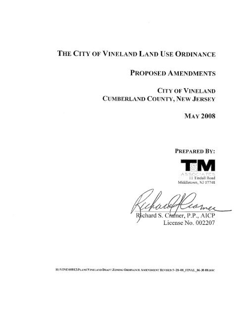
Land Use Ordinance - June 2008 - City of Vineland
Land Use Ordinance - June 2008 - City of Vineland
Land Use Ordinance - June 2008 - City of Vineland

Create successful ePaper yourself
Turn your PDF publications into a flip-book with our unique Google optimized e-Paper software.
TABLE OF CONTENTS<br />
A. ZONING<br />
B. ZONING SCHEDULES<br />
C. ZONING MAP<br />
D. DESIGN STANDARDS<br />
E. SUBDIVISION AND<br />
SITE PLAN DETAILS
A. ZONING
<strong>City</strong> <strong>of</strong> <strong>Vineland</strong><br />
<strong>Land</strong> <strong>Use</strong> <strong>Ordinance</strong> Amendment<br />
Zoning<br />
ZONING REGULATIONS<br />
New text is underlined. Text to be deleted is struck through.<br />
ARTICLE XVI, Zoning, is hereby amended and supplemented in accordance with the changes set<br />
forth below.<br />
SECTION ONE<br />
ARTICLE XVI, Zoning, Section 300-297, Word usage; definitions, Subsection B., is amended to<br />
include the following definitions.<br />
Affordable Housing - Housing with a sales price or rent within the means <strong>of</strong> a low and moderate<br />
income household as defined in N.J.A.C. 5:94-7.<br />
Age Restricted Housing - Housing designed to meet the needs <strong>of</strong>, and exclusively for, the<br />
residents <strong>of</strong> an age-restricted segment <strong>of</strong> the population where the head <strong>of</strong> the household is a<br />
minimum age <strong>of</strong> either sixty-two (62) years or fifty-five (55) years and meets the provisions <strong>of</strong> 42<br />
USC §§ 3601 et seq.<br />
Assisted Living or Assisted Living Facility - Residences for the frail elderly that provide rooms,<br />
meals, personal care, and supervision <strong>of</strong> self-administered medication. They may provide other<br />
services such as recreational activities, financial services and transportation.<br />
Convalescent Center - A facility that provides short-term, primarily in-patient care, treatment,<br />
and/or rehabilitation services for persons recovering from illness or injury who do not require<br />
continued hospitalization.<br />
Developable <strong>Land</strong> or Developable <strong>Land</strong> Area - <strong>Land</strong> that is free <strong>of</strong> constraints to development<br />
and that has access to an improved roadway. Constraints to development include, but are not<br />
necessarily limited to, the following: wetlands and wetland transition areas; stream corridors;<br />
flood hazard areas; steep slopes <strong>of</strong> 15% or greater; easements; and legal impediments.<br />
A-1
<strong>City</strong> <strong>of</strong> <strong>Vineland</strong><br />
<strong>Land</strong> <strong>Use</strong> <strong>Ordinance</strong> Amendment<br />
Zoning<br />
Major appliance store – Any establishment engaged primarily in selling large scale goods or<br />
merchandise to the general public for personal or household consumption and rendering services<br />
incidental to the sale <strong>of</strong> such goods. For purposes <strong>of</strong> this chapter, large scale goods shall include,<br />
but not be limited to, washers, dryers, stoves, refrigerators and air conditioners.<br />
Medical <strong>of</strong>fice – Any <strong>of</strong>fice <strong>of</strong> a recognized medical pr<strong>of</strong>ession maintained for the conduct <strong>of</strong> that<br />
pr<strong>of</strong>ession. For purposes <strong>of</strong> this chapter, a dentist’s or chiropractor’s <strong>of</strong>fice shall be considered a<br />
medical <strong>of</strong>fice, while a veterinarian’s <strong>of</strong>fice shall not be considered a medical <strong>of</strong>fice.<br />
Medical Research or Medical Research Facility - A facility for investigation into the medical or<br />
health sciences.<br />
Senior Day Care - A facility which provides social and recreational activities, meals, and<br />
entertainment for the elderly or other persons in need <strong>of</strong> similar services on a daily basis without<br />
overnight accommodations. No medical services, other than the supervision <strong>of</strong> self administered<br />
medication, are provided.<br />
SECTION TWO<br />
ARTICLE XVI, Zoning, Section 300-298, Zoning Map, Subsection A. and Subsection B., are<br />
amended to list the following additional zone districts and to be renumbered as follows:<br />
A. The following zones are established in the <strong>City</strong> <strong>of</strong> <strong>Vineland</strong>:<br />
(1) R-1 Residential<br />
(2) R-B-1 Residential-Business<br />
(3) R-B-2 Residential-Business<br />
(3 4) R-2 Residential<br />
(4 5) R-P Residential Pr<strong>of</strong>essional<br />
(5 6) R-3 Residential<br />
(6 7) R-4 Residential<br />
(7 8) R-5 Residential<br />
(9) R-6 Residential<br />
A-2
<strong>City</strong> <strong>of</strong> <strong>Vineland</strong><br />
<strong>Land</strong> <strong>Use</strong> <strong>Ordinance</strong> Amendment<br />
Zoning<br />
(7 10) A-5 Agricultural<br />
(8 11) A-6 Agricultural<br />
(9 12) W-5 Woodlands<br />
(10 13) W-6 Woodlands<br />
(11 14) P-A Pinelands Agricultural Production<br />
(12 15) P-F Pinelands Forest<br />
(13 16) P-R Pinelands Rural Development<br />
(14 17) I-1 Industrial Park<br />
(15 18) I-B Industrial Business<br />
(16 19) I-2 Industrial<br />
(17 20) I-3 Industrial<br />
(18 21) I-4 Industrial<br />
(19 22) B-1 Business<br />
(20 23) B-2 Business<br />
(21 24) B-3 Business<br />
(22 25) B-4 Business<br />
(23 26) MHP Mobile Home Park Zone<br />
(24 27) IN-1 Institutional<br />
(28) IN-2 Institutional Campus<br />
(29) MF Multi Family<br />
(30) P Public<br />
(31) CO Conservation<br />
B. The following overlay areas are established in the <strong>City</strong> <strong>of</strong> <strong>Vineland</strong>:<br />
(1) Airport Hazard Area<br />
(2) Downtown Improvement District Area<br />
(3) River Conservation Area<br />
(4) Flood Hazard Area<br />
(5) Regional Mall<br />
A-3
<strong>City</strong> <strong>of</strong> <strong>Vineland</strong><br />
<strong>Land</strong> <strong>Use</strong> <strong>Ordinance</strong> Amendment<br />
Zoning<br />
SECTION THREE<br />
ARTICLE XVI, Zoning, Section 300-299, R-1 Residential Zone Standards, Subsection B,<br />
Permitted <strong>Use</strong>s, is hereby amended as follows to eliminate garden apartment buildings and midrise<br />
apartment buildings as principal permitted uses <strong>of</strong> the zone:<br />
(4) Garden apartment building Reserved<br />
(6) Mid-rise apartment building Reserved<br />
SECTION FOUR<br />
ARTICLE XVI, Zoning, Section 300-301, R-2 Residential Zone Standards, Subsection B,<br />
Permitted <strong>Use</strong>s, is hereby amended to preserve the zone character <strong>of</strong> the area as a district <strong>of</strong> single<br />
family dwellings and two family dwellings by eliminating triplexes and quadruplexes as principal<br />
permitted uses.<br />
(3) Triplex Reserved<br />
(4) Quadruplex Reserved<br />
SECTION FIVE<br />
ARTICLE XVI, Zoning, Section 300-313, I-B Industrial Business Zone standards, Subsection B,<br />
permitted uses, is hereby amended as follows to eliminate single family dwellings as a permitted<br />
use <strong>of</strong> the zone:<br />
(1) Single family dwelling Reserved<br />
SECTION SIX<br />
ARTICLE XVI, Zoning, Section 300-302, R-P Residential-Pr<strong>of</strong>essional standards, is hereby<br />
amended as follows to include Subsection F with the following special requirements for<br />
development in the zone:<br />
F. Special Zone Requirements. The following requirements apply to development in the R-P<br />
zone:<br />
A-4
<strong>City</strong> <strong>of</strong> <strong>Vineland</strong><br />
<strong>Land</strong> <strong>Use</strong> <strong>Ordinance</strong> Amendment<br />
Zoning<br />
(1) No parking (except for parking in a driveway to a single-family dwelling, or a two-family<br />
dwelling) shall be located in the front yard.<br />
(2) No outdoor storage, or solid waste or recycling areas shall be located in the required front<br />
yard nor between any part <strong>of</strong> the front building façade and the street right-<strong>of</strong>-way line.<br />
(3) No fire escapes shall be located on the front façade <strong>of</strong> any building facing the street right<strong>of</strong>-way<br />
line.<br />
(4) Front porches facing the street right-<strong>of</strong>-way line shall be maintained as open porches.<br />
(5) For any development application for subdivision, or variance, or conditional use, or site<br />
plan approval, the building and site shall be designed to be suitable to the architectural<br />
character <strong>of</strong> a residential neighborhood. Buildings shall provide a front entrance facing<br />
the street right <strong>of</strong> way line. Parking lots shall be screened from public view. <strong>Land</strong>scaping<br />
shall be provided as required by the design standards set forth in Article VII <strong>of</strong> the <strong>City</strong><br />
<strong>of</strong> <strong>Vineland</strong> <strong>Land</strong> <strong>Use</strong> <strong>Ordinance</strong>.<br />
SECTION SEVEN<br />
ARTICLE XVI, Zoning, Section 300-300, R-B Residential Business Zone, is hereby amended as<br />
follows to rename the R-B Residential Business Zone as the R-B-1 Residential Business Zone to<br />
eliminate mid-rise apartments as a permitted use <strong>of</strong> the zone, and to revise Section 300-300 to<br />
read as follows:<br />
300-300. R-B-1 Residential Business Zone standards.<br />
A. No change.<br />
B. Permitted uses. Permitted uses in the R-B-1 Residential Business Zone shall be as follows:<br />
(1) All uses permitted in the R-1 zone, except that mid-rise apartment buildings shall not be<br />
permitted.<br />
(2) through (9) No change<br />
C. Accessory uses. Accessory uses in the R-B-1 Residential Business shall be as follows:<br />
(1) and (2) No change<br />
D. Conditional uses. Conditional uses in the R-B-1 Residential Business Zone shall be as<br />
follows:<br />
(1) through (3) No change<br />
A-5
<strong>City</strong> <strong>of</strong> <strong>Vineland</strong><br />
<strong>Land</strong> <strong>Use</strong> <strong>Ordinance</strong> Amendment<br />
Zoning<br />
D. Prohibited uses. Prohibited uses in the R-B-1 Residential Business Zone shall be as follows:<br />
(1) through (5) No change<br />
F. (Reserved)<br />
G. Special Zone Requirements<br />
The following requirements apply to development in the R-B-1 zone:<br />
(1) No parking (except for parking in an approved driveway to a single-family dwelling, or a<br />
two-family dwelling, or a townhouse) shall be located in the front yard.<br />
(2) No outdoor storage, or solid waste or recycling areas shall be located in the required front<br />
yard nor between any part <strong>of</strong> the front building façade and the street right-<strong>of</strong>-way line.<br />
(3) No fire escapes shall be located on the front façade <strong>of</strong> any building facing the street right<strong>of</strong>-way<br />
line.<br />
(4) Front porches facing the street right-<strong>of</strong>-way line shall be maintained as open porches.<br />
(5) For any development application for subdivision, or variance, or conditional use, or site<br />
plan approval, the building design shall be suitable to the architectural character <strong>of</strong> a<br />
residential neighborhood. Buildings shall provide a front entrance facing the street right<br />
<strong>of</strong> way line. Parking lots shall be screened from public view. <strong>Land</strong>scaping shall be<br />
provided as required by the <strong>City</strong> design standards set forth in Article VII <strong>of</strong> the <strong>City</strong> <strong>of</strong><br />
<strong>Vineland</strong> <strong>Land</strong> <strong>Use</strong> <strong>Ordinance</strong>.<br />
SECTION EIGHT<br />
ARTICLE XVI, Zoning, is hereby amended as follows to include the following new section 300-<br />
300.1 for the R-B-2 zone:<br />
A. Purpose. The R-B-2 zone on Chestnut Avenue provides for the adaptive reuse <strong>of</strong> lands and<br />
buildings formerly occupied and used as the Newcomb Hospital.<br />
B. Permitted uses. Permitted uses in the R-B-2 Residential Business Zone shall be as follows:<br />
(1) Senior day care.<br />
(2) Assisted living.<br />
(3) Convalescent home.<br />
(4) Corporate <strong>of</strong>fices.<br />
(5) Medical research facility.<br />
(6) Pr<strong>of</strong>essional <strong>of</strong>fices.<br />
A-6
<strong>City</strong> <strong>of</strong> <strong>Vineland</strong><br />
<strong>Land</strong> <strong>Use</strong> <strong>Ordinance</strong> Amendment<br />
Zoning<br />
(7) Public purpose uses.<br />
(a) School.<br />
(b) Child-care center.<br />
(c) Governmental or public utility facility.<br />
(d) Governmental or public utility <strong>of</strong>fice.<br />
(e) Affordable age-restricted housing (Maximum <strong>of</strong> eighty (80) dwelling units).<br />
(f) Public parks and playgrounds.<br />
(8) Community residence, community shelter.<br />
C. Accessory uses. Accessory uses in the R-B-2 Residential Business Zone shall be as follows:<br />
(1) Parking.<br />
(2) Public bus shelter.<br />
(3) Trash enclosure.<br />
(4) Fencing.<br />
(5) Signage.<br />
D. Conditional uses. Conditional uses in the R-B-2 Residential Business Zone shall be as<br />
follows:<br />
(1) Church, congregation.<br />
(2) Funeral home.<br />
(3) Recreational facility.<br />
E. Prohibited uses. Prohibited uses in the R-B-2 Residential Business Zone shall be as follows:<br />
(1) Adult book store.<br />
(2) Establishment which does tattooing, massage, body piercing.<br />
(3) Steam bath.<br />
(4) Astrologers, cardreaders, psychics.<br />
(5) Substance abuse counseling or treatment center.<br />
A-7
<strong>City</strong> <strong>of</strong> <strong>Vineland</strong><br />
<strong>Land</strong> <strong>Use</strong> <strong>Ordinance</strong> Amendment<br />
Zoning<br />
F. Reserved.<br />
SECTION NINE<br />
ARTICLE XVI, Zoning, Section 300-303, R-3 Residential Zone Standards, Subsection B,<br />
Permitted <strong>Use</strong>s, is hereby amended to maintain the character <strong>of</strong> the zone as a single-family<br />
district by eliminating two-family dwellings as a principal permitted use and to recognize the<br />
public uses within the district by including governmental or public utility yards as a permitted use<br />
<strong>of</strong> the district .<br />
C. Permitted uses. Permitted uses within the R-3 Residential Zone shall be as follows;<br />
(1) No change<br />
(2) Two-family dwelling Reserved.<br />
(3) No change<br />
(4) No change<br />
(5) Public purpose uses:<br />
(a) No change<br />
(b) No change<br />
(c) No change<br />
(d) Governmental or public utility yard.<br />
SECTION TEN<br />
ARTICLE XVI, Zoning, is hereby amended as follows to include a new section which shall set<br />
forth standards for the R-5 Residential Zone and which shall read as follows:<br />
300-304.1 R-5 Residential Zone standards.<br />
A. Purpose. The purpose <strong>of</strong> the R-5 zone is to implement the Master Plan recommendation for<br />
a low-density suburban/rural transition area from the <strong>City</strong> center suburbs to the <strong>City</strong><br />
greenbelt. The R-5 zone provides an area for development <strong>of</strong> low-density single-family<br />
detached housing. Farms will continue to be permitted and farmland preservation as part <strong>of</strong><br />
the low-density residential area is encouraged and supported by the <strong>City</strong>. Residential cluster<br />
A-8
<strong>City</strong> <strong>of</strong> <strong>Vineland</strong><br />
<strong>Land</strong> <strong>Use</strong> <strong>Ordinance</strong> Amendment<br />
Zoning<br />
development and lot size averaging will be permitted at the <strong>City</strong>'s option provided that the<br />
total number <strong>of</strong> dwellings is equivalent to the number <strong>of</strong> dwellings allowed by a<br />
conventional layout. Cluster development and lot size averaging will only be allowed where<br />
the lots are served by sewer and public water and the reduction in lot size is <strong>of</strong>fset by open<br />
space preservation and protection <strong>of</strong> the environment.<br />
B. Permitted uses.<br />
(1) Single-family dwelling.<br />
(2) Residential cluster.<br />
(3) Farm, except for those enumerated as prohibited uses.<br />
(4) Home occupation.<br />
(5) Public purpose uses:<br />
(a) School.<br />
(b) Child-care center.<br />
(c) Governmental or public utility facility.<br />
(6) Community residence, community shelter.<br />
C. Accessory uses. Accessory uses within the R-5 Residential Zone shall be as follows:<br />
(1) All accessory uses permitted in the R-1 Zone.<br />
(2) Farm building for livestock, equipment, storage <strong>of</strong> supplies or harvested crops, or for<br />
preparation <strong>of</strong> crops for market for a farm.<br />
(3) Commercial production greenhouse for a farm.<br />
(4) Roadside stand, 300 square feet maximum, for a single family dwelling or a farm.<br />
D. Conditional uses in the R-5 Residential Zone shall be as follows:<br />
(1) Church, congregation.<br />
(2) Recreational facility.<br />
E. Prohibited uses. Prohibited uses in the R-5 Residential Zone shall be as follows:<br />
A-9
<strong>City</strong> <strong>of</strong> <strong>Vineland</strong><br />
<strong>Land</strong> <strong>Use</strong> <strong>Ordinance</strong> Amendment<br />
Zoning<br />
(1) Piggery.<br />
(2) Animal or poultry processing (slaughtering).<br />
F. Residential Cluster in the R-5 Zone.<br />
Residential cluster design within the R-5 zone may better advance the intent and purpose <strong>of</strong> the<br />
<strong>City</strong> Master Plan for the protection <strong>of</strong> the environment and the conservation <strong>of</strong> open space.<br />
provided that the overall intensity <strong>of</strong> the cluster does not exceed the intensity <strong>of</strong> a permitted<br />
conventional development. Accordingly, a residential cluster <strong>of</strong> single family dwellings may be<br />
permitted as an alternative form <strong>of</strong> development in the R-5 zone on a contiguous land area that is<br />
to be developed as a single entity according to a plan that preserves a significant area <strong>of</strong> open<br />
space. The Planning Board may approve a residential cluster where it determines that the intent<br />
and purpose <strong>of</strong> the <strong>City</strong> Master Plan is better served by the cluster design and that the<br />
development meets the requisite standards and criteria for the residential cluster option.<br />
(1) Cluster Option. Cluster development may be permitted at the option <strong>of</strong> the <strong>City</strong> Planning<br />
Board as an alternative to conventional development. The Planning Board may permit the<br />
cluster option where the applicant demonstrates that, compared to a conventional layout,<br />
the cluster design will benefit the community in the following ways: by conserving natural<br />
resources; by preserving open spaces; by better protecting areas that are particularly<br />
susceptible to erosion and sediment loss; by reducing impervious surfaces; by better<br />
protecting natural drainage features and vegetation; by minimizing land disturbance from<br />
clearing and grading; by minimizing soil compaction; by reducing the use <strong>of</strong> stormwater<br />
management basins; by promoting the use <strong>of</strong> vegetated open-channel drainage systems that<br />
discharge into and through stable vegetated areas; and by reducing the need for additional<br />
infrastructure. For purposes <strong>of</strong> evaluating the cluster option, the applicant shall submit a lot<br />
yield map <strong>of</strong> a conforming conventional subdivision layout. The Planning Board shall<br />
compare the benefit <strong>of</strong> the cluster subdivision plan to the conventional subdivision plan by<br />
considering the following factors: reduction in the total area <strong>of</strong> land disturbance; reduction<br />
in the total area <strong>of</strong> impervious coverage; reduction in the total length <strong>of</strong> new streets;<br />
reduction in the construction <strong>of</strong> new structural drainage facilities; and the preservation <strong>of</strong><br />
trees and woodland.<br />
A-10
<strong>City</strong> <strong>of</strong> <strong>Vineland</strong><br />
<strong>Land</strong> <strong>Use</strong> <strong>Ordinance</strong> Amendment<br />
Zoning<br />
(a) Required Location. A residential cluster <strong>of</strong> single family dwellings shall be located<br />
on contiguous land in the R-5 zone, with the single family dwellings located to enable the<br />
preservation <strong>of</strong> common or public open space.<br />
(b) Minimum Total <strong>Land</strong> Area Required. The minimum total land area required for<br />
development as a residential cluster is fifty (50) acres. At least sixty-five percent (65%) <strong>of</strong><br />
the total minimum land area requirement for a residential cluster shall be unencumbered by<br />
any <strong>of</strong> the following: wetlands or wetlands transition areas; areas <strong>of</strong> special flood hazard;<br />
existing easements for utilities or drainage; rights-<strong>of</strong>-way; surface waters. <strong>Land</strong> that is<br />
already permanently protected from development as open space or as farmland through a<br />
conservation easement or other means cannot be used to satisfy the minimum area<br />
requirement.<br />
(c) Maximum Permitted Number <strong>of</strong> Dwelling Units. The residential cluster shall not<br />
yield a greater number <strong>of</strong> dwelling units than would result from the development <strong>of</strong> the<br />
land as a fully conforming conventional subdivision <strong>of</strong> single family lots. For purposes <strong>of</strong><br />
determining the maximum number <strong>of</strong> dwellings permitted under the residential cluster<br />
alternative, the applicant shall submit a lot yield map <strong>of</strong> a conforming conventional<br />
subdivision layout. The conforming lot yield map shall be in a sufficient detail to permit the<br />
Planning Board to make an informed decision that the subdivision satisfies all ordinance<br />
requirements in every respect and would be approvable as a conventional subdivision<br />
without the need for any variances, waivers, or exceptions from the <strong>City</strong> development<br />
regulations. The number <strong>of</strong> dwellings shown on an accepted lot yield map <strong>of</strong> a conforming<br />
subdivision shall be the maximum number <strong>of</strong> lots permitted in the residential cluster.<br />
(d)<br />
Public Sewer and Public Water Required. The dwelling units <strong>of</strong> a residential cluster<br />
must be served by public sewer and public water.<br />
(e) Minimum Area and Bulk Standards for Residential Lots. The number <strong>of</strong> dwellings<br />
shown on the accepted lot yield map <strong>of</strong> a conforming subdivision shall be the maximum<br />
number <strong>of</strong> residential lots permitted in the residential cluster. The residential cluster lots<br />
shall otherwise conform to the area, yard, and bulk standards as set forth in the Zoning<br />
A-11
<strong>City</strong> <strong>of</strong> <strong>Vineland</strong><br />
<strong>Land</strong> <strong>Use</strong> <strong>Ordinance</strong> Amendment<br />
Zoning<br />
Schedule, Sheet 1 (Part 1) for conventional 1-family development in the R-4 Residential<br />
zone.<br />
(f) Open Space Design Requirements. The cluster design for open space shall be<br />
arranged to preserve land as public or common open space in accordance with the<br />
following criteria.<br />
[1] A minimum <strong>of</strong> fifty percent (50%) <strong>of</strong> the gross land area <strong>of</strong> the cluster<br />
shall be preserved as common or public open space. If the residential cluster<br />
includes an existing farm, the continued use <strong>of</strong> preserved open space as a farm<br />
may be permitted, subject to Planning Board acceptance <strong>of</strong> a continued farm<br />
operation as part <strong>of</strong> the overall cluster design.<br />
[2] All areas to be preserved as public or as common open space shall be<br />
clearly identified and reserved on the plans submitted for approval. The existing<br />
and planned use <strong>of</strong> the open space shall be indicated on the plans.<br />
[3] The minimum land area required to be preserved as common or public<br />
open space shall be land that is not already preserved as open space or preserved<br />
as farmland.<br />
[4] The area proposed as common or public open space shall be suitable for<br />
enjoyment and use as open space. The Planning Board may require that the<br />
applicant submit a Phase I and, if deemed necessary, a Phase II environmental<br />
report. The Planning Board may withhold approval <strong>of</strong> any area that it deems<br />
unsuitable as open space.<br />
[5] At least sixty five percent (65%) <strong>of</strong> the minimum land area required to be<br />
preserved as common or public open space shall be land unencumbered by any <strong>of</strong><br />
the following: wetlands or wetlands transition areas; areas <strong>of</strong> special flood<br />
hazard; existing easement areas for utilities or drainage; rights <strong>of</strong> way; surface<br />
waters.<br />
A-12
<strong>City</strong> <strong>of</strong> <strong>Vineland</strong><br />
<strong>Land</strong> <strong>Use</strong> <strong>Ordinance</strong> Amendment<br />
Zoning<br />
[6] Stormwater management basins are structures and do not qualify as open<br />
space for the purpose <strong>of</strong> meeting the open space requirements. In its sole<br />
discretion, the Planning Board may permit retention basins for the permanent<br />
storage <strong>of</strong> water run<strong>of</strong>f within the open space areas, provided such basins are<br />
integrated into the site as an aesthetic feature <strong>of</strong> the open space landscape to<br />
enhance the visual enviroment. In its sole discretion, the Planning Board may<br />
also permit the integration <strong>of</strong> nonstructural stormwater management strategies,<br />
such as vegetated open-channel drainage systems, into the open space landscape<br />
design. Not more than ten percent (10%) <strong>of</strong> the minimum required open space<br />
area may be features such as wet ponds, retention basins, and vegetated open<br />
channel drainage systems.<br />
[7] Any common or public open space area shall be at least ten (10) acres in<br />
area and have a minimum width <strong>of</strong> two hundred feet (200') and a minimum depth<br />
<strong>of</strong> two hundred feet (200'), unless the Planning Board determines that the<br />
proposed open space area is contiguous with and/or expands or extends an<br />
existing common open space or a public open space; or that the proposed open<br />
space is contiguous with a land area in other ownership that has been<br />
permanently preserved as open space or as farmland pursuant to a Federal, State,<br />
County, or <strong>City</strong> open space acquisition or farmland preservation program. In<br />
such cases, or for other reasons that would advance the public interest, the<br />
Planning Board may approve a smaller area where it determines that such action<br />
would be beneficial to the open space design <strong>of</strong> the cluster.<br />
[8] An open space lot shall have a minimum road frontage <strong>of</strong> at least 200'.<br />
(g) Common Open Space Ownership. The developer shall provide a plan for the use,<br />
ownership, and maintenance <strong>of</strong> any common open space in a residential cluster. The plan is<br />
subject to Planning Board review and approval. The ownership plan shall be submitted<br />
with the preliminary application for development and shall identify the existing and<br />
proposed ownership <strong>of</strong> all proposed open space areas. The <strong>City</strong>, at its option and in its sole<br />
discretion, or other governmental agency approved by the <strong>City</strong>, at any time and from time<br />
A-13
<strong>City</strong> <strong>of</strong> <strong>Vineland</strong><br />
<strong>Land</strong> <strong>Use</strong> <strong>Ordinance</strong> Amendment<br />
Zoning<br />
to time, may accept the dedication <strong>of</strong> land or any interest therein for public use and<br />
maintenance, but the <strong>City</strong> shall not require, as a condition <strong>of</strong> the approval <strong>of</strong> a residential<br />
cluster, that land proposed to be set aside for common open space be dedicated or made<br />
available to public use. The developer shall provide for an organization for the ownership<br />
and maintenance <strong>of</strong> any open space for the benefit <strong>of</strong> owners or residents <strong>of</strong> a residential<br />
cluster, if the open space is not dedicated to the municipality or other governmental agency.<br />
The type <strong>of</strong> ownership <strong>of</strong> land dedicated for common open space purposes shall be selected<br />
by the applicant subject to the approval <strong>of</strong> the Planning Board. Type <strong>of</strong> ownership may<br />
include, but is not necessarily limited to, the following:<br />
(h)<br />
[1] The <strong>City</strong> <strong>of</strong> <strong>Vineland</strong>, subject to acceptance by the <strong>City</strong> Council.<br />
[2] Homeowner, condominium, or cooperative associations or organizations.<br />
[3] Shared, undivided interest by all property owners in the subdivision.<br />
[4] Any organization provided for by the developer to own or maintain open space<br />
shall not be dissolved and shall not dispose <strong>of</strong> any <strong>of</strong> its open space without first <strong>of</strong>fering to<br />
dedicate such property, without cost, to the <strong>City</strong> <strong>of</strong> <strong>Vineland</strong>.<br />
Homeowners’ association. If the common open space is owned and maintained by a<br />
homeowner or condominium association, the developer shall file a declaration <strong>of</strong> covenants and<br />
restrictions that will govern the association, to be submitted with the application for the<br />
preliminary approval. The provisions shall include, but are not necessarily limited to, the<br />
following:<br />
[1] The homeowners’ association must be established before the sale <strong>of</strong> any<br />
residential unit.<br />
[2] Membership shall be mandatory for each buyer and any successive buyer.<br />
[3] The open space restrictions shall be permanent.<br />
[4] The association shall be responsible for liability insurance, local taxes, and the<br />
maintenance and replacement <strong>of</strong> recreational and other facilities.<br />
[5] Homeowners shall pay their pro rata share <strong>of</strong> the cost; the assessment levied by<br />
the association can become a lien on the property if allowed in the master deed establishing<br />
the homeowners’ association.<br />
[6] The association must be able to adjust the assessment to meet changed needs.<br />
A-14
<strong>City</strong> <strong>of</strong> <strong>Vineland</strong><br />
<strong>Land</strong> <strong>Use</strong> <strong>Ordinance</strong> Amendment<br />
Zoning<br />
(i) Maintenance <strong>of</strong> open space areas. In the event that a nonmunicipal organization with the<br />
responsibility for the common open space fails to maintain it in reasonable order and condition,<br />
then the <strong>City</strong> Council, in accordance with N.J.S.A. 40:55D-43, may correct such deficiencies and<br />
assess the cost <strong>of</strong> maintenance against the properties within the development.<br />
(j) <strong>Use</strong> and improvement <strong>of</strong> common open space for active recreation. The Planning Board<br />
may approve the installation <strong>of</strong> recreational facilities suitable to the development, such as<br />
playgrounds, playfields, parks or similar outdoor recreation facilities, on the common open<br />
space,. Such facilities shall be conveniently located and accessible to all dwelling units and<br />
should follow the following guidelines:<br />
(k)<br />
[1] One active recreation area should be provided for each 300 persons or 75<br />
children <strong>of</strong> projected population. Such areas should not be less than four acres.<br />
[2] For developments <strong>of</strong> more than 300 persons, active recreation or park space<br />
should be provided at the rate <strong>of</strong> 10.25 acres per 1,000 population.<br />
Undeveloped common open space. Undeveloped common open space should be left in its<br />
natural state. A developer may, however, make limited improvements for the installation <strong>of</strong><br />
utilities, necessary grading, and the provision <strong>of</strong> paths and trails. In addition, the Planning Board<br />
may require a developer to make other improvements, such as removal <strong>of</strong> dead or diseased trees;<br />
thinning <strong>of</strong> trees or other vegetation to encourage more desirable growth; reforestation <strong>of</strong><br />
disturbed areas; and grading and seeding, subject to approval by all regulatory agencies.<br />
[1] Deed restrictions. Any lands dedicated for common open space purposes shall<br />
contain covenants and deed restrictions approved by the <strong>City</strong> attorney that ensure that:<br />
[2] The open space area will not be further subdivided in the future.<br />
[3] The use <strong>of</strong> the open space will continue in perpetuity for the purpose specified.<br />
[4] Appropriate provisions are made for the maintenance <strong>of</strong> the open space.<br />
[5] The open space shall not be utilized for any commercial purpose. The Planning<br />
Board may, however, approve the use <strong>of</strong> open space as farmland or pastureland as part <strong>of</strong><br />
the residential cluster design.<br />
A-15
<strong>City</strong> <strong>of</strong> <strong>Vineland</strong><br />
<strong>Land</strong> <strong>Use</strong> <strong>Ordinance</strong> Amendment<br />
Zoning<br />
(l)<br />
Prior to the approval <strong>of</strong> the residential cluster, the Planning Board shall make a finding <strong>of</strong><br />
facts and conclusions as required by N.J.S.A. 40:55D-45.<br />
(2) The residential cluster in the R-5 zone may be developed as age restricted housing at the<br />
<strong>City</strong>’s option. An age restricted residential cluster shall meet the requirements for a residential<br />
cluster in the R-5 zone subject to the following requirements and modifications.<br />
(a) The frontage for the age restricted residential cluster and the access to the development shall<br />
be provided from a road classified as an arterial road by the <strong>City</strong> Master Plan.<br />
(b) The maximum permitted number <strong>of</strong> dwelling units in the age restricted residential cluster<br />
shall not exceed the number <strong>of</strong> dwelling units permitted for a residential cluster, unless the agerestricted<br />
residential cluster provides for the on-site construction <strong>of</strong> affordable housing.<br />
(c) If the age-restricted development provides affordable housing, then one additional market rate<br />
age restricted unit will be permitted for every affordable unit provided. At the <strong>City</strong>’s option, the<br />
<strong>City</strong> may accept a payment in lieu <strong>of</strong> construction <strong>of</strong> the affordable housing on-site. The payment<br />
in lieu shall be in an amount as provided by the <strong>City</strong>’s affordable housing regulations.<br />
(d) The density <strong>of</strong> the development, including the additional units permitted to provide the<br />
affordable housing, shall not exceed a maximum <strong>of</strong> three dwelling units per acre.<br />
(e) The age restricted residential cluster may be constructed as single family dwelling units or as<br />
townhouse units, or as a combination <strong>of</strong> such unit types, in accordance with the standards <strong>of</strong> the<br />
R-1 zone district.<br />
(f) The Planning Board may reduce the minimum common or public open space requirement <strong>of</strong><br />
the cluster to twenty-five per cent (25%) <strong>of</strong> the gross land area <strong>of</strong> the cluster in order to<br />
accommodate the increased number <strong>of</strong> dwelling units permitted to be developed on-site.<br />
A-16
<strong>City</strong> <strong>of</strong> <strong>Vineland</strong><br />
<strong>Land</strong> <strong>Use</strong> <strong>Ordinance</strong> Amendment<br />
Zoning<br />
(g) If the zoning on a site has changed subsequent to December 17, 2007, the number <strong>of</strong> units<br />
permitted for the purpose <strong>of</strong> calculating the additional number <strong>of</strong> units shall be the higher <strong>of</strong> the<br />
current number <strong>of</strong> units permitted or the number <strong>of</strong> units permitted on December 17, 2007.<br />
G. Lot Size Averaging in the R-5 Zone. In its sole discretion and at its option, the Planning<br />
Board may permit lot size averaging in the R-5 Zone. The purpose <strong>of</strong> this subsection is to<br />
provide an alternative design technique for conventional development to promote the goals <strong>of</strong><br />
the Master Plan. The overall planning for a tract may better advance the intent and purpose <strong>of</strong><br />
the Master Plan to protect the environment and conserve open space if flexibility in the<br />
design <strong>of</strong> a major subdivision is permitted. The goals and objectives included in the Master<br />
Plan for maintaining large, contiguous open areas, may be better addressed if some<br />
modification <strong>of</strong> the minimum lot size requirement in conventional development is allowed,<br />
provided the maximum number <strong>of</strong> lots that would result from a conforming conventional<br />
development is not exceeded.<br />
(1) Lot size averaging is permitted in the R-5 zone district in a major subdivision <strong>of</strong> a<br />
contiguous tract <strong>of</strong> land that is fifteen (15) acres or greater in area.<br />
(2) Any development proposed for lot size averaging shall be served by public sewer and<br />
public water.<br />
(3) Building Area Requirements.<br />
(a)<br />
Lots shall conform to the requirements <strong>of</strong> the R-5 zone as established in the area,<br />
yard, and bulk standards as set forth in the Zoning Schedule, Sheet 1 (Part 1) for the<br />
R-5 Residential zone, except that the minimum lot area required may be reduced as<br />
indicated below.<br />
R-5 Zone District Requirements for Lot Size Averaging<br />
Minimum Permissible Lot Size (square feet)<br />
Inside<br />
Corner<br />
Average Lot Size (square feet)<br />
16,500 18,000 40,000<br />
A-17
<strong>City</strong> <strong>of</strong> <strong>Vineland</strong><br />
<strong>Land</strong> <strong>Use</strong> <strong>Ordinance</strong> Amendment<br />
Zoning<br />
(b) Within the R-5 zone, the Planning Board may approve the varying <strong>of</strong> lot areas and<br />
dimensions, and yards and setbacks otherwise required by the development regulations <strong>of</strong><br />
the zone district in such a way that the average lot areas and dimensions, yards and setbacks<br />
within the subdivision conform to the conventional norms <strong>of</strong> the R-5 zone district as<br />
established in the Schedule <strong>of</strong> Area, Yard and Building Requirements, except that the<br />
minimum lot area required shall be in accordance with the minimum permissible lot size<br />
for lot size averaging and further provided that no dimension, yard, setback, or other<br />
dimensional requirement shall be less than the minimum requirements <strong>of</strong> the R-4 zone.<br />
(4) Maximum Permitted Number <strong>of</strong> Lots. The use <strong>of</strong> lot size averaging in a subdivision plan<br />
shall not result in a greater number <strong>of</strong> lots than would result if a parcel were developed as a fully<br />
conforming conventional subdivision <strong>of</strong> lots. For purposes <strong>of</strong> determining the maximum number<br />
<strong>of</strong> lots permitted under lot size averaging, the applicant shall submit a lot yield map <strong>of</strong> a<br />
conforming conventional subdivision layout. The conforming lot yield map shall be in a sufficient<br />
detail to permit the Planning Board to make an informed decision that the subdivision satisfies all<br />
ordinance requirements and would be approvable by the Planning Board as a conventional<br />
subdivision without the need for any lot area or lot dimension variances or exceptions to<br />
subdivision design standards. The number <strong>of</strong> lots shown on an accepted lot yield map shall be the<br />
maximum number <strong>of</strong> lots permitted for subdivision under lot size averaging.<br />
(5) Design Criteria. Lot size averaging may be permitted where the Planning Board<br />
determines that the resource conservation and/or farmland preservation goals and objectives <strong>of</strong><br />
the Master Plan are better served by the lot size averaging plan than by the conventional plan for<br />
development. The applicant shall demonstrate to the Planning Board that the lot size averaging<br />
plan is clearly preferable to the conventional plan with respect to one or more <strong>of</strong> the following<br />
factors: stream corridor protection, agricultural retention, preservation <strong>of</strong> forests and woodlands,<br />
preservation <strong>of</strong> habitat for native flora and fauna, protection <strong>of</strong> scenic views, protection <strong>of</strong><br />
landmarks, reduction in site disturbance from clearing and grading, reduction in impervious<br />
surface, conservation <strong>of</strong> the site's natural features and topography, and relationship to open spaces<br />
on neighboring parcels.<br />
A-18
<strong>City</strong> <strong>of</strong> <strong>Vineland</strong><br />
<strong>Land</strong> <strong>Use</strong> <strong>Ordinance</strong> Amendment<br />
Zoning<br />
(6) Minimum Lot Area. The minimum lot area may be reduced to the minimum permissible<br />
lot size for lot size averaging, provided that the average lot area in the development shall be at<br />
least the conventional lot size required for the R-5 zone, and, further provided, that the total<br />
number <strong>of</strong> lots than shall be no greater than the maximum permitted number <strong>of</strong> lots established in<br />
accordance with the approved lot yield map.<br />
(7) Deed Restrictions. Each lot that is part <strong>of</strong> a lot averaging plan shall be permanently deed<br />
restricted from any future subdivision <strong>of</strong> that lot. When only a portion <strong>of</strong> a tract is to be<br />
developed in a lot averaging plan, deed restrictions against further subdivision shall be required<br />
for the portion <strong>of</strong> the tract devoted to the lot averaging plan.<br />
SECTION ELEVEN<br />
ARTICLE XVI, Zoning, is hereby amended as follows to include a new section which shall set<br />
forth standards for the R-6 Residential Zone and which shall read as follows:<br />
300-304.2 R-6 Residential Zone standards.<br />
A. Purpose. The purpose <strong>of</strong> the R-6 zones is to implement the Master Plan recommendation<br />
for a low-density suburban/rural transition area from the center suburbs to the beginning <strong>of</strong> the<br />
<strong>City</strong>'s greenbelt. The zones provide an area for development <strong>of</strong> low-density single-family<br />
detached housing. Farms would continue to be permitted and farmland preservation within the<br />
zone is encouraged and supported by the <strong>City</strong>.<br />
Residential cluster development and lot size averaging will be permitted at the <strong>City</strong>'s option<br />
provided that the total number <strong>of</strong> dwellings is the equivalent to the number <strong>of</strong> dwellings allowed<br />
by a conventional layout. Cluster development and lot size averaging would only be allowed<br />
where the lots are served by sewer and public water and the reduction in lot size is <strong>of</strong>fset by open<br />
space preservation and protection <strong>of</strong> the environment.<br />
B. Permitted uses.<br />
(1) Single-family dwelling.<br />
(2) Residential cluster.<br />
A-19
<strong>City</strong> <strong>of</strong> <strong>Vineland</strong><br />
<strong>Land</strong> <strong>Use</strong> <strong>Ordinance</strong> Amendment<br />
Zoning<br />
(3) Farm, except for those enumerated as prohibited uses.<br />
(4) Home occupation.<br />
(5) Public purpose uses:<br />
(d) School.<br />
(e) Child-care center.<br />
(f) Governmental or public utility facility.<br />
(6) Community residence, community shelter.<br />
C. Accessory uses. Accessory uses within the R-6 Residential Zone shall be as follows:<br />
(1) All accessory uses permitted in the R-1 Zone.<br />
(2) Farm building for livestock, equipment, storage <strong>of</strong> supplies or harvested crops, or for<br />
preparation <strong>of</strong> crops for market for a farm.<br />
(3) Commercial production greenhouse for a farm.<br />
(4) Roadside stand, 300 square feet maximum, for a single family dwelling or a farm.<br />
D. Conditional uses in the R-6 Residential Zone shall be as follows:<br />
(1) Church, congregation.<br />
(2) Recreational facility.<br />
E. Prohibited uses. Prohibited uses in the R-6 Residential Zone shall be as follows:<br />
(1) Piggery.<br />
(2) Animal or poultry processing (slaughtering).<br />
F. Residential Cluster in the R-6 Zone.<br />
Residential cluster design within the R-6 zone may better advance the intent and purpose <strong>of</strong> the<br />
<strong>City</strong> Master Plan for the protection <strong>of</strong> the environment and the conservation <strong>of</strong> open space,<br />
provided that the overall intensity <strong>of</strong> the cluster does not exceed the intensity <strong>of</strong> a permitted<br />
conventional development. Accordingly, a residential cluster <strong>of</strong> single family dwellings may be<br />
permitted as an alternative form <strong>of</strong> development in the R-6 zone on a contiguous land area that is<br />
A-20
<strong>City</strong> <strong>of</strong> <strong>Vineland</strong><br />
<strong>Land</strong> <strong>Use</strong> <strong>Ordinance</strong> Amendment<br />
Zoning<br />
to be developed as a single entity according to a plan that preserves a significant area <strong>of</strong> open<br />
space. The Planning Board may approve a residential cluster where it determines that the intent<br />
and purpose <strong>of</strong> the <strong>City</strong> Master Plan is better served by the cluster design and that the<br />
development meets the requisite standards and criteria for the residential cluster option.<br />
(1) Cluster Option. Cluster development may be permitted at the option <strong>of</strong> the <strong>City</strong> Planning<br />
Board as an alternative to conventional development. The Planning Board may permit the cluster<br />
option where the applicant demonstrates that, compared to a conventional layout, the cluster<br />
design will benefit the community in the following ways: by conserving natural resources; by<br />
preserving open spaces; by better protecting areas that are particularly susceptible to erosion and<br />
sediment loss; by reducing impervious surfaces; by better protecting natural drainage features and<br />
vegetation; by minimizing land disturbance from clearing and grading; by minimizing soil<br />
compaction; by reducing the use <strong>of</strong> stormwater management basins; by promoting the use <strong>of</strong><br />
vegetated open-channel drainage systems that discharge into and through stable vegetated areas;<br />
and by reducing the need for additional infrastructure. For purposes <strong>of</strong> evaluating the cluster<br />
option, the applicant shall submit a lot yield map <strong>of</strong> a conforming conventional subdivision layout<br />
for single family dwelling. The Planning Board shall compare the benefit <strong>of</strong> the cluster<br />
subdivision plan to the conventional subdivision plan by considering the following factors:<br />
reduction in the total area <strong>of</strong> land disturbance; reduction in the total area <strong>of</strong> impervious coverage;<br />
reduction in the total length <strong>of</strong> new streets; reduction in the construction <strong>of</strong> new structural<br />
drainage facilities; and the preservation <strong>of</strong> trees and woodland.<br />
(a) Required Location. A residential cluster <strong>of</strong> single family dwellings shall be located<br />
on contiguous land in the R-6 zone, with the single family dwellings located to enable the<br />
preservation <strong>of</strong> common or public open space.<br />
(b) Minimum Total <strong>Land</strong> Area Required. The minimum total land area required for<br />
development as a residential cluster is fifty (50) acres. At least sixty-five percent (65%) <strong>of</strong><br />
the total minimum land area requirement for a residential cluster shall be unencumbered by<br />
any <strong>of</strong> the following: wetlands or wetlands transition areas; areas <strong>of</strong> special flood hazard;<br />
existing easements for utilities, or drainage; rights-<strong>of</strong>-way; surface waters. <strong>Land</strong> that is<br />
already permanently protected from development as open space or as farmland through a<br />
A-21
<strong>City</strong> <strong>of</strong> <strong>Vineland</strong><br />
<strong>Land</strong> <strong>Use</strong> <strong>Ordinance</strong> Amendment<br />
Zoning<br />
conservation easement or other means cannot be used to satisfy the minimum area<br />
requirement.<br />
(c) Maximum Permitted Number <strong>of</strong> Dwelling Units. The residential cluster shall not<br />
yield a greater number <strong>of</strong> dwelling units than would result from the development <strong>of</strong> the<br />
land as a fully conforming conventional subdivision <strong>of</strong> single family lots. For purposes <strong>of</strong><br />
determining the maximum number <strong>of</strong> dwellings permitted under the residential cluster<br />
alternative, the applicant shall submit a lot yield map <strong>of</strong> a conforming conventional<br />
subdivision layout. The conforming lot yield map shall be in a sufficient detail to permit the<br />
Planning Board to make an informed decision that the subdivision satisfies all ordinance<br />
requirements in every respect and would be approvable as a conventional subdivision<br />
without the need for any variances, waivers, or exceptions from the <strong>City</strong> development<br />
regulations. The number <strong>of</strong> dwellings shown on an accepted lot yield map <strong>of</strong> a conforming<br />
subdivision shall be the maximum number <strong>of</strong> lots permitted in the residential cluster.<br />
(d)<br />
Public Sewer and Public Water. The dwelling units <strong>of</strong> a residential cluster must be<br />
served by public sewer and water.<br />
(e) Minimum Area and Bulk Standards for Residential Lots. The number <strong>of</strong> dwellings<br />
shown on the accepted lot yield map <strong>of</strong> a conforming subdivision shall be the maximum<br />
number <strong>of</strong> residential lots permitted in the residential cluster. The residential cluster lots<br />
shall otherwise conform to the area, yard, and bulk standards as set forth in the Zoning<br />
Schedule, Sheet 1 (Part 1) 1-family for the R-5 Residential zone.<br />
(f) Open Space Design Requirements. The cluster design for open space shall be<br />
arranged to preserve land as public or common open space in accordance with the<br />
following criteria.<br />
[1] A minimum <strong>of</strong> fifty percent (50%) <strong>of</strong> the gross land area <strong>of</strong> the cluster<br />
shall be preserved as common or public open space. If the residential cluster<br />
includes an existing farm, the continued use <strong>of</strong> preserved open space as a farm<br />
A-22
<strong>City</strong> <strong>of</strong> <strong>Vineland</strong><br />
<strong>Land</strong> <strong>Use</strong> <strong>Ordinance</strong> Amendment<br />
Zoning<br />
may be permitted, subject to Planning Board acceptance <strong>of</strong> a continued farm<br />
operation as part <strong>of</strong> the overall cluster design.<br />
[2] All areas to be preserved as public or as common open space shall be<br />
clearly identified and reserved on the plans submitted for approval. The existing<br />
and planned use <strong>of</strong> the open space shall be indicated on the plans.<br />
[3] The minimum land area required to be preserved as common or public<br />
open space shall be land that is not already preserved as open space or preserved<br />
as farmland.<br />
[4] The area proposed as common or public open space shall be suitable for<br />
enjoyment and use as open space. The Planning Board may require that the<br />
applicant submit a Phase I and, if deemed necessary, a Phase II environmental<br />
report. The Planning Board may withhold approval <strong>of</strong> any area that it deems<br />
unsuitable as open space.<br />
[5] At least sixty five percent (65%) <strong>of</strong> the minimum land area required to be<br />
preserved as common or public open space shall be land unencumbered by any <strong>of</strong><br />
the following: wetlands or wetlands transition areas; areas <strong>of</strong> special flood<br />
hazard; existing easement areas for utilities or drainage; rights <strong>of</strong> way; surface<br />
waters.<br />
[6] Stormwater management basins are structures and do not qualify as open<br />
space for the purpose <strong>of</strong> meeting the open space requirements. In its sole<br />
discretion, the Planning Board may permit wet ponds and retention basins for the<br />
permanent storage <strong>of</strong> water run<strong>of</strong>f within the open space areas, provided such<br />
basins are integrated into site as an aesthetic feature <strong>of</strong> the open space landscape<br />
design to enhance the visual environment. In its sole discretion, the Planning<br />
Board may also permit the integration <strong>of</strong> nonstructural stormwater management<br />
strategies, such as vegetated open-channel drainage systems, into the open space<br />
landscape design. Not more than ten percent (10%) <strong>of</strong> the minimum required<br />
A-23
<strong>City</strong> <strong>of</strong> <strong>Vineland</strong><br />
<strong>Land</strong> <strong>Use</strong> <strong>Ordinance</strong> Amendment<br />
Zoning<br />
open space area may be features such as wet ponds, retention basins, and<br />
vegetated open channel drainage systems.<br />
[7] Any common or public open space area shall be at least ten (10) acres in<br />
area and have a minimum width <strong>of</strong> two hundred feet (200') and a minimum depth<br />
<strong>of</strong> two hundred feet (200'), unless the Planning Board determines that the<br />
proposed open space area is contiguous with and/or expands or extends an<br />
existing common open space or a public open space; or that the proposed open<br />
space is contiguous with a land area in other ownership that has been<br />
permanently preserved as open space or as farmland pursuant to a Federal, State,<br />
County, or <strong>City</strong> open space acquisition or farmland preservation program. In<br />
such cases, or for other reasons that would advance the public interest, the<br />
Planning Board may approve a smaller area where it determines that such action<br />
would be beneficial to the open space design <strong>of</strong> the cluster.<br />
[8] An open space lot shall have a minimum road frontage <strong>of</strong> at least 200'.<br />
(g) Common Open Space Ownership. The developer shall provide a plan for the use,<br />
ownership, and maintenance <strong>of</strong> any common open space in a residential cluster. The plan is<br />
subject to Planning Board review and approval. The ownership plan shall be submitted<br />
with the preliminary application for development and shall identify the existing and<br />
proposed ownership <strong>of</strong> all proposed open space areas. The <strong>City</strong>, at its option and in its sole<br />
discretion, or other governmental agency approved by the <strong>City</strong>, at any time and from time<br />
to time, may accept the dedication <strong>of</strong> land or any interest therein for public use and<br />
maintenance, but the <strong>City</strong> shall not require, as a condition <strong>of</strong> the approval <strong>of</strong> a residential<br />
cluster, that land proposed to be set aside for common open space be dedicated or made<br />
available to public use. The developer shall provide for an organization for the ownership<br />
and maintenance <strong>of</strong> any open space for the benefit <strong>of</strong> owners or residents <strong>of</strong> a residential<br />
cluster, if the open space is not dedicated to the municipality or other governmental agency.<br />
The type <strong>of</strong> ownership <strong>of</strong> land dedicated for common open space purposes shall be selected<br />
by the applicant subject to the approval <strong>of</strong> the Planning Board. Type <strong>of</strong> ownership may<br />
include, but is not necessarily limited to, the following:<br />
A-24
<strong>City</strong> <strong>of</strong> <strong>Vineland</strong><br />
<strong>Land</strong> <strong>Use</strong> <strong>Ordinance</strong> Amendment<br />
Zoning<br />
[1] The <strong>City</strong> <strong>of</strong> <strong>Vineland</strong>, subject to acceptance by the <strong>City</strong> Council.<br />
[2] Homeowner, condominium, or cooperative associations or organizations.<br />
[3] Shared, undivided interest by all property owners in the subdivision.<br />
[4] Any organization provided for by the developer to own or maintain open space<br />
shall not be dissolved and shall not dispose <strong>of</strong> any <strong>of</strong> its open space without first <strong>of</strong>fering to<br />
dedicate such property, without cost, to the <strong>City</strong> <strong>of</strong> <strong>Vineland</strong>.<br />
(h) Homeowners’ association. If the common open space is owned and maintained by a<br />
homeowner or condominium association, the developer shall file a declaration <strong>of</strong> covenants and<br />
restrictions that will govern the association, to be submitted with the application for the<br />
preliminary approval. The provisions shall include, but are not necessarily limited to, the<br />
following:<br />
[1] The homeowners’ association must be established before the sale <strong>of</strong> any<br />
residential unit.<br />
[2] Membership shall be mandatory for each buyer and any successive buyer.<br />
[3] The open space restrictions shall be permanent.<br />
[4] The association shall be responsible for liability insurance, local taxes, and the<br />
maintenance and replacement <strong>of</strong> recreational and other facilities.<br />
[5] Homeowners shall pay their pro rata share <strong>of</strong> the cost; the assessment levied by<br />
the association can become a lien on the property if allowed in the master deed<br />
establishing the homeowners’ association.<br />
[6] The association must be able to adjust the assessment to meet changed needs.<br />
(i) Maintenance <strong>of</strong> open space areas. In the event that a nonmunicipal organization with the<br />
responsibility for the common open space fails to maintain it in reasonable order and condition,<br />
then the <strong>City</strong> Council, in accordance with N.J.S.A. 40:55D-43, may correct such deficiencies and<br />
assess the cost <strong>of</strong> maintenance against the properties within the development.<br />
A-25
<strong>City</strong> <strong>of</strong> <strong>Vineland</strong><br />
<strong>Land</strong> <strong>Use</strong> <strong>Ordinance</strong> Amendment<br />
Zoning<br />
(j) <strong>Use</strong> and improvement <strong>of</strong> common open space for active recreation. The Planning Board<br />
may approve the installation <strong>of</strong> recreational facilities suitable to the development, such as<br />
playgrounds, playfields, parks or similar outdoor recreation facilities, on the common open space.<br />
Such facilities shall be conveniently located and accessible to all dwelling units and should follow<br />
the following guidelines:<br />
[1] One active recreation area should be provided for each 300 persons or 75<br />
children <strong>of</strong> projected population. Such areas should not be less than four acres.<br />
[2] For developments <strong>of</strong> more than 300 persons, active recreation or park space<br />
should be provided at the rate <strong>of</strong> 10.25 acres per 1,000 population.<br />
(k) Undeveloped common open space. Undeveloped common open space should be left in its<br />
natural state. A developer may, however, make limited improvements for the installation <strong>of</strong><br />
utilities, necessary grading, and the provision <strong>of</strong> paths and trails. In addition, the Planning Board<br />
may require a developer to make other improvements, such as removal <strong>of</strong> dead or diseased trees;<br />
thinning <strong>of</strong> trees or other vegetation to encourage more desirable growth; reforestation <strong>of</strong><br />
disturbed areas; and grading and seeding, subject to approval by all regulatory agencies.<br />
(l) Deed restrictions. Any lands dedicated for common open space purposes shall contain<br />
covenants and deed restrictions approved by the <strong>City</strong> attorney that ensure that:<br />
[1] The open space area will not be further subdivided in the future.<br />
[2] The use <strong>of</strong> the open space will continue in perpetuity for the purpose specified.<br />
[3] Appropriate provisions are made for the maintenance <strong>of</strong> the open space.<br />
[4] The open space shall not be utilized for any commercial purpose. The Planning<br />
Board, may however, approve the use <strong>of</strong> open space as farmland or pastureland as part <strong>of</strong><br />
the residential cluster design.<br />
(m) The residential cluster in the R-6 zone may be developed as age restricted housing at the<br />
<strong>City</strong>’s option. An age restricted residential cluster shall meet the requirements for a residential<br />
cluster in the R-6 zone, subject to the following requirements and modifications.<br />
A-26
<strong>City</strong> <strong>of</strong> <strong>Vineland</strong><br />
<strong>Land</strong> <strong>Use</strong> <strong>Ordinance</strong> Amendment<br />
Zoning<br />
(1) The frontage for the age restricted residential cluster and the access to the development shall<br />
be provided from a road classified as an arterial road by the <strong>City</strong> Master Plan.<br />
(2) The maximum permitted number <strong>of</strong> dwelling units in the age restricted residential cluster<br />
shall not exceed the number <strong>of</strong> dwelling units permitted for a residential cluster, unless the agerestricted<br />
residential cluster provides for the on-site construction <strong>of</strong> affordable housing.<br />
(3) If the age-restricted development provides affordable housing, then one additional market rate<br />
age restricted unit will be permitted for every affordable unit provided. At the <strong>City</strong>’s option, the<br />
<strong>City</strong> may accept a payment in lieu <strong>of</strong> construction <strong>of</strong> the affordable housing on-site. The payment<br />
in lieu shall be in an amount as provided by the <strong>City</strong>’s affordable housing regulations.<br />
(4) The density <strong>of</strong> the development, including the additional units permitted to provide the<br />
affordable housing, shall not exceed a maximum <strong>of</strong> three dwelling units per acre.<br />
(5) The age restricted residential cluster may be constructed as single family dwelling units or as<br />
townhouse units, or as a combination <strong>of</strong> such unit types, in accordance with the standards <strong>of</strong> the<br />
R-1 zone district.<br />
(6) The Planning Board may reduce the minimum common or public open space requirement <strong>of</strong><br />
the cluster to twenty-five per cent (25%) <strong>of</strong> the gross land area <strong>of</strong> the cluster in order to<br />
accommodate the increased number <strong>of</strong> dwelling units permitted to be developed on-site.<br />
(7) If the zoning on a site has changed subsequent to December 17, 2007, the number <strong>of</strong> units<br />
permitted for the purpose <strong>of</strong> calculating the additional number <strong>of</strong> units shall be the higher <strong>of</strong> the<br />
current number <strong>of</strong> units permitted or the number <strong>of</strong> units permitted on December 17, 2007.<br />
(n)<br />
Prior to the approval <strong>of</strong> the residential cluster, the Planning Board shall make a finding <strong>of</strong><br />
facts and conclusions as required by N.J.S.A. 40:55D-45.<br />
G. Lot Size Averaging in the R-6 Zone. In its sole discretion and at its option, the Planning<br />
Board may permit lot size averaging in the R-6 Zone. The purpose <strong>of</strong> this subsection is to provide<br />
A-27
<strong>City</strong> <strong>of</strong> <strong>Vineland</strong><br />
<strong>Land</strong> <strong>Use</strong> <strong>Ordinance</strong> Amendment<br />
Zoning<br />
an alternative design technique for conventional development to promote the goals <strong>of</strong> the Master<br />
Plan. The overall planning for a tract may better respond to the intent and purpose <strong>of</strong> the Master<br />
Plan to protect the environment and conserve open space if flexibility in the design <strong>of</strong> a major<br />
subdivision is permitted. The goals and objectives included in the Master Plan for maintaining<br />
large, contiguous open areas, may be better addressed if some modification <strong>of</strong> the minimum lot<br />
size requirement in conventional development is allowed, provided the maximum number <strong>of</strong> lots<br />
that would result from a conforming conventional development is not exceeded.<br />
(1) Lot size averaging is permitted in the R-6 zone district in a major subdivision <strong>of</strong> a<br />
contiguous tract <strong>of</strong> land that is fifteen (15) acres or greater in area.<br />
(2) Any development proposed for lot size averaging shall be served by public sewer and<br />
public water.<br />
(3) Building Area Requirements.<br />
(a) Lots shall conform to the requirements <strong>of</strong> the R-6 zone as established in the area,<br />
yard, and bulk standards as set forth in the Zoning Schedule, Sheet 1 (Part 1) for the R-6<br />
Residential zone, except that the minimum lot area required may be reduced as indicated<br />
below.<br />
R-6 Zone District Requirements for Lot Size Averaging<br />
Minimum Permissible Lot Size (square feet)<br />
Inside<br />
Corner<br />
Average Lot Size (square feet)<br />
30,000 30,000 80,000<br />
(b) Within the R-6 zone, the Planning Board may approve the varying <strong>of</strong> lot areas and<br />
dimensions, and yards and setbacks otherwise required by the development regulations <strong>of</strong><br />
the zone district in such a way that the average lot areas and dimensions, yards and setbacks<br />
within the subdivision conform to the conventional norms <strong>of</strong> the R-6 zone as established in<br />
the Schedule <strong>of</strong> Area, Yard and Building Requirements, except that the minimum lot area<br />
required shall be in accordance with the minimum permissible lot size for lot size averaging<br />
and further provided that no dimension, yard, setback, or other dimensional requirement<br />
shall be less than the minimum requirements <strong>of</strong> the R-5 zone.<br />
A-28
<strong>City</strong> <strong>of</strong> <strong>Vineland</strong><br />
<strong>Land</strong> <strong>Use</strong> <strong>Ordinance</strong> Amendment<br />
Zoning<br />
(4) Maximum Permitted Number <strong>of</strong> Lots. The use <strong>of</strong> lot size averaging in a subdivision plan<br />
shall not result in a greater number <strong>of</strong> lots than would result if a parcel were developed as a fully<br />
conforming conventional subdivision <strong>of</strong> lots. For purposes <strong>of</strong> determining the maximum number<br />
<strong>of</strong> lots permitted under lot size averaging, the applicant shall submit a lot yield map <strong>of</strong> a<br />
conforming conventional subdivision layout. The conforming lot yield map shall be in a sufficient<br />
detail to permit the Planning Board to make an informed decision that the subdivision satisfies all<br />
ordinance requirements and would be approvable by the Planning Board as a conventional<br />
subdivision without the need for any lot area or lot dimension variances or exceptions to<br />
subdivision design standards. The number <strong>of</strong> lots shown on an accepted lot yield map shall be the<br />
maximum number <strong>of</strong> lots permitted for subdivision under lot size averaging.<br />
(5) Design Criteria. Lot size averaging may be permitted where the Planning Board<br />
determines that the resource conservation and/or farmland preservation goals and objectives <strong>of</strong><br />
the Master Plan are better served by the lot size averaging plan than by the conventional plan for<br />
development. The applicant shall demonstrate to the Planning Board that the lot size averaging<br />
plan is clearly preferable to the conventional plan with respect to one or more <strong>of</strong> the following<br />
factors: stream corridor protection, agricultural retention, preservation <strong>of</strong> forests and woodlands,<br />
preservation <strong>of</strong> habitat for native flora and fauna, protection <strong>of</strong> scenic views, protection <strong>of</strong><br />
landmarks, reduction in site disturbance from clearing and grading, reduction in impervious<br />
surface, conservation <strong>of</strong> the site's natural features and topography, and relationship to open spaces<br />
on neighboring parcels.<br />
(6) Minimum Lot Area. The minimum lot area may be reduced to the minimum permissible<br />
lot size for lot size averaging, provided that the average lot area in the development shall be at<br />
least the conventional lot size required for the R-6 zone, and, further provided, that the total<br />
number <strong>of</strong> lots than shall be no greater than the maximum permitted number <strong>of</strong> lots established in<br />
accordance with the approved lot yield map.<br />
(7) Deed Restrictions. Each lot that is part <strong>of</strong> a lot averaging plan shall be permanently deed<br />
restricted from any future subdivision <strong>of</strong> that lot. When only a portion <strong>of</strong> a tract is to be<br />
developed in a lot averaging plan, deed restrictions against further subdivision shall be required<br />
for the portion <strong>of</strong> the tract devoted to the lot averaging plan.<br />
A-29
<strong>City</strong> <strong>of</strong> <strong>Vineland</strong><br />
<strong>Land</strong> <strong>Use</strong> <strong>Ordinance</strong> Amendment<br />
Zoning<br />
SECTION TWELVE<br />
This section is intentionally blank.<br />
SECTION THIRTEEN<br />
ARTICLE XVI, Zoning, is hereby amended as follows to include the following new section for<br />
the CO Conservation zone.<br />
A. Purpose. The purpose <strong>of</strong> the CO Conservation zone is to provide for the conservation<br />
and use <strong>of</strong> the dedicated open spaces within the <strong>City</strong> that are owned and managed by the <strong>City</strong>, the<br />
County, the State, or the Federal government or that are privately owned and dedicated to open<br />
space and conservation uses.<br />
B. Permitted <strong>Use</strong>s in the CO Conservation zone shall be as follows:<br />
(1) Public parks or public outdoor recreation area.<br />
(2) Public or private open space.<br />
(3) Public or private conservation areas.<br />
(4) Water, forest, and wildlife conservation or management areas and related uses.<br />
(5) Public agricultural or environmental research centers.<br />
(6) Existing public utility installations.<br />
C. Accessory uses in the CO Conservation zone shall be as follows:<br />
(1) Parking.<br />
(2) Public bus shelter.<br />
(3) Trash enclosure.<br />
(4) Fencing.<br />
(5) Signage.<br />
SECTION FOURTEEN<br />
ARTICLE XVI, Zoning, is hereby amended as follows to include new section for the P Public<br />
zone.<br />
A-30
<strong>City</strong> <strong>of</strong> <strong>Vineland</strong><br />
<strong>Land</strong> <strong>Use</strong> <strong>Ordinance</strong> Amendment<br />
Zoning<br />
A. Purpose. The purpose <strong>of</strong> the P Public zone is to provide for the public use and<br />
development <strong>of</strong> areas owned by the <strong>City</strong>, the County, the State, the Federal government, or<br />
agencies there<strong>of</strong>, on a permanent basis, for public purposes.<br />
B. Permitted uses. The permitted uses in the P Public zone shall be public uses as located<br />
and approved by the <strong>City</strong> <strong>of</strong> <strong>Vineland</strong> including, but not necessarily limited to, the following:<br />
(1) Public <strong>of</strong>fice or administration buildings, maintenance yards, garages, and similar<br />
structures.<br />
(2) Public education and cultural institutions.<br />
(3) Public parks, playgrounds, playfields, and open space.<br />
(4) Public library.<br />
(5) Public recreation facilities.<br />
(6) Public water storage and treatment facilities.<br />
(7) Public wastewater treatment facilities.<br />
(8) Utility installations.<br />
(9) Communications installations.<br />
C. Accessory uses. Accessory uses in the P-Public zone shall be as follows:<br />
(1) Parking.<br />
(2) Public bus shelter.<br />
(3) Trash enclosure.<br />
(4) Fencing.<br />
(5) Signage.<br />
SECTION FIFTEEN<br />
The <strong>City</strong> <strong>of</strong> <strong>Vineland</strong> <strong>Land</strong> <strong>Use</strong> <strong>Ordinance</strong>, is hereby amended as follows to establish ARTICLE<br />
XVIC for the Flood Hazard Overlay.<br />
300-337.8 Purpose. The flood hazard areas <strong>of</strong> the <strong>City</strong> <strong>of</strong> <strong>Vineland</strong> are subject to periodic<br />
inundation which threatens life and property, disrupts commerce, and requires expenditures for<br />
A-31
<strong>City</strong> <strong>of</strong> <strong>Vineland</strong><br />
<strong>Land</strong> <strong>Use</strong> <strong>Ordinance</strong> Amendment<br />
Zoning<br />
flood protection and relief. The purpose <strong>of</strong> the Flood Hazard Overlay is to control the use <strong>of</strong> land<br />
to discourage construction and fill or regrading in flood hazard areas, to prevent encroachments<br />
which would obstruct or constrict the movement <strong>of</strong> flood waters, to prevent damage to property<br />
and loss <strong>of</strong> life, to prevent the endangerment <strong>of</strong> areas otherwise protected from flood damage, to<br />
prevent pollution <strong>of</strong> watercourses by preventing the placing or storing <strong>of</strong> unsanitary or dangerous<br />
substances in the flood hazard areas, and to support the conservation, protection, and maintenance<br />
<strong>of</strong> the stream corridors within the <strong>City</strong>.<br />
300-337.9 Delineation <strong>of</strong> Flood Hazard Overlay Area. Any and all lands within the <strong>City</strong> <strong>of</strong><br />
<strong>Vineland</strong> which are classified as a floodway, flood fringe, or one-hundred-year floodplain by the<br />
New Jersey Department <strong>of</strong> Environmental Protection, and/or by the Federal Emergency<br />
Management Administration, or as an area <strong>of</strong> special flood hazard or floodway pursuant to 300-<br />
71 Flood damage prevention, <strong>of</strong> the <strong>City</strong> <strong>of</strong> <strong>Vineland</strong> <strong>Land</strong> <strong>Use</strong> <strong>Ordinance</strong>, is hereby designated<br />
as the Flood Hazard Overlay zone. The Flood Hazard Overlay zone shall operate in conjunction<br />
with the underlying zone such that the overlay provisions, where more restrictive or imposing a<br />
higher standard, shall govern.<br />
300-337.10 Permitted land use. <strong>Land</strong> use with the Flood Hazard Overlay zone shall be<br />
limited to the following:<br />
(1) Open space.<br />
(2) Wildlife sanctuaries, woodland preserves, and arboretums, but excluding enclosed<br />
structures.<br />
(3) Game farms, fish hatcheries, and fishing reserves, operated for the protection and<br />
propagation <strong>of</strong> wildlife, but excluding enclosed structures.<br />
(4) Hiking, bicycle, and bridle trails, including bridges or other structures appurtenant thereto<br />
constructed.<br />
(5) Trails or pathways, including bridges or other structures appurtenant thereto constructed<br />
and/or maintained by or under the authority <strong>of</strong> the <strong>City</strong> for the purpose <strong>of</strong> providing access to<br />
public recreation areas.<br />
(6) Fishing areas.<br />
A-32
<strong>City</strong> <strong>of</strong> <strong>Vineland</strong><br />
<strong>Land</strong> <strong>Use</strong> <strong>Ordinance</strong> Amendment<br />
Zoning<br />
(7) Cultivation <strong>of</strong> the soil for agricultural or horticultural production, pasture, and similar<br />
agricultural uses undertaken in accordance with agricultural best management practices to reduce<br />
or prevent nonpoint source pollution.<br />
(8) Forestry where a plan approved by the New Jersey Bureau <strong>of</strong> Forestry is on file with the<br />
<strong>City</strong> Engineer.<br />
(9) A use, structure, or activity that has been allowed as part <strong>of</strong> a development approved<br />
pursuant to the Stream Corridor design regulations, and the determination that there is no other<br />
reasonable or prudent alternative to placement <strong>of</strong> the use, structure, or activity in the Flood<br />
Hazard Overlay.<br />
300-337.11 Flood damage prevention. Any development within the Flood Hazard Overlay<br />
zone shall comply with 300-71, Flood damage prevention design standards.<br />
SECTION SIXTEEN<br />
ARTICLE XVI, Zoning, is hereby amended to include the following new Section for the MF<br />
Multi Family zone.<br />
MF Multi Family Zone standards.<br />
A. Purpose. The purpose <strong>of</strong> the MF Multifamily zone is to permit residential development<br />
that includes the multi-family development <strong>of</strong> townhouses as a residential cluster. The<br />
townhouse cluster is an alternative to single family development in the zone. The<br />
increased density for the townhouse development must be <strong>of</strong>f-set by open space<br />
preservation as part <strong>of</strong> the cluster.<br />
B. Permitted uses in the MF Multi Family Residential Zone shall be as follows.<br />
(1) Single-family dwelling.<br />
(2) Multi family residential cluster <strong>of</strong> townhouses.<br />
(3) Public purpose uses:<br />
(a) School<br />
(b) Child-care center<br />
A-33
<strong>City</strong> <strong>of</strong> <strong>Vineland</strong><br />
<strong>Land</strong> <strong>Use</strong> <strong>Ordinance</strong> Amendment<br />
Zoning<br />
(c) Governmental or public utility facility<br />
(4) Community residence, community shelter<br />
C. Accessory uses. Accessory uses within the MF Multi Family Residential Zone shall be as<br />
follows:<br />
(1) All accessory uses permitted in the R-1 Zone.<br />
(2) Farm building for livestock, equipment, storage <strong>of</strong> supplies or harvested crops, or for<br />
preparation <strong>of</strong> crops for market for a farm.<br />
(3) Commercial production greenhouse for a farm.<br />
(4) Roadside stand, 300 square feet maximum, for a single family dwelling or a farm.<br />
D. Conditional uses in the MF Multi Family Residential Zone shall be as follows:<br />
(1) Church, congregation.<br />
(2) Recreational facility.<br />
E. Prohibited uses. Prohibited uses in the MF Multi Family Residential Zone shall be as<br />
follows:<br />
(1) Piggery.<br />
(2) Animal or poultry processing (slaughtering).<br />
F. Multi Family Residential Cluster in the MF Zone. A residential cluster <strong>of</strong> town houses may<br />
be permitted in the MF zone on a contiguous area that is to be developed as a single entity<br />
according to a plan in accordance with the requirements below. The Planning Board may<br />
approve a residential cluster <strong>of</strong> townhouses where it determines that the intent and purpose <strong>of</strong> the<br />
<strong>City</strong> Master Plan is better served by the cluster design and that the development meets the<br />
requisite standards and criteria for the residential cluster option.<br />
(1) The maximum permitted number <strong>of</strong> townhouse dwelling units in the age restricted residential<br />
cluster shall not exceed the number <strong>of</strong> single family dwelling units permitted for a fully<br />
A-34
<strong>City</strong> <strong>of</strong> <strong>Vineland</strong><br />
<strong>Land</strong> <strong>Use</strong> <strong>Ordinance</strong> Amendment<br />
Zoning<br />
conforming subdivision <strong>of</strong> residential lots in the zone. For purposes <strong>of</strong> determining the maximum<br />
number <strong>of</strong> dwellings permitted, the applicant shall submit a yield map <strong>of</strong> a conforming<br />
conventional subdivision layout. The conforming lot yield map shall be in sufficient detail to<br />
permit the Planning Board to make an informed decision the subdivision would satisfy the<br />
ordinance requirements in every respect and would be approvable as a conventional subdivision<br />
without the need for any variances, waivers, or design exceptions from the <strong>City</strong> development<br />
regulations.<br />
(2) If the residential cluster <strong>of</strong> townhouses provides affordable housing, then one additional<br />
market rate townhouse unit will be permitted for every affordable unit provided. At the <strong>City</strong>’s<br />
option, the <strong>City</strong> may accept a payment in lieu <strong>of</strong> construction <strong>of</strong> the affordable housing on-site.<br />
The payment in lieu shall be in an amount as provided by the <strong>City</strong>’s affordable housing<br />
regulations.<br />
(3) If the townhouse development provides affordable housing, then the density <strong>of</strong> the<br />
development, including the additional units permitted to provide the affordable housing, shall not<br />
exceed a maximum <strong>of</strong> six dwelling units per acre.<br />
(4) The affordable housing units may be constructed as townhouse units, or as dwelling units<br />
located one over another.<br />
(5) The Planning Board may reduce the minimum common or public open space requirement<br />
<strong>of</strong> the cluster to twenty-five per cent (25%) <strong>of</strong> the gross land area <strong>of</strong> the cluster in order to<br />
accommodate an increased number <strong>of</strong> dwellings to provide affordable housing.<br />
(6) If the zoning on a site has changed subsequent to December 17, 2007, the number <strong>of</strong> units<br />
permitted for the purpose <strong>of</strong> calculating the additional number <strong>of</strong> units shall be the higher <strong>of</strong> the<br />
current number <strong>of</strong> units permitted or the number <strong>of</strong> units permitted on December 17, 2007.<br />
(7) Minimum Total <strong>Land</strong> Area Required. The minimum total land area required for<br />
development <strong>of</strong> a multifamily residential cluster <strong>of</strong> townhouses is five (5) developable acres.<br />
A-35
<strong>City</strong> <strong>of</strong> <strong>Vineland</strong><br />
<strong>Land</strong> <strong>Use</strong> <strong>Ordinance</strong> Amendment<br />
Zoning<br />
(8) Sewer and Water. The dwelling units <strong>of</strong> a residential cluster must be served by public<br />
sewer and water.<br />
(9) Open Space Design Requirements. The cluster design for open space should be arranged<br />
to preserve land as public or common open space in accordance with the following criteria.<br />
(a)<br />
A minimum <strong>of</strong> forty percent (40%) <strong>of</strong> the gross land area <strong>of</strong> the cluster<br />
shall be preserved as common open space.<br />
(b) All areas to be preserved as common open space shall be clearly<br />
identified and reserved on the plans submitted for approval. The existing and<br />
planned use <strong>of</strong> the open space shall be indicated on the plans.<br />
(c) The minimum land area required to be preserved as common open space<br />
shall be land that is not already preserved as open space or preserved as<br />
farmland.<br />
(d) The area proposed as public or private open space shall be suitable for<br />
enjoyment and use as open space. The Planning Board may withhold approval <strong>of</strong><br />
any area that it deems unsuitable as open space.<br />
(e) At least sixty five percent (65%) <strong>of</strong> the minimum land area required to be<br />
preserved as common open space shall be land unencumbered by any <strong>of</strong> the<br />
following: wetlands or wetlands transition areas; areas <strong>of</strong> special flood hazard;<br />
existing easement areas for utilities or drainage; rights <strong>of</strong> way; and surface<br />
waters.<br />
(f) Stormwater management basins are structures and do not qualify as open<br />
space for the purpose <strong>of</strong> meeting the common open space requirements.<br />
(g) Any common open space area shall be at least two (2) acres in area and<br />
have a minimum width <strong>of</strong> two hundred feet (200') and a minimum depth <strong>of</strong> two<br />
A-36
<strong>City</strong> <strong>of</strong> <strong>Vineland</strong><br />
<strong>Land</strong> <strong>Use</strong> <strong>Ordinance</strong> Amendment<br />
Zoning<br />
hundred feet (200'). The Planning Board may approve a smaller area where it<br />
determines that such action would be beneficial to the open space design <strong>of</strong> the<br />
cluster.<br />
(h)<br />
An open space lot shall have a minimum road frontage <strong>of</strong> at least one<br />
hundred feet (100’).<br />
(10) Common Open Space Ownership. The developer shall provide a plan for the use,<br />
ownership, and maintenance <strong>of</strong> any common open space in a residential cluster. The plan is<br />
subject to Planning Board review and approval. The ownership plan shall be submitted<br />
with the preliminary application for development and shall identify the existing and<br />
proposed ownership <strong>of</strong> all proposed open space areas. The <strong>City</strong>, at its option and in its sole<br />
discretion, or other governmental agency approved by the <strong>City</strong>, at any time and from time<br />
to time, may accept the dedication <strong>of</strong> land or any interest therein for public use and<br />
maintenance, but the <strong>City</strong> shall not require, as a condition <strong>of</strong> the approval <strong>of</strong> a residential<br />
cluster, that land proposed to be set aside for common open space be dedicated or made<br />
available to public use. The developer shall provide for an organization for the ownership<br />
and maintenance <strong>of</strong> any open space for the benefit <strong>of</strong> owners or residents <strong>of</strong> a residential<br />
cluster, if the open space is not dedicated to the municipality or other governmental agency.<br />
The type <strong>of</strong> ownership <strong>of</strong> land dedicated for common open space purposes shall be selected<br />
by the applicant subject to the approval <strong>of</strong> the Planning Board. Type <strong>of</strong> ownership may<br />
include, but is not necessarily limited to, the following:<br />
(a) The <strong>City</strong> <strong>of</strong> <strong>Vineland</strong>, subject to acceptance by the <strong>City</strong> Council.<br />
(b) Homeowner, condominium, or cooperative associations or organizations.<br />
(c) Shared, undivided interest by all property owners in the subdivision.<br />
(d) Any organization provided for by the developer to own or maintain open space shall<br />
not be dissolved and shall not dispose <strong>of</strong> any <strong>of</strong> its open space without first <strong>of</strong>fering<br />
to dedicate such property, without cost, to the <strong>City</strong> <strong>of</strong> <strong>Vineland</strong>.<br />
(11) Homeowners’ association. If the common open space is owned and maintained by a<br />
homeowner or condominium association, the developer shall file a declaration <strong>of</strong> covenants and<br />
restrictions that will govern the association, to be submitted with the application for the<br />
A-37
<strong>City</strong> <strong>of</strong> <strong>Vineland</strong><br />
<strong>Land</strong> <strong>Use</strong> <strong>Ordinance</strong> Amendment<br />
Zoning<br />
preliminary approval. The provisions shall include, but are not necessarily limited to, the<br />
following:<br />
(a) The homeowners’ association must be established before the sale <strong>of</strong> any residential<br />
unit.<br />
(b) Membership shall be mandatory for each buyer and any successive buyer.<br />
(c) The open space restrictions shall be permanent.<br />
(d) The association shall be responsible for liability insurance, local taxes, and the<br />
maintenance and replacement <strong>of</strong> recreational and other facilities.<br />
(e) Homeowners shall pay their pro rata share <strong>of</strong> the cost; the assessment levied by the<br />
association can become a lien on the property if allowed in the master deed<br />
establishing the homeowners’ association.<br />
(f) The association must be able to adjust the assessment to meet changed needs.<br />
(12) Maintenance <strong>of</strong> open space areas. In the event that a non-municipal organization with<br />
the responsibility for the common open space fails to maintain it in reasonable order and<br />
condition, then the <strong>City</strong> Council, in accordance with N.J.S.A. 40:55D-43, may correct such<br />
deficiencies and assess the cost <strong>of</strong> maintenance against the properties within the development.<br />
(13) <strong>Use</strong> and improvement <strong>of</strong> common open space for active recreation. The Planning Board<br />
may require the installation <strong>of</strong> recreational facilities suitable to the development, such as<br />
playgrounds, playfields, parks or similar outdoor recreation facilities, on the common open<br />
space,. Such facilities shall be conveniently located and accessible to all dwelling units and<br />
should follow the following guidelines:<br />
(a) One active recreation area should be provided for each 300 persons or 75 children <strong>of</strong><br />
projected population. Such areas should not be less than four acres.<br />
(b) For developments <strong>of</strong> more than 300 persons, active recreation or park space should be<br />
provided at the rate <strong>of</strong> 10.25 acres per 1,000 population.<br />
A-38
<strong>City</strong> <strong>of</strong> <strong>Vineland</strong><br />
<strong>Land</strong> <strong>Use</strong> <strong>Ordinance</strong> Amendment<br />
Zoning<br />
(c) Undeveloped common open space. Undeveloped common open space should be left in its<br />
natural state. A developer may, however, make limited improvements for the installation <strong>of</strong><br />
utilities, necessary grading, and the provision <strong>of</strong> paths and trails. In addition, the Planning<br />
Board may require a developer to make other improvements, such as removal <strong>of</strong> dead or<br />
diseased trees; thinning <strong>of</strong> trees or other vegetation to encourage more desirable growth;<br />
reforestation <strong>of</strong> disturbed areas; and grading and seeding, subject to approval by all<br />
regulatory agencies.<br />
(14) Deed restrictions. Any lands dedicated for common open space purposes shall contain<br />
covenants and deed restrictions approved by the <strong>City</strong> attorney that ensure that:<br />
(a) The open space area will not be further subdivided in the future.<br />
(b) The use <strong>of</strong> the open space will continue in perpetuity for the purpose specified.<br />
(c) Appropriate provisions are made for the maintenance <strong>of</strong> the open space.<br />
(d) The open space shall not be utilized for any commercial purpose. The Planning<br />
Board, may however, approve the use <strong>of</strong> open space as farmland or pastureland as<br />
part <strong>of</strong> the residential cluster design.<br />
(15) Prior to the approval <strong>of</strong> the residential cluster, the Planning Board shall make a finding <strong>of</strong><br />
facts and conclusions as required by N.J.S.A 40:55D-45.<br />
SECTION SEVENTEEN<br />
ARTICLE XVI, Zoning, is hereby amended and supplemented to include the following section<br />
establishing the requirements for the developable area <strong>of</strong> each lot.<br />
Developable Area Requirement.<br />
All lots must provide a contiguous minimum developable land area within the lot. The contiguous<br />
developable land area within the lot shall be equal to or greater than the applicable minimum lot<br />
area required for the zone district in which the lot is located. The contiguous developable land<br />
area must also meet the minimum lot dimensions required by the zone district, except that the<br />
minimum contiguous developable land area is not required to exceed forty thousand (40,000)<br />
A-39
<strong>City</strong> <strong>of</strong> <strong>Vineland</strong><br />
<strong>Land</strong> <strong>Use</strong> <strong>Ordinance</strong> Amendment<br />
Zoning<br />
square feet where the lot is served by public sewer and public water, nor is it required to have a<br />
minimum dimension greater than one hundred fifty (150) feet. Where the lot is not served by<br />
public sewer or by public water, the contiguous developable land area within the lot is not<br />
required to exceed eighty thousand (80,000) square feet nor is it required to have a minimum<br />
dimension greater than one hundred fifty (150) feet.<br />
SECTION EIGHTEEN<br />
This section is intentionally blank.<br />
SECTION NINETEEN<br />
The <strong>City</strong> <strong>of</strong> <strong>Vineland</strong> Zoning Schedule, Sheet 1, Area, Yard, Bulk and Parking Standards (Part 1<br />
and Part 2), is hereby amended and supplemented, as shown on the attached amended schedule.<br />
SECTION TWENTY<br />
The <strong>City</strong> <strong>of</strong> <strong>Vineland</strong> Zoning Schedule, Sheet 2, Conditional <strong>Use</strong> Specific Standards is amended<br />
and supplemented, as hereby amended and supplemented as shown on the attached amended<br />
schedule.<br />
SECTION TWENTY-ONE<br />
The <strong>City</strong> <strong>of</strong> <strong>Vineland</strong> Zoning Schedule, Sheet 4, Signage Standards, is hereby amended and<br />
supplemented, as shown on the attached amended schedule.<br />
SECTION TWENTY-TWO<br />
The Zoning Map <strong>of</strong> the <strong>City</strong> <strong>of</strong> <strong>Vineland</strong> is amended and supplemented as shown on the attached<br />
amended zoning map.<br />
Attachments<br />
• Amended Zoning Map<br />
• Amendments to Zoning Schedule, Sheet 1, Area , Yard, Bulk, and Parking Standards<br />
A-40
<strong>City</strong> <strong>of</strong> <strong>Vineland</strong><br />
<strong>Land</strong> <strong>Use</strong> <strong>Ordinance</strong> Amendment<br />
Zoning<br />
• Amendments to Zoning Schedule, Sheet 2, Conditional <strong>Use</strong>s<br />
• Amendments to Zoning Schedule, Sheet 3, Parking Standards<br />
• Amendments to Zoning Schedule, Sheet 4, Signs<br />
SECTION TWENTY-THREE<br />
ARTICLE XVI, Zoning, Section 300-313, I-B Industrial Business Zone standards, Subsection D,<br />
conditional uses, is hereby amended as follows to eliminate church, congregation as a conditional<br />
use <strong>of</strong> the zone:<br />
(1) Church, congregation Reserved<br />
SECTION TWENTY-FOUR<br />
ARTICLE XVI, Zoning, Section 300-314, I-2 Industrial Zone standards, Subsection E, prohibited<br />
uses, is hereby amended as follows to eliminate manufacture <strong>of</strong> oil cloth as a prohibited use <strong>of</strong> the<br />
zone:<br />
(16) Manufacture <strong>of</strong> linoleum or oil cloth<br />
SECTION TWENTY-FIVE<br />
ARTICLE XVI, Zoning, Section 300-315, I-3 Industrial Zone standards, Subsection B, permitted<br />
uses, is hereby amended as follows to eliminate stone crushing operation as a permitted use <strong>of</strong> the<br />
zone:<br />
(3) Stone crushing operation Reserved<br />
SECTION TWENTY-SIX<br />
ARTICLE XVI, Zoning, Section 300-315, I-3 Industrial Zone standards, Subsection E, prohibited<br />
uses, is hereby amended as follows to eliminate stone crushing operation from the exceptions to<br />
the prohibited uses <strong>of</strong> the zone:<br />
A-41
<strong>City</strong> <strong>of</strong> <strong>Vineland</strong><br />
<strong>Land</strong> <strong>Use</strong> <strong>Ordinance</strong> Amendment<br />
Zoning<br />
(1) All uses prohibited in the I-2 Zone, except for manufacture <strong>of</strong> brick, tile or terra cotta;<br />
stone crushing operation; recycling facility, if all operations are conducted indoors; and<br />
resource extraction.<br />
SECTION TWENTY-SEVEN<br />
ARTICLE XVI, Zoning, Section 300-317, B-1 Business Zone standards, Subsection B, permitted<br />
uses, is hereby amended as follows to explicitly allow a medical <strong>of</strong>fice as a permitted use <strong>of</strong> the<br />
zone:<br />
(3) Business or pr<strong>of</strong>essional <strong>of</strong>fice Business, pr<strong>of</strong>essional or medical <strong>of</strong>fice.<br />
SECTION TWENTY-EIGHT<br />
ARTICLE XVI, Zoning, Section 300-317, B-1 Business Zone standards, Subsection D,<br />
conditional uses, is hereby amended as follows to delete funeral home as a conditional use <strong>of</strong> the<br />
zone:<br />
(2) Funeral home Reserved.<br />
SECTION TWENTY-NINE<br />
ARTICLE XVI, Zoning, Section 300-317, B-1 Business Zone standards, Subsection E, prohibited<br />
uses, is hereby amended as follows to delete linen and/or diaper service and steam bath as<br />
prohibited uses <strong>of</strong> the zone:<br />
(5) Linen and/or diaper service. Reserved<br />
(7) Steam bath. Reserved<br />
SECTION THIRTY<br />
A-42
<strong>City</strong> <strong>of</strong> <strong>Vineland</strong><br />
<strong>Land</strong> <strong>Use</strong> <strong>Ordinance</strong> Amendment<br />
Zoning<br />
ARTICLE XVI, Zoning, Section 300-318, B-2 Business Zone standards, Subsection B, permitted<br />
uses, is hereby amended as follows to delete gasoline station and public garage (car wash) and to<br />
add senior day care facility as permitted uses <strong>of</strong> the zone:<br />
(4) Gasoline station Senior day care facility.<br />
(5) Public garage: Reserved<br />
(a) Car wash.<br />
SECTION THIRTY-ONE<br />
ARTICLE XVI, Zoning, Section 300-319, B-3 Business Zone standards, Subsection B, permitted<br />
uses, is hereby amended as follows to allow senior day care facility and assisted living residence<br />
as permitted uses <strong>of</strong> the zone:<br />
(24) Senior day care facility.<br />
(25) Assisted living residence.<br />
SECTION THIRTY-TWO<br />
ARTICLE XVI, Zoning, Section 300-319, B-3 Business Zone standards, Subsection D,<br />
conditional uses, is hereby amended as follows to eliminate church, congregation as a conditional<br />
use <strong>of</strong> the zone:<br />
(1) Church, congregation Reserved.<br />
SECTION THIRTY-THREE<br />
ARTICLE XVI, Zoning, Section 300-320, B-4 Business Zone standards, Subsection B, permitted<br />
uses, is herby amended as follows to eliminate public garage (car wash, auto body shop, towing<br />
facility), drive-in theater, flea market, self-storage business, sign business and new and used car<br />
sales as permitted uses <strong>of</strong> the zone:<br />
(1) All uses permitted in the B-3 Zone, except for public garage (car wash, auto body shop,<br />
towing facility), drive-in theater, flea market, self-storage business, sign business, new<br />
and used car sales, and billboard.<br />
A-43
<strong>City</strong> <strong>of</strong> <strong>Vineland</strong><br />
<strong>Land</strong> <strong>Use</strong> <strong>Ordinance</strong> Amendment<br />
Zoning<br />
SECTION THIRTY-FOUR<br />
ARTICLE XVI, Zoning, Section 300-320, B-4 Business Zone standards, Subsection D,<br />
conditional uses, is hereby amended as follows to eliminate church, congregation, cemetery,<br />
crematorium, heliport, helistop and helipad as conditional uses <strong>of</strong> the zone:<br />
(1) Church, congregation Reserved.<br />
(2) Cemetery, crematorium Reserved.<br />
(4) Heliport, helistop, helipad Reserved.<br />
SECTION THIRTY-FIVE<br />
ARTICLE XVI, Zoning, Section 300-320.2, IN-1 Institutional Zone standards, Subsection B,<br />
permitted uses, is hereby amended as follows to allow senior day care facility as a permitted use<br />
<strong>of</strong> the zone:<br />
(20) Senior day care facility.<br />
(21) Public purpose uses:<br />
(a) Child-care center.<br />
(b) Governmental or public utility facility, with the exception <strong>of</strong> an electrical generating<br />
facility.<br />
(c) Governmental or public utility <strong>of</strong>fice.<br />
SECTION THIRTY-SIX<br />
ARTICLE XVI, Zoning, is hereby amended and supplemented to include the following new<br />
section establishing the Regional Mall Overlay District.<br />
A. Purpose. The purpose <strong>of</strong> the Regional Mall Overlay District is to provide an opportunity<br />
for the development <strong>of</strong> a regional shopping mall and/or large scale shopping opportunities. The<br />
area <strong>of</strong> the Regional Mall Overlay District is accessible from the interchanges <strong>of</strong> Route 55 with<br />
Sherman Avenue and South Delsea Drive and overlays portions <strong>of</strong> the B-3, IN-1 and MHP Zone<br />
A-44
<strong>City</strong> <strong>of</strong> <strong>Vineland</strong><br />
<strong>Land</strong> <strong>Use</strong> <strong>Ordinance</strong> Amendment<br />
Zoning<br />
districts. The intent <strong>of</strong> the Regional Mall Overlay District is to permit shopping center<br />
development as an additional permitted use within the underlying zone districts.<br />
B. Permitted <strong>Use</strong>. The development <strong>of</strong> a shopping center with a minimum gross floor area<br />
<strong>of</strong> 250,000 square feet on a tract <strong>of</strong> 100 acres or greater shall be permitted within the Regional<br />
Mall Overlay District. Shopping center development shall be in accordance with the standards <strong>of</strong><br />
the B-4 zone district for shopping centers.<br />
A-45
B. ZONING SCHEDULES
C. ZONING MAP<br />
Note: This proposed Zoning Map was included as<br />
part <strong>of</strong> the Master Plan Reexamination Report<br />
prepared for the <strong>City</strong> Planning Board in May<br />
<strong>2008</strong>.
ALMOND RD<br />
AMOS AVE<br />
BORTLE AVE<br />
OSBORN AVE<br />
BORTLE AVE<br />
R-1<br />
FENIMORE ST<br />
NW BLVD<br />
NE BLVD<br />
DIVISION ST<br />
FOWLER AVE<br />
I-2<br />
NORTH ST<br />
Legend<br />
HENDEE RD<br />
GHEYSEN AVE<br />
Tax Parcels<br />
Downtown Improvement District<br />
DOWNS DR<br />
Flood Hazard Overlay<br />
ORCHARD RD<br />
ARR<br />
PC<br />
LUBINS LN<br />
PARK AVE<br />
NEW PEACH ST<br />
PC<br />
QUIGLEY AVE<br />
DELSEA DR<br />
B-4<br />
SUNNYSIDE DR<br />
LYNN AVE<br />
I-2<br />
B-2<br />
WW<br />
PEAR ST<br />
I-2<br />
R<br />
4TH ST<br />
ERIN ST<br />
PEACH ST<br />
LA FRANCE ST<br />
R-B-1<br />
PEAR ST<br />
P<br />
P/G<br />
PARK DR<br />
R-B-1<br />
7TH ST<br />
R<br />
CRYSTAL AVE<br />
HARVARD ST<br />
GILMORE ST<br />
EAST AVE<br />
Proposed Zone Changes<br />
HAMILTON DR<br />
CAMBRIDGE PL<br />
NEW PEAR ST<br />
VIRGINIA AVE<br />
BROADLAWN TER<br />
R-2<br />
BROAD LN<br />
PARK LN<br />
SAWYER AVE<br />
CARLTON PL<br />
LISA LN<br />
R-3<br />
BAYLOR AVE<br />
SAMUEL DR<br />
WOODLAWN AVE<br />
CHESTNUT TER<br />
LANDIS AVE<br />
B-4<br />
ZONE<br />
NAME<br />
A-5 Agricultural<br />
A-6 Agricultural<br />
ARR Age Restricted Residential Redevelopment District<br />
B-1 Business<br />
B-2 Business<br />
B-3 Business<br />
B-4 Business<br />
CO Conservation<br />
CPO Civic and Pr<strong>of</strong>essional Office Redevelopment District<br />
EG East Gate Mixed <strong>Use</strong> Redevelopment District<br />
I-1 Industrial<br />
I-2 Industrial<br />
I-3 Industrial<br />
I-4 Industrial<br />
I-B Industrial – Business<br />
IN-1 Institutional<br />
IN-2 Institutional Campus<br />
LC <strong>Land</strong>is Avenue Commercial Redevelopment District<br />
LMS <strong>Land</strong>is Avenue Main Street Redevelopment District<br />
MF Multi-Family<br />
MHP Mobile Home Park<br />
NC Neighborhood Commercial Redevelopment District<br />
P-A Pinelands Agricultural Production<br />
P-F Pinelands Forest<br />
P-R Pinelands Rural Development<br />
PC Plaza Commercial Redevelopment District<br />
P Public District<br />
P/G Park/Green Space Redevelopment District<br />
R Residential Redevelopment District - 9,500 sq. ft.<br />
R-1 Residential - 9,500 sq. ft.<br />
R-2 Residential - 11,250 sq.ft.<br />
R-3 Residential - 13,500 sq. ft.<br />
R-4 Residential - 16,500 sq. ft.<br />
R-5 Residential - 1 Acre<br />
R-6 Residential - 2 Acres<br />
R-B-1 Residential – Business<br />
R-B-2 Residential – Business<br />
R-P Residential – Pr<strong>of</strong>essional<br />
W-5 Woodlands<br />
W-6 Woodlands<br />
WW West <strong>Vineland</strong> Village Mixed-<strong>Use</strong> Redevelopment District<br />
CRESCENT DR<br />
CARLISLE DR<br />
CHIMES TER<br />
MOYER ST<br />
ELMER ST<br />
11 Tindall Road<br />
Middletown, NJ 07748-2792<br />
Phone: 732-671-6400<br />
Fax: 732-671-7365<br />
CONEY AVE<br />
B-3<br />
ALMOND ST<br />
HOLLY HILL TER<br />
EARL DR<br />
MONTROSE ST<br />
EARL DR<br />
R-2<br />
R<br />
R-2<br />
EARL DR<br />
MELROSE ST<br />
MARY CT<br />
DIANE CT<br />
EARL DR<br />
EARL DR<br />
THORVIEW CT<br />
R-B-1<br />
P/G<br />
B-1<br />
R-B-1<br />
WEST AVE<br />
WOOD ST<br />
2ND ST<br />
P<br />
LC<br />
Downtown Impr. District Area<br />
ALMOND ST<br />
CHERRY ST<br />
3RD ST<br />
THIRD STREET TER<br />
PLUM ST<br />
R-B-1<br />
I-3<br />
NC<br />
SW BLVD<br />
SE BLVD<br />
NC<br />
R<br />
PAUL ST<br />
ELMER ST<br />
GRAPE ST<br />
CPO<br />
6TH ST<br />
BELLAIR AVE<br />
CPO<br />
LMS<br />
CHESTNUT AVE<br />
P/G<br />
TULIP ST<br />
QUINCE ST<br />
R-B-1<br />
MONTROSE ST<br />
8TH ST<br />
CPO<br />
WASHINGTON AVE<br />
EG<br />
MICHIGAN AVE<br />
MYRTLE ST<br />
ALLEN AVE<br />
R-3<br />
R-P<br />
ARCADIA PL<br />
ALLEN AVE<br />
EWAN TER<br />
STATE ST<br />
STATE ST<br />
R-B-2<br />
HOWARD ST<br />
ALMOND ST<br />
YALE TER<br />
COLUMBIA AVE<br />
ALMOND ST<br />
<strong>City</strong> <strong>of</strong> <strong>Vineland</strong> Zone Map<br />
(Central Area)<br />
LOUISA LN<br />
EMBASSY TER<br />
TEMPLE RD<br />
D'SHIBE TER<br />
0 600 1,200<br />
Feet<br />
Notes:<br />
Flood Hazard Area boundaries are generalized and must be interpreted in accordance<br />
with the references cited in the <strong>City</strong> development regulations.<br />
Prepared by PNR, May 20, <strong>2008</strong><br />
Source: <strong>City</strong> <strong>of</strong> <strong>Vineland</strong> GIS, NJDEP<br />
File Path: H:VINE\00013\GIS\Projects\ZONINGMAP-CENTERCITYMay<strong>2008</strong>.mxd<br />
Airport Hazard Area Boundaries are generalized and must be interpreted in accordance<br />
with the N.J.A.C. 16:62.1.1 et. seq. Air Safety and Hazardous Zoning.
D. DESIGN STANDARDS
<strong>City</strong> <strong>of</strong> <strong>Vineland</strong><br />
<strong>Land</strong> <strong>Use</strong> <strong>Ordinance</strong> Amendment<br />
Design Standards for Stream Corridors<br />
STREAM CORRIDORS<br />
ARTICLE VII, Design Standards, is hereby amended to include the following design standards<br />
and regulations for development in the stream corridors <strong>of</strong> the <strong>City</strong> <strong>of</strong> <strong>Vineland</strong>. (New text is<br />
underlined).<br />
Stream Corridors<br />
A. Statement <strong>of</strong> purpose. The stream corridors <strong>of</strong> the <strong>City</strong> consist <strong>of</strong> rivers, streams, ponds,<br />
lakes, together with adjacent upland areas, including the floodplain and areas that support<br />
protective bands <strong>of</strong> vegetation that line the waters edge. The maintenance <strong>of</strong> a stream buffer as<br />
part <strong>of</strong> the corridor <strong>of</strong> a surface water body is needed to maintain water quality and to protect the<br />
stream environment from adverse development impacts. The purpose <strong>of</strong> these stream corridor<br />
regulations is to provide design standards that will:<br />
(1) Improve the management, care, and conservation <strong>of</strong> the water resources <strong>of</strong> the <strong>City</strong> <strong>of</strong><br />
<strong>Vineland</strong>.<br />
(2) Protect significant ecological components <strong>of</strong> stream corridors such as floodplains,<br />
woodlands, steep slopes and wild life and plant life habitats within the stream corridors <strong>of</strong> the<br />
watershed; and prevent flood related damage to the communities <strong>of</strong> the watershed.<br />
(3) Complement existing State, regional, county and municipal stream corridor and flood<br />
hazard protection and management regulations and initiatives.<br />
(4) Coordinate the regulation <strong>of</strong> development within stream corridors in a manner<br />
complementary and consistent with the <strong>City</strong>’s other regulatory approaches regarding<br />
environmentally sensitive areas, including the <strong>City</strong> Flood Hazard Overlay zone.<br />
(5) Reduce the amount <strong>of</strong> nutrients, sediment, organic matter pesticides, and other harmful<br />
substances that reach watercourses, and subsurface and surface water bodies by using<br />
H:\VINE\00012\Plans\<strong>Ordinance</strong> Amendment Revised 05~28~08 ~ Design Standards.doc<br />
D-1
<strong>City</strong> <strong>of</strong> <strong>Vineland</strong><br />
<strong>Land</strong> <strong>Use</strong> <strong>Ordinance</strong> Amendment<br />
Design Standards for Stream Corridors<br />
scientifically proven processes including filtration, deposition, absorption, adsorption, plant<br />
uptake, biodegradation, denitrification and by improving infiltration, encouraging sheet flow, and<br />
stabilizing concentrated flows.<br />
(6) Regulate the land use, siting and engineering <strong>of</strong> all development to be consistent with the<br />
intent and objectives <strong>of</strong> this ordinance and accepted conservation practices.<br />
(7) Conserve natural, scenic, and recreation areas within and adjacent to streams and water<br />
bodies. Support the water resource policies <strong>of</strong> the New Jersey State Development and<br />
Redevelopment Plan.<br />
(8) Advance the purposes <strong>of</strong> the New Jersey Municipal <strong>Land</strong> <strong>Use</strong> Law with particular regard<br />
to those purposes set forth pursuant to N.J.S.A. 40:55D-2a,b,d,i, and j.<br />
B. Definitions.<br />
STREAM shall mean any pond or lake or perennial or intermittent waterway depicted on the most<br />
recent United States Geological Survey 7.5 minute topographic map quadrangles and/or the<br />
Cumberland County Soils Report prepared by the U.S. Soil Conservation Service.<br />
STREAM CORRIDOR shall mean the stream channel (the bed and banks <strong>of</strong> a stream that confine<br />
and conduct continuously or intermittently flowing water or the bed and banks <strong>of</strong> a pond or lake),<br />
the area within the one-hundred year flood line, and the stream corridor buffer. Where no 100-<br />
year flood line has been delineated, the stream corridor shall consist <strong>of</strong> the stream channel and<br />
stream corridor buffer area.<br />
STREAM CORRIDOR BUFFER shall mean an area extending a minimum <strong>of</strong> 75 feet and an<br />
average distance <strong>of</strong> 100 feet from the 100-year flood line or from the boundary <strong>of</strong> the Flood<br />
Hazard Overlay zone unless a greater distance is required for the specific stream by <strong>City</strong><br />
regulation. If there is no 100-year flood line delineated, the distance shall be measured outward<br />
from the bank <strong>of</strong> the stream channel, lake, or pond. If slopes greater than ten (10) percent, or<br />
wetlands, or wetland transition areas abut the outer boundary <strong>of</strong> the stream corridor, the area <strong>of</strong><br />
H:\VINE\00012\Plans\<strong>Ordinance</strong> Amendment Revised 05~28~08 ~ Design Standards.doc<br />
D-2
<strong>City</strong> <strong>of</strong> <strong>Vineland</strong><br />
<strong>Land</strong> <strong>Use</strong> <strong>Ordinance</strong> Amendment<br />
Design Standards for Stream Corridors<br />
such slopes, wetlands and wetland transition areas shall also be included within the boundaries <strong>of</strong><br />
the stream corridor buffer area.<br />
C. Applicability.<br />
(1) All tracts that are the subject <strong>of</strong> an application for subdivision, site plan, conditional use,<br />
or variance approval that fall in whole or in part within a stream corridor or stream corridor buffer<br />
or the Flood Hazard Overlay District shall be subject to the standards set forth in this section.<br />
(2) Review <strong>of</strong> any land disturbance in a stream corridor or stream corridor buffer or the<br />
Flood Hazard Overlay zone shall be undertaken as part <strong>of</strong> the application review by the Planning<br />
Board.<br />
(3) The stream corridor buffer shall be increased to a minimum distance <strong>of</strong> 200 feet and an<br />
average distance <strong>of</strong> 250 feet for the following:<br />
(a) Blackwater Branch, from East Avenue eastward to the <strong>City</strong> limit.<br />
(b) Maurice River, main stem, from its confluence with the Blackwater Branch north<br />
to the <strong>City</strong> limit.<br />
(c) Menantico Creek, main stem.<br />
D. Stream corridor standards.<br />
(1) Permitted activities. Stream corridors and stream corridor buffers shall remain in their<br />
natural state, with no clearing or cutting <strong>of</strong> trees and brush (except for removal <strong>of</strong> dead vegetation<br />
and pruning for reasons <strong>of</strong> public safety), altering <strong>of</strong> watercourses, regrading or construction,<br />
except for the following activities:<br />
(a) Wildlife sanctuaries, woodland preserves, and arboretums, but excluding enclosed<br />
structures.<br />
H:\VINE\00012\Plans\<strong>Ordinance</strong> Amendment Revised 05~28~08 ~ Design Standards.doc<br />
D-3
<strong>City</strong> <strong>of</strong> <strong>Vineland</strong><br />
<strong>Land</strong> <strong>Use</strong> <strong>Ordinance</strong> Amendment<br />
Design Standards for Stream Corridors<br />
(b) Game farms, fish hatcheries, and fishing reserves, operated for the protection and<br />
propagation <strong>of</strong> wildlife, but excluding enclosed structures.<br />
(c) Hiking, bicycle, and bridle trails, including bridges or other structures appurtenant<br />
thereto constructed.<br />
(d) Trails or pathways, including bridges or other structures appurtenant thereto<br />
constructed and/or maintained by or under the authority <strong>of</strong> the <strong>City</strong> for the purpose<br />
<strong>of</strong> providing access to public recreation areas.<br />
(e) Fishing areas.<br />
(f) Cultivation <strong>of</strong> the soil for agricultural or horticultural production, pasture, and<br />
similar agricultural uses undertaken in accordance with agricultural best<br />
management practices to reduce or prevent nonpoint source pollution.<br />
(2) Location <strong>of</strong> activities on tracts partially within stream corridors.<br />
(a) All new lots in major and minor subdivisions and site plans shall be designed to<br />
provide sufficient areas outside <strong>of</strong> stream corridors and stream corridor buffers for<br />
the placement <strong>of</strong> principal buildings and uses as well as any permitted accessory<br />
uses.<br />
(b) The Planning Board may allow an average stream corridor buffer width <strong>of</strong> 100 feet<br />
from the 100-year flood line, thus allowing reasonable flexibility to accommodate<br />
site planning when necessitated by the size and shape <strong>of</strong> the tract and physical<br />
conditions thereon. The stream corridor width may be reduced to a minimum <strong>of</strong> 75<br />
feet from the 100-year flood line provided there is an equivalent increase in the<br />
width elsewhere on site and that all relevant permits (e.g., Stream Encroachment,<br />
Freshwater Wetlands) are obtained.<br />
H:\VINE\00012\Plans\<strong>Ordinance</strong> Amendment Revised 05~28~08 ~ Design Standards.doc<br />
D-4
<strong>City</strong> <strong>of</strong> <strong>Vineland</strong><br />
<strong>Land</strong> <strong>Use</strong> <strong>Ordinance</strong> Amendment<br />
Design Standards for Stream Corridors<br />
(3) Activities in Stream Corridors and Stream Corridor Buffers when there is no Reasonable<br />
or Prudent Alternative. The Planning Board may permit the following in a stream corridor, if the<br />
Planning Board determines that there is no other reasonable or prudent alternative to placement in<br />
the stream corridor or stream corridor buffer.<br />
(a) Recreational use, whether open to the public or restricted to private membership,<br />
such as parks, camps, picnic areas, golf courses, sports, or boating clubs, not to<br />
include enclosed structures, but permitting piers, docks, floats, or shelters usually<br />
found in developed outdoor recreational areas.<br />
(b) Outlet installation for sewage treatment plants and sewage pumping stations and<br />
the expansion <strong>of</strong> existing sewage treatment facilities.<br />
(c) Private or public water supply wells that have a sanitary seal, flood-pro<strong>of</strong>ed water<br />
treatment facilities, or pumping facilities.<br />
(d) Dredging or grading when incidental to permitted structures or uses, including<br />
stream cleaning and stream rehabilitation work undertaken to improve hydraulics<br />
or to protect public health.<br />
(e) Dams, culverts, bridges, and roads provided that they cross the corridor directly as<br />
practical.<br />
(f) Sanitary or storm sewers.<br />
(g) Utility transmission lines installed during periods <strong>of</strong> low stream flow in accordance<br />
with soil erosion and sediment control practices and approved by the State Soil<br />
Conservation District in a manner that will not impede flows or cause ponding <strong>of</strong><br />
water.<br />
(h) Stormwater management facilities such as detention basins and outfall facilities.<br />
H:\VINE\00012\Plans\<strong>Ordinance</strong> Amendment Revised 05~28~08 ~ Design Standards.doc<br />
D-5
<strong>City</strong> <strong>of</strong> <strong>Vineland</strong><br />
<strong>Land</strong> <strong>Use</strong> <strong>Ordinance</strong> Amendment<br />
Design Standards for Stream Corridors<br />
(4) Provisions Governing Activities in Stream Corridors and Stream Corridor Buffers.<br />
(a) The applicant for development <strong>of</strong> any activity in a stream corridor or stream<br />
corridor buffer shall rehabilitate any degraded areas within the stream corridor, in a<br />
manner acceptable to the Planning Board, as the case may be, unless the applicant<br />
demonstrates that it is economically infeasible to do so.<br />
(b) The applicant shall also:<br />
(1) Rehabilitate or cure the effects <strong>of</strong> the disturbance caused during construction;<br />
(2) Maintain the integrity <strong>of</strong> the surrounding habitat; and<br />
(3) Maintain the existing ability <strong>of</strong> the stream corridor to buffer the stream.<br />
(c) The applicant shall provide whatever additional measures are necessary to ensure<br />
that areas designated as stream corridors and stream corridor buffers will be<br />
preserved and to prevent additional encroachments in the stream corridor likely to<br />
occur as a result <strong>of</strong> the approval granted.<br />
(d) The Planning Board may require conservation easements or deed restrictions<br />
ensuring that there will be no further intrusion on the stream corridor than that<br />
permitted by the activity approved.<br />
(5) Submission Requirements. An applicant for an activity in a stream corridor or stream<br />
corridor buffer shall submit a map at a scale <strong>of</strong> not less than 1" = 100' <strong>of</strong> the project site<br />
delineating the following, using the best available information:<br />
(a) 100-year flood line which shall be the line formed by the area inundated by a 100<br />
year flood which is the flood estimated to have a one percent chance <strong>of</strong> being<br />
equaled or exceeded in any one year; and<br />
H:\VINE\00012\Plans\<strong>Ordinance</strong> Amendment Revised 05~28~08 ~ Design Standards.doc<br />
D-6
<strong>City</strong> <strong>of</strong> <strong>Vineland</strong><br />
<strong>Land</strong> <strong>Use</strong> <strong>Ordinance</strong> Amendment<br />
Design Standards for Stream Corridors<br />
(b) State wetland boundary lines; and<br />
(c) The stream corridor and stream corridor buffer boundary; and<br />
(d) Any steep slopes located within the site; and<br />
(e) The location <strong>of</strong> all improvements and land disturbance proposed to be located<br />
within any <strong>of</strong> the above boundaries.<br />
H:\VINE\00012\Plans\<strong>Ordinance</strong> Amendment Revised 05~28~08 ~ Design Standards.doc<br />
D-7
<strong>City</strong> <strong>of</strong> <strong>Vineland</strong><br />
<strong>Land</strong> <strong>Use</strong> <strong>Ordinance</strong> Amendment<br />
Design Standards for Wellhead Protection<br />
WELLHEAD PROTECTION<br />
ARTICLE VII, Design Standards, is hereby amended to include the following design standards<br />
and regulations to protect the public community wells <strong>of</strong> the <strong>City</strong> <strong>of</strong> <strong>Vineland</strong> from ground water<br />
contamination. (New text is underlined).<br />
Wellhead protection.<br />
A. Statement <strong>of</strong> purpose. The <strong>City</strong> public water supply is derived exclusively from ground<br />
water resources and public community wells. The Kirkwood-Cohansey formation is the main<br />
source <strong>of</strong> the <strong>City</strong> public water supply.<br />
The purpose <strong>of</strong> these design standards is to secure the public health, safety and welfare by<br />
protecting ground water resources to ensure a supply <strong>of</strong> safe and healthful drinking water for the<br />
general public in <strong>Vineland</strong>.<br />
The lands surrounding the wellhead <strong>of</strong> each public community well in <strong>Vineland</strong> are areas through<br />
which contaminants may move in the ground to be withdrawn in water taken from the well. To<br />
reduce the risk <strong>of</strong> contamination to the <strong>City</strong>’s water supply, the development <strong>of</strong> the lands around<br />
the wellhead must safeguard against accidental spills and discharges <strong>of</strong> toxic and hazardous<br />
materials that may threaten the quality <strong>of</strong> the <strong>City</strong>'s ground water supplies and related water<br />
sources. As a preventive measure, the proximity <strong>of</strong> such materials to sources <strong>of</strong> water supplies<br />
should be restricted and the potential for ground water contamination should be reduced to<br />
prevent the migration <strong>of</strong> potential pollutants into the ground water that is withdrawn from a<br />
public community well.<br />
B. Definitions.<br />
BEST MANAGEMENT PRACTICES (BMP) shall mean performance or design standards<br />
established to minimize the risk <strong>of</strong> contaminating ground water or surface waters while managing<br />
the use, manufacture, handling or storage <strong>of</strong> hazardous substances or hazardous wastes.<br />
H:\VINE\00012\Plans\<strong>Ordinance</strong> Amendment Revised 05~28~08 ~ Design Standards.doc<br />
D-8
<strong>City</strong> <strong>of</strong> <strong>Vineland</strong><br />
<strong>Land</strong> <strong>Use</strong> <strong>Ordinance</strong> Amendment<br />
Design Standards for Wellhead Protection<br />
CONTAMINATION shall mean the presence <strong>of</strong> any harmful or deleterious substances in the water<br />
supply.<br />
DISCHARGE shall mean any intentional or unintentional action or omission, unless pursuant to<br />
and in compliance with the conditions <strong>of</strong> a valid and effective Federal or State Permit, resulting in<br />
the releasing, spilling, pumping, pouring, emitting, emptying or dumping <strong>of</strong> a hazardous<br />
substance into the waters or lands <strong>of</strong> the State or into waters outside the jurisdiction <strong>of</strong> the State<br />
when damage may result to the lands, waters or natural resources within the jurisdiction <strong>of</strong> the<br />
State.<br />
HAZARDOUS SUBSTANCE shall mean a substance designated under 40 CFR 116 pursuant to<br />
Section 311 <strong>of</strong> the Federal Act, the Spill Compensation and Control Act, N.J.S.A. 58:10-23.ll et<br />
seq., or Section 4 <strong>of</strong> the State Act. Substances listed include petroleum, petroleum products,<br />
pesticides, solvents and other substances.<br />
HAZARDOUS WASTE shall mean any solid waste that is defined or identified as a hazardous<br />
waste pursuant to the Solid Waste Management Act, N.J.S.A. 13:1E et seq., N.J.A.C. 7:26-8, or<br />
40 CFR Part 261.<br />
POLLUTED WATER shall mean in the content <strong>of</strong> drinking water, water is polluted when a<br />
pollutant is present in excess <strong>of</strong> a maximum contaminant level or bacteriological limit established<br />
by law or regulation.<br />
PUBLIC COMMUNITY WELL shall mean a public water supply well which serves at least 15<br />
service connections used by year-round residents or regularly serves at least 25 year-round<br />
residents.<br />
WELLHEAD shall mean the well borehole and its attendant equipment.<br />
WELLHEAD PROTECTION AREA shall mean the area within the corporate boundaries <strong>of</strong> the<br />
<strong>City</strong> <strong>of</strong> <strong>Vineland</strong> and described in plan view around a well, from which groundwater is<br />
reasonably likely to flow to the well and through which groundwater pollution, if it occurs, is<br />
H:\VINE\00012\Plans\<strong>Ordinance</strong> Amendment Revised 05~28~08 ~ Design Standards.doc<br />
D-9
<strong>City</strong> <strong>of</strong> <strong>Vineland</strong><br />
<strong>Land</strong> <strong>Use</strong> <strong>Ordinance</strong> Amendment<br />
Design Standards for Wellhead Protection<br />
reasonably likely to pose a significant threat to the water quality <strong>of</strong> a public community well.<br />
Wellhead protection areas consist <strong>of</strong> three tiers, corresponding to areas on average, from which<br />
groundwater flows to a well in two years (Tier 1), five years (Tier 2), and 12 years (Tier 3).<br />
These areas are delineated by the New Jersey Geological Survey <strong>of</strong> the New Jersey Department<br />
<strong>of</strong> Environmental Protection (NJDEP). The location <strong>of</strong> the existing wellhead protection areas in<br />
the <strong>City</strong> <strong>of</strong> <strong>Vineland</strong> are mapped on Map CO-1, Conservation Plan, in the Conservation Plan<br />
Element <strong>of</strong> the <strong>City</strong> Master Plan adopted by the <strong>City</strong> Planning Board. For any planned location<br />
<strong>of</strong> a new public community well for which the NJDEP has not delineated the wellhead protection<br />
area, the wellhead protection area shall be the area within a radius <strong>of</strong> two thousand (2,000) feet<br />
from the location <strong>of</strong> the proposed wellhead.<br />
C. Applicability. Any <strong>of</strong> tract <strong>of</strong> land that is the subject <strong>of</strong> an application for subdivision,<br />
site plan, conditional use, or use variance approval, and which is located in a wellhead protection<br />
area, shall be subject to the standards and limitations set forth for wellhead protection.<br />
D. Prohibited activities. The following activities shall not be allowed within a wellhead<br />
protection area:<br />
(1) Permanent storage or disposal <strong>of</strong> hazardous wastes, industrial or municipal sludge or<br />
radioactive materials, including solid waste landfills.<br />
(2) Collection and transfer facilities for hazardous wastes, solid wastes that contain<br />
hazardous materials, and radioactive materials.<br />
(3) Any activity requiring the underground storage <strong>of</strong> hazardous substances or waste in<br />
excess <strong>of</strong> an aggregate <strong>of</strong> three-hundred (300) gallons.<br />
E. Permitted activities. The following activities involved, conducted, or proposed as part <strong>of</strong><br />
an otherwise permitted use or accessory use in the zone shall be allowed in a wellhead protection<br />
area only upon the finding as part <strong>of</strong> any required site plan, subdivision, conditional use, or<br />
variance approval, that best management practices, or other procedures or measures, as set forth<br />
below in subsection H, are in place such that a minimal threat is posed by the activity to<br />
H:\VINE\00012\Plans\<strong>Ordinance</strong> Amendment Revised 05~28~08 ~ Design Standards.doc<br />
D-10
<strong>City</strong> <strong>of</strong> <strong>Vineland</strong><br />
<strong>Land</strong> <strong>Use</strong> <strong>Ordinance</strong> Amendment<br />
Design Standards for Wellhead Protection<br />
groundwater quality in the wellhead protection area in which the activity is to be conducted:<br />
(1) On-site storage (above or below ground), use or disposal <strong>of</strong> hazardous substances or waste in<br />
excess <strong>of</strong> an aggregate <strong>of</strong> fifty (50) gallons or one hundred (100) pounds.<br />
(2) Auto body and auto repair activities.<br />
(3) New and used truck and auto repair activities<br />
(4) Contractor yards.<br />
(5) Commercial car washes.<br />
F. Exempted activities. The following activities are exempted from the requirements <strong>of</strong><br />
subsection D., Prohibited activities, and Subsection E., permitted activities.<br />
(1) Retail sales establishments that store and handle hazardous substances in their original<br />
unopened containers.<br />
(2) Police, fire, and emergency medical service facilities.<br />
(3) Municipal, County, and Sate government facilities.<br />
(4) The use <strong>of</strong> any hazardous substance solely as fuel in a vehicle fuel tank or as a lubricant in a<br />
vehicle.<br />
(5) The transportation <strong>of</strong> a hazardous substance or waste through the wellhead protection area,<br />
provided that the transporting vehicle is in transit and meets all state and federal requirements<br />
for the transportation <strong>of</strong> such materials.<br />
(6) The use or presence <strong>of</strong> small quantities <strong>of</strong> hazardous substances on residential property that<br />
are appropriate to normal residential use.<br />
H:\VINE\00012\Plans\<strong>Ordinance</strong> Amendment Revised 05~28~08 ~ Design Standards.doc<br />
D-11
<strong>City</strong> <strong>of</strong> <strong>Vineland</strong><br />
<strong>Land</strong> <strong>Use</strong> <strong>Ordinance</strong> Amendment<br />
Design Standards for Wellhead Protection<br />
G. Environmental Impact Statement (EIS) requirement. All activities regulated pursuant to<br />
subsection D., Prohibited activities, and Subsection E., permitted activities, seeking development<br />
approval within a wellhead protection area, shall submit an environmental impact statement<br />
demonstrating to the satisfaction <strong>of</strong> the <strong>City</strong> Planning Board that the proposed use and or/activity<br />
employs, to the maximum extent practicable, best management practices, as set forth in<br />
subsection H., below, to protect ground water quality and minimize the risk <strong>of</strong> potential<br />
groundwater contamination.<br />
H. Best management practices requirement. All site plan and major subdivision applications shall<br />
demonstrate to the satisfaction <strong>of</strong> the Planning Board that the proposed development is planned<br />
and designed to the maximum extent practicable, for best management practices for the protection<br />
<strong>of</strong> groundwater quality and minimization <strong>of</strong> the risk <strong>of</strong> potential groundwater contamination.<br />
(1) All portions or areas <strong>of</strong> a facility in which hazardous substances or hazardous wastes are<br />
stored, processed, manufactured or transferred outdoors, shall be designed so that the discharges<br />
<strong>of</strong> hazardous substances will be prevented from overflowing, draining, or leaching into the<br />
ground water or surface waters.<br />
(2) Outdoor storage, dispensing, loading, manufacturing or processing areas <strong>of</strong> hazardous<br />
substances or hazardous wastes must be protected from precipitation, stormwater flows or<br />
flooding.<br />
(3) Wherever hazardous substances are stored, processed, manufactured or transferred<br />
outdoors, the design features shall include secondary containment and/or diversionary structures<br />
which may include but not be limited to:<br />
(a)<br />
Containers, dikes, berms or retaining walls sufficiently impermeable to contain<br />
spilled hazardous substances, for the duration <strong>of</strong> a spill event.<br />
(b)<br />
Curbing.<br />
H:\VINE\00012\Plans\<strong>Ordinance</strong> Amendment Revised 05~28~08 ~ Design Standards.doc<br />
D-12
<strong>City</strong> <strong>of</strong> <strong>Vineland</strong><br />
<strong>Land</strong> <strong>Use</strong> <strong>Ordinance</strong> Amendment<br />
Design Standards for Wellhead Protection<br />
(c)<br />
Gutter, culverts and other drainage systems.<br />
(d)<br />
Weirs, booms and other barriers.<br />
(e)<br />
Lined diversion ponds, lined lagoons and lined retention basins, holding tanks,<br />
sumps, slop tanks and other collecting systems.<br />
(f)<br />
Drip pans.<br />
(4) Secondary containment and/or diversionary systems, structure or equipment must meet<br />
the following standards:<br />
(a)<br />
The system must block all routes by which spilled hazardous substances could be<br />
expected to flow, migrate, or escape into the ground water or surface waters.<br />
(b)<br />
The system must have sufficient capacity to contain or divert the largest probable<br />
single discharge that could occur within the containment area, plus an additional<br />
capacity to compensate for any anticipated normal accumulation <strong>of</strong> rainwater.<br />
(c)<br />
In order to prevent the discharge <strong>of</strong> hazardous substances into ground water, all<br />
components <strong>of</strong> the system shall be made <strong>of</strong> or lined with impermeable materials<br />
sufficient to contain the substance for the duration <strong>of</strong> a spill event. Such material<br />
or liner must be maintained in an impermeable condition.<br />
(d)<br />
No manufacturing area, processing area, transfer area, dike storage area, or other<br />
storage area, or secondary containment/diversion system appurtenant thereto shall<br />
drain into a watercourse, or into a ditch, sewer, pipe or storm drain that leads<br />
directly or indirectly into a surface or subsurface disposal area, unless provision<br />
has been made to intercept and treat any spilled hazardous substances in an NJDEP<br />
approved industrial wastewater treatment or pre-treatment facility, or other NJDEP<br />
approved facility.<br />
H:\VINE\00012\Plans\<strong>Ordinance</strong> Amendment Revised 05~28~08 ~ Design Standards.doc<br />
D-13
<strong>City</strong> <strong>of</strong> <strong>Vineland</strong><br />
<strong>Land</strong> <strong>Use</strong> <strong>Ordinance</strong> Amendment<br />
Design Standards for Wellhead Protection<br />
(e)<br />
Catchment basins, lagoons and other containment areas that may contain<br />
hazardous substances should not be located in a manner that would subject them to<br />
flooding by natural waterways.<br />
(5) Storage <strong>of</strong> hazardous materials shall, except as otherwise regulated by State or Federal<br />
regulation, allow access for physical inspection and monitoring and shall utilize the best available<br />
technology to provide for automatic and immediate alarm or detection <strong>of</strong> releases.<br />
(6) <strong>Use</strong>rs <strong>of</strong> hazardous materials shall have a plan to detect and control hazardous material<br />
leaks and spills, including but not limited to inspections, notification procedures, and emergency<br />
containment and cleanup procedure.<br />
H:\VINE\00012\Plans\<strong>Ordinance</strong> Amendment Revised 05~28~08 ~ Design Standards.doc<br />
D-14
<strong>City</strong> <strong>of</strong> <strong>Vineland</strong><br />
<strong>Land</strong> <strong>Use</strong> <strong>Ordinance</strong> Amendment<br />
Design Standards for Conservation <strong>of</strong> Forests and Trees<br />
CONSERVATION OF FORESTS AND TREES<br />
ARTICLE VII, Design Standards, is hereby amended to include the following design standards<br />
and regulations for the conservation <strong>of</strong> trees and forests in the <strong>City</strong> <strong>of</strong> <strong>Vineland</strong>. (New text is<br />
underlined.)<br />
Conservation <strong>of</strong> Forests and Trees.<br />
A. Statement <strong>of</strong> Purpose<br />
Forests and trees are important to the <strong>City</strong>’s identity and environmental health. <strong>Vineland</strong>’s forests<br />
are an important part <strong>of</strong> the <strong>City</strong>’s natural landscape and habitats and protect water and air<br />
quality, control flooding, and reduce stormwater run<strong>of</strong>f and erosion. Forests absorb carbon<br />
dioxide and release oxygen into the atmosphere. Forests reduce greenhouse gas emissions,<br />
especially carbon dioxide, and they help control global warming.<br />
The planting, maintenance, and protection <strong>of</strong> trees benefits the <strong>City</strong>’s environment. Planting or<br />
preserving trees can reduce energy demand in buildings and heating and cooling costs, and trees<br />
are beneficial for stormwater management, for controlling erosion, and for masking urban noise.<br />
Trees can mitigate the adverse impacts <strong>of</strong> the urban heat island effect. When planted in parking<br />
lots and streets, trees are effective in cooling and beautifying the urban and the suburban<br />
environment.<br />
The clear cutting <strong>of</strong> forests and the removal <strong>of</strong> trees to prepare a development site has<br />
substantially adverse environmental impacts including increased drainage control costs, increased<br />
soil erosion, increased buildup <strong>of</strong> atmospheric carbon, and increased dust.<br />
The purpose <strong>of</strong> these standards is to regulate and control indiscriminate and excessive cutting <strong>of</strong><br />
trees and forests and preserve the maximum possible number <strong>of</strong> trees and forest area in the course<br />
<strong>of</strong> development <strong>of</strong> a site; to protect larger, older specimens <strong>of</strong> trees; and to provide a plan for<br />
replacement <strong>of</strong> trees.<br />
H:\VINE\00012\Plans\<strong>Ordinance</strong> Amendment Revised 05~28~08 ~ Design Standards.doc<br />
D-15
<strong>City</strong> <strong>of</strong> <strong>Vineland</strong><br />
<strong>Land</strong> <strong>Use</strong> <strong>Ordinance</strong> Amendment<br />
Design Standards for Conservation <strong>of</strong> Forests and Trees<br />
B. Applicability.<br />
The standards set forth in this section shall apply to all applications for subdivision, site plan,<br />
conditional use, or use variance approval for sites greater than one acre in area and that have<br />
forest covering more than acre in area. An area or stand <strong>of</strong> trees shall be considered as forest or<br />
forest acreage where twenty percent (20%) or more <strong>of</strong> the trees covering an area greater than one<br />
quarter (1/4) acre have a diameter breast height (DBH) <strong>of</strong> six inches or greater or where there are<br />
one or more groves <strong>of</strong> mature trees, without regard to the minimum DBH, consisting <strong>of</strong> a<br />
substantial number <strong>of</strong> individual specimens. The DBH shall be measured from four (4) feet<br />
above grade.<br />
The goal <strong>of</strong> these requirements is to retain rather than replace forest acreage.<br />
In the following zone districts, developments that result in the removal <strong>of</strong> more than sixty-five<br />
percent (65%) <strong>of</strong> the forest acreage within the development shall mitigate for the loss <strong>of</strong> forest,<br />
and provide for the replacement <strong>of</strong> trees as set forth by these design standards: zones R-B-1, R-B-<br />
2, R-P, I-1, I-B, I-2, I-3, I-4, B-1, B-2, B-3, B-4, MHP, IN-1, IN-2, MF, and P. In all other zone<br />
districts, any development which results in the removal <strong>of</strong> more than thirty percent (30%) <strong>of</strong> the<br />
forest acreage within the development shall mitigate for the loss <strong>of</strong> forest and provide for the<br />
replacement <strong>of</strong> trees as set forth by these design standards.<br />
No development shall cut or remove, or cause to be cut or removed, any tree with a diameter<br />
breast height (DBH) <strong>of</strong> six (6) inches or greater, unless the cutting or removal is accomplished in<br />
accordance with a site plan or subdivision approved in accordance with the provisions <strong>of</strong> this<br />
section. No tree with a DBH <strong>of</strong> six (6) inches or greater shall be cut or otherwise removed from<br />
any lands that are subject to a tree replacement plan except in accordance with a tree replacement<br />
plan approved as part <strong>of</strong> the subdivision or site plan application.<br />
All development design shall be arranged with particular attention to conserve any significant<br />
trees, which are defined to be the largest known individual trees <strong>of</strong> each species in New Jersey<br />
listed by the New Jersey Department <strong>of</strong> Environmental Protection, Bureau <strong>of</strong> Forestry; and/or<br />
H:\VINE\00012\Plans\<strong>Ordinance</strong> Amendment Revised 05~28~08 ~ Design Standards.doc<br />
D-16
<strong>City</strong> <strong>of</strong> <strong>Vineland</strong><br />
<strong>Land</strong> <strong>Use</strong> <strong>Ordinance</strong> Amendment<br />
Design Standards for Conservation <strong>of</strong> Forests and Trees<br />
large trees approaching the diameter <strong>of</strong> the known largest tree; and or species that are rare to the<br />
area and or have particular horticultural or landscape value.<br />
C. Replacement plan.<br />
An application for major subdivision or site plan approval shall include a forest retention and tree<br />
save and replacement plan. The plan shall be certified by a New Jersey Approved Forester, a<br />
New Jersey Certified <strong>Land</strong>scape Architect, or a New Jersey Certified Tree Expert. The forest<br />
retention and tree save and replacement plan shall include the following:<br />
(1) A tree save plan and inventory, on the scale otherwise set forth in this chapter, or <strong>of</strong> one<br />
inch equals 50 feet or less, showing the location <strong>of</strong> existing forest areas and clearly marked<br />
boundaries <strong>of</strong> the plots used to determine the average forest acreage for the site. For each plot<br />
there shall be a list identifying the number and species <strong>of</strong> trees inventoried. The site plan shall<br />
include the lot and block numbers, the street address, if assigned, and a certification <strong>of</strong><br />
compliance with the requirements <strong>of</strong> this section.<br />
(2) The location <strong>of</strong> any areas on the site that were previously forest but which were cleared<br />
within twenty-four months prior to the filing <strong>of</strong> the application for development shall be shown.<br />
Such areas may be included by the Planning Board for the purpose <strong>of</strong> determining the total<br />
number <strong>of</strong> forest acres on the tract and the number <strong>of</strong> trees that are subject to tree replacement.<br />
(3) The location <strong>of</strong> streams and watercourses.<br />
(4) The locations <strong>of</strong> slopes <strong>of</strong> greater than 10% where any tree removal is proposed.<br />
(5) The location(s) on the tract where tree removal is to take place.<br />
(6) The total acreage <strong>of</strong> the tract.<br />
(7) The total number <strong>of</strong> forest acres within the tract.<br />
H:\VINE\00012\Plans\<strong>Ordinance</strong> Amendment Revised 05~28~08 ~ Design Standards.doc<br />
D-17
<strong>City</strong> <strong>of</strong> <strong>Vineland</strong><br />
<strong>Land</strong> <strong>Use</strong> <strong>Ordinance</strong> Amendment<br />
Design Standards for Conservation <strong>of</strong> Forests and Trees<br />
(8) The total number <strong>of</strong> forest acres allowed to be removed, without subjecting the<br />
development to the requirements for tree replacement.<br />
(9) The total number <strong>of</strong> forest acres proposed to be removed.<br />
(10) The total number, by species, <strong>of</strong> existing trees with a DBH <strong>of</strong> six inches or greater on the<br />
tract. For tracts greater than two acres in size, the applicant may estimate the total number <strong>of</strong><br />
trees by multiplying the total number <strong>of</strong> forest acres permitted for development by the number <strong>of</strong><br />
trees on an average forest acre for the site.<br />
(11) The total number, by species, <strong>of</strong> trees with a DBH <strong>of</strong> six inches or greater which are to be<br />
removed. For tracts greater than two acres in size, the applicant may make an estimate <strong>of</strong> the<br />
total quantity <strong>of</strong> trees to be removed, by species, based upon the average forest acre for the site.<br />
(12) Notwithstanding permitted estimates <strong>of</strong> the quantity <strong>of</strong> trees to be removed, all trees with<br />
a DBH <strong>of</strong> sixteen (16) inches or greater shall be specifically identified by location, species and<br />
common name. All efforts shall be made to preserve such trees, including, if necessary,<br />
relocation <strong>of</strong> infrastructure, roadways and buildings. Removal <strong>of</strong> any tree within this category<br />
shall require specific approval and any such trees approved for removal shall be listed<br />
individually on the approved plan.<br />
(13) A specific plan for replacement <strong>of</strong> removed trees in accordance with the requirements <strong>of</strong><br />
this section.<br />
(14) A <strong>City</strong>-approved method <strong>of</strong> disposal <strong>of</strong> removing trees, topping and slash. No burning or<br />
burying <strong>of</strong> trees or parts <strong>of</strong> trees is permitted. All disposal methods must comply with the<br />
requirements <strong>of</strong> the <strong>City</strong> code.<br />
D. All specific plans for replacement <strong>of</strong> removed trees shall be based upon the following<br />
formulas:<br />
H:\VINE\00012\Plans\<strong>Ordinance</strong> Amendment Revised 05~28~08 ~ Design Standards.doc<br />
D-18
<strong>City</strong> <strong>of</strong> <strong>Vineland</strong><br />
<strong>Land</strong> <strong>Use</strong> <strong>Ordinance</strong> Amendment<br />
Design Standards for Conservation <strong>of</strong> Forests and Trees<br />
(1) For trees with a DBH equal to or greater than six (6) inches and less than sixteen (16)<br />
inches, replacement shall be based upon the percentage <strong>of</strong> the trees removed as set forth in Table<br />
A below:<br />
Table A<br />
Replacement <strong>of</strong> trees equal to or greater than six (6) inches and less than<br />
sixteen (16) inches DBH:<br />
Percentage <strong>of</strong> Trees<br />
Removed From Forest<br />
Acres<br />
Percentage <strong>of</strong> Removed<br />
Trees to be Replaced<br />
(using trees with a minimum<br />
DBH <strong>of</strong> 2-1/2 inches<br />
60 to 100 50<br />
40 to 59 40<br />
20 to 39 20<br />
Less than 20 10<br />
(2) Any trees with a DBH equal to or greater than six (6) inches and less than sixteen (16)<br />
inches left standing in areas designated for removal or trees planted in compliance with other<br />
requirements <strong>of</strong> the development regulations shall be credited against the total replacement count<br />
on a one-for-one basis. For trees with a DBH <strong>of</strong> sixteen (16) inches or greater, replacement shall<br />
be in accordance with Table B below. The species or type <strong>of</strong> replacement trees shall be selected<br />
from a list to be provided by the Environmental Commission or shall be the same as the species<br />
removed from the tract under consideration.<br />
(3) For trees with a DBH equal to or greater than sixteen (16) inches, the removed tree shall<br />
be replaced according to Table B below:<br />
H:\VINE\00012\Plans\<strong>Ordinance</strong> Amendment Revised 05~28~08 ~ Design Standards.doc<br />
D-19
<strong>City</strong> <strong>of</strong> <strong>Vineland</strong><br />
<strong>Land</strong> <strong>Use</strong> <strong>Ordinance</strong> Amendment<br />
Design Standards for Conservation <strong>of</strong> Forests and Trees<br />
Table B<br />
Replacement <strong>of</strong> trees equal to or greater than 16 inches DBH:<br />
Existing Tree<br />
To be Removed<br />
(inches)<br />
Number <strong>of</strong> Replacement Trees<br />
(minimum DBH<br />
<strong>of</strong> 2-1/2 inches)<br />
Less than 18 3<br />
Less than 21 4<br />
Less than 24 5<br />
Less than 27 6<br />
Less than 29 7<br />
Less than 31 8<br />
(4) The species or type <strong>of</strong> replacement trees shall be selected from a list maintained by the<br />
Environmental Commission, or shall be the same as the species removed from the tract under<br />
consideration.<br />
E. In lieu <strong>of</strong> planting <strong>of</strong> the replacement trees on site, the applicant may request or may be<br />
required to contribute an amount equal to twice the current value <strong>of</strong> each unplanted tree to a fund<br />
established by the <strong>City</strong> for environmental programs such as tree planting, tree maintenance, tree<br />
preservation, park development or landscaping and other comparable project as recommended by<br />
the Environmental Commission. The applicant may apply this option to up to 50% <strong>of</strong> the required<br />
number <strong>of</strong> replacement trees; all requests to make contributions in lieu <strong>of</strong> planting replacement<br />
trees in excess <strong>of</strong> 50% <strong>of</strong> the required number <strong>of</strong> replacement trees must be approved by the<br />
Board.<br />
F. Where an applicant claims that the cost <strong>of</strong> the required number <strong>of</strong> replacement trees, as<br />
determined by the formula in this section, would impose a development cost that exceeds 5% <strong>of</strong><br />
the total bonded improvement cost on development <strong>of</strong> the site, the Board may, at its discretion,<br />
reduce the required number <strong>of</strong> replacement trees. In support <strong>of</strong> such a claim, the applicant shall<br />
submit written cost estimates from three sources for Board review. Replacement trees required in<br />
H:\VINE\00012\Plans\<strong>Ordinance</strong> Amendment Revised 05~28~08 ~ Design Standards.doc<br />
D-20
<strong>City</strong> <strong>of</strong> <strong>Vineland</strong><br />
<strong>Land</strong> <strong>Use</strong> <strong>Ordinance</strong> Amendment<br />
Design Standards for Conservation <strong>of</strong> Forests and Trees<br />
accordance with this section are specifically excluded from such estimates. Each estimate shall<br />
include the species, size, number and price <strong>of</strong> the replacement trees. No reduction in the required<br />
number <strong>of</strong> replacements trees shall exceed ½ <strong>of</strong> the original number <strong>of</strong> replacement trees required<br />
by the formula in this section. No reductions will be granted as to the number <strong>of</strong> replacement<br />
trees required by Table B.<br />
G. Regulations pertaining to delineation <strong>of</strong> clearing limits.<br />
(1) The clearing limits shown on the replacement plan shall be fully established prior to the<br />
cutting <strong>of</strong> permitted forest acreage and shall be defined by snow fencing firmly secured along the<br />
dripline but not less than six (6) feet from the trunk <strong>of</strong> the remaining trees. In a like manner,<br />
specimen trees and isolated groupings <strong>of</strong> trees which are to remain on the site shall be clearly<br />
protected by snow fencing or an equally visible and protective device installed along the dripline<br />
<strong>of</strong> the tree(s) but not less than six feet from the tree trunk(s).<br />
(2) The grade <strong>of</strong> the land located along the dripline shall not be raised or lowered more than<br />
six inches, unless compensated by welling or retaining wall methods, and in no event shall the<br />
welling or retaining wall methods be less than six (6) feet from the trunk <strong>of</strong> the tree.<br />
(3) No soil stockpiling, storage <strong>of</strong> building materials or equipment operation shall be<br />
permitted within the dripline or within six (6) feet <strong>of</strong> any remaining trees, whichever is greater.<br />
(4) Any clearing within the dripline or within six (6) feet <strong>of</strong> the trunk <strong>of</strong> a remaining tree<br />
must be done by hand or with hand-operated equipment.<br />
(5) Where clearing and/or construction on the site results in accidental removal or severe<br />
damage which will eventually result in death and removal <strong>of</strong> any tree delineated in the<br />
replacement plan as remaining on the site, such removed or damaged tree shall be replaced on a<br />
one-for-one bases (using trees with a minimum DBH <strong>of</strong> 2-1/2 inches) for accidentally removed or<br />
damaged trees which have a DBH from six (6) inches to less than sixteen (16) inches. The<br />
species or type <strong>of</strong> replacement trees shall be selected from a list maintained by the Environmental<br />
Commission or shall be the same as the species removed from the tract under consideration.<br />
H:\VINE\00012\Plans\<strong>Ordinance</strong> Amendment Revised 05~28~08 ~ Design Standards.doc<br />
D-21
<strong>City</strong> <strong>of</strong> <strong>Vineland</strong><br />
<strong>Land</strong> <strong>Use</strong> <strong>Ordinance</strong> Amendment<br />
Design Standards for Conservation <strong>of</strong> Forests and Trees<br />
H. Regulations pertaining to clear-cutting. No clear-cutting is permitted except in<br />
conjunction with subdivision or site plan approval in accordance with the provisions <strong>of</strong> this<br />
chapter.<br />
(1) The Board may refer the application to the Environmental Commission for its report and<br />
recommendations. The Board may rely on the report and recommendations <strong>of</strong> the Environmental<br />
Commission in reaching its decision to approve the replacement plan, disapprove the replacement<br />
plan or subject the replacement plan to such conditions as have been recommended by the<br />
Environmental Commission in accordance with the provisions <strong>of</strong> this section.<br />
(2) No approval shall be granted by the Board if the Board finds that the proposed removal or<br />
destruction is contrary to the best interest <strong>of</strong> the public health, safety or general welfare.<br />
I. Change in tree save and replacement plan. Any substantial change in a tree save and<br />
replacement plan shall necessitate the submission <strong>of</strong> a revised plan to the Board for review and<br />
approval.<br />
H:\VINE\00012\Plans\<strong>Ordinance</strong> Amendment Revised 05~28~08 ~ Design Standards.doc<br />
D-22
<strong>City</strong> <strong>of</strong> <strong>Vineland</strong><br />
<strong>Land</strong> <strong>Use</strong> <strong>Ordinance</strong> Amendment<br />
Design Standards for Community Design<br />
COMMUNITY DESIGN<br />
ARTICLE VII, Design Standards, is hereby amended to include the following community design<br />
standards for the <strong>City</strong> <strong>of</strong> <strong>Vineland</strong>. (New text is underlined)<br />
Community design.<br />
A. Purpose. Community design is the organization and coordination <strong>of</strong> the different<br />
elements <strong>of</strong> the <strong>City</strong>'s built and natural environment to achieve a unified, functional, efficient, and<br />
visually appealing physical setting. The design, orientation, form, and relationship <strong>of</strong> buildings,<br />
landscaping, signage, lighting, streets, open spaces, and parking to meet the public need for a well<br />
ordered community are basic considerations <strong>of</strong> community design. To direct community design,<br />
the <strong>City</strong>'s development regulations includes these design standards to maintain, establish, or<br />
improve the visual qualities and amenities <strong>of</strong> the <strong>City</strong> and provide for orderly, safe, efficient, and<br />
convenient design within the <strong>City</strong>. The purpose <strong>of</strong> the community design standards is to guide<br />
the appropriate use and development <strong>of</strong> lands in order to promote the public safety and general<br />
welfare; to encourage the location and design <strong>of</strong> transportation routes to promote the free flow <strong>of</strong><br />
traffic; and to promote a desirable visual environment through good civic design and<br />
arrangement. These provisions for community design shall supplement and be applied in<br />
conjunction with other design standards and provisions <strong>of</strong> the <strong>City</strong> <strong>of</strong> <strong>Vineland</strong> <strong>Land</strong> <strong>Use</strong><br />
<strong>Ordinance</strong> to guide the layout and design <strong>of</strong> development in the <strong>City</strong>.<br />
B. Applicability. All tracts that are the subject <strong>of</strong> an application for subdivision, site plan,<br />
conditional use, or use variance approval shall be subject to the standards set forth in this section.<br />
The illustrations included with the community design standards are intended to further the<br />
understanding <strong>of</strong> the application and the purpose <strong>of</strong> the design standards. The illustrations,<br />
however, do not supersede the written text <strong>of</strong> these regulations.<br />
C. Building design and placement. The following requirements are for non-residential and<br />
attached residential buildings.<br />
(1) Front Entrance. Buildings should orient towards the street with front entrances and<br />
windows facing the street. For commercial, industrial, mixed use, public and institutional<br />
H:\VINE\00012\Plans\<strong>Ordinance</strong> Amendment Revised 05~28~08 ~ Design Standards.doc<br />
D-23
<strong>City</strong> <strong>of</strong> <strong>Vineland</strong><br />
<strong>Land</strong> <strong>Use</strong> <strong>Ordinance</strong> Amendment<br />
Design Standards for Community Design<br />
buildings, the “front entrance” is the main public entrance to the building. In the case where no<br />
public entrance exists, road connections shall be provided to the main employee entrance.<br />
For multifamily buildings in which each unit does not have its exterior entrance, the “front<br />
entrance” may be a lobby, courtyard or breezeway that serves as a common entrance for more<br />
than one dwelling. For detached residential buildings, the “front entrance” is the front door (i.e.,<br />
facing the road).<br />
Non-residential buildings shall have a front entrance for pedestrians from the street-side <strong>of</strong> the<br />
building to the building interior. This entrance shall be designed to be attractive and functionally<br />
be a distinctive and prominent element <strong>of</strong> the architectural design. For buildings that are open to<br />
the public, this entrance shall be open to the public during business hours. Buildings shall<br />
incorporate lighting and changes in mass, surface or finish to give emphasis to their front<br />
entrances.<br />
D. Drive-thru facilities. Drive-thru facilities shall only be located at the rear or side <strong>of</strong> a<br />
building and screened from view from any street or sidewalk. A drive-thru shall be located and<br />
designed to meet the following requirements:<br />
(1) The drive thru facility shall be screened to minimize visual and noise impacts to<br />
residences and to preclude visibility from any streets or sidewalks. The screen may be a masonry<br />
wall or landscape buffer or combination <strong>of</strong> wall and landscaping. The screen shall be at least one<br />
foot higher than the facilities being screened.<br />
(2) No portion <strong>of</strong> queuing or access lanes or driveways shall be located between the building<br />
elevation facing the street and the street or within forty (40) feet from the primary façade <strong>of</strong> the<br />
building.<br />
(3) For corner lots, the drive-thru shall be located on the side <strong>of</strong> the building that is furthest<br />
from the corner.<br />
E. Fences, service and loading areas, and mechanical equipment.<br />
H:\VINE\00012\Plans\<strong>Ordinance</strong> Amendment Revised 05~28~08 ~ Design Standards.doc<br />
D-24
<strong>City</strong> <strong>of</strong> <strong>Vineland</strong><br />
<strong>Land</strong> <strong>Use</strong> <strong>Ordinance</strong> Amendment<br />
Design Standards for Community Design<br />
(1) Front yard fencing. Chain link fencing is discouraged in any yard facing a street.<br />
(2) Service and loading areas. Loading docks, truck parking, outdoor storage, utility meters,<br />
HVAC equipment, trash dumpsters, trash compaction, and other service functions shall be<br />
incorporated into the overall design <strong>of</strong> the primary building using screening walls <strong>of</strong> compatible<br />
material, style, color, texture, pattern, trim, and details and landscaping. The wall shall be one (1)<br />
foot higher than the largest object being screened, but not more than ten (10) feet high, on all<br />
sides where access is not needed. An opaque gate, with the same height as the wall, shall be<br />
included where access is needed. Enclosures should not be visible from any street or sidewalk.<br />
The maximum height in the screening requirement takes into account the height <strong>of</strong> a semi tractortrailer.<br />
If such trucks will not be making deliveries or staging in this area, the recommendation<br />
for maximum height may be lowered to eight feet, at the discretion <strong>of</strong> the Planning Board.<br />
(3) Mechanical equipment. Mechanical equipment at ground level shall be placed on the<br />
parking lot side <strong>of</strong> the building away from view from any streets and sidewalks and shall be<br />
screened from view by fencing, vegetation, or by being incorporated into a building utilizing the<br />
same materials as the principal building, i.e., stone, brick or stucco. The screening shall be at least<br />
equal to the width and height <strong>of</strong> the equipment to be screened from view.<br />
F. Access. Adjacent shopping centers or <strong>of</strong>fice parks are <strong>of</strong>ten not directly connected. As a<br />
result, customers or clients who wish to shop in both centers or visit both sites, must exit the<br />
parking lot <strong>of</strong> one, travel a short distance on a major thoroughfare, and then access the next site.<br />
A cross access easement reduces traffic on the major thoroughfare and reduces safety hazards.<br />
This in turn, can have positive business benefits by providing easy access to one site from<br />
another. The purpose <strong>of</strong> these access regulations is to promote shared access and cross access<br />
arrangements for the convenient, orderly, and safe movement <strong>of</strong> pedestrians and vehicles.<br />
(1) Joint use driveways and cross access easements. A system <strong>of</strong> joint use driveways and<br />
cross access easements should be established wherever feasible and the building site should<br />
incorporate the following:<br />
H:\VINE\00012\Plans\<strong>Ordinance</strong> Amendment Revised 05~28~08 ~ Design Standards.doc<br />
D-25
<strong>City</strong> <strong>of</strong> <strong>Vineland</strong><br />
<strong>Land</strong> <strong>Use</strong> <strong>Ordinance</strong> Amendment<br />
Design Standards for Community Design<br />
(a) A continuous service drive or cross access extending the entire length <strong>of</strong> each<br />
parcel served to provide for driveway separation. Along a State highway, the driveway<br />
separation shall be consistent with the State access management classification system and<br />
standards.<br />
(b) Stub-outs and other design features to make it visually obvious that the abutting<br />
properties may be tied in to provide cross access via a service drive.<br />
(c) A unified access and circulation system plan that includes coordinated or shared<br />
parking areas is encouraged wherever feasible.<br />
(2) Access for out parcels and phased development plans. The design <strong>of</strong> good internal<br />
vehicle circulation in parking areas and on local streets reduces the number <strong>of</strong> driveways that<br />
businesses need for access to the major roadway. Requiring a unified access and circulation plan<br />
will ensure long term coordination regardless <strong>of</strong> a change in owners and tenants. In the interest <strong>of</strong><br />
promoting unified access and circulation systems, development sites under the same ownership or<br />
consolidated for the purposes <strong>of</strong> development and comprised <strong>of</strong> more than one building site<br />
should not be considered separate properties in relation to the access standards <strong>of</strong> this code. The<br />
number <strong>of</strong> connections permitted shall be the minimum number necessary to provide reasonable<br />
access to these properties, not the maximum permitted for that frontage. All necessary<br />
easements, agreements, and stipulations required for joint use driveways and cross access<br />
easements shall be met. This shall also apply to phased development plans.<br />
All access to out parcels must be internalized using the shared circulation system <strong>of</strong> the principal<br />
development. Access to out parcels shall be designed to avoid excessive movement across<br />
parking aisles and queuing across surrounding parking and driving aisles.<br />
G. Pedestrian access and circulation. To support multi-modal transportation options,<br />
pedestrian access and circulation is as important as vehicle access and circulation. The basic<br />
pedestrian network is the sidewalk system along public and private roads. This section expands<br />
that network by establishing connections to pedestrian pathways that are internal to development<br />
projects. The purpose and intent <strong>of</strong> this section is to provide opportunities for alternative modes<br />
H:\VINE\00012\Plans\<strong>Ordinance</strong> Amendment Revised 05~28~08 ~ Design Standards.doc<br />
D-26
<strong>City</strong> <strong>of</strong> <strong>Vineland</strong><br />
<strong>Land</strong> <strong>Use</strong> <strong>Ordinance</strong> Amendment<br />
Design Standards for Community Design<br />
<strong>of</strong> transportation by connecting existing and future public transportation routes and pedestrian and<br />
bicycle pathways within the <strong>City</strong> to provide safe passage from residential areas and the public<br />
right-<strong>of</strong>-way to activity generators and destination buildings. This section is applicable to parcels<br />
within areas that generate or promote pedestrian activity and movement. Such areas include, but<br />
are not necessarily limited to, the central business district, park and recreational facilities,<br />
schools, public library, shopping centers, multimodal trails, and areas served by public<br />
transportation. The <strong>City</strong> should consider the existing and the planned development pattern, as<br />
prescribed by the <strong>City</strong> Master Plan, to identify areas that generate pedestrian or bicycle activity.<br />
(1) Pathways shall connect all primary building entrances to one another.<br />
(2) Pathways shall extend throughout the development site and connect all primary building<br />
entrances, surrounding streets, external sidewalks, adjacent trails, transit stops, parking areas,<br />
recreational facilities and common areas, out-parcels, future phases <strong>of</strong> development, and adjacent<br />
developments to the site, as applicable. Shared pedestrian walkways are encouraged between<br />
adjacent projects. An applicant may also be required to connect or stub pathway(s) to adjacent<br />
roads and private property.<br />
(3) Pathways within developments shall provide reasonably direct and safe connections.<br />
(4) Pathways shall comply with the New Jersey State Barrier-Free Access Code and the<br />
Americans with Disabilities Act, which requires accessible routes <strong>of</strong> travel. In addition, all<br />
pathways used to comply with these standards shall conform to all the following criteria:<br />
(a) Pathway surfaces and multi-use paths shall be concrete, colored concrete,<br />
stamped pattern concrete asphalt, brick/masonry pavers or other durable surfaces.<br />
(b) Pedestrian walkways shall be a minimum <strong>of</strong> five feet wide. Multi-use paths (i.e.,<br />
for bicycle and pedestrians) shall be a minimum <strong>of</strong> 10 feet wide within a 20-foot wide<br />
right-<strong>of</strong>-way or easement that allows access for emergency vehicles. Stairs or switchback<br />
paths using a narrower right-<strong>of</strong>-way/easement may be required in lieu <strong>of</strong> a multi-use<br />
pathway where grades are steep.<br />
H:\VINE\00012\Plans\<strong>Ordinance</strong> Amendment Revised 05~28~08 ~ Design Standards.doc<br />
D-27
<strong>City</strong> <strong>of</strong> <strong>Vineland</strong><br />
<strong>Land</strong> <strong>Use</strong> <strong>Ordinance</strong> Amendment<br />
Design Standards for Community Design<br />
(c)<br />
If the roads within the subdivision or neighborhood are lighted, the pathways<br />
shall also be lighted.<br />
(d) Where pathways are parallel and adjacent to a driveway or road (public or<br />
private), they shall be raised six inches and curbed, or separated from the driveway/road<br />
by a five (5) foot minimum strip within bollards, a landscape berm or other physical<br />
barrier. If a raised path is used, the ends <strong>of</strong> raised portions must be equipped with curb<br />
ramps.<br />
(5) Pedestrian pathway shall be separated a minimum <strong>of</strong> five (5) feet from all residential<br />
living areas on the ground floor, except at building entrances. Separation is measured from the<br />
pathway edge to the closest dwelling unit. No pathway/building separation is required for<br />
commercial, industrial, public, or institutional uses.<br />
(6) Crosswalks shall be designed and coordinated to move people safely to and from<br />
buildings and parking areas. Where pathways cross a parking area, driveways or road, they shall<br />
be clearly marked with contrasting paving material, humps, raised crossing or painted striping. If<br />
painted striping is used, it shall consist <strong>of</strong> thermo-plastic striping or similar type <strong>of</strong> durable<br />
application.<br />
H. Shared parking. Two (2) or more owners or operators <strong>of</strong> adjacent parcels requiring <strong>of</strong>fstreet<br />
parking facilities may make collective provision for such facilities. The Planning Board<br />
may approve shared parking facilities for developments or uses with different operating hours or<br />
different peak business periods if the shared parking complies with the all <strong>of</strong> following standards.<br />
(1) Required parking spaces reserved for persons with disabilities shall not be located <strong>of</strong>fsite.<br />
(2) Shared parking spaces must be located within six-hundred (600) feet <strong>of</strong> the primary<br />
entrance <strong>of</strong> all uses served. Required parking spaces reserved for persons with disabilities shall<br />
meet all requirements <strong>of</strong> the New Jersey State Barrier-Free Access Code.<br />
H:\VINE\00012\Plans\<strong>Ordinance</strong> Amendment Revised 05~28~08 ~ Design Standards.doc<br />
D-28
<strong>City</strong> <strong>of</strong> <strong>Vineland</strong><br />
<strong>Land</strong> <strong>Use</strong> <strong>Ordinance</strong> Amendment<br />
Design Standards for Community Design<br />
(3) Shared parking areas for uses located in a nonresidential district shall not be located in<br />
any residential district.<br />
(4) Those wishing to use shared parking as a means <strong>of</strong> satisfying <strong>of</strong>f-street parking<br />
requirements must submit a shared parking analysis to the Planning Board that clearly<br />
demonstrates to the satisfaction <strong>of</strong> Board the feasibility <strong>of</strong> the proposed shared parking<br />
arrangement. The study must address, at a minimum, the size and type <strong>of</strong> the proposed<br />
development, the composition <strong>of</strong> tenants, the anticipated rate <strong>of</strong> parking turnover and the<br />
anticipated peak parking and traffic loads for all uses that will be sharing <strong>of</strong>f-street parking<br />
spaces.<br />
(5) A shared parking plan shall be enforced through written agreement among all owners <strong>of</strong><br />
record. The owner <strong>of</strong> the shared parking area shall enter into a written agreement with the <strong>City</strong><br />
providing that the land comprising the parking area shall never be disposed <strong>of</strong> except in<br />
conjunction with the sale <strong>of</strong> the building which the parking area serves so long as the facilities are<br />
required; and that the owner agrees to bear the expense <strong>of</strong> recording the agreement and such<br />
agreement shall bind his or her heirs, successors, and assigns. An attested copy <strong>of</strong> the agreement<br />
between the owners <strong>of</strong> record shall be submitted to the <strong>City</strong> Clerk and to the <strong>City</strong> Planning Board.<br />
Recordation <strong>of</strong> the agreement must take place before issuance <strong>of</strong> a building permit or certificate<br />
<strong>of</strong> occupancy for any use to be served by the shared parking area. A shared parking agreement<br />
may be revoked only if all required <strong>of</strong>f-street parking spaces will be provided on-site in<br />
accordance with the <strong>of</strong>f-street parking schedules <strong>of</strong> the <strong>City</strong> land use ordinance. The written<br />
agreement shall be voided by the <strong>City</strong> if other <strong>of</strong>f-street facilities are provided in accord with<br />
these zoning regulations.<br />
(6) When the uses subject to a shared parking agreement change, it shall be considered a<br />
substantial change to the terms <strong>of</strong> development approval and the Planning Board shall have the<br />
authority to require submission <strong>of</strong> a revised shared parking study and a new shared parking<br />
agreement in the event the revised shared parking study indicates additional parking is required.<br />
I. Bicycle parking facilities. Inadequate facilities and fear <strong>of</strong> theft are major deterrents to<br />
bicycle transportation. Bicycle parking and storage are important ways to provide convenience<br />
H:\VINE\00012\Plans\<strong>Ordinance</strong> Amendment Revised 05~28~08 ~ Design Standards.doc<br />
D-29
<strong>City</strong> <strong>of</strong> <strong>Vineland</strong><br />
<strong>Land</strong> <strong>Use</strong> <strong>Ordinance</strong> Amendment<br />
Design Standards for Community Design<br />
and security for bicyclists at important community destinations. In order to enhance multi-modal<br />
transportation opportunities, the following standards for bicycle parking shall be met with the<br />
exception <strong>of</strong> single-family, two-family, three-family and four-family housing (attached, detached<br />
or manufactured housing), home occupations, agriculture and livestock uses, or other<br />
developments with fewer than 10 vehicle parking spaces.<br />
(1) Number <strong>of</strong> Bicycle Parking Spaces. A minimum <strong>of</strong> two (2) bicycle parking spaces per<br />
use is required for all uses with greater than ten (10) vehicle parking spaces. The following<br />
additional standards apply to specific types <strong>of</strong> development:<br />
(a) Every residential use <strong>of</strong> four (4) or more dwelling units shall provide at least one<br />
sheltered bicycle parking space for each dwelling unit. Bicycle parking shall have a longterm<br />
design. Residential bicycle parking spaces may be located within a garage, storage<br />
shed, basement, utility room or similar area.<br />
(b) All public and commercial parking lots and parking structures shall provide a<br />
minimum <strong>of</strong> one bicycle parking space for every ten (10) motor vehicle parking spaces.<br />
All bicycle parking shall have a long-term design.<br />
(c) Elementary and middle schools, both private and public, shall provide one<br />
bicycle parking space for every ten (10) students and employees. High schools shall<br />
provide one bicycle parking space for every five (5) students and employees. All school<br />
bicycle parking shall have a long-term design.<br />
(d) Colleges and trade schools shall provide one bicycle parking space for every 10<br />
motor vehicle spaces plus one space for every dormitory unit. Fifty percent <strong>of</strong> bicycle<br />
parking shall have a long-term design; fifty percent short-term design.<br />
(e) For buildings with multiple uses (such as a commercial or mixed use center),<br />
bicycle parking standards shall be calculated by using the total number <strong>of</strong> motor vehicle<br />
parking spaces required for the entire development. A minimum <strong>of</strong> one bicycle parking<br />
space for every 10 motor vehicle parking spaces is required. Fifty percent <strong>of</strong> bicycle<br />
H:\VINE\00012\Plans\<strong>Ordinance</strong> Amendment Revised 05~28~08 ~ Design Standards.doc<br />
D-30
<strong>City</strong> <strong>of</strong> <strong>Vineland</strong><br />
<strong>Land</strong> <strong>Use</strong> <strong>Ordinance</strong> Amendment<br />
Design Standards for Community Design<br />
parking shall have a long-term design; fifty percent short-term design as defined in the<br />
following Section.<br />
(2) Short term design <strong>of</strong> bicycle parking facility. Short-term design <strong>of</strong> bicycle parking<br />
facilities shall be high-quality, inverted “U”- type construction. The Planning Board may<br />
approve alternative high-quality bicycle parking facilities if they can be shown to:<br />
(a)<br />
Provide adequate theft protection and security; and<br />
(b) Support the bicycle at two points <strong>of</strong> contact to prevent damage to the bicycle<br />
wheels and frame.<br />
(3) Long-term design <strong>of</strong> bicycle parking facility. In addition to the requirements <strong>of</strong> shortterm<br />
design, the bicycle parking spaces for long term parking shall be sheltered from sun and<br />
precipitation under an eave, overhang, an independent structure or similar cover. Bicycle parking<br />
requirements for long-term and employee parking may be met by providing a bicycle storage<br />
room, bicycle lockers, racks, or other secure storage space inside or outside <strong>of</strong> the building. The<br />
Planning Board may approve alternative measures if they meet the intents for visibility, security<br />
and weather protection.<br />
(4) Bicycle parking facilities shall be located with easy access, near main building entrances,<br />
in areas with natural surveillance. Bicycle parking facilities shall be conveniently located with<br />
respect to both the road right-<strong>of</strong>-way and at least one building entrance (e.g., No farther away<br />
than the closest vehicle parking space).<br />
(5) It is encouraged that bicycle parking facilities are incorporated whenever possible into<br />
building design and coordinated with the design <strong>of</strong> street furniture when it is provided.<br />
(6) Bicycle parking should be located in areas that are close to lighting fixtures on the parcel.<br />
(7) Areas set aside for bicycle parking shall be clearly marked and reserved for bicycle<br />
parking only.<br />
H:\VINE\00012\Plans\<strong>Ordinance</strong> Amendment Revised 05~28~08 ~ Design Standards.doc<br />
D-31
<strong>City</strong> <strong>of</strong> <strong>Vineland</strong><br />
<strong>Land</strong> <strong>Use</strong> <strong>Ordinance</strong> Amendment<br />
Design Standards for Community Design<br />
(8) Bicycle parking shall not interfere with pedestrian passage, and shall not create a hazard<br />
to pedestrians. Parking areas shall be located so as to not conflict with vehicle clear sight<br />
triangles.<br />
J. Reverse frontage requirement for residential lots. Subdivision and site plan design should<br />
be arranged so that residential lots abut and have direct driveway access from minor streets, local<br />
streets, or minor collector streets. Residential lots abutting higher volume streets should be<br />
designed as reverse frontage lots with a landscaped buffer at least twenty-five (25) feet in width<br />
along the property line along the higher volume street. The minimum yard requirement from the<br />
higher order street shall be increased twenty-five (25) feet and the lot shall be designed with<br />
greater depth or width, as applicable, to provided the space for the buffer. If the buffer is planned<br />
as a separate open space lot to be held in common ownership, then the minimum yard required for<br />
the residential lot shall be measured from the buffer strip lot line. A deed restriction shall be<br />
provided for the lot to preclude any future direct vehicular access from the higher volume street.<br />
Any driveway on a residential lot which is permitted to take access to a higher volume street shall<br />
be designed to permit a "K" turn movement to allow a vehicle to exit the lot without backing into<br />
the higher order street.<br />
K. Outdoor storage areas. Outdoor storage areas for the storage and sale <strong>of</strong> seasonal<br />
inventory should be permanently defined and screened with walls and/or fences. Materials,<br />
colors, trim, details and designs <strong>of</strong> screening walls and/or fences and the cover should conform to<br />
those used as predominant materials and colors <strong>of</strong> the building. If such areas are to be covered,<br />
then the covering should conform to those used as predominant materials and colors on the<br />
buildings.<br />
L. Stormwater Design Strategy. To the maximum extent possible, the design <strong>of</strong><br />
development shall rely upon a natural strategy for stormwater management that emphasizes the<br />
use <strong>of</strong> nonstructural measures. To that end, development design shall be arranged to preserve the<br />
significant natural features <strong>of</strong> the site, avoid areas <strong>of</strong> environmental sensitivity, and minimize<br />
negative impacts. Design shall be arranged to protect natural drainage features and vegetation;<br />
minimize land disturbance from clearing and grading; minimize soil compaction; reduce the use<br />
H:\VINE\00012\Plans\<strong>Ordinance</strong> Amendment Revised 05~28~08 ~ Design Standards.doc<br />
D-32
<strong>City</strong> <strong>of</strong> <strong>Vineland</strong><br />
<strong>Land</strong> <strong>Use</strong> <strong>Ordinance</strong> Amendment<br />
Design Standards for Community Design<br />
<strong>of</strong> stormwater management basins; promote the use <strong>of</strong> vegetated open-channel drainage systems<br />
that discharge into and through stable vegetated areas; and minimize impervious surfaces. An<br />
application for development shall identify the nonstructural measures for stormwater management<br />
that have been incorporated into the design. If the applicant contends that it is not feasible to rely<br />
primarily upon a natural strategy and nonstructural measures for stormwater management, the<br />
applicant shall be required to substantiate that contention to the satisfaction <strong>of</strong> the Planning<br />
Board.<br />
(1) No stormwater management basin which requires a fence shall be located in a front yard.<br />
A stormwater management basin that is two (2) feet or less in depth shall not be required to be<br />
fenced.<br />
(2) Stormwater management ponds and/or depressions, where permitted, shall be designed<br />
and utilized as site amenities to enhance the visual environment. Subject to the requirements <strong>of</strong><br />
other governmental agencies, and a consideration <strong>of</strong> safety related issues, stormwater facilities<br />
that are located in the front <strong>of</strong> a property should be prohibited from having fencing. If fencing is<br />
required, a green or black vinyl/painted finish shall be provided. Any walls or railings for<br />
structured stormwater ‘boxes’ must be decorative. Fenced or walled ponds shall not count toward<br />
open space requirements within a project and shall only be located at the side or rear <strong>of</strong> a site.<br />
Maximum Fence Height shall be no more than four (4) feet.<br />
(3) Wet stormwater detention/retention facilities adjacent to public streets or open to public<br />
view shall include a water feature such as a fountain or spray jet, and shall be landscaped<br />
appropriately.<br />
(4) Detention/Retention if permitted along the front <strong>of</strong> a property shall be designed with<br />
curvilinear edges – not as a straight ‘box’ and shall be attractively landscaped.<br />
(5) Stormwater detention areas, where permitted, shall be planted with suitable ground cover,<br />
and unless maintained as an open lawn swale, shall be attractively landscaped to screen the view.<br />
H:\VINE\00012\Plans\<strong>Ordinance</strong> Amendment Revised 05~28~08 ~ Design Standards.doc<br />
D-33
<strong>City</strong> <strong>of</strong> <strong>Vineland</strong><br />
<strong>Land</strong> <strong>Use</strong> <strong>Ordinance</strong> Amendment<br />
Design Standards for Community Design<br />
M. External site lighting. Commercial buildings and projects, including their outparcels,<br />
shall be designed to provide safe, convenient and efficient lighting for pedestrians and vehicles.<br />
Lighting shall be designed in a consistent and coordinated manner for the entire project. Lighting<br />
shall be used to accent key architectural elements and/or to emphasize landscape features, and<br />
shall be designed and installed to avoid the creation <strong>of</strong> hot spots, glare or a nuisance.<br />
(1) Light fixtures shall be designed as an integral design element that complements the<br />
design <strong>of</strong> the project through style, material or color. All light poles and fixtures shall be black,<br />
dark green or some similarly dark color that is consistent with the architectural design scheme <strong>of</strong><br />
the property. Lighting <strong>of</strong> on-site buildings shall be limited to wall-washer type fixtures or uplights,<br />
which do not produce spillover lighting or glare. Site lighting shall not incorporate<br />
floodlight fixtures mounted on building walls, ro<strong>of</strong>s, or poles.<br />
(2) To provide cohesiveness and uniformity, a lighting plan shall be submitted as part <strong>of</strong> an<br />
application for site plan approval.<br />
(3) Lighting intensities for ATM machines shall comply with New Jersey Statutes.<br />
(4) Lighting intensities shall be designed as recommended by the most recent edition <strong>of</strong> the<br />
Illuminating Engineering Society (IES) <strong>of</strong> North America’s IES Lighting Handbook.<br />
(5) A light fixture (the pole and light source/luminary) shall be a maximum <strong>of</strong> thirty (30) feet<br />
in height within any parking lot, and a maximum <strong>of</strong> sixteen (16) feet in height within any nonvehicular<br />
pedestrian area (with height being measured from the finished grade to the top <strong>of</strong> the<br />
light fixture).<br />
(6) At service stations and convenience centers, lighting under awnings, canopies, portecocheres,<br />
etc., should be recessed. If not recessed, the box type or other lighting fixture shall be<br />
opaque on all sides (no light shall emanate from any side <strong>of</strong> the fixture). Additionally, the<br />
following lighting standards shall apply:<br />
(a)<br />
The light source shall be metal halide (a maximum <strong>of</strong> 250 watts) or fluorescent.<br />
H:\VINE\00012\Plans\<strong>Ordinance</strong> Amendment Revised 05~28~08 ~ Design Standards.doc<br />
D-34
<strong>City</strong> <strong>of</strong> <strong>Vineland</strong><br />
<strong>Land</strong> <strong>Use</strong> <strong>Ordinance</strong> Amendment<br />
Design Standards for Community Design<br />
(b)<br />
The metal halide shall be phosphor coated when used with a clear flat glass lens,<br />
or may be clear when used with a diffused flat glass lens; and<br />
(c) The maximum foot-candle level shall be 30 fc (average maintained maximum) –<br />
see the IES Lighting Handbook, most recent edition.<br />
(7) Illumination levels at the property line shall range between a minimum <strong>of</strong> 0.0 fc and a<br />
maximum <strong>of</strong> 1.0 fc, with as close to 0.0 fc as reasonably feasible when lighting is located next to<br />
residential. To keep light rays and glare from encroaching onto adjacent properties, illumination<br />
shall be installed with house-side shields and reflectors, and shall be maintained in such a manner<br />
as to confine light rays to the premises.<br />
(8) All parking areas, pedestrian walkways, bikeways, loading/service and other areas shall,<br />
to the extent applicable, shall conform to the requirements stated above.<br />
(9) Parking area lighting.<br />
(a)<br />
Parking area lighting shall be shielded from adjacent properties by utilizing flat<br />
glass lenses, houseside shields, and “NEMA” Type II, III, and IV reflectors.<br />
(b) Decorative acorn-type fixtures shall not exceed eighteen feet (18’) in height and<br />
two hundred fifty (250) watts per bulb, and shall have a textured clear lens/globe,<br />
frosted/phosphor coated bulbs, and an internal optical system.<br />
(10) Lighting for pedestrian walkways and bikeways. Lighting along pedestrian walkways<br />
and bikeways shall be decorative in appearance, style and finish. Selected luminaries shall have<br />
the lamp source shielded from view. Translucent diffusers may be an acceptable substitute to<br />
avoid visual glare and brightness.<br />
Appended Illustrations<br />
Access Design Illustration<br />
H:\VINE\00012\Plans\<strong>Ordinance</strong> Amendment Revised 05~28~08 ~ Design Standards.doc<br />
D-35
<strong>City</strong> <strong>of</strong> <strong>Vineland</strong><br />
<strong>Land</strong> <strong>Use</strong> <strong>Ordinance</strong> Amendment<br />
Design Standards for Community Design<br />
Access Design for Out Parcels<br />
Shared Parking Design<br />
Pedestrian Access and Circulation Design<br />
Pedestrian, Lighting, and Parking Lot <strong>Land</strong>scape Illustration<br />
LANDSCAPING<br />
ARTICLE VII, Design Standards, § 300-73, Buffers, shade trees, and landscaping, is hereby<br />
amended and supplemented as follows to include the following design standards for buffers,<br />
shade trees, and landscaping in the <strong>City</strong> <strong>of</strong> <strong>Vineland</strong>. (New text is underlined. Text to be deleted<br />
is struck through)<br />
§300-73. Buffers, screening, shade trees, and landscaping.<br />
A. through C. No change<br />
D. Buffers.<br />
(1) No change<br />
(2) Side and rear buffers which abut a residential use or residential zone shall be a minimum <strong>of</strong><br />
ten (10) twenty-five (25) feet in width for all developments which require site plan approval<br />
except as modified below in the R-1, R-P, B-1, and R-B-1 and R-B-2 Zones to screen<br />
commercial or industrial activities which abut a residential use or residential zone.<br />
(3) No change<br />
(4) Front buffer strips at least ten (10) feet wide shall be provided for all developments which<br />
require site plan approval and in residential development on street frontage designed as<br />
reverse frontage. No parking or paving shall be permitted within the front buffer strip.<br />
H:\VINE\00012\Plans\<strong>Ordinance</strong> Amendment Revised 05~28~08 ~ Design Standards.doc<br />
D-36
<strong>City</strong> <strong>of</strong> <strong>Vineland</strong><br />
<strong>Land</strong> <strong>Use</strong> <strong>Ordinance</strong> Amendment<br />
Design Standards for Community Design<br />
Sidewalks shall only be permitted within the front buffer strip in the B-1 zone only. Front<br />
buffer strips shall be provided in accordance with the following provisions:<br />
(a) A twenty-five (25) foot landscape buffer shall be required along all public streets<br />
classified as a major or minor arterial or a major or minor collector street. A fifteen (15)<br />
landscape buffer shall be required along all other public streets. The landscape buffer<br />
shall include canopy trees and groundcover and understory and shrubs and must follow<br />
the standards provided herein.<br />
(b) Not less than one canopy tree with a diameter breast height (DBH) at planting <strong>of</strong><br />
two and one half inches (2 1/2") shall be provided for every fifty feet (50') <strong>of</strong> street<br />
frontage.<br />
(c)<br />
All planted shrub and groundcover areas shall achieve a hundred (100) percent<br />
coverage <strong>of</strong> their planting area within one (1) year.<br />
(d) The twenty-five (25)-foot buffer along public streets may include a berm ranging<br />
in height from one (1) to two (2) feet, maintaining a two (2)-foot height for at least forty<br />
(40) percent <strong>of</strong> the overall length. The course and base <strong>of</strong> the berm shall meander where<br />
possible and have side slopes no greater than 4:1.<br />
(e)<br />
buffer.<br />
Loading, service, or dumpsters areas or similar items shall not be placed in any<br />
(f) Hedge, shrub and groundcover landscaped areas should be planted to achieve one<br />
hundred (100) percent coverage <strong>of</strong> the planting area within one year <strong>of</strong> installation. All<br />
continuous shrub hedges shall be installed at a minimum <strong>of</strong> twenty (24) inches in overall<br />
height and maintained at a height <strong>of</strong> thirty six (36) inches to forty two (42) inches and<br />
one hundred (100) percent opacity within one (1)year <strong>of</strong> planting. Determination <strong>of</strong><br />
spacing should be considered as follows.<br />
H:\VINE\00012\Plans\<strong>Ordinance</strong> Amendment Revised 05~28~08 ~ Design Standards.doc<br />
D-37
<strong>City</strong> <strong>of</strong> <strong>Vineland</strong><br />
<strong>Land</strong> <strong>Use</strong> <strong>Ordinance</strong> Amendment<br />
Design Standards for Community Design<br />
[i] Hedge/Shrubs: three gallon, container grown, planted 36” on center<br />
maximum spacing. Plant count at 36” triangular spacing equals Planting Area<br />
sq.ft. x .129 = total number <strong>of</strong> plants.<br />
[ii] Groundcovers: one gallon, container grown, planted 24” on center<br />
maximum spacing. Plant count at 24” triangular spacing equals Planting Area<br />
sq.ft. x .290 = total number <strong>of</strong> plants.<br />
(5) No change<br />
(6) Parking areas which provide two hundred (200) fifty (50) or more or more parking spaces<br />
shall use at least five percent (5%) <strong>of</strong> the land within said areas for divider strips or islands in<br />
order to alleviate an otherwise barren expanse <strong>of</strong> paved area open space and to provide locations<br />
for the required on-site shade trees. Parking lots shall be planted with trees at a rate <strong>of</strong> at least<br />
one (1) tree per twelve (12) spaces. Parking shall not extend more than twelve (12) spaces<br />
without a tree island break. At time <strong>of</strong> parking lot construction and planter installation, all planter<br />
islands shall be excavated to the full width <strong>of</strong> the parking planter island and through the full depth<br />
<strong>of</strong> compacted subgrade to remove all compacted material, limerock or other material harmful to<br />
plant health, and backfilled with clean planting fill.<br />
(7) Divider strips located between rows <strong>of</strong> parking spaces shall be at least seven and half (7 1/2)<br />
ten feet (10) feet wide in order to accommodate car overhang and allow for adequate planting<br />
space passage between bumpers.<br />
E. Screening.<br />
(1) through (5) No change<br />
F. Shade trees.<br />
(1) No change<br />
H:\VINE\00012\Plans\<strong>Ordinance</strong> Amendment Revised 05~28~08 ~ Design Standards.doc<br />
D-38
<strong>City</strong> <strong>of</strong> <strong>Vineland</strong><br />
<strong>Land</strong> <strong>Use</strong> <strong>Ordinance</strong> Amendment<br />
Design Standards for Community Design<br />
(2) Within the parking area <strong>of</strong> a commercial or industrial site, one (1) shade tree for each twentyfive<br />
(25) twelve (12) parking spaces shall be provided.<br />
(3) through (10) No change<br />
(11) Deciduous trees shall have a caliper at breast height <strong>of</strong> at least one and three fourths (1<br />
3/4) two and one half (2 1/2) inches at the time <strong>of</strong> planting.<br />
G. <strong>Land</strong>scaping.<br />
(1) through (5) No change<br />
(6) Pedestrian walkways shall be landscaped with additional shade or ornamental trees equal<br />
to an average <strong>of</strong> one (1) shade tree per fifty (50) linear feet <strong>of</strong> walkway, unless the walkway is<br />
adjacent or included within an existing compliant buffer. One (1) shade tree shall be planted for<br />
each two-hundred (200) square feet <strong>of</strong> separate additional landscaped area.<br />
(7) All landscaped areas shall be designed, installed and maintained at a high level <strong>of</strong> quality,<br />
following best management practices for landscaping. <strong>Land</strong>scaped areas shall include all areas <strong>of</strong><br />
the site that are to be planted with groundcover, shrubs, trees, or flowers, or any combination <strong>of</strong><br />
plant material. All landscaped areas to be planted pursuant to an approved landscape plan <strong>of</strong> a site<br />
plan for nonresidential development and for multifamily residential development, shall have<br />
100% irrigated coverage. All landscaped areas shall be irrigated with a timed, automatic<br />
underground system utilizing pop-up heads and/or tree bubblers and providing coverage <strong>of</strong> not<br />
more than one and one half (1½) inches <strong>of</strong> water per week. The automatic irrigation system shall<br />
include a rain gauge or other water saving features to minimize wasted water. Broken lines or<br />
damaged spray heads shall be repaired to minimize wasted water.<br />
H:\VINE\00012\Plans\<strong>Ordinance</strong> Amendment Revised 05~28~08 ~ Design Standards.doc<br />
D-39
E. SUBDIVISION AND<br />
SITE PLAN DETAILS
<strong>City</strong> <strong>of</strong> <strong>Vineland</strong><br />
<strong>Land</strong> <strong>Use</strong> <strong>Ordinance</strong> Amendment<br />
Subdivision and Site Plan Details<br />
SUBDIVISION AND SITE PLAN DETAILS<br />
ARTICLE VI, Subdivision and Site Plan Review and Approval, §300-60, Subdivision plat details<br />
and other required data, is hereby amended and supplemented as to the following requirements:<br />
New text is underlined. Text to be deleted is struck through.<br />
§300-60. Subdivision plat details and other required data.<br />
A. Minor subdivision or resubdivision plats shall:<br />
(1) through (16) No change.<br />
(17) Show any stream corridors.<br />
(18) Show any wellhead protection area and identify any best management practices for<br />
wellhead protection, if applicable.<br />
(19) Show any area <strong>of</strong> special flood hazard and any floodway.<br />
(20) Show any wetlands or wetland transition areas.<br />
(21) Show and identify the developable land area <strong>of</strong> each lot.<br />
(22) Show a schedule <strong>of</strong> zone district area, yard, and bulk requirements and identify any<br />
variance requested from the zone district requirements.<br />
(23) Provide copies <strong>of</strong> any existing or proposed deed restrictions or covenants.<br />
B. Major subdivision preliminary plats shall:<br />
(1) through (34) No change<br />
Add to (35)<br />
H:\VINE\00012\Plans\<strong>Ordinance</strong> Amendment ~ SubdivisionandSitePlanReview 05~28~08.doc<br />
E-1
<strong>City</strong> <strong>of</strong> <strong>Vineland</strong><br />
<strong>Land</strong> <strong>Use</strong> <strong>Ordinance</strong> Amendment<br />
Subdivision and Site Plan Details<br />
(35) .....Identify the forest acreage to be removed and provide a forest retention and tree<br />
replacement plan, where applicable.<br />
(36) Provide a list <strong>of</strong> any design waivers or exceptions requested from <strong>City</strong> development<br />
regulations.<br />
(37) Provide a landscaping plan showing any proposed landscape areas, including buffer<br />
areas; show the number, size, species, and location <strong>of</strong> proposed plantings; planting details; and<br />
proposed means <strong>of</strong> irrigation.<br />
(38) For residential cluster development or residential development based on lot size<br />
averaging, provide a lot yield map showing the number <strong>of</strong> lots permitted under conventional<br />
zoning and the number <strong>of</strong> lots proposed, and identify any variances or design exceptions<br />
necessary to achieve the yield under conventional zoning standards.<br />
(39) For residential development subject to the New Jersey Residential Site Improvement<br />
Standards (RSIS) , provide a certification <strong>of</strong> the design engineer, architect, planner, surveyor, as<br />
applicable, <strong>of</strong> conformance <strong>of</strong> the plan and details to RSIS; identify any requested design waivers<br />
from RSIS; identify any requested deminimis exceptions from RSIS, and identify any<br />
improvements proposed to exceed RSIS.<br />
C. Major subdivision final plats shall:<br />
(1) through (6) No change<br />
§300-61. Site plan details and other required data.<br />
A. Minor site plans shall show the proposed improvements, alterations, or change <strong>of</strong> use on a<br />
site. The minor site plan shall:<br />
(1) through (11) No change<br />
Amend (12)<br />
H:\VINE\00012\Plans\<strong>Ordinance</strong> Amendment ~ SubdivisionandSitePlanReview 05~28~08.doc<br />
E-2
<strong>City</strong> <strong>of</strong> <strong>Vineland</strong><br />
<strong>Land</strong> <strong>Use</strong> <strong>Ordinance</strong> Amendment<br />
Subdivision and Site Plan Details<br />
(12) “....all structures within 150 feet <strong>of</strong> the land to be developed.”<br />
(13) through (26) No change.<br />
Add to (27)<br />
(27) Provide a site lighting plan showing the location, height above grade, type <strong>of</strong> illumination,<br />
type <strong>of</strong> fixture, the source lumens, and the luminous area for each source <strong>of</strong> light proposed.<br />
(28 through (33) No change.<br />
(34) Show any stream corridors.<br />
(35) Show any wellhead protection area and provide an environmental impact statement to<br />
identify the best management practices proposed for wellhead protection, if applicable.<br />
(36) Show any area <strong>of</strong> special flood hazard and any floodway.<br />
(37) Show any wetlands or wetland transition areas.<br />
(38) Show the developable land area <strong>of</strong> each lot.<br />
(39) Provide copies <strong>of</strong> any existing or proposed deed restrictions or covenants.<br />
(40) Show such other details as may apply to the proposed improvements or change <strong>of</strong> use.<br />
B. Major site plans shall:<br />
(1) through (17) No change<br />
(18) Provide a landscaping plan showing any proposed landscape areas, including buffer areas;<br />
the number, location, size, species, and location <strong>of</strong> proposed plantings; planting details; and<br />
proposed means <strong>of</strong> irrigation.<br />
H:\VINE\00012\Plans\<strong>Ordinance</strong> Amendment ~ SubdivisionandSitePlanReview 05~28~08.doc<br />
E-3
<strong>City</strong> <strong>of</strong> <strong>Vineland</strong><br />
<strong>Land</strong> <strong>Use</strong> <strong>Ordinance</strong> Amendment<br />
Subdivision and Site Plan Details<br />
(19) Provide preliminary architectural plans and elevations in designated redevelopment areas.<br />
(20) Provide a list <strong>of</strong> any design waivers or exceptions requested from <strong>City</strong> development<br />
regulations.<br />
(21) Identify the forest acreage to be removed and provide a forest retention and tree<br />
replacement plan, where applicable.<br />
(22) For residential development subject to the New Jersey Residential Site Improvement<br />
Standards (RSIS) , provide a certification <strong>of</strong> the design engineer, architect, planner, surveyor, as<br />
applicable, <strong>of</strong> conformance <strong>of</strong> plan and details to RSIS; identify any requested design waivers<br />
from RSIS; identify any requested deminimis exceptions from RSIS, and identify any<br />
improvements proposed to exceed RSIS.<br />
H:\VINE\00012\Plans\<strong>Ordinance</strong> Amendment ~ SubdivisionandSitePlanReview 05~28~08.doc<br />
E-4