Leading Cadet ECSM Wing Revision Guide - 967 Air Cadets
Leading Cadet ECSM Wing Revision Guide - 967 Air Cadets
Leading Cadet ECSM Wing Revision Guide - 967 Air Cadets

You also want an ePaper? Increase the reach of your titles
YUMPU automatically turns print PDFs into web optimized ePapers that Google loves.
<strong>ECSM</strong> <strong>Wing</strong><br />
<strong>Air</strong> Training Corps<br />
<strong>Leading</strong> <strong>Cadet</strong> Training<br />
Principles of Flight<br />
<strong>Air</strong>manship<br />
Basic Navigation<br />
<strong>Revision</strong> Notes and Questions<br />
<strong>Cadet</strong> ………………………………………<br />
40 1
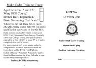
Make <strong>Cadet</strong> Training Count<br />
Aged between 15 and 17?<br />
<strong>Wing</strong> NCO Course?<br />
Bronze DofE Expedition?<br />
Basic Swimming Certificate?<br />
When you can tick these boxes, just a<br />
one-day course stands between you and a<br />
qualification equivalent to four GCSE’s.<br />
Build on your cadet achievements to earn your<br />
BTEC First Diploma in Public Service. Normally<br />
a two-year College course, this qualification is<br />
equivalent to four GCSE’s at grade A* to C and is<br />
completely free to ATC cadets.<br />
For most cadets with 2 years service, only the<br />
completion of two short workbooks stands between<br />
them and the BTEC First Diploma.<br />
Details of future “Workbook Workshops” can be<br />
found in Sharepoint on the <strong>Wing</strong> Calendar or contact<br />
the <strong>Wing</strong> Training Officer:<br />
Training.<strong>ECSM</strong>@aircadets.org<br />
2<br />
39
Upper Winds<br />
Depressions move under the influence of:<br />
The upper wind is responsible for the general<br />
movement of a depression.<br />
This diagram shows isobars for both the upper<br />
a) Lower winds. b) Warm fronts.<br />
c) Cold fronts. d) Upper winds.<br />
Upper winds are generally responsible for:<br />
a) The strength of the surface wind.<br />
b) Poor weather.<br />
c) Fine weather.<br />
d) Movement of a epression.<br />
In the diagram above left, the dotted lines represent the<br />
upper wind and the solid lines the lower wind. If you<br />
stood at Y with your back to the lower wind and the upper<br />
wind is moving from left to right:<br />
a) You'll feel a warm wind in your face.<br />
b) The weather is likely to improve.<br />
c) The weather is likely to deteriorate.<br />
d) There will be no change in the weather for a while.<br />
HOW TO USE THIS BOOK<br />
This manual contains essential knowledge<br />
and key revision points for the three <strong>Leading</strong><br />
<strong>Cadet</strong> subjects, Principles of Flight, <strong>Air</strong>manship<br />
and Basic Navigation.<br />
You may be sitting all three subjects together,<br />
or you may be sitting them separately. Ensure<br />
you know which subjects you will be sitting<br />
before each examination and retain this book<br />
until you have successfully passed all three<br />
subjects.<br />
Chapter 1<br />
Principles of Flight<br />
Contents<br />
Lift and Weight<br />
Newton’s Law<br />
Bernoulli’s Principle<br />
Lift<br />
Factors Affecting Lift<br />
Straight and Level Flight<br />
winds (dotted) and lower winds (solid lines). If<br />
you are standing at position ‘Y’ with your back to<br />
the lower wind, the upper wind is moving from<br />
west to east , the depression has not reached you<br />
yet and the weather is likely to deteriorate.<br />
Anticyclones<br />
Anticyclones are regions of high pressure with<br />
widely spaced isobars and light winds. In general<br />
they are stable, slow-moving systems, consisting<br />
of warm, dry air, bringing long periods of fine<br />
clear weather.<br />
Clouds<br />
Clouds are named according to both their shape<br />
and their height. There are three main types of<br />
cloud:<br />
Cirrus - found only at high levels and composed<br />
of ice crystals. (Cirrus means thread or hair.)<br />
Cumulus - a lumpy or heaped cloud.<br />
Stratus - a featureless layer cloud.<br />
Dependant upon their height, clouds may be prefixed<br />
with :<br />
An anticyclone is:<br />
a) An area of low pressure.<br />
b) An area of high pressure.<br />
c) A depression.<br />
d) An area between two areas of high pressure.<br />
Generally an area of high pressure will tend to bring:<br />
a) Fast moving wet weather systems.<br />
b) Fast moving fine weather systems.<br />
c) Long periods of fine weather.<br />
d) Long periods of poor weather.<br />
Stratus is what type of cloud?<br />
a) Lumpy or heaped. b) Hair-like.<br />
c) Featureless layer. d) Thread-like.<br />
Cumulus is what type of cloud?<br />
a) Lumpy or heaped. b) Hair-like.<br />
c) Featureless layer. d) Thread-like.<br />
Cirrus is what type of cloud?<br />
a) Lumpy. b) Heaped.<br />
c) Hair or thread-like. d) Featureless layer.<br />
Cloud names may have a prefix which indicates the height<br />
of the cloud base. Which of these indicates a cloud with a<br />
base at medium level?<br />
a) Nimbo. b) Cirro. c) Alto. d) Strato.<br />
When alto is used as a prefix in a name of a cloud, that<br />
cloud may be found at:<br />
Read each page, then read the associated<br />
questions. Underline or highlight the correct<br />
answer. Before the examination date, check<br />
with your instructor to ensure that your chosen<br />
answers are the correct ones. Revise these<br />
questions and answers as they will constitute<br />
a very high proportion of the actual examination<br />
questions.<br />
Sqn Ldr P Twose<br />
Training Officer<br />
<strong>ECSM</strong> <strong>Wing</strong><br />
<strong>Leading</strong> <strong>Cadet</strong> Training<br />
Contents<br />
Principles of Flight Page 3<br />
Revised May 08<br />
<strong>Air</strong>manship Page 16<br />
Revised Mar 08<br />
Chapter 2<br />
Chapter 3<br />
Chapter 4<br />
Chapter 5<br />
Thrust and Drag<br />
Thrust<br />
Drag<br />
Variation with <strong>Air</strong>speed<br />
Straight and Level Flight<br />
Stability and Control<br />
Stability<br />
Dihedral<br />
Anhedral<br />
The Pilot’s Controls<br />
Trim Tabs<br />
Flaps<br />
Slats<br />
Stalling<br />
Stalling Speed<br />
Gliding<br />
Gliding (balance of forces)<br />
Gliding Angle<br />
<strong>Air</strong>brakes<br />
Cirro - high clouds (5,500m to 11,000m)<br />
e.g. cirrocumulus, cirrostratus.<br />
Alto - medium level (2000m to 5,500m)<br />
e.g. altocumulus, altostratus.<br />
Clouds with no prefix have a base below 2000m,<br />
e.g. cumulus, cumulonimbus, stratus and stratocumulus.<br />
a) Any level. b) Low level.<br />
c) Medium level. d) High level.<br />
Which of these would only be found at high level?<br />
a) Stratocumulus. b) Altocumulus.<br />
c) Altostratus. d) Cirrostratus.<br />
High level cloud names begin with the prefix:<br />
a) Strato b) Alto<br />
c) Nimbo d) Cirro<br />
Basic Navigation Page 26<br />
Revised Apr 07<br />
Amended Mar 08<br />
Chapter 6<br />
The Helicopter<br />
Torque Reaction<br />
Flying Controls<br />
Collective Pitch Control<br />
The Hand Throttle<br />
Cyclic Pitch Control<br />
Tail Rotor Control<br />
38<br />
3
CHAPTER 1 LIFT AND WEIGHT<br />
Many years ago Sir Isaac Newton formulated laws<br />
which explain the way things move. One of his laws<br />
states that ‘to every action there is an equal and<br />
opposite reaction’. A vehicle weighing 1 tonne will<br />
press down on the road with a force of 1 tonne. The<br />
road must press up with a force of 1 tonne to support<br />
the vehicle. Similarly a 10 tonne boat is supported<br />
by an upward 10 tonne force from the water, otherwise<br />
it would sink. How can an aircraft, which may<br />
weigh hundreds of tonnes, be supported by just air?<br />
In a simple wind-tunnel experiment air is blown<br />
from A, through a constriction at B, and comes out<br />
at C. If airspeed and pressure are measured at each<br />
of these three points we find that the air speeds up to<br />
get through the restriction at B then slows again at<br />
C. When airspeed increases, the pressure actually<br />
decreases. This is known as Bernoulli’s Principle.<br />
The pressure recorded at B will be lower than at A<br />
or C.<br />
If you find this hard to believe, then hold a sheet of<br />
paper as shown in the diagram below and blow<br />
along the curved top edge of the paper.<br />
The paper will rise into line with the<br />
airflow. By speeding up the airflow<br />
over the top you have reduced the<br />
pressure above the paper, so the normal<br />
air pressure under the paper<br />
pushes it up.<br />
The top surface of an aircraft’s wing<br />
is shaped like half of the constriction in the wind<br />
tunnel.<br />
The air increases in speed as it flows over the wing<br />
and the pressure at point X is therefore reduced. The<br />
resulting pressure difference between the air above<br />
and below the wing pushes the wing upwards. At<br />
flying speeds, this force is sufficient to support the<br />
weight of the aircraft.<br />
4<br />
Which scientist formulated laws which explain the way<br />
things move?<br />
a) Morgan. b) Newton. c) Riddeley. d) Einstein.<br />
That scientist's 3rd law states that:<br />
a) Every object has weight.<br />
b) Weight equals lift during flight.<br />
c) Every force causes an object to move.<br />
d) Every action has an equal and opposite reaction.<br />
In the wind-tunnel diagram, air is flowing past a constriction.<br />
What has happened to the air pressure at point B?<br />
a) It is lower than at point A.<br />
b) It is the same as at point C.<br />
c) It is greater than at point C.<br />
d) It is greater than at point A.<br />
For air moving in a smooth streamline flow, if the air is<br />
made to speed up, what happens to the pressure of the air<br />
where it is flowing faster?<br />
a) It increases. b) It fluctuates wildly.<br />
c) It decreases. d) It remains constant.<br />
Bernoulli’s Principle says that:<br />
a) Where air is speeded up the pressure decreases.<br />
b) Where air speed decreases the temperature increases.<br />
c) Where air is speeded up the pressure increases.<br />
d) Where air speed increases the temperature increases.<br />
When you blow along the curved top of a sheet of paper, the<br />
paper rises. This is because of:<br />
a) The skin friction that develops along the top of the paper.<br />
b) A reduction in the air pressure along the top of the paper.<br />
c) The vortices that form along the top of the paper.<br />
d) A rise in the air pressure along the top of the paper.<br />
Where is the airflow fastest in the diagram of an aerofoil in<br />
an airflow?<br />
a) W b) X c) Y d) Z<br />
Where is the air pressure lowest in the diagram of an aerofoil<br />
in an airflow?<br />
a) W b) X c) Y d) Z<br />
As air passes over the top surface of a wing in normal flight,<br />
its speed will:<br />
a) Increase. b) Reduce considerably.<br />
c) Reduce slightly. d) Remain constant.<br />
Why is lift produced when air flows over the top surface of a<br />
wing?<br />
a) The air pressure rises because the air is speeded up.<br />
b) The air pressure rises because the air is slowed down.<br />
c) The air pressure falls because the air is speeded up.<br />
d) The air pressure falls because the air is slowed down.<br />
Arctic Maritime<br />
Originates in cold Arctic seas and picks up little<br />
moisture as it travels south.<br />
Summer: very cold, frequent heavy showers.<br />
Winter: very cold, strong N-NE wind, heavy snow.<br />
Polar Continental<br />
Originates in Siberia, it is very cold in winter, but<br />
warm in summer. The short sea track to the south of<br />
England means that it remains quite dry with little<br />
or no cloud, whereas in Scotland, weather conditions<br />
can be quite different.<br />
Summer: warm and dry, cloud free.<br />
Winter: sleet and snow in north, cold and dry in<br />
south.<br />
Fronts and Frontal Depressions<br />
Fronts and depressions are the cause of most of the<br />
poor weather we experience. Weather changes<br />
occur as the result of water vapour and variations in<br />
air pressure. To understand what is happening,<br />
meteorologists draw charts linking all points of<br />
equal pressure (isobars) to gain an understanding of<br />
weather features in much the same way as contours<br />
(lines joining points of equal height) help you to<br />
picture a geographical feature from a map.<br />
Just as the distance between contours indicates the<br />
steepness of a hill, the distance between isobars<br />
indicates a change in pressure or a pressure gradient.<br />
A steep gradient with the isobars close together<br />
results in high winds, whereas widely spaced isobars<br />
result in light breezes.<br />
Areas of low pressure are called lows or depressions,<br />
areas of high pressure, highs or anticyclones.<br />
Most depressions<br />
are accompanied<br />
by<br />
‘fronts’ where<br />
a cold air mass<br />
meets a warm<br />
one. In this<br />
diagram of a<br />
depression<br />
moving east,<br />
‘X’ is the<br />
warm sector with a warm front to the east and a<br />
cold front moving in behind from the west. As cold<br />
fronts move faster than warm fronts, the cold front<br />
eventually catches up with the warm front and<br />
‘lifts’ the warm sector air away from the ground<br />
completely. This ‘occluded’ front is represented by<br />
a line of alternate semi-circles and triangles.<br />
37<br />
Which of these types of air mass brings cold dry weather<br />
with little or no cloud to the British Isles in winter?<br />
a) Polar continental via the short sea track.<br />
b) Polar maritime.<br />
c) Polar continental via the long sea track.<br />
d) Returning polar maritime.<br />
Lines on a weather chart joining all points of equal pressure<br />
are called:<br />
a) Cold Fronts b) Occluded Fronts.<br />
c) Warm Fronts d) Isobars.<br />
Isobars are drawn on a weaher map joining points of equal:<br />
a) Temperature. b) Windspeed.<br />
c) Humidity. d) Pressure.<br />
An area of low pressure is also known as:<br />
a) A depression. b) A warm front.<br />
c) An occluded front. d) An anticyclone.<br />
Fronts occur where:<br />
a) The atmospheric pressure is very high.<br />
b) Two warm air masses meet.<br />
c) A cold air mass meets a warm air mass.<br />
d) Two cold air masses meet.<br />
This diagram shows:<br />
a) An anti-cyclone.<br />
b) A warm front.<br />
c) An occluded front.<br />
d) A cold front.<br />
This diagram shows:<br />
a) An anti-cyclone.<br />
b) A warm front.<br />
c) An occluded front.<br />
d) A cold front.<br />
When a cold air mass catches up with another cold air<br />
mass, thereby undercutting a comparatively warm air mass<br />
and pushing it upwards off the Earth's surface, the weather<br />
system is called:<br />
a) A cold stream. b) An occluded front.<br />
c) A ridge of high pressure. d) A non-frontal depression.<br />
This diagram shows:<br />
a) An anti-cyclone.<br />
b) A warm front.<br />
c) An occluded front.<br />
d) A cold front.<br />
An occluded front is represented by:<br />
a) A line carrying alternate semicircles and triangles.<br />
b) A line carrying alternate semicircles and squares.<br />
c) A line carrying semicircles.<br />
d) A line carrying squares.
CHAPTER 4 WEATHER<br />
There are six main air masses that affect the<br />
weather in the British Isles, each having its own<br />
distinctive characteristics. To complicate matters,<br />
these characteristics also change by season.<br />
<strong>Air</strong> Masses<br />
Look at the figure below for the next five questions.<br />
In normal flight conditions the wing is inclined to<br />
the oncoming airflow at a slight positive angle.<br />
This deflects some of the airflow downwards<br />
creating a ‘downwash’ which adds to the lift<br />
generated by the top surface of the wing.<br />
Where is the greatest amount of lift normally generated on<br />
an aerofoil?<br />
a) Top surface. b) Bottom surface.<br />
c) Trailing edge. d) <strong>Leading</strong> edge.<br />
Lift is obtained from almost all parts of the wing but not<br />
equally from every part. About how much is obtained<br />
from the top surface of an aircraft wing?<br />
V<br />
a) Up to 80%. b) Up to 50%.<br />
c) Up to 33%. d) Up to 25%.<br />
Which air mass is called Arctic Maritime?<br />
a) V b) W c) X d) Y e) Z<br />
Under these flight conditions all parts of a wing<br />
generate lift, though to varying degrees.<br />
This diagram illustrates several important points:<br />
On a general purpose aerofoil, the greatest amount of lift<br />
occurs:<br />
a) Just forward of the trailing edge.<br />
b) At the centre of the bottom surface.<br />
c) Where the top surface is not curved.<br />
d) Where the top surface is curved the most.<br />
Which air mass is called Tropical Maritime?<br />
a) V b) W c) X d) Y e) Z<br />
In what direction relative to the direction of the oncoming<br />
air, or path of the aircraft, do the lift forces act?<br />
Polar Maritime<br />
Originates in North Canada and Greenland, picks<br />
up water vapour from the Atlantic before reaching<br />
the British Isles.<br />
Summer: cool winds, heavy showers.<br />
Winter: heavy showers in west, clear in east.<br />
Returning Polar Maritime<br />
Originates in Canada as cold, dry air, but moves<br />
south and picks up a lot of water vapour. It is much<br />
warmer and wetter than Polar Maritime air.<br />
Summer: warm with squally showers and storms.<br />
Winter: low stratus cloud, showers in mountains.<br />
Tropical Maritime<br />
Originates in warm tropical oceans around the<br />
equator and brings cloudy, warm and wet air all<br />
year round.<br />
Summer: warm SW winds, low stratus clouds.<br />
Winter: mild, low stratus, drizzle, mountain rain.<br />
Tropical Continental<br />
Originates in North Africa.<br />
Summer only: very hot, dry, hazy, occasional<br />
thunderstorms.<br />
36<br />
Which air mass is called Tropical Continental?<br />
a) V b) W c) X d) Y e) Z<br />
Which air mass is called Polar Maritime?<br />
a) V b) W c) X d) Y e) Z<br />
Which air mass is called Polar Continental?<br />
a) V b) W c) X d) Y e) Z<br />
Which air mass starts off very cold with dry air but arrives<br />
in the U.K. warm and wet?<br />
a) Arctic Maritime. b) Polar Maritime.<br />
c) Returning Polar Maritime. d) Tropical Continental.<br />
Which air mass originates around the equator and brings<br />
warm, cloudy weather to the U.K. in both summer and<br />
winter?<br />
a) Arctic Maritime. b) Polar Maritime.<br />
c) Tropical Continental. d) Tropical Maritime.<br />
Which air mass originates in North Africa and brings hot,<br />
dry weather with occasional thunderstorms to the U.K. in<br />
summer?<br />
a) Arctic Maritime. b) Polar Continental.<br />
c) Tropical Continental. d) Tropical Maritime.<br />
Which air mass originating in Siberia brings to the U.K.<br />
warm weather in summer and cold weather in winter?<br />
a) Arctic Maritime. b) Polar Continental.<br />
c) Tropical Continental. d) Tropical Maritime.<br />
Which air mass originates in the north of Canada and<br />
Greenland, brings cool winds and heavy showers to the<br />
UK both summer and winter?<br />
a) Polar Continental. b) Polar Maritime.<br />
c) Tropical Continental. d) Arctic Maritime.<br />
a) the top surface normally generates more lift<br />
than the bottom surface (sometimes 80% of it).<br />
b) the greatest amount of lift on the top surface<br />
occurs where the surface is curved the most.<br />
c) all lift forces act at 90° to the oncoming airflow.<br />
All of these lift forces can be combined and represented<br />
by a single arrow from the ‘centre of pressure’<br />
where all lift forces can be said to act.<br />
Factors Affecting Lift<br />
This is similar to finding the<br />
centre of gravity of a ruler. All<br />
the small forces of gravity<br />
acting on the ruler balance<br />
about the centre of gravity.<br />
Several factors affect the amount of lift a wing<br />
produces. At subsonic speeds, doubling the airspeed<br />
gives four times the lift, trebling the airspeed<br />
gives nine times the lift.<br />
Increasing the ‘angle of attack will increase lift<br />
until the angle reaches about 15°.<br />
Angle of attack is the angle between the chord<br />
line of a wing and the oncoming air.<br />
5<br />
a) At about 4 degrees. b) The opposite direction.<br />
c) At 90 degrees. d) The same direction.<br />
The point on a wing at which all the lift forces are said to<br />
act is:<br />
a) Centre of pressure. b) Dynamic centre.<br />
c) Pressure point. d) Static point.<br />
In the figure on the left, all the small forces of gravity<br />
acting on the ruler balance at a point called:<br />
a) The static centre. b) The centre of gravity.<br />
c) The centre of pressure. d) The dynamic centre.<br />
If an aircraft's speed through the air is increased from 250<br />
kts to 500 kts, what happens to the amount of lift produced?<br />
a) It is increased by four times. b) It is doubled.<br />
c) It is reduced to a quarter. d) It remains the same.<br />
For low subsonic speeds, if the airspeed is doubled and all<br />
other factors affecting lift are unchanged, the lift is:<br />
a) Unchanged. b) Multiplied by 2.<br />
c) Multiplied by 4. d) Multiplied by 8.<br />
On an aircraft, if the airspeed over a wing is trebled and<br />
all other factors affecting lift are unchanged, the lift is:<br />
a) Multiplied by about 3. b) Divided by about 3.<br />
c) Unchanged. d) Multiplied by about 9.<br />
Angle of attack means:<br />
a) The angle between the chord line of the wing and the<br />
oncoming air.<br />
b) The angle of sweepback of a wing.<br />
c) The amount by which the aircraft's nose is above the<br />
horizon in level flight.<br />
d) The angle at which a wing is fixed to the fuselage.
The chord line of a wing is a straight line joining<br />
the leading edge to the trailing edge.<br />
<strong>Air</strong> density also affects lift. If the air becomes<br />
‘thinner’ (as it does with increasing altitude or<br />
temperature) the amount of lift is reduced.<br />
<strong>Wing</strong> shape and area significantly affect the<br />
amount of lift produced. An aircraft designer will<br />
design a wing for the aircraft’s specific role: a big<br />
high lift wing for a heavy slow transport, a thin<br />
high speed wing for a fighter.<br />
In this diagram Z and W are thin, high-speed<br />
wing sections. X is a general purpose wing section<br />
and Y illustrates a high-lift section. The dotted<br />
line is the mean camber line for each wing.<br />
In most aircraft the pilot will have some control<br />
over the wing section and area. He can increase<br />
the effective camber of the wing (and hence lift)<br />
by lowering flaps. Flaps are covered in more<br />
detail in Chapter 3.<br />
Straight and Level Flight<br />
The force of gravity acting on an aircraft is called<br />
‘weight’.<br />
When an aircraft is in straight and level flight,<br />
neither climbing or descending, then lift exactly<br />
equals weight.<br />
If lift is greater than weight, the aircraft will<br />
climb, if weight is more than lift it will descend.<br />
If an aircraft in steady straight and level flight<br />
suddenly reduced its weight by dropping supplies<br />
or jettisoning fuel, then the aircraft would start to<br />
climb rapidly unless the pilot took corrective<br />
action on the flying controls.<br />
What is the chord line of a wing section?<br />
a) A curved line following the mean camber of the wing<br />
from the leading edge to the trailing edge.<br />
b) A straight line joining the leading edge to the trailing<br />
edge.<br />
c) The line at which the wing is set to the fuselage.<br />
d) A line through the leading edge parallel to the thrust<br />
line.<br />
If the air density in an airflow is reduced and all other<br />
factors are unchanged, what happens to the lift generated<br />
by a wing in the airflow?<br />
a) It is reduced.<br />
b) It is increased.<br />
c) It is unchanged.<br />
d) It becomes unpredictable.<br />
Which of the wing sections are for high speed?<br />
a) W and Z b) X and Y<br />
c) W and Y d) Y and Z<br />
Which of the wing sections is for general purpose?<br />
a) W b) X<br />
c) Y d) Z<br />
Which of the wing sections is for high lift?<br />
a) W b) X<br />
c) Y d) Z<br />
To fly, an aircraft must generate lift to oppose its:<br />
a) Drag. b) Weight.<br />
c) Inertia. d) Thrust.<br />
The effect of gravity on an aircraft is called:<br />
a) Thrust. b) Lift.<br />
c) Drag. d) Weight.<br />
Only one of these statements is true for an aircraft in<br />
straight and level flight. Which one?<br />
a) Lift is slightly more than weight.<br />
b) Lift exactly equals weight.<br />
c) Lift is slightly less than weight.<br />
d) Lift is considerably greater than weight.<br />
If an aircraft in steady straight and level flight suffered a<br />
sudden reduction in weight (for example, by jettisoning<br />
fuel) and the pilot made no changes to the controls, the<br />
aircraft would begin to:<br />
a) Speed up.<br />
b) Climb<br />
c) Descend.<br />
d) Slow down.<br />
Errors<br />
No method of estimating distance is entirely accurate,<br />
and when you add errors in measuring direction as<br />
well, you can see how quickly your ‘area of uncertainty’<br />
can grow as you are travelling.<br />
For instance, if you assume a possible error of<br />
+/- 10% in measuring distance and one of +/- 4% in<br />
measuring direction, your area of uncertainty is about<br />
the size of 4 football pitches after only 1 km, and a<br />
staggering 36 football pitches after 3 km!<br />
In order to keep this ‘area of uncertainty’ to a minimum,<br />
it is important that you measure bearings as<br />
accurately as possible and practice pacing and timing<br />
distances to reduce the error as much as possible.<br />
Handrailing<br />
If a track or path leads directly to where you want to<br />
go, it would be sensible to follow it. You could just<br />
as easily follow a wall, river, ridge, electricity pylons<br />
or any other linear feature that leads the right way.<br />
You are using the linear feature as a ‘handrail’ to<br />
guide you to your destination.<br />
Note: After a serious accident caused by<br />
‘handrailing’ down a steep stream valley, HQAC<br />
have directed that this method is to be used with<br />
extreme caution.<br />
Contouring<br />
Is it better to go round a hill or over the top? The two<br />
routes may take the same time, but ‘contouring’<br />
round, following a contour of the hill, usually takes<br />
less effort. This is particularly the case if you are<br />
carrying heavy packs.<br />
Attack Points<br />
An attack point is an easily identifiable feature<br />
which is close enough to your objective to enable<br />
you to home in on it with some degree of accuracy.<br />
It sometimes pays to go slightly out of your way to<br />
hit a definite target to assist in reaching your final<br />
objective.<br />
Measuring distances accurately whilst out walking helps you<br />
particularly to:<br />
a) Choose the shortest route.<br />
b) Reduce the area of uncertainty in your position.<br />
c) Calculate magnetic variation.<br />
d) Calculate the gradient.<br />
When navigating, in order to reduce the area of uncertainty to<br />
a minimum, you should:<br />
a) Always follow paths.<br />
b) Never follow contours.<br />
c) Measure distances and bearings as accurately as possible.<br />
d) Walk as quickly as possible to your destination.<br />
A cadet decides to follow a stream down from the hillside<br />
because she knows that the stream runs close to her campsite.<br />
The cadet is using a navigational technique known as:<br />
a) Aiming off.<br />
b) Resection.<br />
c) Handrailing.<br />
d) Contouring.<br />
Handrailing is the term for:<br />
a) Aiming for a prominent feature close to your destination.<br />
b) Following linear features to get to your destination.<br />
c) Walking on a compass bearing.<br />
d) Avoiding climbing by maintaining height.<br />
Following linear features to guide you to your destination is<br />
known as:<br />
a) Aiming off.<br />
b) Using attack points.<br />
c) Handrailing.<br />
d) Contouring.<br />
Walking round a hill without gaining or losing height is<br />
called:<br />
a) Handrailing.<br />
b) Contouring.<br />
c) Aiming off.<br />
d) Pacing.<br />
What is an ‘attack point’?:<br />
a) Any trig point.<br />
b) Any prominent feature close to your objective.<br />
c) Any prominent feature that can be easily identified.<br />
d) The summit of any hill.<br />
6<br />
35
CHAPTER 3 PRACTICAL NAVIGATION<br />
If you know how fast you walk, you can work out<br />
how long it will take you to cover a known distance.<br />
For instance, a typical group will walk 1km over<br />
reasonably flat ground in 15 minutes, it would therefore<br />
take one hour to cover 4 km in similar terrain.<br />
Measuring distances accurately when hillwalking is<br />
important because it helps you calculate your speed<br />
of travel accurately.<br />
Naismith’s Rule<br />
A Scottish climber called Naismith devised a rule (in<br />
1892!) to calculate walking speeds over mountainous<br />
terrain.<br />
His basic rule assumed a walking speed of 4 km per<br />
hour over normal (flat) terrain.<br />
Climbing took more time, so he added 30 minutes for<br />
every 200m of climbing.<br />
Steep descents also need extra care and time, so he<br />
added 10 minutes for every 200m of steep descent.<br />
On expeditions you must take the group’s fitness<br />
into account, and also the fact that you will be carrying<br />
heavy packs.<br />
Pacing<br />
Distance can be measured by counting paces (or<br />
every other pace) and with practice this can be very<br />
accurate, but only over short distances.<br />
34<br />
Measuring distances accurately whilst hillwalking is important<br />
because it:<br />
a) Calculates your speed of travel.<br />
b) Keeps you on schedule.<br />
c) Chooses the shortest route.<br />
d) Pinpoints your position accurately.<br />
What do you estimate as the average walking speed of a<br />
group on level ground?<br />
a) 2 kph. b) 4 kph. c) 6 kph. d) 8 kph.<br />
A cadet is able to walk 1 km over reasonably flat ground in<br />
20 minutes. How long would it take him to cover 4.5 km in<br />
similar terrain?<br />
a) 40 mins. b) 60 mins. c) 90 mins. d) 120 mins.<br />
Whilst walking over reasonably flat ground, a cadet takes 1<br />
hour to cover 3 km. How long will it take him to walk 500 m<br />
at the same speed?<br />
a) 10 mins. b) 15 mins. c) 20 mins. d) 60 mins.<br />
What is Naismith’s rule?<br />
a) 3 kph overall.<br />
b) 5 kph overall.<br />
c) 5 kph plus an hour for any climbing.<br />
d) 4 kph as measured on the map plus half an hour for<br />
every 200m climbed.<br />
Naismith's Rule applies to the calculation of:<br />
a) Gradients.<br />
b) Shapes depicted by contour lines.<br />
c) Headings and bearings.<br />
d) The speed of advance on foot in mountainous country.<br />
How can you estimate distance covered from your last check<br />
point?<br />
a) Use your mobile phone.<br />
b) Use a pedometer.<br />
c) Consult your GPS.<br />
d) Measure the time taken and calculate at 4Km per hour.<br />
How much time should be added to a journey on foot for<br />
every 200 meters climbed using Naismith's Rules?<br />
a) 15 minutes. b) 20 minutes.<br />
c) 25 minutes. d) 30 minutes.<br />
How much time should be added to a journey on foot for<br />
every 200 meters of steep descent, using Naismith's Rules?<br />
a) 5 minutes. b) 10 minutes.<br />
c) 15 minutes. d) 20 minutes.<br />
Pacing can be an accurate way of measuring distances if<br />
carried out over:<br />
a) Long distances. b) Medium distances.<br />
c) Short distances. d) 5000 paces.<br />
CHAPTER 2 THRUST AND DRAG<br />
Besides lift and weight, two other forces act on an<br />
aircraft, thrust and drag.<br />
Thrust<br />
An aircraft’s engine, or engines, produce thrust to<br />
propel the aircraft forwards through the air. A<br />
propeller ‘screws’ air backwards, a jet engine<br />
expels air backwards at high speed. In both cases,<br />
pushing air backwards thrusts the aircraft forwards.<br />
(Newton’s Law again—every action has an<br />
equal and opposite reaction!) The thrust force acts<br />
along a line from the tail through the nose of the<br />
aircraft.<br />
Drag<br />
Drag is the force which hinders the aircraft’s<br />
progress through the air. Every part of the aircraft<br />
over which air flows produces drag which resists<br />
forward motion. ’Fairing off’ or streamlining can<br />
significantly reduce this. To simplify matters, we<br />
add all of these drag forces together and represent<br />
them with a single line (as we did with the lift<br />
forces). This line runs from the nose through the<br />
tail of the aircraft and directly opposes the thrust<br />
line.<br />
Variation of Drag with <strong>Air</strong>speed<br />
Drag varies (like lift) with the square of the airspeed.<br />
Doubling the airspeed gives four times the<br />
drag, trebling the airspeed, nine times the drag.<br />
Straight and Level Flight<br />
In steady (i.e. not speeding up, not slowing down)<br />
straight and level flight, just as lift must equal<br />
weight, so the thrust must equal the total drag.<br />
If thrust is greater than drag the aircraft will accelerate,<br />
if the drag exceeds the thrust the aircraft<br />
will slow down.<br />
Lift<br />
Thrust<br />
Weight<br />
Drag<br />
In steady straight and level flight, thrust opposes<br />
the drag and is equal to it, and lift opposes weight<br />
and is equal to it.<br />
7<br />
What is the force called that drives an aircraft forwards?<br />
a) Weight. b) Drag.<br />
c) Lift. d) Thrust<br />
The reaction to the rearward movement of air produced by<br />
the propeller or jet is called:<br />
a) Thrust. b) Drag.<br />
c) Resistance. d) Friction.<br />
The resistance to the forward movement of an aircraft is<br />
called:<br />
a) Drag. b) Resistance.<br />
c) Turbulence. d) Thrust.<br />
To accelerate an aircraft from straight and level flight,<br />
which of the following statements is true?<br />
a) Thrust must equal drag.<br />
b) Drag must exceed thrust<br />
c) Thrust must exceed drag.<br />
d) Drag must be half thrust.<br />
To slow an aircraft from straight and level flight, which of<br />
the following statements is true?<br />
a) Thrust must be less than drag.<br />
b) Thrust must equal total drag.<br />
c) Thrust must exceed total drag.<br />
d) Drag must be greater than thrust.<br />
Which part of an aircraft produces drag which resists<br />
forward motion?<br />
a) Every part of an aircraft over which air flows.<br />
b) The fuselage but not the wings.<br />
c) Only those parts which are producing lift.<br />
d) Only those parts of the aircraft that are not producing<br />
lift.<br />
If you doubled the airspeed the drag would increase by a<br />
factor of:<br />
a) 2 b) 4 c) 6 d) 8<br />
If you trebled the airspeed the drag would increase by a<br />
factor of:<br />
a) 3 b) 6 c) 9 d) 12<br />
A stream line shape with an airspeed of 100 kts has a drag<br />
force of 200 N (Newtons). If the airspeed were increased<br />
to 300 kts what would the drag be?<br />
a) 400 N b) 800 N c) 1800 N d) 3600 N<br />
Which of these statements about an aircraft in straight and<br />
level flight is true?<br />
a) Thrust is equal to the drag.<br />
b) Thrust is equal to twice the drag.<br />
c) Thrust is equal to half the drag.<br />
d) Thrust is equal to four times the drag.
CHAPTER 3 STABILITY & CONTROL<br />
There are three axes about which an aircraft rotates,<br />
and all go through the centre of gravity.<br />
The lateral axis runs from wingtip to wingtip.<br />
Movement about this axis is called pitching.<br />
Fig 1<br />
The longitudinal axis runs from nose to tail. The<br />
aircraft rolls about this axis.<br />
Fig 2<br />
<strong>Air</strong>craft yaw about the normal axis which runs<br />
vertically downwards through the aircraft.<br />
Fig 3<br />
Stability<br />
normal<br />
longitudinal<br />
centre of gravity<br />
lateral<br />
Turbulence will frequently displace an aircraft<br />
from straight and level flight. A well designed<br />
aircraft will tend to go back to level flight of its<br />
own accord without the pilot having to make<br />
continual adjustments. This property is stability.<br />
Stability in the pitching plane is provided by the<br />
tailplane. In normal flight the tailplane meets the<br />
airflow at 0° angle of attack. If the aircraft is<br />
disturbed in pitch the tailplane meets the airflow<br />
at either a positive or negative angle of attack.<br />
This creates lift, either upwards or downwards,<br />
which pushes it back to zero angle of attack and<br />
therefore straight and level flight.<br />
Each of the three axes of an aircraft pass through the<br />
aircraft's:<br />
a) <strong>Wing</strong>s.<br />
b) Centre of gravity.<br />
c) Cockpit.<br />
d) Engine bearings.<br />
e) Centre of pressure.<br />
f) A point halfway along a line between the wing tips.<br />
g) A point halfway between the tail and the nose.<br />
Which axis runs from nose to tail in an aircraft?<br />
a) Bilateral. b) Normal.<br />
c) Lateral. d) Longitudinal.<br />
Which axis generally runs from wing tip to wing tip?<br />
a) Normal. b) Lateral.<br />
c) Diagonal. d) longitudinal.<br />
The 3 axes about which an aircraft moves are:<br />
a) Longitudinal, lateral and diagonal.<br />
b) Longitudinal, lateral and normal.<br />
c) Lateral, normal and diagonal.<br />
d) Lateral, bilateral and normal.<br />
The movement of an aircraft about its lateral axis is<br />
called:<br />
a) Pitching. b) Slewing. c) Yawing. d) Rolling.<br />
The movement of an aircraft about its longitudinal axis is<br />
called:<br />
a) Damping. b) Rolling. c) Yawing. d) Pitching.<br />
The movement of an aircraft about its normal axis is<br />
called:<br />
a) Rolling. b) Damping. c) Pitching. d) Yawing.<br />
See figure 1. What sort of movement is shown?<br />
a) Pitching. b) Yawing. c) Rolling. d) Swinging.<br />
See figure 2. What sort of movement is shown?<br />
a) Pitching. b) Yawing. c) Rolling. d) Swinging.<br />
See figure 3. What sort of movement is shown?<br />
a) Pitching. b) Yawing. c) Rolling. d) Diving.<br />
A well designed aircraft that is disturbed from level flight<br />
(say by bumpy air) will tend to go back to level flight of<br />
its own accord, without the pilot having to make adjustments.<br />
This property is called:<br />
a) Damping. b) Stability.<br />
c) Instability. d) Inertia.<br />
8<br />
2. Hold the compass in this position and turn the<br />
capsule until the orienting arrow lies directly beneath<br />
the north end of the compass needle. This gives the<br />
magnetic bearing.<br />
3. Now turn the capsule to deduct the GMA. This<br />
now gives the grid bearing.<br />
4. Place the compass on the map (you do not have<br />
to have the map oriented, you are only going to use<br />
the compass as a protractor again at this stage) with<br />
its long edge passing through your present position.<br />
Do not turn the capsule.<br />
5. Turn the whole compass until the orienting lines<br />
are parallel to the N-S grid lines and the orienting<br />
arrow points to north on the map. (Ensure the long<br />
edge of the compass is still through your present<br />
position).<br />
6. The edge of the compass that runs through your<br />
position should now run through symbol of the object<br />
you initially took the bearing upon.<br />
To help you remember to deduct the GMA when<br />
taking bearings of features and finding them on the<br />
map, remember the phrase:<br />
Resection<br />
MAG to GRID - get RID<br />
If you wish to determine your position on a map by<br />
reference to features around you, try and identify<br />
three features and take their bearings. Drawing these<br />
lines on your map should fix your position, but it is<br />
unlikely that all three lines meet at a point. If you<br />
have measured and plotted accurately you should<br />
have only a small triangle formed where the three<br />
bearings cross. Take your position as being near the<br />
centre of this triangle.<br />
Roamers<br />
On the corners of most<br />
compass bases you will<br />
find one or more<br />
‘roamers’. These can be<br />
used to find a six figure<br />
grid reference very<br />
accurately. Place the<br />
corner of the roamer on<br />
the feature and read<br />
from where the scales intersect the grid lines, eastings<br />
first. The four figure grid reference from the<br />
SW corner of the square defines the 1km square<br />
(37,07). In this example the six figure grid reference<br />
is 375,073.<br />
33<br />
You are at a point where variation is 2 degrees W and grid<br />
magnetic angle is 5 degrees W. If the compass bearing of a<br />
church is 350 degrees, what is its grid bearing?<br />
a) 343 degrees. b) 345 degrees.<br />
c) 347 degrees. d) 348 degrees.<br />
You are at a point where variation is 1 degree W and grid<br />
magnetic angle is 6 degrees W. If the compass bearing of a<br />
trig point 150 degrees, what is its grid bearing?<br />
a) 143 degrees. b) 144 degrees.<br />
c) 156 degrees. d) 157 degrees.<br />
How can we remember when changing magnetic bearings to<br />
grid bearings?<br />
a) Always minus. b) Always plus.<br />
c) MAG to GRID—get RID. d) MAG to GRID—ADD.<br />
What is resection?<br />
a) Take tree bearings to separate features and the middle of<br />
the triangle is your position.<br />
b) Back Track.<br />
c) Draw a cross section of the surrounding contours.<br />
d) Use reciprocal bearings.<br />
If you wanted to fix your position on a map by reference to<br />
prominent landmarks within your field of vision, what would<br />
give the best result?<br />
a) One bearing giving a position line.<br />
b) Two bearings crossing.<br />
c) Three bearings crossing to give a small position triangle.<br />
d) Three bearings crossing to give a large position triangle.<br />
When using an M726 1:50,000 map, a four figure grid reference<br />
will define a 1 kilometre square on the map. The four<br />
figure reference refers to a particular corner of the square:<br />
which corner?<br />
a) NW b) SW c) SE d) NE<br />
What is a roamer?<br />
a) Ensures better accuracy. It fins a position to the third grid<br />
reference point on a Silva compass.<br />
b) Acts as a magnifier.<br />
c) Reads off the grid reference.<br />
d) Helps you navigate.<br />
A roamer would be used in finding:<br />
a) A relative bearing. b) The average gradient.<br />
c) A grid reference point. d) The direction of a track.<br />
In the diagram on the left, the six figure GR shown would be:<br />
a) 073 375 b) 075 373 c) 375 073 d) 373 075<br />
In this diagram, the six figure<br />
GR shown would be:<br />
a) 367 068<br />
b) 368 067<br />
c) 067 368<br />
d) 068 367
Setting a Compass Heading<br />
To enable you to walk from one point to another<br />
on a compass heading you must locate both points<br />
on your map and take a bearing.<br />
1. Place the compass on the map with its long<br />
edge running through both points and the direction<br />
of travel arrow pointing in the direction you<br />
wish to travel (You do not need to orientate the<br />
map for this operation).<br />
2. Hold the compass plate firmly and turn the<br />
compass capsule until the orienting lines on its<br />
base are parallel to the north-south grid lines and<br />
the orienting arrow points to the top of the map.<br />
3. The compass now registers the number of<br />
degrees between grid north and your intended<br />
direction of travel.<br />
Note that you have effectively used the compass<br />
as a protractor. In order to now use your compass<br />
to walk on that bearing you must take the difference<br />
between grid north and magnetic north into<br />
account.<br />
4. In order to add the Grid Magnetic Angle<br />
(GMA) turn the compass capsule to add those<br />
extra degrees.<br />
5. Remove the compass from the map. Hold it in<br />
front of you so that it is level and the direction of<br />
travel arrow points away from you. Turn your<br />
body until magnetic needle falls inside the orienting<br />
arrow on the base of the capsule - red end<br />
pointing north. The direction of travel arrow will<br />
now be pointing the direction you need to travel.<br />
To help you to remember to add on the GMA<br />
when taking a bearing from a map with westerly<br />
variation, remember the phrase:<br />
GRID to MAG - ADD<br />
Try to avoid walking while staring at your compass.<br />
A better technique is to pick out some feature<br />
in the far distance and walk to that.<br />
Taking a Bearing on a Distant Object<br />
In order to help pinpoint your position you may<br />
need to take a compass bearing of a distant object<br />
and convert it into a map bearing. To do this:<br />
1. Point the direction of travel arrow at the distant<br />
object.<br />
32<br />
To take a bearing between 2 features on a map, you would<br />
first place the compass on the map so that its longest edge<br />
runs through both features and its direction of travel arrow<br />
points in your intended direction of travel. You would<br />
then:<br />
a) Turn the capsule on the compass to deduct the grid<br />
magnetic angle.<br />
b) Turn the map and compass together until the needle<br />
falls into the orienting arrow.<br />
c) Turn the capsule on the compass until the needle falls<br />
into the orienting arrow.<br />
d) Turn the capsule on the compass so that its orienting<br />
lines are parallel to the north-south grid lines.<br />
The direction of a track drawn between two places on a<br />
map is measured against the grid-lines and found to be<br />
102 degrees (grid). If magnetic north is five degrees west<br />
of grid north, what is the magnetic bearing of the track?<br />
a) 097 degrees (M) b) 107 degrees (M)<br />
c) 095 degrees (M) d) 102 degrees (M)<br />
The grid bearing between two features on a map was<br />
measured to be 040 degrees (Grid). If the grid magnetic<br />
angle is 6 degrees west of grid north, what is the magnetic<br />
bearing?<br />
a) 034 degrees. b) 040 degrees.<br />
c) 043 degrees. d) 046 degrees.<br />
A grid bearing from a M726 series OS map on which the<br />
magnetic variation is westerly, can be converted to a<br />
magnetic bearing by:<br />
a) Subtracting the angular difference between magnetic<br />
north and grid north.<br />
b) Adding the angular difference between magnetic north<br />
and grid north.<br />
c) Adding the angular difference between grid north and<br />
true north.<br />
d) Subtracting the angular difference between grid north<br />
and true north.<br />
When walking on a bearing in good visibility, the best<br />
technique is to:<br />
a) Follow your compass and ignore the countryside.<br />
b) Send a team member out 50 metres and walk to there.<br />
c) Select an object 5 metres in front and walk to it.<br />
d) Select a distant feature that is along your intended<br />
direction of travel.<br />
When using a compass to take a bearing on a distant<br />
object, you would first of all:<br />
a) Turn the capsule to subtract the grid magnetic angle.<br />
b) Align the red compass needle to point at the object.<br />
c) Point the direction of travel arrow at the object.<br />
d) Turn the capsule so that the orienting arrow points at<br />
the object.<br />
Stability in the rolling plane is usually established<br />
by setting the wings into the fuselage at a slight<br />
upward angle to the horizontal called dihedral.<br />
If a wing drops in turbulence the aircraft will<br />
‘slip’ sideways towards the dropped wing. The<br />
lower wing now has a greater angle of attack to<br />
the oncoming airflow than the upper wing. Additionally<br />
the upper wing’s airflow is being affected<br />
by the shielding of the fuselage. This differential<br />
between each wing’s lift rolls the aircraft back to<br />
straight and level flight.<br />
High wing aircraft have natural stability in the<br />
rolling plane because the centre of gravity is well<br />
below the wing creating a ‘pendulum’ effect.<br />
Where too much stability would hinder manoeuvrability<br />
designers incorporate anhedral to reduce<br />
excessive stability.<br />
anhedral<br />
Stability in the yawing plane (sometimes called<br />
directional stability) is provided by the aircraft’s<br />
fin. A air disturbance causing the aircraft to yaw<br />
will put the fin into the airflow at an angle of<br />
attack creating ‘sideways lift’ to push it back into<br />
line. Most aircraft have a large fin placed as far<br />
back as possible to increase the weathercock<br />
effect and ensure directional stability.<br />
Note that we always describe pitching, rolling and<br />
yawing relative to the pilot, not the horizon.<br />
The Pilot’s Controls<br />
Pitching: The pilot uses elevators, two moveable<br />
parts of the tailplane, to make the aircraft’s nose<br />
pitch up or down.<br />
Yawing: The rudder, a single control surface<br />
hinged to the trailing edge of the fin, is connected<br />
to the rudder pedals in the cockpit.<br />
Rolling: On the trailing edge of each wing towards<br />
the tip are moveable parts called ailerons.<br />
These move in opposite directions, one up, one<br />
down, in response to the pilot’s control column<br />
inputs. This increases lift on one wing and decreases<br />
lift on the other so that the aircraft rolls.<br />
9<br />
What part of an aircraft provides stability in the pitching<br />
plane?<br />
a) The fin. b) The undercarriage.<br />
c) The nose. d) The tailplane.<br />
In the two silhouettes on the left, these aircraft are flying<br />
towards you. What angles are the arrows pointing to?<br />
a) Dihedral angle. b) Anhedral angle.<br />
c) Lift angle. d) Cohedral angle.<br />
In the Harrier diagram, the aircraft is flying towards you.<br />
What angle is the arrow pointing to?<br />
a) Cohedral angle. b) Lift angle.<br />
c) Dihedral angle. d) Anhedral angle.<br />
What gives an aircraft stability in the rolling plane?<br />
a) Anhedral angle. b) Dihedral angle.<br />
c) The tailplane. d) The fin.<br />
Which of these gives an aircraft stability in the yawing<br />
plane?<br />
a) High centre of gravity.<br />
b) Anhedral.<br />
c) Dihedral.<br />
d) Sufficient fin area.<br />
Which of these gives an aircraft high directional stability?<br />
a) Small fin area.<br />
b) Rearward centre of gravity.<br />
c) Low centre of gravity.<br />
d) Large fin area.<br />
<strong>Air</strong>craft movements such as pitching, rolling and yawing<br />
are always described in relation to the:<br />
a) Ground. b) Pilot.<br />
c) <strong>Air</strong>flow. d) Horizon.<br />
In order to control an aircraft in the pitching plane, the<br />
pilot of an aircraft fitted with conventional controls uses:<br />
a) The ailerons. b) The fin.<br />
c) The rudder. d) The elevators.<br />
In order to control an aircraft in the yawing plane, the<br />
pilot of an aircraft fitted with conventional controls uses:<br />
a) The ailerons. b) The flaps.<br />
c) The rudder. d) The elevators.<br />
In order to control an aircraft in the rolling plane, the pilot<br />
of an aircraft fitted with conventional controls uses:<br />
a) The ailerons. b) The fin.<br />
c) The rudder. d) The elevators.
aileron<br />
The flying controls have the same effect on the<br />
aircraft, relative to the pilot, regardless of the<br />
attitude the aircraft is in. For instance in the diagram<br />
below the aircraft is climbing vertically. If<br />
the pilot pushes forward on the control column the<br />
nose will pitch nose forward.<br />
Trimming Tabs<br />
Changes in an aircraft’s centre of gravity (due to<br />
fuel usage, munitions dropped or payloads released)<br />
or its centre of pressure (due to changes of<br />
power, speed, configuration or engine failure) will<br />
affect the balance of forces on the aircraft. The<br />
pilot would have to apply constant pressure on the<br />
flying controls to maintain straight and level flight<br />
and would be unable to do this safely for long.<br />
Trimming tabs are small control surfaces attached<br />
to the trailing edges of the elevators, ailerons and<br />
rudder. They can be adjusted from the cockpit to<br />
‘trim out’ or cancel out any unwanted forces on the<br />
flying controls. They can be adjusted to remove<br />
entirely the need to hold any pressure on the control<br />
column or rudder pedals.<br />
Flaps<br />
Fig 4<br />
A - elevator<br />
B - rudder<br />
C - elevator<br />
trimming tab<br />
D - rudder<br />
trimming tab<br />
A wing shape which enables an aircraft to make a<br />
slow controlled approach for landing with good<br />
forward vision over the nose will not be an efficient<br />
wing at high speeds. The solution is to design<br />
a wing for its main task and add flaps for use on<br />
approach and landing.<br />
In the diagram on the left, what does the arrow point to?<br />
a) Fin. b) Fuselage.<br />
c) Aileron. d) Rudder.<br />
At position 1, the aircraft is climbing vertically. To make<br />
the aircraft move to position 2 and then to position 3, the<br />
pilot must move the control column:<br />
a) To the left. b) To the right.<br />
c) Back. d) Forward.<br />
In figure 3, what does arrow A point to?<br />
a) Elevator. b) Rudder.<br />
c) Fuselage. d) Fin.<br />
See figure 4. In this diagram, what does arrow B point to?<br />
a) Fuselage. b) Aileron.<br />
c) Rudder. d) Fin.<br />
What is the purpose of the trimming tabs on flying controls?<br />
a) To increase the approach angle during landing.<br />
b) To improve the manoeuvrability of the aircraft.<br />
c) To cancel out the unwanted forces on the pilot's controls.<br />
d) To reduce the take off run of an overloaded aircraft.<br />
See figure 4. In this diagram, what is arrow C pointing to?<br />
a) A rudder trimming tab.<br />
b) An elevator trimming tab.<br />
c) A fin.<br />
d) A fuselage.<br />
See figure 4. In this diagram, what is arrow D pointing to?<br />
a) A rudder trimming tab.<br />
b) An elevator trimming tab.<br />
c) A fin.<br />
d) A fuselage.<br />
A designer needs one shape of wing for the highest possible<br />
flying speed but another for the slowest possible landing<br />
speed. What does he provide to enable one wing to<br />
achieve both?<br />
a) Flaps. b) Elevators.<br />
c) Trimming tabs. d) Balance tabs.<br />
See figure 4. Which of these is a simple flap?<br />
a) W b) X<br />
c) Y d) Z<br />
See figure 4. Which of these is a fowler flap?<br />
a) W b) X<br />
c) Y d) Z<br />
10<br />
CHAPTER 2 THE COMPASS<br />
In a typical compass, such as the Silva type, the<br />
magnetic needle is half red (points north) and half<br />
white (points south). It is housed in a transparent<br />
liquid filled capsule which ‘damps’ the compass<br />
needle so that it settles down quickly.<br />
Holding the compass horizontally when taking a<br />
reading ensures that the needle floats freely.<br />
Magnetic Deviation<br />
As the compass needle is a small magnet, it will be<br />
affected by ferrous metals close by. This causes<br />
the compass needle to deviate from its true position.<br />
Setting the Map with a Compass<br />
If you cannot easily set the map using observable<br />
features you can set it using a compass.<br />
1. Turn the compass capsule until the grid magnetic<br />
angle (GMA) is set against the direction<br />
arrow.<br />
2. Place the compass onto the map so that the<br />
long edge of the compass matches the N-S grid<br />
lines and the direction of travel arrow points to the<br />
top of the map.<br />
3. Turn the map and compass together until the<br />
compass needle falls inside the orienting arrow,<br />
red end pointing north.<br />
Your map should now be correctly set and you can<br />
use it to identify features on the map with the real<br />
features on the ground.<br />
31<br />
What is the compass we use for navigation when walking?<br />
a) Standard RAF compass. b) Silva compass.<br />
c) Primatic compass. d) DIC<br />
On a Silva walking compass what colour is the magnetic<br />
needle?<br />
a) Red and White. b) Red and Black.<br />
c) Blue and Red. d) White and Blue.<br />
What is the purpose of liquid in the capsule of a compass?<br />
a) Increases the needle's sensitivity.<br />
b) Prevents the needle from moving.<br />
c) Allows the needle to be seen more clearly.<br />
d) Allows the needle to settle down quickly.<br />
When using a magnetic compass, why is it particularly<br />
important to hold it horizontal when taking a reading?<br />
a) To improve damping.<br />
b) To eliminate compass errors.<br />
c) To ensure that the needle floats freely.<br />
d) To minimise the effects of local magnetic attraction<br />
(e.g. from wire fences, electric cables etc.)<br />
Which of the following would cause magnetic deviation if<br />
close to a compass (more than one answer)?<br />
a) An aluminium tent pole. b) A tree.<br />
c) A plastic water bottle. d) A cattle grid.<br />
e) A pencil. f) A bic biro.<br />
g) Paper. h) A plastic spoon.<br />
i) Iron. j) A highlighter.<br />
A compass needle may be affected by iron objects close<br />
by. This is called:<br />
a) Magnetic orientation. b) Magnetic variation.<br />
c) Magnetic fluctuation. d) Magnetic deviation.<br />
What is compass deviation?<br />
a) The difference between magnetic north and grid north.<br />
b) The difference between magnetic north and true north.<br />
c) The effects of non-magnetic and non-ferrous metals<br />
on a compass needle.<br />
d) The effects of nearby ferrous metals or magnetic<br />
materials on a compass needle.<br />
When setting a map with a compass, what is the first<br />
action?<br />
a) Turn the map and compass together until the compass<br />
needle falls inside the orienting arrow.<br />
b) Set the map down on a firm, non-magnetic surface.<br />
c) Determine the grid magnetic angle and set this value<br />
against the direction arrow of the compass.<br />
d) Place the compass onto the map with the long edge on<br />
a north/south grid line.<br />
The final step in setting a map with a compass is to:<br />
a) Turn the map and compass together until the needle is<br />
pointing south.<br />
b) Turn the map only until it is pointing north.<br />
c) Turn the compass only until it is pointing north.<br />
d) Turn the map and compass together until the needle is<br />
inside the orienting arrow.
What is the angular difference between true north and<br />
magnetic north called?<br />
a) Magnetic deviation.<br />
b) Magnetic variation.<br />
c) Magnetic differential.<br />
d) Compass error.<br />
The angular difference between grid north and magnetic<br />
north is:<br />
a) Magnetic difference angle.<br />
b) Magnetic variation.<br />
c) Grid variation.<br />
d) Grid magnetic angle.<br />
e) Grid deviation angle.<br />
f) Compass deviation angle.<br />
g) Magnetic deviation angle.<br />
Where, on an M726 OS map is the information on magnetic<br />
variation located?<br />
a) At the top of the map.<br />
b) At the bottom of the map.<br />
c) At the extreme left of the map.<br />
d) On the back of the map.<br />
What information is provided at the bottom of an M726<br />
OS map?<br />
a) Sheet number.<br />
b) Magnetic variation.<br />
c) Grid magnetic angle.<br />
d) Abbreviations.<br />
Where is information on the grid magnetic angle located<br />
on an M726 OS map?<br />
a) At the centre of the bottom margin.<br />
b) At the centre of the top margin.<br />
c) In the extreme left hand side of the map.<br />
d) On the back of the map.<br />
How many Norths do we have to consider when using an<br />
Ordnance Survey map?<br />
a) 1 b) 2<br />
c) 3 d) 4<br />
There are many types of flaps, but when selected<br />
down they all increase the effective camber of the<br />
wing and hence its lift.<br />
W Clean <strong>Wing</strong><br />
X Simple Flap<br />
Y Split Flap<br />
Z Fowler Flap<br />
Fig 5<br />
If full (90°) flap is selected for an approach to<br />
land, drag is significantly increased and the<br />
steeper approach angle gives the pilot a better<br />
forward view. The lower approach speed also<br />
gives a reduced touch-down speed and a shorter<br />
landing run.<br />
For take-off, a small amount of flap (about 15°)<br />
will improve lift at take-off speeds and shorten the<br />
take-off run with only a very small drag penalty.<br />
Slats<br />
Slats are another device which designers may fit<br />
to improve handling at low speeds.<br />
Fig 6<br />
R - Slat S - Slot T - <strong>Wing</strong> Section U - Flap<br />
Positioned along the leading edge of the wing,<br />
slats are opened at slow speeds enabling air to<br />
flow through the slot between the slat and the<br />
wing. This smoothes the airflow over the wing.<br />
Instead of stalling at the usual 15° angle of attack<br />
the wing can reach as much as 25° before stalling<br />
and the stalling speed is very much reduced.<br />
Slats do cause some extra drag, so most are designed<br />
to close automatically at lower angles of<br />
attack.<br />
See figure 5. Which of these is a split flap?<br />
a) W b) X<br />
c) Y d) Z<br />
A pilot selects full flap when coming in to land. This will:<br />
a) Reduce the angle of approach and improve the forward vision.<br />
b) Increase the angle of approach and improve the forward vision.<br />
c) Decrease the angle of approach and reduce the landing run.<br />
d) Increase the angle of approach and increase the landing run.<br />
Which of the following will occur when flap is lowered during the<br />
approach to land?<br />
a) Stalling speed will be increased.<br />
b) Lift will increase.<br />
c) A higher touch-down speed will be needed.<br />
d) Drag will be reduced.<br />
Which of these flap settings would a pilot most probably select for a<br />
shorter take off?<br />
a) 120 degrees. b) 90 degrees.<br />
c) 60 degrees. d) 15 degrees.<br />
To obtain maximum drag from an aircraft's flaps, they should be set<br />
to:<br />
a) 10 degrees. b) 30 degrees.<br />
c) 40 degrees. d) 90 degrees.<br />
What is the purpose of a slat on an aerofoil?<br />
a) To improve handling at high speed.<br />
b) To reduce drag at high speeds.<br />
c) To make the air turbulent at low speeds.<br />
d) To improve handling at low speeds.<br />
Which of these describes the effect of slats at low speeds?<br />
a) Generate extra turbulence in the airflow over the wing.<br />
b) Help the pilot to move the control surfaces into the airflow.<br />
c) Make it more difficult for the pilot to move the control surfaces<br />
into the airflow.<br />
d) Smooth out the turbulence in the airflow over the wing.<br />
When slats are open on a wing, what effect will this have on i) the<br />
stalling angle, and ii) the stalling speed?<br />
a) Increase Increase<br />
b) Reduce Increase<br />
c) Increase Reduce<br />
d) Reduce Reduce<br />
When slats are open on a wing, what effect will this have on the<br />
drag?<br />
a) No effect.<br />
b) Decrease it.<br />
c) Increase it.<br />
d) Reduce it to zero.<br />
See figure 6. On this cross section of a wing, which arrow points to<br />
a slat?<br />
a) R b) S<br />
c) T d) U<br />
See figure 6. On this cross section of a wing, which arrow points to<br />
a flap?<br />
a) R b) S<br />
c) T d) U<br />
30<br />
11
CHAPTER 4 STALLING<br />
In normal flight the wing meets the air at a small<br />
angle of attack. If the pilot increases the angle of<br />
attack the wings will produce more lift.<br />
Lift continues to increase with increasing angle of<br />
attack until about 15° when the airflow breaks<br />
away from the top surface of the wing and becomes<br />
turbulent. Virtually all lift is lost. This is the stall.<br />
The stalling angle (or critical angle as it is sometimes<br />
known) varies from one type of wing to<br />
another, but each particular wing has its own stalling<br />
angle and it will always stall when the angle of<br />
attack reaches that angle. For most conventional<br />
aircraft the stalling angle is about 15°.<br />
Stalling Speed<br />
Although the angle at which a wing stalls is constant,<br />
the stalling speed does vary.<br />
The heavier an aircraft is, the higher will be the<br />
stalling speed and a lower weight reduces it.<br />
Manoeuvres like steep turns increase the g-forces<br />
and the apparent weight of the aircraft. This increases<br />
the stalling speed. The steeper the turn, the<br />
higher he stalling speed.<br />
Ice accumulation or damage to the wings will<br />
increase stalling speeds.<br />
Lowering flaps lowers the stalling speed as it improves<br />
the wing shape for low speed flight.<br />
On a general purpose wing, at which angle of attack is the<br />
greatest lift produced?<br />
a) About 5 degrees. b) About 10 degrees.<br />
c) About 15 degrees. d) About 20 degrees.<br />
When the angle of attack of a general purpose wing increases<br />
beyond about 15 degrees the airflow becomes<br />
turbulent and lift decreases rapidly. The sudden loss of lift<br />
is known as:<br />
a) The spin. b) The stall.<br />
c) The vortex. d) Boundary layer separation.<br />
Which of these statements, about the airflow over the wing<br />
of an aircraft just beyond the point of stall, is true?<br />
a) It becomes very smooth.<br />
b) It stops completely.<br />
c) It speeds up tremendously.<br />
d) It becomes turbulent.<br />
The angle of attack at which a wing stalls is known as:<br />
a) Crucial angle. b) Stilled angle.<br />
c) Critical angle. d) Stopped angle.<br />
At the stall of a particular wing, which one of these factors<br />
is NOT variable?<br />
a) The angle of attack at which it stalls.<br />
b) The amount of lift being produced by the wing at the<br />
stall.<br />
c) The amount of weight supported by the wing.<br />
d) The air speed at which it stalls.<br />
Which of these is always the same at the point of stall for a<br />
particular wing?<br />
a) Its angle above the horizon.<br />
b) Its speed through the air.<br />
c) Its angle of attack.<br />
d) Its wing loading.<br />
Which of the following statements is true?<br />
a) A wing can stall at any angle of attack.<br />
b) The airspeed at which an aircraft stalls does not vary.<br />
c) The airspeed at which an aircraft stalls does vary.<br />
d) The stall is the same for all aircraft.<br />
For a particular aircraft, which of these will reduce the<br />
stalling speed?<br />
a) A reduction in weight.<br />
b) A reduction in power.<br />
c) Putting the aircraft into a turn.<br />
d) Raising the flaps.<br />
Which of the following will increase the stalling speed of<br />
an aircraft?<br />
a) Putting it into a turn. b) Increasing the power setting.<br />
c) Lowering the flaps. d) Reducing the weight.<br />
Magnetic North<br />
The earth behaves like a giant magnet with its<br />
own magnetic field. A free moving magnetic<br />
needle will align itself with this magnetic field<br />
and point in a north/south direction. Unfortunately<br />
the magnetic north pole does not exactly coincide<br />
with the geographic (true) north pole. The magnetic<br />
north pole is in Canada, slightly north of<br />
Hudson Bay. In the British Isles magnetic north is<br />
presently about 5° west of true north.<br />
Magnetic Variation<br />
Magnetic variation (the difference between true<br />
north and magnetic north) is different in different<br />
parts of the world. In some parts of the world<br />
magnetic north it is east of true north. Magnetic<br />
variation is displayed on the bottom of OS maps.<br />
A further complication is that magnetic north is<br />
not fixed. It moves very slowly, but changes its<br />
position a little every year. This information can<br />
also be found at the bottom of your map.<br />
Grid Magnetic Angle<br />
For map reading purposes, true north has no real<br />
importance. All compass references are made to<br />
either grid north or magnetic north, so the difference<br />
between these two norths must be known.<br />
This information is given in the centre of the top<br />
margin of the map and is called Grid Magnetic<br />
Angle (GMA).<br />
Three Norths<br />
For a full appreciation of Ordnance Survey maps<br />
and navigation we must consider and understand<br />
the significance of all three north points.<br />
Which physical property of the earth do we use when<br />
navigating using a compass?<br />
a) The surface is covered with lines of latitude and longitude.<br />
b) It has a magnetic field.<br />
c) It has a gravitational field.<br />
d) It rotates clockwise.<br />
A freely suspended magnetic needle will point:<br />
a) To grid north.<br />
b) To the geographical North Pole.<br />
c) To the magnetic North Pole.<br />
d) Straight down to the ground.<br />
The Earth's magnetic pole is located:<br />
a) In the same place as the true North Pole.<br />
b) In the same place as the grid North Pole.<br />
c) In northern Siberia.<br />
d) Slightly north of Hudson Bay in Canada.<br />
Which north changes its position slightly over the years?<br />
a) True north.<br />
b) Grid north.<br />
c) Geographic north.<br />
d) Magnetic north.<br />
Which of the following statements about the direction of<br />
magnetic north from locations in the U.K. is true?<br />
a) It is the same as true north.<br />
b) It is the same as grid north.<br />
c) It is the same as both true and grid north.<br />
d) It differs from both true and grid north.<br />
The position of the magnetic north pole:<br />
a) Is fixed and remains in the same place constantly.<br />
b) Is not fixed but changes its position a little every year.<br />
c) Only changes when new maps are issued.<br />
d) Is the same as the true north pole<br />
Look at the symbols below for the next three questions.<br />
Which of these symbols<br />
represents magnetic<br />
north?<br />
a) W b) X<br />
c) Y d) Z<br />
Which of these symbols represents grid north?<br />
a) W b) X c) Y d) Z<br />
Which of these symbols represents true north?<br />
a) W b) X c) Y d) Z<br />
Magnetic Variation is the angular difference between:<br />
a) true north and grid north.<br />
b) true north and magnetic north.<br />
c) grid north and magnetic north.<br />
d) grid lines and lines of longitude.<br />
12<br />
29
Finding North without a Compass<br />
In the northern hemisphere the direction of the<br />
north pole is indicated by the position of the Pole<br />
Star. This can be found by following the pointers<br />
in the group of stars known as the Great Bear or<br />
Plough.<br />
Why is it important to set a map before using it in the<br />
field?<br />
a) So that a compass can be used to follow the required<br />
direction over the ground.<br />
b) So that distances can be measured more easily.<br />
c) So that features on the ground seen by the observer can<br />
be easily related to features on the map.<br />
d) So that names printed on the map may be read more<br />
easily.<br />
Which star group can be used to find the Pole Star?<br />
CHAPTER 5 GLIDING<br />
You will recall that when an aircraft is in steady<br />
straight and level flight the four forces balance,<br />
lift = weight and thrust = drag. If the engine(s)<br />
were to be switched off or fail , the pilot would<br />
have to put the aircraft into a descent to maintain<br />
airspeed and prevent the aircraft stalling. He is<br />
using an element of the weight vector to replace<br />
thrust. This is how gliders fly.<br />
Name the three forces acting on a glider in steady balanced<br />
flight.<br />
a) Drag, thrust and lift.<br />
b) Drag, weight and lift.<br />
c) Drag, weight and thrust.<br />
d) Thrust, weight and lift.<br />
A glider with a gliding angle of 1 in 40 is in still air and<br />
flying over level ground. What distance will the aircraft<br />
travel from a height of 1640 feet (0.5 km) before reaching<br />
the ground?<br />
a) Orion's Belt. b) The Crab Nebula.<br />
c) The Great Bear. d) The Milky Way.<br />
Lift<br />
a) 10 kms b) 20 kms<br />
c) 40 kms d) 80 kms<br />
Using an analogue watch, point the hour hand at<br />
the sun and bisect the angle between the hour hand<br />
and the twelve o’clock position. This line points<br />
due south. (Use the one o’clock position during<br />
British Summer Time.)<br />
North<br />
South<br />
SUN<br />
To use the shadow method, place a stick in the<br />
ground and mark the end of its shadow with a<br />
small stone. After 10 to15 minutes use a second<br />
stone to mark the end of the stick’s shadow again.<br />
A line between the two stones runs roughly west to<br />
east, and a line at right angles to that will run north<br />
to south, north being the point away from the stick.<br />
East<br />
West<br />
From the diagram of the<br />
star constellation The<br />
Plough, which letter<br />
indicates the correct<br />
position of the Pole Star?<br />
a) W b) X<br />
c) Y d) Z<br />
When using a watch to find north/south, what should be<br />
pointed towards the sun?<br />
a) The 12 of the watch face. b) The second hand.<br />
c) The minute hand. d) The hour hand.<br />
You are on the Isle of Wight on<br />
21 November at 4 pm (GMT) and<br />
you hold your watch flat and<br />
correctly aligned as in the previous<br />
question, which arrow will be<br />
pointing north?<br />
a) E b) F<br />
c) G d) H<br />
While on expedition in South<br />
Wales a cadet places a stick in<br />
the ground and watches the<br />
shadow move from position 1<br />
to position 2. Which arrow<br />
points north?<br />
a) W.<br />
b) X.<br />
c) Y.<br />
d) Z.<br />
Which of the following is not a method for determining<br />
north without a compass?<br />
a) Using the shadow from a stick.<br />
b) Using a watch with the sun.<br />
c) Finding the pole star from The Plough.<br />
d) Finding wind direction.<br />
Path of<br />
glider<br />
The Viking glider has a gliding angle of approximately<br />
1 in 35. This means that from a height of 1<br />
kilometre (3,280 feet) it will travel 35 kilometres<br />
in still air conditions before touching down. A<br />
high performance glider with a glide angle of 1 in<br />
40 will travel 40 km from the same height or just<br />
20 km from a height of 0.5 kilometre (1640 ft).<br />
As gliders fly so slowly, any wind has a significant<br />
effect on their performance. A glider flying at<br />
35 kts with a 35 kt tailwind will have a speed over<br />
the ground of 70 kts. If the glider then turns into<br />
the wind it would have a groundspeed of zero kts<br />
and to an observer on the ground would appear to<br />
lose height over the same spot.<br />
<strong>Air</strong>brakes<br />
Weight<br />
Instead of flaps, most gliders are fitted with airbrakes.<br />
These are panels which are normally flush<br />
with the upper and lower surfaces of the wings but<br />
when selected by the pilot pop out of the wings at<br />
90° to the surface where they interfere with the<br />
airflow considerably increasing drag. To maintain<br />
airspeed the pilot lowers the nose, increasing the<br />
gliding angle and allowing him to land in a much<br />
smaller space than would otherwise be possible.<br />
A glider with a gliding angle of 1 in 20 is in still air and<br />
flying over level ground. What distance will the aircraft<br />
travel from a height of 1640 feet (0.5 km) before reaching<br />
the ground?<br />
a) 5 kms b) 10 kms<br />
c) 20 kms d) 8.75 kms<br />
A glider with a gliding angle of 1 in 30 is in still air and<br />
flying over level ground. What distance will the aircraft<br />
travel from a height of 1640 feet (0.5 km) before reaching<br />
the ground?<br />
a) 15 kms b) 25 kms<br />
c) 30 kms d) 60 kms<br />
A glider with a gliding angle of 1 in 35 is in still air and<br />
flying over level ground. What distance will the aircraft<br />
travel from a height of 1640 feet (0.5 km) before reaching<br />
the ground?<br />
a) 8.75 kms b) 17.5 kms<br />
c) 35 kms d) 70 kms<br />
A glider with a flying speed of 35 kts flies into a head<br />
wind of 35 kts. To an observer on the ground the glider<br />
will appear to:<br />
a) Cover the ground at 35 kts.<br />
b) Lose height slowly over one spot.<br />
c) Cover the ground at 70 kts.<br />
d) Climb steadily.<br />
When would a glider pilot use airbrakes?<br />
a) When wanting to climb.<br />
b) When approaching to land.<br />
c) When wanting to turn.<br />
d) When being winch-launched.<br />
The action of airbrakes on the wings of a glider is to:<br />
a) Increase lift and increase drag.<br />
b) Increase lift and reduce drag.<br />
c) Reduce lift and increase drag.<br />
d) Reduce lift and reduce drag.<br />
28<br />
13
Rotor hub<br />
CHAPTER 6 THE HELICOPTER<br />
Each main rotor blade of a helicopter has an aerofoil<br />
cross section and a helicopter generates lift by<br />
spinning these aerofoil shaped blades. The area<br />
swept by these blades is called the rotor disc.<br />
The pilot is able to adjust the angle of attack of the<br />
blades, increasing the pitch angle to increase lift<br />
and decreasing the angle to decrease lift. He is also<br />
able to increase the angle (and hence lift) as each<br />
rotor goes through only a part of the plane of rotation,<br />
reducing it over another part.<br />
For instance, if each blade is made to increase lift<br />
as it passes the rear of the disc and descend as it<br />
passes the front, the whole rotor disc will tilt forwards<br />
and the helicopter will move forwards.<br />
Similarly the helicopter can be made to move<br />
backwards and sideways.<br />
As the pitch of each blade varies through the 360°<br />
cycle, the control for this is called the cyclic pitch<br />
control.<br />
Torque Reaction<br />
Rotor<br />
thrust<br />
Rotor disc<br />
Hinge<br />
Every action has an equal and opposite reaction.<br />
Spinning the rotor blades one way will spin the<br />
fuselage the opposite way with disastrous results.<br />
This is called ‘torque reaction’. A small rotor, far<br />
back on the tail for leverage, with its rotational<br />
disc vertical, creates a horizontal thrust force<br />
which counters this fuselage torque reaction. The<br />
pilot can vary the force provided by using his<br />
rudder pedals to yaw the helicopter or keep it in<br />
balanced flight.<br />
What shape is the x-section of a helicopter rotor blade?<br />
a) Triangular. b) Square.<br />
c) Aerofoil. d) Round.<br />
A helicopter generates lift by:<br />
a) Spinning aerofoil shaped blades.<br />
b) Spinning an aerofoil shaped tail rotor.<br />
c) Using the engine exhaust.<br />
d) Using the torque reaction.<br />
A helicopter's rotor disc is:<br />
a) Controlled by the yaw pedals.<br />
b) The area swept by the rotor blades.<br />
c) Used to programme the path of the helicopter.<br />
d) Only used when hovering.<br />
The lift of a helicopter blade can be increased by:<br />
a) Pointing the nose into wind.<br />
b) Slowing the rotor head down.<br />
c) Increasing the pitch angle.<br />
d) Decreasing the pitch angle.<br />
How is horizontal flight achieved in a helicopter?<br />
a) Tilting the rotor disc.<br />
b) Increasing the speed of the tail rotor.<br />
c) Decreasing the rotor speed.<br />
d) Increasing the rotor speed.<br />
The pitch angle of a helicopter's rotor blades can be altered<br />
individually as each one traverses the plane of<br />
rotation. This is called:<br />
a) Pitching. b) Torque reaction.<br />
c) Cyclic pitch. d) Collective control.<br />
When a helicopter rotor is driven in a circular motion tere<br />
is an opposing force. What is this force called?<br />
a) Lift. b) Drag.<br />
c) Torque reaction. d) Lift reaction.<br />
What is the purpose of the helicopter's tail rotor?<br />
a) Counter torque reaction.<br />
b) Provide thrust.<br />
c) Control the aircraft in the rolling plane.<br />
d) Reduce drag.<br />
The pitch angle of all the main rotor blades of a helicopter<br />
can be altered by the same amount at the same time. This<br />
is called:<br />
a) Cyclic pitch. b) Collective pitch.<br />
c) Torque reaction. d) Pitching.<br />
A helicopter pilot uses the collective pitch control mainly<br />
to control:<br />
a) Horizontal flight.<br />
b) Movement of the nose in the rolling plane.<br />
c) Movement of the nose in the yawing plane.<br />
d) Vertical flight.<br />
14<br />
CHAPTER 1 BASIC NAVIGATION<br />
Good navigation is all about knowing where you<br />
are on a map.<br />
The National Grid<br />
Ordnance Survey maps are all based on a rectangular<br />
National Grid system. This flat ‘grid’ has been<br />
placed over the earth’s curved surface. As a result<br />
the grid lines do not exactly match the lines of<br />
latitude and longitude.<br />
Lines of longitude get closer together as they approach<br />
the true north and south poles. Grid lines are<br />
all parallel and point to an imaginary point called<br />
Grid North. The actual difference between the two<br />
points varies depending upon where you are in the<br />
UK but is normally not more than 2°.<br />
In navigating with an Ordnance Survey map you<br />
must always use grid north as your reference.<br />
Setting or Orientating Your Map<br />
One of the first things you should do when using a<br />
map is to relate the features on the map to the features<br />
on the ground. In order to do this you must<br />
turn the map in such a way that identifiable features<br />
on the ground are<br />
in their correct<br />
position relative<br />
to the map.<br />
By keeping your<br />
map correctly<br />
orientated as you<br />
travel you can<br />
more easily use<br />
features on the<br />
ground to confirm your position.<br />
27<br />
What is navigation all about?<br />
a) Establishing your height above sea level.<br />
b) Checking your position against GPS.<br />
c) Knowing where you are on the map.<br />
d) Finding your latitude and longitude.<br />
The difference between true north and grid north arises<br />
because:<br />
a) Lines of latitude are not parallel.<br />
b) Lines of latitude and longitude do not match grid lines<br />
exactly.<br />
c) Lines of latitude and longitude match grid lines exactly.<br />
d) Grid lines get closer together near the poles of the earth.<br />
What happens to the lines of longitude as they approach the<br />
north pole?<br />
a) They stay parallel.<br />
b) They get closer together.<br />
c) They follow the grid lines exactly.<br />
d) They move apart.<br />
Grid lines on a map:<br />
a) Point to grid north.<br />
b) Get closer together approaching the poles.<br />
c) Point to true north.<br />
d) Follow lines of latitude and longitude exactly.<br />
The difference between grid north and true north in the UK:<br />
a) Is not more than 2 degrees in most places.<br />
b) Is at least 2 degrees in most places.<br />
c) Changes a little each year.<br />
d) Always equals zero degrees.<br />
When navigating with a map, which north must you always<br />
use for reference?<br />
a) True north. b) Grid north.<br />
c) Actual north. d) Magnetic north.<br />
Setting a map is also known as:<br />
a) Turning. b) Mapping.<br />
c) Orientating. d) Clocking.<br />
Orientating a map (turning a map so that identifiable features<br />
are in their relative position) can also be called:<br />
a) Ranging a map. b) Organising a map.<br />
c) Sighting a map. d) Setting a map.<br />
Setting or orientating a map is:<br />
a) Positioning your map relative to the features on the<br />
ground.<br />
b) Holding it flat and horizontal.<br />
c) Holding it so that the contour numbers are the right way<br />
for reading.<br />
d) Folding it correctly for use outdoors.<br />
Correctly orientating your map will help you to:<br />
a) Read place names more easily.<br />
b) Read the numbers on contour lines more easily.<br />
c) Measure distances more accurately.<br />
d) Determine your approximate location more easily.
Chapter 1<br />
Chapter 2<br />
Chapter 3<br />
Chapter 4<br />
Basic Navigation<br />
Contents<br />
Basic Navigation<br />
The National Grid<br />
Setting or Orientating Your Map<br />
Finding North without a Compass<br />
Magnetic North<br />
Magnetic Variation<br />
Grid Magnetic Angle (GMA)<br />
The Compass<br />
Magnetic Deviation<br />
Setting the Map with a Compass<br />
Setting a Compass Heading<br />
Taking a Bearing from an Object<br />
Roamers<br />
Practical Navigation<br />
Naismith’s Rule<br />
Pacing<br />
Errors<br />
Handrailing<br />
Contouring<br />
Attack Points<br />
Weather<br />
<strong>Air</strong> Masses<br />
Fronts and Depressions<br />
Upper Winds<br />
Anticyclones<br />
Clouds<br />
Flying Controls<br />
The helicopter has four main flying controls:<br />
Collective Pitch Control<br />
The collective pitch control changes the pitch<br />
angle of all the blades of the rotor by the same<br />
amount at the same time and controls the vertical<br />
movement of the helicopter. A cam arrangement<br />
attached to the lever opens the throttle to maintain<br />
RPM for small lever movements.<br />
The Hand Throttle<br />
For large movements of the collective lever the<br />
cam arrangement which maintains engine power<br />
under load is not adequate. In these situations the<br />
pilot will twist the hand throttle located on the end<br />
of the collective lever.<br />
Cyclic Pitch Control<br />
By tilting the rotational disc of the main rotor the<br />
cyclic pitch control is used to make the aircraft<br />
move horizontally. It is normally operated by the<br />
pilot’s right hand like the control column of a<br />
conventional aircraft.<br />
If the stick is moved forward the disc is inclined<br />
forward and the helicopter moves into forward<br />
flight. The stick can be moved in any direction,<br />
tilting the disc in the same direction to move the<br />
helicopter forwards, sideways or backwards.<br />
Tail Rotor Control<br />
The tail rotor, which controls the helicopter in<br />
yaw, is operated by rudder pedals similar to fixedwing<br />
aircraft. Pushing the right pedal forward will<br />
yaw the helicopter to the right and vice-versa.<br />
When the pilot of a helicopter makes a large upwards<br />
movement of the collective lever, more power is required.<br />
How is this extra power obtained?<br />
a) An automatic cam arrangement opens the engine<br />
throttle and no further action is required.<br />
b) The pilot turns the hand throttle to open it.<br />
c) The yaw pedals are operated to increase the load on the<br />
engine.<br />
d) The cyclic pitch is altered taking the load off the tail<br />
rotor.<br />
Where is the hand throttle of a helicopter located?<br />
a) At the top of the joystick.<br />
b) On the cyclic control.<br />
c) On the cockpit wall.<br />
d) On the end of the collective lever.<br />
Tilting the rotor disc of a helicopter forward will make the<br />
helicopter:<br />
a) Travel forwards.<br />
b) Hover.<br />
c) Travel backwards.<br />
d) Climb.<br />
What is the main function of a helicopter's cyclic control?<br />
a) Acts as a rudder.<br />
b) Controls the helicopter's vertical movement.<br />
c) Controls horizontal flight in any direction.<br />
d) Controls the engine speed.<br />
A helicopter pilot uses the yaw pedals to control:<br />
a) The pitch angle of the main rotor blades.<br />
b) Forward speed.<br />
c) Vertical flight.<br />
d) The tail rotor.<br />
26<br />
15
<strong>Air</strong>manship<br />
Introduction<br />
The <strong>Air</strong>manship section consists of two<br />
chapters, plus thirty aircraft about which you<br />
must know some basic facts and be able to<br />
recognise from their silhouettes.<br />
You must be able to identify an aircraft from<br />
any one of its three silhouettes. Some questions<br />
show only one silhouette for an aircraft,<br />
some all three.<br />
You should also know the role of each aircraft,<br />
and the number and type of engine(s).<br />
(In almost all examination questions you<br />
will be able to determine the correct answer<br />
by just knowing the number of engines in<br />
each case.)<br />
On pages 20 to 23, neatly write each aircraft’s<br />
name against its silhouette, its role,<br />
and the number and type of engines. Use<br />
these as your revision guide.<br />
Chapter 1<br />
<strong>Air</strong>manship<br />
Contents<br />
<strong>Air</strong> Traffic Control<br />
The Aerodrome Controller<br />
The Approach Controller<br />
The Runway Controller<br />
Telephone Communication<br />
Helicopter Operating Areas<br />
Hazard and Obstruction Markers<br />
Aviation Radio Aids<br />
RADAR<br />
DRDF<br />
ILS<br />
PAR<br />
GCA<br />
<strong>Air</strong>ways<br />
<strong>Air</strong>craft Knowledge Silhouettes<br />
Chapter 2<br />
Rules of the <strong>Air</strong><br />
Avoiding Other <strong>Air</strong>craft<br />
Flight crew communicate with each other to point<br />
out aircraft which may pose a threat. To pinpoint<br />
the location of other aircraft a ‘clock code’ system<br />
is used whereby a position directly ahead of the<br />
aircraft is “12 ‘o clock” and a position directly<br />
astern is “6 ‘o clock”.<br />
For extra clarity you can add ‘HIGH’, ‘LEVEL’<br />
or ‘LOW’ depending upon whether the aircraft is<br />
above, at, or below your level.<br />
If an aircrew member reports to the Captain that they see<br />
another aircraft “at six o’ clock, level”, which way should<br />
the Captain look to see the other aircraft?<br />
a) Directly behind.<br />
b) At 90 degrees to the left.<br />
c) At 90 degrees to the right.<br />
d) Directly ahead.<br />
Alternatively, check out:<br />
www.theaircadets.org => Downloads =><br />
<strong>Air</strong>craft Recognition Cards<br />
for a full set of revision silhouettes and essential<br />
information on each aircraft.<br />
Note that aircraft may have piston engines,<br />
turbojet engines or turboprop engines (jet<br />
engines driving a propeller). All helicopter<br />
engines are turboshafts (jet engines driving a<br />
shaft, which in turn drives the rotors).<br />
Rights of Way<br />
Different <strong>Air</strong>craft Types<br />
Similar <strong>Air</strong>craft Types<br />
Navigation Lights<br />
Avoiding Other <strong>Air</strong>craft<br />
The Clock Code<br />
Between 3 and 7 of the 25 examination<br />
questions will be from chapters one and two,<br />
the remaining questions will be on aircraft<br />
knowledge. Of the aircraft knowledge questions,<br />
between 4 and 11 will involve identifying<br />
silhouettes, the rest will be questions<br />
on aircraft roles or engines.<br />
16<br />
25
CHAPTER 2 RULES OF THE AIR<br />
Just as drivers must obey the Highway Code to<br />
avoid accidents, pilots must obey ‘Right of Way’<br />
rules.<br />
Rights of Way for Different <strong>Air</strong>craft Types<br />
There are four main types of aircraft - balloons,<br />
gliders, airships and conventional powered aircraft.<br />
Balloons cannot be steered, therefore all other<br />
types of aircraft must give way to them.<br />
Gliders are manoeuvrable, but have no engines and<br />
fly at low speeds. They have right of way over<br />
powered aircraft and airships.<br />
<strong>Air</strong>ships do have engines and can avoid collision<br />
more easily than gliders or balloons. For this reason<br />
they must give way to gliders and balloons.<br />
Conventional powered aircraft must give way to<br />
balloons, gliders and airships.<br />
Rights of Way for Similar Types<br />
When two aircraft are approaching head-on, each<br />
must alter course to the right.<br />
If two aircraft are on converging courses, the aircraft<br />
which has the other on its right must give<br />
way.<br />
An aircraft being overtaken has right of way. The<br />
overtaking one must avoid the other by turning<br />
right.<br />
Navigation Lights<br />
In addition to flashing ‘anti-collision’ lights, aircraft<br />
carry navigation lights to help pilots judge<br />
which way other aircraft are travelling at night.<br />
Balloons carry a single red light suspended below<br />
the basket.<br />
Conventional powered aircraft have a red light on<br />
the port wingtip, a green light on the starboard<br />
wingtip and a white light on the tail.<br />
Who must give way to a balloon?<br />
a) Only airships. b) Only conventional powered aircraft.<br />
c) Only gliders. d) All types of aircraft.<br />
Who must give way to a glider?<br />
a) Only conventional powered aircraft. b) Only airships.<br />
c) All types of aircraft except balloons. d) Only balloons.<br />
Who must give way to airships?<br />
a) Conventional powered aircraft. b) Balloons.<br />
c) Gliders. d) All types of aircraft.<br />
Who must give way to a conventional powered aircraft?<br />
a) None. b) <strong>Air</strong>ships.<br />
c) Only gliders. d) Only balloons.<br />
Which of these types of aircraft has to give way to all of the<br />
others?<br />
a) Balloons. b) <strong>Air</strong>ships.<br />
c) Gliders. d) Powered aircraft.<br />
If two aircraft are converging at the same height, which<br />
must take avoiding action?<br />
a) The aircraft that has the other on its right.<br />
b) The aircraft that has the other on its left.<br />
c) The slower of the two.<br />
d) The faster of the two.<br />
According to the rules of the air, if a faster aircraft is catching<br />
up with a slower one which is ahead and at the same<br />
height, how should the faster aircraft overtake?<br />
a) By maintaining height and overtaking on the starboard<br />
side of the slower aircraft.<br />
b) By maintaining height and overtaking on the port side<br />
of the slower aircraft.<br />
c) By climbing at least 1000 feet higher and then overtaking.<br />
d) By descending at least 1000 feet lower and then<br />
overtaking.<br />
All aircraft carry navigation lights at night. Suspended<br />
below the basket, a balloon carries:<br />
a) Two red lights.<br />
b) One red and one green, red above green.<br />
c) One red and one green, green above red.<br />
d) One green light.<br />
e) One red light.<br />
What are the standard navigation lights carried by a powered<br />
aircraft?<br />
24<br />
PORT STARBOARD TAIL<br />
a) Red White Green<br />
b) Green White Red<br />
c) Red Green White<br />
d) White Red Green<br />
CHAPTER 1 AIR TRAFFIC CONTROL<br />
At RAF airfields all movements of aircraft, both on<br />
the ground and in the air are monitored by <strong>Air</strong><br />
Traffic Control (ATC). The ATC controllers operate<br />
from the ‘control tower’.<br />
The Aerodrome Controller<br />
<strong>Air</strong>craft on the ground (and vehicles) in the manoeuvring<br />
area and in the local circuit are handled<br />
by aerodrome controllers (sometimes called airfield<br />
controllers), who work in a glass walled control<br />
room on the top of the control tower.<br />
Communication from the control tower to aircraft<br />
and vehicles on the airfield is by VHF and UHF<br />
RT. (Very High Frequency and Ultra High Frequency<br />
Radio Telecommunications)<br />
The Approach Controller<br />
<strong>Air</strong>craft outside the circuit, but within the airfield’s<br />
area of responsibility are handled by the approach<br />
controllers. This includes aircraft departing and<br />
joining the circuit and aircraft making instrument<br />
approaches.<br />
Other controllers responsible for the safety of aircraft<br />
flying between airfields are located at <strong>Air</strong><br />
Traffic Control Centres (ATCC’s) or <strong>Air</strong> Traffic<br />
Control Radar Units (ATCRU’s) neither of which<br />
are necessarily located on airfields.<br />
The Runway Controller<br />
Busy training airfields often have a runway controller<br />
located in a red and white chequered caravan<br />
located near the touch-down point.<br />
Telephone Communication<br />
Good communications between airfield control<br />
towers, ATCC’s and ATCRU’s are vital. All are<br />
linked by direct cables (landlines). The network<br />
was known as the Defence Fixed Telecommunication<br />
System (DFTS), now the RAF Telecommunications<br />
Network (RAFTN).<br />
Helicopter Operating Areas<br />
Helicopter landing areas are identified by a large<br />
(4m by 2m across) letter ‘H’.<br />
17<br />
Which building at an airfield houses the people who monitor<br />
aircraft on the ground and in the air?<br />
a) <strong>Air</strong> traffic coordination room.<br />
b) <strong>Air</strong> traffic coordination tower.<br />
c) <strong>Air</strong> traffic control tower.<br />
d) <strong>Air</strong>borne traffic control room.<br />
Which of the following controls the movement of both<br />
vehicles and aircraft in an airfield’s ground manoeuvring<br />
area?<br />
a) Ground controller. b) <strong>Air</strong> controller<br />
c) Approach controller. d) <strong>Air</strong>field controller.<br />
Which of the following would normally work in a glass<br />
walled room in the control tower?<br />
a) Approach controller. b) <strong>Air</strong>field controller.<br />
c) Ground controller d) <strong>Air</strong> controller.<br />
The main method of communicating from the control tower<br />
to aircraft and vehicles on an airfield is by:<br />
a) HF and MW RT. b) VHF and UHF RT.<br />
c) RAFTN. d) Tele-talk.<br />
Which of the following controls aircraft departing from and<br />
arriving at an airfield?<br />
a) Approach controller b) Ground controller.<br />
c) <strong>Air</strong> controller. d) <strong>Air</strong>field controller.<br />
What does the abbreviation ATCC represent?<br />
a) <strong>Air</strong> Traffic Control Coordination<br />
b) <strong>Air</strong> Traffic Control Centre.<br />
c) <strong>Air</strong> Traffic Coordination Centre.<br />
d) <strong>Air</strong> Traffic Control Conference.<br />
What does the abbreviation ATCRU represent?<br />
a) <strong>Air</strong> Traffic Control Relay Unit.<br />
b) <strong>Air</strong> Traffic Control Radio Unit.<br />
c) <strong>Air</strong> Traffic Control Radar Unit.<br />
d) <strong>Air</strong> Traffic Control Response Unit.<br />
Which of the following would normally work in a red and<br />
white caravan?<br />
a) <strong>Air</strong>field controller. b) Ground controller.<br />
c) Approach controller. d) Runway controller.<br />
What does the abbreviation DFTS represent?<br />
a) Defence Flexible Telephone System.<br />
b) Defence Fixed Telecoms System.<br />
c) Defence Force Trunking System.<br />
d) Defence Fixed Teletype System.<br />
What does the RAF call its system of telephones?<br />
a) RAFPN b) RAFCN c) RAFTS d) RAFTN<br />
A marker 4m high by 2m across in the shape of a letter ‘H’<br />
identifies what?<br />
a) A helicopter servicing area.<br />
b) A helicopter loading area.<br />
c) A helicopter target area.<br />
d) A helicopter landing area.
<strong>Air</strong>field Hazard and Obstruction Markers<br />
Stationary hazards are marked with a yellow threesided<br />
solid mounted on a pole set in a round base.<br />
At airfields where taxiing on the grass is permitted,<br />
bad ground will be indicated by one of the following<br />
methods:<br />
Fig 2<br />
A yellow and black<br />
striped solid.<br />
Fig 3<br />
Aviation Radio Aids<br />
Fig 1<br />
A white canvas<br />
marker with a red<br />
band.<br />
Yellow flags on light stakes.<br />
RADAR, which stands for Radio Detection And<br />
Ranging is a system of locating aircraft by transmitting<br />
a pulse of electromagnetic energy and picking up<br />
the small ‘echo’ reflected back from the aircraft. It is<br />
the ‘eyes’ of air traffic control.<br />
DRDF (Digital Resolution Direction Finding) indicates<br />
the direction of an aircraft from the airfield by<br />
sensing the source of the aircraft’s radio transmissions.<br />
Although the approach controller can tell the<br />
pilot what course to fly to reach the airfield, DRDF<br />
does not indicate the range.<br />
ILS stands for Instrument Landing System. Ground<br />
transmitters define a radio beam and instruments in<br />
the cockpit display a runway centre line and glideslope<br />
for the pilot to fly without controller assistance..<br />
A helicopter landing area is identified by:<br />
a) A letter ‘L’ b) A large circle.<br />
c) A letter ‘C’ d) A letter ‘H’<br />
A three sided solid mounted on a pole with a round base<br />
identifies what?<br />
a) Stationary hazards. b) Mobile hazards.<br />
c) Bad ground. d) Good ground.<br />
Which of these would signify a stationary object that constitutes<br />
a hazard?<br />
a) A three-sided solid on a pole with a round base.<br />
b) Yellow flags.<br />
c) A white canvas V<br />
d) A white triangle on a pole.<br />
What does the marker in figure 1 indicate?<br />
a) Ground is unserviceable for takeoffs.<br />
b) Ground is unobstructed.<br />
c) Area of bad ground, not to be taxied upon.<br />
d) Ground is serviceable for taxying.<br />
What does the marker in figure 2 indicate?<br />
a) Ground is marshy.<br />
b) Ground is suitable for taxying.<br />
c) Ground is unobstructed.<br />
d) An area of ground unsuitable for taxying.<br />
What does the marker in figure 3 indicate?<br />
a) Ground is swampy.<br />
b) Ground is obstructed.<br />
c) An area of ground unsuitable for taxying.<br />
d) Ground is suitable for takeoffs.<br />
What does the abbreviation RADAR represent?<br />
a) Radio Detection And Reporting.<br />
b) Rapid Detection And Ranging.<br />
c) Raiders Detection And Reporting.<br />
d) Radio Detection And Ranging.<br />
What is DRDF used for?<br />
a) Locates the range and bearing of an aircraft.<br />
b) <strong>Guide</strong>s the pilot onto the runway with no assistance from<br />
the ground.<br />
c) Gives approach control the range and height of an aircraft.<br />
d) Allows approach control to give the pilot a direction<br />
to fly to reach the airfield.<br />
What does the abbreviation ILS represent?<br />
a) Instrument Lighting System. b) Initial Landing Sight.<br />
c) Instrument Landing System. d) Inertial Landing System.<br />
What is ILS used for?<br />
a) Lets the pilot see the runway lights.<br />
b) Guiding the pilot onto the runway with no assistance.<br />
c) Allows approach control to guide the pilot in bad<br />
weather.<br />
d) Locates the range and bearing of an aircraft.<br />
<strong>Air</strong>craft over 15m wingspan <strong>Air</strong>craft under 15m wingspan<br />
18<br />
23
Battle of Britain Flight Transports<br />
PAR stands for Precision Approach Radar. Using<br />
radar the ground controller is able to see the aircraft’s<br />
position relative to the runway centre line and correct<br />
glideslope and pass this information to the pilot until<br />
he is able to land visually. This procedure is called a<br />
ground controlled approach (GCA).<br />
<strong>Air</strong>ways<br />
<strong>Air</strong>ways are a network of imaginary ‘tunnels’ in the<br />
air. They provide a safe means of moving large numbers<br />
of aircraft under air traffic’s control. Any aircraft,<br />
whether military or civilian may use them<br />
providing they comply with the requirements:<br />
1. The pilot must have a valid instrument rating.<br />
2. The aircraft is fitted with appropriate radio and<br />
navigational equipment.<br />
3. The flight is made in accordance with the rules.<br />
<strong>Air</strong>ways are between 10 and 20 nautical miles wide,<br />
the centres of the airways being marked by a series of<br />
radio navigation beacons.<br />
Contact with ATCC must be established before an<br />
aircraft can enter or join an airway.<br />
<strong>Air</strong>craft flying outside controlled airspace may only<br />
cross an airway, either by flying underneath it, providing<br />
the base of the airway is above ground, or<br />
with clearance and radar control from the appropriate<br />
ATCRU.<br />
What does the abbreviation PAR represent?<br />
a) Pilot Applied Radar.<br />
b) Preplanned Approach to Runway.<br />
c) Pilot Aided Radar.<br />
d) Precision Approach Radar.<br />
What is PAR used for?<br />
a) Guiding the aircraft down the correct glide slope towards<br />
touchdown.<br />
b) Guiding the pilot onto the runway with no assistance<br />
from the controller.<br />
c) Giving the pilot directions when flying between airfields.<br />
d) Allowing the pilot to get a fix on the aircraft’s position.<br />
Which of the following are requirements for using an airway?<br />
(More than one answer.)<br />
a) The flight is made during daylight hours.<br />
b) The flight is made in accordance with the rules.<br />
c) The aircraft is fitted with appropriate radio and navigational<br />
equipment.<br />
d) The aircraft must not enter cloud.<br />
e) The correct speed at time of joining.<br />
f) The pilot has a valid instrument rating.<br />
In nautical miles, what is the range of widths of airways?<br />
a) 1 to 5. b) 5 to 10. c) 10 to 20. d) 20 to 30.<br />
<strong>Air</strong>ways are marked by:<br />
a) National grid power lines.<br />
b) Lights at certain points along the ground.<br />
c) A series of radio navigation beacons.<br />
d) Radio signals from air traffic control centres.<br />
The markers in the previous question are positioned along:<br />
a) The outer edge of the airway.<br />
b) The centre of the airway.<br />
c) Each side of the airway.<br />
d) The inner edge of the airway.<br />
ATCC provides which service in connection with airways?<br />
a) Clearance to fly over the top.<br />
b) Planning of route.<br />
c) Permission to takeoff.<br />
d) Clearance to use airway.<br />
If an aircraft wishes to cross an airway, which of the following<br />
is permitted? (More than one answer!)<br />
a) <strong>Air</strong>craft can be flown through under radar control from<br />
the ATCRU.<br />
b) <strong>Air</strong>craft must join airway, fly along it and turn off<br />
when instructed by ATC.<br />
c) <strong>Air</strong>craft may fly through without clearance provided it<br />
is clear of cloud.<br />
d) Provided there is no traffic in that part of the airway it<br />
can fly through without clearance.<br />
e) Providing the base of the airway is above ground, the<br />
aircraft can be flown underneath without clearance.<br />
f) Providing there is no cloud, the aircraft can fly through<br />
at any point without clearance.<br />
g) Providing the pilot has an instrument rating, he can fly<br />
through without clearance.<br />
22<br />
19
20<br />
21<br />
Trainers Helicopters