

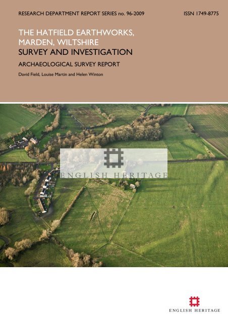
survey and investigation - English Heritage
survey and investigation - English Heritage
survey and investigation - English Heritage

You also want an ePaper? Increase the reach of your titles
YUMPU automatically turns print PDFs into web optimized ePapers that Google loves.
RESEARCH DEPARTMENT REPORT SERIES no. 96-2009 ISSN 1749-8775<br />
THE HATFIELD EARTHWORKS,<br />
MARDEN, WILTSHIRE<br />
SURVEY AND INVESTIGATION<br />
ARCHAEOLOGICAL SURVEY REPORT<br />
David Field, Louise Martin <strong>and</strong> Helen Winton
Research Department Report Series 96-2009<br />
The Hatfield earthworks, Marden, Wiltshire<br />
Survey <strong>and</strong> Investigation<br />
David Field, Louise Martin, Helen Winton<br />
NGR: SU 0907 5818<br />
© <strong>English</strong> <strong>Heritage</strong><br />
ISSN 1749-8775<br />
The Research Department Report Series incorporates reports from all the specialist teams within<br />
the <strong>English</strong> <strong>Heritage</strong> Research Department: Archaeological Science; Archaeological Archives;<br />
Historic Interiors Research <strong>and</strong> Conservation; Archaeological Projects; Aerial Survey <strong>and</strong><br />
Investigation; Archaeological Survey <strong>and</strong> Investigation; Architectural Investigation; Imaging, Graphics<br />
<strong>and</strong> Survey, <strong>and</strong> the Survey of London. It replaces the former Centre for Archaeology Reports<br />
Series, the Archaeological Investigation Report Series <strong>and</strong> the Architectural Investigation Report<br />
Series.<br />
Many of these are interim reports which make available the results of specialist <strong>investigation</strong>s in<br />
advance of full publication. They are not usually subject to external refereeing, <strong>and</strong> their<br />
conclusions may sometimes have to be modified in the light of information not available at the<br />
time of the <strong>investigation</strong>. Where no final project report is available, readers are advised to consult<br />
the author before citing these reports in any publication. Opinions expressed in Research<br />
Department reports are those of the author(s) <strong>and</strong> are not necessarily those of <strong>English</strong> <strong>Heritage</strong>.<br />
Note that web versions of these reports have images of reduced quality for ease of dissemination.<br />
Requests for further hard copies, after the initial print run, can be made by emailing:<br />
Res.reports@english-heritage.org.uk<br />
or by writing to:<br />
<strong>English</strong> <strong>Heritage</strong>, Fort Cumberl<strong>and</strong>, Fort Cumberl<strong>and</strong> Road, Eastney, Portsmouth PO4 9LD<br />
Please note that a charge will be made to cover printing <strong>and</strong> postage.<br />
© ENGLISH HERITAGE 96 - 2009
SUMMARY<br />
This report chronicles the first stage of an integrated inter-disciplinary <strong>survey</strong> of the henge<br />
enclosure <strong>and</strong> related earthworks at Marden, Wiltshire, otherwise referred to as the<br />
Hatfield Earthworks. Using ground, geophysical <strong>and</strong> aerial <strong>survey</strong>, it has produced fresh<br />
information about this little known Neolithic monument. Much of the site has been<br />
carefully levelled at some time in the past <strong>and</strong> is covered by ridge <strong>and</strong> furrow cultivation<br />
marks. Despite this, the bank <strong>and</strong> ditch of the main enclosure remain in good part as<br />
earthworks <strong>and</strong> are revealed as discontinuous, while the location of the Hatfield Barrow,<br />
recorded as being levelled in the early years of the 19 th century, has been located, as has a<br />
second circular enclosure, also previously thought to have been destroyed.<br />
CONTRIBUTORS<br />
The Geophysical fieldwork was undertaken by Neil Linford, Paul Linford, Andy Payne <strong>and</strong><br />
Louise Martin together with Sam Cheyney (Leicester University). Preliminary processing of<br />
the caesium magnetometer <strong>survey</strong>s was conducted by Neil Linford <strong>and</strong> Paul Linford.<br />
Earthwork <strong>survey</strong> <strong>and</strong> analysis was carried out by David Field <strong>and</strong> Deborah Cunliffe<br />
assisted by Mark Bowden <strong>and</strong> Trevor Pearson, while aerial <strong>survey</strong> was carried out by<br />
Helen Winton.<br />
ACKNOWLEDGEMENTS<br />
Many thanks go to Phillipa Carpenter, James Hues <strong>and</strong> Diane Oakley for access to their<br />
l<strong>and</strong> <strong>and</strong> permission to <strong>survey</strong> in their respective fields. Sian Williams kept observation of<br />
the monument alive with regular reports to the Avebury Archaeological Research Group<br />
<strong>and</strong> she provided much helpful assistance <strong>and</strong> advice <strong>and</strong> greatly facilitated access to the<br />
various holdings on site. Inspectors of Ancient Monuments, Phil McMahon <strong>and</strong> Shane<br />
Gould took a keen interest throughout. Ed Carpenter <strong>and</strong> Jim Leary made helpful<br />
comments regarding the site <strong>and</strong> its hinterl<strong>and</strong>.<br />
ARCHIVE LOCATION<br />
National Monuments Record, Kemble Drive, Swindon, Wiltshire SN2 2GZ.<br />
DATE OF SURVEY<br />
The geophysical field work was undertaken between 21-25 th April 2008, 23-27 th March<br />
<strong>and</strong> 27 th April – 1 st May 2009. Earthwork <strong>survey</strong> was carried out in April <strong>and</strong> May 2009<br />
<strong>and</strong> aerial <strong>survey</strong> in 2008-9 as part of a wider <strong>survey</strong> of the Pewsey Vale.<br />
CONTACT DETAILS<br />
David Field NMRC, Kemble Drive, Swindon, Wiltshire SN2 2GZ<br />
email david.field@english-heritage.org.uk. Tel: 01793-414901<br />
Louise Martin Fort Cumberl<strong>and</strong>, Fort Cumberl<strong>and</strong> Road, Portsmouth<br />
email louise.martin@english-heritage.org.uk. Tel: 023 9285 6760<br />
Helen Winton NMRC, Kemble Drive, Swindon, Wiltshire SN2 2GZ<br />
Email helen.winton@english-heritage.org.uk. Tel: 01793-414879<br />
© ENGLISH HERITAGE 96 - 2009
Frontispiece: The Hatfield Earthworks, Marden, Wiltshire.<br />
© ENGLISH HERITAGE 96 - 2009
CONTENTS<br />
LIST OF FIGURES..............................................................................................................................i<br />
INTRODUCTION .......................................................................................................................... 1<br />
GEOLOGY........................................................................................................................................ 4<br />
LANDSCAPE HISTORY ................................................................................................................ 5<br />
ARCHAEOLOGICAL BACKGROUND.................................................................................. 13<br />
THE EARTHWORKS ...................................................................................................................20<br />
GEOPHYSICAL SURVEY............................................................................................................. 27<br />
Magnetometer <strong>survey</strong> ...............................................................................................................27<br />
Earth resistance <strong>survey</strong>.............................................................................................................33<br />
ANALYSIS OF AERIAL PHOTOGRAPHS............................................................................... 40<br />
The henge enclosure.................................................................................................................40<br />
The Beechingstoke/Marden environs ....................................................................................45<br />
Aerial <strong>survey</strong> in the Vale of Pewsey....................................................................................... 47<br />
DISCUSSION..................................................................................................................................49<br />
The henge enclosure.................................................................................................................49<br />
The interior.................................................................................................................................53<br />
The circles ...................................................................................................................................54<br />
Context........................................................................................................................................58<br />
Location........................................................................................................................................60<br />
The wider vale ............................................................................................................................64<br />
REFERENCES..................................................................................................................................66<br />
APPENDIX 1 EXTRACT FROM SALISBURY JOURNAL....................................................71<br />
APPENDIX 2 CUNNINGTON MANUSCRIPTS................................................................... 72<br />
APPENDIX 3 METHOD .............................................................................................................. 82<br />
Earthwork <strong>survey</strong>.......................................................................................................................82<br />
Aerial <strong>survey</strong> ...............................................................................................................................82<br />
Geophysical <strong>survey</strong>....................................................................................................................84<br />
© ENGLISH HERITAGE 96 - 2009
LIST OF FIGURES<br />
Figure 1 Location map.. .................................................................................................................. 3<br />
Figure 2 Map showing the parish boundaries around the Hatfield earthworks.. .............. 6<br />
Figure 3 Detail from a map of Beechingstoke prepared by Robert Speakman in 1726... 9<br />
Figure 4 Philip Crocker’s plan of 1806 published in the second volume Richard Colt<br />
Hoare’s Ancient Wiltshire published in 1821..................................................................11<br />
Figure 5 Extract from the Ordnance Survey 1st edition 25” map published in 1887... 12<br />
Figure 6 Hatfield earthworks. A sketch plan from Gough’s edition of Camden’s<br />
Britannia published in 1806..................................................................................................14<br />
Figure 7 Contour plan of the Marden henge prepared by Wainwright et al (1971)......19<br />
Figure 8 The bank in the north-west sector. ..........................................................................20<br />
Figure 9 The earthworks at Marden.. ....................................................................................... 22<br />
Figure 10 The earthworks around the northwest entrance. ..............................................23<br />
Figure 11 Earthworks on the eastern side of the enclosure................................................ 24<br />
Figure 12 The site of the Hatfield Barrow.. ............................................................................. 25<br />
Figure 13 The Southern Circle. .................................................................................................26<br />
Figure 14 Location of the geophysical <strong>survey</strong> areas...............................................................28<br />
Figure 15 Magnetometer results...............................................................................................29<br />
Figure 16 Graphical summary of significant magnetometer anomalies ............................ 30<br />
Figure 17 Square array earth resistance <strong>survey</strong>.....................................................................34<br />
Figure 18 Twin probe earth resistance <strong>survey</strong> .......................................................................35<br />
Figure 19 Graphical summary of earth resistance anomalies ..............................................36<br />
Figure 20 Marden henge before the construction of Hatfield Farmhouse <strong>and</strong> the row of<br />
houses “Hatfields” . ...............................................................................................................41<br />
Figure 21 Ordnance Survey aerial photograph showing the henge enclosure <strong>and</strong><br />
Hatfield Barrow<br />
Figure 22 Archaeological features visible on aerial photographs in <strong>and</strong> around Marden<br />
henge.........................................................................................................................................43<br />
Figure 23 Lidar jpegs for the area of the henge enclosure. ................................................44<br />
Figure 24 The barrow cemetery <strong>and</strong> henge close to Marden <strong>and</strong> the large barrow<br />
cemetery south-east of Wilsford........................................................................................ 46<br />
Figure 25 Comparison of the earthwork, magnetometer <strong>and</strong> aerial <strong>survey</strong> results. ..... 51<br />
Figure 26 Comparison of the earthwork, earth resistance <strong>and</strong> aerial <strong>survey</strong> results....52<br />
Figure 27 The level interior with ditch <strong>and</strong> bank in the middle distance.......................... 61<br />
Figure 28 The ditch in the east still carrying water in April 2009. ..................................... 62<br />
Figure 29 The floodplain with the henge enclosure on the river bluff beyond. .............. 62<br />
Figure 30 The henge enclosure in relation to the local topography .................................64<br />
Figure 31 Caesium magnetometer <strong>survey</strong> of Areas A-B .....................................................88<br />
Figure 32 Caesium magnetometer <strong>survey</strong> of Areas C-F.......................................................89<br />
Figure 33 Caesium magnetometer <strong>survey</strong> of Areas G-H .....................................................90<br />
Figure 34 Square array earth resistance <strong>survey</strong> of Area A ..................................................91<br />
Figure 35 Square array earth resistance <strong>survey</strong> of Areas G-H............................................92<br />
Figure 36 Twin Probe Earth Resistance Survey Of Area B..................................................93<br />
Figure 37 Twin probe earth resistance <strong>survey</strong> of areas D-E ...............................................94<br />
Figure 38 Twin probe earth resistance <strong>survey</strong> of Areas G-H .............................................95<br />
© ENGLISH HERITAGE 96 - 2009
INTRODUCTION<br />
The Neolithic henge enclosure at Marden, Wiltshire is the largest earthwork monument<br />
of its type in the British Isles <strong>and</strong>, located almost equidistant between the contemporary<br />
components of the World <strong>Heritage</strong> Site at Stonehenge <strong>and</strong> Avebury, it occupies a<br />
particularly intriguing position within Wessex as a whole. Concern in recent years over<br />
management <strong>and</strong> conservation has led the Inspector of Ancient Monuments to request<br />
the provision of modern plans, interpretations <strong>and</strong> other data on which to base decisions<br />
concerning the future of the site <strong>and</strong> this was emphasised when a ditch was cut through<br />
potential archaeological deposits without Scheduled Monument Consent in 2006 (Leary<br />
2007). In contrast to the Wiltshire downl<strong>and</strong> to both north <strong>and</strong> south, the area is one<br />
that has escaped archaeological attention in recent times both on the ground <strong>and</strong> from<br />
the air. This report helps to fill that gap <strong>and</strong> outlines an initial response to the<br />
management concerns. It is the first stage in a multi-team <strong>survey</strong> <strong>and</strong> <strong>investigation</strong><br />
programme of targeted initiatives designed to improve knowledge of the site <strong>and</strong> its<br />
surroundings (Field et al 2008, 6). The non-invasive <strong>survey</strong> has revealed a significant<br />
amount of new data about the site <strong>and</strong> allows it to be better placed alongside the three<br />
other great Neolithic henge enclosure sites in the British Isles, Avebury <strong>and</strong> Durrington<br />
Walls in Wiltshire, <strong>and</strong> Mount Pleasant in Dorset. The results highlight areas where a<br />
second phase of <strong>investigation</strong> involving environmental coring <strong>and</strong> focussed small scale<br />
excavation might concentrate <strong>and</strong>, along with re-examination of the excavation archive,<br />
including C14 dating of appropriate material, this will profitably reveal important<br />
information <strong>and</strong> yield significant benefits, not least regarding the chronology of the site <strong>and</strong><br />
its relationship with Silbury Hill, Stonehenge <strong>and</strong> the contemporary henge enclosures.<br />
The site, generally known in literature as the Marden Henge or Marden earthworks<br />
(Wainwright et al 1971: Stevenson 1975) is referred to as the Hatfield Enclosure by<br />
<strong>English</strong> <strong>Heritage</strong> (e.g. <strong>English</strong> <strong>Heritage</strong> 2009, 102) <strong>and</strong> comprises a series of large<br />
earthworks loosely arranged as an enclosure but open on the south side adjacent to the<br />
floodplain of the River Avon. It is situated within the Vale of Pewsey in central Wiltshire<br />
<strong>and</strong>, formerly in Beechingstoke, currently lies in Marden Parish. It is located at Ordnance<br />
Survey NGR SU 0907 5818 <strong>and</strong> is listed in the National Monument Record as NMR No<br />
SU 05 NE 3 (UID 215179), while a large barrow, the Hatfield Barrow, said to be second<br />
only in size to Silbury Hill, but now levelled, along with a further circular earthwork<br />
sometimes described as a small henge or saucer barrow <strong>and</strong> recorded as lying within it,<br />
are recorded as NMR no SU 05 NE 2 (UID 215176) <strong>and</strong> NMR SU 05 NE 4 (UID<br />
215182) respectively. Other monument reference numbers are presented in the<br />
concordance below.<br />
© ENGLISH HERITAGE 1 96-2009
Site NMR SMR Scheduled<br />
Monument<br />
No<br />
Henge SU05NE3 Wilts 26707Wilts<br />
100 338<br />
Hatfield SU05NE2 Wilts 26707Wilts<br />
Barrow<br />
600 338<br />
??Barrow/henge SU05NE4 Wilts<br />
601<br />
Grinsell Goddard EH<br />
Property<br />
No<br />
268<br />
Beechingstoke<br />
1<br />
Beechingstoke<br />
1<br />
Beechingstoke<br />
1a<br />
The site itself is in multiple ownership, the major part of the site being owned by four<br />
parties, including a Housing Association, while a small portion of the bank is in <strong>English</strong><br />
<strong>Heritage</strong> guardianship. The road verges are the responsibility of the Wiltshire County<br />
Council Highways Department.<br />
© ENGLISH HERITAGE 2 96-2009
Figure 1 Location map showing the spatial relationship of the henge-enclosures at<br />
Avebury (top), Durrington Walls (bottom) with Marden (centre) situated between them.<br />
The two former sites are components of the Stonehenge <strong>and</strong> Avebury World <strong>Heritage</strong><br />
Site. Grid lines mark 10km distances. © Crown Copyright. All rights reserved. <strong>English</strong><br />
<strong>Heritage</strong> 100019088. 2009.<br />
© ENGLISH HERITAGE 3 96-2009
GEOLOGY<br />
The site lies centrally within the Vale of Pewsey, a west to east oriented valley, some 5 to<br />
7km wide, that is situated between the respective escarpments of the Salisbury Plain <strong>and</strong><br />
Marlborough Downs chalk massifs. Within the Vale, a bench of Lower Chalk fringes the<br />
base of the respective chalk escarpments, but elsewhere the underlying Upper Greens<strong>and</strong><br />
is widespread <strong>and</strong> forms the greater part of the l<strong>and</strong> in Beechingstoke parish (British<br />
Geological Survey 1967). The s<strong>and</strong> is easily weathered <strong>and</strong> eroded except where<br />
contained <strong>and</strong> revetted, or retained by hedges, but hard seams of cemented s<strong>and</strong>stone at<br />
some levels provide local building material as used, for example, in local churches.<br />
The site itself occupies a sloping terrace-like spur of the Upper Greens<strong>and</strong>, set hard<br />
against a floodplain, here less than 200m wide, that provides an alluvium strip either side<br />
of a small stream. On the south bank a large spread of gravel, representing an ancient<br />
level of the river, extends downstream between the villages of Marden <strong>and</strong> Rushall. Its<br />
modern counterpart, a branch of the Avon, rises nearby, close to Beechingstoke village<br />
<strong>and</strong> is supplemented by a number of small rivulets fed by springs in the immediate locality.<br />
Aside from the chalk remnants that appear as physical isl<strong>and</strong>s, isl<strong>and</strong> place-names such as<br />
Patney <strong>and</strong> Pewsey emphasise that much of the area is low-lying <strong>and</strong> provide a reminder<br />
that the northern part of Beechingstoke Parish lay on the edge of Cannings Marsh.<br />
Immediately north <strong>and</strong> overlooking the site is a slack-profiled but prominent knoll.<br />
Although not mapped as such, this may be a remnant of Lower Chalk as a number of<br />
such chalk remnants, for example, to the west at Patney, or further north-east towards<br />
Broad Street <strong>and</strong> Woodborough, occur in the Vale.<br />
Covering both Greens<strong>and</strong> <strong>and</strong> Lower Chalk in the Vale are soils of the Ardington Series<br />
(Soil Survey Engl<strong>and</strong> <strong>and</strong> Wales 1983) a mixture of cretaceous <strong>and</strong> glauconitic s<strong>and</strong>, loam<br />
<strong>and</strong> clay. Where developed over the Upper Greens<strong>and</strong> these are generally deep, light,<br />
loamy <strong>and</strong> well-drained <strong>and</strong> are considered appropriate for both cereal cultivation <strong>and</strong><br />
dairying (ibid). All fields containing earthworks were, however, under grass at the time of<br />
<strong>survey</strong>, with areas to the south-east used as grazing for horses.<br />
© ENGLISH HERITAGE 4 96-2009
LANDSCAPE HISTORY<br />
The site lies immediately adjacent to a small stream that forms the upper reaches of one<br />
source of the River Avon <strong>and</strong> which formerly provided the parish division between<br />
Marden <strong>and</strong> Beechingstoke. Upstream as far as Beechingstoke it is a mere brook, beyond<br />
which water collects from a number of field drains <strong>and</strong> springs to serve the river. Despite<br />
its popular name, the site of the henge lay on the Beechingstoke bank <strong>and</strong> was depicted<br />
as being in that parish on early editions of Ordnance Survey maps. The parish, that is –<br />
Beechingstoke, is a small one <strong>and</strong> along with its neighbour, Patney, st<strong>and</strong>s out from others<br />
in the area in not having boundaries arranged in a 'strip' fashion that incorporated a crosssection<br />
of soil types up on to the neighbouring chalk massifs. The origin of the parish is<br />
obscure, but Beechingstoke was referred to as Stoke in 779 <strong>and</strong> Bichenstoc in 1086. The<br />
term Stoke or ‘stoc’ is thought to mean ‘place’ with some special characteristic attached,<br />
possibly indicating the presence of a monastic cell (Ekwall 1974, 443). The name often<br />
occurs in places situated at a distance from the main settlement <strong>and</strong> is sometimes<br />
considered to signify an outlying dairy farm. It is conceivable that in this instance it referred<br />
specifically to the area of the earthworks which lay at a distance from the village centre.<br />
The ‘Bichen’ element is quite unusual, referring to ‘bitches’, that is, female dogs, wolves or<br />
foxes, although it could be a derogatory term for a settlement of women as suggested by<br />
Gover et al (1939, 318-9). Alternatively, given the monastic interpretation, disparaging<br />
reference to an early cell of nuns might be a possibility.<br />
The potential influence of Romano-British settlement appears to be slight. Pottery of this<br />
period was found at Broad Street on the eastern edge of the parish (Wilkinson 1859-65)<br />
<strong>and</strong> it is conceivable that the ‘street’ in the place-name refers to a paved roadway, but<br />
perhaps the main focus of activity lay opposite the henge on the Marden bank of the<br />
stream where Richard Colt Hoare (1821, 4-7) recorded the presence of a great deal of<br />
‘British’ pottery from the fields <strong>and</strong> the area was described by him as the site of a ‘British<br />
Village’ a term that he applied to Romano-British settlements on Salisbury Plain.<br />
The manor of Beechingstoke was held by St Mary's of Shaftesbury in 1086 <strong>and</strong>, compared<br />
to others in the Vale, was a relatively small estate. The precise location of settlement at<br />
the time is not clear <strong>and</strong> the main feature that attracted the attention of the Conqueror’s<br />
tax inspectors appears to have been a mill presumably set somewhere along the stream<br />
<strong>and</strong> unlikely to be that presently at Marden. No woodl<strong>and</strong> is mentioned <strong>and</strong> a lack of pigs<br />
might be expected, but the 28 acres of meadow <strong>and</strong> 40 of pasture must in some measure<br />
reflect l<strong>and</strong>-use, which was presumably based on stock farming. Some cultivation took<br />
place, however, since there was sufficient l<strong>and</strong> in lordship for 5 ploughs <strong>and</strong> more for the<br />
6 villagers <strong>and</strong> six cottagers with their three ploughs (Thorn & Thorn 1979, 12.1) <strong>and</strong><br />
overall it is likely that a mixed, self-sufficient, agrarian regime existed within the parish.<br />
Settlement appears to have been dispersed, with hamlets at Broad Street, Bottlesford<br />
(formerly Botwell), Puckshipton <strong>and</strong> Beechingstoke itself, perhaps not surprisingly given<br />
the low-lying nature of the topography <strong>and</strong> the myriad of brooks, streams <strong>and</strong> springs that<br />
© ENGLISH HERITAGE 5 96-2009
are key to local l<strong>and</strong> use. The strip of alluvium bordering the stream at Marden is now<br />
characterised by unused water meadows, but in the past the industry of this zone may<br />
have been keenly felt with osier <strong>and</strong> withy beds competing for space alongside industries<br />
based around the mills. The parish was divided into two main estates. Beechingstoke<br />
proper, which at some point coalesced around a Norman church set near the north-west<br />
corner of the parish boundary <strong>and</strong> which occupied the headwater drainage of the Avon,<br />
while Puckshipton covered the southern part of the parish (Stevenson 1975). There was a<br />
common open field, Stoke Field, which these settlements shared <strong>and</strong> which appears to<br />
have been largely enclosed by private agreement in 1599. Further, Parliamentary<br />
enclosure occurred in 1793 with both Beechingtoke <strong>and</strong> Puckshipton manors receiving<br />
allotments (Stevenson 1975, 17). Old enclosures lay to the north of the Pewsey-<br />
Woodborough Road in 1793 <strong>and</strong> further open fields, including Gold Hill or 'Goldhyll'<br />
(Gover et al 1939, 501), a place-name that might imply the presence of a plundered<br />
barrow, situated to the north-east of Puckshipton House, appear to have been cultivated<br />
in the triangle formed by Broad Street, Puckshipton Lane <strong>and</strong> the Patney-Woodborough<br />
Road in the late 17th <strong>and</strong> early 18th centuries (Stevenson 1975, 17).<br />
Figure 2 Map showing the parish boundaries around the Hatfield earthworks. The red line<br />
depicts the former parish boundary when the earthworks were in Beechingstoke parish.<br />
The name Pukeshepene (Puckshipton, potentially meaning Puck’s sheep pen) occurs for<br />
the first time in 1303 (Gover et al 1939, 318-9) <strong>and</strong> appears to refer to a mischievous<br />
goblin or evil spirit. It is possible that the name could have some mythological connection<br />
© ENGLISH HERITAGE 6 96-2009
with the earthworks in question as they border on the Puckshipton estate. The manor<br />
was acquired by Corpus Christi College, Oxford in 1516, who managed it, often by subletting,<br />
until 1953 when it was sold off. Tenant farmers during that time included the Miles<br />
[1534-1582]; Raymond [1616-1719]; Dicker [1736-90]; <strong>and</strong> Gilbert families [1790-1849];<br />
any or all of whom may have been instrumental in l<strong>and</strong> improvements, drainage <strong>and</strong><br />
cultivation. It was probably Miles, for example, who was responsible for the Alder Bed<br />
noted in 1609 <strong>and</strong> subsequently Joseph Gilbert who laid out water-meadows over some<br />
12 acres of the Avon floodplain (Stevenson 1975, 16-17) <strong>and</strong> presumably he who was<br />
responsible for the two Osier Beds present in 1834, one of which was referred to as<br />
Osier Bed Bank.<br />
The Puckshipton estate centre lay a little over 0.5km to the east of the Hatfield<br />
earthworks not far from the present Puckshipton House. An early estate map, Robert<br />
Speakman’s map of Beechingstoke of 1726 (Corpus Christi College Oxford Map 328)<br />
illustrates a 'New House' along with its approach avenue to the north-east <strong>and</strong> this was<br />
also marked on Andrews' <strong>and</strong> Dury's small scale Map of Wiltshire of 1773 (WANHS<br />
1952).<br />
The earthworks in question, however, lie on a parcel of l<strong>and</strong> to the south of the<br />
Puckshipton estate, evidently an isolated <strong>and</strong> divorced parcel of Beechingstoke manor.<br />
This is clear from a series of deeds <strong>and</strong> accompanying maps of the early <strong>and</strong> midnineteenth<br />
century. No buildings were present <strong>and</strong>, given the shared nature of Stoke<br />
Field, it is not immediately clear from which location they were farmed. They lay within<br />
the ownership of the Bishop of Winchester, but the copyhold was held by local man<br />
Joseph Hayward, while 'A <strong>survey</strong> <strong>and</strong> valuation of estates in the Parish of<br />
Beechingstoke….' (Hampshire Record Office 11M59/E2/59602) carried out in 1814<br />
indicated that it had been passed to his son, Richard. The situation was confirmed in 1849<br />
with a deed of enfranchisement in return for an annual rent of £116 (Hampshire Record<br />
Office 21M57T155) that incorporated the 'rights of soils <strong>and</strong> mines <strong>and</strong> minerals or<br />
quarries under the said l<strong>and</strong>s' <strong>and</strong> included a map of the holding. Following Hayward's<br />
death the l<strong>and</strong> was conveyed to the Earl of Normanton in March 1865 (Hampshire<br />
Record Office 21M57T155).<br />
The Hatfield Barrow is depicted for the first time on Robert Speakman's 1726 map,<br />
where it appears to be topped with a bush or tree (Fig 3). Barrows were occasionally<br />
adapted as prospect mounds for gr<strong>and</strong> houses or parks <strong>and</strong> the Hatfield Barrow is<br />
obviously a significant enough feature in this l<strong>and</strong>scape to be marked on the estate map.<br />
However, it does not seem to have any obvious relationship, such as a linking carriage<br />
drive, with the parkl<strong>and</strong> around Puckshipton House, which is depicted with radiating treelined<br />
avenues nor, given its connection with Beechingstoke Manor, would one expect it.<br />
Despite the mapping there is some uncertainty concerning the depiction of the highway. It<br />
is possible that its position shifted over time. The two constant features in terms of traffic<br />
movement were the position of the bridge at Marden <strong>and</strong> the hill to the north-east<br />
© ENGLISH HERITAGE 7 96-2009
around which the road is likely to have taken a course of least difficulty. The bridge at<br />
Marden was present <strong>and</strong> evidently railed by 1609 (Corpus Christi KB 4/7) <strong>and</strong> will have<br />
focussed <strong>and</strong> attracted traffic. A single route is depicted crossing the area from north-east<br />
to south in 1638 (‘Map of Puckshipton’, Wilts History Centre x3/47) <strong>and</strong> this led across<br />
the stream to 'Weddenton Common'. This track evidently lay to the east of the present<br />
road <strong>and</strong> its course is likely to have utilized (or caused) the gap through the earthworks in<br />
the east, its diverted course being depicted as a dashed line in 1839 (Wilts History Centre<br />
T/A Beechingstoke) <strong>and</strong> fossilised today by a footpath. The present roadway was certainly<br />
present in 1726 as it appears on Speakman’s map of that date, but it is not clear whether<br />
it was established as a result of an Inclosure agreement or indeed exactly when it came<br />
into use. It is conceivable that the trackway depicted in 1638, presumably a traditional<br />
right of way, was moved to the west in order to allow cultivation of the Hatfield Barrow<br />
(with its fertile soil) <strong>and</strong> the surrounding area. Whether the new road utilized a preexisting<br />
gap or entrance through the earthworks is unclear, but certainly there is a change<br />
in its orientation at this point. Certainly by 1840 the ‘road to Marden was mire <strong>and</strong> ye<br />
ford at Marden bridged over ….when the roads of the Kennett <strong>and</strong> Amesbury Trust were<br />
made’ [presumably the old bridge had fallen into disrepair] (Wilkinson 1859-65). A third<br />
trackway utilised the north entrance through the earthworks from at least 1839 (Wilts<br />
History Centre T/A Beechingstoke) <strong>and</strong> joined the others en route to the bridge in the<br />
south. The antiquity of this is not clear but it is not depicted on the earlier mapping.<br />
The location later referred to as ‘Hatfield’ was not mentioned as being among the arable<br />
in a terrier of 1601 (Corpus Christi, Oxford KB 4/2) <strong>and</strong> the area is described as ‘Hatfyld<br />
Comon’ in a <strong>survey</strong> of Puckshipton carried out in 1609 (Corpus Christi, Oxford KB4/7). It<br />
is conceivable, therefore, that the l<strong>and</strong> around the earthworks may have been waste<br />
before the 17 th century. Part of the floodplain was described as Lammas l<strong>and</strong> in a terrier<br />
of 1691(Corpus Christi, Oxford KB4/11). The same document refers to ‘Wall mead’ on<br />
the floodplain immediately below the western arm of the earthworks (‘Wall’ is a name<br />
frequently applied to ancient earthworks in Wiltshire, for example at Avebury, Amesbury<br />
<strong>and</strong> famously Durrington, as distinct from the usual ‘Welsh’ or British settlement<br />
interpretation) <strong>and</strong> ‘Hayditch’, in the area of the north-west entrance, bounded by<br />
‘Hattfield’ in the east.<br />
The ‘field’ element in the name might imply an early ab<strong>and</strong>oned attempt at cultivation.<br />
The earliest record of the term appears to be in the terrier of 1601(Corpus Christi,<br />
Oxford KB 4/2. By 1638, when a sub-square enclosure had been established within ‘The<br />
longe grounde called greate Hatfield’ (‘Map of Puckshipton’ <strong>survey</strong>ed by Edward May<br />
Wilts History Centre X3/47) <strong>and</strong> this <strong>and</strong> other field boundaries appear to have been<br />
well established by 1766 (‘Plan of the Manor of Stert……’ Wiltshire History Centre<br />
X3/48). Despite errors of <strong>survey</strong>ing in the 1638 map, map regression suggests that the<br />
inclosure may represent that plot known as 'Barrow Hatfield' on later maps (Hampshire<br />
Record Office 21M57T155). The presence of arable is expressly mentioned in 1671<br />
(Stevenson 1975, 18). Later mapping, however, seems to indicate that cultivation may<br />
have been curtailed <strong>and</strong> the early enclosures were removed, for the map <strong>survey</strong>ed in<br />
1726 by Robert Speakman (Corpus Christi, Oxford Map 328) mentioned above refers to<br />
the whole area as ‘Hatfield Grounds’ as though it were open ground, even parkl<strong>and</strong>.<br />
© ENGLISH HERITAGE 8 96-2009
Figure 3 Detail showing Hatfield Grounds, from a map of Beechingstoke prepared by<br />
Robert Speakman in 1726. Note the height of the bell or pear shaped mound depicted to<br />
the east of the road, clearly a feature of some considerable relevance to the l<strong>and</strong><br />
<strong>survey</strong>ors. The mound appears to be surrounded by a ditch <strong>and</strong> has what appears to be a<br />
tree or bush growing on the summit. Puckshipton House is just out of picture in the east<br />
but part of its tree lined avenue is visible. Corpus Christi College Map 328. Reproduced<br />
by permission of the President <strong>and</strong> Fellows of Corpus Christi College, Oxford.<br />
The Reverend John Mayo of Beechingstoke wrote to the Society of Antiquaries in 1768<br />
inclosing a description <strong>and</strong> sketch of the site (Gough 1806: Wainwright et al 1971, 182)<br />
<strong>and</strong> complaining about the levelling of part of the henge bank which was presumably so<br />
that it could be more easily cultivated. The destroyed area lay by the north entrance <strong>and</strong><br />
indeed the bank to the west of the entrance is severely denuded today. Writing in 1807<br />
or 1809 William Cunnington indicated that the levelling had taken place about 40 years<br />
earlier <strong>and</strong> was carried out by Mr Haywood Senior of Marden. (Devizes Museum:<br />
Cunnington MSS Book 12, 23: also see Appendix below). This is likely to be Joseph<br />
Hayward who had copyhold of the l<strong>and</strong> (see above). By 1806 both Cunnington <strong>and</strong><br />
Phillip Crocker could note that the interior was ‘intersected by hedges, <strong>and</strong> in<br />
cultivation…’ (Fig 4). The only part of the site to escape this appears to have been the<br />
southern part of the western arm of the earthwork where a plantation had been<br />
established, presumably the origin of the trees that occupy the bank in that sector today.<br />
A <strong>survey</strong> <strong>and</strong> valuation in 1814 (Hampshire Record Office 11M59/E2/59602) for the<br />
Dean <strong>and</strong> Chapter of Winchester listed the enclosures Little Hatfield, Long Hatfield, High<br />
© ENGLISH HERITAGE 9 96-2009
Hatfield, Ch<strong>and</strong>lers Hatfield <strong>and</strong> part of Parker's Hatfield as being in cultivation; the rest of<br />
the latter with fir trees <strong>and</strong> wood. The location of these enclosures can be established<br />
from the later mapping.<br />
A map accompanying the Tithe Apportionment of 1839 (Wiltshire History Centre T/A<br />
Beechingstoke) reflected this partitioning. Wall mead remained, but to the west of the<br />
road was ‘Parkers Hatfield’, <strong>and</strong> to the east ‘Barrow Hatfield’. The surrounding fields<br />
carried variations: ‘High Hatfield’ to the north, ‘Ch<strong>and</strong>ler’s Hatfield’ to the east, <strong>and</strong> ‘Long’<br />
<strong>and</strong> ‘Lower Hatfield’ to the south.<br />
The Hatfield Barrow was also evidently under the plough. In an exchange of letters in<br />
1797 <strong>and</strong> 1798 between William Withering (1741-1799), a physician based in Edgbaston<br />
<strong>and</strong> James Norris of Nonsuch House, Bromham <strong>and</strong> published posthumously by<br />
Withering’s son (Withering1822, 210-248: ref to Marden 236), the latter described the<br />
mound as being in cultivation. ‘The whole of the barrow is at present ploughed over <strong>and</strong><br />
is said to be more fertile than the surrounding field; when the richness of colour <strong>and</strong> the<br />
beautiful undulations of the corn formed an object as pleasing as it was uncommon’. By<br />
1806 its height had decreased considerably as a result of it being in cultivation<br />
(Cunnington MSS, Devizes Museum: Hoare 1821, 5-6) but Cunnington reported that in<br />
1804 the wheat harvested from the barrow produced ‘six Sacks’ [of grain]. Perry’s Corner<br />
in Beechingstoke was said to immortalise the farmer ‘infamous foe ye destruction of<br />
Hatfield Barrow (Wilkinson 1859-65 Beechingstoke portfolio). By 1845, the mound may<br />
have been almost level, for the map accompanying the deed <strong>and</strong> enfranchisement of that<br />
date (Hampshire Record Office 21M57T155) merely depicts a crescentic ditch, the<br />
portion closest to the highway having been filled in.<br />
By 1900 the plantation noted by Cunnington <strong>and</strong> depicted on Crocker’s plan had<br />
matured <strong>and</strong> was presumably being harvested, the Ordnance Survey 25” map indicating<br />
that the bank in the west was known as ‘Hatfield Copse’. It had been extended along the<br />
west bank <strong>and</strong> it may have been this that was responsible for its preservation.<br />
A long rectangular structure, perhaps a chicken shed, depicted as present in 1924, was<br />
joined by others before 1939 to the east of the road in the area now occupied by<br />
Hatfield Farm (Ordnance Survey 25” editions). A small housing estate was then built along<br />
the southern edge of the monument during the latter part of the 1950s with gardens that<br />
encroach on the monument (Stevenson 1975, 15).<br />
© ENGLISH HERITAGE 10 96-2009
Figure 4 Philip Crocker’s plan of the Hatfield earthworks (described as the Marden<br />
entrenchments) mapped in1806 <strong>and</strong> published in the second volume Richard Colt<br />
Hoare’s Ancient Wiltshire published in 1821. The plan was originally oriented to suit the<br />
publication page but for purposes of convenient comparison is here oriented with north<br />
to the top. The Hatfield Barrow was extant when the plan was made, but by the time<br />
that Hoare returned to the site sometime before 1821 it had been levelled. Crocker has<br />
also depicted a second circular feature set to the south of the Hatfield Barrow which is<br />
referred to here as the Southern Circle. Note also that the NNW-SSE oriented roadway<br />
cuts through the bank of the eastern arm of the henge earthwork. Crocker marks a gap in<br />
the earthwork at C, but another further to the south is not annotated.<br />
© ENGLISH HERITAGE 11 96-2009
Figure 5 Extract from the Ordnance Survey 1st edition 25” map published in 1887. Both<br />
the Hatfield Barrow <strong>and</strong> the Southern Circle are represented by symbols <strong>and</strong> marked as<br />
'site of', the implication being that they had been levelled. The road depicted by Crocker<br />
in 1806 (pub 1821) that cut across the eastern arm of the earthwork is now a single<br />
hedgerow while the centre section of the eastern arm is missing in its entirety having been<br />
severed by field boundaries.<br />
© ENGLISH HERITAGE 12 96-2009
ARCHAEOLOGICAL BACKGROUND<br />
There are few early references to the site. Perhaps the earliest is in Edmund Gibson’s<br />
edition of Camden's Britannia (Gibson 1695, 111) in which the place is considered to be<br />
the location of the Battle of Mertune or Merdune that is mentioned in the Anglo-Saxon<br />
Chronicle for the year 871. ‘….For here to this day remain the marks of entrenchments,<br />
<strong>and</strong> the largest barrow in these parts, except Silbury; together with a tradition of a fight,<br />
<strong>and</strong> some great mans’ being buried under the barrow’ (for accounts of the battle which<br />
give no further clue to its location see Garmondsway trans 1975, 70-3).<br />
This account was subsequently referred to in a letter to the Salisbury <strong>and</strong> Winchester<br />
Journal published on Monday December 2 nd , 1776 on the occasion of the intervention<br />
into Silbury Hill, by Colonel Drax <strong>and</strong> the Duke of Northumberl<strong>and</strong> (Appendix 1). Signed<br />
by S.A.S of Old Sarum, the account refers to the Hatfield Barrow before going on to<br />
describe the henge. The barrow ‘is, as I guess, about 30 feet high, <strong>and</strong> of a very large<br />
diameter at the bottom. It is surrounded at a distance with a vast ditch [i.e. the henge<br />
ditch], which like that of Abury has its bank thrown outward; which I think plainly shows<br />
that this intrenchment could not be of the military kind. The area inclosed by this ditch<br />
contains, I imagine, near 40 acres. There is within the same area another barrow of much<br />
smaller dimensions, at the distance of about 150 yards from the great one’. It then<br />
indicates that archaeological material was encountered during attempts to demolish part<br />
of the earthwork ‘ ….There were a great number of stag's horns, some of them of a very<br />
large size found a few years ago in levelling a part of the bank, <strong>and</strong> near the same place<br />
was found a human skeleton. There is great reason to suppose that there is a cavern in<br />
the great barrow, for the top or vortex of it is sunk into a hollow. I have conversed with<br />
old people in the neighbourhood, <strong>and</strong> they all think that it is considerably sunk within their<br />
remembrance’.<br />
Clearly the mound was of a considerable size <strong>and</strong> a prominent l<strong>and</strong>mark, much more so<br />
perhaps than the earthworks of the henge enclosure, for it alone was depicted on the<br />
map <strong>survey</strong>ed in 1726 by Robert Speakman (Corpus Christi College, Oxford Map 328)<br />
<strong>and</strong> subsequently on the much smaller scale Map of Wiltshire prepared by Andrews <strong>and</strong><br />
Dury in 1773 (WANHS 1952). The former depicts a high mound of bell or pear-shaped<br />
profile, surrounded by a ditch <strong>and</strong> with what appears to be a tree or bush growing on the<br />
summit (Fig 3). While the correspondent’s view that there was a collapsed central<br />
feature is entirely feasible, the removal of this tree may alternatively account for the<br />
hollow – <strong>and</strong> earlier barrow robbery could equally be possible.<br />
Gough’s edition of Camden’s Britannia published in 1806 repeats the earlier account, but<br />
adds that the Reverend [John] Mayo had sent a sketch of the site to the Society of<br />
Antiquaries (Gough 1806, 159) <strong>and</strong> incorporated it as an illustration (Fig 6). This depicted<br />
the henge enclosure as circular, with entrances at the north <strong>and</strong> south. Mayo’s account<br />
(Wainwright et al 1971, 182: Gough 1806) described the ditch as being about 15 yards<br />
wide <strong>and</strong> the whole feature as enclosing about 30 acres. In addition, the plan depicted<br />
© ENGLISH HERITAGE 13 96-2009
the location of the Hatfield Barrow <strong>and</strong> Southern Circle <strong>and</strong> estimated the size of the<br />
larger at 70 or 80 yards (64 -73m) in diameter <strong>and</strong> about 50 feet (15m) high. The eastern<br />
ditch terminal of the northernmost henge entrance was indicated as being the location of<br />
where a human skeleton, presumably that later reported in the Salisbury <strong>and</strong> Winchester<br />
Journal (above), was discovered in 1768, ‘supposed by the leg bone to have been six feet<br />
three inches high’. At the same time the legend marked at H the spot where ‘many stag's<br />
horns were found in levelling the bank, but unfortunately H is missing from the drawing.<br />
The antlers were said to be ‘very large, but broken by the workmen in digging out. Mr<br />
Mayo had a piece of one next to the head, which measured nine inches around, <strong>and</strong> was<br />
petrified’.<br />
Figure 6 Hatfield earthworks. A sketch plan from Gough’s edition of Camden’s Britannia<br />
published in 1806.<br />
The site subsequently came to notice as part of Richard Colt Hoare's work on Ancient<br />
Wiltshire. Although it was included in the second of his volumes published in 1821, it<br />
derived from fieldwork carried out by William Cunnington <strong>and</strong> others in 1806-9 who<br />
provided Hoare with the basic data. Hoare had only recently assumed responsibility for<br />
compiling an Inventory of sites in Ancient Wiltshire <strong>and</strong> planned a campaign of<br />
<strong>investigation</strong> that incorporated field <strong>survey</strong>, <strong>investigation</strong> <strong>and</strong> excavation. The team<br />
assembled comprised Phillip Crocker sometimes assisted by his brother Edmund, both<br />
<strong>survey</strong>ors, William Cunnington who had experience of excavating sites in South Wiltshire<br />
<strong>and</strong> his ‘labourers’ Stephen <strong>and</strong> John Parker from Heytesbury. Crocker was first on site<br />
<strong>and</strong> <strong>survey</strong>ed it early in 1806 <strong>and</strong> included the hedgerows <strong>and</strong> field boundaries that<br />
© ENGLISH HERITAGE 14 96-2009
separated the site into portions. He considered the main feature to be the Hatfield<br />
Barrow, which, although ‘much destroyed’ still measured 4 chains (80m) across. He also<br />
informed Cunnington that the local farmers all had views <strong>and</strong> theories about the local<br />
antiquities <strong>and</strong> having been aware of Camden’s account believed that the earthworks<br />
resulted from the Battle of Marden. Cunnington immediately reconnoitred the site <strong>and</strong><br />
informed Hoare that he hoped to cut into the Hatfield Barrow. He evidently did so, for<br />
by May 22 1806, he wrote that he had ‘set Stephen <strong>and</strong> John to dig in this Tumulus to the<br />
depth of seven feet’ (2.1m: Cunnington later recorded the height of the mound at 22½<br />
feet, i.e. just under 7m). This exploratory excavation evidently took just a few hours for he<br />
considered that it would take three men three days to complete satisfactorily but revised<br />
this <strong>and</strong> indicated to Hoare that a proper examination would need four men working at<br />
the site for ten days. The excavation revealed a few ashes <strong>and</strong> charred wood. Cunnington<br />
then arranged for the Parkers to dig in a ploughed field somewhere to the west of the<br />
barrow where they found some ‘very rude British pottery’. This is likely to have been in<br />
the area later occupied by the Hatfield farmhouse <strong>and</strong> its paddocks. Finally, they moved<br />
on to test the Southern Circle <strong>and</strong> dug ‘within the area’ probably in the ditch, to a depth<br />
of 1.8m <strong>and</strong> found ‘charred wood, Ashes <strong>and</strong> British pottery’.<br />
Cunnington described the site to Hoare <strong>and</strong> others in a number of letters that differ in<br />
some of their detail. Much of Cunnington’s description was used verbatim in Hoare’s<br />
(1821) publication but there are aspects that the latter chose to ignore. Since some of<br />
this is of potential archaeological interest the relevant text is transcribed in Appendix II. In<br />
May 1806 he wrote ‘The greater part of this work is so much intersected with hedgerows<br />
that we find much difficulty in examining it. On passing the rivulets near Marden Mill<br />
<strong>and</strong> a small plantation of firs, you reach a fine Vallum without the vast ditch, on running a<br />
line over the former it measured 112 feet—from tracing this Vallum & making as I<br />
conceived proper allowances where it is mutilated, it appears to me to have been<br />
originally of a Crescent form*, having the Water at the junction of two streams for its<br />
base. When in its pristine state & viewed from its stupendous Vallum, the Area rising from<br />
the wide Foss with a fine swell must have had a pleasing effect.<br />
The enormous tumulus called the Hatfield Barrow is on the Eastern Side, this, Silbury Hill<br />
& Marlbro’ form a trio of the largest circular Tumuli in the Kingdom---a line drawn over<br />
our Marden barrow measured 483 feet – viz – measuring from ditch to ditch, although<br />
the height is much diminished from its having been in tillage..... The work at B is very<br />
similar to our Amphitheatre (as some have called it) near Southley Wood±. It has a<br />
circular Vallum without the ditch <strong>and</strong> the area plain <strong>and</strong> of an Oval form…… We dug<br />
into the Area to the depth of six feet <strong>and</strong> found charred wood, Ashes <strong>and</strong> British pottery,<br />
which strengthened my opinion of its being sepulchral, but to have examined this<br />
properly, would have taken up a whole day. When within this work & particularly when<br />
on the great Tumulus, the high ground on the South of the river seems as if connected<br />
with the camp making it a fine Amphitheatre, but on examining all this high ground I could<br />
not perceive the least sign of a Vallum. The area of this work taking the river for the Base,<br />
contains at least 28 acres. I should have observed before that there is an appearance of<br />
© ENGLISH HERITAGE 15 96-2009
two entrances nearly [south] East * [North] west. For what purpose this Work was<br />
erected unless for religion I cannot say – but it is hard after so much labour in the<br />
<strong>investigation</strong> of these things, that at this period we must put up with conjecture…’.<br />
In a later memor<strong>and</strong>um for Hoare, Cunnington provided an annotated sketch plan along<br />
with a full description of the site (Appendix) <strong>and</strong> it was on this that Hoare based his later<br />
published version. The Reverend Charles Mayo, son of John, had written to Cunnington<br />
to persuade him that the earthwork crossed the river, but the latter was not convinced so<br />
Mayo complained to Hoare. ‘Poor Mr Cunnington was I think mistaken in his idea of the<br />
extent of the [bank] mound’, but having carefully investigated the south bank of the river<br />
on three separate occasions Cunnington found no evidence that the earthwork crossed<br />
to the other side <strong>and</strong> was not convinced. Instead, he believed that that enclosure was<br />
bounded in the south along the line of the river bluff. Hoare, however, visited the site <strong>and</strong>,<br />
having noted the British Village on the southern bank, sided with Mayo in the matter.<br />
In 1809 Cunnington undertook further excavations. 'We explored twenty three by<br />
twenty four feet of the floor of the barrow <strong>and</strong> found Ashes Charred Wood <strong>and</strong> some<br />
fragments of burnt bones, also two or three small pieces of Pottery but missed the<br />
Primary Interment. The finding of so many Stags horns, Animal Bones, two small parcels of<br />
burnt human Bones, together with a floor scattered with Ashes, Charred Wood,<br />
etc…convinced me…that the Barrow was Sepulchral'(Devizes Museum Cunnington MSS<br />
Book 12,39). 'We first made a large square section in the centre , but the Tumulus being<br />
composed of S<strong>and</strong> continually slipped down, we afterwards carried our section down in<br />
the form of an inverted cone –when at the depth of about 22 feet we came to the<br />
bottom of the barrow, but from the immense masses of s<strong>and</strong> that still slipped down it<br />
was several days before we could clear about 23 feet by 24 feet of the floor – During the<br />
operation of digging, our discoveries were exactly similar to those we make in many of<br />
our circular Barrows in which cremation has been practiced – from the depth of two or<br />
three feet, from the top of the Tumulus to the bottom, the Men frequently met with<br />
charred wood, Animal bones, the Horns of the Red deer & two small parcels of burnt<br />
human bones, - Upon the floor of the barrow we found Wood Ashes & Charred Wood<br />
more or less over every part that we cleared - & in one place in which we found parcels<br />
of charred wood we picked up some small pieces of human burnt bones……. we were<br />
then very sanguine we were near the interment – among the ashes we found three or<br />
four small pieces of thick rude British pottery, very similar to the rude funeral urns &<br />
several animal bones' At this point he adds a footnote to say that 'a great deal on the<br />
floor had the appearance of rusty iron, a little like the Sutton barrow <strong>and</strong> probably the<br />
same cause'. Hoare (1821, 4-7) added that 'several of our labourers, who most<br />
providently escaped an untimely end by having been called off from their work by Mr<br />
Cunnington at a time when the soil of the barrow appeared sound, but proved otherwise,<br />
by falling in very shortly after the men had quitted their labours.'<br />
In preparation for the publication, Hoare revisited the site <strong>and</strong> commented that 'On<br />
revisiting this ground in the autumn of 1818, I had the unexpected mortification to find<br />
© ENGLISH HERITAGE 16 96-2009
that the great barrow had been completely levelled to the ground, <strong>and</strong> no signs remained<br />
of its previous existence.' Of the Southern Circle 'Its elegant form has been much defaced<br />
by tillage <strong>and</strong> soon will probably be entirely lost.' The drive for intensive cultivation in the<br />
area evidently led directly to demolition of the Hatfield Barrow <strong>and</strong> much of the<br />
remainder of the site faced a similar fate.<br />
It was presumably Charles Mayo, rector of Beechingstoke, who had informed Hoare<br />
about his father’s account of the destruction <strong>and</strong> who wrote a piece for a journal entitled<br />
The Crypt in which he described being ‘informed by a gentleman who has long resided in<br />
the neighbourhood, that it [the henge] originally displayed a lofty tumulus in the centre;<br />
but this was levelled some years ago by a farmer, who then occupied the soil’. Depending<br />
on the composition of the mound the material could have been considered as good<br />
manure. ‘In the course of its demolition he discovered what is usually met with in British<br />
barrows, some human bones <strong>and</strong> over them two horns of deer…’ (Anon 1828, 212-3),<br />
but the description is surprisingly similar to that of the human bones recovered from the<br />
henge bank noted earlier.<br />
John Wilkinson’s notes (referred to above – Devizes: Wiltshire Archaeological Society<br />
Library) prepared sometime between 1859 <strong>and</strong> 1865 included an Appendix on ‘The<br />
Barrow at Hatfield’ among its entries for Beechingstoke. After quoting Camden’s Britannia,<br />
it adds: ‘This barrow stood in Beechingstoke parish, as well as the so called<br />
entrenchments, but close to Marden parish…I cannot say where the entrances to the<br />
entrenchment may have been as it can only be traced in parts, but the exact position of<br />
the barrows has often been pointed out by persons who remember them in the northeast<br />
corner of a field called Barrow Ground. They were levelled in the ---- (unclear) by<br />
one Perry <strong>and</strong> the soil spread over the field leaving no trace whatsoever. What remains of<br />
the (?ditch) <strong>and</strong> Embankment is more in the shape of a horseshoe than a circle,<br />
corresponding more to Brittain’s account who called it an oval. He describes it “In the<br />
vicinity of Marden, is a remarkable barrow called Beechingstoke tumulus or Hatfield<br />
Barrow. It is 35 feet [10.5m] high <strong>and</strong> covers about an acre of ground, near which is a<br />
smaller hillock or barrow, surrounded by a circular [?mound] <strong>and</strong> ye whole encompassed<br />
by an oval vallum or ditch, comprising an area of nearly 30 acres. The vallum on both the<br />
circles is formed by throwing the earth outwards <strong>and</strong> ye smaller tumulus is depressed or<br />
hollowed in the middle. …”.’ Wilkinson incorporated a sketch of the earthworks that<br />
depicted the Hatfield Barrow as being in the north-east corner of a field to the east of the<br />
highway.<br />
The 1 st edition 25” Ordnance Survey map <strong>survey</strong>ed in 1887 depicted a break in the bank<br />
in the south-east but not through the ditch. In addition, it depicted the bank in the east as<br />
extant as far north as a field boundary. The position of the Hatfield Barrow in the northeast<br />
of the field is as described by Wilkinson, but it is curious that the second circular<br />
feature was not <strong>survey</strong>ed. Instead an antiquity cross was placed on the map <strong>and</strong> this may<br />
have led subsequent researchers to think that it had been levelled.<br />
© ENGLISH HERITAGE 17 96-2009
In his analysis of the earthworks at Durrington Walls, O G S Crawford (1929, 58)<br />
indirectly indicated that he thought both Marden <strong>and</strong> Avebury were of a similar character<br />
<strong>and</strong> it was perhaps on this basis that Clark listed Marden as a henge (1936, 50). Atkinson,<br />
however, was less certain <strong>and</strong>, despite the fact that the ditch lay inside the bank, listed it<br />
as a doubtful example (1951, 104).<br />
No further archaeological activity is recorded at the site until Geoffrey Wainwright carried<br />
out some exploratory excavations in 1969 in order to compare the site with the then<br />
recently excavated Durrington Walls henge (Wainwright 1971) <strong>and</strong> to ascertain whether<br />
wooden structures similar to those discovered at Durrington also existed at Marden. He<br />
focused on the northern of two entrances <strong>and</strong> recovered material that confirmed the<br />
Neolithic nature of the site. Trenches placed at the terminals revealed that the ditch was<br />
originally some 2m deep <strong>and</strong> 13.5m wide. A considerable amount of Grooved Ware<br />
pottery, along with antler picks <strong>and</strong> lithic material, was found in these trenches while the<br />
skeleton of a young female was also recovered. Just within the north-east entrance lay a<br />
circular timber structure, while four C14 dates supported the pottery evidence <strong>and</strong><br />
provided a late Neolithic date for construction of the monument.<br />
As part of these works a contour plan of the site was prepared, but a geophysical plot by<br />
Tony Clark was used to assist in portraying the position of the earthworks (Fig 7). The<br />
plan depicted an entrance in the east detected by Clark. Though scant physical records of<br />
the results survive, remains of a large ditch, 28m wide <strong>and</strong> 105m in diameter, were<br />
revealed (Wainwright et al 1971, 182) that was presumed to be the location for the<br />
Hatfield Barrow though it was centred some 70m east of the position recorded by the<br />
Ordnance Survey.<br />
© ENGLISH HERITAGE 18 96-2009
Figure 7 Contour plan of the Marden henge prepared by Wainwright et al (1971).<br />
© ENGLISH HERITAGE 19 96-2009
THE EARTHWORKS<br />
The enclosure comprises an irregular bank with internal ditch that can be separated into<br />
four separate lengths of linear earthwork (Fig 9 <strong>and</strong> frontispiece). These seem to have<br />
been conjoined to form an inverted U-shaped enclosure. As Cunnington recognised,<br />
there appears to have been no earthwork on the south-west <strong>and</strong> south sides <strong>and</strong> instead<br />
the bluff of the River Avon, which continues the line in the circuit, provides a boundary. In<br />
all some 11ha is enclosed within the ditch, using the river bluff as the southern boundary.<br />
This compares with 10ha within the ditch at Durrington Walls. The western part of the<br />
enclosure, the part that faces upstream, curves gently although incorporates an angle<br />
change, while in the east straight lengths are the norm. Aside from that in the north,<br />
which measures 100m, each of these sections appears to be in the region of 120m in<br />
length.<br />
Figure 8 The bank in the north-west sector.<br />
The western half of the enclosure (i.e. that to the west of the highway) is rather better<br />
preserved than the eastern part. This may be as much a result of later l<strong>and</strong>-use as of the<br />
original build. To the east of the highway the enclosure appears to have suffered to a<br />
greater degree <strong>and</strong> the rounded nature of the earthworks indicates that they have<br />
received a greater degree of cultivation. In general, the banks are the most prominent<br />
feature, but they vary enormously between a maximum of 35m wide to the west of the<br />
© ENGLISH HERITAGE 20 96-2009
oad to some 20m wide in the east. There is similar variation in the ditch which reaches a<br />
width of 25m in places.<br />
In the west, the earthworks are situated on a slope down to the floodplain <strong>and</strong> thus<br />
appear less prominent when viewed from the centre of the enclosure. Viewed from the<br />
river, however, the bank would have simply enhanced the rise of the river bluff. The<br />
corresponding ditch measures no more than 0.5m deep taken below the base of the<br />
bank, but has been dug to some 2.7m below the interior. On the higher ground to the<br />
north-east, the earthworks would have been more prominent, but here they have been<br />
severely affected by destruction <strong>and</strong> cultivation. In contrast, the bank in the west has been<br />
protected by tree cover, evidently planted in the early 1800s (see above) <strong>and</strong> this sector<br />
remains the most prominent part of the earthwork. It is likely to be representative of the<br />
rest of the henge enclosure before it suffered from levelling <strong>and</strong> cultivation episodes.<br />
Here, however, it reaches 2m in height <strong>and</strong> appears to have been enhanced at some<br />
stage for 85m of its length with a subsidiary capping some 20 wide. At one point, ‘X’ on<br />
Fig 9, a shallow but significant mound, 22m by 10m, overlies. Set on the bluff flanking the<br />
‘flood plain’ is a trackway that brackets the henge bank on that side. What appears to be a<br />
terminal to the bank abuts the floodplain in the west, but no corresponding terminal can<br />
be identified in the ditch <strong>and</strong> instead it appears to continue into the floodplain.<br />
To the north of the plantation (Fig 10), the bank has been heavily cultivated <strong>and</strong> spread to<br />
c35m in width. In places it is almost level. It is likely that this is a result of more than<br />
cultivation <strong>and</strong> may correspond to the area of levelling described in early accounts when<br />
the human skeleton was discovered. The ditch at this point is simple, the slopes rounded<br />
off by cultivation but it narrows considerably to less than 20m in width as it approaches<br />
the entrance terminal. Here the bank is a little more than 1m in height with the ditch of<br />
similar proportions (Fig 19). Again the overall impression is of a more imposing earthwork<br />
largely because of its location at this point on gently sloping ground. Bank <strong>and</strong> ditch are<br />
here oriented west to east <strong>and</strong> situated at the apex of the inverted U-shaped plan. The<br />
original form, however, has been much disfigured <strong>and</strong> former subtleties obscured by<br />
levelling <strong>and</strong> cultivation. Several plough steps parallel with the bank are visible, while an<br />
access ramp has been scoured to provide easy access from ditch to bank. Further levelling<br />
of the bank has taken place at the east end of this stretch where it is just 0.5m high. The<br />
ditch is similarly diffuse, the terminal in the west well formed but in the east detail is<br />
obscured by the road way <strong>and</strong> it is not clear whether it formerly continued or terminated.<br />
The north entrance leaves a causeway between ditches of 14m <strong>and</strong> although banks are<br />
almost levelled there appears to be a corresponding gap of 20m. The two separate bank<br />
<strong>and</strong> ditch components, that in the west <strong>and</strong> that in the north, meet at an angle at this<br />
point <strong>and</strong> the impression is obtained that it is the gap between them that is utilised for<br />
access rather than the causeway being planned as an original entrance.<br />
Several of the 1969 excavation trenches are still visible on the ground where the<br />
backfilling has compacted <strong>and</strong> these are plotted in Fig 10. Included are two trenches<br />
© ENGLISH HERITAGE 21 96-2009
across the west part of the bank <strong>and</strong> one in the bottom of the northern ditch that are not<br />
depicted on the published plan <strong>and</strong> perhaps relate to a different intervention.<br />
Figure 9 The earthworks at Marden. Inset 1 see Figure 10; 2 see Figure 11; 3 see Figure 12<br />
<strong>and</strong> 4 see Figure 13.<br />
On the east side of the enclosure is a break of some 90m in both bank <strong>and</strong> ditch (Fig 11).<br />
Since the earthwork appeared complete on Crocker’s plan (Fig 4) this must be a result of<br />
levelling at some time during the intervening years. If so, there is no evidence of such<br />
levelling on the ground. One might expect the bulk of the material to be detected if<br />
spread about the same location. That it was not suggests that if the bank was indeed once<br />
present, the material must have been carted away. Some spoil might, of course, have<br />
© ENGLISH HERITAGE 22 96-2009
een returned into the ditch but there is no mounding or evidence of compacted ground<br />
here. Instead a shallow ditch can be traced between the ends of the two banks while<br />
segmented components of a further shallow ditch curve inward to deviate from the<br />
course of the ditch proper. In part, the course of these latter features reflects the recent<br />
agricultural regime, but engraved to a slightly greater depth than the other plough furrows<br />
implying that the underlying ground is softer at this point. This is difficult to explain as<br />
rather than overlying the position of the original ditch it marks the point where any<br />
former bank is expected to be. The inward curving nature of the inner of these two<br />
features is curious in that it departs from the line of the ditch proper, evidently to avoid or<br />
as if it was influenced by some pre-existing feature.<br />
Figure 10 The earthworks around the northwest entrance. The outlines of excavation<br />
trenches, as <strong>survey</strong>ed on the ground, are shown. North is to the top.<br />
East of these, a sinuous linear depression appears to mark the course of a former or<br />
seasonal water feature. It starts abruptly adjacent to the dividing fence line (Fig 11) <strong>and</strong><br />
feeds into a field drain in the south that ultimately discharges into the Avon.<br />
Most of the interior of the henge enclosure is heavily scarred with ridge <strong>and</strong> furrow<br />
cultivation marks. These tend to be reasonably regular in appearance except for where<br />
they sinuously swerve to cut across pre-existing features. Despite this, traces of what is<br />
evidently the Hatfield Barrow were traced in the field to the south-east of the road (Fig<br />
12). Traces of the earthworks here are extremely shallow, little more than 0.1m in depth<br />
© ENGLISH HERITAGE 23 96-2009
<strong>and</strong> repeatedly masked by the overlying cultivation stripes, but enough can be detected to<br />
reveal that the barrow measured c70m in diameter. It is not precisely circular, although<br />
the extent to which the irregularity is the result of the levelling is unclear. There is a<br />
slightly higher tump in the centre measuring 28m by 18m that could be the residue of a<br />
central feature of different material composition, a greater stone component for example.<br />
The surrounding ditch is massive, generally of c15m across but reaching 20m in width in<br />
places <strong>and</strong> is extended in the east to some 25m, ultimately reaching about 100m in<br />
Figure 11 Earthworks on the eastern side of the enclosure. North is to the top. The<br />
dramatic sinuosity of the ridge <strong>and</strong> furrow at this point might hint at further variation in<br />
that area.<br />
The circular enclosure to the south of the Hatfield Barrow (Fig 13) is set almost centrally<br />
within the arms of the U-shaped enclosure <strong>and</strong> immediately on the lip of the bluff above<br />
the floodplain. It comprises a depression some 28m diameter by 0.5m deep with a small<br />
platform or plinth within it that is lower than the surrounding ground surface <strong>and</strong> which is<br />
© ENGLISH HERITAGE 24 96-2009
offset to the north. The depth of the interior is enhanced by a surrounding bank c0.8m<br />
high. At c30m across this provides an overall diameter for the monument of almost 90m.<br />
Figure 12 The site of the Hatfield Barrow. North is to the top.<br />
© ENGLISH HERITAGE 25 96-2009
Figure 13 The Southern Circle. North is to the top.<br />
© ENGLISH HERITAGE 26 96-2009
GEOPHYSICAL SURVEY<br />
Following trials conducted in 2008, magnetometer <strong>and</strong> earth resistance <strong>survey</strong> was<br />
extended to cover areas of ~12.7 <strong>and</strong> ~6.1 hectares respectively. The aim was to<br />
investigate the interior of the henge enclosure for any internal activity but with particular<br />
reference to further characterising the two known internal features. Eight distinct areas<br />
were <strong>survey</strong>ed – lettered A-H (Fig 14) <strong>and</strong> referred to in the text below. Results from<br />
Areas A <strong>and</strong> B were presented previously (Martin 2008), but following the wider <strong>survey</strong><br />
of the henge enclosure the data has been fully incorporated into this report <strong>and</strong> the<br />
sequence of numbering of anomalies has been revised. The outcome is discussed below<br />
<strong>and</strong> in more detail in Appendix 1I1.<br />
Magnetometer <strong>survey</strong><br />
The results of the magnetic <strong>survey</strong> are presented visually in Figure 15 <strong>and</strong> a graphical<br />
summary of the anomalies discussed in the following text, superimposed on the base<br />
Ordnance Survey map data, is provided in Figure 16. The general magnetic response<br />
across all areas is very low with background readings
Figure 14 Location of the geophysical <strong>survey</strong> areas.<br />
© ENGLISH HERITAGE 28 96-2009
Figure 15 Magnetometer results.<br />
© ENGLISH HERITAGE 29 96-2009
Figure 16 Graphical summary of significant magnetometer anomalies.<br />
A broad linear negative magnetic anomaly at [m6] correlates with the position of the<br />
henge ditch in this field. This is a somewhat atypical response for a ditch feature: ditches<br />
are normally recorded as positive magnetic responses due to the silting of more magnetic<br />
top soil into a feature cut into less magnetic subsoil or bedrock. In this instance it is<br />
© ENGLISH HERITAGE 30 96-2009
possible that the depth of the original ditch, recorded as between 2-3.5m during the<br />
excavations at the north entrance (Wainwright 1971, 185-7),has led to an enhanced<br />
magnetic fill from the time of occupation initially silting the ditch, then subsequently being<br />
buried beneath less enhanced greens<strong>and</strong> colluvium from the bank. It is also possible that<br />
the magnetic minerals have been leached out of the soil in the ditch due to some level of<br />
waterlogging: it was noted during the 1969 excavations, to the north <strong>and</strong> on higher<br />
ground, that the water table was reached at a depth of 2.9m, causing waterlogging to 1-<br />
1.9m of deposits (Wainwright 1971, 185) Furthermore, during an initial site visit in January<br />
2008 it was observed that the ground across the ditch was wetter than elsewhere <strong>and</strong> still<br />
held water in March. There were significantly fewer mole-hills in this vicinity: whereas they<br />
were quite prolific elsewhere across the site. Two isolated pit-type anomalies at [m7] are<br />
the only indicators of further anthropogenic activity across this area of the interior of the<br />
henge.<br />
Area B<br />
A further anomaly of extreme readings [m8] possibly branches from [m1] <strong>and</strong> also heads<br />
in the direction of another water trough. Further scatters of ferrous disturbance at [m2b]<br />
are likely to be traces of a previous field boundary noted in Area A. A linear pattern of<br />
anomalies at [m9-10] could relate to plough activity. That at [m10] is similar in spacing<br />
<strong>and</strong> alignment to that at [m3], however, the broader spacing of [m9] may mean they<br />
relate to some other activity, such as drainage.<br />
Several branching positive magnetic linear anomalies [m11] have been recorded to the<br />
east of the henge earthworks. These are likely to be ceramic field drains <strong>and</strong> their<br />
position, converging towards a drainage ditch to the east, further corroborates this<br />
interpretation.<br />
A broad linear negative magnetic anomaly [m12] correlates with another length of the<br />
henge ditch. Here it is bordered by a positive magnetic response that may derive from<br />
the banks. Two strong dipolar responses, [m13-14] have been recorded along the length<br />
of [m12]. These are likely to be from ferrous material <strong>and</strong> could be coincidental in<br />
location; however, they could be from material that has been deliberately deposited in the<br />
ditch. One possible theory is they are short lengths of pipe positioned to assist drainage in<br />
this area, which would be more likely if the ditch were indeed occasionally waterlogged.<br />
An amorphous area of raised magnetic response [m15] is potentially indicative of<br />
anthropogenic activity though no definitive interpretation can be made.<br />
Area C<br />
Faint traces of parallel anomalies [m16] are further evidence of ploughing, but a broad<br />
negative linear anomaly [m17] is a further atypical corollary of the henge enclosure ditch.<br />
© ENGLISH HERITAGE 31 96-2009
Again, as in Area B, a slightly raised positive magnetic response is apparent to either side<br />
of this though it appears more diffuse here than to the north. Again a strong dipolar<br />
anomaly [m18] has been recorded within the ditch section.<br />
Area D<br />
To the south of Hatfield Farm two dipolar responses [m19-20] relate to two large ferrous<br />
items <strong>and</strong> are similar to the response expected over a manhole cover, though none were<br />
specifically noted in the field. In between [m19] <strong>and</strong> an open drain (the un<strong>survey</strong>ed area<br />
in the centre of the plot) are two negative linear anomalies [m21] of slightly different<br />
widths <strong>and</strong> alignments. The negative response most likely relates to a pipe trench, <strong>and</strong><br />
possibly the presence of a plastic pipe.<br />
A disturbed magnetic linear anomaly [m22] is likely to relate to a buried ferrous pipe (see<br />
below). Further areas of extreme readings have been recorded in this area, but are not<br />
likely to be archaeologically significant.<br />
Area E<br />
Another disturbed magnetic linear anomaly [m23] has been recorded <strong>and</strong> was probably<br />
used to supply water to a former trough at the field boundary with Area D. A negative<br />
linear anomaly [m24] is possibly the response to a small plastic pipe.<br />
A ‘V’ shaped area of positive magnetic response [m25] is one of the few instances of<br />
magnetic enhancement recorded at the site <strong>and</strong> though not that strong (
south-east direction towards the road. At some point the boundary with the road was<br />
moved north-east by ~30m to encompass the bank <strong>and</strong> ditch within this field <strong>and</strong><br />
demarcate the triangle of l<strong>and</strong> now in <strong>English</strong> <strong>Heritage</strong> guardianship.<br />
Several rectilinear areas of negative response [m30] relate to the location of the 1969<br />
excavation trenches placed to investigate the north entrance. Part of the largest is<br />
bounded to the north by a positive magnetic linear anomaly <strong>and</strong> contains an area of<br />
diffuse response to the south. This latter anomaly is in the vicinity of the ditch terminal but<br />
is most likely to relate to the backfill of the trench rather than to the original fill of the<br />
ditch.<br />
Earth resistance <strong>survey</strong><br />
Results of earth resistance <strong>survey</strong> are depicted in Figures 17 <strong>and</strong> 18 while a graphical<br />
summary of the anomalies discussed in the following text, superimposed on the base<br />
Ordnance Survey map data, is provided in Figure 19.<br />
Area A<br />
A large annular low resistance anomaly [r1] measures ~25m wide <strong>and</strong> ~105m in<br />
maximum diameter. Both the location <strong>and</strong> dimensions compare favourably with the<br />
previous geophysical results for the ditch surrounding the Hatfield Barrow. However, two<br />
protrusions on the east side of the anomaly have also been identified. At the centre of<br />
[r1] is a circular area of higher resistance [r2], ~55m in diameter. Towards the centre of<br />
[r2] are two areas of higher resistance <strong>and</strong> one of lower resistance.<br />
South of [r1] is an area of much higher resistance [r3]. This amorphous area is likely to be<br />
geomorphological in origin; however, a dissecting low resistance linear [r4] correlates with<br />
the pipe recorded in the magnetometer <strong>survey</strong> at [m1].<br />
The high resistance anomaly [r5] corresponds with the north terminal of the bank of the<br />
henge enclosure at its east entrance. Further areas of high resistance just south of here<br />
[r6] are not easily interpretable <strong>and</strong> they may be merely geomorphological in origin or<br />
related to differential soil drainage. There are no anomalies that correlate with the<br />
position of the henge ditch as recorded by the magnetometer <strong>survey</strong>.<br />
Area B<br />
A low resistance linear anomaly [r7] correlates with the magnetic anomaly [m12] <strong>and</strong> the<br />
position of the henge ditch. Bordering this to the west <strong>and</strong> south is a narrow high<br />
resistance anomaly [r8]. A faint parallel, weaker high resistance linear anomaly [possibly<br />
part of r8] runs through the centre of [r7] connecting to the main [r8] anomaly at its<br />
southern end <strong>and</strong> forming an extension or return to it. This superimposition of anomalies<br />
© ENGLISH HERITAGE 33 96-2009
may suggest more than one phase of construction. It is also possible that [r8] represents<br />
some sort of capping to stabilise the sides of the ditch: it was noted during the 1969<br />
excavation that the Greens<strong>and</strong> was very unstable (Wainwright et al 1971, 185) <strong>and</strong> that<br />
in some areas blocks of s<strong>and</strong>stone were used to revet the bank (Wainwright et al 1971,<br />
190). The presence of [r8] across the width of [r7] is suggestive of a terminal to the ditch,<br />
though none has been recorded here before. The installation of the adjacent fence may<br />
have affected the response in this area. Further low resistance anomalies [r9] appear to<br />
relate to the top of the bank.<br />
Inside the enclosure is an area of raised resistance containing some discrete high<br />
resistance anomalies [r10]. These are stronger in magnitude than the general background<br />
variations in earth resistance over the site <strong>and</strong> may indicate anthropogenic activity.<br />
However, they do not exhibit any discernable pattern making a definitive interpretation<br />
impossible.<br />
Figure 17 Square array earth resistance <strong>survey</strong>.<br />
© ENGLISH HERITAGE 34 96-2009
Figure 18 Twin probe earth resistance <strong>survey</strong>.<br />
© ENGLISH HERITAGE 35 96-2009
Figure 19 Graphical summary of earth resistance anomalies.<br />
© ENGLISH HERITAGE 36 96-2009
Areas D <strong>and</strong> E<br />
A low resistance linear anomaly [r11] correlates with narrower negative magnetic<br />
anomaly at [m21] <strong>and</strong> is most probably the pipe trench for a plastic pipe running towards<br />
the open sewer. An amorphous area of low resistance [r12] around the south end of the<br />
open drain has been recorded: it is likely that this represents a higher moisture content<br />
created by the sewer. A narrow high resistance linear anomaly [r13] traverses this area. A<br />
similar anomaly [r14] can be seen running approximately perpendicular to this near its<br />
south end, but there is no clear direct relation between the two anomalies. They could<br />
pertain to further drainage to the sewer, but with no correlating response in the<br />
magnetometer <strong>survey</strong> it is difficult to fully interpret their purpose.<br />
Linear high resistance anomalies at [r15] may relate to ploughing, but the responses are<br />
quite broad <strong>and</strong> not visible in the magnetometer <strong>survey</strong> so may have another origin. Low<br />
resistance linear anomalies at [r16] are likely to relate to vehicle tracks noted during the<br />
<strong>survey</strong>.<br />
Two concentric segmented circulinear low resistance anomalies have been recorded [r17]<br />
at the location of the southern circle. These are separated by ~11m <strong>and</strong> have a maximum<br />
diameter of ~75m. Neither response is completely circular with a general elongation in<br />
the north-south direction. The topography in this area has been variously interpreted as<br />
either a mini-henge or bowl barrow: the double ditch-type anomalies detected in this<br />
<strong>survey</strong> suggest it may represent a different sort of enclosure. However, it should be noted<br />
that these two anomalies actually underlie a visible bank <strong>and</strong> therefore may be trenches<br />
for a palisade or revetment material for the bank. Between the ditches of [r17] <strong>and</strong> the<br />
area they enclose are several discrete areas of high resistance of varying size. These may<br />
relate to buried stones or the compaction of soil in these areas. At the approximate<br />
centre of [r17] is an oval area of low resistance [r18], ~15x24m across, which contain<br />
small discrete areas of higher resistance. [r18] correlates with a raised platform at the<br />
centre of the topographical feature which might be expected to be represented as a high<br />
resistance anomaly as with [r2].<br />
Extending to the east from the south of [r17] are a further range of low resistance<br />
segmented anomalies [r19], possibly forming an elongated east-west enclosure. However,<br />
there are elements branching to the south <strong>and</strong> other low resistance anomalies apparent<br />
within its bounds. Not least because of the field boundary, it is not clear what the<br />
relationship is between [r17] <strong>and</strong> [r19]. A low resistance circulinear anomaly [r20] of<br />
~10m diameter <strong>and</strong> a second similar anomaly, of ~20m in diameter [r21] have been<br />
tentatively interpreted. A third [r22] at ~30m diameter has been recorded to the east of<br />
the <strong>survey</strong> area. All three responses are very subtle but could relate to anthropogenic<br />
activity. A cluster of discrete high resistance anomalies [r23] may also be of significance as<br />
pits or perhaps deliberately buried stones.<br />
© ENGLISH HERITAGE 37 96-2009
A low resistance linear anomaly runs parallel <strong>and</strong> adjacent to a broad high resistance<br />
response at [r24]. The size <strong>and</strong> shape of the high resistance anomaly is reminiscent of [r5],<br />
however, the topographical representation of the bank of the henge enclosure is ~40m<br />
east of here, though on a similar alignment.<br />
Areas G <strong>and</strong> H<br />
A low resistance linear anomaly [r25] is most likely a pipe trench corresponding to the<br />
magnetic pipe anomaly [m25].<br />
In the square array dataset a change in the background level of resistance has been<br />
observed at [r26]: the noisier response to the south could reflect a change in vegetation<br />
influencing contact resistance. A vegetation change might be of significance in itself if<br />
growth is affected by subsoil features.<br />
Several broadly linear areas of high <strong>and</strong> low resistance [r27] probably relate to part of the<br />
henge bank <strong>and</strong> ditch in the area of the north entrance. The responses do not totally<br />
conform to the alignment of the visible earthworks as recorded by the Ordnance Survey;<br />
however, the large rectilinear low resistance anomaly corresponds well with the<br />
excavation plan of the terminal of the ditch on the east side of the north entrance<br />
(Wainwright et al 1971: Fig 7 this document). Despite the clear response to the<br />
excavation trenches in the magnetic data there is no corresponding evidence in the<br />
resistance data.<br />
Several discrete high resistance anomalies have been recorded inside the henge enclosure<br />
at [r28]. These may represent significant anthropogenic activity; however, they exhibit a<br />
broadly linear alignment not dissimilar to that at [r15] to the south <strong>and</strong> could be an effect<br />
of ploughing. It is less clear what the origin might be of several low resistance anomalies<br />
recorded in this vicinity.<br />
Conclusion<br />
The magnetometer <strong>survey</strong> has responded to some of the known archaeological features,<br />
still expressed as variations in local topography such as the henge ditch; however, there<br />
has been no corollary response to the Hatfield Barrow or southern circle. The unusual<br />
nature of the magnetic signal over the ditch may be an indicator of post depositional<br />
processes. Additionally, there is little other magnetic evidence for occupation of the site:<br />
numerous dipolar responses are suggestive of modern ferrous litter <strong>and</strong> a network of<br />
service pipes. There are sparse indicators of magnetic enhancement <strong>and</strong> none have<br />
demonstrated a clear patterning or distribution that might aid further interpretation as<br />
pits, hearths or even timber structures. It is highly likely that the magnetisation of the local<br />
soil, derived from the parent greens<strong>and</strong> geology, is not significantly enhanced by<br />
anthropogenic processes.<br />
© ENGLISH HERITAGE 38 96-2009
In contrast, the earth resistance <strong>survey</strong> has been highly successful at locating both the<br />
Hatfield Barrow the Southern Circle. The response to the latter indicated that double<br />
segmented ditches surround a central oval area <strong>and</strong>, in contrast to the topographical<br />
observations, these provide a significantly different interpretation of the site. Potential<br />
further enclosures have also been identified <strong>and</strong> elsewhere sections of the bank <strong>and</strong> ditch<br />
have been recorded including a possible new ditch terminal at the south of Area B.<br />
© ENGLISH HERITAGE 39 96-2009
ANALYSIS OF AERIAL PHOTOGRAPHS<br />
The henge enclosure<br />
The analysis of aerial photographs of the Hatfield earthworks <strong>and</strong> environs was part of a<br />
wider National Mapping Programme (NMP) <strong>survey</strong> of the Vale of Pewsey, covering 75<br />
square kilometres in the Vale of Pewsey between Manningford Abbots <strong>and</strong> Potterne. The<br />
areas to the immediate north, south <strong>and</strong> east of the Vale were <strong>survey</strong>ed from aerial<br />
photographs as part of the Avebury World <strong>Heritage</strong> Site NMP Project (Small 1999,<br />
Crutchley 2005) <strong>and</strong> Salisbury Plain Training Area NMP Project (Crutchley 2000:<br />
McOmish et al 2002) respectively. The results of the NMP <strong>survey</strong> of the Vale of Pewsey<br />
will be described in a separate RDRS report (Carpenter <strong>and</strong> Winton forthcoming). The<br />
results reviewed here relate to the Hatfield Earthworks <strong>and</strong> the immediate environs.<br />
While the 1969 excavation report used aerial photographs to illustrate the setting of the<br />
Hatfield earthworks in relation to the river, <strong>and</strong> to show the layout of the excavation<br />
trenches (Wainwright et al 1971, 179, Plates XXXVII-XXXIX), no comment on the<br />
possible use of aerial photographs as a source of archaeological information was made.<br />
The Hatfield Barrow, for example, is visible as a faint cropmark in Plate XXXVII b. The<br />
photographs published at that time are a useful supplement to those in the national air<br />
photograph collections as they provide an overview of the trench layout <strong>and</strong> the<br />
infrastructure associated with the excavations (people, huts, tracks, tents etc).<br />
Although parts of the interior of the enclosure have been in arable since the 1940s, no<br />
cropmarks were recorded during these short episodes. Most of the area enclosed by the<br />
Hatfield earthworks has been in pasture since the 1960s <strong>and</strong> this usually requires<br />
exceptionally dry conditions for the formation of positive cropmarks (Wilson 1982, 61).<br />
Antiquarian accounts, <strong>and</strong> the recent ground based <strong>survey</strong>s, noted local concentrations of<br />
ground water, in particular in the henge enclosure ditches. It is therefore likely to be local<br />
ground conditions that have resulted in few recorded cropmarks in <strong>and</strong> around the site,<br />
rather than a lack of surviving sub-surface remains. Sub-surface features, associated with<br />
the henge <strong>and</strong> Hatfield Barrow, appear as cropmarks in grass, on aerial photographs taken<br />
during the drought of 1976.<br />
The aerial photographs in the national collections record the l<strong>and</strong>-use <strong>and</strong> illustrate some<br />
of the conservation issues associated with the site since the 1940s. In particular, they<br />
illustrate that much of the henge enclosure was subject to episodes of ploughing in the<br />
mid to late twentieth century. Of note are the vertical aerial photographs which record<br />
the site before the construction of Hatfield Farm house in the centre <strong>and</strong> the row of<br />
houses referred to as 'Hatfields' in the south-western parts of the henge in the 1950s, <strong>and</strong><br />
the extension to 'Hatfields' in the early 1970s (Fig 20).<br />
© ENGLISH HERITAGE 40 96-2009
Figure 20 Marden henge before the construction of Hatfield Farmhouse <strong>and</strong> the row of<br />
houses “Hatfields” NMR RAF/CPE/UK/1821/2157-8, 04-NOV-1946 <strong>English</strong> <strong>Heritage</strong><br />
(NMR) RAF Photography.<br />
The 1940s aerial photographs (e.g. Figure 20), <strong>and</strong> the 1886 Ordnance Survey map,<br />
record a curving field boundary between the water meadows <strong>and</strong> the henge, following<br />
the course of the river bluff. This is now partly covered by 'Hatfields'. There is no<br />
evidence on the 1940s aerial photographs of a substantial bank, or ditch, at the location of<br />
the houses, but it remains possible that the boundary could have fossilised the course of a<br />
Neolithic bank <strong>and</strong> ditch. However, with a lack of appropriate evidence it appears more<br />
likely that the post-medieval boundary follows the natural curvature of the floodplain of<br />
the river. This supports the suggestion that the earthworks were never part of a<br />
complete enclosure <strong>and</strong> the southern parts of the bank <strong>and</strong> ditch nearest the river<br />
probably represent the original, or close to the original, extent.<br />
In the drought of the summer of 1976, ground conditions were particularly good for<br />
cropmark formation <strong>and</strong> sub-surface features were photographed from the air in <strong>and</strong><br />
around the site. The Royal Commission on the Historical Monuments of Engl<strong>and</strong> took<br />
specialist oblique aerial photographs in late July 1976 <strong>and</strong> the Ordnance Survey<br />
© ENGLISH HERITAGE 41 96-2009
fortuitously photographed the area for mapping purposes three <strong>and</strong> a half weeks later.<br />
The RCHME photographs are at a larger scale <strong>and</strong> are more focussed on the location but<br />
the OS photographs taken when the drought was probably at its height <strong>and</strong> the<br />
cropmarks fully developed show more detail, albeit at a smaller scale.<br />
Dark marks in the grass indicate the sub-surface remains of the north <strong>and</strong> east sides of the<br />
henge enclosure ditch (Figures 21 <strong>and</strong> 22). These suggest that the henge ditch was<br />
irregular <strong>and</strong> sinuous, perhaps constructed in piecemeal fashion. There is a marked kink in<br />
the central section of the east side of the henge enclosure, close to the Hatfield Barrow.<br />
This kink was also established by the geophysical <strong>survey</strong>, <strong>and</strong> was observed as a slight<br />
surface feature during the earthwork <strong>survey</strong>. There are several ditch-like features to the<br />
east of the henge at this point, but it is unclear if these are modern drainage, natural<br />
features, or man-made features associated with the henge enclosure.<br />
Figure 21 Extract from an Ordnance Survey aerial photograph taken in 1976. The henge<br />
enclosure ditch is highlighted by cropmarks, visible as a sinuous dark line of irregular width.<br />
The Hatfield Barrow is represented by a cropmark in grass to the right of the buildings in<br />
the centre of the henge. OS76183 Frame 43 21st August 1976 © Crown copyright.<br />
Ordnance Survey.<br />
© ENGLISH HERITAGE 42 96-2009
An unusual feature is visible at the south-eastern terminal of the henge enclosure (Figs 22<br />
<strong>and</strong> 23). It is adjacent to a small pond <strong>and</strong> sunken area that appears to curve around the<br />
bank of the henge (Fig 22). This pond was fenced-in during the 1950s, by the 1970s was<br />
covered in trees <strong>and</strong> scrubs <strong>and</strong> today is particularly difficult to access. It is unclear, from<br />
the aerial photographs, whether this is a man-made or natural feature.<br />
Figure 22 Archaeological features visible on aerial photographs in <strong>and</strong> around Marden<br />
henge.<br />
The aerial <strong>survey</strong> evidence for the Hatfield Barrow indicates an asymmetric site of about<br />
75m across, comprising a mound c50-60m across enclosed by a broad ditch (Figure 22).<br />
When viewed in stereo, the vertical photographs taken in August 1976 show the barrow<br />
as a very low mound sitting in a shallow scoop. This scoop appears to extend<br />
asymmetrically on the eastern side of the barrow <strong>and</strong> may be partially surrounded by a<br />
ditch. Both aerial photographs, <strong>and</strong> recent Environment Agency lidar data, suggest a<br />
disturbed area of ground at the location of the barrow. The earthwork <strong>survey</strong> <strong>and</strong> the<br />
geophysical <strong>survey</strong> also confirmed the survival of low earthworks <strong>and</strong> sub-surface features<br />
at this point.<br />
A number of later boundaries extend southwards from the barrow. These are not<br />
marked on the historic maps but they are parallel <strong>and</strong> perpendicular to the nineteenth<br />
century boundaries associated with Hatfield Farm so it is likely that they are post-medieval<br />
© ENGLISH HERITAGE 43 96-2009
in date, perhaps associated with the ridge <strong>and</strong> furrow which was recorded over most of<br />
this area (see earthwork <strong>survey</strong> above).<br />
The Southern Circle is also recorded on aerial photographs <strong>and</strong> shows well on the lidar<br />
images (Fig 23). Aerial photographs taken in 1946 (Fig 20) illustrate the site before the<br />
western parts of the monument were clipped by the house plots <strong>and</strong> depict it as a<br />
substantial earthwork on subsequent aerial photographs <strong>and</strong> lidar images (Figures 20-23.<br />
The bank seems to be spread by ploughing (the field was in arable cultivation in the<br />
1940s) so the original diameter may have been less than it is now. On both aerial<br />
photographs <strong>and</strong> lidar, it appears as a circular bank with a wide internal ditch, or scoop,<br />
<strong>and</strong> within this sunken area there is a central platform. It does not conform to any of the<br />
known types of prehistoric monument.<br />
Figure 23 Lidar jpegs for the area of the henge enclosure. The southernmost circular<br />
feature st<strong>and</strong>s out next to the Hatfields houses. Lidar tiles SU0856 <strong>and</strong> SU 0858<br />
Environment Agency D0048684-5 3-4th Nov 2005 © Environment Agency copyright<br />
2005. All rights reserved.<br />
© ENGLISH HERITAGE 44 96-2009
The Beechingstoke/Marden environs<br />
The aerial <strong>survey</strong> recorded a number of archaeological features near to the henge<br />
enclosure. These include areas of ab<strong>and</strong>oned medieval <strong>and</strong> post medieval settlement<br />
around Marden village (NMR Monument 1032804). Parts of these may be the “British<br />
Village” noted on Phillip Crocker’s plan published in 1821 (Hoare 1821, Plate I). The area<br />
immediately south of the river, at the north end of the present village, appears to have<br />
been terraced <strong>and</strong> divided into tofts or crofts. A hollow way extends from east to west<br />
across the summit of this area. To the south-west of this, on the east side of The Street,<br />
are more fragments of former boundaries. Other property boundaries are visible on the<br />
west side of the road, between the church <strong>and</strong> Marden Mill. Possible croft or field<br />
boundaries are situated at the south-west end of the village to the south <strong>and</strong> south-east<br />
of Cedar House. The extensive post-medieval water meadows along the banks of the<br />
river Avon were also mapped (NMR Monuments 1507092, 1507099). This complex<br />
system of drains <strong>and</strong> feeders was used to spread an even flow of water over the pasture<br />
to raise the temperature of the ground to encourage lush growth of grass earlier in the<br />
spring. Possible remains of the former Puckshipton House, <strong>and</strong> associated boundaries<br />
were recorded from aerial photographs <strong>and</strong> this will be discussed in a separate report<br />
(Winton <strong>and</strong> Carpenter forthcoming). Possible remains of ploughed out medieval or post<br />
medieval settlement earthworks or terraces are situated to the east of Puckshipton<br />
House.<br />
No prehistoric monuments are visible on aerial photographs immediately around the<br />
Hatfield earthworks. It is possible that the medieval earthworks of Marden village, the<br />
modern village, or the post-medieval water meadows are masking sites. However, there<br />
are areas where one might expect to find sites associated with the henge enclosure, such<br />
as the slight rise to the north-east, or the larger hillock to the north-west now surrounded<br />
by branches of the river between Patney <strong>and</strong> Marden. However, there has been relatively<br />
little specialist archaeological aerial photography of the area <strong>and</strong> it is unfortunate that the<br />
1976 drought aerial photographs, which record cropmarks in grass, were taken when all<br />
the arable fields around Marden had already been harvested.<br />
Upper Greens<strong>and</strong> is generally considered a “difficult” geology for cropmark formation.<br />
Nevertheless, traces of ridge <strong>and</strong> furrow have been seen as cropmarks <strong>and</strong> soilmarks on<br />
the higher ground between Patney <strong>and</strong> Marden <strong>and</strong> this may partly explain the apparent<br />
lack of prehistoric monuments. The slightly higher pieces of l<strong>and</strong> may have been in<br />
cultivation since the medieval period or before <strong>and</strong> any earlier sites on this relatively fertile<br />
s<strong>and</strong>y soil long since ploughed away. Elsewhere, prehistoric monuments survive<br />
underneath former areas of ridge <strong>and</strong> furrow <strong>and</strong> can appear as cropmarks when the rigs<br />
have been ploughed level, for example on the fringes of the Gloucestershire Cotswolds<br />
(C Stoertz pers. comm.). In the lower stretches of the Avon valley in Hampshire,<br />
cropmarks of round barrows have been recorded where areas of former water meadows<br />
have been put into arable (Young 2008, 33-5, figs 17,18). Accordingly, there is still<br />
potential for prehistoric sites to appear as cropmarks in the local area.<br />
© ENGLISH HERITAGE 45 96-2009
A cluster of prehistoric funerary monuments is situated on a low north-south ridge c550m<br />
to the south of the Hatfield earthworks (Fig 24). The remains of five possible round<br />
barrows are visible as cropmarks of ring ditches of varying sizes <strong>and</strong> appear to be arranged<br />
roughly parallel to the ridge. At the northern end of the barrow cemetery, perpendicular<br />
to the ridge, are two possible oblong enclosures. These may be the remains of mortuary<br />
enclosures but the cropmarks have only been photographed once so it is unclear if they<br />
genuinely represent sub-surface remains. Further work, in particular geophysical <strong>survey</strong>,<br />
could determine how well preserved sub-surface remains are <strong>and</strong> establish if there are<br />
any other associated features at this site.<br />
Figure 24 The barrow cemetery <strong>and</strong> henge close to Marden <strong>and</strong> the large barrow<br />
cemetery south-east of Wilsford.<br />
To the south-east of the barrow cemetery, on the east side of the ridge <strong>and</strong> within the<br />
parish of Wilsford, a monument is defined by a broad <strong>and</strong> very irregular pennanular ditch<br />
which measures between 5m <strong>and</strong> 14m wide (NMR Monument 1002029). The internal<br />
diameter of the enclosure is 43m <strong>and</strong> there is an entrance, 12m wide, which faces northeast,<br />
roughly in the direction of the contour, towards the River Avon. A line of eight pits<br />
curves around part of the enclosure, facing the entrance. More pits are situated on the<br />
east <strong>and</strong> south sides of the enclosure. This Class I henge has certain points in common<br />
with Marden. Both are defined by irregular ditches, perhaps suggesting that both were<br />
constructed in an episodic fashion, <strong>and</strong> both face the river. That, however, is where the<br />
© ENGLISH HERITAGE 46 96-2009
parallel ends. No trace of an external bank is visible at the Wilsford henge, but this does<br />
not mean that one did not exist. If there was an external bank then it may have partially<br />
overlain the pits surrounding the enclosure. The pits themselves are irregular <strong>and</strong> are not<br />
parallel to the enclosure, probably indicating complex phasing in the construction of this<br />
monument.<br />
Approximately 2.5km downstream from the henge, to the south-east of Wilsford, a large<br />
round barrow cemetery is located on the edge of the floodplain of the river. The watertable<br />
here may have been different in prehistory, but nevertheless it is quite possible that<br />
the barrow ditches were seasonally flooded when in use. This location is comparable to<br />
the Neolithic <strong>and</strong> Bronze Age funerary monuments found in the lower Avon Valley at<br />
Fordingbridge <strong>and</strong> elsewhere in Hampshire (Young 2008, 33-35, figures 17, 18) or to the<br />
Upton Lovell barrow cemetery alongside the River Wylye in Wiltshire (Eagles & Field<br />
2004, 61-2: Field 2008, 78).<br />
Aerial <strong>survey</strong> in the Vale of Pewsey<br />
The analytical aerial <strong>survey</strong> component of the project included coverage of a contextual<br />
area in the Vale of Pewsey situated between the chalk escarpments of the Salisbury Plain<br />
Training Area <strong>and</strong> the Marlborough Downs. The pattern of the evidence plotted from<br />
aerial photographs is partly determined by the underlying geology <strong>and</strong> historic <strong>and</strong><br />
modern l<strong>and</strong> use in the Vale of Pewsey.<br />
If one assumes that the, mainly nineteenth century, geological mapping is accurate for the<br />
Vale of Pewsey (Geological Survey of Engl<strong>and</strong> Sheets 252, 266) then archaeological<br />
monuments can be seen to generally survive as earthworks on the Upper <strong>and</strong> Middle<br />
chalk of the escarpments to the north <strong>and</strong> south of the Vale. Monuments appear on<br />
aerial photographs as cropmarks in the locales subjected to medieval, post medieval <strong>and</strong><br />
modern ploughing; the areas of Middle Chalk, the Greens<strong>and</strong> <strong>and</strong> the valley gravels on the<br />
floor <strong>and</strong> edges of the Vale. The known prehistoric sites cluster along the edge of the<br />
chalk escarpment to the north of the Vale <strong>and</strong> along the tributaries of the Avon to the<br />
south <strong>and</strong> east of Marden. These include a number of possible Neolithic or Bronze Age<br />
sites which may have had an association with the henge enclosure at Marden, either in<br />
terms of inter-visibility, or because of a common link provided by tributaries of the river<br />
Avon. Concentrations of Neolithic or Bronze Age barrows were recorded to the east of<br />
Marden along the other branches of the Avon that flow through North Newton, the<br />
Manningfords <strong>and</strong> Woodbridge before the confluence with the “Marden Avon” at Rushall.<br />
There is a line of, slightly dubious, round barrows along the southern edge of the Vale on<br />
the boundary of the upl<strong>and</strong>s of Salisbury Plain. However, there is no evidence of<br />
comparable variety <strong>and</strong> quantity to the range of prehistoric sites, especially from the<br />
Neolithic <strong>and</strong> Bronze Age, found on, <strong>and</strong> below, the chalk escarpment to the north of the<br />
Vale of Pewsey (Pollard 2005, fig 10:1; Cleal 2005 fig 11:1)<br />
© ENGLISH HERITAGE 47 96-2009
Few prehistoric sites appear in areas of Greens<strong>and</strong> <strong>and</strong> those that do include the Hatfield<br />
earthworks <strong>and</strong> a small cluster of possible prehistoric funerary monuments situated<br />
between Bottlesford <strong>and</strong> Frith Copse (NMR Monuments 1477059, 1477208).<br />
Swanborough Tump (NMR Monument 221166), apparently used as a medieval Hundred<br />
meeting place (Mawer <strong>and</strong> Stenton 317, 320), survives as an earthwork mound in Frith<br />
Copse <strong>and</strong> could have originally been a Bronze Age Barrow.<br />
These possible funerary monuments, including the earthwork in Frith Copse, appear to be<br />
aligned north-east to south-west on a south facing slope of a knoll on the northern edge<br />
of the Vale above the Bottlesford <strong>and</strong> Manningford branches of the river Avon. Their<br />
situation is in contrast to the other barrows in the Vale, which almost exclusively cluster<br />
close to the river. Other possible barrows are visible as ring ditches, each in close<br />
proximity or associated with unusual enclosures, to the north of Tawsmead Copse on the<br />
lower slopes of Woodborough Hill <strong>and</strong> on the western side of the Knoll by Allington.<br />
These ring ditches highlight the potential for discovery of further funerary monuments on<br />
the low hills, <strong>and</strong> in the woodl<strong>and</strong>, between the chalk escarpments.<br />
A possible lost barrow site is named as the “S<strong>and</strong> Barrow” in boundary charters for North<br />
Newnton dated 892 <strong>and</strong> 934 <strong>and</strong> mentioned as ‘Priest’s Seat’ in the charter for the<br />
neighbouring estate of Beechingstoke in 943 (Grundy 1919, 189, 270). The descriptions<br />
of the boundaries suggest that S<strong>and</strong> Barrow is situated at the north-west corner of the<br />
parish of North Newnton, around a kink in the North Newnton parish boundary where<br />
an old track from Puckshipton meets the Broad Street-Hilcott road at the west end of<br />
Gores/Bottlesford (E Carpenter pers comm). The barrow name implies it may be<br />
comparable in composition to the collapsed Hatfield Barrow <strong>and</strong> its existence also<br />
highlights the possibility of more 'lost' barrows on the Greens<strong>and</strong> in the Vale of Pewsey.<br />
There is much evidence of medieval <strong>and</strong> post medieval agriculture throughout the Vale.<br />
The north <strong>and</strong> south facing chalk escarpments are lined with terraces created by contour<br />
ploughing, while remains of ridge <strong>and</strong> furrow associated with open field systems are<br />
scattered across the area. Additionally, post-medieval water meadows are frequently<br />
located along the streams <strong>and</strong> rivers. Finally a pattern of nineteenth <strong>and</strong> twentieth<br />
century enclosed fields, drains <strong>and</strong> 'ridge <strong>and</strong> furrow like' pasture improvement overlies<br />
much of this evidence <strong>and</strong> it may be that this later l<strong>and</strong>-use is masking prehistoric sites. It<br />
is equally possible that prehistoric sites lie beneath medieval <strong>and</strong> post medieval<br />
settlements, although so far there is no evidence to demonstrate if this is so.<br />
© ENGLISH HERITAGE 48 96-2009
DISCUSSION<br />
Marden is one of only four known henge enclosures or 'mega-henges' in the UK, two of<br />
which, Durrington <strong>and</strong> Avebury, lie within World <strong>Heritage</strong> Site boundaries, while a third,<br />
Mount Pleasant, near Dorchester, Dorset, is almost levelled by cultivation. Despite its<br />
central position within Wiltshire, the Marden henge enclosure, the largest in Great Britain,<br />
has seen little <strong>investigation</strong>. The present <strong>survey</strong> has encountered <strong>and</strong> grappled with<br />
certain challenges for, unlike the chalk, the Greens<strong>and</strong> soils of the Vale of Pewsey are<br />
unresponsive to both cropmarks <strong>and</strong> magnetic signals. Similarly the soils are easily eroded<br />
<strong>and</strong> levelled leaving few subtleties to be observed as earthworks. Despite this, the<br />
multidisciplinary <strong>survey</strong> has introduced a considerable amount of fresh evidence, clarified<br />
certain points <strong>and</strong> provided the basic data for new interpretations. The result revealed by<br />
separate methods is, in each case, a response to slightly different criteria but, regardless of<br />
this, there is a surprising degree of correlation <strong>and</strong> agreement between each <strong>and</strong> features<br />
identified by them complement <strong>and</strong> contribute to the establishment of a satisfactory<br />
overall picture (Fig 25 <strong>and</strong> 26).<br />
The extant components comprise a series of straight lengths of bank <strong>and</strong> ditch linked<br />
together to form a loose inverted U-shaped enclosure that utilises the bluff bordering the<br />
River Avon to complete the southern part of its circuit. Within, are two major circular<br />
settings, one the northernmost, almost levelled, is known as the Hatfield Barrow, the<br />
other, situated south of the first, is referred to here as the Southern Circle.<br />
The henge enclosure<br />
Despite attempts at levelling <strong>and</strong> a regime of cultivation that persisted until the 1960s,<br />
much of the bank <strong>and</strong> ditch of the henge enclosure still survives as an earthwork. The<br />
agricultural episodes have ensured that, apart from a stretch in the west preserved under<br />
trees, few surface subtleties remain to be investigated <strong>and</strong> interpreted. Sufficient remains,<br />
however, to indicate that several phases of construction might be present although it is<br />
difficult to suggest what form these might have taken.<br />
The overall plan is of a disjointed monument that appears to have been constructed in<br />
separate segments. Indeed it is possible that a number of completely separate long<br />
mounds were conjoined. There is no evidence on the outside of the bank of a ditch that<br />
might indicate that one or more long barrows in the traditional sense were present, but<br />
ditched enclosures of the type noted at Dorchester on Thames (Atkinson et al 1951, site<br />
VIII) which measured 60m by 20m, or the long mound <strong>and</strong> enclosure adjacent to palaeochannels<br />
at Raunds might provide a template (Harding & Healy 2007, 54-63; 94-98). Each<br />
of those reached in excess of 100m, in one case 117m, in the other 135m <strong>and</strong> this<br />
corresponds well to the straight lengths of earthwork noted here. The location of the<br />
Raunds examples, adjacent to water, is noteworthy. Evidence for this disjointed<br />
arrangement of straight lengths can be seen at the northern entrance, which is in reality a<br />
gap between segments set at different angles rather than what is usually understood to be<br />
© ENGLISH HERITAGE 49 96-2009
a planned entrance. Whether the bank terminals at this point were enlarged as they were<br />
at, for example, Avebury (McOmish et al 2005, 21) <strong>and</strong> Penrith (Topping 1992) cannot<br />
now be established as a result of the destruction that has taken place.<br />
In the area around the north entrance, the bank <strong>and</strong> ditch responses broadly align,<br />
although the aerial <strong>survey</strong> depicts a larger (longer <strong>and</strong> wider) bank than the earthwork<br />
<strong>survey</strong>. The aerial <strong>survey</strong> also shows a longer ditch <strong>and</strong> this correlates both with the<br />
excavation <strong>and</strong> resistance results. Earthwork <strong>and</strong> magnetometer <strong>survey</strong>s both identified a<br />
slot trench placed across the bank, along with the large excavation trenches across the<br />
ditch <strong>and</strong> bank (Wainwright et al 1971) but none of the <strong>survey</strong>s recorded the site of the<br />
excavated timber circle (Geophysics Area G-H).<br />
The greatest problem lies in the east where the bank is missing from some 90m of the<br />
circuit <strong>and</strong> where the plan prepared by Wainwright et al (1971) depicted an entrance.<br />
Broadly speaking all <strong>survey</strong> techniques agree on the general alignment of bank <strong>and</strong> ditch<br />
here, but both aerial <strong>and</strong> geophysical <strong>survey</strong> indicate the former course of the earthworks.<br />
The end of the bank noted in the earthwork <strong>survey</strong> matches well with the high resistance<br />
anomaly. From the air, the course of the ditch can be seen to change angle away from the<br />
general alignment <strong>and</strong> continue in a straight line for 100m before rejoining the earthwork,<br />
again at an angle. Two narrow gaps some 35m apart are present in this section, one of<br />
which – the most northerly - may coincide with that depicted on the plan published by<br />
Wainwright et al (1971), although at 20m wide that far exceeds it in width. Just within the<br />
enclosure opposite the gap the aerial <strong>survey</strong> plot marks the position of a further<br />
depression <strong>and</strong>, should this be the site of an entrance, this would effectively provide a<br />
screen or filtering process. However, the magnetometer plot depicts this depression <strong>and</strong><br />
gap as corresponding with a 19 th -century fence line, a feature also recorded in the aerial<br />
photographs<br />
Similarly, the southern of the two gaps visible from the air is not clear on the<br />
magnetometer plot as ferrous interference from a fence line obscures detail. In addition,<br />
the response may reflect the position of a buried pipe laid to assist drainage in the area<br />
(Fig 16, m3-14). The square array <strong>survey</strong> for this part of the site is not clear, for while it<br />
identified the present bank terminal, an anomaly at r6 to the south of this is not easily<br />
interpreted. With this uncertainly <strong>and</strong> lack of clarity considerable problems remain here.<br />
Was there an entrance at this point or not? This is the area that was evidently severely<br />
damaged by the road depicted on Crocker's plan (Fig 4). The line of this can be partially<br />
seen in the earthwork plan (Figs 9 <strong>and</strong> 11). It seems that the track initially utilized the<br />
ditch as a thoroughfare <strong>and</strong> then cut obliquely through the bank. Whether it used a preexisting<br />
gap or was the cause of a gap is unclear but it may have later been used to erect<br />
fence lines. Ultimately, there is no clear evidence of an entrance at this point.<br />
© ENGLISH HERITAGE 50 96-2009
Figure 25 Comparison of the earthwork, magnetometer <strong>and</strong> aerial <strong>survey</strong> results.<br />
© ENGLISH HERITAGE 51 96-2009
Figure 26 Comparison of the earthwork, earth resistance <strong>and</strong> aerial <strong>survey</strong> results.<br />
© ENGLISH HERITAGE 52 96-2009
Further to the south-east an entrance gap visible on the surface is noted on the<br />
earthwork plan. Again the ditch <strong>and</strong> bank responses on all three <strong>survey</strong>s correlate. The<br />
magnetometer <strong>survey</strong> depicts a widening at the northern ditch terminal as does the<br />
resistance (r8 on Fig 19) (see Area B). Whether this is an historic or original feature is<br />
unclear but it is worth noting that exp<strong>and</strong>ed banks <strong>and</strong> ditch terminals are a feature of<br />
some henge entrances (Topping 1992). Here the northern ditch terminal is exp<strong>and</strong>ed <strong>and</strong><br />
the surface observation is corroborated by the depiction in the resistance plot. The<br />
causeway across the ditch, however, does not extend cleanly through the bank at this<br />
point <strong>and</strong> consequently there is the possibility that the entrance may be a later cut.<br />
However, Atkinson's (1951) analysis of henges demonstrated that the entrances of Class<br />
II examples are often aligned to the south-east <strong>and</strong> so it would be of no surprise should<br />
this prove to be original.<br />
South of the south-east entrance, i.e. in Area C, the line of the recorded ditches all agree.<br />
The aerial photograph evidence is intriguing for it implies that the terminal of the bank<br />
may have a ditch on its south <strong>and</strong> east sides. This would be unusual but, compared to<br />
elsewhere the bank here is of massive size. This may be a result of the type of terminal<br />
enhancement described by Topping (1992), but it may equally relate to later activity.<br />
The interior<br />
Other than the circles described below, there is little evidence of the presence of features<br />
elsewhere in the interior. This might be considered surprising given the post-holes<br />
discovered by Wainwright et al (1971, 192-3) within the north entrance. Additionally, the<br />
recent excavations at Durrington Walls that revealed the presence of buildings led to<br />
awareness that similar structures might be present at Marden. The <strong>survey</strong>s of surface<br />
undulations, whether ground based or by lidar, are however, heavily influenced by the<br />
cultivation ridges that obscure earlier activity <strong>and</strong> to some extent these may have also had<br />
effect on the vegetation patterns <strong>and</strong> cropmarks. The lines of ploughing have also been<br />
recorded in the magnetic data within <strong>and</strong> to a lesser extent outside the enclosure.<br />
Despite this, the resistance data depicts a scatter of anomalies some of which could be<br />
prehistoric although none can be grouped to form convincing structures. Cunnington<br />
appears to have excavated at a location in a ploughed field to the west of the Hatfield<br />
barrow. It is unlikely that he was simply testing the area <strong>and</strong> probable that some feature<br />
invited his attention. This may have been in the area currently occupied by the farmhouse<br />
<strong>and</strong> gardens.<br />
The earthworks adjacent to the modern road to the south of Hatfield Farm are likely to<br />
represent the former presence of a shed or barn, but there is no trace of these in the<br />
magnetometer results (Area F) but the response to the ferrous pipes in this area has<br />
largely obscured other detail.<br />
While the site was initially considered as a parallel for Durrington Walls by O G S<br />
Crawford (1929), the large size <strong>and</strong> irregular plan of Marden ensured that it did not figure<br />
© ENGLISH HERITAGE 53 96-2009
largely in the subsequent development of earthwork typologies. Clark (1936) described it<br />
as of vast size <strong>and</strong> of irregular form but its internal ditch allowed him to list it simply as a<br />
probable henge. Clark described these monuments as having one, or two-opposing<br />
entrances, but it was the classification of earthwork circles in Dorset according to the<br />
number of entrances that had greater influence (Piggott & Piggott 1939) <strong>and</strong> Atkinson<br />
subsequently went on to divide henges into Class I <strong>and</strong> Class II accordingly. With some<br />
initial caution, he (1951, 104) considered that if Marden is a Neolithic henge monument<br />
then it is probably of Class II i.e. with two entrances <strong>and</strong> ‘by far the largest so far<br />
discovered’. The henge class of monuments was further sub-divided <strong>and</strong> the extremely<br />
large ones, i.e. those above about 300m in diameter, placed in a separate category of<br />
henge-enclosures (Harding & Lee 1987) <strong>and</strong> consequently the site has been referred to as<br />
such in this document.<br />
Like many monument types these were seen as structures designed <strong>and</strong> constructed as<br />
entire monuments. Archaeological work in recent decades on a variety of Neolithic <strong>and</strong><br />
Early Bronze Age monument types has, however, led to the view that the many such sites<br />
were constantly changing; ditches re-cut or remodelled at causewayed enclosures<br />
(Oswald et al, 36-39) <strong>and</strong> the nature of the site transformed (Bradley 1998); round<br />
barrows preceded by numerous phases of palisade settings <strong>and</strong> ditch recutting (e.g. some<br />
of the barrows at Shrewton mentioned by Green <strong>and</strong> Rollo-Smith 1984). Indeed the<br />
construction of barrows both long <strong>and</strong> round is now seen as merely the final<br />
manifestation of work on the site, something that effectively <strong>and</strong> crucially puts a long<br />
established site out of use. A similar process can be detected at henges. The massive bank<br />
at Avebury was erected over an earlier earthwork (McOmish et al 2005, 20-1) while<br />
recent work at Durrington Walls has made it abundantly clear that the ditch <strong>and</strong> bank<br />
were constructed over a pre-existing site consisting of large numbers of structures<br />
(Parker-Pearson 2007) effectively closing it down <strong>and</strong> putting it out of use. This process of<br />
change, addition <strong>and</strong> embellishment, is a process that we might actually expect to find at<br />
Marden with the bank <strong>and</strong> ditch simply representing the final phase of activity.<br />
The circles<br />
All <strong>survey</strong> methods agree on the location of the Hatfield Barrow as well as in certain of its<br />
details, but each makes its unique contribution <strong>and</strong> adds components that the others do<br />
not. The aerial photographs depict a ditch that is open on the south, but which has two<br />
concentric elements as if the barrow had two ditches (?one a possible recut), or as if the<br />
ditch was lined or revetted in some way. Each of these is variable in its form with frequent<br />
bulbous stretches or intersecting cuts. The inner of the two clearly circumscribes what<br />
must be the mound or at least a plinth on which it sat. The outer is slightly elongated in<br />
the east as if there has been some disturbance or feature at this point resulting in a<br />
somewhat ovoid plan. The resistance plot depicts a sub-circular core, which presumably<br />
marks the position of the mound, surrounded by a very wide ditch that has two<br />
protuberances on the east in contrast to the single one depicted on the aerial<br />
photographs. The earthwork <strong>survey</strong> also produced evidence of a wide ditch, again with a<br />
© ENGLISH HERITAGE 54 96-2009
ulbous extension in the east. It depicted the edge of the mound as disfigured by<br />
cultivation <strong>and</strong> with an irregular sub-circular feature set at the centre on what is a slightly<br />
higher plinth.<br />
All techniques depict the ditch as relatively broad <strong>and</strong> this concurs with the observations<br />
made by individuals during the earlier years of the 19th century. Given the diameter of<br />
the mound <strong>and</strong> the height recorded by Hoare <strong>and</strong> depicted on Speakman’s 1726 map<br />
(ibid), if the ditch provided material for a significant part of the mound it may also be of<br />
considerable depth <strong>and</strong> given the nature of Neolithic <strong>and</strong> Early Bronze Age architecture<br />
described above is likely to have seen episodes of re-cutting. All <strong>survey</strong>s agree that there<br />
is an anomaly or extension of some kind in the east, though each depicts it rather<br />
differently. Exactly what this feature represents is difficult to tell. Additionally problems of<br />
interpretation regarding the henge enclosure bank occur in this area. One possibility given<br />
the nature of the local geology is that a small spring or springs erupted at this point <strong>and</strong><br />
broke through into the henge ditch <strong>and</strong> it is worthwhile recalling Hoare’s account which<br />
describes the Hatfield Barrow ditch as deep in water. Additionally, the account by James<br />
Norris indicated that in 1798 the ditch which was ‘constantly supplied with water by<br />
innate springs, forms a sort of moat, which does not become dry even in the midst of<br />
summer’ (Withering 1822, 236). Additionally, the feature recalls the extension to the west<br />
of the Silbury Hill ditch which has been described as a cistern or water tank (Field 2002:<br />
Leary <strong>and</strong> Field forthcoming) that appeared to incorporate the Beckhampton stream.<br />
The bulk of the mound can only be estimated from past description, in particular that<br />
illustrated by Speakman on the map of 1726. The scale in chains may not have been<br />
intended to apply to this perspective sketch, but if it did the mound as depicted might<br />
have been about 65m in diameter, not too dissimilar from the 70m recorded here by the<br />
earthwork <strong>survey</strong>. This along with the fact that the rest of the mapping appears to be of<br />
quite reasonable accuracy for the period encourages a degree of confidence in the<br />
depiction of the form of the mound. However, the same scale would indicate that it was<br />
of some 35m in height <strong>and</strong> given the height of Silbury Hill at a mere 30m, this seems<br />
extremely unlikely. Of course, some artistic license will be inherent, but this aside the<br />
indication of great height might otherwise be accepted. Already under cultivation by 1798<br />
(Withering 1822), Gough’s edition of Camden’s Britannia published in 1806 indicated that<br />
it stood to some 15m at that time, although it may be that a height of about 9m, alluded<br />
to by the correspondent to the Salisbury <strong>and</strong> Winchester Journal in 1776 was closer to<br />
the mark since it correlates better with Cunnington's indication that it had been reduced<br />
to 7m by 1809; the implication then being that it had lost 2m to cultivation in just over 30<br />
years. The accuracy of Cunnington's figure is uncertain as it has been suggested that he<br />
invariably measured from the bottom of the ditch to the top of the mound (Cunnington<br />
1955, 7) <strong>and</strong> if that applied in this case the true height of the mound would be<br />
considerably less. Even so all this indicates that the mound was indeed of considerable<br />
proportions <strong>and</strong> can be placed alongside a number of other large mounds within Britain.<br />
Atkinson's second phase mound at Silbury Hill would have achieved some 66m in<br />
diameter <strong>and</strong> a height of 10 or 12m, but aside from this, the largest barrow in Wiltshire is<br />
© ENGLISH HERITAGE 55 96-2009
that overlooking the Avon at Compton which, at 46m across, reaches 6m in height <strong>and</strong><br />
was suggested as being potentially Neolithic in date by McOmish et al (2002, 39-40). In<br />
contrast, at only 1m in height, a second barrow, Westbury 7, at 43m diameter is listed as<br />
Neolithic by Kinnes (1979). Further afield comparisons can be made with New Grange in<br />
Irel<strong>and</strong> which at a maximum of 85m in diameter reaches 13m in height (O'Kelly 1982)<br />
<strong>and</strong> Le Hougue Bie on Jersey, which has a chapel on the summit <strong>and</strong> measures 50m in<br />
diameter <strong>and</strong> 12m in height (Burl 1986, 236).<br />
Setting aside the dimensions, the frequent mention by Cunnington of ashes <strong>and</strong> charred<br />
wood found during his excavations is worth consideration. A 'cone barrow' of the form<br />
described by Hoare (1812) i.e. similar to that depicted in the Speakman map, one of the<br />
Sling Camp group situated at Bulford, was excavated by Col Hawley (1910, 618-9) <strong>and</strong><br />
found to have been built over a pile of ashes <strong>and</strong> charred wood reaching over 2m in<br />
height, such that when one of Hawley's workmen was buried up to his shoulders he<br />
called a halt to the proceedings. The depression noted by early observers in the summit<br />
of the Hatfield Barrow could have occurred as a result of a similar interior collapsing.<br />
Cunnington's descriptions of the ash, charcoal <strong>and</strong> animal bone deposits at various heights<br />
in the mound are more in keeping with layers of 'midden' material. However, the validity<br />
<strong>and</strong> implications of the <strong>survey</strong> comparisons remain to be tested <strong>and</strong> while they have<br />
added significantly to our knowledge of the site, further exploration is required to further<br />
underst<strong>and</strong> the nature of the Hatfield Barrow.<br />
The Southern Circle is equally curious. Evidently of similar overall diameter, its<br />
components differ markedly. The enclosing bank is wide <strong>and</strong> the internal ditch deep <strong>and</strong><br />
broad with a small offset plinth set within. While aerial photographs do not portray it well<br />
<strong>and</strong> the magnetometry plot is unclear, the lidar model best illustrates its dramatic form.<br />
Cut deep into the ground surface with spoil placed neatly around, it depicts a sunken<br />
amphitheatre-like monument that is almost the inverse of the once prominent high<br />
mound to the north. The earthwork <strong>survey</strong> provides some clarity while the aerial<br />
photographs point to a potentially much broader outer bank. However, the resistance<br />
results introduce the clearest detail <strong>and</strong> suggest that the original outline may have been a<br />
little more sub-square than circular: at least some straight edges can be made out. The<br />
outer edge of the earthwork feature roughly aligns with the outer circular low resistance<br />
anomaly. The inner circular resistance anomaly is then placed more or less where the<br />
earthwork <strong>survey</strong> indicates the position of the edge of the ditch lies.<br />
Most intriguing is that the resistance <strong>survey</strong> indicates the presence of concentric ditches<br />
beneath the bank. One way of interpreting these is as palisade slots that supported a<br />
revetment for the bank material, <strong>and</strong> there are high resistance responses between the<br />
ditch anomalies which could correspond with the presence of a bank, however, at 2-3m<br />
they would appear to be too wide for that. In addition, the resistance responses are also<br />
segmented, something not replicated in the other <strong>survey</strong> results <strong>and</strong> it may be that<br />
instead they refer to an earlier phase of the monument.<br />
© ENGLISH HERITAGE 56 96-2009
All <strong>survey</strong>s depict the central platform as offset to the north-east, although there is a<br />
better correlation between the air photograph plot <strong>and</strong> the resistance results than either<br />
of those with the earthwork <strong>survey</strong>. It might also be pointed out that a low resistance<br />
response is odd for a mound of material.<br />
Although no gap in the bank is evident, there is an unexplained anomaly in the north of<br />
the circle that could mark the position of an entry point but it is partially masked by a<br />
hedge that cuts across the site. This is of potential importance as such an entrance could<br />
indicate that the circle has more affinity with henges than with round barrows. The single<br />
entrance in the north-east at Woodhenge, for example, is a similarly low key affair <strong>and</strong><br />
easily missed. Although the bank at the Marden example is substantial enough for a henge,<br />
without an entrance the depressed or hollowed area in the interior would be without a<br />
parallel. Greater problems attend any suggestion that the site is a barrow, for the bank is<br />
much too substantial when compared to other barrows within Wessex <strong>and</strong> the internal<br />
platform is offset <strong>and</strong> too slight for it to be considered as a saucer barrow as has been<br />
suggested in the past (Grinsell 1957, 37). The major feature, the deep hollowing, does<br />
invite comparisons with pond barrows, but banks of this size are unknown around such<br />
monuments while the internal platform would be quite anomalous. Wainwright et al<br />
(1971, 183) invited comparison with the ‘Dough-cover’ appearance of Woodhenge, the<br />
interior of which, prior to the discovery of post-settings, was dome-shaped <strong>and</strong> the site<br />
described as a denuded disc barrow (Cunnington 1929). Some henges, the Bull Ring in<br />
Derbyshire for example, also exhibit a dome-shaped interior as may Avebury have done<br />
prior to cultivation of the interior, <strong>and</strong> while it is possible that this represents weathering it<br />
has been suggested that chamfering of the edges might have been an intentional feature<br />
(McOmish et al 2005). What may be the inverse of such domed structures can also be<br />
identified. The henge enclosure at Durrington Walls is constructed in a natural curved<br />
depression, which construction of the surrounding banks appears designed to enhance,<br />
while artificial depressions created by shaving off layers of earth <strong>and</strong> referred to as earthen<br />
embanked enclosures, are present in Irel<strong>and</strong> (Stout 1991: Condit & Simpson 1998, 45-<br />
50). Generally found in river valley environments, these are circular enclosures, formed by<br />
scraping up material from the interior to provide material for an enclosing bank leaving<br />
the interior dished or pond-like.<br />
Aside from the problem of an entrance, the Southern Circle with its wide bank <strong>and</strong> ditch<br />
sits comfortably amongst other small henges many of which, for example, King Arthur's<br />
Table, Cumbria (Topping 1992) are similarly located only metres from a river. The overall<br />
size of the Southern Circle almost matches in diameter the Hatfield Barrow with its<br />
encircling ditch <strong>and</strong> their position relative to the surrounding henge enclosure recalls the<br />
north <strong>and</strong> south circles at Avebury, although there of course in stone. Given the great<br />
width of the Hatfield Barrow ditch <strong>and</strong> the potential remodelling it is worth considering<br />
that it also originated as a henge with its external bank long since levelled.<br />
As an alternative, one unusual ceremonial site that might be compared is the pit<br />
circle/shaft complex excavated by Martin Green at Monkton-up-Wimborne on<br />
© ENGLISH HERITAGE 57 96-2009
Cranborne Chase (Green 2000, 77-84: French et al 2007, 114-122). This feature<br />
incorporated a vertical-sided pit 1.5m deep <strong>and</strong> 11m in diameter with a shiny flat base<br />
that appeared to have been polished. The spoil from the pit is thought to have been<br />
thrown outwards <strong>and</strong> placed around the periphery of the pit as a bank, although surface<br />
features had long been levelled <strong>and</strong> were not now in evidence. If it had survived as an<br />
earthwork, however, it would have manifested itself as a broad circular bank enclosing a<br />
hollowed interior not dissimilar from the Southern Circle at Marden. Excavation of the<br />
base of the Monkton-up-Wimborne site demonstrated that offset to one side was a 7m<br />
deep shaft, the spoil from which had placed on one side to form a plinth within the<br />
hollow. This was thought to provide a focus for feasting <strong>and</strong> ceremonial activity.<br />
No date is available from either the Hatfield Barrow or the Southern Circle, although in<br />
the case of Monkton-up-Wimborne quoted above, four skeletons set together in a cavity<br />
cut into the angle of the wall <strong>and</strong> floor were associated with Mortlake Ware pottery <strong>and</strong><br />
a C14 date of 3500-3100calBC (French et al 2007, 118). While the parallel is tenuous it<br />
does provide a salutary reminder that the Southern Circle <strong>and</strong> indeed the Hatfield Barrow<br />
need not have originated in the Early Bronze Age but could be Middle Neolithic in date,<br />
in which case they would represent the earliest features on site. Indeed the position <strong>and</strong><br />
size of the two circular features, both centrally on the spur <strong>and</strong> with regard to each other<br />
suggests that they may be related.<br />
Geophysical <strong>survey</strong> in the area around the Southern Circle also established the presence<br />
of a ditch that emerges from its south tangent <strong>and</strong> extends to the east for c90m before<br />
curving northwards alongside the shallow dry valley identified on the earthwork plan (Fig<br />
9). Here the low resistance anomalies are very similar to those of the circular segmented<br />
ones of the Southern Circle. Following the river bluff for part of its course, it is<br />
conceivable that this is a palisade trench that, in part at least, performed the function of<br />
boundary on this side of the henge enclosure. The aerial <strong>survey</strong> plot also depicts a<br />
substantial feature that extends along the base of this valley <strong>and</strong> which must have run<br />
parallel to the ditch at this point. It is presumed that the dry valley formed as a result of<br />
the erosional effects of a former spring <strong>and</strong> that weathering may have revealed a stratum<br />
of hard greens<strong>and</strong> on the valley floor resulting in the marks on the aerial photograph plot.<br />
However, it is worth pointing out that the valley affords probably the best route for<br />
accessing the river valley from within the henge enclosure <strong>and</strong> it is not inconceivable that<br />
the cropmark represents the position of a formal avenue to the river as was recently<br />
demonstrated existed at Durrington Walls (Parker Pearson 2007).<br />
Context<br />
Immediately north-east of the enclosure <strong>and</strong> hard against the henge enclosure bank is a<br />
hill some 11m in height but perhaps 250m across (best depicted on the lidar plot Fig 23).<br />
It is presumably of natural origin though ought to have weathered in a similar way to the<br />
surrounding l<strong>and</strong> <strong>and</strong> there remains an outside possibility that it was a cultural<br />
construction. The proximity of this <strong>and</strong> the fact that it overlooks the enclosure<br />
© ENGLISH HERITAGE 58 96-2009
supplements the view that there was no intent of fortification of the enclosure, something<br />
long ago observed by Cunnington, <strong>and</strong> serves to confirm the non-defensive nature of the<br />
site. It also indicates that the enclosure banks were not designed to keep observers from<br />
seeing in <strong>and</strong> that any ceremonies could not have been of a restricted nature, for it would<br />
have provided the perfect gr<strong>and</strong>st<strong>and</strong> view. No feature could be detected on the summit<br />
or around the slopes on aerial photographs, but it is difficult to imagine that it hill did not<br />
figure in some way in the site's function.<br />
Whether sarsen formed a component of the henge enclosure, or indeed either of the<br />
internal circles, is unclear. Before he was influenced by Hoare, Cunnington appears to<br />
have believed that the enclosure had contained a stone circle or at least settings similar to<br />
those at Avebury. Following his initial fieldwork there, he wrote to William Owen, ‘for in<br />
passing over the narrow bridge <strong>and</strong> horsepath from the Mill to the Work you perceive a<br />
great many Sarsen stones in the water, - these are not so large as those in the outer circle<br />
of Stonehenge yet several of them are as large as those in the inner circle of the latter<br />
place. A farmer told me that he thought that they were probably brought from the<br />
Kennett <strong>and</strong> placed there to protect the banks from being washed down by the stream<br />
but this is by no means probable - on the road a little way from the Mill is a Sarsen much<br />
larger than those in the water ‘(Devizes Museum Cunnington MSS Book 10, 49). Sarsen<br />
boulders occur quite naturally in the Vale of Pewsey <strong>and</strong> are repeatedly encountered<br />
during cultivation. Many lie prone around Stanton St Bernard, to the north-east of<br />
Marden, a place-name that appears to derive from their presence. Boulders have been set<br />
upright to the north-east of the enclosure at NGR SU 09505898 <strong>and</strong> further north-east at<br />
SU1040594 <strong>and</strong> piles can be seen in farmyards or decorating gardens. Local Historian<br />
Brian Edwards (pers comm) noted several sarsen boulders dumped at Marden, while<br />
Derek Elliott, of Littleton Panel/West Lavington <strong>and</strong> working for Lawton's before<br />
Wainwright’s excavations in the 1960s, remembers clearing sarsen from the henge (Paul<br />
Robinson pers comm).<br />
The irregular form of the enclosure at Marden contrasts with its almost circular<br />
counterparts at Avebury <strong>and</strong> Durrington Walls, <strong>and</strong> with smaller henges at Knowlton <strong>and</strong><br />
elsewhere. The circular henges have been suggested to have represented a metaphor of<br />
the surrounding topography – there is a similar envelope of high ground at Marden yet<br />
the henge enclosure has a distinctly asymmetric shape <strong>and</strong> instead appears to have an<br />
affinity with the water <strong>and</strong> the course of a me<strong>and</strong>ering stream (see discussion below on<br />
water in the ditches).<br />
Superficially, the henge enclosure seems to be of a single phase in comparison to, for<br />
example, Mount Pleasant where the monument was considerably altered, but this is<br />
unlikely. The earthwork plan depicts some phasing in the western arm of the bank <strong>and</strong><br />
while this could have been restricted to that area it is likely that this is an indication that<br />
the rest once exhibited similar phased events. Whether these relate to an original, i.e.<br />
Neolithic modification or to subsequent refurbishment is difficult to know. Given the<br />
attacks on Wessex described in the Anglo-Saxon Chronicles <strong>and</strong> responses to them at<br />
© ENGLISH HERITAGE 59 96-2009
places like Yatesbury, Avebury <strong>and</strong> potentially Silbury Hill (Reynolds 1999, 94) it is likely<br />
that ruined but extant earthworks across the Vale were brought into use. The cultivation<br />
has ensured that now only excavation will establish any sequence of events. Like other<br />
major henge enclosures it has been embellished with circular features, although like those<br />
at Avebury, the place of these within the chronological sequence is unknown. Other than<br />
that excavated by Wainwright et al, it does not appear to have the embellishment of<br />
timber settings as seen at Durrington, nor is there evidence from the geophysical or aerial<br />
<strong>survey</strong>s to indicate the presence of stone settings as at Avebury or Arbor Low. Careful<br />
scrutiny of the magnetometer <strong>and</strong> resistance plots does, however, indicate some<br />
potential.<br />
Location<br />
The henge enclosure is situated centrally within the Vale of Pewsey in which the<br />
respective chalk escarpments of Marlborough Downs <strong>and</strong> Salisbury Plain are prominently<br />
visible to north <strong>and</strong> south respectively <strong>and</strong> which provide a perfect frame or natural<br />
boundary to the l<strong>and</strong>scape. With outlets to west <strong>and</strong> east, they also encase the area<br />
within a natural henge-like environment. This is a classic low-lying location for a henge<br />
monument (Richards 1996: Harding 2003). At Marden, however, there are certain<br />
problems with this now widely accepted interpretation. The earthwork does not<br />
complete a circuit <strong>and</strong> consequently the hills to the south are therefore not represented<br />
in the monument. Further, whereas the Vale is open to the east <strong>and</strong> west; the henge is<br />
enclosed on those sides. There is an additional point that, in framing the horizon the view<br />
north to the escarpment is interrupted by the hill immediately beyond the bank in the<br />
north. It could be, of course, that the Hatfield Barrow was constructed to mimic that, but<br />
it all supposes that the monument was built to an overall blueprint, which is inherently<br />
unlikely.<br />
Richards (1996) drew attention to the association of henges with water <strong>and</strong> Marden is<br />
quite typical in this respect. The striking feature about the l<strong>and</strong>scape position of the henge<br />
enclosure is its relationship to the river. The major part of its bank, the curving northwestern<br />
component, faced immediately up the valley as if in a gesture related to that<br />
approach, with the northern entrance positioned as if to funnel or channel the water into<br />
the interior. Alternatively, as a l<strong>and</strong>scape metaphor it might be seen as mimicking the river<br />
bluff <strong>and</strong> simply guiding the water around another me<strong>and</strong>er. The relationship of river <strong>and</strong><br />
enclosure earthwork was evidently a close one. As noted above, the enclosure ditch was<br />
observed as waterlogged during field work (Fig 28) <strong>and</strong> was noted as such during<br />
excavation by Wainwright et al (1971). The latter recorded the water table at a depth of<br />
2.9m which corresponded with the base of the Neolithic ditch at the causeway.<br />
Elsewhere, the ditch was deeper leading to waterlogged deposits. Wainwright et al<br />
considered that the water-table must have been lower during the Later Neolithic period<br />
otherwise it would have been difficult to dig the ditch. Whether it was indeed lower is a<br />
moot point. Atkinson suggested that it was so at Silbury Hill in order to explain how the<br />
ditch was constructed, but evidence from the ditch silts was of fluvially deposited material<br />
© ENGLISH HERITAGE 60 96-2009
<strong>and</strong> he was therefore led to suggest that the water table rose during the Bronze Age i.e.<br />
at a time when the climate was supposedly improving.<br />
Figure 27 the level interior with ditch <strong>and</strong> bank in the middle distance. Beyond it lies a<br />
natural hill (in cultivation) which rises to the right of the picture <strong>and</strong> overlooks the interior.<br />
At greater distance is the escarpment of the Marlborough Downs.<br />
Since then evidence has rested with John Evans' observation of the presence of poolloving<br />
molluscs in the floodplain at Avebury <strong>and</strong> his interpretation that these must<br />
represent pools of water left in a drying stream bed. More recent observations, however,<br />
indicate that pools of water only collect when the absorbent chalk is sodden <strong>and</strong><br />
incapable of holding more water. However, both the military <strong>and</strong> modern water<br />
companies extract huge quantities of water from the aquifer, such that the Nine Mile<br />
River on Salisbury Plain <strong>and</strong> the headwaters of the Kennet on the North Wiltshire Downs<br />
often run dry in summer months. Modern observations indicate that the water levels<br />
fluctuate dramatically according to the time of year, leading to the use of wells in the<br />
summer, but with winterbourne streams erupting during the winter.<br />
© ENGLISH HERITAGE 61 96-2009
Figure 28 The ditch in the east still carrying water in April 2009.<br />
Figure 29 The floodplain with the henge enclosure situated on the river bluff beyond.<br />
© ENGLISH HERITAGE 62 96-2009
It is quite possible that both the Silbury Hill ditch <strong>and</strong> the Marden henge enclosure ditch<br />
carried water. Avebury is set slightly above the valley floor, nevertheless Passmore<br />
(Devizes Museum: Passmore MSS) suggested that the bottom of the immense ditch<br />
reached a level OD similar to that of the Kennet stream <strong>and</strong> may have carried water.<br />
Harding (2003, 54-5) provides other examples of henges that may had had wet ditches, if<br />
only seasonally, among them Milfield North <strong>and</strong> South in Northumberl<strong>and</strong>, Cairnpapple<br />
Hill in Lothian <strong>and</strong> the Bull Ring in Derbyshire.<br />
Other features at Marden may also have contained water. Hoare noted that the Hatfield<br />
Barrow ditch retained water <strong>and</strong> it is equally likely that the Southern Circle did also. In<br />
fact, should the latter have done so; its internal platform may have stood clear <strong>and</strong> be<br />
related to some water related ceremonial process.<br />
Given this proximity to the Avon, it is to be expected that much activity took place on<br />
the floodplain itself. Where available for inspection, the bluff is proud with no obvious<br />
earthworks indicating original points of access. The line of the existing roadway is one<br />
possibility but a second must be the dry valley in the south-east of the site. This has a<br />
strong linear cropmark along its centre (Fig 22) that could indicate the presence of a<br />
formal way.<br />
In terms of l<strong>and</strong>scape position (Fig 30), Waulud’s Bank, Leagrave, Luton, Beds, which has<br />
often been suggested to be a large henge enclosure, compares particularly favourably to<br />
the site at Marden. Like Marden, the earthworks here form an irregular plan, crescentic<br />
with the river forming the western side. It actually encloses five springs at the source of<br />
the River Lea. The major <strong>and</strong> perhaps fundamental difference is that at Waulud’s Bank the<br />
bank lies inside the ditch <strong>and</strong> the site cannot therefore be described as a henge or henge<br />
enclosure. It is by no means clear that it is a Neolithic site, but an excavation trench cut<br />
across the ditch by James Dyer in the early 1960s revealed two sherds of Grooved Ware.<br />
Beyond the ditch a small circular hut some 2.4m (8ft) in diameter formed of stake holes<br />
was encountered with five flint flakes in-situ on its floor. (Dyer 1956, 9-16; 1961, 57-64).<br />
Further excavation by Dyer in 1971 confirmed that the ditch was flat bottomed, 1.8m<br />
(6ft) deep <strong>and</strong> just over 9m (30ft) wide <strong>and</strong> considered by him of Neolithic date. The<br />
front of the inner bank was revetted with turf <strong>and</strong> sealed below it were sherds of<br />
Windmill Hill style Neolithic pottery <strong>and</strong> flintwork (Kennett 1972, 3) <strong>and</strong> a further<br />
account records the presence of Peterborough ware <strong>and</strong> Grooved ware sherds (Anon<br />
1972). Given the context of other henge enclosures one might expect other ritual<br />
monuments, i.e. those associated with the Neolithic <strong>and</strong> early Bronze Age ‘ritual<br />
l<strong>and</strong>scape’, to be located within the vicinity. The aerial <strong>survey</strong> did not isolate any<br />
previously unknown features in the immediate vicinity of the henge but a pattern of<br />
monuments can be seen flanking the river. On a low north-south ridge c550m to the<br />
south of the Hatfield earthworks (Figure 24) is a small henge (NMR Monument 1002029)<br />
adjacent to which is a small barrow cemetery <strong>and</strong> what appears to be a mortuary<br />
enclosure. It is unclear if these prehistoric funerary monuments are somehow associated<br />
© ENGLISH HERITAGE 63 96-2009
with the Hatfield earthworks as they could equally form part of pattern of monuments<br />
focussed on the river, as is the case further south <strong>and</strong> east.<br />
At just a little further distance downstream to the south-east of Wilsford, just inside the<br />
Charlton parish boundary, there is a cemetery comprising 16 ring ditches (Fig 24),<br />
measuring between 20m <strong>and</strong> 50m across. Some of these ring ditches survive with<br />
shallow traces of mounds, but they were positioned immediately adjacent to the river<br />
<strong>and</strong>, like the works at Marden, may have been seasonally flooded with the ditches likely to<br />
have held water.<br />
The wider vale<br />
The evidence of prehistoric finds (information from the NMR <strong>and</strong> Wilts HER) in the Vale<br />
of Pewsey follows a similar pattern to that of the known prehistoric monuments. Clusters<br />
of finds are known, usually at well explored sites, along the chalk escarpment to the north<br />
of Marden, <strong>and</strong> relatively few finds have been found in the Vale <strong>and</strong> on the southern chalk<br />
escarpment.<br />
Areas of the Vale to the west of Marden, especially between Wedhampton,<br />
Etchilhampton <strong>and</strong> Patney, were heavily drained in the medieval <strong>and</strong> post medieval<br />
periods <strong>and</strong> may correspond to the area suggested as marshl<strong>and</strong> in medieval documents<br />
(Carpenter <strong>and</strong> Winton forthcoming). Given the apparent prehistoric preoccupation with<br />
the river <strong>and</strong> springs it is conceivable that this relatively low-lying area may also have been<br />
favoured for monument construction, but unfortunately, the pattern of drains <strong>and</strong> the<br />
relatively poorly drained soils make this area less conducive to the discovery of sites from<br />
the air. Ground based fieldwork is required to underst<strong>and</strong> the earlier archaeology <strong>and</strong><br />
geomorphology in this part of the Vale of Pewsey.<br />
Figure 30 The henge enclosure in relation to the local topography.<br />
© ENGLISH HERITAGE 64 96-2009
Unfortunately, there is relatively little specialist archaeological aerial photography of the<br />
Vale of Pewsey, especially on the southern chalk escarpment to the south of Marden.<br />
This may partly explain the corresponding lack of evidence for prehistoric sites on the<br />
Lower <strong>and</strong> Middle Chalk on the southern edge of the Vale. Modern drainage <strong>and</strong> a move<br />
towards more arable farming in this area may mean that there is potential for the<br />
discovery of sites which may have been masked by later medieval <strong>and</strong> post medieval<br />
patterns of l<strong>and</strong> use. In this heavily cultivated zone of the Vale of Pewsey, the survival of<br />
sites is entirely fortuitous. It may be the isolation on the fringe of Beechingstoke Manor<br />
that has ensured survival of the earthworks at Marden. Despite lengthy cultivation regimes<br />
from 18th to 20th century enough remains to indicate broad form <strong>and</strong> chronology. The<br />
sheer size of the earthworks has ensured some survival but where deliberate levelling<br />
took place they have they entirely gone.<br />
© ENGLISH HERITAGE 65 96-2009
REFERENCES<br />
Anon 1828 ‘Druidical circle in the parish of Beechingstoke, in the Hundred of<br />
Swanborough, Wilts’ The Crypt, or receptacle for things past. Volume III. Ringwood: W<br />
Wheaton<br />
Anon 1972 'Waulud's Bank' Current Archaeology 30, 173-177<br />
Aspinall, A <strong>and</strong> Saunders, M K 2005 'Experiments with the Square Array' Archaeological<br />
Prospection 12 (2), 115-129.<br />
Atkinson, R, Piggott, C K <strong>and</strong> S<strong>and</strong>ars, N K 1951 Excavations at Dorchester, Oxon<br />
Oxford: Ashmolean Museum<br />
Bradley, R 1998 The significance of monuments London & New York: Routledge<br />
British Geological Survey 1967 Devizes, Engl<strong>and</strong> <strong>and</strong> Wales, Drift Geology Sheet 282.<br />
1:50000<br />
Brown, G, Field, D <strong>and</strong> McOmish 2005 The Avebury L<strong>and</strong>scape: aspects of the field<br />
archaeology on the Marlborough Downs Oxford: Oxbow Books<br />
Burl, A 1970 ‘Henges: internal features <strong>and</strong> regional groups’ Archaeological Journal 126<br />
(for 1969), 1-28<br />
Clark, J G D 1936 ‘The timber monument at Arminghall <strong>and</strong> its affinities’ Proceedings<br />
Prehistoric Society 2, 1-51<br />
Condit, T <strong>and</strong> Simpson, D 1998 ‘Irish Hengiform Enclosures <strong>and</strong> related monuments: a<br />
review’ in A Gibson <strong>and</strong> D Simpson (eds) Prehistoric Ritual <strong>and</strong> Religion Stroud: Sutton<br />
Publishing<br />
Crawford, O G S 1929 ‘Durrington Walls’ Antiquity 3, 49-7<br />
Crutchley, S 2000 Salisbury Plain Training Area: a report for the National Mapping<br />
Programme Swindon: <strong>English</strong> <strong>Heritage</strong><br />
Crutchley 2005 'Recent Aerial Survey Work in the Marlborough Downs Region' in Brown<br />
et al 2005 34-42<br />
Cunnington, M E 1929 Woodhenge Devizes: George Simpson & Co<br />
Cunnington, RH 1955 'Marden <strong>and</strong> the Cunnington manuscripts' Wiltshire Archaeological<br />
& Natural History Magazine 56, 4-11<br />
© ENGLISH HERITAGE 66 96-2009
Cunnington, R H 1975 From Antiquary to Archaeologist: a biography of William<br />
Cunnington 1754-1810 Shire: Princes Risborough.<br />
Darling, P, 1998 Aerial archaeology in Africa: the challenge of a continent AARG News<br />
Newsletter of the Aerial Archaeology Research Group 17, 9-18)<br />
Dyer, J F 1956 ‘A secondary Neolithic Camp at Waulud’s Bank, Leagrave, Bedfordshire’<br />
Bedfordshire Archaeological Journal (for 1955), 9-16<br />
Dyer, J F 1961-3 'Waulud's Bank, Leagrave' Bedfordshire Magazine 8, 57-64<br />
Eagles, B <strong>and</strong> Field, D 2004 'William Cunnington <strong>and</strong> the long barrows of the River<br />
Wylye' in R Cleal <strong>and</strong> J Pollard (eds) Monuments <strong>and</strong> Culture: papers in honour of an<br />
Avebury archaeologist: Isobel Smith , 47-69 Salisbury: Hobnob Press<br />
Ekwall, E 1974 The concise Oxford dictionary of <strong>English</strong> Place-names (fourth edition)<br />
Oxford: Clarendon Press<br />
<strong>English</strong> <strong>Heritage</strong> 2007 Underst<strong>and</strong>ing the archaeology of l<strong>and</strong>scape: a guide to good<br />
recording practice Swindon: <strong>English</strong> <strong>Heritage</strong><br />
<strong>English</strong> <strong>Heritage</strong> 2009 Members <strong>and</strong> visitors h<strong>and</strong>book 2009/10 Ledgerd Jepson Ltd<br />
Field, D 2002 The <strong>investigation</strong> <strong>and</strong> analytical <strong>survey</strong> of Silbury Hill Archaeological<br />
Investigation Report Series AI/22/2002 Swindon: <strong>English</strong> <strong>Heritage</strong><br />
Field, D 2008 Use of l<strong>and</strong> in Central Southern Engl<strong>and</strong> during the Neolithic <strong>and</strong> Early<br />
Bronze Age British Archaeological Reports 458 Oxford: Archaeopress<br />
Field, D, Leary, J, Winton, H, Martin, L, Linford, P <strong>and</strong> Canti, M 2008 'Marden Neolithic<br />
Henge, Wiltshire. Project Design'. <strong>English</strong> <strong>Heritage</strong>.<br />
French, C, Lewis, H, Allen, M J, Green, M, Scaife, R, <strong>and</strong> Gardiner J 2007 Prehistoric<br />
l<strong>and</strong>scape development <strong>and</strong> human impact in the Upper Allen Valley, Cranborne Chase,<br />
Dorset. Cambridge: McDonald Institute for Archaeological Research<br />
Garmondsway, G N (trans <strong>and</strong> ed) 1975 The Anglo-Saxon Chronicle Everymans Library<br />
Reprint. London: Dent<br />
Gibson, E 1695 Camden's Britannia London: Swalle <strong>and</strong> Churchill<br />
Grinsell, L V G 1957 ‘Archaeological Gazeteer’ in R B Pugh <strong>and</strong> E Crittal (eds) A History<br />
of Wiltshire volume 1 part 1, 21-279<br />
© ENGLISH HERITAGE 67 96-2009
Green, C <strong>and</strong> Rollo-Smith, S 1984 'The excavation of eighteen round barrows near<br />
Shrewton, Wiltshire' Proceedings Prehistory Society 50, 255-318<br />
Green, M 2000 A L<strong>and</strong>scape Revealed: 10,000 years on a Chalkl<strong>and</strong> Farm Stroud:<br />
Tempus<br />
Gough, W <strong>and</strong> R 1806 Camden's Britannia London: John Stockdale<br />
Gover, J E B, Mawer, A <strong>and</strong> Stenton, F M 1939 The Place-Names of Wiltshire <strong>English</strong><br />
Place Name Society Vol XVI. Cambridge: Cambridge University Press<br />
Grundy G B 1919 'The Saxon L<strong>and</strong> Charters of Wiltshire' Archaeological Journal 76 143-<br />
301<br />
Harding, A F <strong>and</strong> Lee G E 1987 Henge Monuments <strong>and</strong> related sites of Great Britain<br />
British Archaeological Reports 175 Oxford: British Archaeological Reports<br />
Harding, J 2003 Henge monuments of the British Isles Stroud: Tempus<br />
Harding, J <strong>and</strong> Healy, F 2007 The Raunds Area Project: A Neolithic <strong>and</strong> Bronze |Age<br />
L<strong>and</strong>scape in Northamptonshire Swindon: <strong>English</strong> <strong>Heritage</strong>.<br />
Hawley, W 1910 ' Notes of Barrows in South Wilts' Wiltshire Archaeological & Natural<br />
History Magazine 36, 615-628<br />
Hoare, R C 1821 Ancient Wiltshire volume 2 London: Luckington, Hughes, Harding,<br />
Mayer, & Lepard<br />
Kennett, D H 1972 ‘Bedfordshire Archaeology, 1971-72’ Bedfordshire Archaeological<br />
Journal 7, 89-98<br />
Leary, J 2007 'A report on emergency recording work at the Hatfield Enclosure, Marden,<br />
Wiltshire', in D Field et al 2008<br />
Leary, J <strong>and</strong> Field, D 2010 The story of Silbury Hill Swindon: <strong>English</strong> <strong>Heritage</strong><br />
Martin, L 2008 'Marden Henge, Wiltshire: Report on Geophysical Survey, April 2008'<br />
<strong>English</strong> <strong>Heritage</strong> Research Department Report Series 70/2008.<br />
Mawer, A <strong>and</strong> Stenton, F 1939 <strong>English</strong> Place Names Society vol 16: Wiltshire<br />
McOmish, D, Field, D <strong>and</strong> Brown G. 2002 The field archaeology of Salisbury Plain Training<br />
Area Swindon: <strong>English</strong> <strong>Heritage</strong>.<br />
© ENGLISH HERITAGE 68 96-2009
McOmish, D, Riley, H, Field, D, Lewis, C 2005 ‘Fieldwork in the Avebury area’, in Brown<br />
et al 2005, 12-33.<br />
NMR 1996 Monument Listing: The Hatfield Earthwork: A Henge <strong>and</strong> Remains of<br />
Monumental Mound at Marden, <strong>English</strong> <strong>Heritage</strong>.<br />
Oswald, A, Dyer, C <strong>and</strong> Barber, M 2001 The Creation of Monuments Swindon: <strong>English</strong><br />
<strong>Heritage</strong><br />
Parker Pearson, M 2007 'The Stonehenge Riverside Project: excavations at Durrington<br />
Walls', in L Larsson <strong>and</strong> M Parker Pearson (eds) From Stonehenge to the Baltic British<br />
Archaeological Reports International Series 1692 Oxford: Archaeopress<br />
Piggott, S <strong>and</strong> Piggott, C M1939 ‘Stone <strong>and</strong> earth circles in Dorset’ Antiquity 13, 138-158<br />
Reynolds, A 1999 Later Anglo-Saxon Engl<strong>and</strong> Stroud: Tempus<br />
Richards, C 1996 ‘Henges <strong>and</strong> water’ Journal of Material Culture 1, 313-36<br />
Scollar, I, Tabbagh, A, Hesse, A <strong>and</strong> Herzog, I, (eds) 1990 Archaeological Prospecting <strong>and</strong><br />
Remote Sensing. Topics in Remote Sensing, 2. Cambridge, Cambridge University Press.<br />
Small, F 1999 The Avebury World <strong>Heritage</strong> Site Mapping Project. Unpublished <strong>English</strong><br />
<strong>Heritage</strong> Report. <strong>English</strong> <strong>Heritage</strong>, Swindon.<br />
Soil Survey of Engl<strong>and</strong> <strong>and</strong> Wales 1983 Soils of South West Engl<strong>and</strong> (1:250,000 map)<br />
Harpenden: Lawes Agricultural Trust<br />
Stevenson, J H 1975 'Beechingstoke', in E Crittal (ed) A History of Wiltshire 10, 14-19<br />
Oxford: Oxford University Press.<br />
Stout, G 1991 ‘Embanked enclosures of the Boyne region’ Proceedings of the Irish<br />
Academy 91c, 245-84<br />
Thorn, C <strong>and</strong> Thorn, F 1979 Domesday Book. 6 Wiltshire Chichester: Phillimore<br />
Topping, P 1992 ‘The Penrith henges: a <strong>survey</strong> by the Royal Commission on the Historical<br />
Monuments of Engl<strong>and</strong>’ Proceedings Prehistoric Society 58, 249-64<br />
Wainwright, G W, Evans, J G <strong>and</strong> Longworth, I H 1971 ‘The excavation of a late Neolithic<br />
enclosure at Marden, Wiltshire’ Antiquaries Journal 51 (2), 177-239.<br />
WANHS 1952 Andrews' <strong>and</strong> Dury's Map of Wiltshire 1773 WANHS: Devizes<br />
© ENGLISH HERITAGE 69 96-2009
Wilkinson, J 1859-65 Notes for Parish Histories Devizes: Wiltshire <strong>Heritage</strong> Museum<br />
Library<br />
Wilson, D 1982 Air Photo Interpretation for Archaeologists Batsford London<br />
Withering, W. (Junior) 1822 The Miscellaneous Tracts of the Late William Withering,<br />
Volume 1. London: Longman, Hurst, Rees, Orme <strong>and</strong> Brown (available online at Google<br />
Books).<br />
Young, A 2008 The Aggregate L<strong>and</strong>scape of Hampshire: Results of the NMP Mapping.<br />
Cornwall County Council <strong>Heritage</strong> Environment Service Report available from ADS<br />
website: http://ads.ahds.ac.uk/catalogue/archive/hantsagg_eh_2008/<br />
© ENGLISH HERITAGE 70 96-2009
APPENDIX 1 EXTRACT FROM SALISBURY JOURNAL<br />
Extract from the Salisbury <strong>and</strong> Winchester Journal Monday Dec 2, 1776<br />
To the Printer of the Salisbury Journal.<br />
Uno avulfo, non deficit alter. Virg.<br />
There is, I observe, in your paper of the 18th instant a story of a Boy who broke a pitcher,<br />
which by the contrivance of a taylor was put off for a Roman Urn, etc. This story is<br />
intended as a sneer at the Antiquarians in general, <strong>and</strong> particularly at those gentlemen<br />
who have employed the Miners at Silbury-Hill. That there are ignorant pretenders in<br />
every science, who may be easily imposed on, will not be denied, but that any branch of<br />
science or literature should therefore be the object of ridicule will by no means follow.<br />
The study of Antiquities, if it not to be accounted a liberal science, <strong>and</strong> is of little<br />
immediate use to mankind, yet, I think, it will be admitted to be a gentlemanlike<br />
amusement, at least, <strong>and</strong> considering how many gentlemen spend their time <strong>and</strong> their<br />
fortune in childish trifles, or in vicious pleasures; I think enquiries into the Antiquities of<br />
this or any other country are laudable <strong>and</strong> as such ought rather to be encouraged than<br />
ridiculed. If therefore those gentlemen who have employed the workmen at Silbury<br />
should be successful in their search, or if they should be disappointed there, in either case<br />
it may perhaps be a pleasure to them to be informed that there is another barrow in the<br />
same neighbourhood, in which they may again try their fortune.-This barrow is taken<br />
notice of in the additions to Camden (see Gibson's edit Wilts p111) <strong>and</strong> said to be "the<br />
largest barrow in these parts except Silbury." It is situated near a village called Marden,<br />
about six miles eastward from Devizes, in that fine vale which is bounded on the north by<br />
the Marlbro' downs <strong>and</strong> on the south by Salisbury plain, about eight miles southward of<br />
Silbury-Hill, nearly in a line with Stonehenge, <strong>and</strong> as near half way from Silbury to<br />
Stonehenge as its situation near a rivulet will admit. It is, as I guess, about 30 feet high, <strong>and</strong><br />
of a very large diameter at the bottom. It is surrounded at a distance with a vast ditch,<br />
which like that of Abury has its bank thrown outward; which I think plainly shows that this<br />
intrenchment could not be of the military kind. The area inclosed by this ditch contains, I<br />
imagine, near 40 acres. There is within the same area another barrow of much smaller<br />
dimensions, at the distance of about 150 yards from the great one. Dr Stukeley in his<br />
Abury says (I think, for I have not the book by me) that the entrances into the circular<br />
intrenchement at Abury, which he supposes to be a Druidical Temple, are to the southeast<br />
<strong>and</strong> north-west, <strong>and</strong> so are these of this intrenchment I am speaking of. There were a<br />
great number of stag's horns, some of them of a very large size found a few years ago in<br />
levelling a part of the bank, <strong>and</strong> near the same place was found a human skeleton. There<br />
is great reason to suppose that there is a cavern in the great barrow, for the top or<br />
vortex of it is sunk into a hollow. I have conversed with old people in the neighbourhood,<br />
<strong>and</strong> they all think that it is considerably sunk within their remembrance. If this account<br />
should help to keep up the spirit of enquiry <strong>and</strong> curiosity which is at present excited, it<br />
will be a pleasure to.<br />
Sarum Nov 28, 1776 S.A.S<br />
© ENGLISH HERITAGE 71 96-2009
APPENDIX 2 CUNNINGTON MANUSCRIPTS<br />
The Cunnington manuscripts held at Wiltshire <strong>Heritage</strong> Museum, Devizes contain a<br />
number of letters to <strong>and</strong> from R C Hoare , P Crocker <strong>and</strong> others, some of which contain<br />
details or information that is slightly different from that finally published by Hoare in<br />
volume 2 of Ancient Wiltshire in 1821. Some of these were mentioned by R H<br />
Cunnington in his biography of William (1975) or in a short paper in the Wiltshire<br />
Archaeological & Natural History Magazine (Cunnington 1955). Here references are<br />
placed in chronological order in note form <strong>and</strong> salient pieces quoted without further<br />
comment. They are sometimes difficult to follow <strong>and</strong> references to Marden are often<br />
placed in letters referring to other sites. Readers are encouraged to consult the original<br />
documents.<br />
19 Feb 1806 P Crocker to Cunnington ‘I have heard nothing to contradict the plan Sir<br />
Richard Hoare has laid down for the ensuing <strong>survey</strong> in Wiltshire.. .’ (Cunnington Mss<br />
Letters 8)<br />
9 March 1806 Crocker <strong>survey</strong>ed Stonehenge <strong>and</strong> Marden (ibid Letters Crocker 29)<br />
14 March 1806 “At Marden, also we have made an accurate <strong>survey</strong> not only of the<br />
works, but of all the fields etc thro which they might have passed when perfect: this will<br />
be a good guide for you when you come to examine them – It consists of a large<br />
Tumulus (about 4 ch. [chains] over) in the area of the same works, which is now much<br />
destroyed – You will find every farmer in the parish an Antiquary, who will not only tell<br />
you who erected the works, but who also remember the Battle that was fought under<br />
Broadbury Banks, to which event, these works at Marden are connected!! – They don’t fail<br />
to tell you that (to obtain a correct knowledge of this event <strong>and</strong> the erection of these<br />
works) they have read Camden <strong>and</strong> Mortimer through <strong>and</strong> through…..Phill Crocker”<br />
Crocker to Cunnington (ibid Letters 9).<br />
22 March 1806 letter from Hoare to Cunnington “….We hope also to open sections etc<br />
of the gigantic tumulus – our Inn, which I think had a connection with Silbury hill, for<br />
before its summit was levelled….” (ibid Letters 18)<br />
23 March 1806 Crocker to Cunnington “I left Sir Richard quite busy with his Geraldus-<br />
….Our proceedings have been altogether highly interesting <strong>and</strong> satisfactory: <strong>and</strong><br />
considering the dreadful weather we have had, more to our advantage in forwarding the<br />
<strong>survey</strong> than expected – Stonehenge, Casterley, Chisenbury, Lidbury, Broadbury, Marden,<br />
Everley Barrows – Chisbury <strong>and</strong> Folly farm- have been attentively <strong>survey</strong>ed…. The work<br />
at Marden shall be sent to you this week…<br />
Phill—“<br />
© ENGLISH HERITAGE 72 96-2009
31 March 1806 Cunnington to Hoare ‘the Crocker brothers have <strong>survey</strong>ed Marden.<br />
(Cunnington MSS 2597, 2603 Letters 20,).<br />
May 1806 letter from Cunnington to Hoare mentions a visit to Marden ‘the work is of<br />
great magnitude’ (ibid Letters 24)<br />
___________________________________________________________________<br />
W Cunnington MSS Book 8, 10 Memor<strong>and</strong>um<br />
‘Marden May 22 nd 1806<br />
This work is situated on a s<strong>and</strong>y soil on the North of the Marden River <strong>and</strong> in the parish<br />
of Beaching-Stoke – from having heard many accounts of this Work <strong>and</strong> its mighty<br />
Tumulus, I longed to see them <strong>and</strong> am happy to say that I have been highly gratified. If my<br />
memory serves, Mr Owen says, the Marden is British <strong>and</strong> signifies ruins, which if applied to<br />
its present state is true enough – However enough remains to commend our veneration<br />
for this our gr<strong>and</strong> British Work. The greater part of this work is so much intersected with<br />
hedge-rows that we find much difficulty in examining it. On passing the rivulets near<br />
Marden Mill <strong>and</strong> a small plantation of firs, you reach a fine Vallum without the vast ditch,<br />
on running a line over the former it measured 112 feet—from tracing this Vallum &<br />
making as I conceived proper allowances where it is mutilated, it appears to me to have<br />
been originally of a Crescent form*, having the Water at the junction of two streams for<br />
its base. When in its pristine state & viewed from its stupendous Vallum, the Area rising<br />
from the wide Foss with a fine swell must have had a pleasing effect.<br />
The enormous tumulus called the Hatfield Barrow is on the Eastern Side, this, Silbury Hill<br />
& Marlbro’ form a trio of the largest circular Tumuli in the Kingdom---a line drawn over<br />
our Marden barrow measured 483 feet – viz – measuring from ditch to ditch, although<br />
the height is much diminished from its having been in tillage. About two years ago the<br />
wheat reaped from the Barrow produced six Sacks. I set Stephen <strong>and</strong> John to dig in this<br />
Tumulus to the depth of seven feet, but they only found a few Ashes <strong>and</strong> Charred<br />
Wood§, I then set them to dig on the West side see fig 2. here we found very rude<br />
British pottery. The work at B is very similar to our Amphitheatre (as some have called it)<br />
near Southley Wood±. It has a circular Vallum without the ditch <strong>and</strong> the area plain <strong>and</strong> of<br />
an Oval form. We dug into the Area to the depth of six feet <strong>and</strong> found charred wood,<br />
Ashes <strong>and</strong> British pottery, which strengthened my opinion of its being sepulchral, but to<br />
have examined this properly would have taken up a whole day. When within this work &<br />
particularly when on the great Tumulus, the high ground on the South of the river seems<br />
as if connected with the camp making it a fine Amphitheatre, but on examining all this<br />
high ground I could not perceive the least sign of a Vallum. The area of this work taking<br />
the river for the Base, contains at least 28 acres. I should have observed before that there<br />
is an appearance of two entrances nearly [south] East * [North] west. For what purpose<br />
this Work was erected unless for religion I cannot say – but it is hard after so much<br />
© ENGLISH HERITAGE 73 96-2009
labour in the <strong>investigation</strong> of these things, that at this period we must put up with<br />
conjecture.<br />
*Viz some parts of it nearly removed from its original situation as at A <strong>and</strong> in other places<br />
large quantities of earth carried off.<br />
§If this Tumulus is Sepulchral the interment is [?not] near the top, therefore three men in<br />
three days might possibly reach it.<br />
±Or on first sight not very unlike a Druid Barrow’ [Southley Wood, a henge-like<br />
earthwork at Sutton Veny, Wiltshire with an interior platform some 33m across (Hoare<br />
1812, 50).]<br />
___________________________________________________________________<br />
W Cunnington MSS Book 8, 49<br />
Letter to Mr Owen<br />
Heytesbury May 1806<br />
Dear Sir<br />
I have been the whole of the past week exploring the Camps, Villages Etc of your<br />
Ancestors the Britons. Among these Marden or Mardon deserves the first notice. This<br />
work is situated on the Avon* about midway between Devizes <strong>and</strong> Everly: on the North<br />
are the great ridge of Hills called St Ann’s Hills, <strong>and</strong> the South, the edge of those Downs<br />
called Salisbury Plain. - - This work is now much mutilated & the area is intersected with<br />
Hedge rows, but in its pristine state I am of opinion it formed a Crescent having the river<br />
in front. Annexed you have a rude sketch of the work by which you will form a better<br />
idea. If you enter a small plantation of Firs near Marden Mill you ascend a fine Vallum<br />
which measures 112 feet over§ - this is formed by the earth thrown from within the area<br />
contrary to all military Works – the great slope descending from the top of the Vallum to<br />
the Foss & the gently rising to the area, thus {sketch of profile across the enclosure<br />
incorporated into text} making the latter appear like a small mound & has good effect. In<br />
tracing the Vallum you are much interrupted by hedges & in several places it is mutilated<br />
by the plough for roads. Near The East side is the vast circular Tumulus called the Hatfield<br />
Barrow; on running a line over it from Ditch to Ditch it measured 483 feet – it occupies<br />
nearly an acre of ground & has been repeatedly ploughed over, of course its height has<br />
been considerably diminished. In the next field Southwest of the Tumulus is a rather<br />
singular work, it consists of a circular vallum inclosing a tump of an oval form, the whole<br />
has much the appearance of one of Stukeley’s Druid Barrows. I set some men to dig for a<br />
few hours in the large Tumulus but discovered nothing but a small quantity of Charred<br />
Wood – to have examined it properly would have taken four men ten days. I dug a little<br />
way west from the Barrow in a ploughed field, <strong>and</strong> found some very rude British pottery<br />
© ENGLISH HERITAGE 74 96-2009
as I did in the centre of the little work which I considered as something like the Druid<br />
barrow. The area of this work including the Tumuli contains nearly 30 acres, <strong>and</strong> when<br />
upon the great Tumulus you look through the trees towards the Village of Marden it<br />
appears as if the high ground on the side of the river had been cut round in a Crescent to<br />
meet the two Vallums – To me it appears to have been an extraordinary work <strong>and</strong> to<br />
have been erected for religious purposes; <strong>and</strong> I am of opinion it had a Circle or Circles of<br />
Stones round the Area on the verge of the Ditch similar to Abury; for in passing over the<br />
narrow bridges <strong>and</strong> horsepath from the Mill to the Work you perceive a great many<br />
Sarsen Stones in the water, - - these Stones are not so large as those in the outer circle of<br />
Stonehenge yet several of them are as large as those in the inner circle of the latter place.<br />
A farmer told me that he thought that they were probably brought from the Kennett <strong>and</strong><br />
placed there to protect the banks from being washed down by the stream, but this is by<br />
no means probable – on the road a little way from the Mill is a Sarsen much larger than<br />
those in the water – I have never seen or heard of any work similar to this, - might not<br />
this have been the great work mentioned in your triads & which you conceived referred<br />
to Abury & Silbury hill.<br />
I shall be extremely obliged to you for your opinion of this work <strong>and</strong> as soon as possible.”<br />
*Or rather the confluence of the Avon with a rivulet which takes its rise under St Ann’s<br />
Hills.<br />
§It has been in tillage many years we may reasonably conclude it was originally much<br />
higher.<br />
1807 Excavations at Marden (ibid Letters 38)<br />
May 1807 letter Mayo to Cunnington<br />
8 th July 1807 Mayo to Hoare ‘Poor Mr Cunnington was I think mistaken in his idea of the<br />
extent of the [bank] mound…” Mayo makes out a case for the earthwork crossing the<br />
river.<br />
Sept 1807 letter from Mayo (ibid Letters 44).<br />
2 nd October 1807 letter asking about plans of Marden (ibid Letters 45).<br />
______________________________________________________________________<br />
© ENGLISH HERITAGE 75 96-2009
William Cunnington MSS Book 12, 39 letter from Cunnington to Hoare<br />
Oct. 17 1809<br />
Sir, I am sorry to inform you that after a severe contest we have been defeated by the<br />
Giant of Marden. We explored twenty three by twenty four feet of the floor of the<br />
Barrow <strong>and</strong> found Ashes Charred Wood, <strong>and</strong> some fragments of burnt bones, also two<br />
or three small pieces of Pottery * but missed the Primary Interment.<br />
The finding of so many Stags horns, Animal Bones, - two small parcels of burnt human<br />
Bones, together with a floor scattered with Ashes, Charred Wood, etc, so similar to what<br />
we have discovered in Tumuli where cremation has been practiced convinced me on<br />
Tuesday night that the Barrow was Sepulchral.<br />
On Thursday evening my opinion was more strongly confirmed. From this circumstance<br />
And from feeling myself uneasy at expending so much of your money, I thought it my<br />
duty to put a stop to further proceedings -.<br />
I considered also that it would have been throwing away two pounds more money, not<br />
to inform us, but only to convince our Modern Druids of its being Sepulchral.<br />
I hope these reasons may be deemed sufficient by yourself. I have only to add that<br />
although a good deal of money had been expended yet it has been well earned by the<br />
Men as all the Farmers testify. I am etc etc Wm Cunnington.<br />
* Three bits, are similar to our Sepulchral Urns”<br />
___________________________________________________________________<br />
William Cunnington MSS Book 12, 23 (includes lettered sketch plan similar to Crocker’s<br />
plan see Fig 4 above<br />
Memor<strong>and</strong>um written for Hoare - no date.<br />
“The Earthen Works <strong>and</strong> Great Tumulus near Marden.<br />
Beaching Stoke the parish in which the above work st<strong>and</strong>s is situated in the rich <strong>and</strong><br />
populous vale which runs through Great Bedwyn to Devizes, & nearly midway between<br />
the great ridge of Chalk Hills running on the South from Upavon towards Tilshead,<br />
Martinsell & Tan Hills on the North.<br />
Our British Works consisting of a very large ditch & vallum* together with the mighty<br />
Tumulus & Campestrian Amphitheatre, are situated on some ground that rises with a<br />
gentle swell from a branch of the Upper Avon, - but the greater part of the area is so<br />
much intersected with Hedge-rows that we find much difficulty in examining the work.<br />
© ENGLISH HERITAGE 76 96-2009
After passing the river near Marden mill you enter on your left h<strong>and</strong> into a small<br />
plantation of Firs in which you perceive the North side of the Vallum, which rises from the<br />
Meads, see A in the plan – at B the vallum rises without the ditch very gr<strong>and</strong> & on<br />
extending a line over it viz, from the bottom of the ditch it measured 112 Feet§ - On<br />
taking a view of this part of the vallum from A to D you perceive it inclines to the circular<br />
form, & on casting your eye from B over the wide ditch & part of the area the whole has<br />
a fine effect. At C a great deal of the vallum is levelled, this was done about 40 years ago<br />
by Mr Haywood Sen, of Marden, in this operation of moving the vallum, several large<br />
Stags-horns were found – At D the road from Marden to Beeching-Stoke passes through<br />
the vallum, & at this place the latter is much mutilated & deviates considerably from the<br />
circular form, by pushing out into an obtuse angle± At this place in all probability was the<br />
original entrance, being about the North East point#. At E it bends near the Tumulus, at F<br />
the ditch has been filled up to make a communication between the two fields. At G, the<br />
vallum terminates in the Meads. So far is easy, but much difficulty occurs in regard to the<br />
original form & further extent of the work. – The Rev. Mr Mayo of Beeching Stoke & the<br />
people of Marden are of opinion that the vallum <strong>and</strong> ditch originally passed from A over<br />
the mead to a piece of high ground in the orchard North of Marden Mill see H from<br />
thence it passes over the high ground which comm<strong>and</strong>s the river see H. I. K. L. M. but I<br />
confess that after examining the ground three times I saw nothing to support the opinion<br />
except a bit of rough ground just below the letter M which might be construed as<br />
pointing to the vallum at G. But I cannot see any reasons that could induce the Britons to<br />
extend the vallum & ditch over such high irregular ground¥ so contrary to their usual<br />
custom – Mr Mayo in a letter to me in answer to the above remarks says “You said that<br />
you did not recollect any remains of this nature which crosses the river. But I find a<br />
quotation from Gildas in the first page of Collier’s Church history which, says, that they<br />
used to apply to Hills <strong>and</strong> Rivers, & pay their devotions to them. If this does not prove, it<br />
at least comes in aid of this opinion.” That the Britons had a veneration for fountains or<br />
rivers, seems very probable from the circumstance of finding so many British work as on<br />
high ground & near the heads of rivers – Mr Mayo might also have noticed a well or<br />
spring of water near the Mill called Holy-well or Holly-well as another reason for<br />
extending the work on the Marden side of the river, but not withst<strong>and</strong>ing all these<br />
authorities I cannot believe the vallum ever crossed the water, & I think you will be of the<br />
same opinion. If the vallum did not originally terminate near the river I think it more<br />
probable that it was continued under the rising ground approaching to a circular form<br />
from A to G see the letters abcdef. The whole of the area contains 20-30 acres.<br />
The enormous Tumulus within the work called Hatfield Barrow is situated on the [East]<br />
South side of the area – it is of a circular form & has a deep & wide ditch round it, which<br />
in the winter is nearly full of water although the soil consists of a greenish s<strong>and</strong>$. A line<br />
extended over the barrow from ditch to ditch measures [blank] feet & I am credibly<br />
informed that a few years ago when sowed with wheat it produced Three quarters. From<br />
having been in tillage the height is probably reduced some feet, - its highest elevation at<br />
this time above the floor of the barrow (the original soil) is only 22½feet. We first made a<br />
large square section in the centre, but the Tumulus being composed of S<strong>and</strong>, which<br />
© ENGLISH HERITAGE 77 96-2009
continually slipped down, we afterward carried our section down in the form of an<br />
inverted cone – when at the depth of about 22 feet*² we came to the bottom of the<br />
barrow, but from the immense masses of s<strong>and</strong> that still slipped down it was several days<br />
before we could clear about 23 feet by 24 feet of the floor – During the operation of<br />
digging, our discoveries were exactly similar to those we make in many of our circular<br />
Barrows in which cremation has been practiced – from the depth of two or three feet,<br />
from the top of the Tumulus to the bottom, the Men frequently met with charred wood,<br />
Animal bones*³, the Horns of the Red deer & two small parcels of burnt human bones, -<br />
Upon the floor of the barrow we found Wood Ashes & Charred Wood more or less<br />
over every part that we cleared - & in one place in which we found parcels of charred<br />
wood we picked up some small pieces of human burnt bones. And as similar<br />
circumstances often occur in Tumuli in which burning has been practiced, - we concluded<br />
that on this spot the body of the great person interred under this Tumulus was burnt, - &<br />
that here his remains were gathered up to be finally deposited in a Cist or under an Urn,<br />
we were then very sanguine we were near the interment – among the ashes we found<br />
three or four small pieces of thick rude British pottery, very similar to the rude funeral<br />
urns & several animal bones†<br />
The curious work which I have called Campestrian Amphitheatre is much like that you<br />
have seen by the side of Southley Wood near Sutton, only not as large as the latter. This<br />
within our work see N consists of a fine vallum rising from a ditch which encloses an area<br />
of an oval form. In digging into the area we found two or three small bits of pottery & a<br />
little charred wood, which led me at first to conceive from its coming in form so near our<br />
Druid Barrow, that it might have been Sepulchral, but on making a large section & finding<br />
nothing more, I am now convinced it was never raised for such purposes.<br />
Having described what I have seen, it now only remains for one to sum up the evidence‡,<br />
& lay the whole before a jury who have washed in the Cam, or the Isis, & for them to<br />
determine the nature of the Works…” [Cunnington apparently disagrees with the views<br />
of antiquarians Leman <strong>and</strong> Borlase <strong>and</strong> ventures to speculate, something that he was<br />
evidently not encouraged to do, then continues]……” But our discussions militate against<br />
its first being raised for an Altar, as observed before, during our diggings we were<br />
continually meeting with charred wood, Animal Bones, Stags Horns etc, - & on the floor<br />
of the Barrow were found Ashes, charred wood, some animal bones etc – a convincing<br />
proof that those articles must have covered the ground, not only the spot on which the<br />
Tumulus was raised, but a great deal of the area, - <strong>and</strong> as the Tumulus was raised by Earth<br />
gathered from the adjoining ground, of course these Horns, Bones, charred wood &<br />
would be carried with it – We also find that in levelling part of the vallum Stags Horns<br />
were found, - <strong>and</strong> in the Vallum of the small work which I have called a Campestrian<br />
Amphitheatre we found animal bones & charred wood – From these circumstances<br />
added to former discoveries, it is evident to me that great sacrifices must have been made<br />
on the spot before either the vallum or Tumulus were raised & it also appears to me that<br />
these sacrifices were a part of the funeral rites performed at the burial of the great man<br />
interred under this Tumulus [at this point Cunnington refers to the views of Mayo <strong>and</strong> to<br />
© ENGLISH HERITAGE 78 96-2009
Druid barrows near Woodyates, i.e. Oakley Down, then] But at Marden both the vallum,<br />
Area <strong>and</strong> tumulus are Gigantic – Might not the little work I have called an amphitheatre<br />
been raised for performing Athletic Exercises? Or was it raised for performing some<br />
Religious ceremonies?<br />
* The Vallum is without the ditch.<br />
§ Before this was in tillage it must have been much higher than it is at present.<br />
±Yet I think not quite so much as it appears on the plan.<br />
#near this place a skeleton was found some years ago, see Mr Mayo’s account in<br />
Archaeologia --- which I have not seen [Mr Mayo’s account doesn’t appear to have been<br />
published in Archaeologia]<br />
¥At KLM the edge of Marden Field is very high ground.<br />
$This circumstance arises from a stratum of Clay at a small depth under the s<strong>and</strong>.<br />
*²viz, on the east side of the section, on the west it was more than about 18 feet.<br />
*³ Among these were bones of Swine, Deer, & with a few bones of a large bird.<br />
† I should have observed before that a great deal on the floor had the appearance of<br />
rusty iron, a little like the Sutton Barrow <strong>and</strong> probably the same cause.<br />
‡ I am aware that Mr Leman will say that it is more than I ought to do, because it is my<br />
business only to record facts.”<br />
______________________________________________________________________<br />
Extract from R Hoare 1821 Ancient Wiltshire<br />
'where a large mound of earth, vulgarly called Hatfield Barrow, was the principal object of<br />
my attraction <strong>and</strong> inquiry. I had more than once visited thus interesting relict of British<br />
antiquity <strong>and</strong> in company with Mr Cunnington <strong>and</strong> his pioneers, made a laborious but<br />
unsuccessful attack upon this huge pile, of which I shall hereafter relate the particulars.<br />
The British works which now claim our attention, consist of a deep ditch <strong>and</strong> bank, having<br />
its vallum on the outside of the ditch, <strong>and</strong> enclosing within its area one tumulus of very<br />
large dimensions <strong>and</strong> another differing in its form, <strong>and</strong> smaller in its proportions; the<br />
interior of the area comprehends fifty one acres of l<strong>and</strong> which are intersected by hedges,<br />
<strong>and</strong> in cultivation….Pl 1 No 2 [plan]…..<br />
© ENGLISH HERITAGE 79 96-2009
Passing the rivulet at Marden Mill <strong>and</strong> following the road to Beauchamp Stoke, I observed<br />
a plantation to my left at A where the earthen agger evidently appears, <strong>and</strong> continuous<br />
with little interruption to B, assuming a circular form at first, but afterward contracting<br />
itself to an angle at a point where it is intersected by the aforementioned road; at C, it<br />
approaches the large barrow, <strong>and</strong> pursuing an irregular course , terminates abruptly in the<br />
water meadows at D, but points evidently to some higher ground on the other side of<br />
them at E. This circumstance, owing to the sudden disappearance of the bank <strong>and</strong> ditch at<br />
D, has caused much debate <strong>and</strong> inquiry amongst us. Mr Cunnington was of opinion that<br />
the bank did not cross the brook, but proceeded in a line from A towards D; but the Rev<br />
Mr Charles Mayo, residing at Beauchamp Stoke, whose father first took notice of these<br />
works, after a frequent <strong>and</strong> very minute <strong>investigation</strong> of the ground, thought otherwise<br />
<strong>and</strong> was decidedly of opinion, that the original vallum extended across the present water<br />
meadows to the highest ground marked E.E.E.E. Some ingenious remarks - which he<br />
kindly communicated to me by letter, induced us to re-examine the ground very minutely<br />
with my <strong>survey</strong>or <strong>and</strong> draughtsman Mr Philip Crocker <strong>and</strong> we were both of opinion that<br />
Mr Mayo was right in his conjectures respecting both the direction <strong>and</strong> extent of this bank<br />
<strong>and</strong> ditch. On examining the southern circumvallation of this earthen work, we were<br />
struck with the singularity of that point of the works marked F, which appeared as if<br />
intended for an approach or entrance into the area of the circle; <strong>and</strong> this idea was in a<br />
great degree corroborated by the circumstance of our discovering the site of a British<br />
Village on some high ground not far distant $.....<br />
The enormous tumulus within this work, called Hatfield Barrow, is situated in the East side<br />
of the area; it is of circular form, <strong>and</strong> has a deep <strong>and</strong> wide ditch around it, which in winter<br />
is nearly full of water, although the soil consists of a greenish s<strong>and</strong>. From having been<br />
some time in tillage, the height is probably decreased some feet; its elevation above the<br />
floor of the barrow (viz the original soil) is at present twenty two feet <strong>and</strong> a half (Hoare<br />
1821, 5-6): the area within the circumvallation, supposing the works perfect, would<br />
amount to fifty one acres'.<br />
We began our operations by making a large square opening in the centre, but the<br />
tumulus being composed of s<strong>and</strong>, which continually slipped down, we afterwards carried<br />
our section in the form of an inverted cone. When at the depth of about 22 feet on the<br />
east side of the section <strong>and</strong> eighteen on the west side, we came to the bottom of the<br />
barrow, but from the heavy masses of s<strong>and</strong> that still continued to slip down, several days<br />
elapsed before we could clear the space of about twenty three by twenty four feet of the<br />
floor. During the operation of digging, our discoveries were exactly similar to those we<br />
have made in many other circular barrows where cremation has been practiced. From the<br />
depth of two or three feet from the summit of the tumulus , the men frequently met with<br />
charred wood, animal bones of red deer, swine <strong>and</strong> those of a large bird as well as two<br />
small parcels of burned human bones; <strong>and</strong> as similar circumstances often occur in barrows<br />
where burning has been practiced, we concluded that in this spot the body of a person<br />
here interred, was consumed, <strong>and</strong> that here his remains were gathered up, to be finally<br />
deposited in a cist, or under the shelter of a sepulchral urn……several of our labourers,<br />
© ENGLISH HERITAGE 80 96-2009
who most providently escaped an untimely end by having been called off from their work<br />
by Mr Cunnington at a time when the soil of the barrow appeared sound, but proved<br />
otherwise, by falling in very shortly after the men had quitted their labours.'<br />
Within the area of this entrenchment, <strong>and</strong> further towards the south, there is another<br />
small earthen work, which deserves our notice; its form is circular <strong>and</strong> its diameter one<br />
hundred <strong>and</strong> ninety eight feet; its vallum is slightly raised, <strong>and</strong> the interim rises gradually to<br />
a low apex. In digging within the area, we found a few bits of old pottery <strong>and</strong> a little<br />
charred wood, but no marks of any interment. Its elegant form has been much defaced by<br />
tillage <strong>and</strong> soon will probably be entirely lost.' +<br />
+ On revisiting this ground in the autumn of 1818, I had the unexpected mortification to<br />
find that the great barrow had been completely levelled to the ground, <strong>and</strong> no signs<br />
remained of its previous existence.'<br />
Mr Mayo informs me that in levelling a part of the [henge] bank, a very considerable<br />
quantity of stags horns <strong>and</strong> bones were found, <strong>and</strong> the skeleton of a man, deposited<br />
about four feet beneath the surface..'<br />
$ A great deal of British pottery has been found in the fields on this side of the works'<br />
© ENGLISH HERITAGE 81 96-2009
APPENDIX 3 METHOD<br />
Earthwork <strong>survey</strong><br />
The earthwork <strong>survey</strong> was carried out to Level 3 st<strong>and</strong>ards (EH 2007) using Trimble<br />
4700 dual frequency GPS to record hard detail along with some of the more prominent<br />
earthworks <strong>and</strong> to distribute a network of control points from which subtle earthworks<br />
could be measured by tape. The framework allowed a three station EDM traverse to<br />
establish control points within the woodl<strong>and</strong>. The framework was tied in to OS National<br />
Grid by means of Trimble GPS VRS receivers <strong>and</strong> plotted at 1:1000 using Geosite Survey<br />
software exported to AutoCAD.<br />
Aerial <strong>survey</strong><br />
The aerial <strong>survey</strong> was carried out to <strong>English</strong> <strong>Heritage</strong> National Mapping Programme<br />
(NMP) st<strong>and</strong>ards <strong>and</strong> included mapping, interpretation <strong>and</strong> analysis of all archaeological<br />
features visible on aerial photographs <strong>and</strong> lidar (airbourne laser scanning) images. The<br />
features recorded are, by definition, those large enough to be seen from the air <strong>and</strong><br />
include archaeological remains visible as cropmarks, earthworks, or structures, with a<br />
possible date range from the Neolithic to the twentieth century.<br />
The Marden environs analytical aerial <strong>survey</strong> used st<strong>and</strong>ard National Mapping Programme<br />
(NMP) methodology as specified in the NMP Manual (2007). This means that the data<br />
gathered is comparable to projects carried out to the north <strong>and</strong> south of the area (the<br />
Vale of Pewsey) including the Avebury World <strong>Heritage</strong> Site NMP project <strong>and</strong>, to a lesser<br />
extent as it is a pre-digital undertaking, the Salisbury Plain Training Area NMP project. Ed<br />
Carpenter <strong>and</strong> Helen Winton, Aerial Survey <strong>and</strong> Investigation, <strong>English</strong> <strong>Heritage</strong> carried out<br />
the analytical aerial <strong>survey</strong>.<br />
Sources<br />
All vertical <strong>and</strong> specialist oblique aerial photographs from the National Monuments<br />
Record, Cambridge University, <strong>and</strong> Wiltshire SMR were consulted. Online sources of<br />
digital vertical photographs, Google earth <strong>and</strong> Microsoft BING, were also reviewed.<br />
JPEG images derived from airbourne laser scanning (lidar) by the Environment Agency<br />
were also used. Readily available documentary sources (historic maps etc) <strong>and</strong><br />
synthesised <strong>and</strong> original background information on the area (published material, NMR<br />
<strong>and</strong> Wiltshire SMR records) were also consulted.<br />
The area has been photographed from the air at relatively regular intervals from the<br />
1940s until the present. Marden henge is captured on vertical aerial photographs for nonarchaeological<br />
purposes at least 20 times <strong>and</strong> on eight occasions as part of specialist<br />
© ENGLISH HERITAGE 82 96-2009
oblique archaeological reconnaissance. This provides good vertical cover by national<br />
st<strong>and</strong>ards but is relatively low in terms of oblique photographs for such an important<br />
monument. This is probably due to a number of factors, not least, that the henge is not<br />
particularly photogenic <strong>and</strong> has attracted less interest in the archaeological community<br />
compared to the Avebury <strong>and</strong> Stonehenge complexes. The lack of aerial photography<br />
may also be the result of relatively restricted airspace for light aircraft due, in part, to the<br />
vicinity of the firing ranges on Salisbury Plain.<br />
Digital mapping<br />
Archaeological maps were produced in AutoCAD by tracing archaeological information<br />
from geo-referenced aerial photographs. This information is intended to be viewed against<br />
a suitable digital map base <strong>and</strong> will be incorporated into the <strong>English</strong> <strong>Heritage</strong> corporate<br />
Geographical Information System <strong>and</strong> supplied to the Wiltshire SMR. Rectified <strong>and</strong> georeferenced<br />
images were produced by transforming oblique <strong>and</strong> vertical photographs using<br />
the University of Bradford AERIAL5 programme. Control information was taken from<br />
digital 1:2500 scale Ordnance Survey mastermap data. A digital terrain model function,<br />
using Ordnance Survey 5m interval contour data, was used to compensate for undulating<br />
terrain. The relevant scanned photograph(s) were therefore rectified to an average level<br />
of accuracy of ±
Project Reports<br />
As well as the contribution to the combined phase 1 Marden report a separate RDRS<br />
report will review the results of the Vale of Pewsey NMP mapping.<br />
Geophysical <strong>survey</strong><br />
All areas for <strong>survey</strong> were divided into grids, located using a real-time kinematic Global<br />
Positioning System (GPS). Each grid was <strong>survey</strong>ed by making repeated parallel traverses<br />
across it all aligned to one pair of the grid square’s edges. Survey areas have been marked<br />
on Figure 14 as A-H for reference to the text below.<br />
Magnetometer <strong>survey</strong><br />
The caesium magnetometer <strong>survey</strong> was conducted over Areas A-H as indicated in Figure<br />
14 using an array of four specially modified high sensitivity Scintrex SM4 caesium vapour<br />
magnetometer sensors mounted on a non-magnetic cart system. Readings were collected<br />
at intervals of 0.5m x 0.125m along 100m traverses.<br />
Corrections made to the measured values displayed in the plots were to zero the median<br />
of each instrument traverse to remove the directional sensitivity of the instruments <strong>and</strong> to<br />
edge-match adjacent grids to correct for discontinuities observed at grid edges close to<br />
strongly magnetised features. Such discrepancies are caused by diurnal variations in the<br />
Earth’s magnetic field between the times the grids on either side of the common edge are<br />
<strong>survey</strong>ed. High magnitude responses near the edge of several <strong>survey</strong> areas <strong>and</strong> the<br />
response to individual vehicles passing along the road has also influenced the total field<br />
sensors to approximately 30m from field boundaries. This detrimental effect is limited in<br />
spatial extent <strong>and</strong> generally demonstrates a low frequency negative response<br />
superimposed over the data in these areas. The low frequency response was estimated by<br />
applying a low-pass Gaussian convolution mask <strong>and</strong> subtracted from the original data to<br />
improve the visual appearance of the <strong>survey</strong> results in these areas. Processing was also<br />
undertaken using the application of a 2m by 2m thresholding median filter (Scollar et al.<br />
1990, 492) to reduce the distracting, localised, high-magnitude effects produced by surface<br />
iron objects. This data is presented as both X-Y traceplots <strong>and</strong> linear greyscale plots in<br />
Figures 31-33. To improve the visual intelligibility of the traceplots, the datasets have had<br />
the magnitudes of extreme values truncated.<br />
Further processing was undertaken using a Wallis filter (15m rectangular window radius).<br />
The results are presented as linear greyscale plots overlain on the OS map in Figure 15.<br />
© ENGLISH HERITAGE 84 96-2009
Earth resistance <strong>survey</strong><br />
Subsequent to the magnetometer <strong>survey</strong>, earth resistance <strong>survey</strong>s were conducted in four<br />
different areas using two different techniques. As it is usually only relative changes in earth<br />
resistance that are of interest in archaeological prospecting, no attempt has been made to<br />
correct these measurements for the geometry of the electrode arrays to produce an<br />
estimate of the true apparent resistivity. Thus, the readings presented in the plots are the<br />
actual values of earth resistance recorded by the meter, measured in Ohms (Ω).<br />
Measurements were recorded digitally by an RM15 meter <strong>and</strong> subsequently transferred to<br />
a portable laptop computer for permanent storage <strong>and</strong> preliminary processing. Additional<br />
processing was performed on return to Fort Cumberl<strong>and</strong> using desktop workstations.<br />
Square array<br />
The <strong>survey</strong> was undertaken with an MSP40 wheeled resistance square array in Areas A<br />
<strong>and</strong> G-H. Data was collected with a Geoscan RM15 in the square array configuration<br />
(with an electrode separation of 0.75m) along traverses separated by 1.0m.<br />
With the square array, the two current injection <strong>and</strong> two potential measurement<br />
electrodes can be assigned to the four available electrode positions in a number of<br />
different ways each resulting in a different measurement. Only two such arrangements,<br />
know as the alpha <strong>and</strong> beta configurations, are truly independent (Aspinall <strong>and</strong> Saunders<br />
2005) <strong>and</strong> from these, assuming a noise free system, measurements with any other<br />
configuration can be calculated. As the alpha <strong>and</strong> beta configurations are each slightly<br />
directionally sensitive, both are required to accurately map all subsurface anomalies in the<br />
general case. Hence the MSP40 system was configured to take measurements at 0.25m<br />
intervals along each traverse, alternating between alpha <strong>and</strong> beta measurements.<br />
The two resulting datasets were minimally processed independently: all erroneous earth<br />
resistance measurements of less than 0 Ω were deleted <strong>and</strong> replaced with null values. As<br />
the data logger cannot log the alpha <strong>and</strong> beta readings simultaneously, one of the two<br />
measurements has to be taken slightly later than the other during which time the MSP40<br />
cart has moved slightly beyond the measurement position. This has resulted in an offset in<br />
the direction of travel to measurement positions in the alpha dataset which has been<br />
corrected by shifting adjacent traverses longitudinally to maximise their correlation. A<br />
combined dataset was then produced by partitioning each of the alpha <strong>and</strong> beta datasets<br />
into high <strong>and</strong> low spatial frequency components. The two low frequency components<br />
were then overlaid <strong>and</strong> readings from each averaged to produce a combined regional<br />
component. The two high frequency components were also overlaid <strong>and</strong> a combined<br />
local component was produced by keeping the measurement with the greatest absolute<br />
magnitude at each position. These combined regional <strong>and</strong> local components were then<br />
added together to form the final combined dataset. A high pass filtered version of the<br />
© ENGLISH HERITAGE 85 96-2009
combined dataset was created using a high-pass Gaussian convolution mask (7m radius<br />
for Area A <strong>and</strong> 5m radius for Area G-H).<br />
The filtered combined datasets are presented as equal area greyscale plots superimposed<br />
over the OS base map in Figure 17. Plots of both alpha <strong>and</strong> beta datasets are additionally<br />
presented as equal area greyscale plots, along with a traceplot <strong>and</strong> equal area greyscale<br />
plot of the raw combined dataset <strong>and</strong> the processed combined dataset in Figure 34 for<br />
Area A <strong>and</strong> in Figure 35 for Area G-H.<br />
Twin electrode<br />
The <strong>survey</strong> was conducted over Areas B, D-E <strong>and</strong> G-H as indicated in Figure 14.<br />
Measurements were collected with a Geoscan RM15 resistance meter, MPX15<br />
multiplexer <strong>and</strong> an adjustable PA20 electrode frame in the Twin-Electrode configuration.<br />
Mobile electrode separations of 0.5m <strong>and</strong> 1.0m were used, taking readings at 1.0m along<br />
each traverse. This produced two datasets, preferentially sensitive to features at different<br />
depths, with sample densities of 0.5m x 1.0m for the 0.5m electrode separation <strong>and</strong> 1.0m<br />
x 1.0m for the 1.0m electrode separation.<br />
All data has been ‘despiked’ through the application of a 2m by 2m thresholding median<br />
filter (Scollar et al. 1990, 492) to remove isolated high readings caused by poor contact<br />
<strong>and</strong> discontinuities between grid edges were reduced by modifying the statistical<br />
distribution of adjacent data grids. Further processing was conducted using the application<br />
of a Wallis filter (5m rectangular window radius). Linear greyscale plots of the filtered<br />
0.5m separation data are superimposed over the base Ordnance Survey map at a scale of<br />
1:2500 in Figure 16. Plots of the raw datasets are presented as both X-Y trace plots <strong>and</strong><br />
equal area greyscale plots, along with equal area greyscale plots of the filtered datasets at<br />
on Figure 36 for Area B, on Figure 37 for Areas D-E <strong>and</strong> on Figure 38 for Areas G-H.<br />
© ENGLISH HERITAGE 86 96-2009
© ENGLISH HERITAGE 87 96-2009
Figure 31 Caesium magnetometer <strong>survey</strong> of Areas A-B Figure 31: Caesium magnetometer <strong>survey</strong> of Areas A-B<br />
© ENGLISH HERITAGE 88 96-2009
Figure 32 Caesium magnetometer <strong>survey</strong> of Areas C-F.<br />
© ENGLISH HERITAGE 89 96-2009
Figure 33 Caesium magnetometer <strong>survey</strong> of Areas G-H.<br />
© ENGLISH HERITAGE 90 96-2009
Figure 34 Square array earth resistance <strong>survey</strong> of Area A.<br />
© ENGLISH HERITAGE 91 96-2009
Figure 35 Square array earth resistance <strong>survey</strong> of Areas G-H.<br />
© ENGLISH HERITAGE 92 96-2009
Figure 36 Twin Probe Earth Resistance Survey of Area B.<br />
© ENGLISH HERITAGE 93 96-2009
Figure 37 Twin probe earth resistance <strong>survey</strong> of areas D-E.<br />
© ENGLISH HERITAGE 94 96-2009
Figure 38 Twin probe earth resistance <strong>survey</strong> of Areas G-H.<br />
© ENGLISH HERITAGE 95 96-2009
ENGLISH HERITAGE RESEARCH DEPARTMENT<br />
<strong>English</strong> <strong>Heritage</strong> undertakes <strong>and</strong> commissions research into the historic<br />
environment, <strong>and</strong> the issues that affect its condition <strong>and</strong> survival, in order to<br />
provide the underst<strong>and</strong>ing necessary for informed policy <strong>and</strong> decision making,<br />
for sustainable management, <strong>and</strong> to promote the widest access, appreciation<br />
<strong>and</strong> enjoyment of our heritage.<br />
The Research Department provides <strong>English</strong> <strong>Heritage</strong> with this capacity<br />
in the fields of buildings history, archaeology, <strong>and</strong> l<strong>and</strong>scape history. It brings<br />
together seven teams with complementary investigative <strong>and</strong> analytical skills<br />
to provide integrated research expertise across the range of the historic<br />
environment. These are:<br />
* Aerial Survey <strong>and</strong> Investigation<br />
* Archaeological Projects (excavation)<br />
* Archaeological Science<br />
* Archaeological Survey <strong>and</strong> Investigation (l<strong>and</strong>scape analysis)<br />
* Architectural Investigation<br />
* Imaging, Graphics <strong>and</strong> Survey (including measured <strong>and</strong><br />
metric <strong>survey</strong>, <strong>and</strong> photography)<br />
* Survey of London<br />
The Research Department undertakes a wide range of investigative <strong>and</strong><br />
analytical projects, <strong>and</strong> provides quality assurance <strong>and</strong> management support<br />
for externally-commissioned research. We aim for innovative work of the<br />
highest quality which will set agendas <strong>and</strong> st<strong>and</strong>ards for the historic<br />
environment sector. In support of this, <strong>and</strong> to build capacity <strong>and</strong> promote best<br />
practice in the sector, we also publish guidance <strong>and</strong> provide advice <strong>and</strong> training.<br />
We support outreach <strong>and</strong> education activities <strong>and</strong> build these in to our projects<br />
<strong>and</strong> programmes wherever possible.<br />
We make the results of our work available through the Research Department<br />
Report Series, <strong>and</strong> through journal publications <strong>and</strong> monographs. Our<br />
publication Research News, which appears three times a year, aims to keep<br />
our partners within <strong>and</strong> outside <strong>English</strong> <strong>Heritage</strong> up-to-date with our projects<br />
<strong>and</strong> activities. A full list of Research Department Reports, with abstracts <strong>and</strong><br />
information on how to obtain copies, may be found on www.english-heritage.<br />
org.uk/researchreports<br />
For further information visit www.english-heritage.org.uk


