Endangered Species Act Section 7 Consultation - Seattle District
Endangered Species Act Section 7 Consultation - Seattle District
Endangered Species Act Section 7 Consultation - Seattle District

You also want an ePaper? Increase the reach of your titles
YUMPU automatically turns print PDFs into web optimized ePapers that Google loves.
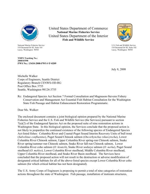
United States Department of Commerce<br />
National Marine Fisheries Service<br />
United States Department of the Interior<br />
Fish and Wildlife Service<br />
National Marine Fisheries Service<br />
510 Desmond Dr SE, Suite 103<br />
Lacey, Washington 98503<br />
U.S. Fish and Wildlife Service<br />
510 Desmond Dr SE, Suite 102<br />
Lacey, Washington 98503<br />
NMFS Tracking No.:<br />
2008/03598<br />
FWS No.: 13410-2008-FWS # F-0209<br />
July 8, 2008<br />
Michelle Walker<br />
Corps of Engineers, <strong>Seattle</strong> <strong>District</strong><br />
Regulatory Branch CENWS-OD-RG<br />
Post Office Box 3755<br />
<strong>Seattle</strong>, Washington 98124-3755<br />
Re: <strong>Endangered</strong> <strong>Species</strong> <strong>Act</strong> <strong>Section</strong> 7 Formal <strong>Consultation</strong> and Magnuson-Stevens Fishery<br />
Conservation and Management <strong>Act</strong> Essential Fish Habitat <strong>Consultation</strong> for the Washington<br />
State Fish Passage and Habitat Enhancement Restoration Programmatic.<br />
Dear Ms. Walker:<br />
The enclosed document contains a joint biological opinion prepared by the National Marine<br />
Fisheries Service and the U.S. Fish and Wildlife Service (the Services) pursuant to section<br />
7(a)(2) of the <strong>Endangered</strong> <strong>Species</strong> <strong>Act</strong> on the proposed suite of nine restoration actions in<br />
Washington State. In this biological opinion, the Services conclude that the proposed action is<br />
not likely to jeopardize the continued existence of the following species of <strong>Endangered</strong> <strong>Species</strong><br />
<strong>Act</strong>-listed fishes: Columbia River and Coastal-Puget Sound Interim Recovery Units of bull trout<br />
(Salvelinus confluentus), Puget Sound Chinook salmon (Oncorhynchus tshawytscha), Lower<br />
Columbia River Chinook salmon, Upper Columbia River spring-run Chinook salmon, Snake<br />
River spring/summer run Chinook salmon, Snake River fall-run Chinook salmon, Lower<br />
Columbia River coho salmon (O. kisutch), Snake River sockeye salmon (O. nerka), Puget Sound<br />
steelhead (O. mykiss), Lower Columbia River steelhead, Middle Columbia River steelhead,<br />
Upper Columbia River steelhead, and Snake River Basin steelhead. The Services have<br />
concluded that the proposed action will not result in the destruction or adverse modification of<br />
designated critical habitats for all of the above-listed species except Lower Columbia River coho<br />
salmon (for which critical habitat has not been designated).<br />
The U.S. Army Corps of Engineers is proposing to permit a total of nine categories of restoration<br />
actions throughout the state of Washington: Fish passage, installation of instream structures,
- 2 -<br />
levee removal and modification, side channel/off-channel habitat restoration and reconnection,<br />
salmonid spawning gravel restoration, forage fish spawning gravel restoration, hardened fords<br />
for livestock crossings of streams and fencing, irrigation screen installation and replacement, and<br />
debris and structure removal.<br />
In your initiation letter from June 10, 2008 you also request concurrence with the effect<br />
determinations of “may affect, but not likely to adversely affect” Hood Canal summer-run chum<br />
salmon (O. keta), Columbia River chum salmon, Brown Pelican (Pelecanus occidentalis),<br />
Columbian White-tailed deer (Odocoileus virginianus leucurus), Canada lynx (Lynx canadensis),<br />
gray wolf (Canis lupus), pygmy rabbit (brachylagus idahoensis), woodland caribou (Rangifer<br />
tarandus caribou), grizzly bear (Ursus arctos = U.a. horribilis), marbled murrelet<br />
(Brachyramphus marmoratus), northern spotted owl (Strix occidentalis caurina), Oregon<br />
silverspot butterfly (Speyeria zerene hippolyta), western snowy plover (Charadrius alexandrinus<br />
nivosus), golden paintbrush (Castilleja levisecta), water howellia (Howellia aquatilis), Nelson’s<br />
checker-mallow (Sidalcea nelsoniana), Kincaid’s lupine (Lupinus sulphureus ssp. Kincaidii),<br />
showy stickseed (Hackelia venusta), Bradshaw's desert-parsley (Lomatium bradshawii),<br />
Spalding’s silene/catchfly (Silene spaldingii), Ute ladies’-tresses (Spiranthes diluvialis) and<br />
designated critical habitat. Also, in your memorandum for the services, you request concurrence<br />
with the effect determinations of “may affect, but not likely to adversely affect” for one of the<br />
nine proposed actions, forage fish spawning gravel restoration, for Coastal-Puget Sound bull<br />
trout interim recovery unit (Salvelinus confluentus), Puget Sound Chinook salmon<br />
(Oncorhynchus tshawytscha), Puget Sound steelhead (O. mykiss), Hood Canal summer-run chum<br />
salmon and designated critical habitat. The Services concurred with your NLAA actions under<br />
separate cover (NMFS Tracking No.: 2008/03600 and USFWS Tracking No.: 13410-2008-F-<br />
0209).<br />
As required by section 7 of the <strong>Endangered</strong> <strong>Species</strong> <strong>Act</strong>, an incidental take statement prepared by<br />
the Services is provided with the biological opinion. The incidental take statement describes<br />
reasonable and prudent measures the Services considers necessary or appropriate to minimize<br />
incidental take associated with the proposed action. It also sets forth nondiscretionary terms and<br />
conditions, including reporting requirements, with which the U.S. Army Corps of Engineers<br />
must comply to carry out the reasonable and prudent measures. Incidental takings of listed<br />
species from actions by the U.S. Army Corps of Engineers that meet these terms and conditions<br />
will be exempt from the <strong>Endangered</strong> <strong>Species</strong> <strong>Act</strong>’s prohibition against such takings.<br />
This document also includes the results of our analysis of the action’s likely effects on essential<br />
fish habitat pursuant to section 305(b) of the Magnuson-Stevens Fishery Conservation and<br />
Management <strong>Act</strong> (MSA), and includes two conservation recommendations to avoid, minimize,<br />
or otherwise offset potential adverse effects on essential fish habitat. These conservation<br />
recommendations are an identical subset of the <strong>Endangered</strong> <strong>Species</strong> <strong>Act</strong> terms and conditions.<br />
<strong>Section</strong> 305(b) (4) (B) of the MSA requires Federal agencies to provide a detailed written<br />
response to National Marine Fisheries Service within 30 days after receiving these<br />
recommendations.<br />
If the response is inconsistent with the essential fish habitat conservation recommendations, the<br />
U.S. Army Corps of Engineers must explain why the recommendations will not be followed,
- 3 -<br />
including the scientific justification for any disagreements over the effects of the action and the<br />
recommendations. In response to increased oversight of overall essential fish habitat program<br />
effectiveness by the Office of Management and Budget, the National Marine Fisheries Service<br />
established a quarterly reporting requirement to determine how many conservation<br />
recommendations are provided as part of each essential fish habitat consultation and how many<br />
are adopted by the action agency. Therefore, in your statutory reply to the essential fish habitat<br />
portion of this consultation, we ask that you clearly identify the number of conservation<br />
recommendations accepted.<br />
If you have questions regarding this consultation, please contact Stephanie Ehinger, Fisheries<br />
Biologist in the Southwest Washington Habitat Branch of the Washington State Habitat Office,<br />
at 360-534-9341, or Martha Jensen, Fish and Wildlife Biologist in the Western Washington<br />
Office, at 360-753-9000. Or you can send email to Stephanie.Ehinger@noaa.gov or<br />
martha_l_jensen@fws.gov.<br />
Sincerely,<br />
D. Robert Lohn Ken S. Berg<br />
Regional Administrator<br />
Western Washington Fish<br />
And Wildlife Office<br />
Enclosure<br />
cc: Suzanne Audet, USFWS<br />
Mark Miller, USFWS<br />
Diane Concannon, King County<br />
Alex Conley, YBFWRB<br />
Michelle Cramer, WDFW<br />
Chris Drivdahl, Salmon Recovery Office<br />
Tony Meyer, RFEG<br />
Karen Streeter, Clark County<br />
Stan Walsh, Skagit River System Cooperative
<strong>Endangered</strong> <strong>Species</strong> <strong>Act</strong> <strong>Section</strong> 7 <strong>Consultation</strong><br />
Biological Opinion<br />
And<br />
Magnuson-Stevens Fishery Conservation and<br />
Management <strong>Act</strong><br />
Essential Fish Habitat <strong>Consultation</strong><br />
Washington State Fish Passage and Habitat Enhancement Restoration Programmatic<br />
<strong>Consultation</strong><br />
Lead <strong>Act</strong>ion Agency:<br />
U.S. Army Corps of Engineers<br />
<strong>Consultation</strong><br />
Conducted By:<br />
National Marine Fisheries Service and<br />
U.S. Fish and Wildlife Service<br />
Date Issued: July 8, 2008<br />
Issued by:<br />
D. Robert Lohn Ken S. Berg, Manager<br />
Regional Administrator<br />
Western Washington Fish<br />
and Wildlife Office<br />
NMFS No.: 2008/03598 FWS No.: 13410-2008-FWS # F-0209
TABLE OF CONTENTS<br />
ABBREVIATIONS AND ACRONYMS ....................................................................................... ii<br />
INTRODUCTION .......................................................................................................................... 1<br />
Background and <strong>Consultation</strong> History ................................................................................ 1<br />
Description of the Proposed <strong>Act</strong>ion .................................................................................... 2<br />
Implementation Process ........................................................................................ 32<br />
<strong>Act</strong>ion Area ....................................................................................................................... 33<br />
ENDANGERED SPECIES ACT .................................................................................................. 35<br />
Biological Opinion ............................................................................................................ 35<br />
Status of the <strong>Species</strong> ............................................................................................. 35<br />
Status of Critical Habitat ....................................................................................... 58<br />
Environmental Baseline ........................................................................................ 69<br />
Effects of the <strong>Act</strong>ion ............................................................................................. 77<br />
Cumulative Effects .............................................................................................. 102<br />
Conclusion .......................................................................................................... 105<br />
Reinitiation of <strong>Consultation</strong> ................................................................................ 106<br />
Incidental Take Statement............................................................................................... 107<br />
Amount or Extent of Take .................................................................................. 107<br />
Reasonable and Prudent Measures ...................................................................... 109<br />
Terms and Conditions ......................................................................................... 109<br />
MAGNUSON-STEVENS FISHERY CONSERVATION AND MANAGEMENT ACT ........ 110<br />
Essential Fish Habitat Conservation Recommendations ................................................ 110<br />
Statutory Response Requirement .................................................................................... 110<br />
Supplemental <strong>Consultation</strong> ............................................................................................. 111<br />
DATA QUALITY ACT DOCUMENTATION AND PRE-DISSEMINATION REVIEW ...... 112<br />
LITERATURE CITED ............................................................................................................... 113<br />
Appendix A: Dewatering And Fish Capture Protocol ............................................................... 121<br />
Appendix B: In-Water Work Windows for Bull Trout, Salmon, and Steelhead ....................... 131<br />
Appendix C: Anadromous Stream Miles ................................................................................... 133<br />
Appendix D: <strong>Species</strong> with Designated EFH in Waters of Washington. .................................... 141<br />
Appendix E: Rangewide Status of the <strong>Species</strong> and Critical Habitat for Bull Trout .................. 142<br />
Appendix F: Minimization Measures For Terrestrial Plants And Animals ............................... 161<br />
i
ABBREVIATIONS AND ACRONYMS<br />
BLM Bureau of Land Management<br />
BRT Biological Review Team<br />
COE U.S. Army Corps of Engineers<br />
CR Columbia River<br />
CWA Clean Water <strong>Act</strong><br />
DPS Distinct Population Segment<br />
EPA U.S. Environmental Protection Agency<br />
ESA <strong>Endangered</strong> <strong>Species</strong> <strong>Act</strong><br />
EFH Essential Fish Habitat<br />
ELJs Engineered Log Jams<br />
ESU Evolutionary Significant Unit<br />
FS United States Forest Service<br />
HUC Hydrologic Unit Code<br />
IRU Interim Recovery Unit<br />
ITS Incidental Take Statement<br />
LC 50 calculated concentration of a chemical to which exposure for a specific length of<br />
time causes mortality in 50 percent of the animals or plants tested<br />
LCR Lower Columbia River<br />
LOAEL Lowest Observed Adverse Effects Level<br />
LOC Level of Concern<br />
LWD Large Woody Debris<br />
MSA Magnuson-Stevens Fishery Conservation and Management <strong>Act</strong><br />
NMFS National Marine Fisheries Service<br />
NPE Nonyphenol polyethoxylate<br />
Opinion Biological Opinion<br />
OHWL Ordinary High Water Line<br />
PBA Programmatic Biological Assessment<br />
PCE Primary Constituent Element<br />
RM River Mile<br />
SPIF Specific Project Information Form<br />
SR Snake River<br />
SRB Snake River Basin<br />
SS Suspended Solids<br />
TNC The Nature Conservancy<br />
The Services National Marine Fisheries Service and U.S. Fish and Wildlife Service<br />
UCR Upper Columbia River<br />
USFWS U.S. Fish and Wildlife Service<br />
VSP Viable Salmonid Population<br />
WDFW Washington Department of Fish and Wildlife<br />
WDOE Washington Department of Ecology<br />
WRIA Water Resource Inventory Area<br />
WSDA Washington State Department of Agriculture<br />
ii
INTRODUCTION<br />
This document contains a biological opinion (Opinion) and incidental take statement (ITS)<br />
prepared in accordance with section 7(b) of the <strong>Endangered</strong> <strong>Species</strong> <strong>Act</strong> (ESA) of 1973, as<br />
amended (16 U.S.C. 1531, et seq.), and implementing regulations at 50 CFR 402. The National<br />
Marine Fisheries Service (NMFS) also completed an essential fish habitat (EFH) consultation,<br />
prepared in accordance with section 305(b)(2) of the Magnuson-Stevens Fishery Conservation<br />
and Management <strong>Act</strong> (MSA) (16 U.S.C. 1801, et seq.) and implementing regulations at 50 CFR<br />
600. The administrative record for this consultation is on file at the NMFS Washington State<br />
Habitat Office in Lacey, Washington.<br />
Background and <strong>Consultation</strong> History<br />
This consultation was developed for two main reasons. In 2001, NMFS and the United States<br />
Fish and Wildlife Service (USFWS, together the Services) completed formal programmatic<br />
consultations with the U.S. Army Corps of Engineers (COE) on Four Categories of Fish Passage<br />
Restoration <strong>Act</strong>ivities in Western Washington (the 2001 Fish Passage Restoration Programmatic,<br />
NMFS Tracking No.: WSB-01-197). A few years later it became clear that this programmatic<br />
was so detailed and put so many restrictions on how projects could be constructed, that there was<br />
little incentive for project sponsors to use the programmatic rather than seek individual<br />
consultation. In meetings with stakeholders and the COE, the Services collected information on<br />
how to improve on the 2001 Fish Passage Restoration Programmatic. The COE and the Services<br />
used this information to initiate consultation on the proposed action that is the subject of this<br />
consultation.<br />
Second, with the completion of recovery plans, the actions that need to be taken to achieve<br />
recovery for several species of listed salmonids have become much clearer. Along with the<br />
recovery plans, many entities have developed specific plans prioritizing actions for certain<br />
watersheds. These plans include several programmatic consultations to support habitat<br />
restoration (for example, invasive plant treatment programs by the United States Forest Service<br />
(FS) and Bureau of Land Management (BLM), and an ESA section 4(d) special rule covering<br />
certain restoration actions in Washington State (Limit 8). The proposed action for a statewide<br />
restoration programmatic covering species under the responsibility of both NMFS and USFWS,<br />
would address restoration actions under COE jurisdiction not addressed in any of the existing<br />
restoration tools or plans.<br />
Early in 2007, the COE and the Services began developing a programmatic consultation that<br />
covers a suite of restoration actions, including culvert replacements. The agencies relied the<br />
results of feedback sessions from the 2001 Fish Passage Restoration Programmatic as well as<br />
experience from the more recent smaller scale restoration programmatic consultations. In<br />
November of 2007, the agencies sent the proposed list of actions out for comment to<br />
stakeholders. The COE and the Services reviewed and responded to the feedback, updating the<br />
proposed action accordingly, including several new action items.<br />
1
On June 10, 2008 the COE submitted the final Biological Evaluation requesting consultation on<br />
a suite of nine categories of restoration actions. The Services initiated informal consultation to<br />
address species and critical habitat that the restoration actions are not likely to adversely affect.<br />
The informal consultations are concluded by letters of concurrence, under separate cover. The<br />
Services also initiated ESA <strong>Section</strong> 7 formal programmatic consultation, the results of which are<br />
reported for both Services in this document. NMFS also initiated and conducted an MSA EFH<br />
consultation, the results of which are also reported in this document. Finally, because NMFS<br />
publishes its formal consultation documents online, this document contains certification of<br />
compliance with the Data Quality <strong>Act</strong>.<br />
The species that the COE determined the proposed program of actions is not likely to adversely<br />
affect includes all listed terrestrial species in the action area, Hood Canal summer-run chum,<br />
Columbia River (CR) chum, and their designated critical habitat. As mentioned above, the<br />
Services concurred with the COE’s not likely to adversely affect determination under separate<br />
cover (F/NWR/2008/03600). Therefore, the analysis in this consultation document, and the<br />
exemption from the take prohibition in the ITS is limited to those species listed in the section<br />
below. The duration of this programmatic is five years from the date of signature. At the end of<br />
this period in 2013, the COE and Services can reinitiate this consultation, if necessary, to adjust<br />
or add activities or conservation measures.<br />
Description of the Proposed <strong>Act</strong>ion<br />
The COE proposes to permit restoration activities designed to maintain, enhance and restore<br />
watershed functions that affect aquatic species. Covered actions are restoration projects that<br />
utilize one or a combination of actions from the following nine restoration categories listed<br />
below. Restoration actions that are specifically excluded from coverage under the proposed<br />
action include:<br />
• Channel redesigns that alter the planform (sinuosity and meander pattern), cross-section<br />
(maximum depth, width to depth ratio) and profile (slopes) of channel reaches. However,<br />
meander reconstruction and minor alterations of the channel planform which would be<br />
achieved by methods described above like LWD and boulder placement are covered.<br />
• Creation of artificial spawning and production channels that need periodic maintenance.<br />
2
Covered Categories of Restoration <strong>Act</strong>ions<br />
1. Fish Passage<br />
Description: The objective of passage barrier removal is to allow all life stages of salmonids<br />
access to historical habitats from which they have been excluded by non-functioning<br />
drainage structures (road, trail, and railroad crossings) and water impoundments (tide gates,<br />
temporary dams).<br />
a. Culvert Replacement and Relocation<br />
Description: Culverts at road crossings will be replaced with bridges, appropriately<br />
sized culverts, bottomless culverts, or arch pipes. Culverts may be replaced with<br />
slightly longer culverts to accommodate safety improvements. Culverts may be<br />
relocated to restore natural hydrology and stream alignment.<br />
Conservation Measures:<br />
1. When there is a series of barriers on one system that are scheduled to be<br />
resolved in a short period of time, work will start at the most upstream barrier.<br />
This way, the work at the more upstream sites can be done without listed fish<br />
in the action area.<br />
2. Road crossings will be designed to the culvert design benchmarks set in the<br />
most current version of the NMFS Anadromous Salmonid Fish Facility<br />
Design manual (http://www.nwr.noaa.gov/Salmon-<br />
Hydropower/FERC/upload/Fish_Passage_Design.pdf) except for the<br />
deviations mentioned below. The Washington Department of Fish and<br />
Wildlife (WDFW) technical guidance manual Design of Road Culverts for<br />
Fish Passage (Bates et al. (2003)) may be used to achieve these benchmarks.<br />
3. Where site specific designs lead to a conflict in design standards, a solution<br />
will be proposed by the designer. This solution will be used as a basis of talks<br />
between the Services, WDFW, and the project applicant. The final design<br />
needs to be approved by the Services.<br />
4. Projects in stream channel with gradients above six percent will preferably<br />
utilize a bridge. If that is not feasible, crossings will be designed using the<br />
stream simulation option. For culverts in fish bearing streams with gradients<br />
higher than six percent the Services can request monitoring data of: 1) placed<br />
substrate integrity and bedload deposition; 2) inlet and outlet conditions; and<br />
3) channel form (structural elements of high gradient channel: boulders, pools,<br />
low flow channel) after the first 10 year flow (or higher) events. The Services<br />
will require a maintenance plan to assure the crossing remains within design<br />
conditions.<br />
5. Culvert replacements on fish-bearing streams will be designed to provide<br />
upstream and downstream passage for juvenile and adult salmonids using the<br />
criteria below (6-17).<br />
6. Project designs for stream simulation will meet the WDFW (Bates et al.<br />
(2003)) design standards for width (for confined to moderately confined<br />
channels: width of the culvert bed to equal 1.2 * bankfull width + 2 feet;<br />
unconfined channels will require a larger span).<br />
3
7. The hydraulic design method is a design process that matches the hydraulic<br />
performance of a culvert with the swimming abilities of a target species and<br />
age class of fish. There are significant errors associated with estimation of<br />
hydrology and fish swimming speeds that are resolved by making<br />
conservative assumptions in the design process. Determination of the high<br />
and low fish passage design flows, water velocity, and water depth is required<br />
for this option. Designs will meet the WDFW (Bates et al. (2003)) flow range<br />
criteria and will be designed to accomplish fish passage between the 7<br />
consecutive days, 2 year low flow and the 10 percent exceedance flow (the<br />
flow that is exceeded only 10 percent of the time; high design flow).<br />
Additionally, the high design flow will be calculated based on the life<br />
histories of the target fish species 1 , and time periods they are most likely to be<br />
moving upstream. This design method may be applied to the design of new<br />
and replacement culverts and may be used to evaluate the effectiveness of<br />
retrofits of existing culverts.<br />
Hydraulic design is limited to situations where:<br />
a. Channel gradient is low to moderate, generally less than 3 percent. If<br />
it is not possible to embed/countersink the culvert, the maximum<br />
channel gradient should not exceed 0.5 percent.<br />
b. The bottom of the culvert should be buried into the streambed a<br />
minimum of 20 percent of the height of the culvert below the elevation<br />
of the tailwater control point downstream of the culvert, and the<br />
minimum embedment must be at least 1 foot.<br />
8. <strong>Act</strong>ive channel (no-slope/embedded pipe): This method provides a simplified<br />
design intended to provide a culvert of sufficient size and embedment to allow<br />
the natural movement of bedload and the formation of a stable bed inside the<br />
culvert. It is intended for use only in very small streams. Determination of<br />
the high and low fish passage design flows, water velocity, and water depth is<br />
not required for this method, since the stream hydraulic characteristics within<br />
the culvert are intended to mimic the stream conditions upstream and<br />
downstream of the crossing. Structures for this design method are typically<br />
round, oval, or squashed pipes made of metal or reinforced concrete. Culverts<br />
are installed level at 0 percent slope.<br />
Design is limited to situations where:<br />
a. The natural slope is less than 3 percent and the culvert length is less<br />
than 80 feet.<br />
b. The bottom of the culvert should be buried into the streambed not less<br />
than 20 percent of the culvert height at the outlet and not more than 40<br />
percent of the culvert height at the inlet. For example, in a ten foot<br />
diameter circular culvert the downstream end invert has to have at<br />
least 2 feet of substrate.<br />
1 Target Fish <strong>Species</strong> are generally all adults and juveniles of the species for which the subject area has been<br />
designated as critical habitat. However, deviations can be suggested by the applicant and implemented with<br />
agreement by both NMFS and WDFW. There may be cases where NMFS may require additional species passage.<br />
4
c. At a minimum the culvert width has to be equal to the average channel<br />
bed width at the elevation the culvert meets the streambed; generally<br />
this elevation is at 20 percent to 30 percent of its diameter (see above,<br />
8b). Thus, combining the requirements of countersinking the outlet<br />
and the culvert width for a circular culvert, the diameter must be at<br />
least 1.25 times the channel bed width.<br />
The culvert bed slope (S in units of length/length or rise/run) times culvert<br />
length (L) is less than or equal to 20 percent of the culvert diameter (D).<br />
S*L
16. Designs will demonstrate that ecological functions including bedload<br />
movement, large wood and other debris movement, and flood flows can occur<br />
as appropriate to the site.<br />
b. Retrofitting Culverts<br />
Description: Where culvert replacement is not currently feasible, culverts may be<br />
retrofitted in the short term to improve passage by installing structures including<br />
baffles and step-and-pool weirs at outlets.<br />
Conservation Measures:<br />
1. Projects will be retrofitted to meet the most current version of the NMFS<br />
Anadromous Salmonid Fish Facility Design manual or WDFW’s fish passage<br />
criteria for salmon and trout (Bates et al. 2003).<br />
2. Projects will demonstrate a commitment to a long-term solution. A retrofitted<br />
culvert will be replaced with a bridge or culvert that is at the time of<br />
retrofitting scheduled and funded and that meets the most current version of<br />
the NMFS Anadromous Salmonid Fish Facility Design manual.<br />
3. All retrofitted culverts will have a maintenance plan which assures that the<br />
fishway will be maintained to provide original design conditions prior to each<br />
fish passage season and inspected at least after every 10 year flow event.<br />
c. Culvert Removal<br />
Description: Removal of unnecessary culverts to improve salmonid access and<br />
habitat functions. When circumstances permit, culvert removal is the preferred<br />
alternative.<br />
Conservation Measures: When there is a series of barriers that are proposed to be<br />
removed in a short period of time on one system, work will start at the most<br />
upstream barrier to minimize impacts to listed fish.<br />
d. Tidegate Removal<br />
Description: Removal of unnecessary or non-functioning tide gates to restore<br />
salmonid access to historic estuarine habitats.<br />
6
e. Removal or Modification of Sediment Bars or Terraces that Block or Delay<br />
Salmonid Migrations<br />
Description: Land use practices such as timber harvest, large scale agriculture<br />
and urban development have resulted in increased, generally fine, sediment<br />
delivery to streams. This sediment can accumulate in low velocity areas and<br />
contribute to widening of stream mouths, forming bars or terraces. The bar or<br />
terrace can spread the streamflow into finely braided or sheet flow patters,<br />
forming low flow fish passage barriers. These temporary blockage points often<br />
provide opportunities for illegal snagging of holding adult salmon. The COE<br />
proposes to restore fish passage by removing sediment to restore flow conditions<br />
that allow for passage.<br />
Conservation Measures:<br />
1. The maximum amount of material removed from a passage impediment is 100<br />
cubic yards.<br />
2. If the removed material contains more than 60 percent silt or clay it will be<br />
disposed of upland. Material with more than 40 percent gravel will be<br />
deposited within the active floodplain, but not in wetlands. Material with<br />
more than 50 percent gravel and less than 30 percent fines (silt or clay) may<br />
be deposited below the OHWL. If material is deposited below the OHWL the<br />
applicant will explain the expected benefits, e.g. use as bankfull bench for<br />
riparian plantings in area where flood storage is not an issue.<br />
3. If the removed material is suitable for spawning it may be used within the<br />
watershed for spawning gravel supplementation including below dams and in<br />
sediment-starved reaches.<br />
4. Sandbags may be placed to temporarily improve fish passage. Sandbags will<br />
be removed prior to anticipated high flows that could wash away sandbag or<br />
cause flow to go around them.<br />
5. If removal of sediment at the same location is proposed for a second time<br />
within ten years, a long term plan for a solution other than sediment removal<br />
will be presented. For example, placement of large wood can result in scour<br />
that may alleviate the local passage impediment.<br />
7
f. Temporary Placement of Sandbags, Hay Bales, and Ecology Blocks to<br />
Improve Salmonid Passage<br />
Description: Land use practices such as large scale agriculture, including<br />
irrigation, and urban and residential development have changed the hydrology of<br />
affected watersheds. Reduced forest cover and increased impervious surface have<br />
resulted on the one hand in increased runoff and peak flows and on the other hand<br />
in less aquifer recharge and resulting increased frequency, duration and<br />
magnitude of summer droughts. During recent droughts, temporary placement of<br />
sandbags, hay bales, and ecology blocks have been successful in providing shortterm<br />
fish passage, especially in Eastern Washington. The COE proposes to utilize<br />
these techniques to restore fish passage during seasonal low flow periods.<br />
Conservation Measure: All material placed in the stream to aid fish passage will<br />
be removed when stream flows increase, prior to the onset of the fall rains.<br />
g. Construction of Structures to Provide Passage over Small Dams<br />
Description: Diversion dams, generally in Eastern Washington, often create a<br />
permanent or temporary fish passage blockage. The COE proposes to build<br />
structures at existing dams to restore fish passage. Structures will be constructed<br />
from rock or wood or a combination of rock and wood. Examples of designs of<br />
structures include Rock Chevrons and V-weirs.<br />
Conservation Measures:<br />
1. Construction of passage structures over irrigation dams is limited to dams of<br />
less than seven feet in height.<br />
2. NMFS engineers are presented with plans for and approve of passage projects<br />
at structures that are between 3 and 7 feet high.<br />
3. Construction of passage structures is limited to facilitate passage at existing<br />
diversion dams, not in combination with new dams.<br />
4. The design of passage structures will follow the appropriate design standards<br />
in the most current version of the NMFS Anadromous Salmonid Fish Facility<br />
Design manual.<br />
Specifically Excluded <strong>Act</strong>ivities:<br />
• Tidegate and floodgate replacements are not proposed for this consultation<br />
and need be addressed project by project.<br />
• Installation of fish ladders to create passage around blockages higher than<br />
seven feet is not proposed under this programmatic biological assessment<br />
(PBA).<br />
• Culvert replacements for road capacity improvements are not proposed under<br />
this PBA.<br />
2. Installation of Instream Structures<br />
Anthropogenic activities that have altered riparian habitats, such as splash damming and the<br />
removal of large wood and logjams, have reduced instream habitat complexity in many rivers.<br />
8
They have eliminated or reduced features like pools, hiding cover, and bed complexity.<br />
Salmonids need habitat complexity for rearing, feeding, and migrating. To improve habitat<br />
complexity where an identified need exists, the COE proposes to permit the following practices:<br />
a. Placement of Woody Debris<br />
Description: Large Woody Debris (LWD) can be placed in the channel, estuary,<br />
or marine environment either unanchored or anchored in place using rock, rebar,<br />
or wooden piles. The amount of rock used is limited to that needed to anchor the<br />
LWD. The use of metal cables will be limited to situations where no other<br />
technique will work.<br />
Conservation Measure: Large trees may be dislodged or felled for constructing<br />
in-stream habitat in areas where the following criteria are met: (1) Lack of<br />
instream LWD has been identified by a watershed analysis, reach assessment, or<br />
similar document as a limiting factor for the subject reach; and (2) Presence of an<br />
adequately stocked and healthy mature riparian forest; (3) Felling or tipping (or<br />
both) of trees into the water will not significantly impact stream shading; (4)<br />
Sufficient natural recruitment of native woody vegetation is expected and the<br />
threat of invasive vegetation filling created gaps is minimal or replanting with<br />
native woody species is planned; (5) The LWD design aims at providing several<br />
years of in-stream habitat benefits; (6) The trees are not suitable habitat for listed<br />
terrestrial species. Whenever possible, rootwads will be used for in-stream<br />
habitat, too. Attempts will be made to procure and stockpile LWD to be used<br />
before felling live trees. Finally, felling trees may be most appropriate where<br />
stream access is limited for creating LWD jams.<br />
b. Placement of Live Stakes<br />
Description: This technique consists of planting of live cottonwood stakes<br />
perpendicular in the ground. The arrays are planted either perpendicular, at slight<br />
angles to, or parallel to the flow/course of the river; in the floodplain or into the<br />
active channel, depending on the objective of the project. Objectives of flood<br />
fencing include:<br />
i. Establish riparian vegetation and mimic (hydraulically) a mature riparian<br />
forest. Spaces between rows may be planted with additional riparian<br />
vegetation.<br />
ii. Create habitat complexity. The live stakes slow water velocities and<br />
collect/catch debris and sediment during bankfull and flood events.<br />
iii. Slow water velocities to reduce scour in the vicinity of riparian plantings,<br />
increasing successful establishment of new riparian plantings,<br />
iv. Decrease width to depth ratios in widened channel reaches,<br />
v. Create backwater effects to allow natural reconnection of side channels.<br />
The installation of flood fences is accomplished by boring with augers and<br />
placing boles vertically into arrays, or by trenching in adjacent, and staggered,<br />
rows to create arrays.<br />
9
Conservation Measures: All materials removed are replaced once boles are in<br />
place, and in fact, are used to reduce scour around boles during the first bankfull<br />
events. Boles are generally sealed on the top to prevent excessive desiccation. In<br />
sensitive areas, such as side channels and bar locations, this step is omitted.<br />
c. Placement of Engineered Log Jams<br />
Description: For detailed descriptions of each technique refer to the Stream<br />
Habitat Restoration Guidelines (Saldi-Caromile et al. 2004),the Integrated<br />
Streambank Protection Guidelines (Cramer et al. 2003), and the Conceptual<br />
Design Guidelines: Application of Engineered Logjams (Herrera 2006).<br />
Engineered log jams are designed collections of LWD. Different types of ELJs<br />
include bank protection ELJs (see below, General CM), bar apex ELJs, and grade<br />
control ELJs (see below). Engineered log jams are patterned after stable natural<br />
log jams and can be either unanchored or anchored in place using rebar, rock, or<br />
piles (steel may be used if other long term anchoring is not possible at site.<br />
Explain in SPIF). Engineered log jams create a hydraulic shadow, a low-velocity<br />
zone downstream that allows sediment to settle out. Scour holes develop adjacent<br />
to the log jam. While providing valuable fish and wildlife habitat they also<br />
redirect flow and can provide stability to a streambank or downstream gravelbar.<br />
Excluded <strong>Act</strong>ivities: Logjams with a primary purpose other than habitat<br />
restoration or enhancement.<br />
d. Grade Control Engineered Log Jams<br />
Description: Grade control ELJs are designed to arrest channel downcutting or<br />
incision by providing a grade control that retains sediment, lowers stream energy,<br />
and increases water elevations to reconnect floodplain habitat and diffuse<br />
downstream flood peaks. Grade control ELJs also serve to protect infrastructure<br />
that is exposed by channel incision and to stabilize over-steepened banks. Unlike<br />
hard weirs or grade control structures, a grade control ELJ is a complex broadcrested<br />
structure that dissipates energy more gradually. Examples of grade<br />
control ELJs include Bronson Creek, Portland, Oregon (Herrera 2006).<br />
e. Trapping Mobile Wood<br />
Description: Construction of wood structures to trap mobile wood. Wood may be<br />
anchored with rebar, anchor rocks, and untreated wood pilings. Less than 10 inch<br />
diameter steel pilings may be used if necessary for stability reasons. Examples of<br />
streamside LWD catchers are outlined in Slaney P.A. and D. Zaldokas (1997),<br />
http://nfcp.org/Archived_Reports/RM97-2.pdf and<br />
http://nfcp.org/Archived_Reports/RM96-3.pdf. The Lower Columbia Fisheries<br />
Enhancement Group which operates in southwest Washington has installed<br />
several of these structures and is willing to offer limited design help.<br />
Conservation Measures: In the marine environment, steel piles will not be driven<br />
with an impact hammer.<br />
10
f. Placement of Boulders<br />
Description: Placement of individual large boulders and boulder clusters to<br />
increase structural diversity. Structural and hydraulic diversity is important to<br />
provide holding and rearing habitat for salmonids. As with all proposed methods,<br />
this treatment will be used in streams that have been identified as lacking<br />
structural diversity and that naturally and/or historically had boulders. (Boulders<br />
may have been removed historically to facilitate wood transport.) For a more<br />
detailed description of potential applications see “Boulder Clusters” in WDFW<br />
(2004). Preferably, boulders will be sized and located to avoid the need for<br />
anchoring. However, if necessary for design objective, boulders placed on<br />
bedrock may be pinned with for example epoxy resin (Hilty system) to ensure<br />
long-term stability (Slaney and Zaldokas 1997).<br />
Excluded <strong>Act</strong>ivities: Boulders may not be cabled in systems other than bedrock.<br />
g. Boulder Weirs and Roughened Channels<br />
Description:<br />
Full channel-spanning boulder weirs will be installed to enhance or provide fish<br />
habitat in stream reaches where log placements are not practicable due to channel<br />
conditions (not feasible to place logs of sufficient length, bedrock dominated<br />
channels, deeply incised channels, artificially constrained reaches, etc.). Boulder<br />
weirs and roughened channels may also be installed for grade control at culverts<br />
(see No. 1 above) and constructed side channels. For boulder weirs in wood<br />
dominated systems, grade control ELJs (see above) will be used.<br />
Conservation Measures:<br />
1. Boulder weirs will be installed only in:<br />
a. Highly uniform, incised, bedrock channels.<br />
b. Stream channels that have been artificially confined<br />
between levees or other floodplain revetments that are not<br />
feasible to remove or set-back.<br />
c. Locations for which salmonid recovery plans identifies<br />
channel spanning boulder weirs as a priority restoration<br />
technique (e.g. lower Entiat River).<br />
d. To provide grade control at culverts or constructed side<br />
channels.<br />
2. Boulder weirs will be low in relation to channel dimensions so that they<br />
are completely overtopped during channel-forming, bankfull flow events<br />
(approximately a 1.5-year flow event).<br />
Boulder weirs will be placed diagonally across the channel or in more<br />
traditional upstream pointing "V" or “U” configurations with the apex<br />
oriented upstream.<br />
3. Boulder weirs will be constructed to allow upstream and downstream<br />
passage of all native listed fish species and life stages that occur in the<br />
stream at all flows.<br />
11
4. The project shall be designed and inspected by a multidisciplinary team<br />
(including a salmon or trout biologist) that has experience with these<br />
types of structures.<br />
5. Full spanning boulder weir placement will be coupled with measures to<br />
improve habitat complexity and protection of riparian areas to provide<br />
long-term inputs of LWD to the maximum extent possible.<br />
6. Roughened channels will be designed to standards contained in the most<br />
current version of the NMFS Anadromous Salmonid Fish Facility<br />
Design manual.<br />
h. Gravel Placement Associated with Structure Placement<br />
For work in gravel-deficient areas, a maximum of 100 cubic yards of clean,<br />
washed, appropriately sized gravel (river-run gravel, not quarry spalls or crushed<br />
gravel) can be imported or relocated and placed upstream of each structure.<br />
When placing LWD on the outside of meander bends, bar material can be<br />
removed from the inside of the meander bend and relocated immediately up<br />
and/or downstream of the new structure. If the work area on the gravel bar is dry,<br />
work may be performed without use of a coffer dam. This gravel relocation<br />
would be expected to speed up the realignment of the thalweg and protect the new<br />
structure.<br />
Excluded <strong>Act</strong>ivities:<br />
• Construction of instream structures with a primary purpose other than<br />
habitat enhancement.<br />
• Construction of boulder weirs or other channel spanning structures in<br />
gravel or finer substrate dominated streams.<br />
• Gravel shall not be placed in areas are currently suitable for salmonid<br />
spawning<br />
3. Levee Removal and Modification<br />
Description: Levee modification or removal serves many purposes including habitat<br />
restoration, erosion reduction, water quality improvements, reduced high flow velocities,<br />
groundwater recharge and reduction of floods in other sections of the river. Techniques<br />
that are covered by this programmatic need to have the sole purpose of restoring flood<br />
plain functions or to enhancing fish habitat. Covered actions in freshwater, estuarine, and<br />
marine areas include:<br />
• Full and partial removal of levees, dikes, berms, and jetties.<br />
• Breaching of levees, dikes and berms.<br />
• Lowering of levees, dikes and berms.<br />
• Setback of levees, dikes and berms.<br />
12
Conservation Measures:<br />
1. Non-native dike and levee material will be hauled to an upland site to the greatest<br />
degree practicable.<br />
2. Native material may be spread across the floodplain in a manner that does not<br />
restrict floodplain capacity and minimizes juvenile stranding. If the material is<br />
used to create/alter microtopograhphy it has to be done in a manner to minimize<br />
juvenile stranding. This can be achieved by sloping side channels to the main<br />
channel or water body and by designing access channels for depressional areas.<br />
These restrictions on microtopography in the floodplain only apply, if the project<br />
contains elements of altering/designing floodplain microtopography like side<br />
channels and depressions.<br />
3. Ditches previously constructed to drain wetlands will be filled preferably with<br />
native material, otherwise with clean imported material of similar substrate to the<br />
adjacent/native banks.<br />
4. In setback dikes/levees the amount of rock will be kept to a minimum. However,<br />
up to the same amount of hard material as in the to be replaced dike/levee may be<br />
used.<br />
4. Side Channel/Off-Channel Habitat Restoration and Reconnection<br />
Description: Side channel habitats are generally small watered remnants of river<br />
meanders. They provide important spawning and rearing habitat for juveniles and refuge<br />
habitat during high flows. They are most common in floodplains that have been strongly<br />
glacially influenced leaving alluvial material in a flat valley floor. Off-channel habitat<br />
includes abandoned river channels, spring-flow channels, oxbows and flood swales. Offchannel<br />
habitat has been reduced by human activities in the floodplain including diking,<br />
removal of LWD, straightening of the channel, and bank armoring. Thus, there is a need<br />
in many Washington watersheds for off-channel restoration.<br />
Restoration techniques covered by the Biological Assessment (BA) focus on the<br />
restoration or creation of self-sustaining off-channel habitat. Self-sustaining is not<br />
synonymous with maintaining a static condition. Self-sustaining means the restored or<br />
created habitat would not require major or periodic maintenance, but function naturally<br />
within the processes of the floodplain. However, up to two project adjustments,<br />
including adjusting the elevation of the created side channel habitat are included under<br />
this proposal. The long-term development of a restored side channel will depend on<br />
natural processes like floods and mainstem migration. Over time, the side channel may<br />
naturally get drier or be taken over by the main river flow.<br />
The following off-channel restoration activities are covered under the BA:<br />
• Creation of new side channel habitat. This approach would create self-sustaining<br />
side channels which are maintained through natural processes. Designs must<br />
demonstrate sufficient hydrology.<br />
• Excavating pools and ponds in the historic floodplain/channel migration zone to<br />
create connected wetlands.<br />
• Reconnecting existing side channels with a focus on restoring fish access and<br />
habitat forming processes (hydrology, riparian vegetation).<br />
13
• ELJs, barbs and groins may be used to direct some flow through a side channel,<br />
see below General Conservation Measures 1.<br />
• Restoration of existing side channels including one-time dredging and an up to<br />
two times project adjustment including adjusting the elevation of the created side<br />
channel habitat.<br />
Conservation Measures:<br />
1. All side channel and pool habitat work will occur in isolation from waters<br />
occupied by listed fish species until project completion, at which time a final<br />
opening may be made by excavation to waters occupied by listed fish or water<br />
will be allowed to return into the area.<br />
2. Side channel habitat will be constructed to prevent fish stranding by providing<br />
a continual positive grade to the intersecting waters of the US or a year around<br />
water connection.<br />
5. Salmonid Spawning Gravel Restoration<br />
Description: The quality and quantity of available spawning gravel has been impacted by<br />
many anthropogenic features and activities. For example, dams and culverts can block the<br />
downstream movement of gravel and result in gravel starved reaches. Channelization, hard<br />
streambank stabilization, and diking restrict a stream from meandering and recruiting<br />
gravel. Elimination of riparian buffers and grazing up to the stream’s edge introduces fines<br />
that often cause embedded or silted-in spawning gravel.<br />
To address problems with gravel quality in constructed chum spawning channels, periodic<br />
cleaning is proposed. A variety of techniques have been developed to restore the quality of<br />
degraded spawning gravel. For more technical information refer to “salmonid spawning<br />
gravel cleaning and placement” (WDFW et al. 2004)). These techniques generally result in<br />
some improvements. However, they may be detrimental to salmonids if they are not used<br />
in combination with process-based methods that address the cause of the problem. To<br />
address a lack of gravel quantity, gravel may be added below dams and in gravel starved<br />
reaches using a dump truck, tracked excavator, conveyor belt, helicopter, or hand carried<br />
bucket.<br />
This consultation covers the following categories of spawning gravel restoration:<br />
• Cleaning of gravels in artificial chum spawning channels in the Lower Columbia<br />
River (LCR) ESUs with mechanic or hydraulic methods where excessive levels of<br />
fine sediment have been identified as a limiting factor.<br />
• Gravel placement in combination with other restoration activities that address the<br />
underlying systematic problem. For example a combined project consisting of:<br />
Planting streambank vegetation, placing instream LWD and supplementing<br />
spawning gravel.<br />
• Gravel supplementation below dams.<br />
14
Conservation Measures: Spawning gravel will contain appropriate size distributions (river-run<br />
gravel, not quarry spalls or crushed gravel) as recommended by Hydraulic Project Approval, or<br />
as recommended by a salmon biologist, for jurisdictions that do not fall under State law.<br />
Excluded <strong>Act</strong>ivities:<br />
• Cleaning and/or placement of gravels is not proposed for bull trout spawning and rearing<br />
areas.<br />
• The construction of artificial spawning channels is not proposed under this programmatic.<br />
6. Forage Fish Spawning Gravel Restoration<br />
Description: The quality and quantity of available forage fish spawning substrate has<br />
been impacted by many anthropogenic features, including beach armoring. Forage fish<br />
(surf smelt and sand lance) spawning habitat in Puget Sound is important to support<br />
recovery of salmon, steelhead, and bull trout. Beach nourishment can contribute to and<br />
enhance salmonid feeding opportunity during the nearshore lifestage.<br />
Conservation Measures:<br />
1. Beach nourishment will be part of a restoration plan considering near shore<br />
transport processes.<br />
2. Beach nourishment must demonstrate appropriate grain size profile for target<br />
species and sediment supplementation rate by estimated sediment erosion rate for<br />
site and drift cell reach.<br />
3. When placing material in areas known to have forage fish spawning, applicant<br />
will adhere to COE timing windows protective of forage fish:<br />
http://www.nws.usace.army.mil/publicmenu/DOCUMENTS/REG/work_windows<br />
_-_all_marine_&_estuarine2.pdf<br />
4. When placing material on known surf smelt spawning beaches a spawning survey<br />
will be conducted prior to placing material.<br />
5. Material may not originate from floodplain gravel mining.<br />
7. Hardened Fords and Fencing for Livestock Steam Crossings<br />
Description: In many areas in Washington State livestock access to streams has degraded<br />
riparian corridors and in-stream habitat. Riparian vegetation is negatively affected by<br />
livestock grazing and trampling. Generally the result is increased and chronic<br />
sedimentation and reduced riparian functions including shading and recruitment of LWD.<br />
To improve riparian conditions in areas used for livestock grazing, the COE proposes to<br />
permit installation of hardened fords for livestock crossing and construction or<br />
replacement of riparian fences.<br />
Conservation Measures:<br />
1. Fences will be installed (or are already existing and functioning) along with all new<br />
fords to limit access of livestock to riparian areas. Fenced off riparian areas will be<br />
maximized and planted with native vegetation.<br />
2. Fords will be located where stream banks are naturally low.<br />
15
3. Fords will not be constructed within known or suspected spawning areas (e.g. pool<br />
tailouts where spawning may occur).<br />
4. Fords will be monitored to determine if ford is a low flow fish passage barrier. If ford<br />
appears to be a barrier measures to address this problem will be discussed with the<br />
Services. Solutions may include installation of sills or groins.<br />
5. Fences at fords will not inhibit upstream or downstream movement of fish or<br />
significantly impede bedload movement. Where appropriate, construct fences at fords to<br />
allow passage of large wood and other debris.<br />
6. If necessary fords will be armored with rock, banks and approaches only, to reduce<br />
chronic sedimentation.<br />
7. If necessary, five feet of stream bank on either side of the ford and approach lanes can<br />
be stabilized with angular rock to reduce chronic sedimentation.<br />
8. Livestock fords will not be located in areas where compaction or other damage can<br />
occur to sensitive soils and vegetation (e.g., wetlands) due to congregating livestock.<br />
9. Ford will be sized between 10 and 20 feet in the upstream-downstream direction.<br />
10. The use of pressure treated lumber for fence posts in areas with frequent water<br />
contact will be avoided. Alternative materials including steel, concrete, and rot resistant<br />
wood like locust will be used.<br />
Excluded <strong>Act</strong>ivities:<br />
• The use of pavement, concrete or individual pavers is not allowed for the<br />
construction of hardened fords.<br />
• Placement of material will be limited to banks and approaches.<br />
8. Irrigation Screen Installation and Replacement<br />
Description: The COE proposes to improve fish protection at existing water diversions.<br />
Irrigation screen installation and replacement include installing, replacing, or upgrading<br />
off-channel screens to improve fish passage or prevent fish entrapment in irrigation<br />
canals, for water diversions up to 20 cubic feet per second. Larger screen structures<br />
require design coordination and approval by NMFS or WDFW engineers. This action<br />
also includes the removal of diversion structures that are less than six feet high and that<br />
impound less than 15 acre-feet of water. This category will not be used to permit new, or<br />
expand existing water diversions, regardless of the existing water right.<br />
Construction would involve use of heavy equipment, such as excavators, backhoes, frontend<br />
loaders, dump trucks, and bulldozers. Heavy machinery may enter the channel under<br />
the conditions described below under “Conservation Measures: Equipment.”<br />
Conservation Measures:<br />
1. All fish screens will be sized to match the water users documented or estimated<br />
historic water use or legal water right, whichever is less. Water diversion rates shall<br />
not exceed the design capacity of the screen, as calculated by following NMFS<br />
Anadromous Salmonid Passage Facility Design manual.<br />
16
2. Irrigation diversion intake and return points will be designed (to the greatest degree<br />
possible) to prevent all native fish life stages from swimming or being entrained into<br />
the irrigation system.<br />
3. Screens, including screens installed in temporary and permanent pump intakes, will<br />
be designed to meet standards in the most current version of the NMFS Anadromous<br />
Salmonid Passage Facility Design manual.<br />
4. Abandoned ditches and other similar structures will be converted into off channel<br />
habitat where possible. If this is not practicable, they will be plugged or backfilled, as<br />
appropriate, to prevent fish from getting trapped in them.<br />
5. When making improvements to pressurized irrigation systems, install a totalizing<br />
flow meter capable of measuring rate and duty of water use. For non-pressurized<br />
systems, install a staff gage or other measuring device capable of measuring<br />
instantaneous rate of water flow 2 , ensuring that the measuring device does not<br />
compromise fish passage at the site.<br />
6. For diversion removal the dewatering will follow the Dewatering and Fish Capture<br />
Protocol in Appendix D. Re-watering of the construction site occurs at such a rate as<br />
to minimize loss of surface water downstream as the construction site streambed<br />
absorbs water.<br />
9. Debris and Structure Removal<br />
Description: The COE proposes to remove manmade debris and structures from<br />
freshwater and marine habitats. Examples of structures or debris that could be removed<br />
include derelict vessels, bank protection and shore armoring, creosote treated timbers,<br />
piers, ramps, and boat launches.<br />
1. Removal methods for derelict vessels may include use of floatation bags or slings<br />
(hydraulic jetting can be used to place slings); cutting up and disposing of the hull<br />
at an approved disposal site; use of a crane and heavy equipment to transport all<br />
or part of the vessel away; or sinking (all toxic material and liquids must be<br />
removed first).<br />
2. Structures that extend into the water (e.g. docks, floats, pilings, or piers) are<br />
generally removed using a barge with a clamshell bucket or crane assembly.<br />
Creosote-treated piles should be pulled out or cut off at the mud line and covered<br />
with clean sediments.<br />
3. Shoreline structures and debris such as boat ramps, bank protection, shore<br />
armoring, creosote-treated logs or timbers, derelict buildings or other material are<br />
generally removed using land-based equipment and taken to an upland disposal<br />
site.<br />
2 This may require development of a rating curve or installation of standardized flume to be able to convert the staff<br />
gage heights to discharge.<br />
17
Conservation Measures:<br />
1. If the removal involves the use of hydraulic jetting for sling placement and the vessel<br />
or debris is embedded more than three feet in bottom sediments, work will be<br />
accomplished during the appropriate marine or freshwater work windows.<br />
2. All toxic materials such as fuel and oil will be removed from the vessel before it is<br />
towed or removed.<br />
3. Creosote-treated timbers and materials containing asbestos will be disposed of at an<br />
approved facility.<br />
4. In the marine environment, beach nourishment with appropriately sized substrate may<br />
accompany the removal of shoreline armoring.<br />
5. After removing bank protection, the bank will be revegetated with native species.<br />
6. After removing hard bank protection like rip-rap or sheet pile the bank may be<br />
stabilized with soft stabilization methods as in “General CM Frequently Associated<br />
with Some Restoration <strong>Act</strong>ions 7” (p. 25).<br />
Excluded <strong>Act</strong>ivities:<br />
• Removal of vessels in contaminated sediments or in superfund sites.<br />
• Removal of vessels in eelgrass, kelp beds or other macroalgae in a<br />
documented herring or foragefish spawning area.<br />
General Prescriptions that Apply to all Proposed Restoration <strong>Act</strong>ions<br />
No in-water activities are permitted in bull trout spawning and rearing areas in eastern<br />
Washington (Table 11).<br />
1. Pre-Construction/Surveying<br />
1. All organic material that has to be cleared for access will remain on site.<br />
2. The removal of riparian vegetation for access will be minimized and estimated in the<br />
Specific Project Information Form (SPIF) at the time the COE seeks to conduct the<br />
action.<br />
3. The number of temporary access roads will be minimized and roads will be designed<br />
to avoid adverse effects like creating excessive erosion.<br />
4. Temporary access-ways across slopes greater than 30 percent will be avoided. If<br />
temporary access needs to cross slopes greater than 30 percent it will be indicated in<br />
the SPIF.<br />
5. No permanent access-ways will be built. All temporary access-ways will be removed<br />
(including gravel surfaces) and planted after project completion.<br />
6. New temporary stream crossings will avoid potential spawning habitat (i.e. pool<br />
tailouts) and pools to the maximum extent possible. They will minimize<br />
sedimentation impacts by using best management practices like mats and boards to<br />
cross a stream. Best management practices will be listed by each applicant in a SPIF.<br />
After project completion temporary stream crossing will be abandoned and the stream<br />
channel restored where necessary.<br />
18
7. Boundaries of clearing limits associated with site access and construction will be<br />
marked to avoid or minimize disturbance of riparian vegetation, wetlands, and other<br />
sensitive sites.<br />
8. A Pollution and Erosion Control Plan, commensurate with the size of the project,<br />
must be prepared and carried out to prevent pollution caused by surveying or<br />
construction operations.<br />
9. A supply of emergency erosion control materials will be on hand and temporary<br />
erosion controls will be installed and maintained in place until site restoration is<br />
complete.<br />
2. General<br />
1. Work windows will be applied to avoid and minimize impacts to listed salmonids or<br />
forage fish.<br />
2. Electrofishing is not proposed in the vicinity of redds from which fry may not have<br />
emerged, or in areas where adult salmonids may be holding prior to spawning.<br />
3. Sandbags may be placed to temporarily keep fish out of work areas. Sandbags will be<br />
removed after completion of project.<br />
4. Temporary roads in wet or flooded areas will be abandoned and restored by the end<br />
of the in-water work period.<br />
5. Existing roadways or travel paths will be used whenever possible.<br />
6. Any large wood, native vegetation, weed-free topsoil, and native channel material<br />
displaced by construction will be stockpiled for use during site restoration.<br />
7. When construction is finished, the construction area will be cleaned up and<br />
rehabilitated (replanted and reseeded) as necessary to renew ecosystem processes that<br />
form and maintain productive fish habitats.<br />
8. Work below the OHWL or mean lower low tide line will be completed during<br />
preferred in-water work windows, when listed salmonids or forage fish are least<br />
likely to be present in the action area. Exceptions will be requested in the SPIF.<br />
9. If listed fish are likely to be present, the project sponsor will assess what is less<br />
impacting to fish, isolation of the in-water work area or work in the wet, see below<br />
“6. Isolation of Work Site”.<br />
10. Prepare a Work Area Isolation Plan for all work below the bankfull elevation<br />
requiring flow diversion or isolation. Include the sequencing and schedule of<br />
dewatering and rewatering activities, plan view of all isolation elements, as well as a<br />
list of equipment and materials to adequately provide appropriate redundancy of all<br />
key plan functions (e.g., an operational, properly sized backup pump and/or<br />
generator). This standard material does not need to be submitted with a SPIF.<br />
However, it needs to be available to the Services at their request.<br />
11. Any water intakes used for the project, including pumps used to dewater the work<br />
isolation area, will have a fish screen installed, operated and maintained according to<br />
NMFS' fish screen criteria (NMFS 1997; NMFS 2008).<br />
12. The site will be stabilized during any significant break in work.<br />
13. Project operations will cease under high flow conditions that may inundate the project<br />
area, except as necessary to avoid or minimize resource damage.<br />
19
14. All discharge water created by construction (e.g., concrete washout, pumping for<br />
work area isolation, vehicle wash water, drilling fluids) will be treated to avoid<br />
negative water quality and quantity impacts. Removal of fines may be accomplished<br />
with bioswales; concrete washout with altered ph, may be infiltrated.<br />
3. Equipment<br />
1. Heavy equipment will be limited to that with the least adverse effects on the<br />
environment (e.g., minimally-sized, low ground pressure equipment).<br />
2. When not in use, vehicles and equipment that contain oil, fuel, and/or chemicals will<br />
be stored in a staging area located at least 150 feet from the COE’ jurisdictional<br />
boundary of wetlands and waterbodies. If possible staging is located at least 300 feet<br />
away from the COE’s jurisdictional boundary of wetlands and waterbodies, and on<br />
impervious surfaces to prevent spills from reaching ground water. Where moving<br />
equipment daily at least 150 feet of waterbodies would create unacceptable levels of<br />
disturbance (multiple stream crossings, multiple passes over sensitive vegetation) a<br />
closer staging location with an adequate spill prevention plan may be proposed.<br />
3. When conducting in-water or bank work, hydraulic lines will be filled with vegetable<br />
oil for the duration of the project to minimize impacts of potential spills and leaks.<br />
4. Spill prevention & clean-up kits will be on site when heavy equipment is operating<br />
within 25 feet of the water.<br />
5. To the extent feasible, work requiring use of heavy equipment will be completed by<br />
working from the top of the bank.<br />
6. Equipment shall be checked daily for leaks and any necessary repairs shall be<br />
completed prior to commencing work activities around the water.<br />
7. Equipment will cross the stream in the wet only under the following conditions:<br />
a. equipment is free of external petroleum-based products, soil and debris has been<br />
removed from the drive mechanisms and undercarriage; and<br />
b. substrate is bedrock or coarse; and<br />
c. in soft bottom streams mats or logs are used to drive across to minimize<br />
compaction; and<br />
d. stream crossings will be performed at right angle if possible; and<br />
e. no stream crossings will be performed at spawning sites when spawners are<br />
present or eggs or alevins could be in the gravel; and<br />
f. the number of crossings will be minimized.<br />
20
4. Planting and Erosion Control<br />
1. Within seven calendar days of project completion, any disturbed bank and riparian<br />
areas shall be protected using native vegetation or other erosion control measures as<br />
appropriate. For erosion control, sterile grasses may be used in lieu of native seed<br />
mixes.<br />
2. If native riparian vegetation has to be disturbed it will be replanted with native<br />
herbaceous and/or woody vegetation after project completion. Planting will be<br />
completed between October 1 and April 15 of the year following construction.<br />
Plantings will be maintained as necessary for three years to ensure 50 percent<br />
herbaceous and/or 70 percent woody cover in year three, whatever is applicable. For<br />
all areas greater than 0.5 acres, a final monitoring report will be submitted to the COE<br />
in year three. Failure to achieve the 50 percent herbaceous and 70 percent woody<br />
cover in year three will require the applicant to submit a plan with follow up<br />
measures to achieve standards or reasons to modify standards.<br />
3. Fencing will be installed as necessary to prevent access to revegetated sites by<br />
livestock, beavers or unauthorized persons. Beaver fencing will be installed around<br />
individual plants where necessary.<br />
5. Water Quality<br />
1. Landward erosion control methods shall be used to prevent silt-laden water from<br />
entering waters of the United States. These may include, but are not limited to,<br />
straw bales, filter fabric, temporary sediment ponds, check dams of pea gravelfilled<br />
burlap bags or other material, and/or immediate mulching of exposed areas.<br />
2. Wastewater from project activities and water removed from within the work area<br />
shall be routed to an area landward of the OHWL in an upland disposal site to<br />
allow removal of fine sediment and other contaminants prior to being discharged<br />
to the waters of the United States.<br />
3. All waste material such as construction debris, silt, excess dirt, or overburden<br />
resulting from this project will generally be deposited above the limits of flood<br />
water in an upland disposal site. However, material from pushup dikes may be<br />
used to restore microtopography, e.g. filling drainage channels.<br />
4. If high flow or high tide conditions that may cause siltation are encountered<br />
during this project, work shall stop until the flow subsides.<br />
5. Measures shall be taken to ensure that no petroleum products, hydraulic fluid,<br />
fresh cement, sediments, sediment-laden water, chemicals, or any other toxic or<br />
deleterious materials are allowed to enter or leach into waters of the US.<br />
6. A spill prevention plan will be prepared for every project that utilizes motorized<br />
equipment or vehicles. Plan will be available to Service by request.<br />
7. An erosion control plan will be prepared for every project that results in ground<br />
disturbance. Plan will be available to Service by request.<br />
21
6. Isolation of Work Site<br />
To reduce impacts to listed fish and water quality, major habitat restoration projects would be<br />
performed in isolation from flowing waters whenever possible. Examples of activities that may<br />
be done in the water include placing wood and rock structures that require very little in-water<br />
excavation, small scale work in systems with sand or coarser grained substrate and work in rock<br />
bottom systems. The choice and rational on whether or not to isolate the worksite needs to be<br />
included in the SPIF. The focus needs to be on minimization of impacts on water quality, listed<br />
salmonids and forage fish. If worksite isolation and fish capture and removal is the least<br />
impacting method, the applicant will follow procedures outlined in Appendix D<br />
When working in the wet some turbidity monitoring may be required, subject to discussions<br />
between applicant and the Services. Turbidity monitoring generally is required when working in<br />
streams with more than 40 percent fines (silt/clay) in the substrate. Turbidity will be monitored<br />
only when turbidity generating work takes place, for example, pulling the culvert in the wet,<br />
reintroducing water. The applicant will measure the duration and extent of the turbidity plume<br />
(visible turbidity above background) generated. The data will be submitted to the Services.<br />
22
Measurements of concentration preferably in mg/l are very helpful for the Services. Turbidity<br />
measurements are used by the Services to develop procedures to minimize turbidity and estimate<br />
take for future projects. If you can provide turbidity measurements in mg/l (NTUs are also less<br />
helpful for purposes of comparison with literature values) the Services will greatly appreciate<br />
your data.<br />
General Prescriptions that Apply to some of the Proposed Restoration <strong>Act</strong>ions<br />
Bank stabilization, Redirection of Flow, Riparian Invasive Plant Removal and small scale<br />
Nutrient Enhancement are frequently associated with restoration actions proposed under this<br />
programmatic. For example, riparian enhancements often require some level of bank treatment<br />
and invasive plant removal; the installation of LWD often is associated with nutrient<br />
enhancement. Neither riparian invasive plant removal nor nutrient enhancement are regulated by<br />
the COE. However, if they are part of a project otherwise covered by this programmatic, they<br />
should follow the guidelines below:<br />
1. Installation of Bank Stabilization Features:<br />
Description: In many riparian areas anthropogenic activities have led to streambank<br />
degradation and accelerated erosion. This usually leads to lack of cover, growth of invasive<br />
plants, reduction in pool habitat, and increased fine sediment input and accumulation, which all<br />
negatively affect salmonids. Projects that improve riparian habitat conditions for salmonids,<br />
such as riparian plantings or side channel construction/reactivation, may utilize the bank<br />
stabilization techniques listed below. For a detailed description of each technique refer to<br />
Integrated Streambank Protection Guidelines (Cramer et al. 2003).<br />
All restoration/enhancement projects that employ bank stabilization need to have restoration as<br />
their primary purpose and need to address the cause of the habitat degradation. Streambank<br />
stabilization can not be the only proposed component, but rather a conservation measure<br />
applied to help a primary action like removal of bank protection and installation of riparian<br />
revegetation to succeed.<br />
a. Bank Protection Engineered Log Jams: The goal of bank protection ELJs is to<br />
protect a section of natural stream bank that may be vulnerable to accelerated<br />
erosion resulting from project activities or existing infrastructure that have altered<br />
the natural stream flow. Bank protection ELJs can be placed intermittently as a<br />
series of flow defectors or as a continuous revetment (Herrera 2006b). Examples<br />
in the Pacific Northwest include the Elwha River in Washington and Johnson<br />
Creek in Portland, Oregon.<br />
23
. Groins/Spur Dikes: Groins are large roughness elements that project from the<br />
bank into the channel. Different from barbs, groins extend above the high-flow<br />
water-surface elevation. Usually they are constructed in a series to provide<br />
continuous bankline roughness.<br />
Groins must be constructed exclusively from wood with minimal anchor rock.<br />
Constructing less permanent (compared to rock) wood groins will ensure that in<br />
the long-term the groins do not interfere with natural river dynamics and provide<br />
maximal habitat.<br />
c. Barbs/Vanes/Bendway Weirs: Barbs, vanes, and bendway weirs are lowelevation<br />
structures that project from a bank into the channel. They are angled<br />
upstream to redirect flow away from the bank. They increase channel roughness<br />
and reduce water velocity near the bank. Barbs have to be constructed from wood<br />
with minimal anchor rock. Wooden barbs within the active river channel may be<br />
used to allow soft bank treatments such as reshaping and native plantings to<br />
mature. Constructing less permanent (compared to rock) wood groins will ensure<br />
that in the long-term the groins do not interfere with natural river dynamics and<br />
provide maximal habitat.<br />
d. Rootwad Toes: Rootwad toes are structural features that prevent erosion at the<br />
toe of a streambank. The toe refers to that portion of the steambank that extends<br />
from the channel bottom up to the lower limit of vegetation. Rootwad toes can<br />
provide the foundation for soft upper-bank treatments such as bank reshaping and<br />
soil reinforcement. Rootwad toes provide better fish habitat and have a shorter<br />
life span than rock toes.<br />
e. Bank Reshaping: Reducing the angle of the bank slope without changing the<br />
location of its toe. However, the toe may be reinforced with rootwads or coir<br />
logs.<br />
f. Soil Reinforcement/Soil Pillows: Soil layers or lifts encapsulated within natural<br />
materials. Often the lifts are used to form a series of stepped terraces along the<br />
bank which then are planted with woody vegetation.<br />
g. Coir Logs: Coir (coconut fiber) logs are long, sausage-shaped bundles of boundtogether<br />
coir. They are commonly used as a temporary measure to stabilize the<br />
bank toe while riparian vegetation grows.<br />
2. In-Channel Nutrient Supplementation<br />
Description: Salmon and anadromous trout runs in most of the rivers in Washington<br />
State are significantly reduced compared to historic levels. This has resulted in a<br />
reduction of marine-derived nutrients that feeds the food chain including juvenile<br />
salmonids. To provide more nutrients up to historic levels the COE proposes to permit<br />
nutrient supplementation. Salmon carcasses or carcass analogs will be obtained from<br />
non-stream sources, generally hatcheries, to distribute in stream systems that have belowhistoric<br />
numbers of salmon carcasses. Distribution of carcasses will follow WDFW<br />
technical guidance (the WDFW protocol and guidelines document describes the<br />
application of fertilizer however, that action is not covered by this PBA). Distribution of<br />
carcasses will occur within the current anadromous zone of a watershed or within areas<br />
historically accessible to anadromous fish. Carcasses or analogs will be deployed<br />
randomly throughout riparian and stream areas by placing individual or several carcasses<br />
24
on the ground, in the water, or wedging into accumulated wood. Work may entail use of<br />
trucks and hand crews.<br />
Conservation Measures:<br />
a. WDFW’s technical guidance document “Protocols and Guidelines for<br />
Distributing Salmonid Carcasses, Salmon Carcass Analogs, and Delayed Release<br />
Fertilizers to Enhance Stream Productivity in Washington State(Saldi-Caromile et<br />
al. 2004) will be followed.<br />
b. The revised Co-managers Salmonid Disease Control Policy (NWIFC and WDFW<br />
July 2006) <strong>Section</strong> 2.4.5. Carcass Transfer Requirements will be followed.<br />
c. Nutrient enhancement will be covered only, if a recovery document, watershed<br />
plan, or best available science identifies nutrient deficiency as one of the limiting<br />
factors.<br />
d. Salmon carcass deployment will not be conducted in areas where documented<br />
grizzly bear sightings have occurred within the last 4 weeks.<br />
3. Riparian Invasive Plant Removal<br />
Description: Functioning riparian corridors provide many essential benefits to salmonids<br />
including shade and recruitment of LWD. In many areas in Washington State riparian<br />
corridors have been disrupted by anthropogenic activities and subsequently taken over by nonnative<br />
invasive vegetation. To re-establish native vegetation the COE proposes to permit<br />
treatment of invasive plant infestations in riparian areas using biological controls, mechanical<br />
methods, and chemical herbicides. The following five herbicides are proposed under this<br />
action category: Clopyralid, Glyphosate, Imazapyr, Metsulfuron, and Sulfometuron.<br />
Clopyralid is a relatively new and very selective herbicide. It is toxic to some members of only<br />
three plant families: the composites (Compositae), the legumes (Fabaceae), and the buckwheats<br />
(Polygonaceae). Clopyralid is very effective against knapweeds, hawkweeds, and Canada<br />
thistle at applications rates of 0.10 to 0.375 pounds per acre. Clopyralid is a WSSA Group 4<br />
herbicide. Its selectivity makes it an attractive alternate herbicide on sites with non-target<br />
species that are sensitive to other herbicides.<br />
Glyphosate is a non-selective, broad-spectrum herbicide that is labeled for a wide variety of<br />
uses. It is absorbed by leaves and translocated throughout the plant, and disrupts the<br />
photosynthetic process. The herbicide affects a wide variety of plants, including grasses and<br />
many broadleaf species, and has the potential to eliminate desirable as well as undesirable<br />
vegetation. Glyphosate is a WSSA Group 9 herbicide. Some plant selectivity can be achieved<br />
by using a wick applicator to directly apply glyphosate to the target plant, thereby avoiding<br />
desirable vegetation.<br />
Imazapyr is used for pre- and post-emergent control of annual and perennial grasses and<br />
broadleaf weeds, brush, vines, and many deciduous trees. Imazapyr is absorbed by the leaves<br />
and through the root system, disrupting amino acid biosynthesis. Effects may not be seen for<br />
two weeks. Complete plant kill may take several weeks. Imazapyr is a WSSA Group 2<br />
herbicide. It can be used in ground broadcast, spot and localized, cut stump, frill and girdle,<br />
25
and tree injection applications at 0.5 to 1.5 lbs active ingredient per acre per year not to exceed<br />
1.5 lbs per acre per year. The imazapyr formulation of Arsenal ® herbicide is registered for use<br />
in non-crop sites for selective and total weed control.<br />
Metsulfuron methyl is used for the control of brush and certain woody plants, annual and<br />
perennial broadleaf weeds, and annual grasses. Metsulfuron methyl is absorbed through the<br />
roots and foliage and inhibits cell division in the roots and shoots. Metsulfuron methyl is a<br />
WSSA Group 2 herbicide. Application should be made before or during active growth periods<br />
at a rate of 0.33 to 2.0 ounces per acre.<br />
Sulfometuron methyl is a non-selective herbicide used primarily to control broadleaf weeds<br />
and grasses. Its primary use is for noxious weed control. Sulfometuron methyl is WSSA<br />
Group 2 herbicide. Application rates for most plants range from 0.023 to 0.38 ounces per acre.<br />
Treatment of an invasive plant site may include one or more of the following treatment<br />
methods: Stem injection; squirt with backpack or hand-held sprayers, squirt bottles, wicking or<br />
wiping. Application with sprayers mounted on or towed by trucks is not proposed. A<br />
combination of treatments may occur to achieve effective control or eradication of an invasive<br />
plant species at many sites. All herbicide applications will comply with label instructions, and<br />
may be further restricted as stated below. Treatment methods were selected due to their low<br />
potential for adversely affecting aquatic species, while facilitating riparian restoration through<br />
invasive plant control. Herbicides were selected due to their low toxicity to aquatic species<br />
and application methods were selected for their low potential for contaminating soils, thereby<br />
minimizing the risk of herbicides leaching to streams. Methods, tools, and project design<br />
criteria are summarized in Table 1, and subsequently discussed in more detail.<br />
Table 1: Summary of methods, tools, and conservation measures for invasive plant<br />
treatment<br />
Methods Tools Conservation Measures<br />
Various tools listed below<br />
Manual &<br />
Mechanical<br />
Treatment<br />
Hand pulling<br />
Seed clipping<br />
Stabbing<br />
Girdling<br />
Cutting<br />
Solarization<br />
Non-motorized tools (weed<br />
wrenches, etc)<br />
String trimmer or hand-held blade<br />
Shovel, hoe, or similar hand tool<br />
Chainsaw, axe, or similar hand-held<br />
tool.<br />
String trimmer or hand-held blade<br />
Plastic, geotextile, cardboard, or<br />
similar ground cover material<br />
- Minimize work from channel<br />
- Minimize ground disturbance<br />
- All methods allowed to bankfull of perennial streams, and<br />
in intermittent/ephemeral streams<br />
- Hand pulling allowed to emergent plants<br />
- Transport only daily fuel supply for chainsaws and string<br />
trimmers to project site<br />
- Do not fuel chainsaws and string trimmers within 100 feet<br />
of water<br />
Herbicide Treatment<br />
Selective application techniques for<br />
clopyralid, aquatic labeled<br />
glyphosate, imazapyr (aquatic and<br />
non-aquatic labeled), metsulfuron<br />
methyl, sulfometuron methyl<br />
- Only daily quantities of herbicide transported to project site<br />
- Do not apply herbicides if rain is predicted within 24 hours<br />
- Emergent treatment restricted to knotweed with aquatic<br />
labeled glyphosate<br />
- No treatment of submerged aquatic plants<br />
- Spill prevention, cleaning, and storage requirements<br />
26
Stem injection<br />
Cut-stump and<br />
Hack & squirt<br />
Wicking, wiping<br />
Spot spray<br />
Biological Control<br />
Site Restoration<br />
Site preparation<br />
Planting & seeding<br />
Appropriate syringes/injectors<br />
Backpack or hand-held sprayers,<br />
squirt bottles, and wiping applicators<br />
(brush, fabric, etc)<br />
Axe, hatchet, machete, drill,<br />
chainsaw, or other hand-held tool.<br />
Squirt bottles, backpack sprayer, or<br />
other hand-held spray bottle. Also<br />
tree injector and pellet gun.<br />
Sponge, wick, or similar absorbent<br />
material<br />
Backpack, hand-pumped, or handheld<br />
spray bottles<br />
Insects, parasites, or pathogens<br />
Rakes, shovels, hoes, and similar<br />
non-motorized hand tools.<br />
Rakes, shovels, hoes, and similar<br />
non-motorized hand tools.<br />
.<br />
- Use only LI 700, Agri-Dex, or an equivalent when adding<br />
surfactants to formulations<br />
- Knotweed applicators will be familiar with appropriate<br />
methods<br />
- Knotweed injection will use only aquatic labeled<br />
glyphosate (up to 100 percent concentration)<br />
- Emergent knotweed stems > 0.75 inches will be injected<br />
- Herbicides to be used are imazapyr, metsulfuron methyl,<br />
and glyphosate<br />
- Application with aquatic glyphosate and aquatic imazapyr<br />
allowed to water’s edge, and bankfull level for metsulfuron<br />
methyl, non-aquatic imazapyr<br />
- Herbicides to be used are clopyralid, aquatic labeled<br />
glyphosate, imazapyr, metsulfuron methyl, and<br />
sulfometuron methyl<br />
- Application with aquatic glyphosate and aquatic imazapyr<br />
allowed to water’s edge, and to bankfull level for<br />
clopyralid, and sulfometuron methyl<br />
- Herbicides to be used are clopyralid, aquatic labeled<br />
glyphosate, imazapyr, metsulfuron methyl, and<br />
sulfometuron methyl<br />
- Spray of aquatic glyphosate, metsulfuron, and<br />
sulfometuron allowed to bankfull level. Hand-held spray<br />
application (no backpack spray) of aquatic glyphosate,<br />
imazapyr metsulfuron, and sulfometuron allowed within<br />
intermittent or ephemeral channels<br />
- No spray of clopyralid within 15 feet of perennial (flowing<br />
water in summer) stream bankfull level.<br />
- No spray of clopyralid in intermittent/ephemeral streams<br />
- Hand-held spray application (no backpack spray) of<br />
aquatic glyphosate and aquatic imazapyr to 15 feet of<br />
waters’ edge in perennial channels<br />
- Drift minimized by 200-800 µm droplet size, and wind<br />
speeds consistent with label or local agency requirements,<br />
whichever is less<br />
- State and U.S. Animal & Plant Health Inspections Service<br />
approved<br />
- Agents with direct adverse effects to non-target organisms<br />
not used<br />
- Minimize ground disturbance by clearing only area<br />
necessary for effective planting<br />
1. Manual and Mechanical<br />
a. Hand Pulling – Uprooting is performed either by hand or using hand (non-motorized)<br />
tools. Generally appropriate for non-rhizome forming, tap-rooted species or species<br />
which produce only from seed. Treatment occurs when plant growth stage and soil<br />
conditions allow, and prior to seed-set for annual species. Hand pulling of emergent<br />
invasive plants is included.<br />
b. Seed Clipping – Seed heads are cut, bagged, and removed from the area. The<br />
remainder of plant is left intact, but is likely to be treated with another method.<br />
27
c. Stabbing – Some invasive plants can be severely weakened or killed by severing or<br />
injuring the carbohydrate storage structure at the base of the plant. Depending on<br />
species, this structure may be a root corm, storage rhizome, or taproot. Can be<br />
accomplished with shovel, hoe, or similar hand tool.<br />
d. Girdling – A strip of bark is removed around the base of susceptible woody species.<br />
The vascular cambium, or inner bark, which translocates carbohydrates between roots<br />
and leaves, is removed<br />
e. Cutting – Removal of the above-ground portion of an invasive plant by cutting with<br />
chainsaw, handsaw, pruning shears, or similar hand held device. Also includes<br />
mowing or cutting with a string-trimmer type machine, which does not have wheels<br />
or contact the ground.<br />
f. Solar deprevation (ground cover) – Invasive plant infestations may be covered with<br />
plastic, geotextile, cardboard, or other ground cover material to kill the plant and<br />
roots, or reduce plant vigor prior to treatment with another method.<br />
2. Herbicide Treatments<br />
a. Do not apply herbicides in areas where listed plants may be present. Botanical<br />
surveys must be conducted in locations that could support listed plants before any<br />
vegetation treatment (including manual and mechanical) is conducted.<br />
b. Stem Injection – Stems of actively growing species are injected with herbicide,<br />
usually near the base of the plant.<br />
c. Cut-Stump – Herbicide is applied by spray, squirt, wicking, or wiping to the<br />
stump of a plant (usually a shrub or tree) shortly after the shoot or trunk is cut<br />
down.<br />
d. Wicking & Wiping – Use a sponge or wick to wipe herbicide onto foliage, stems,<br />
or trunk. Use of wicking and wiping method reduces the possibility affecting<br />
non-target plants.<br />
e. Spot Application – Herbicide is directly sprayed onto target plants only, and<br />
spraying of desirable, non-target vegetation is avoided. Includes backpack and<br />
hand-pumped spray or squirt bottles, which can target very small plants or parts of<br />
plants (foliage, stems, or trunk).<br />
f. Hack & Squirt – Woody species are cut using a saw or axe, or drilled; herbicide is<br />
then immediately applied to the cut with a backpack sprayer, squirt bottle,<br />
syringe, or similar equipment.<br />
3. Biological Controls<br />
a. Biological control is the inoculation of an infestation site with insects, parasites, or<br />
pathogens that specifically target the invasive plant species of concern. Treatment of<br />
invasive plant infestations with biological controls is a gradual process requiring<br />
several years to reach full effectiveness. Subsequent treatment with other methods<br />
may also occur.<br />
b. Site preparation and competitive planting and seeding<br />
i. Invasive plant infestation sites treated using one or more of the above stated<br />
methods may be revegetated by planting cuttings, seedlings, or seeding.<br />
ii. Site preparation can involve removal of litter and duff layer suitable to allow<br />
proper soil to seed/root contact. This will be accomplished by scuffing or<br />
scalping micro-sites (generally less than 1 square meter) with hand tools within<br />
the larger planting/seeding site.<br />
28
Method Specific Prescriptions<br />
1. Manual and Mechanical Methods<br />
a. Minimize treating invasive plants on streambanks when listed aquatic species are<br />
present, or likely to be present.<br />
b. Use the least ground-disturbing method that results in effective invasive plant<br />
treatment.<br />
2. Fuel handling<br />
a. Transport no more than a one day supply of fuel for chainsaws and string-trimmers<br />
into riparian areas.<br />
b. Fueling of chainsaws and string-trimmers will not occur within 100 feet of surface<br />
waters.<br />
3. Herbicides General Criteria<br />
a. Only daily-use quantities of herbicides will be transported to the project site.<br />
b. Use only LI 700 ® , Agri-Dex ® , or an equivalent when adding surfactants to<br />
formulations.<br />
c. Do not apply herbicides if precipitation is predicted within 24 hours.<br />
d. Only herbicide application methods for plants emergent from water are stem<br />
injection, wicking or wiping, and hand-held spray bottle application of glyphosate to<br />
knotweed. No application to submerged aquatic vegetation with any herbicide is<br />
included.<br />
e. Areas used for mixing herbicides will be placed where an accidental spill will not run<br />
into surface waters or result in groundwater contamination. Impervious material will<br />
be placed beneath mixing areas in such a manner as to contain any spills associated<br />
with mixing refilling.<br />
f. Equipment cleaning and storage and disposal of rinsates and containers will follow<br />
all applicable state and Federal laws.<br />
4. Knotweed stem-injection<br />
a. Individuals will be familiar with proper glyphosate stem-injection methodology prior<br />
to treatment.<br />
b. Only aquatic glyphosate formulations will be used. The formulation can be used at<br />
up to 100 percent concentration for the stem injection method. The formulation will<br />
be diluted to 50 percent or less active ingredient when applied directly to fresh stem<br />
cuts using wicking or wiping, and up to the percentage allowed by label instructions<br />
when applied to foliage using low pressure hand-held spot spray applicators.<br />
c. Larger emergent knotweed can be treated with glyphosate by stem injection, and<br />
smaller emergent knotweed by wicking/wiping and spot spray with hand-held<br />
sprayers. Wicking or wiping and hand-held spray bottle application of glyphosate<br />
allowed to emergent knotweed plants less than 4 to 5 feet tall, and usually smaller.<br />
d. Emergent plants with stems over 0.75 inch in diameter will be treated by stem<br />
injection.<br />
e. Most knotweed patches are expected to have overland access. However, some sites<br />
may only be reached by water travel, either by wading or inflatable raft (or kayak).<br />
The following measures will be used to reduce the risk of a spill during water<br />
transport:<br />
29
i. No more than 2.5 gallons of glyphosate will be transported per person or raft,<br />
and typically it will be one gallon or less.<br />
ii. Glyphosate will be carried in 1 gallon or smaller plastic containers. The<br />
containers will be wrapped in plastic bags and then sealed in a dry-bag. If<br />
transported by water craft, the dry-bag will be secured to the watercraft.<br />
5. Cut-stump and hack & squirt<br />
a. Herbicides to be used are imazapyr, metsulfuron methyl, and aquatic labeled<br />
glyphosate.<br />
b. Application with aquatic labeled glyphosate and aquatic labeled imazapyr allowed to<br />
waters’ edge, and to bankfull level for metsulfuron methyl and imazapyr not labeled<br />
for aquatic use.<br />
6. Wicking and wiping<br />
a. Herbicides to be used are clopyralid, aquatic labeled glyphosate, imazapyr,<br />
metsulfuron methyl, and sulfometuron methyl.<br />
b. For perennial streams, wicking and wiping application with aquatic labeled<br />
glyphosate and aquatic labeled imazapyr is allowed to waters’ edge, and to bankfull<br />
level for clopyralid, imazapyr (not aquatic labeled), metsulfuron methyl, and<br />
sulfometuron methyl.<br />
c. For intermittent and ephemeral channels, clopyralid, aquatic labeled glyphosate,<br />
imazapyr, metsulfuron methyl, and sulfometuron methyl can be applied to all dry<br />
portions of the channel.<br />
7. Spot application<br />
a. Herbicides to be used are clopyralid, aquatic glyphosate, imazapyr, metsulfuron<br />
methyl, and sulfometuron methyl.<br />
b. Do not spot spray clopyralid within 15 feet of the bankfull level of perennial streams.<br />
c. Do not spot spray clopyralid within intermittent or ephemeral channels.<br />
d. Spot spray using aquatic labeled glyphosate and aquatic labeled imazapyr allowed to<br />
within 15 feet of the edge of water with hand-held, hand-pump spray or squirt bottles<br />
(no backpack sprayers).<br />
e. Spot spray using metsulfuron methyl, and sulfometuron methyl allowed to bankfull<br />
level of perennial streams with backpack sprayers, hand-pump sprayers, and squirt<br />
bottles.<br />
f. Spot spray of aquatic labeled glyphosate, imazapyr, metsulfuron methyl, and<br />
sulfometuron methyl within dry intermittent and ephemeral channels allowed only<br />
with hand-held, hand-pumped sprayers and squirt bottles (no backpack sprayers).<br />
Excluding backpack spot spray is a conservation measure intended to minimize<br />
overspray within channels, and subsequent "first flush" exposures to aquatic<br />
resources, while still allowing full efficacy of the treatment.<br />
g. For foliar backpack spray applications, use only low pressure sprayers producing<br />
droplet sizes between 200 and 800 microns to minimize drift.<br />
h. Backpack spray activities will only occur during conditions with low drift potential,<br />
defined as wind velocities greater than two and less than 10 mph, or as stated on<br />
herbicide label.<br />
8. Biological Controls<br />
a. All biological controls used will be U.S. Animal and Plant Health Inspection Service<br />
and state approved.<br />
30
. Agents demonstrated to have direct negative effects on non-target organisms will not<br />
be released.<br />
9. Site Preparation and Competitive Planting and Seeding<br />
a. Minimize ground disturbance by clearing only the area necessary for effective<br />
planting.<br />
10. Extent of Treatment<br />
a. Within each sixth field Hydrologic Unit Code (HUC) containing listed aquatic<br />
species, no more than 10 percent of the total riparian area, measured as adjacent<br />
stream length, will be treated within any one year period. This includes 10 percent of<br />
flowing streams, and 10 percent of intermittent streams, measured separately.<br />
Table 2 summarizes conservation measures to minimize effects of herbicide application to water<br />
quality.<br />
Table 2: Summary of conservation measures to minimize effects to water quality and listed salmonids<br />
Herbicide Perennial/flowing channels Dry intermittent and ephemeral<br />
channels, and ditches<br />
Spot spray Hand/select Spot spray Hand/select<br />
Clopyralid<br />
15 feet from<br />
bankfull<br />
bankfull Bankfull allowed through<br />
channel/ditch<br />
Glyphosate (aquatic)<br />
1 15 feet from<br />
edge of water<br />
edge of water allowed through<br />
channel/ditch<br />
allowed through<br />
channel/ditch<br />
Imazapyr bankfull bankfull allowed through<br />
channel/ditch<br />
allowed through<br />
channel/ditch<br />
Imazapyr (aquatic) 15 feet from<br />
edge of water<br />
edge of water allowed through<br />
channel/ditch<br />
allowed through<br />
channel/ditch<br />
Metsulfuron methyl bankfull bankfull allowed through<br />
channel/ditch<br />
allowed through<br />
channel/ditch<br />
Sulfometuron methyl bankfull bankfull allowed through<br />
channel/ditch<br />
allowed through<br />
channel/ditch<br />
General Prescriptions for Herbicide Use<br />
1. When consistent with label instructions, use water when diluting herbicides prior to<br />
application.<br />
2. A spill cleanup kit will be available whenever herbicides are used, transported, or stored.<br />
3. A certified/licensed pesticide applicator will oversee all herbicide application projects.<br />
4. In riparian areas, use only surfactants or adjuvants that do not contain any ingredients on<br />
EPA’s List 1 or 2, where listing indicates a chemical is of toxicological concern, or is<br />
potentially toxic with a high priority for testing<br />
Excluded <strong>Act</strong>ivities<br />
• Application with sprayers mounted on or towed by trucks is not proposed.<br />
• Treatment of submerged aquatic plants is not proposed.<br />
31
4. Prescriptions Specific to Bull Trout<br />
BT1. In bull trout local population areas (spawning and early rearing areas), in-water work will<br />
only occur during the watershed-specific timing windows identified in Appendix C – WDFW’s<br />
Gold and Fish Pamphlet (WDFW 1999) or more up-to-date, USFWS-approved information. For<br />
information on local population areas, refer to the “Key Habitat for Bull Trout Recovery” maps<br />
in the Draft Recovery Plan for the Coastal-Puget Sound Distinct Population Segment of Bull<br />
Trout or to Appendix D: Table 1.<br />
BT2. Fish passage structures will not be installed and barriers will not be removed in locations<br />
where there are concerns for impacts to bull trout populations from exotic or non-native species.<br />
BT3. In-water work will only occur during the timing windows identified in Appendix C, when<br />
the in-water restoration activity occurs in the following water bodies: the Duwamish Waterway,<br />
Lake Union and the Ship Canal, Lake Washington, Sammamish Basin, Columbia River<br />
Mainstem or in marine nearshore and estuarine areas.<br />
5. Prescriptions Specific to Non-Fish <strong>Species</strong><br />
The proposed action includes activity or species-specific (or both) measures and practices<br />
relating to effects of restoration actions on several terrestrial plant and animal species managed<br />
by the USFWS. These measures were designed to ensure that the underlying restoration<br />
activities will have either no affect or will be unlikely to adversely affect those species such that<br />
those species need not be addressed in formal consultation. The relevant effect determinations<br />
for those species are addressed by letter of concurrence under separate cover. This document<br />
lists those species and describes the protective measures and practices in Appendix F, below.<br />
Implementation Process<br />
1. For each project carried-out under this restoration program, the applicant will fill out a<br />
SPIF and submit to the COE.<br />
2. The COE will review each project to ensure that the project meets the description and any<br />
other criteria of the proposed activity category such that any adverse effects to ESA-listed<br />
species and their designated critical habitats are within the range of effects considered in<br />
the Opinion.<br />
3. If the COE determines that the proposed action does not quite meet all of the criteria<br />
outlined in the action categories, but all adverse effects to ESA-listed species and their<br />
designated critical habitats are within the range of effects considered in the Opinion, the<br />
COE will inform the Services about the exception in a Memorandum to the Services and<br />
provide rationale for how the action meets the intent and results of the of the restoration<br />
activity as described for this programmatic consultation. If the Services disagree with the<br />
COE determination, the project will need to go through individual consultation.<br />
4. The COE will forward all SPIFs and copies of necessary project plans (i.e., pollution and<br />
erosion control, temporary access routes, and stormwater management), to the<br />
appropriate NMFS and USFWS field offices for review.<br />
5. The Services will review and approve a SPIF electronically, if warranted, within 30 days.<br />
32
6. After project completion the applicant will report required sediment monitoring data<br />
(extent and duration of plume) to the COE.<br />
7. The COE will prepare an annual monitoring report by evolutionary significant unit (ESU)<br />
or Interim Recovery Unit (IRU) for take tracking purposes. The monitoring report will<br />
include:<br />
a. The number of permits that were issued under each of the nine action categories.<br />
b. Projects/SPIF that were approved with minor deviations.<br />
c. The sum of all project extents (stream miles effected) by watershed.<br />
d. The turbidity monitoring data.<br />
e. A list of problems encountered and solutions.<br />
8. The COE and the Services will conduct an annual coordination meeting to discuss the<br />
annual monitoring report and any actions that could improve conservation or make the<br />
program more efficient or more accountable.<br />
<strong>Act</strong>ion Area<br />
“<strong>Act</strong>ion area” means all areas to be affected directly or indirectly by the Federal action and not<br />
merely the immediate area involved in the action (50 CFR 402.02). For purposes of this<br />
consultation, the overall action area consists of the combined action areas for each project<br />
authorized under this Opinion. The action area includes all lands in Washington State except -FS<br />
and BLM lands. Restoration actions on those lands are covered under a separate programmatic<br />
consultation. For each fifth field HUC the overall action area is limited to five percent annually<br />
of the maximum stream miles known to be used by one of the subject ESU or DPS. Individual<br />
action areas include upland areas, riparian areas, banks, and the stream channels including an<br />
area of two thirds of the visible turbidity plume downstream from the project footprint, where<br />
aquatic habitat conditions will be temporarily degraded until site restoration is complete. All<br />
projects authorized by this Opinion will occur within the jurisdiction of the <strong>Seattle</strong> <strong>District</strong> COE<br />
in the State of Washington.<br />
The COE concluded that the proposed project was “likely to adversely affect” Columbia River<br />
(CR) bull trout (Salvelinus confluentus) IRU, Coastal-Puget Sound bull trout IRU, Puget Sound<br />
Chinook salmon (Oncorhynchus tshawytscha), LCR Chinook salmon, Upper Columbia River<br />
(UCR) spring-run Chinook salmon, Snake River (SR) spring/summer run Chinook salmon, SR<br />
fall-run Chinook salmon, LCR coho salmon (O. kisutch), SR sockeye salmon (O. nerka), Puget<br />
Sound steelhead (O. mykiss), LCR steelhead, Middle Columbia River (MCR) steelhead, UCR<br />
steelhead, and Snake River Basin (SRB) steelhead (Table 1).<br />
The Opinion also addresses effects to critical habitat designated for CR bull trout, Coastal-Puget<br />
Sound bull trout, Puget Sound Chinook, SR fall-run Chinook salmon, SR spring/summer run<br />
Chinook salmon, SR sockeye salmon, LCR Chinook salmon, UCR spring-run Chinook salmon,<br />
Hood Canal summer-run chum, CR chum salmon, MCR steelhead, LCR steelhead, SRB<br />
steelhead, UCR steelhead, and Upper Willamette River Chinook. At this time, critical habitat<br />
has not been proposed or designated for LCR coho salmon and Puget Sound steelhead.<br />
The overall action area is also designated as EFH for Pacific Coast groundfish (PFMC 1998a),<br />
coastal pelagic species (PFMC 1998b), and Pacific Coast salmon (PFMC 1999), or is in an area<br />
33
where environmental effects of the proposed project may adversely affect designated EFH for<br />
those species.<br />
Table 3: Federal Register notices for final rules that list threatened and endangered species, designate critical<br />
habitats, or apply protective regulations to listed species considered in this consultation.<br />
Listing status: ‘T’ means listed as threatened under the ESA; ‘E’ means listed as endangered.<br />
<strong>Species</strong> Listing Status Critical Habitat Protective Regulations<br />
Chinook salmon (Oncorhynchus tshawytscha)<br />
Puget Sound T 6/28/05; 70 FR 37160 9/02/05; 70 FR 52630 6/28/05; 70 FR 37160<br />
Lower Columbia River T 6/28/05; 70 FR 37160 9/02/05; 70 FR 52630 6/28/05; 70 FR 37160<br />
Upper Columbia River springrun<br />
E 6/28/05; 70 FR 37160 9/02/05; 70 FR 52630 ESA section 9 applies<br />
Snake River spring/summer run T 6/28/05; 70 FR 37160 10/25/99; 64 FR 57399 6/28/05; 70 FR 37160<br />
Snake River fall-run T 6/28/05; 70 FR 37160 12/28/93; 58 FR 68543 6/28/05; 70 FR 37160<br />
Chum salmon (O. keta)<br />
Hood Canal summer-run T 6/28/05; 70 FR 37160 9/02/05; 70 FR 52630 6/28/05; 70 FR 37160<br />
Columbia River T 6/28/05; 70 FR 37160 9/02/05; 70 FR 52630 6/28/05; 70 FR 37160<br />
Coho salmon (O. kisutch)<br />
Lower Columbia River T 6/28/05; 70 FR 37160 Not applicable 6/28/05; 70 FR 37160<br />
Sockeye salmon (O. nerka)<br />
Snake River E 6/28/05; 70 FR 37160 12/28/93; 58 FR 68543 ESA section 9 applies<br />
Steelhead (O. mykiss)<br />
Puget Sound T 5/11/07; 72 FR 26722 Not applicable Not applicable<br />
Lower Columbia River T 1/05/06; 71 FR 834 9/02/05; 70 FR 52630 6/28/05; 70 FR 37160<br />
Middle Columbia River T 1/05/06; 71 FR 834 9/02/05; 70 FR 52630 6/28/05; 70 FR 37160<br />
Upper Columbia River E 6/13/07; court decision 9/02/05; 70 FR 52630 6/28/05; 70 FR 37160<br />
Snake River Basin T 1/05/06; 71 FR 834 9/02/05; 70 FR 52630 6/28/05; 70 FR 37160<br />
Bull trout (Salvelinus confluentus)<br />
Recovery Plan<br />
Coastal/Puget Sound T 06/10/98; 63 FR31693 10/26/05; 50 FR 56212 Draft May 2004<br />
Columbia River T 06/10/98; 62 FR 32268 10/26/05; 50 FR 56212 October 2002<br />
34
ENDANGERED SPECIES ACT<br />
<strong>Section</strong> 7(a)(2) of the ESA requires Federal agencies to consult with the Services to ensure that<br />
their actions are not likely to jeopardize the continued existence of endangered or threatened<br />
species or adversely modify or destroy their designated critical habitat. The Opinion included<br />
below records the results of the consultation with the COE on a proposed program of nine habitat<br />
restoration actions. <strong>Section</strong> 7(b)(4) requires the provision of an ITS that specifies the impact of<br />
any incidental taking and includes reasonable and prudent measures to minimize such impacts.<br />
The ITS follows the Opinion in this document. This Opinion was prepared following<br />
interagency consultation conducted according to ESA section 7(a)(2) and was written according<br />
to the Services’ joint consultation regulations at 50 CFR Part 402.<br />
Biological Opinion<br />
This Opinion presents the results of the Services consultation with the COE. For the jeopardy<br />
analyses, the Services review the status of each listed species of Pacific salmon, steelhead, and<br />
Bull trout 3 considered in this consultation, the environmental baseline in the action area, the<br />
effects of the action, and cumulative effects (50 CFR 402.14(g)). From this assessment, the<br />
Services discern whether effects on individual animals in the action area are meaningful enough,<br />
in view of existing risks, to appreciably reduce the likelihood of both the survival and recovery<br />
of the affected listed species.<br />
For the critical habitat adverse modification analysis, the Services consider the status of critical<br />
habitat, the functional condition of critical habitat in the action area (environmental baseline), the<br />
likely effects of the action on that level of function, and the cumulative effects. From this<br />
assessment, the Services discern whether any predicted change in the function of the constituent<br />
elements of critical habitat in the action area would be enough, in view of existing risks, to<br />
appreciably reduce the conservation value of the critical habitat at the designation scale. This<br />
analysis does not employ the regulatory definition of “destruction or adverse modification” at 50<br />
CFR 402.02. Instead, this analysis relies on statutory provisions of the ESA, including those in<br />
section 3 that define “critical habitat” and “conservation,” in section 4 that describe the<br />
designation process, and in section 7 that set forth the substantive protections and procedural<br />
aspects of consultation, and on agency guidance for application of the “destruction or adverse<br />
modification” standard (Hogarth 2005).<br />
Status of the <strong>Species</strong><br />
NMFS and the USFWS use slightly different methods and descriptive language to assess status<br />
of species. For both Services in conducting formal consultation, the status of a species indicates<br />
its current level of risk of extinction. For all of the species considered in this consultation,<br />
extinction risk is a product of multiple factors, including declining habitat quality and quantity<br />
that affect factors bearing population viability. In fact, NMFS typically describes the status of<br />
salmon ESUs and steelhead DPSs in terms of criteria that describe a “Viable Salmonid<br />
Population” (VSP) (McElhany et al. 2000). A VSP has abundance, productivity, spatial<br />
3 An “evolutionarily significant unit” (ESU) of Pacific salmon (Waples 1991) and a “distinct population<br />
segment” (DPS) of steelhead (71 FR 834; January 5, 2006) are both “species” as defined in <strong>Section</strong> 3 of the ESA.<br />
35
structure, and genetic diversity at levels that enhance its capacity to adapt to various<br />
environmental conditions and allow it to become self-sustaining in the natural environment.<br />
These attributes are influenced by survival, behavior, and experiences throughout the entire life<br />
cycle, characteristics that are influenced in turn by habitat and other environmental conditions.<br />
Salmon and steelhead habitat must provide a variety of physical and biological conditions,<br />
depending on the lifestage present and the natural range of variation present within that system<br />
(Groot and Margolis 1991; NRC 1996; Spence et al. 1996). It is the impingement of the<br />
functions that create and maintain those conditions that form the heart of the analysis of the<br />
effects of the proposed program of actions considered in this consultation.<br />
Since the proposed action will occur throughout the State of Washington, the action area is<br />
considered to include nearly all water bodies and their contiguous riparian areas and floodplains<br />
throughout Washington State. As such, the action is likely to bear on every life history<br />
expressed by the affected fish. Habitat supporting eggs and alevin life histories require clean<br />
cold water, free of excessive fine sediment and of contaminants, and stable but not embedded<br />
gravel and cobble substrate. Habitat requirements for juvenile rearing include seasonally<br />
suitable microhabitats for holding, feeding, and resting, allowing growth, maturation, and<br />
predator avoidance before outmigration. Migration of juveniles to rearing areas, whether the<br />
ocean, nearshore areas, estuaries, lakes, or other stream reaches, requires unobstructed access to<br />
these habitats. Physical (barriers, flows, volume, velocity), chemical, and thermal conditions<br />
may all impede migrations of juvenile fish. Juveniles require estuarine and nearshore habitat<br />
with adequate shelter and food in order to become saltwater adapted. Adults require functional<br />
passage (streams, rivers, and lakes with sufficient flow, volume, velocity, cool water, and free of<br />
obstruction,) to reach spawning habitat, and sufficient spawning area and conditions to support<br />
productivity.<br />
For salmon and steelhead species to be considered viable (with a negligible risk of extinction due<br />
to threats from demographic variation, local environmental variation, and genetic diversity<br />
changes over the long term) an ESU or DPS should: (1) contain multiple populations so that a<br />
single catastrophic event is less likely to cause the ESU/DPS to become extinct, and so that the<br />
ESU/DPS may function as a “metapopulation” as necessary to sustain population-level<br />
extinction and recolonization processes. Multiple populations within an ESU/DPS also increase<br />
the likelihood that a diversity of phenotypic and genotypic characteristics will be maintained,<br />
thus allowing natural evolutionary processes to operate and increase the ESU/DPSs long-term<br />
viability. (2) Have some populations that are relatively large and productive to further reduce the<br />
risk of extinction in response to a single catastrophic event that affects all populations. If an<br />
ESU consists of only one population, that population must be as large and productive<br />
(“resilient”) as possible. (3) Have some populations that are geographically widespread to<br />
reduce the risk that spatially-correlated environmental catastrophes will drive the ESU/DPS to<br />
extinction. (4) Have other populations in the same ESU/DPS that are geographically close to<br />
each other to increase connectivity between existing populations and encourage metapopulation<br />
function. (5) Have populations with diverse life-histories and phenotypes in each ESU/DPS to<br />
further reduce the risk of correlated environmental catastrophes or changes in environmental<br />
conditions that occur too rapidly for an evolutionary response, and to maintain genetic diversity<br />
that allows natural evolutionary processes to operate within an ESU/DPS.<br />
36
The status of each ESU or DPS, is presented below with a level of risk for each viability attribute<br />
(abundance, productivity, spatial distribution, genetic diversity). The present risk faced by each<br />
ESU and DPS informs NMFS’ determination of whether additional risk will “appreciably<br />
reduce” the likelihood that an ESU/DPS will survive and recover in the wild. The greater the<br />
present risk, the more likely that any additional risk resulting from the proposed action’s effects<br />
on the abundance or numbers of populations, productivity (growth rate), distribution/spatial<br />
structure, or genetic diversity of the ESU/DPS will be an appreciable reduction (see McElhany et<br />
al., 2000).<br />
Snake River Sockeye<br />
The SR sockeye ESU includes populations of anadromous sockeye salmon from the SRB, Idaho<br />
(extant populations occur only in the Stanley Basin) (November 20, 1991, 56 FR 58619),<br />
residual sockeye salmon in Redfish Lake, Idaho, as well as one captive propagation hatchery<br />
program. The artificially propagated sockeye salmon from the Redfish Lake Captive<br />
Propagation program are part of this ESU, and are no more divergent relative to the local natural<br />
population(s) than what would be expected between closely related natural populations within<br />
the ESU (NMFS 2005b). The residual form of Redfish Lake sockeye is represented by a few<br />
hundred fish. SR sockeye historically were distributed in four lakes within the Stanley Basin,<br />
but the only remaining population resides in Redfish Lake.<br />
Subsequent to the 1991 listing determination for the SR sockeye ESU, a “residual” form of SR<br />
sockeye (hereafter "residuals") was identified. The residuals often occur together with<br />
anadromous sockeye salmon and exhibit similar behavior in the timing and location of spawning.<br />
Residuals are thought to be the progeny of anadromous sockeye salmon, but are generally<br />
nonanadromous. In 1993 NMFS determined that the residual population of SR sockeye that<br />
exists in Redfish Lake is substantially reproductively isolated from kokanee (i.e.,<br />
nonanadromous populations of O. nerka that become resident in lake environments over long<br />
periods of time), represents an important component in the evolutionary legacy of the biological<br />
species, and thus merits inclusion in the SR sockeye ESU.<br />
NMFS’ assessment of the effects of artificial propagation on ESU extinction risk concluded that<br />
the Redfish Lake Captive Broodstock Program does not substantially reduce the extinction risk<br />
of the ESU in-total (NMFS, 2004). Although the program has increased the number of<br />
anadromous adults in some years, it has yet to produce consistent returns. The majority of the<br />
ESU now resides in the captive program composed of only a few hundred fish. The long-term<br />
effects of captive rearing are unknown. The artificial propagation does not substantially mitigate<br />
extreme risks to ESU abundance, productivity, spatial structure, and diversity. The biological<br />
review team (BRT) found extremely high risks for each of the four VSP categories. The BRT<br />
unanimously concluded that the SR sockeye ESU is “in danger of extinction” (Good et al. 2005).<br />
37
Lower Columbia River Chinook<br />
The LCR Chinook ESU includes all naturally spawned populations of Chinook salmon from the<br />
Columbia River and its tributaries from its mouth at the Pacific Ocean upstream to a transitional<br />
point between Washington and Oregon east of the Hood River and the White Salmon River, and<br />
includes the Willamette River to Willamette Falls, Oregon, exclusive of spring-run Chinook<br />
salmon in the Clackamas River (March 24, 1999, 64 FR 14208). Seventeen artificial<br />
propagation programs designed to produce fish for harvest are considered part of the ESU.<br />
Three of these programs are also being implemented to augment the naturally spawning<br />
populations in the basins where the fish are released. These three programs integrate naturally<br />
produced spring Chinook salmon into the broodstock in an attempt to minimize the genetic<br />
effects of returning hatchery adults that spawn naturally. NMFS determined that these<br />
artificially propagated stocks are no more divergent relative to the local natural population(s)<br />
than what would be expected between closely related natural populations within the ESU (NMFS<br />
2005b).<br />
Many populations within the LCR Chinook ESU have exhibited pronounced increases in<br />
abundance and productivity in recent years, but estimates of naturally spawned populations in<br />
this ESU are uncertain due to a high (approximately 70 percent) fraction of naturally spawning<br />
hatchery fish and a low marking rate (only 1 to 2 percent) of hatchery produced fish. Abundance<br />
estimates of naturally produced spring Chinook have improved since 2001 due to the marking of<br />
all hatchery spring Chinook releases. Despite recent improvements, long-term trends in<br />
productivity are below replacement for the majority of populations in the ESU. It is estimated<br />
that eight to 10 of approximately 31 historical populations in the ESU have been extirpated or<br />
nearly extirpated. Although approximately 35 percent of historical habitat has been lost in this<br />
ESU due to the construction of dams and other impassable barriers, this ESU exhibits a broad<br />
spatial distribution in a variety of watersheds and habitat types. Natural production currently<br />
occurs in approximately 20 populations, although only one population has a mean spawner<br />
abundance exceeding 1,000 fish. The BRT expressed concern that the spring-run populations<br />
comprise most of the extirpated populations.<br />
The BRT found moderately high risks for all VSP categories (Good et al. 2005). Informed by<br />
this risk assessment, the majority opinion of the BRT was that the naturally spawned component<br />
of the LCR Chinook ESU is “likely to become endangered within the foreseeable future.”<br />
Upper Columbia River Spring-run Chinook Salmon<br />
The UCR spring-run Chinook ESU includes all naturally spawned populations of Chinook<br />
salmon in all river reaches accessible to Chinook salmon in Columbia River tributaries upstream<br />
of the Rock Island Dam and downstream of Chief Joseph Dam in Washington, excluding the<br />
Okanogan River (March 24, 1999, 64 FR 14208). Six artificial propagation programs are part of<br />
the ESU, and these artificially propagated stocks are no more divergent relative to the local<br />
natural population(s) than what would be expected between closely related natural populations<br />
within the ESU (NMFS 2005b).<br />
Five hatchery populations are programs aimed at supplementing natural production areas. The<br />
remaining within-ESU hatchery program is a captive brood stock program. These programs<br />
38
have contributed substantially to the abundance of fish spawning naturally in recent years.<br />
However, little information is available to assess the impact of these high levels of<br />
supplementation on the long-term productivity of natural populations. Spatial structure in this<br />
ESU was of little concern as there is passage and connectivity among almost all ESU<br />
populations, although it is estimated that approximately 58 percent of historical habitat has been<br />
lost. During years of critically low escapement (1996 and 1998) extreme management measures<br />
were taken in one of the three major spring Chinook producing basins by collecting all returning<br />
adults into hatchery supplementation programs. Such actions reflect the ongoing vulnerability of<br />
certain segments of this ESU. The BRT expressed concern that these actions, while<br />
appropriately guarding against the catastrophic loss of populations, may have compromised ESU<br />
population structure and diversity. The within ESU hatchery programs are conservation<br />
programs intended to contribute to the recovery of the ESU by increasing the abundance and<br />
spatial distribution of naturally spawned fish, while maintaining the genetic integrity of<br />
populations within the ESU. Three of the conservation programs incorporate local natural brood<br />
stock to minimize adverse genetic effects, and follow brood stock protocols guarding against the<br />
over-collection of the natural run. NMFS’ assessment of the effects of artificial propagation on<br />
ESU extinction risk concluded that these hatchery programs collectively do not substantially<br />
reduce the extinction risk of the ESU in-total (NMFS, 2004).<br />
The BRT’s assessment of risk for the four VSP categories reflects strong concerns regarding<br />
abundance and productivity, and comparatively less concern for ESU spatial structure and<br />
diversity. The BRT’s assessment of overall extinction risk faced by the naturally spawned<br />
component of the UCR spring-run Chinook ESU was divided between “in danger of extinction”<br />
and “likely to become endangered within the foreseeable future,” with a slight majority opinion<br />
that the ESU is “in danger of extinction” (Good et al. 2005).<br />
Puget Sound Chinook Salmon<br />
The Puget Sound Chinook ESU includes all naturally spawned populations of Chinook salmon<br />
from rivers and streams flowing into Puget Sound including the Straits of Juan De Fuca from the<br />
Elwha River, eastward, including rivers and streams flowing into Hood Canal, South Sound,<br />
North Sound and the Strait of Georgia in Washington (March 24, 1999, 64 FR 14208). The<br />
Puget Sound Chinook salmon ESU is composed of 31 historically quasi-independent<br />
populations, 22 of which are believed to be extant (NOAA 2006). The populations presumed<br />
extinct are mostly early returning fish; most of these are in mid- to southern Puget Sound or<br />
Hood Canal and the Strait of Juan de Fuca. The ESU populations with the greatest estimated<br />
fractions of hatchery fish tend to be in mid- to southern Puget Sound, Hood Canal, and the Strait<br />
of Juan de Fuca.<br />
Twenty-six artificial propagation programs are part of the ESU. Eight of the programs are<br />
directed at conservation, and are specifically implemented to preserve and increase the<br />
abundance of native populations in their natal watersheds where habitat needed to sustain the<br />
populations naturally at viable levels has been lost or degraded. The remaining programs are<br />
operated primarily for fisheries harvest augmentation purposes (some of which also function as<br />
research programs) using transplanted within-ESU-origin Chinook salmon as broodstock. These<br />
artificially propagated stocks are no more divergent relative to the local natural population(s)<br />
39
than what would be expected between closely related natural populations within the ESU (NMFS<br />
2005b).<br />
Assessing extinction risk for the Puget Sound Chinook ESU is complicated by high levels of<br />
hatchery production and a limited availability of information on the fraction of natural spawners<br />
that are of hatchery-origin. Most populations have a recent five-year mean abundance of fewer<br />
than 1,500 natural spawners, with the Upper Skagit population being a notable exception (the<br />
recent five-year mean abundance for the Upper Skagit population approaches 10,000 natural<br />
spawners). Currently observed abundances of natural spawners in the ESU are several orders of<br />
magnitude lower than estimated historical spawner capacity, and well below peak historical<br />
abundance (approximately 690,000 spawners in the early 1900s). Recent five-year and longterm<br />
productivity trends remain below replacement for the majority of the 22 extant populations<br />
of Puget Sound Chinook. The BRT was concerned about the concentration of the majority of<br />
natural production in just a few subbasins, the disproportionate loss of early run populations,<br />
and the pervasive use of Green River stock and stocks subsequently derived from the Green<br />
River stock. Together these factors may reduce the genetic diversity and fitness throughout the<br />
ESU.<br />
In terms of productivity, the hatchery programs collectively do not substantially reduce the<br />
extinction risk of the ESU in-total (NMFS, 2004). Long-term trends in abundance for naturally<br />
spawning populations of Chinook salmon in Puget Sound indicate that approximately half the<br />
populations are declining, and half are increasing in abundance over the length of available time<br />
series. The median over all populations of long-term trend in abundance is 1.0 (range 0.92–1.2),<br />
indicating that most populations are just replacing themselves. Those populations with the<br />
greatest long-term population growth rates are the North Fork Nooksack and White rivers.<br />
White River spring Chinook life history is adapted to glacial runoff patterns. This life history<br />
distinguishes the White River spring Chinook from most of the other Puget Sound Chinook<br />
populations increasing their importance to recovery of Puget Sound Chinook for their<br />
contribution to life history diversity within the ESU.<br />
The BRT found moderately high risks for all VSP categories. Informed by this risk assessment,<br />
the strong majority opinion of the BRT was that the naturally spawned component of the Puget<br />
Sound Chinook ESU is “likely to become endangered within the foreseeable future” (Good et al.<br />
2005).<br />
Snake River Fall-run Chinook Salmon<br />
The SR fall-run Chinook ESU includes all naturally spawned populations of fall-run Chinook<br />
salmon in the mainstem Snake River below Hells Canyon Dam, and in the Tucannon River,<br />
Grande Ronde River, Imnaha River, Salmon River, and Clearwater River subbasins (April 22,<br />
1992, 57 FR 14653; June 3, 1992, 57 FR 23458). Four artificial propagation programs are part<br />
of the ESU, and these stocks are no more divergent relative to the local natural population(s)<br />
than what would be expected between closely related natural populations within the ESU (NMFS<br />
2005b).<br />
The abundance of natural-origin spawners in the SR fall-run Chinook ESU for 2001 (2,652<br />
adults) was in excess of 1,000 fish for the first time since counts began at the Lower Granite<br />
40
Dam in 1975. The recent five-year mean abundance of 871 naturally produced spawners,<br />
however, generated concern that despite recent improvements, the abundance level is very low<br />
for an entire ESU. Due to the large fraction of naturally spawning hatchery fish, it is difficult to<br />
assess the productivity of the natural population. Depending upon the assumption made<br />
regarding the reproductive contribution of hatchery fish, long-term and short-term trends in<br />
productivity are at or above replacement.<br />
It is estimated that approximately 80 percent of historical spawning habitat was lost (including<br />
the most productive areas) with the construction of a series of Snake River mainstem dams. The<br />
loss of spawning habitats and the restriction of the ESU to a single extant naturally spawning<br />
population increase the ESU’s vulnerability to environmental variability and catastrophic events.<br />
The diversity associated with populations that once resided above the SR dams has been lost, and<br />
the impact of straying out-of-ESU fish has the potential to further compromise ESU diversity.<br />
Introgression below Lower Granite Dam remains a concern.<br />
NMFS concluded that the hatchery programs collectively do not substantially reduce the<br />
extinction risk of the ESU in-total (NMFS, 2004). These hatchery programs have contributed to<br />
the recent substantial increases in total ESU abundance in recent years. However, the<br />
contribution of ESU hatchery programs to the productivity of the ESU in-total is uncertain. As<br />
ESU abundance has increased in recent years, ESU spatial distribution has increased. The SR<br />
fall-run Chinook hatchery programs contributed to this reduction in risk to ESU spatial<br />
distribution. The Lyons Ferry stock has preserved genetic diversity during critically low years of<br />
abundance. However, the ESU-wide use of a single hatchery broodstock may pose long-term<br />
genetic risks, and may limit adaptation to different habitat areas, risks to ESU spatial structure<br />
and diversity. Release strategies practiced by the ESU hatchery programs (e.g., extended<br />
captivity for about 15 percent of the fish before release) conflict with the SR fall-run Chinook<br />
life history, and may compromise ESU diversity. Collectively, artificial propagation programs in<br />
the ESU provide slight benefits to ESU abundance, spatial structure, and diversity, but have<br />
neutral or uncertain effects on ESU productivity.<br />
The BRT found moderately high risk for all VSP categories. Informed by this risk assessment,<br />
the majority opinion of the BRT was that the naturally spawned component of the SR fall-run<br />
Chinook ESU is “likely to become endangered within the foreseeable future” (Good et al. 2005).<br />
Snake River Spring/Summer Chinook Salmon<br />
The SR spring/summer-run Chinook ESU includes all naturally spawned populations of<br />
spring/summer-run Chinook salmon in the mainstem Snake River and the Tucannon River,<br />
Grande Ronde River, Imnaha River, and Salmon River subbasins (June 3, 1992, 57 FR 23458).<br />
Fifteen artificial propagation programs are part of the ESU. These artificially propagated stocks<br />
are no more divergent relative to the local natural population(s) than what would be expected<br />
between closely related natural populations within the ESU (NMFS 2005b).<br />
The aggregate return (including hatchery and natural-origin fish) of SR spring/summer-run<br />
Chinook in 2001 exhibited a large increase over recent abundances. Many, but not all, of the 29<br />
natural production areas within the ESU experienced large abundance increases in 2001 as well,<br />
with two populations nearing the abundance levels specified in NMFS’ 1995 Proposed Snake<br />
41
River Recovery Plan (NMFS 1995). However, approximately 79 percent of the 2001 return of<br />
spring-run Chinook, was of hatchery origin. Short-term productivity trends were at or above<br />
replacement for the majority of natural production areas in the ESU, although long-term<br />
productivity trends remain below replacement for all natural production areas, reflecting the<br />
severe declines since the 1960s. Although the number of spawning aggregations lost in this ESU<br />
due to the establishment of the Snake River mainstem dams is unknown, this ESU has a wide<br />
spatial distribution in a variety of locations and habitat types. There is no evidence of wide-scale<br />
straying by hatchery stocks, thereby alleviating diversity concerns somewhat. Nonetheless, the<br />
high level of hatchery production in this ESU complicates the assessments of trends in natural<br />
abundance and productivity.<br />
NMFS’ assessment of the effects of artificial propagation on ESU extinction risk concluded that<br />
these hatchery programs collectively do not substantially reduce the extinction risk of the ESU<br />
in-total (NMFS, 2004). Overall, these hatchery programs have contributed to the increases in<br />
total ESU abundance and in the number of natural spawners observed in recent years. The<br />
contribution of ESU hatchery programs to the productivity of the ESU in-total is uncertain.<br />
Some reintroduction and outplanting of hatchery fish above barriers and into vacant habitat has<br />
occurred, providing a slight benefit to ESU spatial structure. All hatchery stocks within the ESU<br />
are derived from local natural populations and employ management practices designed to<br />
preserve genetic diversity. Collectively, artificial propagation programs in the ESU provide<br />
benefits to ESU abundance, spatial structure, and diversity, but have neutral or uncertain effects<br />
on ESU productivity.<br />
The BRT found moderately high risk for the abundance and productivity VSP criteria, and<br />
comparatively lower risk for spatial structure and diversity. Informed by this risk assessment,<br />
the majority opinion of the BRT was that the naturally spawned component of the SR<br />
spring/summer-run Chinook ESU is “likely to become endangered within the foreseeable<br />
future.”<br />
Lower Columbia River Coho Salmon<br />
The LCR coho ESU includes all naturally spawned populations of coho salmon in the Columbia<br />
River and its tributaries from the mouth of the Columbia up to and including the Big White<br />
Salmon and Hood Rivers, and includes the Willamette River to Willamette Falls, Oregon. The<br />
twenty-five artificially propagated stocks that are part of the ESU, are no more divergent relative<br />
to the local natural population(s) than what would be expected between closely related natural<br />
populations within the ESU (NMFS 2005b). All of the hatchery programs included in the LCR<br />
coho ESU are designed to produce fish for harvest, with two small programs designed to also<br />
augment the natural spawning populations in the Lewis River Basin.<br />
There are only two extant populations in the LCR coho ESU with appreciable natural production<br />
(the Clackamas and Sandy River populations), from an estimated 23 historical populations in the<br />
ESU. The recent five-year mean of natural-origin spawners for both populations represents less<br />
than 1,500 adults. The Sandy River population has exhibited recruitment failure in five of the<br />
last 10 years, and has exhibited a poor response to reductions in harvest. During the 1980s and<br />
42
1990s natural spawners were not observed in the lower tributaries in the ESU. Short- and longterm<br />
trends in productivity are below replacement.<br />
Approximately 40 percent of historical habitat is currently inaccessible, which restricts the<br />
number of areas that might support natural production, and further increases the ESU’s<br />
vulnerability to environmental variability and catastrophic events. The extreme loss of naturally<br />
spawning populations, the low abundance of extant populations, diminished diversity, and<br />
fragmentation and isolation of the remaining naturally produced fish confer considerable risks to<br />
the ESU. The BRT expressed concern that the magnitude of hatchery production continues to<br />
pose significant genetic and ecological threats to the extant natural populations in the ESU.<br />
However, these hatchery stocks at present collectively represent a significant portion of the<br />
ESU’s remaining genetic resources. Thus, artificial propagation in this ESU continues to<br />
represent a threat to the genetic, ecological, and behavioral diversity of the ESU.<br />
NMFS’ concluded that hatchery programs collectively mitigate the immediacy of extinction risk<br />
for the LCR coho ESU in-total in the short term, but that these programs do not substantially<br />
reduce the extinction risk of the ESU in the foreseeable future (NMFS, 2004). The hatchery<br />
programs are widely distributed throughout the Lower Columbia River, reducing the spatial<br />
distribution of risk to catastrophic events. Additionally, reintroduction programs in the Upper<br />
Cowlitz River may provide additional reduction of ESU spatial structure risks. As mentioned<br />
above, the majority of the ESU’s genetic diversity exists in the hatchery programs. At present,<br />
the LCR coho hatchery programs reduce risks to ESU abundance and spatial structure, provide<br />
uncertain benefits to ESU productivity, and pose risks to ESU diversity. Additionally, the two<br />
extant naturally spawning populations in the ESU were described by the BRT as being “in<br />
danger of extinction.”<br />
The BRT found extremely high risks for each of the VSP categories. Informed by this risk<br />
assessment, the strong majority opinion of the BRT was that the naturally spawned component of<br />
the LCR coho ESU is “in danger of extinction” (Good et al., 2005).<br />
Lower Columbia River Steelhead<br />
The LCR steelhead DPS includes all naturally spawned populations of steelhead in streams and<br />
tributaries to the Columbia River between the Cowlitz and Wind Rivers, Washington (inclusive),<br />
and the Willamette and Hood Rivers, Oregon (inclusive). Excluded are steelhead in the upper<br />
Willamette River Basin above Willamette Falls and steelhead from the Little and Big White<br />
Salmon Rivers in Washington (August 18, 1997, 62 FR 43937). Resident populations of O.<br />
mykiss below impassible barriers (natural and manmade) that co-occur with anadromous<br />
populations are not included in the LCR steelhead DPS. Ten artificial propagation programs are<br />
part of the DPS. These artificially propagated stocks are no more divergent relative to the local<br />
natural population(s) than what would be expected between closely related natural populations<br />
within the DPS (NMFS 2005b).<br />
All of the artificial propagation programs are designed to produce fish for harvest, but several are<br />
also implemented to augment the natural spawning populations in the basins where the fish are<br />
released. One program, the Cowlitz River late-run winter steelhead program, is also producing<br />
43
fish for release into the upper Cowlitz River Basin in an attempt to re-establish a natural<br />
spawning population above Cowlitz Falls Dam.<br />
Hatchery programs in this DPS do not substantially reduce the extinction risk of the DPS in-total<br />
(NMFS 2004). The hatchery programs have reduced risks to DPS abundance. The contribution<br />
of DPS hatchery programs to the productivity of the DPS in-total is uncertain. As noted by the<br />
BRT, out-of-DPS hatchery programs have negatively impacted DPS productivity. The within-<br />
DPS hatchery programs provide a slight decrease in risks to DPS spatial structure, principally<br />
through the re-introduction of steelhead into the Upper Cowlitz River Basin. The eventual<br />
success of these reintroduction efforts, however, is uncertain. Harvest augmentation programs<br />
that have instituted locally-adapted natural broodstock protocols (e.g., the Sandy, Clackamas,<br />
Kalama, and Hood River programs) have reduced adverse genetic effects and benefitted DPS<br />
diversity. Non-DPS hatchery programs in the Lower Columbia River remain a threat to DPS<br />
diversity. Collectively, artificial propagation programs in the DPS provide a slight beneficial<br />
effect to DPS abundance, spatial structure, and diversity, but uncertain effects to DPS<br />
productivity.<br />
Population abundance levels remain small (no population has a recent five-year mean abundance<br />
greater than 750 spawners). The BRT could not conclusively identify a single population that is<br />
naturally viable. Long-term trends in spawner abundance are negative for seven of nine<br />
populations for which there are sufficient data, and short-term trends are negative for five of<br />
seven populations. It is estimated that four historical populations have been extirpated or nearly<br />
extirpated, and only one-half of 23 historical populations currently exhibit appreciable natural<br />
production. Although approximately 35 percent of historical habitat has been lost in the range of<br />
this DPS from the construction of dams or other impassible barriers, the DPS exhibits a broad<br />
spatial distribution in a variety of watersheds and habitat types.<br />
The BRT found moderate risks in each of the VSP categories. Informed by this assessment the<br />
majority opinion of the BRT was that the naturally spawned component of the LCR steelhead<br />
DPS is “likely to become endangered within the foreseeable future” (Good et al., 2005).<br />
Middle Columbia River Steelhead<br />
The Middle Columbia River steelhead DPS includes all naturally spawned populations of<br />
steelhead in streams from above the Wind River, Washington, and the Hood River, Oregon<br />
(exclusive), upstream to, and including, the Yakima River, Washington, excluding steelhead<br />
from the SRB (March 25, 1999, 64 FR 14517). Resident populations of O. mykiss below<br />
impassible barriers (natural and man-made) co-occur with anadromous populations but are not<br />
included in the Middle Columbia River steelhead DPS. Seven artificial propagation programs<br />
are part of the steelhead DPS. These stocks are no more divergent relative to the local natural<br />
population(s) than what would be expected between closely related natural populations within<br />
the DPS (NMFS 2005b).<br />
The seven hatchery steelhead programs propagate steelhead in three of 16 populations in the<br />
DPS, and improve kelt (post-spawned steelhead) survival in one population. There are no<br />
artificial programs producing the winter-run life history in the Klickitat River and Fifteenmile<br />
44
Creek populations. All of the DPS hatchery programs are designed to produce fish for harvest,<br />
although two are also implemented to augment the natural spawning populations in the basins<br />
where the fish are released.<br />
NMFS’ assessment of the effects of artificial propagation on DPS extinction risk concluded that<br />
these hatchery programs collectively do not substantially reduce the extinction risk of the DPS<br />
in-total (NMFS 2004). DPS hatchery programs may provide a slight benefit to DPS abundance.<br />
Artificial propagation increases total DPS abundance, principally in the Umatilla and Deschutes<br />
Rivers. The kelt reconditioning efforts in the Yakima River do not augment natural abundance,<br />
but do benefit the survival of the natural populations. The Touchet River Hatchery program has<br />
only recently been established, and its contribution to DPS viability is uncertain. The<br />
contribution of DPS hatchery programs to the productivity of the three target populations, and<br />
the DPS in-total, is uncertain. The hatchery programs affect a small proportion of the DPS,<br />
providing a negligible contribution to DPS spatial structure. Overall the impacts to DPS<br />
diversity are neutral. The Umatilla River program, through the incorporation of natural<br />
broodstock, likely limits adverse effects to population diversity. The Deschutes River hatchery<br />
program may be decreasing population diversity. The recently initiated Touchet River endemic<br />
program is attempting to reduce adverse effects to diversity through the elimination of the out-of-<br />
DPS Lyons Ferry Hatchery steelhead stock. Collectively, artificial propagation programs in the<br />
DPS provide a slight beneficial effect to DPS abundance, but have neutral or uncertain effects on<br />
DPS productivity, spatial structure, and diversity.<br />
The abundance of some natural populations in the Middle Columbia River steelhead DPS has<br />
increased substantially over the past five years. The Deschutes and Upper John Day Rivers have<br />
recent five-year mean abundance levels in excess of their respective interim recovery target<br />
abundance levels (NMFS 2005a). Long-term trends for 11 of the 12 production areas in the DPS<br />
were negative, although it was observed that these downward trends are driven, at least in part,<br />
by a peak in returns in the middle to late 1980s, followed by relatively low escapement levels in<br />
the early 1990s. Short-term trends in the 12 production areas were mostly positive from 1990 to<br />
2001. The continued low number of natural returns to the Yakima River (10 percent of the<br />
interim recovery target abundance level, historically a major production center for the DPS)<br />
generated concern among the BRT. However, steelhead remain well distributed in the majority<br />
of subbasins in the Middle Columbia River DPS.<br />
The BRT found moderate risk in each of the VSP categories, with the greatest relative risk being<br />
attributed to the DPS abundance category. Informed by this assessment, the opinion of the BRT<br />
was closely divided between the “likely to become endangered within the foreseeable future”<br />
and “not in danger of extinction or likely to become endangered within the foreseeable future”<br />
categories.<br />
Upper Columbia River Steelhead<br />
The UCR steelhead DPS includes all naturally spawned populations of steelhead in streams in<br />
the Columbia River Basin upstream from the Yakima River, Washington, to the U.S.-Canada<br />
border (August 18, 1997, 62 FR 43937). Resident populations of O. mykiss below impassible<br />
barriers (natural and manmade) that co-occur with anadromous populations are not included in<br />
45
the UCR steelhead DPS. The six artificial propagation programs that are part of the DPS are no<br />
more divergent relative to the local natural population(s) than what would be expected between<br />
closely related natural populations within the DPS (NMFS 2005b).<br />
These programs are intended to contribute to the recovery of the DPS by increasing the<br />
abundance of natural spawners, increasing spatial distribution, and improving local adaptation<br />
and diversity (particularly with respect to the Wenatchee River steelhead). NMFS concluded<br />
that hatchery programs collectively mitigate the immediacy of extinction risk for the UCR<br />
steelhead DPS in-total in the short term, but that the contribution of these programs in the<br />
foreseeable future is uncertain (NMFS 2004). The DPS hatchery programs substantially increase<br />
total DPS returns, particularly in the Methow Basin where hatchery-origin fish comprise on<br />
average 92 percent of all returns. The contribution of hatchery programs to the abundance of<br />
naturally spawning fish is uncertain. The contribution of DPS hatchery programs to the<br />
productivity of the DPS in-total is uncertain. However, large numbers of hatchery-origin<br />
steelhead in excess of broodstock needs and what the available spawning habitat can support<br />
may decrease DPS productivity in-total. With increasing DPS abundance in recent years,<br />
naturally spawning hatchery-origin fish have expanded the spawning areas being utilized.<br />
Recent five-year mean abundances for naturally spawned populations in this DPS are only 14 to<br />
30 percent of their interim recovery target abundance levels. Despite increases in total<br />
abundance in the last few years, the BRT was frustrated by the general lack of detailed<br />
information regarding the productivity of natural populations. The BRT did not find data to<br />
suggest that the extremely low replacement rate of naturally spawning fish (0.25-0.30 at the time<br />
of the last status review in 1998) has appreciably improved. The predominance of hatcheryorigin<br />
natural spawners (approximately 70 to 90 percent of adult returns) is a significant source<br />
of concern for DPS diversity, and generates uncertainty in evaluating trends in natural abundance<br />
and productivity.<br />
Collectively, artificial propagation programs in the DPS benefit DPS abundance and spatial<br />
structure, but have neutral or uncertain effects on DPS productivity and diversity. Benefits of<br />
artificial propagation are more substantial in the Wenatchee Basin for abundance, spatial<br />
structure, and diversity.<br />
The BRT found high risk for the productivity VSP category, with comparatively lower risk for<br />
the abundance, diversity, and spatial structure categories. Informed by this risk assessment, the<br />
slight majority BRT opinion concerning the naturally spawned component of the UCR steelhead<br />
DPS was in the “in danger of extinction” category (Good et al., 2005).<br />
Snake River Basin Steelhead<br />
The SRB steelhead DPS includes all naturally spawned populations of steelhead in streams in the<br />
SRB of southeast Washington, northeast Oregon, and Idaho (August 18, 1997, 62 FR 43937).<br />
Resident populations of O. mykiss below impassible barriers (natural and man-made) that cooccur<br />
with anadromous populations are not included in the SRB steelhead DPS. Six artificial<br />
propagation programs are part of the DPS. These artificially propagated stocks are no more<br />
46
divergent relative to the local natural population(s) than what would be expected between closely<br />
related natural populations within the DPS (NMFS 2005b).<br />
NMFS concluded that these hatchery programs collectively do not substantially reduce the<br />
extinction risk (NMFS 2004). The overall contribution of the hatchery programs in reducing<br />
risks to DPS abundance is small. The contribution of DPS hatchery programs to the productivity<br />
of the DPS in-total is uncertain. The artificial propagation programs affect only a small portion<br />
of the DPS’s spatial distribution and confer only slight benefits to DPS spatial structure. Large<br />
steelhead programs, not considered to be part of the DPS, occur in the mainstem Snake, Grande<br />
Ronde, and Salmon Rivers and may adversely affect DPS diversity. These out-of-DPS programs<br />
are currently undergoing review to determine the level of isolation between the natural and<br />
hatchery stocks and to define what reforms may be needed. Collectively, artificial propagation<br />
programs in the DPS provide a slight beneficial effect to DPS abundance and spatial structure,<br />
but have neutral or uncertain effects on DPS productivity and diversity. The BRT noted that the<br />
DPS remains spatially well distributed in each of the six major geographic areas in the SRB.<br />
The BRT found moderate risk for the abundance, productivity, and diversity VSP categories, and<br />
comparatively lower risk in the spatial structure category. Informed by this risk assessment, the<br />
majority opinion of the BRT was that the naturally spawned component of the SRB steelhead<br />
DPS is “likely to become endangered within the foreseeable future.” The minority BRT opinion<br />
was split between the “in danger of extinction” and “not in danger of extinction or likely to<br />
become endangered within the foreseeable future” categories.<br />
Puget Sound Steelhead<br />
Puget Sound steelhead listed as threatened on May 11, 2007 (72 FR 26722). The DPS includes<br />
all naturally spawned anadromous winter-run and summer-run O. mykiss (steelhead)<br />
populations, in streams in the river basins of the Strait of Juan de Fuca, Puget Sound, and Hood<br />
Canal, Washington, bounded to the west by the Elwha River (inclusive) and to the north by the<br />
Nooksack River and Dakota Creek (inclusive), as well as the Green River natural and Hamma<br />
Hamma winter-run steelhead hatchery stocks. The majority of hatchery stocks are not<br />
considered part of this DPS because they are more than moderately diverged from the local<br />
native populations (NMFS 2005b). Resident O. mykiss occur within the range of Puget Sound<br />
steelhead but are not part of the DPS due to marked differences in physical, physiological,<br />
ecological, and behavioral characteristics (71 FR 15666; March 29, 2006). The Puget Sound<br />
steelhead DPS includes more than 50 stocks of summer- and winter-run fish.<br />
No estimates of historical (pre-1960s) abundance specific to the Puget Sound DPS are available.<br />
Of the 21 independent stocks for which adequate escapement information exists, 17 stocks have<br />
been declining and four increasing over the available data series, with a range from 18 percent<br />
annual decline (Lake Washington winter steelhead) to seven percent annual increase (Skykomish<br />
River winter steelhead). Eleven of these trends (nine negative, two positive) were significantly<br />
different from zero. The two basins producing the largest numbers of steelhead (Skagit and<br />
Snohomish Rivers) both have overall upward trends.<br />
47
Hatchery fish in this DPS are widespread, spawn naturally throughout the region, and are largely<br />
derived from a single stock (Chambers Creek). The proportion of spawning escapement<br />
comprised of hatchery fish ranged from less than one percent (Nisqually River) to 51 percent<br />
(Morse Creek). In general, hatchery proportions are higher in Hood Canal and the Strait of Juan<br />
de Fuca than in Puget Sound proper. Most of the hatchery fish in this region originated from<br />
stocks indigenous to the DPS, but are generally not native to local river basins. Summer<br />
steelhead stocks within this DPS are all small, occupy limited habitat, and most are subject to<br />
introgression by hatchery fish.<br />
Specifically, the BRT concluded that there is: (1) A high risk to the viability of Puget Sound<br />
steelhead due to declining productivity and abundance; (2) a moderate risk due to reduced spatial<br />
complexity of, and connectivity among, populations; and (3) a moderate risk due to the reduced<br />
life-history diversity of populations and the potential threats posed by artificial propagation and<br />
harvest practices in Puget Sound. The BRT concluded that Puget Sound steelhead are likely to<br />
become endangered within the foreseeable future throughout all of their range. NMFS also<br />
concluded that, at present, protective efforts in Puget Sound do not substantially mitigate the<br />
factors threatening the DPS’s future viability, nor do they ameliorate the BRT’s assessment of<br />
extinction risk.<br />
Bull Trout<br />
Extensive information regarding the rangewide status of bull trout is found in the appendices.<br />
This section focuses on status information specifically relevant to the proposed action. Status<br />
information for bull trout relevant to this consultation relies on data compiled and summarized<br />
during the comprehensive Bull Trout Five Year Review process (September 26, 2005 70 FR<br />
56212), the draft Recovery Plan (USFWS 2002; USFWS 2004a), the recently completed<br />
Washington Department of Natural Resources Forest Practices Habitat Conservation Plan BO<br />
(USFWS 2006a; NMFS 2006), and the recently completed habitat analysis conducted by The<br />
Nature Conservancy (TNC) and the Washington Department of Fish and Wildlife (TNC 2006).<br />
These data are the most recent and comprehensive in analyzing current status of native salmonids<br />
and habitat conditions of freshwater systems in the State of Washington.<br />
The action area is comprised of the entire Coastal-Puget Sound IRU and that portion of the<br />
Columbia River IRU encompassed by the state of Washington. Bull trout within 14 core areas<br />
and 3 FMO areas outside of core areas will be affected by the proposed action. Because this is<br />
an aquatic restoration program, the proposed action is expected to result in long-term<br />
improvements of the baseline in areas where restoration activities are conducted.<br />
The following recovery objectives are similar for all core areas: maintaining current bull trout<br />
distributions and restoring distribution in previously occupied areas, maintaining stable or<br />
increasing trends in abundance, restoring and maintaining suitable habitat for all life-history<br />
stages, conserving genetic diversity, and providing opportunity for genetic exchange. This can<br />
be achieved by correcting prevailing threats in each core area. In addition, the establishment of<br />
fisheries management goals and objectives, research and monitoring programs, adaptivemanagement<br />
approaches, and use of available conservation programs and regulations will aid in<br />
48
eaching recovery goals. Many core areas currently support fewer than 1,000 adult spawners and<br />
are at increased risk of genetic drift and loss of populations from stochastic events.<br />
The following are brief summaries of the environmental baseline conditions occurring in the<br />
action area. One additional Core Area in the Columbia River DPS (Coeur d’Alene Lake Basin<br />
Cores Area) also partially overlaps into the action area, but, due to the small area of this Core<br />
Area in the action area and lack of local population(s) that occur in Washington, is not described<br />
in the following narrative.<br />
Coastal-Puget Sound Interim Recovery Unit. In the Puget Sound management unit, populations<br />
are low and generally declining in the Snohomish-Skykomish, Puyallup, Stillaguamish, and<br />
Chester Morse core areas (3 to 5 local populations each, most with fewer than 100 individuals).<br />
This is largely attributed to habitat modifications related to their proximity to the urban areas of<br />
Puget Sound. The populations of bull trout are much stronger in the Skagit (lower and upper),<br />
Nooksack, and Chilliwack (transboundary with British Columbia) core areas, with most local<br />
populations having more than 1,000 adult spawners each. In the Olympic Peninsula<br />
management unit, most of the bull trout spawning and rearing habitat is within wilderness areas<br />
or Federal reserves and the migratory corridors are generally in a forested condition. In areas<br />
where the primary threats are relatively low, like the Olympic Peninsula and the upper Skagit,<br />
bull trout populations are generally stable or increasing.<br />
Puget Sound Management Unit:<br />
Chilliwack River, Lower Skagit River, Upper Skagit River, Nooksack River, Puyallup River,<br />
Snohomish-Skykomish Rivers, and Stillaguamish River Core Areas. The Chilliwack River Core<br />
Area is located mainly in British Columbia. The Core Area within Washington is comprised of<br />
four local populations, which overlap into Canada: Depot Creek, Little Chilliwack River, Silesia<br />
Creek, and Upper Chilliwack River. Extensive survey efforts for bull trout has not yet occurred<br />
in the upper Chilliwack River system within Washington, making it difficult to estimate actual<br />
spawner abundance for the four local populations in the action area. Habitat in the United States<br />
portion of the Chilliwack River system remains in relatively pristine condition. This portion of<br />
the watershed lies almost entirely within North Cascades National Park and Mount Baker<br />
Wilderness Area. In contrast, habitat conditions within a number of tributaries to the Chilliwack<br />
River in British Columbia have been significantly impacted by forest practices. Critical habitat<br />
has been designated in Brush Creek, the Chilliwack River, Easy Creek, Little Chilliwack River,<br />
and Silesia Creek.<br />
The Lower Skagit River Core Area is comprised of 21 local populations: Bacon Creek, Baker<br />
Lake, Buck Creek, Cascade River, Downey Creek, Forks of Sauk River, Goodell Creek, Illabot<br />
Creek, Lime Creek, Lower White Chuck River, Milk Creek, Newhalem Creek, South Fork<br />
Cascade River, Straight Creek, Sulphur Creek, Tenas Creek, Upper South Fork Sauk River,<br />
Upper Suiattle River, Upper White Chuck River, Stetattle Creek and Sulphur Creek (Lake<br />
Shannon). Fluvial, adfluvial, resident, and anadromous life-history forms occur in the Core<br />
Area. The Core Area, with a spawning population of migratory bull trout that numbers in the<br />
thousands, probably contains the highest abundance of bull trout of any Washington core area,<br />
with most local populations showing stable or increasing population trends. As an example,<br />
49
annual redd counts in the South Fork Sauk bull trout spawning index reach have ranged from<br />
four redds in 1990 to 370 redds in 2004. The majority of local populations in the Core Area have<br />
more than 100 adult spawners. Anadromous bull trout use the lower estuary and nearshore<br />
marine areas for foraging and sub-adult rearing. Key spawning and early rearing habitat in the<br />
tributaries is generally on Federally protected lands, including the North Cascades National Park,<br />
North Cascades National Recreation Area, Glacier Peak Wilderness, and Henry M. Jackson<br />
Wilderness Area.<br />
Bull trout critical habitat has been designated in the following streams in the Lower Skagit River<br />
Core Area: Alma Creek, Bacon Creek, Baker River, Bald Eagle Creek, Cascade River,<br />
Corkingdale Creek, Crystal Creek, Dan Creek, Diobsud Creek, East Fork Bacon Creek, Finney<br />
Creek, Illabot Creek, Jones Creek, Marble Creek, Newhalem Creek, Pass Creek, Rocky Creek,<br />
Sauk River, Skagit River, Suiattle River, Sulphide Creek, and Tenas Creek.<br />
The Upper Skagit River Core Area is comprised of eight local populations: Ruby Creek, Panther<br />
Creek, Lightning Creek, Big Beaver Creek, Little Beaver Creek, Silver Creek, Pierce Creek, and<br />
Thunder Creek. A significant portion of the upper Skagit River drainage lies within Canada.<br />
Much of the bull trout habitat in the upper watershed is within undisturbed wilderness in the<br />
North Cascades National Park, Pasayten Wilderness Area, and Skagit Valley Provincial Park.<br />
Adfluvial, fluvial and, possibly, resident life-history forms of bull trout occur in this area and the<br />
population of the Upper Skagit Core Area is thought to exceed 1,000 adult spawners. This Core<br />
Area supports both bull trout and Dolly Varden. Connectivity is good, with the exception of<br />
Ross Dam which isolates the Thunder Creek local population from the rest of the Core Area.<br />
Other habitat conditions are generally good in the action area. Brook trout have been introduced<br />
within tributaries to Ross Lake, and some impacts to bull trout have been recorded from these<br />
non-native fish.<br />
Bull trout critical habitat in the Upper Skagit Core Area has been designated on lands<br />
administered by the National Park Service (National Parks and Recreation Areas) and non-<br />
Federal lands in the following water bodies: Big Beaver Creek, Devils Creek, Lightning Creek,<br />
Little Beaver Creek, Panther Creek, Pierce Creek, Deer Creek, Goodall Creek, Roland Creek,<br />
Ruby Creek, Silver Creek, Three Fools Creek, and Thunder Creek.<br />
The Nooksack River Core Area is comprised of 10 local populations: Glacier Creek, Lower<br />
Canyon Creek, Lower Middle Fork Nooksack River, Lower South Fork Nooksack River, Lower<br />
North Fork Nooksack River, Middle North Fork Nooksack River, Upper North Fork Nooksack<br />
River, Upper Middle Fork Nooksack River, Upper South Fork Nooksack River, and Wanlick<br />
Creek. Fluvial, anadromous and, possibly, resident life-history forms of bull trout occur in the<br />
Nooksack Core Area, and Dolly Varden trout also occur in this Core Area. Eight of the local<br />
populations likely have fewer than 100 adults each, based on the relatively low number of<br />
migratory adults observed returning to the Core Area. Only the Glacier Creek and Upper North<br />
Fork Nooksack River local populations have at least 100 spawning adults. Although a number of<br />
spawning areas have been documented within this Core Area, the abundances observed within<br />
these spawning areas are low. Much of the habitat within the basin is still recovering from past<br />
forest practice impacts and associated road building. A single large barrier blocks bull trout<br />
access from the Upper Middle Fork Nooksack local population. Estuarine and marine nearshore<br />
50
habitats required for the anadromous life history form have been reduced and degraded as a<br />
result of urbanization and shoreline development. Brook trout pose an additional threat to bull<br />
trout from hybridization and competition, due to broad distribution of brook trout within the<br />
Core Area. Bull trout critical habitat has been designated within Bear Lake, Howard Creek, the<br />
Middle Fork, South Fork, and mainstem of the Nooksack River.<br />
The Puyallup River Core Area is comprised of five local populations: Carbon River, Greenwater<br />
River, Upper Puyallup and Mowitch River, Upper White River, and West Fork White River.<br />
Resident, fluvial, and anadromous forms occur in the Core Area. Probably fewer than 100 total<br />
bull trout occur within the combined White River local populations. No population status<br />
information is available for the other local populations. Very few spawning areas have been<br />
discovered within these two local populations. Many of the headwater reaches are in either<br />
Mount Rainier National Park or designated wilderness areas (Clearwater Wilderness, Norse Peak<br />
Wilderness) which provide pristine habitat conditions. However, just downstream of the<br />
protected areas, multiple dams block fish passage, and channel modifications are degrading bull<br />
trout migratory, overwintering, and rearing habitat. Brook trout have been introduced and are<br />
widespread within the basin.<br />
Bull trout critical habitat has been designated in Mount Rainier National Park and non-Federal<br />
lands within the following drainages: Carbon River, Chenuis Creek, Clearwater River, Crystal<br />
Creek, Fryingpan Creek, Greenwater River, Huckleberry Creek, Ipsut Creek, Klickitat Creek,<br />
Lodi Creek, Mowich River, Puyallup River, Ranger Creek, South Mowich River, South Puyallup<br />
River, St. Andrews Creek, four unnamed tributaries, West Fork White River, and the White<br />
River.<br />
The Snohomish-Skykomish Rivers Core Area is comprised of four local populations: North Fork<br />
Skykomish River; Troublesome Creek; Salmon Creek; and South Fork Skykomish River. The<br />
Core area probably supports between 500 and 1,000 adult bull trout, with the majority of adult<br />
fish spawning in the North Fork and South Fork local populations. The annual North Fork<br />
Skykomish River spawning redd index count has ranged from 21 in 1988 to 538 in 2002.<br />
Fluvial, resident, and anadromous life-history forms of bull trout occur in the Core Area. A large<br />
portion of the migratory segment of this population is anadromous. Habitat conditions in the<br />
upper watershed are generally good, however past logging legacy effects, such as roads, has<br />
impacted bull trout habitat. Habitat conditions downstream have been altered, resulting in<br />
modified stream morphology and water quality in these migratory and rearing reaches. Bull<br />
trout critical habitat has been designated on the Foss River, Skykomish River, Snohomish River,<br />
Snoqualmie River, South Fork Skykomish River, and West Fork Foss River.<br />
The Stillaguamish River Core Area is comprised of four local populations: Upper Deer Creek,<br />
North Fork Stillaguamish River, South Fork Stillaguamish, and Canyon Creek. The scarcity and<br />
spatial isolation of available spawning habitat limits the number of local populations in the<br />
Stillaguamish River Core Area; spawning apparently is limited to the upper reaches of occupied<br />
streams. Bull trout exhibit anadromous and fluvial life history forms, with limited areas with<br />
resident forms. Fewer than 100 adults probably exist in each of the local populations, though<br />
bull trout snorkel counts in the North Fork Stillaguamish River local population have been as<br />
high as 300 adult fish. Migratory corridors are currently functioning appropriately in this Core<br />
51
Area. Other habitat conditions are degraded, with over-widened stream channels, loss of pools<br />
and pool quality, and increased water temperatures. Spawning habitat in the Upper Deer Creek<br />
and Canyon Creek local populations is in poor condition. Bull trout critical habitat has been<br />
designated in the Boulder River, Canyon Creek, Deer Creek, Glacier Creek, Jim Creek, North<br />
Fork Stillaguamish River, Pilchuck River, South Fork Stillaguamish River, and Squire Creek.<br />
Olympic Peninsula Management Unit:<br />
The Dungeness River Core Area is comprised of two local populations: Middle Dungeness River<br />
and Gray Wolf River. Bull trout occur throughout the Dungeness and Gray Wolf rivers<br />
downstream of impassable barriers, which are present on both rivers. Both fluvial and<br />
anadromous life history forms of bull trout occur in the Dungeness River Core Area. Mainstem<br />
rivers within the Core Area provide spawning, rearing, foraging, migration, and overwintering<br />
habitats. Dolly Varden trout are found upstream of impassable barriers. In 2002, three bull trout<br />
redds were observed in the Gray Wolf River. In 2004, 32 redds were counted during a<br />
comprehensive survey in the Gray Wolf River and 8 redds were observed in the upper<br />
Dungeness. Approximately 90 percent of available spawning habitat was surveyed in 2004,<br />
indicating low overall bull trout population abundance in the Core Area. Since bull trout are<br />
restricted to below-barrier areas, habitat threats are mainly associated with channel modifications<br />
for agriculture, as well as residential and commercial infilling of the floodplain and tidal areas.<br />
In addition, numerous culverts block migration in tributary streams. Bull trout critical habitat<br />
has been designated in Bell Creek, the Dungeness River, and Gray Wolf River.<br />
The Elwha River Core Area is comprised of a single local population. Anadromous, fluvial,<br />
adfluvial, and resident life history forms probably occurred in the Elwha River prior to the<br />
construction of the dams. Elevated stream temperatures likely limits reproducing populations of<br />
bull trout in both the lower and middle reaches of the Elwha River (downstream of Lake Mills).<br />
Although no spawning areas have been identified, the presence of multiple age classes of bull<br />
trout and accessible tributaries upstream from Glines Canyon Dam indicates spawning and<br />
juvenile rearing is occurring in the Elwha River. Bull trout critical habitat has been designated in<br />
Boulder Creek, Cat Creek, Griff Creek, Hughes Creek, Little River, and the Elwha River.<br />
The Hoh River Core Area is comprised of the Hoh River (above the confluence with the South<br />
Fork Hoh River) and the South Fork Hoh River local populations. Resident and migratory life<br />
history forms of bull trout, including anadromous forms, likely occur in this Core Area. No bull<br />
trout were detected in 17 of 18 tributaries surveyed in the upper Hoh River and no population<br />
estimates are available for the two local populations. Limited visibility and access makes<br />
surveys in glacial rivers difficult. Culvert barriers occur in several tributaries, but there are no<br />
barriers to migration in the mainstem. Extensive rip rapping of the lower Hoh River has<br />
occurred, impacting lateral floodplain habitats. Bull trout critical habitat has been designated in<br />
Olympic National Park and non-Federal lands in the Hoh River, Mount Tom Creek, Owl Creek,<br />
South Fork Hoh River, and Winfield Creek.<br />
The Queets River Core Area has one local population and bull trout in this watershed consist of<br />
fluvial, resident, and anadromous life history forms. Bull trout occur in the mainstem river up to<br />
river mile (RM) 48, and tributaries including the Salmon, Sams, and Clearwater rivers and<br />
52
Matheny Creek. Except for the lower eight miles, the entire river is contained within a narrow<br />
corridor of Olympic National Park. The occupied tributaries flow through the Quinault Indian<br />
Reservation, Olympic National Forest, and State and private landholdings. No population<br />
estimates are available for this Core Area. A single bull trout spawning area has been<br />
documented in the mainstem of the Queets River between RMs 45-48. Although there are<br />
barriers to movement (e.g., impassable culverts) in some tributaries, there are no barriers to<br />
movement in the mainstem Queets River. Bull trout critical habitat has been designated in<br />
Olympic National Park lands and non-Federal lands in the Clearwater River, Matheny Creek,<br />
Queets River, Sams River, and Tshletshy Creek.<br />
The Quinault River Core Area is comprised of two local populations: the North Fork Quinault<br />
River and upper mainstem Quinault River. These two local populations occur entirely within the<br />
Olympic National Park, and are well connected. Fluvial, adfluvial, anadromous and, possibly,<br />
resident life history forms of bull trout are present. Dolly Varden trout coexist with bull trout in<br />
the upper Quinault River basin. Bull trout occur from the headwaters to the estuary and in<br />
numerous tributaries above Lake Quinault. Although bull trout spawning sites have not been<br />
located in the Quinault Core Area, the presence of multiple age classes of bull trout in both local<br />
populations indicates spawning and rearing does occur. No population estimates or redd counts<br />
are available for these two local populations. Snorkel surveys conducted in three miles of the<br />
Quinault River above Lake Quinault resulted in 77 bull trout observed in 2003 and 105 bull trout<br />
observed in 2004. Tributary habitats outside of Olympic National Park have been altered by<br />
logging and associated road construction. The Quinault River and tributaries below Lake<br />
Quinault are significantly impacted by logging and associated road construction. Critical habitat<br />
has been designated in Big Creek, Rustler Creek, Irely Creek, Quinault Lake, Quinault River,<br />
and North Fork Quinault River.<br />
The North and South Fork Skokomish Rivers support the two local populations of bull trout in<br />
the Skokomish River Core Area. Fluvial, adfluvial and, possibly, anadromous and resident life<br />
history forms of bull trout are present in this Core Area. The Skokomish River Core Area likely<br />
supports fewer than 200 adult bull trout. Approximately 60 adult bull trout occupy the South<br />
Fork Skokomish, based on surveys conducted by the FS. In the North Fork Skokomish River<br />
bull trout numbers remained relatively stable from 1990 to 1996. Counts during this period<br />
ranged from a low of 250 to a high of 413 (average 302 adults). More recent counts from 1998<br />
to 2004 indicated a decline to an average of 100 adults, ranging from 89 to 133. The two local<br />
populations do not have connectivity to each other or to marine waters in Hood Canal.<br />
Bull trout critical habitat has been designated in Elk Creek, the North Fork Skokomish River<br />
(above and below Lake Cushman), North Fork Skokomish River, Richert Spring, Skokomish<br />
River, South Fork Skokomish River, and Slate Creek. Critical habitat has also been designated<br />
in the marine areas of Hood Canal, the Pacific Coast, Straits of Juan De Fuca, and the Puget<br />
Sound/Georgia Basin.<br />
Adult bull trout have recently been found in the Chehallis River Basin, apparently engaged in<br />
foraging, migration, and overwintering activities. Although no bull trout spawning has been<br />
documented in this basin, the USFWS designated critical habitat on non-Federal lands within the<br />
Humptullips, Wishkah, Chehallis, Wynoochie River, Satsop and Canyon River.<br />
53
Columbia River Interim Recovery Unit. In the Columbia IRU, core areas with both low<br />
numbers of local populations and adult bull trout include the Pend Oreille, Entiat, Lewis,<br />
Touchet, and Asotin Creek core areas. Although larger core areas such as the Yakima,<br />
Wenatchee, and Methow have more local populations and overall numbers of bull trout (due to<br />
the size of the core areas), there are many local populations within these core areas that have<br />
fewer than 100 spawners, are isolated from other populations, and are at increased risk of genetic<br />
drift or extirpation from stochastic events.<br />
Lower Columbia Management Unit:<br />
Lewis River and Klickitat River Core Areas, including the White Salmon River. The Lewis<br />
River Core Area contains three local populations: Cougar Creek, Pine Creek, and Rush Creek.<br />
Bull trout in the Lower Columbia Recovery Unit persist at low numbers in fragmented local<br />
populations. Historically, bull trout may have inhabited areas within the Cowlitz and Kalama<br />
rivers, as well as the White Salmon River, but the current distribution of bull trout in these basins<br />
is unknown. Reproducing populations of bull trout within the Lewis River Core Area are found<br />
in Yale and Swift reservoirs. Individual bull trout are also found in Lake Merwin. The number<br />
of bull trout inhabiting the Lewis Core Area is believed to be low. Spawning and juvenile<br />
rearing occurs in Cougar Creek (Yale Lake tributary), and in Rush and Pine creeks (Swift<br />
Reservoir tributaries). Additionally, subadult bull trout have been observed in the Swift Number<br />
2 by-pass reach and the Swift Creek arm of Swift Reservoir. Bull trout in the Lewis River are<br />
considered to be predominately adfluvial. The estimated Cougar Creek bull trout spawning<br />
population ranges from 0 to 40 individuals. Between 1994 and 2000, the annual bull trout<br />
spawning population in Swift Reservoir has ranged from 101 to 437 fish. The 2001 bull trout<br />
population in Swift Reservoir was 542 adults. The majority of spawning occurs in Rush Creek<br />
and the 8 year average for both creeks is 309 bull trout adults. Large hydroelectric dams<br />
fragment this Core Area’s local populations, with no upstream or downstream passage features.<br />
Bull trout critical habitat has been designated below Mervin Dam in the Lewis River Core Area.<br />
The Klickitat River Core Area contains one local population: West Fork Klickitat River. The<br />
West Fork Klickitat only supports the resident life history form of bull trout. No population<br />
estimates are available, but bull trout numbers are considered low. Although a migratory size<br />
bull trout was observed in the Klickitat River in the early 1990’s, no bull trout were observed in<br />
the mainstem Klickitat River upstream of the confluence with the West Fork Klickitat River<br />
during surveys conducted in 2001. Tributaries within the West Fork Klickitat River which<br />
currently support bull trout include Trappers Creek, Clearwater Creek, Two Lakes Stream, Little<br />
Muddy Creek, and an unnamed tributary to Fish Lake Stream. Bull trout critical habitat has been<br />
designated on private lands in Fish Lake Stream, Klickitat River, Trappers Creek, Two Lakes<br />
Stream, and an unnamed tributary to Fish Lake Stream. Critical habitat also has also been<br />
designated on private lands in the White Salmon River.<br />
54
Umatilla, Walla Walla, and Grande Ronde Management Units:<br />
Tucannon River and Asotin Creek Core Areas. The Tucannon River contains eight local<br />
populations: Upper Tucannon River, Bear Creek, Sheep Creek, Cold Creek, Panjab Creek,<br />
Turkey Creek, Meadow Creek, Little Turkey Creek. The Tucannon River Core Area contains<br />
between 600 and 700 spawning bull trout. Both resident and migratory bull trout forms occur in<br />
this local population. Migratory bull trout from this Core Area may use the Snake River for<br />
overwintering, and bull trout adults and juveniles have been observed passing upstream and<br />
downstream of the four COE mainstem Snake River dams. Four stream reaches have been<br />
consistently surveyed for bull trout spawning. For the years 1990-1997, the adjusted redd count<br />
estimate resulted in an average of 200 redds/year, and for the years 1998-2004, an estimate of<br />
197 redds/year. Bull trout spawning has been observed in the upper Tucannon River, Panjab<br />
Creek, Turkey Creek, Meadow Creek, and Little Turkey Creek. Bull trout also spawn in Sheep,<br />
Cold, and Bear Creeks, all upper Tucannon River tributaries. Much of the spawning and rearing<br />
habitat for bull trout occurs in wilderness areas which in general have a limited amount of<br />
activities occurring there which would threaten bull trout. Threats to bull trout within the<br />
migratory corridors and in areas used for foraging and overwintering are likely what is<br />
preventing bull trout from increasing to recovered levels within this core area. These threats<br />
include, but are not limited recreational dams, mainstem dams, reduced instream habitat, and<br />
legacy effects from past management activities.<br />
Pataha Creek and Hixon Creek have been identified as priority streams in the Tucannon River<br />
Core Area and are considered essential to the recovery of potential local populations of bull<br />
trout. Pataha Creek contained bull trout historically. Hixon Creek is a priority stream because it<br />
contains habitat that may support bull trout. Both Pataha Creek and Hixon Creek may contain<br />
habitat that is essential to expand the distribution and abundance of bull trout. Bull trout critical<br />
habitat has been designated on private lands within five miles of <strong>Act</strong>ion Agencies’ lands on the<br />
following waters in the Tucannon River Core Area: Cummings Creek, Hixon Creek, and<br />
Tucannon River.<br />
The Asotin Creek Core Area contains two local populations: North Fork Asotin Creek and<br />
Cougar Creek. The Asotin Creek Core Area contains fewer than 300 adult spawners. Resident<br />
forms of bull trout are the primary life history form, with migratory adult bull trout extremely<br />
limited in number and distribution. Historic collections of larger, fluvial bull trout indicate<br />
historic connectivity with the Snake River. Bull trout currently inhabit portions of the upper<br />
mainstem of Asotin Creek, North Fork Asotin Creek, Cougar Creek, the Middle Branch and<br />
South Fork of North Fork Asotin Creek, and South Fork Asotin Creek. North Fork Asotin Creek<br />
and Cougar Creek are the only streams where spawning has been documented. Juvenile and<br />
subadult bull trout rear in the mainstem of Asotin Creek from Charley Creek upstream to the<br />
confluence of North Fork and South Fork Asotin Creeks (known as “the Forks”). Juveniles also<br />
rear in lower North Fork Asotin Creek and in the Middle Branch and the South Fork of North<br />
Fork Asotin Creek. Historically, bull trout may have also been present in the South Fork Asotin<br />
Creek drainage, but they were not found during 1992 snorkeling surveys by the FS. The upper<br />
reaches of South Fork Asotin Creek still has suitable habitat for bull trout.<br />
55
George Creek, Coombs Creek, Hefflefinger Creek, and lower Wormell Gulch Creek have been<br />
identified as priority streams in the Asotin Creek Core Area and are considered essential to the<br />
recovery of potential local populations of bull trout. While bull trout have not been identified in<br />
these streams, the streams are identified as priority streams because they contain suitable habitat<br />
for bull trout. These areas may need habitat restoration and protection to help increase bull trout<br />
distribution and abundance in the Asotin Creek Core Area. Habitat conditions in the lower<br />
portions of Asotin Creek are poor and should be restored to encourage a stronger populations and<br />
use by migratory bull trout. Bull trout critical habitat has been designated on private lands<br />
within five miles of <strong>Act</strong>ion Agencies’ lands on the following waters in the Asotin Creek Core<br />
Area: Asotin Creek, Charley Creek, George Creek, and North Fork Asotin Creek.<br />
Middle and Upper Columbia River Management Units:<br />
The Yakima Core Area consists of 17 local populations: Upper Yakima River (Keechelus to<br />
Easton Reach), North Fork Ahtanum Creek, South Fork Ahtanum Creek, and Middle Fork<br />
Ahtanum Creek, American River, Rattlesnake Creek, Crow Creek, South Fork Tieton River,<br />
Indian Creek, North Fork Tieton River, Teanaway River, Box Canyon Creek, Upper Kachess<br />
River, Gold Creek, Upper Cle Elum River, Waptus River, and Bumping River.<br />
Bull trout are dispersed throughout the Yakima River basin. Resident and migratory (both<br />
fluvial and adfluvial) bull trout are all found within the Yakima River Core Area. Consistent,<br />
long-term redd counts are only available for the North Fork Ahtanum Creek local population,<br />
with numbers ranging from 687 redds in 2000 to 460 redds in 2004. The two largest populations<br />
of bull trout are in the South Fork Tieton River and Indian Creek. Only four local populations in<br />
the Yakima River Core Area have more than 100 adults, and three of these local populations are<br />
isolated by large, impassible dams. Migratory bull trout may be using the lower Yakima and<br />
Columbia River for feeding and overwintering habitat. Recent collections of fluvial bull trout<br />
have been made at several lower Yakima River diversion dams. Five impassible dams occur on<br />
tributaries to the Yakima River, and bull trout entrainment has been recorded at several facilities<br />
in the Yakima Basin. Numerous in-channel irrigation diversion structures and diversions reduce<br />
flows by up to 80 percent in the Yakima Basin. Low flows, changes in hydrograph, high<br />
summer water temperatures, and chemical contaminants cause other physical and physiological<br />
migratory barriers. Brook trout are found in the Upper Cle Elum River, Bumping River, and<br />
North Fork Tieton River local populations.<br />
Bull trout critical habitat has been designated on private lands in Ahtanum Creek, Box Canyon<br />
Creek, Bumping River, Cle Elum River, Cooper River, Gold Creek, Jack Creek, Jungle Creek,<br />
Kachess River, Naches River, North Fork Ahtanum Creek, North Fork Tieton River, North Fork<br />
Teanaway River, Rattlesnake Creek, South Fork Ahtanum Creek, Teanaway River, Tieton River,<br />
and Yakima River.<br />
The Entiat River Core Area consists of two local populations, one each in the Entiat River and<br />
Mad River. The two local populations are thought to be isolated from each other due to a natural<br />
thermal barrier. The Entiat River Core Area has extremely high road density. Long-term<br />
persistence of bull trout in the Entiat Core Area is threatened due to the low number of spawning<br />
fish, restricted spawning distribution, and limited opportunities for refounding.<br />
56
Bull trout in the Entiat River local population are believed to be primarily fluvial, with rearing in<br />
the lower Entiat River or the Columbia River. Bull trout have been found in small numbers<br />
throughout the mainstem Entiat River up to Entiat Falls, with an average of less than 10 redds<br />
located each year from the mid-1990s to present. No bull trout spawning concentrations have<br />
been discovered. Brook trout occur in the Entiat River above Entiat Falls. Habitat may be a<br />
potentially limiting factor that restricts bull trout from using tributaries to the Entiat River. The<br />
Entiat River’s tributaries are either low in the drainage, where thermal regimes are not suitable<br />
for bull trout, or the streams are blocked by natural falls. The Mad River local population has the<br />
majority of the known bull trout spawning and rearing in the Entiat River Core Area. Bull trout<br />
in the Mad River may be a combination of fluvial and resident fish. Most bull trout spawning in<br />
the mad River occurs over an eight mile reach between Young Creek and Jimmy Creek, but bull<br />
trout may also spawn in Tillicum Creek. A barrier falls upstream of Jimmy Creek prevents<br />
further upstream access. A large debris jam temporarily reduced spawning activity in the Mad<br />
River. Since then bull trout have relocated their spawning area and redd counts are starting to<br />
increase again. Bull trout spawning surveys have been conducted annually on the Young Creek<br />
to Jimmy Creek index reach since 1989. Redd counts have varied from a high of 45 in 2000, to a<br />
low of 10 in 1993.<br />
The Wenatchee River Core Area is comprised of seven local populations: Chiwaukum Creek,<br />
Chiwawa River, Icicle Creek , Little Wenatchee River, Nason Creek (including Mill Creek),<br />
Peshastin Creek (including Ingalls Creek), and the White River. Bull trout in the Wenatchee<br />
River Core Area consist of adfluvial, fluvial and resident life history forms. Population<br />
abundance and trends vary (based on redd surveys), with four local populations (Icicle, Little<br />
Wenatchee, Nason, and Peshastin) ranging from zero to seven redds per year, two local<br />
populations (Chiwaukum and White) ranging from 23-36 redds per year, and one local<br />
population (Chiwawa) averaging over 300 redds per year. The overall status of bull trout in this<br />
Core Area is largely dependant on the Chiwawa River local population. The small population<br />
size of the remaining local populations puts them at risk of inbreeding depression and loss of<br />
genetic variability, as well as risk of extirpation due to management or stochastic events.<br />
The Methow River Core Area is comprised of 10 local populations: Gold Creek (including<br />
Crater Creek), Twisp River (including North and Reynolds Creeks, Mainstem Methow River,<br />
East and West Fork Buttermilk Creeks), Wolf Creek, Chewuch River, Goat Creek, Early Winters<br />
Creek (including Cedar and Huckleberry Creeks), Lost River (including Cougar Lake, First<br />
Hidden Lake, Middle Hidden Lake and Monument Creek), Upper Methow River, Lake Creek,<br />
and Beaver Creek. Bull trout in the Methow River Core Area consist of adfluvial, fluvial and<br />
resident life history forms. The resident form is usually found in portions above passage barriers<br />
and the distribution and abundance of the resident form is a research need. Based on available<br />
information, adult spawning abundance in the Methow Core Area is probably less than 1,000<br />
adults. Sporadic and incomplete redd surveys have been conducted in selected areas of the<br />
Methow River basin since 1992. Seven of the local populations in the Methow River Core Area<br />
average fewer than 100 adults annually. The most recent 4-year average for adult abundance in<br />
the Twisp River indicates 174 bull trout in this local population. Habitat degradation such as<br />
water withdrawals, diversion dams, grazing, and impassable culverts, have fragmented bull trout<br />
57
populations within this basin and collectively contributed to the decline of bull trout in this Core<br />
Area.<br />
No bull trout critical habitat has been designated in the UCR Bull Trout Management Unit<br />
because all of the areas are National Forest lands.<br />
Northeast Washington Management Unit:<br />
The Pend Oreille River Core Area only has one local population in LeClerc Creek. Recent bull<br />
trout surveys in this basin have documented a limited number of bull trout in several watersheds<br />
as well as the mainstem Pend Oreille River. Bull trout population estimates are not currently<br />
available for the local population. However, due to the low number of bull trout documented in<br />
LeClerc Creek, abundance for the entire Pend Oreille Core Area is estimated to be less than<br />
1,000 adults. Historically, large fluvial and adfluvial bull trout migrated throughout the Pend<br />
Oreille River Basin. However, construction of impassible dams has reduced both the distribution<br />
and abundance of bull trout range in this basin. Bull trout critical habitat has been designated on<br />
private lands within Calispell Creek, Cedar Creek, East Fork Small Creek, East Branch LeClerc<br />
Creek, Fourth of July Creek, Indian Creek, LeClerc Creek, Mill Creek, Ruby Creek, South Fork<br />
Tacoma Creek, Slate Creek, Small Creek, Sullivan Creek, Tacoma Creek, and West Branch<br />
LeClerc Creek.<br />
The majority of the Priest Lakes Core Area is in the northwest corner of Idaho. Within<br />
Washington, small headwater portions of five local populations occur. These local populations<br />
are Hughes Fork, Gold Creek, North Fork Granite Creek, South Fork Granite Creek, and<br />
Kalispell Creek. Based on recent analysis, there are fewer than 100 adult bull trout in the entire<br />
Core Area. Recent redd surveys and fish sampling have failed to document use by bull trout in<br />
several of these streams, perhaps indicating a further decline in their distribution within this Core<br />
Area. Fish passage at Priest Lake dams needs to be addressed to provide year-round fish<br />
passage. Barriers on smaller streams such as water diversions, road crossings, and culverts also<br />
impede connectivity between local populations. Dewatering occurs regularly on portions of<br />
Kalispell Creek. Non-native, invasive species include brook, lake, and brown trout. Bull trout<br />
critical habitat has been designated on private lands in the South Fork of Granite Creek.<br />
Status of Critical Habitat<br />
Critical habitat is defined as the specific areas within the geographical area occupied by the<br />
species, at the time it is listed, on which are found those physical or biological features that are<br />
essential to the conservation of the species, and which may require special management<br />
considerations or protection. Critical habitat can also include specific areas outside the<br />
geographical area occupied by the species at the time it is listed that are determined by the<br />
Secretary to be essential for the conservation of the species. ESA, section 3(5)(A).<br />
The action area for this consultation contains designated critical habitat. In determining what<br />
areas are critical habitat, the Services must consider those physical and biological features that<br />
are essential to the conservation of a given species (referred to as either “essential features” or<br />
“primary constituent elements” (PCEs), and that may require special management considerations<br />
58
or protection. Such requirements include, but are not limited to: (1) Space for individual and<br />
population growth, and for normal behavior; (2) Food, water, air, light, minerals, or other<br />
nutritional or physiological requirements; (3) Cover or shelter; (4) Sites for breeding,<br />
reproduction, rearing of offspring, germination, or seed dispersal; and generally; (5) Habitats that<br />
are protected from disturbance or are representative of the historic geographical and ecological<br />
distributions of a species (50 CFR 424.12(b)).<br />
The Services review the status of designated critical habitat affected by the proposed action by<br />
examining the condition and trends of the PCEs throughout the designated area. For species<br />
under the jurisdiction of the NMFS, the PCEs and life histories that utilize them are listed in<br />
Table 4 and Table 5. These same PCEs apply to bull trout but are described in a slightly<br />
different manner.<br />
Table 4: Primary Constituent Elements of Critical Habitats Designated for Pacific Salmon and Steelhead<br />
<strong>Species</strong> Considered in this <strong>Consultation</strong> (except SR spring/summer run Chinook salmon, SR fall-run Chinook<br />
salmon, and SR sockeye salmon), and corresponding species life history events.<br />
Primary Constituent Elements<br />
Site Type<br />
Site Attribute<br />
<strong>Species</strong> Life<br />
History Event<br />
Freshwater spawning<br />
Freshwater rearing<br />
Freshwater migration<br />
Estuarine areas<br />
Nearshore marine areas<br />
Offshore marine areas<br />
Substrate<br />
Water quality<br />
Water quantity<br />
Floodplain connectivity<br />
Forage<br />
Natural cover<br />
Water quality<br />
Water quantity<br />
Free of artificial obstructions<br />
Natural cover<br />
Water quality<br />
Water quantity<br />
Forage<br />
Free of obstruction<br />
Natural cover<br />
Salinity<br />
Water quality<br />
Water quantity<br />
Forage<br />
Free of obstruction<br />
Natural cover<br />
Water quantity<br />
Water quality<br />
Forage<br />
Water quality<br />
Adult spawning<br />
Embryo incubation<br />
Alevin development<br />
Fry emergence<br />
Fry/parr growth and development<br />
Adult sexual maturation<br />
Adult upstream migration, holding<br />
Kelt (steelhead) seaward migration<br />
Fry/parr seaward migration<br />
Adult sexual maturation<br />
Adult “reverse smoltification”<br />
Adult upstream migration, holding<br />
Kelt (steelhead) seaward migration<br />
Fry/parr seaward migration<br />
Fry/parr smoltification<br />
Smolt growth and development<br />
Smolt seaward migration<br />
Adult sexual maturation<br />
Smolt/adult transition<br />
Adult growth and development<br />
59
Table 5: Primary Constituent Elements for Snake River Spring/Summer Run Chinook Salmon, Fall-Run<br />
Chinook Salmon, and Sockeye Salmon, and Corresponding <strong>Species</strong> Life Histories.<br />
Primary Constituent Elements<br />
Site<br />
Site Attribute<br />
<strong>Species</strong> Life<br />
History Event<br />
Spawning and juvenile<br />
rearing areas<br />
Juvenile migration<br />
corridors<br />
Areas for growth and<br />
development to<br />
adulthood<br />
Adult migration<br />
corridors<br />
Access (sockeye)<br />
Cover/shelter<br />
Food (juvenile rearing)<br />
Riparian vegetation<br />
Space (Chinook)<br />
Spawning gravel<br />
Water quality<br />
Water temperature (sockeye)<br />
Water quantity<br />
Cover/shelter<br />
Food<br />
Riparian vegetation<br />
Safe passage<br />
Space<br />
Substrate<br />
Water quality<br />
Water quantity<br />
Water temperature<br />
Water velocity<br />
Ocean areas – not identified<br />
Cover/shelter<br />
Riparian vegetation<br />
Safe passage<br />
Space<br />
Substrate<br />
Water quality<br />
Water quantity<br />
Water temperature<br />
Water velocity<br />
Adult spawning<br />
Embryo incubation<br />
Alevin development<br />
Fry emergence<br />
Fry/parr growth and development<br />
Fry/parr smoltification<br />
Smolt growth and development<br />
Fry/parr seaward migration<br />
Smolt growth and development<br />
Smolt seaward migration<br />
Adult growth and development<br />
Adult sexual maturation<br />
Fry/parr smoltification<br />
Smolt/adult transition<br />
Adult sexual maturation<br />
Adult “reverse smoltification”<br />
Adult upstream migration<br />
Kelt (steelhead) seaward migration<br />
Designated Critical Habitat for Certain Snake River Salmon<br />
The following areas are designated critical habitat. These areas consist of the water, waterway<br />
bottom, and adjacent riparian zone of specified lakes and river reaches in hydrologic units<br />
presently or historically accessible to listed SR salmon (except reaches above impassable natural<br />
falls, and Dworshak and Hells Canyon Dams). Adjacent riparian zones are defined as those<br />
areas within a horizontal distance of 300 feet (91.4 m) from the normal line of high water of a<br />
stream channel (600 feet or 182.8 m, when both sides of the stream channel are included) or<br />
from the shoreline of a standing body of water (50 CFR 226.205). To be designated critical,<br />
habitat must contain features essential to support at least one life history stage of the listed<br />
60
animal. Essential habitat types for these species can be generally described to include the<br />
following: (1) juvenile rearing areas; (2) juvenile migration corridors: (3) areas for growth and<br />
development to adulthood; (4) adult migration corridors; and (5) spawning areas. Within these<br />
areas, essential features of critical habitat include adequate: (1) substrate, (2) water quality, (3)<br />
water quantity, (4) water temperature, (5) water velocity, (6) cover/shelter, (7) food, (8) riparian<br />
vegetation, (9) space, and (10) safe passage conditions. The complete text delineating critical<br />
habitat for each species follows.<br />
Snake River Sockeye Salmon Critical Habitat. The Columbia River from a straight line<br />
connecting the west end of the Clatsop jetty (south jetty, Oregon side) and the west end of the<br />
Peacock jetty (north jetty, Washington side) and including all Columbia River estuarine areas<br />
and river reaches upstream to the confluence of the Columbia and Snake Rivers; all Snake River<br />
reaches from the confluence of the Columbia River upstream to the confluence of the Salmon<br />
River; all Salmon River reaches from the confluence of the Snake River upstream to Alturas<br />
Lake Creek; Stanley, Redfish, Yellow Belly, Pettit, and Alturas Lakes (including their inlet and<br />
outlet creeks); Alturas Lake Creek, and that portion of Valley Creek between Stanley Lake Creek<br />
and the Salmon River. Critical habitat is comprised of all river lakes and reaches presently or<br />
historically accessible (except reaches above impassable natural falls, and Dworshak and Hells<br />
Canyon Dams) to SR sockeye salmon in the following hydrologic units: Lower Salmon, Lower<br />
Snake, Lower Snake-Asotin, Lower Snake-Tucannon, Middle Salmon-Chamberlain, Middle<br />
Salmon-Panther, and Upper Salmon. Critical habitat borders on or passes through the following<br />
counties in Washington: Asotin, Benton, Clark, Columbia, Cowlitz, Franklin, Garfield,<br />
Klickitat, Pacific, Skamania, Wahkiakum, Walla, Whitman (50 CFR 226.205(a)).<br />
Snake River Spring/Summer Chinook Critical Habitat. The Columbia River from a straight<br />
line connecting the west end of the Clatsop jetty (south jetty, Oregon side) and the west end of<br />
the Peacock jetty (north jetty, Washington side) and including all Columbia River estuarine areas<br />
and river reaches proceeding upstream to the confluence of the Columbia and Snake Rivers; all<br />
Snake River reaches from the confluence of the Columbia River upstream to Hells Canyon Dam.<br />
Critical habitat also includes river reaches presently or historically accessible (except reaches<br />
above impassable natural falls (including Napias Creek Falls) and Dworshak and Hells Canyon<br />
Dams) to SR spring/summer Chinook salmon in the following hydrologic units: Hells Canyon,<br />
Imnaha, Lemhi, Little Salmon, Lower Grande Ronde, Lower Middle Fork Salmon, Lower<br />
Salmon, Lower Snake-Asotin, Lower Snake-Tucannon, Middle Salmon-Chamberlain, Middle<br />
Salmon-Panther, Pahsimeroi, South Fork Salmon, Upper Middle Fork Salmon, Upper Grande<br />
Ronde, Upper Salmon, Wallowa. Critical habitat borders on or passes through the following<br />
counties in Washington: Asotin, Benton, Clark, Columbia, Cowlitz, Franklin, Garfield,<br />
Klickitat, Pacific, Skamania, Wahkiakum, Walla, Whitman (50 CFR 226.205(b)).<br />
Snake River Fall Chinook Salmon Critical Habitat. The Columbia River from a straight line<br />
connecting the west end of the Clatsop jetty (south jetty, Oregon side) and the west end of the<br />
Peacock jetty (north jetty, Washington side) and including all Columbia River estuarine areas<br />
and river reaches proceeding upstream to the confluence of the Columbia and Snake Rivers; the<br />
Snake River, all river reaches from the confluence of the Columbia River, upstream to Hells<br />
Canyon Dam; the Palouse River from its confluence with the Snake River upstream to Palouse<br />
Falls; the Clearwater River from its confluence with the Snake River upstream to its confluence<br />
61
with Lolo Creek; the North Fork Clearwater River from its confluence with the Clearwater River<br />
upstream to Dworshak Dam. Critical habitat also includes river reaches presently or historically<br />
accessible (except reaches above impassable natural falls, and Dworshak and Hells Canyon<br />
Dams) to SR fall Chinook salmon in the following hydrologic units; Clearwater, Hells Canyon,<br />
Imnaha, Lower Grande Ronde, Lower North Fork Clearwater, Lower Salmon, Lower Snake,<br />
Lower Snake-Asotin, Lower Snake-Tucannon, and Palouse. Critical habitat borders on or passes<br />
through the following counties in Washington: Adams, Asotin, Benton, Clark, Columbia,<br />
Cowlitz, Franklin, Garfield, Klickitat, Lincoln, Pacific, Skamania, Spokane, Wahkiakum, Walla,<br />
Whitman (50 CFR 226.205(c)).<br />
Designated Critical Habitat for10 other Listed Salmonid Evolutionary Significant Units in<br />
Washington State<br />
On September 2, 2005 (70 FR 52630), NMFS designated critical habitat for 11 ESUs of<br />
salmonids in Washington State. Ten of these are relevant for this consultation:<br />
(1) Puget Sound Chinook salmon habitat is designated as critical in Clallam, Jefferson, King,<br />
Mason, Pierce, Skagit, Snohomish, Thurston, and Whatcom counties.<br />
(2) Lower Columbia River Chinook salmon habitat is designated as critical in Clark, Cowlitz,<br />
Klickitat, Lewis, Pacific, Skamania, and Wahkiakum counties.<br />
(3) Upper Willamette River Chinook salmon is designated as critical in Clark, Cowlitz, Pacific,<br />
and Wahkiakum counties.<br />
(4) Upper Columbia River spring-run Chinook salmon habitat is designated as critical in<br />
Benton, Chelan, Clark, Cowlitz, Douglas, Franklin, Grant, Kittitas, Klickitat, Okanogan, Pacific,<br />
Skamania, Wahkiakum, Walla Walla, and Yakima counties.<br />
(5) Hood Canal summer-run chum salmon habitat is designated as critical in Clallam, Jefferson,<br />
Kitsap, and Mason counties. Areas outside the geographical area presently occupied by a species<br />
are designated as critical habitat only when a designation limited to its present range would be<br />
inadequate to ensure the conservation of the species (50 CFR 424.12). At the time of this<br />
consultation, the Hood Canal summer-run chum salmon ESU is the only ESU/DPSs for which<br />
presently unoccupied habitat was designated as critical habitat. This habitat includes<br />
approximately 8 miles (12.9 km) of unoccupied (but historically utilized) stream reaches<br />
determined to be essential for the conservation of this ESU.<br />
(6) Columbia River chum salmon habitat is designated as critical in Clark, Cowlitz, Klickitat,<br />
Lewis, Pacific, Skamania, and Wahkiakum counties.<br />
(7) Upper Columbia River steelhead habitat is designated as critical in Adams, Benton, Chelan,<br />
Clark, Cowlitz, Douglas, Franklin, Grant, Kittitas, Klickitat, Okanogan, Pacific, Skamania,<br />
Wahkiakum, Walla Walla, and Yakima counties<br />
62
(8) Snake River Basin steelhead habitat is designated as critical in Asotin, Benton, Clark,<br />
Columbia, Cowlitz, Franklin, Garfield, Klickitat, Pacific, Skamania, Walla Walla, Wahkiakum,<br />
and Whitman counties.<br />
(9) Middle Columbia River steelhead habitat is designated as critical in Benton, Clark, Cowlitz,<br />
Columbia, Franklin, King, Kittitas, Klickitat, Lewis, Pacific, Pierce, Skamania, Wahkiakum,<br />
Walla Walla, and Yakima counties.<br />
(10) Lower Columbia River steelhead habitat is designated as critical in Clark, Cowlitz,<br />
Klickitat, Lewis, Pacific, Skamania, and Wahkiakum counties.<br />
(11) Upper Willamette River steelhead habitat is designated as critical in Clark, Cowlitz, Pacific,<br />
and Wahkiakum counties (69 FR 74572).<br />
The NMFS defined the lateral extent of designated critical habitat for these salmon and steelhead<br />
as the width of the stream channel defined by the ordinary high-water line as defined by the COE<br />
in 33 CFR 329.11. In areas for which ordinary high-water has not been defined pursuant to 33<br />
CFR 329.11, the width of the stream channel shall be defined by its bankfull elevation. Bankfull<br />
elevation is the level at which water begins to leave the channel and move into the floodplain<br />
(Rosgen 1996) and is reached at a discharge which generally has a recurrence interval of 1 to 2<br />
years on the annual flood series (Leopold et al. 1992). Such an interval is commensurate with<br />
nearly all of the juvenile freshwater life phases of most salmon and steelhead species. Therefore,<br />
it is reasonable to assert that for an occupied stream reach this lateral extent is regularly<br />
“occupied.” Moreover, the bankfull elevation can be readily discerned for a variety of stream<br />
reaches and stream types using recognizable water lines (e.g., marks on rocks) or vegetation<br />
boundaries (Rosgen 1996). The condition of the freshwater PCE of water quality, which<br />
supports multiple lifestages, is largely degraded throughout the statewide action area.<br />
In designating critical habitat in estuarine and nearshore marine areas, NMFS determined that<br />
extreme high water is the best descriptor of lateral extent of critical habitat for those areas. For<br />
nearshore marine areas we focused particular attention on the geographical area occupied by the<br />
Puget Sound ESUs (Chinook and Hood Canal summer-run chum salmon) because of the unique<br />
ecological setting and well-documented importance of the area’s nearshore habitats to these<br />
species. NMFS designated the area inundated by extreme high tide because it encompasses<br />
habitat areas typically inundated and regularly occupied during the spring and summer when<br />
juvenile salmon are migrating in the nearshore zone and relying heavily on forage, cover, and<br />
refuge qualities provided by these occupied habitats. While critical habitat must contain one or<br />
more PCE, this does not mean that all PCEs are present, or that the PCEs present are functioning<br />
optimally.<br />
Many of the ESU/DPSs addressed in this consultation use the same rivers and estuaries, have<br />
similar life history characteristics and, therefore, require many of the same PCEs or Essential<br />
Features. The PCEs are physical features essential to the conservation of the ESU (for example,<br />
spawning gravels, good water quality and appropriate water quantity, accessible side channels,<br />
sufficient forage species) because these features enable spawning, rearing, migration, and<br />
63
foraging behaviors essential for survival and recovery. Specific types of sites and the features<br />
associated with them include:<br />
• Freshwater spawning sites with water quantity and quality conditions and substrate<br />
supporting spawning, incubation and larval development.<br />
• Freshwater rearing sites with: (i) Water quantity and floodplain connectivity to form and<br />
maintain physical habitat conditions and support juvenile growth and mobility; (ii) Water quality<br />
and forage supporting juvenile development; and (iii) Natural cover such as shade, submerged<br />
and overhanging large wood, log jams and beaver dams, aquatic vegetation, large rocks and<br />
boulders, side channels, and undercut banks.<br />
• Freshwater migration corridors free of obstruction and excessive predation with water<br />
quantity and quality conditions and natural cover such as submerged and overhanging large<br />
wood, aquatic vegetation, large rocks and boulders, side channels, and undercut banks supporting<br />
juvenile and adult mobility and survival.<br />
• Estuarine areas free of obstruction and excessive predation with: (i) Water quality, water<br />
quantity, and salinity conditions supporting juvenile and adult physiological transitions between<br />
fresh- and saltwater; (ii) Natural cover such as submerged and overhanging large wood, aquatic<br />
vegetation, large rocks and boulders, side channels; and (iii) Juvenile and adult forage, including<br />
aquatic invertebrates and fishes, supporting growth and maturation.<br />
• Nearshore marine areas free of obstruction and excessive predation with: (i) Water<br />
quality and quantity conditions and forage, including aquatic invertebrates and fishes, supporting<br />
growth and maturation; and (ii) Natural cover such as submerged and overhanging large wood,<br />
aquatic vegetation, large rocks and boulders, and side channels.<br />
• Offshore marine areas with water quality conditions and forage, including aquatic<br />
invertebrates and fishes, supporting growth and maturation.<br />
Critical Habitat Conditions - Lower Columbia. The Lower Columbia is designated critical<br />
habitat for the following ESUs and DPSs: SR Sockeye, Salmon SR Spring/Summer Chinook, SR<br />
Fall Chinook Salmon, LCR Chinook salmon, Upper Willamette River Chinook salmon, UCR<br />
spring-run Chinook salmon, Columbia River chum salmon, UCR steelhead, SRB steelhead,<br />
Middle Columbia River steelhead, LCR steelhead, Columbia River bull trout, and Upper<br />
Willamette River steelhead.<br />
Historically, floodwaters of the Columbia River inundated the margins and floodplains along the<br />
estuary, allowing juvenile salmon access to a wide expanse of low-velocity marshland and tidal<br />
channel habitats (Bottom et al. 2001). In general, the riverbanks were gently sloping, with<br />
riparian and wetland vegetation at the higher elevations of the river floodplain becoming<br />
salmonid habitat during flooding river discharges or flood tides. Sherwood et al. (1990)<br />
estimated that the Columbia River estuary lost 20,000 acres of tidal swamps, 10,000 acres of<br />
tidal marshes, and 3,000 acres of tidal flats between 1870 and 1970. This study further estimated<br />
an 80 percent reduction in emergent vegetation production and a 15 percent decline in benthic<br />
algal production.<br />
In summary, in the Lower Columbia River and its tributaries, major factors affecting PCEs are<br />
altered channel morphology and stability, lost/degraded floodplain connectivity, loss of habitat<br />
diversity; excessive sediment; degraded water quality, increased stream temperatures, reduced<br />
64
stream flows, and reduced access to spawning and rearing areas (Wissmar et al. 1994; McIntosh<br />
et al. 1994; Overton et al. 1995; Lee et al. 1997; Bottom et al. 2001).<br />
Critical Habitat Conditions - Interior Columbia Basin. Critical habitat has been designated in<br />
the Interior Columbia Basin (including the SRB) for SR spring/summer Chinook salmon, SR fall<br />
Chinook salmon, UCR spring-run Chinook salmon, SR sockeye salmon, MCR steelhead, UCR<br />
steelhead, Columbia River bull trout, and SRB steelhead. Major tributary river basins in the<br />
Interior Columbia Basin include the Klickitat, Deschutes, Yakima, John Day, Umatilla, Walla<br />
Walla, Methow, Entiat, Wenatchee, Grande Ronde, Tucannon, Imnaha, Clearwater, and Salmon.<br />
Migratory habitat quality in this area has been severely affected by the development and<br />
operation of the Federal Columbia River Power System (FCRPS) dams in the mainstem<br />
Columbia River and privately owned dams in the Snake and UCR basins. Hydroelectric<br />
development has modified natural flow regimes, resulting in higher water temperatures, changes<br />
in fish community structure leading to increased rates of piscivorous and avian predation on<br />
juvenile salmonids, and delayed migration time for both adult and juvenile salmonids. Physical<br />
features of dams such as turbines also kill migrating fish. In-river survival is inversely related to<br />
the number of hydropower projects encountered by emigrating juveniles.<br />
Construction of Hells Canyon Dam eliminated access to several likely production areas in<br />
Oregon and Idaho including the Burnt, Powder, Weiser, Payette, Malheur, Owyhee, and Boise<br />
river basins (Good et al. 2005). Grande Coulee and Chief Joseph Dams on the Upper Columbia<br />
completely block anadromous fish passage on the upper mainstem Columbia River.<br />
In addition to the development and operation of the dams in the mainstem rivers, development<br />
and operation of extensive irrigation systems and hydroelectric dams for water withdrawal and<br />
storage in tributaries have drastically altered hydrological cycles, causing a variety of adverse<br />
impacts to salmon and steelhead spawning and rearing habitat.<br />
Habitat quality in tributary streams in the Interior Columbia Basin varies from excellent in<br />
wilderness and roadless areas to poor in areas subject to heavy agricultural development and<br />
urbanization (Wissmar et al. 1994; McIntosh et al. 1994). Lack of summer stream flows,<br />
impaired water quality, and reduction of habitat complexity are common problems in developed<br />
areas of critical habitat. Critical habitat throughout the Interior Columbia River basin has been<br />
degraded by several management activities, including intense agriculture, alteration of stream<br />
morphology (i.e., channel modifications and diking), riparian vegetation disturbance, wetland<br />
draining and conversion, livestock grazing, dredging, road construction and maintenance, timber<br />
harvest, mining, and urbanization (Lee et al. 1997). Changes in habitat quantity, availability, and<br />
diversity, and flow, temperature, sediment load and channel instability are common symptoms of<br />
ecosystem decline in areas of critical habitat.<br />
Many stream reaches designated as critical habitat in the Interior Columbia Basin are overallocated<br />
under state water law, with more allocated water rights than existing streamflow<br />
conditions can support. Irrigated agriculture is common throughout this region and withdrawal<br />
of water increases summer stream temperatures, blocks fish migration, strands fish, and alters<br />
sediment transport (Spence et al. 1996). Continued operation and maintenance of large water<br />
65
eclamation systems such as the Umatilla Basin and Yakima Projects have disrupted the entire<br />
riverine ecosystem. Reduced tributary stream flow has been identified as a major limiting factor<br />
for all listed salmon and steelhead species in this area except SR fall Chinook salmon (Wissmar<br />
et al. 1994; McIntosh et al. 1994; Lee et al. 1997; Bottom et al. 2001).<br />
Impaired water quality is a problem in many tributaries of the Columbia and Snake Rivers.<br />
Summer stream temperature is the primary water quality problem for this area, with many stream<br />
reaches designated as critical habitat listed on the Clean Water <strong>Act</strong> (CWA) 303(d) list for water<br />
temperature. Many areas that were historically suitable rearing and spawning habitat are now<br />
unsuitable due to high summer stream temperatures. Removal of riparian vegetation, alteration<br />
of natural stream morphology, and withdrawal of water for agricultural or municipal use all<br />
contribute to elevate stream temperatures. Contaminants such as insecticides and herbicides<br />
from agricultural runoff and heavy metals from mine waste are common in some areas of critical<br />
habitat.<br />
Critical Habitat Conditions - Puget Sound. Puget Sound contains designated critical habitat for<br />
Puget Sound Chinook and Coastal/Puget Sound bull trout. Critical habitat is not yet designated<br />
or proposed for Puget Sound steelhead.<br />
All PCES of freshwater, estuarine, and near shore critical habitat have been degraded, throughout<br />
the Puget Sound region, some more severely than others: At least 33 percent of Puget Sound<br />
shorelines are modified by bulkheads or other armoring. These modifications resulted in loss of<br />
riparian vegetation, obstruction of sediment movement along the shoreline, interference with<br />
wave action, and burial of upper beach areas. Although upper beach areas are not utilized<br />
directly by salmon, they are egg-laying grounds for species of smaller forage fish that salmon<br />
depend on (Shared Strategy 2007a; Shared Strategy 2007b). Roughly 73 percent of the wetlands<br />
in major deltas of Puget Sound rivers have been lost in the last 100 years. The number of piers<br />
and docks in Puget Sound is 3,500; the number of small boat slips 29,000; and the number of<br />
large ship slips is 700, each a source of structure and shade which can support predator fish,<br />
interfere with juvenile salmonid migration, diminish aquatic food supply, and is a potential<br />
source of water pollution from boating uses.<br />
Before 1900, 4,000 acres of tidal marshes and mudflats once existed where Harbor Island and the<br />
East and West Waterways now stand in Elliott Bay, <strong>Seattle</strong>. 290 “pocket estuaries” formed by<br />
small independent streams and drainages have been identified to occur throughout Puget Sound;<br />
of these 75 are stressed by urbanization. More than 40 aquatic nuisance species currently infest<br />
Puget Sound. In 2003, Spartina species infested 770 solid acres of Puget Sound.<br />
There are 972 municipal and industrial wastewater dischargers into the Puget Sound Basin,<br />
permitted by the Washington Department of Ecology (WDOE). Of these, 180 permit holders<br />
had specific permission to discharge metals, including mercury and copper, which affect<br />
olfaction in a manner that interferes with critical behaviors, such as predator avoidance, homing<br />
to natal streams, and spawning, as well as impacting fish health at sub-lethal degrees. Over one<br />
million pounds of chemicals were discharged to Puget Sound in 2000 by the 20 industrial<br />
facilities that reported their releases to the U.S. Environmental Protection Agency (EPA). An<br />
estimated 500,000 on-site sewage systems are estimated to occur in the Puget Sound basin.<br />
66
Sixteen major (greater than 10,000 gallons) spills of oil and hazardous materials occurred in<br />
Puget Sound between 1985 and 2001, plus 191 smaller spills occurred from 1993 to 2001,<br />
releasing a total of more than 70,000 gallons. More than 2,800 acres of Puget Sound’s bottom<br />
sediments are contaminated to the extent that cleanup is warranted.<br />
Most devastating to the long term viability of salmon has been the modification of the<br />
fundamental natural processes which allowed habitat to form, and recover from disturbances<br />
such as floods, landslides, and droughts. Vegetation removal has also altered the hydrologic<br />
system in many watersheds, affecting the watershed’s retention of moisture and increasing the<br />
magnitude and frequency of peak and low flows. Wetlands play an important role in hydrologic<br />
processes, as they store water which ameliorates high and low flows.<br />
Bull Trout Critical Habitat<br />
The action area includes all of the Coastal/Puget Sound and approximately 15 percent of the<br />
Columbia River IRU. The draft recovery plan states that maintaining viable populations of the<br />
bull trout is essential to the conservation of species within each of the core areas, IRU, and the<br />
coterminous listing (USFWS 2004b). To maintain or restore the likelihood of long-term<br />
persistence of self-sustaining, complex, interacting groups of bull trout within the action area, the<br />
USFWS has identified the following needs: 1) maintain the current distribution of bull trout and<br />
restore distribution in previously occupied areas, 2) maintain stable or increasing trends in<br />
abundance of bull trout, 3) restore and maintain suitable habitat conditions for all bull trout life<br />
history stages and strategies, and 4) conserve genetic diversity and provide opportunities for<br />
genetic exchange.<br />
The core areas are central to the survival and recovery of the bull trout. They are the smallest<br />
scale necessary for maintaining a functioning meta-population of bull trout because they contain<br />
the habitat qualities necessary for them to spawn, rear, forage, overwinter, and migrate and the<br />
contiguous habitat necessary to survive catastrophic events. A core area is defined as a<br />
geographic area that supports one or more local populations of bull trout that overlap in their use<br />
of rearing, foraging, migratory, and overwintering habitat, and in some cases in their use of<br />
spawning habitat. The draft recovery plan states that bull trout need at least the following habitat<br />
conditions:<br />
• Water temperatures ranging from -2 ºC to 22 ºC, depending on life history stage and<br />
form, geography, elevation, diurnal and seasonal variation, and local groundwater<br />
influence (PCE 1).<br />
• A natural hydrograph including peak, high, low, and base flows within historic ranges or<br />
if regulated according to a Opinion that supports bull trout populations by minimizing<br />
daily and day-to-day fluctuations, etc. (PCE 4)<br />
• Migratory corridors with no physical, biological or chemical barriers between spawning,<br />
rearing, overwintering, and foraging habitats (PCE 6)<br />
67
• An abundant food base including prey items such as: macro-invertebrates of aquatic or<br />
terrestrial origin, and forage fish (PCE 7).<br />
• Permanent water of sufficient quantity and quality such that normal reproduction, growth,<br />
and survival, are not inhibited (PCE 8).<br />
The intended recovery function of critical habitat is to support the core areas and ensure that the<br />
habitat requirements of bull trout are met, now and in the future. The PCEs provide a measure of<br />
the habitat conditions and are essential components of critical habitat.<br />
There are currently no listed salmon or steelhead stocks on the west side of the Olympic<br />
Peninsula (outer coast) and in northeast Washington (Pend Oreille). The status of bull trout<br />
critical habitat for the Olympic Peninsula (Unit 27), Blue Mountains and the Pend Oreille (Unit<br />
22) are described briefly below. The current condition of critical habitat in Puget Sound (Unit<br />
28), the lower Columbia (Unit 19), and the middle and interior Columbia basin (Units 20 and<br />
21), is described in detail under the status of critical habitat for other salmon species. The habitat<br />
conditions and reasons for decline are the same for all of the listed salmonids and are not<br />
repeated here.<br />
Olympic Peninsula: Critical Habitat Unit 27. Critical habitat has been designated in streams<br />
and rivers in all core areas within this unit. On the Olympic Peninsula, a significant portion of<br />
the major river basins, particularly the upper river portions where most bull trout spawning and<br />
rearing occurs, lie within the Olympic National Park. Spawning and rearing critical habitat has<br />
been designated in these areas within the Park. Habitat conditions in most of the migratory<br />
corridors are degraded downstream of the park boundary. In the largely rural setting of the<br />
Olympic Peninsula, habitat effects are primarily related to past logging and associated roading<br />
and, to a lesser degree, dams and agricultural practices. Habitat conditions have improved to<br />
some extent over the past decade with more protective forest practices and declining timber<br />
harvest on public lands. Although migratory corridors are still functional, especially on the west<br />
side of the Olympic Peninsula, critical habitat conditions related to suitable temperatures,<br />
floodplain connectivity, substrate, timing and magnitude of flows, and habitat complexity related<br />
to large woody material have been degraded by historical land-management practices.<br />
Snake River, Grande Ronde and Walla Walla: Critical Habitat Units 10, 23, and 25. The<br />
threats and condition of critical habitat in the Blue Mountains Ecoregion are similar to the<br />
condition of critical habitat in the middle and UCR. Most of the migratory corridors currently<br />
present physical or thermal barriers that impede or preclude bull trout movement and<br />
connectivity between local populations during the summer months. For example, high stream<br />
temperatures (thermal barriers) and/or low flows/seasonal dewatering of the channel, are listed as<br />
primary threats to survival and recovery of bull trout in the Touchet, Asotin, and Grande Ronde<br />
Rivers. The loss of riparian vegetation, water withdrawals, and agricultural and livestock<br />
management practices have resulted in degraded water quality in many areas. In addition,<br />
hydroelectric dams and water control structures block migration, have isolated and caused<br />
significant declines of several local populations, and eliminated most of the lowland areas that<br />
historically provided rearing and foraging areas. Conservation efforts are underway to restore<br />
habitat and fish passage for imperiled salmonid stocks and significant improvements have<br />
68
ecently been made in Mill Creek and other areas of the Walla Walla drainage to restore instream<br />
flows and provide fish passage over dams.<br />
Northeast Washington: Critical Habitat Unit 22. As is the case in many areas, migratory<br />
corridors and connectivity to other populations and habitat in this unit is fragmented by large<br />
dams (Albeny Falls and Boundary Dams). Timber harvest, livestock management, and<br />
agricultural practices have affected riparian conditions and threaten the only bull trout spawning<br />
and rearing area in this unit. Removing or upgrading impassable culverts and reducing threats<br />
from recreational angling and stocking of non-native fish are identified as primary recovery<br />
needs in this unit. The function of critical habitat is to maintain current bull trout distributions,<br />
restore connectivity to previously occupied areas, maintain and improve suitable habitat for all<br />
life history stages, and to provide opportunity for genetic exchange between populations.<br />
Ongoing threats, the degraded condition of habitat in the lower tributaries and Pend Oreille<br />
River, and the extremely low number of bull trout (a single spawning population) make<br />
restoration efforts critical to ensure the continued existence of bull trout in this unit.<br />
For a description and range wide condition of critical habitat for the bull trout, please refer to<br />
Appendix E. Further detail about the condition of designated critical habitat for bull trout in<br />
Puget Sound, the Columbia River, and Snake/Grande Ronde geographic areas is described in the<br />
critical habitat section for other salmonid species.<br />
Environmental Baseline<br />
The environmental baseline for species and critical habitat is the past and present impacts of all<br />
Federal, State, or private actions and other human activities in the action area (50 CFR 402.02).<br />
The environmental baseline includes the anticipated impacts of all proposed Federal projects in<br />
the action area that have already undergone section 7 consultation, and the impacts of State and<br />
private actions which are contemporaneous with the consultation in progress.<br />
Much like describing the rangewide factors affecting the status of species and critical habitat, the<br />
Services describe the environmental baseline in terms of the habitat features and processes<br />
necessary to support affected life stages of ESA/MSA listed species, with the focus on the action<br />
area. As stated about, the habitat features and processes relevant to this consultation are those<br />
that support every likely life history expression since the action area is large enough to include<br />
habitat where each life history is expressed. Those habitat characteristics include ones<br />
supporting 1) successful spawning, incubation, and juvenile rearing; 2) successful foraging,<br />
growth and survival of all age classes, and 3) successful juvenile and adult migrations. In<br />
general, endangered and threatened species are listed because their habitat has been significantly<br />
degraded by human activities. Water quality and quantity in much of Washington has been<br />
adversely impacted by development, livestock grazing and agricultural practices, forest<br />
management, roads, dams and water control structures, and pollution. Reduced flows may cause<br />
mortality of juvenile and adult salmonids by delaying or blocking their migration, stranding of<br />
fish resulting from rapid flow fluctuations, entrainment of juveniles into poorly screened or<br />
unscreened diversions, increased water temperatures, deposition of fine sediments in spawning<br />
gravels, and loss of habitat and spawning gravels (Spence et al. 1996).<br />
69
The conditions supporting spawning migrations, adult salmon require cool, clean water with high<br />
levels of dissolved oxygen, low turbidity, adequate flows to allow passage over barriers, and<br />
adequate holding and resting sites. Anadromous fish select spawning areas based on speciesspecific<br />
requirements of flow, water quality, substrate size, and groundwater upwelling. Embryo<br />
survival and fry emergence depend on substrate conditions (e.g., gravel size, porosity,<br />
permeability, and oxygen saturation levels that are close to 100 percent), substrate stability<br />
during high flows, and, for most species, water temperatures below 12°C. Habitat requirements<br />
for juvenile rearing include seasonally suitable microhabitats for holding, feeding, and resting.<br />
Migration of juveniles to rearing areas, whether the ocean, lakes, or other stream reaches,<br />
requires access to these habitats. Physical, chemical, and thermal conditions all may impede<br />
movements of adult or juvenile fish.<br />
In many river basins, land management activities have:<br />
1) Reduced connectivity (i.e., the flow of energy, organisms, and materials) between<br />
streams, riparian areas, floodplains, and uplands. Channeling, straightening, or diking rivers<br />
for flood control, urban and agricultural land development, and other activities eliminates<br />
channel sinuosity, affects hyporheic flow, and reduces the amount of off-channel rearing<br />
habitat for juvenile salmonids (Poole and Berman 2001);<br />
2) Elevated fine sediment yields, filling pools and reducing spawning and rearing habitat;<br />
3) reduced instream and riparian large wood that traps sediment, stabilizes stream banks, and<br />
helps form pools;<br />
4) Reduced or eliminated vegetative canopy that minimizes temperature fluctuations and<br />
reduces bank stability, which causes bank erosion and increased sediment loading into the<br />
stream. Examples of human activities that have affected riparian vegetation include past<br />
forest harvesting, agricultural land clearing, livestock grazing, and on-going urban<br />
development (Murphy et al. 1981; Spence et al. 1996; May et al. 1997; Karr and Chu 1999;<br />
NRC 2002);<br />
5) Caused streams to become straighter, wider, and shallower, resulting in increased<br />
temperature fluctuations (Spence et al. 1996; May et al. 1997; Miller et al. 2003);<br />
6) Altered peak flow volume and timing, leading to channel changes and potentially altering<br />
fish migration behavior. Streams with water withdrawals or water control structures<br />
generally have higher maximum water temperatures and lower flows during the summer<br />
than would occur under natural conditions (Spence et al. 1996; Karr and Chu 1999);<br />
7) Altered floodplain function, water tables and base flows, resulting in riparian wetland<br />
and stream dewatering.<br />
8) Degraded water quality by adding heat, nutrients and toxicants (Spence et al. 1996).<br />
70
Freshwater Habitat<br />
There are approximately 251,132 miles of streams in the State of Washington. While there has<br />
been substantial habitat degradation across all land ownerships, habitat in many headwater<br />
stream segments is generally in better condition than in the largely non-Federal lower portions of<br />
tributaries (Lee et al. 1997). Most of bull trout and some of the other salmon and steelhead<br />
spawning and rearing occurs in tributaries where riparian areas are still relatively intact and<br />
dominated by mature forests.<br />
Beginning in the early 1800s, many of the riparian areas in the lower rivers were extensively<br />
changed by human activities such as logging, mining, livestock grazing, agriculture, beaver<br />
removal, dams and water diversions, and development. Very little of the once-extensive riparian<br />
vegetation remains to maintain water quality and provide habitats for threatened salmonids.<br />
Dams, diversions, and other water control structures have affected flow, sedimentation, and<br />
gravel patterns, which in turn have diminished regeneration and natural succession of riparian<br />
vegetation along downstream rivers. Introduced plant species pose a risk to some riparian<br />
habitat by dominating local habitats and reducing the diversity of native species. Improper<br />
grazing in riparian areas is another significant threat. The width and age of stream-adjacent<br />
vegetation decreases in the middle and lower portions of the watersheds and today less than 20<br />
percent of the riparian vegetation consists of mature trees.<br />
Forty species of freshwater fish have been introduced in Washington and are now self-sustaining,<br />
making up nearly half of the state’s freshwater fish fauna (Wydoski and Whitney 2003). Most of<br />
the introduced species are warm-water game fish that are thriving in reservoirs and other areas<br />
where stream temperatures are higher than natural conditions because of human-caused changes<br />
to the landscape. Introduced species are frequently predators on native species, compete for food<br />
resources, alter freshwater habitats, and are displacing native salmonids from areas that<br />
historically had colder water temperatures.<br />
The Nature Conservancy (TNC), in coordination with the WDFW, recently completed an<br />
assessment of all freshwater systems in the state. The TNC evaluated the existing threats for<br />
native fish in each 6 th field watershed and then conducted a suitability analysis based on the<br />
biodiversity found in each watershed and existing threats. The product of this analysis is<br />
depicted in several GIS maps that describe the existing condition (threats and/or baseline) and<br />
identify areas with the highest potential for recovery (best opportunity watersheds).<br />
Figure 1 illustrates the combined rating for threats to aquatic resources. This map visually<br />
displays the current condition (environmental baseline) and limitations for recovery by 6 th field<br />
watershed. The watersheds were rated based on the following threats 1) human population and<br />
development, 2) land conversion (permanent site conversions like development rather than forest<br />
management), 3) fish passage barriers (dams), 4) non-native/exotic species, 5) game fish<br />
management (usually lakes that are stocked and/or areas where Rotonone is used to kill nonnative<br />
fish), and 6) effects of global climate change.<br />
71
In contrast, Figure 2 highlights the best opportunities for restoration. The assessment used the<br />
following metrics or measures to identify the best places to achieve effective conservation of<br />
freshwater biodiversity in Washington:<br />
1. Conservation suitability – a measure of current condition and opportunity for<br />
conservation based on landscape condition and ownership.<br />
2. <strong>Species</strong> richness – biodiversity of native aquatic species in the watershed;<br />
3. Irreplaceability – a measure of watershed uniqueness and importance based on<br />
biodiversity. For example, if a species only occurs in one watershed, that watershed<br />
will rate high for this parameter;<br />
4. Conservation utility – a function of both one and three (above). This measure refers<br />
to the relative importance of individual units to overall species conservation<br />
5. The conceptual reserve network is a portfolio based on public lands and connectivity<br />
between areas with high species richness or unique biodiversity;<br />
6. Future threats – areas with the lowest amount of threats were rated highest.<br />
The Nature Conservancy’s Best Opportunities for Conservation includes 20 rivers and three lake<br />
and wetland systems (Swanson and Turnbull Scablands and Lake Ozette, which are not shown<br />
on Figure 2). Tier one systems represent the best opportunity areas to conserve freshwater<br />
biodiversity in the State. Tier two systems differ only by a small margin from the Tier 1 category<br />
but were grouped separately based primarily on expert opinion (a panel of representatives from<br />
state and Federal agencies, universities, and salmon recovery boards). Many other rivers and<br />
watersheds were identified as having tremendous potential for recovery and conservation. For<br />
example, the Elwha will become a focus watershed when the dams are removed. It is recognized<br />
that there is already a tremendous amount of restoration going on in that watershed related to the<br />
removal of the two dams.<br />
Figure 1: Combined threats rating based on human populations, land conversion, fish passage<br />
barriers, exotics/non-natives, game fish management and effects of global climate change<br />
72
Areas with lighter shades of yellows and oranges depict areas with lowest threats. Darker brown<br />
areas reflect centers of urban growth and development, which have the highest levels of threats<br />
to aquatic habitat due to increased water consumption, permanent land conversion, and<br />
infrastructures that impede or block fish migration.<br />
The green overlay shading depicts the recovery domains or management units for listed fish (bull<br />
trout, Chinook salmon, coho, sockeye, and steelhead). Lake Ozette is not shown because this<br />
area is not covered under the programmatic.<br />
73
Figure 2 Best Opportunities for Restoration<br />
Water Quality. Water pollution of almost every category is increasing. Sedimentation and<br />
increased water temperature related to logging, mining, urban development, and agriculture is a<br />
primary cause of salmon habitat degradation. Although the state regulates most activities that<br />
affect water quality, the baseline condition includes a legacy of these past actions.<br />
<strong>Section</strong> 305(b) of the CWA requires that each state periodically prepare a water quality<br />
assessment report. The Washington State Department of Ecology compiles and assesses<br />
available water quality data on a statewide basis in order to get a better picture of the overall<br />
status of water quality in Washington’s waters. According to the 2002 report, approximately 30<br />
percent of the streams statewide are impaired due to high temperatures; 15 percent have<br />
dissolved oxygen levels that are below the state standards; nearly 60 percent of all streams<br />
statewide are impaired by metals; and between 35 and 50 percent of the streams in all ecoregions<br />
have use impairments caused by fecal coliform.<br />
When a lake, river, stream or other waterbody fails to meet the standards, the CWA requires the<br />
state to place the waterbody on a list of “impaired” water bodies called the 303(d) list. A<br />
cleanup plan and implementation schedule is then developed for each of the water bodies on the<br />
303(d) list that sets the timeline to bring the water quality into compliance with the standards.<br />
The latest comprehensive assessment included 32,165 stream segments. Of the total number of<br />
74
stream segments that were assessed, about two thirds are currently in compliance with the<br />
standards. The rest are either showing evidence of problems or will require attention to prevent<br />
further degradation. Approximately 13 percent of the latter are waters of concern (showing signs<br />
of impairments), 9 percent are impaired by physical factors (fish passage barriers or low instream<br />
flows), and 8 percent do not meet the state standards for one or more water quality parameters.<br />
The number of streams that are currently impaired has increased by about 725 since 1998. In the<br />
1998 assessment, 642 streams and lakes were represented on the 303(d) list, many of them with<br />
numerous segments monitored for more than one pollutant parameter. In the 2002/2004<br />
assessment, 800 rivers and lakes were impaired and did not meet the state standards for one or<br />
more parameters. This is an increase of 166 new waters on the 303(d) list (WDOE 2008). The<br />
key elements that have affected water quality in Washington are fecal coliform, temperature,<br />
dissolved oxygen, pH, and total phosphorus. Of the total list of polluted waters, about 70 percent<br />
are for these parameters. The most significant increase in 303(d) listings is related to high<br />
stream temperatures. Water quality problems are discussed in more detail above in the critical<br />
habitat conditions by ESU.<br />
Physical Barriers. As stated above, about 9 percent of the rivers and streams in the State of<br />
Washington are not properly functioning to support the aquatic life uses that occur in the water<br />
body because of human-caused barriers and low instream flows. Anadromous salmonids have<br />
been dramatically affected by the development and operation of the Federal Columbia River<br />
Power System as well as dams that are owned and operated by public utility districts and the<br />
Bureau of Reclamation. Storage dams have eliminated spawning and rearing habitat and have<br />
altered the natural hydrograph, decreasing spring and summer flows and increasing fall and<br />
winter flows. This has virtually reversed the natural hydrograph on rivers such as the Yakima,<br />
Snake, and Columbia Rivers. Water storage for flood control and withdrawal for irrigation<br />
causes river elevations and flows to fluctuate, affecting fish movement through reservoirs and<br />
riparian ecology, and stranding fish in shallow areas. The eight dams in the migration corridor of<br />
the Snake and Columbia Rivers alter smolt and adult migrations. Dams also have converted the<br />
once-swift river into a series of slow-moving reservoirs. Water velocities throughout the<br />
migration corridor now depend far more on volume runoff than before development of the<br />
mainstem reservoirs.<br />
While large dams block or impede migration on the mainstem rivers, improperly designed<br />
culverts present a major problem for up- and down-stream fish passage in many areas that are<br />
used by listed salmonids for spawning and juvenile rearing. The FS, BLM and National Park<br />
Service have relatively up-to-date culvert inventories and are required to replace or remove<br />
culverts that affect fish passage on Federal lands. The process of identifying and replacing<br />
culverts that prevent or impair fish passage is ongoing on state and privately owned timber lands<br />
but the process becomes slower and more expensive lower down in the watershed. Revisions to<br />
state and Federal roads and highways are extremely costly, especially in urban areas. Tide gates<br />
and water control structures that were installed to drain wetlands and floodplains for farming and<br />
development have resulted in the loss of nearly 90 percent of the historic estuaries and offchannel<br />
rearing habitats. Removal or replacement of many of these blockages will require<br />
complex negotiations and may not be socially or economically feasible.<br />
75
The data in Table 6 are statewide in scope but do not represent a complete and comprehensive<br />
inventory. The numbers represent only those data contained in the WDFW Fish Passage and<br />
Diversion Screening Inventory database (FPDSI). Culverts owned by Federal agencies, the<br />
State, and commercial forest land owners are not included. Only watersheds with listed fish are<br />
included in the data listed in table 6.<br />
Table 6: List of culverts that are partial or complete barriers for fish (as of February 2008)<br />
Total Partial<br />
Listed Fish and/or<br />
Watershed Name WRIA Blockage Blockage Unk. Critical habitat<br />
Nooksack 1 153 499 2 BT, CH, ST,<br />
Lower Skagit 3 106 152 204 BT, CH, ST<br />
Upper Skagit 4 56 40 99 BT, CH, ST<br />
Stillaguamish 5 90 186 - BT, CH, ST<br />
Snohomish/ Skykomish 7 120 252 200 BT, CH, ST<br />
Cedar-Sammamish 8 137 350 9 BT, CH, ST<br />
Duwamish/Green 9 29 41 - BT, CH, ST<br />
Puyallup/White 10 38 77 205 BT, CH, ST<br />
Nisqually 11 24 53 1 CH, ST, BT (marine)<br />
Chambers/Clover 12 - 1 - CH, ST, BT (marine)<br />
Deschutes 13 52 79 3 ST<br />
Kennedy/Goldsborough 14 108 133 1 ST<br />
Kitsap 15 176 177 84 Chum, CH, ST<br />
Skokomish/Dosewallips 16 49 28 - BT, Chum, CH, ST<br />
Quilcene/Snow 17 142 119 1 CH, ST, Chum<br />
Elwha/Dungeness 18 31 25 2 BT, CH, ST, Chum<br />
Soleduc/Hoh 20 87 99 3 BT<br />
Queets/Quinault 21 27 50 2 BT<br />
Grays/Elochoman 25 18 37 42 CH, ST, Chum, Coho<br />
Chehalis 22 140 1335 51 BT<br />
Cowlitz 26 203 197 624 CH, ST, Chum<br />
27<br />
216<br />
BT, CH, ST, Chum,<br />
SOC (Columbia)<br />
Lewis<br />
103<br />
55<br />
Salmon/Washougal 28 41 58 2 CH, ST, Chum<br />
Wind/White Salmon 29 11 4 - BT, CH, ST<br />
Klickitat 30 4 10 1 BT, CH, ST<br />
Rock/Glade 31 2 - - CH, ST<br />
Walla Walla 32 - 3 - BT, CH, ST<br />
Middle Snake 35 10 22 - BT, CH, ST<br />
Esquatzel Coulee 36 1 - - BT, CH, ST<br />
Lower Yakima 37 15 37 - BT, CH, ST<br />
Naches 38 10 15 - BT, CH, ST<br />
Upper Yakima 39 20 49 - BT, CH, ST<br />
Alkali 40 33 18 - CH, ST<br />
Lower Crab 41 8 3 1 CH, ST (Columbia R)<br />
Moses-Coulee 44 5 1 - CH, ST (Columbia R)<br />
Wenatchee 45 15 6 64 BT, CH, ST<br />
76
Total Partial<br />
Listed Fish and/or<br />
Watershed Name WRIA Blockage Blockage Unk. Critical habitat<br />
Entiat 46 5 2 8 BT, CH, ST<br />
Methow 48 93 73 93 BT, CH, ST<br />
Okanogan 49 33 50 1 CH, ST<br />
Foster 50 4 1 - CH, ST<br />
Pend Oreille 62 22 74 22 BT<br />
Estuarine, Nearshore Marine, and Marine Habitat Conditions<br />
An 1885 survey estimated that there were 267square kilometers of tidal marsh and swamps<br />
bordering Puget Sound. Tidelands extended 20 km inland from the shoreline in the Skagit and<br />
Stillaguamish watersheds. Approximately 100 years later, only 54.6 km 2 of intertidal marine or<br />
vegetated habitat is estimated to occur in the Puget Sound basin. This represents a decline of 80<br />
percent across the region due to agricultural and urban modification of the lowland landscape<br />
(Johnson et al. 1997). In heavily industrialized watersheds, such as the Duwamish, intertidal<br />
habitat has been eliminated by 98 percent (Shared Strategy 2007a; Shared Strategy 2007b).<br />
Effects of the <strong>Act</strong>ion<br />
‘Effects of the action’ means the direct and indirect effects of an action on the listed species and<br />
critical habitat, together with the effects of other activities that are interrelated or interdependent<br />
with that action, that will be added to the environmental baseline (50 CFR 402.02). For the<br />
following effects discussion “salmonids” stands for all listed salmonids, including Chinook,<br />
chum, coho, and sockeye salmon, steelhead, and bull trout.<br />
Approach to the Analysis<br />
The nine restoration categories addressed by this programmatic Opinion are designed for the sole<br />
purpose of improving habitat conditions for listed salmonids. The Services expect these longterm<br />
improvements to habitat conditions to incrementally result in improvements to abundance,<br />
productivity, and the spatial distribution of all listed salmonids. The measurement of the<br />
magnitude of the effect of individual restoration projects or even several projects in one<br />
watershed on a population level is difficult. One of the most promising studies attempting to<br />
quantify some of the effects of restoration actions, is the Intensively Monitored Watersheds study<br />
conducted by the Washington Department of Ecology (WDOE 2007). However, until this or<br />
other studies reach conclusions that can help to quantify the effect of restoration actions on a<br />
watershed or population level, we can only use anecdotal evidence to support the reasonable<br />
qualitative assumption, that improving limited habitat will incrementally improve the abundance,<br />
productivity, and spatial distribution of salmonids in the action area.<br />
Aside from the long-term benefit that the Services expect from each of the nine restoration<br />
categories, the actions will have some construction-related, short-term, minor, unavoidable,<br />
adverse effects like increased turbidity, embeddedness, and harm of individual salmonids<br />
associated with work site isolation that requires fish capture and handling. These adverse effects<br />
are predictable, regardless of where in Washington they are carried out. The Services have<br />
conducted several individual consultations on each activity type over the past ten years. The<br />
77
knowledge gained from these individual consultations has been applied by the Services and the<br />
COE to compose the activity design criteria and conservation measures for this consultation.<br />
Restoration activities that did not have predictable effects (i.e., channel reconstruction projects)<br />
or aspects of included activity categories that introduced uncertainty into our effects analysis<br />
(i.e., tidegate replacement) where not included.<br />
The Services determined that quantifying the specific number of individuals that will be injured<br />
or killed by actions taken under this programmatic is not possible without site-specific<br />
information. The objective in consulting on programs of actions is to group categories of actions<br />
that will be carried out under carefully prescribed conditions, such that their results are highly<br />
likely to be readily predictable, repeatable, and constrained, no matter where they occur.<br />
Predictability and repetition of results enables the Services to make larger scale, and longer term<br />
predictions about how those results will integrate with conditions under the environmental<br />
baseline given the backdrop of species and critical habitat status in the action area. As such,<br />
these factors enable the Services to consult programmatically without the burden they might<br />
otherwise encounter created by uncertainty surrounding the locations and intensity of the effects<br />
of future projects, including the accrual of the benefits of habitat restoration where those<br />
activities occur.<br />
To further address that uncertainty surrounding site specificity of future actions, the Services<br />
estimated the amount of area that may be affected within one watershed. This estimate is based<br />
on a review of past restoration actions. In addition, the Services established an upper limit for<br />
the extent of short-term, construction-related adverse impacts to cap the potential for adverse<br />
effects of the program on salmonid populations. The cap is not only needed to reduce impacts to<br />
salmonid populations and their habitat, but also reflects the reality of funding limitations for<br />
these types of activities as well as agency limitations on the amount of projects that can be<br />
permitted annually. Even though it seems unlikely that there would ever be sufficient funds<br />
available to restore an extent of stream miles in a watershed to cause jeopardy, the assumption<br />
alone does not provide adequate assurances. Thus, the Services decided to set an upper limit of<br />
the number of stream miles treated with measures that have an in-steam component and are<br />
likely to result in take by fifth field HUC.<br />
To inform this upper limit, the Services and the COE estimated the annual project load over the<br />
next five years using data on restoration projects from past years. We used the Washington State<br />
PRISM data base to look at data from three watersheds with high restoration activity between<br />
2000 and 2005. These were the Skagit, Yakima and Nisqually (Table 7). When using the data<br />
for the Nisqually for estimating restored project miles, we have to be aware of that major<br />
estuarine restoration did not have any stream miles associated with it. Even without these<br />
estuarine miles, the percent of stream miles restored in the Nisqually in 2001 is above one<br />
percent. In the Yakima and Skagit less than 1 percent of anadromous stream miles were restored<br />
with actions involving in-stream components like placing in-stream structures or isolating the<br />
work site.<br />
Using the around one percent of anadromous stream miles restored per watershed and year as a<br />
basis, the Services and the COE projected a need of five percent of anadromous stream miles per<br />
HUC being effected by restoration actions in the future. This upper limit is based on the<br />
78
considerations that: (1) We expect an increase in restoration actions due to the successful<br />
completion of many salmonid recovery plans; (2) the recognized need to speed up replacement<br />
of culverts; (3) the fact that the downstream impact from sedimentation is not included in the<br />
estimates of restored miles; and (4) the fact that probably not all restoration actions are recorded<br />
in PRISM. For their analysis, the Services used this, five percent of the anadromous stream<br />
miles, as the upper impact limit for projects with in-stream components or in-stream adverse<br />
impacts.<br />
Table 7: Percent Stream Miles Restored<br />
Percent of<br />
Chinook<br />
Stream miles<br />
restored by<br />
Projects with<br />
in-steam<br />
component in<br />
2001<br />
Percent of<br />
Steelhead<br />
Stream miles<br />
restored by<br />
Projects with<br />
in-stream<br />
component in<br />
2001<br />
Restored<br />
Miles in<br />
2001<br />
Maximum of<br />
Restored<br />
Miles with instream<br />
component in<br />
any one year<br />
Watershed<br />
Chinook<br />
Miles<br />
Steelhead<br />
Miles<br />
Yakima 545 0.6 8.9 3.4<br />
Nisqually 87 1.2 160 0.6 1 1<br />
Skagit 374 0.5 367 0.6 23.1 2<br />
Although there is considerable overlap in habitat for bull trout and Chinook salmon, the<br />
geographic extent of this programmatic includes many areas that are not used by bull trout and<br />
some areas where bull trout are the only listed salmonid. This necessitated a more refined<br />
review of the potential effect of the program on bull trout.<br />
In order to estimate the amount of incidental take of bull trout associated with the proposed<br />
action, the USFWS conducted a review of the number of COE restoration projects that have gone<br />
through <strong>Section</strong> 7 consultation since 2000 in areas that support bull trout. According to the<br />
records, the COE submitted an average of about 15 restoration projects per year in western<br />
Washington and between 6 and 8 restoration projects annually in eastern Washington to the<br />
USFWS for consultation. All of these actions included work that was conducted below the<br />
OHWL in key recovery habitat for bull trout. Taking into consideration that there may be an<br />
increase in restoration activities in the future to meet the legal requirements for fish passage, the<br />
COE estimates that a maximum of 40 projects could be conducted under this programmatic<br />
annually (statewide) without affecting COE delivery timetables. During this same 8-year time<br />
period the COE submitted about 25 restoration projects annually for areas where bull trout<br />
occurrence is extremely rare or they are absent altogether.<br />
Based on the fact that the action area does not include lands that are administered by the FS or<br />
BLM and activities are excluded in bull trout spawning areas in eastern Washington, the USFWS<br />
anticipates that most (more than 95 percent), if not all, of the 40 restoration activities in key<br />
recovery habitat for bull trout will be conducted in areas that are used by bull trout for migration,<br />
foraging or overwintering. The USFWS expects less than five percent of the projects to occur in<br />
79
juvenile rearing reaches. Using an average project length of 0.44 miles 4 plus a 600-foot<br />
maximum allowable mixing zone for turbidity, the USFWS estimates that program actions could<br />
result in short-term construction-related turbidity over approximately 20 miles of bull trout<br />
streams annually (0.5 mile project effects multiplied by 40 projects). Further, the USFWS<br />
anticipates that no more than 25 percent of the projects in bull trout areas (approximately 10<br />
activities) a year will include isolation of the work area and fish handling.<br />
In summary, using these two analyses to project a likely maximum annual workload for COE<br />
permitted restoration projects in Washington state results in the following maximum stream<br />
miles. In any part of the action area (anywhere in Washington State, except FS and BLM lands)<br />
a maximum of five percent annually of anadromous stream miles per fifth field HUC can be<br />
effected by restoration actions involving in-stream components or resulting in in-stream effects.<br />
Additionally, in key bull trout recovery habitat projects actions involving in-stream components<br />
or resulting in in-stream effects will not exceed a total of total 20 miles annually.<br />
Below, the Services analyze these in-stream components of actions and in-stream effects that are<br />
likely to negatively affect salmonids. The Services first analyzed the short-term construction<br />
related negative impacts that are associated with many of the nine proposed activity categories.<br />
We then analyzed the beneficial effects for each restoration action. Finally, we determined the<br />
magnitude of these effects on the various populations of listed salmonids.<br />
Short-Term, Effects of Construction Relevant to Every <strong>Act</strong>ivity Category<br />
The COE proposes to implement conservation measures that would minimize the constructionrelated<br />
negative impacts. However, some negative impacts would be unavoidable.<br />
Fish Capture and Handling During Worksite Isolation. Dewatering the work area is a<br />
conservation measure that is applied to reduce the risk of potential injury to salmonids associated<br />
with increased sedimentation and equipment operating in the channel. Restoration activities that<br />
involve dewatering stream segments will follow the Dewatering and Fish Capture Protocol<br />
(Appendix A), which is designed to minimize impacts to salmonids from worksite isolation,<br />
mainly stranding, capture, handling and electroshocking. This conservation measure sets up a<br />
sequence of actions used to exclude fish from the work area. Generally, an upstream block net is<br />
set first then fish are seined downstream. After that the work area will be dewatered slowly over<br />
several hours. In areas where salmonid presence is likely, the project is left in a stable low flow<br />
condition over night. During gradual dewatering, most fish are expected to voluntarily leave the<br />
worksite. Fish that get stranded or trapped will be removed with a sanctuary net to keep them in<br />
water at all times. Using electroshocking is proposed only when all other methods of removing<br />
fish have been applied.<br />
4 Estimated using data from Washington State’s Recreation and Conservation PRISM database. The average project<br />
length for 37 restoration activities that are recorded in PRSM in the three watersheds used as examples for this<br />
Opinion: Yakima, Nisqually, and Skagit between 2000 and 2005 was 0.44 miles.<br />
80
The Dewatering Protocol directs that all fish capture operations will be conducted by or under<br />
the supervision of an experienced fishery biologist, and all staff working with the seining<br />
operation must have the necessary knowledge, skills, and abilities to ensure the safe handling of<br />
salmonids. Additionally, this Protocol directs that fish must be handled with extreme care and<br />
kept in water at all times during transfer procedures in order to prevent the added stress of an<br />
out-of-water transfer. The fish removed from the dewatered reach will be released as near as<br />
possible to the isolated reach in a pool or area that provides cover and flow refuge. Following<br />
the in-water work windows (Appendix B) further minimizes the risk to salmonids, because they<br />
are less likely to be present in the stream reach during the construction period.<br />
Even with implementation of the Protocol and in-water work windows, there is a potential that a<br />
small number of juvenile salmonids or their prey will avoid being captured and relocated and<br />
may die because they remain undetected in stream margins under vegetation or gravels during<br />
installation of water diversions and dewatering of the stream channels. Adult and sub-adult<br />
salmonids, because of their larger size, cannot seek refuge in the gravel and are easier to detect<br />
and herd downstream. These larger fish are only very rarely expected to be exposed to stranding<br />
or electroshocking. Sub-adult salmonids, older than one year and generally larger than 150 mm<br />
(with variations depending on the species and population), like adults, can not seek refuge in the<br />
gravel and are easier to detect and herd downstream. However, some sub-adults may hide under<br />
vegetation. Thus, they may be exposed to capture using dip nets during the dewatering process.<br />
Usually, sub-adults are successfully excluded from the construction area prior to<br />
electroshocking. Thus, some juveniles and sub-adults and very few adult salmonids are<br />
reasonably certain to hide in the gravel or under structural cover and may be injured or killed<br />
during capture and/or use of the electro-shocker.<br />
Electro-fishing is typically used as a last resort to remove fish from exposure to the construction<br />
effects. The process involves passing an electrical current through water containing fish to stun<br />
them, making them easier to locate and remove from the work area. The process of running an<br />
electrical current through the water can cause a suite of effects on fish ranging from annoyance<br />
or fright behavior and temporary immobility to physical injury or death resulting from accidental<br />
contact with the electrodes. The amount of unintentional mortality attributable to electro-fishing<br />
can vary widely depending on the equipment used, the settings on the equipment, and the<br />
expertise of the technician.<br />
To minimize unintended negative effects, NMFS’ electrofishing guidelines (NMFS 2000) will be<br />
followed in all projects employing electrofishing equipment. The guidelines require that field<br />
crews be trained in observing animals for signs of stress and shown how to adjust electrofishing<br />
equipment to minimize that stress. Electrofishing will be used only when other methods to<br />
eliminate salmonids from the work area have been exhausted or are not feasible. Electrofishing<br />
is not done in the vicinity of redds or spawning adults. All electrofishing equipment operators<br />
are trained by qualified personnel to be familiar with equipment handling, settings, maintenance,<br />
and safety. Only direct current units will be used, and the equipment will be regularly<br />
maintained to ensure proper operating condition. Voltage, pulse width, and rate will be kept at<br />
minimal levels and water conductivity will be tested at the start of every electrofishing session so<br />
81
those minimal levels can be determined. When such low settings are used, shocked fish<br />
normally revive very quickly.<br />
Because of their larger size and surface area exposed to the voltage, electrofishing can have<br />
severe effects on adult salmonids. Adverse effects include spinal hemorrhages, internal<br />
hemorrhages, fractured vertebra, spinal misalignment, and separated spinal columns (Hollender<br />
and Carline 1994; Dalbey et al. 1996; Thompson et al. 1997). Sharber and Carothers (1988)<br />
reported that electrofishing killed 50 percent of the adult rainbow trout in their study. The longterm<br />
effects electrofishing has on both juvenile and adult salmonids are not well understood, but<br />
long experience with electrofishing indicates that most impacts occur at the time of sampling and<br />
are of relatively short duration.<br />
Most of the studies on the effects of electrofishing on fish have been conducted on adult fish<br />
greater than 300 millimeters in length (Dalbey et al. 1996). The relatively few studies that have<br />
been conducted on juvenile salmonids indicate that spinal injury rates are substantially lower<br />
than they are for large fish. Smaller fish intercept a smaller head-to-tail potential than larger fish<br />
(Sharber and Carothers 1988) and may therefore be subject to lower injury rates (Dalbey et al.<br />
1996; Thompson et al. 1997; Thompson et al. 2008). McMichael et al. (1998) found a<br />
5.1 percent injury rate for juvenile MCR steelhead captured by electrofishing in the Yakima<br />
River subbasin. The incidence and severity of electrofishing damage is partly related to the type<br />
of equipment used and the waveform produced (Sharber and Carothers 1988; Dalbey et al. 1996;<br />
Dwyer and White 1997). Continuous direct current or low-frequency (equal or less than 30 Hz)<br />
pulsed direct current have been recommended for electrofishing (Fredenberg 1992; Dalbey et al.<br />
1996) because lower spinal injury rates, particularly in salmonids, occur with these waveforms<br />
(Fredenberg 1992; Dalbey et al. 1996). Only a few studies have examined the long-term effects<br />
of electrofishing on salmonid survival and growth (Dalbey et al. 1996; Ainslie et al. 1998).<br />
These studies indicate that although some of the fish suffer spinal injury, few die as a result.<br />
However, severely injured fish grow at slower rates and sometimes they show no growth at all<br />
(Dalbey et al. 1996).<br />
Isolation of the work site has the obvious effect of temporarily removing individual fish from an<br />
area in which they were expressing normal behavioral patterns and life histories. Such<br />
displacement can lead to higher energy expression as fish seek equilibrium and replace their<br />
previous feeding opportunity with a new one. Finally, the mechanical processes of using nets to<br />
move fish may cause net contact which also contributes to stress, although such short-term<br />
contact is less likely to cause injury or death.<br />
Based upon the above information, the Services conclude that the adverse impacts to adult<br />
salmonids from worksite isolation are limited to temporary displacement. Due to their size they<br />
are generally successfully seined out of the construction area. The effects on sub-adult<br />
salmonids, are limited to temporary displacement, seining and handling. Sub-adults generally<br />
can not hide in the gravel and thus are easier to seine out. Should they still be in the construction<br />
area during gradual dewatering, they are easier to detect than juveniles and thus likely to be<br />
rescued with sanctuary nets. Juvenile salmonids (0+) are the only age class that is likely to<br />
experience effects from electrofishing and stranding in addition to temporary displacement,<br />
seining and handling.<br />
82
Water Quality--Turbidity and Sediment Deposition. For restoration projects with an in-stream<br />
component the COE proposes to have the applicant propose if work in the wet or in isolation<br />
from the flowing water would result in less impact to salmonids. The Services can then review<br />
the applicants reasoning in the SPIF and ask for adjustments in work site isolation plans, if<br />
necessary. Generally, activities that are conducted below the OHWL result in less turbidity if<br />
work is performed in isolation from the flowing water. However, there are cases in which<br />
negative impacts from turbidity are less when work is performed in the flowing water. These<br />
cases include work in gravel or bedrock substrate and work that has a very short in-stream work<br />
component, like placing individual LWD pieces.<br />
The effects of increased suspended solids (SS) on salmonids depend on the extent, duration,<br />
timing, and frequency of increased SS at the place where it will occur (Bash et al. 2001)<br />
Depending on the level of these parameters, sedimentation can cause lethal, sublethal, and<br />
behavioral effects in juvenile and adult salmonids (Newcombe and Jensen 1996). Behavioral<br />
effects in response to elevated SS levels include avoidance, sub-lethal effects include reduction<br />
in feeding rates, stress, gill flaring, and coughing (Spence et al. 1996).<br />
The Services expect adults and sub-adults to leave areas with elevated levels of turbidity that<br />
would result in significant impairment of respiration and feeding. Thus, they would be mostly<br />
affected by the effects of temporary displacement, rather than the direct effects of exposure to<br />
increased turbidity. Juveniles on the other hand are more likely to seek cover, rather than leave,<br />
and, because they are less mobile, are more likely to be exposed to construction-related turbidity.<br />
The summer in-water work windows are designed to reduce impacts on redds and limit exposure<br />
to juvenile salmonids, thus reducing the likelihood for adverse effects to the most vulnerable life<br />
history stages from increased sedimentation. However, sedimentation from natural causes, such<br />
as rainstorms and slope failure, is mostly correlated with high flow events that occur during<br />
winter. Increased sedimentation in the summer is thought to affect salmonids more severely than<br />
in winter because fish secrete less protective mucous during that time of year (Bash et al. 2001).<br />
The disturbance of the stream bed associated with many restoration actions is likely to result in a<br />
second pulse of turbidity with high fall/winter stream flows and velocities. Again, the magnitude<br />
of this increase in turbidity is related to the composition of the substrate. Generally, the finer the<br />
substrate, the higher the delayed, construction related turbidity. This second increase in turbidity<br />
can occur when eggs are in the gravel.<br />
Lapointe et al. (2004) conducted laboratory incubation experiments to test the relative sensitivity<br />
of incubating eggs to silt (diameter less than .063 mm) and sand. Their results showed that redds<br />
can be extremely sensitive to single digit and even less than one percent increases in silt<br />
deposition. Silt loadings over 0.5 percent are detrimental to survival if sand concentrations are<br />
above five percent (Lapointe et al. 2004). At 15 percent sand mean survival decreases from<br />
60 percent to 20 percent as silt content increases from zero to four percent (Lapointe et al,.<br />
2004). Wu (2004) used data from previous publications to develop a model to predict embryo<br />
survival as a function of parameters that influence the hydraulic gradient and substrate<br />
permeability (gravel shape, gravel size composition, sediment deposition, and sediment size<br />
83
distribution). Wu’s (2004) results show for a given content of fine deposition an increasing<br />
survival rate with increasing sediment diameter. Thus, depending on the sediment and spawning<br />
gravel composition eggs may experience a reduced rate of hatching due to suffocation after<br />
mobilization of sediment during the first fall/winter rain events following project construction.<br />
In summary, work with an in-stream component in streams with sandy and finer substrate is<br />
reasonably certain to expose juvenile salmonids and redds to increased levels of turbidity. For<br />
projects constructed in isolation from the flowing water, the increase in turbidity would occur<br />
after reintroduction of flow into the work area. The combination of fine substrates and larger<br />
flows will result in higher levels of turbidity that will extend further downstream than in<br />
situations where the substrates are larger and flows are lower. Generally, the increase in<br />
turbidity could last for as little as several hours but may last for several days on larger projects.<br />
For projects constructed in the wet in coarse substrates the increase in turbidity is expected to be<br />
negligible. However, for projects in finer substrates the turbidity is likely to result in negative<br />
effects to juveniles. For projects constructed in the wet with short in-stream action, the increase<br />
in turbidity is also expected to be short in duration.<br />
Other programmatic consultations for similar restoration projects with in-stream components<br />
assume negative downstream impacts from turbidity of 600 feet per project (USFWS 2006b) and<br />
1000 feet (NMFS 2007). For this consultation, the applicant will report the project length and<br />
visible downstream turbidity. The Services assume that on average within 50 percent of the<br />
visible plume significant disturbance of respiration and feeding in juveniles will occur. The<br />
Services assume that on average the same downstream effect will occur with the first fall/winter<br />
freshets. The resulting stream miles, project length plus 50 percent of visible downstream<br />
turbidity, will be added per fifth field HUC.<br />
Water Quality--Herbicides. While the application of herbicides is not regulated by the COE,<br />
herbicide application is a part of many of the proposed action categories. Thus, the Services<br />
analyzed it as an indirect effect below.<br />
The use of chemical treatment is likely to directly affect fish, and indirectly affect their food<br />
sources. The effects range from killing fish outright as a result of subtle, sublethal changes in<br />
behavior or physiology, to reductions in the availability of prey (Scholz et al. 2005). Most of the<br />
adverse effects from the proposed action are short-term in nature and are caused by invasive<br />
plant treatments in or adjacent to the stream. The Services have evaluated these effects in many<br />
individual consultations over the past ten years, most recently the Formal Programmatic<br />
<strong>Consultation</strong>s on the Treatment of Invasive Plant <strong>Species</strong>, Gifford Pinchot National Forest<br />
(NMFS no. 2007-01096 and USFWS no. 13410-2007-F-0267) and Olympic National Forest<br />
(NMFS no. 2007-00357 and USFWS no. 13410-2007-F-0244). The Services and action agency<br />
used these consultations to prescribe herbicidal applications that might be required to achieve<br />
certain restoration goals involving vegetative control. As such, all practices prescribed by the<br />
proposed action will greatly minimize exposure of listed animals to materials that might<br />
otherwise adversely affect them. These measures include: (1) selection of five low risk<br />
chemicals; (2) use of surfactants or adjuvants that do not contain any ingredients on EPA’s List 1<br />
or 2; (3) exclusion of activities that introduced the greatest risk to listed fish (i.e., aerial<br />
application).<br />
84
Herbicides are used to clear invasive or non-native vegetation from an area in preparation for<br />
planting. The long-term effects of site preparation and planting are expected to be entirely<br />
beneficial because establishing mature riparian vegetation will help to reduce or eliminate<br />
chronic sources of sedimentation, improve stream shade, and reduce or eliminate the risk of<br />
chemicals and turbidity from entering the water.<br />
The following five herbicides are proposed under this action category 1) Clopyralid, 2)<br />
Glyphosate, 3) Imazapyr, 4) Metsulfuron, and 5) Sulfometuron methyl.<br />
The USFWS recently (Region 1 memo to field offices, dated February 19, 2008) approved the<br />
use of these and other herbicides on National Wildlife Refuges. These herbicides are also used<br />
on National Forests and National Parks because they have been demonstrated to have low or no<br />
toxicity to listed species when used in accordance with label specifications (USFWS and NMFS<br />
1984). The following summarizes the potential effects that these herbicides may have on listed<br />
salmonids and designated critical habitat. A more detailed risk assessment and analysis of other<br />
commonly used herbicides on salmonids and water quality can be found in the Opinions for the<br />
Olympic and Gifford Pinchot National Forest noxious weed control programs (USFWS 2007a,<br />
USFWS 2007b).<br />
The most sensitive effect from the most sensitive species tested was used to determine the<br />
toxicity indices for each herbicide. Quantitative estimates of dose from each exposure scenario<br />
were compared to the corresponding toxicity index to determine the potential for adverse effect.<br />
Doses below the toxicity indices are predicted to result in insignificant effects. Table 8 lists the<br />
toxicity indices for fish and summarizes the lowest observed adverse effects level (LOAEL) for<br />
these herbicides. Indices represent the most sensitive endpoint from the most sensitive species<br />
for which adequate data are available. Generally, the lowest toxicity index available for the<br />
species most sensitive to effects was used. Measured chronic data was used when they were<br />
lower than 1/20 th of an acute LC 50 5 because they account for at least some sub-lethal effects, and<br />
doses that are protective in chronic exposures are more protective in acute exposures.<br />
Table 8: Toxicity indices for salmonids for the 5 herbicides that are approved under the<br />
COE Restoration Programmatic<br />
Herbicide Duration Normal<br />
Application<br />
Rate<br />
Clopyralid Acute<br />
5 mg/l (1/20 th<br />
of LC 50 )<br />
Glyphosate (no<br />
surfactant)<br />
Glyphosate with<br />
POEA surfactant<br />
<strong>Species</strong><br />
Rainbow trout<br />
Lowest Observed Adverse<br />
Effect Level<br />
LC 50 at 103 mg/l<br />
Chronic<br />
none available<br />
Acute<br />
0.1 mg/l<br />
(LOAEL)<br />
Rainbow trout Olfaction impaired at 0.2 mg/l<br />
Chronic 2.57 mg/l Rainbow trout Life-cycle study in minnows<br />
Acute<br />
0.065 mg/l<br />
(1/20 th LC<br />
of Rainbow trout<br />
50 at 1.3 mg/l for<br />
fingerlings<br />
LC 50 )<br />
Chronic 0.36 mg/l salmonids Estimated from full life-cycle<br />
5 A calculated concentration of a chemical in air or water to which exposure for a specific length of time is expected<br />
to cause death in 50 percent of a defined experimental animal or plant populations.<br />
85
Herbicide Duration Normal<br />
Application<br />
Rate<br />
Imazapyr<br />
Acute<br />
5 mg/l (1/20 th<br />
LC 50 )<br />
<strong>Species</strong><br />
trout, catfish,<br />
bluegill<br />
Chronic 43.1 mg/l Rainbow<br />
Metsulfuron methyl Acute 10 mg/l Rainbow<br />
Chronic 4.5 mg/l Rainbow<br />
Lowest Observed Adverse<br />
Effect Level<br />
study of minnows<br />
LC 50 at 110-180 mg/l for<br />
North American species<br />
“nearly significant” effects on<br />
early life stages at 92.4 mg/l<br />
lethargy, erratic swimming at<br />
100 mg/l<br />
standard length effects at 8<br />
mg/l<br />
No signs of toxicity at highest<br />
doses tested<br />
No effects at highest doses<br />
tested<br />
Sulfometuron<br />
Fathead<br />
Acute 7.3 mg/l<br />
methyl<br />
minnow<br />
Fathead<br />
Chronic 1.17 mg/l<br />
minnow<br />
fathead<br />
0.2 mg/l<br />
NPE Surfactants Acute<br />
(1/20 th minnow,<br />
LC<br />
LC 50 )<br />
50 at 4.0 mg/l<br />
rainbow trout<br />
Chronic 1.0 mg/l trout no LOEL given<br />
Acute exposure = a single exposure or multiple brief exposures in a brief time (< 24hrs)<br />
Chronic exposure = Exposures that occur over the average lifetime of the organism<br />
Low Risk Herbicides: Clopyralid and Metsulfuron methyl. The low risk group contains<br />
clopyralid and metsulfuron methyl. This group was considered the lowest risk because level of<br />
concern (LOC) exceedances (i.e. HQ greater than one) were for aquatic plants only, and were of<br />
a low magnitude (most HQ less than two). Minor effects to aquatic plants have a plausible, but<br />
low likelihood, of resulting in detectable effects to listed aquatic species. There were no<br />
exceedances for clopyralid for any of the aquatic groups. Metsulfuron methyl exceeds the LOC<br />
for aquatic plants, indicating that there are plausible effects to habitat for fish under the scenario<br />
that was analyzed. Nonyphenol polyethoxylate based surfactants were also classified as low<br />
risk.<br />
Moderate Risk Herbicides: Imazapyr and Sulfometuron methyl. Imazapyr and sulfometuron<br />
methyl are considered moderate risk herbicides due to LOC exceedances for both algae and<br />
aquatic macrophytes. Minor adverse effects to multiple components of the food chain are<br />
plausible and more likely to have measurable indirect effects to listed fish species. The LOC<br />
exceedances for these chemicals indicate that effects to habitat for fish species is plausible.<br />
However, no direct adverse effects to salmonids are expected from exposure to these two<br />
herbicides.<br />
Higher Risk Herbicides: Glyphosate. The highest risk herbicides are those that could plausibly<br />
cause acute adverse effects to listed aquatic fish. Because glyphosate is considered a high risk<br />
herbicide and is approved for use under this programmatic, the effects of this chemical on<br />
aquatic organisms were evaluated in more detail below. Glyphosate (aquatic formulation) is a<br />
nonionic surfactant with low toxicity to aquatic organisms (LC 50 >10mg/L). Typical application<br />
rate is 2 to 5 lbs/acre of active ingredient.<br />
The EPA classified technical grade glyphosate as non-toxic to practically non-toxic to freshwater<br />
fish and LC 50 values for glyphosate are in the range of 70 to 170 mg/l (EPA 1994). In addition,<br />
86
the EPA used the NOEC of 25.7 mg/l from life cycle toxicity study on technical grade<br />
glyphosate using fathead minnow and concluded that echnical glyphosate should not cause acute<br />
or chronic adverse effects to aquatic organisms or environments (EPA 1994).<br />
Glyphosate is highly soluble in water but much less so in organic solvents. In general, it is very<br />
immobile in soil, being rapidly adsorbed by soil particles, and subject to some degree of<br />
microbial degradation. In aquatic species, the acute lethal potency of glyphosate and glyphosate<br />
formulations has been relatively well-defined. The formulation of glyphosate with surfactants,<br />
especially the polyethoxylated tallow amine (POEA) surfactant commonly used in glyphosate<br />
formulations, has a pronounced effect on the potency of this chemical.<br />
The primary hazards to fish appear to be from acute exposures to the more toxic formulations.<br />
At high and typical application rates, the hazard quotients for the more toxic formulation at the<br />
upper ranges of plausible exposure indicate that the 1/20 th LC50 values for listed fish will be<br />
exceeded under worst-case conditions. The more toxic formulation did exceed the toxicity<br />
endpoints for invertebrates and aquatic plants at the highest permitted application rate (7 lbs<br />
a.i./acre). In the worst-case scenarios, the exposure estimates are based on a severe rainfall<br />
(about 7 inches over a 24 hour period) in an area where runoff is favored – a slope toward a<br />
stream immediately adjacent to the application site. Glyphosate LOC exceedances occurred for<br />
fish at rainfall rates of 50 to 100 inches per year (SERA 2003). Thus the risk of exposure of<br />
listed fish to glyphosate is likely to occur at those treatment sites that are located adjacent to<br />
perennial and wet intermittent streams<br />
The most toxic formulations of surfactants are not proposed for use under this programmatic.<br />
Only less toxic aquatic formulations such as Aqua Neat, Aquamaster, Debit TMF, Eagre,<br />
Foresters’ Non-Selective Herbicide, Glyphosate VMF, and Rodeo are approved for use under<br />
this program.<br />
Adverse effects on individual listed fish are likely to result from herbicide applications. Adverse<br />
effects such as increased respiration, reduced feeding success, and subtle behavioral changes that<br />
can increase predation risk to individuals will occur. Specifically, adverse effects from<br />
glyphosate such as diminished olfactory capacity, leading to increased predation risk will occur<br />
this programmatic.<br />
For chronic exposures to glyphosate, the most relevant study remains the life cycle toxicity<br />
studies done in fathead minnow. As summarized by the SERA (2003), no effect on mortality or<br />
reproduction was observed at a concentration of 25.7 mg/l using 87.3 percent pure technical<br />
grade glyphosate. It is important to note that the NOEC from this full life-cycle toxicity study<br />
not only indicates a lack of mortality but also indicates that the fish were able to reproduce<br />
normally. The life cycle NOEC of 25.7 mg/l was used as the most appropriate basis for risk<br />
characterization in the SERA 2003 risk assessment.<br />
In typical backpack ground sprays, droplet sizes are greater than 100 µ, and the distance from the<br />
spray nozzle to the ground is 3 ft or less. In mechanical sprays, raindrop nozzles might be used.<br />
These nozzles generate droplets that are usually greater than 400 µ, and the maximum distance<br />
above the ground is about 6 ft. In both cases, the sprays are directed downward.<br />
87
For most applications, the wind velocity will be no more than 5 miles/hour, which is equivalent<br />
to approximately 7.5 ft/sec (1 mile/hour = 1.467 ft/sec). Assuming a wind direction<br />
perpendicular to the line of application, 100 µ particles falling from 3 ft above the surface could<br />
drift as far as 23 ft (3 seconds at 7.5 ft/sec). This suggests that there is a reasonable probability<br />
of some off-site drift from spot applications that occur up to the water’s edge. For spot<br />
applications, the amount of drift is likely to be significantly less than from broadcast<br />
applications; therefore, the magnitude of effects on fish, invertebrates, and aquatic plants as a<br />
result of drift is very low. When spot treatments of herbicide using hand-held equipment are<br />
made, the applicator has direct control of where the spray solution is applied and little, if any,<br />
herbicide comes in contact with standing water.<br />
Field Monitoring Results. The Washington State Department of Agriculture (WSDA) has been<br />
conducting water quality monitoring to record any residual concentrations of the aquatic<br />
herbicides that are used to treat various freshwater emergent noxious weed species in or near the<br />
waters of Washington (WSDA 2004, 2005, 2006).<br />
Eleven sites between 2003 and 2005 were monitored for glyphosate, which was applied from<br />
boat mounted power equipment, backpack sprayer, and hand held injection gun. Seven resulted<br />
in some level of detection below State standards and the remainder had no detection. No<br />
detection indicates that herbicide residue was not detected above the listed practical<br />
quantification limit. The practical quantification limit is the lowest level that can be achieved<br />
within specified limits of precision and accuracy during routine laboratory conditions.<br />
The highest concentration detected was 0.343 mg/l, one hour after treatment in 2003 in a pond<br />
near the Yakima River. The area treated was less than 0.3 acre treated with 6 oz of glyphosate<br />
per gallon of water. These results indicate that very little, if any, glyphosate remains in the water<br />
near treatment sites (WSDA 2003) under spot and hand/select applications. Under the proposed<br />
action, aquatic formulations of glyphosate are proposed for treatment of emergent invasive<br />
weeds growing along the stream bank, not within the wetted channel. Most such treatments are<br />
likely to result in undetectable levels of glyphosate entering the water.<br />
In summary, juvenile, sub-adult and adults salmonids may be present in areas where herbicides<br />
could be used. Timing restrictions prohibit instream activities during spawning and incubation<br />
periods, so exposure to spawning adults or incubating eggs and alevins to herbicides is not<br />
expected. Any treatment method could introduce small amounts of herbicide into adjoining<br />
waters as a result of propose applications. Exposure risk in the larger rivers and tributaries is<br />
considered to be extremely low because the larger size of the river channels and higher high base<br />
flows will dilute any chemicals that may accidently enter the water from overspray or runoff<br />
after rain events to such low levels that they are not expected to have measureable effects on fish<br />
or aquatic organisms. In these larger streams the herbicides proposed for use are not expected to<br />
reach streams in concentrations that would kill salmonids, or in sufficient quantity to degrade<br />
water quality. In smaller streams, effects to salmonids from exposure to herbicides, where<br />
concentrations could be higher, are expected to be sub-lethal and limited to short-term alteration<br />
of olfactory function. This may result in temporary behavioral changes that could include<br />
delayed predator avoidance response.<br />
88
Short-term adverse effects on water quality are likely to occur when near or in-water invasive<br />
plant treatment occurs. Increased levels of chemical contaminants resulting from treatment will<br />
last for a few hours to a maximum of a few weeks. Minor inputs of chemical herbicides as<br />
described above will degrade water quality for a period of hours to days. Impacts to freshwater<br />
spawning sites will be minimized through not conducting treatments during spawning periods.<br />
In the long-term, the removal of invasive plants is designed to improve water quality. Planting<br />
riparian areas creates shade and thus reduces summer stream temperatures.<br />
The Effects of the Proposed Restoration <strong>Act</strong>ivity Categories<br />
1. Fish Passage Restoration. Installing or modifying fish passage structures will address stream<br />
blockages from culverts, tide gates, sediment bars and small diversion dams. This project<br />
category is not intended to include large scale, mainstem, hydroelectric or flood control dams or<br />
other large scale projects, or to provide passage beyond natural barriers. Restoring passage will<br />
provide access to historic salmonid spawning and rearing habitat. Long-term habitat<br />
improvements also include better bedload and debris movement. Thus, improving fish passage<br />
is expected to result in long-term benefits to abundance, productivity and special diversity of<br />
salmonids.<br />
The loss of accessible habitat resulting from structures that block fish passage is one factor<br />
responsible for the low abundance and productivity of Washington’s salmon and bull trout<br />
populations. Removing fish passage barriers is identified as a primary recovery tool in all of the<br />
salmonid recovery plans. Thus, the Services expect significant, long-term habitat benefits to<br />
result from this project category. We expect the long-term benefits of restoring fish passage to<br />
far outweigh the short-term construction related negative impacts that will result from this<br />
project category.<br />
The construction process for replacing culverts and removing tide gates involves significant instream<br />
work. It will adversely affect water quality by increasing instream turbidity during<br />
construction, and shortly thereafter. With increased turbidity, increased substrate embeddedness<br />
and pool filling are possible during and after construction, until equilibrium in and around the<br />
new structure has been established. Finally, construction for projects on larger streams and in<br />
finer substrate material will in many cases involve worksite isolation to avoid salmonid exposure<br />
to the acute effects of instream construction. While worksite isolation is a minimization practice,<br />
consisting of several measures meant to decrease fish exposure to the effects of construction<br />
activities, it likely will injure or kill some juvenile salmonids.<br />
Worksite isolation practices include methods as simple as stream seining to “herd” fish out of the<br />
worksite, dip netting to physically remove fish, and electrofishing to shock, locate and remove<br />
those few residual juveniles that might have successfully “hidden” from other removal<br />
techniques. These techniques are meant to locate and remove all fish from worksites prior to<br />
diverting water around the construction site. None of these techniques is likely to be completely<br />
successful. Therefore, some fish are reasonably certain to be stranded during dewatering, in<br />
addition to any stress they incur during removal techniques.<br />
89
2. Installation of Instream Structures. Installing instream structures will increase spawning,<br />
rearing and resting habitat for salmonids, provide places of refugia from high instream flow, and<br />
increase interstitial spaces for benthic (salmonid food) organisms. These habitats for fish are<br />
created, because each piece of wood or engineered log jam that is installed will increase the<br />
structural complexity and diversity of instream habitat. In-stream wood creates cover, pools,<br />
reduces sediment deposition in spawning gravel, and increases oxygen levels caused by<br />
turbulence as water flows over and through the structures. In areas where the width/depth ratio<br />
of the stream has been altered by removal of LWD, channelization, and land use change, the<br />
addition of in-stream wood restores historic function. Finally, instream structures can restore<br />
historic hydrologic regimes, decrease high flow velocities, and deflect flows into adjoining flood<br />
plain areas, restoring connections to juvenile refugia and rearing habitat in wetlands, old<br />
channels, and the floodplain at large.<br />
The construction process for adding instream structure will adversely affect water quality by<br />
increasing instream turbidity during construction, and shortly thereafter. With increased<br />
turbidity, increased substrate embeddedness and pool filling are possible during and after<br />
construction, at least until equilibrium in and around the new structure establishes, after which<br />
deposition is likely to be flushed away. Finally, construction could involve worksite isolation to<br />
avoid salmonid exposure to the acute effects of instream construction. While worksite isolation<br />
is a minimization practice, consisting of several measures meant to decrease fish exposure to the<br />
effects of construction activities, it likely will injure or kill some juvenile salmonids. Worksite<br />
isolation practices are discussed above.<br />
3. Levee Removal and Modification. Removing, lowering, breaching and setting back levees<br />
will improve floodplain and estuarine processes. Improvements are expected to increase the<br />
quality and abundance of rearing and winter habitat for salmonids, mainly juveniles. In estuarine<br />
areas in Puget Sound, the mouth of the Columbia River and the Olympic Peninsula, the removal<br />
and breaching of levees will result in improved tidal circulation and establishment of marsh/tidal<br />
channels that provide important rearing habitat for salmonid smolts.<br />
In freshwater areas, the removal, lowering and setting back of dikes will result in improved<br />
floodplain processes, including increased floodplain connectivity, flood storage and increased<br />
availability of floodplain rearing habitat.<br />
As shown above, this project category, in estuarine and freshwater areas, is directly linked to<br />
addressing limiting factors and improving salmonid habitat. This gives the Services high<br />
confidence in expecting large, long-term habitat benefits to result from this project category. We<br />
expect these benefits to by far outweigh the short-term construction related negative impacts that<br />
will result from this project category.<br />
Removing, breaching and lowering dikes and regarding/restoring hydrology in the proposed<br />
marsh areas involves the use of heavy equipment in the floodplain. Regrading of topography in<br />
the to be re-opened area usually can be done prior to and in isolation from the water. However,<br />
dike work, even if done at low tides, will involve some water contact towards the end of<br />
construction. This will adversely affect water quality by increasing turbidity during construction.<br />
Increases in turbidity will periodically occur with major flow events and tidal cycles, till marsh<br />
vegetation is fully established. For some salt marshes increased turbidity during major flow<br />
events may persist for several years.<br />
90
4. Side Channel/Off-Channel Habitat Restoration and Reconnection. Restoring access to and<br />
improving the condition of side channel habitat will increase the availability of rearing habitat<br />
and refugia from high instream flow, enhance hydrologic moderation of instream flow, and<br />
enhance habitat diversity and complexity. These functions will be accomplished by removing<br />
existing blockages to secondary channels (removing built up sediments, for example), adding<br />
structures that enhance connectivity by maintaining a functional flow regime into existing<br />
secondary channels, and constructing/revitalizing side channels.<br />
As detailed in the associated CM 1, side channel restoration will be accomplished in isolation<br />
from the main channel with establishing a connection to the main channel being the last step.<br />
This final step is likely to result in a short-term increase in turbidity in the main-stem.<br />
Installing in-stream structures for grade control at the outlet of the side channel will result in<br />
impacts described under “Installation of In-stream structures”.<br />
5. Salmonid Spawning Gravel Restoration. Restoration of spawning gravel quality and<br />
quantity is proposed for very limited circumstances. Addressing a lack in gravel quantity by<br />
placing gravel is proposed for two situations, only, below dams and in association with<br />
placement of instream structures. Hydraulic cleaning of gravel is proposed for even more<br />
restrictive applications, for artificial chum spawning channels in the LCR ESU. This activity<br />
will not be conducted in bull trout spawning and rearing habitat.<br />
Below dams and around in-stream structures in gravel starved reaches, gravel would be placed<br />
using a dump truck, tracked excavator, conveyor belt, helicopter, or hand carried bucket. All of<br />
these activities are likely to result in short-term changes in flow regime and increases in<br />
turbidity. Juveniles that reside in pools below dams are likely to be temporarily disturbed and<br />
displaced.<br />
Cleaning of chum spawning gravels in the LCR would be performed in the constructed chum<br />
spawning channels including Hamilton, Hardy and Duncan Creek. Cleaning is not expected to<br />
be necessary more than once every five years. Mechanical cleaning of spawning gravels<br />
involves the use of heavy equipment such as a bulldozer, backhoe, or front-end loader to<br />
physically disturb the substrate. Hydraulic gravel cleaning methods involve flushing fine<br />
sediment from the substrate by injecting a high-speed jet of water into the streambed (Saldi-<br />
Caromile et al. 2004). Both approaches, mechanic and hydraulic, may temporally destabilize the<br />
spawning environment, alter water depths and velocities desired for spawning, disrupt interstitial<br />
environment for aquatic insects, and negatively impact LCR coho and steelhead. Cum spawning<br />
cannels may be used by juvenile LCR coho and steelhead for summer rearing. Thus, the<br />
Services expect that these juveniles will experience the effects of work site isolation including<br />
electrofishing. However, overall both techniques would have small impacts because, the area of<br />
these impacts is small, limited to the constructed reaches, the frequency is low, less than once<br />
every five years, and the number of locations where this action could be performed less than five.<br />
This activity will not be conducted in bull trout spawning and rearing areas.<br />
6. Forage Fish Spawning Gravel Restoration. The effects of restoring forage fish spawning<br />
habitat are considered entirely beneficial. Therefore, they are discussed and disposed under<br />
91
separate cover concurring with the COE’ determination that this activity is not LAA listed<br />
species.<br />
7. Hardening of Fords and Fencing for Livestock Stream Crossings. The installation of fords<br />
and fencing off streambanks to restrict livestock access will improve water quality and riparian<br />
habitat conditions. Livestock crossings are more common in eastern Washington than in western<br />
Washington. Thus, the Services expect most benefits from this element of the action in the Mid<br />
Columbia, Upper Columbia and Snake River geographic areas. However, fencing off riparian<br />
areas to restrict livestock access is also an issue in the rural areas of the Lower Columbia River<br />
and Puget Sound.<br />
Next to dams, diversions, roads and railways, some aspects of agriculture, including livestock<br />
grazing, continue to threaten spring Chinook, steelhead, and bull trout and their habitat in some<br />
locations in the Upper Columbia Basin (UCSRB 2007). Line et al. (2000) found that excluding<br />
livestock through fencing and planting trees in the excluded area significantly reduced nutrient<br />
input to streams. Thus, the Services expect that actions under this category, in the long-term,<br />
will further recovery by improving water quality and riparian conditions.<br />
Although the net benefits of fencing streams to exclude livestock or humans are clear, some<br />
minor adverse effects can occur at watering or crossing sites. Concentration of livestock or<br />
human traffic at these areas can result in streambank damage and locally add fine sediment to<br />
stream substrates. The COE propose several conservation measures to reduce the potential for<br />
these types of adverse effects from occurring. Livestock crossings will be located in areas where<br />
streambanks are naturally low, crossing widths are limited to 20 feet, and areas of sensitive soils<br />
and vegetation will be avoided. Although these measures will reduce the potential for adverse<br />
effects, some minor streambank damage is likely to occur in these small areas.<br />
8. Irrigation Screen Installation and Replacement. The installation of properly sized irrigation<br />
screens, replacement of deficient screens and the removal of diversion structures less than six<br />
feet high that impound less than 15 acre-feet of water will reduce juvenile injury and mortality<br />
that is currently occurring at unscreened water diversions. Unscreened or improperly screened<br />
irrigation diversions can entrain fish into canals where they become trapped and die. If approach<br />
velocities are too fast, fish can also be impinged against the screen surface. To avoid any effects<br />
from improperly designed screens, all proposed screen installations or replacements will meet<br />
NMFS fish passage criteria (NMFS 1997). The removal of small diversion structures will result<br />
in improved fish passage and restore natural bedload movement. As described above (base line)<br />
water diversions are more common in eastern Washington than in western Washington. Thus,<br />
the Services expect most benefits from this action category for the Mid Columbia, Upper<br />
Columbia and Snake River ESUs.<br />
The primary long-term beneficial effect of properly screening diversions is decreased salmonid<br />
mortality. Although it is well accepted that screens prevent fish from dying, NMFS cannot<br />
predict exactly how many fish would be saved by installing screens. Despite millions of dollars<br />
spent on fish screening of water diversions in the Pacific Northwest and California, there have<br />
been few quantitative studies conducted on how screening actually affects fish populations<br />
(Moyle and Israel 2005). Even though the effects of screening have not been well studied,<br />
92
NMFS recognizes the value of screening and supports the <strong>Act</strong>ion Agencies’ precautionary<br />
approach to screen diversions that may affect listed salmon and steelhead.<br />
Installing/replacing irrigation screens and removing small diversion structures often requires insteam<br />
work with heavy equipment. As a result, the construction process will likely adversely<br />
affect water quality by increasing instream turbidity during construction, and shortly thereafter.<br />
The same negative effects related to increased turbidity, as discussed above apply. Finally,<br />
construction could involve worksite isolation to avoid salmonid exposure to the acute effects of<br />
instream construction. While worksite isolation is a minimization practice, consisting of several<br />
measures meant to decrease fish exposure to the effects of construction activities, it likely will<br />
injure or kill some juvenile salmonids. Worksite isolation practices are discussed above.<br />
Effects to listed salmonids or their habitat caused by water withdrawals are not covered in this<br />
consultation.<br />
9. Debris and Structure Removal. The removal of debris including bank protection as well as<br />
the replacement of bank protection with softer bank stabilization methods will improve riparian<br />
habitat conditions including cover and shade. In addition, the installation of some bank<br />
protection structures like ELJs, root wad toes and wood groins will also provide increased<br />
rearing habitat and cover. The removal of bank protection will be combined with some riparian<br />
restoration/re-vegetation.<br />
Thirty-three percent of Puget Sound shorelines have been modified with bulkheads or other<br />
armoring. The creation of additional estuarine habitat in the major river deltas and the<br />
restoration of shoreline processes which both can be achieved through removal of shoreline<br />
armoring is one of seven key actions the recovery plan for Puget Sound proposes, Chapter 6<br />
(Shared Strategy 2007a). Another of the seven key actions outlined by the Puget Sound<br />
Recovery Plan (Shared Strategy 2007a) is the protection and restoration of freshwater quantity.<br />
This goal will be furthered by the debris removal proposed under this action category.<br />
The construction process for removing debris and bank protection will in some cases adversely<br />
affect water quality by resulting in a short-term increase in turbidity during construction, and<br />
shortly thereafter. As discussed above, in the freshwater environment increased turbidity can<br />
result in increased substrate embeddedness and pool filling during and after construction. In the<br />
estuarine and marine environment increased turbidity in the near-shore may impact juvenile<br />
salmonids. Finally, construction for some projects will involve partial worksite isolation (lateral<br />
coffer dams) to avoid salmonid exposure to the acute effects of instream construction. While<br />
worksite isolation is a minimization practice, consisting of several measures meant to decrease<br />
fish exposure to the effects of construction activities, it likely will injure or kill some juvenile<br />
salmonids. Worksite isolation practices are discussed above.<br />
Relevance of Habitat Effects to the Pathways and Indicators of Habitat Function 6<br />
Effects of program activities were also evaluated for relevant habitat indicators. All of the<br />
restoration activities included in this consultation are intended to restore watershed function and<br />
processes over the long term. These restoration projects are small in scale making evaluation at<br />
6 In this joint Programmatic Opinion the USFWS evaluates effects to bull trout and their habitat by relating project<br />
effects to habitat indicators (see NMFS 1996 (Making Determinations of Effect at the Watershed Scale).<br />
93
the fifth or sixth field watershed level to diffuse to detect functional habitat changes. Therefore,<br />
during this consultation, the Services referred to the Matrix of Pathways and Indicators in<br />
examining project effects at the site-scale, rather than at the fifth or sixth field watershed level.<br />
If a restoration activity maintains or improves the existing functional condition of a relevant<br />
habitat indicator at the project scale, then it is highly likely that functional condition is improved<br />
at the fifth field and core area levels. In contrast, change in site-scale functional condition is<br />
highly unlikely to impair functional condition at the fifth field and core area levels, unless the<br />
affected habitat indicator is already a limiting factor in that watershed or core area.<br />
To ensure a conservative analysis for a forward-looking, programmatic consultation like this one,<br />
the Services assumed that all relevant habitat indicators are degraded and “functioning at risk” as<br />
that term is described in NMFS (1996). While actual functional condition is variable throughout<br />
the state (see the description of the Environmental Baseline), this broad characterization creates a<br />
simplified “platform” from which to analyze the results of conducting restoration activities. As<br />
restoration activities are planned, this assumption can be clarified and analysis of impacts to the<br />
relevant indicators revised as necessary. Marine indicators were added to the matrix to evaluate<br />
project activities on estuary and nearshore/intertidal functions.<br />
Table 9 Checklist for Documenting Effects of Proposed <strong>Act</strong>ions on Relevant Indicators<br />
NOTE: Numbers in the Table correspond to restoration activities.<br />
Effects of <strong>Act</strong>ion (s)<br />
Relevant Indicators Restore 1 Maintain 1 Degrade 1<br />
Subpopulation Characteristics<br />
Subpopulation Size 1-9<br />
Growth and Survival 1, 2, 4, 7 1-9<br />
Life History Diversity and 1, 2 3-9<br />
Isolation<br />
Persistence and Genetic Integrity 1, 2 3-9<br />
Water Quality<br />
(including marine)<br />
Temperature 2L, 4L, 7L 1, 5, 6, 8, 9 1S, 3S, 7S, 9S<br />
Sediment 1L, 2L, 3L, 4L,<br />
5S, 6S, 7L<br />
8, 9 1S, 2S, 3S, 4S, 5S,<br />
6S, 7S, 9S<br />
Chemical Contaminants and 2L, 4L, 7L, 9L 1, 3, 5, 6, 8<br />
Nutrients<br />
Habitat Access<br />
(including marine)<br />
Physical Barriers 1L, 2L, 3L, 4L 5, 7, 8, 9<br />
Habitat Elements<br />
(including marine)<br />
Substrate Embeddedness 1L, 2L, 3L, 4L,<br />
5L, 6S, 7L<br />
6, 8, 9 1S, 2S, 3S, 4S, 7S<br />
Large Woody Debris 2L, 3L, 4L, 7L 1, 3, 5, 6, 8, 9<br />
Pool Frequency and Quality 2L, 3L, 4L, 7L 1, 3, 5, 6, 8, 9 1S, 2S, 3S, 4S, 7S<br />
94
Effects of <strong>Act</strong>ion (s)<br />
Relevant Indicators Restore 1 Maintain 1 Degrade 1<br />
Off-channel Habitat 3L, 4L 1, 2, 5-9 3S<br />
Refugia 2L, 3L, 4L 1, 5, 7, 8, 9<br />
Estuary and Intertidal Habitat 3L, 6S, 9L<br />
Channel Conditions<br />
Wetted Width/Max. Depth Ratio 3, 4 1, 2, 5, 7, 8<br />
Streambank Condition 1L, 2L, 3L, 4L,<br />
7L<br />
5, 8 1S, 2S, 3S, 4S, 7S,<br />
9S<br />
Floodplain Connectivity 1, 2L, 3L, 4L 5, 7, 8, 9<br />
Flow/Hydrology<br />
Changes in Peak/Base Flows 3, 4 1, 2, 5, 7<br />
Drainage Network Increase 4L 1, 2, 3, 5, 7, 8, 9<br />
Watershed Conditions<br />
Road Density and Location 3 1, 2, 4, 5, 7, 8, 9<br />
Disturbance History 1, 2, 3, 4, 7L 5, 8, 9<br />
Riparian Areas 1L, 3L,4L, 7L, 9 5, 8 2S, 3S, 4S, 7S, 9S<br />
Disturbance Regime (Floods) 1, 3, 4 5, 8, 9<br />
<strong>Species</strong> and Habitat<br />
Integration of <strong>Species</strong> and Habitat 1, 2, 3, 4, 5S, 6S,<br />
7, 8, 9<br />
1. Definition of terms<br />
Degrade - A degrade determination on an “indicator” of the Matrix would imply that an action will negatively impact that<br />
“indicator.” Under the proposed action, these impacts are short term<br />
Long-term - Impacts to the environment that will change the physical/biological status for a period of greater than one year.<br />
This definition may include permanent changes. Long-term impacts are expected to continue over a protracted time period,<br />
not just a single moment–in-time event. Designated by an “L” in the Matrix.<br />
Maintain - A maintain determination on an “indicator” of the Matrix implies that an action will not change the function of an<br />
“indicator.” An example might be some riparian planting activities where proper mitigation techniques are used and no<br />
sediment will actually enter the stream.<br />
Restore - A restore determination on an “indicator” of the Matrix implies that an action will beneficially impact the function<br />
of an “indicator.” An example would be an artificial barrier removal which allows fish to pass to spawning and rearing<br />
habitat.<br />
Short-term - Impacts to the environment that will change the physical/biological status for a time period of 1 year or less.<br />
These are moment-in-time impacts that are then allowed to heal; therefore, in a year or less the impact will disappear. This<br />
definition does not include impacts that continue to occur over a period of 1 year. The rationale for this definition is that<br />
certain salmonid life stages are assumed to be more susceptible to adverse impacts than others. As an example, incubating<br />
eggs and fry in the gravel are susceptible to sedimentation which may reduce infiltration and oxygen transfer in the redd,<br />
and gravel disturbances which may crush or dislodge the eggs. Once the fry emerge from the gravel and become free<br />
swimming, similar sediment impacts would be less likely to cause mortality or seriously compromise individual fish. An<br />
example of a short-term impact would be a project where soil was disturbed during project implementation. Measures<br />
would be taken to minimize soil erosion, the disturbed area would be replanted, with the expectation that the area would be<br />
returned to a vegetated state within one growing season. Designated by an “S” in the Matrix.<br />
95
Relevance of Habitat Effects to Affected Fish Populations<br />
To evaluate whether the proposed action is likely to appreciably reduce the likelihood of survival<br />
and recovery of the listed salmonids, the Services assessed the magnitude of the effects at the<br />
watershed or core area (bull trout) scale and then at the scale of the ESU or listed entity.<br />
The COE proposes to construct restoration actions with an in-stream component resulting in<br />
adverse effects of a maximum of five percent of anadromous RMs per fifth field HUC and a total<br />
of no more than 20 miles in bull trout streams. These affected stream miles will include down<br />
stream effects from increased turbidity. The Services expect that the corresponding construction<br />
related effects on distribution or abundance of listed salmonids will be much less than five<br />
percent of the population. First, the locations in which restoration actions are implemented are<br />
generally sub-optimal habitat and thus have a low abundance of salmonids. This means reduced<br />
exposure of salmonids. Second, the many conservation measures proposed by the COE will<br />
further reduce exposure of salmonids to construction related effects. The timing windows reduce<br />
exposure. By the beginning of the summer work window, ocean-type Chinook have largely<br />
migrated into the estuary, bull trout, steelhead, coho and stream-type Chinook have reached a<br />
size where they are more mobile and can avoid areas of disturbance. Work site isolation will<br />
further reduce the exposure to increased turbidity of these juveniles likely to be present in low<br />
numbers. The negative effects of the work site isolation to juvenile salmonids are small<br />
compared to exposure of high levels of turbidity. Based on (McMichael et al. 1998) NMFS<br />
assumes injury to less than 10 percent for all other juvenile salmonids.<br />
Because no activities are permitted in bull trout spawning and rearing areas in eastern<br />
Washington, and only a small percentage of activities include work site isolation and associated<br />
fish handling, the USFWS estimates that very few juvenile bull trout will be harmed from<br />
electroshocking and based on (McMichael et al. 1998).<br />
Bull Trout Populations. The proposed action has the potential to affect individuals and/or<br />
designated critical habitat from 25 of the 29 bull trout Core Areas in Washington. The following<br />
Core Areas will not be affected by the proposed action because all of the bull trout habitat is on<br />
Federal land: Coeur d’Alene Lake, Clark Fork, Clearwater, and the Upper Skagit. Table 10<br />
below lists the miles of key recovery habitat that is not on Federal lands and is included in the<br />
action area. All of the bull trout spawning and rearing areas in eastern Washington are excluded.<br />
To determine the maximum extent of potential effects of the proposed action to any single bull<br />
trout Core Area, the USFWS estimated the likelihood of restoration actions to occur in each of<br />
the bull trout core areas based on past projects, proximity to urban areas, number of passage<br />
barriers (see Table 6: Culvert Inventory), stream miles that are in the action area, and current<br />
condition of the habitat (likelihood of activities column in Table 10).<br />
The “Likelihood of <strong>Act</strong>ivities” rating was established using spatial analysis of the <strong>Section</strong> 7<br />
consultations for COE restoration projects that were conducted in western Washington between<br />
2000 and 2008, overlaid onto the habitat baseline condition (Figure 1, threats and Figure 2 best<br />
condition). We also looked at watershed size and the number of fish passage barriers (Table 6,<br />
culvert inventory) that need to be replaced and incorporated some project information that was<br />
obtained from the PRISM database for activities in eastern Washington. Watersheds with good<br />
96
aseline conditions, no past project history, and few passage barriers (< 100 barrier culverts in<br />
the Water Resource Inventory Area (WRIA) were rated low (L). A moderate (M) rating was<br />
given in areas where any one of the following was the case: 1) the watershed had moderate or<br />
high level of threats, 2) there was a history of past restoration actions, 3) larger basin size, and/or<br />
4) higher number of fish passage barriers (100 to 200 barrier culverts in the WRIA). Watersheds<br />
where two or more of these factors applied or WRIAs with a large number of fish passage<br />
barriers in areas with listed salmonids, received a high (H) rating for likelihood of projects<br />
occurring in the area under the proposed action. Although the rating system is subjective, it<br />
provides a somewhat more refined approach for analyzing the potential effects and extent of take<br />
related to the proposed action on the individual bull trout core areas rather than assuming that the<br />
activities will be conducted evenly across the state.<br />
There are an average of 43 miles of bull trout streams per fifth field watershed, with the average<br />
being somewhat higher in the migratory corridors. Using the estimate that the proposed action<br />
could impact water quality in up to 20 miles of bull trout habitat annually over the entire State of<br />
Washington, the USFWS does not anticipate the proposed action to ever reach the 5 percent per<br />
fifth field watershed cap. In order to reach or exceed the cap, more than 10 restoration projects<br />
would need to be conducted in the same watershed at the same time, which is exceedingly<br />
unlikely. Furthermore, based on this analysis, it appears extremely unlikely that the cumulative<br />
effects of all of the Restoration Programmatics combined (FS/BLM, western Washington<br />
USFWS, and the proposed action) would ever reach the 5 percent per fifth field watershed<br />
threshold.<br />
97
Table 10: Miles of bull trout streams 7 that are included in the action area<br />
Area included in Programmatic<br />
WRIA Bull Trout Core Area Area Type<br />
Likelihood of<br />
activities<br />
Miles of<br />
foraging habitat<br />
Miles of juvenile<br />
rearing habitat<br />
Coastal-Puget Sound IRU<br />
1 Chilliwack Core Area L 16 0<br />
1 Marine FMO H 981 -<br />
1 Nooksack Core Area H 139 98<br />
3 Lower Skagit Core Area H 293 11<br />
3 Samish FMO L 33 -<br />
5 Stillaguamish Core Area H 147 41<br />
7 Snohomish/Skykomish Core Area H 249 15<br />
8 Chester Morse Core Area L 22 25<br />
8 Lake Washington FMO M 99 0<br />
8 Lower Green FMO H 63 0<br />
10 Puyallup Core Area M 147 63<br />
11 Lower Nisqually FMO L 32 0<br />
16 Skokomish Core Area L 77 2<br />
18 Bell FMO L 4 -<br />
18 Dungeness Core Area M 22 5<br />
18 Elwha Core Area M 30 6<br />
18 Morse FMO L 16 -<br />
20 Goodman FMO L 18 -<br />
20 Hoh Core Area L 91 5<br />
21 Kalaloch FMO L 5 -<br />
21 Moclips/Copalis FMO L 27 -<br />
21 Queets Core Area L 71 0<br />
21 Quinault Core Area L 87 0<br />
21 Raft FMO L 9 -<br />
22 Chehalis FMO L 49 -<br />
22 Humptulips FMO L 68 -<br />
22 Satsop FMO L 53 -<br />
22 Wishkah FMO L 57 -<br />
22 Wynoochee FMO L 47 -<br />
Columbia River IRU<br />
27 Columbia River FMO H 501 -<br />
27 Lewis Core Area M 117 12<br />
29 White Salmon Core Area L 18 0<br />
30 Klickitat Core Area L 59 0<br />
32 Walla Walla Core Area M 174 0<br />
33 Snake River Core Area L 4 0<br />
33 Snake River FMO L 34 0<br />
35 Asotin Creek Core Area L 15 0<br />
35 Gande Ronde Core Area L 30 0<br />
35 Tucannon Core Area M 42 0<br />
7 Bull trout streams identified as important for recovery and mapped in the draft recovery plans. Bull trout may<br />
utilize other streams that are accessible for foraging or overwintering.<br />
98
37 Yakima Core Area H 286 0<br />
45 Wenatchee Core Area M 56 0<br />
46 Entiat Core Area L 40 0<br />
48 Methow Core Area M 98 0<br />
62 Pend Oreille Core Area M 86 0<br />
Although no activities are permitted in areas that are used by bull trout for spawning or juvenile<br />
rearing east of the Cascade Crest, a few restoration actions could be conducted in the lower<br />
reaches of juvenile rearing areas in western Washington. These activities could affect juveniles<br />
from local populations in the Nooksack, Skagit (only the reach of Illabot Creek), Stillaguamish,<br />
Snohomish/Skykomish, Chester Morse (City of <strong>Seattle</strong> Municipal Watershed), Puyallup, Lewis,<br />
Elwha and Hoh River Core Areas. A review of the databases and input from the USFWS field<br />
offices in Wenatchee and Spokane indicate that fewer than five COE restoration projects were<br />
conducted in areas that support juvenile bull trout statewide over the past eight years. None of<br />
these projects included fish handling or were conducted in documented spawning areas. Based<br />
on the past actions and anticipating the need for additional restoration actions in the future, the<br />
USFWS estimates that one or two projects could be conducted in areas that are used by juvenile<br />
bull trout annually (western Washington only) under this Programmatic.<br />
Most of the proposed action’s adverse effects on bull trout stem from short-term exposure of<br />
sub-adults and adults to elevated levels of turbidity in areas that are used seasonally for<br />
migration or foraging. The exposure to turbidity is not likely to kill individual fish. Sub-adult<br />
and adult bull trout could be stressed or injured during attempts to remove fish from work areas.<br />
Project-related effects to individuals were described earlier and are the same for all salmonids.<br />
Given the fact that we do not anticipate program activities to affect more than 20 miles of bull<br />
trout streams state-wide, the USFWS does not anticipate the proposed action to appreciably<br />
reduce the likelihood of survival and recovery of bull trout or preclude critical habitat from<br />
meeting the intended recovery function in any core area or at the level of the IRU.<br />
Salmon and Steelhead Populations. This consultation considered three endangered populations,<br />
the SR Sockeye salmon, the UCR Spring-run Chinook salmon, and the UCR steelhead. The<br />
UCR spring-run Chinook salmon and UCR steelhead spawn and early-rear largely on FS and<br />
BLM lands that are not covered by this Opinion. This is an artifact of the distribution of the<br />
remaining suitable spawning and early-rearing habitat. Short-term construction related affects,<br />
as discussed above, are likely to affect larger more mobile juvenile UCR Spring-run Chinook<br />
salmon and UCR steelhead. However, larger juveniles are expected to be more mobile and able<br />
to use deeper water with stronger current. Thus, they are more able to avoid construction related<br />
effects. Thus, NMFS expects that impacts form the proposed actions on UCR spring-run<br />
Chinook salmon abundance will be small. The SR Sockeye salmon use the Columbia River and<br />
the Snake River as migratory corridors, only. Restoration projects on the mainstem Columbia<br />
and Snake would be limited to riparian and near-shore areas. During their outmigration SR<br />
Sockeye salmon generally use deeper water. Thus, NMFS expects that impacts from the<br />
proposed actions on SR Sockeye salmon abundance will be extremely small.<br />
99
Site-Scale Effects on the Elements of Salmon and Steelhead Critical Habitat<br />
The Services established above that the only significant adverse effects on habitat would be<br />
short-term and construction related, mainly water quality effects in the form of increased<br />
suspended fine sediment and sediment deposition. The critical habitat analysis begins with a<br />
summary of the effects of the proposed restoration activity categories on critical habitat PCEs.<br />
An evaluation of how changes in PCEs affect conservation value at the watershed scale and then<br />
the species-wide scale follows.<br />
Freshwater Spawning Sites. Water quantity: The proposed activity categories will not reduce<br />
water quantity with the exception of short-term construction actions that require work area<br />
isolation. In these cases, water quantity in a very small area, typically a maximum of several<br />
thousand square feet may be reduced for a maximum of several days. In the long-term some<br />
projects will improver late season stream flow. Projects that are designed to improve streamfloodplain<br />
connection such as levee removal and modification and side channel/off channel<br />
habitat restoration will result in greater storage of water in the floodplain. This water will then<br />
be available for late season in-stream recharge.<br />
Water quality: Short-term adverse effects to water quality will occur when near or in-water<br />
construction occurs. Increased turbidity resulting from construction will last for a few hours to a<br />
maximum of a few years (levee setbacks). Minor inputs of chemical herbicides as described<br />
earlier will degrade water quality for a period of hours to days.<br />
In the long term, many proposed restoration activities are designed to improve water quality.<br />
Planting riparian areas creates shade which will incrementally reduce summer stream<br />
temperatures. Fencing off riparian areas from livestock use will reduce chronic streambank<br />
erosion and decrease turbidity.<br />
Substrate: Fine sediments mobilized by construction activities will settle out in downstream<br />
substrates resulting in a minor, short-term increase in substrate embededdness. Over the long<br />
term, many restoration activity categories like riparian plantings are designed to reduce inputs of<br />
fine sediment.<br />
Freshwater Rearing Sites. Water quantity will be affected as described above. The Services do<br />
not expect construction related adverse effects to floodplain connectivity. Long-term beneficial<br />
effects are the intent of several activity categories including levee removal and modification and<br />
side channel/off-channel habitat restoration. These actions will restore or improve the<br />
interaction between the stream and its floodplain. They are likely to result in improved<br />
floodplain storage and incremental elevation of the water table. Water quality will be affected as<br />
described above. Minor reductions in invertebrate forage will occur as a result of short-term,<br />
small scale construction related increase in fine sediment or worksite isolation. The Services<br />
expect that the affected construction area will be recolonized by invertebrates within a few<br />
months. Invertebrates will quickly move into restored stream areas by drift from upstream and<br />
by eggs from adults. Short-term reductions in algae and macroinvertebrates will occur as<br />
described in the analysis of herbicide effects. In the long term, all of the restoration activity<br />
categories that improve riparian function reduce inputs of fine sediments, and help to encourage<br />
100
establishment of healthy riparian plant community, will resulting in increased terrestrial and<br />
aquatic forage. Riparian disturbance caused by construction activities for access and site<br />
preparation will result in some minor reduction of overhead cover at project sites. In the long<br />
term, many restoration activity categories such as large wood and boulder placement, riparian<br />
fencing, and riparian planting will improve cover for salmonids and steelhead.<br />
Freshwater Migration Corridors. Fish passage: Construction activities may temporarily<br />
impede fish passage for a maximum of a few days. In the long-term the proposed culvert<br />
replacement, tide gate removal, and removal of irrigation diversions will all improve fish<br />
passage. Water quantity will be affected as described above. Water quality will be affected as<br />
described above. Natural cover will be affected as described above.<br />
Estuarine Areas. Construction activities in estuarine areas may temporarily impede fish passage<br />
for a maximum of a few days. In the long-term several proposed activities like the removal of<br />
tide gates, the replacement of culverts and levee removal or modification will improve fish<br />
passage, allowing access to previously blocked estuary and areas. The proposed estuary<br />
restoration projects will improve water quality, primarily by reconnecting the estuary to tidal<br />
waters. The proposed estuary restoration actions will not affect water quantity, other than by<br />
reestablishing tidal influence. The proposed removal of tidegates and levees will reestablish tidal<br />
influence and allow periodic inundations of saltwater. This will restore natural salinity levels to<br />
historic estuarine areas. The restoration of tidal influence and natural plant communities will<br />
provide more cover for salmonids and steelhead. Juvenile salmon and steelhead feed primarily<br />
on small to mid-sized invertebrates while in estuaries (Groot and Margolis 1991). Estuary<br />
restoration projects that restore natural vegetation and tidal influence will increase the amount of<br />
forage available for juvenile salmonids. Adult salmon and steelhead feed on small fish and<br />
invertebrates in estuary areas (Groot and Margolis 1991). Reestablishment of natural vegetation,<br />
tidal influence, and estuary function improves habitat for salmonids, steelhead, and their forage<br />
species. The proposed estuary restoration will increase the amount of forage available for adult<br />
salmonids and steelhead.<br />
Relevance of Site-Scale Effects to the Conservation Value of Critical Habitat.<br />
The Services used the watershed or subbasin (fifth field HUC) to evaluate effects to critical<br />
habitat. Organizing information at this scale is especially relevant to salmonids, since their<br />
innate homing ability allows them to return to the watersheds where they were hatched. Across<br />
Washington, there are several hundred watersheds with designated critical habitat for one or<br />
more listed salmonid. Most of the watersheds with critical habitat outside of Federal lands were<br />
rated as having medium conservation value.<br />
As summarized above, the proposed restoration actions will all have long-term beneficial effects<br />
to critical habitat PCEs at the watershed scale. The construction related adverse effects to PCEs<br />
are expected to be minor and persist for a short time (typically a few weeks). The <strong>Act</strong>ion<br />
Agencies’ proposal to limit the number of activities with in-stream effects to five percent of the<br />
anadromous stream miles per watershed per year ensures that aggregate adverse effects from<br />
restoration projects proposed under this programmatic will not interfere with watershed<br />
processes. In every watershed where restoration actions are carried out in, the incremental<br />
101
improvements to the condition of PCEs will improve the ability of these watersheds’ habitat to<br />
contribute to the conservation of listed salmonids and steelhead.<br />
At the species-wide scale the Services expect that the incremental improvements to watershed<br />
condition resulting from the proposed actions will collectively enhance the habitat and VSP<br />
parameters of the listed salmonids and steelhead. All of the proposed actions are supported by<br />
either recovery plans or other major watershed analysis and thus we expect them to further<br />
recovery.<br />
Cumulative Effects<br />
‘Cumulative effects’ are those effects of future state or private activities, not involving Federal<br />
activities, that are reasonably certain to occur within the action area of the Federal action subject<br />
to consultation (50 CFR 402.02). Cumulative effects that reduce the ability of a listed species to<br />
meet its biological requirements may increase the likelihood that the proposed action will result<br />
in jeopardy to that listed species or in destruction or adverse modification of a designated critical<br />
habitat.<br />
The effects of non-Federal actions on salmonids and salmonid critical habitat cannot be precisely<br />
estimated or quantified due to the variety of State, Tribal, and local actions that may occur over<br />
the time-period covered by this PBA. There are generally four broad categories of impacts that<br />
could occur within the action area: 1) growth and development, 2) forest management, 3) habitat<br />
rehabilitation and restoration projects, and 4) other habitat-altering actions.<br />
Habitat Change from Land Use Change (Growth and Development)<br />
Washington’s population grew by 1,027,474 people between 1990 and 2000 to a total of<br />
5,589,143 people in 2000 (Washington State Office of Financial Management 2007). The<br />
human population in the state is projected to increase by another 41 percent by the year 2030<br />
(Washington State Office of Financial Management 2007a). The largest increases in population<br />
are projected to occur in the counties along Puget Sound and adjacent to metro areas like <strong>Seattle</strong><br />
and Spokane. Growth on the west side of the Cascades in the Puget Sound area accounted for 50<br />
percent of the total population growth in the 1990s down from 75 percent in the 1980s<br />
(Washington State Office of Financial Management 2007). Clark, San Juan, and Grant Counties<br />
had the fastest growing populations. San Juan County grew by 40 percent (Washington State<br />
Office of Financial Management 2007). In Washington the top 10 counties with regards to<br />
highest populations in 1999 are the following in order, highest to lowest: King, Pierce,<br />
Snohomish, Spokane, Clark, Kitsap, Yakima, Thurston, Whatcom, and Benton (Washington<br />
State Office of Financial Management 2007b). Since January of 1990, 14 new cities have been<br />
created in Washington State (Washington State Office of Financial Management 2007).<br />
Approximately 50,089 housing permits were issued in Washington in 2004 (Washington State<br />
Office of Financial Management 2007). It is likely that population growth and development<br />
since 1999 has continued to exhibit a similar pattern and will continue to do so into the future.<br />
On the western side of Washington, population growth and residential development are centered<br />
in the Puget Trough area in <strong>Seattle</strong>, Tacoma, Olympia, and Vancouver. These areas will<br />
102
continue to expand east toward the foothills of the Cascade Mountains, west toward the Kitsap<br />
Peninsula and north and south along the I-5 corridor.<br />
Residential and commercial development tends to occur in low elevation, low gradient<br />
floodplains, or foothills. This type of development permanently converts suitable habitats and<br />
provides little to no benefits to salmonids. Habitat fragmentation, habitat loss, and habitat<br />
degradation are expected to continue as development creates a demand for new public services<br />
and facilities. Disturbances caused by human development have had, and will continue to have a<br />
big cumulative impact on salmonids and salmonid critical habitat.<br />
Habitat Change from Forestry and Agriculture<br />
Washington State encompasses 66,582 square miles. Approximately 14,063 square miles are<br />
under Federal management, leaving approximately 52,519 square miles of non-Federal land. Of<br />
these, approximately 8 million acres or 12,500 square miles are private and corporate owned<br />
forest land (i.e. not Federal and not managed by the Washington Department of Natural<br />
Resources). In comparison, Federal lands covered under the Northwest Forest Plan in<br />
Washington State total 13,811 square miles.<br />
On the 12,500 square miles of private and corporate timberlands in Washington State, intensive<br />
forest management practices would leave these lands in early seral stages (e.g., 40 to 50 years of<br />
age on the west side) with few structures such as snags, down logs, large trees, and variable<br />
vertical layers. Intensive forest management generally results in adverse impacts such as loss of<br />
older forest habitats and habitat structures, increased fragmentation of forest age classes, loss of<br />
large contiguous and interior forest habitats, decreased water quality, degradation of riparian and<br />
aquatic habitats, and increased displacement of individuals.<br />
Statewide timber harvest in 2002 was 3,582 million board feet (Washington State Office of<br />
Financial Management 2007). This harvest level is down 134 million board feet from figures in<br />
2001. Since 1986, timber harvest levels have been decreasing from a high of 6,556 million<br />
board feet to 3, 582 million board feet (Washington State Office of Financial Management<br />
2007). In Washington, there are seven HCPs for non-Federal landowners that address the<br />
conservation of salmonids, including the Washington Department of Natural Resources.<br />
Other non-Federal landowners may take steps to curtail or avoid land management practices that<br />
would harm or harass salmonids, or seek incidental take exemptions through section 10(a)(1)(B)<br />
of the <strong>Act</strong>. However, there is no certainty that this will occur. Therefore, the Service assumes<br />
future non-Federal actions in Washington are likely to continue over the next several years at<br />
similar intensities as in recent years and these actions will cumulatively affect salmonids. The<br />
Services anticipates the majority of cumulative effects will occur within bull trout foraging,<br />
migratory, and overwintering habitats where the greatest concentration of non-Federal lands<br />
occur.<br />
In 1999, federal, tribal and state resource agencies entered into a long-term agreement with<br />
timber landowners, call the Forest and Fish Agreement. In 2000, State forest practice regulations<br />
were significantly revised following the Forest and Fish agreement. In 2006, these efforts<br />
103
esulted in the statewide Forests & Fish Habitat Conservation Plan (Calhoun, 2005, NMFS<br />
2006). These regulations increased riparian protection, unstable slope protection, recruitment of<br />
large wood, and improved road standards over the old regulations. Because there is biological<br />
uncertainty associated with some of the prescriptions, the Forest and Fish agreement relies on an<br />
adaptive management program for assurance that the new rules will meet the conservation needs<br />
of salmonids. The updated regulations will reduce the level of future timber harvest impacts to<br />
salmonids streams on private lands. More importantly, existing riparian habitat in poorly<br />
functioning condition is likely to decrease as the benefits of the more modern forest practices<br />
accrue into the future.<br />
Farmlands tend to occur in low elevation, low gradient areas in the action area. In Western<br />
Washington it is likely that most suitable habitat conversion to agricultural lands occurs along<br />
valleys and in the Puget Trough. From 1969 to 2002, farmland acres decreased from 17,559,187<br />
acres to 15,318,008 acres, a decrease of 2,241,179 acres (Washington State Office of Financial<br />
Management, 2007). Residential and commercial development will likely continue to occur in<br />
current agriculture areas, resulting in a permanent loss of those habitats to development.<br />
Recovery Plans<br />
The ESA requires NMFS to develop and implement recovery plans for conservation and survival<br />
of listed species. Recovery plans must describe specific management actions; establish<br />
objective, measurable criteria for delisting; and estimate the time and cost to carry out measures<br />
needed to achieve recovery. NMFS has established a recovery-planning process to maximize<br />
local involvement and capitalize on ongoing efforts. The Northwest Region is linking its<br />
recovery planning processes to on-going regional and local salmon conservation and planning<br />
efforts. As a result of this bottom up approach, the development of and finalized recovery plans<br />
have been an important tool in raising awareness with public nonprofit and private entities of<br />
what habitat improvements are needed to ultimately increase abundance, productivity, and<br />
spatial distribution of salmonids. Throughout the action area, recovery planning is either<br />
complete or well under way.<br />
At this time, the progress of local, non-Federal recovery action implementation has just begun<br />
and NMFS has only partial and anecdotal information on the progress of the multitude of<br />
recovery related actions in the action area. Nevertheless, NMFS believes the local planning<br />
efforts and action implementation are a reasonably foreseeable step toward recovery. They raise<br />
awareness and provide guidance for restoration actions and policy decisions. Thus, NMFS is<br />
optimistic that their on-going stepwise implementation will significantly improve habitat<br />
conditions and minimize negative impacts from growth.<br />
Habitat Improvement through Habitat Rehabilitation and Restoration Projects<br />
Most restoration actions outside of FS and BLM lands will require a COE permit. Thus, they<br />
would be either reviewed though this programmatic or one of the other existing programmatic<br />
ESA consultations including the USFWS Restoration Programmatic (USFWS 2006b).<br />
104
Regarding the quality of these projects and their related effects the Services are optimistic.<br />
Partially as a result of watershed and recovery planning actions, local groups are becoming more<br />
sophisticated in their technical skills and abilities, and are starting to take a watershed approach<br />
to understanding what habitat related issues exist and what the best-available science is telling<br />
them about how to effectively address these issues. Restoration project techniques and skills are<br />
likely to continue to improve over time, and the Services expect groups to have evolved to<br />
address watershed-level issues rather than site-specific issues. Additionally, non-profit<br />
organizations like the Columbia Land Trust are identifying, with the use of the recovery plan,<br />
and acquiring key parcels of land that support salmon habitat and removing the potential for<br />
future development of those parcels. Thus, the Services expect that these efforts will lead to an<br />
improvement in riparian and aquatic habitats in Washington State, and will in the long-term<br />
benefit the salmonids addressed in this PBA.<br />
Summary of Cumulative Effects<br />
Increasing development and sprawl in Washington will continue to be a contributor to the<br />
decline of salmonids and salmonid critical habitat in the action area. Forest habitat conditions<br />
will improve in some places and continue at their current level of degradation in other places,<br />
dependent upon the level of implementation of the Forest and Fish regulations or development of<br />
habitat conservation plans by landowners. Habitat rehabilitation and restoration projects will<br />
likely have some short-term negative impacts. However, over the long-term the Services expect<br />
that these activities will hugely benefit salmonids and salmonid critical habitat. The Services<br />
expect that the quality and beneficial effects of these restoration actions will, with the availability<br />
of recovery plans, continue to improve. The recovery plans also are helping to incrementally<br />
improve local policies and ordinances. Recovery plan related activities are important in<br />
counteracting growth related issues such as urban development and the associated increase in<br />
impervious surfaces, logging, road building, agricultural conversion, water withdrawals, fishing,<br />
mineral extraction, and recreation will continue to contribute to population declines and<br />
degradation of salmonids and salmonid critical habitat.<br />
Conclusion<br />
After reviewing the status of the listed salmonids addressed by this Opinion, the status of their<br />
designated critical habitats, the environmental baseline for the action areas, the effects of the<br />
proposed actions, and cumulative effects, the Services found that the proposed program of<br />
restoration action will not adversely influence species population viability in a way that increases<br />
the risks bearing on the likelihood of the survival and recovery of CR bull trout, Coastal-Puget<br />
Sound bull trout, Puget Sound Chinook, Puget Sound steelhead, SR fall-run Chinook salmon, SR<br />
spring/summer run Chinook salmon, SR sockeye salmon, LCR Chinook salmon, LCR coho<br />
salmon, UCR spring-run Chinook salmon, MCR steelhead, LCR steelhead, SRB steelhead, UCR<br />
steelhead, and Upper Willamette River Chinook. Therefore, the Services conclude that the<br />
proposed action will not jeopardize the continued existence of these species.<br />
105
In addition, after conducting this consultation, the Services determined that the proposed<br />
program of restoration actions will not diminish the conservation value of critical habitat<br />
designated for these species. Therefore, the proposed action is not likely to destroy or adversely<br />
modify their designated critical habitat. These conclusions are based on the following<br />
considerations:<br />
• The salmonids addressed in this Opinion have declined due to numerous factors. The<br />
biggest factor for their decline is the growth and development related degradation of<br />
freshwater and estuarine habitat. Human development of the Pacific Northwest has<br />
caused significant negative changes to stream and estuary habitat across the range of<br />
listed salmon and steelhead.<br />
• All of the actions addressed by this consultation are intended to improve the condition of,<br />
and restore natural processes to, degraded aquatic habitats. Some minor short-term<br />
negative effects will occur as a result of implementing these actions. The conservation<br />
measures and design criteria proposed by the COE ensure that these effects remain minor<br />
and are scheduled to occur at times that are least sensitive to salmon and steelhead life<br />
cycles.<br />
• Some core populations of bull trout and UCR Chinook are at critically low levels.<br />
However, most of the spawning and early rearing sites for these species are on FS and<br />
BLM lands that are not covered by this Opinion. All other species, although currently<br />
well below historic levels, are distributed widely enough and are presently at high enough<br />
abundance levels that any construction related short-term adverse effects resulting from<br />
restoration actions will not have an observable negatively effect on population abundance<br />
or productivity.<br />
• Long-term beneficial effects from improving habitat conditions will result in increased<br />
population distribution, productivity and abundance. Spatial structure of salmonid<br />
populations will improve as a result of the proposed restoration actions; most notably due<br />
to improved fish passage.<br />
• Implementation of the proposed actions will cause some minor, predictable, construction<br />
related, short-term adverse effects to critical habitat PCEs. These effects will last for a<br />
few days to a few months. These short-term adverse effects will be far outweighed by<br />
the long-term beneficial effects of the restorative actions. The conservation value of<br />
critical habitat will increase as a result of the actions implemented under this Opinion.<br />
This concludes formal consultation.<br />
Reinitiation of <strong>Consultation</strong><br />
Reinitiation of formal consultation is required and shall be requested by the COE or by the<br />
Services where discretionary Federal involvement or control over the action has been retained or<br />
is authorized by law and: (a) If the amount or extent of taking specified in the ITS is exceeded;<br />
(b) if new information reveals effects of the action that may affect listed species or designated<br />
critical habitat in a manner or to an extent not previously considered; (c) if the identified action is<br />
subsequently modified in a manner that has an effect to the listed species or designated critical<br />
106
habitat that was not considered in the Opinion; or (d) if a new species is listed or critical habitat<br />
is designated that may be affected by the identified action (50 CFR 402.16). This programmatic<br />
consultation expires on December 31, 2013. New projects should not be implemented under this<br />
consultation after this date. To reinitiate consultation, contact the Washington State Habitat<br />
Office of NMFS and the USFWS’s Western Washington field office and refer to the Tracking<br />
Number assigned to this consultation.<br />
Incidental Take Statement<br />
<strong>Section</strong> 9(a) (1) of the ESA prohibits the taking of endangered species without a specific permit<br />
or exemption. Protective regulations adopted pursuant to section 4(d) extend the prohibition to<br />
threatened species. Take is defined as to harass, harm, pursue, hunt, shoot, wound, kill, trap,<br />
capture or collect, or to attempt to engage in any such conduct. Harm is further defined by the<br />
Services as an act which actually kills or injures wildlife. Such an act may include significant<br />
habitat modification or degradation where it actually kills or injures wildlife by significantly<br />
impairing essential behavioral patterns, including breeding, feeding, or sheltering (50 CFR 17.3).<br />
Harass is further defined by the Services as an intentional or negligent act or omission which<br />
creates the likelihood of injury to wildlife by annoying it to such an extent as to significantly<br />
disrupt normal behavioral patterns which include, but are not limited to, breeding, feeding, or<br />
sheltering (50 CFR 17.3).<br />
Incidental take is defined as take that is incidental to, and not the purpose of, the carrying out of<br />
an otherwise lawful activity. Under the terms of section 7(b)(4) and section 7(o)(2), taking that<br />
is incidental to and not intended as part of the agency action is not considered to be prohibited<br />
taking under the <strong>Act</strong> provided that such taking is in compliance with the Terms and Conditions<br />
of this ITS.<br />
Among other things, an action that harasses, wounds, or kills an individual of a listed species or<br />
harms a species by altering habitat in a way that significantly impairs its essential behavioral<br />
patterns is a taking (50 CFR 222.102). Incidental take refers to takings that result from, but are<br />
not the purpose of, carrying out an otherwise lawful activity conducted by the Federal agency or<br />
applicant (50 CFR 402.02). <strong>Section</strong> 7(o) (2) exempts any taking that meets the terms and<br />
conditions of a written ITS from the taking prohibition.<br />
Amount or Extent of Take<br />
Any of the nine proposed restoration categories may result in construction related short-term<br />
adverse impacts to listed salmonids, mainly water quality change (increased turbidity) and<br />
effects from worksite isolation (fish handling). Depending on the species and location there is a<br />
varying likelihood of presence, and thus exposure. However, for most projects with an in-stream<br />
component, incidental take of individual salmonids is reasonably certain to occur.<br />
The Services anticipate incidental take of juvenile salmonids in the form of harm or injury as a<br />
result of the construction related short-term increased turbidity. Also, the Services expect<br />
incidental take of some salmon and/or steelhead eggs in the form of harm as a result of reduced<br />
rate of hatching due to suffocation after mobilization of sediment during the first fall/winter rain<br />
107
events following project construction. Because none of the proposed activities will be conducted<br />
in reaches where bull trout spawning has been documented, no incidental take of bull trout eggs<br />
is anticipated. The Services anticipate incidental take of juvenile, subadult and adult salmonids<br />
in the form of harm through physical injury or death caused by capture, handling, and<br />
electroshocking during work site isolation. Finally, the Services expect incidental take of<br />
juvenile, subadult and adult salmonids in the form of harm as a result of small amounts of<br />
herbicides.<br />
The Services were not able to quantify the amount of take for several reasons. First, the manner<br />
in which each exposed fish will respond to exposure, and whether those responses will fall into<br />
one of the categories of take, listed above. For take in the form of harm or harassment, this<br />
assessment can be difficult if not impossible to accomplish because of the range of individual<br />
fish responses to habitat change. Some will encounter changed habitat and merely react by<br />
seeking out a different place in which to express their present life history. Others might change<br />
their behavior, causing them to express more energy, suffer stress, or otherwise respond in ways<br />
that impair their present or subsequent life histories. Yet others will experience changed habitat<br />
in way that kills them. Second, the Services do not have realistic species specific density<br />
estimates by watershed or fifth field HUC for the entire State. Even though such numbers exist<br />
for some watersheds, the specific project locations within one watershed will have very different<br />
salmonid densities depending on habitat conditions. Thus, even an estimate of the number of<br />
fish that would be exposed to any of the categories of take is not meaningful for this<br />
consultation.<br />
While this uncertainty makes it impossible to quantify take in the form of harm or harassment in<br />
terms of numbers of animals injured or killed, the maximum extent of habitat change to which<br />
present and future generations of fish will be exposed presents a reliable measure of the extent of<br />
take that can be monitored and tracked. Therefore, when the specific number of individuals<br />
“harmed” cannot be predicted, NMFS quantifies the extent of take based on the extent of habitat<br />
modified (June 3, 1986, 51 FR 19926 at 1995451).<br />
For this consultation the maximum extent of habitat affected by in-steam components likely to<br />
result in take and adverse habitat effects is five percent of the stream miles annually over the live<br />
of the Opinion in each fifth filed watershed that supports listed salmonids (see Appendix C) and<br />
no more than 20 miles in bull trout habitat for the entire state. The applicant will provide<br />
sufficient information in the SPIF to determine the extent of adverse effects. The Services will<br />
track the extent of take by fifth field HUCs). Based on the review of the geographic extent and<br />
maximum number of activities that potentially could occur in any given year, the Services do not<br />
anticipate the short-term adverse effects of the proposed action to reduce or have a significant<br />
effect on any local populations of listed salmonids or result in the adverse modification of<br />
designated critical habitat.<br />
The estimated extent of habitat affected by construction activities represents the extent of take<br />
exempted in this ITS. These extents are readily observable and therefore suffice to trigger<br />
reinitiation of consultation, if exceeded and necessary (see H.R. Rep. No 97-567, 97 th Cong., 2d<br />
Sess. 27 (1982)).<br />
108
Reasonable and Prudent Measures<br />
The following measures are necessary and appropriate to minimize the impact of incidental take<br />
of listed species from the proposed action:<br />
The COE shall:<br />
1. Minimize incidental take by avoiding and minimizing take from construction related<br />
effects.<br />
2. Ensure completion of a monitoring and reporting program to confirm that the<br />
quantification of take for the proposed action is not exceeded, and that the terms and<br />
conditions in this ITS are effective in minimizing incidental take.<br />
Terms and Conditions<br />
The measures described below are non-discretionary, and must be undertaken by the COE or, if<br />
an applicant is involved, must become binding conditions of any permit or grant issued to the<br />
applicant, for the exemption in section 7(o)(2) to apply. The COE has a continuing duty to<br />
regulate the activity covered by this ITS. If the COE (1) fails to assume and implement the terms<br />
and conditions or (2) fails to require an applicant to adhere to the terms and conditions of the ITS<br />
through enforceable terms that are added to the permit or grant document, the protective<br />
coverage of section 7(o)(2) may lapse. To monitor the impact of incidental take, the COE or<br />
applicant must report the progress of the action and its impact on the species to the Service as<br />
specified in the ITS.<br />
1. To implement reasonable and prudent measure no. 1, the COE shall ensure that all applicable<br />
conservation measures described in the BA are implemented.<br />
2. To implement reasonable and prudent measure no. 2, the COE shall ensure that the applicant:<br />
a. reports the extent of the downstream plume and any minor changes that may be made<br />
during project implementation compared to what was reported in the SPIF.<br />
b. Prepares a maintenance plan for new culverts that assures that the culvert will be in<br />
design condition prior to each fish passage season.<br />
109
MAGNUSON-STEVENS FISHERY CONSERVATION AND MANAGEMENT ACT<br />
The consultation requirement of section 305(b) of the MSA directs Federal agencies to consult<br />
with NMFS on all actions, or proposed actions that may adversely affect EFH. Adverse effects<br />
include the direct or indirect physical, chemical, or biological alterations of the waters or<br />
substrate and loss of, or injury to, benthic organisms, prey species and their habitat, and other<br />
ecosystem components, if such modifications reduce the quality or quantity of EFH. Adverse<br />
effects to EFH may result from actions occurring within EFH or outside EFH, and may include<br />
site-specific or EFH-wide impacts, including individual, cumulative, or synergistic consequences<br />
of actions (50 CFR 600.810). <strong>Section</strong> 305(b) also requires NMFS to recommend measures that<br />
may be taken by the action agency to conserve EFH.<br />
The Pacific Fishery Management Council (PFMC) designated EFH for groundfish (PFMC<br />
1998a), coastal pelagic species (PFMC 1998b) and Chinook salmon, coho salmon, and PS pink<br />
salmon (PFMC 1999) (all species listed in Appendix D). The proposed action and action area<br />
for this consultation are described in the Introduction to this document. The action area includes<br />
areas designated as EFH for various life-history stages of the species listed in Appendix D.<br />
Based on information provided in the BA and the analysis of effects presented in the ESA<br />
portion of this document, NMFS concludes that proposed action will have the following adverse<br />
effects on EFH designated for Pacific Coast groundfish, coastal pelagic species, and Pacific<br />
Coast salmon. The only negative effects resulting from the proposed projects are short-term, one<br />
time, low-level and construction related. They include effects from increases in sediment input<br />
and turbidity. The intent and expected long term effect of all proposed actions is to improve<br />
salmonid and EFH habitat.<br />
Essential Fish Habitat Conservation Recommendations<br />
NMFS believes that the COE conditioned their proposed project with all reasonable and<br />
necessary conservation measures to minimize impacts to EFH as well as salmonid critical<br />
habitat. Thus, the conservation measures necessary to avoid, mitigate, or offset the impact of the<br />
proposed action on EFH are identical to the ESA Terms and Conditions, described above in the<br />
ITS.<br />
Statutory Response Requirement<br />
Federal agencies are required to provide a detailed written response to NMFS’ EFH conservation<br />
recommendations within 30 days of receipt of these recommendations [50 CFR 600.920(j) (1)].<br />
The response must include a description of measures proposed to avoid, mitigate, or offset the<br />
adverse affects of the activity on EFH. If the response is inconsistent with the EFH conservation<br />
recommendations, the response must explain the reasons for not following the recommendations.<br />
The reasons must include the scientific justification for any disagreements over the anticipated<br />
effects of the proposed action and the measures needed to avoid, minimize, mitigate, or offset<br />
such effects.<br />
110
In response to increased oversight of overall EFH program effectiveness by the Office of<br />
Management and Budget, NMFS established a quarterly reporting requirement to determine how<br />
many conservation recommendations are provided as part of each EFH consultation and how<br />
many are adopted by the action agency. Therefore, we ask that in your statutory reply to the<br />
EFH portion of this consultation, you clearly identify the number of conservation<br />
recommendations accepted.<br />
Supplemental <strong>Consultation</strong><br />
The COE must reinitiate EFH consultation with NMFS if the proposed action is substantially<br />
revised in a way that may adversely affect EFH, or if new information becomes available that<br />
affects the basis for NMFS’ EFH conservation recommendations [50 CFR 600.920(k)].<br />
111
DATA QUALITY ACT DOCUMENTATION AND PRE-DISSEMINATION REVIEW<br />
<strong>Section</strong> 515 of the Treasury and General Government Appropriations <strong>Act</strong> of 2001 (Public Law<br />
106-554) (Data Quality <strong>Act</strong>) specifies three components contributing to the quality of a<br />
document. They are utility, integrity, and objectivity. This section of the Opinion addresses<br />
these Data Quality <strong>Act</strong> (DQA) components, documents compliance with the DQA, and certifies<br />
that this Opinion has undergone pre-dissemination review.<br />
Utility: Utility principally refers to ensuring that the information contained in this consultation<br />
is helpful, serviceable, and beneficial to the intended users. The intended users are the COE and<br />
their permittees.<br />
Individual copies were provided to the above-listed entities. This consultation will be posted on<br />
the NMFS Northwest Region website (http://www.nwr.noaa.gov). The format and naming<br />
adheres to conventional standards for style.<br />
Integrity: This consultation was completed on a computer system managed by NMFS in<br />
accordance with relevant information technology security policies and standards set out in<br />
Appendix III, ‘Security of Automated Information Resources,’ Office of Management and<br />
Budget Circular A-130; the Computer Security <strong>Act</strong>; and the Government Information Security<br />
Reform <strong>Act</strong>.<br />
Objectivity:<br />
Information Product Category: Natural Resource Plan.<br />
Standards: This consultation and supporting documents are clear, concise, complete, and<br />
unbiased; and were developed using commonly accepted scientific research methods. They<br />
adhere to published standards including the NMFS ESA <strong>Consultation</strong> Handbook, ESA<br />
regulations, 50 CFR 402.01, et seq., and the MSA implementing regulations regarding EFH, 50<br />
CFR 600.920(j).<br />
Best Available Information: This consultation and supporting documents use the best<br />
available information, as referenced in the Literature Cited section. The analyses in this<br />
Opinion/EFH consultation contain more background on information sources and quality.<br />
Referencing: All supporting materials, information, data and analyses are properly<br />
referenced, consistent with standard scientific referencing style.<br />
Review Process: This consultation was drafted by NMFS staff with training in ESA and<br />
MSA implementation, and reviewed in accordance with Northwest Region ESA quality control<br />
and assurance processes.<br />
112
LITERATURE CITED<br />
Ainslie, B.J., R.J. Post, and A.J. Paul. 1998. Effects of Pulsed and Continuous DC<br />
Electrofishing on Juvenile Rainbow Trout. North American Journal of Fisheries<br />
Management 18(4): 905-918.<br />
Bash, J., C. Berman, and S. Bolton. 2001. Effects of turbidity and suspended solids on<br />
salmonids. Center for Streamside Studies, University of Washington, <strong>Seattle</strong>, WA<br />
(November 2001). 72 p.<br />
Bates, K., B. Bernard, B. Heiner, J.P. Klavas, and P.D. Powers. 2003. Design of Road Culverts<br />
for Fish Passage. Washington Department of Fish and Wildlife, Olympia, WA.<br />
http://wdfw.wa.gov/hab/engineer/cm/culvert_manual_final.pdf<br />
Bottom, D.L., C.A. Simenstad, A.M. Baptista, D.A. Jay, J. Burke, K.K. Jones, E. Casillas, and<br />
M.H. Schiewe. 2001. Salmon at River's End: The Role of the Estuary in the Decline and<br />
Recovery of Columbia River Salmon. National Marine Fisheries Scervice, Northwest<br />
Fisheries Science Center, <strong>Seattle</strong>, Washington.<br />
Calhoun, J. M. The Status of Washington State’s Forest Practice Habitat Conservation Plan: Its<br />
Origin, Objectives and Possible Value for Different Landowners. November 1, 2005.<br />
Center for Sustainable Forestry at Pack Forest, College of Forest Resources University of<br />
Washington. http://www.nwenvironmentalforum.org/ForestForum/topicpapers/tp7.pdf<br />
Cramer, M., K. Bates, D. Miller, K. Boyd, L. Fotherby, P. Skidmore, and T. Hoitsma. 2003.<br />
Integrated Streambank Protection Guidelines. Washington State Departments of<br />
Ecology, Fish and Wildlife, and Transportation, Washington State Aquatic Habitat<br />
Guidelines Program, Olympia, WA. http://wdfw.wa.gov/hab/ahg/ispgdoc.htm<br />
Dalbey, S.R., T.E. McMahon, and W. Fredenberg. 1996. Effect of electrofishing pulse shape<br />
and electrofishing-induced spinal injury to long-term growth and survival of wild<br />
rainbow trout. North American Journal of Fisheries Management 16(560-569).<br />
Dwyer, W.P. and R.G. White. 1997. Effect of Electroshock on Juvenile Arctic Grayling And<br />
Yellowstone Cutthroat Trout Growth 100 Days after Treatment. North American Journal<br />
of Fisheries Management 17: 174-177.<br />
Fredenberg, W.A. 1992. Evaluation of electrofishing-induced spinal injuries resulting from<br />
field electrofishing surveys in Montana. Montana Department of Fish, Wildlife and<br />
Parks, Helena.<br />
Good, T.P., R.S. Waples, and P. Adams, editors. 2005. Updated Status of Federally Listed<br />
ESUs of West Coast Salmon and Steelhead. U.S. Department of Commerce, National<br />
Marine Fisheries Service, Northwest Fisheries Science Center, NOAA Technical Memo.<br />
NMFS-NWFSC-66, <strong>Seattle</strong>, Washington. 598 p.<br />
113
Groot, C. and L. Margolis. 1991. Pacific Salmon Life Histories. University of British Columbia<br />
Press, Vancouver, Canada. 564 p.<br />
Herrera Environmental Consultants. 2006. Conceptual Design Guidelines: Application of<br />
Engineered Logjams.<br />
Hogarth, W. 11-7-2005. Application of the "Destruction or Adverse Modification" Standard<br />
under <strong>Section</strong> 7(a)(2) of the <strong>Endangered</strong> <strong>Species</strong> <strong>Act</strong>. 11-7-2005.<br />
Ref Type: Generic<br />
Hollender, B.A. and R.F. Carline. 1994. Injury to wild brook trout by backpack electrofishing.<br />
North American Journal of Fisheries Management 14: 643-649.<br />
Johnson, P.N., W.S. Grant, R.G. Kope, K. Neeley, F.W. Waknitz, and R.S. Waples. 1997.<br />
Status Review of Cum Salmon from Washington, Oregon, and California. NOAA,<br />
NMFS-NWFSC-32. 280 p.<br />
Karr, J.R. and E.W. Chu. 1999. Restoring Life in Running Waters, Better Biological<br />
Monitoring. Island Press. 206 pages p.<br />
Lapointe, M.F., N.E. Bergeron, F. Berube, M.-A. Pouliot, and P. Johnstone. 2004. Interactive<br />
effects of substrate sand and silt contents, redd-scale hydraulic gradients, and interstitial<br />
velocities on egg-to-emergence survival of Atlantic salmon (Salmo salar). Can. J. Fish.<br />
Aqu. Sci. 61: 2271-2277.<br />
Lee, D.C., J.R. Sedell, B.E. Rieman, R.F. Thurow, and J.E. Williams. 1997. Broadscale<br />
Assessment of Aquatic <strong>Species</strong> and Habitats. U.S. Forest Service, General Technical<br />
Report PNW-GTR-405, Volume III, Chapter 4.<br />
Leopold, L.B., M.G. Wolman, and J.P. Miller. 1992. Fluvial processes in geomorphology.<br />
Dover. 522 p.<br />
Line, D.E., W.A. Harman, G.D. Jennigs, E.J. Thompson, and D.L. Osmond. 2000. Nonpointsource<br />
pollutant load reductions associated with livestock exclusion. Journal of<br />
Environmental Quality 29: 1882-1890.<br />
May, C.W., R.R. Horner, J.R. Karr, B.W. Mar, and E.B. Welch. 1997. Effects of urbanization<br />
on small streams in the Puget Sound Lowland Ecoregion. Watershed Protection<br />
Techniques 2(4): 483-494.<br />
McElhany, P., M.H. Ruckelshaus, M.J. Ford, T. Wainwright, and E. Bjorkstedt. 2000. Viable<br />
Salmon Populations and the Recovery of Evolutionarily Significant Units. National<br />
Marine Fisheries Service, Northwest Fisheries Science Center, NOAA Technical Memo,<br />
NMFS-NWFSC-42. 156 p.<br />
http://www.nwfsc.noaa.gov/publications/techmemos/tm42/tm42.pdf<br />
114
McIntosh, B.A., J.R. Sedell, J.E. Smith, R.C. Wissmar, S.E. Clarke, G.H. Reeves, and L.A.<br />
Brown. 1994. Historical changes in fish habitat for selected river basins of eastern<br />
Oregon and Washington. Northwest Science 68: 36-53.<br />
McMichael, G.A., A.L. Fritts, and T.N. Pearsons. 1998. Electrofishing Injury to Stream<br />
Salmonids; Injury Assessment at the Sample, Reach, and Stream Scales. North American<br />
Journal of Fisheries Management 18: 894-904.<br />
Miller, D., C. Luce, and L. Benda. 2003. Time, Space, and Episodicity of Physical Disturbance<br />
in Streams. Forest Ecology and Management 178(1-2): 121-140.<br />
Moyle, P.B. and J.A. Israel. 2005. Untested assumptions: Effectiveness of screening diversions<br />
for conservation of fish populations. Fisheries 30(5): 20-29.<br />
Murphy, M.L., C.P. Hawkins, and N.H. Anderson. 1981. Effects of Canopy Modification and<br />
Accumulated Sediment on Stream Communities. Transactions of the American Fisheries<br />
Society 110: 469-478.<br />
Newcombe, C.P. and J.O.T. Jensen. 1996. Channel suspended sediment and fisheries: Synthesis<br />
for quantitative assessment of risk and impact. North American Journal of Fisheries<br />
Management 16(4): 693-727.<br />
NMFS (National Marine Fisheries Service). 1995. Proposed recovery plan for Snake River<br />
salmon. National Marine Fisheries Service, Portland, Oregon. 364+appendices p.<br />
NMFS (National Marine Fisheries Service). 1996. Making ESA determinations of effect for<br />
individual or grouped actions at the watershed scale. National Marine Fisheries Service,<br />
Portland, Oregon, USA.<br />
NMFS (National Marine Fisheries Service). 1997. Fish Screening Criteria for Anadromous<br />
Salmonids. NMFS Southwest Region, (January 1997). 12 p.<br />
http://swr.nmfs.noaa.gov/hcd/fishscrn.pdf<br />
NMFS (National Marine Fisheries Service). 2000. Guidelines for Electrofishing Waters<br />
Containing Salmonids Listed Under the <strong>Endangered</strong> <strong>Species</strong> <strong>Act</strong>.<br />
NMFS (National Marine Fisheries Service). 2004. Artificial Propagation Evaluation Workshop<br />
Report. NOAA Fisheries, Northwest Region, Protected Resources Division. Protected<br />
Resources Division, (April, 2004). http://www.nwr.noaa.gov/Publications/APE-<br />
Workshop.cfm<br />
NMFS (National Marine Fisheries Service). 2005a. Updated Status of Federally Listed ESUs of<br />
West Coast Salmon and Steelhead. NOAA Technical Memorandum NMFS-NWFSC-66<br />
(June 2005).<br />
NMFS (National Marine Fisheries Service). 2005b. Updates to the May 18, 2004, Salmonid<br />
Hatchery Inventory and Effects Evaluation Report. Salmon Recovery Division.<br />
115
NMFS (National Marine Fisheries Service). 2007. Endagered <strong>Species</strong> <strong>Act</strong> - <strong>Section</strong> 7<br />
Programmatic <strong>Consultation</strong> Biological and Conference Opinion And Magnuson-Stevens<br />
Fishery Conservation and Management <strong>Act</strong> Essential Fish Habitat <strong>Consultation</strong>: Fish<br />
Habitat Restoration <strong>Act</strong>ivities in Oregon and Washington. NMFS No:<br />
P/NWR/2006/06530, P/NWR/2006/06532, P/MWR/2006/07234.<br />
NMFS. June 2006. <strong>Endangered</strong> <strong>Species</strong> <strong>Act</strong> <strong>Section</strong> 7 <strong>Consultation</strong> Biological Opinion and<br />
<strong>Section</strong> 10 Statement of Findings And Magnuson-Stevens Fishery Conservation and<br />
Management <strong>Act</strong> Essential Fish Habitat <strong>Consultation</strong>: Washington State Forest Practices<br />
Habitat Conservation Plan. NMFS No: 2005/07225<br />
NOAA (National Oceanographic and Atmospheric Administration). July 2006. Independent<br />
Populations of Chinook salmon in Puget Sound. NOAA Technical Memorandum<br />
NMFS-NWFSC-78. http://www.nwfsc.noaa.gov/trt/puget_docs/popidtm78final.pdf<br />
NRC (National Research Council) 2002. Riparian Areas. 428 pp.<br />
NRC (National Research Council). 1996. Upstream: Salmon and Society in the Pacific<br />
Northwest. National Academy Press, Washington, D.C. 452 p.<br />
NWIFC and WDFW. July 2006. The revised Co-managers Salmonid Disease Control Policy.<br />
http://www.nwifc.wa.gov/enhance/fh_downloads.asp<br />
Overton, C.K., J.D.McIntyre, R.Armstrong, S.L.Whitwell, and K.A.Duncan. 1995. Users guide<br />
to fish habitat: descriptions that represent natural conditions in the Salmon River basin,<br />
Idaho. United States Forest Service, Gen. Tech. Rep. INT-GTR-345.<br />
PFMC (Pacific Fishery Management Council). 1998a. Final Environmental<br />
Assessment/Regulatory Review for Amendment 11 to the Pacific Coast Groundfish<br />
Fishery Management Plan. Portland, Oregon (October 1998).<br />
http://www.pcouncil.org/groundfish/gffmp/gfa11.html<br />
PFMC (Pacific Fishery Management Council). 1998b. The Coastal Pelagic <strong>Species</strong> Fishery<br />
Management Plan: Amendment 8. Portland, Oregon (December 1998).<br />
http://www.pcouncil.org/cps/cpsfmp.html<br />
PFMC (Pacific Fishery Management Council). 1999. Amendment 14 to the Pacific Coast<br />
Salmon Plan, Appendix A: Identification and Description of Essential Fish Habitat,<br />
Adverse Impacts and Recommended Conservation Measures for Salmon. Portland,<br />
Oregon (August 1999). 146 p. http://www.pcouncil.org/salmon/salfmp/a14.html<br />
Poole, G.C. and C.H. Berman. 2001. An Ecological Perspective on In-Stream Temperature:<br />
Natural Heat Dynamics and Mechanisms of Human-Caused Thermal Degradation.<br />
Environmental Management 27(6): 787-802.<br />
Puget Sound TRT (Technical Recovery Team) 2001<br />
116
Rosgen, D. 1996. Applied River Morphology, 2nd ed. Wildland Hydrology, Pagosa Springs,<br />
Colorado. 276 p.<br />
Saldi-Caromile, K., K.Bates, P.Skidmore, J.Barnetti, and D.Pineo. 2004. Stream Habitat<br />
Restoration Guidelines: Final Draft. Co-published by the Washington Departments of<br />
Fish and Wildlife and Ecology and the US Fish and Wildlife Service. Olympia<br />
Washington.<br />
Scholz, N.L., J.P. Incardona, C.M. Stehr, and T.L. Linbo. 2005. Evaluating the effects of<br />
forestry herbicides on early development of fish using the zebrafish phenotypic screen.<br />
FS-PIAP FY 03-04 Final Report, November 18, 2005.<br />
SERA (Syracuse Environmental Research Associates, Inc.). 2003. Glyphosate- Human Health<br />
and Ecological Risk Assessment Final Report. SERA TR 02-43-09-04a. March 1, 2003.<br />
Sharber, N.G. and S.W. Carothers. 1988. Influence of electrofishing pulse shape on spinal<br />
injuries in adult rainbow trout. North American Journal of Fisheries Management 8: 117-<br />
122.<br />
Shared Strategy Development Committee. 2007a. Puget Sound Salmon Recovery Plan, Volume<br />
I. U.S. Department of Commerce, National Marine Fisheries Service and Shared<br />
Strategy for Puget Sound, <strong>Seattle</strong>, Washington (adopted January 19, 2007). 503 p.<br />
http://www.nwr.noaa.gov/Salmon-Recovery-Planning/Recovery-Domains/Puget-<br />
Sound/PS-Chinook-Plan.cfm<br />
Shared Strategy Development Committee. 2007b. Puget Sound Salmon Recovery Plan, Volume<br />
II. U.S. Department of Commerce, National Marine Fisheries Service and Shared<br />
Strategy for Puget Sound, <strong>Seattle</strong>, Washington (adopted January 19, 2007).<br />
http://www.sharedsalmonstrategy.org/plan/vol2.htm<br />
Sherwood, C.R., D.A. Jay, R.B. Harvey, P. Hamilton, and C.A. Simenstad. 1990. Historical<br />
changes in the Columbia River Estuary. Progress in Oceanography 25(1-4): 299-352.<br />
Slaney P.A.and D.Zaldokas. 1997. Fish Habitat Rehabilitation Procedures. Watershed<br />
Restoration Technical Circular No. 9. Ministry of Environment, Lands and Parks.,<br />
Vancouver, BC.<br />
Slaney, P.A. and D. Zaldokas. 1997. Fish Habitat Rehabilitation Procedures. Watershed<br />
Restoration Technical Circular No. 9. Ministry of Environment, Lands and Parks.,<br />
Vancouver, BC.<br />
Spence, B.C., G.A. Lomnicky, R.M. Hughes, and R.P. Noviztki. 1996. An Ecosystem<br />
Approach to Salmonid Conservation. Prepared by ManTech Environmental Research<br />
Services, Inc., Corvallis, Oregon, for National Marine Fisheries Service, Publication TR-<br />
4501-96-6057, Portland, Oregon (December 1996). 356 p.<br />
http://www.nwr.noaa.gov/Publications/Guidance-Documents/ManTech-Report.cfm<br />
117
TNC (The Nature Conservancy). 2006. An assessment of freshwater systems in Washington<br />
State.<br />
Thompson, K.G., E.P. Bergensen, R.B. Nehring, and D.C. Bowden. 1997. Long-term effects of<br />
electrofishing on growth and body condition of brown and rainbow trout. North<br />
American Journal of Fisheries Management 17: 154-159.<br />
Thompson, K.G., E.P. Bergensen, R.B. Nehring, and D.C. Bowden. 2008. Long-term effects of<br />
electrofishing on growth and body condition of brown and rainbow trout. North<br />
American Journal of Fisheries Management 17: 154-159.<br />
UCSRB (Upper Columbia Salmon Recovery Board). 2007. Upper Columbia Spring Chinook<br />
Salmon and Steelhead Recovery Plan. http://www.ucsrb.com/plan.asp#planCol<br />
EPA (U.S. Environmental Protection Agency). 1994. EPA Reregistration decision for<br />
glyphosate. EPA 738-R-93-014. U.S. Environmental Protection Agency; Office of<br />
Prevention, Pesticides, and Toxic Substances; Office of Pesticide Programs, Washington,<br />
D.C. 259 pp.<br />
USFWS (United States Fish and Wildlife Service) and National Marine Fisheries Service. 1984.<br />
Acute toxicity rating scales. Research Information Bulletin No. 84-78.<br />
USFWS (United States Fish and Wildlife Service). 2002. Bull Trout (Salvelinus confluentus)<br />
Draft Recovery Plan. USFWS, Portland, Oregon. 137 p.<br />
USFWS (United States Fish and Wildlife Service). 2004a. Draft Recovery Plan for the Coastal-<br />
Puget Sound Distinct Population Segment of Bull Trout (Salvelinus confluentus). Volume<br />
I (of II): Puget Sound Management Unit. USFWS, Portland, Oregon. 389 p.<br />
USFWS (United States Fish and Wildlife Service). 2004b. Draft Recovery Plan for the Jarbidge<br />
River Distinct Population Segment of Bull Trout (Salvelinus Confluentus). Federal<br />
Register Vol. 69(126) 39951-39952.<br />
USFWS (United States Fish and Wildlife Service). 2006a. Biological Opinion for the Issuance<br />
of the Forest Practices Habitat Conservation Plan. Washington Department of Natural<br />
Resources, Olympia, Washington. FWS Reference: 1-3-06-FWI-0301, Western<br />
Washington Office, USFWS, Lacey, Washington (2006).<br />
USFWS (United States Fish and Wildlife Service). 2006b. Biological Opinion, Letter of<br />
Concurrence, Conference for the Programmatic Biological Assessment for Habitat<br />
Restoration <strong>Act</strong>ivities of the Western Washington Fish and Wildlife Office. FWS<br />
Reference # 1-3-05-FWF-0167.<br />
USFWS (United States Fish and Wildlife Service). 2007a. Biological Opinion on the Olympic<br />
National Forest Invasive Plant Treatment Program. (FWS Reference: 13410-2007-F-<br />
0244). Western Washington Office, USFWS, Lacey, Washington.<br />
118
USFWS (United States Fish and Wildlife Service). 2007b. Biological Opinion on the Gifford<br />
Pinchot National Forest Invasive Plant Treatment Program. (FWS Reference: 113410-<br />
2007-F-0267). Western Washington Office, USFWS, Lacey, Washington.<br />
Waples, R.S. 1991. Definition of '<strong>Species</strong>' under the <strong>Endangered</strong> <strong>Species</strong> <strong>Act</strong>: Application to<br />
Pacific salmon. U.S. Department of Commerce, National Marine Fisheries Service,<br />
Northwest Fisheries Science Center, NOAA Technical Memo. NMFS-F/NWC-194,<br />
<strong>Seattle</strong>, Washington.<br />
http://www.nwfsc.noaa.gov/publications/techmemos/tm194/waples.htm<br />
Washington State Office of Financial Management. 2007. Washington State Data Book.<br />
http://www.ofm.wa.gov/databook/<br />
Washington State Office of Financial Management. 2007a. Forecast of the State Population.<br />
Accessed June 2007. http://www.ofm.wa.gov/pop/stfc/default.asp<br />
Washington State Office of Financial Management. 2007b. County and City Data for<br />
Washington. Accessed June 2007. http://www.ofm.wa.gov/localdata/default.asp<br />
WDFW (Washington Department of Fish and Wildlife). 1999. Gold and Fish Pamphlet.<br />
http://wdfw.wa.gov/hab/goldfish/prospect.pdf<br />
WDFW (Washington Department of Fish and Wildlife). 2004. Aquatic Habitat Guidelines: An<br />
Integrated Approach to Marine, Freshwater, and Riparian Habitat Protection and<br />
Restoration. http://wdfw.wa.gov/hab/ahg/shrg/<br />
WDOE (Washington Department of Ecology). 2007. Intensively Monitored Watersheds.<br />
http://www.ecy.wa.gov/programs/eap/imw/index.html<br />
WDOE (Washington Department of Ecology). 2008. Information presented on: Washington<br />
State's Water Quality Assessment [303(d)]<br />
http://www.ecy.wa.gov/Programs/wq/303d/index.html<br />
Wissmar, R.C., J.E. Smith, B.A. McIntosh, H.W. Li, and G.H. Reeves. 1994. A History of<br />
resource use and disturbance in riverine basins of eastern Oregon and Washington (early<br />
1800s-1990s). Northwest Science 68: 1-35.<br />
WSDA (Washington State Department of Agriculture). 2003. 2003 freshwater emergent<br />
noxious and quarantine weed water quality group monitoring plan results.<br />
WSDA (Washington State Department of Agriculture). 2005. 2004 freshwater emergent<br />
noxious and quarantine weed water quality group monitoring plan results. Prepared by<br />
G. Haubrich and B. Archbold. January, 2005.<br />
WSDA (Washington State Department of Agriculture). 2006. 2005 freshwater emergent<br />
noxious and quarantine weed water quality group monitoring plan results. Prepared by<br />
G. Haubrich. January, 2006.<br />
119
Wu, F.-C. 2004. Modeling embryo survival affected by sediment deposition into salmonid<br />
spawning gravels: Application to flushing flow prescriptions. Water Resources Research<br />
36(6): 1595-1606.<br />
Wydoski, R.S and R.R. Whitney. 2003. Inland Fishes of Washington. University of Washington<br />
Press<br />
120
Appendix A: Dewatering And Fish Capture Protocol<br />
Work to facilitate habitat restoration may occur in isolation from flowing waters or in flowing<br />
water depending on site conditions to minimize impacts to salmonids.<br />
If bull trout or other listed salmonids could be present in the vicinity of the project use the<br />
following dichotomous key to determine which dewatering protocol and timing window you<br />
need to implement for your project. This key references information within the Draft Recovery<br />
Plan for the Coastal-Puget Sound Distinct Population Segment of Bull Trout Volumes I and II<br />
(USFWS 2004a; USFWS 2004b), and the Draft Recovery Plan for the Columbia River Distinct<br />
Population Segment of Bull Trout (USFWS 2002).<br />
http://www.fws.gov/pacific/bulltrout/recovery.html. If you have questions, contact the USFWS.<br />
1. Is the project located within a documented or potential bull trout Local Population<br />
Area that is excluded from coverage under this programmatic consultation (see<br />
Table 11)?<br />
a. Yes – Dewatering in a documented or potential bull trout Local Population<br />
Area in eastern Washington is not covered under this programmatic<br />
consultation. Complete an individual section 7 consultation for the<br />
project.<br />
b. No – go to 2<br />
2. Is the project located within a water body where any listed salmonids are likely to<br />
be present? For specific bull trout areas where projects are permitted see Table<br />
12.<br />
a. Yes – go to 3<br />
b. No - use “Protocol for Dewatering Outside High Likelihood Listed Fish<br />
Areas”;<br />
3. Is the stream flow at the time of project construction anticipated to be greater than<br />
or equal to 5 cubic feet per second and is the dewatered stream length (not<br />
including the culvert and plunge pool length, if present) greater than or equal to<br />
33 ft?<br />
a. No - use “Protocol II for Dewatering Outside High Likelihood Listed Fish<br />
Areas” (see below);<br />
b. Yes - use “Protocol I Dewatering Within High Likelihood Listed Fish<br />
Areas”; and consult with a USFWS bull trout biologist staff on appropriate<br />
timing window.<br />
121
Table 11: Bull Trout Spawning and Rearing Areas that are Excluded from the<br />
Programmatic 8<br />
(Listed in order of WRIA number)<br />
Management or<br />
Recovery Unit<br />
Umatilla-Walla<br />
Walla River Basin<br />
Core Area<br />
Walla Walla Core<br />
Area<br />
WRIA 32<br />
Spawning and Rearing Areas Excluded<br />
(no in-water work is permitted in these areas)<br />
Mill Creek and tributaries<br />
Wolf Fork above Coates Creek<br />
N Fk Touchet and tributaries upstream of Wolf Fk confluence<br />
S Fk Touchet River and tributaries above Griffin Creek<br />
Snake River Basin Asotin Creek N Fk Asotin Creek including Charley and Cougar Creeks – above<br />
confluence with Charley Cr<br />
Tucannon River<br />
WRIA 35<br />
Tucannon River from confluence with Little Tucannon<br />
Upper Tucannon River and tributaries above confluence with<br />
Hixon Creek<br />
Cummings Creek<br />
Middle Columbia<br />
River Basin<br />
Upper Columbia<br />
River Basin<br />
Yakima River Core<br />
Area<br />
Wenatchee River Core<br />
Area<br />
WRIA 45<br />
Entiat River Core<br />
Area<br />
WRIA 46<br />
Methow River Core<br />
Area<br />
WRIA 48<br />
WRIA 37<br />
N and MFk Ahtanum Creek - above the confluence of S Fk<br />
S Fk Ahtanum Creek – above confluence with N Fk Ahtanum<br />
WRIA 38<br />
Rattlesnake Creek – upstream of confluence with Naches River<br />
WRIA 39<br />
Taneum Creek – upstream of Taneum Campground<br />
Upper Yakima – upstream of Lake Easton Dam<br />
Cle Elum River – upstream of confluence with Yakima River<br />
N Fk Teanaway – upstream of confluence with Yakima River<br />
Upper Wenatchee and tributaries above confluence with the<br />
Chiwawa, including Nason Cr, Little Wenatchee, White and the<br />
Chiwawa Rivers<br />
Chiwaukum Creek and Icicle Creek– upstream from confluence<br />
with the Wenatchee River<br />
Ingalls Creek- upstream of confluence with Peshastin Creek<br />
Entiat River – above confluence with the Mad River<br />
Mad River – above confluence with Entiat River<br />
Upper Methow tributaries - Lost River, Early Winters Cr, W Fk<br />
Methow, Goat Cr, and Wolf Cr<br />
Chewack River – upstream of Twentymile Cr<br />
Twisp River and tributaries above confluence of, and including,<br />
Little Bridge Creek<br />
Gold Cr – upstream of confluence with Methow River<br />
Northeast Pend Oreille River Le Clerc Creek – upstream of mouth<br />
8 Spawning and rearing areas on lands administered by the U.S. Forest Service, National Park Service, or Bureau of<br />
Land Management are not listed because these lands are not included in this Programmatic<br />
122
Management or Core Area<br />
Recovery Unit<br />
Washington WRIA 62<br />
Spawning and Rearing Areas Excluded<br />
(no in-water work is permitted in these areas)<br />
Table 12 List of streams and marine areas that important for bull trout recovery where inwater<br />
work is permitted<br />
Management Unit<br />
Olympic Peninsula -<br />
Marine<br />
Olympic Peninsula -<br />
Freshwater<br />
Bull Trout Areas<br />
Hood Canal and independent tributaries<br />
Strait of Juan de Fuca and independent tributaries (includes Bell, Morse, Ennis,<br />
Siebert Creeks)<br />
Pacific Ocean and independent coastal tributaries (includes Goodman,<br />
Mosquito, Cedar, Steamboat, Kalaloch and Joe Creeks, Raft, Moclips and<br />
Copalis Rivers)<br />
Lower Chehalis River/Grays Harbor and independent Tributaries (includes<br />
Humptulips, Wishkah, Wynoochee and Satsop Rivers)<br />
Dungeness River – mouth to RM 10<br />
Skokomish River – mouth to head of Cushman Reservoir<br />
Hoh River – mouth to National Park boundary<br />
Queets River – mouth to National Park boundary<br />
Quinault River - mouth to National Forest boundary<br />
Puget Sound - Marine<br />
Puget Sound -<br />
Freshwater<br />
All marine shorelines including North Puget Sound, Main Basin, Whidbey<br />
Basin, and South Puget Sound<br />
Samish River, Whatcom Creek, Squalicum Creek, Duwamish and lower Green<br />
River, and Lower Nisqually River including the Nisqually River estuary and<br />
McAllister Creek (FMO areas outside of core areas)<br />
Lake Washington including the following: lower Cedar River; Sammamish<br />
River; Lakes Washington, Sammamish, and Union; and Ship Canal<br />
Nooksack River – mouth to National Forest boundary (North and South Forks)<br />
Skagit River – mouth to National Forest boundary<br />
Stillaguamish River – mouth to headwaters of N Fork; Deer Creek – mouth to<br />
National Forest boundary; S Fork and Canyon Cr – mouth to National Forest<br />
boundary<br />
Snohomish/Skykomish – mouth to confluence of Skykomish and Snoqualmie<br />
Rivers; Pilchuck River; Snoqualmie River to falls; Tolt River; Skykomish River<br />
– mouth to National Forest boundary, including Sultan River, Woods Creek and<br />
Wallace River; S Fk Skykomish to National Forest boundary<br />
Puyallup River – mouth, including Mowich River, to National Park boundary;<br />
Carbon River – mouth to National Forest boundary;<br />
White River – mouth to National Forest boundary<br />
123
Management Unit<br />
Bull Trout Areas<br />
Lower Columbia<br />
Lewis River – mouth to RM 75 (Upper Falls), including Swift, Yale, and<br />
Mervin Reservoirs<br />
Klickitat River – mouth to confluence of W FK Klickitat<br />
Mainstems of the Columbia, Snake, Walla Walla, Pend Oreille, and Grande<br />
Ronde Rivers<br />
Middle Columbia River<br />
Basin<br />
Upper Columbia River<br />
Basin<br />
Northeast Washington<br />
Pend Oreille River<br />
Walla Walla River<br />
Basin<br />
Snake River Basin<br />
Ahtanum Creek – mouth to confluence of N and S Forks<br />
Naches River – mouth to confluence of Little Naches and Bumping River<br />
Tieton River – mouth to Rimrock Lake<br />
Yakima River – mouth to Easton (RM 203) and Teanaway River<br />
Wenatchee River – mouth to confluence of the Chiwawa; Peshastin Cr –<br />
mouth to confluence of Ingalls Cr; Chewack River – confluence with<br />
Wenatchee to RM 20; Beaver Cr – mouth to Blue Buck Cr<br />
Entiat River – mouth to confluence with Mad River<br />
Methow River – mouth to confluence of Lost River<br />
Pend Oreille River; Tacoma Cr - mouth to Little Tacoma; Small Creek –<br />
mouth to forks; Sullivan Creek to and including Sullivan Lake<br />
Touchet River – mouth to forks;<br />
S Fk Touchet River – to confluence of Griffin Cr<br />
N Fk Touchet to Wolf Fork; Wolf Fork to confluence of Coates Cr<br />
Mill Creek and tributaries<br />
Mainstem Snake and Grande Ronde Rivers;<br />
Asotin Creek – mouth to confluence of N Fk Asotin and Charley Cr;<br />
Tucannon River – mouth to confluence of Hixon Cr<br />
Protocol I - Dewatering Within High Likelihood Listed Fish Areas<br />
A. Fish Capture – General Guidelines<br />
1. Fish Capture Methods<br />
a. Minnow traps. Optional. Traps may be left in place prior to dewatering and may<br />
be used in conjunction with seining. Once dewatering starts, minnow traps should<br />
only be used if there is someone present to check the traps every few hours, and<br />
remove the traps once the water level becomes too low.<br />
b. Seining. Required. Use seine with mesh of a size to ensure entrapment of the<br />
residing ESA-listed fish and age classes.<br />
c. Sanctuary dip nets. Required. Use in conjunction with other methods as area is<br />
dewatered.<br />
124
d. Electrofishing. Optional. Use electrofishing only after other means of fish<br />
capture have been exhausted or where other means of fish capture are not be<br />
feasible. Applicants shall adhere to NMFS Backpack Electrofishing Guidelines<br />
(NMFS 2000).<br />
2. Fish capture operations will be conducted by or under the supervision of a fishery<br />
biologist experienced in such efforts and all staff working with the capture operation<br />
must have the necessary knowledge, skills, and abilities to ensure the safe handling of all<br />
ESA-listed fish.<br />
3. The applicant must obtain any other Federal, State and local permits and authorizations<br />
necessary for the conduct of fish capture activities.<br />
4. A description of any capture and release effort will be included in a post-project report,<br />
including the name and address of the supervisory fish biologist, methods used to isolate<br />
the work area and minimize disturbances to ESA-listed species, stream conditions before<br />
and following placement and removal of barriers; the means of fish removal; the number<br />
and size of fish removed by species and age class; condition upon release of all fish<br />
handled; and any incidence of observed injury or mortality.<br />
5. Storage and Release. ESA-listed fish must be handled with extreme care and kept in<br />
water at all times during transfer procedures. The transfer of ESA-listed fish must be<br />
conducted using a sanctuary net that holds water during transfer, whenever necessary to<br />
prevent the added stress of an out-of-water transfer. A healthy environment for non-ESA<br />
listed fish shall be provided by large buckets (five gallon minimum to prevent<br />
overcrowding) and minimal handling of fish. The water temperature in the transfer<br />
buckets shall not exceed the temperature of cold pool water in the subject stream. Retain<br />
fish the minimum time possible to ensure that stress is minimized, temperatures do not<br />
rise, and dissolved oxygen remains suitable. Release fish as near as possible to the<br />
isolated reach in a pool or area that provides cover and flow refuge.<br />
B. Dewater Instream Work Area and Fish Capture<br />
Fish screen. Except for gravity diversions that have gradual and small outfall drops directly into<br />
water, all water intake structures must have a fish screen installed, operated, and maintained in<br />
accordance with NMFS Guidelines (NMFS 1997; Chapter 11 in NMFS 2008).<br />
The sequence for stream flow diversion will be:<br />
Note: this sequence will take one 24-hour period prior to construction to complete (of which 12<br />
hours are for staged dewatering with 6 hours overnight). We suggest you start in the morning the<br />
day before project construction is scheduled and leave the reach dewatered overnight according<br />
to instruction below.<br />
1. Install flow conveyance devices (pumps, discharge lines, gravity drain lines, conduits,<br />
and channels), but do not divert flow.<br />
2. Install upstream barrier. Allow water to flow over upstream barrier.<br />
125
3. Install block net at upstream end of work area. Block nets will be checked every 4 hours,<br />
24 hours a day. If any fish are impinged or killed on the nets they will be checked<br />
hourly.<br />
4. Reduce flow over upstream barrier by one-third for a minimum of 6 hours.<br />
5. Inspect as discharge is diminishing and in dewatered areas for stranded and trapped fish<br />
and remove them with sanctuary dip nets.<br />
6. Reduce flow over upstream barrier by an additional one-third for a minimum of 6 hours.<br />
7. Again, inspect dewatered areas for stranded and trapped fish and remove them with<br />
sanctuary dip nets.<br />
8. Leave the project area in a stable, low flow (one third of flow) condition, overnight,<br />
allowing fish to leave the area volitionally.<br />
9. In the morning, remove any remaining fish from the area to be dewatered using seines<br />
and/or hand held sanctuary dip-nets.<br />
10. Divert upstream flow completely.<br />
11. Install downstream barrier if necessary (only in low gradient, backwatered reaches).<br />
12. If water remains within the work area; seine, dip net, and lastly electrofish (if using this<br />
technique), the project area until catch rates have reached no fish for 3 consecutive<br />
passes. Move rocks as needed to flush fish and effectively electrofish the work area.<br />
13. If needed, pump water out of isolated pools within the project area to a temporary storage<br />
and treatment site or into upland areas and filter through vegetation prior to reentering the<br />
stream channel. Continue to seine, dip net and electrofish while pumping.<br />
14. If fish continue to be captured, shut pump off before average water depths reach one foot.<br />
Continue to seine, dip net and electrofish until no fish are caught for 3 consecutive<br />
passes.<br />
15. Pump dry and check substrate for remaining fish.<br />
16. Continue to pump water from the project area as needed for the duration of the project.<br />
The diversion structure is typically a temporary dam built just upstream of the project site with<br />
sand bags that are filled with clean gravel or stream/floodplain rock and covered with plastic<br />
sheeting. A portable bladder dam or other non-erosive diversion technologies may be used to<br />
contain stream flow. Mining of stream or floodplain rock can be used for diversion dam<br />
construction if it does not result in significant additional floodplain or stream disturbance. Often<br />
gravel has to be moved to key in logs in which case it makes sense to use this gravel for the<br />
diversion structure.<br />
The temporary bypass system must consist of non-erosive techniques, such as a pipe or a plasticlined<br />
channel, both of which must be sized large enough to accommodate the predicted peak<br />
flow rate during construction. In cases of channel rerouting, water can be diverted to one side of<br />
the existing channel.<br />
Dissipate flow at the outfall of the bypass system to diffuse erosive energy of the flow. Place the<br />
outflow in an area that minimizes or prevents damage to riparian vegetation. If the diversion<br />
inlet is a gravity diversion and is not screened to allow for downstream passage of fish, place<br />
diversion outlet in a location that facilitates gradual and safe reentry of fish into the stream<br />
channel.<br />
126
C. Rewater Instream Work Area<br />
Remove stream diversion and restore stream flow. Heavy machinery operating from the bank<br />
may be used to aid in removal of diversion structures. Slowly re-water the construction site to<br />
prevent loss of surface water downstream as the construction site streambed absorbs water and to<br />
prevent a sudden increase in stream turbidity. Look downstream during re-watering to prevent<br />
stranding of aquatic organisms below the construction site.<br />
All stream diversion devices, equipment, pipe, and conduits will be removed and disturbed soil<br />
and vegetation will be restored after the diversion is no longer needed.<br />
Protocol II - Dewatering Outside High Likelihood Listed Fish Areas<br />
If bull trout or other listed salmonids are captured at any time during the dewatering process,<br />
immediately notify a USFWS bull trout biologist or NMFS biologist and obtain guidance to<br />
either continue to dewater and remove fish or stop activities and re-water the project site.<br />
Normal guidance:<br />
1. If you encounter listed fish at or prior to step 3 switch to Protocol I<br />
2. If you encounter listed fish after step 3, continue to dewater and remove fish, paying<br />
close attention to presence of additional listed salmonids.<br />
A. Fish Capture – General Guidelines<br />
1. Fish Capture Methods<br />
a. Minnow traps. Optional. Traps may be left in place prior to dewatering and may<br />
be used in conjunction with seining. Once dewatering starts, minnow traps should<br />
only be used if there is someone present to check the traps every few hours, and<br />
remove the traps once the water level becomes too low.<br />
b. Seining. Required. Use seine with mesh of such a size to ensure entrapment of<br />
the residing ESA-listed fish and age classes.<br />
c. Sanctuary dip nets. Required. Use in conjunction with other methods as area is<br />
dewatered.<br />
d. Electrofishing. Optional. Use electrofishing only after other means of fish<br />
capture have been exhausted or where other means of fish capture are not be<br />
feasible. Applicants shall adhere to NMFS Backpack Electrofishing Guidelines.<br />
2. Fish capture operations will be conducted by or under the supervision of a fishery biologist<br />
experienced in such efforts and all staff working with the seining operation must have the<br />
necessary knowledge, skills, and abilities to ensure the safe handling of all ESA-listed fish.<br />
3. The applicant must obtain any other Federal, State and local permits and authorizations<br />
necessary for the conduct of fish capture activities.<br />
4. A description of any seine and release effort will be included in a post-project report,<br />
including the name and address of the supervisory fish biologist, methods used to isolate the<br />
127
work area and minimize disturbances to ESA-listed species, stream conditions before and<br />
following placement and removal of barriers; the means of fish removal; the number and size of<br />
fish removed by species; conditions upon release of all fish handled; and any incidence of<br />
observed injury or mortality.<br />
5. Storage and Release. Fish must be handled with extreme care and kept in water to the<br />
maximum extent possible during transfer procedures. A healthy environment for the stressed<br />
fish shall be provided by large buckets (five gallon minimum to prevent overcrowding) and<br />
minimal handling of fish. The temperature of the water shall not exceed the temperature in large<br />
deep holding pools of the subject system. The transfer of any ESA-listed fish must be conducted<br />
using a sanctuary net that holds water during transfer, to prevent the added stress of an out-ofwater<br />
transfer. Retain fish the minimum time possible to ensure that stress is minimized,<br />
temperatures do not rise, and dissolved oxygen remains suitable. Release fish as near as possible<br />
to the isolated reach in a pool or area that provides cover and flow refuge.<br />
B. Dewater Instream Work Area and Fish Capture<br />
Fish screen. Except for gravity diversions that have gradual and small outfall drops directly into<br />
water, all water intake structures must have a fish screen installed, operated, and maintained in<br />
accordance with the NMFS Guidelines (NMFS 1997; Chapter 11 in NMFS 2008).<br />
The sequence for stream flow diversion would be as follows:<br />
1. Install flow conveyance devices (pumps, discharge lines, gravity drain lines,<br />
conduits, and channels), but do not divert flow.<br />
2. Install block net at upstream end or work area.<br />
3. Seine and dip net through the entire project area in a downstream direction, starting<br />
at the upstream end; thereby moving fish out of the project area. Then, if necessary<br />
electrofish.<br />
4. Install upstream barrier and divert upstream flow completely.<br />
5. Capture any remaining fish using hand held dip-nets.<br />
6. Install downstream barrier if necessary (only in low gradient backwatered reaches).<br />
7. If water remains within the work area; seine and dip net, if necessary electrofish the<br />
project area until catch rates have reached no fish for 3 consecutive passes.<br />
8. Pump water out of isolated pools within the project area to a temporary storage and<br />
treatment site or into upland areas and filter through vegetation prior to re-entering<br />
the stream channel. Continue to seine, dip net, or electrofish while pumping.<br />
9. If fish continue to be captured, shut pump off before average water depths reach<br />
one foot. Continue to seine, dip net, or electrofish until no fish are caught for 3<br />
consecutive passes.<br />
10. Pump dry and check substrate for remaining fish and remove them.<br />
11. Continue to pump water from the project area as needed for the duration of the<br />
project.<br />
The diversion structure is typically a temporary dam built just upstream of the project site with<br />
sand bags that are filled with clean gravel or stream/floodplain rock and covered with plastic<br />
128
sheeting. A portable bladder dam or other non-erosive diversion technologies may be used to<br />
contain stream flow. Mining of stream or floodplain rock can be used for diversion dam<br />
construction if it does not result in significant additional floodplain or stream disturbance. Often<br />
gravel has to be moved to key in logs in which case it makes sense to use this gravel for the<br />
diversion structure.<br />
The temporary bypass system must consist of non-erosive techniques, such as a pipe or a plasticlined<br />
channel, both of which must be sized large enough to accommodate the predicted peak<br />
flow rate during construction. In cases of channel rerouting, water can be diverted to one side of<br />
the existing channel.<br />
Dissipate flow at the outfall of the bypass system to diffuse erosive energy of the flow. Place the<br />
outflow in an area that minimizes or prevents damage to riparian vegetation. If the diversion<br />
inlet is a gravity diversion and is not screened to allow for downstream passage of fish, place<br />
diversion outlet in a location that facilitates gradual and safe reentry of fish into the stream<br />
channel.<br />
C. Rewater Instream Work Area<br />
Remove stream diversion and restore stream flow. Heavy machinery operating from the bank<br />
may be used to aid in removal of diversion structures. Slowly re-water the construction site to<br />
prevent loss of surface water downstream as the construction site streambed absorbs water and to<br />
prevent a sudden increase in stream turbidity. Look downstream during re-watering to prevent<br />
stranding of aquatic organisms below the construction site.<br />
All stream diversion devices, equipment, pipe, and conduits will be removed and disturbed soil<br />
and vegetation will be restored after the diversion is no longer needed.<br />
Literature Cited<br />
NMFS (National Marine Fisheries Service). 1997. Fish Screening Criteria for Anadromous<br />
Salmonids. NMFS Southwest Region, (January 1997). 12 p.<br />
http://swr.nmfs.noaa.gov/hcd/fishscrn.pdf<br />
NMFS (National Marine Fisheries Service). 2000. Guidelines for Electrofishing Waters<br />
Containing Salmonids Listed Under the ESA. http://www.nwr.noaa.gov/ESA-Salmon-<br />
Regulations-Permits/4d-Rules/upload/electro2000.pdf<br />
NMFS (National Marine Fisheries Service). February 2008. Anadromous Salmonid Passage<br />
Facility Design. http://www.nwr.noaa.gov/Salmon-<br />
Hydropower/FERC/upload/Fish_Passage_Design.pdf<br />
USFWS (USFWS). 2002. Bull trout (Salvelinus confluentus) draft recovery plan. Chapter One.<br />
Fish and Wildlife Service, Portland, Oregon. 137 pp.<br />
129
USFWS (USFWS). 2004a. Draft Recovery Plan for the Coastal-Puget Sound Distinct<br />
Population Segment of Bull Trout (Salvelinus confluentus). Volume I (of II): Puget<br />
Sound Management Unit. Portland, Oregon. 389 + xvii pp.<br />
USFWS (USFWS). 2004b. Draft Recovery Plan for the Coastal-Puget Sound Distinct<br />
Population Segment of Bull Trout (Salvelinus confluentus). Volume II (of II): Olympic<br />
Peninsula Management Unit. Portland, Oregon. 277 + xvi pp.<br />
130
Appendix B: In-Water Work Windows for Bull Trout, Salmon, and Steelhead<br />
MARINE AND ESTUARINE 1 WATERS<br />
SPECIFIC AREA NO INWATER WORK ALLOWABLE INWATER<br />
WORK<br />
Marine Waters (including 2/16 through 7/15 7/16 through 2/15<br />
Puget Sound) 2<br />
Duwamish Waterway 2/16 through 9/30 10/1 through 2/15<br />
1<br />
estuaries may be provided separate windows in the future<br />
2<br />
marine water timing may change in the future<br />
LAKE UNION AND SHIP CANAL<br />
SPECIFIC AREA NO INWATER WORK ALLOWABLE INWATER<br />
WORK<br />
Ship Canal (from the<br />
Chittenden Locks to the east<br />
end of the Mountlake cut)<br />
4/16 through 9/30 10/1 through 4/15<br />
Lake Union 4/16 through 9/30 10/1 through 4/15<br />
LAKE WASHINGTON<br />
SPECIFIC AREA NO INWATER WORK ALLOWABLE INWATER<br />
WORK<br />
South of I-90 within 1 mile<br />
Mercer Slough or Cedar River<br />
South of I-90 further than 1<br />
mile from Mercer Slough or<br />
Cedar River<br />
1/1-7/15 and 8/1-11/15 7/16 through 7/31and 11/16<br />
through 12/31<br />
1/1 through 7/15 7/16 through 12/31<br />
Between I-90 and SR 520 5/1 through 7/15 7/16 through 4/30<br />
North of SR 520, between SR<br />
520 and a line drawn due west<br />
from Arrowhead Point<br />
North of SR 520, north of a<br />
line drawn due west from<br />
Arrowhead Point<br />
3/16 through 7/15 7/16 through 3/15<br />
2/2 through 7/15 and 8/1<br />
through 11/15<br />
7/16 through 7/31 and 11/16<br />
through 2/1<br />
131
SAMMAMISH BASIN<br />
SPECIFIC AREA NO INWATER WORK ALLOWABLE INWATER<br />
WORK<br />
Mainstem Sammamish River August 1 - November 15<br />
and 2/2 through 7/15<br />
Lake Sammamish - further<br />
than ½ mile from Issaquah<br />
Creek<br />
Lake Sammamish - within ½<br />
mile of Issaquah Creek<br />
7/16 through 7/31 and 11/16<br />
through 2/1<br />
January 1 through July 15 7/16 through 12/31<br />
August 1 - November 15<br />
and January 1 - July 15<br />
7/16 through 7/31 and 11/16<br />
through 12/31<br />
Issaquah Creek August 1 through June 14 June 15 through July 31<br />
Lower Cedar River July 1 through August 31 Sept. 1 through June 30<br />
COLUMBIA RIVER (general) June 1 to October 31<br />
FWS work windows for bull trout (different from Gold and Fish)<br />
6/20/08<br />
Inwater work<br />
window for bull<br />
Waterbody<br />
trout<br />
King County<br />
White River (10.0031) JUL 16 - AUG 15<br />
West Fork Foss River (07.1573) JUL 16- AUG 31<br />
Pierce County<br />
Puyallup River (10.0021) Upstream of PSE Electron Powerhouse<br />
Outfall JUL 16 - AUG 15<br />
White River (10.0031) JUL 16 - AUG 15<br />
Carbon River (10.0413) JUL 16 - AUG 15<br />
Huckleberry Creek (10.0253) JUL 16 - AUG 15<br />
West Fork White River (10.0186) JUL 16 - AUG 15<br />
Snohomish County<br />
Deer Creek (05.0173) - Upstream of stream mile 0.5 of Skykomish<br />
River AUG 1 - AUG 31<br />
Whatcom County<br />
JULY 16- AUG<br />
Baker River (04.0435) -Mouth of Blum Creek to Nat'l Park Boundary 15<br />
OTHERS<br />
Use the WDFW work windows unless we have new information.<br />
132
Appendix C: Anadromous Stream Miles<br />
Stream Miles used by each <strong>Species</strong><br />
SpringC<br />
HUC5 Watershed N GEOGRAPHY WRIA Coho Chinook FallCH H Steelh BT MAX<br />
1701021501 Priest River Northeast Wa 62 2.71 2.71<br />
1701021502 Priest River Northeast Wa 62 31.17 31.17<br />
1701021503 Priest River Northeast Wa 62 3.47 3.47<br />
1701021504 Upper West F Northeast Wa 62 10.70 10.70<br />
1701021601 Upper Pend O Northeast Wa 62 141.24 141.24<br />
1701021602 Middle Pend Northeast Wa 62 92.04 92.04<br />
1701021603 Lower Pend O Northeast Wa 62 120.15 120.15<br />
1702000503 Lower Foster Central Colu 50 0.80 0.80 0.80<br />
1702000504 Maintstem Co Central Colu 50 0.11 0.11 4.08 4.08<br />
1702000505 Maintstem Co Central Colu 50 0.34 1.70 36.71 36.71<br />
1702000601 Upper Okanog Upper Columb 49 38.17 38.17<br />
1702000602 Okanogan Riv Upper Columb 49 20.55 20.55<br />
1702000603 Salmon Creek Upper Columb 49 4.01 4.79 4.79<br />
1702000604 Okanogan Riv Upper Columb 49 50.14 50.14<br />
1702000605 Lower Okanog Upper Columb 49 27.20 27.20<br />
1702000704 Lower Silkam Upper Columb 49 3.78 3.78<br />
1702000801 Methow/Lost Upper Columb 48 7.78 7.36 31.11 31.11<br />
1702000802 Upper Methow Upper Columb 48 21.43 20.77 43.43 43.43<br />
1702000803 Upper Chewuc Upper Columb 48 19.01 19.69 24.11 24.11<br />
1702000804 Lower Chewuc Upper Columb 48 29.05 30.28 49.07 49.07<br />
1702000805 Twisp River Upper Columb 48 32.71 39.99 64.63 64.63<br />
1702000806 Middle Metho Upper Columb 48 49.82 60.74 86.42 86.42<br />
1702000807 Lower Methow Upper Columb 48 36.75 49.28 56.98 56.98<br />
1702001001 Entiat River Upper Columb 46 46.29 60.32 64.41 64.41<br />
1702001002 Columbia Riv Upper Columb 40 4.14 4.75 53.26 53.26<br />
1702001003 Columbia Riv Upper Columb 40 0.25 29.61 32.22 32.22<br />
1702001004 Columbia Riv Upper Columb 40 9.25 28.75 28.75<br />
1702001101 Wenatchee/Wh Upper Columb 45 34.30 34.86 54.11 54.11<br />
1702001102 Chiwawa Rive Upper Columb 45 51.38 42.95 51.93 51.93<br />
1702001103 Nason/Tumwat Upper Columb 45 48.76 63.94 61.22 63.94<br />
1702001104 Icicle/Tumwa Upper Columb 45 13.11 23.41 59.58 59.58<br />
1702001105 Lower Wenatc Upper Columb 45 33.11 63.55 41.64 63.55<br />
1702001604 Columbia Riv Mid Columbia 36 0.09 34.61 34.61<br />
1702001605 Columbia Riv Mid Columbia 36 31.23 31.23<br />
1702001606 Columbia Riv Mid Columbia 36 0.01 0.01 31.67 31.67<br />
1702001606 Columbia Riv Mid Columbia 36 0.85 31.67 31.67<br />
1703000101 Upper Yakima Mid Columbia 39 48.12 161.88 161.88<br />
1703000102 Teanaway Riv Mid Columbia 39 77.74 89.50 89.50<br />
1703000103 Middle Upper Mid Columbia 39 116.85 229.35 229.35<br />
1703000104 Umtanum/Wena Mid Columbia 39 41.97 53.01 53.01<br />
1703000201 Little Nache Mid Columbia 39 87.14 104.17 104.17<br />
1703000202 Naches River Mid Columbia 39 84.03 82.14 84.03<br />
1703000203 Naches/Tieto Mid Columbia 39 89.36 166.02 166.02<br />
1703000301 Ahtanum Cree Mid Columbia 37 90.28 81.77 90.28<br />
1703000302 Lower Yakima Mid Columbia 37 14.72 11.35 14.72<br />
1703000303 Upper Toppen Mid Columbia 37 111.31 111.31<br />
133
1703000304 Yakima River Mid Columbia 37 122.09 34.17 122.09<br />
1703000305 Satus Creek Mid Columbia 37 112.28 112.28<br />
1703000306 Yakima River Mid Columbia 37 95.52 82.43 95.52<br />
1703000307 Lower Yakima Mid Columbia 37 22.90 22.91 22.91<br />
1706010301 Lower Snake/ Lower Snake 35 7.34 7.34 2.87 7.34<br />
1706010302 Asotin Creek Lower Snake 35 82.14 82.14<br />
1706010303 Snake River/ Lower Snake 35 29.33 29.21 14.21 29.33<br />
1706010603 Wenaha River Grande Ronde 35 8.33 31.62 31.62<br />
1706010606 Lower Joseph Grande Ronde 35 9.26 9.26<br />
1706010607 Lower Grande Grande Ronde 35 37.56 39.21 48.69 48.69<br />
1706010701 Alpowa Creek Grande Ronde 35 21.79 21.79<br />
1706010702 Lower Snake/ Lower Snake 35 31.57 31.52 31.57 31.57<br />
1706010703 Deadman Cree Lower Snake 35 45.59 45.59<br />
1706010704 Flat Creek Lower Snake 35 18.86 18.86<br />
1706010705 Pataha Creek Lower Snake 35 10.79 10.79<br />
1706010706 Upper Tucann Lower Snake 35 5.85 47.45 80.97 80.97<br />
1706010707 Lower Tucann Lower Snake 35 11.77 11.77 11.78 11.78<br />
1706010708 Penawawa Cre Lower Snake 35 47.61 47.61 47.68 47.68<br />
1706010808 Lower Palous Lower Snake 35 7.64 0.21 7.75 7.75<br />
1706011001 Walker Creek Lower Snake 33 29.15 29.15 29.19 29.19<br />
1706011003 McCoy Creek Lower Snake 33 19.34 19.34 19.32 19.34<br />
1706011004 Mouth of Sna Lower Snake 33 11.68 11.93 11.58 11.93<br />
1707010101 Columbia R/U Mid Columbia 32 9.13 9.13<br />
1707010102 Columbia R/L Mid Columbia 32 0.63 11.24 11.24<br />
1707010105 Columbia R/G Mid Columbia 31 0.82 0.82<br />
1707010106 Columbia R/U Mid Columbia 31 2.66 2.66<br />
1707010109 Columbia R/M Mid Columbia 31 5.42 9.42 9.42<br />
1707010110 Columbia R/A Mid Columbia 31 11.70 11.70<br />
1707010111 Columbia R/P Mid Columbia 31 7.13 7.13<br />
1707010112 Columbia R/W Mid Columbia 31 10.90 10.90<br />
1707010113 Columbia R/R Mid Columbia 31 60.31 60.31<br />
1707010114 Columbia R/L Mid Columbia 31 5.01 12.08 12.08<br />
1707010202 Mill Creek Mid Columbia 32 45.58 37.75 45.58<br />
1707010203 Upper Touche Mid Columbia 32 119.02 90.22 119.02<br />
1707010204 Middle Touch Mid Columbia 32 50.73 39.58 50.73<br />
1707010205 Middle Touch Mid Columbia 32 0.25 0.25 0.25<br />
1707010207 Lower Touche Mid Columbia 32 40.89 40.94 40.94<br />
1707010208 Cottonwood C Mid Columbia 32 40.71 10.55 40.71<br />
1707010209 Pine Creek Mid Columbia 32 5.51 0.25 5.51<br />
1707010210 Dry Creek Mid Columbia 32 43.70 13.84 43.70<br />
1707010211 Lower Walla Mid Columbia 32 50.63 37.01 50.63<br />
1707010501 Mid Columbia Mid Columbia 30 8.21 8.21<br />
1707010504 Mid Columbia Mid Columbia 30 0.22 13.51 13.51<br />
1707010504 Mid Columbia Mid Columbia 30 0.15 13.51 13.51<br />
1707010509 White Salmon Mid Columbia 29 13.11 2.36 6.70 21.91 21.91<br />
1707010509 White Salmon Mid Columbia 29 34.03 21.91 34.03<br />
1707010510 Little White Mid Columbia 29 3.52 0.27 1.01 1.14 3.52<br />
1707010510 Little White Mid Columbia 29 4.28 1.14 4.28<br />
1707010511 Wind River Mid Columbia 29 1.32 3.29 1.49 5.57 5.57<br />
1707010512 Mid Columbia Mid Columbia 29 75.82 51.26 126.82 9.47 126.82<br />
134
1707010513 Mid Columbia Mid Columbia 29 3.71 0.91 7.30 4.98 7.30<br />
1707010601 Upper Klicki Mid Columbia 30 74.50 156.29 156.29<br />
1707010602 Middle Klick Mid Columbia 30 58.10 158.77 158.77<br />
1707010603 Little Klick Mid Columbia 30 40.95 56.78 56.78<br />
1707010604 Lower Klicki Mid Columbia 30 64.18 127.32 127.32<br />
1708000106 Washougal Ri Lower Columb 28 78.51 29.66 129.06 4.66 129.06<br />
1708000107 Columbia Gor Lower Columb 28 46.52 3.43 36.93 24.76 46.52<br />
1708000109 Salmon Creek Lower Columb 28 14.31 14.31<br />
1708000201 Upper Lewis Lower Columb 27 15.59 15.59<br />
1708000202 Muddy River Lower Columb 27 13.29 13.29<br />
1708000203 Swift Reserv Lower Columb 27 23.26 23.26<br />
1708000204 Yale Reservo Lower Columb 27 17.14 17.14<br />
1708000205 East Fork Le Lower Columb 27 68.12 22.18 145.34 0.20 145.34<br />
1708000206 Lower Lewis Lower Columb 27 78.72 45.40 88.84 34.14 88.84<br />
1708000301 Kalama River Lower Columb 27 26.91 54.67 127.54 11.51 127.54<br />
1708000304 Germany Creek Lower Columb 89.82 48.16 89.82<br />
1708000305 Skamokawa Cr Lower Columb 108.04 37.62 108.04<br />
1708000307 Columbia Riv Lower Columb 8.77 3.15 2.58 8.77<br />
1708000401 Headwaters o Lower Columb 26 8.29 7.39 7.75 8.29<br />
1708000402 Upper Cowlit Lower Columb 26 37.65 24.21 34.92 37.65<br />
1708000403 Cowlitz Vall Lower Columb 26 71.16 36.15 59.16 71.16<br />
1708000404 Upper Cispus Lower Columb 26 21.17 20.63 21.83 21.83<br />
1708000405 Lower Cispus Lower Columb 26 45.92 26.33 44.76 45.92<br />
1708000501 Tilton River Lower Columb 26 65.54 28.70 66.44 66.44<br />
1708000502 Riffe Reserv Lower Columb 26 66.66 31.01 43.74 66.66<br />
1708000503 Jackson Prai Lower Columb 26 145.20 67.62 134.30 145.20<br />
1708000504 Toutle River Lower Columb 26 28.01 2.32 49.28 49.28<br />
1708000505 Green River Lower Columb 26 69.41 29.71 71.48 71.48<br />
1708000506 South Fork Toutle Lower Columb 26 90.76 34.92 79.33 90.76<br />
1708000507 East Willapa Lower Columb 26 212.55 114.87 209.89 212.55<br />
1708000508 Coweeman Lower Columb 26 129.10 61.25 121.73 129.10<br />
1708000603 Grays Bay ve Lower Columb 110.68 45.38 110.68<br />
1708000604 Crooked Cree Lower Columb 51.71 16.39 51.71<br />
1708000605 Columbia Riv Lower Columb 27.17 15.63 27.17<br />
1709001204 Salmon Creek Lower Columb 127.10 40.76 131.79 131.79<br />
1709001205 Columbia Riv Lower Columb 2.28 0.76 1.94 2.28<br />
1710010107 Goodman/Mosq Olympic Peni 20 11.04 11.04<br />
1710010108 Hoh River Olympic Peni 20 120.03 120.03<br />
1710010201 Queets River Olympic Peni 21 103.92 103.92<br />
1710010202 Clearwater R Olympic Peni 21 35.24 35.24<br />
1710010203 Lower Quinau Olympic Peni 21 42.82 42.82<br />
1710010204 Upper Quinau Olympic Peni 21 69.82 69.82<br />
1710010206 Moclips/Copa Olympic Peni 21 58.17 58.17<br />
1710010302 Newaukum Riv Lower Columb 0.10 0.10<br />
1710010303 Skookumchuck Puget Sound 11.18 0.49 11.18<br />
1710010304 Upper Chehal SW Washingto 23 19.21 19.21<br />
1710010401 Cloquallum R SW Washingto 22 20.54 20.54<br />
1710010402 Lower Chehal SW Washingto 22 59.48 59.48<br />
1710010403 Wynootchee R SW Washingto 22 65.88 65.88<br />
1710010404 Wishkah Rive SW Washingto 22 54.99 54.99<br />
135
1710010501 Humptullips SW Washingto 22 120.48 120.48<br />
1710010601 Naselle Rive Lower Columb 0.33 0.33<br />
1711000101 Upper Chilli Puget Sound 1 15.86 15.86<br />
1711000102 Middle Chill Puget Sound 1 5.52 5.52<br />
1711000103 Lower Chilli Puget Sound 1 16.40 16.40<br />
1711000201 Bellingham B Puget Sound 1 40.91 18.75 40.91<br />
1711000202 Samish River Puget Sound 3 18.95 59.45 9.88 59.45<br />
1711000204 Birch Bay Puget Sound 1 25.66 37.24 37.24<br />
1711000401 Upper North Puget Sound 1 14.36 33.73 39.66 39.66<br />
1711000402 Middle Fork Puget Sound 1 47.33 18.04 34.71 47.33<br />
1711000403 South Fork N Puget Sound 1 72.33 78.09 77.53 78.09<br />
1711000404 Lower North Puget Sound 1 100.37 81.42 52.86 100.37<br />
1711000405 Nooksack Riv Puget Sound 1 2.72 113.25 36.89 113.25<br />
1711000501 Ross Lake Puget Sound 4 55.08 55.08<br />
1711000502 Lightning Cr Puget Sound 4 22.49 22.49<br />
1711000503 Ruby Creek Puget Sound 4 30.52 30.52<br />
1711000504 Skagit River Puget Sound 4 22.47 7.46 50.32 50.32<br />
1711000505 Skagit River Puget Sound 4 21.57 30.91 33.05 33.05<br />
1711000506 Cascade Rive Puget Sound 4 35.20 35.96 39.49 39.49<br />
1711000507 Skagit River Puget Sound 4 22.49 49.74 46.38 49.74<br />
1711000508 Baker River Puget Sound 4 27.28 41.61 45.81 45.81<br />
1711000601 Upper Sauk R Puget Sound 4 7.65 48.78 71.01 71.01<br />
1711000602 Upper Suiatt Puget Sound 4 35.75 12.21 40.07 40.07<br />
1711000603 Lower Suiatt Puget Sound 4 46.96 38.13 43.68 46.96<br />
1711000604 Lower Sauk R Puget Sound 4 87.22 57.48 48.27 87.22<br />
1711000701 Middle Skagi Puget Sound 3 64.54 128.88 118.37 128.88<br />
1711000702 Middle Skagi Puget Sound 3 54.33 81.65 65.36 81.65<br />
1711000801 North Fork S Puget Sound 5 34.29 136.31 96.00 136.31<br />
1711000802 South Fork S Puget Sound 5 40.06 138.50 106.71 138.50<br />
1711000803 Lower Stilla Puget Sound 5 26.93 76.04 59.88 76.04<br />
1711000901 Tye and Beck Puget Sound 7 40.70 33.07 31.02 40.70<br />
1711000902 Skykomish Ri Puget Sound 7 33.96 65.52 61.92 65.52<br />
1711000903 Skyskomish R Puget Sound 7 9.78 46.57 29.32 46.57<br />
1711000904 Sultan River Puget Sound 7 39.94 10.20 9.81 39.94<br />
1711000905 Skykomish Ri Puget Sound 7 35.20 60.97 39.14 60.97<br />
1711001003 Middle Fork Puget Sound 7 54.30 65.47 16.77 65.47<br />
1711001004 Lower Snoqua Puget Sound 7 37.63 83.28 44.97 83.28<br />
1711001101 Pilchuck Riv Puget Sound 7 61.27 67.18 45.14 67.18<br />
1711001102 Snohomish Ri Puget Sound 7 37.18 65.22 46.91 65.22<br />
1711001201 Cedar River Puget Sound 8 36.61 42.62 69.93 69.93<br />
1711001202 Lake Sammami Puget Sound 8 64.93 34.53 7.78 64.93<br />
1711001203 Lake Washing Puget Sound 8 64.08 43.08 0.11 64.08<br />
1711001204 Sammamish Ri Puget Sound 8 12.04 48.29 13.35 48.29<br />
1711001301 Upper Green Puget Sound 9 26.46 26.22 26.46<br />
1711001302 Middle Green Puget Sound 9 103.54 12.12 11.85 103.54<br />
1711001303 Lower Green Puget Sound 9 44.81 108.24 44.45 108.24<br />
1711001401 Upper White Puget Sound 10 62.22 48.05 109.51 109.51<br />
1711001402 Lower White Puget Sound 10 50.06 74.57 56.37 74.57<br />
1711001403 Carbon River Puget Sound 10 47.74 55.35 54.26 55.35<br />
1711001404 Upper Puyall Puget Sound 10 29.97 45.68 81.52 81.52<br />
136
1711001405 Lower Puyall Puget Sound 10 43.86 46.86 17.91 46.86<br />
1711001502 Mashel/Ohop Puget Sound 11 42.66 66.27 10.04 66.27<br />
1711001503 Lower Nisqua Puget Sound 11 24.68 93.60 27.83 93.60<br />
1711001601 Prairie Cree Puget Sound 13 27.20 36.60 36.60<br />
1711001602 Deshutes Riv Puget Sound 13 56.98 26.72 56.98<br />
1711001701 Skokomish Ri Puget Sound 16 1.12 86.41 117.15 117.15<br />
1711001802 Lower West H Puget Sound 16 3.83 5.38 5.38<br />
1711001803 Hamma Hamma Puget Sound 16 8.06 4.40 8.37 8.37<br />
1711001804 Duckabush Ri Puget Sound 16 13.55 9.37 2.12 13.55<br />
1711001805 Dosewallips Puget Sound 16 2.83 14.61 5.62 14.61<br />
1711001806 Big Quilcene Puget Sound 17 0.76 6.91 0.73 6.91<br />
1711001807 Upper Hood C Puget Sound 17 28.16 34.98 0.04 34.98<br />
1711001808 Hood Canal Puget Sound 15 11.22 76.11 76.11<br />
1711001900 Kennedy/Gold Puget Sound 14 27.95 116.32 116.32<br />
1711001901 Kitsap Penin Puget Sound 15 9.35 80.65 80.65<br />
1711001902 Puget Sound/ Puget Sound 13 0.87 20.63 20.63<br />
1711001903<br />
North Puget<br />
Sound/Tulalip Creek Puget Sound 7 22.31 22.31<br />
1711001904 Puget Sound/ Puget Sound 8 0.81 3.07 3.07<br />
1711001906 Chambers Cre Puget Sound 12 24.63 16.75 24.63<br />
1711001908 Port Ludlow/ Puget Sound 17 3.65 21.18 21.18<br />
1711002001 Discovery Ba Puget Sound 17 5.01 15.13 15.13<br />
1711002002 Sequim Bay Puget Sound 17 8.92 0.59 8.92<br />
1711002003 Dungeness Ri Puget Sound 18 58.23 73.22 73.22<br />
1711002004 Port Angeles Puget Sound 18 53.91 16.29 53.91<br />
1711002007 Elwha River Olympic Peni 18 79.69 79.69<br />
Documentation for WA State Listed Salmonid Distribution Project<br />
1/7/08, B. Seekins, NOAA Fisheries, NW Region, Portland, OR<br />
Processing and analysis was done at NOAA Fisheries (NW Region, Portland, OR) using ArcGIS<br />
(ArcInfo level), version 9.2.<br />
Project specifications stated that mileage by fifth field hydrologic units for specific distribution<br />
types (See below) is needed for the following listed ESUs / DPSs;<br />
Chinook;<br />
Coho;<br />
Steelhead<br />
Puget Sound Chinook<br />
Lower Columbia River Chinook<br />
Upper Columbia Spring Chinook<br />
Snake River Fall Chinook<br />
Snake River Spring / Summer Chinook<br />
Lower Columbia River Coho<br />
Lower Columbia River Steelhead<br />
Middle Columbia River Steelhead<br />
Upper Columbia River Steelhead<br />
137
Snake River Steelhead<br />
Puget Sound Steelhead<br />
Data Sources;<br />
The Washington Lakes and Rivers Information System (WLRIS) Fish Distribution data at<br />
1:24,000 was obtained as a geodatabase from WA Department of Fish & Wildlife in December<br />
2007.<br />
Relevant categorizations in WDFW data are the “Distribution Type” and the “Use Type”. While<br />
‘Distribution Type’ was used to query data, ‘Use Type’ was used only as an alternative way of<br />
categorizing the data that was queried.<br />
The Washington State boundary GIS data obtained from the Interior Columbia Basin Ecosytem<br />
Management Project (ICBEMP) was used.<br />
The fifth field HUC data at NOAA Fisheries, NW Regional Office dated 8/14/06 was used.<br />
NOAA Fisheries combined hydrologic units from the Regional Ecosystem Office (REO) and a<br />
consortium effort headed by the Idaho Department of Water Resources. An ‘Intersect’ was run<br />
to obtain the data set that has the fifth field hydrologic unit boundaries that fall only within<br />
Washington state boundaries.<br />
Procedures;<br />
It was specified that the mainstem Columbia River should NOT be included in the mileage. To<br />
accommodate that need, a ‘ColRmainstm’ field was added with ‘Y’ values to indicate the lines<br />
that represent the Columbia River mainstem for each of the species. ‘N’ for No values were<br />
added to indicate lines that are not in the mainstem of the Columbia River. Some judgment calls<br />
were needed where there were branched sections of the Columbia River.<br />
Initially a query was run on the fish distribution data specifying the GIS <strong>Species</strong> Code that in<br />
some cases includes runs or the Fish Program tabular species codes (depending on whether the<br />
run needs to be indicated). The query also called the fish distribution segments that are not<br />
considered to be part of the Columbia River mainstem.<br />
This distribution data was clipped using the appropriate ESU or DPS boundary.<br />
Then a query was built on Distribution Type to extract the types of interest from the clipped file.<br />
The query pulled data from the following distribution types of interest;<br />
10 = Documented<br />
11 = Transported – Documented<br />
13 = Artificial – Documented<br />
20 = Presumed<br />
21 = Transported – Presumed<br />
23 = Artificial – Presumed<br />
The other categories of distribution types that were NOT of interest were;<br />
138
Potential, Transported Potential, Artificial – Potential, Undetected,<br />
Undetected – AFS 2000 Protocol, Documented – Historic,<br />
The WDFW fish distribution data had overlapping segments of rivers and streams to<br />
accommodate the distribution of different species and runs. This became an issue where there<br />
were multiple runs included in the ESU / DPS and therefore the same segment of stream was<br />
sometimes used by multiple runs. These overlapping lines had to be eliminated so that the<br />
mileage could be calculated accurately. A field called ‘Dissolve’ was added to the attributes of<br />
the clipped fish distribution and populated with a ‘1’ value for all records. Then, a<br />
‘Dissolve’was run using this field in order to get a distribution data set without overlapping lines.<br />
An ‘Intersect’ was run with the dissolved data set and the HUC 5 data for Washington state. The<br />
resultant file has streams combined with the HUC data including attributes that indicate the HUC<br />
name and number.<br />
An attribute is added for the mileage calculation and the calculation is made using ‘Calculate<br />
Geometry’.<br />
In the attribute table, the ‘HUC5’ field was selected and a ‘Summarize’ was run. The ‘First’ was<br />
checked under the ‘HUC5_Name’ and under ‘Miles’, ‘Sum’ was checked. This resulted in a<br />
table that gives the mileage for each fifth field hydrologic unit along with the name and number<br />
for that unit.<br />
The table was opened in Excel, the column widths were adjusted to be more readable, and the<br />
table was saved in Excel format.<br />
In ArcGIS software, 2 map images as .pdf files were generated and exported for each ESU / DPS<br />
using the result file from the ‘Intersect’ process mentioned above. One map image showed the<br />
data categorized by Distribution Type and the other by the Use Type.<br />
Total Mileage for each ESU / DPS was calculated and a mileage table for all of them was<br />
constructed.<br />
Discrepancies that were noted were;<br />
L. Columbia River Chinook; A small segment of distribution data in the Naselle River fifth field<br />
HUC should have fallen outside the ESU boundary but due to data quality did not. The segment<br />
record was deleted from the GIS data layer and from the table called ‘CKLCRcheck’ in order to<br />
give an improved calculation of the mileage.<br />
There were fifth field hydrologic units that are included in an ESU / DPS but have no fish<br />
distribution within them according to the criteria for this project. In these cases, the hydrologic<br />
unit is not listed in the mileage table. Examples of this are found in the Upper Columbia R.<br />
steelhead DPS where many of the HUC5s (in the southern part of the DPS) have no distribution<br />
in them since the mainstem Columbia River was not included in the mileage calculation.<br />
139
Conversion from species specific anadromous stream miles to anadromous miles:<br />
Stephanie Ehinger May 2008<br />
For each ESU I merged the files by fifth field HUC code and retained the largest stream mile.<br />
For tracking purposes having a single number for impacted steam miles is needed. It would be<br />
too cumbersome to calculate impacts for each fifth field HUC in stream miles for each species<br />
present in the subject fifth field HUC. Thus, the Services decided to use the maximum number<br />
of stream miles used by any species in a HUC as the measure. This is generally bull trout or<br />
steelhead.<br />
140
Appendix D: <strong>Species</strong> with Designated Essential Fish Habitat in Waters of Washington.<br />
Groundfish <strong>Species</strong><br />
Leopard shark (Triakis<br />
semifasciata)<br />
Soupfin shark<br />
(Galeorhinus zyopterus)<br />
Spiny dogfish (Squalus<br />
acanthias)<br />
Big skate<br />
(Raja binoculata)<br />
California skate<br />
(R. inornata)<br />
Longnose skate<br />
(R. rhina)<br />
Ratfish<br />
(Hydrolagus colliei)<br />
Pacific rattail<br />
(Coryphaenoides<br />
acrolepsis)<br />
Lingcod<br />
(Ophiodon elongatus)<br />
Cabezon<br />
(Scorpaenichthys<br />
marmoratus)<br />
Kelp greenling<br />
(Hexagrammos<br />
decagrammus)<br />
Pacific cod<br />
(Gadus macrocephalus)<br />
Pacific whiting (Hake)<br />
(Merluccius productus)<br />
Sablefish (Anoplopoma<br />
fimbria)<br />
Aurora rockfish<br />
(Sebastes aurora)<br />
Bank Rockfish<br />
(S. rufus)<br />
Black rockfish<br />
(S. melanops)<br />
Blackgill rockfish<br />
(S. melanostomus)<br />
Blue rockfish<br />
(S. mystinus)<br />
Bocaccio (S. paucispinis)<br />
Brown rockfish<br />
(S. auriculatus)<br />
Canary rockfish<br />
(S. pinniger)<br />
Chilipepper<br />
(S. goodei)<br />
China rockfish<br />
(S. nebulosus)<br />
Copper rockfish<br />
(S. caurinus)<br />
Darkblotched rockfish<br />
(S. crameri)<br />
Grass rockfish<br />
(S. rastrelliger)<br />
Greenspotted rockfish<br />
(S. chlorostictus)<br />
Greenstriped rockfish<br />
(S. elongatus)<br />
Longspine thornyhead<br />
(Sebastolobus altivelis)<br />
Shortspine thornyhead<br />
(Sebastolobus alascanus)<br />
Pacific Ocean perch<br />
(S. alutus)<br />
Quillback rockfish<br />
(S. maliger)<br />
Redbanded rockfish<br />
(S. babcocki)<br />
Redstripe rockfish<br />
(S. proriger)<br />
Rosethorn rockfish<br />
(S . helvomaculatus)<br />
Rosy rockfish<br />
(S. rosaceus)<br />
Rougheye rockfish<br />
(S. aleutianus)<br />
Sharpchin rockfish<br />
(S. zacentrus)<br />
Shortbelly rockfish<br />
(S. jordani)<br />
Shortraker rockfish<br />
(S. borealis)<br />
Silvergray rockfish<br />
(S. brevispinus)<br />
Speckled rockfish<br />
(S. ovalis)<br />
Splitnose rockfish<br />
(S. diploproa)<br />
Stripetail rockfish<br />
(S. saxicola)<br />
Tiger rockfish<br />
(S. nigrocinctus)<br />
Vermillion rockfish<br />
(S. miniatus)<br />
Widow Rockfish<br />
(S. entomelas)<br />
Yelloweye rockfish<br />
(S. ruberrimus)<br />
Yellowmouth rockfish<br />
(S. reedi)<br />
Yellowtail rockfish<br />
(S. flavidus)<br />
Arrowtooth flounder<br />
(Atheresthes stomias)<br />
Butter sole<br />
(Isopsetta isolepsis)<br />
Curlfin sole<br />
(Pleuronichthys<br />
decurrens)<br />
Dover sole<br />
(Microstomus pacificus)<br />
English sole<br />
(Parophrys vetulus)<br />
Flathead sole<br />
(Hippoglossoides<br />
elassodon)<br />
Pacific sanddab<br />
(Citharichthys sordidus)<br />
Petrale sole<br />
(Eopsetta jordani)<br />
Rex sole (Glyptocephalus<br />
zachirus)<br />
Rock sole (Lepidopsetta<br />
bilineata)<br />
Sand sole (Psettichthys<br />
melanostictus)<br />
Starry flounder<br />
(Platyichthys stellatus)<br />
Coastal Pelagic <strong>Species</strong><br />
Northern anchovy<br />
(Engraulis mordax)<br />
Pacific sardine (Sardinops<br />
sagax)<br />
Pacific mackerel (Scomber<br />
japonicus)<br />
Jack mackerel (Trachurus<br />
symmetricus)<br />
Market squid<br />
(Loligo opalescens)<br />
Salmon<br />
Coho salmon<br />
(O. kisutch)<br />
Chinook salmon<br />
(O. tshawytscha)<br />
141
Appendix E: Rangewide Status of the <strong>Species</strong> and Critical Habitat for Bull Trout<br />
RANGEWIDE STATUS OF THE SPECIES (Bull Trout)<br />
Listing Status<br />
The coterminous United States population of the bull trout (Salvelinus confluentus) was listed as<br />
threatened on November 1, 1999 (64 FR 58910). The threatened bull trout generally occurs in<br />
the Klamath River Basin of south-central Oregon; the Jarbidge River in Nevada; the Willamette<br />
River Basin in Oregon; Pacific Coast drainages of Washington, including Puget Sound; major<br />
rivers in Idaho, Oregon, Washington, and Montana, within the Columbia River Basin; and the St.<br />
Mary-Belly River, east of the Continental Divide in northwestern Montana (Cavender 1978;<br />
Bond 1992; Brewin and Brewin 1997; Leary and Allendorf 1997).<br />
Throughout its range, the bull trout are threatened by the combined effects of habitat<br />
degradation, fragmentation, and alterations associated with dewatering, road construction and<br />
maintenance, mining, grazing, the blockage of migratory corridors by dams or other diversion<br />
structures, poor water quality, entrainment (a process by which aquatic organisms are pulled<br />
through a diversion or other device) into diversion channels, and introduced non-native species<br />
(64 FR 58910). Although all salmonids are likely to be affected by climate change, bull trout are<br />
especially vulnerable given that spawning and rearing are constrained by their location in upper<br />
watersheds and the requirement for cold water temperatures (Rieman et al. 2007; Battin et al.<br />
2007). Poaching and incidental mortality of bull trout during other targeted fisheries are<br />
additional threats.<br />
The bull trout was initially listed as three separate Distinct Population Segments (DPSs) (63 FR<br />
31647; 64 FR 17110). The preamble to the final listing rule for the United States coterminous<br />
population of the bull trout discusses the consolidation of these DPSs with the Columbia and<br />
Klamath population segments into one listed taxon and the application of the jeopardy standard<br />
under section 7 of the <strong>Act</strong> relative to this species (64 FR 58910):<br />
Although this rule consolidates the five bull trout DPSs into one listed taxon,<br />
based on conformance with the DPS policy for purposes of consultation under<br />
section 7 of the <strong>Act</strong>, we intend to retain recognition of each DPS in light of<br />
available scientific information relating to their uniqueness and significance.<br />
Under this approach, these DPSs will be treated as IRUs with respect to<br />
application of the jeopardy standard until an approved recovery plan is developed.<br />
Formal establishment of bull trout recovery units will occur during the recovery<br />
planning process.<br />
Current Status and Conservation Needs<br />
In recognition of available scientific information relating to their uniqueness and significance,<br />
five segments of the coterminous United States population of the bull trout are considered<br />
essential to the survival and recovery of this species and are identified as IRUs: 1) Jarbidge<br />
River, 2) Klamath River, 3) Columbia River, 4) Coastal-Puget Sound, and 5) St. Mary-Belly<br />
142
River (USFWS 2002; 2004a, b). Each of these IRUs is necessary to maintain the bull trout’s<br />
distribution, as well as its genetic and phenotypic diversity, all of which are important to ensure<br />
the species’ resilience to changing environmental conditions.<br />
A summary of the current status and conservation needs of the bull trout within these IRUs is<br />
provided below and a comprehensive discussion is found in the Service’s draft recovery plans for<br />
the bull trout (USFWS 2002; 2004a,b).<br />
The conservation needs of bull trout are often generally expressed as the four “Cs”: cold, clean,<br />
complex, and connected habitat. Cold stream temperatures, clean water quality that is relatively<br />
free of sediment and contaminants, complex channel characteristics (including abundant large<br />
wood and undercut banks), and large patches of such habitat that are well connected by<br />
unobstructed migratory pathways are all needed to promote conservation of bull trout at multiple<br />
scales ranging from the coterminous to local populations (a local population is a group of bull<br />
trout that spawn within a particular stream or portion of a stream system). The recovery<br />
planning process for bull trout (USFWS 2002; 2004a,b) has also identified the following<br />
conservation needs: 1) maintenance and restoration of multiple, interconnected populations in<br />
diverse habitats across the range of each IRU, 2) preservation of the diversity of life-history<br />
strategies, 3) maintenance of genetic and phenotypic diversity across the range of each IRU, and<br />
4) establishment of a positive population trend. Recently, it has also been recognized that bull<br />
trout populations need to be protected from catastrophic fires across the range of each IRU<br />
(Rieman et al. 2003).<br />
Central to the survival and recovery of bull trout is the maintenance of viable core areas<br />
(USFWS 2002; 2004a,b). A core area is defined as a geographic area occupied by one or more<br />
local bull trout populations that overlap in their use of rearing, foraging, migratory, and<br />
overwintering habitat. Each of the IRUs listed above consists of one or more core areas. There<br />
are 121 core areas recognized across the coterminous range of the bull trout (USFWS 2002;<br />
2004a,b).<br />
Jarbidge River Interim Recovery Unit<br />
This IRU currently contains a single core area with six local populations. Less than 500 resident<br />
and migratory adult bull trout, representing about 50 to 125 spawning adults, are estimated to<br />
occur in the core area. The current condition of the bull trout in this IRU is attributed to the<br />
effects of livestock grazing, roads, incidental mortalities of released bull trout from recreational<br />
angling, historic angler harvest, timber harvest, and the introduction of non-native fishes<br />
(USFWS 2004a). The draft bull trout recovery plan (USFWS 2004a) identifies the following<br />
conservation needs for this IRU: 1) maintain the current distribution of the bull trout within the<br />
core area, 2) maintain stable or increasing trends in abundance of both resident and migratory<br />
bull trout in the core area, 3) restore and maintain suitable habitat conditions for all life history<br />
stages and forms, and 4) conserve genetic diversity and increase natural opportunities for genetic<br />
exchange between resident and migratory forms of the bull trout. An estimated 270 to 1,000<br />
spawning bull trout per year are needed to provide for the persistence and viability of the core<br />
area and to support both resident and migratory adult bull trout (USFWS 2004a).<br />
Klamath River Interim Recovery Unit<br />
143
This IRU currently contains three core areas and seven local populations. The current<br />
abundance, distribution, and range of the bull trout in the Klamath River Basin are greatly<br />
reduced from historical levels due to habitat loss and degradation caused by reduced water<br />
quality, timber harvest, livestock grazing, water diversions, roads, and the introduction of nonnative<br />
fishes (USFWS 2002). Bull trout populations in this IRU face a high risk of extirpation<br />
(USFWS 2002). The draft Klamath River bull trout recovery plan (USFWS 2002) identifies the<br />
following conservation needs for this IRU: 1) maintain the current distribution of bull trout and<br />
restore distribution in previously occupied areas, 2) maintain stable or increasing trends in bull<br />
trout abundance, 3) restore and maintain suitable habitat conditions for all life history stages and<br />
strategies, 4) conserve genetic diversity and provide the opportunity for genetic exchange among<br />
appropriate core area populations. Eight to 15 new local populations and an increase in<br />
population size from about 2,400 adults currently to 8,250 adults are needed to provide for the<br />
persistence and viability of the three core areas (USFWS 2002).<br />
Columbia River Interim Recovery Unit<br />
The Columbia River IRU includes bull trout residing in portions of Oregon, Washington, Idaho,<br />
and Montana. Bull trout are estimated to have occupied about 60 percent of the Columbia River<br />
Basin, and presently occur in 45 percent of the estimated historical range (Quigley and Arbelbide<br />
1997). This IRU currently contains 97 core areas and 527 local populations. About 65 percent<br />
of these core areas and local populations occur in central Idaho and northwestern Montana. The<br />
Columbia River IRU has declined in overall range and numbers of fish (63 FR 31647).<br />
Although some strongholds still exist with migratory fish present, bull trout generally occur as<br />
isolated local populations in headwater lakes or tributaries where the migratory life history form<br />
has been lost. Though still widespread, there have been numerous local extirpations reported<br />
throughout the Columbia River basin. In Idaho, for example, bull trout have been extirpated<br />
from 119 reaches in 28 streams (Idaho Department of Fish and Game in litt. 1995). The draft<br />
Columbia River bull trout recovery plan (USFWS 2002) identifies the following conservation<br />
needs for this IRU: 1) maintain or expand the current distribution of the bull trout within core<br />
areas, 2) maintain stable or increasing trends in bull trout abundance, 3) restore and maintain<br />
suitable habitat conditions for all bull trout life history stages and strategies, and 4) conserve<br />
genetic diversity and provide opportunities for genetic exchange.<br />
This IRU currently contains 97 core areas and 527 local populations. About 65 percent of these<br />
core areas and local populations occur in Idaho and northwestern Montana. The condition of the<br />
bull trout within these core areas varies from poor to good. All core areas have been subject to<br />
the combined effects of habitat degradation and fragmentation caused by the following activities:<br />
dewatering; road construction and maintenance; mining; grazing; the blockage of migratory<br />
corridors by dams or other diversion structures; poor water quality; incidental angler harvest;<br />
entrainment into diversion channels; and introduced non-native species. The Service completed<br />
a core area conservation assessment for the 5-year status review and determined that, of the 97<br />
core areas in this IRU, 38 are at high risk of extirpation, 35 are at risk, 20 are at potential risk, 2<br />
are at low risk, and 2 are at unknown risk (USFWS 2005).<br />
144
Coastal-Puget Sound Interim Recovery Unit<br />
Bull trout in the Coastal-Puget Sound IRU exhibit anadromous, adfluvial, fluvial, and resident<br />
life history patterns. The anadromous life history form is unique to this IRU. This IRU currently<br />
contains 14 core areas and 67 local populations (USFWS 2004b). Bull trout are distributed<br />
throughout most of the large rivers and associated tributary systems within this IRU. Bull trout<br />
continue to be present in nearly all major watersheds where they likely occurred historically,<br />
although local extirpations have occurred throughout this IRU. Many remaining populations are<br />
isolated or fragmented and abundance has declined, especially in the southeastern portion of the<br />
IRU. The current condition of the bull trout in this IRU is attributed to the adverse effects of<br />
dams, forest management practices (e.g., timber harvest and associated road building activities),<br />
agricultural practices (e.g., diking, water control structures, draining of wetlands, channelization,<br />
and the removal of riparian vegetation), livestock grazing, roads, mining, urbanization, poaching,<br />
incidental mortality from other targeted fisheries, and the introduction of non-native species.<br />
The draft Coastal-Puget Sound bull trout recovery plan (USFWS 2004b) identifies the following<br />
conservation needs for this IRU: 1) maintain or expand the current distribution of bull trout<br />
within existing core areas, 2) increase bull trout abundance to about 16,500 adults across all core<br />
areas, and 3) maintain or increase connectivity between local populations within each core area.<br />
St. Mary-Belly River Interim Recovery Unit<br />
This IRU currently contains six core areas and nine local populations (USFWS 2002). Currently,<br />
bull trout are widely distributed in the St. Mary-Belly River drainage and occur in nearly all of<br />
the waters that it inhabited historically. Bull trout are found only in a 1.2-mile reach of the North<br />
Fork Belly River within the United States. Redd count surveys of the North Fork Belly River<br />
documented an increase from 27 redds in 1995 to 119 redds in 1999. This increase was<br />
attributed primarily to protection from angler harvest (USFWS 2002). The current condition of<br />
the bull trout in this IRU is primarily attributed to the effects of dams, water diversions, roads,<br />
mining, and the introduction of non-native fishes (USFWS 2002). The draft St. Mary-Belly bull<br />
trout recovery plan (USFWS 2002) identifies the following conservation needs for this IRU: 1)<br />
maintain the current distribution of the bull trout and restore distribution in previously occupied<br />
areas, 2) maintain stable or increasing trends in bull trout abundance, 3) restore and maintain<br />
suitable habitat conditions for all life history stages and forms, 4) conserve genetic diversity and<br />
provide the opportunity for genetic exchange, and 5) establish good working relations with<br />
Canadian interests because local bull trout populations in this IRU are comprised mostly of<br />
migratory fish, whose habitat is mostly in Canada.<br />
Life History<br />
Bull trout exhibit both resident and migratory life history strategies. Both resident and migratory<br />
forms may be found together, and either form may produce offspring exhibiting either resident or<br />
migratory behavior (Rieman and McIntyre 1993). Resident bull trout complete their entire life<br />
cycle in the tributary (or nearby) streams in which they spawn and rear. The resident form tends<br />
to be smaller than the migratory form at maturity and also produces fewer eggs (Fraley and<br />
Shepard 1989; Goetz 1989). Migratory bull trout spawn in tributary streams where juvenile fish<br />
rear 1 to 4 years before migrating to either a lake (adfluvial form), river (fluvial form) (Fraley and<br />
145
Shepard 1989; Goetz 1989), or saltwater (anadromous form) to rear as subadults and to live as<br />
adults (Cavender 1978; McPhail and Baxter 1996; WDFW et al. 1997). Bull trout normally<br />
reach sexual maturity in 4 to 7 years and may live longer than 12 years. They are iteroparous<br />
(they spawn more than once in a lifetime). Repeat- and alternate-year spawning has been<br />
reported, although repeat-spawning frequency and post-spawning mortality are not well<br />
documented (Leathe and Graham 1982; Fraley and Shepard 1989; Pratt 1992; Rieman and<br />
McIntyre 1996).<br />
The iteroparous reproductive strategy of bull trout has important repercussions for the<br />
management of this species. Bull trout require passage both upstream and downstream, not only<br />
for repeat spawning but also for foraging. Most fish ladders, however, were designed<br />
specifically for anadromous semelparous salmonids (fishes that spawn once and then die, and<br />
require only one-way passage upstream). Therefore, even dams or other barriers with fish<br />
passage facilities may be a factor in isolating bull trout populations if they do not provide a<br />
downstream passage route. Additionally, in some core areas, bull trout that migrate to marine<br />
waters must pass both upstream and downstream through areas with net fisheries at river mouths.<br />
This can increase the likelihood of mortality to bull trout during these spawning and foraging<br />
migrations.<br />
Growth varies depending upon life-history strategy. Resident adults range from 6 to 12 inches<br />
total length, and migratory adults commonly reach 24 inches or more (Pratt 1985; Goetz 1989).<br />
The largest verified bull trout is a 32-pound specimen caught in Lake Pend Oreille, Idaho, in<br />
1949 (Simpson and Wallace 1982).<br />
Habitat Characteristics<br />
Bull trout have more specific habitat requirements than most other salmonids (Rieman and<br />
McIntyre 1993). Habitat components that influence bull trout distribution and abundance<br />
include water temperature, cover, channel form and stability, valley form, spawning and rearing<br />
substrate, and migratory corridors (Fraley and Shepard 1989; Goetz 1989; Hoelscher and Bjornn<br />
1989; Sedell and Everest 1991; Howell and Buchanan 1992; Pratt 1992; Rieman and McIntyre<br />
1993, 1995; Rich 1996; Watson and Hillman 1997). Watson and Hillman (1997) concluded that<br />
watersheds must have specific physical characteristics to provide the habitat requirements<br />
necessary for bull trout to successfully spawn and rear and that these specific characteristics are<br />
not necessarily present throughout these watersheds. Because bull trout exhibit a patchy<br />
distribution, even in pristine habitats (Rieman and McIntyre 1993), bull trout should not be<br />
expected to simultaneously occupy all available habitats (Rieman et al. 1997).<br />
Migratory corridors link seasonal habitats for all bull trout life histories. The ability to migrate is<br />
important to the persistence of bull trout (Rieman and McIntyre 1993; Gilpin, in litt. 1997;<br />
Rieman et al. 1997). Migrations facilitate gene flow among local populations when individuals<br />
from different local populations interbreed or stray to nonnatal streams. Local populations that<br />
are extirpated by catastrophic events may also become reestablished by bull trout migrants.<br />
However, it is important to note that the genetic structuring of bull trout indicates there is limited<br />
gene flow among bull trout populations, which may encourage local adaptation within individual<br />
populations, and that reestablishment of extirpated populations may take a long time (Spruell et<br />
al. 1999; Rieman and McIntyre 1993). Migration also allows bull trout to access more abundant<br />
146
or larger prey, which facilitates growth and reproduction. Additional benefits of migration and<br />
its relationship to foraging are discussed below under “Diet.”<br />
Cold water temperatures play an important role in determining bull trout habitat quality, as these<br />
fish are primarily found in colder streams (below 15 °C or 59 °F), and spawning habitats are<br />
generally characterized by temperatures that drop below 9 °C (48 °F) in the fall (Fraley and<br />
Shepard 1989; Pratt 1992; Rieman and McIntyre 1993).<br />
Thermal requirements for bull trout appear to differ at different life stages. Spawning areas are<br />
often associated with cold-water springs, groundwater infiltration, and the coldest streams in a<br />
given watershed (Pratt 1992; Rieman and McIntyre 1993; Baxter et al. 1997; Rieman et al.<br />
1997). Optimum incubation temperatures for bull trout eggs range from 2 °C to 6 °C (35 °F to<br />
39 °F) whereas optimum water temperatures for rearing range from about 6 °C to 10 °C (46 °F to<br />
50 °F) (McPhail and Murray 1979; Goetz 1989; Buchanan and Gregory 1997). In Granite Creek,<br />
Idaho, Bonneau and Scarnecchia (1996) observed that juvenile bull trout selected the coldest<br />
water available in a plunge pool, 8 °C to 9 °C (46 °F to 48 °F), within a temperature gradient of 8<br />
°C to 15 °C (4 °F to 60 °F). In a landscape study relating bull trout distribution to maximum<br />
water temperatures, (Dunham et al. 2003) found that the probability of juvenile bull trout<br />
occurrence does not become high (i.e., greater than 0.75) until maximum temperatures decline to<br />
11 °C to 12 °C (52 °F to 54 °F).<br />
Although bull trout are found primarily in cold streams, occasionally these fish are found in<br />
larger, warmer river systems throughout the Columbia River basin (Fraley and Shepard 1989;<br />
Rieman and McIntyre 1993, 1995; Buchanan and Gregory 1997; Rieman et al. 1997).<br />
Availability and proximity of cold water patches and food productivity can influence bull trout<br />
ability to survive in warmer rivers (Myrick et al. 2002). For example, in a study in the Little<br />
Lost River of Idaho where bull trout were found at temperatures ranging from 8 °C to 20 °C<br />
(46 °F to 68 °F), most sites that had high densities of bull trout were in areas where primary<br />
productivity in streams had increased following a fire (Bart Gamett, U.S. Forest Service, pers.<br />
comm. 2002).<br />
All life history stages of bull trout are associated with complex forms of cover, including LWD,<br />
undercut banks, boulders, and pools (Fraley and Shepard 1989; Goetz 1989; Hoelscher and<br />
Bjornn 1989; Sedell and Everest 1991; Pratt 1992; Thomas 1992; Rich 1996; Sexauer and James<br />
1997; Watson and Hillman 1997). Maintaining bull trout habitat requires stability of stream<br />
channels and maintenance of natural flow patterns (Rieman and McIntyre 1993). Juvenile and<br />
adult bull trout frequently inhabit side channels, stream margins, and pools with suitable cover<br />
(Sexauer and James 1997). These areas are sensitive to activities that directly or indirectly affect<br />
stream channel stability and alter natural flow patterns. For example, altered stream flow in the<br />
fall may disrupt bull trout during the spawning period, and channel instability may decrease<br />
survival of eggs and young juveniles in the gravel from winter through spring (Fraley and<br />
Shepard 1989; Pratt 1992; Pratt and Huston 1993). Pratt (1992) indicated that increases in fine<br />
sediment reduce egg survival and emergence.<br />
Bull trout typically spawn from August through November during periods of increasing flows<br />
and decreasing water temperatures. Preferred spawning habitat consists of low-gradient stream<br />
147
eaches with loose, clean gravel (Fraley and Shepard 1989). Redds are often constructed in<br />
stream reaches fed by springs or near other sources of cold groundwater (Goetz 1989; Pratt 1992;<br />
Rieman and McIntyre 1996). Depending on water temperature, incubation is normally 100 to<br />
145 days (Pratt 1992). After hatching, fry remain in the substrate, and time from egg deposition<br />
to emergence may surpass 200 days. Fry normally emerge from early April through May,<br />
depending on water temperatures and increasing stream flows (Pratt 1992; Ratliff and Howell<br />
1992).<br />
Early life stages of fish, specifically the developing embryo, require the highest inter-gravel<br />
dissolved oxygen (IGDO) levels, and are the most sensitive life stage to reduced oxygen levels.<br />
The oxygen demand of embryos depends on temperature and on stage of development, with the<br />
greatest IGDO required just prior to hatching.<br />
A literature review conducted by Ecology (WDOE, 2002) indicates that adverse effects of lower<br />
oxygen concentrations on embryo survival are magnified as temperatures increase above optimal<br />
(for incubation). In a laboratory study conducted in Canada, researchers found that low oxygen<br />
levels retarded embryonic development in bull trout (Giles and Van der Zweep1996 cited in<br />
Stewart et al. 2007). Normal oxygen levels seen in rivers used by bull trout during spawning<br />
ranged from 8 to 12 mg/L (in the gravel), with corresponding instream levels of 10 to 11.5 mg/L<br />
(Stewart et al 2007). In addition, IGDO concentrations, water velocities in the water column,<br />
and especially the intergravel flow rate, are interrelated variables that affect the survival of<br />
incubating embryos (ODEQ 1995). Due to a long incubation period of 220+ days, bull trout are<br />
particularly sensitive to adequate IGDO levels. An IGDO level below 8 mg/L is likely to result<br />
in mortality of eggs, embryos, and fry.<br />
Migratory forms of bull trout may develop when habitat conditions allow movement between<br />
spawning and rearing streams and larger rivers, lakes or nearshore marine habitat where foraging<br />
opportunities may be enhanced (Frissell 1993; Goetz et al. 2004; Brenkman and Corbett 2005).<br />
For example, multiple life history forms (e.g., resident and fluvial) and multiple migration<br />
patterns have been noted in the Grande Ronde River (Baxter 2002). Parts of this river system<br />
have retained habitat conditions that allow free movement between spawning and rearing areas<br />
and the mainstem Snake River. Such multiple life history strategies help to maintain the stability<br />
and persistence of bull trout populations to environmental changes. Benefits to migratory bull<br />
trout include greater growth in the more productive waters of larger streams, lakes, and marine<br />
waters; greater fecundity resulting in increased reproductive potential; and dispersing the<br />
population across space and time so that spawning streams may be recolonized should local<br />
populations suffer a catastrophic loss (Rieman and McIntyre 1993; MBTSG 1998; Frissell 1999).<br />
In the absence of the migratory bull trout life form, isolated populations cannot be replenished<br />
when disturbances make local habitats temporarily unsuitable. Therefore, the range of the<br />
species is diminished, and the potential for a greater reproductive contribution from larger size<br />
fish with higher fecundity is lost (Rieman and McIntyre 1993).<br />
Diet<br />
Bull trout are opportunistic feeders, with food habits primarily a function of size and life-history<br />
strategy. A single optimal foraging strategy is not necessarily a consistent feature in the life of a<br />
148
fish, because this strategy can change as the fish progresses from one life stage to another (i.e.,<br />
juvenile to subadult). Fish growth depends on the quantity and quality of food that is eaten<br />
(Gerking 1994), and as fish grow, their foraging strategy changes as their food changes, in<br />
quantity, size, or other characteristics. Resident and juvenile migratory bull trout prey on<br />
terrestrial and aquatic insects, macrozooplankton, and small fish (Boag 1987; Goetz 1989;<br />
Donald and Alger 1993). Subadult and adult migratory bull trout feed on various fish species<br />
(Leathe and Graham 1982; Fraley and Shepard 1989; Brown 1994; Donald and Alger 1993).<br />
Bull trout of all sizes other than fry have been found to eat fish half their length (Beauchamp and<br />
Van Tassell 2001). In nearshore marine areas of western Washington, bull trout feed on Pacific<br />
herring (Clupea pallasi), Pacific sand lance (Ammodytes hexapterus), and surf smelt (Hypomesus<br />
pretiosus) (WDFW et al. 1997; Goetz et al. 2004).<br />
Bull trout migration and life history strategies are closely related to their feeding and foraging<br />
strategies. Migration allows bull trout to access optimal foraging areas and exploit a wider<br />
variety of prey resources. Optimal foraging theory can be used to describe strategies fish use to<br />
choose between alternative sources of food by weighing the benefits and costs of capturing one<br />
source of food over another. For example, prey often occur in concentrated patches of<br />
abundance (“patch model;” Gerking 1994). As the predator feeds in one patch, the prey<br />
population is reduced, and it becomes more profitable for the predator to seek a new patch rather<br />
than continue feeding on the original one. This can be explained in terms of balancing energy<br />
acquired versus energy expended. For example, in the Skagit River system, anadromous bull<br />
trout make migrations as long as 121 miles between marine foraging areas in Puget Sound and<br />
headwater spawning grounds, foraging on salmon eggs and juvenile salmon along their migration<br />
route (WDFW et al. 1997). Anadromous bull trout also use marine waters as migration corridors<br />
to reach seasonal habitats in non-natal watersheds to forage and possibly overwinter (Brenkman<br />
and Corbett 2005; Goetz et al. 2004).<br />
Changes in Status of the Coastal-Puget Sound Interim Recovery Unit<br />
Although the status of bull trout in Coastal-Puget Sound IRU has been improved by certain<br />
actions, it continues to be degraded by other actions, and it is likely that the overall status of the<br />
bull trout in this population segment has not improved since its listing on November 1, 1999.<br />
Improvement has occurred largely through changes in fishing regulations and habitat-restoration<br />
projects. Fishing regulations enacted in 1994 either eliminated harvest of bull trout or restricted<br />
the amount of harvest allowed, and this likely has had a positive influence on the abundance of<br />
bull trout. Improvement in habitat has occurred following restoration projects intended to benefit<br />
either bull trout or salmon, although monitoring the effectiveness of these projects seldom<br />
occurs. On the other hand, the status of this population segment has been adversely affected by a<br />
number of Federal and non-Federal actions, some of which were addressed under section 7 of the<br />
<strong>Act</strong>. Most of these actions degraded the environmental baseline; all of those addressed through<br />
formal consultation under section 7 of the <strong>Act</strong> permitted the incidental take of bull trout.<br />
<strong>Section</strong> 10(a)(1)(B) permits have been issued for Habitat Conservation Plans (HCP) completed<br />
in the Coastal-Puget Sound population segment. These include: 1) the City of <strong>Seattle</strong>’s Cedar<br />
River Watershed HCP, 2) Simpson Timber HCP, 3) Tacoma Public Utilities Green River HCP,<br />
4) Plum Creek Cascades HCP, 5) Washington State Department of Natural Resources HCP, 6)<br />
149
West Fork Timber HCP (Nisqually River), and 7) Forest Practices HCP. These HCPs provide<br />
landscape-scale conservation for fish, including bull trout. Many of the covered activities<br />
associated with these HCPs will contribute to conserving bull trout over the long-term; however,<br />
some covered activities will result in short-term degradation of the baseline. All HCPs permit<br />
the incidental take of bull trout.<br />
Changes in Status of the Columbia River Interim Recovery Unit<br />
The overall status of the Columbia River IRU has not changed appreciably since its listing on<br />
June 10, 1998. Populations of bull trout and their habitat in this area have been affected by a<br />
number of actions addressed under section 7 of the <strong>Act</strong>. Most of these actions resulted in<br />
degradation of the environmental baseline of bull trout habitat, and all permitted or analyzed the<br />
potential for incidental take of bull trout. The Plum Creek Cascades HCP, Plum Creek Native<br />
Fish HCP, and Forest Practices HCP addressed portions of the Columbia River population<br />
segment of bull trout.<br />
Changes in Status of the Klamath River Interim Recovery Unit<br />
Improvements in the Threemile, Sun, and Long Creek local populations have occurred through<br />
efforts to remove or reduce competition and hybridization with non-native salmonids, changes in<br />
fishing regulations, and habitat-restoration projects. Population status in the remaining local<br />
populations (Boulder-Dixon, Deming, Brownsworth, and Leonard Creeks) remains relatively<br />
unchanged. Grazing within bull trout watersheds throughout the recovery unit has been<br />
curtailed. Efforts at removal of non-native species of salmonids appear to have stabilized the<br />
Threemile and positively influenced the Sun Creek local populations. The results of similar<br />
efforts in Long Creek are inconclusive. Mark and recapture studies of bull trout in Long Creek<br />
indicate a larger migratory component than previously expected.<br />
Although the status of specific local populations has been slightly improved by recovery actions,<br />
the overall status of Klamath River bull trout continues to be depressed. Factors considered<br />
threats to bull trout in the Klamath Basin at the time of listing – habitat loss and degradation<br />
caused by reduced water quality, past and present land use management practices, water<br />
diversions, roads, and non-native fishes – continue to be threats today.<br />
Changes in Status of the Saint Mary-Belly River Interim Recovery Unit<br />
The overall status of bull trout in the Saint Mary-Belly River IRU has not changed appreciably<br />
since its listing on November 1, 1999. Extensive research efforts have been conducted since<br />
listing, to better quantify populations of bull trout and their movement patterns. Limited efforts<br />
in the way of active recovery actions have occurred. Habitat occurs mostly on Federal and<br />
Tribal lands (Glacier National Park and the Blackfeet Nation). Known problems due to instream<br />
flow depletion, entrainment, and fish passage barriers resulting from operations of the U.S.<br />
Bureau of Reclamation's Milk River Irrigation Project (which transfers Saint Mary-Belly River<br />
water to the Missouri River Basin) and similar projects downstream in Canada constitute the<br />
primary threats to bull trout and to date they have not been adequately addressed under section 7<br />
of the <strong>Act</strong>. Plans to upgrade the aging irrigation delivery system are being pursued, which has<br />
150
potential to mitigate some of these concerns but also the potential to intensify dewatering. A<br />
major fire in August 2006 severely burned the forested habitat in Red Eagle and Divide Creeks,<br />
potentially affecting three of nine local populations and degrading the baseline.<br />
This Biological Opinion does not rely on the regulatory definition of “destruction or adverse<br />
modification” of critical habitat at 50 CFR 402.02. Instead, we have relied upon the statute and<br />
the August 6, 2004, Ninth Circuit Court of Appeals decision in Gifford Pinchot Task Force v.<br />
USFWS (No. 03-35279) to complete the following analysis with respect to critical habitat.<br />
Legal Status<br />
The Service published a final critical habitat designation for the coterminous United States<br />
population of the bull trout on September 26, 2005 (70 FR 56212); the rule became effective on<br />
October 26, 2005. The scope of the designation involved the Klamath River, Columbia River,<br />
Coastal-Puget Sound, and Saint Mary-Belly River population segments (also considered as<br />
IRUs). Rangewide, the Service designated 143,218 acres of reservoirs or lakes and 4,813 stream<br />
or shoreline miles as bull trout critical habitat, see Table below.<br />
Stream/shoreline distance and acres of reservoir or lakes designated as bull trout critical habitat<br />
by state.<br />
Stream/shoreline Stream/shoreline Acres Hectares<br />
Miles<br />
Kilometers<br />
Idaho 294 474 50,627 20,488<br />
Montana 1,058 1,703 31,916 12,916<br />
Oregon 939 1,511 27,322 11,057<br />
Oregon/Idaho 17 27<br />
Washington 1,519 2,445 33,353 13,497<br />
Washington<br />
(marine)<br />
985 1,585<br />
Although critical habitat has been designated across a wide area, some critical habitat segments<br />
were excluded in the final designation based on a careful balancing of the benefits of inclusion<br />
versus the benefits of exclusion (see <strong>Section</strong> 3(5)(A) and Exclusions under <strong>Section</strong> 4(b)(2) in the<br />
final rule). This balancing process resulted in all proposed critical habitat being excluded in 9<br />
proposed critical habitat units: Unit 7 (Odell Lake), Unit 8 (John Day River Basin), Unit 15<br />
(Clearwater River Basin), Unit 16 (Salmon River Basin), Unit 17 (Southwest Idaho River<br />
Basins), Unit 18 (Little Lost River), Unit 21 (Upper Columbia River), Unit 24 (Columbia River),<br />
and Unit 26 (Jarbidge River Basin). The remaining 20 proposed critical habitat units were<br />
designated in the final rule. It is important to note that the exclusion of waterbodies from<br />
designated critical habitat does not negate or diminish their importance for bull trout<br />
conservation.<br />
151
Conservation Role and Description of Critical Habitat<br />
The conservation role of bull trout critical habitat is to support viable core area populations (70<br />
FR 56212). The core areas reflect the metapopulation structure of bull trout and are the closest<br />
approximation of a biologically functioning unit for the purposes of recovery planning and risk<br />
analyses. Critical habitat units generally encompass one or more core areas and may include<br />
foraging, migration, and overwintering (FMO) areas, outside of core areas, that are important to<br />
the survival and recovery of bull trout.<br />
Because there are numerous exclusions that reflect land ownership, designated critical habitat is<br />
often fragmented and interspersed with excluded stream segments. These individual critical<br />
habitat segments are expected to contribute to the ability of the stream to support bull trout<br />
within local populations and core areas in each critical habitat unit.<br />
The primary function of individual critical habitat units is to maintain and support core areas<br />
which 1) contain bull trout populations with the demographic characteristics needed to ensure<br />
their persistence and contain the habitat needed to sustain those characteristics (Rieman and<br />
McIntyre 1993); 2) provide for persistence of strong local populations, in part, by providing<br />
habitat conditions that encourage movement of migratory fish (Rieman and McIntyre 1993,<br />
MBTSG 1998); 3) are large enough to incorporate genetic and phenotypic diversity, but small<br />
enough to ensure connectivity between populations (Rieman and McIntyre 1993, Hard 1995,<br />
Healey and Prince 1995, MBTSG 1998); and 4) are distributed throughout the historic range of<br />
the species to preserve both genetic and phenotypic adaptations (Rieman and McIntyre 1993,<br />
Hard 1995, MBTSG 1998, Rieman and Allendorf 2001).<br />
The Olympic Peninsula and Puget Sound critical habitat units are essential to the conservation of<br />
amphidromous bull trout, which are unique to the Coastal-Puget Sound bull trout population.<br />
These critical habitat units contain nearshore and freshwater habitats, outside of core areas, that<br />
are used by bull trout from one or more core areas. These habitats, outside of core areas, contain<br />
Primary Constituent Elements (PCEs) that are critical to adult and subadult foraging,<br />
overwintering, and migration.<br />
Within the designated critical habitat areas, the PCEs for bull trout are those habitat components<br />
that are essential for the primary biological needs of foraging, reproducing, rearing of young,<br />
dispersal, genetic exchange, or sheltering. Note that only PCEs 1, 6, 7, and 8 apply to marine<br />
nearshore waters identified as critical habitat; and all except PCE 3 apply to FMO habitat<br />
identified as critical habitat.<br />
The PCEs are as follows:<br />
(1) Water temperatures that support bull trout use. Bull trout have been documented in<br />
streams with temperatures from 32º to 72 ºF (0º to 22 ºC) but are found more frequently<br />
in temperatures ranging from 36º to 59 ºF (2º to 15 ºC). These temperature ranges may<br />
vary depending on bull trout life-history stage and form, geography, elevation, diurnal<br />
and seasonal variation, shade, such as that provided by riparian habitat, and local<br />
152
groundwater influence. Stream reaches with temperatures that preclude bull trout use are<br />
specifically excluded from designation.<br />
(2) Complex stream channels with features such as woody debris, side channels, pools,<br />
and undercut banks to provide a variety of depths, velocities, and instream structures.<br />
(3) Substrates of sufficient amount, size, and composition to ensure success of egg and<br />
embryo overwinter survival, fry emergence, and young-of-the-year and juvenile survival.<br />
This should include a minimal amount of fine substrate less than 0.25 inch (0.63<br />
centimeter) in diameter.<br />
(4) A natural hydrograph, including peak, high, low, and base flows within historic<br />
ranges or, if regulated, currently operate under a biological opinion that addresses bull<br />
trout, or a hydrograph that demonstrates the ability to support bull trout populations by<br />
minimizing daily and day-to-day fluctuations and minimizing departures from the natural<br />
cycle of flow levels corresponding with seasonal variation.<br />
(5) Springs, seeps, groundwater sources, and subsurface water to contribute to water<br />
quality and quantity as a cold water source.<br />
(6) Migratory corridors with minimal physical, biological, or water quality impediments<br />
between spawning, rearing, overwintering, and foraging habitats, including intermittent<br />
or seasonal barriers induced by high water temperatures or low flows.<br />
(7) An abundant food base including terrestrial organisms of riparian origin, aquatic<br />
macroinvertebrates, and forage fish.<br />
(8) Permanent water of sufficient quantity and quality such that normal reproduction,<br />
growth, and survival are not inhibited.<br />
Critical habitat includes the stream channels within the designated stream reaches, the shoreline<br />
of designated lakes, and the inshore extent of marine nearshore areas, including tidally<br />
influenced freshwater heads of estuaries.<br />
In freshwater habitat, critical habitat includes the stream channels within the designated stream<br />
reaches, and includes a lateral extent as defined by the ordinary high-water line. In areas where<br />
ordinary high-water line has not been defined, the lateral extent will be defined by the bankfull<br />
elevation. Bankfull elevation is the level at which water begins to leave the channel and move<br />
into the floodplain and is reached at a discharge that generally has a recurrence interval of 1 to 2<br />
years on the annual flood series. For designated lakes, the lateral extent of critical habitat is<br />
defined by the perimeter of the water body as mapped on standard 1:24,000 scale topographic<br />
maps.<br />
In marine habitat, critical habitat includes the inshore extent of marine nearshore areas between<br />
mean lower low-water (MLLW) and minus 10 meters (m) mean higher high-water (MHHW),<br />
including tidally influenced freshwater heads of estuaries. This refers to the area between the<br />
153
average of all lower low-water heights and all the higher high-water heights of the two daily tidal<br />
levels. The offshore extent of critical habitat for marine nearshore areas is based on the extent of<br />
the photic zone, which is the layer of water in which organisms are exposed to light. Critical<br />
habitat extends offshore to the depth of 33 ft (10 m) relative to the MLLW.<br />
Adjacent stream, lake, and shoreline riparian areas, bluffs, and uplands are not designated as<br />
critical habitat. However, it should be recognized that the quality of marine and freshwater<br />
habitat along streams, lakes, and shorelines is intrinsically related to the character of these<br />
adjacent features, and that human activities that occur outside of the designated critical habitat<br />
can have major effects on physical and biological features of the aquatic environment.<br />
<strong>Act</strong>ivities that cause adverse effects to critical habitat are evaluated to determine if they are<br />
likely to “destroy or adversely modify” critical habitat by altering the PCEs to such an extent that<br />
critical habitat would not remain functional to serve the intended conservation role for the<br />
species (70 FR 56212, FWS 2004). The Service’s evaluation must be conducted at the scale of<br />
the entire critical habitat area designated, unless otherwise stated in the final critical habitat rule<br />
(USFWS and NMFS 1998). Therefore, adverse modification of bull trout critical habitat is<br />
evaluated at the scale of the final designation, which includes the critical habitat designated for<br />
the Klamath River, Columbia River, Coastal-Puget Sound, and Saint Mary-Belly River<br />
population segments.<br />
Current Condition Rangewide<br />
The condition of bull trout critical habitat varies across its range from poor to good. Although<br />
still relatively widely distributed across its historic range, the bull trout occurs in low numbers in<br />
many areas, and populations are considered depressed or declining across much of its range (67<br />
FR 71240). This condition reflects the condition of bull trout habitat.<br />
There is widespread agreement in the scientific literature that many factors related to human<br />
activities have impacted bull trout and their habitat, and continue to do so. Among the many<br />
factors that contribute to degraded PCEs, those which appear to be particularly significant and<br />
have resulted in a legacy of degraded habitat conditions are as follows: 1) fragmentation and<br />
isolation of local populations due to the proliferation of dams and water diversions that have<br />
eliminated habitat, altered water flow and temperature regimes, and impeded migratory<br />
movements (Rieman and McIntyre 1993, Dunham and Rieman 1999); 2) degradation of<br />
spawning and rearing habitat and upper watershed areas, particularly alterations in<br />
sedimentation rates and water temperature, resulting from forest and rangeland practices and<br />
intensive development of roads (Fraley and Shepard 1989, MBTSG 1998); 3) the introduction<br />
and spread of nonnative fish species, particularly brook trout and lake trout, as a result of fish<br />
stocking and degraded habitat conditions, which compete with bull trout for limited resources<br />
and, in the case of brook trout, hybridize with bull trout (Leary et al. 1993, Rieman et al. 2006);<br />
4) in the Coastal-Puget Sound region where amphidromous bull trout occur, degradation of<br />
mainstem river FMO habitat, and the degradation and loss of marine nearshore foraging and<br />
migration habitat due to urban and residential development; and 5) degradation of FMO habitat<br />
resulting from reduced prey base, roads, agriculture, development, and dams.<br />
154
LITERATURE CITED<br />
Battin, James, Matthew W. Wiley, Mary H. Ruckelshaus, Richard N. Palmer, Elizabeth Korb,<br />
Krista K. Bartz, and Hiroo Imaki. 2007. Proceedings of the Nation al Academy of<br />
Science of the USA. 2007<br />
Baxter, C.V. 2002. Fish movement and assemblage dynamics in a Pacific Northwest riverscape.<br />
Ph.D. Thesis, Oregon State University, Corvallis, Oregon.<br />
Baxter, J.S., E.B. Taylor, R.H. Devlin, J. Hagen, and J.D. McPhail. 1997. Evidence for natural<br />
hybridization between Dolly Varden (Salvelinus malma) and bull trout (S. confluentus) in<br />
a northcentral British Columbia watershed. Canadian Journal of Fisheries and Aquatic<br />
Sciences 54:421-429.<br />
Beauchamp, D.A., and J.J. VanTassell. 2001. Modeling seasonal trophic interactions of<br />
adfluvial bull trout in Lake Billy Chinook, Oregon. Transactions of the American<br />
Fisheries Society 130:204-216.<br />
Boag, T.D. 1987. Food habits of bull char (Salvelinus confluentus), and rainbow trout (Salmo<br />
gairdneri), coexisting in the foothills stream in northern Alberta. Canadian Field-<br />
Naturalist 101(1):56-62.<br />
Bond, C.E. 1992. Notes on the nomenclature and distribution of the bull trout and the effects of<br />
human activity on the species. Pages 1-4 in Howell, P.J., and D.V. Buchanan (eds.).<br />
Proceedings of the Gearhart Mountain bull trout workshop. Oregon Chapter of the<br />
American Fisheries Society, Corvallis, Oregon.<br />
Bonneau, J.L., and D.L. Scarnecchia. 1996. Distribution of juvenile bull trout in a thermal<br />
gradient of a plunge pool in Granite Creek, Idaho. Transactions of the American<br />
Fisheries Society 125(4):628-630.<br />
Brenkman, S.J., and S.C. Corbett. 2005. Extent of anadromy in bull trout and implications for<br />
conservation of a threatened species. North American Journal of Fisheries Management<br />
25:1073-1081.<br />
Brewin, P.A., and M.K. Brewin. 1997. Distribution maps for bull trout in Alberta. Pages 209-<br />
216 in: MacKay, W.C., M.K. Brewin, and M. Monia (eds.). Friends of the Bull Trout<br />
Conference Proceedings. Bull Trout Task Force (Alberta), c/o Trout Unlimited, Calgary.<br />
Brown, L.G. 1994. The zoogeography and life history of WA native charr. Report #94-04<br />
November 1992. Washington Department of Fish and Wildlife, Fisheries Management<br />
Division, Olympia, Washington.<br />
Buchanan, D.M., and S.V. Gregory. 1997. Development of water temperature standards to<br />
protect and restore habitat for bull trout and other cold water species in Oregon. Pages 1-<br />
8 in: Mackay, W.C., M.K. Brewin, and M. Monita (eds.). Friends of the Bull Trout<br />
155
Conference Proceedings. Bull Trout Task Force (Alberta), c/o Trout Unlimited Calgary,<br />
Alberta, Canada.<br />
Cavender, T.M. 1978. Taxonomy and distribution of the bull trout, (Salvelinus confluentus)<br />
(Suckley), from the American Northwest. California Fish and Game 64(3):139-174.<br />
Donald, D.B., and D.J. Alger. 1993. Geographic distribution, species displacement, and niche<br />
overlap for lake trout and bull trout in mountain lakes. Canadian Journal of Zoology<br />
71:238-247.<br />
Dunham, J. B. and Rieman, B. E.. 1999. Metapopulation Structure of Bull Trout: Influences of<br />
Physical, Biotic, and Geometrical Landscape Characteristics. Ecological Applications,<br />
Vol. 9, No. 2 (May, 1999), pp. 642-655<br />
Dunham, J.B., B.E. Rieman, and G. Chandler. 2003. Influence of temperature and<br />
environmental variables on the distribution of bull trout within streams at the southern<br />
margin of its range. North American Journal of Fisheries Management 23:894-904.<br />
Fraley, J.J., and B.B. Shepard. 1989. Life history, ecology, and subpopulation status of<br />
migratory bull trout (Salvelinus confluentus) in the Flathead Lake and River system,<br />
Montana. Northwest Science 63:133-143.<br />
Frissell, C.A. 1999. An ecosystem approach to habitat conservation for bull trout: groundwater<br />
and surface water protection. Open File Report Number 156-99. Flathead Lake<br />
Biological Station, University of Montana. Polson, Montana.<br />
Frissell, C.A. 1993. Topology of extinction and endangerment of native fishes in the Pacific<br />
Northwest and California. Conservation Biology 7(2):342-354.<br />
Gerking, S.D. 1994. Feeding Ecology of Fish. Academic Press, San Diego, California.<br />
Giles, M.A.and M. Van der Zweep. 1996. Dissolved oxygen requirements for fish of the Peace,<br />
Athabasca and Slave River basins: a laboratory study of bull trout (Salvelinus<br />
confluentus) and mountain whitefish (Prosopium williamsoni). Northern River Basins<br />
Study Project Report. 153 p. cited in Stewart .D.B., N.J. Mochnacz, C.D. Sawatzky, T.J.<br />
Carmichael, and J.D. Reist. 2007. Fish life history and habitat use in the Northwest<br />
Territories: bull trout (Salvelinus confluentus). Can. Manuscr. Rep. Fish. Aquat. Sci.<br />
2801: vi + 46 p.<br />
Goetz, F. 1989. Biology of the bull trout, (Salvelinus confluentus), literature review.<br />
Willamette National Forest, Eugene, Oregon.<br />
Goetz, F.A., E. Jeanes, and E. Beamer. 2004. Bull trout in the nearshore. Preliminary draft.<br />
U.S. Army Corps of Engineers, <strong>Seattle</strong>, Washington.<br />
156
Hard, J. 1995. A quantitative genetic perspective on the conservation of intraspecific diversity.<br />
American Fisheries Society Symposium 17:304-326.<br />
Healy, M.C., and A. Prince. 1995. Scales of variation in life history tactics of Pacific salmon<br />
and the conservation of phenotype and genotype. American Fisheries Society Symposium<br />
17:176-184.<br />
Hoelscher, B., and T.C. Bjornn. 1989. Habitat, density, and potential production of trout and<br />
char in Pend Oreille Lake tributaries. Project F-710R-10, Subproject III, Job No. 8.<br />
Idaho Department of Fish and Game, Boise, Idaho.<br />
Howell, P.J., and D.V. Buchanan. 1992. Proceedings of the Gearhart Mountain Bull Trout<br />
Workshop. Oregon Chapter of the American Fisheries Society, Corvallis, Oregon.<br />
Leary, R.F., and F.W. Allendorf. 1997. Genetic confirmation of sympatric bull trout and Dolly<br />
Varden in western Washington. Transactions of the American Fisheries Society 126:715-<br />
720.<br />
Leathe, S.A., and P. Graham. 1982. Flathead Lake fish food habits study. Environmental<br />
Protection Agency, through Steering Committee for the Flathead River Basin<br />
Environmental Impact Study. Contract R008224-01-4 to Montana Department of Fish,<br />
Wildlife, and Parks, Helena, Montana.<br />
MBTSG (The Montana Bull Trout Scientific Group). 1998. The relationship between land<br />
management activities and habitat requirements of bull trout. Prepared for the Montana<br />
Bull Trout Restoration Team, Montana Fish, Wildlife, and Parks, Helena, Montana. 85<br />
pp.<br />
McPhail, J.D., and J.S. Baxter. 1996. A review of bull trout (Salvelinus confluentus) life-history<br />
and habitat use in relation to compensation and improvement opportunities. Fisheries<br />
Management Report No. 104. Department of Zoology, University of British Columbia,<br />
Vancouver, British Columbia.<br />
McPhail, J.D., and C. Murray. 1979. The early life history of Dolly Varden (Salvelinus malma)<br />
in the upper Arrow Lakes. Report to the British Columbia Hydro and Power Authority<br />
and Kootenai Department of Fish and Wildlife. University of British Columbia,<br />
Department of Zoology and Institute of Animal Resources, Vancouver, British Columbia.<br />
Myrick, C.A., F.T. Barrow, J.B. Dunham, B.L. Gamett, G. Haas, J.T. Peterson, B. Rieman, L.A.<br />
Weber, and A.V. Zale. 2002. Bull trout temperature thresholds. Peer review summary<br />
prepared for USFWS.<br />
ODEQ (Oregon Department of Environmental Quality). 1995. Dissolved Oxygen. Final Issue<br />
Paper. 1992-1994 WQS review. Standards and Assessment<strong>Section</strong>, Portland, Oregon.<br />
157
Pratt, K.L. 1985. Habitat use and species interactions of juvenile cutthroat, (Salmo clarki), and<br />
bull trout, (Salvelinus confluentus), in the upper Flathead River basin. Masters Thesis,<br />
University of Idaho, Moscow.<br />
Pratt, K.L. 1992. A review of bull trout life history. Pages 5-9 in: Howell, P.J., and D.V.<br />
Buchanan (eds.). Proceedings of the Gearhart Mountain bull trout workshop. Oregon<br />
Chapter of the American Fisheries Society, Corvallis, Oregon.<br />
Pratt, K.L., and J.E. Huston. 1993. Status of bull trout (Salvelinus confluentus) in lake Pend<br />
Oreille and the lower Clark Fork River. Draft report. Prepared for the Washington<br />
Water Power Company, Spokane, Washington.<br />
Quigley, Thomas M., and Sylvia J. Arbelbide (tech. eds.). 1997. An assessment of ecosystem<br />
components in the Interior Columbia Basin and portions of the Klamath and Great<br />
Basins. Portland, Oregon. U.S. Department of Agriculture, U.S. Forest Service, Pacific<br />
Northwest Research Station 3:1174-1185.<br />
Ratliff, D.E., and P.J. Howell. 1992. The status of bull trout populations in Oregon. Pages 10-<br />
17 in: Howell, P.J. and D.V. Buchanan (eds.). Proceedings of the Gearhart Mountain<br />
Bull Trout Workshop. Oregon Chapter of the American Fisheries Society, Corvallis,<br />
Oregon.<br />
Rich, C.F., Jr. 1996. Influence of abiotic and biotic factors on occurrence of resident bull trout<br />
in fragmented habitats, western Montana. Masters Thesis, Montana State University,<br />
Bozeman.<br />
Rieman, B.E., Daniel Isaak, Susan Adams, Dona Horan, David Nagel, Charles Luce, and<br />
Deborah Myers. 2007. Transactions of the American Fisheries Society. Volume 136,<br />
Issue 6 (November 2007)<br />
Rieman, B.E., and J.D. McIntyre. 1993. Demographic and habitat requirements for<br />
conservation of bull trout. U.S. Department of Agriculture, U.S. Forest Service,<br />
Intermountain Research Station, General Technical Report INT-302, Ogden, Utah. 38<br />
pp.<br />
Rieman, B.E., and J.D. McIntyre. 1995. Occurrence of bull trout in naturally fragmented habitat<br />
patches of varied size. Transactions of the American Fisheries Society 124 (3):285-296.<br />
Rieman, B.E., and J.D. McIntyre. 1996. Spatial and temporal variability in bull trout redd<br />
counts. North American Journal of Fisheries Management 16:132-141.<br />
Rieman, B.E., D.C. Lee, and R.F. Thurow. 1997. Distribution, status and likely future trends of<br />
bull trout within the Columbia River and Klamath River basins. North American Journal<br />
of Fisheries Management 17:1111-1125.<br />
158
Rieman, B.E., and F.W. Allendorf. 2001. Effective population size and genetic conservation<br />
criteria for bull trout. North American Journal of Fisheries Management 21:756-764.<br />
Rieman, B.E., D. Lee, D. Burns, R. Gresswell, M. Young, R. Stowell, and P. Howell. 2003.<br />
Status of native fishes in western United States and issues for fire and fuels management.<br />
Forest Ecology and Management 178(1-2):197-211.<br />
Rieman, B.E., J. Peterson, and D. Meyers. 2006. Have brook trout (Salvelinus fontinalis)<br />
displaced bull trout (Salvelinus confluentus) along longitudinal gradients in central Idaho<br />
streams? Canadian Journal of Fisheries and Aquatic Sciences 63:63-78.<br />
Sedell, J.R., and F.H. Everest. 1991. Historic changes in pool habitat for Columbia River Basin<br />
salmon under study for TES listing. Draft U.S. Department of Agriculture Report,<br />
Pacific Northwest Research Station, Corvallis, Oregon.<br />
Sexauer, H.M., and P.W. James. 1997. Microhabitat use by juvenile trout in four streams<br />
located in the eastern Cascades, Washington. Pages 361-170 in: MacKay, W.C., M.K.<br />
Brewin, and M. Monita (eds.). Friends of the Bull Trout Conference Proceedings. Bull<br />
Trout Task Force (Alberta), c/o Trout Unlimited Calgary, Alberta, Canada.<br />
Simpson, J.C., and R.L. Wallace. 1982. Fishes of Idaho. University of Idaho Press, Moscow,<br />
Idaho.<br />
Spruell, P., B.E. Rieman, K.L. Knudsen, F.M. Utter, and F.W. Allendorf. 1999. Genetic<br />
population structure within streams: microsatellite analysis of bull trout populations.<br />
Ecology of Freshwater Fish 8:114-121.<br />
Stewart .D.B., N.J. Mochnacz, C.D. Sawatzky, T.J. Carmichael, and J.D. Reist. 2007. Fish life<br />
history and habitat use in the Northwest Territories: bull trout (Salvelinus confluentus).<br />
Can. Manuscr. Rep. Fish. Aquat. Sci. 2801: vi + 46 p.<br />
Thomas, G. 1992. Status of bull trout in Montana. Report prepared for Montana Department of<br />
Fish, Wildlife, and Parks, Helena, Montana.<br />
USFWS (United States Fish and Wildlife Service) and National Marine Fisheries Service. 1998.<br />
Final <strong>Endangered</strong> <strong>Species</strong> <strong>Act</strong> <strong>Consultation</strong> Handbook: Procedures for conducting <strong>Section</strong><br />
7 consultations and conferences. March 1998.<br />
USFWS (United States Fish and Wildlife Service). 2002. Bull trout (Salvelinus confluentus)<br />
Draft Recovery Plan. Chapter One. Portland, Oregon. 137 pp.<br />
USFWS (United States Fish and Wildlife Service). 2004a. Draft recovery plan for the Jarbridge<br />
River Distinct Population Segment of Bull Trout (Salvelinus confluentus). Portland,<br />
Oregon. May 2004. 132 pp +xiii.<br />
159
USFWS (United States Fish and Wildlife Service). 2004b. Draft Recovery Plan for the Coastal-<br />
Puget Sound Distinct Population Segment of Bull Trout (Salvelinus confluentus).<br />
Volume I: Puget Sound Management Unit, 389+xvii pp and Volume II: Olympic<br />
Peninsula Management Unit, Portland, Oregon. 277+xvi pp.<br />
USFWS (United States Fish and Wildlife Service). 2005. Bull trout core area templatecomplete<br />
core area by core area analysis. Fredenberg, W., and J. Chan (eds.). Portland,<br />
Oregon.<br />
Watson, G., and T.W. Hillman. 1997. Factors affecting the distribution and abundance of bull<br />
trout: an investigation at hierarchical scales. North American Journal of Fisheries<br />
Management 17:237-252.<br />
WDOE (Washington Department of Ecology). 2002. Evaluating criteria for the protection of<br />
freshwater aquatic life in Washington’s surface water quality standards. Dissolved<br />
oxygen. Olympia, Washington. 84pp.<br />
WDFW (Washington Department of Fish and Wildlife), FishPro Inc., and Beak Consultants.<br />
1997. Grandy Creek trout hatchery biological assessment. March 1997. Olympia,<br />
Washington.<br />
In Litt REFERENCES<br />
Gilpin, M., University of California, San Diego. 1997. Bull trout connectivity on the Clark Fork<br />
River. Letter to Shelley Spalding, Montana Department of Fish, Wildlife, and Parks,<br />
Helena, Montana.<br />
Idaho Department of Fish and Game, in litt. 1995. List of streams compiled by IDFG where<br />
bull trout have been extirpated, fax from Bill Horton, IDFG, to Trish Klahr, USFWS,<br />
Boise, Idaho. 3 pp.<br />
PERSONAL COMMUNICATIONS<br />
Gamett, B. 2002. U.S. Forest Service. Telephone conversation 06/20/02 with Shelley Spalding,<br />
USFWS. (Subject: relationship between water temperature and bull trout distribution and<br />
abundance in the Little Lost River, Idaho.).<br />
160
Appendix F: Minimization Measures For Terrestrial Plants And Animals<br />
This appendix describes specific measures and practices included in the proposed action to<br />
minimize or avoid the exposure of certain endangered, threatened, and proposed terrestrial<br />
species managed by USFWS to any effects of the underlying restoration construction activities.<br />
These measures include practices that would minimize or avoid any such effects on the<br />
designated critical habitat for those species with designated and proposed critical habitat.<br />
<strong>Endangered</strong> Animals<br />
Brown pelican (Pelecanus occidentalis)<br />
BP1.<br />
BP2.<br />
Prior to initiating restoration activities which directly alter islands within Grays<br />
Harbor and Willapa Bay, contact USFWS: (1) to avoid and minimize impacts to<br />
brown pelicans and their roosting islands; and (2) to be not likely to adversely<br />
affect or to have no effect on brown pelicans. This includes only islands found<br />
within the bays, not those formed at the delta of rivers entering the bays.<br />
From June 1 to October 31, no explosives will be used within 1 mile of Sand and<br />
Goose Islands in Grays Harbor, and Dead Man Island in Willapa Bay.<br />
Columbian white-tailed deer (Odocoileus virginianus leucurus)<br />
CWTD1.<br />
CWTD2.<br />
To avoid and minimize impacts to Columbian white-tailed deer during the<br />
fawning period, restoration activities on: Puget Island; the Hunting Islands; Price<br />
Island; and 2 miles inland from the Columbia River between 2 miles east of<br />
Cathlamet and 2 miles west of the community of Ridgefield, will not occur from<br />
June 1 to June 30.<br />
To avoid and minimize impacts to Columbian white-tailed deer and their<br />
movements, fencing projects on Puget Island; the Hunting Islands; Price Island;<br />
and 2 miles inland from the Columbia River between 2 miles east of Cathlamet<br />
and 2 miles west of the community of Ridgefield, will use only three-strand<br />
barbed wire.<br />
Gray wolf (Canis lupus)<br />
The Rocky Mountain DPS of the grey wolf was delisted on February 27, 2008. The wolf<br />
remains listed in the Cascade Mountains (Okanogan, Chelan, Kittitas, Yakima, Whatcom,<br />
Skagit, Snohomish, King, Pierce, Lewis, Cowlitz, and Skamania Counties):<br />
GW1. Restoration activities generating noise above ambient levels within 0.25 mile (1<br />
mile for blasting and pile driving) of any known gray wolf den (none known in<br />
Washington to date) or rendezvous site, will not occur from March 15 to June 30.<br />
161
GW2.<br />
GW3.<br />
Restoration activities generating noise above ambient levels or otherwise creating<br />
disturbances will not occur within:<br />
(1) 0.25 mile (1.0 mile for blasting and pile driving) of occupied ungulate<br />
winter habitat from December 1 to April 15; and<br />
(2) 0.25 mile (1.0 mile for blasting and pile driving) of calving, fawning, or<br />
kidding grounds from December 1 to June 15.<br />
Restoration activities will not increase trail or road densities within gray wolf<br />
habitat.<br />
Pygmy rabbit (Brachylagus idahoensis)<br />
Prior to initiating restoration activities in the central Columbia Plateau (Douglas,<br />
Lincoln, Adams andGrant, counties) in dense, tall stands of sagebrush, consult<br />
with USFWS staff and design restoration activities to avoid and minimize impacts<br />
to the pygmy rabbit, in order to be not likely to adversely affect or to have no<br />
effect on the pygmy rabbit. If any evidence of pygmy rabbit presence is detected<br />
on a project outside of these counties, but within the historic range of the pygmy<br />
rabbit, USFWS staff will be contacted to determine the best way to avoid and<br />
minimize impacts.<br />
Woodland caribou (Rangifer tarandus caribou)<br />
WC1.<br />
Prior to initiating restoration activities east of the Pend Oreille River in Pend<br />
Oreille County at elevations 4,000 feet or above, within the recovery zone (as<br />
defined in the Woodland Caribou Recovery Plan, USFWS 1993), contact USFW<br />
staff: (1) to avoid and minimize impacts to woodland caribou and their habitats;<br />
and (2) to be not likely to adversely affect or to have no effect on woodland<br />
caribou.<br />
<strong>Endangered</strong> plants<br />
Hackelia venusta (showy stickseed)<br />
SST1.<br />
Prior to initiating restoration activities in the Wenatchee Mountains in Chelan<br />
County, between 984 and 1,600 ft in the Ponderosa Pine Zone, contact USFWS<br />
staff: (1) to avoid and minimize impacts to showy stickseed and its habitat; and,<br />
(2) to be not likely to adversely affect or have no effect on showy stickseed.<br />
Lomatium bradshawii (Bradshaw’s desert-parsley)<br />
Prior to initiating restoration activities in wet meadows and pastures in Clark<br />
County, contact USFWS staff: (1) to avoid and minimize impacts to Bradshaw’s<br />
desert-parsley and its habitat, if present; and (2) to be not likely to adversely<br />
affect or to have no effect on Bradshaw’s desert-parsley.<br />
162
Sidalcea oregana var. calva (Wenatchee Mountains checker-mallow)<br />
Threatened Animals<br />
Prior to initiating restoration activities in the Icicle and Peshastin creek<br />
watersheds and the Camas Creek watershed on the Camas lands in Chelan<br />
County, contact USFWS staff: (1) to avoid adverse modification or destruction to<br />
designated critical habitat of the Wenatchee Mountains checker-mallow in the<br />
Camas and Pendleton Creek watershed of Chelan County; and (2) to be not likely<br />
to adversely affect or to have no effect on Wenatchee Mountains checker-mallow.<br />
Canada lynx (Lynx canadensis)<br />
CL1.<br />
Prior to initiating restoration activities in lodgepole pine, cedar/hemlock and subalpine<br />
forest habitats at or above 3000 ft. in elevation in Asotin, Chelan,<br />
Columbia, Cowlitz, Douglas, Ferry, Franklin, Garfield, Grant, King, Kittitas,<br />
Klickitat, Lewis, Lincoln, Okanogan, Pend Oreille, Pierce, Skagit, Skamania,<br />
Snohomish, Stevens, Walla Walla, Whatcom, Whitman, and Yakima Counties,<br />
contact USFWS staff: (1) to avoid and minimize impacts to Canada lynx and<br />
snowshoe hare and their habitat; and (2) to be not likely to adversely affect or to<br />
have no effect on Canada lynx.<br />
Grizzly bear (Ursus arctos = U.a. horribilis)<br />
In Pend Oreille, Stevens, Ferry, Okanogan, Chelan, Kittitas, Yakima, Whatcom, Skagit,<br />
Snohomish, King, Pierce, Lewis, Klickitat, Cowlitz, Clark, and Skamania Counties (excluding<br />
urban areas):<br />
GB1.<br />
Restoration activities generating noise above ambient levels will not occur within<br />
0.25 mile (1.0 mile for blasting and pile driving) of known grizzly bear den sites<br />
from November 1 to April 30. <strong>Act</strong>ivities within 0.25 mile of a known den site at<br />
any time of year will be reviewed by USFWS staff.<br />
GB2. Restoration activities generating noise above ambient levels within 0.25 mile (1.0<br />
mile for blasting and pile driving) of early season grizzly bear foraging areas (e.g.,<br />
low elevation riparian areas, avalanche chutes) will not occur from March 1 to<br />
July 31 if both of the following conditions exist: (1) the activity will affect the<br />
same area for more than one day; and (2) the activity is located within core<br />
habitat.<br />
GB3. Restoration activities generating noise above ambient levels within 0.25 mile (1.0<br />
mile for blasting and pile driving) of late season grizzly bear foraging areas (e.g.,<br />
high elevation berry fields, shrub fields, fruit/nut sources) will not occur from July<br />
15 to November 15 if both of the following conditions exist: (1) the activity will<br />
affect the same area for more than one day; and (2) the activity is located within<br />
core habitat.<br />
163
GB4.<br />
GB5.<br />
Restoration activities will not degrade or destroy key grizzly bear foraging habitat<br />
(e.g., avalanche chutes, berry/shrub fields, fruit/nut sources) when the activity is<br />
located within core habitat.<br />
Restoration activities will not increase trail or road densities within core habitat.<br />
Marbled murrelet (Brachyramphus marmoratus)/marbled murrelet critical habitat<br />
MM1. Restoration activities generating noise above ambient levels within 200 feet (1.0<br />
mile for blasting and pile driving) of suitable nesting habitat will not occur from<br />
April 1 to August 5. Any activities (1.0 mile for blasting and pile driving)<br />
occurring within 200 feet of suitable nesting habitat from August 6 to September<br />
15 will only occur between two hours after sunrise and two hours before sunset.<br />
Aircraft will maintain at least a 250 ft. distance from nesting habitat between<br />
August 6 and September 15, and will only fly near nesting habitat between two<br />
hours after sunrise and two hours before sunset.<br />
MM2.<br />
MM3.<br />
MM4.<br />
MM5.<br />
<strong>Act</strong>ivities within potential nesting habitat for the marbled murrelet will not<br />
remove or kill trees with suitable platforms, remove suitable platforms, or reduce<br />
the suitability of the stand as nesting habitat.<br />
<strong>Act</strong>ivities within potential murrelet nesting habitat in stands of at least one half<br />
the site potential tree height will not inhibit the development of the stand into<br />
suitable habitat and will not reduce any buffering qualities of the stand for<br />
adjacent suitable habitat.<br />
<strong>Act</strong>ivities which modify stands outside of suitable nesting habitat will not impede<br />
development of constituent elements or reduce any buffering qualities of the stand<br />
for adjacent suitable habitat.<br />
<strong>Act</strong>ivities that are conducted in the marine environment shall not generate<br />
underwater sound pressure levels that exceed 150dB re: 1μPa 2 /Hz (
NSOCH1.<br />
NSOCH2.<br />
NSOCH3.<br />
<strong>Act</strong>ivities adjacent to critical habitat may involve minimal modification of current<br />
high quality suitable habitat, but will not adversely impact constituent elements.<br />
<strong>Act</strong>ivities may modify younger stands adjacent to critical habitat. However, any<br />
modification will not impede development of constituent elements or reduce any<br />
buffering qualities of the stand for adjacent suitable habitat.<br />
<strong>Act</strong>ivities may modify spotted owl dispersal habitat. However, any modification<br />
will not result in the stand no longer being considered dispersal habitat.<br />
Western snowy plover (Charadrius alexandrinus nivosus)<br />
WSP1.<br />
Restoration activities will not occur within suitable nesting or foraging habitat<br />
from March 15 to September 30.<br />
Threatened Plants<br />
Castilleja levisecta (golden paintbrush)<br />
GP1.<br />
Prior to initiating restoration activities in Island County, San Juan County, and<br />
Thurston County prairies and coastal grasslands where golden paintbrush is likely<br />
to occur, contact USFWS staff: (1) to avoid and minimize impacts to golden<br />
paintbrush and its habitat; and, (2) to be not likely to adversely affect or to have<br />
no effect on golden paintbrush.<br />
Howellia aquatilis (water howellia)<br />
WH1.<br />
Prior to initiating restoration activities in or within 50 meters of ephemeral or<br />
vernal pool wetlands ringed by primarily deciduous vegetation in Mason, Pierce,<br />
Thurston, Clark, and Spokane counties, contact USFWS staff: (1) to avoid and<br />
minimize impacts to water howellia and its habitat, if present; and (2) to be not<br />
likely to adversely affect or to have no effect on water howellia.<br />
Lupinus sulphureus ssp. kincaidii (Kincaid’s lupine)<br />
KL1.<br />
Prior to initiating restoration activities in grassland habitat near Boistfort, Lewis<br />
County, contact USFWS staff: (1) to avoid and minimize impacts to Kincaid’s<br />
lupine and its habitat; and (2) to be not likely to adversely affect or to have no<br />
effect on Kincaid’s lupine.<br />
Sidalcea nelsoniana (Nelson's checker-mallow)<br />
NC1.<br />
Prior to initiating restoration activities in wetlands, stream corridors, or wet<br />
prairies in Lewis and Cowlitz Counties, Washington, contact USFWS staff: (1) to<br />
avoid and minimize impacts to Nelson’s checker-mallow and its habitat, if<br />
165
present; and (2) to be not likely to adversely affect or to have no effect on<br />
Nelson’s checker-mallow.<br />
Silene spaldingii (Spalding’s silene/catchfly)<br />
SSP1. Prior to initiating restoration activities in Asotin, Lincoln, Spokane, and Whitman<br />
counties, in undisturbed prairie on loessal hills, contact USFWS staff: (1) to avoid<br />
and minimize impact to Spalding’s silene and its habitat; and (2) to be not likely<br />
to adversely affect or to have no effect on Spalding’s silene.<br />
Spiranthes diluvialis (Ute ladies’-tresses)<br />
ULT1.<br />
Prior to initiating restoration activities in springs, wet meadows, wetlands, river<br />
meanders, floodplains, and riparian areas in open shrub lands and grasslands in<br />
eastern Washington, contact USFWS staff: (1) to avoid and minimize impacts to<br />
Ute ladies’-tresses and its habitat, if present; and (2) to be not likely to adversely<br />
affect or to have no effect on Ute ladies’-tresses.<br />
Candidate Animals<br />
Taylors (Edith’s) checkerspot (Euphydryas editha taylori)<br />
Prior to initiating restoration activities in the Puget Trough, Straits of Juan de<br />
Fuca and the San Juan Islands in maritime prairie, Straits shoreline, post-glacial<br />
gravelly outwash and mounded prairie habitat, contact USFWS staff (1) to avoid<br />
and minimize impacts to Taylors (Edith’s) checkerspot and its habitat; and (2) to<br />
be not likely to adversely affect or to have no effect on Taylor (Edith’s)<br />
checkerspot.<br />
166