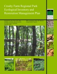
Pilot Knob II Plan - Great River Greening
Pilot Knob II Plan - Great River Greening
Pilot Knob II Plan - Great River Greening

Create successful ePaper yourself
Turn your PDF publications into a flip-book with our unique Google optimized e-Paper software.
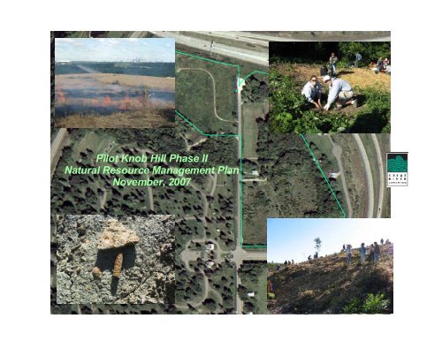
<strong>Pilot</strong> <strong>Knob</strong> Hill Phase <strong>II</strong><br />
Natural Resource Management <strong>Plan</strong><br />
November, 2007
<strong>Pilot</strong> <strong>Knob</strong> Hill Phase <strong>II</strong><br />
Natural Resource Management <strong>Plan</strong><br />
Compiled by:<br />
Wiley Buck<br />
Todd Rexine<br />
Tara Krebs<br />
Tony Randazzo<br />
Daniel Tix<br />
<strong>Great</strong> <strong>River</strong> <strong>Greening</strong><br />
November 2007
<strong>Pilot</strong> <strong>Knob</strong> Hill Natural Resource Management <strong>Plan</strong><br />
<strong>Great</strong> <strong>River</strong> <strong>Greening</strong>, a nonprofit organization, helps<br />
communities coordinate cost-effective and sustained efforts to<br />
manage ecosystems of the Mississippi, Minnesota and St.<br />
Croix <strong>River</strong> valleys in the Twin Cities metropolitan area. We<br />
are primarily an implementing organization, providing on-theground<br />
ecological restoration and management of both public<br />
and private land. We engage thousands of volunteers in the<br />
planting of native vegetation, removal of exotic weeds, native<br />
seed collection and stewardship—work which results in an<br />
informed and involved citizenry. GRG also acts as a catalyst,<br />
creating effective partnerships among agencies, municipalities,<br />
and private landowners responsible for managing river valleys<br />
and their natural resources. Restoration ecologists and other<br />
scientists provide technical expertise. For more information,<br />
see our website at www.greatrivergreening.org.<br />
Wiley Buck, Restoration Ecologist (M.S., Wildlife<br />
Conservation, University of Minnesota)<br />
Wiley is responsible for project development and management,<br />
particularly for multi-year restoration projects such as Metro<br />
Conservation Corridors, a cooperative effort for protection and<br />
acquisition in priority areas of the metro, and Bucks and<br />
Buckthorn, a youth hunter and ecological education project. He<br />
served as <strong>Greening</strong>’s conservation director in 2004 and 2005.<br />
Wiley gained his restoration expertise through his experience<br />
with McHenry County Conservation District, The Nature<br />
Conservancy, Chicago Wilderness, and the Minnesota DNR’s<br />
Scientific and Natural Areas Program (SNA). As Resource<br />
Management Supervisor with SNA, he developed and<br />
implemented SNA management policy, supervised crew and<br />
staff, and helped build budgets and funding priorities.<br />
wbuck@greatrivergreening.org<br />
Todd Rexine, Ecological Designer (M.L.A, University of<br />
Minnesota)<br />
Todd provides landscape ecological and design services on a<br />
variety of <strong>Greening</strong> projects. He has significant installation,<br />
computer and budget experience from his years in the private<br />
design-build field. He also has a B.F.A. in Studio Art and has<br />
worked as an assistant for American Bronze Castings, in<br />
addition to continuing in his own sculpture.<br />
trexine@greatrivergreening.org<br />
Tara Krebs, Project Assistant (B.A. Rangeland Ecology,<br />
conc. Restoration, Colorado State University)<br />
Tara assists the Conservation Director at <strong>Great</strong> <strong>River</strong> <strong>Greening</strong><br />
with project development and tracking, as well as follow-up<br />
maintenance and field support. She started as a field crew<br />
member at <strong>Great</strong> <strong>River</strong> <strong>Greening</strong>. Her previous work<br />
experience includes: studying nutrient loading on a watershed<br />
level with The Institute of Ecosystem Studies, teaching ecology<br />
lessons to high school students at the Irvine Nature Center, and<br />
work as the Rangeland Management specialist SCEP student,<br />
writing annual operating plans, implementing riparian<br />
monitoring systems, and doing GPS/GIS work for the USDA<br />
Forest Service in Colville, WA.<br />
tkrebs@greatrivergreening.org<br />
Tony Randazzo, Landscape Ecologist (M.L.A, University of<br />
Minnesota)<br />
Tony provides landscape, ecological and design services on a<br />
variety of <strong>Greening</strong> projects, conducts ecological inventories<br />
and analysis, and writes ecological restoration and management<br />
plans. Previously at Kestrel Design Group and Peterson<br />
i
<strong>Pilot</strong> <strong>Knob</strong> Hill Natural Resource Management <strong>Plan</strong><br />
Environmental Consulting, Tony specializes in inventory,<br />
design and restoration of wetlands, shorelines and streambanks.<br />
trandazzo@greatrivergreening.org<br />
Daniel Tix, Conservation Director (Ph.D., Conservation<br />
Biology, University of Minnesota)<br />
Dan leads and coordinates the growing<br />
conservation operations of <strong>Greening</strong>, including volunteer<br />
restoration work, crew work, ecological planning, design and<br />
consulting. Previously, as Conservation Ecologist, he was<br />
involved in all types of restoration work, particularly the<br />
restoration of native savanna and forest communities and the<br />
development of design and management plans. Dan received<br />
his Ph.D. in plant biology from the University of Minnesota,<br />
where he researched management of restored prairies along<br />
roadsides and in urban areas. He has prior experience<br />
performing plant inventories for ecological management<br />
projects in California, the Dakotas, and Minnesota. Prior to his<br />
work at <strong>Great</strong> <strong>River</strong> <strong>Greening</strong>, Dan worked as a wetland<br />
consultant, delineating wetlands and advising developers on<br />
appropriate wetland management strategies.<br />
dtix@greatrivergreening.org<br />
ii
<strong>Pilot</strong> <strong>Knob</strong> Hill Natural Resource Management <strong>Plan</strong><br />
Executive Summary<br />
The potential acquisition and restoration of a 15 acre addition<br />
to the 8 acres of existing public natural area on <strong>Pilot</strong> <strong>Knob</strong> Hill<br />
represents a historic opportunity to protect a significant piece<br />
of Minnesota’s history and restore some of the native prairie<br />
and savanna that has all but disappeared from the landscape.<br />
Known as Oheyawahi (“a hill much visited”), this prominent<br />
hill is a burial ground and sacred space to the Dakota people. It<br />
was a landmark for river navigation recognized by early<br />
European-American settlers. In 1851, a major treaty signed<br />
between the Dakota and whites ceded to the U.S. 35 million<br />
acres of land in Minnesota (Woolworth and White 2004).<br />
Today, the site is adjacent to Fort Snelling State Park, within a<br />
major bird migration route; it is both surrounded by dense<br />
urban development, while also an integral part of the wildlife<br />
rich Minnesota <strong>River</strong> corridor.<br />
The main purpose of this report is to identify the most<br />
appropriate targets for restoring and managing the <strong>Pilot</strong> <strong>Knob</strong><br />
Hill Phase <strong>II</strong> site and then determine an effective strategy for<br />
achieving those targets. These targets and recommendations,<br />
and much of the background information, is based on<br />
information gathered for the Phase I management plan (<strong>Great</strong><br />
<strong>River</strong> <strong>Greening</strong>, 2005). In addition, we identify several<br />
additional options to enhance the project, such as including<br />
volunteers and increasing the diversity of wildflowers. The<br />
overall goal is to make this site an inviting place where people<br />
can enjoy its views, experience the natural setting, and learn<br />
about and honor its storied past. The site could also become a<br />
gateway to Mendota Heights for thousands of daily motorists.<br />
Restoration Targets:<br />
<strong>Pilot</strong> <strong>Knob</strong> Hill should be restored to native prairie and<br />
savanna, habitats that were present in the mid-1800s before the<br />
land was settled by Europeans, and of utmost ecological value<br />
(MN DNR.2006) and cultural value today When restored, the<br />
site will give visitors a sense of the diverse and beautiful<br />
prairie landscape that is rare today.<br />
Restoration Process:<br />
The restoration of native habitats in the 15 acre <strong>Pilot</strong> <strong>Knob</strong> Hill<br />
Phase <strong>II</strong> project area will be a long term process. Little native<br />
vegetation is left due to fairly typical disturbance of agriculture<br />
use and homesite development. These disturbances have<br />
allowed a number of threatening invasive species to get a<br />
foothold, though they are still at manageable levels.<br />
Unlike Phase I, this site can be restored in distinct steps and<br />
distinct areas. Fortunately, the area with the greatest ecological<br />
connectivity to Phase I will also be the easiest area to restore.<br />
With the suite of invasive species on the site, however, the<br />
restoration needs to proceed systematically and with care.<br />
Volunteer Opportunities:<br />
Nearly every part of this restoration project can involve<br />
volunteers, either through large, well-publicized events or as<br />
small, self-sufficient groups requiring minimal supervision.<br />
The large events allow local people to come together for<br />
meaningful work, become personally involved, and learn more<br />
about the restoration and the site. Potential volunteer activities<br />
run the gamut from invasive species removal to planting and<br />
seeding.<br />
iii
<strong>Pilot</strong> <strong>Knob</strong> Hill Natural Resource Management <strong>Plan</strong><br />
Trails and Overlook:<br />
A simple, low-maintenance trail system with overlooks that<br />
connects to the Phase I trails will give visitors the opportunity<br />
to contemplate the site’s expansive views of natural and<br />
human-built landscapes.<br />
Costs:<br />
Estimated cash requirements for native prairie and savanna<br />
restoration are:<br />
• Whole Site Treatments (exotics etc.) $ 32,000<br />
• Area 1 Prairie $ 35,000<br />
• Area 2 Prairie and Savanna $ 54,000<br />
• Areas 3 Savanna and Prairie $ 30,400<br />
(10yrs of 30yr plan)<br />
• Wildlife Hibernaculum/Nest Boxes $ 6,300<br />
• Trail/Overlook/Parking constr $ 38,800<br />
• Interpretive displays $ 30,000<br />
Acquisition Requirements:<br />
This management plan is designed to fulfill the requirements of<br />
the acquisition partner organizations and grant programs. Use<br />
of the site will be determined in the final grant agreements, but<br />
sound management and appropriate public access are principles<br />
that are fully anticipated. The acquisition partners include Trust<br />
for Public Land, Dakota County Farmland and Natural Areas<br />
Program, DNR Metro Greenways, DNR Remediation Fund,<br />
and the DNR Natural and Scenic Area Grants Program.<br />
Funding:<br />
The <strong>Pilot</strong> <strong>Knob</strong> Hill Phase <strong>II</strong> natural resource restoration<br />
project has many components that are compelling for funders:<br />
• it is highly visible,<br />
• it has a nationally significant role in the history of the<br />
Dakota people and European settlement of the region,<br />
• it connects to existing natural areas and is in a key<br />
township in the state’s Comprehensive Wildlife<br />
Conservation Strategy,<br />
• prairie and savanna communities are high priority<br />
habitats for restoration due to their rarity,<br />
• the work provides meaningful opportunities for<br />
volunteers.<br />
While there are no guarantees for fundraising, the City of<br />
Mendota Heights can anticipate that substantial funding for the<br />
restoration project can be generated through grants. If selected<br />
to coordinate the restoration work, <strong>Great</strong> <strong>River</strong> <strong>Greening</strong> can<br />
work with the City to secure grant funds for the project.<br />
A Vision:<br />
An artistic vision of a restored <strong>Pilot</strong> <strong>Knob</strong> Hill gives a sense of<br />
how this natural area could look. The waving prairie grasses,<br />
flushes of colorful wildflowers throughout the season, and<br />
scattered, twisting-limbed bur oaks in a restored <strong>Pilot</strong> <strong>Knob</strong><br />
Hill would be a striking sight to thousands of drivers crossing<br />
the bridge into Mendota Heights. It would be a great setting<br />
for bringing together community members to commemorate<br />
such a significant place.<br />
iv
<strong>Pilot</strong> <strong>Knob</strong> Hill Natural Resource Management <strong>Plan</strong><br />
illustration by Dan Shaw<br />
v
<strong>Pilot</strong> <strong>Knob</strong> Hill Natural Resource Management <strong>Plan</strong><br />
Acknowledgements<br />
This plan was written under the guidance of Guy Kullander,<br />
James Danielson, and Sue McDermott and of the City of<br />
Mendota Heights; Alan Singer of the Dakota County Farmland<br />
and Natural Areas Program; and Robert McGillivray of The<br />
Trust for Public Land. Ryan Ruzek assisted with shape files;<br />
Mary Hagerman at Dakota County GIS Services supplied high<br />
resolution aerial photos and assistance with re-projecting.<br />
Cathy Undem at Dakota Co. Farmland and Natural Areas<br />
Program supplied historic aerial photos.<br />
Many volunteers from several organizations have contributed<br />
on drafts of this report include Gail Lewellan, Sister Jan<br />
Dalsin, and Jeanne Hollingsworth of the <strong>Pilot</strong> <strong>Knob</strong><br />
Preservation Association; Larry Grainger of PKPA and the<br />
JRB Minnesota <strong>River</strong> History Center; Jim Anderson, Cultural<br />
Liaison of the Mendota Mdwakenton Dakota Community;<br />
Rudy, long-time resident at the north homesite; and Dale<br />
Bachmeier, Acacia Park Cemetery for allowing access during<br />
the acquisition period.<br />
Peter Wielke, USDA-NRCS, and Liz Harper, Non-game<br />
Specialist at MN DNR, provided expert review and data on<br />
select portions of the plan. Chet Meyers, Chairperson of the<br />
Red-Headed Woodpecker Recovery, Audubon - Minneapolis<br />
provided valuable resources on the habitat needs of red-headed<br />
woodpeckers.<br />
Cordelia Pierson of The Trust for Public Land compiled the<br />
Phase I version of the funding sources listed in Appendix C.<br />
Susan Overson of the Mississippi National <strong>River</strong> and<br />
Recreation Area assisted with estimates of the costs of creating<br />
and installing interpretive signs.<br />
This plan was presented to the Mendota Heights Parks and<br />
Recreation Commission on November 13, 2007, and the City<br />
Council on November 20, 2007.<br />
vi
<strong>Pilot</strong> <strong>Knob</strong> Hill Natural Resource Management <strong>Plan</strong><br />
Table of Contents Page<br />
Review and Approval<br />
Executive Summary iii<br />
Acknowledgements vi<br />
<strong>Pilot</strong> <strong>Knob</strong> Hill Project Area Location 1<br />
Geology and Soils 3<br />
Vegetation of <strong>Pilot</strong> <strong>Knob</strong> Before European Settlement 6<br />
Vegetation of <strong>Pilot</strong> <strong>Knob</strong> Project Area in the 1900s 8<br />
Current Vegetation at <strong>Pilot</strong> <strong>Knob</strong> Hill 12<br />
Native <strong>Plan</strong>t Communities Recommended for Restoration at <strong>Pilot</strong> <strong>Knob</strong> Hill 19<br />
An Implementation <strong>Plan</strong> for Restoring Native <strong>Plan</strong>t Communities 24<br />
Wildlife Habitat Management at <strong>Pilot</strong> <strong>Knob</strong> Hill 36<br />
Implementation Schedules 40<br />
Recommendations for Trails, Overlook, and Interpretive Information 51<br />
Recommendations for Parking and <strong>Pilot</strong> <strong>Knob</strong> Road 65<br />
Recommendations for Involving Volunteers 70<br />
References 74<br />
vii
<strong>Pilot</strong> <strong>Knob</strong> Hill Natural Resource Management <strong>Plan</strong><br />
Appendices:<br />
Appendix A: <strong>Plan</strong>t Species for Restoration at <strong>Pilot</strong> <strong>Knob</strong> Hill 77<br />
Appendix B: Resources for Restoration 90<br />
Appendix C1: Potential Funding Sources for <strong>Pilot</strong> <strong>Knob</strong> Restoration<br />
as of October 22, 2005 93<br />
Appendix C2: Current Funding Sources as of November 2007 97<br />
Appendix D: Reasonable Replacement Costs for Tree/Shrub Removal on<br />
Mn/DOT Right of Way 98<br />
Appendix E: <strong>Plan</strong> Amendments 100<br />
Appendix F: Bird Species of <strong>Great</strong>est Conservation Need (SGCN) Found at<br />
Fort Snelling State Park 101<br />
Appendix G: Rare Animal Features within 1.5 Miles of <strong>Pilot</strong> <strong>Knob</strong> Hill 103<br />
List of Figures:<br />
Figure 1: <strong>Pilot</strong> <strong>Knob</strong> Hill Project Location 2<br />
Figure 2: Soils of <strong>Pilot</strong> <strong>Knob</strong> Hill Project Area 4<br />
Figure 3: Vegetation at the Time of European Settlement 7<br />
Figure 4: 1945 Aerial Photo of <strong>Pilot</strong> <strong>Knob</strong> Hill Phase <strong>II</strong> 9<br />
Figure 5: 1970 Aerial Photo of <strong>Pilot</strong> <strong>Knob</strong> Hill Phase <strong>II</strong> 10<br />
Figure 6: 1985 Aerial Photo of <strong>Pilot</strong> <strong>Knob</strong> Hill Phase <strong>II</strong> 11<br />
Figure 7: Current Land Cover 14<br />
Figure 8: Invasive Species Locations 18<br />
Figure 9: Target <strong>Plan</strong>t Communities at <strong>Pilot</strong> <strong>Knob</strong> Hill 20<br />
Figure 10: Herbaceous Seed Mixes for Sowing 39<br />
Figure 11:Phase I and Phase <strong>II</strong> Trails and Overlooks 52<br />
Figure 12: Proposed Temporary Trails and Overlook Locations 53<br />
Figure 13: Proposed Trails and Overlook Locations at <strong>Pilot</strong> <strong>Knob</strong> Hill <strong>II</strong> 54<br />
viii
<strong>Pilot</strong> <strong>Knob</strong> Hill Natural Resource Management <strong>Plan</strong><br />
List of Tables:<br />
Table 1: Whole Site Considerations 40<br />
Table 2: Area 1 Prairie Reconstruction 42<br />
Table 3: Area 2 Prairie and Savanna Reconstruction 44<br />
Table 4: Area 3 Savanna and Prairie Reconstruction 45<br />
Table 5: Wildlife Habitat Improvements 50<br />
Table 6: Estimated Construction Costs 67<br />
Table 7: Estimated Construction Costs, Parking Lot Area 68<br />
Table 8: Summary of Estimated Costs by Year 69<br />
ix
<strong>Pilot</strong> <strong>Knob</strong> Hill Natural Resource Management <strong>Plan</strong><br />
<strong>Pilot</strong> <strong>Knob</strong> Hill Project Area Location<br />
<strong>Pilot</strong> <strong>Knob</strong> Hill Phase I and <strong>II</strong> project areas are in the southern<br />
corners of section 27 and 28, range 23, township 28 in<br />
Mendota Heights, Dakota Co. <strong>Pilot</strong> <strong>Knob</strong> Hill is located in the<br />
2000 block of <strong>Pilot</strong> <strong>Knob</strong> Road at its northern terminus.<br />
The <strong>Pilot</strong> <strong>Knob</strong> Hill Phase <strong>II</strong> project area consists of over 16<br />
acres of potential habitat, consisting of three parcels currently<br />
owned by the City, and the bulk of the acreage from a Trust for<br />
Public Land acquisition from Acacia Park Cemetery. Phase I<br />
and Phase <strong>II</strong> straddle both sides of the <strong>Pilot</strong> <strong>Knob</strong> Road, which<br />
reaches a dead-end at the site, and will no longer be necessary.<br />
This adds a small amount of acreage to the project location; its<br />
removal is important for connectivity.<br />
by highways to the east and paved road on the south, Acacia<br />
Park cemetery to the west. The two sites together then are<br />
bordered on the north by Highways 55 and 110 just east of the<br />
Mendota Bridge, and to the west by the Big <strong>River</strong>s Regional<br />
Bike Trail (maintained by Dakota County) and Sibley<br />
Memorial Highway (Figure 1). Fort Snelling State Park sits<br />
within the Minnesota <strong>River</strong> Valley just west of the project area.<br />
The Minnesota Valley National Wildlife Refuge adjoins the<br />
state park just upstream from the project area. The south edge<br />
of Mississippi National <strong>River</strong> and Recreation Area is just north<br />
of the project area.<br />
The views from the hill span native forests and wetlands in the<br />
Minnesota Valley, as well as a broad panorama of the urban<br />
landscape including the Minneapolis skyline, Fort Snelling<br />
State Park and History Center, and the MSP International<br />
Airport.<br />
This land is adjacent to the eight acres in Phase I combining for<br />
a total of approximately 24 acres. The project site is bordered<br />
1
<strong>Pilot</strong> <strong>Knob</strong> Hill Natural Resource Management <strong>Plan</strong><br />
St. Paul<br />
Lilydale<br />
Fort Snelling<br />
Mendota<br />
Phase <strong>II</strong><br />
Phase I<br />
Sections<br />
Municipalities<br />
28<br />
27<br />
Mendota Heights<br />
N<br />
Figure 1: <strong>Pilot</strong> <strong>Knob</strong> Hill Project Location (2003 FSA Color Aerial) Photo)<br />
0 1 2 Miles<br />
2
<strong>Pilot</strong> <strong>Knob</strong> Hill Natural Resource Management <strong>Plan</strong><br />
Geology and Soils<br />
During the Paleozoic Era 450-523 million years ago, the <strong>Pilot</strong><br />
<strong>Knob</strong> Hill region was covered by warm, tropical seas.<br />
Sediments deposited in these seas later formed a series of<br />
limestone, sandstone, dolomite and shale layers throughout<br />
southeastern Minnesota. The uppermost strata of this<br />
sedimentary rock series occurs near the surface on the sides of<br />
<strong>Pilot</strong> <strong>Knob</strong> Hill. Rocks exposed within the Phase I project area<br />
include the Decorah shale, a gray-green shale, and Platteville<br />
limestone. These layers are known for having highly abundant<br />
fossils, including brachiopods, cephalopods, gastropods,<br />
crinoids, and trilobites (Ojakangas and Matsch 1982).<br />
Much later in time, the Paleozoic bedrocks were covered by<br />
glacial deposits. Approximately 13,000 years ago, <strong>Pilot</strong> <strong>Knob</strong><br />
Hill was covered by the eastern edge of the Des Moines lobe of<br />
the Wisconsinan glaciation, which was the latest glaciation in<br />
Minnesota. When the glacial lobe melted from its edge and<br />
retreated, approximately 12,000 years ago, outwash streams<br />
flowed over the <strong>Pilot</strong> <strong>Knob</strong> area northward into the Mississippi<br />
<strong>River</strong>. These meltwater streams left beds of sandy and gravelly<br />
outwash (Hobbs et al. 1990). The braided meltwater stream bed<br />
was later followed by Glacial <strong>River</strong> Warren, a huge glacial<br />
river that originated from the southern tip of Glacial Lake<br />
Agassiz in western Minnesota and formed the broad and wide<br />
valley now occupied by the Minnesota <strong>River</strong> (Wright 1972).<br />
The glacial outwash deposits sit underneath the upper slopes of<br />
<strong>Pilot</strong> <strong>Knob</strong>, including most of the project area. Lower slopes<br />
of <strong>Pilot</strong> <strong>Knob</strong> were carved by Glacial <strong>River</strong> Warren, which<br />
removed layers of outwash and underlying glacial till, and cut<br />
into the underlying sedimentary bedrock layers.<br />
According to the Dakota County Soil Survey (NRCS 1983),<br />
three soil types occur in the <strong>Pilot</strong> <strong>Knob</strong> Hill phase <strong>II</strong> project<br />
area (Figure 2). Brief descriptions of these soil types given<br />
below are excerpted from this soil survey. Interpretations of<br />
conditions for soil formation are from Brady (1974) and<br />
Weikle (pers. comm.). Additional recommendations on<br />
suitable plant communities for the different soil types are<br />
interpretations of the authors of this report.<br />
Soil survey polygon attributes and boundaries were created<br />
before 1983, which predates the latest road construction<br />
improvements for highway 55. The steep slopes along<br />
highway 55 at the northeast corner of the project area occur<br />
further south today than they did when the soil survey was<br />
created.<br />
The three soil types in the <strong>Pilot</strong> <strong>Knob</strong> Hill phase <strong>II</strong> project area<br />
are all mesic loams or silt loams most suitable for mesic plant<br />
communities such as mesic prairie or savanna.<br />
The Waukegan soil is by far the most prevalent soil, with only<br />
minor corners of the project areas Lester and Kanaranzi (likely<br />
disrupted from Hwy 55 construction) Waukegan soils in the<br />
site are classified as mollisols, meaning that they contain dark,<br />
upper horizons formed under prairie.<br />
3
<strong>Pilot</strong> <strong>Knob</strong> Hill Natural Resource Management <strong>Plan</strong><br />
WAUKEGAN<br />
LESTER<br />
#<br />
~0"<br />
KANARANZI<br />
Ph. <strong>II</strong> Boundary<br />
#<br />
>12"<br />
#<br />
3"<br />
#<br />
A Horizon<br />
Depths 10_22_07<br />
#<br />
>12"<br />
#<br />
~0"<br />
#<br />
>15"<br />
#<br />
~0"<br />
#<br />
>12"<br />
N<br />
Figure 2: Soils of <strong>Pilot</strong> <strong>Knob</strong> Hill Project Area(Source: USDA, 1983)<br />
0 400 800 Feet<br />
4
<strong>Pilot</strong> <strong>Knob</strong> Hill Natural Resource Management <strong>Plan</strong><br />
Soil borings were taken as part of this planning process (see<br />
Figure 2). Topsoil depths were found to vary greatly, being<br />
very deep in many spots but essentially absent in others. This<br />
lack of topsoil in some spots is likely due to erosion from<br />
agriculture, and scraping for road building or other purposes.<br />
These soil borings also revealed the presence of invasive exotic<br />
earthworms, specifically nightcrawlers (Lumbricus terrestris).<br />
This infestation is common but the deleterious effect of<br />
earthworms on forest and woodland understory plants is well<br />
documented.<br />
Waukegan Silt Loam – This is a gently sloping, well-drained<br />
soil formed in a deep, silty mantle over sandy and gravelly<br />
outwash deposits. In a typical profile, silt loam extends to a<br />
depth of 32 inches, underlain by gravelly coarse sand of glacial<br />
outwash deposits.<br />
Lester Loam – This soil is a deep, well-drained loam formed<br />
in glacial till deposits. A typical pedon consists of loam to 11<br />
inches over clay loam. The underlying clay loam is likely to<br />
have formed in shale and limestone colluvial deposits. In<br />
phase <strong>II</strong> this soil was likely disrupted during Hwy 55<br />
construction.<br />
Kanaranzi Silt Loam – This is a gently sloping, well-drained<br />
soil of fine silt loam. In a typical profile, silt loam extends to a<br />
depth of 0-7 inches. Native vegetation is classified as tall grass<br />
prairie.<br />
5
<strong>Pilot</strong> <strong>Knob</strong> Hill Natural Resource Management <strong>Plan</strong><br />
Vegetation of <strong>Pilot</strong> <strong>Knob</strong> Before European<br />
Settlement<br />
The upper slopes of <strong>Pilot</strong> <strong>Knob</strong> were dominated by native prairie<br />
vegetation in the early 1800s, as clearly illustrated by Seth<br />
Eastman’s drawing from 1847. Between open prairies were bands<br />
of woody vegetation concentrated along drainages. Given the<br />
mesic (moist) soils on these upper slopes, the prairie vegetation<br />
would have been predominantly mesic tallgrass prairie.<br />
These Oak Openings and Barrens would be described today as<br />
Southern Dry Savanna or Southern Mesic Savanna (MNDNR<br />
2005, in preparation). Mesic prairies and oak savannas are firemaintained<br />
plant communities that burned every 5-10 years, which<br />
prevented them from being overtaken by brush and trees. Before<br />
European settlement, wildfires set by lightning or Native<br />
Americans frequently swept across the landscape (Grimm 1984).<br />
Today, mesic prairies and savannas are among the rarest native<br />
plant communities in Minnesota. Most prairies and savannas in<br />
the region were cleared for agriculture or urban development.<br />
Nearly all that remained transformed into woodlands and forests<br />
due to the suppression of wildfires.<br />
Eastman’s drawing of <strong>Pilot</strong> <strong>Knob</strong> Minnesota Historical Society<br />
Frederick J. Marschner’s map of “The Original Vegetation of<br />
Minnesota” shows the <strong>Pilot</strong> <strong>Knob</strong> region as “Oak Openings and<br />
Barrens” (Figure 3; Marschner 1974). This map was based on the<br />
notes of surveyors of the Public Land Survey, who marked off the<br />
grid of section lines across the state and surveyed most of Dakota<br />
County from 1847 to 1855. Oak Openings and Barrens were<br />
principally “scattered trees and groves of Oaks (mostly bur oaks)<br />
of scrubby form with some brush and thickets, in a matrix of tallgrass<br />
prairie, and occasionally with Pines” (Heinselman 1974).<br />
6
<strong>Pilot</strong> <strong>Knob</strong> Hill Natural Resource Management <strong>Plan</strong><br />
7
<strong>Pilot</strong> <strong>Knob</strong> Hill Natural Resource Management <strong>Plan</strong><br />
Vegetation of the <strong>Pilot</strong> <strong>Knob</strong> Project Area in<br />
the 1900s<br />
Figures 4, 5 and 6 are historic aerial photos of the area in 1945,<br />
1970 and 1985 respectively. The project area was primarily a<br />
farm and other houses in the early 1900s. Large fields were<br />
cultivated on the south end and north end. The east-central<br />
portion appears to have been an intense livestock area; in 1970,<br />
trees and shrubs appear to have volunteered in this former eastcentral<br />
livestock areas, presumably due to the removal of the<br />
livestock. The old field on the south end currently supports a<br />
large number of young green ash and other trees.<br />
By 1985, <strong>Pilot</strong> <strong>Knob</strong> Road’s connection to Hwy 55 was rerouted<br />
and has been a dead end cul-de-sac ever since. Several<br />
homesites existed on the site, with a cluster of small lots in the<br />
southeast. MN DOT constructed a detention basin in the<br />
southeast corner, but it does not appear to collect much runoff<br />
at this point. Most recently, Acacia Park Cemetery has changed<br />
the use of the grounds around the central homesite. The back<br />
lot is now used extensively for equipment and vehicle storage.<br />
Up until the 1990s, the large turf area between the two<br />
remaining homesites was cut for sod by Acacia Park Cemetery<br />
(Bachmeir, pers. comm.)<br />
8
<strong>Pilot</strong> <strong>Knob</strong> Hill Natural Resource Management <strong>Plan</strong><br />
Figure 4: 1945 Aerial Photo of <strong>Pilot</strong> <strong>Knob</strong> Hill<br />
(Photo and layout courtesy of Dakota Co. Farmland and Natural Areas Program)<br />
9
<strong>Pilot</strong> <strong>Knob</strong> Hill Natural Resource Management <strong>Plan</strong><br />
Figure 5: 1970 Aerial Photo of <strong>Pilot</strong> <strong>Knob</strong> Hill<br />
(Photo and layout courtesy of Dakota Co. Farmland and Natural Areas Program)<br />
10
<strong>Pilot</strong> <strong>Knob</strong> Hill Natural Resource Management <strong>Plan</strong><br />
Figure 6: 1985 Aerial Photo of <strong>Pilot</strong> <strong>Knob</strong> Hill<br />
(Photo and layout courtesy of Dakota Co. Farmland and Natural Areas Program)<br />
11
<strong>Pilot</strong> <strong>Knob</strong> Hill Natural Resource Management <strong>Plan</strong><br />
Current Vegetation at <strong>Pilot</strong> <strong>Knob</strong> Hill<br />
The existing land cover in the <strong>Pilot</strong> <strong>Knob</strong> Hill Phase <strong>II</strong> project<br />
area was field surveyed from September to Novermber 2007,<br />
and in Phase I in September 2005 (<strong>Great</strong> <strong>River</strong> <strong>Greening</strong>,<br />
2005) and mapped in Figure 8. The units on the map are<br />
described below.<br />
Old Field<br />
In Phase I, the vegetation of this area is highly disturbed and<br />
dominated mostly by a dense cover of a wide diversity of<br />
exotic or invasive native plant species. Major dominant<br />
species on the site include Kentucky bluegrass (Poa pratensis),<br />
quackgrass (Agropyron repens), burdock (Arctium minus),<br />
common buckthorn (Rhamnus cathartica), giant goldenrod<br />
(Solidago gigantea), Canada goldenrod (Solidago canadensis),<br />
white sweet clover (Melilotus alba), and yellow sweet clover<br />
(Melilotus officinalis).<br />
Some native plant species that would occur in prairies and<br />
savannas are also present. These include stiff goldenrod<br />
(Solidago rigida), wild bergamot (Monarda fistulosa), dogbane<br />
(Apocynum androsaemifolium), white snakeroot (Eupatorium<br />
rugosum), wolfberry (Symphoricarpos occidentalis),<br />
nannyberry (Viburnum lentago), jerusalem artichoke<br />
(Helianthus tuberosus), gray dogwood (Cornus racemosa),<br />
yarrow (Achillea millefolium), short sedge (Carex brevior), and<br />
woodland sedge (Carex blanda).<br />
Turf<br />
In Phase <strong>II</strong>, the old field is fairly typical in that the herbaceous<br />
layer is dominated by non-native smooth brome, poa, and<br />
overabundant native Canada and stiff goldenrod. It is has a<br />
high stem density of invasive Siberian elm, black walnut, and<br />
green ash. Red cedar, gray dogwood, box elder, aspen and<br />
other species are present in lower numbers.<br />
Several acres in phase <strong>II</strong> are in turf, including the yards around<br />
the two remaining homesites and an expanse between the two<br />
homes. This area has been mowed regularly. It has common<br />
weeds in it including quack grass, but is relatively free of<br />
spotted knapweed and other invasive species in the area.<br />
12
<strong>Pilot</strong> <strong>Knob</strong> Hill Natural Resource Management <strong>Plan</strong><br />
Vegetable Garden<br />
A large vegetable garden was in production until 2007. This<br />
area is adjacent to the turf and is now being colonized by<br />
weedy species. Raspberry and assorted fencing are also in this<br />
classification.<br />
Detention Pond<br />
There is a stormwater detention pond in the southeast corner of<br />
the site, collecting run off from Valencour Circle. However,<br />
even in heavy rainfall periods, standing water does not collect.<br />
Due to the steep slopes and highly disrupted nature of this area,<br />
it presents no unique planting opportunities.<br />
13
<strong>Pilot</strong> <strong>Knob</strong> Hill Natural Resource Management <strong>Plan</strong><br />
Bi<br />
Br<br />
Mo<br />
Wi<br />
Ct<br />
Br<br />
Be<br />
Fr<br />
Si<br />
As<br />
Am<br />
Co<br />
Di<br />
Bu<br />
Re<br />
Of<br />
Ur<br />
Bg<br />
Ds<br />
Land Cover<br />
Bx<br />
Re<br />
Ur<br />
Tr<br />
Tr<br />
Br<br />
Br<br />
Br<br />
Pr<br />
Ur<br />
Tf<br />
Vg<br />
Cw<br />
Old field<br />
<strong>Plan</strong>ted conifers<br />
Buildings and groun<br />
Vegetable garden<br />
DOT slope<br />
Turf grass<br />
Detention Pond<br />
Cottonwood box<br />
elder and ash<br />
Bg<br />
Of<br />
Cw<br />
Po<br />
Co<br />
N<br />
Figure 7: Current Land Cover (2006 Color Aerial courtesy of Dakota Co.)<br />
0 400 800 Feet<br />
14
<strong>Pilot</strong> <strong>Knob</strong> Hill Natural Resource Management <strong>Plan</strong><br />
Box Elders and <strong>Plan</strong>ted Conifers (Phase I only)<br />
This is a large area of woods on the Acacia Cemetery property<br />
composed mostly of box elders that invaded the area since the<br />
early 1960s (Figures 4, 5 and 6). Stands of invasive trees like<br />
this are not recognized as native plant communities, as they<br />
originate primarily on human-disturbed sites. Several patches<br />
of planted conifers planted before 1970 also occur within this<br />
woods and contain white spruce (Picea alba), red pine (Pinus<br />
resinosa), and arbor vitae (Thuja sp.). Other trees in these<br />
woods include cottonwood, green ash, black walnut, Siberian<br />
elm, and American elm. Underneath the trees in these woods<br />
is a dense thicket of common buckthorn, a highly invasive<br />
exotic species that crowds out native trees and wildflowers.<br />
Garlic mustard (Alliaria petiolata) is an exotic plant that has<br />
invaded the ground in these woods. Other common native<br />
herbs include wood nettle (Laportea canadensis), moonseed<br />
(Menispermum canadense), lady fern (Athyrium angustum),<br />
enchanter’s nightshade (Circaea lutetiana), sweet-scented<br />
bedstraw (Galium triflorum), and white snakeroot (Eupatorium<br />
rugosum). Stacks of marble tiles, slate roof shingles, and<br />
limestone blocks are stored in a small portion of this area.<br />
Bur Oaks<br />
This is a small stand of large bur oak trees on the Acacia<br />
Cemetery property that were present in 1945 (Figure 4) and<br />
likely originated from trees that occupied the area before the<br />
time of European settlement. These trees grew up in an open<br />
setting and not in woods, as they have broad crowns with<br />
spreading, horizontal limbs. A large American elm, (Ulmus<br />
americana), is also present within the woods. The herbs on the<br />
ground are species typical of shaded woods on heavy, moist<br />
soils, including wood nettles, and other species seen in the Box<br />
Elder and <strong>Plan</strong>ted Conifers woods.<br />
15
<strong>Pilot</strong> <strong>Knob</strong> Hill Natural Resource Management <strong>Plan</strong><br />
DOT Slope<br />
This is an engineered, north-facing slope along the south side<br />
of highway 55. In Phase I, the slope consists predominantly of<br />
grassy vegetation with a narrow band of planted trees and<br />
shrubs that were mapped separately. Below the band of trees<br />
and shrubs, the slope is dominated by exotic species: smooth<br />
brome (Bromus inermis), Kentucky bluegrass, and bird’s foot<br />
trefoil. The upper half of the slope, above the planted trees, the<br />
vegetation is much the same as the area mapped as Old Field.<br />
Several species of native prairie grasses and forbs were also<br />
planted by MNDOT into this area but these did not establish<br />
very well due to poor seed, insufficient site preparation, and /or<br />
lack of maintenance. These prairie species include big<br />
bluestem, Indian grass, little bluestem, and black-eyed Susan<br />
(Rudbeckia hirta). Controlled burns on the upper part of the<br />
slope would help re-establish the planted prairie grasses.<br />
Road cut slope, NE end Phase <strong>II</strong><br />
In Phase <strong>II</strong>, the slope for the roadcut, owned in part by DOT<br />
and part contained in the Phase <strong>II</strong> boundary, several trees<br />
including Lombardy poplar, conifers, and desirable oaks are<br />
growing. Within the project boundary, the understory<br />
vegetation includes invasive reed canary grass, but also native<br />
river bulrush and extensive wild bergamot. Box elder trees are<br />
beginning to take over. On the DOT slope in Phase <strong>II</strong>, there are<br />
no highly invasive trees or shrubs whose removal is necessary<br />
like Phase I.<br />
<strong>Plan</strong>ted Conifers<br />
In Phase I, this is an area of pines (Ponderosa pine or red pine)<br />
and white spruce planted by MNDOT.<br />
In Phase <strong>II</strong>, conifers have been planted along a roadside<br />
easement along Acacia Blvd at the south end of the site where<br />
many mature evergreens and some hardwoods were planted<br />
decades ago. Shrubs are also ornamental. Conifers include<br />
Scotch pine (Pinus sylvestris), red pine (Pinus resinosa) and<br />
white spruce (Picea alba). Box elder and aspen have<br />
volunteered; on the shady north side of this planting, many<br />
other trees are volunteering.<br />
Cottonwood, box elder and green ash<br />
The large east-central forested area of Phase <strong>II</strong> is comprised<br />
largely of cottonwood, box elder and green ash in the canopy.<br />
The shrub layer is predominately invasive buckthorn, but the<br />
desired elderberry bush is found along some of the perimeter.<br />
The understory in this area is in very poor condition.<br />
16
<strong>Pilot</strong> <strong>Knob</strong> Hill Natural Resource Management <strong>Plan</strong><br />
Buildings and Grounds<br />
This classification includes the cultural areas of homes and<br />
outbuildings, driveways, utilities, roads, turf and trees-in-turf.<br />
These areas will be highly modified by the house and<br />
outbuilding removal process.<br />
Invasive Species<br />
Invasive species span the spectrum of existing land covers.<br />
Figure 8 identifies species that are on the verge of expanding.<br />
Other species such as poa and smooth brome are ubiquitious<br />
and therefore not mapped.<br />
17
<strong>Pilot</strong> <strong>Knob</strong> Hill Natural Resource Management <strong>Plan</strong><br />
Knapweed<br />
Sw. clover<br />
S. elm/B. elder<br />
med/low density<br />
Buckth./Honeys.<br />
medium density<br />
Carrageena<br />
Spoil pile<br />
Can. thistle<br />
Leafy spurge<br />
Figure 8: Invasive Species Locations<br />
(2006 Color Aerial courtesy of Dakota Co.)<br />
0 400 800 Feet<br />
N<br />
18
<strong>Pilot</strong> <strong>Knob</strong> Hill Natural Resource Management <strong>Plan</strong><br />
Native <strong>Plan</strong>t Communities Recommended<br />
for Restoration at <strong>Pilot</strong> <strong>Knob</strong> Hill<br />
Mesic (moist soil) prairie, wet prairie, dry prairie and mesic<br />
oak savanna are native plant communities that once existed on<br />
<strong>Pilot</strong> <strong>Knob</strong> and would be excellent target communities for<br />
restoration. These communities have a continuous display of<br />
wildflowers throughout the growing season. In the fall the<br />
prairie grasses turn a combination of rich orange-red and blue<br />
colors. Figure 10 shows a proposed layout of these<br />
communities in the project area. Descriptions of the native<br />
plant community types recommended for restoration at <strong>Pilot</strong><br />
<strong>Knob</strong> are given below. A step-by step timeline for restoring<br />
these native plant communities is given in the next section.<br />
brome, and slender wheatgrass. Little bluestem, sideoats grama<br />
grass, and porcupine grass are more common in dry-mesic<br />
phases of this type. Switch grass, prairie cordgrass, and<br />
slender wheatgrass are more common in the wet-mesic phase.<br />
Some of the more common forbs include heart-leaved<br />
alexanders, Canada goldenrod, wild bergamot, Maximilian<br />
sunflower, gray-headed coneflower, purple prairie clover, and<br />
prairie phlox. Shrubs, varying from well scattered to clumped,<br />
typically include leadplant and prairie rose.<br />
Mesic Prairie:<br />
Within the project area on the north side of <strong>Pilot</strong> <strong>Knob</strong>, the<br />
open prairies were mostly mesic prairie as the site is dominated<br />
mostly by moist, loamy soils. Mesic prairie is a diverse,<br />
tallgrass prairie community on moderately-drained to welldrained<br />
sites on uplands. This community type ranges from<br />
dry-mesic to wet-mesic in nature. Dominant grasses are big<br />
bluestem, Indian grass, porcupine grass, prairie dropseed, and<br />
little bluestem. Other important grasses and sedges include<br />
Leiberg’s panic grass, switchgrass, Mead’s sedge, Kalm’s<br />
Mesic Prairie in June, Redwood County © Minnesota DNR<br />
19
<strong>Pilot</strong> <strong>Knob</strong> Hill Natural Resource Management <strong>Plan</strong><br />
Area 1<br />
4.6 ac<br />
Area 3<br />
5.3 ac<br />
Target <strong>Plan</strong>t<br />
Communities<br />
Oak savanna<br />
Mesic prairie<br />
Dry prairie<br />
Det. pond<br />
Cattail marsh<br />
Wet prairie<br />
Area 2<br />
7.6 ac<br />
N<br />
Figure 9: Target <strong>Plan</strong>t Communities at <strong>Pilot</strong> <strong>Knob</strong> Hill<br />
(2006 Color Aerial courtesy of Dakota Co.)<br />
0 300 600 Feet<br />
20
<strong>Pilot</strong> <strong>Knob</strong> Hill Natural Resource Management <strong>Plan</strong><br />
Oak Savanna:<br />
mesic sites, the dominant vegetation between trees is mesic<br />
prairie; on dry sites the dominant vegetation is dry prairie. In<br />
areas of dense trees, the vegetation contains many species that<br />
are tolerant of partial to full shade that occur in oak woodlands.<br />
At <strong>Pilot</strong> <strong>Knob</strong>, we recommend restoration of open oak savanna<br />
to recreate one of the prevalent native plant communities that<br />
used to occur in the region, and provide transition zone and<br />
screenings around the south and east perimeters.<br />
Oak Savanna in the Fall, Scott County © Minnesota DNR<br />
A good source of local ecotype acorns is the stand of bur oaks<br />
growing on the adjacent Acacia Cemetery. Other native oak<br />
stands within 30 miles would also be a good source; manicured<br />
sites are especially well suited for acorn collection. Bur oaks<br />
generally produce acorns around August 20 and produce acorns<br />
every year.<br />
Dry to mesic savanna and woodlands were common<br />
communities in Minnesota in the transition zone between open<br />
prairies and dense hardwood forests. On <strong>Pilot</strong> <strong>Knob</strong>, these<br />
communities occupied drainages where the fire frequency was<br />
not as great as in open, treeless prairies. These areas had<br />
scattered to clumped trees composed mostly of bur oak, a<br />
relatively fire-resistant tree when mature. Northern pin oak,<br />
which is somewhat less fire resistant, was also frequent in the<br />
landscape. In natural savannas, the stature and spacing of trees<br />
is somewhat variable: areas with a high frequency of fire tend<br />
to have fewer, more widely-spaced trees within a matrix of<br />
prairie vegetation; and areas with low fire frequency tend to<br />
have more dense woody vegetation. In open savannas on<br />
21
<strong>Pilot</strong> <strong>Knob</strong> Hill Natural Resource Management <strong>Plan</strong><br />
Dry Prairie:<br />
At <strong>Pilot</strong> <strong>Knob</strong>, we recommend planting dry prairie on the<br />
driest, most well-drained areas, such as on the upper parts of<br />
steep west-facing slopes. Dry prairie vegetation is shorter in<br />
stature and facilitates better views from topographic high<br />
points in the site. Including dry prairie in the restoration will<br />
also increase the diversity of different grasses and wildflowers<br />
in the site.<br />
Wet Prairie:<br />
Dry Prairie in June, Hennepin County © Minnesota DNR<br />
Dry hill prairie likely covered the driest tops of hills and ridges<br />
at <strong>Pilot</strong> <strong>Knob</strong>. The dominant grasses in the most excessivelydrained<br />
areas are mid-height to short grasses, including<br />
porcupine grass, little bluestem, side-oats grama, and<br />
junegrass. On lower, more mesic slopes, such as at mid-slope<br />
on steep hillsides, big bluestem usually co-dominates with the<br />
short to mid-height grasses. Common forbs in this type include<br />
pasque flower, stiff sunflower, silky aster, stiff goldenrod,<br />
rough blazing star, purple prairie clover. Two very common<br />
native shrub species are leadplant and prairie rose. This<br />
community is very similar in composition to dry oak savanna<br />
but lacks the scattered to clumped oaks and species adapted to<br />
low to moderate shade.<br />
Wet Prairie, Dakota County © Minnesota DNR<br />
This is a wetland prairie community that occurs on poorlydrained<br />
mineral soils that may be slightly flooded during wet<br />
seasons in the spring. The dominant grasses and sedges are<br />
prairie cord-grass, big bluestem, bluejoint, woolly sedge, and<br />
switchgrass. Often other sedges are common, including<br />
Sartwell’s sedge, dark green bulrush, and Buxbaum’s sedge.<br />
Common forbs include Virginia mountain mint, giant<br />
22
<strong>Pilot</strong> <strong>Knob</strong> Hill Natural Resource Management <strong>Plan</strong><br />
goldenrod, golden alexanders, spotted water-hemlock, New<br />
England aster, and giant sunflower. Shrubs are sometimes<br />
common in these communities, including red-osier dogwood,<br />
slender willow, pussy willow, and Bebb’s willow.<br />
In Phase I, we are planting wet prairie in three areas of wet,<br />
mineral soils that are wet for much of the growing season.<br />
These areas are in low, level areas in drainages. Reed canary<br />
grass, an invasive exotic species of wetlands, currently<br />
dominates most of these areas in the site. In Phase <strong>II</strong>, the DOT<br />
slope in the northeast is moister due to the seepage from the top<br />
of the hill and its north aspect. It is this one spot where wet<br />
prairie reconstruction is recommended.<br />
<strong>Plan</strong>t Species Lists:<br />
Lists of plant species for the native plant communities<br />
recommended for restoration in the site are given in Appendix<br />
A. These lists include a complete list of species that occur in<br />
the community type in the region. These species lists were<br />
determined from an analysis of numerous vegetation plots<br />
collected in remnant native plant communities in east-central<br />
Minnesota by ecologists of the Minnesota Department of<br />
Natural Resources (MN DNR) (Dunevitz and Lane 2004).<br />
Additional refinements of the lists were done by examining<br />
plant species lists taken by MN DNR ecologists from several<br />
nearby reference sites identified in the MN DNR’s Rare<br />
Features Database. These reference sites include mesic oak<br />
savanna at Fort Snelling State Park (MCBS 1995); dry oak<br />
savanna at the Lawrence Wayside (Scott County; MCBS<br />
2002); mesic prairie and oak woodland at the Katherine<br />
Ordway Natural History Study Area (Macalester College,<br />
Dakota County); mesic prairie at the Black Dog Prairie<br />
Preserve Scientific and Natural Area (Dakota County); and<br />
mesic prairie at Thomas Lake Prairie (City of Eagan, Dakota<br />
County; MCBS 1997). For Phase <strong>II</strong>, the species lists were<br />
refined to include those believed to be important in the<br />
reconstruction process (Packard 1999) and those recommended<br />
for exposed clay soil (Prairie Moon Nursery 2007).<br />
23
<strong>Pilot</strong> <strong>Knob</strong> Hill Natural Resource Management <strong>Plan</strong><br />
An Implementation <strong>Plan</strong> for Restoring<br />
Native <strong>Plan</strong>t Communities at <strong>Pilot</strong> <strong>Knob</strong><br />
<strong>Pilot</strong> <strong>Knob</strong> Phase <strong>II</strong> is a more typical site for prairie and<br />
savanna restoration than Phase I, as a large part of it is<br />
currently old field and turf. Nonetheless, it will be challenging<br />
as several invasive species are threatening. Once restored the<br />
combined acreage with Phase I will bring about a large waving<br />
prairie and savanna with diverse wildflowers supporting bird<br />
and other animal life, and provide an enjoyable site for visitors<br />
and motorists.<br />
The key recommendations to accomplish a successful<br />
restoration at <strong>Pilot</strong> <strong>Knob</strong> are:<br />
• Adopt an “adaptive management” approach,<br />
• Invest properly in invasive species control and site<br />
preparation.<br />
• After the seed is sown, make a three-year investment to<br />
help ensure the native plants get established.<br />
• Annual maintenance, including a three-year burn cycle.<br />
As with all natural area restorations, we encourage Mendota<br />
Heights to adopt an “adaptive management” approach to the<br />
restoration of this important site. Because of variables due to<br />
such things as weather, seed bank, advancements in the<br />
restoration field, and new exotic species, the knowledge of the<br />
site will increase as the work progresses. This knowledge<br />
should be used to revise and adapt the management approach<br />
as the work progresses. When adapting the management<br />
methods and approach, the objectives should be kept in mind to<br />
guide the decisions.<br />
Unlike Phase I, the Phase <strong>II</strong> site lends itself well to a phased in<br />
approach, with three areas identified as restoration blocks. This<br />
phasing allows for the areas of greatest ecological value to be<br />
restored first. Fortunately, the priority areas are also the least<br />
expensive to restore.<br />
For Phase <strong>II</strong>, the recommendations are categorized as either<br />
whole site considerations, or by Area. Specific<br />
recommendations follow.<br />
WHOLE SITE CONSIDERATIONS<br />
Mark the property lines<br />
The property lines, especially on the east, are unclear in the<br />
field. Getting a professional survey and then marking the<br />
property lines is essential for communicating with on-theground<br />
restoration personnel.<br />
Invasive Species Control<br />
Spotted Knapweed Control<br />
Spotted knapweed poses several problems. In the areas that it<br />
has already infested, it will become dominant in part via<br />
chemicals it emits into the soil to prevent germination of other<br />
species; these chemicals can linger in the soil for several years.<br />
Through prolific airborne seed production it can be<br />
exponentially invasive, especially where the soil is worked and<br />
exposed; seeds can remain viable in the soil for seven years<br />
(MN DNR 2002).<br />
24
<strong>Pilot</strong> <strong>Knob</strong> Hill Natural Resource Management <strong>Plan</strong><br />
The knapweed at Phase <strong>II</strong> is found in four distinct populations.<br />
In Area 1, there is an established roadside population under the<br />
utility poles (along with leafy spurge) that is being controlled<br />
with mowing by Public Works, and along a small area near the<br />
cul-de-sac. In Area 2, there are two pioneering populations, one<br />
along the mowed area and lane of the current Gathering Area<br />
(see Figure x), and a second at the MN DOT retention pond.<br />
Also in the southwest corner of Area 2 is the large core<br />
population that has infested several acres of the southwest<br />
corner. This is by far the most problematic area, with a high<br />
level of infestation and signs of expansion. Along with<br />
knapweed, exotic mustard is prevalent, and there is a patch of<br />
sweet clover, another invasive species with similar behavior<br />
and control.<br />
As with any invasive species, the approach will be, in order of<br />
priority, to: 1) stop further spreading; 2) attack the periphery<br />
and restrict the range; and 3) attack the core populations and<br />
infestations. Knapweed is also spread by contaminated topsoil<br />
from which it can hitch a ride on boots and equipment<br />
including cars, mowers and tracked vehicles.<br />
Stop further spreading<br />
In Area 1, the infested areas are relatively small. The biggest<br />
threat they pose is in spreading from infested soil getting on<br />
equipment tires, especially since the soil will be worked in the<br />
area and heavy equipment will be used to remove the poles and<br />
road. We recommend covering these two areas with 4” or more<br />
of shredded hardwood mulch made from the trees and shrubs in<br />
the area. This covering should take place before other activities<br />
in the area. This will smother the invasive knapweed (and leafy<br />
spurge and Canada thistel) plants for several years until the<br />
prairie vegetation becomes established and greatly reduce<br />
(though probably not eliminate) the number of knapweed and<br />
leafy spurge plants that grow there.<br />
Infested areas to be mulched<br />
To help protect Area 1 from airborne seeds coming from Area<br />
2, the row of tall trees and shrubs on the north side of the south<br />
house will largely remain intact for two years, with the<br />
exception of girdling the box elder and spruce, until the prairie<br />
vegetation becomes established and control of the south<br />
population of knapweed is achieved.<br />
Throughout the site, with the main focus being on the southern<br />
half, the knapweed plants should not be allowed to go to seed.<br />
This can be done through a variety of methods, including<br />
spraying, pulling, and mowing/cutting throughout the growing<br />
season. Knapweed has an extended blooming period, from<br />
early July through October, with the main blooming period in<br />
July, so diligence is required. Mowers used in any infested<br />
areas should be thoroughly cleaned at the infestation site to<br />
prevent further spread. Mowers were the main source of spread<br />
25
<strong>Pilot</strong> <strong>Knob</strong> Hill Natural Resource Management <strong>Plan</strong><br />
for the existing gathering area and are often a vector for the<br />
seed. Mendota Heights will implement an equipment cleaning<br />
protocol for future mowing equipment using existing highpressure<br />
sprayers (Kullander, pers. comm..)<br />
The southwest corner and the current temporary Gathering<br />
Area need to be closed to public for two or three years, until<br />
the knapweed is under control and the threat of spreading on<br />
boots and equipment is minimized. In the southwest corner, we<br />
recommend fencing off the infested area (after tree removal,<br />
see below) to prevent the spread of seed via foot, vehicle and<br />
equipment traffic. This ‘psychological’ fencing will be semipermanent<br />
(~ 3 years); a typical structure is t-posts with a<br />
single strand of smooth wire, appropriate markings and safety<br />
flags, and interpretation. In addition, a temporary parking area<br />
further north, at the southernmost driveway, with a trail spur,<br />
will be used until the knapweed is under control. This will<br />
require a temporary gate to be installed north of the temporary<br />
lot, and some vegetation barriers along the east side of the road<br />
and the east side of the lot, achieved easily by felling nearby<br />
trees. The existing gravel surface can be used or can be<br />
removed and seeded to turf while it is a temporary lot.<br />
At the temporary Gathering Area, posted signs without fence<br />
are recommended. Visitor use is anticipated to be much lighter<br />
in this area than in the SW corner.<br />
Interpretation<br />
An interpretive sign might read:<br />
This area is infested with spotted knapweed, a highly invasive<br />
exotic species. Please do not access this area as seeds are<br />
known to hitch a ride on shoes, boots, and clothes.<br />
If you see this plant outside of the fenced area, please report it<br />
to xxx-xxxx or leave a note in the box. Thank you.<br />
Managers: Be sure to thoroughly clean equipment and boots<br />
before leaving this area. As feasible, work in this area at the<br />
end of the day so you don’t track seed to other parts of the site<br />
after working in here.<br />
Knapweed fencing and sign posts, general location<br />
Reduce perimeter<br />
Beyond the prevention of seed production, the smaller<br />
pioneering populations and the edge of the main infestation<br />
should be reduced with more intensive control including spot<br />
spraying and pulling. The knapweed at the MN/DOT retention<br />
pond and at the gathering space should be intensively<br />
controlled for several years, as should the perimeter of the<br />
main population.<br />
26
<strong>Pilot</strong> <strong>Knob</strong> Hill Natural Resource Management <strong>Plan</strong><br />
Attack the core population<br />
In addition to preventing any of the core population from going<br />
to seed, elimination of the core population should be achieved<br />
as quickly as possible. Before the fencing is installed, the trees<br />
should be removed as their removal will bring a flush of<br />
knapweed due to the soil disturbance and increased sunlight.<br />
Tree removal should be followed by a shallow spring<br />
harrowing, to also flush the seed bank, followed by a spring<br />
boom spray followed by spot treatments throughout the<br />
growing season. Inexpensive cover crops will be sown to test<br />
the potency of knapweed’s allelopathic chemicals on<br />
germination. This process should be repeated in year 2 and<br />
perhaps year 3. Control of the knapweed needs to be gained<br />
before the Area 2 prairie restoration can begin.<br />
Maintenance: Early detection, rapid response.<br />
As part of the annual maintenance, the entire site should be<br />
surveyed for knapweed. Detecting new populations early and<br />
eradicating them before they can become established is a key to<br />
efficient and effective control.<br />
Leafy Spurge<br />
A population of leafy spurge has been identified on both sides<br />
of <strong>Pilot</strong> <strong>Knob</strong> Road near the northeast corner of the Acacia<br />
property. The east population will be controlled with the mulch<br />
used for spotted knapweed. The west population is in the road<br />
right of way; control will be coordinated with Public Works<br />
which has already been mowing it closely. Preventing the<br />
spread is the most important.<br />
Sweet Clover<br />
Two small populations of sweet clover have been documented<br />
at the site, one at the future parking pull off and one in the<br />
southeast portion of the site. Sweet clover has the ability to<br />
infest prairies and although currently small, its control should<br />
also be a priority. Its control will follow the same path as the<br />
spotted knapweed. It is noteworthy that sweet clover benefits<br />
from prescribed burns so it can be problematic for prairies even<br />
when they are in the maintenance phase. It oftentimes<br />
fluctuates on a multi-year cycle in established prairies, where<br />
every fifth year or so it is a dominant plant.<br />
The existing patch by the pull-off will be mulched. The<br />
pioneering plants will be pulled and/or sprayed.<br />
Garlic Mustard<br />
Garlic mustard has also been found on the site. It is invasive to<br />
woodlands and forests, overtaking the understory. While it may<br />
become invasive in the existing woodland, it will not persist in<br />
prairie or savanna and it can be largely ignored at this time.<br />
Canada thistle<br />
Canada thistle is a difficult and tenacious invasive species. A<br />
small population of it has been documented at the site; its<br />
control should be a priority before it gets worse. This is best<br />
achieved with a variety of methods, primarily spraying.<br />
Bird’s-foot trefoil and crown vetch<br />
Bird’s-foot trefoil is well established in the MN-DOT retention<br />
pond, very likely purposefully planted there as part of the<br />
process. Trefoil can be invasive even to established prairies.<br />
Crown vetch is widespread in the DOT slope. It too has the<br />
potential to invade prairie reconstructions.<br />
27
<strong>Pilot</strong> <strong>Knob</strong> Hill Natural Resource Management <strong>Plan</strong><br />
We recommend control of both of these pecies, primarily<br />
through spraying.<br />
Buckthorn and Honeysuckle<br />
These two woody shrubs can become highly invasive in<br />
savannas. The current level of infestation is low but should be<br />
treated to prevent the problem from getting worse. We<br />
recommend controlling these shrubs with a combination of<br />
cutting and stump treating, and basal bark chemical<br />
application. Fall is the best time to treat as they are easy to spot<br />
in the first half of November. Two years of control are<br />
recommended.<br />
Siberian elm and box elder<br />
Siberian elm is an invasive tree species that is a prolific seed<br />
producer. It can overwhelm areas when they are being planted.<br />
It is currently found throughout the southern half of the site in<br />
patches. Its control is needed before the soil is worked. This is<br />
best achieved through cutting and stump treatment, and<br />
chainsaw girdling with chemical application. The girdling<br />
method is much more cost-effective and leaves standing dead<br />
material, prime habitat for woodpeckers and other wildlife; it<br />
should be the primary method of control except where trees<br />
need to be removed for other reasons.<br />
Russian olive and Lombardy poplar.<br />
Both of these species are exotic species present in small<br />
numbers at the north homesite. Russian olive is invasive in<br />
many natural areas including prairie restorations (MN DNR<br />
2002). Lombardy poplar can be invasive with root suckers in<br />
some situations.<br />
Cottonwood<br />
Cottonwood is an overabundant native tree species at this site,<br />
found in the wooded area. It is a prolific seed producer capable<br />
of colonizing an area especially when the soil is exposed.<br />
However, sprouts can be fairly easily controlled by mowing<br />
and burning so a simple reduction in cottonwood will be the<br />
goal. Girdling the cottonwood trees along the north edge of the<br />
wooded area and leaving them standing will reduce the seed<br />
amount and provide woodpecker habitat.<br />
Box elder is an overabundant native tree, one that can also<br />
dominate and overwhelm prairie plantings. Box elder has both<br />
female seed-bearing trees, and male trees. Control of the<br />
female trees, to disrupt the seed production, is required as part<br />
of the prairie restoration. Girdling and cut-stump treatment are<br />
the recommended methods.<br />
28
<strong>Pilot</strong> <strong>Knob</strong> Hill Natural Resource Management <strong>Plan</strong><br />
Siberian peashrub<br />
A stand of large non-native invasive pea shrub exists in the<br />
southeast corner of the site at one of the former home sites.<br />
This may become invasive once restoration begins. It is best<br />
controlled with a cut-stump treatment, and stacking the cut<br />
material on site rather than risk the spread of seed by hauling it<br />
elsewhere.<br />
Smooth brome, reed canary grass, bluegrass (poa), and<br />
overabundant Canada goldenrod<br />
All of these species are addressed as part of the restoration and<br />
do not need to be addressed separately.<br />
Snags are wildlife trees<br />
Scotch Pine and Spruce<br />
Scotch pine is a mildly invasive exotic species. It is found<br />
along the southern edge, seeded in by the mature trees of the<br />
Acacia Grand Entrance easement. It should be removed as part<br />
of the general clearing of the area.<br />
Spruce is also not native to the area, but not considered<br />
invasive. Some spruce trees on site are quite large. These can<br />
be girdled and left standing, to create wildlife habitat, and to<br />
get the public accustomed to their removal.<br />
Spoil area<br />
An area south of the masonry house is currently being used as a<br />
spoil pile and/or borrow pit. It is severely infested with a<br />
number of exotic species, including one which we have not yet<br />
identified. This area is best treated by leveling and covering<br />
under deep mulch, followed by spot treatment throughout the<br />
growing season. It is also a logical area for a fire ring.<br />
Early Detection, Rapid Response<br />
The past several years have seen the rise of several invasive<br />
species, and the establishment of several new ones in the area.<br />
These include Russian thistle, cheat grass, wild parsnip, and<br />
Queen Anne’s lace. These are often spread along roadsides via<br />
mowing equipment and vehicles. A trained ecologist should<br />
perform an invasive species survey of the area on an annual<br />
basis to prevent these newcomers from becoming established.<br />
Unified Strategy with Neighbors<br />
The City and its restoration partner should pursue working<br />
relationships with the surrounding landowners, for a unified<br />
29
<strong>Pilot</strong> <strong>Knob</strong> Hill Natural Resource Management <strong>Plan</strong><br />
weed control strategy. This includes Acacia Cemetery and their<br />
Grand Entrance, homeowners to the east, and DOT rights-ofway.<br />
The invasive species control does not necessarily have to<br />
be as complete in these ‘buffer’ lands; eliminating seed<br />
production and dispersal is the primary goal.<br />
Off-Road Vehicle Barriers<br />
Off-road vehicles can wreak havoc on a natural area,<br />
destroying habitat and vectoring invasive species. Without<br />
prevention, trespass may increase in the absence of<br />
homeowners. In addition to the design measures of parking lot<br />
boulders and gates, standing vegetation can be used as barriers.<br />
The south side is protected via the vegetation. The southeast<br />
corner is protected both by existing vegetation and the<br />
detention pond. No vegetation will be removed around the<br />
perimeter of the southeast corner; invasive species there will be<br />
girdled and left standing.<br />
Boulders for the permanent lot can be collected on-site if<br />
artificial boulder piles are discovered around the former<br />
homesites. However, scattered boulders in the landscape<br />
provide important micro-habitat and should be left in place.<br />
Neighbors are typically the source of ATV and snowmobile<br />
trespass. With the limited number of neighbors, and no trespass<br />
problems of this type to date, any future problems with this<br />
trespass might quickly be solved with education and<br />
enforcement. Barriers for these vehicles are not deemed<br />
necessary at this time.<br />
PHASED AREA CONSIDERATIONS<br />
Area 1 Prairie Reconstruction<br />
Site Prep<br />
It is reported that the house and outbuildings will be removed<br />
shortly before restoration. Any additional site prep such as<br />
fence removal, driveway removal, and cleanup, also needs to<br />
be completed prior to restoration. The utility poles and lines<br />
should also be removed; it is reported that underground<br />
utilities, including DOT fiber optics and underground power to<br />
the DOT fiber optics, will likely still be present and active<br />
(Kullander, pers. comm..). Active removal of the roadbed is<br />
strongly encouraged, as it can then be restored to prairie,<br />
providing a continuous cover of vegetation, important for some<br />
of the smaller terrestrial wildlife. Removal of the poles and<br />
roadbed will greatly improve the opportunities for visitors’ to<br />
get a sense of Minnesota’s natural heritage.<br />
This area is largely mowed turf, former vegetable garden, and<br />
former homesite. Small and intermediate trees will be removed<br />
and used to mulch the knapweed infestation site (see above for<br />
more detail). Four large trees, two silver maple and two green<br />
ash can remain. While these trees are not native to oak<br />
savannas, they have an open-grown structure that will provide<br />
the right amount of shade to allow the installation of savanna<br />
understory plants, while providing a sense of savanna to<br />
visitors for the next 30 years while the oak trees elsewhere on<br />
the site mature. Several limbs on these trees will be girdled to<br />
allow for more sunlight, and provide wildlife habitat.<br />
Soil prep will include a single season of two sprayings and 2-<br />
3” harrowing and sod-busting, followed by seeding. Because of<br />
30
<strong>Pilot</strong> <strong>Knob</strong> Hill Natural Resource Management <strong>Plan</strong><br />
the sod structure, we recommend using a seed drill (rather than<br />
broadcasting the seed), followed by an overseeding to add<br />
diversity and reduce the ‘row look’. Overseeding is an<br />
excellent volunteer event opportunity which could take place in<br />
fall of 2008. This area can then be put on the same<br />
maintenance schedule as Phase I, to include mowing, spot<br />
treatment of exotics, and eventually burning.<br />
Note: It is clear that the <strong>Pilot</strong> <strong>Knob</strong> hill is a Dakota burial<br />
ground (White and Woolworth, 2004). For the restoration in<br />
Phase I, repeated harrowing to a depth of 2” was deemed<br />
acceptable to stakeholders. For Phase <strong>II</strong>, this technique is<br />
acceptable and in most areas preferred over working the soil to<br />
4".<br />
Prairie Reconstruction and Savanna Understory Installation<br />
Mesic prairie mix is recommended for most of Area 1, except<br />
dry prairie is recommended where a thin layer of soil exists<br />
over former roadbed, homesite, etc. (see Figure xx). At the<br />
periphery, these mixes will be blended to prevent a hard edge.<br />
Wet prairie species will be restored to a moister area on the<br />
slope of the road cut, currently infested with reed canary grass.<br />
A small seep also exists nearby, currently populated largely by<br />
native river bulrush (Scirpus fluviatilis); this area is too small<br />
for supplemental seeding or planting.<br />
Under the drip-line of the large trees and extending north to the<br />
property edge, a savanna understory mix will be sowed. Once<br />
established, this area can then be a source of savanna<br />
understory seed for sowing in other areas on-site.<br />
A minimally intrusive method of prairie establishment, being<br />
used at William O’Brien State Park, was investigated as part of<br />
this management plan. The native plant diversity of the final<br />
restorations using is unacceptably low so this method is not<br />
recommended.<br />
Seeding will be followed by prairie establishment phase for<br />
three years. This establishment typically requires establishment<br />
mowing three times a year for two years, spot treatment of<br />
exotics, limited over-seeding, and a mixture of mowing and<br />
burning in year three. After that, the maintenance phase is<br />
typically spot treatment of exotics and a controlled burn or<br />
burn alternative every three years.<br />
Note: For all prairie seeding areas, we strongly recommend a<br />
seed mix that is diverse and heavy on the forb seed, at least 3#<br />
and preferably 5#/acre. While this adds to the cost<br />
significantly, it also leads to greater diversity, which is<br />
important for beauty, function, and bird life. Species must be<br />
appropriate for the region and be of local eco-type. We also<br />
recommend the full seeding rate for grasses (≥ 10 pounds/acre),<br />
since they will complete well with invasive species and<br />
incoming weeds. If the forb rate is reduced, however, grass rate<br />
must also be reduced.<br />
Tree Row Removal<br />
The tree row at the border between Area 1 and 2 will be phased<br />
out over three or four years. Year 1, invasive species and large<br />
spruce will be girdled and left standing, to create woodpecker<br />
habitat and allow the public to become accustomed to their<br />
removal. Once the invasive species are under control in Area 2<br />
and Area 1 is vegetated, then the shrub under-story can be<br />
31
<strong>Pilot</strong> <strong>Knob</strong> Hill Natural Resource Management <strong>Plan</strong><br />
removed and larger trees limbed up. Finally, the tree row will<br />
be removed in preparation for seeding Area 2.<br />
Area 2 Prairie and Savanna Reconstruction<br />
Tree removal<br />
Once the knapweed, sweet clover, and other invasive species<br />
are under control, this area should be cleared of the trees and<br />
shrubs, with the exception of a few red cedar and the gray<br />
dogwood. They will be removed, hauled to the roadside, and<br />
hauled away for use as bio fuel. Many of the trees are green ash<br />
and black walnut. There is a general statewide call to reduce<br />
ash inventory in the state to reduce the impacts of emerald ash<br />
borer, an exotic insect that is devastating ash trees in nearby<br />
states (MDA 2007); removing the green ash can be considered<br />
part of that effort. Tree removal will be phased over ten years<br />
in the savanna installation areas, as red cedar and aspen can act<br />
as a nurse crop for oaks.<br />
Prairie Reconstruction and Savanna Understory Installation<br />
Site prep here can run a wide spectrum, with several acceptable<br />
options. We recommend spraying, followed by raking off the<br />
dead thatch (as an alternative to burning), and a second<br />
spraying. Due to global warming concerns and the smoke<br />
management needs at <strong>Pilot</strong> <strong>Knob</strong> Hill, we feel that a burn<br />
alternative is preferable and less expensive for the site prep<br />
stages. This soil prep can happen over the course of a single<br />
growing season, followed by a fall seeding with cover crop.<br />
We strongly recommend a seed mix that is diverse and heavy<br />
on the forb seed (at least 3# and preferably 5#/acre). Mesic<br />
prairie mix is recommended for most of the site, except dry<br />
prairie is recommended where a thin layer of soil exists over<br />
former roadbed, homesite, etc. (see Figure xx). At the<br />
periphery, these mixes should be blended to prevent a hard<br />
edge.<br />
In the areas partially shaded by the easement trees, a savanna<br />
understory mix will be sown. Seeding will be followed by<br />
prairie establishment phase for three years. This establishment<br />
typically requires establishment mowing three times a year for<br />
two years, spot treatment of exotics, limited over-seeding, and<br />
a mixture of mowing and burning in year three. After that, the<br />
maintenance phase is typically spot treatment of exotics and a<br />
controlled burn or burn alternative every three years.<br />
Savanna Oaks Installation<br />
After the establishment Rx burn, we recommend planting oak<br />
trees. Bur oaks are the specific species we recommend, and as<br />
in Phase I, local acorns from sites such as Acacia cemetery is<br />
the ideal source of acorns.<br />
Several acceptable options exist. We recommend collecting<br />
~1000 acorns from local sources, and planting them into the<br />
ground. When seedlings arise, they will need to be protected<br />
from herbivory by rabbits, voles, and overabundant deer. We<br />
recommend a rigid mesh protector during the growing season,<br />
and a tree cone with mesh top in the winter for added<br />
protection from girdling by voles. Once the bark gets hardy<br />
enough, the rigid mesh will work year round. Winter and<br />
spring protection will have to be provided until the terminal<br />
bud is 8’ or higher, beyond the reach of browsing deer. This is<br />
an excellent volunteer activity.<br />
32
<strong>Pilot</strong> <strong>Knob</strong> Hill Natural Resource Management <strong>Plan</strong><br />
Screening with existing trees and shrubs between the site and<br />
neighbors to the east has been requested by at least one<br />
stakeholder. This is easily accommodated.<br />
Tree cones with browse mesh installed by volunteers<br />
Site prep<br />
In addition to the invasive species control described earlier, we<br />
recommend clearcutting select areas to create gap openings.<br />
Recommended priority areas are the ravine area east of the<br />
south homesite, and surrounding the open grown tree in the<br />
southeast portion. Cut tree material can be bucked up and<br />
stacked on the forest floor around the gaps to save removal<br />
costs and help nurse the young oaks. Excess can be removed<br />
for firewood, bio fuel, or other purposes.<br />
Area 3<br />
We recommend a gradual reduction of the wooded area,<br />
converting to prairie, and within the remaining wooded area, a<br />
gradual replacement of existing trees with oaks, to begin the<br />
savanna reconstruction. Basic savanna understory<br />
reconstruction will be included with the oak planting.<br />
There is the potential for a biofuels program to develop that<br />
could be used to aggressively clear cut areas for restoration and<br />
use the wood for biofuel power generation. If such a biofuels<br />
program minimizes the cost of site prep, then we recommend<br />
pursuing it. Interpretation will be required to gain public<br />
acceptance of the clearcutting. Snags and other wildlife trees<br />
should be spared from removal in such a scenario. In the<br />
meantime, we recommend beginning a gradual reconstruction<br />
of oak savanna.<br />
Area 3 savanna restoration priorities<br />
Oak savanna reconstruction<br />
Once the site is prepped, acorns can be planted. A basic<br />
understory mix should also be sown by hand in the area, a mix<br />
33
<strong>Pilot</strong> <strong>Knob</strong> Hill Natural Resource Management <strong>Plan</strong><br />
that includes hardy and common natives suitable for the shade<br />
component that will colonize well, such as Pennsylvania sedge,<br />
wild bergamot, golden glow, and wild rye.<br />
We recommend collecting local acorns and planting them in<br />
these areas. In the following fall, seedlings will need to be<br />
located and then protected from deer, rabbits, voles, etc. The<br />
most cost-effective way is to install a tree cone/browse mesh<br />
system that requires little maintenance. Winter protection will<br />
have to be provided until the terminal bud is 8’ or higher,<br />
beyond the reach of browsing deer.<br />
Ideally, but not required, the protective cones will be removed<br />
for the summer and reinstalled before winter. Once the bark<br />
gets hardy and tough, the rigid mesh will work year round.<br />
Winter protection will have to be provided until the terminal<br />
bud is 8’ or higher, beyond the reach of browsing deer.<br />
Another very good option is to collect acorns for custom<br />
growing at a local nursery for two years for later planting as<br />
seedlings. The same protection regime will need to be<br />
followed.<br />
Labor Forces<br />
Dakota County Corrections has two labor forces that are<br />
appropriate for the restoration activities.<br />
Sentence to Serve (STS) is comprised of offenders who are<br />
putting in community service time. STS consists of a paid crew<br />
supervisor, typically trained in enforcement, and “day of”<br />
crews who meet and work for the day. Our wide experience<br />
with county STS crews are that they work well for large,<br />
straightforward projects, with a significant amount of on-site<br />
direction by an ecologist. We do not recommend them for<br />
spraying or controlled burns unless they are specifically trained<br />
and certified to do so by the state. Dakota County STS reports<br />
that the crew supervisor has chainsaw and power brush cutting<br />
capabilities, and that in the summer months they typically do<br />
paid work for municipalities, while in the winter months they<br />
are more available for assistance for free.<br />
Also available is a Dakota County work crew of inmates.<br />
These inmates have incentives for working hard. Our limited<br />
experience working with inmate crews is that they are hard<br />
working; using them is appropriate at sites where the public<br />
will not be alarmed. We feel they are appropriate to help with<br />
the restoration activities at <strong>Pilot</strong> <strong>Knob</strong> Hill.<br />
Working with volunteers is of utmost importance as they are<br />
the stakeholders in the restoration. Volunteering builds<br />
constituency, and engages and educates citizens. Restoration is<br />
an excellent way for volunteers to connect with their local<br />
natural area, a connection that is on a steep decline for the<br />
nation’s urban, suburban, and rural children (Louv 2005).<br />
Large groups of volunteers build a strong sense of community,<br />
and are generally immediately cost-effective when doing large<br />
manual projects. Trained volunteers who return to the site can<br />
be very valuable in cost savings but also as stewards with long<br />
term ownership of the restoration, reporting back on new<br />
invasive species populations for example, or pulling the lone<br />
stray knapweed.<br />
Global Warming and Bio Fuels<br />
A great deal of new information is coming out on the role of<br />
natural communities in terrestrial carbon management, as part<br />
of a larger concern over global warming. While more detailed<br />
34
<strong>Pilot</strong> <strong>Knob</strong> Hill Natural Resource Management <strong>Plan</strong><br />
analysis is needed on the effects of wooded areas vs.<br />
grasslands, it is clear that natural communities with deeprooted<br />
natives are much better at carbon management than turf<br />
grasses, especially those that require mowing. Converting<br />
hardscapes and other impervious surfaces are also beneficial,<br />
as is water retention.<br />
As an offshoot of global warming concerns, bio fuels appear to<br />
have a role. Bio fuels still release carbon, but unlike fossil<br />
fuels, that carbon release is partially offset by the increased<br />
carbon sequestration of the vegetation that remains behind.<br />
<strong>Great</strong> <strong>River</strong> <strong>Greening</strong> believes it is important to incorporate<br />
this data into our restoration recommendations and activities.<br />
As seen in this natural resource management plan, we<br />
encourage any cut wood going to a bio fuel plant or other<br />
utilitarian purpose such as firewood for MMDC or other<br />
stakeholders. We typically no longer recommend brush pile<br />
burning on-site, and recommend alternatives to controlled<br />
burning for some applications.<br />
35
<strong>Pilot</strong> <strong>Knob</strong> Hill Natural Resource Management <strong>Plan</strong><br />
Wildlife Habitat Management at <strong>Pilot</strong> <strong>Knob</strong><br />
Hill<br />
The cornerstone of wildlife habitat management is vegetation<br />
management. <strong>Pilot</strong> <strong>Knob</strong> Hill will eventually be prairie and<br />
savanna, the rarest communities in the region and some of the<br />
most important for wildlife species (MN DNR 2006).<br />
<strong>Pilot</strong> <strong>Knob</strong> Hill is in the St. Paul Baldwin Plains and Moraines<br />
ecological subsection. This subsection is in the top tier of the<br />
state’s subsections for species richness of wildlife ‘species of<br />
greatest conservation need’ (SGCN), and the township which<br />
includes <strong>Pilot</strong> <strong>Knob</strong> Hill is one of the three highest ranking in<br />
the subsection for SGCN records. Furthermore, prairie and oak<br />
savanna are the top two habitats used by SGCN in the<br />
subsection (MN DNR 2006c). This is compelling information<br />
for underscoring the importance for managing for wildlife in<br />
the area.<br />
The Phase <strong>II</strong> site offers some specific opportunities beyond<br />
general vegetation management for wildlife habitat given the<br />
varied existing conditions, and the enlarged size of the natural<br />
area. A few species will find all their habitat needs can be met<br />
at <strong>Pilot</strong> <strong>Knob</strong> Hill. Many other species will use the site in<br />
combination with adjacent areas, particularly the rest of the<br />
Minnesota <strong>River</strong> corridor, and adjacent Fort Snelling State<br />
Park.<br />
Grassland wildlife species are expected to be of more concern<br />
in the next few years. Many agricultural lands are being taken<br />
out of the Conservation Reserve Program (CRP), a set-aside<br />
program that puts marginal ag lands into permanent grassland<br />
habitat for a period of 10 years. Predictions are that grassland<br />
birds will start to decline from today’s levels, which are<br />
already much lower than they were several decades ago<br />
(National Audubon Society .<br />
Bird Surveys and Habitat<br />
We anticipate that <strong>Pilot</strong> <strong>Knob</strong> Hill’s habitat value for bird life<br />
is best found in the variety of communities found there and its<br />
location in the river corridor and proximity to Fort Snelling<br />
State Park. The acreage is relatively small for area-sensitive<br />
grassland birds such as Henslow’s sparrow, eastern<br />
meadowlark and bobolink. One possible exception is that with<br />
the unbroken vista to the west, it may effectively appear to<br />
birds to be a larger grassland.<br />
Bird Surveys<br />
Bird surveys will help to document the effects of restoration on<br />
bird life. The data collected should be incorporated into future<br />
management decisions.<br />
Surveys by volunteers are an excellent way to gather bird<br />
information, especially since <strong>Pilot</strong> <strong>Knob</strong> Hill is already known<br />
as an excellent birding spot. <strong>Greening</strong> has had success<br />
partnering with the St. Paul Audubon Society for getting<br />
annual volunteer bird surveys; Audubon Minnesota is<br />
developing a standardized and rigorous protocol for volunteer<br />
monitoring of birds which will likely include training.<br />
Audubon Minneapolis is interested in evaluating the site as<br />
potential red-headed woodpecker habitat (Meyers, pers.<br />
comm.)<br />
Woodpeckers<br />
36
<strong>Pilot</strong> <strong>Knob</strong> Hill Natural Resource Management <strong>Plan</strong><br />
As mentioned in the vegetation management section, standing<br />
dead trees are excellent habitat for woodpeckers (and squirrels,<br />
bats, foxes etc.), both common and rare. The rare red-headed<br />
woodpecker has been documented at Fort Snelling State Park,<br />
and <strong>Pilot</strong> <strong>Knob</strong> Hill can be seen as an enlargement of the<br />
habitat for this species. Red-headed woodpecker’s ideal habitat<br />
is mature oak savanna with short understory (<br />
Bluebirds<br />
Bluebirds have suffered a decline over the past several decades<br />
as well, largely due to a loss in their nesting sites. Bluebirds are<br />
a species that thrives at the transition between wooded areas<br />
and grassland openings. Installation of two pairs of bluebird<br />
nest boxes on the north edge of Area 3N is recommended.<br />
Typically, tree swallows will occupy half of the nest boxes.<br />
These boxes require annual maintenance, a popular volunteer<br />
activity.<br />
Field sparrow<br />
Field Sparrow, while relatively common recently, is a<br />
Minnesota species of greatest conservation need (MN DNR<br />
2006a; MN DNR 2006b) and a common bird in decline<br />
(National Audubon Society, 2007d.). Field sparrow should also<br />
thrive at the transition between wooded areas and grassland<br />
openings. No specific enhancements are recommended at this<br />
time, however if the bird survey documents field sparrows at<br />
the site, future vegetation management should keep that in<br />
mind.<br />
tailed hawk, bald eagle, and migrating broad-winged hawks<br />
will very likely be observed from <strong>Pilot</strong> <strong>Knob</strong> Hill. Rare species<br />
including northern harrier, Peregrine falcon (known to nest on<br />
the Mendota bridge in recent years), and loggerhead shrike,<br />
documented at Fort Snelling State Park, may also use the site.<br />
Some birds of prey will soar above the open habitat, while<br />
others will perch on nearby trees. Loggerhead shrikes are<br />
known to frequent utility wires and thorny bushes (National<br />
Audubon Society, 2007e).<br />
Snake Hibernaculum<br />
A snake hibernaculum is an underground chamber that snakes<br />
use for winter hibernation. Manmade structures such as old<br />
wells, rock and log piles, retaining walls and building<br />
foundations, and natural features such as ant mounds and<br />
rodent or crayfish burrows are examples of snake hibernation<br />
sites ((Toronto Zoo, no date). Creating snake hibernacula is a<br />
key to their conservation, as many are destroyed with urban<br />
expansion. At <strong>Pilot</strong> <strong>Knob</strong> Hills, harmless species including<br />
common garter snake and red-bellied snakes are most likely to<br />
inhabit the hibernaculum. Fox snake, an SGCN species, is<br />
known to be in the area (Harper, MN DNR, pers. comm.) and<br />
may also inhabit the hibernaculum. Other animals may use the<br />
chamber as well.<br />
Aerial predators<br />
Birds of prey are very likely to use the <strong>Pilot</strong> <strong>Knob</strong> site, with its<br />
very rare plant communities it offers habitat that is not readily<br />
found elsewhere. Many common birds of prey such as red<br />
37
<strong>Pilot</strong> <strong>Knob</strong> Hill Natural Resource Management <strong>Plan</strong><br />
create a hibernaculum. The top will be mounded above grade<br />
to allow for some settling, and covered with soil. Logs, rocks,<br />
and a small hole will be above ground. In April or May, snakes<br />
emerge and proceed to mate in an intriguing wildlife display.<br />
This hibernaculum will be off of the trail, with interpretation,<br />
so only focused willing visitors observe the hibernaculum. It<br />
may take several years for the snakes to begin using the<br />
hibernaculum.<br />
Hibernaculum construction. Photo courtesy Toronto Zoo.<br />
We recommend excavating a corner of the foundation of the<br />
former north house and re-filling in a detailed manner with<br />
concrete and masonry construction materials and rubble to<br />
38
<strong>Pilot</strong> <strong>Knob</strong> Hill Natural Resource Management <strong>Plan</strong><br />
Area 1<br />
4.6 ac<br />
Area 3<br />
5.3 ac<br />
Seed Mixes<br />
Oak savanna<br />
Dry prairie<br />
Mesic prairie<br />
No plantings<br />
Area 2<br />
7.6 ac<br />
N<br />
Figure 10: Herbaceous Seed Mixes for Sowing<br />
(2006 Color Aerial courtesy of Dakota Co.) 0 400 800 Feet<br />
39
<strong>Pilot</strong> <strong>Knob</strong> Hill Natural Resource Management <strong>Plan</strong><br />
Implementation Schedules<br />
Table 1: Whole Site Treatments<br />
Year –<br />
I.D.<br />
Timeline Activity Technique Estimated<br />
Cost/Unit<br />
Estimated<br />
Cost<br />
2008-1 Jan - Mar SW: Remove trees Cut/stump treat, haul. Girdle $1500/ac $3,800<br />
and leave at edge until fence<br />
is installed.<br />
2008-2 Jan - Mar Invasive tree control – sib. Elm, box elder, Chainsaw girdle with<br />
$2,350<br />
cottonwood, spruce, tree row<br />
chemical; leave standing<br />
2008-3 Apr - May Knapweed control: SW- Install Fencing;<br />
Gathering - Install and post signs<br />
SW - t-post with smooth wire<br />
and interpretation; Gathering<br />
$3,300<br />
2008-4 Apr - May Knapweed control: SW - Harrow, and first<br />
boom spray, sow cover crop; Gathering –<br />
Rake, spot spray and sow<br />
2008-5 Apr - Oct Knapweed control: Spot treatment, SW<br />
and Gathering.<br />
– no wire<br />
Boom spray with Transline;<br />
oat cover crop<br />
Cut, pull, spray. Multiple<br />
visits<br />
No plants going to seed, attack perimeter<br />
populations, survey site<br />
2008-6 May - June Survey and mark boundary Professional surveyors City in-kind<br />
2008-7 June Canada thistle control Transline spot spray $100<br />
2008-8 Sept - Oct Bird’s-foot trefoil, crown vetch control Spray $500<br />
2008-9 November Buckthorn and honeysuckle control Basal bark, limited cut/stump<br />
$1,000<br />
treat<br />
$1,400<br />
$3,000<br />
2009-1 Apr - May Knapweed control: SW - Harrow, and<br />
second boom spray, sow cover crop;<br />
Gathering – Rake, spot spray and sow<br />
2009-2 Apr - Oct Knapweed control: Spot treatment, SW<br />
and Gathering.<br />
No plants going to seed, attack perimeter<br />
populations, survey site<br />
Boom spray with Transline;<br />
oat cover crop<br />
Cut, pull, spray. Multiple<br />
visits<br />
$1,400<br />
$3,000<br />
40
<strong>Pilot</strong> <strong>Knob</strong> Hill Natural Resource Management <strong>Plan</strong><br />
2009-3 June Canada thistle control Transline spot spray $100<br />
2009-4 Sept - Oct Bird’s-foot trefoil control Spray $300<br />
2009-5 November Buckthorn and honeysuckle control Foliar spray, basal bark, cut<br />
$1,000<br />
stump.<br />
2010-1 Apr - Oct Knapweed control: Spot treatment, SW<br />
and Gathering.<br />
Cut, pull, spray. Multiple<br />
visits<br />
$3,000<br />
No plants going to seed, attack perimeter<br />
populations, survey site<br />
2010-2 Sept - Oct Bird’s-foot trefoil control Spray $300<br />
Sub-Total for Whole $24,550<br />
Site<br />
2011-<br />
Invasive Species Control, Gen’l Varied $1,000/yr*7=<br />
17<br />
$7,000<br />
Total for Whole Site $31,550<br />
41
<strong>Pilot</strong> <strong>Knob</strong> Hill Natural Resource Management <strong>Plan</strong><br />
Table 2: Area 1 Prairie Reconstruction<br />
Year –<br />
I.D.<br />
Timeline Activity Technique Estimated<br />
Cost/Unit<br />
2008-1 Jan-April Sm. and Cut/ stump treat/stack.<br />
intermediate tree Remove for use, or chip<br />
removal later<br />
2008-2 Jan-April Roadside<br />
vegetation<br />
barriers<br />
2008-3 April Mulch roadside<br />
knapweed areas,<br />
spoil area<br />
2008-4 Apr - May Site prep: first<br />
spray<br />
2008-5 May-<br />
August<br />
Remove roadbed<br />
and replace with<br />
engineered soil<br />
surface.<br />
Fell nearby trees along<br />
roadside<br />
Estimated<br />
Cost<br />
$3,000<br />
$150<br />
4” deep minimum $4,500<br />
Boom spray with Roundup<br />
In conjunction with other<br />
city road work.<br />
$55/acre plus<br />
oversight<br />
$375<br />
City In-<br />
Kind<br />
Remove utility<br />
poles.<br />
2008-6 September Site prep: second<br />
spray, harrow to<br />
bust sod.<br />
2008-7 Sept - Oct Seed prairie and<br />
savanna mixes<br />
2008-8 Sept - Oct Fall volunteer<br />
event “kick off”<br />
2009-1 Apr - Oct Establishment<br />
mowing 3x, spot<br />
treatment<br />
Shallow harrowing<br />
Seed drill<br />
Overseeding, slope<br />
seeding, invasives removal,<br />
etc. 30-100 people<br />
mow when 8-10” high to 4-<br />
6”<br />
$200/acre,<br />
plus<br />
oversight<br />
$1,500/acre<br />
plus<br />
oversight<br />
$300/acre,<br />
plus<br />
oversight<br />
$1,150<br />
$8,250<br />
$5,000 -<br />
$15,000<br />
$1,650<br />
42
<strong>Pilot</strong> <strong>Knob</strong> Hill Natural Resource Management <strong>Plan</strong><br />
2010-1 Apr - Oct Establishment<br />
mowing 3x, spot<br />
treatment<br />
2011-1 Apr - Oct Establishment<br />
mowing 1x; Rx<br />
burn<br />
mow when 8-10” high to 4-<br />
6”<br />
mow when 8-10” high to 4-<br />
6”. Spring or fall burn<br />
$300/acre,<br />
plus<br />
oversight<br />
Subtotal<br />
for Area 1<br />
$1,650<br />
$5,000<br />
$30,725-<br />
$40,725<br />
2012 Apr - Oct Maintenance Spot treatment, overseeding $500/yr<br />
2013 Apr - Oct Maintenance Spot treatment, overseeding $500/yr<br />
2014 Apr - Nov Maintenance Spot treatment,<br />
overseeding,<br />
$500/yr<br />
Rx burn<br />
$3000<br />
2015 Apr - Oct Maintenance Spot treatment, overseeding $500/yr<br />
2016 Apr - Oct Maintenance Spot treatment, overseeding $500/yr<br />
2017 Apr - Nov Maintenance Spot treatment,<br />
$500/yr<br />
overseeding,<br />
Rx burn<br />
Est. Total<br />
for Area 1<br />
$3000<br />
$39,725-<br />
$49,725<br />
43
<strong>Pilot</strong> <strong>Knob</strong> Hill Natural Resource Management <strong>Plan</strong><br />
Table 3: Area 2 Prairie and Savanna Reconstruction<br />
Year –<br />
I.D.<br />
Timeline Activity Technique Estimated<br />
Cost/Unit<br />
Estimated<br />
Cost<br />
2010-1 Jan -March Tree removal Chainsaw and haul. Treat cut stumps. $2,000/acre<br />
Dep’t of Corrections assistance.<br />
$16,000<br />
2010-2 Apr - Oct Site Prep. Spray, Rake, Spray $200/acre plus $1,760<br />
oversight<br />
2010-3 Sept - Nov Seeding No-till drill with high diversity mix $1,500/acre plus $13,200<br />
oversight<br />
2011-1 Apr - Oct Establishment Mowing 3x, spot treatment, possible $300/acre plus $2,550<br />
overseeding<br />
oversight<br />
2012-1 Apr - Oct Establishment Mowing 3x, spot treatment, possible $300/acre plus $2,550<br />
overseeding<br />
oversight<br />
2013-1 Mar - Nov Establishment Rx burn, mowing 1x, spot treatment,<br />
$6,000<br />
possible overseeding<br />
2013-2 August <strong>Plan</strong>t 1000 or more local acorns, in Hand collect; “step” or trowel in. $1,000<br />
bare spots.<br />
2014-1 Apr – Nov Maintenance Spot Treatment, possible overseeding. $1,000<br />
2014-2 August <strong>Plan</strong>t 1000 or more local acorns, in Hand collect; “step” or trowel in. $1,000<br />
bare spots.<br />
2014-3 Sept - Oct Find and protect oak seedlings Tree cone w/ browse mesh $6/tree $150<br />
from winter herbivory, 2013<br />
planting<br />
2015-1 Apr- Nov Maintenance Spot treatment, possible overseeding $1,000<br />
2015-2 Sept - Oct Find and protect oak seedlings Tree cone w/ browse mesh $6/tree $150<br />
from winter herbivory, 2014<br />
planting<br />
Sub-Total $46,360<br />
2016 Apr - Nov Annual Maintenance Spot Treatment, possible overseeding.<br />
$1,000 to<br />
Rx burn<br />
$5,000<br />
2017 Apr - Nov Annual Maintenance Spot Treatment, possible overseeding. $1,000<br />
Total $53,360<br />
44
<strong>Pilot</strong> <strong>Knob</strong> Hill Natural Resource Management <strong>Plan</strong><br />
Table 4: Area 3 Savanna and Prairie Reconstruction<br />
Year –<br />
I.D.<br />
Ar<br />
ea<br />
Timeline Activity Technique Estimated<br />
Cost/Unit<br />
Estimated<br />
Cost<br />
2008-1 3S August Control Peashrub Cut/stump treat/stack local $500<br />
2009-1 3N Jan -March Site Prep west edge of ravine, acre Clearcut $5000/ac $5,000<br />
1 of 2<br />
2009-2 3S Jan - March Site prep, centered around opengrown<br />
Clearcut $5000/ac $2,500<br />
tree, .5 acre of 1<br />
2009-3 3N March - May Sow understory seed acre 1 of 2 Hand broadcast and rake in $300/ac $300<br />
2009-4 3S March-May Sow understory seed acre .5 of 1 Hand broadcast and rake in $300/ac $150<br />
2009-5 3N August <strong>Plan</strong>t 1000 local acorns acre 1 of 2 Hand collect, “step” or trowel in. $500<br />
2009-6 3S August <strong>Plan</strong>t 1000 local acorns acre .5 of 1 Hand collect, “step” or trowel in. $250<br />
2010-1 3N Jan-March Site Prep west edge of ravine, acre Clearcut $5000/ac $5,000<br />
2 of 2<br />
2010-2 3S Jan-March Site Prep centered around opengrown<br />
Clearcut $5000/ac $2,500<br />
tree, 2 nd .5 acre of 1<br />
2010-3 3N March-May Sow understory seed, acre 2 of 2 Hand broadcast and rake in $300/ac $300<br />
2010-4 3S March-May Sow understory seed, acre .5 of 1 Hand broadcast and rake in $300/ac $150<br />
2010-5 3N August <strong>Plan</strong>t 1000 local acorns, acre 2 of 2 Hand collect, “step” or trowel in. $500<br />
2010-6 3S August <strong>Plan</strong>t 1000 local acorns, 2 nd .5 acre Hand collect, “step” or trowel in. $250<br />
of 1<br />
2010-7 3N September- Find and protect oak seedlings Tree cone w/ browse mesh $6/tree $150<br />
October from winter herbivory acre 1 of 2<br />
2010-8 3S September-<br />
October<br />
Find and protect oak seedlings<br />
from winter herbivory 2 nd .5 acre<br />
Tree cone w/ browse mesh $6/tree $150<br />
2010 -9 3N November-<br />
December<br />
2011-1 3N September-<br />
October<br />
2011-2 3S September-<br />
October<br />
2011 -3 3N August-<br />
December<br />
of 1<br />
Phased removal of woody<br />
encroachment<br />
Find and protect oak seedlings<br />
from winter herbivory, acre 2 of 2<br />
Find and protect oak seedlings<br />
from winter herbivory, acre 1 of 1<br />
Phased removal of woody<br />
encroachment.<br />
Girdle and leave standing trees and<br />
$400<br />
shrubs, 5-10’ in from existing perimeter.<br />
Sow aggressive savanna and prairie seed<br />
mix.<br />
Tree cone w/ browse mesh $6/tree $150 est.<br />
Tree cone w/ browse mesh $6/tree $150 est.<br />
Girdle and leave standing trees and<br />
shrubs, 5-10’ in from existing perimeter.<br />
Sow aggressive savanna and prairie seed<br />
45<br />
$400
<strong>Pilot</strong> <strong>Knob</strong> Hill Natural Resource Management <strong>Plan</strong><br />
2011-4 3S August-<br />
December<br />
2012 -1 3N August-<br />
December<br />
2012-2 3S August-<br />
December<br />
2012-3 3N May,<br />
September-<br />
October<br />
2012-4 3S May,<br />
September-<br />
October<br />
2013 -1 3N August-<br />
December<br />
2013-2 3S August-<br />
December<br />
2013-3 3N May,<br />
September-<br />
October<br />
2013-4 3S May,<br />
September-<br />
October<br />
2014 -1 3N August-<br />
December<br />
Phased removal of woody<br />
encroachment<br />
Phased removal of woody<br />
encroachment<br />
Phased removal of woody<br />
encroachment<br />
Reduce competition. Change to<br />
mesh in summer, cone/mesh in<br />
winter (optional). 2 acres.<br />
Reduce competition. Change to<br />
mesh in summer, cone/mesh in<br />
winter (optional). 1 acres.<br />
Phased removal of woody<br />
encroachment<br />
Phased removal of woody<br />
encroachment<br />
Reduce competition. Change to<br />
mesh in summer, cone/mesh in<br />
winter (optional). 2 acres.<br />
Reduce competition. Change to<br />
mesh in summer, cone/mesh in<br />
winter (optional). 1 acres.<br />
Phased removal of woody<br />
encroachment<br />
mix.<br />
Girdle and leave standing trees and<br />
shrubs, 5-10’ in from existing perimeter.<br />
Sow aggressive savanna and prairie seed<br />
mix.<br />
Girdle and leave standing trees and<br />
shrubs, 5-10’ in from existing perimeter.<br />
Sow aggressive savanna and prairie seed<br />
mix.<br />
Girdle and leave standing trees and<br />
shrubs, 5-10’ in from existing perimeter.<br />
Sow aggressive savanna and prairie seed<br />
mix.<br />
Bark protected until hardy. Terminal bud<br />
protected until 8’ tall.<br />
Bark protected until hardy. Terminal bud<br />
protected until 8’ tall.<br />
Girdle and leave standing trees and<br />
shrubs, 5-10’ in from existing perimeter.<br />
Sow aggressive savanna and prairie seed<br />
mix.<br />
Girdle and leave standing trees and<br />
shrubs, 5-10’ in from existing perimeter.<br />
Sow aggressive savanna and prairie seed<br />
mix.<br />
Bark protected until hardy. Terminal bud<br />
protected until 8’ tall.<br />
Bark protected until hardy. Terminal bud<br />
protected until 8’ tall.<br />
Girdle and leave standing trees and<br />
shrubs, 5-10’ in from existing perimeter.<br />
Sow aggressive savanna and prairie seed<br />
mix.<br />
$400<br />
$400<br />
$400<br />
$300<br />
$150<br />
$400<br />
$400<br />
$300<br />
$150<br />
$400<br />
46
<strong>Pilot</strong> <strong>Knob</strong> Hill Natural Resource Management <strong>Plan</strong><br />
Increase understory diversity Collect savanna seed from Area 1;<br />
overseed in understory. Purchase seed if<br />
nec.<br />
2014-2 3S August- Phased removal of woody Girdle and leave standing trees and<br />
December encroachment<br />
shrubs, 5-10’ in from existing perimeter.<br />
Sow aggressive savanna and prairie seed<br />
mix.<br />
$500<br />
$400<br />
2014-3 3N May,<br />
September-<br />
October<br />
2014-4 3S May,<br />
September-<br />
October<br />
2015 -1 3N August-<br />
December<br />
Increase understory diversity<br />
Reduce competition. Change to<br />
mesh in summer, cone/mesh in<br />
winter (optional). 2 acres.<br />
Reduce competition. Change to<br />
mesh in summer, cone/mesh in<br />
winter (optional). 1 acres.<br />
Phased removal of woody<br />
encroachment<br />
Collect savanna seed from Area 1;<br />
overseed in understory. Purchase seed if<br />
nec.<br />
Bark protected until hardy. Terminal bud<br />
protected until 8’ tall.<br />
Bark protected until hardy. Terminal bud<br />
protected until 8’ tall.<br />
Girdle and leave standing trees and<br />
shrubs, 5-10’ in from existing perimeter.<br />
Sow aggressive savanna and prairie seed<br />
mix.<br />
$300<br />
$300<br />
$150<br />
$400<br />
2015-2 3S August-<br />
December<br />
Increase understory diversity<br />
Phased removal of woody<br />
encroachment<br />
Collect savanna seed from Area 1;<br />
overseed in understory. Purchase seed if<br />
nec.<br />
Girdle and leave standing trees and<br />
shrubs, 5-10’ in from existing perimeter.<br />
Sow aggressive savanna and prairie seed<br />
mix.<br />
$500<br />
$400<br />
2015-3 3N May,<br />
September-<br />
October<br />
2015-4 3S May,<br />
September-<br />
October<br />
Increase understory diversity<br />
Reduce competition. Change to<br />
mesh in summer, cone/mesh in<br />
winter (optional). 2 acres.<br />
Reduce competition. Change to<br />
mesh in summer, cone/mesh in<br />
winter (optional). 1 acres.<br />
Collect savanna seed from Area 1;<br />
overseed in understory. Purchase seed if<br />
nec.<br />
Bark protected until hardy. Terminal bud<br />
protected until 8’ tall.<br />
Bark protected until hardy. Terminal bud<br />
protected until 8’ tall.<br />
47<br />
$300<br />
$300<br />
$150
<strong>Pilot</strong> <strong>Knob</strong> Hill Natural Resource Management <strong>Plan</strong><br />
2016 -1 3N August- Phased removal of woody<br />
December encroachment<br />
Girdle and leave standing trees and<br />
shrubs, 5-10’ in from existing perimeter.<br />
Sow aggressive savanna and prairie seed<br />
mix.<br />
$400<br />
2016-2 3S August-<br />
December<br />
Increase understory diversity<br />
Phased removal of woody<br />
encroachment<br />
Collect savanna seed from Area 1;<br />
overseed in understory. Purchase seed if<br />
nec.<br />
Girdle and leave standing trees and<br />
shrubs, 5-10’ in from existing perimeter.<br />
Sow aggressive savanna and prairie seed<br />
mix.<br />
$500<br />
$400<br />
2016-3 3N May,<br />
September-<br />
October<br />
2016-4 3S May,<br />
September-<br />
October<br />
2017 -1 3N August-<br />
December<br />
Increase understory diversity<br />
Reduce competition. Change to<br />
mesh in summer, cone/mesh in<br />
winter (optional). 2 acres.<br />
Reduce competition. Change to<br />
mesh in summer, cone/mesh in<br />
winter (optional). 1 acres.<br />
Phased removal of woody<br />
encroachment<br />
Collect savanna seed from Area 1;<br />
overseed in understory. Purchase seed if<br />
nec.<br />
Bark protected until hardy. Terminal bud<br />
protected until 8’ tall.<br />
Bark protected until hardy. Terminal bud<br />
protected until 8’ tall.<br />
Girdle and leave standing trees and<br />
shrubs, 5-10’ in from existing perimeter.<br />
Sow aggressive savanna and prairie seed<br />
mix.<br />
$300<br />
$300<br />
$150<br />
$400<br />
2017-2 3S August-<br />
December<br />
Increase understory diversity<br />
Phased removal of woody<br />
encroachment<br />
Collect savanna seed from Area 1;<br />
overseed in understory. Purchase seed if<br />
nec.<br />
Girdle and leave standing trees and<br />
shrubs, 5-10’ in from existing perimeter.<br />
Sow aggressive savanna and prairie seed<br />
mix.<br />
$500<br />
$400<br />
Increase understory diversity Collect savanna seed from Area 1;<br />
$300<br />
overseed in understory. Purchase seed if<br />
nec.<br />
2017-3 3N May, Reduce competition. Change to Bark protected until hardy. Terminal bud $300<br />
48
<strong>Pilot</strong> <strong>Knob</strong> Hill Natural Resource Management <strong>Plan</strong><br />
September- mesh in summer, cone/mesh in<br />
October winter (optional). 2 acres.<br />
2017-4 3S May,<br />
Reduce competition. Change to<br />
September- mesh in summer, cone/mesh in<br />
October winter (optional). 1 acres.<br />
protected until 8’ tall.<br />
Bark protected until hardy. Terminal bud<br />
protected until 8’ tall.<br />
$150<br />
Sub-Total $30,400<br />
49
<strong>Pilot</strong> <strong>Knob</strong> Hill Natural Resource Management <strong>Plan</strong><br />
Table 5: Wildlife Habitat Improvements<br />
Year –<br />
I.D.<br />
Timeline Activity Technique Estimated<br />
Cost/Unit<br />
Estimated<br />
Cost<br />
2008-1 May-June Excavate and install snake<br />
hibernaculum<br />
Excavate, fill, cover. Rubble only, no<br />
wood<br />
$1,500<br />
City in-kind<br />
2008-2 September- Install bluebird houses $300<br />
October<br />
2009- September- Maintain bluebird houses Clean and leave open by volunteers $0<br />
2017 October<br />
2009- Year Round Annual Bird and Snake Surveys Volunteer coordination $500x9=$4500<br />
2017<br />
2009- Any<br />
Create Snags for Woodpeckers, Girdle trees and limbs as part of other<br />
n/c<br />
2017<br />
etc.<br />
management<br />
Sub-Total $6,300<br />
50
<strong>Pilot</strong> <strong>Knob</strong> Hill Natural Resource Management <strong>Plan</strong><br />
Recommendations for Trails, Overlook, and<br />
Interpretive Information<br />
Trails<br />
It is recommended that trail construction follow the same<br />
construction procedure as in Phase I.<br />
The main trail connecting to Phase I would be 4 feet wide and<br />
constructed of compacted crushed Class V limestone gravel.<br />
This would be the trail on the western edge of the Phase <strong>II</strong> site.<br />
The remainder of the trails would be low maintenance mowed<br />
trails. The trail location has been kept primarily along the<br />
western edge of the Phase <strong>II</strong> site (see Figure 11). This<br />
alignment is intended to preserve the restoration area for<br />
wildlife habitat consideration. The trail on the south half<br />
would be a loop trail allowing visitors the option of having a<br />
smaller journey through the site or continuing on to the<br />
northern part of the site. On the northern portion of the trail<br />
visitors can continue exploring the site and either take the trail<br />
west to the Phase I restoration area or take a trail north towards<br />
Highway 55. This northern leg of the trail would bring visitors<br />
near the proposed snake hibernacula area and also gain access<br />
to a view of St. Peter’s Cemetery on the other side of Highway<br />
55, framed by remaining large trees.<br />
It is also recommended to connect up the bike path on the north<br />
side of Acacia Blvd. to the entrance and parking lot area.<br />
There would be an area set a side in the parking area for<br />
visitors to lock their bikes up and visit the site on foot<br />
(see<br />
Figure 13).<br />
Illustration by Dan Shaw<br />
51
<strong>Pilot</strong> <strong>Knob</strong> Hill Natural Resource Management <strong>Plan</strong><br />
#S<br />
#S<br />
Phase <strong>II</strong><br />
Boundary<br />
Phase I<br />
Boundary<br />
Overlook<br />
Temp Gathering<br />
Areas<br />
Hibernacula<br />
Gravel Trail<br />
Mowed Trail<br />
Temp Trail<br />
Parking Lot<br />
Emerg Vehicle<br />
Access<br />
Figure 11: Phase I & Phase <strong>II</strong> Trails and Overlooks<br />
(2006 Color Aerial courtesy of Dakota Co.)<br />
0 400 800 Feet<br />
N<br />
52
<strong>Pilot</strong> <strong>Knob</strong> Hill Natural Resource Management <strong>Plan</strong><br />
#S<br />
Phase <strong>II</strong><br />
Boundary<br />
Overlook<br />
Temp Gathering<br />
Areas<br />
Hibernacula<br />
Gravel Trail<br />
Mowed Trail<br />
Parking Lot<br />
Emerg Vehicle<br />
Access<br />
Knapweed<br />
Infestation<br />
Picture><br />
Figure 12: Proposed Temporary Trails and Overlook Locations at <strong>Pilot</strong> <strong>Knob</strong> Phase <strong>II</strong><br />
N<br />
(2006 Color Aerial courtesy of Dakota Co.)<br />
0 400 800 Feet<br />
53
<strong>Pilot</strong> <strong>Knob</strong> Hill Natural Resource Management <strong>Plan</strong><br />
Phase <strong>II</strong><br />
Boundary<br />
#S<br />
Overlook<br />
Temp Gathering<br />
Areas<br />
Hibernacula<br />
Gravel Trail<br />
Mowed Trail<br />
Temp Trail<br />
Parking Lot<br />
Emerg Vehicle<br />
Access<br />
Picture><br />
Figure 13: Proposed Trails and Overlook Locations at <strong>Pilot</strong> <strong>Knob</strong> Phase <strong>II</strong><br />
(2006 Color Aerial courtesy of Dakota Co.) 0 400 800 Feet<br />
N<br />
54
<strong>Pilot</strong> <strong>Knob</strong> Hill Natural Resource Management <strong>Plan</strong><br />
Overlooks<br />
The primary views are still located at the overlook area in the<br />
Phase I restoration. In Phase <strong>II</strong> there would be two overlooks<br />
where visitors would be able to pull off the path and stop. The<br />
first overlook would be at about the midway point of the site.<br />
Here there is a view towards Saint Paul of the old Highland<br />
Park Water Tower. The second overlook would be at the<br />
northern end of Phase <strong>II</strong> at the edge of where <strong>Pilot</strong> <strong>Knob</strong> Road<br />
ends. There is a glimpse into St. Peter’s Cemetery from this<br />
point and also allows the visitor to look back at the journey<br />
they have made.<br />
provide a growing medium for plants and to prevent erosion of<br />
the crushed stone.<br />
Recommended Overlook Design and Materials:<br />
The 3 overlooks will be based on a circular design. This said<br />
there are two options for the design of the overlooks to<br />
consider: Option 1 would be keeping in tune with the<br />
recommendations in the Phase I proposal but having each<br />
overlook a little different. Option 2 would be to consult with a<br />
public artist to design the overlooks.<br />
Option 1:<br />
The proposed overlooks would be constructed with<br />
approximately 3-4 inches of crushed limestone or stone placed<br />
and compacted over the existing ground surface. The main<br />
overlook located in Phase I would be a 14 foot diameter circle<br />
with the other two being 10 foot diameter circles. The main<br />
overlook would still have sitting stones placed around the<br />
circle allowing visitors to have a rest and lookout over the river<br />
valley. Seven sitting stones, each representing one of the seven<br />
branches of Dakota, would be placed around the perimeter of<br />
the ring. Each stone should be approximately 3 feet in length.<br />
These stones would be anchored approximately 2-3 inches into<br />
the crushed limestone and would extend approximately 16-18<br />
inches above the ground to provide a sitting area. It may be<br />
beneficial to place some soil on the edges of the overlook to<br />
55<br />
Main Overlook, Illustration by Dan Shaw
<strong>Pilot</strong> <strong>Knob</strong> Hill Natural Resource Management <strong>Plan</strong><br />
The northern most overlook would stay rather simple.<br />
Different colored stone would be used for the circle denoting<br />
the four cardinal directions: North – Red limestone, East –<br />
Yellow Limestone, South – White Limestone, West – Dresser<br />
Trap. Steel edging would be used around the perimeter of the<br />
circle as well as to separate the colored stone.<br />
North<br />
The overlook at the midway point of Phase <strong>II</strong> would be a<br />
garden overlook again based on the cardinal points of the<br />
compass. The circular pad would still be 10 feet across and be<br />
constructed of compacted crushed limestone. The garden area<br />
would encompass a 4 foot area surrounding the gravel circle.<br />
Possible species to include could be: North – Red (Little<br />
Bluestem, Prairie Phlox, Prairie Smoke), East – Yellow (Lance<br />
Leaf Coreopsis, False Sunflower, Prairie Dropseed), South –<br />
White (Alum Root, Whorled Milkweed, Heath Aster, Prairie<br />
Dropseed, Quaking Aspen), West – Black (Black Eyed Susan,<br />
Prairie Dropseed, Black Chokeberry). Steel edging would be<br />
used to separate the garden planting from the prairie and<br />
around the compacted gravel pad.<br />
North<br />
Northern Overlook, Illustration by Todd Rexine<br />
56<br />
Garden Overlook, Illustration by Todd Rexine
<strong>Pilot</strong> <strong>Knob</strong> Hill Natural Resource Management <strong>Plan</strong><br />
Option 2:<br />
The second option for the overlooks is to work with a public<br />
artist to come up with a design for the spaces possibly a blend<br />
of some of the ideas from option 1 along with the artist’s own<br />
notions. There has already been a conceptual design created by<br />
Seitu Jones for the overlook in Phase I. If the city pursues this<br />
avenue it would be a matter of closely working the artist to<br />
make sure the final design is what the city is after.<br />
Images by Seitu Jones<br />
57
<strong>Pilot</strong> <strong>Knob</strong> Hill Natural Resource Management <strong>Plan</strong><br />
Group Gathering Spaces<br />
There has been much discussion on having designated areas for<br />
larger group gatherings. These areas would remain in a prairie<br />
state during the majority of the year, but at the request of an<br />
applicant through a city permit, select areas could be mowed to<br />
accommodate groups. The two spaces are of different sizes to<br />
accommodate varying size groups. The larger of the spaces is<br />
located on the southern portion of the site and would allow for<br />
a 100 foot diameter area. This location was chosen because the<br />
topography lends a gentler slope for a larger space. The<br />
location also appears to be used already for gatherings as it is<br />
currently mowed. To demark this location, seven oaks could<br />
be planted on the outer edge of the circle, to represent the<br />
seven branches of the Dakota. The second location is located<br />
to the east of the current brick house. It is a smaller space with<br />
a diameter of about 40 feet. This location could also be<br />
demarked by oak trees. With the smaller space the oaks would<br />
be located at the four cardinal points of the compass.<br />
Illustration by Todd Rexine<br />
58
<strong>Pilot</strong> <strong>Knob</strong> Hill Natural Resource Management <strong>Plan</strong><br />
Interpretive Signs<br />
Interpretive information is a crucial experiential component for<br />
a locality with such a storied past. Interpretive information<br />
could highlight natural and cultural history while interweaving<br />
art and storytelling traditions. Simple and clean markers at the<br />
main entry points of <strong>Pilot</strong> <strong>Knob</strong> are recommended. The main<br />
entrance to <strong>Pilot</strong> <strong>Knob</strong> presents an opportunity for a monument<br />
featuring the history of the site. Features to highlight in<br />
interpretation could include:<br />
• Native Prairies and Savannas<br />
• Dakota History<br />
• Post European Settlement History<br />
• Glacial <strong>River</strong> Warren and The Minnesota <strong>River</strong> Valley<br />
• Decorah Shale and Fossils<br />
• Migratory Birds<br />
• The Restoration of Native <strong>Plan</strong>t Communities at <strong>Pilot</strong><br />
<strong>Knob</strong><br />
A notice board or weather-proof box located near the main<br />
interpretive display should be included to post announcements<br />
of upcoming events at the site, such as volunteer events, and<br />
progress reports on the restoration work. A weather-proof<br />
announcement/update box could also be posted at the bike trail<br />
entrance at the west end of the site.<br />
At the entrance there is also an opportunity to have visitors<br />
notify the city of potential invasive species on the site. Small<br />
maps could be made available for visitors to write on and<br />
leave. All that would be needed is a small sign and<br />
weatherproof drop box. This would be in conjunction with the<br />
notice board.<br />
Interpretive information should be developed by individuals<br />
with special knowledge of certain topics. The <strong>Pilot</strong> <strong>Knob</strong><br />
Preservation Association has volunteered the expertise and<br />
resources of its members to prepare interpretive historical<br />
materials.<br />
Illustration by Todd Rexine<br />
59
<strong>Pilot</strong> <strong>Knob</strong> Hill Natural Resource Management <strong>Plan</strong><br />
Monument Entry Sign<br />
Images used in entry sign examples from the Minnesota Historical Society. Text from www.dakotahistory.org/county/pilotknob.asp.<br />
Left Panel<br />
60
<strong>Pilot</strong> <strong>Knob</strong> Hill Natural Resource Management <strong>Plan</strong><br />
Middle Panel<br />
61
<strong>Pilot</strong> <strong>Knob</strong> Hill Natural Resource Management <strong>Plan</strong><br />
Right Panel<br />
62
<strong>Pilot</strong> <strong>Knob</strong> Hill Natural Resource Management <strong>Plan</strong><br />
Large Interpretive Panel (32”x22”) to be located at overlooks.<br />
Top three-quarters devoted to description of the topic with the bottom section reserved for interesting facts or other educational<br />
opportunities<br />
Background image from Minnesota Historical Society all other images provided by <strong>Great</strong> <strong>River</strong> <strong>Greening</strong><br />
63
<strong>Pilot</strong> <strong>Knob</strong> Hill Natural Resource Management <strong>Plan</strong><br />
Small interpretive panel (16”x20”)<br />
This size panel would be used along the trails at<br />
areas of interest to describe special features,<br />
habitats, species or views occurring at <strong>Pilot</strong> <strong>Knob</strong>.<br />
Care should be taken on both the large and small<br />
interpretive panels so the wording engages both<br />
children and adults.<br />
64
<strong>Pilot</strong> <strong>Knob</strong> Hill Natural Resource Management <strong>Plan</strong><br />
Recommendations for Parking and <strong>Pilot</strong><br />
<strong>Knob</strong> Road<br />
Parking<br />
There is currently ample space at the southwest corner to create<br />
a parking lot. The parking lot would incorporate part of <strong>Pilot</strong><br />
<strong>Knob</strong> Road north of Acacia Blvd. This would allow use of the<br />
existing asphalt road bed to create a portion of the parking lot<br />
with the rest of the space being comprised from the gravel area<br />
on the east side of <strong>Pilot</strong> <strong>Knob</strong> Rd. The parking lot would offer<br />
a good location to create some recessed planting areas to accept<br />
stormwater from the road bed and infiltrate it. Along with<br />
stone outcroppings, the recessed infiltration areas could help to<br />
define the parking lot and prohibit vehicles from the restoration<br />
area.<br />
Bus parking can be accomplished with on street parking on<br />
Acacia Blvd. Visitors would be able to exit the bus onto the<br />
bike path and follow the bike path to the entrance area of Phase<br />
<strong>II</strong>, at the corner of <strong>Pilot</strong> <strong>Knob</strong> Road and Acacia Blvd.<br />
Currently the north side of Acacia Blvd (between <strong>Pilot</strong> <strong>Knob</strong><br />
Road and Valencour Circle) can accommodate parking for 14<br />
school buses or 32 automobiles. With current city zoning<br />
codes there is available on street parking on both sides of<br />
Acacia Blvd and <strong>Pilot</strong> <strong>Knob</strong> Road south of Acacia Blvd.<br />
Illustration by Todd Rexine<br />
65
<strong>Pilot</strong> <strong>Knob</strong> Hill Natural Resource Management <strong>Plan</strong><br />
Emergency Vehicle Access<br />
<strong>Pilot</strong> <strong>Knob</strong> (north of Acacia Blvd.)<br />
With the land on the west side of <strong>Pilot</strong> <strong>Knob</strong> being restored to<br />
prairie/savanna there it is not necessary for <strong>Pilot</strong> <strong>Knob</strong> Road to<br />
continue to the gravel cul-de-sac, on the northern end of the<br />
site between Phase I and Phase <strong>II</strong>. However, Acacia cemetery<br />
still needs to have access from <strong>Pilot</strong> <strong>Knob</strong> Road to the northern<br />
edge of the cemetery. There also needs to be an emergency<br />
vehicle access to the northern edge of the restoration. This<br />
being the case, there could be a metal swing gate installed on<br />
the northern end of the parking lot to allow access by Acacia<br />
cemetery and emergency vehicles. The asphalt road would<br />
remain to the northern property line between Acacia and Phase<br />
I restoration. At this point there are several options to<br />
consider for the section of <strong>Pilot</strong> <strong>Knob</strong> Road north of Acacia<br />
Cemetery.<br />
Option 1: Leave <strong>Pilot</strong> <strong>Knob</strong> Road intact.<br />
This would allow emergency vehicles access as needed to the<br />
end of <strong>Pilot</strong> <strong>Knob</strong> Road. It would create a physical barrier<br />
between Phase I and Phase <strong>II</strong> for wildlife. It would also<br />
continue to create a visual barrier between both Phases.<br />
Option 2: Remove the asphalt from <strong>Pilot</strong> <strong>Knob</strong> Road and<br />
install a vegetated emergency vehicle access.<br />
The remaining road bed north of the property line would be<br />
excavated and in its place a vegetate emergency access route<br />
would be installed. There are a number of products available<br />
that can be utilized to help stabilize the soil and give it the<br />
structural strength to support emergency vehicles. This would<br />
help unite both phases together and would visually break up the<br />
straight line that <strong>Pilot</strong> <strong>Knob</strong> Road currently creates.<br />
The access will need to be planted as dry prairie and burned off<br />
as part of a prescribed burn. It would require the excavation of<br />
all the compactable gravel and having engineered soils<br />
installed. This would be a mix of angular rock and native or<br />
imported soil. If mowed it is recommended that it not all be<br />
mowed at the same time allowing for the prairie to cross over<br />
and break up the linear nature of the road. This will also allow<br />
cover for wildlife that will be crossing over the old road bed.<br />
Marked posts would need to be installed to delineate the edge<br />
of the access area.<br />
Upon conversations with Alcoa GeoSystems, Geoblock is a<br />
plantable structural system that would work for emergency<br />
vehicle access.<br />
An option for the asphalt is to have it hauled out and milled for<br />
reuse on other roads. The gravel sub-base for the road would<br />
be able to be excavated and reused to construct some of the<br />
trails.<br />
College of Architecture – University of Minnesota<br />
A publication of students work for interpretive buildings for<br />
<strong>Pilot</strong> <strong>Knob</strong> was reviewed. The designs were comprehensive<br />
and insightful using various forms of construction. At this time<br />
buildings on the land does not fit the low impact restoration<br />
that the city is looking at. Also with the current funding and<br />
grants being used to procure the site a structure is not able to be<br />
located on <strong>Pilot</strong> <strong>Knob</strong>.<br />
66
<strong>Pilot</strong> <strong>Knob</strong> Hill Natural Resource Management <strong>Plan</strong><br />
Table 6: Estimated Construction Costs<br />
Year 1 Installation Estimate<br />
Crushed Limestone Trail<br />
(Phase 1 & north half Phase 2)<br />
Regrading before limestone placement $1,200<br />
62 CY (16800 CF) crushed Class V limestone at<br />
3” thick with placement<br />
$6,500<br />
Rock check-dams in ditches $650<br />
Oversight $800<br />
Construction Subtotal $9,150<br />
Main Overlook (Phase 1)<br />
3 CY crushed Class V limestone at 4" thick w/<br />
placement<br />
7 Boulders w/ placement (assume donated stone<br />
– cost is moving from Acacia property)<br />
$350<br />
$1,400<br />
7 Boulders purchased and placed $2,800<br />
Oversight $500<br />
Construction Subtotal $2,250-$3,650<br />
Northern Overlook<br />
3 CY 3/4" crushed stone 4" thick w/ placement $500<br />
Metal Edging Installed $400<br />
Oversight $200<br />
Construction Subtotal $1,200<br />
Garden Overlook<br />
3 CY crushed Class V limestone at 4" thick<br />
$350<br />
w/ placement<br />
Metal Edging Installed $500<br />
Mulch $200<br />
<strong>Plan</strong>ts Installed $1,600<br />
Oversight $600<br />
Construction Subtotal $3,250<br />
Interpretive Signs at Overlooks<br />
Editing submitted written work $1,000<br />
Materials and construction $6,000<br />
Installation (labor, footings, etc.) $3,000<br />
Interpretive Sign Subtotal $10,000<br />
Fire Ring (10ft diameter)<br />
1.5 ton of 12-18" boulders installed $400<br />
Construction Subtotal $400<br />
TOTAL $26,250 – $27,650<br />
67
<strong>Pilot</strong> <strong>Knob</strong> Hill Natural Resource Management <strong>Plan</strong><br />
Table 7: Estimated Construction Costs, Parking Lot Area<br />
South End Installation Estimate<br />
( to be completed once Knapweed is under control)<br />
Connection to Bike Trail on Acacia Blvd<br />
12 CY (324 CF) crushed Class V limestone a 4" thick<br />
to path<br />
$2,750<br />
Parking Area<br />
Rough grading $2,000<br />
50 CY (1350 CF) crushed Class V limestone at 12"<br />
thick w/ placement<br />
Placement soil and seeding on edges of Class V to<br />
prevent erosion<br />
$6,000<br />
$1,000<br />
20 Boulders w/ placement (donated – cost is moving<br />
$3,000<br />
from Acacia property)<br />
20 Boulders purchased and placed $6,000<br />
450 SF Infiltration Basin installed $1,800<br />
Oversight $1,600<br />
Construction Subtotal $15,400-$18,400<br />
Entrance Interpretive Monument<br />
Editing submitted written work $1,000<br />
Graphics design for large 3-panel kiosk $6,000<br />
Materials and construction $10,000<br />
Installation (labor, footings, etc.) $3,000<br />
Simple interpretive sign (alternative to kiosk) $6,000<br />
Interpretive Sign Subtotal $6000 - $20,000<br />
TOTAL $24,150 – $41,150<br />
Removal of <strong>Pilot</strong> <strong>Knob</strong> and installation of Emergency Vehicle<br />
access and gates to be overseen by the city of Mendota Heights<br />
68
<strong>Pilot</strong> <strong>Knob</strong> Hill Natural Resource Management <strong>Plan</strong><br />
Table 8: Summary of Estimated Costs by Year<br />
YEAR<br />
Basic<br />
RESTORATION<br />
Optional<br />
Enhancements/Volunteer<br />
Events<br />
CONSTRUCTION<br />
Trail/Overlook/ Parking Lot<br />
2008 $33,375 $16,800 (Phase I and Phase <strong>II</strong> Area 1, north trails, Overlooks, and signage) $27,650<br />
2009 $16,650<br />
2010 $45,810 Area 2 (Parking lot, remaining trails, signs) $41,150<br />
2011 $10,150<br />
2012 $5,800<br />
2013 $10,250<br />
2014 $9,200<br />
2015 $5,200<br />
2016 $10,050<br />
2017 $8,050<br />
TOTAL $154,535 $16,800 $68,800<br />
69
<strong>Pilot</strong> <strong>Knob</strong> Hill Natural Resource Management <strong>Plan</strong><br />
Recommendations for Involving<br />
Community Volunteers<br />
Volunteers can be a way to contain costs, depending on how<br />
much advance organizing, event day assistance, and supplies<br />
(box lunches, rented Bifs) are needed. Informal groups of hardworking,<br />
committed volunteers that need minimal oversight<br />
and do not require additional supplies or organizing (volunteer<br />
recruiting, rented toilets, and box lunches) are the most<br />
beneficial in terms of containing cost. Many local community<br />
members are already enthused about the potential acquisition<br />
and restoration of the site and should be a great source of<br />
assistance to the project.<br />
A large volunteer event of 100 or more volunteers generally<br />
requires funding for training, advertising, recruitment, event<br />
supplies, and advance site prep. When funding is obtained,<br />
these events are an excellent way to raise awareness and<br />
publicity, foster deeper connections to the site, and recruit new<br />
volunteers, all while performing meaningful work. Activities<br />
that can be performed at least in part by volunteers are noted in<br />
the implementation schedules and below.<br />
Potential activities that can be handled by volunteers:<br />
• tree planting<br />
• hauling and stacking previously cut brush<br />
• planting native forb (wildflower) seedlings<br />
• weed pulling (maintenance)<br />
• monitoring the natural area<br />
<strong>Great</strong> <strong>River</strong> <strong>Greening</strong> has extensive experience in successfully<br />
organizing large groups of volunteers in restoration activities,<br />
including tree and shrub plantings, exotic species removal and<br />
70<br />
prairie seed collection and seeding. To date, <strong>Great</strong> <strong>River</strong><br />
<strong>Greening</strong> has engaged more than 15,000 community volunteers<br />
in these types of activities at many sites in the Twin Cities<br />
metropolitan river valleys. Our successful approach relies on<br />
our trained volunteer supervisors who educate and train<br />
volunteers to conduct restoration activities properly in welldefined<br />
work units.<br />
Recruiting and Engaging Volunteers<br />
Recruiting volunteers from neighborhoods and businesses or<br />
other institutions close to the location of a restoration project is<br />
always a priority for <strong>Great</strong> <strong>River</strong> <strong>Greening</strong>. We recruit<br />
individuals and families for our events, as well as larger<br />
groups. Groups of community members already united for their<br />
own reasons often appreciate opportunities to participate in<br />
enjoyable hands-on activities that serve the wider community.<br />
Ecological restoration projects are a great match for many<br />
individuals and groups searching for volunteer opportunities.<br />
Groups to contact for recruiting volunteers include:<br />
• Community organizations (like the <strong>Pilot</strong> <strong>Knob</strong> Preservation<br />
Association)<br />
• Neighborhood block clubs<br />
• Schools and colleges (many have service learning programs)<br />
• Churches<br />
• Scout troops<br />
• Garden clubs<br />
• Local businesses<br />
• Civic organizations<br />
• Volunteer recruitment organizations, (eg. Twin Cities<br />
Volunteer Resource Center)<br />
• Community volunteer programs for employees of local<br />
corporations (for example, in the Twin Cities, 3M, H.B. Fuller,
<strong>Pilot</strong> <strong>Knob</strong> Hill Natural Resource Management <strong>Plan</strong><br />
Comcast, Cargill and other corporations encourage their<br />
employees to volunteer)<br />
Event publicity can be done by word-of-mouth, and with fliers,<br />
press releases to community newspapers, newsletters, websites<br />
and email listservs.<br />
Organizing Volunteer Events<br />
Volunteers enjoy well-organized events. When volunteers’<br />
basic needs are met and their time is used well at an event, they<br />
enjoy themselves, experience a sense of satisfaction, and are<br />
more likely to volunteer again. Educating volunteers about the<br />
purposes and benefits of the restoration activities, and training<br />
them to properly conduct the activities are essential to holding<br />
a well-organized, satisfying volunteer event.<br />
<strong>Greening</strong> has conducted dozens of volunteer events with<br />
people of all ages. We have held events for only a handful of<br />
volunteers and events with as many as 1,100 volunteers. Our<br />
events are typically 3 hours long, and are usually held on<br />
Saturday mornings. Following are the steps we take to conduct<br />
our events.<br />
<strong>Plan</strong>ning the volunteer event<br />
• Define the location and field activities of the event,<br />
considering event logistics like parking location, registration<br />
area and wrap-up/lunch area.<br />
• Estimate the number of volunteers required for the field work<br />
and other volunteer event needs. The kinds of volunteers we<br />
typically recruit include:<br />
• Not all activities will be appropriate for volunteers of all ages<br />
and recruitment will need to reflect this. (For example, brush<br />
hauling is unsafe for young children)<br />
• Trained volunteer supervisors (to lead and instruct restoration<br />
volunteers).<br />
• Parking volunteers (to direct traffic--especially important for<br />
large events).<br />
• Registration volunteers<br />
• Food table volunteers<br />
• Event cleanup volunteers<br />
• Recruit and register volunteers in advance (especially for<br />
large events).<br />
• Confirm registration with volunteers, and provide site maps,<br />
directions and event information (by mail or email).<br />
Organizing the field work<br />
• Before the event, organize the restoration work area into<br />
“work units.” A work unit is the defined area for work to be<br />
completed by 20 volunteers and 2 volunteer supervisors during<br />
the event time period.<br />
• All work units are well-marked, and all necessary materials<br />
(plants, woodchip, water for plantings, for example) and tools<br />
are provided at the event site. Occasionally (particularly for<br />
71
<strong>Pilot</strong> <strong>Knob</strong> Hill Natural Resource Management <strong>Plan</strong><br />
very large events), we ask volunteers to bring their own hand<br />
tools to supplement the ones we provide.<br />
• Trained volunteer supervisors arrive at the event shortly<br />
before the restoration volunteers and orient themselves to their<br />
work units and the event activities.<br />
Volunteer organization at the event<br />
• Posted signs direct volunteers to parking and registration<br />
areas.<br />
• Restroom facilities are located in convenient locations. (We<br />
usually rent “biffs.)<br />
• All volunteers go to the registration area to sign in, and are<br />
assigned to work units.<br />
• Coffee and snacks are provided. (These are often donated by<br />
local businesses.)<br />
• Field staff is trained in first aid. Cell phones and first aid<br />
equipment are available. An emergency plan is in place in case<br />
of an accident. Staff informs volunteer supervisors of the plan<br />
during their orientation. For very large events, a trained nurse<br />
or other medical staff is present at the event site.<br />
• Water is provided at work units and the event wrap-up area.<br />
Field activities at the event<br />
• Volunteer supervisors direct their volunteers to their work<br />
units and provide a 10-minute training about the purpose of the<br />
project and activities, demonstrate proper methods, identify<br />
any safety concerns and answer questions.<br />
• Volunteer supervisors oversee the activities of the volunteers,<br />
ensuring proper methods are used.<br />
• Staff oversees volunteer supervisors to ensure work is<br />
happening appropriately and on schedule.<br />
Groups that finish the work in their units early are asked to<br />
shift to assist in another work unit so all the work in the project<br />
area can be completed by the end of the event.<br />
• Water is provided at the work units.<br />
Thanking the volunteers<br />
• When the field work period of the event is completed,<br />
volunteers gather at a central location for snacks or lunch and a<br />
short presentation.<br />
• Event hosts thank the volunteers for their work and provide<br />
additional information about the project. <strong>Greening</strong> typically<br />
invites partner organizations and local public officials to make<br />
presentations during<br />
the event wrap-up. This is a good time and location for partners<br />
or local groups to display booths.<br />
• After the event, we mail postcards to volunteers thanking<br />
them for their participation.<br />
Evaluating the event<br />
• We request comments about our events from participants,<br />
both while they are at the event and after the event. For most<br />
events, we typically survey our volunteer supervisors and a<br />
subset of the volunteer participants to help identify where we<br />
need to improve.<br />
• Staff holds a debriefing after each event to further improve<br />
our efforts.<br />
Training volunteer supervisors<br />
• <strong>Great</strong> <strong>River</strong> <strong>Greening</strong> already has a network of volunteer<br />
supervisors who lead work groups at <strong>Greening</strong> events<br />
72
<strong>Pilot</strong> <strong>Knob</strong> Hill Natural Resource Management <strong>Plan</strong><br />
• Volunteers willing to serve as supervisors participate in our<br />
basic training, where they learn about their role at <strong>Greening</strong><br />
events. A supervisor’s role is to educate volunteers about the<br />
purpose of the project and event activities, to help motivate the<br />
volunteers and help them enjoy the activities, and to help<br />
ensure they use proper techniques.<br />
• In addition to the basic training, we also offer advanced<br />
training to volunteer supervisors to expand their knowledge of<br />
ecological restoration activities. Topics have included exotic<br />
species control, prairie plant identification and an introduction<br />
to the natural communities of the Twin Cities area.<br />
Volunteer Site Monitors<br />
Volunteers can also assist the monitoring and management of<br />
the site by periodically walking through the site and reporting<br />
on management problems (trash, vandalism, new exotic weed<br />
problems) to the City’s parks department. They can also<br />
record observations of interesting birds or other creatures they<br />
encounter. The City of Maplewood (see “Nature Center<br />
Volunteers” in www.maplewoodmn.com) has a good program<br />
that could serve as a model. In this program, trained volunteers<br />
visit their designated natural areas once a month, fill out a<br />
monitoring form that they submit to city staff.<br />
Potential Volunteer Events<br />
<strong>Greening</strong> has experience engaging volunteers in the following<br />
management activities:<br />
• <strong>Plan</strong>ting native trees and shrubs<br />
• <strong>Plan</strong>ting wildflower and grass seedlings<br />
• Collecting and broadcasting prairie seed<br />
• Removing exotic species seedlings using weed wrenches<br />
• Hauling exotic species brush that has been cut by professional<br />
crews<br />
73
<strong>Pilot</strong> <strong>Knob</strong> Hill Natural Resource Management <strong>Plan</strong><br />
References<br />
Dunevitz, H., C. Lane. 2004. Species Lists for Terrestrial and<br />
Palustrine Native <strong>Plan</strong>t Communities in East-Central<br />
Minnesota, A joint project of the Minnesota Department of<br />
Natural Resources, Ecological Strategies LLC, and <strong>Great</strong> <strong>River</strong><br />
<strong>Greening</strong>. These lists, with accompanying text, are available<br />
from the website for <strong>Great</strong> <strong>River</strong> <strong>Greening</strong>:<br />
www.greatrivergreening.org.<br />
<strong>Great</strong> <strong>River</strong> <strong>Greening</strong>. 2005. <strong>Pilot</strong> <strong>Knob</strong> Natural Resource<br />
Management <strong>Plan</strong> [Phase I]. St. Paul, MN.<br />
.<br />
Grimm, E. 1984. Fire and other factors controlling the big<br />
woods vegetation of Minnesota in the mid-nineteenth century.<br />
Ecological Monographs, 54(3), pp.291-311.<br />
Heinselman, M.L. 1974. Interpretation of Francis J.<br />
Marschner’s map of the original vegetation of Minnesota. Text<br />
printed on the back side of Marschner’s map. U.S. Forest<br />
Service, North Central Forest Experiment Station, St. Paul.<br />
Hobbs, H.C., S. Aronow, C.J. Patterson.1990. Surficial<br />
Geology Map of Dakota County, County Atlas Series, Atlas C-<br />
6, Plate 3 of 9, Minnesota Geological Survey, Minneapolis.<br />
Kilde, R. 2000. Going Native: A Prairie Restoration Handbook<br />
for Minnesota Landowners. Minnesota Department of Natural<br />
Resources, Scientific and Natural Areas Program, St. Paul,<br />
MN.<br />
Lane, C., S. Raab. 2002. <strong>Great</strong> <strong>River</strong> <strong>Greening</strong>: a case study in<br />
urban woodland restoration. Ecological Restoration 20:04, 243-<br />
251.<br />
Louv, R. 2005. Last child in the woods: Saving our children<br />
from nature deficit disorder. Algonquin Books.<br />
Marschner, F.J. 1974. The original vegetation of Minnesota.<br />
Map compiled from U.S. General Land Office survey notes.<br />
U.S. Forest Service, North Central Forest Experiment Station,<br />
St. Paul.<br />
MCBS. 1995. Inventory of Biological Features in Fort Snelling<br />
State Park and Inventory of Natural Communities and Rare<br />
<strong>Plan</strong>ts in Minnehaha Regional Park. Minnesota Department of<br />
Natural Resources, Biological Report No. 54, St. Paul,<br />
Minnesota.<br />
MCBS. 1997. Natural Communities and Rare Species of<br />
Dakota County, Minnesota [map]. Minnesota Department of<br />
Natural Resources, St. Paul, MN<br />
MCBS. 2002. Survey of Biological Features in the Minnesota<br />
Valley State Recreation Area. Minnesota Department of<br />
Natural Resources, Biological Report No. 72, St. Paul,<br />
Minnesota.<br />
MN Department of Agriculture. 2007. Emerald Ash Borer<br />
Prevention, Early Detection & Rapid Response.<br />
74
<strong>Pilot</strong> <strong>Knob</strong> Hill Natural Resource Management <strong>Plan</strong><br />
http://www.mda.state.mn.us/plants/pestmanagement/eab.htm.<br />
(Accessed 11/7/07)<br />
MN DNR. 2002. Minnesota invasive non-native terrestrial<br />
plant; an identification guide for resource managers. St. Paul,<br />
MN. Also available on-line at<br />
http://www.dnr.state.mn.us/invasives/terrestrialplants/index.ht<br />
ml<br />
MN DNR. 2003. Direct Seeding of Native Hardwood Trees:<br />
An Innovative Approach to Hardwood Regeneration. A 4 page<br />
brochure from the MN Department of Natural Resources<br />
Division of Forestry.<br />
MNDNR. 2005. [manuscript in preparation] Field Guide to the<br />
Native <strong>Plan</strong>t Communities of Minnesota: the Eastern Broadleaf<br />
Forest Province. Ecological Land Classification Program,<br />
Minnesota County Biological Survey, and Natural Heritage and<br />
Nongame Research Program. MNDNR St. Paul, MN.<br />
MN DNR. 2006a. Tomorrow’s Habitat for the Wild and Rare:<br />
An Action <strong>Plan</strong> for Minnesota Wildlife, Comprehensive<br />
Wildlife Conservation Strategy (CWCS). St. Paul, MN.<br />
MN DNR. 2006b. Tomorrow’s Habitat for the Wild and Rare:<br />
An Action <strong>Plan</strong> for Minnesota Wildlife, Comprehensive<br />
Wildlife Conservation Strategy (CWCS). Available on-line at<br />
http://www.dnr.state.mn.us/cwcs/index.html (accessed<br />
10/22/07).<br />
MN DNR. 2006c St. Paul Baldwin Plains and Moraines. Pp.<br />
106-111 in Tomorrow’s Habitat for the Wild and Rare: An<br />
Action <strong>Plan</strong> for Minnesota Wildlife, Comprehensive Wildlife<br />
Conservation Strategy (CWCS). St. Paul, MN. Also available<br />
on-line at<br />
http://files.dnr.state.mn.us/assistance/nrplanning/bigpicture/cw<br />
cs/profiles/st_paul_baldwin_plains.pdf. (Accessed 10/22/07).<br />
National Audubon Society, 2007a. Top 20 Common Birds in<br />
Decline.<br />
http://www.audubon.org/bird/stateofthebirds/cbid/browseSpeci<br />
es.php (Accessed 10/18/07).<br />
National Audubon Society. 2007b. #6 Common Bird in<br />
Decline Eastern Meadowlark (Sturnella magna).<br />
http://www.audubon.org/bird/stateofthebirds/cbid/profile.php?i<br />
d=6 (accessed 10/18/07).<br />
National Audubon Society. 2007c. #8 Common Bird in Decline<br />
Loggerhead Shrike (Lanius ludovicianus).<br />
http://www.audubon.org/bird/stateofthebirds/cbid/profile.php?i<br />
d=8 (accessed 10/18/07).<br />
National Audubon Society. 2007d. #9 Common Bird in<br />
Decline Field Sparrow (Spizella pusilla).<br />
http://www.audubon.org/bird/stateofthebirds/cbid/profile.php?i<br />
d=9 (accessed 10/18/07).<br />
National Audubon Society, 2007e. #17 Common Bird in<br />
Decline Whip-poor-will (Caprimulgus vociferus).<br />
75
<strong>Pilot</strong> <strong>Knob</strong> Hill Natural Resource Management <strong>Plan</strong><br />
http://www.audubon.org/bird/stateofthebirds/cbid/profile.php?i<br />
d=17 (accessed 10/18/07).<br />
Ownbey, G., T. Morley. 1991. Vascular <strong>Plan</strong>ts of Minnesota: A<br />
Checklist and Atlas. University of Minnesota Press,<br />
Minneapolis, MN.<br />
Ojakangas, R.W., C.L. Matsch.1982. Minnesota’s Geology.<br />
University of Minnesota Press, Minneapolis.<br />
Packard, S., C. Mutel (Ed.s.). 1997. The Tallgrass Restoration<br />
Handbook. Island Press, Washington D.C.<br />
Shirley, S. 1994. Restoring the Tallgrass Prairie: An Illustrated<br />
Manual for Iowa and the Upper Midwest. Iowa City:<br />
University of Iowa Press.<br />
Stuckey, R.L., D.P. Salamon. 1987. Typha angustifolia in<br />
North America: a foreigner masquerading as a native.<br />
(Abstract). Page 4 in Proceedings of the Ohio Academy of<br />
Science, Columbus, OH.<br />
USDA - NRCS. 1983. Soil Survey of Dakota County. U.S.<br />
Department of Agriculture, Soil Conservation Service.<br />
USDA Forest Service, Michigan Department of Agriculture,<br />
Michigan Department of Natural Resources, USDA Animal<br />
and <strong>Plan</strong>t Health Inspection Services (APHIS), Michigan State<br />
University, Purdue University, and Ohio State University.<br />
2007. Emerald Ash Borer. http://www.emeraldashborer.info<br />
(Accessed 11/7/07)<br />
van der Valk, A. G., and R. L. Pederson. 1989. Seed banks and<br />
the management and restoration of natural vegetation. pp. 329-<br />
346 in M. A. Leck, V. T. Parker, and R. L. Simpson (eds.)<br />
Ecology of Soil Seed Banks. Academic Press, New York,<br />
USA.<br />
Weikle, P., personal communication, NRCS Soil Scientist for<br />
the Twin Cities metropolitan region, Brooklyn Center,<br />
Minnesota.<br />
White, B., A. Woolworth. 2004. Oheyawahi/<strong>Pilot</strong> <strong>Knob</strong>: A Hill<br />
of State and National Significance in Dakota County. Over the<br />
Years, Vol. 45, No. 2. A publication of the Dakota County<br />
Historical Society and Museum.<br />
Wovcha, D.S., B.C. Delaney, G.E. Nordquist. 1995,<br />
Minnesota’s St. Croix <strong>River</strong> Valley and Anoka Sandplain: A<br />
Guide to Native Habitats, University of Minnesota Press,<br />
Minneapolis.<br />
Wright, H.E. 1972. Physiography of Minnesota. In: Sims, P.K.,<br />
G.B. Morey (ed.s), Geology of Minnesota: A Centennial<br />
Volume. Minnesota Geological Survey, St. Paul, pp 561-578.<br />
76
<strong>Pilot</strong> <strong>Knob</strong> Hill Natural Resource Management <strong>Plan</strong><br />
Appendix A: <strong>Plan</strong>t Species for Restoration at <strong>Pilot</strong> <strong>Knob</strong><br />
Mesic Prairie – page 1<br />
S OUTHERN MES IC PRAIRIE<br />
List of Potential <strong>Plan</strong>t Species 1<br />
Species in PRI<br />
Standard Grass &<br />
Wildflower Seed<br />
Mixes 2 (% of mix) 3<br />
Genus Species Common Name<br />
Understory Trees<br />
Populus tremuloides Quaking aspen<br />
Quercus macrocarpa Bur oak<br />
Quercus ellipsoidalis Northern pin oak<br />
Juniperus virginiana Red cedar<br />
Shrubs<br />
Amorpha canescens Lead-plant 4% b.w.<br />
Amorpha nana Fragrant false indigo X<br />
Artemisia frigida Prairie sagewort<br />
Cornus racemosa Gray dogwood<br />
Cornus sericea<br />
Red-osier dogwood<br />
Corylus americana American hazelnut<br />
Prunus americana Wild plum<br />
Prunus virginiana Chokecherry<br />
Rhus glabra Smooth sumac<br />
Rhus typhina Staghorn sumac<br />
Rosa arkansana Prairie rose X<br />
Rosa blanda Smooth wild rose<br />
Rubus occidentalis Black raspberry<br />
Rubus idaeus<br />
Red raspberry<br />
Salix humilis Prairie willow<br />
Spiraea alba Meadowsweet<br />
Symphoricarpos cmx. Snowberry<br />
Forbs<br />
Achillea millefolium Yarrow 2% b.w.<br />
Agastache foeniculum Fragrant giant hyssop 3% b.w.<br />
Other Species<br />
Recommended<br />
for <strong>Plan</strong>ting<br />
Allium stellatum Prairie wild onion X<br />
Allium canadense Wild garlic<br />
Anemone cylindrica Long-headed thimbleweed<br />
Anemone virginiana Virginia thimbleweed<br />
Anemone canadensis Canada anemone<br />
Antennaria spp. Pussytoes<br />
Apocynum androsaemifolium Spreading dogbane<br />
Apocynum sibiricum Clasping dogbane<br />
Artemisia ludoviciana Western mugwort X<br />
Artemisia campestris Tall wormwood<br />
Asclepias tuberosa Butterfly-weed<br />
Asclepias ovalifolia Oval-leaved milkweed<br />
Aster oolentangiensis Sky-blue aster X<br />
Aster ericoides Heath aster X<br />
Aster lanceolatus Panicled aster X<br />
Aster novae-angliae New England aster clay X<br />
Aster laevis Smooth aster 4% b.w.<br />
clay<br />
Astragalus agrestis Field milk-vetch<br />
clay<br />
Astragalus canadensis Canada milk-vetch X<br />
Campanula rotundifolia Harebell<br />
Chrysopsis villosa<br />
Prairie golden aster<br />
clay<br />
<strong>II</strong><br />
77
<strong>Pilot</strong> <strong>Knob</strong> Hill Natural Resource Management <strong>Plan</strong><br />
Mesic Prairie – page 2<br />
Cirsium muticum Swamp thistle<br />
Cirsium flodmani Prairie thistle<br />
Comandra umbellata Bastard toad-flax<br />
Coreopsis palmata Stiff tickseed 4% b.w.<br />
Dalea purpurea Purple prairie-clover<br />
14% b.w.<br />
clay<br />
Dalea candida White prairie-clover 4% b.w.<br />
clay<br />
Desmodium canadense Canadian tick-trefoil 1% b.w.<br />
Erigeron strigosus Daisy fleabane<br />
Euphorbia corollata Flowering spurge<br />
Euthamia graminifolia Grass-leaved goldenrod<br />
Fragaria virginiana Common strawberry<br />
Galium boreale Northern bedstraw<br />
Galium triflorum Three-flowered bedstraw<br />
Gentiana andrewsii Closed gentian X<br />
Geum triflorum Prairie smoke<br />
Glycyrrhiza lepidota Wild licorice X<br />
Hedeoma hispida Mock pennyroyal<br />
Helenium autumnale Autumn sneezeweed<br />
Helianthus maximiliani Maximilian's sunflower X<br />
Helianthus giganteus Giant sunflower<br />
Helianthus pauciflorus Stiff sunflower 2% b.w.<br />
Heliopsis helianthoides Ox-eye 5% b.w.<br />
clay<br />
Heuchera richardsonii Alum-root<br />
Hypoxis hirsuta Yellow star-grass<br />
Krigia biflora Two-flowered Cynthia<br />
Kuhnia eupatorioides False boneset<br />
Lactuca spp. Wild lettuce<br />
Lathyrus palustris Marsh vetchling<br />
Lathyrus venosus Veiny pea<br />
Lespedeza capitata Round-headed bush-clover 1% b.w.<br />
clay<br />
Liatris aspera Rough blazing star 1% b.w.<br />
Liatris ligulistylis Northern plains (meadow) blazing star 2% b.w.<br />
Liatris pycnostachya Gayfeather (tall blazing star) 2% b.w.<br />
Lilium philadelphicum Wood lily X<br />
Lithospermum canescens Hoary puccoon<br />
Lobelia spicata Rough-spiked Lobelia X<br />
Lupinus perennis Wild lupine 3% b.w.<br />
Mirabilis hirsuta Hairy four-o'clock<br />
Monarda fistulosa Wild bergamot 4% b.w.<br />
clay<br />
Oenothera biennis Common evening-primrose<br />
Oxalis cmx. Wood-sorrel<br />
Pedicularis canadensis Wood-betony X<br />
Pediomelum argophyllum Silvery scurf-pea X<br />
Phlox pilosa Prairie phlox X<br />
Physalis heterophylla Clammy ground-cherry<br />
Physalis virginiana Ground-cherry<br />
Polygala sanguinea Purple milkwort<br />
Polygala polygama Racemed milkwort<br />
Potentilla simplex Old-field cinquefoil<br />
Potentilla arguta Tall cinquefoil X<br />
Prenanthes racemosa Smooth rattlesnake-root X<br />
Pycnanthemum virginianum Virginia mountain-mint X<br />
<strong>II</strong><br />
78
<strong>Pilot</strong> <strong>Knob</strong> Hill Natural Resource Management <strong>Plan</strong><br />
Mesic Prairie – page 3<br />
Ratibida pinnata Gray-headed coneflower<br />
clay<br />
X<br />
Rudbeckia hirta Black-eyed Susan 16% b.w.<br />
clay<br />
Scutellaria leonardi Leonard's skullcap<br />
Silphium perfoliatum Cup-plant<br />
Sisyrinchium campestre Field blue-eyed grass<br />
Smilacina stellata Starry false Solomon's-seal<br />
Solidago rigida Stiff goldenrod 6% b.w.<br />
clay<br />
Solidago canadensis Canada goldenrod<br />
Solidago gigantea Giant goldenrod<br />
Solidago nemoralis Gray goldenrod 1% b.w.<br />
Solidago ptarmicoides Upland white aster/goldenrod 2% b.w.<br />
Solidago speciosa Showy goldenrod<br />
Stachys palustris Woundwort X<br />
Thalictrum dasycarpum Tall meadow-rue<br />
Tradescantia bracteata Bracted spiderwort<br />
Verbena stricta Hoary verbena 15% b.w.<br />
Vernonia fasciculata Bunched ironweed X<br />
Veronicastrum virginicum Culver's root X<br />
Vicia americana American vetch<br />
Viola pedatifida Prairie bird-foot violet<br />
Viola pedata Bird-foot violet<br />
Zizia aptera Heart-leaved alexanders X<br />
Zizia aurea Golden alexanders 3% b.w.<br />
Grasses, Rushes and Sedges<br />
Andropogon gerardii Big bluestem 35% pls<br />
Bouteloua curtipendula Side-oats grama 8% pls<br />
clay<br />
Bromus kalmii Kalm's brome X<br />
Carex bicknellii Bicknell's sedge<br />
Carex meadii Mead's sedge X<br />
Carex tenera Marsh-straw sedge<br />
Carex scoparia Pointed-broom sedge<br />
Carex siccata<br />
Hay sedge<br />
Elymus canadensis Canada wild rye 4% pls<br />
Elymus trachycaulus Slender wheatgrass<br />
clay<br />
Eragrostis spectabilis Purple lovegrass<br />
Koeleria pyramidata June-grass<br />
Muhlenbergia mexicana Mexican satin-grass<br />
Muhlenbergia glomerata Clustered muhly grass<br />
Muhlenbergia frondosa Swamp satin-grass<br />
Muhlenbergia racemosa Marsh muhly grass<br />
Panicum oligosanthes Few-flowered panic grass<br />
clay<br />
Panicum leibergii Leiberg's panic grass X<br />
Panicum virgatum Switchgrass 2.5% pls<br />
Panicum perlongum Long-leaved panic grass<br />
clay<br />
Panicum commonsianum White-haired panic grass<br />
Panicum capillare Witch grass<br />
Schizachyrium scoparium Little bluestem 25% pls<br />
Sorghastrum nutans Indian grass 25% pls<br />
Spartina pectinata Prairie cord-grass<br />
clay<br />
Sporobolus heterolepis Prairie dropseed 0.5% b.w.<br />
Stipa spartea Porcupine-grass<br />
Ferns and Fern Allies<br />
79
Ferns and Fern Allies<br />
Equisetum laevigatum Smooth scouring-rush<br />
Equisetum hyemale Tall scouring-rush<br />
Equisetum arvense Field horsetail<br />
1 M odified from a compilation of MNDNR vegetation plot data from East-Central Minnesota: see "Species Lists for Terrestr<br />
and Palustrine Native <strong>Plan</strong>t Communities in East-central M innesota" by C. Lane & H. Texler (at www.greatrivergreening.org)<br />
2<br />
From Prairie Restorations, Inc. (www.prairieresto.com/seed_mixes.htm)<br />
3 % refers to % of grass mix or % of wildflower mix. pls = pure live seed; b.w. = bulk weight<br />
Clay species modified from Prairie Moon Nursery Mesic Clay Mix<br />
((http://www.prairiemoon.com/store/template/product_detail.php?<strong>II</strong>D=747&SID=4bd9277f2a1ff1c813d8f20fc9ecd9<br />
03)<br />
<strong>Pilot</strong> <strong>Knob</strong> Hill Natural Resource Management <strong>Plan</strong><br />
Mesic Prairie – page 4<br />
80
<strong>Pilot</strong> <strong>Knob</strong> Hill Natural Resource Management <strong>Plan</strong><br />
Dry Prairie – page 1<br />
DRY PRAIRIE<br />
List of Potential <strong>Plan</strong>t S pecies 1<br />
Genus Species Common Name<br />
Trees<br />
Juniperus virginiana Red cedar<br />
Prunus serotina Black cherry<br />
Quercus macrocarpa Bur oak<br />
Quercus ellipsoidalis Northern pin oak<br />
Quercus rubra Northern red oak<br />
Shrubs<br />
Amorpha canescens Lead-plant 5% d.w.<br />
Artemisia frigida Prairie sagewort<br />
Ceanothus americanus American New Jersey tea<br />
Corylus americana American hazelnut<br />
Prunus americana Wild plum<br />
Rhus glabra Smooth sumac<br />
Rosa arkansana Prairie rose 1% d.w.<br />
Rosa cmx Smooth wild rose<br />
Rubus occidentalis Black raspberry<br />
Symphoricarpos cmx Snowberry<br />
Toxicodendron rydbergii Poison ivy<br />
Zanthoxylum americanum Prickly ash<br />
Species in PRI<br />
Standard Grass &<br />
Wildflower Seed<br />
Mixes 2 (% of forb or<br />
grass mix) 3<br />
Other Species<br />
Recommended for<br />
<strong>Plan</strong>ting<br />
Forbs<br />
Achillea millefolium Yarrow 2% d.w.<br />
Allium stellatum Prairie wild onion X<br />
Ambrosia artemisiifolia Common ragweed<br />
Ambrosia psilostachya Western ragweed<br />
Anemone cylindrica Long-headed thimbleweed X<br />
Anemone patens Pasque-flower<br />
Antennaria spp. Pussytoes<br />
Arabis divaricarpa Spreading rock-cress<br />
Artemisia campestris Tall wormwood<br />
Artemisia ludoviciana Western mugwort X<br />
Artemisia dracunculus Estragon<br />
Asclepias verticillata Whorled milkweed<br />
Asclepias viridiflora Green milkweed<br />
Asclepias syriaca Common milkweed<br />
Asclepias ovalifolia Oval-leaved milkweed<br />
Asclepias tuberosa Butterfly-weed X<br />
Aster ericoides Heath aster 2% d.w.<br />
Aster sericeus Silky aster X<br />
Aster oblongifolius Aromatic aster<br />
Aster oolentangiensis Sky-blue (azure) aster 2% d.w.<br />
Aster prenanthoides Crooked-stemmed aster<br />
Aster laevis Smooth aster<br />
Astragalus crassicarpus Buffalo-bean X<br />
Calylophus serrulata Toothed evening primrose<br />
Campanula rotundifolia Harebell X<br />
81
<strong>Pilot</strong> <strong>Knob</strong> Hill Natural Resource Management <strong>Plan</strong><br />
Dry Prairie – page 2<br />
Chenopodium desiccatum Narrow-leaved lamb's quarters<br />
Chrysopsis villosa Prairie golden aster<br />
Cirsium flodmani Prairie thistle<br />
Comandra umbellata Bastard toad-flax<br />
Coreopsis palmata Stiff tickseed 6% d.w.<br />
Cycloloma atriplicifolium Winged pigweed<br />
Dalea purpurea Purple prairie-clover<br />
16% d.w.<br />
Dalea villosa Silky prairie-clover<br />
Dalea candida White prairie-clover 4% d.w.<br />
Delphinium virescens Prairie larkspur X<br />
Erigeron strigosus Daisy fleabane<br />
Erysimum inconspicuum Small-flowered wallflower<br />
Euphorbia corollata Flowering spurge<br />
Euphorbia glyptosperma Ridge-seeded spurge<br />
Hedeoma hispida Mock pennyroyal<br />
Helianthemum bicknellii Hoary frostweed<br />
Helianthus pauciflorus Stiff sunflower X<br />
Isanthus brachiatus False pennyroyal<br />
Kuhnia eupatorioides False boneset X<br />
Lactuca spp. Wild lettuce<br />
Lathyrus venosus Veiny pea<br />
Lepidium densiflorum Green-flowered pepper-grass<br />
Lespedeza capitata Round-headed bush-clover 2% d.w.<br />
Liatris punctata Dotted blazing star<br />
Liatris aspera Rough blazing star 3% d.w.<br />
Linum sulcatum Grooved yellow flax<br />
Lupinus perennis Wild lupine 6% d.w.<br />
Lithospermum canescens Hoary puccoon X<br />
Lithospermum caroliniense Hairy puccoon<br />
Lithospermum incisum Narrow-leaved puccoon<br />
Mirabilis hirsuta Hairy four-o'clock<br />
Monarda fistulosa Wild bergamot 2% d.w.<br />
Oenothera biennis Common evening-primrose<br />
Oenothera clelandii Cleland's evening-primrose<br />
Onosmodium molle False gromwell<br />
Oxalis cmx. Wood-sorrel<br />
Pediomelum argophyllum Silvery scurf-pea<br />
X<br />
Pediomelum esculentum Prairie-turnip<br />
X<br />
Penstemon grandiflorus Large-flowered beard-tongue<br />
Penstemon gracilis Slender beard-tongue<br />
Physalis virginiana Ground-cherry<br />
Physalis heterophylla Clammy ground-cherry<br />
Polygonum tenue Slender knotweed<br />
Potentilla arguta Tall cinquefoil<br />
Ratibida pinnata Gray-headed coneflower X<br />
Rudbeckia hirta Black-eyed Susan 18% d.w.<br />
Scutellaria leonardi Leonard's skullcap<br />
Senecio plattensis Prairie ragwort<br />
Silene antirrhina Sleepy catchfly<br />
Solidago nemoralis Gray goldenrod 4% d.w.<br />
Solidago missouriensis Missouri goldenrod<br />
Solidago rigida Stiff goldenrod 2% d.w.<br />
82
<strong>Pilot</strong> <strong>Knob</strong> Hill Natural Resource Management <strong>Plan</strong><br />
Dry Prairie – page 3<br />
Solidago ptarmicoides Upland white aster (goldenrod) 3% d.w.<br />
Solidago canadensis Canada goldenrod<br />
Solidago speciosa Showy goldenrod 1% d.w.<br />
Thalictrum dasycarpum Tall meadow-rue<br />
Tradescantia bracteata Bracted spiderwort X<br />
Verbena stricta Hoary vervain 18% d.w.<br />
Veronicastrum virginicum Culver's root X<br />
Viola pedatifida Prairie bird-foot violet X<br />
Zizia aurea Golden alexanders 3% d.w.<br />
Zizia aptera Heart-leaved alexanders X<br />
Grasses, Rushes and Sedges<br />
Andropogon gerardii Big bluestem<br />
Aristida basiramea Base-branched three-awn<br />
Bouteloua curtipendula Side-oats grama 35% pls wt.<br />
Bouteloua gracilis Blue grama 10% pls wt.<br />
Bouteloua hirsuta Hairy grama<br />
Bromus kalmii Kalm's brome<br />
Calamovilfa longifolia Sand reed-grass<br />
Carex tenera Marsh-straw sedge<br />
Carex muhlenbergii Muhlenberg's sedge<br />
Carex siccata Hay sedge<br />
Cenchrus longispinus Sandbur<br />
Cyperus schweinitzii Schweinitz' cyperus<br />
Cyperus lupulinus Hop-like cyperus<br />
Cyperus<br />
spp.<br />
Elymus canadensis Canada wild rye<br />
Elymus trachycaulus Slender wheatgrass<br />
Eragrostis spectabilis Purple lovegrass<br />
Koeleria pyramidata June-grass<br />
1% d.w.<br />
Muhlenbergia cuspidata Plains muhly<br />
Panicum perlongum Long-leaved panic grass<br />
Panicum oligosanthes Few-flowered panic grass X<br />
Panicum wilcoxianum Wilcox's panic grass<br />
Panicum leibergii Leiberg's panic grass<br />
Schizachyrium scoparium Little bluestem 53% pls wt.<br />
Sorghastrum nutans Indian grass<br />
Sporobolus cryptandrus Sand dropseed 0.5% d.w.<br />
Sporobolus heterolepis Prairie dropseed 0.5% d.w.<br />
Stipa spartea Porcupine-grass X<br />
Stipa comata Needle-and-thread grass<br />
Vulpia octoflora Eight-week fescue<br />
Ferns and Fern Allies<br />
Equisetum laevigatum Smooth scouring-rush<br />
Selaginella rupestris Rock spikemoss<br />
1 Modified from a compilation of MNDNR vegetation plot data from East-Central Minnesota: see "Species Lists for Terrestrial<br />
and Palustrine Native <strong>Plan</strong>t Communities in East-central Minnesota" by C. Lane & H. Texler (at www.greatrivergreening.org).<br />
2 From Prairie Restorations, Inc. (www.prairieresto.com/seed_mixes.htm)<br />
3 pls = pure live seed; b.w. = bulk weight<br />
83
<strong>Pilot</strong> <strong>Knob</strong> Hill Natural Resource Management <strong>Plan</strong><br />
Wet Prairie – page 1<br />
WET PRAIRIE<br />
List of Potential <strong>Plan</strong>t Species 1<br />
Genus Species Common Name<br />
Shrubs<br />
Cornus racemosa Gray dogwood<br />
Cornus sericea Red-osier dogwood<br />
Salix bebbiana Bebb's willow<br />
Salix discolor Pussy willow<br />
Salix petiolaris Slender willow<br />
Spiraea alba Meadowsweet<br />
Species in PRI<br />
Standard Grass &<br />
Wildflower Seed<br />
Mixes 2 (% of forb<br />
or grass mix) 3<br />
Other Species<br />
Recommended for<br />
<strong>Plan</strong>ting<br />
Forbs<br />
Agastache foeniculum Blue giant-hyssop<br />
Alisma subcordatum Water plantain 2% b.w.<br />
Anemone canadensis Canada anemone 1% b.w.<br />
Apios americana Groundnut<br />
Apocynum sibiricum Clasping dogbane X<br />
Asclepias incarnata Swamp milkweed 3% b.w.<br />
Aster lanceolatus Panicled aster 5% b.w.<br />
Aster novae-angliae New England aster 2% b.w.<br />
Aster pubentior<br />
Flat-topped aster<br />
Aster puniceus Red-stemmed aster X<br />
Calystegia sepium<br />
Hedge bindweed<br />
Campanula aparinoides Marsh bellflower<br />
Castilleja coccinea Indian paintbrush<br />
Chelone glabra White turtlehead X<br />
Chenopodium desiccatum Narrow-leaved lamb's quarters<br />
Cicuta maculata Spotted water-hemlock X<br />
Cirsium muticum Swamp thistle<br />
Desmodium canadense Canadian tick-trefoil 3% b.w.<br />
Epilobium cm2 Willow-herb<br />
Eupatorium maculatum Spotted Joe-pye weed 16% b.w.<br />
Eupatorium perfoliatum Common boneset 4% b.w.<br />
Euphorbia corollata Flowering spurge<br />
Euthamia graminifolia Grass-leaved goldenrod 1% b.w.<br />
Fragaria virginiana Common strawberry<br />
Gentiana andrewsii Closed gentian X<br />
Geum aleppicum Yellow avens<br />
Helenium autumnale Autumn sneezeweed X<br />
Helianthus giganteus Giant sunflower 2% b.w.<br />
Helianthus grosseserratus Sawtooth sunflower<br />
Heliopsis helianthoides Ox eye 3% b.w.<br />
Hypericum pyramidatum <strong>Great</strong> St. John's wort 3% b.w.<br />
Hypoxis hirsuta Yellow star-grass X<br />
Iris versicolor Northern blue Flag 8% b.w.<br />
Iris virginica Southern blue flag<br />
Krigia biflora Two-flowered Cynthia<br />
Lathyrus palustris Marsh vetchling X<br />
Lathyrus venosus Veiny pea<br />
X<br />
84
<strong>Pilot</strong> <strong>Knob</strong> Hill Natural Resource Management <strong>Plan</strong><br />
Wet Prairie – page2<br />
Liatris ligulistylis Northern plains blazing star<br />
Liatris pycnostachya Gayfeather (tall blazing star) 8% b.w.<br />
Lilium michiganense Michigan lily X<br />
Liparis loeselii Loesel's twayblade<br />
Lobelia siphilitica <strong>Great</strong> lobelia X<br />
Lobelia spicata Rough-spiked lobelia<br />
Lycopus americanus Cut-leaved bugleweed<br />
Lycopus uniflorus Northern bugleweed<br />
Lysimachia ciliata Fringed loosestrife<br />
Lysimachia quadriflora Prairie loosestrife<br />
Lythrum alatum Wing-angled loosestrife<br />
Mentha arvensis Common mint<br />
Mimulus ringens Purple monkey-flower<br />
Monarda fistulosa Wild bergamot 4% b.w.<br />
Oenothera perennis Perennial evening-primrose<br />
Oxalis cmx. Wood-sorrel<br />
Oxypolis rigidior Cowbane<br />
Pedicularis canadensis Wood-betony<br />
Pedicularis lanceolata Swamp lousewort<br />
Polygala sanguinea Purple milkwort<br />
Polygala senega Seneca snakeroot<br />
Polygonum amphibium Water smartweed<br />
Polygonum punctatum Dotted smartweed<br />
Potentilla simplex Old-field cinquefoil<br />
Prenanthes racemosa Smooth rattlesnake-root<br />
Pycnanthemum virginianum Virginia mountain-mint 2% b.w.<br />
Ratibida pinnata Gray-headed coneflower<br />
Rudbeckia hirta Black-eyed Susan 6% b.w.<br />
Rudbeckia laciniata Goldenglow<br />
Sagittaria latifolia Giant arrowhead 2% b.w.<br />
Scutellaria galaericulata Marsh skullcap<br />
Senecio pseudaureus/aureus Golden ragwort X<br />
Silphium perfoliatum Cup-plant X<br />
Smilacina stellata Starry false Solomon's-seal<br />
Solidago canadensis Canada goldenrod<br />
Solidago gigantea Giant goldenrod X<br />
Solidago riddellii Riddell's goldenrod<br />
Solidago rigida Stiff goldenrod 2% b.w.<br />
Stachys palustris Woundwort X<br />
Teucrium canadense Germander X<br />
Thalictrum dasycarpum Tall meadow-rue 1% b.w.<br />
Verbena hastata Blue vervain 16% b.w.<br />
Vernonia fasciculata Bunched ironweed 1% b.w.<br />
Veronicastrum virginicum Culver's root 1% b.w.<br />
Vicia americana American vetch<br />
Viola cm1 Violet<br />
Zizia aurea Golden alexanders 3% b.w.<br />
Grasses, Rushes and Sedges<br />
Agrostis hyemalis Rough bent-grass<br />
Andropogon gerardii Big bluestem 38% pls wt.<br />
Bromus ciliatus Fringed brome<br />
Calamagrostis canadensis Bluejoint 15% b.w.<br />
85
<strong>Pilot</strong> <strong>Knob</strong> Hill Natural Resource Management <strong>Plan</strong><br />
Wet Prairie – page 3<br />
Carex bebbii Bebb's sedge<br />
Carex buxbaumii Buxbaum's sedge<br />
Carex granularis Granular sedge<br />
Carex haydenii Hayden's sedge<br />
Carex interior Inland sedge<br />
Carex lacustris Lake-sedge X<br />
Carex sartwellii Sartwell's sedge X<br />
Carex scoparia Pointed-broom sedge<br />
Carex stipata Awl-fruited sedge<br />
Carex stricta Tusssock-sedge<br />
Carex tenera Marsh-straw sedge<br />
Carex tetanica Wood-sedge<br />
Carex pellita Woolly sedge<br />
X<br />
Eleocharis compressa Flattened spike-rush<br />
Elymus canadensis Canada wild rye 10% pls wt.<br />
Elymus trachycaulus Slender wheatgrass<br />
Eriophorum angustifolium Narrow-leaved cotton-grass<br />
Glyceria striata Fowl manna-grass<br />
Hierochloe odorata Sweet grass<br />
Juncus nodosus Knotty rush<br />
Juncus tenuis Path rush<br />
Juncus vaseyi Vasey's rush<br />
Juncus dudleyi<br />
Dudley's rush<br />
Leersia oryzoides Rice cut grass<br />
Muhlenbergia frondosa Swamp satin-grass<br />
Muhlenbergia glomerata Clustered muhly grass<br />
Panicum virgatum Switchgrass 10% pls wt.<br />
Poa palustris Fowl meadow-grass X<br />
Scirpus atrovirens Dark green bulrush 1% b.w.<br />
Scirpus cyperinus Wool-grass 2% b.w.<br />
Sorghastrum nutans Indian grass 6% pls wt.<br />
Sparganium eurycarpum Giant bur-reed 1% b.w.<br />
Spartina pectinata Prairie cord-grass 15% b.w.<br />
Sphenopholis obtusata Prairie wedge-grass<br />
Ferns and Fern Allies<br />
Equisetum arvense Field horsetail<br />
Equisetum pratense Meadow horsetail<br />
Onoclea sensibilis Sensitive fern<br />
1 Modified from a compilation of MNDNR vegetation plot data from East-Central Minnesota: see "Species Lists for Terrestria<br />
and Palustrine Native <strong>Plan</strong>t Communities in East-central Minnesota" by C. Lane & H. Texler (at www.greatrivergreening.org).<br />
2<br />
From Prairie Restorations, Inc. (www.prairieresto.com/seed_mixes.htm)<br />
3 pls = pure live seed; b.w. = bulk weight<br />
86
<strong>Pilot</strong> <strong>Knob</strong> Hill Natural Resource Management <strong>Plan</strong><br />
Oak Woodland – Page 1<br />
DRY-MESIC OAK WOODLAND<br />
List of Potential <strong>Plan</strong>t S pecies 1<br />
Genus Species Common Name<br />
Canopy Trees (>10m)<br />
Acer negundo Box elder<br />
Acer rubrum Red maple<br />
Betula papyrifera<br />
Paper-birch<br />
Carya cordiformis Bitternut hickory<br />
Celtis occidentalis Hackberry<br />
Fraxinus pennsylvanica Green ash<br />
Ostrya virginiana Ironwood<br />
Prunus serotina Black cherry X<br />
Quercus alba White oak<br />
Quercus ellipsoidalis Northern pin oak<br />
Quercus macrocarpa Bur oak<br />
Quercus rubra Northern red oak<br />
Tilia americana Basswood<br />
Ulmus americana American elm<br />
Understory Trees<br />
Acer negundo Box elder<br />
Acer rubrum Red maple<br />
Acer saccharum Sugar maple<br />
Betula papyrifera<br />
Paper-birch<br />
Carya cordiformis Bitternut hickory<br />
Celtis occidentalis Hackberry<br />
Fraxinus pennsylvanica Green ash<br />
Ostrya virginiana Ironwood<br />
Prunus serotina Black cherry<br />
Quercus alba White oak<br />
Quercus rubra Northern red oak<br />
Tilia americana Basswood<br />
Ulmus americana American elm<br />
Ulmus rubra Slippery elm<br />
Shrubs<br />
Cornus alternifolia Pagoda dogwood<br />
Cornus racemosa Gray dogwood<br />
X<br />
Corylus americana American hazelnut X<br />
Corylus cornuta Beaked hazelnut<br />
Prunus virginiana Chokecherry<br />
Ribes cynosbati Prickly gooseberry<br />
Ribes missouriense Missouri gooseberry<br />
Rosa blanda Smooth wild rose<br />
Rubus cm1 Blackberry<br />
Rubus idaeus Red raspberry<br />
Sambucus racemosa Red-berried elder<br />
Symphoricarpos cmx Snowberry<br />
Toxicodendron rydbergii<br />
Poison ivy<br />
Viburnum lentago Nannyberry X<br />
Species Recommended<br />
Recommended for Species Available<br />
<strong>Plan</strong>ting on as Seed from<br />
Woodland Edges at Prairie Moon<br />
<strong>Pilot</strong> <strong>Knob</strong><br />
Nursery 2<br />
87
<strong>Pilot</strong> <strong>Knob</strong> Hill Natural Resource Management <strong>Plan</strong><br />
Oak Woodland – Page 2<br />
Viburnum rafinesquianum Downy arrow-wood X<br />
Zanthoxylum americanum Prickly ash<br />
Vines<br />
Parthenocissus spp. Virginia creeper<br />
Vitis riparia Wild grape<br />
Smilax hispida Green-briar<br />
Forbs<br />
Actaea rubra Red baneberry X<br />
Amphicarpaea bracteata Hog-peanut X<br />
Anemone acutiloba Sharp-lobed hepatica<br />
Apocynum androsaemifolium Spreading dogbane X<br />
Aquilegia canadensis Columbine X<br />
Aralia nudicaulis Wild sarsaparilla X<br />
Aralia racemosa American spikenard<br />
Arisaema triphyllum Jack-in-the-pulpit X X<br />
Aster cordifolius Heart-leaved aster X<br />
Campanula americana American bell flower X X<br />
Caulophyllum thalictroides Blue cohosh X<br />
Circaea lutetiana Canada enchanter's nightshade X<br />
Cryptotaenia canadensis Honewort<br />
Desmodium glutinosum Pointed-leaved tick-trefoil X X<br />
Erigeron philadelphicus Philadelphia fleabane<br />
Eupatorium rugosum Common snakeroot X X<br />
Fragaria virginiana Common strawberry X X<br />
Galium aparine Cleavers<br />
Galium boreale Northern bedstraw X X<br />
Galium concinnum Elegant bedstraw<br />
Galium triflorum Three-flowered bedstraw<br />
Geranium maculatum Wild geranium X X<br />
Geum canadense White avens X<br />
Hackelia spp. Stickseed<br />
Helianthus strigosus Woodland sunflower X<br />
Heliopsis helianthoides Ox-eye X X<br />
Hydrophyllum virginianum Virginia waterleaf X X<br />
Impatiens spp. Touch-me-not<br />
Laportea canadensis Wood-nettle<br />
Lathyrus ochroleucus Pale vetchling<br />
Maianthemum canadense Canada mayflower<br />
Mitella diphylla Two-leaved miterwort<br />
Monotropa uniflora Indian pipe<br />
Osmorhiza claytonii Clayton's sweet cicely X X<br />
Osmorhiza longistylis Anise-root<br />
Phryma leptostachya Lopseed X<br />
Pilea spp. Clearweed<br />
Polygonatum pubescens Hairy Solomon's-seal<br />
Polygonatum biflorum<br />
Giant Solomon's-seal<br />
Ranunculus abortivus Kidney-leaf buttercup<br />
Ranunculus recurvatus Hooked crowfoot<br />
Sanguinaria canadensis Bloodroot X X<br />
Sanicula gregaria Gregarious black snakeroot X<br />
Sanicula marilandica Mariland black snakeroot X<br />
Smilacina racemosa Racemose false Solomon's-seal<br />
88
Smilax cmx. Carrion-flower<br />
Stellaria longifolia Long-leaved chickweed<br />
Thalictrum dioicum Early meadow-rue X X<br />
Urtica dioica Stinging nettle<br />
Uvularia grandiflora Yellow bellwort X<br />
Veronicastrum virginicum Culver's root X X<br />
Viola cm4 Violet<br />
Grasses, Rushes and Sedges<br />
Andropogon gerardii Big bluestem X X<br />
Bromus latiglumis Woodland brome X<br />
Bromus pubescens (purgans) Hairy wood chess X X<br />
Carex blanda Woodland sedge X<br />
Carex gracillima Graceful sedge X X<br />
Carex pensylvanica Pennsylvania sedge X<br />
Carex sprengelii Sprengel's sedge X X<br />
Carex radiata Stellate sedge<br />
X<br />
Elymus (Hystrix) hystrix Bottlebrush grass X X<br />
Festuca subverticillata Nodding fescue<br />
Oryzopsis asperifolia Mountain rice grass<br />
Oryzopsis racemosa Black-fruited rice grass X<br />
Ferns and Fern Allies<br />
Athyrium filix-femina Lady-fern<br />
X<br />
Botrychium virginianum Rattlesnakefern<br />
Osmunda claytoniana Interrupted fern<br />
Pteridium aquilinum Bracken<br />
89<br />
1 Modified from a compilation of MNDNR vegetation plot data from East-Central Minnesota: see "Species Lists for Terrestrial<br />
and Palustrine Native <strong>Plan</strong>t Communities in East-central Minnesota" by C. Lane & H. Texler (at www.greatrivergreening.org).<br />
2 Prairie Moon Nursery, Winona, MN (www.prairiemoon.com). Note: Prairie Moon's standard woodland and savanna edge seed<br />
<strong>Pilot</strong> <strong>Knob</strong> Hill Natural Resource Management <strong>Plan</strong><br />
Oak Woodland – Page 3<br />
mixes are not recommended because they contain species that do not occur in this region.
<strong>Pilot</strong> <strong>Knob</strong> Hill Natural Resource Management <strong>Plan</strong><br />
Appendix B: Resources for Restoration<br />
And Management<br />
Equipment:<br />
Tree planting and seeding equipment:<br />
Forestry Suppliers, Inc.<br />
205 West Rankin St.<br />
Jackson, MS 39201<br />
(800) 647-5368<br />
www.forestry-suppliers.com<br />
Ben Meadows Company<br />
3589 Broad St.<br />
Atlanta, GA 30341<br />
(800) 241-6401<br />
www.benmeadows.com<br />
Prairie restoration:<br />
Seed:<br />
Minnesota Native Landscapes<br />
14088 Hwy. 95 NE<br />
Foley, MN 56329<br />
(320) 968-4222<br />
www.mnnativelandscapes.com<br />
Prairie Moon Nursery<br />
31837 Bur Oak Lane<br />
Winona, MN 55987-9515<br />
507-452-1362<br />
www.prairiemoon.com<br />
Prairie Restorations, Inc.<br />
P.O. Box 327<br />
Princeton, MN 55371<br />
(763) 633-4342<br />
www.prairieresto.com<br />
Shooting Star Native Seeds<br />
P.O. Box 648<br />
Spring Grove, MN 55974-0648<br />
(507) 498-3944<br />
www.shootingstarnativeseed.com<br />
90<br />
Spring Lake Restoration Nurseries<br />
21938 Mushtown Rd.<br />
Prior Lake, MN 55372<br />
952-447-1919<br />
http://www.appliedeco.com/slrn/
<strong>Pilot</strong> <strong>Knob</strong> Hill Natural Resource Management <strong>Plan</strong><br />
Potted plants:<br />
Dragonfly Gardens<br />
PO Box 192, Amery, WI 54001.<br />
(715) 268-6155; www.dragonflygardens.net<br />
Hild & Associates<br />
326 Glover Rd. S.<br />
<strong>River</strong> Falls, WI 54022<br />
800-790-9495; ghild@hildnatives.com<br />
Landscape Alternatives<br />
25316 St. Croix Trail<br />
Shafer, MN 55074<br />
(651) 257-4460; landscapealt@earthlink.net<br />
Prairie Moon Nursery<br />
31837 Bur Oak Lane<br />
Winona, MN 55987-9515<br />
507-452-1362; www.prairiemoon.com<br />
Prairie Restorations, Inc.<br />
P.O. Box 327<br />
Princeton, MN 55371<br />
(763) 633-4342; www.prairieresto.com<br />
Ramsey County Corrections Nursery<br />
297 S. Century Ave<br />
St. Paul, MN 55119<br />
651-266-1510; sean.uslabar@co.ramsey.mn.us<br />
Spring Lake Restoration Nurseries<br />
21938 Mushtown Rd.<br />
Prior Lake, MN 55372<br />
952-447-1919, http://www.appliedeco.com/slrn/<br />
91
<strong>Pilot</strong> <strong>Knob</strong> Hill Natural Resource Management <strong>Plan</strong><br />
Local Ecotype Trees:<br />
(bare root seedlings)<br />
MN DNR State Forest Nursery<br />
General Andrews Nursery<br />
PO Box 95 Willow <strong>River</strong>, MN 55795<br />
tel. (218) 372-3183<br />
www.dnr.state.mn.us/forestry/nurseries/ordering<br />
(potted, b&b trees and shrubs)<br />
Out Back Nursery<br />
15280 110 th St. S.<br />
Hastings, MN 55033<br />
651-438-2771<br />
www.outbacknursery.com<br />
(bareroot, potted, b&b - specify local stock)<br />
Bailey Nurseries<br />
1325 Bailey Rd.<br />
St. Paul, MN 55119-6313<br />
651-768-3378<br />
www.baileynurseries.com<br />
Restoration contractors:<br />
Bidwell Maintenance<br />
(heavy equip. for site prep)<br />
75 Bidwell St.<br />
St. Paul, MN 55107<br />
<strong>Great</strong> <strong>River</strong> <strong>Greening</strong><br />
35 W. Water St., Suite 201<br />
St. Paul, MN 55107-2016<br />
651-665-9500<br />
www.greatrivergreening.org<br />
Minnesota Native Landscapes<br />
14088 Hwy. 95 NE<br />
Foley, MN 56329<br />
(320) 968-4222<br />
www.mnNativeLandscapes.com<br />
Prairie Restorations, Inc.<br />
P.O. Box 327<br />
Princeton, MN 55371<br />
(763) 633-4342<br />
www.prairieresto.com<br />
Contacts:<br />
United States Fish and Wildlife Service (USFWS)<br />
Minnesota Valley National Wildlife Refuge<br />
Patricia Martinkovic, Refuge Manager<br />
3815 E. 80 th St.<br />
Bloomington, MN 55425-1600<br />
(952) 854-5900<br />
Patricia_Martinkovic@fws.gov<br />
92
<strong>Pilot</strong> <strong>Knob</strong> Hill Natural Resource Management <strong>Plan</strong><br />
Minnesota Department of Natural Resources (DNR)<br />
Division of Wildlife:<br />
Bryan Lueth, Urban Wildlife Manager<br />
5463 – C W Broadway<br />
Forest Lake, MN 55025<br />
651-296-3779<br />
bryan.lueth@dnr.state.mn.us<br />
Division of Forestry:<br />
Art Widerstrom, Area Forester<br />
800 Oak Savanna Lane<br />
Cambridge, MN 55008<br />
763-689-7101<br />
art.widerstrom@dnr.state.mn.us<br />
Division of Ecological Services<br />
Hannah Texler, Regional Ecologist<br />
1200 Warner Rd., St. Paul, MN 55106<br />
651-772-7570<br />
hannah.texler@dnr.state.mn.us<br />
Minnesota Department of Transportation<br />
Paul Voight<br />
651-284-3791 (w)<br />
651-470-5956 (cell)<br />
93
<strong>Pilot</strong> <strong>Knob</strong> Hill Natural Resource Management <strong>Plan</strong><br />
Appendix C1: Potential Funding Sources for<br />
the <strong>Pilot</strong> <strong>Knob</strong> Restoration and<br />
Management Project as of October 22, 2005<br />
The <strong>Pilot</strong> <strong>Knob</strong> natural resource restoration project has many<br />
components that are compelling for funders:<br />
• it is highly visible,<br />
• it has a nationally significant role in the history of the<br />
Dakota people and European settlement of the region,<br />
• it connects to existing natural areas in the Minnesota<br />
<strong>River</strong> Valley,<br />
• prairie and savanna communities are high priority<br />
habitats for restoration due to their rarity,<br />
• the work provides meaningful opportunities for<br />
volunteers.<br />
There are many different potential sources for funding natural<br />
resource restoration work and associated volunteer events.<br />
Several federal, state, and local government grant programs, as<br />
well as private corporations and foundations, have funded<br />
restoration projects like <strong>Pilot</strong> <strong>Knob</strong>. Most grants require some<br />
amount of match: either as cash match only, or as cash and/or<br />
in-kind match.<br />
While there are no guarantees for fundraising, the City of<br />
Mendota Heights can anticipate that substantial funding for the<br />
restoration project can be generated through grants. If selected<br />
to coordinate the restoration work, <strong>Great</strong> <strong>River</strong> <strong>Greening</strong> can<br />
work with the City to secure grant funds for the project.<br />
Potential Source<br />
Potential<br />
Amount<br />
Status as of October 22, 2005<br />
Mississippi <strong>River</strong> Fund (National<br />
Park Service Foundation)<br />
<strong>Pilot</strong> <strong>Knob</strong> Preservation Association $1,000<br />
plus inkind<br />
$37,000 city letter submitted Sept. 2005 for March 2006 decision; requires 50% match, which<br />
can include in-kind<br />
PKPA also offers in-kind assistance to develop interpretive information and provide<br />
volunteers to assist with restoration work.<br />
Dakota County $10,000 approved by the Dakota County Board on October 18, 2005<br />
<strong>Great</strong> <strong>River</strong> <strong>Greening</strong> (GRG) $8,000 contingent on using GRG’s assistance; requires 50% cash match; restoration funds<br />
from Metro Conservation Corridors<br />
94
<strong>Pilot</strong> <strong>Knob</strong> Hill Natural Resource Management <strong>Plan</strong><br />
Dakota County Soil and Water<br />
$5,000 verbal interest in funding and helping secure other funding<br />
Conservation District<br />
Friends of the Minnesota Valley $2,500 verbal commitment<br />
Sierra Club $500 verbal commitment<br />
Friends of the Mississippi <strong>River</strong><br />
Minnesota Historical Society - State<br />
Grants-in-Aid<br />
Verbal commitment. Grant funds available through the Metro Conservation Corridors<br />
program. FMR also has members in the region and can bring many volunteers.<br />
grant program helps fund installation of structures for and development of interpretive<br />
information; priority is given to projects involving properties that are listed or eligible<br />
for listing on the National Register of Historic places. Maximum grant of $6,000.<br />
Requires 1:1 match. Pre-application deadline likely in July 2006.<br />
See: www.mnhs.org/about/grants/stgrantscontents.html<br />
HRK Foundation foundation with interest in restoration through “Community Building...to encourage<br />
responsible land use and promote conservation and preservation of community<br />
resources.” See www.hrkfoundation.org.<br />
Conservation Partners – DNR restoration grants available historically; status of future funding unknown; restoration<br />
of native plant communities; reforestation; protection of wetlands; and abatement of<br />
soil erosion. <strong>Plan</strong>tings must consist only of native species; requires 1;1 match though<br />
match may be in-kind<br />
Metro Greenways restoration restoration grants through Metro Conservation Corridors; application round likely in<br />
early 2006; no maximum award, but has awarded up to $50,000 in past . For info, see<br />
www.dnr.state.mn.us/grants/land/metrogreen.html. Contact: Kate Drewry<br />
kate.drewry@dnr.state.mn.us<br />
Some watershed districts have funded restoration work, particularly as related to<br />
Lower Minnesota <strong>River</strong> Watershed<br />
improving water quality in the watershed See http://www.watersheddistrict.org/.<br />
District<br />
National Fish & Wildlife<br />
Foundation (NFWF) Challenge<br />
Grants<br />
National Fish & Wildlife<br />
Foundation (NFWF) General<br />
Matching Grant<br />
Contact Terry Schwalbe [terrys@lowermn.com] about a potential partnership.<br />
letter deadline Sept 15; http://www.nfwf.org/guidelines.cfm;<br />
in our region, the most likely projects to be funded are demonstration projects that<br />
show new approaches to restoration; could show how restoration could be done on a<br />
Native American burial ground.<br />
95
<strong>Pilot</strong> <strong>Knob</strong> Hill Natural Resource Management <strong>Plan</strong><br />
Roadsides for Wildlife - DNR $500 Revegetation of roadsides with native grass and forb seed, demonstration plots on<br />
biological weed control, and native seed planting and harvesting equipment. $350/acre<br />
max cost-share; $500 rough estimate<br />
http://www.dnr.state.mn.us/grants/habitat/roadsides.html<br />
Minnesota ReLeaf - DNR<br />
Purchasing and planting of predominantly native trees to conserve energy, benefit<br />
wildlife, and establish community windbreaks; actions to preserve and maintain<br />
healthy community forests; educational programs in conjunction with these activities;<br />
and conducting tree inventories for land use and comprehensive planning<br />
Legislative Commission on<br />
Minnesota Resources (LCMR)<br />
MN Office of Environmental<br />
Assistance<br />
MN Pollution Control Agency<br />
USDA – Natural Resources<br />
Conservation Service (NRCS)<br />
This commission, staffed by state legislators, solicits, evaluates and recommends<br />
natural resources projects for legislative funding from the Minnesota Environment and<br />
Natural Resources Trust Fund. Application deadlines are biennial.<br />
www.commissions.leg.state.mn.us/lcmr/lcmr.htm.<br />
www.moea.state.mn.us/<br />
http://www.pca.state.mn.us/netscape4.html<br />
The Wildlife Habitat Improvement Program of USDA-NRCS may be a possible source<br />
of funding.<br />
http://www.nrcs.usda.gov/<br />
Native American Tribes<br />
Additional Foundations<br />
Individuals<br />
Corporations<br />
Potential Total as of 10/03/05 $64,500<br />
96
<strong>Pilot</strong> <strong>Knob</strong> Hill Natural Resource Management <strong>Plan</strong><br />
Appendix C2: Current Funding Sources as of November, 2007<br />
Funding source<br />
notes<br />
NEA (Artist fee) http://www.arts.gov/grants/apply/GAP08/Challenge.html<br />
due June 1<br />
Prairie Island<br />
Bess Spiva Timmons Foundation<br />
Target Store Grant<br />
Archie D and Bertha H Walker Foundation<br />
MPCA<br />
Acacia Cem.<br />
PKPA<br />
Starbucks<br />
Matt Entenza<br />
Dak SWCD<br />
Cons. Partners grant<br />
GRG MeCC Phase <strong>II</strong><br />
Friends of MN Valley MeCC Phase <strong>II</strong><br />
Dak. County Cap. Improve.<br />
Mn Hist Soc<br />
Lower Mn <strong>River</strong> Watersh. Dist<br />
Artist Fee - 3/12/2007, no word back yet<br />
Artist Fee -5/31/2007<br />
Artist Fee - 6/7/2007<br />
for interpretive facilities: signs, trails, overlook, and<br />
design of those facilities: to be done by 6/08<br />
used for buckthorn removal at acacia in 2006<br />
Paid directly to the city; site prep in 2006<br />
site prep in 2006<br />
site prep in 2006<br />
Total received for restoration and facilities $82,659<br />
see list to use for in contract, site prep in 2006<br />
use in 2007, reimbursement to city, used for restoration<br />
in 2007 - seeding!<br />
used for site prep, especially in 2006, some in 07<br />
used for oak tree in MnDOT ROW<br />
Prefer used for capital improvements - trees, plants, etc.;<br />
Is ok if used for trail, etc. if it attracts match funds<br />
Pay for signs only! See acceptance form for details.<br />
used for various restoration in 2007 - reimbursement to<br />
city<br />
97
<strong>Pilot</strong> <strong>Knob</strong> Hill Natural Resource Management <strong>Plan</strong><br />
Appendix D: Reasonable Replacement Costs<br />
for Tree/Shrub Removal on Mn/DOT Right<br />
of Way<br />
from: Paul G. Voigt<br />
Natural Resource Specialist-<br />
Horticulturist Senior Office of Environmental Services<br />
Phone: (651) 284-3791<br />
E-mail: paul.voigt@dot.state.mn.us<br />
The following table can be used as a general guideline as to<br />
how Mn/DOT may determine the value of replacing or paying<br />
for removed vegetation on its Right of Way. These numbers<br />
.<br />
are based on the “reasonable replacement cost” method of<br />
valuating trees and shrubs. These are only a general guideline,<br />
and these figures could change based on several factors<br />
including but not limited to species, condition, location,<br />
historical significance, etc. I would say based on our field visit<br />
of the <strong>Pilot</strong> <strong>Knob</strong> site on October 11 th , 2005 that the following<br />
figures should be a good for the potential removal of Mn/DOT<br />
trees and shrubs. The per plant cost figures are based on the<br />
average of the average bid prices for contracted Mn/DOT<br />
landscape projects between 01/01/02 and 12/31/04 (3 contract<br />
years). This bid price would include the preparation of the site,<br />
planting of the tree according to Mn/DOT specification 2571,<br />
and maintaining the tree for a period of 2 years<br />
98
<strong>Pilot</strong> <strong>Knob</strong> Hill Natural Resource Management <strong>Plan</strong><br />
PLANT TYPE<br />
SIZE RANGE OF REQUESTED<br />
REMOVAL<br />
REPLACEMENT QUANTITY<br />
Coniferous tree Up to 8’ height 1 for 1 w/ a 5’ height coniferous<br />
B&B tree<br />
Coniferous tree Over 8’ height up to 14’ height 2 for 1 w/ a 5’ height coniferous<br />
B&B tree<br />
Coniferous tree Over 14’ height up to 20’ height 3 for 1 w/ a 5’ height coniferous<br />
B&B tree<br />
Deciduous tree *1”dbh – 8”dbh 1 for 1 w/ a 2” caliper deciduous<br />
B&B tree<br />
Deciduous tree Over 8”dbh - 14” dbh 2 for 1 w/ a 2” caliper deciduous<br />
B&B tree<br />
Deciduous tree Over 14 dbh -20” dbh 3 for 1 w/ a 2” caliper deciduous<br />
B&B tree<br />
Deciduous shrub 4’ height – 10’ height 1 for 1 w/ a 4’ height containerized<br />
deciduous shrub<br />
*dbh refers to the diameter of the tree at breast height (4.5’ above the ground).<br />
REPLACEMENT COSTS PER<br />
PLANT<br />
$277.00<br />
(1 x $277.00 = $277.00 per tree<br />
removed)<br />
$277.00<br />
(2 x $277.00 = $554.00 per tree<br />
removed)<br />
$277.00<br />
(3 x $277.00 = $831.00 per tree<br />
removed)<br />
$348.00<br />
(1 x $348.00 = $348.00 per tree<br />
removed)<br />
$348.00<br />
(2 x $348.00 = $696.00 per tree<br />
removed)<br />
$348.00<br />
(3 x $348.00 = $1044.00 per tree<br />
removed)<br />
$60.00<br />
(1 x $60.00 = $60.00 per shrub<br />
removed)<br />
99
<strong>Pilot</strong> <strong>Knob</strong> Hill Natural Resource Management <strong>Plan</strong><br />
Appendix E: <strong>Plan</strong> Amendments<br />
The writers of this plan have worked hard to provide<br />
reasonable and accurate estimates of the work and costs<br />
involved in the proposed restoration and management project at<br />
<strong>Pilot</strong> <strong>Knob</strong>. However, no natural resource management plan<br />
can predict all of the potential situations or changes that might<br />
arise in the future that require significant deviations from the<br />
approved plan. Unforeseen situations that might require<br />
amendments to the plan might include:<br />
• Catastrophic weather events that knock over trees into<br />
the project site, requiring additional tree removal<br />
• An excessive rainfall event immediately following soil<br />
raking that will require unforeseen additional measures<br />
to control erosion<br />
• Poor quality plant seed that fails to germinate properly,<br />
requiring an additional seeding<br />
• Inflation of prices for materials and labor, especially 5-<br />
10 years from now<br />
• A severe drought that kills plant seedlings before they<br />
can root themselves deeply into the soil<br />
• Nursery stock shortages<br />
• Unforeseen plant diseases<br />
• Responding to and working with adjacent landowners<br />
such as Acacia Park Cemetery and MNDOT<br />
Other situations that might also merit a deviation from the<br />
approved plan could include potential new designs, materials<br />
and costs for alternatives to the constructed areas (trails,<br />
overlook, parking lot, interpretive structures) or native plant<br />
communities that were not considered by the time the final<br />
draft of the plan was written and approved.<br />
Prior to any significant plan and implementation revisions<br />
consisting of major departures that are not consistent with the<br />
overall goal and intent of the plan, Dakota County and DNR<br />
Metro Greenways, and their appropriate representatives, will<br />
be contacted by the City and must jointly agree to any<br />
significant plan revisions prior to implementation.<br />
100
<strong>Pilot</strong> <strong>Knob</strong> Hill Natural Resource Management <strong>Plan</strong><br />
Appendix F: Bird Species of <strong>Great</strong>est Conservation Need (SGCN) Found at Fort Snelling State Park<br />
C = Common -present, relatively easy to find SPC = Special Concern<br />
U = Uncommon - observed, may be difficult to find THR = Threatened<br />
O = Occasional -may or may not be present in any year END = Endangered<br />
R = Rare -has occurred at least once, may or may not be expected to recur (Source: Harper, MN DNR, pers. comm.)<br />
Common Name Scientific Name Spr Sum Fall Win MN Status Fed<br />
Status<br />
American Bittern Botaurus lentiginosus O O O<br />
American Black Duck Anas rubripes O O O<br />
American White Pelican Pelecanus erythrorhynchos O O SPC<br />
American Woodcock Scolopax minor O R U<br />
Bald Eagle Haliaeetus leucocephalus U U U O SPC THR<br />
Bay-breasted Warbler Dendroica castanea U U<br />
Bell's Vireo Vireo bellii R R R<br />
Black Tern Chlidonias niger U U U<br />
Black-billed Cuckoo Coccyzus erythropthalmus U U U<br />
Black-crowned Night-Heron Nycticorax nycticorax U U U<br />
Black-throated Blue Warbler Dendroica caerulescens O O<br />
Blue-winged Warbler Vermivora pinus R R R<br />
Bobolink Dolichonyx oryzivorus O O O<br />
Brown Thrasher Toxostoma rufum U U U<br />
Canada Warbler Wilsonia canadensis U U<br />
Cape May Warbler Dendroica tigrina U U<br />
Common Loon Gavia immer O O<br />
Common Moorhen Gallinula chloropus R R R SPC<br />
Common Nighthawk Chordeiles minor U U U<br />
Common Tern Sterna hirundo O O THR<br />
Connecticut Warbler Oporornis agilis R R<br />
Dickcissel Spiza americana O O<br />
Dunlin Calidris alpina O O<br />
Eared Grebe Podiceps nigricollis O O<br />
Eastern Meadowlark Sturnella magna O O O<br />
Eastern Wood-Pewee Contopus virens C C C<br />
Field Sparrow Spizella pusilla O O O<br />
Forster's Tern Sterna forsteri U U U SPC<br />
Franklin's Gull Larus pipixcan U U SPC<br />
Golden-winged Warbler Vermivora chrysoptera U U<br />
Grasshopper Sparrow Ammodramus savannarum O O O<br />
<strong>Great</strong>er Yellowlegs Tringa melanoleuca O O<br />
Horned Grebe Podiceps auritus U U THR<br />
King Rail Rallus elegans R END<br />
Least Bittern Ixobrychus exilis O O O<br />
Least Flycatcher Empidonax minimus C U C<br />
Lesser Scaup Aythya affinis U U<br />
Loggerhead Shrike Lanius ludovicianus O R O THR<br />
Louisiana Waterthrush Seiurus motacilla R SPC<br />
Marsh Wren Cistothorus palustris U U U<br />
Northern Goshawk Accipiter gentilis O O<br />
Northern Harrier Circus cyaneus U U<br />
Northern Pintail Anas acuta U U<br />
Northern Rough-winged Swallow Stelgidopteryx serripennis U U U<br />
101
Common Name Scientific Name Spr Sum Fall Win MN Status Fed Status<br />
Olive-sided Flycatcher Contopus cooperi U U U<br />
Ovenbird Seiurus aurocapillus C O C<br />
Peregrine Falcon Falco peregrinus U U U THR<br />
Piping Plover Charadrius melodus R R END END<br />
Prothonotary Warbler Protonotaria citrea R O R<br />
Red-headed Woodpecker Melanerpes erythrocephalus O O O<br />
Red-necked Grebe Podiceps grisegena U U<br />
Red-shouldered Hawk Buteo lineatus O SPC<br />
Rose-breasted Grosbeak Pheucticus ludovicianus C C C<br />
Ruddy Turnstone Arenaria interpres R R<br />
Rusty Blackbird Euphagus carolinus U U<br />
Sedge Wren Cistothorus platensis U U U<br />
Semipalmated Sandpiper Calidris pusilla O O<br />
Short-billed Dowitcher Limnodromus griseus O O O<br />
Short-eared Owl Asio flammeus O O R SPC<br />
Swamp Sparrow Melospiza georgiana C C C<br />
Trumpeter Swan Cygnus buccinator R O THR<br />
Veery Catharus fuscescens U R O<br />
Virginia Rail Rallus limicola U U U<br />
Western Grebe Aechmophorus occidentalis O<br />
Whimbrel Numenius phaeopus R R<br />
Whip-poor-will Caprimulgus vociferus R R<br />
White-rumped Sandpiper Calidris fuscicollis O<br />
White-throated Sparrow Zonotrichia albicollis C C<br />
Willow Flycatcher Empidonax traillii U U U<br />
Wilson's Phalarope Phalaropus tricolor O O THR<br />
Winter Wren Troglodytes troglodytes U U<br />
Wood Thrush Hylocichla mustelina U U U<br />
Yellow-bellied Sapsucker Sphyrapicus varius U U U<br />
<strong>Pilot</strong> <strong>Knob</strong> Hill Natural Resource Management <strong>Plan</strong><br />
Appendix F: cont’d<br />
102
<strong>Pilot</strong> <strong>Knob</strong> Hill Natural Resource Management <strong>Plan</strong><br />
Appendix G: Rare Animal Features within 1.5 Miles of <strong>Pilot</strong> <strong>Knob</strong> Hill<br />
(source: Harper, MN DNR, pers. comm.)<br />
Birds<br />
Bald Eagle<br />
Bell's Vireo<br />
Louisiana Waterthrush<br />
Peregrine Falcon<br />
Reptiles<br />
Blanding's Turtle<br />
Eastern Fox Snake<br />
Milk Snake<br />
Insects<br />
Karner Blue Butterfly<br />
Mussel<br />
Black Sandshell<br />
Ebonyshell<br />
Elktoe<br />
Fawnsfoot<br />
Hickorynut<br />
Higgins Eye<br />
Monkeyface<br />
Mucket<br />
Purple Wartyback<br />
Rock Pocketbook<br />
Round Pigtoe<br />
Scaleshell<br />
Sheepnose<br />
Wartyback<br />
Fish<br />
Pallid Shiner<br />
Pugnose Shiner<br />
Shovelnose Sturgeon<br />
Haliaeetus leucocephalus<br />
Vireo bellii<br />
Seiurus motacilla<br />
Falco peregrinus<br />
Emydoidea blandingii<br />
Elaphe vulpina gloydi<br />
Lampropeltis triangulum<br />
Lycaeides melissa samuelis<br />
Ligumia recta<br />
Fusconaia ebena<br />
Alasmidonta marginata<br />
Truncilla donaciformis<br />
Obovaria olivaria<br />
Lampsilis higginsii<br />
Quadrula sparsa<br />
Actinonaias ligamentina<br />
Cyclonaias tuberculata<br />
Arcidens confragosus<br />
Pleurobema sintoxia<br />
Leptodea leptodon<br />
Plethobasus cyphyus<br />
Quadrula nodulata<br />
Hybopsis amnis<br />
Notropis anogenus<br />
Scaphirhynchus platorynchus<br />
103