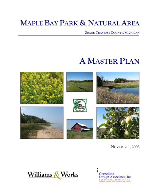
maple bay park & natural area - Grand Traverse Regional Land ...
maple bay park & natural area - Grand Traverse Regional Land ...
maple bay park & natural area - Grand Traverse Regional Land ...

You also want an ePaper? Increase the reach of your titles
YUMPU automatically turns print PDFs into web optimized ePapers that Google loves.
MAPLE BAY PARK & NATURAL AREA<br />
GRAND TRAVERSE COUNTY, MICHIGAN<br />
A MASTER PLAN<br />
NOVEMBER, 2008
TABLE OF CONTENTS<br />
INTRODUCTION AND SUMMARY ............................................................... 1<br />
PARK OVERVIEW ...................................................................................... 3<br />
CHALLENGES ............................................................................................ 9<br />
PUBLIC PARTICIPATION .......................................................................... 13<br />
SITE DEVELOPMENT ALTERNATIVES ........................................................ 15<br />
LOW INTENSITY ................................................................................. 15<br />
MODERATE INTENSITY ....................................................................... 19<br />
ACTIVE USE ....................................................................................... 25<br />
MAPLE BAY PARK RANGE OF USES ......................................................... 29<br />
RECOMMENDED PLAN ............................................................................ 31<br />
MAPS<br />
MAP 1 – SITE OVERVIEW AND FEATURES ................................................. 7<br />
MAP 2 – LOW INTENSITY ALTERNATIVE ................................................. 17<br />
MAP 3 – MODERATE INTENSITY ALTERNATIVE ....................................... 21<br />
MAP 4 – MODERATE INTENSITY ALTERNATIVE – WEST SIDE DETAIL ..... 23<br />
MAP 5 – ACTIVE USE ALTERNATIVE ....................................................... 27<br />
MAP 6 – RECOMMENDED PLAN ILLUSTRATION ...................................... 33<br />
MAP 7 – DESIGN CONCEPTS ................................................................... 35<br />
APPENDICES<br />
APPENDIX A – Press Release regarding Maple Bay Public Input<br />
APPENDIX B – Newsletter<br />
APPENDIX C – Summary of Comments Received during Open House,<br />
September 7 th and 8 th , 2007<br />
APPENDIX D – Open House Synopsis<br />
APPENDIX E – Comments received during Community Meeting,<br />
September 27, 2007<br />
APPENDIX F – Summary of participants and resources included in<br />
acquiring the property<br />
APPENDIX G – Summary of final Open House Comments
MAPLE BAY PARK & NATURAL AREA<br />
INTRODUCTION AND SUMMARY<br />
This report presents the conclusions and recommendations of the<br />
consulting team with regard to the improvement of Maple Bay Park and<br />
Natural Area in <strong>Grand</strong> <strong>Traverse</strong> County. The consulting teams,<br />
consisting of the planning and design professionals at Williams &<br />
Works and Cornelisse Design Associates, were retained by the County<br />
Parks and Recreation Department to explore the various challenges and<br />
opportunities associated with the facility and to present a<br />
report that seeks to address particular challenges and<br />
capitalize on the <strong>park</strong>’s assets.<br />
A significant amount of public input was<br />
received during the planning process<br />
This report is founded on the significant amount of public<br />
input the County received during the planning process. The<br />
public input consisted of an open house, mobile tours,<br />
community meeting, and meetings of the Parks Board<br />
during the summer and fall of 2007 and spring of 2008.<br />
Building on that citizen input and our objective analysis, this<br />
report outlines our recommendation to address many of the<br />
challenges facing this exceptional community facility.<br />
In addition, the County benefited from initial exploratory and design<br />
work conducted by the Michigan State University <strong>Land</strong>scape<br />
Architecture students as a class project. Students worked in<br />
teams to evaluate the opportunities and challenges of the site<br />
and to develop alternative plans for its improvement. These<br />
ranged from very low intensity and passive to highly<br />
developed facilities. This background work helped to inform<br />
this effort and provided a place of beginning for several of<br />
the recommendations outlined here.<br />
The process to develop the recommendations set forth here<br />
began with a field visit of the facility on July 5, 2007 together<br />
with a review of the various published reports and materials<br />
provided by the <strong>Grand</strong> <strong>Traverse</strong> County Parks and<br />
Recreation Department. The consulting team, with the<br />
assistance of County staff, developed an informational<br />
website and newsletter that was mailed to various<br />
organizations and members of the public. The initial review<br />
was supplemented by further discussions with County Parks<br />
and Recreation personnel, and the general public. After the<br />
field visit, the consulting team attended a meeting of the<br />
County Parks Board where the initial analysis of the site was<br />
presented.<br />
GRAND TRAVERSE COUNTY 1 MAPLE BAY PARK AND NATURAL AREA<br />
MASTER PLAN
MAPLE BAY PARK & NATURAL AREA<br />
Later in the process, the consulting team and County Parks department<br />
hosted a two-day open house on the Maple Bay property. The event<br />
was a causal, “drop-in” format, where users could take tours of the site<br />
that were narrated by a member of the consulting team or the Parks<br />
Department staff. The purpose of the open house was to introduce the<br />
<strong>park</strong> to the public and gather input for potential uses or issues this<br />
report should address. A summary of the community input received<br />
during the open house is provided in Appendix B.<br />
A few weeks after the open house, on September 27, 2007 a community<br />
meeting was held at the Civic Center in <strong>Traverse</strong> City. This was a more<br />
focused meeting format than the open house, and about eighty<br />
members of the public participated. The meeting began with a<br />
presentation of the initial review of the site, its unique features and<br />
challenges. Then, the consulting team led discussion tables where<br />
participants brainstormed ideas for potential uses, limitations and<br />
opportunities for the <strong>park</strong>. A summary of the community input<br />
received during the community meeting is provided in Appendix C.<br />
SUMMARY OF THE RECOMMENDED PLAN<br />
This plan recommends a sensitive use of the site, primarily for<br />
community access to <strong>natural</strong> feature and agriculture (see map 6 on page<br />
31). It outlines low intensity uses of the beach and lower wetlands, but<br />
incorporates facilities to improve access while protecting key features. It<br />
also recognizes the agricultural heritage of the site and retains active<br />
field crop agriculture over a significant <strong>area</strong> of the upper portions of the<br />
facility. Wetland features and wildlife habitat <strong>area</strong>s would be protected,<br />
restored and preserved to the greatest extent possible while walking<br />
paths and overlook features and interpretative signage would be<br />
provided into and through key <strong>area</strong>s.<br />
The rural character of the site will continue with regulated hunting<br />
permitted in most <strong>area</strong>s except in the southern portion of the upper<br />
croplands and near the trailhead on the east side. Finally, with<br />
expanding interest in the facility for a wide range of field-oriented<br />
activities, such as model airplane flying and hunting dog training, a<br />
portion of the site would be planned for multiple purposes to be<br />
coordinated by the County Parks and Recreation Department.<br />
GRAND TRAVERSE COUNTY 2 MAPLE BAY PARK AND NATURAL AREA<br />
MASTER PLAN
MAPLE BAY PARK & NATURAL AREA<br />
PARK OVERVIEW<br />
Maple Bay Park and Natural Area is 400 acre property located along<br />
both sides of US-31, just north of Angell Road in Acme Township. It is<br />
home to a wide variety of features and uses, including active agricultural,<br />
wetlands, woodlands, sand dunes and beaches. The property was<br />
acquired in 2002 by <strong>Grand</strong> <strong>Traverse</strong> County through a<br />
collaborative effort involving <strong>Grand</strong> <strong>Traverse</strong> County, the<br />
Michigan DNR Trust Fund and the <strong>Grand</strong> <strong>Traverse</strong><br />
<strong>Regional</strong> <strong>Land</strong> Conservancy. (See Appendix F for a<br />
summary of the participants, resources and funding agencies<br />
included in acquiring the property.)<br />
The Maple Bay property has been an iconic part of the<br />
agricultural heritage of the County and a portion of the site<br />
remains viable for farming purposes. Other parts of the site<br />
offer unique recreational, habitat restoration and<br />
preservation opportunities.<br />
A portion of the site (approximately 135 acres) has been<br />
enrolled in the federal Wetland Reserve Program. The<br />
Wetlands Reserve Program (WRP) is a voluntary program<br />
administered by the Natural Resources Conservation Service<br />
(NRCS). It provides technical and financial assistance to the<br />
County to address wetland, wildlife habitat, soil, water, and<br />
related <strong>natural</strong> resource concerns on the Maple Bay<br />
Property. The program provides an opportunity for the<br />
County to receive financial incentives to restore, protect, and enhance<br />
wetlands in exchange for retiring marginal lands in the <strong>park</strong> from<br />
agriculture. Development of lands enrolled in this program is restricted<br />
and these regulations will apply in perpetuity.<br />
NATURAL RESOURCES<br />
The portion of the site on the western side of US-31 is characterized by<br />
approximately one-half mile of undeveloped sand and cobble beach on<br />
the east arm of <strong>Grand</strong> <strong>Traverse</strong> Bay. Currently, Lake Michigan water<br />
levels are low, exposing a great amount of beach. Farther offshore, deep<br />
water off the beach has been popular with boaters, divers and fishermen.<br />
To the east of the beach lies the lowland and sand foredune, which<br />
consists of open foredunes, and undisturbed forested dune-swale<br />
complex. It is home to several threatened and endangered plant species<br />
and is important wildlife habitat.<br />
GRAND TRAVERSE COUNTY 3 MAPLE BAY PARK AND NATURAL AREA<br />
MASTER PLAN
MAPLE BAY PARK & NATURAL AREA<br />
Beyond the lowland and sand dune, the land rises up a<br />
steep, stable and heavily wooded bluff that meets the west<br />
croplands. The crops are actively farmed through an<br />
agreement with the Send Brothers, a local farming company.<br />
These croplands are somewhat fragmented due to the west<br />
wetlands <strong>area</strong>s near US-31 enrolled in the WRP. The<br />
croplands are also separated by the west hardwood grove,<br />
which have very limited understory due to past cattle grazing<br />
before the land was acquired for recreational use.<br />
On the eastern side of US-31 are fairly large tracts of rolling,<br />
highly visible croplands west of Bates Road lands that are<br />
bisected with portions of land enrolled in the WRP. Much<br />
of the WRP <strong>area</strong>s are not inundated with water for much of<br />
the year, and these <strong>area</strong>s have been restored by the planting<br />
of native grasses and wildflowers. Other portions of the east<br />
wetlands provide excellent habitat for ducks, herons, and<br />
other wildlife.<br />
The easternmost portion of the site contains additional<br />
croplands east of Bates Road. This <strong>area</strong> borders the 350-<br />
acre Petobego Marsh, which provides many more opportunities for<br />
viewing birds and other wildlife.<br />
CULTURAL RESOURCES<br />
The <strong>area</strong> of the <strong>park</strong> to the west of US-31 is the “main entrance” to the<br />
site. A 10-acre portion of this property is owned and maintained by the<br />
<strong>Grand</strong> <strong>Traverse</strong> <strong>Regional</strong> <strong>Land</strong> Conservancy. The historic farmhouse is<br />
part of this <strong>Land</strong> Conservancy property, and the future use of the<br />
farmhouse has not yet been determined. It is anticipated that the <strong>Land</strong><br />
Conservancy will renovate the farmhouse and maintain the<br />
grounds immediately surrounding it. The County has<br />
acquired an additional 5 acres from the conservancy for<br />
accessing the Maple Bay property.<br />
Also providing a unique sense of place to the <strong>park</strong> is the<br />
active farming that currently occurs on each side. In 2007,<br />
the agricultural land on the west side of US-31 was used to<br />
grow corn and sunflowers. The crop planted will vary of the<br />
years depending on soil conditions and markets.<br />
The <strong>park</strong> and adjoining Petobego Marsh<br />
offer important habitat for many species<br />
GRAND TRAVERSE COUNTY 4 MAPLE BAY PARK AND NATURAL AREA<br />
MASTER PLAN
MAPLE BAY PARK & NATURAL AREA<br />
Maple Bay Park and Natural Area is also in very close proximity to other<br />
public recreational lands. Aside from one privately owned parcel along<br />
Lake Michigan, most of the property to the north is owned either by the<br />
<strong>Land</strong> Conservancy or the State of Michigan. This adjacency not only<br />
provides excellent recreational opportunities for residents in<br />
the <strong>area</strong>, but it also facilitates the movement of wildlife<br />
throughout the region.<br />
The east side of US-31 contains the east farm buildings,<br />
which consist of a fairly old barn and a farmhouse. While<br />
the condition of the farmhouse is substandard, it represents<br />
an important aspect of the <strong>park</strong>’s history and the agricultural<br />
heritage of the region. Structurally, the barn appears to be<br />
better condition, and its fate plays a role in the<br />
recommendations of this plan.<br />
The east farm building <strong>area</strong>, while relatively small, is shaded and<br />
mowed and may serve as an entrance to the larger portion of the <strong>park</strong>,<br />
on the east side of US-31.<br />
Near the center of the property is a steel culvert that was<br />
used in the past to move cattle under US-31. This “livestock<br />
underpass” is approximately six feet in height and relatively<br />
free of debris and obstructions. Whether this connection<br />
can be utilized by <strong>park</strong> users remains to be seen, due to<br />
accessibility, periodic stormwater and limited headroom.<br />
The tunnel is located at one of the lower points on the<br />
property, and is often inundated with water during the<br />
springtime.<br />
The barn was evaluated in March 2006 by White Oak<br />
Timber Frame Ltd. Their report indicates that the barn is in<br />
reasonable condition and can be stabilized for future use for an<br />
approximate cost of $10,000.<br />
The farmhouse has not had a professional evaluation to determine if it<br />
is structurally sound and how much it will cost to stabilize the structure.<br />
This evaluation should be done before assuming the farmhouse can be<br />
reused.<br />
GRAND TRAVERSE COUNTY 5 MAPLE BAY PARK AND NATURAL AREA<br />
MASTER PLAN
MAPLE BAY PARK & NATURAL AREA<br />
GRAND TRAVERSE COUNTY 6 MAPLE BAY PARK AND NATURAL AREA<br />
MASTER PLAN
Maple Bay Park<br />
6<br />
<strong>Grand</strong> <strong>Traverse</strong> County, Michigan<br />
Existing<br />
Conditions<br />
<strong>Grand</strong> <strong>Traverse</strong> <strong>Regional</strong><br />
<strong>Land</strong> Conservancy<br />
1<br />
<strong>Grand</strong> <strong>Traverse</strong> <strong>Regional</strong><br />
<strong>Land</strong> Conservancy<br />
US 31<br />
7<br />
Private<br />
property<br />
State of<br />
Michigan<br />
<strong>Grand</strong> <strong>Traverse</strong><br />
<strong>Regional</strong> <strong>Land</strong><br />
Conservancy<br />
2<br />
3<br />
views to Lake<br />
Michigan blocked<br />
by trees<br />
rock jetties<br />
- sandy/stony beach<br />
- (low water 2007)<br />
- foot access only<br />
at present<br />
3<br />
1 2<br />
Forested Foredune<br />
Area<br />
- low, wet<br />
- lowland forest<br />
- beech, hemlock<br />
<strong>maple</strong>, birch<br />
C r o p R o t a t i o n<br />
steep slope acts as barrier<br />
to pedestrian/vehicular movement<br />
hardwood grove<br />
limited underbrush<br />
approximate hunting limit<br />
iconic barn<br />
reasonable condition<br />
historic?<br />
C r o p R o t a t i o n<br />
6' CMP cattle underpass<br />
- good condition, but<br />
may be wet in spring<br />
- good pedestrian<br />
connection under US-31<br />
power lines<br />
Old US-31 paving<br />
power lines<br />
power lines<br />
Bates<br />
8<br />
contiguous<br />
lowland/drainage <strong>area</strong><br />
7<br />
P e t o b e g o S w a m p<br />
8<br />
9<br />
4<br />
MDOT<br />
spoil material<br />
(high point)<br />
community<br />
septic field<br />
Orchard Shores<br />
Common Area<br />
<strong>Grand</strong> <strong>Traverse</strong><br />
<strong>Regional</strong> <strong>Land</strong><br />
Conservancy<br />
4<br />
only vehicular access<br />
into west <strong>park</strong>land<br />
allowed by MDOT<br />
6<br />
shady, grove <strong>area</strong><br />
potential for picnics<br />
newer pole barn<br />
good condition<br />
iconic farmhouse<br />
interior in poor condition<br />
low, drainage <strong>area</strong><br />
- great habitat<br />
- cedar buffer<br />
9<br />
Park Boundary<br />
Powerlines<br />
5<br />
Plum<br />
C r o p R o t a t i o n<br />
Yuba International Airport<br />
(private)<br />
grass runway<br />
High Points<br />
USGS Contours<br />
(Feet above mean sea level)<br />
584 - 600<br />
US 31<br />
great overview<br />
5<br />
600 - 620<br />
620 - 640<br />
640 - 670<br />
Wetland Reserve<br />
1 inch equals 650 feet<br />
0 300 600 1,200<br />
Feet
MAPLE BAY PARK & NATURAL AREA<br />
CHALLENGES<br />
Maple Bay Park and Natural Area faces numerous challenges. These<br />
include challenges determining an appropriate balance of uses for the<br />
public, the potential for degradation of some sensitive <strong>area</strong>s due to<br />
misuse or vandalism, the financial burden resulting from maintenance<br />
of the <strong>park</strong>’s assets, and the public safety challenges presented by the<br />
<strong>park</strong>’s location coupled with its rough terrain. Many of these challenges<br />
and problems are inter-related and solutions will need to be multifaceted.<br />
The following paragraphs describe these challenges in greater<br />
detail.<br />
1. Location. The site is bisected by US-31, a major arterial thoroughfare<br />
that runs from southwest to northeast through the Maple Bay property.<br />
The road is four lanes through most of the <strong>park</strong>, and traffic moves at<br />
speeds near 55 miles per hour or more; US-31 experiences<br />
approximately 7,800 vehicle trips per day near Maple Bay<br />
Park.<br />
The Maple Bay property borders <strong>Grand</strong><br />
<strong>Traverse</strong> Bay and is bisected by US-31<br />
It has been indicated that the only access to the <strong>park</strong> that<br />
will be permitted are those already in existence today; no<br />
new driveways are likely to be built from US-31 to access<br />
the <strong>park</strong>. This leaves three options to access the site from<br />
US-31: The <strong>Grand</strong> <strong>Traverse</strong> <strong>Regional</strong> <strong>Land</strong> Conservancy<br />
driveway (main entrance), the intersection with Old US-31<br />
on the east side of US-31, or via Bates road on the far east<br />
portion of the property.<br />
2. Identification of Long Term Uses. Certain <strong>area</strong>s on the Maple Bay<br />
property may be better suited to recreational development than others.<br />
For example, properties enrolled in the WRP are very limited for<br />
recreational development. However, certain <strong>area</strong>s that are currently<br />
used for agricultural purposes may be appropriate for more intense<br />
recreational use.<br />
During the mobile tours and community meetings, there was much<br />
discussion among the participants regarding the agricultural activities on<br />
the Maple Bay property. Some participants felt that the current farming<br />
practice should continue on the site, while others felt that alternative<br />
uses may be better suited for these <strong>area</strong>s. One of the challenges in<br />
developing a plan for such a large site is the need to provide a variety of<br />
activities for a variety of <strong>park</strong> users.<br />
GRAND TRAVERSE COUNTY 9 MAPLE BAY PARK AND NATURAL AREA<br />
MASTER PLAN
MAPLE BAY PARK & NATURAL AREA<br />
Currently, hunting is permitted on Maple Bay Park with the exception<br />
of an <strong>area</strong> on the west side of US-31, north of the Orchard Shores<br />
residential development. It is likely that hunting will continue on the<br />
site, consideration should be given to the types of firearms that would be<br />
permitted.<br />
Areas of the <strong>park</strong> that are enrolled in the wetland reserve program are<br />
limited in the degree and intensity of uses that may occur. Generally,<br />
land enrolled in the WRP is limited to “undeveloped” recreational uses<br />
if they both protect and enhance the wetland functions and values.<br />
While the use of <strong>area</strong>s in the WRP are not “off the table” in terms of<br />
recreation, severe limitations are in place that restrict the intensity of the<br />
ultimate recreational developments.<br />
3. Amount of Development. One of the key challenges in the planning<br />
process was determining the appropriate intensity of uses within the<br />
<strong>park</strong>. This property contains numerous sensitive <strong>natural</strong> features, and<br />
one of the goals of this plan is to achieve an appropriate balance<br />
between the protection of those features while still encouraging more<br />
active recreational use in certain locations.<br />
4. Beach and Lowland Access. A key attraction of the Maple Bay Park is<br />
the nearly one-half mile of undeveloped beach front along the east arm<br />
of <strong>Grand</strong> <strong>Traverse</strong> Bay. This attraction also presents the<br />
challenge of determining what level of access should be<br />
provided to beach users. Currently, vehicular access to<br />
the lowland and beach <strong>area</strong> is prohibited; only<br />
pedestrian access is permitted.<br />
A key attraction of the <strong>park</strong> is the nearly onehalf<br />
mile of undeveloped beach<br />
The County is therefore faced with the decision to<br />
maintain this current policy, which would prevent<br />
people with disabilities from accessing the beach <strong>area</strong>.<br />
The other extreme would be to permit vehicular access<br />
to, and <strong>park</strong>ing at the beach, and managing the potential<br />
degradation that might result.<br />
5. Conflicting Activities. Due in part to its large size, Maple Bay Park will<br />
likely see conflicting recreational activities. Conflicts may include more<br />
obvious examples, such as users interested in bird-watching and hunters,<br />
while others may be more subtle, such as the need to balance public<br />
access to key <strong>area</strong>s of the <strong>park</strong> with the limitations imposed on the <strong>area</strong>s<br />
enrolled in the WRP.<br />
GRAND TRAVERSE COUNTY 10 MAPLE BAY PARK AND NATURAL AREA<br />
MASTER PLAN
MAPLE BAY PARK & NATURAL AREA<br />
The interior of the<br />
house has been<br />
determined to be<br />
relatively poor<br />
condition.<br />
6. Disposition of Existing Farm Structures. The old farm house and barn<br />
on the east side of US-31 are a key component to the sense of place at<br />
Maple Bay Park. However, neither the house nor the barn have been<br />
maintained over the years, and as a result their condition has<br />
deteriorated. The interior of the house has been determined to be<br />
relatively poor condition, and the structural integrity of the barn was<br />
evaluated in a report in March of 2006. It indicated that the building<br />
may be stabilized and reused, but advancing deterioration ought to be<br />
reversed as soon as possible.<br />
Many citizens who participated in the planning process indicated a<br />
desire to retain these structures for recreational or other use. However,<br />
the renovation of these structures will likely require substantial public<br />
investment depending on the desired end use.<br />
7. Long-term Management. The Maple Bay property was acquired<br />
through a collaborative effort involving numerous organizations and<br />
local government officials, and the long-term management of the site<br />
will require similar cooperation.<br />
Issues such as public access, hunting, and wildlife management will<br />
require on-going communication between the County, the State, local<br />
officials and members of the public. Funding for the maintenance of<br />
the site may also present a challenge that requires a multi-faceted<br />
solution with the effort from these groups.<br />
8. Natural Area Goals. While this plan presents three different “levels” of<br />
use for the <strong>park</strong>, many variables and outcomes should be considered by<br />
the County. There may be opportunities for portions of the <strong>park</strong> to be<br />
financially self-supporting through user fees, volunteer commitments or<br />
other means.<br />
The <strong>park</strong> also possesses the potential to be used as a valuable public<br />
education resource. The variety of wildlife, vegetation and land<br />
formations may be used to educate citizens of all ages, and the <strong>park</strong> may<br />
also become a destination for field trips from <strong>area</strong> schools.<br />
9. Multiple uses. The relatively large size of the <strong>park</strong> provides users the<br />
opportunity to enjoy a range of activities at once that may not be<br />
compatible in other <strong>area</strong>s. It is the intent of this plan to maintain the<br />
<strong>natural</strong> character of the site where it is appropriate and feasible without<br />
precluding other, more active uses.<br />
GRAND TRAVERSE COUNTY 11 MAPLE BAY PARK AND NATURAL AREA<br />
MASTER PLAN
MAPLE BAY PARK & NATURAL AREA<br />
PUBLIC PARTICIPATION<br />
A BATA bus was utilized for portions of the<br />
mobile tour<br />
In September 2007, the County sought public input regarding the<br />
future uses of Maple Bay Park and Natural Area. The County held two<br />
formal input sessions: The first was a two-day open house and “mobile<br />
tour” that allowed residents to tour the site and learn<br />
more about the site and its features on September 7 th and<br />
8 th . Tours were offered on the east side of US-31, and the<br />
portion west of US-31.<br />
The east tour took participants past the old farm<br />
structures, <strong>area</strong>s enrolled in the Wetland Reserve Program<br />
(WRP), agricultural <strong>area</strong>s and Petobego Marsh State<br />
Game Area. The west tour brought participants through<br />
agricultural <strong>area</strong>s, through the wooded <strong>area</strong> and sand<br />
dunes and down to the beach. The tours were led by<br />
either a member of the County staff or a member of the<br />
consulting team. While the primary goal of the tours was<br />
to introduce the public to the <strong>park</strong>, important and<br />
informed input was received from participants. Over the two day span<br />
of the open house, more than one hundred interested citizens<br />
participated.<br />
The second input session was a community meeting held on September<br />
27 at the Civic Center in <strong>Traverse</strong> City. The purpose of this meeting<br />
was to seek more direct and formal guidance from the public to decide<br />
what uses the <strong>park</strong> should accommodate. The participants were<br />
broken into smaller groups of 8-12 people, and each<br />
group was led by a member of the consulting team who<br />
facilitated the discussion. About fifty people attended the<br />
community meeting.<br />
The mobile tours allowed the public to<br />
familiarize themselves with the <strong>park</strong><br />
The community input resulted in a variety of ideas and<br />
opinions. Many citizens wanted the <strong>park</strong> to remain in its<br />
current, relatively <strong>natural</strong> state. Other participants were<br />
interested in more active uses for the <strong>park</strong>. Given the<br />
range of potential uses and suggestions, coupled with the<br />
overall size of the <strong>park</strong>, the plan for potential uses has<br />
been organized by three levels of intensity: Low intensity,<br />
moderate intensity and “active” uses.<br />
GRAND TRAVERSE COUNTY 13 MAPLE BAY PARK AND NATURAL AREA<br />
MASTER PLAN
MAPLE BAY PARK & NATURAL AREA<br />
SITE ALTERNATIVES<br />
The following scenarios, and the plan schematics on pages 15, 19 and<br />
25, describe the elements of each alternative with a focus on the key<br />
elements of the site. It should be understood that, although these are<br />
presented here as three distinct alternatives, the final recommendation<br />
draws elements and features from each.<br />
LOW INTENSITY<br />
The overall intent of low intensity uses in this plan is to preserve the key<br />
elements of a particular <strong>area</strong> of the <strong>park</strong> to the greatest degree possible,<br />
while allowing reasonable use and access of these features by the public.<br />
Therefore, many of the low intensity uses consist of limited<br />
improvements to certain <strong>area</strong>s, or in some cases, ceasing activities<br />
currently occurring on the site to foster the rehabilitation of the <strong>natural</strong><br />
habitats of plant and animal species.<br />
WEST SIDE<br />
The existing <strong>natural</strong> beachfront presents a<br />
unique recreational opportunity<br />
Beach Zone. Low intensity uses along the beach include an improved,<br />
but unpaved, pedestrian trail heading from the top of the hill, through<br />
the wooded <strong>area</strong> and sand dunes to the waterfront. Motorized vehicles<br />
would not be permitted on the trail, but would be permitted to <strong>park</strong> in a<br />
defined <strong>area</strong> near the top of the bluff. Basic restroom<br />
facilities, such as port-a-jons, would be located at the<br />
beach. Camping would not be permitted.<br />
Lowland Forest and Sand Foredunes. Low intensity uses<br />
in the forested lowlands and sand foredunes <strong>area</strong>s would<br />
consist of maintaining the trails in their current state.<br />
Off-Road Vehicles (ORV) use would be prohibited.<br />
Currently, the trails are unpaved and unimproved. It is<br />
anticipated that only minimal maintenance, such as<br />
clearing large obstacles, would be performed. Hunting<br />
would continue to be permitted.<br />
Upper Croplands. The lowest intensity use for the west<br />
croplands would consist of ceasing agricultural production and letting<br />
the land revert back to its most <strong>natural</strong> state. The open <strong>area</strong>s could be<br />
maintained as a northern Michigan prairie, or native grasslands, so only<br />
large vegetation would be removed. Hunting would be permitted north<br />
of the current firearms boundary.<br />
GRAND TRAVERSE COUNTY 15 MAPLE BAY PARK AND NATURAL AREA<br />
MASTER PLAN
MAPLE BAY PARK & NATURAL AREA<br />
Upper Wetlands. Much of this <strong>area</strong> is enrolled in the WRP. Therefore,<br />
low intensity use of the wetlands consists of leaving the site in its current<br />
condition. Hunting would be permitted north of the current hunting<br />
boundary.<br />
EAST SIDE<br />
Upper Hardwood Grove. This <strong>area</strong> is currently characterized by old<br />
hardwoods with limited underbrush. A low intensity use for this <strong>area</strong><br />
would consist of leaving the site as-is and letting the underbrush grow<br />
back in, which would be compatible with its WRP designation.<br />
Hunting would continue to be permitted in this location.<br />
East Croplands (East of Bates Road). Low intensity uses for the<br />
croplands east of Bates Road consist of leaving the site in its current<br />
condition and maintaining agricultural activities. Hunting would be<br />
permitted in this <strong>area</strong>. Hunting would be permitted north of the<br />
current hunting boundary.<br />
East Croplands (West of Bates Road). The lowest<br />
intensity use for the west croplands would consist of<br />
ceasing agricultural production and letting the land revert<br />
back to its most <strong>natural</strong> state of a northern Michigan<br />
prairie or field grasses.<br />
Plan recommendations present several<br />
options for uses in the agricultural <strong>area</strong>s<br />
East Farm Buildings. The east side of US-31 contains a<br />
farm house and old barn that have deteriorated over time.<br />
The low intensity use of these structures would consist of<br />
razing them and letting the native vegetation reclaim the<br />
<strong>area</strong>. The newer pole barn would be retained as a service<br />
building for the <strong>park</strong>.<br />
East Farmstead Area. The mowed <strong>area</strong> near the<br />
buildings would be maintained as an entry point from<br />
US-31 to the east half of the <strong>park</strong>, a trailhead, and a<br />
picnic <strong>area</strong>.<br />
East Wetlands. Much of this <strong>area</strong> is enrolled in the<br />
WRP. Therefore, low intensity use of the wetlands<br />
consists of leaving the site in its current condition.<br />
Hunting would be permitted in these <strong>area</strong>s.<br />
Wetland <strong>area</strong>s are home to a variety of<br />
wildlife<br />
GRAND TRAVERSE COUNTY 16 MAPLE BAY PARK AND NATURAL AREA<br />
MASTER PLAN
MAPLE BAY PARK & NATURAL AREA<br />
MODERATE INTENSITY<br />
Moderate intensity uses seek to provide more active recreational<br />
opportunities than the low intensity uses, however, the protection of key<br />
<strong>natural</strong> features that make a particular location attractive to visitors<br />
remains a high priority. Moderate intensity uses also seek to make<br />
portions of the <strong>park</strong> more accessible to the public, and<br />
uses may require more active management of the property<br />
than is anticipated for low intensity uses.<br />
WEST SIDE<br />
The lowland wooded <strong>area</strong>s between the<br />
croplands and the <strong>bay</strong> are a unique <strong>natural</strong><br />
environment<br />
Beach Zone. Moderate intensity uses along the beach<br />
include a paved trail heading from the top of the hill,<br />
through the wooded <strong>area</strong> and sand dunes to the beach.<br />
Vehicles would not be permitted down to the beach, but<br />
the paved trail would accommodate persons with<br />
disabilities on motorized chairs and service/emergency<br />
vehicles. Basic restroom facilities, such as port-a-jons,<br />
would be located at the beach along with a few picnic<br />
tables. No camping would be permitted.<br />
Lowland Forest and Sand Foredunes. Moderate intensity<br />
development in this <strong>area</strong> would consist of improving and<br />
maintaining the trails with accessible (though not<br />
necessarily paved) surfacing. The possibility of an<br />
easement would explored with private property owners to<br />
the north to provide trail access to Petobego Pond. A<br />
viewing platform near the top of the bluff would provide a<br />
view of the Bay. Achieving the view of the <strong>bay</strong> will likely<br />
require limited tree-thinning or removing a minimal<br />
number of trees that might obstruct the view from the<br />
platform. A gravel access and <strong>park</strong>ing will be extended to<br />
the platform.<br />
Upper Croplands. In croplands west of US-31, moderate<br />
intensity uses would consist of maintaining the current<br />
agricultural activities. Hunting would be permitted north<br />
of the current firearms boundary.<br />
Many people feel that the “iconic” barn and<br />
farm house on the east side of US-31 are<br />
important components of the <strong>park</strong>’s<br />
character<br />
Upper Wetlands. Wetland activities on the Maple Bay<br />
Park are limited because they are enrolled in the WRP.<br />
However, a feasible moderate intensity use would consist<br />
of mowed trails though the <strong>area</strong>s of the wetlands that are<br />
GRAND TRAVERSE COUNTY 19 MAPLE BAY PARK AND NATURAL AREA<br />
MASTER PLAN
MAPLE BAY PARK & NATURAL AREA<br />
generally dry. Paths would tie in to the pedestrian trail under US-31.<br />
The livestock underpass below under US-31 is also located in this <strong>area</strong>,<br />
and could be used as a pedestrian crossing during times of the year<br />
when it is dry.<br />
Upper Hardwood Grove. Currently this <strong>area</strong> is enrolled in the WRP<br />
and development is limited. The current limited underbrush would be<br />
maintained to keep this <strong>area</strong> in its current condition. “Rustic” picnic<br />
<strong>area</strong>s would be permitted in this <strong>area</strong>. A paved trail connection from<br />
the trailhead <strong>park</strong>ing to the pedestrian underpass under US-31 would<br />
follow the top of the bluff through the grove.<br />
EAST SIDE<br />
Hunting on the east<br />
side of US-31 would be<br />
permitted but limited to<br />
shotgun and archery<br />
only.<br />
Croplands (East of Bates Road). Moderate intensity uses on these <strong>area</strong>s<br />
consist of trail access to Petobego Marsh, a casual or occasional hunting<br />
dog training <strong>area</strong> with a <strong>park</strong>ing lot located off of Bates Road; trails<br />
leading from the <strong>park</strong>ing <strong>area</strong> to Petobego Marsh, hunting, and limited<br />
cropland that will support wildlife. Hunting would be permitted west of<br />
Bates Road<br />
Croplands (West of Bates Road). In croplands east of US-31 west of<br />
Bates, moderate intensity uses would consist of maintaining the current<br />
agricultural activities. There is also potential for a small <strong>area</strong> west of<br />
Bates on a high knoll that would contain a picnic <strong>area</strong> and trailhead<br />
accessed from Bates. Hunting on the east side of US-31 would be<br />
permitted but limited to shotgun and archery only.<br />
Farm Buildings. Moderate intensity use for the farm buildings east of<br />
US-31 would consist of stabilizing and preserving the barn, which can be<br />
used as a trailhead facility. The farmhouse would be stabilized based on<br />
a professional evaluation of the structure and cost estimate. It would be<br />
retained for future renovation and potential use as a property care<br />
taker’s residence. Restrooms would be installed in this <strong>area</strong> or as part of<br />
the barn structure. The grounds would include a small gravel <strong>park</strong>ing<br />
<strong>area</strong> and access drive off US-31 to serve as the trailhead.<br />
Wetlands. Because of the WRP restrictions, a feasible moderate<br />
intensity use would consist of mowed trails though the <strong>area</strong>s of the<br />
wetlands that are generally dry. An improved trail is proposed across<br />
the wetland dike connecting Bates Road and the rustic picnic <strong>area</strong> to the<br />
south.<br />
GRAND TRAVERSE COUNTY 20 MAPLE BAY PARK AND NATURAL AREA<br />
MASTER PLAN
MAPLE BAY PARK & NATURAL AREA<br />
ACTIVE USES<br />
In certain <strong>area</strong>s of the <strong>park</strong>, active uses may be appropriate to provide<br />
greater exposure of the <strong>park</strong> for compatible recreational opportunities<br />
not offered elsewhere in the County, and to improve the accessibility for<br />
those users who may have difficult reaching various locations on the<br />
property. In this instance, active uses may include barrier-free paved<br />
trails, increased interpretive and educational<br />
opportunities. It should be noted, however, that these<br />
recommendations recognize the fact that the <strong>natural</strong><br />
resources and wildlife unique to the Maple Bay site will<br />
be preserved and human intrusions will be managed to<br />
reduce the impact in critical <strong>area</strong>s.<br />
WEST SIDE<br />
Picnic facilities may be appropriate<br />
where the wooded <strong>area</strong>s and agricultural<br />
<strong>area</strong>s meet<br />
Beach. Active uses on the beach would include a paved<br />
trail to the beach wide enough to accommodate<br />
emergency and service vehicles. The beach would also<br />
contain a watersport concession <strong>area</strong> geared toward<br />
visitors interested in kite surfing and kayaking on the Bay.<br />
Permanent “pump-out” restroom facilities would be located along the<br />
beach. Parking would be located at the top of the bluff to support walkin<br />
use of the beach.<br />
Lowlands and Sand Dunes. Active uses in the lowlands and sand<br />
dunes would include walk-in camping in clearly defined campsites,<br />
allowed by the County by permit only. A viewing platform would be<br />
located at the top of the hill with a view to the <strong>bay</strong>. Direct vehicular<br />
access would not be provided through the lowlands to the beach. A<br />
picnic <strong>area</strong> would be located near the beach, and stairs would be<br />
constructed leading from the lowlands to the top of the hill.<br />
Upper Croplands. The most active uses anticipated for<br />
the west cropland <strong>area</strong> include agricultural uses such as<br />
organic farming, a demonstration farm, or community<br />
garden. In this option, with its more active uses, hunting<br />
would be prohibited west of US-31. Due to the<br />
complexity of funding, operating and maintaining such a<br />
facility would have to be undertaken in conjunction with<br />
other agencies or groups.<br />
Participants on the mobile tours saw a<br />
variety of wildlife in the ponds, including<br />
herons, ducks and turtles<br />
Wetlands. While the WRP limits uses of the <strong>area</strong>, these<br />
wetland <strong>area</strong>s can be improved to contain mowed foot<br />
trails with interpretive/educational stops. The pond near<br />
GRAND TRAVERSE COUNTY 25 MAPLE BAY PARK AND NATURAL AREA<br />
MASTER PLAN
MAPLE BAY PARK & NATURAL AREA<br />
the driveway on the west side of US-31 would be improved and<br />
expanded to connect the wetlands, thereby improving and expanding<br />
wildlife habitat. The livestock underpass below US-31 is also located in<br />
this <strong>area</strong>, and could be used as a pedestrian crossing during times of the<br />
year when it is dry.<br />
West Groves. Active uses would consist of maintaining a mowed field<br />
grass surface in part of the grove with shelter for small groups.<br />
Construction of a picnic facility (e.g. an open air pavilion), permanent<br />
barbeque grills, and restroom facilities could accommodate small events<br />
related to <strong>park</strong> uses.<br />
EAST SIDE<br />
Croplands (East of Bates Road). Active uses for this <strong>area</strong> include a<br />
gravel drive from Bates Road that runs to Petobego Marsh, with <strong>park</strong>ing<br />
near the marsh. A portion of this <strong>area</strong> could be set aside for model<br />
airplane club use although the proximity to wildlife <strong>area</strong>s in the Marsh<br />
would require further evaluation. Even with this activity, most of the<br />
<strong>area</strong> may still be farmed with some restrictions on crop height to<br />
facilitate plane observation and tracking. Regulated hunting would also<br />
be permitted on this site.<br />
Croplands (West of Bates Road). Active uses anticipated for the east<br />
cropland <strong>area</strong> include agricultural uses such as organic farming, a<br />
demonstration farm, or community garden. A small <strong>area</strong> west of Bates<br />
would also be appropriate for a picnic and trailhead.<br />
Farm Buildings. Active use of these buildings would result in the<br />
rehabilitation of both the farm house and the barn. The barn would be<br />
stabilized and used for a trailhead or warming <strong>area</strong>, and the house<br />
would be rehabilitated for use as a caretaker’s residence. With more<br />
active uses, an on-site caretaker would be needed. Given the<br />
deteriorated condition of the farmhouse, this renovation could be<br />
treated as an educational opportunity for vocational education. A less<br />
costly approach to providing a caretaker residence may be a<br />
manufactured housing unit. Restrooms would also be located in this<br />
<strong>area</strong>, perhaps integrated into the barn renovation.<br />
Wetlands. While the WRP limits uses of the <strong>area</strong>, these wetland <strong>area</strong>s<br />
can be improved to contain footpaths, a paved trail connection or<br />
elevated boardwalks with interpretive/educational stops. Eventually,<br />
future acquisition or management efforts should evaluate an extension<br />
of wetland functions to the south and east of the central wetland.<br />
GRAND TRAVERSE COUNTY 26 MAPLE BAY PARK AND NATURAL AREA<br />
MASTER PLAN