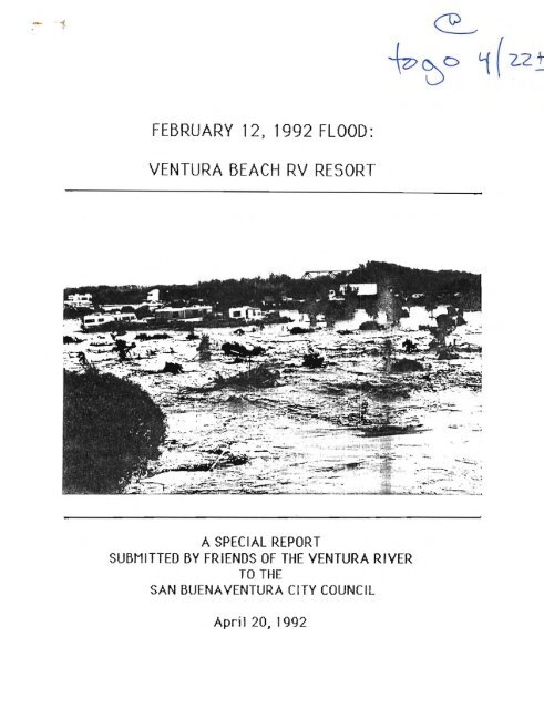
february 12, 1992 flood: ventura beach rv resort - Friends of the ...
february 12, 1992 flood: ventura beach rv resort - Friends of the ...
february 12, 1992 flood: ventura beach rv resort - Friends of the ...

You also want an ePaper? Increase the reach of your titles
YUMPU automatically turns print PDFs into web optimized ePapers that Google loves.
FEBRUARY <strong>12</strong>, <strong>1992</strong> FLOOD:<br />
VENTURA BEACH RV RESORT<br />
.~- . . ... - =.-:-:~ ... ~> -.<br />
: --- .. - . .. ~ .<br />
.."... . -<br />
---'-......;., • ••~::~.~.:- _ . - _ : _"<br />
A SPECIAL REPORT<br />
SUBMITTED BY FRIENDS OF THE VENTURA RIVER<br />
TO THE<br />
SAN BUENA VENTURA CITY COUNCIL<br />
April 20 J <strong>1992</strong>
Table <strong>of</strong> Contents<br />
Introduction<br />
Ventura River System<br />
Inadequacy <strong>of</strong> Flood Analysis<br />
Methodology<br />
Flooding Pattern<br />
Magnitude & Freqency <strong>of</strong> Flooding<br />
Dams, Bridges & Levees<br />
Conclusion and Recommendations<br />
2<br />
3<br />
4<br />
6<br />
6<br />
8<br />
9<br />
<strong>12</strong><br />
Maps and Figures
2<br />
Introduction<br />
On February <strong>12</strong>, <strong>1992</strong> <strong>the</strong> Ventura River over-flowed its metn channel<br />
severe1 hundred yards above <strong>the</strong> Main Street Bridge and poured across<br />
agricultural fields, <strong>the</strong> west end <strong>of</strong> Main Street, and into <strong>the</strong> Ventura Beach<br />
RV Resort. The <strong>flood</strong> waters were sufficiently deep and swift to pick up and<br />
carry several recreational vehi c1es back into <strong>the</strong> met n channel <strong>of</strong> <strong>the</strong><br />
Ventura River and out to <strong>the</strong> ocean.<br />
Whi 1e numerous i ndi vidue1s were stranded" and one homeless indi vidual lost<br />
his 1ife, <strong>the</strong> <strong>flood</strong> flows fortunately reached <strong>the</strong>ir peak dunng <strong>the</strong> midmorning<br />
when visibility was good and rescue operations were possible. Had<br />
<strong>the</strong> f1 ood occurred several hours earl ier durt ng <strong>the</strong> night" <strong>the</strong> damage and<br />
1ass <strong>of</strong> 1i fe coul d have been consi derab1y higher.<br />
The <strong>flood</strong> flows which caused <strong>the</strong> damage and loss <strong>of</strong> lif e were estimated at<br />
about 46,000 cubic feet per second. As SUCh" <strong>the</strong> <strong>flood</strong> is rated as a 40 year<br />
frequency event, that is a <strong>flood</strong> event which has <strong>the</strong> chance <strong>of</strong> occurring<br />
once every 40 years, or a 2.5~ chance <strong>of</strong> occurn n9 in any 91 yen year. Such a<br />
storm has 8 20~ chance <strong>of</strong> occurri ng ina 10-year periad" and a 15~ chance<br />
<strong>of</strong> occurring in a 5-year period. The <strong>flood</strong> Which occurred on February <strong>12</strong>,<br />
<strong>1992</strong>, <strong>the</strong>refore, was not a particularly unusual <strong>flood</strong> event, and in fact has a<br />
ra<strong>the</strong>r high probability <strong>of</strong> occurring again in a relatively short time.
3<br />
Ventura River System<br />
The Ventura River begins in <strong>the</strong> rugged transverse range, runs through a<br />
re1ati ve1y broad and shallow valley, and terminates at a manne deItao Any<br />
evaluation <strong>of</strong> <strong>the</strong> <strong>flood</strong>s <strong>of</strong> February <strong>12</strong>.. <strong>1992</strong> requires a basic understanding<br />
<strong>of</strong> <strong>the</strong> different components <strong>of</strong> <strong>the</strong> Ventura River system. These elements<br />
each have distinct geologic, geomorphic .. and hydrologic characteristics<br />
which are critical to planning and land use planning along <strong>the</strong> Ventura River<br />
or its trioutert es.<br />
The tributaries in <strong>the</strong> headwaters have steep gradients which se<strong>rv</strong>es to<br />
collect <strong>the</strong> majority <strong>of</strong> <strong>the</strong> water in <strong>the</strong> system. Because <strong>of</strong> <strong>the</strong>ir steepness<br />
and <strong>the</strong> easily erodible nature <strong>of</strong> <strong>the</strong> soils through which <strong>the</strong>y pass, <strong>the</strong>se<br />
tributaries account for <strong>the</strong> majority <strong>of</strong> <strong>the</strong> sediment produced in <strong>the</strong><br />
Ventura Ri ver system through erosi on.<br />
The main stem <strong>of</strong> <strong>the</strong> river has a relatively shallow gradient, and as a result<br />
<strong>of</strong> tectonic up lift and periodic eustatic sea-level changes, runs through a<br />
broad bed composed <strong>of</strong> loosely consoli dated alluvium. The mal n stem is also<br />
cherecteri zed by braided or mul ti pI e channels. The metn stem, in addi tion to<br />
carry;ng <strong>the</strong> comb; ned flows <strong>of</strong> <strong>the</strong> trinutertes aIso acts as a temporary<br />
storage area for sedi ments eroded in <strong>the</strong> headwaters. These sedi ments are<br />
periodically picked up and transported downstream where <strong>the</strong>y are ei<strong>the</strong>r<br />
passed to <strong>the</strong> ocean or fill existing channels, <strong>the</strong>reby forcing <strong>flood</strong> waters<br />
out <strong>of</strong> current channels or into new or previously abandoned channels. As a<br />
result, channels are SUbject to rapid sifts during periodic <strong>flood</strong>s making<br />
accurate predictions <strong>of</strong> <strong>the</strong> areal extent <strong>of</strong> <strong>flood</strong>ing extremely difficult.
4<br />
The fan shaped delta at <strong>the</strong> rf verse mouth (begi nn1 ng 1 mil e upstream from<br />
<strong>the</strong> ocean) is cherecten zed by a system <strong>of</strong> d1 stributary or branchi ng<br />
channels which discharge river flow to <strong>the</strong> ocean at different points along<br />
<strong>the</strong> ocean frontage <strong>of</strong> <strong>the</strong> delta. The gradient tn this segment <strong>of</strong> <strong>the</strong> river is<br />
extremely shallow; and as result, deposition <strong>of</strong> sediment and <strong>the</strong> consequent<br />
dispersal <strong>of</strong> river flow is <strong>the</strong> dominant geologic/hydrologic process. The<br />
Ventura Beach RV Resort is particularly susceptible for <strong>flood</strong>ing because <strong>of</strong><br />
its location on <strong>the</strong> Ventura River Delta which is SUbject to <strong>the</strong> full force <strong>of</strong><br />
combined force <strong>of</strong> <strong>the</strong> run<strong>of</strong>f generated by all <strong>of</strong> <strong>the</strong> river's tributaries and<br />
<strong>the</strong> unpredictable nature <strong>of</strong> <strong>the</strong> branching channel pattern.<br />
Inadequacy <strong>of</strong> Flood Analysis<br />
The general <strong>flood</strong> potential <strong>of</strong> <strong>the</strong> Ventura River has been well known for<br />
more than a century. Fallowing <strong>the</strong> disastrous <strong>flood</strong>s <strong>of</strong> 1969 <strong>the</strong> U.S. Army<br />
Corps <strong>of</strong> Engineer prepared a series <strong>of</strong> comprehensive studtes <strong>of</strong> <strong>the</strong> major<br />
drainages <strong>of</strong> Ventura County which summarized <strong>the</strong> nature <strong>of</strong> <strong>flood</strong>s in <strong>the</strong><br />
Ventura River. The stUdy noted particularly <strong>the</strong> unpredictable nature <strong>of</strong><br />
<strong>flood</strong> flow patterns in <strong>the</strong> main stem <strong>of</strong> <strong>the</strong> Ventura River, referring to <strong>the</strong>:<br />
rapid and destructive shifts in <strong>the</strong> currents as some channel<br />
sections are filled and as o<strong>the</strong>rs are cut out. .. This stabllity <strong>of</strong><br />
<strong>the</strong> Ventura River may cause actual <strong>flood</strong>ed areas to vary from<br />
those <strong>of</strong> <strong>the</strong>oretical <strong>flood</strong>s. (U.S. Army Corps <strong>of</strong> Engineers,<br />
"Flood Plain Information: Ventura River (includ'ing Coyote<br />
Creek) Ventura County California- , 1971, P 5.)
5<br />
The U.S. Army Corps <strong>of</strong> Engineer study, however, did not make a distinction<br />
between <strong>the</strong> main stem <strong>of</strong> <strong>the</strong> Ventura River and <strong>the</strong> various distributary<br />
channels which make up <strong>the</strong> well developed delta at <strong>the</strong> mouth, <strong>the</strong> site <strong>of</strong><br />
<strong>the</strong> Ventura Beach RV Resort.<br />
Never<strong>the</strong>less, <strong>the</strong> occurrence <strong>of</strong> <strong>flood</strong>ing on <strong>the</strong> site <strong>of</strong> <strong>the</strong> Ventura Beach RV<br />
Resort has been well documented and reflected 1n prevt ous deve1npments<br />
and 1and use desi gnations for <strong>the</strong> area. Both <strong>the</strong> Main Street bridge<br />
constructed in 1932 and <strong>the</strong> U.S. 101 crossing constructed in 1964 were<br />
dest gned to pass <strong>flood</strong> flows across what is now <strong>the</strong> Ventura Beach RV<br />
Resort. Prior to <strong>the</strong> development <strong>of</strong> <strong>the</strong> Ventura Beach RV Resort <strong>the</strong> 1anduse<br />
designatlon on <strong>the</strong> property was sgrtculture, with a <strong>flood</strong> overlay which<br />
prohibited permanent structures.<br />
Despite <strong>the</strong> recognized <strong>flood</strong> hazards associated with <strong>the</strong> Ventura River<br />
De1te, <strong>the</strong> <strong>flood</strong> anal ysis perfarmed for <strong>the</strong> Ventura Beach RV Resort was<br />
defect1ve ina number <strong>of</strong> fundamental ways:<br />
(1) it relied on a <strong>flood</strong> analysis methodology which is inappropriate to a<br />
mixed-sediment load stream with a highly moblle channel; (2) it<br />
mt S1nterpreted <strong>the</strong> nature <strong>of</strong> <strong>the</strong> <strong>flood</strong>i ng patterns associ ated wi th <strong>the</strong><br />
project site on <strong>the</strong> Ventura River Delta; (3) it underestlmated <strong>the</strong> magnitude<br />
and frequency <strong>of</strong> catastrophic <strong>flood</strong>ing in <strong>the</strong> lower river; (4) it incorrectly<br />
assessed <strong>the</strong> significance <strong>of</strong> dams, bridges, and levees along <strong>the</strong> river; and<br />
(5) it ignored <strong>the</strong> effects <strong>of</strong> urbanization tn <strong>the</strong> watershed on <strong>the</strong> <strong>flood</strong>ing<br />
potentiel <strong>of</strong> <strong>the</strong> Ventura Beach RV Resort 51 teo
6<br />
Methodology<br />
The applicant proposed and governmental agencies agreed to <strong>the</strong> use <strong>of</strong> a<br />
standard HEC-2 analysis developed by <strong>the</strong> U.S. Army Corps <strong>of</strong> Engineers for<br />
evaluating <strong>flood</strong>ing potential <strong>of</strong> <strong>the</strong> Ventura Beach RV Resort site.<br />
Thf s model for predi cti ng <strong>the</strong> areal extent <strong>of</strong> f1 oodi ng under gi ven magni tude<br />
<strong>of</strong> storm flows assumes a fixed cross-sectional channel area, and is not<br />
appropriate for watercourses with highly mobile channels and banks such as<br />
.<br />
<strong>the</strong> Ventura River. It is particularly inappropriate for use on e delta where<br />
<strong>the</strong>re are multiple channels. The inadequacy <strong>of</strong> <strong>the</strong> HEC-2 computer<br />
modeling was tragically demonstrated during <strong>the</strong> recent inundation <strong>of</strong> <strong>the</strong><br />
<strong>the</strong> Ventura Beach RV Resort. The HEC-2 anal ysisin thi s instance predi cted<br />
that <strong>the</strong> site would not be 'inundated in less than 78,000 cubic feet per<br />
second flows, but in fact was completely inundated with a 46,000 cubic<br />
feet per second flow.<br />
Flooding Pattern<br />
The analysis misrepresented <strong>the</strong> nature <strong>of</strong> <strong>flood</strong>ing patterns by misapplying<br />
<strong>the</strong> Federal Emergency Management Agency (FEMA) <strong>flood</strong> insurance<br />
terminology M<strong>flood</strong>way" and "f1oodway fringe" to <strong>the</strong> project site, using <strong>the</strong>m<br />
for planning purposes for which <strong>the</strong>y were not originally intended.<br />
Any deve1apment in an area which recei ves run-<strong>of</strong>f wi 11 djsplace that run<strong>of</strong>f<br />
and <strong>the</strong>refore cause <strong>flood</strong> flows to ei<strong>the</strong>r spread out lateralIy or rtse<br />
vertically. In an effort to discourage <strong>the</strong> lateral encroachment into <strong>the</strong><br />
<strong>flood</strong> prone land, FEMA has chose to determine <strong>flood</strong> insurance ellgibllity by
7<br />
reference to <strong>the</strong> rise in vertical elevation <strong>of</strong> <strong>flood</strong> flows resulting from<br />
later incursi ons into <strong>the</strong> <strong>flood</strong> pI 8i n<strong>of</strong> a watercourse.<br />
The term Ufl oodway" is a techni ce1 term used by FEMA to desi gnate a<br />
lateral area into which a discharge from a 100 year frequency storm can be<br />
squeezed without increasing <strong>the</strong> vertical height <strong>of</strong> <strong>the</strong> <strong>flood</strong> flow more<br />
than one (1) foot. Significantly" this term does not designate those areas<br />
which will be inundated only during a 100 year frequency storm. Similarly"<br />
<strong>the</strong> term IO<strong>flood</strong>way fringe" is a technical term used to designate that<br />
portion <strong>of</strong> <strong>the</strong> natural 100 year <strong>flood</strong> plain which would be <strong>the</strong>oretically<br />
left dry after squeezing <strong>the</strong> 100 year <strong>flood</strong> flow into <strong>the</strong> •..<strong>flood</strong>way.... It<br />
does not designated that portion <strong>of</strong> <strong>the</strong> <strong>flood</strong> plain which is necessarily less<br />
prone to <strong>flood</strong>ing.<br />
The two definitions were created for <strong>the</strong> purpose <strong>of</strong> determining <strong>flood</strong><br />
insurance eligibility" and to define a standard which would allow some<br />
development within <strong>flood</strong> prone lands where such <strong>flood</strong> prone areas were so<br />
extensi ve (such as in <strong>the</strong> mi d-west) that to categoricall y preht bit<br />
development on <strong>the</strong>se lands would result in <strong>the</strong> removal <strong>of</strong> large tracts from<br />
any development, or intensi ve human use. Development in areas desi gnated<br />
as -<strong>flood</strong>way" would by definition cause a rise <strong>of</strong> one (1) foot in <strong>flood</strong> flow<br />
elevations and <strong>the</strong>refore not be eligible for low cost <strong>flood</strong> insurance<br />
without incorporation <strong>of</strong> some type <strong>of</strong> <strong>flood</strong> pro<strong>of</strong>ing features such as raised<br />
foundations. Conversely, development in <strong>the</strong> area designated as "<strong>flood</strong>way<br />
fringe would not cause a rise <strong>of</strong> one footing <strong>flood</strong> flows elevations and<br />
<strong>the</strong>refore would be eligible <strong>flood</strong> insurance without applying special <strong>flood</strong><br />
proon ng but1di ng standards.
8<br />
Both <strong>of</strong> <strong>the</strong> terms are arti f1 ciel in <strong>the</strong> sense that <strong>the</strong> do not purport to<br />
desert be <strong>the</strong> natural pattern <strong>of</strong> fl oodi ng" but ra<strong>the</strong>r areas in which <strong>flood</strong><br />
flows man be artificially channeled. They specifically were not intended<br />
to describe <strong>the</strong> pattern <strong>of</strong> <strong>flood</strong>ing in ei<strong>the</strong>r braided channels or on deltas<br />
with a system <strong>of</strong> distributary channels such as disp1ayed by <strong>the</strong> Ventura<br />
River. Never<strong>the</strong>less both terms were used throughout <strong>the</strong> planning and<br />
dectsion mekt ng process to desi gnate areas on <strong>the</strong> Ventura Beach RV Resort<br />
which woul d expert ence projected 1eve1s <strong>of</strong> <strong>flood</strong>i ng under uncontro 11 ed<br />
conditions.<br />
It must be emphasi zed that <strong>the</strong> N<strong>flood</strong>way fringe" areas are not nacsssert1y<br />
less susceptible to <strong>flood</strong>ing than "<strong>flood</strong>way areas: <strong>the</strong>y are simply" and only<br />
<strong>the</strong>oretically" what is left <strong>of</strong> <strong>the</strong> <strong>flood</strong> plain for development without<br />
special <strong>flood</strong> insurance requirements when a 100 year frequently <strong>flood</strong> is<br />
squeezed laterally into <strong>the</strong> point where its vertical rise in no more than one<br />
(1) foot.<br />
Magni tude & Frequency <strong>of</strong> Fl ooding<br />
The analysis underestimated <strong>the</strong> magnitude and frequency <strong>of</strong> <strong>flood</strong>ing in <strong>the</strong><br />
lower Ventura River" and specifically where <strong>the</strong> project was to be situated<br />
on <strong>the</strong> Ventura Ri ver De1tao<br />
Fluvial geomorphologists have long recognized <strong>the</strong> presence <strong>of</strong> a major<br />
ecttva delta at <strong>the</strong> moth <strong>of</strong> <strong>the</strong> Ventura River. The first U.S. Coast and<br />
Geodetic Su<strong>rv</strong>ey <strong>of</strong> <strong>the</strong> Pacific Coast in 1855 mapped <strong>the</strong> delta and its<br />
various dtstrtbutertes in considerable detail. They have also recognized
9<br />
that <strong>the</strong> defining characteristic <strong>of</strong> a delta is a system <strong>of</strong> distributary<br />
channe1s whlch are subject to rapid and unpredi cteb1e depostt jon" erosi on"<br />
and lateral migration. The frequency <strong>of</strong> <strong>flood</strong>ing within distributary<br />
channels is not directly a function <strong>of</strong> <strong>the</strong> magnitude <strong>of</strong> <strong>flood</strong> flows, but is<br />
<strong>the</strong> result <strong>of</strong> deposition and erosion patterns which is only partially<br />
dependent upon <strong>the</strong> magnitude <strong>of</strong> <strong>flood</strong> flows. Consequently, <strong>the</strong> <strong>flood</strong>ing<br />
associated with distrt butary channel s may be more frequent than than a<br />
standard <strong>flood</strong> frequency analysis might. suggest.<br />
The western most distnbutary channels <strong>of</strong> <strong>the</strong> Ventura Ri ver Delta have<br />
been irregularly" but frequently used in major storm events. The<br />
distributary channel which runs through <strong>the</strong> Ventura Beach RV Resort and<br />
which discharges through <strong>the</strong> Second Mouth <strong>of</strong> <strong>the</strong> Ventura River has been<br />
used to pass f1 ood waters during <strong>the</strong> 1969" 1978" 1982" and <strong>1992</strong> f1 ood events<br />
- an average <strong>of</strong> once every six years. Fur<strong>the</strong>rmore <strong>the</strong> <strong>flood</strong> flows rated as a<br />
40 year frequency event (t.e., 46,,000 cubic feet per second) have actually<br />
occurred 4 times over <strong>the</strong> last 23 years" or on <strong>the</strong> average <strong>of</strong> every 6 years.<br />
Thi s past history <strong>of</strong> fl oodi ng on <strong>the</strong> Ventura Ri ver Delta was not taken into<br />
account in <strong>the</strong> <strong>flood</strong> anal ysis perfarmed for <strong>the</strong> Ventura Beach RV Resort.<br />
D8ms~<br />
Bridges & Levees<br />
The <strong>flood</strong> analysis mis-evaluated <strong>the</strong> significant <strong>of</strong> dams, bridges, and<br />
levees constructed in <strong>the</strong> watershed, assuming that <strong>the</strong>se structures had<br />
substantially reduced <strong>the</strong> frequency and magnitude <strong>of</strong> <strong>flood</strong>ing, as well 85<br />
<strong>the</strong> basic pattern <strong>of</strong> dtstrtbuten, <strong>flood</strong>ing in <strong>the</strong> Ventura River Delta.
10<br />
These bridges were constructed in 1i ne with The Sou<strong>the</strong>rn Paci fic Rai1road<br />
bridge over <strong>the</strong> Second Mouth constructed in 1914, <strong>the</strong> Main Street Bridge<br />
constructed in 1932, and <strong>the</strong> U.S. 101 bridge and associated Nfairwea<strong>the</strong>r N<br />
crosst ng were all constructed to accommodate <strong>the</strong> western distributary<br />
channe1which runs through <strong>the</strong> midd1e <strong>of</strong> <strong>the</strong> Ventura Beach RV Resort. None<br />
<strong>of</strong> <strong>the</strong>se structures was intended to restrict <strong>the</strong> flow through this<br />
distributary channe 1. The <strong>flood</strong> anal ysis performed for <strong>the</strong> Ventura Beach RV<br />
Resort site found, however, that <strong>the</strong>re was no evidence <strong>of</strong> distributary<br />
channel s through <strong>the</strong> subject property.<br />
It is significant that <strong>the</strong> level <strong>of</strong> use <strong>of</strong> <strong>the</strong> distributary channel across<br />
which <strong>the</strong> Ventura Beach RV Resort is constructed has been maintained<br />
since <strong>the</strong> construction <strong>of</strong> <strong>the</strong> rtettltje Dam (1948) and Casitas Dam (1958) in<br />
<strong>the</strong> Ventura Ri ver watershed.<br />
These two dams were not desi gned or are operated for food control<br />
purposes. While <strong>the</strong> larger <strong>of</strong> <strong>the</strong> two (Casitas with a storage capacity <strong>of</strong><br />
254,000 acre feet) has some <strong>flood</strong> attenuation capacity when it is not full,<br />
it was not built on <strong>the</strong> largest tributary <strong>of</strong> <strong>the</strong> river; fur<strong>the</strong>r even this<br />
moderating effect is substantially lessened if a <strong>flood</strong> coincides with a full<br />
rese<strong>rv</strong>oir as it did in 1978 and 1982. The Robles Diversion which diverts<br />
water to Casitas Rese<strong>rv</strong>oir from <strong>the</strong> main stem <strong>of</strong> <strong>the</strong> Ventura River has 8<br />
maximum capacity <strong>of</strong> 500 cubic; <strong>the</strong> total diversion during <strong>the</strong> February <strong>12</strong>,<br />
<strong>1992</strong> <strong>flood</strong> thus constituted only about 11 <strong>of</strong> <strong>the</strong> total <strong>flood</strong> flows.<br />
It should also be noted that proposals to use <strong>the</strong> Casitas Rese<strong>rv</strong>oir as a<br />
storage rese<strong>rv</strong>oi r for imported state water woul d increase <strong>the</strong> 1ike1ihood
11<br />
that <strong>the</strong> Casitas rese<strong>rv</strong>oir would be<br />
<strong>the</strong>refore provide even less <strong>flood</strong> attenuating capacity.<br />
maintained at a higher level, and<br />
The rtettltje Dam, situated on <strong>the</strong> major food producing tributary <strong>of</strong> <strong>the</strong><br />
Ventura Ri ver has has is storage cepect ty which has been reduced to less<br />
than 1000 acre feet as a result <strong>of</strong> stttettcn and lowering <strong>of</strong> <strong>the</strong> dam crest;<br />
as a result it has no appreciable effect on <strong>flood</strong> flows.<br />
The Ventura Ri ver levee which was constructed by <strong>the</strong> U.S. Army Corps <strong>of</strong><br />
Engineers on <strong>the</strong> east side <strong>of</strong> <strong>the</strong> Ventura River in 1948, ra<strong>the</strong>r than<br />
confining <strong>the</strong> river to its main channel, has increased <strong>the</strong> tendency <strong>of</strong> <strong>the</strong><br />
river to utilize <strong>the</strong> distributary channels to <strong>the</strong> west, including <strong>the</strong> channel<br />
over which <strong>the</strong> Ventura Beach RV Resort was constructed. As noted above,<br />
<strong>the</strong> des1gn <strong>of</strong> <strong>the</strong> U.S. 101 crossi ng was intended to accommodate <strong>the</strong>se<br />
distributary flows, and incorporates a large "fairwea<strong>the</strong>r" crossing to <strong>the</strong><br />
west <strong>of</strong> <strong>the</strong> highway 101 bridge which passes major <strong>flood</strong> flows in<br />
conjunction with <strong>the</strong> bridge.<br />
Finally,' <strong>the</strong> <strong>flood</strong> analysis did not consider <strong>the</strong> effects <strong>of</strong> increased<br />
urnentzetion in <strong>the</strong> Ventura Ri ver watershed. 5ince <strong>the</strong> end <strong>of</strong> <strong>the</strong> Second<br />
World War <strong>the</strong> Ventura River watershed outside <strong>of</strong> <strong>the</strong> Los Padres National<br />
Forest has undergone SUbstantial urbanization and agricultural development.<br />
These changes, which involve <strong>the</strong> construction <strong>of</strong> increased in1permeable<br />
surfaces and gradi ng on steep hl11-slopes have increased <strong>the</strong> rate and<br />
percentage <strong>of</strong> run-<strong>of</strong>f over historical levels which in turn has contributed to<br />
increased erosi on, deposi tion, and inundation in <strong>the</strong> lower reaches <strong>of</strong> <strong>the</strong><br />
River.
<strong>12</strong><br />
Additionally., fire suppression programs in <strong>the</strong> National Forest have led to<br />
less frequent but more widespread forest fires such as <strong>the</strong> most recent<br />
Wheeler Fire in 1985 which also greatly increases sediment loads in <strong>the</strong><br />
<strong>flood</strong> flows, 1eadi ng to expanded areas <strong>of</strong> i nundatian).<br />
Conclusion and Recommendations<br />
In <strong>the</strong> light <strong>of</strong> <strong>the</strong> foregoing, it can be reasonably expected that <strong>the</strong> Ventura<br />
Beach RV Resort, if allowed to continue, will be subject to repeated<br />
<strong>flood</strong>ing and damages, including possibly <strong>the</strong> loss <strong>of</strong> life. It is doubtful that<br />
<strong>the</strong> City, given its past experience with <strong>flood</strong>ing on this site, would be able<br />
to evot d a11 financia1 and 1ega1 responsi bil i ty for property damages or loss<br />
<strong>of</strong> life resulting from future <strong>flood</strong> events.<br />
In order to avert a fur<strong>the</strong>r tragedy <strong>the</strong> City should seriously consider <strong>the</strong><br />
following options:<br />
1. Revocation. Initiate a permit revocation hearing for <strong>the</strong> purpose <strong>of</strong><br />
examining <strong>the</strong> SUitability <strong>of</strong> <strong>the</strong> existing use in <strong>the</strong> light <strong>of</strong> <strong>the</strong><br />
demonstrated <strong>flood</strong> hazards associated with <strong>the</strong> SUbject parcel. Revocation<br />
rsvi ew shoul d also eonsi der possi bIe ways <strong>of</strong> 1esseni ng hazards to patrons<br />
<strong>of</strong> <strong>the</strong> Ventura Beach RV Resort by: (a) It miting <strong>the</strong> time <strong>of</strong> year <strong>the</strong> park<br />
may be occupi ed; (b) 1i mt tin9 <strong>the</strong> areas <strong>of</strong> <strong>the</strong> Ventura Beach RV Resort<br />
which may be occupied; and (c) streng<strong>the</strong>n permit conditions regarding <strong>the</strong><br />
1ength <strong>of</strong> stay, and <strong>the</strong> f1 ood warnin9 system.
13<br />
2. Permi t Como1i ance. Vigorous1y pursue vi01 ations associated wi th <strong>the</strong><br />
operation <strong>of</strong> <strong>the</strong> Ventura Beach RV Resort including: ( a) <strong>the</strong> unpermitted<br />
placement <strong>of</strong> 26 1000<br />
cubic yards <strong>of</strong> soil within <strong>the</strong> designated buffer area<br />
adj acent to <strong>the</strong> mai n Ventura Ri ver channel; and (b) <strong>the</strong> unauthori zed 1ength<br />
<strong>of</strong> stay <strong>of</strong> patrons in <strong>the</strong> Ventura Beach RV Resort.<br />
4. Acquisition. Explore <strong>the</strong> acquisition <strong>of</strong> <strong>the</strong> parcel in conjunction with<br />
o<strong>the</strong>r public and private entities such as <strong>the</strong> California Coastal Conse<strong>rv</strong>ancy<br />
and <strong>the</strong> Trust for Public Land for <strong>the</strong> purpose <strong>of</strong> converting <strong>the</strong> present use<br />
to an open space use more compatib1e with <strong>the</strong> <strong>flood</strong> hazards and<br />
environmentally sensitive habitats associated with <strong>the</strong> site.<br />
5. Amorti zati on. Int tiate an amortizeti on program for thi s and o<strong>the</strong>r<br />
parcels with non-conforming uses in <strong>the</strong> RegUlatory Floodways identified by<br />
FEMA for <strong>the</strong> purpose <strong>of</strong> eventual closure <strong>of</strong> <strong>the</strong> Ventura Beach RV Park and<br />
public acquisition.
\<br />
\<br />
\<br />
rss<br />
~.'<br />
--<br />
Local Vicinity<br />
.. .. ,<br />
....<br />
,<br />
..<br />
.I<br />
,.'<br />
B U E<br />
N<br />
-.<br />
,.-<br />
o<br />
1/4 ,<br />
1/2 ,<br />
1 Miles ,<br />
o<br />
N<br />
....
----------------------+<br />
~ IB20<br />
__ CI';'<br />
LEG£NO<br />
• REPEATER<br />
... SE\..F- REPORT ING RAIN GAGE<br />
• SELF-REPORTING STREAM 0<br />
GAGE 0<br />
lIiI COMBINATION SEW' - REPORTING
VENTuRA RIVER DELTA. THE VENTURA RIVER DELTA HAS BEEN FORf'.'1ED BY DISTRIUTARY CHANNELS<br />
OF THE VENTURA RIVER It/HICH FILL WITH SEDlfvENT AS THE VELOCITY OF FLOWS DECREASE UPON<br />
REACHING THE PACIFIC OCEAN. BECAUSE OF THE RAPID TECTONIC UPLIFT IN THE VENTURA RIV-<br />
ER WATERSHED... THE VENTURA RIVER DELTA IS 111E ONLY ADVANCING DELTA ALONG THE PACIFIC<br />
CoAST.
VENTURA COUNTY<br />
DISTR ICT FLOOD EASEr,'£: ~T<br />
FLOO: CC:-~'7;;::L<br />
I<br />
,.,.' \<br />
"''''<br />
,. t·<br />
" ._:..<br />
,<br />
~IU<br />
STREET BRIDGE<br />
(1932)<br />
~RUARY <strong>12</strong>TH<br />
FL:OD<br />
VENTURA BE,,\CH RV<br />
(l9Si)<br />
U.S. 101<br />
CROSSING<br />
(l96Li)<br />
j<br />
I<br />
I<br />
SECOND t1JUTH VENTUP~\<br />
RIV~R<br />
,. ,..<br />
P /"\~<br />
, FIe
Channels<br />
,<br />
.. '.'.<br />
. o.<br />
"...... '. I,' .' '••<br />
~ .....<br />
• ,.'.. .4 •• • . ~.:<br />
"J , ••••: ... : ';...1. _'. • a<br />
'" .. ' "..<br />
__~~• • o\, ....<br />
". '.~"', j" .<br />
, .' .~~.<br />
\ ...... ".·i·o<br />
.....<br />
'. -,.-<br />
u.s.<br />
COAST SURVEY<br />
1855
o<br />
Small Main Street<br />
bridge for drainage<br />
"rr,.<br />
FLOOD HlTlr.ATtON A'lAUSIS<br />
O..lltnu'on<br />
r..l.r"".·...·", S,.'U.<br />
Nn".. r..'.U trd<br />
- - H"ln Cha,,".. l ".'r<strong>rv</strong>ay. ..ork<br />
Ii' '2' - - -<br />
~".I-f.I"O"••""C<br />
\Y - - - - - ItfOU,," U aCfuCCl1r p.r<br />
\,!.I " ....., r•••,•••• ) _ ~II""'..... _ .<br />
.. Itt..".<br />
FLOODWAY MAP<br />
LCP Flood Mitigation<br />
Analysis<br />
from Taylor Ranch @ - - - - - . " - - _ •••••1" ••~_.., ,. fI".' ..".. '.... ". PRC Toup<br />
(\",,...",. •.:_.. ,.~<br />
(Source: engineers. June, I 980 S Corpora .)<br />
lion,<br />
---:..~.:'~-.~ ,,,c-,.~.,. ~<br />
------- ... •.<br />
.• 1. .:.'L..} '. . ...•..... "<br />
.•='-' ".' ';'~'<br />
-.~---.... -.- '. .........,_. ...... ---.,.,..,- . '--\,.. ""'."'...., -'" , ..._- .••'. '...-..".,..... r ....•. I '.. . -..-, '. WEST AlAIN STREET . . .-<br />
- ~ -_. ,"J \ _. • ~:;' ". • ..... ....._'"- '" • __< ..... _ ... ", .~<br />
~,<br />
._.<br />
-- -_. / ./. ',. '--' \" - - ------ ---... _.-"- '--r,-<br />
-.. . . ..' • , ! . ,. , .. . . ..c'· .'. ( 'l" ~ .... --.<br />
~ ~.:! ~ ":"AbP~~~a~~<br />
.;/#._<br />
.. " : • .'<br />
" ..... ," ./ .'..\ II:' I',):?f/!,<br />
~<br />
......, '. ... '.'. (. ..:,'/ \. \ . --:, . _.:...'C::' .' _ '.: _ '._~ IY1(~. .<br />
":'-t"~\, ~<br />
. rd ".' l" "\' .<br />
·f-t~1i'. _--.,,; '" "" ! If"/'<br />
~<br />
';I••,<br />
.t.. ,.<br />
~~/;,Jt~t"'~/1/1'\<br />
· / ,CliOSS/A, .'",. "':~;-,'lr;"'~~'""'-:-,;.._.<br />
::~.".,<br />
i .<br />
./ . ..~. ~\.. ~', "(""~ '::-~<br />
.. , -. /. ·l ....·- .•.. 'va (-":. . ..'.'- -' -;- ..:.. .~.,.. """'! ..'!(' d ,I :... [ ..' "':: _," __.....,__ vr<br />
", "';'"/l r "'" '/.., . • ',"., '.' . _;'.....<br />
"-\ ,,\ •·1' . A-i/5't<br />
'~\ -....., '/'( 'j ,. .. •<br />
\<br />
""r:r"If~J.';//~'./'1{tJ,<br />
_<br />
.... (.. V:t ~f ...flI,~~~;,?~ ~\T<br />
1r. 100 YEA .' ( I.'-'" '... .,f .: ~",,--<br />
(,1 ./ J '.,<br />
A<br />
""'~', · ....- ." 'rl"or<br />
~.:;0>~,) ~!'J I,.~ ~;, ~~ ~i<br />
,! \/<br />
>'
,-----<br />
._-........ .<br />
r. ewa/~ .<br />
:::.: _.- ::.:::;--- 1 (<br />
24 Pull thru spaces<br />
<strong>12</strong>0 Back up spaces<br />
144 Total spaces<br />
d attenuation wall<br />
SOUa~ong freeway<br />
IO<br />
IJ<br />
Laun dry•<br />
showers.<br />
restrooms<br />
. western boun~~XI<br />
Approxlmat~ lenance ease<br />
<strong>of</strong> VCFCD mam<br />
:..: ...<br />
Site Plan
ONSITE VEGETATION<br />
300 ,<br />
__--- Sensitive Habitat<br />
.....-._.~.<br />
.' ..