Chapter 2 The South Sudbury Industrial Track - Bruce Freeman Rail ...
Chapter 2 The South Sudbury Industrial Track - Bruce Freeman Rail ...
Chapter 2 The South Sudbury Industrial Track - Bruce Freeman Rail ...

Create successful ePaper yourself
Turn your PDF publications into a flip-book with our unique Google optimized e-Paper software.
RD<br />
BENT RD<br />
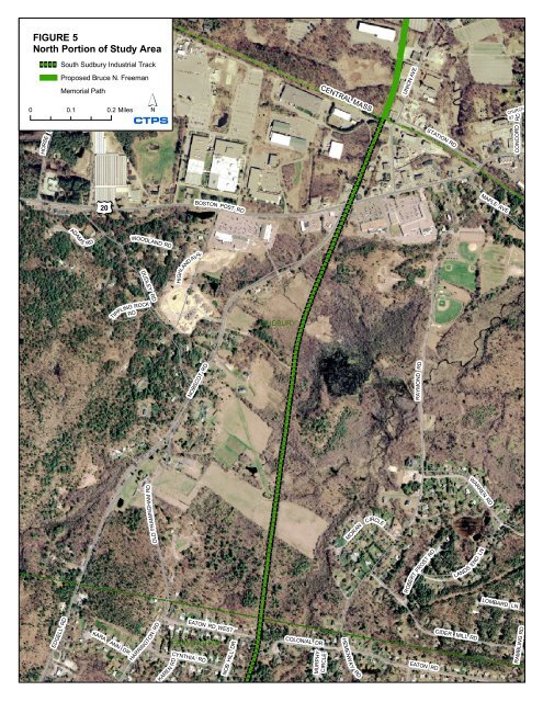
FIGURE 5<br />
North Portion of Study Area<br />
ELLIOT RD<br />
<strong>South</strong> <strong>Sudbury</strong> <strong>Industrial</strong> <strong>Track</strong><br />
Proposed <strong>Bruce</strong> N. <strong>Freeman</strong><br />
Memorial Path<br />
UNION AVE<br />
CENTRAL MASS<br />
0 0.1 0.2 Miles<br />
HORSE POND<br />
CTPS<br />
STATION RD<br />
CHURCH<br />
ST<br />
CONCORD<br />
RD<br />
MAPLE AVE<br />
20<br />
BOSTON POST RD<br />
ADAM S<br />
RD<br />
WOODLAND RD<br />
E<br />
HIGHLAND AV<br />
DUDLEY RD<br />
RD<br />
TIPPLING ROCK<br />
SUDBURY<br />
NOBSCOT RD<br />
RD<br />
RAYMOND<br />
WARREN RD<br />
OLD FRAMINGHAM RD<br />
MORAN<br />
CIRCLE<br />
ROBERT<br />
FROST RD<br />
LANDS END LN<br />
LOMBARD LN<br />
EDGELL RD<br />
KARA ANN DR<br />
HARRINGTON RD<br />
RD<br />
KAREN<br />
EATON RD WEST<br />
FRAMINGHAM<br />
CYNTHIA RD<br />
DR<br />
NOB HILL<br />
COLONIAL DR<br />
MURPHY<br />
CIRCLE<br />
HEMENWAY<br />
RD<br />
EATON RD<br />
CIDER MILL RD<br />
RAMBLING RD
Proposed Extension of the <strong>Bruce</strong> N. <strong>Freeman</strong> Memorial Path in <strong>Sudbury</strong> and Framingham<br />
<strong>The</strong> <strong>South</strong> <strong>Sudbury</strong> <strong>Industrial</strong> <strong>Track</strong> has ample space for a trail; the narrowest width is 55 feet.<br />
Below are the width variations along the corridor, south to north, according to VAL plans<br />
obtained from CSX.<br />
Framingham<br />
<strong>Sudbury</strong><br />
Junction with Fitchburg<br />
Secondary to Pleasant Street: 65; 90 feet.<br />
Bridge over I-90:<br />
85 feet.<br />
I-90 to Grove: 85; 130; 140; 145; 135; 110; 100; 75 feet; a<br />
triangular section on the west side,<br />
approximately 300 feet long, juts out to a<br />
maximum width of 230 feet; then the rightof-way<br />
tapers to 75 feet.<br />
Grove to Belknap:<br />
75 feet.<br />
Belknap to Edgell:<br />
75 feet.<br />
Edgell to Frost:<br />
75 feet.<br />
Frost to Water:<br />
75; 60 feet.<br />
Water to <strong>Sudbury</strong> line:<br />
75; 85; 95; 85; 75; 90; 75 feet.<br />
Framingham line to Route 20:<br />
Route 20 to the Central Mass.:<br />
75 feet except a triangular section on the east<br />
side, 90 feet long, that juts out to a maximum<br />
width of 290 feet, located about 1,600 feet<br />
south of Route 20.<br />
55; 65 feet.<br />
A railroad bed must be relatively flat, while the adjacent land may not be. Thus the bed is<br />
sometimes cut into the land (“cut” section), is sometimes at grade, and sometimes rises above<br />
the adjacent land on an embankment. In some locations the land may be at grade on one side<br />
of the railroad bed, and below or above grade on the other.<br />
In segments where the railroad bed is on an embankment, it typically occupies only a portion<br />
of the right-of-way width. Embankments were measured at several locations on the right-ofway<br />
and were found to be approximately 16 feet wide.<br />
D ROADWAY CROSSINGS<br />
<strong>The</strong>re are six at-grade roadway/right-of-way crossings. <strong>The</strong>re are two grade-separated<br />
crossings: bridges over I-90 and Grove Street. Table 5 below compares the rate of occurrence<br />
of grade crossings on this right-of-way relative to major rail trails in Massachusetts.<br />
<strong>The</strong> table illustrates that the incidence of at-grade crossings on the <strong>South</strong> <strong>Sudbury</strong> <strong>Industrial</strong><br />
<strong>Track</strong> is comparable to the rates on the three trails cited. <strong>The</strong>re are slightly fewer crossings per<br />
mile on this right-of-way than on the Minuteman Commuter Bikeway, and slightly more than<br />
16 Boston Region MPO
Proposed Extension of the <strong>Bruce</strong> N. <strong>Freeman</strong> Memorial Path in <strong>Sudbury</strong> and Framingham<br />
Table 5<br />
Comparison of Rate of Occurrence of At-Grade Intersections on<br />
<strong>South</strong> <strong>Sudbury</strong> <strong>Industrial</strong> <strong>Track</strong> and Major Massachusetts <strong>Rail</strong> Trails<br />
Length At-Grade Miles per<br />
Facility (miles) Intersections At-Grade Crossing<br />
Cape Cod <strong>Rail</strong> Trail 25 25 1.0<br />
Minuteman Commuter Bikeway 11 17 0.6<br />
Norwottuck <strong>Rail</strong> Trail 8 8 1.0<br />
<strong>South</strong> <strong>Sudbury</strong> <strong>Industrial</strong> <strong>Track</strong> 5 6 0.8<br />
on the Cape Cod and Norwottuck rail trails. On average, a traveler can go eight-tenths of a<br />
mile between grade crossings on the <strong>South</strong> <strong>Sudbury</strong> <strong>Industrial</strong> <strong>Track</strong>. <strong>The</strong> longest and shortest<br />
continuous segments are Water Street in Framingham to Route 20 in <strong>Sudbury</strong> (about two<br />
miles) and Edgell Road to Frost Street (about 500 feet). <strong>Chapter</strong> 3 includes details on the<br />
roadway crossings.<br />
E ENVIRONMENTAL ISSUES<br />
According to Federal Highway Administration regulations, bicycle facilities are usually<br />
exempt from federal requirements for environmental impact statements. <strong>The</strong>y are subject to<br />
the provisions of the Massachusetts Environmental Policy Act (MEPA). An Environmental<br />
Notification Form is required to determine whether an environmental impact report would be<br />
necessary for permitting a rail trail to be constructed on the right-of-way. <strong>The</strong> project also<br />
would need to meet state and local wetlands bylaw requirements, the requirements of the<br />
Natural Heritage and Endangered Species Program, 12 and the State Stormwater Guidelines. 13<br />
An environmental assessment of the right-of-way from the January 2004 Report of the<br />
Nobscot Trail Task Force, working on behalf of the Town of Framingham, is provided as<br />
Appendix B of this study.<br />
Noise and Air Quality<br />
It is anticipated that modest noise and air emissions will be generated during construction of a<br />
trail. Once constructed, use of the right-of-way for a rail trail will generate minimal, if any,<br />
on-site air emissions and noise levels since motorized vehicles would not be permitted (except<br />
police and service vehicles, and motorized wheelchairs). <strong>The</strong> exclusion of snowmobiles and<br />
other off-road motorized vehicles would need to be enforced by police. 14<br />
12 This program seeks to protect the 190 species of animals, vertebrate and invertebrate, and 258 species of native<br />
plants officially listed as “Endangered, Threatened, or of Special Concern” in the Commonwealth. An initial<br />
review suggests that there are no core habitats in the study area.<br />
13 Administered by the Massachusetts Department of Environmental Protection.<br />
14 <strong>The</strong>re is anecdotal evidence of motorized vehicles now using the right-of-way. Although this is trespassing,<br />
there is no enforcement: the right-of-way is owned by CSX and there is no agreement in place for local police<br />
jurisdiction. Based on past experiences, once a right-of-way is converted to a trail, such activities as loitering, use<br />
by motorized vehicles, and rubbish disposal become much less frequent or cease altogether.<br />
CTPS 17
Proposed Extension of the <strong>Bruce</strong> N. <strong>Freeman</strong> Memorial Path in <strong>Sudbury</strong> and Framingham<br />
<strong>The</strong> project should generate positive benefits to air quality and noise in the neighborhoods<br />
through which the right-of-way passes since the path is expected to eliminate some motor<br />
vehicle trips, especially short trips or so-called “cold starts,” which contribute<br />
disproportionately to air quality degradation. <strong>The</strong> only additional noise should be<br />
conversations of trail users.<br />
Floodplain Areas<br />
CTPS reviewed Federal Emergency Management Agency (FEMA) maps to assess floodplain<br />
issues. Figure 6 15 indicates three FEMA classifications: (1) an area inundated by 100-year<br />
flood and with a Base Flood Elevation (BFE) 16 determined, (2) an area inundated by 100-year<br />
flood and no BFE determined, and (3) an area not considered in the Special Flood Hazard<br />
Area (SFHA) but inundated up to one foot in 500-year flood. Federal, state, and local policies<br />
direct proponents of most transportation projects to minimize construction and implement<br />
mitigation measures in areas categorized as within a 100-year floodplain.<br />
As seen in Figure 6, the right-of-way enters a 100-year floodplain about 800 feet north of the<br />
Massachusetts Turnpike for a distance of 100 feet. It then enters another approximately 200<br />
feet north of Water Street. It is at first on the western edge of the 100-year floodplain for<br />
about 1,000 feet and then passes through the floodplain for about 500 feet.<br />
About 1,500 feet further north, about halfway between Water Street and the <strong>Sudbury</strong> line, the<br />
right-of-way enters another 100-year floodplain for a distance of 1,000 feet. Approximately<br />
1,500 feet north of the Framingham/<strong>Sudbury</strong> line, the right-of-way is on the western border of<br />
a 100-year floodplain for about 3,000 feet.<br />
Environmental Contamination<br />
<strong>The</strong> work scope for this study does not include soil testing for the presence of environmental<br />
contamination. Whoever purchases the right-of-way ought to test for contaminants prior to<br />
acquisition and the initiation of design and engineering work. CTPS has assumed that since<br />
the right-of-way supported both passenger and freight operations for many years, there is the<br />
potential for environmental contamination. Sources of potential contaminants may include:<br />
substances leached from tracks, ties, bridges, or signal infrastructure; illegal dumping; leaks or<br />
spills from railroad cars; substances deposited through the implementation of vegetation<br />
management programs; and derailments.<br />
<strong>The</strong>re have been at least two derailments in <strong>Sudbury</strong>, one in the summer of 1999 and one on<br />
April 13, 2000. <strong>The</strong> latter occurred on the last rail trip made on the line. <strong>The</strong> derailment<br />
resulted in “debris and parts of one box car” being “piled on the well head of public well<br />
15 Figure 6 shows Q3 flood data, which are digital representations of certain features of FEMA’s Flood Insurance<br />
Rate Maps (FIRMs).<br />
16 Base Flood Elevations (BFEs) are the computed elevations to which floodwater is anticipated to rise during the<br />
base flood. <strong>The</strong>y are shown on FIRMs. <strong>The</strong> BFE is the regulatory requirement for the elevation or flood proofing<br />
of structures. <strong>The</strong> relationship between the BFE and a structure’s elevation determines the flood insurance<br />
premium.<br />
18 Boston Region MPO
20<br />
FRAMINGHAM<br />
SUDBURY<br />
WAYLAND<br />
126<br />
90<br />
FIGURE 6<br />
FEMA Q3 Flood Zones<br />
30<br />
AE - An area inundated by 100-year flood<br />
and BFE determined<br />
A - An area inundated by 100-year flood<br />
and no BFE determined<br />
X500 - Not considered in the SFHA flood plain<br />
but inundated up to 1 ft in 500-year flood<br />
9<br />
NATICK<br />
0 0.25 0.5 Miles<br />
CTPS
Proposed Extension of the <strong>Bruce</strong> N. <strong>Freeman</strong> Memorial Path in <strong>Sudbury</strong> and Framingham<br />
#7.” 17 Testing done at the behest of the Drinking Water Division of the Department of<br />
Environmental Protection (DEP) found the presence of a volatile organic compound called<br />
trichloroethylene. 18 CSX and the <strong>Sudbury</strong> Conservation Commission subsequently reached a<br />
settlement concerning the derailment and its aftermath. 19<br />
F CURRENT USES OF THE SOUTH SUDBURY INDUSTRIAL TRACK<br />
Sixty-two years of passenger service on this line ended in 1933. One hundred and twenty-nine<br />
years of freight service ended in 2000. With no rail activity from 2000 to 2004, much of the<br />
land had become overgrown and difficult to pass through. <strong>The</strong> removal of tracks and ties in<br />
2004 made the right-of-way much easier to traverse. Currently, hikers, snow-shoers, crosscountry<br />
skiers, and snowmobilers use the corridor, as evidenced by their tracks and by<br />
anecdotal accounts. People have dumped trash in many areas.<br />
As indicated earlier, any use of the right-of-way is illegal without an agreement with CSX.<br />
Local police enforcement also requires such an agreement. Although CSX has indicated to<br />
the towns that it is amenable to a lease that would allow interim use, including police access,<br />
no action has occurred to date.<br />
CSX has advised CTPS that there is only one lease agreement recorded for the <strong>South</strong> <strong>Sudbury</strong><br />
<strong>Industrial</strong> <strong>Track</strong>. This agreement provided for installation and maintenance of a sidetrack<br />
south of the Central Mass., on the west side of the <strong>South</strong> <strong>Sudbury</strong> <strong>Industrial</strong> <strong>Track</strong>. This lease<br />
was executed in 1931 as a tenancy-at-will with a 30-day termination clause. 20 It is a safe<br />
assumption that this lease is no longer in effect. <strong>The</strong>re is a gas line crossing under the right-ofway<br />
about a quarter–mile south of the Framingham-<strong>Sudbury</strong> line.<br />
Field reconnaissance to date has not recorded any right-of-way encroachments. A survey is<br />
necessary to determine this definitively.<br />
17 Order of Conditions, <strong>Sudbury</strong> Wetlands Administration Bylaw File # 301-722, August 10, 2000.<br />
18 Letter form Richard P. Carroll, Superintendent, <strong>Sudbury</strong> Water District, to Deborah Dineen, Town of <strong>Sudbury</strong><br />
Conservation Commission, October 30, 2000. <strong>The</strong> letter goes on to state that these “tests have been performed<br />
routinely for many years. This is the first time a positive result has been realized.”<br />
19 CSXT v. <strong>Sudbury</strong> Conservation Commission, Civil Action No. 00-4687 (Middlesex).<br />
20 Correspondence from Lee Chastain, CSX, January 12, 2005.<br />
20 Boston Region MPO