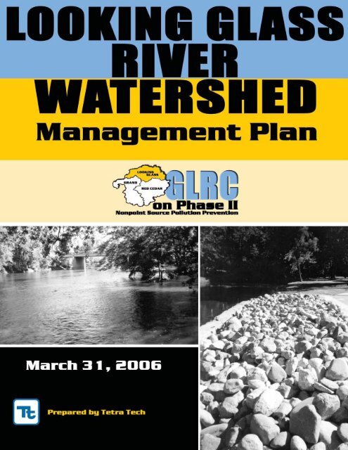
Looking Glass River Watershed Management Plan - Greater ...
Looking Glass River Watershed Management Plan - Greater ...
Looking Glass River Watershed Management Plan - Greater ...

You also want an ePaper? Increase the reach of your titles
YUMPU automatically turns print PDFs into web optimized ePapers that Google loves.
GLRC on Phase II<br />
<strong>Looking</strong> <strong>Glass</strong> <strong>River</strong><br />
<strong>Watershed</strong> <strong>Management</strong> <strong>Plan</strong><br />
April 2007
ii <strong>Looking</strong> <strong>Glass</strong> <strong>River</strong> <strong>Watershed</strong> April 2007<br />
(THIS PAGE INTENTIONALLY LEFT BLANK)
P:\1666001\09 <strong>Looking</strong> <strong>Glass</strong> WMP\WMP Revised for CMI\Version 4.0<br />
iii
iv <strong>Looking</strong> <strong>Glass</strong> <strong>River</strong> <strong>Watershed</strong> April 2007<br />
(THIS PAGE INTENTIONALLY LEFT BLANK)
Table of Contents<br />
Organization of the <strong>Plan</strong>.........................................................................................................................................................xi<br />
Executive Summary ...............................................................................................................................................................xv<br />
SECTION 1 Introduction<br />
<strong>Looking</strong> <strong>Glass</strong> <strong>Watershed</strong>..............................................................................................................................................1-2<br />
Purpose of the <strong>Watershed</strong> <strong>Management</strong> <strong>Plan</strong> ............................................................................................................1-2<br />
What is a <strong>Watershed</strong>.......................................................................................................................................................1-3<br />
<strong>Plan</strong> Requirements..........................................................................................................................................................1-3<br />
Relevant Federal, State, and Regional Programs........................................................................................................1-4<br />
References ........................................................................................................................................................................1-6<br />
SECTION 2 – <strong>Watershed</strong> Characteristics<br />
Subwatersheds ................................................................................................................................................................2-1<br />
Political Jurisdictions......................................................................................................................................................2-1<br />
Demographics .................................................................................................................................................................2-3<br />
Land Use and Growth Trends ......................................................................................................................................2-3<br />
Wetlands ..........................................................................................................................................................................2-7<br />
Importance of Headwater Streams...............................................................................................................................2-8<br />
Climate .............................................................................................................................................................................2-8<br />
Geology and Soils ...........................................................................................................................................................2-9<br />
Hydrology......................................................................................................................................................................2-10<br />
Point Sources of Potential Pollutants .........................................................................................................................2-11<br />
Sewer and Septic System Service Areas ....................................................................................................................2-13<br />
Significant Natural Features to be Protected ............................................................................................................2-14<br />
References ......................................................................................................................................................................2-16<br />
SECTION 3 – Documented Water Quality Conditions<br />
The Relevance of Impervious Cover............................................................................................................................3-1<br />
Habitat and Populations................................................................................................................................................3-2<br />
Assorted Field Assessments..........................................................................................................................................3-3<br />
MDEQ-defined Impairments ......................................................................................................................................3-19<br />
Designated Uses............................................................................................................................................................3-20<br />
Pollutant Load Analysis...............................................................................................................................................3-21<br />
Interpretation of <strong>Watershed</strong> Conditions ...................................................................................................................3-25<br />
References ......................................................................................................................................................................3-25<br />
SECTION 4 – Community Outreach<br />
Introduction.....................................................................................................................................................................4-1<br />
Public Participation Process ..........................................................................................................................................4-1<br />
Public Education <strong>Plan</strong> ....................................................................................................................................................4-5<br />
Summary of Concerns....................................................................................................................................................4-6<br />
References ........................................................................................................................................................................4-7<br />
v
SECTION 5 – Stressor Summary<br />
Introduction.....................................................................................................................................................................5-1<br />
Status of Designated Uses .............................................................................................................................................5-1<br />
Determining Significant Stressors ................................................................................................................................5-3<br />
Sediment ..........................................................................................................................................................................5-3<br />
Altered Hydrology .........................................................................................................................................................5-8<br />
Other Stressors ..............................................................................................................................................................5-15<br />
References ......................................................................................................................................................................5-23<br />
SECTION 6 – Goals and Objectives<br />
Introduction.....................................................................................................................................................................6-1<br />
Water Quality Issues and Concerns .............................................................................................................................6-1<br />
Goals and Objectives ......................................................................................................................................................6-2<br />
References ........................................................................................................................................................................6-9<br />
SECTION 7 – <strong>Watershed</strong> Protection Tools<br />
Overview..........................................................................................................................................................................7-1<br />
<strong>Watershed</strong> <strong>Plan</strong>ning .......................................................................................................................................................7-1<br />
Land Conservation .........................................................................................................................................................7-1<br />
Aquatic Buffers ...............................................................................................................................................................7-3<br />
Better Site Design............................................................................................................................................................7-4<br />
Erosion and Sediment Control......................................................................................................................................7-4<br />
Storm Water Best <strong>Management</strong> Practices....................................................................................................................7-5<br />
Non-Storm Water Discharges .......................................................................................................................................7-6<br />
<strong>Watershed</strong> Stewardship Programs...............................................................................................................................7-6<br />
School Curriculum........................................................................................................................................................7-10<br />
Additional Resources ...................................................................................................................................................7-11<br />
References ......................................................................................................................................................................7-11<br />
SECTION 8 – Action <strong>Plan</strong><br />
Introduction.....................................................................................................................................................................8-1<br />
<strong>Watershed</strong>-Based NPDES Permit Fulfillment.............................................................................................................8-1<br />
Critical Items Identified by Stakeholders ....................................................................................................................8-1<br />
Benefits of Actions ..........................................................................................................................................................8-2<br />
Action <strong>Plan</strong> Table............................................................................................................................................................8-3<br />
Abbreviations..................................................................................................................................................................8-4<br />
References ........................................................................................................................................................................8-4<br />
SECTION 9 – Evaluation Mechanisms<br />
Introduction.....................................................................................................................................................................9-1<br />
Permit Requirements......................................................................................................................................................9-1<br />
Program <strong>Plan</strong>ning...........................................................................................................................................................9-2<br />
Program Implementation ..............................................................................................................................................9-5<br />
Effectiveness Assessment ..............................................................................................................................................9-5<br />
Evaluation Action <strong>Plan</strong> ..................................................................................................................................................9-9<br />
Summary..........................................................................................................................................................................9-9<br />
References ......................................................................................................................................................................9-10<br />
vi <strong>Looking</strong> <strong>Glass</strong> <strong>River</strong> <strong>Watershed</strong> April 2007
SECTION 10 – <strong>Plan</strong> Sustainability<br />
Introduction...................................................................................................................................................................10-1<br />
History of <strong>Greater</strong> Lansing Regional Committee.....................................................................................................10-1<br />
<strong>Watershed</strong> Committees................................................................................................................................................10-3<br />
Phase II Legal Relationship .........................................................................................................................................10-3<br />
Funding..........................................................................................................................................................................10-4<br />
GLRC Future .................................................................................................................................................................10-5<br />
References ......................................................................................................................................................................10-6<br />
APPENDIX A Meeting Fact Sheets<br />
APPENDIX B Stakeholder Contact Information<br />
APPENDIX C NPDES Wastewater Discharge General Permit for Storm Water Discharges<br />
APPENDIX D <strong>Watershed</strong> <strong>Management</strong> <strong>Plan</strong> Community Resolutions<br />
APPENDIX E Road Stream Crossing Surveys<br />
APPENDIX F Vermillion Creek Pathogen Correspondence<br />
vii
TABLES<br />
Table 1-1 <strong>Watershed</strong> <strong>Management</strong> Units .....................................................................................................................1-3<br />
Table 2-1 Political Jurisdictions in the <strong>Watershed</strong>.......................................................................................................2-2<br />
Table 2-2 Population .......................................................................................................................................................2-3<br />
Table 2-3 Wetlands ..........................................................................................................................................................2-8<br />
Table 2-4 Climatic Data...................................................................................................................................................2-9<br />
Table 2-5 Sewer Service Areas .....................................................................................................................................2-13<br />
Table 2-6 Threatened and Endangered Features in the <strong>Watershed</strong>........................................................................2-15<br />
Table 3-1 Project GREEN Education Programs ...........................................................................................................3-3<br />
Table 3-2 Additional Problems and Actions..............................................................................................................3-12<br />
Table 3-3 Extrapolated Data.........................................................................................................................................3-12<br />
Table 3-4 Problems Found During Upland Assessment ..........................................................................................3-13<br />
Table 3-5 Potential Retrofit Projects ............................................................................................................................3-14<br />
Table 3-6 Mid-MEAC Monitoring Data......................................................................................................................3-16<br />
Table 3-7 Water Sampling Results July 8-10, 1992 ....................................................................................................3-18<br />
Table 3-8 Fish Consumption Advisory Information.................................................................................................3-19<br />
Table 3-9 Impaired Waterbodies .................................................................................................................................3-19<br />
Table 3-10 Urban Pollutant Load Concentrations.......................................................................................................3-21<br />
Table 3-11 Unit Area Storm Water Loading Data .......................................................................................................3-24<br />
Table 5-1 Status of Designated Uses .............................................................................................................................5-2<br />
Table 5-2 Sediment Sources and Causes.......................................................................................................................5-4<br />
Table 5-3 Altered Hydrology Sources and Causes .....................................................................................................5-9<br />
Table 5-4 Subwatershed Impervious Cover...............................................................................................................5-13<br />
Table 5-5 Detergents: Sources and Causes .................................................................................................................5-16<br />
Table 5-6 Nutrients: Sources and Causes ...................................................................................................................5-17<br />
Table 5-7 Trash and Debris: Sources and Causes......................................................................................................5-18<br />
Table 5-8 Pathogens: Sources and Causes..................................................................................................................5-19<br />
Table 5-9 Salt: Sources and Causes..............................................................................................................................5-19<br />
Table 5-10 Oil and Grease: Sources and Causes..........................................................................................................5-20<br />
Table 5-11 HHW: Sources and Causes..........................................................................................................................5-20<br />
Table 5-12 Heavy Metals: Sources and Causes............................................................................................................5-21<br />
Table 5-13 PCBs: Sources and Causes...........................................................................................................................5-21<br />
Table 5-14 Pesticide: Sources and Causes.....................................................................................................................5-22<br />
Table 5-15 Temperature: Sources and Causes .............................................................................................................5-22<br />
Table 5-16 Woody Debris: Sources and Causes...........................................................................................................5-22<br />
Table 8-1 Benefits of Goals .............................................................................................................................................8-3<br />
Table 9-1 Examples of Evaluation Mechanisms by Type...........................................................................................9-4<br />
viii <strong>Looking</strong> <strong>Glass</strong> <strong>River</strong> <strong>Watershed</strong> April 2007
FIGURES<br />
Figure 1-1 <strong>Watershed</strong> Location Map ..............................................................................................................................1-1<br />
Figure 2-1 Subwatersheds ................................................................................................................................................2-1<br />
Figure 2-2 Local Units of Government ...........................................................................................................................2-2<br />
Figure 2-3 Land Types Circa 1830...................................................................................................................................2-4<br />
Figure 2-4 Land Types Present Day................................................................................................................................2-4<br />
Figure 2-5 Land Types Future .........................................................................................................................................2-5<br />
Figure 2-6 Public Lands....................................................................................................................................................2-6<br />
Figure 2-7 Wetlands ..........................................................................................................................................................2-7<br />
Figure 2-8 Effects of Urbanization on Runoff..............................................................................................................2-10<br />
Figure 2-9 Stream Flow Data at Eagle, MI. ..................................................................................................................2-11<br />
Figure 2-10 Point Sources.................................................................................................................................................2-12<br />
Figure 2-11 Sanitary Sewer Service.................................................................................................................................2-12<br />
Figure 3-1 Water Quality Data Summary ........................................................................................................3-4 and 3-5<br />
Figure 3-2 Road Stream Crossing Locations..................................................................................................................3-6<br />
Figure 3-3 Stabilization, Erosion and Sedimentation Issues........................................................................................3-8<br />
Figure 3-4 Riparian Buffer Issues ....................................................................................................................................3-9<br />
Figure 3-5 Trash Clean Up and Illicit Discharge Investigation Issues .....................................................................3-11<br />
Figure 3-6 Calling Calendar for Frogs and Toads in Michigan.................................................................................3-17<br />
Figure 3-7 Sediment Pollutant Load .............................................................................................................................3-22<br />
Figure 3-8 Phosphorous Pollutant Load.......................................................................................................................3-23<br />
Figure 3-9 BOD Pollutant Load .....................................................................................................................................3-23<br />
Figure 5-1 Stream Flow at Eagle (USGS 04114498).....................................................................................................5-11<br />
Figure 5-2 R-B Index at Eagle (USGS 04114498)..........................................................................................................5-12<br />
Figure 5-3 Impervious Cover Map................................................................................................................................5-13<br />
Figure 9-1 Program Elements ..........................................................................................................................................9-1<br />
Figure 9-2 Success Levels .................................................................................................................................................9-3<br />
Figure 10-1 <strong>Greater</strong> Lansing Regional Committee Structure ......................................................................................10-2<br />
ix
x <strong>Looking</strong> <strong>Glass</strong> <strong>River</strong> <strong>Watershed</strong> April 2007<br />
(THIS PAGE INTENTIONALLY LEFT BLANK)
Organization of the <strong>Plan</strong><br />
This plan defines an approach that is to be taken to protect ecological,<br />
hydrological, and cultural resources of the subwatershed. It presents all of<br />
the data, analyses, public inputs, and conclusions used in developing the<br />
approach as well as components of the approach itself, including goals and<br />
objectives, actions to achieve the goals and objectives, plan evaluation and<br />
revision, and plan sustainability.<br />
1. Introduction<br />
This section introduces the reader to the watershed, describes the purpose<br />
and requirements of the plan, and defines the drainage units, or catchments,<br />
that comprise the watershed.<br />
The section goes on to introduce the reader to some background information<br />
such as watershed science, water pollution control and its history, and other<br />
relevant plans that are supported by this watershed management plan<br />
(WMP).<br />
2. <strong>Watershed</strong> Characteristics<br />
This section walks the reader through the natural environment of the<br />
subwatershed, including coverage of each category in the watershed. A brief<br />
introduction to the hydrological processes, vegetation, habitat and wildlife<br />
provides the reader with a greater understanding of the valuable natural<br />
features.<br />
The section goes on with details of the community profiles, population<br />
trends and statistics. Past, present and future land use data educates the<br />
reader about trends in development and infrastructure.<br />
The section concludes with existing infrastructure and potential sources of<br />
pollution discharges.<br />
3. Documented Water Quality Conditions<br />
This section begins with a discussion of the impacts on the environment<br />
caused by human activity and government defined water quality standards<br />
and indicators. An in-depth discussion of qualitative water chemistry<br />
conditions, biological conditions and hydrologic conditions supplies the<br />
reader with an overview of historic and current subwatershed conditions.<br />
The section continues by providing the reader with results from road-stream<br />
crossing surveys, and other volunteer monitoring efforts.<br />
There are several subwatershed protection practices already in place and are<br />
summarized for the reader. The section is closed out with a list of the<br />
existing waterbody impairments.<br />
A vast amount of the information in this section provides a baseline for<br />
future sections in this WMP and future planning efforts.<br />
4. Community Outreach<br />
Section 4 begins with a discussion of the public involvement processes that<br />
were used to obtain input into the content of this WMP and comments on a<br />
draft version. This discussion includes details of the participants in the<br />
various mechanisms and lists the specific feedback received.<br />
Organization of the <strong>Plan</strong><br />
xi
The section goes on to discuss the education that was done for benefit of the<br />
municipal officials and concludes with a detailing of the public education<br />
efforts that were conducted during development of and will continue after<br />
submittal of the WMP.<br />
5. Stressor Summary<br />
This section distills the information contained in Sections 2, 3, and 4 into a<br />
number of significant stressors that impact water quality. The section<br />
discusses the methodology employed to analyze the significant stressors and<br />
provides a section for each stressor that discusses topics associated with<br />
each: sources, impacts and impairment, indicators, water quality standards,<br />
load estimates and reduction goals, critical areas, monitoring progress, and<br />
improvement ideas.<br />
The section finishes with a brief discussion of other known and suspected<br />
stressors in the subwatershed.<br />
6. Goals and Objectives<br />
This section defines the goals and objectives of the plan. This section<br />
combines the desires learned in Section 4 with the impaired designated uses<br />
and the subsequent sources and causes of the stressors identified in Section<br />
5.<br />
This section begins with a very brief summary of the main issues and then<br />
presents a mission statement developed by the watershed committee. Nine<br />
goals are identified for the watershed and specific objectives are identified<br />
for each goal.<br />
This section also discusses the NPDES Phase II permit and how the<br />
requirements of the permit are being met.<br />
7. <strong>Watershed</strong> Protection<br />
This section presents many tools and resources that are available to achieve<br />
the goals and objectives presented in the previous section.<br />
The tools are discussed in following general groups: <strong>Watershed</strong> <strong>Plan</strong>ning,<br />
Land Conservation, Aquatic Buffers, Better Site Design, Erosion and<br />
Sediment Control, Storm Water Best <strong>Management</strong> Practices, Non-Storm<br />
Water Discharges, <strong>Watershed</strong> Stewardship Programs, and School<br />
Curriculum.<br />
8. Action <strong>Plan</strong><br />
This section details the roadmap that the implementing agencies will follow,<br />
utilizing the actions and resources presented in Section 7, to achieve the<br />
goals and objectives of the WMP (see Section 6). It details the steps that will<br />
be taken and includes: a textual description of each action, a table linking the<br />
actions to the appropriate goals and objectives, the lead implementing<br />
agency, a projected schedule, estimates of cost and time, financial and<br />
technical assistance needed, the authority related to each action, and<br />
<strong>Watershed</strong>-based Permit (NPDES Phase II) details such as SWPPI inclusion<br />
and level of commitment.<br />
xii <strong>Looking</strong> <strong>Glass</strong> <strong>River</strong> <strong>Watershed</strong> April 2007
9. Evaluation and Revision<br />
Section 9 describes the iterative process of watershed planning and how<br />
evaluation and revision are an essential component of this.<br />
The section also details potential evaluation mechanisms (or measures of<br />
success) and what options are available to assess them.<br />
The bulk of the section lays out the evaluation and revision guidance,<br />
including: measures of activity completion, measures of usage, and measures<br />
of change; monitoring protocols and existing monitoring programs; and the<br />
specific actions involved in the plan with details such as lead implementing<br />
agency, timeline/schedule, and estimates of cost and time.<br />
10. <strong>Plan</strong> Institutionalization<br />
This section presents a history of the <strong>Greater</strong> Lansing Regional committee<br />
and how they have organized to work together in the future. A discussion of<br />
the current committee structure is provided. The formal legal relationship of<br />
the Committee is described along with the funding mechanisms. The action<br />
items identified in Section 8 are often assigned to a committee as described in<br />
this section.<br />
Appendices<br />
The appendices include products generated during the WMP-development<br />
process (e.g. fact sheets) contact lists, and other information not essential to<br />
the text of the WMP but important for those requiring additional information<br />
on selected topics.<br />
Organization of the <strong>Plan</strong><br />
xiii
(THIS PAGE INTENTIONALLY LEFT BLANK)<br />
xiv <strong>Looking</strong> <strong>Glass</strong> <strong>River</strong> <strong>Watershed</strong> April 2007
!<br />
!<br />
!<br />
!<br />
!<br />
!<br />
Forest Hill<br />
!<br />
!<br />
!<br />
!<br />
!<br />
!<br />
!<br />
!<br />
Francis<br />
!<br />
!<br />
!<br />
!<br />
!<br />
!<br />
!<br />
!<br />
!<br />
Ingersoll<br />
!<br />
!<br />
!<br />
!<br />
Lowell<br />
!<br />
Lowell<br />
!<br />
!<br />
National<br />
!<br />
!<br />
!<br />
!<br />
!<br />
!<br />
!<br />
! !<br />
! ! !<br />
Grove<br />
Grov e<br />
!<br />
Hide Aw ay<br />
!<br />
!<br />
!<br />
!<br />
!<br />
Airport<br />
!<br />
!<br />
Hardke<br />
! !<br />
!<br />
!<br />
!<br />
!<br />
!<br />
!<br />
!<br />
!<br />
!<br />
!<br />
!<br />
Schav ey<br />
!<br />
!<br />
!<br />
!<br />
!<br />
! !<br />
Farm<br />
!<br />
!<br />
! !<br />
Norris<br />
! !<br />
!<br />
!<br />
!<br />
! !<br />
!<br />
!<br />
!<br />
Daggo t<br />
!<br />
Wilson<br />
Dewitt<br />
!<br />
Dewitt<br />
!<br />
!<br />
!<br />
!<br />
!<br />
! !<br />
!<br />
Dewi t<br />
Turner<br />
!<br />
!<br />
!<br />
!<br />
!<br />
!<br />
! ! !<br />
! ! !<br />
!<br />
! !<br />
!<br />
!<br />
!<br />
!<br />
Tuck er<br />
State<br />
!<br />
!<br />
US 127 BR<br />
East<br />
Brook<br />
Kruger<br />
! !<br />
!<br />
!<br />
!<br />
Northward<br />
!<br />
!<br />
!<br />
!<br />
!<br />
Boichot<br />
! !<br />
!<br />
!<br />
!<br />
!!<br />
Chetwyn<br />
!<br />
Ohio<br />
! !<br />
!<br />
!<br />
!<br />
Williams<br />
Wood<br />
! !<br />
!<br />
!<br />
!<br />
Wi liams<br />
! !<br />
!<br />
! ! ! !<br />
!<br />
!<br />
!<br />
!<br />
Gate<br />
Baird<br />
!<br />
!<br />
Bond<br />
!<br />
Merlin<br />
! !<br />
! !<br />
!<br />
!<br />
!<br />
!<br />
!<br />
!<br />
!<br />
!<br />
! ! ! !<br />
!<br />
!<br />
West<br />
! ! !<br />
Krepps<br />
Coolidge<br />
!<br />
!<br />
!<br />
!<br />
!<br />
Marfitt<br />
!<br />
!<br />
!<br />
!<br />
!<br />
!<br />
!<br />
Harrison<br />
!<br />
!<br />
!<br />
!<br />
!<br />
!<br />
!<br />
!<br />
!<br />
!<br />
!<br />
!<br />
!<br />
! !<br />
!<br />
!<br />
! !<br />
!<br />
Colorado<br />
!<br />
!!<br />
! !<br />
Chandler<br />
! ! !<br />
! ! !<br />
!<br />
!<br />
! !<br />
!<br />
Forest<br />
!<br />
!<br />
!<br />
!<br />
Chandler<br />
! !<br />
!<br />
!<br />
Abbott<br />
Grove<br />
!<br />
!<br />
!<br />
! !<br />
!<br />
Chandler<br />
!<br />
!! !<br />
! !<br />
!<br />
!<br />
!<br />
!<br />
! !<br />
!<br />
! ! !<br />
!<br />
!<br />
! ! !<br />
Towar<br />
!<br />
Porter<br />
Alton<br />
!<br />
! ! ! !<br />
!<br />
!<br />
Hardy<br />
!<br />
!<br />
!<br />
Watson<br />
!<br />
Watson<br />
!<br />
Tiffin<br />
!<br />
Hagadorn<br />
!<br />
!<br />
!<br />
Skyline<br />
! !<br />
!<br />
Babcock<br />
! ! ! !<br />
! !<br />
!<br />
Gary<br />
!<br />
Saint Clair<br />
Webster<br />
!<br />
!<br />
! ! !<br />
!<br />
!<br />
Deerpath<br />
!<br />
!<br />
G K<br />
!<br />
Angle<br />
!<br />
!<br />
Nic hols<br />
!<br />
!<br />
Center<br />
!<br />
Center<br />
!<br />
! ! ! ! ! !<br />
!<br />
Center<br />
!<br />
!<br />
!<br />
!<br />
Robson<br />
Upton<br />
!<br />
!<br />
!<br />
!<br />
!<br />
Upton<br />
!<br />
!<br />
Hunter<br />
!<br />
Ho lister<br />
!<br />
!<br />
!<br />
!<br />
Peacock<br />
!<br />
!<br />
!<br />
! !<br />
!<br />
! !<br />
!<br />
!<br />
!<br />
!<br />
!<br />
!<br />
!<br />
!<br />
!<br />
!<br />
!<br />
!<br />
!<br />
!<br />
!<br />
! ! ! ! ! !<br />
!<br />
!<br />
!<br />
!<br />
!<br />
!<br />
!<br />
! ! ! ! ! !<br />
!<br />
!<br />
Woodbury<br />
!<br />
!<br />
!<br />
Woodbury<br />
!<br />
Dunn<br />
!<br />
Pulver<br />
!<br />
!<br />
!<br />
!<br />
!<br />
!<br />
!<br />
!<br />
Ribbey<br />
!<br />
!<br />
!<br />
!<br />
! !<br />
! !<br />
! !<br />
Warner<br />
!<br />
!<br />
!<br />
!<br />
!<br />
!<br />
!<br />
!<br />
Executive Summary<br />
“The significant problems we<br />
face cannot be solved at the<br />
same level of thinking we were<br />
at when they were created.”<br />
Lower Grand<br />
<strong>River</strong><br />
Upper Grand<br />
<strong>River</strong><br />
- Albert Einstein<br />
<strong>Looking</strong> <strong>Glass</strong> <strong>River</strong><br />
<strong>Watershed</strong> <strong>Management</strong><br />
<strong>Plan</strong>ning Area<br />
Michigan <strong>Watershed</strong>s, <strong>Looking</strong><br />
<strong>Glass</strong> <strong>River</strong> <strong>Watershed</strong>, Tetra<br />
The <strong>Looking</strong> <strong>Glass</strong> <strong>River</strong> <strong>Watershed</strong> is one of three watersheds that were<br />
delineated as a result of the formation of the <strong>Greater</strong> Lansing Regional<br />
Committee on Phase II Nonpoint Source Pollution Prevention (GLRC) on<br />
May 21, 2004. The GLRC is comprised of 22 political agencies (i.e.<br />
communities, drain commissioner’s offices, and road commission) that each<br />
chose to fulfill the requirements of the Michigan <strong>Watershed</strong>-Based National<br />
Pollutant Discharge Elimination System (NPDES) Phase II Storm Water<br />
Permit. The <strong>Looking</strong> <strong>Glass</strong> <strong>River</strong> <strong>Watershed</strong> contains 14 of the 22 political<br />
agencies. Working together as the <strong>Looking</strong> <strong>Glass</strong> <strong>River</strong> <strong>Watershed</strong><br />
Committee, the permittees have developed this <strong>Watershed</strong> <strong>Management</strong><br />
<strong>Plan</strong> (WMP) to fulfill the permit requirements.<br />
The <strong>Looking</strong> <strong>Glass</strong> <strong>River</strong> <strong>Watershed</strong> includes both rural and urban areas.<br />
The urban areas, which encompass approximately 11% of the watershed,<br />
include a portion of the Lansing metropolitan area (the Cities of Lansing,<br />
East Lansing, and Lansing Township), Meridian Township, and the City of<br />
DeWitt. The City of DeWitt and Bath and DeWitt Townships are<br />
experiencing development but still have rural (agricultural and forest) areas<br />
that can be protected. Watertown, Woodhull, Victor, Olive and Riley<br />
Townships are all in the watershed and all have rural areas with significant<br />
croplands.<br />
<strong>Watershed</strong> Location Map<br />
Participating NPDES<br />
Permittees<br />
• Bath Township<br />
• Clinton County Drain<br />
Commissioner<br />
• Clinton County Road<br />
Commission<br />
• DeWitt, City of<br />
• DeWitt Township<br />
• DeWitt Public School District<br />
• East Lansing, City of<br />
• Ingham County Drain<br />
Commissioner<br />
• Lansing, City of<br />
• Lansing Township<br />
• Lansing Public School<br />
District<br />
• Meridian Township<br />
• Watertown Township<br />
Watertown Twp<br />
W I 96<br />
E I 96<br />
Stoll<br />
Waters of the State<br />
State Roads<br />
Roads<br />
E I 96/E I 69<br />
Grand <strong>River</strong><br />
Legend<br />
Riley Twp<br />
<strong>Looking</strong> <strong>Glass</strong> <strong>River</strong><br />
W I 69<br />
Herbis on<br />
State<br />
Sto l<br />
County Boundary<br />
State<br />
Municipal Boundaries<br />
<strong>Watershed</strong><br />
Howe<br />
Shady Brook<br />
! ! ! ! ! ! ! ! ! !<br />
! ! ! ! ! ! ! ! !<br />
£¤ 127<br />
! ! ! ! ! ! ! ! ! ! ! !<br />
City of<br />
Dewitt<br />
Dewitt Twp<br />
CLINTON COUNTY<br />
EATON COUNTY<br />
Ivy<br />
Sandhill<br />
Airport/E I 96<br />
INGHAM COUNTY<br />
Wrenwood<br />
White Pine<br />
Redpole<br />
Shamrock<br />
Riv ergate<br />
Cutler<br />
Sara Ann<br />
Olive Twp<br />
Brookview<br />
Herbis on<br />
Main<br />
W I 69/Dewitt<br />
Dill<br />
Primrose<br />
Theresa<br />
State<br />
Golf<br />
Sanborn<br />
Clark<br />
Stoll<br />
Solon<br />
<strong>River</strong><br />
Burlingame<br />
Keusc h<br />
Benne t<br />
Valley<br />
E I 69<br />
6th<br />
Round Lake<br />
Webb<br />
Coleman<br />
Lansing<br />
Twp<br />
David<br />
Alward<br />
Chadwick<br />
City of<br />
Lansing<br />
S US 127 N US 127<br />
Herbis on<br />
Sir Galahad<br />
Cadgewith<br />
Brown<br />
Tulane<br />
E I 69 CD<br />
Vassar<br />
! !<br />
Alward<br />
Howe<br />
Herbis on<br />
Coleman<br />
Abbey<br />
Wolf<br />
Lehman<br />
Stoll<br />
! ! ! ! !<br />
! ! ! ! ! ! ! ! !<br />
! ! !<br />
! ! !<br />
Unknown<br />
! !<br />
! !<br />
Lake Lansing<br />
Southlawn<br />
City of<br />
Ballantine<br />
Howe<br />
Bernier<br />
Sleight<br />
Biber<br />
Saginaw<br />
Hawk Hollow<br />
Biber<br />
Applegate<br />
Clise<br />
Victor Twp<br />
Vine<br />
Drumheller<br />
Webster/W I 69<br />
Ann<br />
! !<br />
Outer<br />
Oakdale<br />
Park Lake<br />
Pine Hollow<br />
Sleight<br />
§ ¨¦ 69<br />
Chadwick<br />
Howe<br />
Alward<br />
Davis<br />
! ! ! ! ! !<br />
Bath Twp<br />
Meridian Twp<br />
Round Lake<br />
Herbis on<br />
W I 69/I 69 BL<br />
4<br />
Alward<br />
Old M 78<br />
Cutler<br />
Sto l<br />
State<br />
Coleman<br />
Herbis on<br />
Old M 78<br />
CLINTON COUNTY<br />
Chadwick<br />
Clark<br />
State<br />
SHIAWASSEE COUNTY<br />
Cutler<br />
! ! ! ! ! ! ! ! ! ! ! !<br />
! ! ! ! ! ! ! ! ! ! ! !<br />
Miss aukee<br />
Laingsburg<br />
Britton<br />
Sto l<br />
Laingsburg<br />
Corcoran<br />
Pollard<br />
Blackberry<br />
Sciota Twp<br />
Bath<br />
Woodbury /I69<br />
Shoeman<br />
Deer<br />
Britton<br />
Lans ing<br />
Foster<br />
Gulick<br />
Woodhull Twp<br />
Beard<br />
Braden<br />
I 69<br />
Barry<br />
Williamstown Twp<br />
Colby Lak e<br />
Moon Lake<br />
I 69<br />
Gulick<br />
Zimmer<br />
Beard<br />
Oakes<br />
Lovejoy<br />
0 1 2 3 4<br />
Miles<br />
Water quality monitoring has been and continues to be conducted by the<br />
Michigan Department of Environmental Quality (MDEQ), the Michigan<br />
Department of Natural Resources (MDNR), and Friends of the <strong>Looking</strong> <strong>Glass</strong><br />
to determine the effects of various land uses and specific problem areas. As<br />
part of this WMP, the permittees will support water quality monitoring to<br />
help show changes in water quality as the WMP is implemented.<br />
Executive Summary<br />
xv
Priority water bodies within the watershed include the <strong>Looking</strong> <strong>Glass</strong> <strong>River</strong><br />
and the Vermillion Creek. Both of these water bodies have multiple<br />
designated uses that are threatened or impaired as listed by the MDEQ. The<br />
Vermillion Creek is impaired for ‘Untreated Sewage’ and ‘Discharge of<br />
Pathogens’. The original reason for listing Vermillion Creek as impaired has<br />
been resolved and is discussed further in Section 3. It is anticipated that<br />
successful completion of the WMP will help protect and restore designated<br />
uses of the water bodies within the <strong>Looking</strong> <strong>Glass</strong> <strong>River</strong> <strong>Watershed</strong>.<br />
Macroinvertebrate and fish communities are only as strong as the habitat<br />
available to them in the river corridor. Within that portion of the <strong>Looking</strong><br />
<strong>Glass</strong> <strong>River</strong> <strong>Watershed</strong>, the habitat ranged from excellent to poor. This<br />
mixed bag of data tells us that there are areas of the watershed that are still<br />
pristine while other areas need restoration. Before the <strong>Looking</strong> <strong>Glass</strong> <strong>River</strong><br />
reaches DeWitt, habitat quality was identified as good to excellent.<br />
Downstream of DeWitt, data shows that macroinvertebrates are significantly<br />
impaired and there is a complete absence of intolerant species. Heavy<br />
sedimentation deposition and urban debris were common. The populations<br />
and diversity rebound by the time the river reached Wright and Howe<br />
Roads, downstream of this watershed planning area (Evans 1976). Summers<br />
Drain, Faiver Drain, Remy-Chandler Drain, Mud Creek, and Vermillion<br />
Creek all have identified concerns and the designated use of warmwater<br />
fisheries and other aquatic life and wildlife is considered to be threatened.<br />
Development of the WMP and the decision making process of the watershed<br />
committee has involved input from the general public and the stakeholders.<br />
Multiple public meetings were held at the start of the WMP development,<br />
four stakeholder workshops were held throughout the planning process, and<br />
the public was invited to comment near the completion of the plan. At these<br />
meetings, the WMP stakeholders and the general public expressed their<br />
concerns and vision for the watershed which includes having swimmable<br />
and fishable water bodies and significant public education as top priorities.<br />
In addition to the vision of the general public and stakeholders,<br />
consideration was given to the restoration and protection of the designated<br />
uses of the water bodies. The following goals were developed through the<br />
public participation and input process:<br />
• Educate the Public about the Importance of Protecting and Managing<br />
the <strong>Watershed</strong><br />
• Provide a Sustainable and Equitable Funding Source<br />
• Encourage Water Quality Friendly Development<br />
• Restore and Enhance Recreational Uses Through Development of a<br />
<strong>Watershed</strong> Recreation <strong>Plan</strong><br />
• Protect and Enhance Habitat for Wildlife and Aquatic Animals<br />
Through Development of a <strong>Watershed</strong> Habitat <strong>Plan</strong><br />
• Protect and Increase Wetlands Through Development of a <strong>Watershed</strong><br />
Habitat <strong>Plan</strong><br />
• Provide Pollution Prevention/Good Housekeeping Practices for<br />
Municipal Operations<br />
• Strive to Eliminate Pathogens to Meet Total and Partial Body Contact<br />
for Recreational Uses<br />
• Encourage Water Quality Friendly Agricultural Practices<br />
<strong>Looking</strong> <strong>Glass</strong> <strong>River</strong> <strong>Watershed</strong>,<br />
Tetra Tech, 2005<br />
<strong>Looking</strong> <strong>Glass</strong> <strong>River</strong> near Babcock<br />
Rd., Tetra Tech, 2005<br />
<strong>Looking</strong> <strong>Glass</strong> <strong>River</strong> <strong>Watershed</strong>,<br />
Tetra Tech, 2005<br />
Vermillion Creek at Woodbury<br />
Road, Tetra Tech, 2005<br />
xvi <strong>Looking</strong> <strong>Glass</strong> <strong>River</strong> <strong>Watershed</strong> April 2007
The goals and objectives were then used to guide the development of the<br />
Action <strong>Plan</strong> in Section 8. The Action <strong>Plan</strong> is a comprehensive set of actions<br />
which support the nine goals and subordinate objectives for the watershed.<br />
The goals listed above include the following actions: developing a public<br />
education campaign; a funding strategy; development standards; riparian<br />
recreation and habitat projects; pollution prevention practices; an illicit<br />
discharge elimination program; and agricultural best management practices.<br />
The actions are presented in a table under their corresponding goals and<br />
objectives and are accompanied by a schedule, responsible party, evaluation<br />
mechanism, and cost. Permittees are expected to incorporate portions of the<br />
WMP Action <strong>Plan</strong>, which are applicable to their agency, into their individual<br />
Storm Water Pollution Prevention Initiatives.<br />
Vermillion Creek at Warner Road,<br />
Tetra Tech, 2005<br />
Implementation of the WMP will be predominately through sub-committee<br />
actions as discussed in Section 10 of this WMP. As part of the WMP Action<br />
<strong>Plan</strong>, a funding strategy will be developed for procuring start-up and<br />
continual funding for WMP implementation. The GLRC currently uses a<br />
funding allocation formula based on population and land area of the<br />
permitted communities within the watershed.<br />
The GLRC will continue to oversee watershed management throughout the<br />
tri-county region under their current organizational structure but will<br />
consider additional or alternate legal organizational structures if necessary to<br />
implement the WMP in the future. This WMP is intended to be a flexible<br />
document that can be changed as needs arise.<br />
Vermillion Creek at Beard Road,<br />
Tetra Tech, 2005<br />
Executive Summary<br />
xvii
!<br />
!<br />
!<br />
!<br />
!<br />
!<br />
Forest Hill<br />
!<br />
!<br />
!<br />
!<br />
!<br />
!<br />
!<br />
!<br />
Francis<br />
!<br />
!<br />
!<br />
!<br />
!<br />
!<br />
!<br />
!<br />
!<br />
Ingersoll<br />
!<br />
!<br />
!<br />
!<br />
Lowell<br />
!<br />
!<br />
Lowell<br />
!<br />
National<br />
!<br />
!<br />
!<br />
!<br />
!<br />
!<br />
!<br />
! !<br />
! ! !<br />
Grove<br />
Grove<br />
!<br />
Hide Away<br />
!<br />
!<br />
!<br />
!<br />
!<br />
Airport<br />
!<br />
!<br />
Hardke<br />
! !<br />
!<br />
!<br />
!<br />
!<br />
!<br />
!<br />
!<br />
!<br />
!<br />
!<br />
!<br />
Schavey<br />
!<br />
!<br />
!<br />
! !<br />
!<br />
Farm<br />
!<br />
! !<br />
!<br />
!<br />
!<br />
! !<br />
Norris<br />
!<br />
!<br />
! ! ! ! ! ! ! ! ! !<br />
!<br />
!<br />
Daggott<br />
!<br />
!<br />
Wilson<br />
Dewitt<br />
!<br />
Dewitt<br />
!<br />
!<br />
!<br />
!<br />
!<br />
! !<br />
Dewitt<br />
!<br />
Turner<br />
!<br />
!<br />
!<br />
!<br />
!<br />
! ! !<br />
! ! !<br />
!<br />
!!<br />
!<br />
!<br />
!<br />
Tucker<br />
State<br />
!<br />
!<br />
US 127 BR<br />
East<br />
Brook<br />
Kruger<br />
! ! !<br />
!<br />
!<br />
Northward<br />
!<br />
!<br />
!<br />
!<br />
!<br />
Boichot<br />
! !<br />
!<br />
!<br />
!<br />
!!<br />
!<br />
Chetwyn<br />
Ohio<br />
!<br />
!<br />
!<br />
Williams<br />
Wood<br />
! !<br />
!<br />
!<br />
!<br />
!<br />
Williams<br />
!<br />
!<br />
!<br />
!<br />
Gate<br />
Baird<br />
Bond<br />
!<br />
! !<br />
!<br />
!<br />
! !<br />
!<br />
!<br />
!<br />
! !<br />
!<br />
!<br />
!<br />
!<br />
!<br />
!<br />
! ! ! !<br />
!<br />
!<br />
West<br />
!<br />
! ! !<br />
Krepps<br />
Coolidge<br />
!<br />
!<br />
!<br />
!<br />
!<br />
Marfitt<br />
!<br />
!<br />
!<br />
!<br />
!<br />
!<br />
!<br />
!<br />
Harrison<br />
!<br />
!<br />
!<br />
!<br />
!<br />
!<br />
!<br />
!<br />
!<br />
!<br />
!<br />
!<br />
! !<br />
!<br />
!<br />
!<br />
!<br />
! !<br />
Colorado<br />
!<br />
!<br />
Chandler<br />
! ! !<br />
!<br />
!<br />
!<br />
Forest<br />
!<br />
! !<br />
! !<br />
!<br />
!<br />
!<br />
Chandler<br />
!<br />
!<br />
Abbott<br />
!<br />
Grove<br />
!<br />
!<br />
! !<br />
!<br />
Chandler<br />
!<br />
! ! ! ! !<br />
!<br />
!<br />
! ! ! !<br />
!<br />
!<br />
! !<br />
!<br />
! ! !<br />
!<br />
!<br />
! ! !<br />
Towar<br />
!<br />
Porter<br />
Alton<br />
!<br />
! ! ! !<br />
!<br />
!<br />
Hardy<br />
!<br />
!<br />
!<br />
Watson<br />
!<br />
Watson<br />
!<br />
Tiffin<br />
!<br />
Hagadorn<br />
!<br />
!<br />
!<br />
Skyline<br />
!<br />
Babcock<br />
! !<br />
! !<br />
!<br />
Gary<br />
!<br />
Saint Clair<br />
Webster<br />
!<br />
!<br />
!<br />
!<br />
Deerpath<br />
!<br />
!<br />
G K<br />
!<br />
Angle<br />
!<br />
!<br />
Nichols<br />
! ! ! ! ! ! !<br />
!<br />
!<br />
Center<br />
!<br />
Center<br />
!<br />
!<br />
Center<br />
!<br />
!<br />
!<br />
!<br />
Robson<br />
Upton<br />
!<br />
!<br />
!<br />
!<br />
!<br />
Upton<br />
!<br />
!<br />
Hunter<br />
!<br />
Hollister<br />
!<br />
!<br />
!<br />
!<br />
Peacock<br />
!<br />
!<br />
!<br />
! !<br />
!<br />
!<br />
! !<br />
!<br />
!<br />
!<br />
!<br />
!<br />
!<br />
!<br />
!<br />
!<br />
!<br />
!<br />
!<br />
!<br />
!<br />
!<br />
!<br />
!<br />
!<br />
!<br />
!<br />
!<br />
! ! ! ! ! !<br />
!<br />
!<br />
!<br />
!<br />
!<br />
!<br />
Dunn<br />
!<br />
Pulver<br />
!<br />
!<br />
!<br />
!<br />
!<br />
!<br />
!<br />
!<br />
Ribbey<br />
!<br />
! !<br />
!<br />
!<br />
!<br />
! !<br />
! !<br />
Warner<br />
!<br />
!<br />
!<br />
!<br />
!<br />
!<br />
!<br />
!<br />
1. Introduction<br />
The State of Michigan, by Public Act 78 of 2004, officially designated the<br />
American lotus blossom (Nelumbo lutea) as the state symbol for clean water<br />
effective April 21, 2004. The American lotus is a showy plant that<br />
proliferates in shallow wetland areas during the summer months. Micro and<br />
macro invertebrates inhabit submerged portions of the plant, which, in turn<br />
are used as food for fish and other wildlife. The adoption of this symbol<br />
demonstrates Michigan’s commitment to wetland protection and clean<br />
water. Michigan’s commitment is further established by the National<br />
Pollutant Discharge Elimination System (NPDES) Phase II storm water<br />
permit requiring communities to conduct storm water or watershed<br />
planning. The <strong>Looking</strong> <strong>Glass</strong> <strong>Watershed</strong> <strong>Management</strong> <strong>Plan</strong> contained herein<br />
is one of many planning efforts in Michigan.<br />
American Lotus<br />
Figure 1-1. <strong>Watershed</strong> Location Map<br />
<strong>Looking</strong> <strong>Glass</strong> <strong>River</strong><br />
<strong>Watershed</strong> <strong>Management</strong><br />
<strong>Plan</strong>ning Area<br />
Lower Grand<br />
<strong>River</strong><br />
Upper Grand<br />
<strong>River</strong><br />
Riley Twp<br />
Cutler<br />
Olive Twp<br />
£¤ 127<br />
! ! ! ! ! ! ! ! ! ! !<br />
Wrenwood<br />
Brookview<br />
Chadwick<br />
Round Lake<br />
Alward<br />
Alward<br />
Lehman<br />
! ! ! ! ! !<br />
! ! ! ! ! ! ! ! !<br />
Ballantine<br />
Victor Twp<br />
Oakdale<br />
Alward<br />
Chadwick<br />
Alward<br />
Round Lake<br />
Cutler<br />
Chadwick<br />
! ! ! ! ! ! ! ! ! !<br />
CLINTON COUNTY<br />
SHIAWASSEE COUNTY<br />
! ! ! ! ! ! ! ! ! ! ! !<br />
! ! ! ! ! ! ! ! ! ! ! !<br />
Laingsburg<br />
Cutler<br />
Sciota Twp<br />
S US 127 N US 127<br />
! ! ! ! ! ! ! ! ! !<br />
Watertown Twp<br />
W I 96<br />
E I 96<br />
Stoll<br />
E I 96/E I 69<br />
Grand <strong>River</strong><br />
<strong>Looking</strong> <strong>Glass</strong> <strong>River</strong><br />
W I 69<br />
Herbison<br />
State<br />
Stoll<br />
State<br />
Legend<br />
Waters of the State County Boundary<br />
State Roads<br />
Municipal Boundaries<br />
Roads<br />
<strong>Watershed</strong><br />
Howe<br />
Shady Brook<br />
! ! ! ! ! ! ! ! !<br />
City of<br />
Dewitt<br />
Dewitt Twp<br />
CLINTON COUNTY<br />
EATON COUNTY<br />
Ivy<br />
Sandhill<br />
White Pine<br />
INGHAM COUNTY<br />
Redpole<br />
Airport/E I 96<br />
Shamrock<br />
<strong>River</strong>gate<br />
Sara Ann<br />
Herbison<br />
Main<br />
W I 69/Dewitt<br />
Dill<br />
Primrose<br />
Theresa<br />
State<br />
Golf<br />
Sanborn<br />
Clark<br />
Stoll<br />
Burlingame<br />
Solon<br />
<strong>River</strong><br />
Keusch<br />
Bennett<br />
Valley<br />
E I 69<br />
6th<br />
Webb<br />
Coleman<br />
Herbison<br />
Sir Galahad<br />
Lansing<br />
Twp<br />
David<br />
Cadgewith<br />
City of<br />
Lansing<br />
Brown<br />
Merlin<br />
Tulane<br />
E I 69 CD<br />
Vassar<br />
Howe<br />
Herbison<br />
Coleman<br />
Stoll<br />
Abbey<br />
Wolf<br />
! ! ! ! ! ! ! ! ! ! !<br />
Unknown<br />
! !<br />
! !<br />
Lake Lansing<br />
Southlawn<br />
City of<br />
Howe<br />
Bernier<br />
Sleight<br />
Biber<br />
Saginaw<br />
Hawk Hollow<br />
Biber<br />
Applegate<br />
Clise<br />
Vine<br />
Drumheller<br />
Webster/W I 69<br />
Ann<br />
Outer<br />
Park Lake<br />
Pine Hollow<br />
Sleight<br />
§¨¦ 69<br />
Howe<br />
Davis<br />
Herbison<br />
W I 69/I 69 BL<br />
Bath Twp<br />
Meridian Twp<br />
4<br />
Old M 78<br />
Stoll<br />
State<br />
Coleman<br />
Herbison<br />
Old M 78<br />
Clark<br />
State<br />
Missaukee<br />
Britton<br />
Stoll<br />
Laingsburg<br />
Corcoran<br />
Pollard<br />
Blackberry<br />
Woodbury<br />
Bath<br />
Woodbury /I69<br />
Beard<br />
Lansing<br />
Woodhull Twp<br />
Braden<br />
I 69<br />
! ! ! ! ! !<br />
Shoeman<br />
Woodbury<br />
Deer<br />
Britton<br />
Foster<br />
Gulick<br />
Moon Lake<br />
Barry<br />
Williamstown Twp<br />
Colby Lake<br />
I 69<br />
Gulick<br />
Zimmer<br />
Beard<br />
Oakes<br />
Lovejoy<br />
0 1 2 3 4<br />
Miles<br />
Section 1: Introduction 1-1
<strong>Looking</strong> <strong>Glass</strong> <strong>Watershed</strong><br />
The <strong>Looking</strong> <strong>Glass</strong> <strong>River</strong> is a major tributary to the Grand <strong>River</strong>, located in<br />
Central, Lower Michigan (Figure 1-1). The <strong>Looking</strong> <strong>Glass</strong> <strong>River</strong> discharges<br />
into the Grand <strong>River</strong> in Portland, Michigan (Ionia County), which continues<br />
on west and drains into Lake Michigan.<br />
Approximately 80,000 acres of the total number of acres that comprise the<br />
<strong>Looking</strong> <strong>Glass</strong> <strong>Watershed</strong> are included in this watershed management plan<br />
(WMP). Within the watershed there are about 183 miles of rivers and<br />
streams. The two largest are the <strong>Looking</strong> <strong>Glass</strong> <strong>River</strong> and Vermilion Creek.<br />
There are also approximately 900 acres of lakes within the watershed, with<br />
the largest lake being Park Lake (182 acres), Round Lake (87 acres), Lake<br />
Geneva (58 acres), and Perch Lake (35 acres).<br />
Purpose of the <strong>Watershed</strong> <strong>Management</strong> <strong>Plan</strong><br />
On March 10, 2003 any municipality within the Lansing Urbanized Area<br />
(UA) was required to submit a NPDES Phase II storm water permit. In<br />
Michigan, permittees were given the choice of submitting a jurisdictional or a<br />
watershed based permit. Michigan is the only state to offer this permitting<br />
option. With over 300 communities in Michigan needing to apply for Phase<br />
II permit coverage, over 250 have decided to use the watershed planning<br />
option, due to its many benefits over a traditional permitting program.<br />
Participating NPDES<br />
Permittees<br />
• Bath Township<br />
• Clinton County Drain<br />
Commissioner<br />
• Clinton County Road<br />
Commission<br />
• DeWitt, City of<br />
• DeWitt Public School<br />
District<br />
• DeWitt Township<br />
• East Lansing, City of<br />
• Ingham County Drain<br />
Commissioner<br />
• Lansing, City of<br />
• Lansing Public School<br />
District<br />
• Lansing Township<br />
• Meridian Township<br />
• Watertown Township<br />
Some benefits of the watershed approach include: access to grant funding,<br />
including the State Bond Fund known as Clean Michigan Initiative (CMI),<br />
expanded schedules for watershed management planning, and choices on<br />
how and when implementation will occur. A watershed approach involves<br />
coordination with both public and private sectors focusing efforts to address<br />
the highest priority problems.<br />
As a result of this watershed permit approach, the <strong>Greater</strong> Lansing Regional<br />
Committee on Phase II Nonpoint Source Pollution Prevention (GLRC) was<br />
created. The GLRC has developed this plan to address the requirements<br />
outlined in the Phase II permit and to improve and protect the ecological,<br />
hydrological, and cultural resources of the <strong>Looking</strong> <strong>Glass</strong> <strong>Watershed</strong>.<br />
1-2 <strong>Looking</strong> <strong>Glass</strong> <strong>River</strong> <strong>Watershed</strong> April 2007
<strong>Watershed</strong> <strong>Management</strong> Units<br />
The largest watershed<br />
management unit is the basin.<br />
A basin drains to a major<br />
receiving water such as a large<br />
river, estuary or lake. Within<br />
each basin are a group of<br />
subbasins, that are a mosaic of<br />
many diverse land uses,<br />
including forest, agriculture,<br />
range and urban areas.<br />
Subbasins are composed of a<br />
group of watersheds, which, in<br />
turn, are composed of a group<br />
of subwatersheds. Within<br />
subwatersheds are catchments,<br />
which are the smallest units in a<br />
watershed, defined as the area<br />
that drains an individual<br />
development site to its first<br />
intersection with a stream.<br />
Source: CWP, 1998.<br />
What is a <strong>Watershed</strong><br />
A watershed is any area of land that drains to a common point. That<br />
common point may be a lake, the outlet of a river, or any point within a river<br />
system. Throughout this WMP, the terms basin, subbasin, watershed,<br />
subwatershed, and catchment are used to describe the drainages of the river.<br />
Table 1-1. <strong>Watershed</strong> <strong>Management</strong> Units.<br />
<strong>Watershed</strong><br />
<strong>Management</strong> Unit<br />
Typical Area<br />
(square miles)<br />
Influence of<br />
Impervious Cover<br />
Sample<br />
<strong>Management</strong><br />
Measures<br />
Catchment 0.05 – 0.50 Very Strong BMP and site<br />
design<br />
Subwatershed 1 – 10 Strong Stream<br />
classification and<br />
management<br />
<strong>Watershed</strong> 10-100 Moderate <strong>Watershed</strong>-based<br />
zoning<br />
Subbasin 100 – 1,000 Weak Basin <strong>Plan</strong>ning<br />
Basin 1,000 – 10,000 Weak Basin <strong>Plan</strong>ning<br />
Source: CWP, 1998<br />
<strong>Plan</strong> Requirements<br />
According to the MDEQ NPDES Wastewater Discharge General Permit for<br />
Storm Water Discharges from Municipal Separate Storm Sewer Systems Subject to<br />
<strong>Watershed</strong> <strong>Plan</strong> Requirements, the WMP shall, at a minimum, contain the<br />
following:<br />
• an assessment of the nature and status of the watershed ecosystem to<br />
the extent necessary to achieve the purpose of the WMP;<br />
• short-term measurable objectives for the watershed;<br />
• long-term goals for the watershed (which shall include both the<br />
protection of designated uses of the receiving waters as defined in<br />
Michigan's Water Quality Standards, and attaining compliance with<br />
any Total Maximum Daily Load [TMDL] established for a parameter<br />
within the watershed);<br />
• determination of the actions needed to achieve the short-term<br />
measurable objectives for the watershed;<br />
• determination of the actions needed to achieve the long-term goals for<br />
the watershed;<br />
• assessment of both the benefits and costs of the actions identified above<br />
(a "cost/benefit analysis" is not required)<br />
• commitments, identified by specific permittee or others as appropriate,<br />
to implement actions by specified dates necessary to achieve the shortterm<br />
measurable objectives;<br />
• commitments, identified by specific permittee or others as appropriate,<br />
to implement actions by specified dates necessary to initiate<br />
achievement of the long-term goals; and<br />
Section 1: Introduction 1-3
• methods for evaluation of progress, which may include chemical or<br />
biological indicators, flow measurements, erosion indices, and public<br />
surveys.<br />
Relevant Federal, State, and Regional Programs<br />
Clean Water Act<br />
Growing public awareness and concern for controlling water pollution led to<br />
enactment of the Clean Water Act (CWA) of 1972. The Act established the<br />
basic structure for regulating discharges of pollutants into the waters of the<br />
United States. It gave EPA the authority to implement pollution control<br />
programs, such as setting wastewater standards for industry. The CWA also<br />
continued requirements to set water quality standards for all contaminants<br />
in surface waters. The Act made it unlawful for any person to discharge any<br />
pollutant from a point source into navigable waters, unless a permit was<br />
obtained under its provisions. It also funded the construction of sewage<br />
treatment plants under the construction grants program and recognized the<br />
need for planning to address the critical problems posed by nonpoint source<br />
pollution.<br />
Subsequent enactments modified some of the earlier CWA provisions.<br />
Revisions in 1981 streamlined the municipal construction grants process,<br />
improving the capabilities of treatment plants built under the program.<br />
Changes in 1987 phased out the construction grants program, replacing it<br />
with the State Water Pollution Control Revolving Fund, more commonly<br />
known as the Clean Water State Revolving Fund (SRF). This new funding<br />
strategy addressed water quality needs by building on EPA State<br />
partnerships.<br />
The State of Michigan administers the Total Maximum Daily Load (TMDL)<br />
program in Michigan. These rules define the water quality goals for a lake or<br />
stream. MDEQ defines water quality standards (WQS) as “state rules<br />
established to protect the Great Lakes, the connecting waters, and all other<br />
surface waters of the state. The goals are in three areas, including the uses of<br />
the lake or stream, such as swimming and fishing; safe levels to protect the<br />
uses, such as the minimum oxygen level needed for fish to live; and<br />
procedures to protect high quality waters.” (MDEQ, 2005)<br />
Public Act 451 of 1994 – Natural Resources and<br />
Environmental Protection Act<br />
The Natural Resources and Environmental Protection Act is designed to<br />
protect the environment and natural resources of the state by:<br />
• regulating pollutant discharges<br />
• regulating land, water, and resource use<br />
• prescribing penalties and remedies for violations.<br />
Notable parts of the act relating to storm water include: Part 31 – Water<br />
Resources Protection; Part 41 – Sewerage Systems; Part 87 – Groundwater<br />
and Freshwater Protection; Part 91 – Soil Erosion & Sedimentation Control;<br />
Part 301 – Inland Lakes and Streams; Part 303 – Wetland Protection; and Part<br />
305 – Natural <strong>River</strong>s Act. (Reference)<br />
1-4 <strong>Looking</strong> <strong>Glass</strong> <strong>River</strong> <strong>Watershed</strong> April 2007
Public Act 40 of 1956 – The Drain Code<br />
The Drain Code sets forth procedures for the creation, maintenance and<br />
financing of county and inter-county drains in Michigan. It establishes the<br />
office and prescribes the duties and powers of the county drain<br />
commissioner. County drains are important to Phase II efforts because many<br />
of them are waters of the state, and most of them discharge directly or<br />
indirectly to waters of the state. (Pratt, 2005)<br />
State Programs and Permits<br />
State programs that directly enforce and assist in compliance with federal<br />
and state storm water regulations include the following MDEQ Water<br />
Division groups: Storm Water, Soil Erosion and Sedimentation Control,<br />
NPDES Permits, and Nonpoint Source Pollution. State-level funding<br />
programs that support storm water related projects include: the SRF, the<br />
Strategic Water Quality Initiative Fund, and the CMI.<br />
Despite the NPDES permitting process that covers storm water-specific<br />
issues, other permits may apply for a specific case. Many state and federal<br />
permits are covered under the MDEQ/U.S. Army Corps of Engineers Joint<br />
Permit Application (JPA) package. The JPA covers activities relating to:<br />
wetlands, floodplains, marinas, dams, inland lakes and streams, great lakes<br />
bottomlands, critical dunes, and high-risk erosion areas. Other permits not<br />
included in the JPA include: the Sewerage System Construction Permit and<br />
the Groundwater Discharge Permit.<br />
Additional Programs<br />
Specific situations may invoke numerous other federal, state, and local<br />
programs that directly or indirectly relate to storm water issues. The<br />
following list presents some of these:<br />
• The federal Safe Drinking Water Act establishes wellhead protection<br />
provisions that are implemented at the state (MDEQ Water Wellhead<br />
Protection program) or local level. Wellhead protection may involve<br />
managing and treating storm water to prevent aquifer pollution.<br />
• Coastal and shoreline areas invoke numerous federal laws such as the<br />
Shoreline Erosion Protection Act and the Coastal Zone Act, state laws,<br />
and state programs such as Coastal <strong>Management</strong>, Sand Dune<br />
Protection, and Shoreland <strong>Management</strong>.<br />
Commercial/industrial facilities (mines, landfills, agriculture facilities, etc.)<br />
have numerous laws and regulations controlling on-site materials use and<br />
site-related runoff control requirements that are designed to minimize<br />
environmental impacts. Example laws include: the Surface Mining Control<br />
& Reclamation Act, the Resource Conservation and Recovery Act, and the<br />
Federal Insecticide, Fungicide, and Rodenticide Act.<br />
Section 1: Introduction 1-5
References<br />
Center for <strong>Watershed</strong> Protection. “Rapid <strong>Watershed</strong> <strong>Plan</strong>ning Handbook.”<br />
1998. Ellicott City, Maryland.<br />
Michigan Department of Environmental Quality. “TMDL Website.” Via:<br />
www.michigan.gov. Last accessed: February 2 nd , 2005.<br />
Pratt, Paul. “E-mail communication concerning Michigan’s Drain Code”.<br />
January 28 th , 2005.<br />
1-6 <strong>Looking</strong> <strong>Glass</strong> <strong>River</strong> <strong>Watershed</strong> April 2007
!<br />
!<br />
!<br />
!<br />
!<br />
!<br />
!<br />
!<br />
!<br />
!<br />
!<br />
!<br />
!<br />
!<br />
!<br />
!<br />
!<br />
!<br />
!<br />
!<br />
!<br />
!<br />
!<br />
!<br />
!<br />
!<br />
!<br />
!<br />
!<br />
!<br />
!<br />
!<br />
!<br />
!<br />
!<br />
!<br />
!<br />
!<br />
! !<br />
! ! !<br />
!<br />
!<br />
!<br />
!<br />
!<br />
!<br />
!<br />
! ! ! ! ! ! ! ! ! ! ! !<br />
!<br />
!<br />
!<br />
!<br />
!<br />
!<br />
!<br />
!<br />
!<br />
! !<br />
!<br />
!<br />
!<br />
!<br />
!<br />
! !<br />
!<br />
!<br />
! !<br />
!<br />
! !<br />
!<br />
!<br />
!<br />
!<br />
!<br />
!<br />
!<br />
!<br />
!<br />
!<br />
!<br />
!<br />
!<br />
!<br />
!<br />
!<br />
!<br />
!<br />
!<br />
!<br />
!<br />
! ! !<br />
!<br />
!<br />
!<br />
!<br />
!<br />
!<br />
! ! !<br />
!<br />
!<br />
!<br />
!<br />
!<br />
!<br />
!<br />
!<br />
!<br />
!<br />
!<br />
!<br />
!<br />
!<br />
!<br />
!<br />
!<br />
! !<br />
!<br />
!<br />
!<br />
!<br />
!<br />
!<br />
!<br />
!<br />
!<br />
!<br />
!<br />
! !<br />
!<br />
!<br />
!<br />
! !<br />
!<br />
!<br />
! !<br />
!<br />
!<br />
!<br />
!<br />
!<br />
!<br />
! !<br />
! ! ! !<br />
!<br />
! ! ! !<br />
!<br />
!<br />
!<br />
!<br />
!<br />
!<br />
!<br />
!<br />
!<br />
!<br />
!<br />
!<br />
!<br />
!<br />
!<br />
!<br />
!<br />
!<br />
!<br />
!<br />
!<br />
!<br />
!<br />
!<br />
!<br />
!<br />
!<br />
!<br />
!<br />
!<br />
!<br />
!<br />
! !<br />
!<br />
!<br />
! !<br />
!<br />
! !<br />
!<br />
!<br />
!<br />
!<br />
!<br />
!<br />
!<br />
! !<br />
!<br />
! ! !<br />
! ! ! !<br />
!<br />
!<br />
!<br />
!<br />
! !<br />
!<br />
! ! !<br />
!<br />
!<br />
!<br />
!<br />
!<br />
! ! ! !<br />
!<br />
!<br />
!<br />
!<br />
!<br />
!<br />
!<br />
!<br />
!<br />
!<br />
!<br />
!<br />
!<br />
!<br />
!<br />
!<br />
!<br />
!<br />
!<br />
!<br />
!<br />
!<br />
!<br />
!<br />
!<br />
!<br />
!<br />
!<br />
!<br />
!<br />
!<br />
!<br />
!<br />
!<br />
!<br />
!<br />
!<br />
!<br />
!<br />
!<br />
!<br />
!<br />
!<br />
!<br />
!<br />
!<br />
!<br />
!<br />
! !<br />
!<br />
!<br />
! !<br />
!<br />
!<br />
!!! ! ! ! ! ! ! ! ! ! !<br />
!<br />
!<br />
!<br />
!<br />
!<br />
!<br />
!<br />
!<br />
!<br />
!<br />
!<br />
!<br />
!<br />
!<br />
!<br />
!<br />
!<br />
!<br />
! ! ! ! ! !<br />
!<br />
!<br />
!<br />
!<br />
!<br />
!<br />
!<br />
!<br />
!<br />
!<br />
!<br />
!<br />
!<br />
!<br />
!<br />
!<br />
! !<br />
!<br />
!<br />
!<br />
! !<br />
! !<br />
!<br />
!<br />
!<br />
!<br />
!<br />
!<br />
!<br />
!<br />
Subwatershed Delineation<br />
The subwatershed delineations<br />
and names do not necessarily<br />
correspond to Drain<br />
Commissioner assessment<br />
areas. The subwatersheds are<br />
defined as planning areas only<br />
for the purposes of this<br />
watershed plan.<br />
2. <strong>Watershed</strong> Characteristics<br />
Subwatersheds<br />
The boundaries of the <strong>Looking</strong> <strong>Glass</strong> <strong>Watershed</strong> and its fourteen<br />
subwatersheds are primarily based on United States Geological Survey<br />
(USGS) defined boundaries (USGS, 2005). These boundaries, or Hydrologic<br />
Unit Codes (HUCs), divide the United States into discrete, nested areas<br />
based on common drainage patterns. HUCS were further subdivided based<br />
upon drainage to get the subwatersheds to the desired size.<br />
The subwatersheds range in size from 10 to 15 square miles. Figure 2-1<br />
presents a map of these subwatersheds. Table 2-1 lists them with<br />
corresponding areas and watershed coverage percentages.<br />
Political Jurisdictions<br />
The <strong>Looking</strong> <strong>Glass</strong> <strong>Watershed</strong> is a diverse watershed made up of 14 distinct<br />
political jurisdictions. While Bath Township, DeWitt Township, Watertown<br />
Township, Woodhull Township, Victor Township, and Riley Township are<br />
the six largest communities in the watershed; they represent different types<br />
of communities.<br />
Figure 2-1 Subwatersheds<br />
Watertown Twp<br />
Riley Twp<br />
Faiver Drain<br />
Subwatershed<br />
<strong>Looking</strong> <strong>Glass</strong> <strong>River</strong><br />
! ! ! ! ! ! ! !<br />
City of<br />
Dewitt<br />
Olive Twp<br />
<strong>Looking</strong> <strong>Glass</strong> B<br />
Subwatershed<br />
!!! !<br />
£¤ 127<br />
Turkey Creek<br />
Subwatershed<br />
! ! ! !<br />
!! ! ! ! !<br />
<strong>Looking</strong> <strong>Glass</strong> A<br />
Subwatershed<br />
Victor Twp<br />
! ! ! ! ! ! ! ! ! !<br />
! ! ! ! ! ! ! ! ! !! !<br />
Clise Drain<br />
Subwatershed<br />
Mud Creek<br />
Subwatershed<br />
Graneer Drain<br />
Subwatershed<br />
CLINTON COUNTY<br />
SHIAWASSEE COUNTY<br />
Sciota Twp<br />
Lower Vermilion<br />
Creek Subwatershed<br />
Middle Vermilion<br />
Creek Subwatershed<br />
Woodhull Twp<br />
! ! ! ! ! ! ! ! ! ! ! !<br />
! ! ! ! ! ! ! ! !<br />
! ! ! ! ! ! ! ! ! !<br />
! ! ! ! ! ! ! ! !<br />
! ! ! ! ! ! ! ! !<br />
Waters of the State<br />
State Roads<br />
County Boundary<br />
Summer Drain<br />
Subwatershed<br />
Legend<br />
Municipal Boundaries<br />
Subwatersheds<br />
<strong>Watershed</strong><br />
CLINTON COUNTY<br />
EATON COUNTY<br />
INGHAM COUNTY<br />
Lower Remey Chandler<br />
Prairie and Gunderman Drain Subwatershed<br />
Drain Subwatershed<br />
Dewitt Twp<br />
Lansing<br />
Twp<br />
City of<br />
Lansing<br />
! !<br />
City of<br />
East Lansing<br />
! !<br />
! !<br />
! ! !<br />
Upper Remey Chandler<br />
Drain Subwatershed<br />
! !<br />
§¨¦ 69<br />
Bath Twp<br />
Meridian Twp<br />
4<br />
Upper Vermilion Creek<br />
Subwatershed<br />
! ! ! ! ! !<br />
Williamstown Twp<br />
0 1 2 3 4<br />
Miles<br />
Section 2: <strong>Watershed</strong> Characteristics 2-1
!<br />
!<br />
!<br />
!<br />
!<br />
!<br />
!<br />
!<br />
!<br />
!<br />
!<br />
!<br />
!<br />
!<br />
!<br />
!<br />
!<br />
!<br />
!<br />
!<br />
!<br />
!<br />
!<br />
!<br />
!<br />
!<br />
!<br />
!<br />
!<br />
!<br />
!<br />
!<br />
!<br />
!<br />
!<br />
!<br />
!<br />
!<br />
! !<br />
! ! !<br />
!<br />
!<br />
!<br />
!<br />
!<br />
!<br />
!<br />
! ! ! ! ! ! ! ! ! ! ! !<br />
!<br />
!<br />
!<br />
!<br />
!<br />
!<br />
!<br />
!<br />
!<br />
! !<br />
!<br />
!<br />
!<br />
! !<br />
!<br />
!<br />
!<br />
!<br />
! !<br />
!<br />
! !<br />
!<br />
!<br />
!<br />
!<br />
!<br />
!<br />
!<br />
!<br />
!<br />
!<br />
!<br />
!<br />
!<br />
!<br />
!<br />
!<br />
!<br />
!<br />
!<br />
!<br />
! ! !<br />
! ! !<br />
!<br />
!<br />
!<br />
!<br />
!<br />
!<br />
!<br />
!<br />
! ! !<br />
!<br />
!<br />
!<br />
!<br />
!<br />
!<br />
!<br />
!<br />
!<br />
!<br />
!<br />
!<br />
!!<br />
!<br />
!<br />
!<br />
!<br />
! !<br />
!<br />
!<br />
!<br />
!<br />
!<br />
! !<br />
!<br />
!<br />
!<br />
! !<br />
!<br />
! !<br />
!<br />
!<br />
!<br />
!<br />
!<br />
!<br />
!<br />
!<br />
!<br />
! ! ! !<br />
!<br />
! ! ! !<br />
!<br />
!<br />
!<br />
!<br />
!<br />
!<br />
!<br />
!<br />
!<br />
!<br />
!<br />
!<br />
!<br />
!<br />
!<br />
!<br />
!<br />
!<br />
!<br />
!<br />
!<br />
!<br />
!<br />
!<br />
!<br />
!<br />
! ! ! !<br />
!<br />
!<br />
!<br />
! !<br />
!<br />
!<br />
!<br />
!<br />
! !<br />
!<br />
!<br />
!<br />
!<br />
! !<br />
!<br />
!<br />
! ! !<br />
!<br />
!<br />
! ! ! !<br />
!<br />
!<br />
! !<br />
!!<br />
!<br />
! ! !<br />
!<br />
!<br />
!<br />
!<br />
!<br />
! ! ! !<br />
!<br />
!<br />
!<br />
!<br />
!<br />
!<br />
!<br />
!<br />
!<br />
!<br />
! !<br />
! !<br />
!<br />
!<br />
!<br />
!<br />
!<br />
!<br />
!<br />
!<br />
!<br />
!<br />
!<br />
!<br />
!<br />
!<br />
!<br />
!<br />
!<br />
!<br />
!<br />
!<br />
!<br />
!<br />
!<br />
!<br />
!<br />
!<br />
!<br />
!<br />
!<br />
!<br />
!<br />
!<br />
!<br />
!<br />
!<br />
! !<br />
! !<br />
!<br />
!<br />
!<br />
!<br />
!<br />
!<br />
!<br />
!<br />
!<br />
!<br />
!<br />
!<br />
!<br />
!<br />
!<br />
!<br />
!<br />
!<br />
!<br />
!<br />
!<br />
!<br />
!<br />
! ! ! ! ! !<br />
!<br />
!<br />
!<br />
!<br />
!<br />
!<br />
!<br />
!<br />
!<br />
!<br />
!<br />
!<br />
!<br />
!<br />
!<br />
!<br />
! !<br />
!<br />
!<br />
!<br />
! !<br />
! !<br />
!<br />
!<br />
!<br />
!<br />
!<br />
!<br />
!<br />
!<br />
Subwatershed<br />
Table 2-1 Political Jurisdictions in the <strong>Watershed</strong><br />
Bath<br />
Township<br />
DeWitt<br />
Township<br />
Olive<br />
Township<br />
Victor<br />
Township<br />
City of<br />
DeWitt<br />
Riley<br />
Township<br />
Clise Drain 4,066 1,388 24 943 6,420 8%<br />
Faiver Drain 1,098 82 117 3,986 5,283 7%<br />
Graneer Drain 1,452 3,607 5,059 6%<br />
Upper Vermilion 682 5,087 1,910 7,679 10%<br />
<strong>Looking</strong> <strong>Glass</strong> A 162 2,888 2,088 5,138 6%<br />
<strong>Looking</strong> <strong>Glass</strong> B 3,909 1,487 1,821 35 130 7,382 9%<br />
Lower Remey Chandler 505 4,964 879 39 6,388 8%<br />
Lower Vermilion Creek 1,576 579 578 134 2,867 3%<br />
Mud Creek 5,879 55 5,934 7%<br />
Prairie and Gunderman 3,809 375 297 4,480 6%<br />
Summer Drain 157 5,982 6,139 8%<br />
Turkey Creek 1,910 1,508 3,418 4%<br />
Upper Remey Chandler 3,357 73 3,483 224 87 1,229 8,453 11%<br />
Middle Vermilion Creek 4,201 1,449 5,650 7%<br />
Total 21,717 17,470 5,907 7,272 1,903 152 10,098 7,114 4,363 637 134 384 1,229 1,910 80,290 100%<br />
% of <strong>Watershed</strong> 28% 22% 7% 9% 2% 0% 13% 9% 5% 1% 0% 0% 2% 2% 100% ---<br />
Area given in acres. Blank boxes indicate that jurisdiction does not exist in subwatershed.<br />
Watertown<br />
Township<br />
Woodhull<br />
Township<br />
City of East<br />
Lansing<br />
Lansing<br />
Township<br />
Sciota<br />
Township<br />
City of<br />
Lansing<br />
Meridian<br />
Township<br />
Williamstown<br />
Township<br />
Total Area<br />
(ac)<br />
% of<br />
<strong>Watershed</strong><br />
Watertown, Victor, and Olive Townships are all rural areas with significant<br />
croplands. Woodhull Township is rural with higher portions of pasture and<br />
forest land. Bath and DeWitt Townships are more developed but still have<br />
rural (agricultural and forest) areas that can be protected. The urban areas,<br />
which encompass approximately 11% of the watershed, include the Lansing<br />
metropolitan area (the Cities of Lansing, East Lansing, and Lansing<br />
Township), Meridian Township, and the City of DeWitt. Figure 2-2 presents<br />
a map of these local units of government. Table 2-1 shows the acreage of each<br />
community in the watershed and watershed coverage percentages.<br />
<strong>River</strong> Quote<br />
“I started out thinking of<br />
America as highways and state<br />
lines. As I got to know it better,<br />
I began to think of it as rivers.”<br />
- Charles Kuralt<br />
Figure 2-2 Local Units of Government<br />
Riley Twp<br />
Olive Twp<br />
! ! ! ! ! ! ! ! ! ! ! !<br />
!! ! ! ! !<br />
! !<br />
Victor Twp<br />
£¤ 127 <strong>Looking</strong> <strong>Glass</strong> <strong>River</strong><br />
CLINTON COUNTY<br />
SHIAWASSEE COUNTY<br />
! ! ! ! ! ! ! ! ! !<br />
! ! ! ! ! ! ! ! ! !! !<br />
Sciota Twp<br />
! ! ! ! ! ! ! ! ! ! ! !<br />
! ! ! ! ! ! ! ! !<br />
Watertown Twp<br />
City of<br />
Dewitt<br />
Bath Twp<br />
! ! ! ! ! ! ! ! ! ! ! !<br />
Woodhull Twp<br />
! ! ! ! ! ! ! ! ! !<br />
! ! ! ! ! ! ! ! ! ! !<br />
! ! ! ! ! ! ! ! !<br />
Dewitt Twp<br />
Waters of the State<br />
State Roads<br />
County Boundary<br />
Legend<br />
Municipal Boundaries<br />
<strong>Watershed</strong><br />
CLINTON COUNTY<br />
EATON COUNTY<br />
INGHAM COUNTY<br />
Lansing<br />
Twp<br />
! !<br />
City of<br />
Lansing<br />
2-2 <strong>Looking</strong> <strong>Glass</strong> <strong>River</strong> <strong>Watershed</strong> April 2007<br />
! !<br />
! !<br />
! !<br />
! ! !<br />
City of<br />
East Lansing<br />
§¨¦ 69<br />
Meridian Twp<br />
4<br />
! ! ! ! ! !<br />
Williamstown Twp<br />
0 1 2 3 4<br />
Miles
Demographics<br />
The communities with the highest population in the watershed are the City<br />
of East Lansing (35%), DeWitt Township (19%), Bath Township (14%), and<br />
the City of DeWitt (9%). The other municipalities contribute 5% or less to the<br />
watershed population.<br />
Source: UM, 2005b.<br />
Source: RSGIS, 2005.<br />
The fastest growing communities (of the major population contributors) for<br />
the period from 1990 to 2000 include City of DeWitt (+27%), Bath Township<br />
(+18%), and DeWitt Township (+15%). Communities showing population<br />
declines over this period include the Cities of East Lansing (-8%), Lansing (-<br />
5%), and Lansing Township (-4%). The other communities in the watershed<br />
showed growth between 7% and 20%.<br />
Over the next 30 years, the watershed population is expected to grow overall<br />
by 7% every decade with growth rates of 18% for Bath Township, 10% for the<br />
City of East Lansing, 8% for DeWitt Township, and 6% for the City of<br />
DeWitt. The sparsely populated Olive, Riley, Victor, and Watertown<br />
Townships are predicted to grow between 17% and 23%. The other<br />
watershed communities have predicted growth rates between 2% and 8%.<br />
Table 2-2 shows the past, present, and future population in the region and<br />
associated population change percentages (non-participating communities<br />
shown in italics).<br />
Table 2-2 Population<br />
Population in the <strong>Watershed</strong><br />
Community<br />
Avg % Change<br />
Per 10 years<br />
1990 2000 2030 90-00 00-30<br />
Bath Township 6,297 7,431 11,483 18% 18%<br />
City of DeWitt 3,888 4,935 5,430 27% 3%<br />
DeWitt Township 8,661 9,983 12,593 15% 9%<br />
City of East Lansing 20,068 18,515 24,176 -8% 10%<br />
City of Lansing 2,164 2,055 2,130 -5% 1%<br />
Lansing Township 1,739 1,667 1,850 -4% 4%<br />
Meridian Township 2,316 2,541 3,152 10% 8%<br />
Olive Township 549 601 908 9% 17%<br />
Riley Township 10 12 19 20% 19%<br />
Sciota Township 12 14 n/a 17% n/a<br />
Victor Township 915 1,077 1,817 18% 23%<br />
Watertown Township 1,656 1,838 2,835 11% 18%<br />
Williamstown Township 424 490 506 16% 1%<br />
Woodhull Township 1,469 1,579 n/a 7% n/a<br />
Total 50,168 52,738 56,566 5% 9%<br />
Total (participating) 46,789 48,965 53,316 5% 10%<br />
Source: USCB, 2004; TCRPC, no date.<br />
Land Use and Growth Trends<br />
Historically, much of the <strong>Looking</strong> <strong>Glass</strong> <strong>River</strong> watershed was comprised of<br />
deep forests and swamps / wetlands. The majority of the upland land<br />
ecosystem was comprised of Oak/ Hickory Forests. Figure 2-3 shows a map<br />
of the land types in the watershed circa 1830 and shows a percentage<br />
breakdown of these land types.<br />
Source: LFC, 2004.<br />
Section 2: <strong>Watershed</strong> Characteristics 2-3
!<br />
!<br />
!<br />
!<br />
!<br />
!<br />
!<br />
!<br />
!<br />
!<br />
!<br />
!<br />
!<br />
!<br />
!<br />
!<br />
!<br />
!<br />
!<br />
!<br />
!<br />
!<br />
!<br />
!<br />
!<br />
!<br />
!<br />
!<br />
!<br />
!<br />
!<br />
!<br />
!<br />
!<br />
!<br />
!<br />
!<br />
!<br />
!<br />
!<br />
!<br />
!<br />
!<br />
!<br />
!<br />
!<br />
!<br />
!<br />
!<br />
!<br />
!<br />
!<br />
!<br />
!<br />
!<br />
!<br />
!<br />
!<br />
!<br />
!<br />
!<br />
!<br />
!<br />
!<br />
!<br />
!<br />
!<br />
!<br />
!<br />
!<br />
!<br />
!<br />
!<br />
! !<br />
! ! !<br />
!<br />
!<br />
!<br />
!<br />
! !<br />
! ! !<br />
!<br />
!<br />
!<br />
!<br />
!<br />
!<br />
! ! ! ! !<br />
!<br />
! ! ! ! !<br />
!<br />
!<br />
!<br />
!<br />
!<br />
!<br />
! ! ! ! ! ! ! ! ! ! ! !<br />
!<br />
!<br />
!<br />
!<br />
! ! ! ! ! ! !<br />
!<br />
!<br />
!<br />
!<br />
!<br />
!<br />
!<br />
!<br />
!<br />
!<br />
!<br />
!<br />
!<br />
!<br />
!<br />
! !<br />
!<br />
!<br />
!<br />
!<br />
!<br />
!<br />
!<br />
! !<br />
!<br />
!<br />
! !<br />
! !<br />
!<br />
!<br />
!<br />
!<br />
! !<br />
!<br />
! !<br />
!<br />
!<br />
! !<br />
!<br />
!<br />
!<br />
!<br />
!<br />
!<br />
!<br />
!<br />
!<br />
!<br />
!<br />
!<br />
!<br />
!<br />
!<br />
!<br />
!<br />
!<br />
!<br />
!<br />
!<br />
!<br />
!<br />
!<br />
!<br />
! !<br />
!<br />
!<br />
!<br />
!<br />
!<br />
!<br />
! !<br />
!<br />
!<br />
!<br />
!<br />
!<br />
!<br />
!<br />
! ! !<br />
! ! !<br />
!<br />
! ! !<br />
! ! !<br />
!<br />
!<br />
!!<br />
!<br />
!<br />
!<br />
!<br />
!<br />
!<br />
!<br />
!<br />
!<br />
!<br />
! ! !<br />
!<br />
! ! !<br />
!<br />
!<br />
!<br />
!<br />
!<br />
!<br />
!<br />
!<br />
!<br />
!<br />
! !<br />
!<br />
!<br />
!<br />
!!<br />
!<br />
!<br />
!<br />
! !<br />
!<br />
!<br />
!<br />
!<br />
!<br />
!<br />
!<br />
! ! ! ! !<br />
!<br />
!<br />
!<br />
!<br />
!<br />
!<br />
! !<br />
!<br />
!<br />
!<br />
!<br />
!<br />
!<br />
!<br />
!<br />
!<br />
!<br />
!<br />
! !<br />
!<br />
!<br />
!<br />
!<br />
!<br />
!<br />
! !<br />
!<br />
!<br />
! !<br />
!<br />
!<br />
!<br />
! !<br />
!<br />
!<br />
! !<br />
!<br />
!<br />
! !<br />
!<br />
!<br />
! !<br />
!<br />
!<br />
!<br />
!<br />
!<br />
!<br />
!<br />
!<br />
!<br />
!<br />
!<br />
!<br />
! ! ! !<br />
!<br />
! ! !<br />
!<br />
!<br />
!<br />
!<br />
!<br />
!<br />
!<br />
!<br />
!<br />
!<br />
!<br />
!<br />
!<br />
!<br />
! ! !<br />
! ! ! !<br />
!<br />
! ! !<br />
!<br />
!<br />
!<br />
!<br />
!<br />
!<br />
!<br />
!<br />
!<br />
!<br />
!<br />
!<br />
!<br />
!<br />
!<br />
!<br />
!<br />
!<br />
!<br />
!<br />
!<br />
!<br />
!<br />
!<br />
!<br />
!<br />
!<br />
!<br />
!<br />
!<br />
!<br />
!<br />
!<br />
!<br />
! ! ! !<br />
!<br />
!<br />
!<br />
!<br />
!<br />
! !<br />
!<br />
!<br />
!<br />
!<br />
!<br />
!<br />
! !<br />
!<br />
!<br />
!<br />
!<br />
!<br />
!!<br />
! !<br />
! !<br />
! !<br />
!<br />
!<br />
! ! !<br />
!<br />
!<br />
!<br />
! !<br />
!<br />
!<br />
!<br />
! !<br />
!<br />
!<br />
!<br />
! !<br />
!<br />
!<br />
! !<br />
!<br />
!<br />
!<br />
!<br />
!<br />
!<br />
! !<br />
!<br />
!<br />
!<br />
!<br />
!<br />
! !<br />
!<br />
!<br />
!<br />
!<br />
!<br />
!<br />
!<br />
! ! ! !<br />
!<br />
!<br />
! !<br />
! ! !<br />
!<br />
! ! ! !<br />
!<br />
!<br />
! ! !<br />
!<br />
!<br />
!<br />
!<br />
! ! !<br />
! ! !<br />
!<br />
!<br />
! ! ! !<br />
!<br />
!<br />
! !<br />
!<br />
!<br />
!<br />
!<br />
!<br />
!<br />
!<br />
!<br />
!<br />
!<br />
!<br />
!<br />
!<br />
!<br />
!<br />
!<br />
! ! !<br />
!<br />
!<br />
!<br />
!<br />
!<br />
! ! ! !<br />
!<br />
!<br />
! !<br />
! !<br />
!<br />
!<br />
! !<br />
! !<br />
!<br />
!<br />
!<br />
!<br />
!<br />
!<br />
!<br />
!<br />
!<br />
!<br />
!<br />
!<br />
!<br />
!<br />
!<br />
!<br />
!<br />
!<br />
!<br />
!<br />
!<br />
!<br />
!<br />
!<br />
!<br />
!<br />
!<br />
!<br />
!<br />
!<br />
!<br />
!<br />
!<br />
!<br />
!<br />
!<br />
!<br />
!<br />
!<br />
!<br />
!<br />
!<br />
!<br />
!<br />
!<br />
!<br />
!<br />
!<br />
!<br />
!<br />
!<br />
!<br />
!<br />
!<br />
!<br />
!<br />
!<br />
!<br />
!<br />
!<br />
!<br />
!<br />
!<br />
!<br />
!<br />
!<br />
!<br />
!<br />
! !<br />
!<br />
!<br />
! !<br />
!<br />
!<br />
!<br />
!<br />
!<br />
!<br />
!<br />
!<br />
!<br />
!<br />
! !<br />
!<br />
!<br />
!<br />
! !<br />
!<br />
!<br />
!<br />
!<br />
!<br />
!<br />
!<br />
!<br />
!<br />
!<br />
!<br />
!<br />
!<br />
!<br />
!<br />
!<br />
!<br />
!<br />
!<br />
! ! ! ! ! !<br />
!<br />
!<br />
!<br />
!<br />
!<br />
!<br />
!<br />
! ! ! ! ! !<br />
!<br />
! ! !<br />
!<br />
!<br />
!<br />
!<br />
!<br />
!<br />
! ! ! ! ! !<br />
!<br />
!<br />
!<br />
!<br />
!<br />
!<br />
!<br />
!<br />
!<br />
!<br />
!<br />
!<br />
!<br />
!<br />
!<br />
!<br />
!<br />
!<br />
!<br />
!<br />
!<br />
!<br />
!<br />
! ! !<br />
!<br />
!<br />
!<br />
!<br />
!<br />
!<br />
!<br />
!<br />
!<br />
!<br />
!<br />
! !<br />
! !<br />
!<br />
!<br />
!<br />
! !<br />
! !<br />
!<br />
! !<br />
! !<br />
!<br />
!<br />
!<br />
!<br />
!<br />
!<br />
!<br />
!<br />
!<br />
!<br />
!<br />
!<br />
!<br />
!<br />
!<br />
Figure 2-3 Land Types - circa 1830<br />
Watertown Twp<br />
Riley Twp<br />
<strong>Looking</strong> <strong>Glass</strong> <strong>River</strong><br />
! ! ! ! ! ! ! ! !<br />
EATON COUNTY<br />
INGHAM COUNTY<br />
£¤ 127<br />
! ! ! ! ! ! ! ! ! ! !<br />
City of<br />
Dewitt<br />
Dewitt Twp<br />
CLINTON COUNTY<br />
Olive Twp<br />
Legend<br />
Waters of the State Land Use<br />
Beech/Sugar Maple Forest<br />
State Roads<br />
Oak/Hickory Forest Lake/<strong>River</strong><br />
County Boundary<br />
Wet Prairie<br />
Conifer Swamp<br />
Municipal Boundaries<br />
Emergent Marsh Hardwood Swamp<br />
<strong>Watershed</strong><br />
City of<br />
Lansing<br />
Lansing<br />
Twp<br />
! !<br />
! ! ! ! ! !<br />
! ! ! ! ! ! ! ! !<br />
City of<br />
East Lansing<br />
! !<br />
! !<br />
Victor Twp<br />
! ! ! ! ! ! ! ! ! !<br />
! ! ! ! ! ! ! ! ! ! ! !<br />
§¨¦ 69<br />
Bath Twp<br />
INGHAM COUNTY<br />
! ! ! ! ! ! ! ! ! ! ! !<br />
! ! ! ! ! ! ! ! ! ! ! !<br />
Sciota Twp<br />
Woodhull Twp<br />
Meridian Twp<br />
Williamstown Twp<br />
4<br />
0 1 2 3 4<br />
Miles<br />
CLINTON COUNTY<br />
SHIAWASSEE COUNTY<br />
Wet Prairie<br />
6.49%<br />
Shrub Swamp/<br />
Emergent<br />
Marsh/Bog<br />
6.00%<br />
Oak/Hickory<br />
Forest<br />
55.43%<br />
Beech-Sugar<br />
Maple Forest<br />
18.30%<br />
Lake/<strong>River</strong><br />
1.24%<br />
Mixed Conifer<br />
Swamp<br />
9.14%<br />
Black Ash<br />
/Hardwood<br />
Swamp<br />
3.41%<br />
Permanent human settlement brought great change to the landscape as the<br />
land was altered for human benefit. One example is that much of the<br />
swamps/wetlands were drained to provide land for farming, settlement, and<br />
transportation. This and other changes, such as urban development, dams,<br />
river relocation, and dredging, significantly altered the landscape to produce<br />
the one we now see today (Figure 2-4).<br />
Figure 2-4 Land Types – Present Day<br />
Riley Twp<br />
Olive Twp<br />
£¤ 127<br />
! ! ! ! ! ! ! ! ! ! !<br />
! ! ! ! ! !<br />
! ! ! ! ! ! ! ! !<br />
Victor Twp<br />
! ! ! ! ! ! ! ! ! !<br />
! ! ! ! ! ! ! ! ! ! ! !<br />
CLINTON COUNTY<br />
SHIAWASSEE COUNTY<br />
Sciota Twp<br />
Water<br />
Transportation 2%<br />
2%<br />
Wetland<br />
7%<br />
Commercial<br />
1%<br />
Woodhull Twp<br />
Watertown Twp<br />
<strong>Looking</strong> <strong>Glass</strong> <strong>River</strong><br />
City of<br />
Dewitt<br />
Single<br />
Residential<br />
17%<br />
Cropland<br />
36%<br />
Legend<br />
Waters of the State<br />
State Roads<br />
County Boundary<br />
Municipal Boundaries<br />
<strong>Watershed</strong><br />
Landuse Types<br />
CFO<br />
Commercial<br />
Cropland<br />
Forest Land<br />
Industrial<br />
Institutional<br />
Multi-Family<br />
Open Land<br />
Pasture Land<br />
Single Family<br />
Transportation<br />
Water<br />
Wetlands<br />
! ! ! ! ! ! ! ! ! !<br />
CLINTON COUNTY<br />
! ! ! ! ! ! ! ! !<br />
EATON COUNTY<br />
INGHAM COUNTY<br />
Dewitt Twp<br />
City of<br />
Lansing<br />
Lansing<br />
Twp<br />
! !<br />
! ! ! ! ! ! ! ! ! ! !<br />
City of<br />
East Lansing<br />
! !<br />
! !<br />
§¨¦ 69<br />
Bath Twp<br />
Meridian 4Twp<br />
! ! ! ! ! ! ! ! ! ! ! !<br />
! ! ! ! ! ! ! ! ! ! ! !<br />
Williamstown Twp<br />
0 1 2 3 4<br />
Miles<br />
Open Land<br />
1%<br />
Multi-Residential<br />
1%<br />
Pasture Land<br />
14%<br />
Institutional<br />
1%<br />
Forest Land<br />
16%<br />
Industrial<br />
2%<br />
2-4 <strong>Looking</strong> <strong>Glass</strong> <strong>River</strong> <strong>Watershed</strong> April 2007
!<br />
!<br />
!<br />
!<br />
!<br />
!<br />
!<br />
!<br />
!<br />
!<br />
!<br />
!<br />
!<br />
!<br />
!<br />
!<br />
!<br />
!<br />
!<br />
!<br />
!<br />
!<br />
!<br />
!<br />
!<br />
!<br />
!<br />
!<br />
!<br />
!<br />
!<br />
!<br />
!<br />
!<br />
!<br />
!<br />
! !<br />
! ! !<br />
<strong>Looking</strong> <strong>Glass</strong> <strong>River</strong><br />
!<br />
!<br />
!<br />
!<br />
!<br />
!<br />
! ! ! !<br />
!<br />
!<br />
!<br />
! ! ! ! ! ! ! ! ! ! ! !<br />
! ! ! ! ! ! ! !<br />
!<br />
!<br />
!<br />
!<br />
!<br />
!<br />
!<br />
!<br />
!<br />
!<br />
!<br />
! !<br />
!<br />
!<br />
!<br />
!<br />
! !<br />
!<br />
!<br />
! !<br />
!<br />
! !<br />
!<br />
!<br />
!<br />
!<br />
!<br />
!<br />
!<br />
!<br />
!<br />
!<br />
!<br />
!<br />
!<br />
!<br />
!<br />
!<br />
!<br />
!<br />
!<br />
! ! ! !<br />
!<br />
! ! !<br />
!<br />
!<br />
!<br />
!<br />
!<br />
!<br />
! ! !<br />
!<br />
!<br />
!<br />
!<br />
!<br />
!<br />
!<br />
!<br />
!<br />
!<br />
!<br />
!<br />
!!<br />
!<br />
!<br />
!<br />
!<br />
! !<br />
!<br />
!<br />
!<br />
!<br />
!<br />
!<br />
!<br />
!<br />
!<br />
! !<br />
!<br />
!<br />
!<br />
! !<br />
!<br />
!<br />
!<br />
! !<br />
!<br />
!<br />
!<br />
!<br />
!<br />
!<br />
! ! !<br />
! ! ! !<br />
!<br />
!<br />
!<br />
! ! ! !<br />
!<br />
!<br />
!<br />
!<br />
!<br />
!<br />
!<br />
!<br />
!<br />
!<br />
!<br />
!<br />
!<br />
!<br />
!<br />
!<br />
! ! ! !<br />
!<br />
!<br />
!<br />
!<br />
!<br />
!<br />
!<br />
!<br />
!<br />
!<br />
! !<br />
!<br />
!<br />
! !<br />
!<br />
!<br />
!<br />
!<br />
!<br />
!<br />
!<br />
! !<br />
!<br />
! !<br />
!<br />
!<br />
! !<br />
!<br />
!<br />
!<br />
!<br />
!<br />
! !<br />
!<br />
! ! ! ! !<br />
!<br />
!<br />
!<br />
!<br />
!<br />
! ! !<br />
!<br />
!<br />
! ! ! !<br />
! !<br />
!<br />
!<br />
! ! !<br />
!<br />
!<br />
!<br />
!<br />
!<br />
!<br />
!<br />
!<br />
!<br />
!<br />
!<br />
!<br />
!<br />
!<br />
!<br />
! !<br />
!<br />
!<br />
!<br />
!<br />
!<br />
!<br />
!<br />
!<br />
!<br />
!<br />
!<br />
!<br />
!<br />
!<br />
!<br />
!<br />
!<br />
!<br />
!<br />
!<br />
!<br />
!<br />
!<br />
!<br />
!<br />
!<br />
!<br />
!<br />
!<br />
!<br />
!<br />
!<br />
!<br />
! !<br />
! ! ! ! !<br />
!<br />
!<br />
!<br />
!!!<br />
!<br />
! !<br />
!<br />
!<br />
!<br />
!<br />
!<br />
!<br />
!<br />
!<br />
!<br />
!<br />
!<br />
!<br />
!<br />
!<br />
!<br />
! ! ! ! ! !<br />
!<br />
!<br />
!<br />
!<br />
! ! ! ! ! !<br />
!<br />
!<br />
!<br />
!<br />
!<br />
!<br />
!<br />
!<br />
!<br />
!<br />
!<br />
!<br />
!<br />
!<br />
!<br />
!<br />
! !<br />
!<br />
!<br />
!<br />
! !<br />
! !<br />
!<br />
!<br />
!<br />
!<br />
!<br />
!<br />
!<br />
!<br />
These changes have resulted in a loss of 80% of the forest cover and 75% of<br />
the wetlands.<br />
Source: Crossing Place, 2005.<br />
Based on zoning ordinances for the various watershed communities, the<br />
projected future land use indicates that residential, industrial, and<br />
commercial land uses will expand. To cover most of the watershed only the<br />
northern and western areas are projected to be dominated by agricultural use<br />
(except for one corridor that includes the City of Dewitt). Figure 3-5 shows<br />
the anticipated future land use.<br />
Urbanized Land Use<br />
The major urbanized areas of the watershed are the Cities of Lansing, East<br />
Lansing, and Dewitt; and Meridian, Bath, Dewitt, and Lansing Townships.<br />
The predominant land use type within these communities is single-family<br />
residential.<br />
Several major thoroughfares transect the watershed, including Interstate 69<br />
(I-69) and US-127. These highways (including I-96, which is located a couple<br />
of miles south of the watershed) are critical for commerce within the state.<br />
They also substantially influence future development by opening up more<br />
rural townships and cities to convenient intra- and interstate travel,<br />
particularly at access and exit ramps.<br />
Figure 2-5 illustrates that urbanization will increase substantially in Bath,<br />
Watertown, and Woodhull Townships. The population predictions<br />
presented in Table 3-2 support the projected land use growth observed in<br />
Figure 2-5, with the exception of Victor Township which is expected to grow<br />
23% every decade (based on 2000 population data).<br />
If the estimated future land uses are correct, the watershed will see a 53%<br />
increase in urbanized lands.<br />
Figure 2-5 Land Types - Future<br />
Single<br />
Residential<br />
40%<br />
Trans/<br />
Comm/Utilities<br />
1%<br />
Agricultural<br />
44%<br />
Watertown Twp<br />
Riley Twp<br />
! ! ! ! ! !<br />
! ! ! ! ! ! ! ! !<br />
City of<br />
Dewitt<br />
Olive Twp<br />
£¤ 127<br />
!! ! ! ! !<br />
! ! ! ! ! ! ! ! !<br />
! ! ! ! !<br />
Victor Twp<br />
! ! ! ! ! ! ! ! ! ! !<br />
! ! ! ! ! ! ! ! ! !! !<br />
CLINTON COU<br />
SHIAWASSEE C O<br />
Sciota Twp<br />
Woodhull Twp<br />
Dewitt Twp<br />
CLINTON COUNTY<br />
! !<br />
§¨¦ 69<br />
Bath Twp<br />
! ! ! ! ! ! ! ! ! ! ! !<br />
! ! ! !<br />
Open Land<br />
5%<br />
Multi-Residential<br />
5%<br />
Industrial<br />
2%<br />
Commercial<br />
3%<br />
Legend<br />
Waters of the State Landuse Type<br />
State Roads<br />
Agricultural Land<br />
County Boundary<br />
Commercial<br />
Municipal Boundaries<br />
Industrial<br />
<strong>Watershed</strong><br />
Multi-Family<br />
Open Land<br />
Single Family<br />
Transportation<br />
EATON COUNTY<br />
INGHAM COUNTY<br />
City of<br />
Lansing<br />
Lansing<br />
Twp<br />
City of<br />
East Lansing<br />
! !<br />
Meridian Twp<br />
4<br />
Williamstown Twp<br />
0 1 2 3 4<br />
Miles<br />
Source: TCRPC, 2004.<br />
Section 2: <strong>Watershed</strong> Characteristics 2-5
!<br />
!<br />
!<br />
!<br />
!<br />
!<br />
!<br />
!<br />
!<br />
!<br />
!<br />
!<br />
!<br />
!<br />
!<br />
!<br />
!<br />
!<br />
!<br />
!<br />
!<br />
!<br />
!<br />
!<br />
!<br />
!<br />
!<br />
!<br />
!<br />
!<br />
!<br />
!<br />
!<br />
!<br />
!<br />
!<br />
!<br />
!<br />
! !<br />
! ! !<br />
!<br />
!<br />
!<br />
!<br />
!<br />
!<br />
!<br />
! ! ! ! ! ! ! ! ! ! ! !<br />
!<br />
!<br />
!<br />
!<br />
!<br />
!<br />
!<br />
!<br />
!<br />
!<br />
!<br />
!<br />
!<br />
!<br />
! !<br />
!<br />
!<br />
!<br />
! !<br />
!<br />
! !<br />
!<br />
!<br />
!<br />
!<br />
!<br />
!<br />
!<br />
!<br />
!<br />
!<br />
!<br />
!<br />
!<br />
!<br />
!<br />
!<br />
! !<br />
!<br />
!<br />
!<br />
! ! !<br />
! ! !<br />
!<br />
!!<br />
!<br />
!<br />
!<br />
!<br />
!<br />
! ! !<br />
!<br />
!<br />
!<br />
!<br />
!<br />
!<br />
!<br />
! !<br />
!<br />
!<br />
!<br />
!<br />
!<br />
!<br />
!<br />
!<br />
! !<br />
!<br />
!<br />
!<br />
!<br />
!<br />
!<br />
!<br />
!<br />
!<br />
!<br />
! !<br />
!<br />
!<br />
!<br />
! !<br />
!<br />
!<br />
! !<br />
!<br />
!<br />
!<br />
!<br />
!<br />
!<br />
! ! ! !<br />
!<br />
! ! !<br />
!<br />
!<br />
!<br />
!<br />
!<br />
!<br />
!<br />
!<br />
!<br />
!<br />
!<br />
!<br />
!<br />
!<br />
!<br />
!<br />
!<br />
!<br />
! !<br />
!<br />
!<br />
!<br />
!<br />
!<br />
!<br />
!<br />
! !<br />
!<br />
!<br />
!<br />
!<br />
! !<br />
! !<br />
!<br />
!<br />
! !<br />
!<br />
!<br />
!<br />
! !<br />
!<br />
!<br />
!<br />
!<br />
! !<br />
! !<br />
!<br />
!<br />
!<br />
!<br />
!<br />
!<br />
!<br />
!<br />
! !<br />
!<br />
! ! !<br />
!<br />
!<br />
! ! !<br />
!<br />
!<br />
!<br />
! !<br />
!<br />
! ! !<br />
!<br />
!<br />
!<br />
!<br />
!<br />
! ! !<br />
! ! ! !<br />
!<br />
!<br />
!<br />
!<br />
!<br />
!<br />
!<br />
!<br />
!<br />
!<br />
!<br />
!<br />
! !<br />
!<br />
!<br />
!<br />
!<br />
!<br />
!<br />
!<br />
!<br />
!<br />
!<br />
!<br />
!<br />
!<br />
!<br />
!<br />
!<br />
!<br />
!<br />
!<br />
!<br />
!<br />
!<br />
!<br />
!<br />
!<br />
!<br />
!<br />
!<br />
!<br />
!<br />
!<br />
!<br />
!<br />
!<br />
!<br />
!<br />
!<br />
! !<br />
!<br />
!<br />
!<br />
!<br />
!<br />
!<br />
!!! ! ! ! ! ! ! ! ! ! !<br />
!<br />
!<br />
!<br />
!<br />
!<br />
!<br />
!<br />
!<br />
!<br />
!<br />
!<br />
!<br />
! ! ! ! ! !<br />
!<br />
!<br />
!<br />
!<br />
!<br />
!<br />
! ! ! ! ! !<br />
!<br />
!<br />
!<br />
!<br />
!<br />
!<br />
!<br />
!<br />
!<br />
!<br />
!<br />
!<br />
!<br />
!<br />
!<br />
!<br />
! !<br />
!<br />
!<br />
!<br />
! !<br />
! !<br />
!<br />
!<br />
!<br />
!<br />
!<br />
!<br />
!<br />
!<br />
Agricultural Land Use<br />
Agricultural land use includes those lands used for livestock pasture and<br />
those lands used to grow crops. Details of these uses are presented in the<br />
dialog boxes to the right. Based on present day land use and future zoning<br />
predictions, the total land used for agricultural purposes is expected to<br />
decrease by 6%.<br />
Public Land<br />
Public land is a valuable component of the landscape and includes schools,<br />
recreational (golf courses, parks) and natural resources (state parks), as well<br />
as buildings such as libraries. Both recreational and natural resource land<br />
present opportunities to improve the watershed through best management<br />
practice implementation.<br />
Figure 3-6 shows the location of the known public lands in the watershed.<br />
Approximately 6 percent of the watershed is composed of public lands. Of<br />
this 6 percent, state parks make up about 59 percent of public lands, local<br />
parks 19 percent, golf courses 14 percent and schools 8 percent.<br />
Figure 2-6 Public Lands<br />
Olive Twp<br />
£¤ 127<br />
Victor Twp<br />
CLINTON COUNTY<br />
SHIAWASSEE COUNTY<br />
Sciota Twp<br />
Livestock<br />
Nine-hundred and eighty-five<br />
livestock farms with<br />
approximately 127,000 livestock<br />
head exist throughout Clinton<br />
County. Additional data is<br />
presented below:<br />
Livestock Farms Head<br />
Cattle/calves 334 44,416<br />
(sold) 263 16,859<br />
Beef cattle 118 1,144<br />
Dairy cattle 87 18,717<br />
Hogs / pigs 35 11,939<br />
(sold) 43 29,420<br />
Sheep /<br />
31 2,197<br />
lambs<br />
Layers (20 67 2,240<br />
wks +)<br />
Poultry<br />
7 n/a<br />
(sold)<br />
Total 985 126,932<br />
Riley Twp<br />
! ! ! ! ! ! ! ! ! ! !<br />
! ! ! ! ! !<br />
! ! ! ! ! ! ! ! ! !<br />
! ! ! ! ! ! ! ! ! ! ! !<br />
Watertown Twp<br />
<strong>Looking</strong> <strong>Glass</strong> <strong>River</strong><br />
City of<br />
Dewitt<br />
! ! ! ! ! ! ! ! !<br />
! ! ! ! ! ! ! ! ! ! ! !<br />
Woodhull Twp<br />
Crops<br />
Historically, crops grown in<br />
Clinton County consisted of oats,<br />
wheat and corn.<br />
! ! ! ! ! ! ! ! ! !<br />
! ! ! ! ! ! ! ! !<br />
Legend<br />
Waters of the State<br />
State Roads<br />
County Boundary<br />
Municipal Boundaries<br />
<strong>Watershed</strong><br />
Golf Courses<br />
Parks<br />
State Parks<br />
Schools<br />
EATON COUNTY<br />
INGHAM COUNTY<br />
Dewitt Twp<br />
CLINTON COUNTY<br />
Lansing<br />
Twp<br />
City of<br />
Lansing<br />
! !<br />
City of<br />
East Lansing<br />
! !<br />
! !<br />
§¨¦ 69<br />
Meridian Twp<br />
Bath Twp<br />
4<br />
Williamstown Twp<br />
0 1 2 3<br />
Miles<br />
Today, eight-hundred and eightyfour<br />
farms in Clinton County<br />
harvest approximately 200,500<br />
acres of land. Specific crop data is<br />
presented below:<br />
Crop Farms Acres<br />
Corn for 416 56,992<br />
grain<br />
Corn for 97 12,749<br />
silage<br />
Sorghum<br />
1 n/a<br />
for grain<br />
Wheat for 280 18,443<br />
grain<br />
Barley for 5 106<br />
grain<br />
Oats for<br />
52 961<br />
grain<br />
Sunflower 3 40<br />
seed<br />
Soybean 501 82,978<br />
Source: MDNR, 2004.<br />
2-6 <strong>Looking</strong> <strong>Glass</strong> <strong>River</strong> <strong>Watershed</strong> April 2007
!<br />
!<br />
!<br />
!<br />
!<br />
!<br />
!<br />
!<br />
!<br />
!<br />
!<br />
!<br />
!<br />
!<br />
!<br />
!<br />
!<br />
!<br />
!<br />
!<br />
!<br />
!<br />
!<br />
!<br />
!<br />
!<br />
!<br />
!<br />
!<br />
!<br />
!<br />
!<br />
!<br />
!<br />
!<br />
!<br />
!<br />
!<br />
! !<br />
! ! !<br />
!<br />
!<br />
!<br />
!<br />
!<br />
!<br />
!<br />
! ! ! ! ! ! ! ! ! ! ! !<br />
!<br />
!<br />
!<br />
!<br />
!<br />
!<br />
!<br />
!<br />
!<br />
!<br />
!<br />
!<br />
!<br />
!<br />
! !<br />
!<br />
!<br />
!<br />
! !<br />
!<br />
! !<br />
!<br />
!<br />
!<br />
!<br />
!<br />
!<br />
!<br />
!<br />
!<br />
!<br />
!<br />
!<br />
!<br />
!<br />
!<br />
!<br />
! !<br />
!<br />
!<br />
!<br />
!<br />
! ! !<br />
! ! !<br />
!<br />
!<br />
!<br />
!<br />
!<br />
!<br />
!<br />
! ! !<br />
!<br />
!<br />
!<br />
!<br />
!<br />
!<br />
!<br />
! !<br />
!<br />
!<br />
!<br />
!<br />
!<br />
!<br />
!<br />
!<br />
! !<br />
!<br />
!<br />
!<br />
!<br />
!<br />
!<br />
!<br />
!<br />
!<br />
!<br />
! !<br />
!<br />
!<br />
! !<br />
!<br />
!<br />
!<br />
! !<br />
!<br />
!<br />
!<br />
!<br />
!<br />
!<br />
! ! ! !<br />
!<br />
! ! !<br />
!<br />
!<br />
!<br />
!<br />
!<br />
!<br />
!<br />
!<br />
!<br />
!<br />
!<br />
!<br />
!<br />
!<br />
!<br />
!<br />
!<br />
!<br />
!<br />
!<br />
!<br />
!<br />
!<br />
!<br />
!<br />
!<br />
!<br />
!<br />
!<br />
! !<br />
!<br />
!<br />
!<br />
!<br />
!<br />
!<br />
!<br />
!<br />
!<br />
!<br />
! !<br />
! !<br />
!<br />
!<br />
!<br />
!<br />
!<br />
!<br />
! ! !<br />
!<br />
!<br />
!<br />
!<br />
! ! !<br />
!<br />
!<br />
! !<br />
!<br />
! ! !<br />
!<br />
!<br />
!<br />
!<br />
!<br />
! ! !<br />
! ! ! !<br />
!<br />
!<br />
!<br />
!<br />
!<br />
!<br />
!<br />
!<br />
!<br />
!<br />
!<br />
! !<br />
! !<br />
!<br />
!<br />
!<br />
!<br />
!<br />
!<br />
!<br />
!<br />
!<br />
!<br />
!<br />
!<br />
!<br />
!<br />
!<br />
!<br />
!<br />
!<br />
!<br />
!<br />
!<br />
!<br />
!<br />
!<br />
!<br />
!<br />
!<br />
!<br />
!<br />
!<br />
!<br />
!<br />
!<br />
!<br />
!<br />
!<br />
! !<br />
!<br />
!<br />
! !<br />
!<br />
!<br />
!<br />
!<br />
!<br />
!<br />
!<br />
!<br />
!<br />
!<br />
!<br />
!<br />
!<br />
!<br />
!<br />
!<br />
!<br />
!<br />
!<br />
!<br />
! ! ! ! ! !<br />
!<br />
!<br />
!<br />
!<br />
!<br />
!<br />
!<br />
!<br />
!<br />
!<br />
!<br />
!<br />
!<br />
!<br />
!<br />
!<br />
! !<br />
!<br />
!<br />
!<br />
! !<br />
! !<br />
!<br />
!<br />
!<br />
!<br />
!<br />
!<br />
!<br />
!<br />
Wetland Types<br />
Aquatic Bed- Areas of shallow<br />
permanent water that are<br />
dominated by plants that grow<br />
on or below the surface of the<br />
water<br />
Emergent Wetlands- include<br />
marshes, fens, wet meadows,<br />
and potholes<br />
Forested- Forested swamps are<br />
found throughout the United<br />
States. They are often inundated<br />
with floodwater from nearby<br />
rivers and streams.<br />
Open Water- Deeper, perennial<br />
pools within wetlands and<br />
shallow portions of lakes and<br />
rivers.Typically home to<br />
submerged plants<br />
Scrub/Shrub- Shrub swamps,<br />
are similar to forested swamps,<br />
except that shrubby vegetation<br />
predominates.<br />
USEPA Wetland Definition and<br />
Cwiekial, 2003<br />
Wetlands<br />
In general terms, wetlands are lands dominated by the saturation of water<br />
which determines the nature of soil development and the types of plants and<br />
animals living in and above ground (Cowardin, 1979).<br />
Wetlands can play critical roles in flood storage, nutrient transformation, and<br />
water quality protection. As part of a healthy watershed they may also<br />
dampen the effects of impervious cover within the watershed. Important<br />
wetland functions and values include:<br />
• Flood prevention and temporary storage of water, allowing it to be<br />
slowly released, evaporate, or percolate into the ground recharging<br />
groundwater.<br />
• Sediment capture and storage.<br />
• Wildlife habitat for a wide diversity of plants, amphibians, reptiles,<br />
fish, birds, mammals, and recreational uses.<br />
• Water quality improvement by filtering pollutants out of water.<br />
• The support of approximately 50 percent of Michigan’s endangered<br />
or threatened species (Cwiekial, 2003).<br />
Figure 2-7 shows the location of wetlands in the watershed. Table 2-3<br />
presents the wetland coverage for each subwatershed. Currently, wetland<br />
coverage in the watershed is 20% of land area. Generally speaking, those<br />
subwatersheds that have expansive contiguous areas of residential build-out<br />
and or agricultural land, such as Faiver Drain and <strong>Looking</strong> <strong>Glass</strong> C, have the<br />
lowest percentage of land mass existing as wetlands (7% and 6%,<br />
respectively).<br />
Figure 2-7 Wetlands<br />
Olive Twp<br />
£¤ 127<br />
Victor Twp<br />
CLINTON COUNTY<br />
SHIAWASSEE COUNTY<br />
Sciota Twp<br />
Riley Twp<br />
! ! ! ! ! ! ! ! ! ! !<br />
! ! ! ! ! !<br />
! ! ! ! ! ! ! ! !<br />
! ! ! ! ! ! ! ! ! !<br />
! ! ! ! ! ! ! ! ! ! ! !<br />
!!! ! ! ! ! ! ! ! ! ! !<br />
! ! ! ! ! ! ! ! ! ! ! !<br />
! ! ! ! ! ! ! ! ! !<br />
Woodhull Twp<br />
! ! ! ! ! ! ! ! ! ! !<br />
! ! ! ! ! ! ! ! !<br />
City of<br />
Dewitt<br />
Watertown Twp<br />
<strong>Looking</strong> <strong>Glass</strong> <strong>River</strong><br />
Legend<br />
Waters of the State<br />
State Roads<br />
County Boundary<br />
Municipal Boundaries<br />
<strong>Watershed</strong><br />
Wetlands<br />
Dewitt Twp<br />
CLINTON COUNTY<br />
EATON COUNTY<br />
INGHAM COUNTY<br />
Lansing<br />
Twp<br />
Aquatic Bed<br />
Meridian Twp<br />
City of<br />
Emergent<br />
Lansing<br />
Forested<br />
4<br />
City of<br />
Open Water<br />
East Lansing<br />
Scrub-Shrub<br />
! !<br />
! !<br />
! !<br />
! !<br />
§¨¦ 69<br />
Bath Twp<br />
! ! ! ! ! !<br />
Williamstown Twp<br />
0 1 2 3 4<br />
Miles<br />
Section 2: <strong>Watershed</strong> Characteristics 2-7
The majority of wetlands in the watershed exist in the subwatersheds of<br />
Upper Remey Chandler, Middle Vermilion Creek, and Mud Creek (each<br />
having 12% of the total).<br />
Subwatershed<br />
Table 2-3 Wetlands<br />
Wetland<br />
Acres<br />
Wetland<br />
Coverage<br />
Subwatershed Wetland<br />
(ac) per <strong>Watershed</strong><br />
Wetland (ac)<br />
Clise Drain 1,494 23% 9%<br />
Faiver Drain 387 7% 2%<br />
Graneer Drain 1,676 33% 10%<br />
Upper Vermilion 1,749 23% 11%<br />
<strong>Looking</strong> <strong>Glass</strong> A 1,400 27% 9%<br />
<strong>Looking</strong> <strong>Glass</strong> B 463 6% 3%<br />
Lower Remey Chandler 634 10% 4%<br />
Lower Vermilion Creek 1,012 35% 6%<br />
Mud Creek 1,916 32% 12%<br />
Prairie & Gunderman 515 11% 3%<br />
Summer Drain 619 10% 4%<br />
Turkey Creek 376 11% 2%<br />
Upper Remey Chandler 1,937 23% 12%<br />
Middle Vermilion Creek 1,891 33% 12%<br />
<strong>Watershed</strong> Total 16,070 20% 100%<br />
Importance of Headwater Streams<br />
Headwater streams and wetlands are often undefined, unmapped, small<br />
locations which provide the water that flows and maintains our river<br />
systems. The term “headwater” refers to the smallest stream or wetland that<br />
flows into a stream network. Regional studies have shown that these<br />
headwater streams and wetlands make up more than 80% of the nation’s<br />
stream network. These waterways provide many of the benefits that<br />
scientists call “ecosystem services”. They provide groundwater filtering and<br />
recharge, recycling of waste products, flood control, spawning and mating<br />
grounds for fish and wildlife, and the water for human use. Most<br />
importantly, headwater streams and wetlands provide the basis for<br />
improved water quality in our watersheds.<br />
Climate<br />
The climate of the <strong>Looking</strong> <strong>Glass</strong> watershed can generally be described as<br />
one having a warm summer and a cool-to-cold winter. The average<br />
temperature in the region is highly seasonal. The average temperature for<br />
the month of January, the coldest month, is 22.7° F while August, the<br />
warmest month, has an average temperature of 71.2° F – a difference of 48.5<br />
°F.<br />
The average annual precipitation is 32.82 inches. Like the temperature, it is<br />
seasonally variable, with February, the driest month receiving 1.57 inches on<br />
average, while June, the wettest month, receives 3.73 inches on average – a<br />
difference of approximately 2.2 inches.<br />
In the months of October through April, a portion of precipitation typically<br />
occurs as snowfall. The greatest amount of snowfall occurs in January (13.4<br />
inches on average – approximately equivalent to 1.3 inches of rainfall) and<br />
“The physical, chemical, and<br />
biotic integrity of our nations’<br />
waters is subtained by service<br />
provided by wetlands and<br />
headwaters streams”<br />
- Where <strong>River</strong>s are Born:: The<br />
Scientific Imperative for Defending<br />
Small Streams and Wetlands, 2003<br />
2-8 <strong>Looking</strong> <strong>Glass</strong> <strong>River</strong> <strong>Watershed</strong> April 2007
accounts for 75% of the precipitation for the month. The months of June<br />
through August average no snowfall, while May and September may receive<br />
trace amounts.<br />
The wind in the region generally comes from the west / southwest at 9mph<br />
during the summer and 12 mph during the winter. The peak gusts generally<br />
occur in the spring / early summer.<br />
More detailed climatic information is presented in Table 2-4.<br />
Month<br />
Average<br />
Temperature<br />
(°F)<br />
Table 2-4 Climatic Data<br />
Average<br />
Precipitation*<br />
(inches)<br />
Average<br />
Snowfall**<br />
(inches)<br />
Prevailing<br />
Wind<br />
Direction<br />
Average<br />
Wind<br />
Speed<br />
(mph)<br />
Peak<br />
Gust<br />
Wind<br />
Speed<br />
(mph)<br />
January 22.7 1.78 13.4 SW 12 55<br />
February 24.4 1.57 9.1 W 12 51<br />
March 33.7 2.28 7.4 W 12 61<br />
April 46.0 3.12 2.0 W 12 70<br />
May 57.4 3.36 Trace W 10 59<br />
June 67.1 3.73 0.0 W 9 67<br />
July 71.2 3.09 0.0 W 9 60<br />
August 69.2 3.33 0.0 W 8 62<br />
September 61.7 3.27 Trace S 9 47<br />
October 50.6 2.62 0.3 SW 10 58<br />
November 38.1 2.56 3.6 SW 12 53<br />
December 27.2 2.11 11.3 SW 12 54<br />
Total --- 32.82 46.9 --- --- ---<br />
Note: Temperature and precipitation data is an aggregate of data from Ionia, Clinton,<br />
Shiawassee, Barry, Eaton, Ingham, Calhoun, Jackson, St. Joseph, Branch, and Hillsdale Counties<br />
from 1931-2000. The snowfall data is an average of the 30-year means for stations in Lansing<br />
and Jackson. The wind data is from a station in Lansing from 1930-1996.<br />
* - Includes snowfall. ** - As a general rule, divide the snowfall amount by ten to convert to<br />
equivalent inches of rainfall.<br />
Source: NOAA, no date; NCDC, 1998; NCDC, 2002.<br />
Soil Associations<br />
The ten soil associations present<br />
in the watershed include:<br />
• Urban land/Marlette/Capac<br />
• Marlette/Capac/Owosso<br />
• Oshtema/Houghton/Riddle<br />
s<br />
• Marlette/Oshtemo/Capac<br />
• Marlette/Capac/Parkhill<br />
• Boyer/Marlette/Houghton<br />
• Houghton/Gilford/Adrian<br />
• Miami/Conover/Brookston<br />
• Boyer/Wasepi/Spinks<br />
• Carlisle/Gilford/Tawas<br />
Geology and Soils<br />
Michigan has been subjected to four glacial periods: Wisconsian, Illinoian,<br />
Nebraskan, and Kansian. The last of these continental glaciers, the<br />
Wisconsian, existed approximately 11,000 years ago and is responsible for<br />
much of the development of Michigan’s underlying geology, soils,<br />
topography, and the Great Lakes.<br />
In the <strong>Looking</strong> <strong>Glass</strong> <strong>Watershed</strong> the predominant underlying geology is<br />
primarily:<br />
• Glacial till – poorly sorted and poorly rounded material ranging in<br />
size from pebbles to boulders<br />
• Glacial outwash – finer material deposited by glacial melt water<br />
• Lacustrian material – fine materials deposited in still or ponded<br />
glacial meltwater<br />
• Alluvian material – recently deposited material from local rivers and<br />
streams<br />
Each of these deposited materials, along with organic material, are the parent<br />
materials of the soils present in the watershed. These soils are<br />
predominantly sandy, loamy, sandy loams, clay loams or muck soils and are<br />
Section 2: <strong>Watershed</strong> Characteristics 2-9
commonly classified as hydrologic soil group B. The topography of the<br />
watershed ranges from 800 to 1,000 ft above sea level with rolling plains<br />
having slopes ranging from 0 to 30 percent. This, in combination with the<br />
soil groups, provides a wide variety of drainage from poorly to very well<br />
drained landscape.<br />
Hydrology<br />
Hydrology is the study of water and the circulation of water on the surface<br />
of the land, in the soil and underlying rocks, and in the atmosphere.<br />
Understanding how hydrologic components respond to land use changes<br />
and site development is the basis for developing successful watershed and<br />
storm water management programs. Traditional development practices tend<br />
to cause a sharp increase in the total volume, peak flow rate and frequency of<br />
rainwater reaching the rivers and lakes. In addition, channels experience<br />
more bankful flood events each year and are exposed to critical erosive<br />
velocities for longer intervals. Since impervious cover prevents rainfall from<br />
infiltrating into the soil, less flow is available to recharge ground water.<br />
Consequently, during extended periods without rainfall, baseflow levels are<br />
often reduced in urban streams. Figure 2-8 illustrates the relationship<br />
between impervious cover and surface runoff.<br />
Figure 2-8 Effects of Urbanization on Runoff<br />
Source: FISRWG, 1998.<br />
2-10 <strong>Looking</strong> <strong>Glass</strong> <strong>River</strong> <strong>Watershed</strong> April 2007
Figure 2-9 provides a summary of USGS stream gauging data from 1944 to<br />
2003 for station 04114498 - <strong>Looking</strong> <strong>Glass</strong> <strong>River</strong> at the Tallman Road bridge<br />
near Eagle, Michigan (USGS, 2005). The presented information is the<br />
monthly mean streamflows in cubic feet per second (cfs). The vertical bar<br />
above each month illustrates the range of flow recorded and the horizontal<br />
tick mark on each vertical bar is the monthly mean stream flow. Stream flow<br />
has varied from a low of 14 cfs in July 1965 to a high of 1131 cfs in April 1947.<br />
Figure 2-9 Stream Flow Data at Eagle, MI<br />
1200<br />
1000<br />
800<br />
Flow (cfs)<br />
600<br />
400<br />
200<br />
0<br />
Jan Feb Mar Apr May Jun Jul Aug Sep Oct Nov Dec<br />
Month<br />
Point Sources of Potential Pollutants<br />
Within the watershed, there are five facilities that are permitted to discharge<br />
certain pollutants. These include the SCCUMA Waste Water Treatment<br />
<strong>Plan</strong>t (WWTP) in DeWitt Township and four other sites (three in Watertown<br />
Township, one in DeWitt Township). These are identified in Figure 2-10.<br />
Source: ATSDR, 2005.<br />
Source: SCCMUA, 2005.<br />
Section 2: <strong>Watershed</strong> Characteristics 2-11
!<br />
!<br />
!<br />
!<br />
!<br />
!<br />
!<br />
!<br />
!<br />
!<br />
!<br />
!<br />
!<br />
!<br />
!<br />
!<br />
!<br />
!<br />
!<br />
!<br />
!<br />
!<br />
!<br />
!<br />
!<br />
!<br />
!<br />
!<br />
!<br />
!<br />
!<br />
!<br />
!<br />
!<br />
!<br />
!<br />
!<br />
!<br />
!<br />
!<br />
!<br />
!<br />
!<br />
!<br />
!<br />
!<br />
!<br />
!<br />
!<br />
!<br />
!<br />
!<br />
!<br />
!<br />
!<br />
!<br />
!<br />
!<br />
!<br />
!<br />
!<br />
!<br />
!<br />
!<br />
!<br />
!<br />
!<br />
!<br />
!<br />
!<br />
!<br />
!<br />
! !<br />
! ! !<br />
!<br />
!<br />
!<br />
! !<br />
! ! !<br />
!<br />
!<br />
!<br />
!<br />
!<br />
!<br />
!<br />
!<br />
!<br />
!<br />
!<br />
! !<br />
!<br />
!<br />
!<br />
!<br />
!<br />
!<br />
!<br />
!<br />
! ! ! !<br />
! ! !<br />
!<br />
!<br />
!<br />
! !<br />
!<br />
!<br />
!<br />
!<br />
!<br />
!<br />
!<br />
!<br />
!<br />
!<br />
!<br />
!<br />
!<br />
!<br />
!<br />
!<br />
! !<br />
!<br />
! !<br />
!<br />
!<br />
! !<br />
!<br />
!<br />
!<br />
!<br />
!<br />
!<br />
!<br />
! !<br />
!<br />
!<br />
! !<br />
!<br />
! !<br />
!<br />
!<br />
!<br />
!<br />
!<br />
!<br />
!<br />
!<br />
!<br />
!<br />
!<br />
!<br />
!<br />
!<br />
!<br />
!<br />
! !<br />
!<br />
!<br />
!<br />
!<br />
!<br />
!<br />
!<br />
!<br />
! !<br />
!<br />
!<br />
!<br />
!<br />
!<br />
!<br />
!<br />
!<br />
!<br />
!<br />
!<br />
!<br />
! ! !<br />
!<br />
! ! !<br />
!<br />
!<br />
!<br />
!<br />
! ! ! !<br />
! ! !<br />
!<br />
! ! !<br />
!<br />
! ! ! ! ! ! ! !<br />
!<br />
!<br />
!<br />
! !<br />
!<br />
!<br />
!<br />
!<br />
!<br />
!<br />
!<br />
!<br />
!<br />
! ! !<br />
!<br />
!<br />
! ! !<br />
!<br />
!<br />
!<br />
!<br />
!<br />
!<br />
!<br />
! !<br />
!<br />
!<br />
!!<br />
!<br />
!<br />
!<br />
!<br />
!<br />
!<br />
!<br />
!<br />
!<br />
! ! ! ! !<br />
!<br />
!<br />
!<br />
!<br />
!<br />
!<br />
!<br />
!<br />
!<br />
!<br />
!<br />
!<br />
!<br />
!<br />
! !<br />
!<br />
!<br />
! !<br />
!<br />
!<br />
!<br />
!<br />
!<br />
!<br />
!<br />
!<br />
!<br />
!<br />
!<br />
!<br />
! !<br />
! !<br />
!<br />
!<br />
!<br />
!<br />
! !<br />
!<br />
!<br />
!<br />
!<br />
! !<br />
!<br />
!<br />
! !<br />
!<br />
! !<br />
!<br />
!<br />
!<br />
!<br />
!<br />
!<br />
!<br />
!<br />
!<br />
!<br />
!<br />
!<br />
!<br />
! ! ! !<br />
!<br />
! ! ! !<br />
!<br />
!<br />
!<br />
!<br />
!<br />
! ! ! !<br />
! ! !<br />
!<br />
! !<br />
!<br />
!<br />
!<br />
!<br />
!<br />
!<br />
!<br />
!<br />
!<br />
!<br />
!<br />
!<br />
!<br />
!<br />
!<br />
!<br />
!<br />
!<br />
!<br />
!<br />
!<br />
!<br />
!<br />
!<br />
!<br />
!<br />
!<br />
!<br />
!<br />
!<br />
!<br />
!<br />
!<br />
!<br />
!<br />
!<br />
!<br />
!<br />
!<br />
!<br />
!<br />
!<br />
!<br />
!<br />
! !<br />
!<br />
!<br />
!<br />
!<br />
!<br />
! !<br />
!!<br />
!<br />
!<br />
!<br />
!<br />
! ! ! !<br />
!<br />
!<br />
!<br />
! !<br />
! !<br />
!<br />
!<br />
!<br />
!<br />
!<br />
!<br />
!<br />
! !<br />
!<br />
!<br />
!<br />
!<br />
!<br />
! !<br />
! !<br />
!<br />
!<br />
! !<br />
!<br />
!<br />
!<br />
!<br />
!<br />
!<br />
!<br />
!<br />
!<br />
!<br />
! !<br />
!<br />
!<br />
!<br />
! ! ! !<br />
!<br />
!<br />
! ! ! !<br />
!<br />
!<br />
!<br />
!<br />
!<br />
! ! !<br />
!<br />
! !<br />
!<br />
!<br />
! !<br />
! ! !<br />
!<br />
!<br />
!<br />
!<br />
!<br />
!<br />
! ! ! !<br />
!<br />
!<br />
!<br />
!<br />
!<br />
!<br />
!<br />
!<br />
!<br />
!<br />
!<br />
!<br />
!<br />
! ! !<br />
!<br />
!<br />
! ! !<br />
!<br />
!<br />
!<br />
!<br />
!<br />
!<br />
!<br />
! ! ! ! !<br />
! ! ! !<br />
!<br />
!<br />
!<br />
! !<br />
!<br />
! !<br />
!<br />
! !<br />
! !<br />
!<br />
!<br />
!<br />
!<br />
!<br />
!<br />
!<br />
!<br />
!<br />
!<br />
!<br />
!<br />
!<br />
!<br />
!<br />
!<br />
!<br />
!<br />
!<br />
!<br />
!<br />
!<br />
! ! ! ! ! ! !<br />
!<br />
!<br />
!<br />
!<br />
!<br />
!<br />
!<br />
!<br />
!<br />
!<br />
!<br />
!<br />
!<br />
!<br />
!<br />
!<br />
!<br />
!<br />
!<br />
!<br />
!<br />
!<br />
!<br />
!<br />
!<br />
!<br />
!<br />
!<br />
!<br />
!<br />
!<br />
!<br />
!<br />
!<br />
!<br />
!<br />
!<br />
!<br />
!<br />
!<br />
!<br />
!<br />
!<br />
!<br />
!<br />
!<br />
!<br />
! !<br />
! !<br />
! !<br />
!<br />
!<br />
!<br />
!<br />
!<br />
!<br />
!<br />
! !<br />
!<br />
!<br />
!<br />
!<br />
!<br />
!<br />
!<br />
!<br />
!<br />
!<br />
!<br />
!<br />
!<br />
!<br />
!<br />
!<br />
!<br />
!<br />
!<br />
!<br />
!<br />
!<br />
!<br />
!<br />
!<br />
!<br />
!<br />
!<br />
!<br />
!<br />
!<br />
!<br />
!<br />
!<br />
!<br />
!<br />
!<br />
!<br />
!<br />
! ! ! ! ! !<br />
! ! ! ! ! !<br />
!<br />
!<br />
!<br />
!<br />
!<br />
!<br />
!<br />
!<br />
!<br />
!<br />
!<br />
!<br />
!<br />
!<br />
!<br />
!<br />
!<br />
!<br />
!<br />
!<br />
!<br />
!<br />
!<br />
!<br />
!<br />
!<br />
!<br />
!<br />
!<br />
!<br />
!<br />
! !<br />
!<br />
!<br />
!<br />
!<br />
! !<br />
! !<br />
!<br />
!<br />
!<br />
! !<br />
!<br />
! !<br />
! !<br />
!<br />
!<br />
!<br />
!<br />
!<br />
!<br />
!<br />
!<br />
!<br />
!<br />
!<br />
!<br />
!<br />
!<br />
!<br />
Additionally, pollutants may be released from known pollutant sites called<br />
“brownfields”. These typically include such things as abandoned and<br />
operating gas stations, commercial business land and development, and<br />
convenience stores. One brownfield is located in Bath Township. There is<br />
another site in the watershed, Motor Wheel, Inc, that is included on the<br />
federal National Priorities List (NPL) as needing remediation.<br />
Figure 2-10 Point Sources<br />
Riley Twp<br />
Olive Twp<br />
£¤ 127<br />
X<br />
<strong>Looking</strong> <strong>Glass</strong> <strong>River</strong><br />
!! ! ! ! !<br />
Victor Twp<br />
! ! ! ! ! ! ! ! ! ! !<br />
! ! ! ! ! ! ! ! ! !! !<br />
CLINTON COUN<br />
SHIAWASSEE CO U<br />
Sciota Twp<br />
Woodhull Twp<br />
! ! ! ! ! ! ! ! ! ! ! !<br />
! ! ! ! ! ! ! ! !<br />
! ! ! ! ! ! ! ! ! ! !<br />
! ! ! ! ! ! ! ! ! !<br />
! ! ! ! ! ! ! ! ! ! !<br />
! ! ! ! ! ! ! ! !<br />
Watertown Twp<br />
X<br />
^<br />
City of<br />
Dewitt<br />
#<br />
X<br />
X<br />
CLINTON COUNTY<br />
! !<br />
! !<br />
! !<br />
§¨¦ 69<br />
Bath Twp<br />
Lansing<br />
Twp<br />
Legend<br />
X<br />
State Roads<br />
Industrial Permit Holders<br />
Meridian Twp<br />
^<br />
<strong>Watershed</strong><br />
City of<br />
WWTP<br />
County Boundary<br />
Lansing<br />
#<br />
4<br />
Brownfields<br />
Municipal Boundaries<br />
City of<br />
Waters of the State East Lansing<br />
EATON COUNTY<br />
INGHAM COUNTY<br />
Dewitt Twp<br />
! ! ! ! ! !<br />
Williamstown Twp<br />
0 1 2 3 4<br />
Miles<br />
Figure 2-11 Sanitary Sewer Service<br />
Olive Twp<br />
£¤ 127<br />
! ! ! ! ! !<br />
Victor Twp<br />
CLINTON COUNTY<br />
SHIAWASSEE COUNTY<br />
Sciota Twp<br />
Riley Twp<br />
! ! ! ! ! ! ! ! ! ! !<br />
! ! ! ! ! ! ! ! ! !<br />
! ! ! ! ! ! ! ! !<br />
Woodhull Twp<br />
City of<br />
Dewitt<br />
Watertown Twp<br />
<strong>Looking</strong> <strong>Glass</strong> <strong>River</strong><br />
! ! ! ! ! ! ! ! !<br />
Legend<br />
Waters of the State<br />
State Roads<br />
County Boundary<br />
Municipal Boundaries<br />
<strong>Watershed</strong><br />
East Lansing WWTP<br />
Lansing<br />
SCCMUA<br />
! ! ! ! ! ! ! ! ! !<br />
CLINTON COUNTY<br />
EATON COUNTY<br />
INGHAM COUNTY<br />
Dewitt Twp<br />
Lansing<br />
Twp<br />
City of<br />
Lansing<br />
! !<br />
! ! ! ! ! ! ! ! ! ! ! !<br />
City of<br />
East Lansing<br />
! !<br />
! !<br />
§¨¦ 69<br />
Meridian Twp<br />
4<br />
Bath Twp<br />
! ! ! ! ! ! ! ! ! ! ! ! !<br />
! ! ! ! ! ! ! ! ! ! ! !<br />
! ! ! ! ! !<br />
Williamstown Twp<br />
0 1 2 3 4<br />
Miles<br />
2-12 <strong>Looking</strong> <strong>Glass</strong> <strong>River</strong> <strong>Watershed</strong> April 2007
Sewer and Septic System Service Areas<br />
Strengths and Weaknesses of<br />
Great Lakes Onsite Sewage<br />
System Regulatory Programs<br />
The following points<br />
summarize the report<br />
conducted by the Joyce<br />
Foundation:<br />
• The goal was to assess the<br />
degree to which regulatory<br />
agencies have the capacities<br />
recommended by the EPA.<br />
• Estimates indicate that 10 to<br />
20 percent of all systems are<br />
failing at any given time.<br />
• One challenge for regulators<br />
is ensuring that all systems<br />
are designed and<br />
maintained properly.<br />
• Another challenge is<br />
developing permitting<br />
procedures that deviate<br />
from the traditional model.<br />
• The main challenge is<br />
getting homeowners and<br />
officials to recognize that<br />
onsite sewage systems must<br />
be taken as seriously as<br />
centralized WWTPs.<br />
Source: Halvorsen, 2004.<br />
Sanitary sewer service is an important factor that has the potential to affect<br />
water quality in the watershed. Where this service does not exist, homes<br />
dispose of their waste through a private septic system. Collectively, private<br />
systems present a greater risk of pollutant discharge to waters as compared<br />
to a centralized treatment facility that is associated with a sanitary sewer<br />
system. Sanitary (and combined) sewer service coverage in the watershed is<br />
shown in Figure 2-11.<br />
Generally, the most populous areas of the watershed are those that have<br />
sanitary sewer service. The systems serving the watershed include:<br />
• East Lansing WWTP (serving the City of East Lansing, and Meridian<br />
Township)<br />
• Lansing (serving the City of Lansing and Lansing Township)<br />
• Southern Clinton County Municipal Utilities Authority (serving<br />
portions of Bath, Dewitt, and Watertown Townships, and the City of<br />
Dewitt)<br />
Some of the above systems serve very small portions of surrounding<br />
communities. The East Lansing WWTP and Lansing WWTP do not<br />
discharge their effluent in the watershed.<br />
As a whole, only 19% of the watershed land area has sanitary sewer service.<br />
On a subwatershed basis, those with the most service include Prairie and<br />
Gunderman Drain (71%), <strong>Looking</strong> <strong>Glass</strong> B (58%), Upper Remey Chandler<br />
Drain (57%). Those with little or no service include Clise Drain (0%), Graneer<br />
Drain (0%), Upper Vermilion Creek (0%), <strong>Looking</strong> <strong>Glass</strong> A (0%), Lower<br />
Vermilion Creek (0%), Turkey Creek (0%), Middle Vermilion Creek (0%),<br />
Mud Creek (1%), and Summer Drain (5%).<br />
Table 2-5 Sewer Service Areas<br />
Subwatershed Sanitary Sewer Private Systems<br />
Clise Drain 0% 100%<br />
Faiver Drain 24% 76%<br />
Graneer Drain 0% 100%<br />
Upper Vermilion 0% 100%<br />
<strong>Looking</strong> <strong>Glass</strong> A 0% 100%<br />
<strong>Looking</strong> <strong>Glass</strong> B 58% 42%<br />
Lower Remey Chandler 21% 79%<br />
Lower Vermilion Creek 0% 100%<br />
Mud Creek 1% 99%<br />
Prairie and Gunderman<br />
Drain 71% 29%<br />
Summer Drain 5% 95%<br />
Turkey Creek 0% 100%<br />
Upper Remey Chandler 57% 43%<br />
Middle Vermilion Creek 0% 100%<br />
Total 19% 81%<br />
Section 2: <strong>Watershed</strong> Characteristics 2-13
Significant Natural Features to be Protected<br />
Michigan has a number of significant natural features located across the<br />
State. These natural features can provide public benefits which may include<br />
recreation, bird watching, hunting, fishing, camping, hiking, off-roading, and<br />
water sports. These areas also include critical habitat for different species of<br />
plants, mammals, amphibians, reptiles, birds, fish, and macroinvertebrates.<br />
The features identified in the watershed are presented in Table 3-5.<br />
Threatened and Endangered Species<br />
The Michigan Department of Natural Resources (MDNR) provides<br />
information on threatened and endangered species in Michigan by<br />
watershed. This work is coordinated by the Michigan Natural Features<br />
Inventory (MNFI).<br />
A species is classified as endangered if it is near extinction throughout all or<br />
a significant portion of its range in Michigan.<br />
A species is threatened if it is likely to become classified as endangered<br />
within the foreseeable future throughout all or a significant portion of its<br />
range in Michigan.<br />
A species is of special concern if it is extremely uncommon in Michigan or if<br />
it has a unique or highly specific habitat requirement and deserves careful<br />
monitoring of its status. A species on the edge or periphery of its range that<br />
is not listed as threatened may be included in this category along with any<br />
species that was once threatened or endangered but now has an increasing or<br />
protected, stable population.<br />
A species is extinct if it can no longer be found anywhere in the world. An<br />
extirpated species is one which doesn’t exist in Michigan, but can be found<br />
elsewhere in the world.<br />
A species is stable if it is not included in the above categories and the<br />
population is not declining drastically. A stable species is breeding and<br />
reproducing well enough to maintain current population in a given area.<br />
Table 2-6 includes the species of plants and animals found in the watershed<br />
which are listed as threatened, endangered, or of special concern.<br />
Esker Locations in Michigan<br />
Eskers<br />
An esker is a geographic natural feature<br />
that is formed when glacial meltwater<br />
carves subsurface river tunnels within<br />
the ice sheet. As the flow of water<br />
descreases or is blocked, sediment<br />
accumulates beneath the glacier. When<br />
the glacier recedes, a snake-like ridge<br />
composed of sand and gravel remains.<br />
The longest esker in Michigan extends<br />
from DeWitt to Mason running through<br />
Holt and Lansing. Much of the Mason<br />
Esker has been excavated for concrete<br />
roadway construction (Schaetzl 2005).<br />
Sinuous<br />
ridge of an<br />
esker.<br />
Source: Geological Survey of Canada<br />
Source: Schaetzl , 2005.<br />
2-14 <strong>Looking</strong> <strong>Glass</strong> <strong>River</strong> <strong>Watershed</strong> April 2007
Table 2-6 Threatened and Endangered Features in the <strong>Watershed</strong><br />
Feature Type 1<br />
Name<br />
Scientific Name<br />
H Great Blue Heron Rookery n/a X X X X X X<br />
O Barrens Buckmoth Hemileuca maia SC X X X<br />
O Beak Grass Diarrhena americana T X X X X X X X<br />
O Blanchard's Cricket Frog Acris crepitans blanchardi SC X X X<br />
O Blanding's Turtle Emys blandingii SC X X X X<br />
O Cat-tail Sedge Carex typhina T X X X<br />
O Cerulean Warbler Dendroica cerulea SC X X X X<br />
O Clinton's Bulrush Scirpus clintonii SC X X X X X X<br />
O Cooper's Hawk Accipiter cooperii SC X X X<br />
O Cooper's Milk-vetch Astragalus neglectus SC X X X<br />
O Culvers Root Borer Papaipema sciata SC X X X<br />
O Dwarf-bulrush Hemicarpha micrantha SC X X X X<br />
O Eastern Massasauga Sistrurus catenatus C SC X X X X X X X X X X<br />
O Elktoe Alasmidonta marginata SC X X X<br />
O False Hop Sedge Carex lupuliformis T X X X X X X X X X X<br />
O Hairy Angelica Angelica venenosa SC X X X<br />
O Indiana Bat or Indiana Myotis Myotis sodalis LE E X X X<br />
O King Rail Rallus elegans E X X X X X X X<br />
O Least Shrew Cryptotis parva T X X X X X X X<br />
O Prairie Fringed Orchid Platanthera leucophaea LT E X X X<br />
O Purple Milkweek Asclepias purpurascens SC X X X<br />
O Raven's-foot Sedge Carex crus-corvi T X X X<br />
O Regal Fern Borer Papaipema speciosissima SC X X X X X X X<br />
O Regal Fritillary Speyeria idalia E X X X X X X X X<br />
O Round Pigtoe Pleurobema coccineum SC X X X<br />
O Showy Orchis Galearis spectabilis T X X X X X X X X X X<br />
O Splendid Clubtail Gomphus lineatifrons SC X X X<br />
O Spotted Turtle Clemmys guttata T X X X<br />
O Swamp Metalmark Calephelis mutica SC X X X<br />
O Tamarack Tree Cricket Oecanthus laricis SC X X X<br />
O Torrey's Bulrush Scirpus torreyi SC X X X X X X X X X X X<br />
O White or Prairie False Indigo Baptisia lactea SC X X X X X X X X X X X<br />
O Virginia Spiderwort Tradescantia virginiana SC X X X X X X X<br />
O Virginia Waterhorehound Lycopus virginicus T X X X X X X X<br />
O Woodland Vole Microtus pinetorum SC X X X X X X X<br />
1 – F = Forest, G = Geographical, H = Habitat, O = Organism<br />
2 – LE = Listed as endangered, LT = Listed as threatened, SC = Special concern, T = Threatened, E = Endangered<br />
Source: MNFI, 2005.<br />
Federal Status 2<br />
State Status 2<br />
Clise Drain<br />
Faiver Drain<br />
Graneer Drain<br />
Upper Vermilion Creek<br />
<strong>Looking</strong> <strong>Glass</strong> A<br />
<strong>Looking</strong> <strong>Glass</strong> B<br />
Mud Creek<br />
Prairie & Gunderman<br />
Lower Remey Chandler<br />
Upper Remey Chandler<br />
Summer Drain<br />
Turkey Creek<br />
Lower Vermilion Creek<br />
Middle Vermilion Creek<br />
Section 2: <strong>Watershed</strong> Characteristics 2-15
References<br />
Centers for Disease Control. Via: http://www.atsdr.cdc.gov/HAC/PHA/<br />
motorwheel/mot_p2.html. Last accessed: February 9 th , 2005.<br />
Crossing Place. Via: http://www.crossingplaceliving.com/. Last accessed:<br />
February 9th, 2005.<br />
Cwikiel, Wilfred. “Michigan Wetlands – Yours to Protect: A Citizen’s Guide<br />
to Wetland Protection (Third Edition). 2003. Tip of the Mitt <strong>Watershed</strong><br />
Council, Petoskey, MI 49770.<br />
Darlling, Burt. Unnamed article for Gannett News Service. April 1990.<br />
Environmental Protection Agency. “National Priorities List Sites in<br />
Michigan.” Via: http://www.epa.gov/superfund/sites/npl.htm. Last<br />
accessed: January 17, 2005.<br />
Federal Interagency Stream Restoration Working Group. “Stream Corridor<br />
Restoration: Principles, Processes, and Practices.” 1998.<br />
Friends of the <strong>Looking</strong> <strong>Glass</strong>. “<strong>Looking</strong> <strong>Glass</strong> <strong>River</strong> <strong>Watershed</strong> Handbook.”<br />
1999.<br />
Halvorsen, K.E., et al. “Strengths and Weaknesses of Great Lakes Onsite<br />
Sewage System Regulatory Programs.” The Joyce Foundation. 2004.<br />
Laurentian Forestry Centre. Via:<br />
http://gis.cfl.forestry.ca/Wetlands/Details/. Last accessed: December<br />
29th, 2004.<br />
Malik, Jahan Ara. “Historical Geography of Ingham County, Michigan.”<br />
1960.<br />
McNamee, Robert L. “The Surface Waters of Michigan Hydrology and<br />
Qualitative Characteristics and Purification for Public Use.” June, 1930.<br />
Meyer, Judy L., et al. “Where <strong>River</strong>s are Born: The Scientific Imperative for<br />
Protecting Small Streams and Wetlands.” September 2003.<br />
Michigan Department of Environmental Quality. “Michigan Hazardous<br />
Waste Treatment, Storage, and Disposal Facilities, Directory (TSD).” Via:<br />
http://www.deq.state.mi.us/tsd/default.asp. Last accessed: January 17,<br />
2005.<br />
Michigan Department of Environmental Quality. “Brownfields – USTfields<br />
Database.” Via: http://www.deq.state.mi.us/ustfields/default.asp. Last<br />
accessed: January 17, 2005.<br />
Michigan Natural Features Inventory. Via:<br />
http://web4.msue.msu.edu/mnfi/. Last accessed: February 9th, 2005.<br />
National Aeronautic and Space Administration. Via:<br />
http://earthobservatory.nasa.gov/Newsroom/NewImages/Images/S2002<br />
017181519.L1A_HNSG.jpg Last accessed: September 7, 2005<br />
National Oceanic and Atmospheric Administration. “Divisional Normals<br />
and Standard Deviations of Temperature, Precipitation, and Heating and<br />
Cooling Degree Days 1971-2000 (and previous normals periods)”<br />
National Climatic Data Center. “United States Climate Normals, 1971-2000:<br />
National Weather Service Snow Normals”. October 1, 2002.<br />
National Climatic Data Center. “Climatic Wind Data for the United States”.<br />
November 1998.<br />
Remote Sensing and Geographic Information Science Research and Outreach<br />
Services at Michigan State University. Via:<br />
2-16 <strong>Looking</strong> <strong>Glass</strong> <strong>River</strong> <strong>Watershed</strong> April 2007
http://www.rsgis.msu.edu/images/lulc.jpg Last accessed: September 7,<br />
2005.<br />
Schaetzl, Randall. “GEO 333: Geography of Michigan and the Great Lakes<br />
Region.” Obtained via: http://www.geo.msu.edu/geo333/eskers.html.<br />
Department of Geography, Michigan State University. Last accessed:<br />
April 11, 2005.<br />
Tri-County Regional <strong>Plan</strong>ning Commission. “Trends: 2020 and Beyond”<br />
http://www.tri-co.org/Demographics/Trends%20Forecast<br />
%202020%20and%20Beyond.pdf Last accessed: September 7, 2005.<br />
Tri-County Regional <strong>Plan</strong>ning Commission. Various GIS files. Provided:<br />
2004.<br />
United States Census Bureau. “Year 2000 Census.” 2000<br />
United States Census Bureau. Via: http://www.census.gov. Last accessed:<br />
January 13, 2005.<br />
United States Geological Survey. “USGS Hydrologic Units Maps.” Obtained<br />
via: http://water.usgs.gov/GIS/huc.html. Last accessed: January 18,<br />
2005.<br />
University of Michigan. Via: http://animaldiversity.ummz.umich.edu/ Last<br />
accessed: February 9th, 2005.<br />
University of Michigan. “Michigan Student Study” Via:<br />
http://www.umich.edu/~oami/mss/staff. Last accessed: January 5th,<br />
2005.<br />
United States Geological Survey. “Real Time Data for Michigan” website.<br />
Via: http://waterdata.usgs.gov/mi/nwis/rt. Last accessed: January<br />
21st, 2005.<br />
Watson, Ken. “A Rideau Image” website. Via: http://www.rideauinfo.com/canal/images/nature/img-heronnest.html.<br />
Last accessed:<br />
January 21st, 2005.<br />
Section 2: <strong>Watershed</strong> Characteristics 2-17
3. Water Quality Conditions<br />
People tend not to realize the<br />
impact of their actions until<br />
long after damage has been<br />
done.<br />
- Unknown<br />
The Relevance of Impervious Cover<br />
The physical, chemical, and biological integrity of a given stream system has<br />
been shown to be strongly correlated to the amount of impervious cover (the<br />
area covered by rooftops, streets, parking facilities, and other hard surfaces)<br />
in the subbasin or watershed (Schueler, 1994). Imperviousness appears to be<br />
one of the principal indicators of watershed “health.” Analysis of stream<br />
systems across the country seems to indicate that there are thresholds at<br />
which watershed imperviousness results in degradation of water quality and<br />
physical stream processes.<br />
The conversion of natural landscapes (i.e. farmland, forests, and wetlands)<br />
into urban landscapes creates a layer of impervious surface. Urbanization<br />
has a significant impact on hydrology, morphology, water quality and<br />
ecology of surface waters. The amount of impervious cover in a watershed<br />
can be used as an indicator to predict how severe differences are in character<br />
of urban watersheds and natural watersheds.<br />
In natural settings, there is very little runoff, with most of the rainfall being<br />
filtered by the soils, and supplying deep water aquifers. In urbanized areas,<br />
however, less and less rainfall is infiltrated, and as a result, less water is<br />
available to streams. Additional changes in urban streams due to increased<br />
impervious cover include enlarged channels; upstream channel erosion<br />
contributing greater sediment load to the stream; in-stream habitat structure<br />
degradation; and declining water quality.<br />
“Even small increases in impervious change stream morphology and<br />
degradation of aquatic habitat. The relationship between impervious cover<br />
and subwatershed quality can be predicted by a simple model, projecting<br />
current and future quality of streams and other water resources.” (Center<br />
for <strong>Watershed</strong> Protection 2003)<br />
Macroinvertebrates<br />
Animals that are visible to the<br />
naked eye, but do not have<br />
backbones. Typical<br />
macroinvertebrates include<br />
insects (may flies, black flies,<br />
caddisflys and stone flys),<br />
aquatic worms, crustaceans,<br />
snails, and worms.<br />
Source: Cheo and Murdoch, 2001.<br />
Research indicates that zones of stream quality exist, most noticeably<br />
beginning around 10% impervious cover with a second threshold appearing<br />
at around 25-30% impervious cover. These thresholds are powerfully<br />
modeled in The Impervious Cover Model, classifying streams into three<br />
categories; sensitive, impacted, and non-supporting. <strong>Watershed</strong>s with less<br />
than 10% imperviousness appear to exhibit natural chemical, physical, and<br />
biological quality. Between 10 and 25 percent imperviousness, river systems<br />
show signs of degradation. Beyond 25 percent imperviousness, the damage<br />
to physical, chemical, and biological integrity may be irreversible. It is<br />
important to understand that the Impervious Cover Model, although a<br />
powerful tool predicting quality of streams based on impervious cover<br />
change, is not without its limitations. (Schueler, 1994)<br />
Each land use type in the Grand <strong>River</strong> watershed was given an assumed<br />
percent impervious value. A geographic information system (GIS) was used<br />
to develop a composite of the impervious surfaces in the watershed. This<br />
method was designed to be utilized for urban areas by determining the<br />
percent impervious of each subwatershed.<br />
Section 3: Water Quality Conditions 3-1
Habitat and Populations<br />
The habitat and biota populations were identified by reviewing previously<br />
conducted and published studies performed predominantly by the MDEQ<br />
and MDNR. These studies are summarized and presented below in<br />
discussions regarding the <strong>Looking</strong> <strong>Glass</strong> <strong>River</strong> and Vermillion Creek. Figure<br />
3-1 presents a visual summary of the data discussed in this section.<br />
<strong>Looking</strong> <strong>Glass</strong> <strong>River</strong><br />
Only a few studies are available regarding the habitat conditions and biota<br />
populations in the <strong>Looking</strong> <strong>Glass</strong> <strong>River</strong> <strong>Watershed</strong> defined by this plan. The<br />
most comprehensive study was conducted in 1975. Macroinvertebrate<br />
populations and diversity was identified as good to excellent at Hollister<br />
Road, west of Laingsburg. At Williams Road east of DeWitt populations<br />
were slightly more impaired and lacked any evidence of intolerant or<br />
sensitive macroinvertebrates. Downstream of DeWitt the study identified<br />
significantly impaired populations and diversity of macroinvertebrates and a<br />
complete absence of intolerant species. The populations and diversity<br />
rebounded by the time the river reached Wright and Howe Roads,<br />
downstream of this watershed planning area (Evans 1976). Turbidity,<br />
although not observed during the study, was also identified as a potential<br />
problem as rapid runoff from agricultural ditches increased the potential for<br />
erosion.<br />
Biota includes all of the plant<br />
and animal life in a particular<br />
region.<br />
Caddis Fly Larvae in Case<br />
<strong>Watershed</strong>.org, 2004<br />
A 1992 study conducted by staff members from the Michigan Department of<br />
Natural Resources (MDNR) investigated two sites within this planning<br />
watershed. At Lowell Road the habitat and macroinvertebrate were in good<br />
condition and at Chandler Road, the habitats were rated in poor condition<br />
while the macroinvertebrate conditions were rated in fair condition. The<br />
study suggested that macroinvertebrate and fish population and diversity<br />
fluctuated between moderately and slightly impaired for the entire stretch of<br />
the <strong>Looking</strong> <strong>Glass</strong> main channel. Habitat on the other hand improved from<br />
severely impaired near Laingsburg to slightly impaired at Lowell Road (Scott<br />
1993).<br />
Stone Fly<br />
<strong>Watershed</strong>.org, 2004<br />
Upstream of the planning area sediment deposits were a significant factor in<br />
habitat loss for macroinvertebrates. Within the watershed between<br />
Laingsburg and DeWitt the channel and its banks become more stable. It is<br />
important to state that the study found several small gravel pits within this<br />
reach, and at least one, located at Howe Road, was found to be discharging<br />
highly turbid storm water (Scott 1993).<br />
Two additional studies conducted in 1996 and 1999 as part of the Michigan<br />
Department of Environmental Quality (MDEQ’s) Quality Assurance<br />
Evaluations of Qualitative Biological and Habitat Survey Protocols, recorded<br />
the conditions at DeWitt Road. Both of these studies rated habitat as good or<br />
slightly impaired with acceptable macroinvertebrate and fish populations<br />
(Alexander 1997, Wolf 2000).<br />
In 1975 the DeWitt and DeWitt Township waste water treatment plants<br />
(WWTP) were identified as the primary sources of water quality<br />
impairments effecting biota in the lower <strong>Looking</strong> <strong>Glass</strong> <strong>River</strong>. In 1980 the<br />
Southern Clinton County Municipal Utility Authority (SCCMUA) began<br />
operating a WWTP with tertiary treatment. Recent studies (Scott 1993,<br />
Alexander 1997, Wolf 2000) show that the implementation of a more efficient<br />
3-2 <strong>Looking</strong> <strong>Glass</strong> <strong>River</strong> <strong>Watershed</strong> April 2007<br />
Crayfish<br />
Aquatic Worms<br />
<strong>Watershed</strong>.org, 2004<br />
<strong>Watershed</strong>.org, 2004
sanitary sewer treatment system has improved the quality of biota in the<br />
lower <strong>Looking</strong> <strong>Glass</strong> <strong>River</strong>.<br />
Carp<br />
NOAA, 2004<br />
Rock Bass<br />
NOAA, 2004<br />
In 2002 and 2003, volunteer monitoring by the Friends of the <strong>Looking</strong> <strong>Glass</strong><br />
<strong>River</strong> (FOLGR) was conducted for the <strong>Looking</strong> <strong>Glass</strong> <strong>River</strong> <strong>Watershed</strong>.<br />
Sampling sites in the <strong>Looking</strong> <strong>Glass</strong> <strong>River</strong>, Vermillion Creek, Remy-Chandler<br />
Drain, Clise Drain, and Summers Drain were indicated to have fair to good<br />
overall stream quality as indicated by macroinvertebrate sampling. Adjacent<br />
land use indicates water quality degradation sources may include<br />
channelization, bank and shoreline erosion/destruction, and crop/grazing<br />
related activities (MDEQ 2005).<br />
Also in 2002, MDEQ staff collected macroinvertebrate and physical habitat<br />
data at sites along the <strong>Looking</strong> <strong>Glass</strong> <strong>River</strong> and Vermillion Creek.<br />
Macroinvertebrate communities were considered acceptable to excellent at<br />
all sites. Sampling just downstream of the SCCMUA Wastewater Treatment<br />
<strong>Plan</strong>t showed no evidence of impacts from plant discharge. The physical<br />
habitat impairment upstream of the City of DeWitt was moderate with a<br />
substrate predominately composed of sand and silt. Downstream of the City<br />
of DeWitt the physical habitat improved with a cobble and gravel substrate<br />
and riffle/run stretches (Roush 2003).<br />
Vermillion Creek<br />
In 1992 a MDNR study (Scott 1993) assessed the biota and habitat at three<br />
sites within Vermillion Creek. The most upstream site, located at Beardslee<br />
Road just east of the planning watershed habitat, was rated poor.<br />
Observations reported that the channel was highly channelized, had little or<br />
no buffer, and was dominated by instream sediment. Fish and<br />
macroinvertebrate communities were rated good and fair respectively (Scott<br />
1993).<br />
Habitat, fish, and macroinvertebrates were all rated in good condition at<br />
Woodbury Road. The channel corridor was more stable with additional<br />
instream habitat (Scott 1993).<br />
Assorted Field Assessments<br />
Project GREEN<br />
Project Global <strong>River</strong>s Environmental Education Network (GREEN) is an<br />
interdisciplinary, watershed-based education program providing hands-on<br />
opportunities to high school students. Students gain science, math, and<br />
social skills outside the classroom primarily through dealing with local water<br />
quality problems. Table 3-1 and Figure 3-1 identifies the monitoring location<br />
in the watershed.<br />
Table 3-1 Project GREEN Educational Programs<br />
Location Description<br />
On the south side of the <strong>Looking</strong> <strong>Glass</strong> river in<br />
downtown Dewitt, MI<br />
South side of the <strong>Looking</strong> <strong>Glass</strong> river at<br />
<strong>River</strong>side Park, adjacent to the Southern<br />
Clinton County Municipal Utilities Authority<br />
(SCCMUA), Dewitt, MI<br />
Volunteer Group conducting water testing:<br />
Dewitt High School students. Data collected<br />
during Spring and/or Fall of 2000 - 2002<br />
Dewitt Junior High School students. Data<br />
collected during Spring and/or Fall of 2003 -<br />
2005<br />
Section 3: Water Quality Conditions 3-3
Figure 3-1 Water Quality Data Summary<br />
3-4 <strong>Looking</strong> <strong>Glass</strong> <strong>River</strong> <strong>Watershed</strong> April 2007
Section 3: Water Quality Conditions 3-5
!<br />
!<br />
!<br />
!<br />
!<br />
!<br />
Forest Hi l<br />
!<br />
!<br />
!<br />
!<br />
!<br />
!<br />
!<br />
Francis<br />
!<br />
!<br />
!<br />
!<br />
!<br />
!<br />
Ingersoll<br />
!<br />
!<br />
!<br />
!<br />
Lowell<br />
!<br />
!<br />
Lowe l<br />
!<br />
National<br />
!<br />
!<br />
!<br />
!<br />
!<br />
!<br />
!<br />
! !<br />
! ! !<br />
Grove<br />
Grove<br />
!<br />
!<br />
!<br />
!<br />
Hide Aw ay<br />
!<br />
!<br />
!<br />
!<br />
! ! ! ! !<br />
! !<br />
! !<br />
!<br />
Airport<br />
!<br />
Idylcrest<br />
!<br />
!<br />
Hardke<br />
!<br />
!<br />
!<br />
!<br />
!<br />
!<br />
!<br />
!<br />
!<br />
!<br />
!<br />
!<br />
Schav ey<br />
!<br />
!<br />
! !<br />
!<br />
!<br />
! !<br />
!<br />
Farm<br />
!<br />
!<br />
! !<br />
! !<br />
!<br />
Norris<br />
!<br />
!<br />
!<br />
!<br />
Daggo t<br />
!<br />
!<br />
Wilson<br />
Dewi t<br />
!<br />
Dewitt<br />
!<br />
!<br />
!<br />
!<br />
!<br />
! !<br />
Dewitt<br />
! !<br />
!<br />
Turner<br />
!<br />
!<br />
!<br />
!<br />
!<br />
!<br />
! ! !<br />
! ! !<br />
!<br />
!<br />
!<br />
!<br />
! !<br />
!<br />
Tucker<br />
State<br />
!<br />
!<br />
US 127 BR<br />
East<br />
Brook<br />
Kruger<br />
! !<br />
!<br />
!<br />
Northward<br />
!<br />
!<br />
!<br />
!<br />
!<br />
Boichot<br />
! !<br />
!<br />
!<br />
!<br />
!!<br />
!<br />
Chetwyn<br />
Ohio<br />
! ! ! ! !<br />
!<br />
!<br />
!<br />
Williams<br />
! !<br />
!<br />
Wood<br />
!<br />
!<br />
!<br />
Williams<br />
!<br />
!<br />
!<br />
!<br />
!<br />
Gate<br />
Baird<br />
Bond<br />
!<br />
!<br />
!<br />
! !<br />
Merlin<br />
! !<br />
!<br />
!<br />
!<br />
! !<br />
!<br />
!<br />
!<br />
!<br />
!<br />
!<br />
! ! ! !<br />
!<br />
West<br />
! ! !<br />
Krepps<br />
!<br />
Coolidge<br />
!<br />
!<br />
!<br />
!<br />
Marfi t<br />
!<br />
!<br />
!<br />
!<br />
!<br />
!<br />
!<br />
!<br />
Harrison<br />
!<br />
!<br />
!<br />
!<br />
!<br />
!<br />
!<br />
!<br />
!<br />
!<br />
!<br />
!<br />
! !<br />
!<br />
!<br />
! !<br />
! !<br />
!<br />
Colorado<br />
!<br />
!<br />
Chandler<br />
!<br />
! ! !<br />
!<br />
!<br />
! !<br />
!<br />
!<br />
Forest<br />
!<br />
Chandler<br />
!<br />
!<br />
!<br />
! !<br />
!<br />
Abbott<br />
!<br />
Grove<br />
!<br />
!<br />
! !<br />
!<br />
Chandler<br />
!<br />
!<br />
! ! !<br />
!<br />
!<br />
!<br />
! !<br />
!<br />
! ! !<br />
!<br />
!<br />
! ! !<br />
Towar<br />
!<br />
Porter<br />
Alton<br />
!<br />
! ! ! !<br />
!<br />
!<br />
Hardy<br />
!<br />
!<br />
!<br />
!<br />
Watson<br />
Watson<br />
Tiffin<br />
!<br />
!<br />
Hagadorn<br />
!<br />
!<br />
!<br />
Skyline<br />
!<br />
Babcock<br />
!<br />
! !<br />
!<br />
!<br />
Gary<br />
Saint Clair<br />
!<br />
Webster<br />
!<br />
!<br />
!<br />
!<br />
!<br />
Deerpath<br />
!<br />
!<br />
G K<br />
!<br />
Angle<br />
!<br />
!<br />
Nic hols<br />
!<br />
!<br />
Center<br />
!<br />
Center<br />
!<br />
!<br />
Center<br />
!<br />
!<br />
!<br />
!<br />
Robson<br />
Upton<br />
!<br />
!<br />
!<br />
!<br />
!<br />
Upton<br />
!<br />
!<br />
Hunter<br />
!<br />
Hollister<br />
!<br />
!<br />
! !<br />
!<br />
!<br />
Peacock<br />
!<br />
!<br />
!<br />
! !<br />
! !<br />
!<br />
!<br />
!<br />
!<br />
!<br />
!<br />
!<br />
!<br />
!<br />
!<br />
!<br />
!<br />
!<br />
!<br />
!<br />
!<br />
! ! ! ! ! !<br />
!<br />
!<br />
!<br />
!<br />
!<br />
!<br />
!<br />
! ! ! ! ! !<br />
!<br />
!<br />
Woodbury<br />
!<br />
!<br />
!<br />
Woodbury<br />
!<br />
Dunn<br />
!<br />
Pulver<br />
!<br />
!<br />
!<br />
!<br />
!<br />
!<br />
!<br />
!<br />
Ribbey<br />
!<br />
!<br />
!<br />
!<br />
! !<br />
! !<br />
! !<br />
Warner<br />
!<br />
!<br />
!<br />
!<br />
!<br />
!<br />
!<br />
!<br />
Road-Stream Crossing Survey<br />
During July and August of 2001, a team of volunteers from the Friends of the<br />
<strong>Looking</strong> <strong>Glass</strong> <strong>River</strong> conducted a visual assessment along the <strong>Looking</strong> <strong>Glass</strong><br />
<strong>River</strong> and small tributaries. The volunteers investigated 160 road-stream<br />
crossings along the <strong>Looking</strong> <strong>Glass</strong> <strong>River</strong> starting in Shiawassee County and<br />
ending at its confluence with the Grand <strong>River</strong> in the City of Portland. These<br />
survey locations are presented in Figure 3-2. The river assessment identified<br />
the bottom substrate, type of bank vegetation, surrounding land use and<br />
potential pollution sources. Water quality monitoring was not conducted<br />
during the road-stream crossing surveys, but some sites were identified as<br />
being potential problems. Sites identified as potential problems are priority<br />
areas listed in the section below. Complete results are provided in Appendix<br />
E.<br />
Each of the volunteers had previously attended a half day training session to<br />
familiarize them with the methodology. The methodology was developed<br />
by the Michigan Department of Environmental Quality (MDEQ) and is<br />
presented in an April 2000 document titled “Stream Crossing <strong>Watershed</strong><br />
Survey Procedure.”<br />
Watertown Twp<br />
W I 96<br />
E I 96<br />
&<br />
Sto l<br />
E I 96/E I 69<br />
&<br />
Grand <strong>River</strong><br />
&<br />
&<br />
W I 69<br />
&<br />
Riley Twp<br />
Herbison<br />
Figure 3-2 Road Stream Crossing Locations<br />
&<br />
! ! ! ! ! ! ! ! !<br />
&<br />
&<br />
&<br />
<strong>Looking</strong> <strong>Glass</strong> <strong>River</strong><br />
State<br />
Legend<br />
Road Stream Crossing Points<br />
Waters of the State<br />
State Roads<br />
Roads<br />
Stoll<br />
State<br />
Howe<br />
Shady Brook<br />
E I 69<br />
&<br />
&<br />
&<br />
&<br />
! ! ! ! ! ! ! ! ! ! !<br />
City of<br />
Dewitt<br />
Dewitt Twp<br />
CLINTON COUNTY<br />
EATON COUNTY<br />
Ivy<br />
INGHAM COUNTY<br />
Wrenwood<br />
Sandhi l<br />
White Pine<br />
Redpole<br />
W I 69/Airport<br />
Shamrock<br />
<strong>River</strong>gate<br />
Cutler<br />
Sara Ann<br />
Olive Twp<br />
Brookview<br />
Herbis on<br />
Main<br />
W I 69/Dewitt<br />
Dill<br />
Primrose<br />
Theresa<br />
State<br />
Golf<br />
Sanborn<br />
Clark<br />
Solon<br />
<strong>River</strong><br />
Burlingame<br />
Keusch<br />
E I 69/Old US 27<br />
Stoll<br />
Bennett<br />
Valley<br />
&<br />
&<br />
&<br />
6th<br />
Webb<br />
Coleman<br />
£¤ 127<br />
&<br />
Lansing<br />
Twp<br />
S US 127 N US 127<br />
Brown<br />
E I 69 CD<br />
! !<br />
Alward<br />
Herbis on<br />
&<br />
&<br />
&<br />
&<br />
Lehman<br />
! ! ! ! ! !<br />
&<br />
&<br />
&<br />
! ! ! ! ! ! ! ! !<br />
! ! !<br />
! ! ! ! ! !<br />
! !<br />
! !<br />
Lake Lansing<br />
&<br />
&<br />
&<br />
! ! ! ! ! ! ! ! ! !<br />
! ! ! ! ! ! ! !! !<br />
&<br />
&<br />
&<br />
Victor Twp<br />
&<br />
&<br />
& & & &<br />
& &<br />
§¨¦ 69<br />
&<br />
&<br />
&<br />
Bath Twp<br />
Meridian Twp<br />
City of<br />
Lansing<br />
City of<br />
East Lansing<br />
4<br />
County Boundary<br />
Municipal Boundaries<br />
0 1 2<br />
Miles<br />
<strong>Watershed</strong><br />
David<br />
Alward<br />
Chadwick<br />
Round Lake<br />
Herbison<br />
Sir Galahad<br />
Cadgewith<br />
Tulane<br />
Vassar<br />
Howe<br />
Coleman<br />
Stoll<br />
Abbey<br />
Wolf<br />
Unknown<br />
Southlawn<br />
Ballantine<br />
Howe<br />
Bernier<br />
Sleight<br />
Biber<br />
Saginaw<br />
Hawk Hollow<br />
Applegate<br />
Biber<br />
Clise<br />
Vine<br />
Drumheller<br />
Webster/W I 69<br />
Ann<br />
Outer<br />
Oakdale<br />
Park Lake<br />
Pine Ho low<br />
Sleight<br />
Chadwick<br />
Howe<br />
Alward<br />
Davis<br />
Alward<br />
Round Lake<br />
Herbis on<br />
W I 69/I 69 BL<br />
Old M 78<br />
Cutler<br />
Stoll<br />
State<br />
&<br />
Coleman<br />
&<br />
&<br />
Old M 78<br />
CLINTON COUNTY<br />
&<br />
Chadwick<br />
Herbison<br />
&<br />
&<br />
Clark<br />
State<br />
SHIAWASSEE COUNTY<br />
&<br />
! ! ! ! ! ! ! ! ! ! ! !<br />
! ! ! ! ! ! ! ! ! ! ! !<br />
Miss aukee<br />
Laingsburg<br />
Cutler<br />
Bri ton<br />
&<br />
Laingsburg<br />
Sciota Twp<br />
& &<br />
&<br />
Bath<br />
& &<br />
&<br />
& &<br />
&<br />
& && &<br />
&&<br />
&& &<br />
Sto l<br />
Woodbury /I69<br />
Corcoran<br />
Pollard<br />
Blackberry<br />
Shoeman<br />
Deer<br />
Bri ton<br />
Lansing<br />
Foster<br />
Gulick<br />
Woodhull Twp<br />
Beard<br />
Braden<br />
I 69<br />
Ba ry<br />
Williamstown Twp<br />
Colby Lak e<br />
Moon Lake<br />
I 69<br />
Gulick<br />
Zimmer<br />
Beard<br />
Oakes<br />
Lovejoy<br />
Road-Stream Crossing Survey<br />
Potential Problem Sites<br />
<strong>Looking</strong> <strong>Glass</strong> <strong>River</strong><br />
• Britton Road, between<br />
Godfrey/Scribner Roads<br />
• State Road, north of<br />
Winegar Road<br />
• Morrice Road, north of<br />
Tyrell Road<br />
• at M-52<br />
• Laingsburg Road or Colby<br />
Lake Road<br />
• Hollister Road<br />
• Williams and Wood Road,<br />
South of Round Lake Road<br />
• Airport Road<br />
• Monroe Road, between<br />
Howe and Cutler Roads<br />
• Wacousta Road near<br />
Corrison Road<br />
Vermillion Creek<br />
• Locke Road<br />
• Colby Road<br />
• Britton and Peacock Road<br />
• Warner Road, South of<br />
Beard<br />
Kellogg Drain<br />
• Miller or Tyrell Road<br />
McRea Drain<br />
• Ruppert Road near Locke<br />
Road<br />
Remy-Chandler Drain<br />
• Howe Road, East of<br />
Business 27<br />
• State Road, West of<br />
Chandler Road<br />
Clise Drain<br />
• Ballantine Road<br />
Summer Drain<br />
• Clark Road, West of Lowell<br />
Road<br />
Kramer Drain<br />
• Jones Road<br />
Grub Creek<br />
• State Road, north of Britton<br />
Road<br />
3-6 <strong>Looking</strong> <strong>Glass</strong> <strong>River</strong> <strong>Watershed</strong> April 2007
Data Analysis<br />
Tetra Tech summarized the data by actions that would be required to<br />
improve the watershed condition. For the purposes of this analysis all road<br />
stream crossing data as entered into the database was assumed to be<br />
accurate. Further investigation of the sites will be required prior to the<br />
implementation of the corrective action to identify the nature and extents of<br />
the problem.<br />
The actions include:<br />
<strong>Looking</strong> <strong>Glass</strong> <strong>River</strong> Canoe Trip: 1. Improving Canoeing and Recreation<br />
Tetra Tech 2005.<br />
2. Streambank Stabilization<br />
3. Stabilize Disturbed Ground<br />
4. Decrease Embeddedness<br />
5. Increase Shade Cover<br />
6. Establish 30 Foot Riparian Buffer<br />
7. Establish 100 Foot Riparian Buffer<br />
8. IDEP Investigations Trash Clean Up<br />
9. Other Actions<br />
The methods for summarizing the data, the results, and a list of preliminary<br />
tasks are provided below for each of the 10 actions.<br />
1. Improve Canoeing and Recreation<br />
If a stream channel was observed to be wider than 25 feet, deeper than<br />
3 feet, and woody debris and logs were present, the site was identified<br />
as a problem. The analysis did not identify any sites.<br />
Tasks<br />
• Remove logs and debris in a habitat sensitive<br />
manner.<br />
2. Streambank Stabilization<br />
Streambank erosion identified at a site as either moderate or heavy<br />
was identified as a problem. The locations are presented in Figure 3-3.<br />
Three (3) sites were identified as needing stream bank stabilization.<br />
Tasks<br />
• Have a professional revisit the site and determine the extent<br />
and cause of the erosion.<br />
• Stabilize the bank using soil bioengineering techniques.<br />
<strong>Looking</strong> <strong>Glass</strong> <strong>River</strong> Canoe Trip:<br />
Tetra Tech 2005.<br />
3. Stabilize Disturbed Ground<br />
If disturbed ground was identified during the survey on either the<br />
right or left bank then the site was identified for additional work. The<br />
locations are presented in Figure 3-3. Four (4) sites were identified<br />
during the analysis.<br />
Tasks<br />
• Have a professional revisit the site and verify the existence<br />
of a problem<br />
• Stabilize the disturbed ground<br />
Section 3: Water Quality Conditions 3-7
!<br />
!<br />
!<br />
!<br />
!<br />
!<br />
Forest Hill<br />
!<br />
!<br />
!<br />
!<br />
!<br />
!<br />
!<br />
Francis<br />
!<br />
!<br />
!<br />
!<br />
!<br />
!<br />
Ingersoll<br />
!<br />
!<br />
!<br />
!<br />
Lowell<br />
!<br />
!<br />
Lowell<br />
!<br />
National<br />
!<br />
!<br />
!<br />
!<br />
!<br />
!<br />
!<br />
! !<br />
! ! !<br />
Grov e<br />
Grov e<br />
!<br />
!<br />
Hide Aw ay<br />
!<br />
!<br />
!<br />
!<br />
!<br />
!<br />
!<br />
! !<br />
!<br />
!<br />
!<br />
Airport<br />
!<br />
!<br />
Hardke<br />
! ! ! ! ! ! ! ! ! ! ! !<br />
!<br />
!<br />
!<br />
!<br />
!<br />
!<br />
!<br />
!<br />
!<br />
!<br />
!<br />
Schavey<br />
!<br />
!<br />
!<br />
!<br />
!<br />
! !<br />
Farm<br />
!<br />
!<br />
! !<br />
Norris<br />
! !<br />
!<br />
!<br />
!<br />
!<br />
!<br />
Daggott<br />
!<br />
!<br />
Wilson<br />
Dewitt<br />
!<br />
!<br />
Dewitt<br />
!<br />
!<br />
!<br />
!<br />
! !<br />
Dewitt<br />
!<br />
Turner<br />
!<br />
!<br />
!<br />
!<br />
!<br />
!<br />
! ! !<br />
! ! !<br />
!<br />
!<br />
!<br />
!<br />
!<br />
Tuck er<br />
State<br />
!<br />
!<br />
US 127 BR<br />
East<br />
Kruger<br />
! !<br />
!<br />
!<br />
!<br />
!<br />
!<br />
!<br />
!<br />
Boichot<br />
! !<br />
!<br />
!<br />
!<br />
!!<br />
!<br />
Chetwyn<br />
Ohio<br />
!<br />
!<br />
!<br />
Williams<br />
Wood<br />
! !<br />
!<br />
!<br />
!<br />
!<br />
Williams<br />
!<br />
!<br />
!<br />
!<br />
!<br />
!<br />
Gate<br />
Baird<br />
Bond<br />
! !<br />
!<br />
!<br />
!<br />
! !<br />
!<br />
!<br />
!<br />
!<br />
!<br />
!<br />
!<br />
!<br />
!<br />
! ! ! !<br />
!<br />
!<br />
West<br />
! ! !<br />
Krepps<br />
Coolidge<br />
!<br />
!<br />
!<br />
!<br />
!<br />
Marfitt<br />
!<br />
!<br />
!<br />
!<br />
!<br />
!<br />
!<br />
!<br />
Harrison<br />
!<br />
!<br />
!<br />
!<br />
!<br />
!<br />
!<br />
!<br />
!<br />
!<br />
!<br />
!<br />
! !<br />
!<br />
!<br />
! ! ! !<br />
Colorado<br />
Chandler<br />
! ! !<br />
!<br />
!<br />
!<br />
! !<br />
Forest<br />
!<br />
!<br />
!<br />
!<br />
Chandler<br />
! !<br />
!<br />
!<br />
Abbott<br />
!<br />
!<br />
Grov e<br />
!<br />
! !<br />
!<br />
Chandler<br />
!<br />
! ! !<br />
!<br />
!<br />
!<br />
Towar<br />
!<br />
! !<br />
!<br />
! ! !<br />
!<br />
!<br />
Porter<br />
Alton<br />
!<br />
!<br />
! ! ! !<br />
!<br />
!<br />
Hardy<br />
!<br />
!<br />
!<br />
!<br />
Watson<br />
Watson<br />
!<br />
Tiffin<br />
!<br />
Hagadorn<br />
!<br />
!<br />
!<br />
Skyline<br />
!<br />
!<br />
Babcock<br />
!<br />
!<br />
Gary<br />
!<br />
Saint Clair<br />
Webster<br />
!<br />
!<br />
!<br />
!<br />
!<br />
!<br />
!<br />
G K<br />
!<br />
Angle<br />
!<br />
!<br />
Nic hols<br />
!<br />
!<br />
Center<br />
!<br />
Center<br />
!<br />
!<br />
Center<br />
!<br />
!<br />
!<br />
!<br />
Robson<br />
Upton<br />
!<br />
!<br />
!<br />
!<br />
!<br />
Upton<br />
!<br />
!<br />
Hunter<br />
!<br />
Hollister<br />
!<br />
!<br />
!<br />
!<br />
Peacock<br />
!<br />
!<br />
!<br />
! !<br />
! !<br />
!<br />
!<br />
!<br />
!<br />
!<br />
!<br />
!<br />
!<br />
!<br />
!<br />
!<br />
!<br />
!<br />
!<br />
!<br />
!<br />
!<br />
!<br />
!<br />
!<br />
!<br />
!<br />
!<br />
! ! ! ! ! !<br />
!<br />
!<br />
!<br />
!<br />
!<br />
!<br />
Dunn<br />
!<br />
Pulver<br />
!<br />
!<br />
!<br />
!<br />
!<br />
!<br />
!<br />
!<br />
!<br />
!<br />
!<br />
!<br />
! !<br />
! !<br />
! !<br />
Warner<br />
!<br />
!<br />
!<br />
!<br />
!<br />
!<br />
!<br />
!<br />
4. Decrease Embeddedness<br />
Channels observed as having a substrate composed of greater than 80<br />
percent silt or sand were identified as having a potential<br />
embeddedness problem. The locations are presented in Figure 3-3.<br />
Conditions that would suggest an embedded stream channel were<br />
found at 22 of the sites surveyed.<br />
Tasks<br />
• Determine the cause of embeddedness problems.<br />
• Stabilize the problem areas.<br />
Figure 3-3 Stabilization, Erosion and Sedimentation Issues<br />
Riley Twp<br />
Cutler<br />
Olive Twp<br />
£¤ 127<br />
! ! ! ! ! ! ! ! ! ! !<br />
Wrenwood<br />
Brookview<br />
Chadwick<br />
Round Lake<br />
Alward<br />
Alward<br />
Lehman<br />
! ! ! ! ! !<br />
! !<br />
! ! ! ! ! ! ! ! !<br />
Ballantine<br />
Victor Twp<br />
Oakdale<br />
Alward<br />
Chadwick<br />
Alward<br />
Round Lake<br />
Cutler<br />
Chadwick<br />
! ! ! ! ! ! ! ! ! !<br />
! ! ! ! ! ! ! ! ! ! ! !<br />
CLINTON COUNTY<br />
SHIAWASSEE COUNTY<br />
! ! ! ! ! ! ! ! ! ! ! !<br />
! ! ! ! ! ! ! ! ! ! ! !<br />
Laingsburg<br />
Cutler<br />
Sciota Twp<br />
S US 127 N US 127<br />
! ! ! ! ! !<br />
Watertown Twp<br />
W I 96<br />
E I 96<br />
Stoll<br />
E I 96/E I 69<br />
Grand <strong>River</strong><br />
<strong>Looking</strong> <strong>Glass</strong> <strong>River</strong><br />
W I 69<br />
Herbis on<br />
State<br />
Streambank Stabilization<br />
Decrease Embeddness<br />
Stoll<br />
State<br />
Legend<br />
Stabilized Disturbed Ground<br />
Waters of the State<br />
State Roads<br />
Howe<br />
Shady Brook<br />
! ! ! ! ! ! ! ! !<br />
City of<br />
Dewitt<br />
Dewitt Twp<br />
CLINTON COUNTY<br />
EATON COUNTY<br />
Ivy<br />
Sandhill<br />
White Pine<br />
INGHAM COUNTY<br />
Redpole<br />
Airport/E I 96<br />
Shamrock<br />
Roads<br />
Riv ergate<br />
Sara Ann<br />
Herbis on<br />
County Boundary<br />
Main<br />
W I 69/Dewitt<br />
Municipal Boundaries<br />
<strong>Watershed</strong><br />
Dill<br />
Primrose<br />
Theresa<br />
State<br />
Golf<br />
Sanborn<br />
Clark<br />
Solon<br />
Stoll<br />
Riv er<br />
Burlingame<br />
Keusc h<br />
Bennett<br />
Valley<br />
E I 69<br />
6th<br />
Oaklane<br />
Eskes<br />
Webb<br />
Coleman<br />
Herbison<br />
Sir Galahad<br />
Lansing<br />
Twp<br />
David<br />
Cadgewith<br />
City of<br />
Lansing<br />
Brown<br />
Merlin<br />
Tulane<br />
E I 69 CD<br />
Vassar<br />
! !<br />
Herbison<br />
Abbey<br />
Wolf<br />
! ! ! ! ! ! ! ! ! ! !<br />
Unknown<br />
City of<br />
East Lansing<br />
! !<br />
! !<br />
Lake Lansing<br />
Southlawn<br />
Howe<br />
Howe Howe<br />
Coleman<br />
Stoll<br />
Bernier<br />
Sleight<br />
Saginaw<br />
Clise<br />
! ! !<br />
Biber<br />
Hawk Hollow<br />
Biber<br />
Applegate<br />
Vine<br />
Drumheller<br />
Webster/W I 69<br />
Ann<br />
! !<br />
Outer<br />
Park Lake<br />
Pine Hollow<br />
Deerpath<br />
Sleight<br />
§¨¦ 69<br />
Davis<br />
Herbison<br />
W I 69/I 69 BL<br />
Bath Twp<br />
Meridian Twp<br />
Old M 78<br />
Stoll<br />
State<br />
Coleman<br />
4<br />
Herbis on<br />
Old M 78<br />
Clark<br />
State<br />
Missaukee<br />
Britton<br />
Stoll<br />
Laingsburg<br />
Corcoran<br />
Pollard<br />
Blackberry<br />
Woodbury<br />
Bath<br />
Woodbury /I69<br />
Lans ing<br />
Woodhull Twp<br />
Beard<br />
Braden<br />
I 69<br />
! ! ! ! ! !<br />
Shoeman<br />
Woodbury<br />
Deer<br />
Britton<br />
Foster<br />
Gulick<br />
Barry<br />
Williamstown Twp<br />
0 1 2 3 4<br />
Miles<br />
Colby Lak e<br />
Moon Lake<br />
I 69<br />
Ribbey<br />
Gulick<br />
Zimmer<br />
Beard<br />
Oakes<br />
Lovejoy<br />
5. Increase Shade Cover<br />
The site was determined to be impacted if the volunteers noted these<br />
three observations:<br />
• Lack of aquatic plant cover<br />
• Lack of overhanging vegetation<br />
• Stream canopy cover was less than 25 percent or was not<br />
noted.<br />
No locations were identified by the volunteers as having reduced<br />
shade cover within the watershed. Professional observation indicated<br />
3-8 <strong>Looking</strong> <strong>Glass</strong> <strong>River</strong> <strong>Watershed</strong> April 2007
!<br />
!<br />
!<br />
!<br />
!<br />
!<br />
Forest Hill<br />
!<br />
!<br />
!<br />
!<br />
!<br />
!<br />
!<br />
Francis<br />
!<br />
!<br />
!<br />
!<br />
!<br />
!<br />
Ingers oll<br />
!<br />
!<br />
!<br />
!<br />
Lowell<br />
!<br />
Lowell<br />
!<br />
!<br />
National<br />
!<br />
!<br />
!<br />
!<br />
!<br />
!<br />
!<br />
! !<br />
! ! !<br />
Grove<br />
Grove<br />
!<br />
Hide Aw ay<br />
!<br />
!<br />
!<br />
!<br />
!<br />
!<br />
!<br />
! !<br />
!<br />
!<br />
Airport<br />
!<br />
Idylcrest<br />
!<br />
!<br />
!<br />
Hardke<br />
! ! ! ! ! ! ! ! ! ! ! !<br />
!<br />
!<br />
!<br />
!<br />
!<br />
!<br />
!<br />
!<br />
! !<br />
!<br />
!<br />
Schavey<br />
!<br />
!<br />
!<br />
!<br />
! !<br />
Farm<br />
!<br />
!<br />
! !<br />
Norris<br />
! !<br />
!<br />
!<br />
!<br />
!<br />
!<br />
Daggott<br />
!<br />
!<br />
Wilson<br />
Dewitt<br />
!<br />
Dewitt<br />
!<br />
!<br />
!<br />
!<br />
!<br />
! !<br />
Dewitt<br />
!<br />
Turner<br />
!<br />
!<br />
!<br />
!<br />
!<br />
!<br />
! ! !<br />
! ! !<br />
!<br />
!<br />
!<br />
!<br />
!<br />
Tucker<br />
State<br />
!<br />
!<br />
US 127 BR<br />
East<br />
Kruger<br />
! !<br />
!<br />
!<br />
!<br />
!<br />
!<br />
!<br />
!<br />
Boichot<br />
! !<br />
!<br />
!<br />
!<br />
!!<br />
!<br />
Chetwyn<br />
Ohio<br />
!<br />
!<br />
!<br />
Williams<br />
Wood<br />
! !<br />
!<br />
!<br />
!<br />
!<br />
Williams<br />
!<br />
!<br />
!<br />
!<br />
!<br />
!<br />
Gate<br />
Baird<br />
Bond<br />
! !<br />
!<br />
!<br />
!<br />
! !<br />
!<br />
!<br />
!<br />
!<br />
!<br />
!<br />
!<br />
!<br />
!<br />
! ! ! !<br />
!<br />
!<br />
West<br />
! ! !<br />
Krepps<br />
Coolidge<br />
!<br />
!<br />
!<br />
!<br />
!<br />
Marfitt<br />
!<br />
!<br />
!<br />
!<br />
!<br />
!<br />
!<br />
!<br />
Harrison<br />
!<br />
!<br />
!<br />
!<br />
!<br />
!<br />
!<br />
!<br />
!<br />
!<br />
!<br />
!<br />
! !<br />
!<br />
!<br />
! ! ! !<br />
Colorado<br />
Chandler<br />
! ! !<br />
!<br />
!<br />
!<br />
! !<br />
Forest<br />
!<br />
!<br />
!<br />
!<br />
!<br />
! !<br />
Chandler<br />
!<br />
Abbott<br />
!<br />
!<br />
Grove<br />
!<br />
! !<br />
!<br />
Chandler<br />
!<br />
! ! !<br />
!<br />
!<br />
!<br />
Towar<br />
!<br />
! !<br />
!<br />
! ! !<br />
!<br />
!<br />
Porter<br />
Alton<br />
!<br />
!<br />
! ! ! !<br />
!<br />
!<br />
Hardy<br />
!<br />
!<br />
!<br />
!<br />
Watson<br />
Watson<br />
!<br />
Tiffin<br />
!<br />
Hagadorn<br />
!<br />
!<br />
!<br />
Skyline<br />
!<br />
!<br />
Babcock<br />
!<br />
!<br />
Gary<br />
!<br />
Saint Clair<br />
Webster<br />
!<br />
!<br />
!<br />
!<br />
!<br />
!<br />
!<br />
G K<br />
!<br />
Angle<br />
!<br />
!<br />
Nichols<br />
!<br />
!<br />
Center<br />
!<br />
Center<br />
!<br />
!<br />
Center<br />
!<br />
!<br />
!<br />
!<br />
Robson<br />
Upton<br />
!<br />
!<br />
!<br />
!<br />
!<br />
Upton<br />
!<br />
!<br />
Hunter<br />
!<br />
Hollister<br />
!<br />
!<br />
!<br />
!<br />
Peacock<br />
!<br />
!<br />
!<br />
! !<br />
! !<br />
!<br />
!<br />
!<br />
!<br />
!<br />
!<br />
!<br />
!<br />
!<br />
!<br />
!<br />
!<br />
!<br />
!<br />
!<br />
!<br />
!<br />
!<br />
!<br />
!<br />
!<br />
!<br />
!<br />
! ! ! ! ! !<br />
!<br />
!<br />
!<br />
!<br />
!<br />
!<br />
Dunn<br />
!<br />
Pulver<br />
!<br />
!<br />
!<br />
!<br />
!<br />
!<br />
!<br />
!<br />
!<br />
!<br />
!<br />
!<br />
! !<br />
! !<br />
! !<br />
Warner<br />
!<br />
!<br />
!<br />
!<br />
!<br />
!<br />
!<br />
!<br />
that sites most likely exist and will fall under the tasks for increasing<br />
riparian buffers.<br />
6. Establish a 30 Foot Riparian Buffer<br />
Areas where a buffer was identified as being 30 feet or less were<br />
identified as a problem. Figure 3-4 identifies the locations of these<br />
sites. Forty-two (42) sites were identified as having riparian buffers 30<br />
feet or less.<br />
Tasks<br />
• Establish a 30 foot wide buffer.<br />
Each road stream crossing identified as having a 30 foot or less<br />
riparian buffer was evaluated using air photos. The length of a riparian<br />
buffer 30 feet or less in width was measured on the aerial photos. The<br />
estimated length of riparian buffer needed is identified in the last<br />
column of the table in Appendix E. This length represents the<br />
upstream side of the road stream crossing and incorporates both side<br />
of the waterbody as necessary. A total of approximately 52,728 linear<br />
feet of buffer was identified for re-establishment.<br />
Figure 3-4 Riparian Buffer Issues<br />
Riley Twp<br />
Cutler<br />
Olive Twp<br />
£¤ 127<br />
! ! ! ! ! ! ! ! ! ! !<br />
Wrenwood<br />
Brookview<br />
Alward<br />
Chadwick<br />
Round Lake<br />
Alward<br />
Lehman<br />
! ! ! ! ! !<br />
! !<br />
! ! ! ! ! ! ! ! !<br />
Ballantine<br />
Victor Twp<br />
Oakdale<br />
Alward<br />
Chadwick<br />
Alward<br />
Round Lake<br />
Cutler<br />
Chadwick<br />
! ! ! ! ! ! ! ! ! !<br />
! ! ! ! ! ! ! ! ! ! ! !<br />
CLINTON COUNTY<br />
SHIAWASSEE COUNTY<br />
! ! ! ! ! ! ! ! ! ! ! !<br />
! ! ! ! ! ! ! ! ! ! ! !<br />
Laingsburg<br />
Cutler<br />
Sciota Twp<br />
S US 127 N US 127<br />
! ! ! ! ! !<br />
! ! ! ! ! ! ! ! ! ! !<br />
Watertown Twp<br />
W I 96<br />
E I 96<br />
Stoll<br />
E I 96/E I 69<br />
Grand <strong>River</strong><br />
W I 69<br />
Herbison<br />
<strong>Looking</strong> <strong>Glass</strong> <strong>River</strong><br />
State<br />
Stoll<br />
State<br />
Legend<br />
Establish 30ft Riparian Buffer<br />
Establish 100ft Riparian Buffer<br />
Waters of the State<br />
State Roads<br />
Howe<br />
Shady Brook<br />
E I 69<br />
! ! ! ! ! ! ! ! !<br />
City of<br />
Dewitt<br />
Dewitt Twp<br />
CLINTON COUNTY<br />
EATON COUNTY<br />
Ivy<br />
Sandhill<br />
White Pine<br />
INGHAM COUNTY<br />
Redpole<br />
W I 69/Airport<br />
Shamrock<br />
<strong>River</strong>gate<br />
Sara Ann<br />
Roads<br />
Herbison<br />
Main<br />
W I 69/Dewitt<br />
County Boundary<br />
Dill<br />
Primrose<br />
Theresa<br />
State<br />
Golf<br />
Sanborn<br />
Clark<br />
Solon<br />
Riv er<br />
Burlingame<br />
Keusc h<br />
E I 69/Old US 27<br />
Stoll<br />
Municipal Boundaries<br />
<strong>Watershed</strong><br />
Bennett<br />
Valley<br />
6th<br />
Oaklane<br />
Eskes<br />
Webb<br />
Coleman<br />
Herbison<br />
Sir Galahad<br />
Lansing<br />
Twp<br />
David<br />
Cadgewith<br />
City of<br />
Lansing<br />
Brown<br />
Merlin<br />
Tulane<br />
E I 69 CD<br />
Vassar<br />
! !<br />
Howe<br />
Herbison<br />
Coleman<br />
Stoll<br />
Abbey<br />
Wolf<br />
Unknown<br />
City of<br />
East Lansing<br />
! !<br />
! !<br />
Lake Lansing<br />
Southlawn<br />
Howe<br />
Bernier<br />
Sleight<br />
Saginaw<br />
Clise<br />
! ! !<br />
Biber<br />
Hawk Hollow<br />
Biber<br />
Applegate<br />
Vine<br />
Drumheller<br />
Webster/W I 69<br />
Ann<br />
! !<br />
Outer<br />
Park Lake<br />
Pine Hollow<br />
Deerpath<br />
Sleight<br />
§¨¦ 69<br />
Howe<br />
Davis<br />
Herbison<br />
W I 69/I 69 BL<br />
Bath Twp<br />
Meridian Twp<br />
Old M 78<br />
Stoll<br />
State<br />
Coleman<br />
4<br />
Herbis on<br />
Old M 78<br />
Clark<br />
State<br />
Missaukee<br />
Britton<br />
Stoll<br />
Laingsburg<br />
Corcoran<br />
Pollard<br />
Blackberry<br />
Woodbury<br />
Bath<br />
Woodbury /I69<br />
Lansing<br />
Woodhull Twp<br />
Beard<br />
Braden<br />
I 69<br />
! ! ! ! ! !<br />
Shoeman<br />
Woodbury<br />
Deer<br />
Britton<br />
Foster<br />
Gulick<br />
Barry<br />
Williamstown Twp<br />
0 1 2 3 4<br />
Miles<br />
Colby Lake<br />
Moon Lake<br />
I 69<br />
Ribbey<br />
Gulick<br />
Zimmer<br />
Beard<br />
Oakes<br />
Lovejoy<br />
Section 3: Water Quality Conditions 3-9
7. Establish a 100 Foot Riparian buffer<br />
Areas where a buffer was identified as being between 30 and 100 feet<br />
in width were identified. Figure 3-4 identifies the locations of these<br />
sites. The surveys identified 52 riparian buffers 100 feet or less in<br />
width, but of those 52 sites 42 are 30 feet or less<br />
Tasks<br />
• Establish a 100 foot wide buffer.<br />
Each road stream crossing identified as having a 100 foot or less<br />
riparian buffer was also evaluated using air photos. The length of<br />
riparian buffer 100 feet or less in width was measured on the aerial<br />
photos. The estimated length of the riparian buffer needed is<br />
identified in the last column of the table in Appendix E. This<br />
length represents the upstream side of the road stream crossing<br />
and incorporates both side of the waterbody as necessary. A total<br />
of approximately 60,752 linear feet of buffer was identified for reestablishment.<br />
8. Trash Clean Up<br />
Volunteers were able to identify whether trash was not present,<br />
present, or abundant. Reaches requiring cleaning were assumed to<br />
include any reaches with trash present or in abundance. Trash<br />
observations were noted at 4 of the sites investigated. Figure 3-5<br />
identifies the location of all of the trash cleanup sites.<br />
Tasks<br />
• Visit the site and clean up the trash<br />
• For long term purposes, coordinate with existing river clean<br />
up programs to extend the program to these areas.<br />
3-10 <strong>Looking</strong> <strong>Glass</strong> <strong>River</strong> <strong>Watershed</strong> April 2007
!<br />
!<br />
!<br />
!<br />
!<br />
!<br />
Forest Hill<br />
!<br />
!<br />
!<br />
!<br />
!<br />
!<br />
!<br />
!<br />
Francis<br />
!<br />
!<br />
!<br />
!<br />
!<br />
!<br />
!<br />
!<br />
!<br />
Ingersoll<br />
!<br />
!<br />
!<br />
!<br />
Lowell<br />
!<br />
Lowell<br />
!<br />
!<br />
National<br />
!<br />
!<br />
!<br />
!<br />
!<br />
!<br />
!<br />
! !<br />
! ! !<br />
Grove<br />
Grove<br />
!<br />
Hide Aw ay<br />
!<br />
!<br />
!<br />
!<br />
! !<br />
!<br />
!<br />
!<br />
Airport<br />
!<br />
!<br />
Hardke<br />
! ! ! ! ! ! ! ! ! ! ! !<br />
!<br />
!<br />
!<br />
!<br />
!<br />
!<br />
!<br />
!<br />
!<br />
!<br />
!<br />
Schav ey<br />
!<br />
!<br />
!<br />
!<br />
!<br />
! !<br />
Farm<br />
!<br />
!<br />
! !<br />
Norris<br />
! !<br />
!<br />
!<br />
!<br />
!<br />
!<br />
Daggott<br />
!<br />
!<br />
Wilson<br />
Dewitt<br />
!<br />
Dewitt<br />
!<br />
!<br />
!<br />
!<br />
!<br />
! !<br />
Dewitt<br />
!<br />
Turner<br />
!<br />
!<br />
!<br />
!<br />
!<br />
!<br />
! ! !<br />
! ! !<br />
!<br />
!<br />
!<br />
!<br />
!<br />
Tucker<br />
State<br />
!<br />
!<br />
US 127 BR<br />
East<br />
Kruger<br />
! !<br />
!<br />
!<br />
!<br />
!<br />
!<br />
!<br />
Boichot<br />
!<br />
! !<br />
!<br />
!<br />
!<br />
!!<br />
!<br />
Chetwyn<br />
Ohio<br />
!<br />
!<br />
!<br />
Williams<br />
Wood<br />
! !<br />
!<br />
!<br />
!<br />
!<br />
Williams<br />
!<br />
!<br />
!<br />
!<br />
!<br />
!<br />
Gate<br />
Baird<br />
Bond<br />
! !<br />
!<br />
!<br />
!<br />
! !<br />
!<br />
!<br />
!<br />
!<br />
!<br />
!<br />
!<br />
!<br />
!<br />
! ! ! !<br />
!<br />
!<br />
West<br />
! ! !<br />
Krepps<br />
Coolidge<br />
!<br />
!<br />
!<br />
!<br />
!<br />
Marfitt<br />
!<br />
!<br />
!<br />
!<br />
!<br />
!<br />
!<br />
!<br />
Harrison<br />
!<br />
!<br />
!<br />
!<br />
!<br />
!<br />
!<br />
!<br />
!<br />
!<br />
!<br />
!<br />
!<br />
!<br />
!<br />
! ! ! !<br />
Colorado<br />
Chandler<br />
!<br />
! ! !<br />
!<br />
!<br />
!<br />
! !<br />
Forest<br />
!<br />
!<br />
!<br />
!<br />
Chandler<br />
!<br />
! !<br />
!<br />
Abbott<br />
!<br />
Grove<br />
!<br />
!<br />
! !<br />
!<br />
Chandler<br />
!<br />
! ! !<br />
!<br />
!<br />
!<br />
Towar<br />
!<br />
! !<br />
!<br />
! ! !<br />
!<br />
!<br />
Porter<br />
Alton<br />
!<br />
!<br />
! ! ! !<br />
!<br />
!<br />
Hardy<br />
!<br />
!<br />
!<br />
Watson<br />
!<br />
Watson<br />
!<br />
Tiffin<br />
!<br />
Hagadorn<br />
!<br />
!<br />
!<br />
Skyline<br />
!<br />
!<br />
Babcock<br />
!<br />
!<br />
Gary<br />
!<br />
Saint Clair<br />
Webster<br />
!<br />
!<br />
!<br />
!<br />
!<br />
Deerpath<br />
!<br />
!<br />
G K<br />
!<br />
Angle<br />
!<br />
!<br />
Nic hols<br />
!<br />
!<br />
Center<br />
!<br />
Center<br />
!<br />
!<br />
Center<br />
!<br />
!<br />
!<br />
!<br />
Robson<br />
Upton<br />
!<br />
!<br />
!<br />
!<br />
!<br />
Upton<br />
!<br />
!<br />
Hunter<br />
!<br />
Hollister<br />
!<br />
!<br />
!<br />
!<br />
Peacock<br />
!<br />
!<br />
!<br />
! !<br />
! !<br />
!<br />
!<br />
!<br />
!<br />
!<br />
!<br />
!<br />
!<br />
!<br />
!<br />
!<br />
!<br />
!<br />
!<br />
!<br />
!<br />
!<br />
!<br />
!<br />
!<br />
!<br />
!<br />
!<br />
! ! ! ! ! !<br />
!<br />
!<br />
!<br />
!<br />
!<br />
!<br />
Dunn<br />
!<br />
Pulver<br />
!<br />
!<br />
!<br />
!<br />
!<br />
!<br />
!<br />
!<br />
!<br />
!<br />
!<br />
!<br />
! !<br />
! !<br />
! !<br />
Warner<br />
!<br />
!<br />
!<br />
!<br />
!<br />
!<br />
!<br />
!<br />
Figure 3-5 Trash Clean Up and Illicit Discharge Investigation Issues<br />
Riley Twp<br />
Cutler<br />
Olive Twp<br />
£¤ 127<br />
! ! ! ! ! ! ! ! ! ! !<br />
Wrenwoo d<br />
Brookview<br />
Chadwick<br />
Round Lake<br />
Alward<br />
Alward<br />
Lehman<br />
! ! ! ! ! !<br />
! !<br />
! ! ! ! ! ! ! ! !<br />
Ballantine<br />
Victor Twp<br />
Oakdale<br />
Alward<br />
Chadwick<br />
Alward<br />
Round Lake<br />
Cutler<br />
Chadwick<br />
! ! ! ! ! ! ! ! ! !<br />
! ! ! ! ! ! ! ! ! ! ! !<br />
CLINTON COUNTY<br />
SHIAWASSEE COUNTY<br />
! ! ! ! ! ! ! ! ! ! ! !<br />
! ! ! ! ! ! ! ! ! ! ! !<br />
Laingsburg<br />
Cutler<br />
Sciota Twp<br />
S US 127 N US 127<br />
! ! ! ! ! !<br />
Watertown Twp<br />
W I 96<br />
E I 96<br />
Stoll<br />
Trash Clean-Up<br />
IDEP Investigations<br />
Waters of the State<br />
State Roads<br />
E I 96/E I 69<br />
Grand <strong>River</strong><br />
Legend<br />
<strong>Looking</strong> <strong>Glass</strong> <strong>River</strong><br />
W I 69<br />
Roads<br />
Herbison<br />
State<br />
County Boundary<br />
Stoll<br />
State<br />
Municipal Boundaries<br />
<strong>Watershed</strong><br />
Howe<br />
Shady Brook<br />
! ! ! ! ! ! ! ! !<br />
City of<br />
Dewitt<br />
Dewitt Twp<br />
CLINTON COUNTY<br />
EATON COUNTY<br />
Ivy<br />
Sandhill<br />
White Pine<br />
INGHAM COUNTY<br />
Redpole<br />
Airport/E I 96<br />
Shamrock<br />
<strong>River</strong>gate<br />
Sara Ann<br />
Herbis on<br />
Main<br />
W I 69/Dewitt<br />
Dill<br />
Primrose<br />
Theresa<br />
State<br />
Golf<br />
Sanborn<br />
Clark<br />
Solon<br />
Stoll<br />
Riv er<br />
Burlingame<br />
Keusch<br />
Bennett<br />
Valley<br />
E I 69<br />
6th<br />
Oaklane<br />
Eskes<br />
Webb<br />
Coleman<br />
Herbison<br />
Sir Galahad<br />
Lansing<br />
Twp<br />
David<br />
Cadgewith<br />
City of<br />
Lansing<br />
Brown<br />
Merlin<br />
Tulane<br />
E I 69 CD<br />
Vassar<br />
! !<br />
Howe<br />
Herbison<br />
Coleman<br />
Stoll<br />
Abbey<br />
Wolf<br />
! ! ! ! ! ! ! ! ! ! !<br />
Unknown<br />
City of<br />
East Lansing<br />
! !<br />
! !<br />
Lake Lansing<br />
Southlawn<br />
Howe<br />
Bernier<br />
Sleight<br />
Saginaw<br />
Clise<br />
! ! !<br />
Biber<br />
Hawk Hollow<br />
Biber<br />
Applegate<br />
Vine<br />
Drumheller<br />
Webster/W I 69<br />
Ann<br />
! !<br />
Outer<br />
Park Lake<br />
Pine Hollow<br />
Sleight<br />
§¨¦ 69<br />
Howe<br />
Davis<br />
Herbison<br />
Bath Twp<br />
W I 69/I 69 BL<br />
Meridian Twp<br />
Old M 78<br />
Stoll<br />
State<br />
Coleman<br />
4<br />
Herbison<br />
Old M 78<br />
Clark<br />
State<br />
Missaukee<br />
Britton<br />
Stoll<br />
Laingsburg<br />
Corcoran<br />
Pollard<br />
Blackberry<br />
Woodbury<br />
Bath<br />
Woodbury /I69<br />
Lansing<br />
Woodhull Twp<br />
Beard<br />
Braden<br />
I 69<br />
! ! ! ! ! !<br />
Shoeman<br />
Woodbury<br />
Deer<br />
Britton<br />
Foster<br />
Gulick<br />
Barry<br />
Williamstown Twp<br />
Colby Lake<br />
Moon Lake<br />
I 69<br />
Ribbey<br />
Gulick<br />
Zimmer<br />
Beard<br />
Oakes<br />
Lovejoy<br />
0 1 2 3 4<br />
Miles<br />
9. Illicit Discharges Investigations<br />
Illicit discharges investigations are additional investigations of<br />
pollutant sources to the water body. These may include nutrients,<br />
sewage, animal wastes, sediment, oil, or any discharges from point<br />
sources. The observations collected from the road/stream crossing<br />
survey were reviewed for the following parameters and conditions:<br />
• Abundant aquatic plants<br />
• Abundant floating algae<br />
• Abundant filamentous algae<br />
• Abundant bacteriological slime<br />
• Abundant turbidity<br />
• Present or abundant oil sheens<br />
• Present or abundant foam<br />
• Septic tanks ruled as a moderate or high priority pollutant source<br />
• Industrial point sources identified as a moderate or high priority<br />
pollutant source<br />
• Municipal point sources identified as a moderate or high priority<br />
pollutant source<br />
Twelve (12) locations were identified as having potential illicit<br />
discharge problems. These locations are presented in Figure 3-5.<br />
Section 3: Water Quality Conditions 3-11
Tasks<br />
• Have a professional revisit the site and verify the existence<br />
and nature of the problem<br />
• Stop the illicit discharge or remove the illicit connection.<br />
10. Other Actions<br />
Additional actions were identified based on comments provided on<br />
the field forms. The problems and their associated actions are<br />
summarized in Table 3-2.<br />
Table 3-2 Additional Problems and Actions<br />
Site ID Problem Task<br />
8-8 Culvert erosion under cement Install adequate BMP<br />
supports<br />
G<br />
Potential for asphalt / cement Repair culvert<br />
restriction in water<br />
G-State Rd.<br />
Construction site right up to<br />
stream bank with no BMP<br />
Install BMP<br />
Data Extrapolation<br />
The results of the data analysis may be extrapolated to the rest of the<br />
watershed as a means of estimating the magnitude of problems through the<br />
watershed. Road-stream inventories were completed at approximately 43<br />
percent (75 out of 173) of the crossings in the watershed. Table 3-3 estimates<br />
the total number of problems throughout the watershed based on direct<br />
proportions.<br />
Table 3-3 Extrapolated Data<br />
Action<br />
Number of Problems found<br />
out of 75 Sites<br />
Estimated Number of<br />
Problems in <strong>Watershed</strong><br />
Trash Cleanup 4 Sites 9 Sites<br />
Improve Canoeing and<br />
Recreation<br />
- -<br />
Streambank Stabilization 3 Sites 7 Sites<br />
Stabilize Disturbed Ground 4 Sites 9 Sites<br />
Decrease Embeddedness 22 Sites 51 Sites<br />
Increase Shade Cover - -<br />
Establish 30’ Riparian Buffer 42 Sites 97 Sites<br />
Establish 100’ Riparian Buffer 52 Sites 120 Sites<br />
IDEP Investigation 12 Sites 28 Sites<br />
Sediment next to <strong>Looking</strong> <strong>Glass</strong><br />
<strong>River</strong>front Park<br />
Upland Field Assessment<br />
Field work was conducted by Tetra Tech Staff on July 19, 2005. Field<br />
methods used for conducting the upland field assessment were developed<br />
by the Center for <strong>Watershed</strong> Protection. A number of assessments were<br />
conducted to find potential problem areas, including Neighborhood Source<br />
Assessment, Pervious Area Assessment, Hotspot Assessment, and Streets<br />
and Storm Drain Assessment. These assessments were used to develop a list<br />
of potential solutions and retrofit projects that could lessen the impact of<br />
development and urbanization of the water quality of the <strong>Looking</strong> <strong>Glass</strong><br />
<strong>River</strong> <strong>Watershed</strong>.<br />
3-12 <strong>Looking</strong> <strong>Glass</strong> <strong>River</strong> <strong>Watershed</strong> April 2007<br />
Soil Erosion US-27 & Locher Rd.
Table 3-4 explains the problems found during the Upland Field Assessment.<br />
Table 3-5 outlines potential retrofit projects that may be submitted for grant<br />
funding.<br />
Table 3-4 Problems Found During Upland Assessment<br />
DeWitt Business<br />
Location Problem Potential Solutions<br />
US-27 and Locher Road Lack of Soil Erosion and<br />
Sedimentation Control<br />
Impacting Adjacent Wetland<br />
Install Soil Erosion Control<br />
Measures<br />
Stage Grading <strong>Plan</strong><br />
Creekside Phase IV<br />
Non-target Irrigation<br />
Homeowner Education<br />
Subdivision, DeWitt<br />
Township, Watercrest and<br />
Addington Streets<br />
Grass Clippings in Storm<br />
Drains<br />
Dill Road along <strong>Looking</strong><br />
<strong>Glass</strong> <strong>River</strong><br />
Septic Tanks Likely along<br />
river corridor<br />
Consider extending sewer<br />
along this corridor<br />
Check for failing septics<br />
Plaza between Webb and<br />
Herbison Road<br />
Erosion in Parking Lot<br />
Wetland Swale in need of<br />
Maintenance<br />
Repave Parking Lot, Insert<br />
Sediment forebay before<br />
wetland swale<br />
Improve Wetland Swale,<br />
remove invasive species<br />
Lake Geneva Neighborhood Highly maintained turf grass<br />
around water’s edge- No<br />
Riparian Buffer<br />
Homeowner Education<br />
Riparian Buffer<br />
Demonstration Project<br />
Business in Downtown<br />
DeWitt<br />
Rusting 55 gallon drums<br />
Used Batteries Stored next to<br />
Storm Drain<br />
Contact Business Owner to<br />
remove drums and batteries<br />
from property<br />
Cars and Car Parts Stored<br />
outside<br />
Lack of Secondary<br />
Containment<br />
<strong>Looking</strong> <strong>Glass</strong> <strong>River</strong>front<br />
Park- DeWitt Township,<br />
Herbison Road Across from<br />
White Pine Street<br />
Lack of Riparian Buffer<br />
Parking Lot Erosion<br />
Install Riparian Buffer<br />
Maintain or Pave Parking Lot<br />
Section 3: Water Quality Conditions 3-13
Table 3-5 Potential Retrofit Projects<br />
Location Retrofit Options Property Owner Retrofit Potential<br />
City of DeWitt DPS<br />
City of DeWitt<br />
Yard<br />
• Parking Lot Rain<br />
garden or<br />
Bioswale<br />
• Salt and<br />
Sediment<br />
Containment-<br />
Pipe currently<br />
conveys directly<br />
to river<br />
• Native <strong>Plan</strong>tings<br />
along <strong>River</strong> trail<br />
between garage<br />
and river<br />
McGuire Park • Native <strong>Plan</strong>tings<br />
along both sides<br />
of <strong>River</strong> trail.<br />
• Educational<br />
Signs<br />
City of DeWitt<br />
Good- City is<br />
planning to redesign<br />
DPS Yard and<br />
construct new salt<br />
storage building<br />
Good- City owned<br />
Park, May be able to<br />
get volunteer time<br />
and plant donations<br />
Lake Geneva Neighborhood<br />
<strong>River</strong>side Park and<br />
DeWitt Memorial<br />
Park<br />
<strong>Looking</strong> <strong>Glass</strong><br />
<strong>River</strong>front Park<br />
• Provide Doggie<br />
Bags<br />
• Install Riparian<br />
Buffer<br />
• Develop rain<br />
garden to deal<br />
with excess<br />
water from<br />
development<br />
across the street<br />
City of DeWitt<br />
DeWitt Township<br />
Good- City owned<br />
Park, May be able to<br />
get volunteer time<br />
and plant donations<br />
Good- Township<br />
Owned Property<br />
<strong>River</strong>side Park in Dewitt<br />
Additional field work could be conducted, however, this data will give the<br />
watershed group a good start on future projects to prevent or eliminate<br />
pollution sources within the <strong>Looking</strong> <strong>Glass</strong> <strong>River</strong> <strong>Watershed</strong>. The actions<br />
associated with the Potential Solutions column are also included in the<br />
Action <strong>Plan</strong> in Section 8 of this document.<br />
Creekside Phase IV Subdivision<br />
3-14 <strong>Looking</strong> <strong>Glass</strong> <strong>River</strong> <strong>Watershed</strong> April 2007
Vermillion Creek Assessment<br />
Vermillion Creek is a tributary to the <strong>Looking</strong> <strong>Glass</strong> <strong>River</strong> and is located on<br />
the east side of the urbanized area watershed. A portion of the creek is listed<br />
as impaired due to untreated sewage discharged/pathogens and is<br />
scheduled for development of a TMDL in 2009 (MDEQ 2006).<br />
The source of the concern is located upstream of the watershed for which<br />
this plan is written. The concern stems from an observation made by MDEQ<br />
staff that a residential property located on the southeast corner of the<br />
Beardslee Road and Braden Road intersection was observed discharging an<br />
unpermitted septic tank drainage (Scott 1993). The Shiawassee County<br />
Health Department was contacted in January 2007 to determine the current<br />
status of this problem. After researching the issue, the Health Department<br />
indicated that a new septic system was constructed in 1993 at the location in<br />
question, presumably due to the observation, and a point of sale inspection<br />
was conducted in 2006 which revealed that the system is intact and<br />
functioning (refer to Appendix F for copies of the correspondence).<br />
Since the only indication of a pathogen problem was the 1993 observation<br />
(Scott 1993) and the Shiawassee County Health Department has confirmed<br />
that this particular problem no longer exists, the assumption is that<br />
Vermillion Creek should no longer be listed as impaired for untreated<br />
sewage discharged/pathogens.<br />
Britton<br />
Woodbury<br />
Pulver<br />
Perry No 2 Drain<br />
Bath<br />
Osborn Creek Drain<br />
Woodbury<br />
§¨¦I 69<br />
Woodhull Twp<br />
Beard<br />
Perry<br />
Beardslee<br />
Vermilion Creek<br />
M 52<br />
Dunn<br />
Braden<br />
Warner<br />
Oakes<br />
Shaftsburg<br />
Vermilion Creek<br />
.<br />
Section 3: Water Quality Conditions 3-15
Mid-Michigan Environmental Action Council<br />
Mid-Michigan Environmental Action Council (Mid-MEAC) is a non-profit<br />
and volunteer based environmental organization dedicated to improving the<br />
environment and quality of life by raising environmental consciousness and<br />
activism. Data collection was provided in the Michigan Clean Water Corps<br />
grant application, which required testing of each site and includes past<br />
monitoring data. Monitoring sites are located in Table 3-6 and Figure 3-1.<br />
Table 3-6 Mid-MEAC Monitoring Data<br />
<strong>River</strong><br />
Name<br />
<strong>Looking</strong><br />
<strong>Glass</strong><br />
<strong>River</strong><br />
<strong>Looking</strong><br />
<strong>Glass</strong><br />
<strong>River</strong><br />
Vermillion<br />
Creek<br />
Road<br />
Location<br />
DeWitt<br />
Road in<br />
downtown<br />
DeWitt<br />
Airport<br />
Road, off<br />
Herbison<br />
Road<br />
Rose Lake<br />
State<br />
Game<br />
Area<br />
County<br />
Clinton<br />
County<br />
Clinton<br />
County<br />
Clinton<br />
County<br />
Macro<br />
Rating Location Assessment<br />
Surrounding<br />
Areas<br />
Reason to<br />
Monitor<br />
Fair Slight bank & shoreline<br />
forest, Serves as an<br />
erosion/modification/destruction, residential upstream<br />
some urban runoff, &<br />
lawns & location to<br />
residential/tourism activities parks be<br />
compared to<br />
a state<br />
location<br />
downstream<br />
from the<br />
Southern<br />
Clinton<br />
County<br />
Municipal<br />
Utilities<br />
Authority<br />
(SCCMUA)<br />
Fair None Conducted forest Located<br />
downstream<br />
from the<br />
Waste<br />
Water<br />
Treatment<br />
<strong>Plan</strong>t.<br />
No<br />
Results<br />
None Conducted<br />
low<br />
gradient,<br />
wetland type<br />
of stream<br />
MDEQ<br />
received<br />
some<br />
information<br />
in the late<br />
1990’s<br />
indicating<br />
high E. coli<br />
counts the<br />
in stream.<br />
Year<br />
2004<br />
2004<br />
2004<br />
Frog and Toad Survey<br />
Michigan is home to 13 native species of anurans (frogs and toads). In recent<br />
years, observers have noticed a decline in population of several anuran<br />
species in Michigan. Frogs and toads are sensitive to changes in water<br />
quality and urbanization. Therefore, their populations serve as an index to<br />
environmental quality.<br />
The State of Michigan is concerned about the decline of anurans. Michigan<br />
initiated a volunteer based frog and toad survey program in 1988 to increase<br />
the knowledge of anuran distribution and to monitor population over the<br />
long-term. Wetland sites are visited in early spring, late spring and summer<br />
for monitoring.<br />
Wood Frog<br />
3-16 <strong>Looking</strong> <strong>Glass</strong> <strong>River</strong> <strong>Watershed</strong> April 2007
Volunteers identify the species based on their breeding season call or songs<br />
and determine the abundance of each species using a call index of 1 (1-5<br />
individuals), 2 (6-12 individuals) & 3 (unable to count individuals).<br />
In the Tri-County area, anuran species include the Wood Frog, Western<br />
Chorus Frog, Spring Peeper, Northern Leopard Frog, American Toad, Gray<br />
Tree Frog, and Green Frog. Volunteers are unable to observe the other<br />
species shown in Figure 3-6 because they are primarily found along the lake<br />
shore, in the Upper Peninsula, or their population is declining in Michigan.<br />
Volunteers monitored the frogs and toads primarily in Watertown Township<br />
and Meridian Township. Approximately 4 sections within the <strong>Looking</strong> <strong>Glass</strong><br />
<strong>River</strong> <strong>Watershed</strong> were surveyed by 12 volunteers. Tri-County area data from<br />
the frog and toad surveys are available from the MDNR going back to 1996.<br />
Figure 3-6 Calling Calendar for Frogs and Toads in Michigan<br />
Section 3: Water Quality Conditions 3-17
Water Chemistry<br />
From November 18 through November 25, 1994, a study was conducted to<br />
assess the chronic toxicity of the <strong>Looking</strong> <strong>Glass</strong> <strong>River</strong> in DeWitt Township.<br />
Ceriodaphnia dubia and fathead minnow tests were performed on samples<br />
from the river and indicated the river water was not acutely or chronically<br />
toxic to either species (Butler 1995). The river water met Michigan Water<br />
Quality Standards and therefore the aquatic toxicity requirements. No toxic<br />
chemicals were detected at or above the detection limit.<br />
A water chemistry study was conducted in July of 1992 indicating that levels<br />
of phosphorous and ammonia were slightly elevated but were only a result<br />
of above average rainfall prior to sampling. The elevated levels were<br />
subsequently of no concern (Scott 1993). See Table 3-7 for a summary of the<br />
water chemistry data found during the study.<br />
Table 3-7 Water Sampling Results July 8-10, 1992 (Scott 1993)<br />
Parameter<br />
Ellsworth Rd.<br />
Clinton Co.<br />
Gale Rd.<br />
Shiawassee Co.<br />
Woodbury Rd.<br />
Shiawassee Co.<br />
Chandler Rd.<br />
Clinton Co.<br />
Clark Rd.<br />
Clinton Co.<br />
COD (mg/l) 16 13 35 28 22<br />
NO3+NO2 (mg N/l) 0.83 0.41 0.43 0.18 2.7<br />
Ammonia (mg N/l) 0.07 0.06 0.13 0.15 0.12<br />
Total Kjaldahl Nitrogen (mg N/l) 0.70 0.62 1.31 1.02 1.21<br />
T. Phosphorous (mg P/l) 0.11 0.09 0.22 0.11 0.18<br />
TOC (mg/l) 6.2 6.8 12 8.5 7.4<br />
In addition to the collection of biological data in the 2002 MDEQ <strong>Looking</strong><br />
<strong>Glass</strong> <strong>River</strong> study, water chemistry data were collected. Water sample<br />
results indicate that water quality standards were not exceeded (Roush<br />
2003).<br />
3-18 <strong>Looking</strong> <strong>Glass</strong> <strong>River</strong> <strong>Watershed</strong> April 2007
<strong>Watershed</strong> Fish Consumption<br />
The Michigan Department of Community Health (MDCH) uses fish<br />
contaminant data collected by the MDEQ to develop the annual Michigan<br />
Fish Advisory. Presently, there is no particular fish consumption advisory<br />
(FCA) in effect for any waterbodies within the <strong>Looking</strong> <strong>Glass</strong> <strong>River</strong><br />
<strong>Watershed</strong>, although all inland lakes, reservoirs, and impoundments within<br />
the watershed are under a general statewide fish advisory for mercury<br />
contamination. This advisory applies to all inland lakes in Michigan since not<br />
all inland lakes, reservoirs, and impoundments have been tested or<br />
monitored. Table 3-8 lists the FCAs applicable to the watershed.<br />
Table 3-8 Fish Consumption Advisory Information<br />
Water body Location Fish Species Restricted Population Restriction<br />
Lakes,<br />
Entire State<br />
General Population Any size: One meal per week<br />
reservoirs, and<br />
Bass<br />
Women and Children* Any size: One meal per month<br />
impoundments<br />
General Population 9+ inches: One meal per week<br />
Crappie<br />
Women and Children* 9+ inches: One meal per month<br />
Muskellunge<br />
General Population Any size: One meal per week<br />
Women and Children* Any size: One meal per month<br />
Northern Pike<br />
General Population Any size: One meal per week<br />
Women and Children* Any size: One meal per month<br />
Rock Bass<br />
General Population 9+ inches: One meal per week<br />
Women and Children* 9+ inches: One meal per month<br />
Walleye<br />
General Population Any size: One meal per week<br />
Women and Children* Any size: One meal per month<br />
Yellow Perch<br />
General Population 9+ inches: One meal per week<br />
Women and Children* 9+ inches: One meal per month<br />
- Children are defined as those individuals under 15 years of age<br />
Source: MDCH, 2004<br />
MDEQ-defined Impairments<br />
Based on the studies conducted by the MDEQ and the MDNR a WQS<br />
violation has been identified in Vermillion Creek within the watershed. A<br />
Total Maximum Daily Load (TMDL) implementation date for Vermillion<br />
Creek has been set for 2009 to develop a management strategy and<br />
ultimately restore the water quality. The details of the impairment, as<br />
outlined in the State of Michigan’s 2006 Integrated Report (MDEQ 2006) , are<br />
presented in Table 3-9. However, based on the Shiawassee County Health<br />
Department investigations, the untreated sewage problem is assumed to be<br />
resolved (refer to page 3-15 and Appendix E).<br />
Table 3-9 Impaired Waterbodies<br />
Water body Location Problem TMDL date<br />
Vermillion Creek Woodbury Road u/s<br />
to headwaters at<br />
County Line Lake.<br />
Untreated sewage<br />
discharge pathogens<br />
2009<br />
Source: MDEQ, 2006<br />
Section 3: Water Quality Conditions 3-19
Designated Uses<br />
The Michigan Department of Environmental Quality (MDEQ), acting under<br />
authority of the federal Clean Water Act, aims to make waters in the state<br />
meet certain designated uses (State of Michigan, 1999). All surface waters of<br />
the state are designated and protected for all of the following uses (MDEQ<br />
2006):<br />
What are “designated uses”?<br />
• They are recognized as<br />
important uses for<br />
waterbodies that are<br />
protected by state and/or<br />
federal regulations.<br />
• They are defined in Rule 100<br />
of MDEQ Administrative<br />
Rules under authority of the<br />
Natural Resources and<br />
Environmental Protection Act<br />
(Public Act 451 of 1994, Part<br />
31)<br />
• Agricultural<br />
• Navigation<br />
• Industrial water supply<br />
• Warmwater fishery<br />
• Other indigenous aquatic life and wildlife<br />
• Partial body contact recreation<br />
• Fish consumption<br />
• Total body contact recreation (May 1 st – October 31 st )<br />
• Coldwater fisheries (specifically identified waterbodies only) Example Pollutants Affecting<br />
• Public water supply (specifically identified waterbodies only)<br />
The designated uses are intended to:<br />
• Protect health and public welfare<br />
• Enhance and maintain the quality of water<br />
• Protect the state’s natural resources<br />
• Meet the requirements of state and federal law (including<br />
international agreements)<br />
One of the first things people envision when discussing water quality is<br />
drinking water. It is extremely important for communities to have a clean<br />
source of drinking water that is free from contaminants.<br />
Communities in the subwatershed use groundwater for drinking water<br />
supplies, and although the designated uses apply to surface waters, the uses<br />
also help protect groundwater drinking supplies because these two water<br />
sources are implicitly linked.<br />
Contaminants in water can also affect human health when the water is used<br />
to irrigate food sources, when fish living in these waters are eaten, or when<br />
humans come in contact with these waters through swimming or boating.<br />
While human health is the most important reason for protecting these<br />
resources, the designated uses are also intended to protect wildlife,<br />
commerce, and recreation. For example:<br />
• The “warm water and cold water fisheries” uses also ensure healthy<br />
fish populations, increases recreational enjoyment of fishing, and<br />
ensures a thriving fishing industry that results in fishing related<br />
consumer spending, travel, and tourism.<br />
• The “industrial water supply” use ensures that businesses have an<br />
inexpensive and sustainable process water supply that helps keep<br />
them competitive and providing jobs to Michigan’s citizens.<br />
• The “navigation” use ensures that the state’s waterways are passable<br />
and the “body contact” use ensures that people can safely swim. These<br />
uses contribute to the lure of many travelers vacationing during the<br />
summer.<br />
3-20 <strong>Looking</strong> <strong>Glass</strong> <strong>River</strong> <strong>Watershed</strong> April 2007<br />
Designated Uses<br />
Agricultural Water Supply<br />
- Hydrology (too little flow)<br />
- Excess nutrients<br />
- Toxic contaminants<br />
Industrial Water Supply<br />
- Hydrology (too little flow)<br />
- Suspended solids<br />
Public Water Supply<br />
- Excess nutrients (nitrates)<br />
- Pesticide contaminants<br />
Warm Water Fishery<br />
- Sediment<br />
- Hydrology (flow<br />
variability)<br />
- Dissolved oxygen (too<br />
little)<br />
Cold Water Fishery<br />
- Sediment<br />
- Hydrology (flow<br />
variability)<br />
- Dissolved oxygen (too<br />
little)<br />
Other Aquatic Life / Wildlife<br />
- Sediment<br />
- Pesticides<br />
- Temperature<br />
Partial Body Contact<br />
- Pathogens<br />
- Nutrients<br />
Total Body Contact<br />
- Pathogens<br />
- Nutrients<br />
Navigation<br />
- Obstructions<br />
Source: MDEQ, 2000.
The coldwater fishery use does not apply to any waters within the watershed<br />
as none have been designated as such by the MDEQ.<br />
Pollutant Load Analysis<br />
The intent of a pollutant load analysis is to derive the potential pollutant<br />
contributions to a system for a given area to assist in prioritizing problem<br />
areas. Pollutant load analyses are often developed by extrapolating existing<br />
data or developing theoretical data from a model.<br />
There is limited data on existing pollutant loads within this watershed.<br />
Therefore, it is practical to calculate the pollutant loadings by utilizing a<br />
model. The pollutant load analysis conducted for this watershed was<br />
modeled utilizing the Environmental Protection Agency’s Spreadsheet Tool<br />
for Estimating Pollutant Loads (STEPL). Phosphorus, 5-day Biological<br />
Oxygen Demand (BOD), and sediment loadings were all calculated on a<br />
subwatershed basis using this program. The methods used to calculate<br />
urban loadings of phosphorus, sediment, and BOD primarily utilized the<br />
runoff volume and land use specific pollutant concentrations for each<br />
subwatershed to provide an average annual loading. Agricultural sediment<br />
calculations utilized the universal soil loss equation (USLE), which is used<br />
widely to calculate average annual soil losses from sheet and rill erosion<br />
(EPA, 2004). Phosphorus and BOD were calculated for agricultural areas by<br />
multiplying the soil load by a pollutant concentration for nutrients in<br />
sediment.<br />
Land Use Specific Pollutant Concentrations<br />
Pollutant concentrations for the watershed were not available, therefore<br />
published concentrations from national studies were considered for their<br />
applicability to this watershed. Table 3-10 presents the range of urban<br />
pollutant load concentrations found in a literature review.<br />
Table 3-10 Urban Pollutant Load Concentrations<br />
Reference Commercial Industrial Institutional Transportation Residential Pasture Land Forest<br />
BOD<br />
TP<br />
TSS<br />
BOD<br />
TP<br />
TSS<br />
BOD<br />
TP<br />
TSS<br />
BOD<br />
TP<br />
TSS<br />
BOD<br />
TP<br />
TSS<br />
BOD<br />
TP<br />
TSS<br />
BOD<br />
TP<br />
TSS<br />
EPA, 1983 9.3 0.2 69 -- -- -- -- -- -- -- -- -- 10 0.38 101 -- -- -- -- -- --<br />
EPA, 2004 9.3 0.2 75 9 0.4 120 7.8 0.3 67 9.3 0.5 150 10 0.4 100 13 0.3 -- 0.5 0.1 --<br />
MPS, 1992 16 0.26 30 23 0.36 142 -- -- -- -- -- -- 43 0.57 205 -- -- -- -- -- --<br />
Pitt, 2004 11 0.22 74 9 0.26 78 8.5 0.18 17 8 0.25 99 9 0.3 49 -- -- -- -- -- --<br />
The data in Table 3-10 illustrate the diversity in land use specific pollutant<br />
load concentrations and the potential for error in the pollutant load<br />
estimates. For the purposes of this watershed; the concentrations identified<br />
in STEPL (EPA, 2004) were chosen for the pollutant load calculations.<br />
These values were chosen with the understanding that the pollutant load<br />
analysis is a theoretical calculation of the loadings within the watershed and<br />
Section 3: Water Quality Conditions 3-21
!<br />
!<br />
!<br />
!<br />
!<br />
!<br />
!<br />
!<br />
!<br />
!<br />
!<br />
!<br />
!<br />
!<br />
!<br />
!<br />
!<br />
!<br />
!<br />
!<br />
!<br />
!<br />
!<br />
!<br />
!<br />
!<br />
!<br />
!<br />
!<br />
!<br />
!<br />
!<br />
!<br />
!<br />
!<br />
!<br />
! !<br />
! ! !<br />
<strong>Looking</strong> <strong>Glass</strong> <strong>River</strong><br />
!<br />
!<br />
!<br />
!<br />
!<br />
!<br />
!<br />
!<br />
!<br />
! !<br />
!<br />
!<br />
!<br />
!<br />
!<br />
!<br />
!<br />
!<br />
!<br />
!<br />
!<br />
!<br />
!<br />
!<br />
! !<br />
! !<br />
!<br />
!<br />
!<br />
!<br />
! !<br />
!<br />
!<br />
!<br />
!<br />
!<br />
!<br />
!<br />
!<br />
!<br />
!<br />
!<br />
!<br />
! ! !<br />
!<br />
!<br />
!<br />
!<br />
!<br />
! !<br />
!<br />
!<br />
!<br />
! ! !<br />
! ! !<br />
!<br />
!!<br />
!<br />
!<br />
!<br />
!<br />
!<br />
! ! ! ! ! !<br />
! ! !<br />
!<br />
!<br />
!<br />
!<br />
!<br />
!<br />
!<br />
! !<br />
!<br />
!<br />
!<br />
!<br />
!<br />
!<br />
!<br />
!<br />
! !<br />
!<br />
!<br />
!<br />
!<br />
!<br />
!<br />
!<br />
!<br />
!<br />
!<br />
!<br />
! !<br />
!<br />
! !<br />
!<br />
!<br />
!<br />
! !<br />
!<br />
!<br />
!<br />
!<br />
!<br />
!<br />
! ! ! !<br />
!<br />
! ! !<br />
!<br />
!<br />
!<br />
!<br />
!<br />
!<br />
!<br />
!<br />
!<br />
!<br />
!<br />
!<br />
!<br />
!<br />
!<br />
!<br />
!<br />
!<br />
!<br />
!<br />
!<br />
!<br />
!<br />
!<br />
!<br />
! !<br />
!<br />
!<br />
! ! ! !<br />
!<br />
!<br />
!<br />
!<br />
!<br />
!<br />
! !<br />
!<br />
!<br />
! !<br />
!<br />
!<br />
!<br />
!<br />
!<br />
!<br />
!<br />
! !<br />
!<br />
!<br />
!<br />
! ! ! !<br />
!<br />
!<br />
! !<br />
!<br />
! ! !<br />
!<br />
! !<br />
!<br />
!<br />
!<br />
!<br />
! ! ! !<br />
!<br />
!<br />
!<br />
!<br />
!<br />
! ! ! ! !<br />
!<br />
!<br />
!<br />
!<br />
!<br />
!<br />
! !<br />
! !<br />
!<br />
!<br />
!<br />
!<br />
!<br />
!<br />
!<br />
!<br />
!<br />
!<br />
!<br />
! ! ! ! ! ! !<br />
!<br />
!<br />
!<br />
!<br />
!<br />
!<br />
!<br />
!<br />
!<br />
!<br />
!<br />
!<br />
!<br />
!<br />
!<br />
!<br />
!<br />
!<br />
!<br />
!<br />
!<br />
!<br />
!<br />
!<br />
! !<br />
!<br />
!<br />
! !<br />
!<br />
!<br />
!<br />
!<br />
!<br />
!<br />
!<br />
!<br />
!<br />
!<br />
!<br />
!<br />
!<br />
!<br />
!<br />
!<br />
!<br />
!<br />
!<br />
!<br />
! ! ! ! ! !<br />
!<br />
!<br />
!<br />
!<br />
!<br />
!<br />
!<br />
!<br />
!<br />
!<br />
!<br />
!<br />
!<br />
!<br />
!<br />
!<br />
! !<br />
!<br />
!<br />
!<br />
! !<br />
! !<br />
!<br />
!<br />
!<br />
!<br />
!<br />
!<br />
!<br />
!<br />
that the results would be used to draw conclusions and prioritize<br />
subwatersheds, in concert, with the published water quality data discussed<br />
previously.<br />
Pollutant Load Results<br />
The current unit pollutant loads (lbs/ac/yr) for sediment, phosphorus, and<br />
BOD are illustrated by subwatershed in Figure 3-7, Figure 3-8, and Figure<br />
3-9, respectively. Tabular unit pollutant load data for each subwatershed is<br />
provided in Table 3-11. Locations and names of subwatersheds are provided<br />
in Figure 2-1.<br />
Figure 3-7 Sediment Pollutant Load<br />
Riley Twp<br />
Olive Twp<br />
£¤ 127<br />
! ! ! ! ! ! ! ! ! ! !<br />
!! ! ! ! !<br />
! ! ! ! ! ! ! ! !<br />
Victor Twp<br />
CLINTON COUNTY<br />
! ! ! ! ! ! ! ! ! !<br />
SHIAWASSEE COUNTY<br />
Sciota Twp<br />
Woodhull Twp<br />
! ! ! !<br />
! ! ! ! ! ! ! ! ! !<br />
! ! ! ! ! ! ! ! !<br />
City of<br />
Dewitt<br />
Watertown Twp<br />
Legend<br />
Waters of the State Sediment<br />
State Roads<br />
135 - 258 lb/ac/yr<br />
County Boundary<br />
258 - 400 lb/ac/yr<br />
Municipal Boundaries<br />
401 - 541 lb/ac/yr<br />
<strong>Watershed</strong><br />
542 - 567 lb/ac/yr<br />
CLINTON COUNTY<br />
EATON COUNTY<br />
INGHAM COUNTY<br />
Dewitt Twp<br />
Lansing<br />
Twp<br />
City of<br />
Lansing<br />
! !<br />
! ! ! ! ! ! ! ! ! ! ! !<br />
City of<br />
East Lansing<br />
! !<br />
! !<br />
! ! !<br />
§¨¦ 69<br />
Bath Twp<br />
4<br />
Meridian Twp<br />
! ! ! ! ! ! ! ! ! ! ! ! !<br />
! ! ! ! ! ! ! !<br />
! ! ! ! ! !<br />
Williamstown Twp<br />
0 1 2 3 4<br />
Miles<br />
3-22 <strong>Looking</strong> <strong>Glass</strong> <strong>River</strong> <strong>Watershed</strong> April 2007
!<br />
!<br />
!<br />
!<br />
!<br />
!<br />
!<br />
!<br />
!<br />
!<br />
!<br />
!<br />
!<br />
!<br />
!<br />
!<br />
!<br />
!<br />
!<br />
!<br />
!<br />
!<br />
!<br />
!<br />
!<br />
!<br />
!<br />
!<br />
!<br />
!<br />
!<br />
!<br />
!<br />
!<br />
!<br />
!<br />
!<br />
!<br />
!<br />
!<br />
!<br />
!<br />
!<br />
!<br />
!<br />
!<br />
!<br />
!<br />
!<br />
!<br />
!<br />
!<br />
!<br />
!<br />
!<br />
!<br />
! !<br />
<strong>Looking</strong> <strong>Glass</strong> <strong>River</strong><br />
!<br />
!<br />
!<br />
!<br />
!<br />
!<br />
!<br />
!<br />
!<br />
!<br />
!<br />
!<br />
!<br />
!<br />
!<br />
!<br />
!<br />
!<br />
! !<br />
!<br />
!<br />
!<br />
!<br />
! !<br />
! ! !<br />
<strong>Looking</strong> <strong>Glass</strong> <strong>River</strong><br />
!<br />
!<br />
!<br />
!<br />
!<br />
!<br />
!<br />
!<br />
!<br />
!<br />
!<br />
! ! !<br />
!<br />
!<br />
!<br />
!<br />
!<br />
!<br />
!<br />
!<br />
!<br />
! ! !<br />
!<br />
!<br />
!<br />
!<br />
!<br />
!<br />
!<br />
!<br />
!<br />
!<br />
!<br />
!<br />
!<br />
!<br />
! !<br />
! !<br />
!<br />
!<br />
!<br />
!<br />
!<br />
!<br />
!<br />
!<br />
!<br />
!<br />
! !<br />
!<br />
!<br />
!<br />
!<br />
! !<br />
!<br />
!<br />
!<br />
!<br />
! !<br />
!<br />
!<br />
! !<br />
!<br />
!<br />
!<br />
!<br />
!<br />
!<br />
!<br />
!<br />
!<br />
!<br />
!<br />
!<br />
!<br />
! ! !<br />
!<br />
!<br />
!<br />
!<br />
! !<br />
!<br />
!<br />
!<br />
!<br />
!<br />
!<br />
!<br />
! ! ! ! ! ! ! ! !<br />
!<br />
!<br />
!<br />
!<br />
!<br />
!<br />
! !<br />
! ! !<br />
!<br />
! ! !<br />
!<br />
!<br />
!<br />
! ! !<br />
! ! !<br />
!<br />
!!<br />
!<br />
!<br />
!!<br />
!<br />
!<br />
!<br />
!<br />
!<br />
!<br />
! ! ! ! ! !<br />
!<br />
!<br />
!<br />
!<br />
!<br />
!<br />
!<br />
!<br />
!<br />
!<br />
!<br />
!<br />
! !<br />
!<br />
!<br />
!<br />
!<br />
!<br />
!<br />
!<br />
!<br />
! !<br />
!<br />
!<br />
!<br />
!<br />
!<br />
! !<br />
!<br />
!<br />
!<br />
!<br />
!<br />
!<br />
! !<br />
! !<br />
!<br />
!<br />
!<br />
!<br />
!<br />
!<br />
!<br />
!<br />
!<br />
!<br />
!<br />
!<br />
!<br />
!<br />
!<br />
! !<br />
!<br />
! !<br />
!<br />
!<br />
!<br />
! !<br />
! !<br />
!<br />
!<br />
!<br />
!<br />
!<br />
!<br />
!<br />
!<br />
!<br />
!<br />
!<br />
!<br />
! !<br />
!<br />
!<br />
! !<br />
!<br />
!<br />
!<br />
!<br />
! ! ! !<br />
!<br />
!<br />
! !<br />
!<br />
! ! !<br />
!<br />
!<br />
!<br />
!<br />
!<br />
!<br />
!<br />
!<br />
!<br />
!<br />
!<br />
!<br />
!<br />
!<br />
!<br />
!<br />
!<br />
!<br />
!<br />
!<br />
!<br />
!<br />
!<br />
!<br />
! ! ! !<br />
!<br />
! ! !<br />
!<br />
!<br />
!<br />
!<br />
!<br />
!<br />
!<br />
!<br />
!<br />
!<br />
!<br />
!<br />
!<br />
!<br />
!<br />
!<br />
!<br />
!<br />
!<br />
!<br />
!<br />
!<br />
!<br />
!<br />
!<br />
!<br />
!<br />
!<br />
!<br />
!<br />
!<br />
!<br />
!<br />
!<br />
!<br />
!<br />
!<br />
! !<br />
!<br />
!<br />
!<br />
! !<br />
!<br />
!<br />
!<br />
!<br />
!<br />
!<br />
!<br />
!<br />
!<br />
!<br />
!<br />
!<br />
!<br />
!<br />
!<br />
!<br />
!<br />
!<br />
!<br />
!<br />
!<br />
!<br />
!<br />
!<br />
!<br />
!<br />
!<br />
!<br />
!<br />
! !<br />
! !<br />
!<br />
!<br />
!<br />
!<br />
! !<br />
!<br />
!<br />
! !<br />
!<br />
!<br />
! !<br />
!<br />
! ! !<br />
!<br />
!<br />
!<br />
!<br />
! ! !<br />
! ! ! !<br />
!<br />
!<br />
!<br />
!<br />
!<br />
!<br />
!<br />
!<br />
!<br />
!<br />
!<br />
! !<br />
! ! ! ! !<br />
!<br />
!<br />
!<br />
! ! !<br />
!<br />
! !<br />
!<br />
!<br />
!<br />
! ! !<br />
!<br />
!<br />
! !<br />
!<br />
! ! !<br />
!<br />
!<br />
!<br />
!<br />
!<br />
!<br />
!<br />
!<br />
!<br />
!<br />
!<br />
! !<br />
!<br />
!<br />
!<br />
! !<br />
! !<br />
!<br />
! ! ! ! !<br />
!<br />
!<br />
! ! ! !<br />
!<br />
!<br />
!<br />
!<br />
!<br />
!<br />
!<br />
!<br />
!<br />
!<br />
!<br />
!<br />
!<br />
!<br />
!<br />
!<br />
!<br />
!<br />
!<br />
!<br />
!<br />
!<br />
!<br />
! ! ! ! ! ! !<br />
!<br />
!<br />
!<br />
!<br />
!<br />
!<br />
! ! ! ! ! ! !<br />
!<br />
!<br />
!<br />
!<br />
!<br />
!<br />
!<br />
!<br />
!<br />
!<br />
!<br />
!<br />
!<br />
!<br />
!<br />
!<br />
!<br />
!<br />
!<br />
!<br />
!<br />
!<br />
!<br />
!<br />
!<br />
!<br />
!<br />
!<br />
!<br />
!<br />
!<br />
!<br />
!<br />
!<br />
!<br />
!<br />
!<br />
!<br />
!<br />
!<br />
!<br />
! !<br />
!<br />
!<br />
!<br />
! !<br />
!<br />
!<br />
!<br />
!<br />
!<br />
!<br />
!<br />
!<br />
!<br />
!<br />
!<br />
!<br />
!<br />
!<br />
! !<br />
!<br />
!<br />
!<br />
!<br />
!<br />
!<br />
!<br />
!<br />
!<br />
!<br />
!<br />
!<br />
!<br />
!<br />
!<br />
!<br />
!<br />
!<br />
!<br />
!<br />
!<br />
!<br />
!<br />
!<br />
!<br />
!<br />
!<br />
!<br />
!<br />
! ! ! ! ! !<br />
!<br />
!<br />
!<br />
!<br />
!<br />
!<br />
!<br />
!<br />
!<br />
! ! ! ! ! !<br />
!<br />
!<br />
!<br />
!<br />
!<br />
!<br />
!<br />
!<br />
!<br />
!<br />
!<br />
!<br />
!<br />
!<br />
!<br />
!<br />
!<br />
!<br />
!<br />
!<br />
!<br />
!<br />
!<br />
!<br />
!<br />
! !<br />
!<br />
!<br />
!<br />
!<br />
!<br />
! !<br />
!<br />
!<br />
!<br />
!<br />
!<br />
!<br />
!<br />
!<br />
! !<br />
!<br />
!<br />
!<br />
!<br />
! !<br />
! !<br />
!<br />
!<br />
!<br />
!<br />
!<br />
!<br />
!<br />
!<br />
Figure 3-8 Phosphorous Pollutant Load<br />
Olive Twp<br />
£¤ 127<br />
! ! ! !<br />
Victor Twp<br />
CLINTON COUNTY<br />
SHIAWASSEE COUNTY<br />
Sciota Twp<br />
Riley Twp<br />
! ! ! ! ! !<br />
! ! ! ! ! ! ! ! ! ! !<br />
! ! ! ! ! ! ! !<br />
! ! ! ! ! ! ! ! !<br />
Woodhull Twp<br />
! ! ! ! ! !<br />
! ! ! ! ! ! ! ! ! !<br />
! ! ! ! ! ! ! ! !<br />
Watertown Twp<br />
City of<br />
Dewitt<br />
Legend<br />
Waters of the State Phosphorus<br />
State Roads<br />
0.0 - 0.24 lb/ac/yr<br />
County Boundary<br />
0.25 - 0.39 lb/ac/yr<br />
Municipal Boundaries<br />
0.40 - 0.55 lb/ac/yr<br />
<strong>Watershed</strong><br />
0.56 - 0.70 lb/ac/yr<br />
0.71 - 0.80 lb/ac/yr<br />
CLINTON COUNTY<br />
EATON COUNTY<br />
INGHAM COUNTY<br />
Dewitt Twp<br />
Lansing<br />
Twp<br />
City of<br />
Lansing<br />
! !<br />
! ! ! ! ! ! ! ! ! ! ! !<br />
City of<br />
East Lansing<br />
! !<br />
! !<br />
§¨¦ 69<br />
Meridian Twp<br />
4<br />
Bath Twp<br />
! ! ! ! ! ! ! ! ! ! ! ! !<br />
! ! ! ! !<br />
! ! ! ! ! !<br />
Williamstown Twp<br />
0 1 2 3<br />
Miles<br />
Figure 3-9 BOD Pollutant Load<br />
Olive Twp<br />
£¤ 127<br />
Victor Twp<br />
CLINTON COUNTY<br />
SHIAWASSEE COUNTY<br />
Sciota Twp<br />
Riley Twp<br />
! ! ! ! ! ! ! ! ! ! !<br />
! ! ! ! ! !<br />
! ! ! ! ! ! ! ! !<br />
! ! ! ! ! ! ! ! ! !<br />
Woodhull Twp<br />
! ! ! ! ! ! ! ! ! !<br />
! ! ! ! ! ! ! ! !<br />
Watertown Twp<br />
City of<br />
Dewitt<br />
Legend<br />
Waters of the State BOD<br />
State Roads<br />
4.0 - 4.4 lb/ac/yr<br />
County Boundary<br />
4.5 - 5.5 lb/ac/yr<br />
Municipal Boundaries<br />
5.6 - 6.6 lb/ac/yr<br />
<strong>Watershed</strong><br />
6.7 - 7.6 lb/ac/yr<br />
7.7 - 7.9 lb/ac/yr<br />
CLINTON COUNTY<br />
EATON COUNTY<br />
INGHAM COUNTY<br />
Dewitt Twp<br />
Lansing<br />
Twp<br />
City of<br />
Lansing<br />
! !<br />
! ! ! ! ! ! ! ! ! ! !<br />
City of<br />
East Lansing<br />
! !<br />
! !<br />
! ! !<br />
! !<br />
§¨¦ 69<br />
Meridian Twp<br />
4<br />
Bath Twp<br />
! ! ! ! ! ! ! ! ! ! ! !<br />
! ! ! ! ! ! ! ! ! ! ! !<br />
! ! ! ! ! !<br />
Williamstown Twp<br />
0 1 2 3 4<br />
Miles<br />
Section 3: Water Quality Conditions 3-23
In Table 3-11 the top five unit area loadings are highlighted in yellow with<br />
the number one loadings, Turkey Creek and Lower Vermillion Creek,<br />
bolded. Locations and names of subwatersheds can be referenced in Figure<br />
2-1.<br />
Table 3-11 Unit Area Storm Water Data Loading<br />
Subwatershed<br />
Phosphorus BOD Sediment<br />
(lbs/ac/yr) (lbs/ac/yr) (lbs /ac/yr)<br />
Clise Drain 0.55 6.62 384.47<br />
Faiver Drain 0.65 6.57 500.90<br />
Graneer Drain 0.49 6.11 346.63<br />
Upper Vermillion Creek 0.38 7.05 208.99<br />
<strong>Looking</strong> <strong>Glass</strong> A 0.67 6.66 514.47<br />
<strong>Looking</strong> <strong>Glass</strong> B 0.40 4.70 283.68<br />
Lower Remey Chandler Drain 0.49 6.92 327.21<br />
Lower Vermillion Creek 0.52 7.98 363.47<br />
Mud Creek 0.30 5.06 173.93<br />
Prairie & Gunderman Drain 0.24 4.28 148.54<br />
Summer Drain 0.63 5.99 479.08<br />
Turkey Creek 0.70 6.61 567.58<br />
Upper Remey Chandler Drain 0.28 4.08 180.66<br />
Middle Vermillion Creek 0.29 6.30 135.84<br />
The model is showing that the highest unit loadings are occurring in the<br />
more rural or agricultural zones of the watershed. These results are not due<br />
to specific sites within the watershed, but are a result of the higher loadings<br />
associated with agricultural land uses. Best management practices existing<br />
within the watershed were not considered within this loading model.<br />
Pollutant Loading Summary<br />
Overall the loadings calculated may provide an accurate representation of<br />
the loadings occurring in the watershed. In many instances agricultural<br />
landscapes have the highest loads of sediment, phosphorus, and BOD,<br />
although urban areas should not be underestimated in their loading<br />
contributions. Much of the urban sediments which may not be accounted for<br />
through the pollutant load calculations may be originating from construction<br />
sites, poor maintenance of roads and catch basins, and altered urban<br />
waterways.<br />
The MDEQ and MDNR found the greatest impact to macroinvertebrates, fish<br />
and habitat in the <strong>Looking</strong> <strong>Glass</strong> to be occurring in the downstream areas<br />
within the urbanized zone. Sediments may be carried from the upstream<br />
reach to the urbanized zone where water velocities are slower and the<br />
sediment is able to be deposited.<br />
It is a coincidence that the largest loadings of BOD are located in Vermillion<br />
Creek, the same area where a TMDL for untreated sewage discharge must be<br />
developed. STEPL only calculates pollutant loads based on a specific<br />
pollutant concentration for a land use. The pollutant load concentration may<br />
be predicting a high load of BOD as a result of the agricultural land use,<br />
which may need to be controlled through the TMDL.<br />
The published data support the pollutant load calculations produced in the<br />
STEPL program for most of the watershed, but suggest that the program is<br />
underestimating the urbanized subwatersheds.<br />
3-24 <strong>Looking</strong> <strong>Glass</strong> <strong>River</strong> <strong>Watershed</strong> April 2007
Interpretation of <strong>Watershed</strong> Conditions<br />
This chapter was intended to present the conditions of the watershed that<br />
can be used to identify the problems, the causes of the problems and the<br />
sources of the causes. The continuing analysis of problems, causes, and<br />
sources is presented in Chapter 5. This follows Chapter 4, Community<br />
Outreach, because the public input that was obtained throughout the<br />
planning process was also used to define the problems, causes, and sources<br />
and in addition helping define the targets to which the resources of the<br />
watershed should be managed.<br />
References<br />
Alexander, M. “A Quality Assurance Evaluation of the Qualitative<br />
Biological and Habitat Survey Protocols for Wadable Stream, 1996.”<br />
Staff Report No. 97/034. March 1997.<br />
Butler, D. “Chronic Toxicity Assessment of <strong>Looking</strong> <strong>Glass</strong> <strong>River</strong> in DeWitt<br />
Township, DeWitt, Michigan, November 18-25, 1994.” Staff Report No.<br />
95/016. March 1995.<br />
Center for <strong>Watershed</strong> Protection. “On <strong>Watershed</strong> Education, <strong>Watershed</strong><br />
Protection Techniques.” Article 127. 3(3): 671-679.<br />
Center for <strong>Watershed</strong> Protection. “Understanding <strong>Watershed</strong> Behavior,<br />
<strong>Watershed</strong> Protection Techniques.” Article 126,3(3): 671-679.<br />
Center of <strong>Watershed</strong> Protection. Rapid <strong>Watershed</strong> <strong>Plan</strong>ning Handbook - A<br />
Comprehensive Guide for Managing Urbanizing <strong>Watershed</strong>s. October<br />
1998.<br />
Cheo, Martha and Tom Murdoch. Streamkeeper’s Field Guide. Adopt-A-<br />
Stream Foundation. 2001.<br />
EPA. http://it.tetratech-ffx.com/stepl/. 2004<br />
Evans, E.D. “A Biological Study of the Maple <strong>River</strong>, Stoney Creek and the<br />
<strong>Looking</strong> <strong>Glass</strong> <strong>River</strong> in Clinton County, Michigan, October 9, 1975.”<br />
Michigan Department of Natural Resources, Bureau of Water<br />
<strong>Management</strong>. Staff Report No. 02690. 23 pp. 1976.<br />
Michigan Department of Environmental Quality. “Road/Stream Crossing<br />
and Macroinvertebrate Database.” Provided: April 2005.<br />
Michigan Department of Environmental Quality. Water Quality and<br />
Pollution Control in Michigan 2004 Section 303(d) and 305(b) Report.<br />
2004<br />
Michigan Department of Environmental Quality. Water Quality and<br />
Pollution Control in Michigan 2006 Section 303(d) and 305(b) Report.<br />
2006<br />
Michigan Department of Community Health. 2004 Michigan Family Fish<br />
Consumption Guide. 2004<br />
NOAA. http://www.glerl.noaa.gov/pubs/photogallery/gallery.html. 2004<br />
Section 3: Water Quality Conditions 3-25
Roush, D. “A Biological Assessment of Stony Creek, Goose Creek, and the<br />
<strong>Looking</strong> <strong>Glass</strong> <strong>River</strong>, Clinton, Ionia, and Shiawassee Counties, Michigan<br />
June 2002.” Michigan Department of Environmental Quality, Water<br />
Division. Staff Report No. MI/DEQ/WD-03/120. October 2003.<br />
Schueler, T. 1994. The importance of imperviousness. <strong>Watershed</strong> Protection<br />
Techniques 1:100-111.<br />
Scott, A.M., “A Biological Study of the <strong>Looking</strong> <strong>Glass</strong> <strong>River</strong> and Selected<br />
Tributaries, Shiawassee and Clinton Counties July 8-10, 1992.” Staff<br />
Report No. 93/009. June 1993.<br />
<strong>Watershed</strong>s.Org. http://www.watersheds.org/nature/macroinv.htm. 2004<br />
Wolf, S. “A Quality Assurance Evaluation of the Qualitative Biological and<br />
Habitat Survey Protocols for Wadable Streams, 1999.” Staff Report No.<br />
00/032. May 2000.<br />
3-26 <strong>Looking</strong> <strong>Glass</strong> <strong>River</strong> <strong>Watershed</strong> April 2007
4. Community Outreach<br />
A watershed plan stands little<br />
chance of ever being<br />
implemented unless broad<br />
consensus is reached among the<br />
many stakeholders that might<br />
be affected by the plan.<br />
- (CWP 1998)<br />
Source: Rapid <strong>Watershed</strong><br />
<strong>Plan</strong>ning Handbook, 1998<br />
<strong>Looking</strong> <strong>Glass</strong> Public Meeting<br />
Feb. 9, 2005<br />
Introduction<br />
This section provides information on how outreach was conducted to foster<br />
public involvement during the watershed planning process. The general<br />
public and specific stakeholders were involved in the development of the<br />
watershed management plan (WMP). The bulk of their input was obtained<br />
at community forums and stakeholder workshops. At these meetings, the<br />
participants were asked to provide a list of their goals and concerns in the<br />
watershed. This information was then used to develop the goals and<br />
objectives that are outlined in Section 6.<br />
Public Participation Process<br />
The Public Participation <strong>Plan</strong> (PPP) outlines the roles of the steering<br />
committee, stakeholder groups, and the general public in developing the<br />
WMP and how the information will be used during the decision-making<br />
process. For more information on the steering committee, please refer to<br />
Section 10.<br />
The goal of the PPP was to effectively involve stakeholders throughout the<br />
watershed management planning process so that they contribute during the<br />
process, understand the plan, and support plan implementation. To foster<br />
involvement and participation within the community, key stakeholders in<br />
the watershed were identified and invited to participate in the planning<br />
process. The aim of this process was to engage a wide variety of agencies<br />
and interests, including those most affected by the plan or able to help<br />
implement the plan.<br />
Obtaining sufficient public input on watershed projects takes creativity,<br />
persistence, and commitment. As such, the Public Participation <strong>Plan</strong> was<br />
developed with adaptive management in mind, allowing for the watershed<br />
committees to be flexible as they develop a WMP. While the PPP for this<br />
watershed outlined specific activities to be completed, these activities were<br />
modified as a better understanding how to obtain local public input was<br />
gained.<br />
Initial Public Meetings<br />
A public meeting was held on February 9, 2005 at DeWitt Township Hall.<br />
Approximately 30 people attended the meeting to voice their concerns and<br />
share their vision for the watershed management plan. The following is a<br />
compilation of goals and concerns from the public meeting.<br />
1. Pollutants<br />
• From developed areas<br />
• Sediment<br />
i. from agricultural areas<br />
ii. Remy Chandler Drain<br />
iii. <strong>Looking</strong> <strong>Glass</strong> <strong>River</strong> from bank erosion<br />
• Salt – deicing and water softeners<br />
• Fertilizing to edge of stream<br />
• Septic systems<br />
i. Aging subdivisions – no testing requirements<br />
Section 4: Community Outreach 4-1
2. Flooding (including Laingsburg area)<br />
3. <strong>River</strong> obstructions (including tree falls)<br />
4. New development<br />
• Destruction of wetlands<br />
• Pavement widths<br />
5. Funding / money<br />
6. Measurables (how to gauge actions)<br />
The following desired uses and goals were identified at the public meeting:<br />
1. Balance different needs (example: trees in river used for habitat vs.<br />
canoeing)<br />
2. Conservation<br />
• Easements<br />
• Protect / preserve open space<br />
3. Cooperation<br />
• Promote cooperative groups<br />
• Encourage communities to partner with volunteer groups<br />
• Coordinate activities<br />
4. Pollution controls<br />
• Soil erosion control enforcement<br />
• Turf management<br />
5. Recreation<br />
• Accessibility/<strong>River</strong>walk<br />
• Canoeing / canoe landings<br />
6. Educate (including ‘where the water goes’ /hydrology)<br />
• <strong>Plan</strong>ners<br />
• Riparian owners<br />
• Schools (elementary)<br />
• Elected officials<br />
• Farmers<br />
• Developing communities<br />
• Construction contractors<br />
• Road Commission<br />
• Michigan Dept. of Transportation<br />
• Drain Commissioner (including drain maintenance<br />
procedures)<br />
• Homeowners (kits)<br />
• Designers / engineers<br />
7. <strong>Plan</strong> effectiveness<br />
• Community participation and buy-in<br />
• A plan that doesn’t die in 3 years<br />
• Implementation continued<br />
• Leverage DeWitt Storm Water <strong>Management</strong> <strong>Plan</strong><br />
• Recognize successes in watershed<br />
8. Need additional data and base line monitoring<br />
9. Stewardship / general responsibility<br />
• Expand Adopt-a-Stream program<br />
• <strong>Watershed</strong> boundary signs<br />
10. <strong>Watershed</strong> standards& ordinance review<br />
11. Save historic bridges<br />
4-2 <strong>Looking</strong> <strong>Glass</strong> <strong>River</strong> <strong>Watershed</strong> April 2007
Public Comment on Draft <strong>Plan</strong><br />
A draft copy of the WMP was posted on the www.mywatersheds.org<br />
website for review and comment by the general public. A newspaper press<br />
release and announcement at municipal board meetings were made to<br />
advertise the availability of the plan. Comments received were addressed<br />
appropriately.<br />
<strong>Looking</strong> <strong>Glass</strong> Stakeholder<br />
Workshop, March 11, 2005<br />
Stakeholder Workshop 2, March 11,<br />
2005<br />
Stakeholder Workshops<br />
A stakeholder list, including contact information, was developed prior to the<br />
stakeholder workshops. This list is included in Appendix B. Prior to each of<br />
the four workshops, a letter of invitation was mailed to each of the<br />
stakeholders. Approximately one week later, each stakeholder was called<br />
and personally invited to attend the meeting by one of the watershed<br />
committee members. This method led to solid attendance and stakeholder<br />
participation.<br />
The first workshop was an overwhelming success with approximately 35<br />
diverse stakeholders representing various parts of the local communities.<br />
They included business owners, developers, local nonprofit and<br />
environmental groups, county conservation districts and drain<br />
commissioners, school superintendents, community planners, and interested<br />
citizens. After a brief introduction to the watershed management planning<br />
process, attendees were divided into four workgroups and were asked to<br />
brainstorm together to answer two questions:<br />
• What concerns or problems have you seen within the watershed?<br />
• What desired uses and goals do you think are appropriate for the<br />
watershed?<br />
After identifying the concerns, problems, uses, and goals, the lists were<br />
voted on and ranked.<br />
Stakeholder Workshop 3,<br />
June 3, 2005<br />
Stakeholder Workshop 4,<br />
September 9, 2005<br />
For the second stakeholder workshop, watershed characteristics and data<br />
that had been obtained were presented. A number of goals and desired uses<br />
had been identified by the stakeholders and the committee members during<br />
the first workshop. These goals were consolidated and presented to the<br />
stakeholders as a concise unit. Goals were also added to assure that Phase II<br />
requirements would be met. Once these goals were presented, workshop<br />
attendees ranked the goals as a method to prioritize for the action plan.<br />
The three watershed groups including the Grand <strong>River</strong>, <strong>Looking</strong> <strong>Glass</strong> and<br />
Red Cedar decided to join together to conduct future stakeholder workshops<br />
jointly. Because these plans were being developed on a similar time frame,<br />
the committee members felt that time and money would be saved by<br />
combining the workshops.<br />
Representatives from the Grand <strong>River</strong>, the Red Cedar <strong>River</strong>, and the <strong>Looking</strong><br />
<strong>Glass</strong> <strong>River</strong> <strong>Watershed</strong>s came together for their third stakeholder workshop<br />
on June 3, 2005. The purpose of the workshop was for stakeholders to<br />
respond to proposed actions designed to meet the previously determined<br />
goals and objective for each of the watersheds. Over 60 individuals attended<br />
the workshop.<br />
The fourth and final workshop was held on September 9, 2005. The<br />
workshop provided stakeholders with an overview of the tri-county<br />
watershed planning process. Workshop attendees were provided copies of<br />
Section 4: Community Outreach 4-3
the draft <strong>Watershed</strong> <strong>Management</strong> <strong>Plan</strong>s (WMP) from the three watersheds.<br />
Over 40 individuals attended the workshop.<br />
Meeting Fact Sheets<br />
Meeting fact sheets were developed for both the stakeholder workshops and<br />
the public meetings. The factsheets served as a meeting summary as well as<br />
an educational tool. Factsheets were provided to municipal officials and<br />
stakeholders to demonstrate what the public view as critical water resource<br />
issues in the watershed. Each factsheet contains a schedule of upcoming<br />
meetings to promote participation and input during the planning process.<br />
Report to Municipal Officials<br />
Local appointed and elected officials are critical players in adopting the<br />
WMP and allocating resources toward its implementation. Obtaining buy-in<br />
and providing education to this group will help ensure the success of<br />
implementing the WMP. Local government leaders value the advice,<br />
concerns, and issues that community residents vocalize in terms of the<br />
watershed conditions of the past, present and future.<br />
Various presentations to municipal officials have been conducted throughout<br />
the watershed management planning process. These presentations are given<br />
during regular City Council, Township Board, and County Commissioner<br />
meetings. These meetings are a great way to provide information on future<br />
meetings and improve participation. Many of the people that are attending<br />
these meetings are potential community participants in public education and<br />
involvement meetings. A PowerPoint presentation for these meetings is<br />
developed by the consultant and presented by the appropriate community<br />
representative member for their regular meetings with elected officials.<br />
Focus Group Meetings<br />
Participants in the combined third stakeholder workshop for the Grand<br />
<strong>River</strong>, the Red Cedar <strong>River</strong>, and the <strong>Looking</strong> <strong>Glass</strong> <strong>River</strong> <strong>Watershed</strong>s<br />
requested additional time to discuss the draft Action <strong>Plan</strong>. Tetra Tech<br />
conducted focus groups in three key areas including; public education,<br />
future development and agriculture. The purpose of the focus groups was to<br />
clarify and supplement items contained in the Action <strong>Plan</strong>.<br />
Key stakeholders in each of the three areas were asked to participate; the<br />
idea being that a small group of well informed people would be able to<br />
better communicate needed adjustments. Significant effort was made to<br />
bring people from different backgrounds and perspectives to each of the<br />
focus groups while keeping the size to 6-8 participants. The focus groups<br />
took place on July 11 and 12, 2005 and each ran for approximately two hours.<br />
The input received from the focus groups clarified proposed action items<br />
and enriched the overall action plan. In the case of the agricultural focus<br />
group they opted to continue meeting in the future with the aim of<br />
improving water quality by combining and partnering on existing<br />
agricultural conservation programs.<br />
2002 Red Cedar <strong>River</strong> Survey<br />
In February 2002, a<br />
questionnaire was mailed to a<br />
stratified random sample of<br />
1000 residents of the Red Cedar<br />
<strong>River</strong> watershed. The sample<br />
was made up of 200 agricultural<br />
and 800 residential landowners<br />
and the overall response rate<br />
was 53.4 percent.<br />
The survey produced several<br />
significant findings relevant to<br />
efforts to educate the public as<br />
well as protect and restore the<br />
Red Cedar <strong>River</strong>. One<br />
significant finding was that the<br />
Red Cedar <strong>River</strong> is a severely<br />
under utilized resource because<br />
of its poor water quality.<br />
Respondents were aware of the<br />
negative water quality impacts<br />
associated with urban sprawl<br />
but were not as cognizant of the<br />
issues surrounding erosion and<br />
sediment control. There was a<br />
high level of support (> 90%) for<br />
instituting best management<br />
practices to improve water<br />
quality. There was strong<br />
support for governmental action<br />
to improve water quality as<br />
indicated by support for stricter<br />
regulation of construction<br />
practices (≥ 75%), for increased<br />
enforcement of current<br />
regulations (≥ 74%), and for the<br />
zoning of open space (≥ 61%).<br />
Respondents also indicated that<br />
a preference for regional<br />
planning to protect the<br />
watershed.<br />
Note: This survey was only<br />
conducted for the Red Cedar <strong>River</strong>;<br />
however data was used as a basis in<br />
the <strong>Looking</strong> <strong>Glass</strong> watershed<br />
planning process.<br />
4-4 <strong>Looking</strong> <strong>Glass</strong> <strong>River</strong> <strong>Watershed</strong> April 2007
Public Education <strong>Plan</strong><br />
Public education is inherent in the public participation process. Before the<br />
public is interested or willing to participate, they need to have a basic<br />
understanding of the issues. The Public Education <strong>Plan</strong> (PEP) is designed to<br />
promote, publicize, and facilitate education to help the public initiate<br />
positive watershed management activities.<br />
The DEQ explains that “an adequate PEP will implement the necessary<br />
amount of educational activities to ensure that the targeted sectors of the<br />
“public” or audiences are reached with the appropriate message(s) for each<br />
education category.”<br />
The educational activities that have been completed and the materials that<br />
are being developed as part of the PEP were designed using the six major<br />
requirements in the Permit and on feedback from the public meetings,<br />
stakeholder workshops, and focus group sessions. This gave the watershed<br />
planning committee a more effective approach to reach individuals and<br />
groups that are critical to the long-term success of the watershed planning<br />
effort. (For more details about the PEP refer to the specific <strong>Plan</strong> for each<br />
community).<br />
Coordinating future public education efforts with this watershed<br />
management plan is key to successful implementation. The <strong>Greater</strong> Lansing<br />
Regional Committee (GLRC) has formed a public education committee that<br />
will facilitate public education ideas for each subwatershed in conjunction<br />
with the PEP and the WMP.<br />
The GLRC is currently working on several major public education and<br />
involvement projects that are briefly described below.<br />
• Storm Drain Stenciling: The GLRC purchased curb markers for<br />
storm drain stenciling. Storm drain stenciling involves marking<br />
storm drain inlets with plaques or stencil painted messages to deter<br />
dumping of pollutants down the storm drains. Messages include<br />
“No Dumping. Drains to Water Source," "Drains to <strong>River</strong>," and "You<br />
Dump It, You Drink It. No Waste Here." Stenciling allows<br />
volunteers to get involved and become more educated and to spread<br />
awareness.<br />
• <strong>Watershed</strong> Signage: Another effort by the GLRC to educate the<br />
public is to provide signage around the watershed boundary. These<br />
signs create an understanding of the extent of connections and<br />
distances from one waterbody to another within the watershed.<br />
Currently, the committee is in the process of determining locations to<br />
post the signs. Once this decision is made, the signs will be posted.<br />
• Brochure Development: The Public Education Committee has<br />
developed a number of educational brochures that will be<br />
distributed for public education.<br />
Many other programs currently exist to educate the public and to help foster<br />
public involvement with watershed awareness, storm water management,<br />
and water quality protection. These programs are described in detail in<br />
Section 7.<br />
Section 4: Community Outreach 4-5
Summary of Concerns and Desires<br />
This section summarizes the concerns and desires expressed by the public<br />
and stakeholders throughout the various public meetings, comments on the<br />
plan, workshops, and focus group meetings.<br />
Water Quality Concerns<br />
Water quality concerns were solicited from the public and stakeholders<br />
though a series of workshops and meetings, as previously described. Water<br />
quality concerns are problems that are observed or perceived to exist by<br />
residence and stakeholders within the watershed. A list of the public’s<br />
concerns is provided below.<br />
• Pollutants<br />
– From developed areas<br />
– Sediment<br />
– Salt<br />
– Fertilizing to edge of stream<br />
– Aging/Failing Septic systems<br />
• Flooding (Laingsburg area)<br />
• <strong>River</strong> obstructions/tree fall<br />
• New development<br />
- Destruction of wetlands<br />
- Pavement widths<br />
The concerns identified by the stakeholders are ranked and presented below.<br />
The concerns were ranked by the stakeholders to determine which issues<br />
they felt were more important.<br />
1. Education – Developers/Contractors/Public<br />
2. a) Inter-Government /Agency Cooperation and Communication -<br />
Regional Quality of Life<br />
b) Financial Requirements / Needs<br />
3. Need for Consistent Enforcement<br />
4. Managing Storm Water Runoff<br />
5. a) Increased Recreational Opportunities – Trails / Greenways<br />
b) Agricultural Runoff / Flooding<br />
c) Lack of Storm Water Friendly Zoning Requirements<br />
6. a) Residential Yard Waste <strong>Management</strong> (e.g., fertilizer)<br />
b) Lack of Education on Individual Actions Affecting Water<br />
Quality<br />
7. a) Stewardship - Homeowner / Small Business<br />
b) Public Apathy<br />
c) Vermillian Creek Sewage Discharge<br />
8. Septic Systems<br />
9. a) Wetland Protection from Runoff and Development<br />
b) Lack of Riparian Buffers<br />
c) Industrial Illegal Connections<br />
d) Sediment In Runoff<br />
10. a) Animal Waste (domestic, wildlife, farming)<br />
b) Industrial Illegal Connections<br />
c) Increasing Impervious Surface<br />
<strong>Watershed</strong> Desires<br />
The term “watershed desire” is meant to invoke a vision of what watershed<br />
stakeholders would like their watershed to look like. The watershed<br />
planning committee members and the stakeholders have participated in<br />
4-6 <strong>Looking</strong> <strong>Glass</strong> <strong>River</strong> <strong>Watershed</strong> April 2007<br />
Photo courtesy of<br />
Michigan State University, 2005.<br />
<strong>Looking</strong> <strong>Glass</strong> <strong>River</strong> <strong>Watershed</strong><br />
Stakeholder Meeting, Courtesy of Tetra<br />
Tech, June 2005.<br />
Source: NCSU, 2004.
determining goals and desires for the watershed, such as, developing a<br />
recreational trail along the river.<br />
During the public participation process, the public was given the<br />
opportunity to express their watershed desires. The public identified the<br />
following watershed desires:<br />
• Address pollutants entering watershed<br />
• Increase public education and awareness<br />
• Determine a funding mechanism for program<br />
• Assure that measurable actions are developed to track program<br />
success<br />
Friends of the <strong>Looking</strong> <strong>Glass</strong> <strong>River</strong><br />
Likewise, the stakeholders were also given an opportunity to develop a list<br />
of watershed desires. This list was prioritized by the stakeholders and is<br />
provided below:<br />
1. Sustained Funding Mechanisms<br />
2. Increase Zoning Options<br />
3. Increase and Enhanced Recreational Opportunities<br />
4. Wetland Preservation<br />
5. Increase Public Awareness<br />
6. Increase Riparian Buffers<br />
7. Slow Storm Water Runoff Velocity<br />
8. Increased School Programs<br />
9. Balanced <strong>Watershed</strong> Resources<br />
10. Protect Storm Drain Inlets – Stenciling /Neighborhood Stewardship<br />
11. Flood Control<br />
12. Diverse, Enhanced Aquatic Life<br />
13. Increase Tourism<br />
14. Decrease Sediment Loading<br />
15. Preserve Open Space<br />
16. Allow water reuse on development sites<br />
References<br />
Center for <strong>Watershed</strong> Protection, Rapid <strong>Watershed</strong> <strong>Plan</strong>ning Handbook: A<br />
Comprehensive Guide for Managing <strong>Watershed</strong>s. 1998<br />
Draft Motor Oil Brochure: GLRC 2005<br />
Section 4: Community Outreach 4-7
Introduction<br />
5. Stressor Summary<br />
<strong>Watershed</strong> management planning requires an understanding of the causes<br />
and sources of pollutants and other stressors (e.g., hydromodification) in the<br />
watershed, a quantifiable measurement of the pollutants and other stressors<br />
affecting the watershed, and a comparison of the current levels of pollutants<br />
and stressors against required water quality metrics (i.e., water quality<br />
standards).<br />
This section presents significant information that is sometimes redundant<br />
with other sections. This is because the analyses presented herein are best<br />
understood if all pertinent information is presented. Section 3 presented a<br />
detailed description of the causes and sources affecting conditions in the<br />
subwatershed, as well as the water quality metrics used to assess watershed<br />
conditions. Each of the causes and sources described in Section 3 result in<br />
one or more types of pollutants or stressors that adversely impact the<br />
watershed. This section provides a more detailed look at the primary<br />
pollutants and stressors generated by those causes and sources.<br />
It is important to note that the problem assessment and stressor summary for<br />
the subwatershed reflects the best sources of data available at the time of<br />
analysis. The analysis will change over time as a result of new data collected<br />
and changes in the metrics used to assess water quality data. <strong>Watershed</strong><br />
management planning is an iterative and dynamic process that requires the<br />
use of adaptive management, allowing strategies to evolve as new<br />
information becomes available. The analysis contained in this Section will<br />
require regular re-assessment and re-evaluation as new data become<br />
available to ensure that strategies and priorities reflect the most accurate and<br />
most recent information.<br />
Status of Designated Uses<br />
Based on the MDEQ-defined waterbody impairments and other information<br />
in Section 3, as well as the input summarized in Section 4, the designated<br />
uses that are threatened, impaired, or of indeterminate status have been<br />
identified and are presented in Table 5-1.<br />
Section 5: Stressor Summary 5-1
Table 5-1 Status of Designated Uses<br />
Designated Use Status Location Stressor Based On<br />
Summers Drain<br />
Sediment and<br />
Altered Hydrology<br />
Fair benthic macroinvertebrate scores<br />
(FOLGR); observations (MDEQ 2005);<br />
streambank erosion problems (roadstream<br />
crossing surveys); and lack of<br />
buffer (road-stream crossing surveys)<br />
Faiver Drain.<br />
Sediment and<br />
Altered Hydrology<br />
Embeddedness problem (road-stream<br />
crossing surveys); and lack of buffer<br />
(road-stream crossing surveys)<br />
Remy-Chandler Drain Sediment and<br />
Altered Hydrology<br />
Fair to poor benthic macroinvertebrate<br />
scores (FOLGR); observations (MDEQ<br />
2005); embeddedness problems (roadstream<br />
crossing surveys); disturbed<br />
ground noted adjacent to drain (roadstream<br />
crossing surveys); and lack of<br />
buffer (road-stream crossing surveys)<br />
Turkey Creek Drain Sediment and Embeddedness problem (road-stream<br />
Warmwater Fisheries and<br />
Altered Hydrology crossing surveys); and lack of buffer<br />
Other Aquatic Life and Threatened<br />
(road-stream crossing surveys)<br />
Wildlife<br />
Mud Creek<br />
Sediment and Embeddedness problem (road-stream<br />
Altered Hydrology crossing surveys); and lack of buffer<br />
(road-stream crossing surveys)<br />
Vermillion Creek Sediment and<br />
Altered Hydrology<br />
Fair benthic macroinvertebrate scores<br />
(FOLGR); embeddedness problem<br />
(road-stream crossing surveys); and<br />
lack of buffer (road-stream crossing<br />
surveys)<br />
<strong>Looking</strong> <strong>Glass</strong> <strong>River</strong> Sediment and<br />
Altered Hydrology<br />
Fair benthic macroinvertebrate scores<br />
(FOLGR, MDEQ, MidMEAC); poor<br />
habitat scores (MDEQ); embeddedness<br />
problems (road-stream crossing<br />
surveys); disturbed ground noted<br />
adjacent to drain (road-stream crossing<br />
surveys); and lack of buffer (roadstream<br />
crossing surveys)<br />
Navigation Threatened <strong>Looking</strong> <strong>Glass</strong> <strong>River</strong> Periodic tree Observations from canoe trips<br />
blockage<br />
Fish Consumption Impaired Lakes, reservoirs, and<br />
impoundments<br />
Mercury<br />
MDCH statewide fish consumption<br />
advisory for mercury contamination.<br />
5-2 <strong>Looking</strong> <strong>Glass</strong> <strong>River</strong> <strong>Watershed</strong> April 2007
Determining Significant Stressors<br />
A wide range of data and information are available on the <strong>Looking</strong> <strong>Glass</strong><br />
<strong>River</strong> watershed. Review and analysis of recent data from studies and<br />
reports, also summarized in Section 3, helped to determine the most<br />
significant pollutants and stressors specifically in the subwatershed.<br />
Based on all of the data analyzed, the status of designated uses and related<br />
stressors, and the general stressor list, it has been determined that the most<br />
significant stressors in the subwatershed (and the most appropriate to<br />
address at this scale) include the following:<br />
• Sediment;<br />
• Altered Hydrology;<br />
Included in this section is a summary of the major pollutants or stressors that<br />
are adversely affecting the watershed. A stressor is defined as a stimulus<br />
that causes stress. Stress in the environment is caused by the presence of<br />
unfavorable external factors such air and land pollutants, impervious<br />
surfaces and lack of undisturbed land.<br />
Two primary stressors are identified within this watershed and include:<br />
altered hydrology and sediment. For each of these stressors, detailed<br />
information is provided on the sources, impacts, impairments, indicators,<br />
water quality standards, available data, improvement or protection goals,<br />
critical areas, how to monitor progress and ideas for improvement.<br />
Sediment<br />
Sediment in urban watersheds is an important pollutant; causing problems<br />
and negative impacts while furthermore transporting other pollutants that<br />
bind to sediment particles. Quantitatively, sediment has been labeled the<br />
most important single pollutant in U.S. streams and rivers. Inorganic fine<br />
sediments are naturally present to some extent in all streams. However, in<br />
the last half century, excessive sediment of anthropogenic origin has caused<br />
enormous damage to streams throughout North America (Waters, T.F. 1995).<br />
Sediment transported by moving water is described by the terms<br />
“suspended load” and “bedload.” The suspended load is comprised by the<br />
fraction of material that is mixed intimately with the flowing water and<br />
tends to make the water appear muddy. The suspended load may be further<br />
segregated to include the suspended solids and the dissolved solids.<br />
Suspended solids will settle through the water based on its own density<br />
given an opportunity, however is often sporadically and repeatedly caught<br />
in local turbulent eddies and remains suspended. The bedload is comprised<br />
of the larger particles too heavy to be suspended, but rather pushed along<br />
near the streambed. (Leopold, 1994).<br />
All streams require a degree of bedload transport to maintain their pools,<br />
riffles, and meanders. Some substrate movement is beneficial because it<br />
allows fine sediment to be flushed out of the spaces between larger particles<br />
and ultimately downstream. However, if there is too much substrate<br />
movement, the channel may be too unstable to support healthy fish and<br />
invertebrate populations.<br />
Section 5: Stressor Summary 5-3
Sources<br />
The main sources of sediment are the erosion of uplands, lateral movement<br />
of channels into streambanks, and down cutting of streambeds. Natural<br />
erosion is present almost everywhere and results from wind and water<br />
passing over land surfaces.<br />
Table 5-2 identifies some general sources and causes of sediment based on<br />
anthropogenic influences. The sources and causes were ranked by reviewing<br />
all of the collected data (Section 2 and 3) and combining it with the<br />
knowledge of staff from the local communities.<br />
Table 5-2 Sediment Sources and Causes<br />
Sources Priority Cause (k=known, s=suspected) Priority<br />
Agricultural Runoff (k) 1 Lack of Buffer (k) 1<br />
Poor Conservation Practices (k) 2<br />
Over Grazing of Livestock (s) 3<br />
Streambanks (k) 2 (tie) Flow Fluctuations (see Altered Hydrology) (k) 1<br />
Lack of Buffer (k) 2<br />
Livestock Access (k) 3<br />
Human Access (s) 4<br />
Construction Site Runoff (s) 2 (tie) Inadequate Soil Erosion and Sedimentation Controls (s) 1<br />
Bare Soil (k) 4 High traffic area prevents vegetation (human or animal) (s) 1<br />
Soil disturbances (e.g. gardening) (s) 2<br />
Chemicals (e.g. excess salt, weed killer) (s) 3<br />
Fire (s) 4<br />
Drainage Ditches (s) 5 Flow Fluctuations (see Altered Hydrology) (s) 1<br />
Ditch Cleanout without Soil Stabilization (k) 2<br />
Livestock Access (s) 3<br />
Human Access (s) 4<br />
Gravel Roads, Parking Lots and Driveways (k) 6 Loss of surface material (s) 1 (tie)<br />
Lack of Buffer (s)<br />
1 (tie)<br />
Poor Maintenance (s) 3<br />
Livestock in Stream (k) 7 (tie) Unrestricted Access (k) 1<br />
Road-Stream Crossings (culverts) (k) 7 (tie) Poor Maintenance (s) 1<br />
Poor Design (s) 2<br />
Poor Construction (s) 3<br />
Human Access (s) 4<br />
Loss of Material Around Storm Sewer System (s) 9 Poor Maintenance (s) 1<br />
Poor Construction (s) 2<br />
Sand for Winter Road (s) 10 Lack of Buffer (s) 1<br />
Application Practices (s) 2<br />
Poor Clean Up Practices (s) 3<br />
Off-Road Vehicles (k) 11 Unrestricted Access (k) 1<br />
Lack of Buffer (s) 2<br />
Mining Operations/Gravel Pits (s) 12 Inadequate Soil Erosion and Sedimentation Controls (s) 1<br />
Impact and Impairment<br />
Suspended sediment, through turbidity, reduces light penetration through<br />
the water thus reducing photosynthesis. Fish in nature avoid streams or<br />
stream reaches with high suspended sediment levels creating environments<br />
just as devoid of fish as if they had been killed. Deposited sediment<br />
increases the level of embeddedness of the stream bed (termed habitat<br />
reduction) resulting in a decrease of invertebrate populations and<br />
5-4 <strong>Looking</strong> <strong>Glass</strong> <strong>River</strong> <strong>Watershed</strong> April 2007
consequently in food available to fish. Embeddedness refers to the extent to<br />
which gravel and cobbles are surrounded or covered by fine sediment.<br />
Indicators<br />
Direct measurement of the amount of sediment moving in the watercourse<br />
may be measured as the suspended solids (TSS), dissolved solids (TDS) and<br />
the bedload. Turbidity indirectly measures the amount of sediment by<br />
considering the amount of light passable through the water column.<br />
Conductivity may also be used to indirectly measure the dissolved solids.<br />
In addition, indicators such as the embeddedness and fish and benthic<br />
macroinvertebrate population and diversity may also be used as indicators<br />
of sediment.<br />
Water Quality Standards<br />
Water quality standards in Michigan are provided under the Administrative<br />
Rules Part 4 Water Quality Standards, promulgated pursuant to Part 31 of<br />
the Natural Resources and Environmental Protection Act, 1994 PA 451 as<br />
amended. Applicable standards include:<br />
Rule 50. The waters of the state shall not have any of the following unnatural<br />
physical properties in quantities which are or may become injurious to any<br />
designated use:<br />
• Turbidity<br />
• Color<br />
• Oil films<br />
• Floating solids<br />
• Foams<br />
• Settleable solids<br />
• Suspended solids<br />
• Deposits<br />
Rule 51. The addition of any dissolved solids shall not exceed concentrations which<br />
are or may become injurious to any designated use. Point sources containing<br />
dissolved solids shall be considered by the commission on a case-by-case basis and<br />
increases of dissolved solids in the waters of the state shall be limited through the<br />
application of best practicable control technology currently available as prescribed by<br />
the administrator of the United States environmental protection agency pursuant to<br />
section 304(b) of Public Law 92-500, as amended, 33 U.S.C. §466 et seq., except that<br />
in no instance shall total dissolved solids in the waters of the state exceed a<br />
concentration of 500 milligrams per liter as a monthly average nor more than 750<br />
milligrams per liter at any time, as a result of controllable point sources.<br />
Rule 90. Applicability of water quality standards.<br />
(1) The requirements prescribed by these rules shall not apply within mixing zones,<br />
except for the requirements prescribed in R 323.1050, or as otherwise specified by<br />
these rules.<br />
(2) Water quality standards prescribed by these rules are minimally acceptable water<br />
quality conditions and shall apply at all flows equal to or exceeding the design flows,<br />
except where the department determines that a more restrictive design flow is<br />
necessary. The design flows in lotic systems shall be as follows: (a) unless otherwise<br />
stated in this rule, the design flow is equal to the lowest of the 12 monthly 95%<br />
exceedance flows. The 95% exceedance flow is the flow equal to or exceeded 95% of<br />
Section 5: Stressor Summary 5-5
the time for the specified month. (b) For human health values, the design flow is<br />
equal to the harmonic mean flow. (c) For wildlife values, the design flow is equal to<br />
the 90-day, 10-year flow (90Q10).<br />
(3) A maximum of 4 seasonal design flows may be granted when determining surface<br />
water discharge effluent limitations for ammonia or substances not addressed by R<br />
323.1057 if it is determined by the department that the use of such design flows will<br />
protect water quality and be consistent with the protection of the public health,<br />
safety, and welfare. The seasonal design flows shall be the lowest of the monthly 95%<br />
exceedance flow for the months in each season.<br />
(4) Alternate design flows may be used for intermittent wet weather discharges as<br />
necessary to protect the designated uses of the receiving water.<br />
Available Data<br />
The available data is described in detail in Section 3. The available data<br />
includes: habitat, fish and invertebrate assessments and observations from<br />
the road-stream crossing surveys, the canoe trip, and the upland area<br />
surveys. Specific in-stream measurements of suspended and dissolved<br />
solids are not available.<br />
Load Estimates<br />
The STEPL model was used to estimate the sources of the sediment loads in<br />
the watershed. The model was not calibrated due to the lack of available<br />
average annual solids load or concentration data. Therefore the model<br />
results should be used as an indicator of relative contributions and a<br />
screening level model. The STEPL model results are presented in Section 3.<br />
Critical Areas<br />
In general within the rural and agricultural areas controlling sediment in the<br />
adjacent stream corridor is much more important than controlling exposed<br />
soil away from the river. The reason for this is because the primary mode of<br />
transportation in rural areas is by way of a ditch or a swale; overland sheet<br />
flow rarely occurs for distances longer than about 300 feet before the flow<br />
becomes channelized in some form. The ditches and swales are generally<br />
vegetated which serves to slow the water down and tends to offer some<br />
filtering.<br />
Within the urbanized areas, sediment picked up by the surface runoff is<br />
readily conveyed to a gutter (an impervious channelized flow path) which<br />
runs along most streets and is then washed into a traditional storm sewer<br />
drainage system which quickly discharges to the sediment to the nearby<br />
water courses. The traditional catch basin sumps offer some limited<br />
opportunity to remove sediment.<br />
Sediment is not limited to a few sources but rather comes from wide ranging<br />
areas. The critical areas in the watershed to control sediment include:<br />
1. The known areas of exposed soil, including areas of severe<br />
streambank erosion, immediately adjacent to the river and stream<br />
corridor. These areas of exposed soil contribute adjacent to the<br />
watercourses may contribute significant sediment directly into the<br />
river. Refer to the areas identified from the various inventory<br />
methods (Section 3).<br />
5-6 <strong>Looking</strong> <strong>Glass</strong> <strong>River</strong> <strong>Watershed</strong> April 2007
2. Soil erosion from constructed related activities, particularly in areas<br />
immediately adjacent to a water course or in an urbanized area with<br />
direct access to a storm sewer system. Although these areas were<br />
not considered in the STEPL model, it is well documented that soil<br />
erosion from construction related activities is a severe problem in<br />
our nation and contributes significant sediment loads to the<br />
waterways.<br />
3. The agricultural lands immediately adjacent to the drains and rivers.<br />
4. The sediment from the urbanized areas.<br />
Table 3-11 presents a summary table of the sediment loads expressed as<br />
pounds per acre per year for each of the subwatersheds. This information<br />
may be used to further prioritize areas to control sediment.<br />
Improvement or Protection Goal<br />
The goal for sediment is to meet the applicable water quality standards.<br />
Monitoring Progress<br />
Monitoring the progress of reducing the sediment load may be accomplished<br />
by using the indicators of sediment previously discussed. To accomplish<br />
this, a volunteer monitoring program may be used for much of the work<br />
along with other monitoring efforts.<br />
Monitoring is recommended to include benthic macroinvertebrates, habitat<br />
assessments, and suspended solids during both dry and wet weather<br />
conditions. In addition, turbidity and conductivity may be used as<br />
supplemental indicators based on their ease of measuring and relatively low<br />
cost. If turbidity and conductivity are used, it is recommended to also test<br />
for TSS and TDS initially in order to develop a relationship between the tests.<br />
Eroded Streambank: The Great<br />
Swamp Water Association<br />
Conservation Area 2005<br />
Improvement Ideas<br />
Stabilizing exposed soil adjacent to the streambanks and eroding<br />
streambanks may typically be accomplished with a vegetative approach<br />
(bioengineering). Some streambanks with extremely fast moving water next<br />
to them may require the use of hard armoring but in most cases other<br />
bioengineering techniques are available to divert or stabilize the forces from<br />
the moving water.<br />
In the agricultural areas animal access to the river should be limited and a<br />
buffer of ideally 100-foot or wider should be constructed. Where possible,<br />
direct discharge of tile drains to the watercourses should be avoided. In<br />
addition various conservation practices to minimize soil erosion should be<br />
employed. Participation in the CREP program and making the rental rates<br />
for the land more appealing may be considered.<br />
In the urban areas good housekeeping practices such as street sweeping and<br />
catch basin cleaning may be used. In addition reducing the direct connection<br />
of impervious areas to the storm sewer drainage system will help. Ideas for<br />
accomplishing this include porous pavement, green roofs, bioinfiltration,<br />
retention, detention and other low impact development techniques. In<br />
addition, the use of swirl separators or sediment traps is another alternative.<br />
Section 5: Stressor Summary 5-7
Altered Hydrology<br />
Stream flows vary in characteristic ways over time frames ranging from<br />
hours and days to seasons and years. The flow regime includes such factors<br />
as the magnitude and frequency of floods and low flow periods, the seasonal<br />
occurrence of various flow rates, and the rates of change of flow. The flow<br />
regime of a stream reflects the operation of the hydrologic cycle within its<br />
watershed. Climate, topography, geology, soils, vegetation, watershed size<br />
and shape, stream pattern, land use, water use, and dams all impact the<br />
timing and pathways of water movement to and through stream and hence<br />
the stream’s flow regime.<br />
Altered hydrology is not a pollutant in the terms of heavy metals or<br />
pesticides, but does affect biota and stability of streams and rivers. Changes<br />
in hydrology typically increase the volume, frequency, and peak discharges<br />
of the stream. These changes may cause streambank erosion, sedimentation,<br />
and poor conditions for plants, fish and macroinvertebrates. In addition the<br />
surface runoff from precipitation collects and transports various pollutants to<br />
the receiving waters thus not only affecting the flow characteristics in the<br />
receiving water but also the pollutant concentrations.<br />
Sources<br />
Hydrology changes in receiving water courses are due to a loss of infiltration<br />
into the soil, a loss of evaporation, loss of storage or increased flow<br />
channelization. These occurrences are typical of development regardless of<br />
the new land use. For example in urban areas loss of infiltration, storage and<br />
evaporation result as impervious surfaces are created and the soil is<br />
compacted due to construction operations. Refer to the discussion on the<br />
relevance of impervious cover in Section 3 for additional information.<br />
Another key cause of changes in hydrology is the loss of storage such as<br />
wetlands and floodplains. Wetlands are discussed in Section 2 and show<br />
that the majority of the existing wetlands are located in the eastern half of the<br />
watershed which is generally the less developed areas. The future land use<br />
discussion, also in Section 2, indicates that significant growth is expected in<br />
this same eastern half of the watershed potentially threatening the existing<br />
wetlands and potentially exasperating the future hydrology concerns.<br />
Table 5-3 summarizes various sources of changes to the hydrology. The<br />
sources and causes were ranked by reviewing all of the collected data<br />
(Section 2 and 3) and combining it with the knowledge of staff from the local<br />
communities.<br />
5-8 <strong>Looking</strong> <strong>Glass</strong> <strong>River</strong> <strong>Watershed</strong> April 2007
Table 5-3 Altered Hydrology Sources and Causes<br />
Sources Priority Cause (k=known, s=suspected) Priority<br />
Loss of Infiltration (k) 1 Loss of Natural Areas (k) 1<br />
Impervious Surfaces (k) 2<br />
Development with Poor Storm Water <strong>Plan</strong>ning (s) 3<br />
Lack of Buffer (s) 4<br />
Compacted Soils (s) 5<br />
Turf Grass (s) 6<br />
Loss of Storage (k) 2 Loss of Wetlands (k) 1<br />
Loss of Low Areas Acceptable for Flooding (k) 2<br />
Development with Poor Storm Water <strong>Plan</strong>ning (s) 3<br />
Loss of Floodplain (k) 4<br />
Increased Channelization (k) 3 Development with Poor Storm Water <strong>Plan</strong>ning (s) 1<br />
Lack of Buffer (k) 2<br />
Impervious Surfaces (k) 3<br />
Additional Drainage Systems (s) 4<br />
More Hydraulically Efficient Drainage Systems (s) 5<br />
Impact and Impairment<br />
The typical changes in hydrology due to development in the surrounding<br />
water include an increase in the flashiness of the watercourse, an increased<br />
peak flow, a reduction in the base flow due to loss of interflow and<br />
groundwater flow through the soil, and an increase in the total volume of<br />
water transported. A decrease of water is also possible if significant water<br />
withdrawals are occurring, however this is not the case in this watershed.<br />
Increases in peak flow rates may literally wash benthic macroinvertebrates,<br />
fish, amphibians and vegetation downstream if the peak velocities and shear<br />
forces are great enough. With the increased flow rates and occurrence comes<br />
an increase in the erosion potential within the watershed. The impacts and<br />
impairment of this are discussed under sediment as a stressor.<br />
The increased runoff from developed areas also has the potential to carry<br />
with it pollutants that would not otherwise enter the watercourse. For<br />
example in a residential development fertilizers may be carried by rainwater<br />
through the engineered stormwater conveyance system and be discharged to<br />
a river. Hence if the increased runoff were controlled not only would the<br />
stream experience less impact due to changes in hydrology but would also<br />
not receive the fertilizer applied to the yard, in the above example.<br />
A good discussion of the impacts of altered hydrology may be found in<br />
“Hydrologic Impacts Due to Development: The Need for Adequate Runoff<br />
Detention and Stream Protection” by the MDEQ May 2002.<br />
The loss of wetlands and connected floodplains in the watershed results in<br />
the same hydrologic changes as discussed above. In addition the loss storage<br />
areas help prevent the movement of sediment, filter pollutants, provide<br />
habitat and support a wide diversity of plants and animals.<br />
Indicators<br />
Many different indicators may be used for altered hydrology. The most<br />
obvious indicator is that of the flow profile itself monitored throughout the<br />
Section 5: Stressor Summary 5-9
day as it is at a USGS gauging station. The challenge with gauging station<br />
data is in interpretation based on all of the other variables affecting flow, for<br />
example precipitation, temperature, wind, length of records, etc. Flashiness<br />
indices are one method of analyzing flow records. The term flashiness<br />
reflects the frequency and rapidity of short term changes in stream flow,<br />
especially during runoff events. A variety of indices have been developed to<br />
describe natural flow regimes, their degree of alteration, and progress in<br />
their remediation.<br />
Other indicators of changes in hydrology look at the impact left behind such<br />
as streambank erosion, embeddedness, and population and biodiversity of<br />
organisms.<br />
Erosion of streambanks is a natural process; severely eroding streambanks<br />
may be an indicator of changes in the hydrology regime. Various methods<br />
are available to monitor the rate of eroding streambanks; these typical center<br />
around some type of reference marks or pins. Photographic monitoring also<br />
provides some reference framework for this. Fallen trees into the river may<br />
be an indicator of active erosion although this may be difficult to tell. The<br />
presence of exposed roots on the riverbanks with the fine roots present<br />
(looks like the roots are hairy) may indicate actively eroding streambanks.<br />
The loss of storage may be calculated based on mapping, survey data, and<br />
perhaps modeling and used as an indirect measurement of the hydrologic<br />
change.<br />
Water Quality Standards<br />
Water quality standards specific to altered hydrology are not available. The<br />
water quality rules discussed under the MDEQ’s administrative rules focus<br />
on chemical composition, taste or odor producing substances, radioactive<br />
substances, plant nutrients, microorganisms, dissolved oxygen, and<br />
temperature. The rules surrounding floodplains also do not address altered<br />
hydrology specifically but rather look to net increases to the floodplain,<br />
typically the one percent probability floodplain (100-year). Since hydrology<br />
variations are in and of themselves not regulated, attention must be focused<br />
on the impacts associated with the changes of hydrology.<br />
Available Data<br />
Stream flow data is available at the USGS gauging stations<br />
(http://waterdata.usgs.gov/mi/nwis/rt). There is only one USGS gauging<br />
site located on the <strong>Looking</strong> <strong>Glass</strong> <strong>River</strong> and it is downstream of the<br />
watershed of interest. For data analysis purposes this site is still considered.<br />
• Station ID 04114498 located on the <strong>Looking</strong> <strong>Glass</strong> <strong>River</strong> near Eagle<br />
Michigan. This site is located on the right bank at the downstream side<br />
of the bridge at Tallman Road, 1.9 miles northeast of Eagle, and 11<br />
miles upstream from mouth. The gauge collected data in August of<br />
1944 and continued uninterrupted to September 1996 and then was put<br />
back into service in October 2001 and continues today. The drainage<br />
area tributary to the gauge is 280 square miles. The gauge is currently<br />
managed by the Lansing Field Office of MDEQ.<br />
Land use data and aerial mapping is available to estimate percent<br />
imperviousness. Soil mapping information is available from the NRCS<br />
5-10 <strong>Looking</strong> <strong>Glass</strong> <strong>River</strong> <strong>Watershed</strong> April 2007
which is used in hydrology computations. Some flow conveyance<br />
information is available from the respective County Drain Commissioner’s<br />
offices, the MDEQ and as well as from some municipalities.<br />
Information on indicators is available in the form of organism biodiversity<br />
and population data, and physical characteristics as observed from the<br />
various inventory and screening efforts are all discussed in Section 3.<br />
Load Estimates<br />
Load estimates for altered hydrology are not specifically available rather<br />
surrogate estimates are used, namely the stream flow variations, flashiness<br />
indices and the amount of imperviousness within the watershed.<br />
Average annual stream flow statistics (annual minimums, maximums and<br />
average annual flows) are provided in Figure 5-1. This data shows that the<br />
<strong>Looking</strong> <strong>Glass</strong> <strong>River</strong> experienced much higher peak flows during the period<br />
of record than it has in the last 10 years. What is not evident in this<br />
information is the cause of the maximum flows, i.e. the combination of land<br />
use, conveyance pathways and precipitation. A detailed historical flow<br />
characterization of the <strong>Looking</strong> <strong>Glass</strong> <strong>River</strong> is beyond the scope of this<br />
watershed management plan.<br />
Figure 5-1 Stream Flow at Eagle (USGS 04114498)<br />
1200<br />
1000<br />
Streamflow (cfs)<br />
800<br />
600<br />
400<br />
200<br />
0<br />
1944<br />
1949<br />
1954<br />
1959<br />
1964<br />
1969<br />
1974<br />
1979<br />
1984<br />
1989<br />
1994<br />
1999<br />
2004<br />
The term “flashy” as applied to stream flow has no set definition and in<br />
general flashy streams have rapid rates of change and stable streams have<br />
slow rates of change. The Richards-Baker Flashiness Index (abbreviated R-B<br />
Index) was calculated for the available stream flow data (Baker 2004). The R-<br />
B Index measures oscillations in flow relative to the total flow.<br />
The calculated R-B Index has varied over time with an average value of 0.10<br />
based on the USGS gauging station data, refer to Figure 5-2. According to<br />
the paper on the R-B index (Baker, 2004) an index value of 0.10 for these size<br />
watersheds is in the lowest quartile of flashiness when compared to the data<br />
from other sites. It should be noted that in the Baker study the flashier<br />
streams were outside of Michigan. For comparison purposes one of the most<br />
stable streams in Michigan is the Au Sable <strong>River</strong> which has an R-B Index of<br />
0.043 computed on the South Branch near Luzern.<br />
Another way to look at the R-B Index is to consider the trend over time.<br />
Based on the graph the <strong>Looking</strong> <strong>Glass</strong> <strong>River</strong> appears relatively stable over<br />
the last 50 years.<br />
Section 5: Stressor Summary 5-11
Figure 5-2 R-B Index at Eagle (USGS 04114498)<br />
0.2<br />
0.15<br />
R-B Index<br />
0.1<br />
0.05<br />
0<br />
1944 1954 1964 1974 1984 1994 2004<br />
An illustration of the watershed depicting the estimated percent<br />
imperviousness is provided in Figure 5-3. Tabulated in Table 5-4 is a<br />
summary of the percent imperviousness by subwatershed. For the purposes<br />
of these computations open water such as rivers, lakes and streams were<br />
assumed to have zero impervious area. As indicated in the Relevance of<br />
Impervious Cover section (Section 3), watersheds with an impervious cover<br />
less than 10 percent are considered sensitive, watersheds between 10 and 25<br />
percent are considered impacted, between 25 and 60 percent the watershed is<br />
considered non-supporting and greater than 60 percent the watershed is<br />
effectively just urban-drainage (Schueler, 1994). A watershed wide average<br />
percent impervious for the <strong>Looking</strong> <strong>Glass</strong> <strong>River</strong> watershed was computed to<br />
be 9.2 percent which places the watershed in the sensitive category.<br />
However when considering smaller units within the watershed impacted,<br />
non-supporting and urban drainage categories are identified. Table 5-4 also<br />
shows the percentage of area within each subwatershed in each of the four<br />
categories. Refer to Figure 2-1 for reference to the subwatershed locations.<br />
5-12 <strong>Looking</strong> <strong>Glass</strong> <strong>River</strong> <strong>Watershed</strong> April 2007
!<br />
!<br />
!<br />
!<br />
!<br />
!<br />
!<br />
!<br />
!<br />
!<br />
!<br />
!<br />
!<br />
!<br />
!<br />
!<br />
!<br />
Francis<br />
!<br />
!<br />
!<br />
!<br />
!<br />
!<br />
!<br />
!<br />
!<br />
!<br />
!<br />
!<br />
!<br />
!<br />
!<br />
!<br />
!<br />
!<br />
!<br />
!<br />
!<br />
! !<br />
! ! !<br />
!<br />
!<br />
!<br />
!<br />
! !<br />
! !<br />
Airport<br />
!<br />
!<br />
!<br />
! ! ! ! ! ! ! ! ! ! ! !<br />
!<br />
!<br />
!<br />
!<br />
!<br />
!<br />
!<br />
!<br />
!<br />
! !<br />
!<br />
!<br />
!<br />
! !<br />
!<br />
!<br />
!<br />
!<br />
! !<br />
! !<br />
!<br />
!<br />
!<br />
!<br />
!<br />
!<br />
!<br />
!<br />
Dewitt<br />
!<br />
!<br />
!<br />
!<br />
!<br />
!<br />
!<br />
!<br />
!<br />
!<br />
!<br />
!<br />
!<br />
! ! !<br />
!<br />
!<br />
Turner<br />
!<br />
!<br />
!<br />
!<br />
State<br />
!<br />
!<br />
! ! !<br />
!<br />
!<br />
!<br />
!<br />
!<br />
!<br />
!<br />
! !<br />
!<br />
!<br />
!<br />
!!<br />
!<br />
!<br />
!<br />
!<br />
Wood<br />
! !<br />
!<br />
!<br />
!<br />
!<br />
!<br />
!<br />
!<br />
!<br />
!<br />
!<br />
!<br />
! !<br />
! !<br />
!<br />
!<br />
!<br />
!<br />
!<br />
!<br />
!<br />
!<br />
!<br />
!<br />
! ! ! !<br />
!<br />
!<br />
!<br />
!<br />
!<br />
!<br />
!<br />
!<br />
!<br />
!<br />
!<br />
!<br />
!<br />
!<br />
!<br />
!<br />
!<br />
!<br />
!<br />
!<br />
!<br />
!<br />
!<br />
!<br />
!<br />
!<br />
!<br />
! ! ! !<br />
!<br />
!<br />
!<br />
!<br />
!<br />
! !<br />
!<br />
!<br />
!<br />
!<br />
! !<br />
!<br />
!<br />
!<br />
!<br />
! !<br />
!<br />
! ! !<br />
! !<br />
!<br />
!<br />
!<br />
!<br />
! !<br />
!<br />
! ! !<br />
!<br />
!<br />
!<br />
!<br />
!<br />
! ! ! !<br />
!<br />
!<br />
!<br />
!<br />
!<br />
!<br />
!<br />
!<br />
!<br />
!<br />
! !<br />
!<br />
!<br />
!<br />
!<br />
!<br />
!<br />
!<br />
!<br />
!<br />
!<br />
!<br />
!<br />
!<br />
!<br />
!<br />
!<br />
!<br />
!<br />
!<br />
!<br />
!<br />
!<br />
!<br />
Upton<br />
!<br />
!<br />
!<br />
!<br />
!<br />
!<br />
!<br />
!<br />
!<br />
!<br />
!<br />
!<br />
!<br />
!<br />
!<br />
! !<br />
! !<br />
!<br />
!<br />
!<br />
!<br />
!<br />
!<br />
!<br />
!<br />
!<br />
!<br />
!<br />
!<br />
!<br />
!<br />
!<br />
!<br />
!<br />
!<br />
!<br />
!<br />
!<br />
!<br />
!<br />
! ! ! ! ! !<br />
!<br />
!<br />
!<br />
!<br />
!<br />
!<br />
!<br />
!<br />
!<br />
!<br />
!<br />
!<br />
!<br />
!<br />
!<br />
!<br />
! !<br />
!<br />
!<br />
!<br />
! !<br />
! !<br />
!<br />
!<br />
!<br />
!<br />
!<br />
!<br />
!<br />
!<br />
Figure 5-3 Impervious Cover Map<br />
Watertown Twp<br />
Riley Twp<br />
Howe<br />
! ! ! ! ! ! ! ! ! ! !<br />
City of<br />
Dewitt<br />
Olive Twp<br />
Round Lake<br />
! ! !<br />
£¤ 127<br />
!! ! ! ! !<br />
! !<br />
! ! ! ! ! ! ! ! !<br />
Chandler<br />
Victor Twp<br />
Round Lake<br />
! ! ! ! ! ! ! ! ! !<br />
! ! ! ! ! ! ! ! ! ! ! !<br />
CLINTON COU<br />
SHIAWASSEE COU<br />
Sciota Twp<br />
Woodhull Twp<br />
<strong>Looking</strong> <strong>Glass</strong> <strong>River</strong><br />
! ! ! ! ! !<br />
! ! ! ! ! ! ! ! !<br />
Clark<br />
Legend<br />
Waters of the State<br />
Roads<br />
County Boundary<br />
Municipal Boundaries<br />
Subwatershed<br />
Percent Impervious Surface<br />
0-10 Percent<br />
CLINTON COUNTY<br />
EATON COUNTY<br />
INGHAM COUNTY<br />
Dewitt Twp<br />
Lansing<br />
Twp<br />
City of<br />
Lansing<br />
! !<br />
State<br />
! ! ! !<br />
! !<br />
! ! ! ! ! ! ! ! ! ! !<br />
City of<br />
East Lansing<br />
! !<br />
! !<br />
! ! !<br />
! !<br />
Printemp<br />
§¨¦ 69<br />
Meridian Twp<br />
4<br />
Bath Twp<br />
! ! ! ! ! ! ! ! ! ! ! !<br />
! ! ! ! ! ! ! ! ! ! ! !<br />
! ! ! ! ! !<br />
Woodbury<br />
Williamstown Twp<br />
0 1 2 3 4<br />
Miles<br />
11-25 Percent<br />
26-60 Percent<br />
61-100 Percent<br />
Subwatershed Name<br />
Area<br />
(acres)<br />
Table 5-4 Subwatershed Impervious Cover<br />
Sensitive<br />
(
It should also be noted that the suggested relationship between impervious<br />
cover and the expected stream quality was developed for urban<br />
subwatersheds (typically with a drainage area less than 10 square miles) and<br />
may not accurately reflect conditions for agricultural areas.<br />
Critical Areas<br />
The critical areas for altered hydrology are the highest developed areas as<br />
estimated by the impervious cover analysis. The more imperviousness<br />
associated with a given site, the higher the flashiness, the greater the peak<br />
flows will be increased, and the greater the total runoff volume due to the<br />
reduction in evaporation, transpiration, infiltration and storage.<br />
All impervious areas which are directly connected to a storm water<br />
conveyance system (often referred to as DCIA or directly connected<br />
impervious areas) should be considered for restoration potential. The areas<br />
with a higher percent impervious may be given higher priority based on<br />
their potential to more adversely affect the receiving water body. Likewise<br />
impervious areas which have a high potential for containing other pollutants<br />
should also be given a higher priority over impervious surfaces with no<br />
other pollutants.<br />
When considered on the subwatersheds level those subwatersheds which<br />
have a percent imperviousness greater than or equal to 10 percent are<br />
considered the critical areas. Three categories are provided:<br />
1. Urban Drainage as classified as impervious cover greater than 60<br />
percent. No subwatersheds were in this category.<br />
2. Non-Supporting as classified as impervious cover between 25 and<br />
60 percent. No subwatersheds were in this category.<br />
3. Impacted as classified as impervious cover between 10 and 25<br />
percent. The following subwatersheds are included in this category;<br />
Prairie and Gunderman (20.6 percent). Summer Drain (18.7 percent),<br />
Upper Remey Chandler (14.0 percent), Lower Remey Chandler (12.1<br />
percent), and <strong>Looking</strong> <strong>Glass</strong> C (10.2 percent).<br />
Keep in mind that regardless of the overall subwatershed area weighted<br />
percent impervious, all directly connected impervious areas are good<br />
candidates for restoration potential.<br />
For protection consideration, critical areas are considered those that have an<br />
impervious cover less than 10 percent. These are generally the undeveloped<br />
parcels or parcels with open green space included. The highest priority is<br />
given to the undisturbed tracks of land. This also includes protecting<br />
wetlands.<br />
Improvement or Protection Goal<br />
No specific target is set for the impervious cover analysis. The desire is to<br />
see no “effective” increase in hydraulically significant percent impervious.<br />
Hydraulically significant impervious areas are those impervious areas<br />
directly connected to the receiving water. The intent is not to limit<br />
development and consequently the impervious area, but rather when<br />
development occurs to do so in an environmentally friendly manner such as<br />
the premise of low impact development techniques<br />
5-14 <strong>Looking</strong> <strong>Glass</strong> <strong>River</strong> <strong>Watershed</strong> April 2007
The target for the wetlands and floodplains is to see no net loss of additional<br />
storage within the watershed.<br />
Monitoring Progress<br />
Use of the R-B Index will be used at the USGS gauging station to monitor<br />
progress over time. Trending of the Index should be looked at on no less<br />
than a five year basis and not annually.<br />
Progress will also be monitored through the other indicator parameters as<br />
identified in the Indicator section.<br />
Improvement Ideas<br />
In order to reduce the flashiness of a stream the high impervious cover areas<br />
may be retrofitted to slow down the runoff discharge and promote the use of<br />
infiltration and evapotranspiration. This may be accomplished through the<br />
use of bioretention and infiltration practices such as rain gardens, green<br />
roofs, porous pavement and vegetated swales. The use of detention facilities<br />
is appropriate to reduce the peak discharge however these types of facilities<br />
do not generally reduce the total volume of runoff discharged and therefore<br />
are not as effective as other means.<br />
For new development and significant redevelopment areas development<br />
standards should be put into place promoting the use of low impact<br />
development techniques. Public education and input should be included in<br />
formulating development standards.<br />
Directly related to the flow regime stemming from high impervious areas is<br />
the ability and tendency of the runoff to pick up other pollutants and<br />
discharge them to the receiving waters. In order to minimize the impact of<br />
this, any retrofit projects undertaken to reduce the discharge should also<br />
include best management practices to reduce the pollutants carried by the<br />
storm water. In addition, good housekeeping practices and education<br />
should be included to reduce the opportunity for the pollutants to come in<br />
contact with the storm water.<br />
The degradation and loss of storage should also be thwarted by first<br />
completing inventories and assessments of the existing wetlands and<br />
floodplains and then providing protection measures. In addition, those areas<br />
capable of being restored should be prioritized and worked on as possible.<br />
Other Stressors<br />
Aside from previously identified stressors, other pollutants are present in the<br />
watershed. A list of pollutants, their sources and causes was developed for<br />
the watershed. Each pollutant is grouped into one of five categories of<br />
pollutants below; oxygen-depleting, physical, toxic, thermal or `other’<br />
followed by a description of the pollutant and possible sources and causes.<br />
Soil Erosion: Tetra Tech 2004.<br />
Oxygen-Depleting Pollutants<br />
Oxygen-depleting pollutants generally are, or cause, organic materials that<br />
require a large amount of oxygen for decomposition. Many organisms living<br />
in water systems require the presence of oxygen (aerobic organisms) for<br />
survival, such as fish and zooplankton, and will suffocate in oxygen-deficient<br />
systems. Common oxygen-depleting pollutants of concern in the <strong>Looking</strong><br />
<strong>Glass</strong> <strong>River</strong> watershed are listed below.<br />
Section 5: Stressor Summary 5-15
Detergents are becoming a serious threat of contamination to storm water.<br />
Detergents are the soaps people use to wash their cars, which are carried to<br />
waterbodies through storm drains. Once detergents enter a water body they<br />
cause excessive algae growth. As the algae begin to decompose, it creates an<br />
oxygen-deficient environment. Detergents/soaps also alter the aquatic<br />
environment and destroy the mucus layer in fish that protects them from<br />
parasites. Washing vehicles on lawns or other pervious surfaces will help<br />
reduce the rate at which detergents enter the storm drain.<br />
Table 5-5 Detergents: Sources and Causes<br />
Sources<br />
Residential Car Washing<br />
Commercial Car Washing<br />
Cleaning Agents Used Outside<br />
Cause<br />
Lack of Buffer<br />
Poor Construction<br />
Poor Maintenance<br />
Lack of Ordinance<br />
Lack of Enforcement<br />
Lack of Buffer<br />
Poor Construction<br />
Poor Maintenance<br />
Lack of Ordinance<br />
Lack of Enforcement<br />
Photo Courtesy of Tetra Tech, 2005<br />
5-16 <strong>Looking</strong> <strong>Glass</strong> <strong>River</strong> <strong>Watershed</strong> April 2007
Nitrogen and phosphorus nutrients are crucial elements for aquatic systems<br />
when they exist in low concentrations. When concentrations are found in<br />
excess, negative impacts are exerted on receiving waters, such as excessive<br />
plant growth. Excessive plant growth leads to increased plant<br />
decomposition as the plants start to die off. The decomposition process<br />
consumes oxygen. Thus increased nutrients lends to oxygen depletion.<br />
Nutrient concentrations are found to be directly connected to land use, with<br />
urban and agricultural land uses introducing the highest loads and annual<br />
rainfall amounts. More annual rainfall results in a greater magnitude of<br />
nutrient concentrations. Nitrogen is reported in four concentration forms.<br />
Nitrate (NO 3 ), nitrite (NO 2 ), total nitrogen (Total N), and total Kjeldhal<br />
nitrogen (TKN). Phosphorus is measured using either total phosphorus<br />
(Total P) or soluble phosphorus (phosphates) (CWP, March 2003).<br />
Table 5-6 Nutrients: Sources and Causes<br />
Sources<br />
Livestock<br />
Manure Storage<br />
Animal Waste (Non-Agricultural)<br />
Failing Septic Systems<br />
Leaky Sanitary Sewer<br />
Combined Sewer Overflows (CSOs)<br />
Sanitary Sewer Overflows (SSOs)<br />
Fertilizer Use (Non-Agricultural)<br />
Atmospheric Deposition<br />
Agricultural Runoff<br />
Increase in Naturally Occurring Sources<br />
Residential Yard Waste<br />
Dumpsters<br />
Golf Courses<br />
Publicly Owned Treatment Works (POTWs)<br />
Cause<br />
Unrestricted Access<br />
Lack of Buffer<br />
Poor Design<br />
Poor Construction<br />
Poor Maintenance<br />
Pet Owners Not Picking Up Waste<br />
Wildlife<br />
Lack of Buffer<br />
Poor Design<br />
Poor Construction<br />
Poor Maintenance<br />
Poor Design<br />
Poor Construction<br />
Poor Maintenance<br />
Function of Design Criteria<br />
Increased Development<br />
Unnecessary Inflow<br />
Excessive Infiltration<br />
Storm Water Inflow<br />
Increased Development<br />
Fertilizer Application<br />
Lack of Buffer<br />
Causes Not Appropriate for this <strong>Plan</strong> but Education Needed<br />
Poor Nutrient <strong>Management</strong><br />
Lack of Buffer<br />
Loss of Wetlands<br />
Poor Maintenance<br />
Poor Design of Facility<br />
Poor Construction<br />
Poor Maintenance<br />
Fertilizer Application<br />
Lack of Buffer<br />
<strong>Plan</strong>t Effluent Limits<br />
Poor Design<br />
Poor Maintenance<br />
Section 5: Stressor Summary 5-17
Physical Pollutants<br />
Physical pollutants include rubbish and sediments from erosion. These<br />
pollutants cover and suffocate plant and animal life, reduce light availability<br />
for aquatic plant and micro-algae growth, and may cause a decline in the<br />
biological diversity of an ecosystem when they are deposited into streams.<br />
The physical pollutants of concern in the <strong>Looking</strong> <strong>Glass</strong> <strong>River</strong> watershed are<br />
briefly described below.<br />
Trash & Debris can impact the biota and stability of a waterway. It is also<br />
an issue with the aesthetic appeal and perception of a river. Common<br />
sources of trash and debris include storm water, combined sewer overflows,<br />
beachgoers and other non-point sources, boats, solid waste disposal and<br />
landfills, industrial activities, and illegal dumping or littering (EPA, 2004).<br />
Table 5-7 Trash and Debris: Sources and Causes<br />
Sources<br />
Dumping<br />
Animal Scavenging<br />
Cause<br />
Lack of Convenient Disposal Facilities<br />
Lack of Secure Disposal Facilities<br />
Toxic Pollutants<br />
Toxic pollutants are non-biodegradable compounds including heavy metals<br />
and organic compounds. Toxic pollutants are deadly to organisms because<br />
the organism’s natural biological processes are disrupted; usually with very<br />
low pollutant concentrations. The major toxic pollutants of alarm for the<br />
watershed are listed below.<br />
A Pathogen is a microbe that under certain conditions will cause disease.<br />
Because many pathogens are not easily identified in water, an indicator<br />
organism such as Escherichia coli is commonly used as an estimation of<br />
pathogenic organisms. Cryptosporidium parvum and Giardia lambia, two<br />
protozoa, are the most common waterborne pathogens in the U.S. These<br />
protozoa, originating from human sewage and animal feces, are waterborne<br />
parasites that cause intestinal problems when ingested by creating a cyst that<br />
attaches to a host (i.e. cattle host, and then transferred to humans). Elevated<br />
levels of both pathogens were detected in a study of urban storm water<br />
runoff causing concern over drinking water supplies (CWP, March 2003).<br />
Source: The University of Florida,<br />
2005<br />
5-18 <strong>Looking</strong> <strong>Glass</strong> <strong>River</strong> <strong>Watershed</strong> April 2007
Table 5-8 Pathogen: Sources and Causes<br />
Sources<br />
Livestock<br />
Manure Storage<br />
Animal Waste (Non-Agricultural)<br />
Illicit Connections<br />
Failed Septic Systems<br />
Leaky Sanitary Sewer<br />
Combined Sewer Overflows (CSOs)<br />
Sanitary Sewer Overflows (SSOs)<br />
Dumping<br />
Cause<br />
Unrestricted Access<br />
Lack of Buffer<br />
Poor Design<br />
Poor Construction<br />
Poor Maintenance<br />
Pet Owners Not Picking Up Waste<br />
Wildlife<br />
Lack of Buffer<br />
Poor Construction Practices<br />
Poor Design<br />
Poor Construction<br />
Poor Maintenance<br />
Poor Design<br />
Poor Construction<br />
Poor Maintenance<br />
Function of Design Criteria<br />
Increased Development with Poor Storm Water <strong>Plan</strong>ning<br />
Unnecessary Inflow (e.g. connected downspouts and footing drains)<br />
Excessive Infiltration<br />
Storm Water Inflow<br />
Increased Development with Poor Storm Water <strong>Plan</strong>ning<br />
Lack of Adequate Disposal Facilities<br />
Salt (Deicer) is often used to melt snow and ice on roads and sidewalks.<br />
Extremely high concentrations, in the range of 2,000-5,000 mg/l, are typical<br />
in snowmelt and storm water runoff particularly in colder regions.<br />
However, chloride becomes toxic to organisms at concentrations of 500-1,000<br />
mg/l and may additionally affect soil permeability, drinking water and<br />
small streams (CWP, March 2003).<br />
Table 5-9 Salt: Sources and Causes<br />
Sources<br />
Roadways<br />
Water Softeners<br />
Cause<br />
Application Practices<br />
Lack of Buffer<br />
Poor Design<br />
Poor Maintenance<br />
Poor Construction<br />
Source: Morton Salt, 2005<br />
Section 5: Stressor Summary 5-19
Oil and grease are often referred to as “hydrocarbons,” or petroleum-based<br />
substances. Hydrocarbons travel attached to sediment and are frequently<br />
found in storm water and accumulate in bottom sediments. Little is known<br />
about the direct impacts of hydrocarbons on waterways, however,<br />
bioaccumulation and toxicity in aquatic organisms is a large concern.<br />
“Hotspots” for high concentrations of hydrocarbons are gas stations,<br />
convenience stores, commuter and residential parking areas and streets<br />
(CWP, March 2003).<br />
Table 5-10 Oil and Grease: Sources and Causes<br />
Sources<br />
Automobiles<br />
Dumping from Food Preparation Facilities<br />
Dumpsters<br />
Maintenance/Storage Yards<br />
Junk Yard<br />
Gas Stations<br />
Cause<br />
Poor Maintenance<br />
Lack of Convenient Disposal Facilities<br />
Inadequate Disposal Facilities<br />
Poor Maintenance<br />
Lack of Convenient Disposal Facilities<br />
Poor Design<br />
Poor Construction<br />
Poor Maintenance<br />
Poor Maintenance<br />
Poor Construction<br />
Lack of Oil/Grease Separator<br />
Lack of Buffer<br />
Poor Maintenance<br />
Lack of Oil/Grease Separator<br />
Lack of Buffer<br />
Poor Maintenance<br />
Poor Design<br />
Poor Construction<br />
Lack of Oil/Grease Separator<br />
Source: Rouge Valley Council of<br />
Governments, 2005<br />
According to the EPA, as much as 100 pounds of Household Hazardous<br />
Waste (HHW) is generated per home/garage annually. HHW includes<br />
paints, solvents, used motor oil, excess pesticides and cleaning products.<br />
Although the exact fraction of HHW that is illegally dumped into the storm<br />
drain is unknown, it is apparent that during most outdoor rinsing of<br />
pesticide applicators and outdoor painting cleanup the waste enters the<br />
storm drain system creating potential toxins to aquatic life (CWP, March<br />
2003).<br />
Sources<br />
Paint<br />
Batteries<br />
Solvents<br />
Medicines/Antibiotics<br />
Table 5-11 HHW: Sources and Causes<br />
Cause<br />
Lack of Convenient Disposal Facilities<br />
Lack of Convenient Disposal Facilities<br />
Lack of Convenient Disposal Facilities<br />
Lack of Convenient Disposal Facilities<br />
Not Removed By POTW<br />
Source: King County Government,<br />
2005<br />
Heavy Metals, specifically zinc, copper, lead, cadmium, and chromium, have<br />
been consistently found in urban storm water at levels of concern. EPA<br />
studies found that 75% of the time, concentrations of lead, zinc and copper<br />
5-20 <strong>Looking</strong> <strong>Glass</strong> <strong>River</strong> <strong>Watershed</strong> April 2007
exceed chronic toxicity limits in storm water samples. These metals result<br />
from the use of motor vehicles, metals and paint weathering, burning and<br />
atmospheric deposition of fossil fuels and have the potential, from<br />
bioaccumulation, to be highly toxic to aquatic organisms (CWP, March 2003).<br />
Table 5-12 Heavy Metals: Sources and Causes<br />
Sources<br />
Automobiles<br />
Metal Roofs<br />
Soil Leachate<br />
Maintenance/Storage Yards<br />
Junk Yard<br />
Dumping<br />
Publicly Owned Treatment Works (POTWs)<br />
Atmospheric Deposition<br />
Medical Establishments<br />
Cause<br />
Normal Result of Usage<br />
Poor Maintenance<br />
Normal Result of Usage<br />
Lack of Buffer<br />
Contaminated Soil from Historic Industrial Practices<br />
Normal Background Level Present in Soil<br />
Poor Maintenance<br />
Poor Construction<br />
Lack of Buffer<br />
Poor Maintenance<br />
Lack of Buffer<br />
Lack of Education<br />
Lack of Convenient Disposal Facilities<br />
<strong>Plan</strong>t Effluent Limits<br />
Poor Design<br />
Poor Maintenance<br />
Causes Not Appropriate for this <strong>Plan</strong> but Education Needed<br />
Lack of Convenient Disposal Facilities<br />
Poor <strong>Management</strong><br />
Polychlorinated Biphenyls (PCBs) were commonly used in industrial and<br />
commercial equipment, including heat transfer systems and televisions, as<br />
well as in paints, plastic and rubber products, pigments, dyes and carbonless<br />
copy paper until PCBs were banned in 1976. According to the EPA, PCBs are<br />
known to cause cancer in animals, cause problems in human immune,<br />
reproductive, nervous and endocrine systems and affect intellectual<br />
development of children and adults (EPA, 2005).<br />
Table 5-13 PCBs: Sources and Causes<br />
Sources<br />
Stream Bottom Sediment<br />
Brownfield Runoff and Subsurface Leaching<br />
Cause<br />
<strong>Plan</strong>t Discharges<br />
Lack of Convenient Disposal Facilities<br />
Permitted Usage<br />
<strong>Plan</strong>t Discharges<br />
Lack of Convenient Disposal Facilities<br />
Permitted Usage<br />
Source: DHI Water and<br />
Environment, 2005<br />
Pesticides are used to control unwanted pests in the urban environment and<br />
vary in mobility, persistence, and potential aquatic impacts. Pesticide<br />
detection has been found to proportionally increase with the amount of<br />
urban land. Studies have found that high concentrations of pesticides,<br />
specifically diazinon, have adverse effects on ecology and human health.<br />
The Center for <strong>Watershed</strong> Protection (CWP) studies identify 100 percent of<br />
urban stream fish contain detectable pesticide levels in their tissues (CWP<br />
March 2003).<br />
Section 5: Stressor Summary 5-21
Table 5-14 Pesticide: Sources and Causes<br />
Sources<br />
Agricultural Lands<br />
Residential Gardens<br />
Drainage Ditches/Retention Basins<br />
Golf Courses<br />
Mosquito Treatment<br />
Lake <strong>Management</strong><br />
Cause<br />
Pesticide Application<br />
Lack of Buffer<br />
Pesticide Application<br />
Lack of Buffer<br />
Pesticide Application to Reduce Maintenance<br />
Pesticide Application<br />
Lack of Buffer<br />
Pesticide Application<br />
Lack of Buffer<br />
Pesticide Application<br />
Lack of Buffer<br />
Thermal Pollutants<br />
Thermal pollution is waste heat generated from industrial processes which<br />
use water for cooling. The water is returned back into the water system at a<br />
significantly higher temperature, decreasing the dissolved oxygen and<br />
increasing the biological demand for oxygen from organisms.<br />
Changes in temperature, even slight changes, will cause stress to urban<br />
streams and aquatic life. Specifically, increases in temperature result in<br />
changes in migration patterns, increased sensitivity and mortality in fish,<br />
and an increase in metabolic activity producing greater disease and parasite<br />
susceptibility (CWP, March 2003).<br />
Table 5-15 Temperature: Sources and Causes<br />
Photo Courtesy of Tetra Tech,<br />
2005.<br />
Sources<br />
Urban Runoff<br />
Lack of Riparian Buffer<br />
Publicly Owned Treatment Works (POTWs)<br />
and Industrial Discharges<br />
Cause<br />
Impervious Surfaces<br />
Lack of Shade over Drainage and Storage<br />
Facilities<br />
Lack of Shade over Watercourse<br />
<strong>Plan</strong>t Effluent Limits<br />
Poor Design<br />
Poor Maintenance<br />
Other Potential Problems<br />
While woody debris is not technically a pollutant, large amounts of it hinder<br />
recreation such as canoeing in rivers and streams and may indicate bank<br />
erosion problems. Woody debris can also increase the flood stage and<br />
increase flooding on private property. However, woody debris is generally<br />
beneficial to the environment since it provides habitat for fish and<br />
macroinvertebrates which is critical for maintaining a healthy fishery.<br />
Table 5-16 Woody Debris: Sources and Causes<br />
Sources<br />
Dead Fall<br />
Yard Waste Dumping<br />
Wildlife Habitat<br />
Cause<br />
Natural Causes<br />
Flow Fluctuations (see Altered Hydrology)<br />
Clearing by Property Owners (view of river)<br />
Lack of Convenient Disposal Facilities<br />
Natural Causes<br />
Photo Courtesy of Tetra Tech, 2005.<br />
5-22 <strong>Looking</strong> <strong>Glass</strong> <strong>River</strong> <strong>Watershed</strong> April 2007
References<br />
Baker, D., R. Richards, T. Loftus, and J. Kramer. “A New Flashiness Index:<br />
Characteristics and Applications to Midwestern <strong>River</strong>s and Streams.”<br />
Journal of the American Water Resources Association, April 2004.<br />
Environmental Protection Agency (EPA). 2001. Protocol for Developing<br />
Pathogen TMDLs, First Edition. United States Environmental Protection<br />
Agency, Washington D.C.<br />
Leopold, Luna B. “A View of the <strong>River</strong>.” Harvard University Press. 1994<br />
Michigan Department of Environmental Quality. “Hydrologic Impacts Due<br />
to Development: The Need for Adequate Runoff and Stream protection”<br />
May 2002.<br />
Schueler, 1994. 1994. The Importance of Imperviousness. <strong>Watershed</strong><br />
Protection Techniques 1:100-111.<br />
Waters, T.F. “Sediment in Streams: Sources, Biological Effects, and Control.”<br />
American Fisheries Society Monograph 7. 1995.<br />
Section 5: Stressor Summary 5-23
Introduction<br />
6. Goals and Objectives<br />
“Water is the most critical resource of<br />
our lifetime and our children’s<br />
lifetime. The health of our waters is<br />
the principal measure of how we live<br />
on the land.”<br />
- Luna Leopold<br />
As more and more people live, work and interact within a watershed,<br />
maintaining a healthy, sustainable environment becomes a challenge. To<br />
address these challenges, goals and objectives are developed to direct the<br />
actions within the watershed that will improve and protect the environment.<br />
The purpose of this chapter is to:<br />
1. Outline the water quality issues discussed in Section 4, summarize<br />
public and stakeholder concerns, and identify which pollutants are<br />
perceived to be of most concern.<br />
2. Define designated uses and identify the impaired or threatened water<br />
bodies within the watershed that do not meet their designated uses.<br />
3. Define and identify the watershed desires identified through the<br />
stakeholder workshops.<br />
4. List the goals and objectives and identify how they were developed.<br />
Water Quality Issues and Concerns<br />
It is important to distinguish between water quality issues and water quality<br />
concerns. Water quality issues are those water quality problems that have<br />
been identified through water quality monitoring, macroinvertebrate and fish<br />
sampling, and habitat surveys. Water quality concerns are problems that are<br />
observed or perceived to exist by residence and stakeholders within the<br />
watershed.<br />
Photo courtesy of<br />
Michigan State University, 2005.<br />
Water Quality Issues<br />
Sections 3 and 5 summarized data collected over a span of thirty years in the<br />
<strong>Looking</strong> <strong>Glass</strong> <strong>River</strong> and Vermillion Creek. The results show that a variety of<br />
impacts have been identified; and one in particular is still present in these<br />
water bodies.<br />
Biological studies found populations and diversity of fish and<br />
macroinvertebrates impaired in the vicinity of the City of Dewitt; possible<br />
impacts include rapid runoff from agricultural ditches increasing the potential<br />
for erosion.<br />
Additional biological sampling in the 1970s has identified wastewater<br />
treatment effluent as a primary source of biota impairments in the lower<br />
<strong>Looking</strong> <strong>Glass</strong> <strong>River</strong> and Vermillion Creek. Recent studies in the <strong>Looking</strong><br />
<strong>Glass</strong> <strong>River</strong> indicate water quality improvements attributed to the<br />
implementation of tertiary wastewater treatment systems.<br />
Based on the earlier studies, Water Quality Standards (WQS) violations have<br />
been identified in the watershed. The impaired waterbodies are assigned a<br />
date to implement a Total Maximum Daily Load (TMDL) management<br />
strategy to address the violation and ultimately restore the water quality. The<br />
impaired waterbodies and the TMDL dates are presented in Table 3-9.<br />
Section 6: Goals and Objectives 6-1
Goals and Objectives<br />
A mission statement was developed by the watershed committee during the<br />
initial stages of The Public Participation <strong>Plan</strong> implementation. The mission is:<br />
Improve Water Quality in the <strong>Looking</strong> <strong>Glass</strong> <strong>River</strong> <strong>Watershed</strong><br />
Using this mission statement along with the identified known pollutants and<br />
watershed desires, a set of goals and objectives was developed. The goals<br />
reflect the mission statement and are accompanied by a set of objectives and<br />
actions which when implemented will assist in meeting the corresponding<br />
goal. The actions associated with these objectives are listed in Section 8.<br />
In addition to considering the desires of the public and stakeholders during<br />
goal and objective development, permit requirements were also considered.<br />
The watershed management plan as a whole must contain the following: (See<br />
Part I.B.1 of the permit in Appendix C).<br />
• An assessment of the nature and status of the watershed ecosystem<br />
(Section 2, 3 and 5)<br />
• Long-term goals to include the protection of designated uses of the<br />
receiving waters and compliance with TMDLs (Sections 6 and 8)<br />
• Short-term objectives (Sections 6 and 8)<br />
• Action items to achieve goals and objectives (Section 8)<br />
• The benefit and cost of the action items (Section 8)<br />
• A responsible party, schedule, and evaluation mechanism for each<br />
action item (Section 8)<br />
Minimum Permit Requirements<br />
The objectives in this plan meet the <strong>Watershed</strong>-Based NPDES Permit<br />
requirements, but because of the significant public and stakeholder response,<br />
many additional objectives are included in the plan to expand on voiced<br />
desires. These additional objectives go beyond the minimum requirement of<br />
the permit.<br />
Because the <strong>Watershed</strong>-Based NPDES Permit has broad requirement<br />
language, and because of the implication that any implemented objective,<br />
directly or indirectly, must help protect the designated uses of the receiving<br />
water body, it was necessary to include the minimum requirements from<br />
other sources. These sources include the U.S. Environmental Protection<br />
Agency (US-EPA) Storm Water Phase II Final Rule requirements and the<br />
Michigan Jurisdictional-Based NPDES Permit. These two sources were<br />
chosen because the <strong>Watershed</strong>-Based NPDES Permit is based on their<br />
requirements. The US-EPA Storm Water Phase II and Jurisdictional-Based<br />
NPDES Permit requirements establish six minimum measures.<br />
Each minimum measure requirement as well as each specific <strong>Watershed</strong>-<br />
Based NPDES Permit requirement was reviewed to assure that at least one<br />
objective correlated with it. In the section below, each goal is prioritized<br />
according to what stakeholders deemed important. Objectives are included in<br />
the table under each goal. A ‘Yes’ indicates that the objective fulfills one or<br />
more permit requirements at a minimum level. A ‘No’ indicates that the<br />
objective is considered beyond the minimum requirement of the permit, or<br />
that it extends a general effort beyond the minimum requirement of the<br />
permit, and may be eligible for certain types of grant funds. During goal and<br />
objective development, it became clear that some objectives fulfill minimum<br />
6-2 <strong>Looking</strong> <strong>Glass</strong> <strong>River</strong> <strong>Watershed</strong> April 2007<br />
US-EPA’s Six Minimum Measures<br />
Public Education and Outreach<br />
- Distribute educational<br />
materials or conduct outreach<br />
Public Involvement/ Participation<br />
- Comply with state, tribal, and<br />
local public notice<br />
requirements<br />
Illicit Discharge Detection and<br />
Elimination<br />
- Map waters of the state and<br />
the outfalls that discharge to<br />
them<br />
- Legal authority to prohibit<br />
non-storm water discharges<br />
- A plan to detect and address<br />
non-storm water discharges<br />
- Educate staff, businesses, and<br />
public about illicit discharges<br />
Construction Site Runoff Control<br />
- Regulate compliance with<br />
proper soil erosion/ sediment<br />
control<br />
- Review site plans that have<br />
potential for water impacts<br />
- Conduct site inspection and<br />
enforcement<br />
- Receive/consider information<br />
submitted by public<br />
Post-Construction Storm Water<br />
<strong>Management</strong><br />
- Implement strategies to<br />
include structural/nonstructural<br />
BMPs<br />
- Require usage of postconstruction<br />
controls<br />
- Ensure long-term O&M<br />
controls<br />
Pollution Prevention/Good<br />
Housekeeping<br />
- Prevent/reduce pollutant<br />
runoff from municipal<br />
operations<br />
- Train employees on pollution<br />
prevention/good<br />
housekeeping<br />
Source: US-EPA, 2000
equirements, some objectives go beyond the minimum requirements, and<br />
some objectives are difficult to categorize. Discretion was used to determine<br />
how the uncategorical objectives are classified.<br />
Note that each goal and objective should be considered in association with<br />
other goals and objectives, as applicable. For example, Goal 1 is focused on<br />
educating the public on many different topics. These education efforts will be<br />
coordinated with efforts included in the remaining goals as much as<br />
practicable to provide the greatest benefit.<br />
Goal 1: Educate the Public about the Importance of<br />
Protecting and Managing the <strong>Watershed</strong>.<br />
The aim of Goal 1 is to develop an aggressive multi-media public education<br />
plan to define watersheds and storm water, encourage homeowner<br />
stewardship, and advertise watershed events targeted at the general public,<br />
stakeholders, municipal officials and planning boards.<br />
Source: KSU, 2005<br />
While many of the Goal 1 objectives fulfill the minimum Phase II Permit<br />
requirements, several go beyond the minimum requirements and are<br />
indicated as such. Specifically, the Goal 1 objectives fulfill Part I.A.3.b of the<br />
<strong>Watershed</strong>-Based NPDES Permit. Objectives under this goal will be<br />
incorporated into updated Public Education <strong>Plan</strong>s (PEP). The objectives of the<br />
education plan recognize that multiple public entities exist, often with specific<br />
needs and requiring more tailored educational efforts. Therefore, the<br />
objectives have been grouped under three categories intended to reflect the<br />
different publics targeted by the PEP. This more focused approach will allow<br />
for better connectivity between the identified watershed issues and concerns<br />
and the education programs. The three categories are:<br />
• Youth Programs (K-12);<br />
• General Public Education;<br />
• Business/Restaurant Education.<br />
Tri-County Curb Marker,<br />
Courtesy of Tri-County RPC,<br />
June 2005.<br />
Youth Programs (K-12)<br />
Objective<br />
Required*<br />
1a School Education: Assist local school districts in developing a Yes<br />
science curriculum on watershed studies.<br />
General Public Education<br />
Objective<br />
Required*<br />
1b Public Participation: Develop and maintain Storm Drain Yes<br />
Marking. Provide routine updates to the general public, the<br />
stakeholders and the municipal officials.<br />
1c Support participation in Adopt-A-<strong>River</strong> program. Yes<br />
1d Develop an educational campaign to encourage preservation<br />
and reestablishment of native riparian vegetation and to<br />
emphasize the importance of wetlands in the community.<br />
Yes<br />
Section 6: Goals and Objectives 6-3
1e Homeowner Education: Develop an educational campaign for Yes<br />
maintenance and operation of on-site sewage disposal<br />
systems, household hazardous waste, lawn maintenance,<br />
automobile maintenance and private wellhead protection for<br />
all homeowners.<br />
1f Maintain GLRC Public and Project Web Site. Yes<br />
1g Public Participation: Develop a community based volunteer Yes<br />
group and train them to assist with watershed-wide actions<br />
such as stream corridor inventories and road stream crossings<br />
and publicize the results.<br />
1h Update Public Education <strong>Plan</strong> (PEP) to reflect this WMP. Yes<br />
Business & Restaurant Education<br />
Objective<br />
1i<br />
Business Education: Salt application, good housekeeping of<br />
parking lots and grounds, oil/grease disposal, cleaning<br />
agent use.<br />
Restaurant Education: No Grease in Storm Drains<br />
*The ‘Required’ column indicates whether an objective is required under the Phase II Permit.<br />
Required*<br />
Yes<br />
Goal 2: Provide a Sustainable and Equitable Funding Source<br />
For any plan to be fully implemented and sustained for the long-term, a<br />
funding source must be identified. In fulfillment of this goal, it is anticipated<br />
that a funding sub-committee will be coordinated to establish budget needs<br />
and funding mechanisms.<br />
Objective<br />
Required*<br />
2a Develop and Adopt a funding strategy to support the WMP. Yes<br />
6-4 <strong>Looking</strong> <strong>Glass</strong> <strong>River</strong> <strong>Watershed</strong> April 2007
Goal 3: Encourage Water Quality Friendly Development<br />
Many of the Goal 3 objectives are aimed at fulfilling Storm Water Pollution<br />
Prevention Initiative (SWPPI) requirements from Part I.B.2 of the <strong>Watershed</strong>-<br />
Based NPDES Permit. The permit requires the “development,<br />
implementation, and enforcement of a comprehensive storm water<br />
management program for post-construction controls for areas of new<br />
development and significant redevelopment.” Goal 3 objectives aim to<br />
prevent or minimize the effects of urbanization on water quality through<br />
ordinances, planning, and long-term operation and maintenance<br />
requirements for controls.<br />
Objectives<br />
3a Promote intergovernmental coordination and cooperation for<br />
Water Quality Friendly Development practices which includes<br />
wetland and waterbody setbacks.<br />
3b Develop a development standards manual which outlines<br />
economically viable Water Quality Friendly Development<br />
practices.<br />
3c Improve ordinance enforcement of all watershed-related<br />
ordinances such as Illicit Discharge Elimination Program<br />
(IDEP), waste disposal, and wetland protection.<br />
3d Incorporate Water Quality Friendly practices into land use,<br />
zoning, and community development master plans.<br />
3e Implement watershed-wide septic system inspection and<br />
abandoned well closure inspection in conjunction with local<br />
health agencies.<br />
3f Facilitate the completion of at least one demonstration project<br />
within the watershed using low impact development<br />
standards.<br />
3g Retrofit areas of high impervious cover with stormwater<br />
BMPs to decrease imperviousness. Look for ways to<br />
coordinate with groundwater protection and cooperate on<br />
grant applications.<br />
Required*<br />
Yes<br />
Yes<br />
Yes<br />
Yes<br />
Yes<br />
No<br />
No<br />
Goal 4: Restore and Enhance Recreational Uses through<br />
Development of a <strong>Watershed</strong> Recreation <strong>Plan</strong><br />
Goal 4 was developed primarily in response to public input. During the<br />
public meetings, many people indicated that they would like to see rivers<br />
restored, enhanced, and/or protected so that recreational activities can be<br />
enjoyed for the long-term. “Partial Body Contact Recreation” and “Total<br />
Body Contact Recreation between May 1 and October 31” are designated uses<br />
of surface waters that the individual watershed communities are required to<br />
protect. The communities would like to restore, enhance, and protect<br />
recreation in their waterways as much as practicable, but they recognize that<br />
this is a long-term goal that involves the implementation of this WMP as a<br />
whole. Therefore, most of the Goal 4 objectives are considered objectives that<br />
go beyond the Phase II permit requirements, save the ongoing task of<br />
coordinating efforts to remove trash and debris from the rivers.<br />
Section 6: Goals and Objectives 6-5
Objectives<br />
4a Research deadfall management techniques and adopt a<br />
management plan.<br />
4b Restore fishing opportunities in the watershed. Look at both<br />
accessibility and habitat.<br />
4c Add at least one canoe landing along the <strong>Looking</strong> <strong>Glass</strong> <strong>River</strong>,<br />
Red Cedar <strong>River</strong>, or Grand <strong>River</strong>.<br />
4d Recreational Assessment: Examine the river and stream<br />
corridors and construct additional access sites, river trails, and<br />
observation decks to improve walking, fishing, and<br />
observation opportunities.<br />
Required*<br />
No<br />
No<br />
No<br />
No<br />
Goal 5: Protect and Enhance Habitat for Wildlife and Aquatic<br />
Animals through Development of a <strong>Watershed</strong> Habitat <strong>Plan</strong><br />
Similar to Goal 4, Goal 5 was developed in response to the public’s desire to<br />
protect and enhance wildlife including aquatic animals. “Warm Water<br />
Fisheries” and “Other Indigenous Aquatic Life and Wildlife” are designated<br />
uses of surface waters that the individual watershed communities are<br />
required to protect. The communities rely on the successful implementation<br />
of this WMP to protect these designated uses. Therefore, most of the Goal 5<br />
objectives are considered objectives that go beyond the Phase II permit<br />
requirements.<br />
Objectives<br />
5a Conduct an inventory of the stream corridors and identify<br />
existing riparian buffers and shade cover over streams. Also,<br />
identify areas of eroding stream banks and excessive<br />
sedimentation. Identify potential sources and rank in order of<br />
importance for restoration.<br />
5b Protect and Enhance Habitat for Wildlife and Aquatic<br />
Animals through Development of a <strong>Watershed</strong> Habitat <strong>Plan</strong>.<br />
5c Consider restoration or purchase of key wildlife habitat areas<br />
based on the management plan.<br />
Required*<br />
No<br />
No<br />
No<br />
Photo courtesy of<br />
Clinton <strong>River</strong> <strong>Watershed</strong> Council<br />
Goal 6: Protect and Increase Wetlands through Development<br />
of a <strong>Watershed</strong> Habitat <strong>Plan</strong><br />
Communities would like to protect and increase wetlands as much as<br />
practicable and recognize that successful implementation of the WMP is<br />
needed to do this. Although the watershed committee is committed to<br />
protecting wetlands as part of Goal 3, all Goal 6 objectives go beyond the<br />
requirements of the Phase II program.<br />
Objectives<br />
Required*<br />
6a Inventory wetlands within the watershed and determine the No<br />
Photo courtesy of<br />
Tetra Tech, 2005<br />
6-6 <strong>Looking</strong> <strong>Glass</strong> <strong>River</strong> <strong>Watershed</strong> April 2007
general health of wetlands, primary impacts and sources of<br />
these impacts.<br />
6b Develop and adopt wetland protection measures. No<br />
6c Implement advanced wetland restoration/protection No<br />
measures.<br />
Source: Hamilton, 2005.<br />
Goal 7: Provide Pollution Prevention/Good Housekeeping<br />
Practices for Municipal Operations<br />
Similar to Goal 3, Goal 7 objectives focus on fulfilling SWPPI requirements<br />
from Part I.B.2 of the <strong>Watershed</strong>-Based NPDES Permit. The permit requires<br />
specific activities to be conducted under this section including the following:<br />
1) Maintenance and inspection plans for structural controls;<br />
2) Controls to reduce/eliminate pollutants from roadways, parking lots,<br />
and maintenance garages;<br />
3) Procedures for proper disposal of operation and maintenance waste;<br />
4) Ways to ensure the flood management projects assess the impacts of<br />
water quality; and<br />
5) Controls to reduce the discharge of pesticides and fertilizers in the<br />
permittee’s regulated area.<br />
The permit also calls for a training and inspection program for staff and<br />
contractors. As part of many of these objectives, training will be conducted as<br />
outlined in the action plan table in Section 8.<br />
Objectives<br />
7a Ensure that ordinances and Standard Operating Procedures<br />
(SOP) comply with Phase II permit requirements.<br />
7b Review municipal pesticide and fertilizer application<br />
procedures for municipally-owned property. Ensure that<br />
directions are followed, low-phosphorus fertilizers are used,<br />
and soil testing is conducted to determine fertilizer need.<br />
7c Provide maintenance activities and inspection procedures for<br />
permanent structural storm water best management practices<br />
(retention basins, swales, created wetlands, rain gardens, etc.).<br />
7d Assess the impacts on water quality from flood management<br />
projects.<br />
7e Reduce discharge of pollutants from streets, roads, highways,<br />
parking lots, and maintenance garages.<br />
7f Dispose of operation and maintenance waste from the<br />
separate storm water drainage system appropriately. This<br />
includes street sweeping, catch basin cleaning, dredge spoil,<br />
sediments, floatables, and other debris.<br />
7g Add or revise municipal ordinances to require low or no<br />
phosphorus fertilizer for both business and residential use.<br />
7h Ensure that excess salt is not being spread in watershed.<br />
(coordinate with Obj. 1i and Obj. 7e)<br />
7i Remove trash and debris from river. Coordinate with O&M<br />
Departments to plan for events that result in excessive trash<br />
and debris, such as festivals, street fairs, and football games.<br />
7j Adopt stream and ditch management techniques for channel<br />
rehabilitation focused on drains and open ditches.<br />
Required*<br />
Yes<br />
Yes<br />
Yes<br />
Yes<br />
Yes<br />
Yes<br />
No<br />
No<br />
Yes<br />
Yes<br />
Section 6: Goals and Objectives 6-7
Goal 8: Strive to Eliminate Pathogens to Meet Total and<br />
Partial Body Contact for Recreational Uses<br />
Individual watershed communities will strive to eliminate pathogens<br />
discharging to waterbodies primarily through their Illicit Discharge<br />
Elimination <strong>Plan</strong> (IDEP). Developing and implementing an IDEP, a plan that<br />
is approved separately from this WMP, is a requirement of Part I.A.3 of the<br />
<strong>Watershed</strong>-Based NPDES Permit.<br />
Minimization and/or management of sanitary sewer overflows (SSOs) and<br />
combined sewer overflows (CSOs) is a targeted objective that came out of<br />
public and stakeholder involvement. SSO and CSO management is not a<br />
requirement of the Phase II program, so any actions taken for this objective<br />
are not part of this permit. Alternatively, actions are taken under a separate<br />
permit and are managed by other agencies within the communities.<br />
Photo courtesy of Tetra<br />
Tech, 2005<br />
Objectives<br />
8a Minimize and/or manage sanitary sewer overflows (SSOs)<br />
and combined sewer overflow (CSOs).<br />
8b Conduct an illicit discharge removal program including:<br />
finding problems by checking for leaking sanitary systems,<br />
leaking septic systems, and illicit connections; removing the<br />
source of the problem and prohibiting their reoccurrence<br />
through municipal code and ordinances.<br />
Required*<br />
No<br />
Yes<br />
Goal 9: Encourage Water Quality Friendly Agricultural<br />
Practices<br />
Agricultural practices have the potential to contribute large amounts of runoff<br />
laden with sediment, nutrients, and other compounds harmful to our rivers<br />
and streams. Recognizing this as a problem, Stakeholders and the Public have<br />
requested that this goal be added to the WMP. Implementation of<br />
agricultural BMPs is not a requirement of the Phase II Program. Therefore,<br />
the Goal 9 objectives are considered objectives beyond the requirement of the<br />
Phase II permit.<br />
Objectives<br />
9a Promote and support the existing agricultural program and<br />
encourage water quality friendly practices. Focus on creating<br />
incentives.<br />
9b Support annual community meetings on agriculture in the<br />
watershed.<br />
Required*<br />
No<br />
No<br />
Details surrounding the watershed objectives are included in Section 8 of this<br />
WMP. Although the objectives are intended to help meet the goals, an<br />
iterative process of implementation and evaluation is required to assess the<br />
effectiveness of the objectives. Refer to Section 9 for more discussion on<br />
evaluation mechanisms.<br />
6-8 <strong>Looking</strong> <strong>Glass</strong> <strong>River</strong> <strong>Watershed</strong> April 2007
References<br />
DAS Manufacturing. “Curb marker graphic.” via<br />
http://www.dasmanufacturing.com/storm/. Last accessed February<br />
28, 2005<br />
Hamilton, City of, Ontario, Canada. “Street sweeping photo.” via<br />
http://hamilton.ca/public-works/Fleet-And-Facilities/Fleet-<br />
Services/default.asp. Last accessed May 23, 2005.<br />
Ingham Conservation District (ICD). “Row boat photo.” via<br />
http://www.inghamconservation.com. Last accessed February 28, 2005.<br />
Kent State University (KSU). “<strong>River</strong> clean-up photo.” via<br />
http://www.kent.edu/images/river.jpg. Last accessed May 23, 2005<br />
Lansing Oar and Paddle Club (LOAPC). “Canoeing photo.” via<br />
http://www.loapc.com. Last accessed February 28, 2005<br />
Michigan Department of Environmental Quality Water Division. “Developing<br />
a <strong>Watershed</strong> <strong>Management</strong> <strong>Plan</strong> for Water Quality: An Introductory<br />
Guide.” 2000.<br />
Michigan Waterfowl. “Wetland habitat photo.” via<br />
http://www.michiganwaterfowl.com. Last accessed February 28, 2005.<br />
National Oceanic and Atmospheric Association (NOAA). “Site plan<br />
illustration” via http://www.csc.noaa.gov/alternatives/<br />
conserveStatic.html. Last accessed May 24, 2005.<br />
North Carolina State University (NCSU). “Picture of boy drinking water.” via<br />
http://www2.ncsu.edu/ncsu/CIL/WRRI/annual/0203SDWA.html.<br />
Last accessed December 15, 2004.<br />
State of Michigan. “Michigan Administrative Code.” Part 4. Last Revised:<br />
April 2, 1999<br />
United States Environmental Protection Agency (US-EPA). “Storm Water<br />
Phase II Final Rule Fact Sheet Series.” Publication 833-F00-005. January<br />
2000.<br />
United States Environmental Protection Agency (US-EPA). “Smart growth<br />
definition.” via http://www.epa.gov/smartgrowth/about_sg.htm. Last<br />
accessed May 25, 2005.<br />
Section 6: Goals and Objectives 6-9
<strong>River</strong> Quote<br />
“Water is the most critical<br />
resource issue of our lifetime<br />
and our children’s lifetime. The<br />
health of our waters is the<br />
principal measure of how we<br />
live on the land.”<br />
- Luna Leopold<br />
Overview<br />
7. <strong>Watershed</strong> Protection<br />
Tools<br />
<strong>Watershed</strong> protection requires a series of tools to protect or restore aquatic<br />
resources. Many tools are available and some of these are discussed below.<br />
Different subwatersheds may require different combinations of these<br />
watershed tools.<br />
<strong>Watershed</strong> <strong>Plan</strong>ning<br />
<strong>Watershed</strong> planning is an overall tool which examines the characteristics of a<br />
watershed, including its geology, hydrology, land use, development,<br />
demographics and water quality. This data is typically broken down into<br />
smaller subwatershed units for effective and efficient planning and actions.<br />
A watershed plan may include:<br />
• A prediction of how water resources will react to future land use<br />
changes.<br />
• A public consensus on desired goals or uses within the watershed.<br />
• A plan to meet the designated uses and desired goals within the<br />
watershed.<br />
• A plan to reduce or abate current or future impervious cover.<br />
• An action plan to select combinations of watershed protection tools<br />
for subwatersheds.<br />
• The framework for a sustainable watershed management plan.<br />
Land Conservation<br />
This tool focuses on the conservation of five critical land types:<br />
• Critical Habitats<br />
• Aquatic Corridors<br />
• Hydrologic Reserve Areas<br />
• Water Hazards<br />
• Cultural/Historical Areas<br />
Conservation of these land types helps protect the existing water quality<br />
from degradation and encroachment onto these important critical land types.<br />
These land types may not occur in every subwatershed, but are likely to<br />
occur somewhere in the watershed or basin you are working in. There are<br />
several techniques for conducting land conservation which include: land<br />
acquisition, conservation easements, regulation of land alteration, setback of<br />
water pollution hazards, protection of green space within open space design,<br />
landowner stewardship, and public sector stewardship. Conducting land<br />
conservation efforts will require community coordination and an<br />
examination of the critical resources that are important to protect a<br />
subwatershed level.<br />
Section 7: <strong>Watershed</strong> Protection Tools 7-1
Several programs are available locally that conduct land conservation efforts,<br />
including the following:<br />
Michigan Conservation Districts<br />
Michigan’s Conservation Districts are “unique” local resource management<br />
agencies that coordinate and implement resource and environmental<br />
programs utilizing state, federal and private sector resources. The guiding<br />
philosophy of the Conservation Districts is that decision on conservation<br />
issues should be made at the local level, by local people and interests, with<br />
technical assistance provided by the government. The Conservation Districts<br />
carry out many diverse programs, including programs that deal with land<br />
management, erosion control, flood prevention, water use, groundwater,<br />
farms, forestry, wildlife, water quality, recreation, and community<br />
development. Contact information for local conservation districts can be<br />
found at http://www.macd.org/.<br />
Natural Resources Conservation Service<br />
The Natural Resources Conservation Service (NRCS) works hand-in-hand<br />
with the American people to conserve natural resources on private lands.<br />
They help land-users and communities approach conservation planning and<br />
implementation with an understanding of how natural resources relate to<br />
each other and to all of us and how our activities affect these resources. The<br />
NRCS has several conservation programs, including: the Environmental<br />
Quality Incentives Program, the Wildlife Habitat Incentives Program, the<br />
Wetlands Reserve Program, the Farm and Ranch Land Protection Program,<br />
the Grassland Reserve Program, the Conservation of Private Grazing Land<br />
Program, the Conservation Security Program, the Resource Conservation<br />
and Development Program, and the Conservation Reserve Program. More<br />
information of the NRCS can be found at http://www.nrcs.usda.gov/.<br />
The Nature Conservancy<br />
The Nature Conservancy’s (TNC) mission is to preserve the plants, animals<br />
and natural communities that represent the diversity of life on Earth by<br />
protecting the lands and waters they need to survive. TNC has developed a<br />
strategic, science-based planning process, called Conservation by Design,<br />
which helps them to identify the highest-priority places that, if conserved,<br />
promise to ensure biodiversity over the long term. In other words,<br />
Conservation by Design allows TNC to achieve meaningful, lasting<br />
conservation results. The TNC website is located at http://nature.org/.<br />
Michigan Department of Agriculture’s Conservation Reserve<br />
Enhancement Program<br />
The Michigan Department of Agriculture’s (MDA) Conservation Reserve<br />
Enhancement Program was created to help protect our environment and<br />
wildlife. Michigan is partnering with the federal government to implement<br />
conservation practices of great significance to the state and value to the<br />
nation in matters of soil erosion, water quality, and wildlife habitat.<br />
Information on the program can be obtained through the MDA website at<br />
http://www.michigan.gov/mda/.<br />
Michigan Department of Natural Resources<br />
The Michigan Department of Natural Resources (MDNR) is responsible for<br />
the stewardship of Michigan’s natural resources and for the provision of<br />
outdoor recreational opportunities; a role it has relished since creation of the<br />
original Conservation Department in 1921. Federal funds support programs<br />
for wildlife and fisheries habitat and development, forest management,<br />
7-2 <strong>Looking</strong> <strong>Glass</strong> <strong>River</strong> <strong>Watershed</strong> April 2007
ecreation and other natural resource efforts. The MDNR’s website is located<br />
at http://www.michigan.gov/dnr/.<br />
US Fish and Wildlife Services<br />
The goal of the U.S. Fish and Wildlife Services is to work with the public and<br />
government agencies to conduct an environmental review for habitat<br />
protection and restoration, environmental contaminants, and federally<br />
threatened and endangered species. The agency’s website is located at<br />
http://www.fws.gov/.<br />
Pheasants Forever<br />
Pheasants Forever is a non-profit conservation organization dedicated to the<br />
protection and enhancement of pheasant and other wildlife populations in<br />
North America. This mission is carried out through habitat improvement,<br />
land management, public awareness, and education. The organization’s<br />
website is located at http://www.pheasantsforever.org/.<br />
Ducks Unlimited<br />
The Ducks Unlimited Great Lakes/Atlantic Regional Office, located in Ann<br />
Arbor, MI and established in 1998, provides comprehensive conservation<br />
solutions to help restore and protect diminishing wetlands in 18 states, from<br />
Wisconsin to Virginia and north to Maine. The organization’s website is<br />
located at http://www.ducks.org/.<br />
Trout Unlimited<br />
Trout Unlimited’s mission is to conserve, protect and restore North<br />
America’s trout and salmon fisheries and their watersheds. TU accomplishes<br />
this mission on local, state, and national levels with an extensive and<br />
dedicated volunteer network. The organization’s website is located at<br />
http://www.tu.org/.<br />
Aquatic Buffers<br />
The aquatic corridor, where land and water meet, needs special protection in<br />
the form of buffers. Aquatic buffers may be used along streams, rivers,<br />
lakes, ponds, and wetlands. It functions to 1) reduce the amount of<br />
pollutants entering waterbodies through filtration and uptake of pollutants<br />
and 2) protect waterbodies from encroachment. Aquatic buffers can also<br />
provide habitat corridors and protection of floodplains from impervious<br />
development.<br />
USDA National Agroforestry Center<br />
The USDA National Agroforestry Center conducts research on how to design<br />
and install forested buffers to protect water quality, and develops and<br />
delivers technology on a broad set of agroforestry practices to natural<br />
resource professionals who directly assist landowners and communities.<br />
The center’s website is located at http://www.unl.edu/nac/.<br />
Michigan State University Extension<br />
The Michigan State University Extension focuses on bringing knowledgebased<br />
educational programs to the people of the state to improve their lives<br />
and communities. Today, county-based staff members, in concert with oncampus<br />
faculty members, serve every county with programming focused on<br />
agriculture and natural resources; children, youth and families; and<br />
community and economic development. The program’s website is located at<br />
http://www.msue.msu.edu/home/.<br />
Section 7: <strong>Watershed</strong> Protection Tools 7-3
Better Site Design<br />
Better site design incorporates a number of best management practices in<br />
conjunction with sustainable development when designing a subdivision or<br />
portion of a community. This has been used in Michigan in several locations<br />
with great success. The key to this type of design is that it can reduce<br />
impervious cover by 10% to 50% (CWP, 1998). Design strategies that have a<br />
good application in watershed protection include: Open Space Residential<br />
Subdivisions, Green Parking Lots (minimized impervious surfaces),<br />
Headwater Streets (decreased street widths with decreasing average daily<br />
trips), and Rooftop Runoff <strong>Management</strong>.<br />
Erosion and Sediment Control<br />
Erosion and sediment control is a critical tool that the watershed group uses<br />
to protect waters from sedimentation. The potential impacts to waterways<br />
are increased by removal of trees and topsoil, exposed soils, alteration of<br />
drainage patterns, and disturbing sensitive areas. Many Michigan<br />
communities have existing programs, but they are understaffed and underenforced.<br />
Steps such as ensuring the use of buffer strips, reducing sediment<br />
loads, and maintaining the boundary of conservation areas and buffers are<br />
important. Conducting a good erosion and sediment control program is a<br />
critical component of effective watershed protection.<br />
Part 31 of Public Act 451 is known as Permit by Rule. Permit by Rule is<br />
administered by the Michigan Department of Environmental Quality<br />
(MDEQ) and requires any land disturbance greater than 5 acres to obtain a<br />
Notice of Coverage in addition to a soil erosion control permit from the local<br />
county enforcing agents (CEA) or municipal enforcing agents (MEA). These<br />
agencies are identified in the box on the right-hand side of the page.<br />
Part 91 of Public Act 451 is administered by the CEAs and requires that a<br />
permit be obtained for any land disturbance greater than 1 acre.<br />
To contact the MDEQ about the Permit by Rule program, use the following<br />
contact information:<br />
Michigan Department of Environmental Quality<br />
Water Bureau, Storm Water Administration<br />
PO Box 30657525 West Allegan, 2 nd Floor<br />
Lansing, MI 48909-8157<br />
MEAs<br />
City of East Lansing<br />
2000 Meritt Road<br />
East Lansing, MI 48912<br />
517-337-9459<br />
City of Lansing<br />
Public Service Department<br />
7th Floor City Hall<br />
124 W. Michigan Ave.<br />
Lansing, MI 48893<br />
517-483-4455<br />
CEAs<br />
Clinton County Drain Commissioner<br />
Clinton County Courthouse<br />
100 East State Street, Suite 2300<br />
St. John’s, MI 48879<br />
989-224-5160<br />
Eaton County Drain Commissioner<br />
1045 Independence Blvd<br />
Charlotte, MI 48813<br />
517-543-7500<br />
Ingham County Drain<br />
Commissioner<br />
707 Buhl Drive<br />
Mason, MI 48854<br />
517-676-8395<br />
7-4 <strong>Looking</strong> <strong>Glass</strong> <strong>River</strong> <strong>Watershed</strong> April 2007
MSU Green Roof<br />
Street Sweeping<br />
Storm Water Best <strong>Management</strong> Practices<br />
As described by the US Environmental Protection Agency (EPA), storm<br />
water nonpoint source pollution has a significant impact on water quality in<br />
the Unites States. To reduce this impact, it is important that watershed<br />
protection measures include examining best management practices (BMPs)<br />
used to reduce the amount of pollution that is entering receiving water<br />
bodies. Since development causes hydrological changes in the watershed,<br />
BMPs must also be chosen to mitigate this effect. A number of BMP types<br />
are presented below:<br />
• Erosion and Sediment Control systems – These include silt fences,<br />
catch basin inserts, and many other systems/actions that reduce<br />
erosion at the source and/or trap traveling sediments.<br />
• Infiltration systems – These include basins and swales that are<br />
designed to allow storm water runoff to slowly percolate into the<br />
soil. The primary benefits of these systems are runoff volume<br />
reduction and pollutant removal, specifically total suspended solids<br />
(TSS), phosphorus (P), nitrogen (N), and metals.<br />
• Filtration systems – These include bioretention, sand filters, and<br />
filter strips. The primary benefit of these systems is pollutant<br />
removal, specifically TSS, P, N, and metals.<br />
• Vegetated Swales / Wetlands – These systems are designed to<br />
attenuate and reduce runoff in addition to removing pollutants such<br />
as TSS, P, N, and metals.<br />
• Retention systems – These systems include specialized ponds and<br />
function in a similar fashion to infiltration systems in that the total<br />
volume of storm water runoff is reduced. These systems typically<br />
provide some benefits for pollutant removal, principally TSS.<br />
• Detention systems – These systems include basins and vaults that are<br />
typically dry and are designed primarily to attenuate runoff<br />
discharge but may provide some pollutant removal benefits,<br />
specifically TSS.<br />
The BMP types discussed above are classified as either vegetative or<br />
structural. Vegetative BMPs are those that use vegetation to slow runoff,<br />
infiltrate stormwater, and/or filter pollutants. Structural BMPs include those<br />
that are hard-engineered (meaning they are typically constructed of concrete<br />
or steel). Other BMPs typically fall under the ‘managerial’ category. These<br />
BMPs typically aim to reduce pollution by standardizing environmentally<br />
responsible activities and educating people about environmental issues and<br />
proper actions. These BMPs include such things as ordinances, household<br />
hazardous waste programs, and street sweeping.<br />
Section 7: <strong>Watershed</strong> Protection Tools 7-5
Non-Storm Water Discharges<br />
Non-storm water discharges include discharges from septic systems, sanitary<br />
sewers, and others, such as industrial NPDES discharges and manure runoff<br />
to name a few. This tool is used to evaluate the need for septic system<br />
inspections, failing septic system repairs, ordinance changes, spill<br />
prevention, and identifying and removing illicit connections.<br />
<strong>Watershed</strong> management planning being conducted through the Michigan<br />
watershed permit program are already developing and implementing an<br />
illicit discharge elimination plan, or IDEP, which is examining the storm<br />
sewer systems and other waterways for illicit discharges and connections.<br />
This watershed management plan is also examining current septic system<br />
issues and will make recommendations for future improvement in local<br />
planning, installation and maintenance operations. This is discussed earlier<br />
in Section 3.<br />
<strong>Watershed</strong> Stewardship Programs<br />
<strong>Watershed</strong> stewardship is the community investment of time and resources<br />
to promote public understanding and awareness of watershed issues. A<br />
number of programs are available to consider when selecting a method to<br />
promote watershed stewardship including:<br />
• <strong>Watershed</strong> Advocacy<br />
• <strong>Watershed</strong> Education<br />
• Pollution Prevention<br />
• <strong>Watershed</strong> Maintenance<br />
• Indicator Monitoring<br />
• Restoration<br />
These programs provide different ways to promote watershed stewardship,<br />
depending on the number, education level, and watershed education level of<br />
the community members. One or more of these programs may be used as<br />
tools in implementing a watershed management plan.<br />
There are many programs that promote watershed, including the following.<br />
The Michigan Department of Agriculture<br />
Information on the following programs can be obtained through the MDA’s<br />
website at http://www.michigan.gov/mda/.<br />
The Michigan Groundwater Stewardship Program<br />
The goal of the Michigan Groundwater Stewardship Program (MGSP) is to<br />
provide information and assessment tools for pesticide and nitrogen<br />
fertilizer users which help them identify risks to groundwater associated<br />
with their pesticide and nitrogen fertilizer use practices and to coordinate<br />
local, state, and federal resources to help individuals reduce those risks. The<br />
MGSP is designed to be voluntary, to be locally driven, to address the<br />
concerns of individuals, and to maintain a focus on the financial and<br />
technical constraints which drive real-world decisions.<br />
7-6 <strong>Looking</strong> <strong>Glass</strong> <strong>River</strong> <strong>Watershed</strong> April 2007
Silviculture is the science, art<br />
and practice of caring for forests<br />
with respect to human<br />
objectives.<br />
Farm*A*Syst<br />
Farm*A*Syst identifies potential risks posed by farmstead operations.<br />
Technical assistance with completing Farm*A*Syst evaluations is available<br />
free of charge from the Michigan Groundwater Stewardship Program.<br />
Home*A*Syst<br />
Home*A*Syst is a household assessment tool that can be used to help<br />
identify risks and provide information on how to lower your risks to<br />
groundwater contamination around the home. Home*A*Syst helps protect<br />
your drinking water, the environment, your health, and the health of your<br />
family.<br />
Field*A*Syst<br />
Field*A*Syst is a series of worksheets and fact sheets that help identify and<br />
offer ways to reduce the risk of groundwater contamination associated with<br />
pesticide and nitrogen fertilizer use. Just like Farm*A*Syst, the Field*A*Syst<br />
program is voluntary and confidential.<br />
Abandoned Well Closures<br />
The objective of abandoned well closure is to reduce the risk of contaminants<br />
moving down an abandoned well and contaminating groundwater supplies.<br />
Farmers may qualify for technical assistance and cost-share through the<br />
Michigan Groundwater Stewardship Program. Stewardship Teams<br />
determine local cost-shares, which are often as high as 75 to 90 percent of the<br />
total cost.<br />
Groundwater Stewardship Practices<br />
There are many practices that can be implemented on the farm that can<br />
reduce the risk of groundwater contamination. Types of practices that may<br />
be available include: abandoned well closures, nitrate testing, sprayer tips,<br />
rotational grazing, backflow devices, manure testing, and spill kits.<br />
Right to Farm Act<br />
The Michigan Right to Farm Act, P.A. 93, was enacted in 1981 to provide<br />
farmers with protection from nuisance lawsuits. This state statute authorizes<br />
the Michigan Commission of Agriculture to develop and adopt Generally<br />
Accepted Agricultural and <strong>Management</strong> Practices for farms and farm<br />
operations in Michigan. These voluntary practices are based on available<br />
technology and scientific research to promote sound environmental<br />
stewardship and help maintain a farmer’s right to farm.<br />
The Farmland and Open Space Preservation Program<br />
The Farmland and Open Space Preservation Program consists of methods for<br />
preserving farmland and open space.<br />
Michigan’s Biosolids Program<br />
When treated and processed, sewage sludge becomes biosolids which can be<br />
safely recycled and applied as fertilizer to sustain, improve, and maintain<br />
productive soils and stimulate plant growth. Michigan’s Biosolids Program<br />
encourages the use of Biosolids to enhance agricultural and silvicultural<br />
production in Michigan. Biosolids are also used to provide nutrients and soil<br />
conditioning in mine reclamation projects, tree farms, and forest lands.<br />
Michigan Agriculture Environmental Assurance Program<br />
Michigan’s Agriculture Environmental Assurance Program teaches effective<br />
land stewardship practices that comply with state and federal regulations<br />
and shows producers how to find and prevent agricultural pollution risks on<br />
their farms. The program is designed as a multi-year program allowing<br />
Section 7: <strong>Watershed</strong> Protection Tools 7-7
producers to meet personal objectives, while best managing both time and<br />
resources.<br />
Organic Farming<br />
Organic farming is widely recognized as an alternative to conventional or<br />
chemical farming. In September, 1998, the MDA Director created the<br />
Michigan Organic Advisory Committee. This Committee was charged with<br />
developing a strategic plan: serving as a framework for advancing a system<br />
of production, processing and marketing products of organic agriculture in<br />
Michigan.<br />
The Michigan Department of Environmental Quality<br />
Information on the following programs can be obtained through the MDEQ’s<br />
website at http://www.michigan.gov/deq/.<br />
Groundwater: Drinking Water<br />
The MDEQ has primary enforcement authority in Michigan for the Federal<br />
Safe Drinking Water Act under the legislative authority of the Michigan Safe<br />
Drinking Water Act. The MDEQ also investigates drinking water well<br />
contamination, and oversees remedial activities at sites of groundwater<br />
contamination affecting drinking water wells.<br />
Groundwater: Michigan Groundwater Discharge Program<br />
The Groundwater Program regulates discharge to groundwater under Part<br />
31, Water Resources Protection, of the Natural Resources and Environmental<br />
Protection Act, 1994 PA 451 and Part 22 Rules.<br />
Groundwater: The Michigan Wellhead Protection Program<br />
This program assists local communities utilizing groundwater for their<br />
municipal drinking water supply systems in protecting their water source.<br />
Groundwater: Groundwater Modeling Program<br />
The Groundwater Modeling Program has provided groundwater modeling<br />
support on a department-wide basis since 1980 when an EPA grant was used<br />
to fund the use of groundwater models for site remediation.<br />
Surface Water: Inland Lakes and Streams<br />
The State’s water resources are monitored by the Department of<br />
Environmental Quality and partnering organizations to determine water<br />
quality, the quantity and quality of aquatic habitat, and the health of aquatic<br />
communities, and compliance with state laws.<br />
Surface Water: The Surface Water Enforcement Unit<br />
The Surface Water Enforcement Unit is responsible for conducting all<br />
escalated enforcement actions taken by the division. These actions are<br />
conducted in response to violations of state water pollution control statutes<br />
and rules, violations of surface water discharge permits, and any violations<br />
of administrative or judicial orders.<br />
Surface Water: Nonpoint Source Program<br />
The Nonpoint Source Program offers grants and technical assistance and<br />
develops information and educational materials to help protect and improve<br />
Michigan’s lakes and streams.<br />
Surface Water: Water Quality Trading Program<br />
The State of Michigan is developing a statewide water quality trading<br />
program. Water quality trading will allow facilities facing high pollution<br />
control costs to meet their regulatory obligations by purchasing<br />
environmentally equivalent pollution reductions from another source at<br />
7-8 <strong>Looking</strong> <strong>Glass</strong> <strong>River</strong> <strong>Watershed</strong> April 2007
lower cost, thus achieving the same water quality improvement at lower<br />
overall cost.<br />
Surface Water: Michigan Biosolids & Industrial Pretreatment Program<br />
To further preserve and protect Michigan’s water resources, the Michigan<br />
Department of Environmental Quality encourages and enforces the use of<br />
wastewater treatment systems through the use of Biosolids and the<br />
Industrial Pretreatment Program.<br />
Surface Water: Water <strong>Management</strong><br />
The MDEQ regulates activities that may have potential impacts to the public<br />
trust, riparian rights, or may impair or destroy the waters or other natural<br />
resources of the state, including inland lakes and streams, the Great Lakes,<br />
wetlands, and groundwater.<br />
Surface Water: Michigan Water Quality Monitoring<br />
The MDEQ has several water quality monitoring programs that assist in<br />
keeping all of Michigan’s waters clean. These programs include Beach Water<br />
Monitoring, Assessment of Michigan Waters, Inland Lakes Monitoring, and<br />
Public Swimming Pool Monitoring.<br />
Surface Water: Emergency Response<br />
The MDEQ is responsible for implementing the Part 5 Rules - Spillage of Oil<br />
and Polluting Materials. The Part 5 Rules deal with the storage and release<br />
of oil, salt, and polluting materials.<br />
Surface Water: The MDEQ/USACE “Joint Permit Application”<br />
The is a package that covers permit requirements pursuant to state and<br />
federal rules and regulations for construction activities where the land meets<br />
the water and including wetlands, often referred to as the land/water<br />
interface.<br />
Michigan Environmental Council<br />
The Michigan Environmental Council (MEC) provides a collective voice for<br />
the environment at the local, state and federal levels. Working with member<br />
groups and their collective membership of nearly 200,000 residents, MEC is<br />
addressing the primary assaults on Michigan’s environment; promoting<br />
alternatives to urban blight and suburban sprawl; advocating for a<br />
sustainable environment and economy; protecting Michigan’s water legacy;<br />
promoting cleaner energy; and working to diminish environmental impacts<br />
on children’s health. The MEC website is located at<br />
http://www.mecprotects.org/.<br />
Mid-Michigan Environmental Action Council<br />
MID-MEAC is a non-profit environmental organization dedicated to<br />
improving the environment and quality of life by raising environmental<br />
consciousness and activism. MID-MEAC conducts storm drain labeling,<br />
water quality monitoring, tree plantings, youth programs, and trail and<br />
greenway planning. The MID-MEAC website is located at<br />
http://www.midmeac.org/.<br />
Michigan State University <strong>Watershed</strong> Action through Education and<br />
Research<br />
The Michigan State University <strong>Watershed</strong> Action through Education and<br />
Research group provides watershed education, outreach and research. This<br />
includes local school mentoring program, seminars, research, and data. The<br />
group’s website is located at http://www.msu-water.msu.edu/.<br />
Section 7: <strong>Watershed</strong> Protection Tools 7-9
Michigan Turfgrass Environmental Stewardship Program<br />
The mission of the Michigan Turfgrass Environmental Stewardship Program<br />
is to advance the environmental stewardship of Michigan’s golf industry by<br />
increasing the awareness and understanding of environmental issues, ensure<br />
regulatory compliance, and recognize stewardship achievements. The<br />
program’s website is located at http://www.mtesp.org/.<br />
Michigan Nature Centers<br />
Nature Centers are either privately or locally funded entities that focus on<br />
research, recreation, and, education. The State of Michigan has<br />
approximately 72 nature centers. The MDEQ lists the nature centers in the<br />
State of Michigan, which can be found at http://www.michigan.gov/deq/<br />
under “Key Topics” → “Environmental Education”.<br />
The Groundwater Foundation<br />
The Groundwater Foundation focuses on educating<br />
people and communities about the importance of<br />
groundwater and how to protect it. The foundation’s<br />
Groundwater Guardian program assists communities<br />
in organizing a team and developing result oriented<br />
activities that focus on education, pollution prevention,<br />
public policy, conservation, and best management<br />
practices. More information about the Groundwater<br />
Foundation can be found at<br />
http://www.groundwater.org/.<br />
Tri-County Regional <strong>Plan</strong>ning Commission<br />
The Tri-County Regional <strong>Plan</strong>ning Commission has<br />
published “Regional Choices for Our Future” which<br />
outlines goals and visions for an improved quality of<br />
life and economic competitiveness. This publication<br />
includes the roles of government, citizens, and<br />
stakeholders in maintaining a healthy economy and<br />
healthy environment, growth and redevelopment of<br />
the community, and open space and resource<br />
protection.<br />
School Curriculum<br />
<strong>Watershed</strong> protection will be most effective when the public understands the<br />
environmental challenges and is invested in rectifying them. This<br />
understanding and investment ultimately comes through education and this<br />
education should start when people are young. The education of young<br />
people on these issues will pave the way for watershed protection becoming<br />
a societal value.<br />
Michigan Department of Environmental Quality<br />
The Department of Environmental Quality (DEQ) is using $1 million of the<br />
Clean Michigan Initiative funds and working with the Department of<br />
Education to develop and disseminate sound science-based supplementary<br />
environmental curriculum materials for use by Michigan educators. The five<br />
unit topics under development include: Air Quality, Ecosystems, Energy and<br />
Resources, Individuals’ Impact on the Land, and Water Quality.<br />
Additional information including classroom resources, grant opportunities,<br />
speaker request forms and a list of local nature centers can be found at<br />
Local Nature Centers<br />
Audubon Society of Michigan 6011<br />
W. St. Joseph Hwy.<br />
Lansing, MI 48917<br />
http://www.michiganaudubon.org/<br />
Fenner Nature Center<br />
2020 Mount Hope Rd.<br />
Lansing, MI 48917<br />
http://parks.cityoflansingmi.com/<br />
fenner/fnc.html<br />
Harris Nature Center<br />
3998 Van Atta Rd.<br />
Okemos, MI 48864<br />
Rails to Trails Conservancy<br />
319 W. Homes Rd., Suite 145<br />
Lansing, MI 48910<br />
http://www.railtrails.org/default.asp<br />
Woldumar Nature Center<br />
5739 Old Lansing Rd.<br />
Lansing, MI 48910<br />
http://www.woldumar.org/<br />
Project Green—Lansing, MI<br />
Lansing’s Project GREEN began<br />
in 1992 with a grant from the<br />
General Motors Corporation<br />
(GM). Woldumar Nature Center<br />
became the area Coordinator in<br />
1995 and carries out the Project<br />
today with continued support<br />
from GM. GREEN satisfies<br />
multiple benchmark<br />
requirements for teachers in<br />
Chemistry, Biology,<br />
Environmental Studies, Social<br />
Studies, and Math, enhancing<br />
curriculums in these areas.<br />
Refer to<br />
http://www.woldumar.org/<br />
programs/green.html for<br />
additional information.<br />
7-10 <strong>Looking</strong> <strong>Glass</strong> <strong>River</strong> <strong>Watershed</strong> April 2007
http://www.michigan.gov/deq/ under “Key Topics” → “Environmental<br />
Education”.<br />
Global <strong>River</strong>s Environmental Education Network<br />
GREEN is a national network of schools and communities working together<br />
to meet critical water resource challenges through a combination of<br />
environmental education and civic action. GREEN builds on national<br />
academic standards and teaches elementary, middle and high school-aged<br />
youth essential skills including critical thinking, teamwork, problem solving<br />
and the application of science to real world problems. Additional<br />
information can be found at the following website:<br />
http://www.earthforce.org/section/programs/green/<br />
Additional Resources<br />
In addition to the programs listed in the previous sections, there are<br />
numerous documents by various organizations that describe tools to use for<br />
watershed protection. A complete listing of these documents is not possible,<br />
but a number of the more popular ones are listed:<br />
• Stormwater <strong>Management</strong> Guidebook produced by the Land and<br />
Water <strong>Management</strong> Division of the MDNR<br />
• Guidebook of Best <strong>Management</strong> Practices for Michigan <strong>Watershed</strong><br />
produced by the Surface Water Quality Division of the MDEQ<br />
• The Michigan Department of Transportation’s Drainage Manual<br />
References<br />
Center for <strong>Watershed</strong> <strong>Plan</strong>ning. Rapid <strong>Watershed</strong> <strong>Plan</strong>ning Handbook.<br />
1998.<br />
Section 7: <strong>Watershed</strong> Protection Tools 7-11
8. Action <strong>Plan</strong><br />
Source: Basetree, 2005.<br />
“Anything else you’re<br />
interested in is not going to<br />
happen if you can’t breathe the<br />
air and drink the water.<br />
Don’t sit this one out.<br />
Do something.<br />
You are by accident of fate alive<br />
at an absolutely critical moment<br />
in the history of our planet.”<br />
- Carl Sagan<br />
Introduction<br />
This section details the actions supporting the goals and objectives for the<br />
watershed. As discussed in Section 6 of this WMP, the goals and objectives<br />
were developed based on input from community stakeholders and the<br />
general public. The actions in this section are presented in a table under<br />
their corresponding goal and objective and are accompanied by a schedule,<br />
responsible party, evaluation mechanism, and cost. In addition, each<br />
objective is marked with a ‘Yes’ or ‘No’ indicating its role in fulfilling the<br />
Michigan <strong>Watershed</strong>-Based National Pollutant Discharge Elimination<br />
System (NPDES) Permit as introduced in Section 6 of this WMP.<br />
<strong>Watershed</strong>-Based NPDES Permit Fulfillment<br />
The watershed is composed of distinct political jurisdictions working<br />
together with public and stakeholder involvement to develop a <strong>Watershed</strong><br />
<strong>Management</strong> <strong>Plan</strong> (WMP) as discussed in Section 3 of this WMP. Each<br />
jurisdiction is bound to the requirements of the <strong>Watershed</strong>-Based NPDES<br />
Permit and is committed to considering all environmental stressors within<br />
their watershed. To this end, the jurisdictions engage in an iterative<br />
watershed management planning process that includes goal-setting; data<br />
collection and analysis; problem identification; action development and<br />
implementation; and evaluation. The development of the action plan in this<br />
section is a result of goal-setting, data collection and analysis, and problem<br />
identification.<br />
Furthermore, the actions fulfill Storm Water Pollution Prevention Initiative<br />
(SWPPI) requirements contained in Part I.B.2 of the <strong>Watershed</strong>-Based<br />
NPDES Permit (see Appendix C). The SWPPI is required to contain actions<br />
specified in the WMP and has specific requirements for good housekeeping/pollution<br />
prevention and post-construction elements. The WMP<br />
action plan was developed so that each watershed jurisdiction can bring the<br />
actions they are responsible for directly into their SWPPI.<br />
Critical Items Identified by Stakeholders<br />
In February 2003, Governor Granholm convened a 26 member council to<br />
address the trends, causes, and consequences of unmanaged growth and<br />
development in Michigan (Executive Order 2003-4). The Michigan Land Use<br />
Leadership Council (MLULC) provided more than 150 recommendations to<br />
the governor and the legislature designed to minimize the impact of current<br />
land use trends on Michigan's environment and economy. The council used<br />
the following smart growth tenets for many of the recommendations. These<br />
ten tenets can form the basis for establishing a set of state land use goals.<br />
1. Create a range of housing opportunities and choices<br />
2. Create walkable neighborhoods<br />
3. Encourage community and stakeholder collaboration<br />
4. Foster distinctive, attractive communities with a strong sense of<br />
place<br />
5. Make development decisions predictable, fair, and cost-effective<br />
6. Mix land uses<br />
Section 8: Action <strong>Plan</strong> 8-1
7. Preserve open space, farmland, natural beauty and critical<br />
environmental areas<br />
8. Provide a variety of transportation choices<br />
9. Strengthen and direct development towards existing communities<br />
10. Take advantage of compact development design<br />
Stakeholders who participated in the workshops consistently referred to the<br />
ten smart growth tenets but recognized that with regard to watershed<br />
management they encompass more than may be necessary for the WMPs<br />
purposes. Consequently, it was agreed that in the WMP any actions that<br />
were intended to mitigate developments’ impacts on waterways (e.g. BMPs<br />
like riparian buffers) would be referred to as “Water Quality Friendly<br />
Development.”<br />
Participants in the workshops also made the connection between surface<br />
water and groundwater; that they were two key components of the whole<br />
hydrologic cycle. As such, combining programs where appropriate only<br />
seems logical. It was recommended that the GLRC should look for ways to<br />
coordinate with groundwater protection initiatives and cooperate on grant<br />
applications.<br />
There was recognition by stakeholders of the need to be good neighbors due<br />
to potential upstream and downstream pollution impacts on water quality.<br />
This recognition was extended to rural areas too. Although NPDES<br />
permitting is only required for municipalities, it was felt there was a need to<br />
include the agricultural community. Stakeholders thought the best way to<br />
engage farmers was through existing agricultural programs (see Section 7).<br />
The current fiscal climate faced by municipalities dictates that they look for<br />
new and creative ways to deliver programming. Stakeholders recommended<br />
that municipalities and watershed committees look to form partnerships<br />
with existing organization to achieve their goals. Two examples of programs<br />
that have public service requirements in order for participants to achieve<br />
certification are MSU Extension’s “Master Gardner” and “Citizen <strong>Plan</strong>ner”<br />
programs.<br />
Benefits of Actions<br />
The permit requires an assessment of both the benefits and costs of the<br />
actions identified, although a “cost/benefit analysis” is not required. The<br />
costs associated with each action are identified in the Action <strong>Plan</strong> table. The<br />
benefit of each individual action is not specifically addressed but rather<br />
discussed in general terms because the ultimate goal of each action is really<br />
the same, i.e. to protect and improve the water resources in the watershed.<br />
The benefits of the actions associated with each goal are discussed in Table<br />
8-1.<br />
8-2 <strong>Looking</strong> <strong>Glass</strong> <strong>River</strong> <strong>Watershed</strong> April 2007
Table 8-1 Benefits of Goals<br />
No Goal Benefit<br />
1 Educate the Public about the<br />
Importance of Protecting<br />
and Managing the<br />
<strong>Watershed</strong><br />
To increase public knowledge and awareness<br />
in order to facilitate the paradigm shift<br />
needed to change adverse behavior affecting<br />
our watersheds<br />
2 Provide a Sustainable and<br />
Equitable Funding Source<br />
To fund implementation and ensure long<br />
term institutionalization of the plan<br />
3 Encourage Water Quality<br />
Friendly Development<br />
4 Restore and Enhance<br />
Recreational Uses through<br />
Development of a<br />
<strong>Watershed</strong> Recreation <strong>Plan</strong><br />
5 Protect and Enhance Habitat<br />
for Wildlife and Aquatic<br />
Animals through<br />
Development of a<br />
<strong>Watershed</strong> Habitat <strong>Plan</strong><br />
6 Protect and Increase<br />
Wetlands through<br />
Development of a<br />
<strong>Watershed</strong> Habitat <strong>Plan</strong><br />
7 Provide Pollution<br />
Prevention/Good<br />
Housekeeping Practices for<br />
Municipal Operations<br />
8 Strive to Eliminate<br />
Pathogens to Meet Total and<br />
Partial Body Contact for<br />
Recreational Uses<br />
9 Encourage Water Quality<br />
Friendly Agricultural<br />
Practices<br />
To prevent or minimize the effects of<br />
urbanization on water quality through<br />
ordinances, planning and long-term<br />
operation and maintenance requirements<br />
To reconnect the public to their local water<br />
resources thus fostering a stewardship ethic<br />
To protect our natural resources that provide<br />
economic and social benefits<br />
To protect wetlands that provide water<br />
quality improvements, reduced flow rates,<br />
increased groundwater infiltration and<br />
natural habitat<br />
To minimize the impacts of municipal<br />
operations on receiving waterbodies,<br />
whereby improving water quality<br />
To protect public health and foster increased<br />
recreational uses of our water resources<br />
To minimize impacts of agricultural<br />
operations on the receiving waterbodies ,<br />
whereby improving water quality<br />
When establishing the implementation schedule, the economic, social,<br />
political and watershed cost and benefit of each action were taken into<br />
account. The municipalities and stakeholders entered into an iterative<br />
consensus building process that melded together these various<br />
considerations. The process of establishing the schedule resulted in a<br />
product that effectively “ranks” each action based upon the perceived benefit<br />
and cost associated with that action relative to all other actions.<br />
Evaluation Mechanisms<br />
are further discussed<br />
in Section 9<br />
Action <strong>Plan</strong> Table<br />
The remainder of this section is composed primarily of the action plan table.<br />
There are nine goals and a number of objectives and actions to assist in<br />
fulfilling each goal.<br />
The Action <strong>Plan</strong> contains a number of new committees that have been<br />
developed to assist in implementation of the WMP. These committees are<br />
discussed in detail in Section 10, <strong>Plan</strong> Sustainability<br />
Section 8: Action <strong>Plan</strong> 8-3
Abbreviations<br />
BMP<br />
Best <strong>Management</strong> Practices<br />
Central Bus Sustain BF Central Business Sustainable Business Forum<br />
Civic Organizations Civic Organizations (e.g. environ groups,<br />
master/local gardeners, scouts, 4H etc.)<br />
Conserv Districts Conservation Districts<br />
CREP<br />
Conservation Reserve Enhancement Program<br />
CRP<br />
Conservation Reserve Program<br />
FSA<br />
Farm Service Agency<br />
Fund Com<br />
Funding Committee<br />
GLA<br />
<strong>Greater</strong> Lansing Area<br />
GLRC<br />
<strong>Greater</strong> Lansing Regional Committee<br />
GLRC Crd<br />
<strong>Greater</strong> Lansing Regional Committee Coordinator<br />
GLRC Exec Comm GLRC Executive Committee<br />
Hab-Rec Com Habitat and Recreation Committee<br />
Health Dept<br />
Health Department<br />
IDEP<br />
Illicit Discharge Elimination Program<br />
LID<br />
Low Impact Development<br />
MDA<br />
Michigan Department of Agriculture<br />
MDEQ<br />
Michigan Department of Environmental Quality<br />
MDNR<br />
Michigan Department of Natural Resources<br />
MTA<br />
Michigan Township Association<br />
NPDES<br />
National Pollutant Discharge Elimination System<br />
NRCS<br />
Natural Resource Conservation Service<br />
O&M<br />
Operations and Maintenance<br />
Ord/BMP Com Ordinance and BMP Committee<br />
PEP<br />
Public Education <strong>Plan</strong><br />
PEP Com<br />
Public Education Committee<br />
Permittees<br />
Individual NDPES Municipal Separate Stormwater<br />
System Phase II permittees<br />
PIPP<br />
Pollution Incident Prevention plan<br />
SOP<br />
Standard Operating Procedures<br />
TCRPC<br />
Tri-County Regional <strong>Plan</strong>ning Commission<br />
WMP<br />
<strong>Watershed</strong> <strong>Management</strong> <strong>Plan</strong><br />
References<br />
Basetree. “Starting line photo.” via http://www.basetree.com/photos/bayto-breakers/the-race.html.<br />
Last accessed May 24, 2005.<br />
Michigan Land Use Leadership Council, (August, 2003). Michigan's Land,<br />
Michigan's Future (2003). Accessed July 26, 2005 at<br />
http://www.smartgrowth.org/pdf/gettosg.pdf.<br />
8-4 <strong>Looking</strong> <strong>Glass</strong> <strong>River</strong> <strong>Watershed</strong> April 2007
9. Evaluation Mechanisms<br />
“Not everything that can be<br />
counted counts, and not<br />
everything that counts can be<br />
counted.”<br />
Albert Einstein<br />
Introduction<br />
<strong>Watershed</strong> planning is meant to be an iterative process that provides for<br />
continuous input and revision of procedures, processes, and products. This<br />
<strong>Watershed</strong> <strong>Management</strong> <strong>Plan</strong> (WMP) is a living document and is meant to be<br />
used, revised, and altered to fit the changing needs of the watershed as new<br />
information becomes available. This section establishes an overall program<br />
framework which emphasizes the importance of an on-going iterative<br />
process that consists of three elements: Program <strong>Plan</strong>ning, Program<br />
Implementation, and Effectiveness Assessment. The relationship between<br />
the three elements is presented in Figure 9-1. Portions of this chapter are<br />
based on “A Framework for Assessing the Effectiveness of Jurisdictional<br />
Urban Runoff <strong>Management</strong> Programs” developed by the San Diego<br />
Municipal Storm Water Co-Permittees (2003).<br />
The evaluation mechanisms for each action item are provided in Section 8.<br />
The purpose of this section is to explain the different evaluation mechanisms<br />
and how they fit into the permit requirements.<br />
Figure 9-1 Program Elements<br />
MDEQ-Required Components<br />
of the WMP<br />
1. Assess the nature and status<br />
of the watershed ecosystem.<br />
(Sections 3 & 4)<br />
2. Define long-term goals and<br />
short-term objectives for the<br />
system. (Section 6)<br />
3. Determine actions needed to<br />
achieve long-term goals and<br />
short-term objectives. (Section<br />
8)<br />
4. Assess both benefits and costs<br />
of each action. (Sections 8 & 9)<br />
5. Implement desired actions<br />
and permittee commitments<br />
by a specified schedule.<br />
6. Evaluate the effects of the<br />
implemented actions and the<br />
progress toward goals and<br />
objectives.<br />
7. Re-evaluate goals and<br />
objectives as part of an ongoing,<br />
iterative process.<br />
Source: MDEQ, 1997.<br />
Permit Requirements<br />
<strong>Watershed</strong> management is intended to be a tool in a comprehensive and<br />
systematic approach to balancing land uses and human activities to meet<br />
mutually agreed upon social, economic, and environmental goals and<br />
objectives in a watershed. As required by the NPDES Wastewater Discharge<br />
General Permit, the WMP must include the components listed in the adjacent<br />
dialog box, all of which are intended to be done in the context of significant<br />
public participation (Section 5). The permit does not require any water<br />
quality monitoring per se, however evaluating the efforts of the<br />
implemented actions is required.<br />
Section 9: Evaluation Mechanisms 9-1
Program <strong>Plan</strong>ning<br />
The program planning phase requires a significant amount of public<br />
participation to characterize the watershed and develop and prioritize goals<br />
and objectives for the watershed. This phase can be broken down into the<br />
four steps below:<br />
1. Goal and Objective Development<br />
2. Action Development<br />
3. Measures of Success<br />
4. Assessment<br />
While the elements of program planning interact in a cyclical manner,<br />
developing goals and objectives typically initiates the cycle. However,<br />
program planning also occurs following the effectiveness assessment phase if<br />
changes to the WMP are necessary.<br />
Goal and Objective Development<br />
The watershed committee has worked with the stakeholders and the public<br />
to obtain input and comments during the initial watershed planning process.<br />
A facilitated workshop was held to develop and rank goals and objectives.<br />
Discussions at watershed committee meetings and stakeholder workshops<br />
helped to prioritize long-term watershed goals and objectives that would<br />
impact water quality within the watershed. Every effort was made to<br />
involve the public during the development process in order to gain support<br />
for implementation. The public participation efforts are documented in<br />
Section 5. The finalized goals and objectives are presented in Section 6.<br />
Action <strong>Plan</strong> Development<br />
To implement the goals and objectives, specific actions were developed for<br />
each objective. Action plan development was completed as part of this WMP<br />
and is presented in detail in Section 8. The actions were assigned a schedule,<br />
responsible party, cost, and means to measure success (refer to the following<br />
paragraph, ‘Evaluation Mechanisms’).<br />
Evaluation Mechanisms<br />
Evaluation mechanisms are essential to gauge implementation status and<br />
assess the effectiveness of the overall program. Identification of quantifiable<br />
measures provides both measurability and accountability within the<br />
program. Six success levels have been established, as shown in Figure 9-2, to<br />
provide an organizing framework for the evaluation mechanisms. These<br />
success levels are discussed further in the dialog box on the right-hand-side<br />
of the page. Note that measures may be classified in more than one level.<br />
9-2 GLRC <strong>Watershed</strong>s April 2007
Evaluation Mechanisms<br />
Level One – Activities conducted<br />
include those that are described or<br />
required in the permit. These<br />
activities are expected to be beneficial<br />
to water quality because they are part<br />
of a successful WMP. This plan<br />
addresses the permit requirements<br />
including specific requirements of the<br />
Storm Water Pollution Prevention<br />
Initiative (SWPPI).<br />
Level Two – Changes in knowledge<br />
and awareness are targeted through<br />
the Public Participation <strong>Plan</strong> (PPP)<br />
and Public Education <strong>Plan</strong> (PEP),<br />
such as conducting stakeholder<br />
workshops and public briefings.<br />
Level Three – The desired success of<br />
Level Three is behavioral change due<br />
to an increase in knowledge. This<br />
may be documented through the use<br />
of a survey or tracking the number of<br />
Best <strong>Management</strong> Practices (BMPs)<br />
installed or retrofitted. Section 7<br />
discusses possible tools for watershed<br />
protection such as watershed<br />
planning, land conservation, and soil<br />
erosion and sediment control.<br />
Level Four – BMPs are used to reduce<br />
the amount of pollutants entering<br />
local water bodies from storm water<br />
runoff. Load reductions may be<br />
calculated based on information<br />
provided once a BMP is installed.<br />
Load reductions may also be<br />
estimated for illicit discharges that<br />
are removed.<br />
Level Five – Changes in the water<br />
quality of storm water discharge<br />
show the direct environmental<br />
benefit gained by the installation of<br />
BMPs and pollution prevention<br />
practices. Permittees will be working<br />
on this task through their Illicit<br />
Discharge Elimination Program<br />
(IDEP), which seeks to correct illicit<br />
discharges that are discovered<br />
through outfall screening and<br />
investigation. Should a sample show<br />
poor water quality, further sampling<br />
and testing will take place to pinpoint<br />
the source and work to remove it.<br />
Level Six - The ultimate goal of the<br />
permit program is to improve the<br />
water quality of receiving water<br />
bodies. Monitoring may be<br />
conducted on a periodic basis to<br />
show change in water quality and<br />
environmental benefit. More details<br />
concerning monitoring efforts are<br />
included in the discussion on<br />
effectiveness assessments.<br />
Figure 9-2. Success Levels.<br />
Each measure can also be classified based on the data required for an<br />
appropriate assessment. There are three data classifications, including:<br />
• Measure of Activity Completion – requires only an indication of<br />
whether or not an activity has been completed (i.e. “Complete” or<br />
“Incomplete”). These measures are used to assess implementation.<br />
• Measure of Usage – requires data concerning how much a facility<br />
has been used or how much of a material has been distributed or<br />
collected (i.e. “200 brochures distributed”). These measures are used<br />
to assess implementation.<br />
• Measure of Change – requires data concerning baseline and postaction<br />
levels of knowledge or water quality (i.e. “a comparison of<br />
baseline and post-action results for macroinvertebrate monitoring in<br />
the river show signs of improvement”). These measures are used to<br />
assess effectiveness.<br />
Table 9-1 gives examples of evaluation mechanisms from the action plan<br />
table based on the six different success levels. Note that actions must have<br />
at least one measurable in any data classification category and may have one<br />
in each category.<br />
One other distinction that can be made to classify the evaluation mechanisms<br />
is whether they are direct or indirect. Direct evaluation mechanisms are<br />
associated with characterizing water quality and quantifying pollutant loads.<br />
Indirect evaluation mechanisms deal with degrees of activity or program<br />
implementation.<br />
Section 9: Evaluation Mechanisms 9-3
Level<br />
One<br />
Two<br />
Three<br />
Four<br />
Five<br />
Table 9-1. Examples of Evaluation Mechanisms by Type.<br />
Measure of Activity<br />
Example Objective / Action<br />
Completion<br />
Objective 7d: Provide maintenance<br />
activities and inspection procedures for<br />
A manual has been<br />
permanent structural storm water BMPs.<br />
adopted.<br />
Action 3: Adopt BMP Manual.<br />
Objective 1b: Assist local school districts in<br />
developing a science curriculum on<br />
watershed studies.<br />
Action 3: Work with schools to see that this<br />
is implemented and that a standard<br />
assessment or test is conducted following<br />
the presentation of the curriculum.<br />
Objective 1h: Conduct ‘Public <strong>Watershed</strong><br />
Awareness Assessment’.<br />
Action 3: Mail assessments and compile<br />
results.<br />
Objective 7f: Reduce discharge of<br />
pollutants from streets, roads, highways,<br />
parking lots, and maintenance garages.<br />
Action 4: Develop method to track<br />
quantity of sediment and debris removed<br />
Objective 8b: Conduct an illicit discharge<br />
removal program including: finding<br />
problems by checking for leaking sanitary<br />
systems, leaking septic systems, and illicit<br />
connections; removing the source of the<br />
problem and prohibiting their<br />
reoccurrence through municipal code and<br />
ordinances<br />
Communication /<br />
meetings between the<br />
community and the<br />
schools have<br />
occurred.<br />
Assessments have<br />
been mailed.<br />
A method to track<br />
quantity of debris<br />
removed from system<br />
has been developed.<br />
Septic system<br />
tracking program has<br />
been implemented<br />
Measure of Usage<br />
Number of local<br />
agencies and<br />
municipalities that<br />
adopt the manual.<br />
• Number of<br />
teachers<br />
presenting<br />
material.<br />
• Number of<br />
students the<br />
curriculum<br />
reaches.<br />
Number of<br />
assessments returned.<br />
Quantity of debris<br />
removed from streets<br />
and catch basins<br />
annually.<br />
Willingness of<br />
County Health<br />
Departments to use<br />
tracking system<br />
Measure of Change<br />
Evaluate changes in<br />
water quality based<br />
on ongoing<br />
monitoring results.<br />
Evaluate changes in<br />
awareness through<br />
student assessment or<br />
test.<br />
Results of assessment<br />
to measure<br />
knowledge and<br />
behavior change.<br />
Evaluate changes in<br />
water quality based<br />
on on-going<br />
monitoring results.<br />
Evaluate changes in<br />
water quality based<br />
on ongoing<br />
monitoring results.<br />
Six<br />
Action 3: Implement septic system tracking<br />
program in the Tri-County Area<br />
Evaluate changes in water quality based on ongoing monitoring results. See Table 9-2 for details concerning water<br />
quality monitoring within the watershed.<br />
Assessment<br />
Assessment is the process of evaluating the Evaluation Mechanisms. The<br />
following describes how each of the three types of evaluation mechanisms is<br />
assessed.<br />
• Measure of Activity Completion - A ‘yes’ or ‘no’ is required to<br />
evaluate the measure.<br />
• Measure of Usage - The actual usage amount is required to evaluate<br />
the measure.<br />
• Measure of Change - The actual change in water quality or public<br />
behavior is required to evaluate the measure.<br />
9-4 GLRC <strong>Watershed</strong>s April 2007
Program Implementation<br />
Program implementation is the second phase of the cycle and consists of<br />
applying the WMP which was developed or updated during the program<br />
planning phase.<br />
Lessons learned and comments on the WMP are compiled during the<br />
implementation phase and are subsequently addressed in the effectiveness<br />
assessment phase.<br />
Effectiveness Assessment<br />
The effectiveness assessment phase consists of a water quality assessment, a<br />
program assessment, and an integrated assessment. The integrated<br />
assessment facilitates examining the causal relationships between program<br />
implementation and changes in water quality.<br />
Water Quality Assessment<br />
Water quality assessment is the analysis of water quality data to draw<br />
conclusions on the condition of or changes to the condition of receiving<br />
waters or discharges to those waters. The water quality assessment provides<br />
a way to assess the direct evaluation mechanisms. Long-term assessment is<br />
also necessary to ensure that seasonal, annual, and other variables can be<br />
identified and are considered when interpreting the results.<br />
Generally, determining the effectiveness of the actions is a qualitative<br />
process that relies on the water quality assessment showing at least minimal<br />
improvement in water quality over time.<br />
Many watershed monitoring methods may be used throughout the<br />
watershed to help evaluate the effectiveness of WMP implementation.<br />
Examples of the methods include the following:<br />
• Benthic Macroinvertebrate Monitoring<br />
• Frog and Toad Survey<br />
• Fish Studies<br />
• Analytical Chemistry Testing<br />
• Stream Corridor Assessments<br />
• Stream Crossing <strong>Watershed</strong> Survey and Photographs<br />
• Hot Spot Testing<br />
The different monitoring activities will be conducted in close proximity to<br />
one another in order to develop relationships between them and a holistic<br />
view of a particular area. For example, the photographic monitoring will be<br />
done at the macroinvertebrate monitoring sites along with the basic water<br />
quality monitoring sites. The road/stream crossing surveys will be done<br />
immediately upstream and downstream of the macroinvertebrate<br />
monitoring sites and will include photographic log files.<br />
A community-based research group made up of volunteers from the general<br />
public will be trained to assist with monitoring activities. The benefits of<br />
using volunteers to conduct monitoring include increasing public<br />
participation, increasing public education and decreasing the cost of the<br />
monitoring program. Including established volunteer programs in the<br />
monitoring effort may be beneficial. Established groups include the Mid-<br />
Section 9: Evaluation Mechanisms 9-5
Michigan Environmental Action Council (MID-MEAC), public school<br />
projects such as GREEN (Global <strong>River</strong>s Environmental Education Network),<br />
or other organized activities such as 4-H clubs, scouting groups, and senior<br />
citizen groups.<br />
The following describes the various monitoring methods:<br />
Benthic Macroinvertebrate Monitoring<br />
The presence or absence of certain species of benthic macroinvertebrates is a<br />
good indicator of the health of a stream. A benthic macroinvertebrate is an<br />
organism having no backbone that dwells on the bottom of a water body.<br />
The presence of organisms tolerant to pollution and few or no organisms<br />
sensitive to pollution indicates pollution in the water.<br />
MSUWATER, MDEQ/MDNR, and MID-MEAC have conducted<br />
macroinvertebrate monitoring in the past (see Section 4) and may do so again<br />
in the future at their discretion.<br />
Benthic Monitoring, Clinton <strong>River</strong><br />
<strong>Watershed</strong> Council, 2005<br />
Frog and Toad Survey<br />
Like benthic macroinvertebrates, frogs and toads are sensitive to changes in<br />
water quality. The absence or decline of a frog and toad population indicates<br />
a loss of the quality of their wetland habitat and ultimately their ecosystem.<br />
As a result of the concern for the rarity, decline, and population die-off of<br />
several species, the Michigan Department of Natural Resources (MDNR)<br />
developed the Michigan Frog and Toad Survey which uses volunteers to<br />
monitor wetland sites three times annually during early spring, late spring,<br />
and summer. At each site, the volunteer listens for frog and toad breeding<br />
season calls and makes a simple estimate on the population size. Detailed<br />
information is given to the volunteer including how to establish a survey<br />
route and a tape or CD of frog and toad calls.<br />
Fish Studies<br />
Fish studies may consist of assessing habitat, population diversity and<br />
abundance, and contaminants in tissue. All of these factors can be used as<br />
indicators of the health of the river.<br />
MSUWATER or the MDEQ / MDNR have conducted fish studies in the past<br />
(see Section 4) and may do so again in the future at their discretion.<br />
Analytical Chemistry Testing<br />
Many different analytical chemistry tests may be performed to determine the<br />
quality of surface water. The tests may be considered individually or<br />
combined together in an index. An example of one such index was created<br />
and designed by the National Sanitation Foundation (NSF) in 1970 called the<br />
Water Quality Index (WQI). The purpose of the index is to measure water<br />
quality changes in a particular river reach over time and provide a means to<br />
compare results with different reaches of the same river or other rivers. The<br />
WQI includes testing the water for dissolved oxygen, fecal coliform, pH,<br />
biochemical oxygen demand (BOD), temperature, total phosphate, nitrates,<br />
turbidity, and total solids. The nine resulting values are then added, with<br />
weighting factors, to arrive at an overall water quality index (Mitchell, 2000).<br />
Sampling and testing may be done by either volunteer or professionals<br />
depending on the desired results and budgetary constraints.<br />
Photo Courtesy of CWP, June 2005.<br />
9-6 GLRC <strong>Watershed</strong>s April 2007
The MDEQ/MDNR have conducted analytical chemistry testing in the past<br />
and may do so again in the future at their discretion.<br />
Stream Corridor Assessments<br />
During this effort the participants walk reaches of a stream looking for and<br />
recording issues potentially impacting the waterbody such as outfalls, bank<br />
erosion, buffer, channel modifications, trash and debris, and impacts from<br />
utilities. Issues such as substrate, water clarity, plant and wildlife, shade<br />
cover can also be noted. Some data collected during the assessments<br />
overlaps with data collected using other methods.<br />
Stream corridor assessments may be conducted as part of a canoe trip on<br />
waterways large enough to support canoeing.<br />
<strong>River</strong> Sampling, Courtesy of Tetra<br />
Tech, June 2005.<br />
Stream Crossing <strong>Watershed</strong> Survey with Photograph<br />
The stream crossing watershed survey is an approach used to collect<br />
information about the quality of a stream. A standard data collection form is<br />
used to ensure uniformity throughout the watersheds. The physical habitat<br />
of the site, including water characteristics, stream characteristics, plant life,<br />
foam and trash presence, substrate type, stream morphology, land use, and<br />
corridor description, is recorded. Also potential sources of pollution<br />
upstream and downstream of the site are identified if apparent. This method<br />
is similar to the stream corridor assessment but is conducted at discrete sites<br />
where streams and roads cross as opposed to entire stretches of stream.<br />
The MDEQ maintains a statewide database and standard protocol set that<br />
can easily be implemented. The MDEQ may provide training upon request.<br />
Hot Spot Testing<br />
Parts of the watershed encompass land once and currently used for<br />
industrial and commercial purposes. Prior to government regulation, a<br />
number of pollutants were released without realizing their potential impacts<br />
on public health and safety and water quality in aquatic environments. In<br />
addition to this historical pollution, various hot spots of pollution may exist<br />
due to accidental release or intentional, illegal releases. Any known or<br />
discovered hot spots may be monitored for the applicable pollutants.<br />
MDEQ Water Quality Monitoring Program (MDEQ, 2005)<br />
Environmental monitoring is an essential component of the Michigan<br />
Department of Environmental Quality mission. The DEQ recognizes that<br />
comprehensive water quality monitoring is necessary to improve natural<br />
resource management, maintain sustainable ecosystems, and protect public<br />
health. MDEQs strategy is described in a report titled “Michigan Water<br />
Quality Monitoring Strategy Update” prepared in April 2005. The Strategy<br />
consists of nine interrelate elements: fish contaminants, water chemistry,<br />
sediment chemistry, biological integrity, wildlife contaminants, bathing<br />
beaches, inland lake quality and eutrophication, stream flow, and volunteer<br />
monitoring. The Strategy specifically identifies four monitoring goals:<br />
• Assess the current status and condition of waters of the state and<br />
determine whether water quality standards are being met;<br />
• Measure spatial and temporal water quality trends:<br />
• Evaluate the effectiveness of water quality prevention and protection<br />
programs; and<br />
Section 9: Evaluation Mechanisms 9-7
• Identify new and emerging water quality problems.<br />
A number of approaches are employed to meet the diverse objectives of the<br />
monitoring program. In general the monitoring activities fall under one or<br />
more of the following types of study design:<br />
• 5-year Rotating Basin<br />
o Biological surveys<br />
o Fish Contaminants<br />
o Inland Lake Assessment<br />
o Special Studies<br />
• Fixed Station<br />
o Water Chemistry<br />
o Wildlife Contaminants (Herring Gull<br />
Eggs)<br />
o Stream Flow<br />
o Volunteer Monitoring (Inland Lakes)<br />
o Fish Contaminants<br />
• Probabilistic<br />
o Wildlife Contaminants (Bald Eagles)<br />
o Inland Lake Assessment<br />
• Targeted Sites/Special Studies<br />
o Water Chemistry<br />
o Fish Contaminants<br />
o Biological Surveys<br />
o Beach Monitoring<br />
o Sediment Chemistry<br />
o Volunteer Monitoring (Streams)<br />
The Upper Grand <strong>River</strong> <strong>Watershed</strong> which includes the Red Cedar and<br />
<strong>Looking</strong> <strong>Glass</strong> <strong>River</strong>s is in Basin Year 5 of the DEQ monitoring program and<br />
the next round of studies on this program is expected in 2006. As a part of<br />
the evaluation mechanisms, the data collected by the DEQ will be reviewed<br />
and evaluated as appropriate for this watershed.<br />
Program Assessment<br />
Program assessment involves reviewing the attainment of the evaluation<br />
mechanisms. Evaluation mechanisms will be reviewed for implementation<br />
and effectiveness and if not implemented or effective, an investigation will<br />
be conducted to determine possible factors causing the delay or failure.<br />
The program assessment involves a number of techniques such as: water<br />
quality monitoring, a public watershed awareness assessment, a student<br />
awareness assessment, meeting evaluations, inspection results, and staff<br />
training assessments. Table 9-2 is an action plan specifically for conducting<br />
evaluation mechanisms. The table is similar to the action plan table in<br />
Section 8 and addresses the actions, schedule, responsible party, and cost to<br />
implement the evaluation mechanisms.<br />
Generally, determining the effectiveness of the actions is a qualitative<br />
process that relies on the program assessment showing at least minimal<br />
improvement in awareness and knowledge over time.<br />
9-8 GLRC <strong>Watershed</strong>s April 2007
Assessing the evaluation mechanisms is an annual task that will be reported<br />
in the annual progress reports. The annual progress report is required to<br />
cover decisions made, actions performed, and results of the IDEP, PEP,<br />
SWPPI, and other storm water actions conducted during the previous permit<br />
year. The IDEP and PEP are separate documents containing additional<br />
actions and evaluation mechanisms not covered in this WMP. The annual<br />
report must also cover updates of nested drainage system agreements and<br />
point source discharges to the storm water system.<br />
Integrated Assessment<br />
The integrated assessment incorporates the water quality assessment and<br />
program assessment and evaluates the entire watershed management plan as<br />
a whole. The integrated assessment identifies and addresses data gaps in the<br />
water quality monitoring program and finds causal relationships between<br />
actions taken through the WMP and changes in load reductions, discharge<br />
quality, and receiving water quality.<br />
As a result of the integrated assessment, targeted updates and revisions will<br />
be made to the WMP for submittal to the MDEQ by the March 1, 2007<br />
deadline indicated on the certificate of coverage.<br />
Action <strong>Plan</strong> and Evaluation Mechanisms<br />
The Action <strong>Plan</strong> detailed in Section Eight describes the many action items<br />
assigned to implementation committees and Permittees. In order to evaluate<br />
the success of these action items and the overall program, evaluation<br />
mechanisms must be reviewed. There are six evaluation mechanisms<br />
described in table 9.2 and listed here:<br />
1. Water Quality Monitoring<br />
2. Road Stream Crossing Data<br />
3. Public Awareness Assessment<br />
4. Municipal Staff Training Surveys<br />
5. Student Awareness Survey/Tests<br />
6. Annual Canoe Trip with Stream Assessment<br />
In order to monitor the program’s progress and achievements, each objective<br />
must be evaluated. The tables below show the connection between the<br />
objective and the evaluation mechanism(s).<br />
Section 9: Evaluation Mechanisms 9-9
Goal 1: Educate the Public about the Importance of Protecting and Managing the<br />
<strong>Watershed</strong>.<br />
Youth Programs (K-12)<br />
Objective<br />
1a School Education: Assist local school districts in developing a<br />
science curriculum on watershed studies.<br />
Evaluation Mechanism<br />
#5 – Student Awareness Survey/Tests<br />
General Public Education<br />
Objective<br />
Evaluation Mechanism<br />
1b Public Participation: Develop and maintain Storm Drain Marking.<br />
Provide routine updates to the general public, the stakeholders and<br />
#3 – Public Awareness Assessment<br />
#4 – Municipal Staff Training Surveys<br />
the municipal officials.<br />
1c Support participation in Adopt-A-<strong>River</strong> program. #3 – Public Awareness Assessment<br />
1d Develop an educational campaign to encourage preservation and<br />
reestablishment of native riparian vegetation and to emphasize the<br />
importance of wetlands in the community.<br />
#1 – Water Quality Monitoring<br />
#2 – Road Stream Crossing Data<br />
#3 – Public Awareness Assessment<br />
#4 – Municipal Staff Training Surveys<br />
#6 – Annual Canoe Trip with Stream Assessment<br />
1e Homeowner Education: Develop an educational campaign for<br />
maintenance and operation of on-site sewage disposal systems,<br />
household hazardous waste, lawn maintenance, automobile<br />
maintenance, and private wellhead protection for all homeowners.<br />
#3 – Public Awareness Assessment<br />
1f Maintain GLRC Public and Project Web Site. #3 – Public Awareness Assessment<br />
#5 – Student Awareness Survey/Tests<br />
See Measure of Usage on Action <strong>Plan</strong><br />
1g<br />
Public Participation: Develop a community based volunteer group<br />
and train them to assist with watershed-wide actions such as stream<br />
corridor inventories and road stream crossing and publicize the<br />
results.<br />
#1 – Water Quality Monitoring<br />
#2 – Road Stream Crossing Data<br />
#3 – Public Awareness Assessment<br />
#5 – Student Awareness Survey/Tests<br />
#6 – Annual Canoe Trip with Stream Assessment<br />
1h Update Public Education <strong>Plan</strong> (PEP) to reflect this WMP. Submitted revised PEP to MDEQ<br />
Business & Restaurant Education<br />
Objective<br />
1i Business Education: Salt application, good housekeeping of parking<br />
lots and grounds, oil/grease disposal, cleaning agent use.<br />
Restaurant Education: No Grease in Storm Drains<br />
Evaluation Mechanism<br />
#3 – Public Awareness Assessment<br />
Goal 2: Provide a Sustainable and Equitable Funding Source<br />
Objective<br />
Evaluation Mechanism<br />
2a Develop and adopt a funding strategy to support the WMP. #3 – Public Awareness Assessment<br />
9-10 GLRC <strong>Watershed</strong>s April 2007
Goal 3: Encourage Water Quality Friendly Development<br />
Objectives<br />
Evaluation Mechanism<br />
3a Promote intergovernmental coordination and cooperation for<br />
Water Quality Friendly Development practices which includes<br />
wetland and waterbody setbacks.<br />
#1 – Water Quality Monitoring<br />
#2 – Road Stream Crossing Data<br />
#6 – Annual Canoe Trip with Stream Assessment<br />
3b<br />
3c<br />
3d<br />
3e<br />
3f<br />
Develop a development standards manual which outlines<br />
economically viable Water Quality Friendly Development<br />
practices.<br />
Improve ordinance enforcement of all watershed-related<br />
ordinances such as Illicit Discharge Elimination Program (IDEP),<br />
waste disposal, and wetland protection.<br />
Incorporate Water Quality Friendly practices into land use, zoning,<br />
and community development master plans.<br />
Implement watershed-wide septic system inspection and<br />
abandoned well closure inspection in conjunction with local health<br />
agencies.<br />
Facilitate the completion of at least one demonstration project<br />
within the watershed using low impact development standards.<br />
#1 – Water Quality Monitoring<br />
#2 – Road Stream Crossing Data<br />
#6 – Annual Canoe Trip with Stream Assessment<br />
#1 – Water Quality Monitoring<br />
#2 – Road Stream Crossing Data<br />
#4 – Municipal Staff Training Surveys<br />
#6 – Annual Canoe Trip with Stream Assessment<br />
#1 – Water Quality Monitoring<br />
#2 – Road Stream Crossing Data<br />
#4 – Municipal Staff Training Surveys<br />
#6 – Annual Canoe Trip with Stream Assessment<br />
#1 – Water Quality Monitoring<br />
#2 – Road Stream Crossing Data<br />
#3 – Public Awareness Assessment<br />
#4 – Municipal Staff Training Surveys<br />
#6 – Annual Canoe Trip with Stream Assessment<br />
#1 – Water Quality Monitoring<br />
#2 – Road Stream Crossing Data<br />
#3 – Public Awareness Assessment<br />
#4 – Municipal Staff Training Surveys<br />
#5 – Student Awareness Survey/Tests<br />
#6 – Annual Canoe Trip with Stream Assessment<br />
3g<br />
Retrofit areas of high impervious cover with stormwater BMPs to<br />
decrease imperviousness. Look for ways to coordinate with<br />
groundwater protection and cooperate on grant applications.<br />
#1 – Water Quality Monitoring<br />
#2 – Road Stream Crossing Data<br />
#3 – Public Awareness Assessment<br />
#6 – Annual Canoe Trip with Stream Assessment<br />
Section 9: Evaluation Mechanisms 9-11
Goal 4: Restore and Enhance Recreational Uses through Development of a <strong>Watershed</strong><br />
Recreation <strong>Plan</strong><br />
Objectives<br />
Evaluation Mechanism<br />
4a<br />
4b<br />
4c<br />
4d<br />
Research deadfall management techniques and adopt a management<br />
plan.<br />
Restore fishing opportunities in the watershed. Look at both<br />
accessibility and habitat.<br />
Add at least one canoe landing along the <strong>Looking</strong> <strong>Glass</strong> <strong>River</strong>, Red<br />
Cedar <strong>River</strong>, or Grand <strong>River</strong>.<br />
Recreational Assessment: Examine the river and stream corridors<br />
and construct additional access sites, river trails, and observation<br />
decks to improve walking, fishing, and observation opportunities.<br />
#1 – Water Quality Monitoring<br />
#2 – Road Stream Crossing Data<br />
#3 – Public Awareness Assessment<br />
#4 – Municipal Staff Training Surveys<br />
#6 – Annual Canoe Trip with Stream Assessment<br />
#3 – Public Awareness Assessment<br />
#2 – Road Stream Crossing Data<br />
#3 – Public Awareness Assessment<br />
#6 – Annual Canoe Trip with Stream Assessment<br />
#2 – Road Stream Crossing Data<br />
#3 – Public Awareness Assessment<br />
#4 – Municipal Staff Training Surveys<br />
#6 – Annual Canoe Trip with Stream Assessment<br />
Goal 5: Protect and Enhance Habitat for Wildlife and Aquatic Animals through<br />
Development of a <strong>Watershed</strong> Habitat <strong>Plan</strong><br />
Objectives<br />
Evaluation Mechanism<br />
5a<br />
5b<br />
Conduct an inventory of the stream corridors and identify existing<br />
riparian buffers and shade cover over streams. Also, identify areas<br />
of eroding stream banks and excessive sedimentation. Identify<br />
potential sources and rank in order of importance for restoration.<br />
Protect and Enhance Habitat for Wildlife and Aquatic Animals<br />
through Development of a <strong>Watershed</strong> Habitat <strong>Plan</strong>.<br />
#1 – Water Quality Monitoring<br />
#2 – Road Stream Crossing Data<br />
#6 – Annual Canoe Trip with Stream Assessment<br />
#1 – Water Quality Monitoring<br />
#2 – Road Stream Crossing Data<br />
#6 – Annual Canoe Trip with Stream Assessment<br />
Acres of area, or number of sites purchased and/or<br />
restored<br />
5c Consider restoration or purchase of key wildlife habitat areas<br />
based on the management plan.<br />
5d Conduct a Natural Features Inventory. Percentage of area evaluated<br />
5e Prepare and adopt a tree/woodland ordinance. Progress toward ordinance adoption<br />
5f Professionally manage municipal woodlands/forested property. Acres managed<br />
5g Complete a municipal reforestation project. #1 – Water Quality Monitoring<br />
#2 – Road Stream Crossing Data<br />
5h Reduce area of turf grass on selected areas of municipal property –<br />
no mow zones – and revegetate the areas with native vegetation.<br />
5i Provide vegetated buffer zones around water features and drains<br />
on municipal property.<br />
#6 – Annual Canoe Trip with Stream Assessment<br />
Area converted<br />
#1 – Water Quality Monitoring<br />
#2 – Road Stream Crossing Data<br />
#3 – Public Awareness Assessment<br />
#4 – Municipal Staff Training Surveys<br />
#6 – Annual Canoe Trip with Stream Assessment<br />
Area converted<br />
9-12 GLRC <strong>Watershed</strong>s April 2007
Goal 6: Protect and Increase Wetlands through Development of a <strong>Watershed</strong> Habitat<br />
<strong>Plan</strong><br />
Objectives<br />
Evaluation Mechanism<br />
6a<br />
Inventory wetlands within the watershed and determine the<br />
general health of wetlands, primary impacts and sources of these<br />
impacts.<br />
#1 – Water Quality Monitoring<br />
#2 – Road Stream Crossing Data<br />
#6 – Annual Canoe Trip with Stream Assessment<br />
6b Develop and adopt wetland protection measures. #1 – Water Quality Monitoring<br />
#2 – Road Stream Crossing Data<br />
6c Implement advanced wetland restoration/protection measures. #1 – Water Quality Monitoring<br />
#2 – Road Stream Crossing Data<br />
Goal 7: Provide Pollution Prevention/Good Housekeeping Practices for Municipal<br />
Operations<br />
Objectives<br />
Evaluation Mechanism<br />
7a Ensure that ordinances and Standard Operating Procedures (SOP)<br />
comply with Phase II permit requirements.<br />
#4 – Municipal Staff Training Surveys<br />
7b<br />
7c<br />
Review municipal pesticide and fertilizer application procedures for<br />
municipally-owned property. Ensure that directions are followed,<br />
low-phosphorus fertilizers are used, and soil testing is conducted to<br />
determine fertilizer need.<br />
Provide maintenance activities and inspection procedures for<br />
permanent structural storm water best management practices<br />
(retention basins, swales, created wetlands, rain gardens, etc.).<br />
#1 – Water Quality Monitoring<br />
#2 – Road Stream Crossing Data<br />
#3 – Public Awareness Assessment<br />
#4 – Municipal Staff Training Surveys<br />
#1 – Water Quality Monitoring<br />
#2 – Road Stream Crossing Data<br />
7d Assess the impacts on water quality from flood management projects. #1 – Water Quality Monitoring<br />
#2 – Road Stream Crossing Data<br />
7e Reduce discharge of pollutants from streets, roads, highways,<br />
parking lots, and maintenance garages.<br />
#1 – Water Quality Monitoring<br />
#4 – Municipal Staff Training Surveys<br />
7f Dispose of operation and maintenance waste from the separate storm<br />
water drainage system appropriately. This includes street sweeping,<br />
catch basin cleaning, dredge spoil, sediments, floatables, and other<br />
debris.<br />
#1 – Water Quality Monitoring<br />
#4 – Municipal Staff Training Surveys<br />
7g<br />
7h<br />
7i<br />
7j<br />
Add or revise municipal ordinances to require low or no phosphorus<br />
fertilizer for both business and residential use.<br />
Ensure that excess salt is not being spread in watershed. (coordinate<br />
with Obj. 1i and Obj. 7e)<br />
Remove trash and debris from river. Coordinate with O&M<br />
Departments to plan for events that result in excessive trash and<br />
debris, such as festivals, street fairs, and football games.<br />
Adopt stream and ditch management techniques for channel<br />
rehabilitation focused on drains and open ditches.<br />
#1 – Water Quality Monitoring<br />
#2 – Road Stream Crossing Data<br />
#3 – Public Awareness Assessment<br />
#6 – Annual Canoe Trip with Stream Assessment<br />
#1 – Water Quality Monitoring<br />
#4 – Municipal Staff Training Surveys<br />
#1 – Water Quality Monitoring<br />
#3 – Public Awareness Assessment<br />
#6 – Annual Canoe Trip with Stream Assessment<br />
#1 – Water Quality Monitoring<br />
#2 – Road Stream Crossing Data<br />
#6 – Annual Canoe Trip with Stream Assessment<br />
7k Sweep/clean municipal owned parking lots and streets. #4 – Municipal Staff Training Surveys<br />
Frequency of sweeping, amount collected<br />
7l Operate and maintain municipally owned on-site disposal systems. #4 – Municipal Staff Training Surveys<br />
Section 9: Evaluation Mechanisms 9-13
Objectives<br />
Evaluation Mechanism<br />
7m Collection of waste cooking oil and grease and distribution of home<br />
grease collection containers.<br />
#3 – Public Awareness Assessment<br />
#4 – Municipal Staff Training Surveys<br />
Number of containers distributed and amount of<br />
grease collected<br />
7n Institute yard waste and Christmas tree collection program. #3 – Public Awareness Assessment<br />
#4 – Municipal Staff Training Surveys<br />
Amount of yard waste and tree collected<br />
7o Institute a mercury thermometer exchange program. #3 – Public Awareness Assessment<br />
#4 – Municipal Staff Training Surveys<br />
Number of thermometers collected<br />
7p Institute municipal re-use rally. #3 – Public Awareness Assessment<br />
#4 – Municipal Staff Training Surveys<br />
Amount of material collect, reused, etc.<br />
7q<br />
Insure that only leak proof dumpsters are used on municipal<br />
properties.<br />
#3 – Public Awareness Assessment<br />
#4 – Municipal Staff Training Surveys<br />
Number of dumpster replaced or converted<br />
Goal 8: Strive to Eliminate Pathogens to Meet Total and Partial Body Contact for<br />
Recreational Uses<br />
Objectives<br />
8a Minimize and/or manage sanitary sewer overflows (SSOs) and<br />
combined sewer overflow (CSOs).<br />
8b Conduct an illicit discharge removal program including: finding<br />
problems by checking for leaking sanitary systems, leaking septic<br />
systems, and illicit connections; removing the source of the problem<br />
and prohibiting their reoccurrence through municipal code and<br />
ordinances.<br />
Evaluation Mechanism<br />
#1 – Water Quality Monitoring<br />
#1 – Water Quality Monitoring<br />
#2 – Road Stream Crossing Data<br />
#4 – Municipal Staff Training Surveys<br />
#6 – Annual Canoe Trip with Stream Assessment<br />
Goal 9: Encourage Water Quality Friendly Agricultural Practices<br />
Objectives<br />
Evaluation Mechanism<br />
9a Promote and support the existing agricultural program and encourage<br />
water quality friendly practices. Focus on creating incentives.<br />
#1 – Water Quality Monitoring<br />
#2 – Road Stream Crossing Data<br />
#3 – Public Awareness Assessment<br />
#4 – Municipal Staff Training Surveys<br />
9b Support annual community meetings on agriculture in the watershed. #1 – Water Quality Monitoring<br />
#2 – Road Stream Crossing Data<br />
Goal 10: <strong>Watershed</strong> <strong>Management</strong> <strong>Plan</strong> Updates<br />
Objectives<br />
10 Review, revise, update, and approve WMP updates as appropriate.<br />
a Document updates and revisions between permit cycles and provide<br />
updated WMP at the end of each permit cycle.<br />
Evaluation Mechanism<br />
9-14 GLRC <strong>Watershed</strong>s April 2007
Evaluation Action <strong>Plan</strong><br />
At the end of this section is the evaluation plan table.<br />
Summary<br />
The framework presented here is not meant to be inclusive, but rather a<br />
guide illustrating the embodiment of the watershed management plan. The<br />
emphasis of the plan is to focus on high priority constituents, sources,<br />
benefits etc. rather than all potential problems. Attention is given to the<br />
importance of long-term assessments that boast strategy rather than<br />
ambition.<br />
References<br />
CWP (Center for <strong>Watershed</strong> Protection). “Stormwater Practice Design;<br />
<strong>Watershed</strong> Leadership Kit.” Volume 5. Last accessed, June 2005.<br />
Michigan Department of Environmental Quality. “Michigan Water Quality<br />
Monitoring Strategy Update.” April 2005.<br />
Michigan Department of Environmental Quality. “Wastewater Discharge<br />
General Permit”. 1997.<br />
Mitchell, Mark K. and William B. Stapp. “Field Manual for Water Quality<br />
Monitoring”. 2000.<br />
San Diego Municipal Storm Water Co-Permittees. “A Framework for<br />
Assessing the Effectiveness of Jurisdictional Urban Runoff <strong>Management</strong><br />
Programs”. 2003.<br />
Section 9: Evaluation Mechanisms 9-15
Evaluation<br />
Mechanisms<br />
Water Quality<br />
Monitoring<br />
Water Quality<br />
Monitoring<br />
Water Quality<br />
Monitoring<br />
Water Quality<br />
Monitoring<br />
Water Quality<br />
Monitoring<br />
Road Stream<br />
Crossing<br />
Survey<br />
Road Stream<br />
Crossing<br />
Survey<br />
Road Stream<br />
Crossing<br />
Survey<br />
Road Stream<br />
Crossing<br />
Survey<br />
Road Stream<br />
Crossing<br />
Survey<br />
Public<br />
Awareness<br />
Assessment<br />
Public<br />
Awareness<br />
Assessment<br />
Public<br />
Awareness<br />
Assessment<br />
Public<br />
Awareness<br />
Assessment<br />
Public<br />
Awareness<br />
Assessment<br />
Eval No.<br />
Action No<br />
Action<br />
1 1 Choose 15-25 monitoring<br />
sites (throughout all three<br />
watersheds) to monitor<br />
annually.<br />
1 2 Determine funding and<br />
availability of local groups<br />
to conduct monitoring.<br />
Lead<br />
Agency<br />
Hab-Rec<br />
Com<br />
Hab-Rec<br />
Com<br />
1 3 Conduct monitoring Hab-Rec<br />
Com<br />
1 4 Review results of<br />
Hab-Rec<br />
monitoring (from all Com<br />
groups such as Project<br />
Green, Mid-MEAC, ICHD,<br />
MDEQ, MDNR etc.) and<br />
evaluate implications on<br />
watershed activities<br />
1 5 Post data and analysis to GLRC<br />
the GLRC Web site.<br />
Crd<br />
2 1 Determine locations of all<br />
road stream crossings<br />
within watershed using<br />
GIS/maps. Group road<br />
stream crossing locations<br />
so that 20% of the total<br />
number of crossings are<br />
surveyed each year and<br />
100% of the crossings are<br />
surveyed every five years.<br />
2 2 Determine annual funding<br />
and availability of local<br />
groups to conduct<br />
monitoring.<br />
2 3 Conduct road stream<br />
crossing surveys.<br />
Hab-Rec<br />
Com<br />
Hab-Rec<br />
Com<br />
Hab-Rec<br />
Com<br />
2 4 Compile the data Hab-Rec<br />
Com<br />
2 5 Post data and analysis to<br />
the GLRC Web site.<br />
3 1 Develop a Public<br />
Awareness Assessment<br />
and provide opportunity<br />
for communities to review.<br />
3 2 Develop an assessement<br />
sampling methodology<br />
GLRC<br />
Crd<br />
Schedule<br />
Material Cost<br />
Estimate<br />
Labor Hour<br />
Estimate<br />
Begin<br />
By<br />
Complete<br />
By<br />
Comment<br />
Jun-06 Dec-06 none 20 hours<br />
Jun-06 Dec-06 none 40 hours<br />
Jun-07 Long<br />
Term<br />
Annually $500-$2,000 per<br />
site<br />
TBD<br />
Aug 07 on-going Annually none 20-60 hours<br />
per year<br />
Dec-07 Long Annually none 40 hours<br />
Term<br />
Jun-06 Dec-06 none 20 hours<br />
Jun-06 Dec-06 none 40 hours<br />
Jun-07<br />
Jun-07<br />
Dec-07<br />
Long<br />
Term<br />
Long<br />
Term<br />
Long<br />
Term<br />
3 3 Conduct assessment PEP Com Jun-07 Long<br />
Term<br />
3 4 Evaluate the results and<br />
make recommendations for<br />
changes .<br />
3 6 Post results to the GLRC<br />
Web site.<br />
Annually<br />
$50-$150 per<br />
site<br />
40 hours<br />
Annually $3,000-$6,000 20 - 80 hours<br />
Annually none 40 hours<br />
annually<br />
PEP Com Jun-06 Dec-06 none 40 to 200<br />
hours<br />
PEP Com Jun-06 Dec-06 none 40 to 200<br />
hours<br />
PEP Com Sep-07 Long<br />
Term<br />
GLRC<br />
Crd<br />
Sep-07<br />
Long<br />
Term<br />
Repeat<br />
every 2 to<br />
5 years<br />
Repeat<br />
after each<br />
survey<br />
Typical Cost:<br />
$200 per<br />
survey<br />
TBD<br />
none<br />
TBD<br />
10 hours<br />
annually<br />
9-16 GLRC <strong>Watershed</strong>s April 2007
Evaluation<br />
Mechanisms<br />
Municipal<br />
Staff Training<br />
Surveys<br />
Municipal<br />
Staff Training<br />
Surveys<br />
Municipal<br />
Staff Training<br />
Surveys<br />
Student<br />
Awareness<br />
Survey/Tests<br />
Student<br />
Awareness<br />
Survey/Tests<br />
Student<br />
Awareness<br />
Survey/Tests<br />
Student<br />
Awareness<br />
Survey/Tests<br />
Student<br />
Awareness<br />
Survey/Tests<br />
Annual<br />
Canoe Trip<br />
with Stream<br />
Assessment<br />
Annual<br />
Canoe Trip<br />
with Stream<br />
Assessment<br />
Annual<br />
Canoe Trip<br />
with Stream<br />
Assessment<br />
Annual<br />
Canoe Trip<br />
with Stream<br />
Assessment<br />
Annual<br />
Canoe Trip<br />
with Stream<br />
Assessment<br />
Eval No.<br />
Action No<br />
Action<br />
4 1 Develop a Staff Training<br />
Survey to assess and<br />
improve current municipal<br />
staff training effectiveness.<br />
4 2 Distribute to staff following<br />
training. (Conduct in<br />
coordination with the<br />
trainings in Goal 7.)<br />
4 3 Compile and evaluate<br />
results to assess if<br />
improvements in staff<br />
training are needed.<br />
5 1 Develop a Student<br />
Awareness Survey to<br />
assess student knowledge<br />
on watershed awareness in<br />
schools using the<br />
watershed curriculum<br />
identified in Goal 1.<br />
5 2 Distribute to School<br />
Administrators/Teachers.<br />
5 3 Work with schools to see<br />
that the survey/test is<br />
administered.<br />
5 4 Compile/Evaluate results<br />
to determine education<br />
level and areas of<br />
improvement needed in<br />
education.<br />
5 5 Post results to the GLRC<br />
Web site.<br />
6 1 Identify existing canoe trip<br />
programs<br />
6 2 Partner and coordinate<br />
with existing canoe trip<br />
programs<br />
6 3 Develop and/or coordinate<br />
with already developed<br />
river assessment forms for<br />
canoe trip participants<br />
6 4 Compile river assessment<br />
forms and prepare a<br />
summary.<br />
6 5 Post results to the GLRC<br />
Web site.<br />
Lead<br />
Agency<br />
Schedule<br />
Begin<br />
By<br />
Complete<br />
By<br />
PEP Com Jan-06 Long<br />
Term<br />
Permittee Dec-07 Long<br />
Term<br />
Permittee Dec-07 Long<br />
Term<br />
Comment<br />
Material Cost<br />
Estimate<br />
Labor Hour<br />
Estimate<br />
As-needed none 20 hours of<br />
developing<br />
survey<br />
As-needed<br />
~$0.15 per<br />
copy, $10-$30<br />
As part of<br />
trainings<br />
Annually none 40 hours per<br />
year<br />
PEP Com Jan-08 Apr 08 none 20 hours of<br />
developing<br />
survey<br />
PEP Com<br />
PEP Com<br />
PEP Com<br />
GLRC<br />
Crd<br />
Hab-Rec<br />
Com<br />
Hab-Rec<br />
Com<br />
Hab-Rec<br />
Com<br />
Hab-Rec<br />
Com<br />
GLRC<br />
Crd<br />
Long<br />
Term<br />
Long<br />
Term<br />
Long<br />
Term<br />
Long<br />
Term<br />
Long<br />
Term<br />
Long<br />
Term<br />
Long<br />
Term<br />
Long<br />
Term<br />
Jan-07 Mar 07<br />
Oct-07<br />
Oct-07<br />
Long<br />
Term<br />
Assume<br />
schools pay for<br />
reproduction/<br />
distribution<br />
costs<br />
none<br />
none<br />
none<br />
20 hours of<br />
distributing<br />
20 hours of<br />
coordinating<br />
100 hours of<br />
compiling<br />
and<br />
evaluating<br />
10 hours<br />
annually<br />
Annually $300-$1000 20 hours of<br />
coordinating;<br />
10-20<br />
volunteers, 8<br />
hours each<br />
Oct-08 on-going Annually none 24 hours of<br />
compiling<br />
and<br />
summarizing<br />
Jan-09 on-going Annually none 10 hours<br />
annually<br />
Section 9: Evaluation Mechanisms 9-17
Source: stock.xchng, 2005.<br />
Original Phase II Jurisdictions<br />
Bath, Charter Township<br />
Delhi, Charter Township<br />
Delta, Charter Township<br />
DeWitt, Charter Township<br />
East Lansing, City<br />
Lansing, Charter Township<br />
Lansing, City<br />
Meridian, Charter Township<br />
Williamstown, Township<br />
Clinton, County<br />
Eaton, County<br />
Ingham, County<br />
Capital City Airport Authority<br />
Michigan State University<br />
Introduction<br />
10. <strong>Plan</strong> Sustainability<br />
<strong>Plan</strong> sustainability refers to an essential component of watershed<br />
management planning that involves finding ways to continue efforts to<br />
implement this watershed management plan (WMP). Implementation<br />
involves taking the appropriate actions to achieve the goals and objectives,<br />
evaluate the effectiveness of the plan, and update / improve the plan when<br />
necessary.<br />
A key component of sustainability is obtaining and keeping a wide variety of<br />
local support. This support and public involvement will help maintain<br />
momentum for implementing this WMP. Local support will also help obtain<br />
funding through all available means and open doors for partnerships in<br />
areas where other groups have similar missions.<br />
This section of the plan discusses past implementation and future<br />
sustainability efforts.<br />
History of <strong>Greater</strong> Lansing Regional Committee<br />
On November 15, 1999, Delta Township and the City of Lansing hosted a<br />
meeting for several local communities. The meeting notice stated that this<br />
was to be “an informal meeting to discuss the Storm Water Phase II program<br />
and how, or if, there may be a way to pool resources on a regional basis”.<br />
Representatives from various communities, counties, and the MDEQ<br />
discussed the Federal Regulations for Storm Water Phase II and the MDEQ’s<br />
program allowing a “Voluntary Permit Program.” Originally, eleven<br />
communities and three counties were listed as designated Phase II<br />
communities by the MDEQ.<br />
Subsequent meetings were held to continue exploring the feasibility and cost<br />
of a cooperative effort. On June 8, 2000, a draft Resolution was prepared for<br />
the establishment of the “<strong>Greater</strong> Lansing Area Regional NPDES Phase II<br />
Storm Water Regulations Committee” for each of the communities to adopt.<br />
Each community was also asked to name a representative to serve on the<br />
committee.<br />
Throughout the remainder of 2000, the committee obtained Resolutions from<br />
each community, elected offices, received proposals, and interviewed four<br />
consulting firms. Tetra Tech was selected to assist the Committee in<br />
determining how to best comply with the Phase II Storm Water Rules. Tri-<br />
County Regional <strong>Plan</strong>ning Commission (TCRPC) also assisted the<br />
Committee in providing contractual, fiduciary, and administrative support.<br />
In May 2001, Tetra Tech completed the “Step 1 – Permit Strategy<br />
Development” study, which incorporated the Committee’s decision (April<br />
20, 2001) to proceed as a group using the State’s Voluntary General Permit<br />
approach. The Committee then agreed to retain Tetra Tech to prepare the<br />
Voluntary General Permit Application for each of the nine communities. The<br />
cost for each community was based on a formula that included weighted<br />
factors for population and land area. Each of the nine communities then<br />
passed a second resolution agreeing to continue as a group to pursue a<br />
Voluntary General Permit using the previous distribution of costs.<br />
Section 10: <strong>Plan</strong> Sustainability 10-1
The committee defined appropriate watershed boundaries for the Grand<br />
<strong>River</strong> <strong>Watershed</strong>, the Red Cedar <strong>River</strong> <strong>Watershed</strong>, and the <strong>Looking</strong> <strong>Glass</strong><br />
<strong>River</strong> <strong>Watershed</strong>. On January 25, 2002, the Committee agreed to retain Tetra<br />
Tech to prepare WMPs for these watersheds. Again, the allocation of cost<br />
was based on the previously agreed upon formula. Each community<br />
adopted a third resolution committing their appropriate funds for the<br />
watershed management plans.<br />
A Public Education Advisory Committee was organized to assist in the<br />
educational portion of the Voluntary General Permit Applications, including<br />
in this an inventory of current community practices.<br />
Throughout 2002 and 2003, fourteen additional communities within the three<br />
watersheds were invited to join the committee. Ten of these communities<br />
were required to meet the Stormwater Phase II requirements based on the<br />
2000 census. Eight communities ultimately joined and participated in the<br />
regional approach and completed the Voluntary General Permit Application.<br />
In March 2003, all seventeen communities; (the original nine plus the eight<br />
additional communities); and the three counties submitted their Voluntary<br />
General Permit Applications to MDEQ. In November 2003, certificates of<br />
coverage were issued to each of the seventeen communities and to each of<br />
the three counties.<br />
Figure 10-1 <strong>Greater</strong> Lansing Regional Committee Structure<br />
<strong>Greater</strong> Lansing Regional Committee<br />
(GLRC)<br />
Additional Committee<br />
Members (as of 2004)<br />
Alaiedon, Township of<br />
DeWitt, City of<br />
Dimondale, Village of<br />
Grand Ledge, City of<br />
Mason, City of<br />
Oneida, Township of<br />
Vevay, Township of<br />
Watertown, Township of<br />
Windsor, Township of<br />
Tri-County Regional<br />
<strong>Plan</strong>ning Commission<br />
GLRC Executive<br />
Committee<br />
GLRC Coordinator<br />
Grand <strong>River</strong><br />
<strong>Watershed</strong><br />
Committee<br />
Public Education<br />
<strong>Plan</strong><br />
Funding<br />
Red Cedar <strong>River</strong><br />
<strong>Watershed</strong><br />
Illicit Discharge<br />
Elimination <strong>Plan</strong><br />
Habitat and<br />
Recreation<br />
<strong>Looking</strong> <strong>Glass</strong><br />
<strong>River</strong> <strong>Watershed</strong><br />
• Ordinance<br />
• Development<br />
Standards<br />
• Best <strong>Management</strong><br />
Practices<br />
In early 2004, Alaeidon Township joined the committee and submitted its<br />
permit application in November.<br />
Throughout 2004, the communities involved in the voluntary committee<br />
adopted a ‘Memorandum of Agreement’ (GLRC, 2004) to establish the<br />
“<strong>Greater</strong> Lansing Regional Committee on Phase II Nonpoint Source<br />
10-2 <strong>Looking</strong> <strong>Glass</strong> <strong>River</strong> <strong>Watershed</strong> April 2007
Pollution Prevention” (GLRC). The committee was formally convened on<br />
May 21, 2004. This committee structure is outlined in the flowchart on the<br />
right (Figure 10-1) and is discussed under the “Phase II Legal Relationship”<br />
heading below.<br />
<strong>Watershed</strong> Committees<br />
Although each individual community is ultimately responsible for fulfilling<br />
permit requirements, actual implementation of the WMP will be<br />
predominately by committee, particularly during the initial stages of the<br />
WMP. For many of the proposed objectives in the action plan, the first action<br />
in support of the objective is to create a committee. Committees will be<br />
assigned a chairperson who will then solicit members from the watershed<br />
committee, municipal staff, stakeholders, the general public, or any other<br />
individual pertinent to the decision-making process. Depending on the<br />
nature of the task they are appointed to oversee, committees may have a<br />
short or long lifespan. It is anticipated that each committee will make<br />
decisions and represent the wishes to the full watershed committee.<br />
Existing committees that were created as part of the WMP development<br />
process will also be utilized during WMP implementation. The individual<br />
make-up of these committees will be reevaluated for applicability to the new<br />
assignments. Volunteers who identified interest during a Stakeholder<br />
Workshop are also included in these committees. Existing committees<br />
include the following:<br />
Illicit Discharge Elimination <strong>Plan</strong> (IDEP) Committee<br />
– Illicit connection and septic system ordinances and enforcement.<br />
Public Education <strong>Plan</strong> (PEP) Committee<br />
– Public education materials and outreach strategies.<br />
Ordinance and Best <strong>Management</strong> Practice Committee<br />
– Ordinances related to IDEP, development standards, and operation and<br />
maintenance.<br />
– Water quality friendly site development standards planning practices.<br />
– Structural storm water BMPs, ditch/drain BMPs, and stream<br />
recreation.<br />
The following committees will be created as part of WMP implementation.<br />
The members indicated have volunteered to participate.<br />
Funding Committee<br />
- Funding strategy for WMP implementation.<br />
Habitat and Recreation Committee<br />
- Studies and research explicit to the health of local streams and habitat.<br />
- Wetland inventory, protection, and restoration.<br />
Phase II Legal Relationship<br />
As previously mentioned, the communities formed the GLRC in 2004 by<br />
adopting a ‘Memorandum of Agreement’. The stated purpose of this<br />
agreement is as follows (GLRC, 2004):<br />
Section 10: <strong>Plan</strong> Sustainability 10-3
“It is the purpose of this Memorandum of Agreement (hereinafter the<br />
Agreement) to set forth the composition, duties, and responsibilities<br />
of the <strong>Greater</strong> Lansing Regional Committee Phase II Nonpoint Source<br />
Pollution Prevention (hereinafter the “GLRC”) to be formed as more<br />
particularly described below. Local public agencies and communities<br />
believe there are substantial benefits that can be derived under this<br />
Agreement through cooperative management of the Grand <strong>River</strong>,<br />
Red Cedar [<strong>River</strong>] and <strong>Looking</strong> <strong>Glass</strong> <strong>River</strong> watersheds and in<br />
providing mutual assistance in meeting the storm water permit<br />
requirements under the Michigan Department of Environmental<br />
Quality (MDEQ) watershed-based, general storm water discharge<br />
permit, or similar storm water discharge permits issued to public<br />
entities within the Grand <strong>River</strong>, Red Cedar [<strong>River</strong>], and <strong>Looking</strong><br />
<strong>Glass</strong> <strong>River</strong> watersheds.<br />
The Agreement will also provide a framework for consideration of<br />
new, permanent watershed organizations with potentially broader<br />
responsibilities that could provide a more cost effective and efficient<br />
means to meet state and federal requirements, and public<br />
expectations for restoration and maintenance of the beneficial uses of<br />
the watersheds.”<br />
This agreement included fund allocation and authorization mechanisms and<br />
other by-laws of the committee including the term, composition, public<br />
participation, voting, election, meetings, duties, fiduciary services, and<br />
insurance/legal requirements of the committee.<br />
By passing a resolution committing to the agreement, each community<br />
formalized its participation in the committee. The powers of the committee<br />
are derived from the ‘Inter-Municipal Committee Act’ (PA 200, 1957) and<br />
include studying problems and preparing plans to address problems.<br />
Under the Act, the committee can employ staff or hire public or private<br />
agencies or businesses to perform surveys and studies. In-kind services by<br />
municipal personnel, the use of equipment and office space, and other<br />
services can be accepted as financial support by any of the members.<br />
The primary limitation of the committee is that the Act provides it with no<br />
powers to perform construction or to operate and maintain facilities. Under<br />
the current structure, these activities will have to be pursued by the<br />
individual communities. However, the purpose statement indicates that<br />
other organizational frameworks will be considered in the future that allow<br />
for broader powers to implement the WMP.<br />
Example Funding Idea<br />
One objective identified in<br />
Chapter 8 is to undertake<br />
watershed<br />
friendly<br />
development practices. A<br />
possible source of grant funding<br />
for implementing this objective<br />
is People and Land (PAL), a<br />
project funded by the W.K.<br />
Kellogg Foundation, whose<br />
mission is to enable people in<br />
Michigan to live in diverse,<br />
healthy communities that are<br />
environmentally sustainable,<br />
economically viable, and<br />
socially equitable. Please see<br />
http://www.peopleandland.or<br />
Funding g/index.html for more<br />
As introduced in Section 6, Goal 2 of the WMP is to “Provide a Sustainable<br />
and Equitable Funding Source”. The funding strategy to be developed<br />
includes procuring start-up and continual funding for implementing WMP<br />
recommendations. The actions associated with this goal (Section 8) involve<br />
developing budget needs, comparing funding mechanisms, selecting a<br />
funding mechanism, and implementing the mechanism.<br />
information.<br />
The GLRC currently uses a funding allocation formula, based on population<br />
and land area within the watershed. Land area and populations were<br />
carefully reviewed as input into the funding allocation formula. Corrections<br />
were made for communities holding utility service and tax sharing<br />
10-4 <strong>Looking</strong> <strong>Glass</strong> <strong>River</strong> <strong>Watershed</strong> April 2007
agreements to assure they are accurately reflected in the calculations. Land<br />
area that was owned by Michigan State University, MSU, in the City of<br />
Lansing, City of East Lansing, and Lansing Township was also subtracted<br />
from the total land area since MSU is participating as an ad-hoc member of<br />
the GLRC and is implementing storm water management activities through<br />
an internally-funded watershed management initiative known as MSU-<br />
WATER.<br />
In the short–term, and as a means to supplement the above funding strategy,<br />
several additional tactics should be undertaken. Specifically, grant seeking,<br />
voluntary initiatives, and piggy backing on existing programs can yield<br />
significant resources for achieving the WMP goals and objectives. Grants<br />
targeted for environmental action, land use issues and community<br />
development can help fund specific initiatives.<br />
Voluntary initiatives can have significant impact in a community and act as a<br />
catalyst for others to be good stewards. For example, if planning<br />
departments make information available on alternative development options<br />
that are watershed friendly then developers may more readily undertake<br />
these options. Giving companies public recognition and publicity for these<br />
initiative often encourages business to try new ideas.<br />
Currently, the Conservation Districts run both the Adopt-A-<strong>River</strong> and the<br />
landowner conservation programs. Both of these programs present<br />
opportunities to add watershed protection components to their programs.<br />
This is only one example of an existing program which could provide a<br />
vehicle for helping to meet the objectives outlined in the WMP. Other<br />
possible organizations that currently conduct complementary programs<br />
include 4-H through their Junior Citizen <strong>Plan</strong>ner program and MSU<br />
Extension with its watershed short courses.<br />
GLRC Future<br />
The GLRC will to continue to operate under their current organizational<br />
structure. This structure has successfully accomplished many tasks<br />
including:<br />
• Hiring a part time executive director,<br />
• Developing a public and project team website,<br />
• Designing and purchasing curb markers,<br />
• Installing watershed boundary signs,<br />
• Developing brochures and posters, and<br />
• Guiding the development of this WMP and all the effort contained<br />
therein.<br />
These accomplishments would not have been possible without the support<br />
of local community groups, local government agencies, and the dedication of<br />
committee members participating in this process.<br />
The committee will continue to encourage local support and partnerships<br />
through public involvement activities and watershed implantation. A<br />
concerted effort will be made to foster a network of local subwatershed<br />
stewardship organizations. The network will bring together volunteer<br />
stewards throughout the watershed to share their experiences and learn from<br />
Section 10: <strong>Plan</strong> Sustainability 10-5
each other about how to protect and restore natural areas in and around their<br />
neighborhoods. Drawing from the lessons learned in the Huron <strong>River</strong><br />
<strong>Watershed</strong>, (http://www.hrwc.org) it is anticipated that the network will<br />
work together to protect natural areas, learn about the functioning and<br />
identification of many parts of a watershed (plants, animals, natural systems,<br />
etc), and help one another become effective advocates for the natural world.<br />
While this organizational structure is working well at this time, it may need<br />
adjusting in the future. This watershed plan is intended to be a fluid<br />
adaptive document that can be changed as needs arise. If it becomes<br />
apparent, in the future, that implementation is insufficient; the committee<br />
will consider additional or alternate legal organizational structures that<br />
provide greater opportunities to implement the actions in this plan.<br />
References<br />
<strong>Greater</strong> Lansing Regional Committee on Phase II Nonpoint Source Pollution<br />
Prevention. “Memorandum of Agreement”. 2004.<br />
stock.xchng. “stock.xchng” website. Via: http://www.sxc.hu/.<br />
accessed: May 20, 2005.<br />
Last<br />
10-6 <strong>Looking</strong> <strong>Glass</strong> <strong>River</strong> <strong>Watershed</strong> April 2007
Appendix A<br />
Meeting Fact Sheets<br />
Appendix A: Meeting Fact Sheets A-1
A-2 <strong>Looking</strong> <strong>Glass</strong> <strong>River</strong> <strong>Watershed</strong> April 2007
Appendix B<br />
Stakeholder Contact<br />
Appendix B: Stakeholder Contact B-1
B-2 <strong>Looking</strong> <strong>Glass</strong> <strong>River</strong> <strong>Watershed</strong> April 2007
Appendix C<br />
NPDES Permit<br />
Appendix C: NPDES Permit C-1
C-2 <strong>Looking</strong> <strong>Glass</strong> <strong>River</strong> <strong>Watershed</strong> April 2007
Appendix D<br />
Community Resolutions<br />
Appendix D: Community Resolutions D-1
D-2 <strong>Looking</strong> <strong>Glass</strong> <strong>River</strong> <strong>Watershed</strong> April 2007
Community resolutions will be provided at a later time.<br />
Appendix D: Community Resolutions D-3
Appendix E<br />
Road Stream Surveys<br />
Appendix E: Road Stream Surveys E-1
E-2 <strong>Looking</strong> <strong>Glass</strong> <strong>River</strong> <strong>Watershed</strong> April 2007
Appendix F<br />
Vermillion Creek<br />
Correspondence<br />
Appendix F: Vermillion Creek Correspondence F-1
F-2 <strong>Looking</strong> <strong>Glass</strong> <strong>River</strong> <strong>Watershed</strong> April 2007