Landslide Prevention Project in Thailand
Landslide Prevention Project in Thailand
Landslide Prevention Project in Thailand

You also want an ePaper? Increase the reach of your titles
YUMPU automatically turns print PDFs into web optimized ePapers that Google loves.
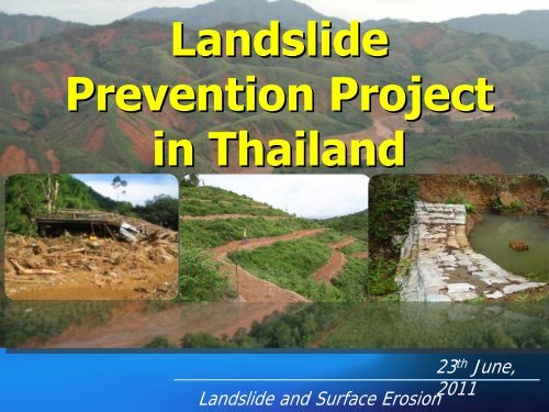
<strong>Landslide</strong><br />
<strong>Prevention</strong> <strong>Project</strong><br />
<strong>in</strong> <strong>Thailand</strong><br />
23 th June,<br />
2011<br />
<strong>Landslide</strong> and Surface Erosion
OUTLINE<br />
• <strong>Landslide</strong> <strong>in</strong> <strong>Thailand</strong><br />
- Type of <strong>Landslide</strong><br />
- Past event<br />
• <strong>Landslide</strong> Susceptibility Map<br />
• <strong>Landslide</strong> <strong>Prevention</strong> <strong>Project</strong><br />
- Soil and Water Conservation<br />
measures
<strong>Landslide</strong> <strong>in</strong> <strong>Thailand</strong>-Type of <strong>Landslide</strong><br />
- Debris avalanche ,Rotational Slide ,Surface <strong>Landslide</strong>s<br />
or Shallow <strong>Landslide</strong>s<br />
- Heavy ra<strong>in</strong> and cont<strong>in</strong>ued for a long time <strong>in</strong> the<br />
mounta<strong>in</strong>s<br />
- usually occurred <strong>in</strong> exit<strong>in</strong>g water channel and small<br />
ditches <strong>in</strong> hillside<br />
- slope over 30% , depth soil horizon
- Soil and rock become wet can not be settled on.<br />
- the mass flow of sediment, soil and rock mixed with<br />
the mud flow<strong>in</strong>g down the slope to the surface at low<br />
speeds , down with sand and gravel along the way<br />
then <strong>in</strong>crease velocity and high speed become more<br />
powerful as the "Debris flow"
ตค. 45<br />
อ.แมสะเรียง แมฮองสอน<br />
พค. 47<br />
อ.สบเมย แมฮองสอน<br />
กย. 47<br />
อ.เมืองแมฮองสอน<br />
กย. 47<br />
อ.แมสะเรียง แมฮองสอน<br />
กย. 48<br />
อ.ปางมะผา แมฮองสอน<br />
Major Land Slide Events<br />
from 1970 - 2011<br />
.<br />
พค. 47<br />
อ.อมกอย เชียงใหม<br />
พค., กย. 47<br />
อ.แมแจม เชียงใหม<br />
กย. 47<br />
อ.ฝาง เชียงใหม<br />
พค 49 สุโขทัย<br />
กค.,กย. 47<br />
อ.แมอาย เชียงใหม<br />
กย. 45<br />
อ.แมแจม เชียงหม<br />
กย. 51อ . ทาวังผา นาน<br />
พค. 49<br />
อ.ลับแล, อุตรดิถย<br />
พค.47<br />
อ.แมระมาด อ,แมตื่น ตาก<br />
พค. 44<br />
อ.วังชิ้น แพร<br />
พค. 49 แพร<br />
กย.47<br />
อ.ลอง แพร<br />
พย. 13<br />
อ.ทับสะแก<br />
ประจวบคีรีขันธ<br />
มีค. 54<br />
อ.เขาพนม กระบี่<br />
ตค. 47<br />
อ.เมือง กระบี่<br />
ตค. 44<br />
อ.กะทู จ.ภูเก็ต<br />
ธค. 25<br />
อ.ศรีบรรพต พัทลุง<br />
มีค 54<br />
อ.กาญจนดิษฐ สุราษฎรธานี<br />
มค 18<br />
อ.รอนพิบูลย นครศรีธรรมราช<br />
พย. 31<br />
อ.พิปูน อ.ลานสกา นครศรีธรรมราช<br />
มีค. 54<br />
อ.นบพิตํา อ.สิชล นครศรีธรรมราช<br />
พค 47<br />
อ.ธารโต จ.ยะลา<br />
ธค. 48<br />
อ.บันนังสตาร ยะลา<br />
กย. 43<br />
อ.หลมสัก, อ.เมือง เพชรบูรณ<br />
สค. 44<br />
อ.หลมสัก เพชรูรณ<br />
สค. 42,44<br />
อ.เขาคิชกูฏ จันทรบุรี<br />
No. of Land Slide
1988 , Debris avalanche occurred <strong>in</strong> Ka Thoon watershed,<br />
Ka Thoon sub-district, Phiboon district, Nakhon Si<br />
Thammarat prov<strong>in</strong>ce.
Sediment deposit cover risk area ~ 3 m. height
1999, heavy ra<strong>in</strong> hit the area <strong>in</strong> Khitchakut<br />
district,<br />
Chanthaburi Prov<strong>in</strong>ce
2001, landslide occurred <strong>in</strong> Soi sub-district,<br />
Wang Ch<strong>in</strong> district,<br />
Phrae Prov<strong>in</strong>ce
2001, Debris flow occurred Lomsak<br />
district,<br />
Petchabun prov<strong>in</strong>ce
village affected at downstream
Mae Jam Bas<strong>in</strong>, Chiang Mai<br />
(2003)
2005, Shallow landslide with debris flow,<br />
Pangmapha district , Maehongson prov<strong>in</strong>ce
2006, Shallow landslide with debris flow<br />
occurred <strong>in</strong> Uttradit prov<strong>in</strong>ce,
2009, Ban Namka, Pha-changnoi subdistrict,<br />
Phong district ,Phayao Prov<strong>in</strong>ce
2009, Sediment deposit cover farmland,<br />
Ban Namka,Pha-changnoi subdistrict,<br />
Phong district , Phayao Prov<strong>in</strong>ce
March 2011, debris avalanche<br />
occurred, Ban Pean,<br />
Thepprarat subdistrict, Sichon district ,<br />
Nakhon Si Thammarat prov<strong>in</strong>ce
March 2011, debris avalanche<br />
occurred, Ban Tonharn,<br />
Kaopanom district, Krabi prov<strong>in</strong>ce
<strong>Landslide</strong><br />
Susceptibility<br />
Map<br />
Prov<strong>in</strong>ce<br />
Legend<br />
Stream<br />
Susceptibility level<br />
Low<br />
Moderate<br />
High<br />
<strong>Landslide</strong> susceptibility area<br />
covers 56 prov<strong>in</strong>ces, 196,800 km 2<br />
Village at risk of <strong>Landslide</strong><br />
1,007 villages
Soil and water conservation project<br />
<strong>in</strong> the landslide risk areas.<br />
Soil and water conservation measures to protect and<br />
restore areas of potential landslide <strong>in</strong> the area of<br />
landslide susceptibility- moderate to high level<br />
soil and water conservation measures<br />
1. Hillside ditches<br />
2. Check dam<br />
3. Waterways<br />
4. Sediment trap<br />
5. Vetiver<br />
6. Tree plant<strong>in</strong>g<br />
– Rubber, Bamboo, Teak
conservation structure<br />
1. Hillside ditches<br />
- type 5, slope 15-35%
conservation structure<br />
1. Hillside ditches<br />
-type 6,<br />
slope > 35%
conservation structure<br />
2. Check dam<br />
Masonry<br />
check dam<br />
Bamboo<br />
barrier
Sacks of cement
conservation structure<br />
3. Waterways, diversion dicth
conservation structure<br />
4. Sediment trap<br />
Sacks of cement
Vegetative conservation<br />
measures<br />
5. Vetiver
Vegetative conservation<br />
measures<br />
6. Tree , Orchard plant<strong>in</strong>g<br />
– Rubber, Bamboo, Teak, Coffee etc.
???those method appropriate to prevent<br />
landslide and severe erosion??? (Q.#1)<br />
Are there another measure can implement <strong>in</strong><br />
upland agriculture? (Q.#2)<br />
Is there only soil and water conservation<br />
measures can protect the land from<br />
landslide? (Q.#3)<br />
Are there another method can <strong>in</strong>tegrated<br />
with soil and water conservation measure<br />
,especially <strong>in</strong> upland farm<strong>in</strong>g? (Q.#4)
Question 1:Are those measures applied<br />
currently by LDD <strong>Thailand</strong> enough to prevent<br />
landslides and severe erosion?<br />
• Land Use Activities:Agriculture<br />
• The conversion of undisturbed land to agricultural<br />
production has often disrupted the previously<br />
exist<strong>in</strong>g state of dynamic equilibrium.
• Introduced at the landscape, watershed, stream<br />
corridor, stream, and reach scales, agricultural<br />
activities have generally resulted <strong>in</strong> encroachment<br />
on stream corridors with significant changes to the<br />
structure and mix of functions usually found <strong>in</strong><br />
stable systems.
• Vegetative Clear<strong>in</strong>g<br />
• One of the most obvious disturbances from agriculture<br />
<strong>in</strong>volves the removal of native, riparian, and upland<br />
vegetation. Producers often crop as much productive land<br />
as possible to enhance economic returns; therefore,<br />
vegetation is sacrificed to <strong>in</strong>crease arable acres.<br />
• Vegetative removal from streambanks, floodpla<strong>in</strong>s, and<br />
uplands often conflicts with the hydrologic and geomorphic<br />
functions of stream corridors.<br />
• These disturbances can result <strong>in</strong> sheet and rill as well as<br />
gully erosion, reduced <strong>in</strong>filtration, <strong>in</strong>creased upland surface<br />
runoff and transport of contam<strong>in</strong>ants, <strong>in</strong>creased<br />
streambank erosion, and unstable stream channels.
Soil Exposure and Compaction<br />
• Tillage and soil compaction <strong>in</strong>terfere with soil’s capacity to<br />
partition and regulate the flow of water <strong>in</strong> the landscape,<br />
<strong>in</strong>crease surface runoff, and decrease the water-hold<strong>in</strong>g<br />
capacity of soils.<br />
• Increases <strong>in</strong> the rate and volume of throughflow <strong>in</strong> the<br />
upper soil layers are frequent. Tillage also often aids <strong>in</strong> the<br />
development of a hard pan, a layer of <strong>in</strong>creased soil<br />
density and decreased permeability that restricts the<br />
movement of water <strong>in</strong>to the subsurface.<br />
• The result<strong>in</strong>g changes <strong>in</strong> surface and ground water flow<br />
often <strong>in</strong>itiate <strong>in</strong>cised channels and effects similar to those<br />
discussed previously for <strong>in</strong>stream modifications.
Sediment and Contam<strong>in</strong>ants<br />
• Disturbance of soil associated with agriculture<br />
generates runoff polluted with sediment, a major<br />
nonpo<strong>in</strong>t source pollutant.<br />
• Pesticides and nutrients (ma<strong>in</strong>ly nitrogen,<br />
phosphorous, and potassium) applied dur<strong>in</strong>g the<br />
grow<strong>in</strong>g season can leach <strong>in</strong>to ground water or<br />
flow <strong>in</strong> surface water to stream corridors, either<br />
dissolved or adsorbed to soil particles.<br />
•
• Soil sal<strong>in</strong>ity is a naturally occurr<strong>in</strong>g phenomenon found<br />
most often <strong>in</strong> floodpla<strong>in</strong>s and other low-ly<strong>in</strong>g areas of wet<br />
soils, lakes, or shallow water tables.<br />
• Dissolved salts <strong>in</strong> surface and ground water enter<strong>in</strong>g these<br />
areas become concentrated <strong>in</strong> the shallow ground water<br />
and the soils as evapotranspiration removes water.<br />
Agricultural activities <strong>in</strong> such landscapes can <strong>in</strong>crease the<br />
rate of soil sal<strong>in</strong>ization by chang<strong>in</strong>g vegetation patterns or<br />
by apply<strong>in</strong>g irrigation water without adequate dra<strong>in</strong>age.<br />
• In the arid and semiarid areas, irrigation can import salts<br />
<strong>in</strong>to a dra<strong>in</strong>age bas<strong>in</strong>. S<strong>in</strong>ce crops do not use up the<br />
salts,they accumulate <strong>in</strong> the soil. Sal<strong>in</strong>ity levels greater<br />
than 4 millimhos/cm can alter soil structure, promote<br />
waterlogg<strong>in</strong>g, cause salt toxicity <strong>in</strong> plants, and decrease<br />
the ability of plants to take up water.
Forestry<br />
• Three general activities associated with forestry<br />
operations can affect streamcorridors.<br />
• 1. tree removal,<br />
• 2. activities necessary to transport the harvested<br />
timber,<br />
• 3. preparation of the harvest site for regeneration.
Removal of Trees<br />
• Forest th<strong>in</strong>n<strong>in</strong>g <strong>in</strong>cludes the removal of either<br />
mature trees or immature trees to provide more<br />
growth capability for the rema<strong>in</strong><strong>in</strong>g trees.<br />
• F<strong>in</strong>al harvest removes mature trees, either<br />
s<strong>in</strong>gularly or <strong>in</strong> groups. Both activities reduce<br />
vegetative cover.
• Tree removal decreases the quantity of nutrients <strong>in</strong> the<br />
watershed s<strong>in</strong>ce approximately one-half of the nutrients <strong>in</strong><br />
trees are <strong>in</strong> the trunks.<br />
• Instream nutrient levels can <strong>in</strong>crease if large limbs fall <strong>in</strong>to<br />
streams dur<strong>in</strong>g harvest<strong>in</strong>g and decompose. Conversely,<br />
when tree cover is removed, there is a short-term <strong>in</strong>crease<br />
<strong>in</strong> nutrient release followed by long-term reduction <strong>in</strong><br />
nutrient levels.<br />
• Removal of trees can affect the quality, quantity, and tim<strong>in</strong>g<br />
of stream flows for the same reasons that vegetative<br />
clear<strong>in</strong>g for agriculture does. If trees are removed from a<br />
large portion of a watershed, flow quantity can <strong>in</strong>crease<br />
accord<strong>in</strong>gly.<br />
• The overall effect depends on the quantity of trees<br />
removed and their proximity to the stream corridor.
• Increases <strong>in</strong> flood peaks can occur if vegetation <strong>in</strong> the area<br />
closest to the stream is removed. Long-term loss of<br />
riparian vegetation can result <strong>in</strong> bank erosion and channel<br />
widen<strong>in</strong>g, <strong>in</strong>creas<strong>in</strong>g the width/depth ratio. Water<br />
temperature can <strong>in</strong>crease dur<strong>in</strong>g summer and decrease <strong>in</strong><br />
w<strong>in</strong>ter by removal of shade trees <strong>in</strong> riparian areas.<br />
• Allow<strong>in</strong>g large limbs to fall <strong>in</strong>to a stream and divert stream<br />
flow may alter flow patterns and cause bank or bed erosion<br />
• .<br />
• Removal of trees can reduce availability of cavities for<br />
wildlife use and otherwise alter biological systems,<br />
particularly if a large percentage of the tree cover is<br />
removed. Loss of habitat for fish, <strong>in</strong>vertebrates, aquatic<br />
mammals, amphibians, birds, and reptiles can occur.
Transportation of Products<br />
• Forest roads are constructed to move loaded logs from the<br />
land<strong>in</strong>g to higher quality roads and then to a manufactur<strong>in</strong>g<br />
facility. Stream cross<strong>in</strong>gs are necessary along most forest<br />
road systems and are especially sensitive areas.<br />
• Removal of topsoil, soil compaction, and disturbance by<br />
equipment can result <strong>in</strong> long-term loss of productivity,<br />
decreased porosity, decreased soil <strong>in</strong>filtration, and<br />
<strong>in</strong>creased runoff and erosion. Spills of petroleum products<br />
can contam<strong>in</strong>ate soils.<br />
•<br />
• Trails, roads, and land<strong>in</strong>gs can <strong>in</strong>tercept ground water flow<br />
and cause it to become surface runoff.
Site Preparation<br />
• Prepar<strong>in</strong>g the harvested area for the next generation of<br />
desired trees typically <strong>in</strong>cludes some use of prescribed fire<br />
or other methods to prepare a seed bed and reduce<br />
competition from unwanted species. Mechanical methods<br />
that completely remove compet<strong>in</strong>g species can cause<br />
severe compaction, particularly <strong>in</strong> wetsoils.<br />
•<br />
• This compaction reduces <strong>in</strong>filtration and <strong>in</strong>creases runoff<br />
and erosion. Mov<strong>in</strong>g logg<strong>in</strong>g debris <strong>in</strong>to piles or w<strong>in</strong>drows<br />
can remove important nutrients from the soil.<br />
• Depend<strong>in</strong>g on the methods used, significant soil can be<br />
removed from the site and stacked with piled debris, further<br />
reduc<strong>in</strong>g site productivity.
• Intense prescribed fire can volatilize important nutrients,<br />
while less <strong>in</strong>tense fire can mobilize nutrients for rapid plant<br />
uptake and growth. Use of fire can also release nutrients to<br />
the stream <strong>in</strong> unacceptable quantities.<br />
• Mechanical methods that cause significant compaction or<br />
decrease <strong>in</strong>filtration can <strong>in</strong>crease runoff and therefore the<br />
amount of water enter<strong>in</strong>g the stream system. Severe<br />
mechanical disturbance can result <strong>in</strong> significant erosion<br />
and sedimentation.<br />
• Conversely,less disruptive mechanical means can<br />
<strong>in</strong>crease organic matter <strong>in</strong> the soil surface and <strong>in</strong>crease<br />
<strong>in</strong>filtration. Each method has advantages and<br />
disadvantages.
Soil and water conservation project<br />
<strong>in</strong> the landslide risk areas.<br />
Soil and water conservation measures to protect and<br />
restore areas of potential landslide <strong>in</strong> the area of<br />
landslide susceptibility- moderate to high level<br />
soil and water conservation measures<br />
1. Hillside ditches<br />
2. Check dam<br />
3. Waterways<br />
4. Sediment trap<br />
5. Vetiver<br />
6. Tree plant<strong>in</strong>g<br />
– Rubber, Bamboo, Teak
Question 2:Are there other measures can<br />
be implemented <strong>in</strong> upland agriculture?
Question 3:Is there only soil and water<br />
conservation measure can protect the land<br />
from landslide?
Soil Conservation Design Guidel<strong>in</strong>es for Watershed Management<br />
Steep terrace works with Stonewalls<br />
and Vetiver grasses +native tree<br />
reforestation<br />
Simple terrace works with Vetiver grasses<br />
+Natural succession<br />
Monkey cheek<br />
Hillside dra<strong>in</strong>age channels<br />
Monkey cheek<br />
Channel diversion with buffer grass strips<br />
along stream banks<br />
Reforestation<br />
area or permanent<br />
fruit trees<br />
Permanent fruit trees<br />
Road access<br />
Foothill rehabilitation with<br />
fast grow<strong>in</strong>g trees<br />
Land-use Design for Rehabilitat<strong>in</strong>g<br />
<strong>Landslide</strong> Area (after)
Question 4: Are there measures can be<br />
<strong>in</strong>tegrated with soil and water conservation<br />
measure,especially <strong>in</strong> upland farm<strong>in</strong>g?
農 地 的 最 佳<br />
管 理 方 案<br />
• 個 別 及 系 統 的 方<br />
案 , 主 要 目 標 為 減<br />
輕 來 自 農 地 的 非 點<br />
源 汙 染 維 害 野 溪 。
農 地 的 最 佳 管 理 方 案<br />
- 應 用 及 其 成 效<br />
• 應 用 及 其 成 效<br />
1. 農 地 利 用 可 能 衝 擊 濱 溪 廊 道 的 環 境 。<br />
2. 當 執 行 集 水 區 管 理 規 劃 以 改 善 環 境 時 。<br />
3. 應 結 合 集 水 區 管 理 規 劃 , 農 地 管 理 計 畫 及 河 川<br />
廊 道 復 育 計 畫 。
農 地 的 最 佳 管 理 方 案<br />
- 應 用 及 其 成 效<br />
• 應 用 及 其 成 效<br />
4. 應 考 量 四 季 變 化 的 水 , 土 , 微 生 物 等 資 源 。<br />
5. 耕 作 等 農 業 行 為 應 考 量 相 鄰 土 地 的 環 境 品 質 。
農 地 的 最 佳 管 理 方 案<br />
- 應 用 及 其 成 效
森 林 地 的 最 佳 管 理<br />
方 案
森 林 地 的 最 佳 管 理 方 案<br />
- 應 用 及 其 成 效
都 市 開 發 地 的 最 佳 管 理 方<br />
案<br />
• 個 別 或 系 統 的 處 理<br />
設 計 來 減 輕 , 移 除<br />
或 保 護 濱 溪 廊 道 免<br />
於 受 開 發 行 為 及 各<br />
式 活 動 造 成 影 響 。
農 地 的 最 佳 管 理 方 案<br />
- 應 用 及 其 成 效<br />
• 應 用 及 其 成 效<br />
1. 用 來 改 善 或 恢 復 受 影 響 的 自 然 生 態 的 功 能 。<br />
2. 整 體 濱 溪 廊 道 需 一 併 考 量 各 河 段 的 最 佳 管 理 方<br />
案 。<br />
3. 個 別 都 市 化 的 管 理 方 案 應 配 合 整 體 河 道 復 育 方<br />
案 辦 理 。
農 地 的 最 佳 管 理 方 案<br />
- 應 用 及 其 成 效<br />
• 應 用 及 其 成 效<br />
4. 都 市 化 會 造 成 很 大 的 影 響 且 具 複 雜 性 。<br />
5. 可 行 方 案 包 括 .. 滯 洪 設 施 , 池 塘 , 人 造 濕 地 ,<br />
油 水 分 離 設 施 , 植 生 窪 地 , 過 濾 帶 , 入 滲 池 ,<br />
透 水 舖 面 , 市 區 內 的 造 林 等 。
Thank<br />
you