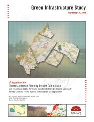
Route 29 Bypass Project - Thomas Jefferson Planning District ...
Route 29 Bypass Project - Thomas Jefferson Planning District ...
Route 29 Bypass Project - Thomas Jefferson Planning District ...

Create successful ePaper yourself
Turn your PDF publications into a flip-book with our unique Google optimized e-Paper software.
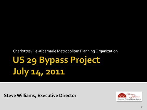
Charlottesville-Albemarle Metropolitan <strong>Planning</strong> Organization<br />
Steve Williams, Executive Director<br />
1
• Memorandum on US<strong>29</strong> <strong>Bypass</strong><br />
• Map of Proposed <strong>Project</strong> Corridor<br />
• June 24 letter from Commissioner Whirley on Funding of US<strong>29</strong><br />
<strong>Bypass</strong><br />
• MPO Resolution Regarding US<strong>29</strong> <strong>Bypass</strong> Construction Funding in<br />
MPO TIP<br />
• Summary of US<strong>29</strong> Final Environmental Impact Statement (1993)<br />
• Environmental Reevaluation of US<strong>29</strong> <strong>Bypass</strong> (1998)<br />
• Summary of US<strong>29</strong> Supplemental Environmental Impact<br />
Statement (2002)<br />
• Public Comments received via mail and email prior before 7/8/11<br />
• Public Comments received via mail and email between 7/8/11 and<br />
7/14 (distributed at meeting)<br />
2
• This presentation provides a summary of the US<strong>29</strong><br />
<strong>Bypass</strong> project<br />
• Information in the presentation is taken from:<br />
1. 1993 Final Environmental Impact Statement<br />
2. 1998 Environmental Reevaluation<br />
3. 2002 Supplemental Environmental Impact Statement<br />
• The project evaluated in those documents is the only<br />
project under consideration. The proposed amendments<br />
do not consider other bypass alternatives or a general<br />
bypass option.<br />
3
• “The purpose of the <strong>Route</strong> <strong>29</strong> Corridor Study is to find a solution to<br />
existing and future congestion on a three-mile section of U.S. <strong>Route</strong> <strong>29</strong><br />
between U.S. <strong>Route</strong> 250 <strong>Bypass</strong> and the South Fork of the Rivanna River<br />
in the City of Charlottesville and Albemarle County North of<br />
Charlottesville. A secondary purpose of the study is to complete a gap in<br />
ongoing improvements to U.S. <strong>Route</strong> <strong>29</strong> through central Virginia”<br />
-1993 FEIS, FHWA-VA-EIS-90-01-F, pg. I-1<br />
• “The purpose and need for the project remain the same as before: reduce<br />
congestion on existing <strong>Route</strong> <strong>29</strong> and enhance mobility for through<br />
traffic.”<br />
-2000 EIS Reevaluation, pg. 11<br />
• “ The need for the proposed project is based on the inability of existing<br />
<strong>Route</strong> <strong>29</strong> to adequately accommodate projected traffic volumes,<br />
particularly traffic that is not generated by, or oriented to, the<br />
development along existing <strong>Route</strong> <strong>29</strong>.”<br />
-2002 SEIS, FHWA-VA-EIS-90-02-DS, 1-12<br />
4
• October 1987: Location studies for a bypass are approved by<br />
Commonwealth Transportation Board (CTB).<br />
• 1987 to 1992: Public hearings and stakeholder interviews are held regarding<br />
the development of the route <strong>29</strong> corridor study.<br />
• 1992 to 1993: Alternative 10 of the corridor options is chosen as preferred<br />
alternative, the Final EIS approved, and the record of decision is issued by<br />
FHWA.<br />
• 1993: MPO forms the <strong>Route</strong> <strong>29</strong> Design Committee.<br />
• 1993 to 2001: Public hearing and stakeholder interviews are held, regarding<br />
design changes and environmental concerns of the proposed project, MPO<br />
route <strong>29</strong> design committee is included in this discussion.<br />
• 1994: Termini revisions are proposed to federal and state environmental<br />
agencies.<br />
• 1995: CTB approves termini revisions.<br />
• 1996: VDOT begins EIS reevaluation due to time elapse.<br />
5
• 1998: Lawsuit filed regarding effects of proposed project on water resources<br />
and watershed.<br />
• 2000: EIS reevaluation approved.<br />
• 2001: Court orders VDOT to prepare a Supplemental EIS to address water<br />
issue concerns from lawsuit.<br />
• 2002: Supplemental EIS approved.<br />
• 2002: MPO puts language in TIP to prevent VDOT from accruing and<br />
allocating construction funding for proposed route <strong>29</strong> bypass project.<br />
• 2003: MPO disbands <strong>Route</strong> <strong>29</strong> <strong>Bypass</strong> Committee.<br />
• 2004: General Assembly approves legislation requiring repayment of<br />
expended federal and state funds if US<strong>29</strong> <strong>Bypass</strong> is not constructed due to<br />
opposition from the MPO and if Federal Highway Administration requires<br />
reimbursement<br />
• May 27, 2011: MPO Policy Board decides to reconsider adopted position on<br />
US<strong>29</strong> Western <strong>Bypass</strong><br />
6
Proposed<br />
Hollymead<br />
Town Center<br />
Corridor<br />
7<br />
Distance: 6.24 miles<br />
Type: 4 lane divided<br />
highway<br />
Interchanges: Two,<br />
located at north and<br />
south termini. North<br />
interchange with<br />
existing US<strong>29</strong> is<br />
located at<br />
approximately<br />
Ashwood Blvd. South<br />
interchange with<br />
US250/US<strong>29</strong> includes a<br />
connection to UVa<br />
North Grounds.
Images taken from the 2002 Supplemental Environmental Impact Statement, FHWA-VA-EIS-90-02-DS<br />
8
Images taken from the 2002 Supplemental Environmental Impact Statement, FHWA-VA-EIS-90-02-DS<br />
9
Images taken from the 2002 Supplemental Environmental Impact Statement, FHWA-VA-EIS-90-02-DS<br />
10
Location<br />
2009 Annual<br />
Average Daily<br />
Traffic (VDOT)<br />
2015 Traffic<br />
Forecast<br />
(1998<br />
ReEval)*<br />
2022 Traffic<br />
Forecast<br />
(SEIS)<br />
US<strong>29</strong> North of Ashwood Blvd (north terminus) 37,000 68,400<br />
US<strong>29</strong> South of Ashwood Blvd (north terminus) 47,000 49,000 46,300<br />
US<strong>29</strong> <strong>Bypass</strong> 21,600 24,400<br />
Existing US<strong>29</strong> Alignment btwn Hydraulic Rd and<br />
Rio Rd 56,000 68,800<br />
US250 East of Hydraulic Road 43,000 30,500 43,000<br />
US<strong>29</strong>/250 btwn Ivy Rd and Fountaine Ave 42,000 35,000<br />
*Traffic Forecasts in 1998 Environmental Reevaluation included extension of Meadow Creek Parkway to<br />
intersect US<strong>29</strong> at north terminus of US<strong>29</strong> <strong>Bypass</strong><br />
11
• May 27 th 2011: MPO Policy Broad agreed to reconsider its<br />
adopted position on the US<strong>29</strong> <strong>Bypass</strong><br />
• June 24 th 2011: Letter from VDOT Commissioner Greg<br />
Whirley stating VDOT will seek funding for US<strong>29</strong> <strong>Bypass</strong> at<br />
July Commonwealth Transportation Board (CTB) meeting.<br />
He requests that the MPO amend the Constrained Long<br />
Range Transportation Plan (CLRP) and Transportation<br />
Improvement Program (TIP) to include construction of the<br />
US<strong>29</strong> <strong>Bypass</strong>.<br />
• June 27 th 2011: Two Public Hearings advertised to consider<br />
amending Constrained Long Range Transportation Plan and<br />
Transportation Improvement Program<br />
12
• July 14 th 2011: MPO Policy Board to conduct first Public<br />
Hearing. No action to be taken at this meeting due to<br />
requirement for full funding assurance of both the CLRP and<br />
TIP.<br />
• July 20 th 2011: CTB to consider funding for US<strong>29</strong> <strong>Bypass</strong><br />
• July 27 th 2011: MPO Policy Board to conduct second Public<br />
Hearing and initial consideration of CLRP and TIP<br />
amendments. The MPO Policy Board may take action on the<br />
proposed amendments at this meeting or at a subsequent<br />
meeting.<br />
13
1. MPO could chose to maintain existing policy and take no<br />
action on amendments to the CLRP and TIP.<br />
2. If Commonwealth Transportation Board amends Six Year<br />
Improvement Program to provide full funding for the US<strong>29</strong><br />
<strong>Bypass</strong> the MPO could amend the CLRP and TIP to include<br />
the project for construction.<br />
3. If Commonwealth Transportation Board does not amend<br />
the Six Year Improvement Program to provide full funding<br />
for the US<strong>29</strong> <strong>Bypass</strong> the MPO could amend the CLRP and<br />
TIP to include the project as a “Vision <strong>Project</strong>” that would<br />
be eligible for future funding.<br />
14
Prior to the CTB consideration for funding the US<strong>29</strong> <strong>Bypass</strong> and<br />
widening of US<strong>29</strong> between Rio Mills Road and Timberlake<br />
Drive The MPO Policy Board may want to communicate to<br />
CTB about local transportations priorities such as:<br />
• Hillsdale Drive<br />
• US<strong>29</strong>/250 Lane and Ramp Improvements<br />
• Berkmar Drive Extension<br />
• Belmont Bridge<br />
• Transit Service to Hollymead/Forest Lakes/Airport<br />
15
If the CTB provides full funding and the MPO adds the US<strong>29</strong><br />
<strong>Bypass</strong> to the CLRP and TIP the following steps would need<br />
to be completed prior to construction:<br />
• Environmental Reevaluation at the discretion of VDOT and<br />
Federal Highway Administration<br />
• Completion of <strong>Project</strong> Design<br />
• Completion of Right of Way acquisition<br />
• Approval of Required Permits<br />
16
Stephen Williams, Executive Director<br />
<strong>Thomas</strong> <strong>Jefferson</strong> <strong>Planning</strong> <strong>District</strong> Commission<br />
401 E. Water Street, Charlottesville, 2<strong>29</strong>02<br />
(434) 979-7310<br />
swilliams@tjpdc.org<br />
17