

download
download
download

Create successful ePaper yourself
Turn your PDF publications into a flip-book with our unique Google optimized e-Paper software.
MARINE<br />
TECHNOLOGY<br />
May 2015 www.marinetechnologynews.com<br />
REPORTER<br />
R E R<br />
Special Report<br />
Norway’s<br />
Subsea Valley<br />
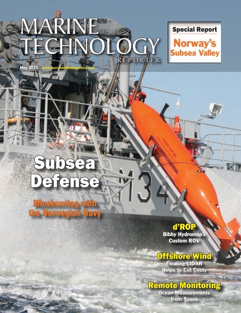
Subsea<br />
Defense<br />
Minehunting with<br />
the Norwegian Navy<br />
d’ROP<br />
Bibby Hydromap’s<br />
Custom ROV<br />
Offshore Wind<br />
Floating LIDAR<br />
Helps to Cut Costs<br />
Remote Monitoring<br />
Ocean Measurements<br />
from Space
May 2015<br />
Contents<br />
Volume 58 • Number 4<br />
32<br />
Photo: Kongsberg Maritime<br />
On the Cover<br />
28 Subsea Defense<br />
As the trend toward automation<br />
picks up steam across all military<br />
branches, MTR discusses<br />
automation in the subsea sector<br />
with Richard Mills of Kongsberg.<br />
By Greg Trauthwein<br />
26<br />
Source: ESA/AOES Medialab<br />
32 Eye in the Sky<br />
The advancement of satellite<br />
technology is expanding the<br />
range of ocean parameters<br />
which can be measured. The<br />
recent addition of salinity,<br />
pioneering techniques and<br />
sustained funding are set to<br />
revolutionize the way that marine<br />
and climate scientists study the<br />
ocean.<br />
By Kira Coley<br />
38 Into the Valley<br />
Driven mostly by the needs of its<br />
larger members, Subsea Valley<br />
the multidisciplinary cluster<br />
is addressing stated industry<br />
needs while growing its member<br />
list to 90.<br />
By William Stoichevski<br />
44<br />
Illustration courtesy FMC Technologies<br />
6 Editorial<br />
8 People & Companies<br />
14 Tech File<br />
50 Products<br />
63 Classifeds<br />
64 Ad Index<br />
2 MTR<br />
May 2015<br />
Bibby HydroMap
May 2015<br />
Contents<br />
Volume 58 • Number 4<br />
14<br />
MOST<br />
New Tech<br />
14 Meet AutoNaut<br />
There’s a new wave-powered<br />
vessel in town, and it’s called<br />
AutoNaut.<br />
Offshore Wind<br />
22 Cutting Costs<br />
WindSentinel Floating LIDAR<br />
is designed to help cut<br />
offshore windfarm costs.<br />
Coastal Survey<br />
44 d’ROP<br />
Bibby HydroMap unveiled<br />
what it dubs a revolution in<br />
coastal ROV survey.<br />
14<br />
22<br />
44<br />
The Authors<br />
Graham Howe<br />
Graham Howe is director of sales<br />
at AXYS Technologies. p. 22<br />
4 MTR<br />
Kira Coley<br />
Kira Coley graduated with a BSc.<br />
(Hons) Marine Biology degree<br />
from University of Portsmouth<br />
and has extensive experience<br />
as a Field Scientist in various<br />
locations. p. 32<br />
William Stoichevski<br />
William Stoichevski lives and<br />
works in Oslo, and is a regular<br />
contributor to MTR, Maritime<br />
Reporter & Engineering News<br />
and Offshore Energy Reporter.<br />
p. 38<br />
May 2015
Editorial<br />
Photo: Kongsberg Maritime<br />
www.marinetechnologynews.com<br />
NEW YORK<br />
118 E. 25th St., New York, NY 10010<br />
Tel: (212) 477-6700; Fax: (212) 254-6271<br />
FLORIDA<br />
215 NW 3rd St., Boynton Beach, FL 33435<br />
Tel: (561) 732-4368; Fax: (561) 732-6984<br />
PUBLISHER<br />
John C. O’Malley<br />
jomalley@marinelink.com<br />
Associate Publisher & Editor<br />
Gregory R. Trauthwein<br />
trauthwein@marinelink.com<br />
Web Editor<br />
Eric Haun<br />
haun@marinelink.com<br />
Contributing Editors<br />
Capt. Edward Lundquist, USN (Ret.)<br />
Claudio Paschoa, Brazil<br />
William Stoichevski, Norway<br />
Production Manager<br />
Irina Tabakina<br />
tabakina@marinelink.com<br />
Production & Graphic Design<br />
Nicole Ventimiglia<br />
nicole@marinelink.com<br />
Sales & Event Coordinator<br />
Michelle Howard<br />
mhoward@marinelink.com<br />
Manager, Public Relations<br />
Mark O’Malley<br />
momalley@marinelink.com<br />
Manager, Information Technology Services<br />
Vladimir Bibik<br />
bibik@marinelink.com<br />
Gregory R. Trauthwein<br />
Associate Publisher & Editor<br />
Email: trauthwein@marinelink.com<br />
Just back from Southampton and what proved to be a very busy Ocean Business<br />
2015, and I am happy to report that while the persistent low price-per-barrel for<br />
oil has slowed some parts of the industry, it has yet to dampen the innovative spirit<br />
that is the very hallmark of the global subsea business. This edition as well as the<br />
coming few will be packed with news and features on innovative new products,<br />
systems and designs, but without a doubt the proliferation of new subsea and surface vehicle<br />
technology was a recurring theme in Southampton.<br />
As is the case with any meeting of this magnitude, it affords us the opportunity to sit<br />
with individuals and companies for a more intensive discussion on their activities. One<br />
such meeting with Dan Allidis of MOST (Autonomous Vessels) Ltd. led to the feature<br />
starting on page 14 on the AutoNaut. While the vehicle is powered by the motion of the<br />
ocean and at a glance similar to other competitors in this niche, the Autonaut has some<br />
interesting technological wrinkles that are designed to make it not only more efficient, but<br />
more survivable in the harsh ocean environment.<br />
If you weren’t in Southampton or were there but didn’t have the chance to jump onboard<br />
Bibby Athena, turn to page 44 for insights on Bibby Hydromap’s new custom built ROV<br />
– d’ROP – which has been dubbed a ‘revolution in coastal ROV survey’ by its developers.<br />
Grand claims you may think, and while I cannot personally attest to its performance in the<br />
field, the concept, vehicle and mission range is impressive to say the least.<br />
Kira Coley once again graces our pages, and has in fact has quickly become one of our<br />
‘go to’ regular contributors for compelling features on the technology driving the industry<br />
forward, faster. This month she reports on “Ocean Measurements from Space” starting on<br />
page 32, examining the use of Satellites in monitoring, learning and understanding twothirds<br />
of the planet.<br />
As always, we welcome your thoughts and insights on new and emerging technologies in<br />
the subsea sector, as I and the editorial staff are always on the look-out for ‘what’s next.’<br />
CIRCULATION<br />
Kathleen Hickey<br />
mtrcirc@marinelink.com<br />
ADVERTISING<br />
Vice President, Sales and Marketing<br />
Rob Howard<br />
howard@marinelink.com<br />
Tel: (561) 732-4368 • Fax: (561) 732-6984<br />
Advertising Sales Manager<br />
Lucia M. Annunziata<br />
annunziata@marinelink.com<br />
Tel: (212) 477-6700 • Fax: (212) 254-6271<br />
Mike Kozlowski<br />
kozlowski@marinelink.com<br />
Tel: (561) 733-2477 • Fax: (561) 732-9670<br />
www.marinetechnologynews.com<br />
Vol. 58 No. 4<br />
ISSN 1559-7415<br />
USPS# 023-276<br />
118 East 25th Street,<br />
New York, NY 10010<br />
tel: (212) 477-6700<br />
fax: (212) 254-6271<br />
Download our App<br />
iPhone & Android<br />
Marine Technology Reporter ISSN<br />
1559-7415 is published monthly<br />
except for February, August, and<br />
December by New Wave Media,<br />
118 E. 25th St., New York, NY<br />
10010-2915. Periodicals Postage<br />
at New York, NY and additional<br />
mailing offi ces.<br />
POSTMASTER: Send address<br />
changes to Marine Technology Reporter,<br />
850 Montauk Hwy.,<br />
#867, Bayport, NY 11705<br />
Postmaster send notifi cation (Form<br />
3579) regarding<br />
undeliverable magazines to Marine<br />
Technology Reporter, 850 Montauk<br />
Hwy., #867, Bayport, NY 11705<br />
Publishers are not responsible for<br />
the safekeeping or return of<br />
editorial material.<br />
© 2015 New Wave Media.<br />
Member<br />
Japan<br />
Katsuhiro Ishii • amskatsu@ dream.com<br />
Tel: +81 3 5691 3335 • Fax: + 81 3 5691 3336<br />
All rights reserved. No part of this publication may be reproduced or transmitted in any form or by any means<br />
mechanical, photocopying, recording or otherwise without the prior written permission of the publishers.<br />
Subscription:<br />
To subscribe please visit<br />
www.marinetechnologynews.com<br />
6 MTR<br />
May 2015
People & Company News<br />
New GM at Teledyne Bowtech<br />
Simon Beswick has been appointed to<br />
the role of General Manager at Teledyne<br />
Bowtech Ltd. He was previously<br />
Managing Director of Tritech International<br />
Ltd. from 2008 having joined as<br />
Finance Director in 2007. Prior to joining<br />
Tritech, Beswick had spent most of<br />
his career in international roles within<br />
the specialist chemical industry. He is<br />
an engineering graduate and holds an<br />
MBA from Oxford University.<br />
Beswich succeeds Steve Bowring<br />
who leaves the company at the end of<br />
April having led the company since its<br />
foundation in 1989. Teledyne Technologies<br />
Incorporated acquired Bowtech in<br />
February 2015.<br />
Teledyne Seabotix Opens ROV<br />
Service Center in Mass.<br />
Teledyne SeaBotix announced the<br />
phased opening of a service support<br />
and repair facility within its parent organization,<br />
Teledyne Marine Systems,<br />
located in North Falmouth, MA. “We<br />
are pleased to geographically extend<br />
our world class service and support to<br />
enhance response capability and reduce<br />
maintenance and repair turn-around<br />
times,” said Dr. Thomas Altshuler, Teledyne<br />
Marine Systems VP & GM. The<br />
SeaBotix service and repair facility<br />
will be based at Teledyne Marine Systems<br />
main HQ which includes approximately<br />
67,000 sq. ft. of manufacturing,<br />
engineering, test, and administration<br />
resources.<br />
Planet OS Joins AWS for<br />
NOAA’s Big Data Project<br />
Planet OS has joined Amazon Web Services<br />
(AWS) as a member of its Data Alliance<br />
within NOAA’s Big Data Project.<br />
(Continued on page 9)<br />
www.marinetechnologynews.com<br />
Marine Technology Reporter 7
People & Company News<br />
Grasshopper Rides Falcon for 3D View of Dam<br />
A retractable sonar system has been<br />
specially designed by underwater engineering<br />
services company Subsea Fenix<br />
to set atop a Saab Seaeye Falcon ROV.<br />
Nicknamed ‘The Grasshopper.’ the concept<br />
has made possible a more detailed<br />
inspection of a reservoir dam in central<br />
Italy than could otherwise be achieved.<br />
Faced with the problem of mounting a<br />
BlueView 3D Sonar system high enough<br />
above the ROV to gather all-round images<br />
and avoid the vehicle’s chassis obstructing<br />
the scan, Subsea Fenix knew<br />
it would be impossible to swim any distance<br />
top-loaded in this way. The solution<br />
was to create a retractable structure that<br />
lowers the topside mass while the Falcon<br />
is swimming, then remotely raises it<br />
when needed.<br />
With a full inspection package aboard<br />
the ROV it has been possible to provide<br />
accurate visual 2D and 3D sonar data<br />
of inlets and outlets, grids, tunnels and<br />
ramps, while also identifying the presence<br />
of debris and sediment.<br />
The clarity of both the high-resolution<br />
cameras and advanced sonar has given<br />
the inspection team a clear and accurate<br />
view of the condition of the dam and its<br />
operational components.<br />
The Falcon helped uncover critical<br />
problems such as rock fall damage to the<br />
rail used to lower the massive outflow<br />
closure gate, and rock debris blocking the<br />
cable wheels that lower the gate. Scans<br />
also revealed that a third of the grids<br />
clearing the water flow were obstructed<br />
by sediment.<br />
Divers were used for much of the remedial<br />
work with the Falcon in support.<br />
The 2D sonar aboard the ROV was used<br />
to view the underwater horizon and monitor<br />
diver activity, while at the same time<br />
observing crane movement of a dredging<br />
pump. In addition to the top-mounted<br />
BlueView sonar system, the total inspection<br />
package for the Subsea Fenix Falcon<br />
includes a Tritech Super Seaprince scanning<br />
sonar, a high-resolution color video<br />
camera with 180-degree tilt platform and<br />
low-light mono camera.<br />
The Falcon’s control architecture<br />
makes it easy to add and change such<br />
systems as needed.<br />
Although small enough to be manhandled,<br />
even from a small boat, its five powerful<br />
thrusters make the Falcon highly<br />
maneuverable and able to hold steady in<br />
moving water while filming or undertaking<br />
various missions. Subsea Fenix’s future<br />
plans include using the Falcon at the<br />
same Lake for a deep tunnel inspection to<br />
an interconnected lake.<br />
Left:<br />
Subsea Fenix team with their<br />
‘Grasshopper’ - the Falcon with<br />
the retractable system lowered.<br />
Below:<br />
3D portion of turbine inlet<br />
channel deep inside dam wall.<br />
8 MTR<br />
May 2015
(Continued from page 7)<br />
The company will work together with<br />
The Weather Company and ESRI under<br />
the Cooperative Research and Development<br />
Agreement (CRADA) to research<br />
and test solutions for bringing NOAA’s<br />
vast information to the cloud where<br />
both the public and industry can easily<br />
and equally access, explore, and create<br />
new products from it, thus fostering new<br />
ideas and spurring economic growth.<br />
Offshore Mooring<br />
Replacement Completed<br />
InterMoor finished replacing components<br />
in an FPU mooring system offshore<br />
Equatorial Guinea on schedule,<br />
enabling the prime contractor, Boskalis,<br />
to expand the InterMoor work scope.<br />
The original contract covered replacing<br />
old mooring chains and wire ropes for<br />
eight of the 12 mooring lines along with<br />
two drag anchors on Mobil Equatorial<br />
Guinea Inc.’s (MEGI’s) Zafiro Producer<br />
floating production unit. During the operation,<br />
Boskalis contracted InterMoor<br />
to replace an additional mooring line.<br />
The engineering work began in Oc-<br />
Applied Acoustics Wins<br />
Queen’s Award<br />
Applied Acoustic Engineering Ltd. won<br />
the Queen’s Award for Enterprise in the<br />
International Trade category for a second<br />
time.<br />
The award is recognition of its achievement<br />
in boosting export revenues over<br />
three years of continuous growth. This<br />
performance has been made possible<br />
through technical innovation and the<br />
sustained support of a strong network<br />
of overseas representatives. Applied<br />
Acoustics designs and manufactures<br />
underwater acoustic positioning, tracking<br />
and survey equipment sold mainly to<br />
the commercial offshore energy market<br />
but increasingly sales have been secured<br />
with oceanographic research institutions<br />
and naval defense industries. The company<br />
exported to more than 61 different<br />
countries over the past three years, including<br />
significant orders received from<br />
Japan, USA and Germany. New agency<br />
agreements have been established in<br />
Turkey, Mexico, Brazil and Australia.<br />
Adam Darling<br />
Let MST show you<br />
what you have<br />
been missing.<br />
Using the highest<br />
resolution on the<br />
market you will<br />
see every detail.<br />
The Sea Scan ARC<br />
line of side scan<br />
sonars can fit<br />
every application<br />
from advanced<br />
towed systems<br />
to AUV/ROV<br />
Embedded.<br />
A Brand of ATLAS NORTH AMRERICA<br />
www.marinesonic.com<br />
(Photo: Applied Acoustic Engineering)<br />
www.marinetechnologynews.com<br />
Marine Sonic Technology<br />
120 Newsome Dr, Suite H<br />
Yorktown, VA 23692<br />
(804) 693-9602<br />
Marine Technology Reporter 9
People & Company News<br />
Photo courtesy of InterMoor<br />
tober 2014 in Houston and the Netherlands,<br />
where the Norwegian anchor<br />
handling and construction (AHC) vessel<br />
Olympic Zeus was mobilized. Inter-<br />
Moor completed the installation work<br />
on location 64 kilometers west of Malabo,<br />
offshore Equatorial Guinea, from<br />
the Olympic Zeus.<br />
During the installation, InterMoor<br />
inspected all the mooring lines as they<br />
were being disconnected from the floating<br />
production unit to determine which<br />
portion of the line required replacement<br />
with new chain and connectors. The<br />
company also documented the installation<br />
to ensure the client had accurate,<br />
as-built information on the mooring system.<br />
The offshore installation was completed<br />
in March 2015 to MEGI’s satisfaction<br />
and the project will be finalized<br />
with all documentation delivered in<br />
April 2015. InterMoor had previously<br />
worked for MEGI in country, but this<br />
was the company’s first time working in<br />
conjunction with Boskalis.<br />
Fugro Set for Southwest<br />
Pacific Survey<br />
Fugro commissioned an additional airborne<br />
laser bathymetry system to underpin<br />
its position in the development<br />
and application of bathymetric LiDAR<br />
technology. The combined Fugro LADS<br />
Mk 3 and Riegl VQ-820-G systems<br />
provide measurements and mapping of<br />
nearshore and shallow water environments.<br />
The increased capability will<br />
enable Fugro to deliver simultaneous<br />
topographic and bathymetric surveys<br />
in multiple geographical areas. With<br />
continued operations across the Middle<br />
East during 2015, Fugro will also begin<br />
a South West Pacific ALB survey campaign<br />
following the award of projects<br />
in multiple locations to support nautical<br />
charting, coastal engineering, scientific<br />
assessments, coastal management, benthic<br />
habitat mapping and climate change<br />
initiatives.<br />
GROW Funding Nurtures<br />
New Subsea Tech<br />
Offshore Marine Management (OMM)<br />
has secured GROW:OffshoreWind funding<br />
to build a subsea tool designed to<br />
reduce project costs and improve health<br />
and safety offshore. The subsea tool,<br />
which is currently being constructed by<br />
Darlington-based Subsea Innovation,<br />
will see improvements during the installation<br />
phase by removing the need for<br />
deep sea divers and separate work class<br />
ROVs. It is expected to be in operation<br />
from June 2015 following sea trials.<br />
New 64-bit Software Version<br />
of “Teledyne PDS”<br />
Teledyne Marine introduced the Teledyne<br />
PDS software suite, a new software<br />
package with enhanced capabilities<br />
over the former PDS2000. Teledyne<br />
PDS is now a 64-bit Windows version<br />
offering faster performance, optimized<br />
memory management and better feature<br />
utilization. Teledyne PDS is a multipurpose<br />
software platform and supports a<br />
wide range of tasks within Hydrography,<br />
Dredge Guidance, Construction<br />
Support, Search & Recovery Operations<br />
and Port Entrance Monitoring.<br />
Teledyne PDS is of-the-shelf software<br />
and developed to solve the variety<br />
of challenges that arise from each specific<br />
task in the main business segments<br />
served by Teledyne Marine. It interfaces<br />
with a wide range of survey instruments<br />
such as Lidar, Multibeam and Singlebeam<br />
Echosounders, and is an optimal<br />
tool for interfacing to a variety of periphery<br />
sensors, including dredge and<br />
construction sensors, sound velocity<br />
measurements, positioning, motion systems<br />
and most other devices that output<br />
data.<br />
Osiris: Key ROV and Cable<br />
Pull-in Solution<br />
Osiris, part of James Fisher and Sons plc,<br />
completed a long-term project started in<br />
spring 2014, carrying out a wide-range<br />
of services with cross-trained personnel<br />
on the 219MW wind farm, Humber<br />
Gateway, based 8km off the Holderness<br />
coast in East Yorkshire. Osiris provided<br />
a Cougar-XT ROV to conduct seabed<br />
inspection work and transition piece<br />
cable pull-in teams. The teams mobilized<br />
from its shoreside support base in<br />
Grimsby using a moored, large multi-cat<br />
vessel and the ROV conducted around<br />
30 dives in free swimming mode. The<br />
subsequent initial success led to an in-<br />
10 MTR<br />
May 2015
People & Company News<br />
(Photo courtesy of Bluefin Robotics)<br />
vitation to extend its role on the Humber<br />
Gateway and complete unfinished<br />
cable pull-ins through an externally positioned<br />
J-Tube.<br />
Hull Inspection Systems<br />
for U.S. Navy<br />
Bluefin Robotics delivered new vehicles<br />
to the U.S. Navy to increase the Navy’s<br />
capability to remotely search and investigate<br />
ship hulls, harbor sea floors and<br />
underwater infrastructure. The Navy<br />
accepted delivery of Bluefin’s ship hull<br />
inspection systems 4 and 5 under the<br />
“Explosive Ordnance Disposal, Hull<br />
Unmanned Underwater Vehicle Localization<br />
System” (EOD HULS) Program<br />
of Record. Each System (known<br />
as MK19), consists of two vehicles and<br />
associated support equipment. Bluefin’s<br />
third-generation Hovering Autonomous<br />
Underwater Vehicle (HAUV-3), used in<br />
the MK19 system, was developed under<br />
Office of Naval Research and the EOD<br />
Program Office (PMS 408). The vehicle<br />
allows detection of IEDs and limpet<br />
mines on ship hulls, piers, pilings and<br />
quay walls for harbor and force protection.<br />
“The MK19 vehicle operates by<br />
hull-relative navigation and control and<br />
provides very detailed acoustic images<br />
of a ship hull with 100% sonar coverage,<br />
without prior knowledge about the<br />
ship,” said Jerome Vaganay, Bluefin’s<br />
Director of Inspection Systems. “Although<br />
it looks like an ROV with its six<br />
thrusters and its fiber optic data tether,<br />
the vehicle is powered by an onboard<br />
battery and operates primarily autonomously<br />
with the ability for the operator<br />
to take manual control to investigate<br />
contacts.”<br />
Gondan Lays Keel for IMR Oceanographic Vessel<br />
Gondan Shipyard celebrated the keel laying<br />
ceremony of the new Oceanographic<br />
Research Vessel for the Institute of Marine<br />
Research (IMR) of Bergen, Norway.<br />
At the ceremony, held at Gondan’s facilities<br />
in Figueras, were several representatives<br />
from the Norwegian Ministry of<br />
Foreign Affairs, NORAD (Norwegian<br />
Agency for Development Cooperation),<br />
IMR (Institute of Marine Research) and<br />
FAO (Food and Agriculture Organization<br />
of the United Nations), as well as representatives<br />
of the shipyard management.<br />
The contract of this oceanographic vessel<br />
was signed in March last year. This<br />
ship was awarded to Gondan Shipyard<br />
through an international tender, in which<br />
it competed with eight Norwegian and a<br />
Spanish shipyard, and in March the project<br />
was finally awarded to it.<br />
Designed by Skipsteknisk, it will be 74.5<br />
x 17.4 m. Cutting edge technology has<br />
been used to develop the vessel, which<br />
will allow her to perform oceanographic<br />
tasks – such as studying the bottom of<br />
the sea – hydrographic, marine biology,<br />
12 MTR<br />
biomass analysis, and geology works,<br />
launching and recovery of buoys for data<br />
collection, ROV and AUV operations, as<br />
well as logistic and cargo handling operations,<br />
and student training. Delivery is expected<br />
for September 2016<br />
May 2015
MTR_Sealed_87x254mm_b0_04_15.indd 1 14.04.15 08:36<br />
New Subsea Dredger<br />
Trials of a new subsea dredging system, which can<br />
move one ton of rocks on the seabed per minute, reportedly<br />
exceeded all expectations in terms of efficiency<br />
and performance. The Predator Subsea Dredger, a<br />
new concept, underwent a number of trials while fitted<br />
to the Triton XL26 work class ROV used for training<br />
and trials at The Underwater Center’s Loch Linnhe site<br />
in Fort William.<br />
Nine tons of 50-60 mm rocks were placed on areas<br />
of the seabed to recreate a range of terrains typical of<br />
the offshore subsea environment to be dredged during<br />
the trial, and the task was completed in between<br />
eight and nine minutes. Further trials designed to test<br />
the integrity of the system, including the dredging of<br />
100-130mm rocks in an attempt to break the machine<br />
and to identify any weak spots, highlighted the robustness<br />
of the product. A final test of the agitator system,<br />
which shoots out jets of water at the suction head end<br />
directly onto the seabed, breaking up the peat at the<br />
bottom of Loch Linnhe and dredging it at the same<br />
time, worked exceptionally well and did not affect the<br />
performance of the dredger. It can also be reconfigured<br />
subsea, with the use of a second work class ROV or<br />
diver. The Predator Subsea Dredger was designed by<br />
Subsea Tooling Services (STS), based in Oldmeldrum,<br />
Aberdeenshire, which offers a diverse range of subsea<br />
equipment.<br />
STS Business Development Manager Billy Milne said<br />
the main objective was to prove that it was as efficient,<br />
if not more so, than other dredgers currently on the<br />
market. “We wanted to prove the dredger’s capabilities<br />
to our clients, as well confirm our development tests by<br />
filming it in action in conditions close to those it will<br />
be used in offshore.”<br />
Connect 2<br />
Expertise Reliability Innovation<br />
Get the right solution<br />
Proven, reliable connectors and<br />
cable assemblies are here<br />
www.fischerconnectors.com<br />
Headquarters<br />
Fischer Connectors SA<br />
Saint-Prex - Switzerland<br />
Phone +41 21 800 95 95<br />
mail@fischerconnectors.ch<br />
www.marinetechnologynews.com<br />
Marine Technology Reporter 13
Tech File<br />
Meet the AutoNaut<br />
Exhibitions are fertile grounds to discover<br />
new technologies, and Ocean Business 2015<br />
in Southampton, U.K. last month did not disappoint.<br />
Here MTR speaks with Dan Alldis,<br />
Naval Architect at MOST (Autonomous Vessels)<br />
Ltd. regarding his companies new offering<br />
to the subsea market.<br />
By Greg Trauthwein<br />
For readers not familiar, describe MOST.<br />
MOST (AV) Ltd. is a micro start up based on the<br />
South coast of the United Kingdom. At the waterside office<br />
in Chichester, the team are responsible for the R&D,<br />
project management and the build of their product, AutoNaut.<br />
Plymouth is their base for sea trials, deployments<br />
and customer demonstrations. Trading since late 2012, the<br />
team has developed an Unmanned Surface Vessel (USV)<br />
called AutoNaut. Wave propelled, silent, persistent and<br />
cost efficient, it is a revolutionary data gathering platform<br />
designed for tasks which are inherently dull, dirty, dangerous<br />
and deep (long range). With boats in service with<br />
3.5m AutoNaut on deployment off the South Devon Coast.<br />
14 MTR<br />
May 2015
academic institutions in the U.K. and<br />
the U.S., MOST (AV) Ltd. are working<br />
hard on developing the next generation<br />
of AutoNaut vessels and marketing this<br />
revolutionary platform across a range of<br />
industry sectors.<br />
Provide, in details, the vehicle.<br />
AutoNaut is primarily wave<br />
propelled; harvesting the energy from<br />
the ‘motion in the ocean’ to propel the<br />
vessel forwards, the product of some 30<br />
years of experimentation by company<br />
Director, Mike Poole. Over the last two<br />
years, the engineers at MOST (AV) Ltd.<br />
have been working hard to develop the<br />
efficiency and robustness of the system<br />
and prepare the product for the conditions<br />
expected on persistent, offshore<br />
data collection missions.<br />
AutoNaut is available in two sizes,<br />
3.5m and 5m but the technology is scalable<br />
and unmanned boats up to 10m<br />
are possible (this limit in size reflects<br />
likely maritime operating regulations).<br />
The 3.5m vessel is easily car-topped or<br />
3.5m AutoNaut towing the<br />
J+S Narcine Array (blue tube<br />
running over the stern)<br />
www.marinetechnologynews.com<br />
Marine Technology Reporter 15
News Notes<br />
trailored and can be launched with just<br />
one person.<br />
AutoNaut can be remotely driven<br />
away from a slipway or towed to a release<br />
point using a small support boat.<br />
For recovery, AutoNaut can be sent back<br />
to a waypoint just offshore and escorted<br />
back in with a support boat or can be recovered<br />
by a ship at sea using a crane<br />
or davit.<br />
The wave propulsion will offer 2 – 3<br />
knots vessel speed with a 3.5m hull and<br />
3 – 4 knots with a 5m hull. In the case of<br />
calm weather or in an area with strong<br />
tidal streams, an electric propulsion pod<br />
is available to provide 1 – 2 knots speed;<br />
this is also useful when maneuvering<br />
away from a slip.<br />
Photovoltaic panels trickle charge<br />
the vessel’s lead gel batteries during<br />
daylight hours, powering the command<br />
and control system and sensors. In low<br />
sunlight areas and for high power sensors,<br />
a methanol fuel cell can be added<br />
to the fully autonomous power supply to<br />
charge the batteries.<br />
AutoNaut can be controlled using local<br />
UHF or WiFi comms, or an Iridium<br />
Satellite link. Waypoints, tracks and<br />
missions can be sent to the vessel by the<br />
pilot at any time and easily amended dependent<br />
on weather conditions or mission<br />
requirements. With AIS collision<br />
avoidance enabled, AutoNaut will assess<br />
all AIS targets within a 4km range<br />
and avoid any which are on a collision<br />
course. Radar transceivers are an option<br />
most customers chose, as a failsafe to<br />
alert those around of the vessel in their<br />
proximity.<br />
AutoNaut is fully configurable to any<br />
customer’s requirements. A wide range<br />
of sensors can be fitted through the hull,<br />
on a mast and / or towed behind the vessel.<br />
ADCPs (Acoustic Doppler Current<br />
Profilers), CTDs (Conductivity Temperature<br />
Depth), weather stations and Passive<br />
Acoustic Monitoring arrays have all<br />
been integrated and trialed in AutoNauts<br />
to great effect. The 5m hull design is optimized<br />
to operate high resolution Multi<br />
Beam Echo Sounders.<br />
In brief, walk us through the<br />
rationale to design this vessel<br />
… what problem(s) was it developed<br />
to solve?<br />
Operating any manned ship for<br />
data collection is expensive. Salaries<br />
3.5m AutoNaut and Plymouth Ferry.<br />
AutoNaut can be controlled using local UHF or WiFi comms, or an Iridium Satellite link.<br />
16 MTR<br />
May 2015
The latest rendering of my new 5m<br />
AutoNaut design. Designed to take a<br />
high res MBES and high bandwidth sat<br />
comms for image and video transfer.<br />
www.marinetechnologynews.com<br />
Marine Technology Reporter 17
Tech File: New Vehicle<br />
The H-Scientific Ltd RCW<br />
graphic user interface. This<br />
is a screen grab of the vessel<br />
leaving the Isles of Scilly<br />
for the MASSMO mission<br />
last October.<br />
must be paid, food, fuel, maintenance is costly and often range<br />
and sea conditions limit the areas in which data can be gathered.<br />
With an unmanned surface vessel, data can be collected<br />
24/7 in a much wider range of weather conditions, for much<br />
longer periods and more cost effectively.<br />
The patented wave propulsion system further increases the<br />
persistence of AutoNaut. In theory she could propel herself<br />
at two knots indefinitely collecting data across the oceans. In<br />
principle the limiting factor on mission length will be biofouling,<br />
barnacles and marine growth etc., which will slow the<br />
vessel down and impact sensor performance.<br />
The ability to launch and recover the AutoNaut easily from a<br />
slipway or a ship is beneficial. A route can be pre-programmed<br />
from a launch site from where she can make her own way out<br />
to the survey area, complete her mission, send data back in<br />
real time and drive herself back for recovery with all the raw<br />
data safely logged onboard.<br />
AutoNaut can replicate what a wave buoy can do, except<br />
there are no expensive moorings which are prone to breaking,<br />
she can deploy herself without the need for a ship and she can<br />
recover herself. AutoNaut is also capable of sampling across a<br />
range of sites, autonomously and under her own power.<br />
In short, AutoNaut is a cost effective, low man-power data<br />
collection platform. Zero emission, extreme persistence and<br />
capable of surviving extreme weather conditions.<br />
Specifically, how is your vessel designed to<br />
work, and what differentiates it from other vessels<br />
on the market?<br />
Other wave propelled vessels are already being used<br />
in a number of offshore industries, but AutoNaut is the only<br />
vessel on the market which uses pitch and roll to propel herself<br />
forwards. The monohull has a draft of less than half a<br />
meter which reduces fouling and entanglement and increases<br />
efficiency; sensors mounted through the hull also have an uninterrupted<br />
view of the water column below. The hull is carefully<br />
designed so that in the event of capsize, she rights herself<br />
and carries on with her mission.<br />
The wave propulsion is silent, which means an acoustic array<br />
is able to record a full 360º without interference from a<br />
propulsion system. AutoNaut is a ‘storm-proven’ unmanned<br />
surface vessel technology, weathering Storm Force 10 winds<br />
and 7m significant wave heights in the Atlantic Ocean in October<br />
2014.<br />
Are there any new or innovative use technologies<br />
on our vessel that we won’t see on others?<br />
Please be specific.<br />
As mentioned above, the wave propulsion system has<br />
been developed into a simple, elegant solution offering silent,<br />
persistent and cost effective operation. While wave propulsion<br />
technology is used on other craft, AutoNaut is a unique<br />
monohull vessel. This technology is not new. Back in 1895,<br />
Herman Linden build his Autonaut using a system with some<br />
similarities to the MOST (AV) Ltd AutoNaut. Company director<br />
Mike Poole picked up on the idea during his research in the<br />
1980’s and began developing his own version of the system in<br />
his free time. Mike even built a 25m wave tank at the bottom<br />
of his garden in Devon to test his designs (much to the dismay<br />
of his neighbours downhill!). In 2012, Mike was introduced<br />
to David Maclean, a retired Royal Navy Commodore running<br />
MOST Ltd. (Marine One Stop Technologies); David loved the<br />
idea and began working with Mike to engineer the system for<br />
production.<br />
Since 2013 the company has grown organically and has now<br />
built four AutoNauts while developing the systems to improve<br />
reliability and efficiency.<br />
AutoNaut has a revolutionary command and control system<br />
18 MTR May 2015
developed and built by H-Scientific Ltd., in Waterlooville,<br />
U.K. The Micro-Spectre system provides all the autopilot,<br />
powering and sensor control systems onboard, allowing pilots<br />
to remotely operate AutoNauts from anywhere with an internet<br />
connection.<br />
The system is custom built and runs without an operating<br />
system (Windows / Linux etc.) which means the current draw<br />
is extremely low. The whole system runs on H-Scientific’s<br />
RCW (Remote Control Workstation), an innovative front end<br />
package which gives pilots access to AutoNaut’s systems 24/7.<br />
Power consumption, sensor sampling and mission control are<br />
all manageable easily from the intuitive program.<br />
Sensor data is captured and stored in ‘raw’ form on the AutoNaut’s<br />
data logger. The platform control system can analyze<br />
the data and compress into packets which are sent over the<br />
satellite communications network at intervals set by the pilot.<br />
This is an extremely valuable tool which allows an operator to<br />
evaluate the data being captured, change settings or alter the<br />
mission profile to track specific features or phenomena.<br />
In looking at your vessel and its capabilities,<br />
rank the top three markets/niches you see it<br />
serving best, with short descriptions of why.<br />
There are a number of different markets which AutoNaut<br />
will become invaluable within.<br />
• Scientific Data Gathering<br />
AutoNaut is already being used in the U.K. and U.S. to gather<br />
scientific data; from CTD and water content analysis to current<br />
profiling and meteorological data collection. The National<br />
Oceanography Center in Southampton have been a major<br />
partner with MOST (AV) with ajoint SBRI project with dstl,<br />
which provided funding to develop the prototype AutoNauts.<br />
NOC (Southampton) purchased their own AutoNaut,‘Gordon,’<br />
which has already been used on a deployment in the U.K.,<br />
tracking Oceanic Fronts off the Isles of Scilly and tagged fish<br />
off the Plymouth Coast in Devon, United Kingdom. Texas<br />
A&M University have bought an AutoNaut for use in the Gulf<br />
of Mexico. It will use an ADCP and CTD to monitor the loop<br />
www.marinetechnologynews.com<br />
Marine Technology Reporter 19
Tech File: New Vehicle<br />
currents typical around the Gulf as well as providing a comms<br />
link between other university assets.<br />
• Oil, Gas & Renewables<br />
With oil prices down and oil majors looking for ways of reducing<br />
their costs, unmanned systems are a real option for<br />
service providers in the Offshore O, G & R sector. AutoNauts<br />
can complete MBES survey on assets underwater, monitor hydrocarbon<br />
slippage from surface assets and transfer platforms,<br />
provide marine mammal monitoring around piling and drilling<br />
sites and offer security and surveillance possibilities to an<br />
operator. These tasks can be completed by manned ships, but<br />
within strict weather and sea condition windows often with a<br />
high premium. An AutoNaut can carry on sampling autonomously<br />
for extended periods at a fraction of the cost.<br />
• Defence and Security<br />
AutoNaut’s silence, persistence and minimal visual and radar<br />
profile makes it a valuable asset for a number of defense<br />
operations. The ability to autonomously track assets both on<br />
and under water for extended periods is extremely valuable.<br />
Unmanned systems are often used for the 4 D’s; Dull, Dirty,<br />
Dangerous & Deep (long distance). AutoNauts can operate in<br />
‘swarms’, collecting oceanographic data and still and video<br />
images eg for border security, among many other applications.<br />
In overview, what did you see in the autonomous<br />
vessel market that told you that this was<br />
a good time to invest in a new system.<br />
The ability to offer 24/7 data capture at a fraction of<br />
the price of a manned asset is extremely valuable to many people.<br />
Autonomous systems have been outlined by the UK Government<br />
as one of the ‘Eight Great Technologies’. The First<br />
Sea Lord, Admiral Sir George Zambellas has said “The Royal<br />
Navy will lead – and win – through the innovative and robust<br />
exploitation of Marine Autonomous Systems. They open up a<br />
new world of possibilities”.<br />
The riverene and lake survey market is flooded with small<br />
Autonomous Surface Vessels but very few are proven inshore<br />
and offshore in extreme conditions; this is where AutoNaut<br />
excels.<br />
What was the greatest challenge in bringing<br />
this vehicle from a concept to reality?<br />
As an engineer, I must always think about the conditions<br />
in which the vessel will operate. The biggest challenge<br />
AutoNaut in the Field<br />
In 2014, The National Oceanography Center in Southampton began planning<br />
the MASSMO mission, which was to take place in October/November 2014.<br />
This first part of the mission was to deploy multiple unmanned vehicles in a<br />
‘fleet’ to track Oceanographic Fronts from the Isles of Scilly in South West<br />
England and out towards the continental shelf in the Celtic Sea. The second<br />
part of the mission was to be just off the coast of Plymouth, England and this<br />
was to track ~85 fish tagged by the Marine Biological Association. AutoNaut<br />
was selected to be part of the fleet, and a boat was commissioned by NOC to<br />
join its MARS (Marine Autonomous Robotic Systems) Fleet. For phase one of<br />
the mission, it was to be fitted with AirMar weather station, Solar Insolation<br />
sensor, a WetLabs Triplet PUC and to tow the J+S Narcine Array, a passive<br />
acoustic array for marine mammal monitoring. For phase two of the MASSMO<br />
project, she swapped the acoustic array for a VEMCO VR2C acoustic modem<br />
which was to monitor the ‘pings’ produced by trackers attached to fish released<br />
off Plymouth Breakwater. During both phases, she was fitted with two powered<br />
GoPro cameras. Phase One saw AutoNaut successfully weather a Force 10 Atlantic<br />
storm with 7m+ significant wave height. AutoNaut self-righted and carried<br />
on with little damage. After 13 days at sea, she was sent back to a waypoint<br />
just North of the Isles of Scilly and met by the recovery team in a RIB which<br />
towed her back to the harbor for recovery up the beach.<br />
Phase Two saw AutoNaut launched from Plymouth Harbour and towed clear<br />
GoPro image taken by<br />
AutoNaut off Devon Coast.<br />
of the breakwater where she was released and sent for calibration on the ‘range’ set up by the MBA. During this mission<br />
AutoNaut successfully tracked a number of fish which were tagged and released up to 3 months earlier. The data captured<br />
and sent back in real time over Iridium was analyzed by the staff at the MBA and NOC and partner companies and proved<br />
to be extremely useful.<br />
20 MTR May 2015
we have faced is how we engineer the systems to withstand the<br />
harsh offshore environment, while keeping an eye on weight,<br />
cost and manufacture. We are always completing research<br />
and feasibility studies on the new technologies and materials<br />
available to us. Our hulls are a composite of Glass and Kevlar<br />
Fibers giving us excellent impact and structural strength; almost<br />
literally bullet proof! We have used SLS (Selective Laser<br />
Sintering) 3D printing to create intricate parts quickly and to<br />
extremely high tolerance which have been used in the production<br />
vessels to great effect.<br />
Putting electronics in saline environments has proved tricky,<br />
and we have had to design sub-sea housings to encase electronic<br />
components and assemblies to ‘proof’ them in the case<br />
of submersion. The offshore environment will quickly find<br />
any design or manufacturing weakness and we are always<br />
looking for improvements to our resilience.<br />
What do you envision will be the greatest challenge<br />
in bringing this vehicle from reality to<br />
market success?<br />
There are two hurdles to jump over when bringing<br />
AutoNaut to market:<br />
• Proving the concept and reliability: Our technology sometimes<br />
seems ‘too good to be true’, a boat that needs no engine,<br />
can weather any storm and collect data at a fraction of the cost<br />
of a manned ship. The way to prove this is to have the vessels<br />
out there collecting real data for as long as possible. As a<br />
small, startup company this can be demanding and expensive,<br />
but we now have two 12+ day missions under our belts and an<br />
Atlantic storm which AutoNaut weathered almost unscathed.<br />
Now that we have AutoNauts with our customers, we should<br />
see them racking up the nautical miles pretty quickly.<br />
• Convincing customers that breaking the mold could save<br />
them a lot of money: We are slowly seeing many companies<br />
coming round to using unmanned systems, with many<br />
trials and tenders available for the feasibility of using USV/<br />
UUV’s for data gathering. However as the technology is so<br />
new, most big companies are reluctant to commit to buying<br />
unmanned systems, because of the potential risk. AutoNaut<br />
has been branded a ‘game changer’ which is both good and<br />
bad, because it really can improve data capture efficiency, and<br />
productivity.<br />
www.marinetechnologynews.com<br />
Marine Technology Reporter 21
Renewable Energy Tech<br />
Offshore<br />
Wind<br />
WindSentinel<br />
Floating LIDAR<br />
Helps Cut Costs<br />
WindSentinel buoy deployed<br />
next to the ORE Catapult<br />
met mast in the North Sea<br />
for a one-month validation<br />
& research study.<br />
22 MTR May 2015
The WindSentinel Floating LiDAR solution developed by AXYS Technologies<br />
is a wind resource assessment buoy capable of accurately gathering data on<br />
wind speed and wind direction offshore at turbine hub-height and across the<br />
blade span. The data enables developers to understand how strong the winds<br />
are at the heights of wind turbines, provides a clear picture of how much power<br />
can be generated at specific sites, and helps to validate wind predictions<br />
from computer models.<br />
By Graham Howe, AXYS<br />
Looking for a DVL?<br />
Rowe Technologies SeaPILOT offers a full range of DVL solutions from shallow water to full ocean depth<br />
• Easy integration – custom data formats available<br />
• 10/100-Base-T Ethernet Interface included<br />
• Support for simultaneous, independent serial<br />
communications with different output formats<br />
Coming Soon<br />
DVL for Small Observation<br />
Class ROVs!<br />
Now you have a choice!<br />
• Support for dual frequency configurations<br />
• Simultaneous Current Profiling Included<br />
• 1200KHz, 600KHz, and 300KHz available<br />
• Smallest form factor in the industry<br />
CUSTOM OEM SOLUTIONS<br />
AVAILABLE<br />
1200KHz DVL on OceanServer<br />
Iver3-450 Nano (4.5” OD) AUV<br />
Rowe Technologies, Inc.<br />
12655 Danielson Court. Suite 306. Poway, CA 92064 USA<br />
email: sales@rowtechinc.com • www.rowetechinc.com • Phone: +1-858-842-3020<br />
Acoustic Doppler & Imaging Technologies<br />
www.marinetechnologynews.com<br />
Marine Technology Reporter 23
Renewable Energy Tech<br />
WindSentinel – What is it designed to do?<br />
The WindSentinel Floating LiDAR solution developed by<br />
AXYS Technologies is a wind resource assessment buoy capable<br />
of accurately gathering data on wind speed and wind<br />
direction offshore at turbine hub-height and across the blade<br />
span. The data enables developers to understand how strong<br />
the winds are at the heights of wind turbines, provides a clear<br />
picture of how much power can be generated at specific sites,<br />
and helps to validate wind predictions from computer models.<br />
Meteorological and ocean measurements also help scientists<br />
understand air-sea interactions. The WindSentinel facilitates<br />
cost effective, accurate monitoring of many key parameters<br />
required by offshore wind farm developers to determine if<br />
their proposed project will pass financial investment decision<br />
(FID) and gain the financial support needed from their project<br />
funders.<br />
AXYS equips a 6m NOMAD buoy with relevant sensors<br />
such as dual-LIDAR systems, current sensors, wave sensors<br />
and is also able to install other sensors required by our clients.<br />
To support the WindSentinel, AXYS gives clients access to<br />
real-time data through our AXYS-APS portal. AXYS works<br />
with clients to understand their measurement campaign data<br />
needs so that we can enable early analysis and quality control<br />
as soon as data is transmitted.<br />
Value in the Renewable Energy Sector<br />
Prior to wind farm construction, a series of environmental<br />
monitoring campaigns are required to understand local wind<br />
resource, bird and fish populations and sea states. The current<br />
solution to measuring local wind conditions is to install a<br />
rather costly meteorological mast (10m Euro) equipped with<br />
anemometers and extrapolate those measurements across the<br />
length of the wind farm. To measure sea states, wave buoys<br />
and weather forecasting models are used. Standards for moni-<br />
The EDPi WindSentinel is equipped with two cameras, one on the bow and one on the<br />
stern, that continuously monitor the system and the surrounding environment.<br />
24 MTR<br />
May 2015
toring bird and fish populations are still being developed, but<br />
may include use of observers and sophisticated radar systems.<br />
The WindSentinel floating LiDAR eliminates the need to construct<br />
a meteorological mast and provides all the required data<br />
from a moveable and low environmental-impact buoy. Floating<br />
LiDAR decreases the overall cost and time to market of<br />
offshore wind developments.<br />
Design Drivers<br />
The WindSentinel was designed to use the proven metocean<br />
NOMAD buoy and a LiDAR capable of measuring wind from<br />
a floating platform. In selecting the NOMAD hull as the optimal<br />
platform, AXYS focused on the following key criteria:<br />
• The hull needed to be well known and reliable<br />
• The hull needed to have the capacity to support the<br />
necessary sensor payload<br />
• The hull needed to be able to support a power supply<br />
which could be deployed for up to a year between services<br />
AXYS has 25 years of experience of working with the NO-<br />
MAD hull, which has an extensive history as a platform for<br />
offshore sensors. The NOMAD hull was originally designed<br />
in the 1940s for the US Navy’s offshore data collection program<br />
and was later adapted and used by the National Data<br />
Buoy Center (NDBC) and Environment Canada as part of<br />
the national networks of permanent buoy stations providing<br />
weather forecasting.<br />
The WindSentinel was also designed to be flexible enough<br />
to accommodate virtually any sensor and telemetry while being<br />
easy to modify as project requirements evolve. As part of<br />
ongoing improvements to our technology, AXYS has recently<br />
begun developing WindSentinel buoys with dual-LiDAR in<br />
order to increase total data availability and to reduce the level<br />
of risk of data outage during extreme weather conditions often<br />
expected during wind assessment campaigns. This redundant<br />
dual-LiDAR configuration is the first in the world to be designed<br />
and deployed and reflects AXYS’ commitment to fund<br />
research & development to further reduce the overall cost of<br />
offshore wind development.<br />
Case Studies<br />
AXYS has sold 11 WindSentinels to projects in the United<br />
States, Portugal, France, and Taiwan. Here are three case stud-<br />
www.marinetechnologynews.com<br />
Marine Technology Reporter 25
Renewable Energy Tech<br />
Above: NOMAD buoy deployed<br />
along Canada’s West Coast<br />
since 1987.<br />
Right: WindSentinel deployed<br />
near Coos Bay, Oregon.<br />
Below:<br />
WindSentinel design with<br />
two ZephIR 300 LiDARs.<br />
26 MTR May 2015
ies that illustrate those projects. Grand Valley State University<br />
(GVSU) Michigan Alternative Renewable Energy Center<br />
(MAREC) was tasked with the objectives to select and demonstrate<br />
the technical viability and economic performance of<br />
renewable and alternative energy technologies. Their goal was<br />
to implement a comprehensive wind assessment review on<br />
Lake Michigan and the project featured LiDAR based extended<br />
season wind assessment and related environmental studies.<br />
The AXYS WindSentinel was selected and deployed in the fall<br />
of 2011 for a three-year study. The study concluded in 2014<br />
and GVSU and its partner scientists learned that the quantity<br />
and quality of the Lake Michigan winds are favourable for offshore<br />
generation of electricity with commercial wind turbines.<br />
On October 30th, 2012, Hurricane Sandy reached the GVSU<br />
WindSentinel deployed at the center of Lake Michigan, 36<br />
miles offshore. Sandy produced 26 m/s (58 mph) winds, a gale<br />
force storm on the Beaufort Scale, and 10m waves with an average<br />
wave period of 8.3 seconds. The WindSentinel recorded<br />
wind and Metocean data for the entire event. EDP Inovação<br />
(EDPi) under the European funded project, DemoWFloat, deployed<br />
a WindSentinel off the coast of Portugal near Viana<br />
do Castelo in July 2014. EDPi are using it to test and monitor<br />
the performance of their prototype floating wind turbine<br />
and contribute for the development of new methodologies for<br />
deep offshore resource assessment, and also refine the wind<br />
estimate for this location. This WindSentinel survived a major<br />
storm that ravaged the coast of Portgual near Viana do Castelo<br />
on October 16, 2014. Enduring gale force winds with gusts<br />
of over 90 km/hr and waves the size of three-story buildings<br />
(10 metres high), the WindSentinel remained on-station, fully<br />
operational with 100% data availability.<br />
Pacific Northwest National Laboratory (PNNL) on behalf<br />
of the U.S. Department of Energy (DoE) contracted AXYS to<br />
supply two WindSentinel floating LiDAR systems. The systems<br />
are managed by PNNL to support research and development<br />
to help advance the U.S. offshore wind industry. Starting<br />
in November 2014, they are deployed for up to a year at two<br />
offshore wind demonstration projects: one near Coos Bay, Oregon,<br />
and another near Virginia Beach, Virginia.<br />
The buoys carry a multitude of advanced instruments, including<br />
LiDAR to measure wind speed and direction at multiple<br />
heights above the ocean. Other onboard instruments will<br />
record air and sea surface temperature, barometric pressure,<br />
relative humidity, wave height and period, and water conductivity.<br />
Subsurface ocean currents will also be measured with<br />
acoustic Doppler sensors. All of these measurements will help<br />
scientists and developers better understand air-sea interactions<br />
and their impact on how much wind energy a turbine could<br />
capture at particular offshore sites. The data will also help<br />
validate the wind predictions derived from computer models,<br />
which have thus far relied on extremely limited real-world information.<br />
www.marinetechnologynews.com<br />
Marine Technology Reporter 27
Subsea Defense<br />
Getting<br />
Defensive<br />
By Greg Trauthwein<br />
The trend toward automation in all branches of military are pronounced and<br />
increasingly well established. To discuss progress in the maritime sector, Marine<br />
Technology Reporter reached out to Richard Mills, Product Sales Manager<br />
AUV, Kongsberg Maritime, for insights.<br />
28 MTR May 2015
Though the Kongsberg brand is well known, can<br />
you give a brief overview of your company?<br />
With an extensive portfolio of cutting-edge hydroacoustic<br />
survey equipment including sonar, single- and<br />
multibeam echo sounders, positioning technology and sophisticated<br />
underwater vehicles to data analysis tools and subsea<br />
cameras, sensors and instruments, Kongsberg Maritime Subsea<br />
is an established technology provider for the oil & gas<br />
exploration, scientific research and maritime engineering<br />
sectors. Kongsberg Maritime Subsea also works closely with<br />
leading research institutes and organizations to create advances<br />
in the fields of hydrography and underwater positioning for<br />
scientific and commercial applications. Kongsberg Maritime<br />
Subsea solutions cover all aspects of technology on the seabed,<br />
in the water, and on a wide variety of vessels involved<br />
in hydrographic and seismic survey, offshore support applications<br />
and maritime construction.<br />
Put in perspective the importance of the military<br />
market to your company in terms of percentage<br />
of sales.<br />
Sales to military operators and defense research organizations<br />
have always been an integral part of our business. As<br />
the HUGIN product has evolved, more and more of our vehicles<br />
have been adopted by defense operators around the world<br />
for various tasks including Mine Counter Measures (MCM),<br />
Rapid Environmental Assessment (REA) and hydrography.<br />
Our AUV sales have grown over the last few years. Within this<br />
growth, the defence sector has been relatively steady.<br />
What are your offerings to the defense sectors?<br />
Within Kongsberg Maritime we have two groups<br />
that deliver cruising AUVs to defense customers. The HUGIN<br />
AUV System from Kongsberg Maritime has been adopted<br />
www.marinetechnologynews.com<br />
Marine Technology Reporter 29
Subsea Defense<br />
company, produces REMUS AUV systems for the U.S. Navy,<br />
The Royal Navy in the UK and many others.<br />
Can you provide details on specific vehicle(s)<br />
for the global military markets?<br />
The HUGIN AUV System is available for defense<br />
customers equipped with a myriad of sensors including HI-<br />
SAS 1030/1032, EM040 Multibeam Echo sounder, camera<br />
and more. When equipped with HISAS and automated target<br />
recognition software, during a single mission it can detect,<br />
process and classify mine-like objects in near real-time. This<br />
information is then fed into the mission controller to re-plan<br />
the route to collect photographs, thereby formally identifying<br />
the targets with no user input. The REMUS 600 is the most<br />
popular MCM vehicle by number. It is a modular system, easily<br />
transportable yet it does not sacrifice performance. Capable<br />
of carrying HISAS and the associated target recognition algorithms<br />
the REMUS 600 packs a strong punch in a smaller<br />
body.<br />
In your opinion, what are the drivers for autonomous<br />
vehicles in military use today?<br />
The biggest drivers for military operators today are<br />
associated with increasing capability of the system as a whole.<br />
That includes the vehicle technology and behavior, sensor resolution,<br />
endurance, launch and recovery right through to data<br />
encryption and processing. One of the areas where a large<br />
performance change has been realized is in how the data is<br />
handled prior to the vehicle being recovered. We have taken<br />
great steps in on-board real-time processing capability and the<br />
ability to make the vehicle react to what it has detected. This<br />
enables operators to maintain a greater stand-off than previously.<br />
The majority of Kongsberg’s AUVs, including both<br />
HUGIN and REMUS platforms are supplied with highly accurate<br />
navigation and positioning systems, often exceeding IHO<br />
standards. When combined with a package of sensors on the<br />
vehicle, it provides users with a platform capable of performing<br />
many different missions without reconfiguring the vehicle.<br />
In comparing military markets to commercial or<br />
scientific clients, what are the chief differences<br />
between vehicle supplied to the military versus<br />
other uses?<br />
Two of the main differences we see between the<br />
equipment supplied to defense and commercial operators are<br />
the sensors and real-time processing. The defense community<br />
is ahead of the commercial market with regard to processing<br />
real-time high resolution data in-mission and making the vehicle<br />
respond to it. The commercial market is catching up as<br />
we manipulate the technology to make it suit alternative applications<br />
such as responding to a gas leak from a pipe detected<br />
in real-time. On the other hand, commercial operators demand<br />
a more comprehensive sensor suite than most military users.<br />
However, there are common elements required by both market<br />
segments, notably reliability, robustness and support.<br />
30 MTR May 2015
“The defense community is ahead of the commercial<br />
market with regard to processing real-time high<br />
resolution data in-mission and making the vehicle respond<br />
to it.”<br />
Richard Mills, Kongsberg Maritime<br />
Iver3<br />
Autonomous<br />
Underwater<br />
Vehicles<br />
Rapid Data Collection For<br />
Coastal Applications<br />
Mine Hunting with the<br />
Royal Norwegian Navy<br />
RNoN MCM-capability today exists with three Minesweepers and three<br />
Mine hunters. The main MCM-tool on the mine hunters is the HUGIN AUV,<br />
specially designed for MCM-operations. The minehunters are fitted for HUGIN<br />
AUVs, but in addition the Navy has containers designed for HUGIN operations;<br />
which means the containers with HUGIN can be used from vessels of opportunity<br />
and shipped world-wide.<br />
The concept of the MCM-operations is to send HUGIN into a danger area<br />
(keeping the vessel outside this area) searching for mines. This operation is<br />
fully autonomous, as this is done covertly. During the mission HUGIN will process<br />
all data and when recovered the operator will have access to data for possible<br />
localized, classified and identified mine like objects. Positions of objects<br />
of interest will then be transferred to the one-shot system (Mine sniper), which<br />
then are sent out to the actual position to destroy the objects.<br />
The RNoN is presently (as many other nations) looking at a future MCMcapability,<br />
and a trend we foresee is more autonomy. So one solution could be<br />
unmanned surface platforms launching and recovering AUVs.<br />
www.marinetechnologynews.com<br />
Side Scan<br />
Bathy<br />
Water Quality<br />
Magnetometer<br />
www.ocean-server.com<br />
+1 508-678-0550
Remote Monitoring<br />
Ocean measurements from space<br />
Satellite<br />
Monitoring<br />
By Kira Coley<br />
Since the beginning of the Industrial Revolution, billions of metric tons of carbon<br />
dioxide (CO2) have been emitted into the Earth’s atmosphere each year.<br />
The ocean absorbs about 25% of these global emissions annually, causing<br />
fundamental changes in seawater chemistry throughout the world’s oceans.<br />
For more than 50 years, measurements from space have given scientists a<br />
worldwide prospective of the Earth’s climate and more recently, ocean topography.<br />
The continued advancement of satellite technology is expanding the<br />
range of ocean parameters which can be measured. The recent addition of<br />
salinity, pioneering techniques and sustained funding are set to revolutionize<br />
the way that marine and climate scientists study the ocean, hailing the start<br />
of a new era of ocean monitoring.<br />
32 MTR<br />
May 2015
Source: ESA/AOES Medialab<br />
Artistic impression of the The Soil Moisture and Ocean Salinity (SMOS) satellite in orbit around<br />
the Earth. The SMOS satellite and its sensor have been monitoring the Earth’s soil and oceans<br />
since late 2009 and the salinity data are now beginning to be used for supporting ocean carbonate<br />
research.<br />
Ocean acidification (OA) is a relatively new field<br />
of research. While this area has gained considerable<br />
attention over the last decade, there are<br />
many challenges in acquiring high quality datasets<br />
which can be used to better predict the<br />
implications of decreasing pH in the oceans. As the ocean<br />
covers approximately 360 million sq. km. of the Earth’s surface,<br />
difficulties surveying this enormous range confines studies<br />
to individual sites.<br />
In 2012, the Global Ocean Acidification Observing Network<br />
(GOA-ON) was formed with the aims to improve global<br />
observations and expertise. Monitoring efforts are currently<br />
dominated by in situ measurements taken from research vessels,<br />
moorings and other platforms. While these methods are<br />
vital for OA research, challenging and remote regions can be<br />
difficult to access, causing low spatial and temporal resolution<br />
in global datasets.<br />
The resulting accumulation of in situ data over the last<br />
decade allows for the advancement and testing of satellitederived<br />
products for ocean monitoring. In a paper published<br />
in Environmental Science & Technology, researchers suggest<br />
that the relatively new ability to observe salinity using satellites<br />
was the missing piece to monitoring OA parameters.<br />
“In situ data is key to OA research, but in situ measurements<br />
will always be sparse in time and space. This is because they<br />
are point data and so it’s expensive, time consuming and often<br />
difficult and dangerous to monitor spatially large areas using<br />
in situ methods. The combination of in situ models and satellite<br />
Earth observation, provides us with a good combination of<br />
spatial and temporal coverage. It is only by using all three of<br />
these methods that we will be able to efficiently monitor our<br />
Earth,” said Dr. Jamie Shutler, an oceanographer and former<br />
www.marinetechnologynews.com<br />
Marine Technology Reporter 33
Remote Monitoring<br />
European Space Agency (ESA) fellow, now specializing in<br />
atmosphere-ocean gas exchange at the University of Exeter.<br />
Dr. Shutler is part of an international team of researchers<br />
based at the University of Exeter, Plymouth Marine Laboratory,<br />
Institut français de recherche pour l’exploitation de la<br />
mer (Ifremer), the European Space Agency and other collaborators,<br />
highlighting the potential role of satellites in OA<br />
research.<br />
Measuring a Complex Carbonate System<br />
Many ocean variables can now be observed using satellite<br />
Earth observations. These include sea surface temperature, sea<br />
state (waves, wind speed and direction), optical color (called<br />
ocean color) and more recently, salinity. These variables are<br />
derived from observations of different parts of the electromagnetic<br />
spectrum, from ultra-violet visible wavelengths through<br />
to near-infra and microwaves.<br />
The carbonate system can be studied using four parameters:<br />
34 MTR<br />
dissolved inorganic carbon (DIC), total alkalinity (TA), partial<br />
pressure of CO2 (pCO2) and pH. None of which can currently<br />
be directly observed using satellites.<br />
The solubility of CO2 in Water is mostly controlled by temperature,<br />
so seasonal changes in sea temperature can be important<br />
for driving changes in pCO2 and consequently, DIC<br />
and pH. Salinity a ects the coe cients of the carbonate system<br />
equations. Therefore, in order to characterize the carbonate<br />
system, two of these four parameters are required, together<br />
with temperature and salinity. The recent addition of salinity<br />
to the parameters measurable from space unlocks the potential<br />
to measuring the other carbonate variables used in OA<br />
observations.<br />
Dr. Shutler explains, “While we can make salinity observations<br />
from space, the technology and methods are continually<br />
being improved and enhanced. The precision and accuracy of<br />
the salinity measurements are continuing to improve as our<br />
knowledge develops. The Arctic regions are particularly dif-<br />
May 2015
Mussels being grown on ropes in waters off the coast of Cornwall, UK. Mussels are a popular<br />
source of food enjoyed by millions of people around the world. Ocean acidification, caused by the<br />
oceanic uptake of carbon dioxide, is thought to reduce the ability of mussels to attach to their<br />
host surface. Suggesting that in the future, as carbon dioxide levels continue to rise, it may become<br />
more difficult to cultivate them.<br />
ficult as the sensitivity of the salinity measurements reduces in<br />
lower temperature waters.”<br />
Biological activity is also an important factor for the removal<br />
or addition of CO2. Plankton photosynthesis or respiration<br />
can be a significant component of seasonal variation. Additional<br />
factors, such as nutrients and light conditions, can also<br />
drive regional changes in biological activity. The ability to<br />
measure chlorophyll, a proxy for biomass, as well as oxygen<br />
concentration, can be valuable for interpreting the biological<br />
part of the carbonate system.<br />
Potential of Space-based Measurements<br />
While the use of remote technology to detect changes in<br />
ocean pH directly has proven difficult, satellites can measure<br />
sea surface temperature and salinity (SST and SSS), as well<br />
as surface chlorophyll-a. These measurements, used in combination<br />
with empirical relationships derived from in situ data,<br />
allows the estimation of carbonate system parameters.<br />
Satellite Earth observations will usually be limited to the<br />
top few meters of the ocean. In the case of salinity, measurements<br />
are derived from the top few centimeters of the water,<br />
so are truly ‘surface’ measurements. In some regions where<br />
there is an upwelling of water, surface measurements will actually<br />
represent the conditions at depth.<br />
“Questions asking if these surface measurements are<br />
enough to monitor OA, could also be asked of in situ data. In<br />
situ data are collected at one depth and a single location – so,<br />
are these in situ data points any use for determining the carbonate<br />
system conditions 1-5 meters, or further, away from<br />
the sampling position? In some cases they might be, and in<br />
others they won’t. All methods of observation have limitations.<br />
The important thing is to fully understand the limitations,”<br />
said Dr. Shutler.<br />
As air-sea interactions and changes in carbonate chemistry<br />
www.marinetechnologynews.com<br />
Marine Technology Reporter 35
occur at the ocean surface first, these<br />
observations are particularly important<br />
for OA. This means that although satellites<br />
are mostly limited to surface observations,<br />
they have great potential as<br />
a tool for assessing changes in carbonate<br />
chemistry. Of the four parameters,<br />
only pCO2 and pH are routinely monitored<br />
in situ. DIC and TA measurements<br />
are usually made in laboratories,<br />
both at sea and on land. The accuracy<br />
obtained in laboratory conditions will<br />
far outcompete that which can be<br />
achieved from satellites and in situ<br />
methods. However, as research vessels<br />
are expensive and limited in coverage,<br />
autonomous in situ instruments are<br />
also deployed. Although autonomous<br />
vehicles can generally provide greater<br />
spatial coverage than research ships,<br />
shallow or enclosed seas remain unobserved<br />
due to difficulties accessing<br />
these areas.<br />
While important for advancing ocean<br />
monitoring capabilities, satellite Earth<br />
observation will by no means replace<br />
in situ observations as they are needed<br />
to evaluate satellite data. Equally, satellite<br />
Earth observation often exploits<br />
advancements and knowledge gained<br />
through in situ data studies, therefore<br />
the two methods of observations complement<br />
each other.<br />
“Satellite Earth observation is key<br />
to monitoring the health of our oceans.<br />
The global oceans cover about 71% of<br />
the Earth’s surface. So arguably, the<br />
only way to efficiently and economically<br />
monitor this vast amount of water<br />
is to use satellite Earth observation. No<br />
other efficient method to monitor the<br />
vast oceans exists. Their size and often<br />
inhospitable nature means that we cannot<br />
solely rely on in situ observations,”<br />
said Dr. Shutler. “However, satellite<br />
Earth observation is not the ‘golden<br />
solution’ for monitoring OA, it is just<br />
one piece of the puzzle. The combination<br />
of satellite observations along with<br />
in situ measurements and models will,<br />
together, provide an excellent capability<br />
for monitoring OA.”<br />
Future Developments<br />
It is an important time for satellite<br />
ocean monitoring. The Copernicus<br />
program, a European flagship initiative<br />
worth more than $7 billion, launched<br />
the Sentinel-1A in 2014. This long<br />
term (15-20 year) program aims to provide<br />
an operational satellite monitoring<br />
capability and related services for the<br />
environment and security. These satellites<br />
will provide unmatched spatial<br />
and temporal coverage for both chlorophyll-a<br />
and SST observations.<br />
Another satellite mission launched<br />
in 2014 was the NASA Orbiting Carbon<br />
Observatory (OCO-2). While its<br />
primary objective is to observe atmospheric<br />
CO2 concentrations, its potential<br />
for marine carbon cycle and OA is<br />
likely to be a focus of future research.<br />
The data from all of these satellites and<br />
their sensors will give scientists new insights<br />
into how OA may be influencing<br />
our oceans and marine life. However,<br />
these programs are still in their infancy<br />
and further developments are required<br />
to improve the accuracy and quality of<br />
satellite derived observations.<br />
The advancement of the satellitebased<br />
technology and the ability to<br />
monitor ocean salinity will shape the<br />
development of future satellite sensors.<br />
These satellite observations, used in<br />
conjunction with in situ measurements<br />
and models, will become a key element<br />
in understanding and assessing OA.<br />
“We are entering an exciting time for<br />
satellite Earth observation. The start of<br />
the EU Copernicus program heralds a<br />
new era in satellite monitoring. This<br />
large long term program will provide<br />
environmental monitoring via a fleet of<br />
satellites for the next 15 or more years<br />
at unprecedented temporal and spatial<br />
scales,” said Dr. Shutler.<br />
ENVIRONMENTAL<br />
MONITORING<br />
Multisensor probes<br />
SMATCH<br />
Multiparameter probe<br />
Autonomous<br />
Long term use<br />
Active antifouling<br />
Automatic<br />
transmission<br />
PROVOR CTS4<br />
*<br />
BGC Profiling float<br />
Self-ballasted<br />
High payload capability<br />
Fully remote-controlled<br />
Sampling rates<br />
Slices thickness<br />
Cycle periods<br />
Surfaced hours<br />
Data preprocessing<br />
Acknowledgement<br />
Dr. Jamie Shutler, Centre for Geography, Environment and Society, University of Exeter.<br />
Land, P.E., Shutler J.D., Findlay H.S., et. al. (2015) Salinity from Space Unlocks Satellite-Based<br />
Assessment of Ocean Acidifi cation. Environ. Sci. Technol., 49 (4), pp 1987–1994 DOI: 10.1021/<br />
es504849s.<br />
www.marinetechnologynews.com<br />
www.nke-instrumentation.com<br />
*Biogeochemical
Region Report: Norway<br />
Take a dive<br />
into Norway’s<br />
Subsea<br />
Valley<br />
By William Stoichevski<br />
38 MTR<br />
May 2015<br />
Illustration courtesy FMC Technologies
Preben Stroem,<br />
Subsea Valley<br />
Managing Director<br />
It took three years for Subsea<br />
Valley to carve out a tradeshow<br />
and conference in a crowded<br />
market and then to proudly declare<br />
the existence of a powerful<br />
industrial grouping along<br />
the highway corridor between<br />
Kongsberg — home to the subsea<br />
juggernaut of the same<br />
name — and Oslo, the forgotten<br />
Norwegian capital. Driven<br />
mostly by the needs of its larger<br />
members, Subsea Valley the<br />
multidisciplinary cluster is addressing<br />
stated industry needs<br />
while growing its member list<br />
to 90.<br />
Subsea Expertise<br />
A field study with<br />
gas-compression.<br />
www.marinetechnologynews.com<br />
Marine Technology Reporter 39
Region Report: Norway<br />
40 MTR<br />
May 2015
The corridor, or “valley”, controls much of the world’s<br />
offshore cable production and a goodly slice of offshore<br />
rubber hose production. The world’s fastestgrowing<br />
classification society is here. Most of all,<br />
the Subsea Valley industrial cluster could be the world’s most<br />
dominant collection of subsea suppliers. For the first time,<br />
they aim to collaborate and share to stay competitive.<br />
They’ve moved quickly and opened an industrial park “for<br />
small companies”. Statoil, Oslo and Kongsberg have helped<br />
purchase commercial property for the enterprise. Already, certain<br />
“programs” (or seminar streams) — in offshore safety,<br />
quality assurance and “competence” — are making a name for<br />
the organization beyond focused subsea conferences.<br />
Preben Stroem, managing director of Subsea Valley, says<br />
Subsea Valley found its impetus when it was realized there<br />
was no vehicle for technology transfer akin to what the European<br />
Space Agency program (or Boston’s medical cluster or<br />
Silicon Valley have). Well-connected to Houston’s large Norwegian<br />
community, Stroem reveals a U.S. government grant to<br />
the University of Houston for the study of subsea issues will<br />
be unveiled at OTC in Houston.<br />
Another unsavory realization, although few talk about it, is<br />
a brain train — real and perceived — to other sectors. The perennial<br />
worry about the offshore oil and gas industry’s average<br />
engineer age has helped make the need to develop “competence”<br />
a Subsea Valley driver.<br />
“We think you’ll see a high number of early pensioned people<br />
because the average age in the industry is so high,” says<br />
Stroem, adding that recruitment, too, has become challenging.<br />
“We will not have the best and brightest in five years’ time,”<br />
he says, pointing to a 35-percent drop in sciences enrollment<br />
over the past five years in and around oil town Stavanger. Then<br />
there’s recent layoffs and other worrying company moves: GE<br />
Oil & Gas recently shunted its headquarters out of Norway<br />
and across the North Sea to the U.K. The GE departure removed<br />
250 jobs to an oil province in a more advanced state<br />
of decline.<br />
Stroem says the industry isn’t too concerned but it knows its<br />
strengths. He points to a survey by engineer advocacy Tekna<br />
which suggests 75 percent of engineers in the energy sector<br />
say they’re confident their skills transfer well to other industries.<br />
Kongsberg Cluster Project<br />
Cluster champ Kongsberg is also at the focus of efforts<br />
to build skills, reverse or stop any brain drain and become<br />
a vehicle for technology transfer between Oslo and this tiny<br />
Cable Dominance<br />
Part of Nexan Norway’s subsea cable factory.<br />
Photo: Copyright Nexans Norway<br />
www.marinetechnologynews.com
Region Report: Norway<br />
ski-center town. Already called “the industrial capital of Norway”,<br />
the Kongsberg Cluster Project is seemingly at odds with<br />
Subsea Valley but is instead a major member.<br />
While, Subsea Valley anchor Oslo might boast Aker Solutions,<br />
Nexans Norway, ABB (not a member) and other big<br />
names, Kongsberg’s dynamic positioning, subsea, power-generation<br />
and autonomous vehicles have earned it accolades as a<br />
Norwegian Centre of Excellence (NCE) in Systems Engineering.<br />
Speaking to journalists, NCE director, Torkil Bjornson,<br />
links “regional cooperation” with bringing in talent. It becomes<br />
apparent Oslo-Kongsberg is competing for skills with<br />
Western Norway, home of Norway’s offshore shipping cluster<br />
and Stavanger, the oilfield services hub. Bjornson announces<br />
a new Norwegian Systems Engineering master’s degree, although<br />
it isn’t clear whether he means the “collegial” British<br />
fast-track, the “Stanford” type (his words) or the streamlined<br />
Norwegian version. One-year “professorship” tenures will<br />
also be offered at a Kongsberg campus with an emphasis on<br />
those able to teach “lean product development and knowledge<br />
management”.<br />
“There’s a lot of mobility between the industries,” Bjornson<br />
asserts. He says the cluster will help provide gravity for local,<br />
high-level expertise. During the last (oil-price crisis in 2008)<br />
crisis, “people moved around”.<br />
Subsea matchmaker<br />
Although its membership is the Who’s Who of the subsea<br />
world, it’s clear Subsea Valley itself aims to be the added value<br />
in this cluster. Stroem has already teamed up with classification<br />
giant DNV GL by representing sub-suppliers at the table<br />
in a Joint Industry Project, or JIP, on subsea documentation.<br />
The program seeks standard documents on quality safeguards<br />
and supply chain qualification.<br />
Another program on health, safety and environmental<br />
leadership has aimed to help suppliers “prequalify” for work<br />
with, among others, Statoil. The “Introductory Program” in<br />
May 2014 seemed more conference than course, but the focus<br />
on realizing Statoil’s subsea factory concept for remote<br />
seabed operations apparently brought out the “teacher” in<br />
TESS founder Erik Jolberg; a Statoil subsea process engineer;<br />
an actor-producer known for live theatre; a Kongsberg digital<br />
signature expert and a business college instructor among many<br />
others.<br />
Health and<br />
Safety focus<br />
Subsea Valley hopes to<br />
retain local health and<br />
safety expertise<br />
Subsea Driver:<br />
The Oslo headquarters<br />
of stately deep-water<br />
player, Statoil<br />
Photo: William Stoichevski<br />
Photo: William Stoichevski<br />
42 MTR<br />
May 2015
Seeing opportunity<br />
To the regular observer, it seems Subsea Valley’s long-outof-the-spotlight<br />
Oslo-to-Kongsberg membership at last have<br />
their own forum in a cluster, conference, tradeshow and links<br />
to south-Norwegian training facilities. The bonds ought to<br />
help local industry turn current trendy thinking into learning<br />
and practice. Stroem’s conference and cluster show the capital<br />
region and industrial pockets lining the highway to Kongsberg<br />
can get on the same page faster.<br />
“Low oil prices are opportunity,” says Stroem, adding,“We’ve<br />
never before seen such momentum to actually change an industry.”<br />
Stroem has the support of townships from Oslo to Kongsberg,<br />
including Baerum, a well-to-do Oslo suburb with the<br />
highest high school science grades in the country. Its mayor,<br />
Lisbeth Hammer, says they’re also “first in subsea employment”.<br />
“We’re famous for our engineering expertise,” she<br />
says, adding that there are 20,000 subsea-related jobs in her<br />
town alone. They’re a major contributor to the $26-billion-ayear<br />
in Norwegian offshore oil and gas exports.<br />
Norway will send three mayors from its Subsea Valley corridor<br />
to OTC in Houston.<br />
WORLDWIDE LEADER IN SUBSEA<br />
ACOUSTIC RELOCATION AND<br />
DIVER NAVIGATION<br />
www.rjeint.com (949) 727-9399<br />
www.marinetechnologynews.com<br />
Marine Technology Reporter 43
Coastal Survey<br />
44 MTR<br />
May 2015
Bibby’ Hydromap’s Custom-built ROV<br />
By Greg Trauthwein<br />
Self-dubbed a ‘revolution in coastal ROV survey,’ Bibby HydroMap unveiled<br />
its d’ROP system onboard its new survey vessel, Bibby Athena,<br />
a the National Oceanographic Center in Southampton, UK. MTR spoke<br />
with Andrew McLeay, Managing Director of Bibby HydroMap, for details.<br />
In an industry where innovation<br />
is common, Bibby HydroMap’s<br />
d’ROP system truly stood out at an<br />
active Ocean Business last month<br />
in Southampton. d’ROP is a custom developed<br />
solution by the company, touted<br />
to be a revolution in coastal ROV survey<br />
with particular productivity gains<br />
in shallow water survey and inspection.<br />
d’ROP was showcased onboard the new<br />
27.5m purpose built semi-swath coastal<br />
survey vessel Bibby Athena, and was set<br />
to embark on its first commercial mission<br />
immediately after the exhibition.<br />
In a market teeming with advanced<br />
ROV platforms and options, the first<br />
natural question for McLeay is: Why<br />
custom design this yourself?<br />
“The decision was taken to develop<br />
the d’ROP as we have a set of very specific<br />
survey tasks that lie beyond the capabilities<br />
of existing observation class<br />
ROVs and require the dynamic capabilities<br />
of a powerful work class vehicle,<br />
said McLeay. “We obviously cannot accommodate<br />
a work class ROV spread<br />
aboard our own vessels due to size and<br />
weight limitations. We also need the<br />
ability to be able to deploy in shallow<br />
water, something that is not usually associated<br />
with a work class ROV, and<br />
especially not with an offshore support<br />
vessel. Much of our work is in coastal<br />
www.marinetechnologynews.com<br />
areas with strong tides and being able to<br />
work through an entire tidal cycle is a<br />
major advantage.”<br />
While d’ROP surely does not look<br />
like any other vehicle in the field, there<br />
are some classic markers – namely four<br />
massive, powerful thrusters – that link it<br />
with its brethren.<br />
“What we have effectively done is to<br />
take the basic components of a powerful<br />
work class ROV, strip off all the peripherals<br />
and redundant systems that we<br />
don’t need and have created a compact<br />
but exceptionally stable and powerful<br />
platform focused entirely on deploying<br />
survey sensors at the optimum geometry<br />
for maximum resolution and data<br />
quality,” said McLeay. “ In reality there<br />
was no existing single ROV product that<br />
could address our specific requirements.<br />
Developing d’ROP<br />
The d’ROP is based upon a concept<br />
conceived in-house within Bibby Hy-<br />
Ph: (714) 546-3478 | www.secoseals.com | sales@secoseals.com<br />
Marine Technology Reporter 45
Coastal Survey<br />
Bibby Athena<br />
Builder ........................................Socarenam Boulogne, France<br />
Designer ..............................................................Bureau Mauric<br />
Length x Beam x Draft ................................... 27.5 x 10 x 3.5 m<br />
Tonnage ............................................................................ 145 gt<br />
Class .................... Lloyd’s Register 100A1SSC Catamaran, G6<br />
Flag ......................................................................................... UK<br />
Main engines ......................................2 x Cummins KTA19 M3<br />
Gears ............................................................Twin Disc MG516C<br />
Survey Propulsion ...... 2 x Schottel SPJ57 azimuth pumps jets<br />
Bow thrusters ...............2 x Schottel SPJ15 azimuth pump jets<br />
Speed ........................................................................... 12 knots<br />
Survey speed ..................................................................6 knots<br />
Endurance ...................................................................... 10 days<br />
Fuel Consumption, transit ...................................2.5 cu.m./day<br />
Fuel Consumption, survey speed .......................1.2 cu.m./day<br />
Fuel Consumption, DP .........................................1.8 cu.m./day<br />
Generators .............................................2 x Scania DI13-074M<br />
Tank capacity, gas oil ..................................................24 cu. m.<br />
Tank capacity, fresh water ............................................8 cu. m.<br />
Tank capacity, water maker .................................. 2 cu. m./day<br />
Crane .............................................................................Palfi nger<br />
Max. lift............................................................. 5450kg @ 4.2m<br />
Moonpool ................................................................2.05 x 2.3m<br />
A-Frame .... Hydrualic 8000kg SWL with 6.5m deck clearance<br />
Sonar winch ............................................. MacArtney Cormac 4<br />
Radar, AID, Echosounder, Navtex, Satcom ....................Furuno<br />
Autopilot ........................................................................... Navico<br />
ECDIS ......................................................................... Navmaster<br />
dGPS ............................................................................ C&C Tech<br />
Heading ........................................................... iXBlue Quadrans<br />
Heading2 ............................................................. iXBlue Hydrins<br />
Speed log ........................................................................Skipper<br />
VHF ...................................................................................... Icom<br />
DP1 System.......................................................Sirehna EasyDP<br />
d’ROP<br />
Manufacturer .........................Hydrobotics (under license from<br />
....................... Bibby Marine Survey Services, patent pending)<br />
Dimensions ........................................................ 1.8 x 1.2 x 1 m<br />
Weight ..................................460 kg in seawater, 500 kg in air<br />
Depth rating ..................................................................... 300 m<br />
Max thrust, Forward ..................................................... 848 kgf<br />
Max thrust, Reverse ..................................................... 760 kgf<br />
Max thrust, Lateral ....................................................... 804 kgf<br />
Hydraulic Power ..............75kW (100SHP), nominal 3000V AC<br />
Auto functions ................Heading, depth, altitude, track follow<br />
Base equipment .......... Fiber optic gyro, gyro, altimeter, depth<br />
sounder, color camera, mono low light camera, LED lighting,<br />
USBL beacons<br />
Optional equipment ........................................DVL, Sonar, MRU<br />
Survey Capability ...............TSS350, TSS440, TSS Dual Track,<br />
Multi-beam echo sounder, side scan sonar, gradiometer, 3D<br />
imaging sonar<br />
Deployment .......... Through moon-pool or over-side/cantilever<br />
SWL..................................................... 4100 kg on bottom layer<br />
Average line speed ...................................................>30m/min<br />
Lift umbilical .............................................Double armored, lift,<br />
............................................ 16 conductors plus fi ber optic link<br />
Diameter ...................................................................... 27.2mm<br />
Breaking strength ..................................................... 38038 kgf<br />
LARS .................................... Passive cursor with latch box and<br />
...................................... umbilical sheaves on a 20 ft. ISO skid<br />
SWL................................................................................ 4100 kg<br />
Power unit ............... Hydraulic integrated into umbilical winch<br />
Output..............................................................................37.5kW<br />
Power requirements ............1x400v/350A and 1 x 400v/75A<br />
46 MTR<br />
May 2015
Sir Michael Bibby, MD, Bibby Line Group and Andrew McLeay, MD, Bibby HydroMap on board<br />
Bibby Athena to mark the rebrand of Osiris Projects to Bibby HydroMap.<br />
droMap, and started with a desk top study to look at the potential<br />
options to turn the concept into reality. “A partnership was<br />
formed with a small company called HydroBotics which provide<br />
ROV engineering consultancy and project management<br />
services,” said McLeay. “Hydrobotics were then contracted to<br />
manage the build, commission and deliver the system. Bibby<br />
Marine Survey Services own the patent for the concept.”<br />
Why d’ROP<br />
d’ROP is a dynamic Remotely Operated Survey Platform<br />
that borrows and combines technology and operating principles<br />
from ROVs, ROTVs and modern dredging systems.<br />
“The main operational advantages are the ability to maintain<br />
track or station in high current environments, automated<br />
launch and recovery, reduced number of support staff as a conventional<br />
pilot is not required, bringing work class capability<br />
to shallow water and providing a highly adaptable platform<br />
with high payload capability of up to 500kg,” said McLeay.<br />
It is deployed vertically beneath the support vessel, getting<br />
vertical position from a heave-compensated winch and<br />
combined LARS, with its thrusters maintaining heading and<br />
www.marinetechnologynews.com<br />
altitude in relation to a survey line. Courtesy of its massive<br />
thrusters, it is designed to be able to hold station and remain<br />
stationary, operate at very slow speed for depth of burial surveying<br />
or track at up to four knots for acoustic survey. “The<br />
high power propulsion is to give the platform the ability to<br />
maintain position in strong cross tides as well as operate at up<br />
to 4 knots in acoustic survey mode.”<br />
While it has numerous advantages, there is a drawback according<br />
to McLeay: “It has limited excursion ability and operates<br />
directly beneath the vessel only and is limited in depth<br />
capability by the available length of lift umbilical cable.”<br />
Following its unveiling in Southampton, the unit was scheduled<br />
to be deployed on its first live contract surveying an AC<br />
power cable and measuring depth of burial on one of the North<br />
West England wind farm sites.<br />
According to McLeay, the decision on whether to hold<br />
this technology close or commercialize has yet to be taken.<br />
“Initially the platform was developed to service an in-house<br />
requirement although the level of interest in the system may<br />
prompt us to explore the possibility of producing multiple<br />
units for wider use.”<br />
Marine Technology Reporter 47
Products<br />
Soundnine Inc.<br />
Soundnine (S9) launched two products<br />
at Ocean Business 2015, the Enduro<br />
APT Recorder and Ulti-modem inductive<br />
modem, designed to provide new capability<br />
and value in ocean observing. The<br />
Enduro APT Recorder is a small, robust<br />
instrument that measures Acceleration,<br />
Pressure and Temperature, logs internally<br />
and transmits data in real time over plastic-jacketed<br />
wire rope commonly used on<br />
moorings. S9’s dual mode inductive technology<br />
is compatible with the prevailing<br />
inductive telemetry (Sea-Bird), and also<br />
offers a fast transmit mode when communicating<br />
with an Ulti-modem.<br />
The size and power requirements<br />
of the Enduro were reduced by using<br />
electronic technology also found in cell<br />
phones, enabling a more compact mechanical<br />
design with low manufacturing<br />
cost, and allowed more design detail to<br />
be devoted to solving problems experienced<br />
using other moored sensors. The<br />
Enduro is easily held in one hand during<br />
mooring assembly and installs concentrically<br />
on the mooring wire in seconds<br />
using a cordless driver. Its tapered shape<br />
reduces dynamic stress on the mooring<br />
and fends off fishing lines or debris that<br />
might otherwise snag the instrument.<br />
The modem used in the Enduro is also<br />
built into the Ulti-modem, a clamp-onthe-wire<br />
companion module that adapts<br />
50 MTR<br />
MacArtney Launches NEXUS MK VII MultiPlexer<br />
At Ocean Business MacArtney<br />
launched the NEXUS MK VII multiplexer,<br />
while other recent MacArtney<br />
developments, such as the LUXUS<br />
wide angle LED, will also be on display.<br />
Moreover, stand visitors had the<br />
chance learn about the MacArtney<br />
range of advanced hydrostatic pressure<br />
testing vessels and examine a<br />
3D scale model MERMAC foldable<br />
A-Frame representing the company’s new series of cutting-edge LARS solutions.<br />
The star of the show on stand B1 was the MacArtney NEXUS MK VII - a highly<br />
versatile HD and standard video, Ethernet, serial and multibeam sonar multiplexer<br />
based on Moog Focal 907 telemetric technology. The NEXUS MK VII represents<br />
the most advanced MacArtney telemetry system to date. Power switching is software<br />
controlled via PC software or using a tablet which is online via LAN or WiFi.<br />
Sensor power status, telemetry link, leak alarm etc. is also continuously monitored<br />
by the software. Advanced features include programmable fuses and software enabled<br />
interface selection. Moreover, the NEXUS MK VII carries all signals over<br />
one single mode optical fiber via coarse wavelength division multiplexing, hereby<br />
providing a highly efficient link between surface and seabed.<br />
www.macartney.com<br />
most instruments having a serial interface<br />
to real-time inductive telemetry.<br />
The Ulti-modem is also used with S9s<br />
DANTE Buoy Controller or common<br />
data loggers to communicate with other<br />
Ulti-modems, Enduro APT Recorders<br />
or Sea-Bird inductive modems on the<br />
same mooring wire.<br />
Perhaps most intriguing are the possibilities<br />
for new research yet to be conducted<br />
with the Enduro APT Recorder<br />
and Ulti-modem. It’s now possible to<br />
obtain real-time profiles of the upper<br />
few hundred meters of the ocean from a<br />
small boat towing a string of inexpensive<br />
sensors on ordinary jacketed wire rope,<br />
sampling temperature, pressure and tilt<br />
at 12 or more times per second. Moorings<br />
will be able to send data about the<br />
frequency and intensity of strumming,<br />
and indicate anchor movements that<br />
may impact the safety of the mooring.<br />
With this advance warning, researchers<br />
may be able to intervene, preventing<br />
huge losses in equipment and data.<br />
www.soundnine.com<br />
EvoLogics Launches<br />
High-speed Mini-modem<br />
EvoLogics GmbH announced the<br />
S2CM-HS - a high-speed “mini” modem<br />
that offers rates up to 62.5 kbps for shortrange<br />
data transmissions. EvoLogics<br />
S2CM-HS is an addition to the S2CM<br />
range of “mini” modems, boasting the<br />
company’s patented S2C technology in<br />
a light and compact design. EvoLogics<br />
further tackles speed, size- and weightsensitive<br />
applications, supporting the<br />
industry trend for smaller and powerefficient<br />
solutions. S2CM-HS will be<br />
available with a cable-mounted trans-<br />
May 2015
ducer, offering more options for system<br />
integration, for example, into diver<br />
communication systems. The M-series<br />
is fully compatible with the company’s<br />
standard S2C R and S2C R USBL series<br />
that rely on the patented broadband communication<br />
technology, overcoming the<br />
challenges of dynamic underwater environment<br />
to deliver a great performance<br />
in various subsea conditions. M-modems<br />
are smaller and lighter than the standard<br />
EvoLogics R-series devices, but offer an<br />
uncompromised performance of the fullsized<br />
product line.<br />
www.evologics.de<br />
Kongsberg’s New Marine<br />
Motion Sensor<br />
Kongsberg Maritime introduced a new<br />
member in its family of Motion Monitoring<br />
Units at Ocean Business 2015. As<br />
the new flagship unit, the MRU 5+ MK-<br />
II is part of a range of MRUs that offers<br />
reliable performance in attitude determination<br />
for diverse marine applications including<br />
motion compensation of multibeam<br />
echo sounders, high speed craft<br />
motion control and damping systems,<br />
heave compensation of offshore cranes,<br />
dynamic positioning, hydro acoustic positioning,<br />
ship motion monitoring, ocean<br />
wave measurements and antenna motion<br />
compensation and stabilization.<br />
The MRU 5+ MK-II offers performance<br />
through the use of a new sensing element<br />
(Coriolis force resonator) in the new design<br />
of integrated MEMS gyros. With less<br />
than 0.002° angle noise, and Angle Random<br />
Walk 0.006°/√h, the MRU is on par<br />
with fibre optic and ring laser gyros.<br />
www.kongsberg.com<br />
Diver6 System<br />
The Diver6 System is a new maritime<br />
tracking technology, designed to<br />
enhance diving command, control, and<br />
safety. As a supplemental resource,<br />
Diver6 assists Dive Supervisors in monitoring<br />
and tracking divers. Diver information<br />
is transmitted via an underwater<br />
modem to a receiving unit deployed on<br />
the surface, and then to a monitoring<br />
computer that records, calculates, and<br />
Applanix introduced an expanded<br />
portfolio of Marine georeferencing and<br />
motion compensation solutions designed<br />
to deliver performance at a variety of<br />
price points. The new line-up offers<br />
high-performance solutions to a broader<br />
cross-section of the hydrographic survey<br />
industry. All Applanix Marine products<br />
benefit from the optimal integration of<br />
GNSS and Inertial observables, with access<br />
to Trimble GNSS technology. At the<br />
entry-level of the expanded product portfolio,<br />
Applanix introduced the new POS<br />
MV SurfMaster. Incorporating Applanix’s<br />
proprietary SmartCal inertial caliwww.marinetechnologynews.com<br />
displays various parameters such as diver<br />
air pressure, depth, water temperature,<br />
and position using a 2D and 3D tracking<br />
display. Diver6 communicates with divers<br />
up to 100 meters in depth and 1,000<br />
meters in range from the topside receiving<br />
unit (Topside Modem).<br />
Dive logs are created for each dive<br />
with divers having access to electronic<br />
and hard copy data history.<br />
The data logs are recorded each time<br />
the modems connect with the software.<br />
The extensive Diver6 is designed to provide<br />
up-to-date information on divers<br />
allowing the Dive Supervisor to make<br />
faster, safer, and more accurate decisions<br />
with significantly enhanced situational<br />
awareness.<br />
Nautronix Deploys NASNet<br />
Nautronix said that the NASNet array<br />
in Statoil’s Aasta Hansteen field is fully<br />
operational and awaiting first field construction.<br />
Last year Nautronix secured<br />
an order with Subsea 7 to supply 16<br />
NASNet stations along with a wet-stored<br />
spare station and three additional MTrx<br />
beacons to provide QC capabilities.<br />
Subsea 7 collected the full equipment<br />
spread in February, over three weeks<br />
earlier than scheduled, and the Subsea<br />
7 construction vessel Havila Subsea<br />
was mobilized in Sandnessjøen, Norway<br />
on February 25 in preparation for<br />
the offshore installation. Despite challenging<br />
weather conditions in the Aasta<br />
Hansteen field, all 17 stations were successfully<br />
deployed to the seabed, tested<br />
and boxed-in (calibrated for position).<br />
The actual average installation time per<br />
station was less than six hours, which<br />
included calibration and testing.<br />
www.nautronix.com<br />
Applanix’ Expanded<br />
Marine Product Portfolio<br />
Marine Technology Reporter 51
Products<br />
bration techniques, POS MV SurfMaster<br />
delivers robust georeferencing for small<br />
platforms, both manned and unmanned.<br />
SurfMaster is fully supported by Applanix’<br />
post processing software POSPac<br />
MMS, and can deliver roll and pitch accuracy<br />
to 0.03 degrees, regardless of latitude<br />
or rate of vessel motion.<br />
www.applanix.com<br />
Teledyne TSS Launches Powertrack<br />
Subsea Cable Tracker<br />
Falmouth Scientific’s New<br />
Chirp Transceiver<br />
Falmouth Scientific, Inc. (FSI) announced<br />
a new addition to its sub-bottom<br />
systems product line – a true 24-bit<br />
CHIRP sub-bottom profiling transceiver.<br />
The FSI HMS-622 CHIRPceiver and<br />
its associated transducers and arrays can<br />
fill a wide range of survey needs. The<br />
HMS-622 is available in dual and single<br />
frequency configurations, and supports<br />
three frequency bands: standard<br />
LF (1KHz-10KHz), as well as optional<br />
ULF (200Hz-2KHz) and HF (8KHz-<br />
23KHz). A direct A/D input is available<br />
for the FSI Bubble Gun or other seismic<br />
systems, and it has an industry-standard<br />
Ethernet interface for data and control<br />
signals.<br />
The HMS-622 CHIRPceiver rounds<br />
out the FSI sub-bottom system product<br />
line which includes the Bubble Gun<br />
Family of portable seismic systems, hull<br />
mounted transducers, arrays, and preamplifiers<br />
for deep water survey applications,<br />
and other customizable solutions.<br />
www.falmouth.com<br />
52 MTR<br />
The new Powertrack subsea power cable tracker was launched by Teledyne<br />
TSS at Ocean Business to close a gap in the offshore survey industry’s inventory<br />
of marine detection technology. The company’s research department<br />
has now overcome the problem of tracking live power cables by developing<br />
a system that is capable of detecting the harmonics of AC tones in all AC and<br />
DC utility cables whether they are three or single phase and the same system<br />
can detect them regardless of whether they are carrying power or not. Unlike<br />
pipelines, cables have a much smaller metallic profile which makes them considerably<br />
harder to detect. This problem is overcome by the TSS 350 which can<br />
monitor a detectable tone that has been injected into the cable. However this<br />
is not an option if the cable is in use delivering electrical power so Powertrack<br />
has been designed as an enhanced version of the TSS 350 that is able to operate<br />
over a wider range of frequencies.<br />
The new system has been developed so that it can now cover the higher-order<br />
harmonics of the grid frequency. This frequency delivers increased capability<br />
for detecting the harmonics of AC tones in all powered and unpowered threephase<br />
and single-phase AC and DC utility cables. This detection capability<br />
takes advantage of the inherent embedded power transmission characteristics<br />
of the installation. The complete Powertrack assembly weighs 17 kg in air and<br />
is depth rated to 3000-m where it is capable of detecting a cable at a vertical<br />
range of up to 10m and within a total horizontal swath width, centered on the<br />
coil array, of 20m.<br />
www.teledyne-tss.co.uk<br />
May 2015
Valeport’s<br />
SWIFT SVP<br />
Valeport is using Ocean Business as<br />
the launch platform for a new sound velocity<br />
profiler, which will be on show<br />
for the first time at the show. Valeport’s<br />
latest addition to its portfolio of sound<br />
velocity sensors and profilers is the<br />
SWIFT SVP. This new compact unit<br />
will feature high accuracy SV, pressure<br />
and temperature, plus integral GPS<br />
to geo-located every profile. Data can<br />
be easily and quickly <strong>download</strong>ed, reviewed<br />
and translated to common SVP<br />
formats wirelessly via Bluetooth Smart<br />
using the free SWIFT APP on iOS devices.<br />
The data can also be instantly<br />
shared via FTP, email and cloud services.<br />
With a battery endurance of up to<br />
a week and easy charging via USB, the<br />
SWIFT SVP is intended for coastal, harbor<br />
and inland hydrographic survey use<br />
and is designed to offer the highest quality<br />
sound velocity profiles in a compact,<br />
robust and portable package.<br />
Valeport also showcased:<br />
• Ultra Sensors – the new ultraSV<br />
and ultraP are the next generation of<br />
sound velocity and pressure sensors<br />
from Valeport.<br />
• Hyperion Fluorometers – The<br />
new range of optical sensors with the<br />
launch of a Fluorometer for measurement<br />
of Chlorophyll and Fluoresceine.<br />
• miniCTD Fast Profiler – An<br />
evolution of Valeport’s miniCTD, the<br />
Fast Profiler has been designed to deliver<br />
the highest quality CTD casts at<br />
rapid drop rates.<br />
www.valeport.co.uk<br />
Dolphin Sea View<br />
2D Sonar<br />
A new 2D sonar that provides high<br />
frequency real time imagery has been<br />
developed for use on the smallest AUVs<br />
and ROVs by Marine Electronics Ltd.<br />
The Dolphin Sea View offers a 720<br />
kHz operating frequency which gives it<br />
a range setting availability from 100m<br />
down to 0.2m. It also provides AUV<br />
designers with an Ethernet over power<br />
option that enables connectivity to be<br />
established using just a two core cable.<br />
With a sonar head measuring 228mm x<br />
130mm x 70mm the Dolphin Sea View is<br />
designed to provide real-time continuous<br />
scanning at 30 frames per second over<br />
a 120 degree field of view. The unit includes<br />
a nine-axis MEMS motion sensor<br />
which supports a composite array of 192<br />
beams. This has a vertical band width of<br />
20 degrees and it consumes less than 15<br />
watts of power. The entire unit has an inwater<br />
weight of 1.5 kg and is depth rated<br />
to 500m as standard with a 3000m option<br />
available for deep water operations.<br />
www.marine-electronics.co.uk<br />
Fifth-Generation OCTANS<br />
iXBlue unveiled its fifth-generation<br />
OCTANS for survey-grade navigation.<br />
The new OCTANS is an all-in-one gyrocompass<br />
and motion sensor (attitude<br />
and heading reference system, AHRS)<br />
and brings in new and enhanced features,<br />
including IMO/IMO-HSC certification<br />
and inertial navigation system<br />
(INS) product upgrade-path. The fifthgeneration<br />
OCTANS gives marine customers<br />
more product variant choices,<br />
expanding its surface and subsea product<br />
range. OCTANS is built on iXBlue’s<br />
strap-down fiber-optic gyroscope (FOG)<br />
technology. Fifth-generation OCTANS<br />
customers will benefit from a new offer<br />
of 5 year warranty.<br />
www.ixblue.com<br />
www.marinetechnologynews.com<br />
Marine Technology Reporter 53
Products<br />
New Sonardyne ‘Syrinx’<br />
Doppler Velocity Log<br />
New Software from EIVA<br />
The EIVA NaviSuite software suite<br />
now includes a dedicated solution for<br />
anchor handling operations that offers<br />
advanced catenary simulation. This<br />
ensures users data they can trust and a<br />
complete picture of the entire operation.<br />
NaviSuite Beka is designed to be<br />
a versatile, scalable and user-friendly<br />
software solution that increases the efficiency<br />
and safety of anchor handling<br />
www.marinetechnologynews.com<br />
Sonardyne introduced its first ever Doppler Velocity Log, called Syrinx, developed<br />
to meet the needs of surface and subsea vehicles that require high<br />
integrity, high performance navigation aiding over a wide range of water depths<br />
and seabed type.<br />
The Syrinx DVL employs full linear signal processing to provide very low<br />
noise, high precision velocity measurements over a wide range of seabed bottom<br />
types and altitudes. During extensive testing, Syrinx has demonstrated its<br />
ability to achieve consistent and reliable ‘bottom lock’ at high altitudes comparable<br />
to a 300 kHz DVL, with the high resolution performance of a 1200 kHz<br />
DVL.<br />
Syrinx can be used as a standalone DVL, as part of an integrated navigation<br />
system, or perform both functions at once due to concurrent Ethernet and serial<br />
output capability at ping rates of up to 10 Hz. Its dual output capability also<br />
now means that only one DVL instrument is required on a vehicle as both pilots<br />
and survey teams can simultaneously share the output from Syrinx. This offers<br />
valuable savings, both in terms of cost and vehicle payload space.<br />
The Syrinx DVL has also been designed to be easy to install, set up and<br />
use and can be fitted to existing instrument mounting brackets. This makes it<br />
straightforward for users to equip their vehicles with Syrinx without any modification.<br />
A 4,000 metre depth rated titanium version is available to meet the<br />
requirements of modern Work-Class ROVs, with 3,000 m and 6,000 m models<br />
also available.<br />
www.sonardyne.com<br />
Marine Technology Reporter 55
Products<br />
Linden Photonics<br />
Linden Photonics introduces hybrid cables to its expanding product line. Building upon its STFOCcables whose<br />
pedigree comes from a long history and variety of underwater uses - from munitions tethers to ROV controls to littoral<br />
water sensing. Linden’s Hybrid cables combine copper and fiber elements in a lightweight, yet strong and robust tether<br />
cable. Linden can customize your size, buoyancy and strength; from neutrally buoyant designs to extremely thin cables<br />
with various conductor offerings and fiber types available. Linden’s patented cable jacket construction is designed to<br />
protect the fiber in the harsh subsea environment. Our cables are compact and rugged; flexible and strong.<br />
www.lindenphotonics.com<br />
operations during rig move and barge<br />
management projects.<br />
The solution combines anchor handling<br />
and catenary data acquisition,<br />
ROV inspection, and reporting in a single<br />
tool that covers both operation planning<br />
and execution, designed to simplify<br />
the work process and reduces the risk of<br />
calculation errors that comes with using<br />
multiple software tools.<br />
The advanced catenary algorithm<br />
behind the catenary feature of Navi-<br />
Suite Beka offers high-performance,<br />
virtually instant anchor chain catenary<br />
simulation. The algorithm computes the<br />
physical behaviour of the defined anchor<br />
chains taking into account material<br />
weight, drag, buoyancy, elasticity, etc.<br />
Also, as it is a 3D algorithm, it takes into<br />
account water currents, among others.<br />
www.eiva.com<br />
56 MTR<br />
STR Unveils<br />
Rechargeable Battery<br />
Pack & Charger System<br />
Subsea Technology and Rentals<br />
(STR) unveiled its new subsea rechargeable<br />
battery pack (SeaCell) and charger<br />
system (SeaCharge) to complement<br />
their existing portfolio of specialist<br />
equipment. Ahead of the launch, the<br />
R&D team at STR’s Head Office in<br />
Great Yarmouth have invested in a substantial<br />
development program to generate<br />
a battery pack and charger capable<br />
of delivering a reliable, high power so-<br />
May 2015
lution for underwater systems. The STR<br />
battery pack employs environmentally<br />
acceptable NiMH technology and takes<br />
full advantage of Microcontroller technology<br />
to ensure reliable performance<br />
throughout the service life of the pack.<br />
www.str-subsea.com<br />
New Switchable<br />
Magnet Launched<br />
as Tool for ROVs<br />
Norway’s Miko Marine AS has developed<br />
a powerful magnet to be used as<br />
a practical and versatile tool for ROV<br />
operators. Incorporating patented technology<br />
that increases its performance,<br />
the magnet has been designed so that it<br />
can be switched-on and off by an ROV<br />
manipulator and used for a wide range<br />
of applications underwater. The new<br />
magnet can be applied instantly to any<br />
steel structure where it is capable of<br />
holding weights up to 750 kg and it can<br />
significantly reduce the amount of time<br />
required for an ROV to undertake a task.<br />
The Miko ROV Magnet functions<br />
completely mechanically without the<br />
need for cables or wires and permits<br />
gentle contact with painted surfaces on<br />
subsea structures or when used while<br />
working on fragile wrecks or other objects<br />
vulnerable to damage. It is compatible<br />
with all common types of manipulator<br />
claw (parallel, three-finger or<br />
four-finger) and is supplied with an interchangeable<br />
fixing bracket.<br />
mikomarine.com<br />
Photo: Adrian Round, Dir. of Observatory Operations, ONC<br />
AML CTDs with UV-Xchange Chosen by Ocean Networks<br />
Canada for Smart Oceans Project<br />
A sample comparison<br />
of two identical<br />
sensor configurations:<br />
On the left is an AML<br />
Metrec-X instrument<br />
with UV-Xchange installed<br />
to protect all<br />
four sensors. On the<br />
right is identical instrumentation<br />
without<br />
UV-Xchange. Note<br />
the glass tubes of the<br />
C-Xchange protected<br />
by UV-Xchange are<br />
crystal clear after<br />
nine months in-situ at<br />
ONC’s Folger Pinnacle<br />
observatory.”<br />
AML Oceanographic has been selected to supply CTDs for Ocean Networks Canada’s Smart Oceans program. AML<br />
Metrec-X instruments will be deployed on cabled observatory platforms off Canadian coasts to provide data imperative to<br />
improving environmental monitoring and marine safety. AML’s award-winning UV-Xchange and Cabled UV will prevent<br />
biofouling of Xchange and other environmental sensors on each CTD, in addition to other critical surfaces of the platform.<br />
The prevention of fouling-induced drift will allow the sensors to provide accurate data for the duration of the in-situ<br />
deployments. Scott McLean, Director of Ocean Networks Canada Innovation Centre, stated, “With the incredible results<br />
of the AML Oceanographic CTD and UV anti-biofouling system in our technology demonstration program we are very<br />
pleased to be deploying these systems across coastal BC as part of the Smart Oceans program.”<br />
www.amloceanographic.com<br />
www.marinetechnologynews.com<br />
Marine Technology Reporter 57
Products<br />
MacArtney Connectivity for<br />
Navy Bow Sonar Systems<br />
MacArtney Underwater Technology<br />
supplied SubConn underwater connectivity<br />
solutions for the bow mounted<br />
sonar systems that are essential to the<br />
undersea threat detection and response<br />
capability of the advanced FREMM<br />
frigates currently operated by the<br />
French, Italian and Moroccan navies.<br />
In cooperation with naval defense technology<br />
contractors; Thales (France) and<br />
WASS (Italy), MacArtney has designed<br />
and delivered the outboard and inboard<br />
cable and connector solutions that interface<br />
all sonar elements and connect<br />
these to the on board communications<br />
and power network.<br />
The first ship of the class, the Aquitaine,<br />
was commissioned in 2012 and<br />
so far, a total of 21 ships are on order.<br />
With a system supply spanning the Herakles<br />
multifunction radar, the Artemis<br />
infrared search and track system, various<br />
electronic warfare and communication<br />
systems along with a sonar suite,<br />
Thales has made a significant contribution<br />
to the multi-mission capabilities of<br />
FREMM frigates.<br />
MacArtney supplies the ‘inboard’<br />
lead-in cables running from the sonar<br />
dome (bulbous bow) to a central hub<br />
within the hull of the ship. Moreover,<br />
MacArtney supplied the outboard Sub-<br />
Conn underwater connectivity harnesses<br />
providing the power and signal interface<br />
for all sonar elements within the sonar<br />
dome. Underwater connectors were<br />
needed for this job, as the dome (which<br />
is manufactured partly from reinforced<br />
rubber that is transparent to acoustic signal)<br />
is flooded with chlorinated water in<br />
order to maintain its shape. A total of 96<br />
outboard harness cables were delivered,<br />
each featuring five power and signal<br />
outlets (two-pin SubConn connectors)<br />
for plugging into sonar elements - and<br />
one SubConn connector for interfacing<br />
with the inboard system at the opposite<br />
end. To eliminate risk of corrosion, all<br />
the SubConn connectors supplied were<br />
of the non-metallic PEEK type.<br />
While all cables were manufactured<br />
with a specially designed polyurethane<br />
jacket, the inboard cables were made<br />
from halogen free polyurethane material.<br />
All cables and connectors were tested<br />
to 4.5 kV.<br />
www.macartney.com<br />
Right:<br />
FREMM bow sonar<br />
SubConn connectivity.<br />
Far Right:<br />
FREMM frigate outline:<br />
SubConn connectors are<br />
used to interface the hull<br />
mounted sonar<br />
(Image: MacArtney)<br />
(Image: DCNS)<br />
58 MTR<br />
May 2015<br />
(Image: DCNS)
New Multibeam Z-Boat<br />
Teledyne Oceanscience, in partnership<br />
with Teledyne Odom<br />
Hydrographic, unveiled the<br />
first public demonstration of<br />
a multibeam echosounder-equipped Z-<br />
Boat 1800 autonomous remote survey<br />
boat at the U.S. Hydro 2015 Conference.<br />
The 1.8-meter distinctive yellow<br />
survey boat is found in action all over<br />
the world conducting single-beam surveys<br />
in rivers, lakes and industrial water.<br />
The Z-Boat is typically used when<br />
access is restricted or conditions are<br />
unsafe for a manned vessel. Adding a<br />
multibeam echosounder allows users to<br />
expand the range of surveying tasks that<br />
can be undertaken with the boat to conduct<br />
detailed engineering surveys, river<br />
scour surveys and infrastructure inspection.<br />
The new Z-Boat may be manually<br />
controlled from the shore or operated<br />
autonomously using a waypoint navigation<br />
/ line following system developed<br />
in partnership with MSubs Ltd. (UK).<br />
Conference attendees were able to<br />
drive the Z-Boat using the manual shore<br />
control system and simultaneously observe<br />
their survey tracks and bathymetry<br />
data on the shore PC. With the Teledyne<br />
Odom MB1 on board, up to 512 beams<br />
may be configured in a 120deg swath,<br />
representing a potentially enormous<br />
improvement in data availability versus<br />
the previous single-beam sonar options.<br />
With on-board computing powering<br />
the multibeam echosounder, and HY-<br />
PACK running on the Z-Boat PC, this<br />
combination opens the prospect of adding<br />
further instruments and sensors for<br />
simultaneously collected georeferenced<br />
datasets.<br />
For example, LiDAR imagery may<br />
be gathered from the Z-Boat for water<br />
level inspection of surface and sub-surface<br />
topography. With alternate Z-Boat<br />
configurations and telemetry options for<br />
other compact multibeam echosounders,<br />
users are able to match their choice<br />
of sonar with available Z-Boat deployment<br />
systems.<br />
www.oceanscience.com<br />
Below: Z-Boat Odom.<br />
Left: Boat and HYPACK.<br />
www.marinetechnologynews.com<br />
Marine Technology Reporter 59<br />
Photo: Teledyne Oceanscience
Science & Education<br />
Seaperch<br />
Underwater Robotic Championships<br />
This year the SeaPerch Program<br />
will celebrate a half decade of national<br />
underwater robotic championships.<br />
On the last Saturday in May,<br />
the fifth National SeaPerch Challenge<br />
will be held on the University of Massachusetts<br />
Dartmouth (UMassD) campus<br />
where 150 teams of middle and high<br />
school students from across the country<br />
will compete on the national stage.<br />
The phenomenal growth of the event<br />
is evident with a simple look back to the<br />
inaugural National Challenge, staged in<br />
Philadelphia five years ago attracting 38<br />
teams and 187 students.<br />
In May more than 1,200 students,<br />
family and friends will gather for a<br />
weekend of learning, sharing, competing<br />
and excitement. On the line will be<br />
the title of national SeaPerch championship,<br />
with trophies in all three competition<br />
events along with a number of new<br />
special awards.<br />
Hosted by the New England Regional<br />
SeaPerch Committee, registered participants<br />
and spectators will be treated to<br />
the “college experience,” as the entire<br />
weekend’s activities, including Friday<br />
night’s Ice Cream Social and Saturday’s<br />
in-pool and poster competition<br />
events as well as the Awards Ceremony,<br />
dorm room accommodations and meals<br />
through Sunday morning, will be available<br />
for all participants on the university’s<br />
picturesque campus near Buzzard’s<br />
Bay.<br />
What is SeaPerch<br />
SeaPerch is the innovative K-12 underwater<br />
robotics program, sponsored<br />
by the Office of Naval Research (ONR)<br />
and managed by the Association of Unmanned<br />
Vehicle Systems International<br />
Foundation (AUVSIF). It is geared to<br />
train trains teachers and group leaders<br />
to inspire students to build their own<br />
Remotely Operated Vehicles (ROV)<br />
following an academic curriculum consistent<br />
with national learning standards<br />
supporting Science, Technology, Engineering<br />
and Mathematics (STEM) subjects<br />
with a marine engineering-based<br />
theme. The program promotes handson<br />
learning of engineering and scientific<br />
concepts, problem solving, teamwork<br />
60 MTR<br />
May 2015
and critical thinking, and introduces students<br />
to potential and rewarding career<br />
opportunities in naval architecture, marine,<br />
ocean and naval engineering.<br />
“With guidance afforded by AUVSIF<br />
and with ONR’s commitment to SeaPerch,<br />
we have grown exponentially,<br />
reaching more than 200,000 students to<br />
date,” said Susan Nelson, Executive Director<br />
of SeaPerch. Over the years, in<br />
excess of 14,000 teachers and mentors<br />
have committed to supporting student<br />
learning through this stimulating and<br />
fun hands-on activity and to promoting<br />
student discovery and excitement<br />
of STEM subjects leading to a potential<br />
future career path.<br />
Diverse and Targeted<br />
The program reaches a diverse population,<br />
so participants in the National<br />
Challenge frequently include students<br />
from inner cities to remote rural areas<br />
of the country to Native American reservations<br />
in Minnesota to the islands of<br />
Hawaii, all of whom have now been introduced<br />
to STEM though SeaPerch.<br />
Beginning on Friday afternoon, May<br />
29, arriving teams will first check into<br />
their UMassD dorm rooms, then head<br />
over to registration where they will<br />
check in and submit their ROVs for a<br />
compliance review. For those vehicles<br />
requiring adjustments and/or repairs, a<br />
triage station with spare parts and tools<br />
will be available. Following dinner at<br />
the Resident Dining Hall, teams will be<br />
treated to an Ice Cream Social where<br />
students from all over the country can<br />
meet, mingle and compare their design<br />
enhancements and innovations. All participants<br />
will receive National SeaPerch<br />
Challenge T-shirts and giveaway bags<br />
with items contributed by the SeaPerch<br />
program and its corporate sponsors.<br />
Competition day, Saturday, May 30,<br />
will begin at the university’s Tripp Athletic<br />
Center with the continuation of<br />
registration check-in and compliance<br />
reviews. Susan Nelson will preside over<br />
the opening ceremony in the gymnasium,<br />
with a number of speakers as well<br />
as last minute technical instructions for<br />
the teams.<br />
The Competition<br />
Teams may consist of a minimum<br />
of one student and one adult leader,<br />
and while there is no restriction on the<br />
maximum number of students that can<br />
participate, five members is the average.<br />
A juried poster competition is<br />
planned for the middle and high school<br />
teams to introduce their designs through<br />
graphic displays, with top qualifiers to<br />
deliver oral presentations about their<br />
design philosophy, construction challenges,<br />
and to answer questions from<br />
the judges. The in-pool technical competition<br />
events requires students to steer<br />
their ROV through the Obstacle Course<br />
consisting of five, 22-in. diameter submerged<br />
hoops oriented in different<br />
planes. Each year, the second in-pool<br />
event changes, requiring the students<br />
to design their vehicles specifically to<br />
meet the ever-changing missions. This<br />
year the event, aptly named “Finesse,”<br />
will test the students’ ability to perform<br />
precise maneuvers on the pool bottom.<br />
Detailed specifications for both underwater<br />
events have been posted on the<br />
www.marinetechnologynews.com<br />
Marine Technology Reporter 61
Science & Education<br />
SeaPerch website, www.seaperch.org, for teams to construct<br />
their own events for practice prior to the national competition.<br />
Approximately 150 judges and volunteers are also anticipated<br />
to attend during the day in order to adequately oversee the<br />
multiple poster presentation and in-pool competitions as well<br />
as to ensure a rewarding and memorable day for all attendees.<br />
On Saturday evening the Awards Ceremony will take place<br />
again in the Athletic Center. Here, first-through-third place<br />
trophies in each event for middle school, high school and open<br />
classes, special awards and the naming of the 2015 national<br />
champions will be made by Susan Nelson.<br />
Invited speakers, representing corporate sponsors, local and<br />
state congressional representatives, ONR, U.S. Navy, U.S.<br />
Coast Guard and other military branch personnel, will be able<br />
to take part in the day’s activities, as well. They have been encouraged<br />
to arrive early and observe the competitions, judge<br />
various events and speak first hand with the students before<br />
addressing them that evening about the importance of STEM<br />
to their future careers.<br />
All student team members will receive participation medals,<br />
and be photographed by team for the benefit of their families<br />
and schools. Additionally, Certificates of Participation will<br />
be available both for student participants and for teachers and<br />
advisors to <strong>download</strong> following the National Challenge. At<br />
the conclusion of the award presentations all registrants will<br />
enjoy an outdoor lawn party and barbeque.<br />
Sunday, May 18, will be a free day for the teams to explore<br />
on their own the rich cultural history and outdoor activities in<br />
the greater Dartmouth area including parks and historic sites<br />
such as the nearby New Bedford Whaling Museum and Battleship<br />
Cove National Heritage Museum on the waterfront in<br />
Fall River where the Battleship, USS Massachusetts, the destroyer,<br />
USS Joseph P. Kennedy, Jr., the submarine, Lionfish,<br />
and PT Boats from the South Pacific are on display.<br />
Sponsorship opportunities are still available for individual,<br />
local and corporate funding, and can be viewed on<br />
the SeaPerch website. Contact Susan Nelson at snelson@<br />
seaperch.org for those interested in sponsorship the event.<br />
Also, judges and volunteers are always welcome. Should<br />
you be interested in participating as a volunteer or judge<br />
on May 30, please contact Cheri Koch at koch@auvsifoundation.org.<br />
62 MTR<br />
May 2015
MTR<br />
Marketplace<br />
PRODUCT & PROFESSIONAL<br />
SERVICES DIRECTORY<br />
ALLAMERICANMARINE.COM<br />
We can take the pressure.<br />
Subsea Instrumentation Housings and Junction Boxes<br />
10000 N. Technology Drive, Fountain Hills, AZ 85268<br />
480-837-0100 • 480-718-7723 Fax<br />
noleaks@prevco.com • www.prevco.com<br />
www.marinetechnologynews.com<br />
Marine Technology Reporter 63
Advertiser Index<br />
For Fast, Free Information from Advertisers visit www.maritimeequipment.com/mt<br />
Page Company Website Phone#<br />
15 . . . . .AML Oceanographic . . . . . . . . . . . . . . . . . . . .www.AMLoceanographic.com . . . . . . . . . . . . . . . . . . . . . . . . .(250) 656-0771<br />
39 . . . . .ASL Environmental Sciences Inc. . . . . . . . . . . .www.aslenv.com . . . . . . . . . . . . . . . . . . . . . . . . . . . . . . . .Please visit us online<br />
11 . . . . .Birns, Inc. . . . . . . . . . . . . . . . . . . . . . . . . . . . .www.birns.com . . . . . . . . . . . . . . . . . . . . . . . . . . . . . . . . . . . .(805) 487-5393<br />
C3 . . . . .EvoLogics GmbH . . . . . . . . . . . . . . . . . . . . . . .www.evologics.de . . . . . . . . . . . . . . . . . . . . . . . . . . . . . . . .49 30 4679 862 0<br />
13 . . . . .Fischer Connectors SA . . . . . . . . . . . . . . . . . .www.fischerconnectors.com . . . . . . . . . . . . . . . . . . . . . . . . .41 21 800 95 95<br />
C4 . . . . .Forum Energy Technologies . . . . . . . . . . . . . .www.f-e-t.com/subsea . . . . . . . . . . . . . . . . . . . . . . . . . . .Please visit us online<br />
19 . . . . .Hydroid . . . . . . . . . . . . . . . . . . . . . . . . . . . . .www.hydroid.com . . . . . . . . . . . . . . . . . . . . . . . . . . . . . . . . . .(508) 563-6565<br />
35 . . . . .JW Fishers Mfg Inc. . . . . . . . . . . . . . . . . . . . .www.jwfishers.com . . . . . . . . . . . . . . . . . . . . . . . . . . . . . . . . .(508) 822-7330<br />
7 . . . . . .Kongsberg Maritime Subsea . . . . . . . . . . . . . .www.kongsberg.com . . . . . . . . . . . . . . . . . . . . . . . . . . .011 47 32 28 500 00<br />
3 . . . . . .Louisiana Cat . . . . . . . . . . . . . . . . . . . . . . . . .www.LouisianaCat.com . . . . . . . . . . . . . . . . . . . . . . . . . . . . . .(866) 843-7440<br />
9 . . . . . .Marine Sonic Technology . . . . . . . . . . . . . . . .www.marinesonic.com . . . . . . . . . . . . . . . . . . . . . . . . . . . . . . .(804) 693-9602<br />
37 . . . . .NKE Instrumentation . . . . . . . . . . . . . . . . . . . .www.nke-instrumentation.com . . . . . . . . . . . . . . . . . . . . .011 33 297 36 1012<br />
54 . . . . .Oceans'15 MTS/IEEE Washington . . . . . . . . . .www.oceans15mtsieeewashington.org . . . . . . . . . . . . . . .Please visit us online<br />
29 . . . . .Ocean Sensor Systems, Inc. . . . . . . . . . . . . . .www.oceansensorsystems.com . . . . . . . . . . . . . . . . . . . . . . . .(954) 796-6583<br />
31 . . . . .OceanServer Technology, Inc. . . . . . . . . . . . . .www.ocean-server.com . . . . . . . . . . . . . . . . . . . . . . . . . . . . . .(508) 678-0550<br />
41 . . . . .Ohmsett . . . . . . . . . . . . . . . . . . . . . . . . . . . . .www.ohmsett.com/mtr.html . . . . . . . . . . . . . . . . . . . . . . . . . . .(732) 866-7183<br />
43 . . . . .RJE International . . . . . . . . . . . . . . . . . . . . . .www.rjeint.com . . . . . . . . . . . . . . . . . . . . . . . . . . . . . . . . . . . .(949) 727-9399<br />
23 . . . . .Rowe Technologies, Inc. . . . . . . . . . . . . . . . . .www.rowetechinc.com . . . . . . . . . . . . . . . . . . . . . . . . . . . . . . .(858) 842-3020<br />
27 . . . . .SBG Systems . . . . . . . . . . . . . . . . . . . . . . . . .www.sbg-systems.com . . . . . . . . . . . . . . . . . . . . . . . . . . .Please visit us online<br />
45 . . . . .Seco Seals, Inc. . . . . . . . . . . . . . . . . . . . . . . .www.secoseals.com . . . . . . . . . . . . . . . . . . . . . . . . . . . . . . . . .(714) 546-3478<br />
21 . . . . .Shark Marine Technologies Inc. . . . . . . . . . . . .www.sharkmarine.com . . . . . . . . . . . . . . . . . . . . . . . . . . . . . .(905) 687-6672<br />
41 . . . . .Specialty Devices, Inc. . . . . . . . . . . . . . . . . . .www.specialtydevices.com . . . . . . . . . . . . . . . . . . . . . . . . . . . .(972) 429-7240<br />
1 . . . . . .Subconn . . . . . . . . . . . . . . . . . . . . . . . . . . . . .www.subconn.com . . . . . . . . . . . . . . . . . . . . . . . . . . . . . . . . . .(781) 829-4440<br />
43 . . . . .Subsalve USA Corporation . . . . . . . . . . . . . . .www.subsalve.com . . . . . . . . . . . . . . . . . . . . . . . . . . . . . . . . .(401) 884-8801<br />
5 . . . . . .Teledyne SeaBotix Inc. . . . . . . . . . . . . . . . . . .www.SeaBotix.com . . . . . . . . . . . . . . . . . . . . . . . . . . . . . . . . .(619) 450-4000<br />
17 . . . . .Valeport Limited . . . . . . . . . . . . . . . . . . . . . . .www.valeport.co.uk . . . . . . . . . . . . . . . . . . . . . . . . . . . . . .44(0) 1803869292<br />
C2 . . . . .VideoRay LLC . . . . . . . . . . . . . . . . . . . . . . . . .www.videoray.com . . . . . . . . . . . . . . . . . . . . . . . . . . . . . . . . . .(610) 458-3000<br />
64 MTR May 2015