

2008 Annual Monitoring Report (pdf 10.9MB) - Bolsa Chica ...
2008 Annual Monitoring Report (pdf 10.9MB) - Bolsa Chica ...
2008 Annual Monitoring Report (pdf 10.9MB) - Bolsa Chica ...

Create successful ePaper yourself
Turn your PDF publications into a flip-book with our unique Google optimized e-Paper software.
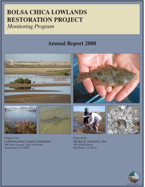
<strong>Bolsa</strong> <strong>Chica</strong> Lowlands Restoration Project<br />
<strong>Monitoring</strong> Program<br />
<strong>2008</strong> <strong>Annual</strong> <strong>Report</strong><br />
Prepared for:<br />
California State Lands Commission<br />
100 Howe Avenue, Suite 100 South<br />
Sacramento, CA 95825-8202<br />
Prepared by:<br />
Merkel & Associates<br />
5434 Ruffin Road<br />
San Diego, CA 92123<br />
Keith Merkel & Rachel Woodfield<br />
with:<br />
Moffatt & Nichol Engineers<br />
Coastal Frontiers Corporation<br />
Chambers Group
<strong>Bolsa</strong> <strong>Chica</strong> Lowlands Restoration <strong>Monitoring</strong><br />
<strong>2008</strong> <strong>Annual</strong> <strong>Report</strong><br />
TABLE OF CONTENTS<br />
Executive Summary................................................................................................................................ 1<br />
Introduction........................................................................................................................................... 11<br />
I. Ecological <strong>Monitoring</strong> Program ..................................................................................................... 17<br />
1.1. Vegetation/Habitat <strong>Monitoring</strong> .................................................................................................................................. 17<br />
1.2. Soils/Sediment <strong>Monitoring</strong>......................................................................................................................................... 33<br />
1.3. Fish Community <strong>Monitoring</strong>...................................................................................................................................... 37<br />
1.4. Benthic <strong>Monitoring</strong> .................................................................................................................................................... 55<br />
1.5. Water Quality <strong>Monitoring</strong> .......................................................................................................................................... 66<br />
1.6. Avian <strong>Monitoring</strong>....................................................................................................................................................... 72<br />
General Avian <strong>Monitoring</strong> ............................................................................................................................................. 72<br />
Light-footed Clapper Rail <strong>Monitoring</strong> ........................................................................................................................... 87<br />
Belding’s Savannah Sparrow <strong>Monitoring</strong> ...................................................................................................................... 87<br />
California Least Tern and Western Snowy Plover <strong>Monitoring</strong> ...................................................................................... 91<br />
1.7. Non-native Invasive Species ....................................................................................................................................... 96<br />
II. Physical <strong>Monitoring</strong> Program ....................................................................................................... 99<br />
2.1. Inlet Flood Shoal ......................................................................................................................................................... 99<br />
2.2. Tidal <strong>Monitoring</strong> ....................................................................................................................................................... 107<br />
2.3. Beach <strong>Monitoring</strong>...................................................................................................................................................... 114<br />
III. Maintenance Dredging Program ................................................................................................ 135<br />
3.1 Dredging Triggers ...................................................................................................................................................... 136<br />
3.2 Trigger Analysis......................................................................................................................................................... 137<br />
3.3 Dredge Triggers - Conclusions and Recommendations ............................................................................................. 140<br />
3.4 Maintenance Dredging Plan ....................................................................................................................................... 141<br />
References............................................................................................................................................ 143<br />
LIST OF FIGURES<br />
Figure 0-1. Site locator and vicinity map .............................................................................................. 15<br />
Figure 0-2. Schedule of <strong>Bolsa</strong> <strong>Chica</strong> monitoring activities................................................................... 16<br />
Figure 1-1. <strong>Monitoring</strong> stations ............................................................................................................. 18<br />
Figure 1-2. Vegetation and soil monitoring locations ........................................................................... 20<br />
Figure 1-3. Habitat map (May <strong>2008</strong>)..................................................................................................... 22<br />
Figure 1-4. Full Tidal Basin cordgrass distribution............................................................................... 24<br />
Figure 1-5. Full Tidal Basin eelgrass distribution ................................................................................. 26<br />
Figure 1-6. Mean percent cover of native and non-native vegetation by survey area (<strong>2008</strong>) ............... 29<br />
Figure 1-7. Fisheries sampling locations............................................................................................... 39<br />
Figure 1-8. Mean fish density by quarter for large beach seine, otter trawl, and purse seine at Stations<br />
1 and 2 in the Full Tidal Basin......................................................................................................... 45<br />
Figure 1-9. Mean fish biomass by quarter for large beach seine, otter trawl, and purse seine at Stations<br />
1 and 2 in the Full Tidal Basin......................................................................................................... 47<br />
Figure 1-10. Size class distribution of topsmelt, slough anchovy, kelp bass, and California killifish in<br />
the Full Tidal Basin in <strong>2008</strong>............................................................................................................. 53<br />
Figure 1-11. Benthic sampling stations ................................................................................................. 56<br />
Figure 1-12. Mean infauna density and biomass in January and July <strong>2008</strong> by station and tidal elevation<br />
.......................................................................................................................................................... 61<br />
Figure 1-13. Full Tidal Basin water quality data - January <strong>2008</strong> .......................................................... 68<br />
Figure 1-14. Full Tidal Basin water quality data - April <strong>2008</strong> .............................................................. 69<br />
Figure 1-15. Full Tidal Basin water quality data - July <strong>2008</strong>................................................................ 70<br />
Merkel & Associates, Inc.<br />
i
<strong>Bolsa</strong> <strong>Chica</strong> Lowlands Restoration <strong>Monitoring</strong><br />
<strong>2008</strong> <strong>Annual</strong> <strong>Report</strong><br />
Figure 1-16. Avian survey zones........................................................................................................... 73<br />
Figure 1-17. Avian abundance by guild at <strong>Bolsa</strong> <strong>Chica</strong> during <strong>2008</strong> surveys ...................................... 80<br />
Figure 1-18. Avian abundance by habitat type at <strong>Bolsa</strong> <strong>Chica</strong> during <strong>2008</strong> surveys............................ 84<br />
Figure 1-19. Belding’s Savannah sparrow territories (March and April <strong>2008</strong>)..................................... 89<br />
Figure 2-1. Predicted flood shoal area................................................................................................. 100<br />
Figure 2-2. Full Tidal Basin inlet bathymetry ..................................................................................... 102<br />
Figure 2-3. Full Tidal Basin accretion and erosion comparisons between surveys............................. 103<br />
Figure 2-4. Net sediment accretion rate per month ............................................................................. 104<br />
Figure 2-5a. Minimum daily tidal elevations in the <strong>Bolsa</strong> <strong>Chica</strong> Full Tidal Basin (FTB) and at the Los<br />
Angeles Outer Harbor (LAOH) between January 20, 2007 and December 31, <strong>2008</strong> ................... 109<br />
Figure 2-5b. Daily differences in lower low tide elevations between the FTB and the LAOH .......... 109<br />
Figure 2-6. Maximum spring low tide muting..................................................................................... 111<br />
Figure 2-7. Example comparison of recorded tides (February 2007) at FTB with the ocean tides<br />
(LAOH).......................................................................................................................................... 112<br />
Figure 2-8. Location map .................................................................................................................... 115<br />
Figure 2-9. Beach profile data used in CCSTWS-OC......................................................................... 117<br />
Figure 2-10. Beach profile survey operations...................................................................................... 119<br />
Figure 2-11. May <strong>2008</strong> and October <strong>2008</strong> beach widths..................................................................... 124<br />
Figure 2-12. Long-Term beach width changes, May 1963 to May <strong>2008</strong>............................................ 125<br />
Figure 2-13. <strong>Bolsa</strong> <strong>Chica</strong> monitoring period shoreline changes, October 2005 to October <strong>2008</strong>....... 126<br />
Figure 2-14. Long-Term subaerial volume changes, May 1963 to October <strong>2008</strong> .............................. 127<br />
Figure 2-15. <strong>Bolsa</strong> <strong>Chica</strong> monitoring period subaerial volume changes, Oct. 2005 to Oct. <strong>2008</strong> ...... 128<br />
Figure 2-16. Long-Term shorezone volume changes, May 1963 to October <strong>2008</strong>............................. 129<br />
Figure 2-17. Twelve -Month average berm width at Corps Station 247+88....................................... 131<br />
Figure 2-18. Twelve -Month average berm width at Corps Station 307+88....................................... 131<br />
Figure 2-19. Twelve-Month average berm width at Corps Station 424+44........................................ 132<br />
Figure 2-20. Shoreline changes at upcoast transects, October 2005 to October <strong>2008</strong> ........................ 133<br />
Figure 2-21. Shoreline changes at downdrift transects, October 2005 to October <strong>2008</strong>..................... 133<br />
Figure 2-22. Subaerial volume changes at upcoast transects, October 2005 to October <strong>2008</strong>............ 134<br />
Figure 2-23. Subaerial volume changes at downcoast transects, October 2005 to October <strong>2008</strong>....... 134<br />
LIST OF TABLES<br />
Table 1-1. Area of habitats within the <strong>Bolsa</strong> <strong>Chica</strong> study area (May <strong>2008</strong>). ........................................ 21<br />
Table 1-2. Vegetation transect monitoring results (<strong>2008</strong>)..................................................................... 30<br />
Table 1-3. Soils monitoring results (September <strong>2008</strong>)........................................................................... 35<br />
Table 1-4. Soil grain size analysis results (September <strong>2008</strong>)................................................................ 36<br />
Table 1-5. Summary of fish abundance in the Full Tidal Basin in <strong>2008</strong>............................................... 42<br />
Table 1-6. Summary of fish mass in the Full Tidal Basin in <strong>2008</strong>........................................................ 44<br />
Table 1-7. Water quality measurements taken during quarterly fish sampling in <strong>2008</strong>........................ 48<br />
Table 1-8. Summary of fish abundance in the Muted Tidal Basins in <strong>2008</strong>. ........................................ 49<br />
Table 1-9. Summary of fish mass in the Muted Tidal Basins in <strong>2008</strong>. ................................................. 50<br />
Table 1-10. Summary of fish abundance in the Muted Pocket Marsh in <strong>2008</strong>. .................................... 50<br />
Table 1-11. Summary of fish mass in the Muted Pocket Marsh in <strong>2008</strong>. ............................................. 51<br />
Table 1-12. Minimum and maximum standard length of all fish species captured by quarter at all<br />
station in <strong>2008</strong>.................................................................................................................................. 52<br />
Merkel & Associates, Inc.<br />
ii
<strong>Bolsa</strong> <strong>Chica</strong> Lowlands Restoration <strong>Monitoring</strong><br />
<strong>2008</strong> <strong>Annual</strong> <strong>Report</strong><br />
Table 1-13. Mean density of infauna in January <strong>2008</strong>. ......................................................................... 58<br />
Table 1-14. Mean biomass of infauna in January <strong>2008</strong>......................................................................... 59<br />
Table 1-15. Mean density of infauna in July <strong>2008</strong>. ............................................................................... 59<br />
Table 1-16. Mean biomass of infauna in July <strong>2008</strong>............................................................................... 60<br />
Table 1-17. Counts of epibenthic invertebrates detected in 1-m 2 quadrats in January and July <strong>2008</strong>. . 63<br />
Table 1-18. Counts of epibenthic invertebrates captured in fishing gear during <strong>2008</strong> quarterly fish<br />
sampling........................................................................................................................................... 64<br />
Table 1-19. Summary of <strong>2008</strong> survey dates and number of birds and species observed...................... 76<br />
Table 1-20. Avian abundance by survey (<strong>2008</strong>).................................................................................... 77<br />
Table 1-21. Belding’s Savannah sparrow territories at <strong>Bolsa</strong> <strong>Chica</strong> in 2007 and <strong>2008</strong> ........................ 90<br />
Table 1-22. <strong>2008</strong> California least tern reproductive success for each nesting location. ....................... 93<br />
Table 1-23. <strong>2008</strong> Western snowy plover reproductive success for each nesting location. ................... 94<br />
Table 2-1. Net increase in inlet sediment volume in comparison to pre-opening conditions. ............ 101<br />
Table 2-2. Summary of spring high and low tides............................................................................... 110<br />
Table 2-3. Beach nourishment history................................................................................................. 116<br />
Table 2-4. Statistical range and depth of closure at <strong>Bolsa</strong> <strong>Chica</strong> area transects.................................. 122<br />
Table 2-5. Beach width measurement program summary statistics, Jan. 2007 to Dec. <strong>2008</strong>. ............ 130<br />
Table 2-6. Range and depth of closure at <strong>Bolsa</strong> <strong>Chica</strong> area transects. ................................................ 130<br />
LIST OF APPENDICES<br />
Appendix 1-A. <strong>2008</strong> Field Survey Dates<br />
Appendix 1-B. Sampling Location Coordinates<br />
Appendix 1-C. Cordgrass <strong>Monitoring</strong> Photos<br />
Appendix 1-D. Avian Guild<br />
Appendix 1-E. Avian Abundance by Zone in <strong>2008</strong><br />
Appendix 1-F. Final <strong>Report</strong> Western Snowy plover Nesting at <strong>Bolsa</strong> <strong>Chica</strong>, <strong>2008</strong><br />
Appendix 2-A. Monthly Tide Plots <strong>2008</strong><br />
Appendix 2-B. <strong>Bolsa</strong> Beach Profile Plots<br />
Appendix 2-C. MSL Beach Width<br />
Appendix 2-D. Sediment Volume Data<br />
Appendix 2-E. MSL Beach Width Measurements<br />
Appendix 2-F. US Army Corps Beach Width Measurements<br />
Merkel & Associates, Inc.<br />
iii
<strong>Bolsa</strong> <strong>Chica</strong> Lowlands Restoration <strong>Monitoring</strong><br />
<strong>2008</strong> <strong>Annual</strong> <strong>Report</strong><br />
BOLSA CHICA LOWLANDS RESTORATION PROJECT<br />
<strong>Monitoring</strong> Program<br />
<strong>Annual</strong> <strong>Report</strong> - <strong>2008</strong><br />
EXECUTIVE SUMMARY<br />
The construction phases of the <strong>Bolsa</strong> <strong>Chica</strong> Lowlands Restoration Project were principally complete<br />
by the end of 2006, including the opening of the Full Tidal Basin (FTB) to the ocean in August 2006.<br />
This report presents the biological and physical monitoring program data collected in <strong>2008</strong>,<br />
documenting the conditions within the restored areas two to three years post-restoration.<br />
The biological, physical, and beach monitoring programs reported in this annual report were conducted<br />
following the <strong>Bolsa</strong> <strong>Chica</strong> Lowland Restoration Project Biological <strong>Monitoring</strong> and Follow-up Plan and<br />
the <strong>Bolsa</strong> <strong>Chica</strong> Lowlands Restoration Project Beach <strong>Monitoring</strong> Plan, both prepared by the U.S. Fish<br />
and Wildlife Service in 2001. The monitoring team included Merkel & Associates, Moffat & Nichol<br />
Engineers, Coastal Frontiers, and Chambers Group, Inc. The findings are summarized in the following<br />
sections.<br />
VEGETATION/HABITAT<br />
The distribution, composition, and evolution of vegetation communities and unvegetated habitats were<br />
monitored through the use of aerial photography and quantitative transect methods. The May <strong>2008</strong><br />
assessment of habitats at <strong>Bolsa</strong> <strong>Chica</strong> mapped ten vegetated and seven non-vegetated habitats within<br />
the 402-ha (994-acre) study area.<br />
Open water and salt panne were the most extensive unvegetated habitats. Southern coastal salt marsh<br />
was the most extensive vegetated habitat, occurring primarily as a fringe to salt panne in the Seasonal<br />
Ponds and Future Full Tidal Basin, while providing nearly complete cover in the Muted Tidal Basins<br />
(MTBs). In <strong>2008</strong>, only the west MTB was open to tidal influence and the marsh there had had limited<br />
time to respond prior to the monitoring. It is anticipated that this basin and the central and east MTBs<br />
will have shifts in marsh distribution in the coming years as all basins are opened to the FTB. The<br />
lowest lying areas will be converted to open water and mudflat, while marsh will be able to expand<br />
into higher areas previously dominated by non-native weeds, once they are eliminated by the salt water<br />
influence. The MTBs were designed to support 51.1 ha (126.3 acres) of salt marsh habitat. In <strong>2008</strong><br />
the three basins had a total of 49.8 ha (122.9 acres) of salt marsh.<br />
Salt marsh distribution is also expected to change in the FTB, particularly on Rabbit Island as lowlying<br />
marsh continues to convert to mudflat. The FTB was designed to eventually support 7.7 ha (19.1<br />
acres) of pickleweed. In <strong>2008</strong>, approximately 4.9 ha (12.4 acres) of coastal salt marsh were present in<br />
the basin. Salt marsh will be gained at the higher elevations of Rabbit Island as non-native vegetation<br />
continues to convert to mid and high marsh. Additionally, pickleweed on the cordgrass bench in the<br />
FTB is expected to expand along the base of the riprap in the coming years.<br />
Cordgrass (Spartina foliosa) and eelgrass (Zostera marina) were transplanted throughout the FTB in<br />
August 2007. By August <strong>2008</strong>, one year post-transplant, the eelgrass had doubled in distribution to<br />
cover 0.8 ha (0.9 acre) and is expected to expand substantially in the coming years. Approximately<br />
Merkel & Associates, Inc 1
<strong>Bolsa</strong> <strong>Chica</strong> Lowlands Restoration <strong>Monitoring</strong><br />
<strong>2008</strong> <strong>Annual</strong> <strong>Report</strong><br />
196 m 2 of cordgrass had become established in the FTB one year post-transplant. It is expected that<br />
the cordgrass will expand to form continuous patches suitable as habitat for light-footed clapper rails<br />
(Rallus longirostris levipes) within four to five years of transplant.<br />
Investigations of plant species composition along nineteen transects in the restored areas found the<br />
Muted Pocket Marsh (MPM) to support the most diverse salt marsh habitat, with minimal non-native<br />
species. Rabbit Island in the FTB was the second most diverse, but had a higher component of weedy<br />
species, particularly iceplants. A population of the rare plant coast woolly heads (Nemacaulis<br />
denudata var. denudata) persists on Rabbit Island and will need immediate protection through removal<br />
of the iceplant that is encroaching on its remaining populations. The salt marsh in the MTBs is low in<br />
diversity, but forms a dense canopy of pickleweed (Sarcocornia pacifica) that is heavily used by<br />
Belding’s Savannah sparrows (Passerculus sandwichensis beldingi) for nesting each year.<br />
The next full vegetation monitoring event, including aerial photography, habitat mapping, and transect<br />
surveys, will be conducted in summer 2011 (Year 5) as called for in the <strong>Monitoring</strong> Plan. Additional<br />
photography and habitat mapping will be done in 2009 to document interim conditions.<br />
FISH COMMUNITY<br />
The <strong>2008</strong> fish community sampling was completed in January, April, July, and October. Sampling<br />
was performed during daylight hours at two stations in the FTB, one in the MPM, and two in the<br />
MTBs. Sampling equipment included an otter trawl, purse seine, large beach seine, and small beach<br />
seine as appropriate for the station depth and accessibility. Captured fish were identified, counted,<br />
measured, and weighed. Physical water quality parameters were measured coincident with the fish<br />
sampling efforts.<br />
A total of 42 fish species were captured in <strong>2008</strong> at all stations. Thirty-nine species were captured in<br />
the FTB, dominated by topsmelt (Atherinops affinis) (46% of the total catch), California killifish<br />
(Fundulus parvipinis) (6% of the total catch), and California grunion (Leuresthes tenuis) (9% of the<br />
total catch). Anchovy (Anchoa sp.) comprised only 7% of the total catch and were present primarily in<br />
July. The other species captured were increasingly associated with structured habitats due to the<br />
spread of eelgrass habitat, particularly in the southern half of the basin. Fish densities were generally<br />
low in January and April and much higher in July and October, driven primarily by the number of<br />
atherinids captured.<br />
Ten fish species were captured in the west and central MTB in <strong>2008</strong>. Only the west MTB was directly<br />
open to the FTB. Topsmelt and killifish were the most abundant species. Diversity and biomass are<br />
anticipated to increase as the MTBs are all opened to the tidal influence of the FTB in the future.<br />
The MPM, which is hydrologically separate from the restoration project area, was generally found to<br />
be low in diversity but high in abundance of species foraged on by many birds. Nine species were<br />
captured, with topsmelt and California killifish the most abundant year round, reaching their peaks in<br />
July. Staghorn sculpin (Leptocottus armatus) and longjaw mudsucker (Gillichthys mirabilis) were<br />
occasionally abundant.<br />
The restoration project and creation of the FTB has increased the availability of important bay habitat,<br />
provided nursery functions for many species of marine fish, and thereby improved southern California<br />
fisheries resources. Nearly every fish species captured during the 2007 and <strong>2008</strong> monitoring was<br />
Merkel & Associates, Inc. 2
<strong>Bolsa</strong> <strong>Chica</strong> Lowlands Restoration <strong>Monitoring</strong><br />
<strong>2008</strong> <strong>Annual</strong> <strong>Report</strong><br />
represented by juvenile size classes, demonstrating the linkages between the basin and coastal<br />
fisheries, and the role of the basin as nursery habitat for spawning or post-larval dispersal.<br />
The <strong>Bolsa</strong> <strong>Chica</strong> Steering Committee has decided to conduct an additional year of fisheries monitoring<br />
in Year 3, which was initiated in October <strong>2008</strong> and will extend through July 2009. The next<br />
monitoring is then scheduled to occur in Year 5, with sampling events in October 2010, and January,<br />
April, and July 2011.<br />
BENTHIC COMMUNITY<br />
Assessments of benthic infauna and epifauna were conducted in January and July <strong>2008</strong> at three stations<br />
in the FTB. To sample the benthic infauna, three replicate sediment cores were collected from the<br />
+0.3-m (+1-foot) NAVD elevation and from the -0.6-m (–2-foot) NAVD elevation and rinsed through<br />
a 1.0-mm sieve. Organisms from each sample were transported to the laboratory to be identified to the<br />
lowest practical taxonomic level, counted, and weighed. Epibenthic invertebrates were assessed using<br />
1-m 2 quadrat at each of the sampling points and tidal elevations. All epifaunal organisms were<br />
identified and counted. Additionally, during the completion of fish studies described above, the<br />
incidental by-catch of epibenthic invertebrates was collected, identified, and counted to further<br />
enhance the detection of epibenthic organisms.<br />
As expected, considerable variability was observed in the infaunal invertebrate community due to the<br />
limited replication and frequency of sampling, variations in sediment type within and between stations,<br />
and the patchiness that is characteristic of benthic invertebrate communities in general. However, the<br />
two sampling events during the second year post-restoration did serve to document that the creation of<br />
the FTB has provided benthic food resources available to birds, fish, and other invertebrates. The<br />
created basin was found to support nine phyla of infauna, with polychaetes the dominant taxa (61% of<br />
the total), followed by tanaids and bivalves (21% and 4% of the total, respectively). Benthic<br />
monitoring conducted during the comparable second year post-restoration at Batiquitos Lagoon (1998)<br />
found the density of infauna there to be very similar, indicating the FTB is performing as expected for<br />
a created tidal embayment.<br />
The quadrat sampling to characterize epibenthic communities did not provide a good representation of<br />
the invertebrates present. Most epibenthic organisms are highly mobile and had vacated the mudflat<br />
shoreline during the low tides targeted for the survey work. However the tracking of epibenthic<br />
invertebrates in the fishing gear documented considerably more diversity due the greater area and<br />
depth range sampled. Species seen in high numbers in <strong>2008</strong> were the pink shrimp Pandalus sp., the<br />
small kelp humpback shrimp (Hippolyte clarki) commonly associated with eelgrass, various tunicates,<br />
B. gouldiana, and Argopecten ventricosus. Six non-native species were identified, including the<br />
Japanese mussel (Musculista senhousia), a highly invasive non-native mussel present in many<br />
California bays and estuaries and detected during the first biological monitoring event in October<br />
2007.<br />
Epibenthic invertebrates present after the opening of the basin to tidal influence were all marine<br />
species associated with estuarine or bay environments. It is expected that the species list will continue<br />
to expand over time as additional sampling is conducted. These macroinvertebrates also provide an<br />
important prey base for fish and birds in the basin.<br />
Merkel & Associates, Inc. 3
<strong>Bolsa</strong> <strong>Chica</strong> Lowlands Restoration <strong>Monitoring</strong><br />
<strong>2008</strong> <strong>Annual</strong> <strong>Report</strong><br />
The <strong>Monitoring</strong> Plan calls for benthic monitoring to occur again in Years 5 and 10 post-restoration,<br />
with sampling events scheduled for January and July of 2011 and 2016.<br />
WATER QUALITY<br />
Water quality monitoring was conducted in January, April, and July <strong>2008</strong> using both tended and<br />
untended continuous recording instrumentation. The deployed units were programmed to log water<br />
depth, temperature, dissolved oxygen (DO), turbidity, and salinity at 20-minute intervals at two<br />
stations within the FTB, one in at the north end and other at the south end of the basin. Unfortunately,<br />
water quality monitoring in <strong>2008</strong> was severely impacted by repeated instrument failures, which limited<br />
comparisons between stations in several cases.<br />
The water quality conditions observed in the FTB in <strong>2008</strong> showed the tidal marine influence that exists<br />
in the basin, reflecting the daily and monthly tidal fluctuations seen in the open ocean. All parameters<br />
were well within acceptable ranges to support the developing fish, invertebrate, and vegetation<br />
communities, and are indicative of a well-flushed marine environment. On-going physical monitoring<br />
of the condition of the inlet and the flood shoal is important to ensure proper circulation of the basin<br />
and maintenance of good water quality.<br />
In the April and July months, the slow-circulating waters at the northern end of the basin had higher<br />
water temperatures because of increased solar heating. The better circulated waters of the southern<br />
portion of the basin were more influenced by cooler oceanic water, maintaining lower temperatures<br />
during the warmer months. Very little difference in temperature was seen between the two stations<br />
during the January sampling. The FTB closely matched sea surface temperatures in the ocean in the<br />
winter, and had higher temperatures than the ocean in the summer months, a condition typically seen in<br />
other coastal embayments in the region.<br />
Dissolved oxygen levels were within the expected range and reflected the strong influence of diurnal<br />
tidal flow, with DO levels rising and falling with tides as water masses with differing physical and<br />
biotic conditions were exchanged. The condition of the FTB inlet remained suitable to provide enough<br />
tidal circulation throughout the basin to maintain DO levels generally well above 5.5 mg/L, with daily<br />
tidal peaks in the 7.5 to 8.5 mg/L range, even during the warm July month when unhealthy drops in<br />
DO can be observed in poorly circulated systems.<br />
Large gaps in the salinity datasets limited the amount of interpretation that could be done, however the<br />
data available reflected the absence of significant freshwater input into the FTB, with salinities similar<br />
to typical oceanic salinities for most of the year. Turbidity generally ranged between 0 and 15 NTU at<br />
both stations, though interference with the sensor by passing octopus, opisthobranchs, and algae, as<br />
well as laid egg masses, affected the acceptability of some of the data.<br />
The next monitoring is scheduled to occur in Year 5, with sampling events in October 2010, and<br />
January, April, and July 2011.<br />
AVIAN COMMUNITY<br />
Saturation surveys of the avian surveys were conducted in February, April, June, August, October, and<br />
December in <strong>2008</strong>. Diversity ranged from 82 to 114 species per survey and was highest during<br />
December and February. A total of 135 species was observed in <strong>2008</strong>, for a grand total of 145 species<br />
observed since the start of the monitoring period (October 2007 to December <strong>2008</strong>). The number of<br />
Merkel & Associates, Inc. 4
<strong>Bolsa</strong> <strong>Chica</strong> Lowlands Restoration <strong>Monitoring</strong><br />
<strong>2008</strong> <strong>Annual</strong> <strong>Report</strong><br />
individual birds observed was fairly consistent over the year with the exception of June, when the<br />
count was reduced by more than one half due to the absence of large groups of shorebirds.<br />
Throughout most of the year western sandpiper (Calidris mauri) was the most common species, with<br />
shorebirds the most abundant guild overall. This changed in June when most of the shorebirds left<br />
<strong>Bolsa</strong> <strong>Chica</strong> for their breeding grounds and were replaced by species that nest in the area. These<br />
species were mostly the aerial fish foragers (primarily terns), but also included some of the larger<br />
shorebirds such as black-necked stilt (Himantopus himantopus), and American avocet (Recurvirostra<br />
americana). The second most abundant guild was dabbling ducks/geese, which had high counts in<br />
February, April, and December but remained present year round in smaller numbers.<br />
Mudflats and inundated salt panne were the most utilized habitat type, although species richness was<br />
highest in the salt marsh. In <strong>2008</strong> the FTB was utilized by 49.7% of all birds observed, representing<br />
103 species. Nest Site 1 (NS1) in the FTB was highly utilized by aerial fish foragers, particularly<br />
during the April through August surveys when the terns and skimmers were nesting. The Future Full<br />
Tidal Basin (FFTB), Seasonal Ponds, and MTBs were very important habitat for dabbling ducks,<br />
shorebirds, and upland birds. The most abundant upland bird was Belding’s Savannah sparrow, which<br />
utilized the pickleweed-dominated salt marsh. The Muted Pocket Marsh is highly utilized by<br />
shorebirds and dabbling ducks and had even more birds per hectare than the FTB.<br />
Surveys for the state endangered Belding's Savannah sparrow were performed in April and May <strong>2008</strong>.<br />
Two complete surveys were done in <strong>2008</strong> in order to improve the reliability of the number of<br />
territories recorded. A total of 177 territories were identified within the study site in April <strong>2008</strong> and<br />
208 territories in May <strong>2008</strong>. These numbers are lower than those recorded in 2007, but comparable to<br />
the counts in 2006. Territories appeared to be relatively evenly dispersed throughout areas where<br />
pickleweed-dominated salt marsh occurred. Using the area of salt marsh available and the maximum<br />
number of territories recorded, the average territory size was estimated to be 1,836 m 2 , much larger<br />
than the average territory size noted in the available literature (304 m 2 to 626 m 2 ). While the available<br />
habitat would suggest low-density occupancy by Belding’s Savannah sparrow, the highly fragmented<br />
nature of the present salt marsh results in considerable area that is unsuitable for breeding use. As the<br />
system matures, it is expected that more of this area will become suitable and will be occupied by the<br />
sparrows. The FFTB supported the most territories, followed by the MTBs, then Seasonal Ponds.<br />
California least tern (Sternula antillarum browni) nest monitoring occurred on North Tern Island<br />
(NTI), South Tern Island (STI), NS1, Nest Site 2 (NS2), and Nest Site 3 (NS3). The terns nested<br />
primarily on STI and NS1, although one unsuccessful nest was located in the Seasonal Ponds in Zone<br />
11. The least terns did not utilize NTI, NS2, or NS3. From an estimated number of 217 pairs, a total<br />
of 432 eggs were laid in 242 nests. These numbers are a slight increase from those of 2007. The<br />
average clutch size was 1.8 eggs per nest and the first least tern fledgling was recorded on 23 June.<br />
California least tern nest predation was low at 19 (7.9% of all nests) nests. Seven (2.9%) nests were<br />
abandoned prior to hatching, and one nest was lost to flooding. Fledgling success for the <strong>2008</strong> season<br />
ranged from 100-150 fledglings, for a rate of 0.41 to 0.62 fledglings per nest. This is compared to 15<br />
fledglings in 2007 and a rate of 0.07 fledglings per nest.<br />
The western snowy plover (Charadrius alexandrinus nivosus) nested on STI, NS1, NS3, and a number<br />
of cells within the Seasonal Ponds, with a total of 67 nests. From the 193 total eggs laid, 174 chicks<br />
were produced. Two of the 67 nest attempts were lost to predators; however, three nests were<br />
Merkel & Associates, Inc. 5
<strong>Bolsa</strong> <strong>Chica</strong> Lowlands Restoration <strong>Monitoring</strong><br />
<strong>2008</strong> <strong>Annual</strong> <strong>Report</strong><br />
abandoned. Of these, 174 total chicks were produced in <strong>2008</strong> and a minimum of 57 and a maximum of<br />
109 (32.8 to 62.6%) chicks survived to fledge. The minimum fledgling estimate per nest (0.85<br />
fledglings/nest) is slightly below the average (0.95 fledglings/nest) of the study years. The maximum<br />
estimate of fledglings per nest (1.62 fledglings/nest) would exceed the previous high of 1.47 in 2005.<br />
Avian monitoring recommendations include continuing the Belding’s Savannah sparrow monitoring<br />
program to include a minimum of 2 surveys per breeding season and implementation of the<br />
management recommendations detailed in the snowy plover report (Appendix 1-F).<br />
INLET FLOOD SHOAL<br />
The rate and distribution of sand accretion in the FTB inlet was assessed by bathymetric survey in<br />
January and June 2007, and in January, July, and December <strong>2008</strong>. The volume and distribution of<br />
accumulated sand was compared to the pre-basin opening conditions of August 2006. A small shoal<br />
had formed in the inlet by January 2007 and continued to expand through 2007 and <strong>2008</strong>. The net<br />
volume of sediment (composed entirely of littoral sand) accreted within the assessment polygon was<br />
compared to the pre-opening conditions and had reached 204,923 m 3 by December <strong>2008</strong>. This can be<br />
expressed as a total rate of volume change from the basin opening through December <strong>2008</strong>, roughly 28<br />
months later, of approximately 240 m 3 /day. It is important to note, however, that this average rate<br />
does not represent the actual accretion per day, as deposition and erosion occurred throughout the<br />
period at an uneven rate.<br />
To examine this variable rate, the contour plots of each survey were compared to each other to quantify<br />
areas of erosion and accretion between surveys. As anticipated, there was a large input of sand<br />
between the basin opening on August 24, 2006 and the first survey on January 19, 2007, with an<br />
average of 402 m 3 /day. The influx rate then decreased between subsequent surveys, to an average of<br />
230 m 3 /day in 2007 and 134 m 3 /day in <strong>2008</strong>.<br />
The flood shoal volume, area of shoaling, and shoaling rate have occurred similarly to processes<br />
predicted during the project design. The variable seasonal influx of sand, and added complication of<br />
provision of local source sand in the pre-filled ebb bar and beach around the mouth, is expected to<br />
have played a role in the high early infill rates. Further, early infill would have also added sand to the<br />
oversized entrance channel, thus decreasing the observed rate of shoaling from the true rate since the<br />
flood shoal survey assessment area does not extend out fully into the entrance channel. Subsequent<br />
reduced rates of infill may indicate more rapid achievement of relative stability following the initial<br />
system loading.<br />
Future monitoring of the flood shoal will occur in January and June of 2009 and 2010.<br />
TIDAL MONITORING<br />
Accretion of sand within the flood shoal of the FTB is the most important factor causing tidal lag and<br />
muting. Tidal monitoring provides a means of tracking the lag and muting and providing information<br />
necessary to determine the need for maintenance dredging to ensure proper physical and ecological<br />
system functioning.<br />
Tidal monitoring began in the FTB in December 2006 and was continuous throughout <strong>2008</strong>.<br />
Comparison of the lower low tide data for each day showed that the FTB did not completely drain to<br />
local oceanic sea levels (as measured at Los Angeles Outer Harbor [LAOH]) during lower low spring<br />
Merkel & Associates, Inc. 6
<strong>Bolsa</strong> <strong>Chica</strong> Lowlands Restoration <strong>Monitoring</strong><br />
<strong>2008</strong> <strong>Annual</strong> <strong>Report</strong><br />
tides and that tidal muting was becoming more pronounced through the <strong>2008</strong> monitoring period as the<br />
flood shoal built in the inlet. In <strong>2008</strong>, lower low tides in the FTB only went as low as LAOH during<br />
very mild neap tides.<br />
From January to December 2007, tidal muting within the FTB had increased by an average of 0.07 m.<br />
The winter of 2007-<strong>2008</strong> marked a considerable change. From December 2007 through April <strong>2008</strong>,<br />
tidal range decreased by approximately 0.24 m and tidal muting increased by an equivalent amount.<br />
From May <strong>2008</strong> through the remainder of the year, muting and tidal range remained fairly consistent<br />
with little additional muting being evidenced. By the end of <strong>2008</strong>, the tidal range within the FTB had<br />
been reduced from that of the open coast by an average of approximately 0.6 m with the maximum<br />
observed range loss reaching 0.86 m during July <strong>2008</strong>. The collected data indicated the presence of<br />
seasonal variation in muting, with an increase in the winter and mid-summer months when larger than<br />
average tidal ranges occur, and decreased muting during the spring and fall months when smaller than<br />
average tidal cycles occur. There were also fairly substantial changes in muting rates between months,<br />
including a relatively precipitous acceleration in the extent of muting in the system overall beginning<br />
in January <strong>2008</strong> through approximately April <strong>2008</strong>, after which time the spring tide low tide muting<br />
remained fairly constant through the remainder of the year.<br />
The lag of the low tide in the FTB compared to that in the ocean was approximately 78 minutes on<br />
January 19, 2007, 114 minutes on January 21, <strong>2008</strong>, and 288 minutes by December 13, <strong>2008</strong>.<br />
It was expected that the tidal range would gradually decrease and muting of the low tide would<br />
increase over time. It was further expected that muting and phase lag would become more severe due<br />
to effects of flood shoal development in the FTB until the implementation of the first dredging event,<br />
occurring in 2009. Preliminary engineering predictions of the effect of shoaling on tidal muting were<br />
that the tide range would reach 2.256 m and muting of the low tide to reach 0.244 m. Generally, the<br />
muted tidal range under the post-construction condition met the target of the “full tidal range”<br />
objective of the project planning documents during 2007, but with further shoal development in <strong>2008</strong><br />
the range substantively diminished.<br />
During preliminary engineering, tidal predictions were based on a theoretical average spring tidal<br />
condition, not the maximum spring tide condition. Because of the high importance of the low tide<br />
muting and lag to the drain-fill hydraulics of the MTBs, these maximum drain-out conditions are of<br />
key interest as they pertain to proper functioning of the MTBs. Although the FTB would still be<br />
considered fully tidal in <strong>2008</strong>, the diminishing drainage from the basin reached such a point as to<br />
restrict drainage from the open west MTB.<br />
Although the Freeman Creek water control structure slide gates remained closed during <strong>2008</strong>, the<br />
muting of the FTB would have otherwise restricted the full drain-out potential if they had been open,<br />
since the drainage of Freeman Creek is by gravity to the FTB. FTB water levels were higher than the<br />
creek in <strong>2008</strong> and would have precluded proper drainage.<br />
As a result of the shoal-associated muting and its controlling influence on the functioning of the MTBs<br />
and Freeman Creek, along with other variables (shoal volume and area of low intertidal habitat lost),<br />
maintenance dredging was warranted in <strong>2008</strong> and first scheduled to occur in the fall of <strong>2008</strong>.<br />
Continuous tidal monitoring will continue in 2009.<br />
Merkel & Associates, Inc. 7
<strong>Bolsa</strong> <strong>Chica</strong> Lowlands Restoration <strong>Monitoring</strong><br />
<strong>2008</strong> <strong>Annual</strong> <strong>Report</strong><br />
BEACH MONITORING<br />
Beach profile data were obtained in May and October <strong>2008</strong> and compared to historic data and data<br />
collected in 2007. Historically, the beaches along the <strong>Bolsa</strong> <strong>Chica</strong> study area have benefited as the<br />
downdrift recipient of the Surfside-Sunset nourishment material. During the 34-year period between<br />
1963 and 1997, the beaches advanced at four of the five historical transects included in the <strong>Bolsa</strong> <strong>Chica</strong><br />
beach monitoring program. Mean sea level (MSL) shoreline advance ranged from 14 m to 71 m within<br />
the present study area. The only occurrence of shoreline retreat during the 34-yr period was a loss of<br />
18 m at a transect located at Huntington Cliffs. The volume of sand above MSL increased in parallel<br />
to the beach width changes during the period. The shorezone volumes in the study area, which<br />
incorporate the sediment changes further offshore, increased at all of the sites. The greatest gains<br />
typically occurred prior to 1978.<br />
During the three-year period encompassing the last year of the construction of the <strong>Bolsa</strong> <strong>Chica</strong><br />
Lowlands Restoration Project and the first two years post-restoration (October 2005 to October <strong>2008</strong>),<br />
the shoreline advanced at the three transects located north of the entrance channel, with the greatest<br />
gain being 24 m. Shoreline retreat predominated at the survey sites located south of the entrance<br />
channel, with beach width changes ranging from a gain of 1 m to a loss of 14 m. The subaerial volume<br />
changes were very similar to the beach width changes, with gains occurring north of the entrance<br />
channel and losses predominating south of the entrance channel. While it is not possible to<br />
quantitatively assess shorezone volume changes during the recent three-year period (the October 2005<br />
profile does not extend below the waterline), a trend of shorezone volume loss has prevailed at each<br />
transect between January 2007 and October <strong>2008</strong>. This may be attributable dispersal of the pre-filled<br />
ebb bar and natural erosion between Surfside-Sunset nourishment intervals.<br />
Approximately 158,000 m 3 of sediment was deposited in the lagoon during the 17-month period<br />
between August 2006 and January <strong>2008</strong>. Sedimentation was reduced substantially during the second<br />
year (11-month period between January <strong>2008</strong> to December <strong>2008</strong>) to approximately 46,000 m 3 . While<br />
a small fraction of this material may have resulted from redistribution of basin sediments or aeolian<br />
processes, nearly all of the sediment has entered the basin from the ocean. It is possible that the high<br />
shoaling rate during the first year was a transient effect attributable to inlet stabilization, and increased<br />
propensity for sedimentation due to the proximately of the pre-filled ebb bar and widened beaches<br />
adjacent to the inlet. The reduced shoaling rate during the second year is likely attributable to a<br />
reduced tidal prism due to high initial shoaling rates and the stabilization of the aforementioned local<br />
sediment sources (nourished beaches and ebb bar). Nevertheless, the shoaling rate measured during<br />
the initial 17-month period is on the same order of magnitude as the alongshore sediment transport<br />
rates previously developed for Orange County (estimated to range from 108,000 m 3 /y to 125,000<br />
m 3 /y). As a result, particular attention is warranted in monitoring the flood shoal accumulation rates<br />
following the recent <strong>2008</strong> dredging activities to understand if the initial sedimentation was transitory or<br />
should be expected following future dredging episodes.<br />
In the event that the high sediment trapping rates detected following the initial inlet opening persist<br />
following the upcoming dredging activities forecast for 2009 (i.e., the sedimentation rates are not<br />
transitory), these rates are of a significant magnitude to be of major concern to alongshore transport in<br />
the littoral cell. If left unchecked and unmanaged, the primary implication of a substantial reduction of<br />
the alongshore sediment supply is shoreline erosion downdrift of the entrance channel. The <strong>Bolsa</strong><br />
<strong>Chica</strong> project, however, incorporates two sand management measures to actively address the potential<br />
for downdrift erosion by eliminating or substantially reducing the net long-term loss of sand<br />
Merkel & Associates, Inc. 8
<strong>Bolsa</strong> <strong>Chica</strong> Lowlands Restoration <strong>Monitoring</strong><br />
<strong>2008</strong> <strong>Annual</strong> <strong>Report</strong><br />
downcoast. To compensate for anticipated short-term sediment losses from the littoral budget due to<br />
the natural formation of an ebb bar, initial lagoon shoaling, and fillet formation along the jetties, the<br />
ebb bar located offshore of the entrance channel was pre-filled, and supplemental sand was placed as<br />
beach nourishment adjacent to the channel at the time of construction. These pre-fills were intended to<br />
minimize littoral sand loss to ebb bar formation and provide supplemental sand for early inlet<br />
stabilization. In addition, the long-term project sediment management plan provides for periodic<br />
down-coast beach nourishment using sediment derived from the FTB during maintenance dredging<br />
operations, restoring the sediment lost from the littoral budget to the downdrift beaches.<br />
MAINTENANCE DREDGING AND DREDGING TRIGGERS<br />
Parameters of tidal muting, beach width, loss of subtidal habitat, closure risk, muted tidal basin<br />
function, and water quality were analyzed to evaluate the functioning of the system and determine<br />
when dredging should be performed. Some of these parameters have pre-established triggers including<br />
tidal muting, beach width, and loss of subtidal habitat. Other parameters do not presently have<br />
established criteria for triggering a dredging event.<br />
In reviewing the established dredging triggers, it is clear that some of the triggers may never be met<br />
except under extreme circumstances, while more significant triggers may exist that have not as yet<br />
been quantified. Chronic beach erosion triggers are not likely to be met because of the ongoing<br />
replenishment at Surfside-Sunset and the program’s effect on long-term beach growth trends.<br />
Similarly, acute erosion triggers are not likely to be met due to the generally broad beach profiles at<br />
trigger point transects. It is more likely that maintenance dredging will be required to address an<br />
intrinsic system need related to the functionality of the MTB tidal control structures and Freeman<br />
Creek. Final triggers to address this issue will need to be set once all of the MTBs are open to the FTB<br />
and have operated under both normal and muted FTB conditions.<br />
During periods in <strong>2008</strong> when the average of the lowest spring tides in each tide series achieved<br />
elevations at or below –0.05 m NAVD, the west MTB functioned well. When the average of the<br />
lowest spring tides in each tide series achieved elevations at or above 0.28 m NAVD, the function of<br />
the west MTB was impaired and operational ranges were necessarily curtailed to avoid flooding above<br />
designed operational levels. As an interim-operating trigger for maintenance dredging, it is<br />
recommended that the occurrence of four or more consecutive low spring tides in the FTB that fail to<br />
achieve low elevations of 0.12 m NAVD or lower, on a running average basis, should suggest dredging<br />
is likely necessary. It is anticipated that maintenance triggers will need to be further modified in the<br />
future as the central and east MTBs are opened to tidal flows.<br />
Recommendations<br />
• Modify the expectations of tidal range in the FTB from 2.75 m to 2.29 m, with tidal elevations<br />
ranging from 2.02 to -0.27 m NAVD.<br />
• Remove the dredge trigger of the Mean Low Tide muting of 0.152 m.<br />
• Add an interim trigger of the rolling average of four consecutive lowest tides achieved during<br />
spring tide series exceeding 0.12 m NAVD, described in detail in Section 3.<br />
• Continue the tidal monitoring program with frequent reporting to show effects of the first<br />
maintenance dredging event occurring in 2009 and to assess the relationship between flood<br />
shoaling and tidal muting.<br />
Merkel & Associates, Inc. 9
<strong>Bolsa</strong> <strong>Chica</strong> Lowlands Restoration <strong>Monitoring</strong><br />
<strong>2008</strong> <strong>Annual</strong> <strong>Report</strong><br />
• Continue the tidal monitoring program to show effects of the first maintenance dredging event and<br />
to assess the relationship between flood shoaling and tidal muting.<br />
• Dredge accumulated sands from within the flood shoal in winter <strong>2008</strong>/2009 as scheduled since<br />
effects of the flood shoal impede the tidal ebbing from the entire site and adversely effect function<br />
of the MTBs and Freeman Creek Water Control structure.<br />
• The beach width dredging trigger should be modified to reflect a more current set of beach width<br />
data that includes the effects of the 2002 Surfside-Sunset nourishment and the scheduled 2009<br />
Surfside-Sunset nourishment. In addition, the trigger should indicate that dredging should be<br />
performed when the beach width is less than two standard deviations from the mean beach width,<br />
since being greater than two standard deviations does not indicate a need for dredging.<br />
• Consider phasing out the beach width triggers, as these are not likely to ever be tripped prior to<br />
maintenance dredging triggers that address muting and impairment of the MTBs.<br />
• Continue bathymetric monitoring, and anticipate another maintenance dredging event in two years.<br />
Additional adjustments to dredging triggers are anticipated in response to future performance analysis<br />
of the MTBs and additional analysis of shoaling after the first maintenance dredging cycle is<br />
completed.<br />
The first maintenance-dredging event is scheduled to occur in early 2009. For future dredging events,<br />
consideration should be given to dredging to the permitted depth of the final engineering design depths<br />
to extend the period between maintenance events. Dredging at the time of initial construction was not<br />
completed to full design depths within the maintenance basin. If deepening of the maintenance basin<br />
were completed, this would garner additional time between dredging events and would improve<br />
dredging efficiency by capturing a greater volume of sediment in a more localized and recoverable area<br />
nearer the inlet.<br />
Additionally, the pre-dredging contracting process can consume a considerable period of time and thus<br />
work should be completed to streamline and pre-prepare to the maximum extent practical prior to<br />
maintenance triggers being tripped. This would allow for a reduced period over which the system<br />
functions in an impaired condition prior to completing maintenance dredging. To accomplish this<br />
would require: preparation of the majority of the plans and specifications, completion of permitting<br />
based on a maintenance basin plan and dredge volume range, preparation of bid and contract<br />
documents, and obtaining maximum flexibility for the dredging window of work. Long-term Corps<br />
permits for maintenance dredging are possible, including ten-year permits to include dredging triggers<br />
and pre-dredging notification and approvals that are considerably shorter than applying for a new<br />
permit each time dredging is to be performed.<br />
Merkel & Associates, Inc. 10
<strong>Bolsa</strong> <strong>Chica</strong> Lowlands Restoration <strong>Monitoring</strong><br />
<strong>2008</strong> <strong>Annual</strong> <strong>Report</strong><br />
INTRODUCTION<br />
BACKGROUND<br />
The <strong>Bolsa</strong> <strong>Chica</strong> Lowlands are located in Orange County, California, between <strong>Bolsa</strong> <strong>Chica</strong> Mesa on<br />
the northwest and Huntington Beach on the southeast (Figure 0-1). In 1996, eight state and federal<br />
agencies entered into an agreement to conduct wetland acquisition and restoration at the Lowlands.<br />
Following project planning, land purchase, restoration design, permit acquisition, and publication of a<br />
Final Environmental Impact Statement/Final Environmental Impact <strong>Report</strong>, restoration construction<br />
began on October 6, 2004. The project involved the creation of a Full Tidal Basin (FTB) and<br />
restoration of Muted Tidal Basins (MTB) by constructing an ocean inlet north of Huntington Mesa.<br />
To create the FTB, approximately 1.57 million m 3 of material were excavated from within the <strong>Bolsa</strong><br />
<strong>Chica</strong> Lowlands to create a basin of a general depth of –1m NAVD, bounded by intertidal flats. The<br />
excavated sand was distributed on the adjacent beaches from March to June 2006 (102,500 m 3 , divided<br />
evenly to the north and south of the future inlet) as well as placed offshore from November 2005 to<br />
May 2006 to form an ebb bar (929,326 m 3 ) outside of the future inlet. Approximately 531,354 m 3 of<br />
material was placed to form the berms that bound the basin and three nesting areas. Remaining<br />
material was hauled off-site. Jetties were constructed to form the ocean inlet to the basin from March<br />
through June of 2006.<br />
The FTB was opened to the ocean on August 24, 2006. The basin was designed to support 71.0<br />
hectares (ha) (175.5 acres) of non-wetland waters, 49.6 ha (122.6 acres) of tidal flats, and 7.7 ha (19.1<br />
acres) of pickleweed. In order to keep the inlet open, maintenance dredging is anticipated to be needed<br />
every two to three years, with dredged sand to be placed on down-coast beaches.<br />
Water control structures and culverts through the berm were installed to allow regular but muted tidal<br />
influence from the FTB to each of three MTBs (Figure 0-1), to support 51.1 ha (126.3 acres) of salt<br />
marsh habitat, and create 17.1 ha (42.3 acres) of tidal flats, 12.3 ha (30.5 acres) of cordgrass habitat,<br />
and 0.7 ha (1.4 acres) of non-wetland waters. The west MTB was opened to tidal influence from the<br />
FTB through its water control structure in March <strong>2008</strong>, while the central and east basins remained<br />
closed while additional oil spill and flood control protections were put into place. The restoration<br />
project involved no changes to the Future Full Tidal Basin, which is currently an active oil production<br />
field, or the Seasonal Ponds (Figure 0-1).<br />
<strong>2008</strong> SITE CONDITIONS<br />
The water control structure at the west MTB was opened to tidal influence from the FTB on March 5,<br />
08. The central and east remained closed, however several heavy rain events, slow seepage through<br />
the control structures, and designed gravitational flow from the west to central MTB filled the low<br />
lying areas of all three of the basins, creating open water in areas that were previously dry salt panne.<br />
The storm events early in the year also raised the water level in Freeman Creek and the Seasonal<br />
Ponds, creating large expanses of open water during many of the bird surveys. Because the water<br />
control structures designed to drain Freeman Creek and Seasonal Ponds to the FTB were closed in<br />
<strong>2008</strong> while additional oil spill protections were put in place, water was pumped out of the creek and<br />
some ponds in May 08 to lower the water level in the ponds to make more foraging habitat available<br />
for western snowy plovers.<br />
Merkel & Associates, Inc. 11
<strong>Bolsa</strong> <strong>Chica</strong> Lowlands Restoration <strong>Monitoring</strong><br />
<strong>2008</strong> <strong>Annual</strong> <strong>Report</strong><br />
By the end of <strong>2008</strong>, the flood shoal in the FTB inlet had reached its greatest extent as anticipated, and<br />
the reduction of tidal range in the basin had progressed as well. During low oceanic tides, the blockage<br />
of the inlet by the shoal prevented the FTB from draining out as fully as it had immediately following<br />
construction. This resulted in a muting of low tides in the basin, which had an effect on the biological<br />
communities by increasing the daily durations of tidal inundation in the FTB and on the physical<br />
functioning of the system, which relies on low tides in the FTB to adequately gravity drain Freeman<br />
Creek and the Seasonal Ponds. These conditions were anticipated as part of the project design and<br />
were the triggers that indicated that maintenance dredging at the end of <strong>2008</strong> was warranted.<br />
Development of the flood shoal and the resulting effects on the biological communities, tidal ranges,<br />
and maintenance plans are discussed in the following chapters.<br />
MONITORING PROGRAM<br />
The follow-up monitoring of the restoration generally conforms to the <strong>Bolsa</strong> <strong>Chica</strong> Lowland<br />
Restoration Project Biological <strong>Monitoring</strong> and Follow-up Plan prepared by the U.S. Fish and Wildlife<br />
Service in 2001 (<strong>Monitoring</strong> Plan)(USFWS 2001a). The <strong>Monitoring</strong> Plan notes that the purpose of the<br />
monitoring program is to document the habitat improvements for fish and wildlife, the success of<br />
revegetation efforts, and the use of the site by endangered species. Additional monitoring elements in<br />
the <strong>Monitoring</strong> Plan are intended to ensure that the inlet is properly maintained, constructed nesting<br />
areas have adequate maintenance, any impacts to sensitive plant species are offset, and that<br />
construction impacts to Belding’s Savannah sparrow (Passerculus sandwichensis beldingi) were<br />
minimized.<br />
The Plan identifies the ecological monitoring objectives as follows:<br />
• Facilitate evaluation of the effectiveness of the restoration to provide habitat for fish and<br />
wildlife.<br />
• Document changes in the ecology of the wetlands environment over time.<br />
• Provide timely identification of any problems with the physical, or biological development of<br />
the restored area.<br />
• Assist in providing a technical basis for resource management of the restored wetland by<br />
documenting maintenance needs and enhancement opportunities.<br />
The plan calls for biological monitoring to be conducted during the 2nd, 5th, and 10th years after<br />
completion of construction. Listed species will be monitored each year. Physical monitoring will be<br />
conducted in years 1, 2, 3, 5, and 10.<br />
Immediately west of the Lowlands is Inner <strong>Bolsa</strong> Bay, which was established as an Ecological Reserve<br />
in 1973 to be managed by the California Department of Fish and Game (CDFG) (Figure 0-1). On<br />
August 24, 2006, the <strong>Bolsa</strong> <strong>Chica</strong> Lowlands Restoration Project acreage and the Muted Pocket Marsh<br />
were incorporated into the Ecological Reserve by agreement of the State Lands Commission and<br />
CDFG. This monitoring program study boundary includes only the restored Lowlands and Muted<br />
Pocket Marsh, not <strong>Bolsa</strong> Bay, with the exception that California least tern and western snowy plover<br />
monitoring was conducted throughout the Ecological Reserve (Restoration Area and Inner <strong>Bolsa</strong> Bay).<br />
The Beach <strong>Monitoring</strong> for this program conforms to the <strong>Bolsa</strong> <strong>Chica</strong> Lowlands Restoration Project<br />
Beach <strong>Monitoring</strong> Plan (USFWS, 2001b). The Beach <strong>Monitoring</strong> Plan defines monitoring activities<br />
and analyses that are expected to assure restoration project-related adverse impacts to area beaches are<br />
mitigated.<br />
Merkel & Associates, Inc. 12
<strong>Bolsa</strong> <strong>Chica</strong> Lowlands Restoration <strong>Monitoring</strong><br />
<strong>2008</strong> <strong>Annual</strong> <strong>Report</strong><br />
The State Lands Commission contracted Merkel & Associates, Inc. (M&A) and its team to implement<br />
the first three years of the Biological and Beach <strong>Monitoring</strong> Plans. The monitoring team included<br />
Merkel & Associates, Moffatt & Nichol Engineers, Coastal Frontiers, and Chambers Group, Inc. The<br />
FTB was opened to the ocean on August 24, 2006, with additional remedial construction activities<br />
continuing to address various shoreline stabilization issues. Contracting was not in place to initiate<br />
immediate monitoring until late 2006. However the Year 2 biological monitoring was initiated on<br />
schedule in Fall 2007. The annual monitoring reports will be prepared by calendar year but will<br />
include data collected by monitoring year, which is based on a schedule starting in October 2006.<br />
Therefore the first monitoring report included all data collected from November 2006 through<br />
December 2007, capturing all monitoring conducted under Year 1 of the monitoring program (October<br />
2006 to September 2007), as well as the first quarter of Year 2 (October to December 2007) (M&A<br />
<strong>2008</strong>a). This second monitoring report includes all data collected from January to December <strong>2008</strong>,<br />
capturing the last three quarters of Year 2 (through September <strong>2008</strong>) and the first quarter of Year 3<br />
(October to December <strong>2008</strong>). A schedule of monitoring activities and reporting is presented for<br />
clarification (Figure 0-2).<br />
This document serves as the annual report for <strong>2008</strong>. It is divided into three primary sections:<br />
Ecological <strong>Monitoring</strong>, Physical <strong>Monitoring</strong>, and Dredging Analysis. Copies of prior reports are<br />
posted on-line at www.bolsachicarestoration.org.<br />
In additional to the schedule in Figure 0-2, a table summarizing the dates of each field event during<br />
<strong>2008</strong> is provided in Appendix 1-A.<br />
HORIZONTAL AND VERTICAL REFERENCE DATA<br />
The vertical datum used throughout this document is North American Vertical Datum of 1988<br />
(NAVD88), with units expressed in meters. For purposes of equating this datum to recognized<br />
biological zonation patterns in tidal marine systems, NAVD88 roughly equates to Mean Lower Low<br />
Water (MLLW). More precisely, at the project site, NAVD88 lies approximately 0.06 m (0.2 feet)<br />
above National Ocean Service (NOS) MLLW and 0.79 m (2.6 feet) below NOS Mean Sea Level<br />
(MSL; NOS, 2007).<br />
Horizontally geo-referenced data are in meters relative to California State Plane Zone 6, North<br />
American Datum of 1983 (NAD 83). Area measurements are presented in hectares, with conversions<br />
to acres provided due to the greater ease with which many readers can envision areas in this unit of<br />
measurement. Additionally, discussion of sediment accumulation and dredging volumes are presented<br />
in cubic meters, with conversions to cubic yards due to the prevalence of this unit in the commercial<br />
dredging field.<br />
DEFINITIONS AND GEOGRAPHIC REFERENCES<br />
To assist the reader, this section has been provided to serve as a reference for terminology and<br />
abbreviations used in this report. In addition, this section includes a map of the <strong>Bolsa</strong> <strong>Chica</strong> Lowlands<br />
and surroundings labeled with place names to assist in following discussions that are geographically<br />
referenced to particular areas within the site (Figure 0-1).<br />
Merkel & Associates, Inc. 13
<strong>Bolsa</strong> <strong>Chica</strong> Lowlands Restoration <strong>Monitoring</strong><br />
<strong>2008</strong> <strong>Annual</strong> <strong>Report</strong><br />
Term Abbreviation Notes<br />
Full Tidal Basin FTB Area: 158.3 hectare (ha)(391.2 acres [ac])<br />
Future Full Tidal Basin FFTB Area: 103.8 ha (256.5 ac)<br />
Muted Tidal Basin MTB Area: 76.6 ha (189.3 ac) (not joined to FTB)<br />
Seasonal Ponds<br />
Area: 49.6 ha (122.5 ac)<br />
Muted Pocket Marsh MPM Area: 14.0 ha (34.7 ac)<br />
Nest Site 1 NS 1<br />
Nest Site 2 NS 2<br />
Nest Site 3 NS 3<br />
South Tern Island STI Inner <strong>Bolsa</strong> Bay (LETE and SNPL monitoring only)<br />
North Tern Island NTI Inner <strong>Bolsa</strong> Bay (LETE and SNPL monitoring only)<br />
Rabbit Island<br />
Intertidal island in northwest portion of FTB<br />
Water Control Structure WCS Gates to regulate tidal flow from FTB to MTBs<br />
Merkel & Associates, Inc. 14
Santa Barbara<br />
Los Angeles<br />
Outer<br />
<strong>Bolsa</strong><br />
Bay<br />
Muted<br />
Pocket Marsh<br />
West<br />
WCS<br />
East Garden Grove Wintersburg Channel<br />
Muted Tidal Basins<br />
Huntington Beach<br />
MAP<br />
AREA<br />
HUNTINGTON BEACH<br />
San Diego<br />
Rabbit<br />
Island<br />
Inner<br />
<strong>Bolsa</strong> Bay<br />
North<br />
Tern<br />
Island<br />
Nest Site 1<br />
Central<br />
WCS<br />
Full Tidal Basin<br />
East<br />
WCS<br />
Nest<br />
Site 2<br />
Freeman<br />
WCS<br />
Freeman Creek<br />
Future Full Tidal<br />
PACIFIC OCEAN<br />
South<br />
Tern<br />
Island<br />
Nest<br />
Site 3<br />
Flood Shoal<br />
Maintenance<br />
Area<br />
Seasonal Ponds<br />
West Muted Tidal Basin<br />
Central Muted Tidal Basin<br />
East Muted Tidal Basin<br />
<strong>Monitoring</strong> Program Study Boundary<br />
0 100 200 400 600 800<br />
Meters<br />
Ocean<br />
Inlet<br />
Site locator and vicinity map<br />
<strong>Bolsa</strong> <strong>Chica</strong> Lowlands Restoration Project<br />
Figure 0-1<br />
Merkel & Associates, Inc.
<strong>Bolsa</strong> <strong>Chica</strong> Lowlands Restoration <strong>Monitoring</strong> <strong>2008</strong> <strong>Annual</strong> <strong>Report</strong><br />
Figure 0-2. Schedule of <strong>Bolsa</strong> <strong>Chica</strong> monitoring activities (Breaks in task numbering reflect analytical or administrative tasks that have not been<br />
shown)<br />
2006 2007 <strong>2008</strong> 2009<br />
TASK A S O N D J F M A M J J A S O N D J F M A M J J A S O N D J F M A M J J A S O N D<br />
<strong>Monitoring</strong> Year 1 <strong>Monitoring</strong> Year 2 <strong>Monitoring</strong> Year 3<br />
COMPLETION OF CONSTRUCTION<br />
1.0. Ecological <strong>Monitoring</strong> Program<br />
1.1. Water Quality<br />
1.2. Soils<br />
1.3. Vegetation/Habitat Mapping<br />
Aerial Photogrammetry and Georeferencing<br />
Vegetation Mapping and Groundtruthing<br />
Vegetation Transect <strong>Monitoring</strong><br />
Eelgrass <strong>Monitoring</strong><br />
Cordgrass <strong>Monitoring</strong><br />
1.4. Fisheries<br />
1.5. Benthos<br />
1.6. Avian<br />
General Avian Surveys<br />
Species of Special Concern<br />
California Least Tern <strong>Monitoring</strong><br />
Western Snowy Plover <strong>Monitoring</strong><br />
Belding's Savannah Sparrow <strong>Monitoring</strong><br />
2.0. Physical <strong>Monitoring</strong> Program<br />
2.1. Inlet Bathymetric <strong>Monitoring</strong><br />
2.2. Tidal <strong>Monitoring</strong><br />
2.3. Beach <strong>Monitoring</strong><br />
Semiannual Beach Profile Surveys<br />
Monthly Beach Width Measurements<br />
5.0. Maintenance Dredging<br />
Planning and Permitting<br />
Maintenance Dredging<br />
7.0. <strong>Report</strong>ing Program<br />
7.2. <strong>Annual</strong> <strong>Report</strong><br />
Activity<br />
<strong>Report</strong><br />
Merkel & Associates, Inc. 16
<strong>Bolsa</strong> <strong>Chica</strong> Lowlands Restoration <strong>Monitoring</strong><br />
<strong>2008</strong> <strong>Annual</strong> <strong>Report</strong><br />
I. ECOLOGICAL MONITORING PROGRAM<br />
The ecological monitoring stations were established using direction provided in the <strong>Bolsa</strong> <strong>Chica</strong><br />
Lowland Restoration Project Biological <strong>Monitoring</strong> and Follow-up Plan (<strong>Monitoring</strong> Plan), as well as<br />
observations made in the field at the time of station determination. Figure 1-1 presents the general<br />
sampling locations for water quality, benthic infauna, fish, and birds. Appendix 1-A summarizes the<br />
dates of each field event. Within each of the following sections, more detailed maps of sampling<br />
locations are presented as needed.<br />
1.1. VEGETATION/HABITAT MONITORING<br />
Introduction<br />
The distribution, composition, and evolution of vegetation communities and unvegetated habitats were<br />
monitored through the use of aerial photography and quantitative transect methods. The <strong>Monitoring</strong><br />
Plan called for vegetation monitoring to be initiated in Year 2 of the program.<br />
Methodology<br />
Habitat Mapping<br />
To map vegetated and non-vegetated habitats, the <strong>Bolsa</strong> <strong>Chica</strong> study area was contract flown on May<br />
13, <strong>2008</strong> to photograph the site at a scale of 1:4,800 from true vertical position on 9”x9” false-color<br />
infrared (IR) film. The photos were flown at approximately 1230 hours at a measured FTB tide of<br />
approximated +0.3m NAVD88. This allowed photography of as much exposed intertidal habitat as<br />
possible while lighting and weather conditions were suitable for the photography. Additionally, a<br />
single 1:19,344 true color spot aerial photograph was taken coincident with the IR imagery. This<br />
photograph assisted in providing an additional tool for habitat interpretation and mapping as well as<br />
served as a base map for all field monitoring efforts and reporting.<br />
Following survey flights, the aerial images were digitally scanned and georeferenced to create a tile<br />
mosaic image for interpretive mapping. Once the images were correctly registered to the project site,<br />
heads-up digitization of vegetation boundaries was performed to map communities in accordance with<br />
CDFG Holland classification codes (Holland 1986). Additional codes were used as necessary to<br />
supplement the vegetation codes with biologically important marsh zones, non-vegetated communities,<br />
and marine habitats that are lacking in the Holland system. These codes followed the Nearshore<br />
Habitat Classification system developed for coastal marine mapping (M&A 2003).<br />
The draft digitized habitat maps were printed and taken into the field for ground-truthing. Once<br />
completed, the habitat maps were updated and map products and summary statistics of habitat acreage<br />
and distribution across the various project components were generated. Future mapping efforts will<br />
examine habitat change relative to spatial and numeric parameters reported here.<br />
Eelgrass (Zostera marina) was introduced into the FTB through a transplant conducted by M&A in<br />
August 2007. Eelgrass was harvested from the Cabrillo Beach region of the Port of Los Angeles and<br />
transplanted to 15 sites in the FTB in 45x5m blocks. A total of 0.4 hectare (0.9 acre) of eelgrass was<br />
transplanted. The distribution of eelgrass present one year later was mapped on June 30, <strong>2008</strong> by a<br />
separate methodology from the other vegetation mapping described above. The FTB was surveyed for<br />
eelgrass from a boat using a sidescan sonar operating at 600 kHz scanning out 20<br />
Merkel & Associates, Inc. 17
Muted<br />
Pocket Marsh<br />
STATION 1<br />
wq1<br />
STATION 3<br />
(benthic only)<br />
East Water<br />
Control Structure<br />
Tidal<br />
<strong>Monitoring</strong><br />
Station<br />
wq2<br />
STATION 2<br />
Water Quality Stations<br />
Inlet Bathymetric <strong>Monitoring</strong><br />
Avian and Vegetation Study Boundary<br />
0 100 200 400 600 800<br />
Meters<br />
<strong>Monitoring</strong> stations<br />
<strong>Bolsa</strong> <strong>Chica</strong> Lowlands Restoration Project<br />
Figure 1-1<br />
Merkel & Associates, Inc.
<strong>Bolsa</strong> <strong>Chica</strong> Lowlands Restoration <strong>Monitoring</strong><br />
<strong>2008</strong> <strong>Annual</strong> <strong>Report</strong><br />
meters on both the starboard and port channels to cover a 40-m wide swath. Following completion of<br />
the survey, sidescan sonar traces were geographically registered, plotted on the geo-rectified aerial<br />
image described above, and the eelgrass digitized to calculate the amount of coverage and show its<br />
distribution.<br />
Cordgrass (Spartina foliosa) harvested from upper Newport Bay was transplanted by M&A and<br />
agency and community volunteers into the FTB on August 21 and 22, 2007. It was planted as both<br />
plugs with native sediment and as bundles of individual bare-root stems in 45x5m blocks at 14 sites<br />
along the northeastern and western shore of the FTB, including Rabbit Island. A total of 0.3 ha (0.7<br />
acre) of cordgrass was transplanted. The distribution of cordgrass in the FTB was mapped one year<br />
later on August 20 and 21, <strong>2008</strong> by walking the perimeter of the cordgrass patches at each transplant<br />
site with a hand-held differential GPS (dGPS) unit. Groups of plants that were less than one meter<br />
apart were mapped as a single patch. Plants more than one meter from other plants were mapped<br />
individually. The height of growing shoots was measured at five locations within each site and the<br />
number of shoots growing within five randomly placed 1-m 2 quadrats was counted at each site.<br />
Quadrats that fell within a bare spot between plants mapped as a patch were recorded as zeros and<br />
factored into the site average.<br />
A photo of each cordgrass transplant site was taken from the west end of the transplant transect<br />
looking roughly eastward. These photos will later be compared to photos taken from the same points<br />
during the next annual survey in August 2009.<br />
Salt Marsh Transect <strong>Monitoring</strong><br />
Nineteen permanent vegetation transects were established in <strong>2008</strong> at <strong>Bolsa</strong> <strong>Chica</strong>: three at Rabbit<br />
Island, four on the east and north shore of the FTB, three in the west MTB, three in the central MTB,<br />
three in the east MTB, and 3 in the Muted Pocket Marsh (Figure 1-2). The 50-meter transects were<br />
positioned to characterize a range of elevations within the marsh and the endpoints each marked with<br />
labeled stakes and recorded using a dGPS. The coordinates for the transect endpoints are listed in<br />
Appendix 1-B.<br />
On August 14 and 21, <strong>2008</strong>, each transect was surveyed by stretching a<br />
fiberglass measuring tape between the stakes and using a line-intercept<br />
method to document the percent cover of plant species and bare<br />
ground/open water. The presence of individual plant species was<br />
recorded for each meter along the 50-meter transect, including a notation<br />
of which species was dominant if there were multiple species. Plants and<br />
bare ground/open water were recorded only if a part of the plant or bare<br />
space fell underneath the vertical plane of the measuring tape.<br />
Additionally, a list of all species observed on each transect within one<br />
meter on either side of the transect was recorded. The canopy height was<br />
recorded at five points randomly selected along each transect and a<br />
photograph of each transect was taken from a fixed point to allow direct<br />
non-quantitative comparison of change over time when repeat photos are<br />
taken in subsequent years.<br />
Transect monitoring.<br />
The collected data were assessed to determine the percent cover of native and non-native species, both<br />
with and without overlap, on each transect within each survey area. The presence of multiple species<br />
Merkel & Associates, Inc. 19
C B A<br />
MPM 2<br />
CBA<br />
C<br />
B<br />
A<br />
MPM 3<br />
Muted Pocket Marsh<br />
MPM 1<br />
A B C<br />
A<br />
B<br />
C<br />
FTB North<br />
WMTB 3<br />
West Muted<br />
Tidal Basin C<br />
BA<br />
WMTB 1<br />
B<br />
A<br />
C<br />
WMTB 2<br />
Central Muted<br />
Tidal Basin<br />
RI 1<br />
B<br />
A<br />
C<br />
RI 2<br />
A<br />
B<br />
C<br />
RI 3<br />
Rabbit<br />
Island<br />
C<br />
B<br />
A<br />
FTB E3<br />
CMTB 2<br />
C<br />
B<br />
A<br />
C BA<br />
C<br />
B<br />
A<br />
C BA<br />
CMTB 3<br />
FTB E2<br />
CMTB 1<br />
C<br />
B<br />
A<br />
EMTB 1<br />
East Muted<br />
Tidal Basin<br />
C<br />
B<br />
A<br />
EMTB 2<br />
C<br />
B<br />
A<br />
EMTB 3<br />
FTB E1<br />
C BA<br />
C B A<br />
Full Tidal Basin<br />
Vegetation Transects<br />
Soil Collection<br />
0 100 200 400 600<br />
Meters<br />
Vegetation and soil monitoring locations<br />
<strong>Bolsa</strong> <strong>Chica</strong> Lowlands Restoration Project<br />
Figure 1-2<br />
Merkel & Associates, Inc.
<strong>Bolsa</strong> <strong>Chica</strong> Lowlands Restoration <strong>Monitoring</strong><br />
<strong>2008</strong> <strong>Annual</strong> <strong>Report</strong><br />
within the plant canopy often resulted in the total percent cover exceeding 100%. The percent cover<br />
excluding overlap was determined by considering only the dominant plant species for each transect.<br />
Results<br />
Habitat Mapping<br />
Ten vegetated and seven non-vegetated habitats were mapped within the 402-ha (994-acre) study area<br />
in <strong>2008</strong>. Vegetated habitats included southern coastal salt marsh, disturbed coastal salt marsh,<br />
cordgrass, mule fat scrub, coastal sage scrub, coastal and valley freshwater marsh, southern arroyo<br />
willow riparian forest, eelgrass, decaying/transitional vegetation, and non-native vegetation. Although<br />
cordgrass is a component of southern coastal salt marsh, it was mapped separately to track its spread<br />
throughout the site. Non-vegetated habitats included: salt panne, disturbed salt panne, intertidal sand<br />
shoal, intertidal mudflat, open water, unvegetated nest site, and urban/developed. Figure 1-3 presents<br />
the habitats mapped on-site, and Table 1-1 summarizes the acreage of each. The following text<br />
describes each habitat in detail.<br />
Table 1-1. Area of habitats within the <strong>Bolsa</strong> <strong>Chica</strong> study area (May <strong>2008</strong>).<br />
Habitat Hectares Acres<br />
Southern coastal salt marsh 92.0 227.2<br />
Disturbed southern coastal salt marsh* 7.1 17.5<br />
Cordgrass*
0 250 500 1,000<br />
Meters<br />
Habitat Type<br />
Southern coastal salt marsh<br />
Disturbed southern coastal salt marsh<br />
Cordgrass<br />
Mule fat scrub<br />
Coastal sage scrub<br />
Coastal and valley freshwater marsh<br />
Southern arroyo willow riparian forest<br />
Eelgrass<br />
Decaying/transitional vegetation<br />
Non-native vegetation<br />
Salt panne<br />
Disturbed salt panne<br />
Intertidal sand shoal<br />
Intertidal mudflat<br />
Open water<br />
Unvegetated nest site<br />
Urban/developed<br />
Habitat Map - May <strong>2008</strong><br />
<strong>Bolsa</strong> <strong>Chica</strong> Lowlands Restoration Project<br />
Figure 1-3<br />
Merkel & Associates, Inc.
<strong>Bolsa</strong> <strong>Chica</strong> Lowlands Restoration <strong>Monitoring</strong><br />
<strong>2008</strong> <strong>Annual</strong> <strong>Report</strong><br />
central and east MTBs) are species that are tolerant of highly saline soils. This relictual marsh is<br />
almost entirely composed of large expanses of pickleweed (Sarcocornia pacifica and Arthrocnemum<br />
subterminale). The pickleweed quality varies throughout the site from tall and robust, to short in<br />
stature and desiccated. Other species common in the salt marsh in low densities included: salt grass<br />
(Distichlis spicata), saltwort (Batis maritima), and alkali heath (Frankenia salina).<br />
The majority of this salt marsh habitat is of moderate quality based on its fairly expansive nature,<br />
isolation from human disturbance, and limited infestation by exotic and upland species. While there is<br />
low plant diversity within this habitat, such conditions are normal for coastal salt marsh habitats and<br />
especially so for non-tidal marshes that experience hypersaline sediment conditions and the<br />
environmental extremes of wet and dry seasons and years.<br />
More functional coastal salt marsh habitat is now present in the FTB (on Rabbit Island) and Muted<br />
Pocket Marsh, both of which received daily tidal flushing following the restoration completion.<br />
Additionally, in March <strong>2008</strong> the west MTB was opened to muted influence from the FTB, with the salt<br />
marsh receiving daily tidal flushing for the first time in many decades. This resulted in the inundation<br />
of large areas of pickleweed for some or nearly all of each day. In some areas the inundation<br />
frequency may be greater than the tolerance of the pickleweed; those areas are expected to convert to<br />
open mudflat in future years.<br />
As noted above, cordgrass was not included in the coastal salt marsh mapping in order to better track<br />
its spread over time.<br />
Disturbed Southern Coastal Salt Marsh<br />
This habitat category was used to distinguish areas of<br />
southern coastal salt marsh that were degraded due<br />
primarily to disturbance by heavy equipment and<br />
vehicles associated with both the construction elements<br />
of the restoration program and the on-going<br />
contamination remediation activities within the oil field.<br />
This category was also used for the unvegetated sidecast<br />
piles of sediment place on either side of the channels<br />
that were dug out of the marsh as part of the restoration<br />
of the MTBs. These will be re-categorized in future<br />
assessments if salt marsh vegetation becomes reestablished.<br />
Sidecast mounds remaining from channel excavation.<br />
Cordgrass<br />
New cordgrass growth with flowers.<br />
One year post-transplant, 196 m 2 of cordgrass was mapped at 10<br />
of the 14 transplant sites (Figure 1-4). At most locations<br />
cordgrass was present in only portions of the original transplant<br />
site, and in some cases had spread laterally some distance out of<br />
the site. Within plots of cordgrass the shoot density ranged from<br />
2 to 98 shoots/m 2 , with a mean of 23 shoots/m 2 . The canopy<br />
height ranged from 9 to 85 cm, with a mean of 52 cm. Nearly all<br />
cordgrass was flowering, with seeds seen scattered on the mudflat<br />
around the plants.<br />
Merkel & Associates, Inc. 23
August 22, 2007 cordgrass transplant sites - 0.3 hectare (0.7 acre)<br />
8<br />
9<br />
August 21, <strong>2008</strong> cordgrass distribution - 0.02 hectare (0.05 acre)<br />
Numbers are transplant IDs<br />
7<br />
11 10 1<br />
12<br />
6<br />
5<br />
4<br />
3<br />
2<br />
13<br />
14<br />
0 200 400 800<br />
Meters<br />
Full Tidal Basin cordgrass distribution<br />
<strong>Bolsa</strong> <strong>Chica</strong> Lowlands Restoration Project<br />
Figure 1-4<br />
Merkel & Associates, Inc.
<strong>Bolsa</strong> <strong>Chica</strong> Lowlands Restoration <strong>Monitoring</strong><br />
<strong>2008</strong> <strong>Annual</strong> <strong>Report</strong><br />
Transplant site 6 may have belowground rhizomes that will persist and support new growth in the<br />
future. Sites 11, 12, and 13 are not expected to recover because they are at a slightly lower elevation<br />
than the other sites. Photos taken of each transplant site are presented in Appendix 1-C along with the<br />
mean shoot density and mean canopy height at each. Photos of Sites 12 and 13 are included.<br />
Mule Fat Scrub<br />
Mule fat scrub occurs primarily in the southeast portion of the Seasonal Ponds, where perennial<br />
freshwater input supports several freshwater vegetation communities, and sporadically along the<br />
eastern boundaries of the study area near other sources of freshwater. This habitat is nearly monotypic<br />
mule fat (Baccharis salicifolia).<br />
Coastal Sage Scrub<br />
Baccharis scrub occurring within the project site was mapped as coastal sage scrub. This habitat is<br />
composed almost entirely of coyote brush (Baccharis pilularis) and Emory’s Baccharis (Baccharis<br />
emoryi) various non-native weeds such as radish (Raphanus sativus) and black mustard (Brassica<br />
nigra). Baccharis scrub is a sub-class of coastal sage scrub that is generally almost entirely dominated<br />
by coyote brush and is typically indicative of greater soil disturbance, higher moisture levels, and/or<br />
sandier soils. This vegetation occurs near the more highly disturbed eastern boundary of the study<br />
area, however it was mapped in such limited areas that it is not visible on the habitat map.<br />
Coastal and Valley Freshwater Marsh<br />
A few small areas of coastal and valley freshwater marsh were mapped in the southeast corner of the<br />
seasonal ponds. The freshwater marsh is composed primarily of broad-leaved cattail (Typha latifolia)<br />
and narrow-leaf cattail (Typha angustifolia), with occasional California bulrush (Scirpus californicus)<br />
and prairie bulrush (Scirpus robustus) nearby. These small freshwater marshes persist on the margins<br />
of the coastal salt marsh due to perennial freshwater input as both surface runoff and groundwater<br />
seepage from adjacent lands.<br />
Southern Arroyo Willow Riparian Forest<br />
A single mature stand of arroyo willow (Salix lasiolepis) occurs adjacent to the freshwater marsh and<br />
mule fat scrub in the southeastern portion of the Seasonal Ponds. This willow stand receives high<br />
amounts of seepage from the adjacent bluff as well as surface runoff sources and has a small drainage<br />
running through it out onto the salt panne.<br />
Eelgrass<br />
Eleven months post-transplant, 0.8 ha (2.0 acres) of eelgrass<br />
was mapped in the FTB on June 30, <strong>2008</strong>, marking a<br />
doubling in area from the 0.4 ha (0.9 acre) of eelgrass<br />
originally transplanted in 2007. (Figure 1-5). Eelgrass had<br />
persisted at 13 of the original 15 transplant sites and spread<br />
extensively into the southern portions of the basin. The two<br />
transplant sites that were positioned in the center of the basin<br />
did not appear to have persisted through to the June <strong>2008</strong><br />
survey. Due to the increasing tidal muting of the FTB in<br />
<strong>2008</strong>, eelgrass was able to establish at higher elevations than<br />
it typically would, often growing at the base of the riprap in<br />
the outer portions of the FTB.<br />
Eelgrass in the FTB.<br />
Merkel & Associates, Inc. 25
August 24, 2007 eelgrass transplant sites - 0.3 hectare (0.8 acre)<br />
June 30, <strong>2008</strong> eelgrass distribution - 0.8 hectare (2.0 acres)<br />
0 200 400 800<br />
Meters<br />
Full Tidal Basin eelgrass distribution<br />
<strong>Bolsa</strong> <strong>Chica</strong> Lowlands Restoration Project<br />
Figure 1-5<br />
Merkel & Associates, Inc.
<strong>Bolsa</strong> <strong>Chica</strong> Lowlands Restoration <strong>Monitoring</strong><br />
<strong>2008</strong> <strong>Annual</strong> <strong>Report</strong><br />
Decaying/Transitional Vegetation<br />
This habitat was used to describe transitional vegetation communities exhibiting the effects of<br />
exposure to or inundation by regular tidal influence following long periods of freshwater influence or<br />
intermittent inundation. This included rampikes of dead eucalyptus and Myoporum trees that ring the<br />
Muted Pocket Marsh and presently provide roosting and perching habitat for a variety of birds. These<br />
trees will eventually decay and begin to fall into the marsh. This category was also used to describe<br />
large areas of Rabbit Island. Prior to the opening of the FTB to the ocean, Rabbit Island supported<br />
mostly non-native upland species at the highest elevations and was ringed by coastal salt marsh.<br />
Following the introduction of tidal influence, which at extreme tide submerges much of Rabbit Island,<br />
both the upland and salt marsh vegetation began to die. Much of Rabbit Island is now covered with the<br />
standing dead woody stalks of past marsh and upland vegetation, including broad expanses of dead<br />
hottentot fig (Carpobrotus edulis). It is anticipated that as the decaying vegetation decomposes,<br />
coastal salt marsh will gradually become established at the mid- to high salt marsh elevations and<br />
cordgrass and mudflats will dominate the lower marsh elevations.<br />
Decaying marsh and hottentot fig on Rabbit Island (left/center), dead salt marsh transitioning to mud flat following inundation of the west MTB (right).<br />
Small losses to salt marsh in the MTBs and Seasonal Ponds were mapped as decaying vegetation as<br />
well, due to prolonged inundation by tidal waters or seasonal freshwater ponding. This process had<br />
only begun in the MTBs and is expected to results in greater losses of marsh in the coming years as the<br />
MTBs are all opened to tidal influence.<br />
Non-Native Vegetation<br />
Non-native vegetation was mapped primarily on the eastern boundaries of the study area in association<br />
with various oil filed operations and staging areas, as well as residential areas that contribute escaped<br />
landscape plantings. Common species include: radish, black mustard, castor-bean (Ricinus communis),<br />
myoporum (Myoporum laetum), hottentot fig, and tumbleweed (Amaranthus albus). Notably, there is<br />
little to no occurrence of the highly invasive non-natives giant reed (Arundo donax) or pampas grass<br />
(Cortaderia selloana) within the study area. By May <strong>2008</strong> non-native vegetation, primarily hottentot<br />
fig and slender-leaved iceplant (Mesembryanthemum nodiflorum), had begun to colonize the created<br />
nest sites. Only areas that were infested to a high enough degree as to preclude nesting were mapped<br />
as non-native vegetation, however there was a regular scattering of these and some native species on<br />
the surface of all three nest sites.<br />
The areas immediately adjacent to the roads bordering the marshes often supported a narrow mix of<br />
roadside weeds and a few native species such as goldenbush (Isocoma menziesii). Unless these weed<br />
bands were more than about 3 m wide and monotypically non-native, these roadside areas were not<br />
called out as a distinct habitat, rather included in either the coastal salt marsh they were mixed with or<br />
the urban/developed road, as appropriate.<br />
Merkel & Associates, Inc. 27
<strong>Bolsa</strong> <strong>Chica</strong> Lowlands Restoration <strong>Monitoring</strong><br />
<strong>2008</strong> <strong>Annual</strong> <strong>Report</strong><br />
Salt Panne<br />
Salt panne in the Seasonal Ponds.<br />
The habitat covering the third largest area within the study area<br />
was unvegetated salt panne, primarily in the Seasonal Pond and<br />
Future Full Tidal Basin areas. These areas were historically<br />
subsided marsh plain inundated by seawater, but are currently<br />
inundated intermittently by primarily freshwater. These low<br />
permeability areas collect water during rainy months, and later<br />
dry by evaporation as conditions warm in spring and summer<br />
months. This leaves hypersaline conditions that are<br />
inhospitable to most marsh plants. Although pickleweed has<br />
colonized much of the salt panne areas or its margins, the areas<br />
lowest in elevation that pool water for extended periods remain<br />
unvegetated.<br />
Disturbed Salt Panne<br />
Due to the use of the salt panne habitat by various migratory birds,<br />
including western snowy plovers for nesting, it is relevant to call<br />
out large areas of salt panne that are disturbed. Generally, these<br />
areas are previously flat expanses that have been traversed by<br />
various trucks and equipment, primarily for contaminated sediment<br />
removal work. When disturbed during wet periods, this activity<br />
leaves the ground deeply rutted, less desirable to foraging and<br />
nesting birds, and of some concern in relation to harboring pests<br />
such as mosquitoes longer into the summer season. Disturbed salt<br />
panned made up only 3% of the total salt panne area.<br />
Disturbed salt panne in the Seasonal Ponds.<br />
Intertidal Sand Shoal<br />
This category refers to the depositional flood shoals present in the FTB inlet. The shoals were<br />
composed of unvegetated and unconsolidated sand that can be highly transitory in nature as they are<br />
chronically accreted and reworked by the tides and waves. Their mapped extent was fully dependent<br />
on the tidal elevation at the time of the aerial imagery collection. A more comprehensive assessment<br />
of the shoal is included in the bathymetric monitoring section of this report (see Section 2.2).<br />
Intertidal Mudflat<br />
This habitat included the unvegetated intertidal mudflats occurring below elevations at which vascular<br />
plant communities occur. This habitat occurred primarily on the borders of FTB, in portions of the<br />
Muted Pocket Marsh, and at the lower elevations of Rabbit Island where inundated salt marsh<br />
transitioned to mudflat after the opening of the inlet. Although the cordgrass bench on the east shore<br />
of the FTB is above the typical intertidal mudflat zone, it will also be mapped as intertidal mudflat<br />
until such time as marsh vegetation develops.<br />
Open Water<br />
Open water habitat included all tidal waters, all permanently inundated areas in the FTB, Muted Pocket<br />
Marsh, and Freeman Creek. Standing water in the Seasonal Ponds and FFTB areas were mapped as<br />
salt panne in consideration of their underlying, persistent substrate. This habitat covered the greatest<br />
acreage in <strong>2008</strong>, due to the large expanses of open water in the FTB. As with mudflat and sand shoal,<br />
its mapped extent was dependent on the tidal elevation at the time of the aerial imagery collection. In<br />
Merkel & Associates, Inc. 28
<strong>Bolsa</strong> <strong>Chica</strong> Lowlands Restoration <strong>Monitoring</strong><br />
<strong>2008</strong> <strong>Annual</strong> <strong>Report</strong><br />
years of greater tidal muting, the open water areas will be slightly larger, since the low tides won’t fall<br />
to as low an elevation as they would immediately following a dredge event, when tidal muting is<br />
minimized.<br />
Unvegetated Nest Site<br />
This includes Nest Sites 1, 2, & 3. They are topped with sand and groomed to appeal to targeted<br />
sensitive avian species that nest on such sites. Portions of the nest sites that have non-native vegetation<br />
growing at a high enough density as to preclude nesting by the targeted species were excluded from the<br />
total nest site area calculations and mapping instead as non-native vegetation.<br />
Urban/Developed<br />
The areas designated as urban/developed were comprised of paved streets, paved and unpaved oil field<br />
roadways and berm roads, recreational paths, oil pads, or highly disturbed areas adjacent to the<br />
residential neighborhoods or related to oil field operations and contamination remediation.<br />
Salt Marsh Transect <strong>Monitoring</strong><br />
The results of the transect monitoring are presented in Table 1-2. At the bottom the table is a summary<br />
of the percent vegetative cover on each transect, disregarding any overlap of species, for all vegetation<br />
and for native species only. Summaries are also provided for native and non-native species,<br />
accounting for overlapping species within the transect. Figure 1-6 presents the mean coverage of<br />
native and non-native species at each of the five survey areas, allowing for overlap of species. The<br />
MPM had very little non-native cover and the FTB transects had none, however it should be noted that<br />
Rabbit Island, which is also located in the FTB, did have non-native species. The FTB transects are all<br />
located on the intertidal mudflats of the north and east shore, where conditions are unfavorable for the<br />
establishment of most non-native species due to regular tidal inundation. The non-native species at<br />
Rabbit Island occur at elevations above the highest high tides.<br />
100<br />
Mean % cover<br />
80<br />
60<br />
40<br />
20<br />
Native Vegetation<br />
Non-native Vegetation<br />
0<br />
Rabbit Island Full Tidal Basin West MTB Central MTB East MTB Muted Pocket<br />
Marsh<br />
Figure 1-6. Mean percent cover (including overlap) of native and non-native vegetation by survey area (<strong>2008</strong>)<br />
The most abundant non-native species were the iceplants M. nodiflorum and C. edulis, with M.<br />
nodiflorum particularly abundant in the non-tidal portions of the central and east MTBs. The iceplant<br />
remaining in the west MTB was showing signs of stress from the introduction of tidal influence in<br />
March and will likely die in the coming year.<br />
Merkel & Associates, Inc. 29
<strong>Bolsa</strong> <strong>Chica</strong> Lowlands Restoration <strong>Monitoring</strong> <strong>2008</strong> <strong>Annual</strong> <strong>Report</strong><br />
Table 1-2. Vegetation transect monitoring results (<strong>2008</strong>).<br />
Plant Species Observed Along Transects<br />
Percent Cover<br />
Scientific Name Common Name RI 1 RI 2 RI 3 FTB N FTB E1 FTB E2 FTB E3 WMTB 1 WMTB 2 WMTB 3 CMTB 1 CMTB 2 CMTB 3 EMTB 1 EMTB 2 EMTB 3 MPM 1 MPM 2 MPM 3<br />
Native Species<br />
Sarcocornia pacifica Pacific pickleweed 14 50 32 10 8 100 36 88 48 76 28 82 74 42 16 4<br />
Arthrocnemum subterminale Parish’s pickleweed 2 2 8<br />
Distichlis spicata Saltgrass 26 4 26 58 6 76 14 6 4 4<br />
Frankenia salina Alkali heath 2 6 2 10 4 4 8 34 4 24<br />
Monanthochloe littoralis Shoregrass 14<br />
Cressa truxillensis Alkali weed 12 18 4<br />
Suaeda esteroa Estuary seablite 12 4<br />
Batis maritima Saltwort 26 12 2<br />
Limonium californicum Western marsh rosemary 2<br />
Juncus acutus ssp. leopoldii Southwestern spiny rush 6 2<br />
Atriplex prostrata Spearscale 2<br />
Atriplex canescens var. canescens Four wing saltbush 12<br />
Ruppia maritima Wigeon grass 18 26 36<br />
Enteromorpha sp. (alga) Sea lettuce 2 6<br />
Non-native Species<br />
Mesembryanthemum nodiflorum Slender-leaved iceplant 16 2 18 4 8<br />
Bassia hyssopifolia Five hook bassia 18 12 12 8 2 2<br />
Salsola tragus Russian thistle 4<br />
Carpobrotus edulis Hottentot-fig 12 6 6 6<br />
Polypogon monspeliensis <strong>Annual</strong> beard grass 6 2<br />
Bromus madritensis rubens Red brome 2<br />
Dead plant debris 14 2 14 14 10 4 4 8 18<br />
Bare construction sidecast 8 12 10 8<br />
Open water 4 4 2 34<br />
Bare ground /mudflat 30 18 10 90 82 72 58 2 32 46 2 6 16 14<br />
Total Percent Vegetative Cover Without Overlap (all species) 58 80 76 10 18 28 42 82 100 94 100 58 88 34 88 84 100 42 34<br />
Total Percent Native Vegetative Cover Without Overlap 46 58 62 10 18 28 42 56 100 94 90 52 66 30 88 76 30 88 76<br />
Total Percent Native Vegetative Cover With Overlap 50 62 78 10 18 28 42 68 106 124 106 54 80 32 102 92 124 46 36<br />
Total Percent Non-native Vegetative Cover With Overlap 12 22 18 0 0 0 0 28 0 0 18 8 26 4 0 8 2 0 0<br />
Total Number of Native Species within 1 m of Transect 5 6 5 1 1 2 2 4 3 4 3 2 3 2 3 3 9 6 6<br />
Total Number of Non-native Species within 1 m of Transect 2 3 2 0 0 0 0 4 0 0 5 6 4 1 2 2 1 0 0<br />
Mean Canopy Height (cm) 26 44 N/C 28 0 0 0 36 25 52 45 50 33 26 46 22 41 30 25<br />
Merkel & Associates, Inc. 30
<strong>Bolsa</strong> <strong>Chica</strong> Lowlands Restoration <strong>Monitoring</strong><br />
<strong>2008</strong> <strong>Annual</strong> <strong>Report</strong><br />
Table 1-2 also summarizes the total number of native and non-native species found within one meter<br />
on either side of the transect line. The salt marsh in the MPM was by far the most diverse of all the<br />
areas surveyed, followed by Rabbit Island. One species was found in the 2-m belt that was not<br />
detected on any transect: western sea purslane (Sesuvium verrucosum) along transect MPM2. As noted<br />
above the marshes in the MTBs are low in diversity, supporting primarily S. pacifica and D. spicata.<br />
The FTB transects were primarily unvegetated in <strong>2008</strong>, with the exception of a small amount of S.<br />
pacifica becoming established at the north end of the basin at FTB North and considerable growth of<br />
R. maritima on the intertidal mudflats on the east shore of the FTB.<br />
Although not captured in the transect monitoring, there was a narrow band of S. pacifica seedlings that<br />
had established on the large mudflats of the eastern shore of the FTB (cordgrass bench) near the base<br />
of the riprap. In some cases the pickleweed extended out as far as 30 m onto the mudflat from the<br />
riprap. Also of note, though not captured in the transect monitoring, was the persistence of the rare<br />
coastal dune plant coast woolly heads (Nemacaulis denudata var. denudata) on Rabbit Island. The<br />
restoration project aimed to protect this species at the highest elevations of Rabbit Island through<br />
removal of hottentot fig during the project and by preserving the dune areas about the highest tides in<br />
the project design. A comprehensive survey for this species was not conducted, however four patches<br />
covering approximately 50m 2 in total were mapped incidentally during the survey work on the island.<br />
Hottentot fig was encroaching on the remaining patches of woolly heads and immediate intervention<br />
through removal of the non-native will be critical to the survival of woolly heads at <strong>Bolsa</strong> <strong>Chica</strong>.<br />
The scars from the construction grading of the cordgrass bench were still evident in <strong>2008</strong> and created<br />
pools of standing water at low tide, which had heavy growth of R. maritima in them. An interesting<br />
observation was made by Peter Knapp of a snowy plover foraging for small fish in these pools, an<br />
unusual behavior for this bird. The bench showed signs of growing maturity with the natural<br />
development of tidal channels at the edges of the bench.<br />
Pickleweed seedlings, Ruppia maritima, and channel development on the mudflats of the eastern shore of the FTB.<br />
The photos taken at each of the nineteen transects will be presented following the next monitoring<br />
event in series to illustrate change over time.<br />
Discussion<br />
The <strong>2008</strong> vegetation monitoring at <strong>Bolsa</strong> <strong>Chica</strong> was the first full monitoring event to document habitat<br />
distribution and species composition following the restoration. Coastal salt marsh was the most<br />
abundant vegetated habitat and changes in its distribution will be tracked in the coming years, since its<br />
availability is critical for nesting by Belding’s Savannah sparrow. In <strong>2008</strong>, only the west MTB was<br />
open to tidal influence and the marsh had had limited time to respond prior to the monitoring. It is<br />
Merkel & Associates, Inc. 31
<strong>Bolsa</strong> <strong>Chica</strong> Lowlands Restoration <strong>Monitoring</strong><br />
<strong>2008</strong> <strong>Annual</strong> <strong>Report</strong><br />
anticipated that this basin and the central and east MTBs will have shifts in marsh distribution in the<br />
coming years as all basins are opened to the FTB. The lowest lying areas will be converted to open<br />
water and mudflat, while marsh will be able to expand into areas previously dominated by non-native<br />
weeds once they are eliminated by the salt water influence. The MTBs were designed to support 51.1<br />
ha (126.3 acres) of salt marsh habitat. In <strong>2008</strong> the three basins had a total of 49.8 ha (122.9 acres) of<br />
coastal salt marsh and disturbed coastal salt marsh.<br />
An unanticipated benefit of the restoration work in the<br />
MTBs was the placement of the sidecast excavated<br />
material from tidal channel creation (described above as<br />
disturbed coastal salt marsh). These mounds have been<br />
smoothed by weather and standing water in most areas<br />
and are gradually becoming vegetated at their base with<br />
pickleweed. The elevated mounds serve as a refuge from<br />
tidal inundation and are heavily used at high tide or<br />
during periods of heavy rainfall accumulation by loafing<br />
shorebirds. They are also used by Belding’s Savannah<br />
sparrow’s as elevated perch points, and as they become<br />
vegetated will likely provide additional nesting habitat at<br />
Hundreds of shorebirds loafing on sediment mounds<br />
in flooded marsh in the central MTB.<br />
elevations safe from tidal inundation. Their vegetation by salt marsh will also help to offset losses of<br />
pickleweed at lower elevations due to the introduction of tidal influence. Because these mounds are<br />
comprised only of the sidecast material from channel excavations, they do not have a consequential<br />
effect on the hydrology of the MTBs, but add a valuable habitat element.<br />
Salt marsh distribution is also expected to change on Rabbit Island as low-lying marsh continues to<br />
convert to mudflat. The FTB was designed to eventually support 7.7ha (19.1 acres) of pickleweed. In<br />
<strong>2008</strong>, approximately 4.9 ha (12.4 acres) of coastal salt marsh were present in the basin, including<br />
Rabbit Island. Salt marsh will be gained at the higher elevations as non-native vegetation continues to<br />
convert to mid and high marsh. Pickleweed on the cordgrass bench in the FTB may continue to fill in<br />
along the base of the riprap in the coming years as well.<br />
The transplant of cordgrass in the FTB was intended to accelerate the development of low salt marsh<br />
habitat, with the goal of providing suitable habitat for light-footed clapper rails (Rallus longirostris<br />
levipes). In <strong>2008</strong>, one year post-transplant, the majority of the transplant sites had persisted. By<br />
December 2007, four months post-transplant, most of the planted shoots had senesced and fallen over,<br />
so all shoots mapped and measured in <strong>2008</strong> were new growth. Although only 196 m 2 of cordgrass<br />
were mapped in <strong>2008</strong> (in comparison to the 3,000 m 2 area that was planted), the cordgrass had<br />
expanded within each transplant to become denser, and was healthy, flowering, and dispersing seed.<br />
The slow establishment is typical of cordgrass transplants, but may have been exacerbated by the<br />
prolonged inundation periods that resulted from tidal muting as the flood shoal in the FTB inlet<br />
increased in size, restricting low tide drainage (see Appendix 2-A). Dredging scheduled for January<br />
2009 will improve tidal range and reduce inundation periods at the elevations where the cordgrass was<br />
planted. It is likely that cordgrass at slightly higher elevations on the cordgrass bench will be more<br />
successful. Based on the establishment and expansion rates seen in a similar transplant conducted at<br />
Batiquitos Lagoon, it is expected that the cordgrass will begin to form continuous patches suitable as<br />
habitat within four to five years of transplant (M&A 2009).<br />
Merkel & Associates, Inc. 32
<strong>Bolsa</strong> <strong>Chica</strong> Lowlands Restoration <strong>Monitoring</strong><br />
<strong>2008</strong> <strong>Annual</strong> <strong>Report</strong><br />
It was interesting to note during the avian surveys throughout the year that large shorebirds showed a<br />
clear preference for foraging and loafing on portions of the mudflat where cordgrass was growing.<br />
There are other locations within the restoration area that are suitable for cordgrass establishment and<br />
should be the focus of future transplants, particularly around the west and south side of Rabbit Island<br />
and in the MTBs. Cordgrass establishment on the shores of NS 1 on the west side of the FTB is not<br />
desirable, because clear access from the nest site to the shoreline should be maintained for snowy<br />
plovers.<br />
Another habitat goal of the restoration was the establishment of eelgrass in the FTB. The 2007<br />
transplant was successful, with a doubling of the area covered after one year. The eelgrass began<br />
flowering shortly after transplant, which was likely the source of its spread to areas nearly a kilometer<br />
from the transplant sites. During <strong>2008</strong>, eelgrass may have been able to extend to higher elevations in<br />
the basin due to the tidal muting and resulting higher low tides. The eelgrass may recede from these<br />
upper elevations in 2009 and 2010 following maintenance dredging to restore lower low tide<br />
conditions. These losses will be more than offset by the large increases in distribution that are<br />
anticipated in the coming years, with the most dense and expansive growth occurring in the mid and<br />
lower portions of the FTB.<br />
The next full vegetation monitoring event, including aerial photography, habitat mapping, and transect<br />
surveys, will be conducted in summer 2011 (Year 5) as called for in the <strong>Monitoring</strong> Plan. Additional<br />
photography and habitat mapping will be done in 2009 to document interim conditions.<br />
Recommendations<br />
• Continue collection of aerial imagery each year (rather than in Years 2, 5, and 10 only) to track<br />
changes in water levels, site conditions, and habitat development.<br />
• Consider adding species diversity to the <strong>Bolsa</strong> <strong>Chica</strong> system by transplants from other areas such<br />
as Upper Newport Bay or Outer <strong>Bolsa</strong> Bay.<br />
• Consider opportunities for introduction of Salt Marsh Bird’s Beak (Cordylanthus maritimus) from<br />
Upper Newport Bay into areas of Freeman Creek, the Seasonal Ponds, and the Muted Tidal Basins,<br />
where seasonally lowered salinities would promote seed germination.<br />
1.2. SOILS/SEDIMENT MONITORING<br />
Introduction<br />
The <strong>Monitoring</strong> Plan anticipated that soil and sediment conditions throughout the restored portions of<br />
<strong>Bolsa</strong> <strong>Chica</strong> might be changed in the course of dredging and/or introduction of tidal flushing.<br />
<strong>Monitoring</strong> was developed to document the soil conditions in the restored areas as new vegetation<br />
colonized and existing vegetation adjusted to the restoration of tidal influence.<br />
The <strong>Monitoring</strong> Plan calls for soils monitoring to be initiated in Year 2 of the program, coinciding with<br />
the vegetation monitoring task described in the previous section.<br />
Merkel & Associates, Inc. 33
<strong>Bolsa</strong> <strong>Chica</strong> Lowlands Restoration <strong>Monitoring</strong><br />
<strong>2008</strong> <strong>Annual</strong> <strong>Report</strong><br />
Methodology<br />
Soils monitoring was conducted on September 30 and October 2, <strong>2008</strong> in conjunction with the<br />
vegetation monitoring work. Soil samples were collected along each vegetation transect, at three<br />
locations distributed along the elevation range of each transect. The samples were generally collected<br />
at each end of the transect and at a mid-point along the transect that represented a median elevation and<br />
were assigned a label of A, B, and C (Figure 1-2).<br />
At each sampling point soil, small holes were dug to a depth of 5<br />
and 15 centimeters to assess the pore water quality. Most holes<br />
filled with pore water after being dug, which was measured for<br />
salinity with a hand-held refractometer to the nearest part per<br />
thousand (ppt) and for pH with a Hanna HI 9125 portable pH<br />
meter inserted into the pore water. If the holes formed no<br />
pooled water, interstitial soil water was filtered from the soil<br />
using a syringe containing two No. 1 filter papers. Filtered<br />
water was placed onto a refractometer and the salinity recorded.<br />
If the sampling point along the transect occurred over open<br />
water, the open water salinity and pH was measured instead.<br />
Soil and pore water collection.<br />
At the same locations, sediment samples were collected from the surface (upper 5 cm) and transported<br />
to the laboratory for analysis of grain size distribution (ASTM D4464) and total organic carbon (TOC)<br />
(EPA 9060A).<br />
Results<br />
The results of the soil assessment are presented in Table 1-3. In many cases the soil was so dry<br />
(generally in sandy areas) it was not possible to extract water from the sample to make the field<br />
measurement of pH or salinity. In some cases salinity could be measured while pH could not, because<br />
only a few drops of water are needed to determine salinity, whereas the pH meter needs pooled water<br />
to submerge the probe in. The table presents the mean grain size description for each sample; the full<br />
grain size analyses for each sample are presented in Table 1-4.<br />
TOC was highest in silty, vegetated areas, particularly in the Muted Pocket Marsh, which has a more<br />
mature, dense, and diverse salt marsh than the other areas. Pore water pH in vegetated marsh was<br />
generally in the 6 to 7 range, while the pH of areas inundated with tidal waters was around 8.3<br />
generally. The only low pH (5.3) was measured in a basin of pooled water at CMTB 3A that had a<br />
high iron content (the water and sediment were rusty red). Pore water salinity was highly variable<br />
depending on its degree of exposure to tidal waters, elevation, and surrounding sediment grain size.<br />
Discussion<br />
The <strong>Monitoring</strong> Plan discusses that a knowledge of soil conditions will help determine which factors<br />
might be controlling plant community diversity and productivity, and which types of plant<br />
communities are likely to develop in the future. Although the plant diversity was documented in the<br />
transect monitoring described above, it was generally very low or absent (in areas that had yet to be<br />
colonized by vegetation). It is therefore difficult to seek correlations between marsh diversity and soil<br />
characteristics at this early stage of marsh development. The present diversity of the marsh is likely<br />
related to the length of time the marsh has been isolated from tidal influence and the degree to which<br />
opportunitistic introduction of new marsh species has occurred.<br />
Merkel & Associates, Inc. 34
<strong>Bolsa</strong> <strong>Chica</strong> Lowlands Restoration <strong>Monitoring</strong><br />
<strong>2008</strong> <strong>Annual</strong> <strong>Report</strong><br />
Table 1-3. Soils monitoring results (September <strong>2008</strong>).<br />
RABBIT ISLAND<br />
northwest portion of FTB,<br />
lower portions intertidal<br />
FULL TIDAL BASIN<br />
open to ocean<br />
WEST MUTED TIDAL<br />
BASIN<br />
open to FTB<br />
CENTRAL MUTED TIDAL<br />
BASIN<br />
closed to FTB but flooded by<br />
leaked seawater<br />
EAST MUTED TIDAL BASIN<br />
closed to FTB, but water in low<br />
areas<br />
MUTED POCKET MARSH<br />
intertidal through culverts to<br />
Outer <strong>Bolsa</strong> Bay (not FTB)<br />
Transect Rep<br />
Total Organic<br />
Carbon<br />
(mg/kg)<br />
Mean Grain<br />
Size Description<br />
Pore Water<br />
pH<br />
5cm deep<br />
Pore Water<br />
pH<br />
15cm deep<br />
Pore Water<br />
Salinity (ppt)<br />
5cm deep<br />
Pore Water<br />
Salinity (ppt)<br />
15cm deep<br />
Notes<br />
RI1 A 4,400 Fine Sand N/M N/M N/M N/M dry, Sarcocornia, iceplant<br />
B 1,400 Fine Sand N/M N/M N/M N/M dry, Distichlis, Sarcocornia<br />
C 14,000 Fine Sand 7.98 7.98 35 35 underwater, algal mat<br />
RI2 A 9,400 Fine Sand 6.75 6.75 45 40 Sarcocornia<br />
B 16,000 Fine Sand N/M N/M N/M N/M dry<br />
C 16,000 Fine Sand 6.92 7.17 50 49 mudflat<br />
RI3 A 15,000 Fine Sand N/M N/M 35 42<br />
B 26,000 Fine Sand N/M N/M N/M N/M Sarc, Distichlis, high point sand dune<br />
C 15,000 Fine Sand N/M N/M 39 N/M<br />
FTB North A 3,400 Fine Sand N/M N/M N/M N/M bare, fluffy levee dirt<br />
B 1,700 Silt N/M N/M N/M N/M no veg, in clay layer<br />
C 2,100 Fine Sand N/M N/M 65 65 on mudflat in pickleweed<br />
FTB E1 A 2,900 Fine Sand 8.34 8.34 35 35 underwater, water measured<br />
B 4,200 Fine Sand 8.34 8.34 35 35 underwater, water measured<br />
C 5,800 Fine Sand 8.34 8.34 35 35 underwater, water measured<br />
FTB E2 A 3,400 Fine Sand 8.29 8.29 35 35 underwater, water measured<br />
B 3,300 Fine Sand 8.29 8.29 35 35 underwater, water measured<br />
C 2,000 Fine Sand 8.29 8.29 35 35 underwater, water measured<br />
FTB E3 A 3,500 Fine Sand 8.27 8.27 35 35 underwater, water measured<br />
B 8,200 Fine Sand 8.27 8.27 35 35 underwater, water measured<br />
C 2,300 Fine Sand 8.27 8.27 35 35 underwater, water measured<br />
WMTB 1 A 15,000 Silt N/M N/M > 100 > 100 damp, iceplants<br />
B 12,000 Silt 8.17 8.17 50 50 all Distichlis, underwater, water measured<br />
C 18,000 Silt 6.64 6.64 60 55 saturated<br />
WMTB 2 A 22,000 Fine Sand 8.43 8.43 40 40 underwater, water meas, submerged Sarc<br />
B 33,000 Fine Sand 8.37 8.37 40 40 underwater, water meas, submerged Sarc<br />
C 13,000 Silt 8.40 8.40 40 40 underwater, water meas, submerged Sarc<br />
WMTB 3 A 19,000 Fine Sand 7.85 7.85 39 39 underwater<br />
B 21,000 Silt 8.82 8.82 35 35 underwater in Distichlis<br />
C 13,000 Silt 8.67 8.67 36 36 underwater in Distichlis<br />
CMTB 1 A 11,000 Fine Sand 7.38 6.66 100 80 saturated, sampled water pooled in holes<br />
B 29,000 Fine Sand N/M 6.86 70 65 very damp marsh<br />
C 18,000 Silt 7.88 7.88 72 72 underwater, water meas, submerged Sarc<br />
CMTB 2 A 19,000 Silt 6.65 6.53 50 50 no veg<br />
B 23,000 Fine Sand 6.79 6.79 52 52 underwater, water meas, submerged Sarc<br />
C 20,000 Silt 6.20 6.23 72 58 dead iceplant<br />
CMTB 3 A 3,200 Fine Sand 5.47 5.33 > 100 > 100 Red iron in H20<br />
B 4,100 Fine Sand N/M N/M N/M N/M Totally dry, no pore water<br />
C 6,400 Fine Sand N/M N/M > 100 N/M deep dry clay, poreH20 at surface<br />
EMTB 1 A 5,900 Silt N/M N/M 59 59 damp but no pooled water, syringed salin<br />
B 12,000 Silt N/M N/M N/M N/M dry, no pore water<br />
C 3,600 Silt 8.63 8.63 54 54 underwater, water measured<br />
EMTB 2 A 100,000 Silt N/M N/M N/M N/M dry, no pore water<br />
B 95,000 Silt N/M N/M N/M N/M damp but not wet enough to get water<br />
C 5,800 Silt 8.60 8.60 61 61 underwater, water measured<br />
EMTB 3 A 6,900 Silt N/M N/M N/M N/M dry, no pore water<br />
B 61,000 Silt N/M N/M N/M N/M dry, no pore water<br />
C 7,200 Silt 8.90 8.90 60 60 underwater, water measured<br />
PM1 A 12,000 Fine Sand N/M N/M 50 50<br />
B 23,000 Silt 6.87 N/M 40 38<br />
C 48,000 Silt N/M N/M 49 42<br />
PM2 A 44,000 Fine Sand N/M N/M 50 50<br />
B 60,000 Fine Sand 6.64 N/M 45 55<br />
C 62,000 Silt 7.54 7.54 35 35 underwater, water measured<br />
PM3 A 36,000 Fine Sand N/M 6.65 40 40<br />
B 51,000 Silt 6.82 6.82 40 40<br />
C 20,000 Silt 7.58 7.58 35 35 underwater, water measured<br />
N/M – not measured because soil was too dry to extract pore water.<br />
Merkel & Associates, Inc. 35
<strong>Bolsa</strong> <strong>Chica</strong> Lowlands Restoration <strong>Monitoring</strong><br />
<strong>2008</strong> <strong>Annual</strong> <strong>Report</strong><br />
Table 1-4. Soil grain size analysis results (September <strong>2008</strong>).<br />
Median<br />
Particle Size Distribution, wt. percent<br />
Silt<br />
Transect- Mean Grain Size Grain<br />
Sand Size<br />
&<br />
Replicate Description Size (mm) Gravel Coarse Medium Fine Silt Clay Clay<br />
RI 1-A Fine sand 0.235 0.00 0.00 15.26 80.94 3.06 0.74 3.80<br />
RI 1-B Fine sand 0.283 0.00 0.00 20.46 77.39 1.63 0.51 2.14<br />
RI 1-C Fine sand 0.251 0.00 0.00 20.72 68.35 9.35 1.58 10.93<br />
RI 2-A Fine sand 0.232 0.00 0.00 17.47 70.12 10.93 1.48 12.41<br />
RI 2-B Fine sand 0.253 0.00 0.00 14.53 80.55 3.96 0.96 4.92<br />
RI 2-C Fine sand 0.141 0.00 0.00 12.70 55.81 28.92 2.57 31.49<br />
RI 3-A Fine sand 0.251 0.00 0.00 18.74 73.99 6.43 0.84 7.27<br />
RI 3-B Fine sand 0.222 0.00 0.00 10.00 81.35 7.44 1.21 8.65<br />
RI 3-C Fine sand 0.229 0.00 0.00 12.62 79.01 7.18 1.20 8.38<br />
FTB NO-A Fine sand 0.100 0.00 0.00 4.67 53.34 34.01 7.98 41.99<br />
FTB NO-B Silt 0.046 0.00 0.00 0.00 36.99 52.38 10.63 63.01<br />
FTB NO-C Fine sand 0.098 0.00 0.00 3.37 57.48 33.36 5.79 39.15<br />
FTB E 1-A Fine sand 0.187 0.00 0.00 15.84 64.96 15.58 3.62 19.20<br />
FTB E 1-B Fine sand 0.071 0.00 0.00 5.92 43.05 41.76 9.26 51.03<br />
FTB E 1-C Fine sand 0.099 0.00 0.00 12.49 46.47 32.84 8.19 41.03<br />
FTB E 2-A Fine sand 0.063 0.00 0.00 3.61 42.82 44.79 8.78 53.57<br />
FTB E 2-B Fine sand 0.075 0.00 0.00 3.45 46.81 40.55 9.20 49.75<br />
FTB E 2-C Fine sand 0.114 0.00 0.00 6.97 64.56 23.78 4.69 28.47<br />
FTB E 3-A Fine sand 0.081 0.00 0.00 8.38 44.11 38.10 9.40 47.50<br />
FTB E 3-B Fine sand 0.104 0.00 0.00 8.63 52.27 30.82 8.28 39.10<br />
FTB E 3-C Fine sand 0.094 0.00 0.00 3.85 53.35 35.03 7.77 42.80<br />
WMTB 1-A Silt 0.032 0.00 0.00 8.53 24.18 51.28 16.01 67.29<br />
WMTB 1-B Silt 0.026 0.00 0.00 5.12 18.38 59.74 16.77 76.50<br />
WMTB 1-C Silt 0.022 0.00 0.00 3.15 17.08 61.71 18.05 79.77<br />
WMTB 2-A Fine sand 0.039 0.00 0.00 20.64 22.40 40.04 16.93 56.97<br />
WMTB 2-B Fine sand 0.029 0.00 0.00 11.22 23.73 47.66 17.39 65.05<br />
WMTB 2-C Silt 0.014 0.00 0.00 0.01 9.34 65.88 24.77 90.65<br />
WMTB 3-A Fine sand 0.105 0.00 0.00 25.81 29.53 34.87 9.79 44.66<br />
WMTB 3-B Silt 0.024 0.00 0.00 6.67 20.26 56.09 16.99 73.08<br />
WMTB 3-C Silt 0.019 0.00 0.00 5.82 17.89 57.38 18.90 76.29<br />
CMTB 1-A Fine sand 0.210 0.00 0.00 32.19 51.12 13.69 3.00 16.69<br />
CMTB 1-B Fine sand 0.128 0.00 0.00 22.57 39.23 31.44 6.76 38.20<br />
CMTB 1-C Silt 0.022 0.00 0.00 3.96 19.28 58.26 18.49 76.76<br />
CMTB 2-A Silt 0.030 0.00 0.00 8.91 22.56 53.03 15.50 68.53<br />
CMTB 2-B Fine sand 0.130 0.00 0.00 25.67 33.21 32.64 8.49 41.13<br />
CMTB 2-C Silt 0.012 0.00 0.00 0.02 12.56 61.20 26.22 87.42<br />
CMTB 3-A Fine sand 0.092 0.00 0.00 6.37 50.58 33.76 9.29 43.05<br />
CMTB 3-B Fine sand 0.093 0.00 0.00 2.36 58.02 33.44 6.17 39.62<br />
CMTB 3-C Fine sand 0.083 0.00 0.00 6.01 47.17 40.60 6.22 46.82<br />
EMTB 1-A Silt 0.057 0.00 0.00 5.07 33.93 55.13 5.87 61.00<br />
EMTB 1-B Silt 0.052 0.00 0.00 0.00 35.17 57.26 7.57 64.83<br />
EMTB 1-C Silt 0.041 0.00 0.00 0.00 25.22 65.67 9.11 74.78<br />
EMTB 2-A Silt 0.029 0.00 0.00 7.80 21.44 56.95 13.81 70.76<br />
EMTB 2-B Silt 0.022 0.00 0.00 2.71 15.77 65.64 15.89 81.52<br />
EMTB 2-C Silt 0.024 0.00 0.00 2.23 16.97 62.51 18.30 80.80<br />
EMTB 3-A Silt 0.043 0.00 0.00 0.00 35.58 50.66 13.76 64.42<br />
EMTB 3-B Silt 0.018 0.00 0.00 1.19 17.25 58.94 22.61 81.55<br />
EMTB 3-C Silt 0.022 0.00 0.00 2.71 18.94 59.33 19.03 78.35<br />
MPM 1-A Fine sand 0.109 0.00 0.00 14.24 45.47 32.45 7.84 40.29<br />
MPM 1-B Silt 0.022 0.00 0.00 2.85 22.14 56.22 18.78 75.00<br />
MPM 1-C Silt 0.036 0.00 0.00 3.75 33.52 49.62 13.11 62.73<br />
MPM 2-A Fine sand 0.073 0.00 0.00 8.42 40.96 43.30 7.31 50.62<br />
MPM 2-B Fine sand 0.098 0.00 0.00 3.25 60.64 30.54 5.57 36.11<br />
MPM 2-C Silt 0.037 0.00 0.00 3.26 23.52 59.70 13.51 73.21<br />
MPM 3-A Fine sand 0.051 0.00 0.00 14.73 27.61 48.21 9.45 57.66<br />
MPM 3-B Silt 0.037 0.00 0.00 8.50 25.15 54.38 11.97 66.35<br />
MPM 3-C Silt 0.024 0.00 0.00 2.60 16.72 63.34 17.34 80.68<br />
Merkel & Associates, Inc. 36
<strong>Bolsa</strong> <strong>Chica</strong> Lowlands Restoration <strong>Monitoring</strong><br />
<strong>2008</strong> <strong>Annual</strong> <strong>Report</strong><br />
As the system continues to evolve it is expected that soil conditions may become more interesting and<br />
useful in understanding controls on vegetation structure or gaps within particular locations of interest.<br />
However, to adequately study the linkage between the development of new or restored marsh<br />
communities and the soil conditions, a much more focused study would be needed. While many<br />
interesting questions on the subject could be answered by more intensive studies, the present<br />
monitoring program does not substantially contribute to the larger objective of the present monitoring<br />
program, which is to document the habitat improvements achieved for wildlife by the restoration, to<br />
document the success of revegetation efforts, and to identify management needs to correct observed<br />
shortcomings in desired habitat development.<br />
Based on this circumstance, continued collection of soils data in Year 5, following the same<br />
monitoring structure, is not expected to yield substantial additional data for meeting the fundamental<br />
project goals. Therefore it is recommended that the collected soils data from <strong>2008</strong> serve as a baseline<br />
data set that can be revisited if future vegetation monitoring reveals any areas of concern, and that the<br />
Year 5 monitoring be removed from the program. If, after further vegetation development, particular<br />
areas of concerns exist regarding the absence of vegetation or undesirable vegetation conditions<br />
develop, a more focused soils investigation may be appropriate at that time.<br />
Recommendations<br />
• Use collected soil data from <strong>2008</strong> as a baseline data set.<br />
• Remove Year 5 monitoring from the program.<br />
1.3. FISH COMMUNITY MONITORING<br />
Introduction<br />
The <strong>Monitoring</strong> Plan calls for fisheries monitoring to be conducted in Years 2, 5, and 10 following the<br />
opening of the FTB to the ocean. The <strong>Bolsa</strong> <strong>Chica</strong> Steering Committee decided to collect an additional<br />
year of data in Year 3 as well. The first sampling event of Year 2 was conducted during the prior<br />
reporting period, in October 2007. The remainder of the Year 2 monitoring and the first quarter of the<br />
Year 3 monitoring were conducted during the present reporting period (January to December <strong>2008</strong>).<br />
Methodology<br />
Fisheries sampling was conducted over a two-day period each quarter to obtain the appropriate tidal<br />
elevations for each gear type. During <strong>2008</strong> surveys were conducted during daylight hours on January<br />
17 and 24, April 2 and 7, July 7 and 17, and October 15 and 27. Additional sampling in the MTBs was<br />
conducted on July 7 and November 24. Each quarter, sampling was done at Stations 1 and 2 in the<br />
FTB and in the Muted Pocket Marsh (MPM) (Figure 1-1). Limited sampling was done in the west<br />
MTB in April, July, and October after tidal waters had been introduced into the basin.<br />
Sampling equipment included an otter trawl, purse seine, and large beach seine at Stations 1 and 2 and<br />
a large beach seine only in the MPM. A variety of depth, current, substrate, and exposure conditions<br />
exist within each station, each of which encompass large areas. To characterize the fish communities<br />
that utilize the large sampling stations, three replicates hauls were made across each station, using gear<br />
as indicated in Figure 1-7. A small beach seine was used in the MTBs.<br />
Merkel & Associates, Inc. 37
<strong>Bolsa</strong> <strong>Chica</strong> Lowlands Restoration <strong>Monitoring</strong><br />
<strong>2008</strong> <strong>Annual</strong> <strong>Report</strong><br />
The otter trawl consists of a 4.6-m trawl with 2-cm mesh in the body and 0.3-cm mesh in the cod end.<br />
The otter trawl was deployed at offshore sampling locations using a small vessel traveling between 1.5<br />
and 2 knots along 250-m transects. The trawl was used to sample primarily demersal offshore fish at<br />
Stations 1 and 2 in the FTB. The otter trawl was not used in the MPM due to the inaccessibility of the<br />
site by boat.<br />
The purse seine consists of a 66-m x 6-m seine with 1.2-cm mesh<br />
in the wings and 0.6-cm mesh in the bag. The purse seine was<br />
deployed at offshore sampling locations using a small vessel.<br />
This gear was used to sample adult and juvenile fish species in the<br />
water column as well as demersal fish at Stations 1 and 2 in the<br />
FTB. The purse seine was not used in the MPM due to the<br />
inaccessibility of the site by boat.<br />
Purse seine being deployed in the FTB.<br />
The large beach seine consists of a 15- m x 1.8-m net with a 1.8-m x 1.8-m x 1.8-m bag in the center.<br />
The seine has 1.2-centimeter (cm) mesh in the wings and 0.6-cm mesh in the bag. It was utilized to<br />
sample shoreline waters between the bottom and surface at depths of 0 to 1 m. The seine was<br />
positioned parallel to shore between 8 and 31 m from the water’s edge, depending on bottom contours.<br />
The seine was held in place for 3 minutes and then walked slowly to shore.<br />
Small beach seine in the West MTB.<br />
The small beach seine is a 7.3-m x 1.2 m-net with 0.3-cm mesh, with no<br />
bag. It was utilized to sample waters between 0-1 m in depth on the<br />
shorelines of the MTBs. The seine was positioned perpendicular to the<br />
shore, walked parallel to the shore for a measured distance, then pivoted<br />
in and walked to shore. The length of the each haul was determined by<br />
the space and water available at the time of the sampling and recorded<br />
on the field datasheet.<br />
By the October <strong>2008</strong> sampling period, the muting of the tide by the accreted flood shoal in the inlet<br />
had reduced the tidal drainage in the FTB to an extent that the regular shore-based large beach seine<br />
stations were deeper than suitable at some station replicates. At Station 1, replicate 2 had to be moved<br />
slightly to the west to an area that provided enough exposed beach to pull the net up onto. At Station<br />
2, replicate 1 had to be moved slightly to the west along the shoreline and replicate 3 moved around the<br />
corner to the north to accessed exposed beach as well. Station 2, replicate 1 was therefore not pulled<br />
through eelgrass beds during October <strong>2008</strong>, while in all other quarters the eelgrass bed was sampled.<br />
In <strong>2008</strong>, the MTB fish sampling program was not fully implemented because the basins were not fully<br />
open to the FTB through the tide gates at the water control structure (WCS). The west MTB was<br />
opened to FTB tidal influence in March <strong>2008</strong>, therefore some sampling was done there in April <strong>2008</strong> at<br />
two locations near the tide gate. By July, some tidal water had spilled over from the west to the central<br />
MTB (as designed), so some sampling was done in that basin as well at two locations, though<br />
conditions were non-tidal. Additionally, the WCS was briefly opened to the FTB for several hours five<br />
days prior to the sampling, which likely allowed in some fish. In October, the west MTB was still the<br />
only basin open to tidal influence, however three replicate hauls were collected in both the west and<br />
central basins.<br />
Merkel & Associates, Inc. 38
BS PM Rep3<br />
Muted Pocket Marsh<br />
BS PM Rep2<br />
STATION 1<br />
BS PM Rep1<br />
PS1 Rep1<br />
OT1 Rep1<br />
BS1 Rep1<br />
West Muted<br />
Tidal Basin<br />
SS WMTB Rep3<br />
SS WMTB Rep2<br />
SS WMTB Rep1<br />
Central Muted<br />
Tidal Basin<br />
SS CMTB Rep3<br />
OT1 Rep2<br />
BS1 Rep2<br />
PS1 Rep2<br />
SS CMTB Rep2<br />
SS CMTB Rep1<br />
BS1 Rep3<br />
PS1 Rep3<br />
East Muted<br />
Tidal Basin<br />
OT1 Rep3<br />
Full Tidal Basin<br />
OT2 Rep1<br />
PS2 Rep1<br />
BS2 Rep1<br />
OT2 Rep2<br />
PS2 Rep2<br />
BS2 Rep2<br />
STATION 2<br />
OT2 Rep3<br />
BS2 Rep3<br />
PS2 Rep3<br />
Purse Seine<br />
Large Beach Seine (BS)<br />
Small Beach Seine (SS)<br />
Otter Trawl<br />
0 100 200 400 600 800<br />
Meters<br />
Fisheries sampling locations<br />
<strong>Bolsa</strong> <strong>Chica</strong> Lowlands Restoration Project<br />
Figure 1-7<br />
Merkel & Associates, Inc.
<strong>Bolsa</strong> <strong>Chica</strong> Lowlands Restoration <strong>Monitoring</strong><br />
<strong>2008</strong> <strong>Annual</strong> <strong>Report</strong><br />
All fish captured in the nets were transferred to buckets or tubs filled with seawater, worked up, and<br />
released. Data collected for fish caught in each haul included species identification, individual counts,<br />
standard length (in millimeters [mm]), and wet weight (in grams [g]). Ectoparasites, lesions, or<br />
tumors, if any, were also noted. Species that were not identified in the field were transported to the<br />
laboratory and identified utilizing field identification references and/or a dissecting microscope. All<br />
fish identifications were made using widely accepted field identification guides such as Miller and Lea<br />
(1972) and Eschmeyer et al. (1983). Fish nomenclature was standardized in conformance with Nelson<br />
et al. (2004).<br />
If more than 30 individuals of a species were caught in a replicate of any gear type, a batch sampling<br />
procedure was utilized. First, the standard length and weight was measured for 30 randomly selected<br />
individuals within the species. Second, the batch weight was measured for 100 additional randomly<br />
selected individuals. Finally, the total weight was measured for all of the remaining, uncounted<br />
individuals caught in the replicate. The number of uncounted individuals was then estimated using the<br />
batch weight of the 100 randomly selected individuals.<br />
All survey data were initially recorded in the field on hard copy data sheets and later transferred to a<br />
digital database and checked for accuracy.<br />
Due to the difficulty of rapidly and conclusively distinguishing between small arrow goby<br />
(Clevelandia ios) and shadow goby (Quietula y-cauda) in the field, gobies that may have belonged to<br />
either species were identified as "arrow/shadow goby complex". These functionally similar species<br />
commonly co-occur and occupy similar niches in the demersal fish community. Vouchers of the<br />
gobies collected were brought back to the lab for identification to document the actual species present<br />
at a given station.<br />
All macroinvertebrates captured in the fish sampling nets were collected, identified to the lowest<br />
taxonomic level possible, counted, and released. Due to the tremendous spatial variability of these<br />
species and the non-targeted methodology employed here to sample them, collected data were intended<br />
to generate a list of species that occur in the project area, rather than to provide definitive density and<br />
biomass data on their populations. The data are presented in the following section covering benthic<br />
invertebrates.<br />
At each study location, physical water quality parameters were measured coincident with the biological<br />
sampling described above. A Hydrolab Quanta ® multi-probe, calibrated in accordance with<br />
manufacturer specifications, was used to collect temperature, dissolved oxygen, turbidity, and salinity<br />
data. Readings were taken near the bottom and top of the water column.<br />
Results<br />
A total of 42 fish species were captured in <strong>2008</strong> quarterly fish sampling. The sampling results are<br />
presented below by sampling area: Full Tidal Basin, Muted Tidal Basins, and Muted Pocket Marsh.<br />
Full Tidal Basin<br />
A total of 39 species of fish were captured in the FTB in <strong>2008</strong> (Table 1-5). The greatest number of fish<br />
was captured at Station 2 (the southern station closer to the inlet), made up of 33 species and<br />
dominated by topsmelt (Atherinops affinis) (60% of the total catch). California grunion (Leuresthes<br />
tenuis) accounted for 12%, unidentified atherinid juveniles (Atherinidae) 9%, arrow/shadow gobies<br />
Merkel & Associates, Inc. 40
<strong>Bolsa</strong> <strong>Chica</strong> Lowlands Restoration <strong>Monitoring</strong><br />
<strong>2008</strong> <strong>Annual</strong> <strong>Report</strong><br />
8%, and staghorn sculpin (Leptocottus armatus) 3%. The juvenile atherinids were not developed<br />
enough to definitively identify, but were likely either topsmelt or grunion. These species often occur<br />
together during larval and juvenile stages (Ehrlich et al. 1978). The remaining species made up less<br />
than 2% of the total catch each at Station 2.<br />
At Station 1, 28 species were captured in <strong>2008</strong>, with California killifish (Fundulus parvipinis) and<br />
topsmelt dominating the catch nearly equally (30% and 29% of the total catch, respectively). Slough<br />
anchovy (Anchoa delicatissima) made up 14% of the catch and arrow/shadow gobies made up 5%. All<br />
other species were captured in low numbers (Table 1-5).<br />
Five species of elasmobranchs were captured in <strong>2008</strong>, primarily in April and July and nearly entirely at<br />
Station 1. Anchovies were captured primarily at Station 1 and only in April and July, with small<br />
numbers of deepbody anchovy (Anchoa compressa) and northern anchovy (Engraulis mordax)<br />
captured in the purse seine, and slightly larger numbers of slough anchovy, nearly all of which were<br />
captured near to shore in a single replicate of the large beach seine in July. Pacific herring (Clupea<br />
pallasii) and Pacific sardine (Sardinops sagax caeruleus) were captured only in July and in very low<br />
numbers. Topsmelt and California grunion were present year round at both stations, primarily as<br />
juveniles. Ten large jacksmelt (Atherinopsis californiensis) were captured, with no juveniles detected.<br />
All three Paralabrax bass were captured, with the highest numbers in July and October. All were<br />
juveniles.<br />
Gobies were common at both stations and were most<br />
abundant in July. The density of gobies is believed to be<br />
underrepresented because large numbers were often<br />
observed swimming out of the seine bag as it was pulled<br />
up onto shore. Their slippery texture, active nature, and<br />
narrow bodies allow them to align with the net mesh and<br />
escape more easily than the other species. Both arrow<br />
and shadow gobies were captured in FTB. California<br />
halibut (Paralichthys californicus) and diamond turbot<br />
(Pleuronichthys guttulatus) were captured in all quarters.<br />
Table 1-5 also notes the capture of two unidentified fish.<br />
Juvenile California halibut.<br />
These two juvenile fish of the same species could not be<br />
identified in the laboratory and are being sent out to a taxonomist at the time of this report preparation.<br />
The final identification will be included in the next monitoring report.<br />
Merkel & Associates, Inc. 41
<strong>Bolsa</strong> <strong>Chica</strong> Lowlands Restoration <strong>Monitoring</strong><br />
<strong>2008</strong> <strong>Annual</strong> <strong>Report</strong><br />
Table 1-5. Summary of fish abundance (# of individuals) in the Full Tidal Basin in <strong>2008</strong>.<br />
Grand<br />
Total<br />
Station 1<br />
January <strong>2008</strong> April <strong>2008</strong><br />
July <strong>2008</strong><br />
October <strong>2008</strong><br />
<strong>2008</strong> Station 1 (North) Station 2 (South) Station 1 (North) Station 2 (South) Station 1 (North) Station 2 (South) Station 1 (North) Station 2 (South)<br />
Grand<br />
Total<br />
Station 2<br />
Beach Otter Purse Beach Otter Purse Beach Otter Purse Beach Otter Purse Beach Otter Purse Beach Otter Purse Beach Otter Purse Beach Otter Purse<br />
Species<br />
Seine Trawl Seine Seine Trawl Seine Seine Trawl Seine Seine Trawl Seine Seine Trawl Seine Seine Trawl Seine Seine Trawl Seine Seine Trawl Seine<br />
Gray Smoothound 7 0 1 5 1<br />
Thornback 1 0 1<br />
Bat Ray 9 1 1 1 1 7<br />
Round Stingray 29 1 6 1 1 13 5 2 2<br />
California Butterfly Ray 3 0 2 1<br />
Bonefish 4 0 4<br />
Pacific Herring 0 1 1<br />
Pacific Sardine 0 2 2<br />
Northern Anchovy 16 3 1 15 3<br />
Deepbody Anchovy 58 16 4 3 51 16<br />
Slough Anchovy 478 8 27 434 17 8<br />
California Lizardfish 1 5 1 3 2<br />
California Needlefish 1 0 1<br />
California Killifish 1,039 81 1 25 3 4 43 45 992 7<br />
California Grunion 221 545 2 15 73 138 5 88 7 436 1 1<br />
Topsmelt 1,015 2,583 2 29 23 51 437 275 57 173 30 243 1,119 293 332 534<br />
Atherinid, unidentified juvenile 210 373 58 152 35 338<br />
Jacksmelt 1 9 1 9<br />
Bay Pipefish 1 40 1 5 3 2 2 12 2 3 11<br />
Barred Pipefish 0 1 1<br />
Sebastes , unidentified juvenile 0 1 1<br />
Staghorn Sculpin 45 135 31 82 13 42 1 11<br />
Kelp Bass 7 30 3 3 1 1 1 1 26 1<br />
Spotted Sand Bass 0 7 3 1 1 1 1<br />
Barred Sand Bass 25 6 13 5 7 1 4 1<br />
Salema 0 7 7<br />
Queenfish 2 10 1 1 8 1 1<br />
Yellowfin Croaker 16 0 16<br />
Black Croaker 2 8 2 7 1<br />
Walleye Surfperch 0 1 1<br />
Shiner Surfperch 0 54 24 2 23 5<br />
Bay Blenny 1 2 1 2<br />
Giant Kelpfish 0 7 3 4<br />
Cheekspot Goby 18 3 2 1 2 2 14<br />
Arrow/Shadow Goby complex 189 342 4 11 17 1 167 330 1<br />
Gobiidae, unidentified juvenile 4 1 1 1 3<br />
California Halibut 9 11 1 6 1 1 1 3 1 1 4 1<br />
Diamond Turbot 32 21 9 2 6 1 7 2 3 3 4 7 1 6 1 1<br />
Speckled Sanddab 0 1 1<br />
Unidentified Fish 0 2 2<br />
Total Abundance (individuals) 3,444 4,318 111 2 181 183 2 361 175 17 613 341 11 149 875 19 159 690 13 1,623 1,286 4 2 342 64 539<br />
Area Sampled (m 2 ) 10,617 11,141 729 800 1,040 991 800 1,040 884 800 1,040 969 800 1,040 822 800 1,040 853 800 1,040 822 800 1,040 968 800 1,040<br />
Merkel & Associates, Inc. 42
<strong>Bolsa</strong> <strong>Chica</strong> Lowlands Restoration <strong>Monitoring</strong><br />
<strong>2008</strong> <strong>Annual</strong> <strong>Report</strong><br />
Less common fish captured over the year included bonefish (Albula vulpes), California lizardfish<br />
(Synodus lucioceps), and an unidentified juvenile rockfish (Sebastes sp.). All were captured in low<br />
numbers. Only one California needlefish (Strongylura exilis) was captured (in April <strong>2008</strong>), though a<br />
school of them was observed from the boat at Station 1 in October but not captured. No striped mullet<br />
(Mugil cephalus) were captured in the basin but were regularly observed, particularly in October, in<br />
schools in the shallows along the riprap of the basin.<br />
Ca. butterfly ray in the beach seine.<br />
The total mass (g) of fish captured in <strong>2008</strong> is presented in Table 1-6. A<br />
total of 55 kg of fish was captured at Station 1, 68% of which was made<br />
up of elasmobranchs, primarily bat ray (Myliobatis californica), round<br />
stingray (Urobatis halleri), gray smoothhound (Mustelus californicus),<br />
and California butterfly ray (Gymnura marmorata). Topsmelt,<br />
yellowfin croaker (Umbrina roncador), and California halibut were also<br />
major contributors to overall mass at Station 1. A smaller total mass of<br />
19 kg of fish was captured at Station 2, dominated by topsmelt (45%),<br />
jacksmelt (17%), and diamond turbot (12%).<br />
It is important to note when reviewing these tables that survey intensity varied slightly between<br />
stations due to variations in large beach seine haul sizes, so direct comparisons between stations and<br />
quarters should be made carefully. In addition, the sampling biases between gear types make lumping<br />
of the catch of all gears together inappropriate. To standardize for the area sampled and to allow direct<br />
comparisons in density and biomass between stations, Figure 1-8 presents the mean density<br />
(individuals/m 2 ) by gear by quarter for each station. The results of the first sampling in October 2007<br />
are included as well.<br />
Merkel & Associates, Inc. 43
<strong>Bolsa</strong> <strong>Chica</strong> Lowlands Restoration <strong>Monitoring</strong><br />
<strong>2008</strong> <strong>Annual</strong> <strong>Report</strong><br />
Table 1-6. Summary of fish mass (g) in the Full Tidal Basin in <strong>2008</strong>.<br />
Grand<br />
Total<br />
Station 1<br />
Grand<br />
Total<br />
Station 2<br />
January <strong>2008</strong><br />
<strong>2008</strong> Station 1 (North) Station 2 (South)<br />
April <strong>2008</strong><br />
Station 1 (North) Station 2 (South)<br />
July <strong>2008</strong><br />
Station 1 (North) Station 2 (South)<br />
October <strong>2008</strong><br />
Station 1 (North) Station 2 (South)<br />
Beach Otter Purse Beach Otter Purse Beach Otter Purse Beach Otter Purse Beach Otter Purse Beach Otter Purse Beach Otter Purse Beach Otter Purse<br />
Species<br />
Seine Trawl Seine Seine Trawl Seine Seine Trawl Seine Seine Trawl Seine Seine Trawl Seine Seine Trawl Seine Seine Trawl Seine Seine Trawl Seine<br />
Gray Smoothound 6,605.0 0.0 3,000.0 3,387.0 218.0<br />
Thornback 895.0 0.0 895.0<br />
Bat Ray 13,716.0 248.0 248.0 250.0 1,350.0 ######<br />
Round Stingray 8,902.0 566.0 1,128.0 159.0 566.0 4,675.0 1,315.0 922.0 703.0<br />
California Butterfly Ray 7,556.0 0.0 6,800.0 756.0<br />
Bonefish 308.0 0.0 308.0<br />
Pacific Herring 0.0 6.1 6.1<br />
Pacific Sardine 0.0 3.0 3.0<br />
Northern Anchovy 21.2 2.5 10.0 11.2 2.5<br />
Deepbody Anchovy 1,072.0 212.4 25.0 59.0 988.0 212.4<br />
Slough Anchovy 353.6 51.2 130.0 151.2 72.4 51.2<br />
California Lizardfish 8.0 29.0 8.0 20.0 9.0<br />
California Needlefish 55.0 0.0 55.0<br />
California Killifish 2,014.6 76.5 0.1 43.7 15.7 17.7 15.2 10.7 1,983.6 4.4<br />
California Grunion 692.1 471.7 0.5 1.5 18.1 664.0 6.0 165.3 9.1 296.4 0.4 2.5<br />
Topsmelt 4,495.7 8,573.7 0.2 718.9 50.2 358.9 2,325.0 2,542.2 458.0 126.2 29.0 1,050.6 1,990.5 937.5 918.4 1,563.8<br />
Atherinid, unidentified juvenile 16.5 32.6 4.9 11.6 3.5 29.1<br />
Jacksmelt 340.0 3,169.0 340.0 3,169.0<br />
Bay Pipefish 0.7 86.8 0.7 3.3 2.4 5.0 5.0 25.6 2.6 11.2 31.7<br />
Barred Pipefish 0.0 0.7 0.7<br />
Sebastes , unidentified juvenile 0.0 1.4 1.4<br />
Staghorn Sculpin 27.3 188.4 5.0 49.1 9.3 47.9 13.0 91.4<br />
Kelp Bass 54.7 154.3 9.7 40.0 5.0 0.8 13.0 31.0 106.7 2.8<br />
Spotted Sand Bass 0.0 209.7 39.7 31.0 22.0 66.0 51.0<br />
Barred Sand Bass 817.0 302.0 315.0 214.0 288.0 41.0 180.0 81.0<br />
Salema 0.0 6.3 6.3<br />
Queenfish 10.4 82.0 4.0 9.3 4.0 74.0 1.1<br />
Yellowfin Croaker 3,078.0 0.0 3,078.0<br />
Black Croaker 0.5 7.1 0.5 2.7 4.4<br />
Walleye Surfperch 0.0 2.2 2.2<br />
Shiner Surfperch 0.0 237.5 73.3 10.4 85.6 68.2<br />
Bay Blenny 1.5 1.8 1.5 1.8<br />
Giant Kelpfish 0.0 82.9 15.5 67.4<br />
Cheekspot Goby 4.5 0.8 0.5 0.3 0.3 0.5 3.7<br />
Arrow/Shadow Goby complex 46.9 66.5 0.4 1.3 7.9 0.3 38.3 64.9 0.3<br />
Gobiidae, unidentified juvenile 0.4 0.1 0.1 0.1 0.3<br />
California Halibut 2,431.0 1,909.0 23.0 1,949.0 1,095.0 94.0 209.0 285.0 19.0 179.0 232.0 255.0<br />
Diamond Turbot 1,911.7 2,271.4 12.5 422.0 238.9 140.0 13.1 309.0 146.5 260.0 61.1 715.0 17.0 1,347.0 379.0 122.0<br />
Speckled Sanddab 0.0 10.0 10.0<br />
Unidentified Fish 0.0 0.3 0.3<br />
Total Mass (g) 55,435 19,063 25 422 731 365 388 79 3,685 3,426 5,071 2,774 1,956 637 15,739 3,209 18,944 1,409 1,704 5,975 2,921 1,261 2 934 885 1,956<br />
Area Sampled (m 2 ) 10,617 11,141 729 800 1,040 991 800 1,040 884 800 1,040 969 800 1,040 822 800 1,040 853 800 1,040 822 800 1,040 968 800 1,040<br />
Merkel & Associates, Inc. 44
<strong>Bolsa</strong> <strong>Chica</strong> Lowlands Restoration <strong>Monitoring</strong><br />
<strong>2008</strong> <strong>Annual</strong> <strong>Report</strong><br />
2.500<br />
Large Beach Seine<br />
Fish density (indiv/m 2 )<br />
2.000<br />
1.500<br />
1.000<br />
0.500<br />
0.000<br />
Oct 07 Jan 08 Apr 08 Jul 08 Oct 08<br />
Fish density (indiv/m 2 )<br />
0.030<br />
0.025<br />
0.020<br />
0.015<br />
0.010<br />
0.005<br />
Station 1 (North)<br />
Station 2 (South)<br />
Otter Trawl<br />
0.000<br />
Oct 07 Jan 08 Apr 08 Jul 08 Oct 08<br />
2.000<br />
Purse Seine<br />
Fish density (indiv/m 2 )<br />
1.600<br />
1.200<br />
0.800<br />
0.400<br />
0.000<br />
Oct 07 Jan 08 Apr 08 Jul 08 Oct 08<br />
Figure 1-8. Mean fish density (individuals/m 2 ) by quarter for large beach seine, otter trawl, and purse seine at<br />
Stations 1 and 2 in the Full Tidal Basin (note variable y-axis scales between charts)<br />
The large beach seine chart reflects nearshore fish densities. Trends in the beach seine density over<br />
time reflect primarily the variations in topsmelt and goby abundance, although the peak in Station 1<br />
density in October <strong>2008</strong> was due to the capture of large numbers of California killifish. Demersal and<br />
eelgrass-associated fish density as assessed by the otter trawl was similar at both stations except in the<br />
October months, when species such as kelp bass (P. clathratus), salema (Xenistius californiensis),<br />
Merkel & Associates, Inc. 45
<strong>Bolsa</strong> <strong>Chica</strong> Lowlands Restoration <strong>Monitoring</strong><br />
<strong>2008</strong> <strong>Annual</strong> <strong>Report</strong><br />
shiner surfperch (Cymatogaster aggregata), and giant kelpfish (Heterostichus rostratus) were captured<br />
at Station 2 (Table 1-5). Trends in the purse seine data were driven primarily by the number of<br />
atherinids captured (which made up 81% of the total purse seine catch in <strong>2008</strong>), and reflect the high<br />
numbers of topsmelt captured in July at Station 2.<br />
Figure 1-9 presents the mean biomass (g/m 2 ) of fish by gear by quarter for each station. The biomass<br />
values in the large beach seine chart reflect the regular capture of topsmelt and diamond turbot,<br />
however the large peak in July at Station 1 is the result of the capture of multiple gray smoothhound,<br />
round stingray, and California butterfly ray. Fish biomass in the otter trawl was highest in April and<br />
July when larger and more abundant California halibut, diamond turbot, round stingray, and California<br />
butterfly ray were captured. Biomass in the purse seine was highest in July with the capture of seven<br />
bat rays and a school of yellowfin croaker at Station 1, and highest in July at Station 2 with the capture<br />
of nine jacksmelt and the highest catch of topsmelt for all gear types for the whole year.<br />
The water quality conditions at the time of each sampling are presented in Table 1-7. All parameters<br />
measured in the FTB indicated a well-flushed system, with near-oceanic salinities, and warmer<br />
temperatures at Station 1 than 2, except in January, when Station 1 was slightly cooler. Dissolved<br />
oxygen was always greater than 5.5 and as high as 9.2 mg/L in the basin.<br />
Merkel & Associates, Inc. 46
<strong>Bolsa</strong> <strong>Chica</strong> Lowlands Restoration <strong>Monitoring</strong><br />
<strong>2008</strong> <strong>Annual</strong> <strong>Report</strong><br />
20.0<br />
Large Beach Seine<br />
Fish biomass (g/m 2 )<br />
16.0<br />
12.0<br />
8.0<br />
4.0<br />
0.0<br />
Oct 07 Jan 08 Apr 08 Jul 08 Oct 08<br />
Fish biomass (g/m 2 )<br />
1.6<br />
1.4<br />
1.2<br />
1.0<br />
0.8<br />
0.6<br />
0.4<br />
Station 1 (North)<br />
Station 2 (South)<br />
Otter Trawl<br />
0.2<br />
0.0<br />
Oct 07 Jan 08 Apr 08 Jul 08 Oct 08<br />
20.0<br />
Purse Seine<br />
Fish biomass (g/m 2 )<br />
16.0<br />
12.0<br />
8.0<br />
4.0<br />
0.0<br />
Oct 07 Jan 08 Apr 08 Jul 08 Oct 08<br />
Figure 1-9. Mean fish biomass (g/m 2 ) by quarter for large beach seine, otter trawl, and purse seine at Stations<br />
1 and 2 in the Full Tidal Basin (note variable y-axis scales between charts)<br />
Merkel & Associates, Inc. 47
<strong>Bolsa</strong> <strong>Chica</strong> Lowlands Restoration <strong>Monitoring</strong><br />
<strong>2008</strong> <strong>Annual</strong> <strong>Report</strong><br />
Table 1-7. Water quality measurements taken during quarterly fish sampling in <strong>2008</strong>.<br />
January <strong>2008</strong><br />
Station <strong>Monitoring</strong><br />
Quarter<br />
Date<br />
Sampling<br />
Event<br />
Strata Time Depth<br />
(m)<br />
Merkel & Associates, Inc. 48<br />
Temp<br />
(°C)<br />
Dissolved<br />
Oxygen<br />
Salinity<br />
(ppt)<br />
Turbidity<br />
(NTU)<br />
1 Jan-08 1/17/<strong>2008</strong> BS Midwater 11:00 0.6 11.7 8.60 33.7 8.1<br />
Jan-08 1/24/<strong>2008</strong> PS/OT Surface 11:55 0.3 12.5 8.20 33.5 6.4<br />
Jan-08 1/24/<strong>2008</strong> PS/OT Bottom 11:57 1.5 12.4 8.20 33.5 6.7<br />
2 Jan-08 1/17/<strong>2008</strong> BS Midwater 12:33 0.6 12.9 9.20 33.9 15.0<br />
Jan-08 1/24/<strong>2008</strong> PS/OT Midwater 12:10 0.5 12.9 8.40 33.6 7.2<br />
MPM Jan-08 1/17/<strong>2008</strong> BS Midwater 8:00 0.6 7.9 7.50 30.9 45.0<br />
April <strong>2008</strong><br />
Station <strong>Monitoring</strong><br />
Quarter<br />
Date<br />
Sampling<br />
Event<br />
Strata Time Depth<br />
(m)<br />
Temp<br />
(°C)<br />
Dissolved<br />
Oxygen<br />
(mg/L)<br />
Salinity<br />
(ppt)<br />
Turbidity<br />
(NTU)<br />
1 Apr-08 4/2/<strong>2008</strong> BS Midwater 13:01 0.1 18.6 7.70 35.4 18.0<br />
Apr-08 4/7/<strong>2008</strong> PS/OT Surface 11:55 2.0 19.0 5.99 36.0 10.9<br />
Apr-08 4/7/<strong>2008</strong> PS/OT Bottom 11:52 3.5 19.0 5.80 36.1 13.4<br />
2 Apr-08 4/2/<strong>2008</strong> BS Midwater 14:20 0.1 16.8 8.50 35.0 18.7<br />
Apr-08 4/7/<strong>2008</strong> PS/OT Surface 11:45 2.1 15.7 7.76 35.0 6.8<br />
Apr-08 4/7/<strong>2008</strong> PS/OT Bottom 11:43 3.8 15.3 7.90 35.1 6.7<br />
MPM Apr-08 4/2/<strong>2008</strong> BS Midwater 9:42 0.3 15.9 5.70 34.8 8.0<br />
WMTB 1 Apr-08 4/7/<strong>2008</strong> BS Midwater 14:15 0.3 21.1 6.84 36.9 8.8<br />
July <strong>2008</strong><br />
Station <strong>Monitoring</strong><br />
Quarter<br />
Date<br />
Sampling<br />
Event<br />
Strata Time Depth<br />
(m)<br />
Temp<br />
(°C)<br />
Dissolved<br />
Oxygen<br />
(mg/L)<br />
Salinity<br />
(ppt)<br />
Turbidity<br />
(NTU)<br />
1 Jul-08 7/7/<strong>2008</strong> BS Midwater 9:41 1.3 23.6 5.60 34.8 22.0<br />
Jul-08 PS/OT Bottom NC NC NC NC NC NC<br />
2 Jul-08 7/7/<strong>2008</strong> BS Midwater 10:23 1.8 20.4 5.80 33.8 4.0<br />
Jul-08 PS/OT Bottom NC NC NC NC NC NC<br />
MPM Jul-08 7/7/<strong>2008</strong> BS Midwater 15:50 0.3 30.9 10.90 36.5 0.0<br />
WMTB 1 Jul-08 7/7/<strong>2008</strong> BS Midwater 16:25 0.3 26.1 7.30 35.2 2.0<br />
CMTB 1 Jul-08 7/7/<strong>2008</strong> BS Midwater 16:40 0.5 25.1 4.20 54.4 50.0<br />
October <strong>2008</strong><br />
Station <strong>Monitoring</strong><br />
Quarter<br />
Date Sampling<br />
Event<br />
Strata Time Depth<br />
(m)<br />
Temp<br />
(°C)<br />
Dissolved<br />
Oxygen<br />
Salinity<br />
(ppt)<br />
Turbidity<br />
(NTU)<br />
1 Oct-08 10/25/<strong>2008</strong> BS Midwater 13:17 0.1 21.1 8.20 34.3 5.0<br />
Oct-08 10/15/<strong>2008</strong> PS/OT Surface 11:45 0.2 16.4 8.03 33.9 13.1<br />
Oct-08 10/15/<strong>2008</strong> PS/OT Bottom 11:50 2.0 16.5 8.23 34.2 6.0<br />
2 Oct-08 10/25/<strong>2008</strong> BS Midwater 14:48 0.1 20.0 8.20 33.9 5.0<br />
Oct-08 10/15/<strong>2008</strong> PS/OT Surface 12:35 0.2 15.7 8.53 33.6 10.2<br />
Oct-08 10/15/<strong>2008</strong> PS/OT Bottom 12:40 2.0 15.2 8.55 33.5 7.5<br />
MPM Oct-08 10/25/<strong>2008</strong> BS Midwater 10:30 0.5 19.2 5.20 34.4 16.0<br />
WMTB 1 Oct-08 11/24/<strong>2008</strong> BS Surface * 0.1 37<br />
WMTB 2 Oct-08 11/24/<strong>2008</strong> BS Surface * 0.1 41<br />
WMTB 3 Oct-08 11/24/<strong>2008</strong> BS Surface * 0.1 38<br />
CMTB 1 Oct-08 11/24/<strong>2008</strong> BS Surface * 0.1 75<br />
CMTB 2 Oct-08 11/24/<strong>2008</strong> BS Surface * 0.1 75<br />
CMTB 3 Oct-08 11/24/<strong>2008</strong> BS Surface * 0.1 78<br />
MPM = Muted Pocket Marsh<br />
WMTB or CMTB = West or Central Muted Tidal Basin<br />
BS = Beach seine<br />
PS/OT = Purse seine/Otter trawl<br />
NC = Not collected<br />
*Water quality instrument failed in field. Water samples collected for subsequent salinity measurement with a refractometer in the laboratory.
<strong>Bolsa</strong> <strong>Chica</strong> Lowlands Restoration <strong>Monitoring</strong><br />
<strong>2008</strong> <strong>Annual</strong> <strong>Report</strong><br />
Muted Tidal Basins<br />
The Muted Tidal Basins were sampled with the small beach<br />
seine as described in the methods section above, with<br />
variations in effort each quarter based on conditions within<br />
each basin. The area and water depth sampled was highly<br />
variable between quarters due to fluctuating water levels. In<br />
some cases, unvegetated shoreline was not exposed to pull the<br />
net up onto at the sampling site, so the net had to be lifted up<br />
prior to shoreline vegetation, which reduced sampling of fish<br />
right along the shoreline. Hauls were often filled with dead<br />
plant debris from decaying pickleweed that was permanently<br />
inundated by the introduction of tidal waters or heavy rainfall.<br />
Beach seining the central MTB.<br />
Six fish species were captured in the west MTB and seven in the central MTB (Table 1-8). Both arrow<br />
and shadow gobies were captured in the west MTB. Topsmelt and juvenile atherinids were the most<br />
common species in both basins. California killifish were abundant in October, and various gobies<br />
were captured in all quarters. Both bay and barred pipefish were observed. Only one other barred<br />
pipefish was captured in <strong>2008</strong> at <strong>Bolsa</strong> <strong>Chica</strong> (at Station 2 in the FTB). A small juvenile striped mullet<br />
was captured in the far east end of the west muted tidal basin. In <strong>2008</strong> the central MTB was not<br />
directly open to the FTB for any length of time, just periodically for a few minutes or up to one day.<br />
Table 1-8. Summary of fish abundance (# of individuals) in the Muted Tidal Basins in <strong>2008</strong>.<br />
April <strong>2008</strong><br />
July <strong>2008</strong> October <strong>2008</strong><br />
Species West MTB Central MTB West MTB Central MTB West MTB<br />
California Killifish 14 68<br />
Topsmelt 2 76 26 168 301<br />
Atherinid, unidentified juvenile 120<br />
Bay Pipefish 1<br />
Barred Pipefish 1<br />
Staghorn Sculpin 3<br />
Striped Mullet 1<br />
Lonjaw Mudsucker 1 2 5<br />
Cheekspot Goby 12 3<br />
Arrow/Shadow Goby complex 8 1<br />
Total Abundance (individuals) 145 77 30 185 376<br />
Area Sampled (m 2 ) 126 155 310 170 129<br />
The water quality conditions at the time of each sampling were presented in Table 1-7. Salinity in the<br />
west MTB was similar to or just slightly higher than the FTB in each quarter, while salinity in the<br />
central MTB was considerable higher, measuring 54.4 ppt in July and from 78-78 ppt in October. Both<br />
MTBs were notably warmer than the FTB in July and October, due to their shallow depth and more<br />
limited circulation (particularly in the central MTB). Dissolved oxygen was lowest in the central MTB<br />
in July (4.2 mg/L).<br />
The mass of the fish captured is presented in Table 1-9. These data show that although gobies made up<br />
only 4% of the total count, they represented over 16% of the total biomass, due primarily to the large<br />
size of the longjaw mudsuckers (Gillichthys mirabilis) captured.<br />
Merkel & Associates, Inc. 49
<strong>Bolsa</strong> <strong>Chica</strong> Lowlands Restoration <strong>Monitoring</strong><br />
<strong>2008</strong> <strong>Annual</strong> <strong>Report</strong><br />
Table 1-9. Summary of fish mass (g) in the Muted Tidal Basins in <strong>2008</strong>.<br />
April <strong>2008</strong><br />
July <strong>2008</strong> October <strong>2008</strong><br />
Species West MTB Central MTB West MTB Central MTB West MTB<br />
California Killifish 33.5 14.7<br />
Topsmelt 8.0 70.2 12.8 207.7 342.3<br />
Atherinid, unidentified juvenile 12.0<br />
Bay Pipefish 2.4<br />
Barred Pipefish 0.1<br />
Staghorn Sculpin 10.7<br />
Striped Mullet 0.3<br />
Lonjaw Mudsucker 4.8 13.1 117.8<br />
Cheekspot Goby 2.8 1.1<br />
Arrow/Shadow Goby complex 2.9 0.4<br />
Total Mass (g) 36.4 75.0 28.7 242.3 475.2<br />
Area Sampled (m 2 ) 126 155 310 170 129<br />
Muted Pocket Marsh<br />
The Muted Pocket Marsh was sampled with the large beach<br />
seine and was generally found to be low in diversity but high in<br />
abundance of species foraged on by many birds. A total of nine<br />
species were captured over the year (Table 1-10). Topsmelt and<br />
California killifish were the most abundant year round, reaching<br />
their peaks in July. Staghorn sculpin and longjaw mudsucker<br />
were occasionally abundant. Diamond turbot was the only<br />
flatfish captured. Both arrow and shadow gobies were captured.<br />
Four non-native yellowfin gobies were captured in April.<br />
Beach seining the Muted Pocket Marsh.<br />
Table 1-10. Summary of fish abundance (# of individuals) in the Muted Pocket Marsh in <strong>2008</strong>.<br />
Species January <strong>2008</strong> April <strong>2008</strong> July <strong>2008</strong> October <strong>2008</strong><br />
California Killifish 6 47 879 88<br />
Topsmelt 190 82 591 293<br />
Staghorn Sculpin 1 18<br />
Yellowfin Goby 4<br />
Longjaw Mudsucker 1 58<br />
Cheekspot Goby 10<br />
Arrow/Shadow Goby complex 18 11 1<br />
Diamond Turbot 3 5<br />
Total Abundance (individuals) 200 185 1,539 382<br />
Area Sampled (m 2 ) 1,301 1,206 938 1,301<br />
The mass of fish captured in the Muted Pocket Marsh is presented by species in Table 1-11. Topsmelt<br />
accounted for 84% of the total mass during the year. Although abundance of all fish was greatest in<br />
July, the total mass was highest in October with the capture of larger, more mature topsmelt. The<br />
diamond turbot captured in January were very small juveniles (20-27 mm standard length), while the<br />
five captured in April were larger juveniles, ranging in standard lengths from 34-75mm.<br />
Merkel & Associates, Inc. 50
<strong>Bolsa</strong> <strong>Chica</strong> Lowlands Restoration <strong>Monitoring</strong><br />
<strong>2008</strong> <strong>Annual</strong> <strong>Report</strong><br />
Table 1-11. Summary of fish mass (g) in the Muted Pocket Marsh in <strong>2008</strong>.<br />
Species January <strong>2008</strong> April <strong>2008</strong> July <strong>2008</strong> October <strong>2008</strong><br />
California Killifish 0.9 28.2 364.5 57.4<br />
Topsmelt 235.1 231.9 1,213.3 2,205.3<br />
Staghorn Sculpin 0.1 46.6<br />
Yellowfin Goby 1.6<br />
Longjaw Mudsucker 46.0 169.2<br />
Cheekspot Goby 3.3<br />
Arrow/Shadow Goby complex 4.4 10.2 1.2<br />
Diamond Turbot 1.3 26.8<br />
Total Mass (g) 237.4 388.8 1,757.2 2,263.9<br />
Area Sampled (m 2 ) 1,301 1,206 938 1,301<br />
The water quality conditions at the time of each sampling in the Muted Pocket Marsh were presented<br />
in Table 1-7. In January water temperature was lower than all other sites (7.9°C), then reached a high<br />
of 30.9°C in July. This basin can experience wide fluctuations in temperature due to its shallow depth<br />
and restricted circulation from Outer <strong>Bolsa</strong> Bay through the tide gates. The salinity was fairly stable,<br />
ranging between 30.9 ppt in January and 36.5 ppt in July. Dissolved oxygen in the MPM ranged from<br />
5.2 mg/L in October to 10.9 mg/L in July.<br />
Fish Length<br />
Of all 42 fish species captured, all but three were represented to some degree by juveniles. The three<br />
species captured only as mature individuals were thornback (Platyrhinoidis triseriata), California<br />
needlefish, and jacksmelt. The minimum and maximum standard length of each fish species is<br />
presented in Table 1-12.<br />
In Figure 1-10, the number of individuals in each standard length size class is presented by quarter, for<br />
four species selected based on their numerical dominance, commercial importance, or importance as a<br />
food source for birds. Only fish captured in the FTB in <strong>2008</strong> (Stations 1 and 2) are included. As<br />
described in the methods section, standard length was not determined for individuals that were batch<br />
weighed. Therefore, the size class distributions shown include only individually weighed and<br />
measured fish (the first 30 individuals of each species in each replicate) and therefore do not always<br />
reflect the total catch of that species overall. Because the subsampling and batch weigh protocol was<br />
designed to sample randomly across size classes, it is assumed that these data are generally<br />
representative of total catch.<br />
Topsmelt were generally smallest in July, with larger individuals present in April and October. July<br />
also had the most small slough anchovy, consistent with Emmitt et al. (1991), which reports spawning<br />
to occur from May to September, peaking in July. These smaller bait fish may have served as a food<br />
source for nesting terns on the nest sites. Nearly all individuals of kelp bass, a recreational important<br />
sport fish, were less than one year old based on their length (
<strong>Bolsa</strong> <strong>Chica</strong> Lowlands Restoration <strong>Monitoring</strong><br />
<strong>2008</strong> <strong>Annual</strong> <strong>Report</strong><br />
Table 1-12. Minimum and maximum standard length (mm) of all fish species captured by quarter at all<br />
station in <strong>2008</strong>.<br />
January <strong>2008</strong> April <strong>2008</strong> July <strong>2008</strong> October <strong>2008</strong><br />
Species<br />
Min.<br />
SL (mm)<br />
Max.<br />
SL (mm)<br />
Min.<br />
SL (mm)<br />
Max.<br />
SL (mm)<br />
Min.<br />
SL (mm)<br />
Max.<br />
SL (mm)<br />
Min.<br />
SL (mm)<br />
Max.<br />
SL (mm)<br />
Gray Smoothound 860 860 375 635<br />
Thornback 450 450<br />
Bat ray (disc length) 170 170 180 250 220 420<br />
Round Stingray 140 230 135 244 145 210<br />
California Butterfly Ray (disc length) 215 515<br />
Bonefish 145 195<br />
Pacific Herring 49 49<br />
Pacific Sardine 46 51<br />
Northern Anchovy 109 109 34 50<br />
Deepbody Anchovy 78 84 22 128<br />
Slough Anchovy 49 80 24 82<br />
California Lizardfish 83 102<br />
California Needlefish 370 370<br />
California Killifish 20 62 20 68 14 84 15 59<br />
California Grunion 25 35 18 124 19 53 36 64<br />
Topsmelt 22 148 14 138 13 132 32 144<br />
Atherinid, unidentified juvenile 10 39 10 14<br />
Jacksmelt 318 318 280 375<br />
Bay Pipefish 90 175 140 230 48 250 110 244<br />
Barred Pipefish 111 111 73 73<br />
Sebastes , unidentified juvenile 35 35<br />
Staghorn Sculpin 13 62 15 86 58 79<br />
Kelp Bass 34 83 86 104 19 145<br />
Spotted Sand Bass 72 105 140 140<br />
Barred Sand Bass 75 140 115 155<br />
Salema 26 39<br />
Queenfish 59 59 24 162 40 40<br />
Striped Mullet 27 27<br />
Yellowfin Croaker 105 235<br />
Black Croaker 17 29 54 54<br />
Walleye Surfperch 47 47<br />
Shiner Surfperch 33 64 66 88<br />
Bay Blenny 36 40<br />
Giant Kelpfish 69 110 103 145<br />
Yellowfin Goby 29 33<br />
Longjaw Mudsucker 145 145 29 115 52 117<br />
Cheekspot Goby 22 35 13 38 20 35 26 40<br />
Arrow/Shadow Goby complex 15 31 15 43 14 52 30 38<br />
Gobiidae, unidentified juvenile 12 13 11 16<br />
California Halibut 107 107 105 455 100 280 85 245<br />
Diamond Turbot 12 220 13 175 34 215 160 220<br />
Speckled Sanddab 78 78<br />
Unidentified Fish 23 28<br />
Merkel & Associates, Inc. 52
Topsmelt<br />
January<br />
April<br />
July<br />
October<br />
Slough Anchovy<br />
18<br />
16<br />
14<br />
12<br />
10<br />
8<br />
6<br />
4<br />
January<br />
April<br />
July<br />
October<br />
Number of individuals<br />
2<br />
20-29<br />
30-39<br />
40-49<br />
50-59<br />
60-69<br />
70-79<br />
80-89<br />
90-99<br />
0<br />
40-49<br />
50-59<br />
60-69<br />
70-79<br />
80-89<br />
90-99<br />
100-109<br />
110-119<br />
120-129<br />
130-139<br />
140-149<br />
150-159<br />
Size Class (mm)<br />
California Killifish<br />
70<br />
60<br />
50<br />
40<br />
30<br />
20<br />
10<br />
January<br />
April<br />
July<br />
October<br />
Number of individuals<br />
10-19<br />
20-29<br />
0<br />
30-39<br />
40-49<br />
50-59<br />
60-69<br />
70-79<br />
100<br />
90<br />
80<br />
70<br />
60<br />
50<br />
40<br />
30<br />
20<br />
10<br />
0<br />
Size Class (mm)<br />
Kelp Bass<br />
January<br />
April<br />
July<br />
October<br />
50-59<br />
60-69<br />
70-79<br />
80-89<br />
90-99<br />
100-109<br />
110-119<br />
120-129<br />
130-139<br />
140-149<br />
200-209<br />
210-219<br />
Size Class (mm)<br />
Size class distribution of topsmelt, slough anchovy, kelp bass, and California killifish in the Full Tidal Basin in <strong>2008</strong><br />
Standard length (mm)<br />
<strong>Bolsa</strong> <strong>Chica</strong> Lowlands Restoration Project<br />
Figure<br />
1-10<br />
Merkel & Associates, Inc.<br />
40-49<br />
30-39<br />
30-39<br />
20-29<br />
20-29<br />
10-19<br />
10-19<br />
14<br />
12<br />
10<br />
8<br />
6<br />
4<br />
2<br />
0<br />
Size Class (mm)<br />
Number of individuals<br />
Number of individuals
<strong>Bolsa</strong> <strong>Chica</strong> Lowlands Restoration <strong>Monitoring</strong><br />
<strong>2008</strong> <strong>Annual</strong> <strong>Report</strong><br />
Discussion<br />
The <strong>2008</strong> monitoring year included the period of 17 to 25 months post-opening to the ocean. During<br />
the first survey in October 2007 (13 months post-opening), a total of 17 species were observed in the<br />
FTB (Merkel & Associates <strong>2008</strong>). By October <strong>2008</strong>, the cumulative total had increased to 38 species<br />
after 5 surveys (though only 15 species were captured in the October <strong>2008</strong> survey itself). The only<br />
species captured in the FTB in 2007 but not <strong>2008</strong> were snubnose pipefish, California tonguefish, and<br />
striped mullet. The pipefish and tonguefish may still be present but undetected and striped mullet were<br />
frequently seen, just not captured due to the difficulty of catching them without a gill net.<br />
The species joining the fish community in the FTB are increasingly associated with structured habitats,<br />
which is most likely due to the spread of eelgrass habitat, particularly in the southern half of the basin.<br />
Structure-associated fish such as blennies, surfperch, and kelpfish will likely increase in abundance as<br />
eelgrass continues to spread in the coming years. The eelgrass also provides nursery habitat for<br />
species such as topsmelt, which lay eggs on the eelgrass in estuaries and bays (Emmett et al. 1991).<br />
The creation of the FTB has increased the availability of important bay habitat, provided nursery<br />
functions for many species of marine fish, and thereby improved southern California fisheries<br />
resources. Nearly every fish species captured during the 2007 and <strong>2008</strong> monitoring was represented<br />
by juvenile size classes, demonstrating the linkages between the basin and coastal fisheries, and the<br />
role of the basin as nursery habitat for spawning or post-larval dispersal. CDFG staff have also<br />
reported spawning by California grunion on the high sand beach on the north side of the channel<br />
entrance (K. O’Reilly pers. comm.). The creation of shallow-water habitat rich with primary<br />
production supplies detritus-based and grazing-based food webs with energy. Ultimately, this energy<br />
is transferred to fish and used to support increased biomass and numbers. Additionally, this increased<br />
production is transferred offshore with individuals that leave the basin, or it supports other ecological<br />
communities through consumption by avian and mammalian consumers.<br />
The fish community of the MTBs was in its early stages in <strong>2008</strong>, with only the western basin open to<br />
tidal influence and manual adjustments still being made to its tidal range throughout the year. The<br />
presence of high numbers of topsmelt and California killifish are reflected in the usage of these basins<br />
by terns and wading marsh birds for foraging. The large numbers of post-larval atherinids captured in<br />
July suggests the basin is being used for spawning.<br />
Although the west MTB showed relatively stable water quality, the central and east will continue to<br />
experience fluctuations in temperature, salinity, and dissolved oxygen that will limit the diversity of<br />
fish that can persist there. It is anticipated that diversity and distribution of fish will increase once all<br />
three basins are opened directly to the FTB through their tide gates, allowing for more stable water<br />
quality, regular tidal flushing, and exchange of fish between the basins.<br />
The Muted Pocket Marsh continued to provide an abundant food source of small fish for the many<br />
piscivorous birds that use the marsh. It is key to note that the MPM is not hydrologically connected to<br />
the FTB of <strong>Bolsa</strong> <strong>Chica</strong>, rather it receives muted tidal influence through a water control structure from<br />
outer <strong>Bolsa</strong> Bay, through Huntington Harbour, which ultimately opens to the ocean over 6.5 km (4<br />
miles) to the northwest. It is anticipated that future sampling events may reveal a few more species<br />
tolerant of lower salinities and limited tidal flushing, however the muted tidal conditions, the water<br />
control structure, and the distance from the ocean will likely limit the diversity and size of fish that<br />
ultimately make up the community of the marsh.<br />
Merkel & Associates, Inc. 54
<strong>Bolsa</strong> <strong>Chica</strong> Lowlands Restoration <strong>Monitoring</strong><br />
<strong>2008</strong> <strong>Annual</strong> <strong>Report</strong><br />
Recommendations<br />
No changes to the fisheries monitoring program are recommended at this time. The next monitoring is<br />
scheduled to occur in Year 5, with sampling events in October 2010, and January, April, and July<br />
2011.<br />
1.4. BENTHIC MONITORING<br />
Introduction<br />
The <strong>Monitoring</strong> Plan calls for benthic invertebrate monitoring to be initiated in Year 2 (October 2007<br />
to September <strong>2008</strong>) and to be repeated in Years 5 and 10 following the opening of the FTB to the<br />
ocean. The Year 2 sampling was conducted in January and July of <strong>2008</strong>. The objective of the benthic<br />
monitoring task in the <strong>Monitoring</strong> Plan is to characterize the marine invertebrate food resources<br />
available to birds and fish, as well as provide an index of general habitat quality in the basin.<br />
Methodology<br />
Infauna<br />
Three benthic sampling stations were established in the FTB: one along the north eastern shore, one<br />
along the western shore, and one in the southern portion of the basin (Figure 1-11). Three replicate<br />
collection points were established for each station. At each replicate point, a sediment core was<br />
collected from the + 0.3-m (+1-foot) NAVD elevation and from the -0.6-m (–2-foot) NAVD elevation.<br />
These elevations will be referred to in feet throughout this section. The elevations were estimated<br />
based on the water level compared to a known elevation at the east Water Control Structure in January<br />
<strong>2008</strong>. During the second sampling in July <strong>2008</strong>, the tidal range in the basin had been altered due to<br />
tidal muting caused by the accumulated flood shoal in the basin inlet, and the point of core collection<br />
had to be adjusted accordingly to best approximate the true tidal elevation.<br />
The sediment cores were collected using a 15-cm diameter corer inserted<br />
to a sediment depth of 15 cm, and rinsed through a 1.0-mm sieve. The<br />
sediment area sampled by each core was 0.018 m 2 . Core collection<br />
unavoidably captured the biota occurring on the surface of the sampled<br />
core, as well as in the water column for the –2-foot NAVD samples.<br />
Therefore, the collected samples could include epibenthic and open water<br />
organisms along with the infauna. Although captured fish were removed<br />
from the samples, all other organisms were retained and worked up along<br />
Sieving a sediment core.<br />
with the infauna. Organisms from each sample were placed in<br />
containers, preserved in a buffered 10% formalin:seawater solution, and transported to the laboratory<br />
for subsequent analysis.<br />
After approximately one week, organisms collected from the benthic cores were transferred in the<br />
laboratory into 70% isopropyl alcohol. All individuals in each replicate sample were identified to the<br />
lowest practical taxonomic level, counted, and the wet weight measured. Wet weight was determined<br />
by transferring the sample, including alcohol, onto a paper towel and blotting quickly to remove excess<br />
liquid from the animals. Organisms were then transferred to a tared weighing dish and weighed to the<br />
Merkel & Associates, Inc. 55
Benthic Sta 1 Rep2<br />
Benthic Sta 1 Rep1<br />
Benthic Sta 3 Rep1<br />
Benthic Sta 3 Rep2<br />
Benthic Sta 3 Rep3<br />
Benthic Sta 1 Rep3<br />
Full Tidal Basin<br />
Benthic Sta 2 Rep1<br />
Benthic Sta 2 Rep2<br />
Benthic Sta 2 Rep3<br />
0 100 200 400 600 800<br />
Meters<br />
Benthic sampling stations<br />
<strong>Bolsa</strong> <strong>Chica</strong> Lowlands Restoration Project<br />
Figure 1-11<br />
Merkel & Associates, Inc.
<strong>Bolsa</strong> <strong>Chica</strong> Lowlands Restoration <strong>Monitoring</strong><br />
<strong>2008</strong> <strong>Annual</strong> <strong>Report</strong><br />
nearest 0.0001 gram using an analytical balance. All samples were returned to the alcohol solution and<br />
archived for future reference.<br />
Because the benthic monitoring program was intended to broadly characterize the communities of<br />
infaunal organisms within the FTB of <strong>Bolsa</strong> <strong>Chica</strong>, species level classification was not deemed<br />
necessary. Rather, data were assembled into logical, higher-order taxonomic groups.<br />
Epifauna<br />
The epibenthic invertebrate sampling program made use of both a<br />
focused quadrat investigation and a more expansive field effort<br />
undertaken as a part of the fish community surveys. For the quadrat<br />
survey, a 1-m 2 quadrat was tossed randomly at each of the sampling<br />
points, and at the two tidal elevations (+1 foot and -2 feet NAVD),<br />
utilized for the infauna coring (Figure 1-11). All epifaunal organisms<br />
present on the surface of the substrate within the quadrat boundary<br />
were identified and counted. Macroalgae present in the quadrat were<br />
also recorded.<br />
Epibenthic quadrat sampling.<br />
Additionally, during the completion of fish studies described above the incidental by-catch of<br />
epibenthic invertebrates was collected, identified, and counted to further enhance the detection of<br />
epibenthic organisms and characterize their distribution, composition, and rough abundance within the<br />
FTB. Because of the incidental nature of these collections, density information was not generated<br />
from the count data.<br />
Only representatives of those organisms that could not be positively identified in the field were<br />
collected for subsequent laboratory taxonomy and voucher collections. These individuals were<br />
preserved in a 10% formalin:seawater mixture and transported to the laboratory for identification.<br />
After approximately one week, organisms were transferred into 70% isopropyl alcohol and identified.<br />
Results<br />
Infauna<br />
In January <strong>2008</strong>, nine phyla were collected in the infauna cores, with most taxa represented at both<br />
elevations. Table 1-13 presents the mean density of infauna for the three replicates at each station and<br />
elevation. Polychaetes were the dominant taxa, accounting for 61% of the total abundance. Tanaids<br />
and bivalves were the second and third most abundant (21% and 4% of the total, respectively). Total<br />
density was higher at the –2-foot elevation than at the +1-foot elevation, driven primarily by greater<br />
numbers of polychaetes, amphipods, and tanaids at the lower elevation. Table 1-14 presents the mean<br />
biomass (g/m 2 ) of infauna for the three replicates at each station and elevation in January. Infaunal<br />
biomass in January was dominated by bivalves, gastropods, and polychaetes at all stations.<br />
Merkel & Associates, Inc. 57
<strong>Bolsa</strong> <strong>Chica</strong> Lowlands Restoration <strong>Monitoring</strong><br />
<strong>2008</strong> <strong>Annual</strong> <strong>Report</strong><br />
Table 1-13. Mean density of infauna (individuals/m 2 ) in January <strong>2008</strong>.<br />
-2-feet NAVD<br />
+1-foot NAVD<br />
Phylum Taxa Station 1 Station 2 Station 3 Station 1 Station 2 Station 3<br />
Annelida Class Polychaeta 1,733 2,806 7,119 659 2,392 829<br />
Arthropoda Class Ostracoda 19<br />
Order Amphipoda 697 132 603 75 75<br />
Order Decapoda 38 38 19<br />
Order Mysidacea 19<br />
Order Tanaidacea 1,394 38 2,881 282 716<br />
Cnidaria Class Anthozoa 19 113 19 38<br />
Echinodermata Class Holothuroidea 19 490 19 19<br />
Subclass Ophiuroidea 19<br />
Foraminifera Phylum Foraminifera 19<br />
Mollusca Class Bivalvia 113 207 56 565 169<br />
Class Gastropoda 38 282 19 264<br />
Nemertea Phylum Nemertea 75 19 38 151 94<br />
Phoronida Phylum Phoronida 75 19 19<br />
Platyhelminthes Class Turbellaria 19 19 38<br />
Total Mean Density all Taxa (individuals/m 2 ) 4,162 4,200 10,734 1,676 3,107 1,733<br />
Merkel & Associates, Inc. 58
<strong>Bolsa</strong> <strong>Chica</strong> Lowlands Restoration <strong>Monitoring</strong><br />
<strong>2008</strong> <strong>Annual</strong> <strong>Report</strong><br />
Table 1-14. Mean biomass of infauna (g/m 2 ) in January <strong>2008</strong>.<br />
-2-feet NAVD<br />
+1-foot NAVD<br />
Phylum Taxa Station 1 Station 2 Station 3 Station 1 Station 2 Station 3<br />
Annelida Class Polychaeta 6.582 12.766 19.480 1.203 17.616 1.863<br />
Arthropoda Class Ostracoda 0.024<br />
Order Amphipoda 1.292 0.102 0.887 0.041 0.077<br />
Order Decapoda 2.637 10.938 0.017<br />
Order Mysidacea 0.011<br />
Order Tanaidacea 0.358 0.004 0.422 0.038 0.113<br />
Cnidaria Class Anthozoa 0.661 5.808 0.160 0.571<br />
Echinodermata Class Holothuroidea 0.051 12.810 0.085 0.041<br />
Subclass Ophiuroidea 0.013 0.000<br />
Foraminifera Phylum Foraminifera 0.117<br />
Mollusca Class Bivalvia 54.750 2.145 8.554 10.100 17.599<br />
Class Gastropoda 1.183 5.508 2.949 88.497<br />
Nemertea Phylum Nemertea 0.000 0.763 0.011 0.226 4.040 1.770<br />
Phoronida Phylum Phoronida 0.239 0.260 0.038<br />
Platyhelminthes Class Turbellaria 0.026 0.030 0.117<br />
Total Mean Biomass all Taxa (g/m 2 ) 67.787 40.205 32.418 22.706 128.635 3.840<br />
In July <strong>2008</strong>, eight phyla were collected from the infauna cores, with amphipods making up 36% of the<br />
total individuals captured, and tanaids making up 27% (Table 1-15). Tanaids and amphipods were<br />
particularly abundant at the +1-foot elevation of Station 3.<br />
Table 1-15. Mean density of infauna (individuals/m 2 ) in July <strong>2008</strong>.<br />
-2-feet NAVD<br />
+1-foot NAVD<br />
Phylum Taxa Station 1 Station 2 Station 3 Station 1 Station 2 Station 3<br />
Annelida Class Polychaeta 621 1,582 1,488 320 1,789 3,333<br />
Arthropoda Order Amphipoda 1,205 395 1,563 94 885 7,533<br />
Order Decapoda 19 38 19<br />
Order Isopoda 19<br />
Order Mysidacea 38<br />
Order Tanaidacea 38 169 791 19 19 8,927<br />
Echinodermata Class Holothuroidea 19 151 132<br />
Subclass Ophiuroidea 56<br />
Mollusca Class Bivalvia 339 282 339 395 339 94<br />
Class Gastropoda 433 132 358 678 377 640<br />
Nematoda Phylum Nematoda 38<br />
Nemertea Phylum Nemertea 38 169 38 38 245 0<br />
Phoronida Phylum Phoronida 132 94 19 113 56<br />
Platyhelminthes Class Turbellaria 19 94<br />
Total Mean Density all Taxa (individuals/m 2 ) 2,900 2,976 4,746 1,130 3,823 20,734<br />
Merkel & Associates, Inc. 59
<strong>Bolsa</strong> <strong>Chica</strong> Lowlands Restoration <strong>Monitoring</strong><br />
<strong>2008</strong> <strong>Annual</strong> <strong>Report</strong><br />
Table 1-16 presents the mean biomass (g/m 2 ) of infauna for the three replicates at each station and<br />
elevation in July. Infauna biomass in July was dominated by bivalves, due to the collection of large<br />
individuals at both elevations.<br />
Table 1-16. Mean biomass of infauna (g/m 2 ) in July <strong>2008</strong>.<br />
-2-feet NAVD<br />
+1-foot NAVD<br />
Phylum Taxa Station 1 Station 2 Station 3 Station 1 Station 2 Station 3<br />
Annelida Class Polychaeta 4.962 32.567 13.017 0.386 24.305 2.674<br />
Arthropoda Order Amphipoda 1.079 0.205 0.955 0.196 0.377 5.571<br />
Order Decapoda 0.895 1.678 0.006<br />
Order Isopoda 0.006<br />
Order Mysidacea 0.194<br />
Order Tanaidacea 0.002 0.036 0.043 0.002 0.002 1.109<br />
Echinodermata Class Holothuroidea 0.186 0.527 1.951<br />
Subclass Ophiuroidea 8.633<br />
Mollusca Class Bivalvia 26.753 7.162 187.476 190.286 0.047 2.217<br />
Class Gastropoda 0.670 2.085 1.228 12.309 20.976 2.710<br />
Nematoda Phylum Nematoda 0.188<br />
Nemertea Phylum Nemertea 0.207 0.375 0.098 0.363 0.367 0.000<br />
Phoronida Phylum Phoronida 1.220 0.100 0.075 0.079 0.284<br />
Platyhelminthes Class Turbellaria 0.036 0.104<br />
Total Mean Biomass all Taxa (g/m 2 ) 44.608 43.056 204.879 205.220 46.352 14.863<br />
Figure 1-12 presents a summary comparison between the January and July density and biomass of all<br />
taxa combined, by station and tidal elevation. There was high variability between all parameters with<br />
no clear seasonal differences or trends between stations or elevations.<br />
Merkel & Associates, Inc. 60
<strong>Bolsa</strong> <strong>Chica</strong> Lowlands Restoration <strong>Monitoring</strong><br />
<strong>2008</strong> <strong>Annual</strong> <strong>Report</strong><br />
Infauna density (indiv/m 2 )<br />
Infauna density (indiv/m 2 )<br />
40,000<br />
30,000<br />
20,000<br />
10,000<br />
0<br />
40,000<br />
30,000<br />
20,000<br />
10,000<br />
0<br />
600<br />
January <strong>2008</strong><br />
July <strong>2008</strong><br />
Infauna density at -2-feet NAVD<br />
Station 1 Station 2 Station 3<br />
Infauna density at +1-foot NAVD<br />
January <strong>2008</strong><br />
July <strong>2008</strong><br />
Station 1 Station 2 Station 3<br />
Infauna biomass at -2-feet NAVD<br />
Infauna biomass (g/m 2 )<br />
Infauna biomass (g/m 2 )<br />
500<br />
400<br />
300<br />
200<br />
100<br />
0<br />
600<br />
500<br />
400<br />
300<br />
200<br />
100<br />
0<br />
January <strong>2008</strong><br />
July <strong>2008</strong><br />
Station 1 Station 2 Station 3<br />
Infauna biomass at +1-foot NAVD<br />
January <strong>2008</strong><br />
July <strong>2008</strong><br />
Station 1 Station 2 Station 3<br />
Figure 1-12. Mean infauna density (individuals/m 2 ) and biomass (g/m 2 ) in January and July <strong>2008</strong> by station<br />
and tidal elevation<br />
Merkel & Associates, Inc. 61
<strong>Bolsa</strong> <strong>Chica</strong> Lowlands Restoration <strong>Monitoring</strong><br />
<strong>2008</strong> <strong>Annual</strong> <strong>Report</strong><br />
Epifauna<br />
The epifauna documented in the 1-m quadrat assessment in January <strong>2008</strong><br />
are presented in Table 1-17 (all replicates combined) and included only a<br />
few bivalves and tunicates at Station 1 and no animals at Stations 2 or 3,<br />
although several Navanax inermis were observed outside of the quadrat at<br />
the –2-foot elevation at Station 2.<br />
In the July <strong>2008</strong> quadrat sampling, considerably more epifaunal<br />
invertebrates were observed, with Station 2 at the –2-foot elevation having<br />
the most animals (Table 1-17). At Stations 1 and 3 there were large groups<br />
of Bulla gouldiana and egg masses present just outside of the quadrats.<br />
Also noted in July were large numbers of Hemigrapsus oregonensis and<br />
Pachygrapsus crassipes throughout the riprap surrounding the FTB.<br />
Bulla gouldiana and egg masses.<br />
The epifaunal invertebrates captured in the fishing nets in <strong>2008</strong><br />
are presented in Table 1-18 by station and sampling quarter (all<br />
replicates combined). Considerably more diversity was recorded<br />
than was seen in the quadrat assessment due the greater area and<br />
depth range sampled. Species occasionally seen in high numbers<br />
were the pink shrimp Pandalus sp., the small kelp humpback<br />
shrimp (Hippolyte clarki) commonly associated with eelgrass,<br />
A. ventricosus size classes in the FTB.<br />
various tunicates, B. gouldiana, and Argopecten ventricosus. The<br />
scallop A. ventricosus was captured during every quarter in the FTB and in the full range of sizes from<br />
newly settled to fully-grown. Six non-native species were identified (as indicated in the table by an<br />
asterisk), including the Japanese mussel (Musculista senhousia), a highly invasive non-native mussel<br />
present in many California bays and estuaries and detected during the first benthic monitoring in<br />
October 2007 (Merkel & Associates <strong>2008</strong>).<br />
Though not measured by the benthic monitoring program, the<br />
development of the invertebrate community on the shoreline was<br />
dramatic during <strong>2008</strong>, with the loose rocks that are scattered over the<br />
mud shoreline of the FTB becoming heavily encrusted by the nonnative<br />
Mediterranean mussel (Mytilus galloprovincialis), the limpet<br />
Crepidula fornicata, native oysters (Ostreola conchaphila), and<br />
barnacles (Balanus sp.). These rocks were left behind following the<br />
completion of the FTB construction and have added complexity to<br />
the large mudflats of the basin. Octopus (Octopus bimaculoides), navanax, and nudibranchs were<br />
often observed in the pooled water at the base of the FTB riprap and in the shoreline eelgrass beds.<br />
Encrusting molluscs on the FTB mudflats.<br />
Merkel & Associates, Inc. 62
<strong>Bolsa</strong> <strong>Chica</strong> Lowlands Restoration <strong>Monitoring</strong> <strong>2008</strong> <strong>Annual</strong> <strong>Report</strong><br />
Table 1-17. Counts of epibenthic invertebrates detected in 1-m 2 quadrats in January and July <strong>2008</strong>.<br />
January <strong>2008</strong> January <strong>2008</strong><br />
July <strong>2008</strong><br />
July <strong>2008</strong><br />
+ 1-foot NAVD Elevation -2-foot NAVD Elevation + 1-foot NAVD Elevation -2-foot NAVD Elevation<br />
Phylum Taxa Common name Sta 1 Sta 2 Sta 3 Sta 1 Sta 2 Sta 3 Sta 1 Sta 2 Sta 3 Sta 1 Sta 2 Sta 3<br />
Phylum Arthropoda Balanus sp. Barnacle 1 6<br />
Phylum Chordata Styela plicata* Leathery Tunicate 2 1 2 1<br />
Phylum Mollusca Argopecten ventricosus Pacific Calico Scallop 9 1<br />
Veneridae Venus Clam 1<br />
Ostreola conchaphila California Oyster 1 5 4<br />
Mytilus galloprovincialis* Mediterranean Mussel 2 3 11<br />
Crepidula fornicata American Slipper Limpet 1 50<br />
Nassarius tegula Covered-lip Nassa 5<br />
Plants/Algae Enteromorpha sp. present present<br />
Total 2 0 0 11 0 0 4 5 2 9 73 0<br />
* non-native species<br />
Merkel & Associates, Inc. 63
<strong>Bolsa</strong> <strong>Chica</strong> Lowlands Restoration <strong>Monitoring</strong><br />
<strong>2008</strong> <strong>Annual</strong> <strong>Report</strong><br />
Table 1-18. Counts of epibenthic invertebrates captured in fishing gear during <strong>2008</strong> quarterly fish sampling.<br />
January <strong>2008</strong><br />
April <strong>2008</strong><br />
July <strong>2008</strong><br />
October <strong>2008</strong><br />
Phylum Taxa Common name Sta 1 Sta 2 MPM Sta 1 Sta 2 MPM WMTB Sta 1 Sta 2 MPM WMTB Sta 1 Sta 2 MPM WMTB<br />
Phylum Arthropoda Balanus sp. Barnacle 6 5<br />
Crangon franciscorum California Bay Shrimp 3 1<br />
Hippolyte clarki Kelp Humpback Shrimp 205 5<br />
Palaemon macrodactylus* Oriental Shrimp 1 9<br />
Pandalus sp. Pink Shrimp 2 5 680 5 200 1<br />
Penaeus californicus Brown Shrimp 2 2 2 1 4 1<br />
Portunus xantusii Swimming Crab 3<br />
Pugettia producta Shield-backed Kelp Crab 1 13<br />
Pyromaia tuberculata American Spider Crab 3 2 7<br />
Pachygrapsus crassipes Lined Shore Crab 1 3 1<br />
Lophopanopeus bellus Black-clawed Crab 2<br />
Hemigrapsus oregonensis Yellow Shore Crab 4 1 2<br />
Family Paguridae Hermit Crabs 3<br />
Phylum Chordata Order Ascidiacea Tunicate 20 200 10 119 2 127 46 6<br />
Styela plicata* Leathery Tunicate 2 26<br />
Styela clava* Rough Sea Squirt 9 1 6<br />
Phylum Cnidaria Aurelia sp. Moon Jellyfish 2<br />
Polyorchis sp. Bell Jelly 2 2<br />
Phylum Ctenophora Phylum Ctenophora Comb Jelly 1<br />
Phylum Ectoprocta Phylum Ectoprocta Bryozoan present<br />
Zoobotryon verticillatum* Bryozoan present present<br />
Phylum Mollusca Bulla gouldiana Bubble Snail 181 150 5 70 4 55 13 3 43 102 34 10<br />
Cerithidea californica California Horn Snail 3 2 1 74 7<br />
Gastropteron pacificum Pacific Stomach Wing 2<br />
Navanax inermis Navanax 8 15 9 12 28 9 2<br />
Navanax inermis eggs Navanax present<br />
Argopecten ventricosus Pacific Calico Scallop 37 2 88 4 21 56 3 3<br />
Laevicardium substriatum Egg Cockle 1<br />
Lyonsia californica California Lyonsia 1<br />
Protothaca sp. Clam 1 1<br />
Tellina sp. Clam 1<br />
Chione sp. Clam 1<br />
Ostreola conchaphila California Oyster 1 9 4 2 5<br />
Mytilus galloprovincialis* Mediterranean Mussel 2 17 1 1 1 1<br />
Musculista senhousia* Japanese Mussel 1 5<br />
Crepidula fornicata American Slipper Limpet 1 69 4 4 23 5 62<br />
Nassarius tegula Covered-lip Nassa 2 3 5 13 27<br />
Octopus bimaculoides Two-spot Octopus 1<br />
Total 260 389 204 215 133 134 1 108 857 214 2 45 123 367 46<br />
* non-native species<br />
Merkel & Associates, Inc. 64
<strong>Bolsa</strong> <strong>Chica</strong> Lowlands Restoration <strong>Monitoring</strong><br />
<strong>2008</strong> <strong>Annual</strong> <strong>Report</strong><br />
Discussion<br />
Considerable variability in the infaunal invertebrate community was recorded by the coring work.<br />
Patchiness is an established characteristic of benthic invertebrate communities. Most marine<br />
invertebrates are rapid colonizers, with community composition being driven by sediment<br />
characteristics and the frequency and spatial scale of disturbances (Thrush et al. 1996, Levin and<br />
Talley 2002). The variability see in invertebrate abundance and biomass through time and across<br />
stations in <strong>2008</strong> can be attributed to an uneven distribution of food or other resources, subtle substrate<br />
differences, or localized environmental impacts within a community. During the sediment core<br />
collection, considerable variability in sediment type was noted within stations, with some having a<br />
hard clay component, others with clean sand, and others composed of very soft muds. Additionally,<br />
the monitoring program was not conducted at a frequency capable of identifying seasonal patterns or<br />
with enough replication to detect directional trends amidst the high variability within station<br />
elevations.<br />
However, the two sampling events during the second year post-restoration did serve to document that<br />
the creation of the FTB has provided benthic food resources available to birds, fish, and other<br />
invertebrates. The created basin was quickly colonized by polychaetes, amphipods, tanaids, bivalves,<br />
and gastropods. Similar trends were seen at Batiquitos Lagoon following the introduction of marine<br />
influence to the wetland, which was quickly dominated in both density and biomass by molluscs<br />
(gastropods and bivalves), annelids (primarily polychaetes), and arthropods (primarily crustaceans)<br />
(M&A 2009). Benthic monitoring conducted during the comparable second year post-restoration at<br />
Batiquitos Lagoon (1998) found the mean density of all infauna at the –2-foot elevation to be 3,518<br />
indiv./m 2 in January and 3,020 indiv./m 2 in July, and at the +1-foot elevation to be 2,265 indiv./m 2 in<br />
January and 2,321 indiv./m 2 in July (Merkel & Associates 2009). The mean densities found at <strong>Bolsa</strong><br />
<strong>Chica</strong> in <strong>2008</strong> were within the same order of magnitude, with a density at the –2-foot elevation of<br />
6,365 indiv./m 2 in January and 3,540 indiv./m 2 in July, and at the +1-foot elevation a mean density of<br />
2,172 indiv./m 2 in January and 8,562 indiv./m 2 in July. This suggests infaunal density is not falling<br />
short after the second year post-restoration.<br />
The FTB experienced considerable tidal muting during the first two years post-restoration, with its<br />
ability to drain at low tides increasingly hampered over time by the accumulation of the anticipated<br />
sand shoal in the inlet (see Appendix 2-A). This had the effect of increasing the inundation period at a<br />
given elevation, so that by the end of <strong>2008</strong>, the +1-foot elevation was exposed much less frequently at<br />
low tides. This inundation shift probably had an effect on the invertebrate community that could not<br />
be detected by the limited sampling program, but likely influenced the distribution of fauna<br />
elevationally. Following maintenance dredging scheduled for 2009, the tidal range will rapidly be<br />
restored and subject the infaunal community to a less gradual shift in tidal elevation. The benthic<br />
community is anticipated to respond quickly, re-establishing at the elevations with the appropriate<br />
inundation conditions for their environmental tolerances. Although the response of the benthic<br />
community to tidal muting is not monitored, it should additionally be kept in mind when considering<br />
the variability between stations and seasons.<br />
The lack of lower level taxonomic data makes it impossible to compare the relative health of the FTB<br />
benthic communities with some popular indices (e.g., Index of Biotic Integrity, Benthic Response<br />
Index) to local reference standards. However, the basic goal of the sampling program was met;<br />
monitoring allowed documentation of the conversion of the basin to a tidally influenced bay capable of<br />
supporting a substantial prey base of infauna for marine fish and birds present in the basin.<br />
Merkel & Associates, Inc. 65
<strong>Bolsa</strong> <strong>Chica</strong> Lowlands Restoration <strong>Monitoring</strong><br />
<strong>2008</strong> <strong>Annual</strong> <strong>Report</strong><br />
It is clear that the quadrat sampling effort to characterize epibenthic communities did not provide a<br />
good representation of the invertebrates present. Most epibenthic organisms are highly mobile and had<br />
vacated the mudflat shoreline during the low tides targeted for the survey work. Additionally, the<br />
limited frequency of sampling did not capture the pulses of invertebrate usage of the basin that were<br />
observed during other, more frequent, sampling elements of the biological monitoring program. The<br />
tracking of invertebrates in the fishing gear more comprehensively and frequently documented the<br />
epibenthic community, though examination of community parameters, such as density, diversity, and<br />
evenness, cannot be done due to the incidental nature of the sample collection.<br />
Epibenthic invertebrates present after the opening of the basin to tidal influence were all marine<br />
species associated with estuarine or bay environments. It is expected that the species list will continue<br />
to expand over time as additional sampling is conducted. These macroinvertebrates also provide an<br />
important prey base for fish and birds in the basin.<br />
Recommendations<br />
No changes to the benthic monitoring program are recommended at this time. The <strong>Monitoring</strong> Plan<br />
calls for benthic monitoring to be repeated in Years 5 and 10 following the opening of the FTB to the<br />
ocean.<br />
1.5. WATER QUALITY MONITORING<br />
The <strong>Monitoring</strong> Plan calls for water quality monitoring to be initiated in Year 2 of the monitoring.<br />
<strong>Monitoring</strong> began in October 2007 (reported in the 2007 report). Quarterly monitoring continued<br />
through July <strong>2008</strong> and documented water quality conditions through the use of untended, deployed<br />
instruments programmed to collect continuous data.<br />
Methodology<br />
Hydrolab Datasonde 5 ® water quality instruments were deployed at two stations within the FTB:<br />
Station 1 and Station 2 (Figure 1-1). The station coordinates are provided in Appendix 1-B. These<br />
locations were positioned to correspond to the general location of fisheries and benthic invertebrate<br />
monitoring. The depths at water quality Stations 1 and 2 are approximately –1.2 m and –1.3 m NAVD,<br />
respectively.<br />
The units were calibrated in accordance with manufacturer specifications and programmed to log water<br />
depth (m), temperature (°C), dissolved oxygen (DO)(mg/L), turbidity (NTU), and salinity (ppt) at 20-<br />
minute intervals for 30 days. The units were mounted to weighted boards and deployed in the FTB in<br />
January, April, and July <strong>2008</strong> to document the second, third and fourth quarter conditions during Year<br />
2. At the time of deployment and retrieval, water quality readings were taken with an independent,<br />
tended instrument next to the Hydrolab for quality control purposes.<br />
Following data collection, the retrieved units were placed in calibration solutions and re-checked for<br />
accuracy. A technician downloaded the units and transferred the data to the project database for<br />
review and analysis. The data were reviewed to detect and remove spurious data points that may have<br />
resulted from algal fouling of probes, signal decay from sediment loading or biotic activities, or that<br />
Merkel & Associates, Inc. 66
<strong>Bolsa</strong> <strong>Chica</strong> Lowlands Restoration <strong>Monitoring</strong><br />
<strong>2008</strong> <strong>Annual</strong> <strong>Report</strong><br />
were out of the range of the capability of the unit. Accepted data were plotted graphically, numerically<br />
analyzed, and reviewed to generate summary statistics.<br />
Water quality monitoring during <strong>2008</strong> was severely impacted by repeated instrument failures. The<br />
instruments were repeatedly repaired and in some cases replaced, but new malfunctions arose during<br />
each monitoring interval. Despite intensive coordination and follow-up with the manufacturer, it<br />
appears that the quality of this previously reliable instrument manufacturer is no longer suitable for the<br />
present monitoring needs and an alternate instrument manufacturer will be used for future monitoring<br />
work.<br />
Results<br />
In January <strong>2008</strong> the instrument at Station 1 only functioned correctly for the first four days of the 30-<br />
day deployment (January 10-14). The instrument at Station 2 collected data for 30 days (January 10-<br />
February 10), with all data acceptable except the second half of the salinity data. The data are<br />
presented in Figure 1-13. During the four-day period beginning January 10, <strong>2008</strong>, temperature ranged<br />
from 12.8 to 14.3°C at Station 1, with a mean of 13.4°C. During the 30-day period beginning January<br />
10, <strong>2008</strong> at Station 2, temperature ranged from 11.3 to 15.1°C, with a mean of 13.4°C. Salinity was<br />
similar at both stations, with a mean of 32.2 ppt at Station 1 (January 10-14) and 32.5 ppt (January 10-<br />
22) at Station 2. The turbidity data showed considerably more noise than would be expected, and it is<br />
believed that animals or drift algae regularly passing near the optical sensor likely caused the erratic<br />
data. The retrieved units were noted to have eggs of the opistobranch Navanax inermis around the<br />
sensors, which may have interfered with the turbidity readings. In general, turbidity ranged between 0<br />
and 10 at both stations. Quality control readings taken with a separate instrument at time of<br />
deployment, retrieval, and mid-way through the logging period measured a turbidity between 5 and 8<br />
NTU at Station 1 and between 7 and 15 NTU at Station 2. Dissolved oxygen at Station 1 ranged from<br />
6.8 to 8.9 mg/L, with a mean of 7.9 mg/L during the 4-day logging period. Dissolved oxygen at<br />
Station 2 ranged from 6.5 to 9.5 mg/L, with a mean of 8.0 mg/L.<br />
In April <strong>2008</strong> the instrument at Station 1 failed completely for the entire logging period. The<br />
instrument at Station 2 was on loan from Hydrolab Corporation due to the ongoing maintenance on<br />
other M&A instruments. This instrument only collected data for the first 18 of the 30 days of<br />
deployment (April 2-20) and only the temperature and DO probes worked properly. The retrieved data<br />
are presented in Figure 1-14. During the 18-day period beginning April 2, <strong>2008</strong>, temperature ranged<br />
from 12.7 to 20.1°C at Station 2, with a mean of 16.1°C. Dissolved oxygen at Station 2 ranged from<br />
5.5 to 9.6 mg/L, with a mean of 7.1 mg/L.<br />
In July <strong>2008</strong> the instrument at Station 1 collected data for the full 30-day monitoring period (July 1-<br />
30), but only the temperature and first half of the salinity data were acceptable. The instrument at<br />
Station 2 collected data for the full 30-day monitoring period, with most of the data acceptable. The<br />
data are presented in Figure 1-15. At Station 1, temperature ranged from 19.2 to 26.2°C, with a mean<br />
of 24.0°C. At Station 2, temperature was lower and ranged from 17.2 to 23.7°C, with a mean of<br />
20.8°C. Salinity was higher at Station 1, ranging from 32.3 to 36.1, with a mean of 34.5 ppt (July 1-<br />
18), than at Station 2, where salinity ranged from 30.8 to 34.9, with a mean of 33.7 ppt (July 1-30).<br />
Turbidity data from Station 1 were unacceptable, but quality control readings taken with a separate<br />
instrument at time of deployment, retrieval, and mid-way through the logging period measured a<br />
turbidity between 13 and 24 NTU at Station 1. Turbidity data collected at Station 2 were acceptable<br />
Merkel & Associates, Inc. 67
16<br />
Temperature<br />
34<br />
Salinity<br />
15<br />
33.5<br />
33<br />
Temperature (C)<br />
14<br />
13<br />
12<br />
Salinity (ppt)<br />
32.5<br />
32<br />
31.5<br />
11<br />
Station 1 (North)<br />
Station 2 (South)<br />
31<br />
30.5<br />
Station 1 (North)<br />
Station 2 (South)<br />
10<br />
13:40:00 22:40:00 7:40:00 16:40:00 1:40:00 10:40:00 19:40:00 4:40:00 13:40:00 22:40:00<br />
1/10/<strong>2008</strong> 1/12/<strong>2008</strong> 1/15/<strong>2008</strong> 1/17/<strong>2008</strong> 1/20/<strong>2008</strong> 1/22/<strong>2008</strong> 1/24/<strong>2008</strong> 1/27/<strong>2008</strong> 1/29/<strong>2008</strong> 1/31/<strong>2008</strong><br />
7:40:00 16:40:00<br />
2/3/<strong>2008</strong> 2/5/<strong>2008</strong><br />
1:40:00 10:40:00<br />
2/8/<strong>2008</strong> 2/10/<strong>2008</strong><br />
30<br />
13:40:00 0:20:00 11:00:00 21:40:00 8:20:00 19:00:00 5:40:00 16:20:00 3:00:00<br />
1/10/<strong>2008</strong> 1/13/<strong>2008</strong> 1/15/<strong>2008</strong> 1/17/<strong>2008</strong> 1/20/<strong>2008</strong> 1/22/<strong>2008</strong> 1/25/<strong>2008</strong> 1/27/<strong>2008</strong> 1/30/<strong>2008</strong><br />
13:40:00<br />
2/1/<strong>2008</strong><br />
0:20:00 11:00:00 21:40:00<br />
2/4/<strong>2008</strong> 2/6/<strong>2008</strong> 2/8/<strong>2008</strong><br />
Turbidity<br />
Dissolved Oxygen<br />
300<br />
10.5<br />
Turbidity (NTU)<br />
250<br />
200<br />
150<br />
100<br />
Station 1 (North)<br />
Station 2 (South)<br />
Dissolved Oxygen (mg/L)<br />
9.5<br />
8.5<br />
7.5<br />
6.5<br />
5.5<br />
4.5<br />
Station 1 (North)<br />
Station 2 (South)<br />
50<br />
3.5<br />
0<br />
13:40:00 22:40:00 7:40:00 16:40:00 1:40:00 10:40:00 19:40:00 4:40:00 13:40:00 22:40:00<br />
1/10/<strong>2008</strong> 1/12/<strong>2008</strong> 1/15/<strong>2008</strong> 1/17/<strong>2008</strong> 1/20/<strong>2008</strong> 1/22/<strong>2008</strong> 1/24/<strong>2008</strong> 1/27/<strong>2008</strong> 1/29/<strong>2008</strong> 1/31/<strong>2008</strong><br />
7:40:00 16:40:00<br />
2/3/<strong>2008</strong> 2/5/<strong>2008</strong><br />
1:40:00 10:40:00<br />
2/8/<strong>2008</strong> 2/10/<strong>2008</strong><br />
2.5<br />
13:40:00 0:00:00 10:20:00 20:40:00 7:00:00 17:20:00 3:40:00 14:00:00 0:20:00<br />
1/10/<strong>2008</strong> 1/13/<strong>2008</strong> 1/15/<strong>2008</strong> 1/17/<strong>2008</strong> 1/20/<strong>2008</strong> 1/22/<strong>2008</strong> 1/25/<strong>2008</strong> 1/27/<strong>2008</strong> 1/30/<strong>2008</strong><br />
10:40:00 21:00:00<br />
2/1/<strong>2008</strong> 2/3/<strong>2008</strong><br />
7:20:00 17:40:00<br />
2/6/<strong>2008</strong> 2/8/<strong>2008</strong><br />
Full Tidal Basin water quality data - January 2009<br />
<strong>Bolsa</strong> <strong>Chica</strong> Lowlands Restoration Project<br />
Figure<br />
1-13<br />
Merkel & Associates, Inc.
22<br />
Temperature<br />
20<br />
Temperature (C)<br />
18<br />
16<br />
14<br />
12<br />
Station 2 (South)<br />
10<br />
13:40:00<br />
4/2/<strong>2008</strong><br />
22:40:00<br />
4/3/<strong>2008</strong><br />
7:40:00 16:40:00<br />
4/5/<strong>2008</strong> 4/6/<strong>2008</strong><br />
1:40:00 10:40:00 19:40:00<br />
4/8/<strong>2008</strong> 4/9/<strong>2008</strong> 4/10/<strong>2008</strong><br />
4:40:00 13:40:00 22:40:00 7:40:00 16:40:00 1:40:00<br />
4/12/<strong>2008</strong> 4/13/<strong>2008</strong> 4/14/<strong>2008</strong> 4/16/<strong>2008</strong> 4/17/<strong>2008</strong> 4/19/<strong>2008</strong><br />
Dissolved Oxygen<br />
10.5<br />
9.5<br />
Dissolved Oxygen (mg/L)<br />
8.5<br />
7.5<br />
6.5<br />
5.5<br />
4.5<br />
Station 2 (South)<br />
3.5<br />
2.5<br />
13:40:00<br />
4/2/<strong>2008</strong><br />
23:00:00<br />
4/3/<strong>2008</strong><br />
8:20:00 17:40:00<br />
4/5/<strong>2008</strong> 4/6/<strong>2008</strong><br />
3:00:00 12:20:00 21:40:00<br />
4/8/<strong>2008</strong> 4/9/<strong>2008</strong> 4/10/<strong>2008</strong><br />
7:00:00 16:20:00 1:40:00 11:00:00 20:20:00 5:40:00<br />
4/12/<strong>2008</strong> 4/13/<strong>2008</strong> 4/15/<strong>2008</strong> 4/16/<strong>2008</strong> 4/17/<strong>2008</strong> 4/19/<strong>2008</strong><br />
Full Tidal Basin water quality data - April <strong>2008</strong><br />
<strong>Bolsa</strong> <strong>Chica</strong> Lowlands Restoration Project<br />
Figure<br />
1-14<br />
Merkel & Associates, Inc.
28<br />
Temperature<br />
38<br />
Salinity<br />
26<br />
37<br />
24<br />
36<br />
22<br />
35<br />
Temperature (C)<br />
20<br />
18<br />
16<br />
14<br />
Station 1 (North)<br />
Station 2 (South)<br />
Salinity (ppt)<br />
34<br />
33<br />
32<br />
31<br />
30<br />
Station 1 (North)<br />
Station 2 (South)<br />
12<br />
29<br />
10<br />
0:00:00 7:20:00 14:40:00 22:00:00 5:20:00 12:40:00 20:00:00 3:20:00 10:40:00 18:00:00 1:20:00 8:40:00 16:00:00 23:20:00<br />
7/1/<strong>2008</strong> 7/3/<strong>2008</strong> 7/5/<strong>2008</strong> 7/7/<strong>2008</strong> 7/10/<strong>2008</strong> 7/12/<strong>2008</strong> 7/14/<strong>2008</strong> 7/17/<strong>2008</strong> 7/19/<strong>2008</strong> 7/21/<strong>2008</strong> 7/24/<strong>2008</strong> 7/26/<strong>2008</strong> 7/28/<strong>2008</strong> 7/30/<strong>2008</strong><br />
28<br />
0:00:00<br />
7/1/<strong>2008</strong><br />
8:40:00 17:20:00<br />
7/3/<strong>2008</strong> 7/5/<strong>2008</strong><br />
2:00:00 10:40:00<br />
7/8/<strong>2008</strong> 7/10/<strong>2008</strong><br />
19:20:00 4:00:00 12:40:00 21:20:00 6:00:00 14:40:00 23:20:00 8:00:00<br />
7/12/<strong>2008</strong> 7/15/<strong>2008</strong> 7/17/<strong>2008</strong> 7/19/<strong>2008</strong> 7/22/<strong>2008</strong> 7/24/<strong>2008</strong> 7/26/<strong>2008</strong> 7/29/<strong>2008</strong><br />
Turbidity<br />
Dissolved Oxygen<br />
300<br />
10.5<br />
250<br />
9.5<br />
Turbidity (NTU)<br />
200<br />
150<br />
100<br />
50<br />
Station 2 (South)<br />
Dissolved Oxygen (mg/L)<br />
8.5<br />
7.5<br />
6.5<br />
5.5<br />
4.5<br />
3.5<br />
Station 2 (South)<br />
0<br />
0:00:00 7:40:00 15:20:00 23:00:00 6:40:00 14:20:00 22:00:00 5:40:00 13:20:00 21:00:00 4:40:00 12:20:00 20:00:00 3:40:00<br />
7/1/<strong>2008</strong> 7/3/<strong>2008</strong> 7/5/<strong>2008</strong> 7/7/<strong>2008</strong> 7/10/<strong>2008</strong> 7/12/<strong>2008</strong> 7/14/<strong>2008</strong> 7/17/<strong>2008</strong> 7/19/<strong>2008</strong> 7/21/<strong>2008</strong> 7/24/<strong>2008</strong> 7/26/<strong>2008</strong> 7/28/<strong>2008</strong> 7/31/<strong>2008</strong><br />
2.5<br />
0:00:00<br />
7/1/<strong>2008</strong><br />
8:40:00 17:20:00<br />
7/3/<strong>2008</strong> 7/5/<strong>2008</strong><br />
2:00:00 10:40:00<br />
7/8/<strong>2008</strong> 7/10/<strong>2008</strong><br />
19:20:00 4:00:00 12:40:00 21:20:00 6:00:00 14:40:00 23:20:00 8:00:00<br />
7/12/<strong>2008</strong> 7/15/<strong>2008</strong> 7/17/<strong>2008</strong> 7/19/<strong>2008</strong> 7/22/<strong>2008</strong> 7/24/<strong>2008</strong> 7/26/<strong>2008</strong> 7/29/<strong>2008</strong><br />
Full Tidal Basin water quality data - July <strong>2008</strong><br />
<strong>Bolsa</strong> <strong>Chica</strong> Lowlands Restoration Project<br />
Figure<br />
1-15<br />
Merkel & Associates, Inc.
<strong>Bolsa</strong> <strong>Chica</strong> Lowlands Restoration <strong>Monitoring</strong><br />
<strong>2008</strong> <strong>Annual</strong> <strong>Report</strong><br />
from July 1-16 and generally ranged between 5 and 20 NTU. Dissolved oxygen data at Station 1 were<br />
unacceptable, but deployment, mid-deployment, and retrieval readings taken with a separate<br />
instrument recorded DO levels ranging between 5.6 and 7.6 mg/L. Dissolved oxygen at Station 2 for<br />
the 30-day period ranged from 4.1 to 9.4 mg/L, with a mean of 7.2 mg/L.<br />
Additional spot water quality readings taken at the same stations during concurrent fisheries<br />
monitoring were presented in the fisheries monitoring section of this report.<br />
Discussion<br />
The water quality conditions observed in the FTB during the last three quarters of Year 2 monitoring<br />
show the tidal marine influence that exists in the basin, reflecting the daily and monthly tidal<br />
fluctuations seen in the open ocean. All parameters were well within acceptable ranges to support the<br />
developing fish, invertebrate, and vegetation communities, and are indicative of a well-flushed marine<br />
environment. On-going physical monitoring of the condition of the inlet and the flood shoal is<br />
important to ensure proper circulation of the basin and maintenance of good water quality.<br />
The lack of usable paired temperature data at both stations makes comparisons difficult, but reviewing<br />
the limited data available in conjunction with water quality measurements taken at the time of the<br />
fisheries monitoring allows for some assessment. In the April and July months, there was a south to<br />
north gradient of increasing water temperature. During warmer months the slow-circulating waters in<br />
at the northern end of the basin tended to have higher temperatures because of increased solar heating.<br />
The better circulated waters of the southern portion of the basin were more influenced by cooler<br />
oceanic water, maintaining lower temperatures during the warmer months. Very little difference in<br />
temperature was seen between the two stations during the January sampling.<br />
Monthly average sea surface temperature data were obtained from the Coastal Data Information<br />
Program (CDIP) (http://cdip.ucsd.edu/) for the closest station: 092 San Pedro (offshore of LA/LB<br />
Harbors, 10 kilometers south of Point Fermin). The mean monthly sea surface temperature in January<br />
<strong>2008</strong> was 13.7 °C, while it was an average of 13.4 °C at both Station 1 and 2 in the FTB. In April<br />
<strong>2008</strong> the sea surface was 14.3°C (compared to 16.1°C at Station 2). In July <strong>2008</strong> the sea surface was<br />
20.2°C (compared to 24.0°C at Station 1 and 20.8°C at Station 2). The FTB appears to closely match<br />
the ocean temperature in the winter, with higher temperatures than the ocean in the summer months, a<br />
condition typically seen in other coastal embayments in the region.<br />
Dissolved oxygen levels measured at <strong>Bolsa</strong> <strong>Chica</strong> were within the expected range and reflected the<br />
strong influence of diurnal tidal flow, with DO levels rising and falling with tides as water masses with<br />
differing physical and biotic conditions were exchanged. Dissolved oxygen concentrations in water<br />
are determined by a number of factors including: production through photosynthesis, atmospheric gas<br />
exchange, oxygen consumption through biochemical oxygen demand and chemical oxygen demand,<br />
and saturation capacity as dictated by temperature, salinity, and barometric pressure. The condition of<br />
the FTB inlet remained suitable to provide enough tidal circulation throughout the basin to maintain<br />
DO levels generally well above 5.5 mg/L, with daily tidal peaks in the 7.5 to 8.5 mg/L range, even<br />
during the warm July month when unhealthy drops in DO can be observed in poorly circulated<br />
systems.<br />
The salinity data available reflected the absence of significant freshwater input into the FTB, with<br />
salinities similar to typical oceanic salinities.<br />
Merkel & Associates, Inc. 71
<strong>Bolsa</strong> <strong>Chica</strong> Lowlands Restoration <strong>Monitoring</strong><br />
<strong>2008</strong> <strong>Annual</strong> <strong>Report</strong><br />
Recommendations<br />
No changes to the water quality monitoring program are recommended at this time. The <strong>Monitoring</strong><br />
Plan calls for water quality monitoring to occur again in Year 5.<br />
1.6. AVIAN MONITORING<br />
General Avian <strong>Monitoring</strong><br />
Introduction<br />
The general avian monitoring program for the <strong>Bolsa</strong> <strong>Chica</strong> Lowlands Restoration Project was designed<br />
to employ similar methodologies and survey units as those used in pre-restoration biological survey<br />
work. The <strong>Monitoring</strong> Plan calls for avian monitoring to be conducted once per month in monitoring<br />
Year 2, with no monitoring in Years 1 and 3. Review of other long-term avian monitoring program<br />
data, such as the Batiquitos Lagoon Restoration Long-Term <strong>Monitoring</strong> Program and the Port of Los<br />
Angeles/Port of Long Beach Biological Baseline Study, suggested that such closely spaced monitoring<br />
events may not provide significantly more useful information on avian site-usage than quarterly or bimonthly<br />
surveys.<br />
With review and concurrence by the <strong>Bolsa</strong> <strong>Chica</strong> Steering Committee and the California Coastal<br />
Commission, a revised monitoring schedule was adopted to conduct the surveys every other month,<br />
over a period of two years (monitoring Years 2 and 3), for the same total of 12 surveys. This approach<br />
is more likely to detect annual anomalies, capture natural inter-annual variations in avian usage, and<br />
better document changes in distribution and site use patterns as the restored site matures.<br />
Merkel & Associates biologists conducted the avian surveys with assistance from a team of birders<br />
from Chambers Group, Inc.<br />
Methodology<br />
Study Area<br />
The study site at <strong>Bolsa</strong> <strong>Chica</strong> was divided into "zones" (differing from "stations" for the fish and<br />
benthic studies) for the general avian surveys (Figure 1-16). The U.S. Fish and Wildlife Service<br />
provided the initial zone boundaries and numbering. The term zone is interchangeable with the term<br />
cell, often used at <strong>Bolsa</strong> <strong>Chica</strong> when numbering the marsh units bounded by service roads throughout<br />
the site. The created Full Tidal Basin (FTB) was divided up into new zones as described below.<br />
The Seasonal Ponds at the southeastern side of <strong>Bolsa</strong> <strong>Chica</strong> are divided into Zones 2 through 13.<br />
These zones consist mainly of salt panne with small to extensive expanses of pickleweed, primarily<br />
along the slightly elevated zone boundaries. Portions are seasonally inundated with fresh to brackish<br />
water that becomes highly saline later as evaporation concentrates the remaining water over the salt<br />
panne.<br />
Zones 14 through 40 and Zone 63 (Future Full Tidal Basin) occur between the Seasonal Ponds and the<br />
Muted Tidal Basin (MTB) and include Freeman Creek. These zones are very similar to the Seasonal<br />
Ponds and consist mainly of salt panne and pickleweed, although there are some areas that retain water<br />
year-round. Zone 36 is primarily a freshwater marsh.<br />
Merkel & Associates, Inc. 72
PM<br />
50<br />
66<br />
47<br />
Full Tidal Basin<br />
Future Full Tidal<br />
Muted Pocket Marsh<br />
Muted Tidal Basins<br />
Seasonal Ponds<br />
49<br />
48<br />
46<br />
68<br />
69<br />
45<br />
Cordgrass Bench<br />
42<br />
41<br />
40<br />
39<br />
38<br />
70<br />
63<br />
71<br />
30<br />
37<br />
72<br />
29<br />
19<br />
31<br />
28<br />
32<br />
33<br />
34<br />
35<br />
14<br />
20<br />
27<br />
21<br />
26<br />
25<br />
36<br />
9<br />
13<br />
22<br />
23<br />
24<br />
73<br />
10<br />
12<br />
2<br />
11<br />
0 100 200 400 600 800<br />
Meters<br />
Avian Zones<br />
<strong>Bolsa</strong> <strong>Chica</strong> Lowlands Restoration Project<br />
Figure 1-16<br />
Merkel & Associates, Inc.
<strong>Bolsa</strong> <strong>Chica</strong> Lowlands Restoration <strong>Monitoring</strong><br />
<strong>2008</strong> <strong>Annual</strong> <strong>Report</strong><br />
Zones 41 through 50 and Zone 66 (MTBs) occupy the northeastern section of <strong>Bolsa</strong> <strong>Chica</strong>. These<br />
zones generally contain less salt panne, with broad expanses of pickleweed. Zones 49, 50, 66, and a<br />
portion of 48 were exposed to muted tidal influence in March <strong>2008</strong>. The other zones of the MTBs were<br />
inundated by tidal overflow and rainwater for much of spring and summer, but were not open directly<br />
to the FTB. The portions of these zones closest to the residential neighborhoods have an increased<br />
amount of weedy species, particularly Zone 47.<br />
Zones 68 through 73 are located within the FTB and are subject to full tidal influence. Zone 68<br />
(Rabbit Island) is located on the western portion of the site between Inner <strong>Bolsa</strong> Bay and the FTB.<br />
This zone previously had more habitat diversity than most of the other zones, with salt marsh, alkali<br />
marsh, and upland plant species. The introduction of tidal influence in August 2006 resulted in the<br />
inundation of much of Rabbit Island during high spring tides, causing the existing low elevation<br />
habitats to die off as the area transitioned into mudflats and low to middle marsh habitats. Zone 69<br />
borders Rabbit Island to the east. Zone 71 is the newly created California least tern (Sternula<br />
antillarum browni) and western snowy plover (Charadrius alexandrinus nivosus) nesting site: Nest<br />
Site 1. Zone 71 is a relatively unvegetated, sandy strip that gently slopes towards the FTB. The<br />
remaining zones include the intertidal mudflat shelf on the eastern shore and open water bounded by<br />
riprap along the shoreline.<br />
The Muted Pocket Marsh occurs north of Rabbit Island and is not hydrologically connected to the<br />
<strong>Bolsa</strong> <strong>Chica</strong> Lowlands; rather it experiences a muted tidal influence through a restricted tidal inlet<br />
leading to Outer <strong>Bolsa</strong> Bay. This area is shallow intertidal and subtidal with salt marsh at the higher<br />
elevations. The northern shore of the Muted Pocket Marsh is lined with large eucalyptus trees that<br />
died when tidal influence was introduced. The dead trees that remain provide abundant roosting and<br />
perching habitat for multiple bird species that use the marsh.<br />
Survey Methodology<br />
Zones 1 through 66 included the MTB, Future Full Tidal Basin (FFTB), and Seasonal Ponds and were<br />
surveyed on foot by teams of field biologists. The FTB (Zones 68 through 73) was surveyed primarily<br />
by vehicles, with multiple stops to view and record birds. Much of Zone 68 was surveyed by foot<br />
along the pedestrian foot trail. Zone 71, which is a breeding colony for terns and shorebirds, and the<br />
Muted Pocket Marsh were surveyed on foot.<br />
Birding in the muted tidal basins.<br />
Surveys began in October 2007 to mark the start of Year 2 of the<br />
monitoring program and will continue every other month for a 2-year<br />
period (see Appendix 1-A for survey dates). Surveys were conducted in<br />
<strong>2008</strong> over a two-day period at each survey interval in such a way as to<br />
minimize the possibility of double-counts between the two days. The FTB<br />
and Seasonal Ponds were normally surveyed the first day, and the Muted<br />
Pocket Marsh, FFTB, and MTBs surveyed the second day. The surveys<br />
were conducted during a tide low enough to expose the mudflat on the<br />
eastern shore of the FTB, referred to often as the cordgrass bench, generally<br />
within a predicted oceanic tide range of +0.9 to +0.3m (+3 to +1 ft) NAVD.<br />
At this tide, the large sand shoals that had formed in the inlet of the FTB<br />
where large numbers of gulls, cormorants, and pelicans loaf in the<br />
afternoon were only minimally exposed.<br />
Merkel & Associates, Inc. 74
<strong>Bolsa</strong> <strong>Chica</strong> Lowlands Restoration <strong>Monitoring</strong><br />
<strong>2008</strong> <strong>Annual</strong> <strong>Report</strong><br />
Each of five teams, which included 2-3 people (1-2 observers and 1 recorder), was responsible for<br />
surveying an assigned set of zones over each survey day, which extended from approximately 0700 to<br />
1200. Team size depended upon complexity of the survey area and seasonal abundance of birds.<br />
Multiple observers allowed teams to minimize double-counts associated with bird movements between<br />
zones.<br />
The field biologists used both binoculars and spotting scopes to identify and count species. All teams<br />
conducted surveys simultaneously. Data collected included species, number of individuals, activities of<br />
the birds (foraging, flying, resting, or showing evidence of breeding), and habitats in which the birds<br />
occurred (open water, nesting site, mud flat, salt marsh, disturbed salt marsh, freshwater marsh, willow<br />
riparian, baccharis scrub, salt panne [dry], inundated salt panne, and non-native vegetation). Weather<br />
conditions, including air temperature, wind speed, wind direction, cloud cover, precipitation, and tide<br />
height, were recorded several times during each survey day.<br />
Due to the large size of the zones being surveyed, particularly in the FTB, identifications were often<br />
made over great distances. When it was not possible to identify a bird to the species level due to<br />
distance, overhead flight, or a limited view of the bird, a less specific identification was made such as<br />
unidentified gull or unidentified swallow. In cases where challenging lighting conditions and long<br />
distances prevented the distinction between two species that are very similar and require close<br />
inspection to identify, the less specific name was used if necessary, i.e. greater and lesser scaup or<br />
long-billed and short-billed dowitchers were identified as unidentified scaup and unidentified<br />
dowitchers.<br />
The accuracy of the bird counts was compromised somewhat on Zones 70 and 71 (Nest Site 1) during<br />
the June and August surveys. This was due to the large number of birds, including western snowy<br />
plover, elegant tern (Thalasseus elegans), black skimmer (Rynchops niger), California least tern, royal<br />
tern (Thalasseus maximus), and Caspian tern (Hydroprogne caspia), that were nesting and rearing their<br />
young on Nest Site 1. To avoid disturbing the nesting birds, the survey of these zones was conducted<br />
from either end of the nest site and therefore some avian species, particularly in the center of the site,<br />
were likely missed.<br />
Avifauna observed during field surveys were recorded on field data sheets along with collection<br />
location, time, and name of field observer. All field staff carried a field guide to avoid<br />
misidentification of uncommon species. In order to avoid double counts of birds, individuals that were<br />
observed on the boundary of a zone or flying from one zone to another were recorded by only one<br />
team. This was determined by communicating directly with the other team by radio or phone. If<br />
contact could not be made, the data were recorded and details noted on the data sheets. At the end of<br />
each survey, field staff reviewed the data sheets and, if necessary, corrections were made on the data<br />
sheets to avoid over-counting of individual birds.<br />
In some cases it was not possible to definitively assess whether a double-count had occurred,<br />
particularly with large flocks of highly transitory shorebirds and with raptors, which ranged over all<br />
survey zones and were seen on both survey days. In cases where an over-count is suspected, a note has<br />
been made on the reported table of birds observed.<br />
All survey data were initially recorded in the field on hard copy data sheets and then transferred in the<br />
office to digital database files and checked for accuracy. The database was then queried to extract<br />
Merkel & Associates, Inc. 75
<strong>Bolsa</strong> <strong>Chica</strong> Lowlands Restoration <strong>Monitoring</strong><br />
<strong>2008</strong> <strong>Annual</strong> <strong>Report</strong><br />
summary information used to prepare tables and figures. Data were analyzed to identify spatial and<br />
temporal trends in total avian abundance, numbers of species, and patterns of habitat usage, activity,<br />
and seasonal variation. Each bird species observed was assigned to one of 9 ecological guilds<br />
(Appendix 1-D).<br />
Attempts were made to locate results of previous avian monitoring programs within <strong>Bolsa</strong> <strong>Chica</strong> for<br />
comparison. Prior western snowy plover reports prepared by the U.S. Fish and Wildlife Service<br />
(Fancher, 1998; Fancher et al., 1998, 2001, 2002, 2004, 2005a, 2005b, 2006) and the report on<br />
Belding’s Savannah sparrow populations in California (Zembal et al., 2006) were located and<br />
reviewed. Data collected during prior general avian surveys of the site were not located.<br />
The following results report all data collected from January to December <strong>2008</strong>, capturing the last three<br />
quarters of monitoring Year 2 (January to September <strong>2008</strong>) and the first quarter of Year 3 (October to<br />
December <strong>2008</strong>) (see Figure 0-2 for monitoring schedule).<br />
Results<br />
A summary of the <strong>2008</strong> avian survey results is presented in Table 1-19. Avian abundance was fairly<br />
consistent for each survey period with the exception of the June survey, when counts were notably<br />
lower. This was due to the absence of many shorebirds and wintering ducks, and the timing of the<br />
survey at the end of the spring migration period. Diversity ranged from 82 to 114 species and was<br />
highest during December and February surveys. A total of 135 species was observed in <strong>2008</strong>, for a<br />
grand total of 145 species observed since the start of the monitoring period (October 2007 to December<br />
<strong>2008</strong>).<br />
Table 1-19. Summary of <strong>2008</strong> survey dates and number of birds and species observed.<br />
Date<br />
Number of<br />
Birds<br />
Number of<br />
Species<br />
February 14 & 15, <strong>2008</strong> 8,948 114<br />
April 10 & 11, <strong>2008</strong> 9,779 99<br />
June 25 & 26, <strong>2008</strong> 3,818 82<br />
August 19 & 20, <strong>2008</strong> 9,387 85<br />
October 1 & 2, <strong>2008</strong> 8,793 84<br />
December 18 & 19, <strong>2008</strong> 10,412 106<br />
Table 1-20 presents the abundance of each species by survey event. Abundance data tables are<br />
presented in Appendix 1-E showing the number of each species by zone in <strong>2008</strong>. Overall, the ten most<br />
abundant species in <strong>2008</strong> were western sandpiper (Calidris mauri) (26.0% of the total), followed by<br />
black-bellied plover (Pluvialis squatarola) (7.8%), elegant tern (5.4%), northern shoveler (Anas<br />
clypeata) (4.6%), dowitcher (Limnodromus sp.) (4.1%), American coot (Fulica americana)<br />
Merkel & Associates, Inc. 76
<strong>Bolsa</strong> <strong>Chica</strong> Lowlands Restoration <strong>Monitoring</strong><br />
<strong>2008</strong> <strong>Annual</strong> <strong>Report</strong><br />
Table 1-20. Avian abundance by survey (<strong>2008</strong>).<br />
Species Feb 08 Apr 08 Jun 08 Aug 08 Oct 08 Dec 08 Total<br />
Pacific Loon 1 1<br />
Common Loon 1 1 2<br />
Horned Grebe 9 1 7 16 33<br />
Eared Grebe 60 61 14 42 177<br />
Pied-billed Grebe 15 9 3 3 8 13 51<br />
Clark's Grebe 1 1<br />
Western Grebe 1 1 1 4 7<br />
White Pelican 29 1 2 2 34<br />
Brown Pelican 18 5 36 95 9 163<br />
Double-crested Cormorant 64 33 19 25 69 74 284<br />
Pelagic Cormorant 1 1<br />
American Bittern 1 1<br />
Black-crowned Night Heron 7 5 5 11 2 14 44<br />
Green Heron 3 2 5<br />
Reddish Egret* 2 2 2 5 11<br />
Cattle Egret 1 1 2<br />
Snowy Egret 19 40 61 84 44 23 271<br />
Great Egret 8 32 34 25 22 11 132<br />
Great Blue Heron 15 9 9 14 10 12 69<br />
White-faced Ibis 2 2<br />
Mute Swan 1 1<br />
Snow Goose 1 1<br />
Canada Goose 6 16 4 23 1 50<br />
Brant 1 1 2<br />
Wood Duck 1 1<br />
Mallard 30 98 50 30 57 265<br />
Gadwall 166 211 184 23 6 91 681<br />
Green-winged Teal 255 28 22 231 536<br />
American Wigeon 454 65 9 801 1329<br />
Northern Pintail 345 6 4 663 1018<br />
Northern Shoveler 803 674 2 49 190 648 2366<br />
Blue-winged Teal 10 4 10 48 72<br />
Cinnamon Teal 32 45 2 41 120<br />
Redhead 5 22 25 1 32 85<br />
Greater Scaup 3 3<br />
Lesser Scaup 20 3 139 162<br />
Unidentified Scaup 24 14 38<br />
Unidentified Duck 2 2<br />
Surf Scoter 239 48 2 36 325<br />
Bufflehead 142 14 159 315<br />
Common Merganser 1 1<br />
Red-breasted Merganser 4 2 11 17<br />
Hooded Merganser 1 1<br />
Ruddy Duck 469 491 19 2 16 172 1169<br />
Turkey Vulture 10 2 6 2 13 33<br />
Osprey* 5 1 2 1 9<br />
White-tailed Kite 1 2 3<br />
Northern Harrier* 9 2 3 3 17<br />
Unidentified Dowitcher 692 424 39 290 258 411 2114<br />
Sharp-shinned Hawk 1 1 2<br />
Cooper's Hawk 2 1 2 1 6<br />
Red-tailed Hawk* 3 1 4 2 3 7 20<br />
American Kestrel 2 2 1 1 4 10<br />
Merkel & Associates, Inc. 77
<strong>Bolsa</strong> <strong>Chica</strong> Lowlands Restoration <strong>Monitoring</strong><br />
<strong>2008</strong> <strong>Annual</strong> <strong>Report</strong><br />
Table 1-20. Avian abundance by survey (<strong>2008</strong>) cont’d.<br />
Species Feb 08 Apr 08 Jun 08 Aug 08 Oct 08 Dec 08 Total<br />
Merlin 1 1<br />
Peregrine Falcon 4 1 3 2 10<br />
Virginia Rail 2 1 3<br />
Sora 1 2 1 4<br />
American Coot 657 309 7 41 696 1710<br />
Black-bellied Plover* 891 129 57 704 1213 1001 3995<br />
Western Snowy Plover 37 49 34 15 4 139<br />
Semipalmated Plover 245 107 51 237 172 145 957<br />
Killdeer 174 75 52 98 244 19 662<br />
American Avocet 158 146 15 25 53 68 465<br />
Black-necked Stilt 92 317 223 37 74 52 795<br />
Willet 109 108 81 182 128 118 726<br />
Greater Yellowlegs 9 6 5 51 10 23 104<br />
Lesser Yellowlegs 2 1 3 3 2 11<br />
Unidentified Yellowlegs 5 13 14 15 75 43 165<br />
Whimbrel 14 74 9 21 6 14 138<br />
Long-billed Curlew 86 9 7 21 32 9 164<br />
Marbled Godwit 172 184 35 229 239 209 1068<br />
Ruddy Turnstone 8 6 2 9 11 9 45<br />
Red Knot 3 22 8 3 13 49<br />
Sanderling 17 8 4 96 6 121 252<br />
Dunlin 99 100 13 61 273<br />
Unidentified Sandpiper 100 482 2 68 228 691 1571<br />
Western Sandpiper 630 2723 8 4867 3735 1342 13305<br />
Least Sandpiper 22 39 46 33 70 210<br />
Short-billed Dowitcher 3 3<br />
Wilson's Phalarope 7 41 48<br />
Wilson's Snipe 1 1<br />
Red-necked Phalarope 1 1 24 26<br />
Unidentified Shorebird 200 200<br />
Heerman's Gull 5 6 11<br />
Bonaparte's Gull 1 2 3 6<br />
Ring-billed Gull 106 41 2 101 15 91 356<br />
California Gull 148 68 10 27 3 383 639<br />
Western Gull 71 53 40 114 47 162 487<br />
Glaucous-winged Gull 1 1 2<br />
Unidentified Gull 41 33 8 8 3 224 317<br />
Elegant Tern 7 1341 1085 258 95 2786<br />
Royal Tern 20 36 30 86<br />
Caspian Tern 1 137 19 24 5 186<br />
Forster's Tern 80 28 64 46 17 235<br />
California Least Tern 1 84 2 87<br />
Black Skimmer 157 674 56 887<br />
Unidentified Tern 9 3 12<br />
Rock Dove 3 2 2 1 2 10<br />
Mourning Dove 105 72 93 97 228 249 844<br />
Burrowing Owl 1 1 2<br />
White-throated Swift 3 1 4<br />
Costa's Hummingbird 1 1 2<br />
Anna's Hummingbird 18 14 5 16 11 15 79<br />
Allen's Hummingbird 4 1 4 8 6 1 24<br />
Unidentified Hummingbird 1 1<br />
Belted Kingfisher 3 2 2 7<br />
Merkel & Associates, Inc. 78
<strong>Bolsa</strong> <strong>Chica</strong> Lowlands Restoration <strong>Monitoring</strong><br />
<strong>2008</strong> <strong>Annual</strong> <strong>Report</strong><br />
Table 1-20. Avian abundance by survey (<strong>2008</strong>) cont’d.<br />
Species Feb 08 Apr 08 Jun 08 Aug 08 Oct 08 Dec 08 Total<br />
Northern Flicker 1 1<br />
Pacific-slope Flycatcher 1 1<br />
Black Phoebe 9 1 14 19 23 29 95<br />
Say's Phoebe 6 1 1 17 16 41<br />
Western Kingbird 1 2 3<br />
Cassin's Kingbird 2 1 1 3 7<br />
Loggerhead Shrike 1 1 1 3<br />
American Crow 33 7 25 8 15 4 92<br />
Common Raven 6 8 2 16<br />
Violet-green Swallow 42 8 50<br />
Tree Swallow 23 23 46<br />
Cliff Swallow 44 26 222 53 24 369<br />
Northern Rough-winged Swallow 83 11 10 3 1 3 111<br />
Barn Swallow 42 18 62 107 2 231<br />
Unidentified Swallow 30 4 34<br />
Bushtit 13 9 29 20 71<br />
House Wren 2 1 6 3 6 18<br />
Bewick's Wren 5 1 2 8<br />
Marsh Wren 12 3 4 1 2 6 28<br />
Blue-gray gnatcatcher 6 1 7<br />
Northern Mockingbird 3 4 9 16<br />
European Starling 17 13 10 2 19 10 71<br />
American Pipit 30 11 41<br />
Orange-crowned Warbler 3 3<br />
Yellow-rumped Warbler 27 1 2 51 81<br />
Common Yellowthroat 12 22 24 17 10 6 91<br />
California Towhee 1 2 1 6 3 2 15<br />
Savannah Sparrow 43 22 14 504 236 819<br />
Belding's Savannah Sparrow 113 257 402 156 135 19 1082<br />
Song Sparrow 16 18 11 13 7 65<br />
White-crowned Sparrow 28 24 9 78 139<br />
Unidentified Sparrow 9 4 13<br />
Western Meadowlark 48 7 2 1 20 11 89<br />
Red-winged Blackbird 20 35 2 2 12 71<br />
Great-tailed Grackle 26 19 45<br />
Brewer's Blackbird 32 32<br />
Brown-headed Cowbird 3 3<br />
House Finch 211 84 257 96 124 158 930<br />
American Goldfinch 1 7 21 29<br />
Lesser Goldfinch 6 6 6 7 25<br />
Unidentified Goldfinch 1 1<br />
House Sparrow 1 8 9<br />
Total 8,948 9,779 3,818 9,387 8,793 10,412 51,137<br />
* Species suspected of overcounting in some cases due to multiple sightings that could not be determined as either unique or duplicate.<br />
Merkel & Associates, Inc. 79
<strong>Bolsa</strong> <strong>Chica</strong> Lowlands Restoration <strong>Monitoring</strong><br />
<strong>2008</strong> <strong>Annual</strong> <strong>Report</strong><br />
(3.3%), American wigeon (Anas americana) (2.6%), ruddy duck (Oxyura jamaicensis) (2.3%),<br />
Belding’s Savannah sparrow (2.1 %), and marbled godwit (Limosa fedoa) (2.1%).<br />
The most abundant bird guild was shorebirds in all survey periods except June (3,567 individuals in<br />
February, 5,028 individuals in April, 7,059 individuals in August, 6,773 individuals in October, and<br />
4,407 individuals in December) (Figure 1-17). Shorebirds made up an average of 53.8% of all birds<br />
observed, with a high of 77% in October <strong>2008</strong>. During June the number of shorebirds dropped to 656<br />
individuals and represented only 17.2% of the birds present.<br />
Number of birds<br />
8,000<br />
7,000<br />
6,000<br />
5,000<br />
4,000<br />
3,000<br />
Jan <strong>2008</strong><br />
Apr <strong>2008</strong><br />
Jun <strong>2008</strong><br />
Aug <strong>2008</strong><br />
Oct <strong>2008</strong><br />
Dec <strong>2008</strong><br />
Mean- all <strong>2008</strong> surveys<br />
2,000<br />
1,000<br />
0<br />
Aerial Fish<br />
Foragers<br />
Coots and<br />
Rails<br />
Dabbling<br />
Ducks/<br />
Geese<br />
Diving Ducks/<br />
Grebes/<br />
Cormorants<br />
Gulls Herons Raptors Shorebirds Upland<br />
Birds<br />
Figure 1-17. Avian abundance by guild at <strong>Bolsa</strong> <strong>Chica</strong> during <strong>2008</strong> surveys<br />
The most numerous shorebird species in <strong>2008</strong> was the western sandpiper with its highest numbers<br />
during August (4,867 individuals and 51.8% of all species), October (3,735 individuals, 42.4%) and<br />
April (2,723 individuals, 27.8%). There were low counts in December (1,342 individuals), February<br />
(630 individuals), and almost no western sandpipers in June (8 individuals). Other abundant<br />
shorebirds included black-bellied plover, dowitcher, marbled godwit, semipalmated plover<br />
(Charadrius semipalmatus), black-necked stilt (Himantopus himantopus), killdeer (Charadrius<br />
vociferous), and willet (Tringa semipalmata) in that order. In June, when most of the shorebirds were<br />
absent, the black-necked stilt was the most common shorebird. This is one of several shorebirds that<br />
nest at <strong>Bolsa</strong> <strong>Chica</strong>. The snowy plover is the only listed shorebird observed at <strong>Bolsa</strong> <strong>Chica</strong> and our<br />
count of 49 individuals in April was almost identical to the 50 adults observed on a focused count for<br />
this species in May.<br />
The second most abundant guild was dabbling ducks/geese which had high counts in December (2,721<br />
individuals), February (2,125 individuals), and April (1,151 individuals) and remained present year<br />
round in smaller numbers. The most abundant of the dabbling ducks were northern shoveler,<br />
American wigeon, and northern pintail (Anas acuta). American wigeon and northern pintail were<br />
absent during the June and August surveys and present in only very small numbers during the February<br />
Merkel & Associates, Inc. 80
<strong>Bolsa</strong> <strong>Chica</strong> Lowlands Restoration <strong>Monitoring</strong><br />
<strong>2008</strong> <strong>Annual</strong> <strong>Report</strong><br />
and April surveys. Northern shoveler was present in small numbers only during the surveys in June<br />
and August. Several brant (Branta bernicla) were recorded foraging in eelgrass in the FTB.<br />
The third most abundant guild in <strong>2008</strong> was upland birds, primarily due to the inclusion of Savannah<br />
sparrow (Passerculus sandwichensis) in this guild, including both the Belding’s Savannah sparrow, a<br />
species that remains in the salt marsh year round, and any other migrating Savannah sparrows. The<br />
number of individuals in the guild remained fairly stable for the entire year although there was a small<br />
drop in numbers during April (711 individuals) and August (671 individuals). June had the highest<br />
count of upland birds with 1,244 individuals and made up 32.6% of all birds observed during that<br />
survey. Counts during the winter months were comparable to the June count including; 1,162<br />
individuals (13% of all birds) in October, 1,012 individuals (9% of all birds) in December, and 1,106<br />
individuals in February. The highest numbers for Savannah sparrow were during the month of October<br />
when a total of 639 individuals were counted. February and August, which correspond with the<br />
beginning and end of the Belding’s Savannah sparrow breeding season, were the lowest numbers with<br />
156 individuals observed. June counts were much higher at 416 individuals.<br />
Other abundant upland species include house finch (Carpodacus mexicanus), and mourning dove<br />
(Zenaida macroura). Cliff swallow (Petrochelidon pyrrhonota), northern rough-winged swallow<br />
(Stelgidopteryx serripennis), barn swallow (Hirundo rustica), violet-green swallow Tachycineta<br />
thalassina, and tree swallow (Tachycineta bicolor) were all observed at <strong>Bolsa</strong> <strong>Chica</strong> although the<br />
highest counts of each species were observed at different times of the year. Northern-rough winged<br />
swallow (83 individuals) and violet-green swallow (42 individuals) were most numerous in February.<br />
Tree swallow was most numerous in both February and December with 23 individuals observed each<br />
month. Cliff swallow were most numerous in June (222 individuals) and barn swallow most numerous<br />
in August (107 individuals). The great-tailed grackle (Quiscalus mexicanus), not native to the area but<br />
an invading species from Sonora or southern Arizona, was observed breeding during April and June<br />
surveys but was not observed during any other surveys.<br />
Aerial fish foragers were the fourth most abundant guild and accounted for 8.8% of all birds observed<br />
over the year. The elegant tern was the most common, accounting for 62.1% of all aerial fish foragers.<br />
The majority of the remaining species in this category included; in descending order of abundance,<br />
black skimmer, Forster’s tern (Sterna forsteri), Caspian tern, California least tern, and royal tern. All<br />
of these species nest at <strong>Bolsa</strong> <strong>Chica</strong> in the area of the FTB and had their highest numbers during the<br />
June survey. These species were most likely undercounted during June and August due to limited<br />
access to their high-density nesting area in Zone 71 (Nest Site 1). It is important to note that the<br />
elegant tern count (maximum of 1,330 in April <strong>2008</strong>) only reflects their usage of Zone 71, which<br />
represents only a small portion of the total breeding population at the <strong>Bolsa</strong> <strong>Chica</strong> Ecological Reserve.<br />
The majority of elegant terns nested at North Tern Island in Inner <strong>Bolsa</strong> Bay, outside the survey focus<br />
of this monitoring program (see Figure 0-1). An estimated 7,000 elegant tern nested on NTI in <strong>2008</strong><br />
(Mike Horn, pers. comm.).<br />
Other aerial fish foragers included belted kingfisher (Megaceryl alcyon), which were seen in low<br />
numbers, and brown pelican (Pelecanus occidentalis), which were observed loafing and foraging<br />
nearly year-round (none detected in February) in moderate numbers.<br />
Diving ducks/grebes/cormorants were the fifth most abundant guild and accounted for 4.9% of all<br />
birds observed over the year. Ruddy duck was the most common diving duck accounting for 46.6% of<br />
Merkel & Associates, Inc. 81
<strong>Bolsa</strong> <strong>Chica</strong> Lowlands Restoration <strong>Monitoring</strong><br />
<strong>2008</strong> <strong>Annual</strong> <strong>Report</strong><br />
all individuals in this category, with the majority found during the February and April surveys. Other<br />
common birds in this guild were surf scoter (Melanitta perspicillata), bufflehead (Bucephala albeola),<br />
scaup (Aythya sp.), ruddy duck, and eared grebe (Podiceps nigricollis). Double-crested cormorant<br />
(Phalacrocorax auritus) were also a common species in this category. They were observed year<br />
round, even nesting on the site, but were observed in higher numbers during the winter months of<br />
October through February.<br />
The remaining guilds were represented in the following order of descending abundance: gulls, coots<br />
and rails, herons, and raptors. Coots and rails were primarily American coot. A notable member of the<br />
heron guild was the reddish egret (Egretta rufescens), regularly seen in the FTB and Muted Pocket<br />
Marsh. Raptors are normally lowest in number due to their position in the food chain. They are also<br />
among the more likely to be over-counted due to their mobility and size of their territories. Attempts<br />
were made between surveyors to eliminate overcounts; however, this is difficult over time and between<br />
consecutive survey days. Eleven species of raptor were observed in <strong>2008</strong> including red-tailed hawk<br />
(Buteo jamaicensis), turkey vulture (Cathartes aura), American kestrel (Falco sparverius), osprey<br />
(Pandion haliaetus), northern harrier (Circus cyaneus), Cooper’s hawk (Accipiter cooperii), whitetailed<br />
kite (Elanus leucurus), peregrine falcon (Falco peregrinus), sharp-shinned hawk (Accipiter<br />
striatus), burrowing owl (Athene cunicularia), and merlin (Falco columbarius).<br />
Avian Usage of the Survey Area<br />
Assessing the avian usage of <strong>Bolsa</strong> <strong>Chica</strong> is complicated due to the frequent movements of the<br />
shorebirds and waterfowl between areas such as the Seasonal Ponds and FTB within and between days.<br />
However a general overview of the use of these areas is provided.<br />
Full Tidal Basin<br />
The 158-ha FTB is the largest, and was the most highly utilized, portion of the site. A total of 25,413<br />
individuals (49.7% of all birds observed), representing 103 species, were counted in the basin in <strong>2008</strong>.<br />
The heavy usage of this area was strongly linked to the low tidal elevation during which the surveys<br />
were always conducted. During low tide, shorebirds (which made up 72.1% of all birds) foraged on<br />
the intertidal mudflats along the eastern shore of the basin (cordgrass bench), southwestern shoreline<br />
(Nest Site 1), and around Rabbit Island. Gulls utilized the exposed mudflats for loafing during the low<br />
tides. As the tide rose at the end of the surveys, many of the shorebirds and loafing gulls and pelicans<br />
would move to the zones east of the FTB berm once the mudflat was flooded in the FTB. This high<br />
tide usage is not reflected in the present dataset due to intentional low tide timing.<br />
Nest Site 1 in the FTB was highly utilized by aerial fish foragers, particularly during the April through<br />
August surveys when the terns and skimmers were nesting. Overall 94% of all aerial fish foragers<br />
were recorded in the FTB. Current research by California State University Fullerton has been<br />
examining usage of the FTB by terns, particularly elegant terns, and found foraging activity to be<br />
rather limited in the FTB, with the birds foraging primarily in the ocean. During the present <strong>2008</strong><br />
monitoring, a total of only 15 elegant terns were documented foraging in the FTB. Among the other<br />
terns, there were 15 least tern, 8 Caspian tern, 38 Forster’s tern, four royal tern, and 26 black skimmer<br />
documented foraging in the FTB.<br />
Merkel & Associates, Inc. 82
<strong>Bolsa</strong> <strong>Chica</strong> Lowlands Restoration <strong>Monitoring</strong><br />
<strong>2008</strong> <strong>Annual</strong> <strong>Report</strong><br />
Future Full Tidal Basin<br />
A total of 9,105 individual birds (113 species) were counted in the 104-ha FFTB in <strong>2008</strong>. The most<br />
abundant guilds in the FFTB were upland birds, dabbling ducks, and shorebirds, respectively. The<br />
most abundant upland bird was Belding’s Savannah sparrow that utilized the pickleweed-dominated<br />
salt marsh and house finch that utilized the weedy uplands available in this area. These zones are dry<br />
and highly disturbed in some areas. The ponded water within Zones 38, 63, and 30 was utilized by<br />
dabbling ducks and shorebirds. American coot is also very abundant in this region.<br />
Seasonal Ponds<br />
The 50-ha Seasonal Ponds were utilized by 8,241 individual birds during the <strong>2008</strong> surveys,<br />
representing 92 species. These ponds are a very important habitat for waterfowl, shorebirds, and<br />
Belding’s Savannah sparrow. Zone 11 makes up the largest portion of the Seasonal Ponds, supports<br />
the most diverse habitats, and is the least disturbed of the Seasonal Ponds zones and as a consequence<br />
most bird activity was focused on this zone. The degree of inundation by rainfall fluctuates from year<br />
to year, but generally it provides a mix of shallow water, salt panne, riparian forest, freshwater marsh,<br />
and salt marsh.<br />
The most abundant guilds in the Seasonal Ponds were shorebirds and dabbling ducks. Western<br />
sandpiper was the most abundant shorebird, representing 67.9% of all shorebirds and 30.1% of all<br />
birds observed in this area. This area was also occupied by species such as the black-bellied plover,<br />
semipalmated plover, American avocet (Recurvirostra americana), black-necked stilt; the latter two<br />
nested in the Seasonal Ponds. The most common dabbling ducks were the northern shoveler, gadwall<br />
(Anas strepera), and American wigeon, indicating the importance of the shallow water in the inundated<br />
salt panne for foraging and the exposed salt panne for resting. The Seasonal Ponds also support<br />
considerable expanses of pickleweed that were heavily utilized for nesting by Belding’s Savannah<br />
sparrow.<br />
The Seasonal Ponds are much more heavily used by shorebirds during high tide, when the mudflats of<br />
the FTB are no longer exposed and large flocks of sandpipers, black-bellied plover, and semipalmated<br />
plover move over the berm into the ponds. This condition is not reflected in this dataset.<br />
Muted Tidal Basins<br />
The 77-ha MTB was the least utilized of all the survey areas, with the most abundant guilds being<br />
shorebirds and upland species. The MTBs had a total of 4,633 individuals (95 species) during the<br />
<strong>2008</strong> surveys. Western sandpiper, black-bellied plover, and killdeer were the most abundant shorebird<br />
species, and all utilized areas of open mudflat and salt panne primarily at the western ends of the<br />
MTBs. As with the Seasonal Ponds, the MTBs were much more heavily used by shorebirds at high<br />
tide, when mudflat was lost in the FTB but remained in the MTBs due to the muting by, or continued<br />
closure of, the tide gates.<br />
The most abundant upland species during the surveys were Belding’s Savannah sparrow and house<br />
finch. The MTBs are an important area for Belding’s Savannah sparrow nesting, providing large<br />
expanses of pickleweed. In <strong>2008</strong>, there was standing water in much of the MTBs due to the opening of<br />
the west MTB to the FTB and subsequent flow into the central and east MTBs, however Belding’s<br />
Savannah sparrow usage remained high.<br />
The ponded water in the MTBs was also utilized by least tern and Forster’s tern for foraging.<br />
Merkel & Associates, Inc. 83
<strong>Bolsa</strong> <strong>Chica</strong> Lowlands Restoration <strong>Monitoring</strong><br />
<strong>2008</strong> <strong>Annual</strong> <strong>Report</strong><br />
Muted Pocket Marsh<br />
The 14-ha Muted Pocket Marsh is primarily shallow open water and mudflat and therefore highly<br />
utilized by shorebirds and dabbling ducks. The Muted Pocket Marsh had a total of 3,745 individuals<br />
(88 species) during the <strong>2008</strong> surveys. Although this area appeared to have the lowest number of<br />
individuals and species, this is solely due to its size. Compared to the highly utilized FTB, which had<br />
an overall total of 161 birds per hectare, the Muted Pocket Marsh supported 268 birds per hectare. The<br />
most abundant of dabbling ducks included American wigeon and green-winged teal (Anas crecca).<br />
The most abundant shorebirds were dowitcher, which frequented the marsh in high numbers during the<br />
winter months.<br />
The rampikes of dead eucalyptus trees that ring the basin were used for perching by osprey, doublecrested<br />
cormorant, and belted kingfisher. The dead Myoporum along the shorelines were frequently<br />
occupied by roosting black-crowned night heron (Nycticorax nycticorax).<br />
Avian Distribution and Abundance by Habitat Type<br />
Mudflats were the most utilized habitat type during the <strong>2008</strong> surveys (37.5% of all birds observed)<br />
(Figure 1-18). Large and small shorebirds had the highest utilization of the mudflats for foraging and<br />
resting. During the June survey, the sand shoals in the FTB were the most utilized habitat due to their<br />
considerable size at that time and the absence of most shorebirds from the basin. The inundated salt<br />
panne was also highly utilized (19.0% of all birds), particularly by foraging northern shoveler,<br />
American coot, ruddy duck, northern pintail, and American widgeon. This is followed by usage of salt<br />
marsh habitat (13.5% of all birds) and open water habitat (12.3% of all birds). Salt marsh habitat<br />
usage, unlike the other major usage habitat types, appears to increase during the breeding season and<br />
continue to increase into the fall surveys. This can largely be attributed to breeding Belding’s<br />
Savannah Sparrow; however, during the August and October surveys there was also an increase in<br />
large shorebirds and upland birds (swallows and morning dove).<br />
25,000<br />
90<br />
20,000<br />
Number of birds<br />
Number of species<br />
80<br />
70<br />
Number of birds<br />
15,000<br />
10,000<br />
60<br />
50<br />
40<br />
30<br />
Number of species<br />
5,000<br />
20<br />
10<br />
0<br />
Salt<br />
Marsh<br />
Dist urbedFreshwat er Willow/<br />
Salt Marsh Marsh Riparian<br />
Mulefat Decaying/<br />
Scrub Transit ional<br />
Salt<br />
Panne<br />
Inundat ed<br />
Salt Panne<br />
Nest<br />
Site<br />
Open<br />
Wat er<br />
Riprap Mudf lat Sand<br />
Shoal<br />
Coast al Non-nat ive Urban/<br />
Sage ScrubVegetationDist urbed<br />
0<br />
Figure 1-18. Avian abundance by habitat type at <strong>Bolsa</strong> <strong>Chica</strong> during <strong>2008</strong> surveys<br />
Merkel & Associates, Inc. 84
<strong>Bolsa</strong> <strong>Chica</strong> Lowlands Restoration <strong>Monitoring</strong><br />
<strong>2008</strong> <strong>Annual</strong> <strong>Report</strong><br />
The extent of these habitats varies greatly (Table 1-3). When standardized by the area of each habitat<br />
type, bird densities in February were greatest in the freshwater areas such as mulefat scrub (1,478<br />
birds/ha), freshwater marsh (121 birds/ha), and willow/riparian (81 birds/ha). In April the bird<br />
densities were highest in mulefat scrub (455 birds/ha), mudflat (134 birds/ha), and decaying<br />
transitional vegetation (104 birds/ha). June had the highest bird densities on the intertidal sand shoal<br />
(199 birds/ha). August bird densities were greatest on the mudflat (128 birds/ha), the intertidal sand<br />
shoal (99 birds/ha), and on the nest site (60 birds/ha). In October the birds densities were highest on<br />
the mulefat scrub (398 birds/ha), decaying transitional vegetation (78 birds/ha), salt panne and<br />
inundated salt panne (39 species/ha), and disturbed salt marsh (37 birds/ha). December bird densities<br />
were greatest in the foraging and resting area such as decaying transitional vegetation (732 birds/ha),<br />
mudflat (82 birds/ha), and the intertidal sand shoal (67 birds/ha).<br />
Flying birds were recorded in the habitat over which they were flying at the time of observation,<br />
though they may not necessarily use that habitat on the ground. Thirteen percent of all birds were<br />
flyovers. To look at species richness, all birds recorded as flying were disregarded and only birds on<br />
the ground considered. Species richness was highest in the salt marsh (85 species), open water (74<br />
species), mudflat (66 species), and inundated salt panne (62 species) (Figure 1-18). All other habitats<br />
had 50 species or less in <strong>2008</strong>.<br />
As noted in the prior annual report, the heavy usage of the intertidal sand shoals in Zone 73 (inlet) at<br />
low tide by gulls, cormorants, terns, and pelicans was not fully captured by these surveys, though<br />
observed regularly in late afternoon low tides at the site. The survey also cannot account for<br />
movement of birds into and out of the survey area from <strong>Bolsa</strong> <strong>Chica</strong> State Beach and from Inner and<br />
Outer <strong>Bolsa</strong> Bay.<br />
Gulls on sand shoal in the Full Tidal Basin.<br />
Discussion<br />
The <strong>Bolsa</strong> <strong>Chica</strong> Lowlands Restoration Project included several elements that have enhanced the avian<br />
community within the project area. The creation of the FTB is the most notable, which involved<br />
removing existing oil wells, excavating a basin, and constructing a permanent opening to the ocean in<br />
2006. Its new mudflats and open water were the most used area in <strong>2008</strong>, providing expansive foraging<br />
and loafing habitat to 91 species, including seven that were found in no other area of the site: brant,<br />
common loon (Gavia immer), common merganser (Mergus merganser), glaucous-winged gull (Larus<br />
glaucescens), pelagic cormorant (Phalacrocorax pelagicus), surf scoter, and western grebe<br />
Merkel & Associates, Inc. 85
<strong>Bolsa</strong> <strong>Chica</strong> Lowlands Restoration <strong>Monitoring</strong><br />
<strong>2008</strong> <strong>Annual</strong> <strong>Report</strong><br />
(Aechmophorus occidentalis). As reported above, in <strong>2008</strong> the basin supported a diverse marine<br />
community, including fish, invertebrates, and eelgrass, which provided important food resources for<br />
migrating, resident, and nesting birds. As eelgrass habitat expands in the basin in the coming years,<br />
more surf scoter, brant, and other diving birds will likely frequent the basin.<br />
The FTB design included low intertidal mudflat suitable for the introduction of cordgrass. The<br />
expansion of the transplanted cordgrass over time should provide habitat attractive to light-footed<br />
clapper rails in the coming years. To facilitate the development of this habitat, it is critical that<br />
appropriate tidal ranges and inundation frequency of the mudflat be maintained through regular<br />
maintenance dredging of the basin inlet.<br />
The Project also created three nest sites that have substantially increased the available habitat for<br />
nesting terns and plovers. The usage of these site and resulting reproductive success will be discussed<br />
further in the next section.<br />
The third most abundant guild was dabbling ducks/geese, which had high counts in February (2,354<br />
individuals), April (982 individuals), and June (322 individuals) and in smaller numbers during the<br />
August survey (31 individuals). The most abundant of the dabbling ducks were northern shoveler,<br />
gadwall, American wigeon followed closely by green-winged teal, northern pintail, and mallard. Most<br />
of the dabbling ducks/geese were observed during February and April with species and numbers<br />
dropping in June and absent in August. Several brant were recorded foraging in eelgrass in the FTB<br />
and mallard were the only species still present during the August survey.<br />
Another element of the Project involved the introduction of muted tidal influence to the Muted Pocket<br />
Marsh. Although avian data from this previously freshwater site have not been located, the usage of<br />
the basin following the conversion to a saltwater system has been notable. This site had consistently<br />
high densities of birds, provided an easily accessible viewing area for the public, and supported several<br />
Belding’s Savannah sparrow breeding territories.<br />
Prior to the restoration, the expanses of pickleweed in the Muted Tidal Basins were non-tidal and<br />
experienced hypersaline sediment conditions and the environmental extremes of wet and dry seasons.<br />
The Project design included restoration of a muted tidal influence to these three basins in order to<br />
provide greater environmental stability to the salt marsh, improve its quality for Belding’s Savannah<br />
sparrow, and to create a more functional salt marsh with open water and intertidal mudflats, as well as<br />
low and mid marsh. Only the west MTB was open to tidal influence in <strong>2008</strong>. This basin maintained a<br />
high level of Belding’s Savannah sparrow nesting while also providing open water for large numbers<br />
of wintering ducks and foraging terns, and some mudflat for foraging sandpipers. The regulation of<br />
water levels in this basin was hampered by the accumulation of sand in the FTB inlet, preventing tides<br />
from falling as low as desired in the FTB and west MTB. It is anticipated that after the <strong>2008</strong>/2009<br />
maintenance dredging cycle, and the opening of the other two MTBs to tidal influence, the entire MTB<br />
system will be able to move toward an equilibrium of habitat availability for multiple avian guilds.<br />
Diversity within the entire study area (135 species in <strong>2008</strong>) is comparable to diversity observed at<br />
other coastal salt marshes in southern California. The bird usage of Batiquitos Lagoon in San Diego<br />
County was monitored, using similar methods to those of the present study, for 10 years following the<br />
restoration of tidal influence to the system. Two years post-restoration, 133 species were documented<br />
at Batiquitos Lagoon (M&A 1999). Batiquitos Lagoon is a smaller site (approximately 2/3 the size),<br />
Merkel & Associates, Inc. 86
<strong>Bolsa</strong> <strong>Chica</strong> Lowlands Restoration <strong>Monitoring</strong><br />
<strong>2008</strong> <strong>Annual</strong> <strong>Report</strong><br />
but includes more diverse habitats in a more balanced distribution. The Huntington Beach Wetlands<br />
are located roughly five miles to the south of <strong>Bolsa</strong> <strong>Chica</strong> and have been monitored for the past 2 years<br />
in anticipation of the restoration of tidal influence to Brookhurst and Magnolia Marshes, part of the<br />
overall wetland complex. From January 2007 to January 2009 a total of 115 bird species were<br />
documented in quarterly saturation surveys of Brookhurst, Magnolia, and Talbert Marshes. These<br />
marshes contain similar expanses of non-tidal pickleweed marsh. Surveys conducted following<br />
restoration of tidal influence to Brookhurst Marsh in 2009 and Magnolia Marsh in 2010 will provide<br />
better comparisons for <strong>Bolsa</strong> <strong>Chica</strong>.<br />
Recommendations<br />
• Continue modified avian monitoring schedule, expanding the monthly Year 5 monitoring called for<br />
in the <strong>Monitoring</strong> Plan to instead conduct the surveys every other month, distributed over a period<br />
of two years (monitoring Years 5 and 6).<br />
Light-footed Clapper Rail <strong>Monitoring</strong><br />
Surveys for the light-footed clapper rail (Rallus longirostris levipes) will not be initiated until suitable<br />
cordgrass habitat has developed to an extent and quality to attract clapper rails. The status of the<br />
cordgrass transplants was detailed in the vegetation section of this report.<br />
Belding’s Savannah Sparrow <strong>Monitoring</strong><br />
Methodology<br />
Two complete surveys for the state endangered Belding's Savannah<br />
sparrow were performed in <strong>2008</strong>. The number of surveys was<br />
increased from one survey in 2007 to two in <strong>2008</strong> in order to improve<br />
the reliability of the number of territories recorded. The results of both<br />
<strong>2008</strong> surveys will be reported. The first survey was conducted on<br />
April 21 and 22, <strong>2008</strong> and the second on May 12 and 13, <strong>2008</strong>. At this<br />
time the sparrows were well into their breeding season and therefore<br />
displaying territorial and breeding behavior. All areas with potentially<br />
suitable breeding habitat for the Belding's Savannah sparrow<br />
(pickleweed-dominated salt marsh) were surveyed. The site was<br />
surveyed on foot by qualified biologists using binoculars and spotting<br />
scopes. Surveys were performed between 0530 hours and 1100 hours,<br />
but generally ended by about 0930. Weather conditions including air<br />
temperature, cloud cover, precipitation, and approximate wind speed<br />
were recorded regularly throughout the survey.<br />
Photo: Laura Gorman<br />
Belding’s Savannah sparrow.<br />
In 2007 the survey program included a calibration training period with Dick Zembal prior to<br />
conducting the surveys so that data collected would be consistent between individuals and in<br />
comparison to past surveys conducted at the site and throughout the state (Zembal et al, 2006). This<br />
method gives a rapid estimate of the number of territories and their locations. The same team<br />
conducted the surveys in <strong>2008</strong> to minimize further surveyor bias. Surveys will continue to be<br />
conducted annually in the future to document changes over time and space.<br />
The site was surveyed over the two-day period by assigning each surveyor a series of zones. Each<br />
zone was surveyed only once per survey; two days were needed to cover all of the zones. The surveys<br />
would have been discontinued for the day if wind, visibility, rain, or other factors were deemed to be<br />
Merkel & Associates, Inc. 87
<strong>Bolsa</strong> <strong>Chica</strong> Lowlands Restoration <strong>Monitoring</strong><br />
<strong>2008</strong> <strong>Annual</strong> <strong>Report</strong><br />
unsuitable for accurate and effective data collection, including an absence of territorial behavior by the<br />
sparrows. No such problems were encountered during these two surveys. All survey data were<br />
initially recorded in the field on hard copy maps of each zone and then transferred in the office to GIS<br />
database files.<br />
The location of each Belding’s Savannah sparrow territory observed was plotted on a map based on the<br />
behavior observed which included: singing by a perched male, extended perching together of mates,<br />
territorial defensive behavior demonstrated by circular chasing of birds from a territory, scolding,<br />
carrying nesting material or food, feeding young, extended high and fully exposed perching of<br />
individuals, and scolding. All behaviors were marked on the field map of the zone being assessed. At<br />
the completion of the survey of each zone, the biologist reviewed the notes, assessed the significance<br />
of each behavior noted, and wrote down a tally of the total number of territories assessed in that zone.<br />
Biologists were careful to keep track of birds within a zone to avoid over counting territories and did<br />
not spend too much time in a particular zone to avoid confusion. The ranking of behavior used to<br />
determine a territory, listed from most-certain to least-certain, was: extended perching of a pair,<br />
singing male, territory by chase, and extended exposed perching by a male. If the biologist mapped a<br />
male as perched for an extended period of time, but it later began singing, the singing would supersede<br />
the perching in making the determination and the final map would show a single singing male.<br />
From these breeding and territorial behaviors, the number and approximate locations of territories<br />
within each zone were estimated. This method has been used by the U.S. Fish and Wildlife Service<br />
and California Department of Fish and Game when the scope of the surveys does not include precise<br />
determination of the number of territories present. This technique has been used for statewide surveys<br />
(Zembal et al., 2006). However, a clearly defined, written protocol for surveys of this type does not<br />
exist and there will therefore be some unavoidable variation in technique and judgment between survey<br />
programs.<br />
Results<br />
The location of the Belding’s Savannah sparrow territories estimated by the observed breeding and<br />
territorial behaviors is shown in Figure 1-19. A total of 177 territories were identified within the study<br />
site in April <strong>2008</strong> and 208 territories in May <strong>2008</strong>. The majority of territories were determined by<br />
observation of a singing male (65%), followed by extended perching of pairs (14%), and extended<br />
perching by a male (12%), with the other behaviors making up roughly 9% of the territories<br />
determinations. Territories appeared to be relatively evenly dispersed throughout areas where<br />
pickleweed-dominated salt marsh occurred. Nearly all areas of non-flooded pickleweed that appeared<br />
to be of high quality but had no territorial birds in it were observed to be occupied by Belding’s<br />
Savannah sparrows, though they were engaged in non-territorial behaviors such as foraging or moving<br />
about in groups.<br />
The Future Full Tidal Basin supported the most territories, followed by the Muted Tidal Basins, then<br />
the Seasonal Ponds (Table 1-21). The number of territories did not correlate with the amount of salt<br />
marsh available. The number of territories recorded was about 50% of what was counted in 2007 and<br />
was similar to the count in 2006 (Zembal et al., 2006). The Seasonal Ponds supported 52%-59% of the<br />
territories in <strong>2008</strong> as it did in 2007. The salt panne in this area was flooded throughout the breeding<br />
season and in some cases this flooding also entered into areas of pickleweed. The FFTB also had<br />
Merkel & Associates, Inc. 88
Zone PM 2 9 10 11 12 13 14 19 20 21 22 23 24 25 26 27 28 29 30 31 32 33 34 35 36 38 39 40 41 42 45 46 47 48 49 50 63 66 68 Total<br />
Apr-08 2 10 10 8 14 4 7 4 4 5 2 2 2 1 2 0 2 1 1 6 2 4 7 5 3 1 1 6 7 10 6 6 7 2 6 4 3 4 1 5 177<br />
May-08 3 7 5 5 21 4 5 6 9 1 1 1 3 2 1 1 2 1 0 4 1 5 6 6 7 2 3 7 4 7 10 11 11 3 12 7 10 3 1 10 208<br />
PM<br />
50<br />
66<br />
47<br />
49<br />
48<br />
46<br />
68<br />
69<br />
45<br />
42<br />
41<br />
71<br />
40<br />
39<br />
38<br />
70<br />
30<br />
63<br />
37<br />
72<br />
29 31<br />
19<br />
28<br />
20<br />
14<br />
9<br />
32<br />
27<br />
21<br />
13<br />
33<br />
26<br />
25<br />
22<br />
34<br />
35<br />
24<br />
23<br />
36<br />
73<br />
10<br />
12<br />
2<br />
11<br />
April 21 and 22, <strong>2008</strong> (177 Territories)<br />
May 12 and 13, <strong>2008</strong> (208 Territories)<br />
0 100 200 400 600 800<br />
Meters<br />
Belding's Savannah sparrow territories - <strong>2008</strong><br />
<strong>Bolsa</strong> <strong>Chica</strong> Lowlands Restoration Project<br />
Figure 1-19<br />
Merkel & Associates, Inc.
<strong>Bolsa</strong> <strong>Chica</strong> Lowlands Restoration <strong>Monitoring</strong><br />
<strong>2008</strong> <strong>Annual</strong> <strong>Report</strong><br />
about half as many territories as in 2007. Zone 36 at the eastern end of the site is normally wet all<br />
year; but in <strong>2008</strong>, this zone dried out and was apparently not as suitable for the sparrow. It supported<br />
19 territories in 2007 and only 2 in <strong>2008</strong>. All other zones in the FFTB decreased by small numbers<br />
between 2007 and <strong>2008</strong>.<br />
The counts in the MTB were the most variable, ranging from counts of 45 territories in April to 72<br />
territories in May, while having had a count of 117 territories in 2007. The west MTB (Figure 0-1)<br />
was opened to tidal influence from the FTB on March 5, <strong>2008</strong>, which inundated much of the<br />
pickleweed growing at low elevations (in Zones 50, 66, and 49). In conjunction with rainfall, tidal<br />
waters flowing from the west to the central basin resulted in inundation of some low pickleweed in the<br />
central MTB as well (Zones 48 and some of 46). Belding’s Savannah sparrow were regularly<br />
observed defending territories that were inundated.<br />
Zones 41, 45, and 46 decreased from the 2007 counts by a minimum of 17 (63%), 14 (56%), and 9<br />
(45%) territories respectively. These zones are normally dry and covered in pickleweed and remained<br />
unchanged between the 2007 and <strong>2008</strong> breeding season.<br />
Using the area of undisturbed salt marsh available and the maximum number of territories recorded per<br />
cell over both surveys within Zones 2-29, the average territory size was estimated to be 1,836m 2 ,<br />
ranging from 693 m 2 in Cell 26 to 3,714m 2 in Cell 9. This is a very course calculation and does not<br />
take into account the observed patchy distribution of the birds in the marsh or the considerable areas of<br />
what appeared to be suitable habitat that remained unoccupied.<br />
Table 1-21. Belding’s Savannah sparrow territories at <strong>Bolsa</strong> <strong>Chica</strong> in 2007 and <strong>2008</strong><br />
Zone<br />
# of Territories # of Territories # of Territories Salt Marsh<br />
April 2007 April <strong>2008</strong> May <strong>2008</strong> Available (ha)<br />
Full Tidal Basin n/a 5 10 5.0<br />
Future Full Tidal Basin 143 72 76 25.3<br />
Muted Tidal Basins 118 45 72 44.5<br />
Seasonal Ponds 90 53 47 11.6<br />
Pocket Marsh n/a 2 3 4.6<br />
Total 351 177 208 91.0<br />
n/a = not counted during 2007<br />
Discussion<br />
The count of Belding’s Savannah sparrow territories in <strong>2008</strong> was considerably lower than in 2007, but<br />
comparable to the counts (201 territories) in the 2006 annual survey conducted by CDFG (Zembal et<br />
al., 2006) within a similar area of <strong>Bolsa</strong> <strong>Chica</strong>. The 2007 increase may have resulted from a<br />
movement of birds out of the newly created FTB. Prior to inundation the area of the new FTB<br />
supported pickleweed-dominated salt marsh where Belding’s Savannah sparrow regularly nested and<br />
foraged. When the FTB was excavated and later opened to the ocean in August 2006, much of the<br />
pickleweed in that area was lost, which may have forced the sparrows to move the following year<br />
(2007) to more suitable habitat in the salt marsh and salt panne areas of the FFTB, MTBs, and in<br />
particular the Seasonal Ponds.<br />
Merkel & Associates, Inc. 90
<strong>Bolsa</strong> <strong>Chica</strong> Lowlands Restoration <strong>Monitoring</strong><br />
<strong>2008</strong> <strong>Annual</strong> <strong>Report</strong><br />
The reduced number of territories documented in <strong>2008</strong> could be related the to extensive inundation of<br />
some cells by rainfall and tidal influence, though males were observed actively defending territories<br />
that were inundated throughout and did not have higher, dry areas that other territories near zone edges<br />
did. A clear trend between marsh inundation and usage by breeding birds was not observed.<br />
Considerable movement by the birds between zones was noted, particularly with birds leaving to<br />
forage for extended periods of time on the riprap, mudflat, and eelgrass of the FTB, likely resulting in<br />
missed documentation of territories. To compensate for this to some extent, the surveys during Year 2<br />
were conducted twice within the season. Although many individuals were mapped on the same<br />
territories between surveys, a large number of territories were only observed on one survey or the<br />
other, and there were 18% more territories on one date than the other. Examination of Figure 1-19<br />
shows that although the total number of territories was relatively similar, the physical distribution of<br />
territories between surveys was considerable in many locations. The most variable zones were located<br />
in the FTB and MTB, which had 50% and 60% more territories on one date than another, respectively.<br />
Zone 11 also had high variability and appeared to have a large number of territories in a small area. It<br />
is expected that this variability will continue in future counts; however, continuation of the two-survey<br />
approach may help provide a better picture of the range of usage of the site. It is also recommended<br />
that the surveys be conducted in late February and March to reduce further complications related the<br />
presence of dispersing juveniles. The Belding’s Savannah sparrow will normally return to their<br />
breeding grounds in January and start breeding by March.<br />
The density of territories of Belding’s Savannah sparrow at <strong>Bolsa</strong> <strong>Chica</strong> was low in comparison to<br />
assessments of territory size at other sites. In their study of 54 territories at Sweetwater Marsh in San<br />
Diego County, Powell and Collier (1998) found that territories ranged from 84.5m 2 to 999.5m 2 with an<br />
average of approximately 475m 2 . Massey (1979) measured territories at Anaheim Bay in Orange<br />
County that ranged between 250m 2 and 375m 2 at 14 territories. The estimation of territory size at<br />
<strong>Bolsa</strong> <strong>Chica</strong> is much larger (1,836m 2 ), however this calculation takes into account all available<br />
pickleweed habitat, including that which may not be occupied, and is therefore likely an overestimate.<br />
The birds were sometimes observed defending territories in very close proximity to each other.<br />
Several years of subsequent survey will need to be completed in order to better consider whether there<br />
is a general decline in usage of the site by Belding’s Savannah sparrows, or if <strong>2008</strong> was just a year of<br />
reduced nesting for other reasons. When the MTBs are fully operational with muted tidal connections<br />
to the FTB, much of these zones will be inundated daily, with the higher edges of the zones remaining<br />
dry. Future surveys will reveal the degree of usage these zone receive once they are tidal.<br />
The quality of habitat in the FTB is expected to improve over time, as pickleweed becomes better<br />
established at Rabbit Island and on the upper edge of the mudflats of the bench on the eastern shore.<br />
California Least Tern and Western Snowy Plover <strong>Monitoring</strong><br />
Methodology<br />
California least tern nest monitoring occurred on North Tern Island (NTI), South Tern Island (STI),<br />
Nest Site 1 (NS1), Nest Site 2 (NS2), and Nest Site 3 (NS3) (Figure 0-1). NTI and STI are located in<br />
Inner <strong>Bolsa</strong> Bay, outside of the project survey area, but are included in this report in order to give a<br />
more complete understanding of tern reproductive success at the <strong>Bolsa</strong> <strong>Chica</strong> complex. NS1, NS2, and<br />
NS3 were created by the restoration project. NS1 is in the FTB bordering the FTB and Inner <strong>Bolsa</strong><br />
Merkel & Associates, Inc. 91
<strong>Bolsa</strong> <strong>Chica</strong> Lowlands Restoration <strong>Monitoring</strong><br />
<strong>2008</strong> <strong>Annual</strong> <strong>Report</strong><br />
Bay, NS2 is located within Zone 42 of the southern MTB, and NS3 is located in Zone 14 of the FFTB.<br />
Western snowy plover nest sites included all tern colonies listed above but also included the Seasonal<br />
Ponds (Zones 1 through 37).<br />
The principal survey effort for California least tern and western snowy plover was undertaken by<br />
CDFG seasonal staff member, Peter Knapp and assisted on NS1 by Kelly O’Reilly, CDFG. Merkel &<br />
Associates biologist, Bonnie Peterson, participated intermittently in the survey efforts as support and to<br />
aid in collecting data for report preparation. STI and NS1 were surveyed by vehicle from the West<br />
Levee Road prior to arrival of the least terns and then on foot. NTI was used primarily by nesting<br />
elegant terns and black skimmers and therefore required minimal monitoring for least terns and<br />
plovers. Observations were made from the West Levee Road. NS2 was surveyed by vehicle from the<br />
East Levee Road weekly using a spotting scope and once a month on foot. NS3 was surveyed by<br />
vehicle from the north end of the site. The large majority of suitable western snowy plover nesting<br />
habitat in the Seasonal Ponds was visible from the road network. The observer(s) would slowly drive<br />
along the roads that subdivide this area. Frequent stops were made to examine specific areas adjacent<br />
to the road with binoculars or spotting scope without exiting the vehicle.<br />
NS1, NS2, and NS3 are sectioned by markers, which form the basis for data recording. NS1 is<br />
sectioned south to north from A though CC in a regular grid. Each least tern and snowy plover nest<br />
located on NS1 was marked with a numbered tongue depressor and mapped for ease of relocation on<br />
subsequent visits.<br />
Beginning in late-March, surveys for nesting western snowy plovers were conducted at least twice a<br />
week, sometimes 4 or 5 times a week, until the beginning of September. Data collected included the<br />
gender of the incubating adult, length of incubation (days), number of eggs in the clutch, condition of<br />
the nest (e.g. signs of disturbance), and the fate of each nest (hatched, predated, or abandoned). Close<br />
examination of nests was usually conducted only once or twice per nest. As snowy plover nests were<br />
located they were protected by Mini-Exclosures (MEs), which were placed over the nest.<br />
Observations of snowy plover broods were made 3 to 5 days per week. It was usually possible to<br />
follow the movements and determine the fate of the chicks from each brood since there was sufficient<br />
dispersion over space and time to differentiate between broods. These regular brood observations were<br />
conducted to determine chick survival or fledgling production, as well as to detect movement between<br />
zones and use of specific zones for brood rearing.<br />
California least tern monitoring began as soon as the terns started arriving at <strong>Bolsa</strong> <strong>Chica</strong> in mid-April<br />
and continued until the terns fledged and left the breeding grounds in late August. The observers<br />
would walk active tern colonies and mark and record the section of all new nests. This activity<br />
typically occurred between 0800 and 1200 hours, 1 to 2 times per week. Observers would record any<br />
hatched, abandoned or depredated nests. Any signs of disturbance within the tern colonies were also<br />
recorded. At other times during the week, observations on the status of the colony were made from<br />
observation points outside of the colony. Observations of least tern chicks and fledglings were made<br />
every 1 to 2 days to determine hatching and fledging success.<br />
In <strong>2008</strong>, monitoring of nests on NS1 was very difficult due to the large number of nesting birds besides<br />
the western snowy plover and California least tern, including elegant tern, black skimmer, royal tern,<br />
and Caspian tern. These species previously nested primarily on NTI. By the end of June, monitoring<br />
Merkel & Associates, Inc. 92
<strong>Bolsa</strong> <strong>Chica</strong> Lowlands Restoration <strong>Monitoring</strong><br />
<strong>2008</strong> <strong>Annual</strong> <strong>Report</strong><br />
was ceased due to disruption of the nesting birds and their chicks. Most nest data was collected prior<br />
to that time; however, fledglings for both the California least tern and the western snowy plover on<br />
NS1 had to be estimated.<br />
Results<br />
California Least Tern<br />
The data from the <strong>2008</strong> California least tern breeding season at <strong>Bolsa</strong> <strong>Chica</strong> Ecological Reserve were<br />
provided by CDFG and are summarized in Marschalek (<strong>2008</strong>).<br />
In <strong>2008</strong>, the California least tern arrived at<br />
<strong>Bolsa</strong> <strong>Chica</strong> on April 14 and were last<br />
observed on the site August 19, which was<br />
very similar to past years. The terns<br />
nested primarily on STI and NS1, although<br />
one unsuccessful nest was located on the<br />
Seasonal Ponds in Zone 11 (Table 1-22).<br />
The least tern did not utilize NTI, NS2, or<br />
NS3. The first nest was initiated on May<br />
19 on the STI nesting site. There were a<br />
total of 242 California least tern nests at<br />
Photo by Bonnie Peterson <strong>Bolsa</strong> <strong>Chica</strong> in <strong>2008</strong>, only slightly higher<br />
than the 226 nests in 2007. The average<br />
California least tern on nest.<br />
clutch size was 1.8 eggs per nest. From an<br />
estimated 217 pairs, a total of 432 eggs were laid. Fledgling success for the <strong>2008</strong> season ranged from<br />
100-150 fledglings with a rate of 0.41 to 0.62 fledglings per nest. This is compared to 15 fledglings in<br />
2007 and a rate of 0.07 fledglings per nest. The first least tern fledgling was recorded on June 23.<br />
Table 1-22. <strong>2008</strong> California least tern reproductive success for each nesting location.<br />
Location Total Nests Nests Failed*<br />
Nests Hatched<br />
(# chicks)<br />
Fledglings<br />
Nest Site 1 184 25 159 (281) --<br />
South Tern Island 57 2 55 (89) --<br />
Seasonal Ponds 1 1 0 (0) 0<br />
Total 242 28 214 (370) 100-150<br />
California least tern nest predation was low at 19 nests (7.9% of all nests). Seven (2.9%) nests were<br />
abandoned prior to hatching, and one nest was lost to flooding. Black skimmer and the larger terns<br />
nested on NS1, an area where the California least tern had already established their nests. It is<br />
estimated that 19-26 least tern nests were subsequently lost through trampling by other terns and<br />
skimmers. In order to increase hatching success, where California least tern nests overlapped with the<br />
larger terns and black skimmer, nests were encircled with wire fences 20 cm high and 1m in diameter.<br />
The circular fences successfully protected the eggs from being trampled by larger birds.<br />
Three chicks were observed lost to depredation: one chick was lost to a red-tailed hawk and two chicks<br />
were depredated by ants.<br />
Merkel & Associates, Inc. 93
<strong>Bolsa</strong> <strong>Chica</strong> Lowlands Restoration <strong>Monitoring</strong><br />
<strong>2008</strong> <strong>Annual</strong> <strong>Report</strong><br />
Western Snowy Plover<br />
The complete <strong>2008</strong> results for the western snowy plover breeding season at <strong>Bolsa</strong> <strong>Chica</strong> can be read in<br />
the annual report (Knapp and Peterson <strong>2008</strong>)(Appendix 1-G).<br />
The western snowy plover initiated its first nest on March 17, <strong>2008</strong> and the last nest hatched on August<br />
9. The plovers nested on STI, NS1, NS3, and a number of zones within the Seasonal Ponds (Table 1-<br />
23). A total of 67 nests were located at <strong>Bolsa</strong> <strong>Chica</strong>. Four completed clutches were 2-egg clutches,<br />
while 61 were 3-egg clutches. The remaining 2 nests were depredated prior to nest completion. From<br />
the 193 total eggs laid, 174 chicks were produced. Two of the 67 total nest attempts were lost to<br />
predators, one on Zone 22 early in the season and one on NS1. These nests were depredated prior to<br />
placement of the mini-exclosure over the nest. The probable predators for these nests were corvid and<br />
gull, respectively. Three nests, one with 3 eggs and two with 2 eggs, were abandoned. These nests<br />
were located on STI, NTI, and Zone 19, respectively. Of the 174 total chicks produced in <strong>2008</strong>, a<br />
minimum of 57 and a maximum of 109 chicks (32.8 to 62.6%) were estimated to have survived to<br />
fledge.<br />
The minimum fledgling estimate per nest (0.85) is slightly below the average (0.95) of the study years.<br />
The maximum estimate of fledglings per nest (1.62) would exceed the previous high of 1.47 in 2005.<br />
Of the 67 nests, 24 nests did not fledge chicks. Of the 19 known nests producing chicks but not<br />
producing fledglings, one brood was depredated by gulls and one brood by coyote. The remaining 17<br />
broods were most likely depredated by red-tailed hawk (STI) or American kestrel (Seasonal Ponds).<br />
There was potential for trampling of the chicks on NS1 due to overcrowding.<br />
Table 1-23. <strong>2008</strong> Western snowy plover reproductive success for each nesting location.<br />
Location Total Nests Nests Failed*<br />
Nests Hatched<br />
(# chicks)<br />
Fledglings<br />
Nest Site 1 37 1 36 (100) 33-83<br />
Seasonal Ponds: 20 2 18 (51) 18<br />
Cell 9 1 0 1 (3) 3<br />
Cell 10 3 0 3 (8) 1<br />
Cell 12 3 0 3 (8) 6<br />
Cell 19 4 1 3 (9) 3<br />
Cell 22 6 1 5 (15) 2<br />
Road 3 0 3 (8) 3<br />
Nest Site 3 5 0 5 (14) 3-5<br />
North Tern Island 1 1 0 (0) 0<br />
South Tern Island 4 1 3 (9) 3<br />
Total 67 5 62 (174) 57-109<br />
Merkel & Associates, Inc. 94
<strong>Bolsa</strong> <strong>Chica</strong> Lowlands Restoration <strong>Monitoring</strong><br />
<strong>2008</strong> <strong>Annual</strong> <strong>Report</strong><br />
Photo by Peter Knapp<br />
Snowy plover nest on Nest Site 1 surrounded by elegant terns.<br />
The tight colonial style of nesting of the terns and black skimmer on NS1 did not exclude the snowy<br />
plover from any portion of the nesting area. However, it is suspected that their presence on NS1 had<br />
an effect on the overall reproductive success of the snowy plover once the nests hatched and the chicks<br />
left the protection of the ME.<br />
The number of nests on NS1 has increased quickly from 14 nests in 2006, the first year the site was<br />
available, to 36 in <strong>2008</strong>. Reproductive success has remained consistent on NS1 with a fledge rate of at<br />
least 0.89 fledglings/nest. The increased usage of NS1 has been balanced out by a decreased use of the<br />
Seasonal Ponds. The reproductive success on the Seasonal Ponds was very low in 2007 at 0.28,<br />
increasing to 0.90 in <strong>2008</strong> even with suboptimal conditions. Some of the zones normally available for<br />
nesting remained flooded throughout the <strong>2008</strong> breeding season and therefore were unavailable for<br />
nesting plovers.<br />
Discussion<br />
Reproductive success at <strong>Bolsa</strong> <strong>Chica</strong> for the California least tern was high in <strong>2008</strong> compared to 2007;<br />
however, the fledgling rate is still lower than the highly successful years of 2005 and 2006. In 2007,<br />
the <strong>Bolsa</strong> <strong>Chica</strong> tern colony on NS1 was devastated by the trampling of nests by other nesting terns<br />
and black skimmer as well as high black-crowned night heron predation. In <strong>2008</strong>, as in 2007, black<br />
skimmer, elegant tern, royal tern, and Caspian tern all nested on NS1. However, nest predation was<br />
minimal and trampling was minimized by placing wire fencing around least tern nests adjacent to or<br />
within the skimmer colonies.<br />
Reproductive success at <strong>Bolsa</strong> <strong>Chica</strong> for the western snowy plover increased in <strong>2008</strong> from a low in<br />
2007 and is comparable to prior years. Even though there were some problems and/or deterrents<br />
during the nesting season, the snowy plover was able to fledge between 0.85 and 1.62 fledglings/nest.<br />
It is suspected that the greatest chick loss on NS1 was due to trampling as a result of overcrowding on<br />
this nest site. Also, many of the zones in the Seasonal Ponds that had regularly been used for nesting<br />
in the past were flooded during the <strong>2008</strong> nesting season. The ability of the snowy plover to adapt to<br />
changes in flooding regimes in the Seasonal Ponds suggests that the plover has not reached its highest<br />
potential for nesting snowy plovers in this area.<br />
Merkel & Associates, Inc. 95
<strong>Bolsa</strong> <strong>Chica</strong> Lowlands Restoration <strong>Monitoring</strong><br />
<strong>2008</strong> <strong>Annual</strong> <strong>Report</strong><br />
Management of the California least tern and western snowy plover nesting sites is expected to be<br />
adaptive due to enhancement of the <strong>Bolsa</strong> <strong>Chica</strong> area and the creation of new nesting and foraging<br />
areas. Management recommendations for <strong>2008</strong> were made to increase reproductive success and to<br />
enhance the newly created nesting sites (Knapp and Peterson, <strong>2008</strong>) and are summarized below.<br />
There are currently at least 6 species nesting on NS1 including black skimmer, elegant tern, royal tern,<br />
Caspian tern, as well as the western snowy plover and California least tern. This high-density nesting<br />
may have some benefits but appears to be highly detrimental to least tern and snowy plover nests and<br />
chicks. This problem requires long-term management that would address overcrowding and its effect<br />
on listed species, as well as a review of monitoring methods that would minimize disruption of this<br />
large nesting colony. For the <strong>2008</strong> breeding season, roof tiles were placed on the site. This<br />
management aided in the increased survival of chicks on the site through protection from both<br />
predation and trampling. Increased cover on NS1 in the form of vegetation and debris would decrease<br />
least terns and snowy plovers chick exposure to predators, lowering predation and aiding in increased<br />
foraging areas for snowy plovers. NS2 is not used by any nesting avian species and NS3 is currently<br />
being utilized by the snowy plover. These sites need to be assessed to determine how they can be<br />
managed and for what species. Finally, there needs to be improved water management in the Seasonal<br />
Ponds. Several zones, normally utilized by the snowy plover for nesting, were not available in <strong>2008</strong><br />
due to seasonal flooding and subsequent poor drainage.<br />
Recommendations<br />
• Increase cover on NS1 in the form of vegetation and debris.<br />
• Assess sites NS2 and NS3 to determine how they can be managed and for what species.<br />
• Improve water management in the Seasonal Ponds.<br />
1.7. NON-NATIVE INVASIVE SPECIES<br />
An awareness of the importance of tracking the arrival and spread of non-native species has increased<br />
in recent years, particularly with the discovery of the invasive non-native seaweed Caulerpa taxifolia<br />
in nearby Huntington Harbour and in Agua Hedionda Lagoon in San Diego County. Early detection of<br />
some species of invasive plants and animals may allow the opportunity for quick and economical<br />
response activities. These species may include non-native seaweeds such as Caulerpa spp., Sargassum<br />
filicinum, and Undaria pinnatifida, or terrestrial weed plants such as pampas grass or Arundo, as<br />
mentioned above. However, there are other non-native species that are already proliferating in<br />
regional coastal embayments and are likely to invade the tidal areas of <strong>Bolsa</strong> <strong>Chica</strong> at some point in the<br />
future. While options to restrict these species from <strong>Bolsa</strong> <strong>Chica</strong> are limited, keeping good records on<br />
the time of arrival and the degree of spread can be helpful for understanding the threat posed by these<br />
species to <strong>Bolsa</strong> <strong>Chica</strong>, as well as for the general body of knowledge about these species.<br />
During the <strong>2008</strong> monitoring several non-native marine species were observed. At least two non-native<br />
tunicate species were captured in the restoration areas: Styela plicata and S. clava. These species are<br />
common occurrences in southern California and both have been documented to impact native species<br />
of tunicate by competing with them for space or food, or by impacting the reproductive success of the<br />
native species by consuming the planktonic larvae before they settle. Both species were first found in<br />
Merkel & Associates, Inc. 96
<strong>Bolsa</strong> <strong>Chica</strong> Lowlands Restoration <strong>Monitoring</strong><br />
<strong>2008</strong> <strong>Annual</strong> <strong>Report</strong><br />
July <strong>2008</strong>, roughly two years after the basin was opened to the ocean, and occurred in the FTB, west<br />
MTB, and MPM.<br />
Other non-native invertebrates documented included the invasive oriental shrimp (Palaemon<br />
macrodactylus). This species is considered established in California, and Ricketts et al. (1968)<br />
proposed that this species was responsible for the disappearance of native species of shrimp Crangon<br />
spp. in some cases. It is generally thought to be introduced by ballast water releases, from which it<br />
spreads to surrounding estuaries planktonically. The Mediterranean mussel (Mytilus galloprovincialis)<br />
was first observed in the FTB during the first survey in October 2007, and was also found during every<br />
quarter in <strong>2008</strong>. This non-native species is well established throughout California.<br />
The Japanese mussel (M. senhousia) is another non-native presumed to eventually arrive at <strong>Bolsa</strong><br />
<strong>Chica</strong>. This species settles from the plankton onto soft substrate and can form dense mats of entangled<br />
fibrous threads. This mat and the thousands of mussels that can colonize per square meter can inhibit<br />
the feeding of native filter feeders and the spread of eelgrass. Although there is no evidence of dense<br />
mats having formed at this time at <strong>Bolsa</strong> <strong>Chica</strong>, their capture in the fishing nets in October 2007 and<br />
April and July <strong>2008</strong> indicates their presence in the FTB and Muted Pocket Marsh. Cordgrass and<br />
eelgrass transplanted from Upper Newport Bay and the Port of Los Angeles in August 2007 was<br />
observed to have M. senhousia in its roots prior to planting in <strong>Bolsa</strong> <strong>Chica</strong>. This species may have<br />
already arrived in the FTB through the settlement of planktonic larvae prior to the transplant of the<br />
cordgrass and eelgrass. There is no effective means to control this species, however it has been<br />
documented that dense, healthy eelgrass beds can inhibit the growth of M. senhousia (Allen and<br />
Williams, 2003).<br />
The non-native bryozoan Zoobotryon verticillatum was observed in July and October <strong>2008</strong> in the<br />
Muted Pocket Marsh and at Station 2, respectively. This species is also well established in southern<br />
California bays and estuaries. It can seasonally grow to great expanses that can reduce the density and<br />
vigor of eelgrass beds, and smother native flora and fauna.<br />
Japanese wireweed (Sargassum muticum) is a seaweed native<br />
to Japan that is widespread in Southern California bays,<br />
commonly found on rock, riprap, or other hard substrate.<br />
This brown alga has been documented to compete with and<br />
displace native species of seaweed and eelgrass by reducing<br />
light through shading. At <strong>Bolsa</strong> <strong>Chica</strong> in <strong>2008</strong>, the seaweed<br />
has not yet colonized the riprap, rather was observed loose in<br />
the FTB. The holdfasts of the seaweed were secured to highly<br />
motile scallops (A. ventricosus), which were serving as minireefs<br />
for the S. muticum to settle onto and be transported by.<br />
It is likely that hard substrate within the basin will become<br />
Sargassum muticum attached to a scallop.<br />
colonized with S. muticum following future reproductive<br />
events by the population on the scallops. There are no feasible means to control or prevent<br />
colonization by S. muticum, nor is its potential biological impact clearly understood in southern<br />
California. Future field work will also look for Sargassum filicinum, a related species recently<br />
discovered in some southern California bays and estuaries, and at Catalina Island.<br />
Merkel & Associates, Inc. 97
<strong>Bolsa</strong> <strong>Chica</strong> Lowlands Restoration <strong>Monitoring</strong><br />
<strong>2008</strong> <strong>Annual</strong> <strong>Report</strong><br />
Non-native vertebrates observed in <strong>2008</strong> at <strong>Bolsa</strong> <strong>Chica</strong> included the yellow-fin goby (the only nonnative<br />
fish documented) and several birds, including rock pigeon and great-tailed grackle (Quiscalus<br />
mexicanus). The grackle is an invading species from Sonora or southern Arizona and is breeding at<br />
<strong>Bolsa</strong> <strong>Chica</strong>.<br />
There are numerous non-native plant species in the wetlands of southern California, however the <strong>Bolsa</strong><br />
<strong>Chica</strong> Lowlands are fortunate to be devoid of two of the most invasive and difficult species. There is<br />
little to no occurrence of the giant reed (Arundo donax) or pampas grass (Cortaderia selloana) within<br />
the study area. Any observations of these species will be immediately reported to CDFG for removal.<br />
Hottentot fig (C. edulis) is widespread in the system and is being removed by CDFG and volunteer<br />
hand labor as resources permit. Black mustard (Brassica nigra) is widespread on the road margins and<br />
along the northeast corner of the site. Seasonally timed herbicide application would benefit the control<br />
efforts for these species.<br />
In some areas, particularly along the northern and eastern boundary of the side, a few highly invasive<br />
terrestrial weeds were observed in the early stages of establishment. These include artichoke thistle<br />
(Cynara cardunculus) and castorbean (Ricinus communis). The size and distribution of these specific<br />
plants is quite limited, unlike the ice plant and mustard discussed above. Early removal or herbicide<br />
treatment of these individuals in spring, prior to release of seeds into the system, would be<br />
tremendously helpful in restricting their spread<br />
and may result in financial and labor saving by<br />
avoiding their widespread establishment, such as<br />
currently seen with the mustard and others. The<br />
California Invasive Plant Council recommends<br />
prompt removal or treatment of these species<br />
upon their discovery if possible. Also to note,<br />
Spanish false fleabane (Pulicaria paludosa) was Species to be targeted for removal during early stages of invasion.<br />
identified in Zone 38.<br />
Recommendations<br />
• Employ seasonally timed herbicide application to benefit the control efforts of non-native plant<br />
species.<br />
• Conduct early spring removal or herbicide treatment of invasive terrestrial weeds, prior to release<br />
of seeds into the system.<br />
• Continue assault on Hottentot fig with more strategic seasonal timing of herbicide application.<br />
Merkel & Associates, Inc. 98
<strong>Bolsa</strong> <strong>Chica</strong> Lowlands Restoration <strong>Monitoring</strong><br />
<strong>2008</strong> <strong>Annual</strong> <strong>Report</strong><br />
II. PHYSICAL MONITORING PROGRAM<br />
The physical monitoring program focuses on large-scale morphological changes of the system and<br />
tidal response to these changes. Principally this monitoring includes evaluation of inlet shoaling,<br />
coastal beach response to inlet conditions and sand loss to the inlet shoal, and tidal reaction to shoal<br />
development. The physical monitoring program is intended to monitor changes in relation to<br />
management needs, and to adaptively evaluate and recommend adjustment of maintenance and<br />
management triggers where appropriate to ensure health of the system and protection of coastal beach<br />
resources.<br />
2.1. INLET FLOOD SHOAL<br />
Introduction<br />
A newly constructed inlet to a tidally influenced system will typically interrupt longshore sediment<br />
transport and divert sediment both offshore (creating an ebb bar) and towards the tidal basin (creating a<br />
flood shoal). As the ebb bar forms, it affects the wave and current regime. This, in turn, causes the<br />
shoreline planform to evolve toward a new dynamic equilibrium condition. Similarly, the flood and<br />
ebb tidal currents moving through the inlet will build and shape a flood shoal in the interior of the tide<br />
basin. The configurations and sizes of the bars depend on the tidal prism of the basin, cross-sectional<br />
area of the tidal inlet, length of the jetties, tidal range, sediment characteristics, and longshore sediment<br />
transport rate. While complete equilibrium is rarely achieved, rates of change within the ebb bar and<br />
flood shoal typically diminish as the conditions around a new inlet stabilize. To limit early adverse<br />
impacts of ebb bar development on the shoreline processes, approximately 929,326 m 3 (1,214,579 y 3 )<br />
of sand was placed as pre-fill to form the ebb bar at <strong>Bolsa</strong> <strong>Chica</strong> prior to opening of the inlet. This fill<br />
was placed to avoid the potential for the full ebb bar developing from available beach sand engaged in<br />
longshore drift; thus robbing the littoral cell of mobile sand supply.<br />
As beach sand migrates longshore, it is made available for capture by flood tides entering the <strong>Bolsa</strong><br />
<strong>Chica</strong> FTB. Sand is moved into the system where it settles into a flood shoal. A portion of this sand is<br />
moved back to the beach with the ebbing tide while a portion of the sand remains trapped in the shoal<br />
deposits. As the flood shoal matures, it will begin to restrict ebbing tidal flow through the inlet. Tidal<br />
flow restriction will diminish or mute the full tidal range in the system relative to the tidal range that<br />
would exist without the flood shoal. Therefore, a monitoring, maintenance, and maintenance dredging<br />
plan was incorporated into the <strong>Bolsa</strong> <strong>Chica</strong> Lowlands Restoration Project and is being implemented as<br />
an essential component to the long-term health and viability of the system.<br />
The oversized inlet of <strong>Bolsa</strong> <strong>Chica</strong> was sized to accommodate the tidal prism of the FTB, the three<br />
MTBs, and the FFTB. From the time of opening and throughout 2007, only the FTB supplied tidal<br />
prism through the inlet. In February <strong>2008</strong>, the West MTB was opened adding additional muted prism<br />
to the FTB. Other basins remained closed through the remainder of <strong>2008</strong>. As a result of the oversizing<br />
of the inlet, tidal velocities through the inlet are too low to keep the channel between the jetties fully<br />
open and sedimentation has occurred in the inlet channel as would be expected. As additional tidal<br />
prism is added to the system, the inlet mouth will increase in cross-sectional area as it responds to the<br />
higher tidal velocity required to feed the system during tidal exchanges.<br />
The preliminary engineering studies (M&N 1999) done for the project predicted a flood shoal volume<br />
of 126,200 m 3 (165,000 y 3 ) at the end of the first year and a shoaling rate of 102,500 m 3 /year (134,000<br />
Merkel & Associates, Inc. 99
<strong>Bolsa</strong> <strong>Chica</strong> Lowlands Restoration <strong>Monitoring</strong><br />
<strong>2008</strong> <strong>Annual</strong> <strong>Report</strong><br />
y 3 /year) for the second year after the inlet was to be connected to the ocean, for a total of<br />
approximately 230,000 m 3 (300,000 y 3 ) over the first two years. The predicted flood shoal location is<br />
illustrated in Figure 2-1. Investigations were completed to assess the true rate of shoal accretion and<br />
distribution pattern of flood shoal development.<br />
Full Tidal<br />
Basin (Phase I)<br />
Modeled Shoal Area<br />
Tidal Inlet<br />
Scale 1’’= 1,800’<br />
Figure 2-1. Predicted flood shoal area (cited from M&N 1999)<br />
Methodology<br />
The rate and distribution of sand accretion in the FTB inlet has been assessed during the first two<br />
monitoring years on January 19, 2007, June 27, 2007, January 10, <strong>2008</strong>, and July 1, <strong>2008</strong>. After the<br />
January 2007 survey it became clear that a larger area needed to be surveyed to capture the extent of<br />
the shoaling, therefore all following surveys extended a considerable distance further to the north. A<br />
survey was also conducted on December 23, <strong>2008</strong> by the maintenance dredging contractor hired to<br />
remove the accumulated sand from the inlet during the <strong>2008</strong>/2009 winter season. This survey was<br />
performed by the dredging contractor’s surveyor, CLE Engineering, Inc., and was intended to<br />
document the pre-dredge bathymetric condition.<br />
The surveys were conducted from a small survey vessel with sub-meter accurate differential global<br />
positioning system (dGPS) and a survey-grade SyQuest Hydrobox ® fathometer. Land surveying was<br />
conducted using a total station to complete areas that were too shallow to conduct hydrographic<br />
surveys during the various survey intervals. The bathymetric survey area was previously presented in<br />
Figure 1-1. The methodology for the CLE survey in December <strong>2008</strong> was comparable to that<br />
completed by M&A, as described above. The December <strong>2008</strong> survey area did not cover the western<br />
Merkel & Associates, Inc. 100
<strong>Bolsa</strong> <strong>Chica</strong> Lowlands Restoration <strong>Monitoring</strong><br />
<strong>2008</strong> <strong>Annual</strong> <strong>Report</strong><br />
edge of the maintenance basin, therefore an additional survey was conducted by CLE to fill this gap on<br />
January 28, 2009. It was assumed that these data generally reflected the conditions in this area at the<br />
time of the December 23, <strong>2008</strong> survey, as this area is not an area of high deposition, nor erosion.<br />
Survey work reported in this report was conducted prior to the first maintenance dredging event, which<br />
occurred in early 2009 and which will be reported on in the next annual report.<br />
Data from the vessel-based bathymetric assessment were post-processed to correct for tidal elevations<br />
at the time of the survey, and the boat and shore data was used to develop bathymetric contour plots for<br />
the basin. These contour plots were aligned with a plot of the same area from the post-construction,<br />
pre-opening, contour data collected on August 20, 2006 that was provided by Moffatt & Nichol.<br />
To estimate the rate of sand influx in the FTB, a sediment assessment polygon encompassing the area<br />
of shoal formation was established. The changes in volume within this polygon over time were<br />
quantified, both between surveys and in comparison to the pre-opening conditions in August 2006.<br />
Results<br />
The contour plots for the pre-opening survey and the five post-opening surveys are presented in Figure<br />
2-2. A small shoal had formed in the inlet by January 2007 and continued to expand through 2007 and<br />
<strong>2008</strong>. The net volume of sediment (composed entirely of littoral sand) accreted within the assessment<br />
polygon was compared to the pre-opening conditions and is presented in Table 2-1. The net accretion<br />
takes into the account minor losses of sediment due to erosion.<br />
Table 2-1. Net increase in inlet sediment volume in comparison to pre-opening conditions.<br />
Survey date Net Sediment Accretion (m 3 )<br />
August 2006 (pre-opening) 0<br />
January 2007 + 59,481<br />
June 2007 + 122,105<br />
January <strong>2008</strong> + 158,403<br />
July <strong>2008</strong> + 180,905<br />
December <strong>2008</strong> + 204,623<br />
The total rate of volume change from the basin opening in August 2006 to the December <strong>2008</strong> survey,<br />
roughly 28 months later, was approximately 240 m 3 /day. It is important to note, however, that this<br />
average rate does not represent the actual accretion per day, as deposition and erosion occurred<br />
throughout the period at an uneven rate.<br />
To examine this variable rate, the contour plots of each survey were compared to each other to quantify<br />
areas of erosion and accretion between surveys. These comparisons are presented graphically in<br />
Figure 2-3. Included in the figure is a table that tracks the accretion and erosion of sediment over time<br />
within the sediment assessment polygon. As anticipated, there was a large input of sand between the<br />
basin opening on August 24, 2006 and the first survey on January 19, 2007, with an average of 402<br />
m 3 /day. The influx rate then decreased between subsequent surveys, to an average of 134 m 3 /day in<br />
<strong>2008</strong>.<br />
Merkel & Associates, Inc. 101
August 2006 (pre-opening)<br />
January 2007<br />
Sediment<br />
Assessment<br />
Polygon<br />
June 2007<br />
January <strong>2008</strong><br />
m (NAVD)<br />
2.6 - 3<br />
2.1 - 2.5<br />
1.6 - 2<br />
1.1 - 1.5<br />
0.6 - 1<br />
0.1 - 0.5<br />
-0.4 - 0<br />
-0.9 - -0.5<br />
-1.4 - -1<br />
-1.9 - -1.5<br />
-3.8 - -2<br />
July <strong>2008</strong><br />
December <strong>2008</strong><br />
Full Tidal Basin inlet bathymetry<br />
<strong>Bolsa</strong> <strong>Chica</strong> Lowlands Restoration Project<br />
Figure 2-2<br />
Merkel & Associates, Inc.
Aug06 to Jan07<br />
Jan07 to Jun07<br />
assumed<br />
no change<br />
assumed<br />
no change<br />
Sediment<br />
Assessment<br />
Polygon<br />
Jun07 to Jan08<br />
Jan08 to Jul08<br />
Jul08 to Dec08<br />
Erosion/Accretion (m)<br />
-2.6 - -2.4 -0.7 - -0.6<br />
-2.3 - -2.2 -0.5 - -0.4<br />
-2.1 - -2 -0.3 - -0.2<br />
-1.9 - -1.8 -0.1 - 0<br />
-1.7 - -1.6 0.1 - 0.2<br />
-1.5 - -1.4 0.3 - 0.4<br />
-1.3 - -1.2 0.5 - 0.6<br />
-1.1 - -1 0.7 - 0.8<br />
-0.9 - -0.8 0.9 - 1<br />
1.1 - 1.2<br />
1.3 - 1.4<br />
1.5 - 1.6<br />
1.7 - 1.8<br />
1.9 - 2<br />
2.1 - 2.2<br />
2.3 - 2.4<br />
Survey Range Time Erosion Accretion Net Influx Influx Rate<br />
day m 3 m 3 m 3 m 3 /day<br />
Aug06 - Jan07 148 -1,157 60,638 59,481 402<br />
Jan07 - Jun07 159 -11,412 55,543 44,131 278<br />
Jun07 - Jan08 197 -10,612 46,381 35,769 182<br />
Jan08 - Jul08 179 -9,828 32,480 22,652 127<br />
Jul08 - Dec08 167 -16,742 40,523 23,781 142<br />
Full Tidal Basin accretion and erosion comparisons between surveys<br />
<strong>Bolsa</strong> <strong>Chica</strong> Lowlands Restoration Project<br />
Figure 2-3<br />
Merkel & Associates, Inc.
<strong>Bolsa</strong> <strong>Chica</strong> Lowlands Restoration <strong>Monitoring</strong><br />
<strong>2008</strong> <strong>Annual</strong> <strong>Report</strong><br />
Figure 2-4 presents the net accretion rate graphically as net sediment accretion per month within the<br />
assessment area shown in Figure 2-1. Again, the averages do not represent the actual accretion per day<br />
or month, as field observations noted that deposition and erosion occurred over time at an uneven rate.<br />
15,000<br />
Net Accretion Rate (m 3 /month)<br />
10,000<br />
5,000<br />
12,139 m 3 /mo<br />
8,327 m 3 /mo<br />
5,419 m 3 /mo<br />
3,775 m 3 /mo<br />
4,247 m 3 /mo<br />
0<br />
Opening through<br />
Jan. 2007<br />
Jan. 2007 through<br />
June 2007<br />
June 2007 through<br />
Jan. <strong>2008</strong><br />
Jan. <strong>2008</strong> through<br />
July <strong>2008</strong><br />
July <strong>2008</strong> through<br />
Dec. <strong>2008</strong><br />
Figure 2-4. Net sediment accretion rate per month<br />
A grain size analysis of the sand accreted in the FTB inlet was conducted in June <strong>2008</strong> in anticipation<br />
of maintenance dredging activities scheduled for 2009. The shoal sediment was documented to be<br />
99% sand with minor components of fine gravel (shell hash) and silt/clay fractions (M&A <strong>2008</strong>b).<br />
Discussion<br />
Flood shoal development within <strong>Bolsa</strong> <strong>Chica</strong> exhibited patterns typical of coastal wetland systems.<br />
Shoals develop as individual depositional fans along the primary flow alignment. As sediments are<br />
deposited, the resistance to flow along the channel increases and shoals continue to build until such<br />
time as the flows break out of the main channel and define a new primary channel. As a result of the<br />
continued process, the flood shoal builds as a series of teardrop shaped lobes running into the basin.<br />
These are subsequently modified by wave and current erosion as water moves past and across the<br />
deposited fan. The importance of this shoaling process is that it creates a regular depositional pattern<br />
through a process defined by unpredictable events. The shoaling by highly settleable sands follows a<br />
pathway along the principal coarse of flow with little lateral spread in footprint. As a result, quiescent<br />
waters that are outside of the higher velocity effective flow path may not receive sediment deposition<br />
and more linear shoals may develop in alignment with flow patterns. Terminal and lateral slopes of the<br />
flood shoal deposit are typically at or near the angle of repose for the clean sands (approximately 30-35<br />
degrees).<br />
The bathymetric assessment of the FTB inlet and numerous site visits indicated that the tidal inlet<br />
morphology and sediment depositional areas (inlet thalweg and flood shoal patterns) are highly<br />
Merkel & Associates, Inc. 104
<strong>Bolsa</strong> <strong>Chica</strong> Lowlands Restoration <strong>Monitoring</strong><br />
<strong>2008</strong> <strong>Annual</strong> <strong>Report</strong><br />
dynamic due to dynamic tidal and sedimentation processes. The January 2007 survey showed that the<br />
inlet thalweg was in the middle of the inlet channel and the shoal was on the southeast side of the inlet<br />
channel as shown in Figure 2-2. This reflects the infancy state of the wetland geomorphology at that<br />
time, with sediment not yet having been deposited along the inside bank of the tidal inlet channel.<br />
The June 2007 survey shows sedimentation along the inside bank of the tidal inlet channel, with the<br />
channel being forced toward the outside bank. That pattern continued to evolve over time and is also<br />
reflected in the January, July, and December <strong>2008</strong> surveys. From mouth opening through December<br />
<strong>2008</strong>, each survey shows the flood shoal growing progressively larger, corresponding to a period of<br />
time when low tides in the tidal basin were becoming increasingly truncated and tides were becoming<br />
more muted. The effects of the shoaling on tidal muting are analyzed in Section 2.2.<br />
Also noted in the progression of surveys are a series of new channel cuts through the flood shoal as the<br />
resistance to tidal flow along the primary channel caused breakouts and new channel formation into the<br />
larger FTB basin. These breakout channels resulted in the expansion of the flood shoal to the west,<br />
away from the primary linear shoal accumulation and into the boat ramp area along the west shore to<br />
the north of the inlet.<br />
Another morphologic feature noted in the shoal formation was the generation of an elevated and shell<br />
fragment-armored nose on the inside radius of the inlet channel as it enters the FTB. This elevated<br />
shoal was the result of both current-transported and wave-built littoral sand accumulation. The<br />
subsequent winnowing of sand from this bar resulted in an armoring of the feature by shell fragments<br />
carried in the littoral sands. Because of the significant bar development, the channel thalweg was<br />
pushed off the tip of the bar towards the opposite bank and narrowed significantly. The narrowing of<br />
the flow resulted in significant bed scouring at the base of a riprap-armored nose on the opposite bank.<br />
The scour displaced sands below the riprap toe and resulted in some loss of bank protection at this<br />
location. As a result, rock was replaced at the toe of the riprap slope on the south side of the inlet to<br />
restore protection to this area.<br />
Based on the bathymetric assessments, it could be estimated that the flood shoal volume deposited<br />
during the first twelve months post-opening, August 2006 through July 2007, was approximately<br />
127,524 m 3 (166,667 yds 3 ) (derived by taking the 122,105m 3 surveyed in June of 2007 and adding<br />
5,419 m 3 (a single month times the average estimated deposition rate for the subsequent period, June<br />
2007 through January <strong>2008</strong>). This method of annualizing the shoal volume would be expected to<br />
result in an underestimate of shoaling due to the generally declining shoaling rate through time. Using<br />
this estimating approach, the actual shoaling rate was estimated to be only 1% higher than the 126,200<br />
m 3 (165,000 yds 3 ) predicted as the first year shoal volume (M&N 1999).<br />
As expected, the subsequent sediment accretion rate shown in Figure 2-3 decreases gradually, as the<br />
flood shoal developed towards an equilibrium state. The second year shoaling rate from August 2007<br />
through July <strong>2008</strong> is roughly estimated at 53,381 m 3 /year (69,395 yds 3 /year) (derived by subtracting<br />
the estimated August 2007 volume from the July <strong>2008</strong> surveyed volume. This rate is substantially<br />
lower than the 102,500 m 3 /year (134,000 yds 3 /year) shoaling volume predicted by preliminary<br />
engineering modeling for the second year after the inlet was to be connected to the ocean (M&N<br />
1999). However, when taken as a whole, the model-predicted two-year accumulation volume of<br />
230,000 m 3 (300,000 yds 3 ) compares very favorable to the early period measurements and rate-based<br />
escalation two-year volume of 180,905 m 3 (237,000 yds 3 ) from the post-construction monitoring. The<br />
Merkel & Associates, Inc. 105
<strong>Bolsa</strong> <strong>Chica</strong> Lowlands Restoration <strong>Monitoring</strong><br />
<strong>2008</strong> <strong>Annual</strong> <strong>Report</strong><br />
measured second year shoaling was thus determined to be 79% of that predicted by the preliminary<br />
engineering model calculations.<br />
The variable seasonal influx of sand, and added complication of provision of local source sand in the<br />
pre-filled ebb bar and beach around the mouth likely have played a role in the high early infill rates.<br />
Further, early infill would have also added sand to the oversized entrance channel, thus decreasing the<br />
observed rate of shoaling from the true rate since the flood shoal survey assessment area does not<br />
extend to the full extent of the entrance channel. Subsequent reduced rates of infill may illustrate more<br />
rapid achievement of relative stability following the initial system loading. The lack of temporal<br />
precision and high variance associated with early system dynamics is to be expected with limited<br />
predictive methods.<br />
Through <strong>2008</strong>, the average monthly shoal accumulation rate remained remarkably stable with the<br />
average accumulation rate from January-June <strong>2008</strong> being 3,775 m 3 /month and July-December <strong>2008</strong><br />
being an average of 4,247 m 3 /month. The six-month accumulation rates, however, mask what are<br />
likely to be much more variable instantaneous rates that are dependent upon tide state, surf conditions,<br />
littoral transport volumes, and patterns of flow across at the flood shoal. Tidal monitoring in the FTB<br />
suggests that at least one punctuated change in the flood shoal may have occurred during <strong>2008</strong> (see<br />
Section 2.2). This may reflect the formation of a minor sill across the primary tidal channel, followed<br />
by a breach of the sill, or the cut of a new primary channel across the flood shoal.<br />
The flood shoal volume, area of shoaling, and shoaling rate have occurred similarly to processes<br />
predicted during the project design. The notable difference between predicted shoaling and that<br />
actually observed has been the bypass of much of the maintenance basin by the shoal formation and<br />
thus a greater penetration into the FTB than would be expected given the accretion volume manifested<br />
at this early period in shoal formation. Although ultimate shoal formation is expected to extend much<br />
further into the FTB (Figure 2-1), the early bypass of portions of the shoal maintenance basin allowed<br />
a more rapid progression of the shoal along the eastern edge of the basin than the western edge. In<br />
retrospect, this bypass should have been predictable given past observations of shoal development in<br />
systems such as Batiquitos Lagoon, Agua Hedionda Lagoon, and San Elijo Lagoon and the anticipated<br />
patterns of effective tidal flows. As the sand accumulation along the eastern edge of the basin<br />
develops a greater resistance to flows, the effective flow pattern is expected to shift into those portions<br />
of the maintenance basin that have not received sand accumulation, thus beginning to infill the full<br />
extent of the basin with shoal sands.<br />
Another principal difference in shoal development from that anticipated was the transverse bar<br />
development at the inside curve and the subsequent deep scouring on the opposite bank to the south.<br />
Given basin morphology, the observed development patterns of the <strong>Bolsa</strong> <strong>Chica</strong> flood shoal are<br />
anticipated to continue in the future. It is less clear how the future accretion rates will vary as the inlet<br />
conditions continue to evolve and respond to maintenance dredging, changes in littoral cell sand<br />
availability, coastal storm climates, and the addition of future prism with the opening of the remaining<br />
central and eastern MTBs.<br />
The manner in which the basin performs as expected or different from expected is a factor in<br />
determining the necessity for shoal dredging and the establishment of triggers. This is addressed in<br />
Section 3.<br />
Merkel & Associates, Inc. 106
<strong>Bolsa</strong> <strong>Chica</strong> Lowlands Restoration <strong>Monitoring</strong><br />
<strong>2008</strong> <strong>Annual</strong> <strong>Report</strong><br />
2.2. TIDAL MONITORING<br />
Introduction<br />
Tidal monitoring is fundamental to understanding the factors influencing physical and biological<br />
structure of the <strong>Bolsa</strong> <strong>Chica</strong> Lowlands. As a non-estuarine system with minor surface freshwater<br />
input, oceanic tides combined with winds are the principal forces driving the hydrodynamics within the<br />
wetlands. Conversely, as these factors act to sculpt the physical and biological environments, feedback<br />
loops associated with alteration of basin bedform and shoreline conditions influence tidal conditions<br />
within the system. Ultimately, roughness associated with the development of vegetation will influence<br />
tidal conditions; presently, this is an inconsequential variable in assessing system conditions.<br />
At the present time, accretion and erosion of sand within the flood shoal of the FTB has the greatest<br />
impact on tidal conditions, resulting in tidal lag and muting. While it is anticipated that the future<br />
opening of the central and east MTBs (in addition to the west which was opened in Marsh <strong>2008</strong>) will<br />
influence the shape of tidal curves in the FTB, it is expected that the principal factor influencing the<br />
performance of the entire system will be the tidal drain and fill parameters between the ocean and the<br />
FTB.<br />
The restoration and opening of the <strong>Bolsa</strong> <strong>Chica</strong> Lowlands to the Pacific Ocean allowed nearshore<br />
littoral sands to be drawn into the FTB, forming a flood shoal that restricts and retards tidal flows at the<br />
entrance of the FTB (refer to Section 2.1). Tidal monitoring provides a means of tracking the tidal lag<br />
and muting to provide information regarding the functionality of the system and the need for<br />
maintenance dredging.<br />
The tidal monitoring program also offers insight into intertidal mudflat and vegetative habitat<br />
development within intertidal elevation ranges. Tidal muting and loss of drainage affect inundation<br />
frequency within the intertidal zone that further affects oxidation-reduction potential in the sediments.<br />
These changes in tidal hydroperiods and associated factors can have substantial consequences on<br />
mudflats and marshland development.<br />
Methodology<br />
Tidal monitoring was begun in the FTB on December 21, 2006 at 11:06 and has been continuous since<br />
then with data collected at 6-minute intervals. The tidal data were collected with a RBR Instruments<br />
TGR2050 pressure gauge. The TGR2050 has a depth accuracy of ±5 mm and a resolution of ±0.1 mm.<br />
A second TGR2050 pressure gauge was deployed nearby, on shore and used to correct the submerged<br />
pressure gauge for atmospheric pressure.<br />
The pressure data obtained from the submerged and atmospheric pressure gauges were used to<br />
calculate water depth at the sensor with the following formula:<br />
Depth = (P w – P atm ) / (λ * 0.980665);<br />
where depth is the water depth in meters at the pressure gauge, P w is the pressure in deciBars read at<br />
the in-water pressure gauge, P atm is the local atmospheric pressure in deciBars, λ is the density of<br />
seawater measured at the study site (1.027 g/cm 3 ), and 0.980665 is a gravitational constant (RBR<br />
2007).<br />
Merkel & Associates, Inc. 107
<strong>Bolsa</strong> <strong>Chica</strong> Lowlands Restoration <strong>Monitoring</strong><br />
<strong>2008</strong> <strong>Annual</strong> <strong>Report</strong><br />
The tide logger was held in an aluminum bracket mounted to the FTB bulkhead at the east water<br />
control structure. The initial bracket configuration resulted in a sensor elevation of –0.05 m NAVD.<br />
This elevation was not sufficient to capture the lower low tides during spring tidal cycles. On January<br />
19, 2007 at 13:00, the bracket was extended, resulting in a sensor elevation of –0.68 m NAVD. A<br />
subsequent elevational measurement of the FTB bulkhead by Coastal Frontiers resulted in adjustment<br />
of the sensor elevation to –0.72 m NAVD. This sensor elevation was used for data reported in the<br />
2007 annual report. In <strong>2008</strong>, it was learned that nearby Orange County elevational benchmarks had<br />
been adjusted 7 cm to account for local subsidence. Thus, the tide stations sensor elevation was<br />
corrected to –0.79 m NAVD. This change, along with a minor calculation error discovered during<br />
analysis of the <strong>2008</strong> data, resulted in minor changes to previously reported values. When appropriate,<br />
these corrections are provided in the below text.<br />
Tidal elevations were calculated by adjusting the 6-minute water depth data with the sensor elevation.<br />
The tidal muting analyses are based on data collected from January 20, 2007 through December 31,<br />
<strong>2008</strong>.<br />
Recorded tides were compared with tides measured at the nearest tidal station, located 22.5 km (14<br />
miles) north in Los Angeles Outer Harbor (LAOH) (NOAA Station 9410660). The NOAA gauge is<br />
located immediately adjacent to the open ocean, and the recorded tides represent the ocean tidal<br />
conditions. The data were obtained from the NOAA Tides and Currents website<br />
(http://tidesandcurrents.noaa.gov). The obtained data were not temporally corrected based on distance<br />
to the study site because the correction is less than the logging period.<br />
Results<br />
Comparison of the lower low tide data for each sampling date since January 20, 2007 against the<br />
NOAA tide data for LAOH shows that the FTB does not completely drain to local oceanic sea levels<br />
during lower low spring tides (Figure 2-5a). Moreover, the data indicate that tidal muting trends<br />
observed in 2007 were continued and became more pronounced during <strong>2008</strong>. In <strong>2008</strong>, lower low tides<br />
in the FTB only went as low as LAOH during very mild neap tides.<br />
Plotting the differences between the minimum observed tidal elevations for all daily lower low tides at<br />
LAOH versus the FTB numerically illustrates increased tidal muting (Figure 2-5b). From January to<br />
December 2007, tidal muting within the FTB had increased by an average of 0.07 m (previously<br />
reported as 0.10 m). Muting accelerated during <strong>2008</strong>. By the end of <strong>2008</strong>, tidal muting averaged<br />
approximately 0.40 m. The maximum low tide differential between LAOH and the FTB was 0.86 m<br />
on July 2, <strong>2008</strong>. Notably, on infrequent occasions the tidal elevation of the ocean tides marginally<br />
exceeded the elevation within the FTB. This occurred principally at periods of neap tide and may be<br />
the result of a variety of factors including inlet morphology, tidal lag influences, or instrument variance<br />
at particular times.<br />
Table 2-2 summarizes the bi-weekly spring highest and lowest tidal elevations observed in the FTB<br />
and LAOH. Because the FTB gauge was lowered on January 19, 2007 only a partial spring-neap tidal<br />
cycle was analyzed for the first cycle in January 2007. The column identified as “Difference” under<br />
“Spring High Tide” show the spring high tide differences as calculated by subtracting the highest tide<br />
in the FTB by that at LAOH. A negative number indicates that the ocean high tide is higher than that<br />
in the FTB, and a positive number indicates the FTB has a higher high tide than that in the ocean. The<br />
general change from slightly positive values in 2007 to negative values in <strong>2008</strong> may be associated with<br />
Merkel & Associates, Inc. 108
<strong>Bolsa</strong> <strong>Chica</strong> Lowlands Restoration <strong>Monitoring</strong><br />
<strong>2008</strong> <strong>Annual</strong> <strong>Report</strong><br />
0.8<br />
0.6<br />
FTB<br />
LAOH<br />
Daily Minimum Tidal Elevations<br />
Lower Low Tide (m NAVD)<br />
0.4<br />
0.2<br />
0.0<br />
-0.2<br />
-0.4<br />
-0.6<br />
-0.8<br />
Jan-2007<br />
Feb-2007<br />
Mar-2007<br />
Apr-2007<br />
May-2007<br />
Jun-2007<br />
Jul-2007<br />
Aug-2007<br />
Sep-2007<br />
Oct-2007<br />
Nov-2007<br />
Dec-2007<br />
Jan-<strong>2008</strong><br />
Feb-<strong>2008</strong><br />
Mar-<strong>2008</strong><br />
Apr-<strong>2008</strong><br />
May-<strong>2008</strong><br />
Jun-<strong>2008</strong><br />
Jul-<strong>2008</strong><br />
Aug-<strong>2008</strong><br />
Sep-<strong>2008</strong><br />
Oct-<strong>2008</strong><br />
Nov-<strong>2008</strong><br />
Dec-<strong>2008</strong><br />
Date<br />
Figure 2-5a. Minimum daily tidal elevations in the <strong>Bolsa</strong> <strong>Chica</strong> Full Tidal Basin (FTB) and at the Los Angeles<br />
Outer Harbor (LAOH) between January 20, 2007 and December 31, <strong>2008</strong> (Values are measured, lower low<br />
tide in meters NAVD88)<br />
1.0<br />
Daily Minimum Tide Differences (<strong>Bolsa</strong> FTB minus LAOH)<br />
0.8<br />
Difference (m)<br />
0.6<br />
0.4<br />
0.2<br />
0.0<br />
-0.2<br />
Jan-2007<br />
Feb-2007<br />
Mar-2007<br />
Apr-2007<br />
May-2007<br />
Jun-2007<br />
Jul-2007<br />
Aug-2007<br />
Sep-2007<br />
Oct-2007<br />
Nov-2007<br />
Dec-2007<br />
Jan-<strong>2008</strong><br />
Feb-<strong>2008</strong><br />
Mar-<strong>2008</strong><br />
Apr-<strong>2008</strong><br />
May-<strong>2008</strong><br />
Jun-<strong>2008</strong><br />
Jul-<strong>2008</strong><br />
Aug-<strong>2008</strong><br />
Sep-<strong>2008</strong><br />
Oct-<strong>2008</strong><br />
Nov-<strong>2008</strong><br />
Dec-<strong>2008</strong><br />
Date<br />
Figure 2-5b. Daily differences in lower low tide elevations between the FTB and the LAOH (Values are in<br />
meters with negative values indicating lower tidal values in the <strong>Bolsa</strong> <strong>Chica</strong> FTB and positive values indicating<br />
lower tidal values at LAOH. The straight line represents the trend in the daily differences over the dates<br />
observed)<br />
Merkel & Associates, Inc. 109
<strong>Bolsa</strong> <strong>Chica</strong> Lowlands Restoration <strong>Monitoring</strong><br />
<strong>2008</strong> <strong>Annual</strong> <strong>Report</strong><br />
Table 2-2. Summary of spring high and low tides (m, NAVD).<br />
Spring‐Neap Tide Spring High Tide (m, NAVD)<br />
Spring Low Tide (m, NAVD) Tidal Range (m)<br />
Cycles<br />
Date LAOH FTB Difference Date LAOH FTB Difference LAOH FTB<br />
Jan 1 ‐ Jan 10 2007/01/02 2.072 2.096 0.024 2007/01/02 ‐0.481 ‐0.12 0.361 2.553 2.216<br />
Jan 11 ‐ Jan 25 2007/01/19 1.97 2.012 0.042 2007/01/18 ‐0.507 ‐0.208 0.299 2.477 2.22<br />
Jan 26 ‐ Feb 9 2007/01/31 1.959 1.974 0.015 2007/02/01 ‐0.427 ‐0.198 0.229 2.386 2.172<br />
Feb 10 ‐ Feb 24 2007/02/17 1.869 1.865 ‐0.004 2007/02/16 ‐0.593 ‐0.35 0.243 2.462 2.215<br />
Feb 25 ‐ Mar 11 2007/02/28 1.583 1.634 0.051 2007/02/28 ‐0.491 ‐0.222 0.269 2.074 1.856<br />
Mar 12 ‐ Mar 26 2007/03/21 1.858 1.863 0.005 2007/03/17 ‐0.449 ‐0.232 0.217 2.307 2.095<br />
Mar 27 ‐ Apr 9 2007/04/05 1.578 1.567 ‐0.011 2007/03/28 ‐0.298 ‐0.132 0.166 1.876 1.699<br />
Apr 10 ‐ Apr 25 2007/04/18 1.931 2.04 0.109 2007/04/18 ‐0.542 ‐0.17 0.372 2.473 2.21<br />
Apr 26 ‐ May 10 2007/05/03 1.675 1.773 0.098 2007/05/03 ‐0.263 ‐0.025 0.238 1.938 1.798<br />
May 11 ‐ May 24 2007/05/16 2.005 2.046 0.041 2007/05/18 ‐0.638 ‐0.271 0.367 2.643 2.317<br />
May 25 ‐ Jun 8 2007/06/01 1.783 1.834 0.051 2007/06/02 ‐0.329 ‐0.118 0.211 2.112 1.952<br />
Jun 9 ‐ Jun 23 2007/06/14 2.112 2.148 0.036 2007/06/15 ‐0.534 ‐0.209 0.325 2.646 2.357<br />
Jun 24 ‐ Jul 6 2007/06/30 1.893 1.931 0.038 2007/07/01 ‐0.362 ‐0.123 0.239 2.255 2.054<br />
Jul 6 ‐ Jul 21 2007/07/13 2.035 1.961 ‐0.074 2007/07/13 ‐0.531 ‐0.316 0.215 2.566 2.277<br />
Jul 22 ‐ Aug 5 2007/07/29 2.093 2.055 ‐0.038 2007/07/29 ‐0.319 ‐0.124 0.195 2.412 2.179<br />
Aug 5 ‐ Aug 19 2007/08/11 1.964 2.023 0.059 2007/08/11 ‐0.384 ‐0.091 0.293 2.348 2.114<br />
Aug 19 ‐ Sep 3 2007/08/27 1.9 1.959 0.059 2007/08/28 ‐0.364 ‐0.039 0.325 2.264 1.998<br />
Sep 4 ‐ Sep 18 2007/09/08 1.784 1.82 0.036 2007/09/08 ‐0.248 ‐0.016 0.232 2.032 1.836<br />
Sep 19 ‐ Oct 3 2007/09/29 1.984 2.014 0.03 2007/09/25 ‐0.203 0.083 0.286 2.187 1.931<br />
Oct 4 ‐ Oct 18 2007/10/13 1.638 1.592 ‐0.046 2007/10/06 ‐0.103 0.084 0.187 1.741 1.508<br />
Oct 19 ‐ Nov 3 2007/10/26 2.075 2.124 0.049 2007/10/27 ‐0.51 ‐0.033 0.477 2.585 2.157<br />
Nov 4 ‐ Nov 18 2007/11/11 1.735 1.78 0.045 2007/11/10 ‐0.197 0.04 0.237 1.932 1.74<br />
Nov 19 ‐ Dec 2 2007/11/25 2.126 2.17 0.044 2007/11/25 ‐0.634 ‐0.12 0.514 2.76 2.29<br />
Dec 3 ‐ Dec 16 2007/12/10 1.868 1.84 ‐0.028 2007/12/08 ‐0.283 ‐0.07 0.213 2.151 1.91<br />
Dec 16 ‐ Dec 31 2007/12/24 2.085 2.09 0.005 2007/12/22 ‐0.682 ‐0.2 0.482 2.767 2.29<br />
Jan 1 ‐ Jan 15 <strong>2008</strong>/01/07 1.907 1.973 0.066 <strong>2008</strong>/01/08 ‐0.404 ‐0.097 0.307 2.311 2.07<br />
Jan 15 ‐ Jan 29 <strong>2008</strong>/01/21 2.013 2.018 0.005 <strong>2008</strong>/01/21 ‐0.683 ‐0.174 0.509 2.696 2.192<br />
Jan 30 ‐ Feb 12 <strong>2008</strong>/02/06 1.726 1.69 ‐0.036 <strong>2008</strong>/02/06 ‐0.515 ‐0.174 0.341 2.241 1.864<br />
Feb 13 ‐ Feb 27 <strong>2008</strong>/02/19 1.894 1.876 ‐0.018 <strong>2008</strong>/02/19 ‐0.475 ‐0.14 0.335 2.369 2.016<br />
Feb 29 ‐ Mar 13 <strong>2008</strong>/03/05 1.694 1.66 ‐0.034 <strong>2008</strong>/03/06 ‐0.402 ‐0.039 0.363 2.096 1.699<br />
Mar 14 ‐ Mar 29 <strong>2008</strong>/03/17 1.529 1.535 0.006 <strong>2008</strong>/03/18 ‐0.417 ‐0.05 0.367 1.946 1.585<br />
Mar 30 ‐ Apr 14 <strong>2008</strong>/04/07 1.875 1.864 ‐0.011 <strong>2008</strong>/04/08 ‐0.422 0.046 0.468 2.297 1.818<br />
Apr 15 ‐ Apr 29 <strong>2008</strong>/04/20 1.597 1.583 ‐0.014 <strong>2008</strong>/04/21 ‐0.249 0.2 0.449 1.846 1.383<br />
Apr 30 ‐ May 13 <strong>2008</strong>/05/05 2.008 1.994 ‐0.014 <strong>2008</strong>/05/07 ‐0.576 0.157 0.733 2.584 1.837<br />
May 14 ‐ May 28 <strong>2008</strong>/05/21 1.838 1.912 0.074 <strong>2008</strong>/05/20 ‐0.235 0.282 0.517 2.073 1.63<br />
May 29 ‐ Jun 12 <strong>2008</strong>/06/03 2.143 2.098 ‐0.045 <strong>2008</strong>/06/04 ‐0.6 0.218 0.818 2.743 1.88<br />
Jun 13 ‐ Jun 26 <strong>2008</strong>/06/18 1.831 1.818 ‐0.013 <strong>2008</strong>/06/18 ‐0.237 0.308 0.545 2.068 1.51<br />
Jun 27 ‐ Jul 10 <strong>2008</strong>/07/02 2.215 2.198 ‐0.017 <strong>2008</strong>/07/02 ‐0.532 0.326 0.858 2.747 1.872<br />
Jul 11 ‐ Jul 25 <strong>2008</strong>/07/17 1.921 1.874 ‐0.047 <strong>2008</strong>/07/17 ‐0.202 0.295 0.497 2.123 1.579<br />
Jul 26 ‐ Aug 8 <strong>2008</strong>/07/31 2.229 2.216 ‐0.013 <strong>2008</strong>/07/31 ‐0.431 0.327 0.758 2.66 1.889<br />
Aug 9 ‐ Aug 22 <strong>2008</strong>/08/15 1.89 1.883 ‐0.007 <strong>2008</strong>/08/16 ‐0.138 0.345 0.483 2.028 1.538<br />
Aug 23 ‐ Sep 6 <strong>2008</strong>/08/28 2.087 2.067 ‐0.02 <strong>2008</strong>/08/29 ‐0.323 0.363 0.686 2.41 1.704<br />
Sep 7 ‐ Sep 21 <strong>2008</strong>/09/18 1.858 1.835 ‐0.023 <strong>2008</strong>/09/13 ‐0.029 0.434 0.463 1.887 1.401<br />
Sep 22 ‐ Oct 6 <strong>2008</strong>/09/25 1.762 1.75 ‐0.012 <strong>2008</strong>/09/26 ‐0.128 0.368 0.496 1.89 1.382<br />
Merkel & Associates, Inc. 110
<strong>Bolsa</strong> <strong>Chica</strong> Lowlands Restoration <strong>Monitoring</strong><br />
<strong>2008</strong> <strong>Annual</strong> <strong>Report</strong><br />
settlement of the East MTB water control structure (WCS) on which the FTB tide gauge is mounted.<br />
As this structure settled downward, it suggested a rising water elevation in the FTB and thus the<br />
subtracted difference from LAOH tide station data would indicate negative values. This artifact in the<br />
data is an order of magnitude less important than the measured muting rates within the FTB, but it is<br />
important to understanding sources of tidal measurement error at the site.<br />
The overall differences in the high tide elevations are relatively small as shown in Table 2-2, with a<br />
2007-<strong>2008</strong> average difference of less than 0.007m. Given the anticipated settlement of WCSs, and thus<br />
the attached FTB gauge and the relatively minor variation from LAOH it is clear that no consequential<br />
muting of the high tides within the FTB has occurred.<br />
When examining the maximum spring tide muting that occurs at low tide on a spring-neap tidal cycle<br />
basis, the severity is much more pronounced than is evidenced during mean low tides or higher low<br />
tides. Table 2-2 also presents the low spring tide muting in the FTB in comparison to oceanic<br />
conditions at LAOH. This was calculated by subtracting the spring low tide in the FTB from the<br />
equivalent oceanic low tide at the LAOH gauge. When the low tide muting is graphed as a function of<br />
time (Figure2-6) several aspects of the FTB muting are revealed. First, the data indicate the presence<br />
of seasonal variation in muting, with an increase in the winter and mid-summer months when larger<br />
than average tidal ranges occur, and decreased muting during the spring and fall months when smaller<br />
than average tidal cycles occur. Figure 2-6 also shows fairly substantial changes in muting rates<br />
between months, including a relatively precipitous acceleration in the extent of muting in the system<br />
overall beginning in January <strong>2008</strong>. Prior to that month, little change in the extent of muting was seen.<br />
After January <strong>2008</strong>, there was a sharp increase in muting through approximately April <strong>2008</strong> after<br />
which time the spring tide low tide muting remained fairly constant through the remainder of the year.<br />
1<br />
0.9<br />
0.8<br />
Spring Tide Low Tide Muting (m)<br />
0.7<br />
0.6<br />
0.5<br />
0.4<br />
0.3<br />
0.2<br />
0.1<br />
0<br />
Nov-06<br />
Dec-06<br />
Jan-07<br />
Feb-07<br />
Mar-07<br />
Apr-07<br />
May-07<br />
Jun-07<br />
Jul-07<br />
Aug-07<br />
Sep-07<br />
Oct-07<br />
Nov-07<br />
Dec-07<br />
Jan-08<br />
Feb-08<br />
Mar-08<br />
Apr-08<br />
May-08<br />
Jun-08<br />
Jul-08<br />
Jul-08<br />
Aug-08<br />
Sep-08<br />
Oct-08<br />
Nov-08<br />
Dec-08<br />
Jan-09<br />
Feb-09<br />
Figure 2-6. Maximum spring low tide muting (Muting reflects the maximum difference between the FTB and<br />
corresponding LAOH low tides)<br />
Merkel & Associates, Inc. 111
<strong>Bolsa</strong> <strong>Chica</strong> Lowlands Restoration <strong>Monitoring</strong><br />
<strong>2008</strong> <strong>Annual</strong> <strong>Report</strong><br />
Plots of tidal elevations within the FTB and LAOH over this time period between December 21, 2006<br />
and December 31, <strong>2008</strong> are presented on a monthly basis for the entire data set in Appendix 2-A.<br />
Figure 2-7 shows a tidal comparison of February 2007, six months after the inlet was connected to the<br />
ocean in August 2006.<br />
Figure 2-7. Example comparison of recorded tides (February 2007) at FTB with the ocean tides (LAOH).<br />
By analyzing the tidal records for the FTB and LAOH, it is possible to determine the phase lag for low<br />
tide drain-out from the FTB. As shown in Appendix 2-A, there is no discernable phase lag between<br />
the high tides in the basin and those in the ocean. The lag of the low tide in the FTB compared to that<br />
in the ocean was approximately 78 minutes on January 19, 2007, 114 minutes on January 21, <strong>2008</strong>,<br />
and 288 minutes by December 13, <strong>2008</strong>.<br />
Discussion<br />
The preliminary engineering studies (M&N 1999) predicted a maximum tidal range of 2.286 m and a<br />
low tide muting of 0.213 m in the FTB under the post-construction condition. The tidal monitoring<br />
started on December 21, 2006 so there are no tidal records available for the immediate postconstruction<br />
condition (August 26, 2006 through December 20, 2006). The recorded spring low tides<br />
records were truncated before January 19, 2007 as described in the tide monitoring methodology. The<br />
FTB experienced a tidal range of 2.22 m and a low tide muting of 0.30 m in January 19, 2007. The<br />
Merkel & Associates, Inc. 112
<strong>Bolsa</strong> <strong>Chica</strong> Lowlands Restoration <strong>Monitoring</strong><br />
<strong>2008</strong> <strong>Annual</strong> <strong>Report</strong><br />
recorded tides were very close to the predicted values of the post-construction condition. By January<br />
<strong>2008</strong>, the FTB experienced a tidal range of 2.19 m and a low tide muting of 0.51 m.<br />
The winter of 2007-<strong>2008</strong> marked a considerable change in the tidal range and low tide muting within<br />
the FTB (Figure 2-6). From December 2007 through April <strong>2008</strong>, tidal range decreased by<br />
approximately 0.24 m and tidal muting increased by an equivalent amount. From May <strong>2008</strong> through<br />
the remainder of the year, muting and tidal range remained fairly consistent with little additional<br />
muting being evidenced. By the end of <strong>2008</strong>, the tidal range within the FTB had been reduced from<br />
that of the open coast by an average of approximately 0.6 m with the maximum observed range loss<br />
reaching 0.86 m during July <strong>2008</strong>.<br />
It was expected that the tidal range would gradually decrease and muting of the low tide would<br />
increase over time. It was further expected that muting and phase lag would become more severe due<br />
to effects of flood shoal development in the FTB until the implementation of the first dredging event,<br />
occurring in 2009. Preliminary engineering predictions of the effect of shoaling on tidal muting were<br />
that the tide range would reach 2.256 m and muting of the low tide to reach 0.244 m (M&N 1999).<br />
Generally, the muted tidal range under the post-construction condition met the target of the “full tidal<br />
range” objective of the project planning documents during 2007, but with further shoal development in<br />
<strong>2008</strong> the range substantively diminished, with the most distinct changes occurring during the 2007-08<br />
winter and spring months. Additionally, the low tide lag increased by only 36 minutes throughout<br />
2007. Over <strong>2008</strong>, the increase in lag was 174 minutes, a nearly five-fold increase.<br />
During preliminary engineering, tidal predictions were based on a theoretical average spring tidal<br />
condition, not the maximum spring tide condition noted in the muting analysis (Table 2-2). Because of<br />
the high importance of the low tide muting and lag to the drain-fill hydraulics of the MTBs, these<br />
maximum drain-out conditions are of key interest as they pertain to proper functioning of the MTBs.<br />
Although the FTB would still be considered fully tidal in <strong>2008</strong>, the diminishing drainage from the<br />
basin reached such a point as to restrict drainage from the open west MTB. The MTB tidal conditions<br />
are strongly influenced by the amount of stored water in them as a result of prior tidal history. Waters<br />
step up in elevation during moderate neap tidal series in the FTB and drain down during the more<br />
extreme low water levels of spring tide series. This un-natural tidal fill and drain pattern is required to<br />
provide gravity driven muted tides to marshlands that are located at elevations well below mean sea<br />
level.<br />
The west MTB was opened to the FTB in March <strong>2008</strong>. During the first few months post-opening,<br />
adjustments were made to maximize tidal range in the basin. In October <strong>2008</strong>, the gates were<br />
readjusted to restrict tidal flows into the west MTB due to increasingly inadequate drain-out during<br />
low tides. As a result of the loss of low tide range in the FTB, low water elevations slowly built to<br />
higher base elevations in the west MTB, causing the high water elevations to exceed desired maximum<br />
operating elevations. This caused intermittent overtopping the precautionary oil containment weir at<br />
the water control structure, and spilling over the lowered spillway that connects the west MTB to the<br />
central MTB.<br />
Although the Freeman Creek water control structure slide gates remained closed during <strong>2008</strong>, the<br />
muting of the FTB would have otherwise restricted the full drain-out potential if they had been open,<br />
since the drainage of Freeman Creek is by gravity to the FTB. FTB water levels were higher than the<br />
creek in <strong>2008</strong> and would have precluded proper drainage.<br />
Merkel & Associates, Inc. 113
<strong>Bolsa</strong> <strong>Chica</strong> Lowlands Restoration <strong>Monitoring</strong><br />
<strong>2008</strong> <strong>Annual</strong> <strong>Report</strong><br />
As a result of the shoal-associated muting and its controlling influence on the functioning of the MTBs<br />
and Freeman Creek, along with other variables (shoal volume and area of low intertidal habitat lost),<br />
maintenance dredging was warranted in <strong>2008</strong> and first scheduled to occur in the fall of <strong>2008</strong>.<br />
In the “Statements of Interest for the Environmental and Beach Profile <strong>Monitoring</strong> of the <strong>Bolsa</strong> <strong>Chica</strong><br />
Lowlands Restoration Project”, a dredging trigger was proposed as follows: “a tidal muting of the<br />
average low tide elevations (Mean Low Water) on the order of 0.5 feet would indicate that the flood<br />
shoal maintenance dredging was warranted”. This should be revised since the Mean Low Water in the<br />
FTB is unlikely to ever be muted prior to failing of the required MTB and Freeman Creek drain-out<br />
conditions. The spring low tide would be a more appropriate parameter to gauge the muting in the<br />
FTB.<br />
While water quality conditions and habitat function within the FTB remained high during all periods of<br />
2007 and <strong>2008</strong>, the operational restrictions within the west MTB and increasing base water levels in<br />
the MTB affect vegetation condition and distribution, as well as tidal circulation. Both of these have<br />
the potential to significantly affect habitat functions. As a result, an appropriate maintenance dredging<br />
trigger related to impacts to tidal drainage from the MTBs should be included to optimize overall<br />
system functioning. This is addressed in Section 3.<br />
2.3. BEACH MONITORING<br />
Introduction<br />
The objective of the beach monitoring program is to develop a quantitative understanding of changes<br />
in the condition of the beaches adjacent to the newly constructed Full Tidal Basin (FTB) entrance<br />
channel. The study area includes portions of the <strong>Bolsa</strong> <strong>Chica</strong> and Huntington Cliffs shorelines. The<br />
monitoring program, which commenced in January 2007, is comprised of semi-annual beach profile<br />
surveys and monthly beach width measurements at seven sites located along a 5.3 km section of<br />
coastline between <strong>Bolsa</strong> <strong>Chica</strong> State Beach and 17 th Street in Huntington Beach. Coastal Frontiers<br />
Corporation conducted the beach profile surveys, while Moffatt and Nichol performed the beach width<br />
measurements. The historical research and collected data analysis was conducted by Coastal Frontiers<br />
Corporation.<br />
Figure 2-8 shows the locations of the beach profile transects used in the monitoring program. Two of<br />
these were established specifically for the monitoring program and were first surveyed in January<br />
2007. Five of the transects had been established previously and were included in the Coast of<br />
California Storm and Tidal Waves Study for the Orange County Region (CCSTWS-OC) conducted by<br />
the U.S. Army Corps of Engineers (USACE 2002).<br />
Transect establishment/recovery activities were conducted prior to the commencement of the initial<br />
beach profile survey. The initial beach profile survey for the <strong>Bolsa</strong> <strong>Chica</strong> Lowlands Restoration<br />
Project was conducted in January 2007. Additional surveys have been performed during each of the<br />
subsequent May and October time periods in 2007 and <strong>2008</strong> (Appendix 1-A). The monthly beach<br />
width measurements commenced in January 2007. The monitoring activities were detailed previously<br />
by Coastal Frontiers (2007a, 2007b, <strong>2008</strong>a, <strong>2008</strong>b, 2009) and are discussed under the methodology<br />
section below.<br />
Merkel & Associates, Inc. 114
<strong>Bolsa</strong> <strong>Chica</strong> Lowlands Restoration <strong>Monitoring</strong><br />
<strong>2008</strong> <strong>Annual</strong> <strong>Report</strong><br />
Beach profile plots accompany this report in Appendix 2-B. Summary tables and figures are<br />
interspersed with the text, while supporting data are provided in Appendices 2-C, 2-D, 2-E, and 2-F.<br />
Historical Background Information<br />
The <strong>Bolsa</strong> <strong>Chica</strong> study area is contained within the Huntington Beach littoral cell, which spans the<br />
shoreline from the East Jetty of Anaheim Bay to the Newport Harbor Entrance. The area has been<br />
studied extensively as part of the CCSTWS-OC (USACE 2002) and in prior federal studies.<br />
Prior to significant coastal development, sand was delivered to the littoral cell from the San Gabriel<br />
and Santa Ana Rivers, with modest input from coastal bluff erosion. The littoral transport regime<br />
changed substantially following construction of the Long Beach/Los Angeles Harbor Complex, the<br />
jetties at Anaheim Bay (for the U.S. Navy Weapons Station, Seal Beach), and numerous flood control<br />
measures. Coastal erosion was particularly severe in Surfside-Sunset Beach and West Newport Beach.<br />
Figure 2-8. Location map<br />
Merkel & Associates, Inc. 115
<strong>Bolsa</strong> <strong>Chica</strong> Lowlands Restoration <strong>Monitoring</strong><br />
<strong>2008</strong> <strong>Annual</strong> <strong>Report</strong><br />
In response to the loss of private and public property caused by erosion, the U.S. Army Corps of<br />
Engineers, in concert with the State of California and the County of Orange, has undertaken periodic<br />
beach nourishment operations in the Huntington Beach cell since 1964. The majority of the sand<br />
nourishment has been placed at Surfside-Sunset Beach, immediately upcoast of the <strong>Bolsa</strong> <strong>Chica</strong> study<br />
area. Table 2-3 summarizes the beach nourishment history at Surfside-Sunset Beach. The next<br />
nourishment episode (Stage 12) is planned for winter/spring 2009.<br />
The beaches along the <strong>Bolsa</strong> <strong>Chica</strong> study area benefited as the downdrift recipient of the Surfside-<br />
Sunset nourishment material. During the 34-year period between 1963 and 1997, the beaches<br />
advanced at four of the five historical transects included in the <strong>Bolsa</strong> <strong>Chica</strong> monitoring program.<br />
Mean sea level (MSL) shoreline advance ranged from 14 m at Transect 423+89 to 71 m at Transect<br />
350+71. The only occurrence of shoreline retreat during the 34-yr period was a loss of 18 m at<br />
Transect 378+28, located at Huntington Cliffs. The volume of sand above MSL increased in parallel<br />
to the beach width changes during the period. The shorezone volumes in the study area, which<br />
incorporate the sediment changes further offshore, increased at all of the sites. The greatest gains<br />
typically occurred prior to 1978 (USACE, 2002).<br />
Table 2-3. Beach nourishment history.<br />
Date Placement Site Borrow Site Volume (m 3 )<br />
1964 Surfside/Sunset (Stage 1) Naval Weapons Station 3,058,000<br />
1971 Surfside/Sunset (Stage 4) Naval Weapons Station 1,728,000<br />
1979 Surfside/Sunset (Stage 7) Nearshore Borrow Pit 1,257,000<br />
1983 Surfside/Sunset (Stage 8) Naval Weapons Station 382,000<br />
1984 Surfside/Sunset (Stage 8) Nearshore Borrow Pits 1,147,000<br />
1984 Surfside/Sunset (Stage 8) Naval Weapons Station 497,000<br />
1988 Surfside/Sunset Naval Weapons Station 138,000<br />
1990 Surfside/Sunset (Stage 9) Nearshore Borrow Pits 1,393,000<br />
1997 Surfside/Sunset (Stage 10) Nearshore Borrow Pit 1,223,000<br />
2002 Surfside/Sunset (Stage 11) Nearshore Borrow Pit 1,707,000<br />
Source: USACE, 2002; Mesa, <strong>2008</strong>a<br />
Historical Shoreline Data<br />
Historical shoreline data were used to provide context for the results of the current <strong>Bolsa</strong> <strong>Chica</strong><br />
monitoring program. The available beach profile and beach width measurement data are summarized<br />
below.<br />
Historical Beach Profile Data<br />
As indicated above, five of the beach profile transects used in the <strong>Bolsa</strong> <strong>Chica</strong> monitoring program<br />
were included in the CCSTWS-OC. The study incorporated data from 18 beach profile surveys<br />
conducted between 1963 and 1997. The U.S. Army Corps of Engineers conducted an additional beach<br />
Merkel & Associates, Inc. 116
<strong>Bolsa</strong> <strong>Chica</strong> Lowlands Restoration <strong>Monitoring</strong><br />
<strong>2008</strong> <strong>Annual</strong> <strong>Report</strong><br />
profile survey of the area in March 2002. More recent shoreline data are available from several Light<br />
Detection and Ranging (LIDAR) surveys commissioned by the Scripps Institution of Oceanography.<br />
These data were used to provide historical context for the results of the current <strong>Bolsa</strong> <strong>Chica</strong> monitoring<br />
program.<br />
The survey data used in the CCSTWS-OC for the period 1963-1995 were retrieved from the archives<br />
maintained by the Scripps Institute of Oceanography. The 1997 and 2002 survey data were obtained<br />
from the Coastal Frontiers Corporate archives. LIDAR data for October 2005 and March 2006 were<br />
retrieved from archives maintained by NOAA (NOAA <strong>2008</strong>).<br />
The beach profile data used in the CCSTWS-OC are summarized in Figure 2-9. The historical surveys<br />
are not uniform with respect to profile location or areal extent. The U.S. Army Corps of Engineers in<br />
support of the Surfside-Sunset nourishment program, navigation channel deepening at Anaheim Bay,<br />
or the CCSTWS-OC, performed most of the surveys. The transect locations differ among surveys due<br />
Surfside-Sunset <strong>Bolsa</strong> <strong>Chica</strong> Huntington Cliffs Huntington Beach West Newport<br />
0 10000 20000 30000 40000 50000 60000 70000 80000<br />
0<br />
May-63<br />
2 Jul-64<br />
Oct-66<br />
4 Apr-69<br />
May-73<br />
6 Dec-78<br />
Jul-79<br />
8 Apr-82<br />
Jan-83<br />
0 Feb-92<br />
May-92<br />
2 Nov-92<br />
May-93<br />
4 Oct-93<br />
Apr-94<br />
6 Oct-94<br />
May-95<br />
8 Nov-97<br />
0<br />
Station (feet)<br />
Surveyed Transect<br />
CCSTWS-OC Transect<br />
Figure 2-9. Beach profile data used in CCSTWS-OC<br />
CCSTWS-OC Transect<br />
used in <strong>Bolsa</strong> <strong>Chica</strong><br />
<strong>Monitoring</strong> Program<br />
to the scope of each project and the perceived needs at the time of each survey. Only the profile data<br />
obtained between 1992-1997, and more recently in March 2002, are coincident with the transect<br />
locations used in the CCSTWS-OC.<br />
In order to allow a comprehensive analysis based on the direct comparison of successive profiles at<br />
fixed locations, the CCSTWS-OC study employed a triangular irregular network (TIN) model to<br />
Merkel & Associates, Inc. 117
<strong>Bolsa</strong> <strong>Chica</strong> Lowlands Restoration <strong>Monitoring</strong><br />
<strong>2008</strong> <strong>Annual</strong> <strong>Report</strong><br />
develop a set of “synthetic” profiles for the survey years with data that were not coincident with the<br />
CCSTWS-OC transect locations (typically the pre-1992 surveys). For the purposes of the <strong>Bolsa</strong> <strong>Chica</strong><br />
monitoring program, the same TIN model approach was used to “re-generate” the synthetic profiles<br />
used in the CCSTWS-OC. This approach was not necessary for the data that were coincident with the<br />
transect locations (1992-1997 and 2002).<br />
The LIDAR data consists of densely spaced topographic points derived from an airborne survey.<br />
These data encompass the entire shoreline of the <strong>Bolsa</strong> <strong>Chica</strong> study area, but do not extend below the<br />
waterline. Beach profiles were created at each of the five historical transects and the two newly<br />
established transects using a TIN model developed from the LIDAR results.<br />
Synthetic profiles also were developed for the two newly established transects for March 2002 and<br />
several of the pre-1992 CCSTWS-OC survey dates. Using the same TIN model approach described<br />
above, synthetic profiles were created for each case when historical survey data bracketed the location<br />
of the two newly established transects and at least one of the bracketing transects was not coincident<br />
with a historical transect. Profiles were generated for the following eight survey years: May 1963,<br />
July 1964, October 1966, April 1969, May 1973, April 1982, January 1983, and March 2002.<br />
Historical Beach Width Measurements<br />
U.S. Army Corps of Engineers personnel have acquired monthly beach width measurements along the<br />
Orange County coast since 1977. This extensive data set was initiated by Robert Clancy. Since the<br />
late 1980’s, Chuck Mesa of the Corps has continued the monthly data collection program.<br />
The data set contains measurements from a consistent back beach position to the break-in-slope at the<br />
beach berm. The location of the berm does not represent a vertically-referenced shoreline (such as the<br />
MSL shoreline). However, the measurements do provide an indication of gross changes in beach<br />
configuration. To differentiate these measurements from beach widths derived from profile data or<br />
from the beach width measurements collected on behalf of the <strong>Bolsa</strong> <strong>Chica</strong> project, they will be<br />
referred to hereafter as “Corps beach widths”.<br />
Three of the measurement stations are located within or immediately adjacent to the <strong>Bolsa</strong> <strong>Chica</strong> study<br />
area: 247+88, 308+88, and 424+44. These stations are not coincident with the transect locations used<br />
for the CCSTWS-OC or the <strong>Bolsa</strong> <strong>Chica</strong> monitoring program. The beach width measurements at these<br />
stations were retrieved from the U.S. Army Corps of Engineers (Mesa <strong>2008</strong>b, 2009).<br />
Methodology<br />
Beach Profile Surveys<br />
Beach profile data were obtained on two occasions in <strong>2008</strong>: May 12 and October 28. The methods<br />
employed were similar to those used on previous Orange County surveys. In consequence, the results<br />
are directly comparable. The data acquisition and reduction methods are described below.<br />
The wading and bathymetric portions of each survey were performed concurrently by two crews, as<br />
illustrated in Figure 2-10. Data were acquired along each transect from the back beach to a depth of<br />
approximately 14 m below NAVD88. Wave heights typically were less than 1 m during each of the<br />
surveys.<br />
Merkel & Associates, Inc. 118
<strong>Bolsa</strong> <strong>Chica</strong> Lowlands Restoration <strong>Monitoring</strong><br />
<strong>2008</strong> <strong>Annual</strong> <strong>Report</strong><br />
The beach and surf zone were surveyed using a total station and a survey rodman. The total station<br />
was used to determine the position and elevation of the beach at each location occupied by the rodman.<br />
Each transect was surveyed from the back beach seaward through the surf zone until the survey rod no<br />
longer protruded above the water surface when held erect. This location, typically in a water depth of<br />
3.0 to 3.5 m below NAVD88, provided substantial overlap with the landward portion of the<br />
bathymetric survey.<br />
Bathymetric data were collected with a digital acoustic echo sounder operated from a shallow-draft<br />
inflatable survey vessel. A dynamic motion sensor, which provides real-time corrections to the echo<br />
sounder for wave-induced vessel heave, also was utilized. A GPS receiver was used to determine the<br />
position of each sounding. To improve the accuracy of each position, differential corrections<br />
transmitted in real-time from U.S. Coast Guard beacons were utilized (DGPS). All systems were<br />
interfaced to a laptop computer using the Hypack Max survey package.<br />
Figure 2-10. Beach profile survey operations<br />
The boat traveled along each transect from the offshore terminus to the surf zone guided by DGPS<br />
navigation. Soundings were acquired on a continuous basis (approximately 3 soundings per second),<br />
while positions were recorded at 1-second intervals. The DGPS position data and sounding data were<br />
merged using the Hypack software, with interpolated positions being assigned to the soundings<br />
acquired between position fixes.<br />
The calibration of the echo sounder was checked at periodic intervals during the survey using a<br />
standard “bar check” procedure. In addition, measurements of the speed of sound in sea water also<br />
were obtained at the offshore end of each transect using a recording conductivity, temperature, and<br />
depth (CTD) instrument.<br />
Merkel & Associates, Inc. 119
<strong>Bolsa</strong> <strong>Chica</strong> Lowlands Restoration <strong>Monitoring</strong><br />
<strong>2008</strong> <strong>Annual</strong> <strong>Report</strong><br />
The data from the wading portion of each survey were processed using software developed by Trimble.<br />
The software read the raw total station data, and the coordinates and elevation of each data point were<br />
calculated and inserted into a CAD drawing.<br />
The raw data from the bathymetric portion of each survey consisted of Hypack files containing the<br />
position data and heave-compensated soundings. These data were edited for outliers using the Hypack<br />
Single-Beam Processing Module. The dynamic motion sensor utilized during the survey removed the<br />
majority of the wave contamination from the record in real time. To further minimize the influence of<br />
wave-induced vessel motion on several transects, however, a smooth line was faired through the echo<br />
sounder record prior to digitizing it with the Hypack software package.<br />
Corrections for the draft of the transducer and the measured speed of sound in sea water then were<br />
applied to the measured depths. The speed-of-sound profiles were confirmed using the results of the<br />
“bar check” calibration procedure. Finally, the corrected soundings were adjusted to NAVD88 datum<br />
using tide measurements made by the U.S. Department of Commerce, NOAA, at Los Angeles Harbor.<br />
To provide a more accurate representation of local tide conditions, the water levels recorded at Los<br />
Angeles Harbor were adjusted to the project site using the time and height differences published by<br />
NOAA (NOS, <strong>2008</strong>).<br />
The adjusted soundings were thinned to a nominal horizontal interval of 3 m to produce a file size<br />
suitable for developing beach profile plots. The resulting x, y, z data (easting, northing, and elevation)<br />
were inserted into the CAD drawing containing the wading data. As indicated above, the fieldwork<br />
was conducted in such a manner as to provide substantial overlap between the wading and bathymetric<br />
portions of the survey. The processed data were examined in this region to insure that the two data sets<br />
were compatible. Once this confirmatory inspection had been completed, only the more detailed data<br />
in the region of overlap were retained (typically the bathymetric data). The less detailed data were<br />
purged, after which the wading and bathymetric data were merged to create a single digital file.<br />
Based on past experience, the vertical accuracy of the processed soundings is approximately ±15 cm.<br />
According to the Hemisphere GPS equipment specifications, the accuracy of horizontal positions<br />
obtained in the manner described above is less than 1.0 m. The electronic total station used to conduct<br />
the survey is capable of measuring ranges to within ±15 cm and elevation differences to within ±3 cm.<br />
Because the swimmer encountered waves and currents in the surf zone, however, the horizontal<br />
accuracy perpendicular to each transect (parallel to the shoreline) varied from minimal at short ranges<br />
to approximately ±5 m at the offshore end.<br />
Beach Width Measurement Program<br />
Monthly beach width measurements were acquired at each of the seven profile sites, commencing in<br />
January 2007 and continuing throughout <strong>2008</strong>.<br />
The measurements were collected at tide heights ranging from -0.62 m to 1.96 m, NAVD. The beach<br />
width was recorded as the distance from a permanent point at the back beach to the approximate<br />
intersection of the still water line and the beach face. The foreshore slope also was measured and<br />
recorded along with the date and time of the observation. The measurements then were adjusted to<br />
approximate the MSL beach width using the foreshore slope and NOAA tide elevations. In addition,<br />
the distance from the back beach to the berm was measured. Although inherently less accurate than<br />
Merkel & Associates, Inc. 120
<strong>Bolsa</strong> <strong>Chica</strong> Lowlands Restoration <strong>Monitoring</strong><br />
<strong>2008</strong> <strong>Annual</strong> <strong>Report</strong><br />
surveys, the method provides a cost-effective means to supplement the more accurate MSL beach<br />
widths derived from the semi-annual beach profile survey data.<br />
Results<br />
The beach profile plots are provided in Appendix 2-B. MSL beach widths and sediment volume data<br />
are presented in Appendices 2-C and 2-D, respectively. Appendix 2-E contains the beach width<br />
measurements obtained for the <strong>Bolsa</strong> <strong>Chica</strong> monitoring program, while Appendix 2-F contains those<br />
collected by the U.S. Army Corps of Engineers.<br />
Beach Profile Plots<br />
The <strong>2008</strong> beach profile data were used in conjunction with data from the historical surveys to create<br />
profile plots and compute changes in beach width and sediment volume. The beach profile plots<br />
developed from the survey data are provided in Appendix 2-B. The range on each profile plot<br />
represents the distance in meters seaward of the survey origin measured along the transect alignment.<br />
The elevation is given in meters relative to NAVD88.<br />
Two sets of beach profile plots were generated for each transect. The first set of plots shows all of the<br />
beach profile data available for each transect, while the second set of plots shows only those profiles<br />
obtained in during the three-year period encompassing the end of construction of the <strong>Bolsa</strong> <strong>Chica</strong><br />
Lowlands Restoration Project and the first two years post-construction (October 2005 to October<br />
<strong>2008</strong>). The plots focusing on the recent three-year period also show the envelope of all available<br />
profile data that preceded the opening of the <strong>Bolsa</strong> <strong>Chica</strong> entrance channel in August 2006 (May 1963<br />
to March 2006). These plots also include two panels for each transect - one isolating the nearshore<br />
region of the profile and another displaying the entire profile length.<br />
Mean Sea Level Beach Widths<br />
Mean Sea Level (MSL) beach widths are provided in Appendix 2-C. The beach width was computed<br />
as the horizontal distance, in meters, between the landward edge of the beach sand and the point at<br />
which the beach profile intersected the plane of MSL Datum. In the <strong>Bolsa</strong> <strong>Chica</strong> area, MSL lies 0.79<br />
m above NAVD88. Notwithstanding the use of NAVD88 as the elevation reference for the profile<br />
data, MSL was adopted as the shoreline reference in the belief that it provides a more accurate<br />
indicator of changes in beach configuration.<br />
Sediment Volumes<br />
Sediment volume changes are provided in Appendix 2-D. The volume changes were computed along<br />
each transect for the entire width of the shorezone, and for that portion of the profile located above<br />
MSL (subaerial volume).<br />
The offshore boundary of the control volume for the beach above MSL was placed at the intersection<br />
of the profile and a horizontal line corresponding to the elevation of MSL. The offshore boundary for<br />
the shorezone was placed at the “statistical range of closure”. This parameter represents the distance<br />
seaward of the transect origin, beyond which profile variations are smaller than the accuracy of the<br />
survey technique. As implied by its definition, the statistical range of closure was adopted as the<br />
offshore boundary to separate the signal of true profile change from the noise of survey inaccuracy.<br />
The sea bottom elevation at the range of closure corresponds to the “depth of closure” or the depth at<br />
which sediment transport is not substantially affected by littoral processes.<br />
The statistical range of closure was determined for the five historical transects as part of the CCSTWS-<br />
OC. However, these boundaries were no longer appropriate due to the profile changes that resulted at<br />
Merkel & Associates, Inc. 121
<strong>Bolsa</strong> <strong>Chica</strong> Lowlands Restoration <strong>Monitoring</strong><br />
<strong>2008</strong> <strong>Annual</strong> <strong>Report</strong><br />
several locations from the placement of the ebb bar offshore of the <strong>Bolsa</strong> <strong>Chica</strong> entrance. As a result,<br />
the statistical range of closure was re-computed for each historical transect and for the two new<br />
transects based on all available survey data collected between May 1963 and October 2007. The<br />
procedure used to calculate the statistical range of closure for each transect was identical to that<br />
employed for the CCSTWS-OC (USACE, 2002). The results are shown in Table 2-4.<br />
Statistical closure was assumed to occur at the point at which the standard deviation of all measured<br />
elevations ceased to decrease in value. The procedure used to compute the point of statistical closure<br />
at each profile is summarized below:<br />
Statistical closure was assumed to occur at the point at which the standard deviation of all measured<br />
elevations ceased to decrease in value. The procedure used to compute the point of statistical closure<br />
at each profile is summarized below:<br />
• Sea bottom elevations were interpolated at 15.2-m range intervals along all selected profiles.<br />
• The sample standard deviation of the interpolated elevations for all available survey profiles (σ)<br />
was calculated at each 15.2-m interval.<br />
• Statistical closure was assumed to occur at the point at which σ ceased to decrease.<br />
• The maximum depth of all available survey profiles at the point of statistical closure was<br />
recorded as the depth of statistical closure.<br />
• The distance from the transect origin to the point of statistical closure was recorded as the<br />
“range of statistical closure”. This range was adopted as the offshore boundary for the<br />
computation of shorezone volumes.<br />
Table 2-4. Statistical range and depth of closure at <strong>Bolsa</strong> <strong>Chica</strong> area transects.<br />
Transect Designation<br />
Range of Closure<br />
(m)<br />
Depth of Closure<br />
(m, NAVD88)<br />
249+30 473 -6.97<br />
311+22 900 -9.29<br />
318+30 793 -8.80<br />
333+30 717 -8.67<br />
350+71 519 -7.70<br />
378+29 381 -6.73<br />
423+89 549 -8.72<br />
The onshore boundary of the control volume for both the shorezone and subaerial volumes was placed<br />
at the landward edge of the beach sand.<br />
Beach Width Measurements<br />
The results of the beach width measurements obtained by Moffatt and Nichol at the seven <strong>Bolsa</strong> <strong>Chica</strong><br />
area transects are presented graphically in Appendix 2-E. The plots include the MSL beach width and<br />
the horizontal distance from the back beach to the berm.<br />
The Corps beach widths, which consist of measurements from a consistent back beach position to the<br />
break-in-slope at the beach berm, are presented graphically in Appendix 2-F.<br />
Merkel & Associates, Inc. 122
<strong>Bolsa</strong> <strong>Chica</strong> Lowlands Restoration <strong>Monitoring</strong><br />
<strong>2008</strong> <strong>Annual</strong> <strong>Report</strong><br />
Discussion<br />
The shoreline change assessment is based on the 45-year period between 1963 and <strong>2008</strong>. Particular<br />
emphasis is placed on the three-year period encompassing the end of the construction of the <strong>Bolsa</strong><br />
<strong>Chica</strong> Lowlands Restoration Project and the first two years post-restoration (October 2005 to October<br />
<strong>2008</strong>). This three-year period will be referred to as the “<strong>Bolsa</strong> <strong>Chica</strong> <strong>Monitoring</strong> Period”. The project<br />
components that influence coastal changes include placing approximately 929,326 m 3 (1,214,579 y 3 )<br />
of sand in an ebb bar located offshore of the entrance channel during Winter 2005/2006, providing<br />
approximately 102,500 m 3 (133,962 y 3 ) of beach nourishment (50:50 north and south) to the shoreline<br />
adjacent to the channel in Summer 2006 and establishing tidal exchange at the entrance channel in<br />
August 2006.<br />
As indicated previously, the beaches along the <strong>Bolsa</strong> <strong>Chica</strong> study area has regularly benefited from the<br />
downdrift dispersal of the Surfside-Sunset nourishment material. A comprehensive account of the<br />
coastal changes in the area during the 34-year period between 1963 and 1997 can be found in the<br />
CCSTWS-OC (USACE, 2002).<br />
Profile Changes<br />
Long-Term Profile Changes (1963 to <strong>2008</strong>): The above-water beach profiles obtained in <strong>2008</strong> are<br />
each near or seaward of the upper bound of the historical profile envelope at six of the seven <strong>Bolsa</strong><br />
<strong>Chica</strong> area transects. The exception was Transect 378+29, located at Huntington Cliffs. These<br />
findings are consistent with the long-term trend of beach width and sediment volume gains identified<br />
in the CCSTWS-OC for the <strong>Bolsa</strong> <strong>Chica</strong> study area. Of the five historical transects, the accretion trend<br />
was absent only at Transect 378+29.<br />
<strong>Bolsa</strong> <strong>Chica</strong> <strong>Monitoring</strong> Period Changes (2005 to <strong>2008</strong>): During the three-year <strong>Bolsa</strong> <strong>Chica</strong><br />
<strong>Monitoring</strong> Period, above-water profile accretion occurred at the three transects located north of the<br />
entrance channel (249+30, 311+22, and 318+30). Modest gains also occurred at the southernmost<br />
transect (423+89). The greatest above-water volume gains occurred at Transect 311+22 and 318+30,<br />
located immediately north of the entrance channel. These gains may be explained by a combination of<br />
the beach nourishment placed in Summer 2006, onshore migration of the material placed in the ebb<br />
bar, and upcoast sediment trapping at the entrance jetties. Immediately south of the entrance channel<br />
at Transect 333+30, substantial above-water profile erosion occurred seaward of the berm. Volume<br />
gains are evident at this location landward of the berm, however, and are likely an artifact of the 2006<br />
beach nourishment. Further downcoast, the above-water beach at Transects 350+71 and 378+29 was<br />
characterized by modest erosion or stability.<br />
Offshore Ebb Bar: Approximately 1.5 million m 3 of sand was placed in an ebb bar located offshore of<br />
the <strong>Bolsa</strong> <strong>Chica</strong> entrance channel between November 2005 and May 2006. This bar is evident in the<br />
2007 and <strong>2008</strong> profiles at Transects 311+22, 318+30 and 333+30. Comparison of the 2007 and <strong>2008</strong><br />
profiles indicates the onshore migration of the ebb bar during the one-year period between the surveys.<br />
The most significant changes were isolated to depths above 8 m.<br />
Beach Width Changes<br />
<strong>2008</strong> Beach Widths: Figure 2-11 shows the beach widths in the <strong>Bolsa</strong> <strong>Chica</strong> study area at the time of<br />
the May <strong>2008</strong> and October <strong>2008</strong> surveys. Each figure also includes the range of Fall and Spring beach<br />
widths for all available data between 1963 and 2002. At the time of the May <strong>2008</strong> survey, beach<br />
widths ranged from 21 m at Transect 378+29 to 109 m at Transect 423+89. The greatest beach width<br />
Merkel & Associates, Inc. 123
<strong>Bolsa</strong> <strong>Chica</strong> Lowlands Restoration <strong>Monitoring</strong><br />
<strong>2008</strong> <strong>Annual</strong> <strong>Report</strong><br />
Figure 2-11. May <strong>2008</strong> and October <strong>2008</strong> beach widths<br />
Merkel & Associates, Inc. 124
<strong>Bolsa</strong> <strong>Chica</strong> Lowlands Restoration <strong>Monitoring</strong><br />
<strong>2008</strong> <strong>Annual</strong> <strong>Report</strong><br />
at the time of the October <strong>2008</strong> survey was 107 m (Transect 423+89), while the narrowest beach width<br />
was 26 m (Transect 378+29). The beach width at Transect 318+30 (immediately north of the entrance<br />
channel) exceeded historical beach width envelope at the time of both the May and October <strong>2008</strong><br />
surveys. Further north at Transect 311+22, the May <strong>2008</strong> beach width exceeded the envelope, while<br />
the October <strong>2008</strong> beach width was within 2 m of the historical maximum. The beach width at Transect<br />
423+89 also exceed the envelope in May <strong>2008</strong>.<br />
Long-Term Shoreline Changes (1963 to <strong>2008</strong>): The time series plots in Appendix 2-C indicate a trend<br />
of long-term shoreline advance at six of the seven <strong>Bolsa</strong> <strong>Chica</strong> area transects during the 45-year period<br />
between 1963 and <strong>2008</strong>. The exception was Transect 378+29, where beach widths were relatively<br />
stable during this period with no apparent trend.<br />
Figure 2-12 shows the net long-term beach width changes in the <strong>Bolsa</strong> <strong>Chica</strong> study area between May<br />
1963 and May <strong>2008</strong>. To avoid a seasonal bias, the comparison utilizes the May <strong>2008</strong> survey rather<br />
than the more recent October <strong>2008</strong> survey. Shoreline advance predominated, with gains ranging from<br />
10 m at Transect 350+71 to 73 m at Transect 318+30. Shoreline retreat occurred at only one location,<br />
a loss of 12 m at Transect 378+29.<br />
Figure 2-12. Long-Term beach width changes, May 1963 to May <strong>2008</strong><br />
Merkel & Associates, Inc. 125
<strong>Bolsa</strong> <strong>Chica</strong> Lowlands Restoration <strong>Monitoring</strong><br />
<strong>2008</strong> <strong>Annual</strong> <strong>Report</strong><br />
<strong>Bolsa</strong> <strong>Chica</strong> <strong>Monitoring</strong> Period Shoreline Changes (2005 to <strong>2008</strong>): Beach width changes between<br />
October 2005 and October <strong>2008</strong> are shown in Figure 2-13. During the three-year period encompassing<br />
the construction of the <strong>Bolsa</strong> <strong>Chica</strong> Lowlands Restoration Project, the shoreline advanced at the three<br />
transects located north of the entrance channel (249+30, 311+22, and 318+30). The greatest gain, 24<br />
m, occurred at Transect 311+22. Shoreline retreat predominated at the survey sites located south of the<br />
entrance channel. Beach widths changes ranged from a gain of 1 m at Transect 333+30 to a loss of 14<br />
m at Transect 423+89. Similarly, investigation of the time series plots in Appendix 2-C indicates<br />
trends of shoreline advance north of the entrance channel and shoreline retreat south of the entrance<br />
channel during the <strong>Bolsa</strong> <strong>Chica</strong> <strong>Monitoring</strong> Period.<br />
Figure 2-13. <strong>Bolsa</strong> <strong>Chica</strong> monitoring period shoreline changes, October 2005 to October <strong>2008</strong><br />
Sediment Volume Changes<br />
Long-Term Subaerial Volume Changes (1963 to <strong>2008</strong>): The long-term subaerial volume trends<br />
(Appendix 2-D) were similar to the long-term shoreline changes. Volume gains occurred at six of the<br />
seven <strong>Bolsa</strong> <strong>Chica</strong> area transects during the 45-year period between 1963 and <strong>2008</strong>. In keeping with<br />
the shoreline change trends, the exception was Transect 378+29, where subaerial volumes were<br />
relatively stable during this period with no apparent trend. Figure 2-14, which shows the net longterm<br />
subaerial volume changes between May 1963 and May <strong>2008</strong>, bears a striking resemblance to<br />
Figure 2-12 (showing shoreline changes for the same period).<br />
Merkel & Associates, Inc. 126
<strong>Bolsa</strong> <strong>Chica</strong> Lowlands Restoration <strong>Monitoring</strong><br />
<strong>2008</strong> <strong>Annual</strong> <strong>Report</strong><br />
Figure 2-14. Long-Term subaerial volume changes, May 1963 to October <strong>2008</strong><br />
<strong>Bolsa</strong> <strong>Chica</strong> <strong>Monitoring</strong> Period Subaerial Volume Changes (2005 to <strong>2008</strong>): Subaerial volume changes<br />
during the three-year <strong>Bolsa</strong> <strong>Chica</strong> <strong>Monitoring</strong> Period are shown in Figure 2-15. The subaerial volume<br />
changes were very similar to the beach width changes, with gains occurring north of the entrance<br />
channel and losses predominating south of the entrance channel. The primary discrepancy occurred at<br />
Transect 423+89, where the shoreline retreated but the subaerial volume increased. This apparent<br />
inconsistency can be explained by accretion of the beach between the waterline and the berm at the<br />
time of the October <strong>2008</strong> survey.<br />
Merkel & Associates, Inc. 127
<strong>Bolsa</strong> <strong>Chica</strong> Lowlands Restoration <strong>Monitoring</strong><br />
<strong>2008</strong> <strong>Annual</strong> <strong>Report</strong><br />
Figure 2-15. <strong>Bolsa</strong> <strong>Chica</strong> monitoring period subaerial volume changes, Oct. 2005 to Oct. <strong>2008</strong><br />
Long-Term Shorezone Volume Changes (1963 to <strong>2008</strong>): As described previously, the shorezone<br />
encompasses the entire littoral zone from the back beach to the depth of closure. Figure 2-16 shows<br />
the net long-term shorezone volume changes between May 1963 and October <strong>2008</strong> at each of the <strong>Bolsa</strong><br />
<strong>Chica</strong> area transects. The comparison utilizes the May 1963 and October <strong>2008</strong> surveys because the<br />
shorezone volume is not subject to seasonal bias. Shorezone volume gains prevailed at each of the<br />
seven <strong>Bolsa</strong> <strong>Chica</strong> area transects. The gains ranged from 72 m 3 /m at Transect 378+29 to 1006 m 3 /m at<br />
Transect 318+30.<br />
The shorezone volume gains reflect not only the influence of the Surfside/Sunset nourishment<br />
activities, but also the ebb bar that was placed offshore of the entrance channel as part of the<br />
restoration project. The ebb bar, which was created by placing approximately 1 million m 3 of sand<br />
offshore, is evident in the 2007 and <strong>2008</strong> profiles at Transects 311+22, 318+30 and 333+30. The time<br />
series plot in Appendix 2-D show substantial volume gains at each of these transects between 2002 and<br />
2007.<br />
Merkel & Associates, Inc. 128
<strong>Bolsa</strong> <strong>Chica</strong> Lowlands Restoration <strong>Monitoring</strong><br />
<strong>2008</strong> <strong>Annual</strong> <strong>Report</strong><br />
Figure 2-16. Long-Term shorezone volume changes, May 1963 to October <strong>2008</strong><br />
<strong>Bolsa</strong> <strong>Chica</strong> <strong>Monitoring</strong> Period Shorezone Volume Changes (2005 to <strong>2008</strong>): It is not possible to<br />
quantify the shorezone volume changes for the <strong>Bolsa</strong> <strong>Chica</strong> <strong>Monitoring</strong> Period because the October<br />
2005 profile does not extend below the waterline. However, investigation of the time series plots in<br />
Appendix 2-D indicates that a trend of shorezone volume loss has prevailed at each transect between<br />
January 2007 and October <strong>2008</strong>. This may be attributable dispersal of the ebb bar and natural<br />
shoreline erosion between Surfside-Sunset nourishment intervals.<br />
Beach Width Measurement<br />
Time series plots for the beach width measurements obtained at the seven <strong>Bolsa</strong> <strong>Chica</strong> area transects<br />
by Moffatt and Nichol and at three nearby locations by the U.S. Army Corps of Engineers are<br />
presented in Appendices 2-E and 2-F, respectively.<br />
The results of the beach width measurements obtained at the seven <strong>Bolsa</strong> <strong>Chica</strong> area transects are<br />
summarized in Table 2-5. During the two-year period between the January 2007 and December <strong>2008</strong><br />
observations, the MSL beach width decreased at three of the seven sites, increased at three locations,<br />
and was essentially unchanged (3 m or less) at the remaining site. In general, the shoreline tended to<br />
advance north of the entrance channel and retreat to the south. The greatest shoreline advance was<br />
14 m, and occurred north of the entrance channel at Transects 311+22 and 318+30. The greatest<br />
shoreline retreat, 22 m, occurred immediately south of the entrance channel at Transect 333+30, and at<br />
the north end of the study area at Transect 249+30. Shoreline change rates during the two-year period<br />
ranged from -10.9 m/yr at Transect 249+30 to 8.0 m/yr at Transect 318+30.<br />
Merkel & Associates, Inc. 129
<strong>Bolsa</strong> <strong>Chica</strong> Lowlands Restoration <strong>Monitoring</strong><br />
<strong>2008</strong> <strong>Annual</strong> <strong>Report</strong><br />
Table 2-5. Beach width measurement program summary statistics, Jan. 2007 to Dec. <strong>2008</strong>.<br />
Transect<br />
Range<br />
(m))<br />
Distance to Berm (m)<br />
Ave<br />
(m)<br />
Change<br />
(m)<br />
Trend<br />
(m/yr)<br />
Range<br />
(m))<br />
MSL Beach Width (m)<br />
Ave<br />
(m)<br />
Change<br />
(m)<br />
Trend<br />
(m/yr)<br />
249+30 57-86 67 -12 -11.7 73-104 85 -22 -10.9<br />
311+22 50-67 59 7 4.0 65-87 75 14 4.5<br />
318+30 56-77 65 9 6.7 69-99 82 14 8.0<br />
333+30 24-46 32 -22 -10.3 38-72 56 -22 -5.7<br />
350+71 22-37 28 -2 -5.9 34-53 47 -3 -2.7<br />
378+29 0-14 3 2 -2.8 6-33 18 6 -2.4<br />
423+89 78-99 85 -3 -0.2 95-110 102 -5 1.4<br />
The <strong>Bolsa</strong> <strong>Chica</strong> <strong>Monitoring</strong> Plan (USFWS, 2001b) defined beach nourishment triggers based on the<br />
monthly beach width observations at the Corps measurement sites within the study area. The<br />
minimum permitable beach width based on two consecutive monthly measurements was stipulated to<br />
be 15.2 m (50 ft). A second condition indicated that the 12-month rolling average beach width could<br />
not deviate from the long-term mean beach width (based on the period January 1980 to January 2000)<br />
by more than two standard deviations. Table 2-6 shows the beach width statistics for the three Corps<br />
measurement sites within the study that were provided in the monitoring plan.<br />
Table 2-6. Range and depth of closure at <strong>Bolsa</strong> <strong>Chica</strong> area transects.<br />
Station<br />
Berm Width (m)<br />
Range Mean Std. Deviation<br />
247+88 48 - 105 64.0 7.6<br />
307+88 12 - 59 33.2 7.3<br />
424+44 18 - 81 52.4 10.4<br />
Figures 2-17, 2-18, and 2-19 show the long-term rolling average berm width from October 2006 (preproject)<br />
to December <strong>2008</strong> at each of the three Corps measurement sites within the study area. The<br />
time series plots also show the minimum stipulated berm width (15.2 m), the long-term mean berm<br />
width, and a shaded area encompassing two standard deviations above and below the long-term mean<br />
berm width.<br />
The 12-month rolling average berm width remained above the minimum stipulated berm width<br />
(15.2 m) throughout the period at each of the sites. At 307+88 and 424+44, the 12-month rolling<br />
average berm width exceeded two standard deviations above the long-term mean. At no location,<br />
however, was the 12-month rolling average berm width less than two standard deviations below the<br />
long-term mean.<br />
Merkel & Associates, Inc. 130
<strong>Bolsa</strong> <strong>Chica</strong> Lowlands Restoration <strong>Monitoring</strong><br />
<strong>2008</strong> <strong>Annual</strong> <strong>Report</strong><br />
120<br />
12-Month Rolling Average Berm Width (m)<br />
100<br />
80<br />
60<br />
40<br />
20<br />
long-term mean = 64.0 m<br />
minumum permitable beach width<br />
+-2 Standard Deviations<br />
from Long-Term Mean<br />
0<br />
2005 2006 2007 <strong>2008</strong> 2009 2010<br />
Year<br />
Figure 2-17. Twelve -Month average berm width at Corps Station 247+88<br />
120<br />
12-Month Rolling Average Berm Width (m)<br />
100<br />
80<br />
60<br />
40<br />
20<br />
long-term mean = 33.2 m<br />
minumum permitable beach width<br />
+-2 Standard Deviations<br />
from Long-Term Mean<br />
0<br />
2005 2006 2007 <strong>2008</strong> 2009 2010<br />
Year<br />
Figure 2-18. Twelve -Month average berm width at Corps Station 307+88<br />
Merkel & Associates, Inc. 131
<strong>Bolsa</strong> <strong>Chica</strong> Lowlands Restoration <strong>Monitoring</strong><br />
<strong>2008</strong> <strong>Annual</strong> <strong>Report</strong><br />
120<br />
12-Month Rolling Average Berm Width (m)<br />
100<br />
80<br />
60<br />
40<br />
20<br />
long-term mean = 52.4 m<br />
minumum permitable beach width<br />
+-2 Standard Deviations<br />
from Long-Term Mean<br />
0<br />
2005 2006 2007 <strong>2008</strong> 2009 2010<br />
Year<br />
Figure 2-19. Twelve-Month average berm width at Corps Station 424+44<br />
Influence of Entrance Channel<br />
Shoreline Changes Adjacent to Entrance Channel: Between October 2005 and October <strong>2008</strong>, the<br />
beaches upcoast (north) of the new entrance channel accreted, while those downcoast (south) of the<br />
channel tended to erode (Figure 2-13). Figure 2-20 compares the shoreline changes immediately north<br />
of the channel (Transect 318+30) with the changes for the remaining upcoast monitoring sites<br />
(Transects 249+30 and 311+12). The shoreline at the three upcoast transects responded similarly<br />
between October 2005 and January 2007. Following the opening of the new channel (January 2007 to<br />
October 2007), the shoreline at Transect 318+30 retreated slightly, while the beaches at the other<br />
upcoast sites advanced. Between October 2007 and October <strong>2008</strong>, the shoreline advanced at Transect<br />
318+30, stabilized at Transect 311+12, and retreated at Transect 249+30.<br />
A time series of the shoreline changes at the four transects located downcoast (south) of the entrance<br />
channel is shown in Figure 2-21. The shoreline changes at Transect 333+30 (immediately downdrift of<br />
the channel) were nearly identical to those at Transects 350+71 and 423+89, and indicate a trend of<br />
shoreline retreat between October 2005 and October 2007. The shoreline changes at Transect 378+29<br />
differed only modestly. During the most recent one-year period (October 2007 to October <strong>2008</strong>),<br />
modest shoreline advance occurred at the two transects nearest the entrance channel (333+30 and<br />
350+71). In contrast, the shoreline retreated at the remaining sites.<br />
Volume Changes Adjacent to Entrance Channel: The subaerial volume changes upcoast of the<br />
entrance channel (Figure 2-22) responded similarly to the shoreline changes. The subaerial volume<br />
increased during the three-year period at each of the sites, with the most pronounced gains occurring at<br />
Transects 311+22 and 318+30.<br />
Merkel & Associates, Inc. 132
<strong>Bolsa</strong> <strong>Chica</strong> Lowlands Restoration <strong>Monitoring</strong><br />
<strong>2008</strong> <strong>Annual</strong> <strong>Report</strong><br />
Figure 2-20. Shoreline changes at upcoast transects, October 2005 to October <strong>2008</strong><br />
Figure 2-21. Shoreline changes at downdrift transects, October 2005 to October <strong>2008</strong><br />
Merkel & Associates, Inc. 133
<strong>Bolsa</strong> <strong>Chica</strong> Lowlands Restoration <strong>Monitoring</strong><br />
<strong>2008</strong> <strong>Annual</strong> <strong>Report</strong><br />
Figure 2-22. Subaerial volume changes at upcoast transects, October 2005 to October <strong>2008</strong><br />
Figure 2-23. Subaerial volume changes at downcoast transects, October 2005 to October <strong>2008</strong><br />
Merkel & Associates, Inc. 134
<strong>Bolsa</strong> <strong>Chica</strong> Lowlands Restoration <strong>Monitoring</strong><br />
<strong>2008</strong> <strong>Annual</strong> <strong>Report</strong><br />
As shown in Figure 2-23, subaerial volume losses prevailed after January 2007 at the two downcoast<br />
transects nearest the entrance channel (333+30 and 350+71). Because this period followed the opening<br />
of the entrance channel, particular vigilance is warranted at this site during future monitoring activities.<br />
The remaining downcoast sites were relatively stable during this period. (Note: It is not possible to<br />
assess the shorezone volume changes for the <strong>Bolsa</strong> <strong>Chica</strong> <strong>Monitoring</strong> period because the October 2005<br />
profile does not extend below the waterline).<br />
Sediment Trapping in the Full Tidal Basin: As indicated in Section 2.1, approximately 158,000 m 3 of<br />
sediment was deposited in the lagoon during the 17-month period between August 2006 and January<br />
<strong>2008</strong>. Sedimentation was reduced substantially during the second year (11-month period between<br />
January <strong>2008</strong> to December <strong>2008</strong>) to approximately 46,000 m 3 . While a small fraction of this material<br />
may have resulted from redistribution of basin sediments or aeolian processes, nearly all of the<br />
sediment has entered the basin from the ocean. It is possible that the high shoaling rate during the first<br />
year was a transient effect attributable to inlet stabilization, and increased propensity for sedimentation<br />
due to the proximately of the pre-filled ebb bar and widened beaches adjacent to the inlet. The reduced<br />
shoaling rate during the second year is likely attributable to a reduced tidal prism due to infilling of the<br />
FTB and the stabilization of the aforementioned local sediment sources (nourished beaches and ebb<br />
bar).<br />
The shoaling rate measured during the initial 17-month period was on the same order of magnitude as<br />
the alongshore sediment transport rates developed as part of the CCSTWS-OC sediment budgets<br />
(estimated to range from 108,000 m 3 /y to 125,000 m 3 /y). As a result, particular attention is warranted<br />
in monitoring the flood shoal accumulation rates following the maintenance dredging in early 2009 to<br />
understand if the initial sedimentation was transitory or should be expected following future dredging<br />
episodes.<br />
In the event that trapping rates detected during the initial post-opening are not transitory, these rates<br />
are of a significant magnitude to be of major concern to longshore transport in the littoral cell. If left<br />
unchecked and unmanaged, the primary implication of a substantial reduction of the longshore<br />
sediment supply is shoreline erosion downdrift of the entrance channel. The <strong>Bolsa</strong> <strong>Chica</strong> project,<br />
however, incorporates two sand management measures to actively address the potential for downdrift<br />
erosion by eliminating or substantially reducing the net long-term loss of sand downcoast. To<br />
compensate for anticipated short-term sediment losses from the littoral budget due to the natural<br />
formation of an ebb bar, initial lagoon shoaling, and fillet formation along the jetties, the ebb bar<br />
located offshore of the entrance channel was pre-filled, and supplemental sand was placed as beach<br />
nourishment adjacent to the channel at the time of construction. These pre-fills were intended to<br />
minimize littoral sand loss to ebb bar formation and provide supplemental sand for early inlet<br />
stabilization. In addition, the long-term project sediment management plan provides for periodic<br />
down-coast beach nourishment using sediment derived from the FTB during maintenance dredging<br />
operations. This bypassing operation essentially restores the sediment lost from the littoral budget to<br />
the downdrift beaches over the long-term. Taken together, these measures are anticipated to maintain<br />
the historical supply of sediment to the beaches located south of the entrance channel. The first such<br />
maintenance dredging will be conducted in early 2009.<br />
Merkel & Associates, Inc. 135
<strong>Bolsa</strong> <strong>Chica</strong> Lowlands Restoration <strong>Monitoring</strong><br />
<strong>2008</strong> <strong>Annual</strong> <strong>Report</strong><br />
III. MAINTENANCE DREDGING PROGRAM<br />
The maintenance dredging program is planned as a sand management action to maintain “no net loss”<br />
of sand to the downcoast beaches as required in the EIR/EIS and project permits, as well as to ensure<br />
the vitality of the tidal system. During regular maintenance dredging operations, sand will be removed<br />
from the flood shoal of the FTB within the original dredging footprint, in a region that can extend from<br />
the tidal inlet north to approximately the position of the Freeman Creek culvert. The final area may be<br />
slightly larger or smaller depending on shoaling patterns determined from pre-dredge surveys. Sand<br />
dredged from the basin will be placed at the beach or nearshore areas based on the results of beach<br />
monitoring as well as a consideration of the volume of material to be dredged.<br />
Preliminary engineering studies (M&N 1999) and the Basis of Design <strong>Report</strong> (M&N 2003) estimated<br />
the quantity of sand that would accrete in the lagoon would be on the order of 126,000 m 3 (165,000<br />
yd 3 ) during the first year, 102,000 m 3 (134,000 yd 3 ) during the second year, 49,000 m 3 (64,000 yd 3 )<br />
during the third year, and 7,600 m 3 (10,000 yd 3 ) during the fourth year post opening. The reduced<br />
sand influx rate in later years was predicted as a result of anticipated system muting. Therefore, the<br />
need for maintenance dredging would arise before later low influx rates would be realized.<br />
Maintenance dredging plans included provisions for dredging deeper than the original dredge depth but<br />
within originally permitted dredge depths. This could add as much as 400,000 m 3 (550,000 yd 3 ) of<br />
dredging to maintenance sand removals from the FTB. This additional advance maintenance quantity<br />
would provide a longer interval between dredging cycles if it were implemented.<br />
3.1 DREDGING TRIGGERS<br />
The following parameters were monitored and analyzed to evaluate the functioning of the system and<br />
determine when dredging should be performed. Some of these parameters have previously established<br />
dredging triggers associated with them, as indicated, while others have thresholds that were established<br />
by the monitoring team, based on the need to sustain the biological and hydrological functioning of the<br />
system.<br />
Tidal Muting<br />
Muting of the average low tide elevations (Mean Low Water) on the order of 0.5 feet would<br />
indicate that the flood shoal maintenance dredging was warranted (Biological <strong>Monitoring</strong> and<br />
Follow-up Plan [USFWS 2001]).<br />
Muted Tidal Basin Function<br />
The flood shoal should be dredged if the tidal drainage in the MTBs is impeded and the MTB<br />
function is degraded as a result of inefficient drainage. Tidal monitoring in the FTB will help<br />
determine the dredging trigger related to tidal drainage in the MTBs (<strong>Monitoring</strong> Team<br />
determination).<br />
Beach Width<br />
Flood shoal dredging should occur if any beach is found to be narrower than 50 feet, based on two<br />
consecutive monthly beach width measurements, and/or if any 12-month rolling average of beach<br />
widths which deviate more than 2 standard deviations from the mean beach width, using the 20-<br />
year historic record to establish these means and standard deviations (Beach <strong>Monitoring</strong> Plan<br />
[USFWS, 2001]).<br />
Merkel & Associates, Inc. 136
<strong>Bolsa</strong> <strong>Chica</strong> Lowlands Restoration <strong>Monitoring</strong><br />
<strong>2008</strong> <strong>Annual</strong> <strong>Report</strong><br />
Loss of Subtidal Habitat<br />
The flood shoal should be dredged if a 10% decrease in habitat acreage occurs (Basis of Design<br />
<strong>Report</strong> [M&N, 2003]).<br />
Closure Risk<br />
The flood shoal should be dredged if it is determined that the inlet is at risk of closure in a single<br />
storm scenario due to the localized shoaling pattern (<strong>Monitoring</strong> Team determination).<br />
Water quality<br />
Tidal circulation in the FTB will be slightly less efficient under the muted tidal condition.<br />
However, the FTB should still have an excellent circulation condition with a residence time of a<br />
few days. The water quality will degrade if the inlet is closed. At present, the large size of the<br />
FTB and the significant wave fetch is believed to be adequate to sustain good water quality even in<br />
highly muted conditions. However, substantial deviations in water quality parameters that suggest<br />
isolation from strong oceanic influences should trigger dredging of the flood shoal (<strong>Monitoring</strong><br />
Team determination).<br />
3.2 TRIGGER ANALYSIS<br />
Analysis of Tidal Muting Trigger<br />
A review of the tidal ranges in the FTB and LAOH indicates that the differences in the high tide<br />
elevations between the two sites are very small. This implies that the overall measurement is reliable<br />
and there was no muting of the high tides in <strong>2008</strong>. The low tides were muted in <strong>2008</strong> and the degree<br />
of muting was a result of flood shoal accretion in the basin. While the original tidal muting trigger<br />
within the Biological <strong>Monitoring</strong> and Follow-up Plan (USFWS 2001) was based on muting of the<br />
average low tide elevations (Mean Low Water) on the order of 0.5 feet, this trigger is too high to avoid<br />
adverse effects on tidal circulation and drain-out conditions from the MTBs. As a result, a different<br />
trigger based on lower tide levels is appropriate.<br />
Several factors are important to consider in setting tidal muting or tidal drainage triggers for<br />
maintenance dredging events. Tidal muting is positively correlated with tidal range, with greater<br />
muting occurring during spring tides and less muting occurring during neap tides. The trend of tidal<br />
muting is for gradually increased muting over time, with greater punctuated increases and reductions in<br />
muting that are likely coincident with significant changes in littoral transport and flow patterns across<br />
the flood shoal (this occurred during the winter of 2007-08, Figures 2-5B and 2-6). The amount of<br />
muting shown in Table 2-2 increased over time as the flood shoal expanded in the FTB.<br />
Tidal plots in the Appendix 2-A and the low tide muting in Table 2-2 show an average spring low tide<br />
muting of 0.29 m from oceanic conditions over 2007 (January through December). For that same<br />
monitoring period in <strong>2008</strong>, the spring low tide muting averaged 0.54 m. However, high water level<br />
management issues in the west MTB, necessitating gate closures and self-regulating tide gate<br />
adjustments to reduce tidal range, extended from approximately May <strong>2008</strong> through the remainder of<br />
the year. During this period, the average low spring tide was muted 0.62 m from oceanic conditions.<br />
For the preceding few months during which the west MTB was open, the muting level was 0.39 m and<br />
constraints were minimal.<br />
Merkel & Associates, Inc. 137
<strong>Bolsa</strong> <strong>Chica</strong> Lowlands Restoration <strong>Monitoring</strong><br />
<strong>2008</strong> <strong>Annual</strong> <strong>Report</strong><br />
While tidal muting from oceanic conditions provides a good means by which drainage loss may be<br />
measured, it is more difficult and less direct than establishing a maintenance trigger that can be readily<br />
measured from recording instrumentation. Further, during periods of sea surface rise, such as during<br />
an El Nino Southern Oscillation (ENSO) event, it may be expected that there will be less difference<br />
between the oceanic low tides and those within the FTB, yet MTB and Freeman Creek drainage<br />
conditions will be even more severely affected than under normal shoal-driven muting. For this<br />
reason, it is worth considering the use of the lowest achieved tides within the FTB as a metric for<br />
maintenance dredging action.<br />
During periods when the average of the lowest spring tides in each tide series achieved elevations at or<br />
below –0.05 m NAVD, the west MTB functioned well. When the average of the lowest spring tides in<br />
each tide series achieved elevations at or above 0.28 m NAVD, the function of the west MTB was<br />
impaired and operational ranges were necessarily curtailed to avoid flooding above designed<br />
operational levels. As an interim-operating trigger for maintenance dredging, it is recommended that<br />
the occurrence of four or more consecutive low spring tides in the FTB that fail to achieve low<br />
elevations of 0.12 m NAVD or lower, on a running average basis, should suggest dredging is likely<br />
necessary. It is anticipated that maintenance triggers will need to be further modified in the future as<br />
the central and east MTBs are opened to tidal flows. In addition, once the Freeman Creek gate is open<br />
to the FTB it will be important to assess the influence of FTB elevations on operational drainage from<br />
this basin as well. It is important to note that both the central and east MTBs have a lower designed<br />
operational elevation than does the west MTB. As a result, it is anticipated that maintaining limited<br />
muting within the FTB will be even more important to the intended operation of these basins than to<br />
the higher elevation west MTB.<br />
Recommendations<br />
• Modify the expectations of tidal range in the FTB from 2.75 m to 2.29 m, with tidal elevations<br />
ranging from 2.02 to -0.27 m NAVD.<br />
• Remove the dredge trigger of Mean Low Tide muting of 0.15 m.<br />
• Add an interim trigger of the rolling average of four consecutive lowest tides achieved during<br />
spring tide series exceeding 0.12 m NAVD, as described above.<br />
• Continue the tidal monitoring program with frequent reporting to show effects of the first<br />
maintenance dredging event occurring in 2009 and to assess the relationship between flood<br />
shoaling and tidal muting.<br />
• Remove the flood shoal in winter <strong>2008</strong>/2009 as scheduled to reduce the tidal muting effects.<br />
Recommendations relating to this dredging trigger are currently considered preliminary in nature as the<br />
muting of the system affects the functioning of the MTBs, which have yet to be fully opened. As a<br />
result, final dredging triggers relating to tidal muting should only be set after opportunities exist to<br />
monitor the full performance of all of the MTBs under normal and muted conditions.<br />
Analysis of Beach Width Trigger<br />
The <strong>Bolsa</strong> <strong>Chica</strong> <strong>Monitoring</strong> Plan defined beach nourishment triggers based on the monthly beach<br />
width observations at the USACE measurement sites within the study area. The minimum permittable<br />
Merkel & Associates, Inc. 138
<strong>Bolsa</strong> <strong>Chica</strong> Lowlands Restoration <strong>Monitoring</strong><br />
<strong>2008</strong> <strong>Annual</strong> <strong>Report</strong><br />
beach width based on two consecutive monthly measurements was stipulated to be 15.2 m. A second<br />
condition indicated that the 12-month rolling average beach width could not deviate from the longterm<br />
mean beach width (based on the period January 1980 to January 2000) by more than two standard<br />
deviations. The presumption is that the deviation from beach width must also be towards a declining<br />
width from the benchmark period.<br />
Figures 2-17, 2-18, and 2-19 show the long-term rolling average berm width from October 2006 (preproject)<br />
to December <strong>2008</strong> at each of the three USACE measurement sites within the study area. The<br />
time series plots of the monitoring data also show the minimum stipulated berm width (15.2 m) (red),<br />
the long-term mean berm width (green), and a red shaded area encompassing two standard deviations<br />
above and below the long-term mean berm width.<br />
The 12-month rolling average berm width remained well above the minimum stipulated berm width<br />
(15.2 m) throughout the period at each of the sites. At 307+88 and 424+44, the 12-month rolling<br />
average berm width exceeded two standard deviations above the long-term mean. The 12-month<br />
rolling average berm width was never less than two standard deviations below the long-term mean<br />
during 2007. Given the beach width criteria, it is not expected that beach erosion will trigger the need<br />
for maintenance dredging and replenishment as long as the Surfside-Sunset nourishment program<br />
continues, as this upcoast feed of littoral sand has been building beach width over time.<br />
At the present time, the beach response triggers established for the project maintenance dredging<br />
requirements are not particularly responsive to the relatively low volume of sand lost to entrainment<br />
and flood shoal capture. However, the project does not appear to be resulting in substantive broad<br />
scale changes in beach conditions beyond a localized influence of the jetties on beach form in the<br />
immediate vicinity of the inlet. As this maintenance trigger was developed to ensure protection of<br />
littoral beach conditions and it appears that these are being protected, no recommendation for a trigger<br />
change is made at this time. It would, however, be appropriate to consider reduction or even future<br />
elimination of the beach monitoring program given the highly unlikely condition that any of these<br />
maintenance triggers will be tripped prior to the requirements to perform maintenance dredging for<br />
tidal muting corrections.<br />
Analysis of Subtidal Habitat Trigger<br />
The flood shoal volume, the area of shoaling, and shoaling rate all have occurred similarly to processes<br />
predicted during the project design. Maintenance dredging should occur as recommended in the<br />
design as well. A recommended maintenance dredge trigger is the reduction of intertidal habitat area.<br />
The Basis of Design <strong>Report</strong> (M&N 2003) indicates that dredging should occur when habitat reduction<br />
reaches 10%. However, this criterion is probably too restrictive and should be reconsidered. Previous<br />
analyses as part of preliminary engineering studies show a rapid loss of 10% habitat within 1.3 years,<br />
and a subsequent habitat loss reaching 24% after 2 years (M&N 1999) at the predicted shoaling rate.<br />
The actual application of this trigger is confounded by the low frequency (not more than once a year<br />
and planned for lower frequency in the future) habitat mapping and bathymetric assessments, which<br />
are needed to assess intertidal habitat losses. As a result of these complications the maintenance<br />
dredging program should consider eliminating this trigger as the system matures and the intensity of<br />
biological and physical monitoring are diminished over time. In the interim period, while adequate<br />
data are being collected to complete these assessments (over the next 3-7 years) a two-year<br />
maintenance dredging frequency would be appropriate considering measured versus predicted shoaling<br />
volumes, tidal muting, and habitat loss. A revised dredge trigger based on habitat loss should be: when<br />
Merkel & Associates, Inc. 139
<strong>Bolsa</strong> <strong>Chica</strong> Lowlands Restoration <strong>Monitoring</strong><br />
<strong>2008</strong> <strong>Annual</strong> <strong>Report</strong><br />
24% of low intertidal habitat converts to subtidal habitat or when 24% of the subtidal basin is lost to<br />
intertidal flood shoaling near the ocean inlet, dredging is warranted. In either condition, the habitat<br />
functionality would be considered to be impaired from the initial design objectives.<br />
Analysis of Closure Risk Trigger<br />
The closure risk trigger is not specifically defined or quantified, but is presented as an opinion of risk<br />
due to the shoaling pattern of the inlet. A review of the bathymetric changes at the inlet shows that the<br />
major cross-sectional flow area varies by season and is presently located within a very narrow thalweg<br />
on the southern side of the inlet (Figure 2-2). Based on the quantity of material passing through the<br />
inlet and the significant narrowing of the thalweg, it is prudent to recommend dredging as needed to<br />
prevent a catastrophic closure of the inlet in a large storm event.<br />
Of greatest concern relative to an episodic closure event are large accumulations of sand within the<br />
inlet channel, high and over-steepened channel banks, and the sinuous course of flow between high<br />
sand bars and adjacent to the armored shoreline. In such cases as these, a major storm event, or series<br />
of events, combined with a weak neap tide series could lead to either full or partial closure of the<br />
mouth. This could then result in loss of drainage and rising water levels within the MTBs and<br />
Freeman Creek.<br />
As conditions necessary to cause a catastrophic closure event have not yet materialized, however,<br />
response to such an occurrence should be included in emergency planning contingencies. In the event<br />
such a closure occurred, it is likely that tidal flows could be restored to pre-event conditions by<br />
excavation of the channel during a strong ebbing tide.<br />
Analysis of Water Quality Trigger<br />
This trigger for maintenance dredging would be met if the water quality within the FTB were to begin<br />
to exhibit conditions of impaired circulation resulting in degradation of field measurable parameters of<br />
dissolved oxygen, considerably rising temperatures during summer months, or high resident plankton<br />
blooms that were not reflected in the open coastal waters. At the present time, the FTB waters exhibit<br />
conditions comparable to those of the open coast with oceanic variability strongly driving conditions in<br />
the areas of the FTB located closest to the inlet and only moderate variance from ocean conditions<br />
further into the basin. The FTB closely matched the ocean temperature in the winter, with slightly<br />
higher temperatures than the ocean in the summer months, a condition typically seen in other coastal<br />
embayments in the region. Dissolved oxygen levels measured at <strong>Bolsa</strong> <strong>Chica</strong> were within the expected<br />
range and reflected the strong influence of diurnal tidal flow, and were generally above healthy levels<br />
of 5.5 mg/L, with daily tidal peaks in the 7.5 to 8.5 mg/L range. There were no significant local<br />
plankton blooms during either 2007 or <strong>2008</strong>. Based on these conditions, water quality triggers for<br />
maintenance dredging were not tripped during the <strong>2008</strong> monitoring period.<br />
3.3 DREDGE TRIGGERS - CONCLUSIONS AND RECOMMENDATIONS<br />
In reviewing the established dredging triggers, it is clear that some of the triggers may never be met<br />
except under extreme circumstances, while more significant triggers may exist that have not as yet<br />
been quantified. Chronic beach erosion triggers are not likely to be met because of the ongoing<br />
replenishment at Surfside-Sunset and its effect on long-term beach growth trends. Similarly, acute<br />
erosion triggers are not likely to be met due to the generally broad beach profiles at trigger point<br />
transects. This is not to say that beaches would not benefit from replenishment with flood shoal sand<br />
Merkel & Associates, Inc. 140
<strong>Bolsa</strong> <strong>Chica</strong> Lowlands Restoration <strong>Monitoring</strong><br />
<strong>2008</strong> <strong>Annual</strong> <strong>Report</strong><br />
bypass. Rather, it acknowledges that beach erosion is not likely to occur to the extent that would<br />
trigger an obligatory maintenance dredging event for replenishment purposes.<br />
It is more likely that maintenance dredging will be required to address an intrinsic system need related<br />
to the functionality of the MTB tidal control structures. Final triggers to address this issue will need to<br />
be set once all of the MTBs are open to the FTB and have operated under both normal and muted FTB<br />
conditions.<br />
Recommendations<br />
• Modify the expectations of tidal range in the FTB from 2.75 m to 2.29 m, with tidal elevations<br />
ranging from 2.02 m to -0.27 m NAVD.<br />
• Remove the dredge trigger of the Mean Low Tide muting of 0.152 m.<br />
• Add an interim trigger of the rolling average of four consecutive lowest tides achieved during<br />
spring tide series exceeding 0.12 m NAVD, as described above.<br />
• Continue the tidal monitoring program with frequent reporting to show effects of the first<br />
maintenance dredging event occurring in 2009 and to assess the relationship between flood<br />
shoaling and tidal muting.<br />
• Continue the tidal monitoring program to show effects of the first maintenance dredging event and<br />
to assess the relationship between flood shoaling and tidal muting.<br />
• Remove the flood shoal in winter <strong>2008</strong>/2009 as scheduled since effects of the flood shoal impede<br />
the tidal ebbing from the entire site.<br />
• The beach width dredging trigger should be modified to reflect a more current set of beach width<br />
data that includes the effects of the 2002 Surfside-Sunset nourishment. In addition, the trigger<br />
should indicate that dredging should be performed when the beach width is less than two standard<br />
deviations from the mean beach width, since being greater than two standard deviations does not<br />
indicate a need for dredging.<br />
• Consider phasing out the beach width triggers, as these are not likely to ever be tripped prior to<br />
maintenance dredging triggers that address muting and impairment of the MTBs.<br />
• Continue bathymetric monitoring, and anticipate another maintenance dredging event in two years.<br />
3.4 MAINTENANCE DREDGING PLAN<br />
The first maintenance-dredging event occurred in early 2009 based on shoal sediment accumulation<br />
during the first two years post-opening. Since this dredging occurred outside of the present report<br />
window, the details of the dredging program and recommendations for modification of dredging in the<br />
future are to be discussed in the 2009 report. However, it is prudent to make two recommendations at<br />
the present time as they are highly pertinent to maintenance actions and trigger setting.<br />
Merkel & Associates, Inc. 141
<strong>Bolsa</strong> <strong>Chica</strong> Lowlands Restoration <strong>Monitoring</strong><br />
<strong>2008</strong> <strong>Annual</strong> <strong>Report</strong><br />
First, consideration should be given to dredging to the permitted depth of the final engineering design<br />
depths to extend the period between maintenance events. Dredging at the time of initial construction<br />
was not completed to full design depths within the maintenance basin. If deepening of the<br />
maintenance basin were completed, this would garner additional time between dredging events and<br />
would improve dredging efficiency by capturing a greater volume of sediment in a more localized and<br />
recoverable area nearer the inlet.<br />
Second, the pre-dredging contracting process can consume a considerable period of time and thus work<br />
should be completed to streamline and pre-prepare to the maximum extent practical prior to<br />
maintenance triggers being tripped. This would allow for a reduced period over which the system<br />
functions in an impaired condition prior to completing maintenance dredging. To accomplish this<br />
would require: preparation of the majority of the plans and specifications, completion of permitting<br />
based on a maintenance basin plan and dredge volume range, preparation of bid and contract<br />
documents, and obtaining maximum flexibility for the dredging window of work.<br />
Merkel & Associates, Inc. 142
<strong>Bolsa</strong> <strong>Chica</strong> Lowlands Restoration <strong>Monitoring</strong><br />
<strong>2008</strong> <strong>Annual</strong> <strong>Report</strong><br />
REFERENCES<br />
Allen, B. J. and S.L. Williams. 2003. Native eelgrass Zostera marina controls growth and reproduction<br />
of an invasive mussel through food limitation. Marine Ecology Progress Series 254: 57-67.<br />
Cailliet, G.M. 2000. Biological Characteristics of Nearshore Fishes of California: A Review of<br />
Existing Knowledge and Proposed Additional Studies for the Pacific Ocean Interjurisdictional<br />
Fisheries Management Plan Coordination and Development Project. Prepared for Pacific States<br />
Marine Fisheries Commission.<br />
Coastal Frontiers. 2009. <strong>Bolsa</strong> <strong>Chica</strong> October <strong>2008</strong> Beach Profile Survey, letter report prepared for<br />
Merkel and Associates, 10 pp.<br />
Coastal Frontiers. <strong>2008</strong>a. <strong>Bolsa</strong> <strong>Chica</strong> October 2007 Beach Profile Survey, letter report prepared for<br />
Merkel and Associates, 9 pp.<br />
Coastal Frontiers. <strong>2008</strong>b. <strong>Bolsa</strong> <strong>Chica</strong> May <strong>2008</strong> Beach Profile Survey, letter report prepared for<br />
Merkel and Associates, 10 pp.<br />
Coastal Frontiers. 2007a. <strong>Bolsa</strong> <strong>Chica</strong> January 2007 Beach Profile Survey, letter report prepared for<br />
Merkel and Associates, 8 pp.<br />
Coastal Frontiers. 2007b. <strong>Bolsa</strong> <strong>Chica</strong> May 2007 Beach Profile Survey, letter report prepared for<br />
Merkel and Associates, 8 pp.<br />
Ehrlich, K.F., G.E. McGowen, and G. Muszynski. 1978. Temperature selection by young topsmelt:<br />
laboratory and field investigations. In: Energy and environmental stress in aquatic systems:<br />
selected papers from a symposium held in Augusta, Georgia, November 2-4, 1977. National<br />
Technical Information Service, U.S. Dept. of Commerce. p 522-533.<br />
Emmett, R.L., S.A. Hinton, S.L. Stone, and M.E. Monaco. 1991. Distribution and abundance of fishes<br />
and invertebrates in west coast estuaries, Volume II: Species life history summaries. ELMR <strong>Report</strong><br />
No 8. NOAA/NOS Strategic Environmental Assessments Division. Rockville, MD, 329 pp.<br />
Fancher, J., P. Knapp, and L. Hays. 2006. Western snowy plover nesting at <strong>Bolsa</strong> <strong>Chica</strong>, Orange<br />
County, California 2006. A report of the Fish and Wildlife Service, Carlsbad Office. February<br />
2007 28pp.<br />
Fancher, J., P. Knapp, and L. Hays. 2005. Western snowy plover nesting at <strong>Bolsa</strong> <strong>Chica</strong>, Orange<br />
County, California 2005. A report of the Fish and Wildlife Service, Carlsbad Office. December<br />
2005 28pp.<br />
Fancher, J, P. Knapp, and L. Hays. 2005. Western snowy plover nesting at <strong>Bolsa</strong> <strong>Chica</strong>, Orange<br />
County, California 2004. A report of the Fish and Wildlife Service, Carlsbad Office. January 2005<br />
25pp.<br />
Merkel & Associates, Inc. 143
<strong>Bolsa</strong> <strong>Chica</strong> Lowlands Restoration <strong>Monitoring</strong><br />
<strong>2008</strong> <strong>Annual</strong> <strong>Report</strong><br />
Fancher, J., P. Knapp, and L. Hays. 2004. Western snowy plover nesting at <strong>Bolsa</strong> <strong>Chica</strong>, Orange<br />
County, California 2003. A report of the Fish and Wildlife Service, Carlsbad Office. January 2004<br />
22pp.<br />
Fancher, J., L. Hays, and P. Knapp. 2002. Western snowy plover nesting at <strong>Bolsa</strong> <strong>Chica</strong>, Orange<br />
County, California 2002. A report of the Fish and Wildlife Service, Carlsbad Office. December<br />
2002. 23pp.<br />
Fancher, J., L. Hays, and P. Knapp. 2002. Western snowy plover nesting at <strong>Bolsa</strong> <strong>Chica</strong>, Orange<br />
County, California 2001. A report of the Fish and Wildlife Service, Carlsbad Office. February<br />
2002. 24pp.<br />
Fancher, J., L. Hays, and P. Knapp. 2001. Western snowy plover nesting at <strong>Bolsa</strong> <strong>Chica</strong>, Orange<br />
County, California 1999 and 2000. A report of the Fish and Wildlife Service, Carlsbad Office.<br />
February 2001. 34pp.<br />
Fancher, J., R. Zembal, L. Hays, and P. Knapp. 1998. Western snowy plover nesting at <strong>Bolsa</strong> <strong>Chica</strong>,<br />
Orange County, California. 1998. A report of the Fish and Wildlife Service, Carlsbad Office.<br />
October 1998. 27pp.<br />
Fancher, J. 1998. Western snowy plover nesting at <strong>Bolsa</strong> <strong>Chica</strong>, Orange County, California. 1997. A<br />
report of the Fish and Wildlife Service, Carlsbad Office. April 1998. 22pp.<br />
Holland RF. 1986. Preliminary descriptions of terrestrial natural communities of California. State of<br />
California, The Resources Agency, Department of Fish and Game, Sacramento, California. 156 pp.<br />
Knapp, P. and B. Peterson. <strong>2008</strong>. Final <strong>Report</strong>. Western snowy plover nesting at <strong>Bolsa</strong> <strong>Chica</strong>, Orange<br />
County, California <strong>2008</strong>. December <strong>2008</strong>. 20pp.<br />
Levin, L.A. and T.S. Talley. 2002. Natural and manipulated sources of Heterogeneity controlling<br />
early faunal development of a salt marsh. Ecological Applications 12(6):1785-1802.<br />
Marschalek, D.A. <strong>2008</strong>. California least tern breeding survey, <strong>2008</strong> season. California Department of<br />
Fish and Game, Wildlife Branch, Nongame Wildlife Unit <strong>Report</strong>, <strong>2008</strong>-01. Sacramento, CA.<br />
21 pp.<br />
Massey, B. W. 1979. The Belding’s Savannah Sparrow. U. S. Army Corps of Engineers,<br />
DACW0978-C-0008, Los Angeles.<br />
Merkel & Associates, Inc. 2009. Batiquitos Lagoon Long-term Biological <strong>Monitoring</strong> Program Final<br />
<strong>Report</strong>. M&A Doc. No. 96-057-01-F. Prepared for City of Carlsbad Planning Department and Port<br />
of Los Angeles, Environmental Management Division. San Diego, CA.<br />
Merkel & Associates, Inc. <strong>2008</strong>a. <strong>Bolsa</strong> <strong>Chica</strong> Lowlands Restoration Project <strong>Monitoring</strong> Program -<br />
<strong>Annual</strong> <strong>Report</strong> 2007. <strong>Monitoring</strong> Year 1. Prepared for California State Lands Commission.<br />
103pp.<br />
Merkel & Associates, Inc. 144
<strong>Bolsa</strong> <strong>Chica</strong> Lowlands Restoration <strong>Monitoring</strong><br />
<strong>2008</strong> <strong>Annual</strong> <strong>Report</strong><br />
Merkel & Associates, Inc. <strong>2008</strong>b. <strong>Bolsa</strong> <strong>Chica</strong> Restoration Project <strong>2008</strong> Maintenance Dredging<br />
Sediment Characterization and Compatibility Testing Results. Prepared for the California State<br />
Lands Commission and the U.S. Army Corps of Engineers. June <strong>2008</strong>. 11pp.<br />
Merkel & Associates, Inc. 2003. Habitat Classification for: Inventory and Evaluation of Habitats and<br />
Other Environmental Resources in the San Diego Region’s Nearshore Coastal Zone. California<br />
Coastal Conservancy and San Diego Association of Governments. Revised: November 26, 2003.<br />
Mesa, Chuck. 2009. U.S. Army Corps of Engineers, LA District. personal communication by e-mail<br />
on April 29, <strong>2008</strong>.<br />
Mesa, Chuck. <strong>2008</strong>a. U.S. Army Corps of Engineers, LA District. personal communication by e-mail<br />
on February 7, <strong>2008</strong>.<br />
Mesa, Chuck. <strong>2008</strong>b. U.S. Army Corps of Engineers, LA District. personal communication by e-mail<br />
on February 5, <strong>2008</strong>.<br />
Moffatt & Nichol. 2003. <strong>Bolsa</strong> <strong>Chica</strong> Lowlands Restoration Project Basis of Design Final <strong>Report</strong>.<br />
August, 2003.<br />
Moffatt & Nichol. 1999. Final <strong>Report</strong>, Preliminary Engineering Inlet Studies for <strong>Bolsa</strong> <strong>Chica</strong> Wetlands<br />
Restoration. December 1999.<br />
National Ocean Service (NOS). <strong>2008</strong>. Center for Operation Oceanographic Products and Services.<br />
http://co-ops.nos.noaa.gov.<br />
National Oceanic and Atmospheric Administration (NOAA). <strong>2008</strong>. Coastal Services Center.<br />
http://maps.csc.noaa.gov/TCM/.<br />
Nelson, J.S., E.J. Crossman, H. Espinosa-Pérez, L.T. Findley, C.R. Gilbert, R.N. Lea, and J.D.<br />
Williams. 2004. Common and Scientific Names of Fishes from the United States, Canada, and<br />
Mexico. Sixth Edition. American Fisheries Society, Special Publication 29, Bethesda,<br />
Maryland. 386 pp.<br />
Powell, A. N. and C. L. Collier. 1998. Reproductive Success of Belding’s Savannah Sparrows in a<br />
Highly Fragmented Landscape. The Auk 115(2): 508-513.<br />
Ricketts E.F., J. Calvin, J.W. Hedgpeth. 1968. Between Pacific Tides. Stanford University Press,<br />
California, 614 pp.<br />
Thrush, S.F., R.B. Whitlatch, R.D. Pridemore, J.E. Hewitt, V.J. Cummings, and M.R. Wilkinson.<br />
1996. Scale-dependent recolonization: The role of sediment stability in a dynamic sandflat<br />
habitat. Ecology 77(8):2472-2487.<br />
U.S. Army Corps of Engineers (USACE). 2002. Coast of California Storm and Tidal Wave Study -<br />
South Coast Region - Orange County, USACE, Los Angeles District, 545 pp + appendices.<br />
Merkel & Associates, Inc. 145
<strong>Bolsa</strong> <strong>Chica</strong> Lowlands Restoration <strong>Monitoring</strong><br />
<strong>2008</strong> <strong>Annual</strong> <strong>Report</strong><br />
U.S. Fish and Wildlife Service. 2001a. <strong>Bolsa</strong> <strong>Chica</strong> Lowland Restoration Project Biological<br />
<strong>Monitoring</strong> and Follow-up Plan.<br />
U.S. Fish and Wildlife Service. 2001b. <strong>Bolsa</strong> <strong>Chica</strong> Lowland Restoration Project Beach <strong>Monitoring</strong><br />
Plan.<br />
Zembal, R., J. Konecny, and S. M. Hoffman. 2006. A survey of the Belding’s Savannah sparrow<br />
(Passerculus sandwichensis beldingi) in California, 2006. Calif. Dep. Fish and Game, Habitat<br />
Conservation Planning Branch, Species Conservation and Recovery Program <strong>Report</strong> 2006-03,<br />
Sacramento, CA. 15pp.<br />
Merkel & Associates, Inc. 146
<strong>Bolsa</strong> <strong>Chica</strong> Lowlands Restoration <strong>Monitoring</strong><br />
<strong>2008</strong> <strong>Annual</strong> <strong>Report</strong><br />
APPENDIX 1-A. YEAR 1 FIELD SURVEY DATES<br />
Merkel & Associates, Inc.
<strong>Bolsa</strong> <strong>Chica</strong> Lowlands Restoration <strong>Monitoring</strong><br />
<strong>2008</strong> <strong>Annual</strong> <strong>Report</strong><br />
<strong>2008</strong> field survey dates.<br />
WATER QUALITY MONITORING<br />
January 08 <strong>Monitoring</strong> Quarter Deployed Jan 10, <strong>2008</strong> Two units deployed for 30 days<br />
April 08 <strong>Monitoring</strong> Quarter Deployed April 2, <strong>2008</strong> Two units deployed for 30 days<br />
July 08 <strong>Monitoring</strong> Quarter Deployed July 1, <strong>2008</strong> Two units deployed for 30 days<br />
SOILS MONITORING<br />
Year 2 <strong>Monitoring</strong> Sept 30 to Oct 2, <strong>2008</strong> Samples collected<br />
VEGETATION MONITORING<br />
Year 2 <strong>Monitoring</strong> May 13, <strong>2008</strong> Aerial imagery collected<br />
Year 2 <strong>Monitoring</strong> September 17, <strong>2008</strong> Vegetation map ground-truthing<br />
Year 2 <strong>Monitoring</strong> August 14 and 21, <strong>2008</strong> Transect monitoring<br />
Year 2 <strong>Monitoring</strong> August 14 and 21, <strong>2008</strong> Eelgrass sonar survey<br />
Year 2 <strong>Monitoring</strong> August 20 & 21, <strong>2008</strong> Cordgrass monitoring<br />
FISHERIES MONITORING<br />
January ’08 <strong>Monitoring</strong> Quarter January 17 & 24, <strong>2008</strong> Fisheries sampling<br />
April ’08 <strong>Monitoring</strong> Quarter April 2 & 7, <strong>2008</strong> Fisheries sampling<br />
July ’08 <strong>Monitoring</strong> Quarter July 7 & 17, <strong>2008</strong> Fisheries sampling<br />
October ’08 <strong>Monitoring</strong> Quarter October 15 & 27, <strong>2008</strong> Fisheries sampling<br />
AVIAN MONITORING<br />
<strong>2008</strong> Sensitive Species Nesting Season March to Sept, <strong>2008</strong> SNPL and LETE monitoring<br />
<strong>2008</strong> Nesting Season April 21 & 22, <strong>2008</strong> 1 st Belding’s Sav. Spar. Survey<br />
<strong>2008</strong> Nesting Season May 12 & 13, <strong>2008</strong> 2 nd Belding’s Sav. Spar. Survey<br />
February ’08 General Bird Survey February 14 & 15, <strong>2008</strong> Full survey of site for all species<br />
April ’08 General Bird Survey April 10 and 11, <strong>2008</strong> Full survey of site for all species<br />
June ’08 General Bird Survey June 25 & 26, <strong>2008</strong> Full survey of site for all species<br />
August ’08 General Bird Survey August 19 & 20, <strong>2008</strong> Full survey of site for all species<br />
October’08 General Bird Survey October 1 & 2, <strong>2008</strong> Full survey of site for all species<br />
December ’08 General Bird Survey December 18 & 19, <strong>2008</strong> Full survey of site for all species<br />
INLET BATHYMETRIC MONITORING<br />
Winter 2007/<strong>2008</strong> Survey January 10, <strong>2008</strong> Bathymetric survey of inlet<br />
Summer <strong>2008</strong> Survey July 1, <strong>2008</strong> Bathymetric survey of inlet<br />
Winter <strong>2008</strong>/2009 Survey Dec 23, <strong>2008</strong>/Jan 28, 09 Bathymetric survey of inlet<br />
TIDAL MONITORING<br />
<strong>2008</strong> <strong>Monitoring</strong> Jan 1 to Dec 31, <strong>2008</strong> Continuous logging in FTB<br />
BEACH MONITORING<br />
January <strong>2008</strong> Beach Width Survey January 18, <strong>2008</strong> 7 Sites Measured<br />
Merkel & Associates, Inc.
<strong>Bolsa</strong> <strong>Chica</strong> Lowlands Restoration <strong>Monitoring</strong><br />
<strong>2008</strong> <strong>Annual</strong> <strong>Report</strong><br />
February <strong>2008</strong> Beach Width Survey February 21, <strong>2008</strong> 7 Sites Measured<br />
March <strong>2008</strong> Beach Width Survey March 21, <strong>2008</strong> 7 Sites Measured<br />
April <strong>2008</strong> Beach Width Survey April 21, <strong>2008</strong> 7 Sites Measured<br />
May <strong>2008</strong> Beach Width Survey May 22, <strong>2008</strong> 7 Sites Measured<br />
June <strong>2008</strong> Beach Width Survey June 20, <strong>2008</strong> 7 Sites Measured<br />
July <strong>2008</strong> Beach Width Survey July 21, <strong>2008</strong> 7 Sites Measured<br />
August <strong>2008</strong> Beach Width Survey August 22, <strong>2008</strong> 7 Sites Measured<br />
September <strong>2008</strong> Beach Width Survey September 20, <strong>2008</strong> 7 Sites Measured<br />
October <strong>2008</strong> Beach Width Survey October 24, <strong>2008</strong> 7 Sites Measured<br />
November <strong>2008</strong> Beach Width Survey November 18, <strong>2008</strong> 7 Sites Measured<br />
December <strong>2008</strong> Beach Width Survey December 19, <strong>2008</strong> 7 Sites Measured<br />
Spring <strong>2008</strong> Beach Profile Survey May 12, <strong>2008</strong> Profile Survey - 7 Transects<br />
Fall <strong>2008</strong> Beach Profile Survey October 28, <strong>2008</strong> Profile Survey - 7 Transects<br />
Merkel & Associates, Inc.
<strong>Bolsa</strong> <strong>Chica</strong> Lowlands Restoration <strong>Monitoring</strong><br />
<strong>2008</strong> <strong>Annual</strong> <strong>Report</strong><br />
APPENDIX 1-B. SAMPLING LOCATION COORDINATES<br />
Merkel & Associates, Inc.
<strong>Bolsa</strong> <strong>Chica</strong> Lowlands Restoration <strong>Monitoring</strong><br />
<strong>2008</strong> <strong>Annual</strong> <strong>Report</strong><br />
Sampling Location Coordinates<br />
California State Plane, Zone 6, NAD 83, Meters<br />
Field Element Station and Replicate ID X Y<br />
Vegetation RI 1 stop 1,833,325.64 671,485.78<br />
Transects RI 1 start 1,833,366.34 671,514.44<br />
RI 2 stop 1,833,431.95 671,673.61<br />
RI 2 start 1,833,464.57 671,635.45<br />
RI 3 stop 1,833,526.47 671,445.14<br />
RI 3 start 1,833,498.34 671,403.74<br />
FTBW 1 stop 1,834,331.54 671,268.08<br />
FTBW 1 start 1,834,365.01 671,305.46<br />
FTBW 2 stop 1,834,143.34 671,411.92<br />
FTBW 2 start 1,834,178.67 671,448.99<br />
FTBW 3 stop 1,833,979.61 671,626.83<br />
FTBW 3 start 1,834,015.89 671,661.42<br />
FTB north stop 1,833,816.71 671,931.03<br />
FTB north start 1,833,845.78 671,970.35<br />
EMTB 1 stop 1,834,502.81 671,355.14<br />
EMTB 1 start 1,834,552.68 671,353.17<br />
EMTB 2 start 1,834,623.34 671,566.11<br />
EMTB 2 stop 1,834,614.84 671,614.77<br />
EMTB 3 stop 1,834,881.73 671,512.94<br />
EMTB 3 start 1,834,899.29 671,465.86<br />
CMTB 1 stop 1,834,387.15 671,693.14<br />
CMTB 1 start 1,834,416.09 671,652.24<br />
CMTB 2 stop 1,834,046.59 671,740.55<br />
CMTB 2 start 1,834,046.26 671,690.73<br />
CMTB 3 stop 1,834,194.00 671,620.91<br />
CMTB 3 start 1,834,167.97 671,578.10<br />
WMTB 1 start 1,834,129.94 671,948.04<br />
WMTB 1 stop 1,834,084.83 671,926.02<br />
WMTB 2 stop 1,834,179.65 672,099.48<br />
WMTB 2 start 1,834,219.58 672,070.02<br />
WMTB 3 start 1,833,962.40 671,993.38<br />
WMTB 3 stop 1,833,912.52 671,996.52<br />
MPM1 start 1,833,285.22 671,920.30<br />
MPM1 stop 1,833,235.92 671,925.71<br />
MPM2 start 1,833,368.76 671,974.94<br />
MPM 2 stop 1,833,318.94 671,976.42<br />
MPM3 start 1,833,423.99 672,050.83<br />
MPM3 stop 1,833,440.42 672,003.96<br />
Merkel & Associates, Inc.
<strong>Bolsa</strong> <strong>Chica</strong> Lowlands Restoration <strong>Monitoring</strong><br />
<strong>2008</strong> <strong>Annual</strong> <strong>Report</strong><br />
Purse Seine Station 1 Rep 1 1,833,662.56 671,875.62<br />
Station 1 Rep 2 1,833,897.57 671,479.91<br />
Station 1 Rep 3 1,834,106.99 671,308.46<br />
Station 2 Rep 1 1,834,554.56 670,690.03<br />
Station 2 Rep 2 1,834,463.66 670,337.65<br />
Station 2 Rep 3 1,834,366.47 670,039.54<br />
Otter Trawl Station 1 Rep 1N 1,833,739.41 671,870.60<br />
Station 1 Rep 1S 1,833,832.46 671,638.59<br />
Station 1 Rep 2N 1,833,728.03 671,609.96<br />
Station 1 Rep 2S 1,833,843.77 671,388.44<br />
Station 1 Rep 3N 1,833,962.78 671,461.67<br />
Station 1 Rep 3S 1,834,012.69 671,215.96<br />
Station 2 Rep 1N 1,834,448.76 670,736.71<br />
Station 2 Rep 1S 1,834,420.89 670,489.02<br />
Station 2 Rep 2N 1,834,523.64 670,509.52<br />
Station 2 Rep 2S 1,834,571.90 670,263.45<br />
Station 2 Rep 3N 1,834,452.21 670,173.52<br />
Station 2 Rep 3S 1,834,463.48 669,923.39<br />
Large Beach Pocket Marsh Rep 1 1,833,710.06 672,144.96<br />
Seine Pocket Marsh Rep 2 1,833,470.21 672,021.93<br />
Pocket Marsh Rep 3 1,833,273.77 671,924.75<br />
Station 1 Rep 1 1,833,797.81 671,938.86<br />
Station 1 Rep 2 1,833,686.35 671,401.07<br />
Station 1 Rep 3 1,834,157.35 671,362.85<br />
Station 2 Rep 1 1,834,680.13 670,539.00<br />
Station 2 Rep 2 1,834,317.83 670,047.05<br />
Station 2 Rep 3 1,834,685.46 670,314.34<br />
Benthic Station 1 Rep 1 1,833,780.44 671,943.61<br />
Station 1 Rep 2 1,833,624.94 671,941.40<br />
Station 1 Rep 3 1,834,130.42 671,378.73<br />
Station 2 Rep 1 1,834,676.95 670,541.17<br />
Station 2 Rep 2 1,834,688.47 670,299.59<br />
Station 2 Rep 3 1,834,332.74 670,053.99<br />
Station 3 Rep 1 1,833,593.88 671,759.67<br />
Station 3 Rep 2 1,833,700.39 671,385.09<br />
Station 3 Rep 3 1,833,851.86 671,284.76<br />
Water Quality Station 1 1,833,687.14 671,735.95<br />
Station 2 1,834,520.64 670,639.78<br />
Merkel & Associates, Inc.
<strong>Bolsa</strong> <strong>Chica</strong> Lowlands Restoration <strong>Monitoring</strong><br />
<strong>2008</strong> <strong>Annual</strong> <strong>Report</strong><br />
APPENDIX 1-C. CORDGRASS MONITORING PHOTOS<br />
Merkel & Associates, Inc.
<strong>Bolsa</strong> <strong>Chica</strong> Lowlands Restoration <strong>Monitoring</strong> <strong>2008</strong> <strong>Annual</strong> <strong>Report</strong><br />
Cordgrass Site 1. Looking south to north.<br />
Mean shoot density: 66 shoots/m 2 ; mean canopy height: 20 cm<br />
Cordgrass Site 2. Looking west to east.<br />
Mean shoot density: 16 shoots/m 2 ; mean canopy height: 50 cm<br />
Cordgrass Site 3. Looking west to east.<br />
Mean shoot density: 22 shoots/m 2 ; mean canopy height: 61 cm<br />
Cordgrass Site 4. Looking west to east..<br />
Mean shoot density: 16 shoots/m 2 ; mean canopy height: 60 cm<br />
Merkel & Associates, Inc.
<strong>Bolsa</strong> <strong>Chica</strong> Lowlands Restoration <strong>Monitoring</strong> <strong>2008</strong> <strong>Annual</strong> <strong>Report</strong><br />
Cordgrass Site 5. Looking west to east.<br />
Mean shoot density: 33 shoots/m 2 ; mean canopy height: 50 cm<br />
Cordgrass Site 6. Looking west to east.<br />
No cordgrass detected.<br />
Cordgrass Site 7. Looking west to east.<br />
Mean shoot density: 9 shoots/m 2 ; mean canopy height: 43 cm<br />
Cordgrass Site 8. Looking east to west..<br />
Mean shoot density: 16 shoots/m 2 ; mean canopy height: 73 cm<br />
Merkel & Associates, Inc.
<strong>Bolsa</strong> <strong>Chica</strong> Lowlands Restoration <strong>Monitoring</strong> <strong>2008</strong> <strong>Annual</strong> <strong>Report</strong><br />
Cordgrass Site 9. Looking east to west.<br />
Mean shoot density: 21 shoots/m 2 ; mean canopy height: 60 cm<br />
Cordgrass Site 10. Looking east to west.<br />
Mean shoot density: 34 shoots/m 2 ; mean canopy height: 70 cm<br />
Cordgrass Site 11 Looking east to west.<br />
No cordgrass detected.<br />
Cordgrass Site 14. Looking south to north. Single plant.<br />
Shoot density: 15 shoots/m 2 ; canopy height: 50 cm<br />
Merkel & Associates, Inc.
<strong>Bolsa</strong> <strong>Chica</strong> Lowlands Restoration <strong>Monitoring</strong><br />
<strong>2008</strong> <strong>Annual</strong> <strong>Report</strong><br />
APPENDIX 1-D. AVIAN GUILDS<br />
Merkel & Associates, Inc.
<strong>Bolsa</strong> <strong>Chica</strong> Lowlands Restoration <strong>Monitoring</strong><br />
<strong>2008</strong> <strong>Annual</strong> <strong>Report</strong><br />
Avian Guilds (2007 and <strong>2008</strong>)<br />
Aerial Fish Foragers<br />
Coots and Rails<br />
Dabbling Ducks/Geese<br />
Diving Ducks/Grebes/Cormorants<br />
Belted Kingfisher<br />
Black Skimmer<br />
Brown Pelican<br />
California Least Tern<br />
Caspian Tern<br />
Elegant Tern<br />
Forster's Tern<br />
Royal Tern<br />
Unidentified Tern<br />
White Pelican<br />
American Bittern<br />
American Coot<br />
Sora<br />
Virginia Rail<br />
American Wigeon<br />
Blue-winged Teal<br />
Brant<br />
Canada Goose<br />
Cinnamon Teal<br />
Gadwall<br />
Green-winged Teal<br />
Lesser Scaup<br />
Mallard<br />
Mute Swan<br />
Northern Pintail<br />
Northern Shoveler<br />
Snow Goose<br />
Unidentified Duck<br />
Wood Duck<br />
Bufflehead<br />
Canvasback<br />
Clark's Grebe<br />
Common Loon<br />
Common Merganser<br />
Double-crested Cormorant<br />
Eared Grebe<br />
Greater Scaup<br />
Hooded Merganser<br />
Horned Grebe<br />
Long-tailed Duck<br />
Pacific Loon<br />
Pelagic Cormorant<br />
Pied-billed Grebe<br />
Red-breasted Merganser<br />
Redhead<br />
Ruddy Duck<br />
Surf Scoter<br />
Unidentified Scaup<br />
Western Grebe<br />
Merkel & Associates, Inc.
<strong>Bolsa</strong> <strong>Chica</strong> Lowlands Restoration <strong>Monitoring</strong><br />
<strong>2008</strong> <strong>Annual</strong> <strong>Report</strong><br />
Avian Guilds (2007 and <strong>2008</strong>) cont'd<br />
Gulls<br />
Herons, Bitterns, and Ibis<br />
Raptors<br />
Shorebirds<br />
Merkel & Associates, Inc.<br />
Bonaparte's Gull<br />
California Gull<br />
Glaucous-winged Gull<br />
Heerman's Gull<br />
Mew Gull<br />
Ring-billed Gull<br />
Unidentified Gull<br />
Western Gull<br />
Black-crowned Night Heron<br />
Cattle Egret<br />
Great Blue Heron<br />
Great Egret<br />
Green Heron<br />
Reddish Egret<br />
Snowy Egret<br />
White-faced Ibis<br />
American Kestrel<br />
Burrowing Owl<br />
Cooper's Hawk<br />
Merlin<br />
Northern Harrier<br />
Osprey<br />
Peregrine Falcon<br />
Red-tailed Hawk<br />
Sharp-shinned Hawk<br />
Short-eared Owl<br />
Turkey Vulture<br />
White-tailed Kite<br />
American Avocet<br />
Black-bellied Plover<br />
Black-necked Stilt<br />
Dunlin<br />
Greater Yellowlegs<br />
Killdeer<br />
Least Sandpiper<br />
Lesser Yellowlegs<br />
Long-billed Curlew<br />
Marbled Godwit<br />
Red Knot<br />
Red Phalarope<br />
Red-necked Phalarope<br />
Ruddy Turnstone<br />
Sanderling<br />
Semipalmated Plover<br />
Short-billed Dowitcher<br />
Unidentified Dowitcher<br />
Unidentified Sandpiper<br />
Unidentified Yellowlegs<br />
Western Sandpiper<br />
Western Snowy Plover<br />
Whimbrel<br />
Willet<br />
Wilson's Phalarope<br />
Wilson's Snipe
<strong>Bolsa</strong> <strong>Chica</strong> Lowlands Restoration <strong>Monitoring</strong><br />
<strong>2008</strong> <strong>Annual</strong> <strong>Report</strong><br />
Avian Guilds (2007 and <strong>2008</strong>) cont'd<br />
Upland birds<br />
Allen's Hummingbird<br />
American Crow<br />
American Goldfinch<br />
Anna's Hummingbird<br />
Barn Swallow<br />
Belding's Savannah Sparrow<br />
Bewick's Wren<br />
Black Phoebe<br />
Blue-gray gnatcatcher<br />
Brewer's Blackbird<br />
Brown-headed Cowbird<br />
Bushtit<br />
California Towhee<br />
Cassin's Kingbird<br />
Cliff Swallow<br />
Common Raven<br />
Common Yellowthroat<br />
Costa's Hummingbird<br />
European Starling<br />
Great-tailed Grackle<br />
House Finch<br />
House Sparrow<br />
House Wren<br />
Lesser Goldfinch<br />
Loggerhead Shrike<br />
Marsh Wren<br />
Mourning Dove<br />
Northern Flicker<br />
Northern Mockingbird<br />
Northern Rough-winged Swallow<br />
Orange-crowned Warbler<br />
Pacific-slope Flycatcher<br />
Red-winged Blackbird<br />
Rock Pigeon<br />
Savannah Sparrow<br />
Say's Phoebe<br />
Selasphorus sp.<br />
Song Sparrow<br />
Tree Swallow<br />
Unidentified Gnatcatcher<br />
Unidentified Goldfinch<br />
Unidentified Hummingbird<br />
Unidentified Sparrow<br />
Unidentified Swallow<br />
Vaux's Swift<br />
Violet-green Swallow<br />
Western Kingbird<br />
Western Meadowlark<br />
White-crowned Sparrow<br />
White-throated Swift<br />
Wilson's Warbler<br />
Yellow-rumped Warbler<br />
Merkel & Associates, Inc.
<strong>Bolsa</strong> <strong>Chica</strong> Lowlands Restoration <strong>Monitoring</strong><br />
<strong>2008</strong> <strong>Annual</strong> <strong>Report</strong><br />
APPENDIX 1-E. AVIAN ABUNDANCE BY ZONE IN <strong>2008</strong><br />
Merkel & Associates, Inc.
Avian Abundance by Zone for all <strong>2008</strong> Surveys Combined<br />
Total Future Full Tidal Basin FFTB Full Tidal Basin FTB Muted Tidal Basin MTB Pocket MSeasonal Ponds SP<br />
14 19 20 21 22 23 24 25 26 27 28 29 30 31 32 33 34 35 36 37 38 39 40 63 Total 68 69 70 71 72 73 Total 41 42 45 46 47 48 49 50 66 Total Marsh 2 9 10 11 12 13 Total<br />
Allen's Hummingbird 24 1 4 1 1 7 3 1 6 1 11 6 6<br />
American Avocet 465 2 14 4 1 13 1 2 7 6 3 53 4 17 1 12 6 40 1 50 5 56 166 2 13 131 4 150<br />
American Bittern 1 1 1<br />
American Coot 1710 98 15 84 132 54 2 162 11 52 1 27 638 42 42 2 2 4 430 88 434 26 48 596<br />
American Crow 92 2 3 1 1 5 2 14 7 2 5 14 2 20 3 13 1 39 19 5 1 6<br />
American Goldfinch 29 7 2 11 20 3 6 9<br />
American Kestrel 10 1 1 2 4 1 1 2 1 1 1 3<br />
American Pipit 41 1 2 10 17 2 8 1 41<br />
American Wigeon 1329 16 16 4 8 64 248 18 23 21 35 2 3 458 59 5 2 8 74 4 8 9 4 53 4 82 437 8 39 203 6 22 278<br />
Anna's Hummingbird 79 2 1 1 2 1 16 4 1 2 4 34 1 1 4 3 1 3 9 3 1 1 2 27 7 1 8 1 10<br />
Barn Swallow 231 3 4 3 1 5 4 20 13 2 27 10 7 13 15 2 129 3 8 11 5 27 24 6 4 6 3 2 45 12 10 6 2 18<br />
Belding's Savannah Sparrow 1082 29 45 6 16 1 9 9 4 2 8 6 2 38 7 42 44 54 15 9 1 9 31 39 7 433 20 5 1 8 9 10 53 64 56 47 51 21 43 57 26 13 378 24 27 24 25 79 24 15 194<br />
Belted Kingfisher 7 1 1 2 1 1 4<br />
Bewick's Wren 8 1 3 2 6 2<br />
Black Phoebe 95 1 2 2 1 3 1 4 5 9 3 6 4 3 2 46 1 1 2 4 1 1 10 2 3 4 25 7 1 2 10 2 15<br />
Black Skimmer 887 1 1 13 7 233 611 3 15 882 1 1 1 3 1<br />
Black-bellied Plover 3995 200 2 1 203 69 928 1339 53 389 200 2978 346 1 1 348 1 1 464 465<br />
Black-crowned Night Heron 44 1 1 2 1 5 1 2 2 5 1 2 1 4 30<br />
Black-necked Stilt 795 8 17 2 8 7 27 2 2 3 28 4 31 10 28 4 172 22 6 3 5 389 20 24 2 11 57 17 4 36 22 21 15 26 141 22 21 9 15 124 11 6 186<br />
Blue-gray gnatcatcher 7 1 1 1 1 4 1 1 2 2<br />
Blue-winged Teal 72 2 1 3 4 4 48 2 50 13 2 2<br />
Bonaparte's Gull 6 1 1 1 3 4 1 1<br />
Brant 2 1 1 2<br />
Brewer's Blackbird 32 32 32<br />
Brown Pelican 163 1 126 1 9 23 160 3<br />
Brown-headed Cowbird 3 3 3<br />
Bufflehead 315 2 2 1 5 5 8 3 26 18 32 57 42 42 191 3 3 1 2 9 52 1 1 2 9 16 8 37<br />
Burrowing Owl 2 2 2<br />
Bushtit 71 50 6 56 1 14 14<br />
California Gull 639 2 1 6 1 6 16 11 108 82 1 147 237 586 5 1 3 2 11 2 1 2 21 24<br />
California Least Tern 87 1 1 1 4 3 1 2 1 1 2 17 6 7 2 17 9 3 44 7 2 1 2 4 16 3 1 6 7<br />
California Towhee 15 4 3 3 10 2 3 3<br />
Canada Goose 50 2 2 2 1 1 5 1 2 16 2 23 25 2 2 4 3 3<br />
Caspian Tern 186 2 1 1 3 7 2 2 88 31 9 132 3 3 4 3 33 2 2 40<br />
Cassin's Kingbird 7 2 1 1 4 2 2 1<br />
Cattle Egret 2 1 1 1 1<br />
Cinnamon Teal 120 4 2 6 1 4 1 4 2 13 6 2 45 9 34 10 53 5 2 9 6 17<br />
Clark's Grebe 1 1<br />
Cliff Swallow 369 7 8 4 1 3 3 2 4 1 2 3 7 6 41 6 8 8 10 6 13 143 12 3 21 21 57 16 6 39 22 5 3 8 30 129 1 5 1 2 24 2 5 39<br />
Common Loon 2 2 2<br />
Common Merganser 1 1 1<br />
Common Raven 16 2 1 3 6 4 1 1 6 4<br />
Common Yellowthroat 91 3 1 34 1 5 44 1 3 1 5 1 2 1 14 5 28 28<br />
Cooper's Hawk 6 1 1 1 1 4 1 1 1<br />
Costa's Hummingbird 2 1 1 1<br />
Double-crested Cormorant 284 2 3 1 7 1 14 7 20 152 3 6 13 201 5 4 4 2 5 2 3 1 26 34 4 5 9<br />
Dunlin 273 2 3 3 8 62 30 110 48 1 251 3 8 11 3<br />
Eared Grebe 177 7 8 15 2 1 11 1 45 12 23 16 14 11 76 5 2 7 13 2 25 2 7 36<br />
Elegant Tern 2786 4 1 1 2 4 2 14 14 35 1838 647 92 126 2752 1 3 5 4 13 5 1 1 2<br />
European Starling 71 4 1 1 11 2 5 5 2 11 1 7 2 52 1 2 8 4 3 18 1 1<br />
Forster's Tern 235 2 2 2 1 1 8 33 26 62 2 40 2 165 1 2 1 6 2 2 14 26 4 4 12 2 22<br />
Gadwall 681 13 18 1 4 50 67 12 31 2 41 22 2 9 272 2 4 2 8 16 7 15 11 5 2 2 42 50 14 2 24 200 10 51 301<br />
Glaucous-winged Gull 2 2 2<br />
Great Blue Heron 69 2 1 2 1 1 1 1 1 2 1 13 11 2 2 4 3 22 4 3 3 3 3 3 19 11 1 1 2 4<br />
Great Egret 132 7 1 2 2 1 1 1 1 16 24 5 11 15 55 1 4 3 9 2 2 2 6 1 30 20 1 10 11<br />
Greater Scaup 3 2 2 1 1<br />
Greater Yellowlegs 104 2 1 3 7 2 4 19 16 16 2 4 1 39 2 1 1 2 2 26 34 9 1 1 1 3
Total Future Full Tidal Basin FFTB Full Tidal Basin FTB Muted Tidal Basin MTB Pocket MSeasonal Ponds SP<br />
14 19 20 21 22 23 24 25 26 27 28 29 30 31 32 33 34 35 36 37 38 39 40 63 Total 68 69 70 71 72 73 Total 41 42 45 46 47 48 49 50 66 Total Marsh 2 9 10 11 12 13 Total<br />
Great-tailed Grackle 45 1 2 17 20 25 25<br />
Green Heron 5 1 1 1 1 2 1 1<br />
Green-winged Teal 536 35 6 13 9 16 19 2 100 6 2 8 2 2 287 134 3 2 139<br />
Heerman's Gull 11 1 1 2 5 1 10 1<br />
Hooded Merganser 1 1<br />
Horned Grebe 33 4 9 4 7 6 30 3<br />
House Finch 930 5 6 3 19 4 3 5 6 5 60 91 32 40 23 35 8 345 19 19 27 83 38 86 121 53 13 6 11 438 2 123 3 126<br />
House Sparrow 9 7 7 2 2<br />
House Wren 18 1 6 2 5 1 15 3<br />
Killdeer 662 14 3 2 19 2 22 20 43 26 26 17 30 10 23 7 4 13 3 284 25 6 2 1 1 35 5 52 21 56 45 7 28 6 1 221 28 1 3 8 36 29 17 94<br />
Least Sandpiper 210 7 8 9 4 9 4 1 1 43 45 5 12 3 65 41 1 16 1 1 60 30 3 2 7 12<br />
Lesser Goldfinch 25 7 2 5 14 2 2 5 1 10 1 1<br />
Lesser Scaup 162 2 2 4 75 79 78 3 3<br />
Lesser Yellowlegs 11 1 3 4 1 2 2 5 1 1 2<br />
Loggerhead Shrike 3 1 1 2 2<br />
Long-billed Curlew 164 1 3 2 1 7 97 6 28 15 146 3 1 4 6 1 1<br />
Mallard 265 8 3 1 2 8 5 1 1 3 84 7 21 6 150 1 2 2 4 9 3 4 2 2 6 2 5 24 38 2 1 27 10 4 44<br />
Marbled Godwit 1068 3 3 366 192 219 127 90 994 3 3 49 18 1 19<br />
Marsh Wren 28 1 8 1 10 1 1 2 4 1 13 14<br />
Merlin 1 1 1<br />
Mourning Dove 844 9 12 21 3 2 4 13 6 18 5 41 11 24 91 24 36 36 38 18 114 92 10 628 1 2 3 36 16 20 38 29 43 3 6 1 192 3 2 3 3 8 1 1 18<br />
Mute Swan 1 1 1<br />
Northern Flicker 1 1 1<br />
Northern Harrier 17 2 1 1 4 2 1 3 1 1 2 1 1 6 2 2 2<br />
Northern Mockingbird 16 3 1 1 1 6 1 13 2 2 1<br />
Northern Pintail 1018 6 34 40 5 12 8 426 3 36 5 5 23 603 26 4 17 33 80 5 62 67 101 14 10 136 4 3 167<br />
Northern Rough-winged Swallow 111 2 1 5 5 40 53 3 11 14 2 20 1 3 1 12 39 5 5<br />
Northern Shoveler 2366 64 28 6 19 2 2 193 4 127 13 87 235 73 34 3 890 1 25 3 23 52 2 25 4 26 2 6 18 83 32 64 6 17 1098 84 40 1309<br />
Orange-crowned Warbler 3 3 3<br />
Osprey 9 1 1 2 1 1 2 5<br />
Pacific Loon 1 1 1<br />
Pacific-slope Flycatcher 1 1 1<br />
Pelagic Cormorant 1 1 1<br />
Peregrine Falcon 10 1 1 1 1 4 2 2 4 1 1 2<br />
Pied-billed Grebe 51 1 4 2 1 8 11 5 2 18 1 1 22 2 2<br />
Red Knot 49 13 21 4 3 41 5 3 8<br />
Red-breasted Merganser 17 7 1 1 3 12 5<br />
Reddish Egret 11 4 2 2 1 9 2<br />
Redhead 85 1 7 26 6 10 11 5 66 5 5 1 1 2 5 4 1 2 7<br />
Red-necked Phalarope 26 1 1 2 1 5 1 15 22 2 2<br />
Red-tailed Hawk 20 2 1 4 2 3 1 13 2 1 3 2 1 3 1 1<br />
Red-winged Blackbird 71 2 28 30 41 41<br />
Ring-billed Gull 356 1 24 3 1 4 1 7 3 44 8 22 17 14 61 4 35 1 1 1 4 46 74 1 1 124 1 4 131<br />
Rock Dove 10 2 3 5 1 2 3 1 1 1<br />
Royal Tern 86 1 34 25 17 5 82 1 1 1 2 3<br />
Ruddy Duck 1169 36 4 43 144 19 19 49 71 3 388 29 3 4 2 38 2 4 6 227 2 425 14 69 510<br />
Ruddy Turnstone 45 6 10 12 3 9 40 5 5<br />
Sanderling 252 82 157 4 3 246 6 6<br />
Savannah Sparrow 819 271 213 2 1 2 1 4 27 3 1 13 2 2 8 8 1 559 6 1 7 1 18 35 10 39 8 22 35 168 29 2 5 24 10 15 56<br />
Say's Phoebe 41 1 2 1 1 1 1 2 1 1 2 2 15 4 1 1 1 7 3 1 1 1 2 1 9 2 2 3 3 8<br />
Semipalmated Plover 957 47 19 66 61 26 297 330 7 721 3 1 166 170<br />
Sharp-shinned Hawk 2 1 1 1 1<br />
Short-billed Dowitcher 3 3 3<br />
Snow Goose 1 1 1<br />
Snowy Egret 271 1 2 4 1 1 1 10 77 23 26 14 2 142 3 8 3 4 9 3 30 88 1 1<br />
Song Sparrow 65 19 2 21 1 2 1 1 5 38 1 39<br />
Sora 4 3 3 1 1<br />
Surf Scoter 325 3 47 42 233 325
Total Future Full Tidal Basin FFTB Full Tidal Basin FTB Muted Tidal Basin MTB Pocket MSeasonal Ponds SP<br />
14 19 20 21 22 23 24 25 26 27 28 29 30 31 32 33 34 35 36 37 38 39 40 63 Total 68 69 70 71 72 73 Total 41 42 45 46 47 48 49 50 66 Total Marsh 2 9 10 11 12 13 Total<br />
Tree Swallow 46 1 1 8 3 10 23 4 4 10 4 14 5 5<br />
Turkey Vulture 33 1 1 1 1 1 1 1 7 2 1 2 5 1 1 12 14 5 2 2<br />
Unidentified Dowitcher 2114 2 3 4 57 1 3 17 82 1 4 174 643 12 386 3 1 1045 28 16 24 8 76 802 1 13 3 17<br />
Unidentified Duck 2 2 2<br />
Unidentified Goldfinch 1 1 1<br />
Unidentified Gull 317 5 1 15 1 6 3 2 7 1 2 1 1 1 15 17 22 100 3 2 5 83 14 1 3 8 109 3 1 6 3 5 10 75 100<br />
Unidentified Hummingbird 1 1 1<br />
Unidentified Sandpiper 1571 15 15 25 5 16 9 1 12 42 3 8 12 163 995 27 199 52 32 1305 6 29 32 8 10 85 4 11 3 14<br />
Unidentified Scaup 38 2 2 11 5 5 5 26 10<br />
Unidentified Shorebird 200 200 200<br />
Unidentified Sparrow 13 1 4 5 8 8<br />
Unidentified Swallow 34 4 4 30 30<br />
Unidentified Tern 12 3 3 3 3 6 6<br />
Unidentified Yellowlegs 165 1 4 2 1 2 1 11 42 2 5 2 1 52 2 13 1 20 3 37 76 20 3 1 2 6<br />
Violet-green Swallow 50 3 8 24 10 3 48 2 2<br />
Virginia Rail 3 3 3<br />
Western Grebe 7 4 2 1 7<br />
Western Gull 487 8 1 8 6 1 1 60 13 98 8 24 158 17 136 343 1 5 13 8 7 2 2 1 39 3 4 4<br />
Western Kingbird 3 2 1 3<br />
Western Meadowlark 89 1 1 1 1 4 6 6 6 10 4 4 10 5 8 13 6 66 2 1 1 1 8 11<br />
Western Sandpiper 13305 12 21 3 22 13 90 20 18 50 83 7 339 2100 2506 3127 1527 196 9456 724 2 109 5 2 842 185 3 18 1646 810 6 2483<br />
Western Snowy Plover 139 3 3 8 17 42 18 26 111 3 6 10 6 25<br />
Whimbrel 138 5 5 49 19 45 13 6 132 1<br />
White Pelican 34 15 2 17 1 1 2 2 14<br />
White-crowned Sparrow 139 3 9 3 2 20 3 7 4 51 10 10 3 1 6 4 33 4 1 4 15 71 4 2 1 3<br />
White-faced Ibis 2 1 1 2<br />
White-tailed Kite 3 1 1 2 1 1<br />
White-throated Swift 4 1 3 4<br />
Willet 726 3 5 1 1 1 1 1 13 267 54 145 1 62 41 570 3 6 5 6 20 120 3 3<br />
Wilson's Phalarope 48 3 3 37 37 1 7 8<br />
Wilson's Snipe 1 1 1<br />
Wood Duck 1 1<br />
Yellow-rumped Warbler 81 1 1 1 7 1 14 9 7 1 6 48 1 2 3 6 24 24<br />
Grand Total 51137 1059 495 82 147 33 300 50 102 30 61 28 2 841 82 1055 964 510 181 1415 179 618 395 375 101 9105 5306 4450 9209 1400 3311 1737 25413 316 502 250 1658 397 544 232 620 114 4633 3745 252 85 219 5967 1287 431 8241
<strong>Bolsa</strong> <strong>Chica</strong> Lowlands Restoration <strong>Monitoring</strong><br />
<strong>2008</strong> <strong>Annual</strong> <strong>Report</strong><br />
APPENDIX 1-F. FINAL REPORT WESTERN SNOWY PLOVER NESTING AT BOLSA CHICA, ORANGE<br />
COUNTY, CALIFORNIA <strong>2008</strong><br />
Merkel & Associates, Inc.
Western Snowy Plover Nesting<br />
at <strong>Bolsa</strong> <strong>Chica</strong>, Orange County, California<br />
<strong>2008</strong><br />
Photo by Peter Knapp<br />
by Peter Knapp and Bonnie Peterson*<br />
December <strong>2008</strong><br />
* Merkel & Associates, Inc.
Western Snowy Plover Nesting at <strong>Bolsa</strong> <strong>Chica</strong>, <strong>2008</strong> December <strong>2008</strong><br />
INTRODUCTION<br />
<strong>Bolsa</strong> <strong>Chica</strong> is a coastal lowland area between two mesas, the <strong>Bolsa</strong> <strong>Chica</strong> Mesa and the Huntington<br />
Beach Mesa in Orange County, California (Figure 1). <strong>Bolsa</strong> <strong>Chica</strong>, which a century ago was under<br />
full tidal influence, has started to come full circle. Over 100 years ago, <strong>Bolsa</strong> <strong>Chica</strong> was diked-off<br />
from direct tidal influence but remained below mean sea level, becoming influenced by freshwater<br />
and a sump for local drainage. In 1978, restoration began on the State’s Ecological Reserve, and<br />
muted tidal influence was restored to the Inner <strong>Bolsa</strong> Bay area. At that time, two small islands,<br />
North Tern Island and South Tern Island, were created for nesting California least tern (Sternula<br />
antillarum browni), a State and Federal endangered species.<br />
In 1997, the <strong>Bolsa</strong> <strong>Chica</strong> lowlands were acquired into public ownership. This marked the beginning<br />
of a multi-agency effort to design, evaluate, and implement a plan for restoring the fish and wildlife<br />
habitats which had been cut off from the ocean for a century and an operating oil field for 50 years.<br />
Construction of the restoration project began in Fall 2004 and was completed in August 2006.<br />
By the 2006 breeding season, 3 new nest sites were available for nesting and augmented the preexisting<br />
North and South Tern Islands in Inner <strong>Bolsa</strong> Bay. The new ocean inlet, referred to as the<br />
Full Tidal Basin, was opened after the conclusion of the breeding season in August 24, 2006. The<br />
Full Tidal Basin is now subject to water level rise and fall that matches the unequal semi-diurnal tidal<br />
range of southern California’s ocean waters.<br />
The purpose of this investigation is to continue to improve the level of knowledge about the western<br />
snowy plover (Charadrius alexandrinus nivosus), a federally listed, threatened species that currently<br />
uses <strong>Bolsa</strong> <strong>Chica</strong>, and to attempt interim management actions to benefit the reproductive success of<br />
this species. In addition, this study will aid in assessing the success of the restoration projects and<br />
allow for modifications that would enhance utilization and increase reproductive success of the<br />
western snowy plover. This annual study was first initiated in 1997. This report addresses the <strong>2008</strong><br />
snowy plover breeding season at <strong>Bolsa</strong> <strong>Chica</strong>.<br />
BACKGROUND AND CURRENT STATUS<br />
The western snowy plover is a sparrow-sized, white and tan colored shorebird with dark patches on<br />
either side of the neck, behind the eyes, and on the forehead. The coastal western snowy plover<br />
population is defined as those individuals that nest adjacent to or near tidal waters and includes all<br />
nesting colonies on the mainland coast, peninsulas, offshore islands, adjacent bays, and estuaries.<br />
The breeding range of the coastal population of the western snowy plover extends along coastal<br />
beaches from the southern portion of Washington State to southern Baja California, Mexico. The<br />
Pacific coast population of the western snowy plover is reproductively isolated from the interior<br />
populations.<br />
The breeding season of the western snowy plover extends from March 1 through September 15.<br />
Generally, 3 eggs are laid in a nest on the ground, which consists of a shallow depression scraped in<br />
the substrate. Some nests are lined with plant parts, small pebbles, or shell fragments. Both sexes<br />
incubate the eggs for an average of 27 days. Snowy plovers will renest after loss of a clutch or<br />
brood. Snowy plover chicks are precocial and leave the nest within hours of hatching in search of<br />
food. The tending adult(s) provide danger warnings, thermo-regulation assistance, and guide the<br />
chicks to foraging areas, but do not provide food to their chicks. Broods rarely stay in the immediate<br />
area of the nest. Young birds are able to fly within approximately 31 days of hatching.<br />
Merkel & Associates, Inc. 1
Study<br />
Area<br />
<br />
<br />
<br />
<br />
Meters<br />
0 250 500 1,000<br />
Figure 1. <strong>Bolsa</strong> <strong>Chica</strong> Vicinity Map
Western Snowy Plover Nesting at <strong>Bolsa</strong> <strong>Chica</strong>, <strong>2008</strong> December, <strong>2008</strong><br />
Double brooding and polyandry are the typical. Snowy plover females may leave very young chicks<br />
to find another mate. The male typically tends the brood until the chicks fledge. Western snowy<br />
plover adults and young forage on invertebrates and insects (Page et al. 1995, Tucker and Powell<br />
1999) along intertidal areas, beaches in wet sand and surf cast kelp, foredune areas of dry sand above<br />
the high tide, on salt panne, and edges of salt marshes and salt ponds. The snowy plover is primarily<br />
a run and glean type of forager.<br />
Poor reproductive success resulting from human disturbance, predation, and inclement weather,<br />
combined with permanent or long-term loss of nesting habitat to urban development and the<br />
encroachment of introduced beach grass, has led to the decline in active nesting colonies as well as<br />
an overall decline in the breeding and wintering population of the western snowy plover along the<br />
Pacific coast of the United States. In southern California, the very large human population and the<br />
resultant beach recreation activities by humans have precluded the western snowy plover from<br />
breeding on historically used beach strand habitat. As a result of these factors, the Pacific coast<br />
population of the western snowy plover was federally listed as threatened with extinction on March<br />
5, 1993 (Federal Register 1993).<br />
Studies from 1997-<strong>2008</strong> have examined the scope, magnitude, and problems of snowy plover<br />
breeding activity at <strong>Bolsa</strong> <strong>Chica</strong>, before, during and after completion of the restoration project.<br />
BOLSA CHICA STUDY AREA<br />
The study area includes several snowy plover nesting areas within <strong>Bolsa</strong> <strong>Chica</strong>. These nesting areas<br />
include: Seasonal Ponds (Cells 1 through 37), North Tern Island (NTI), South Tern Island (STI),<br />
Nest Site 1 (NS1), Nest Site 2 (NS2), and Nest Site 3 (NS3) (Figure 2). Some areas in the vicinity of<br />
the <strong>Bolsa</strong> <strong>Chica</strong> study area were not surveyed in this study, although western snowy plovers may<br />
have used the habitats for foraging or loafing. Those areas are the ocean beach immediately to the<br />
west at <strong>Bolsa</strong> <strong>Chica</strong> State Beach and Inner <strong>Bolsa</strong> Bay to the west of West Levee Road with the<br />
exception of NTI and STI (Figure 2). The study area also did not include Cell 64 (the Edwards<br />
Thumb), which remains in private ownership and a different oil lease.<br />
The Seasonal Ponds are demarcated into subareas (cells) by the network of slightly elevated roads<br />
constructed decades ago for access to the oil wells. These cells were numbered and form the basis<br />
for observer navigation, nest mapping, and data recording. Each cell is unique in configuration and<br />
area. The approximate areas of some key cells are: Cell 10 (17 acres) and Cell 11 (54 acres). The<br />
seasonal ponds are predominantly soil or salt panne and the most dominant plant species is<br />
pickleweed (Sarcocornia pacifica). Some cells are thickly vegetated with pickleweed and considered<br />
unsuitable for western snowy plover nesting (Cells 41 through 50). Similarly, areas inundated by<br />
water during most of the breeding season (Cells 30 and 38) are unsuitable for nesting but the margins<br />
were regularly checked for nesting plovers. Cells 11, 13, and 32, that were commonly utilized in<br />
previous years were inundated this year and were not available for snowy plover nesting. This<br />
caused greater use of NS1 by the plovers.<br />
NTI and STI are well-established created islands under muted tidal influence within Inner <strong>Bolsa</strong> Bay.<br />
The surface is dredge spoil with a developed boundary of intertidal or salt tolerant vegetation. STI is<br />
a regular breeding area for least terns but has also has several snowy plover nests per season. NTI<br />
has been used primarily by larger terns (elegant, Forester’s, royal, and Caspian) and black skimmers<br />
Merkel & Associates, Inc. 3
<strong>2008</strong> Nest Locations<br />
!( Nest<br />
μ<br />
!( Nest - Fledged at least 1<br />
!> Predated or Abandoned<br />
!> Unknown Outcome<br />
Nest Sites<br />
37<br />
Roads<br />
39<br />
38<br />
63<br />
34<br />
35<br />
36<br />
PM<br />
50<br />
66<br />
47<br />
<br />
46<br />
48<br />
49<br />
69<br />
45<br />
42<br />
<br />
<br />
70<br />
41<br />
<br />
<br />
40<br />
72<br />
32<br />
30<br />
!( ! > !(<br />
!(<br />
29<br />
31 28<br />
19<br />
33<br />
!(<br />
! ><br />
!( !( !(<br />
!( !(<br />
!(<br />
!(<br />
!(<br />
!(<br />
!( !( !( !(<br />
!(<br />
!(<br />
!(<br />
!(<br />
!(<br />
20<br />
14<br />
27<br />
26<br />
21<br />
9<br />
25<br />
13<br />
22<br />
<br />
<br />
10<br />
2<br />
24<br />
23<br />
!(<br />
12<br />
<br />
<br />
11<br />
68<br />
!( !( !( !(<br />
!(<br />
!(<br />
!(<br />
! ><br />
! > ! > ! ><br />
! ><br />
! > !(<br />
! > ! ><br />
! ><br />
! > ! ><br />
!(<br />
!!! >>><br />
! > ! ><br />
!(<br />
!(<br />
! ><br />
! ><br />
! ><br />
!(<br />
!<br />
! ><br />
!(<br />
!(<br />
! ><br />
<br />
71<br />
<br />
<br />
!(<br />
!! ((<br />
!(<br />
<br />
73<br />
<br />
Meters<br />
0 100 200 400 600<br />
<br />
Figure 2. Distribution of Western Snowy Plover Nests in <strong>2008</strong> at <strong>Bolsa</strong> <strong>Chica</strong>
Western Snowy Plover Nesting at <strong>Bolsa</strong> <strong>Chica</strong>, <strong>2008</strong> December, <strong>2008</strong><br />
(Rynchops niger), but after an absence of plover nests for 10 years, at least 1 and probably 2 plover<br />
pairs nested on NTI in <strong>2008</strong>. One nest was confirmed and subsequently abandoned due to conflict<br />
between the plovers and elegant terns (Thalasseus elegans).<br />
Snowy plovers at North Tern Island are being kept from their nest by a large flock of elegant terns. The nest<br />
pictured was subsequently abandoned with 3 eggs in the nest.<br />
NS1 is a large linear nesting area between Inner <strong>Bolsa</strong> Bay and the Full Tidal Basin that was built<br />
during the creation of the Full Tidal Basin. The surface is dredge spoil that forms a flat surface that<br />
extends from the West Levee Rd. towards the basin. The shoreline of the nest site is now under full<br />
tidal influence. In <strong>2008</strong>, vegetation lightly covered much of the site, including beach evening<br />
primrose (Camissonia cheiranthifolia), beach sand-verbena (Abronia umbellata var. umbellate),<br />
saltgrass (Distichlis spicata), alkali heath (Frankenia salina), pickleweed, coastal deerweed (Lotus<br />
scoparius), five-hook bassia (Bassia hyssopifolia) and 3 types of common iceplant<br />
(Mesembryanthemum sp.). Efforts were made during the winter and spring to remove much of the<br />
iceplant but it still persisted in patches throughout the site. The area along the northeastern shoreline<br />
lacks vegetation or debris that is normally found in a tidal area. Pickleweed is slowly spreading on<br />
this shoreline.<br />
NS2 and NS3 are also newly created sites that are within Cell 42 and Cell 14, respectively. NS3 is<br />
within the Seasonal Ponds and NS2 is located in the Muted Tidal Basin. These sites were built up<br />
with fill and covered with sand. Winds have blown the sand from the surface of NS3, and rainfall<br />
has eroded NS2. There is very little live vegetation on either nest site. Foraging areas for snowy<br />
plover chicks are not readily available on these nest sites; therefore, they must leave the site<br />
immediately upon hatching to find foraging areas in the adjacent cells or at the foot of the raised<br />
nesting site.<br />
Merkel & Associates, Inc. 5
Western Snowy Plover Nesting at <strong>Bolsa</strong> <strong>Chica</strong>, <strong>2008</strong> December, <strong>2008</strong><br />
Photo by B. Peterson<br />
Photo by B. Peterson<br />
Nest Site 1 (NS1) nesting area (left) and shoreline (right) in October <strong>2008</strong> after the breeding season.<br />
Public access is not allowed on any of the western snowy plover nesting sites. The human presence<br />
in the study area is mostly related to the operation of the oil field, consisting of large and small oil<br />
service vehicles and small work crews along the roads and well pads.<br />
STUDY METHODS<br />
Beginning late-March, Peter Knapp (the primary surveyor), assisted by Wally Ross, Kelly O’Reilly<br />
(California Department of Fish & Game (CDFG)), and Bonnie Peterson (Merkel & Associates)<br />
surveyed for nesting western snowy plovers a minimum of twice a week, but most often on a daily<br />
basis. Data collected during this study included the gender of the incubating adult, length of<br />
incubation (days), number of eggs in the clutch, condition of the nest (e.g. signs of disturbance), and<br />
the fate of each nest (hatched, predated, or abandoned). Observations were also recorded of western<br />
snowy plover distribution, throughout the study area, not just those birds associated with nests.<br />
The large majority of suitable western snowy plover nesting habitat in the Seasonal Ponds was<br />
visible from the road network. Usually between 7 am and noon, the observer(s) would slowly drive<br />
in a motor vehicle along the roads that subdivide this area. Frequent stops were made to examine<br />
specific areas adjacent to the road with binoculars or spotting scope without exiting the vehicle. In<br />
this manner, it was possible to discover most nests within a few days of eggs having been laid. Most<br />
of the time, a nest was evident when an adult was incubating. Other times the adult was foraging or<br />
preening near the nest and soon returned to it. The observer would occasionally exit the vehicle in<br />
order to inspect an area not visible from the road or to verify the presence of eggs or chicks in a nest.<br />
Close examination of nests was usually conducted only once or twice per nest.<br />
STI was surveyed by vehicle from the West Levee Road and on foot as part of the least tern surveys.<br />
NTI is used primarily by nesting elegant terns and black skimmers and was surveyed from the West<br />
Levee Road.<br />
NS1, NS2, and NS3 are sectioned by markers which form the basis for data recording. NS1 is<br />
sectioned south to north from A though CC. NS1 was surveyed by vehicle, in the same manner as<br />
the Seasonal Ponds, either from the West Levee Road or the eastern slope of NS1. Due to nesting<br />
patterns of least terns, black skimmers, and other terns, vehicle surveys were suspended mid-May.<br />
Merkel & Associates, Inc. 6
Western Snowy Plover Nesting at <strong>Bolsa</strong> <strong>Chica</strong>, <strong>2008</strong> December, <strong>2008</strong><br />
NS1 was also partially surveyed on foot as part of least tern surveys from marker CC south to marker<br />
M until surveys had to be suspended in July, due to excessive nesting activity by the terns and<br />
skimmers. Each nest located on NS1 was marked with numbered tongue depressors, mapped for<br />
ease of relocation on subsequent visits, and a mini exclosure was placed over the scrape. NS2 was<br />
surveyed by vehicle from the East Levee Road weekly using a spotting scope and once a month on<br />
foot. There was no nesting activity on NS2 this season although plovers were present and created 3<br />
or 4 scrapes. NS3 was surveyed by vehicle from the north end of the site.<br />
On all sites other than NS1, it was usually possible to follow the movements and determine the fate<br />
of chicks of each brood since there was dispersion over space and time sufficient to differentiate<br />
between broods. In a few cases banded adults identified specific broods, although banding of chicks<br />
has not been done at <strong>Bolsa</strong> <strong>Chica</strong> since 2000. Broods were observed 2 - 7 days per week. These<br />
regular brood observations were conducted to determine chick survival or fledgling production, as<br />
well as to detect movement between cells and use of specific cells for brood rearing. Due to high<br />
nesting activity on NS1 in <strong>2008</strong> following broods along such a long narrow reach was difficult.<br />
Effort was still made to determine the number of fledglings but it was often difficult to assign them<br />
to a specific nest.<br />
A Range-wide, Breeding Season Window Survey was conducted at <strong>Bolsa</strong> <strong>Chica</strong> in May <strong>2008</strong>. The<br />
survey was conducted in the same manner as in previous years and in accordance to the guidelines<br />
set out in the Recovery Plan for the Pacific Coast Population of the Western Snowy Plover (USFWS<br />
2007).<br />
PROTECTION FROM PREDATORS<br />
Photo by P. Knapp<br />
Photo of American crow perched on an active snowy plover nest covered<br />
with a mini-exclosure (ME).<br />
Once a nest was discovered,<br />
a welded wire miniexclosure<br />
(ME) was<br />
anchored in place over the<br />
top of the nest and left in<br />
place until the eggs in the<br />
nest hatched. The MEs are<br />
28-inches in width on all<br />
four sides and 16-inch in<br />
height. These dimensions<br />
have proved effective in<br />
deterring predation by<br />
corvids and coyotes (Canis<br />
latrans).<br />
Observations were made of<br />
potential predators during<br />
the surveys. Predator<br />
management actions were<br />
then enacted commensurate<br />
with the threat to snowy plover breeding activity by that specific predator. Predator management has<br />
been a necessary recovery action for the California least tern for decades. In places, such as <strong>Bolsa</strong><br />
<strong>Chica</strong>, where snowy plover nests in proximity to the least tern, predator management activities on<br />
Merkel & Associates, Inc. 7
Western Snowy Plover Nesting at <strong>Bolsa</strong> <strong>Chica</strong>, <strong>2008</strong> December, <strong>2008</strong><br />
behalf of one species will also benefit the other species. In <strong>2008</strong>, predator management was<br />
undertaken by Wally Ross under contract to U.S. Fish and Wildlife Service (USFWS).<br />
In <strong>2008</strong>, as in past years, simulated nest scrapes were constructed using quail eggs injected with<br />
bitter tasting, non-lethal contents. This aversion technique has been successfully used in previous<br />
years in an attempt to deter coyote depredation of snowy plover eggs. The use of “aversion” nests<br />
was intended to teach coyotes to leave ME-covered eggs alone, without harming or removing<br />
coyotes. From February 1 through April, these “aversion nests”, with 3 baited eggs each, were<br />
constructed in areas where snowy plovers had nested in the past. Some nests were covered with an<br />
ME and some were not. The use of aversion nests and the ME contribute greatly to low egg<br />
predation in <strong>2008</strong>. Chick predation by coyote in <strong>2008</strong> will be discussed in a following section.<br />
NS1 was watered during the winter months, prior to the <strong>2008</strong>-breeding season, to aid the germination<br />
of existing native plant seeds. Non-natives were removed by hand and with the use of herbicide.<br />
These efforts provided additional cover for the young snowy plover chicks. Clay roof tiles were<br />
placed on NS1 and NS3 to provide further shelter for young chicks.<br />
RESULTS AND DISCUSSION<br />
NUMBERS OF MALE AND FEMALE SNOWY PLOVERS<br />
During May <strong>2008</strong>, a range-wide breeding season window survey was conducted. The total number<br />
of snowy plovers present at <strong>Bolsa</strong> <strong>Chica</strong> was 50 adults: 22 female and 28 male (Table 1). This is a<br />
higher count than in 2007, but has not yet reached the highest counts seen in 2005 (62) and 2006<br />
(65).<br />
Table 1. Males, Females, Nests and Fledgling Production 1997-<strong>2008</strong><br />
Year Females Males<br />
Total<br />
Total % Chick<br />
Fledglings<br />
Nests<br />
Fledge/Nest Survival<br />
Fledge/Male<br />
<strong>2008</strong> 22 28 67 57-109* 0.85-1.62* nd 2.0-3.9*<br />
2007 18 12 50 25 0.50 19.2 2.1<br />
2006 27 35 71 64 0.90 38.5 1.8<br />
2005 25 41 51 75 1.47 65.2 1.8<br />
2004 25 20 65 79 1.22 53.0 4.0<br />
2003 15 16 32 44 1.38 57.9 2.8<br />
2002 19 20 50 27 0.54 36.0 1.4<br />
2001 19 18 55 57 1.04 90.5 3.2<br />
2000 15 16 39 42 1.08 85.4 2.6<br />
1999 12 11 38 23 0.61 32.4 2.1<br />
1998 11 16 34 25 0.74 37.3 1.6<br />
1997 14 20 30 nd nd nd nd<br />
Fl = fledglings, nd = not determined<br />
* based on minimum/maximum numbers of fledglings<br />
NEST DISTRIBUTION AND CHRONOLOGIES<br />
The distribution of nests indicates that NS1 and the Seasonal Ponds were the preferred plover nesting<br />
sites in <strong>2008</strong>. NS1 had more than half (55%) of all the nests and the Seasonal Ponds had 30% of the<br />
Merkel & Associates, Inc. 8
Western Snowy Plover Nesting at <strong>Bolsa</strong> <strong>Chica</strong>, <strong>2008</strong> December, <strong>2008</strong><br />
nests. (Figure 2, Table 2). The most utilized cells were Cell 22 (9%), Cell 10 (4%), Cell 12 (4%),<br />
Cell 19 (6%), and several roadways (4%) were utilized for nesting this year. There was one nest on<br />
NTI and 4 nests on STI.<br />
Appendix 1 provides the cell location, start and end dates, nest fates, eggs and chicks produced for<br />
each nest.<br />
Distribution of nests on the Seasonal Ponds fluctuates annually (Appendix 2); however, in <strong>2008</strong><br />
many of the cells that were commonly used, such as Cell 13 and Cell 11, were not available for<br />
nesting plovers in <strong>2008</strong> due to high water levels. Typically these cells collect water during the winter<br />
rains, but later drain out by gravity into Freeman Creek, exposing dry salt panne prior to the breeding<br />
season.<br />
In <strong>2008</strong>, delayed drainage of the Seasonal Ponds occurred as a result of the inability of Freeman<br />
Creek to drain to the Full Tidal Basin, due to reduced tidal prism associated with the flood shoal that<br />
had formed in the inlet of the basin. A pump-down of water levels was undertaken in May <strong>2008</strong> to<br />
drain water levels; however, it was too late in the nesting season to make these cells available for<br />
nesting plovers. Cells 9, 10, 12, 19, and even the roadways were utilized by the snowy plover in<br />
order to find dry, suitable nesting areas. Figure 2 shows the location of all nests located in the <strong>Bolsa</strong><br />
<strong>Chica</strong> study area.<br />
Table 2. <strong>2008</strong> Nest, Nest Fate, and Reproductive Success Distribution by Cell<br />
Location Total Nests Nests Failed<br />
Nests Hatched<br />
(# chicks)<br />
Fledglings<br />
Nest Site 1* 37 1 36 (100) 33-83<br />
Seasonal Ponds: 20 2 18 (51) 18<br />
Cell 9 1 0 1 (3) 3<br />
Cell 10 3 0 3 (8) 1<br />
Cell 12 3 0 3 (8) 6<br />
Cell 19 4 1 3 (9) 3<br />
Cell 22 6 1 5 (15) 2<br />
Road 3 0 3 (8) 3<br />
Nest Site 3 5 0 5 (14) 3-5<br />
North Tern Island 1 1 0 (0) 0<br />
South Tern Island 4 1 3 (9) 3<br />
Total 67 5 62 (174) 57-109<br />
*Nests were not monitored on NS1 for the entire season; therefore, nests failed and nests hatched are for known nests (minimum<br />
number). The number of fledglings is based on the minimum and maximum number of fledglings for NS1.<br />
The number of nests on NS1 has increased dramatically from 14 nests in 2006, the first year the site<br />
was available, to 37 in <strong>2008</strong> (Appendix 2). Reproductive success remained consistent on NS1 with a<br />
fledge rate of at least 0.89 (fledge/nest). The increased usage of NS1 has been balanced out by a<br />
decreased use of the Seasonal Ponds. The reproductive success in the Seasonal Ponds was very low<br />
in 2007 at 0.28, increasing to 0.90 in <strong>2008</strong>, even with suboptimal conditions. This would<br />
demonstrate that <strong>Bolsa</strong> <strong>Chica</strong> has not reached its highest potential for nesting snowy plovers.<br />
The Seasonal Pond Cells, in addition to the nesting areas, are also the primary feeding areas for<br />
hatched plovers other than those from STI and NS1. More than one cell maybe used by a brood and<br />
often a brood will travel to another cell within one or two days of hatching. As an example, although<br />
Merkel & Associates, Inc. 9
Western Snowy Plover Nesting at <strong>Bolsa</strong> <strong>Chica</strong>, <strong>2008</strong> December, <strong>2008</strong><br />
there were no nests in Cell 11 this year, at least 6 broods fed in this cell and most of the chicks<br />
fledged.<br />
The State and Federal Endangered California least tern also nests at <strong>Bolsa</strong> <strong>Chica</strong>. In 2006, they<br />
nested on STI and on the newly created NS1 and have continued this nesting pattern through <strong>2008</strong>.<br />
Snowy plover egg-laying typically begins several weeks before the least tern begins its egg-laying.<br />
This has been the case at <strong>Bolsa</strong> <strong>Chica</strong>. The two species tolerate the co-location of their nests.<br />
Black skimmers, elegant, royal (Thalasseus maximus), California least, Caspian tern (Hydroprogne<br />
caspia), and American avocet (Recurvirostra Americana) all nested on NS1 in <strong>2008</strong>. These species<br />
typically nest on NTI. In June 2007, the black skimmers and some of the elegant terns abandoned<br />
that nesting site and moved to NS1. The tight colonial style of nesting of the terns and black<br />
skimmers did not exclude the snowy plover from any portion of the nesting area. However, it is<br />
suspected that their presence on NS1 had an effect on the overall reproductive success of the snowy<br />
plover once the nests hatched and the chicks left the protection of the ME. Black skimmers are<br />
known to be predators of tern chicks (Gochfeld and Burger 1994).<br />
In <strong>2008</strong>, the first plover nest was initiated March 17, which is early compared to previous years.<br />
Snowy plover nesting rose to its peak by mid-April (Figure 3). Twenty-five (37%) nests had been<br />
initiated by May 1, which is a greater number of nests than in all previous years of the study. Half of<br />
the nests had been initiated by May 12, 2 weeks earlier that in 2007. The last nest hatched on August<br />
9 with no new nest being initiated after July 16 (Figure 4) which is comparable to past years.<br />
25<br />
# of Active Nests<br />
20<br />
15<br />
10<br />
5<br />
97-04 ave<br />
2005<br />
2006<br />
2007<br />
<strong>2008</strong><br />
0<br />
Survey Date<br />
17-Aug<br />
11-Aug<br />
2-Aug<br />
27-Jul<br />
21-Jul<br />
14-Jul<br />
9-Jul<br />
2-Jul<br />
25-Jun<br />
19-Jun<br />
15-Jun<br />
9-Jun<br />
3-Jun<br />
Figure 3. 1997-<strong>2008</strong> <strong>Bolsa</strong> <strong>Chica</strong> Active Nest Chronology.<br />
27-May<br />
23-May<br />
18-May<br />
13-May<br />
6-May<br />
1-May<br />
27-Apr<br />
22-Apr<br />
17-Apr<br />
11-Apr<br />
4-Apr<br />
29-Mar<br />
23-Mar<br />
15-Mar<br />
EGG, CHICK, AND FLEDGLING PRODUCTION<br />
All 67 nests in <strong>2008</strong> were judged to be complete clutches with the exception of Nest #4 in Cell 22<br />
and Nest #21 on NS1, which were both predated prior to the completion of egg laying and the<br />
placement of the ME. Only 4 completed clutches were 2-egg clutches, while 61 were 3-egg clutches<br />
(Appendix 1). Three nests were abandoned and appeared to be unrelated to each other. Two were<br />
Merkel & Associates, Inc. 10
Western Snowy Plover Nesting at <strong>Bolsa</strong> <strong>Chica</strong>, <strong>2008</strong> December, <strong>2008</strong><br />
initiated in mid April, one on NTI and one on STI. The third abandoned nest was initiated in mid-<br />
July in Cell 19.<br />
14<br />
12<br />
# of Nests<br />
10<br />
8<br />
6<br />
4<br />
2<br />
initiated<br />
hatched<br />
predated/lost<br />
0<br />
Mar 16-31<br />
Apr 1-15<br />
Apr 16-30<br />
May 1-15<br />
May 16-31<br />
Jun 1-15<br />
Jun 16-30<br />
Survey Time Period<br />
Jul 1-15<br />
Jul 16-31<br />
Aug 1-15<br />
Figure 4. Biweekly Western Snowy Plover Nest Initiation, Hatching, & Loss at <strong>Bolsa</strong> <strong>Chica</strong> in<br />
<strong>2008</strong>.<br />
The abandoned nest on NTI was caused by harassment of the plover pair by elegant terns. The<br />
plovers continuously failed to reach the protection of the ME over their eggs and after 2 days<br />
abandoned the nest. In 2007, on NS1, 2 plover nests protected by an ME survived to hatch amongst<br />
the elegant terns.<br />
The nest abandoned on STI (Nest #19) was incubated by banded female WWYY. Prior to the<br />
abandonment of Nest #19, Nest #12 hatched, but the brood was unattended by an adult. The chicks<br />
from Nest # 12 gravitated to Nest #19 and, after initially attempting to drive off the chicks, the<br />
female (WWYY) began to brood these chicks and to simultaneously incubate her own eggs. It was<br />
apparent that she was confused by the situation and the next day after an adult from Nest #12<br />
appeared and brooded its chicks, the female abandoned her Nest #19.<br />
The nest in Cell 19, Nest # 65, was abandoned for unknown reasons. Subsequent examination of<br />
eggs revealed semi-developed chicks.<br />
A total of 193 snowy plover eggs were produced at <strong>Bolsa</strong> <strong>Chica</strong> in <strong>2008</strong>, with 19 eggs abandoned,<br />
predated, or failing to hatch. From the 193 total eggs, 174 chicks were produced. Of these 174 total<br />
chicks produced in <strong>2008</strong>, a minimum of 57 chicks (32.8%) and a maximum of 109 chicks (62.6%)<br />
were estimated to have survived to fledge (Table 2). This is the highest number of hatched nests and<br />
potentially the highest number of fledglings recorded at <strong>Bolsa</strong> <strong>Chica</strong>. Even the minimum number of<br />
fledglings is surpassed only by 2004, 2005, and 2006 (Figure 5). Sixty-two nests survived to hatch<br />
with a hatching success rate of 92.5%. This is the highest hatching success rate in all years surveyed<br />
with the exception of 2007 at 96.0%.<br />
Merkel & Associates, Inc. 11
Western Snowy Plover Nesting at <strong>Bolsa</strong> <strong>Chica</strong>, <strong>2008</strong> December, <strong>2008</strong><br />
The total fledgling count was difficult to determine in <strong>2008</strong> due to the nesting activity on NS1; black<br />
skimmers, elegant terns, royal terns, Caspian terns, and American avocets all nested on NS1 along<br />
with the California least tern and the western snowy plover. During July and August, there was so<br />
much activity on the nest site that walking the site to locate nests was no longer possible and all<br />
human activity on the site was stopped. The total fledgling count for <strong>2008</strong> was estimated to be<br />
between 57 and 109. This minimum count is an increase over the results for 2007 and is comparable<br />
to the higher counts in previous years.<br />
# Nests<br />
90<br />
80<br />
70<br />
60<br />
50<br />
40<br />
30<br />
20<br />
10<br />
0<br />
Hatched Nests<br />
Failed Nests<br />
Fledglings<br />
1997*<br />
1998<br />
1999<br />
2000<br />
2001<br />
2002<br />
2003<br />
Year<br />
Figure 5. Comparison of Number of Western Snowy Plover Hatched Nests, Failed Nests, and<br />
Fledglings 1997-<strong>2008</strong> at <strong>Bolsa</strong> <strong>Chica</strong><br />
In <strong>2008</strong>, 9 dead eggs were observed, excluding eggs in abandoned nests. With 193 total eggs laid in<br />
<strong>2008</strong>, 4.7% of total eggs were dead eggs. No laboratory analysis was made of these dead eggs. In<br />
the previous 10 years the average percent dead eggs is 4.2% (60/437).<br />
In this study, when one or more eggs of a clutch hatch, several days are allowed to pass before any<br />
egg(s) that may have been abandoned are removed. No apparently abandoned eggs have been seen<br />
to hatch.<br />
2004<br />
2005<br />
2006<br />
2007<br />
<strong>2008</strong>**<br />
* fledglings not determined in 1997<br />
** minimum number of fledglings presented for <strong>2008</strong><br />
BROOD TRACKING<br />
Due to the chronological and geographic spacing of each brood, it is often possible to locate and<br />
identify individual broods over the period before they fledge. As generally seen in prior years, in<br />
<strong>2008</strong> each brood tended to stay together and the males prevented overlap or co-mingling with other<br />
broods. There were confrontations between the males if the broods wondered to close together or<br />
tried to take advantage of the same resources (see photo below).<br />
Broods hatched from NS3 relocated within days to other locations to seek food. Snowy plovers<br />
readily used the roads of <strong>Bolsa</strong> <strong>Chica</strong> to cover distances of 1/3 to 3/4 mile. In the seasonal ponds,<br />
broods would move about or change cells readily but could generally be identified. Broods on NS1<br />
Merkel & Associates, Inc. 12
Western Snowy Plover Nesting at <strong>Bolsa</strong> <strong>Chica</strong>, <strong>2008</strong> December, <strong>2008</strong><br />
were not tracked on a regular basis to avoid possible disturbance of other nesting birds on the site<br />
(least, elegant, royal, and Caspian terns, and black skimmers).<br />
Photo by P. Knapp<br />
Photo by P. Knapp<br />
Territorial dispute between two male snowy plovers<br />
OBSERVATIONS OF BANDED ADULTS<br />
A male (RBRP) hatched at Moss Landing in 2001 and has bred every year at <strong>Bolsa</strong> <strong>Chica</strong> since 2003<br />
and in <strong>2008</strong> had 3 nests; two on NS1 (Nests #6 and #50) and one in Cell 10 (Nest #64). He produced<br />
5 fledglings this year. This male has not been seen in the area during the non-breeding seasons. The<br />
only winter record was at Pt. Magu in February 2006.<br />
A male (WNGY) has nested at <strong>Bolsa</strong> <strong>Chica</strong> every year since 2004. This male was banded at<br />
Guadalupe Dunes near Pismo Beach in 2003. He has wintered at Surfside, Orange County and <strong>Bolsa</strong><br />
<strong>Chica</strong> State Beach for the past 3 years. In <strong>2008</strong> he had a minimum of 2 nests on NS1 and a third<br />
(Nest #65 that was abandoned) in Cell 19.<br />
A female (WWYY) banded as an adult at the South Spit, Humboldt Bay in 2006, nested twice at<br />
<strong>Bolsa</strong> <strong>Chica</strong> on STI in 2007 and 3 times in <strong>2008</strong> including once on STI (Nest #19), NS1 (Nest #43)<br />
and the road between Cells 2 and 10 (Nest #63) in the Seasonal Pond area.<br />
A female (SKM), banded at Camp<br />
Pendleton (year unknown), wintered at<br />
Surfside, Orange County in 2007/8 and<br />
bred at least once at <strong>Bolsa</strong> <strong>Chica</strong> in <strong>2008</strong><br />
(Nest #10).<br />
Three other banded adults nested at <strong>Bolsa</strong><br />
<strong>Chica</strong> in 2007 and <strong>2008</strong>, but were<br />
identified by only a USFWS band. Two<br />
were females and the other a male. One of<br />
the females nested twice with male<br />
Photo by P. Knapp (RBRP) on NS1 in <strong>2008</strong>.<br />
Snowy plover male banded (RBRP) and female banded<br />
with USFWS band only.<br />
Two chicks from Nest #6 were handreared<br />
at the Wetlands and Wildlife Care<br />
Center of Orange County and were banded YNYR and YNWW. They were released in Cell 11 in<br />
Merkel & Associates, Inc. 13
Western Snowy Plover Nesting at <strong>Bolsa</strong> <strong>Chica</strong>, <strong>2008</strong> December, <strong>2008</strong><br />
early June and were seen until late July at <strong>Bolsa</strong> <strong>Chica</strong>. YNYR was subsequently seen at Batiquitos<br />
Lagoon and later at the Tijuana Estuary. A third chick was successfully hand-reared at the care<br />
center and was released on <strong>Bolsa</strong> <strong>Chica</strong> State Beach unbanded. The later chick was from Nest #67<br />
and was found unattended 2 days after its siblings hatched and were led away into another cell.<br />
Other banded bird sightings not breeding at <strong>Bolsa</strong> <strong>Chica</strong> were as follows: WBRW on March 24;<br />
RWRW on April 24 through 26; RAGY and VKRR on July 19; BBVG on August 6; VVVR on<br />
August 10; YYGW on August 11; PGVG on August 19; and OYLL on August 27.<br />
PREDATION<br />
In <strong>2008</strong>, 2 of the 67 nests were depredated. Nest #4 in Cell 22, with 1 egg, was a probable loss to a<br />
corvid. Nest #21 on NS1, with 1 egg, was a probable loss to a gull. Neither nest had an ME placed<br />
over it as confirmation of the nest was performed after the eggshell remnants were discovered. Three<br />
nests were abandoned. Sixty-two nests hatched. The <strong>2008</strong> proportion of nests hatching, 62 out of<br />
67, was 93%. The low rate of nest loss and high degree of chick production is attributable in <strong>2008</strong> to<br />
the following management actions: a) deployment of ME’s to deter corvid and coyote predation, b)<br />
the use of “aversion” nests to deter predation by coyotes and, c) regular monitoring.<br />
The minimum fledgling estimate per nest (0.85) is slightly below the average (0.95) of the study<br />
years. The maximum fledgling estimate per nest (1.62) would exceed the previous high of 1.47 in<br />
2005.<br />
Of the 67 nests, 24 are known to have not fledged chicks. Five of these 24 did not produce chicks (2<br />
depredated and 3 abandoned). Of the 19 known nests producing chicks but not producing fledglings,<br />
one brood (Nest #57) was depredated by gulls and one brood (Nest # 25) by coyote. On the<br />
remaining 17 broods predation was not observed but the potential predators were: red-tailed hawk<br />
(Buteo jamaicensis) on STI (2 nests), American kestrel on Seasonal Ponds (12 nests) and black<br />
skimmers on NS1 (5 nests). Loggerhead shrikes were not present in <strong>2008</strong>.<br />
Red-tailed hawks were regularly present at <strong>Bolsa</strong> <strong>Chica</strong>, but no hawk nests were known to be present<br />
in <strong>2008</strong>. Red-tailed hawks were present continuously on the power poles opposite STI. Although<br />
there was no documented take of snowy plover chicks by red-tailed hawks, one took at least one least<br />
tern chick from STI from this perch in <strong>2008</strong>. These red-tailed hawks were resistant to repeated<br />
attempts to trap them and remained present during the entire breeding season. A red-tailed hawk was<br />
trapped in the Seasonal Pond area and was relocated.<br />
The gull-billed tern (Gelochilodon nilotica) has increased its nesting presence near least tern and<br />
snowy plover nesting areas of San Diego County. This tern is a threat to least tern and snowy plover<br />
chicks. On 3 occasions gull-billed terns were present during the <strong>2008</strong>-breeding season at <strong>Bolsa</strong><br />
<strong>Chica</strong>. These sightings were in the Seasonal Pond area (Cells 19 and 11) and NS1. There is no<br />
evidence to suggest that either least tern or plover chicks were depredated. The gull-billed tern visits<br />
were of no more than 2 or 3 days each.<br />
Chick loss to black skimmers is believed to be significant on NS1. The only other potential predators<br />
regularly seen on NS1 were gulls. Other breeding birds on NS1, elegant, royal and Caspian terns,<br />
were not probable predators.<br />
Merkel & Associates, Inc. 14
Western Snowy Plover Nesting at <strong>Bolsa</strong> <strong>Chica</strong>, <strong>2008</strong> December, <strong>2008</strong><br />
Black-crowned night herons, Cooper’s hawk, and peregrine falcon present during all or part of the<br />
breeding season were not suspected predators in <strong>2008</strong>. Management action was taken against blackcrowned<br />
night herons in the area of STI early in the season based upon 2007 problems with the<br />
species.<br />
No instance of predation or disease mortality of adult snowy plovers was detected in <strong>2008</strong>.<br />
Table 3. <strong>Bolsa</strong> <strong>Chica</strong> Predator Removal Summary 1997-<strong>2008</strong><br />
Potential<br />
Predator<br />
<strong>2008</strong> 2007 2006 2005 2004 2003 2002 2001 2000 1999 1998 1997<br />
American<br />
Crow<br />
12 10 - 15 99 118 52 80 91 27 1 2<br />
America<br />
Kestrel<br />
4 4 6 13 19 5 12 13 15 46 14 2<br />
Loggerhead<br />
Shrike<br />
- - 4 1 10 5 3 6 2 5 - -<br />
Common<br />
Raven<br />
- 4 2 1 2 4 5 6 3 2 - -<br />
Cooper’s<br />
Hawk<br />
1 - - 8 - - - - - - - -<br />
Peregrine<br />
Falcon<br />
- 1 - - - - - - - - - -<br />
Red-tailed<br />
Hawk<br />
1 - - - - - - - - - - -<br />
Gulls 1 7 - 1 - - - - - - - -<br />
Skunk - - - - 2 1 - - - - - -<br />
Coyote - - - - - - - - - - - -<br />
Weasel - - - - - - - - - - - -<br />
Ground<br />
3 unkn* unkn* unkn* unkn* unkn* - - - - - -<br />
Squirrel<br />
* bait stations used, therefore the number removed is unknown (unkn).<br />
MANAGEMENT RECOMMENDATIONS<br />
The <strong>2008</strong> western snowy plover breeding season resulted in excellent nest survival rates. The high<br />
nest survival rates are attributable to management actions such as the use of MEs. The fledgling rate<br />
(Table 2) was also higher than in 2007, ranging from 57 to 109 fledglings. Therefore, management<br />
recommendations focus on maintaining existing management actions as well as taking additional<br />
steps that focus on improving fledgling success. The endangered California least tern, which nests in<br />
the same locations as the western snowy plover, needs to be considered in all management efforts.<br />
The following five recommendations are proposed for upcoming nesting seasons:<br />
1. Continue utilizing the MEs and taking other preventive measures to protect nests<br />
from predation.<br />
Merkel & Associates, Inc. 15
Western Snowy Plover Nesting at <strong>Bolsa</strong> <strong>Chica</strong>, <strong>2008</strong> December, <strong>2008</strong><br />
The deployment of MEs on every nest has been very effective at preventing egg loss to corvids and<br />
coyotes. Mimic aversion nests, stocked with bitter tasting eggs, appear to have ended egg predation<br />
by coyotes, just as bait stations, when required, have deterred ground squirrel depredation. The<br />
removal of iceplant has also deterred ground squirrel depredation. These management efforts should<br />
continue.<br />
2. Develop methods to manage overcrowding on NS1.<br />
There are currently 7 species nesting on NS1 including American avocet, California least tern, black<br />
skimmer, elegant tern, royal tern, Caspian tern, as well as the western snowy plover. All species,<br />
except the snowy plover, are colonial nesters and nest in large groups. This high density nesting<br />
probably benefits all species by deterring predators from entering the site. However, mortality<br />
increases due to trampling of nests and chicks of the smaller species: California least terns and snowy<br />
plovers. Nest trampling has been observed at California least tern nests while snowy plovers have<br />
had the protection of the ME covering their nest. Once the eggs hatch the snowy plover chicks are<br />
highly mobile, leaving the security of the ME and venturing through the colonial nests to reach the<br />
shoreline and risking the possibility of trampling and aggressive behavior from the colonial nesters.<br />
In these overcrowded conditions, monitoring on NS1, in the same manner that has been utilized in<br />
the past, may no longer be possible after the elegant terns, Caspian terns, and black skimmers start<br />
nesting. In <strong>2008</strong>, all nest monitoring on this site had to be halted in July due to the density of birds<br />
and the potential threat that any disturbance may cause to nests and chicks.<br />
This problem requires long-term management that would address overcrowding and its effect on<br />
listed species, particularly the snowy plover, as well as a review of monitoring methods that can be<br />
safely utilized in the future. Management decisions could include: 1) Allowing the terns, skimmers,<br />
and plovers to continue nesting and abandon monitoring the listed species for reproductive success in<br />
the manner utilized in the past. New methods of estimating success would need to be adopted; 2)<br />
Encourage some of the species to utilize NS2 and NS3 (see management recommendation 4. 3)<br />
Actively discourage the elegant tern and black skimmer from nesting on NS1 in hopes that they will<br />
return to NTI. 4) Continue the use of decoys to attract elegant tern to NTI and acquire black<br />
skimmer decoys to attract skimmers to NTI where they have nested in the past.<br />
Observations of interactions between the species would be highly beneficial prior to making these<br />
decisions. Although the California least tern and western snowy plover are listed species, the black<br />
skimmer is a CDFG Species of Special Concern, and the elegant, royal, and Caspian tern have<br />
limited areas for breeding. Utilizing a blind for regular observations, during the nesting season,<br />
could give management insight on the negative effects and/or benefits of this high-density nesting.<br />
3. Improve water management in the Seasonal Ponds<br />
A number of cells (i.e. Cell 11, 13, and 32) within the Seasonal Ponds were not available in <strong>2008</strong> for<br />
nesting due to flooding. These ponds normally flood during the winter but dry out prior to the snowy<br />
plover nesting season. In <strong>2008</strong> water was not able to drain into Freeman Creek due to elevated levels<br />
in the creek. Cell 11, in particular, has been highly used for snowy plover nesting in the past years<br />
but was not available in <strong>2008</strong>. This flooding caused the snowy plover to expand into potentially less<br />
suitable cells as well as the roadways in order to locate suitable, dry nesting areas. Nesting in the<br />
Seasonal Ponds has decreased over the last 3 years, probably due to the creation of NS1 (Appendix<br />
Merkel & Associates, Inc. 16
Western Snowy Plover Nesting at <strong>Bolsa</strong> <strong>Chica</strong>, <strong>2008</strong> December, <strong>2008</strong><br />
2); therefore, increasing the number of cells available in the Seasonal Ponds would also provide<br />
increased potential for nesting opportunities.<br />
Based on conditions in the Full Tidal Basin, it is likely that similar pond basin flooding will recur in<br />
future years and that an active water management strategy will be necessary to draw down water in<br />
the late winter months. A water management plan must be completed to develop triggers for<br />
seasonal water level reduction to accommodate ground-nesting birds on the dry pond basin floors.<br />
4. Increase usage and reproductive success on NS2 and NS3.<br />
NS2 has been utilized only one time (2007) for nesting by snowy plovers and no terns have used it.<br />
NS3 had 5 snowy plover nests in <strong>2008</strong> with a modest 0.6 fledge rate. No other species have utilized<br />
these nest sites. These are both large nesting sites that could be utilized by snowy plover or one or<br />
more of the tern species to alleviate the high nesting pressure on NS1. If these sites are to be utilized<br />
by snowy plover they require maintenance to make them more attractive. 1) Vegetation, on both<br />
sites, is required to help aid in shelter and enhance foraging. This could be accomplished in the same<br />
manner as NS1, by watering the site during the winter months to encourage growth on the existing<br />
seed bank. 2) NS2 does not appear to be very attractive to the snowy plover. The slopes are very<br />
steep and there is no vegetation even along the channel that surrounds the nest site, where the chicks<br />
would be required to forage. This channel goes all the way around the nest site. Consideration<br />
should be given to enhancing this site for snowy plover nesting or managing it for one or more of the<br />
nesting tern species.<br />
5. Develop methods to increase shelter and forage opportunities for snowy plover<br />
chicks on NS1.<br />
Recommendations were made in the 2007 snowy plover report on increasing shelter and forage<br />
opportunities for snowy plovers on NS1. Many of these recommendations were implemented and<br />
probably increased the chicks’ survival. These actions included increasing native vegetation by<br />
watering the site during the winter months, removing non-natives with herbicides and by hand, and<br />
putting out tiles for the chicks to hide under. The tiles provided protection from both predation and<br />
trampling.<br />
These measures have enhanced the nest site; however, the snowy plover chicks are more likely to be<br />
foraging along the shoreline. Wrack does not appear to be accumulating along the shoreline and<br />
efforts to move ocean debris to the area are quickly washed away with the tide. A variety of<br />
approaches could be implemented, perhaps initially on a small scale, to determine the best way to<br />
enhance the structure and foraging opportunities in this area. Wrack placed along the shoreline could<br />
be anchored at the high tide line to prevent it from washing out with the tide. Pickleweed is<br />
beginning to grow along the high tide line. This should be encouraged and perhaps enhanced<br />
through further plantings. Another possibility is to artificially enhance the structure of the shoreline<br />
by permanently anchoring logs or large rocks along a portion of the shoreline. These permanent<br />
structures will, quite likely, cause some areas to erode and others to accumulate sand and debris. The<br />
benefits of these structures should 1) act as a shelter for chicks to hide; 2) provide a way of retaining<br />
some of the natural debris; 3) change the dynamics of broods by providing barriers between<br />
established foraging territories.<br />
Merkel & Associates, Inc. 17
Western Snowy Plover Nesting at <strong>Bolsa</strong> <strong>Chica</strong>, <strong>2008</strong> December, <strong>2008</strong><br />
Ongoing and adaptive management actions are essential to improving western snowy plover<br />
reproductive success at <strong>Bolsa</strong> <strong>Chica</strong>, which provides the best nesting option for snowy plovers within<br />
a 60-mile radius.<br />
ACKNOWLEDGMENTS<br />
We offer special thanks to Wally Ross who performed the predator management actions that are so<br />
important to snowy plover reproductive success at <strong>Bolsa</strong> <strong>Chica</strong>.<br />
Merkel & Associates, Inc. 18
Western Snowy Plover Nesting at <strong>Bolsa</strong> <strong>Chica</strong>, <strong>2008</strong> December, <strong>2008</strong><br />
LITERATURE CITED<br />
Fancher, J. 1998. Western snowy plover nesting at <strong>Bolsa</strong> <strong>Chica</strong>, Orange County, California. 1997. A<br />
report of the Fish and Wildlife Service, Carlsbad Office. April 1998. 22pp.<br />
Fancher, J., R. Zembal, L. Hays, and P. Knapp. 1998. Western snowy plover nesting at <strong>Bolsa</strong> <strong>Chica</strong>,<br />
Orange County, California. 1998. A report of the Fish and Wildlife Service, Carlsbad Office.<br />
October 1998. 27pp.<br />
Fancher, J., L. Hays, and P. Knapp. 2001. Western snowy plover nesting at <strong>Bolsa</strong> <strong>Chica</strong>, Orange<br />
County, California 1999 and 2000. A report of the Fish and Wildlife Service, Carlsbad<br />
Office. February 2001. 34pp<br />
Fancher, J., L. Hays, and P. Knapp. 2002. Western snowy plover nesting at <strong>Bolsa</strong> <strong>Chica</strong>, Orange<br />
County, California 2001. A report of the Fish and Wildlife Service, Carlsbad Office.<br />
February 2002. 24pp<br />
Fancher, J., L. Hays, and P. Knapp. 2002. Western snowy plover nesting at <strong>Bolsa</strong> <strong>Chica</strong>, Orange<br />
County, California 2002. A report of the Fish and Wildlife Service, Carlsbad Office.<br />
December 2002. 23pp<br />
Fancher, J., P. Knapp, and L. Hays. 2004. Western snowy plover nesting at <strong>Bolsa</strong> <strong>Chica</strong>, Orange<br />
County, California 2003. A report of the Fish and Wildlife Service, Carlsbad Office. January<br />
2004 22pp<br />
Fancher, J, P. Knapp, and L. Hays. 2005. Western snowy plover nesting at <strong>Bolsa</strong> <strong>Chica</strong>, Orange<br />
County, California 2004. A report of the Fish and Wildlife Service, Carlsbad Office. January<br />
2005 25pp<br />
Fancher, J., P. Knapp, and L. Hays. 2005. Western snowy plover nesting at <strong>Bolsa</strong> <strong>Chica</strong>, Orange<br />
County, California 2005. A report of the Fish and Wildlife Service, Carlsbad Office.<br />
December 2005 28pp<br />
Fancher, J., P. Knapp, and L. Hays. 2006. Western snowy plover nesting at <strong>Bolsa</strong> <strong>Chica</strong>, Orange<br />
County, California 2006. A report of the Fish and Wildlife Service, Carlsbad Office.<br />
February 2007 28pp<br />
Federal Register. 1993. Endangered and threatened wildlife and plants; determination of threatened<br />
status of the Pacific Coast population of the western snowy plover. Federal Register 58:<br />
12864-12874.<br />
Gochfield M. and J. Burger 1994. Black Skimmer (Rynchops niger). In The Birds of North America,<br />
No. 108 (A. Poole and F. Gills, Eds.) Philadelphia: The academy of Natural Sciences;<br />
Washingon, D.C.: The American Ornighologists’ Union.<br />
Knapp, P., B. Peterson and J. Fancher. 2007. Western snowy plover nesting at <strong>Bolsa</strong> <strong>Chica</strong>, Orange<br />
County, California 2007. A report of the Fish and Wildlife Service, Carlsbad Office.<br />
December 2007 22pp<br />
Merkel & Associates, Inc. 19
Western Snowy Plover Nesting at <strong>Bolsa</strong> <strong>Chica</strong>, <strong>2008</strong> December, <strong>2008</strong><br />
Page, G. W., J. S. Warriner, J.C. Warriner, and P.W. Patton 1995. Snowy Polver (Charadrius<br />
alexandrinus) in The Birds of North America (A. Poole and F. Gill, eds.) No. 154. Acad. Nat.<br />
Sci. Philadelphia<br />
Ross, W.L. 1999. <strong>Bolsa</strong> <strong>Chica</strong> wetlands 1999 breeding season predator management report. A report<br />
for the Fish and Wildlife Service. 3pp.<br />
Ross, W.L. 2000. <strong>Bolsa</strong> <strong>Chica</strong> wetlands California least tern, western snowy plover, 2000 breeding<br />
season predator management report. A report for the Fish and Wildlife Service. 10pp.<br />
Ross, W.L. 2001. <strong>Bolsa</strong> <strong>Chica</strong> wetlands California least tern, western snowy plover, 2001 breeding<br />
season predator management report. A report for the Fish and Wildlife Service. 9 pp.<br />
Ross, W.L. 2002. <strong>Bolsa</strong> <strong>Chica</strong> wetlands California least tern, western snowy plover, 2002 breeding<br />
season predator management report. A report for the Fish and Wildlife Service. 9 pp.<br />
Ross, W.L. 2003. <strong>Bolsa</strong> <strong>Chica</strong> wetlands California least tern, western snowy plover, 2003 breeding<br />
season predator management report. A report for the Fish and Wildlife Service. 9 pp.<br />
Ross, W.L. 2004. <strong>Bolsa</strong> <strong>Chica</strong> wetlands California least tern, western snowy plover, 2004 breeding<br />
season predator management report. A report for the Fish and Wildlife Service. 13 pp.<br />
Ross, W.L. 2005. <strong>Bolsa</strong> <strong>Chica</strong> wetlands California least tern, western snowy plover, 2005 breeding<br />
season predator management report. A report for the Fish and Wildlife Service. 11 pp.<br />
Ross, W.L. 2006. <strong>Bolsa</strong> <strong>Chica</strong> wetlands California least tern, western snowy plover, 2006 breeding<br />
season predator management report. A report for the Fish and Wildlife Service. 9 pp.<br />
Ross, W.L. 2007. <strong>Bolsa</strong> <strong>Chica</strong> wetlands California least tern, western snowy plover, 2007 breeding<br />
season predator management report. A report for the Fish and Wildlife Service. 9 pp.<br />
Tucker, M. A. and A. N. Powell. 1999. Snowy Plover diets in 1995 at a Coastal Southern California<br />
Breeding Site. Western Birds 30: 44-48.<br />
U.S. Fish and Wildlife Service. 2007. Recovery Plan for the Pacific Coast Population of the Western<br />
Snowy Plover (Charadrius alexandrinus nivosus). In 2 volumes. Sacramento, California. xiv<br />
+ 751 pages.<br />
U.S. Fish and Wildlife Service. 2001a. Formal section 7 Biological Opinion on the <strong>Bolsa</strong> <strong>Chica</strong><br />
Lowland Restoration Project, Orange County, California (FWS No. 1-66-01-1653). April 16,<br />
2001. 22pp with attachment.<br />
U.S. Fish and Wildlife Service, Corps of Engineers, and State Lands Commission. 2001. Final<br />
environmental impact report/environmental impact statement for the <strong>Bolsa</strong> <strong>Chica</strong> Lowlands<br />
Restoration Project. April 2001. Appendices A-H and Volumes I-VI.<br />
Merkel & Associates, Inc. 20
Western Snowy Plover Nesting at <strong>Bolsa</strong> <strong>Chica</strong>, <strong>2008</strong> December, <strong>2008</strong><br />
Appendix 1. Snowy plover eggs laid, chicks hatched, and fledged at <strong>Bolsa</strong> <strong>Chica</strong>, <strong>2008</strong><br />
Nest # Cell # date found date ended eggs nest fate chicks fledglings<br />
1 STI 3-17 4-22 3 H 3 0<br />
2 NS1 BB2 3-21 4-18 3 H 3 3<br />
3 NS1 V1 3-26 4-28 3 2H1A 2 --<br />
4 22 3-28 3-28 1 P 0 0<br />
5 NS1 H1 3-28 4-25 3 H 3 1<br />
6 NS1 E1 3-28 4-28 3 H 3 3<br />
7 22 3-28 5-02 3 H 3 1<br />
8 NS1 Z2 3-28 4-30 3 H 3 1<br />
9 NS1 O1 3-29 4-25 3 H 3 --<br />
10 NS1 L2 3-30 4-23 3 2H1A 2 1<br />
11 NS1 I1 4-02 5-01 3 2H1A 2 --<br />
12 STI K3/4 4-02 4-29 3 H 3 0<br />
13 NS3 6D 4-05 5-07 3 H 3 3<br />
14 NS1 K1 4-05 5-12 3 H 3 --<br />
15 10 4-07 5-12 3 H 3 1<br />
16 NS3 5C 4-08 5-06 3 H 3 0<br />
17 NS1 V2 4-10 5-06 3 H 3 --<br />
18 NS1 F2 4-15 5-18 2 H 2 --<br />
19 STI 4-17 5-06 2 A 0 0<br />
20 NTI 4-17 5-04 3 A 0 0<br />
21 NS1 D1 4-18 4-19 1 P 0 0<br />
22 22 4-18 5-17 3 H 3 0<br />
23 NS1AA2 4-21 5-15 3 H 3 2<br />
24 NS1 W1 4-21 5-17 3 2H 1A 2 --<br />
25 NS3 3C 4-23 5-25 3 H/P 3 0<br />
26 NS1 M1 5-01 6-08 3 H 3 --<br />
Merkel & Associates, Inc. 21
Western Snowy Plover Nesting at <strong>Bolsa</strong> <strong>Chica</strong>, <strong>2008</strong> December, <strong>2008</strong><br />
Nest # Cell # date found date ended eggs nest fate chicks fledglings<br />
27 10 5-05 6-07 3 2H1A 2 0<br />
28 NS1H1/2 5-07 5-22 3 H 3 --<br />
29 STI 5-07 6-08 3 H 3 3<br />
30 22 5-12 6-10 3 H 3 0<br />
31 NS1 J2 5-12 6-04 3 2H1A 2 --<br />
32 NS1 R1 5-12 5-26 3 H 3 --<br />
33 NS1 02 5-13 5-26 3 H 3 --<br />
34 NS1 Q2 5-13 6-01 3 H 3 1<br />
35 NS1 J1 5-14 6-03 3 H 3 --<br />
36 NS1 T1 5-14 6-10 3 H 3 --<br />
37 RD 9/10 5-14 6-14 3 2H1A 2 0<br />
38 RD 10/2 5-17 6-17 3 H 3 3<br />
39 NS1J1/2 5-19 6-19 3 H 3 --<br />
40 NS1M1 5-19 6-19 3 2H1A 2 --<br />
41 9 5-20 6-15 3 H 3 3<br />
42 12 5-20 6-16 3 H 3 3<br />
43 NS1 X1 5-21 6-13 3 H 3 2<br />
44 NS1 Y2 5-26 6-24 3 H 3 2<br />
45 NS3 B3 6-1 6-29 3 2H1A 2 --<br />
46 12 6-2 6-30 3 H 3 3<br />
47 NS1 W1 6-5 7-01 3 H 3 --<br />
48 NS1 H1 6-5 6-30 3 H 3 --<br />
49 NS1 O1 6-5 7-01 3 H 3 --<br />
50 NS1 G1 6-7 6-30 3 H 3 0<br />
51 NS1AA2 6-7 7-2 3 H 3 1<br />
52 NS1 E2 6-8 7-9 3 H 3 0<br />
53 22 6-12 7-12 3 H 3 0<br />
Merkel & Associates, Inc. 22
Western Snowy Plover Nesting at <strong>Bolsa</strong> <strong>Chica</strong>, <strong>2008</strong> December, <strong>2008</strong><br />
Nest # Cell # date found date ended eggs nest fate chicks fledglings<br />
54 NS1 Y1 6-12 6-29 3 H 3 0<br />
55 NS3 6-25 7-19 3 H 3 0<br />
56 10 6-25 7-15 3 H 3 0<br />
57 NS1 Y2 6-25 7-15 3 H 3 0<br />
58 NS1AA2 6-25 6-30 3 H 3 1<br />
59 NS1 J1 6-26 7-25 3 H 3 0<br />
60 NS1 K1 6-26 7-25 3 2H1A 2 --<br />
61 19 6-28 7-25 3 H 3 0<br />
62 12 6-28 7-27 2 H 2 0<br />
63 RD10/2 7-13 8-2 3 H 3 0<br />
64 19 7-16 8-9 3 H 3 1<br />
65 19 7-16 8-15 2 A 0 0<br />
66 19 7-16 8-6 3 H 3 2<br />
67 22 7-16 8-2 3 H 3 1<br />
<strong>2008</strong> Season Totals 193<br />
eggs<br />
2P, 3A, 62H<br />
67 Nests<br />
174<br />
chicks<br />
45++<br />
fledglings<br />
P = predated; A = abandoned; H – hatched<br />
Note: In the Nest Fate column, 2H1A means the nest hatched but only two eggs produced chicks, one egg was<br />
abandoned.<br />
Merkel & Associates, Inc. 23
Western Snowy Plover Nesting at <strong>Bolsa</strong> <strong>Chica</strong>, <strong>2008</strong> December <strong>2008</strong><br />
Appendix 2. Distribution of Western Snowy Plover Nests at <strong>Bolsa</strong> <strong>Chica</strong> for 1997 through <strong>2008</strong>.<br />
Distribution of nests<br />
Year<br />
Total #<br />
Nests Cell 1 Cell 3 Cell 4 Cell 5 Cell 6 Cell 8 Cell 59 Cell 44 Cell 62 FTB NTI NS1 NS2 NS3 Total<br />
1997 31 5 1 4 3 1 14<br />
1998 34 7 5 1 1 2 16<br />
1999 38 2 9 1 1 1 14<br />
2000 39 1 9 1 11<br />
2001 55 1 1 11 4 1 1 19<br />
2002 50 8 3 1 1 1 14<br />
2003 32 1 8 1 1 11<br />
2004 65 6 9 1 1 17<br />
2005 51 1 5 6<br />
2006 71 13 15 2 8 38<br />
2007 50 19 8 27<br />
<strong>2008</strong> 67 1 37 5 43<br />
Cells that were no longer available after 2005<br />
Cells only available after 2005<br />
Year Cell 2 Cell 9 Cell 10 Cell 11 Cell 12 Cell 13 Cell 14 Cell 17 Cell 18 Cell 19 Cell 22 Cell 30 Cell 32 Cell 33 Cell 34 Cell 36 STI Total<br />
1997 4 7 1 1 2 2 17<br />
1998 2 7 6 1 1 1 18<br />
1999 6 5 1 1 5 4 2 24<br />
2000 2 6 12 1 1 1 1 3 1 28<br />
2001 1 8 11 9 5 2 36<br />
2002 1 2 1 10 3 3 5 10 1 36<br />
2003 6 1 2 2 1 9 21<br />
2004 5 12 13 2 1 1 3 1 4 1 5 48<br />
2005 1 6 8 12 3 1 4 3 7 45<br />
2006 2 6 5 13 2 1 4 33<br />
2007 1 6 3 1 3 4 1 4 23<br />
<strong>2008</strong> 2 5 3 4 6 4 24<br />
Merkel & Associates, Inc. 24
<strong>Bolsa</strong> <strong>Chica</strong> Lowlands Restoration <strong>Monitoring</strong><br />
<strong>2008</strong> <strong>Annual</strong> <strong>Report</strong><br />
APPENDIX 2-A. MONTHLY TIDE PLOTS <strong>2008</strong><br />
Merkel & Associates, Inc.
<strong>Bolsa</strong> <strong>Chica</strong> Lowlands Restoration <strong>Monitoring</strong> <strong>2008</strong> <strong>Annual</strong> <strong>Report</strong><br />
Monthly tidal elevations for the <strong>Bolsa</strong> <strong>Chica</strong> Wetlands Full Tidal Basin (Tide) and Los Angeles Outer Harbor (LA) for January <strong>2008</strong>. Elevations are in ft NAVD.<br />
8.00<br />
6.00<br />
4.00<br />
2.00<br />
0.00<br />
-2.00<br />
January <strong>2008</strong><br />
Tide (ft-NAVD)<br />
LA (ft-NAVD)<br />
Merkel & Associates, Inc.
<strong>Bolsa</strong> <strong>Chica</strong> Lowlands Restoration <strong>Monitoring</strong> <strong>2008</strong> <strong>Annual</strong> <strong>Report</strong><br />
Monthly tidal elevations for the <strong>Bolsa</strong> <strong>Chica</strong> Wetlands Full Tidal Basin (Tide) and Los Angeles Outer Harbor (LA) for February <strong>2008</strong>. Elevations are in feet NAVD.<br />
8.00<br />
6.00<br />
4.00<br />
2.00<br />
0.00<br />
-2.00<br />
-4.00<br />
February <strong>2008</strong><br />
Tide (ft-NAVD)<br />
LA (ft-NAVD)<br />
Merkel & Associates, Inc.
<strong>Bolsa</strong> <strong>Chica</strong> Lowlands Restoration <strong>Monitoring</strong> <strong>2008</strong> <strong>Annual</strong> <strong>Report</strong><br />
Monthly tidal elevations for the <strong>Bolsa</strong> <strong>Chica</strong> Wetlands Full Tidal Basin (Tide) and Los Angeles Outer Harbor (LA) for March <strong>2008</strong>. Elevations are in feet NAVD.<br />
6.00<br />
5.00<br />
4.00<br />
3.00<br />
2.00<br />
1.00<br />
0.00<br />
-1.00<br />
-2.00<br />
March <strong>2008</strong><br />
Tide (ft-NAVD)<br />
LA (ft-NAVD)<br />
Merkel & Associates, Inc.
<strong>Bolsa</strong> <strong>Chica</strong> Lowlands Restoration <strong>Monitoring</strong> <strong>2008</strong> <strong>Annual</strong> <strong>Report</strong><br />
Monthly tidal elevations for the <strong>Bolsa</strong> <strong>Chica</strong> Wetlands Full Tidal Basin (Tide) and Los Angeles Outer Harbor (LA) for April <strong>2008</strong>. Elevations are in feet NAVD.<br />
8.00<br />
6.00<br />
4.00<br />
2.00<br />
0.00<br />
-2.00<br />
April <strong>2008</strong><br />
Tide (ft-NAVD)<br />
LA (ft-NAVD)<br />
Merkel & Associates, Inc.
<strong>Bolsa</strong> <strong>Chica</strong> Lowlands Restoration <strong>Monitoring</strong> <strong>2008</strong> <strong>Annual</strong> <strong>Report</strong><br />
Monthly tidal elevations for the <strong>Bolsa</strong> <strong>Chica</strong> Wetlands Full Tidal Basin (Tide) and Los Angeles Outer Harbor (LA) for May <strong>2008</strong>. Elevations are in feet NAVD.<br />
8.00<br />
6.00<br />
4.00<br />
2.00<br />
0.00<br />
-2.00<br />
-4.00<br />
May <strong>2008</strong><br />
Tide (ft-NAVD)<br />
LA (ft-NAVD)<br />
Merkel & Associates, Inc.
<strong>Bolsa</strong> <strong>Chica</strong> Lowlands Restoration <strong>Monitoring</strong> <strong>2008</strong> <strong>Annual</strong> <strong>Report</strong><br />
Monthly tidal elevations for the <strong>Bolsa</strong> <strong>Chica</strong> Wetlands Full Tidal Basin (Tide) and Los Angeles Outer Harbor (LA) for June <strong>2008</strong>. Elevations are in feet NAVD.<br />
8.00<br />
6.00<br />
4.00<br />
2.00<br />
0.00<br />
-2.00<br />
-4.00<br />
June <strong>2008</strong><br />
Tide (ft-NAVD)<br />
LA (ft-NAVD)<br />
Merkel & Associates, Inc.
<strong>Bolsa</strong> <strong>Chica</strong> Lowlands Restoration <strong>Monitoring</strong> <strong>2008</strong> <strong>Annual</strong> <strong>Report</strong><br />
Monthly tidal elevations for the <strong>Bolsa</strong> <strong>Chica</strong> Wetlands Full Tidal Basin (Tide) and Los Angeles Outer Harbor (LA) for July <strong>2008</strong>. Elevations are in feet NAVD.<br />
8.00<br />
6.00<br />
4.00<br />
2.00<br />
0.00<br />
-2.00<br />
-4.00<br />
July <strong>2008</strong><br />
Tide (ft-NAVD)<br />
LA (ft-NAVD)<br />
Merkel & Associates, Inc.
<strong>Bolsa</strong> <strong>Chica</strong> Lowlands Restoration <strong>Monitoring</strong> <strong>2008</strong> <strong>Annual</strong> <strong>Report</strong><br />
Monthly tidal elevations for the <strong>Bolsa</strong> <strong>Chica</strong> Wetlands Full Tidal Basin (Tide) and Los Angeles Outer Harbor (LA) for August <strong>2008</strong>. Elevations are in feet NAVD.<br />
8.00<br />
6.00<br />
4.00<br />
2.00<br />
0.00<br />
-2.00<br />
August <strong>2008</strong><br />
Tide (ft-NAVD)<br />
LA (ft-NAVD)<br />
Merkel & Associates, Inc.
<strong>Bolsa</strong> <strong>Chica</strong> Lowlands Restoration <strong>Monitoring</strong> <strong>2008</strong> <strong>Annual</strong> <strong>Report</strong><br />
Monthly tidal elevations for the <strong>Bolsa</strong> <strong>Chica</strong> Wetlands Full Tidal Basin (Tide) and Los Angeles Outer Harbor (LA) for September <strong>2008</strong>. Elevations are in feet NAVD.<br />
8.00<br />
6.00<br />
4.00<br />
2.00<br />
0.00<br />
-2.00<br />
September <strong>2008</strong><br />
Tide (ft-NAVD)<br />
LA (ft-NAVD)<br />
Merkel & Associates, Inc.
<strong>Bolsa</strong> <strong>Chica</strong> Lowlands Restoration <strong>Monitoring</strong> <strong>2008</strong> <strong>Annual</strong> <strong>Report</strong><br />
Monthly tidal elevations for the <strong>Bolsa</strong> <strong>Chica</strong> Wetlands Full Tidal Basin (Tide) and Los Angeles Outer Harbor (LA) for October <strong>2008</strong>. Elevations are in feet NAVD.<br />
8.00<br />
6.00<br />
4.00<br />
2.00<br />
0.00<br />
-2.00<br />
October <strong>2008</strong><br />
Tide (ft-NAVD)<br />
LA (ft-NAVD)<br />
Merkel & Associates, Inc.
<strong>Bolsa</strong> <strong>Chica</strong> Lowlands Restoration <strong>Monitoring</strong> <strong>2008</strong> <strong>Annual</strong> <strong>Report</strong><br />
Monthly tidal elevations for the <strong>Bolsa</strong> <strong>Chica</strong> Wetlands Full Tidal Basin (Tide) and Los Angeles Outer Harbor (LA) for November <strong>2008</strong>. Elevations are in feet NAVD.<br />
8.00<br />
6.00<br />
4.00<br />
2.00<br />
0.00<br />
-2.00<br />
November <strong>2008</strong><br />
Tide (ft-NAVD)<br />
LA (ft-NAVD)<br />
Merkel & Associates, Inc.
<strong>Bolsa</strong> <strong>Chica</strong> Lowlands Restoration <strong>Monitoring</strong> <strong>2008</strong> <strong>Annual</strong> <strong>Report</strong><br />
Monthly tidal elevations for the <strong>Bolsa</strong> <strong>Chica</strong> Wetlands Full Tidal Basin (Tide) and Los Angeles Outer Harbor (LA) for December <strong>2008</strong>. Elevations are in feet NAVD.<br />
8.00<br />
6.00<br />
4.00<br />
2.00<br />
0.00<br />
-2.00<br />
December <strong>2008</strong><br />
Tide (ft-NAVD)<br />
LA (ft-NAVD)<br />
Merkel & Associates, Inc.
<strong>Bolsa</strong> <strong>Chica</strong> Lowlands Restoration <strong>Monitoring</strong><br />
<strong>2008</strong> <strong>Annual</strong> <strong>Report</strong><br />
APPENDIX 2-B. BOLSA BEACH PROFILE PLOTS<br />
Merkel & Associates, Inc.
<strong>Bolsa</strong> <strong>Chica</strong> Lowlands Restoration <strong>Monitoring</strong><br />
<strong>2008</strong> <strong>Annual</strong> <strong>Report</strong><br />
Merkel & Associates, Inc.
<strong>Bolsa</strong> <strong>Chica</strong> Lowlands Restoration <strong>Monitoring</strong><br />
<strong>2008</strong> <strong>Annual</strong> <strong>Report</strong><br />
Merkel & Associates, Inc.
<strong>Bolsa</strong> <strong>Chica</strong> Lowlands Restoration <strong>Monitoring</strong><br />
<strong>2008</strong> <strong>Annual</strong> <strong>Report</strong><br />
Merkel & Associates, Inc.
<strong>Bolsa</strong> <strong>Chica</strong> Lowlands Restoration <strong>Monitoring</strong><br />
<strong>2008</strong> <strong>Annual</strong> <strong>Report</strong><br />
Merkel & Associates, Inc.
<strong>Bolsa</strong> <strong>Chica</strong> Lowlands Restoration <strong>Monitoring</strong><br />
<strong>2008</strong> <strong>Annual</strong> <strong>Report</strong><br />
Merkel & Associates, Inc.
<strong>Bolsa</strong> <strong>Chica</strong> Lowlands Restoration <strong>Monitoring</strong><br />
<strong>2008</strong> <strong>Annual</strong> <strong>Report</strong><br />
Merkel & Associates, Inc.
<strong>Bolsa</strong> <strong>Chica</strong> Lowlands Restoration <strong>Monitoring</strong><br />
<strong>2008</strong> <strong>Annual</strong> <strong>Report</strong><br />
Merkel & Associates, Inc.
<strong>Bolsa</strong> <strong>Chica</strong> Lowlands Restoration <strong>Monitoring</strong><br />
<strong>2008</strong> <strong>Annual</strong> <strong>Report</strong><br />
Merkel & Associates, Inc.
<strong>Bolsa</strong> <strong>Chica</strong> Lowlands Restoration <strong>Monitoring</strong><br />
<strong>2008</strong> <strong>Annual</strong> <strong>Report</strong><br />
Merkel & Associates, Inc.
<strong>Bolsa</strong> <strong>Chica</strong> Lowlands Restoration <strong>Monitoring</strong><br />
<strong>2008</strong> <strong>Annual</strong> <strong>Report</strong><br />
Merkel & Associates, Inc.
<strong>Bolsa</strong> <strong>Chica</strong> Lowlands Restoration <strong>Monitoring</strong><br />
<strong>2008</strong> <strong>Annual</strong> <strong>Report</strong><br />
Merkel & Associates, Inc.
<strong>Bolsa</strong> <strong>Chica</strong> Lowlands Restoration <strong>Monitoring</strong><br />
<strong>2008</strong> <strong>Annual</strong> <strong>Report</strong><br />
Merkel & Associates, Inc.
<strong>Bolsa</strong> <strong>Chica</strong> Lowlands Restoration <strong>Monitoring</strong><br />
<strong>2008</strong> <strong>Annual</strong> <strong>Report</strong><br />
Merkel & Associates, Inc.
<strong>Bolsa</strong> <strong>Chica</strong> Lowlands Restoration <strong>Monitoring</strong><br />
<strong>2008</strong> <strong>Annual</strong> <strong>Report</strong><br />
Merkel & Associates, Inc.
<strong>Bolsa</strong> <strong>Chica</strong> Lowlands Restoration <strong>Monitoring</strong><br />
<strong>2008</strong> <strong>Annual</strong> <strong>Report</strong><br />
APPENDIX 2-C. MSL BEACH WIDTH<br />
Merkel & Associates, Inc.
<strong>Bolsa</strong> <strong>Chica</strong> Lowlands Restoration <strong>Monitoring</strong><br />
<strong>2008</strong> <strong>Annual</strong> <strong>Report</strong><br />
Mean Sea Level Beach Width (4) (m)<br />
Survey<br />
Transect Designation<br />
Date 249+30 311+22 318+30 333+30 350+71 378+29 423+89<br />
May 1963 36.6 (1) 17.7 (1) 21.0 (1) 28.9 (1) 33.0 (1) 33.6 (1) 71.2 (1)<br />
Jul 1964 40.1 (1) 22.7 (1) 33.2 (1) 29.9 (1) - - -<br />
Oct 1966 48.8 (1) 24.6 (1) 33.4 (1) 30.7 (1) 35.4 (1) 22.0 (1) 58.0 (1)<br />
Apr 1969 63.2 (1) 34.6 (1) 47.5 (1) 40.4 (1) 40.4 (1) 25.2 (1) 43.6 (1)<br />
May 1973 88.6 (1) 46.4 (1) 49.0 (1) 40.1 (1) 49.0 (1) 19.2 (1) 34.5 (1)<br />
Dec 1978 83.3 (1) 61.6 (1) - - 37.4 (1) 29.6 (1) 55.0 (1)<br />
Jun 1979 113.8 (1) 74.4 (1) - - 51.9 (1) 42.3 (1) 67.6 (1)<br />
Apr 1982 82.5 (1) 55.3 (1) 57.3 (1) 48.9 (1) 44.2 (1) 19.5 (1) 70.3 (1)<br />
Jan 1983 84.0 (1) 54.4 (1) 58.4 (1) 53.4 (1) 43.6 (1) 26.2 (1) 69.5 (1)<br />
Feb 1992 89.3 58.3 - - 61.4 11.9 82.1<br />
May 1992 96.4 61.6 - - 58.3 14.3 75.1<br />
Nov 1992 93.5 54.1 - - 56.4 13.7 81.0<br />
May 1993 84.5 57.9 - - 56.1 13.0 65.5<br />
Oct 1993 92.6 68.0 - - 67.0 26.4 72.9<br />
Apr 1994 90.0 66.2 - - 62.5 30.4 76.0<br />
Oct 1994 100.7 69.7 - - 73.6 33.6 89.5<br />
May 1995 83.6 60.2 - - 54.3 19.7 69.5<br />
Nov 1997 93.6 (2) 88.6 (2) - - 56.1 (2) 15.7 (2) 83.6 (2)<br />
Mar 2002 78.1 60.2 67.3 (1) 66.0 (1) 57.7 20.7 96.4<br />
Oct 2005 85.9 (3) 63.4 (3) 70.5 (3) 79.3 (3) 62.1 (3) 36.1 (3) 120.2 (3)<br />
Mar 2006 71.2 (3) 64.6 (3) 64.1 (3) 67.5 (3) 53.6 (3) 22.3 (3) 111.3 (3)<br />
Jan 2007 86.8 70.3 85.9 66.6 54.1 23.9 110.5<br />
May 2007 84.7 76.2 86.1 61.9 48.9 27.8 106.9<br />
Oct 2007 91.0 85.5 82.7 72.3 54.8 41.1 113.3<br />
May <strong>2008</strong> 74.5 86.3 93.5 46.8 42.6 21.3 108.8<br />
Oct <strong>2008</strong> 87.1 87.1 93.5 80.5 57.2 26.4 106.6<br />
Notes:<br />
(1) Beach profile data generated from TIN model<br />
(2) Beach profile data interpolated at 15.24 m (50.0 ft) intervals<br />
(3) Beach profile data generated from LIDAR with a TIN model, topography only<br />
(4) Mean Sea Level (MSL) lies 0.79 m above NAVD88 datum<br />
Merkel & Associates, Inc.
<strong>Bolsa</strong> <strong>Chica</strong> Lowlands Restoration <strong>Monitoring</strong><br />
<strong>2008</strong> <strong>Annual</strong> <strong>Report</strong><br />
Merkel & Associates, Inc.
<strong>Bolsa</strong> <strong>Chica</strong> Lowlands Restoration <strong>Monitoring</strong><br />
<strong>2008</strong> <strong>Annual</strong> <strong>Report</strong><br />
Merkel & Associates, Inc.
<strong>Bolsa</strong> <strong>Chica</strong> Lowlands Restoration <strong>Monitoring</strong><br />
<strong>2008</strong> <strong>Annual</strong> <strong>Report</strong><br />
Merkel & Associates, Inc.
<strong>Bolsa</strong> <strong>Chica</strong> Lowlands Restoration <strong>Monitoring</strong><br />
<strong>2008</strong> <strong>Annual</strong> <strong>Report</strong><br />
Merkel & Associates, Inc.
<strong>Bolsa</strong> <strong>Chica</strong> Lowlands Restoration <strong>Monitoring</strong><br />
<strong>2008</strong> <strong>Annual</strong> <strong>Report</strong><br />
Merkel & Associates, Inc.
<strong>Bolsa</strong> <strong>Chica</strong> Lowlands Restoration <strong>Monitoring</strong><br />
<strong>2008</strong> <strong>Annual</strong> <strong>Report</strong><br />
Merkel & Associates, Inc.
<strong>Bolsa</strong> <strong>Chica</strong> Lowlands Restoration <strong>Monitoring</strong><br />
<strong>2008</strong> <strong>Annual</strong> <strong>Report</strong><br />
Merkel & Associates, Inc.
<strong>Bolsa</strong> <strong>Chica</strong> Lowlands Restoration <strong>Monitoring</strong><br />
2007 <strong>Annual</strong> <strong>Report</strong><br />
APPENDIX 2-D. SEDIMENT VOLUME DATA<br />
Merkel & Associates, Inc.
<strong>Bolsa</strong> <strong>Chica</strong> Lowlands Restoration <strong>Monitoring</strong><br />
<strong>2008</strong> <strong>Annual</strong> <strong>Report</strong><br />
Subaerial Volume (4) (m 3 /m)<br />
Survey<br />
Transect Designation<br />
Date 249+30 311+22 318+30 333+30 350+71 378+29 423+89<br />
May 1963 40 (1) 28 (1) 50 (1) 64 (1) 33 (1) 35 (1) 165 (1)<br />
Jul 1964 45 (1) 26 (1) 82 (1) 74 (1) - - -<br />
Oct 1966 80 (1) 18 (1) 69 (1) 55 (1) 30 (1) 19 (1) 128 (1)<br />
Apr 1969 131 (1) 66 (1) 114 (1) 87 (1) 43 (1) 10 (1) 80 (1)<br />
May 1973 231 (1) 111 (1) 147 (1) 103 (1) 90 (1) 10 (1) 68 (1)<br />
Dec 1978 206 (1) 138 (1) - - 69 (1) 68 (1) 96 (1)<br />
Jun 1979 209 (1) 146 (1) - - 96 (1) 24 (1) 131 (1)<br />
Apr 1982 217 (1) 151 (1) 179 (1) 139 (1) 77 (1) 12 (1) 189 (1)<br />
Jan 1983 227 (1) 137 (1) 179 (1) 140 (1) 72 (1) 20 (1) 156 (1)<br />
Feb 1992 246 153 - - 116 1 214<br />
May 1992 259 148 - - 107 3 217<br />
Nov 1992 262 142 - - 104 1 224<br />
May 1993 246 151 - - 110 1 195<br />
Oct 1993 245 153 - - 119 9 198<br />
Apr 1994 253 170 - - 113 10 212<br />
Oct 1994 250 173 - - 124 14 219<br />
May 1995 244 155 - - 107 7 194<br />
Nov 1997 233 (2) 294 (2) - - 98 (2) 2 (2) 220 (2)<br />
Mar 2002 206 181 217 (1) 211 (1) 130 11 277<br />
Oct 2005 214 (3) 173 (3) 199 (3) 221 (3) 100 (3) 30 (3) 326 (3)<br />
Mar 2006 200 (3) 172 (3) 200 (3) 241 (3) 113 (3) 9 (3) 346 (3)<br />
Jan 2007 226 211 268 257 113 16 343<br />
May 2007 237 221 276 234 101 21 338<br />
Oct 2007 252 235 264 232 97 38 361<br />
May <strong>2008</strong> 214 259 311 186 81 12 342<br />
Oct <strong>2008</strong> 233 258 305 210 84 12 341<br />
Notes:<br />
(1) Beach profile data generated from TIN model<br />
(2) Beach profile data interpolated at 15.24 m (50.0 ft) intervals<br />
(3) Beach profile data generated from LIDAR with a TIN model, topography only<br />
(4)<br />
Subaerial volume boundary extends from the back beach to the intersection of the<br />
beach profile and Mean Sea Level (MSL). MSL lies 0.79 m above NAVD88 datum<br />
Merkel & Associates, Inc.
<strong>Bolsa</strong> <strong>Chica</strong> Lowlands Restoration <strong>Monitoring</strong><br />
<strong>2008</strong> <strong>Annual</strong> <strong>Report</strong><br />
Transect 249+30<br />
400<br />
350<br />
Stage 1 Stage 4<br />
Stage 7 Stage 8 Stage 9 Stage 10 Stage 11<br />
3.1 mil m 3 1.7 mil m 3 1.3 mil m 3 2.0 mil m 3 1.4 mil m 3 1.2 mil m 3 1.7 mil m 3<br />
Subaerial Volume (m 3 /m)<br />
300<br />
250<br />
200<br />
150<br />
100<br />
50<br />
0<br />
1960 1965 1970 1975 1980 1985 1990 1995 2000 2005 2010<br />
Year<br />
= Surfside-Sunset Nourishment<br />
Merkel & Associates, Inc.
<strong>Bolsa</strong> <strong>Chica</strong> Lowlands Restoration <strong>Monitoring</strong><br />
<strong>2008</strong> <strong>Annual</strong> <strong>Report</strong><br />
Transect 311+22<br />
400<br />
350<br />
Stage 1 Stage 4<br />
Stage 7 Stage 8 Stage 9 Stage 10 Stage 11<br />
3.1 mil m 3 1.7 mil m 3 1.3 mil m 3 2.0 mil m 3 1.4 mil m 3 1.2 mil m 3 1.7 mil m 3<br />
Subaerial Volume (m 3 /m)<br />
300<br />
250<br />
200<br />
150<br />
100<br />
50<br />
0<br />
1960 1965 1970 1975 1980 1985 1990 1995 2000 2005 2010<br />
Year<br />
= Surfside-Sunset Nourishment<br />
Merkel & Associates, Inc.
<strong>Bolsa</strong> <strong>Chica</strong> Lowlands Restoration <strong>Monitoring</strong><br />
<strong>2008</strong> <strong>Annual</strong> <strong>Report</strong><br />
Transect 318+30<br />
400<br />
350<br />
Stage 1 Stage 4<br />
Stage 7 Stage 8 Stage 9 Stage 10 Stage 11<br />
3.1 mil m 3 1.7 mil m 3 1.3 mil m 3 2.0 mil m 3 1.4 mil m 3 1.2 mil m 3 1.7 mil m 3<br />
Subaerial Volume (m 3 /m)<br />
300<br />
250<br />
200<br />
150<br />
100<br />
50<br />
0<br />
1960 1965 1970 1975 1980 1985 1990 1995 2000 2005 2010<br />
Year<br />
= Surfside-Sunset Nourishment<br />
Merkel & Associates, Inc.
<strong>Bolsa</strong> <strong>Chica</strong> Lowlands Restoration <strong>Monitoring</strong><br />
<strong>2008</strong> <strong>Annual</strong> <strong>Report</strong><br />
Transect 333+30<br />
400<br />
350<br />
Stage 1 Stage 4<br />
Stage 7 Stage 8 Stage 9 Stage 10 Stage 11<br />
3.1 mil m 3 1.7 mil m 3 1.3 mil m 3 2.0 mil m 3 1.4 mil m 3 1.2 mil m 3 1.7 mil m 3<br />
Subaerial Volume (m 3 /m)<br />
300<br />
250<br />
200<br />
150<br />
100<br />
50<br />
0<br />
1960 1965 1970 1975 1980 1985 1990 1995 2000 2005 2010<br />
Year<br />
= Surfside-Sunset Nourishment<br />
Merkel & Associates, Inc.
<strong>Bolsa</strong> <strong>Chica</strong> Lowlands Restoration <strong>Monitoring</strong><br />
<strong>2008</strong> <strong>Annual</strong> <strong>Report</strong><br />
Transect 350+71<br />
400<br />
350<br />
Stage 1 Stage 4<br />
Stage 7 Stage 8 Stage 9 Stage 10 Stage 11<br />
3.1 mil m 3 1.7 mil m 3 1.3 mil m 3 2.0 mil m 3 1.4 mil m 3 1.2 mil m 3 1.7 mil m 3<br />
Subaerial Volume (m 3 /m)<br />
300<br />
250<br />
200<br />
150<br />
100<br />
50<br />
0<br />
1960 1965 1970 1975 1980 1985 1990 1995 2000 2005 2010<br />
Year<br />
= Surfside-Sunset Nourishment<br />
Merkel & Associates, Inc.
<strong>Bolsa</strong> <strong>Chica</strong> Lowlands Restoration <strong>Monitoring</strong><br />
<strong>2008</strong> <strong>Annual</strong> <strong>Report</strong><br />
Transect 378+29<br />
400<br />
350<br />
Stage 1 Stage 4<br />
Stage 7 Stage 8 Stage 9 Stage 10 Stage 11<br />
3.1 mil m 3 1.7 mil m 3 1.3 mil m 3 2.0 mil m 3 1.4 mil m 3 1.2 mil m 3 1.7 mil m 3<br />
Subaerial Volume (m 3 /m)<br />
300<br />
250<br />
200<br />
150<br />
100<br />
50<br />
= Surfside-Sunset Nourishment<br />
0<br />
1960 1965 1970 1975 1980 1985 1990 1995 2000 2005 2010<br />
Year<br />
Merkel & Associates, Inc.
<strong>Bolsa</strong> <strong>Chica</strong> Lowlands Restoration <strong>Monitoring</strong><br />
<strong>2008</strong> <strong>Annual</strong> <strong>Report</strong><br />
Transect 423+89<br />
400<br />
350<br />
Stage 1 Stage 4<br />
Stage 7 Stage 8 Stage 9 Stage 10 Stage 11<br />
3.1 mil m 3 1.7 mil m 3 1.3 mil m 3 2.0 mil m 3 1.4 mil m 3 1.2 mil m 3 1.7 mil m 3<br />
Subaerial Volume (m 3 /m)<br />
300<br />
250<br />
200<br />
150<br />
100<br />
50<br />
0<br />
1960 1965 1970 1975 1980 1985 1990 1995 2000 2005 2010<br />
Year<br />
= Surfside-Sunset Nourishment<br />
Merkel & Associates, Inc.
<strong>Bolsa</strong> <strong>Chica</strong> Lowlands Restoration <strong>Monitoring</strong><br />
<strong>2008</strong> <strong>Annual</strong> <strong>Report</strong><br />
Shorezone Volume (3) (m 3 /m)<br />
Survey<br />
Transect Designation<br />
Date 249+30 311+22 318+30 333+30 350+71 378+29 423+89<br />
May 1963 4901 (1) 7556 (1) 7069 (1) 6577 (1) 5191 (1) 3990 (1) 5661 (1)<br />
Jul 1964 5166 (1) 7605 (1) 7342 (1) 6848 (1) - - -<br />
Oct 1966 4973 (1) 7449 (1) 7182 (1) 6757 (1) 5247 (1) 4162 (1) 5637 (1)<br />
Apr 1969 4991 (1) 7384 (1) 7087 (1) 6700 (1) 5530 (1) 4180 (1) 5431 (1)<br />
May 1973 5324 (1) 7713 (1) 7324 (1) 6798 (1) 5246 (1) 4068 (1) 5374 (1)<br />
Dec 1978 5398 (1) 8067 (1) - - 5388 (1) 4073 (1) 5497 (1)<br />
Jun 1979 5411 (1) 7752 (1) - - 5314 (1) 4107 (1) 5448 (1)<br />
Apr 1982 5313 (1) 7390 (1) 7051 (1) 6575 (1) 5079 (1) 4021 (1) 5538 (1)<br />
Jan 1983 5417 (1) 7686 (1) 7408 (1) 6923 (1) 5355 (1) 4061 (1) 5656 (1)<br />
Feb 1992 5385 7293 - - 5231 3697 5528<br />
May 1992 5385 7352 - - 5183 3783 5581<br />
Nov 1992 5378 7384 - - 5289 3890 5570<br />
May 1993 5428 7669 - - 5348 3857 5655<br />
Oct 1993 5397 7694 - - 5373 4197 5710<br />
Apr 1994 5452 7701 - - 5438 4083 5785<br />
Oct 1994 5400 7388 - - 5416 4114 5812<br />
May 1995 5439 7630 - - 5376 3925 5772<br />
Nov 1997 5437 (2) 7848 (2) - - 5474 (2) 3948 (2) 5886 (2)<br />
Mar 2002 5375 7635 7310 (1) 6873 (1) 5323 3937 6022<br />
Oct 2005 - - - - - - -<br />
Mar 2006 - - - - - - -<br />
Jan 2007 5407 8369 8234 7255 5405 4068 6210<br />
May 2007 5381 8268 8292 7386 5433 4075 6167<br />
Oct 2007 5394 8327 8258 7304 5380 4119 6193<br />
May <strong>2008</strong> 5347 8186 8026 7105 5285 3923 6157<br />
Oct <strong>2008</strong> 5355 8216 8075 7268 5316 4062 6175<br />
Notes:<br />
(1) Beach profile data generated from TIN model<br />
(2) Beach profile data interpolated at 15.24 m (50.0 ft) intervals<br />
(3)<br />
Shorezone volume boundary extends from the back beach to the statistical<br />
range of closure. Shorezone volume basement elevation located at -13.83 m<br />
NAVD88 (-45.0 ft, MLLW, 1960-1978 tidal datum epoch)<br />
Merkel & Associates, Inc.
<strong>Bolsa</strong> <strong>Chica</strong> Lowlands Restoration <strong>Monitoring</strong><br />
<strong>2008</strong> <strong>Annual</strong> <strong>Report</strong><br />
Shorezone Volume Change Relative to 1963 Survey (3) (m 3 /m)<br />
Survey<br />
Transect Designation<br />
Date 249+30 311+22 318+30 333+30 350+71 378+29 423+89<br />
May 1963 0 (1) 0 (1) 0 (1) 0 (1) 0 (1) 0 (1) 0 (1)<br />
Jul 1964 265 (1) 49 (1) 273 (1) 271 (1) - - -<br />
Oct 1966 72 (1) -107 (1) 113 (1) 180 (1) 56 (1) 172 (1) -24 (1)<br />
Apr 1969 90 (1) -172 (1) 18 (1) 123 (1) 339 (1) 190 (1) -230 (1)<br />
May 1973 423 (1) 157 (1) 255 (1) 221 (1) 55 (1) 78 (1) -287 (1)<br />
Dec 1978 497 (1) 511 (1) - - 197 (1) 83 (1) -164 (1)<br />
Jun 1979 510 (1) 196 (1) - - 123 (1) 117 (1) -213 (1)<br />
Apr 1982 412 (1) -166 (1) -18 (1) -2 (1) -112 (1) 31 (1) -123 (1)<br />
Jan 1983 516 (1) 130 (1) 339 (1) 346 (1) 164 (1) 71 (1) -5 (1)<br />
Feb 1992 484 -263 - - 40 -293 -133<br />
May 1992 484 -204 - - -8 -207 -80<br />
Nov 1992 477 -172 - - 98 -100 -91<br />
May 1993 527 113 - - 157 -133 -6<br />
Oct 1993 496 138 - - 182 207 49<br />
Apr 1994 551 145 - - 247 93 124<br />
Oct 1994 499 -168 - - 225 124 151<br />
May 1995 538 74 - - 185 -65 111<br />
Nov 1997 536 (2) 292 (2) - - 283 (2) -42 (2) 225 (2)<br />
Mar 2002 474 79 241 (1) 296 (1) 132 -53 361<br />
Oct 2005 - - - - - - -<br />
Mar 2006 - - - - - - -<br />
Jan 2007 506 813 1165 678 214 78 549<br />
May 2007 480 712 1223 809 242 85 506<br />
Oct 2007 493 771 1189 727 189 129 532<br />
May <strong>2008</strong> 446 630 957 528 94 -67 496<br />
Oct <strong>2008</strong> 454 660 1006 691 125 72 514<br />
Notes:<br />
(1) Beach profile data generated from TIN model<br />
(2) Beach profile data interpolated at 15.24 m (50.0 ft) intervals<br />
(3)<br />
Shorezone volume boundary extends from the back beach to the statistical<br />
range of closure. Shorezone volume basement elevation located at -13.83 m<br />
NAVD88 (-45.0 ft, MLLW, 1960-1978 tidal datum epoch)<br />
Merkel & Associates, Inc.
<strong>Bolsa</strong> <strong>Chica</strong> Lowlands Restoration <strong>Monitoring</strong><br />
<strong>2008</strong> <strong>Annual</strong> <strong>Report</strong><br />
Transect 249+30<br />
Shorezone Volume Change Relative to 1963 (m 3 /m)<br />
1400<br />
1200<br />
1000<br />
800<br />
600<br />
400<br />
200<br />
0<br />
-200<br />
-400<br />
Stage 1 Stage 4<br />
Stage 7 Stage 8 Stage 9 Stage 10 Stage 11<br />
3.1 mil m 3 1.7 mil m 3 1.3 mil m 3 2.0 mil m 3 1.4 mil m 3 1.2 mil m 3 1.7 mil m 3<br />
1960 1965 1970 1975 1980 1985 1990 1995 2000 2005 2010<br />
Year<br />
= Surfside-Sunset Nourishment<br />
Merkel & Associates, Inc.
<strong>Bolsa</strong> <strong>Chica</strong> Lowlands Restoration <strong>Monitoring</strong><br />
<strong>2008</strong> <strong>Annual</strong> <strong>Report</strong><br />
Transect 311+22<br />
Shorezone Volume Change Relative to 1963 (m 3 /m)<br />
1400<br />
1200<br />
1000<br />
800<br />
600<br />
400<br />
200<br />
0<br />
-200<br />
-400<br />
Stage 1 Stage 4<br />
Stage 7 Stage 8 Stage 9 Stage 10 Stage 11<br />
3.1 mil m 3 1.7 mil m 3 1.3 mil m 3 2.0 mil m 3 1.4 mil m 3 1.2 mil m 3 1.7 mil m 3<br />
1960 1965 1970 1975 1980 1985 1990 1995 2000 2005 2010<br />
Year<br />
= Surfside-Sunset Nourishment<br />
Merkel & Associates, Inc.
<strong>Bolsa</strong> <strong>Chica</strong> Lowlands Restoration <strong>Monitoring</strong><br />
<strong>2008</strong> <strong>Annual</strong> <strong>Report</strong><br />
Transect 318+30<br />
Shorezone Volume Change Relative to 1963 (m 3 /m)<br />
1400<br />
1200<br />
1000<br />
800<br />
600<br />
400<br />
200<br />
0<br />
-200<br />
-400<br />
Stage 1 Stage 4<br />
Stage 7 Stage 8 Stage 9 Stage 10 Stage 11<br />
3.1 mil m 3 1.7 mil m 3 1.3 mil m 3 2.0 mil m 3 1.4 mil m 3 1.2 mil m 3 1.7 mil m 3<br />
1960 1965 1970 1975 1980 1985 1990 1995 2000 2005 2010<br />
Year<br />
= Surfside-Sunset Nourishment<br />
Merkel & Associates, Inc.
<strong>Bolsa</strong> <strong>Chica</strong> Lowlands Restoration <strong>Monitoring</strong><br />
<strong>2008</strong> <strong>Annual</strong> <strong>Report</strong><br />
Transect 333+30<br />
Shorezone Volume Change Relative to 1963 (m 3 /m)<br />
1400<br />
1200<br />
1000<br />
800<br />
600<br />
400<br />
200<br />
0<br />
-200<br />
-400<br />
Stage 1 Stage 4<br />
Stage 7 Stage 8 Stage 9 Stage 10 Stage 11<br />
3.1 mil m 3 1.7 mil m 3 1.3 mil m 3 2.0 mil m 3 1.4 mil m 3 1.2 mil m 3 1.7 mil m 3<br />
1960 1965 1970 1975 1980 1985 1990 1995 2000 2005 2010<br />
Year<br />
= Surfside-Sunset Nourishment<br />
Merkel & Associates, Inc.
<strong>Bolsa</strong> <strong>Chica</strong> Lowlands Restoration <strong>Monitoring</strong><br />
<strong>2008</strong> <strong>Annual</strong> <strong>Report</strong><br />
Transect 350+71<br />
Shorezone Volume Change Relative to 1963 (m 3 /m)<br />
1400<br />
1200<br />
1000<br />
800<br />
600<br />
400<br />
200<br />
0<br />
-200<br />
-400<br />
Stage 1 Stage 4<br />
Stage 7 Stage 8 Stage 9 Stage 10 Stage 11<br />
3.1 mil m 3 1.7 mil m 3 1.3 mil m 3 2.0 mil m 3 1.4 mil m 3 1.2 mil m 3 1.7 mil m 3<br />
1960 1965 1970 1975 1980 1985 1990 1995 2000 2005 2010<br />
Year<br />
= Surfside-Sunset Nourishment<br />
Merkel & Associates, Inc.
<strong>Bolsa</strong> <strong>Chica</strong> Lowlands Restoration <strong>Monitoring</strong><br />
<strong>2008</strong> <strong>Annual</strong> <strong>Report</strong><br />
Transect 378+29<br />
Shorezone Volume Change Relative to 1963 (m 3 /m)<br />
1400<br />
1200<br />
1000<br />
800<br />
600<br />
400<br />
200<br />
0<br />
-200<br />
-400<br />
Stage 1 Stage 4<br />
Stage 7 Stage 8 Stage 9 Stage 10 Stage 11<br />
3.1 mil m 3 1.7 mil m 3 1.3 mil m 3 2.0 mil m 3 1.4 mil m 3 1.2 mil m 3 1.7 mil m 3<br />
1960 1965 1970 1975 1980 1985 1990 1995 2000 2005 2010<br />
Year<br />
= Surfside-Sunset Nourishment<br />
Merkel & Associates, Inc.
<strong>Bolsa</strong> <strong>Chica</strong> Lowlands Restoration <strong>Monitoring</strong><br />
<strong>2008</strong> <strong>Annual</strong> <strong>Report</strong><br />
Transect 423+89<br />
Shorezone Volume Change Relative to 1963 (m 3 /m)<br />
1400<br />
1200<br />
1000<br />
800<br />
600<br />
400<br />
200<br />
0<br />
-200<br />
-400<br />
Stage 1 Stage 4<br />
Stage 7 Stage 8 Stage 9 Stage 10 Stage 11<br />
3.1 mil m 3 1.7 mil m 3 1.3 mil m 3 2.0 mil m 3 1.4 mil m 3 1.2 mil m 3 1.7 mil m 3<br />
1960 1965 1970 1975 1980 1985 1990 1995 2000 2005 2010<br />
Year<br />
= Surfside-Sunset Nourishment<br />
Merkel & Associates, Inc.
<strong>Bolsa</strong> <strong>Chica</strong> Lowlands Restoration <strong>Monitoring</strong><br />
<strong>2008</strong> <strong>Annual</strong> <strong>Report</strong><br />
APPENDIX 2-E. MSL BEACH WIDTH MEASUREMENTS<br />
Merkel & Associates, Inc.
<strong>Bolsa</strong> <strong>Chica</strong> Lowlands Restoration <strong>Monitoring</strong><br />
<strong>2008</strong> <strong>Annual</strong> <strong>Report</strong><br />
Transect 249+30<br />
MSL Beach Width/Distance to Berm (meters)<br />
140<br />
120<br />
100<br />
80<br />
60<br />
40<br />
20<br />
Distance to Berm<br />
MSL Beach Width<br />
MSL Beach Width<br />
From Profile Data<br />
0<br />
2007 <strong>2008</strong> 2009<br />
Date<br />
Merkel & Associates, Inc.
<strong>Bolsa</strong> <strong>Chica</strong> Lowlands Restoration <strong>Monitoring</strong><br />
<strong>2008</strong> <strong>Annual</strong> <strong>Report</strong><br />
Transect 311+22<br />
MSL Beach Width/Distance to Berm (meters)<br />
140<br />
120<br />
100<br />
80<br />
60<br />
40<br />
20<br />
Distance to Berm<br />
MSL Beach Width<br />
MSL Beach Width<br />
From Profile Data<br />
0<br />
2007 <strong>2008</strong> 2009<br />
Date<br />
Merkel & Associates, Inc.
<strong>Bolsa</strong> <strong>Chica</strong> Lowlands Restoration <strong>Monitoring</strong><br />
<strong>2008</strong> <strong>Annual</strong> <strong>Report</strong><br />
Transect 318+30<br />
MSL Beach Width/Distance to Berm (meters)<br />
140<br />
120<br />
100<br />
80<br />
60<br />
40<br />
20<br />
Distance to Berm<br />
MSL Beach Width<br />
MSL Beach Width<br />
From Profile Data<br />
0<br />
2007 <strong>2008</strong> 2009<br />
Date<br />
Merkel & Associates, Inc.
<strong>Bolsa</strong> <strong>Chica</strong> Lowlands Restoration <strong>Monitoring</strong><br />
<strong>2008</strong> <strong>Annual</strong> <strong>Report</strong><br />
Transect 333+30<br />
MSL Beach Width/Distance to Berm (meters)<br />
140<br />
120<br />
100<br />
80<br />
60<br />
40<br />
20<br />
Distance to Berm<br />
MSL Beach Width<br />
MSL Beach Width<br />
From Profile Data<br />
0<br />
2007 <strong>2008</strong> 2009<br />
Date<br />
Merkel & Associates, Inc.
<strong>Bolsa</strong> <strong>Chica</strong> Lowlands Restoration <strong>Monitoring</strong><br />
<strong>2008</strong> <strong>Annual</strong> <strong>Report</strong><br />
Transect 350+71<br />
MSL Beach Width/Distance to Berm (meters)<br />
140<br />
120<br />
100<br />
80<br />
60<br />
40<br />
20<br />
Distance to Berm<br />
MSL Beach Width<br />
MSL Beach Width<br />
From Profile Data<br />
0<br />
2007 <strong>2008</strong> 2009<br />
Date<br />
Merkel & Associates, Inc.
<strong>Bolsa</strong> <strong>Chica</strong> Lowlands Restoration <strong>Monitoring</strong><br />
<strong>2008</strong> <strong>Annual</strong> <strong>Report</strong><br />
Transect 378+29<br />
MSL Beach Width/Distance to Berm (meters)<br />
140<br />
120<br />
100<br />
80<br />
60<br />
40<br />
20<br />
Distance to Berm<br />
MSL Beach Width<br />
MSL Beach Width<br />
From Profile Data<br />
0<br />
2007 <strong>2008</strong> 2009<br />
Date<br />
Merkel & Associates, Inc.
<strong>Bolsa</strong> <strong>Chica</strong> Lowlands Restoration <strong>Monitoring</strong><br />
<strong>2008</strong> <strong>Annual</strong> <strong>Report</strong><br />
Transect 423+89<br />
140<br />
MSL Beach Width/Distance to Berm (meters)<br />
120<br />
100<br />
80<br />
60<br />
40<br />
20<br />
0<br />
2007 <strong>2008</strong> 2009<br />
Date<br />
Distance to Berm<br />
MSL Beach Width<br />
MSL Beach Width<br />
From Profile Data<br />
Merkel & Associates, Inc.
<strong>Bolsa</strong> <strong>Chica</strong> Lowlands Restoration <strong>Monitoring</strong><br />
<strong>2008</strong> <strong>Annual</strong> <strong>Report</strong><br />
APPENDIX 2-F. US ARMY CORPS BEACH WIDTH MEASUREMENTS<br />
Merkel & Associates, Inc.
<strong>Bolsa</strong> <strong>Chica</strong> Lowlands Restoration <strong>Monitoring</strong><br />
<strong>2008</strong> <strong>Annual</strong> <strong>Report</strong><br />
Transect 247+88<br />
120<br />
Stage 7<br />
Stage 8 Stage 9<br />
Stage 10 Stage 11<br />
1.3 mil m 3 2.0 mil m 3 1.4 mil m 3 1.2 mil m 3 1.7 mil m 3<br />
100<br />
Berm Width (meters)<br />
80<br />
60<br />
40<br />
20<br />
0<br />
1975 1980 1985 1990 1995 2000 2005 2010<br />
Year<br />
= Surfside-Sunset Nourishment<br />
Merkel & Associates, Inc.
<strong>Bolsa</strong> <strong>Chica</strong> Lowlands Restoration <strong>Monitoring</strong><br />
<strong>2008</strong> <strong>Annual</strong> <strong>Report</strong><br />
Transect 307+88<br />
120<br />
Stage 7<br />
Stage 8<br />
Stage 9<br />
Stage 10 Stage 11<br />
1.3 mil m 3 2.0 mil m 3 1.4 mil m 3 1.2 mil m 3 1.7 mil m 3<br />
100<br />
Berm Width (meters)<br />
80<br />
60<br />
40<br />
20<br />
0<br />
1975 1980 1985 1990 1995 2000 2005 2010<br />
Year<br />
= Surfside-Sunset Nourishment<br />
Merkel & Associates, Inc.
<strong>Bolsa</strong> <strong>Chica</strong> Lowlands Restoration <strong>Monitoring</strong><br />
<strong>2008</strong> <strong>Annual</strong> <strong>Report</strong><br />
Transect 424+44<br />
120<br />
Stage 7<br />
Stage 8<br />
Stage 9<br />
Stage 10 Stage 11<br />
1.3 mil m 3 2.0 mil m 3 1.4 mil m 3 1.2 mil m 3 1.7 mil m 3<br />
100<br />
Berm Width (meters)<br />
80<br />
60<br />
40<br />
20<br />
0<br />
1975 1980 1985 1990 1995 2000 2005 2010<br />
Year<br />
= Surfside-Sunset Nourishment<br />
Merkel & Associates, Inc.


