DetroitSustainabilit.. - Graham Sustainability Institute - University of ...
DetroitSustainabilit.. - Graham Sustainability Institute - University of ...
DetroitSustainabilit.. - Graham Sustainability Institute - University of ...

Create successful ePaper yourself
Turn your PDF publications into a flip-book with our unique Google optimized e-Paper software.
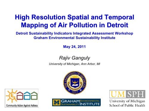
High Resolution Spatial and Temporal<br />
Mapping <strong>of</strong> Air Pollution in Detroit<br />
Detroit <strong>Sustainability</strong> Indicators Integrated Assessment Workshop<br />
<strong>Graham</strong> Environmental <strong>Sustainability</strong> <strong>Institute</strong><br />
May 24, 2011<br />
Rajiv Ganguly<br />
<strong>University</strong> <strong>of</strong> Michigan, Ann Arbor, MI
Outline<br />
Review <strong>of</strong> Objectives<br />
Air Quality Models<br />
AERMOD<br />
AERLINE<br />
Air Quality Modelling<br />
AERMOD : Point Sources, Road Sources<br />
AERLINE : Sensitivity Analysis
Objectives <strong>of</strong> project<br />
Map and analyze ambient air pollutant concentrations for<br />
Detroit at high spatial and temporal resolution<br />
Provide a database containing this information to Data Driven<br />
Detroit (DDD), allowing its use for a wide variety <strong>of</strong> purposes.<br />
• Use state-<strong>of</strong>-the-art simulation models<br />
• Predict concentrations <strong>of</strong> two key pollutants, particulate<br />
matter under 2.5 μm aerodynamic diameter (PM 2.5 ) and<br />
nitrogen oxides (NO x )<br />
• Use spatially dense grid and daily basis for calendar year<br />
2010
Modeling approach<br />
Meteorological<br />
conditions<br />
Regional<br />
Background<br />
concentrations <strong>of</strong><br />
pollutants<br />
Field<br />
Measurements<br />
Source data:<br />
-site description<br />
-emission rate<br />
Atmospheric<br />
dispersion<br />
model<br />
Prediction <strong>of</strong><br />
ground level<br />
concentration<br />
<strong>of</strong> pollutants<br />
Model/Measurement<br />
Synthesis<br />
Model options:<br />
-receptor grid<br />
-dispersion<br />
parameters<br />
Local<br />
topographical<br />
features<br />
Assessment <strong>of</strong><br />
potential<br />
environmental<br />
and health<br />
factors<br />
Refined<br />
Concentration<br />
estimates
Atmospheric Dispersion models - AERMOD<br />
Steady state Gaussian plume model<br />
Uses Planetary Boundary Layer (PBL) technology<br />
Estimates the impacts from a variety <strong>of</strong> industrial sources<br />
Improvement over the ISC model<br />
Pre-processors – AERMET and AERMAP<br />
Rural and urban areas<br />
Simple as well as complex terrain<br />
Accounts for different source types: (i) Surface and elevated sources (ii)<br />
Multiple sources – point, area and volume sources<br />
Concentration distribution in stable boundary layer (SBL): Gaussian in<br />
both vertical and horizontal directions<br />
Concentration distribution in convective boundary layer (CBL): horizontal<br />
distribution is assumed Gaussian but vertical distribution is described<br />
with bi-Gaussian function<br />
Plume penetrates through the elevated boundary layer and re-enters<br />
into the boundary layer.<br />
This model accounts for the vertical inhomogeneity <strong>of</strong> the PBL
AERMOD – Inputs for Point Sources<br />
Source data : Point Source Emission Inventory (NEI2008)<br />
Receptor and Terrain data: Receptor grid as specified (26 * 26 = 676<br />
receptors at 500m spacing. Terrain conditions are assumed as ‘flat’.<br />
Meteorological data: Detroit Airport Data for 2010
Detroit – Map <strong>of</strong> Study Area
AERMOD – Point Sources (NOx)<br />
Number <strong>of</strong> Point Sources – 399. Maximum Annual Average<br />
Concentration = 114.37ug/m3
AERMOD – Point Sources (NOx)
AERMOD – Point Sources (PM2.5)<br />
Number <strong>of</strong> Point Sources – 837. Maximum Annual Average<br />
Concentration = 5.84ug/m3
AERMOD – Point Sources (PM2.5)
AERMOD – Road Sources
Atmospheric Dispersion models - AERLINE<br />
Steady state Gaussian plume model<br />
Uses PBL technology similar to AERMOD<br />
Estimates the impacts from a variety <strong>of</strong> road sources<br />
Improvement over the AERMOD<br />
Pre-processors – AERMET and AERMAP<br />
Additional algorithms used in AERLINE for predicting concentrations from<br />
road sources<br />
Uses an additional component <strong>of</strong> ‘meandering’ to predict concentrations<br />
for both ‘upwind’ and ‘downwind’ conditions<br />
The AERLINE model is capable <strong>of</strong> handling different types <strong>of</strong> road (at<br />
grade, below grade, elevated)<br />
It is still a research model being further evaluated by EPA
AERLINE – Test Case Scenario<br />
Sensitivity Analysis <strong>of</strong> Model for following conditions were<br />
carried out:<br />
1. Road Gradient at -6 m (below grade), 0 m (at grade) and +6 m<br />
(above grade)<br />
2. Wind Speeds <strong>of</strong> 1, 2, 4, 6, 8, 10 and 12m/s<br />
3. Wind Direction <strong>of</strong> 0-90 degrees in 10 degrees interval
AERLINE – Test Case Scenario<br />
Road<br />
(0, 500)<br />
Receptors placed at 10 m distances up<br />
to 500 m on either side <strong>of</strong> road<br />
(-500, 0)<br />
Transect<br />
(0, 0)<br />
(500, 0)<br />
(0, -500)
AERLINE – Test Case Scenario<br />
Input Data for Modelling<br />
• Road Source Coordinates <strong>of</strong> (0,-500, 1) to (0, 500, 1)<br />
• Receptor Coordinates <strong>of</strong> (10, 0, 1.8) to (500, 0, 1.8)<br />
• Emission factor <strong>of</strong> 1 gm/km (0.001 gm/m)<br />
• Distance from C/L = 0<br />
• Initial Dispersion = 1.00 (after discussion with EPA)<br />
• Height <strong>of</strong> barrier = -1 (same value as used by EPA)<br />
• Distance <strong>of</strong> barrier = 0<br />
• Depth <strong>of</strong> Depression = -6 (below gradient), -3 (below gradient), 0 (road at grade)<br />
• Width at top <strong>of</strong> Depression = 50 (below gradient), 0 (at grade)<br />
• Width at bottom <strong>of</strong> Depression = 40 (below gradient), 0 (at grade)<br />
• Heat flux = -41<br />
• Friction Velocity = 0.1*wind speed<br />
• Convective Velocity = 0<br />
• Vertical potential temperature gradient = -9
AERLINE – Test Case Scenario<br />
Input Data for Modelling (Continued)<br />
• Height <strong>of</strong> Convectively generated boundary layer = -999<br />
• Height <strong>of</strong> Mechanically generated boundary layer = 2300*(WS)^1.5<br />
• Monin-Obhukov Length = 1000m<br />
• Surface Roughness Length = 0.25<br />
• Bowen Ratio – 1.4<br />
• Albedo = 1<br />
• Wind Speed = 4 m/s<br />
• Wind direction = 90 degrees<br />
• Height at which WS was measured = 6.1m<br />
• Temperature = 284K<br />
• Height at which temp was measure = 2.0m<br />
• Sigma-z (Vertical Dispersion Curve) = PG<br />
• Wind Speed Pr<strong>of</strong>iling - A<br />
• Meandering - Y
Concentrations<br />
Predicted Concentrations on Road Transect<br />
1000<br />
AERLINE_Grade<br />
100<br />
10<br />
At grade<br />
below grade_6_50_40<br />
below grade_3_50_40<br />
1<br />
-500-450-400-350-300-250-200-150-100 -50 0 50 100 150 200 250 300 350 400 450 500<br />
0<br />
0<br />
Distance from road
Concentrations<br />
Predicted Concentrations on Road Transects<br />
1000<br />
100<br />
10<br />
AERLINE_WS<br />
WS_1<br />
WS_2<br />
WS_4<br />
WS_6<br />
WS_8<br />
WS_10<br />
WS_12<br />
1<br />
-500-450-400-350-300-250-200-150-100 -50 0 50 100 150 200 250 300 350 400 450 500<br />
0.1<br />
0.01<br />
Distance from road
Concentrations<br />
Predicted Concentrations on Road Transect<br />
AERLINE_WD_M<br />
1000<br />
100<br />
10<br />
WD_90<br />
WD_80<br />
WD_70<br />
WD_60<br />
WD_50<br />
WD_40<br />
WD_30<br />
WD_20<br />
WD_10<br />
WD_0<br />
1<br />
-500-450-400-350-300-250-200-150-100 -50 0 50 100 150 200 250 300 350 400 450 500<br />
0.1<br />
0.01<br />
Distance from road
Discussion<br />
‣ Two Atmospheric Dispersion Models (AERMOD and AERLINE) have<br />
been considered.<br />
‣ The AERMOD model has been set-up to calculate contributions from<br />
point sources. Trial runs have already been conducted with predicted<br />
concentrations in ‘reasonable ranges’.<br />
‣ The AERMOD model has been set up for predicting<br />
concentrations from road sources<br />
‣ Sensitivity Analysis <strong>of</strong> AERLINE model has been carried<br />
out.<br />
‣ Further studies are being conducted on AERLINE model to<br />
refine the model predictions
Partners<br />
Arab Community Center for Economic and Social<br />
Services (ACCESS)<br />
Community Health and Social Services Center<br />
(CHASS)<br />
Detroit Department <strong>of</strong> Health and Wellness Promotion<br />
Detroit Hispanic Development Corporation (DHDC)<br />
Detroiters Working for Environmental Justice<br />
Friends <strong>of</strong> Parkside<br />
Henry Ford Health System<br />
Latino Family Services<br />
Warren Conner Development Coalition<br />
<strong>University</strong> <strong>of</strong> Michigan School <strong>of</strong> Public Health (EHS,<br />
HB/HE, Biostatistics)<br />
<strong>University</strong> <strong>of</strong> Michigan School <strong>of</strong> Medicine (Pediatrics)
Thank You