2010 - The Canadian Association of Geographers
2010 - The Canadian Association of Geographers
2010 - The Canadian Association of Geographers

Create successful ePaper yourself
Turn your PDF publications into a flip-book with our unique Google optimized e-Paper software.
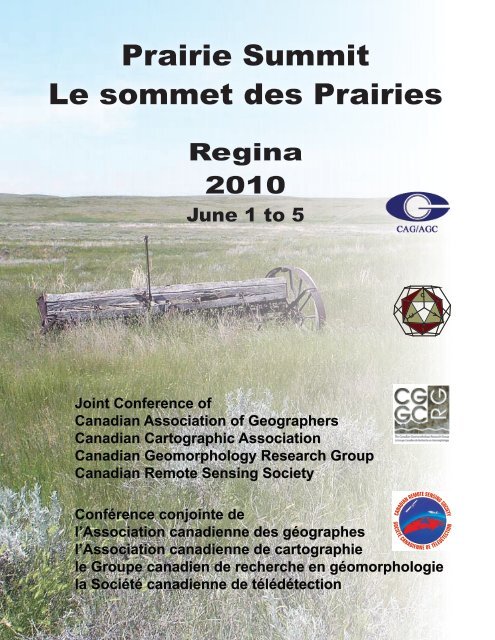
Prairie Summit<br />
Le sommet des Prairies<br />
Regina<br />
<strong>2010</strong><br />
June 1 to 5<br />
Joint Conference <strong>of</strong><br />
<strong>Canadian</strong> <strong>Association</strong> <strong>of</strong> <strong>Geographers</strong><br />
<strong>Canadian</strong> Cartographic <strong>Association</strong><br />
<strong>Canadian</strong> Geomorphology Research Group<br />
<strong>Canadian</strong> Remote Sensing Society<br />
Conférence conjointe de<br />
l’<strong>Association</strong> canadienne des géographes<br />
l’<strong>Association</strong> canadienne de cartographie<br />
le Groupe canadien de recherche en géomorphologie<br />
la Société canadienne de télédétection
Prairie Summit <strong>2010</strong><br />
University <strong>of</strong> Regina Campus<br />
Wascana Lake<br />
N<br />
University Drive North<br />
Downtown<br />
Wascana Parkway<br />
University Drive West<br />
LB<br />
DC<br />
RIC<br />
CL<br />
LY<br />
AH<br />
NR<br />
SR<br />
LI<br />
CM<br />
P<br />
LC<br />
University Drive East<br />
FNUC<br />
CW<br />
CK<br />
RC<br />
ED<br />
IS<br />
2R<br />
HP<br />
University Drive South<br />
Trans Canada Highway Winnipeg<br />
SDCL<br />
PT<br />
IT<br />
GG<br />
Trans Canada Highway<br />
Moose Jaw<br />
© Department <strong>of</strong> Geography, <strong>2010</strong><br />
Conference Buildings<br />
CK - Centre for Kinesiology, Health and Sport:<br />
Public Gym<br />
CL - Classroom Building:<br />
Registration<br />
Paper Sessions<br />
Suzanne Mackenzie Memorial Lecture<br />
E-mail and Internet Access<br />
LB - Laboratory Building:<br />
Poster Sessions<br />
C<strong>of</strong>fee Breaks<br />
NR - North Residence<br />
RC - Dr. William Riddell Centre:<br />
Opening Icebreaker<br />
President’s Welcome<br />
RIC - Research and Innovation Centre:<br />
Wiley Lecture<br />
U <strong>of</strong> R Department <strong>of</strong> Geography Reception<br />
P<br />
Information/<br />
Registration Desk<br />
Bus Stop/<br />
Meeting Point for the Field Trips<br />
Orienteering Challenge<br />
Parking<br />
Visitor Parking<br />
Other Buildings<br />
AH - Administration - Humanities<br />
CM - Campion College<br />
CW - College West<br />
DC - Day Care<br />
ED - Education Building<br />
FNUC - First Nations University <strong>of</strong> Canada<br />
GG - Greenhouse Gas Technology Centre (GGTC)<br />
HP - Heating Plant Building<br />
IS - ISM Canada<br />
IT - <strong>The</strong> Terrace<br />
LC - Luther College<br />
LI - Language Institute<br />
LY - Dr. John Archer Library<br />
PT - Petroleum Technology Research Centre (PTRC)<br />
SDCL - Saskatchewan Disease Control Laboratory<br />
SR - South Residence<br />
2R - Two Research Drive<br />
i
Table <strong>of</strong> Contents<br />
Maps / les cartes<br />
Welcome / accueil<br />
i<br />
Social Events / événements sociaux<br />
ix<br />
Schedule / le calendrier 1<br />
Program / programme 11<br />
Tuesday June 1 / Mardi 1 juin 11<br />
Wednesday June 2 / Mercredi 2 juin 15<br />
Thursday June 3 / Jeudi 3 juin 31<br />
Friday June 4 / Vendredi 4 juin 51<br />
Saturday June 5 / Samedi 5 juin 61<br />
Abstracts / les résumés 69<br />
Sponsors / les sponsors<br />
Notes
Il me fait plaisir de souhaiter la bienvenue à<br />
tous les participants au Sommet des Prairies,<br />
une conférence internationale organisée par<br />
l’Université de Régina.<br />
I take the opportunity to welcome delegates <strong>of</strong><br />
the international “Prairie Summit” conference to<br />
the University <strong>of</strong> Regina.<br />
This major conference will<br />
span a wide range <strong>of</strong> important<br />
areas and for the first time<br />
draw together representatives<br />
<strong>of</strong> the <strong>Canadian</strong> <strong>Association</strong><br />
<strong>of</strong> <strong>Geographers</strong>, the <strong>Canadian</strong><br />
Remote Sensing Society,<br />
the <strong>Canadian</strong> Cartographic<br />
<strong>Association</strong> and the <strong>Canadian</strong><br />
Geomorphology Research<br />
Group. Over the course <strong>of</strong><br />
this important gathering, we<br />
encourage your open dialogue,<br />
debate and participation in<br />
all aspects <strong>of</strong> the Summit’s<br />
programming and scheduled<br />
activities. Further, we encourage<br />
you to take some time within<br />
your busy schedule to celebrate<br />
your colleagues’ accomplishments and enjoy<br />
every aspect <strong>of</strong> our beautiful campus and<br />
community within this welcoming prairie<br />
environment.<br />
Un très grand nombre de sujets d’importance<br />
majeure seront abordés à l’occasion de cette<br />
conférence de premier plan qui réunit pour la<br />
première fois des membres de l’<strong>Association</strong><br />
canadienne des géographes, de la Société<br />
canadienne de télédétection, de l’<strong>Association</strong><br />
canadienne de cartographie et du Groupe<br />
canadien de recherche en géomorphologie.<br />
Nous espérons que vous saurez pr<strong>of</strong>iter, tout<br />
au long de la rencontre, de cet<br />
espace de dialogues et d’échanges<br />
et que vous pourrez vous<br />
impliquer dans toutes les étapes<br />
de l’organisation du programme<br />
du Sommet et des activités qui s’y<br />
dérouleront. Nous vous conseillons<br />
également de prévoir dans votre<br />
emploi du temps surchargé une<br />
place pour rendre hommage aux<br />
réalisations de vos collègues et<br />
de pr<strong>of</strong>iter de la beauté de notre<br />
campus et de l’accueil chaleureux<br />
qui vous attend dans les Prairies.<br />
Permettez-moi en terminant de<br />
vous adresser mes félicitations<br />
pour la tenue de cet événement<br />
d’envergure internationale.<br />
Congratulations on an important international<br />
initiative.<br />
Vianne Timmons<br />
President and Vice-Chancellor / Rectrice et vice chancelière<br />
i
Conference Welcome from the President <strong>of</strong> the <strong>Canadian</strong> <strong>Association</strong> <strong>of</strong> <strong>Geographers</strong><br />
Mot de bienvenue du président de l’<strong>Association</strong> canadienne des géographes<br />
Dear Prairie<br />
Summit Participants:<br />
As President <strong>of</strong> the <strong>Canadian</strong> <strong>Association</strong> <strong>of</strong><br />
<strong>Geographers</strong>, it is my pleasure to welcome you<br />
to the <strong>2010</strong> Annual Meeting <strong>of</strong> the <strong>Canadian</strong><br />
<strong>Association</strong> <strong>of</strong> <strong>Geographers</strong>.<br />
This year’s conference is being hosted by the<br />
Department <strong>of</strong> Geography at the University <strong>of</strong><br />
Regina and will draw attendance from geographers<br />
from all over the world. We are fortunate in that our<br />
meeting is being held in conjunction with the annual<br />
meetings <strong>of</strong> the <strong>Canadian</strong> Cartographic <strong>Association</strong>,<br />
the <strong>Canadian</strong> Geomorphology Research Group and<br />
the <strong>Canadian</strong> Remote Sensing Society.<br />
Speakers representing a breadth <strong>of</strong> interests<br />
will present and discuss the latest topics in their<br />
research fields. Student presentations are an<br />
important component <strong>of</strong> our annual meetings,<br />
and it is delightful to see representation from so<br />
many locations. I am sure that<br />
the conference will provide many<br />
opportunities for exchanging ideas<br />
on your research adventures and<br />
for forging new collaborations.<br />
This week-long conference would<br />
not have been possible without<br />
the sustained dedication <strong>of</strong> the many individuals<br />
involved with the Local Organizing Committee.<br />
Thanks for your commitment to this task and for<br />
the efforts made to ensure the success <strong>of</strong> the<br />
conference.<br />
Enjoy your visit to Regina and have fun at our Prairie<br />
Summit.<br />
À tous les participants au Sommet des Prairies,<br />
En tant que président de l’<strong>Association</strong> canadienne<br />
des géographes, j’ai le plaisir de vous souhaiter la<br />
bienvenue au Congrès annuel <strong>2010</strong> de l’<strong>Association</strong><br />
canadienne des géographes.<br />
Cette année, la conférence est organisée par le<br />
Département de géographie de l’Université de<br />
Régina et sera l’occasion de réunir des géographes<br />
venus de partout dans le monde sous un même<br />
toit. Nous sommes privilégiés de pouvoir tenir notre<br />
réunion conjointement avec celles de l’<strong>Association</strong><br />
canadienne de cartographie, du Groupe canadien<br />
de recherche en géomorphologie et de la Société<br />
canadienne de télédétection.<br />
Les travaux des conférenciers reflètent un vaste<br />
éventail d’intérêts et vont aborder et traiter<br />
les questions d’actualité qui correspondent à<br />
leurs domaines de recherche. Nos congrès<br />
annuels laissent une grande place<br />
aux présentations des étudiants, et je<br />
suis ravi de constater à quel point ils<br />
proviennent de différents endroits. La<br />
conférence vous ouvrira sans doute de<br />
nombreuses perspectives de recherche de<br />
même que des possibilités de nouvelles<br />
collaborations.<br />
Je termine en soulignant le dévouement soutenu<br />
dont les membres du comité d’organisation local<br />
ont fait preuve, et sans lequel la tenue de cette<br />
conférence d’une durée d’une semaine n’aurait<br />
jamais eu lieu. Merci de votre collaboration et pour<br />
tous les efforts déployés afin d’assurer la réussite de<br />
la conférence.<br />
N’oubliez pas de pr<strong>of</strong>iter de votre séjour à Régina et<br />
de vous amuser durant notre Sommet des Prairies.<br />
Dan Smith<br />
President, <strong>Canadian</strong> <strong>Association</strong> <strong>of</strong> <strong>Geographers</strong> / Président, <strong>Association</strong> canadienne des géographes<br />
ii
Welcome from the CCA President<br />
Dear cartographic colleagues:<br />
In June <strong>2010</strong>, the <strong>Canadian</strong><br />
Cartographic <strong>Association</strong> will<br />
hold its annual conference in<br />
Regina, Saskatchewan. This is an opportunity to<br />
keep abreast with the latest scientific and technical<br />
developments in cartography and GIS. In 1975, I<br />
read how the capacity <strong>of</strong> cartography to keep up<br />
with technical and mechanical production <strong>of</strong> maps,<br />
raised many issues for producers and readers<br />
alike. Today, those issues continue, and with the<br />
production <strong>of</strong> maps, <strong>of</strong>ten by non-cartographers<br />
in the GIS realm, we must<br />
constantly be on guard<br />
concerning the design and<br />
readability <strong>of</strong> maps.<br />
Regardless, the conference<br />
provides the likelihood <strong>of</strong><br />
meeting and interacting with<br />
our colleagues in Geography,<br />
Remote Sensing, and<br />
Geomorphology. That is, the<br />
conference at the University<br />
<strong>of</strong> Regina provides the<br />
opportunity, for the first time,<br />
for the activities <strong>of</strong> the CCA<br />
to be showcased together<br />
with the CAG, CRSS, and the CGRG.<br />
<strong>The</strong> following tentative sessions are planned for<br />
the CCA within the conference: Special Session:<br />
<strong>The</strong> Last 25 Years <strong>of</strong> Mapping; and General<br />
Sessions: Historical Cartography, Technology and<br />
Cartography, Geographic/Cartographic Data Bases,<br />
Applied GIS, and Data Analysis and Simulation<br />
using GIS. I would like to say at this time that this<br />
meeting will be a success because <strong>of</strong> the hard work<br />
<strong>of</strong> a good many people who have been involved for<br />
a year in the preparation and organization <strong>of</strong> this<br />
meeting, and I think they have done an outstanding<br />
job. On behalf <strong>of</strong> the CCA, I welcome you to the<br />
Prairie Summit in Regina, the 24th conference <strong>of</strong> the<br />
CCA. I look forward to seeing you in Saskatchewan<br />
in June.<br />
Chers collègues cartographes,<br />
L’<strong>Association</strong> canadienne de cartographie tiendra<br />
sa conférence annuelle à Régina, Saskatchewan<br />
en juin <strong>2010</strong>. Cette conférence est l’occasion de<br />
se tenir au courant des progrès scientifiques et<br />
techniques récents en matière de cartographie<br />
et de SIG. En 1975, je me souviens avoir lu que<br />
le potentiel de la cartographie de s’adapter à<br />
l’évolution constante des processus techniques et<br />
mécaniques de réalisation des cartes avait suscité<br />
de nombreuses questions auprès des concepteurs<br />
et lecteurs. Ces questions sont toujours d’actualité<br />
et, compte tenu que les cartes<br />
sont souvent réalisées par des<br />
personnes spécialisées en SIG<br />
mais qui n’ont suivi aucune<br />
formation en cartographie, nous<br />
devons donc rester vigilants<br />
concernant la conception et la<br />
lisibilité des cartes.<br />
Malgré tout, la conférence <strong>of</strong>fre<br />
la perspective de rencontrer et<br />
d’interagir avec nos collègues<br />
en géographie, télédétection<br />
et géomorphologie. C’est donc<br />
sur le campus de l’Université<br />
de Régina que se dérouleront<br />
conjointement et pour la première fois les activités<br />
de l’ACC, l’ACG, la SCT et du GCRG.<br />
Dans le cadre de cette conférence, l’ACC envisage<br />
de tenir des séances autour de nombreux thèmes.<br />
À titre indicatif, une séance spéciale sera consacrée<br />
aux 25 dernières années de la cartographie; les<br />
séances générales porteront sur la cartographie<br />
historique, la technologie et la cartographie, les<br />
bases de données géographiques/cartographiques,<br />
les SIG appliqués, l’utilisation des SIG dans<br />
l’analyse des données et les simulations. Au sujet de<br />
la conférence, je tiens à vous dire qu’elle connaîtra<br />
sans doute un vif succès grâce au travail infatigable<br />
de nombreuses personnes qui ont participé<br />
activement pendant un an à la préparation et à<br />
l’organisation de cette réunion. Elles ont fourni un<br />
travail exemplaire qui a porté ses fruits. Je voudrais<br />
vous souhaiter la bienvenue au nom de l’ACC au<br />
Sommet des Prairies lors de la 24e conférence de<br />
l’ACC. Au plaisir de vous voir en grand nombre en<br />
Saskatchewan au mois de juin prochain.<br />
Daniel Cole<br />
President, <strong>Canadian</strong> Cartographic <strong>Association</strong> / Président, <strong>Association</strong> canadienne de cartographie<br />
iii
CGRG President’s Welcome/Mot de bienvenue du président du GCRG<br />
<strong>The</strong> Prairies get a bad rap when it<br />
comes to geomorphology. At some<br />
point in the world <strong>of</strong> popular opinion<br />
it was decided that the flatness<br />
<strong>of</strong> the Agassiz plain captured the<br />
landscape <strong>of</strong> the Prairies. But it does not. And<br />
this year, with the annual general meeting <strong>of</strong> the<br />
<strong>Canadian</strong> Geomorphology Research Group (CGRG)<br />
being held as part <strong>of</strong> the Prairie Summit, our mission<br />
is to make sure when you leave Regina at the end<br />
<strong>of</strong> the week you appreciate something more about<br />
the remarkable landscape that characterizes the<br />
Prairies, and southern Saskatchewan in particular.<br />
<strong>The</strong> organizing committee<br />
has put together a strong<br />
program including three<br />
great field trips capturing<br />
the diverse landscape,<br />
natural and human history<br />
<strong>of</strong> southern Saskatchewan;<br />
including trips to the<br />
Avonlea Badlands,<br />
Qu’Appelle Valley, and a<br />
two day trip into Palliser’s<br />
Triangle with stops in<br />
the Great Sand Hills and<br />
Cypress Hills. I hope<br />
you will be able to take<br />
in at least one <strong>of</strong> these<br />
trips. As well, the CGRG is sponsoring two special<br />
sessions during the meeting, Advances in <strong>Canadian</strong><br />
Dendrochronology (Dan Smith and Ze’ev Gedal<strong>of</strong>)<br />
and Eolian Processes in the mid to high latitudes<br />
(Stephen Wolfe and myself), and general sessions<br />
in fluvial and coastal geomorphology.<br />
This year’s annual general meeting will be held on<br />
Saturday June 5th at noon, and include lunch. And<br />
while our organization remains strong, and a lively<br />
presence at meetings across Canada, we face<br />
challenges in the coming years that can only be met<br />
by an active membership. I encourage you to attend<br />
the annual meeting and to get involved with the<br />
organization.<br />
Duane Froese<br />
Les Prairies ont mauvaise presse en matière de<br />
géomorphologie. Une idée très répandue dans<br />
l’univers de l’opinion publique est que le relief plat de<br />
la région du lac Agassiz représente essentiellement<br />
le paysage des Prairies. Or, cela n’est pas vrai.<br />
Comme le Groupe canadien de recherche en<br />
géomorphologie tient cette année son assemblée<br />
générale annuelle dans le cadre du Sommet des<br />
Prairies, nous nous sommes donnés pour mission<br />
de faire en sorte que vous aurez eu la chance lors<br />
de votre passage à Régina de mieux apprécier<br />
certains éléments du paysage remarquable qui<br />
constituent les Prairies et le sud de la Saskatchewan<br />
en particulier.<br />
Le comité organisateur a<br />
préparé un programme<br />
bien ficelé dans lequel sont<br />
proposées trois excursions<br />
qui donnent une bonne<br />
représentation de la diversité<br />
du paysage et de l’histoire<br />
naturelle et humaine du sud<br />
de la Saskatchewan : les<br />
Badlands d’Avonlea, la Vallée<br />
Qu’Appelle et une sortie de<br />
deux jours dans le Triangle<br />
de Palliser dont l’itinéraire<br />
comprend des visites des<br />
Collines Great Sand et<br />
Collines Cypress. Je vous souhaite de participer à<br />
au moins une de ces excursions. Par ailleurs, sous<br />
les auspices du GCRG, deux séances spéciales<br />
sont au programme du congrès et portent sur les<br />
thèmes suivants : les progrès dans le domaine<br />
de la dendrochronologie au Canada (présidée<br />
par Dan Smith et Ze’ev Gedal<strong>of</strong>) et les processus<br />
éoliens aux latitudes moyennes et élevées<br />
(présidée par Stephen Wolfe et moi-même). Nous<br />
abordons les sujets de la géomorphologie fluviale<br />
et la géomorphologie côtière au cours de séances<br />
générales.<br />
L’assemblée générale annuelle se déroule cette<br />
année le samedi 5 juin à compter de midi et un<br />
repas sera servi. Présentement, notre organisation<br />
se porte bien et les réunions organisées un peu<br />
partout au Canada sont très animées, mais les défis<br />
des prochaines années auxquels nous sommes<br />
confrontés ne peuvent être surmontés que si nous<br />
pouvons compter sur des membres actifs. Je vous<br />
invite donc à participer à l’assemblée générale<br />
annuelle et aussi à vous engager dans la vie de<br />
l’organisation.<br />
President <strong>Canadian</strong> Geomorphology Research Group / Président du Groupe canadien de recherche<br />
en géomorphologie<br />
iv
<strong>Canadian</strong> Remote Sensing Society President’s Welcome<br />
It is my great pleasure to give a warm<br />
welcome to all delegates attending<br />
the 31st <strong>Canadian</strong> Symposium on<br />
Remote Sensing – the <strong>2010</strong> Prairie<br />
Summit – and would like to take<br />
this opportunity to address my thanks to the<br />
University <strong>of</strong> Regina for hosting this event. I wish<br />
you all a pleasant and fruitful week. As you know,<br />
this is the first ever joint meeting <strong>of</strong> the <strong>Canadian</strong><br />
<strong>Association</strong> <strong>of</strong> <strong>Geographers</strong> (CAG), the <strong>Canadian</strong><br />
Cartographic <strong>Association</strong> (CCA), the <strong>Canadian</strong><br />
Geomorphology Research Group (CGRG) and<br />
the <strong>Canadian</strong> Remote Sensing Society (CRSS).<br />
On this note, let me highlight<br />
the keen participation in this<br />
year’s symposium by many <strong>of</strong><br />
the members <strong>of</strong> the <strong>Canadian</strong><br />
Remote Sensing Society.<br />
<strong>The</strong> conference program<br />
includes a range <strong>of</strong> topics<br />
covering everything from Native<br />
education, urban or economic<br />
geography, water resource<br />
management in the Prairies,<br />
progress in dendrochronology,<br />
GIS-based approaches, and<br />
the use <strong>of</strong> LiDAR or RADAR<br />
captors. This is only a partial<br />
list. <strong>The</strong> sessions are open to all delegates from<br />
any disciplinary background. Aimed at exploring<br />
and sharing ideas, tools and information, they will<br />
also provide you with a rare opportunity to engage<br />
with colleagues. This meeting will help strengthen<br />
our research and teaching base that will provide<br />
knowledge and skills to our future geographers,<br />
GIS and remote sensing specialists. As ecological<br />
and social systems rapidly evolve, the next<br />
generation must contribute towards a sustainable<br />
economy in Canada and elsewhere in the world.<br />
I would like to <strong>of</strong>fer my thanks to all members <strong>of</strong> the<br />
Geography Department at the University <strong>of</strong> Regina<br />
who contributed to this event organized under the<br />
leadership <strong>of</strong> Pr<strong>of</strong>essor Joe Piwowar and with the<br />
full support <strong>of</strong> the four executive committees. In<br />
addition to hosting a multidisciplinary conference,<br />
the organising committee has prepared numerous<br />
field trips in various locations <strong>of</strong> Saskatchewan and<br />
evening social events to enjoy during your stay.<br />
Il me fait plaisir de souhaiter une agréable et<br />
fructueuse semaine à tous les congressistes<br />
participant au 31e Symposium canadien de<br />
télédétection – le Sommet des Prairies <strong>2010</strong> – et<br />
de remercier l’Université de Régina de l’accueillir<br />
sous son toit. Ce symposium est la première<br />
rencontre conjointe de l’<strong>Association</strong> canadienne des<br />
géographes (ACG), de l’<strong>Association</strong> canadienne<br />
de cartographie (ACC), du Groupe canadien de<br />
recherche en géomorphologie (GCRG) et de<br />
la Société canadienne de télédétection (SCT).<br />
J’aimerais d’ailleurs souligner la participation<br />
enthousiaste au rendez-vous de plusieurs<br />
membres de la Société canadienne de<br />
télédétection.<br />
Le programme scientifique aborde<br />
à la fois des thèmes aussi divers<br />
que l’éducation des aborigènes, la<br />
géographie urbaine ou économique,<br />
la gestion de la ressource en eau<br />
dans les Prairies, les avancées de la<br />
dendrochronologie, les applications des<br />
SIG, et celles des capteurs LiDAR ou<br />
RADAR, pour en nommer que quelques<br />
uns. Toutes les sessions étant ouvertes<br />
à tous les congressistes quelque soit<br />
leur appartenance, c’est une occasion<br />
unique de faire connaissance et de<br />
partager idées, outils et information. Cette rencontre<br />
ne peut que dynamiser nos travaux de recherche<br />
et nos enseignements afin de mieux répondre à la<br />
formation des géographes, des géomaticiens et des<br />
spécialistes en télédétection de demain. La future<br />
génération devra en effet assurer un développement<br />
économique durable dans des environnements<br />
naturels et sociaux en mouvance tant au Canada<br />
qu’ailleurs sur la planète.<br />
J’aimerais aussi remercier les membres du<br />
Département de Géographie de l’Université de<br />
Régina d’avoir initié et organisé sous le leadership<br />
du pr<strong>of</strong>esseur Joe Piwowar et en complicité avec<br />
les quatre exécutifs cet évènement. En plus d’un<br />
programme scientifique multidisciplinaire, ils nous<br />
ont préparé des excursions dans plusieurs régions<br />
de la Saskatchewan, et des soirées animées dont<br />
j’espère vous pr<strong>of</strong>iterez tous et chacun.<br />
Joyeux Sommet!<br />
Have a delightful Summit!<br />
Monique Bernier<br />
President, <strong>Canadian</strong> Remote Sensing Society / Présidente de la Société canadienne de télédétection<br />
v
Welcome to Prairie Summit <strong>2010</strong><br />
<strong>The</strong> Department <strong>of</strong> Geography is pleased<br />
to host Prairie Summit. For the first time,<br />
partcipants from four<br />
pr<strong>of</strong>essional associations -<br />
the <strong>Canadian</strong> <strong>Association</strong><br />
<strong>of</strong> Geograpghers, <strong>Canadian</strong><br />
Cartographic <strong>Association</strong>,<br />
<strong>Canadian</strong> Geomorphology<br />
Research Group, and<br />
<strong>Canadian</strong> Remote Sensing<br />
Society – are meeting<br />
under the umbrella <strong>of</strong> a<br />
common banner. This happy<br />
circumstance has generated<br />
well over 400 paper and<br />
poster presentations on an<br />
amazingly wide range <strong>of</strong> topics<br />
which we hope will provide<br />
ample opportunity to sample<br />
and contribute to scholarly<br />
discourse.<br />
Prairie Summit has attracted participants from<br />
11 countries spanning five continents. We<br />
welcome you to Regina and trust you will take<br />
a little time to explore our city and perhaps<br />
participate in one <strong>of</strong> the field trips we have<br />
planned.<br />
Bienvenue à tous les participants au Sommet<br />
des Prairies <strong>2010</strong><br />
Le Département de géographie<br />
est heureux de vous accueillir<br />
au Sommet des Prairies. Il s’agit<br />
de la première fois que quatre<br />
associations pr<strong>of</strong>essionnelles<br />
– l’<strong>Association</strong> canadienne<br />
des géographes, l’<strong>Association</strong><br />
canadienne de cartographie, le<br />
Groupe canadien de recherche<br />
en géomorphologie et la Société<br />
canadienne de télédétection<br />
– décident de se réunir sous<br />
une même bannière. Dans<br />
ces conditions idéales, plus de<br />
400 communications orales et<br />
affichées sont au programme et<br />
porteront sur une étonnamment<br />
vaste gamme de sujets qui, nous l’espérons,<br />
vous donnneront la possibilité d’être au coeur<br />
des débats académiques.<br />
Les participants au Sommet des Prairies sont<br />
issus de 11 pays répartis sur cinq continents.<br />
Nous vous souhaitons la bienvenue à Régina<br />
et n’oubliez pas de pr<strong>of</strong>iter de votre séjour<br />
pour explorer la ville et de vous inscrire à<br />
l’une ou l’autre des excursions que nous vous<br />
proposons.<br />
Bernard D. Thraves<br />
Head, Department <strong>of</strong> Geography / Chef, Département de géographie<br />
vi
Organizing Committee / Les membres du Comité organisateur<br />
CAG / ACG Randy Widdis and Bernard Thraves<br />
CCA / ACC Julia Siemer<br />
CGRG / GCRG Kyle Hodder<br />
CRSS / SCT Joe Piwowar<br />
Administration / secrétaire Gina Holm<br />
<strong>The</strong> Department <strong>of</strong> Geography at the University <strong>of</strong> Regina takes great pleasure in<br />
welcoming you to <strong>The</strong> Prairie Summit. Our goal has been to create a forum that fosters a<br />
unique synergy among members <strong>of</strong> the cartography, geography, geomorphology and<br />
remote sensing communities. Such an ambitious objective has meant that we have had<br />
to think 'beyond the box', a difficult task given the small number <strong>of</strong> people in our<br />
department and the lack <strong>of</strong> guidelines for hosting joint meetings from which we could<br />
derive some direction. Nevertheless, we persevered and we hope that the end product<br />
meets your expectations.<br />
Other members and friends <strong>of</strong> the Department who made important contributions to the<br />
conference include Louis Awanyo, Mark Coté, Janis Dale, Emily Eaton, Ulrike<br />
Hardenbicker, Robert Knox, Marilyn Lewry, Alec Paul, Linda Paul and Dave Sauchyn.<br />
Le Département de géographie de l’Université de Régina est très heureux de vous<br />
souhaiter la bienvenue au Sommet des Prairies. Le but que nous nous sommes fixé est<br />
de créer un lieu d’échanges et de collaboration favorisant les interactions entre des<br />
spécialistes en cartographie, géographie, géomorphologie et en télédétection. C’est en<br />
« sortant des sentiers battus » que nous avons été en mesure d’atteindre cet objectif<br />
ambitieux. Le défi était de taille pour plusieurs raisons dont le fait que nous sommes peu<br />
nombreux au département et que nous n’avions aucun guide à notre disposition pour<br />
nous aider dans l’organisation d’une telle conférence conjointe. Quoiqu’il en soit, en<br />
faisant preuve de persévérance, nous en sommes arrivés à ce résultat qui, nous<br />
l’espérons, saura répondre à vos attentes.<br />
Soulignons la contribution d’autres membres et proches du département qui ont apporté<br />
leur concours à l’organisation de la conférence : Louis Awanyo, Mark Coté, Janis Dale,<br />
Emily Eaton, Ulrike Hardenbicker, Robert Knox, Marilyn Lewry, Alec Paul, Linda Paul et<br />
Dave Sauchyn.<br />
vii
Social Events<br />
Opening Icebreaker/President's Welcome<br />
Tuesday June 1<br />
18:30–22:30<br />
ceremonies begin at 19:00<br />
<strong>The</strong> Lazy Owl Pub and Grill, University <strong>of</strong> Regina<br />
Cost: free (cash bar)<br />
please wear your name badge<br />
<strong>The</strong> opening icebreaker will feature welcoming addresses by Elder Isadore Pelletier <strong>of</strong> First Nations<br />
University <strong>of</strong> Canada and Dr. Vianne Timmons, President and Vice-Chancellor <strong>of</strong> the University <strong>of</strong><br />
Regina, followed by a reception.<br />
Music will be provided by the Chris Jacklin Quartet.<br />
Suzanne Mackenzie Memorial Lecture and Reception<br />
'Geography That Breaks Your Heart': Feminist Geography from/to the Peripheries<br />
Wednesday June 2<br />
17:00–18:00 (public lecture)<br />
18:00–19:00 (reception – Prairie Summit registrants only)<br />
Research and Innovation Centre 119<br />
Cost: free<br />
Sponsored by the <strong>Canadian</strong> Women and Geography Study Group (CWAG)<br />
In this talk, Catherine Nolin will explore the ways in which doing geography differently – passionately –<br />
with heart – with vulnerability – and collaboratively is the kind <strong>of</strong> geography that empowers, transforms<br />
and sheds light on those parts <strong>of</strong> the world, those issues, those people who are seen as peripheral but<br />
are central to a rethinking <strong>of</strong> development, violence, power and place. Guatemala. Northern British<br />
Columbia, downtown Prince George. Women. Indigenous people. Rural communities. Immigrants. Mailorder<br />
brides. Informed by feminist geography and with commitments to social justice and human rights, in<br />
this presentation, Dr. Nolan will illustrate the value <strong>of</strong> learning geography through the soles <strong>of</strong> our feet<br />
through field-based learning, transformative education opportunities, collaborative research, deep<br />
connections between teaching and research, and a commitment to social change. Doing geography that<br />
breaks our hearts is one way to honour the work <strong>of</strong> Suzanne Mackenzie and the many feminist<br />
geographers who have a vision <strong>of</strong> something better.<br />
Geography pr<strong>of</strong>essor Catherine Nolin combines academic and activist concerns related to the gendered<br />
aspects <strong>of</strong> Guatemala's 1980s genocide and its violent present, refugee movement to Canada,<br />
Guatemala's feminicide, and <strong>Canadian</strong> companies' violent development <strong>of</strong> Guatemala's natural resources<br />
through mining. Her research and teaching interests are shaped by a commitment to social justice and<br />
ix
human rights. Catherine's current research focuses on foreign brides and marriage, migration and<br />
settlement in northern British Columbia in addition to a rethinking <strong>of</strong> development in post-war/pre-peace<br />
Guatemala. Related teaching includes social geography, geographies <strong>of</strong> international development,<br />
settlement and migration, qualitative research methodologies, and the UNBC Geography field school to<br />
Guatemala.<br />
CRSS Gold Medal Reception<br />
Wednesday June 2<br />
18:30–21:30<br />
<strong>The</strong> Royal Saskatchewan Museum<br />
2445 Albert Street<br />
Cost: $50 (all Prairie Summit delegates welcome!)<br />
please wear your name badge<br />
A bus will leave the University at 18:15 and will return at 21:30<br />
<strong>The</strong> evening will feature fine foods, for example:<br />
• Saskatchewan antipasto platter – shaved cold roast buffalo, marinated artichoke hearts, pickled beets<br />
and beans, fresh cheese, bannock.<br />
• Saskatchewan Steel Head Trout skewers with honey orange sauce<br />
• Camembert stuffed with locally produced honey and fresh berries surrounded by nut and seed crackers<br />
• Fresh vegetables steamed crisp with maple cream<br />
• Elk sausage with Gravelbourg mustards<br />
• Decadent dessert display – hand rolled dark chocolate truffles, Saskatoon berry coconuts squares,<br />
cherry cheesecake triangles, pumpkin maple pecan bread, lemon and raspberry bars, fresh fruit<br />
drizzled with white and dark chocolate.<br />
In between food tasting, take in the spectacular dioramas <strong>of</strong> Saskatchewan's ecozones or First Nations'<br />
culture in the different museum galleries. During the evening, the <strong>Canadian</strong> Remote Sensing Society will<br />
recognize a special individual who has made a significant long-term contribution to the field <strong>of</strong> remote<br />
sensing in Canada. <strong>The</strong> Gold Medal is the highest award granted by the <strong>Canadian</strong> Remote Sensing<br />
Society for excellence in remote sensing.<br />
Student Social at Bushwakker Brewpub<br />
Wednesday June 2<br />
19:00-23:00<br />
Bushwakker Brewpub<br />
2206 Dewdney Avenue<br />
Cost: free (students only!)<br />
please wear your name badge<br />
Busses will leave the University between 18:15 and 19:15 and will return between 22:00 and 23:00<br />
x
All students attending the Prairie Summit are invited to participate in this event, held at Bushwakker,<br />
selected by the Globe and Mail as one <strong>of</strong> the five best brewpubs in the country. <strong>The</strong> pub is located on the<br />
main floor <strong>of</strong> the Strathdee Building, a classic warehouse in what is known now as Regina's Old<br />
Warehouse District. <strong>The</strong> area contains many restaurants, nightclubs, bars and pool halls.<br />
Those <strong>of</strong> us in the Department <strong>of</strong> Geography who occasionally conduct research on the subject <strong>of</strong><br />
libations think it is not only the best brewpub in Canada, but the best <strong>of</strong> its kind in North America.<br />
Numerous pitchers <strong>of</strong> beer and munchies will be provided free <strong>of</strong> charge (to students with conference<br />
name badges only).<br />
Wiley Lecture and Department <strong>of</strong> Geography Reception<br />
Ethnohistorical Geography and Aboriginal Rights Litigation in Canada: Reflections <strong>of</strong> an Expert<br />
Witness<br />
Thursday June 3<br />
17:00–18:00 (public lecture)<br />
18:00–19:00 (reception – Prairie Summit registrants only)<br />
Research and Innovation Centre 119<br />
Cost: free<br />
Sponsored by Wiley-Blackwell and the Department <strong>of</strong> Geography<br />
Since the early 1950s, ethnohistorical geography evidence has played an important role in Aboriginal<br />
rights claims and litigation in North America. In turn, claims oriented research has influenced the<br />
development <strong>of</strong> interdisciplinary approaches to Native History. I will highlight this interactive relationship<br />
by focusing on my own training in historical geography at the University <strong>of</strong> Wisconsin‐Madison in the<br />
1960s and involvement in <strong>Canadian</strong> aboriginal and treaty rights litigation since the mid-1980s. This has<br />
included participation several landmark <strong>Canadian</strong> cases: Regina v. Horseman (treaty rights),<br />
Delgamuukw v. Regina (Comprehensive title claim), and Regina v. Powley (Métis rights).<br />
Arthur Ray Pr<strong>of</strong>essor Emeritus, History Department, University <strong>of</strong> British Columbia is a fellow <strong>of</strong> the Royal<br />
Society <strong>of</strong> Canada. He is recipient <strong>of</strong> a national Killam Research Fellowship, a Bora Laskin National<br />
Fellowship in Human Rights, and a Woodrow Wilson Fellowship. He is author <strong>of</strong> I Have Lived Here Since<br />
the World Began (Toronto <strong>2010</strong>, 2005, 1996), Indians in the Fur Trade (Toronto 1999, 1974), and <strong>The</strong><br />
<strong>Canadian</strong> Fur Trade in the Industrial Age (Toronto 1990) and with J.R. Miller and Frank Tough Bounty<br />
and Benevolence (Montreal 2000), with D.B. Freeman, Give Us Good Measure (Toronto 1978), with<br />
Conrad E. Heidenreich, <strong>The</strong> Early Fur Trades (Toronto 1976). He is also author <strong>of</strong> numerous articles and<br />
book chapters on First Nations, Métis and Fur Trade History.<br />
CCA Orienteering Challenge<br />
Thursday June 3<br />
18:00–20:00<br />
Meet at the Registration Desk<br />
Cost: free (all Prairie Summit delegates welcome!)<br />
xi
<strong>The</strong> <strong>Canadian</strong> Cartographic <strong>Association</strong> (CCA) has held an orienteering event as part <strong>of</strong> its annual<br />
meeting since 1995, to exhibit their map reading skills. This fun event attracts all levels, mostly beginners,<br />
except for 1999 when, in conjunction with the International Cartographic <strong>Association</strong>, multiple<br />
Scandinavians filled the top spots. This year, the CCA challenges the members <strong>of</strong> the CAG, CRSS and<br />
CGRG to the Prairie Summit Orienteering Challenge on Thursday June 3 at 18:00 in beautiful Wascana<br />
Park. We will navigate to a pub after the event.<br />
This is a fun and free event open to all Prairie Summit delegates.<br />
Soup and Bannock at First Nations University <strong>of</strong> Canada<br />
Friday June 4<br />
12:00–13:30<br />
<strong>The</strong> First Nations University <strong>of</strong> Canada<br />
Cost: $10<br />
please wear your name badge<br />
Learn about the past, present and future <strong>of</strong> the First Nations University <strong>of</strong> Canada. Enjoy a lunch <strong>of</strong> soup<br />
and bannock and entertainment by world champion hoop dancer, Terrence Littletent.<br />
Prairie Summit Conference Banquet<br />
Friday June 4<br />
17:30–23:00<br />
Hotel Saskatchewan<br />
2125 Victoria Avenue<br />
Cost: $70<br />
please wear your name badge<br />
Busses will leave the University between 17:15 and 18:30 and will return between 22:00 and 23:00<br />
This event will take place in one <strong>of</strong> Regina's most famous historic landmarks, a completely renovated and<br />
updated CPR hotel located downtown, overlooking Victoria Park. <strong>The</strong> conference banquet will feature a<br />
superb buffet meal, brief presentations by the four participating associations and jazz music in the<br />
Regency Ballroom.<br />
Those who wish to continue socializing after the event may wish to explore one or more <strong>of</strong> numerous<br />
establishments located nearby (e.g., Beer Brothers, O'Hanlon's, Crave, the Ro<strong>of</strong>top Bar and Grill).<br />
xii
Événements sociaux<br />
Soirée d’ouverture brise-glace/Le mot de bienvenue de la présidente<br />
Mardi 1 juin, 18h30–22h30<br />
le pub-bistro Lazy Owl, campus de l’Université de Régina<br />
Prix: gratuite<br />
portez votre insigne de nom s'il vous plaît<br />
Au cours de la soirée brise-glace, Isadore Pelletier, ancien de First Nations University <strong>of</strong> Canada, et la<br />
présidente et vice-chancelière Dre Vianne Timmons prononcera un discours d’ouverture, suivi d’une<br />
réception animée par l’ensemble musical Chris Jacklin Quartet.<br />
Conférence commémorative Suzanne-Mackenzie<br />
'Geography That Breaks Your Heart': Feminist Geography from/to the Peripheries<br />
Mercredi 2 juin, 17h–18h (conférence), 18h–19h (réception)<br />
Théâtre du Centre Research and Innovation, Université de Régina<br />
Prix: gratuite<br />
Placée sous les auspices du Groupe d’étude sur les femmes et la géographie de l’ACG, cette conférence<br />
est ouverte à tous les participants au Sommet des Prairies ainsi qu’au grand public. Ce Groupe d’étude<br />
organise également la réception qui est ouvert seulement aux participants membres de le sommet des<br />
Prairies ayant une cocarde d’identification.<br />
La Réception Médaille d’or de la SCT<br />
Mercredi 2 juin, 17h–18h<br />
le Musée royal de la Saskatchewan<br />
2445 Albert Street<br />
Prix: 50$ (Nous invitons tous les participants au Sommet des Prairies)<br />
portez votre insigne de nom s'il vous plaît<br />
Les départs auront lieu entre 18h00 et 18h15 et les retours entre 21h00 et 21h30<br />
Des spécialités typiques de la région sont au menu, dont :<br />
• Assiette antipasto de la Saskatchewan : rôti de bison froid tranché en fines lamelles, cœurs d’artichauts<br />
marinés, salade de betteraves et d’haricots au vinaigre, assiette de fromages, pain bannock<br />
• Brochettes de truite arc-en-ciel, sauce au miel et à l’orange<br />
• Camembert fourré au miel et petits baies du terroir disposé de biscottes aux noix et céréales<br />
xiii
• Douceur de fruits frais cuits à la crème d’érable<br />
• Saucisses de wapiti et moutarde de Gravelbourg<br />
• Assortiment de petits délices : truffes au chocolat noir roulées à la main, carrés d’amélanches à la noix<br />
de coco, bouchées de gâteau au fromage et aux cerises, petits gâteaux au potiron aux noix de pécan<br />
et au sirop d’érable, carrés au citron et aux framboises, fruits frais enrobés de chocolat blanc et noir.<br />
Avant de se mettre à table, ne maquer pas l’occasion de découvrir les magnifiques dioramas des zones<br />
écologiques de la Saskatchewan et de visiter les nombreuses galeries du musée dont celles qui raconte<br />
l’histoire et la culture des Premières nations. Pour un aperçu, rendez-vous sur le site Web du musée à<br />
l’adresse http://www.royalsaskmuseum.ca.<br />
Au cours de la soirée, la Société canadienne de télédétection prévoit remettre une distinction honorifique<br />
à une personne qui a consacré de nombreuses années à l’avancement de la télédétection au Canada. La<br />
Médaille d’or est le prix d’excellence le plus prestigieux décerné par la Société canadienne de<br />
télédétection.<br />
Réception pour les étudiants à la microbrasserie Bushwakker<br />
Mercredi 2 juin, 19h–23h<br />
la microbrasserie Bushwakker<br />
2206 Dewdney Avenue<br />
Prix: gratuite (pour étudiants seulement!)<br />
portez votre insigne de nom s'il vous plaît<br />
Un service de navette par autocar est <strong>of</strong>fert pendant l’événement qui assurera la liaison entre l’université<br />
et l’hôtel. Les départs auront lieu entre 18h15 et 19h15 et les retours entre 22h et 23h.<br />
Tous les étudiants inscrits à la conférence sont invités à participer à cet événement qui se déroulera au<br />
Bushwakker, une des cinq meilleures microbrasseries au pays selon le quotidien torontois Globe and<br />
Mail. Elle est située au rez-de-chaussée de l’immeuble Strathdee, un entrepôt de facture classique dans<br />
un quartier du centre-ville communément nommé les anciens entrepôts. On retrouve de nombreux<br />
établissements dans ce quartier dont plusieurs restaurants, boîtes de nuit, bars et salles de billard.<br />
Ceux et celles du Département de géographie qui, à l’occasion, poursuivent des recherches dans le<br />
domaine de la libation sont de l’avis que ce pub n’est pas seulement le meilleur au pays mais le meilleur<br />
de sa catégorie dans tout l’Amérique du Nord. N’oubliez pas votre cocarde d’identification qui vous<br />
donnera droit à de nombreuses consommations gratuites.<br />
Conférence Wiley et réception<br />
Ethnohistorical Geography and Aboriginal Rights Litigation in Canada: Reflections <strong>of</strong> an Expert<br />
Witness<br />
Jeudi 3 juin, 17h–18h (conférence), 18h–19h (réception)<br />
Théâtre du Centre Research and Innovation, Université de Régina<br />
Prix: gratuite<br />
portez votre insigne de nom s'il vous plaît<br />
xiv
Placée sous les auspices de la Maison d’édition Wiley-Blackwell, cette conférence est ouverte à<br />
tous les participants au Sommet des Prairies ainsi qu’au grand public. Le conférencier cette<br />
année est Arthur J. (Skip) Ray. De plus amples informations sur le sujet de la conférence et le<br />
conférencier seront disponibles sous peu. Une réception, organisée par le Département de<br />
géographie de l’Université de Régina suivra la conférence. Seuls les participants au Sommet<br />
des Prairies à qui une cocarde d’identification a été remise seront admis.<br />
La course d’orientation du Sommet des Prairies de l'ACC<br />
Jeudi 3 juin, 18h–20h<br />
Rencontrez-vous au bureau d'enregistrement<br />
Prix: gratuite (Nous invitons tous les participants au Sommet des Prairies)<br />
Dans le cadre de son congrès annuel, l’<strong>Association</strong> canadienne de cartographie (ACC) organise tous les<br />
ans depuis 1995 une course d’orientation. Cette compétition est l’occasion de faire montre de l’étendue<br />
de vos connaissances en lecture de carte.<br />
Cette activité ludique est ouverte à tous, mais la plupart du temps, elle accueille surtout des débutants,<br />
sauf en 1999, l’année où le congrès était organisé conjointement avec l’<strong>Association</strong> cartographique<br />
internationale et plusieurs concurrents scandinaves ont raflé les meilleures places.<br />
L’ACC invite donc tous les membres de l’ACG, la SCT, et le GCRG à relever le défi en participant à la<br />
course d’orientation du Sommet des Prairies qui se déroulera le jeudi 3 juin à compter de 18h dans le<br />
magnifique Parc Wascana. Nous irons ensuite se désaltérer dans un bar.<br />
Tous les participants au Sommet des Prairies y sont invités. L’entrée est libre. Plaisirs garantis!<br />
Potage et bannock à l'Université de Première Nations du Canada<br />
Vendredi 4 juin, 12h00–13h30<br />
<strong>The</strong> First Nations University <strong>of</strong> Canada<br />
Prix: 10$<br />
portez votre insigne de nom s'il vous plaît<br />
Apprenez environ le passé, le présent et futur de l'Université de Première Nations du Canada. Aimez<br />
un déjeuner de potage et bannock et le divertissement par le danseur de cercle de champion du monde,<br />
Terrence Littletent.<br />
xv
Le banquet de la conférence le sommet des Prairies<br />
Vendredi 4 juin, 17h30–23h00<br />
Hôtel Saskatchewan, 2125 avenue Victoria<br />
Prix: 70$<br />
portez votre insigne de nom s'il vous plaît<br />
Un service de navette par autocar est <strong>of</strong>fert pendant l’événement qui assurera la liaison entre l’université<br />
et l’hôtel. Les départs auront lieu entre 17h15 et 18h30 et les retours entre 22h et 23h.<br />
Le banquet se tiendra dans un des bâtiments historiques les plus remarquables de Régina. Cet ancien<br />
hôtel du Canadien Pacifique qui donne directement sur le parc Victoria au centre-ville a fait l’objet d’une<br />
rénovation complète. La soirée se déroulera autour d’un repas-buffet au cours duquel les quatre<br />
organisations parrainant la conférence feront de brèves présentations. Vous êtes tous invités ensuite à la<br />
salle de bal Regency où un orchestre de jazz se produira.<br />
Pour ceux et celles qui souhaitent prolonger la soirée, de nombreux bars et restaurants sont ouverts très<br />
tard comme le Beer Brothers, O’Hanlon’s, Crave, et Ro<strong>of</strong>top Bar and Grill.<br />
xvi
Schedule / le calendrier
Schedule / le calendrier<br />
8:00<br />
8:15<br />
8:30<br />
8:45<br />
9:00<br />
9:15<br />
9:30<br />
9:45<br />
10:00<br />
10:15<br />
10:30<br />
10:45<br />
11:00<br />
11:15<br />
11:30<br />
11.45<br />
12:00<br />
12:15<br />
12:30<br />
12:45<br />
13:00<br />
13:15<br />
13:30<br />
13:45<br />
14:00<br />
14:15<br />
14:30<br />
14:45<br />
15:00<br />
15:15<br />
15:30<br />
15:45<br />
16:00<br />
16:15<br />
16:30<br />
16:45<br />
17:00<br />
17:15<br />
17:30<br />
17:45<br />
18:00<br />
18:15<br />
18:30<br />
18:45<br />
19:00<br />
19:15<br />
19:30<br />
19:45<br />
20:00<br />
20:15<br />
20:30<br />
20:45<br />
21:00<br />
21:15<br />
21:30<br />
21:45<br />
22:00<br />
22:15<br />
22:30<br />
22:45<br />
23:00<br />
CAG<br />
Executive<br />
Meeting<br />
Tuesday<br />
01. Jun<br />
Registration 14:00-22:00<br />
Radar<br />
Polarimetry<br />
Workshop<br />
GIS<br />
Workshop:<br />
Spatial<br />
Analysis<br />
GIS<br />
Workshop:<br />
Web-Based<br />
GIS<br />
President's Welcome / Icebreaker<br />
8:00<br />
8:15<br />
8:30<br />
8:45<br />
9:00<br />
9:15<br />
9:30<br />
9:45<br />
10:00<br />
10:15<br />
10:30<br />
10:45<br />
11:00<br />
11:15<br />
11:30<br />
11.45<br />
12:00<br />
12:15<br />
12:30<br />
12:45<br />
13:00<br />
13:15<br />
13:30<br />
13:45<br />
14:00<br />
14:15<br />
14:30<br />
14:45<br />
15:00<br />
15:15<br />
15:30<br />
15:45<br />
16:00<br />
16:15<br />
16:30<br />
16:45<br />
17:00<br />
17:15<br />
17:30<br />
17:45<br />
18:00<br />
18:15<br />
18:30<br />
18:45<br />
19:00<br />
19:15<br />
19:30<br />
19:45<br />
20:00<br />
20:15<br />
20:30<br />
20:45<br />
21:00<br />
21:15<br />
21:30<br />
21:45<br />
22:00<br />
22:15<br />
22:30<br />
22:45<br />
23:00<br />
Poster<br />
Session A<br />
Suzanne<br />
Mackenzie<br />
Memorial<br />
Lecture/<br />
Reception<br />
Wednesday<br />
C<strong>of</strong>fee<br />
02. Jun<br />
Registration 8:00-17:00<br />
Paper<br />
Session W1<br />
C<strong>of</strong>fee<br />
Paper<br />
Session W2<br />
CAG Study<br />
Group Chairs'<br />
Lunch<br />
Paper<br />
Session W3<br />
Paper<br />
Session W4<br />
<strong>The</strong> <strong>Canadian</strong><br />
Geographer<br />
Editorial Board<br />
CCA<br />
Executive<br />
Meeting<br />
CRSS Gold<br />
Medal<br />
Reception<br />
Regina<br />
Field Trip<br />
Student<br />
Pub Night<br />
8:00<br />
8:15<br />
8:30<br />
8:45<br />
9:00<br />
9:15<br />
9:30<br />
9:45<br />
10:00<br />
10:15<br />
10:30<br />
10:45<br />
11:00<br />
11:15<br />
11:30<br />
11.45<br />
12:00<br />
12:15<br />
12:30<br />
12:45<br />
13:00<br />
13:15<br />
13:30<br />
13:45<br />
14:00<br />
14:15<br />
14:30<br />
14:45<br />
15:00<br />
15:15<br />
15:30<br />
15:45<br />
16:00<br />
16:15<br />
16:30<br />
16:45<br />
17:00<br />
17:15<br />
17:30<br />
17:45<br />
18:00<br />
18:15<br />
18:30<br />
18:45<br />
19:00<br />
19:15<br />
19:30<br />
19:45<br />
20:00<br />
20:15<br />
20:30<br />
20:45<br />
21:00<br />
21:15<br />
21:30<br />
21:45<br />
22:00<br />
22:15<br />
22:30<br />
22:45<br />
23:00<br />
Poster<br />
Session B<br />
Wiley<br />
Lecture<br />
U<strong>of</strong>R<br />
Geography<br />
Reception<br />
Paper<br />
Session R1<br />
C<strong>of</strong>fee<br />
Paper<br />
Session R2<br />
CAG Study<br />
Group Business<br />
Meetings<br />
Paper<br />
Session R3<br />
C<strong>of</strong>fee<br />
Paper<br />
Session R4<br />
Wiley-<br />
Blackwell<br />
Business<br />
Meeting<br />
Thursday<br />
03. Jun<br />
Registration 8:00-16:00<br />
CAG<br />
Department<br />
Chairs' Lunch<br />
Orienteering<br />
Challenge<br />
Avonlea<br />
Field Trip<br />
Moose<br />
Jaw<br />
Field Trip<br />
Re<br />
CAG Study<br />
Group Busines<br />
Meetings<br />
CAG Annua<br />
General<br />
Meeting<br />
Prair<br />
2
3<br />
Sunday<br />
Monday<br />
06. Jun 07. Jun<br />
C<strong>of</strong>fee<br />
Palliser Triangle<br />
Excursion<br />
Qu'Appelle<br />
Valley Field<br />
Trip<br />
teering<br />
llenge<br />
Paper<br />
Session F1<br />
C<strong>of</strong>fee<br />
Paper<br />
Session F2<br />
CCA<br />
Executive<br />
Meeting<br />
Paper<br />
Session S4<br />
CAG<br />
Executive<br />
Meeting<br />
CGRG<br />
Annual<br />
General<br />
Meeting<br />
CAG Study<br />
Group Business<br />
Meetings<br />
CAG Annual<br />
General<br />
Meeting<br />
Prairie Summit Banquet<br />
Poster<br />
Session C<br />
Avonlea<br />
Field Trip<br />
CCA Annual<br />
General<br />
Meeting<br />
Moose<br />
Jaw<br />
Field Trip<br />
AG<br />
rtment<br />
s' Lunch<br />
Registration 8:00-10:00<br />
05. Jun<br />
Saturday<br />
CRSS<br />
Annual<br />
General<br />
Meeting<br />
Paper<br />
Session S1<br />
C<strong>of</strong>fee<br />
Paper<br />
Session S2<br />
Paper<br />
Session S3<br />
Friday<br />
04. Jun<br />
Registration 8:00-16:00<br />
sday<br />
un<br />
8:00-16:00<br />
8:00<br />
8:15<br />
8:30<br />
8:45<br />
9:00<br />
9:15<br />
9:30<br />
9:45<br />
10:00<br />
10:15<br />
10:30<br />
10:45<br />
11:00<br />
11:15<br />
11:30<br />
11.45<br />
12:00<br />
12:15<br />
12:30<br />
12:45<br />
13:00<br />
13:15<br />
13:30<br />
13:45<br />
14:00<br />
14:15<br />
14:30<br />
14:45<br />
15:00<br />
15:15<br />
15:30<br />
15:45<br />
16:00<br />
16:15<br />
16:30<br />
16:45<br />
17:00<br />
17:15<br />
17:30<br />
17:45<br />
18:00<br />
18:15<br />
18:30<br />
18:45<br />
19:00<br />
19:15<br />
19:30<br />
19:45<br />
20:00<br />
20:15<br />
20:30<br />
20:45<br />
21:00<br />
21:15<br />
21:30<br />
21:45<br />
22:00<br />
22:15<br />
22:30<br />
22:45<br />
23:00<br />
8:00<br />
8:15<br />
8:30<br />
8:45<br />
9:00<br />
9:15<br />
9:30<br />
9:45<br />
10:00<br />
10:15<br />
10:30<br />
10:45<br />
11:00<br />
11:15<br />
11:30<br />
11.45<br />
12:00<br />
12:15<br />
12:30<br />
12:45<br />
13:00<br />
13:15<br />
13:30<br />
13:45<br />
14:00<br />
14:15<br />
14:30<br />
14:45<br />
15:00<br />
15:15<br />
15:30<br />
15:45<br />
16:00<br />
16:15<br />
16:30<br />
16:45<br />
17:00<br />
17:15<br />
17:30<br />
17:45<br />
18:00<br />
18:15<br />
18:30<br />
18:45<br />
19:00<br />
19:15<br />
19:30<br />
19:45<br />
20:00<br />
20:15<br />
20:30<br />
20:45<br />
21:00<br />
21:15<br />
21:30<br />
21:45<br />
22:00<br />
22:15<br />
22:30<br />
22:45<br />
23:00
Tuesday June 1 / Mardi 1 juin<br />
14:00–22:00 Registration / Inscription CL 1st floor<br />
08:30–12:00 Workshop: Leveraging Geoprocessing and Spatial Analysis in ArcGIS ED 541<br />
09:00–16:30 Workshop: Practical Radar Polarimetry: <strong>The</strong>ory and Applications CL 345<br />
09:00–17:00 CAG Executive Meeting CL 427<br />
13:00–16:30 Workshop: Using and Managing Web-Based ArcGIS ED 541<br />
18:30–23:00<br />
President's Welcome Icebreaker<br />
Opening ceremonies commence at 19:00<br />
Lazy Owl<br />
Pub<br />
4
Wednesday June 2 / Mercredi 2 juin<br />
08:00–17:00 Registration / Inscription CL 1st floor<br />
08:30–17:00<br />
Poster Session A<br />
Séance de communication par affiche A<br />
Authors will be standing by their posters from 12:30–13:30<br />
Les auteurs seront debout près de leurs affiches de 12h30 à 13h30<br />
Lab Café<br />
08:30–10:00 Paper Session W1 / Séance générale W1<br />
W1.1 Biosphere Reserves I: Sustainable Development in a Changing CL 126<br />
Climate<br />
W1.2 Education, Geography and Aboriginal Peoples in Canada CL 127<br />
W1.3 Advances in <strong>Canadian</strong> Dendrochronology I CL 128<br />
W1.4 Active and Passive Microwave Applications in the Cryosphere CL 130<br />
W1.5 Geography and Social Issues I CL 305<br />
W1.6 Environmental/Resource Management and Assessment I CL 312<br />
W1.7 <strong>Canadian</strong> Immigration: Places, Practices, Policies I CL 317<br />
W1.8 Geophysical Information from Remote Sensing CL 345<br />
10:00–10:30<br />
Nutrition Break<br />
Pause santé<br />
Celebrate the CAG's 60th Birthday!<br />
Fête soulignant le 60ème anniversaire de la<br />
fondation de l'ACG!<br />
Lab Café<br />
10:30–12:00 Paper Session W2 / Séance générale W2<br />
W2.1 Arctic Perspectives CL 125<br />
W2.2 Biosphere Reserves II: Knowledges, Approaches and Tools for CL 126<br />
Management<br />
W2.3 Unmapping the Great White North: Topographies and Counter- CL 127<br />
Topographies <strong>of</strong> Colonialism in Canada<br />
W2.4 Advances in <strong>Canadian</strong> Dendrochronology II CL 128<br />
W2.5 <strong>The</strong> RADARSAT Constellation Mission CL 130<br />
W2.6 Geography and Social Issues II CL 305<br />
W2.7 Environmental/Resource Management and Assessment II CL 312<br />
W2.8 Urban Citizenship: New Sites, New Scales, New Practices CL 317<br />
W2.9 LiDAR Applications CL 345<br />
11:30–13:30 CCA Executive Meeting CL 316<br />
12:00–13:30 Lunch Break / Repas du midi<br />
12:00–13:30 CAG Study Group Chairs' Lunch CL 317<br />
13:00–17:00 Regina Field Trip RC Bus Stop<br />
5
Wednesday June 2 / Mercredi 2 juin<br />
13:30–15:00 Paper Session W3 / Séance générale W3<br />
W3.1 Water Management in Southern Alberta CL 126<br />
W3.2 Food and Farming in Crisis: Local, Global and Cross-Temporal CL 127<br />
Dimensions<br />
W3.3 Advances in <strong>Canadian</strong> Dendrochronology III CL 128<br />
W3.4 Surface and Space-Based Polarimetric Microwave Remote Sensing <strong>of</strong> CL 130<br />
Ice and Snow<br />
W3.5 Perspectives on Agriculture CL 305<br />
W3.6 Geographic/Cartographic Data Bases CL 312<br />
W3.7 Diversity and Urban Citizenship Practices CL 317<br />
W3.8 Land Cover Classification CL 345<br />
15:00–15:15 Nutrition Break / Pause santé Lab Café<br />
15:15–16:45 Paper Session W4 / Séance générale W4<br />
W4.1 Geographies <strong>of</strong> Waste and Value CL 126<br />
W4.2 Media and Urban Change CL 127<br />
W4.3 Advances in <strong>Canadian</strong> Dendrochronology IV CL 128<br />
W4.4 Synthetic Aperture Radar Applications CL 130<br />
W4.5 Technology and Cartography CL 305<br />
W4.6 Aboriginal Geographies CL 312<br />
W4.7 <strong>Canadian</strong> Immigration: Places, Practices, Policies II CL 317<br />
W4.8 Land Cover Change CL 345<br />
17:00–19:00 Suzanne Mackenzie Memorial Lecture and Reception RIC 119<br />
17:30–19:30 <strong>The</strong> <strong>Canadian</strong> Geographer Editorial Board Reception CL 316<br />
18:30–21:30 CRSS Gold Medal Reception / Royal Saskatchewan Museum<br />
18:30–23:00 Student Pub Night at Bushwakker<br />
RC Bus Stop<br />
Buses leave at 18:15<br />
RC Bus Stop<br />
Buses leave at 18:15<br />
6
Thursday June 3 / Jeudi 3 juin<br />
08:00–16:00 Registration / Inscription CL 1st floor<br />
08:30–17:00<br />
Poster Session B<br />
Séance de communication par affiche B<br />
Authors will be standing by their posters from 12:30–13:30<br />
Les auteurs seront debout près de leurs affiches de 12h30 à 13h30<br />
Lab Café<br />
08:30–16:30 Avonlea Field Trip RC Bus Stop<br />
08:30–16:30 Moose Jaw Field Trip RC Bus Stop<br />
08:30–10:00 Paper Session R1 / Séance générale R1<br />
R1.1 Transformation in Rural Environments: Identity, Citizenship, and CL 125<br />
Collective Response I: Concepts/Frameworks<br />
R1.2 Literature, Story, Film and <strong>The</strong> Arts I: Storytelling through Writing CL 126<br />
R1.3 Policy, Restructured Responsibilities, and Voluntary Work in Rural CL 127<br />
Canada<br />
R1.4 Fluvial Geomorphology CL 128<br />
R1.5 Grassland Mapping and Monitoring I CL 130<br />
R1.6 <strong>The</strong> Geography <strong>of</strong> Sports CL 305<br />
R1.7 Geography and Social Issues III CL 312<br />
R1.8 Health Geography CL 317<br />
R1.9 SAR Polarimetry CL 345<br />
R1.10 Workshop on Planning a Pr<strong>of</strong>essional Development Program in<br />
Teaching for Graduate Students and Junior Faculty<br />
CL 313<br />
10:00–10:30 Nutrition Break / Pause santé<br />
Sponsored by:<br />
Lab Café<br />
10:30–12:00 Paper Session R2 / Séance générale R2<br />
R2.1 Transformation in Rural Environments: Identity, Citizenship, and CL 125<br />
Collective Response II: Case Studies<br />
R2.2 Literature, Story, Film and <strong>The</strong> Arts II: New Media: Film, Photography, CL 126<br />
and Virtual Cartographies<br />
R2.3 Urban Aboriginal Issues I: Identity and Community CL 127<br />
R2.4 Coastal Geomorphology CL 128<br />
R2.5 Grassland Mapping and Monitoring II CL 130<br />
R2.6 <strong>The</strong> Last 25 Years <strong>of</strong> Mapping: Helping Us Move Forward at the CCA CL 305<br />
Meeting in Regina<br />
R2.7 Perspectives on Sustainable Development I CL 312<br />
R2.8 Geographies <strong>of</strong> Aging I CL 317<br />
R2.9 Family Geographies: <strong>The</strong> Spatiality <strong>of</strong> Families and Family Life CL 345<br />
R2.10 A Hitchhiker's Guide to an Academic Career in Geography: Strategies<br />
and Advice for Early Faculty<br />
CL 313<br />
7
Thursday June 3 / Jeudi 3 juin<br />
12:00–13:30 Lunch Break / Repas du midi<br />
12:00–13:30 CAG Study Group Business Meetings<br />
13:00–17:00 CAG Department Chairs' Lunch CL 316<br />
13:30–15:00 Paper Session R3 / Séance générale R3<br />
R3.1 Transformation in Rural Environments: Identity, Citizenship, and CL 125<br />
Collective Response III: Governance<br />
R3.2 Getting the Word(s) Out: Writing and Publishing for Graduate Students CL 126<br />
and Early Career Faculty I – A Panel Session with Participating Editors<br />
R3.3 Urban Aboriginal Issues II: Homelessness CL 127<br />
R3.4 <strong>Canadian</strong> Geomorphology CL 128<br />
R3.5 Grassland Mapping and Monitoring III CL 130<br />
R3.6 Perspectives on Migration and Space CL 305<br />
R3.7 Labour and the Environment: Climate Change, Environmental Issues CL 312<br />
and Labour Geography<br />
R3.8 Geographies <strong>of</strong> Aging II CL 317<br />
R3.9 Remote Sensing <strong>of</strong> Natural Environments CL 345<br />
R3.10 Field Trip Planning: A Geography Signature Pedagogy I CL 313<br />
15:00–15:15 Nutrition Break / Pause santé Lab Café<br />
15:15–16:45 Paper Session R4 / Séance générale R4<br />
R4.1 Transformation in Rural Environments: Identity, Citizenship, and CL 125<br />
Collective Response IV<br />
R4.2 Getting the Word(s) Out: Writing and Publishing for Graduate Students CL 126<br />
and Early Career Faculty II – An Informal Open Question and Answer<br />
Forum with Participating Editors<br />
R4.3 <strong>Canadian</strong> Corporate Geography CL 127<br />
R4.4 Community-Based Participatory Research and Indigenous Peoples CL 128<br />
R4.5 Grassland Mapping and Monitoring IV CL 130<br />
R4.6 Applied GIS CL 305<br />
R4.7 Urban Geography CL 312<br />
R4.8 Historical Geography I CL 317<br />
R4.9 National-, Hemispheric- and Global-Scale Mapping CL 345<br />
R4.10 Field Trip Planning: A Geography Signature Pedagogy II CL 313<br />
17:00–19:00 Wiley Lecture and Department <strong>of</strong> Geography Reception RIC 119<br />
18:00–20:00 CCA Orienteering Challenge<br />
Meet at the<br />
Registration Desk<br />
18:00–19:30 Wiley–Blackwell Business Meeting CL 316<br />
8
Friday June 4 / Vendredi 4 juin<br />
08:00–14:00 Registration / Inscription CL 1st floor<br />
08:00–13:45 Qu'Appelle Valley Field Trip RC Bus Stop<br />
08:30–10:00 Paper Session F1 / Séance générale F1<br />
F1.1 Resource Geographies: Past, Present and Future Practices I CL 125<br />
F1.2 Tourism, Recreation and Rural Heritage CL 126<br />
F1.3 Grassland Mapping and Monitoring V CL 127<br />
F1.4 Forest Mapping and Monitoring I CL 130<br />
F1.5 Data Analysis and Simulation in GIS CL 305<br />
F1.6 Historical Geography II CL 312<br />
F1.7 Economic Geography CL 317<br />
F1.8 Remote Sensing Instrumentation CL 345<br />
10:00–10:30 Nutrition Break / Pause santé Lab Café<br />
10:30–12:00 Paper Session F2 / Séance générale F2<br />
F2.1 Resource Geographies: Past, Present and Future Practices II CL 125<br />
F2.2 Environment, Land Use, and Settlement on the <strong>Canadian</strong> Prairies: CL 126<br />
Learning From the Past<br />
F2.3 Climate, Climate Change and Changing Climate I CL 127<br />
F2.4 Ecological, Tourism and Pedagogical Integrities CL 128<br />
F2.5 Forest Mapping and Monitoring II CL 130<br />
F2.6 Historical Cartography CL 305<br />
F2.7 Urban Health Issues CL 312<br />
F2.8 Ocean Remote Sensing CL 345<br />
12:00–13:30 Lunch Break / Repas du midi<br />
12:00–13:30 Soup and Bannock at First Nations University <strong>of</strong> Canada FNUC<br />
12:00–13:30 CAG Study Group Business Meetings<br />
12:00–13:30 CRSS Executive Meeting CL 427<br />
14:00–16:30 CCA Annual General Meeting CL 312<br />
14:00–16:30 CRSS Annual General Meeting CL 345<br />
14:00–16:30 CAG Annual General Meeting RIC 119<br />
17:30–23:00 Prairie Summit Banquet – Hotel Saskatchewan<br />
RC Bus Stop<br />
Buses leave at 17:15<br />
9
Saturday June 5 / Samedi 5 juin<br />
08:00–10:00 Registration / Inscription CL 1st floor<br />
08:30–15:00<br />
Poster Session C<br />
Séance de communication par affiche C<br />
Authors will be standing by their posters from 12:30–13:30<br />
Les auteurs seront debout près de leurs affiches de 12h30 à 13h30<br />
Lab Café<br />
08:30–10:00 Paper Session S1 / Séance générale S1<br />
S1.1 Historical Geography III CL 125<br />
S1.2 Place-Based Public Policy: Exploring its Potential and Limitations for CL 126<br />
Addressing Urban Inequalities<br />
S1.3 Climate, Climate Change and Changing Climate II CL 127<br />
S1.4 Eolian Processes in the Mid to High Latitudes I CL 128<br />
S1.5 Energy Sustainability CL 317<br />
09:00–11:00 CCA Executive Meeting CL 316<br />
09:00–13:00 CAG Executive Meeting CL 427<br />
10:00–10:30 Nutrition Break / Pause santé Lab Café<br />
10:30–12:00 Paper Session S2 / Séance générale S2<br />
S2.1 Regional/Rural Development CL 125<br />
S2.2 Hazard Perceptions and Adaptations CL 126<br />
S2.3 GIS and Statistical Applications CL 127<br />
S2.4 Eolian Processes in the Mid to High Latitudes II CL 128<br />
S2.5 Tourism CL 317<br />
12:00–13:30 Lunch Break / Repas du midi<br />
12:00–13:30 CGRG Annual General Meeting<br />
13:30–15:00 Paper Session S3 / Séance générale S3<br />
S3.1 Eolian Processes in the Mid to High Latitudes III CL 128<br />
10
Program / programme<br />
Tuesday June 1 / Mardi 1 juin
Tuesday June 1 / Mardi 1 juin<br />
14:00–22:00 Registration / Inscription CL 1st floor<br />
08:30–12:00 Workshop: Leveraging Geoprocessing and Spatial Analysis in ArcGIS ED 541<br />
09:00–16:30 Workshop: Practical Radar Polarimetry: <strong>The</strong>ory and Applications CL 345<br />
09:00–17:00 CAG Executive Meeting CL 427<br />
13:00–16:30 Workshop: Using and Managing Web-Based ArcGIS ED 541<br />
18:30–23:00<br />
President's Welcome Icebreaker<br />
Opening ceremonies commence at 19:00<br />
Lazy Owl<br />
Pub<br />
13
Wednesday June 2 / Mercredi 2 juin
Wednesday June 2 / Mercredi 2 juin<br />
08:00–17:00 Registration / Inscription CL 1st floor<br />
08:30–17:00<br />
Poster Session A<br />
Séance de communication par affiche A<br />
Authors will be standing by their posters from 12:30–13:30<br />
Les auteurs seront debout près de leurs affiches de 12h30 à 13h30<br />
Lab Café<br />
08:30–10:00 Paper Session W1 / Séance générale W1<br />
W1.1 Biosphere Reserves I: Sustainable Development in a Changing CL 126<br />
Climate<br />
W1.2 Education, Geography and Aboriginal Peoples in Canada CL 127<br />
W1.3 Advances in <strong>Canadian</strong> Dendrochronology I CL 128<br />
W1.4 Active and Passive Microwave Applications in the Cryosphere CL 130<br />
W1.5 Geography and Social Issues I CL 305<br />
W1.6 Environmental/Resource Management and Assessment I CL 312<br />
W1.7 <strong>Canadian</strong> Immigration: Places, Practices, Policies I CL 317<br />
W1.8 Geophysical Information from Remote Sensing CL 345<br />
10:00–10:30<br />
Nutrition Break<br />
Pause santé<br />
Celebrate the CAG's 60th Birthday!<br />
Fête soulignant le 60ème anniversaire de la<br />
fondation de l'ACG!<br />
Lab Café<br />
10:30–12:00 Paper Session W2 / Séance générale W2<br />
W2.1 Arctic Perspectives CL 125<br />
W2.2 Biosphere Reserves II: Knowledges, Approaches and Tools for CL 126<br />
Management<br />
W2.3 Unmapping the Great White North: Topographies and Counter- CL 127<br />
Topographies <strong>of</strong> Colonialism in Canada<br />
W2.4 Advances in <strong>Canadian</strong> Dendrochronology II CL 128<br />
W2.5 <strong>The</strong> RADARSAT Constellation Mission CL 130<br />
W2.6 Geography and Social Issues II CL 305<br />
W2.7 Environmental/Resource Management and Assessment II CL 312<br />
W2.8 Urban Citizenship: New Sites, New Scales, New Practices CL 317<br />
W2.9 LiDAR Applications CL 345<br />
11:30–13:30 CCA Executive Meeting CL 316<br />
12:00–13:30 Lunch Break / Repas du midi<br />
12:00–13:30 CAG Study Group Chairs' Lunch CL 317<br />
13:00–17:00 Regina Field Trip RC Bus Stop<br />
17
Wednesday June 2 / Mercredi 2 juin<br />
13:30–15:00 Paper Session W3 / Séance générale W3<br />
W3.1 Water Management in Southern Alberta CL 126<br />
W3.2 Food and Farming in Crisis: Local, Global and Cross-Temporal CL 127<br />
Dimensions<br />
W3.3 Advances in <strong>Canadian</strong> Dendrochronology III CL 128<br />
W3.4 Surface and Space-Based Polarimetric Microwave Remote Sensing <strong>of</strong> CL 130<br />
Ice and Snow<br />
W3.5 Perspectives on Agriculture CL 305<br />
W3.6 Geographic/Cartographic Data Bases CL 312<br />
W3.7 Diversity and Urban Citizenship Practices CL 317<br />
W3.8 Land Cover Classification CL 345<br />
15:00–15:15 Nutrition Break / Pause santé Lab Café<br />
15:15–16:45 Paper Session W4 / Séance générale W4<br />
W4.1 Geographies <strong>of</strong> Waste and Value CL 126<br />
W4.2 Media and Urban Change CL 127<br />
W4.3 Advances in <strong>Canadian</strong> Dendrochronology IV CL 128<br />
W4.4 Synthetic Aperture Radar Applications CL 130<br />
W4.5 Technology and Cartography CL 305<br />
W4.6 Aboriginal Geographies CL 312<br />
W4.7 <strong>Canadian</strong> Immigration: Places, Practices, Policies II CL 317<br />
W4.8 Land Cover Change CL 345<br />
17:00–19:00 Suzanne Mackenzie Memorial Lecture and Reception RIC 119<br />
17:30–19:30 <strong>The</strong> <strong>Canadian</strong> Geographer Editorial Board Reception CL 316<br />
18:30–21:30 CRSS Gold Medal Reception / Royal Saskatchewan Museum<br />
18:30–23:00 Student Pub Night at Bushwakker<br />
RC Bus Stop<br />
Buses leave at 18:15<br />
RC Bus Stop<br />
Buses leave at 18:15<br />
18
Wednesday June 2 / Mercredi 2 juin<br />
Poster Session A / Séance de communication par affiche A<br />
Wednesday June 2<br />
Mercredi 2 juin<br />
8:30–17:00<br />
Authors are to mount their posters between 8:00–8:30 and leave them mounted until 17:00. Authors are to stand by their posters from<br />
12:30–13:30.<br />
Les auteurs présentant une affiche sont priés de l’installer entre 8h et 8h30, de la retirer seulement après 17h et d’être présents près<br />
de leur affiche de 12h30 à 13h30.<br />
• Adaptive Governance for Wildfire Management in Saskatchewan: Coordinating Wildfire Management<br />
Planning across Jurisdictions (Almstedt, Reed)<br />
• Remote Sensing Image Classification Using Random Forests Classifier (Araya, Remmel, Sohn)<br />
• Remote Predictive Mapping <strong>of</strong> Surficial Geology in Aid <strong>of</strong> Regional Land-Use Planning in the Far North <strong>of</strong><br />
Ontario, Canada (Barnett, Yeung)<br />
• A Semi-Automated Method for Lineament Extraction in Aeromagnetic and DEM Data (Beauchemin,<br />
Lamontagne)<br />
• Scaling the Mountain: Environmental Controls on Wildfire in the Joseph & Gold Creek Watersheds,<br />
Kootenay Mountains, BC (Gedal<strong>of</strong>, Dasilva, Daniels)<br />
• Resisting Neoliberalism: Activism and Energy Development in the Skeena Watershed, BC (Giesbrecht,<br />
Nolin)<br />
• Integration <strong>of</strong> Aerial Laser Scanning Data and CIR Images to Produce DTM in Urban Areas: Preliminary<br />
Results (Gonçalves, Gomes Pereira)<br />
• Evaluating the Contribution <strong>of</strong> Organized and Informal Sector Recycling to the Reduction <strong>of</strong> Greenhouse<br />
Gas Emissions in São Paulo, Brazil (King M, Gutberlet)<br />
• Residential Segregation <strong>of</strong> Aboriginal People in Regina, Saskatchewan (Krahnen)<br />
• Monitoring Moisture Dynamics in a Tree Canopy Using 4D GIS (Lam, Remmel)<br />
• Impact <strong>of</strong> Urban Morphology and Social Determinants <strong>of</strong> Health on Spatial Morbidity and Mortality<br />
Patterns: A Comparative Analysis <strong>of</strong> Two Historical Communities (Ludlow)<br />
• Change in RADARSAT-2 Dual-Polarization Backscatter Intensity Over the Great Lakes Ice Cover During<br />
Winter 2009-<strong>2010</strong> (Nguyen)<br />
• Phragmites Australis Detection Using Single-Polarized Analysis and Fully Polarimetric Radar (Radarsat-2)<br />
Decomposition (Ochoski, King D, Duffe)<br />
• Community Freezers as a Catalyst Towards Traditional Food Security: Perspectives from Inuit Residents<br />
<strong>of</strong> Nain, Nunatsiavut (Organ, Furgal)<br />
• Effects <strong>of</strong> Street and Body Orientation on Human Absorbed Radiation (Park, Tuller)<br />
• A Global Sensitivity Analysis <strong>of</strong> DNDC Model on Three Hills' Grassland (Qin, Wang H, Li Y, Brandt)<br />
• Spatio-Triangulation <strong>of</strong> Multiple FRS MERIS Path (Schmitt, Toutin)<br />
• Exploring the Variability in the Ways That Youth are Engaged in Research to Address Urban Inequality<br />
(Skinner, Masuda)<br />
• Hillshade Digital Elevation Model <strong>of</strong> Alberta (Stark)<br />
• Tree-Ring Evidence for CO 2 Fertilization <strong>of</strong> Forests (Stretch, Gedal<strong>of</strong>, Berg)<br />
• C-Band Scatterometer Signatures Displaying Similar Results for Distinct and Different Ice Types (Warner,<br />
Barber, Isleifson)<br />
19
Paper Session W1 / Séance générale W1<br />
Wednesday June 2<br />
Mercredi 2 juin<br />
08:30–10:00<br />
W1.1<br />
Biosphere Reserves I: Sustainable Development in a<br />
Changing Climate<br />
CAG Special Session – Sponsored by <strong>Canadian</strong> Biosphere Research Network<br />
(CBRN), CAG’s Rural Study Group and Environment and the Biosphere Sustainability<br />
Project (University <strong>of</strong> Waterloo)<br />
Organizer: Sharmalene Mendis-Millard, Department <strong>of</strong> Geography and Environmental<br />
Management, University <strong>of</strong> Waterloo<br />
Chair: Maureen Reed, School <strong>of</strong> Environment and Sustainability and Department <strong>of</strong><br />
Geography, University <strong>of</strong> Saskatchewan<br />
CL 126<br />
• Rapid Assessment <strong>of</strong> the Impacts <strong>of</strong> Climate Change at Canada's Biosphere Reserves (Jien, Fenech)<br />
• <strong>The</strong> Multiple Meanings <strong>of</strong> ‘Développement Durable’: Actors, Citizens and the Ideal <strong>of</strong> Sustainable<br />
Development in the Réserve Mondiale de la Biosphère de Charlevoix (Hatvany)<br />
• Redberry Lake Watershed Agri Environmental Group Plan: Local Experiences and Landscape Benefits<br />
(Kindrachuk)<br />
• Germany’s Rhön Biosphere Reserve: Promoting Sustainable Tourism Through Branding and Local Foods<br />
(Abe)<br />
W1.2 Education, Geography and Aboriginal Peoples in Canada CL 127<br />
CAG Special Session – Sponsored by Indigenous Peoples Working Group<br />
Organizers: Susan Delise, Paul Chaput and Anne Godlewska, Department <strong>of</strong> Geography,<br />
Queen’s University<br />
Chair: Paul Chaput, Department <strong>of</strong> Geography, Queen’s University<br />
• Reflections on Project Roles and Technologies: <strong>The</strong> Cybercartographic Atlas <strong>of</strong> the Lake Huron Treaty<br />
(Brauen, Pyne)<br />
• Reconciling the Geographies <strong>of</strong> Academia and Aboriginal Peoples (McCreary, Mills)<br />
• Imposed Identity from Above: Aboriginal Peoples in Ontario Secondary School Grade 9 Geography<br />
(Binkley)<br />
• Lack <strong>of</strong> Knowledge as Power: Results <strong>of</strong> an On-line Survey <strong>of</strong> Aboriginal Knowledge Amongst Students at<br />
Queen’s (Godlewska, Massey)<br />
20
W1.3 Advances in <strong>Canadian</strong> Dendrochronology I CL 128<br />
Sponsored by the <strong>Canadian</strong> Geomorphology Research Group<br />
Chair: David Sauchyn, Prairie Adaptation Research Collaborative, University <strong>of</strong> Regina<br />
• Dendrochronological Evidence for the M<strong>of</strong>fat Stick: Canada’s Oldest Hockey Stick (Laroque, Young A,<br />
Phillips, Presley)<br />
• A Maximum Density Comparison <strong>of</strong> White Spruce to Growing Season Temperatures at Two Sites Along<br />
the Labrador Treeline (White C, Laroque, Smith D)<br />
• Tree-Ring Variability <strong>of</strong> Lodgepole Pine on the Eastern Slopes <strong>of</strong> the Rocky Mountains, Alberta (Axelson,<br />
Alfaro, Hawkes)<br />
• Paraglacial Landslide at Columbia Glacier, Jasper National Park, Canada (Luckman, Watson)<br />
W1.4 Active and Passive Microwave Applications in the Cryosphere CL 130<br />
Chair: Monique Bernier, Eau,Terre et Environment, INRS<br />
• Arctic Sea Ice Conditions During the Past Seven Years (2002-2009) (Shokr, Agnew)<br />
• Monitoring Sea and Coastal Ice to Assess the Vulnerability <strong>of</strong> Nunavik’s Marine Infrastructures to Climate<br />
Change (Bernier, Gauthier, Poulin, Clerc, Gagnon, Guimond, Savard)<br />
• A Retrieval Method for Soil Temperature Determination from AMSR-E During the Winter (Kohn, Royer)<br />
• <strong>The</strong> Impact <strong>of</strong> Snow Cover Variability on Snow Water Equivalent Estimates Derived from Passive<br />
Microwave Brightness Temperatures over a Prairie Environment (Turchenek, Piwowar, Derksen)<br />
W1.5 Geography and Social Issues I CL 305<br />
CAG Special Session – Sponsored by the Economic and Social Change Study Group<br />
Chair: TBA<br />
• Drug Law and International Patterns <strong>of</strong> Illicit Drug Use (Beach)<br />
• Retail Food Capital and the Geography <strong>of</strong> Dignity (Bedore)<br />
• Determinants <strong>of</strong> Earnings Inequality in Canada Between 1996 and 2006: A Spatial Econometrics Analysis<br />
(Bolton, Breau)<br />
• Local Understandings <strong>of</strong> Road Construction, Geographical Accessibility and Social Change in Shimshal,<br />
Pakistan (Butz, Cook)<br />
W1.6 Environmental/Resource Management and Assessment I CL 312<br />
Chair: Brent Bitter, Environmental Assessment Branch, Government <strong>of</strong> Saskatchewan<br />
• Indicators for Watershed Cumulative Effects Assessment: An Analysis <strong>of</strong> Environmental Impact<br />
Statements in the South Saskatchewan River Basin (Ball, Noble)<br />
• Community Lead Environmental Action on Nutrient and Organic Contaminant Elimination and Removal in<br />
Dead Horse Creek, Manitoba (Bennett, Meronek, Buhay, Wong, Hanson M L, Carlson)<br />
• Conceptualizing Participatory Resource Management as Deliberative Democratic Practice (Hostetler)<br />
21
W1.7 <strong>Canadian</strong> Immigration: Places, Practices, Policies I CL 317<br />
CAG Special Session – Sponsored by Diversity, Migration, Ethnicity and Race Study<br />
Group and Geographies <strong>of</strong> Asia Study Group<br />
Organizers: Margaret Walton-Roberts, Department <strong>of</strong> Geography and Environmental<br />
Studies, Wilfrid Laurier University, Luisa Veronis, Department <strong>of</strong> Geography, University <strong>of</strong><br />
Ottawa, and Carlos Teixeira, Department <strong>of</strong> Geography, University <strong>of</strong> British Columbia<br />
Chair: Carlos Teixeira, Department <strong>of</strong> Geography, University <strong>of</strong> British Columbia<br />
• From Protracted Situations to Protracted Separations (Brunner)<br />
• Indirect Pathways to <strong>Canadian</strong> Practice: <strong>The</strong> Migration and Education Nexus for Indian Trained Nurses<br />
(Walton-Roberts)<br />
• Embodied Real Estate: Bearing Hong Kong to Canada (Ley)<br />
• Transnationalism, Citizenship and Sense <strong>of</strong> Belonging Among Elderly Hong Kong Immigrants in Canada<br />
(Li N)<br />
W1.8 Geophysical Information from Remote Sensing CL 345<br />
Chair: Tarmo Remmel, Department <strong>of</strong> Geography, York University<br />
• REFLECT: S<strong>of</strong>tware for Ground Reflectance Restitution to Enhance the Accuracy <strong>of</strong> the Information<br />
Extracted from Satellite Images (Bouroubi, Cavayas, Tremblay)<br />
• Effect <strong>of</strong> Noise on Image Classification: A Controlled Experiment (Remmel, Mitchell)<br />
• DEM Generation with SPOT-HRS Data over Ice-Covered Northern Canada (Schmitt, Toutin, Berthier)<br />
• An Assessment <strong>of</strong> the Vertical Accuracy <strong>of</strong> SRTM and CDED Digital Elevation Datasets in the Province <strong>of</strong><br />
Saskatchewan (Zimmer, Boschman)<br />
Paper Session W2 / Séance générale W2<br />
Wednesday June 2<br />
Mercredi 2 juin<br />
10:30–12:00<br />
W2.1 Arctic Perspectives CL 125<br />
Chair: Bernard Thraves, Department <strong>of</strong> Geography, University <strong>of</strong> Regina<br />
• Greenhouses in Arctic Communities: <strong>The</strong> Social and Cultural Acceptability <strong>of</strong> Alternative Systems <strong>of</strong> Food<br />
Production in Nunavik, Quebec (Avard)<br />
• <strong>The</strong> Evolution <strong>of</strong> Northern Research Protocols in Canada: Demonstrating Leadership in the Circumpolar<br />
North (Kearns, Reed)<br />
• Arctic Shipping: Possibilities and Challenges in the <strong>Canadian</strong> Sector (McCalla)<br />
22
Paper Session W2 / Séance générale W2<br />
Wednesday June 2<br />
Mercredi 2 juin<br />
10:30–12:00<br />
W2.2<br />
Biosphere Reserves II: Knowledges, Approaches and Tools<br />
for Management<br />
CAG Special Session – Sponsored by <strong>Canadian</strong> Biosphere Research Network<br />
(CBRN), CAG’s Rural Study Group and Environment and the Biosphere Sustainability<br />
Project (University <strong>of</strong> Waterloo)<br />
Organizer: Sharmalene Mendis-Millard, Department <strong>of</strong> Geography and Environmental<br />
Management, University <strong>of</strong> Waterloo<br />
Chair: Sharmalene Mendis-Millard, Department <strong>of</strong> Geography and Environmental<br />
Management, University <strong>of</strong> Waterloo<br />
CL 126<br />
• Considering the Opportunities, Limitations and Challenges <strong>of</strong> Oral Histories Versus Scientific Record in<br />
Identifying Climate Trends at Biosphere Reserves in Canada, the USA and Mexico (Dawson, Fenech,<br />
Winfree, Reed, Birtch, Bermúdez, Pankratz, Reynolds, Rodríguez, Comer, Gough, MacIver) Paper<br />
presented by Jerry Jien<br />
• Toward an Integrated Approach to Managing Bovine Tuberculosis in Wildlife and Cattle within Riding<br />
Mountain Biosphere Reserve, Manitoba (Brook)<br />
• Germany’s Rhön Biosphere Reserve: Understanding Landscapes with GIS (Braun)<br />
• Practitioners' Panel (Karl-Friedrich Abe, Reinhard Braun, Andrew Hawrysh, John Kindrachuk)<br />
W2.3<br />
Unmapping the Great White North: Topographies and<br />
Counter-Topographies <strong>of</strong> Colonialism in Canada<br />
CAG Special Session<br />
Organizer: Tyler McCreary, Department <strong>of</strong> Geography, York University<br />
Chair: Tyler McCreary, Department <strong>of</strong> Geography, York University<br />
CL 127<br />
• <strong>The</strong> Intentions <strong>of</strong> Alice: Decolonizing Contemporary Geographic Research about Indigenous People by<br />
<strong>The</strong>orizing its Perpetuation <strong>of</strong> the Past (de Leeuw)<br />
• <strong>The</strong> Contemporary Fiction <strong>of</strong> Eden Robinson and the Politics <strong>of</strong> Traditional Knowledge (TK) in Ecopolitics<br />
<strong>of</strong> Haisla Territory (McCreary, Milligan)<br />
• “I Hope you Learn to Paddle Your Own Canoe”: White Rugged Settlers <strong>of</strong> <strong>Canadian</strong> Wilderness (Patel)<br />
• Unstable Properties: British Columbia, Aboriginal Title and "<strong>The</strong> New Relationship" (Rossiter, Wood P)<br />
W2.4 Advances in <strong>Canadian</strong> Dendrochronology II CL 128<br />
Sponsored by the <strong>Canadian</strong> Geomorphology Research Group<br />
Chair: Ze'ev Gedal<strong>of</strong>, Department <strong>of</strong> Geography, University <strong>of</strong> Guelph<br />
• Climatic Signals in Instrumental Streamflow Records and Tree-Ring Chronologies from the Northwest<br />
Territories, Canada (St. Jacques, Sauchyn)<br />
• Developing Paleoclimate, Historical and GCM Based Future Scenarios <strong>of</strong> Moisture Indices for Upper<br />
Basin Watersheds in Western Canada (Lapp, Sauchyn, Byrne, Macdonald)<br />
• Streamflow Variability in the Souris River Basin, Saskatchewan (Vanstone, Sauchyn)<br />
• An Analysis <strong>of</strong> the Spatio-Temporal Dynamics <strong>of</strong> Ice Jams in a Small Eastern <strong>Canadian</strong> River Using<br />
Dendrochronology (Taylor, Buffin-Bélanger, Arseneault, Hétu)<br />
23
Paper Session W2 / Séance générale W2<br />
Wednesday June 2<br />
Mercredi 2 juin<br />
10:30–12:00<br />
W2.5 <strong>The</strong> RADARSAT Constellation Mission CL 130<br />
CRSS Special Session – Sponsored by the <strong>Canadian</strong> Space Agency and Natural<br />
Resources Canada / Canada Centre for Remote Sensing<br />
Organizer: Brian Brisco, Canada Centre for Remote Sensing<br />
Chair: Brian Brisco, Canada Centre for Remote Sensing<br />
• <strong>The</strong> RADARSAT Constellation Mission: Mission and Applications Overview (TBA)<br />
• Compact Polarimetry Overview and Applications Assessment (Charbonneau, Mcnairn, Brisco, Raney,<br />
Chen L, Vachon, Shang, Deabreu, Champagne, Merzouki, Geldsetzer)<br />
• Rapid Re-Visit and Coherent Change Detection with the RADARSAT Constellation (Van Der Sanden,<br />
Brisco, Buckley, Charbonneau, Deabreu, Goodenough, Mcnairn, Perrie, Singhroy, Vachon)<br />
• Polar Epsilon 2: Preparing DND for the RADARSAT Constellation Mission (Vachon, Samoluk)<br />
W2.6 Geography and Social Issues II CL 305<br />
Chair: Randy Widdis, Department <strong>of</strong> Geography, University <strong>of</strong> Regina<br />
• Demonic Geographies: Space, Bodies Without Souls, and the Taming <strong>of</strong> Affect (Simandan)<br />
• <strong>The</strong> Role <strong>of</strong> Place and Organization <strong>of</strong> Space in the Development <strong>of</strong> Social Cohesion (Herkes)<br />
• Imbalances in the Land Occupation <strong>of</strong> Anzoátegui State, Venezuela (Capriles)<br />
• “We come for the Grass”: <strong>The</strong> Territoriality <strong>of</strong> Fulani Herders in a Section <strong>of</strong> Northeastern Ghana<br />
(Yembilah)<br />
W2.7 Environmental/Resource Management and Assessment II CL 312<br />
Chair: Louis Awanyo, Luther College, University <strong>of</strong> Regina<br />
• Implementing Participatory Irrigation Management in Thailand (Kumnerdpet, Sinclair)<br />
• Vulnerability Assessment <strong>of</strong> Rural Communities in Southern Saskatchewan (Luk)<br />
• Traditional Pastoralist Decision-Making Processes: Lessons for Reforms to Water Resources<br />
Management in Kenya (Sinclair, Robinson L, Spaling)<br />
W2.8 Urban Citizenship: New Sites, New Scales, New Practices CL 317<br />
CAG Special Session – Sponsored by <strong>Canadian</strong> Women and Geography (CWAG)<br />
Study Group<br />
Organizers: Mike Bulthuis, Department <strong>of</strong> Geography, University <strong>of</strong> Ottawa and Fran<br />
Klodawsky, Department <strong>of</strong> Geography, Carleton University<br />
Chair: Fran Klodawsky, Department <strong>of</strong> Geography, Carleton University<br />
• Democracy and Citizenship Formation in Urban Nepal (Ninglekhu)<br />
• Vulnerability and Local Environmental Change: <strong>The</strong> Case <strong>of</strong> Urban Homeless Citizens in Waterloo Region<br />
(de Gomez)<br />
• Border Experiences and Everyday Life: <strong>The</strong> Spatial (Citizenship) Practices <strong>of</strong> Street-Involved Youth in the<br />
Ottawa/Gatineau Region (Bulthuis)<br />
24
Paper Session W2 / Séance générale W2<br />
Wednesday June 2<br />
Mercredi 2 juin<br />
10:30–12:00<br />
W2.9 LiDAR Applications CL 345<br />
Chair: Nicholas Coops, Department <strong>of</strong> Forest Resource Management, University <strong>of</strong> British<br />
Columbia<br />
• Analyzing and Simulation <strong>of</strong> Underwater Digital Terrain Model (UDTM) Using Airborne LiDAR Hydrography<br />
(ALH) Technique for Hydrological and Floods Risks Assessment (Najibi, Abedini)<br />
• Examining Glacial Volume Change at Bridge Glacier Using LiDAR Remote Sensing: A Preliminary<br />
Assessment (Patterson, Smith D, Niemann, Demuth)<br />
• Modelling and Mapping Ro<strong>of</strong>top Solar Energy Potential Using LiDAR (Tooke, Coops)<br />
• Object-Based Urban Tree Cover Extraction from Relief-Corrected Colour-Infrared Aerial Imagery and<br />
LiDAR (Lehrbass, Wang J)<br />
Paper Session W3 / Séance générale W3<br />
Wednesday June 2<br />
Mercredi 2 juin<br />
13:30–15:00<br />
W3.1 Water Management in Southern Alberta CL 126<br />
CAG Special Session<br />
Organizer: Tom Johnston, Department <strong>of</strong> Geography, University <strong>of</strong> Lethbridge<br />
Chair: Tom Johnston, Department <strong>of</strong> Geography, University <strong>of</strong> Lethbridge<br />
• Drought Pro<strong>of</strong>ing On-Farm Water Supplies in Southern Alberta: A Behavioural Analysis (Casey,<br />
Johnston, Cuthbert)<br />
• Public Values and Attitudes Towards Irrigation Water Transfers in Alberta’s South Saskatchewan River<br />
Basin (Russenberger, Bjornlund, Xu)<br />
• Water Irrigation Infrastructure, Multiple Water Demand and Current Use Conflicts: Towards a Synthesis <strong>of</strong><br />
the Literature (Bewer, Bjornlund, Xu)<br />
• Effects <strong>of</strong> Market-Based Instruments on Landowners’ Willingness to Supply Ecosystem Goods and<br />
Services in Southern Alberta (Howard, Bjornlund, Xu)<br />
25
Paper Session W3 / Séance générale W3<br />
Wednesday June 2<br />
Mercredi 2 juin<br />
13:30–15:00<br />
W3.2<br />
Food and Farming in Crisis: Local, Global and Cross-<br />
Temporal Dimensions<br />
CAG Special Session<br />
Organizer: André Magnan, Department <strong>of</strong> Sociology, University <strong>of</strong> Regina and Emily Eaton,<br />
Department <strong>of</strong> Geography, University <strong>of</strong> Regina<br />
Chair: André Magnan, Department <strong>of</strong> Sociology and Social Studies, University <strong>of</strong> Regina<br />
CL 127<br />
• Bi<strong>of</strong>uel Driven Changes to the Regulation <strong>of</strong> Grain in Canada (Eaton)<br />
• Land Grab or Empowerment? International Land Deals in Africa and Global Food Security (Li N)<br />
• Survival and the Family Farm: Food Sustainability and Farm Women’s Health in a Changing Climate<br />
(Fletcher, Kubik)<br />
• Corporate Mega-Farms in the Prairie Grains Sector: Food Crisis, Financialization and the Case <strong>of</strong> One<br />
Earth Farms (Magnan)<br />
W3.3 Advances in <strong>Canadian</strong> Dendrochronology III CL 128<br />
Sponsored by the <strong>Canadian</strong> Geomorphology Research Group<br />
Chair: David Sauchyn, Prairie Adaptation Research Collaborative, University <strong>of</strong> Regina<br />
• 2,500 Years <strong>of</strong> Environmental Variability Along a Natural Transect <strong>of</strong> Thuja Occidentalis Forest Sites on<br />
the Niagara Escarpment Cliff Face in Southern Ontario (Clark, Gedal<strong>of</strong>, Kelly, Larson)<br />
• A Simple Soil Moisture Index for Representing Multi-Year Drought Impacts on Aspen Productivity In<br />
Western Canada (Hogg, Hook, Michaelian, Barr)<br />
• <strong>The</strong> Changing Hydroclimate <strong>of</strong> the Central British Columbia Coast Mountains (Starheim, Prowse,<br />
Smith D)<br />
• Groundwater Levels and Teleconnection Patterns in the <strong>Canadian</strong> Prairies (Perez-Valdivia, Sauchyn)<br />
W3.4<br />
Surface and Space-Based Polarimetric Microwave Remote<br />
Sensing <strong>of</strong> Ice and Snow<br />
CRSS Special Session<br />
Organizer: Randall Scharien, Department <strong>of</strong> Geography, University <strong>of</strong> Calgary<br />
Chair: Randall Scharien, Department <strong>of</strong> Geography, University <strong>of</strong> Calgary<br />
CL 130<br />
• Examination <strong>of</strong> Backscatter and Polarimetric Parameters from C- and X-Band SAR Coincident to Sea Ice<br />
Geophysical Mensurations (Gill, Fuller, Yackel)<br />
• C-Band Dual-Pol and Polarimetric Radar Signatures <strong>of</strong> First-Year Sea Ice During Advanced Melt<br />
(Scharien, Yackel, Barber)<br />
• Monitoring Lake Ice Using Multi-Polarized SAR Imagery (Geldsetzer, van der Sanden, Brisco)<br />
• Results <strong>of</strong> C-Band Polarimetric Remote Sensing Experiments Over Newly Formed Sea Ice During the Fall<br />
Freeze-Up (Isleifson, Hwang, Barber, Scharien, Shafai)<br />
26
Paper Session W3 / Séance générale W3<br />
Wednesday June 2<br />
Mercredi 2 juin<br />
13:30–15:00<br />
W3.5 Perspectives on Agriculture CL 305<br />
Chair: Emily Eaton, Department <strong>of</strong> Geography, University <strong>of</strong> Regina<br />
• Perspectives from the Tractor: A Manitoba-Saskatchewan Comparison <strong>of</strong> Agricultural Programming<br />
(Canart)<br />
• Canada’s Cattle Herd Post-BSE: A Regional Interpretation <strong>of</strong> Seasonal Rhythms, Market Cycles and<br />
Secular Change (MacLachlan)<br />
• La culture du coton en Iran et son role dans l’economie nationale (Yazdani)<br />
• Environmental Regulation in the Hog Farming Sector: A Comparison Between Catalonia, Spain and<br />
Manitoba, Canada (Ramsey, Soldevila)<br />
W3.6 Geographic/Cartographic Data Bases CL 312<br />
Chair: Donna Williams, Natural Resources Canada<br />
• <strong>Canadian</strong> Century Research Infrastructure Project: Using the 1911 Census Microdata for GIS Analysis<br />
and Mapping (Mold<strong>of</strong>sky)<br />
• Harmonized Data for North America: A Tool to Track Change (Richardson)<br />
• Deployment <strong>of</strong> the Ocean GeoPortal (Cole)<br />
W3.7<br />
Diversity and Urban Citizenship Practices – Joint Paper<br />
Session (Urban Citizenship: New Sites, New Scales, New<br />
Practices and <strong>Canadian</strong> Immigration Places, Practices,<br />
Policies)<br />
CAG Special Session<br />
Organizers: Mike Bulthuis, Department <strong>of</strong> Geography, University <strong>of</strong> Ottawa, Fran Klodawsky,<br />
Department <strong>of</strong> Geography, Carleton University, Margaret Walton-Roberts, Department <strong>of</strong><br />
Geography and Environmental Studies, Wilfrid Laurier University, Luisa Veronis, Department<br />
<strong>of</strong> Geography, University <strong>of</strong> Ottawa, and Carlos Teixeira, Department <strong>of</strong> Geography,<br />
University <strong>of</strong> British Columbia<br />
Chair: Mike Bulthuis, Department <strong>of</strong> Geography, University <strong>of</strong> Ottawa<br />
CL 317<br />
• An Urban Politics <strong>of</strong> Possibility (Klodawsky, Siltanen, Andrew)<br />
• Witnessing Social Citizenship (Ustundag)<br />
• Ethnic Food, Electronics and Engagement? Understanding Citizenship and Multiculturalism Through the<br />
Chinatown Summer Night Market (Pottie-Sherman)<br />
• <strong>The</strong> Border and Everyday Life: A Comparative Geography <strong>of</strong> Four Immigrant Groups and <strong>The</strong>ir Practices<br />
in Ottawa-Gatineau (Veronis, Ray)<br />
27
Paper Session W3 / Séance générale W3<br />
Wednesday June 2<br />
Mercredi 2 juin<br />
13:30–15:00<br />
W3.8 Land Cover Classification CL 345<br />
Chair: Joseph Buckley, Department <strong>of</strong> Physics, Royal Military College <strong>of</strong> Canada<br />
• Finding Weeds from Space: Experiences with SAR Polarimetry <strong>of</strong> Prairie Rangelands (Coleman,<br />
Buckley)<br />
• Object Oriented Classification <strong>of</strong> the Western <strong>Canadian</strong> Prairie Region (Finnigan)<br />
• <strong>The</strong> Impact <strong>of</strong> Texture Analysis on Object-Based Classification <strong>of</strong> Shelterbelts (Pankiw, Piwowar)<br />
• Optical and Radar Satellite Remote Sensing for Large-Area Wildlife Habitat Mapping: An Example <strong>of</strong> DMC<br />
and RADARSAT-2 (Wang K, Franklin, Guo)<br />
Paper Session W4 / Séance générale W4<br />
Wednesday June 2<br />
Mercredi 2 juin<br />
15:15–16:45<br />
W4.1 Geographies <strong>of</strong> Waste and Value CL 126<br />
CAG Special Session<br />
Organizer: Chris McNabb, Department <strong>of</strong> Geography, Memorial University<br />
Chair: Chris McNabb, Department <strong>of</strong> Geography, Memorial University<br />
• <strong>The</strong> Shadow Side <strong>of</strong> Tourism: Impacts <strong>of</strong> Waste on Quality <strong>of</strong> Life in Puerto Vallarta, Mexico (Eberts,<br />
Sánchez, Dagostino, Romo)<br />
• Value Creation and Informal/Formal Sector Interfaces in the Waste Management Industry in Buenos Aires,<br />
Argentina (Parizeau)<br />
• Examining Geographies <strong>of</strong> Waste and Value Through Electronic Scrap (McNabb)<br />
W4.2 Media and Urban Change CL 127<br />
Chair: TBA<br />
• How to Watch Big Bird: How American Children Learned to Love the City (Jackson)<br />
• Selling National Urban Renewal: <strong>The</strong> National Film Board, the National Capital Commission and Post-War<br />
Planning in Ottawa, Canada (Picton)<br />
• <strong>The</strong> Cultural Production <strong>of</strong> ‘Authentic Community’: Jane Jacobs Meets Big Bird on the Stoop <strong>of</strong> a Brooklyn<br />
Brownstone (Siciliano)<br />
• Reevaluating Industrial Landscapes: Film Space and Urban Redevelopment (Mathews)<br />
28
Paper Session W4 / Séance générale W4<br />
Wednesday June 2<br />
Mercredi 2 juin<br />
15:15–16:45<br />
W4.3 Advances in <strong>Canadian</strong> Dendrochronology IV CL 128<br />
Sponsored by the <strong>Canadian</strong> Geomorphology Research Group<br />
Chair: Ze'ev Gedal<strong>of</strong>, Department <strong>of</strong> Geography, University <strong>of</strong> Guelph<br />
• Geobotanical Tales from the Asulkin Glacier, Glacier National Park, British Columbia (Pitman, Bingham,<br />
Demidow, Heathfield, Mumeni, Underhill, Ward, Smith D)<br />
• Holocene Dendroglaciology in the Lillooet Icefield Area, Southern British Columbia Coast Mountains,<br />
Canada (Smith D, Allen, Koehler, Reyes, Clague)<br />
• Tiding up the Tiedemann Advance in the Mt Waddington Area, Central British Columbia Coast Mountains<br />
(Harvey, Coulthard, Johnson K, Patterson, Pitman, Smith D)<br />
• Dendroglaciological Reconstruction <strong>of</strong> Late Holocene Glacier Activity at White and South Flat Glaciers,<br />
Boundary Range, Northwestern British Columbia Coast Mountains (Johnson K, Smith D)<br />
W4.4 Synthetic Aperture Radar Applications CL 130<br />
Chair: Thomas Bergeron, Eau, Terre, Environment, INRS<br />
• Potential <strong>of</strong> SAR for Assessing and Ranking Prince Edward Island Best Wind Resources Sites (Bergeron,<br />
Lessard-Fontaine, Bernier, Chokmani, Lafrance, Dockwrill)<br />
• An Extended Time Series <strong>of</strong> Polarimetric SAR Observations <strong>of</strong> Prairie Vegetation (Buckley)<br />
• Preliminary Study into the use <strong>of</strong> DINSAR on the Haiti <strong>2010</strong> Earthquake (Birch, Butterworth)<br />
W4.5 Technology and Cartography CL 305<br />
Chair: Gerald Stark, Alberta Agriculture and Rural Development<br />
• A Sound Design Kit for Audiovisual Web-Mapping (Brauen)<br />
• Advantages and Disadvantages <strong>of</strong> Presenting Map Content on Small Screens (Trede)<br />
• Cartographic Cross-Media Examples <strong>of</strong> the Department <strong>of</strong> Geomatics, Hochschule Karlsruhe, Germany<br />
(Günther-Diringer)<br />
• Public Participation Remote Sensing (Ferster, Coops)<br />
W4.6 Aboriginal Geographies CL 312<br />
Chair: TBA<br />
• Métis Fire Perspectives: <strong>The</strong> Influences <strong>of</strong> Community History, Values and Traditions on Wildfire Risk<br />
Perception and Mitigation (Christianson, McGee, L'Hirondelle)<br />
• Advancing Aboriginal Community - Corporate Agreements: Lessons from Practice in the <strong>Canadian</strong> Mining<br />
Sector (Fidler, Noble)<br />
29
Paper Session W4 / Séance générale W4<br />
Wednesday June 2<br />
Mercredi 2 juin<br />
15:15–16:45<br />
W4.7 <strong>Canadian</strong> Immigration: Places, Practices, Policies II CL 317<br />
CAG Special Session – Sponsored by Diversity, Migration, Ethnicity and Race Study<br />
Group and Geographies <strong>of</strong> Asia Study Group<br />
Organizers: Margaret Walton-Roberts, Department <strong>of</strong> Geography and Environmental<br />
Studies, Wilfrid Laurier University, Luisa Veronis, Department <strong>of</strong> Geography, University <strong>of</strong><br />
Ottawa, and Carlos Teixeira, Department <strong>of</strong> Geography, University <strong>of</strong> British Columbia-<br />
Okanagan<br />
Chair: Luisa Veronis, Department <strong>of</strong> Geography, University <strong>of</strong> Ottawa<br />
• <strong>The</strong> Resettlement and Integration Experience <strong>of</strong> Provincial Nominees in Manitoba (Carter)<br />
• Housing Immigrants and Newcomers in Central Okanagan, British Columbia (Teixeira)<br />
• Contemporary Asian Immigrants in Canada (Wang S, Du)<br />
• State, Space, Society and the Extraction <strong>of</strong> ‘Ethnic Surplus Value’: India-Canada Trade and Immigration<br />
Intersections (Walton-Roberts)<br />
W4.8 Land Cover Change CL 345<br />
Chair: Rasim Latifovic, Canada Centre for Remote Sensing, Natural Resources Canada<br />
• Landsat Mapping <strong>of</strong> Changes in the Shoreline <strong>of</strong> Lake Mead from 1972-2009 (Forsythe, Schatz, Swales)<br />
• Sub-Seasonal Vegetation Variability Within Alberta: <strong>The</strong> Picture from 1982-2006 from AVHRR GIMMS<br />
Data (Hall-Beyer)<br />
• Analyzing Oceanic Storm Surge Impacts Using Remote Sensing Within the Mackenzie Delta, Northwest<br />
Territories (Lapka, Moorman, McDermid)<br />
• Subtle Land Cover Trend Detection and Verification Using a Chronosequence from Dated Fire Scars<br />
(Olth<strong>of</strong>, Pouliot, Latifovic)<br />
30
Thursday June 3 / Jeudi 3 juin
Thursday June 3 / Jeudi 3 juin<br />
08:00–16:00 Registration / Inscription CL 1st floor<br />
08:30–17:00<br />
Poster Session B<br />
Séance de communication par affiche B<br />
Authors will be standing by their posters from 12:30–13:30<br />
Les auteurs seront debout près de leurs affiches de 12h30 à 13h30<br />
Lab Café<br />
08:30–16:30 Avonlea Field Trip RC Bus Stop<br />
08:30–16:30 Moose Jaw Field Trip RC Bus Stop<br />
08:30–10:00 Paper Session R1 / Séance générale R1<br />
R1.1 Transformation in Rural Environments: Identity, Citizenship, and CL 125<br />
Collective Response I: Concepts/Frameworks<br />
R1.2 Literature, Story, Film and <strong>The</strong> Arts I: Storytelling through Writing CL 126<br />
R1.3 Policy, Restructured Responsibilities, and Voluntary Work in Rural CL 127<br />
Canada<br />
R1.4 Fluvial Geomorphology CL 128<br />
R1.5 Grassland Mapping and Monitoring I CL 130<br />
R1.6 <strong>The</strong> Geography <strong>of</strong> Sports CL 305<br />
R1.7 Geography and Social Issues III CL 312<br />
R1.8 Health Geography CL 317<br />
R1.9 SAR Polarimetry CL 345<br />
R1.10 Workshop on Planning a Pr<strong>of</strong>essional Development Program in<br />
Teaching for Graduate Students and Junior Faculty<br />
CL 313<br />
10:00–10:30 Nutrition Break / Pause santé<br />
Sponsored by:<br />
Lab Café<br />
10:30–12:00 Paper Session R2 / Séance générale R2<br />
R2.1 Transformation in Rural Environments: Identity, Citizenship, and CL 125<br />
Collective Response II: Case Studies<br />
R2.2 Literature, Story, Film and <strong>The</strong> Arts II: New Media: Film, Photography, CL 126<br />
and Virtual Cartographies<br />
R2.3 Urban Aboriginal Issues I: Identity and Community CL 127<br />
R2.4 Coastal Geomorphology CL 128<br />
R2.5 Grassland Mapping and Monitoring II CL 130<br />
R2.6 <strong>The</strong> Last 25 Years <strong>of</strong> Mapping: Helping Us Move Forward at the CCA CL 305<br />
Meeting in Regina<br />
R2.7 Perspectives on Sustainable Development I CL 312<br />
R2.8 Geographies <strong>of</strong> Aging I CL 317<br />
R2.9 Family Geographies: <strong>The</strong> Spatiality <strong>of</strong> Families and Family Life CL 345<br />
R2.10 A Hitchhiker's Guide to an Academic Career in Geography: Strategies<br />
and Advice for Early Faculty<br />
CL 313<br />
33
Thursday June 3 / Jeudi 3 juin<br />
12:00–13:30 Lunch Break / Repas du midi<br />
12:00–13:30 CAG Study Group Business Meetings<br />
13:00–17:00 CAG Department Chairs' Lunch CL 316<br />
13:30–15:00 Paper Session R3 / Séance générale R3<br />
R3.1 Transformation in Rural Environments: Identity, Citizenship, and CL 125<br />
Collective Response III: Governance<br />
R3.2 Getting the Word(s) Out: Writing and Publishing for Graduate Students CL 126<br />
and Early Career Faculty I – A Panel Session with Participating Editors<br />
R3.3 Urban Aboriginal Issues II: Homelessness CL 127<br />
R3.4 <strong>Canadian</strong> Geomorphology CL 128<br />
R3.5 Grassland Mapping and Monitoring III CL 130<br />
R3.6 Perspectives on Migration and Space CL 305<br />
R3.7 Labour and the Environment: Climate Change, Environmental Issues CL 312<br />
and Labour Geography<br />
R3.8 Geographies <strong>of</strong> Aging II CL 317<br />
R3.9 Remote Sensing <strong>of</strong> Natural Environments CL 345<br />
R3.10 Field Trip Planning: A Geography Signature Pedagogy I CL 313<br />
15:00–15:15 Nutrition Break / Pause santé Lab Café<br />
15:15–16:45 Paper Session R4 / Séance générale R4<br />
R4.1 Transformation in Rural Environments: Identity, Citizenship, and CL 125<br />
Collective Response IV<br />
R4.2 Getting the Word(s) Out: Writing and Publishing for Graduate Students CL 126<br />
and Early Career Faculty II – An Informal Open Question and Answer<br />
Forum with Participating Editors<br />
R4.3 <strong>Canadian</strong> Corporate Geography CL 127<br />
R4.4 Community-Based Participatory Research and Indigenous Peoples CL 128<br />
R4.5 Grassland Mapping and Monitoring IV CL 130<br />
R4.6 Applied GIS CL 305<br />
R4.7 Urban Geography CL 312<br />
R4.8 Historical Geography I CL 317<br />
R4.9 National-, Hemispheric- and Global-Scale Mapping CL 345<br />
R4.10 Field Trip Planning: A Geography Signature Pedagogy II CL 313<br />
17:00–19:00 Wiley Lecture and Department <strong>of</strong> Geography Reception RIC 119<br />
18:00–20:00 CCA Orienteering Challenge<br />
Meet at the<br />
Registration Desk<br />
18:00–19:30 Wiley–Blackwell Business Meeting CL 316<br />
34
Thursday June 3 / Jeudi 3 juin<br />
Poster Session B / Séance de communication par affiche B<br />
Thursday June 3<br />
Jeudi 3 juin<br />
8:30–17:00<br />
Authors are to mount their posters between 8:00–8:30 and leave them mounted until 17:00. Authors are to stand by their posters from<br />
12:30–13:30.<br />
Les auteurs présentant une affiche sont priés de l’installer entre 8h et 8h30, de la retirer seulement après 17h et d’être présents près de<br />
leur affiche de 12h30 à 13h30.<br />
• A Postglacial Macr<strong>of</strong>ossil Record from the Grande Prairie Area, Alberta (Beaudoin)<br />
• UAV Image Acquisition and Data Processing Techniques (Brooks, Wiseman)<br />
• Assessing the Utility <strong>of</strong> Oblique Aerial Photography for Constructing a Geospatial Database for<br />
Conservation Management (Brooks, Wiseman, Kontzie)<br />
• <strong>The</strong> Temporal Response <strong>of</strong> NDVI to Climate Variables in the Prairie Region, Canada (Chen C)<br />
• Responses <strong>of</strong> Climatic Change on Surface Humid Index in Northern Tibet During the Period <strong>of</strong> 1961-2006<br />
(Du, Biao, Hu, La, Zhou)<br />
• Freezeup in a Large, Shallow Prairie Lake (Hodder, Goeres, Olsen, Ryba)<br />
• Supervised Classification <strong>of</strong> Drumlins: A Step Towards Objective Landform Mapping with GIS (Koenig,<br />
Duke, Barchyn, Hugenholtz)<br />
• <strong>The</strong> Influence <strong>of</strong> Landuse on Alluvial Fans in the Qu’Appelle Valley Area <strong>of</strong> Saskatchewan (Kotowich)<br />
• Estimating Wind Erosion Soil Losses and Evaluating Wind Erosion Control Practices on Prairie Farms<br />
(Lewis, Morris)<br />
• Physical Parameters <strong>of</strong> Water at Waterfowl Park Display Ponds, Regina, SK During Autumn 2009<br />
(Mertler)<br />
• Visualization <strong>of</strong> Glacio-Seismotectonic Landform <strong>Association</strong>s in Northern Finnish Lapland (Middleton,<br />
Piekkari, Sutinen)<br />
• Reflexive Geovisualization: Visualization Strategies for the Communication <strong>of</strong> Historical Geographic<br />
Information (Mueller)<br />
• Infusing Internet Radio-Based Activities into Curriculum for Pre-Service Teacher Education in Social<br />
Studies (Munski)<br />
• Using an OSAE Transect from Grand Forks to Fort Totten to Promote Geographic Perspectives to Field<br />
Trips Among North Dakota K-12 Educators (Munski)<br />
• <strong>The</strong> Potential <strong>of</strong> Interdisciplinary Studies for Analysing and Describing Place (Naqvi, Waldichuk)<br />
• Hyperconcentrated Flow and Associated Risk: A Hydrogeomorphological Analysis <strong>of</strong> a Forested Alluvial<br />
Fan, Northern Gaspé Peninsula, Quebec (Ouellet, Germain)<br />
• Remote Sensing <strong>of</strong> Forest Structure from MODIS Imagery for Biomass Monitoring in Boreal and<br />
Mountainous Terrain Using the BIOPHYS-MFM Algorithm (Peddle, Hall, Huemmrich, Masek, Soenen,<br />
Jackson)<br />
• An Experimental Classification <strong>of</strong> Sugar Maple Stands Based on Site Characteristics and Climatic<br />
Variability Using Principle Components Analysis (Schutten, Gedal<strong>of</strong>, Gordon)<br />
• Assessment <strong>of</strong> Environmental Degradation Caused by Snow Geese: A Case Study in the Wapusk National<br />
Park, Manitoba, Canada (Sharma, Mclennan, Ponomarenko)<br />
35
Poster Session B / Séance de communication par affiche B<br />
Thursday June 3<br />
Jeudi 3 juin<br />
8:30–17:00<br />
• Maps in Emergency Management (Siemer)<strong>The</strong> Geography <strong>of</strong> Early Childhood Development:<br />
Neighbourhood Context in Regina, Saskatchewan (Smart, Siemer)<br />
• Advanced Research Initiatives Using the Mackenzie Delta and Valley Air Photo Project Spatial Data<br />
(Snijders)<br />
• Power Centre Impact on Independent Retailers: Examples from Toronto (Swales, Makar, Forsythe)<br />
• Multivariate Forest Structure Modeling and Mapping Using Quickbird Imagery and Topographic Data in<br />
Chelsea, Québec (Torontow, King D)<br />
• Grassland Composition and Percent Cover Estimation Using Digital Hemispherical Photographs (Zhang Y,<br />
Smith A, Kloppenburg, Larson)<br />
• Use <strong>of</strong> Red-Cyan Anaglyph Technology for Terrain Visualization and Analysis Studies (Zimmer, Penner)<br />
Paper Session R1 / Séance générale R1<br />
Thursday June 3<br />
Jeudi 3 juin<br />
08:30–10:00<br />
R1.1<br />
Transformation in Rural Environments: Identity, Citizenship<br />
and Collective Response I: Concepts/Frameworks<br />
CAG Special Session<br />
Organizers: Ryan Bullock, Department <strong>of</strong> Geography and Environmental Management,<br />
University <strong>of</strong> Waterloo, Maureen Reed, School <strong>of</strong> Environment and Sustainability and<br />
Department <strong>of</strong> Geography, University <strong>of</strong> Saskatchewan and John Parkins, University <strong>of</strong><br />
Alberta<br />
Chair: Maureen Reed, School <strong>of</strong> Environment and Sustainability and Department <strong>of</strong><br />
Geography, University <strong>of</strong> Saskatchewan<br />
CL 125<br />
• ‘Mill Town’ Identity Crisis: Reframing Community and the Culture <strong>of</strong> Forest Resource Dependence in<br />
Single Industry Towns (Bullock)<br />
• Fostering Adaptive Capacity: A Framework and Examples from <strong>Canadian</strong> Biosphere Reserves (Mendis-<br />
Millard)<br />
• Social Resilience and the Challenges <strong>of</strong> Environmental Governance: Addressing Identity and Memory in<br />
British Columbia’s Interior Forests (Davis, Reed)<br />
• Evolution <strong>of</strong> Prairie Ranchers and Farmers in Relation to Sustainability and Climate Change (Mayda)<br />
36
Paper Session R1 / Séance générale R1<br />
Thursday June 3<br />
Jeudi 3 juin<br />
08:30–10:00<br />
R1.2<br />
Literature, Story, Film and <strong>The</strong> Arts I: Storytelling through<br />
Writing<br />
CAG Special Session – Sponsored by Indigenous Peoples Working Group<br />
Organizers: Sophie Edwards, Paul Chaput, Laura Schaefli and Anne Godlewska, Department<br />
<strong>of</strong> Geography, Queen’s University<br />
Discussant: Anne Godlewska, Department <strong>of</strong> Geography, Queen’s University<br />
CL 126<br />
Key themes: place, story as method for research, intercommunity dialogue<br />
• Transgressing Time, Place, Gender and the Material: <strong>The</strong> Political Strategies <strong>of</strong> Moses, Highway and<br />
Erdrich (Schaefli)<br />
• ‘To Activate the Heart’: Creative Writing as a Meaningful Tool for Moving Audiences with Research<br />
(Christensen)<br />
• Story, Place and Identity: Linking the Experiences <strong>of</strong> a Community Driven School Project with Academic<br />
Research (Edwards)<br />
R1.3<br />
Policy, Restructured Responsibilities and Voluntary Work in<br />
Rural Canada<br />
CAG Special Session<br />
Organizers: Laura Ryser, Research Manager, Rural and Small Town Studies Program,<br />
University <strong>of</strong> Northern British Columbia and Greg Halseth, Canada Research Chair, Rural<br />
and Small Town Studies Program, University <strong>of</strong> Northern British Columbia<br />
Chair: Karen Heisler, Department <strong>of</strong> Geography, Simon Fraser University<br />
CL 127<br />
• Stealth Voluntarism: An Expectation <strong>of</strong> Health Pr<strong>of</strong>essional Work in Underserviced Areas? (Hanlon,<br />
Halseth, Ostry)<br />
• Responsibility Wthout Authority: Voluntary Organizations and Labour Market Development in<br />
Newfoundland and Labrador (Lysenko, Vodden)<br />
• Cents and Sensibility: Creating Effective Policies to Support Voluntary Initiatives in Rural Canada (Ryser,<br />
Halseth, Manson) Paper presented by Chelan Zirul<br />
R1.4 Fluvial Geomorphology CL 128<br />
Chair: Dirk de Boer, Department <strong>of</strong> Geography, University <strong>of</strong> Saskatchewan<br />
• A Sediment Budgeting Framework for Large, Data-Sparse Drainage Basins (Ali, de Boer)<br />
• Sediment Fingerprinting in the Athabasca River Basin (de Boer, Evans)<br />
• Floodplain Development and Annual Sediment Yield Variability from the Ausable River, Ontario<br />
(Desloges, Clubine, Phillips, Stewart )<br />
• Spatial Analysis <strong>of</strong> Dissolved Metal Ratios in the Athabasca River Basin (Mahaffey, Evans, de Boer)<br />
37
Paper Session R1 / Séance générale R1<br />
Thursday June 3<br />
Jeudi 3 juin<br />
08:30–10:00<br />
R1.5 Grassland Mapping and Monitoring I CL 130<br />
Chair: Mryka Hall-Beyer, Department <strong>of</strong> Geography, University <strong>of</strong> Calgary<br />
• Determining the Temporal Detection Period <strong>of</strong> Fire Scars in a Mixed Grassland Ecosystem (Gunn,<br />
Piwowar)<br />
• Optical Remote Sensing Tools for Mapping Native Grassland Change in Western Canada (Smith A,<br />
Kloppenburg)<br />
• Investigating RADARSAT-2 Polarimetric Data for Native Grassland Mapping in Western Canada (Smith A,<br />
Buckley, Larson)<br />
R1.6 <strong>The</strong> Geography <strong>of</strong> Sports CL 305<br />
CAG Special Session<br />
Organizers: William Crumplin, Department <strong>of</strong> Geography, Laurentian University and Donna<br />
Williams, Geographer at Large<br />
Chair: William Crumplin, Department <strong>of</strong> Geography, Laurentian University<br />
• Cycling the Earth in a Globalized World: Sponsorship and Pr<strong>of</strong>essional Cycling from Early 20th Century<br />
(Vincent)<br />
• ‘Soccer Moms’: Sports, Driving and Geography <strong>of</strong> Fear (Crumplin, Williams)<br />
• Toronto’s Sportscapes: <strong>The</strong> Intersection <strong>of</strong> Sport, Space and Symbols on Toronto’s Waterfront (Oliver )<br />
• Towards an Interactive North-American Hockey Atlas (Vincent)<br />
R1.7 Geography and Social Issues III CL 312<br />
Chair: Linda Paul, Department <strong>of</strong> Geography, University <strong>of</strong> Regina<br />
• Bridging the ‘EligAbility Gap’ in Saskatchewan: Reducing Greenhouse Gas Emissions and Paving<br />
Pathways Out <strong>of</strong> Poverty (Dolter, Krahnen, Jones M, Goulden, Bigland-Pritchard, Jones S)<br />
• Child Pedestrian Injury, Social Inequality and Urban Change (Yiannakoulias, Scott D)<br />
• Geographies <strong>of</strong> Toponymic Inscription: New Directions in Critical Place-Name Studies (Rose-Redwood,<br />
Alderman, Azaryahu)<br />
• Long-Term Trends and Contributing Factors in Pedestrian-Vehicle Collisions (Hambly)<br />
38
Paper Session R1 / Séance générale R1<br />
Thursday June 3<br />
Jeudi 3 juin<br />
08:30–10:00<br />
R1.8 Health Geography CL 317<br />
CAG Special Session – Sponsored by Geography <strong>of</strong> Health and Health Care Study<br />
Group<br />
Organizer: Nicole Yantzi, Department <strong>of</strong> Geography, Laurentian University<br />
Chair: Nicole Yantzi, Department <strong>of</strong> Geography, Laurentian University<br />
• Reconciling Preferences and Constraints in Building Online Communities <strong>of</strong> Youth with Asthma and<br />
Allergies (Masuda)<br />
• Measuring Potential Spatial Access to Primary Health Care in Canada Using GIS (Schuurman, Crooks)<br />
• Physically Disabled Children’s Assessments <strong>of</strong> <strong>The</strong>ir Schools (Yantzi, Young N, Ruddick, McKeever)<br />
• What is ‘Healthy’ Public Space? A Critical Discourse Analysis <strong>of</strong> Place-based Intervention in Vancouver<br />
(Haber, Masuda) Paper presented by Jeff Masuda<br />
R1.9 SAR Polarimetry CL 345<br />
Chair: Carina Butterworth, SAIT Polytechnic<br />
• Classification <strong>of</strong> Wetland and Urban Area with Touzi Polarimetric SAR Decomposition Parameters<br />
Selected by Information <strong>The</strong>oretic Criteria (Bhattacharya, Touzi)<br />
• Extracting Building Height from Super-Resolution PolInSAR Image (Cai, Moon, Zou)<br />
• Investigation <strong>of</strong> the Touzi Decomposition for Characterization <strong>of</strong> Vegetal Physiognomy Using Polarimetric<br />
SAR (Gosselin, Touzi)<br />
• Statistical and Spectral Parameters to Evaluate Polarimetric Data Pre-Processing in Stereo-<br />
Radargrammetry (Zakharov, Toutin)<br />
R1.10<br />
Workshop on Planning a Pr<strong>of</strong>essional Development Program in<br />
Teaching for Graduate Students and Junior Faculty<br />
CL 313<br />
Chair: Susan Vajoczki, McMaster University<br />
• Bob Sharpe, Wilfrid Laurier University<br />
• Jean Andrey, University <strong>of</strong> Waterloo<br />
• Niem Huynh, Texas State<br />
• John Maclachlan, McMaster University<br />
• Susan Vajoczki, McMaster University<br />
39
Paper Session R2 / Séance générale R2<br />
Thursday June 3<br />
Jeudi 3 juin<br />
10:30–12:00<br />
R2.1<br />
Transformation in Rural Environments: Identity, Citizenship<br />
and Collective Response II: Case Studies<br />
CAG Special Session<br />
Organizers: Ryan Bullock, Department <strong>of</strong> Geography and Environmental Management,<br />
University <strong>of</strong> Waterloo, Maureen Reed, School <strong>of</strong> Environment and Sustainability and<br />
Department <strong>of</strong> Geography, University <strong>of</strong> Saskatchewan and John Parkins, University <strong>of</strong><br />
Alberta<br />
Chair: Ryan Bullock, Department <strong>of</strong> Geography and Environmental Management, University<br />
<strong>of</strong> Waterloo<br />
CL 125<br />
• If Wishes Were (Shell)fishes: Exploring Some Stated and Actual Outcomes <strong>of</strong> the British Columbia<br />
Shellfish Development Initiative (Silver J)<br />
• Changes in the Socio-Economic Status <strong>of</strong> <strong>Canadian</strong> Model Forest Regions (1996-2006): Using a Gender<br />
Lens to Assess Adaptive Capacity (Klenk, Reed)<br />
• First World Political Ecology: <strong>The</strong> Bala Falls Case Study (de Gomez)<br />
• Are Private Lands for the Birds?: Grassland Songbird Conservation Through Grazing Management<br />
(Henderson A)<br />
R2.2<br />
Literature, Story, Film and <strong>The</strong> Arts II: New Media: Film,<br />
Photography, and Virtual Cartographies<br />
CAG Special Session – Sponsored by Indigenous Peoples Working Group<br />
Organizers: Sophie Edwards, Paul Chaput, Laura Schaefli and Anne Godlewska, Department<br />
<strong>of</strong> Geography, Queen’s University<br />
Discussant: Anne Godlewska, Department <strong>of</strong> Geography, Queen’s University<br />
CL 126<br />
Key themes: participatory research, methods<br />
• Creating New Spaces <strong>of</strong> History in the Cybercartographic Atlas <strong>of</strong> the Lake Huron Treaty (Pyne)<br />
• “Not Another Interview!”: Exploring Photography, Digital Stories, Art and Camps to Maintain Cultural<br />
Continuity and Address Inherent Limitations with Traditional Research Methods (Castleden)<br />
• Film as a Proxy for Orality (Chaput)<br />
40
Paper Session R2 / Séance générale R2<br />
Thursday June 3<br />
Jeudi 3 juin<br />
10:30–12:00<br />
R2.3 Urban Aboriginal Issues I: Identity and Community CL 127<br />
CAG Special Session – Sponsored by Indigenous Peoples Working Group<br />
Organizers: Evelyn Peters, Johnson Shoyama Graduate School <strong>of</strong> Public Policy, University <strong>of</strong><br />
Saskatchewan and Ryan Walker, Department <strong>of</strong> Geography and Planning, University <strong>of</strong><br />
Saskatchewan<br />
Chair: Evelyn Peters, Johnson Shoyama Graduate School <strong>of</strong> Public Policy, University <strong>of</strong><br />
Saskatchewan<br />
• Understanding Diversity and Interculturalism Between Aboriginal Peoples and Newcomers (Immigrants) in<br />
Winnipeg (Gyepi-Garbrah, Walker)<br />
• More Than a House: Urban Aboriginal Housing and Quality <strong>of</strong> Life (Fraser N, Walker)<br />
• <strong>The</strong> Resilient Identities <strong>of</strong> Urban Aboriginal Women (Hogan)<br />
• Comparison <strong>of</strong> Impacts <strong>of</strong> Urban Reserves and Other Vehicles <strong>of</strong> Economic Development Used by First<br />
Nations in Saskatchewan: A Preliminary Analysis (Schneider, Starchenko, Kayseas, Anderson R B)<br />
R2.4 Coastal Geomorphology CL 128<br />
Chair: Kyle Hodder, Department <strong>of</strong> Geography, University <strong>of</strong> Regina<br />
• Sediment Dynamics <strong>of</strong> an Intertidal Ecosystem over the Spring/Neap Cycle (Van Proosdij, O'Laughlin)<br />
• Spring/Neap Variations in Tidal Creek Hydrodynamics, Bay <strong>of</strong> Fundy (O'Laughlin, Van Proosdij)<br />
• Wave Climate and Nearshore Processes Along the Western Shoreline <strong>of</strong> Prince Edward County, Ontario<br />
(Childs)<br />
• Comparison <strong>of</strong> Winter Sand Transport at Two Great Lake Coastal Dune Locations in Point Pelee National<br />
Park And Sauble Beach, Ontario, Canada (Byrne, Dale)<br />
R2.5 Grassland Mapping and Monitoring II CL 130<br />
CRSS Special Session – Sponsored by ISTP Canada<br />
Organizer: Xulin Guo, Department <strong>of</strong> Geography, University <strong>of</strong> Saskatchewan<br />
Chair: Xulin Guo, Department <strong>of</strong> Geography, University <strong>of</strong> Saskatchewan<br />
• Framework <strong>of</strong> ISTP Canada-China Grasslands Study (Guo)<br />
• Object-Based Grassland Ecosystem Modelling (He, Guo)<br />
• A Comparative Review <strong>of</strong> Grassland Phenomenon in <strong>Canadian</strong> Prairie and Tibet Plateau (Kamal, Guo)<br />
• Detecting Light to Moderate Grazing Effects on Spatio-Temporal Vegetation Pattern Using Satellite<br />
Imagery for the Period <strong>of</strong> 1987-2009 (Yang)<br />
41
Paper Session R2 / Séance générale R2<br />
Thursday June 3<br />
Jeudi 3 juin<br />
10:30–12:00<br />
R2.6<br />
<strong>The</strong> Last 25 Years <strong>of</strong> Mapping: Helping Us Move Forward at the<br />
CCA Meeting in Regina<br />
CCA Special Session<br />
Organizer: Donna Williams, Natural Resources Canada<br />
Chair: Donna Williams, Natural Resources Canada<br />
CL 305<br />
• Cartographic Production Methods and Tools Before the Computer Age (Wood C)<br />
• Topographic Mapping <strong>of</strong> Canada: <strong>The</strong> Last 25 Years (Désy)<br />
• Mapping Census Data in <strong>The</strong> Atlas <strong>of</strong> Canada (Jasiak)<br />
• From Scribing and Peel Coat to Being Part <strong>of</strong> the Web, 1985 to 2012 and Beyond (Williams)<br />
R2.7 Perspectives on Sustainable Development CL 312<br />
Chair: Louis Awanyo, Luther College, University <strong>of</strong> Regina<br />
• Rural Sustainability, Land use Change and Tree Plantation Options: From Peasant Consensus to Public<br />
Land Use Policies (Khoshroo, Xu, Bjornlund)<br />
• Best Practices for Community-Based Environmental Assessment: Promoting Learning and Sustainability<br />
in Kenya and Tanzania (Spaling, Montes, Sinclair)<br />
• Problems <strong>of</strong> Fit: Applying Sustainable Development Criteria and Indicator Frameworks to Institutional<br />
Objectives in Atlantic Canada (George, Reed)<br />
R2.8 Geographies <strong>of</strong> Aging I CL 317<br />
CAG Special Session<br />
Organizers: <strong>The</strong>resa Garvin, Department <strong>of</strong> Earth and Atmospheric Sciences, University <strong>of</strong><br />
Alberta, Kathi Wilson, Department <strong>of</strong> Geography, University <strong>of</strong> Toronto Mississauga and Mark<br />
Rosenberg, Department <strong>of</strong> Geography, Queen’s University<br />
Chair: <strong>The</strong>resa Garvin, Department <strong>of</strong> Earth and Atmospheric Sciences, University <strong>of</strong> Alberta<br />
• Aging and Health: An Examination <strong>of</strong> Differences Between Older Aboriginal and Non-Aboriginal People<br />
(Wilson K, Rosenberg, Abonyi, Lovelace)<br />
• Aboriginal Peoples, Health and Healing Approaches: <strong>The</strong> Effects <strong>of</strong> Age and Place on Health<br />
(Rosenberg, Wilson K, Abonyi)<br />
• Aging in Suburbs: Human Service Need, Access and Utilization (Lo, Preston)<br />
• Rural Communities as Retirement Communities – What Retirees are we Talking About? Connecting<br />
Community Economic Development Strategies with Healthcare Realities (Koster, Wiersma)<br />
42
R2.9 Family Geographies: <strong>The</strong> Spatiality <strong>of</strong> Families and Family Life CL 345<br />
CAG Panel Session<br />
Organizer: Bonnie Hallman, Department <strong>of</strong> Environment and Geography, University <strong>of</strong><br />
Manitoba<br />
Chair: Bonnie Hallman, Department <strong>of</strong> Environment and Geography, University <strong>of</strong> Manitoba<br />
• Being Home: Family Spatialities <strong>of</strong> Teleworking Households (Andrey, Johnson)<br />
• Bonnie Hallman, Department <strong>of</strong> Environment and Geography, University <strong>of</strong> Manitoba<br />
• Margaret Walton-Roberts, Department <strong>of</strong> Geography and Environmental Studies, Wilfrid Laurier<br />
University<br />
• Jean Andrey, Department <strong>of</strong> Geography and Environmental Management, University <strong>of</strong> Waterloo<br />
• Laura Johnson, Department <strong>of</strong> Geography and Environmental Management, University <strong>of</strong> Waterloo<br />
R2.10<br />
A Hitchhiker's Guide to an Academic Career in Geography:<br />
Strategies and Advice for Early Faculty<br />
CAG Panel Session – Sponsored by Kenneth Foote, Department <strong>of</strong> Geography,<br />
University <strong>of</strong> Colorado and Vice-President, American <strong>Association</strong> <strong>of</strong> <strong>Geographers</strong><br />
Organizer: Su-Yin Tan, Department <strong>of</strong> Geography and Environmental Management,<br />
University <strong>of</strong> Waterloo<br />
Chair: Su-Yin Tan, Department <strong>of</strong> Geography and Environmental Management, University <strong>of</strong><br />
Waterloo<br />
Keynote Speaker: Kenneth Foote, Department <strong>of</strong> Geography, University <strong>of</strong> Colorado<br />
CL 313<br />
Creating a Community <strong>of</strong> Support for Graduate Students and Early Career<br />
Academics<br />
• Jean Andrey, Department <strong>of</strong> Geography and Environmental Management, University <strong>of</strong> Waterloo<br />
• Virginia W. Maclaren, Department <strong>of</strong> Geography and Program in Planning, University <strong>of</strong> Toronto<br />
• Tiffany Muller Myrdahl, Department <strong>of</strong> Women’s Studies, University <strong>of</strong> Lethbridge<br />
• Ebru Ustundag, Department <strong>of</strong> Geography, Brock University<br />
• Su-Yin Tan, Department <strong>of</strong> Geography and Environmental Management, University <strong>of</strong> Waterloo<br />
43
Paper Session R3 / Séance générale R3<br />
Thursday June 3<br />
Jeudi 3 juin<br />
13:30–15:00<br />
R3.1<br />
Transformation in Rural Environments: Identity, Citizenship<br />
and Collective Response III: Governance<br />
CAG Special Session<br />
Organizers: Ryan Bullock, Department <strong>of</strong> Geography and Environmental Management,<br />
University <strong>of</strong> Waterloo, Maureen Reed, School <strong>of</strong> Environment and Sustainability and<br />
Department <strong>of</strong> Geography, University <strong>of</strong> Saskatchewan and John Parkins, University <strong>of</strong><br />
Alberta<br />
Chair: Ryan Bullock, Department <strong>of</strong> Geography and Environmental Management, University<br />
<strong>of</strong> Waterloo<br />
CL 125<br />
• Destruction and Creation? Governing Rural Regional Development in a Neoliberal Policy Environment<br />
(Zirul)<br />
• Rural Transformation in the Plains-Prairies Borderland: Implications for Transboundary Environmental<br />
Cooperation (Bruyneel)<br />
• Towards a ‘Post-Staples’ Economy in the Periphery?: Examining the Responses <strong>of</strong> Two Forestry-<br />
Dependent communities to Economic Restructuring in BC’s Northern Interior (Martin)<br />
• Social Transformations in Rural Manitoba: Implications for Building Social-Ecological Resilience in the<br />
Face <strong>of</strong> Climate Change (Neudoerffer)<br />
R3.2<br />
Getting the Word(s) Out: Writing and Publishing for Graduate<br />
Students and Early Career Faculty I – A Panel Session with<br />
Participating Editors<br />
CAG Panel Session – Sponsored by <strong>The</strong> <strong>Canadian</strong> Geographer/Le Géographe<br />
canadien and the CAG Student Advisory Committee<br />
Organizers: John Wall, Department <strong>of</strong> Geography and Environmental Studies, Carleton<br />
University and Ian MacLachlan, Department <strong>of</strong> Geography, University <strong>of</strong> Lethbridge<br />
Chair: Ian MacLachlan, Department <strong>of</strong> Geography, University <strong>of</strong> Lethbridge<br />
CL 126<br />
• Ian MacLachlan, Editor, <strong>The</strong> <strong>Canadian</strong> Geographer<br />
• Marius Thériault, Rédacteur textes en français, Le Géographe canadien<br />
• Roger Wheate, Co-Editor, Cartographica<br />
• Neil Hanlon, Editor, Western Geography<br />
• Dan Smith, President CAG and former Co-Editor, <strong>The</strong> <strong>Canadian</strong> Geographer<br />
• Derek Peddle, National Past-Chair CRSS and Associate Editor, <strong>Canadian</strong> Journal <strong>of</strong> Remote Sensing<br />
44
Paper Session R3 / Séance générale R3<br />
Thursday June 3<br />
Jeudi 3 juin<br />
13:30–15:00<br />
R3.3 Urban Aboriginal Issues II: Homelessness CL 127<br />
CAG Special Session – Sponsored by Indigenous Peoples Working Group<br />
Organizers: Evelyn Peters, Johnson Shoyama Graduate School <strong>of</strong> Public Policy, University <strong>of</strong><br />
Saskatchewan and Ryan Walker, Department <strong>of</strong> Geography and Planning, University <strong>of</strong><br />
Saskatchewan<br />
Chair: Ryan Walker, Department <strong>of</strong> Geography and Planning, University <strong>of</strong> Saskatchewan<br />
• Moving Place to Place Makes it Homelessness: Perceptions <strong>of</strong> Home and Homelessness Among First<br />
Nations Hidden Homeless People (Peters)<br />
• Knowledge Sharing by First Nations and Métis Homeless People in Saskatoon (Pruden-Nansel)<br />
• ‘It’s Not a Home, It’s an Institution’: <strong>The</strong> Relationships Between Rural-Urban Migration, Institutional<br />
Resources and Individual Pathways to Homelessness in Yellowknife and Inuvik, Northwest Territories<br />
(Christensen)<br />
• Change in the Settlement Patterns <strong>of</strong> <strong>Canadian</strong> Aboriginal Peoples Between 1996 and 2006 (Starchenko,<br />
Peters)<br />
R3.4 <strong>Canadian</strong> Geomorphology CL 128<br />
Chair: Kyle Hodder, Department <strong>of</strong> Geography, University <strong>of</strong> Regina<br />
• Late Pleistocene Glaciolacustrine and Glacial Outburst Flood Sedimentation in Glacial Lake Columbia,<br />
Washington (Hanson M A, Clague)<br />
• <strong>The</strong> Mcfadden Valley-Polonia Trench, Riding Mountain Uplands, Manitoba: Forced Meanders and<br />
Glaci<strong>of</strong>luvial Deposits in a Glacial Spillway (McGinn)<br />
• Engineering Characteristics <strong>of</strong> Avonlea Badland Sediments (Azam, Khan)<br />
• Arctic Landscape Evolution in a Changing Climate (Moorman, Whitehead, Stevens, Wainstien, Bode,<br />
Solomon)<br />
R3.5 Grassland Mapping and Monitoring III CL 130<br />
Chair: Anne Smith, Agriculture and Agri-Food Canada<br />
• Remote Sensing <strong>of</strong> Vegetation in the Northern Mixed Prairie: Patterns at Multiple Spatial Scales (Govind,<br />
Bell)<br />
• Vegetation Monitoring in Grasslands National Park (Henderson J, Piwowar)<br />
• Detecting Invasive Plant Species <strong>of</strong> Grassland Using Multiple Airborne Remote Sensing Products<br />
(Zhang Y, Smith A, Van Hezewijk, Bourchier)<br />
• Estimation <strong>of</strong> Percent Ground Cover in Grassland from Hyperspectral and Multi-Angle Remote Sensing<br />
Imagery (Zhang Y, Smith A)<br />
45
Paper Session R3 / Séance générale R3<br />
Thursday June 3<br />
Jeudi 3 juin<br />
13:30–15:00<br />
R3.6 Perspectives on Migration and Space CL 305<br />
Chair: Louis Awanyo, Luther College, University <strong>of</strong> Regina<br />
• Climate-Related Human Migration: Enhancing our Understanding Through Use <strong>of</strong> Analogues (McLeman)<br />
• Modélisation multiniveau des déterminants de la migration interrégionale des jeunes Canadiens entre<br />
1996 et 2006 (Tremblay, Shearmur)<br />
• What the ‘Margins’ Can Tell us About the ‘Centre’: <strong>The</strong> Politics <strong>of</strong> Identity Management and a Geography<br />
<strong>of</strong> Leisure and Sexuality (Muller Myrdal)<br />
• Are there Gender Differences in Sketch Maps?: Illustrations from a Sociology Class on Cartography (van<br />
den Hoonaard)<br />
R3.7<br />
Labour and the Environment: Climate Change, Environmental<br />
Issues and Labour Geography<br />
CAG Special Session – Sponsored by the Economic and Social Change Study Group<br />
Organizer: Brendan Sweeney, Department <strong>of</strong> Labour Studies, University <strong>of</strong> Manitoba<br />
Chair: Brendan Sweeney, Department <strong>of</strong> Labour Studies, University <strong>of</strong> Manitoba<br />
CL 312<br />
• Labour Unions and Aboriginal Involvement in Northern Resource Development Projects: Considering the<br />
Significance <strong>of</strong> Aboriginal Geographies for Labour Environment Coalitions (Mills)<br />
• (Dis)Organizing Tree Planters: Union Campaigns in British Columbia's Tree Planting Industry (Sweeney,<br />
Ekers)<br />
• Tourism, Climate Change and the Missing Worker: Uneven Impacts, Institutions and Response (Tufts)<br />
R3.8 Geographies <strong>of</strong> Aging II CL 317<br />
CAG Special Session<br />
Organizers: <strong>The</strong>resa Garvin, Department <strong>of</strong> Earth and Atmospheric Sciences, University <strong>of</strong><br />
Alberta, Kathi Wilson, Department <strong>of</strong> Geography, University <strong>of</strong> Toronto Mississauga and Mark<br />
Rosenberg, Department <strong>of</strong> Geography, Queen’s University<br />
Chair: Kathi Wilson, Department <strong>of</strong> Geography, University <strong>of</strong> Toronto Mississauga<br />
• Analyzing the Role <strong>of</strong> the Older Population in Community Development: A qualitative Case Study<br />
(Rosenberg, Brual, Waldbrook)<br />
• <strong>The</strong> Evolving Coping Strategies <strong>of</strong> the Networked Self: A <strong>The</strong>oretical Frame for Examining Later Life<br />
Everyday (Auto)mobility in Jeopardy (Fisker)<br />
• Can We Get Old Here? Older Adults’ Perceptions <strong>of</strong> Seasonal Constraints <strong>of</strong> Neighbourhood Built<br />
Environments in Edmonton (Garvin, Nykiforuk, Johnson S)<br />
• Assessing Gentrification’s Effects on the Daily Lives <strong>of</strong> Autonomous Elderly Long-Established Residents:<br />
<strong>The</strong> Case <strong>of</strong> Montreal’s Petite-Patrie Neighbourhood (Rose, Lavoie, Burns, Covanti)<br />
46
Paper Session R3 / Séance générale R3<br />
Thursday June 3<br />
Jeudi 3 juin<br />
13:30–15:00<br />
R3.9 Remote Sensing <strong>of</strong> Natural Environments CL 345<br />
Chair: Craig Coburn, Department <strong>of</strong> Geography, University <strong>of</strong> Lethbridge<br />
• Characterization <strong>of</strong> the Water Balance Dynamic <strong>of</strong> a Minerotrophic Fen Using Radar Polarimetry<br />
(Khaldoune, Bernier, Chokmani, Deseve, Gauthier)<br />
• Boreal Forest Characterization with Very High Spatial Resolution Satellite Imagery: A Basic Attribute<br />
Approach (Mora, Wulder, White J)<br />
• MFM Canopy Reflectance Modeling <strong>of</strong> Forest Stand Height in Mountainous Terrain, Kananaskis Alberta<br />
(Pilger, Peddle, Hall)<br />
• Incorporating Topographical Information and the Spectral and Structural Properties <strong>of</strong> Vegetation for the<br />
Remote Mapping <strong>of</strong> Wetlands (Tomlins, Niemann)<br />
R3.10 Field Trip Planning: A Geography Signature Pedagogy I CL 313<br />
Chair: Jean Andrey, University <strong>of</strong> Waterloo<br />
• Susan Vajoczki, McMaster University<br />
• John Maclachlan, McMaster University<br />
• Jean Andrey, University <strong>of</strong> Waterloo<br />
• Bob Sharpe, Wilfrid Laurier University<br />
47
Paper Session R4 / Séance générale R4<br />
Thursday June 3<br />
Jeudi 3 juin<br />
15:15–16:45<br />
R4.1<br />
Transformation in Rural Environments: Identity, Citizenship<br />
and Collective Response IV<br />
CAG Panel Session<br />
Organizers: Ryan Bullock, Department <strong>of</strong> Geography and Environmental Management,<br />
University <strong>of</strong> Waterloo, Maureen Reed, School <strong>of</strong> Environment and Sustainability and<br />
Department <strong>of</strong> Geography, University <strong>of</strong> Saskatchewan and John Parkins, University <strong>of</strong><br />
Alberta<br />
Chair: Ryan Bullock, Department <strong>of</strong> Geography and Environmental Management, University<br />
<strong>of</strong> Waterloo<br />
CL 125<br />
• Shannon Bruyneel, Department <strong>of</strong> Geography and Planning, University <strong>of</strong> Saskatchewan<br />
• Michael Burgess, Big Beaver, Saskatchewan<br />
• Dennis Jørgensen, Program Officer, Northern Great Plains Program, World Wildlife Fund, Montana<br />
• Allison Henderson, Department <strong>of</strong> Geography, University <strong>of</strong> Saskatchewan<br />
• Chris Mayda, Department <strong>of</strong> Geography and Geology, Eastern Michigan University<br />
R4.2<br />
Getting the Word(s) Out: Writing and Publishing for Graduate<br />
Students and Early Career Faculty II – An Informal Open<br />
Question and Answer Forum with Participating Editors<br />
CAG Special Session – Sponsored by <strong>The</strong> <strong>Canadian</strong> Geographer/Le Géographe<br />
canadien and the CAG Student Advisory Committee<br />
Organizers: John Wall, Department <strong>of</strong> Geography and Environmental Studies, Carleton<br />
University and Ian MacLachlan, Department <strong>of</strong> Geography, University <strong>of</strong> Lethbridge<br />
Chair: John Wall, Department <strong>of</strong> Geography and Environmental Studies, Carleton University<br />
CL 126<br />
• Ian MacLachlan, Editor, <strong>The</strong> <strong>Canadian</strong> Geographer<br />
• Marius Thériault, Rédacteur textes en français, Le Géographe canadien<br />
• Roger Wheate, Co-Editor, Cartographica<br />
• Neil Hanlon, Editor, Western Geography<br />
• Dan Smith, President CAG and former Co-Editor, <strong>The</strong> <strong>Canadian</strong> Geographer<br />
• Derek Peddle, National Past-Chair CRSS and Associate Editor, <strong>Canadian</strong> Journal <strong>of</strong> Remote Sensing<br />
R4.3 <strong>Canadian</strong> Corporate Geography CL 127<br />
CAG Special Session – Sponsored by the Economic and Social Change Study Group<br />
Organizers: Murray Rice, Department <strong>of</strong> Geography, University <strong>of</strong> North Texas and Tony<br />
Hernandez, CSCA/Geography, Ryerson University<br />
Chair: Murray Rice, Department <strong>of</strong> Geography, University <strong>of</strong> North Texas<br />
• <strong>The</strong> Wal-Mart Era: <strong>The</strong> Super-Sizing <strong>of</strong> <strong>Canadian</strong> Retail (Aversa, Daniel, Hernandez)<br />
• Beyond Power Retailing (Hernandez, Svindal)<br />
• An Exploratory Analysis <strong>of</strong> Firm Decline, Firm Growth and Headquarters Location Change in Canada,<br />
1991-2006 (Rice)<br />
48
Paper Session R4 / Séance générale R4<br />
Thursday June 3<br />
Jeudi 3 juin<br />
15:15–16:45<br />
R4.4<br />
Community-Based Participatory Research and Indigenous<br />
Peoples<br />
CL 128<br />
CAG Special Session – Sponsored by Indigenous Peoples Working Group<br />
Organizers: Heather Castleden, School for Resource and Environmental Studies, Dalhousie<br />
University, Monica Mulrennan, Department <strong>of</strong> Geography, Planning and Development,<br />
Concordia University and Cheryl Sutherland, Department <strong>of</strong> Geography, Queen’s University<br />
Chair: Evelyn Peters, Department <strong>of</strong> Geography, University <strong>of</strong> Saskatchewan<br />
Discussant: Heather Castleden, School for Resource and Environmental Studies, Dalhousie<br />
University<br />
<strong>The</strong>me; Research involving Aboriginal Peoples in Canada, Tri-Council Policy Statement<br />
(TCPS), Ch 9<br />
• Partnerships in Protected Area Planning: <strong>The</strong> Wemindji Protected Areas Project (Mulrennan, Scott K)<br />
• “If you list the whole community as co-author… that’s unethical”: Academic Perspectives on the Ethics <strong>of</strong><br />
Community Co-authorship in Community-based Participatory Indigenous Research (Sloan Morgan,<br />
Castleden)<br />
R4.5 Grassland Mapping and Monitoring IV CL 130<br />
CRSS Special Session – Sponsored by ISTP Canada<br />
Organizer: Xulin Guo, Department <strong>of</strong> Geography, University <strong>of</strong> Saskatchewan<br />
Chair: Xulin Guo, Department <strong>of</strong> Geography, University <strong>of</strong> Saskatchewan<br />
• Estimating Aboveground Biomass in North Tibetan Plateau Using MODIS Imagery (Duo)<br />
• Impact <strong>of</strong> Moss Soil Crust on Vegetation Indexes Interpretation (Fang, Zhang X)<br />
• Vegetation Cover and its Relationship with Environmental Factors in Ordos Region (Fang, Zhang X)<br />
R4.6 Applied GIS CL 305<br />
Chair: Clifford Wood, Department <strong>of</strong> Geography, Memorial University<br />
• A Geomatics Perspective on Vineyard Management in the Niagara Region (Tasker, Jollineau)<br />
• Managing CanVec Data in ArcGIS: A Programming Approach Using Python (Fraser J)<br />
• Integrating Fuzzy Landform Classification into Multi-scale Modeling <strong>of</strong> Acadian Flycatcher (Empidonax<br />
virescens) Habitat (Robinson V)<br />
49
Paper Session R4 / Séance générale R4<br />
Thursday June 3<br />
Jeudi 3 juin<br />
15:15–16:45<br />
R4.7 Urban Geography CL 312<br />
Chair: Tom Carter, Institute <strong>of</strong> Urban Studies, University <strong>of</strong> Winnipeg<br />
• Spatial Interactions Between a Regional Metropolis and Small Settlements Around It: A Case Study <strong>of</strong><br />
Mashhad City and Torghabeh and Shandiz Towns (Alizadeh)<br />
• Metropolitanization and Urban Fields in Midsized Cities Environments: A Better Understanding Through<br />
Geovisualization <strong>of</strong> Commuting Flows (Simard, Chricota)<br />
• Engaging in the Politics <strong>of</strong> Contemporary City Planning: <strong>The</strong> Case <strong>of</strong> 629 Eastern Avenue, Toronto (Watt)<br />
• Policy Windows and Strategic Environmental Assessment: <strong>The</strong> Case <strong>of</strong> York Region, Ontario (Kirchh<strong>of</strong>f,<br />
McCarthy, Crandall, McDowell, Whitelaw)<br />
R4.8 Historical Geography I CL 317<br />
Chair: TBA<br />
• Squaring Palliser's Triangle: Property, Nature, and Modernity (Stefanik)<br />
• Attracting Toronto's Chosen: Golfing and the Elite Edwardian Suburb (Anderson R)<br />
• <strong>The</strong> Re-Use <strong>of</strong> Urban Churches in Toronto, Ontario: An Exploration <strong>of</strong> the Intersections <strong>of</strong> Religion,<br />
Gentrification and Heritage in the Post-Modern City (Lynch)<br />
• Thorncrest Village: Building a Bourgeois Utopia (Vitale)<br />
R4.9 National-, Hemispheric- and Global-Scale Mapping CL 345<br />
Chair: Alain Royer, CARTEL, Université de Sherbrooke<br />
• Global fAPAR Variability and Complexity on Multiple Time Scales and its Relation to Meteorological<br />
Drivers (Lange, Parrott, Mahecha, Reichstein)<br />
• National Scale Satellite Data Record Derived from MERIS and AATSR (Latifovic, Pouliot, Fernandes,<br />
Olth<strong>of</strong>)<br />
• Monitoring Natural Vegetation Land Surface Phenology in Canada: Potential for National Scale Monitoring<br />
(Pouliot, Latifovic, Fernandes, Olth<strong>of</strong>)<br />
• A New Database for 30-Years <strong>of</strong> Daily Surface Temperatures in North America Derived from Satellite<br />
SMMR-SSM/I Microwave Data (Royer, Poirier)<br />
R4.10 Field Trip Planning: A Geography Signature Pedagogy II CL 313<br />
Chair: Jean Andrey, Department <strong>of</strong> Geography and Environmental Management, University <strong>of</strong><br />
Waterloo<br />
• Susan Vajoczki, McMaster University<br />
• John Maclachlan, McMaster University<br />
• Jean Andrey, University <strong>of</strong> Waterloo<br />
• Bob Sharpe, Wilfrid Laurier University<br />
50
Friday June 4 / Vendredi 4 juin
Friday June 4 / Vendredi 4 juin<br />
08:00–14:00 Registration / Inscription CL 1st floor<br />
08:00–13:45 Qu'Appelle Valley Field Trip RC Bus Stop<br />
08:30–10:00 Paper Session F1 / Séance générale F1<br />
F1.1 Resource Geographies: Past, Present and Future Practices I CL 125<br />
F1.2 Tourism, Recreation and Rural Heritage CL 126<br />
F1.3 Grassland Mapping and Monitoring V CL 127<br />
F1.4 Forest Mapping and Monitoring I CL 130<br />
F1.5 Data Analysis and Simulation in GIS CL 305<br />
F1.6 Historical Geography II CL 312<br />
F1.7 Economic Geography CL 317<br />
F1.8 Remote Sensing Instrumentation CL 345<br />
10:00–10:30 Nutrition Break / Pause santé Lab Café<br />
10:30–12:00 Paper Session F2 / Séance générale F2<br />
F2.1 Resource Geographies: Past, Present and Future Practices II CL 125<br />
F2.2 Environment, Land Use, and Settlement on the <strong>Canadian</strong> Prairies: CL 126<br />
Learning From the Past<br />
F2.3 Climate, Climate Change and Changing Climate I CL 127<br />
F2.4 Ecological, Tourism and Pedagogical Integrities CL 128<br />
F2.5 Forest Mapping and Monitoring II CL 130<br />
F2.6 Historical Cartography CL 305<br />
F2.7 Urban Health Issues CL 312<br />
F2.8 Ocean Remote Sensing CL 345<br />
12:00–13:30 Lunch Break / Repas du midi<br />
12:00–13:30 Soup and Bannock at First Nations University <strong>of</strong> Canada FNUC<br />
12:00–13:30 CAG Study Group Business Meetings<br />
12:00–13:30 CRSS Executive Meeting CL 427<br />
14:00–16:30 CCA Annual General Meeting CL 312<br />
14:00–16:30 CRSS Annual General Meeting CL 345<br />
14:00–16:30 CAG Annual General Meeting RIC 119<br />
17:30–23:00 Prairie Summit Banquet – Hotel Saskatchewan<br />
RC Bus Stop<br />
Buses leave at 17:15<br />
53
Friday June 4 / Vendredi 4 juin<br />
Paper Session F1 / Séance générale F1<br />
Friday June 4<br />
Vendredi 4 juin<br />
08:30–10:00<br />
F1.1 Resource Geographies: Past, Present and Future Practices I CL 125<br />
CAG Special Session<br />
Organizers: Jason Cooke, Department <strong>of</strong> Geography and Planning, University <strong>of</strong> Toronto and<br />
Sally Turner, Department <strong>of</strong> Geography and Planning, University <strong>of</strong> Toronto<br />
Chair: Sally Turner, Department <strong>of</strong> Geography and Planning, University <strong>of</strong> Toronto<br />
• A ‘Muddled’ Regional Geography: <strong>The</strong> Influence <strong>of</strong> Oil Extraction on the Metropolitan Development <strong>of</strong> Los<br />
Angeles, 1890-1930 (Cooke)<br />
• Company Practice or Just Context? Explaining Healthy Company-Community Relations at Kinross<br />
Paracatu, Brazil (de Oliveira, Bradshaw)<br />
• <strong>The</strong> Green Revolution: Recent Initiatives to Improve the Environmental Sustainability <strong>of</strong> Social Housing in<br />
Canada (Turner)<br />
• <strong>The</strong> Geography <strong>of</strong> Gasoline Prices in Canada: Linking the Price <strong>of</strong> Gas to the <strong>The</strong>ories <strong>of</strong> Agglomeration<br />
and Metropolitan Growth (Dahl)<br />
F1.2 Tourism, Recreation and Rural Heritage CL 126<br />
CAG Special Session – Sponsored by <strong>The</strong> Historical Geography, Rural Geography, and<br />
Tourism and Recreation Study Groups<br />
Organizers: Rhonda Koster, School <strong>of</strong> Outdoor Recreation Parks and Tourism, Lakehead<br />
University and Elizabeth Halpenny, University <strong>of</strong> Alberta<br />
Chair: Rhonda Koster, School <strong>of</strong> Outdoor Recreation Parks and Tourism, Lakehead<br />
University<br />
• Engaged Acclimatization: Research(ing) Responsibility in an Arctic Riverscape (Grimwood, Doubleday,<br />
Donaldson)<br />
• Successful Aboriginal Tourism Development Through Community Empowerment: <strong>The</strong> Story <strong>of</strong> <strong>The</strong> Cree<br />
Village Ecolodge (Bennett N, Kapashesit, Lemelin, Williams)<br />
• Railfan Tourism and its Connection to Heritage Tourism (Stefanovic, Koster)<br />
F1.3 Grassland Mapping and Monitoring V CL 127<br />
Chair: Joe Piwowar, Department <strong>of</strong> Geography, University <strong>of</strong> Regina<br />
• Spatio-Temporal Habitat Characterization for the Threatened Hairy Prairie-Clover (Lowe, Guo,<br />
Henderson D)<br />
• An Environmental Normal <strong>of</strong> Vegetation Vigour for the Northern Great Plains (Piwowar)<br />
• <strong>The</strong> World’s Temperate Grasslands: Towards a Strategy for their Conservation and Protection (Henwood,<br />
Wallis)<br />
54
Paper Session F1 / Séance générale F1<br />
Friday June 4<br />
Vendredi 4 juin<br />
08:30–10:00<br />
F1.4 Forest Mapping and Monitoring I CL 130<br />
Chair: Paul Treitz, Department <strong>of</strong> Geography, Queen's University<br />
• LiDAR Remote Sensing for Forest Management: Modelling Forest Inventory Variables (Treitz, Lim,<br />
Woods, Nesbit, Etheridge)<br />
• Characterizing Central Ontario’s Forest Ecosystems by Fusing Airborne LiDAR and High Resolution<br />
Digital Imagery (Van Ewijk, Treitz, Scott N)<br />
• A Statistical Partitioning <strong>of</strong> Vegetated Airborne Laser Scanning Data Towards Understory and Canopy<br />
Separation (Ko, Remmel, Sohn)<br />
• Leaf and Canopy Physiology: Synergistic Use <strong>of</strong> Field Measurements, Radiative Transfer Modeling, and<br />
LiDAR-Hyperspectral Remote Sensing (Thomas, Khomik, Mccaughey, Arain, Treitz)<br />
F1.5 Data Analysis and Simulation in GIS CL 305<br />
Chair: Daniel Cole, Smithsonian Institution<br />
• Integrating GIS and Dynamic Models: Cellular Automata Approach for the Simulation <strong>of</strong> Urban Growth (Al-<br />
Ageili)<br />
• Integrating GIS and Agent-Based Modeling: An Approach for Urban Growth Simulation (Jjumba,<br />
Dragicevic, Feick)<br />
• Seeing the Forest and the Trees: Visualizing both Geographic and Environmental Space Using Enhanced<br />
Exploratory Data Analysis (Lieske)<br />
• Sun Glare Road Hazard Mapping, Lethbridge Alberta: <strong>The</strong> Fiat Lux Model (Peddle, Selk, Gibb,<br />
Armstrong, Burnell)<br />
F1.6 Historical Geography II CL 312<br />
Chair: Hansgeorg Schlichtmann, Department <strong>of</strong> Geography, University <strong>of</strong> Regina<br />
• Pr<strong>of</strong>essor James Mavor: What Did He Contribute to <strong>Canadian</strong> Geography? (Warkentin)<br />
• Revisiting Orillia's Golden Age <strong>of</strong> Industry 1895-1925: A Historical-Geographical Perspective (Horne,<br />
Stubbs)<br />
• An Edible Landscape: <strong>The</strong> Sustainable Development <strong>of</strong> Salt Marshes in France and Quebec (Hatvany)<br />
• “Without any Real Home in this Our Own Country”: <strong>The</strong> Historical Geography <strong>of</strong> First Nations Land Claims<br />
in the Southern Interior <strong>of</strong> British Columbia (Favrholdt)<br />
55
Paper Session F1 / Séance générale F1<br />
Friday June 4<br />
Vendredi 4 juin<br />
08:30–10:00<br />
F1.7 Economic Geography CL 317<br />
CAG Special Session – Sponsored by the Economic and Social Change Study Group<br />
Chair: Derrek Eberts, Department <strong>of</strong> Geography, Brandon University<br />
• Restructuring as Routine: Evolving Spatial and Industrial Patterns in BC’s Forest Sector (Edenh<strong>of</strong>fer,<br />
Hayter)<br />
• CSR: Communities Securing Remuneration? Negotiating Community Benefit with Mining Companies in<br />
Northern British Columbia (Heisler, Markey)<br />
• Getting a Fair Share: Regional Development in a Rapid Boom-Bust Rural Setting (Markey, Heisler)<br />
F1.8 Remote Sensing Instrumentation CL 345<br />
Chair: Doug King, Department <strong>of</strong> Geography and Environmental Studies, Carleton University<br />
• Evaluation <strong>of</strong> High Resolution UAV Imagery for Conservation Easement Assessment and Monitoring<br />
(Wiseman D, Brooks, Kontzie)<br />
• Application <strong>of</strong> UAV Imagery for Riparian Health Assessment and Monitoring (Brooks, Wiseman D,<br />
Wiseman G) Paper presented by Dion Wiseman<br />
• Extraction <strong>of</strong> LAI Using Agricultural Crop Canopy BRDF and Inverting the PROSPECT + SAIL Models<br />
(Mazumdar, Coburn, Teillet, Rochdi, Smith A)<br />
• A New Goniometer Capability for Image-Based Bidirectional Reflectance Distribution Function Data<br />
Acquisition (Wang Z, Coburn, Teillet)<br />
Paper Session F2 / Séance générale F2<br />
Friday June 4<br />
Vendredi 4 juin<br />
10:30–12:00<br />
F2.1 Resource Geographies: Past, Present and Future Practices II CL 125<br />
CAG Special Session<br />
Organizers: Jason Cooke, Department <strong>of</strong> Geography and Planning, University <strong>of</strong> Toronto and<br />
Sally Turner, Department <strong>of</strong> Geography and Planning, University <strong>of</strong> Toronto<br />
Chair: Jason Cooke, Department <strong>of</strong> Geography and Planning, University <strong>of</strong> Toronto<br />
• Using Local Knowledge to Manage Coastal Environments and Respond to the Needs <strong>of</strong> Coastal<br />
Communities (Vodden, Woodrow, Smith D, Khan, Furst)<br />
• <strong>The</strong> Abundant Commodity: Unskilled Labour in the Plantation Sector <strong>of</strong> Indonesia (Bissonnette)<br />
• <strong>The</strong> Tar Sands <strong>of</strong> Alberta: Exploring the Gigaproject Concept (Joseph)<br />
56
Paper Session F2 / Séance générale F2<br />
Friday June 4<br />
Vendredi 4 juin<br />
10:30–12:00<br />
F2.2<br />
Environment, Land Use and Settlement on the <strong>Canadian</strong><br />
Prairies: Learning From the Past<br />
CAG Special Session<br />
Organizer: Julia Laforge, Department <strong>of</strong> Geography, University <strong>of</strong> Ottawa<br />
Discussant: Robert McLeman, University <strong>of</strong> Ottawa<br />
CL 126<br />
• Social Capital and Prairie Drought Migration in the 1930s (Laforge)<br />
• Wheat Miners <strong>of</strong> the Plains, Mixed Farmers <strong>of</strong> the Parkland: Perception and Place in Agricultural<br />
Development in Western Canada to 1940 (Massie)<br />
• Dominion Lands Policy, Drought and Agricultural Rehabilitation in Southwestern Saskatchewan, 1908-<br />
1935 (Anderson C)<br />
• History <strong>of</strong> the Special Areas <strong>of</strong> Alberta: Institutional Adaptation to Climate Change (Marchildon)<br />
F2.3 Climate, Climate Change and Changing Climate I CL 127<br />
Chair: TBA<br />
• Assessing Community Capacity to Respond to Changing Climate: <strong>The</strong> Case <strong>of</strong> Dawson City, Yukon<br />
(Duerden, Swales, Hennessey)<br />
• Extreme Climate Events Simulations: <strong>The</strong> Drought Preparedness Partnership (DPP) Pilot Project<br />
(Hadarits, Hill, Lee)<br />
• “Someone has to Build it” – Labour’s Response to Climate Change Under Neoliberalism (Nugent)<br />
• Epistemology <strong>of</strong> Climate Change and the Relative Irrelevance <strong>of</strong> Climatologists (Simmons)<br />
F2.4 Ecological, Tourism and Pedagogical Integrities CL 128<br />
Chair: Doug Munski, Department <strong>of</strong> Geography, University <strong>of</strong> North Dakota<br />
• Tug <strong>of</strong> War at the Border: <strong>The</strong> Geographic Centre <strong>of</strong> North America (McCollum, Wheate)<br />
• Clarifying the Concept <strong>of</strong> Interdisciplinary Work in Ecosystem Management Research (Pujadas, Garvin)<br />
• Expanding Research Methodology with Rural Communities: Participatory Rural Appraisal to Guide<br />
Tourism Development (Vaugeois)<br />
57
Paper Session F2 / Séance générale F2<br />
Friday June 4<br />
Vendredi 4 juin<br />
10:30–12:00<br />
F2.5 Forest Mapping and Monitoring II CL 130<br />
Chair: Rajeev Sharma, Parks Canada Agency<br />
• Imaging Spectroscopic Detection <strong>of</strong> Time-Stable Spatial Patterns <strong>of</strong> Soil Water for Artificial Regeneration<br />
to Scots Pine (Middleton, Närhi, Sutinen)<br />
• Understanding <strong>of</strong> Spring Phenology Over Forested-Dominant Regions: A Remote Sensing Perspective<br />
(Sekhon, Hassan)<br />
• Spectral Response <strong>of</strong> Selected Conifer Tree Species Across Biogeoclimatic Subzones (Sharma,<br />
Marshall, Leckie)<br />
• Mountain Pine Beetle Structural Change Assessment from Pre-Outbreak (1999) and Post-Outbreak<br />
(2007) Satellite Imagery Using BIOPHYS-MFM Canopy Reflectance Modeling near Prince George, British<br />
Columbia (Peddle, Boon, Glover, Hall)<br />
F2.6 Historical Cartography CL 305<br />
Chair: Will van den Hoonaard, University <strong>of</strong> New Brunswick<br />
• <strong>The</strong> Early Years <strong>of</strong> Captain James Cook and His Role in 18th Century Cartography and History in<br />
Newfoundland: Formative Training for His Three Great Voyages <strong>of</strong> Discovery (Peddle)<br />
• Maps <strong>of</strong> the Nipigon: Uncovering History Through Cognitive Cartographics (Young A M, Wilson W)<br />
• St. Marys River Maps and Historic GIS: Four Centuries <strong>of</strong> Revelations (Buck)<br />
F2.7 Urban Health Issues CL 312<br />
Chair: Linda Paul, Department <strong>of</strong> Geography, University <strong>of</strong> Regina<br />
• A Time-Use Perspective on Physical Activity Along the Rural-Urban Continuum: Evidence from the Halifax<br />
Region (Millward, Spinney)<br />
• Spatial Analysis in Primary Healthcare: An Application to Spatial Accessibility in Saskatoon<br />
Neighbourhoods (Shah, Bell, Wilson K)<br />
• Urban Population Vulnerability to Heat Stress Conditions: <strong>The</strong> Case <strong>of</strong> Waterloo Region (Zaib, Andrey,<br />
Mortsch)<br />
58
Paper Session F2 / Séance générale F2<br />
Friday June 4<br />
Vendredi 4 juin<br />
10:30–12:00<br />
F2.8 Ocean Remote Sensing CL 345<br />
CRSS Special Session<br />
Organizer: Xulin Guo, Department <strong>of</strong> Geography, University <strong>of</strong> Saskatchewan<br />
Chair: Xulin Guo, Department <strong>of</strong> Geography, University <strong>of</strong> Saskatchewan<br />
• <strong>The</strong> Delimitation <strong>of</strong> Multinational Marine Cadastral Management and its Enlightenment to Chinese Coastal<br />
Area (Chen Y, Jiang)<br />
• Using a Multi-Factor Remote Sensing Method to Detect Red Tide in the Yangtze River Estuary (Hu, Yuan,<br />
Chen W, Shen)<br />
• Modeling the Projected Surface Area and Settling Velocity <strong>of</strong> Fine-Grained Suspended Sediment Flocs<br />
Based on Spectral Characteristics in Yangtze Estuary, China (Jiang, Cheng)<br />
• Ocean Colour <strong>of</strong> Yangtze River Estuary and the Adjacent East China Sea During an Algal Bloom (Shen,<br />
Xu)<br />
• Comparing Different Atmospheric Correction Methods for Applying Landsat TM Images to Extract<br />
Suspended Sediment Concentration in Yangtze Estuary, China (Lu, Jiang, Guan, Zhang J)<br />
59
Saturday June 5 / Samedi 5 juin
Saturday June 5 / Samedi 5 juin<br />
08:00–10:00 Registration / Inscription CL 1st floor<br />
08:30–15:00<br />
Poster Session C<br />
Séance de communication par affiche C<br />
Authors will be standing by their posters from 12:30–13:30<br />
Les auteurs seront debout près de leurs affiches de 12h30 à 13h30<br />
Lab Café<br />
08:30–10:00 Paper Session S1 / Séance générale S1<br />
S1.1 Historical Geography III CL 125<br />
S1.2 Place-Based Public Policy: Exploring its Potential and Limitations for CL 126<br />
Addressing Urban Inequalities<br />
S1.3 Climate, Climate Change and Changing Climate II CL 127<br />
S1.4 Eolian Processes in the Mid to High Latitudes I CL 128<br />
S1.5 Energy Sustainability CL 317<br />
09:00–11:00 CCA Executive Meeting CL 316<br />
09:00–13:00 CAG Executive Meeting CL 427<br />
10:00–10:30 Nutrition Break / Pause santé Lab Café<br />
10:30–12:00 Paper Session S2 / Séance générale S2<br />
S2.1 Regional/Rural Development CL 125<br />
S2.2 Hazard Perceptions and Adaptations CL 126<br />
S2.3 GIS and Statistical Applications CL 127<br />
S2.4 Eolian Processes in the Mid to High Latitudes II CL 128<br />
S2.5 Tourism CL 317<br />
12:00–13:30 Lunch Break / Repas du midi<br />
12:00–13:30 CGRG Annual General Meeting<br />
13:30–15:00 Paper Session S3 / Séance générale S3<br />
S3.1 Eolian Processes in the Mid to High Latitudes III CL 128<br />
63
Saturday June 5 / Samedi 5 juin<br />
Poster Session C / Séance de communication par affiche C<br />
Saturday June 5<br />
Samedi 5 juin<br />
8:30–15:30<br />
Authors are to mount their posters between 8:00–8:30 and leave them mounted until 15:30. Authors are to stand by their posters from<br />
12:30–13:30.<br />
Les auteurs présentant une affiche sont priés de l’installer entre 8h et 8h30, de la retirer seulement après 15h30 et d’être présents près<br />
de leur affiche de 12h30 à 13h30.<br />
• Comparing Measurements <strong>of</strong> Aeolian Sediment Transport with Piezoelectric Sensors: Is it Possible?<br />
(Barchyn, Hugenholtz)<br />
• A New Approach for Mapping Aerodynamic Surface Roughness (Brown, Hugenholtz)<br />
• Luminescence Dating <strong>of</strong> Late Pleistocene Sandsheets from Interior Yukon and Alaska (Germain,<br />
Lamothe, Froese)<br />
• Deep Vertical Coring <strong>of</strong> Prairie Eolian Dune Structures for Luminescence Dating (Munyikwa, Knight)<br />
Paper Session S1 / Séance générale S1<br />
Saturday June 5<br />
Samedi 5 juin<br />
08:30–10:00<br />
S1.1 Historical Geography III CL 125<br />
Chair: Marilyn Lewry, Department <strong>of</strong> Geography, University <strong>of</strong> Regina<br />
• Apport de la dendroarchéologie à la documentation d’un site candidat à la liste du patrimoine mondial de<br />
l’UNESCO (Grand-Pré, Nouvelle-Écosse) (Robichaud, Young A, Laroque)<br />
• Culture, Geomorphology and Salt Marsh Dynamics: An Interdisciplinary Approach to Environmental<br />
Change in the St. Lawrence Estuary (Hatvany)<br />
• Inherited Landscapes: Retrospect and Prospect for an Environmental History <strong>of</strong> Atlantic Canada<br />
(Summerby-Murray, Campbell)<br />
• Envisioning Canada: <strong>The</strong> Photographically Illustrated Book in Mid-Nineteenth Century Nation Building<br />
(Schwartz)<br />
64
Paper Session S1 / Séance générale S1<br />
Saturday June 5<br />
Samedi 5 juin<br />
08:30–10:00<br />
S1.2<br />
Place-Based Public Policy: Exploring its Potential and<br />
Limitations for Addressing Urban Inequalities<br />
CAG Special Session<br />
Organizers: Joshua Evans, Centre for Global and Social Analysis, Athabasca University and<br />
Jeffrey Masuda, Department <strong>of</strong> Environment and Geography, University <strong>of</strong> Manitoba<br />
Chair: Jeffrey Masuda, Department <strong>of</strong> Environment and Geography, University <strong>of</strong> Manitoba<br />
CL 126<br />
• Urban Policy Transfer and Place-Based Poverty Reduction Strategies: <strong>The</strong> <strong>Canadian</strong> Experience (Evans)<br />
• Measuring Health Inequalities in Urban Canada: How Well Do Deprivation Indices Capture Population<br />
Health Outcomes? (Fraser C, Luke)<br />
• Revealing Revitalization: In-Between Place-based Policy and Redevelopment (Friedman)<br />
• Reframing the ‘Local’ in Public Policy: Transnational ‘Place-Based’ Policies ‘In Motion’ (Carriere)<br />
S1.3 Climate, Climate Change and Changing Climate II CL 127<br />
Chair: TBA<br />
• Climate Change Due to Range <strong>of</strong> Temperature in Babolsar City, Iran (Vojdani)<br />
• Climate Change Impacts on Prairie Land Resources: A Spatially-Explicit Modelling Approach (Zhang A,<br />
MacGregor, Becker, Zhou, Cihlar)<br />
• Assessing the Uncertainty in Prairie Hydrological Response to Climate Change (Zhang H, Huang)<br />
• Watershed Drought and Excessive Moisture Preparedness in Saskatchewan (Pittman)<br />
S1.4 Eolian Processes in the Mid to High Latitudes I CL 128<br />
Sponsored by the <strong>Canadian</strong> Geomorphology Research Group<br />
Chairs: Stephen Wolfe, Geological Survey <strong>of</strong> Canada and Duane Froese, University <strong>of</strong><br />
Alberta<br />
• Seasonal Vegetation Growth as a Control <strong>of</strong> Aeolian Sediment Transport Threshold in Mid to High<br />
Latitudes (Barchyn, Hugenholtz)<br />
• Applications <strong>of</strong> Digital Elevation Data in Aeolian Geomorphology (Hugenholtz, Barchyn, Govenlock)<br />
• Does Fire Trigger the Activation <strong>of</strong> Grass-Stabilized Great Plains Dune Fields? (Swinehart, Wedin, Hiller,<br />
Dinneen, Soper, Robbins)<br />
• Restoration <strong>of</strong> Active Sand Dune Habitats in Alberta (Bender, Wolfe, Hugenholtz, Gummer, Smith B)<br />
65
Paper Session S1 / Séance générale S1<br />
Saturday June 5<br />
Samedi 5 juin<br />
08:30–10:00<br />
S1.5 Energy Sustainability CL 317<br />
CAG Special Session<br />
Organizers: Margot Hurlbert, Justice Studies, University <strong>of</strong> Regina and Dena McMartin,<br />
Faculty <strong>of</strong> Engineering and Applied Science, University <strong>of</strong> Regina<br />
Chair: Dena McMartin, Faculty <strong>of</strong> Engineering and Aplied Science, University <strong>of</strong> Regina<br />
• Transitioning to Sustainability in Saskatchewan Power Production (Hurlbert, Rayner, McNutt)<br />
• Trends in Small-Scale Energy Production and Technologies in Saskatchewan (McMartin)<br />
• Household Energy Consumption and Social Marketing Campaigns (Watson)<br />
• Achieving an Environmentally Just Climate Policy - Post Copenhagen (Hurlbert)<br />
Paper Session S2 / Séance générale S2<br />
Saturday June 5<br />
Samedi 5 juin<br />
10:30–12:00<br />
S2.1 Regional/Rural Development CL 125<br />
Chair: Emily Eaton, Department <strong>of</strong> Geography, University <strong>of</strong> Regina<br />
• A New Perspective on Chinese Regional Disparities (Huang, Todd, Zhang L, Yang)<br />
• Rethinking Rural Development: Identification and Use <strong>of</strong> Amenities to Revitalize Rural Areas (Vaugeois)<br />
S2.2 Hazard Perceptions and Adaptations CL 126<br />
Chair: Alec Paul, Department <strong>of</strong> Geography, University <strong>of</strong> Regina<br />
• Spatial Analysis <strong>of</strong> the Behaviour <strong>of</strong> Residents after the 2004 Chuetsu Earthquake: A Case Study <strong>of</strong><br />
Kawaguchi Village, Japan (Gismondi)<br />
• Public Perception <strong>of</strong> and Response to Severe Weather Warnings in Nova Scotia, Canada (Silver A,<br />
Conrad)<br />
• Building Healthy, Disaster-Resilient Communities in Coastal BC (Stoner, Cloutier-Fisher)<br />
• Archaeological Hazard in Ehnasia Site, Bani Souf, Egypt (El-Bayomi)<br />
66
Paper Session S2 / Séance générale S2<br />
Saturday June 5<br />
Samedi 5 juin<br />
10:30–12:00<br />
S2.3 GIS and Statistical Applications CL 127<br />
Chair: TBA<br />
• <strong>The</strong> Error Statistical Way <strong>of</strong> Thinking in Geography: An Articulation and Defense (Simandan)<br />
• Assessing the Effect <strong>of</strong> Accessibility to Amenities in the Location Rent: Searching for Market Segmentation<br />
<strong>of</strong> Preferences (Thériault, Des Rosiers, Voisin, Dubé)<br />
• An Experiment on the Niagara Escarpment: Can Terrain Influence Dispersal Behaviour? (Robinson V,<br />
Proctor)<br />
• <strong>The</strong> Relationship Between Inversion and Tehran Air Pollutants by Using Multiple Variation Regression Test<br />
(Simultaneous Method) During the Statistic Period <strong>of</strong> 1375-1385 (Parvazi)<br />
S2.4 Eolian Processes in the Mid to High Latitudes II CL 128<br />
Sponsored by the <strong>Canadian</strong> Geomorphology Research Group<br />
Chairs: Stephen Wolfe, Geological Survey <strong>of</strong> Canada and Duane Froese, University <strong>of</strong><br />
Alberta<br />
• Late Pleistocene Cold-Climate Dune Activity in the Central Great Plains, U.S.A. (Mason, Swinehart,<br />
Hanson P, Loope, Goble, Miao)<br />
• Geomorphology, Sedimentology, and Management Issues, Hog Island (Pemamgiag) Sandhills, PEI<br />
(Catto, N., Catto, G.)<br />
• Luminescence Dating <strong>of</strong> Aeolian Sand from the Northern Great Plains, Canada – <strong>The</strong> Utility <strong>of</strong> Feldspar<br />
and Quartz for Providing Temporal Control on Postglacial Environmental Change (Lian, Cullen, Wolfe)<br />
S2.5 Tourism CL 317<br />
Chair: TBA<br />
• Visitors and Residents Images <strong>of</strong> Qingdao as a Tourism Destination and the Influence <strong>of</strong> Place Attachment<br />
on Those Images (Ji)<br />
• Simply the Best’: Olympic Medal Winners and <strong>The</strong>ir Economic and Social Impacts on <strong>The</strong>ir Hometowns<br />
(Olsen)<br />
67
Paper Session S3 / Séance générale S3<br />
Saturday June 5<br />
Samedi 5 juin<br />
13:30–15:00<br />
S3.1 Eolian Processes in the Mid to High Latitudes III CL 128<br />
Sponsored by the <strong>Canadian</strong> Geomorphology Research Group<br />
Chairs: Stephen Wolfe, Geological Survey <strong>of</strong> Canada and Duane Froese, University <strong>of</strong><br />
Alberta<br />
• Late Pleistocene-Early Holocene Climate Oscillations in Interior Alaska Inferred from Radiocarbon Dating<br />
<strong>of</strong> Eolian Sandsheets, Paleosols and Loess (Froese, Reyes, Robinson S)<br />
• Contrasting Glacial-Stage Loess Accumulation and Interglacial Thaw Unconformities in Perennially Frozen<br />
Pleistocene Eolian Sediments, Interior Alaska and Yukon (Reyes, Froese)<br />
• Loess Characteristics and Sources in Recently Deglaciated Landscapes (Schaetzl)<br />
• Eolian Activity in Relation to Late Glacial and Early Holocene Environmental Conditions, Southwestern<br />
Yukon and Western Arctic, North America (Wolfe, Bond, Lamothe)<br />
68
Abstracts / les résumés
Abe, K-F<br />
Karl-Friedrich Abe<br />
Rhön Biosphere Reserve, Germany<br />
Karl-Friedrich.Abe@br-np.thueringen.de<br />
Germany’s Rhön Biosphere Reserve: Promoting Sustainable Tourism Through Branding and<br />
Local Foods<br />
What can be learned from the Rhön Biosphere Reserve in Germany about promoting sustainable tourism and<br />
environmental education through initiatives that encourage conservation, the consumption <strong>of</strong> local products and<br />
services, and sustainable living practices? <strong>The</strong> manager <strong>of</strong> this biosphere reserve describes how his organization is<br />
structured and functions before sharing some experiences with projects that integrate economic and environmental<br />
concerns. One such project is highlighted, that <strong>of</strong> developing a marketing label based on a regional identity. Products<br />
and practices are permitted to display the biosphere reserve brand once they demonstrate how their ecological<br />
footprint is reduced and how they support the local economy. Through partnerships, branding not only raises<br />
awareness <strong>of</strong> biosphere reserve ideals <strong>of</strong> living in harmony with nature, but also encourages sustainable tourism<br />
through adding value to products in the region and helps to promote and conserve valuable cultural landscapes.<br />
Session: W1.1<br />
Al-Ageili, M<br />
Munira Al-Ageili<br />
Department <strong>of</strong> Computer Science<br />
University <strong>of</strong> Regina<br />
alageilm@cs.uregina.ca<br />
Integrating GIS and Dynamic Models: Cellular Automata Approach for the Simulation <strong>of</strong> Urban<br />
Growth<br />
Geographic Information Systems (GIS) are recognized tools for the storage, handling, analyzing, and visualizing <strong>of</strong><br />
spatial data. GIS have been widely used in many application such as land use planning, site selection, and crime<br />
analysis. Despite these advantages, the limited capabilities <strong>of</strong> GIS for handling the temporal dimension <strong>of</strong> spatial data<br />
make them imperfect for modeling complex dynamic spatial phenomena. This raises the need for integration <strong>of</strong> GIS<br />
with dynamic models. Cities are among the most complex <strong>of</strong> spatial systems, making them ideal candidates for<br />
modeling efforts designed to handle their dynamics and patterns <strong>of</strong> change. In this paper cellular automata (CA) is<br />
discussed as a dynamic approach for modeling urban growth. As an example, an application <strong>of</strong> an urban CA model to<br />
a metropolitan area is presented.<br />
Session: F1.5<br />
71
Ali, F<br />
de Boer, D<br />
Faran Ali<br />
Centre for Hydrology<br />
Department <strong>of</strong> Geography and Planning<br />
University <strong>of</strong> Saskatchewan<br />
faran.ali@usask.ca<br />
A Sediment Budgeting Framework for Large, Data-Sparse Drainage Basins<br />
High rates <strong>of</strong> soil loss and high sediment loads in rivers necessitate efficient monitoring and quantification<br />
methodologies so that effective land management strategies can be designed. Constructing a sediment budget is a<br />
useful approach to address these issues. Quantifying a sediment budget using classical field-based techniques is<br />
labour intensive, time-consuming and expensive for poorly gauged, large drainage basins. <strong>The</strong> availability <strong>of</strong> global<br />
environmental datasets in combination with GIS and remote sensing techniques provides an opportunity for studying<br />
large basins, and identifying and quantifying the contribution <strong>of</strong> potential sediment source areas. Following this<br />
approach, a framework is presented for constructing sediment budgets for large, data-sparse drainage basins, which<br />
is applied to the mountainous upper Indus River basin in northern Pakistan. Sediment source contributions and rates<br />
<strong>of</strong> deposition have been determined based on the analysis <strong>of</strong> hydrological data, multiple regression analysis, and<br />
spatially distributed modelling <strong>of</strong> erosion and sediment yields in the basin. <strong>The</strong> long-term mean annual sediment<br />
budget, based on mass balance, is characterized by a gross erosion <strong>of</strong> 762.9, 96.7 and 8.4 Mt and a gross storage <strong>of</strong><br />
551.4, 66.1, and 6.5 Mt in the upper, middle, and lower regions <strong>of</strong> the basin, respectively. <strong>The</strong> sediment budget<br />
indicates that the major sources <strong>of</strong> eroded sediment are located in the Karakoram, in particular the Hunza basin.<br />
Substantial sediment storage occurs throughout the basin, in particular on the relatively flat Tibetan Plateau and the<br />
Indus River valley reach between Partab Bridge and Shatial. <strong>The</strong> sediment budgeting framework presented in this<br />
study has low data requirements and it is therefore useful for large data sparse drainage basins.<br />
Session: R1.4<br />
Alizadeh, K<br />
Katayoon Alizadeh<br />
Geography<br />
Islami Azad University<br />
k-alizadeh@mshdiau.ac.ir<br />
Spatial Interactions Between a Regional Metropolis and Small Settlements Around It: A Case<br />
Study <strong>of</strong> Mashhad City and Torghabeh and Shandiz Towns<br />
Sustainable development is a goal <strong>of</strong> many counties. It requires that decision making be informed by data on<br />
phenomena, incidents, actions and reactions as well as legal considerations when considering the relationship<br />
between population centres. <strong>The</strong>refore, in this research it is tried to make known the governing common states <strong>of</strong> law<br />
abiding on existence <strong>of</strong> space. Several findings are recoreded: metropolitan's presence affects the quantity and<br />
quality <strong>of</strong> population habitation located in small centres in periphery and increases the efficiency <strong>of</strong> economic<br />
activities on the part <strong>of</strong> the populated centres that are moving along with metropolitan's economy; the analysis <strong>of</strong><br />
metropolitan's function in regional space in cities depends on the perception structure <strong>of</strong> regional and national<br />
political economy; during last two decades, some changes have occurred in population habitation and economic rate<br />
which is for the benefit <strong>of</strong> middle size cities; being aware <strong>of</strong> metropolitan's function in providing a regional space<br />
sustainable development in cities is impossible without having a full knowledge and systematic analysis about their<br />
situations from the national function point <strong>of</strong> view and being familiar with the manner, amount and reasons <strong>of</strong> their<br />
relationships with smaller centres; considering research limits, the less distance exists, the more similarity occurs in<br />
cultural indexes between metropolitan populated centres in periphery; and to satisfy metropolitan's requirements, its<br />
periphery provided many natural facilities and surrounding space weakened from the ecological point <strong>of</strong> view.<br />
Session: R4.7<br />
Almstedt, Å<br />
Reed, M<br />
Åsa Almstedt<br />
School <strong>of</strong> Environment and Sustainability<br />
University <strong>of</strong> Saskatechewan<br />
asa500@mail.usask.ca<br />
Adaptive Governance for Wildfire Management in Saskatchewan: Coordinating Wildfire<br />
Management Planning Across Jurisdictions<br />
Fire is a natural ecological process in the boreal forest, but also a threat to human lives, properties and other values<br />
at risk. Intense wildfires in the past have made governments aware <strong>of</strong> the need for national cooperation in planning<br />
72
and implementation in order to improve the efficiency and effectiveness <strong>of</strong> <strong>Canadian</strong> wildfire management, as well as<br />
the need to learn to coexist with fire. This study argues that both these aspects could be facilitated by implementing<br />
governance arrangements for wildfire management that are adaptive and effective. Principles, criteria and indicators<br />
<strong>of</strong> adaptive governance were identified and used to assess wildfire management planning efforts in and near Prince<br />
Albert National Park, Saskatchewan. <strong>The</strong> focus is on the coordination <strong>of</strong> wildfire management across jurisdictions, in<br />
particular between Parks Canada and the Saskatchewan Ministry <strong>of</strong> Environment. Based on data collected through<br />
reviewing policy documents and conducting interviews we demonstrate that some aspects <strong>of</strong> adaptive governance,<br />
such as being prepared for surprise, have already been implemented. Yet, there is a need to improve informationsharing<br />
and communication, especially across jurisdictions, supporting the case for multi-level governance<br />
arrangements. <strong>The</strong> establishment <strong>of</strong> social capital is also crucial and may be a key to future success in wildlife<br />
management planning, both from intra- and inter-agency perspectives.<br />
Poster Session A<br />
Anderson, C<br />
Carl Anderson<br />
Department <strong>of</strong> History<br />
University <strong>of</strong> Regina<br />
c.anderson@sasktel.net<br />
Dominion Lands Policy, Drought and Agricultural Rehabilitation in Southwestern Saskatchewan,<br />
1908-1935<br />
<strong>The</strong> federal government's opening <strong>of</strong> the entire Palliser Triangle to large scale agricultural settlement in 1908, along<br />
with a series <strong>of</strong> devastating droughts over the ensuing decade, resulted in severe hardships for settlers and an<br />
intolerable agricultural relief burden for the Saskatchewan government. <strong>The</strong> Royal Commission <strong>of</strong> Inquiry into<br />
Farming Conditions – the province's formal response to the problem – identified certain adjustments in farming<br />
methods, natural resource use and settlement patterns in its 1921 report that, if put into practice, might help to<br />
stabilize production and income levels in Saskatchewan's semiarid farming regions. Certain constraints hampered<br />
provincial efforts to implement the report's key recommendations during the 1920s, and the federal government kept<br />
its involvement to a minimum, as it viewed agricultural rehabilitation as a mainly provincial problem. As the<br />
experience <strong>of</strong> severe drought and widespread crop failures during the 1930s demonstrated, the province was<br />
financially unable to sponsor a comprehensive agricultural rehabilitation program on its own. This, along with a rapidly<br />
deteriorating political and economic situation on the prairies, finally forced the federal government to own up to the<br />
oversights in its earlier Dominion Lands policy by passing the Prairie Farm Rehabilitation Act in 1935. <strong>The</strong><br />
effectiveness <strong>of</strong> the activities under the Act owed much to the earlier implementation <strong>of</strong> certain recommendations <strong>of</strong><br />
Saskatchewan's 1921 investigative commission.<br />
Session: F2.2<br />
Anderson, R<br />
Richard Anderson<br />
Department <strong>of</strong> Geography<br />
York University<br />
anderson@yorku.ca<br />
Attracting Toronto's Chosen: Golfing and the Elite Edwardian Suburb<br />
In 1905, the Toronto Star estimated that there were 750,000 golfers in the world, indulging their pastime at an annual<br />
cost <strong>of</strong> $50,000,000. Some 3,000 golf courses had spread across the English-speaking world and "no British colony<br />
is complete without one." <strong>The</strong> British colony known as Toronto was no exception. Golf was the most popular sport in<br />
the city's posh suburbs by 1905, and had become integral to its recreational culture. Gaining social acceptance<br />
among the elite in the 1890s, golf and the upscale suburb developed an almost symbiotic relationship. It is time to<br />
explore this relationship and to evaluate its implications.<br />
Session: R4.8<br />
73
Andrey, J<br />
Johnson, L<br />
Jean Andrey<br />
Department <strong>of</strong> Geography and Environmental<br />
Management<br />
University <strong>of</strong> Waterloo<br />
jandrey@uwaterloo.ca<br />
Being Home: Family Spatialities <strong>of</strong> Teleworking Households<br />
This case study <strong>of</strong> teleworkers provides insights into how the temporal and spatial rhythm <strong>of</strong> family life is renegotiated<br />
by this alternative work arrangement. As well, it explores the implications <strong>of</strong> telework for social change. Insights are<br />
drawn from semi-structured interviews with 52 employees <strong>of</strong> a large financial firm with <strong>of</strong>fices across Canada. While<br />
the introduction <strong>of</strong> telework may appear on the surface to be uncomplicated, it can be a catalyst and facilitator <strong>of</strong><br />
fundamental changes in family life. Such changes are sometimes stressful, creating ongoing challenges in<br />
household, workplace and family dynamics; and other times empowering in terms <strong>of</strong> adjusting one’s priorities or<br />
adopting new routines. Challenges are associated with tensions related to the integration versus separation <strong>of</strong> paid<br />
work and personal/family life. A strong theme to emerge relates to the ethic <strong>of</strong> care and the way in which home-based<br />
telework is valued to allow this, sometimes to the extreme. It remains unclear, however, as to the degree to which<br />
telework is an agent <strong>of</strong> change in society versus the extent to which it allows individuals and families to live out<br />
current societal norms in less stressful ways. In summary, our participants provide mixed messages about whether<br />
telework liberates them as workers and as members <strong>of</strong> a highly gendered society. Still, almost without exception, they<br />
describe telework in highly positive terms.<br />
Session: R2.9<br />
Araya, Y<br />
Remmel, T<br />
Sohn, G<br />
Yikalo Araya<br />
Department <strong>of</strong> Geography<br />
York University<br />
yikalo@yorku.ca<br />
Remote Sensing Image Classification Using Random Forests Classifier<br />
Classification and regression trees (CART) have been used to identify important variables for classifying categorical<br />
and continuous complex data sets, but these methods are prone to over-fitting. A recent interest in ensemble learning<br />
methods, particularly the use <strong>of</strong> Random Forests (RF), to improve classification accuracy is hoping to solve the overfitting<br />
problem. <strong>The</strong> objective <strong>of</strong> this study was to assess the accuracy <strong>of</strong> RF by considering two elements: 1)<br />
manipulation <strong>of</strong> the standard input parameters and 2) conducting a sensitivity analysis, which evaluates the sensitivity<br />
<strong>of</strong> the results from the standard input parameters by integrating ancillary data. <strong>The</strong> two standard user-defined<br />
parameters <strong>of</strong> RF include the number <strong>of</strong> variables and number <strong>of</strong> trees to grow; these can alter the predictive<br />
capabilities <strong>of</strong> RF. <strong>The</strong> use <strong>of</strong> RF is explored using a multispectral ASTER image acquired on May 2000 which has<br />
been classified into eight land cover classes. Ancillary data such as NDVI and texture measures (entropy and<br />
standard deviation) are also applied to accomplish the sensitivity analysis. Results from this study indicate that the<br />
overall error rate was generally low for the feature classes considered in the study. It was further discovered that a<br />
relatively higher error rate was obtained for feature classes defined by smaller training samples. Finally, we conclude<br />
that while all variables were important for classification, the near infrared and NDVI bands were most important for<br />
classifying all the feature classes studied.<br />
Poster Session A<br />
Avard, E<br />
Ellen Avard<br />
Département de géographie<br />
Université Laval<br />
ellen.avard.1@ulaval.ca<br />
Greenhouses in Arctic Communities: <strong>The</strong> Social and Cultural Acceptability <strong>of</strong> Alternative Systems<br />
<strong>of</strong> Food Production in Nunavik, Quebec<br />
Is the construction <strong>of</strong> greenhouses in Inuit communities an acceptable way to integrate sustainable development<br />
initiatives into traditional social structures? Can such initiatives increase food security as well as improve the health<br />
and social condition <strong>of</strong> local populations? <strong>The</strong>se were the principal questions that were addressed in a study that was<br />
conducted during the fall <strong>of</strong> 2009 in the village <strong>of</strong> Kuujjuaq, the administrative capital <strong>of</strong> Nunavik (the arctic region <strong>of</strong><br />
the province <strong>of</strong> Quebec). <strong>The</strong> general objective <strong>of</strong> the study, conducted jointly by Quebec Horticultural Council and<br />
Laval University Geography Department, was to establish the social and cultural acceptability <strong>of</strong> the construction <strong>of</strong><br />
74
greenhouses in arctic communities. Specific objectives <strong>of</strong> the study included: determining the role <strong>of</strong> fruits and<br />
vegetables in northern diets; the level <strong>of</strong> familiarity/interest in gardening and greenhouses; and the potential for the<br />
appropriation [by communities] <strong>of</strong> greenhouse projects. In order to collect the information necessary for the study, 31<br />
questionnaires were administered to local residents, and 36 semi-directed interviews with local leaders,<br />
administrators and pr<strong>of</strong>essionals were conducted. Preliminary results show that there is indeed a great deal <strong>of</strong><br />
interest on behalf <strong>of</strong> the local population for a greenhouse project in the village <strong>of</strong> Kuujjuaq. Results also indicate that<br />
greenhouse initiatives (elaborated in Kuujjuaq as well as in other northern villages) could concretely lead to the<br />
sustainable development <strong>of</strong> arctic communities through the reduction <strong>of</strong> ‘food miles’, the creation <strong>of</strong> employment and<br />
training opportunities, and the provision <strong>of</strong> good quality, accessible, fresh produce.<br />
Session: W2.1<br />
Aversa, J<br />
Daniel, C<br />
Hernandez, T<br />
Joseph Aversa<br />
CSCA / Geography<br />
Ryerson University<br />
thernand@research.ryerson.ca<br />
<strong>The</strong> Wal-Mart Era: <strong>The</strong> Super-Sizing <strong>of</strong> <strong>Canadian</strong> Retail<br />
This paper looks at the impact <strong>of</strong> Wal-Mart Canada Inc. on the <strong>Canadian</strong> retail marketplace. It tracks the entry <strong>of</strong> Wal-<br />
Mart into Canada and the subsequent waves <strong>of</strong> locational strategies that have served to fundamentally change the<br />
retail industry. <strong>The</strong> catalystic development <strong>of</strong> Wal-Mart Canada Inc. is placed within the broader context <strong>of</strong> large<br />
format store growth in Canada. Emphasis is placed on the growth <strong>of</strong> the Wal-Mart Supercentre format and the<br />
associated impacts on both the general merchandise and grocery sectors in Canada. <strong>The</strong> analysis is particular timely<br />
given the recent announcements from Wal-Mart Canada Inc. with regard to the on-going roll-out <strong>of</strong> the Supercentre<br />
format. <strong>The</strong> locational strategies <strong>of</strong> Wal-Mart are assessed within the framework <strong>of</strong> urban change in Canada. <strong>The</strong><br />
paper concludes with an outlook for future growth and potential market saturation.<br />
Session: R4.3<br />
Axelson, J<br />
Alfaro, R<br />
Hawkes, B<br />
Jodi Axelson<br />
Department <strong>of</strong> Geography<br />
University <strong>of</strong> Victoria<br />
jaxelson@uvic.ca<br />
Tree-Ring Variability <strong>of</strong> Lodgepole Pine on the Eastern Slopes <strong>of</strong> the Rocky Mountains, Alberta<br />
In Alberta, lodgepole pine is found in every forested region. <strong>The</strong> sudden expansion and spread <strong>of</strong> the mountain pine<br />
beetle (MPB) into the central and northern latitudes <strong>of</strong> the east slopes puts extensive areas <strong>of</strong> lodgepole pine<br />
ecosystems at risk, potentially threatening more than two million hectares <strong>of</strong> pine forests. In this study we used<br />
dendrochronological methods and factor analysis to examine the relationship between tree-ring growth, MPB<br />
disturbances and climate, along a north-south transect on the eastern slopes <strong>of</strong> the <strong>Canadian</strong> Rocky Mountains. We<br />
analyzed 26 lodgepole pine tree-ring chronologies with a common period <strong>of</strong> 94 years collected from a variety <strong>of</strong><br />
natural sub-regions. We used standard dendrochronological techniques, factor analysis, regime shift detection and<br />
correlation analysis. Four significant factor chronologies (FC) were retained from the factor analysis that represented<br />
tight geographical groups across the south-north gradient. Ring-width variation <strong>of</strong> the FCs was extremely<br />
heterogenous and regime shift detected a number <strong>of</strong> growth phases in each. Correlation coefficients were computed<br />
between FC and temperature and precipitation, and the Pacific Decadal Oscillation (PDO), Southern Oscillation Index<br />
(SOI) and the North Pacific Pattern (PNA). Factor chronologies were weakly correlated to station data, but FC2<br />
(Hinton) had a strong positive correlation to spring PDO and FC3 (Waterton Lakes) had negative correlations to<br />
winter and spring SOI. Moving interval correlation analysis revealed that during periods <strong>of</strong> known MPB outbreaks in<br />
southern Alberta FC3 and SOI were not significantly correlated, demonstrating tree-ring variability response to stand<br />
dynamics and a diminished response to climate.<br />
Session: W1.3<br />
75
Azam, S<br />
Khan, F<br />
Shahid Azam<br />
Faculty <strong>of</strong> Engineering<br />
University <strong>of</strong> Regina<br />
Shahid.Azam@URegina.CA<br />
Engineering Characteristics <strong>of</strong> Avonlea Badland Sediments<br />
<strong>The</strong> engineering characteristics <strong>of</strong> badland sediments are derived from geologic history and climatic conditions.<br />
Different types <strong>of</strong> geomaterials are generally encountered in such landscapes as evident from lithologic variations in<br />
composition and texture. Three distinct slope surfaces (steep cemented sandstone, mildly-sloped weathered<br />
mudrock, and flat basal pediment) characterize the Avonlea badlands in the semi-arid environment <strong>of</strong> southern<br />
Saskatchewan. Seasonal variations in water availability (snow melt in spring and rainfall in summer) and water<br />
deficiency (low rainfall and freezing in fall and winter) result in periodic saturation and de-saturation <strong>of</strong> surface soils in<br />
the area. Given the increasing economic activity, a geotechnical evaluation <strong>of</strong> marginal materials is required for<br />
construction in such terrains. <strong>The</strong> main objective <strong>of</strong> this paper is to investigate the engineering behaviour <strong>of</strong> Avonlea<br />
badland sediments. <strong>The</strong> soil water characteristics curve and the hydraulic conductivity is being determined for<br />
selected samples. Preliminary results indicate that a genetic relationship exists between the cemented sandstone and<br />
the basal pediment. Further, the investigated materials respond differently when exposed to identical water saturation<br />
conditions. <strong>The</strong>se data will be used to develop a clear understanding <strong>of</strong> hydrological losses (particularly infiltration<br />
rates and amounts) and cyclic changes in material behaviour under the prevalent climate.<br />
Session: R3.4<br />
Ball, M<br />
Noble, B<br />
Murray Ball<br />
Department <strong>of</strong> Geography and Planning<br />
University <strong>of</strong> Saskatchewan<br />
murray.ball@usask.ca<br />
Indicators for Watershed Cumulative Effects Assessment: An Analysis <strong>of</strong> Environmental Impact<br />
Statements in the South Saskatchewan River Basin<br />
<strong>The</strong>re is general acceptance that assessing the effects <strong>of</strong> development on watersheds and aquatic systems must be<br />
done at a regional scale. In practice, however, cumulative effects assessment (CEA) is <strong>of</strong>ten limited to the individual<br />
project. Assessing cumulative effects to aquatic systems needs to account for stressors and effects at both the<br />
watershed and the project scale, and requires both stressor-based science used in Environmental Impact<br />
Assessment (EIA) and effects-based science used in aquatic monitoring programs. This demands a consistent and<br />
effective set <strong>of</strong> indicators that will allow the sharing <strong>of</strong> information. <strong>The</strong> ecosystem components and indicators used in<br />
EIA were identified in a review <strong>of</strong> 35 environmental impact statements in the South Saskatchewan River Basin to<br />
examine their potential to facilitate CEA at the watershed scale. <strong>The</strong> results indicate that the use <strong>of</strong> ecosystem<br />
components and indicators is infrequent and inconsistent across EIA practice, and that stressor-based indicators are<br />
<strong>of</strong> a different nature than effects-based indicators. While most sources <strong>of</strong> stress to water quality were identified and<br />
associated with an indicator, such indicators were not consistently assessed in impact analyses. Many assessments<br />
skirted watershed-scale stresses by taking a narrow view <strong>of</strong> what constituted an environmental effect. <strong>The</strong> ability <strong>of</strong><br />
current EIA practice, and the indicators used, to facilitate aquatic CEA is limited. ‘Scaling-up’ current EIA practices to<br />
better assess and understand cumulative effects will only be successful with more ‘top-down’ watershed-based<br />
guidance to indicator use and selection in project-specific EIA terms <strong>of</strong> reference.<br />
Session: W1.6<br />
Barchyn, T<br />
Hugenholtz, C<br />
Thomas Barchyn<br />
Department <strong>of</strong> Geography<br />
University <strong>of</strong> Lethbridge<br />
tom.barchyn@uleth.ca<br />
Comparing Measurements <strong>of</strong> Aeolian Sediment Transport with Piezoelectric Sensors: Is it<br />
Possible?<br />
Measurement <strong>of</strong> aeolian sediment transport is challenging; it varies at many scales: sub second to seasonal,<br />
centimetre to dunefield. However, accurate measurement is essential for developing and validating models used to<br />
predict the dynamics <strong>of</strong> aeolian landforms in arid and coastal environments (e.g., the <strong>Canadian</strong> Prairies).<br />
Piezoelectric sensors are one <strong>of</strong> the most common types <strong>of</strong> instruments used to measure aeolian sediment transport<br />
at a high temporal resolution. Unfortunately, little comparative data are available regarding sensor response. In this<br />
76
investigation, we tested the sediment transport detection capabilities <strong>of</strong> four piezoelectric sensors during an 11 day<br />
field deployment (Sensit H11-B, Sensit H11-LIN 10X, Safire, Sensit H11-LIN 1X). Results demonstrate dramatic<br />
differences between detection capabilities (reported as % <strong>of</strong> deployment transport was detected): Sensit H11-B:<br />
7.212%, Sensit H11-LIN 10X: 3.260%, Safire: 1.832% and, Sensit H11-LIN 1X: 0.089%. We illustrate how these<br />
inconsistencies cannot be predicted from published specifications. We also demonstrate how estimates <strong>of</strong> sediment<br />
transport threshold vary substantially between sensors. Regardless <strong>of</strong> the precise cause <strong>of</strong> discrepancies, the very<br />
presence <strong>of</strong> variability is problematic. From the data presented here, we conclude that comparison <strong>of</strong> aeolian<br />
sediment transport measurements with piezoelectric sensors is, at best, tenuous.<br />
Poster Session C<br />
Barchyn, T<br />
Hugenholtz, C<br />
Thomas Barchyn<br />
Department <strong>of</strong> Geography<br />
University <strong>of</strong> Lethbridge<br />
tom.barchyn@uleth.ca<br />
Seasonal Vegetation Growth as a Control <strong>of</strong> Aeolian Sediment Transport Threshold in Mid to High<br />
Latitudes<br />
Aeolian sediment transport threshold defines the minimum wind speed required to entrain particles. Threshold is an<br />
essential parameter in models predicting the flux <strong>of</strong> aeolian sediment and the dynamics <strong>of</strong> aeolian landforms.<br />
Commonly, models incorporate a fixed threshold value; however, in mid to high latitude settings threshold fluctuates<br />
at a variety <strong>of</strong> scales due to varying surface conditions. In this investigation we examine the effects <strong>of</strong> seasonal<br />
vegetation growth on threshold. Whereas numerous studies have examined how different vegetation types and<br />
structures influence threshold, temporal effects associated with seasonal vegetation growth have largely been<br />
overlooked. At the outset <strong>of</strong> this investigation we hypothesized that threshold increases during the summer growth<br />
period due to greater surface sheltering by vegetation. To test this hypothesis we measured threshold from May 2009<br />
to Nov 2009 on a partially vegetated sand dune where a marked seasonal pattern <strong>of</strong> vegetation growth is known to<br />
occur. We demonstrate how the wind pr<strong>of</strong>ile is modified during summer months; however, a corresponding increase<br />
in threshold is not conclusively shown. We discuss the implications <strong>of</strong> these results by considering how temporal<br />
changes <strong>of</strong> threshold in partially vegetated areas might affect dune morphodynamics and dune activity modeling.<br />
Session: S1.4<br />
Barnett, P<br />
Yeung, K<br />
Peter Barnett<br />
Sedimentary Geoscience Section<br />
Ontario Geological Survey<br />
peter.barnett@ontario.ca<br />
Remote Predictive Mapping <strong>of</strong> Surficial Geology in Aid <strong>of</strong> Regional Land-Use Planning in the Far<br />
North <strong>of</strong> Ontario, Canada<br />
In 2008, the Ontario government announced plans to permanently protect half <strong>of</strong> the Far North region <strong>of</strong> Ontario and<br />
launched a planning process to support this goal. During the initial stages <strong>of</strong> planning the need for primary landscape<br />
data became apparent. For example, existing surficial geology map coverage is at a scale <strong>of</strong> 1:250 000 and not<br />
sufficient for regional land-use planning. A project to remotely predict surficial materials was initiated by the Ontario<br />
Geological Survey in response to this information need. Remotely sensed imagery which is available at various<br />
resolutions and degrees <strong>of</strong> coverage, and existing digital elevation models (DEMs) can be used as proxies for the<br />
landscape. Combining information gained from the imagery, such as vegetation type and moisture conditions, with<br />
landform recognition from DEMs, various landform/sediment and vegetation cover/material relationships can be<br />
determined and applied to remotely predict surficial material distribution. Object based image analysis is being used<br />
in the processing <strong>of</strong> imagery and DEM data. On-screen digitization <strong>of</strong> select landforms supplements the predicted<br />
material distribution and will occur as symbols on the maps. Ground verification is based on data collected during<br />
previous field programs and a modest amount <strong>of</strong> field work. Key aspects <strong>of</strong> the field work include making<br />
observations <strong>of</strong> landform/sediment relations, observations <strong>of</strong> the associated vegetation communities and attempting<br />
to understand the spatial and stratigraphic relationships between materials. <strong>The</strong> understanding <strong>of</strong> these associations<br />
is vital to the project’s goal <strong>of</strong> remotely predicting surficial materials and producing maps <strong>of</strong> these in the Far North <strong>of</strong><br />
Ontario.<br />
Poster Session A<br />
77
Beach, K<br />
Kelsey Beach<br />
Department <strong>of</strong> Geography<br />
Queen's University<br />
kelsey.beach@queensu.ca<br />
Drug Law and International Patterns <strong>of</strong> Illicit Drug Use<br />
Despite the frequent depiction <strong>of</strong> the law as an enduring constant beyond cultural and political influence, the law is, in<br />
fact, a spatio-temporal construct directly influenced by local culture and politics. <strong>The</strong> illegal status <strong>of</strong> drugs prohibited<br />
under UN conventions is ostensibly uniform around the world, yet the people <strong>of</strong> each nation, city and neighbourhood<br />
possess unique attitudes and perspectives towards illicit drug use that shape the local interpretation, application and<br />
enforcement <strong>of</strong> drug legislation. In this way, drug laws (both de facto and de jure) operate to both create and shape<br />
social space and frequently act as a central mechanism in the social production <strong>of</strong> drug use environments. Although<br />
my doctoral research is focused on a case study <strong>of</strong> Regina, Saskatchewan, this presentation will focus solely on the<br />
first phase <strong>of</strong> my research: an international analysis <strong>of</strong> drug law and drug use that will provide context for a future indepth<br />
analysis at the local scale. Recognizing that law is but one factor in the geography <strong>of</strong> drug use, this textual<br />
analysis <strong>of</strong> international drug conventions, criminal codes and expert testimony (from secondary sources) will be<br />
augmented with a statistical analysis <strong>of</strong> international drug use rates and suspected legal, social, cultural and<br />
environmental correlates.<br />
Session: W1.5<br />
Beauchemin, M<br />
Lamontagne, M<br />
Mario Beauchemin<br />
Natural Resources Canada<br />
mario.beauchemin@nrcan.gc.ca<br />
A Semi-Automated Method for Lineament Extraction in Aeromagnetic and DEM Data<br />
A methodology is being developed to identify lineaments in aeromagnetic and digital elevation models (DEM) data<br />
that will lead to the interpretation <strong>of</strong> brittle faults. <strong>The</strong> method focuses on magnetic contacts in aeromagnetic data and<br />
local curvature extrema in a DEM. <strong>The</strong> current approach combines several techniques including multi-scale edge<br />
detection, curvature analysis, image thresholding, eigenvalue analysis, and mathematical morphology. <strong>The</strong> test area<br />
is the northern Melville Peninsula (<strong>Canadian</strong> Arctic) where a diamond prospect is possibly associated with brittle<br />
faults. <strong>The</strong> present paper reports on the methodology being elaborated and the preliminary results obtained.<br />
Poster Session A<br />
Beaudoin, A<br />
Alwynne Beaudoin<br />
Royal Alberta Museum<br />
Alwynne.Beaudoin@gov.ab.ca<br />
A Postglacial Macr<strong>of</strong>ossil Record from the Grande Prairie Area, Alberta<br />
<strong>The</strong> Wood Bog (informal name) site is located east <strong>of</strong> Grande Prairie in the Boreal Mixedwood Ecoregion <strong>of</strong><br />
northwest Alberta. Fifty samples from a 3 m sediment section, exposed in the walls <strong>of</strong> a dugout, have been<br />
processed to extract macr<strong>of</strong>ossils. <strong>The</strong> record’s base dates to about 9600 radiocarbon years ago; it provides a<br />
continuous sequence through the Holocene. A taxonomically rich and varied assemblage has been recovered and<br />
includes plant fragments, insect parts, mollusc shells, seeds (s.l.), Charophyte oogonia, and ostracodes. Blue-grey<br />
clay exposed at the base likely represents Glacial Lake Peace. Above this is a 65 cm thick wood-rich layer. Much <strong>of</strong><br />
this wood exhibits clear signs <strong>of</strong> beaver-gnawing. This is overlain by organic-rich mud, then a layer containing<br />
abundant mollusc shells. Samples from this lower sequence are dominated by seeds from aquatic and emergent<br />
plants, including Potamogeton spp., Zannichellia palustris, Utricularia, and Ranunculus sceleratus, and aquatic<br />
molluscs, such as Gyraulus spp., Promenetus, and Pisidium. <strong>The</strong> upper sequence (about 2 m) consists <strong>of</strong> peat, and<br />
shows a marked transition between seed assemblages dominated by Typha latifolia to ones dominated by Carex<br />
spp., with spruce (Picea) needles appearing towards the top. Climate signals throughout the record are weak. <strong>The</strong><br />
lower part is a terrestrialization sequence, recording a beaver dam and an in-filling beaver pond, and indicating that<br />
lowland terrain was rapidly re-occupied by plants and animals following drainage <strong>of</strong> Glacial Lake Peace. <strong>The</strong> record<br />
also provides evidence for the geomorphic activity <strong>of</strong> beavers during the early Holocene.<br />
Poster Session B<br />
78
Bedore, M<br />
Melanie Bedore<br />
Department <strong>of</strong> Geography<br />
Queen's University<br />
4mndb@queensu.ca<br />
Retail Food Capital and the Geography <strong>of</strong> Dignity<br />
People living with low income have complex relationships with retail food spaces and food procurement practices. In<br />
this presentation, I draw from doctoral fieldwork with low-income people living in Kingston, Ontario’s spatially<br />
segregated North End to explore the geography <strong>of</strong> dignity and its relationship to the food procurement experience.<br />
Between 2006 and 2009, the retail food landscape <strong>of</strong> the North End changed significantly, with the closure <strong>of</strong> two<br />
older full-service grocery stores and the opening <strong>of</strong> a new large-scale chain store. I studied these changes by<br />
attending public meetings around the closures, and through focus groups and surveys <strong>of</strong> North End residents. <strong>The</strong><br />
results <strong>of</strong> several focus groups suggest that while retail food capital is ultimately an unsustainable solution to poor<br />
retail food access in low-income communities, corporatized food spaces are culturally significant to low-income<br />
residents. On the one hand, they are a means <strong>of</strong> enhancing personal dignity, as low-income and food-insecure<br />
research participants aspire to middle-class food shopping experiences, valuing luxuries like convenience, selection<br />
and feeling welcome or ‘entitled’ as patrons. On the other hand, negative experiences in retail food spaces (such as<br />
having to remove items at checkout, deny oneself the basics or walk great distances to the nearest store) can be<br />
damaging to a resident’s dignity, subtly reinforcing urban class disparity.<br />
Session: W1.5<br />
Bender, D<br />
Wolfe, S<br />
Hugenholtz, C<br />
Gummer, D<br />
Smith, B<br />
Restoration <strong>of</strong> Active Sand Dune Habitats in Alberta<br />
Darren Bender<br />
Department <strong>of</strong> Geography<br />
University <strong>of</strong> Calgary<br />
dbender@ucalgary.ca<br />
Active sand dunes on the <strong>Canadian</strong> prairies provide a rare form <strong>of</strong> habitat to many specialized species, several <strong>of</strong><br />
which are at risk <strong>of</strong> becoming extirpated/extinct. Dune stabilization by vegetation encroachment has been observed<br />
across the region, although the exact mechanism is not well understood. While shifts in climate are one driver,<br />
anecdotal evidence suggests that suppression <strong>of</strong> disturbance, such as fire and grazing, may also be significant. In<br />
2007, a long-term research project was initiated in the CFB Suffield National Wildlife Area (SNWA) which contains the<br />
greater portion <strong>of</strong> the Middle Sand Hills. Treatments <strong>of</strong> prescribed fire and grazer attractants were applied in a<br />
factorial design to 12 stabilized dunes. <strong>The</strong> goals <strong>of</strong> the experiment were to determine: (1) whether natural forms <strong>of</strong><br />
disturbance could be used to reactivate sustained erosion, (2) whether habitat could be restored for dune-dependent<br />
species, such as the Ord’s kangaroo rat, and (3) what disturbance regime would be required to maintain sustained<br />
erosion. While the treatments immediately stimulated erosion, it was not sustained. Pronounced shifts in vegetation<br />
composition occurred, but re-growth was fast and potential for re-burning was low. Although the experiment is still<br />
underway, preliminary interpretation <strong>of</strong> results to date will be discussed.<br />
Session: S1.4<br />
79
Bennett, N<br />
Kapashesit, R<br />
Lemelin, H<br />
Williams, G<br />
Nathan Bennett<br />
Department <strong>of</strong> Geography<br />
University <strong>of</strong> Victoria<br />
njbennet@uvic.ca<br />
Successful Aboriginal Tourism Development Through Community Empowerment: <strong>The</strong> Story <strong>of</strong><br />
<strong>The</strong> Cree Village Ecolodge<br />
<strong>The</strong> development <strong>of</strong> Aboriginal tourism and ecotourism products in rural communities has the potential to contribute<br />
positively to the preservation and revitalization <strong>of</strong> Aboriginal cultural heritage. Yet in spite <strong>of</strong> extensive marketing<br />
campaigns, ongoing capacity building programs, and numerous studies and reports, the success <strong>of</strong> tourism<br />
development initiatives in remote <strong>Canadian</strong> Aboriginal communities remains an enigma. Given the recent successes<br />
and positive potential for growth <strong>of</strong> Aboriginal tourism in Northern Canada and other polar destinations, the<br />
assessment <strong>of</strong> these activities and enterprises is imperative. In this case study, we examine the history and<br />
development <strong>of</strong> the Cree Village Ecolodge, located in Northern Ontario, and explore the factors that have contributed<br />
to the lodge's continuity and success through the application <strong>of</strong> an expanded ecotourism empowerment framework<br />
(Scheyvens 1999).<br />
Session: F1.2<br />
Bennett, R<br />
Meronek, S<br />
Buhay, W<br />
Wong, C<br />
Hanson, M L<br />
Carlson, J<br />
Renae Bennett<br />
Department <strong>of</strong> Geography<br />
University <strong>of</strong> Winnipeg<br />
b.buhay@uwinnipeg.ca<br />
Community Lead Environmental Action on Nutrient and Organic Contaminant Elimination and<br />
Removal in Dead Horse Creek, Manitoba<br />
Excess nutrient (phosphorous and nitrogen) and organic contaminants (persistent organic pollutants, pesticides,<br />
pharmaceuticals) loadings to our lakes and rivers are two <strong>of</strong> the major environmental health issues we face currently.<br />
<strong>The</strong>y reflect the combination <strong>of</strong> an increase in the sewage disposal requirements <strong>of</strong> an expanding human population and<br />
the intensification <strong>of</strong> agriculture within drainage basins <strong>of</strong> most freshwater ecosystems throughout the world.<br />
Eutrophication leads to a fairly predictable series <strong>of</strong> consequential outcomes initiated by the formation <strong>of</strong> fast growing<br />
dense algal mats at water surfaces followed by reductions in water dissolved oxygen levels, a result which has a<br />
pr<strong>of</strong>ound influence on all aquatic organisms. Water contaminants loadings have also been liked to adverse<br />
consequences on the quality <strong>of</strong> drinking water, irrigation and aquatic ecosystem animal communities. Nutrient and<br />
contaminants loadings can however be reduced or removed from point pollution sources, such as sewage and industrial<br />
wastewaters, through initiatives which represent the first steps in reducing the consequences linked to these pollutants.<br />
Here, the main goal is to attain an improved overall water quality <strong>of</strong> the Dead Horse Creek, Manitoba. Information is<br />
reported on the monitoring <strong>of</strong> nutrients and contaminants emanating from sewage lagoons discharging into the Dead<br />
Horse Creek, as well as interesting possible solutions aimed at reducing these detrimental loadings.<br />
Session: W1.6<br />
Bergeron, T<br />
Lessard-Fontaine, A<br />
Bernier, M<br />
Chokmani, K<br />
Lafrance, G<br />
Dockwrill, P<br />
Thomas Bergeron<br />
Eau, Terre, Environment<br />
INRS Québec<br />
Thomas.Bergeron@ete.inrs.ca<br />
Potential <strong>of</strong> SAR for Assessing and Ranking Prince Edward Island Best Wind Resources Sites<br />
In 2008 the Prince Edward Island (PEI) government initiated a project to support the installation <strong>of</strong> small wind<br />
turbines, capacity up to 100 kW. Among 25 community rinks interested by the project, five sites have been selected<br />
to be funded. For that purpose, 40 Synthetic aperture radar (SAR) images have been acquired; while directional<br />
information was obtained with the QuikSCAT diffusiometer. <strong>The</strong> interest <strong>of</strong> using the SAR approach for PEI<br />
community rink project is double: testing the applicability <strong>of</strong> the SAR technique in a real life project and providing an<br />
additional tool in assessing and ranking the sites with the best wind resources. To estimate the correlation between<br />
80
<strong>of</strong>fshore and onshore wind for Prince Edward Island region, the instantaneous <strong>of</strong>fshore wind maps, were correlated<br />
with meteorological mast data on the island. To assess the ranking <strong>of</strong> potential sites, comparison with the <strong>Canadian</strong><br />
wind atlas were perform and two methods tested. <strong>The</strong> directional mean wind speed classification, all SAR scenes<br />
from a same direction were superimposed and the mean wind speed per direction was computed, in a 10 Km range.<br />
<strong>The</strong> second methods, relative wind speed is similar, while the speed difference between the speed at a specific<br />
location and the mean speed <strong>of</strong> the region at a specific moment is calculated. A directional coefficient factor in<br />
regards to frequency was calculated for each direction for both methods. It seems clear that SAR technology has a<br />
great potential in helping decision makers in their wind resource analysis.<br />
Session: W4.4<br />
Bernier, M<br />
Gauthier, Y<br />
Poulin, J<br />
Clerc, C<br />
Gagnon, M<br />
Guimond, A<br />
Rouyn Savard, J<br />
Monique Bernier<br />
Eau,Terre et Environment<br />
INRS Québec<br />
Monique.Bernier@ete.inrs.ca<br />
Monitoring Sea and Coastal Ice to Assess the Vulnerability <strong>of</strong> Nunavik’s Marine Infrastructures to<br />
Climate Change<br />
Climate change is affecting the ice and water regime <strong>of</strong> the Arctic. In Nunavik, accessibility to marine infrastructures,<br />
safety for users and integrity <strong>of</strong> infrastructures could be affected. Ice is naturally protecting the coast during winter.<br />
But unstable ice or shorter ice season, combined with higher water levels and more frequent storms, can lead to<br />
increased erosion and damages. It is therefore essential to determine the potential extent and impact <strong>of</strong> climate<br />
change on the ice cover and consequently, on marine infrastructures in order to identify adaptation measures. Such<br />
an objective can be achieved through predicting models. But these models need detailed inputs from past and<br />
present ice conditions, which are scarcely available for Nunavik. In an effort to bridge this gap, a four years project<br />
(2009-2013) is underway through the leadership <strong>of</strong> Transport Quebec and with contributions from the OURANOS<br />
Consortium, Indian and Northern Affairs Canada, the Kativik Regional Government, Environment Canada, the<br />
<strong>Canadian</strong> Space Agency, Quebec’s National Institute for Scientific Research (INRS) and the Institute for Marine<br />
Sciences (ISMER). <strong>The</strong> main objective <strong>of</strong> this monitoring is to characterize the past and present behaviour <strong>of</strong> the ice,<br />
regionally (Hudson Bay, Hudson Strait and Ungava Bay) and locally (around the marine infrastructures <strong>of</strong> the<br />
villages). Historical data are compiled from products at the <strong>Canadian</strong> Ice Service. It is combined with traditional<br />
knowledge, which is obtained through interviews with elders in local Inuit communities. Present day data are obtained<br />
through in situ cameras providing hourly pictures <strong>of</strong> the marine infrastructures and surrounding waters and high<br />
resolution RADARSAT-2 images (3m spatial resolution, 20 x 20km coverage) acquired every three days during<br />
freeze-up and breakup. Wind monitoring stations and tidal gauges were also installed. <strong>The</strong> main output <strong>of</strong> this<br />
monitoring will be the compilation <strong>of</strong> change indicators (ice-in, ice-out, ice concentration, ice transport, ice mobility)<br />
that will be fed to ice and climate predicting models.<br />
Session: W1.4<br />
81
Bewer, R<br />
Bjornlund, H<br />
Wei, X<br />
Robert Bewer<br />
Department <strong>of</strong> Geography<br />
University <strong>of</strong> Lethbridge<br />
r.bewer@uleth.ca<br />
Water Irrigation Infrastructure, Multiple Water Demand and Current Use Conflicts: Towards a<br />
Synthesis <strong>of</strong> the Literature<br />
Competition for scarce water resources has elevated in recent decades, especially between agricultural users and<br />
diverse non-agricultural users such as urban (domestic), environmental goods and services (EGS), and industry. This<br />
competition can at times result in conflict between the different user types as to how water and infrastructure is<br />
managed. This literature review aims to identify methods and information about three areas <strong>of</strong> water management: 1)<br />
measurement and assessment <strong>of</strong> user values and attitudes; 2) present legal and regulatory background <strong>of</strong> water<br />
management in Alberta; and 3) background and methods <strong>of</strong> implementing market-based incentives (MBIs) for the<br />
provision <strong>of</strong> Ecosystem Services so that sustainable use <strong>of</strong> water and water and irrigation infrastructure can be<br />
achieved. <strong>The</strong> results <strong>of</strong> the review will then be used in a study that will seek out information about the use <strong>of</strong> MBIs in<br />
southern Alberta concentrating on land users’ provision <strong>of</strong> Ecosystem Services in the context <strong>of</strong> multi-use <strong>of</strong> irrigation<br />
infrastructure, specifically the Chestermere Lake east <strong>of</strong> Calgary.<br />
Session: W3.1<br />
Bhattacharya, A<br />
Touzi, R<br />
Avik Bhattacharya<br />
Canada Centre for Remote Sensing<br />
Avik.Bhattacharya@NRCan-RNCan.gc.ca<br />
Classification <strong>of</strong> Wetland and Urban Area with Touzi Polarimetric SAR Decomposition Parameters<br />
Selected by Information <strong>The</strong>oretic Criteria<br />
Studies conferring to polarimetric SAR image classification in general do not consider the contribution <strong>of</strong> individual<br />
parameters and hence are <strong>of</strong>ten unaware <strong>of</strong> the physical importance <strong>of</strong> the parameters involved in classification. In<br />
this study we will analyse the Touzi decomposition parameters selected and ranked by information theoretic methods<br />
for classifying the CV-580 polarimetric C-band SAR data collected over Mer-Bleue wetlands site and the urban site <strong>of</strong><br />
Tunney’s pasture, Ottawa. <strong>The</strong> study shows that the dominant scattering type phase (Φαs1) and the scattering type<br />
magnitude (αs1) are selected as the first two rank parameters for all the wetland classes. This shows that even<br />
though (Φαs1) permits better discrimination <strong>of</strong> fen, marsh, shrub bog and treed bog than (αs1), both phase and<br />
magnitude <strong>of</strong> the complex scattering type are needed for an unambiguous characterization <strong>of</strong> the symmetric<br />
scattering. It can also be seen that the selection <strong>of</strong> the eigenvalue <strong>of</strong> the dominant scattering (λ1) by a selection<br />
criterion plays an important role in discriminating the bog classes. Parameter selection and ranking for the urban<br />
classes shows that even though (Φαs1) and (αs1) are selected for all the urban classes, (αs1) is ranked higher than<br />
(Φαs1).This can be explained from the fact that (αs1) provides better understanding <strong>of</strong> urban structures in terms <strong>of</strong><br />
their scattering mechanisms. <strong>The</strong> medium target helicity (τ2) selected by a criterion permits the separation <strong>of</strong><br />
symmetric and asymmetric targets having the same scattering type magnitude in urban areas. All these studies can<br />
elevate the understanding and monitoring <strong>of</strong> wetland and urban areas.<br />
Session: R1.9<br />
Binkley, L<br />
Lisa Binkley<br />
Department <strong>of</strong> Geography<br />
Queen's University<br />
lisabinkley@bell.net<br />
Imposed Identity from Above: Aboriginal Peoples in Ontario Secondary School Grade 9<br />
Geography<br />
With a focus on the development <strong>of</strong> Native Studies programs for Aboriginal students in the Ontario education system,<br />
and the development <strong>of</strong> the Ontario Ministry <strong>of</strong> Aboriginal Affairs, the Ontario Ministry <strong>of</strong> Education continues to<br />
encourage the creation and mechanism <strong>of</strong> colonial hierarchies through the education system. Over the past four<br />
decades a mounting focus on multiculturalism and increased recognition for the rights <strong>of</strong> Aboriginal peoples within<br />
Canada has also imposed requirements on the education system for more cultural and Aboriginal inclusion within<br />
mainstream education. An examination <strong>of</strong> the Ontario grade 9 geography programs (the only Ontario secondary<br />
school geography course required to earn a graduation diploma), including relevant education documents and<br />
textbooks from 1980 through to 2005, demonstrates Aboriginal coverage imposed by the highly regulated Ontario<br />
82
Ministry <strong>of</strong> Education from the top down, rendering Aboriginal content from the grass roots absent. This<br />
conceptualization <strong>of</strong> Aboriginal content legitimized through the public education system becomes naturalized over<br />
time. This paper will demonstrate that Aboriginal peoples in Canada will continue to be marginalized through the top<br />
down constructed identity within public education.<br />
Session: W1.2<br />
Birch, C<br />
Butterworth, C<br />
Cristi Birch<br />
Geomatics Engineering Technology<br />
School <strong>of</strong> Construction<br />
SAIT Polytechnic<br />
carina.butterworth@sait.ca<br />
Preliminary Study into the Use <strong>of</strong> DINSAR on the Haiti <strong>2010</strong> Earthquake<br />
<strong>The</strong> earthquake <strong>of</strong> magnitude 7.0Mw that battered Haiti on January 12, <strong>2010</strong> had crippled the country and had<br />
pr<strong>of</strong>ound effects on the cities, rural areas, and transportation routes. <strong>The</strong> after effects <strong>of</strong> the damage are <strong>of</strong> great<br />
interest in aiding the people in Haiti with housing and medical relief. Differential interferometric synthetic aperture<br />
radar (DInSAR) has shown to be successful in modeling earthquake terrain effects in several earthquake applications<br />
to centimetre accuracies. In this study, the use <strong>of</strong> three pass DInSAR and two-pass DEM-derived DInSAR is applied<br />
to ENVISAT ASAR data to model the terrain changes in Haiti. An interferogram is created using two images<br />
preceeding the event and a second interferogram is created using the same master image, but applied to an image<br />
acquired after the earthquake. <strong>The</strong> use <strong>of</strong> a change detection algorithm is applied to three SPOT images acquired in<br />
the same time period is used for validation <strong>of</strong> the DInSAR results.<br />
Session: W4.4<br />
Bissonnette, J<br />
Jean-François Bissonnette<br />
Department <strong>of</strong> Geography and Program in Planning<br />
University <strong>of</strong> Toronto<br />
bissonnettej@geog.utoronto.ca<br />
<strong>The</strong> Abundant Commodity: Unskilled Labour in the Plantation Sector <strong>of</strong> Indonesia<br />
Indonesia is characterized by high rates <strong>of</strong> unemployment and underemployment. This situation is largely due to the fact<br />
that industrial growth remains unable to absorb surplus labour in densely populated islands such as Java. As a result,<br />
over the past decade, many politicians and high civil servants have continually praised large-scale oil palm cultivation<br />
projects as a panacea for economic development and employment. For example, oil palm plantations in Kalimantan<br />
Barat, an Indonesian province on the island <strong>of</strong> Borneo, require the mobilization <strong>of</strong> approximately 200,000 workers, the<br />
large majority <strong>of</strong> whom are low-skilled. In this context, the paper examines the information pertaining to unskilled oil palm<br />
labourers as conveyed in plantation management documentation and by actors from the upper management <strong>of</strong><br />
plantation companies and training centres for plantation agriculture. First, the paper presents a brief historical<br />
background on plantation labour in Indonesia and colonial agriculture. This is followed by a focus on state actors’<br />
perceptions <strong>of</strong> the importance <strong>of</strong> oil palm plantation economy for employment in Kalimantan Barat and at the national<br />
scale. In the second part, interviews and documents are analyzed and demonstrate the absence <strong>of</strong> formal knowledge<br />
pertaining to the management <strong>of</strong> unskilled labour on plantations and hence the non-existence <strong>of</strong> plantation labourers in<br />
the narratives <strong>of</strong> the administrators <strong>of</strong> an estate. <strong>The</strong> paper concludes by analyzing the question <strong>of</strong> unskilled labour in<br />
the plantation economy and in Indonesia at large by using postcolonial insights and notions <strong>of</strong> value.<br />
Session: F2.1<br />
Bolton, K<br />
Breau, S<br />
Kenyon Bolton<br />
Department <strong>of</strong> Geography<br />
McGill University<br />
kenyon.bolton@mail.mcgill.ca<br />
Determinants <strong>of</strong> Earnings Inequality in Canada Between 1996 and 2006: A Spatial Econometrics<br />
Analysis<br />
<strong>The</strong>re is a general consensus that national-scale economic inequality increased in Canada between 1996 and 2006.<br />
However, few studies in geography examine the multi-dimensional causes <strong>of</strong> this trend at the sub-national scale. <strong>The</strong><br />
83
main contributions <strong>of</strong> this paper are the use <strong>of</strong> spatial econometric methods to analyze socioeconomic determinants<br />
<strong>of</strong> economic inequality within Canada, and the implications <strong>of</strong> its findings. It focuses on earnings inequality among<br />
individuals at the census division scale before taxes and government transfers, and draws upon the one-in-five long<br />
form sample <strong>of</strong> the Census <strong>of</strong> Population for 1996, 2001 and 2006. <strong>The</strong> use <strong>of</strong> spatial regressions controls for<br />
geographic clustering in testing the hypothetical determinants <strong>of</strong> inequality, which include levels <strong>of</strong> urbanization,<br />
unemployment, economic development, manufacturing and educational attainment. Our results show that substantial<br />
changes have occurred in the magnitude <strong>of</strong> correlations between inequality and its determinants, suggesting that the<br />
current nature <strong>of</strong> economic inequality in Canada is different than that <strong>of</strong> earlier years. Additionally, relatively high<br />
levels <strong>of</strong> earnings inequality have increasingly clustered regionally since 2001, and urban areas have experienced<br />
higher rates <strong>of</strong> inequality growth during the period studied.<br />
Session: W1.5<br />
Bouroubi, Y<br />
Cavayas, F<br />
Tremblay, N<br />
Yacine Bouroubi<br />
HRDC<br />
Agriculture and Agri-Food Canada<br />
yacine.bouroubi@agr.gc.ca<br />
REFLECT: S<strong>of</strong>tware for Ground Reflectance Restitution to Enhance the Accuracy <strong>of</strong> the<br />
Information Extracted from Satellite Images<br />
Multi-spectral satellite imagery, especially at high spatial resolution, represents an invaluable source <strong>of</strong> information for<br />
decision making in various domains. However, satellite sensor measurements are also affected by parasite inputs<br />
due to illumination and observation conditions, atmosphere, topography and sensor properties. In this research, we<br />
have developed a tool to retrieve ground reflectance (the new version <strong>of</strong> the REFLECT s<strong>of</strong>tware). This s<strong>of</strong>tware is<br />
based on the formulas (and routines) <strong>of</strong> the 6S code and on the dark targets method to estimate the aerosol optical<br />
thickness. Substantial improvements have been made to the existing models. <strong>The</strong>se improvements essentially<br />
concern the aerosols properties (integration <strong>of</strong> a more recent model, improvement <strong>of</strong> the dark targets selection), the<br />
adjacency effect, the adaptation to most used high resolution and very high resolution sensors and the correction <strong>of</strong><br />
topographic effects with a model adaptable to forest canopy. Validation has shown that ground reflectance estimation<br />
with REFLECT is performed with an accuracy <strong>of</strong> approximately ±0.01 in reflectance units even for a surface with<br />
varying topography. This s<strong>of</strong>tware has allowed demonstrating how much parasite factors influencing numerical values<br />
<strong>of</strong> the images may alter the ground reflectance (errors ranging from 10 to 50%). REFLECT has also been used to<br />
examine the usefulness <strong>of</strong> ground reflectance instead <strong>of</strong> raw data for various common remote sensing applications in<br />
domains such as change detection, agriculture and forestry. In most applications (multi-temporal, biophysical<br />
parameters estimation, etc.) image correction is a crucial step to obtain reliable results.<br />
Session: W1.8<br />
Brauen, G<br />
Glenn Brauen<br />
Geomatics and Cartographic Research Centre<br />
Department <strong>of</strong> Geography<br />
Carleton University<br />
glenn@gbrauen.ca<br />
A Sound Design Kit for Audiovisual Web-Mapping<br />
<strong>The</strong> use <strong>of</strong> music, voice, and sound effects as components <strong>of</strong> web- and computer-based maps has been tested by<br />
researchers over at least the last two decades. Although current practice in animated and interactive mapping can<br />
<strong>of</strong>ten be traced to visual metaphors developed earlier in other media, notably cinema (Caquard 2009), it is not clear<br />
that this type <strong>of</strong> experimentation has yet been conducted systematically for uses <strong>of</strong> sound in audiovisual mapping.<br />
Considering sounds as both "cultural objects, replete with meanings and associations" (<strong>The</strong>berge 2005, 389) and as<br />
media capable <strong>of</strong> conveying information through formal, abstract transformations, this project has attempted to<br />
experiment with a variety <strong>of</strong> sound design ideas for audiovisual maps. In the process a flexible, modular programmers<br />
kit for web-based audiovisual maps has been created. This presentation focuses on how this kit enables experiments<br />
in sound design for audiovisual maps with particular reference to a map visualization <strong>of</strong> Canada-US regional<br />
commodity trade flows.<br />
Session: W4.5<br />
84
Brauen, G<br />
Pyne, S<br />
Glenn Brauen<br />
Geomatics and Cartographic Research Centre<br />
Department <strong>of</strong> Geography<br />
Carleton University<br />
glenn@gbrauen.ca<br />
Reflections on Project Roles and Technologies: <strong>The</strong> Cybercartographic Atlas <strong>of</strong> the Lake Huron<br />
Treaty<br />
Current trends in education initiatives, including those relevant to Aboriginal knowledge, indicate not only an<br />
increasing prevalence <strong>of</strong> digital technologies, but also an increase in the use <strong>of</strong> geospatial technologies. Along with<br />
promises <strong>of</strong> new modes <strong>of</strong> expression and new possibilities for engagement in learning, these innovations bring<br />
challenges. One is the potential complexity <strong>of</strong> implementing the visions <strong>of</strong> content developers using the technologies.<br />
<strong>The</strong> project to create the Cybercartographic Atlas <strong>of</strong> the Lake Huron Treaty is situated firmly in both trends. <strong>The</strong> Atlas<br />
is a web-based educational resource designed to organize and portray the historical geography <strong>of</strong> the relationships<br />
between the ‘Lake Huron’ Anishinaabe and British Crown representatives. Aimed at creating an innovative<br />
educational tool that incorporates and reflects Anishinaabe approaches to knowledge, the design process requires a<br />
diverse set <strong>of</strong> skills, ranging from community knowledge and liaison, to programming and geomatics support, to<br />
collecting, organizing and conveying information using a variety <strong>of</strong> media. Research and innovation with atlas content<br />
requires that technologies be designed for flexibility and project-specific adaptation is <strong>of</strong>ten required. But flexibility<br />
may create complexity, potentially preventing those with information from being able to contribute. This atlas project<br />
uses open source s<strong>of</strong>tware technologies originally designed to support community contribution to wiki-style atlases<br />
and now being adapted to assist in team organization. This presentation will provide an overview <strong>of</strong> the ongoing atlas<br />
project and reflections on the coordination <strong>of</strong> roles in the construction <strong>of</strong> educational tools related to Aboriginal<br />
knowledge.<br />
Session: W1.2<br />
Braun, R<br />
Reinhard Braun<br />
Rhön Biosphere Reserve<br />
Reinhard.Braun@br-np.thueringen.de<br />
Germany’s Rhön Biosphere Reserve: Understanding Landscapes with GIS<br />
Germany declared 2009 as the ‘Year <strong>of</strong> the Biosphere Reserve’, providing an opportunity for sites such as the Rhön<br />
Biosphere Reserve, with its ‘land <strong>of</strong> open expanses’, to showcase how local people live in harmony with nature and<br />
encourage sustainable land-use practices. A practitioner from Rhön shares how a Geographical Information System<br />
(GIS) was constructed for the biosphere reserve to allow for electronic data processing and presenting surfacerelated<br />
information to support land-use decision-making. This GIS supports transboundary and integrated ecological<br />
monitoring initiatives that began in 1997 and are now supported by different institutions. In this way, GIS is shown to<br />
be a useful tool for helping to realize specific goals <strong>of</strong> the Rhön Biosphere Reserve: to enhance understandings <strong>of</strong> the<br />
human-environment relationship; to foster integrated ecological monitoring; and to promote environmental education.<br />
Session: W2.2<br />
Brook, R<br />
Ryan Brook<br />
Indigenous Land Management Institute<br />
University <strong>of</strong> Saskatchewan<br />
ryan.brook@usask.ca<br />
Toward an Integrated Approach to Managing Bovine Tuberculosis in Wildlife and Cattle Within<br />
Riding Mountain Biosphere Reserve, Manitoba<br />
<strong>The</strong>re have been many important successes in managing bovine tuberculosis (TB) in cattle, elk and deer within<br />
Riding Mountain Biosphere Reserve in Manitoba. However, the local goal <strong>of</strong> eradicating the disease is no closer to<br />
being achieved than it was ten or twenty years ago, and conflicts associated with TB are arguably as severe as ever.<br />
Perhaps the greatest barrier to success is that research and management continues to be largely focused on the<br />
epidemiology <strong>of</strong> the disease while failing to adequately consider the social aspects and effectively engage the many<br />
stakeholders involved. As such, there is a clear need for an integrated approach that simultaneously addresses the<br />
complex social and biophysical aspects <strong>of</strong> the ecology <strong>of</strong> TB, that incorporates local knowledge effectively, and that<br />
communicates all information in a clear, understandable and transparent manner. Such an approach should be based<br />
on agreed-upon and measurable objectives, direct accountability <strong>of</strong> all participants, and independent, science-based<br />
85
evaluation. During this presentation, I provide data from stakeholder meetings, interviews with local stakeholders, a<br />
regional mail-back survey, and ecological studies <strong>of</strong> radio-collared elk to support this contention, and identify a set <strong>of</strong><br />
‘best practices’ for studying and managing bovine TB in an integrated way.<br />
Session: W2.2<br />
Brooks, R<br />
Wiseman, D<br />
Wiseman, G<br />
Ryan Brooks<br />
Deparment <strong>of</strong> Geography<br />
Brandon University<br />
wiseman@brandonu.ca<br />
Application <strong>of</strong> UAV Imagery for Riparian Health Assessment and Monitoring<br />
<strong>The</strong> conservation and management <strong>of</strong> riparian habitat is a critical component <strong>of</strong> long term soil and water<br />
management initiatives. An essential component <strong>of</strong> such efforts is the development <strong>of</strong> a detailed baseline land cover<br />
inventory and the systematic monitoring <strong>of</strong> land cover conditions through time as various management treatments or<br />
restoration initiatives are applied. <strong>The</strong> objective <strong>of</strong> this research was to assess the utility <strong>of</strong> a small, autonomous,<br />
unmanned aerial vehicle (UAV) for collecting high resolution standard colour and NIR imagery that was used to<br />
produce detailed land cover classifications <strong>of</strong> riparian landscapes. A standard handheld digital camera and a modified<br />
digital camera were secured to the airframe <strong>of</strong> a small UAV. Numerous images acquired for three test site were<br />
mosaicked and a high-resolution five channel (B, G, R, NIR, NDVI), georeferenced image was produced. An<br />
unsupervised classification was used to identify spectrally unique clusters that were then aggregated into a number <strong>of</strong><br />
selected land cover categories. <strong>The</strong> resulting land cover classes were then compared to similar classification<br />
schemes derived from standard colour aerial photography, comparatively low resolution panchromatic photography,<br />
and a ground based vegetation inventory conducted during the same field season. Preliminary results indicate that<br />
the UAV imagery produced superior land cover classifications as compared to other imagery tested and is a<br />
comparatively cost effective means <strong>of</strong> producing baseline land cover inventories <strong>of</strong> riparian habitat. In addition, the<br />
greatest advantage <strong>of</strong> the system may be the ability to acquire imagery on-demand to facilitate continued monitoring<br />
efforts.<br />
Session: F1.8<br />
Brooks, R<br />
Wiseman, D<br />
Kontzie, L<br />
Ryan Brooks<br />
Department <strong>of</strong> Geography<br />
Brandon University<br />
wiseman@brandonu.ca<br />
Assessing the Utility <strong>of</strong> Oblique Aerial Photography for Constructing a Geospatial Database for<br />
Conservation Management<br />
Ground based GPS surveys and high resolution vertical aerial photography are common methods <strong>of</strong> collecting<br />
accurate proprietary geospatial data. However, GPS surveys are time consuming and impractical when large tracts <strong>of</strong><br />
inaccessible land are involved, and traditional aerial photography can be very costly. <strong>The</strong> Manitoba Habitat Heritage<br />
Corporation has been collecting oblique aerial photographs <strong>of</strong> properties placed under conservation easements for<br />
several years. <strong>The</strong> photographs are acquired with a handheld digital camera and used to assess land cover change<br />
and identify easement violations. This approach has enabled them to monitor hundreds <strong>of</strong> small and widely scattered<br />
parcels <strong>of</strong> land at a fraction <strong>of</strong> the cost <strong>of</strong> conducting either annual ground based GPS surveys or aerial photography.<br />
However, until recently the oblique photography was used only for visual inspection <strong>of</strong> easements and no method <strong>of</strong><br />
extracting thematic map information was used. <strong>The</strong> purpose <strong>of</strong> this project was to develop and assess a method <strong>of</strong><br />
extracting geospatial data from the oblique aerial photographs that could be integrated into their GIS database. <strong>The</strong><br />
s<strong>of</strong>tware application Oblique Mapper was selected and photography from various sites analyzed. Results suggest<br />
that accurate geospatial data can be easily extracted from these oblique photographs provided that each photograph<br />
has an accurate GPS coordinate associated with it and that several photos are taken <strong>of</strong> the property from orthogonal<br />
vantage points.<br />
Poster Session B<br />
86
Brooks, R<br />
Wiseman, D<br />
Ryan Brooks<br />
Department <strong>of</strong> Geography<br />
Brandon University<br />
wiseman@brandonu.ca<br />
UAV Image Acquisition and Data Processing Techniques<br />
<strong>The</strong> use <strong>of</strong> small, autonomous, unmanned aerial vehicles (UAVs) for the acquisition <strong>of</strong> high resolution remotely sensed<br />
imagery is becoming increasingly common. Standard hand-held digital cameras or specially modified digital cameras<br />
are the most common camera systems used to collect colour and near infrared imagery; video camera and other<br />
specially designed sensor may also be used. Unlike purchasing other commercially available digital imagery or<br />
photographic products, the UAV operator is faced with a variety <strong>of</strong> tasks related to image acquisition and processing a<br />
large number <strong>of</strong> individual images. <strong>The</strong> objective <strong>of</strong> this poster presentation is to outline the steps and critical decisions<br />
in the UAV image acquisition process from flight planning to post-processing operations such as image mosaicking,<br />
georeferencing, and the production <strong>of</strong> a composite multiband image. Imagery from two different camera systems used<br />
to collect standard colour and near infrared imagery <strong>of</strong> three test sites located in south-western Manitoba has been<br />
used to outline this process and compare various s<strong>of</strong>tware applications and s<strong>of</strong>tware settings used in the process.<br />
Poster Session B<br />
Brown, O<br />
Hugenholtz, C<br />
Owen Brown<br />
Geography<br />
University <strong>of</strong> Lethbridge<br />
owen.brown@uleth.ca<br />
A New Approach for Mapping Aerodynamic Surface Roughness<br />
Establishing suitable values <strong>of</strong> aerodynamic roughness is important for modeling a variety <strong>of</strong> biophysical processes<br />
(e.g., wind erosion, snow drifting, energy exchanges, habitat structure). Methods used to estimate roughness are<br />
dominated by field-based empirical techniques (wind pr<strong>of</strong>iling) and metrics derived from remote sensing imagery.<br />
<strong>The</strong>se methods rely on major assumptions and require intensive data manipulation. Here we describe a new<br />
technique involving airborne LiDAR to estimate aerodynamic roughness over a large area and at a fine resolution.<br />
<strong>The</strong> study site is a vegetation-stabilized prairie dune field in southwestern Saskatchewan. <strong>The</strong> raw LiDAR point data<br />
were processed in a GIS using min/max filters in order to separate vegetation and underlying topography. <strong>The</strong><br />
elevation difference between these two raster layers yielded a surface representing vegetation height. A roughness<br />
value was calculated with the empirical function developed by Meneti and Richie (1994): aerodynamic roughness =<br />
0.33h^1.07, where h is vegetation height. This procedure yielded a unique roughness value for each raster cell, thus<br />
providing a high resolution representation <strong>of</strong> roughness variation. In contrast, existing methods generally provide one<br />
roughness value at a regional scale. Empirical testing <strong>of</strong> the LiDAR-derived aerodynamic roughness values is<br />
currently underway. Overall, this study demonstrates how the spatial representation <strong>of</strong> aerodynamic roughness can<br />
be enhanced through application <strong>of</strong> LiDAR data.<br />
Poster Session C<br />
87
Brunner, L<br />
Lisa Brunner<br />
Department <strong>of</strong> Geography<br />
Simon Fraser University<br />
lisa_brunner@sfu.ca<br />
From Protracted Situations to Protracted Separations<br />
Findings from research with Acehnese refugees in Vancouver suggest that the <strong>Canadian</strong> state distorts refugee<br />
aspirations to marry and have families, despite its provision <strong>of</strong> political asylum through resettlement. <strong>The</strong> analysis<br />
advances current understandings <strong>of</strong> transnationalism by highlighting the role <strong>of</strong> the state in mediating transnational<br />
marriage in contexts <strong>of</strong> refugee resettlement. Levitt and Glick Schiller (2004) usefully distinguish between transnational<br />
ways <strong>of</strong> being and ways <strong>of</strong> belonging. Among Acehnese refugees who came to Vancouver and are mostly single men,<br />
evidence <strong>of</strong> both is clear. After five years in Canada, however, the lives <strong>of</strong> most Acehnese are marked by periods <strong>of</strong><br />
intense waiting to establish families with Acehnese overseas. <strong>Canadian</strong> state policies that encourage family reunification<br />
stand in stark contrast to the realities <strong>of</strong> how this occurs on the ground, resulting in significant consequences for<br />
Acehnese living in both Canada and Aceh, Indonesia. Close attention is paid to transnational ‘ways <strong>of</strong> waiting’ and the<br />
impact <strong>of</strong> state family reunification regulations that extend periods <strong>of</strong> waiting and separation.<br />
Session: W1.7<br />
Bruyneel, S<br />
Shannon Bruyneel<br />
Department <strong>of</strong> Geography and Planning<br />
University <strong>of</strong> Saskatchewan<br />
smc183@mail.usask.ca<br />
Rural Transformation in the Plains-Prairies Borderland: Implications for Transboundary<br />
Environmental Cooperation<br />
Canada-U.S. environmental relations are driven by regional cross-border relationships. <strong>The</strong> indirect influence <strong>of</strong><br />
national-level politics on this relationship has meant that it has generally been unaffected by national divergences in<br />
other policy domains. Subnational relationships, including local grassroots efforts and informal networks <strong>of</strong> state and<br />
non-state actors, have been strong in the Plains-Prairies borderland, a region historically characterized by ecological<br />
and social similarity across the border. This paper examines the case <strong>of</strong> transboundary grasslands conservation<br />
across the Saskatchewan-Montana border. It argues that national responses to the 9/11 terrorist attacks, and<br />
regional/local responses to the BSE crisis, have changed the dynamics <strong>of</strong> the border. In particular, increased border<br />
security and eroded international trust in the post-9/11 era have reduced cross-border cohesion to the detriment <strong>of</strong><br />
transboundary environmental cooperation among state, non-state and grassroots actors. This represents a case in<br />
which a national-level event and its policy responses have had a direct influence on the Canada-U.S. environmental<br />
relationship by constraining regional, subnational action.<br />
Session: R3.1<br />
88
Buck, L<br />
Louise Buck<br />
Department <strong>of</strong> Geography<br />
University <strong>of</strong> Western Ontario<br />
louisebuck@rogers.com<br />
St. Marys River Maps and Historic GIS: Four Centuries <strong>of</strong> Revelations<br />
<strong>The</strong> importance <strong>of</strong> the St. Marys River as a historic geographic feature has yielded nearly four hundred years <strong>of</strong><br />
international cartography and other documentation, including large scale mapping <strong>of</strong> the river morphology near Sault<br />
Ste. Marie, ON since the late 18th century. <strong>The</strong> historic bathymetry recorded on 19th century navigation charts can<br />
be interpolated to accurately reconstruct the physical structure <strong>of</strong> the riverbed, providing time series data over nearly<br />
two centuries. Bathymetric models indicate that there is a similarity in the pattern <strong>of</strong> water level change between the<br />
river and the Great Lakes; however, there is little cartographic evidence to indicate that the shorelines responded to<br />
changing lake levels. Plan and oblique views, temporal series, and 3D modeling enhance the historical depiction <strong>of</strong><br />
underwater topography, <strong>of</strong> the building <strong>of</strong> the canals and locks, and other landscape representations. Changes in the<br />
levels <strong>of</strong> regional geographic knowledge, going from terrae semicognitae to terrae cognitae knowledge, become<br />
evident with the establishment <strong>of</strong> a historical GIS. Data visualization techniques also provide options for making old<br />
maps appealing to a contemporary audience. <strong>The</strong> results obtained from the historic data show that historic maps can<br />
contribute to contemporary research and can make history appealing.<br />
Session: F2.6<br />
Buckley, J<br />
Joseph Buckley<br />
Department <strong>of</strong> Physics<br />
Royal Military College <strong>of</strong> Canada<br />
buckley-j@rmc.ca<br />
An Extended Time Series <strong>of</strong> Polarimetric SAR Observations <strong>of</strong> Prairie Vegetation<br />
<strong>Canadian</strong> Forces Base Shilo, a 40 000 ha region in south western Manitoba, has been the subject <strong>of</strong> a continuing<br />
time series <strong>of</strong> Radarsat-2 fine mode quad-pol image acquisitions. Since June 2008, the site has been imaged every<br />
24 days at an incidence angle <strong>of</strong> 38º on a descending path. Only a few imaging opportunities have been missed. To<br />
date the there have been 20 images acquired. Since May 2009 this data set has been complemented with an<br />
imagery time series acquired at the same incidence angle on ascending orbits. So far 11 images have been acquired<br />
in this sequence. Specific areas <strong>of</strong> interest were selected in the region, representing healthy grassland, unhealthy<br />
grassland, bare ground, aspen forest, spruce forest and wetlands. <strong>The</strong>se areas were analyzed by scattering type<br />
using a modified Yamaguchi decomposition, and time series were plotted. <strong>The</strong>re is a strong annual signal evident in<br />
the random volume scattering, related to the annual cycle <strong>of</strong> vegetation growth and decay. <strong>The</strong> signal is less evident<br />
in the vertically oriented volume scattering and in the surface scattering. Some differences were noted between the<br />
descending (morning) and ascending (afternoon) images that may be related to changes in surface moisture.<br />
Session: W4.4<br />
Bullock, R<br />
Ryan Bullock<br />
Department <strong>of</strong> Geography and Environmental<br />
Management<br />
University <strong>of</strong> Waterloo<br />
rclbullo@uwaterloo.ca<br />
‘Mill Town’ Identity Crisis: Reframing Community and the Culture <strong>of</strong> Forest Resource Dependence<br />
in Single Industry Towns<br />
This paper addresses two main questions linked to processes <strong>of</strong> rural transformation in Canada’s forest hinterland,<br />
specifically, how do different public-private-civic actors view themselves and others in the changing context <strong>of</strong><br />
Northern Ontario’s ‘forestry crisis’ and what are the implications <strong>of</strong> reframing rural identities and community-industry<br />
relations for forest governance and local culture? <strong>The</strong> frame analysis is based on 55 interviews with actors from<br />
forest-dependent communities in the Superior East Region conducted between May 2008 and July 2009. Evolving<br />
social framings <strong>of</strong> different identities (e.g., place-based, interest-based, institutional) and problem and solution<br />
perspectives were analyzed for the period 2001-2009. <strong>The</strong> analysis builds to the main conclusions that local capacity<br />
constraints and institutional change are possible when local, state and industry actors collectively reframe forest<br />
resources, local identities and the ‘mill town’ culture <strong>of</strong> resource dependence. This includes facilitating collaboration<br />
between First Nations and non-Aboriginal residents, development <strong>of</strong> alternative forest products and non-conventional<br />
89
economic opportunities, and validating the legitimacy <strong>of</strong> other forest users as a way forward. Collective reframing <strong>of</strong><br />
community identities and local human-forest relations shapes and is shaped by the restructuring <strong>of</strong> public forest<br />
control and diverges from the conventional industry-state administration <strong>of</strong> day to day work and life in the woods.<br />
Reconciling old and new identities involves a significant reframing <strong>of</strong> the ‘mill town’ and the nature <strong>of</strong> local forest<br />
dependence—one based on a vision developed by local people committed to living and working in Northern Ontario,<br />
Canada.<br />
Session: R1.1<br />
Bulthuis, M<br />
Mike Bulthuis<br />
Department <strong>of</strong> Geography<br />
University <strong>of</strong> Ottawa<br />
mikegbulthuis@gmail.com<br />
Border Experiences and Everyday Life: <strong>The</strong> Spatial (Citizenship) Practices <strong>of</strong> Street-Involved<br />
Youth in the Ottawa/Gatineau Region<br />
<strong>The</strong> inter-provincial border dividing the Ottawa-Gatineau metropolitan area may have little impact on the everyday<br />
mobility <strong>of</strong> many residents who reside within the region. However, for young people who are homeless or streetinvolved,<br />
experiences <strong>of</strong> this region may be more complex. This paper presents findings from qualitative research<br />
investigating the everyday lives <strong>of</strong> street-involved youth living in the two municipalities (Ottawa and Gatineau) and<br />
provinces (Ontario and Quebec) that constitute Canada's capital region. On one hand, limited access to provincially<br />
or municipally funded assistance programs (dependent on residential status), or varied practices <strong>of</strong> law enforcement<br />
and security, may have an obvious impact on an individual's rights within one space or another. Apart from these<br />
formal citizenship claims, youth also perceive <strong>of</strong> and experience socio-cultural, economic and linguistic differences<br />
across and within these two communities; these differences may impact upon feelings <strong>of</strong> attachment, belonging or <strong>of</strong><br />
being ‘in place’ or ‘out <strong>of</strong> place’ across everyday landscapes. In these ways, this particular sub-national border<br />
becomes significant in effecting both the formal and substantive urban citizenship claims <strong>of</strong> street-involved young<br />
people. <strong>The</strong> border is experienced simultaneously as both a barrier and opportunity, while also made more or less<br />
visible in particular situations. Drawing on the personal geographies <strong>of</strong> some street-involved youth living within this<br />
region, the paper investigates the ways this border is learned, experienced and negotiated while illustrating its impact<br />
on the citizenship practices <strong>of</strong> street-involved youth within a regional urban space.<br />
Session: W2.8<br />
Butz, D<br />
Cook, N<br />
David Butz<br />
Department <strong>of</strong> Geography<br />
Brock University<br />
dbutz@brocku.ca<br />
Local Understandings <strong>of</strong> Road Construction, Geographical Accessibility and Social Change in<br />
Shimshal, Pakistan<br />
Shimshal is a farming and herding community in Pakistan’s Gilgit-Baltistan high mountain region. For most <strong>of</strong> the<br />
community’s 400 year history, travel from the village required more than a week’s walk along a difficult mountain<br />
footpath. In 1983, the community began to construct a road from the Karakoram Highway to the village; it was<br />
completed in 2003. In this paper, we examine 35 oral testimony interviews that Shimshalis recorded and transcribed<br />
in 2001 and 2002, in which they narrate their hopes and worries for changes the road will bring, and their ideas for<br />
how to manage those changes to benefit themselves and the community. We also draw on interviews we conducted<br />
in Shimshal in 2007, and on our ethnographic work in the community since 1988. <strong>The</strong> evidence we present leads to<br />
the preliminary conclusion that Shimshalis experience the new road as having both “alienating” (Augé 1995) and “disalienating”<br />
effects on their lives and identities, although not always as they anticipated.<br />
Session: W1.5<br />
90
Byrne, M-L<br />
Dale, J<br />
Mary-Louise Byrne<br />
Department <strong>of</strong> Geography and Environmental<br />
Studies<br />
Wilfrid Laurier University<br />
mlbyrne@wlu.ca<br />
Comparison <strong>of</strong> Winter Sand Transport at Two Great Lake Coastal Dune Locations in Point Pelee<br />
National Park and Sauble Beach, Ontario, Canada<br />
A study was initiated in 2009 to characterize the dune forming processes in Point Pelee National Park along Lake<br />
Erie and Sauble Beach in Lake Huron, Ontario. Both beaches have been heavily impacted by recreational use, have<br />
a finite sediment supply and are essentially closed during the winter season. Point Pelee is protected under Parks<br />
Canada legislation whereas a local volunteer group called Friends <strong>of</strong> Sauble Beach has adopted stewardship <strong>of</strong> that<br />
beach. <strong>The</strong>re is active management at both locations.Our studies suggest that much <strong>of</strong> the landward movement <strong>of</strong><br />
sand occurs during late winter with minimal summer transport. Sand becomes entrained within the ice foot during<br />
freeze-up. Sublimation and melt exposes the material and grain by grain movement <strong>of</strong> sand occurs in a landward<br />
direction. At Point Pelee, sands become trapped by a line <strong>of</strong> cottonwoods and the dune ridge. A former fence line<br />
acts as a barrier to sands moving back into the former parking lot except through blowouts in the ridge. <strong>The</strong> Sauble<br />
Beach dune ridge forms the same function as the treeline at Point Pelee and along with strategically placed snow<br />
fences has successfully trapped sand moving inland. Similarities in process exist at both locations, but pressures<br />
external to the beach/dune area require different strategies to sustainably manage the systems.<br />
Session: R2.4<br />
Cai, H<br />
Moon, W<br />
Zou, B<br />
Hongjun Cai<br />
Department <strong>of</strong> Geological Sciences - Geophysics<br />
University <strong>of</strong> Manitoba<br />
caih@cc.umanitoba.ca<br />
Extracting Building Height from Super-Resolution PolinSAR Image<br />
Polarimetric SAR interferometry (PolInSAR) is not only sensitive to space distribution <strong>of</strong> object in interferometric SAR<br />
(InSAR), but also to distribution and shape <strong>of</strong> object in polarimetric SAR (PolSAR). Hence, PolInSAR is more<br />
advantageous and precise than either polarimetric or interferometric SAR alone in extracting the information <strong>of</strong><br />
vertical object structures. Usually in PolSAR satellite images, each resolution cell contains several different scattering<br />
mechanisms. If these mechanisms can be allocated to different parts in one resolution cell, the detailed information <strong>of</strong><br />
the images can be obtained. In this study, a super-resolution algorithm for PolSAR image is used, and the building<br />
height is extracted from a PolInSAR image. Fully polarimetric L-band interferometric ALOS PALSAR data (April 16th<br />
and June 1st, 2007) over Singapore are used for this study. <strong>The</strong> study areas include mostly urban areas. For<br />
extracting building height from PolInSAR image, the phase <strong>of</strong> the PolInSAR image must be preserved. So a superresolution<br />
algorithm which doesn’t discard phase information is used for PolSAR image. <strong>The</strong>n, the building<br />
information can be estimated from PolInSAR processing using the ESPRIT algorithm and Schneider’s method<br />
separately.PolInSAR technique, which has broad application potential in the next generation <strong>of</strong> SAR remote sensing<br />
technology, can provide additional information <strong>of</strong> target objects than PolSAR or InSAR alone.<br />
Session: R1.9<br />
Canart, C<br />
Christina Canart<br />
Department <strong>of</strong> Geography<br />
University <strong>of</strong> Regina<br />
canart1c@uregina.ca<br />
Perspectives from the Tractor: A Manitoba-Saskatchewan Comparison <strong>of</strong> Agricultural<br />
Programming<br />
<strong>The</strong> federal government has taken the lead role in the development <strong>of</strong> agricultural extension programming for<br />
<strong>Canadian</strong> producers. In 2003, Agriculture and Agri-Food Canada introduced a five-year Agricultural Policy<br />
Framework, under which programming is available to producers in an attempt to address challenges faced by the<br />
sector. While agricultural research has largely concentrated on the macro-analysis <strong>of</strong> the sector, this comparative<br />
research specifically examines the impact <strong>of</strong> programming at the ground-level in two rural municipalities in the<br />
provinces <strong>of</strong> Manitoba and Saskatchewan. <strong>The</strong> agriculture sector is the recipient <strong>of</strong> large amounts <strong>of</strong> fiscal support<br />
from governments and as such, the research aims to determine the effectiveness <strong>of</strong> programming <strong>of</strong>fered. <strong>The</strong><br />
91
esearch asks the question <strong>of</strong> whether three fundamental programs are effective in meeting policy objectives as<br />
viewed by farm operators, whether producer needs are being addressed, and whether variations occur across<br />
provincial boundaries. <strong>The</strong> program analysis focuses on the ground-level outcome <strong>of</strong> the: i) <strong>Canadian</strong> Agricultural<br />
Income Stabilization Account; ii) Environmental Farm Planning program; and iii) Production Insurance. <strong>The</strong> research<br />
contributes to our knowledge <strong>of</strong> the impact <strong>of</strong> programming on producers within the case study areas and aims to<br />
provide insight for future program formulation.<br />
Session: W3.5<br />
Capriles, M<br />
Mortimer Capriles<br />
Department <strong>of</strong> Territorial Development and<br />
Environmental Management<br />
Government <strong>of</strong> the Anzoátegui State, Venezuela<br />
caprilesverdi@gmail.com<br />
Imbalances in the Land Occupation <strong>of</strong> Anzoátegui State, Venezuela<br />
Analysis <strong>of</strong> land occupation in Anzoátegui state, through fieldwork and 1:250,000 scale mapping <strong>of</strong> the State<br />
Authority for Spatial Plan Territory, reveals that the North Subregion occupies 4.7% <strong>of</strong> the state area but has 50% <strong>of</strong><br />
the population (767,570) and experiences high levels <strong>of</strong> pressure on natural resources. Conversely, the South Zone<br />
occupies 47.3% <strong>of</strong> the state area but has only 4% <strong>of</strong> the population (64,662). It has low levels <strong>of</strong> industrial and<br />
agricultural development, despite having the biggest share <strong>of</strong> natural resources in Anzoátegui (Orinoco Oil Belt). <strong>The</strong><br />
South Zone serves as an area <strong>of</strong> purely extractive mineral and forest development, activities with low demand for<br />
personel. <strong>The</strong>se resources are transferred to the North Subregion where they are processed and shipped to other<br />
regions <strong>of</strong> the country and abroad. This activity supports urban development and generates income and taxes for the<br />
North. Beacuse <strong>of</strong> this, poverty levels are comparatively low compared to the South. This imbalance in economic<br />
development is undesirable. Planning is needed to focus a greater share <strong>of</strong> urban-industrial development and<br />
population in the South Zone.<br />
Session: W2.6<br />
Carrirere, J<br />
Jessica Carriere<br />
Faculty <strong>of</strong> Environmental Studies (Planning)<br />
York University<br />
carriere.jessica@gmail.com<br />
Reframing the ‘Local’ in Public Policy: Transnational ‘Place-Based’ Policies ‘In Motion’<br />
This paper reviews the transnationalism <strong>of</strong> targeted neighbourhood improvement policies – or ‘place-based’ policies –<br />
as they are constructed in both the United Kingdom and Toronto. It outlines the geographical and ideological origins<br />
<strong>of</strong> the celebrated approach to ‘local’ governance, and the means through which it has been established in political<br />
networks. Focusing on the discourse and rhetoric <strong>of</strong> ‘place-based’ policies, the question <strong>of</strong> whether these ‘local’<br />
policies are in fact global – both in the sense that they are developed and disseminated transnationally, and because<br />
they aim to localize the ‘problems’ <strong>of</strong> sociospatial polarization associated with neoliberalism and global city formation<br />
– will be explored. In examining this question, I look to the role <strong>of</strong> targeted neighbourhood improvement policies in<br />
London, U.K. in shaping seemingly ‘local’ Toronto policies. <strong>The</strong> methodology pursued will draw from Devorah<br />
Yanow’s (2000) interpretive policy approach, and will focus broadly on discourse and interpretive methods in critical<br />
policy analysis (with an emphasis on the relationship <strong>of</strong> discourse to power).<br />
Session: S1.2<br />
Carter, T<br />
Tom Carter<br />
Department <strong>of</strong> Geography<br />
University <strong>of</strong> Winnipeg<br />
t.carter@uwinnipeg.ca<br />
<strong>The</strong> Resettlement and Integration Experience <strong>of</strong> Provincial Nominees in Manitoba<br />
Immigration to Manitoba over the last decade has been dominated by arrivals under the Manitoba Provincial Nominee<br />
Program. With more than 38,000 nominee arrivals since 1998 the Program has shifted the spatial pattern <strong>of</strong><br />
immigrants in the Province and changed the demographic pr<strong>of</strong>ile <strong>of</strong> many communities. Indicators measuring the<br />
92
esettlement and integration experience illustrate overall positive trajectories but newcomers still face labour force<br />
integration issues. Indicators also vary depending on location and can be very different for visible minorities. Principal<br />
applicants under the program, and spouses arriving with them, also have different resettlement experiences. With<br />
continued high levels <strong>of</strong> immigration expected under the Program over the next decade, newcomers will continue to<br />
change the nature <strong>of</strong> Manitoba communities and will require expanded immigration services to ensure successful<br />
integration.<br />
Session: W4.7<br />
Casey, V<br />
Johnston, T<br />
Cuthbert, R<br />
Victoria Casey<br />
Department <strong>of</strong> Geography<br />
University <strong>of</strong> Lethbridge<br />
johnston@uleth.ca<br />
Drought Pro<strong>of</strong>ing On-farm Water Supplies in Southern Alberta: A Behavioural Analysis<br />
Public agencies such as Alberta Agriculture, Food and Rural Development (AAFRED) have long been interested in<br />
promoting the development <strong>of</strong> sustainable water supplies on farms and ranches. <strong>The</strong> drought <strong>of</strong> 2001-2002<br />
stimulated renewed interest in this issue, prompting the establishment <strong>of</strong> a joint federal/provincial initiative aimed at<br />
drought-pro<strong>of</strong>ing water supplies. According to AAFRD more than 15,000 applications for financial assistance with<br />
water development projects have been processed over three rounds <strong>of</strong> funding. In this presentation, we will report the<br />
results <strong>of</strong> an examination <strong>of</strong> the usage <strong>of</strong> drought-pro<strong>of</strong>ing measures. We use a behavioural-analytical framework,<br />
focusing on individuals’ perception <strong>of</strong> the risks associated with drought, to differentiate the process <strong>of</strong> assessment <strong>of</strong><br />
farmers and ranchers who have actively engaged in drought-pro<strong>of</strong>ing their operational water supplies from those who<br />
have done so less actively. After describing the salient features <strong>of</strong> our conceptual model, it will be tested using data<br />
obtained from a sample <strong>of</strong> farm/ranch operators from Vulcan County, located in southern Alberta, south east <strong>of</strong><br />
Calgary. We hypothesise that those producers who predict that the government will respond to future droughts with<br />
compensation programming are less likely to take steps to drought pro<strong>of</strong> their operational water supplies.<br />
Session: W3.1<br />
Castleden, H<br />
Heather Castleden<br />
School for Resource and Environmental Studies<br />
Dalhousie University<br />
heather.castleden@dal.ca<br />
“Not Another Interview!”: Exploring Photography, Digital Stories, Art and Camps to Maintain<br />
Cultural Continuity and Address Inherent Limitations with Traditional Research Methods<br />
Research that employs visual data is increasingly recognized in participatory research as an effective way to create<br />
space for shared interpretation. While photography in field research is not a novel approach, putting cameras in the<br />
hands <strong>of</strong> participants and asking them to determine the subject matter and meaning <strong>of</strong> the photograph is relatively<br />
new. By sharing this decision-making power with participants, researchers are able to open up new spaces for cross<br />
and inter-cultural dialogue. <strong>The</strong> focus <strong>of</strong> this paper/panel is to briefly introduce the value <strong>of</strong> using a modified version<br />
<strong>of</strong> Photovoice to engage Aboriginal participants in producing and explaining visual images in an effort to create a<br />
sense <strong>of</strong> participant ownership over and democratization <strong>of</strong> the research process and results. <strong>The</strong> remainder <strong>of</strong> the<br />
paper/panel outlines three additional methodological innovations aimed for use in future research with Aboriginal<br />
peoples, all <strong>of</strong> which are intended to expand my repertoire <strong>of</strong> participatory methods and create space for shared<br />
interpretation: (1) digital storytelling, an approach that emphasizes personal voice/experiences by weaving narrative,<br />
images, motion, and music, creating a multi-dimensional story, which can then be effectively accessed, analyzed, and<br />
shared; (2) artistic creations that represent cultural beliefs, an approach that explores the power <strong>of</strong> art as a healing<br />
tool, which can then be used as health interventions in order to contribute towards health equity; and (3) on-the-land<br />
camps, an approach that supports the ability to maintain cultural continuity and relationships, which can effectively<br />
address inherent process limitations associated with traditional methods.<br />
Session: R2.2<br />
93
Catto, N<br />
Catto, G<br />
Norm Catto<br />
Department <strong>of</strong> Geography<br />
Memorial University<br />
ncatto@mun.ca<br />
Geomorphology, Sedimentology, and Management Issues, Hog Island (Pemamgiag) Sandhills, PEI<br />
<strong>The</strong> Hog Island Sandhills barrier island and dune complex, north coast <strong>of</strong> PEI, is one <strong>of</strong> the least disturbed coastal<br />
dune complexes in Atlantic Canada. <strong>The</strong> Sandhills, including four segments <strong>of</strong> dune-backed coast, encompasses<br />
1496 ha, extending linearly for 113 km. <strong>The</strong> complex consists <strong>of</strong> transverse, parabolic, shield, and dome dunes.<br />
Smaller features superimposed on larger ones indicate both multiple periods <strong>of</strong> dune development and irregular<br />
reworking and redeposition <strong>of</strong> sand on dune surfaces. Internal structures indicate deposition by grain avalanching,<br />
viscous grainflow, and kinetic seiving. Erosional scoured surfaces containing adhesion ripples, adhesion warts, rain<br />
pit structures, and niveo-aeolian features are common. Crestal platforms, formed where periodic snow cover allows<br />
sand grains to adhere to the surface, are evident on transverse dunes. Ongoing deflation <strong>of</strong> the dune complex is<br />
indicated by blowouts. Saucer blowouts are dominant in areas not subject to intensive human disturbance. Trough<br />
blowouts, indicative <strong>of</strong> human disturbance, range from 0.5 m to 4 m in depth. Large trough deflation hollows are<br />
present, with depths locally exceeding 11 m. Anthropogenic pressure is the primary influence controlling the observed<br />
change from saucer to trough development, and the enhanced deflation evident in the trough blowouts and deflation<br />
hollows. <strong>The</strong> Hog Island Sandhills complex has retained most <strong>of</strong> its natural landscape features. However, increased<br />
tourism without appropriate forethought will result in significant damage to the Hog Island Sandhills from erosion <strong>of</strong><br />
the dune complex, particularly the development <strong>of</strong> trough blowouts and deflation hollows, increased erosion, and<br />
substantial alteration <strong>of</strong> the dune landscape.<br />
Session: S2.4<br />
Chaput, P<br />
Paul Chaput<br />
Department <strong>of</strong> Geography<br />
Queen's University<br />
paul.j.a.chaput@queensu.ca<br />
Film as a Proxy for Orality<br />
Of all the issues and debates linked to the representation <strong>of</strong> Indigenous Peoples in the Americas, stories are the most<br />
important. Thomas King sums it up: “<strong>The</strong> truth about stories is that that’s all we are” (King 2003, 2). In the Indigenous<br />
epistemology, stories and storytelling encompass education, history, religion, geography, sense <strong>of</strong> self and sense <strong>of</strong><br />
place. To silence a people’s stories is to “disappear” them, to forget them. Conversely, when people are able to<br />
remember and pass on their stories, their cultures continue to exist. “You don’t have anything/If you don’t have<br />
stories,” says Leslie Silko as confirmation (King 2003, 92). This paper answers the question ‘Why film?’ in the context<br />
<strong>of</strong> Indigenous storytelling. Indigenous scholars and filmmakers from the four directions support the use <strong>of</strong> film as the<br />
best medium for transmitting stories and providing education about Indigenous Peoples because it incorporates a<br />
significant piece <strong>of</strong> the multi-sensorial experience <strong>of</strong> orality that is central to Indigenous storytelling. Over the years I<br />
have tried my hand at different approaches to reaching audiences including song writing, singing, acting, academic<br />
writing, advocacy consultation, film writing, film and theatre production and direction but I have found film the most<br />
effective for reaching international audiences. This paper will look at the parallels between traditional storytelling and<br />
film and the strengths and weaknesses <strong>of</strong> film as a proxy for orality.<br />
Session: R2.2<br />
94
Charbonneau, F<br />
McNairn, H<br />
Brisco, B<br />
Raney, R<br />
Chen, L<br />
Vachon, P<br />
Shang, J<br />
DeAbreu, R<br />
Champagne, C<br />
Merzouki, A<br />
Geldsetzer, T<br />
François Charbonneau<br />
Canada Centre for Remote Sensing<br />
Natural Resources Canada<br />
francois.charbonneau@ccrs.nrcan.gc.ca<br />
Compact Polarimetry Overview and Applications Assessment<br />
A Synthetic Aperture Radar (SAR) with hybrid-polarity architecture (CL-pol) transmits circular polarization and<br />
receives two orthogonal mutually-coherent linear polarizations, which is one manifestation <strong>of</strong> compact polarimetry.<br />
<strong>The</strong> resulting radar is relatively simple to implement, and has unique self-calibration features and low susceptibility to<br />
noise and cross-channel errors. It also enables maintaining larger swath coverage than fully polarimetric SAR<br />
systems. A research team, composed <strong>of</strong> various departments <strong>of</strong> the Government <strong>of</strong> Canada, have evaluated the<br />
compact polarimetry mode configuration for agriculture, wetland classification, ship detection, soil moisture<br />
estimation, and sea-ice classification. This paper will present an overview <strong>of</strong> compact polarimetry, the approach<br />
developed for applications evaluation and provide some preliminary results for applications important to the<br />
Government <strong>of</strong> Canada. <strong>The</strong> implications <strong>of</strong> the results are also discussed with respect to the future RADARSAT<br />
Constellation.<br />
Session: W2.5<br />
Chen, C<br />
Chun Chen<br />
Digital Environmental<br />
cchen@digitalenvironmental.ca<br />
<strong>The</strong> Temporal Response <strong>of</strong> NDVI to Climate Variables in the Prairie Region, Canada<br />
Normalized Difference Vegetation Index (NDVI) is generally recognized as a good indicator <strong>of</strong> terrestrial vegetation<br />
health and productivity. Environment factors such as soils, geomorphology and vegetation all influence NDVI values.<br />
Variations in climatic factors, in particular precipitation and temperature, have a strong influence on variation in NDVI.<br />
A systematic analysis <strong>of</strong> monthly climatic data and Moderate Resolution Imaging Spectroradiometer (MODIS) derived<br />
NDVI data was undertaken for last ten years (2000 – 2009). <strong>The</strong> results provide an enhanced understanding <strong>of</strong> the<br />
climatic influences on the NDVI and <strong>of</strong> how quickly NDVI responds to the climate change.<br />
Poster Session B<br />
Chen, Y<br />
Jiang, X<br />
Yue Chen<br />
State Key Laboratory <strong>of</strong> Estuarine and Coastal<br />
Research<br />
East China Normal University<br />
chenyue8687@163.com<br />
<strong>The</strong> Delimitation <strong>of</strong> Multinational Marine Cadastral Management and its Enlightenment to Chinese<br />
Coastal Area<br />
<strong>The</strong> world’s oceans, regulating weather patterns and producing a huge variety <strong>of</strong> plant and animal life, cover almost<br />
two thirds <strong>of</strong> the surface <strong>of</strong> the earth. <strong>The</strong> complex and changing nature <strong>of</strong> marine environment, increasing for control<br />
over marine areas with vast arrays <strong>of</strong> natural resources, and the ambulatory <strong>of</strong> marine boundaries, makes the<br />
effective management and delimitation <strong>of</strong> coastal areas increasingly important. Based on this situation, there is a<br />
need to create an integrate framework such as an efficient marine cadastre, in order to achieve the sustainable<br />
development <strong>of</strong> marine resource and integrated coastal management. Marine cadastre is an information system to<br />
define, manage and administer the interests, right and responsibilities extension and boundaries in marine<br />
environment during a certain period. It aims to enable the access, use and maintenance <strong>of</strong> marine spatial data, and<br />
exchange and sharing <strong>of</strong> such data between stakeholders through the utilization <strong>of</strong> spatial data infrastructure. Around<br />
the goal <strong>of</strong> marine cadastral management, this paper aims to investigate the physical definition and accurate<br />
95
delimitation <strong>of</strong> coastal areas, as well as the accurate position <strong>of</strong> marine boundaries between the stakeholders from<br />
different jurisdictions, also analysis and assesses the research in the framework <strong>of</strong> marine cadastre in coastal states<br />
such as Canada, USA, New Zealand, Australia and so on. Comparing to the goal <strong>of</strong> Chinese marine cadastral<br />
management, the research uses the GIS and land cadastral management system for reference and proposing an<br />
approach to carry out an efficient management model <strong>of</strong> Chinese coastal zone.<br />
Session: F2.8<br />
Childs, J<br />
Jayson Childs<br />
Department <strong>of</strong> Geography and Environmental<br />
Studies<br />
Wilfrid Laurier University<br />
chil0809@wlu.ca<br />
Wave Climate and Nearshore Processes Along the Western Shoreline <strong>of</strong> Prince Edward County,<br />
ON<br />
This study discusses the wave climate and potential littoral transport along the western shore <strong>of</strong> Prince Edward<br />
County, approximately two hours east <strong>of</strong> Toronto along the north shore <strong>of</strong> Lake Ontario. <strong>The</strong> limestone headlands<br />
and barrier bars <strong>of</strong> the western coast are exposed toward a southwesterly fetch <strong>of</strong> approximately 200 km that can<br />
produce large <strong>of</strong>fshore wave heights <strong>of</strong> 2–5 m. <strong>The</strong> wave model STWAVE was used to transform a standard set <strong>of</strong><br />
wave conditions developed from recent hindcast data to examine fair weather, storm and extreme conditions for five<br />
directions between south and west-northwest along the shore. <strong>The</strong> resulting simulations indicate a complex<br />
nearshore wave environment and a pattern <strong>of</strong> changing littoral transport directions resulting from shifting wave<br />
approach angles. A total <strong>of</strong> seven large littoral cells were defined in the study area with each cell have a smaller<br />
circulation pattern principally along the barrier bars. <strong>The</strong> data from this research project will be very helpful for coastal<br />
managers as the region continues to experience economic growth.<br />
Session: R2.4<br />
Christensen, J<br />
Julia Christensen<br />
Department <strong>of</strong> Geography<br />
McGill University<br />
julia.christensen@mail.mcgill.ca<br />
‘To Activate the Heart’: Creative Writing as a Meaningful Tool for Moving Audiences with Research<br />
A growing number <strong>of</strong> academics lend significant importance to communicating their research to audiences beyond<br />
the academic. Community-based and participatory action research models have been developed, in part, with this<br />
goal in mind. Yet despite many promising developments, researchers continue to struggle with finding effective<br />
communicative tools to engage broader audiences in their research. Throughout my doctoral research on<br />
homelessness in the Northwest Territories, I have collaborated with many community groups. Through these<br />
relationships, a research plan was developed that includes the delivery <strong>of</strong> research results through policy reports and<br />
community workshops. While these communicative means fulfill important community engagement goals, I fear that<br />
they still fail to engage the homeless men and women themselves, as well as the broader public, in the research<br />
themes. As a creative writer, I have begun to explore fiction as a means to explore research themes and<br />
communicate ideas in a visceral way. <strong>The</strong> emphasis on storytelling traditions within northern cultures makes this<br />
approach all the more meaningful to participants in this research, most <strong>of</strong> whom are Indigenous northerners. In this<br />
presentation, I will read from short stories I have written as a starting point to discuss the potential that creative<br />
writing and performance have for facilitating dialogue with both research participants and the broader public. I<br />
suggest that creative writing and performance are effective tools not only for self-expression but also to deepen<br />
emotional connections to the research issues, heighten understanding <strong>of</strong> alternative perspectives, and communicate<br />
more meaningfully with marginalized populations.<br />
Session: R1.2<br />
96
Christensen, J<br />
Julia Christensen<br />
Department <strong>of</strong> Geography<br />
McGill University<br />
julia.christensen@mail.mcgill.ca<br />
‘It’s Not a Home, It’s an Institution’: <strong>The</strong> Relationships Between Rural-Urban Migration,<br />
Institutional Resources and Individual Pathways to Homelessness in Yellowknife and Inuvik,<br />
Northwest Territories<br />
Homelessness, as it is commonly understood, is generally regarded as a recent phenomenon in the Northwest<br />
Territories (NWT). Before the 1990s, visible signs <strong>of</strong> homelessness were largely uncommon, however shelters in both<br />
Yellowknife and Inuvik report a steady increase in use over the past decade. Significantly, homelessness in the NWT<br />
disproportionately affects Indigenous northerners. However, little is known about their experiences, nor about the<br />
roots <strong>of</strong> visible homelessness in northern communities more generally. In this paper, I discuss the urban nature <strong>of</strong><br />
northern regional centres like Yellowknife and Inuvik, firmly embedded within the broader institutional, political and<br />
socioeconomic geographies <strong>of</strong> the NWT. Drawing on the experiences <strong>of</strong> homeless research participants in the two<br />
study communities, I suggest that the recent colonial history <strong>of</strong> the NWT, the boom-bust nature <strong>of</strong> its frontier<br />
economy, and its fragmented social and economic infrastructure, result in a unique geography <strong>of</strong> vulnerability to<br />
homelessness through the production <strong>of</strong> particular tensions between small settlement communities and northern<br />
urban centres. Specific attention is paid to how the transition from a reliance on social relations to one on institutional<br />
resources contributes to these rural-urban tensions, as well as to individual pathways to homelessness. Finally,<br />
‘institutionalization’ is a concept that is both useful and one to be critiqued. I suggest that while it sheds light upon the<br />
ways in which the social and economic policy landscape marginalizes the Indigenous homeless, it also fuels a<br />
dependency discourse that may further entrench this marginalization.<br />
Session: R3.3<br />
Christianson, A<br />
McGee, T<br />
L'Hirondelle, L<br />
Amy Christianson<br />
Department <strong>of</strong> Earth and Atmospheric Sciences<br />
University <strong>of</strong> Alberta<br />
anc@ualberta.ca<br />
Métis Fire Perspectives: <strong>The</strong> Influences <strong>of</strong> Community History, Values and Traditions on Wildfire<br />
Risk Perception and Mitigation<br />
Peavine Métis Settlement is an Aboriginal community <strong>of</strong> approximately 1,000 located in north-western Alberta in the<br />
boreal forest. Wildfires are a common occurrence in this region, and the risk is increasing due to population growth,<br />
increased fuels resulting from fire suppression, climate change, and mountain pine beetle killed trees. <strong>The</strong>re has<br />
been an increasing call in Canada at both the federal and provincial levels for research to be conducted in Aboriginal<br />
communities that are at high risk to wildfire as little is known about how wildfire is currently perceived by Aboriginal<br />
communities in Canada. It is also unknown if unique approaches to wildfire risk reduction are warranted, as Canada<br />
risk managers tend to use one-size-fits-all recommendations to reduce the wildfire risk, which research in other<br />
countries indicates will be ineffective. Qualitative research methods, including interviews, focus groups and<br />
participant observation, were used to collect data in Peavine over a two year period. <strong>The</strong> results <strong>of</strong> this part <strong>of</strong> my<br />
PhD indicate that Peavine has developed a unique wildfire risk reduction program called Peavine FireSmart Projects<br />
in the community that incorporate social and cultural factors, such as the high regard for community Elders, the need<br />
to provide employment for community members, and traditional burning practices. Many wildland fire-fighters live in<br />
the community, which has also influenced the development and acceptance <strong>of</strong> the wildfire program. However,<br />
economic constraints in the community are currently influencing the continuation <strong>of</strong> this program.<br />
Session: W4.6<br />
Clark, M<br />
Gedal<strong>of</strong>, Z<br />
Kelly, P<br />
Larson, D<br />
Matthew Clark<br />
Department <strong>of</strong> Geography<br />
University <strong>of</strong> Guelph<br />
mclark04@uoguelph.ca<br />
2,500 Years <strong>of</strong> Environmental Variability Along a Natural Transect <strong>of</strong> Thuja Occidentalis Forest<br />
Sites on the Niagara Escarpment Cliff Face in Southern Ontario<br />
We analyzed the growth patterns <strong>of</strong> Thuja Occidentalis sampled from the limestone cliffs <strong>of</strong> the Niagara Escarpment.<br />
We concluded that growth in the 20th century was larger then any other period within the 2,500 year record, putting at<br />
97
isk a community that has developed a unique longevity as a result <strong>of</strong> maintaining low levels <strong>of</strong> growth. <strong>The</strong> onset <strong>of</strong><br />
this period <strong>of</strong> high growth is variable across the Niagara Escarpment, suggesting that it is not caused by CO 2<br />
fertilization. Analysis <strong>of</strong> the growth climate relations for the chronologies suggests that, while an important<br />
determinant <strong>of</strong> growth, climate alone cannot explain the elevated growth. We think the most likely explanation is<br />
groundwater eutrophication associated with agricultural development. Regardless <strong>of</strong> the cause, this unprecedented<br />
growth is cause for concern from a conservation perspective, as small stature is a condition for survival in the cliff<br />
face environment.<br />
Session: W3.3<br />
Cole, D<br />
Daniel Cole<br />
IT Office, MRC 136<br />
Smithsonian Institution<br />
coled@si.edu<br />
Deployment <strong>of</strong> the Ocean GeoPortal<br />
In development for nearly four years, the launch <strong>of</strong> the Ocean GeoPortal encompassed the geo-referenced portion <strong>of</strong><br />
NMNH's 33 million marine specimens from eight <strong>of</strong> the museum's divisions (Invertebrate Zoology, Fish, Mammals,<br />
Amphibians and Reptiles, Minerals, Botany, and Paleobiology). <strong>The</strong>se large data sets can be combined for display<br />
and analysis (based on fields <strong>of</strong> taxonomy, location, depth, collector, ship, expedition, etc) with any world-wide or<br />
site-specific data sets from our collaborators (NOAA, NASA, USGS, Woods Hole Oceanographic Institute, Scripps,<br />
Monterey Bay Research Institute, National Geographic Society, New England Aquarium, other Smithsonian research<br />
units and any other academic institutions, governmental agencies and non-governmental organizations from around<br />
the world with marine programs). We are providing extensive data bases for outside scientists to harvest spatial data<br />
through the ESRI’s GIS Portal Toolkit (GPTK) s<strong>of</strong>tware; and we are translating these spatial views for the public to<br />
view results in Google Ocean.<br />
Session: W3.6<br />
Coleman, A<br />
Buckley, J<br />
Alex Coleman<br />
Department <strong>of</strong> Physics<br />
Royal Military College <strong>of</strong> Canada<br />
buckley-j@rmc.ca<br />
Finding Weeds from Space: Experiences with SAR Polarimetry <strong>of</strong> Prairie Rangelands<br />
<strong>The</strong> ability <strong>of</strong> polarimetric SAR imagery to differentiate between different sorts <strong>of</strong> natural surfaces, based on their<br />
morphology, is reasonably well established. As part <strong>of</strong> a larger rangeland study, we have been conducting an<br />
experiment to determine if this ability is sufficiently sensitive to be able to identify different species <strong>of</strong> invasive brush<br />
and weeds in native grasslands. Twenty-five Radarsat-2 fine quad-pol images were acquired over an area in<br />
southern Alberta, in the Oldman River coulee from April to October, 2009. Patches <strong>of</strong> three types <strong>of</strong> brush, as well as<br />
areas <strong>of</strong> grass, bare ground, trees and water were delineated by ground survey, and by airphoto, lidar and<br />
hyperspectral imagery. <strong>The</strong>se patches were located on the radar imagery. Computation <strong>of</strong> the Bhattachaiyya distance<br />
between class centres showed that the brush classes ought to be separable from the other classes with 89%<br />
probability, and from each other with about 85% probability. Supervised classification <strong>of</strong> the surveyed data using an<br />
SVM algorithm showed that accuracy was low when just the three Cloude-Pottier parameters and a single image<br />
were used, but increased by using the three Freeman-Durden parameters as well, or by using the nine terms <strong>of</strong> the<br />
coherency matrix. Using multiple images, either at different incidence angles or different times improved classification<br />
accuracy even further. <strong>The</strong>se preliminary results show that polarimetric radar has the potential for providing a<br />
remotely sensed means <strong>of</strong> estimating the distribution and density <strong>of</strong> brush in rangelands, and possibly the potential<br />
for separating different sorts <strong>of</strong> brush.<br />
Session: W3.8<br />
98
Cooke, J<br />
Jason Cooke<br />
Department <strong>of</strong> Geography and Program in Planning<br />
University <strong>of</strong> Toronto<br />
cookej@geog.utoronto.ca<br />
A ‘Muddled’ Regional Geography: <strong>The</strong> Influence <strong>of</strong> Oil Extraction on the Metropolitan<br />
Development <strong>of</strong> Los Angeles, 1890-1931<br />
<strong>The</strong> rapid industrialization <strong>of</strong> southern California and growth <strong>of</strong> Los Angeles in the first few decades <strong>of</strong> the twentieth<br />
century was triggered by the discovery and extraction <strong>of</strong> oil in the region beginning in the 1890s. <strong>The</strong> extractive<br />
industry acted like a magnet that attracted numerous oil-related industries to southern California. Even though Los<br />
Angeles in the 1920s became the administrative nucleus <strong>of</strong> this industry as well as the hub <strong>of</strong> the oil-equipment and<br />
service industry, industrial networks stretched far beyond the municipal boundaries <strong>of</strong> the city and into a sprawling<br />
and politically-fragmented southern California landscape. This paper examines the contradictory influence <strong>of</strong> natural<br />
resource extraction on the metropolitan development <strong>of</strong> Los Angeles between 1890 and 1930. It will be argued that<br />
the spatial distribution <strong>of</strong> oil deposits across the southern California landscape presented numerous political<br />
challenges to the city-building process. Meanwhile, a thriving oil industry, dominated by large companies like<br />
Standard Oil, lubricated regional and urban economic development. <strong>The</strong> result was that by 1930 Los Angles had<br />
become the nucleus <strong>of</strong> a vast, networked oil-producing region that was fragmented politically but integrated<br />
economically.<br />
Session: F1.1<br />
Crumplin, W<br />
Williams, D<br />
William Crumplin<br />
Department <strong>of</strong> Geography<br />
Laurentian University<br />
wcrumplin@laurentian.ca<br />
‘Soccer Moms’: Sports, Driving and Geography <strong>of</strong> Fear<br />
Recent findings suggest that a gender difference exists between mothers and fathers with respect to who drives to<br />
sporting venues. While there is general belief that mothers typically do much driving day to day in the more local<br />
setting such as ferrying children to medical appointments and extracurricular events like sports, it appears that<br />
mothers exhibit hesitation when it comes to longer distance driving that is considered normal when supporting<br />
competitive teenage athletes. Preliminary findings <strong>of</strong> parents’ attitudes toward driving, discovered from interviewing<br />
parents <strong>of</strong> athletes about the benefits and trade<strong>of</strong>fs <strong>of</strong> youth participating in competitive athletics, are compared to<br />
athletes’ perceptions <strong>of</strong> parents’ driving to and from practices, games and tournaments as reported in an on-line<br />
survey. This paper presents common trends from these sources and puts these in context <strong>of</strong> other research related to<br />
gender differences in cognition, Mothers’ and Fathers’ roles as they relate to the space they occupy and the<br />
geography <strong>of</strong> fear.<br />
Session: R1.6<br />
Dahl, M<br />
Melvin Dahl<br />
Department <strong>of</strong> Geography<br />
University <strong>of</strong> Regina<br />
Melvin.Dahl@uregina.ca<br />
<strong>The</strong> Geography <strong>of</strong> Gasoline Prices in Canada: Linking the Price <strong>of</strong> Gas to the <strong>The</strong>ories <strong>of</strong><br />
Agglomeration and Metropolitan Growth<br />
Recent economic studies pertaining to the price <strong>of</strong> gasoline have placed blame on changing crude oil costs and taxes<br />
for the price changes witnessed at the gasoline pump. However, very little analysis with a geographic emphasis has<br />
been put forth explaining why retail gasoline price differences exist between different cities; this is the purpose <strong>of</strong> this<br />
study. Factors that are discussed in geographic literature addressed here fall under the banners <strong>of</strong> agglomeration<br />
theory (location <strong>of</strong> industry) and concepts <strong>of</strong> urban growth from a human/urban/economic viewpoint (differences in<br />
socio-economic conditions). A data set, containing gasoline prices in 38 <strong>Canadian</strong> cities between June 1998 and<br />
December 2005, and a relational model, containing 20,935 cases and 45 variables, developed from both the<br />
economic and geographic literature, is statistically scrutinized. <strong>The</strong> relational model is first subjected to correlation<br />
analysis to understand the interaction between the variables and the price <strong>of</strong> gasoline. Cluster analysis follows and it<br />
determines the relationships between variables; it finds distinct groupings <strong>of</strong> variables that display the characteristics<br />
<strong>of</strong> larger factors involved in the determination <strong>of</strong> the price <strong>of</strong> gasoline. <strong>The</strong>se clusters are then regressed against the<br />
99
price <strong>of</strong> gasoline; this reveals the statistical importance <strong>of</strong> these variable groupings. <strong>The</strong> findings show that, in<br />
addition to a cluster that statistically explains the price <strong>of</strong> crude oil, a statistically significant geographical demand<br />
cluster is present. This cluster contains both agglomeration and socio-economic variables, which statistically explain<br />
the gasoline price segment that excludes the price <strong>of</strong> crude oil, thus highlighting the importance <strong>of</strong> geography in the<br />
price <strong>of</strong> gasoline.<br />
Session: F1.1<br />
Davis, E<br />
Reed, M<br />
Emily Davis<br />
Department <strong>of</strong> Geography<br />
<strong>The</strong> University <strong>of</strong> British Columbia<br />
Davis.emilyjane@gmail.com<br />
Social Resilience and the Challenges <strong>of</strong> Environmental Governance: Addressing Identity and<br />
Memory in British Columbia’s Interior Forests<br />
<strong>The</strong> concept <strong>of</strong> resilience has had enormous influence in linking social-ecological systems and in advancing our<br />
understandings <strong>of</strong> factors shaping human responses to ecological and social change. Yet, its application to the social<br />
dimensions <strong>of</strong> complex systems and changing circumstances has not been fully realized. To date, concepts <strong>of</strong> social<br />
resilience read more as analogues <strong>of</strong> ecological resilience as they emphasize the ability <strong>of</strong> social systems to<br />
withstand change while retaining functions, structures and options for future development. In this paper, we propose<br />
to develop a broad conception <strong>of</strong> social resilience – one that captures identity and memory within structures and<br />
processes <strong>of</strong> environmental governance. First, we define what we mean by social resilience, governance, identity and<br />
memory and discuss their interrelations. Next, we discuss these concepts in a detailed study <strong>of</strong> the Cariboo-Chilcotin<br />
Beetle Action Coalition (CCBAC) in the northern Cariboo-Chilcotin forest region <strong>of</strong> British Columbia, Canada. Finally,<br />
we suggest new methodological and public contributions that our approach might <strong>of</strong>fer.<br />
Session: R1.1<br />
Dawson, J<br />
Fenech, A<br />
Winfree, R<br />
Reed, M<br />
Birtch, J<br />
Bermúdez, B<br />
Pankratz, V<br />
Reynolds, D<br />
Rodríguez, M<br />
Comer, N<br />
Gough, B<br />
MacIver, D<br />
Jaime Dawson<br />
Environment Canada<br />
adam.fenech@ec.gc.ca<br />
Considering the Opportunities, Limitations and Challenges <strong>of</strong> Oral Histories Versus Scientific<br />
Record in Identifying Climate Trends at Biosphere Reserves in Canada, the USA and Mexico<br />
<strong>The</strong> purpose <strong>of</strong> this study is to gain an understanding <strong>of</strong> how indigenous and local knowledge observations<br />
complement the climate station record. Ultimately, with a better understanding <strong>of</strong> how these two types <strong>of</strong> observations<br />
compare they could be used together or separately to better understand regional climate change and extreme events.<br />
<strong>The</strong> study compared community observations <strong>of</strong> climate with the climate station record at three biosphere reserves<br />
across North America – Noatak Biosphere Reserve, Alaska, USA, Riding Mountain Biosphere Reserve, Winnipeg,<br />
Canada, and Sierra La Laguna, Baja California, Mexico. It appears that where there is a long climate station record<br />
(50-60 years), instrument-derived trends complement local and indigenous observations. Indigenous or local<br />
observations can be based on one single variable, such as precipitation, or they can be more complex combinations<br />
<strong>of</strong> several variables. With these more complex observations, it is difficult to find comparisons with the climate station<br />
record and the relationship is not as strong between observation and instrument-derived trends. This paper will<br />
present quantifiable examples <strong>of</strong> how community observations <strong>of</strong> the three biospheres compare with the climate<br />
station record, as well as recommendations for further study in this area <strong>of</strong> inquiry.<br />
Session: W2.2<br />
100
de Boer, D<br />
Evans, M<br />
Dirk de Boer<br />
Department <strong>of</strong> Geography and Planning<br />
University <strong>of</strong> Saskatchewan<br />
dirk.deboer@usask.ca<br />
Sediment Fingerprinting in the Athabasca River Basin<br />
A sharp rise in demand for the Mackenzie River basin’s rich mineral resources has the potential to drastically change<br />
this northern environment. Data collected for various environmental monitoring programs provide insight into the<br />
current spatial patterns <strong>of</strong> sediment quality in the basin. Metal ratios were calculated for 121 sites and rescaled to a<br />
maximum magnitude <strong>of</strong> 1 for hierarchical cluster analysis using Ward’s method and a Euclidean distance measure,<br />
resulting in six clusters. <strong>The</strong> overall picture that emerges from the sediment fingerprinting analysis in the Athabasca<br />
River basin is that the cluster 2 and 3 sites along the main stem <strong>of</strong> the Athabasca River and on the larger tributaries<br />
near the confluence with the Athabasca River have a fingerprint similar to the sites in the Athabasca River delta. By<br />
contrast, upstream sites in the Muskeg River (cluster 5) and Steepbank River (clusters 1, 4, and 5) basins, on<br />
McLelland Lake (cluster 5) have a different fingerprint, as do the two cluster 6 sites west <strong>of</strong> the Athabasca River in the<br />
Calumet River basin (cluster 6 and 1) and on the Tar River near the confluence with the Athabasca River (cluster 6).<br />
<strong>The</strong> interpretation <strong>of</strong> the clusters is that the oils sands activity in the Muskeg River and Clearwater River basins<br />
results in a sediment fingerprint that is distinct from that in other parts <strong>of</strong> the Athabasca River basin, but that there is<br />
no evidence <strong>of</strong> this sediment moving down the river system along the main stem <strong>of</strong> the Athabasca River basin and<br />
into the Athabasca River delta.<br />
Session: R1.4<br />
de Gomez, W<br />
Wendy de Gomez<br />
Department <strong>of</strong> Geography and Environmental<br />
Management<br />
University <strong>of</strong> Waterloo<br />
wdegomez@uwaterloo.ca<br />
Vulnerability and Local Environmental Change: <strong>The</strong> Case <strong>of</strong> Urban Homeless Citizens in Waterloo<br />
Region<br />
Waterloo Region (population 470,000) is the tenth largest urban region in the country. Within this region, in 2007,<br />
2,831 people used emergency shelters and this only accounted for the population which are defined as absolutely<br />
homeless (defined as commonly living or sleeping in indoor or outdoor spaces not intended for inhabitation) and does<br />
not capture the relative homeless population (defined as people living in homes which do not meet the basic housing<br />
standards). It is expected that individuals who have inadequate or no permanent housing are particularly exposed<br />
and sensitive to environmental conditions such as extreme heat and cold events and poor air quality. Under climate<br />
change, it can be expected that the frequency <strong>of</strong> extreme events and days when air quality fails to meet healthy<br />
guidelines may increase. In the <strong>Canadian</strong> context, climate change vulnerability assessments frequently focus on<br />
resource-dependent sectors or indigenous groups. Relatively little research exists on climate change vulnerability and<br />
adaptation among marginalized groups in the <strong>Canadian</strong> urban context. A wide survey <strong>of</strong> literature from both climate<br />
change vulnerability assessments and environmental issues related to homelessness in first world countries has<br />
demonstrated that there is a research gap in understanding how urban citizens experiencing or facing homelessness<br />
adapt to environmental change. <strong>The</strong>refore, this research will address this gap by using both the vulnerability<br />
approach to local climate change assessments and participatory action research to better understand the specificities<br />
<strong>of</strong> adaptation and the available services and future institutional strategies that could enhance the lives <strong>of</strong> this<br />
vulnerable population in relation to local environmental change.<br />
Session: W2.8<br />
de Gomez, W<br />
Wendy de Gomez<br />
Department <strong>of</strong> Geography and Environmental<br />
Management<br />
University <strong>of</strong> Waterloo<br />
wdegomez@uwaterloo.ca<br />
First World Political Ecology: <strong>The</strong> Bala Falls Case Study<br />
<strong>The</strong> Bala Falls sit on 0.07 acres <strong>of</strong> Crown land in the tiny village <strong>of</strong> Bala, Ontario three hours North <strong>of</strong> Toronto. <strong>The</strong><br />
falls have been the central tourism attraction and recreational hot spot for the town for over 100 years. Currently, the<br />
101
falls are the designate spot for the development <strong>of</strong> a run-<strong>of</strong>-the-river renewable hydro-electricity facility proposed by<br />
Swift River Energy Company. Swift River Energy won the right to the proposed development in an open proposal<br />
process initiated by the Province <strong>of</strong> Ontario in 2004, and has since begun preparations for its installation on the site <strong>of</strong><br />
the north falls. This paper is an attempt to capture first world political ecology in relation to the proposed<br />
development. This paper will highlight issues as they relate first, to urban and rural periphery imbalances nested<br />
within provincial scale objectives to initiate clean energy projects and local desires to have both an effective voice into<br />
the proposed development through public consultation and a fair understanding <strong>of</strong> the livelihood issues at stake.<br />
Second, the issue will be analyzed using the concept <strong>of</strong> different social constructionist perspectives <strong>of</strong> landscapes<br />
outlined in Robbins and McCarthy. Third, the issues <strong>of</strong> resource use and access will be developed with a critical<br />
analysis <strong>of</strong> who actually benefits from the proposed changes to the existing site, and how much local ‘ownership’ is<br />
lost in the process. Finally, at the end <strong>of</strong> the paper, the concepts <strong>of</strong> adaptive capacity and management will be<br />
applied to the case study.<br />
Session: R2.1<br />
de Leeuw, S<br />
Sarah de Leeuw<br />
UNBC Northern Medical Program<br />
Faculty <strong>of</strong> Medicine<br />
University <strong>of</strong> Northern British Columbia<br />
deleeuws@unbc.ca<br />
<strong>The</strong> Intentions <strong>of</strong> Alice: Decolonizing Contemporary Geographic Research About Indigenous<br />
People by <strong>The</strong>orizing its Perpetuation <strong>of</strong> the Past<br />
<strong>Geographers</strong> <strong>of</strong> indigenous issues in Canada spend significant energy explaining how our work attempts to<br />
ameliorate, and not exacerbate, historical wrongs and power imbalances still rife across our nation’s landscape. This<br />
is particularly the case in geographic research about contemporary politics and spatialities <strong>of</strong> relationships between<br />
settler‐colonial and First Nations’ peoples in British Columbia. In this paper I argue that, albeit unconsciously or<br />
inadvertently, many contemporary efforts to produce topographies countering the wrongs <strong>of</strong> historic colonial projects<br />
risk instead a distancing <strong>of</strong> present‐day work from historical injustices and, consequently, may perpetuate those<br />
injustices and the ongoing production <strong>of</strong> Aboriginal otherness and marginalization. To elucidate this I <strong>of</strong>fer the<br />
example <strong>of</strong> Alice Ravenhill, an influential colonial subject who, between 1910 and 1954, worked diligently in B.C. to<br />
advance what she thought to be new and moral ways <strong>of</strong> addressing and overturning previously problematic colonial<br />
strategies about ‘the Indian question’ in the province. Specifically, and drawing upon Walter Benjamin’s insistence<br />
that the only way to stop perpetuating violences <strong>of</strong> the past is to understand ourselves as perpetually <strong>of</strong> and touched<br />
by them, I explore the deep connections between well-intentioned contemporary research about colonialism – still<br />
produced predominantly by non‐Indigenous peoples – and equally well‐intentioned efforts by previous generations <strong>of</strong><br />
colonial settlers in B.C. I conclude that inquiries about resistance, countering, opposition and difference may not<br />
prove as effective in achieving some kind <strong>of</strong> social justice, and an ‘unmapping’ <strong>of</strong> current <strong>Canadian</strong> colonial<br />
topographies, as would research about responsibility, responsiveness and connectivity.<br />
Session: W2.3<br />
de Oliveira, G<br />
Bradshaw, B<br />
Gustavo de Oliveira<br />
Department <strong>of</strong> Geography<br />
University <strong>of</strong> Guelph<br />
gdeolive@uoguelph.ca<br />
Company Practice or Just Context? Explaining Healthy Company-Community Relations at Kinross<br />
Paracatu, Brazil<br />
Mineral extraction projects in the Global South have been subjected to ever increasing opposition, especially from<br />
communities proximate to mining sites. In some cases, this opposition has forced firms to abandon governmentpermitted<br />
and financially viable projects. Consequently, both the academic and industry-generated literatures on<br />
community engagement in the mining sector have become saturated with studies on company-community conflict<br />
resolution and prescriptive toolkits. <strong>The</strong>se literatures are problematic in two ways: conflict resolution studies have<br />
understandably focussed on just conflict situations and therefore have not revealed insights from cases where<br />
company-community relations are relatively healthy; and much <strong>of</strong> the prescriptive literature has not been<br />
substantiated with ‘real life’ examples. This paper responds to these limitations through an assessment <strong>of</strong> the<br />
community engagement practices and associated outcomes <strong>of</strong> the <strong>Canadian</strong> mining firm Kinross Gold at Paracatu,<br />
Brazil, where company-community relations have seemingly been healthy for many years. It is evident that Kinross<br />
102
Gold has exerted considerable effort to engage positively with the community through initiatives such as the creation<br />
<strong>of</strong> a computer lab and a sewing workshop in adjacent neighbourhoods, as well as a yearly Seminar <strong>of</strong> Partnerships in<br />
which the community presents and selects projects to be funded by the firm. That said, not all <strong>of</strong> these initiatives have<br />
been effective nor well received. Nevertheless, community relations at Kinross Paracatu are strong especially as<br />
compared with the situation at other foreign-owned mines in Latin America. This suggests that the situational context<br />
matters as much as company practice in determining company-community relations.<br />
Session: F1.1<br />
Desloges, J<br />
Clubine, N<br />
Phillips, R<br />
Stewart, A<br />
Joseph Desloges<br />
Department <strong>of</strong> Geography and Program in Planning<br />
University <strong>of</strong> Toronto<br />
desloges@geog.utoronto.ca<br />
Floodplain Development and Annual Sediment Yield Variability from the Ausable River, Ontario.<br />
Sediment yield into Lake Huron from the 1142 km 2 Ausable River watershed, Ontario is controlled by suspended<br />
sediment response to flood events, hydrologic change and land use. Twenty four years (1970-1993) <strong>of</strong> daily<br />
suspended sediment observation show that the spring nival melt dominates the flood record and yields the majority <strong>of</strong><br />
annual sediment load. Multiple clock-wise hysteresis loops indicate a continuous supply <strong>of</strong> sediment during the early<br />
melt period. As the season progresses there is a tendency towards counter-clockwise loops suggesting delayed<br />
inputs from bank erosion and other watershed-wide sediment storage sinks. A time series <strong>of</strong> exponents for the twenty<br />
four spring season rating curves shows a weak trend towards a reduced response <strong>of</strong> sediment input from floods <strong>of</strong> an<br />
equivalent magnitude during the spring freshet. <strong>The</strong> Ausable River has one <strong>of</strong> the highest specific sediment yields <strong>of</strong><br />
rivers flowing into Lake Huron from the eastern (<strong>Canadian</strong>) side but yields have been declining significantly over the<br />
last quarter century. Geoarchaeological investigations show a floodplain dominated by lateral accretion in the middle<br />
and early Holocene, followed by vertical accretion as the lower reaches <strong>of</strong> the river became deeply entrenched.<br />
Lower channel boundaries are comprised <strong>of</strong> glaciolacustrine clays and silts that are capped by alluvium in the upper<br />
channel boundary. <strong>The</strong>se tall, and <strong>of</strong>ten vertical, embankments exposed in the lower river reaches are a significant<br />
sediment source.<br />
Session: R1.4<br />
Désy, Y<br />
Yvan Désy<br />
Topographic Mapping<br />
Natural Resources Canada<br />
yvan.desy@nrcan.gc.ca<br />
Topographic Mapping <strong>of</strong> Canada: <strong>The</strong> Last 25 Years<br />
This paper provides a short history <strong>of</strong> topographic mapping in Canada, and describes the efforts <strong>of</strong> the federal and<br />
provincial governments during the past two decades leading to the development <strong>of</strong> a national digital topographic<br />
database, followed by the implementation at Natural Resources Canada <strong>of</strong> a new semi-automated map production<br />
system, which uses this national database as the main source. <strong>The</strong> term Map Generator was adopted to emphasize<br />
that the new 1:50 000 scale map publication system would maximize automation and limit human intervention to the<br />
strict minimum. <strong>The</strong> federal government needed a very efficient system to publish maps from the best available<br />
topographic data, in the form <strong>of</strong> print-ready digital files. While symbolization and the creation <strong>of</strong> the map surround or<br />
template could be fully automated, text placement requires some data preparation and a minimal amount <strong>of</strong> editing to<br />
maintain the high cartographic standards <strong>of</strong> previous ‘conventional’ maps. Having implemented a process whereby<br />
we can generate a print-ready map file from a vector topographic database, two areas <strong>of</strong> improvement remain: the<br />
data integration, and the map delivery formats. Throughout the last 25 years, the digitization <strong>of</strong> topographic mapping<br />
and the advent <strong>of</strong> GIS have created a new set <strong>of</strong> relationships between <strong>Canadian</strong> topographic data producers, data<br />
managers, map publishers and map users, which will serve us well as we take the next leap into the future <strong>of</strong><br />
mapping services.<br />
Session: R2.6<br />
103
Dolter, B<br />
Krahnen, A<br />
Jones, M<br />
Goulden, D<br />
Bigland-Pritchard, M<br />
Brett Dolter<br />
Department <strong>of</strong> Economics<br />
University <strong>of</strong> Regina<br />
brett.dolter@uregina.ca<br />
Bridging the ‘EligAbility Gap’ in Saskatchewan: Reducing Greenhouse Gas Emissions and Paving<br />
Pathways Out <strong>of</strong> Poverty<br />
Using spatial analysis and census data we theorized that homes that are most eligible for energy efficiency retr<strong>of</strong>its<br />
are <strong>of</strong>ten located in low-income neighbourhoods where the ability <strong>of</strong> the occupants <strong>of</strong> these homes to carry out the<br />
retr<strong>of</strong>its is severely limited. We call this spatial gap in the market for energy efficient retr<strong>of</strong>its the ‘EligAbility Gap.’ To<br />
test our theory we conducted EnerGuide audits on forty owner-occupied homes in Regina’s North Central<br />
neighbourhood and interviewed the owners. We found that homes in this low-income neighbourhood were in need <strong>of</strong><br />
energy efficiency retr<strong>of</strong>its, that living in inefficient housing had negative quality <strong>of</strong> life impacts, and that households did<br />
not have the financial ability to conduct the retr<strong>of</strong>its. Our results suggest that government policy is needed to help<br />
‘Bridge the EligAbility Gap.’ We propose that a community economic development approach to energy efficiency<br />
retr<strong>of</strong>its can help ‘Bridge the EligAbility Gap’ and act as a catalyst to lift people and communities out <strong>of</strong> poverty.<br />
Conducting energy efficiency retr<strong>of</strong>its will also generate substantial greenhouse gas emissions reductions. We will<br />
present a method <strong>of</strong> locating neighbourhoods that possess the ‘EligAbility Gap.’<br />
Session: R1.7<br />
Du, J<br />
Biao, D<br />
Hu, J<br />
La, B<br />
Zhou, K<br />
Jun Du<br />
Tibet Climate Center<br />
Responses <strong>of</strong> Climatic Change on Surface Humid Index in Northern Tibet During the Period <strong>of</strong><br />
1961-2006<br />
Based on the observational data <strong>of</strong> monthly maximum temperature, minimum temperature, precipitation, wind speed,<br />
relative humidity and sunshine duration <strong>of</strong> 6 stations in the Northern Tibet from 1961 to 2006, the potential<br />
evapotranspiration were computed using Penman-Monteith equation. <strong>The</strong> linear trend, inter-decadal variation and the<br />
seasonal difference <strong>of</strong> the surface humid index were analyzed, and the relationships between surface humidity index<br />
and elements such as sunshine duration, mean wind speed and diurnal temperature range were discussed. <strong>The</strong><br />
results show that: (1) the annual surface humidity index increased during the period <strong>of</strong> 1961-2006, and the increase<br />
rate was around 0.01-0.05/10a. Also, the seasonal surface humidity index increased in most parts <strong>of</strong> the Northern<br />
Tibet, especially in spring and summer. In recent 26 years (1981-2006), the annual and seasonal potential<br />
evapotranspiration showed a declining tendency, and precipitation plays an obvious increasing trend, which resulted<br />
in the rise <strong>of</strong> annual and seasonal surface humidity index increase, especially in summer. (2) In terms <strong>of</strong> inter-decadal<br />
variations for surface humidity index, from the early to mid 1960s, the climate showed higher precipitation and lower<br />
temperature in the Northern Tibet. While from the late 1960s to the mid 1980s, the climate presented colder and drier.<br />
After the early 1990s, the increasing trend <strong>of</strong> mean temperature existed, the surface humidity index increased<br />
significantly, and the climate showed warm and wetter. (3) <strong>The</strong> surface humidity index was most sensitive to<br />
precipitation and relative humidity as well as daily temperature range change, which was more sensitive to sunshine<br />
duration and wind speed change.<br />
Poster Session B<br />
Duerden, F<br />
Swales, S<br />
Hennessey, R<br />
Jones, S<br />
Frank Duerden<br />
Department <strong>of</strong> Geography<br />
Ryerson<br />
fduerden@ryerson.ca<br />
Assessing Community Capacity to Respond to Changing Climate: <strong>The</strong> Case <strong>of</strong> Dawson City,<br />
Yukon<br />
A vulnerability framework was employed to assess the probable response <strong>of</strong> Dawson City, Yukon to anticipated<br />
changes in the physical environment emanating from climate change. <strong>The</strong> community, with a permanent population<br />
104
<strong>of</strong> some 1,500, sits on a flood plain at the confluence <strong>of</strong> the Klondike and Yukon rivers close to the junction <strong>of</strong> two<br />
significant bio-zones. Dawson City has long dealt with exposure to the volatility <strong>of</strong> global markets and local<br />
environmental conditions, the latter manifest in extreme weather conditions, flooding and forest fire. Warming,<br />
increased spring run-<strong>of</strong>f and drier summers may bring with them accelerated permafrost melt, and the possibility <strong>of</strong><br />
increased flooding and incidence <strong>of</strong> forest fire. This IPY funded project, in collaboration with the community and the<br />
Northern Climate Exchange utilized community interviews and workshops leading to the development <strong>of</strong> a plan that<br />
recognizes that vulnerability and the capacity to adapt to changing circumstances are the outcome <strong>of</strong> a synergistic<br />
mix <strong>of</strong> factors. <strong>The</strong>se include the magnitude <strong>of</strong> environmental and economic challenges facing the community and<br />
external and local characteristics conditioning adaptive capacity. In the course <strong>of</strong> this paper we review the plan<br />
development process, and critically review the broad utility <strong>of</strong> the approach to the development <strong>of</strong> community based<br />
adaptive strategies.<br />
Session: F2.3<br />
Duo, C<br />
Chu Duo<br />
Tibet Institute <strong>of</strong> Plateau Atmospheric and<br />
Environmental Sciences<br />
Estimating Aboveground Biomass in North Tibetan Plateau Using MODIS Imagery<br />
As one <strong>of</strong> important biophysical parameters <strong>of</strong> vegetation, vegetation biomass estimation not only is necessary for<br />
studying productivity, carbon circles, and nutrition allocation in terrestrial ecosystem but also is important to the<br />
natural resources management since the amount <strong>of</strong> vegetation biomass directly influence human utilization patterns<br />
<strong>of</strong> surface vegetation and affects other biophysical parameters. Remote sensing techniques make it possible that<br />
scientists examine properties and processes <strong>of</strong> ecosystems and their interannual variability and monitor biophysical<br />
parameters such as biomass over broad areas at multiple scales because satellite observations can be obtained over<br />
large areas <strong>of</strong> interest with high revisitation frequencies. Vegetation Index such as normalized difference vegetation<br />
index (NDVI), Enhanced Vegetation Index (EVI) and soil adjusted vegetation index (SAVI). obtained from satellite<br />
data are useful predictors <strong>of</strong> biomass and productivity in grasslands. In this paper the relationships between<br />
aboveground grassland biomass, green dry material from the field measurement in North Tibetan Plateau from<br />
August to September 2004 and NDVI, EVI from corresponding MODIS remotely sensed data acquired from<br />
EOS/MODIS Receiving Station in Tibet Remote Sensing Center and MOD13Q1 products from LPDAAC with 250m<br />
resolution are established, and the impacts <strong>of</strong> climate conditions and elevation on aboveground grassland biomass<br />
are analyzed as well. Exponential relations exist between aboveground grassland biomass, green dry material and<br />
vegetation index (NDVI, EVI). <strong>The</strong> relationship coefficients between aboveground grassland biomass and NDVI, EVI<br />
are 0.793 and 0.706; coefficients between green dry material and NDVI, EVI are 0.833 and 0.769, respectively. It is<br />
apparent that NDVI can effectively estimate grassland vegetation biomass in North Tibetan Plateau. Furthermore,<br />
based on the relationship between NDVI and ground data the spatial distribution <strong>of</strong> aboveground grassland biomass<br />
and green dry material in North Tibetan Plateau are mapped at a scale <strong>of</strong> 250m. <strong>The</strong> spatial distribution patterns <strong>of</strong><br />
aboveground grassland biomass and green dry material in North Tibetan Plateau decrease from above 2000 kg/ha in<br />
southeast to blow 200 kg/ha in northwest. <strong>The</strong> main factor affecting the spatial distribution <strong>of</strong> aboveground grassland<br />
biomass is the precipitation and their coefficient is 0.64. <strong>The</strong> coefficient between aboveground grassland biomass<br />
and temperature is 0.44. <strong>The</strong>re is a negative relationship between aboveground grassland biomass and elevation in<br />
study area and the coefficient is -0.29, which means that the elevation has negative impacts on vegetation<br />
productivity in North Tibetan Plateau.<br />
Session: R4.5<br />
Eaton, E<br />
Emily Eaton<br />
Department <strong>of</strong> Geography<br />
University <strong>of</strong> Regina<br />
emily.eaton@uregina.ca<br />
Bi<strong>of</strong>uel Driven Changes to the Regulation <strong>of</strong> Grain in Canada<br />
<strong>The</strong> increasing and global demand for bi<strong>of</strong>uel production is spurring significant changes to the regulation <strong>of</strong> <strong>Canadian</strong><br />
Prairie agriculture. Under the auspices <strong>of</strong> incorporating incentives and removing barriers to the development <strong>of</strong> a<br />
domestic bi<strong>of</strong>uel industry, the regulation <strong>of</strong> grain is now moving away from its firm political and cultural foundations in<br />
producer participation and leadership and from its focus on high-quality grains for human consumption. At issue is a<br />
set <strong>of</strong> changes that would challenge and re-organize the institutions and regulatory environment that family farmers<br />
have struggled to build and maintain in their interests since the early 1900s. This paper examines how the recent<br />
push for bi<strong>of</strong>uels in prairie agriculture shapes proposed changes to the two key regulatory frameworks for <strong>Canadian</strong><br />
105
grain: the Canada Grain Act and the <strong>Canadian</strong> Food Inspection Agency’s Seed Regulatory Framework. It argues that<br />
grain industry actors in partnership with the <strong>Canadian</strong> state are using environmental crisis to push forward regulatory<br />
changes that shift relations <strong>of</strong> power further away from small producers.<br />
Session: W3.2<br />
Eberts, D<br />
Sánchez, R<br />
Dagostino, R<br />
Romo, E<br />
Derrek Eberts<br />
Department <strong>of</strong> Geography<br />
Brandon University<br />
ebertsd@brandonu.ca<br />
<strong>The</strong> Shadow Side <strong>of</strong> Tourism: Impacts <strong>of</strong> Waste on Quality <strong>of</strong> Life in Puerto Vallarta, Mexico<br />
This paper reports on the initial findings <strong>of</strong> a survey on perceptions <strong>of</strong> the garbage dump by residents in several areas<br />
<strong>of</strong> Puerto Vallarta. <strong>The</strong> city’s economy is driven primarily by tourism and, as a result, visitors and the services<br />
provided to them account for a substantial share <strong>of</strong> the waste handled by the municipal landfill. <strong>The</strong> effects <strong>of</strong> this on<br />
the city’s residents are not well understood. While the literature on the impacts <strong>of</strong> tourism has increasingly attempted<br />
to address negative effects, much <strong>of</strong> this work focuses broadly on themes such as ‘sustainability’ and less commonly<br />
on direct and concrete changes, such as to neighbourhood health and quality <strong>of</strong> life. This research, therefore, begins<br />
to fill a gap in our understanding <strong>of</strong> the unseen dimensions <strong>of</strong> tourism and their local effects.<br />
Session: W4.1<br />
Edenh<strong>of</strong>fer, K<br />
Hayter, R<br />
Klaus Edenh<strong>of</strong>fer<br />
Department <strong>of</strong> Geography<br />
Simon Fraser University<br />
kedenh<strong>of</strong>@sfu.ca<br />
Restructuring as Routine: Evolving Spatial and Industrial Patterns in BC’s Forest Sector<br />
Since 1980, the BC’s forest sector has faced virtually continuous restructuring. <strong>The</strong> overall trend has been one <strong>of</strong><br />
decline with substantial fluctuations associated with alternating recessions and booms. Yet, there have been plant<br />
openings, and some industries have expanded. This paper contemplates this remarkably long period <strong>of</strong> restructuring<br />
and crisis, a period that could even be extended to incorporate the turbulent 1970s. Conceptually, the paper notes<br />
three general perspectives (‘hypotheses’) <strong>of</strong> restructuring relevant to contemporary times and a traditional industry:<br />
flexible specialization, flexible mass production and neo-Fordism. Empirically, the paper provides an aggregate<br />
perspective on employment change since 1980 to reveal broad spatial and industrial trends in employment and<br />
production changes, and in plant-size distributions. <strong>The</strong> trends are not straightforward to interpret and require insights<br />
from the literature and recent field-based case studies. <strong>The</strong>re is evidence consistent with the flexible specialization<br />
thesis and for a neo-Fordist path dependency thesis. In general, plant-sizes are becoming smaller, the growth<br />
segments show tendencies towards clustering and <strong>Canadian</strong> ownership has probably increased.<br />
Session: F1.7<br />
Edwards, S<br />
Sophie Edwards<br />
Department <strong>of</strong> Geography<br />
Queen's University<br />
sophie.edwards@queensu.ca<br />
Story, Place and Identity: Linking the Experiences <strong>of</strong> a Community Driven School Project with<br />
Academic Research<br />
Through this paper, I will tell a story about a community arts land/story project on Manitoulin Island, Ontario in a<br />
school <strong>of</strong> 50/50 Aboriginal and non-Aboriginal students. Elements Living Arts projects are created using experience,<br />
intuition, observation, context and elder teachings, to create and develop projects that respond to the needs <strong>of</strong> the<br />
students and schools. This paper will use images <strong>of</strong> shape poems by students to demonstrate what was observed<br />
emerging in language, written communication, understanding <strong>of</strong> historical context <strong>of</strong> place, and legitimation <strong>of</strong><br />
perspectives. An overview <strong>of</strong> our longer-term goals to research, in partnership with Laurentian University, impacts <strong>of</strong><br />
land/story projects will be outlined and conceptualized through theoretical work about Aboriginal story theory and<br />
epistemology (Vizenor 1993; Momaday 1998; Nelson 1997), story and language development (Gold 2002), language<br />
and self-continuity (Chandler and Lalonde 1998; Hallett, Chandler and Lalonde 2007; Hallett et al. 2007), and<br />
106
educational approaches for teaching Aboriginal children (Harris 1990; Battiste 1998). <strong>The</strong> importance <strong>of</strong> place within<br />
the ‘post’ colonial context (land appropriation, treaties, traditional aboriginal ways <strong>of</strong> learning) <strong>of</strong> the La Cloche and<br />
Manitoulin area frames the relevance <strong>of</strong> the project and hypotheses regarding potential impacts <strong>of</strong> longer-term<br />
projects. Elders know that story, land and language are important and inter-related. Within a western school system,<br />
being able to communicate why certain teaching approaches are relevant and produce results is important, and may<br />
help to frame and develop nuanced understandings about teaching in mixed Aboriginal and non-Aboriginal schools.<br />
Session: R1.2<br />
El-Bayomi, G<br />
Gehan El-Bayomi<br />
Geography Department<br />
Helwan University<br />
Gehan_Albayomi@arts.helwan.edu.eg<br />
Archeological Hazard in Ehnasia Site, Bani Souf, Egypt<br />
Archaeological sites are most visible records <strong>of</strong> our cultural heritage. <strong>The</strong>se sites are <strong>of</strong>ten constructed <strong>of</strong> stone and<br />
are threatened by geomorphological processes, pollution, urbanization, public access, groundwater seepage, and<br />
other geological hazards, such as rock falls. <strong>The</strong> archaeological sites in Bani Souf, Egypt, have suffered from<br />
deterioration and failure <strong>of</strong> some parts. In this paper a quantitative analysis <strong>of</strong> this deterioration is given. <strong>The</strong><br />
methodology includes: (1) Determination <strong>of</strong> the local archaeological stratigraphy; (2) Analysis <strong>of</strong> the morphological<br />
process affecting the sites; (3) Analysis <strong>of</strong> the depositional characteristics <strong>of</strong> the collapsed material; (4) Investigation<br />
<strong>of</strong> the local geology and geomorphology to define possible natural cause(s) <strong>of</strong> the destruction; (5) Investigation <strong>of</strong> the<br />
local factors affecting ground motion amplifications; and (6) Estimation <strong>of</strong> the dynamic excitation, which has affected<br />
the site under investigation. This gives a basic dataset necessary to perform quantitative analyses.<br />
Session: S2.2<br />
Evans, J<br />
Joshua Evans<br />
Centre for Global and Social Analysis<br />
Athabasca University<br />
jevans@athabascau.ca<br />
Urban Policy Transfer and Place-Based Poverty Reduction Strategies: <strong>The</strong> <strong>Canadian</strong> Experience<br />
Place-based poverty reduction strategies have rapidly become a favoured policy response to the social problems<br />
associated with concentrated urban poverty in <strong>Canadian</strong> cities. Such strategies typically involve community-based,<br />
socio-economic interventions targeted directly to ‘distressed neighbourhoods.’ Policy learning and transfer processes<br />
have played a pivotal role in the development and spread <strong>of</strong> these place-based poverty reduction strategies across<br />
Canada. This paper examines the diffusion <strong>of</strong> this policy approach vis-à-vis two recent and influential Pan-<strong>Canadian</strong><br />
policy learning networks; namely, Vibrant Communities and Action for Neighbourhood Change. <strong>The</strong>se policy learning<br />
networks have provided a mechanism by which poverty reduction strategies employed in one place have been turned<br />
into standardized models which have then been ‘downloaded’ and adapted by local actors in other places. In the<br />
process, these strategies have not only ‘travelled’ but have also become ‘hybridized,’ reflecting attributes <strong>of</strong><br />
standardized models and dynamics in the local setting. This paper examines these policy learning and transfer<br />
processes by mapping these policy ‘transfer networks’; examining the role <strong>of</strong> particular policy ‘transfer actors’ (i.e.,<br />
sponsoring foundations, policy entrepreneurs and strategic brokers); and exploring the function <strong>of</strong> virtual and real<br />
policy ‘transfer sites’ (i.e., websites, conferencing).<br />
Session: S1.2<br />
Fang, S<br />
Zhang, X<br />
Shi-Bo Fang<br />
Chinese Academy <strong>of</strong> Meteorological Sciences<br />
fangshibo@cams.cma.gov.cn<br />
Impact <strong>of</strong> Moss Soil Crust on Vegetation Indices Interpretation<br />
Vegetation Indexes were the most common and the most important parameters to characterize large-scale terrestrial<br />
ecosystems. It is vital to get precise vegetation indexes for running land surface process models and computation <strong>of</strong><br />
NPP change, moisture and heat fluxes over surface. Biological Soil Crusts (BSC) are widely distributed in arid and<br />
semi-arid, polar and sub-polar regions. <strong>The</strong> spectral characteristics <strong>of</strong> dry and wet BSCs were quite different, which<br />
107
could produces much higher Vegetation Indexes value for the wet BSC than for the dry BSC as reports. But no<br />
research was reported about whether the BSC would impact on regional vegetation indexes and how much had dry<br />
and wet BSC impact on regional vegetation indexes. In this paper, the most common vegetation index NDVI was<br />
used to analyze how MSC affects on regional NDVI values. It showed that 100% coverage <strong>of</strong> the wet MSC have a<br />
much higher NDVI value (0.657) than the dry MSC NDVI value (0.320). Dry and wet MSC NDVI value reached<br />
significant difference between the level <strong>of</strong> 0.000. In the study area, MSC, which had the average coverage <strong>of</strong> 12.25%,<br />
would have a great contribution to the composition <strong>of</strong> vegetation index. Linear mixed model was employed to analyze<br />
how the NDVI would be changed in regional scale as wet MSC become dry MSC. <strong>The</strong> impact <strong>of</strong> wet moss crust than<br />
the dry moss crust in the study area can make the regional NDVI increase 0.04 (14.3%). Due to the MSC existence<br />
and rainfall variation in arid and semi-arid zones, it was found that result in NDVI change instability in a short time in<br />
the region. For the wet MSC’s spectral reflectance curve is similar to those <strong>of</strong> the higher plants, misinterpretation <strong>of</strong><br />
the vegetation dynamics could be more severe due to the ‘maximum value composite’ (MVC) technique used to<br />
compose the global vegetation maps in the study <strong>of</strong> vegetation dynamics. <strong>The</strong> researches would be useful for<br />
detecting and mapping MSC, from remote sensing imagery.<br />
Session: R4.5<br />
Fang, S<br />
Zhang, X<br />
Shi-Bo Fang<br />
Chinese Academy <strong>of</strong> Meteorological Sciences<br />
fangshibo@cams.cma.gov.cn<br />
Vegetation Cover and its Relationship with Environmental Factors in Ordos Region<br />
Distributions <strong>of</strong> vegetation were determined by diverse environmental conditions in different spatial scales. <strong>The</strong> aim <strong>of</strong><br />
this study is to analyze the relationship between the environmental factors and vegetation cover in different spatial<br />
scales. In this research, we studied the distribution <strong>of</strong> NDVI by mapping the remote sensing data (LANDSAT5 TM) in<br />
the Ordos basin. Supported by the GIS s<strong>of</strong>tware, geo-database was built in the form <strong>of</strong> thematic map, and GIS-based<br />
spatial analysis was carried out to detect the relationship between the environment factors and NDVI in different<br />
spatial scales. Results indicated that in the Ordos regional scale, mean annual rainfall played an important role in<br />
vegetation distribution, and high-cover vegetation mainly distributes over diluvial deposit and alluvial deposit<br />
geomorphology regions. At local scale, Kubuqi Desert has been studied as an example, and the relations between<br />
the geological environments and the vegetation distribution were investigated. We concluded that geohydrologic<br />
condition is one <strong>of</strong> important factors which contribute to the distribution <strong>of</strong> vegetation cover in Kubuqi Desert. In Mu-<br />
Us, the lithology <strong>of</strong> sublyer terrane greatly affect the vegetation cover and distribution.<br />
Session: R4.5<br />
Favrholdt, K<br />
Kenneth Favrholdt<br />
Department <strong>of</strong> Geography<br />
Thompson Rivers University<br />
kfavrholdt@tru.ca<br />
“… Without Any Real Home in This Our Own Country”: <strong>The</strong> Historical Geography <strong>of</strong> Aboriginal<br />
Land Claims in the Southern Interior <strong>of</strong> British Columbia.<br />
A century ago this year, Prime Minister Sir Wilfrid Laurier visited Kamloops and met with a delegation <strong>of</strong> First Nations<br />
chiefs who presented him with a memorial, an extended letter, outlining their grievances. <strong>The</strong> letter to Laurier<br />
represents a unique and eloquent description <strong>of</strong> the deterritorialization <strong>of</strong> the Shuswap (Secwepemc), Okanagan, and<br />
Couteau (Nlaka'pamux) tribes over the period <strong>of</strong> a century before 1910, from their perspective. This paper will provide<br />
a regional interpretation <strong>of</strong> the origins <strong>of</strong> land claims <strong>of</strong> the three Interior tribes in southern British Columbia,<br />
describing First Nations and non-Aboriginal geographies in the century before the presentation <strong>of</strong> the memorial. <strong>The</strong><br />
historical geography <strong>of</strong> the region spans the period <strong>of</strong> the fur trade from 1812 to 1858, the gold rushes which<br />
followed, the smallpox epidemic <strong>of</strong> 1862, the establishment <strong>of</strong> reserves in the late 19th century, and the beginning <strong>of</strong><br />
activism around the land question in the early 20th century. Ancestral alliances, shared resources and cultural<br />
traditions, and a common colonial history unified the purpose <strong>of</strong> the three tribes. <strong>The</strong> paper considers questions <strong>of</strong><br />
language and discourse, traditional territory, and ideas <strong>of</strong> sovereignty and ownership. Of particular interest is the<br />
research and assistance provided to the Interior tribes by non-native advocates such as James Teit, who helped<br />
frame the famous memorial.<br />
Session: F1.6<br />
108
Ferster, C<br />
Coops, N<br />
Colin Ferster<br />
Department <strong>of</strong> Forest Resources Management<br />
University <strong>of</strong> British Columbia<br />
nicholas.coops@ubc.ca<br />
Public Participation Remote Sensing<br />
Advances in web and mobile communications technology are changing the way maps are made. In the past, mapping<br />
projects were generally limited to government and academic groups with funding to employ specially trained<br />
Geographic Information Systems (GIS) technicians, license s<strong>of</strong>tware, and acquire airborne and spaceborne remote<br />
sensing data. Recent advances in internet technology now allow interested citizens to enter geographic information<br />
using services such as Google Maps at minimal cost and with minimal geography and computer training. In addition,<br />
mobile communication devices, such as the Apple iPhone, are increasingly widespread, and provide an advanced<br />
interface for citizens not only to view geographic data, but also to collect geographic data in real time. As remote<br />
sensing scientists, these advances are providing new opportunities to collect data utilizing a vast network <strong>of</strong><br />
concerned citizens, at a range <strong>of</strong> spatial scales (e.g. close up measurements <strong>of</strong> forest floor and wide angle views <strong>of</strong><br />
the landscape), and in places which are difficult to measure using airborne and spaceborne sensors (such as under<br />
dense forest canopies). However, new questions must also be addressed such as how to maintain the integrity <strong>of</strong><br />
data collected by citizens with a range <strong>of</strong> expertise and motivations. In this presentation, we will discuss the<br />
technological advances that make PPRS possible, some <strong>of</strong> the cautions and considerations when working with PPRS<br />
data, and possible remote sensing science-based PPRS applications.<br />
Session: W4.5<br />
Fidler, C<br />
Noble, B<br />
Courtney Fidler<br />
Department <strong>of</strong> Geography and Planning<br />
University <strong>of</strong> Saskatchewan<br />
crfidler@gmail.com<br />
Advancing Aboriginal Community-Corporate Agreements: Lessons from Practice in the <strong>Canadian</strong><br />
Mining Sector<br />
A significant volume <strong>of</strong> literature has emerged in recent years on negotiated agreements between the mining industry<br />
and Aboriginal communities. <strong>The</strong> focus <strong>of</strong> much attention, however, has been on characterizing and explaining the<br />
emergence <strong>of</strong> such agreements, and identifying their potential to supplement existing regulatory-based processes.<br />
<strong>The</strong>re has been much less attention to examining practical experiences with negotiated agreements and the lessons<br />
emerging to improve their value added. In this presentation we examine two case studies <strong>of</strong> negotiated agreements<br />
in the mining industry: an impact benefit agreement in British Columbia for an open pit copper, gold and silver mine,<br />
and an environmental agreement in Saskatchewan for uranium mining operations. In the British Columbia case, the<br />
agreement was established to recognize each party’s rights in mineral development and to formalize a process <strong>of</strong><br />
working together through the mining sequence, specifically the environmental impact assessment process. In the<br />
Saskatchewan case, the agreement was established between seven Aboriginal communities and two project<br />
proponents to engage communities in environmental monitoring and impact management programs postenvironmental<br />
impact assessment. For each case we provide an overview <strong>of</strong> the mining operation and negotiated<br />
agreement, followed by a brief discussion <strong>of</strong> ‘what worked’ and ‘what didn’t work’ based on the experiences <strong>of</strong> those<br />
involved. Although the two cases are very different in nature and scope, we identify a number <strong>of</strong> common lessons<br />
that demonstrate the challenges that arise from negotiating agreements with a community, and the opportunities and<br />
lessons for improving current practices.<br />
Session: W4.6<br />
109
Finnigan, C<br />
Carmen Finnigan<br />
Digital Environmental<br />
cfinnigan@digitalenvironmental.ca<br />
Object Oriented Classification <strong>of</strong> the Western <strong>Canadian</strong> Prairie Region<br />
Large area classification present a unique set <strong>of</strong> challenges: the spatial extent is <strong>of</strong>ten larger than the individual<br />
image footprint, and the study area may encompass different climatic and environmental conditions. We used an<br />
ecoregion based analysis combined with object-oriented rule based classification to create an accurate map <strong>of</strong> the<br />
Prairie Plains region <strong>of</strong> Canada. Threshold values for classification rules were determined by the Classification and<br />
Regression Tree algorithm. A careful analysis <strong>of</strong> the CART rule-set can point to further refinement <strong>of</strong> difficult to<br />
separate land cover types.<br />
Session: W3.8<br />
Fisker, C<br />
Christian Fisker<br />
Department <strong>of</strong> Architecture and Design<br />
Aalborg University, Denmark<br />
cfisker@chartwellreit.ca<br />
<strong>The</strong> Evolving Coping Strategies <strong>of</strong> the Networked Self: A <strong>The</strong>oretical Frame for Examining Later<br />
Life Everyday (Auto)mobility in Jeopardy<br />
A wave <strong>of</strong> baby boomers is starting to enter their senior years, having spent their adult lives with everyday life<br />
practices (Jensen 2009) holding a strong reliance on the automobile for mobility (Rosenbloom 2001). With age comes<br />
the potential for issues which will make driving a challenge or no longer safe or physically possible, thereby shrinking<br />
motility (Kaufmann 2002). This will bring a significant number <strong>of</strong> seniors to a point where they may have to make<br />
decisions such as self-regulating their driving activity, or deciding to stop driving all together, or alternatively the<br />
decision will be made for them. For seniors who can no longer drive, they can potentially become the immobilized<br />
others <strong>of</strong> automobility (Thomsen 2004). This loss or degradation in ability to use a key form <strong>of</strong> technology (car) within<br />
an environment that was designed for its exclusive, or nearly exclusive use, and it continues to be ‘locked in’ to this<br />
technology (see Urry 2003 and Richardson and Jensen 2008), can place the non-users in a considerable<br />
predicament. Utilizing concepts and approaches being developed through the ‘mobility turn’ (Urry 2007, 2008),<br />
together with notions <strong>of</strong> the networked self (Jensen <strong>2010</strong>), extensions <strong>of</strong> the self (McLuhan 1964/1994; Hall<br />
1959/1990, 1966/1990, 1976/1989) and knowledge from the fields <strong>of</strong> geography, planning, gerontology, sociology,<br />
disabilities, and science and technology studies, a theoretical frame will be presented for examining later life<br />
(auto)mobility and coping strategies <strong>of</strong> the networked self across mobility technologies, mobility infrastructures and<br />
the built environment.<br />
Session: R3.8<br />
110
Fletcher, A<br />
Kubik, W<br />
Amber Fletcher<br />
Women’s and Gender Studies<br />
University <strong>of</strong> Regina<br />
Amber.Fletcher@uregina.ca<br />
Survival and the Family Farm: Food Sustainability and Farm Women’s Health in a Changing<br />
Climate<br />
In the current context <strong>of</strong> neoliberal corporatization and impending climate change, there is a point upon which many<br />
farmers and agriculturalists concur: the <strong>Canadian</strong> family farm is in a state <strong>of</strong> crisis. This farm crisis has implications<br />
for our system <strong>of</strong> food production and, we argue, for the future <strong>of</strong> food security and sustainability in Canada. Further,<br />
at the very micro-level, the crisis has had a pr<strong>of</strong>ound effect on the health and well-being <strong>of</strong> farm women. Despite the<br />
challenges, these women continue to support a more sustainable system <strong>of</strong> food production – namely, the family<br />
farm. This paper weaves together the seemingly disparate issues <strong>of</strong> climate change, commercialized agriculture, food<br />
production, and farm women’s health. All <strong>of</strong> these are linked to a broader concern about food sustainability, which<br />
holds its own implications for global health. We argue that large-scale commercial agriculture poses a threat to<br />
environmental stability and thus to long-term food sustainability and security, while the family farm holds the key to a<br />
more secure and environmentally accountable system <strong>of</strong> food production. Because <strong>of</strong> farm women’s important role in<br />
family farm survival, we promote policymaking strategies that acknowledge and recognize farm women’s role in<br />
sustainable food production on the <strong>Canadian</strong> prairie.<br />
Session: W3.2<br />
Foote, K<br />
Kenneth Foote<br />
Department <strong>of</strong> Geography<br />
University <strong>of</strong> Colorado at Boulder<br />
k.foote@colorado.edu<br />
Creating a Community <strong>of</strong> Support for Graduate Students and Early Career Academic<br />
My presentation focuses on strategies for enhancing the preparation <strong>of</strong> geographers moving into academic careers.<br />
Based on research and experience gained from the Geography Faculty Development Alliance and Enhancing<br />
Departments and Graduate Education in geography projects, several suggestions for improved practice are detailed.<br />
<strong>The</strong>se move beyond self-help models and argue for a systematic, community-based approach to pr<strong>of</strong>essional<br />
development. Reasons for change are disparities that sometimes exist between the implicit knowledge needed for<br />
career success and the topics addressed explicitly in graduate curricula. Although the focus is geography, the<br />
argument is set in the context <strong>of</strong> interdisciplinary debate about improving doctoral education.<br />
Session: R2.10<br />
111
Forsythe, K<br />
Schatz, B<br />
Swales, S<br />
K. Wayne Forsythe<br />
Department <strong>of</strong> Geography<br />
Ryerson University<br />
forsythe@geography.ryerson.ca<br />
Landsat Mapping <strong>of</strong> Changes in the Shoreline <strong>of</strong> Lake Mead from 1972-2009<br />
Over the last decade, the south-western portion <strong>of</strong> the United States has experienced an enduring drought. Lake<br />
Mead is one <strong>of</strong> the major reservoirs in this region and current water levels have reached historic lows. <strong>The</strong><br />
appearance <strong>of</strong> the Lake Mead ‘bathtub ring’ highlights the loss <strong>of</strong> water from the lake. In this paper, satellite imagery<br />
available from the United States Geological Service (USGS) Earth Explorer Landsat archive were obtained for the<br />
1972 to 2009 period. A total <strong>of</strong> 28 images were examined consisting <strong>of</strong>: 6 Multispectral Scanner (MSS), 19 <strong>The</strong>matic<br />
Mapper (TM), and 3 Enhanced <strong>The</strong>matic Mapper Plus (ETM+) images. <strong>The</strong> analysis showed that decadal water<br />
minimums/maximums were achieved in 1972/1979, 1981/1988, 1991/1998, and 2009/2000. <strong>The</strong> minimum lake extent<br />
occurred in 2009 (356.4369 sq. km), while the maximum occurred in 1998 (590.5764 sq. km). <strong>The</strong>re has been a<br />
permanent downward trend in lake area and water levels since 2000. <strong>The</strong> Landsat derived water areas show a very<br />
strong relationship with actual measured water levels at the Hoover Dam. Obtaining a complete (yearly) record <strong>of</strong><br />
satellite images was not possible and this may have caused some <strong>of</strong> the slight mismatch problems in the time series<br />
as yearly water level variations at the dam do not completely correspond with the satellite derived estimates. In<br />
addition, varying slopes around the lake can account for some <strong>of</strong> the observed variance in parts <strong>of</strong> the time series<br />
(i.e. depending on slope... more or less lakebed may be exposed depending on water levels).<br />
Session: W4.8<br />
Fraser, C<br />
Luke, S<br />
Catherine Fraser<br />
<strong>Canadian</strong> Population Health Initiative<br />
<strong>Canadian</strong> Institute for Health Information<br />
cfraser@cihi.ca<br />
Measuring Health Inequalities in Urban Canada: How well do Deprivation Indices Capture<br />
Population Health Outcomes?<br />
Deprivation indices are <strong>of</strong>ten used to measure inequalities in socio-economic status (SES) and health and to inform<br />
related policy interventions. To enhance understanding <strong>of</strong> deprivation indices, the <strong>Canadian</strong> Population Health<br />
Initiative examined four measures used to examine SES: Statistics Canada’s Low Income Cut-Off, the Institut<br />
national de santé publique du Québec Deprivation Index, the Vancouver Area Neighbourhood Deprivation Index and<br />
the Winnipeg Socioeconomic Factor Deprivation Index. Using statistical and geographic information system analysis,<br />
scores from each index were compared to selected health outcomes (ambulatory care sensitive conditions, injuries<br />
and mental health conditions) at the dissemination area level in Vancouver and Winnipeg. This revealed how the<br />
inclusion and weighting <strong>of</strong> different variables impacted differences in health between geographic areas based on their<br />
SES. <strong>The</strong> analysis explored whether national deprivation indices are useful for conducting studies <strong>of</strong> SES, place and<br />
health or whether more specific measures should be developed to score neighbourhood-level deprivation. <strong>The</strong> goal is<br />
to promote better understanding <strong>of</strong> how inequalities are measured and to provide methodological context for the use<br />
<strong>of</strong> index-derived health data when constructing place-based interventions in metropolitan Canada.<br />
Session: S1.2<br />
112
Fraser, J<br />
Joe Fraser<br />
Cartography<br />
Centre <strong>of</strong> Geographic Sciences, NSCC<br />
joe.fraser@gmail.com<br />
Managing CanVec Data in ArcGIS: A Programming Approach Using Python<br />
Assembling base data quickly is a priority for geographic data users. Natural Resource Canada’s CanVec dataset is<br />
an important topographical resource for many in the geomatics industry. <strong>The</strong> ESRI product catalogue has a number<br />
<strong>of</strong> tools available that makes using this data simple. This paper outlines the process <strong>of</strong> creating a geodatabase to<br />
interpret the fields within the CanVec dataset using custom s<strong>of</strong>tware tools. Methods <strong>of</strong> editing the geodatabase’s XML<br />
structure using ArcGIS Diagrammer and ArcCatalog are discussed. Most important to the process is the use <strong>of</strong><br />
Python-based scripts to populate the CanVec geodatabase, and as a method to symbolize the data using cartog-raphic<br />
representations. With these tools, a 1:50,000 map sheet can be produced in minimal time for any area in the country.<br />
Session: R4.6<br />
Fraser, N<br />
Walker, R<br />
Nicholas Fraser<br />
Department <strong>of</strong> Geography and Planning<br />
University <strong>of</strong> Saskatchewan<br />
nich.fraser@usask.ca<br />
More Than a House: Urban Aboriginal Housing and Quality <strong>of</strong> Life<br />
<strong>The</strong> effect that housing has on quality <strong>of</strong> life has primarily been examined from a western perspective and has been<br />
applied to the provision <strong>of</strong> housing for Aboriginal people by non-Aboriginal institutions. Urban Aboriginal social<br />
housing organizations provide more than 11,000 housing units to urban Aboriginal people through a variety <strong>of</strong> funding<br />
sources and operational arrangements with provincial and federal agencies such as the Canada Mortgage and<br />
Housing Corporation (CMHC) or regional housing agencies such as BC Housing. However, it has been repeatedly<br />
noted in a variety <strong>of</strong> sectors, including housing, that services provided by Aboriginal people for Aboriginal people are<br />
outperforming traditional service provision models. Self-determination is <strong>of</strong> growing importance to the wellbeing <strong>of</strong><br />
Aboriginal people as urban Aboriginal populations grow. Aboriginal self-determination in service provision is linked<br />
with successful outcomes in social welfare. Anecdotally, there is something unique and valuable in the provision <strong>of</strong><br />
housing for Aboriginal people by Aboriginal-run organizations. At the heart <strong>of</strong> this research are the underlying<br />
questions: when put to examination is it a true assertion that Aboriginal-run social housing organizations are a distinct<br />
form <strong>of</strong> urban housing provision, and if so, why and how are they positively affecting the wellbeing <strong>of</strong> the urban<br />
Aboriginal community? Is the anecdotal evidence portraying a complete picture? This research begins by examining<br />
what appropriate housing is from an urban Aboriginal perspective and then continues on to examine how housing<br />
links to quality <strong>of</strong> life, self-determination and determinants <strong>of</strong> wellbeing.<br />
Session: R2.3<br />
Friedman, A<br />
Andrea Friedman<br />
Faculty <strong>of</strong> Environmental Studies<br />
York University<br />
afried@yorku.ca<br />
Revealing Revitalization: In-between Place-Based Policy and Redevelopment<br />
This paper compares the discourses and practices <strong>of</strong> neighbourhood revitalization in two urban policy areas - placebased<br />
social policy and the redevelopment <strong>of</strong> the built environment. My research examines the contradictory<br />
meanings and geographies <strong>of</strong> neighbourhood revitalization in the marginal spaces <strong>of</strong> the inner suburbs <strong>of</strong> Toronto.<br />
Neighbourhood revitalization is situated within the context <strong>of</strong> the in-between city and a wider agenda <strong>of</strong> urban<br />
restructuring, rescaling and transitions in urban governance. Through a comparative case study <strong>of</strong> two<br />
neighbourhoods, Steeles L’Amoreaux, a ‘priority neighbourhood’ in Scarborough and Mimico, a non-priority<br />
neighbourhood in Etobicoke, I explore and identify whether identification as a targeted ‘priority neighbourhood’ under<br />
the City <strong>of</strong> Toronto’s Strong Neighbourhood Strategy changes the role <strong>of</strong> community organizations and low-income<br />
residents in the urban planning and redevelopment process. Neighbourhood revitalization is a process based on<br />
ideological assumptions and spatial imaginaries <strong>of</strong> a normal-citizen and a normal-city, yet when practiced is<br />
contingent on complex social and spatial relations.<br />
Session: S1.2<br />
113
Froese, D<br />
Reyes, A<br />
Robinson, S<br />
Duane Froese<br />
Department <strong>of</strong> Earth and Atmospheric Sciences<br />
University <strong>of</strong> Alberta<br />
duane@ualberta.ca<br />
Late Pleistocene-Early Holocene Climate Oscillations in Interior Alaska Inferred from Radiocarbon<br />
Dating <strong>of</strong> Eolian Sandsheets, Paleosols and Loess<br />
Paleoenvironmental proxy data, primarily from lacustrine sediments (pollen, lake level data) support varying<br />
interpretations <strong>of</strong> the timing and nature <strong>of</strong> environmental change in the interior <strong>of</strong> Yukon and Alaska around the late<br />
Pleistocene-early Holocene (LP-EH) transition (ca. 13,500-10,000 yrs BP). <strong>The</strong> onset <strong>of</strong> early Holocene warmth is<br />
seen in most records around 10,000 14C yrs BP (ca. 11,500 cal yr BP) with temperature reconstructions suggesting a<br />
climate as warm as or warmer than modern. However, the presence <strong>of</strong> climate oscillations associated broadly with<br />
the Allerød and Younger Dryas chronozone are less clear both in terms <strong>of</strong> the nature <strong>of</strong> changes (if any), and their<br />
timing. This interval is <strong>of</strong> considerable interest given the dramatic declines <strong>of</strong> Pleistocene megafauna, and causal<br />
links to these losses suggested to reflect environmental changes at this time. We investigated eolian sandsheets and<br />
loess from the LP-EH interval in interior Alaska to determine whether perennially-frozen, high accumulation (eolian)<br />
sites with excellent organic preservation may provide more clarity on the environmental changes. In the Yukon Flats<br />
area, two periods <strong>of</strong> sandsheet accumulation are recognized, an earlier interval around 11,500 14C yr BP (ca.<br />
13,200-13,600 cal yr BP), and a later interval, separated by a prominent paleosol (turbic cryosol), beginning after<br />
10,300 14C yr BP (ca. 12,400-11,700 cal yr BP). Radiocarbon ages indicate an abrupt transition in the area from<br />
eolian sandsheets to loessal sedimentation by 9,800 14C yr BP (ca. 11,200 cal yr BP). Collectively, the eolian record<br />
indicates several rapid transitions during the LP-EH interval between warm, mesic conditions conducive to paleosol<br />
development, and dry arid conditions associated with sandsheet development prior to the early Holocene.<br />
Session: S3.1<br />
Garvin, T<br />
Nykiforuk, C<br />
Johnson, S<br />
<strong>The</strong>resa Garvin<br />
Department <strong>of</strong> Earth and Atmospheric Sciences<br />
University <strong>of</strong> Alberta<br />
<strong>The</strong>resa.Garvin@ualberta.ca<br />
Can We Get Old Here? Older Adults’ Perceptions <strong>of</strong> Seasonal Constraints <strong>of</strong> Neighbourhood Built<br />
Environments in Edmonton<br />
Current estimates <strong>of</strong> <strong>Canadian</strong> demographics suggest that by the year 2040, approximately 1 in 5 <strong>Canadian</strong>s will be<br />
over the age <strong>of</strong> 55. As identified by the WHO (2007) this aging population will place increasing demands on the<br />
design and maintenance <strong>of</strong> neighbourhood built environments. In Canada’s Prairie Provinces (Manitoba,<br />
Saskatchewan, Alberta), these demands are coupled with the need to accommodate the maintenance and use <strong>of</strong><br />
neighbourhood spaces in a climate that ranges from hot, dry summers to cold, snowy winters. <strong>The</strong> work here uses<br />
Photovoice to examine perceptions <strong>of</strong> the impact <strong>of</strong> the built environment on older adults’ independence, mobility and<br />
safety in Edmonton, Alberta by comparing perceptions from summer and winter. This case study is part <strong>of</strong> a larger<br />
project examining how to accommodate future aging populations in Canada’s low-density, sprawling prairie suburbs.<br />
Session: R3.8<br />
Gedal<strong>of</strong>, Z<br />
DaSilva, E<br />
Daniels, L<br />
Ze'ev Gedal<strong>of</strong><br />
Department <strong>of</strong> Geography<br />
University <strong>of</strong> Guelph<br />
zgedal<strong>of</strong>@uoguelph.ca<br />
Scaling the Mountain: Environmental Controls on Wildfire in the Joseph & Gold Creek<br />
Watersheds, Kootenay Mountains, BC<br />
<strong>The</strong> Kootenay Mountains in southeastern British Columbia, Canada, occur at the transition between warm, dry forests<br />
characterized by frequent low-severity fires, and cool, moist montane forests characterized by infrequent standreplacing<br />
fires. <strong>The</strong>y have a complex history <strong>of</strong> anthropogenic land use, including periods <strong>of</strong> prescribed fire, fire<br />
suppression, and grazing by sheep and cattle. <strong>The</strong> effects <strong>of</strong> these actions on the natural fire regime are unknown,<br />
but the transitional nature <strong>of</strong> their geography and their variable history <strong>of</strong> occupation make them an ideal natural<br />
laboratory for testing the relative importance <strong>of</strong> top-down and bottom-up controls on wildfire, as well as the role <strong>of</strong><br />
people in affecting these roles. We reconstructed fire history at 30 randomly selected sites in the Joseph and Gold<br />
Creek watersheds near Cranbrook, BC, stratified according to their historic natural fire regime. We found that fire<br />
114
frequency has decreased over the 20th century, probably due to both direct and indirect fire suppression efforts. As a<br />
consequence, fire has become less regionally synchronous, as only small fires have burned. However we speculate<br />
that this relationship will reverse in coming decades as fuel loadings and the frequency <strong>of</strong> severe fire weather<br />
increase. <strong>The</strong> relative importance <strong>of</strong> top-down and bottom-up controls varied over very short distances, with aspect,<br />
elevation, and recent fire history mediating stand structure and composition. Comparisons to instrumental climate and<br />
reconstructions <strong>of</strong> ENSO, the PDO, and the AMO indicate that regionally synchronous fires are most strongly<br />
associated with the warm phase <strong>of</strong> the PDO.<br />
Poster Session A<br />
Geldsetzer, T<br />
van der Sanden, J<br />
Brisco, B<br />
Torsten Geldsetzer<br />
Canada Centre for Remote Sensing<br />
Natural Resources Canada<br />
tgeldset@nrcan.gc.ca<br />
Monitoring Lake Ice Using Multi-Polarized SAR Imagery<br />
Multi-polarized Radarsat-2 SAR imagery is used to monitor lake ice within three National Parks in the <strong>Canadian</strong><br />
Arctic. During the spring melt period, HH and HV backscatter thresholds classify lake ice versus open water; these<br />
classifications are used to produce ice-<strong>of</strong>f date maps showing inter-lake diversity in melt duration. Classification<br />
accuracies are presented for the three study areas and sources <strong>of</strong> error are discussed. Preliminary analysis <strong>of</strong> fall<br />
imagery illustrates the challenges <strong>of</strong> monitoring lake ice freeze-up. Polarimetric decomposition <strong>of</strong> Fine-quad winter<br />
imagery is used to infer lake ice characteristics. This work is part <strong>of</strong> the Remote Sensing Science Program <strong>of</strong> the<br />
Earth Sciences Sector, Natural Resources Canada. It is financially supported, in part, through the Government<br />
Related Initiatives Program <strong>of</strong> the <strong>Canadian</strong> Space Agency. Parks Canada and Environment Canada are the primary<br />
end users, as well as research partners.<br />
Session: W3.4<br />
George, C<br />
Reed, M<br />
Colleen George<br />
School <strong>of</strong> Environment and Sustainability<br />
University <strong>of</strong> Saskatchewan<br />
cog458@mail.usask.ca<br />
Problems <strong>of</strong> Fit: Applying Sustainable Development Criteria and Indicator Frameworks to<br />
Institutional Objectives in Atlantic Canada<br />
As tools designed to assess and guide sustainability, sustainable development criteria and indicator frameworks have<br />
increased in popularity in recent decades. Such frameworks have been primarily derived from top-down approaches<br />
and have been critiqued for failing to realise the importance <strong>of</strong> local populations in assessing and monitoring change.<br />
Local populations experience the successes and shortcomings <strong>of</strong> sustainable development initiatives firsthand and<br />
have their own defining priorities for sustainable development. Using existing literature from biosphere reserves,<br />
model forests and vibrant communities in Atlantic Canada, we compare local goals and objectives for sustainable<br />
development to recognized criteria and indicator frameworks at both the national and international level. We<br />
demonstrate that criteria and indicators derived from sustainable development priorities at the local level are able to<br />
complement existing national and international frameworks, as they <strong>of</strong>fer a level <strong>of</strong> detail that is crucial for developing<br />
strategies that meet local needs, as well as address the broader objectives <strong>of</strong> sustainable development.<br />
Session: R2.7<br />
Germain, V<br />
Lamothe, M<br />
Froese, D<br />
Véronique Germain<br />
Départment des sciences de la Terre et de<br />
l'atmosphère<br />
Université du Québec à Montréal<br />
veroveutsavoir@hotmail.com<br />
Luminescence Dating <strong>of</strong> Late Pleistocene Sandsheets from Interior Yukon and Alaska<br />
Eolian sandsheets occur commonly in the unglaciated region <strong>of</strong> northwestern Canada and Alaska, but relatively few<br />
have been independently dated. <strong>The</strong>se sandsheets result from unique climatic and environmental conditions that<br />
prevailed towards the end <strong>of</strong> the late Pleistocene, providing information on the relations between climate, vegetation<br />
115
cover and sand supply. Sandsheets are well exposed along the banks the middle Yukon River, and widespread<br />
between the mouth <strong>of</strong> the Fortymile River, Yukon, and the community <strong>of</strong> Eagle, Alaska. <strong>The</strong>se sub-horizontal<br />
deposits are found on fluvial and glaci<strong>of</strong>luvial gravel and are currently stabilized, with typical Holocene soils on their<br />
surfaces. <strong>The</strong> sediments are composed <strong>of</strong> well-sorted fine to medium sand, with structures ranging from massive-towell<br />
stratified, and thicknesses up to eight metres. <strong>The</strong>y show sharply defined parallel and low-angle laminations,<br />
suggesting migration <strong>of</strong> low-amplitude wind ripples. Sand supply was from the Yukon River and their aggradation<br />
suggests sparse vegetation cover in an arid climate. In this study we use infrared simulated luminescence (IRSL) and<br />
radiocarbon dating to constrain the timing <strong>of</strong> their deposition. Optical simulated luminescence (OSL) has proven to be<br />
a very useful technique for establishing their chronology. Statistical IRSL parameters confirm their eolian origin and<br />
are coherent with the ca. 12-18 ka range deduced from preliminary radiocarbon dating.<br />
Poster Session C<br />
Giesbrecht, K<br />
Nolin, C<br />
Kelly Giesbrecht<br />
Department <strong>of</strong> Geography<br />
University <strong>of</strong> Northern British Columbia<br />
kelly.giesbrecht@gmail.com<br />
Resisting Neoliberalism: Activism and Energy Development in the Skeena Watershed, BC<br />
Global and local demands for energy resources and neoliberal government policies are impacting the Skeena<br />
Watershed in rural, northwest, British Columbia (BC). Hydro-electric dams, coal mines, coal bed methane wells and<br />
oil pipelines are some <strong>of</strong> the energy development pressures faced by this region over the last 40 years. During the<br />
same period, several local organizations and groups formed to oppose these proposed developments. Based on<br />
initial fieldwork, this poster sets the context for a case study <strong>of</strong> resistance to neoliberal development by illustrating the<br />
history <strong>of</strong> energy development and activism in the Skeena Watershed. We draw on the concepts <strong>of</strong> neoliberalism and<br />
development, place and identity, and power and resistance from a critical geographic perspective in order to examine<br />
the broader interrelationships <strong>of</strong> power, place and identity and to better understand why local organizations are<br />
resisting the forces <strong>of</strong> neoliberal energy development within the Skeena Watershed. Can we link motivations for<br />
resistance to the deeply ingrained connections between place and identity in this remote region?<br />
Poster Session A<br />
Gill, J<br />
Fuller, M<br />
Yackel, J<br />
Jagvijay Gill<br />
Department <strong>of</strong> Geography<br />
University <strong>of</strong> Calgary<br />
jpsgill@ucalgary.ca<br />
Examination <strong>of</strong> Backscatter and Polarimetric Parameters from C- and X-Band SAR Coincident to<br />
Sea Ice Geophysical Mensurations<br />
In this study we compute polarimetric discriminators at different incidence angles for C (Radarsat-2) and X-band<br />
(TerraSAR-X) frequencies to analyze backscatter with respect to various snow depth and surface roughness<br />
categories. In-situ geophysical, dielectric and meteorological measurements made with simultaneous image<br />
acquisitions are derived from two field expeditions conducted in summer <strong>of</strong> 2008 and 2009. We characterize<br />
microwave signatures <strong>of</strong> different sea ice classes from coarse spatial resolution, single and dual polarized data and<br />
utilize the same for sea ice classification. Our results show nearly equal classification accuracies for both C and X-<br />
band frequencies. With regard to polarization, VV is better suited for discriminating level ice from open water and VH<br />
for level ice from deformed ice. Cross-polarization produces better results than co-polarization and their combination<br />
produces the best results. Investigations on incidence angle dependence on backscatter signatures at C and X band<br />
for all polarizations show decrease in phase difference and backscatter with increase in incidence angle. <strong>The</strong><br />
decrease is high for level ice as compared to deformed ice. Incident angle has no significant effect on co-polarized<br />
correlation coefficient and phase <strong>of</strong> correlation coefficient. Increase in snow depth and surface roughness increase<br />
SAR backscatter at both C and X-band frequencies.<br />
Session: W3.4<br />
116
Gismondi, M<br />
Matteo Gismondi<br />
Graduate School <strong>of</strong> Life and Environmental<br />
Sciences<br />
University <strong>of</strong> Tsukuba<br />
matteo.gismondi@gmail.com<br />
Spatial Analysis <strong>of</strong> the Behaviour <strong>of</strong> Residents After the 2004 Chuetsu Earthquake: A Case Study<br />
<strong>of</strong> Kawaguchi Village, Japan<br />
Japan is a country with a high number <strong>of</strong> earthquakes due to its geographical position and geomorphological structure.<br />
Even if anti-seismic construction technology and investigations on natural disasters are rapidly developing, there is no<br />
guarantee <strong>of</strong> safety. <strong>The</strong> aim <strong>of</strong> this study is to spatially analyze the behaviour <strong>of</strong> people living in rural areas, using GIS<br />
to understand the situation during a seismic event, the short time recovery process and proposing more reliable<br />
solutions for emergency procedures. <strong>The</strong> study area is Kawaguchi Village, located in the central part <strong>of</strong> Niigata<br />
Prefecture on the Sea <strong>of</strong> Japan coast <strong>of</strong> Honshu Island. In 2004, one <strong>of</strong> the strongest earthquakes (magnitude 6.8) <strong>of</strong><br />
this century in Japan struck this area. <strong>The</strong> experiences and behaviours <strong>of</strong> residents were collected by conducting random<br />
interviews inside the study area. Results from digitized data show how geographical location has a deep impact on the<br />
behaviour and organization <strong>of</strong> the community. In fact, the isolated areas are disposed <strong>of</strong> a better organization within the<br />
community rather than the central areas. Nevertheless, it appears that their behaviour is not due to a preventive<br />
organization but partly due to the necessity <strong>of</strong> the situation. Hence, it is believed that cultivating and enhancing the<br />
community connections and precautions will lead to a more efficient and effective preparation to natural disasters.<br />
Session: S2.2<br />
Godlewska, A<br />
Massey, J<br />
Anne Godlewska<br />
Department <strong>of</strong> Geography<br />
Queen's University<br />
anne.godlewska@queensu.ca<br />
Lack <strong>of</strong> Knowledge as Power: Results <strong>of</strong> an On-Line Survey <strong>of</strong> Aboriginal Knowledge Amongst<br />
Students at Queen’s<br />
Ignorance is an extremely powerful political force as has been noted by colonial theorists, epistemologists and many<br />
Aboriginal leaders who have called for improved school education. This paper looks at a survey designed and piloted at<br />
Queen’s University to measure the knowledge <strong>of</strong> first-year university students and final-year education students about<br />
Aboriginal people and issues. <strong>The</strong> survey is a follow up and extension <strong>of</strong> the CAAS 2004 Learning About Walking in<br />
Beauty study which, with a survey pool <strong>of</strong> 500 students, found pervasive ignorance across Canada. We are trying to do<br />
a more comprehensive assessment <strong>of</strong> awareness <strong>of</strong> Aboriginal issues, history and culture in the <strong>Canadian</strong> population<br />
with a primary focus on secondary education. <strong>The</strong> most important first step is to develop a test that can be implemented<br />
Canada-wide, province by province and university and college by university and college. Our questionnaire is designed<br />
to: 1) test student's knowledge <strong>of</strong> Aboriginal history, geography, culture and issues <strong>of</strong> law and society concerning<br />
Aboriginal peoples and Canada; 2) determine the sources <strong>of</strong> their knowledge; and 3) inquire about the respondents to<br />
determine whether there are significant patterns in the populations' awareness. We will explore the challenges <strong>of</strong><br />
designing a survey to assess a reasonable level <strong>of</strong> knowledge and examine the first results <strong>of</strong> an on-line survey <strong>of</strong> over<br />
3,000 undergraduate students and over 500 education students at Queen’s University. We plan to extent the survey to<br />
other universities in Ontario and Canada to track regional differences in attitude, knowledge and experience.<br />
Session: W1.2<br />
Gonçalves, G<br />
Gomes Pereira, L<br />
Gil Gonçalves<br />
Institute <strong>of</strong> Systems and Computers Engineering<br />
Universidade de Coimbra<br />
gil@mat.uc.pt<br />
Integration <strong>of</strong> Aerial Laser Scanning Data and CIR Images to Produce DTM in Urban Areas:<br />
Preliminary Results<br />
Airborne Laser Scanning is an established technique to produce Digital Terrain Models (DTM). In spite <strong>of</strong> its<br />
widespread use, the extraction <strong>of</strong> a DTM in urban areas still poses problems because the filtering process <strong>of</strong>ten fails<br />
to separate some <strong>of</strong> the objects on the terrain surface from the terrain itself. This happens because only one kind <strong>of</strong><br />
information – geometric information – is used in the process. To overcome this problem a methodology is proposed<br />
that integrates aerial laser scanning data with high-resolution orto-rectified CIR images to extract reliable information<br />
117
<strong>of</strong> the terrain and <strong>of</strong> the objects on it (like buildings and trees). <strong>The</strong> methodology was tested in an urban area located<br />
in north Portugal. <strong>The</strong> obtained results show that in complex urban areas the proposed methodology has a superior<br />
performance than the conventional one.<br />
Poster Session A<br />
Gosselin, G<br />
Touzi, R<br />
Gabriel Gosselin<br />
Canada Centre for Remote Sensing<br />
Gabriel.Gosselin@NRCan-RNCan.gc.ca<br />
Investigation <strong>of</strong> the Touzi Decomposition for Characterization <strong>of</strong> Vegetal Physiognomy Using<br />
Polarimetric SAR<br />
<strong>The</strong> Touzi decomposition parameters have been compared to the polarization intensity for the characterization <strong>of</strong> the<br />
vegetal physiognomy <strong>of</strong> farmland and wetlands <strong>of</strong> the Lac Saint-Pierre area (Quebec, Canada). <strong>The</strong> analysis were<br />
conducted with two ALOS-PALSAR PLR images acquired in wet (2006-11-10) and dry weather (2007-05-13)<br />
conditions. Two Landsat-TM images that were acquired few days apart from the ALOS images were used as ground<br />
truth. <strong>The</strong> Landsat-TM image <strong>of</strong> the 11 <strong>of</strong> November has been classified with the unsupervised ISODATA algorithm.<br />
<strong>The</strong> classification results were interpreted and more than 2,300 objects belonging to 21 physiognomy classes were<br />
vectorized. <strong>The</strong> class separability (transformed divergence) and the first order statistics and <strong>of</strong> these objects were<br />
examined. <strong>The</strong> class separability analysis shows that it is essential to take into account the contribution <strong>of</strong> the first<br />
and the second component <strong>of</strong> the Touzi decomposition for a better discrimination between land occupation classes.<br />
Swamps, open peatlands (bog and fen) and herbaceous marsh have been reasonably well discriminated from other<br />
vegetal physiognomy unlike forested peatlands that are confused with forest on dry substrates. A deeper analysis in<br />
this work has demonstrated that the dominant scattering type magnitude (αs1) is able to compensate the soil humidity<br />
variations unlike the polarization intensities. Furthermore, the dominant scattering type phase (Φαs1) provides a<br />
unique information which specifically for open peatland is sensitive to the surface run<strong>of</strong>f pattern and water level<br />
fluctuations in peat subsurface.<br />
Session: R1.9<br />
Govind, A<br />
Bell, S<br />
Arun Govind<br />
Department <strong>of</strong> Geography and Planning<br />
University <strong>of</strong> Saskatchewan<br />
arg603@mail.usask.ca<br />
Remote Sensing <strong>of</strong> Vegetation in the Northern Mixed Prairie: Patterns at Multiple Spatial Scales<br />
Understanding the spatial variation and spatial scale <strong>of</strong> plant biophysical properties is fundamental for many<br />
ecological- and ecosystem studies. This study was aimed to describe the vegetation patterns and to identify the<br />
dominant spatial scale <strong>of</strong> plant biophysical properties in the northern mixed prairie. In this regard, remotely sensed<br />
data <strong>of</strong> vegetation were collected at four spatial scales using a field spectroradiometer and three satellite images<br />
(SPOT-5 HRG1, SPOT-4 HRVIR1, and Landsat-5 TM). To relate remotely sensed data to field estimates,<br />
phytosociological data were collected from 41 sites in the West Block <strong>of</strong> Grasslands National Park <strong>of</strong> Canada in 2006<br />
and 2007. <strong>The</strong> performance <strong>of</strong> normalized difference vegetation index (NDVI) and normalized difference wetness<br />
index (NDWI) computed from remotely sensed data at multiple spatial scales were compared to field estimates <strong>of</strong><br />
vegetation and leaf area index (LAI). To identify the dominant spatial scale <strong>of</strong> variation <strong>of</strong> vegetation properties,<br />
semivariogram analysis was used on the plant biophysical variables. Results show that both at finer and coarser<br />
spatial scales, remotely-sensed data successfully captured the spatial variation <strong>of</strong> plant biophysical properties from<br />
the lowland to upland mixed prairie. LAI, canopy spectral reflectance, NDVI, NDWI, and aboveground biomass<br />
decreased with increase in elevation and with decrease in the availability <strong>of</strong> soil moisture. Pearson’s correlation<br />
revealed that the plant biophysical variables are negatively correlated with elevation and positively correlated to soil<br />
moisture, thus agreeing with previous studies that these are the driving environmental variables controlling vegetation<br />
patterns in the northern mixed prairie. Vegetation indices (VI) derived from remotely sensed data at all spatial scales<br />
showed significant relationships (r = 0.5-0.7) to vegetation composition and plant cover seen on the ground, however<br />
VI obtained from finer scale remotely sensed data showed the highest relationships to field estimates. Semivariogram<br />
analysis <strong>of</strong> plant biophysical variables, derived at multiple scales showed that various plant biophysical variables<br />
have different spatial scales. In general, the dominant scale <strong>of</strong> spatial variation <strong>of</strong> plant biophysical properties varied<br />
from 30-100 m.<br />
Session: R3.5<br />
118
Grimwood, B<br />
Doubleday, N<br />
Donaldson, S<br />
Bryan Grimwood<br />
Department <strong>of</strong> Geography and Environmental<br />
Studies<br />
Carleton University<br />
bgrimwoo@connect.carleton.ca<br />
Engaged Acclimatization: Research(ing) Responsibility in an Arctic Riverscape<br />
<strong>The</strong> <strong>The</strong>lon River is a <strong>Canadian</strong> Heritage River traversing the central Arctic and emptying at Qamani’tuaq (Baker<br />
Lake). <strong>The</strong> ‘heritage’ designation entangles the <strong>The</strong>lon in power relations and their negotiation (e.g., whose ‘nature’<br />
or ‘culture’ counts), with implications for land use, governance and management. Related complexities are interlaced<br />
in conducting research concerning tourism and livelihoods within this riverscape, as diverse worldviews, behaviours<br />
and capacities are enacted amid cross-cultural encounters and relations. Accordingly, the substantive investigation <strong>of</strong><br />
<strong>The</strong>lon River responsibility is intimately tied to the praxis <strong>of</strong> responsible tourism research. This paper reflects critically<br />
upon the first author’s initial visits to Nunavut, which have been integral to developing a study concerning the<br />
geographies <strong>of</strong> responsibility along the <strong>The</strong>lon River. To assist the construction <strong>of</strong> safe social spaces for sharing<br />
knowledge about the river across cultures (Tester and Irniq 2008), we present and explain a process <strong>of</strong> ‘engaged<br />
acclimatization’ (Doubleday and Donaldson 2001), an initial stage in developing community-based research relations<br />
in Qamani’tuaq. Fundamentally, engaged acclimatization entails embodied and experiential immersion within the<br />
mingled relations <strong>of</strong> a research setting; thus, informing the research design phase. Implications for funding, research<br />
capacity in the north, and training tourism and geography graduate students are discussed.<br />
Session: F1.2<br />
Gunn, G<br />
Piwowar, J<br />
Ge<strong>of</strong>frey Gunn<br />
Department <strong>of</strong> Environment and Geography<br />
University <strong>of</strong> Manitoba<br />
umgunng@cc.umanitoba.ca<br />
Determining the Temporal Detection Period <strong>of</strong> Fire Scars in a Mixed Grassland Ecosystem<br />
This analysis attempted to determine the effective temporal window in which a fire scar in a mixed grassland<br />
ecosystem would remain with enough <strong>of</strong> a spectral differentiation for useful classification. Landsat TM and ETM+ data<br />
were used with transformations and vegetation indices. Images were examined using a histogram-based separation<br />
analysis to form groups <strong>of</strong> highly separated images for classification. A single-image classification was performed on<br />
band groups for each image, followed by manual reclassification into burnt and unburnt information classes. We<br />
determined a principal component transformation <strong>of</strong> all standard Landsat bands provided the most consistent lowerror<br />
image <strong>of</strong> the fire scar. Nearly as effective was a classification that incorporated multiple bands, transformations<br />
and vegetation indices. Separation index values appeared useful when grouped over a given constant value, rather<br />
than a set number <strong>of</strong> bands in this analysis. From this we find a principal component transformation is the best<br />
candidate for reliable classification especially when the thermal band is included. This may be caused by the differing<br />
thermal responses <strong>of</strong> burned areas which have a black ash layer and unburned areas which retain a normal, higheralbedo<br />
surface cover. This analysis attempted to determine the effective temporal window in which a fire scar in a<br />
mixed grassland ecosystem would remain with enough <strong>of</strong> a spectral differentiation for useful classification. Landsat<br />
TM and ETM+ data were used with transformations and vegetation indices. Images were examined using a<br />
histogram-based separation analysis to form groups <strong>of</strong> highly separated images for classification. A single-image<br />
classification was performed on band groups for each image, followed by manual reclassification into burnt and<br />
unburnt information classes. We determined a principal component transformation <strong>of</strong> all standard Landsat bands<br />
provided the most consistent low-error image <strong>of</strong> the fire scar. Nearly as effective was a classification that incorporated<br />
multiple bands, transformations and vegetation indices. Separation index values appeared useful when grouped over<br />
a given constant value, rather than a set number <strong>of</strong> bands in this analysis. From this we find a principal component<br />
transformation is the best candidate for reliable classification especially when the thermal band is included. This may<br />
be caused by the differing thermal responses <strong>of</strong> burned areas which have a black ash layer and unburned areas<br />
which retain a normal, higher-albedo surface cover.<br />
Session: R1.5<br />
119
Günther-Diringer, D<br />
Detlef Günther-Diringer<br />
Geomatics<br />
Hochschule Karlsruhe<br />
gude0001@hs-karlsruhe.de<br />
Cartographic Cross-Media Examples <strong>of</strong> the Department <strong>of</strong> Geomatics, Hochschule Karlsruhe,<br />
Germany<br />
Rapidly changing technology has always affected the field <strong>of</strong> geomatics throughout the past. Currently, the broad<br />
availability <strong>of</strong> extremely diverse geospatial data is influencing the discipline in particular. As a result <strong>of</strong> latest<br />
developments, standardized geographic information systems, including functionalities for storing, organizing and<br />
analyzing data, are available to access geospatial data sets and allow for audience specific publication <strong>of</strong> processed<br />
data. Standardized dissemination technology is available in form <strong>of</strong> <strong>of</strong>fset printing, high quality digital printing, or web<br />
GIS-based online publication. Other, non-standardized forms <strong>of</strong> publication include new, dynamic technologies, e.g.<br />
EarthBrowser (new global player with worldwide audience and attention), dynamic 3D visualization (new hardware<br />
possibilities) and location based services (new output devices with extended resolution, particularly with regard to<br />
cartographic applications). Selected projects by students <strong>of</strong> the Hochschule Karlsruhe (Germany) are presented to<br />
demonstrate current, as well as future activities in the Department <strong>of</strong> Geomatics. Samples include: EarthBrowser<br />
application (scale transition from small scale, globe representation to highly detailed 3D visualization) and 3D<br />
visualization applications (visualization <strong>of</strong> vegetation with dynamic high water simulation).<br />
Session: W4.5<br />
Guo, X<br />
Xulin Guo<br />
Department <strong>of</strong> Geography and Planning<br />
University <strong>of</strong> Saskatchewan<br />
xulin.guo@usask.ca<br />
Framework <strong>of</strong> ISTP Canada-China Grasslands Study<br />
Funded by ISTP Canada and MOST in China and collaborated with Digital Environmental TM (DEM), Agriculture and<br />
Agri-Food Canada (AAFC) and Chinese Academy <strong>of</strong> Meteorological Sciences (CAMS), this project aims to develop a<br />
grassland health monitoring and productivity prediction system with the consideration <strong>of</strong> climate change. <strong>The</strong> study<br />
areas include the mixed grass prairie in Canada and grassland in Tibet; both areas are sensitive to climate change<br />
based on the report from IPCC in 2007. Because <strong>of</strong> the lack <strong>of</strong> an accurate grassland productivity prediction system<br />
especially the understanding <strong>of</strong> their response to climate change, this project will aim to 1) establish a comprehensive<br />
database including climate data, ground biophysical data, remote sensing data, and any ancillary data, 2) classify<br />
grassland types (communities) based on satellite imagery with multi-spatial, multi-spectral, and multi-temporal<br />
approaches for both study areas, 3) investigate an effective approach to monitoring grassland health in both<br />
countries, 4) develop and test models to predict grassland productivity using both remote sensing and climate<br />
parameters, 5) understand the climate change effects on environment such as soil carbon, greenhouse gas emission,<br />
and soil erosion and leaching as well as on economy in these regions, and 6) the last and the most important,<br />
develop a grassland health monitoring and productivity prediction s<strong>of</strong>tware as a web version in both Chinese and<br />
English languages, which will be commercialized for end users. This study will also be a comparison study in term <strong>of</strong><br />
regions. Results from this study will not only help understand how ecosystems response to climate change, but also<br />
provide strategies for climate change adaptation.<br />
Session: R2.5<br />
Gyepi-Garbrah, J<br />
Walker, R<br />
John Gyepi-Garbrah<br />
Department <strong>of</strong> Geography and Planning<br />
University <strong>of</strong> Saskatchewan<br />
jvg967@mail.usask.ca<br />
Understanding Diversity and Interculturalism Between Aboriginal Peoples and Newcomers<br />
(Immigrants) in Winnipeg<br />
Indigeneity, the politics <strong>of</strong> original occupancy, plays a central role in planning for diversity and creating inclusive cities<br />
in Canada. In the public domain, racism remains prominent in cities and presents obstacles to realization by urban<br />
Aboriginal peoples and Newcomers <strong>of</strong> their aspirations in urban society. In Winnipeg, an Aboriginal-led organization,<br />
Ka Ni Kanichihk Inc. has initiated partnerships with Newcomer settlement organizations to bring both groups together<br />
to bridge communication gaps and build intercultural relationships. A case study <strong>of</strong> the United Against Racism/<br />
120
Aboriginal Youth Circle component <strong>of</strong> Ka Ni Kanichihk provides the opportunity to examine how the knowledge<br />
developed through its partnerships has helped in deconstructing colonial relationships. <strong>The</strong> operations <strong>of</strong> the<br />
organization include Aboriginal awareness, cross-cultural activities and anti-racism education. <strong>The</strong>se serve to:<br />
promote intercultural understanding and friendships, change negative perceptions and build confidence among<br />
Aboriginal peoples and Newcomers, and help to facilitate Newcomer integration into communities predominantly<br />
occupied by Aboriginal peoples in Winnipeg. An evaluation <strong>of</strong> the partnership programs revealed that there were<br />
tensions and misunderstandings built on false impressions. <strong>The</strong> sharing <strong>of</strong> cultures and ideas has helped them to<br />
value differences and similarities, break down stereotypes, and increase social cohesion.<br />
Session: R2.3<br />
Haber, R<br />
Masuda, J<br />
Rebecca Haber<br />
School <strong>of</strong> Population and Public Health<br />
University <strong>of</strong> British Columbia<br />
rebeccahaber@gmail.com<br />
What is ‘Healthy’ Public Space? A Critical Discourse Analysis <strong>of</strong> Place-Based Intervention in<br />
Vancouver<br />
<strong>The</strong> Downtown Eastside (DTES) in Vancouver has been the target <strong>of</strong> many place-based policies and interventions in<br />
the recent past. Two particular examples are the Vancouver Agreement, a federal, provincial and municipal<br />
government partnership, and the City <strong>of</strong> Vancouver’s Downtown Eastside Revitalization Program. Both <strong>of</strong> these<br />
programs support community-level initiatives that address economic, social, health and safety issues with the aim <strong>of</strong><br />
‘revitalizing’ the DTES, making it a healthier and safer place to live. In my project, I use critical discourse analysis to<br />
examine how these place-based programs represent a ‘healthy’ neighbourhood, and how they socially position<br />
residents <strong>of</strong> the DTES. My analysis questions how social structures and power dynamics are (re)produced in the<br />
policy texts related to these programs. <strong>The</strong> DTES has a predominantly low-income community, high levels <strong>of</strong> social<br />
and health inequities, and faces increasing pressures <strong>of</strong> gentrification. My project will elaborate on the social context<br />
in the neighbourhood, providing a critical perspective on the implications and assumptions behind place-based<br />
interventions in this unique urban <strong>Canadian</strong> setting.<br />
Session: R1.8<br />
Hadarits, M<br />
Hill, H<br />
Lee, N<br />
Monica Hadarits<br />
Agriculture and Agri-Food Canada<br />
monica.hadarits@agr.gc.ca<br />
Extreme Climate Events Simulations: <strong>The</strong> Drought Preparedness Partnership (DPP) Pilot Project<br />
Extreme climate events such as drought and excessive moisture create significant risks for society, the environment,<br />
agriculture, and other economic sectors. Preparedness initiatives, such as tabletop exercises and simulations, are<br />
increasingly recognized as ways to identify the risks associated with, and possibly reveal opportunities to take<br />
advantage <strong>of</strong>, these events. Agriculture and Agri-Food Canada (AAFC) and its partners are investigating ways the<br />
<strong>Canadian</strong> agricultural sector can better prepare for, and perhaps even draw benefits from, extreme climate events.<br />
<strong>The</strong> Drought Preparedness Partnership (DPP), under the EXtreme ClimaTe Events PrepaRedness and Adaptation<br />
(EXTRA) project, is one existing AAFC preparedness initiative. <strong>The</strong> DPP provides a framework for government<br />
institutions to document and evaluate past drought strategies and responses and to identify gaps in responses,<br />
which, if addressed, may enhance resiliency in the agricultural sector. Pilot tabletop exercises held in Saskatchewan<br />
and Manitoba revealed that institutional drought response capacity has increased since the last drought event. <strong>The</strong><br />
exercises also revealed that more proactive strategies may be required to alleviate the impacts <strong>of</strong> future droughts.<br />
This paper introduces EXTRA, summarizes the key findings from the DPP pilot exercises, and makes<br />
recommendations for future simulation projects based on the lessons learned from the DPP.<br />
Session: F2.3<br />
121
Hall-Beyer, M<br />
Mryka Hall-Beyer<br />
Department <strong>of</strong> Geography<br />
University <strong>of</strong> Calgary<br />
mhallbey@ucalgary.ca<br />
Sub-Seasonal Vegetation Variability Within Alberta: <strong>The</strong> Picture from 1982-2006 from AVHRR<br />
GIMMS Data<br />
<strong>The</strong> Vegetation Condition Index (VCI) uses multitemporal image data to indicate the density <strong>of</strong> vegetation at a certain<br />
date relative to the variability at that date over the time span <strong>of</strong> the repeated images. It is thus ideal to show whether<br />
vegetation is having a relatively ‘good’ or ‘bad’ year, although it is not able to show the cause (presumably cumulative<br />
temperature or precipitation). VCI was calculated on 8 km GIMMS AVHRR data for bi-monthly composites April<br />
through October from 1982 through 2006 for Alberta. <strong>The</strong> resulting patterns indicate spatial coherence <strong>of</strong> VCI values<br />
over a sub-regional area for a short time period only. However, Alberta cannot be considered as a single region (we<br />
cannot say “Alberta had a poor spring”) nor can a growing season be within a single year be uniformly characterized<br />
even within sub-regions (we cannot say “year x was a good year on the prairies”). This variability pattern complicates<br />
assessing the connections between global weather patterns such as El Niño and prairie climate. It also complicates<br />
predictions <strong>of</strong> ecosystem response to climate change based on coarse spatial scale climate modelling.<br />
Session: W4.8<br />
Hallman, B<br />
Walton-Roberts, M<br />
Andrey, J<br />
Johnson, L<br />
Bonnie Hallman<br />
Department <strong>of</strong> Environment and Geography<br />
Riddell Faculty <strong>of</strong> Environment, Earth, and<br />
Resources University <strong>of</strong> Manitoba<br />
bonnie_hallman@umanitoba.ca<br />
Family Geographies: <strong>The</strong> Spatiality <strong>of</strong> Families and Family Life<br />
This panel <strong>of</strong> contributors to the new book Family Geographies: <strong>The</strong> Spatiality <strong>of</strong> Families and Family Life will: a)<br />
introduce the book, published June <strong>2010</strong> by Oxford University Press Canada; b) introduce and discuss key themes in<br />
the represented research on spaces and places <strong>of</strong> family life (places <strong>of</strong> family interaction and identity construction;<br />
and, mobility and migration effects on family life); and c) discuss future directions in the subfield <strong>of</strong> family<br />
geographies. A central focus <strong>of</strong> the book, and therefore <strong>of</strong> the panel discussion, is furthering our understanding <strong>of</strong><br />
how, and to what outcomes and effects, our day-to-day activities, responsibilities and opinions regarding family life<br />
are grounded / experienced in the spaces and places <strong>of</strong> family life. In addition, linkages are explored between the<br />
‘everydayness’ <strong>of</strong> family life and the increasingly ‘stretched’ social relations <strong>of</strong> families across space, which are<br />
anything but simply ‘local’ or private. Rather, families <strong>of</strong> all ages, socio-economic circumstances, cultural<br />
backgrounds and sexual orientations react to, and are agents <strong>of</strong>, economic and social change.<br />
Session: R2.9<br />
Hambly, D<br />
Derrick Hambly<br />
Department <strong>of</strong> Geography and Environmental<br />
Management<br />
University <strong>of</strong> Waterloo<br />
djhambly@uwaterloo.ca<br />
Long-Term Trends and Contributing Factors in Pedestrian-Vehicle Collisions<br />
As cities in the developed world move toward sustainable and more balanced urban transportation systems, greater<br />
emphasis will be placed on pedestrian travel. With this shift, it is likely that exposure to risk associated with walking<br />
will increase. This study examines long-term trends in pedestrian-vehicle collisions in several <strong>Canadian</strong> cities over a<br />
19-year period. Annual road safety statistics and Transport Canada’s national collision database are utilized to<br />
investigate temporal (e.g., season, day <strong>of</strong> week, time <strong>of</strong> day) and situational (e.g., weather and light conditions, speed<br />
limit, accident location) factors that contribute to pedestrian-vehicle collisions and to identify conditions in which<br />
higher than expected incident rates occur. Potential safety interventions are then discussed.<br />
Session: R1.7<br />
122
Hanlon, N<br />
Halseth, G<br />
Ostry, A<br />
Neil Hanlon<br />
Geography Program<br />
University <strong>of</strong> Northern British Columbia<br />
hanlon@unbc.ca<br />
Stealth Voluntarism: An Expectation <strong>of</strong> Health Pr<strong>of</strong>essional Work in Underserviced Areas?<br />
Voluntarism in the health care sector is greatly shaped by place, policy and the restructuring <strong>of</strong> state welfare<br />
responsibilities. In this paper, we explore a particular type <strong>of</strong> voluntarism carried out as an add-on to formal duties <strong>of</strong><br />
health care pr<strong>of</strong>essionals and administrators. We outline some impressions <strong>of</strong> what we term ‘stealth voluntarism’,<br />
which we situate at the interstices <strong>of</strong> health care pr<strong>of</strong>essionalism, place integration and welfare retrenchment. Our<br />
discussion draws on exploratory research looking at health care and social support in smaller urban centres in the<br />
interior <strong>of</strong> British Columbia, Canada. While stealth voluntarism can occur anywhere, we highlight its unique<br />
implications for systems <strong>of</strong> support in rural and small town places. We conclude by considering the wider implications<br />
<strong>of</strong> stealth voluntarism as an expectation <strong>of</strong> pr<strong>of</strong>essional work in underserviced areas, particularly in the context <strong>of</strong><br />
welfare retrenchment and the <strong>of</strong>floading <strong>of</strong> care.<br />
Session: R1.3<br />
Hanson, M A<br />
Clague, J<br />
Michelle A. Hanson<br />
Department <strong>of</strong> Earth Sciences<br />
Simon Fraser University<br />
mhanson@sfu.ca<br />
Late Pleistocene Glaciolacustrine and Glacial Outburst Flood Sedimentation in Glacial Lake<br />
Columbia, Washington<br />
During the Late Pleistocene, the Okanogan lobe <strong>of</strong> the Cordilleran Ice Sheet blocked the Columbia River, impounding<br />
glacial Lake Columbia in northeast Washington. Concurrently, the Purcell Trench lobe blocked the Clark Fork River<br />
and impounded glacial Lake Missoula in western Montana. We studied previously unreported exposures <strong>of</strong> glacial,<br />
glaciolacustrine and outburst flood sediments exposed along present-day Lake Roosevelt between Grand Coulee<br />
Dam and Kettle Falls, Washington. Exposures consist <strong>of</strong> till, ice-proximal and ice-distal glaciolacustrine sediments,<br />
and coarse outburst flood sediments deposited during repeated draining <strong>of</strong> glacial Lake Missoula. Stratigraphic and<br />
sedimentological study <strong>of</strong> the exposures indicates that floods from glacial Lake Missoula entered glacial Lake<br />
Columbia from the east and flowed part way up the lower Columbia River arm <strong>of</strong> the lake. No evidence was found <strong>of</strong><br />
floodwaters flowing south from British Columbia down the Columbia River valley. A 97 m high section in the Hawk<br />
Creek arm <strong>of</strong> Lake Roosevelt exposes deposits <strong>of</strong> at least 43 glacial Lake Missoula floods interbedded with Lake<br />
Columbia glaciolacustrine sediments. Each flood unit comprises, from bottom to top, massive pebbly coarse sand,<br />
plane-bedded fine to medium sand, rippled fine to medium sand, interlaminated fine sand and silt, and a thick bed <strong>of</strong><br />
massive silt. Each flood unit is capped by up to 40 silt and clay varves. A radiocarbon age <strong>of</strong> 13,400 ± 100 14C yr BP<br />
on plant fossils near the base <strong>of</strong> this exposure helps to constrain the timing <strong>of</strong> glacial Lake Missoula outburst floods.<br />
Session: R3.4<br />
Harvey, J<br />
Coulthard, B<br />
Johnson, K<br />
Patterson, K<br />
Pitman, K<br />
Smith, D<br />
Jill Harvey<br />
Department <strong>of</strong> Geography<br />
University <strong>of</strong> Victoria<br />
jeharvey@uvic.ca<br />
Tiding up the Tiedemann Advance in the Mt Waddington Area, Central British Columbia Coast<br />
Mountains<br />
<strong>The</strong> application <strong>of</strong> dendroglaciological research techniques in the Mt. Waddington area <strong>of</strong> the central British Columbia<br />
Coast Mountains has contributed to our understanding <strong>of</strong> the late-Holocene glacial history <strong>of</strong> Pacific North America.<br />
<strong>The</strong> Tiedemann Advance was originally proposed to represent a glacial advance between ca. 3000 to 1900 14C<br />
years BP. Continuing investigations, including recent dendroglaciological investigations conducted at Jambeau and<br />
Confederation glaciers, have improved our understanding <strong>of</strong> the temporal and spatial resolution <strong>of</strong> Tiedemann-aged<br />
glacial expansion in this region. At Jambeau Glacier a subfossil wood mat resting on an extensively weathered<br />
pedogenic surface was discovered in the eastern and western lateral moraines. Radiocarbon dating shows that this<br />
deposit records the early Tiedemann phase <strong>of</strong> glacial expansion ca. 3000 years before present. Radiocarbon dates<br />
123
assigned to samples extracted from detrital boles and a rooted stump in growth position at nearby Confederation<br />
Glacier forefield illustrate this widespread character <strong>of</strong> ice expansion ca. 3500 years before present. <strong>The</strong><br />
dendroglaciological discoveries at Jambeau and Confederation glaciers match the findings at nearby glaciers and<br />
emphasize the regional significance <strong>of</strong> the early Tiedemann Phase <strong>of</strong> glacier activity. Growing evidence for the<br />
regional synchronicity in glacier behaviour in this region during the late-Holocene suggests a glaciological response<br />
to large-scale shifts in the prevailing climate regime.<br />
Session: W4.3<br />
Hatvany, M<br />
Matthew Hatvany<br />
Département de géographie<br />
Université Laval<br />
Matthew.Hatvany@ggr.ulaval.ca<br />
<strong>The</strong> Multiple Meanings <strong>of</strong> ‘Développement Durable’: Actors, Citizens and the Ideal <strong>of</strong> Sustainable<br />
Development in the Réserve Mondiale de la Biosphère de Charlevoix<br />
<strong>The</strong> Charlevoix region <strong>of</strong> Quebec was recognized by UNESCO in 1988 as an inhabited biosphere reserve. Some 80<br />
km east <strong>of</strong> Quebec City, the Charlevoix biosphere is comprised <strong>of</strong> three separate areas <strong>of</strong> preservation surrounded<br />
by a number <strong>of</strong> small- and medium-sized communities <strong>of</strong> approximately 30,000 people known for their distinct<br />
cultural, patrimonial and landscape attributes. Through a series <strong>of</strong> formal and informal field observations and<br />
interviews with local preservation actors, economic entrepreneurs and governmental actors, and with average<br />
citizens, this presentation explores the concept <strong>of</strong> sustainable development as it is understood and employed within<br />
the limits <strong>of</strong> the Charlevoix biosphere. <strong>The</strong> paper argues that the contemporary problems in balancing the<br />
environmental, socio-cultural and economic pillars <strong>of</strong> sustainable development that exist within the larger community<br />
<strong>of</strong> Quebec are likewise replicated within the boundaries <strong>of</strong> the Charlevoix biosphere. However, within those<br />
boundaries, the problem <strong>of</strong> finding an optimum balance among the three pillars <strong>of</strong> sustainable development are<br />
exacerbated by the inherent understanding that biodiversity preservation should receive priority within a biosphere<br />
reserve. Can, however, sustainable development be achieved if one <strong>of</strong> the three pillars receives inordinate attention<br />
(or development)? In a period <strong>of</strong> severe underemployment and outmigration <strong>of</strong> the region’s youth, sustainable<br />
development has become the fundamental question that faces the inhabitants <strong>of</strong> the biosphere. In order to remain<br />
sustainable, Charlevoix must not only succeed in preserving the biodiversity <strong>of</strong> the region but also maintain an<br />
adequate economic development that will assure the socio-cultural needs <strong>of</strong> the people who live therein.<br />
Session: W1.1<br />
Hatvany, M<br />
Matthew Hatvany<br />
Département de géographie<br />
Université Laval<br />
Matthew.Hatvany@ggr.ulaval.ca<br />
An Edible Landscape: <strong>The</strong> Sustainable Development <strong>of</strong> Salt Marshes in France and Quebec<br />
In contrast to the industrial age when salt marshes were drained and filled in the name <strong>of</strong> progress, in the postindustrial<br />
period they are preserved as landscapes exhibiting some <strong>of</strong> the highest production rates <strong>of</strong> all generalized<br />
ecosystem types. Ironically, as knowledge <strong>of</strong> marsh ecosystems has increased, the understanding <strong>of</strong> the place <strong>of</strong><br />
humans therein has decreased. Unaware <strong>of</strong> the sustainable role that marshes played in preindustrial food<br />
economies, modern science and land management laws encourage the restriction <strong>of</strong> anthropogenic activities in<br />
marshes under the guise that humans are culturally predisposed agents <strong>of</strong> wetland destruction. However, the search<br />
by coastal communities in France and Quebec to find developmental models that meet the criteria <strong>of</strong> sustainable<br />
development is bringing the perception <strong>of</strong> salt marshes full circle as preindustrial modes <strong>of</strong> marsh exploitation –<br />
mowing salt hay, pasturing animals on the marshes, production <strong>of</strong> gourmet cheeses - are revalorized and re-erecting<br />
the perception <strong>of</strong> marshlands as edible landscapes for postmodern markets in search <strong>of</strong> unique produits du terroir.<br />
Session: F1.6<br />
124
Hatvany, M<br />
Matthew Hatvany<br />
Département de géographie<br />
Université Laval<br />
Matthew.Hatvany@ggr.ulaval.ca<br />
Culture, Geomorphology and Salt Marsh Dynamics: An Interdisciplinary Approach to<br />
Environmental Change in the St. Lawrence Estuary<br />
<strong>The</strong> salt marshes <strong>of</strong> the St. Lawrence Estuary have engendered two opposing paradigms and discourses. As early as<br />
the 1860s, scientists established the paradigm that salt marshes were in a continual state <strong>of</strong> accretion and biological<br />
succession. Linked to that paradigm was a socio-economic discourse emphasizing the ease by which industrial<br />
society could assist nature by speeding accretion and succession through diking and draining. In an abrupt shift in the<br />
1970s, a new paradigm and discourse emerged. Displacing the older paradigm, the new model holds that marsh<br />
ecosystems are in a fragile steady state. This paradigm is intimately linked with a discourse that portrays salt<br />
marshes as a milieu ‘at risk’ to direct and indirect human disruption – especially climate change. <strong>The</strong> opposition<br />
between the historic and actual understanding <strong>of</strong> salt marsh dynamics raises a fundamental question: is the sudden<br />
shift in paradigms and discourses rooted in actual physical change? Or, is it related to perceptual changes in the way<br />
the scientific community and public understands the environment and the place <strong>of</strong> humans therein? To resolve this<br />
problem, the paper relies on an interdisciplinary approach divided into an analytical section focused on the temporal<br />
evolution <strong>of</strong> the scientific paradigms and socio-economic discourses used by the scientific community, followed by a<br />
geomorphological section (using historical maps, aerial photography and GIS) focused on the spatio-temporal<br />
evolution <strong>of</strong> the marshes. <strong>The</strong> conclusion combines these results to explore the cultural and physical causes<br />
underlying the paradigm and discourse shifts in the understanding <strong>of</strong> salt marsh dynamics.<br />
Session: S1.1<br />
He, Y<br />
Guo, X<br />
Yuhong He<br />
Department <strong>of</strong> Geography<br />
University <strong>of</strong> Toronto - Mississauga<br />
yuhong.he@utoronto.ca<br />
Object-Based Grassland Ecosystem Modelling<br />
A spatially explicit ecosystem model can effectively integrate a diverse assemblage <strong>of</strong> environmental data (land<br />
cover, vegetation, soil, and climate) to quantify vegetation productivity and predict future trends. Most spatially explicit<br />
ecosystem models made use <strong>of</strong> remote sensing data and simulated ecosystem conditions in a grid-based mode.<br />
However, grid-based spatial ecosystem modeling is less accurate when simulating vegetation productivity for a<br />
heterogeneous area like <strong>Canadian</strong> critically important grassland ecosystems. As a result, the authors have developed<br />
an object-based ecosystem model framework aiming to simulate spatially explicit vegetation productivity for grassland<br />
ecosystems. Study is needed to continue this work by addressing following research questions. 1) How can the<br />
prescribed initial conditions in the model framework be defined across an environmentally variable region (i.e.<br />
Saskatchewan and Alberta grasslands)? 2) What extent and with what limitations can the initial conditions<br />
(parameters) be derived from available remote sensing data? To answer the research questions, this work 1)<br />
investigated the initial conditions and the associated parameters that the concept models needed, 2) developed a<br />
complete protocol for defining the initial conditions for <strong>Canadian</strong> grasslands, and 3) investigated the appropriated<br />
methodology to derive critical remote sensing parameters that are required by the model from coarse satellite images<br />
(i.e. AVHRR or MODIS). <strong>The</strong> work also provided the examples <strong>of</strong> modelling -remote sensing data integration, and<br />
discussed the challenges in the integration.<br />
Session: R2.5<br />
Heisler, K<br />
Markey, S<br />
Karen Heisler<br />
Department <strong>of</strong> Geography<br />
Simon Fraser University<br />
kgh1@sfu.ca<br />
CSR: Communities Securing Remuneration? Negotiating Community Benefit with Mining<br />
Companies in Northern British Columbia<br />
This paper explores the corporate social responsibility (CSR) practices <strong>of</strong> the former Barrick Gold Eskay Creek Mine<br />
in northwestern British Columbia. Local communities in northern resource based economies struggle to identify<br />
methods to retain benefit from resource activities in adjacent rural regions. <strong>The</strong> growing corporate practice <strong>of</strong><br />
125
negotiating private benefit contracts between First Nation communities and mining companies presents a shift in<br />
power in rural regions between First Nations, municipalities, private resource companies and the province. Explored<br />
through a case study, this paper investigates the benefits received by First Nation and non-First Nation communities<br />
adjacent to the mine. <strong>The</strong> lack <strong>of</strong> jurisdictional authority over resource activity makes local governments reliant on the<br />
CSR practices <strong>of</strong> companies to secure direct benefit from mines operating in the region. Mining companies have<br />
focused their CSR activities in negotiations with First Nations communities to meet the provincially mandated duty to<br />
consult for all projects proposed on traditional territories. Non-First Nation communities, excluded from the formal<br />
negotiation process, must solicit one-<strong>of</strong>f benefits from companies. This paper reveals the disparity between the<br />
experiences <strong>of</strong> rural communities and CSR activities within the region and discusses how CSR activities are being<br />
used to replace the development <strong>of</strong> public policy to ensure local benefit for First Nations and non-First Nations<br />
communities in northwestern British Columbia.<br />
Session: F1.7<br />
Henderson, A<br />
Allison Henderson<br />
School <strong>of</strong> Environment and Sustainability<br />
University <strong>of</strong> Saskatchewan<br />
aeh112@mail.usask.ca<br />
Are Private Lands for the Birds?: Grassland Songbird Conservation Through Grazing<br />
Management<br />
To date, the recovery process for species listed under Canada’s Species at Risk Act has provided species at risk with<br />
inadequate protection. Socioeconomic factors are thought to complicate or hinder species recovery, especially where<br />
habitat occurs on economically important or privately-managed lands. <strong>The</strong> grasslands <strong>of</strong> Saskatchewan are an<br />
excellent system for examining this problem; the majority <strong>of</strong> species at risk habitat is found on privately-managed,<br />
agricultural lands that provide important habitat for many grassland songbirds. Here, grazing management plays an<br />
important role in securing songbird habitat and preventing its further loss. In my research, I examine how grazing<br />
management decisions and habitat characteristics influence grassland songbird abundance. I present preliminary<br />
results that <strong>of</strong>fer insight into how livestock producers contribute to grassland songbird recovery on private lands in<br />
south-western Saskatchewan.<br />
Session: R2.1<br />
Henderson, J<br />
Piwowar, J<br />
Jessica Henderson<br />
Department <strong>of</strong> Geography<br />
University <strong>of</strong> Regina<br />
jessica.odonnell01@gmail.com<br />
Vegetation Monitoring in Grasslands National Park<br />
Grasslands National Park is located within a mixed-grass prairie ecosystem in Southern Saskatchewan, along the<br />
United States-Canada border. Grasslands National Park provides a unique opportunity to study this ecosystem,<br />
because a large portion <strong>of</strong> the land within the park has not been disturbed by human activity. <strong>The</strong> purpose <strong>of</strong> this<br />
research was to answer the question: How has the northern mixed-grass prairie been responding to climatic change?<br />
Using remotely sensed data from the past several decades, normal variability <strong>of</strong> vegetation productivity in the park<br />
was measured and then correlated with meteorological conditions to determine how changes in weather impact the<br />
vegetation in this area. <strong>The</strong> research showed that vegetation productivity in the park varies year by year, and that<br />
some vegetation communities are more vulnerable to meteorological conditions than others. It also showed that<br />
precipitation and temperature do have an impact on the vegetation.<br />
Session: R3.5<br />
Henwood, B<br />
Wallis, C<br />
Bill Henwood<br />
Temperate Grasslands Conservation Initiative<br />
Bill.Henwood@pc.gc.ca<br />
<strong>The</strong> World’s Temperate Grasslands: Towards a Strategy for <strong>The</strong>ir Conservation and Protection<br />
<strong>The</strong> Temperate Grasslands Conservation Initiative (TGCI), a project <strong>of</strong> the IUCN/WCPA Grasslands Protected Areas<br />
Specialist Group, has described the state <strong>of</strong> the world’s temperate grasslands and has supported various temperate<br />
126
grassland conservation initiatives. Temperate grasslands are now the most altered and least protected ecosystem on<br />
the planet. Habitat conversion in grasslands exceeds habitat protection by 10:1. <strong>The</strong> mission <strong>of</strong> the TGCI is “To<br />
reverse the trend <strong>of</strong> biodiversity loss and degradation <strong>of</strong> temperate grasslands by promoting both the designation and<br />
special management <strong>of</strong> representative protected areas and the widespread use <strong>of</strong> sustainable management practices<br />
beyond protected area boundaries, with the goal <strong>of</strong> at least doubling the current level <strong>of</strong> protection by 2014.” This<br />
work continues to build on various international programs as well as the Hohhot Declaration <strong>of</strong> 2008 which states:<br />
“…temperate grasslands are critically endangered and urgent action is required to protect and maintain the many<br />
valuable ecological services they provide.” <strong>The</strong> TGCI hopes to assist grassland conservation by educating and<br />
influencing decision-makers responsible for temperate grassland management and protection. Regionally in North<br />
America, the TGCI is working on revitalizing the Northern Plains Conservation Network as well as supporting the<br />
work <strong>of</strong> the Crossing the Medicine Line Network.<br />
Session: F1.3<br />
Herkes, J<br />
Jennifer Herkes<br />
Department <strong>of</strong> Geography<br />
University <strong>of</strong> Northern British Columbia<br />
herkes@unbc.ca<br />
<strong>The</strong> Role <strong>of</strong> Place and Organization <strong>of</strong> Space in the Development <strong>of</strong> Social Cohesion<br />
Social cohesion develops as a result <strong>of</strong> the trust that stems from interaction. Social cohesion expands beyond<br />
individual interactions and is the creation <strong>of</strong> networks made through various shared commonalities. As such, there<br />
are several variables that affect the development <strong>of</strong> social cohesion. This paper will explore the role played by place<br />
and the organization <strong>of</strong> space on the development <strong>of</strong> social cohesion. In resource and industrial towns, factors that<br />
affect place, and commonalities based on place, include isolation, industrial influence and spatial organization <strong>of</strong> the<br />
town. A triangulated research approach combined an historical analysis <strong>of</strong> Statistics Canada data, GIS techniques, as<br />
well as focus groups and key informant interviews was conducted in the planned instant town <strong>of</strong> Kitimat, BC. In<br />
instant towns, the combined characteristics <strong>of</strong> prescient construction, municipal government and comprehensive<br />
planning were intended to encourage interaction. <strong>The</strong> analysis indicates that geographical location, topographic<br />
characteristics and the organization <strong>of</strong> space can affect how and with whom residents interact, which in turn affects<br />
the development <strong>of</strong> social cohesion.<br />
Session: W2.6<br />
Hernandez, T<br />
Svindal, M<br />
Tony Hernandez<br />
Centre for the Study <strong>of</strong> Commercial Activity/<br />
Geography<br />
Ryerson University<br />
thernand@research.ryerson.ca<br />
Beyond Power Retailing<br />
Power retailing has transformed the <strong>Canadian</strong> retail landscape over the last two decades with successive waves <strong>of</strong><br />
power centre development across Canada (clusters <strong>of</strong> large format or big box retailers). From the suburbs <strong>of</strong> major<br />
metropolitan areas to small town markets the ubiquity <strong>of</strong> power retailing coupled with the large proportion <strong>of</strong> <strong>Canadian</strong><br />
households that reside within relatively short driving distances <strong>of</strong> such centres is astonishing. However, over recent<br />
years the rate <strong>of</strong> power retail growth has slowed and has raised questions as to the nature <strong>of</strong> future retail activity in<br />
Canada. This paper looks at the development <strong>of</strong> power retailing and outlines probable future directions for growth.<br />
Discussion is focused on a set <strong>of</strong> newly emerging retail location types, including a range <strong>of</strong> lifestyle and mixed-use<br />
type developments, that collectively mark a departure from traditional power centres. <strong>The</strong> multifaceted challenges<br />
and opportunities surrounding the integration <strong>of</strong> retail activity with other land uses is examined and forwarded in the<br />
context <strong>of</strong> the next chapter <strong>of</strong> retail development in Canada.<br />
Session: R4.3<br />
127
Hodder, K<br />
Goeres, I<br />
Olsen, S<br />
Ryba, R<br />
Freezeup in a Large, Shallow Prairie Lake<br />
Kyle Hodder<br />
Department <strong>of</strong> Geography<br />
University <strong>of</strong> Regina<br />
kyle.hodder@uregina.ca<br />
Lake ice is a significant component <strong>of</strong> the terrestrial cryosphere and partially governs geomorphic process and form<br />
in lakes. Shallow lakes are particularly sensitive to hydroclimatic conditions, and the onset <strong>of</strong> surface ice marks a<br />
seasonal pause in allocthonous input, evaporation and wind-induced resuspension. Evaluations <strong>of</strong> freshwater ice and<br />
environmental change typically focus on relatively simple parameters, such as ice period or ice thickness. Less<br />
consideration has been directed to the cascade <strong>of</strong> processes that change under the presence <strong>of</strong> surface ice.<br />
Freezeup in the shallow prairie lakes <strong>of</strong> central North America is governed by conditions over periods measured in<br />
hours, in contrast to conditions in deeper lakes over periods measured in weeks. Field sampling to capture changes<br />
in mass and energy flux that occur during, and after, the appearance <strong>of</strong> surface ice in shallow lakes can therefore rely<br />
heavily on short-term meteorological forecasts. This study verified 0- to 6-day forecasts <strong>of</strong> temperature and<br />
precipitation, including their skill relative to 1971–2000 <strong>Canadian</strong> Climate Normals (CCN) at Wascana Lake, SK.<br />
Results indicate that temperature forecasts >1 day in advance had marginal skill relative to CCN, with average high<br />
[low] temperature error magnitudes >3.5C [>2.0]. Although 0- and 1-day precipitation forecasts were a 25% and 15%<br />
improvement over CCN, respectively, forecasts >1 day in advance were <strong>of</strong> marginal skill relative to CCN. <strong>The</strong>se<br />
results indicate that outputs from the <strong>Canadian</strong> atmospheric environmental forecasting system are <strong>of</strong> almost no utility<br />
in planning a field sampling campaign directed at surface ice. Prediction <strong>of</strong> freezeup in shallow prairie lakes is<br />
therefore analogous to nowcasting, and relies on the hour-to-hour link between air (ex situ) and water (in situ)<br />
temperatures.<br />
Session:<br />
Hogan, M<br />
Michelle Hogan<br />
Department <strong>of</strong> Native Studies<br />
University <strong>of</strong> Saskatchewan<br />
michelle.hogan@usask.ca<br />
<strong>The</strong> Resilient Identities <strong>of</strong> Urban Aboriginal Women<br />
This paper presents results <strong>of</strong> a 2007 research project on First Nations and Métis identities in cities done with the<br />
urban Aboriginal population <strong>of</strong> Saskatoon, Saskatchewan. It focuses on data from a subset <strong>of</strong> female participants in<br />
this study. This paper describes identity as originating from the processes <strong>of</strong> inclusion, exclusion, culture change and<br />
culture acquisition experienced by Aboriginal women who participated in the project. This study suggests that urban<br />
Aboriginal identity is experienced as a set <strong>of</strong> processes <strong>of</strong> inclusion and exclusion by the women who participated.<br />
This paper identifies seven areas <strong>of</strong> inclusion and exclusion: ancestry, appearance, cultural activities, cultural<br />
ideology, relations, political/legal membership and linguistic. <strong>The</strong> women in this study maintained Aboriginal identity<br />
by retaining contact with their home communities, by contact with urban Aboriginal organization and by forming new<br />
Aboriginal communities <strong>of</strong> friends and family members in the city. Many women in this study were not only<br />
maintaining an Aboriginal identity within the city, they were creating new urban Aboriginal identities for themselves.<br />
<strong>The</strong> data suggest that some urban Aboriginal women negotiated the areas <strong>of</strong> inclusion/exclusion to create fluid urban<br />
Aboriginal identities based on a unique combination <strong>of</strong> tribal identity, pan-Aboriginal identity and identity as minority<br />
residents <strong>of</strong> Saskatoon.<br />
Session: R2.3<br />
Hogg, E<br />
Hook, T<br />
Michaelian, M<br />
Barr, A<br />
Edward Hogg<br />
<strong>Canadian</strong> Forest Service<br />
Natural Resources Canada<br />
ted.hogg@nrcan.gc.ca<br />
A Simple Soil Moisture Index for Representing Multi-Year Drought Impacts on Aspen Productivity<br />
in Western Canada<br />
Tree ring studies have shown that drought is a major factor governing growth <strong>of</strong> aspen (Populus tremuloides) forests<br />
in western Canada. Previous analyses showed that interannual variation in aspen radial growth is moderately wellcorrelated<br />
with a climate moisture index (CMI), calculated annually as the difference between precipitation (P) and<br />
potential evapotranspiration (PET). However, there are multi-year lags, where current year growth is significantly<br />
128
correlated with CMI over each <strong>of</strong> the previous 2-5 years. We postulated that such multi-year lags arise from tree<br />
growth responding directly to soil moisture in the rooting zone. To address this, a model was developed that<br />
simulates soil moisture (SM) from inputs <strong>of</strong> P and PET only. <strong>The</strong> model successfully emulated changes in SM at an<br />
intensively instrumented boreal aspen stand in Saskatchewan over a 7-year period that included a severe drought<br />
(2001-2003). This model was then used to estimate historic variation in SM across a regional network <strong>of</strong> plots where<br />
aspen growth has been reconstructed from tree-rings. Subsequent analyses showed that SM during the current<br />
growing season (May-August) was comparable to the CMI in its ability to explain temporal variation in aspen growth.<br />
However, the multi-year lags associated with CMI were no longer significant when SM was used as the independent<br />
moisture variable. Thus, hydrological lags can explain much <strong>of</strong> the delay in aspen growth responses to CMI, and<br />
future studies may benefit from using modeled SM as a more realistic index for assessing drought impacts on the<br />
productivity <strong>of</strong> aspen and other forest types.<br />
Session: W3.3<br />
Horne, W<br />
Stubbs, T<br />
William Horne<br />
Department <strong>of</strong> Interdisciplinary Studies<br />
Lakehead University (Orillia Campus)<br />
rhorne@lakeheadu.ca<br />
Revisiting Orillia's Golden Age <strong>of</strong> Industry 1895-1925: A Historical-Geographical Perspective<br />
For a brief period <strong>of</strong> time between 1885 and 1925 Orillia, Ontario was on its way to becoming a classical industrial<br />
town. <strong>The</strong> 1911 Census shows one in six residents <strong>of</strong> the town employed in industry. It had a small cadre <strong>of</strong><br />
entrepreneurs who had invested in the latest technology and taken control <strong>of</strong> the municipal government. It had a large<br />
and rapidly growing working class who had to overcome housing shortages. <strong>The</strong>ir non-working lives consisted <strong>of</strong><br />
activities that had little to do with the products they manufactured. Through content analysis <strong>of</strong> local newspapers and<br />
examination <strong>of</strong> a variety <strong>of</strong> other historical documents this study looks at life in Orillia at the turn <strong>of</strong> the last century<br />
including the spatial distribution <strong>of</strong> industry and the various social classes.<br />
Session: F1.6<br />
Hostetler, G<br />
Glen Hostetler<br />
Natural Resources Institute<br />
University <strong>of</strong> Manitoba<br />
hostetler.glen@gmail.com<br />
Conceptualizing Participatory Resource Management as Deliberative Democratic Practice<br />
A ‘communicative turn’ has emerged and is solidifying in resource and environmental management, in part in<br />
response to perceived failures <strong>of</strong> traditional decision-making processes that have <strong>of</strong>ten exacerbated conflicts, left<br />
various publics voiceless, and produced ecologically irrational decisions. Much <strong>of</strong> this newer, more participatory<br />
approach assumes theoretical concepts described in other fields, for example in Jurgen Habermas’ theory <strong>of</strong><br />
communicative action and in theories <strong>of</strong> deliberative democracy, but the resource management literature <strong>of</strong>ten fails to<br />
acknowledge or to fully explore the consequences <strong>of</strong> these theoretical underpinnings. My presentation explores how<br />
participatory resource management decision making might be understood if considered as part a growing web <strong>of</strong><br />
deliberative institutions designed to steer administrative decisions toward more democratic outcomes. I first briefly<br />
discuss relevant aspects <strong>of</strong> Habermas’ theory <strong>of</strong> communicative action and <strong>of</strong> his model <strong>of</strong> deliberative democracy<br />
that is derived from it. After considering some <strong>of</strong> the implications <strong>of</strong> using this as a lens through which to view<br />
decision and planning processes I present a generalized conceptual framework for such processes that translates the<br />
relevant communicative and democratic assumptions and understandings into the field <strong>of</strong> resource management. In<br />
this framework a communicative decision-making process is described situated between, interpenetrating and joining<br />
together emergent public and administrative spheres. <strong>The</strong> decision process thus envisioned takes up content from<br />
discourses in relevant public and administrative spheres, thematizes and communicatively rationalizes arguments,<br />
provides identified problems with possible solutions, and transmits these outcomes on to administrative decision<br />
makers.<br />
Session: W1.6<br />
129
Howard, K<br />
Bjornlund, H<br />
Wei, X<br />
Kyle Howard<br />
Department <strong>of</strong> Geography<br />
University <strong>of</strong> Lethbridge<br />
kyle.howard@uleth.ca<br />
Effects <strong>of</strong> Market-Based Instruments on Landowners’ Willingness to Supply Ecosystem Goods<br />
and Services in Southern Alberta<br />
Depletion <strong>of</strong> goods and services produced by healthy ecosystems, which many people benefit from, is an increasing<br />
concern. <strong>The</strong> Government <strong>of</strong> Alberta is looking into market-based instruments (MBIs) as viable options to entice<br />
landowners with the use <strong>of</strong> economic incentives into supplying these ecosystem goods and services (EGS), rather<br />
than using strict policies and regulations. In order for MBIs to be successful they must be tailored to accommodate<br />
the specific demands and supplies <strong>of</strong> EGS from the areas <strong>of</strong> concern. <strong>The</strong> objective <strong>of</strong> this research is to determine<br />
whether the selected MBIs will affect landowners' willingness to supply EGS in southern Alberta, and how sociodemographic<br />
characteristics, personal attitudes and values, and economic conditions <strong>of</strong> the landowners affect their<br />
preferences. <strong>The</strong> area <strong>of</strong> study will be within the Bow River Watershed with focus on the Battersea Drain and the<br />
Willow Creek Basin. Data will be collected through a series <strong>of</strong> interviews and surveys based on the <strong>The</strong>ory <strong>of</strong><br />
Planned Behaviour (TPB) adapted to incorporate constraints and barriers outside the individual level. A review <strong>of</strong><br />
literature on adoption <strong>of</strong> environmental programs and MBIs, as well as willingness to supply EGS, will be presented.<br />
Additionally, a review <strong>of</strong> the conceptual frameworks, TPB and Belief System <strong>The</strong>ory, guiding the study and an<br />
explanation <strong>of</strong> the methodology and expected results will be provided.<br />
Session: W3.1<br />
Hu, H<br />
Yuan Yuan, C<br />
Wenyan, S<br />
Huiping Hu<br />
School <strong>of</strong> Ocean and Earth Science<br />
Tongji University (China)<br />
xuhuiping@tongji.edu.cn<br />
Using a Multi-Factor Remote Sensing Method to Detect Red Tide in the Yangtze River Estuary<br />
Since the problem <strong>of</strong> algal bloom in the Yangtze River estuary is getting increasingly serious, the traditional field<br />
sampling and spectral measurement methods are insufficient in meeting the imperative need <strong>of</strong> monitoring and<br />
predicting coastal red tide. Remote sensing technology, with significant advantages in rapid and simultaneous largescale<br />
observations at low cost, plays a central role in solving the problem. A cruise designed for surveying the coastal<br />
ocean environments was held in July, 2009. Nearly one hundred field spectra were measured using ASD Fieldspec3.<br />
<strong>The</strong> water samples, the sea surface temperature and salinity were measured at the same time. <strong>The</strong> spectral<br />
characteristics <strong>of</strong> red tide based on the field measurements were discussed in detail. <strong>The</strong> correlation analysis method<br />
was used for spectral analyses <strong>of</strong> both red tide and suspended sediments. A multi-factor red tide detection method<br />
for MODIS data based on the principle <strong>of</strong> multi-element detection was established. First, true colour image <strong>of</strong> MODIS<br />
bands was composited for visual interpretation and for supervised classification learning. Second, the OC3<br />
algorithms, Carder algorithms and split window algorithms were applied to invert chlorophyll concentration and the<br />
sea surface temperature. According to the spectral response to the Skeletonema costatum, which is one <strong>of</strong> the most<br />
important algae <strong>of</strong> the East China Sea, a discrimination model, (Res555-Res412)/Res412, was built thirdly. Finally, all<br />
the results were used for integrated interpretation.<br />
Session: F2.8<br />
Huang, Y<br />
Todd, D<br />
Zhang, L<br />
Yang, B<br />
Yuanxi Huang<br />
Institute <strong>of</strong> Geographical Sciences and Resources<br />
Research<br />
Chinese Academy <strong>of</strong> Sciences<br />
nonohuang@gmai.com<br />
A New Perspective on Chinese Regional Disparities<br />
It is an undoubted fact that regional disparities in China exist and are still severe. Particularly alarming is the growing<br />
economic gap between the coastal provinces and the western ones. Using the three dimensions introduced by the<br />
World Bank to analyze world development and data for the year 2008, Western China was shown to be suffering from<br />
the lowest density <strong>of</strong> economic activities, the longest distance to the density zones and the worst divisions <strong>of</strong> all the<br />
constituent parts <strong>of</strong> China. Remedial action has taken the form <strong>of</strong> the China Western Development program,<br />
implemented since 1999, which was expressly conceived to help the western part <strong>of</strong> China catch up with other fast-<br />
130
growing parts. Great progress has been made during the last 10 years, especially in the way <strong>of</strong> infrastructure<br />
construction and the inauguration <strong>of</strong> huge development projects. But the Western people’s living standard has not<br />
improved in line with GDP increase notwithstanding this effort. How to help the people in Western China share the<br />
benefits <strong>of</strong> national economic growth and enjoy a much richer life remains a critical issue for China’s central<br />
government. To that end, strategies for strengthening industry, improving and fine-tuning infrastructure and reducing<br />
interregional barriers should be prosecuted much more vigorously in the years to come.<br />
Session: S2.1<br />
Hugenholtz, C<br />
Barchyn, T<br />
Govenlock, W<br />
Chris Hugenholtz<br />
Department <strong>of</strong> Geography<br />
University <strong>of</strong> Lethbridge<br />
chris.hugenholtz@uleth.ca<br />
Applications <strong>of</strong> Digital Elevation Data in Aeolian Geomorphology<br />
Despite increased availability <strong>of</strong> global elevation datasets (e.g., SRTM, ASTER GDEM) digital elevation data are<br />
largely under-utilized in aeolian geomorphology. This restricts progress in a range <strong>of</strong> topics where the geometric<br />
characterization <strong>of</strong> aeolian bedforms is paramount, including: dune morphodynamics, dunefield pattern development,<br />
and paleoenvironmental reconstruction. To illustrate potential research applications <strong>of</strong> digital elevation data in aeolian<br />
geomorphology we developed a series <strong>of</strong> GIS-based methods that are used to resolve a number <strong>of</strong> existing and<br />
emerging research themes. First, we present a technique known as geomorphic backstripping, which is used to<br />
discriminate dune hierarchies in the Badain Jaran Desert, China. Second, we present a method to quantify spatial<br />
patterns <strong>of</strong> sand supply in a portion <strong>of</strong> the Rub’ Al Khali Desert, Saudi Arabia. Third, we show how the integration <strong>of</strong><br />
digital elevation data, Computational Fluid Dynamics s<strong>of</strong>tware, and GIS can be used to develop a wind erosion<br />
sensitivity map <strong>of</strong> a stabilized dunefield in the <strong>Canadian</strong> Prairies. Collectively, these three examples illustrate simple<br />
yet useful applications <strong>of</strong> digital elevation data in aeolian geomorphology.<br />
Session: S1.4<br />
Hurlbert, M<br />
Margot Hurlbert<br />
Department <strong>of</strong> Justice Studies<br />
University <strong>of</strong> Regina<br />
Margot.Hurlbert@uregina.ca<br />
Achieving an Environmentally Just Climate Policy - Post Copenhagen<br />
Many hoped that the fifteenth Conference <strong>of</strong> the Parties (COP15) pursuant to the United Nations Framework<br />
Convention on Climate Change (UNFCCC) in Copenhagen in December, 2009 would achieve a legally binding<br />
agreement reducing global greenhouse gas emissions. <strong>The</strong> Copenhagen Accord, arrived at during the last hours <strong>of</strong><br />
the meetings, fell far short <strong>of</strong> the stated goal. <strong>The</strong> Accord established a target <strong>of</strong> two percent as the maximum global<br />
temperature increase acceptable and left parties to file emission reduction targets at a later date. Was Copenhagen a<br />
failure? Should we conclude that international law is not able to respond to the challenge <strong>of</strong> climate change? This<br />
paper will explore the theme <strong>of</strong> environmental justice surrounding climate change and argue that the COP15 at<br />
Copenhagen was an important step to achieving an environmentally just international climate policy. Environmental<br />
justice entails having and affecting a fair and open process, hearing and understanding all parties, and achieving a<br />
result that is substantively fair. Environmental justice is practiced and reflected in all forums and in many spheres<br />
including the local, regional, national and international. For all its flaws, Copenhagen contributed to the achievement<br />
<strong>of</strong> environmental justice illustrating key dynamics in achieving an environmentally just international climate policy.<br />
Capitalizing and building on these dynamics (whether termed successes or failures) will advance an environmentally<br />
just climate policy.<br />
Session: S1.5<br />
131
Hurlbert, M<br />
Rayner, J<br />
McNutt, K<br />
Margot Hurlbert<br />
Department <strong>of</strong> Justice Studies<br />
University <strong>of</strong> Regina<br />
Margot.Hurlbert@uregina.ca<br />
Transitioning to Sustainability in Saskatchewan Power Production<br />
This paper hypothesizes the future <strong>of</strong> Saskatchewan power production based on the theory <strong>of</strong> transition<br />
management. Power generation law and policy in Saskatchewan over the last century to the present is analyzed as a<br />
key component <strong>of</strong> a socio-technical regime. Understanding the legacy <strong>of</strong> law and policy is important given<br />
sustainability concerns and the realization that significant changes will be required in trajectories <strong>of</strong> development<br />
putting less strain on natural capital and ecosystem services. In this paper, we examine the critical relationship<br />
between governance strategies at the macro socio and political landscape level and the particular policy mix that is<br />
found in the socio-technical regime <strong>of</strong> power generation in Saskatchewan. This exercise is informed by transition<br />
management theory and also the alternative explanations <strong>of</strong> path dependency. Switch points critical to the trajectory<br />
<strong>of</strong> power generation development are identified and used to illustrate and assess the plausibility <strong>of</strong> these theoretical<br />
concepts. Current landscape developments in Saskatchewan, including the emergence <strong>of</strong> concerns for humaninduced<br />
climate change, the development <strong>of</strong> wind power and even the re-emergence <strong>of</strong> nuclear power generation as<br />
a policy option, may facilitate a transition towards greater sustainability. Possible future alternative pathways are<br />
outlined and critiqued.<br />
Session: S1.5<br />
Isleifson, D<br />
Hwang, B<br />
Barber, D<br />
Scharien, R<br />
Shafai, L<br />
Dustin Isleifson<br />
Department <strong>of</strong> Electrical and Computer<br />
Engineering<br />
University <strong>of</strong> Manitoba<br />
disl@ee.umanitoba.ca<br />
Results <strong>of</strong> C-Band Polarimetric Remote Sensing Experiments over Newly Formed Sea Ice During<br />
the Fall Freeze-up<br />
<strong>The</strong> fall freeze‐up is a critical time <strong>of</strong> year in the Arctic due to the rapid changes that occur in the thermodynamic<br />
balance <strong>of</strong> the ocean – sea ice – atmosphere system. In light <strong>of</strong> the recent and dramatic reduction in sea ice extent<br />
and thickness, new observation techniques are vital to improve our understanding <strong>of</strong> the observed changes and to<br />
aid in the development <strong>of</strong> a capability to precisely monitor these changes in the future. In situ scatterometer<br />
experiments can provide a close-up look at the sea ice electrical and physical properties, thereby providing the link<br />
between the state <strong>of</strong> the ice and the polarimetric measurements. A ship-based C-band scatterometer was used to<br />
obtain polarimetric backscattering measurements for a large variety <strong>of</strong> sea ice types and surface coverage conditions<br />
during the fall freeze-up <strong>of</strong> 2003, 2006, and 2007. An analysis <strong>of</strong> the relationship <strong>of</strong> polarimetric parameters<br />
(specifically the co‐polarized correlation coefficient) to ice thickness was derived. Implications <strong>of</strong> ice floe deformation<br />
and surface features in naturally occurring new ice types, including frost flowers, were evaluated to see the impact on<br />
the backscattering signatures. <strong>The</strong>se data can be used in future modeling studies and can provide ice type validation<br />
for satellite-based SAR.<br />
Session: W3.4<br />
Jackson, P<br />
Paul Jackson<br />
Department <strong>of</strong> Geography and Program in Planning<br />
University <strong>of</strong> Toronto<br />
paul.jackson@utoronto.ca<br />
How to Watch Big Bird: How American Children Learned to Love the City<br />
Beyond letter ‘R’ and ‘1-2-3-4’ what does Sesame Street teach? Arising at the end <strong>of</strong> the 1960s, Sesame Street was<br />
one the most highly researched television productions through the Children's Television Workshop, an institute<br />
funded by the Ford Foundation and the Carnegie Institute to the tune <strong>of</strong> $8 million. This education research was<br />
primarily directed at how poor inner city African-American children learned, and what they should learn particularly in<br />
terms <strong>of</strong> affective and emotional skills. Build upon Piaget evolutionary education theories the show was hoped to be<br />
corrective to the failing liberal American Dream. Many <strong>of</strong> the innovations <strong>of</strong> CTW developed were to keep children's<br />
‘eyes on the screen’ (choice <strong>of</strong> inner city location, integration <strong>of</strong> muppets and actors, choice <strong>of</strong> race/ethnicity <strong>of</strong><br />
actors). Yet as a nationally consumed medium, indeed the show becoming the flagship <strong>of</strong> US children programming,<br />
132
what else was learned about the intersection <strong>of</strong> urban form, conflict, race relations, community and urban<br />
spontaneity? And how did this reflect the fears <strong>of</strong> the media producers at the beginning <strong>of</strong> the 1970s? How does<br />
Sesame Street, produced as the imagination <strong>of</strong> the child, allow adult producers to engage with the social and political<br />
urban crises, yet ‘coated in the syrup <strong>of</strong> paradise’ in a puppet-filled fantasy?<br />
Session: W4.2<br />
Jasiak, A<br />
Anna Jasiak<br />
Mapping Information Branch, Atlas <strong>of</strong> Canada<br />
Natural Resources Canada<br />
anna.jasiak@nrcan.gc.ca<br />
Mapping Census Data in <strong>The</strong> Atlas <strong>of</strong> Canada<br />
<strong>The</strong> Atlas <strong>of</strong> Canada has been producing maps using census data since the publication <strong>of</strong> the First Edition in 1906.<br />
Basic socio-economic and demographic information is critical to understanding the geography <strong>of</strong> Canada in the<br />
context <strong>of</strong> our ever-changing societal and demographic landscape at any given point in time. With the introduction <strong>of</strong><br />
digital data following the 5th Edition and the Internet for the 6th Edition, <strong>The</strong> Atlas <strong>of</strong> Canada had the opportunity to<br />
integrate census data with other non demographic variables. This approach demonstrated the value <strong>of</strong> using maps to<br />
illustrate issues important to <strong>Canadian</strong>s using geospatial and place-based data. This presentation reviews the<br />
evolution <strong>of</strong> census mapping published in the 6th Edition, using the 1996, 2001 and 2006 Census data, along with<br />
cartographic challenges experienced and future opportunities envisioned.<br />
Session: R2.6<br />
Ji, S<br />
Shaojun Ji<br />
Department <strong>of</strong> Geography and Environmental<br />
Management<br />
University <strong>of</strong> Waterloo<br />
s2ji@uwaterloo.ca<br />
Visitors and Residents Images <strong>of</strong> Qingdao as a Tourism Destination and the Influence <strong>of</strong> Place<br />
Attachment on Those Images<br />
While the images <strong>of</strong> a tourist destination perceived by visitors have a significant impact on their travel choices, how<br />
residents perceive a destination where they reside influences both potential visitors’ images <strong>of</strong> that place as an<br />
information source and residents’ support <strong>of</strong> local tourism development. <strong>The</strong> purposes <strong>of</strong> this research are to<br />
investigate image similarities and differences between visitors and residents associated with Qingdao, China, and to<br />
examine the relationship between place attachment and images <strong>of</strong> Qingdao perceived by visitors and residents. <strong>The</strong><br />
data were collected by self-administered survey from 578 visitors and 337 residents <strong>of</strong> Qingdao in May and June<br />
2009. <strong>The</strong> image construct was conceptualized as three dimensions: cognitive, affect and overall. <strong>The</strong> results indicate<br />
that the images perceived by visitors and residents converged mostly in cognitive image and less in affective and<br />
overall images. <strong>The</strong> main differences between the images perceived by visitors and by residents were founded on<br />
eight cognitive images: seafood, traffic congestion, airline schedule, highway system, cultural attractions, beach,<br />
weather, and hygiene and cleanliness. <strong>The</strong> findings also provide evidence that place attachment was an important<br />
predictor <strong>of</strong> perceived images by visitors and residents <strong>of</strong> Qingdao.<br />
Session: S2.5<br />
Jiang, X<br />
Cheng, J<br />
Xuezhong Jiang<br />
State Key Laboratory <strong>of</strong> Estuarine and Coastal<br />
Research<br />
East China Normal University<br />
jiangxzh@vip.sina.com<br />
Modeling the Projected Surface Area and Settling Velocity <strong>of</strong> Fine-Grained Suspended Sediment<br />
Flocs Based on Spectral Characteristics in Yangtze Estuary, China<br />
In situ spectral reflectance and physical characteristics <strong>of</strong> fine-grained suspended sediment flocs in surface water (0.5<br />
m) were measured in the maximum turbidity at south channel <strong>of</strong> Yangtze Estuary from May 23 to June 2 <strong>of</strong> 2009 with<br />
a spectroradiometer and a laser particle size analyzer, respectively. In addition, suspended sediment concentration<br />
133
(SSC) was obtained by water sample analysis. <strong>The</strong> projected surface area and settling velocity <strong>of</strong> fine-grained<br />
suspended sediment flocs based on spectral characteristics in Yangtze Estuary were modeled. <strong>The</strong> results showed<br />
that 1) Spectral reflectivity increased with increased projected surface area (PSA) <strong>of</strong> fine-grained suspended<br />
sediment flocs. Two spectral reflectivity peaks exist in 690~720 nm and 810 nm wavelength range, respectively. 2)<br />
Flocculation process changed the spectral characteristics <strong>of</strong> fine-grained suspended sediment, resulted the<br />
correlation between PSA and spectral reflectance higher than that between SSC and spectral reflectance. 3)<br />
Exponential relationship was the best one between single band spectral reflectance and PSA, and also between<br />
multi-band spectral reflectance ratio and PSA. <strong>The</strong> correlations <strong>of</strong> single band at 860 nm with r=0.92, and multi-band<br />
spectral reflectivity ratio <strong>of</strong> 860/670 with r=0.94 were the best. 4) Based on the fine relationships between PSA and<br />
spectral reflectance, and between PSA and settling velocity (WS) <strong>of</strong> flocs, a power relationship with r=0.83 was<br />
established between spectral reflectance and WS which could provide a new attemptable method to understand the<br />
distribution and changing process <strong>of</strong> PSA and WS <strong>of</strong> fine-grained suspended sediment at a large water area such as<br />
in Yangtze Estuary.<br />
Session: F2.8<br />
Jien, J<br />
Fenech, A<br />
Jerry Jien<br />
Department <strong>of</strong> Physical and Environmental<br />
Sciences<br />
University <strong>of</strong> Toronto - Scarborough<br />
jjien@hotmail.com<br />
Rapid Assessment <strong>of</strong> the Impacts <strong>of</strong> Climate Change at Canada's Biosphere Reserves<br />
Biosphere reserves (BRs), designated under the United Nations Educational, Scientific and Cultural Organization’s<br />
(UNESCO’s) Man and Biosphere Programme, contain some <strong>of</strong> the world’s most valuable natural assets that are<br />
vulnerable to climate change. This paper reports the results <strong>of</strong> a study that assesses recent climate conditions <strong>of</strong><br />
three <strong>Canadian</strong> BRs (Charlevoix, Frontenac Arch and Mont Saint Hilaire) and projects scenarios <strong>of</strong> future climate<br />
change using global climate models from the Fourth Assessment Report <strong>of</strong> the Intergovernmental Panel on Climate<br />
Change. A history <strong>of</strong> climate extremes using precipitation and temperature developed from climate stations proximate<br />
to the three BRs is given. Global climate models validated against baseline data are used to determine projections <strong>of</strong><br />
future climate change. This paper presents the historic and modeled climate data communicated as various climate<br />
extremes (i.e., growing season length, consecutive dry days) that are meaningful to a variety <strong>of</strong> socio-economic<br />
sectors such as eco-tourism and biodiversity, and thus indicate possible impacts on sustainable development.<br />
Session: W1.1<br />
Jjumba, A<br />
Dragicevic, S<br />
Feick, R<br />
Anthony Jjumba<br />
Department <strong>of</strong> Geography<br />
Simon Fraser University<br />
ajjumba@yahoo.com<br />
Integrating GIS and Agent-Based Modeling: An Approach for Urban Growth Simulation<br />
Changes in urban land use patterns are driven by the complex interactions between the various stakeholders. <strong>The</strong>se<br />
interactions are characterized by competition for space, economic benefits and the implementation <strong>of</strong> sustainable<br />
living goals. Stakeholders can be represented as independent agents that are formalized as s<strong>of</strong>tware objects using<br />
an agent-based modeling approach integrated within a Geographic Information Systems (GIS) environment. In this<br />
study, a GIS agent-based modeling approach is developed to simulate the process <strong>of</strong> urban land-use change at a<br />
high spatial resolution that corresponds in this case to urban cadastral lots. Agents that represent four key types <strong>of</strong><br />
stakeholders, urban planners, households, residential developer, and commercial retailers and industrial<br />
manufacturers, are incorporated within the model to capture their complex interactions in land use change. A vectorbased<br />
GIS environment was used to represent the cadastral parcels and model how parcel geometry could be<br />
transformed as the city develops and parcel subdivision occurs. Simulations were conducted using data from<br />
Chilliwack, British Columbia to develop several urban growth scenarios that are based on feasible urban planning<br />
policies and the relocation choices <strong>of</strong> the households. Sensitivity analysis demonstrated that the simulation results<br />
were quite robust and that the model used in the research can assist in forecasting future urban growth patterns and<br />
helps improve our understanding <strong>of</strong> stakeholders' influences in land use change.<br />
Session: F1.5<br />
134
Johnson, K<br />
Smith, D<br />
Kate Johnson<br />
Department <strong>of</strong> Geography<br />
University <strong>of</strong> Victoria<br />
katejohn@uvic.ca<br />
Dendroglaciological Reconstruction <strong>of</strong> Late Holocene Glacier Activity at White and South Flat<br />
Glaciers, Boundary Range, Northwestern British Columbia Coast Mountains<br />
<strong>The</strong> rapid retreat and downwasting <strong>of</strong> glaciers in Pacific North America (PNA) over the last few decades is exposing<br />
land surfaces and glacially-killed wood samples that provide singular insights into periods <strong>of</strong> glacier activity during the<br />
Holocene Epoch. Dendrochronologic analyses <strong>of</strong> increment core samples from living trees (Tsuga mertensiana) and<br />
samples <strong>of</strong> subfossil wood collected in the Cambria Icefield area, Boundary Ranges, British Columbia Coast<br />
Mountains, provide the basis for a dendroglaciological and radiocarbon-based reconstruction <strong>of</strong> late Holocene glacier<br />
activity. An interval <strong>of</strong> glacier expansion is recorded by trees killed or buried by advancing glaciers around 1500 14C<br />
years BP that corresponds with the regional First Millennium Advance (FMA). Analysis <strong>of</strong> sediment units,<br />
geomorphological features and buried wood highlights a subsequent phase <strong>of</strong> glacier expansion associated with the<br />
regional Little Ice Age (LIA) interval between 1000 and 1400 AD. This chronology <strong>of</strong> late Holocene glacial activity<br />
closely matches that emerging from similar investigations in PNA and provides additional support for the regional<br />
significance <strong>of</strong> both the FMA and LIA advances.<br />
Session: W4.3<br />
Joseph, C<br />
Chris Joseph<br />
School <strong>of</strong> Resource and Environmental<br />
Management<br />
Simon Fraser University<br />
cjoseph@sfu.ca<br />
<strong>The</strong> Tar Sands <strong>of</strong> Alberta: Exploring the Gigaproject Concept<br />
<strong>The</strong> tar sands <strong>of</strong> Alberta are rapidly emerging as one <strong>of</strong> the largest energy projects in history. According to some, the<br />
tar sands are worthy <strong>of</strong> a new term: gigaproject. In considering this idea I sort through the current ‘large project’<br />
literature and identify nine defining characteristics <strong>of</strong> megaprojects including identifiability, novel technology, risk and<br />
symbolism. I then use this definition to put the tar sands in context and in doing so show new perspectives on the tar<br />
sands, highlighting its physical breadth, symbolism, relationship to longstanding social objectives in Canada and the<br />
US, controversies, the extent <strong>of</strong> private and state involvement, and other interesting features. I conclude that indeed<br />
there are quantitative and qualitative differences between the tar sands and a ‘typical’ megaproject. I then discuss the<br />
concept <strong>of</strong> gigaproject and its usefulness in light <strong>of</strong> other very large scale development phenomena. I conclude by<br />
discussing planning in the gigaproject context. I point out challenges in planning gigaprojects and discuss how some<br />
<strong>of</strong> the planning tools that we already have may help.<br />
Session: F2.1<br />
135
Kamal, M<br />
Guo, X<br />
Mohammad Kamal<br />
Department <strong>of</strong> Geography and Planning<br />
University <strong>of</strong> Saskatchewan<br />
mohammad.kamal@usask.ca<br />
A Comparative Review <strong>of</strong> Grassland Phenomenon in <strong>Canadian</strong> Prairie and Tibet Plateau<br />
Grassland ecosystem covers almost one-fifth <strong>of</strong> the Earth’s surface and widely distributed over all the continents<br />
except Antarctica. Grasslands are immensely important not only for its extent, but also for the ecological and<br />
economic benefits, such as, nutrient cycling and volume <strong>of</strong> global carbon stock, soil organic matter, and providing<br />
much <strong>of</strong> the world’s grazing capacity. Today there is experts’ consensus that grasslands are degrading and shrinking<br />
due to extended human activities like over-grazing and agriculture, as well as the climate changes. <strong>Canadian</strong> prairie<br />
grassland and the grassland in Tibet plateau occupy significant portions <strong>of</strong> the world’s grasslands. Both areas are<br />
sensitive to climate change as reported in the Intergovernmental Panel on Climate Change (IPCC) in 2007. It also a<br />
general understanding that there is a lack <strong>of</strong> the accurate grassland productivity prediction system that is vital for<br />
adopting globally harmonized appropriate conservation policies. This paper presents a comparative review on<br />
grassland <strong>of</strong> Canada and Tibet plateau and application <strong>of</strong> remote sensing and geographic information technologies in<br />
grassland health monitoring and productivity prediction as part <strong>of</strong> an ISTPCanada ‘Climatic Affect on Grassland in<br />
Prairie And Tibet (CAGPAT)’ project.<br />
Session: R2.5<br />
Kearns, J<br />
Reed, M<br />
John Kearns<br />
School <strong>of</strong> Environment and Sustainability<br />
University <strong>of</strong> Saskatchewan<br />
john.kearns@usask.ca<br />
<strong>The</strong> Evolution <strong>of</strong> Northern Research Protocols in Canada: Demonstrating Leadership in the<br />
Circumpolar North<br />
Canada is a leader in conducting natural and social science research in the circumpolar North. However, northerners<br />
have <strong>of</strong>ten been unequal research participants, especially prior to Aboriginal political mobilization in the 1960s. For<br />
more than 30 years, <strong>Canadian</strong> research institutions and funding agencies have attempted to advance equitable<br />
research relations with northern and Aboriginal communities and individuals through the establishment <strong>of</strong> specific<br />
protocols for research practice. This paper traces the evolution <strong>of</strong> research protocols to determine their key concerns<br />
and to compare the <strong>Canadian</strong> experience with other countries in the circumpolar north. My assessment <strong>of</strong> <strong>Canadian</strong><br />
and international protocols suggests that an ‘ethical climate’ has evolved in Canada that demonstrates leadership in<br />
advancing best research practices with northern communities, as well as Aboriginal peoples in the circumpolar world.<br />
I have synthesized reviews conducted by individual researchers who have assessed research activity, relationships<br />
and ethics protocols in northern Canada, and drawn on efforts by research and government institutions to establish<br />
guidelines for engaging Aboriginal peoples in ways that maintain cultural and research integrity. Based on this<br />
evidence I suggest that Canada has established a unique and robust ethical climate in relation to northern research. I<br />
then compare the <strong>Canadian</strong> ethical climate with practices <strong>of</strong> other countries in the circumpolar north where<br />
communities and Indigenous peoples are engaged in research relationships. I find that Canada has demonstrated<br />
leadership in advancing equitable relationships with northern and Aboriginal communities.<br />
Session: W2.1<br />
Khaldoune, J<br />
Bernier, M<br />
Chokmani, K<br />
DeSeve, D<br />
Gauthier, Y<br />
Jalal Khaldoune<br />
Eau,Terre et Environment<br />
Institut National de la Recherche Scientifique<br />
Jalal.Khaldoune@ete.inrs.ca<br />
Characterization <strong>of</strong> the Water Balance Dynamic <strong>of</strong> a Minerotrophic Fen Using Radar Polarimetry<br />
<strong>The</strong> hydroelectric production in the Province <strong>of</strong> Quebec is strongly dependent on hydrological conditions <strong>of</strong> the middle<br />
north <strong>of</strong> the province. In this area, the hydroelectric complex <strong>of</strong> the La Grande River generates about 40% <strong>of</strong> the total<br />
hydroelectricity produced in Quebec while about 20% <strong>of</strong> this territory is covered with peatlands. Recently, a research<br />
project has been initiated to study the hydrological processes <strong>of</strong> boreal minerotrophic fens in order to provide more<br />
adapted hydrological modeling tools for the hydroelectric managers. In this effort and for better understanding <strong>of</strong> the<br />
water balance dynamics in such a complex ecosystem, a minerotrophic fen (11.3 ha) was selected in the La Forge<br />
136
egion, a subbasin <strong>of</strong> the La Grande river watershed. It has been instrumented in order to measure all components <strong>of</strong><br />
the water balance. A network <strong>of</strong> ground-water monitoring wells and piezometers were used to identify the hydrologic<br />
regime. To determine the hydrologic conditions related to storage (soil moisture, water balance changes, and water<br />
storage capacity), remote sensing data represents a potential source <strong>of</strong> continuous and synoptic information not only<br />
for the peatland experimental site but also for the entire basin that supply water to the wetlands. <strong>The</strong>refore, a<br />
combination <strong>of</strong> 23 polarimetric SAR images (Radarsat-2, polarimetric Fine mode) and four optical satellite images<br />
(GeoEye panchromatic and multispectral images) were acquired between May and October 2009, covering a wide<br />
range <strong>of</strong> hydrological conditions. Using change detection techniques, the radiometric information is related to<br />
changes in the hydrologic conditions at the peatland level as measured by soil moisture and water table level<br />
sensors. Validated findings at the local level are therefore upscaled at the basin level.<br />
Session: R3.9<br />
Khoshroo, N<br />
Xu, W<br />
Bjornlund, H<br />
Nader Khoshroo<br />
Department <strong>of</strong> Geography<br />
University <strong>of</strong> Lethbridge<br />
nader.khoshroo@uleth.ca<br />
Rural Sustainability, Land use Change and Tree Plantation Options: From Peasant Consensus to<br />
Public Land Use Policies<br />
Planting vegetation is one <strong>of</strong> the practical approaches in mitigating global warming by sequestrating carbon from the<br />
atmosphere to plant matter and soil. In order to protect the environment, reduce excessive soil erosion and decrease<br />
the propensity and frequency <strong>of</strong> flooding and other natural disasters, China has initiated nationwide pivotal projects<br />
such as ‘Grain for Green’ to mitigate exacerbated environmental deterioration and degradation. Such ecological<br />
programs may affect the socio-economic livelihoods <strong>of</strong> peasants and the economic activities <strong>of</strong> the whole region. <strong>The</strong><br />
impact and economic uncertainty associated with such projects urges policy makers to include all stakeholders in<br />
decision-making processes so that an agreeable solution towards sustainable rural development can be identified.<br />
This study uses Liping County in Guizhou province as a case study to identify a consensus among peasants<br />
regarding planting selected tree species. Analytic Hierarchy Process (AHP) is used as a multicriteria decision-making<br />
tool to rank sustainability criteria and determine the priority <strong>of</strong> options. <strong>The</strong> method helps the policy makers to realize<br />
what a peasant desires and what his/her priorities are with respect to particular types <strong>of</strong> vegetation. It also promotes<br />
sustainable rural development and identifies the benefits <strong>of</strong> carbon sequestration from peasants’ point <strong>of</strong> view and<br />
integrates these views into policy development.<br />
Session: R2.7<br />
Kindrachuk, J<br />
John Kindrachuk<br />
Redberry Lake Watershed Agri-Environmental<br />
Project<br />
aegp@redberrylake.ca<br />
Redberry Lake Watershed Agri Environmental Group Plan: Local Experiences and Landscape<br />
Benefits<br />
<strong>The</strong> Redberry Lake Biosphere Reserve (RLBR) is a proponent and strong supporter <strong>of</strong> the Redberry Lake Watershed<br />
Agri Environmental Group Plan (RLWAEGP). <strong>The</strong> RLWAEGP works with farmers and ranchers to increase<br />
awareness <strong>of</strong> potential impacts <strong>of</strong> agriculture on water, soil, air and biodiversity within the RLBR region and<br />
surrounding area, and encourage the adoption <strong>of</strong> ‘Beneficial Management Practices’. <strong>The</strong> RLWAEGP projects help to<br />
build capacity with local farmers as to how they perceive what being a biosphere reserves means and what the<br />
associated organization is trying to achieve. Given by a local community leader, this talk provides an overview <strong>of</strong><br />
farmer-led projects and the benefits that local people are seeing on the landscape within the Biosphere reserve.<br />
Session: W1.1<br />
137
King, M<br />
Gutberlet, J<br />
Megan King<br />
Department <strong>of</strong> Geography<br />
University <strong>of</strong> Victoria<br />
mfking@uvic.ca<br />
Evaluating the Contribution <strong>of</strong> Organized and Informal Sector Recycling to the Reduction <strong>of</strong><br />
Greenhouse Gas Emissions in São Paulo, Brazil<br />
Urban greenhouse gas emissions can be reduced through recovery and recycling <strong>of</strong> resources from the municipal<br />
solid waste stream. In São Paulo, Brazil, organized informal sector recycling plays a crucial role in providing<br />
municipal solid waste management services including collection, separation, cleaning, stocking and collective sale <strong>of</strong><br />
recyclables. Using participatory research methods and a life cycle assessment approach, the present research will<br />
document, analyze and model a) the resource recovery and recycling activities <strong>of</strong> the recycling cooperatives, and b)<br />
the ancillary linkages between recycling cooperatives and the reverse logistics industry. <strong>The</strong> methods will include<br />
participant observation, focus groups and diagramming with members from recycling coops, and a life cycle<br />
assessment. <strong>The</strong> results will define a model to help measure the contribution <strong>of</strong> recycling cooperatives to the<br />
reduction <strong>of</strong> São Paulo’s greenhouse gas emissions, and thus, evaluate the opportunities for recycling cooperatives<br />
to participate in the Brazilian carbon credit market. <strong>The</strong>se findings will lead to more informed policy decisions in waste<br />
management, climate change mitigation, and poverty reduction in São Paulo, and establish policy models that can be<br />
adapted to other cities in both developing and developed countries.<br />
Poster Session A<br />
Kirchh<strong>of</strong>f, D<br />
McCarthy, D<br />
Crandall, D<br />
McDowell, L<br />
Whitelaw, G<br />
Denis Kirchh<strong>of</strong>f<br />
Department <strong>of</strong> Geography and Environmental<br />
Management<br />
University <strong>of</strong> Waterloo<br />
dkirchho@uwaterloo.ca<br />
Policy Windows and Strategic Environmental Assessment: <strong>The</strong> Case <strong>of</strong> York Region, Ontario<br />
Government agenda setting has been a focus <strong>of</strong> research in the field <strong>of</strong> policy sciences for over two decades.<br />
However, within the strategic environmental assessment (SEA) literature, few have attempted to understand how<br />
SEA adoption becomes a priority, as most SEA scholars have focused their research on process issues, the<br />
generation <strong>of</strong> alternatives and governance and decision-making. Few have addressed how SEA gains policy attention<br />
and becomes a governmental priority in the first place. This paper explores the concept <strong>of</strong> a policy window as a driver<br />
<strong>of</strong> governmental agenda setting. <strong>The</strong> Regional Municipality <strong>of</strong> York, Ontario, Canada was chosen as a case study for<br />
exploring the application <strong>of</strong> strategic environmental assessment (SEA) at the municipal level through a policy window<br />
lens. Problem, policy and political streams converged to provide the necessary conditions for improved environmental<br />
assessment and infrastructure planning in York Region. A focusing event and the resulting crisis motivated<br />
stakeholders to identify and act on the problem. An SEA-type approach was initiated as one key response. A variety<br />
<strong>of</strong> activities were initiated by York Region including the development <strong>of</strong> a Sustainability Strategy, synchronization <strong>of</strong><br />
infrastructure master planning, wider consideration <strong>of</strong> alternatives at the master plan level and improved public<br />
consultation. Several recommendations are presented and discussed.<br />
Session: R4.7<br />
Klenk, N<br />
Reed, M<br />
Nicole Klenk<br />
Environment and Resource Studies/School <strong>of</strong><br />
Environment and Sustainability<br />
University <strong>of</strong> Waterloo / University <strong>of</strong><br />
Saskatchewan<br />
nicole.klenk@mail.mcgill.ca<br />
Changes in the Socio-Economic Status <strong>of</strong> <strong>Canadian</strong> Model Forest Regions (1996-2006): Using a<br />
Gender Lens to Assess Adaptive Capacity<br />
As forest communities have experienced economic downturns, the socio-economic impacts <strong>of</strong> these changes have<br />
affected men and women differently and in turn, have differential effects on these communities’ adaptive capacity to<br />
respond to future challenges and opportunities. Adaptive capacity <strong>of</strong> people in forestry communities can be analyzed<br />
by considering assets and endowments as well as formal and informal governance institutions. Assets involve capital<br />
138
formation and mobilization while institutions include formal and informal rules, procedures and relations. In this paper,<br />
we argue that adaptive capacity should be interpreted by using a gender lens to an assessment <strong>of</strong> assets and<br />
institutions. We trace the changing socio-economic status <strong>of</strong> <strong>Canadian</strong> Model Forest communities using Canada<br />
Census data (1996, 2001, 2006) to demonstrate gender-based differences in access to assets and endowments that<br />
facilitate adaptation. By documenting specific cases, this paper encourages researchers and practitioners to think <strong>of</strong><br />
transformation and response as variegated, not only across resource sectors, but also because <strong>of</strong> social differences<br />
<strong>of</strong> those with economic dependencies within a resource sector – in this case forestry. We conclude that gender and<br />
adaptive capacity shape one another and inform our understanding <strong>of</strong> adaptation in forestry communities to rapid<br />
socio-economic and environmental change.<br />
Session: R2.1<br />
Klodawsky, F<br />
Siltanen, J<br />
Andrew, C<br />
Fran Klodawsky<br />
Department <strong>of</strong> Geography and Environmental<br />
Studies<br />
Carleton University<br />
fran_klodawsky@carleton.ca<br />
An Urban Politics <strong>of</strong> Possibility<br />
In this paper we explore a formulation <strong>of</strong> political participation at the urban scale that we identify as a politics <strong>of</strong><br />
possibility. This formulation addresses not only issues <strong>of</strong> inclusion and substance – the classic concerns <strong>of</strong><br />
citizenship – but also enactment. We present the argument that what gets identified as progressive change is highly<br />
contingent on time, place and configurations <strong>of</strong> power, and that forms <strong>of</strong> institutionalization are required in order to<br />
embed and stabilize positive (progressive) gains. Our insights are drawn from two case studies <strong>of</strong> organizations<br />
whose primary objective is to bring a diversity <strong>of</strong> women’s voices and concerns to the attention <strong>of</strong>, and into the daily<br />
business <strong>of</strong>, cities. One organization is based in Ottawa; the other is a global network <strong>of</strong> city-based initiatives. <strong>The</strong><br />
authors have a two-fold relation to the organizations – as researchers and as participants.<br />
Session: W3.7<br />
Ko, C<br />
Remmel, T<br />
Sohn, G<br />
Connie Ko<br />
Department <strong>of</strong> Geography<br />
York University<br />
cko@yorku.ca<br />
A Statistical Partitioning <strong>of</strong> Vegetated Airborne Laser Scanning Data Towards Understory and<br />
Canopy Separation<br />
<strong>The</strong> understory is generally defined as the lowest layer <strong>of</strong> vegetation in an ecosystem, persisting below the main<br />
forest canopy, <strong>of</strong>ten representing a significant component <strong>of</strong> the total ecosystem biomass. Identifying means for<br />
partitioning this level from the main canopy and computing its volume can provide improved biomass estimates and<br />
other biophysical parameters; unfortunately robust and wide-extent methods for such tasks are limited. We propose<br />
an improved method based on LiDAR data with an average density <strong>of</strong> 40 points per m 2 to achieve these goals.<br />
Typically, understory partitioning is achieved by setting a height threshold to partition points into subsets above and<br />
below the threshold; however, irregular topography or understory growth above the specified local threshold height<br />
can complicate the process. Our method classifies LiDAR point clouds into three classes: 1) the overstory, 2)<br />
understory, and 3) the volume between the overstory and understory by using adaptive thresholds. We produce two<br />
boundary planes as output; the first defines the base <strong>of</strong> the overstory and the second defines the top <strong>of</strong> the<br />
understory, which form the segmenting planes that achieve the 3 desired point cloud classes. Consequently the<br />
volume <strong>of</strong> each new segmented point cloud is calculated. <strong>The</strong> resulting overstory can be used as an output for other<br />
purposes such as single tree delineation, determining tree height, crown geometry, and potentially aid in species<br />
identification among other biophysical parameters. <strong>The</strong> volumes <strong>of</strong> the remaining layers have important implications<br />
for studies involving fire, habitat utilization, ecological characterization, and biomass estimation.<br />
Session: F1.4<br />
139
Koenig, D<br />
Duke, G<br />
Barchyn, T<br />
Hugenholtz, C<br />
Daniel Koenig<br />
Department <strong>of</strong> Geography<br />
University <strong>of</strong> Lethbridge<br />
dan.koenig@uleth.ca<br />
Supervised Classification <strong>of</strong> Drumlins: A Step Towards Objective Landform Mapping with GIS<br />
Drumlins are streamlined glaciogenic landforms that provide insight into the dynamics <strong>of</strong> former ice sheets. Mapping<br />
and morphometric analysis <strong>of</strong> drumlins and allied subglacial bedforms typically involves manual techniques utilizing<br />
aerial photographs, satellite imagery, or digital elevation models (DEMs). In an attempt to increase the efficacy and<br />
objectivity <strong>of</strong> drumlin mapping we developed a supervised classification technique using digital elevation data and<br />
GIS. <strong>The</strong> site examined in this investigation covers a portion <strong>of</strong> the Livingstone Lake drumlin field in northern<br />
Saskatchewan. Topographic derivatives (wetness index, solar radiation, and vertical distance to streams) were<br />
developed from a 10 m DEM <strong>of</strong> the site. A series <strong>of</strong> training drumlins were digitized in order to define zonal statistics<br />
for each derivative layer. <strong>The</strong>se zonal statistics were used to create a probability surface for each layer representing<br />
the likelihood that a give cell belongs to a drumlin. From a composite probability surface areas with high probability z-<br />
scores (drumlins) were delineated. <strong>The</strong> accuracy <strong>of</strong> the supervised classification was assessed against 190 manually<br />
digitized drumlins. Results indicate that 92.4% <strong>of</strong> cells comprising drumlins were classified correctly. Overall, results<br />
from this study demonstrate that supervised classification <strong>of</strong> digital elevation data provides an objective exploratory<br />
tool for mapping drumlins, particularly in areas lacking high resolution imagery.<br />
Poster Session B<br />
Kohn, J<br />
Royer, A<br />
Jacqueline Kohn<br />
CARTEL<br />
Université de Sherbrooke<br />
jacqueline.kohn@USherbrooke.ca<br />
A Retrieval Method for Soil Temperature Determination from AMSR-E During the Winter<br />
A new technique is presented for retrieving soil temperature, within the first five centimetres <strong>of</strong> soil, and determining<br />
the freeze/thaw state below the snowpack for several locations in Canada. <strong>The</strong> technique coupled a physical<br />
multilayer snow model, SNTHERM, with the HUT microwave snow emission model and applied an inversion routine<br />
for estimating soil temperature by using passive microwave brightness temperature observations from the Advanced<br />
Microwave Scanning Radiometer on Earth Observing System (AMSR-E) at 10.7 GHz in vertical polarization. <strong>The</strong><br />
snow model is driven with measurements from meteorological stations (air temperature, precipitation, air relative<br />
humidity, wind speed) and data generated by the NARR reanalysis. <strong>The</strong> retrieved temperatures are validated with insitu<br />
measurements in Canada, over several years, and the overall root mean square error in the soil temperature<br />
retrieval is 3.29 K, which is lower compared to simulated soil temperature using the snow model alone. This<br />
performance is the same or better than that reported for physical temperature at the surface level under snow-free<br />
conditions. <strong>The</strong> potential applications <strong>of</strong> this methodology include land applications related to seasonal changes and<br />
permafrost monitoring. Understanding permafrost is important to civil engineering and it is also a crucial part <strong>of</strong><br />
studying global change and protecting the environment in cold regions.<br />
Session: W1.4<br />
Koster, R<br />
Wiersma, E<br />
Rhonda Koster<br />
School <strong>of</strong> Outdoor Recreation, Parks and Tourism<br />
Lakehead University<br />
rkoster@lakeheadu.ca<br />
Rural Communities as Retirement Communities – What Retirees are We Talking About?<br />
Connecting Community Economic Development Strategies with Healthcare Realities<br />
Many remote and single industry communities in Canada continue to face the dilemma <strong>of</strong> how to address their<br />
declining population and economic base. While those located within the urban periphery can benefit from supplying<br />
‘quality <strong>of</strong> life amenities’ to a wide variety <strong>of</strong> people who commute to the city, those in peripheral regions must<br />
examine other options. Attracting retirees is one strategy that several communities have chosen (for example<br />
Tumbler Ridge, BC and Elliot Lake, ON). This paper is part <strong>of</strong> a larger research project focused on successful aging<br />
in a remote single industry town in northwestern Ontario. Our purpose in this paper, is to examine the connection (or<br />
disconnection) between attracting seniors and the services required to support them to successfully age in place. <strong>The</strong><br />
research was conducted based on a focused ethnographic approach typically adopted in applied research; 84<br />
140
interviews were conducted with a variety <strong>of</strong> community members over a three month time period. Findings indicate<br />
that while the community possesses several positive attributes (acceptance <strong>of</strong> newcomers, accessibility services,<br />
abundance <strong>of</strong> recreation activities, provision <strong>of</strong> good healthcare and facilities), these largely support ‘healthy seniors’;<br />
services for those who require additional levels <strong>of</strong> care are limited, on both a formal and informal basis. This calls into<br />
question the long term viability <strong>of</strong> developing a community economic development strategy based on attracting<br />
retirees and suggests that further engagement with the healthcare industry is required.<br />
Session: R2.8<br />
Kotowich, R<br />
Roberta Kotowich<br />
Department <strong>of</strong> Geography<br />
University <strong>of</strong> Regina<br />
bertieanne@hotmail.com<br />
<strong>The</strong> Influence <strong>of</strong> Landuse on Alluvial Fans in the Qu’Appelle Valley Area <strong>of</strong> Saskatchewan<br />
Sedimentation on alluvial fans is controlled by erosional processes acting on source drainage basins and slopes. In<br />
the Qu’Appelle Valley, landuse changes during the last 150-years have strongly influenced erosion and<br />
sedimentation patterns in the valley catchments and subsequently the alluvial fans. Two alluvial fans in the<br />
Qu’Appelle Valley were chosen in order to analyze the influence <strong>of</strong> these landuse changes on sediment deposition<br />
and to document the geomorphic response. <strong>The</strong> first alluvial fan is situated adjacent to intensive agricultural landuse<br />
near Lumsden, whereas the second lies within the Cowessess First Nation with little to no agriculture activity<br />
documented in the catchment. Bore holes were drilled and sediment cores extracted from each fan: on the First<br />
Nation the length <strong>of</strong> core is 350cm and near Lumsden the length is 850cm. Particle size analyses in combination with<br />
geochemical parameters were used to identify sediments which reflect times <strong>of</strong> severe erosion in the catchment and<br />
sediments which reflect times <strong>of</strong> geomorphic stability in the cores.<br />
Poster Session B<br />
Krahnen, A<br />
Anne Krahnen<br />
Department <strong>of</strong> Geography<br />
University <strong>of</strong> Regina<br />
anne.krahnen@ymail.com<br />
Residential Segregation <strong>of</strong> Aboriginal People in Regina, Saskatchewan<br />
In 1988, Douglas S. Massey and Nancy A. Denton published ‘<strong>The</strong> Dimensions <strong>of</strong> Residential Segregation.’ In this<br />
article, the authors discussed residential segregation as a multidimensional phenomenon, which could be<br />
characterized, measured and specified with the five dimensions <strong>of</strong> evenness, exposure, concentration, centralization<br />
and clustering. Out <strong>of</strong> twenty indices <strong>of</strong> segregation, they chose one to represent each dimension <strong>of</strong> segregation<br />
applying a principal component analysis. In this paper, the five indices have been applied to identify the residential<br />
segregation <strong>of</strong> Aboriginal people in Regina, Saskatchewan: evenness is calculated by the Index <strong>of</strong> Dissimilarity (D);<br />
exposure by the Interaction Index (xP*y); concentration by the Relative Concentration Index (RCO); centralization by<br />
the Absolute Centralization Index (ACE); and clustering by the Spatial Proximity Index (SP). Computation <strong>of</strong> these<br />
indices is based on data from the 2006 Census for Regina’s Dissemination Areas and Census Tracts. Indices are<br />
determined for people <strong>of</strong> Aboriginal origin (i.e., Inuit, Métis and North American Indian), as well as Métis and North<br />
American Indian separately. Maps and graphics are used to display and interpret the analysis. Contrasting results for<br />
different areas <strong>of</strong> the city are explained.<br />
Poster Session A<br />
Kumnerdpet, W<br />
Sinclair, J<br />
Wachiraporn Kumnerdpet<br />
Natural Resources Institute<br />
University <strong>of</strong> Manitoba<br />
indianroller@hotmail.com<br />
Implementing Participatory Irrigation Management in Thailand<br />
Participatory irrigation management (PIM) was formally incorporated in Thailand in 2004. Farmer involvement in<br />
water management decision making is necessary to meet the implementation challenges <strong>of</strong> this initiative. As such,<br />
the research presented in this paper considered the level <strong>of</strong> farmer involvement in water management and decision<br />
141
making and the lessons learned by both government <strong>of</strong>ficials and farmers through the implementation <strong>of</strong> PIM in<br />
Thailand to date. Data collected from document reviews and a total <strong>of</strong> 44 semi-structured face-to-face and telephone<br />
interviews <strong>of</strong> public irrigation <strong>of</strong>ficials and farmers nationwide show that farmers possess the full potential to manage<br />
irrigation water by themselves and are making important changes to governance systems for irrigation. However, they<br />
need both the opportunities and the continuing support <strong>of</strong> public irrigation <strong>of</strong>ficials for success, which is currently only<br />
being partly achieved through the PIM initiative.<br />
Session: W2.7<br />
Laforge, J<br />
Julia Laforge<br />
Department <strong>of</strong> Geography<br />
University <strong>of</strong> Ottawa<br />
julialaforge@gmail.com<br />
Social Capital and Prairie Drought Migration in the 1930s<br />
During the 1930s, extreme droughts compounded by economic hardship led to high unemployment, falling<br />
commodity prices and farm failures across much <strong>of</strong> North America’s Great Plains. In Saskatchewan, many rural<br />
households adapted by migrating north to the cooler and wetter Aspen Parkland, the transition area from plains to<br />
boreal forest. While government agencies <strong>of</strong>fered incentives to some migrants, the majority <strong>of</strong> families chose to move<br />
on their own. Social capital is increasingly recognized as being an important factor in migration decision-making and<br />
in building household capacity to adapt to environmental and climatic variability and change. This presentation<br />
reports results from an empirical study <strong>of</strong> the role social capital played in the migration and its importance in the<br />
incorporation <strong>of</strong> migrant households into a new environment. <strong>The</strong> study combined a review <strong>of</strong> archival and secondary<br />
resources combined with detailed interviews with 30 individuals with first-hand experience <strong>of</strong> the migration. <strong>The</strong><br />
findings provide useful insights for those interested in the study <strong>of</strong> environmental migration and in how communities<br />
and households adapt or respond to conditions <strong>of</strong> combined economic and environmental hardship.<br />
Session: F2.2<br />
Lam, D<br />
Remmel, T<br />
Doris Lam<br />
Department <strong>of</strong> Geography<br />
York University<br />
dorislam@yorku.ca<br />
Monitoring Moisture Dynamics in a Tree Canopy Using 4D GIS<br />
This study develops an interactive Geographic Information System (GIS) model to capture the movement <strong>of</strong> water<br />
through a tree canopy in four dimensions (4D) during and following precipitation events. During a rain event,<br />
precipitation is intercepted by vegetation and either 1) transported as throughfall, stemflow, or leaf flow, or 2) stored<br />
by the canopy temporarily until moisture is evapotranspired. <strong>The</strong> amount and pathway <strong>of</strong> water movement vary by<br />
canopy architecture and are functions <strong>of</strong> rainfall duration and intensity. Precipitation data was collected for a sixmonth<br />
period (June to November 2009) by installing 20 leaf wetness sensors within the canopy <strong>of</strong> a Japanese Lilac<br />
Tree (approximately 6m in height) on York University’s campus in Toronto, Canada. <strong>The</strong>se leaf wetness sensors<br />
were spatially distributed to cover the top, outer edges, centre, and bottom <strong>of</strong> the canopy. A small weather station<br />
(consisting <strong>of</strong> a rain gauge, two soil moisture sensors, a relative humidity sensor, and a pyranometer) was also<br />
installed near the tree. Investigations into the spatial and temporal variability <strong>of</strong> leaf flow at high resolutions have<br />
implications for both water resource management and 4D GIS development. <strong>The</strong> main objective <strong>of</strong> this study is to<br />
quantify canopy moisture <strong>of</strong> individual leaves at a one-minute temporal resolution for different storm events. This<br />
innovative approach will improve existing interception models and contribute to the understanding <strong>of</strong> wetting and<br />
drying phases at the canopy scale.<br />
Poster Session A<br />
142
Lange, H<br />
Parrott, L<br />
Mahecha, M<br />
Reichstein, M<br />
Holger Lange<br />
Centre for Forest Research<br />
University <strong>of</strong> Quebec at Montreal<br />
holger.lange@skogoglandskap.no<br />
Global fAPAR Variability and Complexity on Multiple Time Scales and Its Relation to<br />
Meteorological Drivers<br />
Understanding the feedbacks between terrestrial biosphere processes and meteorological drivers is crucial to<br />
ecosystem research as well as management. For exaample, remote sensing <strong>of</strong> the activity <strong>of</strong> vegetation in relation to<br />
environmental conditions provides an invaluable basis for investigating the spatiotemporal dynamics and patterns <strong>of</strong><br />
variability. We investigate the Fraction <strong>of</strong> Absorbed Photosynthetically Active Radiation (FAPAR) using SeaWiFS<br />
satellite observations from 1998 to 2005 and ancillary meteorological variables from the CRU-PIK dataset. To what<br />
extent do precipitation and temperature dominate the terrestrial photosynthetic activity on monthly to interannual time<br />
scales? A spectral decomposition using Singular System Analysis leads to a global ‘classification’ <strong>of</strong> the terrestrial<br />
biosphere according to prevalent time-scale dependent dynamics <strong>of</strong> fAPAR and its relation to the meteorology. A<br />
complexity analysis and a combined subsignal extraction and dimensionality reduction reveals a series <strong>of</strong> dominant<br />
geographical gradients, separately for different time scales. Here, we differentiate between three time scales: on<br />
short time scales (compared to the annual cycle), variations in FAPAR coincide with corresponding precipitation<br />
dynamics. At the annual scale, which explains around 50% <strong>of</strong> the FAPAR variability as a global average, patterns<br />
largely resemble the biomes <strong>of</strong> the world as mapped by biogeographic methods. At longer time scales, spatially<br />
coherent patterns emerge which are induced by precipitation and temperature fluctuations combined. However, we<br />
can also identify regions where the variability <strong>of</strong> fAPAR on specific time scales cannot be traced back to climate and<br />
is apparently shaped by other geoecological or anthropogenic drivers.<br />
Session: R4.9<br />
Lapka, S<br />
Moorman, B<br />
McDermid, G<br />
Stephanie Lapka<br />
Department <strong>of</strong> Geography<br />
University <strong>of</strong> Calgary<br />
sdlapka@ucalgary.ca<br />
Analyzing Oceanic Storm Surge Impacts Using Remote Sensing Within the Mackenzie Delta,<br />
Northwest Territories<br />
<strong>The</strong> coastal Mackenzie Delta, NT, is very unique because it is influenced by both riverine and oceanic processes.<br />
Over 1000 square kilometres <strong>of</strong> this arctic delta is impacted by oceanic storm surge events. <strong>The</strong> flooding <strong>of</strong> saline<br />
water into a sensitive freshwater ecosystem creates dramatic, prolonged and potentially dangerous ecological and<br />
geomorphic change. Such dangers include widespread vegetation damage and regional lake salinization. This study<br />
involves utilizing multidisciplinary techniques to examine the degree <strong>of</strong> impact and spatial extent <strong>of</strong> oceanic storm<br />
surges within the coastal regions <strong>of</strong> the Mackenzie Delta over the past 37 years. Change detection analysis was<br />
performed on multispectral Landsat 1, 2, 5 and 7 images taken from 1972-2009. Historic tide gauge data was also<br />
examined to determine the frequency and magnitude <strong>of</strong> these storm surge events. Results from this study can be<br />
used for ecological and species management as well as utility route selection for oil and gas exploration. This<br />
research demonstrates the utility <strong>of</strong> remote sensing in understanding the influence <strong>of</strong> storm surges on vegetation<br />
within the Mackenzie Delta. Moreover, this research will be the first to provide a historical and cumulative model<br />
demonstrating vegetation responses from oceanic impacts within this region.<br />
Session: W4.8<br />
Lapp, S<br />
Sauchyn, D<br />
Byrne, J<br />
MacDonald, R<br />
Suzan Lapp<br />
Prairie Adaptation Research Collaborative<br />
University <strong>of</strong> Regina<br />
lapp200s@uregina.ca<br />
Developing Paleoclimate, Historical and GCM Based Future Scenarios <strong>of</strong> Moisture Indices for<br />
Upper Basin Watersheds in Western Canada<br />
This presentation describes an ongoing project linking dendrochronology proxy climate records and General<br />
Circulation Model (GCM) climate scenarios to the GENESYS (Generate Earth Systems Science input) Model as a<br />
means to identify changes in drought periodicity and duration. GENESYS is a fine scale physically based, spatial<br />
hydrometeorological model that has been shown to provide reasonable estimates <strong>of</strong> hydrometeorological conditions<br />
143
in complex terrain <strong>of</strong> upper watershed basins. Daily time series <strong>of</strong> instrument weather and developed future climate<br />
scenarios, which encompass both shifts in the mean (climate change) and departures from mean conditions (climate<br />
variability), are linked to the GENESYS Model. A range <strong>of</strong> hydrologic outputs will be produced for the eastern slopes<br />
<strong>of</strong> Alberta, reflecting possible north-south changes in hydrology for these important water tower regions <strong>of</strong> western<br />
Canada. Through the application <strong>of</strong> paleoclimatic proxy data we develop reconstructed moisture indices as<br />
measurements <strong>of</strong> drought during the spring/summer season for the past 200-500 yrs. <strong>The</strong>se reconstructions reflect<br />
the seasonal changes in moisture relative to both the instrumental and future time periods for western Canada. <strong>The</strong><br />
major drivers <strong>of</strong> climate for this region, PDO, ENSO and NAO will also be derived from multiple GCMs as a tool to<br />
better understand changes in future moisture conditions. Decision makers responsible for adaptation to climate<br />
variability and change may use our forecasts <strong>of</strong> persistent departures from mean hydroclimate to plan for watershed<br />
scale adaptation.<br />
Session: W2.4<br />
Laroque, C<br />
Young, A<br />
Phillips, B<br />
Presley, M<br />
Colin Laroque<br />
Department <strong>of</strong> Geography and Environment<br />
Mount Allison Dendrochronology Laboratory<br />
claroque@mta.ca<br />
Dendrochronological Evidence for <strong>The</strong> M<strong>of</strong>fat Stick: Canada’s Oldest Hockey Stick<br />
<strong>The</strong> particular situation <strong>of</strong> the hand-carved M<strong>of</strong>fatt hockey stick makes it unique among old hockey sticks in that it has<br />
a ring pattern evident to allow crossdating <strong>of</strong> the stick against a known master chronology. Added to this, the<br />
particular way in which the stick was carved from one solid piece <strong>of</strong> timber, left evidence that the perimeter <strong>of</strong> the tree<br />
is near the outside <strong>of</strong> the shaft <strong>of</strong> the stick. An analysis <strong>of</strong> the ring-widths was conducted and two paths were able to<br />
be measured from the butt <strong>of</strong> the stick (42 and 43 years long). A local sugar maple chronology was developed from<br />
the Pottles Lake region <strong>of</strong> Nova Scotia where the stick originated and a crossdate <strong>of</strong> 1815 was achieved against a<br />
time period where limited sample depth exists in the master chronology. Added to this date are seven rings that can<br />
be seen on the rounded portion <strong>of</strong> the butt, and six more rings where tangential wood illustrates that material was<br />
carved away. <strong>The</strong>se additional rings add up to a minimum outside date for the wood <strong>of</strong> 1828, with additional rings<br />
needed to get to the wood/bark interface. Although the sample sizes are low for the crossdate and further research<br />
will continue to strengthen the pattern match, the dendrochronological data fit well with the archival details suggesting<br />
the stick was originally made for WM ‘Dilly’ M<strong>of</strong>fatt sometime in the 1830s. This would suggest that this is the oldest<br />
‘hockey’ stick known to exist in Canada.<br />
Session: W1.3<br />
Latifovic, A<br />
Pouliot, D<br />
Fernandes, R<br />
Olth<strong>of</strong>, I<br />
Asim Latifovic<br />
Canada Centre for remote Sensing (CCRS)<br />
NRCan/ESS<br />
Rasim.Latifovic@nrcan.gc.ca<br />
National Scale Satellite Data Record Derived from MERIS and AATSR<br />
In the project framework “Characterizing and Monitoring Changes in Canada’s Land Cover” under the NRCan/ESS<br />
Program “Remote Sensing Science” research and development efforts for national scale satellite time series and<br />
applications are planned. Presently the project maintains a national scale satellite data record generated from POES<br />
from NOAA, MODIS from NASA and MERIS from ESA. <strong>The</strong> goal <strong>of</strong> this article is to provide information on a new data<br />
record generated from MERIS and AATSR using CCRS newly designed data processing system. Furthermore,<br />
suitability <strong>of</strong> processing scheme and derived satellite data records for land surface monitoring will be analyzed and<br />
discussed. Research and development on MERIS and AATSR data record is an important step toward adopting data<br />
that will be available from ESA Sentinel-3 mission. This mission will carry the MERIS-follow-on instrument OLCI<br />
(Ocean & Land Color Instrument) as well as Sea and Land Surface Temperature Radiometer (SLSTR), and is<br />
currently planned for launch in 2012. <strong>The</strong> subsequent sensors have been confirmed to allow for at least 15 years <strong>of</strong><br />
continuous coverage. Canada, as an associate member <strong>of</strong> the European Space Agency, has in principle the ability to<br />
influence the design and operation <strong>of</strong> these missions and also to receive and use data from the sensors on the<br />
satellites.<br />
This work is supported by the <strong>Canadian</strong> Space Agency through the Government Related Initiative Program<br />
(09MOA94555).<br />
Session: R4.9<br />
144
Lehrbass, B<br />
Wang, J<br />
Brad Lehrbass<br />
Department <strong>of</strong> Geography<br />
University <strong>of</strong> Western Ontario<br />
blehrbas@uwo.ca<br />
Object-Based Urban Tree Cover Extraction from Relief-Corrected Colour-Infrared Aerial Imagery<br />
and LiDAR<br />
Tree canopy cover is a fundamental structural measure <strong>of</strong> the urban forest, which has many environmental and social<br />
benefits. Tree cover is <strong>of</strong>ten measured using high-resolution colour-infrared imagery, but it can be difficult to<br />
differentiate low-lying vegetation from tree cover using optical information alone. This can be improved by combining<br />
the imagery with a Digital Surface Model (DSM) derived from airborne LiDAR. However, simply classifying each pixel<br />
using its height and spectral information produces many classification errors. Slight misalignment <strong>of</strong> the data occurs<br />
because <strong>of</strong> relief displacement <strong>of</strong> tall objects in traditionally orthorectified aerial imagery and imperfect geometric<br />
registration <strong>of</strong> the aerial imagery with the DSM. Power lines above vegetation can cause confusion, as can bodies <strong>of</strong><br />
water which do not reflect LiDAR. Relief displacement can be corrected using the DSM and photogrammetric<br />
techniques. Other sources <strong>of</strong> confusion can be reduced using object-based classification, which segments the<br />
images into image-objects and uses rules to classify them. Presented in this paper is an object-based urban tree<br />
cover extraction method combining relief-corrected multispectral aerial imagery with a LiDAR-derived DSM. <strong>The</strong><br />
method relies on spectral and height data, but also uses contextual information to extract the tree cover with greater<br />
classification accuracy. Using this method, the tree cover was extracted from a 1600 ha region <strong>of</strong> London, Ontario<br />
with 96.98% overall accuracy.<br />
Session: W2.9<br />
Lewis, M<br />
Morris, E<br />
Murray Lewis<br />
Agri-Environment Services Branch<br />
Agriculture and Agri-Food Canada<br />
Murray.Lewis@AGR.GC.CA<br />
Estimating Wind Erosion Soil Losses and Evaluating Wind Erosion Control Practices on Prairie<br />
Farms<br />
Prairie soils under low residue crop rotations, such as potatoes and beans, are <strong>of</strong>ten at risk from wind erosion. Over<br />
the past 20 years prairie farmers have reduced soil losses due to wind erosion by applying new farm management<br />
practices. In the future, however, climate change on the prairies could increase the risk <strong>of</strong> soil loss caused by wind<br />
erosion. A multi-year wind erosion project was initiated in 2007 to better understand the benefits and potential<br />
applications <strong>of</strong> current wind erosion control practices. Measurements <strong>of</strong> soil surface characteristics, daily wind<br />
conditions and soil movement were made at a number <strong>of</strong> sites. Soil movement was measured using BSNE dust<br />
collector arrays. We created the Wind Erosion Estimation Program (WEEP) to estimate how much soil has been<br />
eroded from a field based on samples from the dust collectors. This computer program provides useful results. In the<br />
future the accuracy <strong>of</strong> soil loss estimates can be improved if wind direction is monitored on a minute-by-minute basis<br />
during erosion events. Future research is required to better understand the effect <strong>of</strong> field length on wind erosion and<br />
how variation <strong>of</strong> soil texture within a field affects wind erosion. Soil erodibility was most heavily linked with soil texture.<br />
Management practices played a significant role in reducing wind erosion. Appropriate management practices depend<br />
on the soil texture and the time <strong>of</strong> year. Early results look promising for the development <strong>of</strong> more effective erosion<br />
control practices in low residue crop systems.<br />
Poster Session B<br />
Ley, D<br />
David Ley<br />
Department <strong>of</strong> Geography<br />
University <strong>of</strong> British Columbia<br />
david.ley@geog.ubc.ca<br />
Embodied Real Estate: Bearing Hong Kong to Canada<br />
This paper examines the overdetermined impulse to property investment in Canada, especially Vancouver, by<br />
wealthy immigrants and investors from East Asia in the 1980s and 1990s. Both cultural predisposition and economic<br />
history had inculcated the pre-eminence <strong>of</strong> property among members <strong>of</strong> the overseas Chinese. In addition, there<br />
were the successful precedents <strong>of</strong> business families who had left Hong Kong for Canada during the pro-Communist<br />
riots <strong>of</strong> the late 1960s. Finally the movement <strong>of</strong> the large Hong Kong development corporations to mega-projects in<br />
145
downtown Vancouver created a precedent to be imitated by smaller investors. Innovations in real estate marketing<br />
cementing these transnational ties included <strong>of</strong>f-shore pre-selling and self-owned retailing condominiums. Yet the<br />
effects <strong>of</strong> these investment practices were denied by authoritative Vancouver-based interests. <strong>The</strong> paper considers<br />
the politics <strong>of</strong> explanation in the shaping <strong>of</strong> the city’s property market during the turbulent decade from 1987-1997.<br />
Session: W1.7<br />
Li, N<br />
Neville Li<br />
Department <strong>of</strong> Geography<br />
University <strong>of</strong> Victoria<br />
kitkitkaka@gmail.com<br />
Transnationalism, Citizenship and Sense <strong>of</strong> Belonging Among Elderly Hong Kong Immigrants in<br />
Canada<br />
Previous research has looked into the life experiences <strong>of</strong> middle-aged and younger Hong Kong immigrants in<br />
Canada, while the unique experiences <strong>of</strong> elderly Hong Kong immigrants have not been analyzed in detail. This<br />
research aims to fill the gap by focusing on the transnational linkages, concepts <strong>of</strong> citizenship and sense <strong>of</strong> belonging<br />
among Hong Kong elderly immigrants. It analyses their multigenerational transnational family arrangements and<br />
experiences <strong>of</strong> racism. Through questionnaire surveys and in-depth interviews with 35 elderly Hong Kong immigrants<br />
residing in Vancouver at the time <strong>of</strong> data collection, it is shown that they engage in transnationalism to satisfy<br />
emotional needs instead <strong>of</strong> for economic reasons; they hold a high rate <strong>of</strong> dual citizenship and have a strong sense <strong>of</strong><br />
belonging and commitment to Canada despite limited citizenship participation and language barriers; and they do not<br />
perceive encountering serious racism in their daily lives in Canada despite language and educational constraints.<br />
Being mostly grandparents and not in the workplace, their multigenerational transnational family arrangements also<br />
impact on their sense <strong>of</strong> belonging and overall immigration experience. This research acts as one <strong>of</strong> the first steps to<br />
further expose the unique experiences <strong>of</strong> elderly immigrants in Canada.<br />
Session: W1.7<br />
Li, N<br />
Neville Li<br />
Department <strong>of</strong> Geography<br />
University <strong>of</strong> Victoria<br />
kitkitkaka@gmail.com<br />
Land Grab or Empowerment? International Land Deals in Africa and Global Food Security<br />
Following the global food crisis in 2008, some wealthy nations with limited land and resources to grow foods to feed<br />
their own populations have devised strategies to purchase or lease farmland, sometimes for as long as 99 years,<br />
mainly in Africa, Latin America and Asia. Among the largest purchasers/leasers are Saudi Arabia, the United Arab<br />
Emirates, Japan, Korea, Egypt, the United Kingdom and Germany. Both foods and bi<strong>of</strong>uels are grown for export<br />
(usually back to the purchasing/leasing nation), and the agricultural practices are <strong>of</strong>ten unsustainable, which may be<br />
destructive in the already impoverished developing countries such as Sudan, Madagascar, Ethiopia, Kenya and<br />
Tanzania. While critics argue that this type <strong>of</strong> international land deals is ‘land-grabbing’ or ‘neo-colonialism,’<br />
advocates stress the potential economic, social and infrastructural benefits brought by foreign investments. Due to<br />
the recency <strong>of</strong> the phenomenon, and difficulty in obtaining sensitive data such as land contracts and agreements<br />
detailing the terms and conditions, empirical research findings are limited. However, as the world’s population<br />
continues to expand, more quantitative and qualitative research on these international land deals is needed to inform<br />
policymakers <strong>of</strong> ways to create a food secure future.<br />
Session: W3.2<br />
146
Lian, O<br />
Cullen, J<br />
Wolfe, S<br />
Olav Lian<br />
Department <strong>of</strong> Geography<br />
University <strong>of</strong> the Fraser Valley<br />
olav.lian@ufv.ca<br />
Luminescence Dating <strong>of</strong> Aeolian Sand from the Northern Great Plains, Canada – the Utility <strong>of</strong><br />
Feldspar and Quartz for Providing Temporal Control on Postglacial Environmental Change<br />
Over the past 15 years more than 100 luminescence ages have been calculated from feldspar and quartz grains<br />
extracted from sand dunes on the Northern Great Plains, Canada. <strong>The</strong> vast majority <strong>of</strong> these ages have come from<br />
feldspar, and they range from a few decades to more than 15,000 years. Feldspar ages have traditionally been<br />
calculated using multiple-aliquot techniques where it is assumed that all <strong>of</strong> the grains sampled have been exposed to<br />
sufficient sunlight prior to burial. Although these techniques are, in most cases, well-suited to the aeolian depositional<br />
environments <strong>of</strong> interest, the luminescence signal from feldspar suffers from anomalous fading, and this requires that<br />
relatively complex laboratory measurements be made in order to correct for its effect. Quartz, on the other hand,<br />
would appear to be a more suitable as the luminescence signal from it resets much more quickly than that from<br />
feldspar, and it does not suffer from anomalous fading. Moreover, the latest single-aliquot regenerative (SAR)<br />
protocols can be applied to quartz, whereas they are not generally applicable to feldspar. <strong>The</strong> SAR technique is<br />
simple and less laborious, and it easily allows for the discrimination <strong>of</strong> age populations in a sample. Despite the<br />
favourable characteristics <strong>of</strong> quartz we have found instances where it, and standard SAR protocols, appear to be<br />
unsuitable. In this paper we illustrate the utility <strong>of</strong> using quartz and feldspar to dating sand dune evolution on the<br />
Great Northern Plains, and we provide recommendations for estimating the fidelity <strong>of</strong> luminescence ages from this<br />
region.<br />
Session: S2.4<br />
Lieske, D<br />
David Lieske<br />
Department <strong>of</strong> Geography and Environment<br />
Mount Allison University<br />
dlieske@mta.ca<br />
Seeing the Forest and the Trees: Visualizing both Geographic and Environmental Space Using<br />
Enhanced Exploratory Data Analysis<br />
<strong>The</strong>re are many applications that require a simultaneous yet distinguishable view <strong>of</strong> the geographic and<br />
environmental spaces associated with a phenomenon <strong>of</strong> interest. For example, whenever we elect to randomly<br />
sample locations in a region <strong>of</strong> interest, the question naturally arises <strong>of</strong> how adequately we have sampled the natural<br />
range <strong>of</strong> environmental variability. Could our sampling protocol have missed important ‘niches’ within the<br />
environmental space? In the field <strong>of</strong> biogeography, it is <strong>of</strong>ten <strong>of</strong> interest to better understand the niche or<br />
environmental envelope in which different species (or subspecies) reside. Do different species show different<br />
responses to environmental conditions? How does this manifest itself in geographic space? <strong>The</strong> author encountered<br />
a need for a visualization method capable <strong>of</strong> providing this ‘simultaneous yet distinguishable’ view while assessing<br />
the predictive accuracy <strong>of</strong> species distribution models using geographic cross-validation, i.e., reserving the sample<br />
locations from an entire geographic area to test predictions based on locations collected everywhere else. <strong>The</strong> paper<br />
introduces an exploratory data analysis tool capable <strong>of</strong> exploring this issue – one which would is freely accessible<br />
and provides high quality graphical output. <strong>The</strong> data visualization tool provided here (envt. sample) can be used to<br />
expose such differential responses, and more importantly, stimulate further areas <strong>of</strong> inquiry.<br />
Session: F1.5<br />
Lo, L<br />
Preston, V<br />
Lucia Lo<br />
Department <strong>of</strong> Geography<br />
York University<br />
lucialo@yorku.ca<br />
Aging in Suburbs: Human Service Need, Access and Utilization<br />
In North American cities, population growth continues in the suburbs that are also becoming much more socially<br />
diverse. Increasing numbers <strong>of</strong> seniors, low-income households, and recent immigrants are living in the suburbs, a<br />
low density and car-oriented environment in which public services <strong>of</strong> all types are <strong>of</strong>ten in short supply. American<br />
studies indicate that the limited infrastructure in the suburbs poses particular challenges for vulnerable populations<br />
such as elderly residents who have limited mobility, the poor who lack financial resources, and immigrants and<br />
147
efugees who need specialized services. However, little is known about <strong>Canadian</strong> suburbs. This paper assesses the<br />
growth and composition <strong>of</strong> vulnerable older populations in <strong>Canadian</strong> suburbs, and their access to and use <strong>of</strong> human<br />
services by a case study <strong>of</strong> York Region, one <strong>of</strong> the outer suburbs in the Greater Toronto Area. It will first identify the<br />
residential patterns <strong>of</strong> seniors and the socioeconomic character <strong>of</strong> neighbourhoods where they are concentrated;<br />
then assess their human service need, their access to services, and their use <strong>of</strong> services. Contrary to popular<br />
imaginings <strong>of</strong> the suburbs, this paper shows that suburbs are neither homogeneous nor affluent, and that policy<br />
makers need to pay more attention to seniors in suburbs.<br />
Session: R2.8<br />
Lowe, S<br />
Guo, X<br />
Henderson, D<br />
Sarah Lowe<br />
Department <strong>of</strong> Geography and Planning<br />
University <strong>of</strong> Saskatchewan<br />
shl314@mail.usask.ca<br />
Spatio-Temporal Habitat Characterization for the Threatened Hairy Prairie-Clover<br />
Hairy prairie-clover (Dalea villosa var. villosa (Nutt.) Spreng.) was listed as threatened under Canada’s Species at<br />
Risk Act in 2004 making identification <strong>of</strong> critical habitat a necessary first step towards federal conservation efforts.<br />
<strong>The</strong> objective <strong>of</strong> this study is to determine how habitat area and configuration are correlated with the hairy prairieclover<br />
metapopulation within the Dundurn PFRA community pasture located south <strong>of</strong> Saskatoon, Saskatchewan,<br />
Canada. A multi-temporal, multi-resolution land cover classification using object-oriented methods was carried out<br />
with SPOT5 imagery acquired in 2007 and 2009. Potential sand dune habitat identified in the classification was<br />
analyzed using patch level metrics <strong>of</strong> area, shape, nearest neighbour distance, proximity, fractal dimension and edge<br />
contrast to identify which components <strong>of</strong> spatial configuration were best correlated with hairy prairie-clover<br />
occurrences. Air photos from 1944 were subsequently analyzed for the study area using the above methods.<br />
Preliminary results show a relationship between hairy prairie-clover occurrences and spatial habitat configuration<br />
present in 1944 as opposed to current habitat configuration because plants exhibit a delayed response to landscape<br />
change and may not be in equilibrium with current environmental conditions.<br />
Session: F1.3<br />
Lu, B<br />
Jiang, X<br />
Guan, M<br />
Zhang, J<br />
Bing Lu<br />
State Key Laboratory <strong>of</strong> Estuarine and Coastal<br />
Research<br />
East China Normal University<br />
lubing0533@163.com<br />
Comparing Different Atmospheric Correction Methods for Applying Landsat TM Images to Extract<br />
Suspended Sediment Concentration in Yangtze Estuary, China<br />
<strong>The</strong> Yangtze Estuary which lies in the subtropics is usually covered by thick clouds and with a high aerosol<br />
concentration, which can introduce serious errors into the quantitative retrieval <strong>of</strong> suspended sediments concentration<br />
using remote sensing imagery. Atmospheric correction is an important preprocessing step in ocean color remote<br />
sensing applications. <strong>The</strong> water in Yangtze Estuary is typical Case-Ⅱ water with high sediment load together with<br />
large temporal and spatial variations. For Case-Ⅱwaters, the atmospheric correction has always been a complicated<br />
problem. In view <strong>of</strong> the spatial scales <strong>of</strong> Yangtze Estuary and satellite image features, Landsat TM images were<br />
selected in the comparative experiments among different atmospheric correction methods, including 6S atmospheric<br />
correction model, FLAASH method, the dark object subtraction (DOS) method, improved Gordon model respectively.<br />
Influence <strong>of</strong> the run<strong>of</strong>f and estuarine tidal to the image is also considered. <strong>The</strong> results show that most <strong>of</strong> these<br />
methods can restore the water spectral features, but the errors <strong>of</strong> the 6S model and FLAASH method are larger and<br />
the 6S model even did not performed well in the comparative experiments. <strong>The</strong> DOS method is better than the 6S<br />
and FLAASH method. <strong>The</strong> improved Gordon model can achieve a higher accuracy than others with the auxiliary<br />
computation <strong>of</strong> the synchronous MODIS data, and has the improved potential. In order to obtain the better results<br />
when using Landsat imagery to establish the retrieval mode <strong>of</strong> the suspended sediments concentration, this paper<br />
suggests that researchers should analyze and make a choice <strong>of</strong> the atmospheric correction methods for different<br />
situations in Yangtze Estuary.<br />
Session: F2.8<br />
148
Luckman, B<br />
Watson E<br />
Brian Luckman<br />
Department <strong>of</strong> Geography<br />
University <strong>of</strong> Western Ontario<br />
luckman@uwo.ca<br />
Paraglacial Landslide at Columbia Glacier, Jasper National Park, Canada<br />
Columbia Glacier is a western flowing outlet from the Columbia Icefield and has retreated over 3 km during the last<br />
150 years. High lateral moraines indicate the glacier tongue has also downwasted over 150 metres during this<br />
interval Subsequently part <strong>of</strong> the northern lateral moraine has been displaced by a landslide that delivered debris and<br />
trees onto the glacier surface below. Slight deformation <strong>of</strong> the moraines is first seen on 1955 aerial photography but<br />
no landslide scar was developed at that time. Cross sections were recovered from living trees on the landslide and<br />
wood from the glacier surface to investigate the landslide history. A living tree at the margin <strong>of</strong> the slide shows abrupt<br />
radial suppressions in 1955-60 and 1979-84 that are thought to result from root damage as the landslide block moved<br />
downslope. Reaction wood series, radial suppression and mortality data from other trees on the landslide and glacier<br />
surface confirm major slope disturbance in the 1955-60 period though the landslide has continued to move, at least<br />
episodically, between that time and 1996. It is possible that the valley side was destabilized by removal <strong>of</strong> support for<br />
the slope due to glacier downwasting during the past century though rainfall events are also being investigated as a<br />
possible trigger <strong>of</strong> movement. Similar paraglacial slope failures following glacier recession have been reported from<br />
elsewhere in the <strong>Canadian</strong> cordillera and may represent a significant hazard associated with glacier recession in<br />
steep mountain terrain.<br />
Session: W1.3<br />
Ludlow, N<br />
Natalie Ludlow<br />
Department <strong>of</strong> Geography and Planning<br />
University <strong>of</strong> Saskatchewan<br />
natalie_ludlow@usask.ca<br />
Impact <strong>of</strong> Urban Morphology and Social Determinants <strong>of</strong> Health on Spatial Morbidity and Mortality<br />
Patterns: A Comparative Analysis <strong>of</strong> Two Historical Communities<br />
<strong>The</strong> poster will present the preliminary research for an upcoming PhD thesis. <strong>The</strong> goal <strong>of</strong> this research is to examine,<br />
through a mixed methods approach, how spatial variations and temporal changes in the social determinants <strong>of</strong> health<br />
(such as occupation, income, education, ethnic origin, gender) and the built environment affected the morbidity and<br />
mortality patterns in an urban historical context (1881-1931). Two North American cities, St. John’s, Newfoundland,<br />
and Winnipeg, Manitoba, were chosen to allow for an examination and comparison <strong>of</strong> this relationship. In order to<br />
perform a comprehensive comparative analysis, archival data will be collected and analyzed. <strong>The</strong> data (historical<br />
maps, census records, death registry, city directories, photographs) are expected to reflect characteristics <strong>of</strong><br />
population, health, and urban environment for the two study areas. Analysis will incorporate a combination <strong>of</strong><br />
statistical (SPSS) and carto-GIS analysis (ArcGIS), and will be supplemented by qualitative historical and<br />
anthropological methods.<br />
Poster Session A<br />
Luk, F<br />
Fanny Luk<br />
Department <strong>of</strong> Geography and Environmental<br />
Management<br />
University <strong>of</strong> Waterloo<br />
fanny6luk@gmail.com<br />
Vulnerability Assessment <strong>of</strong> Rural Communities in Southern Saskatchewan<br />
Climate change is no longer an environmental issue that merely affects remote areas, but is a pressing global<br />
problem that has pr<strong>of</strong>ound effects on our daily lives. Recently, more and more literature has been devoted to the<br />
study <strong>of</strong> climate change owing to its significant impact on society. A projected increase in climate variability is<br />
affecting water resources availability. If we could predict the impact <strong>of</strong> climate change on water resources accurately,<br />
we would be able to minimize the impact or even make use <strong>of</strong> the opportunity posed by climate change. However,<br />
with the uncertainties associated with climate change, there is urgent need to understand the impact <strong>of</strong> climatic<br />
variability on water resources so as to improve the adaptive capacity <strong>of</strong> communities. Traditional supply-side water<br />
management practices may not be able to deal with the situation adequately; therefore, a more innovative approach<br />
should be adopted so that communities can reduce their vulnerability to future water shortages. In this paper, rural<br />
149
communities in Southern Saskatchewan are used as case studies to assess the impact <strong>of</strong> climate change on water<br />
resources. Frameworks for community-level vulnerability assessment will be examined and adaptive integrated water<br />
resource management based on s<strong>of</strong>t water path will be studied. Rural communities will be used as a starting point for<br />
finding an appropriate framework for application at a broader geographical scale.<br />
Session: W2.7<br />
Lynch, N<br />
Nicholas Lynch<br />
Department <strong>of</strong> Geography<br />
University <strong>of</strong> British Columbia<br />
nlynch11@gmail.com<br />
<strong>The</strong> Re-Use <strong>of</strong> Urban Churches in Toronto, Ontario: An Exploration <strong>of</strong> the Intersections <strong>of</strong><br />
Religion, Gentrification and Heritage in the Post-Modern City<br />
This paper evaluates the current phenomenon <strong>of</strong> church re-use in the private real-estate market in the city <strong>of</strong> Toronto,<br />
Ontario. In particular, I examine this process through the lens <strong>of</strong> gentrification theory to argue that the recent increase <strong>of</strong><br />
the conversion <strong>of</strong> church properties and the use <strong>of</strong> religious architecture for upscale l<strong>of</strong>t spaces is led by an<br />
appropriation <strong>of</strong> Christian heritage and material culture into a particular ‘gentrification aesthetic’. Furthermore, I argue<br />
that this aesthetic, as a display <strong>of</strong> distinct taste and lifestyle represented in housing choice, is increasingly produced by a<br />
cohort <strong>of</strong> cultural intermediaries (e.g., architects, designers, real-estate agents, heritage planners and developers) and is<br />
designed for image conscious middle-class consumers seeking new avenues to build both material and cultural capital. I<br />
highlight interview data and advertising media collected during my doctoral research to evaluate this gentrification<br />
aesthetic and explore its role both in increasing demands for unique church properties in the real-estate market, and, as<br />
a crucial aspect in the production <strong>of</strong> post-modern urban identities and the commodification <strong>of</strong> religious (hi)stories.<br />
Session: R4.8<br />
Lysenko, E<br />
Vodden, K<br />
Ekaterina Lysenko<br />
Department <strong>of</strong> Geography<br />
Memorial University<br />
elysenko@mun.ca<br />
Responsibility Without Authority: Voluntary Organizations and Labour Market Development in<br />
Newfoundland and Labrador<br />
Newfoundland and Labrador’s labour market has traditionally been characterized by three distinctive features: a very<br />
high unemployment rate, a high proportion <strong>of</strong> rural workers and a highly seasonal economy. In recent years labour<br />
shortages have also occurred in some sectors. A number <strong>of</strong> local volunteer organizations have attempted to improve<br />
these conditions, including Rural Development <strong>Association</strong>s, Community Business Development Corporations,<br />
Community Youth Network Centres, Regional Economic Development Boards, Chambers <strong>of</strong> Commerce, tourism<br />
associations and others. Results <strong>of</strong> a three year project investigating rural-urban interactions and regional governance in<br />
Newfoundland and Labrador indicate that these organizations are <strong>of</strong>ten strategically located in rural and remote<br />
communities and therefore able to utilize their social networks and local knowledge to address development <strong>of</strong> local<br />
labour markets and tailor services to the needs <strong>of</strong> particular clients. <strong>The</strong> presence <strong>of</strong> an extended number <strong>of</strong> labour<br />
market service providers has negative aspects as well. Delivery <strong>of</strong> labour market services is fragmented, creating<br />
difficulties with maintaining standards and impeding collaboration and information exchange. Echoing concerns in the<br />
literature related to new public management approaches, these organizations fulfill an important public service role but<br />
do not have formal authority for labour market planning or spending decisions. As a result, labour market development is<br />
only sporadically incorporated into regional planning efforts and long time lags in funding decisions decrease program<br />
effectiveness.<br />
Session: R1.3<br />
150
MacLachlan, I<br />
Ian MacLachlan<br />
Department <strong>of</strong> Geography<br />
University <strong>of</strong> Lethbridge<br />
maclachlan@uleth.ca<br />
Canada’s Cattle Herd Post-BSE: A Regional Interpretation <strong>of</strong> Seasonal Rhythms, Market Cycles<br />
and Secular Change<br />
Seven years after the BSE crisis led to a global embargo on <strong>Canadian</strong> beef exports and a continental embargo on<br />
<strong>Canadian</strong> cattle exports, many aspects <strong>of</strong> beef cattle production appear to have returned to ‘normal’. Yet, in February<br />
<strong>2010</strong>, Statistics Canada’s <strong>The</strong> Daily announced that the number <strong>of</strong> farms reporting cattle in Canada had declined to<br />
99,265, “the first time since data has been collected that the number <strong>of</strong> cattle farms has fallen below 100,000.” In fact,<br />
the <strong>Canadian</strong> cattle herd continues to follow an agro-industrial trend that can be traced back to the 1941 Census <strong>of</strong><br />
Agriculture: average herd size continues to grow while the number <strong>of</strong> farms reporting cattle continues to decline. <strong>The</strong><br />
total size <strong>of</strong> Canada’s cattle herd has plunged since 2005 and the export orientation <strong>of</strong> cattle production appears<br />
about to shift from continental to overseas markets.<br />
Session: W3.5<br />
Magnan, A<br />
André Magnan<br />
Department <strong>of</strong> Sociology and Social Studies<br />
University <strong>of</strong> Regina<br />
andre.magnan@uregina.ca<br />
Corporate Mega-Farms in the Prairie Grains Sector: Food Crisis, Financialization and the Case <strong>of</strong><br />
One Earth Farms<br />
This paper addresses longstanding debates around changing patterns <strong>of</strong> farm ownership and farm structure on the<br />
North American plains. Over the last 150 years, the agr<strong>of</strong>ood system has been transformed by a process <strong>of</strong> capitalist<br />
penetration through which non-farm capital has appropriated key links in the ‘food chain’. Today, large, <strong>of</strong>ten<br />
transnational corporations dominate in the provision <strong>of</strong> farm inputs, as well as in food processing, distribution and<br />
retailing. <strong>The</strong> paradox for food system scholars has been that primary food production (i.e., farming) has generally<br />
remained in the hands <strong>of</strong> independent, family-based operations, especially in the grains and livestock sector. This<br />
paradox has generated a substantial literature on the barriers to capitalist penetration in agriculture. My intent is to<br />
revisit these debates in light <strong>of</strong> two recent trends. First, I examine the most recent data available on farm structure,<br />
size, and ownership in Saskatchewan, highlighting increasing rates <strong>of</strong> incorporation among very large, albeit familyowned,<br />
grain farming operations. Second, I discuss the implications <strong>of</strong> the launch <strong>of</strong> One Earth Farms, a corporate<br />
farming entity embodying altogether new strategies <strong>of</strong> land use, labour, and ownership. Structured as a partnership<br />
between a Toronto based investment firm, Sprott Resources, and seventeen First Nations bands, One Earth Farms<br />
intends to put one million acres <strong>of</strong> leased First Nations land under production in grains and livestock. I interpret the<br />
significance <strong>of</strong> this new entreprise in light <strong>of</strong> food system financialization, food crisis, and corporate-First Nations<br />
relations in other extractive industries.<br />
Session: W3.2<br />
151
Mahaffey, A<br />
Evans, M<br />
de Boer, D<br />
Ashley Mahaffey<br />
Department <strong>of</strong> Geography and Planning<br />
University <strong>of</strong> Saskatchewan<br />
acm914@mail.usask.ca<br />
Spatial Analysis <strong>of</strong> Dissolved Metal Ratios in the Athabasca River Basin<br />
Increasing demand has lead to the rapid expansion <strong>of</strong> oil sands operations in northeastern Alberta, Canada. Because<br />
these operations lie on either side <strong>of</strong> the Athabasca River, there are concerns regarding the impact <strong>of</strong> these activities<br />
on the health <strong>of</strong> downstream ecosystems and local communities, in particular in the Athabasca River delta. Largescale<br />
resource development and extraction activities release a variety <strong>of</strong> contaminants through wastewater and<br />
effluent discharges, stack and vehicle emissions, tailings leakages, and accidental spills. <strong>The</strong> objective <strong>of</strong> this study is<br />
to evaluate the impact <strong>of</strong> development within the tributaries on water quality in the Athabasca River basin. Dissolved<br />
metal concentrations from 55 sites in the Athabasca River basin from 2003 to 2007 were used to calculate metal<br />
ratios. Preliminary cluster and GIS analyses indicate that throughout the study period, sites along the Athabasca<br />
River are characterized by a distinct and separate metal signature from the tributaries. This is likely due to the much<br />
larger average annual discharge in the Athabasca River compared to the tributaries. Further analyses will include the<br />
separation <strong>of</strong> spring and fall data to examine the seasonal influence on this relationship due to increased snow melt<br />
in the spring and increased groundwater input in the fall, as well as the analysis <strong>of</strong> total concentrations.<br />
Session: R1.4<br />
Marchildon, G<br />
Gregory Marchildon<br />
Johnson-Shoyama Graduate School <strong>of</strong> Public<br />
Policy<br />
University <strong>of</strong> Regina<br />
greg.marchildon@uregina.ca<br />
History <strong>of</strong> the Special Areas <strong>of</strong> Alberta: Institutional Adaptation to Climate Change<br />
<strong>The</strong> Special Areas <strong>of</strong> Alberta were established in response to a prolonged agricultural drought in the Alberta Dry Belt<br />
that began in 1917 and did not abate until the end <strong>of</strong> the 1930s. <strong>The</strong> ultimate response was the culmination <strong>of</strong> 20<br />
years <strong>of</strong> more incremental responses, none <strong>of</strong> which was adequate given the major change in climatic exposure and<br />
the vulnerability posed by the dominant system <strong>of</strong> land tenure. <strong>The</strong> eventual ‘solution’ required major changes in land<br />
tenure, organized out-migration, and a complete overhaul <strong>of</strong> infrastructure as well as governance.<br />
Session: F2.2<br />
Markey, S<br />
Heisler, K<br />
Sean Markey<br />
Centre for Sustainable Community Development<br />
Simon Fraser University<br />
spmarkey@sfu.ca<br />
Getting a Fair Share: Regional Development in a Rapid Boom-Bust Rural Setting<br />
<strong>The</strong> purpose <strong>of</strong> this paper is to investigate a regionalist response to the shifting and seemingly placeless dynamics <strong>of</strong><br />
the oil and gas sector in north eastern British Columbia. <strong>The</strong> growth <strong>of</strong> the oil and gas sector (40% growth from 2001-<br />
2006, now representing 30% <strong>of</strong> the regional economy) has had far-reaching implications for the economy and<br />
settlement patters <strong>of</strong> the region. Oil and gas activities generally take place on either private or Crown lands located<br />
beyond municipal taxation boundaries. While the economic activity may take place beyond municipal lands,<br />
communities face direct impacts in terms <strong>of</strong> service provision, infrastructure stress and a growing pattern <strong>of</strong> social ills<br />
associated with a highly transient and seasonal workforce. In 1993, driven by regionalist pressure, the Province<br />
recognized the fiscal imbalance facing the area and began negotiations for what would become the Fair Share<br />
Agreement (FSA). <strong>The</strong> MOU acknowledges that local governments should be compensated for the services and<br />
infrastructure costs associated with resource development activities within the region. <strong>The</strong> current agreement runs<br />
until 2020, with indexing in place to deliver up to $28 million per year to the region. <strong>The</strong> FSA represents an innovative<br />
regional solution to the impacts associated with an industrial sector that is not traditionally associated with a<br />
‘company town’, and <strong>of</strong>fers a precedent for other resource regions. However, concerns exist that funds are being<br />
used for operational purposes and that there is limited long-term planning being done within the region – setting-up<br />
an interesting tension between regional capacity and the institutional response represented by the FSA.<br />
Session: F1.7<br />
152
Martin, A<br />
Alex Martin<br />
Department <strong>of</strong> Geography<br />
University <strong>of</strong> Northern British Columbia<br />
amartin1@unbc.ca<br />
Towards a ‘Post-Staples’ Economy in the Periphery?: Examining the Responses <strong>of</strong> Two Forestry-<br />
Dependent Communities to Economic Restructuring in BC’s Northern Interior<br />
Beginning in the early 1950s, the British Columbia (BC) provincial government, forestry companies and organized<br />
labour entered into an institutional framework predicated on mass production <strong>of</strong> standardized forestry products for<br />
export. <strong>The</strong> recession in the 1980s initiated significant economic restructuring <strong>of</strong> BC’s forestry sector, challenging the<br />
viability <strong>of</strong> this framework. It has been argued in the literature that forest-dependent communities now face a ‘poststaples’<br />
economy that is no longer rooted in productivism. This paper argues that forest-dependent communities in<br />
BC’s northern Interior have not adopted community development or community economic development planning<br />
initiatives congruent with the ‘post-staples’ economy. My research found that the recent recession has highlighted<br />
how vulnerabilities identified during and since the 1980s recession have not been addressed. Furthermore,<br />
communities are also facing a new institutional framework that is redefining their relationships with companies and<br />
the state. <strong>The</strong>se findings are based on fieldwork conducted in Houston and Mackenzie, and are part <strong>of</strong> a larger<br />
research project examining the impact <strong>of</strong> changing community-company relationships in BC’s Interior.<br />
Session: R3.1<br />
Mason, J<br />
Swinehart, J<br />
Hanson, P<br />
Loope, D<br />
Goble, R<br />
Miao, X<br />
Joseph Mason<br />
Department <strong>of</strong> Geography<br />
University <strong>of</strong> Wisconsin-Madison<br />
mason@geography.wisc.edu<br />
Late Pleistocene Cold-Climate Dune Activity in the Central Great Plains, U.S.A.<br />
Multiple episodes <strong>of</strong> Holocene dune activity in the Nebraska Sand Hills and other central Great Plains dunefields are<br />
now well-documented. Published evidence for Late Pleistocene dune mobility in this region remains limited, however,<br />
despite early interpretations <strong>of</strong> the Sand Hills as Pleistocene relicts. Assuming that preservation <strong>of</strong> Pleistocene sands<br />
would be best within large, slowly migrating dunes, we collected drill cores from that setting across the Nebraska<br />
Sand Hills and nearby dunefields. All but one <strong>of</strong> the dunes sampled contain a core <strong>of</strong> Late Pleistocene sand, with<br />
optically stimulated luminescence (OSL) ages between 19 and 14 ka. Eolian sands interbedded with Pleistocene<br />
loess south <strong>of</strong> the Sand Hills yield ages <strong>of</strong> 20-25 ka. Thus, dune and sand sheet activity was extensive during and<br />
just after the last glacial maximum (LGM) on the central Great Plains. Numerical models <strong>of</strong> LGM and late-glacial<br />
climates and the limited paleoecological evidence suggest that reduced effective moisture cannot adequately explain<br />
this cold-climate eolian activity. While these information sources may underestimate episodic aridity during the LGM<br />
and late-glacial period, effects <strong>of</strong> growing season length and low temperature in general must also be considered as<br />
controls on dune mobility. <strong>The</strong> large barchanoid ridges and megabarchans <strong>of</strong> the Nebraska Sand Hills may record<br />
northerly to westerly dune-forming winds <strong>of</strong> the Late Pleistocene, despite substantial Holocene reactivation. Such<br />
paleowinds are consistent with wind regimes simulated by many global circulation models for the Great Plains south<br />
<strong>of</strong> LGM ice margins, despite confusion on this point in the literature.<br />
Session: S2.4<br />
Massie, M<br />
Merle Massie<br />
Department <strong>of</strong> History<br />
University <strong>of</strong> Saskatchewan<br />
mmm124@mail.usask.ca<br />
Wheat Miners <strong>of</strong> the Plains, Mixed Farmers <strong>of</strong> the Parkland: Perception and Place in Agricultural<br />
Development in Western Canada to 1940<br />
<strong>The</strong> overwhelming interrelation between the Prairies and King Wheat has dominated historical perception. <strong>The</strong><br />
common narrative claims that an ideal farm grew wheat for export to an international market, which led to the<br />
construction <strong>of</strong> roads, railways, grain elevators and service centres to facilitate that goal. This story overshadows the<br />
important countercurrent <strong>of</strong> the mixed farming movement, which advocated a mix <strong>of</strong> grain and livestock to spread a<br />
farm's asset base and lessen the impact <strong>of</strong> market forces or environmental disaster. Mixed farms were specifically<br />
153
tied to place: parkland and forest edge areas were actively promoted as ideal sites for mixed farms. <strong>The</strong> mixed<br />
farming movement, combined with environmental adversity on the plains, encouraged northern migration. This essay<br />
outlines the rhetoric and impact <strong>of</strong> the mixed farming movement, in particular its role in encouraging parkland and<br />
forest edge agricultural development through Soldier Settlement and as a result <strong>of</strong> the Dryland Disaster throughout<br />
the 1920s. <strong>The</strong>se migrations paved the way for the massive influx <strong>of</strong> dust bowl refugees into the north during the<br />
1930s.<br />
Session: F2.2<br />
Masuda, J<br />
Jeff Masuda<br />
Department <strong>of</strong> Environment and Geography<br />
University <strong>of</strong> Manitoba<br />
jeff.masuda@gmail.com<br />
Reconciling Preferences and Constraints in Building Online Communities <strong>of</strong> Youth with Asthma<br />
and Allergies<br />
Youth are at the leading edge <strong>of</strong> a revolution in social networking, supported by fast-paced technological changes<br />
that are transforming the culture <strong>of</strong> communication and social interaction. <strong>The</strong>re is growing interest in the health<br />
promotion community to adopt social networking culture as a model for accessible program delivery, social support,<br />
and community building, particularly for youth with chronic conditions. This paper reports results from a pilot project<br />
that delivered an eight-week online support intervention to a cohort <strong>of</strong> 28 youth in rural and urban sites who<br />
experience severe asthma and anaphylaxis. I will focus on findings that reveal the challenges <strong>of</strong> meeting the interests<br />
and capabilities <strong>of</strong> youth within both the current technologically constrained online health promotion environment as<br />
well as the ethical obligations required in online research. Implications for further research with other age groups,<br />
geographic settings, vulnerable populations, technologies, and the use <strong>of</strong> online community building to address<br />
health inequities will be suggested.<br />
Session: R1.8<br />
Mathews, V<br />
Vanessa Mathews<br />
Department <strong>of</strong> Geography and Program in Planning<br />
University <strong>of</strong> Toronto<br />
vanessa.mathews@utoronto.ca<br />
Reevaluating Industrial Landscapes: Film Space and Urban Redevelopment<br />
Over the past three decades, manufacturing employment in North America has declined, leaving a network <strong>of</strong> spaces<br />
as refuse <strong>of</strong> an industrial past. While the use <strong>of</strong> these spaces for industrial purposes is diminishing, their utility in the<br />
circuit <strong>of</strong> cultural production is rising (Zukin 1982, 1995; Lloyd 2005). Although a great deal <strong>of</strong> research has been<br />
conducted on the role <strong>of</strong> the arts in urban regeneration – where art serves to naturalize economic processes and<br />
smooth capital flows – there is less exploration to date on the role <strong>of</strong> the film industry in transforming urban space. In<br />
this paper I examine the relationship between urban redevelopment and the film industry through comparative<br />
research on industrial landscapes in Toronto (King-Parliament, Port Lands) and Hamilton (Port <strong>of</strong> Hamilton) that are<br />
classified as (established or emerging) film locations. Using textual analysis <strong>of</strong> policy and planning reports, production<br />
procedures and newspaper articles, I evaluate how film production is incorporated into local economic development<br />
processes, how it shapes public image and place identity for place-makers, and the potential social policy<br />
implications for this form <strong>of</strong> industrial revaluation (social and economic upgrading, uneven development).<br />
Session: W4.2<br />
154
Mayda, C<br />
Chris Mayda<br />
Department <strong>of</strong> Geography and Geology<br />
Eastern Michigan University<br />
cmayda@emich.edu<br />
Evolution <strong>of</strong> Prairie Ranchers and Farmers in Relation to Sustainability and Climate Change<br />
In 1995, I began what became a long-term relationship with ranchers and farmers on the Saskatchewan and Manitoba<br />
borders. This access came about because <strong>of</strong> walking the US/<strong>Canadian</strong> border. I have continued to document the<br />
changes that have happened in ranching, sustainability, and climate change and how the changes have affected these<br />
families over the past 15 years. In this regard, I would like to discuss these changes and see what others have learned.<br />
Session: R1.1<br />
Mazumdar, D<br />
Coburn, C<br />
Teillet, P<br />
Rochdi, N<br />
Smith, A<br />
Deepayan Mazumdar<br />
Department <strong>of</strong> Geography<br />
University <strong>of</strong> Lethbridge<br />
deepayan.mazumdar@uleth.ca<br />
Extraction <strong>of</strong> LAI Using Agricultural Crop Canopy BRDF and Inverting the PROSPECT + SAIL<br />
Models<br />
<strong>The</strong> vast majority <strong>of</strong> natural Earth surfaces reflect and absorb light differentially, not only with respect to spectral,<br />
spatial, temporal and radiometric considerations, but also with respect to illumination and observation angles.<br />
Remotely sensed spectroradiometric data vary accordingly. <strong>The</strong>se angular dependences are characterised by the<br />
Bidirectional Reflectance Distribution Function (BRDF). It is important to understand BRDF if remotely sensed data<br />
are to be used optimally to perform agricultural crop differentiation, and provide key information in support <strong>of</strong> national<br />
and international food productivity and sustainability. <strong>The</strong> reflectance and absorption features derived from BRDF can<br />
also be used to identify plant conditions. However, this ability <strong>of</strong> remote sensing to provide environmentally relevant<br />
information is limited by the anisotropy <strong>of</strong> vegetation reflectance. <strong>The</strong> effect <strong>of</strong> BRDF can lead to an underestimation<br />
<strong>of</strong> the biophysical and biochemical properties derived from remote sensing data. Leaf area index (LAI) is a key<br />
biophysical parameter in the modelling <strong>of</strong> terrestrial carbon and water flux exchanges. One-dimensional radiative<br />
transfer models are <strong>of</strong>ten used to evaluate the relationship between reflectance and LAI. However, LAI is <strong>of</strong>ten not<br />
estimated correctly because <strong>of</strong> the BRDF effect. We developed a method to extract LAI by simulating the<br />
PROSPECT + SAIL models in the inverse mode using field BRDF data and validated the same with field LAI data for<br />
better estimation.<br />
Session: F1.8<br />
McCalla, R<br />
Robert McCalla<br />
Department <strong>of</strong> Geography<br />
Saint Mary's University<br />
robert.mccalla@smu.ca<br />
Arctic Shipping: Possibilities and Challenges in the <strong>Canadian</strong> Sector<br />
Because <strong>of</strong> global warming and changes to the Arctic Ocean ice regime, increased shipping activity in and through<br />
<strong>Canadian</strong> Arctic waters, especially involving the North West Passage, is a distinct possibility in the future. This paper<br />
will review the state <strong>of</strong> <strong>Canadian</strong> Arctic shipping now and speculate about its future. Shipping activity today involves<br />
community resupply, resource export shipping, cruise shipping, fishing, icebreaker, and government and research<br />
operations. In addition to these activities, the future may bring transit shipping. An assessment <strong>of</strong> this possibility is<br />
presented. Even though the ice regime is changing to increase the shipping season, many other challenges still exist.<br />
<strong>The</strong>se include governance issues, environmental knowledge especially hydrographic, accident and incident response<br />
systems including search and rescue, icebreaker support, location <strong>of</strong> deepwater ports and refuge sites, and<br />
communications and traffic management. Each <strong>of</strong> these challenges will be reviewed and assessed. In conclusion, it is<br />
true that Arctic shipping may increase because <strong>of</strong> changes in the ice regime, but more is involved in this development<br />
than just the physical changes to the water environment. Future Arctic shipping is as much a human challenge as a<br />
physical one.<br />
Session: W2.1<br />
155
McCollum, J<br />
Wheate, R<br />
Joseph McCollum<br />
Forest Inventory and Analysis (USA)<br />
jmccollum@fs.fed.us<br />
Tug <strong>of</strong> War at the Border: <strong>The</strong> Geographic Centre <strong>of</strong> North America<br />
Rugby, North Dakota claims the distinction <strong>of</strong> being the geographic centre <strong>of</strong> North America. <strong>The</strong> authors examine<br />
this claim and attempt to compute where the geographic centre <strong>of</strong> North America really is. For good measure, they<br />
provide estimates <strong>of</strong> the geographic centre <strong>of</strong> a number <strong>of</strong> other places <strong>of</strong> interest.<br />
Session: F2.4<br />
McCreary, T<br />
Milligan, R<br />
Tyler McCreary<br />
Department <strong>of</strong> Geography<br />
York University<br />
tylermcc@yorku.ca<br />
<strong>The</strong> Contemporary Fiction <strong>of</strong> Eden Robinson and the Politics <strong>of</strong> Traditional Knowledge (TK) in<br />
Ecopolitics <strong>of</strong> Haisla Territory<br />
Our paper summarizes the emergence <strong>of</strong> Traditional Knowledge (TK) in Environmental Assessments (EA) and enters<br />
the debate with the purpose <strong>of</strong> disturbing the taxonomies <strong>of</strong> TK by examining Eden Robinson’s Traplines, Monkey<br />
Beach and Blood Sports as novel forms <strong>of</strong> IK that interrupt both the ‘buried epistemologies’ that situate IK’s inclusion<br />
in EA, but also the unintended silencing that critiques <strong>of</strong> ‘buried epistemologies’ <strong>of</strong>ten inherit. While Indigenous<br />
political activism has pressed that resource management regimes such as EA engage with TK, anti-colonial critiques<br />
have been powerful in exposing the imbrications <strong>of</strong> contemporary ecopolitics with the histories <strong>of</strong> dispossession and<br />
the containment <strong>of</strong> Indigenous voice. However, these critiques <strong>of</strong> the circumscription if not silencing <strong>of</strong> Indigenous<br />
subject positions <strong>of</strong>ten inadvertently reinscribe the centrality <strong>of</strong> colonial power. Interrogating texts not to discover<br />
Indigenous voice but to examine how colonial discourse constrains the terms on which Indigenous peoples can<br />
speak, this scholarship too <strong>of</strong>ten assumes an Indigenous condition <strong>of</strong> voicelessness. Where poststructural critique<br />
<strong>of</strong>ten overdetermines colonial discourse, presuming completeness in the colonial project and inscribing Indigenous<br />
peoples as either victims <strong>of</strong> or as the embodiment <strong>of</strong> limits to colonial discourse, we argue it is necessary to further<br />
register the ways in which Indigenous peoples themselves are contesting their exclusion and silencing. Here we<br />
examine the possibilities and repercussions <strong>of</strong> including the novel in discussions <strong>of</strong> what constitutes TK in discourses<br />
<strong>of</strong> ecopolitics and resource management.<br />
Session: W2.3<br />
156
McCreary, T<br />
Mills, S<br />
Tyler McCreary<br />
Department <strong>of</strong> Geography<br />
York University<br />
tyler.mccreary@gmail.com<br />
Reconciling the Geographies <strong>of</strong> Academia and Aboriginal Peoples<br />
Schools were central to colonial assimilation policies through the twentieth century and they have since become a<br />
key arena for the contestation <strong>of</strong> Western knowledge and control by Aboriginal peoples. In post-secondary education,<br />
this struggle has resulted in the development <strong>of</strong> Aboriginal-directed programs and the expansion <strong>of</strong> curriculum<br />
addressing Aboriginal issues within non-Aboriginal institutions. Using a case study <strong>of</strong> a northern college’s process <strong>of</strong><br />
indigenization, we examine the tensions that inform negotiations over teaching content, process and qualifications.<br />
Traditionally, the knowledge and qualifications privileged in post-secondary education reflected the abstract<br />
universals <strong>of</strong> academic knowledge and credentials. However, Aboriginal peoples' claims, both political and epistemic,<br />
have asserted the necessity <strong>of</strong> engaging their local geographies. Negotiating between providing educational content<br />
appropriate to Aboriginal communities and maintaining established academic disciplines, the indigenization process<br />
has exposed the tensions in redefining the geographies <strong>of</strong> education. Academic workers preferable work conditions,<br />
higher salaries and identities are interwoven with traditional definitions <strong>of</strong> academic work. Indigenization threatens to<br />
increase academic instructors' workloads and decrease their autonomy, while undermining their job security through<br />
the recognition and privileging <strong>of</strong> other forms <strong>of</strong> knowledge and other types <strong>of</strong> knowledge-holders. Administrators,<br />
while supporting the recognition <strong>of</strong> Indigenous knowledge in the creation <strong>of</strong> new programs and positions, have been<br />
reticent to recognize the equivalence <strong>of</strong> Indigenous knowledge in terms <strong>of</strong> renumeration. This study demonstrates<br />
that the redefinition <strong>of</strong> academic work within indigenization processes raises significant questions and tensions<br />
regarding the associated distribution <strong>of</strong> the costs in terms <strong>of</strong> wages, time and academic freedom.<br />
Session: W1.2<br />
McGinn, R<br />
Roderick McGinn<br />
Department <strong>of</strong> Geography<br />
Brandon University<br />
mcginn@brandonu.ca<br />
<strong>The</strong> McFadden Valley-Polonia Trench, Riding Mountain Uplands, Manitoba: Forced Meanders and<br />
Glaci<strong>of</strong>luvial Deposits in a Glacial Spillway<br />
Approximately 12,000 B.P. an integrated network <strong>of</strong> supraglacial lakes drained over/through stagnating glacial ice on<br />
the Eastern Uplands <strong>of</strong> Riding Mountain. <strong>The</strong> flow eroded a 30 km long channel into the local diamict substrate.<br />
Generally, the spillway is oriented north to south paralleling the crestline <strong>of</strong> the Riding Mountain Escarpment.<br />
Paleocurrent measurements suggest that the flow was from the north towards the south-south-west . Greatest<br />
entrenchment occurred in the northern McFadden Valley segment (55 m); down slope entrenchment is approximately<br />
35 m in the southern Polonia Trench segment <strong>of</strong> the spillway system. <strong>The</strong> relic channel, including fill has a relatively<br />
steep mean slope (0.0014). In the McFadden Valley, meltwaters were apparently diverted by sub-cropping rock<br />
hummocks which created valley scale forced meanders and associated point bar deposits. Along the length <strong>of</strong> the<br />
Polonia Trench, remnant terminoglacial stream deposits near the valley rim indicate a braided stream environment.<br />
Today the valley floor consists <strong>of</strong> outwash gravels overlain by recent colluvium and alluvial fan deposits. <strong>The</strong><br />
McFadden Valley-Polonia Trench drained into a terminoglacial (perhaps supraglacial) lake and the eroded material is<br />
deposited in a lake margin sandur plain composed <strong>of</strong> braided stream deposits which grade into subaqueous fan and<br />
lacustrine sediments.<br />
Session: R3.4<br />
McLeman, R<br />
Robert McLeman<br />
Department <strong>of</strong> Geography<br />
University <strong>of</strong> Ottawa<br />
rmcleman@uottawa.ca<br />
Climate-Related Human Migration: Enhancing Our Understanding Through Use <strong>of</strong> Analogues<br />
With growing recognition <strong>of</strong> the risks posed by anthropogenic climate change has come a greater interest on the<br />
potential effects on population movements. A variety <strong>of</strong> popular studies suggest that climate change could create<br />
hundreds <strong>of</strong> millions <strong>of</strong> environmental refugees in coming decades. While migration is seen as one way by which<br />
populations exposed to climatic risks and opportunities may adapt, scholarly understanding <strong>of</strong> the nature <strong>of</strong> the<br />
157
interactions <strong>of</strong> environmental and human systems that influence climate-related migration is still developing. This<br />
presentation reviews the use <strong>of</strong> geographical and historical analogues as a means <strong>of</strong> enhancing our knowledge <strong>of</strong><br />
climatic influences on migration and <strong>of</strong> the ways by which households, communities and governance structures may<br />
build capacity that minimizes the potential for distress migration. Studies <strong>of</strong> past migration events on the North<br />
American Great Plains are used to illustrate methodological challenges and outcomes.<br />
Session: R3.6<br />
McMartin, D<br />
Dena McMartin<br />
Faculty <strong>of</strong> Engineering and Applied Science<br />
University <strong>of</strong> Regina<br />
dena.mcmartin@uregina.ca<br />
Trends in Small-Scale Energy Production and Technologies in Saskatchewan<br />
<strong>The</strong> Law <strong>of</strong> Conservation <strong>of</strong> Energy states that energy can neither be created nor destroyed. However, humans<br />
harness and convert energy into usable forms and transmit it across long distances to reach consumers. <strong>The</strong><br />
processes <strong>of</strong> energy ‘production’ and transmission result in losses (from the usable portion) such that produced<br />
energy does not equal that available for consumption. <strong>The</strong>refore, a trend toward small-scale, on-site, green energy<br />
production and use that minimizes transmission-related losses is on the rise. This trend has been embraced through<br />
SaskPower’s program development in demand side management and net metering. <strong>The</strong>se programs promote smart<br />
electricity use, senses <strong>of</strong> ownership and responsibility, and a direct visual connection to energy that is lost under a<br />
system <strong>of</strong> large-scale, remote power production infrastructure systems. An overview <strong>of</strong> the available and most<br />
common technologies for prairie use, a discussion <strong>of</strong> human interaction with sustainable power production, and an<br />
analysis <strong>of</strong> these systems for addressing the projected Saskatchewan power gap between generation and demand<br />
are provided.<br />
Session: S1.5<br />
McNabb, C<br />
Chris McNabb<br />
Department <strong>of</strong> Geography<br />
Memorial University <strong>of</strong> Newfoundland<br />
cmcnabb@mun.ca<br />
Examining Geographies <strong>of</strong> Waste and Value Through Electronic Scrap<br />
Stories <strong>of</strong> electronic waste continue to appear in the popular media. This presentation <strong>of</strong>fers an investigation <strong>of</strong> waste<br />
and value by examining the effects that geography has on the disposal <strong>of</strong> end <strong>of</strong> life electronic devices. This work<br />
takes Memorial University as its departure point and through an examination <strong>of</strong> disposal practices I demonstrate<br />
through a mixed methods approach how waste and value are realized as these devices follow different trajectories.<br />
Finally, I suggest that these geographies <strong>of</strong> waste and value will proliferate and expand as Newfoundland and<br />
Labrador move closer to participating in an electronic waste management program.<br />
Session: W4.1<br />
158
Mendis-Millard, S<br />
Sharmalene Mendis-Millard<br />
Department <strong>of</strong> Geography and Environmental<br />
Management<br />
University <strong>of</strong> Waterloo<br />
srmendis@uwaterloo.ca<br />
Fostering Adaptive Capacity: A Framework and Examples from <strong>Canadian</strong> Biosphere Reserves<br />
What roles might biosphere reserve organizations, as non-state actors, play in helping rural communities adapt to<br />
change? I answer this by proposing a framework <strong>of</strong> adaptive capacity that hinges on 1) focused collaboration and 2)<br />
social learning that accounts for multiple knowledges and builds on opportunities for critical reflection. Empirical<br />
evidence from Clayoquot Sound, BC and Riding Mountain, MB is given. In the former site, a network <strong>of</strong> Advisory<br />
Committees has engaged citizens around issues such as the future <strong>of</strong> forestry, declining salmon stocks and<br />
promoting a sense <strong>of</strong> place. In the latter, the Biosphere Reserve Committee initiated and chairs the bovine<br />
tuberculosis (TB) Stakeholders Advisory Committee (TBSAC), a boundary organization that provides a forum and<br />
voice for diverse interests (e.g., producers, hunters). Such examples demonstrate how biosphere reserves can play a<br />
unique role in fostering key social dimensions to assess and address complex changes at the regional scale.<br />
Session: R1.1<br />
Mendis-Millard, S<br />
Abe, K-F<br />
Braun, R<br />
Hawrysh, A<br />
Kindrachuk, J<br />
Sharmalene Mendis-Millard<br />
<strong>Canadian</strong> Biosphere Research Network (CBRN)<br />
srmendis@uwaterloo.ca<br />
Panel: Biosphere Reserve Practitioners from Germany and Saskatchewan<br />
<strong>The</strong> two special sessions on biosphere reserves end with a panel discussion featuring two representatives from the<br />
Rhön Biosphere Reserve in Germany and two representatives from Saskatchewan's only biosphere reserve,<br />
Redberry Lake. This panel is an opportunity to ask these on-the-ground practitioners about their personal<br />
experiences with operationalizing the UNESCO biosphere reserve concept. Our panellists will share the opportunities<br />
and challenges they have encountered in Europe and Canada with respect to shaping localized discourses <strong>of</strong><br />
sustainability, raising awareness <strong>of</strong> the work <strong>of</strong> their biosphere reserve organizations, networking with other sites<br />
around the world, and implementing initiatives that promote conservation and sustainable development.<br />
Session: W2.2<br />
Mertler, J<br />
Jacqueline Mertler<br />
Department <strong>of</strong> Geography<br />
University <strong>of</strong> Regina<br />
mertlerj@uregina.ca<br />
Physical Parameters <strong>of</strong> Water at Waterfowl Park’s Display Ponds, Regina, SK, During Autumn<br />
2009<br />
<strong>The</strong> evaluation <strong>of</strong> physical parameters <strong>of</strong> water is crucial to determining the overall health <strong>of</strong> an aquatic eco-system.<br />
This study investigated the impact <strong>of</strong> a concentrated population <strong>of</strong> waterfowl on water quality in a controlled system <strong>of</strong><br />
small, shallow, macrophyte-rich ponds situated in urban parkland in the city <strong>of</strong> Regina. <strong>The</strong> ponds are ideal for this<br />
assessment, as inflow and outflow are controlled, and proved useful in the assessment <strong>of</strong> potential human health<br />
risks associated with an urban waterfowl sanctuary. Water quality was assessed according to physical parameters,<br />
including pH, specific conductance (EC), temperature, and total dissolved solids (TDS). <strong>The</strong> measurement <strong>of</strong> these<br />
characteristics at the point <strong>of</strong> inflow was a direct indicator <strong>of</strong> water quality in the ponds’ main water source, a nearby<br />
urban lake. Extreme fluctuations in EC, basic-heavy pH, cool temperatures, and variable TDS levels indicated inflow<br />
<strong>of</strong> poor to variable quality. Outflow water quality was very different, and it appeared that waterfowl reduced pH, EC<br />
and TDS levels. <strong>The</strong> results have application in policy, planning, and programming decisions in urban parklands.<br />
Poster Session B<br />
159
Middleton, M<br />
Närhi, P<br />
Sutinen, R<br />
Maarit Middleton<br />
Landuse and Environment<br />
Geological Survey <strong>of</strong> Finland<br />
maarit.middleton@gtk.fi<br />
Imaging Spectroscopic Detection <strong>of</strong> Time-Stable Spatial Patterns <strong>of</strong> Soil Water for Artificial<br />
Regeneration to Scots Pine<br />
<strong>The</strong> success rate <strong>of</strong> artificial regeneration to Scots pine (Pinus sylvestris L.) can be improved by including a soil water<br />
content based assessment <strong>of</strong> site suitability in the reforestation planning process in a humid northern boreal climate<br />
<strong>of</strong> northern Fennoscandia. In this paper, we introduce a new use <strong>of</strong> airborne visible-near-infrared imaging<br />
spectroscopic data to identify suitable subregions <strong>of</strong> clear-cut forest compartments for the low volumetric soil water<br />
content (2.43 points/ha) and<br />
neural network algorithm selection over the NN algorithm training parameter optimization into perfection. <strong>The</strong><br />
methodology for the analysis <strong>of</strong> site suitability <strong>of</strong> Scots pine can be recommended, especially when artificial<br />
regeneration <strong>of</strong> former mixed wood Norway spruce (Picea abies L. Karst) - downy birch (Betula pubescens Ehrh.)<br />
stands is being considered, so that pine regenerated areas for forestry purposes can be optimized.<br />
Session: F2.5<br />
Middleton, M<br />
Piekkari, M<br />
Sutinen, R<br />
Maarit Middleton<br />
Landuse and Environment<br />
Geological Survey <strong>of</strong> Finland<br />
maarit.middleton@gtk.fi<br />
Visualization <strong>of</strong> Glacio-Seismotectonic Landform <strong>Association</strong>s in Northern Finnish Lapland<br />
Northern Fennoscandia has experienced high-magnitude postglacial fault deformations attributable to glacio-isostatic<br />
rebound. Conceptually, paleolandslides are associated with these crustal events, but the role <strong>of</strong> seismic tremors in<br />
triggering subglacial deformations has thus far remained uncertain. We studied the glacio-seismotectonic<br />
geomorphology in Utsjoki, Finnish Lapland, by visualizing Landsat TM, historic panchromatic aerial photographs and<br />
high spatial resolution digital elevation model with modern image interpretation techniques and in combination with<br />
field observations. As the study area is located above the forest line without tree-canopy interference and is<br />
contrasted by vast amounts <strong>of</strong> bedrock outcrops vs. vegetated shrub surfaces, it serves as an ideal place for remote<br />
recognizance <strong>of</strong> geomorphological features. A number <strong>of</strong> landslides were found on fells west <strong>of</strong> the Utsjoki drumlin<br />
field, and were interpreted to be ice-marginal. Bare bedrock in the slide scars suggests water saturation to have<br />
preceded the slide events. Rim-ridged moraine hummocks were common on the tops <strong>of</strong> fells, but exhibited transition<br />
into sinuous forms on down-slope positions. Hummocky (ribbed) moraines were found in valleys, but were <strong>of</strong>ten<br />
coexistent with esker ridges in the sheetflow tracks. <strong>The</strong> anastomosing network <strong>of</strong> sheetflow tracks did not display<br />
evidence <strong>of</strong> conceptual time-transgressive evolution, but were generated by short-lived mass-floods. <strong>The</strong> alignment<br />
<strong>of</strong> sheetflow tracks was not consistent with the ice-flow streamlined forms, but were superimposing on drumlins<br />
suggesting that streamlining and subglacial sheetwash drainage are separated in time. We propose that along with<br />
the landslides the glacio-seicmotectonic events were the driving forces also in the subglacial evolution <strong>of</strong> many <strong>of</strong> the<br />
other landform associations.<br />
Poster Session B<br />
160
Mills, S<br />
Suzanne Mills<br />
Labour Studies and School <strong>of</strong> Geography and<br />
Earth Sciences<br />
McMaster University<br />
smills@mcmaster.ca<br />
Labour Unions and Aboriginal Involvement in Northern Resource Development Projects:<br />
Considering the Significance <strong>of</strong> Aboriginal Geographies for Labour Environment Coalitions.<br />
Over the past three decades, Aboriginal peoples have gained increasing legal and political recognition <strong>of</strong> their rights<br />
to lands and resources in northern Canada. As a result <strong>of</strong> struggles over resource development, many Aboriginal<br />
governments now have greater control over environmental and employment decisions in their territories. Yet, despite<br />
the crucial roles played by Aboriginal peoples in resource development, researchers examining topics pertaining to<br />
labour and the environment have <strong>of</strong>ten neglected to incorporate Aboriginal peoples’ struggles into their analysis. In<br />
this paper, I argue that labour geographers in North America need to engage more thoroughly with Indigenous<br />
geographies if they hope to advance social and environmental justice. I raise three considerations for this<br />
engagement. First, I argue that conceptualizing Aboriginal peoples’ relationships to the environment from a position <strong>of</strong><br />
prior occupancy and Aboriginal rights has greater political tenancy than subsuming Aboriginal peoples’ relationships<br />
to nature within environmentalism. Second, and related to this point, I raise the issue <strong>of</strong> the need for Aboriginal<br />
controlled development in northern Aboriginal communities and suggest that this is an area where labourenvironment<br />
researchers can make an important contribution. Last, I draw on results from a case study on Inuit and<br />
union participation in the creation <strong>of</strong> the Vale Inco, Voisey’s Bay nickel mine in Labrador to discuss how the<br />
increasing prevalence <strong>of</strong> corporate-Aboriginal alliances is creating important challenges to union engagement that<br />
need to be addressed.<br />
Session: R3.7<br />
Millward, H<br />
Spinney, J<br />
Hugh Millward<br />
Department <strong>of</strong> Geography<br />
Saint Mary's University<br />
hugh.millward@smu.ca<br />
A Time-Use Perspective on Physical Activity Along the Rural-Urban Continuum: Evidence from<br />
the Halifax Region<br />
This paper examines variation in levels <strong>of</strong> physical activity along the rural-urban continuum, within the county-sized<br />
regional municipality <strong>of</strong> Halifax, Nova Scotia. Time-diary data from the Halifax STAR project were used to estimate<br />
time durations in all four activity domains (i.e., leisure, active transportation, chores, occupation). Geographic zones<br />
were based conceptually on the rural-urban fringe concept: the four zones are the Inner City, Suburbs, Inner<br />
Commuter Belt (ICB), and the Outer Commuter Belt (OCB). MET values from the Compendium <strong>of</strong> Physical Activities<br />
were used to classify activity episodes into five effort levels. Light through maximum levels all indicate ‘healthy’<br />
activity, while moderate through maximum levels indicate ‘aerobic’ activity. Mann-Whitney difference-<strong>of</strong>-ranks tests<br />
show significant inter-zonal differences in activity-level durations exist for all domains, but are more prevalent for<br />
leisure and active transportation. <strong>The</strong> inner city contrasts strongly with the suburbs, and the suburbs with the ICB, but<br />
there are fewer significant differences between the ICB and OCB. <strong>The</strong> percentage <strong>of</strong> respondents attaining<br />
recommended levels <strong>of</strong> healthy activity is similar in all zones (75-80%), but durations <strong>of</strong> both healthy and aerobic<br />
activity increase outwards from the inner city.<br />
Session: F2.7<br />
161
Mold<strong>of</strong>sky, B<br />
Byron Mold<strong>of</strong>sky<br />
Department <strong>of</strong> Geography and Program in Planning<br />
University <strong>of</strong> Toronto<br />
byron@geog.utoronto.ca<br />
<strong>Canadian</strong> Century Research Infrastructure Project: Using the 1911 Census Microdata for GIS<br />
Analysis and Mapping<br />
<strong>The</strong> <strong>Canadian</strong> Century Research Infrastructure Project has created a microdata sample database <strong>of</strong> individual<br />
census records for the 1911 to 1951 censuses. To enable and enhance the use <strong>of</strong> the microdata, the project also<br />
developed a geographic framework for the historical census data, at the census subdivision level, and a series <strong>of</strong><br />
tables <strong>of</strong> published aggregate data linked to the geography. This enables geographic location, selection, aggregation<br />
and analysis <strong>of</strong> sample data, as well as mapping <strong>of</strong> generalized census data. <strong>The</strong> 1911 microdata and the GIS files<br />
for all years are now being distributed for public use. A series <strong>of</strong> analyses aggregating and mapping census data from<br />
1911 have been created to demonstrate how these tools can be used to depict characteristics such as household<br />
size, family composition, and languages spoken in 1911, at a finer level <strong>of</strong> detail than has previously been possible.<br />
Session: W3.6<br />
Moorman, B<br />
Whitehead, K<br />
Stevens, C<br />
Wainstien, P<br />
Bode, J<br />
Solomon, S<br />
Brian Moorman<br />
Department <strong>of</strong> Geography<br />
University <strong>of</strong> Calgary<br />
moorman@ucalgary.ca<br />
Arctic Landscape Evolution in a Changing Climate<br />
Landscape evolution is frequently considered to be a slow gradual process that forms the landscape over thousands<br />
or millions <strong>of</strong> years. However, under some circumstances the rate <strong>of</strong> change can be accelerated dramatically. We<br />
examine two such instances, where rapidly changing climate is impacting permafrost and glacial processes leading to<br />
the potential for rapid alteration <strong>of</strong> the landscape. Permafrost and glaciers – synonymous the Arctic – are dominant<br />
influences in northern geomorphology. However, permafrost and glaciers are a function <strong>of</strong> the climate. While the rate<br />
at which climate varies is usually considered to be orders <strong>of</strong> magnitude faster than that <strong>of</strong> the landscape, we are<br />
observing that the significant impact permafrost and glacier systems have on northern geomorphology enable the<br />
rapid imprint climatic changes onto the landscape. On the mostly glacier covered Bylot Island, in the eastern<br />
<strong>Canadian</strong> Arctic, climate warming is impacting the rate at which glaciers are retreating, the rate and character <strong>of</strong> ice<br />
movement, the melt out <strong>of</strong> ground ice and the rate <strong>of</strong> deformation <strong>of</strong> ice-rich permafrost. This not only leads to a rapid<br />
transition from glacial to paraglacial to periglacial landscapes, but it also alters the rate and types <strong>of</strong> processes<br />
operating within each <strong>of</strong> those landscapes. In the western <strong>Canadian</strong> Arctic, permafrost in the Mackenzie Delta is also<br />
experiencing dramatic change as a result <strong>of</strong> a rapidly warming climate. This includes coastal erosion <strong>of</strong> ice-rich<br />
permafrost to alteration <strong>of</strong> shallow-water and low-lying permafrost as a result <strong>of</strong> water level rise.<br />
Session: R3.4<br />
Mora, B<br />
Wulder, M<br />
White, J<br />
Brice Mora<br />
Pacific Forestry Centre<br />
CFS - Natural Resources Canada<br />
brice.mora@nrcan.gc.ca<br />
Boreal Forest Characterization with Very High Spatial Resolution Satellite Imagery: A Basic<br />
Attribute Approach<br />
In Canada some areas are not characterized on an ongoing basis by operational monitoring programs (e.g., northern<br />
areas), yet still have a need for detailed/accurate forest inventory information. Satellite imagery can serve to mitigate<br />
logistical and financial constraints imposed by aerial photography to provide information for generating forest<br />
inventory attributes. While wall-to-wall coverage may not be feasible, Very High Spatial Resolution (VHSR) may be<br />
used in a sampling framework following the systematic grid <strong>of</strong> the National Forest Inventory. In forest inventory, some<br />
attributes are modeled from sets <strong>of</strong> basic attributes that may be interpreted or generated using automated image<br />
processing techniques. <strong>The</strong> Yukon Territory was chosen as study area to first, evaluate an automated stand<br />
delineation technique versus manual delineation; and secondly, to refine semi-automated methods enabling the<br />
identification <strong>of</strong> stand height and leading species as these attributes are required to compute stand volume and<br />
162
iomass. <strong>The</strong> stand delineation method provided useful results, requiring only a small level <strong>of</strong> manual editing. Tree<br />
heights were estimated with regression trees using stand level and crown level metrics as inputs (RMSE= 2.8, R 2 =<br />
0.53**). Stand level leading species were identified with classification trees using crown shape metrics as inputs. <strong>The</strong><br />
leading species were identified with an overall accuracy <strong>of</strong> 78.6%. <strong>The</strong>se results suggest that volume and biomass<br />
estimation based on basic forest attributes derived from VHSR images will be <strong>of</strong> sufficient accuracy and precision,<br />
and that the VHSR imagery will serve as appropriate data source for sample-based, wide area, monitoring.<br />
Session: R3.9<br />
Mueller, S<br />
Shawn Mueller<br />
Faculty <strong>of</strong> Communication Studies<br />
Mount Royal University<br />
smueller@mtroyal.ca<br />
Reflexive Geovisualization: Visualization Strategies for the Communication <strong>of</strong> Historical<br />
Geographic Information<br />
This poster summarizes research conducted into a variety <strong>of</strong> methods <strong>of</strong> visually representing geographic data and<br />
concepts relating to the physical, economic and social history <strong>of</strong> Calgary, Alberta. It provides an examination and<br />
evaluation <strong>of</strong> visualization techniques which may be employed in the visual presentation <strong>of</strong> historical geographic data,<br />
demonstrating that different approaches to presenting the same material can make it accessible and meaningful to<br />
the largest possible audience, and to expert and non-expert viewers.<br />
Poster Session B<br />
Muller Myrdahl, T<br />
Tiffany Muller Myrdahl<br />
Women's Studies, Geography<br />
University <strong>of</strong> Lethbridge<br />
t.mullermyrdahl@uleth.ca<br />
What the ‘Margins’ Can Tell Us About the ‘Centre’: <strong>The</strong> Politics <strong>of</strong> Identity Management and a<br />
Geography <strong>of</strong> Leisure and Sexuality<br />
In this talk, I use research on the lesbian fans <strong>of</strong> U.S. women’s pr<strong>of</strong>essional basketball (WNBA) to outline how a set<br />
<strong>of</strong> exclusive cultural politics (re)produces a curious form <strong>of</strong> self-regulation among target consumers. I link leisure<br />
geographies and geographies <strong>of</strong> sexuality through the lens <strong>of</strong> identity management to examine the ways that identity<br />
performance is shaped by the implicit cultural politics at work in WNBA arenas. I use Kenji Yoshino’s (2006) adoption<br />
<strong>of</strong> Erving G<strong>of</strong>fman’s (1963) term ‘covering’ to discuss the ways that normative ideologies are reinforced and<br />
contested not just by management-driven practices, but by the self-circumscribing practices <strong>of</strong> some lesbian fans. I<br />
show that covering is noteworthy as both an effect <strong>of</strong> marginalization and as a mandate that encourages lesbian fans<br />
to reproduce the dominant discourse at work in WNBA arenas. Using an intersectional framework affords a sensitivity<br />
to the ways these leisure spaces are produced by, and productive <strong>of</strong>, the gendered and sexualized identities who<br />
participate in them.<br />
Session: R3.6<br />
Mulrennan, M<br />
Scott, K<br />
Monica Mulrennan<br />
Department <strong>of</strong> Geography, Planning and<br />
Environment<br />
Concordia University<br />
monica.mulrennan@concordia.ca<br />
Partnerships in Protected Area Planning: <strong>The</strong> Wemindji Protected Areas Project<br />
Until recent decades the management <strong>of</strong> National Parks and protected areas was dominated by the ‘Yellowstone<br />
Model’, an approach that focussed on the preservation <strong>of</strong> wilderness and <strong>of</strong>ten involved the exclusion <strong>of</strong> Indigenous<br />
peoples from their traditional lands. Today, in Canada and elsewhere, Indigenous peoples are major players in the<br />
planning and management <strong>of</strong> protected areas. We examine the recent experience <strong>of</strong> one such group – the James<br />
Bay Cree community <strong>of</strong> Wemindji – in relation to their efforts to secure protected area status on a portion <strong>of</strong> their<br />
lands and seas. <strong>The</strong>ir remarkable achievements over the past five years, which include the establishment <strong>of</strong> a<br />
biodiversity reserve on two major watersheds and the submission <strong>of</strong> a formal proposal for a National Marine<br />
163
Conservation Area in the adjacent <strong>of</strong>fshore area, reflect the success <strong>of</strong> a community-based participatory research<br />
(CBPR) partnership supported by the SSHRC Community-University Research Alliance (CURA) program. This paper<br />
provides an account <strong>of</strong> this partnership, outlining its evolution from an initial collaboration focussed on concerns about<br />
the protection <strong>of</strong> a particular river to a vibrant reciprocal partnership. Strong collaborative relationships have<br />
supported extensive research outputs in the form <strong>of</strong> academic papers and graduate theses. More importantly, they<br />
have lead to the creation <strong>of</strong> diverse community initiatives and achievements, including support for an annual Youth<br />
Science Camp, a ‘mini’ museum for artefacts from the archaeology component <strong>of</strong> the project, and a cultural centre to<br />
facilitate the transmission <strong>of</strong> cultural knowledge and local research projects, build capacity and ensure that the<br />
community is at the centre <strong>of</strong> all projects and decisions.<br />
Session: R4.4<br />
Munski, D<br />
Douglas Munski<br />
Department <strong>of</strong> Geography<br />
University <strong>of</strong> North Dakota<br />
douglas.munski@und.edu<br />
Infusing Internet Radio-Based Activities into Curriculum for Pre-Service Teacher Education in<br />
Social Studies<br />
Radio remains a key medium <strong>of</strong> communication for learning about different places and even more so is the case with<br />
increased access to internet radio. Pre-service teacher education majors at the University <strong>of</strong> North Dakota pursuing<br />
certification in K-12 social studies become exposed to internet radio-based activities as a means to enhance teaching<br />
middle school level world regional geography and high school level AP human geography. Undergraduates on the<br />
Grand Forks campus in turn practice how to supplement their own particular lesson plans by incorporating internet<br />
radio activities for teaching about specific world regions and/or geographical themes such as human-environment<br />
interaction. Ongoing usage <strong>of</strong> this approach to the K-12 social studies curriculum is setting the stage for diffusing this<br />
pedagogy into classrooms <strong>of</strong> student teachers. Such efforts have the potential for providing a low-cost method for<br />
bringing the sounds <strong>of</strong> places and viewpoints <strong>of</strong> people not usually within the everyday experience <strong>of</strong> the K-12 pupils<br />
being taught by social studies student teachers from the University <strong>of</strong> North Dakota.<br />
Poster Session B<br />
Munski, D<br />
Douglas Munski<br />
Department <strong>of</strong> Geography<br />
University <strong>of</strong> North Dakota<br />
douglas.munski@und.edu<br />
Using an OSAE Transect from Grand Forks to Fort Totten to Promote Geographic Perspectives to<br />
Field Trips Among North Dakota K-12 Educators<br />
A classic and still effective pedagogy in K-12 teacher education for geography is local application <strong>of</strong> the OSAE<br />
approach. Initially designed for urban field trips, OSAE (Observe, Speculate, Analyze and Evaluate) is a technique<br />
which has applications to rural field trips, too. This especially is the case for North Dakota, a state which remains<br />
largely rural in terms <strong>of</strong> its landscape even while its settlement pattern is seeing relative intensification <strong>of</strong><br />
urbanization. An OSAE transect from Grand Forks to Fort Totten has been created and revised to promote<br />
geographic perspectives among North Dakota K-12 educators. A spin-<strong>of</strong>f <strong>of</strong> this effort is enhanced attention to<br />
heritage tourism and community development as a focus for teaching North Dakota Studies in grades four, eight and<br />
ten. Consequently, other OSAE transects for sub-regions <strong>of</strong> the original case study are being generated as examples<br />
<strong>of</strong> the pedagogy for use with pre-service educators taking certification in social studies as related to efforts to<br />
increase civic engagement between the communities in this part <strong>of</strong> northeastern North Dakota and the University <strong>of</strong><br />
North Dakota.<br />
Poster Session B<br />
164
Munyikwa, K<br />
Knight, C<br />
Ken Munyikwa<br />
Centre for Science<br />
Athabasca University<br />
kenm@athabascau.ca<br />
Deep Vertical Coring <strong>of</strong> Prairie Eolian Dune Structures for Luminescence Dating<br />
Luminescence dating <strong>of</strong> fossil eolian dune sequences from the <strong>Canadian</strong> prairies provides temporal constraints for<br />
reconstructing postglacial and Holocene paleoenvironments. To date, however, sample collection across the region<br />
has been restricted to pr<strong>of</strong>iles in open cuttings on dune structures or in specifically excavated shallow pits. With<br />
prairie dunes attaining heights <strong>of</strong> up to 20m, this sampling approach has left the lower sections <strong>of</strong> most dune<br />
sequences undated. To circumvent this limitation, we at Athabasca University have acquired a Dormer DrillmiteTM<br />
hydraulic auger unit specially equipped with components for extracting core samples for luminescence dating from<br />
depths <strong>of</strong> up to 30m. In this contribution, we present experiences we have had collecting samples from dune<br />
structures in Alberta. Advantages and drawbacks <strong>of</strong> deep core sampling are discussed. To enable the collection <strong>of</strong><br />
samples without compromising their integrity for luminescence dating, we have fashioned a removable single-use<br />
sampling module attached at the end <strong>of</strong> the drill string. Pre-inspection <strong>of</strong> a depositional unit to be sampled is<br />
performed in the field by extracting a sample core using another detachable module that we have designed. To<br />
assess the reliability <strong>of</strong> deep vertical core sampling using the DrillmiteTM, we have sampled a parabolic dune<br />
structure in central Alberta using both open pr<strong>of</strong>ile and deep core sampling methods. Preliminary results suggest the<br />
data are congruent. <strong>The</strong> dating <strong>of</strong> basal sections <strong>of</strong> Prairie dunes will be particularly imperative in helping ascertain<br />
the timing <strong>of</strong> the initiation <strong>of</strong> eolian activity following the Late Wisconsinan Laurentide Ice Sheet retreat.<br />
Poster Session C<br />
Najibi, N<br />
Abedini, A<br />
Nasser Najibi<br />
Department <strong>of</strong> Surveying and Geomatics<br />
Engineering<br />
University <strong>of</strong> Tehran<br />
najibi@ut.ac.ir<br />
Analyzing and Simulation <strong>of</strong> Underwater Digital Terrain Model (UDTM) Using Airborne LiDAR<br />
Hydrography (ALH) Technique for Hydrological and Floods Risks Assessment<br />
Simulations <strong>of</strong> the hydrological risks and the decisions <strong>of</strong> afterward strategy assessments are crucial in the context <strong>of</strong><br />
extreme meteorological events due to the consequences <strong>of</strong> the fast changes in the climate. <strong>The</strong> remote sensing<br />
methods as Airborne LiDAR Hydrography (ALH) back-scatter techniques are allowing the elaboration <strong>of</strong> a high<br />
precision (5 m vertical and 3 points/m horizontal resolutions) Underwater Digital Terrain Model (UDTM) as basis <strong>of</strong><br />
the hydrological modeling. UDTM is initially applied to analyze <strong>of</strong> the topology <strong>of</strong> the under-water's terrain but also for<br />
mathematical simulation and spatial data. This is a method for Geospatial Information System (GIS) needed for<br />
simulations <strong>of</strong> the hydrological hazards. DTM refers to a digital representation <strong>of</strong> a surface through elevation values.<br />
This paper presents the ALH techniques in underwater analysis. So with raw data from LiDAR, we could extract very<br />
important information such as slope, aspect, contour, pr<strong>of</strong>iles. Here, we focus on the commonly slope map, hill shade<br />
map pr<strong>of</strong>ile and in the end on hydrological risk modeling. Using a LiDAR technique correlated with a high GIS<br />
platform we can easily predict, model and even emit hydrological forecasts. <strong>The</strong> useful <strong>of</strong> the UDTM outputs are for<br />
hydrologic applications and the potential application for many organizations against sea floods and making plain<br />
assessment strategies.<br />
Session: W2.9<br />
Naqvi, K<br />
Waldichuk, T<br />
Kim Naqvi<br />
Department <strong>of</strong> Geography<br />
Thompson Rivers University<br />
knaqvi@tru.ca<br />
<strong>The</strong> Potential <strong>of</strong> Interdisciplinary Studies for Analysing and Describing Place<br />
<strong>The</strong> outwardly generic landscape <strong>of</strong> the big box store is examined through geographical analyses <strong>of</strong> changing<br />
human-land relationships, social conflicts over urban planning goals, and the material and symbolic dimensions <strong>of</strong><br />
production and consumption. Together, they reveal a complex palimpsest <strong>of</strong> physical and social processes which<br />
underlie the visible landscape. Geographical analyses are then compared with the results <strong>of</strong> three very different<br />
methodological approaches from the visual arts, creative writing and a non-traditional method applied in plant<br />
165
ecology. Each demonstrates new dimensions <strong>of</strong> the definition and creation <strong>of</strong> place, as both a cultural and a material<br />
phenomenon. Interdisciplinary approaches are found to enhance geographical methods <strong>of</strong> identifying and describing<br />
‘place’ by emphasising its role as part <strong>of</strong> the human experience.<br />
Poster Session B<br />
Neudoerffer, C<br />
Cynthia Neudoerffer<br />
Natural Resource Institute<br />
University <strong>of</strong> Manitoba<br />
hankcynthia@yahoo.com<br />
Social Transformations in Rural Manitoba: Implications for Building Social-Ecological Resilience<br />
in the Face <strong>of</strong> Climate Change<br />
Farmer-led community-based organizations are anticipated to be an instrumental element in any climate change<br />
adaptation strategy on the <strong>Canadian</strong> prairies. A number <strong>of</strong> key social transformations now underway on the prairies,<br />
for example shifting demographics such as aging farmers, rural depopulation, and increasing farm size, threaten the<br />
viability <strong>of</strong> many existing community-based organizations. This presentation will focus on the results <strong>of</strong> a case study<br />
<strong>of</strong> the key elements <strong>of</strong> social transformation contributing to social-ecological resilience and responsible for the 25-<br />
year success <strong>of</strong> the Deerwood Soil and Water Management <strong>Association</strong> (DSWMA) in Miami, Manitoba. Many <strong>of</strong><br />
these elements, for example social networks and social capital, were based on the farmers’ collective history and<br />
experience. However, much <strong>of</strong> this is eroding as children move <strong>of</strong>f the farm and farm sizes increase. <strong>The</strong> type <strong>of</strong><br />
farmer-led institution for learning and experimentation that DSWMA created 25 years ago would be much more<br />
difficult to establish today because <strong>of</strong> these changing social realities. Such ‘boundary institutions’, which provide a<br />
venue for social learning and interaction across scales - via membership from federal and provincial government<br />
departments and agencies, Rural Municipalities, NGOs, and university researchers - are increasingly recognized as<br />
necessary for adaptation. <strong>The</strong> results <strong>of</strong> this case study provide a preliminary snapshot <strong>of</strong> these changing social<br />
dynamics, how they affect social-ecological resilience, and some attendant climate change policy implications.<br />
Session: R3.1<br />
Nguyen, N<br />
Nicolas Thai Nguyen<br />
Environment Canada - <strong>Canadian</strong> Ice Service<br />
nicolas.nguyen@ec.gc.ca<br />
Change in RADARSAT-2 Dual-Polarization Backscatter Intensity over the Great Lakes Ice Cover<br />
During Winter 2009-<strong>2010</strong><br />
<strong>The</strong> Great Lakes are the world’s largest freshwater surface, covering an area <strong>of</strong> 245 000 km 2 . Ice cover is a critical<br />
alteration <strong>of</strong> the physical characteristics <strong>of</strong> the lakes, and has a major impact on lake-atmosphere interactions<br />
affecting regional climate as well as on shipping industry. <strong>The</strong> large-scale nature <strong>of</strong> the ice cover in large lakes<br />
requires the use <strong>of</strong> satellite SAR data to satisfy both the necessary high resolution and the large areal coverage. As<br />
Canada’s leading source <strong>of</strong> ice information, the <strong>Canadian</strong> Ice Service has been investigating the potential <strong>of</strong><br />
RADARSAT-2 dual-polarization (HH-HV) image products for application to: a) the mapping <strong>of</strong> lake ice cover<br />
characteristics, and b) the monitoring <strong>of</strong> change in lake ice cover characteristics over the winter season. For the<br />
duration <strong>of</strong> the 2009-<strong>2010</strong> ice season, RADARSAT-2 was tasked to image the Great Lakes on a daily basis. Ice<br />
extent, type, and concentration were identified by specialists at the <strong>Canadian</strong> Ice Service. This project studies the<br />
change in RADARSAT-2 dual-polarization backscatter intensity from lake ice cover as function <strong>of</strong> time. RADARSAT-2<br />
sensitivity to the onset <strong>of</strong> ice formation, the nature <strong>of</strong> ice cover observed, and the growth <strong>of</strong> the ice cover over the<br />
winter season is also determined.<br />
Poster Session A<br />
166
Ninglekhu, S<br />
Sabin Ninglekhu<br />
Department <strong>of</strong> Geography and Program in Planning<br />
University <strong>of</strong> Toronto<br />
s.ninglekhu@utoronto.ca<br />
Democracy and Citizenship Formation in Urban Nepal<br />
This article is concerned with politics <strong>of</strong> citizenship formation in the city. I take up the notion <strong>of</strong> subjectivity as the way<br />
it is produced and enacted to break open the mainstream categories <strong>of</strong> citizenship and governance. My study<br />
examines self-governance practices <strong>of</strong> slumdweller communities in Kathmandu as a way to look into the complex<br />
ways in which citizenship is constructed and enacted locally. In the absence <strong>of</strong> any legal status to claim municipal<br />
citizenship rights, the slumdweller communities <strong>of</strong>ten couch their demand for the right to live in the city in the<br />
language <strong>of</strong> citizenship and democracy that draws its meaning from places extending beyond the city. Through this<br />
study, I attempt to stretch the frontiers <strong>of</strong> many strands <strong>of</strong> urban studies, coming out <strong>of</strong> the Right to the City literature,<br />
beyond the confines <strong>of</strong> the urban. I do so to suggest that the Right to the City literature can make more meaningful<br />
contributions to our understanding <strong>of</strong> urban citizenship by examining the ways in which what is understood as the<br />
urban lends itself to places that transcend its boundaries.<br />
Session: W2.8<br />
Nugent, J<br />
James Nugent<br />
Department <strong>of</strong> Geography and Program in Planning<br />
University <strong>of</strong> Toronto<br />
james.nugent@utoronto.ca<br />
“Someone Has to Build it” – Labour’s Response to Climate Change Under Neoliberalism<br />
<strong>The</strong> concerns and vision <strong>of</strong> organized labour in Canada are shaping and being shaped through climate change<br />
politics. Ideological work by unions has helped linked climate change to ongoing struggles <strong>of</strong> labour against<br />
neoliberalism and for greater democratic control <strong>of</strong> capital. During the Kyoto Protocol ratification debates, trade<br />
unions successfully challenged the ‘jobs versus the environment’ dichotomy used by business to reject Kyoto in<br />
favour <strong>of</strong> voluntarist emission reduction policies. But aside from this ideological work, counterhegemonic labourenvironmental<br />
alliance-forming has been weak and slow to materialize in practice due to internal disagreement within<br />
the labour movement over how to support emission reductions in addition to differing strategies for responding to<br />
worsening political-economic conditions. Recent framing <strong>of</strong> climate change by the labour movement as an opportunity<br />
for green job creation has played into a hegemonic shift that recasts climate change as a ‘win-win’ for business and<br />
the environment. Some unions have embraced this ecological modernization discourse as a strategic response to job<br />
losses under neoliberalism or in an attempt to reconstitute Fordist relations. But the ecological modernist discourse<br />
fails to address the transnational dynamics <strong>of</strong> climate change and goals <strong>of</strong> realizing global economic and environment<br />
justice.<br />
Session: F2.3<br />
Ochoski, N<br />
King, D<br />
Duffe, J<br />
Nick Ochoski<br />
Department <strong>of</strong> Geography and Environmental<br />
Studies<br />
Carleton University<br />
nochoski@connect.carleton.ca<br />
Phragmites Australis Detection Using Single-Polarized Analysis and Fully Polarimetric Radar<br />
(RADARSAT-2) Decomposition<br />
Wetlands are a vital ecological component and protecting them from invasive vegetation species is <strong>of</strong> paramount<br />
importance. This research investigated the capacity for single-polarized and fully polarimetric radar (RADARSAT-2) to<br />
be used for the purpose <strong>of</strong> detecting the invasive common reed (Phragmites australis) in southern Ontario<br />
marshlands. Using single-polarized radar, it was shown that patches <strong>of</strong> Phragmites australis could be distinguished<br />
from neighbouring vegetation types; the best results were achieved using a combination <strong>of</strong> incidence angles and<br />
temporal imagery (spring and summer seasons). <strong>The</strong> physical characteristics <strong>of</strong> the wetland vegetation played a role<br />
in the detection <strong>of</strong> Phragmites australis; Density (% cover), adjacent cover (heights, density and orientation),<br />
condition (standing or broken) and composition (patch purity). Detection accuracy ranged from 60-90% where<br />
patches <strong>of</strong> Phragmites australis were greater than 9m across. <strong>The</strong>se results suggest that single-polarized C-band<br />
radar is a viable option for wetland vegetation discrimination, based on the above characteristics, in situations where<br />
167
neighbouring vegetation is structurally distinguishable and patch sizes are sufficient for detection at medium (~3m)<br />
resolutions. <strong>The</strong> all-weather capability <strong>of</strong> radar imagery makes it suitable for mapping expansive wetland areas over a<br />
relatively short period <strong>of</strong> time. Fully polarimetric radar analysis is underway and results will be available by the time <strong>of</strong><br />
the <strong>2010</strong> Prairie Summit.<br />
Poster Session A<br />
O'Laughlin, C<br />
van Proosdij, D<br />
Casey O'Laughlin<br />
Department <strong>of</strong> Geography<br />
Saint Mary's University<br />
casey.olaughlin@smu.ca<br />
Spring/Neap Variations in Tidal Creek Hydrodynamics, Bay <strong>of</strong> Fundy<br />
<strong>The</strong> recent deployment <strong>of</strong> a submerged tidal power turbine in the upper Bay <strong>of</strong> Fundy, Nova Scotia, has raised<br />
questions about alterations to natural ecosystem dynamics. Changes in the natural range <strong>of</strong> a macrotidal system in<br />
response to energy extraction are anticipated, although the magnitude <strong>of</strong> change is unknown and may or may not<br />
occur within a range <strong>of</strong> natural variability. Variations in tidal prism, current velocity and turbulence were investigated<br />
over the spring/neap cycle in a confined tidal creek on the Minas Basin, to determine if variations in tidal energy were<br />
viable for use as a proxy for energy extraction. Acoustic Doppler Velocimeter (ADV) data indicate that for spring,<br />
transitional and neap tides that are restricted to the creek (below creek bankfull level), current velocity and turbulence<br />
show strong flood dominance. Higher tides (4 metres or more) show a generally even distribution <strong>of</strong> tidal energy<br />
above bankfull level and a strong tendency toward ebb dominance at low water levels (less than 1 metre). Maximum<br />
per-tide current velocities range from 10 cm/s to 20 cm/s in the thalweg and up to 30 cm/s on the creek bank. This<br />
has implications for the application <strong>of</strong> spring/neap energy variations as a proxy for energy extraction and<br />
demonstrates that tidal prism is potentially an important factor.<br />
Session: R2.4<br />
Oliver, R<br />
Robert Oliver<br />
Department <strong>of</strong> Geography<br />
Virgina Tech<br />
oliverr@vt.edu<br />
Toronto’s Sportscapes: <strong>The</strong> Intersection <strong>of</strong> Sport, Space and Symbols on Toronto’s Waterfront<br />
In a 2006 article, Toronto Star columnist Christopher Hume used the dismal performance <strong>of</strong> the city’s hockey team –<br />
the Toronto Maple Leafs – to characterize the woes <strong>of</strong> the city’s public culture. Calling the team a group <strong>of</strong> “perennial<br />
losers” and suggesting that the team’s management was “second rate,” Hume suggested that the City <strong>of</strong> Toronto, like<br />
the Leafs, had an image problem. While it is unlikely that Hume penned his point with the expectation that his words<br />
would stimulate a serious debate on the significance <strong>of</strong> the intersections <strong>of</strong> sport, space and society, his comment<br />
that the city’s new hockey arena failed to provide a connective glue between city and waterfront was telling. How<br />
could these new “social cathedrals” fail to become good civic spaces? This research explores the spatial locations<br />
and social implications <strong>of</strong> several <strong>of</strong> Toronto’s recent sport stadiums. It specifically examines how the symbolic power<br />
<strong>of</strong> sport has been used in efforts to reconnect the city with its waterfront. A new stadium cannot only secure consent<br />
for redevelopment and restructuring, but it can also expose the contradictions within urban processes.<br />
Session: R1.6<br />
168
Olsen, D<br />
Daniel Olsen<br />
Department <strong>of</strong> Geography<br />
Brandon University<br />
olsend@brandonu.ca<br />
‘Simply the Best’: Olympic Medal Winners and <strong>The</strong>ir Economic and Social Impacts on <strong>The</strong>ir<br />
Hometowns<br />
Numerous studies have examined the pros and cons related to the social, economic and political ramifications <strong>of</strong> the<br />
Olympic Games on host cities. However, little has been discussed looking at the impacts the Olympic Games have<br />
on areas outside <strong>of</strong> the host city. This presentation goes beyond Vancouver as the <strong>2010</strong> Winter games host city and<br />
examines the ways in which hometown celebrations related to the return home <strong>of</strong> <strong>Canadian</strong> Olympic medalists have<br />
influenced and may improve both the short-term and long-term economic and social prospects <strong>of</strong> these communities.<br />
Session: S2.5<br />
Olth<strong>of</strong>, I<br />
Pouliot, D<br />
Latifovic, R<br />
Ian Olth<strong>of</strong><br />
Canada Centre for Remote Sensing<br />
Natural Resources Canada<br />
iolth<strong>of</strong>@ccrs.nrcan.gc.ca<br />
Subtle Land Cover Trend Detection and Verification Using a Chronosequence from Dated Fire<br />
Scars<br />
Many land cover change detection approaches using satellite data have been tailored to identify abrupt changes due<br />
to disturbance and land use. <strong>The</strong>se approaches <strong>of</strong>ten miss subtle and progressive change due to regeneration,<br />
climate change and succession. Although subtle change may be detectable in satellite image time-series, it is <strong>of</strong>ten<br />
flagged as false change due to a lack <strong>of</strong> in situ or other information required for verification, and then filtered to<br />
reduce commission errors. In this paper, we propose a simple approach to map subtle and progressive change based<br />
on robust multispectral trend detection combined with temporal signature extension from a baseline land cover using<br />
250m MODIS data. <strong>The</strong> magnitude <strong>of</strong> detected land cover trends is verified with a land cover chronosequence using<br />
boreal fire as a stand replacing disturbance, which we hypothesize as having predictable and spatially consistent<br />
regeneration that can serve as a template to confirm multi-temporal trends in the 250m MODIS land cover timeseries.<br />
Results demonstrate generally good agreement between the change magnitude from the chronosequence<br />
and MODIS land cover time-series for forest and ground vegetation consisting <strong>of</strong> herbs and shrub in the southern<br />
boreal forest, where temporal information contained in the chronosequence may be reliable due to a reasonable<br />
degree <strong>of</strong> spatial stationarity. In the north, spatial variance in regeneration appears greater, which may limit its use as<br />
a chronosequence for temporal trend verification.<br />
Session: W4.8<br />
169
Organ, J<br />
Furgal, C<br />
Castleden, H<br />
Jennifer Organ<br />
School for Resource and Environmental Studies<br />
Dalhousie University<br />
jforgan@dal.ca<br />
Community Freezers as a Catalyst Towards Traditional Food Security: Perspectives from Inuit<br />
Residents <strong>of</strong> Nain, Nunatsiavut<br />
Many Inuit <strong>of</strong> Canada rely heavily on sharing mechanisms among kin and other close-knit groups to access<br />
traditional/country foods. Despite the increased availability <strong>of</strong> market foods, Inuit continue to consume country foods<br />
for their nutritional, traditional and cultural value. However, participation in the wage economy, costs associated with<br />
hunting, and changes in environmental factors have posed challenges for some to access country foods. Inuit<br />
residents <strong>of</strong> Nain, Nunatsiavut have recently reported challenges to country food access altered by changing sea ice<br />
conditions associated with climate change and variability. Nain currently operates a community freezer, a response<br />
measure that some Inuit communities throughout the <strong>Canadian</strong> Arctic have adopted to increase support for food<br />
accessibility to residents throughout the year. In the face <strong>of</strong> increasing pressures on country food accessibility related<br />
to climate change and variability, there is interest from the government <strong>of</strong> Nunatsiavut for research to focus on the<br />
community freezer and its support for traditional food security in Nain. Through semi-structured interviews and<br />
participant observation during the <strong>2010</strong> spring/summer field season, this project will seek to: 1) understand how the<br />
Nain community freezer enables access to healthy country foods for current users; 2) identify barriers/challenges to<br />
access; and 3) determine how it can be best be managed so that it contributes toward addressing current and<br />
anticipated environmental stress on food security among Inuit households in that region.<br />
Poster Session A<br />
Ouellet, M-A<br />
Germain, D<br />
Marie-Audray Ouellet<br />
Département de géographie<br />
Université du Québec à Montréal<br />
ouellet.marie-audray@courrier.uqam.ca<br />
Hyperconcentrated Flow and Associated Risk: A Hydrogeomorphological Analysis <strong>of</strong> a Forested<br />
Alluvial Fan, Northern Gaspe Peninsula, Quebec<br />
<strong>The</strong> Gaspe Peninsula is composed <strong>of</strong> small to medium watersheds in which the fluvial dynamics are very sensitive to<br />
climatic and environmental fluctuations. In view <strong>of</strong> the ongoing and anticipated impacts <strong>of</strong> global climate change, the<br />
spatiotemporal variability <strong>of</strong> flow patterns, notably <strong>of</strong> those carrying important sediment loads to alluvial fans,<br />
becomes less predictable and can represent a risk for public safety. This risk is particularly exacerbated by the<br />
location <strong>of</strong> the fans at the interface <strong>of</strong> valley slopes and valley bottoms, which is <strong>of</strong>ten heavily populated. From a risk<br />
management perspective, proper identification <strong>of</strong> hydrogeomorphic processes is <strong>of</strong> utmost importance as it will<br />
determine the prediction and mitigation tools to be employed. This study proposes a hydrogeomorphic analysis <strong>of</strong> a<br />
small forested alluvial fan in order to better guide sustainable regional planning initiatives. A retrospective approach<br />
based on the historical dimension <strong>of</strong> high-magnitude events is applied. Sedimentological analyses point to the<br />
prevalence <strong>of</strong> hyperconcentrated flow, an intermediate in the continuum <strong>of</strong> channelized flow processes between<br />
debris flow on one end and water flow on the other. Dendrogeomorphology techniques retrace the geomorphological<br />
dynamics in time and space with an annual resolution. <strong>The</strong>se data dress a spatiotemporal portrait <strong>of</strong> the fan dynamics<br />
and allow to calculate the return period <strong>of</strong> high-magnitude events from the early 1900s to the present, indicating a six<br />
to ten year recurrence <strong>of</strong> the process at the fan scale. <strong>The</strong> results presented contribute to a better understanding <strong>of</strong><br />
the activity <strong>of</strong> small-scale forested hydrosystems in the context <strong>of</strong> climate change.<br />
Poster Session B<br />
Pankiw, J<br />
Piwowar, J<br />
Joey Pankiw<br />
Department <strong>of</strong> Geography<br />
University <strong>of</strong> Regina<br />
pankiw2j@uregina.ca<br />
<strong>The</strong> Impact <strong>of</strong> Texture Analysis on Object-Based Classification <strong>of</strong> Shelterbelts<br />
In previous research it was indicated that using SPOT-5 2.5 metre panchromatic imagery and object based<br />
classification provides an effective resource to identify Prairie shelterbelts. Using spectral and shape features as the<br />
basis for classification provided a classification accuracy <strong>of</strong> slightly over 80%. Despite the effective classification <strong>of</strong><br />
shelterbelts using these features to classify objects, accuracy was compromised by the lack <strong>of</strong> multi-spectral data<br />
170
making it difficult to differentiate between shelterbelts and the surrounding landscape. As a result <strong>of</strong> the lack <strong>of</strong><br />
contrast between the trees and the surrounding landscape a high number <strong>of</strong> objects were falsely classified. A solution<br />
to this problem is the use <strong>of</strong> texture features as means to separate non shelterbelt objects from shelterbelt objects. It<br />
is thought that due to the high homogeneity <strong>of</strong> the surrounding landscape compared to shelterbelts that classification<br />
accuracy might become greater than previous classification procedures using mainly spectral data. <strong>The</strong> objective <strong>of</strong><br />
this study is to use both spectral features and texture features using SPOT 5 2.5 metre panchromatic images to<br />
compare and contrast the two different features to determine differences in classification accuracy.<br />
Session: W3.8<br />
Parizeau, K<br />
Kate Parizeau<br />
Department <strong>of</strong> Geography and Program in Planning<br />
University <strong>of</strong> Toronto<br />
kate.parizeau@utoronto.ca<br />
Value Creation and Informal/Formal Sector Interfaces in the Waste Management Industry in<br />
Buenos Aires, Argentina<br />
Since the financial crisis <strong>of</strong> 2001-2002, informal waste collection (‘cartoneo’ or waste picking) has proliferated in the<br />
urban environs <strong>of</strong> Buenos Aires, Argentina. <strong>The</strong> economic crash drove up the price <strong>of</strong> imported materials, thus<br />
creating a need for local industrial inputs. Economic changes also led to mass unemployment and a need for incomeearning<br />
opportunities with a quick cash turnaround. <strong>The</strong> result was a substantial increase in the informal reclamation<br />
<strong>of</strong> materials from curbside waste. This presentation will address the interplay between formal waste collection<br />
systems and the informal sector in Buenos Aires, Argentina. How does the existence <strong>of</strong> an informal waste collection<br />
system affect the valuation <strong>of</strong> waste materials? This question will be approached with respect to both the resale <strong>of</strong><br />
reusable/recyclable materials removed form the trash, and the renegotiation <strong>of</strong> waste service contracts in light <strong>of</strong> an<br />
active informal waste sector. I will address the potential effects <strong>of</strong> this interface between formal/informal actors on the<br />
cityscape, on economic circuits, and on waste management governance processes more generally.<br />
Session: W4.1<br />
Park, S<br />
Tuller, S<br />
Sookuk Park<br />
Department <strong>of</strong> Geography<br />
University <strong>of</strong> Victoria<br />
stuller@<strong>of</strong>fice.geog.uvic.ca<br />
Effects <strong>of</strong> Street and Body Orientation on Human Absorbed Radiation<br />
Human and animal radiation exchange is affected by posture, body orientation to radiation sources and the<br />
surrounding environment. A new model is used to simulate absorbed radiation on a person walking along urban<br />
streets running N-S, E-W, NE-SW and NW-SE. A late July, hot summer day in Regina is simulated at 1200 and 1500<br />
true solar time. Body orientation to the solar beam has only a small effect on absorbed direct beam solar radiation by<br />
the walking person, about 15 Wm-2. <strong>The</strong> major effect <strong>of</strong> street orientation is shading by buildings. This can alter the<br />
simulated person’s absorbed direct beam solar radiation by up to 100 Wm-2. Streets running parallel with the solar<br />
beam had up to 45 Wm-2 more absorbed long-wave radiation than shaded streets. Building height also affects longwave<br />
radiation. <strong>The</strong> effect <strong>of</strong> ground and building shading outweighed the proportion <strong>of</strong> cold sky. Afternoon<br />
environmental mean radiant temperature decreased between 25 and 30 oK and absorbed long-wave radiation<br />
decreased up to 45 Wm-2 on street orientations where surface and building shading occurred as the building height<br />
to distance away ratios increased from 1 to 3. Human body orientation to the direct solar beam has only a small effect<br />
on radiation absorbed by a walking person. Urban areas possess a wide range <strong>of</strong> radiation microclimates. Shading<br />
can play a large role in helping to alter summer thermal sensation from hot to slightly warm or neutral.<br />
Poster Session A<br />
171
Parvazi, M<br />
Mahnaz Parvazi<br />
Geography Department<br />
Islamic Azad University Shahr-e-Rey Branch<br />
mahnaz_parvazi@yahoo.com<br />
<strong>The</strong> Relationship Between Inversion and Tehran Air Pollutants by Using Multiple Variation<br />
Regression Test (Simultaneous Method) During the Statistic Period <strong>of</strong> 1375-1385<br />
Air pollution is one <strong>of</strong> today’s most critical societiel issues and is especially problematic in some large cities. Tehran<br />
serves as an example. It is facing this problem as a result <strong>of</strong> several factors. Because <strong>of</strong> the topography and the<br />
natural factors in the north and the south and also major winds in the east and the west, temprature inversion during<br />
cold period, low falls which can not clean the air, growth <strong>of</strong> the population on the other hand and the development <strong>of</strong><br />
industrial activities using million liters <strong>of</strong> fuels in various resources, increasing number <strong>of</strong> vehicles and house fuels as<br />
well, It has become on <strong>of</strong> the most polluted cities <strong>of</strong> the world. <strong>The</strong> result <strong>of</strong> the above mentioned problems are heartfailor,respirator<br />
diseases, lung problems, nerve illnesses,chronic headaches and many other diseases. In this survey,<br />
the relationship between air pollutants and inversion and its impact on mortality due to heart-failures in Tehran and in<br />
the ten-year statistic period from 1375-1385 was reviewed in a daily manner. <strong>The</strong> statistic related to mortality<br />
numbers due to heart-failure and lung diseases, station <strong>of</strong> Vila, Azadi, Bahman, Pardisan, Tajrish, Gholhak and the<br />
Sorkhe Hesar for different days <strong>of</strong> a year were obtained from the related organizations. <strong>The</strong>y were processed by<br />
Excel and Spss s<strong>of</strong>twares and the relationship between heart-failure and inversion and air pollutants was analyzied<br />
using statistic methods. <strong>The</strong> results considerably show that heart failure is meaningfully related to the growth <strong>of</strong> air<br />
pollution like Carbon monoxide (CO), suspended particles (PM), Dust, Nitro oxied (NO), Ozon (O3) and the inversion<br />
day during a ten-year period diseases with Co and NO./001level,PM and O3./05 and lung diseases with NO,PM, and<br />
Dust ./05 these present in during 1375-1385 statistical period.<br />
Session: S2.3<br />
Patel, S<br />
Shaista Patel<br />
Ontario Institute for Studies in Education (OISE)<br />
University <strong>of</strong> Toronto<br />
shaista.patel@utoronto.ca<br />
“I Hope You Learn to Paddle Your Own Canoe”: White Rugged Settlers <strong>of</strong> <strong>Canadian</strong> Wilderness<br />
Informed by themes <strong>of</strong> the ‘True North’, wilderness and colonial violence, my paper unmaps the space <strong>of</strong> wilderness<br />
as natural spaces existing outside the law. As Richard Phillips (1997, 143) states, “to unmap literally is to denaturalize<br />
geography, hence to undermine world views that rest upon it.” This study argues that wilderness is a socio-historical<br />
construct embedded in particular histories and practices <strong>of</strong> colonial violence. I examine the relationship between<br />
production <strong>of</strong> wilderness and the making <strong>of</strong> settler identities as featured in real and imagined geographies <strong>of</strong><br />
<strong>Canadian</strong> nation. In particular, I examine the making <strong>of</strong> settler subjectivities through unmapping the space <strong>of</strong><br />
Algonquin Provincial Park as a space <strong>of</strong> wilderness. <strong>Canadian</strong> parks are important in promotion <strong>of</strong> the country as<br />
close to nature. Tourists to Canada are invited to “experience the natural wonder <strong>of</strong> Canada’s parks from lush urban<br />
forests to a vast wilderness <strong>of</strong> jagged mountain peaks, alpine valleys, plunging waterfalls, pristine lakes and dramatic<br />
wildlife”. As embodiments <strong>of</strong> the national narrative <strong>of</strong> empty wilderness, parks are important sites for investigating the<br />
colonial violences underpinning the notion <strong>of</strong> nature in white settler society. To visitors <strong>of</strong> Algonquin Park, land claims<br />
by the Algonquins are invisible and the Park exists as the peaceful green space that <strong>of</strong>fers the tired body an escape<br />
from the urbanity <strong>of</strong> daily life. My paper attempts to examine who is this settler-subject who is invited to experience<br />
the wilderness and peace <strong>of</strong> the park.<br />
Session: W2.3<br />
Patterson, K<br />
Smith, D<br />
Niemann, K<br />
Demuth, M<br />
Kyla Patterson<br />
Department <strong>of</strong> Geography<br />
University <strong>of</strong> Victoria<br />
kylap@uvic.ca<br />
Examining Glacial Volume Change at Bridge Glacier Using LiDAR Remote Sensing: A Preliminary<br />
Assessment<br />
Bridge Glacier is a prominent eastward flowing outlet glacier from the Lillooet Icefield, southern British Columbia<br />
Coast Mountains. Within the historical period Bridge Glacier has dramatically downwasted and retreated, releasing<br />
meltwater into the Bridge River in sufficient quantity to generate 6-8% <strong>of</strong> British Columbia’s electrical supply. As the<br />
172
glacier continues to shrink in size, it is important to document its annual volumetric changes in order to provide the<br />
insights needed to properly manage this diminishing resource. Although LiDAR imagery potentially provides an<br />
accurate means <strong>of</strong> assessing changes in surface elevation, errors related to the effects <strong>of</strong> changes in aircraft altitude<br />
and slope <strong>of</strong> the ground surface negatively impact on its accuracy level. LiDAR data processing can be facilitated by<br />
using intensity data for land classification purposes and photogrammetric data for landscape interpretation. <strong>The</strong><br />
purpose <strong>of</strong> this research is to compare LiDAR and photogrammetric data acquired in 2006 and 2009 at Bridge<br />
Glacier. A primary objective <strong>of</strong> the study is to refine data processing techniques and error correction methods for<br />
glaciological studies. Our paper presents the preliminary results <strong>of</strong> these investigations and <strong>of</strong>fers LiDAR-derived<br />
insights into volumetric losses experienced by Bridge Glacier over this three year period.<br />
Session: W2.9<br />
Peddle, D<br />
Derek Peddle<br />
Department <strong>of</strong> Geography<br />
University <strong>of</strong> Lethbridge<br />
derek.peddle@uleth.ca<br />
<strong>The</strong> Early Years <strong>of</strong> Captain James Cook and His Role in 18th Century Cartography and History in<br />
Newfoundland: Formative Training for His Three Great Voyages <strong>of</strong> Discovery<br />
Captain James Cook was a remarkable individual whose contributions to the world in the form <strong>of</strong> his three great<br />
voyages <strong>of</strong> discovery are well known. However, less is known <strong>of</strong> his life and explorations that preceded these global<br />
voyages <strong>of</strong> discovery. This paper considers his early years and formative training to explore how his early years and<br />
seafaring experiences led to significant contributions during a series <strong>of</strong> major survey expeditions to Newfoundland in<br />
the mid to late 18th century. <strong>The</strong>se surveys not only provided valuable maps <strong>of</strong> uncharted areas, but also were called<br />
to duty for the purpose <strong>of</strong> preserving treaties and agreements between the British and French during a time <strong>of</strong><br />
political turmoil and battles over ownership and rights <strong>of</strong> this land and its valuable land and ocean resources.<br />
Perspectives and examples that these experiences had on his subsequent voyages <strong>of</strong> discovery are provided with<br />
respect to survey practise, cartographic protocols, and his naming <strong>of</strong> distant places based on associations with<br />
similar coastal landscapes (e.g. Bay <strong>of</strong> Islands, Newfoundland and New Zealand).<br />
Session: F2.6<br />
Peddle, D<br />
Boon, S<br />
Glover, A<br />
Hall, F<br />
Derek Peddle<br />
Department <strong>of</strong> Geography<br />
University <strong>of</strong> Lethbridge<br />
derek.peddle@uleth.ca<br />
Mountain Pine Beetle Structural Change Assessment from Pre-outbreak (1999) and Post-outbreak<br />
(2007) Satellite Imagery Using BIOPHYS-MFM Canopy Reflectance Modeling near Prince George,<br />
British Columbia<br />
<strong>The</strong> mountain pine beetle (MPB) has killed over half <strong>of</strong> the mature pine forest in British Columbia (BC), with<br />
significant implications to the forest industry, ecology, and the national carbon balance. Remote sensing provides<br />
important survey, change assessment and prediction capabilities over these large areas for inventory, salvage,<br />
biomass and carbon reporting. Canopy reflectance models provide an explicit physical-structural basis for estimating<br />
biophysical structural information and change from MPB damage. <strong>The</strong> BIOPHYS multiple-forward mode (MFM)<br />
approach provides improved reflectance modeling by enabling direct forest structure output from complex noninvertible<br />
models, while having reduced or no user input requirements and retaining full sun-surface-sensor geometry<br />
and sub-pixel scale analytical capabilities. Using the MFM-Blind approach that requires minimal user input and model<br />
parameterisation, forest structure was derived from pre-outbreak (1999) and post-outbreak (2007) satellite imagery<br />
with validation against field data from healthy and MPB damaged stands at a study site near Prince George British<br />
Columbia. MPB structural change results from BIOPHYS-MFM were validated for 2007 Landsat imagery against field<br />
measurements at MPB-killed stand plots as ±500 stems/hectare for stand density, ±0.65m for crown radius, and<br />
±0.80m for tree height, from which change assessment estimates were derived against 1999 image structural<br />
outputs.<br />
Session: F2.5<br />
173
Peddle, D<br />
Hall, F<br />
Huemmrich, K<br />
Masek, J<br />
Soenen, S<br />
Jackson, C<br />
Derek Peddle<br />
Department <strong>of</strong> Geography<br />
University <strong>of</strong> Lethbridge<br />
derek.peddle@uleth.ca<br />
Remote Sensing <strong>of</strong> Forest Structure from MODIS Imagery for Biomass Monitoring in Boreal and<br />
Mountainous Terrain Using the BIOPHYS-MFM Algorithm<br />
<strong>The</strong> BIOPHYS-MFM algorithm provides innovative and flexible methods for the inversion <strong>of</strong> canopy reflectance<br />
models to derive biophysical structural information for monitoring, inventory and quantifying vegetation state and<br />
disturbance, and for input to ecosystem, climate and carbon models. <strong>The</strong> algorithm generates products such as land<br />
cover, biomass, stand and crown volume, stem density, height, crown closure, leaf area index (LAI), crown<br />
dimension, productivity, topographic correction and validation, structural change from harvest, fire and mountain pine<br />
beetle damage, and water / hydrology applications. BIOPHYS-MFM has been applied in different ecosystems across<br />
Canada (six provinces from Newfoundland to British Columbia) and USA (NASA COVER, MODIS and LEDAPS sites)<br />
using 7 different canopy reflectance models and over 10 different airborne and satellite imaging systems. In this<br />
paper we summarise the BIOPHYS-MFM algorithm and results from Terra-MODIS imagery from MODIS validation<br />
sites at Kananaskis Alberta in the <strong>Canadian</strong> Rocky Mountains, and from Boreal Ecosystem Atmosphere Study<br />
(BOREAS) sites in Saskatchewan Canada. At the montane Rocky Mountain site, BIOPHYS-MFM density estimates<br />
were within ±380 stems/hectare (ha), with horizontal crown radius (HCR) ±0.4m, vertical crown radius (VCR) ±0.6m,<br />
and height (HGT) ±0.8m. At BOREAS, single-date MODIS imagery yielded density estimates within ±210 stems/ha,<br />
HCR ±0.3m, VCR ±0.5m, and HGT ±0.9m. We concluded that good results from MODIS were obtained for both<br />
boreal and montane ecosystems, especially given the steep environmental gradients involved at the latter and in<br />
comparison with Landsat results. <strong>The</strong>se are useful inputs for deriving biomass and for forest monitoring, inventory,<br />
update, and analysis.<br />
Poster Session B<br />
Peddle, D<br />
Selk, R<br />
Gibb, M<br />
Armstrong, N<br />
Burnell, S<br />
Derek Peddle<br />
Department <strong>of</strong> Geography<br />
University <strong>of</strong> Lethbridge<br />
derek.peddle@uleth.ca<br />
Sun Glare Road Hazard Mapping, Lethbridge Alberta: <strong>The</strong> Fiat Lux Model<br />
<strong>The</strong> potential hazards <strong>of</strong> sun glare to road safety are known to most drivers; however, there have been few studies to<br />
quantify and predict the nature, timing and severity <strong>of</strong> this hazard. Sun glare is a significant problem for the project<br />
study area Whoop-Up Drive in Lethbridge, Alberta, Canada, a major urban road artery across a large valley and<br />
spanning the Oldman River to west Lethbridge. <strong>The</strong> use <strong>of</strong> solar position algorithms, Digital Elevation Models<br />
(DEMs), digital road networks, Geographical Information Systems (GIS), Global Positioning Systems (GPS),<br />
viewshed analysis and slope and direction comparisons are the essential elements in producing sun glare hazard<br />
maps along Whoop-Up Drive. <strong>The</strong>se elements have been integrated into the Fiat Lux s<strong>of</strong>tware model to determine<br />
the timing, extent and severity <strong>of</strong> sun glare as a road hazard. <strong>The</strong> goal is to provide useful public information on<br />
potentially hazardous driving times as well as contribute to municipal transportation planning in terms <strong>of</strong> potential<br />
mitigation strategies for existing roadways as well as urban planning <strong>of</strong> future road networks. Hazard ratings are<br />
based on vertical and horizontal angular <strong>of</strong>fsets with respect to 3-D view (driver) position and sun location vectors,<br />
producing five hazard classes: none, low, moderate, high and extreme. Implementation <strong>of</strong> the model provides the City<br />
<strong>of</strong> Lethbridge with a tool that can be used to describe and potentially predict probable road hazards due to sun glare<br />
as well as a potentially useful tool for use with transportation planning.<br />
Session: F1.5<br />
174
Perez-Valdivia, C<br />
Sauchyn, D<br />
Cesar Perez-Valdivia<br />
Prairie Adaptation Research Collaborative<br />
Univeristy <strong>of</strong> Regina<br />
perezvac@uregina.ca<br />
Groundwater Levels and Teleconnection Patterns in the <strong>Canadian</strong> Prairies<br />
Thirty three hydrological time series <strong>of</strong> shallow groundwater levels, precipitation, and moisture-sensitive tree-ring<br />
chronologies were analyzed and compared to four climate indices. Pearson’s correlation and spectral analyses were<br />
used to document the influence <strong>of</strong> El Niño Southern Oscillation (ENSO), the Pacific Decadal Oscillation (PDO), the<br />
Atlantic Multidecadal Oscillation (AMO), and the North Atlantic Oscillation (NAO) on shallow groundwater levels and<br />
precipitation records <strong>of</strong> the <strong>Canadian</strong> Prairies. Modes <strong>of</strong> variability in the 2-6, 6-10, and 18-22 year bands were<br />
detected and reconstructed. Correlations between these oscillation modes and the climate indices suggest that<br />
variability in the 2-6 and 6-10 year bands is highly influenced by ENSO and PDO. <strong>The</strong> oscillation modes in the 18-22<br />
year band are highly negatively correlated with the PDO index. In addition, shallow groundwater levels in<br />
Saskatchewan are reconstructed using moisture sensitive tree ring chronologies from southern Saskatchewan and<br />
North Dakota, expanding groundwater records for over 150 years.<br />
Session: W3.3<br />
Peters, E<br />
Evelyn Peters<br />
Johnson Shoyama School <strong>of</strong> Public Policy<br />
University <strong>of</strong> Saskatchewan<br />
evelyn.peters@usask.ca<br />
Moving Place to Place Makes it Homelessness: Perceptions <strong>of</strong> Home and Homelessness Among<br />
First Nations Hidden Homeless People<br />
This paper explores the meanings <strong>of</strong> home and homelessness among adult First Nations hidden homeless band<br />
members living in an urban centre. Individuals were defined as hidden homeless if they would be absolutely<br />
homeless if they could not stay with friends or family. <strong>The</strong>re is an increasing recognition <strong>of</strong> the complexity <strong>of</strong><br />
homeless experiences in the literature. <strong>The</strong>re are also diverse experiences <strong>of</strong> home. Sometimes homelessness has<br />
been defined as the antithesis to home and seen mainly in terms <strong>of</strong> the absence <strong>of</strong> certain characteristics associated<br />
with home. Some studies have found that homeless people contest this categorization, interpreting their own versions<br />
<strong>of</strong> home on the basis <strong>of</strong> what is achievable for them, given their circumstances. Ideas <strong>of</strong> home and homelessness are<br />
complicated for First Nations people in this study because <strong>of</strong> the colonial legacy <strong>of</strong> extreme poverty and housing<br />
shortages on reserves, and because they have found shelter with friends and family.<br />
Session: R3.3<br />
Picton, R<br />
Roger Picton<br />
Department <strong>of</strong> Geography<br />
Trent University<br />
rmpicton@trentu.ca<br />
Selling National Urban Renewal: <strong>The</strong> National Film Board, the National Capital Commission and<br />
Post-War Planning in Ottawa, Canada<br />
In the immediate postwar period, two federal institutions, the National Capital Commission (NCC) and the National<br />
Film Board (NFB), worked in tandem to disseminate the promise <strong>of</strong> post-war urban renewal. Using film and archival<br />
evidence, this paper draws attention to the importance <strong>of</strong> historical and archival research in lifting the veil on the<br />
connections between film representations, ideology, power and urban politics. This paper investigates how the NFB’s<br />
promotional efforts complemented the NCC’s <strong>Canadian</strong> post-war urban planning efforts and how film and planning<br />
techniques perfected during the Second World War would be used to sell national urban renewal to <strong>Canadian</strong>s.<br />
Rather than a model <strong>of</strong> success <strong>of</strong> these planning practices, however, the failed redevelopment <strong>of</strong> LeBreton Flats is<br />
an ironic reflection <strong>of</strong> the failure <strong>of</strong> <strong>Canadian</strong> post-war planning practices in the national capital that exemplified the<br />
willingness to abandon democracy in favour <strong>of</strong> modernist dreams. Rooted in centralized planning, steeped in militarist<br />
rhetoric, and embedded in authoritarian tendencies, federal plans for a new modern capital had tragic implications for<br />
the marginalized and dislocated residents <strong>of</strong> the inner-city neighbourhood <strong>of</strong> LeBreton Flats.<br />
Session: W4.2<br />
175
Pilger, N<br />
Peddle, D<br />
Hall, R<br />
Neal Pilger<br />
Department <strong>of</strong> Geography<br />
Queen's University<br />
4np9@queensu.ca<br />
MFM Canopy Reflectance Modeling <strong>of</strong> Forest Stand Height in Mountainous Terrain, Kananaskis<br />
Alberta<br />
Forestry applications such as inventory benefit from a variety <strong>of</strong> remote sensing products over larger areas and for<br />
archival and update purposes. Extracting tree height is <strong>of</strong> particular importance yet poses unique challenges. Passive<br />
optical satellite imagery is the only data source at present that has sufficient coverage, lower cost, and potential<br />
information content; however, the latter has been problematic using traditional methods. In this paper, a physicallybased<br />
modeling approach based on multiple-forward mode (MFM) canopy reflectance model inversion was used for<br />
deriving tree heights at Kananaskis Alberta in the <strong>Canadian</strong> Rocky Mountains. Overall MFM height accuracies<br />
against field measurements were +/-0.9m for Pinus contorta and +/-1.4m for Populus tremuloides from IKONOS 4m<br />
imagery. MFM provides a capability for height estimation from passive optical satellite imagery over large areas that<br />
are neither feasible nor cost-effective using current LiDAR, aerial photography, radar or field-based surveys. <strong>The</strong><br />
MFM approach is suitable for independent use, or for integration with existing forest inventories or other applications.<br />
Session: R3.9<br />
Pitman, K<br />
Bingham, C<br />
Demidow, M<br />
Heathfield, D<br />
Mumeni, A<br />
Underhill, B<br />
Ward, S<br />
Smith, D<br />
Kara Pitman<br />
Department <strong>of</strong> Geography<br />
Univeristy <strong>of</strong> Victoria<br />
karapitman@gmail.com<br />
Geobotanical Tales from the Asulkin Glacier, Glacier National Park, British Columbia<br />
Geobotanical evidence was used to date the Little Ice Age (LIA) activity <strong>of</strong> the spillover tongue <strong>of</strong> the Asulkan Glacier<br />
in Glacier National Park, British Columbia. Rhizocarpon geographicum and trees found colonizing moraine surfaces<br />
were dated using a combination <strong>of</strong> lichenometic and dendrochronologic methodologies. A local ecesis interval was<br />
established from terminus positions shown on historical photographs and compared to those determined in a<br />
previous study. Increment core sampling and annual growth ring counts <strong>of</strong> the oldest trees found growing on the crest<br />
provide a minimum moraine age. Where the trees were too small to be cored, the number <strong>of</strong> stem whorls were<br />
counted to provide an estimate <strong>of</strong> tree age. <strong>The</strong> diameter <strong>of</strong> the largest lichen thallus found growing on boulders in<br />
the moraines were measured with digital calipers and aged using a lichen curve calibrated at nearby Illecillewaet<br />
Glacier. Three intervals <strong>of</strong> glacier expansion were recorded: a maximum LIA advance in the 16th century, a second<br />
readvance in the 17th century, and a minor readvance or standstill in the 18th century. <strong>The</strong> results <strong>of</strong> our<br />
investigations are comparable those reported from other sites in Glacier National Park and provide a perspective on<br />
glacier dynamics in the Columbia Mountains in the late-LIA.<br />
Session: W4.3<br />
Pittman, J<br />
Jeremy Pittman<br />
Saskatchewan Watershed Authority<br />
jeremy.pittman@swa.ca<br />
Watershed Drought and Excessive Moisture Preparedness in Saskatchewan<br />
Extreme hydroclimatic events, such as drought and excessive moisture, are natural and reoccurring features <strong>of</strong><br />
Saskatchewan’s climate, and these extreme events have significant implications for agriculture, communities,<br />
municipalities, watersheds and the environment. Climate change is expected to increase hydroclimatic variability in<br />
the future, leading to increases in the frequency and severity <strong>of</strong> drought and excessive moisture, and thus elevating<br />
the risk associated with these extreme events. Proactively preparing for drought and excessive moisture can reduce<br />
future vulnerability and even provide opportunities. A series <strong>of</strong> workshops were held in various provincial watersheds<br />
that engaged the participation <strong>of</strong> a wide range <strong>of</strong> stakeholders, including agricultural producers, NGOs, municipal<br />
decision makers, watershed advisory groups, government agencies and scientists. <strong>The</strong>se workshops helped gather<br />
information on local drought and excessive moisture vulnerabilities and identified appropriate strategies to manage<br />
176
drought and excessive moisture risk. This initiative will provide the basis for the development <strong>of</strong> future preparedness<br />
planning initiatives at the watershed level.<br />
Session: S1.3<br />
Piwowar, J<br />
Joseph Piwowar<br />
Department <strong>of</strong> Geography<br />
University <strong>of</strong> Regina<br />
joe.piwowar@uregina.ca<br />
An Environmental Normal <strong>of</strong> Vegetation Vigour for the Northern Great Plains<br />
Normalized difference vegetation index (NDVI) data from the Advanced Very High Resolution Radiometer (AVHRR)<br />
sensor on board the National Oceanic and Atmospheric Administration (NOAA) satellites were used to create a<br />
spatially detailed baseline <strong>of</strong> vegetation conditions in the northern Great Plains <strong>of</strong> North America. An environmental<br />
normal <strong>of</strong> vegetation vigour was created from NDVI means and standard deviations calculated over 22 years for each<br />
10-day period during the growing season. Significant vegetation vigour anomalies – differences from the normal –<br />
were subsequently identified and associated with concurrent temperature and precipitation data. Growing season<br />
vegetation vigour anomalies were found to be most dependent on weather patterns from the previous spring, and in<br />
some cases, from the preceding summer. Regions with the densest and most diverse vegetation covers were<br />
impacted the most by temperature and precipitation. Statistically significant increases in vegetation vigour over the<br />
22-year period were measured across the entire study area, with the exception <strong>of</strong> the vegetation communities with<br />
the sparsest ground covers. This increase was matched by a similarly significant rise in annual NDVI variability for all<br />
<strong>of</strong> the phenologies. <strong>The</strong> changes in vegetative cover leading to the increase in NDVI values may be related to warmer<br />
winter temperatures.<br />
Session: F1.3<br />
Pottie-Sherman, Y<br />
Yolande Pottie-Sherman<br />
Department <strong>of</strong> Geography<br />
University <strong>of</strong> British Columbia<br />
yolandep@interchange.ubc.ca<br />
Ethnic Food, Electronics and Engagement? Understanding Citizenship and Multiculturalism<br />
Through the Chinatown Summer Night Market<br />
This paper presents preliminary doctoral research on the urban marketplace and its role in mediating cultural interaction.<br />
Interaction in plural societies has long been an issue for social scientists. Observing colonial Indonesia, the economist<br />
J.S. Furnivall wrote that “there is only one place in which the various sections <strong>of</strong> a plural society meet on common<br />
ground – the marketplace” (1939, 449). To others, however, economic interaction between groups is a non-event – the<br />
seeming “symbiosis” <strong>of</strong> the marketplace is accompanied by “mutual avoidance” (Smith 1965, vii). Present day<br />
discussions <strong>of</strong> interaction in plural societies centre on issues <strong>of</strong> social cohesion, “superdiversity” (Vertovec 2007), and<br />
debates concerning the extent to which immigrants lead “parallel lives” within host societies (Phillips 2006) and many<br />
sites <strong>of</strong> engagement are identified within this literature, including the study <strong>of</strong> immigrant and ethnic entrepreneurship.<br />
Most discussions <strong>of</strong> this type <strong>of</strong> enterprise, however, have not strayed far from the realm <strong>of</strong> political economy, and few<br />
have considered the intercultural relationships established through ethnic enterprise and what these relationships might<br />
mean for citizenship and social cohesion in multicultural societies. My paper aims to contribute to these debates by<br />
approaching them from the perspective <strong>of</strong> citizenship and grounding these theories in Vancouver’s Chinatown Night<br />
Markets: seasonal markets that mimic the flea markets <strong>of</strong> Hong Kong, and bring together buyers and vendors <strong>of</strong><br />
numerous cultural backgrounds. Besides acting as avenues for business transaction – around ethnic food, electronics,<br />
clothing and entertainment – are these Night Markets also sites <strong>of</strong> social engagement? What kinds <strong>of</strong> linkages are<br />
formed, through formal and/or grey market activity, and how thick are these linkages? Are these interactions between<br />
cultural groups characterized by “symbiosis,” “mutual avoidance” or something altogether different?<br />
Session: W3.7<br />
177
Pouliot, D<br />
Latifovic, R<br />
Fernandes, R<br />
Olth<strong>of</strong>, I<br />
Darren Pouliot<br />
Canada Centre for Remote Sensing (CCRS)<br />
Darren.Pouliot@nrcan.gc.ca<br />
Monitoring Natural Vegetation Land Surface Phenology in Canada: Potential for National Scale<br />
Monitoring<br />
Seasonality/phenology is the periodic change in environmental conditions caused by inter-annual climate variation.<br />
Phenology refers specifically to the seasonality <strong>of</strong> living things. Seasonality alters the timing and duration <strong>of</strong><br />
snow/ice/vegetation covers which can have significant impacts on water availability, wildlife habitat, hazard risk, and<br />
climate change. Earth observation (EO) satellite data records have been shown to provide spatially continuous<br />
information on seasonal dynamics complimenting existing sparse ground based monitoring networks. In Canada,<br />
monitoring EO methods for snow and ice seasonality have been developed and applied at the national scale.<br />
Research on phenology methods has been conducted, but has not yet been used for national monitoring. In this<br />
research the need, current capacity, and main limitations for national scale phenology monitoring are reviewed and<br />
results presented involving analysis <strong>of</strong> PlantWatch observations for EO phenology validation, optimization <strong>of</strong> temporal<br />
resolution, and AVHRR and MERIS integration for improved phenology retrieval.<br />
Session: R4.9<br />
Pruden-Nansel, K<br />
Kathie Pruden-Nansel<br />
Saskatoon Indian and Metis Friendship Centre<br />
kathiepruden@sasktel.net<br />
Knowledge Sharing by First Nations and Métis Homeless People in Saskatoon<br />
This study, undertaken by the Saskatoon Indian and Metis Friendship Centre (SIMFC), addresses the knowledge<br />
gaps related to homelessness in Saskatoon, Saskatchewan. Forty-four Aboriginal homeless individuals who visit the<br />
SIMFC shared and interpreted their experiences for the researchers. <strong>The</strong>y identified issues which were vital to their<br />
lives. Through in-depth interviews, they spoke to the staff <strong>of</strong> the world <strong>of</strong> Aboriginal absolute and hidden homeless in<br />
this western <strong>Canadian</strong> city. Supported by the staff at the Centre, the participants explored their experiences with<br />
service organizations, their movement and mobility patterns, their relationships as hidden homeless individuals with<br />
the households that gave them shelter, the relationship between their urban homelessness and the lack <strong>of</strong> and/or the<br />
condition <strong>of</strong> housing in their rural or reserve communities, and particular elements which created homelessness for<br />
them and within Aboriginal populations. This presentation describes some <strong>of</strong> the results <strong>of</strong> this research.<br />
Session: R3.3<br />
Pujadas-Botey, A<br />
Garvin, T<br />
Anna Pujadas-Botey<br />
Department <strong>of</strong> Earth and Atmospheric Sciences<br />
University <strong>of</strong> Alberta<br />
pujadasb@ualberta.ca<br />
Clarifying the Concept <strong>of</strong> Interdisciplinary Work in Ecosystem Management Research<br />
Ecosystem management is an interdisciplinary field within the broader area <strong>of</strong> ecology. It addresses environmental<br />
problems by supporting and promoting interdisciplinary practice. <strong>The</strong> present study evaluates the definition <strong>of</strong><br />
interdisciplinary work among researchers in the field. <strong>The</strong> goal is tw<strong>of</strong>old: to motivate further discussions about the<br />
concept in EM, and to better situate EM in the broader context <strong>of</strong> interdisciplinarity in science. We identified key EM<br />
researchers using a modified systematic review process, resulting in a set <strong>of</strong> 119 on-line questionnaire responses.<br />
Data analysis consisted <strong>of</strong> hierarchical cluster and logistic regression analysis. Results indicate that researchers differ<br />
on the terminology used for interdisciplinary research; however, they share a common understanding <strong>of</strong> what<br />
interdisciplinary research is: both a “way to do research” and a “way <strong>of</strong> thinking about research.” Differences between<br />
researchers suggest there is a growing interest in developing deeper engagements with theoretical discussions <strong>of</strong><br />
interdisciplinary work taking place outside their own EM field. Results are discussed in the context <strong>of</strong> the contributions<br />
that theoretical considerations about interdisciplinary work can make to solving environmental problems.<br />
Session: F2.4<br />
178
Pyne, S<br />
Stephanie Pyne<br />
Department <strong>of</strong> Geography<br />
Carleton University<br />
spyne@connect.carleton .ca<br />
Creating New Spaces <strong>of</strong> History in the Cybercartographic Atlas <strong>of</strong> the Lake Huron Treaty<br />
<strong>The</strong> project to create the Cybercartographic Atlas <strong>of</strong> the Lake Huron Treaty involves a web <strong>of</strong> collaborative working<br />
relationships between both Native and non-Native collaborators and reects a diverse range <strong>of</strong> knowledge,<br />
experience and expertise, including knowledge <strong>of</strong> traditional Anishinaabe culture and language and critical<br />
understandings <strong>of</strong> history, geography and cartography. This project centres on fostering mutual understanding<br />
between cultures in the context <strong>of</strong> coming to a new understanding <strong>of</strong> the historical geography <strong>of</strong> Robinson Huron<br />
Treaty-based relationships through the creation <strong>of</strong> a unique cybercartographic atlas space. As a multidimensional<br />
study in critical cartography and an exemplication <strong>of</strong> the relational space approach, this research provides an ideal<br />
working example <strong>of</strong> “creating spaces for cultural and inter-cultural dialogue.” Cybercartographic atlases are known as<br />
being ‘virtual’ spaces within which multiple perspectives can coexist and be expressed through a variety <strong>of</strong> media.<br />
Through the use <strong>of</strong> geonarrative techniques, they tell stories about people, places and times in new insightful ways<br />
with the potential to stimulate intercultural (and intracultural) interest and understanding. As a prime example <strong>of</strong> this,<br />
the geonarratives in the Atlas are being designed to reect a variety <strong>of</strong> treaty-based relationships at a variety <strong>of</strong><br />
scales, tying together a vast range <strong>of</strong> relevant stories and knowledges in one space. This paper will describe both the<br />
potential <strong>of</strong> the atlas making process as a new knowledge space for learning about and coming to terms with<br />
intercultural differences (and similarities), and the challenges that come with trying to reach this potential.<br />
Session: R2.2<br />
Qin, X<br />
Wang, H<br />
Li, Y<br />
Brandt, K<br />
Xiaobo Qin<br />
Institute <strong>of</strong> Environment and Sustainable<br />
Development in Agriculture<br />
Chinese Academy <strong>of</strong> Agricultural Sciences<br />
chinayrh@gmail.com<br />
A Global Sensitivity Analysis <strong>of</strong> DNDC Model on Three Hills' Grassland<br />
Computational ecosystem models are being increasingly used on local and upscale predictions <strong>of</strong> environmental<br />
research. As a process oriented biochemical model, DNDC (DeNitrification and DeComposition) has been widely<br />
applied to ecosystem carbon and nitrogen cycling simulation. However, the scenarios <strong>of</strong> uncertainty and sensitivity<br />
analysis (SA) <strong>of</strong> DNDC vary with different climate and soil properties. Consequently, the purpose <strong>of</strong> this study is to<br />
employ the Bayesian based global sensitivity analysis (GSA) tool by means <strong>of</strong> GEM-SA to conduct the first time’s<br />
GSA study <strong>of</strong> DNDC, and then indentify which uncertain inputs are driving the uncertainty <strong>of</strong> model outputs by<br />
ranking their sensitivity indices. DNDC was run 86 years on basis <strong>of</strong> Three Hill’s grassland. We found the Gaussian<br />
emulation machine worked well with high efficiency and accuracy on DNDC, but the DNDC outputs (yield, annual<br />
change in soil organic carbon (dSOC) and N2O flux) have comparative large uncertainty during multi-year’s<br />
uncertainty analysis with mean <strong>of</strong> CV (coefficient <strong>of</strong> variation) 78.36%. <strong>The</strong> summary <strong>of</strong> 11 input parameters’ main<br />
effects (SME) and their interactions (first and higher order) (INTER) with respect to given outputs have a dynamic<br />
tendency as well as the total effects <strong>of</strong> 11 inputs with different simulated year in all <strong>of</strong> the SA experiments. Most<br />
sensitive parameters (MSP) for yield and N2O flux is soil wilting point, for dSOC, its SOCPB (SOC decrease rate<br />
below top soil) according to multi year’s average main effects and total effects. As a result, the MSP for the whole<br />
model is soil wilting point and SOCPB. This work will provide a reference for further model validation and calibration<br />
work on DNDC.<br />
Poster Session A<br />
Ramsey, D<br />
Soldevila, V<br />
Doug Ramsey<br />
Department <strong>of</strong> Rural Development<br />
Brandon University<br />
Ramsey@brandonu.ca<br />
Environmental Regulation in the Hog Farming Sector: A Comparison Between Catalonia, Spain<br />
and Manitoba, Canada<br />
Intensive livestock operations (ILOs) have become the dominant livestock production system throughout much <strong>of</strong> the<br />
western world. This system is not without controversy. This paper examines policies in Catalonia (Spain) and<br />
179
Manitoba (Canada) that have been enacted to control the management and expansion <strong>of</strong> the hog sector.<br />
Management policies include manure management and mitigating nuisance issues. Controls on expansion are aimed<br />
at reducing hog farm concentrations in particular regions <strong>of</strong> Catalonia and Manitoba.<br />
Session: W3.5<br />
Remmel, T<br />
Mitchell, S<br />
Tarmo Remmel<br />
Department <strong>of</strong> Geography<br />
York University<br />
remmelt@yorku.ca<br />
Effect <strong>of</strong> Noise on Image Classification: A Controlled Experiment<br />
One factor limiting the accuracy <strong>of</strong> land cover maps derived from classified, remotely-sensed imagery is the quality <strong>of</strong><br />
the spectral data used in the classification process. Satellite data is routinely pre-processed to improve both its<br />
geometric and radiometric qualities. We implement a factorial design that assesses the individual and joint effects <strong>of</strong><br />
simulated sensor noise on specific spectral bands and along continua <strong>of</strong> intensity and spatial configuration; an image<br />
with no added simulated noise is our control. Our focus is on the radiometric component <strong>of</strong> image quality, as we<br />
assume that for our single-image controlled experiment, the multispectral bands are all perfectly aligned and that<br />
topographic relief insignificantly affects the geometric properties <strong>of</strong> our data. For each simulated noisy image we<br />
produce a detailed land cover classification using identically-defined supervised training signatures, and observe the<br />
spatial changes relative to the classification <strong>of</strong> the control image. We assess the classification accuracy between all<br />
noisy cases and the control using traditional error matrices, further assess the configurational uncertainty with the<br />
omega statistic, and characterize the class assignment uncertainty using the relative likelihoods <strong>of</strong> the assigned class<br />
and the next most likely class. <strong>The</strong> objective is to perform a full sensitivity analysis that quantifies the effect <strong>of</strong> noisy<br />
data on image classification, both in terms <strong>of</strong> the aspatial class area tabulations and their spatial configurations. We<br />
link the classification differences with uncertainty metrics as a guide to improving the selection <strong>of</strong> classifiers and preprocessing<br />
techniques.<br />
Session: W1.8<br />
Reyes, A<br />
Froese, D<br />
Alberto Reyes<br />
Department <strong>of</strong> Earth and Atmospheric Sciences<br />
University <strong>of</strong> Alberta<br />
areyes@ualberta.ca<br />
Contrasting Glacial-Stage Loess Accumulation and Interglacial Thaw Unconformities in<br />
Perennially Frozen Pleistocene Eolian Sediments, Interior Alaska and Yukon<br />
Thick loess sequences are common in lowland areas <strong>of</strong> eastern Beringia, the region <strong>of</strong> Yukon and Alaska that<br />
remained ice-free during glacial stages. Loess accumulation and aggradation <strong>of</strong> syngenetic permafrost characterize<br />
glacial and stadial periods, while there is evidence for surface stabilization, forest colonization, and shallow<br />
permafrost thaw during some interglaciations. Past ground thaw can provide valuable paleoenvironmental information<br />
if evidence for thaw can be dated adequately, and if it can shown that thaw was coeval at multiple sites. <strong>The</strong> loess<br />
sequences <strong>of</strong> unglaciated Yukon and Alaska are ideally suited to this approach because they are interbedded with<br />
numerous distal tephra beds, which provide regional chronostratigraphic markers, and because the fine-grained<br />
loessal sediments commonly host ice-rich permafrost that is susceptible to thaw-related mass wasting and<br />
thermokarst. We describe stratigraphic relations, from sites in northern Yukon, the Klondike, and central Alaska,<br />
between Old Crow tephra (124 ± 10 ka) and overlying wood-rich organic silt/peat dating to the last interglaciation. In<br />
most cases, the last interglacial organic-rich sediments represent unconformities marked by ice-wedge<br />
pseudomorphs, or accumulations <strong>of</strong> detrital forest vegetation reworked by thaw slumping or deposited into<br />
thermokarst ponds/depressions. Consistent stratigraphic relations between the organic-rich unconformities and Old<br />
Crow tephra suggest that thaw <strong>of</strong> shallow permafrost was widespread during the last interglaciation, and that current<br />
ground warming foreshadows widespread near-surface thaw under modest future warming scenarios.<br />
Session: S3.1<br />
180
Rice, M<br />
Murray Rice<br />
Department <strong>of</strong> Geography<br />
University <strong>of</strong> North Texas<br />
rice@unt.edu<br />
An Exploratory Analysis <strong>of</strong> Firm Decline, Firm Growth and Headquarters Location Change in<br />
Canada, 1991-2006<br />
This study examines the evolving geography <strong>of</strong> corporate headquarters in Canada, with a focus on two primary<br />
factors that characterize the changing fortunes <strong>of</strong> business: the decline and growth <strong>of</strong> firms. Economic geography has<br />
developed distinct literatures relating to both <strong>of</strong> these types <strong>of</strong> firm change, but only one <strong>of</strong> these change types<br />
(business growth) has been linked specifically to headquarters location studies thus far. This paper surveys the<br />
literatures relating to headquarters location, business growth, business decline, and the related topic <strong>of</strong> technoeconomic<br />
change. <strong>The</strong> study then proceeds to analyze the business changes that occurred in Canada from 1991 to<br />
2006, linking business decline and growth to the evolving status <strong>of</strong> Canada’s system <strong>of</strong> headquarters cities. <strong>The</strong><br />
results indicate that rapid business decline and growth are driven by factors that transcend local conditions, and that<br />
business decline and growth are significantly related to each other by location, but not by economic sector. <strong>The</strong> paper<br />
interprets these results and highlights further research needed that relates to headquarters location within Canada’s<br />
evolving economy.<br />
Session: R4.3<br />
Richardson, K<br />
Karen Richardson<br />
Commission for Environmental Cooperation<br />
krichardson@cec.org<br />
Harmonized Data for North America: A Tool to Track Change<br />
Tracking biological and spatially-related economic change at a continental scale requires harmonized, accurate and<br />
consistent data. <strong>The</strong> North American Environmental Atlas, a joint initiative between the US, Canada and Mexico, has<br />
recently developed a series <strong>of</strong> GIS-based data layers and maps, including terrestrial and marine ecoregions,<br />
watersheds and protected areas, to respond to a growing need for information on issues across North America. Data<br />
from and results generated by the Atlas over the past five years have been used for various initiatives, including<br />
conservation planning. A new land cover change monitoring system aims to expand the usefulness <strong>of</strong> these data by<br />
producing annual land cover data at a scale <strong>of</strong> 250m. <strong>The</strong>se data will assist with tracking change and monitoring<br />
various features, including forest cover associated with carbon storage and sequestration. Further examples <strong>of</strong> the<br />
applications <strong>of</strong> the Atlas are presented. Additionally, the collaborative tri-national approach to acquire, verify and<br />
harmonize the data and maps is presented and it is suggested that this approach could be adopted for similar<br />
initiatives.<br />
Session: W3.6<br />
181
Robichaud, A<br />
Young, A<br />
Laroque, C<br />
André Robichaud<br />
Secteur Arts et sciences humaines - Géographie<br />
Université de Moncton, Campus de Shippagan<br />
andre.j.robichaud@umcs.ca<br />
Apport de la dendroarchéologie à la documentation d’un site candidat à la liste du patrimoine<br />
mondial de l’UNESCO (Grand-Pré, Nouvelle-Écosse)<br />
Grand-Pré est située en Nouvelle-Écosse, dans une région colonisée par les Acadiens au début des années 1680.<br />
C’était l’établissement acadien le plus populeux et probablement le plus prospère d’avant la Déportation de 1755.<br />
L’utilisation intensive du système de drainage et d’endiguement par les aboiteaux y a pris des proportions<br />
imposantes de sorte que vers 1755, près de 30 km de digues et une trentaine d’aboiteaux auraient été construits<br />
pour le drainage de plus de 1000 ha de marais salés. Plusieurs de ces aboiteaux ont été découverts récemment lors<br />
de la réfection des canaux de drainage, mais leur âge exact reste inconnu. Pour exporter les surplus agricoles, les<br />
Acadiens ont fort probablement utilisé des quais et l’un d’eux (d’âge controversé) subsiste peut-être encore à Horton<br />
Landing sur la rivière Gaspereau adjacent aux marais drainés. De nos jours, ce paysage agricole unique a une<br />
grande valeur patrimoniale. Grand-Pré est actuellement un lieu historique national commémoratif et est candidat pour<br />
devenir un site du patrimoine mondial de l’Unesco. Dans le but de documenter la région, la datation des aboiteaux et<br />
du quai mentionnés plus haut est devenu nécessaire et une analyse dendroarchéologique a ainsi été effectuée sur le<br />
bois de ces artefacts. Les résultats de l’analyse de trois aboiteaux indiquent un âge de 1688, 1689 et 1691-1692,<br />
donc du début de l’occupation du site par les Acadiens. Le quai quant à lui date de la fin des années 1880 et a donc<br />
une origine plus récente.<br />
Session: S1.1<br />
Robinson, V<br />
Vincent Robinson<br />
Department <strong>of</strong> Geography and Program in Planning<br />
University <strong>of</strong> Toronto<br />
doc.robinson@utoronto.ca<br />
Integrating Fuzzy Landform Classification into Multi-Scale Modeling <strong>of</strong> Acadian Flycatcher<br />
(Empidonax virescens) Habitat<br />
Since geographic information systems and digital elevation models became widely available, modeling <strong>of</strong> avian<br />
habitat as a function <strong>of</strong> some terrain-related parameters (e.g., slope, aspect) has become common. Incorporating<br />
landform information in avian habitat modeling has rarely been attempted. On the other hand, there are several<br />
reports <strong>of</strong> using fuzzy classification techniques to arrive at fuzzy representations <strong>of</strong> landform classes at multiple<br />
scales. This study illustrates how these two approaches can be brought together for multi-scale modeling <strong>of</strong> acadian<br />
flycatcher (ACFL) habitat in the Land Between the Lakes National Recreation Area. Elevation models were<br />
constructed for 10 metre, 50 metre, 90 metre and 150 metre resolutions. At each resolution terrain parameters <strong>of</strong><br />
slope, mean curvature, sun index and topographic wetness index were calculated and used as input for fuzzy k-<br />
means clustering. A combination <strong>of</strong> cluster validly measures are used to determine the number <strong>of</strong> clusters to use at<br />
each scale. Logisitic regression models <strong>of</strong> ACFL habitat at each scale are arrived at using stepwise techniques.<br />
Finally, a pooled (all scales) logistic regression model indicates that landform variables from the 10 and 50 metre<br />
resolutions provide the best model with an AUC <strong>of</strong> 0.76.<br />
Session: R4.6<br />
182
Robinson, V<br />
Proctor, C<br />
Vincent Robinson<br />
Department <strong>of</strong> Geography and Program in Planning<br />
University <strong>of</strong> Toronto<br />
doc.robinson@utoronto.ca<br />
An Experiment on the Niagara Escarpment: Can Terrain Influence Dispersal Behaviour?<br />
This project combines GIS-based data with behavioural biogeography to run simulation experiments. It has been<br />
postulated that the ansisotropic character <strong>of</strong> the landscape coupled with limitations <strong>of</strong> perceptual range may influence<br />
dispersal behaviour <strong>of</strong> small terrestrial mammals. Using the Extensible Component Objects for Constructing<br />
Observable Simulation Models (ECO-COSM) to conduct the spatially explicit individual-based simulations. A fuzzy<br />
decision model is used to model the dispersal behaviour <strong>of</strong> grey squirrels (Sciurus carolinensis). <strong>The</strong> landscape is<br />
represented as a digital elevation model (DEM) upon which a land cover classification is draped. A comparison is<br />
made <strong>of</strong> simulated behaviour given starting locations at the top <strong>of</strong> and at the foot <strong>of</strong> the Niagara Escarpment. <strong>The</strong><br />
connectivity <strong>of</strong> forested landscape elements is considered in conjunction with terrain influences. Also investigated is<br />
the degree to which results may be sensitive to variations in selected behavioural parameters.<br />
Session: S2.3<br />
Rose, D<br />
Lavoie, J<br />
Burns, V<br />
Covanti, V<br />
Damaris Rose<br />
Centre Urbanisation Culture Société<br />
Institut national de la recherche scientifique<br />
damaris_rose@ucs.inrs.ca<br />
Assessing Gentrification’s Effects on the Daily Lives <strong>of</strong> Autonomous Elderly Long-Established<br />
Residents: <strong>The</strong> Case <strong>of</strong> Montreal’s Petite-Patrie Neighbourhood<br />
Little is known about gentrification’s impacts on the daily lives <strong>of</strong> long-established residents who experience the aging<br />
process in gentrifying neighbourhoods. <strong>The</strong> very limited existing literature has not taken housing tenure into account,<br />
in spite <strong>of</strong> the fact that the process stands to benefit homeowners in certain respects while placing private renters at<br />
risk <strong>of</strong> displacement. Also, inasmuch as aging may contribute to a decreased locus <strong>of</strong> everyday spatial mobility, it<br />
seems pertinent to explore whether older long-term residents <strong>of</strong> gentrifying neighbourhoods experience what the<br />
gentrification literature conceptualizes as ‘indirect displacement’ – meaning that people feel out-<strong>of</strong>-place in economic,<br />
social, cultural and even political terms as the shops and services available locally, as well as the overall<br />
neighbourhood ambience, change with the inflow <strong>of</strong> newcomers with higher incomes and different socio-cultural<br />
practices. This paper presents preliminary findings <strong>of</strong> semi-structured interview based research conducted among<br />
autonomous individuals aged from late 1960s to late 1980s in Montreal’s Petite-Patrie district. Its location just north <strong>of</strong><br />
the gentrified Plateau Mont-Royal, as well as municipally-led commercial revitalization and rebranding initiatives for<br />
the Jean-Talon produce market and ‘La Petite Italie’, have recently drawn gentrifiers to this area. Drawing on<br />
concepts from the social exclusion/inclusion, displacement and sense <strong>of</strong> place literatures, we explore what these<br />
changes mean for two-subgroups <strong>of</strong> long-term residents: homeowners from the neighbourhood’s longstanding Italian<br />
ethnic community and renters, who tend to be French-<strong>Canadian</strong>. This case study forms part <strong>of</strong> a larger study also<br />
involving another Montreal district and two neighbourhoods in Toulouse, France.<br />
Session: R3.8<br />
Rosenberg, M<br />
Brual, J<br />
Waldbrook, J<br />
Mark Rosenberg<br />
Department <strong>of</strong> Geography<br />
Queen's University<br />
mark.rosenberg@utoronto.ca<br />
Analysing the Role <strong>of</strong> the Older Population in Community Development: A Qualitative Case Study<br />
As part <strong>of</strong> a larger study that examines the current and future challenges communities face as the baby boomers age<br />
and retire, a review <strong>of</strong> the policy literature shows two highly divergent views: one can be labelled ‘apocalyptic<br />
demography’ and the other can be linked to the ‘age-friendly community’ literature. <strong>The</strong> authors associated with<br />
apocalyptic demography argue that the older population will overwhelm communities driving up municipal costs to<br />
unsustainable levels because <strong>of</strong> their demands and political voting power. In contrast, authors associated with the<br />
age-friendly literature argue that the older population is rich in both economic and social capital and through the<br />
creation <strong>of</strong> age-friendly community thinking should be attracted as a way <strong>of</strong> creating new opportunities for places that<br />
are losing the economic activities that supported them in the second half <strong>of</strong> the 20th century. We test these views<br />
through a qualitative study <strong>of</strong> the Sarnia/Lambton region <strong>of</strong> Ontario, Canada. Key informants from local government,<br />
183
economic development agencies, health care services, and seniors’ organizations were interviewed to see how they<br />
are responding to the challenges <strong>of</strong> their declining economic base and the role that the older population might play.<br />
This is the first in a series <strong>of</strong> case studies to be carried out in selected places across Ontario to investigate the<br />
competing views <strong>of</strong> the role <strong>of</strong> the older population, what it means for community development, and what underlies<br />
the competing views.<br />
Session: R3.8<br />
Rosenberg, M<br />
Wilson, K<br />
Abonyi, S<br />
Mark Rosenberg<br />
Department <strong>of</strong> Geography<br />
Queen's University<br />
mark.rosenberg@queensu.ca<br />
Aboriginal Peoples, Health and Healing Approaches: <strong>The</strong> Effects <strong>of</strong> Age and Place on Health<br />
For demographic reasons and as a result <strong>of</strong> a number <strong>of</strong> high pr<strong>of</strong>ile health incidents in recent years, much <strong>of</strong> the<br />
research and policy focus has been on the younger cohorts <strong>of</strong> Aboriginal peoples in Canada. An examination <strong>of</strong><br />
recent demographic trends reveals, however, that older cohorts <strong>of</strong> the Aboriginal population are increasing more<br />
quickly than younger cohorts. Yet, there are surprisingly few health studies that have recognized the early stages <strong>of</strong><br />
an aging Aboriginal population. <strong>The</strong> goal <strong>of</strong> this paper is to analyze the differences in health status and utilization <strong>of</strong><br />
health services between older and younger cohorts <strong>of</strong> the Aboriginal population. <strong>The</strong> analysis has three foci –<br />
differences in the determinants <strong>of</strong> health, the importance <strong>of</strong> place, and the use <strong>of</strong> conventional and traditional healing.<br />
Using data from the 2001 Statistics Canada Aboriginal Peoples Survey these foci are analyzed using contingency<br />
tables and logistic regression. <strong>The</strong> results demonstrate that older Aboriginal people face unique challenges with<br />
respect to health and access to health services. This is a result <strong>of</strong> a colonial past and contemporary contingencies<br />
that affect all Aboriginal people and has particularly left health providers ill equipped to provide services to a growing<br />
older Aboriginal population.<br />
Session: R2.8<br />
Rose-Redwood, R<br />
Alderman, D<br />
Azaryahu, M<br />
Reuben Rose-Redwood<br />
Department <strong>of</strong> Geography<br />
University <strong>of</strong> Victoria<br />
redwood@uvic.ca<br />
Geographies <strong>of</strong> Toponymic Inscription: New Directions in Critical Place-Name Studies<br />
<strong>The</strong> study <strong>of</strong> place naming, or toponymy, has recently undergone a critical reformulation as scholars have moved<br />
beyond the traditional focus on etymology and taxonomy by examining the politics <strong>of</strong> place-naming practices. We<br />
provide a selective genealogy <strong>of</strong> the ‘critical turn’ in place-name studies and consider three complementary<br />
approaches to analyzing spatial inscription as a toponymic practice: political semiotics, governmentality studies, and<br />
normative theories <strong>of</strong> social justice and symbolic resistance. We conclude by proposing that future scholarship should<br />
explore the political economy <strong>of</strong> toponymic practices as a step toward expanding the conceptual horizon <strong>of</strong> critical<br />
place-name studies.<br />
Session: R1.7<br />
184
Rossiter, D<br />
Wood, P<br />
David Rossiter<br />
Department <strong>of</strong> Environmental Studies<br />
Western Washington University<br />
david.rossiter@wwu.edu<br />
Unstable Properties: British Columbia, Aboriginal Title and "<strong>The</strong> New Relationship"<br />
In the span <strong>of</strong> a few years, Premier Gordon Campbell went from the number one enemy <strong>of</strong> Aboriginal peoples in<br />
British Columbia to their apparent champion within a ‘new relationship.’ <strong>The</strong> subsequent sudden collapse <strong>of</strong> the<br />
alliance is a window into federal-provincial relations, constitutional change, Aboriginal political organization, and the<br />
consequences <strong>of</strong> decisions made more than a century ago. In the end, we argue that Campbell's various efforts to<br />
control or support Aboriginal peoples were almost irrelevant. As a result <strong>of</strong> the collision <strong>of</strong> Aboriginal political<br />
mobilization, the expansion <strong>of</strong> natural resource development and a series <strong>of</strong> court decisions, the unresolved nature <strong>of</strong><br />
Canada's territorial claim to most <strong>of</strong> the land that is now British Columbia has finally reached a point where it can no<br />
longer be ignored, either politically or legally. However, the province lacks the legal authority to recognize or deny<br />
Aboriginal title, leaving the provincial government and Indigenous peoples in BC equally held hostage by the federal<br />
government.<br />
Session: W2.3<br />
Royer, A<br />
Poirier, S<br />
Alain Royer<br />
CARTEL - Centre d'applications et de recherche en<br />
télédétection<br />
Université de Sherbrooke<br />
Alain.Royer@Usherbrooke.ca<br />
A New Database for 30-Years <strong>of</strong> Daily Surface Temperatures in North America Derived from<br />
Satellite SMMR-SSM/I Microwave Data<br />
We have developed procedures for deriving land surface temperature and homogenizing 30 years <strong>of</strong> daily microwave<br />
brightness temperatures from the NOAA/NASA Nimbus-7 Scanning Multichannel Microwave Radiometer (SMMR)<br />
and Defense Meteorological Satellite Program-Special Sensor Microwave/Imager (DMSP SSM/I) Pathfinder EASE-<br />
Grid database. Processing includes the land-surface temperature retrieval, normalization <strong>of</strong> the variable acquisition<br />
overpass times, removing the effects <strong>of</strong> changing satellite orbits, intercalibration <strong>of</strong> sensors and filling gaps between<br />
missing data. <strong>The</strong> derived new database over North America (above 45°N), limited to snow-free periods, provides the<br />
first estimate <strong>of</strong> the trends <strong>of</strong> consistent mean daily summer land surface temperature over the last three decades.<br />
Compared to near-surface air temperatures derived from ECMWF 40-year Reanalysis (ERA-40), NCEP North<br />
American Regional Reanalysis (NARR) and exhaustive ground-based meteorological measurements across Canada,<br />
we highlighted significant systematic biases in the satellite-derived surface temperatures for the 1983-1991 period,<br />
spanning from the second half <strong>of</strong> Nimbus-7 SMMR lifetime (1983-1987) to the DMSP-F8 SSM/I lifetime (1987-1991).<br />
<strong>The</strong> biased data were corrected using a relative <strong>of</strong>fset derived from ERA-40 and DMSP-F11/F13 mean difference<br />
over the 1992-2002 period. <strong>The</strong> comparison <strong>of</strong> corrected data from the 9-day overlap between SMMR and DMSP-F8<br />
SSM/I as well as from ground-based meteorological measurements for the 1983-1991 biased period shows the<br />
usefulness <strong>of</strong> the correction method. <strong>The</strong> mean difference between corrected satellite-derived surface temperature<br />
and in-situ meteorological air temperature is +0.05 (RMSE <strong>of</strong> 1.85°C) for the whole period (1979-2008). <strong>The</strong> NARR<br />
data appear in general systematically too warm by about 1°C. <strong>The</strong> satellite-derived homogenized database gives new<br />
observational evidence for global warming over North America regions (mean summer temperature trend <strong>of</strong><br />
+0.018°C/a throughout the studied period) with regional variable trends, in agreement with reanalysis and in-situ<br />
measurements trends. However, over the <strong>Canadian</strong> Arctic tundra, the increase in observed land surface<br />
temperatures appears slightly lower than the estimates from near-surface air temperature. <strong>The</strong> spatial and temporal<br />
variability <strong>of</strong> the land surface temperature change are presented and discussed.<br />
Session: R4.9<br />
185
Russenberger, M<br />
Bjorlund, H<br />
Xu, W<br />
Martin Russenberger<br />
Department <strong>of</strong> Geography<br />
University <strong>of</strong> Lethbridge<br />
Martin.Russenberger@uleth.ca<br />
Public Values and Attitudes Towards Irrigation Water Transfers in Alberta’s South Saskatchewan<br />
River Basin<br />
Most <strong>of</strong> the available water in Alberta's South Saskatchewan River Basin is now fully allocated. Given the Water For<br />
Life Strategy (2003), it is clear that the provincial government sees water reallocation and the use <strong>of</strong> markets as key<br />
instruments to meet new demand. Since the majority <strong>of</strong> Alberta's fresh water is allocated to irrigators, transfers will<br />
necessarily take place from agricultural to municipal, recreational and environmental uses. While water transfer<br />
projects have expanded recently, conflicts over the reallocation <strong>of</strong> water are on the rise and receive significant public<br />
attention. <strong>The</strong> varying values and attitudes <strong>of</strong> Alberta's non-irrigator majority will determine their willingness to accept<br />
such transfers, which in turn will have a large impact on their success. In particular, the attitudes <strong>of</strong> non-irrigators<br />
towards the environment will influence their support for the establishment <strong>of</strong> minimum environmental flows. Residents<br />
within the communities <strong>of</strong> Raymond, Taber, Strathmore, Lethbridge and Calgary are located at various positions<br />
along the rural-urban continuum and present an opportunity to research how non-irrigators with various social and<br />
physical distances from agriculture perceive water transfers out <strong>of</strong> agriculture and into other uses. By determining the<br />
principle factors pertaining to water-related environmental concern we hope to build an understanding <strong>of</strong> how the<br />
wider public perceives particular policy suggestions and work to provide solutions that will both accomplish the goals<br />
set out in Alberta’s Water Act and be in line with the values <strong>of</strong> Albertans.<br />
Session: W3.1<br />
Ryser, L<br />
Halseth, G<br />
Manson, D<br />
Laura Ryser<br />
Department <strong>of</strong> Geography<br />
University <strong>of</strong> Northern British Columbia<br />
ryser@unbc.ca<br />
Cents and Sensibility: Creating Effective Policies to Support Voluntary Initiatives in Rural Canada<br />
For the past three decades, neoliberal policies have reduced, closed or <strong>of</strong>floaded rural and small town services in<br />
order to reduce senior government costs. In response, service providers and non-pr<strong>of</strong>it groups have engaged in<br />
voluntary work in order to retain some basic service supports. Economic and social restructuring has created new<br />
service pressures from groups ranging from ‘functional’ lone-parent households to grandparents raising<br />
grandchildren. New service gaps created by neoliberal policy decisions, however, have limited community responses<br />
to assist youth, residents with addictions, and those living in poverty. Drawing upon 237 key informant interviews with<br />
service providers and voluntary groups in 26 communities across northern BC, we explore emerging service gaps<br />
stemming from ongoing social, economic and political change. We also explore the lack <strong>of</strong> local supports that now<br />
exist as a result <strong>of</strong> neoliberal policy and program changes. To support voluntary initiatives that have limited financial<br />
and human resources, we suggest that more community-focused supportive policies and programs are needed to<br />
create synergies and collaborative approaches across organizations, streamline administrative and accountability<br />
procedures, stabilize daily operations, develop leadership and management training supports, enhance business and<br />
community development expertise, build capacity and support for volunteers, and develop information management<br />
systems.<br />
Session: R1.3<br />
Schaefli, L<br />
Laura Schaefli<br />
Department <strong>of</strong> Geography<br />
Queen's University<br />
ilfeax@yahoo.com<br />
Transgressing Time, Place, Gender and the Material: <strong>The</strong> Political Strategies <strong>of</strong> Moses, Highway<br />
and Erdrich<br />
In spite <strong>of</strong> centuries <strong>of</strong> systematic displacement and efforts at deculturation through education, the law and assaults<br />
on the intimate domains <strong>of</strong> gender, identity and spiritual belief, Aboriginal peoples have resisted annihilation, <strong>of</strong>ten<br />
through story telling. Colonial domination can be understood as persistent and systematic strategies to replace local<br />
and intimate knowledge with the epistemology <strong>of</strong> the colonizer. Through its inherent connection with place and local<br />
circumstance, storytelling sustains Indigenous cultural vitality and provides a strong critique <strong>of</strong> colonial ways <strong>of</strong><br />
186
knowing. This paper will identify key colonial binaries, boundaries and categories and explore their transgression and<br />
annihilation in the fictional work by prominent American and <strong>Canadian</strong> authors Louise Erdrich, Tomson Highway and<br />
Daniel David Moses. Erdrich is best known for the interconnections <strong>of</strong> short narratives between and within her novels.<br />
Tomson Highway is most famous for his cycles <strong>of</strong> ‘rez’ plays detailing life on a fictional Ontario reserve. Daniel David<br />
Moses is best known for his parody <strong>of</strong> non-Aboriginal constructions <strong>of</strong> the ‘authentic Indian’ in his work. Storytelling,<br />
even when entertaining, can be (and perhaps is always) deeply political: the political impact <strong>of</strong> Erdrich’s, Highway’s<br />
and Moses’ work can be understood in terms <strong>of</strong> their breakdown and reworking <strong>of</strong> rigid systems <strong>of</strong> colonial<br />
manipulation and control. Through storytelling, these authors open up space for imaginations <strong>of</strong> identities on<br />
Indigenous terms.<br />
Session: R1.2<br />
Schaetzl, R<br />
Randall Schaetzl<br />
Department <strong>of</strong> Geography<br />
Michigan State University<br />
soils@msu.edu<br />
Loess Characteristics and Sources in Recently Deglaciated Landscapes<br />
Contemporary eolian processes in mid and high latitude locations may have several commonalities with those found<br />
in proximity to the wasting Laurentide Ice Sheet, during the Late Pleistocene. Research on loess in the northern<br />
Great Lakes region, dating to this period <strong>of</strong> time, has identified several types <strong>of</strong> loess source areas. <strong>The</strong> work<br />
underscores the importance <strong>of</strong> short-term transport <strong>of</strong> silty and coarse loess from these small and temporally<br />
constrained source areas. Many landscapes in the region have thin silty and sandy loess mantles, typically on stable<br />
uplands that became deglaciated, geomorphically stable, and possibly vegetated, before eolian sediment from the<br />
source areas diminished in quantity. In these recently deglaciated landscapes, wind directions were probably highly<br />
variable, but strong, across largely unvegetated and unstable substrates. Thus, loess thickness and textural<br />
characteristics tend to be more a function <strong>of</strong> distance from a local source, than cardinal direction from it. Research in<br />
the region clearly points to several sources <strong>of</strong> eolian material, including traditional systems such as valley train<br />
outwash deposits, but also (1) broad outwash plains, (2) recently abandoned lacustrine plains, (3) ice-walled lake<br />
plains and other unstable landforms within large moraine belts, and (4) landscapes beyond the glacial margin but<br />
rendered unstable by permafrost and nivation processes. This work (1) documents the importance <strong>of</strong> loess as a<br />
paleoenvironmental indicator, (2) questions the notion that wind directions were dominantly westerly or easterly<br />
during and following deglaciation, and (3) draws attention to the wide range and mix <strong>of</strong> particle sizes found in eolian<br />
sediment deposited during the waning phases <strong>of</strong> the last glacial period.<br />
Session: S3.1<br />
Scharien, R<br />
Yackel, J<br />
Barber, D<br />
Randall Scharien<br />
Department <strong>of</strong> Geography<br />
University <strong>of</strong> Calgary<br />
rkschari@ucalgary.ca<br />
C-Band Dual-Pol and Polarimetric Radar Signatures <strong>of</strong> First-Year Sea Ice During Advanced Melt<br />
<strong>The</strong> advanced melt season <strong>of</strong> Arctic sea ice is characterized by a composite <strong>of</strong> surface types, including liquid water<br />
melt ponds, which introduce sub-scale ambiguities in passive and active microwave signatures and confuse the<br />
interpretation <strong>of</strong> imagery. Dual-polarimetric (dual-pol) and fully-polarimetric data from spaceborne synthetic aperture<br />
radars (SAR) have potential for improving ice type identification and geophysical parameter retrieval through<br />
increased information content. In this study, the response <strong>of</strong> polarimetric backscattering at C-band frequency from<br />
wet snow, bare ice, and melt ponds over first-year sea ice during advanced melt is investigated. Data acquired using<br />
a surface-based C-band polarimetric scatterometer deployed over first-year sea ice the <strong>Canadian</strong> Arctic Archipelago<br />
and Beaufort Sea are summarized, together with coincident SAR imagery from ENVISAT-ASAR and RADARSAT-2.<br />
Results indicate the co-polarization ratio (VV/HH) is distinct for melt ponds at shallow incidence angles, and useful for<br />
the inversion <strong>of</strong> sea ice melt pond fraction from dual-pol SAR. <strong>The</strong> cross-polarization ratio (HV/HH) at steep incidence<br />
is found to have utility in separating surface melt-freeze events from strong backscattering events caused by wave<br />
roughness on melt ponds, illustrating its potential for aiding SAR and scatterometer algorithms which rely on time<br />
series inflections is backscattering to detect the onset <strong>of</strong> ponds in sea ice and climate-related studies.<br />
Session: W3.4<br />
187
Schmitt, C<br />
Toutin, T<br />
Carla Schmitt<br />
Natural Resources Canada<br />
Canada Centre for Remote Sensing<br />
carla.Schmitt@nrcan.gc.ca<br />
Spatio-Triangulation <strong>of</strong> Multiple FRS MERIS Path<br />
This research addressed the spatio-triangulation <strong>of</strong> full resolution full swath (FRS) Medium Resolution Imaging<br />
Spectrometer (MERIS) data. <strong>The</strong> spatio-triangulation (similar to aero-triangulation) used a block bundle adjustment<br />
applying Toutin's 3D physical model (3D-TPM). <strong>The</strong> block bundle adjustment simultaneously computes the spatial<br />
orientation <strong>of</strong> multiple images/paths from adjacent orbits using ground control points (GCPs) and elevation tie points<br />
(ETPs). <strong>The</strong> 3D-TPM, developed at the Canada Centre for Remote Sensing, Natural Resources Canada, uses<br />
collinearity/coplanarity equations to rebuild the viewing geometry taking into account the interior and exterior<br />
orientations <strong>of</strong> each image. This multi-sensor model originally designed for high and medium resolution data was<br />
adapted in 2009 to support FRS MERIS imagery. 3D-TPM, well established in the <strong>Canadian</strong> earth observation<br />
community, will provide <strong>Canadian</strong> users with the tools to geometrically correct multiple MERIS FRS images for their<br />
national-based projects. In comparison to single image processing, a block-bundle adjustment can provide improved<br />
relative accuracy between images and a more accurate output product. This is an advantage for producing large<br />
geographic ortho-mosaics. To test the spatio-triangulation <strong>of</strong> 3D-TPM, five long path FRS MERIS satellite images<br />
(1200km by 1000km) were acquired between 2008 and 2009 across Canada. Using various GCP/ETP<br />
configurations, the model was evaluated on independent check point data.<br />
Poster Session A<br />
Schmitt, C<br />
Toutin, T<br />
Berthier, E<br />
Carla Schmitt<br />
Canada Centre for Remote Sensing<br />
Natural Resources Canada<br />
carla.schmitt@nrcan.gc.ca<br />
DEM Generation with SPOT-HRS Data over Ice-Covered Northern Canada<br />
Monitoring the change <strong>of</strong> land ice for climate change requires accurate and repeatable topographic surveys. <strong>The</strong><br />
SPOT5-HRS (High Resolution Stereoscopic) instrument covers up to 120 km by 600 km in a single pass. A large<br />
HRS archive over ice-covered regions was acquired by the French Space Agency (CNES) and SPOT-Image, France<br />
during the 2007–2008 International Polar Year (IPY). In addition, a large area <strong>of</strong> Canada will be covered in the next<br />
year by SPOT-HRS in collaboration with the Centre for Topographic Information, Sherbrooke (CIT-S). All these data<br />
will enable <strong>Canadian</strong>s to map in 3D the poorly known topography <strong>of</strong> remote <strong>Canadian</strong> areas, such as most glaciers<br />
and ice caps. HRS stereo-images (120x200 km) were acquired over Clyde River, Quebec, one <strong>of</strong> the well-controlled<br />
study sites <strong>of</strong> CIT-S. Because control data is difficult to acquire in remote areas, tools available from CNES were<br />
used to automatically compute 3D geographic coordinates from stereo collected tie points. PCI Geomatics<br />
OrthoengineSE s<strong>of</strong>tware is thus used with these control points to compute Toutin’s stereo model and a digital<br />
elevation model (DEM). <strong>The</strong> DEM is first evaluated through the comparisons <strong>of</strong> the two HRS ortho-images as well as<br />
with digital topographic maps <strong>of</strong> the area. A second evaluation with the new <strong>Canadian</strong> Digital Elevation Data (CDED)<br />
enabled quantitative errors to be computed. Accuracy <strong>of</strong> HRS DEM will be then evaluated in different areas: over icefree<br />
bare surface, ice and snow surfaces, on and around the glaciers and at different slopes.<br />
Session: W1.8<br />
Schneider, B<br />
Starchenko, O<br />
Kayseas, B<br />
Anderson, R<br />
Bettina Schneider<br />
School <strong>of</strong> Business and Public Administration<br />
First Nations University <strong>of</strong> Canada<br />
Comparison <strong>of</strong> Impacts <strong>of</strong> Urban Reserves and Other Vehicles <strong>of</strong> Economic Development Used by<br />
First Nations in Saskatchewan: A Preliminary Analysis<br />
Urban reserves and other land-based instruments <strong>of</strong> First Nations economic development are a rather recent<br />
phenomenon in the political and economic life <strong>of</strong> Saskatchewan. As <strong>of</strong> June 19, 2009, 35 urban reserves have been<br />
created in Saskatchewan and more are in the process <strong>of</strong> being established. Notwithstanding anecdotal accounts <strong>of</strong><br />
the economic success <strong>of</strong> reserves established near urban centres, there has been very little analysis on the<br />
economic and social impact <strong>of</strong> urban reserves and how they compare with the benefits <strong>of</strong> other instruments <strong>of</strong><br />
economic development available to First Nations. We assert that urban reserves and other land-based instruments,<br />
188
located in or near urban centres, are providing both policy and economic and community development strategies for<br />
First Nations living both on-reserve and <strong>of</strong>f-reserve. Our research focuses on the impact that land-based economic<br />
development strategies, inclusive <strong>of</strong> urban reserve creation and the policies that guide them, are having on First<br />
Nations and surrounding communities within the City <strong>of</strong> Saskatoon Planning District.<br />
Session: R2.3<br />
Schutten, K<br />
Gedal<strong>of</strong>, Z<br />
Gordon, A<br />
Kerry Schutten<br />
Department <strong>of</strong> Geography<br />
University if Guelph<br />
kschutte@uoguelph.ca<br />
An Experimental Classification <strong>of</strong> Sugar Maple Stands Based on Site Characteristics and Climatic<br />
Variability Using Principal Components Analysis<br />
Site quality is a term commonly used in forest management that describes the sum <strong>of</strong> forest responses to site factors<br />
that determine the capacity <strong>of</strong> the land to produce wood. <strong>The</strong>se include moisture, nutrients, and available sunlight.<br />
Forest productivity is the response <strong>of</strong> a stand <strong>of</strong> trees to inherent site quality as well as management practices. It is<br />
important to understand the different site characteristics that influence growth <strong>of</strong> a forest stand in order to determine<br />
the most effective forest management plan. Here we provide a principle components analysis <strong>of</strong> physical, chemical<br />
and biological site characteristics measured at 61 sugar maple-dominated stands in southern Ontario that were<br />
sampled in 1977. Sugar maple stands in Ontario tend to be particularly limited by available moisture and pH <strong>of</strong> the<br />
soil, as well as nutrient cycling and local topography. <strong>The</strong> results <strong>of</strong> this analysis are consistent with general sugar<br />
maple ecosystem dynamics as well as the site-specific results reported by the previous study. <strong>The</strong> greatest variation<br />
in the dataset occurred in the soil chemistry variables, the moisture regime, and basal area increment. <strong>The</strong> results <strong>of</strong><br />
this experiment will be the basis <strong>of</strong> a field research project where twenty sites will be selected based on high<br />
correlations to the three principle components so that selected sites will demonstrate a range in variability <strong>of</strong> site<br />
properties. Basal area increment and annual radial growth measurements will be measured to evaluate how biotic<br />
and abiotic factors influence the sensitivity <strong>of</strong> sugar maple annual radial growth to climatic variability and climatic<br />
change.<br />
Poster Session B<br />
Schuurman, N<br />
Crooks, V<br />
Nadine Schuurman<br />
Department <strong>of</strong> Geography<br />
Simon Fraser University<br />
nadine@sfu.ca<br />
Measuring Potential Spatial Access to Primary Health Care in Canada Using GIS<br />
Ensuring equity <strong>of</strong> access to primary health care (PHC) across Canada is a continuing challenge, especially in rural<br />
and remote regions. Despite considerable attention recently by the World Health Organization, Health Canada and<br />
other health policy bodies, there has been no nation-wide study <strong>of</strong> potential (versus realized) spatial access to PHC.<br />
This knowledge gap is partly attributable to the difficulty <strong>of</strong> conducting the analyses required to accurately measure<br />
and represent spatial access to PHC. <strong>The</strong> traditional epidemiological method uses a simple ratio <strong>of</strong> PHC physicians<br />
to the denominator population to measure spatial access. We argue, however, that this measure fails to capture<br />
relative access. For instance, a person who lives 90 minutes from the nearest PHC physician is unlikely to experience<br />
the same responsiveness to care need as the individual who lives more proximate and has a wider range <strong>of</strong> choice<br />
with respect to PHC services and providers. In this paper, we describe development and use <strong>of</strong> a modified gravity<br />
model to measure this phenomenon. This model incorporates a distance decay function that better represents<br />
potential spatial access to PHC in a relative manner. <strong>The</strong> results <strong>of</strong> the model illustrating access to PHC are then<br />
described with respect to the provinces and territories <strong>of</strong> British Columbia, Ontario, Nunavut, and Newfoundland and<br />
Labrador. Several key themes emerge: 1) clear disparities between urban and rural access to care; 2) the binary<br />
nature <strong>of</strong> access to PHC in extremely remote regions; and 3) east-west differences across Canada. We argue that<br />
use <strong>of</strong> a nuanced spatial model <strong>of</strong> access to PHC is an important innovation in measuring potential spatial access to<br />
PHC physicians in Canada and contributes more broadly to assessing the success <strong>of</strong> policy mandates to enhance<br />
the equitability <strong>of</strong> PHC provisioning in <strong>Canadian</strong> provinces and territories.<br />
Session: R1.8<br />
189
Schwartz, J<br />
Joan Schwartz<br />
Department <strong>of</strong> Geography<br />
Queen’s University<br />
Envisioning Canada: <strong>The</strong> Photographically Illustrated Book in Mid-Nineteenth Century Nation<br />
Building<br />
Photography, that is the two-step negative-positive process which resulted in the production <strong>of</strong> a paper print, can be<br />
traced to the early 1840s in both France and England. However, the ability to reproduce photographs on the printed<br />
page alongside letterpress text was an elusive goal and it was not until the late 1880s that a practicable method was<br />
realized. Before the advent and commercialization <strong>of</strong> such modern photomechanical printing techniques, photographs<br />
appeared in books as original prints, individually pasted by hand onto blank or pre-printed pages. Viewed thus, in<br />
primarily literary contexts, they became an integral part <strong>of</strong> the act <strong>of</strong> reading, furnishing visual images not only to<br />
anchor but also to amplify descriptions, to conceptualize knowledge, and to visualize fantasies <strong>of</strong> place, people,<br />
events and things. This paper surveys how photographically illustrated books produced in the years leading up to<br />
Confederation, contributed to <strong>Canadian</strong> nation-building, by nurturing the shared sense <strong>of</strong> place needed to transform<br />
the scattered colonies and territories <strong>of</strong> British North America into the Dominion <strong>of</strong> Canada. <strong>The</strong> 1860s were<br />
important years in the rise <strong>of</strong> visual communication and the spread <strong>of</strong> print culture, when new ways <strong>of</strong> seeing and<br />
knowing changed the way people related to the world around them, and attracted settlers, tourists and investors. In<br />
examining the production, nature and popularity <strong>of</strong> books illustrated with original photographs, this research identifies<br />
new sources for historical geographical research into a period <strong>of</strong> unprecedented political and physical integration,<br />
parliamentary change, territorial expansion, social development, economic growth, railway construction, urbanization<br />
and industrialization.<br />
Session: S1.1<br />
Sekhon, N<br />
Hassan, Q<br />
Navdeep Sekhon<br />
Department <strong>of</strong> Geomatics Engineering<br />
University <strong>of</strong> Calgary<br />
nsekhon@ucalgary.ca<br />
Understanding <strong>of</strong> Spring Phenology over Forested-Dominant Regions: A Remote Sensing<br />
Perspective<br />
Spring phenological events (e.g., snow stages, grass greening up, deciduous bud flushing, and coniferous bud<br />
flushing) are vital in understanding various forestry related activities. In this paper we intend to review different<br />
techniques commonly used in detecting/predicting phenological events over forested landscapes. <strong>The</strong> most accurate<br />
method is the employment <strong>of</strong> in-situ observations. However, this method is unable to capture the spatial dynamics in<br />
particular to remote areas. <strong>The</strong> phonological events could also be predicted using measurable bio-physical variables<br />
(e.g., temperature, soil water content, and incident radiation), but it fails to provide information at landscape level.<br />
Remote sensing techniques, on the other hand, are being used in understanding the spring phonological events due<br />
its capacity to view the earth surface with a greater spatial coverage. Most <strong>of</strong> the cases, the temporal trends from<br />
remote sensing-based indices <strong>of</strong> normalized vegetation index (NDVI), enhanced vegetation index (EVI), and<br />
normalized difference water index (NDWI) are commonly employed to determine various phonological stages. In<br />
some instances, remote sensing-based indices in conjunction with meteorological variables are also used. Both the<br />
merits and demerits associated with the above mentioned methods have to be analyzed and evaluated over boreal<br />
forest-dominant regions <strong>of</strong> Alberta, Canada.<br />
Session: F2.5<br />
Shah, T<br />
Bell, S<br />
Wilson, K<br />
Tayyab Shah<br />
Department <strong>of</strong> Geography and Planning<br />
University <strong>of</strong> Saskatchewan<br />
tis607@mail.usask.ca<br />
Spatial Analysis in Primary Healthcare: An Application to Spatial Accessibility in Saskatoon<br />
Neighbourhoods<br />
<strong>The</strong> objective <strong>of</strong> this study is to explore the spatial relationships and variations in spatial accessibility to primary<br />
healthcare and socio-economic data in urban neighbourhoods. Initially the study is focused on the city <strong>of</strong> Saskatoon,<br />
Saskatchewan with the hope that the technique can be applied to other urban areas in Canada. An index <strong>of</strong> spatial<br />
access to primary healthcare at neighbourhood level, determined through 3-Step Floating Catchment Area (3SFCA)<br />
190
process, is used along with the demographic and socio-economic variables from the 2006 census. <strong>The</strong> research<br />
considers the following dependent variables: population with high needs for primary medical care services (population<br />
groups: seniors with ages above 65, children with ages 0-4 and women with ages 15-44), population in poverty,<br />
female headed households and home ownership normalized by per 100 individuals for each neighbourhood.<br />
Variation in accessibility to primary health care among and between Saskatoon neighbourhoods is analyzed visually<br />
and statistically using GIS and spatial statistical tools. This research contributes to the growing applications <strong>of</strong> spatial<br />
data analysis in health geography and particularly primary healthcare accessibility.<br />
Session: F2.7<br />
Sharma, R<br />
Marshall, P<br />
Leckie, D<br />
Rajeev Sharma<br />
Ecological Integrity Branch<br />
Parks Canada Agency<br />
Rajeev.Sharma@pc.gc.ca<br />
Spectral Response <strong>of</strong> Selected Conifer Tree Species Across Biogeoclimatic Subzones<br />
Spectral responses <strong>of</strong> lodgepole pine (Pinus contorta), Douglas-fir (Pseudotsuga menziesii) and interior spruce<br />
(Picea glauca, P. engelmanni and their crosses) stands, growing in diverse ecological conditions, were studied. <strong>The</strong><br />
main questions were, i) is the variability in spectral responses significant? and ii) what is the effect <strong>of</strong> spectral<br />
signature extension on species level classification? Mean reflectance (B1-5 and 7 <strong>of</strong> Landsat-7 ETM+) for 4710<br />
stands, distributed in nine Biogeoclimatic Ecosystem Classification (BEC) subzones/variants over an area <strong>of</strong> ~19000<br />
km 2 in central British Columbia were analyzed using a multivariate general linear model and discriminant analysis.<br />
<strong>The</strong> stands (≥ 5 ha, ≥ 80% lodgepole pine, Douglas-fir or spruce, and ≥ 60 years <strong>of</strong> age) were randomly selected<br />
from the provincial forest inventory database. Statistically significant spectral differences were found for the three<br />
species at the BEC subzone/variant level. Medium-to-large ‘effect size’ and a decrease in the overall classification<br />
accuracy and associated Kappa statistic <strong>of</strong> the extension samples, compared to the calibration and validation strongly<br />
suggest that site ecology has significant influence on spectral reflectance <strong>of</strong> these tree species and should be<br />
considered in landscape level forestry applications <strong>of</strong> remotely sensed multispectral data.<br />
Session: F2.5<br />
Sharma, R<br />
McLennan, D<br />
Ponomarenko, S<br />
Rajeev Sharma<br />
Ecological Integrity Branch<br />
Parks Canada Agency<br />
Rajeev.Sharma@pc.gc.ca<br />
Assessment <strong>of</strong> Environmental Degradation Caused by Snow Geese: A Case Study in the Wapusk<br />
National Park, Manitoba, Canada<br />
Wapusk National Park (11,475 sq. Km, established in 1996) is one <strong>of</strong> Canada’s 42 national parks and is located 45<br />
km south-east <strong>of</strong> Churchill on the south western shore <strong>of</strong> Hudson Bay in Manitoba, Canada. About 85% <strong>of</strong> the park is<br />
wetlands, covered with lakes, bogs, fens, streams and rivers. This park is an important staging and breeding ground<br />
for various migratory goose populations which have been increasing at the rate <strong>of</strong> at least 5% per annum. <strong>The</strong>ir<br />
increasing numbers have caused extensive damage to the vegetation and soils through their foraging activities. Multitemporal<br />
Landsat-5 <strong>The</strong>matic Mapper (TM) and Landsat-7 Enhanced <strong>The</strong>matic Mapper (ETM+) imagery with 30m<br />
spatial resolution (acquired over the time series 1984 to 2009); and 10-m resolution SPOT-5 multispectral imagery<br />
(acquired August 2008) were used to identify and assess historic and ongoing goose damage. A composite approach<br />
consisting <strong>of</strong> Normalized Difference Vegetation Index, Normalized Difference Water Index and Red/NIR ratios, along<br />
with ground data collected during a July 12-24, 2009 field campaign, were used to identify and assess goosedamaged<br />
areas. Landsat-based Normalized Difference Vegetation Index time series were used to monitor the<br />
damage and regeneration <strong>of</strong> vegetation in the degraded areas. Results from this study will be used to report on the<br />
pattern <strong>of</strong> environmental degradation created by the goose foraging in the context <strong>of</strong> park ecological integrity.<br />
Poster Session B<br />
191
Sharpe, B<br />
Andrey, J<br />
Huynh, N<br />
Maclachlan, J<br />
Vajoczki, S<br />
Bob Sharpe<br />
Department <strong>of</strong> Geography and Environmental<br />
Studies<br />
Wilfrid Laurier University<br />
bsharpe@wlu.ca<br />
Workshop on Planning a Pr<strong>of</strong>essional Development Program in Teaching for Graduate Students<br />
and Junior Faculty<br />
With this workshop we would like to embark on a longer-term project to create a pr<strong>of</strong>essional development certificate<br />
program for teaching geography at <strong>Canadian</strong> universities. Teaching seems to come naturally to a select few<br />
individuals but the majority must spend considerable effort and time developing their teaching skills. <strong>The</strong> purpose <strong>of</strong><br />
this workshop is to bring together interested faculty and students to discuss and develop a formalized program for<br />
providing pr<strong>of</strong>essional development activities related to teaching for graduate students and junior faculty. <strong>The</strong> intent<br />
<strong>of</strong> such a program is to <strong>of</strong>fer a series <strong>of</strong> teaching modules on a semi-regular basis which are endorsed by the<br />
<strong>Canadian</strong> <strong>Association</strong> <strong>of</strong> <strong>Geographers</strong> (CAG). This program will help participants to expand their network <strong>of</strong><br />
pr<strong>of</strong>essional contacts, as well as provide a certificate <strong>of</strong> completion or accomplishment. This workshop will focus on<br />
planning for the design and implementation <strong>of</strong> such a pr<strong>of</strong>essional development program. <strong>The</strong> topics for consideration<br />
will include: appropriate modes <strong>of</strong> delivery, potential collaborators, means <strong>of</strong> assessment and record-keeping, and the<br />
number and topics <strong>of</strong> teaching modules to be <strong>of</strong>fered at future annual national conferences and regional meetings.<br />
Examples <strong>of</strong> some possible teaching modules include: effective assessment, creating meaningful learning objectives,<br />
classroom delivery, field trip planning, critical thinking skills, course development, teaching dossiers with geography<br />
‘branding’, understanding the first year student, academic freedom/academic integrity, and active learning in the<br />
classroom. We would like to hear suggestions from those attending the session regarding the content and delivery <strong>of</strong><br />
possible teaching modules as well as other ideas for such a program.<br />
Session: R1.10<br />
Shen, L<br />
Xu, H<br />
Li Shen<br />
School <strong>of</strong> Ocean and Earth Science<br />
Tongji University<br />
leizhousask@yahoo.com<br />
Ocean Colour <strong>of</strong> Yangtze River Estuary and the Adjacent East China Sea During an Algal Bloom<br />
<strong>The</strong> Yangtze River estuary and the adjacent East China Sea (ECS) are increasingly polluted with anthropogenic<br />
constituents such as overloading <strong>of</strong> nutrients, which result in frequent algal blooms. However, the limitation <strong>of</strong><br />
traditional field measurements cannot meet the demand <strong>of</strong> marine management and environmental protection. As an<br />
advanced technology developed in the 1960s <strong>of</strong> the 20th century, satellite remote sensing technology serves as a<br />
breakthrough in water quality assessment. In this paper, two bands algorithms <strong>of</strong> water classification based on the<br />
spectral characteristics <strong>of</strong> each water type was introduced. After optimization <strong>of</strong> the reflection threshold values, the<br />
ECS MODIS data were calculated into five major categories, suspended sediment water (SSW), eutrophication water<br />
(EW), algae bloom water (ABW), boundary water <strong>of</strong> algae bloom (BAW), and open ocean water (OOW). This result<br />
can distinguish different water types and reveal sharp boundaries between each two as well as macroscopical<br />
distribution from the coastal area to the distant ocean, especially the suspended water and algae bloom, which<br />
provides basic work for the future ocean water monitoring.<br />
Session: F2.8<br />
Shokr, M<br />
Agnew, T<br />
Mohammed Shokr<br />
Science and Technology Branch<br />
Environment Canada<br />
Mohammed.shokr@ec.gc.ca<br />
Arctic Sea Ice Conditions During the Past Seven Years (2002-2009)<br />
One <strong>of</strong> the primary consequences <strong>of</strong> a warmer Arctic climate is the spatial and temporal covering <strong>of</strong> sea ice types.<br />
Although decrease in the summer Arctic ice cover has been reported in previous studies, it has been accompanied by<br />
an increase in the proportion <strong>of</strong> seasonal to MYI. For example, in the <strong>Canadian</strong> Archipelago, the proportion <strong>of</strong> FYI to<br />
MYI has decreased and the origin <strong>of</strong> MYI appears to have changed from MYI formed within the Archipelago to more<br />
MYI intrusions from the Arctic Ocean. An algorithm has been developed in Environment Canada to identify ice types<br />
and estimate their partial concentrations using remote sensing observations. Results were obtained using AMSR-E<br />
192
passive microwave in combination <strong>of</strong> QuikSCAT scatterometer over the freezing season (September to May) from<br />
2002 to 2009. Spatial coverage and duration <strong>of</strong> Young Ice, First-Year Ice and Multi-Year Ice are determined. Rate<br />
and direction <strong>of</strong> First-Year ice expansion is also determined. Changes in ice type cover between regions in the Arctic<br />
basin are identified. Effects <strong>of</strong> weather events on sea ice surface can also be identified. Interannual changes in<br />
spatial coverage and composition <strong>of</strong> sea ice types are linked to climate data in the pre-freezing season. <strong>The</strong>se<br />
changes have significant implications for marine transportation within the Archipelago (the NW passage) as well as<br />
consequences for local community lifestyles. Some <strong>of</strong> those consequences will be discussed as well.<br />
Session: W1.4<br />
Siciliano, A<br />
Amy Siciliano<br />
Department <strong>of</strong> Geography and Program in Planning<br />
University <strong>of</strong> Toronto<br />
Amy.siciliano@utoronto.ca<br />
<strong>The</strong> Cultural Production <strong>of</strong> ‘Authentic Community’: Jane Jacobs Meets Big Bird on the Stoop <strong>of</strong> a<br />
Brooklyn Brownstone<br />
This paper addresses the following questions: How has media helped to transform geographic imaginaries <strong>of</strong> large<br />
North American cities over the past 30 years? How did the cultural production <strong>of</strong> urban space migrate away from a<br />
place commonly associated with crime, racialized violence and urban decay to a place <strong>of</strong> capitalist reinvestment and<br />
gentrification? Looking at how the popular children’s television show Sesame Street resonated with the vision <strong>of</strong><br />
urban utopia imagined by Jane Jacobs and other leading urban intellectuals during the 1960s and 1970s, this paper<br />
examines the cultural production <strong>of</strong> normative ideas <strong>of</strong> urban life as the site <strong>of</strong> ‘authentic community.’ It situates the<br />
development and progression <strong>of</strong> these ideas alongside evidence <strong>of</strong> structural flaws plaguing American urban society<br />
during that time – deindustrialization, racialized revolts and white flight. In doing so it argues that Sesame Street’s<br />
programming, not unlike the programming <strong>of</strong> Jacob’s ideas into urban planning and reform politics, encompassed<br />
part <strong>of</strong> a culturally produced vision <strong>of</strong> urban utopia that, even in its progressive articulations, <strong>of</strong>fered a fundamentally<br />
apolitical perspective <strong>of</strong> urban life. I conclude by suggesting that the broad ascendance <strong>of</strong> this new image <strong>of</strong> the city<br />
as ‘authentic community’ has propelled the cultural, political and economic valourization <strong>of</strong> contemporary urban<br />
space, largely to the detriment <strong>of</strong> the urban poor.<br />
Session: W4.2<br />
Siemer, J<br />
Julia Siemer<br />
Department <strong>of</strong> Geography<br />
University <strong>of</strong> Regina<br />
julia.siemer@uregina.ca<br />
Maps in Emergency Management<br />
<strong>The</strong> poster summarizes the important role maps play in effective and quick response to natural disasters. Maps are<br />
used to support decision-making processes during all four phases <strong>of</strong> emergency management (i.e., mitigation,<br />
preparedness, response and recovery). Effective emergency management requires timely access to up-to-date<br />
geographic data and emergency related information. New developments in geographic information technology, digital<br />
spatial data bases, GPS, remote sensing, etc. <strong>of</strong>fer new possibilities but also challenges for the design and use <strong>of</strong><br />
maps as decision support tools in emergency management.<br />
Poster Session B<br />
Silver, A<br />
Conrad, C<br />
Amber Silver<br />
Department <strong>of</strong> Geography<br />
Saint Mary's University<br />
amber.silver@smu.ca<br />
Public Perception <strong>of</strong> and Response to Severe Weather Warnings in Nova Scotia, Canada<br />
Hurricane Juan, which struck Atlantic Canada on 29 September, 2003, revealed the full extent <strong>of</strong> public vulnerability<br />
to severe weather events in Nova Scotia. In this study, 130 people were interviewed via a systematic sampling<br />
technique to examine their perception <strong>of</strong> severe weather warnings, and to determine what actions (if any) they are<br />
most likely to take when a warning has been posted. It was found that different target groups (e.g., the elderly,<br />
students) utilize different modes <strong>of</strong> media to obtain their severe weather information. It is recommended that<br />
193
forecasters begin to tailor their advisories for specific media sources so as best to reach various target groups. It was<br />
also found that respondents are generally satisfied with the weather warnings they receive, but there is a lack <strong>of</strong><br />
awareness <strong>of</strong> the existence and extent <strong>of</strong> public vulnerability in Nova Scotia. <strong>The</strong> development <strong>of</strong> a comprehensive<br />
education campaign which will outline various facets <strong>of</strong> social vulnerability, while also <strong>of</strong>fering recommendations on<br />
how best to lower existing social vulnerability, is critical.<br />
Session: S2.2<br />
Silver, J<br />
Jennifer Silver<br />
School <strong>of</strong> Resource and Environmental<br />
Management<br />
Simon Fraser University<br />
jsilver@sfu.ca<br />
If Wishes Were (Shell)fishes: Exploring Some Stated and Actual Outcomes <strong>of</strong> the British Columbia<br />
Shellfish Development Initiative<br />
Guided by political ecology, this paper focuses on initiatives for shellfish aquaculture expansion enacted in British<br />
Columbia (BC) over the last 12 to 15 years. First, I describe the background and goals <strong>of</strong> the 1998 Shellfish<br />
Development Initiative, including its central focus on expanding tenured ocean space and engaging coastal Aboriginal<br />
communities. Next, I contrast these goals with some actual outcomes, including the case <strong>of</strong> one First Nations’<br />
experience with a band-owned and operated shellfish aquaculture venture. I conclude by illustrating that, rather than<br />
achieving initial financial and production objectives, the strongest outcome <strong>of</strong> the initiative thus far has been the<br />
strengthening <strong>of</strong> institutions surrounding the industry. <strong>The</strong> paper is part <strong>of</strong> a larger dissertation research project that<br />
documents the role <strong>of</strong> contemporary Aboriginal-State relations in producing a competitive shellfish aquaculture<br />
industry in BC. Findings are based on eight months fieldwork and extensive analysis <strong>of</strong> related discourse, policy,<br />
treaty and funding initiatives.<br />
Session: R2.1<br />
Simandan, D<br />
Dragos Simandan<br />
Department <strong>of</strong> Geography<br />
Brock University<br />
dsimandan@brocku.ca<br />
Demonic Geographies: Space, Bodies Without Souls, and the Taming <strong>of</strong> Affect<br />
<strong>The</strong> recent findings that a) what people in all cultures most want is to be happy, and b) concern with equality and<br />
social justice is positively correlated with negative affect, are put together to explore whether they warrant a shift <strong>of</strong><br />
focus in the social sciences, away from the worship <strong>of</strong> the ideal <strong>of</strong> equality, and towards the striving to achieve<br />
collective happiness. Using as a platform Nigel Thrift’s thesis that space is the very stuff <strong>of</strong> life, I then appraise the<br />
merits and demerits <strong>of</strong> this shift, pinpointing ways in which the latest research on happiness from neuroscience and<br />
psychology could be incorporated and metabolised in geography. In the wake <strong>of</strong> this incorporation, I show that<br />
geography will turn demonic, because the study <strong>of</strong> space-as-life requires the discarding <strong>of</strong> the twin illusions <strong>of</strong> the self<br />
and <strong>of</strong> conscious free will and the acceptance <strong>of</strong> the fact that we all are bodies without souls.<br />
Session: W2.6<br />
Simandan, D<br />
Dragos Simandan<br />
Department <strong>of</strong> Geography<br />
Brock University<br />
dsimandan@brocku.ca<br />
<strong>The</strong> Error Statistical Way <strong>of</strong> Thinking in Geography: An Articulation and Defense<br />
Contemporary geographical research has become a marketplace for a bewilderingly diverse collection <strong>of</strong> theoretical<br />
stances and methodological approaches. While we generally extol diversity for its power to detect multiple facets <strong>of</strong><br />
an empirical phenomenon <strong>of</strong> interest, we should nonetheless remember the price paid for cultivating it. <strong>The</strong> greater<br />
the diversity <strong>of</strong> theories and methods, the higher the risk <strong>of</strong> failing to find a common denominator <strong>of</strong> quality across<br />
them and, therefore, the more arduous the task <strong>of</strong> making sense <strong>of</strong>, and truly pr<strong>of</strong>iting from, diversity. Given this<br />
present state <strong>of</strong> affairs in our discipline, how, then, are we to meaningfully assess quality across such deep and wide<br />
194
gulfs between perspectives? <strong>The</strong> purpose <strong>of</strong> this paper is to articulate and defend one candidate answer to this<br />
question. <strong>The</strong> answer is derived from a staggering, but less publicized advance in the philosophy <strong>of</strong> scientific<br />
induction, known as error statistics or error statistical theory.<br />
Session: S2.3<br />
Simard, M<br />
Chiricota, Y<br />
Martin Simard<br />
Department des sciences humaines (Geography<br />
and Planning)<br />
Université du Québec à Chicoutimi<br />
mgsimard@uqac.ca<br />
Metropolitanization and Urban Fields in Midsized Cities Environments: A Better Understanding<br />
Through Geovisualization <strong>of</strong> Commuting Flows<br />
‘Urban field’ is a key concept in geography, planning and regional sciences. Metropolization and globalization seem<br />
to increase a city’s urban fields, a phenomenon which highlights social and spatial changes induced by the market at<br />
global and regional scales. More precisely, metropolization involves an increasingly important role for cities in the<br />
spatial organization <strong>of</strong> regions. This geographical process generally associated with large metropolises, may also<br />
apply to towns and midsized cities and their surrounding spaces. Certain factors, however, seem to disadvantage the<br />
smaller and more peripheral cities and territories. <strong>The</strong>se difficulties appear to be related to the overall location and the<br />
nature <strong>of</strong> their economic bases although the true significance <strong>of</strong> these factors is not yet established. In this study, we<br />
evaluate metropolization in the northern part <strong>of</strong> the province <strong>of</strong> Quebec (Canada). We focus our study on the city <strong>of</strong><br />
Saguenay (150,000 pop.), formerly known as Chicoutimi, and its hinterland. <strong>The</strong> objective <strong>of</strong> the research is to<br />
measure the intensity, forms and evolution <strong>of</strong> commuting exchanges within that territory. Thus, daily flows <strong>of</strong> workers<br />
between Saguenay and the 48 other localities <strong>of</strong> the Saguenay-Lac-Saint-Jean administrative region have been<br />
processed (1996 and 2006). <strong>The</strong>reafter, we developed innovative GIS and computer graphics tools allowing us to<br />
isolate and illustrate specific flows in this evolving complex system, namely the increase <strong>of</strong> the polarized area over<br />
time and the geographical differentiation <strong>of</strong> urban-rural relationships.<br />
Session: R4.7<br />
Simmons, T<br />
Terry Simmons<br />
Centre for Global Policy Studies<br />
terry@environment-lawyer.com<br />
Epistemology <strong>of</strong> Climate Change and the Relative Irrelevance <strong>of</strong> Climatologists<br />
Climate change is a timeless process. Global warming and its consequences are significant, value laden topics<br />
developed by climatologists and other scientists since the middle 1970s. By 1987, global warming achieved standing<br />
both as climatological research and as environmental policy issues. This was followed quickly by creation <strong>of</strong> the IPCC<br />
by WMO and UNEP, by establishment <strong>of</strong> the UNFCC at the 1992 UNCED or Earth Summit in Rio, and by national<br />
greenhouse gas inventories, emissions and removal standards, reviewed and refined annually at Conference <strong>of</strong><br />
Parties meetings, notably by the Kyoto Protocol in 1997 and by the oversold 2009 Copenhagen conference. Scientific<br />
research continues under the auspices <strong>of</strong> the IPCC and various national institutions. Climate change laws, policies<br />
and actions are determined by individual nations. Still, climate change did not become an overwhelming set <strong>of</strong> public<br />
policy issues until 2006-2007 with breakthrough public support for IPCC science and for Al Gore’s highly successful<br />
propaganda film, Inconvenient Truth, culminating with the Nobel Peace Prize. Notwithstanding issues and<br />
vocabulary, climatologists no longer control the debates, now fragmented into climate science; energy generation and<br />
conservation; carbon taxes, cap and trade or carbon trading economic engineering; subnational and national partisan<br />
politics; and fundamental legal, regulatory and economic restructuring. Arguments about hockey sticks, baseball bats<br />
or rapid glacial movements are no longer important. Arrogance, zealotry and climategate scandals raise serious<br />
questions about credibility, reliability and veracity. Parallel to C.P. Snow’s notorious two cultures dilemma,<br />
climatologists are being buried by a blizzard <strong>of</strong> controversies.<br />
Session: F2.3<br />
195
Sinclair, J<br />
Robinson, L<br />
Spaling, H<br />
John Sinclair<br />
Natural Resources Institute<br />
University <strong>of</strong> Manitoba<br />
jsincla@ms.umanitoba.ca<br />
Traditional Pastoralist Decision-Making Processes: Lessons for Reforms to Water Resources<br />
Management in Kenya<br />
<strong>The</strong> purpose <strong>of</strong> our paper is to consider the vision for public participation in water resources management embedded<br />
in Kenya's 2002 Water Act, as it relates to pastoralists. <strong>The</strong> Act envisions that responsibility for management <strong>of</strong> water<br />
resources at the local level will be devolved to community-level bodies. Our approach was qualitative and included<br />
interviews with government <strong>of</strong>ficials and Gabra pastoralists, observation <strong>of</strong> and participation in traditional Gabra korra<br />
meetings and focus group discussions. We conclude that the ‘institutional model’ <strong>of</strong> participation being pursued<br />
through the creation <strong>of</strong> Water Resource User <strong>Association</strong>s is particularly problematic for mobile pastoralists such as<br />
the Gabra and we suggest an alternative strategy that would focus on the fostering <strong>of</strong> deliberation processes.<br />
Session: W2.7<br />
Skinner, E<br />
Masuda, J<br />
Emily Skinner<br />
Department <strong>of</strong> Environment and Geography<br />
University <strong>of</strong> Manitoba<br />
skinnere@cc.umanitoba.ca<br />
Exploring the Variability in the Ways That Youth are Engaged in Research to Address Urban<br />
Inequality<br />
Urban children and youth living in poverty experience varying degrees <strong>of</strong> marginalization and underrepresentation in<br />
society as a result <strong>of</strong> their age and social status. Evidence suggests that young people are just as, if not more<br />
knowledgeable <strong>of</strong> their surrounding living environments as adults, although it is the latter who make most <strong>of</strong> the<br />
decisions regarding their health and well-being. However, urban health studies focus on children and youth as<br />
research objects rather than active participants and, among those that do, few studies have documented how to<br />
successfully implement and sustain youth-led research projects. This paper provides a systematic review <strong>of</strong> the state<br />
<strong>of</strong> the literature where youth are active research participants in promoting healthy urban environments. We are<br />
focusing on exploring the theoretical and methodological basis for youth engagement in urban health research.<br />
Through systematic searching and categorization, we assessed the titles and abstracts <strong>of</strong> a total <strong>of</strong> 399 studies<br />
focused over the past 31 years, yielding only 17 published studies that adhered to what we consider to be robust<br />
community-based participatory research on urban health involving youth. Using these studies as best practice<br />
exemplars, we assess the strategies that have been used to provide more meaningful representation <strong>of</strong> the expertise<br />
and leadership <strong>of</strong> urban youth in research. <strong>The</strong> low number suggests that youth are not being adequately involved in<br />
the research process most likely as a result <strong>of</strong> the lack <strong>of</strong> acknowledgement <strong>of</strong> untapped potential <strong>of</strong> youth to act as<br />
community leaders in resolving persistent urban health inequalities.<br />
Poster Session A<br />
Sloan Morgan, V<br />
Castleden, H<br />
Vanessa Sloan Morgan<br />
School for Resource and Environmental Studies<br />
Dalhousie University<br />
Vanessa.Sloan.Morgan@Dal.Ca<br />
“If you list the whole community as co-author… that’s unethical”: Academic Perspectives on the<br />
Ethics <strong>of</strong> Community Co-Authorship in Community-Based Participatory Indigenous Research<br />
Researchers are obliged to publish their findings. However, with increased collaboration and complexity <strong>of</strong> studies,<br />
determining who will share authorship has become a difficult ethical practicality. While many journals have authorship<br />
guidelines, researchers and editors are <strong>of</strong>ten unaware <strong>of</strong> context-specific cultural protocols and how to constructively<br />
and appropriately respond to Indigenous contributions to community-based participatory research. Although the<br />
<strong>Canadian</strong> Institutes for Health Research’s (2007) Guidelines for Health Research Involving Aboriginal Peoples states<br />
that, “an Indigenous community should, at its discretion, be able to decide how its contributions to the research<br />
project should be acknowledged,” (Section 15: 6), interpretations and decision-making regarding “acknowledgement”<br />
raise important and complex ethical questions. This paper presents an analysis <strong>of</strong> a pilot study engaging academic<br />
participants (n=15) in qualitative, semi-structured phone interviews to identify and understand their perspectives on<br />
authorship decision-making processes in the scholarly dissemination <strong>of</strong> their collaborative Indigenous research.<br />
196
<strong>The</strong>matic analysis revealed four key ideas: 1) processes regarding placement/methods <strong>of</strong> acknowledging community<br />
contributions; 2) requirements for shared authorship with individual versus collective partners; 3) risks to sharing<br />
authorship with community partners; and 4) benefits to sharing authorship with community partners. Findings suggest<br />
an emerging but inconsistent practice <strong>of</strong> sharing authorship with community partners. While participants in this study<br />
expressed their underlying concerns with sharing authorship as an issue <strong>of</strong> representation, it may be – instead – a<br />
crisis <strong>of</strong> publication in the ‘publish or perish’ era.<br />
Session: R4.4<br />
Smart, K<br />
Siemer, J<br />
Kathryn Smart<br />
Regina Qu'Appelle Health Region<br />
kate.smart@rqhealth.ca<br />
<strong>The</strong> Geography <strong>of</strong> Early Childhood Development: Neighbourhood Context in Regina,<br />
Saskatchewan<br />
<strong>The</strong> most critical stage in human development occurs during early childhood. During this period, children’s<br />
development is shaped by their experiences and interactions, which occur primarily in the context <strong>of</strong> family and<br />
neighbourhood. Through the Understanding the Early Years (UEY) Initiative, an inventory <strong>of</strong> programs, services and<br />
resources for families with young children was developed and combined with key socioeconomic status (SES)<br />
variables from semi-custom 2006 Census <strong>of</strong> Canada data to map the context for early childhood development in<br />
municipal neighbourhoods in Regina, Saskatchewan. During the 2008-09 school year, all kindergarten children in<br />
Regina were assessed using the Early Development Instrument (EDI), a population-based measurement <strong>of</strong> school<br />
readiness with results grouped based upon neighbourhood <strong>of</strong> residence. Results <strong>of</strong> the EDI across <strong>Canadian</strong><br />
jurisdictions suggest that community assets and neighbourhood SES strongly influence early human development.<br />
Regina’s maps reveal that the geographic distribution <strong>of</strong> community assets for families varies according to service<br />
model, with privately-run services such as pre-schools and grocery stores, located in higher-SES neighbourhoods,<br />
<strong>of</strong>ten near Regina’s outskirts, and publicly-run or subsidized services, such as libraries and child care centres, more<br />
evenly distributed. EDI results show that Regina’s kindergarten children are significantly less school-ready than their<br />
<strong>Canadian</strong> peers. While the highest rates <strong>of</strong> developmental vulnerabilities were found in low-SES neighbourhoods, the<br />
majority <strong>of</strong> vulnerable children lived in middle and high-SES neighbourhoods. Regina’s community maps are currently<br />
being used as a key resource to support UEY partners in developing a community action plan for families with young<br />
children in Regina.<br />
Poster Session B<br />
Smith, A<br />
Buckley, J<br />
Larson, G<br />
Anne Smith<br />
Agriculture and Agri-Food Canada<br />
anne.smith@agr.gc.ca<br />
Investigating RADARSAT-2 Polarimetric Data for Native Grassland Mapping in Western Canada<br />
<strong>The</strong> loss <strong>of</strong> native grasslands, which play an important role in ecosystem function, can contribute to climate change,<br />
decreased biodiversity and economic loss; yet quantifiable estimates <strong>of</strong> the rate and location <strong>of</strong> native grassland<br />
change in western Canada are not readily available. To date optical remote sensing has been explored for grassland<br />
mapping but cloud cover limits the availability <strong>of</strong> timely data and discrimination <strong>of</strong> seeded as opposed to native<br />
grassland has proved difficult. In this study we are investigating the utility <strong>of</strong> Radarsat- 2 polarimetric imagery for<br />
mapping native grassland, seeded pastures and agricultural crops. Fine quad-pol Radarsat-2 data at two incidence<br />
angles were acquired over three test sites in southern Alberta every 24 days from 1 April to 31 October, 2009.<br />
Supervised decision tree classification <strong>of</strong> the imagery is being used to separate grasslands from seeded pastures and<br />
crops. Preliminary classification <strong>of</strong> a single Radarsat-2 image acquired in July over the Newell County test site using<br />
only the three parameters from a Freeman-Durden decomposition produced similar results to the classification <strong>of</strong> a<br />
Landsat TM image acquired at almost the same time, although the classification accuracy <strong>of</strong> the radar image was<br />
somewhat lower. Indications are however that significant improvement in polarimetric classification may be achieved<br />
using more polarimetric parameters (Cloude-Pottier decomposition parameters or the full coherency matrix), multiple<br />
incidence angles, or multiple dates.<br />
Session: R1.5<br />
197
Smith, A<br />
Kloppenburg, C<br />
Anne Smith<br />
Agriculture and Agri-Food Canada<br />
anne.smith@agr.gc.ca<br />
Optical Remote Sensing Tools for Mapping Native Grassland Change in Western Canada<br />
Grasslands form an important ecosystem within the <strong>Canadian</strong> Prairies and their loss and/or fragmentation impacts<br />
biodiversity and water and carbon fluxes at local and regional scales. Over time, native grasslands have been lost to<br />
cultivated agriculture, urban development and oil and gas exploration. However, quantitative estimates <strong>of</strong> native<br />
grassland loss are lacking. This study is investigating the use <strong>of</strong> Landsat optical remote sensing to map native<br />
grassland change over time. <strong>The</strong> Landsat archives <strong>of</strong>fer the potential to map the loss <strong>of</strong> native grasslands over the<br />
last 30 years. Two sites were chosen in southern Alberta, one where considerable change is known to have taken<br />
place (Newell County) and one which is relatively more stable in terms <strong>of</strong> land use change (Pakowki Lake/Onefour).<br />
Landsat-5 <strong>The</strong>matic Mapper (TM) imagery was acquired for 1999, 2005 and 2009. In the first set <strong>of</strong> analyses,<br />
Landsat TM images from July <strong>of</strong> each year were classified using support vector machine classification algorithms into<br />
native grassland and cultivated cropping. <strong>The</strong> resulting images were subtracted (2005-1999, 2009-2005, and 2009-<br />
1999) to provide a measure <strong>of</strong> change over time. However, this method relies heavily on the accuracy <strong>of</strong> the<br />
classified images and can lead to over or under estimations in change detected. Hence, a hybrid classification<br />
scheme involving change vector analysis and supervised land classification was developed. <strong>The</strong> change vector<br />
analysis highlights areas <strong>of</strong> spectral change between years, which are then subjected to post classification. <strong>The</strong> latter<br />
method resulted in a lower level <strong>of</strong> change in native grasslands between 1999 and 2005, 4.3% as opposed to 7.9%<br />
with the former method. Based on local knowledge <strong>of</strong> the area obtained from grassland specialists and wildlife<br />
biologists, the latter method appears to provide a more accurate estimate <strong>of</strong> land use change.<br />
Session: R1.5<br />
Smith, D<br />
Allen, S<br />
Koehler, L<br />
Reyes, A<br />
Clague, J<br />
Dan Smith<br />
Department <strong>of</strong> Geography<br />
Univeristy <strong>of</strong> Victoria<br />
smith@uvic.ca<br />
Holocene Dendroglaciology in the Lillooet Icefield Area, Southern British Columbia Coast<br />
Mountains, Canada<br />
<strong>The</strong> Lillooet Icefield refers to an interconnected glacier-covered watershed divide that stretches southward from<br />
Chilko Lake to Meager Creek in the southern British Columbia Coast Mountains. <strong>The</strong> Icefield has six major drainages<br />
and separates wet coastal rainforests from the much drier Chilcotin Plateau to the east. Numerous glaciers spill into<br />
tributary valleys from the Lillooet Icefield, with all showing evidence for significant historical retreat and downwasting.<br />
Our paper describes the result <strong>of</strong> field investigations at over a dozen glacier forefields where recently exposed<br />
glacially-sheared tree stumps and glacially-buried detrital wood demarcate multiple pulses <strong>of</strong> Holocene glacier<br />
expansion interspersed with periods <strong>of</strong> glacier retreat. Dendroglaciological investigations led to the discovery <strong>of</strong> five<br />
distinct episodes <strong>of</strong> glacial expansion. <strong>The</strong> earliest episode is a Garibaldi-aged advance recorded by glaciallysheared<br />
tree stumps at ca. 5700 14C years BP. This advance was followed by an early Tiedemann-aged advance at<br />
ca. 3000 14C years BP, a late Tiedemann-aged advance at ca. 2300 14C years BP; and a widespread First<br />
Millennium Age advance at ca. 1500 14C years BP. As with most glaciers in the British Columbia Coast Mountains,<br />
glaciers in the Lillooet Icefield area experienced their Holocene glacial maximum during the Little Ice Age following a<br />
period <strong>of</strong> expansion that was underway by ca. 1000-900 14C years BP. <strong>The</strong> synchronicity <strong>of</strong> these five periods <strong>of</strong><br />
glacier expansion in the Lillooet Icefield area suggests a Holocene glacier mass balance history dominated by<br />
regional glaciological responses to persistent climate-forcing mechanisms.<br />
Session: W4.3<br />
198
Snijders, M<br />
Marcella Snijders<br />
Indian and Northern Affairs Canada<br />
Government <strong>of</strong> Canada<br />
marsnij@hotmail.com<br />
Advanced Research Initiatives Using the Mackenzie Delta and Valley Air Photo Project Spatial<br />
Data<br />
<strong>The</strong> Mackenzie Valley Air Photo (MVAP) Project is a multi-year, multimillion dollar mapping project (2003-2008)<br />
involving four federal departments (INAC, NRCAN, EC) and Centre for Geomatics and Municipal and Community Affairs<br />
<strong>of</strong> the Government <strong>of</strong> NWT as partners. This INAC–NT led projects goal is to provide sufficiently detailed mapping to<br />
adequately meet the mapping needs <strong>of</strong> public service regulators. <strong>The</strong> project provides high quality information for<br />
resource inventory evaluation and management and supports broad resource management decision-making for the<br />
Delta and Mackenzie pipeline corridor area. From a science perspective, the MVAP data has a general research<br />
purpose as framework data and is useful for logistic field work planning. <strong>The</strong> air Photo mapping Contours and DEM<br />
provide essential information for documenting, identifying, and interpreting surface terrain, vegetation and aquatic<br />
characteristics for assessment and monitoring <strong>of</strong> environmental impacts, management and protection <strong>of</strong> land, wildlife<br />
species, and protected areas, lands with special status, permitting and regulation <strong>of</strong> land uses. <strong>The</strong> aerial photographs<br />
provide a priceless resource by documenting baseline environmental conditions prior and subsequent to major<br />
development change in the region. <strong>The</strong> presented Poster will outline some science research topics employing this data.<br />
Four studies or initiatives are highlighted in the poster. <strong>The</strong>se studies employ the high resolution geo-rectified<br />
orthophotos for terrain, vegetation or permafrost analysis. In addition, there is an example <strong>of</strong> Digital Elevation Model tiles<br />
(DEM) used to examine in geomorphological studies to remote survey for presence <strong>of</strong> methane Gas. <strong>The</strong> numbers <strong>of</strong><br />
research initiatives using the Mackenzie Delta Air Photo Project spatial data can only increase and its use become more<br />
integrated - as the Mackenzie River watershed region is increasingly affected by physical and climatic changes.<br />
Poster Session B<br />
Spaling, H<br />
Montes, J<br />
Sinclair, A<br />
Harry Spaling<br />
Departments <strong>of</strong> Geography and Environmental<br />
Studies<br />
<strong>The</strong> King's University College<br />
harry.spaling@kingsu.ca<br />
Best Practices for Community-Based Environmental Assessment: Promoting Learning and<br />
Sustainability in Kenya and Tanzania<br />
This paper establishes best practices for community-based environmental assessment (CBEA) in Kenya and<br />
Tanzania and examines what participants in community-centred approaches to environmental assessment (EA) have<br />
learned using the lens <strong>of</strong> transformative learning theory, a comprehensive theory <strong>of</strong> how adults learn. Using a case<br />
study approach, three CBEA cases involving water supply projects were studied using interview methods and action<br />
research. Findings show that best practices for encouraging meaningful community involvement include providing<br />
access and adequate notice to participants, fairer cost sharing, broader representation <strong>of</strong> women and youth,<br />
participant understanding <strong>of</strong> the CBEA facilitator, and culturally appropriate sharing <strong>of</strong> findings. Learning outcomes<br />
included both instrumental and communicative learning that could be attributable to the CBEA process, such as<br />
technical skills for erosion control, new information about EA regulations, and shared values <strong>of</strong> environmental<br />
sustainability and community unity. We found that the use <strong>of</strong> participatory rural appraisal tools especially allowed<br />
community members to actively generate knowledge for the CBEA and gain new skills and knowledge themselves.<br />
However, testing selected best practice approaches in a live case in order to encourage greater participation and<br />
learning had mixed success. For example, attempts at providing early notice still resulted in it being far too late for<br />
most participants and only about one-third <strong>of</strong> the participants were women. However, a pictograph functioned as an<br />
effective tool for reporting CBEA results to the community and demonstrating learning outcomes.<br />
Session: R2.7<br />
199
St. Jacques, J-M<br />
Sauchyn, D<br />
Jeannine-Marie St. Jacques<br />
Prairie Adaptation Research Collaborative<br />
University <strong>of</strong> Regina<br />
stjacqje@uregina.ca<br />
Climatic Signals in Instrumental Streamflow Records and Tree-Ring Chronologies from the<br />
Northwest Territories, Canada<br />
Under global warming scenarios, the <strong>Canadian</strong> Northwest Territories, like all northern boreal regions, are projected to<br />
undergo early, major warming, accompanied by increasing river discharge due to glacial and permafrost melting and<br />
hydrological cycle intensification. Increasing run<strong>of</strong>f trends have already been detected in the instrumental hydrometric<br />
records for the Northwest and Yukon Territories, and attributed to permafrost decay, as well as in northern Eurasia.<br />
However, unlike the ~85-year long Eurasian hydrometric records, the Northwest Territories’ records are much shorter<br />
(only ~30-45 years long) and longer-term trends, variability, and linkages to climate oscillations (i.e., the Arctic<br />
Oscillation, Pacific Decadal Oscillation, ENSO) are relatively unknown. To extend the hydroclimatic record, we<br />
constructed a tree-ring network <strong>of</strong> 27 chronologies, primarily from Picea glauca, spanning the Northwest Territories. A<br />
relatively long boreal forest record was obtained that commenced in AD 1492. Correlations between the tree-ring<br />
indices and river discharge were significant and stronger than those between the indices and temperature or<br />
precipitation; therefore the tree-ring data were most suitable for hydrometric inferences. A strong positive correlation<br />
exists between the tree-ring data and the Arctic Oscillation. Tree-ring inferred hydrometric data provides a long-term<br />
context for the natural streamflow variability in this region, which would be otherwise unavailable.<br />
Session: W2.4<br />
Starchenko, O<br />
Peters, E<br />
Oksana Starchenko<br />
Saskatchewan Social Services<br />
oksana.starchenko@accesscomm.ca<br />
Change in the Settlement Patterns <strong>of</strong> <strong>Canadian</strong> Aboriginal Peoples Between 1996 and 2006<br />
<strong>The</strong> three decades on the cusp <strong>of</strong> the new millennium saw increasing urbanization <strong>of</strong> Canada’s Aboriginal peoples.<br />
<strong>The</strong> 2006 census found that the majority <strong>of</strong> <strong>Canadian</strong>s who identify themselves as First Nations or Métis make their<br />
homes in larger metropolitan centres. Existing research on settlement patterns <strong>of</strong> Aboriginal peoples in <strong>Canadian</strong><br />
cities demonstrates some contradictions. Some accounts suggest the experience <strong>of</strong> urban Aboriginal residents is that<br />
<strong>of</strong> segregation with all the associated negative outcomes while others question this assessment. This paper explores<br />
the change in the pattern <strong>of</strong> urban Aboriginal settlement in major <strong>Canadian</strong> cities between 1996 and 2006 using two<br />
complementary methodologies – the classical index-based framework developed by US sociologists Massey and<br />
Denton in 1988 and a more recent approach proposed by a team <strong>of</strong> Australian geographers.<br />
Session: R3.3<br />
200
Starheim, C<br />
Prowse, T<br />
Smith, D<br />
Colette Starheim<br />
Department <strong>of</strong> Geography<br />
University <strong>of</strong> Victoria<br />
starheim@uvic.ca<br />
<strong>The</strong> Changing Hydroclimate <strong>of</strong> the Central British Columbia Coast Mountains<br />
Mountain watersheds throughout British Columbia are an important source and store <strong>of</strong> freshwater. Although the<br />
Central British Columbia Coast Mountains are located in an important hydroclimatologic transitional zone between<br />
higher and lower latitude locations in western North America, there is little understanding <strong>of</strong> the response <strong>of</strong> rivers<br />
and streams in this region to historical climate changes. Exploratory trend analysis <strong>of</strong> temperature, precipitation and<br />
stream discharge in the Bella Coola area reveals several statistically significant trends. Local meteorological records<br />
show significant increases in mean winter temperature and total annual precipitation. However, records from three<br />
stream gauges in the Bella Coola area show substantial decreases in melt-season discharge. Possible connections<br />
between streamflow, climate fluctuations and basin glacier cover are considered. Temporal limitations presented by<br />
the short length <strong>of</strong> hydrometric records in this area reveal a need to extend hydroclimatic records. Existing tree-ring<br />
chronologies in the Bella Coola area are correlated to hydroclimatic records in an effort to identify potential proxy<br />
datasets for the reconstruction <strong>of</strong> these hydroclimatic variables. Significant relationships between historical tree-ring<br />
widths and temperature, as well as precipitation and streamflow are recognized. Potential teleconnections to largescale<br />
climate forcings are investigated. Results are compared to related research in the British Columbia Coast<br />
Mountains.<br />
Session: W3.3<br />
Stark, G<br />
Gerald Stark<br />
Agriculture and Rural Development<br />
Government <strong>of</strong> Alberta<br />
gerald.stark@gov.ab.ca<br />
Hillshade Digital Elevation Model <strong>of</strong> Alberta<br />
<strong>The</strong> use <strong>of</strong> digital elevation data has been used for several years as a means to ‘model’ terrain characteristics without<br />
having to filter out other information such as vegetation cover or man-made features for example. To further enhance<br />
such a terrain view, a hillshade element can be employed to provide the user with an enhanced depth <strong>of</strong> field. Such<br />
techniques have been applied to produce a map <strong>of</strong> the province <strong>of</strong> Alberta. This map has been developed through a<br />
collaborative effort <strong>of</strong> both government and private sector institutions. Produced at a scale <strong>of</strong> 1:1,000,000, this map<br />
shows dramatic contrasts in terrain in Alberta. Perhaps one <strong>of</strong> the most striking features is the Rocky Mountains<br />
along the southwest border <strong>of</strong> the province. Other terrain elements readily apparent are the various ‘glacial scars’<br />
across the rest <strong>of</strong> Alberta. Such a map is used by Alberta Agriculture to study drainage basins and also to overlay<br />
other themes such as crop type, soil moisture values, weather data, and many more agriculturally related spatial data<br />
sets. This map has become a key base layer for the department’s soil, water and climate specialists to assist in their<br />
research work.<br />
Poster Session A<br />
Stefanik, J<br />
Justin Stefanik<br />
Department <strong>of</strong> Geography and Environmental<br />
Studies<br />
Carleton University<br />
jstefani@connect.carleton.ca<br />
Squaring Palliser's Triangle: Property, Nature and Modernity<br />
This paper investigates the Palliser Triangle as a contested, fixed, and fluid region, an object <strong>of</strong> colonial and<br />
contemporary science, an environmental discourse, and a (post)colonial space where landscapes <strong>of</strong> whiteness and<br />
‘wildness’ meet. It attempts to unravel the complex representations <strong>of</strong> the Triangle 150 years after the Palliser and<br />
Hind expedition reports were first published and a century after the area was settled for agriculture. <strong>The</strong> Palliser<br />
Triangle is argued to be not only a changing physical region, but a shifting symbolic and discursive one as well. It is a<br />
geographic entity that has changed in size and character as agricultural science and technology have continued to<br />
push the limits <strong>of</strong> where dry-land agriculture is possible. At the same time, Palliser’s namesake is symbolically<br />
invoked through an environmental degradation narrative. Political dimensions <strong>of</strong> the region are also explored through<br />
political borders and property regimes, while cultural dimensions are interrogated through the lens <strong>of</strong> visual<br />
201
epresentations <strong>of</strong> modernity, whiteness and nature. This paper is the basis <strong>of</strong> a PhD. dissertation proposal and is<br />
therefore an initial exploration into ways in which the Palliser Triangle can be interrogated through a critical<br />
geography framework.<br />
Session: R4.8<br />
Stefanovic, K<br />
Koster, R<br />
Kyle Stefanovic<br />
School <strong>of</strong> Outdoor Recreation, Parks and Tourism<br />
Lakehead University<br />
kstefano@lakeheadu.ca<br />
Railfan Tourism and Its Connection Heritage Tourism<br />
Across North America something is occurring that few have noticed: people are watching and photographing trains. A<br />
review <strong>of</strong> academic and ‘grey’ literature reveals that although there are many books, websites and magazines<br />
dedicated to railfans, virtually no research has been conducted that examines this market. <strong>The</strong> purpose <strong>of</strong> this<br />
presentation is to examine this tourism market and its connection to heritage tourism. Results from an online survey<br />
conducted over three months in 2009 provide a clear market pr<strong>of</strong>ile <strong>of</strong> railfans in terms <strong>of</strong> their age, income, travel<br />
preferences and expectations. More specifically, the results from this research illustrate that railfans travel to a<br />
particular railfan destination for the number <strong>of</strong> trains that can be seen in one day and or for a unique view. Not only<br />
are railfans interested in watching and photographing current trains in unique environments, many are also avid train<br />
historians, keen to visit communities that possess museums and artifacts related to the rail industry. This suggests<br />
that communities which posses high train traffic levels, a unique view to photograph trains from and have supporting<br />
heritage attractions related to the railway history <strong>of</strong> the area, have great potential to cater to this tourism niche market<br />
<strong>of</strong> railfans.<br />
Session: F1.2<br />
Stoner, S<br />
Cloutier-Fisher, D<br />
Sarah Stoner<br />
Department <strong>of</strong> Geography<br />
University <strong>of</strong> Victoria<br />
sarahkstoner@gmail.com<br />
Building Healthy, Disaster-Resilient Communities in Coastal BC<br />
<strong>The</strong> health <strong>of</strong> social, economic and environmental systems is paramount in decreasing vulnerabilities to hazards<br />
affecting our coastal communities. Whether these hazards are earthquakes, tsunamis, sea level rise, or increased<br />
frequency and intensity <strong>of</strong> storms and other weather-related events, healthy communities translate to more resilient<br />
communities. Looking for ways to enhance social, economic and environmental community health is an important<br />
means <strong>of</strong> enhancing resilience and decreasing vulnerabilities to hazards. By analyzing social and economic<br />
indicators <strong>of</strong> vulnerability from census data for Vancouver Island’s Capital Regional District, a Social Vulnerability<br />
Index has been created and mapped. <strong>The</strong>se maps identify and display areas <strong>of</strong> social vulnerability based on the<br />
following factors: family structure, education and employment <strong>of</strong> vulnerable groups, incomes and dwellings, race and<br />
ethnicity, and aging population. Using census data to complete such an analysis provides a snapshot <strong>of</strong> any given<br />
population’s vulnerabilities. This provides a tool that is useful in community and disaster planning. <strong>The</strong> maps<br />
generated from this research project create a means to visually analyze and address social and health vulnerability.<br />
Discrepancies in each area’s capacity to cope and recover, relative to their urban, rural or remote nature, are<br />
displayed clearly in these maps. However, many <strong>of</strong> the variables represented in the maps are inextricably linked and<br />
connected. This leads, once again, to difficulties in unveiling and addressing the root causes <strong>of</strong> these vulnerabilities.<br />
Addressing social and health vulnerabilities not only enhances preparedness for coastal hazards, but tackles<br />
systemic societal, economic and environmental issues <strong>of</strong> health as well.<br />
Session: S2.2<br />
202
Stretch, V<br />
Gedal<strong>of</strong>, Z<br />
Berg, A<br />
Vanessa Stretch<br />
Department <strong>of</strong> Geography<br />
University <strong>of</strong> Guelph<br />
vstretch@uoguelph.ca<br />
Tree-Ring Evidence for CO 2 Fertilization <strong>of</strong> Forests<br />
Increased atmospheric CO 2 could increase photosynthetic rates and cause trees to use water more efficiently,<br />
thereby increasing overall growth rates relative to climatic limiting factors. Accelerated tree growth in response to<br />
elevated atmospheric CO 2 has been seen across a range <strong>of</strong> forest types, however these results have been<br />
inconsistent, and are generally based on short-term studies. Long-term studies based on tree-rings have generally<br />
been restricted to a few sites, and have produced conflicting results. Here we analyze the global record <strong>of</strong> tree-ring<br />
width for evidence <strong>of</strong> increasing growth relative to drought, and for changing sensitivity <strong>of</strong> radial growth to drought.<br />
This analysis shows that a small but highly significant proportion <strong>of</strong> trees exhibit increasing growth relative to drought<br />
over the past 130 years. <strong>The</strong>se growth increases cannot be attributed to increasing water use efficiency, elevation<br />
effects, nitrogen deposition, or divergence. <strong>The</strong>se results suggest that while CO 2 fertilization is occurring at some<br />
locations and will influence future forest dynamics, it cannot be expected to <strong>of</strong>fset the effects <strong>of</strong> increasing<br />
temperatures, or to substantially slow the rate <strong>of</strong> carbon accumulation in the atmosphere. <strong>The</strong> processes causing<br />
these different responses are not yet known, but there appear to be differences both within and between species.<br />
Continuing research will examine the different growth responses <strong>of</strong> Douglas-fir (Pseudotsuga menziesii) and<br />
ponderosa pine (Pinus ponderosa), coexisting species which dominate the semiarid forest environments <strong>of</strong> Western<br />
North America, to increased atmospheric CO 2 , changing climatic conditions, and on differing site conditions.<br />
Poster Session A<br />
Summerby-Murray, R<br />
Campbell, C<br />
Robert Summerby-Murray<br />
Department <strong>of</strong> Geography and Environment<br />
Mount Allison University<br />
rsummerb@mta.ca<br />
Inherited Landscapes: Retrospect and Prospect for an Environmental History <strong>of</strong> Atlantic Canada<br />
In preparation for a forthcoming collection <strong>of</strong> essays, this paper presents the new interests and concerns appearing in<br />
the field <strong>of</strong> environmental history in Atlantic Canada. <strong>The</strong> paper notes the disparate threads <strong>of</strong> past scholarship in the<br />
Atlantic region, with roots in biological and physical sciences, historical geographies, social and labour histories, and<br />
the politics <strong>of</strong> resource economies. Environmental history is suggested as a means <strong>of</strong> integrating these earlier<br />
approaches as well as a vehicle for informing contemporary policy making. Three key themes emerging in current<br />
scholarship are explored in this paper: constructing and conserving historical environments, human responses to<br />
environmental change, and ecologies and sustainability. <strong>The</strong> first theme has a long lineage, from First Nations’<br />
resource use and European colonial encounters, to the prominent study <strong>of</strong> natural history in the mid-nineteenth and<br />
early twentieth centuries and the mobilization <strong>of</strong> an environmental consciousness in recent decades. Human<br />
responses to environmental change are conditioned by the resource geographies <strong>of</strong> this region, particularly local and<br />
regional consequences <strong>of</strong> depletion in the fisheries, forests and mines, and the processes <strong>of</strong> deindustrialization. <strong>The</strong><br />
longer term environmental sustainability <strong>of</strong> Atlantic ecologies is a final theme, especially in terms <strong>of</strong> social and biotic<br />
consequences <strong>of</strong> climate change. Our paper acknowledges the remarkably creative and interdisciplinary analyses at<br />
work in the field today, with evidence ranging from the visual arts to climatic records. <strong>The</strong> paper, and the collection,<br />
use these three themes to synthesize a new ‘environmental history’ that is both theoretically informed and regionally<br />
sensitive.<br />
Session: S1.1<br />
Swales, S<br />
Makar, M<br />
Forsythe, W<br />
Stephen Swales<br />
Department <strong>of</strong> Geography<br />
Ryerson University<br />
sswales@ryerson.ca<br />
Power Centre Impact on Independent Retailers: Examples from Toronto<br />
<strong>The</strong>re is debate about the impact <strong>of</strong> power centres on independent retailers. Some suggest power centres have a<br />
negative impact on nearby independent retailers; others suggest that there is a generative effect. Distance decay is<br />
thought to be relevant for these externalities, be they positive or negative. Using data collected by the Centre for the<br />
Study <strong>of</strong> Commercial Activity (CSCA), this study evaluates the impact <strong>of</strong> two Toronto power centres from 1999 to<br />
203
2008. <strong>The</strong> relative health <strong>of</strong> independent retail within a two kilometre radius <strong>of</strong> each power centre was analyzed by<br />
number <strong>of</strong> stores, vacancies and composition. <strong>The</strong> role <strong>of</strong> distance decay was also evaluated using different-sized<br />
buffers from the power centres. If the independents were in direct competition with power centre stores they suffered<br />
or remained stable. In general, however, independents faired well in the vicinity <strong>of</strong> power centres. Distance decay<br />
patterns were varied.<br />
Poster Session B<br />
Sweeney, B<br />
Ekers, M<br />
Brendan Sweeney<br />
Labour Studies Program<br />
University <strong>of</strong> Manitoba<br />
sweeneyb@cc.umanitoba.ca<br />
(Dis)Organizing Tree Planters: Union Campaigns in British Columbia's Tree Planting Industry<br />
<strong>The</strong> tree planting industry is culturally, economically and ecologically important to Canada’s forest industry. Moreover,<br />
tree planting is designed to simultaneously restore timberlands while legitimizing the liquidation <strong>of</strong> timber by forest<br />
companies, and thus represents an intersection between environmental issues, economic sustainability and the<br />
labour process. This paper examines two (ultimately unsuccessful) attempts to organize tree planters in British<br />
Columbia in the 1990s. <strong>The</strong>se attempts occurred both internally, through CREWS, a grassroots organization, and<br />
externally, through the involvement <strong>of</strong> the Industrial, Wood and Allied Workers <strong>of</strong> Canada (IWA). In doing so, this<br />
paper engages with recent debates in labour geography, particularly Steve Tufts and Lydia Savage’s recent call for<br />
more emphasis on how workers shape “cultural landscapes,” which they suggest “are implicitly beyond material<br />
questions.” We seek to engage with and expand Tufts and Savage’s agenda-setting comment, by addressing the<br />
question <strong>of</strong> how workers shape environmental landscapes. More specifically, we examine how it is necessary for<br />
workers to produce environmental conditions that are conducive to their own social and economic reproduction, and<br />
the need for the labour movement to give ample consideration to these conditions. In doing so, the paper provides<br />
examples <strong>of</strong> how the labour movement can gain environmental legitimacy whilst establishing material and cultural<br />
bases <strong>of</strong> survival and reproduction.<br />
Session: R3.7<br />
Swinehart, J<br />
Wedin, D<br />
Hiller, J<br />
Dinneen, J<br />
Storper, J<br />
Robbins, C<br />
James Swinehart<br />
School <strong>of</strong> Natural Resources<br />
University <strong>of</strong> Nebraska-Lincoln<br />
jswinehart1@unl.edu<br />
Does Fire Trigger the Activation <strong>of</strong> Grass-Stabilized Great Plains Dune Fields?<br />
Most Great Plains dune fields are currently stable, but have been periodically active during the last 25,000 years. <strong>The</strong><br />
largest <strong>of</strong> these dune fields is the grass-stabilized 57,000 km 2 Nebraska Sand Hills. What are the necessary and<br />
sufficient triggers required to reactivate eolian sand under semi-arid grassland? Was fire a likely trigger <strong>of</strong> dune<br />
destabilization prior to European settlement? In January 2006, a wild fire burned 2400 ha <strong>of</strong> grass-stabilized linear<br />
dunes near Halsey, NE. Within three weeks, we established 180 research plots (18 transects with 10 plots each)<br />
across burned and unburned dunes. Sand movement (erosion pins), soil moisture, plant species composition and<br />
plant production were measured during the 2006 growing season and subsequent winter. Total sand movement<br />
varied across the landscape, but averaged less than 0.5 cm gained or lost. More importantly, fire did not significantly<br />
effect sand movement even though burned plots were bare during February thru April, the windiest time <strong>of</strong> the year.<br />
Although soil moisture was significantly lower in burned than unburned plots (6.6 versus 7.7 % volumetric soil<br />
moisture), there was no effect <strong>of</strong> fire on plant species diversity or grassland productivity. This lack <strong>of</strong> dune<br />
reactivation is consistent with OSL dating <strong>of</strong> eolian sand in the Sand Hills. <strong>The</strong> most recent period <strong>of</strong> dune<br />
reactivation was primarily during the Medieval Climatic Anomaly (700-1000 yrs ago). Localized blowouts and sand<br />
movement have occurred in the last 600 years, but none have apparently led to region-wide dune reactivation.<br />
Session: S1.4<br />
204
Tan, S<br />
Foote, K<br />
Andrey, J<br />
Maclaren, V<br />
Muller Myrdahl, T<br />
Ustundag, E<br />
Su-Yin Tan<br />
Department <strong>of</strong> Geography and Environmental<br />
Management<br />
University <strong>of</strong> Waterloo<br />
sy2tan@uwaterloo.ca<br />
A Hitchhiker’s Guide to an Academic Career in Geography: Strategies and Advice for Early<br />
Faculty<br />
This special session is designed for faculty and graduate students who are beginning their careers in higher<br />
education, focusing on key issues and tasks that are most relevant during the first years <strong>of</strong> an academic appointment.<br />
Topics that will be discussed include issues <strong>of</strong> teaching and learning, course design, issues <strong>of</strong> diversity and inclusion,<br />
and active pedagogy. <strong>The</strong> goal <strong>of</strong> the workshop is to help early geography faculty balance the many responsibilities<br />
<strong>of</strong> academic life and to understand how their teaching, research, service, outreach and personal lives intersect and<br />
interconnect. This session will provide a forum for discussing problems and challenges commonly encountered when<br />
beginning an academic post. Such topics are <strong>of</strong> mutual relevance to early faculty from all disciplines in geography.<br />
Graduate students and postdoctoral students are welcome, as the session may provide opportunities for building<br />
networks and facilitating information exchange relevant to the job search process. Topics addressed during the<br />
session may include but are not limited to: career planning, tenure and promotion; effective teaching strategies;<br />
course design and developing learning objectives; establishing a research program in a new setting; working with<br />
research students; balancing pr<strong>of</strong>essional and personal responsibilities; and time‐management. A Chinese proverb<br />
says “to know the road ahead, ask those coming back.” <strong>The</strong> workshop will include a panel session consisting <strong>of</strong><br />
faculty members who have reached different stages in their academic careers. Panellists may share their personal<br />
experiences, exchange advice and discuss lessons learned. This format encourages a framework <strong>of</strong> support from<br />
mentors and information exchange between peers and colleagues which can help with coping with the pressures that<br />
<strong>of</strong>ten face early career faculty.<br />
Session: R2.10<br />
Tasker, V<br />
Jollineau, M<br />
Victoria Tasker<br />
Department <strong>of</strong> Geography<br />
Brock University<br />
vtasker@brocku.ca<br />
A Geomatics Perspective on Vineyard Management in the Niagara Region<br />
Niagara’s vineyards are by nature spatially variable, and a need exists for improved methods <strong>of</strong> assessment,<br />
monitoring and management <strong>of</strong> vines and their condition. <strong>The</strong> ability to measure, assess and monitor vine condition<br />
over time, and account for spatial variability in both vine quality and yield, allows vineyard managers to quickly<br />
respond to changes as they emerge. Based on existing studies, geomatics technologies (e.g., global positioning<br />
systems, geographic information systems and remote sensing) can be used to extract detailed and accurate spatial<br />
information about vineyard characteristics and grape quality. With increasing emphasis on sustainable management<br />
practices, the purpose <strong>of</strong> this study is to examine the value and use <strong>of</strong> geomatics technologies, combined with<br />
ground-based data, for improved vineyard management in the Niagara wine region. We will demonstrate how<br />
geomatics technologies are used to improve wine grape production, from vineyard visualization to sub-block analysis<br />
and management. An integrated data management system provides an opportunity for vineyard managers to conduct<br />
precision viticulture; making valuable vineyard information available with reduced costs over time. Geomatics<br />
technologies have the potential to significantly increase vineyard productivity, production efficiency and pr<strong>of</strong>itability<br />
over the long term while minimizing the impact <strong>of</strong> farm operations on the natural environment.<br />
Session: R4.7<br />
205
Taylor, S<br />
Buffin-Bélanger, T<br />
Arseneault, D<br />
Hétu, B<br />
Suzan Taylor<br />
Biologie, Chimie et Géographie<br />
Université du Québec à Rimouski (UQAR)<br />
suzan.taylor@yahoo.ca<br />
An Analysis <strong>of</strong> the Spatio-Temporal Dynamics <strong>of</strong> Ice Jams in a Small Eastern <strong>Canadian</strong> River<br />
Using Dendrochronology<br />
Ice jams are an accumulation <strong>of</strong> fragmented ice impeding flow. Jams can cause major flooding usually accompanied<br />
by floating blocks <strong>of</strong> ice and generating more damages than free-flowing floods. <strong>The</strong>re are many factors involved in<br />
jam instigation, making prediction an arduous task. This study aims to identify hydrometeorological and morphological<br />
elements leading to jam instigation in a reach <strong>of</strong> the Ouelle river, eastern Canada. This site has been selected for its<br />
jamming frequency and severity affecting the municipality <strong>of</strong> Saint-Pacôme. <strong>The</strong> last major event occurred in 2005,<br />
causing for more than 500 000$ in damages. Ice jam years have been identified by the dendrological dating <strong>of</strong> ice<br />
impact scars on 60 riparian trees, sampled in three geomorphically distinct river reaches : linear, meandering, and the<br />
transition between the two. Variables included in the analysis contain winter temperatures, precipitations and<br />
discharge. Logistical regressions have been used to determine the role <strong>of</strong> the hydrometeorological variables in jam<br />
instigation for the three river reaches. Results indicate that hydrometeorological conditions leading to jam instigation<br />
differ according to location in the fluvial system. This emphasizes the need to consider spatio-temporal jam dynamics<br />
brought forth by the combination <strong>of</strong> hydrological and meteorological conditions in predicting and managing ice jams.<br />
Session: W2.4<br />
Teixeira, C<br />
Carlos Teixeira<br />
Community, Culture and Global Studies -<br />
Geography<br />
University <strong>of</strong> British Columbia - Okanagan<br />
carlos.teixeira@ubc.ca<br />
Housing Immigrants and Newcomers in Central Okanagan, British Columbia<br />
While the Central Okanagan real estate market is one <strong>of</strong> the most expensive in the country, there is little published<br />
data/literature on the housing experiences <strong>of</strong> immigrants in small and medium-size cities such as Vernon, Penticton<br />
and Kelowna. This study examines the housing experiences <strong>of</strong> new immigrants and the stresses they face in Central<br />
Okanagan Valley, as well as the coping strategies <strong>of</strong> these groups.<br />
Session: W4.7<br />
206
Thériault, M<br />
Des Rosiers, F<br />
Voisin, M<br />
Dubé, J<br />
Marius Thériault<br />
ÉSAD<br />
Université Laval<br />
marius.theriault@esad.ulaval.ca<br />
Assessing the Effect <strong>of</strong> Accessibility to Amenities in the Location Rent Searching for Market<br />
Segmentation <strong>of</strong> Preferences<br />
In previous research, we developed a novel approach for assessing centrality and accessibility to urban amenities<br />
distinguishing among city centre, labour market and other types <strong>of</strong> services, like schools, shopping centres, groceries<br />
and health facilities. Complementary indices for each type <strong>of</strong> amenity derived from suitable opportunity sets (based<br />
on willingness to travel) are integrated within a hedonic model <strong>of</strong> housing markets. Results are highly significant and<br />
permit in-depth comparison <strong>of</strong> the marginal value <strong>of</strong> accessibility (by car, bus and walking) to several types <strong>of</strong> amenity<br />
within an integrated hedonic framework, while controlling for multicollinearity related to urban form and transportation<br />
networks, using principal component analysis. However, there remains significant spatial autocorrelation among the<br />
model residuals. <strong>The</strong> purpose <strong>of</strong> this paper is to explore ways to get rid <strong>of</strong> this spatial autocorrelation or, at least, to<br />
handle the spatial drift which could be present in the perception <strong>of</strong> accessibility (and its valuation) among buyers.<br />
Building on a comprehensive hedonic model using thousands <strong>of</strong> single-family house transactions made during the<br />
1993-2004 period in the Quebec Metropolitan Area, this paper compares the efficiency <strong>of</strong> OLS (ordinary least<br />
square), SAR (spatial autoregression) and quantile regression techniques for handling spatial autocorrelation in the<br />
hedonic model and, eventually, for identifying factors behind the spatial drift that could influence buyer’s valuation <strong>of</strong><br />
urban centrality and accessibility to amenities. Moreover, assessment <strong>of</strong> the marginal effects <strong>of</strong> market segmentation<br />
on the valuation <strong>of</strong> accessibility to specific amenities provides bases for discussing spatial drift estimations in-line with<br />
urban economic theory.<br />
Session: S2.3<br />
Thomas, V<br />
Khomik, M<br />
McCaughey, J<br />
Arain, A<br />
Treitz, P<br />
Valerie Thomas<br />
Forest Resources and Environmental Conservation<br />
Virginia Tech<br />
thomasv@vt.edu<br />
Leaf and Canopy Physiology: Synergistic Use <strong>of</strong> Field Measurements, Radiative Transfer<br />
Modeling, and LiDAR-Hyperspectral Remote Sensing<br />
This work models leaf photosynthetic parameters, foliar biochemistry, and species-specific canopy structure and<br />
reflectance characteristics for a boreal mixedwood forest site. Field measurements <strong>of</strong> maximum photosynthesis, light<br />
use efficiency, Vcmax, and conductivity were collected with an LI-6400 Portable Photosynthesis System in the<br />
summers <strong>of</strong> 2005 and 2006. Foliar samples were also collected in 2005 and analyzed for chlorophyll concentration<br />
and macronutrients to generate representative values for each species. Canopy structural characteristics were<br />
modeled from LiDAR data for the site and related to leaf photosynthesis and biochemistry. Species-specific leaf<br />
reflectance and hyperspectral indices were also generated. Radiative transfer modeling and a LiDAR-hyperspectral<br />
data fusion approach were adopted to map canopy photosynthesis characteristics for the entire site.<br />
Session: F1.4<br />
Tomlins, M<br />
Niemann, K<br />
Matthew Tomlins<br />
Department <strong>of</strong> Geography<br />
University <strong>of</strong> Victoria<br />
mtomlins@uvic.ca<br />
Incorporating Topographical Information and the Spectral and Structural Properties <strong>of</strong> Vegetation<br />
for the Remote Mapping <strong>of</strong> Wetlands<br />
An effective alternative to costly and time-intensive field mapping <strong>of</strong> wetlands is the use <strong>of</strong> remote sensing.<br />
Traditional photo-interpretation and image classification techniques <strong>of</strong>ten lead to inaccurate mapping <strong>of</strong> wetlands due<br />
to the visual and spectral similarity <strong>of</strong> wetlands to other land cover types. Technological advancements allow<br />
increasingly accurate modeling <strong>of</strong> wetland topography and vegetation structure using Light Detection and Ranging<br />
(LiDAR) systems, as well as detailed spectral characterization <strong>of</strong> wetland vegetation from high spectral resolution<br />
(hyperspectral) imagery. A project to develop a classification scheme that incorporated LiDAR derived topographical<br />
and structural characteristics with hyperpspectral imagery was undertaken in order to make use <strong>of</strong> the additional<br />
207
discriminatory information that they provide. <strong>The</strong> study region for the project is the Gavin Lake block <strong>of</strong> UBC’s Alex<br />
Frasier Research Forest (AFRF), located approximately 50 kilometres northeast <strong>of</strong> Williams Lake, British Columbia.<br />
Concurrent hyperspectral and LiDAR data were collected during August <strong>of</strong> 2008. Field classification <strong>of</strong> wetland type<br />
was conducted during the summer <strong>of</strong> 2003, as well as an additional field survey during July <strong>of</strong> 2009. A binary<br />
classification-tree approach was utilized that segmented the study area into wetland or non-wetland based on LiDAR<br />
derived topographical characteristics (slope, curvature, wetness) and vegetation structure (canopy height, rugosity). A<br />
spectral classification was then conducted on those areas determined to be wetlands in order to further refine the<br />
wetland type. Preliminary results indicate that the inclusion <strong>of</strong> topographical and structural information can lead to<br />
gains in wetland classification accuracy over traditional photo-interpretation and image classification techniques.<br />
Session: R3.9<br />
Tooke, T<br />
Coops, N<br />
Thoreau Tooke<br />
Department <strong>of</strong> Forest Resources Management<br />
University <strong>of</strong> British Columbia<br />
rorytooke@gmail.com<br />
Modelling and Mapping Ro<strong>of</strong>top Solar Energy Potential Using LiDAR<br />
According to the Greenhouse Gas Division <strong>of</strong> Environment Canada, the public electricity and heat generation sector<br />
accounts for 17% <strong>of</strong> Canada’s total carbon emissions. Add to this the additional emissions from the residential,<br />
commercial and institutional sector and this value grows to almost 30%, or 211 megatons <strong>of</strong> carbon dioxide<br />
emissions per year. From these statistics it becomes apparent that substantial initiatives are required to address the<br />
techniques in which communities obtain and utilize energy if Canada is to effectively mitigate carbon emissions. To<br />
help investigate pathways towards a clean energy future, the research in this paper examines a geographic approach<br />
that integrates active remote sensing technologies for estimating solar energy potential (solar hot water and<br />
photovoltaic) at individual building ro<strong>of</strong>tops. Recent advances in laser remote sensing data collection have<br />
significantly improved the accessibility and accuracy <strong>of</strong> high resolution, site-specific spatial data thereby enabling<br />
novel opportunities to produce detailed models <strong>of</strong> solar energy potential. Incorporating LiDAR (light detection and<br />
ranging) derived building morphological characteristics and modelled direct and diffuse radiation with cloud cover<br />
estimates from geostationary satellites provides for a new generation <strong>of</strong> radiation models where the spatial variations<br />
<strong>of</strong> both topography and climatology are assessed. This novel radiation modelling technique is applied here, using the<br />
District <strong>of</strong> North Vancouver as an example case study, to demonstrate web-based mapping tools developed in<br />
concert with the GIS department that provide local citizens with critical information regarding the solar energy<br />
potential in their community.<br />
Session: W2.9<br />
208
Torontow, V<br />
King, D<br />
Valerie Torontow<br />
Department <strong>of</strong> Geography and Environmental<br />
Studies<br />
Carleton University<br />
vtoronto@connect.carleton.ca<br />
Multivariate Forest Structure Modeling and Mapping Using Quickbird Imagery and Topographic<br />
Data in Chelsea, Quebec<br />
Forest and species conservation requires continual assessment and monitoring <strong>of</strong> forest habitats. This paper presents<br />
the development <strong>of</strong> a remote sensing based multivariate model <strong>of</strong> forest structure as an indicator <strong>of</strong> biodiversity. In North<br />
American forests, increased horizontal and vertical forest structure complexity is <strong>of</strong>ten associated with increased amount<br />
and types <strong>of</strong> habitat, and consequently greater biodiversity. Previous research using 20 cm pixel airborne digital camera<br />
imagery and Redundancy Analysis (RDA) developed a multivariate forest structure model using mostly spatial image<br />
variables but with additional spectral and topographic information. Scaling analysis showed some variables to be better<br />
predictors at fine scales and others at coarser scales. This research follows that work by using coarser scale Quickbird<br />
imagery with greater coverage to develop a similar model for mapping biodiversity in Chelsea, Quebec. In 70 field plots<br />
over 25 structure variables were measured, including information on leaf area index and canopy openness from<br />
hemispherical photographs taken at 1m and 6m height, tree size and spacing, snags, ground and understory vegetation,<br />
and coarse woody debris. Image spectral, spatial and topographic variables were derived from the multispectral<br />
imagery, panchromatic imagery and DEM, respectively. As in the previous study, RDA is being applied to derive a<br />
multivariate forest structure model. This paper presents the model, application <strong>of</strong> the model in mapping the municipality,<br />
and validation <strong>of</strong> the model using data set aside as well as validation <strong>of</strong> the mapping results using field biodiversity data<br />
collected by the municipality during a ‘bioblitz’ in June 2008.<br />
Poster Session B<br />
Trede, K<br />
Kirsten Trede<br />
Zaandam<br />
Netherlands<br />
kirsten.trede@tomtom.com<br />
Advantages and Disadvantages <strong>of</strong> Presenting Map Content on Small Screens<br />
This paper focuses on the different use <strong>of</strong> traditional paper maps (street maps/city maps) versus digital maps on small<br />
screens such as mobile navigation systems, demonstrated by using continuously variable zoom levels and different<br />
language settings. Maps presented will focus on multilingual areas in North America and Europe. <strong>The</strong> following scenario<br />
for presentation on small screens will be introduced: how to get an overview <strong>of</strong> an area in relatively small zoom<br />
levels/scales in relation to the user's position in large scales/zoom levels. This presentation will be based on different<br />
examples in Regina, Canada and Europe with a focus on cities and locations with a local name and a translated or<br />
transcribed name. Examples presented will be: locations described as an address in multilingual areas (e.g., Brussels<br />
(Belgium), Bolzano (Italy), and Biel (Switzerland)). In addition, several locations in Greece and/or Russia will be<br />
presented as in those countries other alphabets than the Latin alphabet are used. In addition to an address description,<br />
the possibility <strong>of</strong> presenting points <strong>of</strong> interest (POIs) will be introduced. <strong>The</strong> focus will be on the presentation <strong>of</strong> POI<br />
categories with different priorities (airports, ferry terminals, railway stations in relation to tourist attractions, restaurants,<br />
and others by use <strong>of</strong> different zoom levels/scales). <strong>The</strong> difference between default settings and user settings will be<br />
outlined. Furthermore, the relationship between the map in a browser and the moving map/navigation view will be outlined.<br />
Session: W4.5<br />
Treitz, P<br />
Lim, K<br />
Woods, M<br />
Nesbit, D<br />
Etheridge D<br />
Paul Treitz<br />
Department <strong>of</strong> Geography<br />
Queen's University<br />
paul.treitz@queensu.ca<br />
LiDAR Remote Sensing for Forest Management: Modelling Forest Inventory Variables<br />
Forest inventory and management requirements are changing rapidly as forest industries try to satisfy an increasingly<br />
complex set <strong>of</strong> rules, standards, business practices and public expectations (i.e., economic, environmental and social<br />
policy goals). To satisfy these expectations, there is a critical need to develop accurate up-to-date inventory systems<br />
209
that spatially quantify forest structure and related attributes to enable product segregation and resource value<br />
maximization across large forested areas. New remote-sensing and data-processing technologies can provide a very<br />
detailed three-dimensional representation <strong>of</strong> the forest, essential to spatially-explicit predictions <strong>of</strong> forest inventory<br />
variables such as basal area, volume and biomass. To demonstrate the feasibility <strong>of</strong> these technologies for providing<br />
enhanced resolution <strong>of</strong> forest resource inventory information, airborne light detection and ranging (LiDAR) and field<br />
data were collected for a boreal forest in northern Ontario. Models for intolerant hardwood, mixedwood, jack pine and<br />
black spruce forest types were developed to predict: (1) basal area (BA) (R 2 =0.57-0.82); (2) gross total volume<br />
(SUMGTV) (R 2 =0.74-0.86); (3) gross merchantable volume (SUMGMV) (R 2 =0.77-0.89); (4) quadratic mean diameter<br />
(QMDBH) (R 2 =0.65-0.83); (5) total aboveground biomass (SUMBIO) (R 2 =0.67-0.77); (6) average height (AVGHT)<br />
(R 2 =0.74-0.87); and (7) top height (TOPHT) (R 2 =0.91-0.98). Although variable by stand type, validation <strong>of</strong> these<br />
models indicate height related models (QMDBH; AVGHT; TOPHT) performed well (i.e., RMSE < 10%) and volume<br />
related models (SUMBA; SUMGTV, SUMGMV, SUMBIO) performed moderately well (RMSE approximately 20%).<br />
<strong>The</strong>se results, for a range <strong>of</strong> boreal forest conditions, indicate that LiDAR data <strong>of</strong>fer significant potential for integration<br />
into tactical forest resource inventories.<br />
Session: F1.4<br />
Tremblay, J<br />
Shearmur, R<br />
Juno Tremblay<br />
Institut national de la recherche scientifique –<br />
Centre Urbanisation Culture Société (INRS-UCS)<br />
Juno_Tremblay@UCS.INRS.Ca<br />
Modélisation multiniveau des déterminants de la migration interrégionale des jeunes Canadiens<br />
entre 1996 et 2006<br />
Dans une perspective de politique publique visant à agir sur des déterminants régionaux pour attirer ou retenir la<br />
population en général et les jeunes en particulier, nous posons les deux questions suivantes: 1) Après contrôle pour<br />
certaines caractéristiques individuelles (par exemple l’âge, le niveau d’éducation, le statut matrimonial), la région estelle<br />
un facteur explicatif dans la décision de migrer au Canada ? Nous étudions ici quatre échelles géographiques:<br />
province, division de recensement, bassin d’emplois et municipalité. Nous élaborons un modèle économétrique<br />
multiniveau simple avec des variables de contrôle explicatives au niveau individuel, mais seulement un modèle vide<br />
(avec une constante aléatoire par région) au deuxième niveau. En somme, nous voulons évaluer la proportion de la<br />
variance attribuable au niveau régional, après certains contrôles individuels, sans toutefois tenter de comprendre à<br />
ce stade quels sont les facteurs régionaux qui entrent en jeu. 2) L’effet régional est-il le même pour chaque groupe<br />
d’âge ? Quatre cohortes de jeunes sont envisagées pour analyser l’effet de l’âge sur la migration (15-19 ans, 20-24<br />
ans, 25-29 ans et 30-34 ans) ainsi qu’une cohorte d’adultes, en principe moins mobile, soit les 35-54 ans.<br />
Session: R3.6<br />
Tufts, S<br />
Steven Tufts<br />
Department <strong>of</strong> Geography<br />
York University<br />
tufts@yorku.ca<br />
Tourism, Climate Change and the Missing Worker: Uneven Impacts, Institutions and Response<br />
For over two decades, researchers have addressed the issue <strong>of</strong> climate change and its present and future impacts on<br />
tourism related activity. Researchers based in Canada have been at the forefront <strong>of</strong> international discussions <strong>of</strong> the<br />
implications for tourism as climate change inevitably affects tourist receiving and generating regions as well as the<br />
mode <strong>of</strong> travel between them. This paper reviews the recent literature with a focus on the impact <strong>of</strong> climate change<br />
mitigation and adaptation on tourism related employment in Canada (now reported by Statistics Canada to be over<br />
600,000). Of particular interest is the wide range <strong>of</strong> impacts climate change will have on employment in a diverse<br />
sector which will experience climate change in highly localized ways influenced by different geographic and<br />
competitive contexts. It is further noted that workers have largely been absent from analyses as agents <strong>of</strong> climate<br />
change mitigation and adaptation. This relative absence may be a product <strong>of</strong> the theoretical focus <strong>of</strong> government and<br />
business and/or the relative lack <strong>of</strong> strong labour institutions in many tourism related industries giving voice to worker<br />
concerns. <strong>The</strong> paper concludes with a call to centre workers in tourism policy responses to climate change. This<br />
research is part <strong>of</strong> a larger sectoral project exploring the impacts <strong>of</strong> climate change on employment in Canada and<br />
the institutional response <strong>of</strong> organized labour.<br />
Session: R3.7<br />
210
Turchenek, K<br />
Piwowar, J<br />
Derksen, C<br />
Kim Turchenek<br />
Department <strong>of</strong> Geography<br />
University <strong>of</strong> Regina<br />
turchenk@uregina.ca<br />
<strong>The</strong> Impact <strong>of</strong> Snow Cover Variability on Snow Water Equivalent Estimates Derived from Passive<br />
Microwave Brightness Temperatures over a Prairie Environment<br />
Considerable seasonal and inter-annual variation in the physical properties and extent <strong>of</strong> snow cover pose problems<br />
for obtaining reliable estimates <strong>of</strong> quantities and characteristics <strong>of</strong> snow cover. In spite <strong>of</strong> these challenges, the<br />
Climate Research Branch <strong>of</strong> the Meteorological Service <strong>of</strong> Canada (MSC) has developed a suite <strong>of</strong> algorithms to<br />
derive snow water equivalent (SWE) estimates from passive microwave imagery. <strong>The</strong> MSC algorithms work well over<br />
open prairie environments under the assumption <strong>of</strong> large areas <strong>of</strong> consistent snow cover. However, the accuracy in<br />
SWE retrievals under variable snow conditions is not well understood. To better understand how variable snow cover<br />
impacts remotely sensed SWE retrievals, field-based experiments were conducted over patchy snow covered areas<br />
in February 2005 and March 2008. <strong>The</strong> field campaigns were developed over a 1600 square kilometre area in<br />
southern Saskatchewan. Land covers found at the sampling sites included fallow and stubble fields, pastures, and<br />
shelter belts. This research verifies that the continuous snow cover assumption embedded in the MSC passive<br />
microwave SWE algorithm overestimates SWE over patchy snow cover. Several in-situ observations that appear to<br />
play important roles in affecting the passive microwave data over variable snow covers include the presence or<br />
absence <strong>of</strong> ice lenses, fractional snow covered areas, snow depths and ground temperatures. In an attempt to<br />
mitigate the impact <strong>of</strong> fractional snow cover on snow water equivalent estimates, a weighted algorithm is proposed<br />
that applies the snow cover percent over a remotely sensed footprint to the SWE estimate derived by the MSC<br />
algorithm.<br />
Session: W1.4<br />
Turner, S<br />
Sally Turner<br />
Department <strong>of</strong> Geography and Program in Planning<br />
University <strong>of</strong> Toronto<br />
sally.turner@utoronto.ca<br />
<strong>The</strong> Green Revolution: Recent Initiatives to Improve the Environmental Sustainability <strong>of</strong> Social<br />
Housing in Canada<br />
Much <strong>of</strong> Canada’s social housing infrastructure was built during the 1960s and 1970s and is now in need <strong>of</strong> repair or<br />
replacement. <strong>The</strong>se older buildings are generally relatively energy inefficient and use construction materials that are<br />
environmentally unsustainable. Social housing landlords can apply for federal funding through Canada’s Economic<br />
Action Plan to upgrade their buildings to ensure that they remain a viable housing option for future generations <strong>of</strong> lowincome<br />
<strong>Canadian</strong>s, and to improve their environmental footprint. Landlords are encouraged to adopt innovative new<br />
building practices to improve the energy efficiency and environmental sustainability <strong>of</strong> their buildings with the help <strong>of</strong><br />
this federal funding. My paper will explore these new building practices by providing specific case study examples,<br />
including grey-water recycling, solar hot water heating, green ro<strong>of</strong>s, and ‘smart’ energy metering. Landlords <strong>of</strong> large<br />
apartment towers on large plots <strong>of</strong> land are also encouraged to use some their surrounding green space for urban<br />
agriculture. While many landlords are only making small changes, collectively they hope to make <strong>Canadian</strong> social<br />
housing a more environmentally sustainable form <strong>of</strong> tenure over the next decade.<br />
Session: F1.1<br />
Ustundag, E<br />
Ebru Ustundag<br />
Department <strong>of</strong> Geography<br />
Brock University<br />
eustundag@brocku.ca<br />
Witnessing Social Citizenship<br />
With the current socio-economic changes in global economy and their impacts on Niagara Region, there has been a<br />
sharp increase in the number <strong>of</strong> vulnerable groups who have been socially and spatially excluded. Based on a streetassessment<br />
conducted in St. Catharines, this paper explores an emerging agenda <strong>of</strong> geographies <strong>of</strong> social<br />
citizenship <strong>of</strong> outdoor female sex-workers in St. Catharines, Ontario. While the effects <strong>of</strong> current social and legal<br />
frameworks on the everyday practices <strong>of</strong> female sex workers have been already studied by various scholars, these<br />
studies lack spatial grounded analysis <strong>of</strong> social citizenship practices. Critical social and feminist geographers have<br />
211
underlined “particular ways <strong>of</strong> being situated within and responding to relations <strong>of</strong> power through which a community<br />
is governed and ruled” (Chouinard 2009). <strong>The</strong>se studies particularly emphasize how various social groups claim,<br />
articulate, exercise and contest social, political and civil rights, entitlements as well as obligations. Linking current<br />
debates in social citizenship and feminist geographies, this paper <strong>of</strong>fers a critical account <strong>of</strong> practices <strong>of</strong> social<br />
exclusion <strong>of</strong> outdoor female sex-workers in St. Catharines. By examining gender and sexuality as systems that also<br />
produce value (Wright 2004), the purpose <strong>of</strong> this paper is to understand various intersections, assemblages and<br />
discourses <strong>of</strong> power relations in contesting practices <strong>of</strong> social citizenship in and through various material and political<br />
spaces <strong>of</strong> St. Catharines.<br />
Session: W3.7<br />
Vachon, P<br />
Samoluk, A<br />
Paris Vachon<br />
Defence R&D<br />
Department <strong>of</strong> National Defence, Canada<br />
Paris.Vachon@forces.gc.ca<br />
Polar Epsilon 2: Preparing DND for the RADARSAT Constellation Mission<br />
<strong>The</strong> Department <strong>of</strong> National Defence (DND) is expecting to be one <strong>of</strong> the largest users <strong>of</strong> RADARSAT Constellation<br />
Mission (RCM) data due to operational requirements to support maritime and Arctic surveillance and Government <strong>of</strong><br />
Canada interests and <strong>Canadian</strong> Forces missions abroad. Currently in Options Analysis phase, Project Polar Epsilon<br />
2 (PE2) will build upon Project Polar Epsilon capabilities that are currently being implemented for DND’s operational<br />
utilization <strong>of</strong> RADARSAT-2 data to prepare for the advent <strong>of</strong> RCM. PE2’s scope currently comprises three key<br />
components. <strong>The</strong> first <strong>of</strong> these, identifies upgrades to Polar Epsilon’s RADARSAT-2 ground segment infrastructure<br />
and capabilities for RCM compatibility, which includes upgrades to the east and west coast Polar Epsilon ground<br />
stations, associated network infrastructure, the Arctic Surveillance (Land) capability, and the near-real time ship<br />
detection (NRTSD) capability. For NRTSD, new algorithms will be developed and implemented for ship/iceberg<br />
discrimination and false alarm rate reduction. <strong>The</strong> second component involves implementation <strong>of</strong> a ship identification<br />
capability through the integration <strong>of</strong> Automatic Identification System (AIS) sensor payloads into the RCM satellites.<br />
Concurrent collection and fusion <strong>of</strong> ship AIS data with RCM radar ship detection data will provide a much more<br />
tactically relevant maritime surveillance picture than with radar ship detection alone. <strong>The</strong> third component involves the<br />
design and implementation <strong>of</strong> a northern Canada ground station that will include the capability <strong>of</strong> receiving satellite<br />
sensor data, thus extending near-real time applications well into the Arctic, and the capability to provide telemetry,<br />
tracking, and commanding (TT&C) <strong>of</strong> satellites to support more rapid satellite tasking. Satellite missions that could be<br />
supported include, but are not limited to RCM, RADARSAT-2, and future DND satellite missions.<br />
Session: W2.5<br />
Vajoczki, S<br />
Maclachlan, J<br />
Andrey, J<br />
Sharpe, B<br />
Susan Vajoczki<br />
School <strong>of</strong> Geography and Earth Sciences<br />
McMaster University<br />
vajoczki@mcmaster.ca<br />
Field Trip Planning: A Geography Signature Pedagogy<br />
Participants in this session will explore the underlying pedagogies associated with field teaching. In small groups the<br />
participants will develop answers to some <strong>of</strong> the common field trip planning questions. As well, each participant will<br />
have the opportunity to commence planning <strong>of</strong> their own trip. Kolb's experiential learning cycle and the principles <strong>of</strong><br />
active learning are tightly entwined in field teaching. <strong>The</strong>se theoretical underpinnings <strong>of</strong>ten disconnect with the reality<br />
<strong>of</strong> operationalizing a field trip. How do you ensure that students are engaged during the field trip? What is the<br />
appropriate amount <strong>of</strong> work students should be doing on a field trip? How do you evaluate field work? How do you<br />
ensure accessibility <strong>of</strong> the trip? University budgets are under increasing scrutiny with fewer available funds. How can<br />
a field trip program be sustained in this environment? How do you effectively manage the risk associated with a field<br />
trip? What logistics need to be considered?<br />
Session: R3.10<br />
212
van den Hoonaard, W<br />
Will van den Hoonaard<br />
Department <strong>of</strong> Sociology<br />
University <strong>of</strong> New Brunswick<br />
will@unb.ca<br />
Are <strong>The</strong>re Gender Differences in Sketch Maps?: Illustrations from a Sociology Class on<br />
Cartography<br />
This paper examines the experiences <strong>of</strong> students in a Sociology class entitled ‘Map Worlds: Society and Maps’ while<br />
creating sketch maps during the first day <strong>of</strong> class. In light <strong>of</strong> existing literature that specifies significant gender<br />
differences while drawing informal sketch maps, I plotted observed map differences in terms <strong>of</strong> orientation (north,<br />
south, etc), scale, legend, fill-in patterns, symbolization <strong>of</strong> lines or routes, symbolization <strong>of</strong> buildings, lettering, enroute<br />
markers and monuments, and wayfaring instructions. Students created these first-day sketches over a five year<br />
period (2002, 2003, 2004, 2005, 2007) before they became acquainted with specific cartographic representations<br />
later in the course. In all, some 76 students participated in this spontaneous exercise (39.5% men, 60.5% women). I<br />
asked the students to draw a map that covered the distance between the classroom and their place <strong>of</strong> local<br />
residence. <strong>The</strong> results showed a diminishing correlation with observations issuing from earlier research. More <strong>of</strong>ten<br />
than not, men and women drew maps with similar features. <strong>The</strong> paper explores not only these similarities, but also<br />
their dissimilarities.<br />
Session: R3.6<br />
Van der Sanden, J<br />
Brisco, B<br />
Buckley, J<br />
Charbonneau, F<br />
DeAbreu, R<br />
Goodenough, D<br />
McNairn, H<br />
Perrie, W<br />
Singhroy, V<br />
Vachon, P<br />
Joost Van der Sanden<br />
Canada Centre for Remote Sensing<br />
Natural Resources Canada<br />
Joost.VanderSanden@NRCan-RNCan.gc.ca<br />
Rapid Re-Visit and Coherent Change Detection with the RADARSAT Constellation<br />
A 1-day rapid re-visit and 4-day coherent change detection capability on the future RADARSAT Constellation will<br />
<strong>of</strong>fer new opportunities for exploiting SAR data for Government <strong>of</strong> Canada (GoC) information requirements. Research<br />
teams, composed <strong>of</strong> various departments <strong>of</strong> the GoC, are evaluating these enhancements for new applications<br />
opportunities and/or to improve existing applications. This paper will present an overview <strong>of</strong> the new capabilities, the<br />
approach developed for the applications evaluation and provide some preliminary results. <strong>The</strong> implications <strong>of</strong> the<br />
results are also discussed with respect to the future RADARSAT Constellation.<br />
Session: W2.5<br />
van Ewijk, K<br />
Treitz, P<br />
Scott, N<br />
Karin van Ewijk<br />
Department <strong>of</strong> Geography<br />
Queen's University<br />
4ekyv@queensu.ca<br />
Characterizing Central Ontario’s Forest Ecosystems by Fusing Airborne LiDAR and High<br />
Resolution Digital Imagery<br />
A comprehensive description <strong>of</strong> forest ecosystems, (i.e., species composition, seral stage and disturbance history,<br />
etc.) is critical to our understanding <strong>of</strong> ecosystem function (e.g. productivity, carbon and nutrient budgets/fluxes),<br />
biodiversity and habitat (real and potential). In turn, this enhanced information allows for improved forest ecosystem<br />
management (i.e., silvicultural treatment, habitat protection for species at risk, fire protection, etc.). Processes <strong>of</strong><br />
succession and disturbance are dynamic and difficult to incorporate within a mostly static vegetation classification<br />
framework. However, the vertical and horizontal structure <strong>of</strong> forest stands are indicators <strong>of</strong> these processes that can<br />
be included in a classification framework. Passive optical systems have proven to be useful in mapping forest<br />
vegetation types at various spatial scales. Active systems such as light detection and ranging (LiDAR) can discern<br />
the three-dimensional structure <strong>of</strong> forest ecosystems. Hence, the objective <strong>of</strong> this study is to analyze and fuse<br />
213
airborne digital imagery and LiDAR to respectively characterize species composition, vertical and horizontal forest<br />
structure reflective <strong>of</strong> seral stage and canopy gaps caused by autogenic and allogenic disturbances. Our results<br />
indicate that LiDAR derived structural and complexity indices are able to identify distinct seral stages and that a<br />
LiDAR derived Canopy Height Model (CHM) can be used to extract and characterize canopy gaps. Subsequently,<br />
these data are combined with species composition information derived from digital imagery. Hence, our study<br />
demonstrates that the combined use <strong>of</strong> optical imagery and LiDAR improves forest vegetation classifications by<br />
adding forest structure information and may help improve forest ecosystem management decisions.<br />
Session: F1.4<br />
van Proosdij, D<br />
O'Laughlin, C<br />
Danika van Proosdij<br />
Department <strong>of</strong> Geography<br />
Saint Mary's University<br />
dvanproo@smu.ca<br />
Sediment Dynamics <strong>of</strong> an Intertidal Ecosystem over the Spring/Neap Cycle<br />
<strong>The</strong> extraction <strong>of</strong> tidal energy or change in the natural tidal range <strong>of</strong> the Bay <strong>of</strong> Fundy by tidal power installations will<br />
potentially influence sediment dynamics in intertidal ecosystems. However, the magnitude <strong>of</strong> this influence is<br />
unknown and may or may not occur within a range <strong>of</strong> natural variability. <strong>The</strong> dynamics <strong>of</strong> sedimentation change in a<br />
confined tidal creek on the Minas Basin are assessed over the spring/neap cycle to determine if variations in tidal<br />
energy are viable for use as a proxy for energy extraction. Per- tide samples <strong>of</strong> deposited sediment indicate that a<br />
comparable amount <strong>of</strong> material is deposited during spring and transitional tidal cycles, while neap tides show<br />
generally less depositional capability. This is despite lower velocities recorded during neap tides. Acoustic data show<br />
a sudden decrease in the strength <strong>of</strong> return signals at high tide during spring tide cycles, indicating a potential<br />
clearing <strong>of</strong> the water column that is not seen on neap tides. Flocculation analysis is currently underway and will be<br />
applied to investigate variations in sediment mobility and distribution over the spring/neap cycle.<br />
Session: R2.4<br />
Vanstone, J<br />
Sauchyn, D<br />
Jessica Vanstone<br />
Department <strong>of</strong> Geography<br />
University <strong>of</strong> Regina, PARC<br />
jrvanstone@gmail.com<br />
Streamflow Variability in the Souris River Basin, Saskatchewan<br />
Residents <strong>of</strong> the Souris River Basin have long suffered from extreme variation in seasonal water flow, experiencing<br />
alternating cycles <strong>of</strong> drought and flood severely affecting water users and limiting future development in the area. A<br />
major obstacle to the detection <strong>of</strong> climate change trends in the region is the short length and discontinuity <strong>of</strong> most<br />
instrumental streamflow records and the effect <strong>of</strong> human impacts. To better understand hydroclimatic variability in the<br />
Souris River Basin, a network <strong>of</strong> tree-ring chronologies has been developed from Saskatchewan, Manitoba and North<br />
Dakota for the reconstruction <strong>of</strong> streamflow in southeastern Saskatchewan. From the spectral analyses (multi-taper<br />
and wavelet) <strong>of</strong> the reconstructed flow we identify common cycles <strong>of</strong> variability at interannual and multidecadal<br />
scales. Results <strong>of</strong> the reconstruction show that longer periods <strong>of</strong> low flows have occurred in the past than have been<br />
recorded. This study provides new and reliable information for water managers and decision makers developing<br />
adaptation strategies to climatic variability within the Souris River Basin.<br />
Session: W2.4<br />
214
Vaugeois, N<br />
Nicole Vaugeois<br />
Department <strong>of</strong> Recreation and Tourism<br />
Management<br />
Vancouver Island University<br />
nicole.vaugeois@viu.ca<br />
Expanding Research Methodology with Rural Communities: Participatory Rural Appraisal to<br />
Guide Tourism Development<br />
Many rural areas cannot afford to pay for research and, when they can, they <strong>of</strong>ten have to rely on the expertise <strong>of</strong><br />
outsiders who can limit time and engagement with diverse stakeholders. Results <strong>of</strong> studies can <strong>of</strong>ten take a long time<br />
to be completed, thereby limiting their impact for timely decision making. Reports are <strong>of</strong>ten long, technical and not<br />
widely distributed within the community. It is possible for a study to be conducted where residents have no<br />
engagement in the process. This can lead to limited buy in <strong>of</strong> the results which impedes implementation. To<br />
counteract some <strong>of</strong> these limitations, alternative research methods are emerging which fit the context <strong>of</strong> rural<br />
communities much better, and which provide residents with ample opportunity for input. One such method is the<br />
participatory rural appraisal (PRA) methodology. According to the World Bank Group, PRA is a label given to a<br />
growing family <strong>of</strong> approaches and methods that emphasize local knowledge and enable local people to make their<br />
own appraisal, analysis and plans. PRA processes use the information gathering process and the reporting process<br />
to help residents contribute information to decision making and to better understand the issues, choices and concerns<br />
in the community. This paper will outline how the PRA method can be useful to guide rural tourism development<br />
within <strong>Canadian</strong> communities. Based on the application <strong>of</strong> the model in five contexts in British Columbia, the paper<br />
will provide insights for further use.<br />
Session: F2.4<br />
Vaugeois, N<br />
Nicole Vaugeois<br />
Department <strong>of</strong> Recreation and Tourism<br />
Management<br />
Vancouver Island University<br />
nicole.vaugeois@viu.ca<br />
Rethinking Rural Development: Identification and Use <strong>of</strong> Amenities to Revitalize Rural Areas<br />
<strong>The</strong> natural and cultural assets <strong>of</strong> an area are key determinants to human settlement. In Canada’s rural areas, these<br />
assets have contributed to settlement patterns and a legacy <strong>of</strong> rich heritage. For many <strong>of</strong> Canada’s rural regions,<br />
these assets were utilized to develop economies based on the extraction <strong>of</strong> natural resources. As time has evolved,<br />
numerous external pressures and new global realities have reshaped the relationship that rural residents have with<br />
these resources. Now, many rural areas are rethinking how they can utilize their rich natural and cultural heritage to<br />
keep their communities alive. <strong>The</strong> same assets are now being viewed as amenities that have the potential to reshape<br />
economic development strategies by bringing people (visitors and residents) into rural areas instead <strong>of</strong> simply<br />
exporting natural resources. An important first step in the support <strong>of</strong> rural amenity based development is gaining a<br />
clear understanding <strong>of</strong> the types <strong>of</strong> rural amenities within Canada. Additionally, researchers need to assemble around<br />
questions that will ensure that a balanced approach to amenity based rural development takes place. This paper will<br />
report on a new typology <strong>of</strong> <strong>Canadian</strong> rural amenities and pose questions for researchers to tackle in supporting<br />
amenity based rural development.<br />
Session: S2.1<br />
215
Veronis, L<br />
Ray, B<br />
Luisa Veronis<br />
Department <strong>of</strong> Geography<br />
University <strong>of</strong> Ottawa<br />
lveronis@uottawa.ca<br />
<strong>The</strong> Border and Everyday Life: A Comparative Geography <strong>of</strong> Four Immigrant Groups and <strong>The</strong>ir<br />
Practices in Ottawa-Gatineau<br />
This paper examines the everyday experiences and practices <strong>of</strong> four immigrant groups (Chinese, Francophones from<br />
sub-Saharan Africa, Latin Americans and Portuguese) residing in Ottawa-Gatineau. Canada's capital region is unique<br />
in that it is located on the most politically and symbolically charged border within the country: between the provinces<br />
<strong>of</strong> Quebec and Ontario. In the everyday life <strong>of</strong> the Ottawa-Gatineau population, the border functions simultaneously<br />
as an obstacle and opportunity for vulnerable groups such as immigrants and newcomers. While different policies<br />
regulate immigration and settlement in each province, we focus on the everyday social and spatial practices <strong>of</strong><br />
individuals. Our aim is to understand the tapestry <strong>of</strong> factors that influences the settlement decisions and everyday<br />
geographies <strong>of</strong> the four immigrant groups taking into account their distinct histories and experiences <strong>of</strong> immigration.<br />
Drawing on the findings <strong>of</strong> qualitative research, we compare and contrast how each group negotiates the city's border<br />
geography, specifically how factors such as employment, housing and services, as well as language, culture and<br />
social networks shape their distinct spatial strategies.<br />
Session: W3.7<br />
Vincent, G<br />
Guy Vincent<br />
Département d'histoire et de géographie<br />
Université de Moncton<br />
guy.vincent@umoncton.ca<br />
Cycling the Earth in a Globalized World: Sponsorship and Pr<strong>of</strong>essional Cycling from Early 20th<br />
Century<br />
Throughout the 20th Century competitive cycling evolved from a regionalized and amateur sport in scattered hearths.<br />
Europe, especially France, Belgium and Italy, has traditionally been the main scene where races were held and the<br />
bicycle industry established. Consequently sponsors became interested in investing in cycling. Sponsorship evolved<br />
from local bike shops and other businesses, (European) bicycle manufacturers to continental manufacturers <strong>of</strong> a<br />
variety <strong>of</strong> products to, more recently, multinational corporations wanting to promote a wide variety <strong>of</strong> commodities by<br />
throwing in very large amounts <strong>of</strong> money. Nowadays athletes and their teams look more like advertising billboards<br />
whose main focus is to ‘show’ the sponsors names whenever and wherever they can throughout a racing calendar<br />
that now spreads yearlong and covers nearly every region <strong>of</strong> the world. This paper looks at how sponsorship, the<br />
industrial sector, the location and markets <strong>of</strong> sponsors, evolved, and the effects it may have had on the cycling world.<br />
Session: R1.6<br />
Vincent, G<br />
Guy Vincent<br />
Département d'histoire et de géographie<br />
Université de Moncton<br />
guy.vincent@umoncton.ca<br />
Towards an Interactive North-American Hockey Atlas<br />
A large database <strong>of</strong> cities owning franchises in over 70 hockey leagues <strong>of</strong> any type (amateur, pr<strong>of</strong>essional or semipr<strong>of</strong>essional)<br />
from 1886 to the present was matched with population data. <strong>The</strong> main objective <strong>of</strong> the current project is<br />
to use this database to construct an interactive atlas that can perform geographical analysis <strong>of</strong> the cultural, social and<br />
economic factors that relate to the evolution <strong>of</strong> the North-American hockey landscape. Additionally, the investigation<br />
<strong>of</strong> the database could lead to more thorough interpretations <strong>of</strong> the developmental trends and impact <strong>of</strong> ‘north skating<br />
south’ and document the contraction and expansion cycles in various North-American pr<strong>of</strong>essional hockey leagues<br />
and the patterns <strong>of</strong> their respective development. Research for this project involves management <strong>of</strong> the data through<br />
a GIS to track the spatial evolution <strong>of</strong> North American hockey over time. This methodology <strong>of</strong>fers tremendous<br />
potential for the development <strong>of</strong> a spatial analysis tool that has been only partly used so far to study this subject.<br />
Session: R1.6<br />
216
Vitale, P<br />
Patrick Vitale<br />
Department <strong>of</strong> Geography and Program in Planning<br />
University <strong>of</strong> Toronto<br />
patrick.vitale@utoronto.ca<br />
Thorncrest Village: Building a Bourgeois Utopia<br />
In the autumn <strong>of</strong> 1945, Marshall Foss began to develop the subdivision <strong>of</strong> Thorncrest Village at the corner <strong>of</strong> Islington<br />
Avenue and Radburn Road in Etobicoke. Foss and his partners made Thorncrest Village into a place devoted to the<br />
central ideals <strong>of</strong> suburban living. <strong>The</strong>se tenets – among them conformity, community, privacy, stability, and a careful<br />
mixture <strong>of</strong> nature and city – are essential for an understanding <strong>of</strong> the history <strong>of</strong> suburbanization in Canada.<br />
Thorncrest Village served as a model for other suburban developments in Canada and was highlighted frequently in a<br />
variety <strong>of</strong> magazines and newspapers, including the Globe and Mail, <strong>The</strong> Montreal Standard, Chatelaine and the<br />
Journal <strong>of</strong> the American Institute <strong>of</strong> Planners. <strong>The</strong> national attention focused on Thorncrest Village was unusual, but<br />
its design and social life were not. While Thorncrest Village exemplified the clichés <strong>of</strong> suburbia, the principles applied<br />
there are apparent throughout suburban Canada. Based on an analysis <strong>of</strong> papers <strong>of</strong> the Thorncrest Village<br />
Homeowners <strong>Association</strong>, this paper returns to the genesis <strong>of</strong> these ideals and the search for order and control that<br />
motivated them.<br />
Session: R4.8<br />
Vodden, K<br />
Woodrow, M<br />
Smith, D<br />
Khan, A<br />
Furst, B<br />
Kelly Vodden<br />
Department <strong>of</strong> Geography<br />
Memorial University<br />
kvodden@mun.ca<br />
Using Local Knowledge to Manage Coastal Environments and Respond to the Needs <strong>of</strong> Coastal<br />
Communities<br />
Residents <strong>of</strong> <strong>Canadian</strong> coastal communities are primary stakeholders in fisheries management but continue to have<br />
little input into largely top-down and <strong>of</strong>ten ineffective management policies and practices. Yet local people have<br />
intimate knowledge to share about marine and coastal environments, problems with current practices and<br />
regulations, and challenges associated with making a livelihood in the fishery. Through interviews, kitchen table<br />
mapping and workshop sessions over two years in the community <strong>of</strong> Change Islands, Newfoundland and Labrador<br />
the authors have documented over 300 new coastal and inshore place names along with local perspectives on the<br />
future <strong>of</strong> the fishery, the distinct heritage and way <strong>of</strong> life <strong>of</strong> fishing communities, sustainable use <strong>of</strong> coastal<br />
environments, and the important contribution that inshore fishing makes to community survival. Harvesters suggest<br />
several key issues that threaten the viability <strong>of</strong> the local fishery and their livelihoods, including: over-regulation and<br />
regulations that do not take into account local realities; low fish prices and rising fishing costs; barriers to market<br />
access; unsustainable fishing practices; and rationalization policies. Lack <strong>of</strong> communication and collaboration along<br />
the fisheries production chain, as well as between policy-makers, contributes significantly to these challenges and<br />
serves as a barrier to policy change. Local solutions are <strong>of</strong>fered that provide opportunities for shared stewardship and<br />
respond to the needs and concerns <strong>of</strong> Change Islands and other fishing-dependent coastal communities.<br />
Session: F2.1<br />
Vojdani, F<br />
Fooroughsadat Vojdani<br />
Physical Geography<br />
Islamic Azad University <strong>of</strong> Shahr-e-rey Branch,<br />
Tehran –Iran<br />
vojdanifoorough@gmail.com<br />
Climate Change Due to Range <strong>of</strong> Temperature in Babolsar City, Iran<br />
Climate change is a global problem. Climate change occurs over time, and the degree <strong>of</strong> change depends on the<br />
time scale we choose to examine. Changes in the last decade seem insignificant, when compared to those over the<br />
past million years. Temperature is one <strong>of</strong> the weather parameters that varies greatly over space and through time.<br />
<strong>The</strong> present research is aimed at quantifying the change in surface air temperature at Babolsar city. In this study,<br />
monthly and annual data for all temperature parameters were obtained. <strong>The</strong> annual and seasonal mean temperature<br />
<strong>of</strong> Babolsar city was calculated for 54 years (1951–2005). Trends in annual and seasonal temperature series were<br />
analyzed by using linear trend and Mann-Kendall test. Most <strong>of</strong> the trends showed a positive change in temperature<br />
217
with different rates in different seasons. <strong>The</strong> maximum temperature during summer and minimum temperature during<br />
winter is increasing significantly. During the last 30 years, the increase in the mean temperature was greatest during<br />
spring, but during the last 50 years winters have warmed up the most. Also in Babolsar, annual mean temperature<br />
has increased significantly during the last three decades.<br />
Session: S1.3<br />
Walton-Roberts, M<br />
Margaret Walton-Roberts<br />
Department <strong>of</strong> Geography and Environmental<br />
Studies<br />
Wilfrid Laurier University<br />
mwaltonroberts@wlu.ca<br />
Indirect Pathways to <strong>Canadian</strong> Practice: <strong>The</strong> Migration and Education Nexus for Indian Trained<br />
Nurses<br />
This paper examines the experiences <strong>of</strong> foreign trained nurses from India who enter Ontario’s nursing pr<strong>of</strong>ession<br />
indirectly via international student streams. This issue has significant policy relevance because indirect entry into the<br />
nursing pr<strong>of</strong>ession adds complexity to: a) labour force planning and practice in the health sector; b) ethical<br />
recruitment protocols for international health care workers; c) processes <strong>of</strong> migrant integration into the <strong>Canadian</strong><br />
labour force; and d) the assessment <strong>of</strong> macros structural processes that shape and reproduce female migration as<br />
form <strong>of</strong> state developmentalist policy. This paper <strong>of</strong>fers an initial reading <strong>of</strong> India’s experiences with the Global<br />
Nursing Care Chain (GNCC), a concept developed by Nicola Yeates that <strong>of</strong>fers a theoretical and methodological<br />
framework for understanding the internationalization <strong>of</strong> nursing within a critical feminist interpretation <strong>of</strong> ‘care’<br />
migration. This paper examines how international education and skilled migration have become intertwined in the<br />
operation <strong>of</strong> the GNCC based on a case study <strong>of</strong> transnational nurse training programs linking India with Canada.<br />
Tracing the spatially <strong>of</strong> nurse migration circuits originating from India will provide much needed empirical material for<br />
academic and policy questions about the distributive impact <strong>of</strong> the GNCC, and the related consequences for global<br />
health and migration governance.<br />
Session: W1.7<br />
Walton-Roberts, M<br />
Margaret Walton-Roberts<br />
Department <strong>of</strong> Geography and Environmental<br />
Studies<br />
Wilfrid Laurier University<br />
mwaltonroberts@wlu.ca<br />
State, Space, Society and the Extraction <strong>of</strong> ‘Ethnic Surplus Value’: India-Canada Trade and<br />
Immigration Intersections<br />
<strong>The</strong> intersection between the mobility <strong>of</strong> skilled workers, regional innovation and export market development<br />
suggests that nations hosting large skilled immigrant populations might benefit from their cultural and economic<br />
competencies in the development <strong>of</strong> international trade networks. In seeking to benefit from this relationship,<br />
however, the state can also be criticized for attempting to ‘extract ethnic surplus value’, by fetishizing the ethnic<br />
immigrant in market terms. <strong>The</strong>se debates are examined empirically in the case <strong>of</strong> India-Canada immigration and<br />
trade using qualitative interviews to elicit the perceptions <strong>of</strong> traders, <strong>of</strong>ficials and immigrant entrepreneurs in British<br />
Columbia, Canada. Findings suggest that the arguably positive relationship between trade and immigration is not<br />
obvious in the India-Canada case, nor is there compelling evidence <strong>of</strong> the state managing to successfully extract<br />
ethnic surplus value. Rather what appears most compelling in the interview transcripts is evidence <strong>of</strong> what can be<br />
termed a discourse <strong>of</strong> regional disadvantage circulated by immigrant and non-immigrant business actors alike<br />
regarding the nature <strong>of</strong> Indo-<strong>Canadian</strong> relations. This discourse <strong>of</strong> disadvantage is associated with the regional<br />
history <strong>of</strong> Indian immigration to Canada, and it functions to fetishize northern Indian ethnicity both in terms <strong>of</strong> its<br />
position in the larger Indian collective and in regards to the <strong>Canadian</strong> immigration landscape. <strong>The</strong> paper highlights<br />
how the geography <strong>of</strong> immigration in the India-Canada case produces competing political, cultural and economic<br />
relations that nuance and complicate critical interpretations <strong>of</strong> the state’s effort to extract ‘ethnic surplus value’.<br />
Session: W4.7<br />
218
Wang, K<br />
Franklin, S<br />
Guo, X<br />
Kai Wang<br />
Department <strong>of</strong> Geography and Planning<br />
University <strong>of</strong> Saskatchewan<br />
kaw809@mail.usask.ca<br />
Optical and Radar Satellite Remote Sensing for Large-Area Wildlife Habitat Mapping: An Example<br />
<strong>of</strong> DMC and Radarsat-2<br />
Remote sensing has long been identified as a feasible and effective technology for large-area habitat mapping. <strong>The</strong><br />
Disaster Monitoring Constellation (DMC), the first successful practice <strong>of</strong> the concept <strong>of</strong> an Earth-observation<br />
constellation, is considered to be an alternative satellite which can address the issue <strong>of</strong> large-area habitat mapping,<br />
providing a new opportunity for extending the applicability <strong>of</strong> this satellite imagery. Radarsat-2, the follow-on mission<br />
to Radarsat-1, represents a significant evolution from Radarsat-1 in aspects <strong>of</strong> spatial resolution, polarization and<br />
look direction. <strong>The</strong> images used in this study consist <strong>of</strong> DMC 32 m multispectral images and Radarsat-2 Standard<br />
Dual-Pol and Fine Quad-Pol images. Preliminary results showed that DMC-based classification obtained an overall<br />
accuracy <strong>of</strong> 95.6% in the coarsest Level I and 82.4% in the finest Level III under a hierarchical classification scheme.<br />
<strong>The</strong>refore, the DMC multispectral imagery was capable <strong>of</strong> describing the physiognomy <strong>of</strong> Earth’s surface with more<br />
than 80% accuracy, especially for large areas. However, clouds and cloud shadows (CCS) notably hinder the<br />
applicability <strong>of</strong> DMC imagery for large-area habitat mapping. Radarsat-2 data shows great potential for fusing with the<br />
DMC data in order to improve the accuracy <strong>of</strong> DMC-based products and diminish the negative impact <strong>of</strong> CCS.<br />
Session: W3.8<br />
Wang, S<br />
Du, P<br />
Shuguang Wang<br />
Department <strong>of</strong> Geography<br />
Ryerson University<br />
swang@ryerson.ca<br />
Contemporary Asian Immigrants in Canada<br />
Over the last two decades, the number <strong>of</strong> Asian immigrants to Canada increased substantially. While coming from<br />
the same continent, the Asian immigrants are composed <strong>of</strong> many groups with diverse cultural backgrounds and<br />
socioeconomic characteristics. For that reason, they are expected to exhibit differences in human capital, adaptation<br />
experiences, settlement patterns, and level <strong>of</strong> labour market performance. Contemporary Asian immigrants<br />
concentrate in a few metropolitan areas, where they increasingly settle in suburbs, leading to the formation <strong>of</strong> Asiandominated<br />
ethnoburbs. Despite their improved human capital, the Asian immigrants as a whole still have much lower<br />
personal income than do the native borns and the general immigrant population. Among other things, education<br />
qualification and <strong>of</strong>ficial language ability are the key factors for the success <strong>of</strong> the Asian immigrants in the <strong>Canadian</strong><br />
labour market. Those from Hong Kong, India and the Philippines have more combined human capital (i.e., high<br />
education plus <strong>of</strong>ficial language ability) than the other Asian immigrants; they are also the highest performers in the<br />
labour market. <strong>The</strong> contemporary mainland Chinese immigrants also have high level <strong>of</strong> educational attainment, but<br />
their level <strong>of</strong> English pr<strong>of</strong>iciency is the lowest among all major groups <strong>of</strong> Asian immigrants, which should have<br />
affected their economic performance. Similarly, the immigrants from Pakistan, Sri Lanka and Bangladesh have the<br />
lowest level <strong>of</strong> high education, and they are the most disadvantaged in the labour market. <strong>The</strong> Korean immigrants<br />
have the highest self-employ rates, but self-employment does seem less rewarding than employment, as other<br />
studies have suggested.<br />
Session: W4.7<br />
Wang, Z<br />
Coburn, C<br />
Teillet, M<br />
Zhijie Wang<br />
Department <strong>of</strong> Physics and Astonomy<br />
University <strong>of</strong> Lethbridge<br />
zhijie.wang@uleth.ca<br />
A New Goniometer Capability for Image-Based Bidirectional Reflectance Distribution Function<br />
Data Acquisition<br />
Most natural surfaces are non-Lambertian and therefore exhibit directional reflectance properties. <strong>The</strong> bidirectional<br />
reflectance distribution function (BRDF) is a broadly used function to describe these surface characteristics. <strong>The</strong> field<br />
measurement <strong>of</strong> BRDF for terrestrial surfaces requires a scanning or pivoting apparatus and a spatially uniform<br />
target. <strong>The</strong>re are many approaches to gathering these data, ranging from simple hand-held devices to more complex<br />
goniometer systems. Goniometer systems are preferred as they automate the positioning <strong>of</strong> the sensor over the<br />
219
target, however, these systems are seldom used because they are expensive to build and cumbersome to use. <strong>The</strong><br />
second-generation University <strong>of</strong> Lethbridge Goniometer System (ULGS) uses a unique quarter-circle arm, which can<br />
carry either a light (ULGS-2) or a heavy (ULGS-2.5) payload for non-imaging or imaging sensors, respectively. In our<br />
pro<strong>of</strong>-<strong>of</strong>-concept research, BRDF data <strong>of</strong> soil samples were acquired under controlled laboratory conditions, with both<br />
an Ocean Optics spectrometer (non-imaging) and a V10E Imaging Spectrometer mounted on the ULGS-2 and<br />
ULGS-2.5, respectively. <strong>The</strong> two BRDF data sets were compared and contrasted and the preliminary results are<br />
presented in this paper.<br />
Session: F1.8<br />
Warkentin, J<br />
John Warkentin<br />
Department <strong>of</strong> Geography<br />
York University<br />
jwarken@yorku.ca<br />
Pr<strong>of</strong>essor James Mavor: What Did He Contribute to <strong>Canadian</strong> Geography?<br />
Scottish-born political economist James Mavor, already experienced in empirical social science research, arrived at<br />
the University <strong>of</strong> Toronto in 1892, at the age <strong>of</strong> 38, and stayed until his retirement in 1924. He is probably most<br />
recognized for his role in helping settle Doukhobors in Canada, but he should be better known to geographers<br />
because he contributed significantly to early <strong>Canadian</strong> geography in three areas. (1) At Toronto in 1906 he introduced<br />
the first economic geography course into a <strong>Canadian</strong> university curriculum, and geography remained in the Political<br />
Science program until the Department <strong>of</strong> Geography was founded in 1935. (2) At the turn <strong>of</strong> the nineteenth century a<br />
new society was transforming the prairies and, in so doing, Canada as a whole. Mavor, a keen observer <strong>of</strong> longestablished<br />
European societies, eagerly investigated this process through his social science eyes. He wrote an<br />
important report on his findings: ostensibly centred on the grain trade it is in fact a comprehensive regional study <strong>of</strong><br />
the prairies. Printed by the British government in 1905, the report is scarcely known today. (3) Mavor also published<br />
general accounts <strong>of</strong> the economic geography <strong>of</strong> Canada in a Handbook <strong>of</strong> Canada for the British <strong>Association</strong> for the<br />
Advancement <strong>of</strong> Science (1897), and in the Oxford Survey <strong>of</strong> the British Empire edited by O.J.R. Howarth and A.J.<br />
Herbertson (1914). Why then does Harold Innis (appointed by Mavor) completely overshadow him as a precursor in<br />
the canon <strong>of</strong> <strong>Canadian</strong> geography? I conclude by examining why this is so.<br />
Session: F1.6<br />
Warner, K<br />
Barber, D<br />
Isleifson, D<br />
Kerri Warner<br />
Department <strong>of</strong> Environment and Geography<br />
University <strong>of</strong> Manitoba<br />
warner.kerri@gmail.com<br />
C-Band Scatterometer Signatures Displaying Similar Results for Distinct and Different Ice Types<br />
During the late summer <strong>of</strong> 2009, the CCGS Amundsen traveled through the <strong>Canadian</strong> Arctic from the Beaufort Sea,<br />
up through the North West Passage ArcticNet. This is a very important time for observing ice conditions, as one can<br />
differentiate between the floes which are surviving the summer becoming second year ice, or the older surviving<br />
pieces <strong>of</strong> multi year ice, all <strong>of</strong> which is surrounded by newly forming ice. Ice conditions in the Beaufort Sea were<br />
observed to be different than forecasted. Areas normally comprising thick multi-year ice contained open water, new<br />
ice types and only small multi-year floes. <strong>The</strong> C-band microwave scattering properties <strong>of</strong> two major ice types were<br />
measured using a ship-mounted C-Band polarimetric scatterometer. <strong>The</strong> dates at which the two distinct ice types<br />
were scanned were August 31 – September 1, 2009 for the multi year ice and then September 4th for the ‘rotten ice’<br />
or the remains <strong>of</strong> what used to be a multi-year floe. In this study, polarimetric signatures <strong>of</strong> these ice types are<br />
compared to coincident RADARSAT(1 or 2?) imagery in order to gain a better understanding <strong>of</strong> signature differences<br />
at the two levels <strong>of</strong> scale. Early results show very similar signatures from the two very distinct ice types, thus requiring<br />
further investigation.<br />
Poster Session A<br />
220
Watson, L<br />
Lisa Watson<br />
Faculty <strong>of</strong> Business Administration<br />
University <strong>of</strong> Regina<br />
lisa.watson@uregina.ca<br />
Household Energy Consumption and Social Marketing Campaigns<br />
This portion <strong>of</strong> the session will consider consumers’ energy consumption knowledge and how <strong>Canadian</strong> electricity<br />
and natural gas providers promote strategies to reduce household energy usage. Consumers’ understanding <strong>of</strong> their<br />
own utility consumption tends to be limited to monthly bill payments going up or down, with little to no sense <strong>of</strong><br />
personal responsibility for consumption in public buildings or that supply is finite (Lutzenhiser 1993). Social marketing<br />
campaigns are intended to educate consumers and encourage them to change their behaviour in some way. Many<br />
household energy providers in the electricity and natural gas sectors <strong>of</strong>fer social marketing programs that encourage<br />
energy conservation. However, in an environment <strong>of</strong> deregulation and dwindling supply, it is unclear how prevalent<br />
these campaigns continue to be and what form they take in privatized regions. This research considers how social<br />
marketing campaigns that encourage reduced energy consumption address consumer understanding and a changing<br />
distribution environment.<br />
Session: S1.5<br />
Watt, E<br />
Emily Watt<br />
Department <strong>of</strong> Geography and Program in Planning<br />
University <strong>of</strong> Toronto<br />
Engaging in the Politics <strong>of</strong> Contemporary City Planning: <strong>The</strong> Case <strong>of</strong> 629 Eastern Avenue, Toronto<br />
This research examines a contemporary planning case in Toronto where tensions between policy visions and<br />
planning practices contribute to our understanding <strong>of</strong> neoliberal urbanism. Media, policy and interview discourses<br />
contribute to developing the nexus between neoliberal urbanism, creative class theory and gentrification in the case<br />
<strong>of</strong> 629 Eastern Avenue. <strong>The</strong> amalgamation <strong>of</strong> Toronto's municipalities in 1998 resulting from the ‘Common Sense<br />
Revolution’ and the 'creative turn' in the 2000s are identified as two key evolutionary stages in Toronto's neoliberal<br />
urbanism. <strong>The</strong> City's contradictory positions as ‘grassroots’ organizers, market actors and market regulators reveals<br />
their interventionist role in this case. <strong>The</strong> analytical imperative presented by this case study to expose the<br />
contradictory and contingent nature <strong>of</strong> 'actually existing neoliberalism' (Brenner and <strong>The</strong>odore 2002) leads to<br />
challenging our very understanding <strong>of</strong> neoliberalism in the context <strong>of</strong> contemporary urban planning practices.<br />
Session: R4.7<br />
221
White, C<br />
Laroque, C<br />
Smith, D<br />
Carrie White<br />
Department <strong>of</strong> Geography and Environment<br />
Mount Allison University<br />
cawhite@mta.ca<br />
A Maximum Density Comparison <strong>of</strong> White Spruce to Growing Season Temperatures at Two Sites<br />
Along the Labrador Treeline<br />
<strong>The</strong> Labrador treeline is different than most in Canada in that it has both a north/south and an east/west component.<br />
<strong>The</strong> treeline region has had little prior research completed, especially X-ray density <strong>of</strong> trees. In the summer <strong>of</strong> 2009,<br />
samples were collected in an attempt to initiate X-ray density studies on white spruce (Picea glauca) at treeline. We<br />
hypothesized that the variation in the response <strong>of</strong> white spruce to growing season temperature is expected to vary at<br />
different locations along treeline. Samples were collected at two sites, one located inland at treeline located near the<br />
Quebec border, and the second from a coastal location where the northernmost trees are found in Labrador. <strong>The</strong><br />
main purpose <strong>of</strong> this paper is to examine the climatological response <strong>of</strong> the maximum density parameter as<br />
compared to the response <strong>of</strong> total ring-width. X-ray analysis was completed with the use <strong>of</strong> the Itrax X-ray Density<br />
machine at the University <strong>of</strong> Victoria, and the samples were then compared with ring-width parameters measured at<br />
the Mount Allison University Dendrochronology Lab. Through comparative analysis, climate parameters are identified<br />
from both sites that have a much stronger correlation with maximum density parameters than with total ring width<br />
parameters. This allowed for significantly stronger models to be reconstructed for summer temperature values at the<br />
interior site, and the reconstruction <strong>of</strong> May temperature for the more northern and coastal location. <strong>The</strong>se results<br />
highlight the value <strong>of</strong> the X-ray density procedure in comparison to the more commonly completed ring-width only<br />
analysis.<br />
Session: W1.3<br />
Williams, D<br />
Donna Williams<br />
Natural Resources Canada<br />
dwilliam@nrcan.gc.ca<br />
From Scribing and Peel Coat to Being Part <strong>of</strong> the Web, 1985 to 2012 and Beyond<br />
Twenty-five years ago the Atlas <strong>of</strong> Canada was producing maps in a traditional scribing and peel coat method and<br />
published on paper. Today Atlas maps are created online using mainly ESRI s<strong>of</strong>tware. Many facets <strong>of</strong> publication<br />
have changed during this period. <strong>The</strong> time needed to produce and publish has decreased, the subjects mapped have<br />
changed, the number <strong>of</strong> people needed and their skills has evolved and the mechanisms for publication are more<br />
diverse. As we look ahead further changes are imagined with more individuals having the opportunity to publish their<br />
own maps. This paper will discuss a number <strong>of</strong> parallel developments and the interlinkages as we try to imagine the<br />
future <strong>of</strong> Atlas mapping.<br />
Session: R2.6<br />
Wilson, K<br />
Rosenberg, M<br />
Abonyi, S<br />
Lovelace, R<br />
Kathi Wilson<br />
Department <strong>of</strong> Geography<br />
University <strong>of</strong> Toronto - Mississauga<br />
kathi.wilson@utoronto.ca<br />
Aging and Health: An Examination <strong>of</strong> Differences Between Older Aboriginal and Non-Aboriginal<br />
People<br />
While the Aboriginal population in Canada is much younger than the general population, a trend towards aging has<br />
emerged over the last decade. In fact, the Aboriginal population aged 65 years and older is increasing faster than<br />
other age cohorts. Despite this trend towards aging within the Aboriginal population, very little is known about their<br />
health and health care use. Using data from the 2001 Aboriginal Peoples Survey (APS) and the 2000/2001 <strong>Canadian</strong><br />
Community Health Survey (CCHS) this paper examines differences in health status and the determinants <strong>of</strong> health<br />
and health care use between older Aboriginal and non-Aboriginal populations. <strong>The</strong> results reveal interesting<br />
variations in health and health care and their determinants. <strong>The</strong> research demonstrates the need for further research<br />
and the development <strong>of</strong> health policy and services that are sensitive to the needs <strong>of</strong> older Aboriginal people as they<br />
grow in number in the coming decades.<br />
Session: R2.8<br />
222
Wiseman, D<br />
Brooks, R<br />
Kontzie, L<br />
Dion Wiseman<br />
Department <strong>of</strong> Geography<br />
Brandon University<br />
wiseman@brandonu.ca<br />
Evaluation <strong>of</strong> High Resolution UAV Imagery for Conservation Easement Assessment and<br />
Monitoring<br />
<strong>The</strong> Manitoba Habitat Heritage Corporation (MHHC) conserves habitat by working in partnership with private<br />
landowners, farm organizations, corporations, conservation groups and government agencies. MHHC uses<br />
conservation agreements as a way for landowners to ensure long-term habitat conservation on their land and<br />
conducts aerial monitoring annually to ensure cooperation with the terms <strong>of</strong> the agreement. <strong>The</strong> existing monitoring<br />
program involves the acquisition <strong>of</strong> low altitude, oblique aerial photography using a handheld digital camera.<br />
Currently, these photos are used for visual interpretation only and no thematic map information is extracted from<br />
them. <strong>The</strong> purpose <strong>of</strong> this project was to compare various remotely sensed image products in terms <strong>of</strong> their utility for<br />
conservation easement assessment and monitoring. Specifically, land cover classifications derived from the oblique<br />
aerial photography were compared to similar classification schemes obtained from 2 metre panchromatic aerial<br />
photography and 10 centimetre imagery acquired using an autonomous unmanned aerial vehicle (UAV). Preliminary<br />
results indicate that the UAV imagery provides the most accurate land cover information, however, the oblique aerial<br />
photography is the most cost effective alternative. <strong>The</strong> 2 metre panchromatic imagery did not provide the spectral<br />
information necessary for a detailed land cover classification and, more significantly, did not provide information on<br />
current land cover conditions.<br />
Session: F1.8<br />
Wolfe, S<br />
Bond, J<br />
Lamothe, M<br />
Stephen Wolfe<br />
Geological Survey <strong>of</strong> Canada<br />
Natural Resources Canada<br />
swolfe@nrcan.gc.ca<br />
Eolian Activity in Relation to Late Glacial and Early Holocene Environmental Conditions,<br />
Southwestern Yukon and Western Arctic, North America<br />
Eolian deposits <strong>of</strong> the Yukon consist <strong>of</strong> loess mantles, stabilized and semi-active dune fields, stabilized sand sheets,<br />
active lakeshore and riverside dunes, and some cliff-top eolian deposits. Optical dating in central and southern Yukon<br />
reveal that dune fields in river valley settings stabilized as late as 9 to 8.5 ka, well after the retreat <strong>of</strong> Cordilleran<br />
glaciers. Eolian deposition in western arctic North America, including arctic coastal lowland dune fields, cliff-top eolian<br />
deposits and loess, show similar responses <strong>of</strong> activity during the late glacial period into the Holocene <strong>The</strong>rmal<br />
Maximum, with reduced activity after 9 to 8 ka. Continued post-glacial eolian activity throughout the region was most<br />
likely related to warm, dry conditions during the Holocene <strong>The</strong>rmal Maximum caused by peak summer insolation.<br />
Early Holocene dune stabilization in river-valley settings was probably due to cooler, moister conditions, and<br />
replacement <strong>of</strong> shrub and forest tundra vegetation by boreal forest cover dominated by spruce; conditions that, in<br />
contrast, were conducive to enhanced loess accumulation in southeastern Alaska. In central Yukon, a reduced loess<br />
accumulation in the early Holocene may reflect a change in river hydrology from glacial meltwater flow dominated to a<br />
predominantly nival flow regime.<br />
Session: S3.1<br />
Wood, C<br />
Clifford Wood<br />
Department <strong>of</strong> Geography<br />
Memorial University<br />
cliffordwood_91@sympatico.ca<br />
Cartographic Production Methods and Tools Before the Computer Age<br />
<strong>The</strong> last 25 years has seen a revolution in cartographic production. But what methods did cartographers use previous<br />
to the introduction <strong>of</strong> graphic s<strong>of</strong>tware such as CorelDRAW and other such s<strong>of</strong>tware. My presentation will highlight<br />
some <strong>of</strong> the materials, instruments and other techniques used before the advent and widespread use <strong>of</strong> desktop PCs,<br />
etcetera.<br />
Session: R2.6<br />
223
Yang, X<br />
Xiaohui Yang<br />
Department <strong>of</strong> Geoography and Planning<br />
University <strong>of</strong> Saskatchewan<br />
xiy930@mail.usask.ca<br />
Detecting Light to Moderate Grazing Effects on Spatio-Temporal Vegetation Pattern Using Satellite<br />
Imagery for the Period <strong>of</strong> 1987-2009<br />
<strong>The</strong>oretically, light to moderate grazing is benefiting grassland ecosystem. However, inconsistent results <strong>of</strong> grazing<br />
effects on vegetation were reported due to lacking accurate and repeatable techniques for discriminating grazing<br />
effects from both temporal variability and spatial heterogeneity <strong>of</strong> vegetation. Remote sensing has the potential to be<br />
an effective tool for detecting difference in spatial and temporal pattern <strong>of</strong> grazing impact on vegetation relating to its<br />
high frequency and spatial coverage. <strong>The</strong> purpose <strong>of</strong> this study is to investigate light to moderate grazing effects on<br />
spatio-temporal vegetation pattern using spectral data derived from satellite image as a tool. Three areas, Larson<br />
Block (G1), north Gillespie (G2) and Dixon community pasture (G3), with different grazing histories but similar grazing<br />
intensity, and one ungrazed area, namely the south portion <strong>of</strong> Larson Block (UG) in mixed grass prairie were visited.<br />
Effects <strong>of</strong> grazing on vegetation biomass from 1987 to 2009 in the four sites were compared using two indices<br />
(NCI/Pr (Normalized Difference Vegetation Index/precipitation index) and RDI (relative difference index)) derived from<br />
NCI data from Landsat <strong>The</strong>matic Mapper images. <strong>The</strong> preliminary results indicated that the temporal pattern <strong>of</strong> NCI<br />
highly related to growing season precipitation (March – data <strong>of</strong> the scenes acquisition). After eliminating the<br />
precipitation impact, a slight advantage in NCI improvement for UG over G2 and G3 was found and a reverse result<br />
was obtained in G2. Our results suggest that multitemporal satellite data together with climate data allow us to<br />
monitor grassland responses to grazing and facilitate management decision-making in the grazed ecosystems <strong>of</strong> the<br />
mixed grass prairies.<br />
Session: R2.5<br />
Yantzi, N<br />
Young, N<br />
Ruddick, S<br />
McKeever, P<br />
Nicole Yantzi<br />
Department <strong>of</strong> Geography<br />
Laurentian University<br />
nyantzi@laurentian.ca<br />
Physically Disabled Children’s Assessments <strong>of</strong> <strong>The</strong>ir Schools<br />
Physically disabled children who use mobility aids are being educated in main stream schools; however, there is little<br />
information on how these children function within their schools. <strong>The</strong> purpose <strong>of</strong> this presentation is to describe the<br />
accessibility and inclusiveness <strong>of</strong> the interior <strong>of</strong> community schools from the perspectives <strong>of</strong> children. Twelve children<br />
were interviewed in their homes. During the interview the child was asked to take the interviewer on a virtual tour <strong>of</strong><br />
their school. A selection <strong>of</strong> child friendly and innovative tools helped the children to describe the inclusiveness and<br />
accessibility <strong>of</strong> their schools. <strong>The</strong> children identified significant barriers to their full participation in the school<br />
environment. <strong>The</strong> findings also show that the children had developed creative ways to negotiate these significant<br />
barriers. <strong>The</strong>re is increasing pressure to include the perspectives <strong>of</strong> disabled people in the development <strong>of</strong><br />
accessibility legislation and policy (e.g., Accessibility for Ontarians with Disabilities Act 2005). This research<br />
emphasizes the contributions <strong>of</strong> the perspectives <strong>of</strong> disabled children in improving their everyday geographies.<br />
Session: R1.8<br />
Yazdani, L<br />
Lotfollah Yazdani<br />
Islamic Azad University Shahr-e-Rey Branch<br />
lotfollahyazdani@yahoo.com<br />
La culture du coton en Iran et son role dans l’economie nationale<br />
Le coton a été cultive dès les temps anciens jusqu’au présent en Iran. Depuis 80 ans, les variétés du coton américain<br />
ont été cultivées en Iran. Le taux de production a été environ 2% du coton mondial et le taux d’exportation de cette<br />
récolte a été 1% de l’exportation mondiale mais malheureusement aujourd’hui la superficie cultivée de cette récolte a<br />
extrêmement diminuée et l’Iran est devenu un pays importateur du coton. La quantité de la production du coton en<br />
1998 a été environ 451,000 tonnes, laquelle ont diminué aujourd’hui à 85,000 tonnes. En raison de l’augmentation<br />
des frais de la production du coton en Iran et aussi de la crise économique mondiale, le prix d’un kilo du coton raffiné<br />
a diminué de 1.8$ à 1.2$ américains, et pour cela, la superficie cultivée du coton et sa production ont diminué et l’Iran<br />
a été obligé d’en importer plus de 55,000 tonnes pour sa consommation intérieure l’année dernière. Pour atteindre<br />
l’autosuffisance de la production du coton et en diminuer l’importation et donc augmenter de l’occupation humaine il<br />
224
faudrait une aide gouvernementale au cultivateur et l'achat de la production paysannière à un prix garanti. En ce<br />
moment dans les grands pays producteur du coton, comme l’Inde, les États-Unis, le Pakistan et la Chine, les<br />
cultivateurs bénéficient de l’aide gouvernementale et pour cultiver un kilogramme de coton, le gouvernement aide<br />
0.10$ à 0.60$ aux cultivateurs. Dans les conditions présent es en Iran, il n’y a non seulement l’aide gouvernementale<br />
nécessaire, même l’achat de la production paysannière du coton est difficile.<br />
Session: W3.5<br />
Yembilah, R<br />
Rita Yembilah<br />
Department <strong>of</strong> Geography<br />
University <strong>of</strong> Calgary<br />
ryembila@ucalgary.ca<br />
“We come for the Grass”: <strong>The</strong> Territoriality <strong>of</strong> Fulani Herders in a Section <strong>of</strong> Northeastern Ghana<br />
<strong>The</strong> phenomenon <strong>of</strong> Fulani herders settling in Ghana for protracted periods has become a reality in many parts <strong>of</strong> the<br />
country although historically, Fulani herders have been nomadic. In Ghana’s Tallensi-Nabdam district where settled<br />
Fulani herders have been present dating back four decades, there has always been simmering tension between<br />
herders and local people as they compete for the forest and land for different and similar purposes. Occasionally,<br />
violent conflicts occur. Locals argue that the Fulani herders are foreigners and should leave, but the Fulani have<br />
persisted. Conducting this research from a geographic standpoint, I investigated the conceptualizations <strong>of</strong> space and<br />
place as held by both herders and locals. I also discovered a variety <strong>of</strong> ways in which the herders, as ‘foreigners’,<br />
assure themselves territory and resources. <strong>The</strong>se are the insights I shall share in this presentation.<br />
Session: W2.6<br />
Yiannakoulias, N<br />
Scott, D<br />
Niko Yiannakoulias<br />
School <strong>of</strong> Geography and Earth Sciences<br />
McMaster University<br />
yiannan@mcmaster.ca<br />
Child Pedestrian Injury, Social Inequality and Urban Change<br />
Not long ago, collisions between child pedestrians and automobiles were a major public health concern. Over the<br />
past several decades, child pedestrian injury rates have declined considerably in many regions <strong>of</strong> the world.<br />
Curiously, these widespread reductions in pedestrian injury risk may correspond with increasing geographic<br />
inequities in the burden <strong>of</strong> injury risk. Some have argued that while driving one’s own children to school decreases<br />
their risk <strong>of</strong> injury, it increases the burden <strong>of</strong> risk on children who continue to walk to school by increasing the overall<br />
number <strong>of</strong> vehicles on the road. In this study, we use longitudinal data to analyze the changes in child pedestrian<br />
injury risk in Edmonton, Alberta Canada. Specifically, we use a generalized linear mixed model approach to quantify<br />
the effect <strong>of</strong> income inequality and urban change on the risk <strong>of</strong> child pedestrian injury over time. Our results show that<br />
injury severity, and to a lesser extent, injury risk, have been increasing in recent years, perhaps as an indirect result<br />
<strong>of</strong> recent economic growth in the region. We also identify a relationship between income inequality and child<br />
pedestrian injury. While some neighbourhoods <strong>of</strong> Edmonton have seen drops in child pedestrian injury risk over the<br />
past decade, others have seen increases, suggesting that injury prevention methods need to be geographically<br />
specific.<br />
Session: R1.7<br />
Young, A M<br />
Wilson, W<br />
Ashley M. Young<br />
Department <strong>of</strong> Geography<br />
Lakehead University<br />
amyoung1@lakeheadu.ca<br />
Maps <strong>of</strong> the Nipigon: Uncovering History Through Cognitive Cartographics<br />
Lake Nipigon, located north <strong>of</strong> Lake Superior is the largest freshwater lake entirely within the province <strong>of</strong> Ontario.<br />
Arguably, it is also the final ‘Great Lake,’ the ultimate end <strong>of</strong> the chain that starts at the Thousand Islands. <strong>The</strong>se<br />
waterways were part <strong>of</strong> an early route to the west and a favoured route north to Hudson Bay. In addition, the Nipigon<br />
was also a popular destination for gentlemen anglers in the late 19th century. Famous for its speckled trout, it<br />
attracted many American and <strong>Canadian</strong> outdoor enthusiasts. However, despite its early fame, the cartographic nature<br />
225
<strong>of</strong> Lake Nipigon remained inconsistent: it is recognizable on several early maps, unconventionally located and<br />
shaped on others, and, on more than a few maps, entirely absent. By implementing Cognitive Cartographics, a<br />
method proposed by Denis Wood and John Fels, we have assessed this ‘spotty’ cartography, positioning these maps<br />
within their proper time and place. Through an inquiry <strong>of</strong> their consequences, we have explored their social<br />
implications and interpreted the knowledge they have constructed <strong>of</strong> the Nipigon. Comparing these understandings<br />
with the existing historiography, we <strong>of</strong>fer a critical history and geography <strong>of</strong> the Nipigon as it has yet to be revealed –<br />
through maps.<br />
Session: F2.6<br />
Zaib, S<br />
Andrey, J<br />
Mortsch, L<br />
Sara Zaib<br />
Department <strong>of</strong> Geography and Environmental<br />
Management<br />
University <strong>of</strong> Waterloo<br />
szaib@uwaterloo.ca<br />
Urban Population Vulnerability to Heat Stress Conditions: <strong>The</strong> Case <strong>of</strong> Waterloo Region<br />
<strong>The</strong> issue <strong>of</strong> concern is whether certain population groups within the Region <strong>of</strong> Waterloo are more vulnerable to hot<br />
and humid weather conditions (in summer) than others. <strong>The</strong> assessment <strong>of</strong> this problem is based on the<br />
characteristics <strong>of</strong> the population which are age (young and old), income, and residence and citizenship status. <strong>The</strong><br />
mortality data for 2006 to 2008, on the other hand, were obtained from Statistics Canada. Essentially, the analysis,<br />
data management and mapping, is on social vulnerability to heat stress conditions. However, the objective <strong>of</strong> this<br />
analysis is not only to bring light to a possible regional issue but also to take actions to reduce vulnerability to heat<br />
stress conditions and to improve (or develop) a heat watch warning system for decision support.<br />
Session: F2.7<br />
Zakharov, I<br />
Toutin, T<br />
Igor Zakharov<br />
Canada Centre for Remote Sensing<br />
Natural Resources Canada<br />
Igor.Zakharov@NRCan.gc.ca<br />
Statistical and Spectral Parameters to Evaluate Polarimetric Data Pre-Processing in Stereo-<br />
Radargrammetry<br />
<strong>The</strong> application <strong>of</strong> polarimetric data in the stereo-radargrammetric process was studied using Radarsat-2 Fine Quad<br />
data for digital surface model (DSM) generation. First, existing polarimetric algorithms enabled generation <strong>of</strong> a<br />
composite image from polarimetric single look complex data (SLC) for target detection and speckle reduction with the<br />
polarimetric whitening filter (PWF) and minimum speckle intensity image (MSII) technique, respectively. Second, the<br />
polarimetric decompositions helped to extract additional information about dominant scattering mechanism in the<br />
given terrain cover. <strong>The</strong> dominant scattering mechanism can be determined with H/A/ decomposition for different<br />
cover types (Bragg surface, forest canopies, etc.). In some cases the surface backscattering is related to coherent<br />
scattering mechanism and can be represented by odd-bounce component <strong>of</strong> Pauli decomposition. Results <strong>of</strong> SLC<br />
composite images (PWF, MSII) and images synthesised using polarimetric decompositions were compared with<br />
multiple image fusion results. <strong>The</strong> quantitative statistical measures, such as correlation coefficient and textural<br />
measures calculated from the grey level co-occurrence matrix, were used for the estimation <strong>of</strong> image quality, which<br />
has impact on stereo matching and DSM accuracy. <strong>The</strong> spectral parameters based on the calculation <strong>of</strong> power<br />
spectrum and coherency function <strong>of</strong> SAR signal helped to analyze signal power in the spatial frequency domain. <strong>The</strong><br />
results showed that the full polarimetric information did not give significant improvement in DSM accuracy (less than<br />
5%) compared to multiple image fusion techniques (non-coherent processing) such as span (total power) and speckle<br />
filtering.<br />
Session: R1.9<br />
226
Zhang, A<br />
MacGregor, R<br />
Becker, R<br />
Zhou, F<br />
Cihlar, J<br />
Aining Zhang<br />
Natural Resources Canada<br />
Aining.Zhang@NRCan.gc.ca<br />
Climate Change Impacts on Prairie Land Resources: A Spatially-Explicit Modelling Approach<br />
<strong>The</strong> potential impact <strong>of</strong> climate change on land resources in the <strong>Canadian</strong> prairies has been identified in several<br />
national reports as an important climate change impacts and adaptation issue. To obtain a more quantitative<br />
assessment <strong>of</strong> the magnitude and spatial distribution <strong>of</strong> such impacts, a modeling study has been undertaken that<br />
employed a biophysical model, the best available databases representing agricultural practices in the prairies, and<br />
IPCC climate change scenarios to simulate biophysical processes over the 2040-2069 period. <strong>The</strong> assessment<br />
reveals significant regional variability in the impacts on land productivity and water use. It also suggests that the<br />
impact will be highly sensitive to the fertilization effect <strong>of</strong> increased atmospheric concentration <strong>of</strong> CO 2 on biomass<br />
growth.<br />
Session: S1.3<br />
Zhang, H<br />
Huang, G<br />
Hua Zhang<br />
Faculty <strong>of</strong> Engineering and Applied Science<br />
University <strong>of</strong> Regina<br />
zhang27h@uregina.ca<br />
Assessing the Uncertainty in Prairie Hydrological Response to Climate Change<br />
Small wetlands in the <strong>Canadian</strong> prairies play an important role in the prairie hydrology and are crucial to many<br />
economic and ecological services such as water supply for rural communities and waterfowl habitat. Most prairie<br />
wetlands are located in closed catchments with largely internal drainage. Natural outflows are rare under normal flow<br />
conditions. Owing to the unstable and dry prairie climate, these small watersheds are highly sensitive to changes in<br />
temperature and precipitation. Downscaled projections from climate models are increasingly used to investigate the<br />
impact <strong>of</strong> climate change on regional hydrological processes. However, few investigations have been made to<br />
effectively examine the uncertainties in the integrated downscaling process and related impact modeling. This study<br />
aimed to explore the impacts <strong>of</strong> climate change on prairie hydrology and associated uncertainties using combined<br />
downscaling-simulation approaches for a small watershed in south Saskatchewan. A variety <strong>of</strong> downscaled climate<br />
scenarios were developed through integrating different RCMs and stochastic weather generators with specific<br />
consideration <strong>of</strong> the changes in precipitation occurrence. Distributed hydrological modeling was then implemented at<br />
the watershed scale based on downscaled climate scenarios to examine the responses <strong>of</strong> key hydrological<br />
processes. Results show that the downscaled future climates are consistent in the prediction <strong>of</strong> warming throughout<br />
the year with high monthly temperature shifts for winter and late summer. Annual precipitation is forecast to be close<br />
to the baseline but seasonal variations are expected to be stronger. Changes in temperature and precipitation have<br />
complex effects on the hydrology <strong>of</strong> the study area. Large changes are forecast for the water yield in March where<br />
the major snowmelt event occurred. Evapotranspiration and soil moisture are relatively insensitive to the simulated<br />
climate change. Reservoir storage is generally decreasing throughout the year particularly in winter and spring.<br />
Results indicate that large uncertainty exists in the simulated hydrological variables under future climate. <strong>The</strong><br />
uncertainty mainly comes from the choice <strong>of</strong> RCM and is enhanced through the differences between weather<br />
generators. <strong>The</strong> incorporation <strong>of</strong> precipitation occurrence change facilitates a comprehensive translation <strong>of</strong> RCM<br />
outputs, but also brings additional uncertainty into the downscaled climate downscaling and hydrological simulation. It<br />
is thus suggested that the results <strong>of</strong> any climate change impact study that is based on only one RCM and one<br />
weather generator should be interpreted with caution, and that a delicate balance is needed between the information<br />
loss and additional uncertainty for effectively utilizing the RCM outputs at small scale.<br />
Session: S1.3<br />
227
Zhang, Y<br />
Smith, A<br />
Yongqin Zhang<br />
Agriculture and Agri-Food Canada<br />
yongqin.zhang@agr.gc.ca<br />
Estimation <strong>of</strong> Percent Ground Cover in Grassland from Hyperspectral and Multi-Angle Remote<br />
Sensing Imagery<br />
Grassland percent ground cover is an indicator <strong>of</strong> grassland health and productivity. In this study, we estimated<br />
percent cover <strong>of</strong> grassland components from multi-angle hyperspectral remote sensing imagery. In 2009, three field<br />
sites were set up on the southern Alberta prairie. At each site, five 140-metre-long transects were established, with<br />
15 sampling points marked at every 10 metre interval along each transect. Field measurements were conducted at<br />
each <strong>of</strong> these sampling points to estimate percent cover <strong>of</strong> green and senescent vegetation, and background. Multiangular<br />
hyperspectral remote sensing imagery CHRIS/Proba was acquired near the same time <strong>of</strong> the ground<br />
measurements. <strong>The</strong> percent cover <strong>of</strong> green vegetation and background was found to be strongly related to several<br />
spectral indices derived from three angular (0, ±36 degree) CHRIS reflectance images. Both the -36 and +36 degree<br />
side-looking CHRIS images provided better estimates <strong>of</strong> percent ground cover <strong>of</strong> grassland than the nadir (0 degree)<br />
image. Amongst the three angle images, spectral indices from the -36 degree image provided the best estimation,<br />
with an R 2 <strong>of</strong> 0.76~0.83 and RMSE <strong>of</strong> 3.63%~4.67% for green vegetation, and an R 2 <strong>of</strong> 0.77~0.88 and RMSE <strong>of</strong><br />
4.66%~6.25% for background estimation.<br />
Session: R3.5<br />
Zhang, Y<br />
Smith, A<br />
Van Hezewijk, B<br />
Bourchier, R<br />
Yongqin Zhang<br />
Agriculture and Agri-Food Canada<br />
yongqin.zhang@agr.gc.ca<br />
Detecting Invasive Plant Species <strong>of</strong> Grassland using Multiple Airborne Remote Sensing Products<br />
Leafy spurge, Euphorbia esula L., is an invasive plant species that can rapidly spread on native grasslands <strong>of</strong> the<br />
<strong>Canadian</strong> prairies. It reduces livestock carrying capacity and is toxic to cattle. <strong>The</strong>re are currently no good<br />
quantitative estimates available for the total area <strong>of</strong> the prairies affected by leafy spurge. This research was<br />
established to provide remote sensing tools for the detection and assessment <strong>of</strong> the spread <strong>of</strong> leafy spurge. A 60 km 2<br />
study area containing a variety <strong>of</strong> habitat types with and without leafy spurge was identified near Taber, Alberta. On<br />
July 17 2009, AISA hyperspectral remote sensing imagery together with coincident LiDAR and ortho-photography<br />
were acquired at nadir view angle over the leafy spurge sites. Ground data including digital images, the density <strong>of</strong><br />
leafy spurge flowering, senescent, and non-flowering stems, and supporting geospatial data were collected to support<br />
interpretation <strong>of</strong> the airborne data. Distinct patches <strong>of</strong> local vegetation, that is patches <strong>of</strong> leafy spurge, sagebrush and<br />
buckbrush, were identified from airborne remote sensing images based on their spectral signature and structural<br />
information. A significant correlation was developed between yellow pixels associated with leafy spurge flowers and<br />
the leafy spurge stem counts in the ground-based digital imagery (R 2 =0.81). Airborne hyperspectral remote sensing<br />
spectral signals were found to be well related to leafy spurge stem counts, the relationship being stronger with<br />
flowering stem counts (R 2 =0.86) than non-flowering stems (R 2 =0.55). Successful detection <strong>of</strong> leafy spurge using<br />
remote sensing tools will enable an accurate estimate <strong>of</strong> the cost <strong>of</strong> an invasive plant and <strong>of</strong> the value and efficacy <strong>of</strong><br />
management programs.<br />
Session: R3.5<br />
Zhang, Y<br />
Smith, A<br />
Kloppenburg, C<br />
Larson, G<br />
Yongqin Zhang<br />
Agriculture and Agri-Food Canada<br />
yongqin.zhang@agr.gc.ca<br />
Grassland Composition and Percent Cover Estimation Using Digital Hemispherical Photographs<br />
Ground-based quantitative estimation <strong>of</strong> the composition and percent cover <strong>of</strong> grasslands can assist in validating<br />
grassland health and productivity as measured through remote sensing. Field-based visual estimation has been<br />
widely adopted for a direct measurement <strong>of</strong> these parameters, however this is time consuming and subjective. In this<br />
study, we explored the applicability <strong>of</strong> digital hemispherical photographs. Three field sites were set up on the<br />
southern Alberta prairie in 2009. Five transects with 75 sampling points were laid out at each <strong>of</strong> the sites. In early<br />
July, visual estimates <strong>of</strong> percent cover encompassing green and senescent vegetation and background were carried<br />
228
out within a 20 x 50 cm Daubenmire frame at each sampling point within the transects. Two sets <strong>of</strong> digital<br />
photographs were taken at each point using a Nikon D90 digital camera coupled with a regular and Nikon fisheye<br />
lens respectively. <strong>The</strong> downward looking hemispherical photos covered a larger ground area than the regular photos<br />
and provided a more accurate estimation <strong>of</strong> the percentage <strong>of</strong> each cover type. In comparison to the field visual<br />
estimation, digital hemispherical photos provided good estimates <strong>of</strong> green vegetation (r 2 = 0.77 and RMSE = 7.9%),<br />
senescent vegetation (r 2 = 0.85 and RMSE = 6.2%), and background (r 2 = 0.81 and RMSE = 4.0%). Given the spatial<br />
heterogeneous nature <strong>of</strong> grasslands, the increased area <strong>of</strong> coverage provided by digital hemispherical photos <strong>of</strong>fers<br />
better representation <strong>of</strong> grasslands composition. As digital hemispherical photographs are acquired with greater ease<br />
and convenience, potentially they can be used to replace the ground-based visual estimation for quantifying<br />
grassland biophysical features.<br />
Poster Session B<br />
Zimmer, T<br />
Boschman, D<br />
Troy Zimmer<br />
J.D. Mollard and Associates (<strong>2010</strong>) Limited<br />
zimmer@jdmollard.com<br />
An Assessment <strong>of</strong> the Vertical Accuracy <strong>of</strong> SRTM and CDED Digital Elevation Datasets in the<br />
Province <strong>of</strong> Saskatchewan<br />
In the past decade a number <strong>of</strong> high-quality geospatial datasets covering the province <strong>of</strong> Saskatchewan have<br />
become available to commercial businesses and the general public through geospatial distribution websites such as<br />
GeoGratis (Natural Resources Canada) and the United States Geological Survey (USGS) Earth Explorer. Among the<br />
digital elevation model (DEM) datasets freely available through the internet, the Shuttle Radar Topography Mission<br />
(SRTM) and the <strong>Canadian</strong> Digital Elevation Data (CDED) datasets are perhaps the most widely used. Published<br />
vertical accuracy statements for the two datasets tend to represent a national or global mean and may not<br />
necessarily reflect the actual vertical accuracy for various parts <strong>of</strong> Saskatchewan. An assessment <strong>of</strong> the vertical<br />
accuracy <strong>of</strong> these two datasets for the major topographic regions <strong>of</strong> the province was carried out using over 15,000<br />
vertical control points from the Saskatchewan Geodetic Dataset v3. <strong>The</strong> results <strong>of</strong> the assessment are compared<br />
against the published vertical accuracies for the datasets.<br />
Session: W1.8<br />
Zimmer, T<br />
Penner, L<br />
Troy Zimmer<br />
J.D. Mollard and Associates (<strong>2010</strong>) Limited<br />
zimmer@jdmollard.com<br />
Use <strong>of</strong> Red-Cyan Anaglyph Technology for Terrain Visualization and Analysis Studies<br />
Stereoscopic (3D) examination <strong>of</strong> terrain features from stereo-pairs <strong>of</strong> aerial photographs has been a key component<br />
<strong>of</strong> terrain analysis and interpretation studies for decades. Stereoscopes, special glasses designed for stereoscopic<br />
viewing <strong>of</strong> air photos, work by forcing the eyes to simultaneously but independently view pairs <strong>of</strong> overlapping stereo<br />
photographs. <strong>The</strong> human mind then 'reconstructs' the two images into a single three-dimensional view. Over the<br />
years a number <strong>of</strong> techniques have been developed to duplicate the three-dimensional nature <strong>of</strong> stereo air photos on<br />
a computer screen for integration into s<strong>of</strong>t-copy photogrammetry and GIS s<strong>of</strong>tware suites. Unfortunately, many <strong>of</strong><br />
these techniques require specialized and <strong>of</strong>ten costly equipment, and do not allow for such views to be exported to<br />
hardcopy or to document distribution formats such as PDF. This poster shows how J.D. Mollard and Associates<br />
(<strong>2010</strong>) Limited (JDMA), a private engineering and geoscience consulting company based in Regina, Saskatchewan,<br />
uses low-cost red-cyan filter glasses, digital elevation models, and <strong>of</strong>f-the-shelf anaglyph creation s<strong>of</strong>tware to<br />
produce three-dimensional stereoviews from air photos and satellite imagery. Such views can be incorporated directly<br />
into JDMA's in-house GIS suite, <strong>of</strong>ten with overlays <strong>of</strong> additional vector data, for further terrain analysis and mapping<br />
studies. <strong>The</strong> anaglyph views can also be exported to paper for inclusion in reports and charts or embedded within<br />
PDF documents.<br />
Poster Session B<br />
229
Zirul, C<br />
Chelan Zirul<br />
Natural Resources and Environmental Studies<br />
(Geography)<br />
University <strong>of</strong> Northern British Columbia<br />
h<strong>of</strong>fmanc@unbc.ca<br />
Destruction and Creation? Governing Rural Regional Development in a Neoliberal Policy<br />
Environment<br />
Resource sector restructuring has resulted in fundamental and accelerated economic and social change in many<br />
rural and small town places in British Columbia. <strong>The</strong> political response has arguably contributed to increasing<br />
uncertainty, as the current provincial government, under the influence <strong>of</strong> neoliberalism, has withdrawn from<br />
participating in rural regional development planning. This presentation highlights my MA case study <strong>of</strong> the Cariboo-<br />
Chilcotin Beetle Action Coalition, a regionally collaborative governance organization that formed in the absence <strong>of</strong><br />
provincial initiatives to address changes in the rural economy and environment. This presentation argues that, in this<br />
case, rural regional development planning has been <strong>of</strong>floaded to a more ‘local’ governance organization, but that the<br />
organization was not provided with the jurisdiction or authority to effect change. Thus, this case study reveals that the<br />
policy approach <strong>of</strong> the BC government needs to be reconsidered in order to capture competiveness <strong>of</strong> place in the<br />
next rural economies.<br />
Session: R3.1<br />
230
CAG 2011 Calgary: Our Legacy, Our Future / ACG 2011 à Calgary : notre héritage, notre avenir<br />
<strong>The</strong> University <strong>of</strong> Calgary Geography<br />
Department is hosting the CAG’s 2011 annual<br />
conference and meeting, May 31-June 4,<br />
2011. U<strong>of</strong>C Geography is also celebrating<br />
50 years <strong>of</strong> research, teaching and service.<br />
It’s a great time to look at what <strong>Geographers</strong><br />
have accomplished, look at the big and small<br />
changes, and celebrate the New Geographies<br />
emerging today.<br />
You are welcome to Calgary, a city debating<br />
its future directions: <strong>Geographers</strong> are taking<br />
a leading role. National Parks are wrestling<br />
with new regional issues, and Banff, Jasper<br />
and Waterton Lakes are in the forefront <strong>of</strong><br />
carrying policies into the future. Field trips will<br />
let you into the front lines <strong>of</strong> these concerns.<br />
GIS technology is in the forefront <strong>of</strong> integrating<br />
data from all geographies, and Calgary’s<br />
Geography Department is in the forefront <strong>of</strong><br />
GIS. Workshops will bring you to the cutting<br />
edges.<br />
Check out our website for the latest information:<br />
http://geog.ucalgary.ca/CAG.<br />
Le congrès annuel 2011de l’ACG se tiendra<br />
du 31 mai au 4 juin 2011 sous les auspices<br />
du Département de géographie de l’Université<br />
de Calgary. Cette année marquera aussi les<br />
50 ans d’existence du Département et de<br />
ses activités de recherche, de formation et<br />
de prestation de services. Le moment est<br />
propice pour faire le point sur les réalisations<br />
et les acquis en géographie, examiner les<br />
changements, petits et grands, et célébrer<br />
les nouvelles géographies qui se dessinent<br />
aujourd’hui.<br />
Vous êtes les bienvenus à Calgary, une ville<br />
qui s’interroge sur son avenir : un débat dans<br />
lequel les géographes occupent une place<br />
de premier plan. Les Parcs Nationaux sont<br />
aux prises avec une série de problèmes<br />
régionaux, et les parcs de Banff, Jasper et<br />
des lacs-Waterton sont à l’avant-garde de la<br />
mise en œuvre de politiques. Les excursions<br />
vous placeront aux premières loges des<br />
préoccupations. Les technologies SIG sont<br />
à l’avant-garde de l’intégration des données<br />
provenant de diverses sources géographiques,<br />
et le Département de géographie à Calgary est<br />
à l’avant-garde dans l’application des SIG. Les<br />
ateliers proposés vous permettront d’être aux<br />
avant-postes du progrès.<br />
Pour obtenir les informations les plus récentes,<br />
rendez-vous sur notre site Web à l’adresse<br />
suivante : http://geog.ucalgary.ca/CAG .
Thank-you to Our Sponsors / Remerciement à nos Sponsors!<br />
<strong>Canadian</strong> Plains Research Center<br />
<strong>Canadian</strong> Space Agency /<br />
Agence spatiale canadienne<br />
City <strong>of</strong> Regina<br />
Commission for Environmental Cooperation <strong>of</strong> North America /<br />
Commission de Coopération en de l’Amérique<br />
ESRI Canada<br />
J.D. Mollard<br />
Natural Resources Canada /<br />
Ressources naturelles Canada<br />
Oxford University Press<br />
Routledge Taylor & Francis Group<br />
Univeristy <strong>of</strong> Regina /<br />
Faculty <strong>of</strong> Arts /<br />
University <strong>of</strong> Regina Bookstore<br />
John Wiley & Sons, Inc.
Notes
Notes
Notes
Notes
Notes