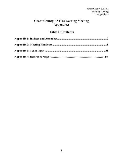
Grant County PAT #2 Evening Meeting Appendices Table of Contents
Grant County PAT #2 Evening Meeting Appendices Table of Contents
Grant County PAT #2 Evening Meeting Appendices Table of Contents

You also want an ePaper? Increase the reach of your titles
YUMPU automatically turns print PDFs into web optimized ePapers that Google loves.
<strong>Grant</strong> <strong>County</strong> <strong>PAT</strong> <strong>#2</strong> <strong>Evening</strong> <strong>Meeting</strong><br />
<strong>Appendices</strong><br />
<strong>Table</strong> <strong>of</strong> <strong>Contents</strong><br />
<strong>Grant</strong> <strong>County</strong> <strong>PAT</strong> <strong>#2</strong><br />
<strong>Evening</strong> <strong>Meeting</strong><br />
<strong>Appendices</strong><br />
Appendix 1: Invitees and Attendees.......................................................................2<br />
Appendix 2: <strong>Meeting</strong> Handouts..............................................................................8<br />
Appendix 3: Team Input .......................................................................................38<br />
Appendix 4: Reference Maps………………………………………………….. 56<br />
1
<strong>Grant</strong> <strong>County</strong> <strong>PAT</strong> <strong>#2</strong><br />
<strong>Evening</strong> <strong>Meeting</strong><br />
<strong>Appendices</strong><br />
Appendix 1: Invitees and Attendees<br />
2
<strong>Grant</strong> <strong>County</strong> <strong>PAT</strong> <strong>#2</strong><br />
<strong>Evening</strong> <strong>Meeting</strong><br />
<strong>Appendices</strong><br />
Email Notification<br />
From: Amanda Edge<br />
Sent: Friday, November 13, 2009 3:00 PM<br />
Cc: Kent McCarthy; Rosemary Curtin; Kara Veit<br />
Subject: Boardman to Hemingway - Project Advisory Team <strong>Meeting</strong> <strong>#2</strong> materials<br />
Thank you for your continued involvement in the Boardman to Hemingway Transmission Line<br />
siting process. The next <strong>Grant</strong> <strong>County</strong> Project Advisory Team meeting will be a mapping session<br />
for use in the process <strong>of</strong> identifying potential routes for the transmission line.<br />
The meeting will be held:<br />
Thursday, November 19, 2009<br />
9:00 a.m. - 1:30 p.m.<br />
-OR-<br />
4:00 - 9:00 p.m.<br />
Mt. Vernon Grange Hall<br />
59491 Hwy 26<br />
Mt. Vernon, OR 97865<br />
If you plan to attend this meeting, please RSVP by responding to this email or contacting<br />
me via phone at (208) 377-9688.<br />
Attached is the meeting agenda, meeting informational sheet, and the community criteria that<br />
was gathered from last week's meeting. There will be an opportunity to comment on the<br />
community criteria at the mapping session. We will also send out a summary from last week's<br />
meeting early next week. Thank you for your participation in the Community Advisory Process.<br />
If you have any questions, please feel free to contact me.<br />
Thank you,<br />
Amanda Edge<br />
RBCI<br />
Boise, ID<br />
amanda@rbci.net<br />
Phone: (208) 377-9688<br />
Fax: (208) 323-1983<br />
3
<strong>Grant</strong> <strong>County</strong> <strong>PAT</strong> <strong>#2</strong><br />
<strong>Evening</strong> <strong>Meeting</strong><br />
<strong>Appendices</strong><br />
<strong>Grant</strong> <strong>County</strong> <strong>PAT</strong> <strong>#2</strong> Invitees<br />
Claude Baker<br />
Property owner<br />
Neil Bauer<br />
Property owner<br />
Representative Cliff Bentz Oregon Representative District 60<br />
Bob Blakeslee<br />
Contractor<br />
Greg Bowman<br />
Property owner<br />
Dennis Bradley<br />
City <strong>of</strong> Mount Vernon<br />
Commissioner Boyd Britton<br />
<strong>Grant</strong> <strong>County</strong><br />
Ron Burnette<br />
Property owner<br />
Scotta Callister<br />
Blue Mountain Eagle<br />
Margaret Carey<br />
The Nature Conservancy<br />
Mark Cerney<br />
Property owner<br />
Adele Cerney<br />
Property owner<br />
Amy Charette<br />
Watershed Council<br />
Steph Charette<br />
Confederated Tribes <strong>of</strong> the Warm<br />
Springs Reservation <strong>of</strong> Oregon<br />
Brian Cochran<br />
Confederated Tribes <strong>of</strong> the Warm<br />
Springs Reservation <strong>of</strong> Oregon<br />
Kristen Coles<br />
Confederated Tribes <strong>of</strong> the Warms<br />
Springs Reservation <strong>of</strong> Oregon<br />
Jerry Ebelt<strong>of</strong>t<br />
The Nature Conservancy<br />
Senator Ted Ferrioli Oregon Senator District 30<br />
Roje Gootee<br />
Rush Creek Ranch<br />
James Hammett<br />
John Day Fossil Beds National<br />
Monument<br />
Eva Harris<br />
Property owner<br />
Rich Henslee<br />
Property owner<br />
Ken Holliday<br />
Holliday Ranch<br />
Representative John Huffman Oregon Representative District 59<br />
Jeffrey Kee<br />
Freshwater Trust<br />
Jason Kehrberg<br />
<strong>Grant</strong> Soil & Water Conservation<br />
4
Jim Kelly<br />
Aaron Kilgore<br />
Wayne Kinney<br />
Rod Kuhn<br />
Tim Lillebo<br />
Hilary McNary<br />
Sharon Mogg<br />
Dennis Myhrum<br />
Tim Nelson<br />
Andrea Officer<br />
Mayor Bob Quinton<br />
Shaun Robertson<br />
Sarah Russ<br />
Vic Shuck<br />
Robert Stewart<br />
Judge Mark Webb<br />
Tom Winters<br />
<strong>Grant</strong> <strong>County</strong> <strong>PAT</strong> <strong>#2</strong><br />
<strong>Evening</strong> <strong>Meeting</strong><br />
<strong>Appendices</strong><br />
District<br />
Property owner<br />
Oregon Natural Desert Association<br />
Senator Ron Wyden La Grande District<br />
Office<br />
Property owner<br />
Oregon Wild<br />
<strong>Grant</strong> <strong>County</strong> Planning Department<br />
<strong>Grant</strong> <strong>County</strong> Chamber <strong>of</strong> Commerce<br />
Oregon Farm Bureau<br />
Property owner<br />
City <strong>of</strong> Seneca<br />
City <strong>of</strong> John Day<br />
John Day Resource Center<br />
Property owner<br />
Property owner<br />
Property owner<br />
<strong>Grant</strong> <strong>County</strong><br />
Property owner<br />
5
<strong>Grant</strong> <strong>County</strong> <strong>PAT</strong> <strong>#2</strong><br />
<strong>Evening</strong> <strong>Meeting</strong><br />
<strong>Appendices</strong><br />
<strong>Grant</strong> <strong>County</strong> <strong>PAT</strong> <strong>#2</strong> <strong>Evening</strong> <strong>Meeting</strong> Attendees<br />
Neil Bauer<br />
Heidi Bigler Cole<br />
Boyd Britton<br />
Ron Burnette<br />
Kathy Cameilla<br />
Margaret Carey<br />
Steph Charette<br />
Karen Coulter<br />
Jim Daniels<br />
Justin DeJager<br />
Jerry Ebelt<strong>of</strong>t<br />
Jerry Franke<br />
Steve Gast<br />
Roje Gootee<br />
Peter Gray<br />
Dave Hannibal<br />
Chloe Hughes<br />
Joe Hughes<br />
Cheryl Jessup<br />
Willis Kimball<br />
Daniel Kehr<br />
Maura J. Kehr<br />
Rod Kuhn<br />
Hilary McNary<br />
J.C. Olives<br />
Roy Peterson<br />
Ruth Shuck<br />
Vic Shuck<br />
Property owner<br />
Commissioner for <strong>Grant</strong> <strong>County</strong><br />
Property owner<br />
Property owner<br />
The Nature Conservancy<br />
Confederated Tribes <strong>of</strong> the Warm Springs<br />
Reservation<br />
Property owner, Blue Mtns Biodiversity<br />
Project<br />
Property owner<br />
Property owner<br />
The Nature Conservancy<br />
Business<br />
Property owner<br />
Rush Creek Ranch<br />
Property owner<br />
Property owner<br />
Property owner<br />
BME<br />
Property owner<br />
Property owner<br />
Property owner<br />
Property owner<br />
<strong>Grant</strong> <strong>County</strong> Planning Department<br />
Property owner<br />
Property owner<br />
6
Robert Steward<br />
Robert Stewart<br />
Dave Traylor<br />
Jack Watson<br />
Linda Watson<br />
Tom Winters<br />
Mark Webb<br />
<strong>Grant</strong> <strong>County</strong> <strong>PAT</strong> <strong>#2</strong><br />
<strong>Evening</strong> <strong>Meeting</strong><br />
<strong>Appendices</strong><br />
Property owner<br />
Property owner<br />
<strong>County</strong><br />
Property owner<br />
Property owner<br />
Property owner<br />
Judge for <strong>Grant</strong> <strong>County</strong><br />
7
<strong>Grant</strong> <strong>County</strong> <strong>PAT</strong> <strong>#2</strong><br />
<strong>Evening</strong> <strong>Meeting</strong><br />
<strong>Appendices</strong><br />
Appendix 2: <strong>Meeting</strong> Handouts<br />
8
<strong>Grant</strong> <strong>County</strong> <strong>PAT</strong> <strong>#2</strong><br />
<strong>Evening</strong> <strong>Meeting</strong><br />
<strong>Appendices</strong><br />
Boardman to Hemingway Project<br />
<strong>Grant</strong> Project Advisory Team <strong>Meeting</strong> <strong>#2</strong><br />
Mapping Workshop<br />
Thursday, November 19, 2009 • 4 p.m. to 9 p.m.<br />
59491 Hwy 26 • Mt. Vernon, OR 97865<br />
AGENDA<br />
<strong>Meeting</strong> objective:<br />
• Present the outcomes <strong>of</strong> the public meetings<br />
• Review and discuss draft community criteria<br />
• Review the regulatory and engineering criteria<br />
• Explain the mapping workshop<br />
• Begin to identify a range <strong>of</strong> possible routes for the Boardman to Hemingway<br />
Transmission Line<br />
4:00 p.m. Welcome – Kent McCarthy, Idaho Power, CAP Project Leader<br />
4:15 p.m. Team business and public meeting outcomes – Rosemary Curtin, Facilitator<br />
• Overview<br />
• Comments<br />
4:30 p.m. Review community criteria – Rosemary Curtin<br />
• How criteria were developed<br />
• Discussion<br />
5:00 p.m. Review criteria and how routes will be analyzed – Kent McCarthy<br />
5:30 p.m. Explanation <strong>of</strong> mapping workshop – Kent McCarthy<br />
• Workshop format<br />
• Confirm times<br />
• Next steps<br />
6:00 p.m. Mapping workshop<br />
• Mapping and technical assistance<br />
Note: Refreshments will be served throughout the day.<br />
9
<strong>Grant</strong> <strong>County</strong> <strong>PAT</strong> <strong>#2</strong><br />
<strong>Evening</strong> <strong>Meeting</strong><br />
<strong>Appendices</strong><br />
www.boardmantohemingway.com<br />
10
11<br />
<strong>Grant</strong> <strong>County</strong> <strong>PAT</strong> <strong>#2</strong><br />
<strong>Evening</strong> <strong>Meeting</strong><br />
<strong>Appendices</strong>
12<br />
<strong>Grant</strong> <strong>County</strong> <strong>PAT</strong> <strong>#2</strong><br />
<strong>Evening</strong> <strong>Meeting</strong><br />
<strong>Appendices</strong>
13<br />
<strong>Grant</strong> <strong>County</strong> <strong>PAT</strong> <strong>#2</strong><br />
<strong>Evening</strong> <strong>Meeting</strong><br />
<strong>Appendices</strong>
14<br />
<strong>Grant</strong> <strong>County</strong> <strong>PAT</strong> <strong>#2</strong><br />
<strong>Evening</strong> <strong>Meeting</strong><br />
<strong>Appendices</strong>
15<br />
<strong>Grant</strong> <strong>County</strong> <strong>PAT</strong> <strong>#2</strong><br />
<strong>Evening</strong> <strong>Meeting</strong><br />
<strong>Appendices</strong>
16<br />
<strong>Grant</strong> <strong>County</strong> <strong>PAT</strong> <strong>#2</strong><br />
<strong>Evening</strong> <strong>Meeting</strong><br />
<strong>Appendices</strong>
17<br />
<strong>Grant</strong> <strong>County</strong> <strong>PAT</strong> <strong>#2</strong><br />
<strong>Evening</strong> <strong>Meeting</strong><br />
<strong>Appendices</strong>
18<br />
<strong>Grant</strong> <strong>County</strong> <strong>PAT</strong> <strong>#2</strong><br />
<strong>Evening</strong> <strong>Meeting</strong><br />
<strong>Appendices</strong>
19<br />
<strong>Grant</strong> <strong>County</strong> <strong>PAT</strong> <strong>#2</strong><br />
<strong>Evening</strong> <strong>Meeting</strong><br />
<strong>Appendices</strong>
20<br />
<strong>Grant</strong> <strong>County</strong> <strong>PAT</strong> <strong>#2</strong><br />
<strong>Evening</strong> <strong>Meeting</strong><br />
<strong>Appendices</strong>
21<br />
<strong>Grant</strong> <strong>County</strong> <strong>PAT</strong> <strong>#2</strong><br />
<strong>Evening</strong> <strong>Meeting</strong><br />
<strong>Appendices</strong>
22<br />
<strong>Grant</strong> <strong>County</strong> <strong>PAT</strong> <strong>#2</strong><br />
<strong>Evening</strong> <strong>Meeting</strong><br />
<strong>Appendices</strong>
23<br />
<strong>Grant</strong> <strong>County</strong> <strong>PAT</strong> <strong>#2</strong><br />
<strong>Evening</strong> <strong>Meeting</strong><br />
<strong>Appendices</strong>
24<br />
<strong>Grant</strong> <strong>County</strong> <strong>PAT</strong> <strong>#2</strong><br />
<strong>Evening</strong> <strong>Meeting</strong><br />
<strong>Appendices</strong>
25<br />
<strong>Grant</strong> <strong>County</strong> <strong>PAT</strong> <strong>#2</strong><br />
<strong>Evening</strong> <strong>Meeting</strong><br />
<strong>Appendices</strong>
26<br />
<strong>Grant</strong> <strong>County</strong> <strong>PAT</strong> <strong>#2</strong><br />
<strong>Evening</strong> <strong>Meeting</strong><br />
<strong>Appendices</strong>
<strong>Grant</strong> <strong>County</strong> <strong>PAT</strong> <strong>#2</strong><br />
<strong>Evening</strong> <strong>Meeting</strong><br />
<strong>Appendices</strong><br />
Community Criteria Overview<br />
The community criteria are factors that will be considered when determining a route for the<br />
Boardman to Hemingway Transmission Line.<br />
The location <strong>of</strong> the transmission line will have many effects that are <strong>of</strong> interest to the local<br />
communities. A route that is supported by the public and meets the community, environmental,<br />
engineering and regulatory criteria will be preferred.<br />
Background<br />
Project Advisory Teams have been formed in <strong>Grant</strong> and Harney counties, as well as in the North,<br />
Central and South project areas from Boardman, Oregon to Melba, Idaho. The purpose <strong>of</strong> the<br />
Project Advisory Teams is to identify concerns, suggestions and work closely with the public<br />
and technical experts to recommend proposed and alternative routes.<br />
The first set <strong>of</strong> <strong>Grant</strong> and Harney counties Project Advisory Team meetings were held November<br />
4 (Harney <strong>County</strong>) and November 5 (<strong>Grant</strong> <strong>County</strong>). At these meetings, team members learned<br />
about the purpose and need for the project, work to-date, and how the Community Advisory<br />
Process will work. The teams identified community concerns and suggestions about the project.<br />
The community concerns and suggestions identified by Project Advisory Teams have been<br />
developed into community criteria.<br />
Project Advisory Teams and technical experts will use these community criteria, along with<br />
environmental, engineering and regulatory criteria to help site a proposed route and alternate<br />
routes for the transmission line.<br />
27
<strong>Grant</strong> <strong>County</strong> Community Criteria<br />
<strong>Grant</strong> <strong>County</strong> <strong>PAT</strong> <strong>#2</strong><br />
<strong>Evening</strong> <strong>Meeting</strong><br />
<strong>Appendices</strong><br />
Definitions<br />
• Placement Opportunities – Project Advisory Teams identified areas for the<br />
transmission line that would be preferred by the communities.<br />
• Avoidance Areas – Project Advisory Teams identified areas that are important to<br />
the communities. The communities recommend avoiding these areas when siting<br />
a route for the transmission line.<br />
Placement Opportunities<br />
Avoidance Areas<br />
• Undeveloped areas<br />
• Existing energy corridors<br />
• Wilderness areas<br />
• I-84 corridor<br />
• Direct route between Boardman<br />
and Hemingway<br />
• Rural areas<br />
• Roadless areas<br />
• Designated wild and scenic rivers<br />
o Riparian areas (strips <strong>of</strong> land<br />
that border creeks, rivers or<br />
other bodies <strong>of</strong> water.)<br />
• Critical watershed enhancement and<br />
restoration areas<br />
• Scenic areas<br />
o The cedar grove<br />
o The fossil beds<br />
o View sheds<br />
• Recreation areas<br />
• Wildlife habitats<br />
o Big game winter range<br />
o Sage grouse leks<br />
o Threatened and endangered<br />
species<br />
• Forest land and old growth<br />
• Private property<br />
• Exclusive Farm Use (EFU) land<br />
28
<strong>Grant</strong> <strong>County</strong> <strong>PAT</strong> <strong>#2</strong><br />
<strong>Evening</strong> <strong>Meeting</strong><br />
<strong>Appendices</strong><br />
Idaho Power Boardman to Hemingway Transmission Line Project – Route Analysis Worksheet for <strong>Grant</strong> <strong>County</strong> Project Advisory Team<br />
Constraint/Opportunity Placement Opportunity Avoidance Categories Exclusion<br />
Siting Criteria<br />
Areas that should be<br />
considered for transmission<br />
line routes because land<br />
uses were identified by the<br />
Project Advisory Team<br />
(indicated by shading) as a<br />
high priority for placement,<br />
and/ or routes are compatible<br />
with the construction,<br />
maintenance, and operation<br />
<strong>of</strong> overhead transmission<br />
lines.<br />
Very low to low impact.<br />
Mitigation, if necessary,<br />
would be very easy to<br />
implement<br />
These areas should be avoided unless there is no reasonable alternative. Mitigation 1<br />
would be required for federally-managed lands and to meet Oregon Department <strong>of</strong><br />
Energy Energy Facility Siting Council standards. Also a potential that federal resource<br />
plans would need to be amended to allow the project. Assignment to categories<br />
based on Project Advisory Team (<strong>PAT</strong>) community criteria (indicated by shading)<br />
and then pr<strong>of</strong>essional judgment for criteria not addressed by the <strong>PAT</strong>.<br />
Avoidance: Low Avoidance: Moderate Avoidance: High<br />
Moderate impact that could<br />
likely result in significant<br />
adverse impact that could<br />
require mitigation.<br />
Mitigation, if necessary,<br />
would range from fairly easy<br />
to implement to being costly<br />
or require longer time<br />
frames.<br />
High to very high impact<br />
(duration, magnitude). Very<br />
difficult or infeasible to<br />
mitigate (due to technology,<br />
sensitivity <strong>of</strong> resource, time<br />
frame, or cost <strong>of</strong> mitigation).<br />
Areas where a transmission<br />
line is precluded by statute<br />
or regulation (federal, state,<br />
local) or as identified by the<br />
Project Advisory Team<br />
(indicated by shading).<br />
MAP SERIES: Land Use<br />
Airport and Controlled Airspace X<br />
Oregon Fish Hatchery X<br />
Pipeline X<br />
Military Operations Area X<br />
Naval Weapons System Training Facility X<br />
Hells Canyon National Recreation Area X<br />
Starkey Game Management Area X<br />
Wind Farm X<br />
Wild/Scenic River X<br />
Nature Conservancy Preserve X<br />
National Wildlife Refuge X<br />
National Forest Utility Corridor X<br />
West-wide Energy Corridor X<br />
Vale District BLM Special Recreation Management Area X<br />
Vale District BLM Proposed & Existing Utility Corridor X<br />
Malheur Resource Area Off Highway Vehicle Closure Area X<br />
Idaho <strong>County</strong> Impact Area X<br />
Oregon Urban Growth Boundary X<br />
Urban Area X<br />
Oregon State Park X<br />
Area <strong>of</strong> Critical Environmental Concern X<br />
29
<strong>Grant</strong> <strong>County</strong> <strong>PAT</strong> <strong>#2</strong><br />
<strong>Evening</strong> <strong>Meeting</strong><br />
<strong>Appendices</strong><br />
Exclusive Farm Use Zone X<br />
Irrigated Agriculture X<br />
US Forest Service Recreation Site X<br />
US Forest Service Recreation Area X<br />
US National Forest Special Interest/Management Area X<br />
US Forest Service Roadless Area X<br />
Bureau <strong>of</strong> Land Management Wilderness Study Area X<br />
US Forest Service Wilderness Area X<br />
Bureau <strong>of</strong> Land Management (managed lands) 2<br />
Bureau <strong>of</strong> Reclamation (managed lands) 2<br />
Indian Reservation X<br />
Military (owned lands) 2<br />
National Park Service (managed lands) X<br />
Other federal (managed lands) 2<br />
Private X<br />
State (managed lands) 2<br />
US Fish and Wildlife Service (managed lands) X<br />
US Forest Service (managed lands) X<br />
MAP SERIES: Cultural and Visual<br />
Oregon Trail Interpretive Center X<br />
Cemetery X<br />
Historic Site (NRHP) X<br />
Idaho Historic Trail / Oregon Trail X<br />
Intact Oregon Trail Segment X<br />
Scenic Byway Route X<br />
Bureau <strong>of</strong> Land Management Visual Resource Management Class I X<br />
Bureau <strong>of</strong> Land Management Visual Resource Management Class II X<br />
Bureau <strong>of</strong> Land Management Visual Resource Management Class III X<br />
US Forest Service VQO: Maximum Modification X<br />
US Forest Service VQO: Modification X<br />
US Forest Service VQO: Partial Retention X<br />
US Forest Service VQO: Retention X<br />
US Forest Service VQO: Preservation X<br />
MAP SERIES: Physical and Natural Resources (Geology, Soils, Vegetation, Water, and Wetlands)<br />
Fault Line X<br />
100-year Floodplain X<br />
US Geological Survey Mining Area X<br />
National Wetland Inventory Wetland X<br />
US Forest Service Old Growth Forest X<br />
Forested Land X<br />
30
<strong>Grant</strong> <strong>County</strong> <strong>PAT</strong> <strong>#2</strong><br />
<strong>Evening</strong> <strong>Meeting</strong><br />
<strong>Appendices</strong><br />
Oregon Landslide Data<br />
Fan X<br />
Landslide X<br />
Talus-Colluvium (landslide related feature) X<br />
NRCS Soil Capability Classification - Arable Land Classification<br />
Class I X<br />
Class II X<br />
Class III X<br />
Class IV X<br />
MAP SERIES: Fish and Wildlife<br />
Special Status Fish Steam X<br />
Wildlife Management Area X<br />
Idaho Pronghorn Antelope Habitat X<br />
Idaho Bighorn Sheep Habitat X<br />
Idaho Elk and Deer Crucial Winter Range X<br />
Oregon Elk Winter Range X<br />
Oregon Deer Winter Range X<br />
Sage-grouse Lek X<br />
Sage-grouse Lek 2 mile Buffer X<br />
Oregon Sage-grouse Occupied Habitat X<br />
Idaho Sage-grouse Key Habitat Area X<br />
Idaho Sage-grouse Habitat: High Restoration Potential X<br />
1. Mitigation is a way to reduce the effect <strong>of</strong> an action. Mitigation is a process that includes avoiding the impact, minimizing the impact, and compensating for remaining unavoidable impacts.<br />
Federal and state agencies have varying mitigation requirements that will be triggered by impacts identified through their permitting and approval processes.<br />
2. Siting criteria that are not considered an opportunity, avoidance, or exclusion area.<br />
31
Community Criteria Comment Sheet<br />
Boardman to Hemingway Project<br />
<strong>Grant</strong> <strong>County</strong> Project Advisory Team <strong>Meeting</strong> <strong>#2</strong><br />
November 19, 2009<br />
Name:_________________________________________<br />
1) Are there additional criteria that need to be included?<br />
2) What criteria need to be changed and how?<br />
28
3) Other comments.<br />
<strong>Grant</strong> <strong>County</strong> <strong>PAT</strong> <strong>#2</strong><br />
<strong>Evening</strong> <strong>Meeting</strong><br />
<strong>Appendices</strong><br />
Thank you!<br />
Please return this comment sheet at the end <strong>of</strong> meeting. If you would like to<br />
return this comment sheet after the meeting, please mail to:<br />
Kent McCarthy<br />
Idaho Power Company<br />
P.O. Box 70<br />
Boise, ID 83707<br />
33
<strong>Meeting</strong> Evaluation<br />
Boardman to Hemingway Project<br />
<strong>Grant</strong> <strong>County</strong> Project Advisory Team <strong>Meeting</strong> <strong>#2</strong><br />
November 19, 2009<br />
<strong>Grant</strong> <strong>County</strong> <strong>PAT</strong> <strong>#2</strong><br />
<strong>Evening</strong> <strong>Meeting</strong><br />
<strong>Appendices</strong><br />
Name:_________________________________________<br />
1) What do you feel worked well for this meeting?<br />
2) What do you feel didn’t work well for this meeting?<br />
34
<strong>Grant</strong> <strong>County</strong> <strong>PAT</strong> <strong>#2</strong><br />
<strong>Evening</strong> <strong>Meeting</strong><br />
<strong>Appendices</strong><br />
3) Do you have any questions?<br />
4) Please provide your current e-mail, address and phone number.<br />
Name:___________________________________________________________<br />
E-mail:__________________________________________________________<br />
Address:________________________________________________________<br />
City, State & Zip:__________________________________________________<br />
Phone Number:___________________________________________________<br />
Thank you!<br />
Please return this comment sheet at the end <strong>of</strong> meeting. If you would like to<br />
return this comment sheet after the meeting, please mail to:<br />
Kent McCarthy<br />
Idaho Power Company<br />
P.O. Box 70<br />
Boise, ID 83707<br />
35
<strong>Grant</strong> <strong>County</strong> <strong>PAT</strong> <strong>#2</strong><br />
<strong>Evening</strong> <strong>Meeting</strong><br />
<strong>Appendices</strong><br />
Boardman to Hemingway Transmission Line Project<br />
<strong>Grant</strong> <strong>County</strong> Project Advisory Team Mapping Session<br />
November 19, 2009<br />
Route Record Form<br />
Name: __________________________________________________________<br />
Assigned name <strong>of</strong> route:<br />
What method did you use to map your route?<br />
[ ] Hard-copy map [ ] GIS computer station<br />
Can we contact you to ask questions for clarification concerning this route?<br />
Yes ____<br />
No____<br />
Phone number____________________________________<br />
Please describe the specific factors that make your route important. (i.e. locations/resources<br />
the route avoids)<br />
36
Other Comments:<br />
<strong>Grant</strong> <strong>County</strong> <strong>PAT</strong> <strong>#2</strong><br />
<strong>Evening</strong> <strong>Meeting</strong><br />
<strong>Appendices</strong><br />
Thank you!<br />
37
Appendix 3: Team Input<br />
<strong>Grant</strong> <strong>County</strong> <strong>PAT</strong> <strong>#2</strong><br />
<strong>Evening</strong> <strong>Meeting</strong><br />
<strong>Appendices</strong><br />
38
<strong>Grant</strong> <strong>PAT</strong> <strong>#2</strong> Mapping Workshop – <strong>Evening</strong> <strong>Meeting</strong><br />
November 19, 2009 4:00 p.m. – 9:00 p.m.<br />
Mt. Vernon, OR<br />
Route Record Form Transcriptions<br />
Comments were transcribed verbatim from the “<strong>Meeting</strong> Evaluation” sheets. (---) indicates that a word was illegible.<br />
Comment<br />
Sheet<br />
Number<br />
Name Assigned name <strong>of</strong> route What method did<br />
you use to map your<br />
route?<br />
Can we contact you to ask<br />
questions for clarification<br />
concerning this route?<br />
Please describe the specific factors that make<br />
your route important. (i.e. locations/resources the<br />
route avoids)<br />
Other comments.<br />
Phone Number<br />
1 Steve Gast Yes<br />
(503) 706-9101<br />
The proposed C18 route through <strong>Grant</strong> <strong>County</strong><br />
would unfortunately run diagonally through the<br />
counties <strong>of</strong> the upper John Day river. Counties<br />
from west to east (or N-S) it would bisect rather<br />
than follow natural features mainly trout streams<br />
that flows into the John Day river. Even more<br />
damaging would be the scenic value <strong>of</strong> this<br />
upper valley that would be lost for the future <strong>of</strong><br />
this valley which has experienced great<br />
economic fallout from the failed timber industry.<br />
One, if not the only future economic value is<br />
tourism and this would not be the saturation <strong>of</strong><br />
the county but with a transmission line cutting<br />
this way as preposed by C18, this would<br />
preclude any serious effort <strong>of</strong> economic<br />
development in this sphere <strong>of</strong> economic growth.<br />
There is an agricultural base here but is changing<br />
fast as most young people are not staying for<br />
lack <strong>of</strong> work and a completely changing socioeconomic<br />
world. If a line is put through this area,<br />
the only to mitigate this would a more vertically<br />
situated line that would be the least damaging to<br />
this future. If anything it should follow the<br />
natural drainage and not cut across.<br />
Obviously my preferred route would be I-84<br />
because <strong>of</strong> the development that is already<br />
existing and the resources that are available to<br />
that area. There are the obvious scenic value <strong>of</strong><br />
the Elkhorns and the Wallowas but those are<br />
better accessed through the many secondary<br />
roads in the area, in especially Baker Co. To run<br />
this transmission line through what essentially is<br />
an untouched by major human endeavors would
2 Jerry Ebelt<strong>of</strong>t Yes<br />
(541) 421-3037<br />
3 Maura J.<br />
Kehr<br />
I-84 Route most preferred Yes<br />
(541) 963-9632<br />
unnecessarily cut up an area that would be better<br />
<strong>of</strong>f left alone.<br />
I am not against the transmission line per se, just<br />
the C18 route which I believe in the long run<br />
would be more difficult economically and<br />
socially to bring on line. And yes, I am a land<br />
owner who would be affected not to the degree at<br />
some in the area, but never the less would have<br />
an adverse effect on my land and my neighbors. I<br />
sincerely hope that there is some thought <strong>of</strong> the<br />
future <strong>of</strong> this area after decisions are made and<br />
brought to fruition.<br />
Thank you,<br />
Steve Grast<br />
P.O. Box 368<br />
Cascade Lockas, OR 97014<br />
The LEK behind the OR Int Center sounds like it<br />
is already disrupted by ATV trails and shooting<br />
range so maybe that LEK could sustain the<br />
disruption.<br />
If all you could research the line running on the<br />
ground (no under) for part <strong>of</strong> the visual area that<br />
would be great<br />
From talking to the Idaho representative it sound<br />
like I-84 is a real possibility with some<br />
mitigation in the La Grande, Baker City and Ag<br />
land in the Ontario area. I think the efforts<br />
should go there instead <strong>of</strong> you all travelling all<br />
over this part <strong>of</strong> the state.<br />
Upgrade existing lines and use clear cut areas<br />
already there. Don’t want in <strong>Grant</strong> <strong>County</strong> as that<br />
area is full <strong>of</strong> beautiful wilderness areas with few<br />
roads. Even with explanation given I do not<br />
understand why upgrade <strong>of</strong> existing lines would<br />
not work. We live in Union <strong>County</strong> primarily<br />
and wish the present lines could be used and<br />
improved. Am concerned with health impact <strong>of</strong><br />
high voltage lines on humans just as much as<br />
animals. Have property on <strong>County</strong> Rd 3 north <strong>of</strong><br />
Monument and fear for health impact and<br />
secondly property values decreasing, and thirdly<br />
aesceteic value decreasing from 130-190’ towers<br />
every 1200 feet apart. How much power does<br />
<strong>Grant</strong> <strong>County</strong> use compared to other counties<br />
and who really needs this power??<br />
<strong>Grant</strong> <strong>County</strong> <strong>PAT</strong> <strong>#2</strong><br />
<strong>Evening</strong> <strong>Meeting</strong><br />
<strong>Appendices</strong><br />
40
4 Margaret<br />
Carey<br />
5 Robert<br />
Stewart<br />
6 Steph<br />
Charette<br />
Yes<br />
(541) 421-3037<br />
Yes<br />
(541) 932-2702<br />
- Oregon trail Monument: is a monument to<br />
westward expansion – establishing a road for<br />
us to follow into a future – which includes<br />
hwy’s – cities and the power we have<br />
developed to live this better life we came<br />
here to haus = find away to celebrate these<br />
towers within this theme Designing best<br />
placement – modify heights where possible?<br />
An occasional ground installation? Etc. i.e.<br />
Golden Gate Bridge is beauty ain’t it?<br />
- Durkee Cement factor: high energy draw!<br />
Another reason for it here<br />
- Ontario/Treasure Valley Ag area: one <strong>of</strong> the<br />
heavy energy (irrigation) draw areas –<br />
regardless <strong>of</strong> whether they are expanding or<br />
not it is still a reasonable siting – it’s not as if<br />
they will be punished by paying more for it –<br />
they will have it go through them to go to<br />
them – as opposed to people who’s property<br />
value and standard <strong>of</strong> life will plummet and<br />
who will not benefit by have mega power in<br />
their backyards.<br />
Big horn sheep habitat has not been included in<br />
wildlife resources, for routes S96, S29 and S23.<br />
S107 may have cultural Indian areas this area has<br />
been designated by Malheur National Forest. In<br />
section 22 up by the <strong>Grant</strong> <strong>County</strong> Road 63C.<br />
If I were to choose a route it would boarder the I-84<br />
corridor but go along the west side <strong>of</strong> the valley<br />
going more on public lands staying <strong>of</strong>f private lands,<br />
the original proposal stated that the I-84 route would<br />
be 86% on private lands. Move it to the west onto<br />
public lands.<br />
Routes S96, S29, S23 cross over the Widows Creek<br />
Ranch which just installed pivot lines in the fields<br />
south <strong>of</strong> the John Day River.<br />
Please invite the Oregon Hunters Assoc. <strong>Grant</strong><br />
<strong>Grant</strong> <strong>County</strong> <strong>PAT</strong> <strong>#2</strong><br />
<strong>Evening</strong> <strong>Meeting</strong><br />
<strong>Appendices</strong><br />
Fire fighting – high tower danger issues<br />
15 ‘ tree height thru miles <strong>of</strong> forest = $$$<br />
maintenance<br />
Weed’s weed’s weed’s – a bigger spendier<br />
longer termed expensive proposition than is<br />
ever budgeted for!<br />
Going thru forested areas – opening up NEW<br />
CORRIDORS for future infiltration.<br />
<strong>County</strong> Chapter and the <strong>Grant</strong> <strong>County</strong> Snowballers.<br />
Yes S9 to C4 (I84) - Concerns on weed control,<br />
sedimentation, an removal <strong>of</strong><br />
herbaceaous trees along sensitive 303D<br />
listed streams.<br />
- Critical andronoumus fish areas within<br />
the John Day Basin, where several<br />
illions are being spent on restoration.<br />
41
7 Dan Kehr Yes<br />
541-963-9632<br />
8 Chloe<br />
Hughes<br />
(Please see<br />
attached)<br />
- Should use state/federal lands & not private<br />
due to devaluation <strong>of</strong> property<br />
- Use I-84 route which has access & not deface<br />
& devalue further property – both private and<br />
public<br />
I would like to voice my extreme negative feelings<br />
about route C-18 and hope you delete it from the<br />
potential routes. It has major conflicts with exclusive<br />
farm use (irrigated) land, private land, timber mgmt<br />
land, scenic corridor National Scenic River (John<br />
Day) and the major creeks that flow into the John<br />
Day River. (see attached)<br />
Every creek band is a cultural resource. Historic &<br />
prehistoric sites are abundant. When the BLM does<br />
their neap assessment part <strong>of</strong> that assessment is to<br />
survey for cultural resources. I might add that BLM<br />
archaeologists deem an area with 10 flakes an<br />
archeological site. C-18 does (or will have) conflicts<br />
with cultural resources.<br />
All <strong>of</strong> the creek drainages are rugged terrain with 60<br />
to 80% slopes (Birch Creek).<br />
C-18 has conflicts with wildlife habitat—specifically<br />
elk, deer, ruff grouse, bald eagle, chukar, pronghorn<br />
antelope, black bear, great horned owl, red tailed<br />
hawk, mt. Lion, porcupine, mt. Cottontail, & native<br />
cutthroat trout.<br />
C-18 has conflicts with exclusive farm land, ranch<br />
land & pasture land, & the health concerns <strong>of</strong><br />
private landowners. (neurological symptoms, birth<br />
<strong>Grant</strong> <strong>County</strong> <strong>PAT</strong> <strong>#2</strong><br />
<strong>Evening</strong> <strong>Meeting</strong><br />
<strong>Appendices</strong><br />
There funds are primarily being spent to<br />
mitigate for overgrazing and habitat<br />
degradation. My fear is that by opening<br />
up roads and cutting trees will nullify<br />
they restoration efforts.<br />
- Also complicating the issue is that the<br />
Malheur NF currently does not have<br />
permission to spray weeds and noxious<br />
weeds are a huge concern along roads<br />
(great vectors for weeds.) Are you going<br />
to hand pull miles <strong>of</strong> weeds in the<br />
Malheur Corridor?<br />
- Power/ transmission lines cause health<br />
hazards<br />
- Dr. David Carpenter – School <strong>of</strong> Public<br />
Health – State University <strong>of</strong> New York<br />
“Likely up to 30% children’s cancers<br />
came from exposure to EMF’s”<br />
- EPA – “There is reason for concern”<br />
- NEG. effects w/fire fighting<br />
The Idaho Power proposed C-18 route passes<br />
through an area rich in human and natural<br />
history and would have major negative effects<br />
and impact. My four areas <strong>of</strong> concern are:<br />
1. Conflicts with Natural Resources:<br />
Conflicts with farming, ranching and<br />
pasture lands. Also, in the<br />
approximately 14 miles area W and NW<br />
<strong>of</strong> Mt Vernon C-18 crosses the John<br />
Day River, 10 perennial creeks (Dry,<br />
Birch, Warrens, Belshaw, Cummings,<br />
Wiley, Marks, Scotty, Stockdale, and<br />
Franks) and 16 intermittent creeks, all<br />
within the John Day drainage. Wildlife<br />
important to the ecological system<br />
includes: Bald Eagle, Ruff Grouse,<br />
Chukar, Pronghorn Antelope, Rocky<br />
Mt. Elk, Mule Deet, Black Bear, Great<br />
Horned Owl, Nighthawk, Western<br />
Meadowlark, Red Tailed Hawk,<br />
Mountain Lion, Coyote, Porcupine,<br />
Mountain Cottontail, Western<br />
Diamondback, Crawfish and Native<br />
42
defects, leukemia from high voltage transmission<br />
lines. C-18 is not a viable construction route due to<br />
its steep canyons & rugged terrain no current roads<br />
into & through the route, irrigated farmland. C-18<br />
would bring economic hardship to citizens <strong>of</strong> <strong>Grant</strong><br />
<strong>County</strong>.<br />
I would like you to use the I-84 corridor for the<br />
transmission line<br />
<strong>Grant</strong> <strong>County</strong> <strong>PAT</strong> <strong>#2</strong><br />
<strong>Evening</strong> <strong>Meeting</strong><br />
<strong>Appendices</strong><br />
Cutthroat Trout. Many <strong>of</strong> these species<br />
are endangered and/or stressed.<br />
2. Conflicts with Cultural Resources: All<br />
<strong>of</strong> the above names creeks and drainages<br />
within the John Day River Watershed<br />
are high probability for locating historic<br />
and prehistoric sites. Aboriginal life was<br />
shaped by the John Day River system<br />
and occupied by Wasco, Tenino, Tygh<br />
Valley Umatilla, Cayuse, Nez Perce and<br />
Paiute Tribes. Hunting, root-gathering,<br />
salmon fishing typified their<br />
ehnographic life-ways. There are<br />
possibly hundreds <strong>of</strong> archaeological<br />
sites within the C-18 route. These sites<br />
are non-renewable and preservation <strong>of</strong><br />
these sites is an important factor.<br />
3. Community Concerns: Conflicts with<br />
Farming, Ranching and Pasture lands <strong>of</strong><br />
local community. Also, The C-18 route<br />
passes through the John Day River<br />
Scenic Corridor This is an important<br />
source <strong>of</strong> revenue for <strong>Grant</strong> <strong>County</strong> and<br />
would be marred and destroyed by the<br />
transmission lines. Views <strong>of</strong> Aldrich Mt<br />
would be desecrated. In addition,<br />
conflicts with the conservation <strong>of</strong> the<br />
historical values <strong>of</strong> the numerous<br />
archaeological sites on the C-18 route.<br />
Further, land values would plummet.<br />
4. Construct-ability issues: Tugged terrain<br />
with steep canyons would not be a<br />
viable construction zone for the right <strong>of</strong><br />
ways or the transmission towers. Poor<br />
accessability is a major concern. There<br />
are no roads going in the direction <strong>of</strong> the<br />
proposedC-18 route. Mitigation<br />
involved with the conflics with farming<br />
and ranching lands, watersheds, cultural<br />
resources, and wildlife concerns would<br />
be extremely expensive.<br />
Idaho Power obviously saw the value in<br />
the original proposed route via I-84. For<br />
over two years, you have involved the<br />
43
9 Brian<br />
Cochran<br />
10 Karen<br />
Coulter, Blue<br />
Mount<br />
27803<br />
Williams<br />
Lane<br />
Fossil, OR<br />
97830<br />
If I had to pick a route at<br />
this point – I-84 corridor<br />
I don’t want any<br />
towers crossing this<br />
area – Keep it along<br />
I-84 in highway<br />
corridor<br />
Yes<br />
553-2003<br />
Yes<br />
(541) 385-9167<br />
11 Ron Burnette Yes<br />
(541) 421-3122<br />
12 Mark Cerny Both Yes<br />
541-542-2633<br />
I have aquatic resource (& other) concerns<br />
regarding: C6, C24, C9, C18, S96, S29, S23, S107<br />
I would prefer you avoid most routes through <strong>Grant</strong><br />
<strong>County</strong>, given land use, ESA, & other concerns<br />
Problems with southwestern (eastern?) route:<br />
impacts to wildlife & ecological integrity in the<br />
National Forests: Umatilla, Malheur, Wallowa<br />
Whitman & for Ochoco: fragmentation <strong>of</strong> forest,<br />
disruption <strong>of</strong> connectivity for wildlife corridors,<br />
toxic chemicals (herbicide) poisoning effects other<br />
concerns re: Neotropical sage birds, amphibians, ---;<br />
potential impairment <strong>of</strong> critical Chinook salmon &<br />
steelhead trout habitat & <strong>of</strong> sage grouse habitat &<br />
pygmy rabbit habitat – numerous federally & state<br />
listed species under the Endangered Species Act. We<br />
don’t want a power line route through any <strong>of</strong> these<br />
National Forests or anywhere near the John Day<br />
River. We are also concerned by tremendous<br />
externalized costs to local, already hard-pressed<br />
communities. See back (next column) →<br />
I don’t think we can locate a route in <strong>Grant</strong> Co that<br />
will be feasible from a cost standpoint, while talking<br />
in community concerns. Specifically the terrain will<br />
not reasonable allow access to the transmission line<br />
without infringing upon neighboring land. You can<br />
gain an easement <strong>of</strong> 250’, but you will not be able to<br />
fully access this easement without crossing and<br />
utilizing land outside this easement. This will<br />
devalue my whole property while we will negotiate<br />
only on that property within the 250’.<br />
My suggestion is that you utilize the existing I-84<br />
corridor. After studying the various proposals, it is<br />
<strong>Grant</strong> <strong>County</strong> <strong>PAT</strong> <strong>#2</strong><br />
<strong>Evening</strong> <strong>Meeting</strong><br />
<strong>Appendices</strong><br />
BLM in the I-84 corridor (Vale, Oregon<br />
BLM) and you have involved the USFS<br />
in the I-84 corridor (Wallowa Whitman<br />
NF). The agencies and people <strong>of</strong> the I-<br />
84 proposed route have been given two<br />
years to comment. Idaho Power deemed<br />
the I-84 route to be the best plan and it<br />
continues to be the best plan.<br />
We are concerned by: Public health costs –<br />
higher rates <strong>of</strong> leukemia, childhood cancer,<br />
birth defects from high lands <strong>of</strong> electromagnetic<br />
radiation, health impacts from herbicides use<br />
economic costs – eminent domain – loss <strong>of</strong><br />
private land value, loss <strong>of</strong> productivity from<br />
forest work, agricultural & ranch lands, lowered<br />
tourist revenue from unsightly power lines/ bad<br />
aesthetics with no direct or permanent<br />
employment locally from this project – we lose<br />
& someone else gains energy.<br />
Also Concerned re: Oregon’s commitment to<br />
more power development only for it to be<br />
sold/transferred elsewhere – to Oregon,<br />
California? How do we meet our state<br />
commitment & an increased percentage <strong>of</strong><br />
renewable energy for climate change slowing<br />
with this drain from our renewable energy?<br />
Please keep me informed <strong>of</strong> all meetings, and<br />
send me all NEPA documents.<br />
From a county standpoint this line has no<br />
identified long term benefit while it has<br />
numerous longterm adverse effects.<br />
Examples timber, recreation, visual,, ranching,<br />
fishing.<br />
Kent, enclosed is my route. I realize it is not a<br />
pencil line on a map but a general description<br />
44
waterfeed@gmail.com<br />
clear that this will cause the least disturbance<br />
possible. It is also the most economic route as well<br />
as doing the least damage to the environment. At the<br />
last meeting, we were shown the areas <strong>of</strong> concern to<br />
the east <strong>of</strong> the Oregon Trail Interpretive Center<br />
outside <strong>of</strong> Baker City. The impact to the Sage Hen<br />
breeding grounds to the east will be minimal in<br />
comparison to the financial, environmental, and<br />
aesthetic impact <strong>of</strong> developing a new corridor<br />
through <strong>Grant</strong> <strong>County</strong>.<br />
By contrast, the alternatives proposed across <strong>Grant</strong><br />
<strong>County</strong> would greatly increase the cost <strong>of</strong> this<br />
project, both financially and ecologically. <strong>Grant</strong><br />
<strong>County</strong> is ruggedly mountainous and largely<br />
undeveloped. Construction <strong>of</strong> the power line through<br />
such terrain would substantially and unnecessarily<br />
increase the monetary cost <strong>of</strong> the power line.<br />
Furthermore, <strong>Grant</strong> <strong>County</strong> is home to one <strong>of</strong> the<br />
last, vast, unfragmented mountain ecosystems in the<br />
western United States. This proposed high-voltage<br />
power line would introduce a type <strong>of</strong> industrial<br />
development that is inconsistent with this largely<br />
pristine landscape. The three forks <strong>of</strong> the John Day<br />
River system, which traverse much <strong>of</strong> the county,<br />
comprise one <strong>of</strong> the only remaining undammed,<br />
free-flowing river systems in the United States<br />
outside <strong>of</strong> Alaska. Within <strong>Grant</strong> <strong>County</strong>, much <strong>of</strong><br />
this river system is statutorily designated as Wild<br />
and Scenic by either the Stat <strong>of</strong> Oregon or the<br />
federal government. The Middle Fork, in particular,<br />
is also the site <strong>of</strong> intensive watershed restoration<br />
efforts by a divers group <strong>of</strong> organizations including<br />
the Bonneville Power Administration, The<br />
Confederated Tribes <strong>of</strong> Warm Springs Nation, The<br />
Nature Conservancy, the United State Forest<br />
Service, the North Fork John Day Watershed<br />
Council and may private land owners. These groups<br />
are working to partially mitigate the negative<br />
impacts that electrical power generation in the<br />
Columbia River Dam complex has had upon<br />
salmonid fisheries. The construction <strong>of</strong> a highvoltage<br />
power line and the related hundreds <strong>of</strong> miles<br />
<strong>of</strong> associated access road across the John Day<br />
watershed is entirely at odds with this effort to retain<br />
a landscape where ecological damage associated<br />
<strong>Grant</strong> <strong>County</strong> <strong>PAT</strong> <strong>#2</strong><br />
<strong>Evening</strong> <strong>Meeting</strong><br />
<strong>Appendices</strong><br />
on the area I feel it should be built. My route<br />
number is 654. I’ll mail the hard copy to you.<br />
Idaho Power chose the right person to facilitate<br />
these meeting. It has been good to meet you.<br />
Please keep me informed as the process<br />
continues.<br />
Again, thank you for the opportunity for me to<br />
be involved in this.<br />
45
13 Vic and Ruth<br />
Shuch<br />
PO Box 324<br />
Monument<br />
OR 97864<br />
541-934-2223<br />
with power generation can be partially remedied. I<br />
urge Idhao Power to reject the idea <strong>of</strong> constructing a<br />
new high-voltage line in this landscape, and instead<br />
select the eastern route that makes use <strong>of</strong> a<br />
previously developed corridor.<br />
Thank You.<br />
<strong>Grant</strong> <strong>County</strong> <strong>PAT</strong> <strong>#2</strong><br />
<strong>Evening</strong> <strong>Meeting</strong><br />
<strong>Appendices</strong><br />
After much careful consideration we find none<br />
<strong>of</strong> the proposed transmission line routes in<br />
<strong>Grant</strong> <strong>County</strong> acceptable for the following<br />
reasons.<br />
<strong>Grant</strong> <strong>County</strong> is a vast and very diverse area<br />
ranging from irrigated meadows to high desert<br />
steppes, timbered forests to rare geological<br />
formations. It is one <strong>of</strong> the few undeveloped,<br />
pristine areas left in Oregon. A transmission<br />
line such as Idaho Power is proposing would be<br />
a black oil stain on newly fallen snow. A raw<br />
wound that will never heal. No matter how well<br />
it is built and maintained there will always be<br />
this giant, unnatural formation marching across<br />
God’s handiwork.<br />
In the area where the proposed route C9, C18<br />
and S29/S23 are some <strong>of</strong> the most fragile soils<br />
we have ever seen. If you simply drive and<br />
ATV across the hillside the native grass is<br />
destroyed, noxious weeds sprout and overtake<br />
the entire area. The tracks are left imprinted for<br />
years to come in the ground. No matter how<br />
careful Idaho Power is, a construction project <strong>of</strong><br />
this magnitude will be devastating to this area.<br />
The erosion into the creeks will be a disaster for<br />
soils and the John Day River and all that lives<br />
within it. One only has to look at the mouth <strong>of</strong><br />
Cottonwood Creek (the area S29 goes through)<br />
after a heavy rainstorm to see the red soil<br />
staining the river for miles. Sunken Mountain,<br />
Cathedral Rock, John Day Fossil Beds, Blue<br />
Basin-these are only a few <strong>of</strong> the fragile,<br />
beautiful treasures that represent the northwest<br />
end <strong>of</strong> <strong>Grant</strong> <strong>County</strong>. It is like handling fine<br />
crystal; once it is broken it does not repair-ever.<br />
In all <strong>of</strong> <strong>Grant</strong> <strong>County</strong> wildlife is an abundant<br />
and wonderful commodity. We understand that<br />
after the transmission line is finished the<br />
wildlife will adjust to it but the people who<br />
46
<strong>Grant</strong> <strong>County</strong> <strong>PAT</strong> <strong>#2</strong><br />
<strong>Evening</strong> <strong>Meeting</strong><br />
<strong>Appendices</strong><br />
come to view and hunt will not! Many residents<br />
supplement their income by guiding paying<br />
customers. Somehow we don’t think they will<br />
be nearly as eager to come if their experience is<br />
overshadowed by a mammoth transmission<br />
tower. While the land owner has been paid a<br />
token for the easement on his land, will he also<br />
be paid for the lost income?<br />
Living in <strong>Grant</strong> <strong>County</strong> is a choice. We know<br />
the hardships but the benefits <strong>of</strong> living here far<br />
outweigh those difficulties. We chose an area<br />
that was remote, less populated because <strong>of</strong> the<br />
lifestyle we like. Being outdoors in this<br />
beautiful country is a wonderful blessing. Clean<br />
air, hard work, wildlife, growing a garden,<br />
floating the unspoiled river, being good<br />
stewards <strong>of</strong> the little patch <strong>of</strong> ground we have,<br />
these things are why we chose <strong>Grant</strong> <strong>County</strong>.<br />
Not a more settled urbanized area. We want to<br />
pass that heritage down to our children and<br />
grandchildren. If the proposed transmission line<br />
is placed in <strong>Grant</strong> <strong>County</strong> much <strong>of</strong> that will be<br />
lost. Our property will be devalued, our health<br />
put at a great risk, our pristine remote area<br />
changed forever. All for the benefit <strong>of</strong> others!<br />
We will benefit nothing! Those who choose to<br />
live a more urban life will reap the rewards <strong>of</strong><br />
the transmission line and we in <strong>Grant</strong> <strong>County</strong><br />
will only have more hardship.<br />
Please do not consider any <strong>of</strong> the proposed<br />
transmission lines in <strong>Grant</strong> <strong>County</strong> as a viable<br />
choice. For the land, the wildlife, and the<br />
people-we implore you, please, don’t put the<br />
transmission line in <strong>Grant</strong> <strong>County</strong>.<br />
Thank you for working with us and giving us<br />
the opportunity to share how we feel.<br />
47
<strong>Grant</strong> <strong>PAT</strong> <strong>#2</strong> Mapping Workshop – <strong>Evening</strong> <strong>Meeting</strong><br />
November 19, 2009 4:00 p.m. – 9:00 p.m.<br />
Mt. Vernon, OR<br />
Community Criteria Comment Form Transcriptions<br />
<strong>Grant</strong> <strong>County</strong> <strong>PAT</strong> <strong>#2</strong><br />
<strong>Evening</strong> <strong>Meeting</strong><br />
<strong>Appendices</strong><br />
Number <strong>of</strong><br />
Comment<br />
Sheet<br />
Name<br />
Are there additional criteria that need to<br />
be included?<br />
1 Chloe Hughes (See attached sheets [Other Comments<br />
column])<br />
Your maps are incomplete. None <strong>of</strong> the<br />
archaeological (cultural resource) sites are<br />
shown – BLM 7 FS cannot share these with<br />
the public. C-18 has many archaeological<br />
sites. None are on your maps.<br />
Comments were transcribed verbatim from the “<strong>Meeting</strong> Evaluation” sheets. (---) indicates that a word was illegible.<br />
What criteria need to be changed and how?<br />
NEPA ground surveys for cultural resources cannot<br />
commence until the ground has thawed, so February is not<br />
possible for these surveys to begin. Possibly end <strong>of</strong> May.<br />
Other comments.<br />
The power transmission line needs to go through the I-84 corridor, not <strong>Grant</strong><br />
<strong>County</strong>.<br />
The Idaho Power proposed C-18 route passes through an area rich in human<br />
and natural history and would have major negative effects and impact. My<br />
four areas <strong>of</strong> concern are:<br />
5. Conflicts with Natural Resources: Conflicts with farming, ranching<br />
and pasture lands. Also, in the approximately 14 miles area W and<br />
NW <strong>of</strong> Mt Vernon C-18 crosses the John Day River, 10 perennial<br />
creeks (Dry, Birch, Warrens, Belshaw, Cummings, Wiley, Marks,<br />
Scotty, Stockdale, and Franks) and 16 intermittent creeks, all within<br />
the John Day drainage. Wildlife important to the ecological system<br />
includes: Bald Eagle, Ruff Grouse, Chukar, Pronghorn Antelope,<br />
Rocky Mt. Elk, Mule Deet, Black Bear, Great Horned Owl,<br />
Nighthawk, Western Meadowlark, Red Tailed Hawk, Mountain Lion,<br />
Coyote, Porcupine, Mountain Cottontail, Western Diamondback,<br />
Crawfish and Native Cutthroat Trout. Many <strong>of</strong> these species are<br />
endangered and/or stressed.<br />
6. Conflicts with Cultural Resources: All <strong>of</strong> the above names creeks and<br />
drainages within the John Day River Watershed are high probability<br />
for locating historic and prehistoric sites. Aboriginal life was shaped<br />
by the John Day River system and occupied by Wasco, Tenino, Tygh<br />
Valley Umatilla, Cayuse, Nez Perce and Paiute Tribes. Hunting, rootgathering,<br />
salmon fishing typified their ehnographic life-ways. There<br />
are possibly hundreds <strong>of</strong> archaeological sites within the C-18 route.<br />
These sites are non-renewable and preservation <strong>of</strong> these sites is an<br />
important factor.<br />
7. Community Concerns: Conflicts with Farming, Ranching and Pasture<br />
lands <strong>of</strong> local community. Also, The C-18 route passes through the<br />
John Day River Scenic Corridor This is an important source <strong>of</strong><br />
revenue for <strong>Grant</strong> <strong>County</strong> and would be marred and destroyed by the<br />
transmission lines. Views <strong>of</strong> Aldrich Mt would be desecrated. In<br />
addition, conflicts with the conservation <strong>of</strong> the historical values <strong>of</strong> the<br />
numerous archaeological sites on the C-18 route. Further, land values<br />
would plummet.<br />
48
<strong>Grant</strong> <strong>County</strong> <strong>PAT</strong> <strong>#2</strong><br />
<strong>Evening</strong> <strong>Meeting</strong><br />
<strong>Appendices</strong><br />
8. Construct-ability issues: Tugged terrain with steep canyons would not<br />
be a viable construction zone for the right <strong>of</strong> ways or the transmission<br />
towers. Poor accessability is a major concern. There are no roads<br />
going in the direction <strong>of</strong> the proposedC-18 route. Mitigation involved<br />
with the conflics with farming and ranching lands, watersheds,<br />
cultural resources, and wildlife concerns would be extremely<br />
expensive.<br />
Idaho Power obviously saw the value in the original proposed route<br />
via I-84. For over two years, you have involved the BLM in the I-84<br />
corridor (Vale, Oregon BLM) and you have involved the USFS in the<br />
I-84 corridor (Wallowa Whitman NF). The agencies and people <strong>of</strong><br />
the I-84 proposed route have been given two years to comment. Idaho<br />
Power deemed the I-84 route to be the best plan and it continues to be<br />
the best plan.<br />
2 Frank A. Silva,<br />
Jane Silva, Steve<br />
Silva<br />
We do not want any electric lines across our<br />
valley and we’ll fight it to the end. Stay up on<br />
government property. Obama & Kulongoski<br />
like to give everything away so maybe they<br />
will give you a right away<br />
3 Justin DeJager The following comments pertain to line C-18<br />
as it passes NorthWest across Highway 26<br />
between Mt Vernon and Dayville and heads<br />
towards Courtrock (Northside Unit #47 Map).<br />
After taking a look with one <strong>of</strong> the aides on<br />
her computer I was able to locate where this<br />
line was actually going. In less than 13 miles<br />
the line crossed the John Day River, Dry<br />
Creek, Birch Creek, Yokum Resvr, Moon<br />
Creek, Warrens Creek, Belshaw Creek, two<br />
arms <strong>of</strong> Cummings creek, and numerous other<br />
drainages. All <strong>of</strong> these feed the John Day<br />
River, on my creek (Birch Creek), I have<br />
caught trout since I was a boy. All <strong>of</strong> these<br />
creeks are fish spawning grounds for the John<br />
Day River. Not only does this small little<br />
area provide habitat for trout, but in thirty<br />
years I have seen deer, elk, antelope, bears,<br />
pygmy rabbits, sage grouse, chukar, doves,<br />
night hawks, eagles (they nest near Yokum<br />
Resvre), red tail hawks, osprey, turkeys, bull<br />
snakes, rattle snakes, bull toads, and<br />
numerous other wildlife, bed down, eat, live,<br />
migrate across my family's 240 acres. I have<br />
49
spent countless hours walking this land and<br />
have come to appreciate the beautiful views<br />
<strong>of</strong> the Aldridges and the Strawberry<br />
Mountains. When I bring friends to the land<br />
they all comment on its pristine beauty and<br />
it's "million dollar view." A view <strong>of</strong> the<br />
mountains and the John Day Valley that will<br />
be forever destroyed by 140 to 190 foot<br />
towers and power lines. I ask you to look at a<br />
topo map and study this 13 mile path and look<br />
at what sort <strong>of</strong> terrain you would have to<br />
cross. I am not even looking at a map that<br />
shows what you are in for before the this<br />
section <strong>of</strong> the John Day River or from<br />
Cummings Creek North to Monument but I<br />
know from exploring those areas that the<br />
terrain is just as tough. From a building<br />
standpoint ( I am third generation General<br />
Contractor in the state <strong>of</strong> Oregon) I cannot<br />
imagine that this route is a cost effective<br />
route. Each one <strong>of</strong> these creek drainages is<br />
several hundred feet deep, with steep rock<br />
canyon walls, and most <strong>of</strong> them do not have<br />
existing roads, and if they do, they would not<br />
be suitable for heavy construction equipment<br />
needed to build the line, nor the roads to<br />
maintain the line. I would assume that the<br />
Oregon Department <strong>of</strong> WIldlife does not have<br />
listings for Sage Grouse Leks, Deer, Elk, and<br />
Antelope Migration routes, and other<br />
exclusionary items on this land because it is<br />
privately held. I also have concerns for all<br />
<strong>of</strong> the lines that travel through <strong>Grant</strong> <strong>County</strong>.<br />
One, I mentioned above, but I think it bares<br />
repeating. We have not had the luxury <strong>of</strong><br />
being informed through out this whole<br />
process, other counties have had years to<br />
meet with you, come up with alternative<br />
routes, join together as a community to<br />
discuss the pros (none that I know <strong>of</strong>) and<br />
cons <strong>of</strong> having a power line erected in their<br />
county. I think if we had been informed<br />
from the beginning the opposition at the two<br />
meetings on Thursday would have been<br />
significantly larger in numbers, more<br />
<strong>Grant</strong> <strong>County</strong> <strong>PAT</strong> <strong>#2</strong><br />
<strong>Evening</strong> <strong>Meeting</strong><br />
<strong>Appendices</strong><br />
50
informed and more articulate in their<br />
opposition. Another aspect that needs to be<br />
looked at when thinking <strong>of</strong> lines through<br />
<strong>Grant</strong> county is what effect it would have on<br />
the community economically. We are all<br />
aware <strong>of</strong> how poor the economy is across the<br />
country, state, and specifically in <strong>Grant</strong><br />
<strong>County</strong>. <strong>Grant</strong> <strong>County</strong> has one thing left in<br />
its pocket as far as money is concerned... its<br />
scenic beauty. <strong>Grant</strong> <strong>County</strong> has become a<br />
destination for fisherman, hunters, rock/fossil<br />
hounds, campers, back packers, hikers,<br />
kayakers, drift boaters, rafters, sightseers,<br />
road trippers etc. Motorcycle clubs (BMW <strong>of</strong><br />
America spends one week a summer in the<br />
Valley, and, thousands <strong>of</strong> individual riders)<br />
camp and ride through out the valley because<br />
<strong>of</strong> its winding/narrow roads (trucking<br />
impediment) and its scenic beauty. Another<br />
example would be The Solar Energy Fair <strong>of</strong><br />
the North West has made the John Day Fair<br />
Grounds its home base for decades every<br />
summer. Having a power line go through the<br />
county would adversely effect tourism by<br />
destroying its beauty and wreaking havoc on<br />
the environment (fish habitat, wildlife<br />
migration paths, etc) by building roads,<br />
erecting towers, and power lines. To add to<br />
the economic strife that this would add is the<br />
amount <strong>of</strong> forest land that would be taken out<br />
<strong>of</strong> production due to the power line. If Idaho<br />
Power needs a 250 foot easement right <strong>of</strong><br />
way, how many acres <strong>of</strong> private timber lands,<br />
BLM, and Maheur National Forest Land<br />
would be taken out <strong>of</strong> production for this<br />
line? I believe that <strong>Grant</strong> <strong>County</strong> has the<br />
highest unemployment in the state, and any<br />
line going through the county would take<br />
away for ever productive timber land. The<br />
power line would also adversely effect<br />
farmers, which in turn, would effect ranchers.<br />
The John Day River Valley is a major hay<br />
and alfalfa producing area for cattle ranchers.<br />
The easements, towers and the roads would<br />
take thousands <strong>of</strong> acres out <strong>of</strong> production,<br />
<strong>Grant</strong> <strong>County</strong> <strong>PAT</strong> <strong>#2</strong><br />
<strong>Evening</strong> <strong>Meeting</strong><br />
<strong>Appendices</strong><br />
51
which once again would effect the economy<br />
<strong>of</strong> <strong>Grant</strong> <strong>County</strong>.<br />
I can go on forever....<br />
The routes through <strong>Grant</strong> not only effect the<br />
people <strong>of</strong> those counties negatively but they<br />
also will effect Idaho Power negatively when<br />
it comes to the bottom line. Baker county has<br />
highway 84, and we have a two lane winding<br />
road that makes big rig (material delivery)<br />
traffic slow and cumbersome. Not only are<br />
our roadways narrow and winding but there<br />
are multiple mountain passes in both<br />
directions. All big rig traffic travels the 84<br />
corridor for a reason and they avoid 18 and 26<br />
for a reason too... I-84 (Baker <strong>County</strong>) also<br />
has a cement batch plant, <strong>Grant</strong> and Harney<br />
Counties do not. What does it cost to place a<br />
batch plant in these counties? What does it<br />
cost to ship or quarry rock in our county,<br />
what about the cost <strong>of</strong> Portland Cement,<br />
where are you going to get water rights on a<br />
river that is already stressed in the late<br />
summer? How cost effective is it to truck it<br />
from I-84 down our roads? I would hope that<br />
you have discussed the logistics <strong>of</strong> shipping<br />
materials long distances on these roads with<br />
the project manager. Not only do you have to<br />
get to <strong>Grant</strong> <strong>County</strong> but then you have to<br />
navigate the roughest terrain <strong>of</strong> any county<br />
proposed once you leave the paved roads.<br />
Mountains, creek drainages, and roadless<br />
areas abound in <strong>Grant</strong> <strong>County</strong>. I honestly<br />
look at your proposed lines and I laugh, and I<br />
question whether you have even looked at a<br />
topo map <strong>of</strong> the areas where these lines are<br />
drawn. Have you even discussed what it<br />
would cost to do these lines from a<br />
production level due to the terrain and the<br />
delivery <strong>of</strong> raw materials to such an isolated<br />
county. The only place this line makes sense<br />
is close to the interstate and close to where<br />
existing lines are already located. Not only<br />
from a building level but doesn't it also make<br />
sense to have the lines in one area. I know<br />
legally you cannot have them right next to<br />
<strong>Grant</strong> <strong>County</strong> <strong>PAT</strong> <strong>#2</strong><br />
<strong>Evening</strong> <strong>Meeting</strong><br />
<strong>Appendices</strong><br />
52
one another but it is my understanding that<br />
you have a route that is close to another line.<br />
Then you do not have to have line crews<br />
spread out all across the state and your<br />
maintenance costs would be lower due to<br />
proximity to the freeway and other lines.<br />
I know that you have received hundreds <strong>of</strong><br />
these letters, but I would hope that this gets<br />
added to your file. I am more than willing to<br />
print it up and mail it to you or whom ever the<br />
appropriate person might be.<br />
<strong>Grant</strong> <strong>County</strong> <strong>PAT</strong> <strong>#2</strong><br />
<strong>Evening</strong> <strong>Meeting</strong><br />
<strong>Appendices</strong><br />
53
<strong>Grant</strong> <strong>PAT</strong> <strong>#2</strong> Mapping Workshop – <strong>Evening</strong> <strong>Meeting</strong><br />
November 19, 2009 4:00 p.m. – 9:00 p.m.<br />
Mt. Vernon, OR<br />
<strong>Meeting</strong> Evaluation Transcriptions<br />
<strong>Grant</strong> <strong>County</strong> <strong>PAT</strong> <strong>#2</strong><br />
<strong>Evening</strong> <strong>Meeting</strong><br />
<strong>Appendices</strong><br />
Comment<br />
Sheet<br />
Number<br />
Name<br />
What do you feel<br />
worked well for this<br />
meeting?<br />
1 Steve Gast There was good give and take –<br />
I just wish there could have been<br />
more fore warning on the initial<br />
meetings. I heard no word and I<br />
think that is important for any<br />
entity to consider.<br />
2 Chloe<br />
Hughes<br />
3 Jerry<br />
Franklin<br />
4 Justin<br />
DeJager<br />
You listened (thank you)<br />
We were able to provide input<br />
Thanks for dinner too!<br />
I really appreciated all <strong>of</strong> your<br />
teams efforts in communicating<br />
a difficult proposal. I thought<br />
you answered all <strong>of</strong> our<br />
questions with straight forward<br />
answers. I also appreciated the<br />
fact that you provided food and<br />
beverages due to the length <strong>of</strong><br />
the meeting.<br />
Comments were transcribed verbatim from the “<strong>Meeting</strong> Evaluation” sheets. (---) indicates that a word was illegible.<br />
What do you feel didn’t work<br />
well for this meeting?<br />
I know that this meeting was very<br />
preliminary but to not have<br />
county by county maps with the<br />
proposed power lines at this time<br />
is kind <strong>of</strong> a joke. You made<br />
efforts with you mapping on<br />
every other aspect as it pertains to<br />
the lines except showing where<br />
the proposed line would go. It<br />
makes people wonder what you<br />
are hiding... More importantly it<br />
is not informing people what<br />
Idaho Power is planning. I spoke<br />
with my neighbors and other land<br />
owners in the valley, and they all<br />
said "it does not look like it<br />
effects me so I am not going to<br />
go to the meeting", but after I<br />
looked at the computer model<br />
(which shows in detail where the<br />
line might go) I spoke with them<br />
Do you have any questions?<br />
Which route would be the most cost effective route for Idaho<br />
Power? Was <strong>Grant</strong> <strong>County</strong> routes in the original proposed map?<br />
I think the main problem I have with this whole discussion is<br />
that you are not making every effort to inform people <strong>of</strong> <strong>Grant</strong><br />
<strong>County</strong> <strong>of</strong> your plans. I live in Portland and the only way that I<br />
found out was my mom read something in the Blue Mountain<br />
Eagle and I own land where one <strong>of</strong> the lines might go through!<br />
Steve and Lori Gast, Joe and Pat Hughes, Jim Daniels (and his<br />
land partner Jack), Steve Tiktin, Chloe Hughes, The Finley<br />
family, and countless other land owners in the Birch Creek and<br />
Cummings Creek drainages had no clue that this line was<br />
proposed. We never received any mailings, notices, nothing to<br />
inform us <strong>of</strong> what is going on and this is just two little drainages<br />
in the John Day Valley that would be affected by 8 miles <strong>of</strong> line<br />
C 18. Not only is <strong>Grant</strong> <strong>County</strong> coming into these meetings in<br />
the middle <strong>of</strong> the discussions that have happened in the last two<br />
years( my understanding is that lines were proposed in <strong>Grant</strong><br />
<strong>County</strong> in October!), but Idaho Power is not making a big<br />
enough effort to keep the public informed. I can honestly say<br />
that none <strong>of</strong> us want this line going across our property, or<br />
destroying our views <strong>of</strong> the Aldridge and Strawberry Mountains<br />
and that if they had a clue that this line was proposed they would<br />
have all been there to fight against this. But since some <strong>of</strong> us<br />
Please provide your current e-mail, address and<br />
phone number.<br />
Chloe Hughes<br />
chloe@bendbroadband.com<br />
541-389-7040<br />
Jerry Franklin<br />
jerrye@wildblue.net<br />
30923 N River Road<br />
Prairie City OR. 97869<br />
503 706 2918<br />
54
and now they wished they were<br />
there. I think to fully disclose<br />
your plans you should place<br />
detailed sectional (township and<br />
range) maps on-line and you<br />
should have them available at the<br />
meetings to pass out. Plus if the<br />
line goes through some ones<br />
property they should be the first<br />
to have these maps in hard copy<br />
form via the mail.<br />
found out days before and some <strong>of</strong> us do not live full time in<br />
<strong>Grant</strong> <strong>County</strong> and we have jobs (in this economy taking a day<br />
<strong>of</strong>f is very difficult) in other parts <strong>of</strong> the state and some in other<br />
states, Idaho Power is not playing fair. If you really want to<br />
have an open book discussion between land owners and Idaho<br />
Power, work on getting some detailed maps, go down to the<br />
<strong>Grant</strong> <strong>County</strong> Assessors <strong>of</strong>fice and get every tax paying land<br />
owners address, and send out a mailing with maps and detailed<br />
descriptions <strong>of</strong> what you are proposing for each line. We are not<br />
informed and the blame for that lays directly in Idaho Powers<br />
lap.<br />
One other thing... If the other counties have had a couple <strong>of</strong><br />
years or even a single year to respond to your proposals what is<br />
it saying that <strong>Grant</strong> <strong>County</strong> just found out in October? Why<br />
don't we get two years to do our due diligence? In my opinion<br />
Idaho Power is not playing fair, they our trying to place this line<br />
where ever they find the path <strong>of</strong> least resistance. Doesn't it<br />
make sense that an uninformed community would be a likely<br />
candidate just for that!<br />
<strong>Grant</strong> <strong>County</strong> <strong>PAT</strong> <strong>#2</strong><br />
<strong>Evening</strong> <strong>Meeting</strong><br />
<strong>Appendices</strong><br />
55