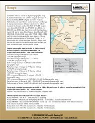
Turkey - Land Info
Turkey - Land Info
Turkey - Land Info

You also want an ePaper? Increase the reach of your titles
YUMPU automatically turns print PDFs into web optimized ePapers that Google loves.
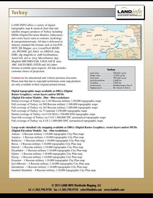
<strong>Turkey</strong><br />
LAND INFO offers a variety of digital<br />
topographic map & nautical chart data and<br />
satellite imagery products of <strong>Turkey</strong> including<br />
DEMs (Digital Elevation Models), bathymetry<br />
and vector layers such as contours, hydrology<br />
& transportation/roads. All data is delivered in<br />
industry standard file formats such as GeoTiff,<br />
NITF, ER Mapper .ecw, LizardTech MrSID<br />
.sid, JPG2000 .jp2, Idrisi .rst, ERDAS .img,<br />
ESRI .shp shapefile or .mdb GeoDatabase,<br />
AutoCAD .dxf or .dwg, MicroStation .dgn,<br />
Map<strong>Info</strong> MIF/MID/TAB, USGS ASCII .dem,<br />
ARC ASCII GRID, DTED and .bil (other<br />
formats available upon request). All data includes<br />
customer choice of projection.<br />
Contact us for educational and volume purchase discounts.<br />
Please note that due to copyright restrictions some map products<br />
are only available in their original printed format.<br />
Digital topographic maps available as DRGs (Digital<br />
Raster Graphics), vector layers and/or DEMs<br />
(Digital Elevation Models: 20m - 90m resolution):<br />
Partial coverage of <strong>Turkey</strong> via 2,162 Russian military 1:50,000 topographic maps<br />
Full coverage of <strong>Turkey</strong> via 580 Russian military 1:100,000 topographic maps<br />
Full coverage of <strong>Turkey</strong> via 162 Russian military 1:200,000 topographic maps<br />
Full coverage of <strong>Turkey</strong> via 73 national 1:250,000 topographic maps<br />
Partial coverage of <strong>Turkey</strong> via 9 US NGA 1:250,000 JOG topographic maps<br />
Near-full coverage of <strong>Turkey</strong> via 5 US 1:500,000 TPC aeronautical topographic maps<br />
Full coverage of <strong>Turkey</strong> via 4 US 1:1,000,000 ONC aeronautical topographic maps<br />
<strong>Turkey</strong><br />
<strong>Land</strong> area ..................... 769,632 sq km<br />
Water area ................... 13,930 sq km<br />
Total area ..................... 783,562 sq km<br />
<strong>Land</strong> boundaries ............ 2,648 km<br />
Coastline ...................... 7,200 km<br />
Lowest point .................. Mediterranean Sea 0<br />
Highest point ................. Mt. Ararat 5,166 m<br />
Large-scale (detailed) city mapping available as DRGs (Digital Raster Graphics), vector layers and/or DEMs<br />
(Digital Elevation Models: 5m - 10m resolution):<br />
Ankara – 4 Russian military 1:10,000 topographic City Plan maps<br />
Antalya – 1 Russian military 1:10,000 topographic City Plan map<br />
Balikesir – 1 Russian military 1:10,000 topographic City Plan map<br />
Bursa – 2 Russian military 1:10,000 topographic City Plan map<br />
Denizli – 1 Russian military 1:10,000 topographic City Plan map<br />
Diyarbakir – 1 Russian military 1:10,000 topographic City Plan map<br />
Edirne – 1 Russian military 1:10,000 topographic City Plan map<br />
Elazig – 1 Russian military 1:10,000 topographic City Plan map<br />
Erzurum – 1 Russian military 1:10,000 topographic City Plan map<br />
Icel (Mersin) – 2 Russian military 1:10,000 topographic City Plan map<br />
Iskenderun – 1 Russian military 1:10,000 topographic City Plan map<br />
Istanbul (Stambul) – 4 Russian military 1:10,000 topographic City Plan map<br />
© 2015 LAND INFO Worldwide Mapping, LLC<br />
tel +1.303.790.9730 ● fax +1.303.790.9734 ● sales@landinfo.com ● www.landinfo.com
<strong>Turkey</strong> (continued)<br />
Izmir – 2 Russian military 1:10,000 topographic City Plan map<br />
Kahramanmaras (Marash) – 1 Russian military 1:10,000 topographic City Plan map<br />
Kars – 1 Russian military 1:10,000 topographic City Plan map<br />
Kayseri – 2 Russian military 1:10,000 topographic City Plan maps<br />
Kirikkale – 1 Russian military 1:10,000 topographic City Plan map<br />
Kocaeli (Izmit) – 1 Russian military 1:10,000 topographic City Plan map<br />
Konya – 1 Russian military 1:10,000 topographic City Plan map<br />
Malatya – 1 Russian military 1:10,000 topographic City Plan map<br />
Manisa – 1 Russian military 1:10,000 topographic City Plan map<br />
Sakarya (Adapazari) – 1 Russian military 1:10,000 topographic City Plan map<br />
Samsun – 1 Russian military 1:10,000 topographic City Plan map<br />
Sivas – 1 Russian military 1:10,000 topographic City Plan map<br />
Trabzon – 1 Russian military 1:10,000 topographic City Plan map<br />
Urfa – 1 Russian military 1:10,000 topographic City Plan map<br />
Zonguldak – 1 Russian military 1:10,000 topographic City Plan map<br />
Off-shelf global data of <strong>Turkey</strong>–low-cost, rapid delivery:<br />
<strong>Turkey</strong> VMAP-0 – US NGA 1:1,000,000 vector mapping<br />
<strong>Turkey</strong> SRTM - Shuttle Radar Topography Mission Dem data available at 1 arc second (ca. 30m), 3 arc second<br />
(ca. 90m) or 30 arc second (ca. 1km)<br />
<strong>Turkey</strong> GeoCover 1990 30m resolution 7-4-2 <strong>Land</strong>sat 5 ortho imagery<br />
<strong>Turkey</strong> GeoCover 2000 15m resolution 7-4-2 <strong>Land</strong>sat 7 ortho imagery<br />
Satellite Imagery:<br />
High-resolution satellite imagery including Airbus Pléiades 50cm, DigitalGlobe IKONOS 80cm, QuickBird 60cm,<br />
GeoEye-1 40cm, WorldView-1 40cm, WorldView-2 40cm & WorldView-3 30cm of <strong>Turkey</strong><br />
Medium-resolution satellite imagery for cost-effective large-area coverage including Airbus SPOT Image 1.5m - 20m<br />
& SPOTMaps, ALOS 2.5m - 10m, RapidEye 5m, ASTER 15m, DEIMOS 22m and <strong>Land</strong>sat 15m - 30m of <strong>Turkey</strong><br />
Remote Sensing Services:<br />
Image processing services including orthorectification, tonal balancing, mosaic output, pan-sharpening, band<br />
manipulation, natural color simulation, 16- to 8-bit scaling/DRA (Dynamic Range Adjustment), cloud-patching,<br />
atmospheric correction, wavelet compression, GPS GCP (Ground Control Point) target location and accuracy assessment.<br />
Classification & Object Based Image Analysis services including land-use/land cover, vegetation and impervious<br />
surface mapping.<br />
2d vector feature extraction including roads/transportation, hydrology and building footprints.<br />
3d terrain modeling via auto-correlation or photogrammetric methods using stereo satellite imagery including<br />
high-res (Pléiades, IKONOS, GeoEye-1, WorldView-1, WorldView-2 & WorldView-3 -- up to 1m post spacing),<br />
Airbus SPOT 5/6/7 (5m - 30m post spacing), ALOS (10m post spacing), ASTER (30m post spacing) or radar<br />
(Radarsat and Airbus WorldDEM TerraSAR-X/TanDEM-X); Intermap DEMs (5m post spacing) from airborne radar<br />
are also offered of select locations. 3d building models with customer choice of LOD (Level of Detail) are extracted<br />
from stereo or off-nadir imagery.<br />
© 2015 LAND INFO Worldwide Mapping, LLC<br />
tel +1.303.790.9730 ● fax +1.303.790.9734 ● sales@landinfo.com ● www.landinfo.com
<strong>Turkey</strong> (continued)<br />
Contact us with your AOI (Area of Interest) for a scene search to determine if the imagery you<br />
need is already in archive or has to be custom-acquired.<br />
LAND INFO Worldwide Mapping, LLC<br />
Founded in 1993, LAND INFO Worldwide Mapping, LLC (<strong>Land</strong> <strong>Info</strong>) maintains one of the world’s largest<br />
commercial archives of digital and paper topographic map and nautical chart data. Complemented by a variety<br />
of high-resolution and medium-resolution satellite imagery products, our total focus on data enables us to deliver<br />
high-quality solutions with rapid turn-around at competitive prices.<br />
The markets we serve include mapping and geographic information systems (GIS), academia, national security<br />
and defense, visualization/simulation, aviation, wireless communications and other utilities, mining, oil & gas,<br />
conservation, hydrology, civil and environmental engineering, conservation, humanitarian assistance, land<br />
surveying, development, fleet management, mass media and motion pictures, among others.<br />
LAND INFO is a DigitalGlobe Distribution Partner, RapidEye Direct Distributor, USGS Business Partner, Esri®<br />
Business Partner, Authorized Intermap Data Distributor and AIRBUS DEFENCE & SPACE Image Partner.<br />
© 2015 LAND INFO Worldwide Mapping, LLC<br />
tel +1.303.790.9730 ● fax +1.303.790.9734 ● sales@landinfo.com ● www.landinfo.com