Study for Seismic Microzoning in Damascus City, Syria, from ... - IISEE
Study for Seismic Microzoning in Damascus City, Syria, from ... - IISEE
Study for Seismic Microzoning in Damascus City, Syria, from ... - IISEE
You also want an ePaper? Increase the reach of your titles
YUMPU automatically turns print PDFs into web optimized ePapers that Google loves.
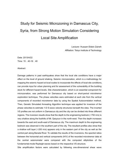
<strong>Study</strong> <strong>for</strong> <strong>Seismic</strong> <strong>Microzon<strong>in</strong>g</strong> <strong>in</strong> <strong>Damascus</strong> <strong>City</strong>,<br />
<strong>Syria</strong>, <strong>from</strong> Strong Motion Simulation Consider<strong>in</strong>g<br />
Local Site Amplification<br />
Lecturer: Hussam Elde<strong>in</strong> Za<strong>in</strong>eh<br />
Affiliation: Tokyo Institute of Technology<br />
Data: 2013/4/22<br />
Time: 15:40-16:40<br />
Abstract:<br />
Damage patterns <strong>in</strong> past earthquakes show that the local site conditions have a major<br />
effect on the level of ground shak<strong>in</strong>g. <strong>Seismic</strong> microzonation, which is a methodology <strong>for</strong><br />
mapp<strong>in</strong>g the seismic hazard at local scales to <strong>in</strong>corporate the effects of local site conditions,<br />
can provide <strong>in</strong>put <strong>for</strong> urban plann<strong>in</strong>g and <strong>for</strong> assessment of the vulnerability of the build<strong>in</strong>g<br />
stock <strong>for</strong> different hazard levels. Site characterization, which is an essential component <strong>for</strong><br />
microzonation, was per<strong>for</strong>med <strong>for</strong> <strong>Damascus</strong> city based on short-period microtremor<br />
exploration technique. The phase velocities were estimated at each site <strong>from</strong> the vertical<br />
components of recorded microtremor data by us<strong>in</strong>g the Spatial Autocorrelation method.<br />
Then, Genetic Simulated Anneal<strong>in</strong>g Algorithm technique was applied <strong>for</strong> <strong>in</strong>version of the<br />
phase velocities to estimate 1-D S-wave velocity structures beneath the sites. The <strong>in</strong>verted<br />
VS profiles are not uni<strong>for</strong>m <strong>in</strong> <strong>Damascus</strong> city and the city can be divided <strong>in</strong>to three different<br />
regions. The <strong>in</strong>version results show that the depth to the eng<strong>in</strong>eer<strong>in</strong>g bedrock (~750 m/s) is<br />
very shallow along the foothills of Mt. Qasyoun <strong>in</strong> the north-west. Then the depth <strong>in</strong>creases<br />
towards the east and south-east of <strong>Damascus</strong> city. The maximum depth to the eng<strong>in</strong>eer<strong>in</strong>g<br />
bedrock was observed <strong>in</strong> the southern part of the city. The resultant profiles also show that<br />
a shallow soft layer (~200 m/s) appears only <strong>in</strong> the eastern part of the city as well as the<br />
central part along Barada River. To validate the results of the <strong>in</strong>versions, the spectral ratios<br />
between the horizontal and vertical components (H/V) of the recorded microtremor data at<br />
the central seismometer were compared with the computed ellipticities of the<br />
fundamental-mode Rayleigh-waves based on the respective VS structure.<br />
Site amplification factors were calculated by follow<strong>in</strong>g one-dimensional shear wave
propagation theory <strong>for</strong> vertical <strong>in</strong>cident S-wave us<strong>in</strong>g the <strong>in</strong>verted VS structure. To validate<br />
the applicability of the NEHRP site classification <strong>in</strong> the case of <strong>Damascus</strong> city, averaged<br />
site amplification was compared with the averaged S-wave velocity <strong>for</strong> the top 30 and 10<br />
meters of soil (VS30 and VS10). VS10 shows a better correlation with the averaged site<br />
amplification than VS30. That <strong>in</strong>dicates VS10 as a better proxy <strong>for</strong> site amplification <strong>in</strong> the<br />
case of <strong>Damascus</strong> city. We also compared the site amplification with the topographic<br />
conditions. We per<strong>for</strong>med a multiple regression analysis with the averaged amplification<br />
factor as the criterion variable and def<strong>in</strong>ed by different <strong>in</strong>dependent parameters (Elevation,<br />
Slope, Distance <strong>from</strong> rivers, and Site classification). A fairly good correlation between the<br />
averaged site amplification and Elevation as well as Distance <strong>from</strong> rivers was found <strong>in</strong> the<br />
case of <strong>Damascus</strong> city. These relationships can be used <strong>for</strong> seismic hazard assessment <strong>in</strong><br />
<strong>Damascus</strong> city even though they need to be improved.<br />
The seismic hazard potential <strong>for</strong> <strong>Damascus</strong> city is ma<strong>in</strong>ly controlled by earthquakes along<br />
Serghaya Fault which is a branch of Dead Sea Fault System. Through the last 2000 years,<br />
many destructive earthquakes occurred <strong>in</strong> the region and caused much causality <strong>in</strong><br />
<strong>Damascus</strong> city and its vic<strong>in</strong>ity; one of the most destructive events occurred <strong>in</strong> November,<br />
1759 with a magnitude of ~7.4. Strong ground motions due to the November 1759<br />
Earthquake along the fault of Serghaya, were estimated with a numerical simulation<br />
technique. In the simulation, the Kostrov-like slip-velocity function was used as an <strong>in</strong>put to<br />
the discrete wave number method to simulate the strong ground motions <strong>in</strong> a broadband<br />
frequency range. In order to model the <strong>in</strong>coherent rupture propagation which can excite<br />
large high-frequency waves, random numbers are added to arrival time of circular rupture<br />
front. For source model<strong>in</strong>g of the 1759 Earthquake, MMI <strong>in</strong>tensities calculated <strong>from</strong> the<br />
synthetic ground motions are compared with the observed values by Ambraseys &<br />
Barazangi (1989). The calculated <strong>in</strong>tensities are <strong>in</strong> good agreement with the observed<br />
ones at the most sites that validate appropriateness of the proposed source model.<br />
A grid system with 1.0 km * 1.0 km cells was adopted <strong>in</strong> <strong>Damascus</strong> city. We simulated the<br />
ground motions at the top layer of VS = 1600 m/s at each grid po<strong>in</strong>t us<strong>in</strong>g the most<br />
appropriate source model of the 1759 Earthquake. The peak ground velocities at the<br />
ground surface (PGVS) were calculated by consider<strong>in</strong>g the effects of shallow soil layers<br />
overla<strong>in</strong> the layer of VS = 1600 m/s. The microzonation maps with respect to peak ground<br />
velocity at ground surface (PGVS) were estimated <strong>for</strong> <strong>Damascus</strong> city. The highest values<br />
of PGVS were obta<strong>in</strong>ed at the central and eastern parts of the city and the smallest values<br />
were obta<strong>in</strong>ed at the southern parts of <strong>Damascus</strong> due to the local site effects. We then<br />
followed the equivalent l<strong>in</strong>ear approximation of nonl<strong>in</strong>ear response to estimate the free<br />
surface ground motions at different sites <strong>in</strong> <strong>Damascus</strong> city. Acceleration response spectra
were estimated and compared with the design response spectra def<strong>in</strong>ed by the <strong>Syria</strong>n<br />
build<strong>in</strong>g code. The simulated high frequency (1.0 – 6.0 Hz) ground motions <strong>for</strong> the sites <strong>in</strong><br />
the <strong>Damascus</strong> city are higher than the design requirements def<strong>in</strong>ed by the code. We also<br />
simulated the ground motions at two sites <strong>in</strong> the epicenter region of the 1759 Earthquake.<br />
Acceleration response spectra were calculated and compared with the design<br />
requirements def<strong>in</strong>ed by the <strong>Syria</strong>n codes. The simulated high frequency ground motions<br />
<strong>for</strong> sites <strong>in</strong> the focal region are bigger than the design requirements <strong>in</strong> the case of the<br />
near-fault factors are not considered. That demonstrates the appropriateness of<br />
consider<strong>in</strong>g the near-fault factors <strong>for</strong> a site near focal region as <strong>in</strong>troduced by the new<br />
build<strong>in</strong>g code.


