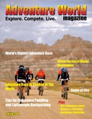
view issue - Adventure World Magazine
view issue - Adventure World Magazine
view issue - Adventure World Magazine

Create successful ePaper yourself
Turn your PDF publications into a flip-book with our unique Google optimized e-Paper software.
to throw the accuracy off.<br />
Route finding: Is everything.<br />
Doesn’t matter how fast you’re<br />
going if you pick the wrong<br />
route. Do you go over the hilltop<br />
or around the hill? Although going<br />
around is longer in distance,<br />
it doesn’t require as much climbing.<br />
Gravel road or single track?<br />
The single track might be way<br />
shorter but technical and slow.<br />
Maybe you would slow to a couple<br />
of miles per hour against 10-<br />
15 MPH + on the gravel road.<br />
Practice different scenarios so<br />
you can understand how different<br />
route choices affect your racing.<br />
Bushwhack or hiking trail?<br />
How fast can you bushwhack?<br />
What’s the terrain like? Overgrown,<br />
briars, clear-cut, uphill,<br />
or downhill? You don’t know<br />
‘till you try and the race is the<br />
wrong time to find out. Orienteering<br />
meets are, again, a good<br />
way to practice bushwhacking.<br />
Typically, an orienteering map<br />
will “show” you the vegetation<br />
type and thickness so you can<br />
try different routes to the same<br />
point. I keep all my “O” meet<br />
maps and regularly go back to<br />
some of the locations and practice.<br />
Navigation at night: Tough,<br />
takes some getting used to. Stay<br />
on top of your map and on top of<br />
your compass at night more than<br />
ever. The lack of light makes it<br />
difficult to see the topography.<br />
You can’t clearly ascertain the<br />
tops of hills on the horizon or<br />
the steepness of inclines and declines.<br />
Practice shooting a bearing<br />
and having a team mate go<br />
forward a few hundred feet and<br />
calling back to you so you can<br />
make sure he’s on the right line<br />
then move up to him and start<br />
again. Make sure you know<br />
where you are before shooting<br />
down that hill in case you have<br />
to come back up again!<br />
Read the map: Especially before<br />
the race. Note the scale (typically<br />
1:24000 in AR but not always!),<br />
the contour spacing (typically 20<br />
or 40 feet – big difference!) and<br />
the declination (the angle between<br />
magnetic and true north).<br />
You really should have a compass<br />
that adjusts for declination.<br />
This is not so important in the<br />
southeast but hugely important in<br />
other parts of the country and the<br />
rest of the world. When planning<br />
your route, pre-race, use colored<br />
highlighters to mark your different<br />
routes. Use a different color<br />
for each discipline so you don’t<br />
get confused if the race goes<br />
over the same ground. Write<br />
important details, clues and CP<br />
locations on the map, preferably<br />
in red (easier to see through) but<br />
make sure this doesn’t cover any<br />
important features. The more information<br />
you have in one place,<br />
the less you are likely to miss<br />
something if you’re referring to<br />
different sources (map, passport,<br />
clue sheet, etc). Don’t be afraid<br />
to make a non navigating team<br />
member the clue sheet reader, as<br />
a back up, but make sure they remember<br />
to keep you up to date.<br />
Write the approximate distances<br />
between important junctions<br />
or features on the map, also so<br />
you’re not guestimating during<br />
the race.<br />
<strong>Adventure</strong> <strong>World</strong> <strong>Magazine</strong> is a GreenZine 25