EASC Agenda January 19 2010 - Cowichan Valley Regional ...
EASC Agenda January 19 2010 - Cowichan Valley Regional ...
EASC Agenda January 19 2010 - Cowichan Valley Regional ...

You also want an ePaper? Increase the reach of your titles
YUMPU automatically turns print PDFs into web optimized ePapers that Google loves.
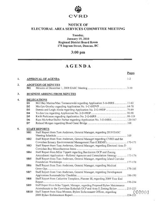
NOTICE OF<br />
ELECTORAL AREA SERVICES COMMITTEE MEETING<br />
1. APPROVAI, OF AGENDA<br />
Tuesday,<br />
<strong>January</strong> <strong>19</strong>,<strong>2010</strong><br />
<strong>Regional</strong> District Board Room<br />
175 Ingram Street, Duncan, BC<br />
AGENDA<br />
2. ADOI'TION OF MINIJTES<br />
M1 Minutes of December 1, 2009 <strong>EASC</strong> Meeting<br />
3. BUSINESS ARISING FROM MINUTES<br />
4. DELEGATIONS<br />
Dl<br />
D2<br />
Mill Bay MarinaIMax Tomaszewski regarding Application 5-A-OSRS .................. 11 -63<br />
- ..<br />
Marilyn Gourley regarding Application No. I-C-09DVP ....................................... 64-78<br />
D3 Dennis and Leigh Ahola regarding Application No. 2-G-09DP .............................. 79-89<br />
D4 Te-Zen Liu regarding Application No. 2-D-09DP ................................................... 90-98<br />
D5 Keith Parkinson regarding Application No. 2-G-08RS .......................................... 9 9 <strong>19</strong><br />
D6 Russ McArlhur/Balbir l'arhar regarding Application No. 3-D-08RS ...................... 120-1 67<br />
D7 Roland Morgan regarding Hood Canal Bridge ...................................................... 168<br />
5. STAFF REPORTS<br />
SR1 Staff Report from Tom Anderson, General Manager, regarding . <strong>2010</strong> <strong>EASC</strong><br />
.................................. 169<br />
SR2<br />
g CVRD and the<br />
<strong>Cowichan</strong> Estuary Environmental Management Plan (CEEMP) ............................. 170-171<br />
SR3 Staff Report from Toni Anderson, General Manager, regarding Electoral Area D<br />
<strong>Cowichan</strong> Bay Miscellaneous Items 172<br />
SR4 Staff Report from Mike Tippett regarding Bamberton OCP and Zoning<br />
Amendment Application - Referral Agencies and Consultation Strategy .............. 173-1 76<br />
SR5 Staff Report from Ton1 Anderson: General Manager, regarding Island Coi-t-idor<br />
Foundation Workshops 177-178<br />
SR6<br />
179-185<br />
SR7<br />
Application Sustainability Checklist 186.<strong>19</strong>5<br />
SR8<br />
<strong>19</strong>6-214<br />
SR9<br />
SRlO<br />
Atnendments to the <strong>Cowichan</strong>-Koksilali OCP and Area E Zoning Bylaw .............. 2 15-223<br />
Staff Report from Nino Morano, Bylaw Enforcement Officer, regarding<br />
C'OO6!l.'!<br />
2009 Bylaw Enforcemex~t Repor<br />
224-225
SRll Staff Report from Nino Morano, Bylaw Enforcement Officer, regarding<br />
<strong>Cowichan</strong> <strong>Valley</strong> Trap and Skeet Club Special Event Shoot <strong>2010</strong> ......................... 226-228<br />
6. APC<br />
API<br />
AP2<br />
Minutes of Area C APC rneetine of Dece~nber 10.2009<br />
Minutes of Area D APC meeting of November 18, 2009 ........................................ 23 1-232<br />
AP3<br />
AP4<br />
Minutes of Area H APC meeting of October 8, 20<br />
Minutes of Area N APC meeting of November 16<br />
AP5 Minutes of Area I APC meeting of <strong>January</strong> 5,201<br />
7. PARKS<br />
PK1 Staff Report from Ryan Dias, Parks Operations Superintendant regarding<br />
Community and <strong>Regional</strong> Parks Portable Toilet Contract ....................................... 239-240<br />
PK2 Email dated <strong>January</strong> 10,<strong>2010</strong><br />
the Area D Parks Commission<br />
PK3 Minutes of Special Area G Pa<br />
PK4 Minutes of Area F Parks Coinmission meeting of December 3, 2009 .................... 245<br />
PK5 Minutes of Area I Parks Cominission meeting of December 8, 2009 ...................... 246-248<br />
PK6 Minutes of Area A Parks Con?mission meeting of November 26, 2009 .................. 249-25 1<br />
PK7 Minutes of South <strong>Cowichan</strong> Parks Commission meeting of November 2,2009 ..... 252-253<br />
8. CORRESPONDENCE<br />
C1 Email dated December <strong>19</strong>,2009, from Joanne de Vries, Fresh Outlook<br />
Foundation regarding Building SustainAble Conlmunities (BSC) <strong>2010</strong> ............... -254<br />
C2 Cot~espondence to Director Duncan from FCM regarding FCM <strong>2010</strong> Sustainable<br />
Communities Conferenc 255<br />
C3 Grant-in-Aid Request A 256-257<br />
C4 Grant-in-Aid Request Area B 258-259<br />
C5 Grant-in-Aid Request Area C 260-262<br />
9. INFORMATION<br />
IN1 November 2009 Building Report ............................................................................. 263-265<br />
IN2 December 2009 Building Report ............................................................................. 266-268<br />
10. NEW BUSINESS<br />
12. CLOSED SESSION<br />
Motion that the meeting be closed to the public in accordance with the Co~nmunity Charter Part 4,<br />
Division 3, Section 90(1), subsections as noted in accordance with each agenda item.<br />
SMl Minutes of Closed Session <strong>EASC</strong> meeting of December 1, 2009 .......................... 269<br />
CSSRl Staff Report regarding Section 90(1)(1) ................................................................... 270-271<br />
CSSR2 Staff Report regarding Section 90(1)(g) ................................................. 272-282<br />
CSSR3 Staff Report regarding Section 90(l)(a) .................................................................. 283-285<br />
13. NEXT MEETING<br />
Tuesday, February 2,<strong>2010</strong><br />
14. ADJOURNMENT<br />
NOTE: A copy of the full agenda package is available at the CVRD website wvvw.cvrd.bc.ca<br />
Director B. Hankon Director M. Marcotte Director L. Iannidinardo<br />
Director K. Cossey Director G. Giles Director L. Duncan 0 0 0 0 0<br />
Director I. Morrison Director K. Kuhn Director M. Dorey
PRESENT<br />
CVRD STAFF<br />
APPROVAL OF<br />
AGENDA<br />
Minutes of the Electoral Area Services Conlmittee Meeting held on Tuesday,<br />
December 1, 2009 at 3:00 pm in the <strong>Regional</strong> District Board Room, 175 Ingrain<br />
Street, Duncan, BC.<br />
Director B. Hanison, Chair<br />
Director M. Marcotte, Vice-Chair<br />
Director L. lanilidinardo<br />
Director K. Kuhn<br />
Director I. Morrison<br />
Director L. Duncan<br />
Director M. Dorey<br />
Director G. Giles<br />
Director I
Minutes of <strong>EASC</strong> Meeting of December 1,2009 (Con't.) Page 2<br />
Jiin Logan, applicant, was present and added further information to the staff<br />
report.<br />
There were questions to the applicant kom Committee men~bers.<br />
Director Dunca~i suggested that a covenant be placed on the propeily to prohibit<br />
signage.<br />
It was Moved and Seconded<br />
1. That Rezoning Application 4-A-07RS (Logan) be approved;<br />
2. That prior to any reading of the amendment bylaws, the Ministry of<br />
Tra~lsportation and Infrastructure indicate in writing to the CVRD that<br />
the sight distance issue has been resolved or can be resolved to their<br />
satisfaction; AND a landscaping plan be submitted with cost estimates;<br />
3. That prior to co~lsideration of adoption of the anlendmelit bylaws, the<br />
owner register a covel~ant on title prohibiting any signs kom being<br />
posted along the southern boundary of the property along the Trans<br />
Canada Highway; and<br />
4 That a BCLS survey be done of the 0.8 ha site being rezoned and that<br />
portion be fenced, or that a security (ILOC) sufficient to ensure fencing<br />
is installed be received by the CVRD; and that a security (LOC)<br />
sufficient to ensure that landscape screening in the plan mwil be done is<br />
deposited with the CVRD.<br />
MOTION CARRIED<br />
D2 - Mann Alison Ganlett, Pla~u~ing Technician, presented Application No. I-G-O9DVP<br />
(Reg and Anne Mann) to relax the side interior parcel line setback of existing<br />
residence at 3696 Gardner Road.<br />
There were no questions to staff or the applica~~t fro111 Comnlittee meinbers.<br />
It was Moved and Seconded<br />
That Applicatioii No. I-G-09DVP by Reg and hle Ma~in for a variance to<br />
Section 5.4(4) of Zoning Bylaw No. 2524, by decreasing the setback to a side<br />
interior parcel line from 1.8 nletres down to 0.94 metres on Lot 20, District Lot<br />
34, Oysler District, Plan 6095, be approved, subject to the applicailt providing a<br />
survey confii~ning compliance with the approved distance.<br />
MOTION CARRCED
Minutes of <strong>EASC</strong> meet in^ of December. 1,2009 (Con't.)<br />
Page 3<br />
D3 - Koutougas Aliso~l Ganiett, Pla~ming Technician, presented Application No. 3-A-09RS<br />
(Gerry Koutougas) to rezone properties located at 2691 and 2673 Mill Bay<br />
Road, from R-3A to new residentivl duplex zone.<br />
Tlie Comulittee directed questions to staff.<br />
Geriy ICoutougas, applica~~t, was present and provided further informalioil to the<br />
staff report.<br />
Tile Coinmittee directed questions to the applicant<br />
It was Moved and Seconded<br />
That Rezoning Application No. 3-A-09RS (ICoutougas) be held in abeyance<br />
pending the following:<br />
Tlie applica~~t to address the commcllts from Miiiistiy of<br />
Transportation and the Vancouver Islalld Health Authority;<br />
Recornniendation of APC regarding proposed new zone; and<br />
Clarification kom CVRD Engi~leering Services regarding<br />
service area.<br />
MOTION CARRED<br />
D4 - Parhar Rob Conway, Manager, presented Application No, 5-E-07DPi6-E-07DP (Parhay<br />
Manageluent Ltd.) regarding consideratioli to anie~ld Board conditiol~ and<br />
establish an expiration date for corupletion of conditions.<br />
STAFF REPORTS<br />
The Coininittee directed questions to staff.<br />
The applicant was not present.<br />
It was Moved and Seconded<br />
That Application No. 5-E-07DP and 6-E-07DP (Pavhar Holdings) be referrl-ed<br />
back to staff for further i~iformatioll and that a report be brought back to the next<br />
<strong>EASC</strong> meeting in <strong>January</strong> 201 0.<br />
MOTION CARRIED<br />
SRI - <strong>2010</strong> Budget It was Moved and Seconded<br />
Plau~~i~lg & That the <strong>2010</strong> Animal Colltrol Budget No. 310 be approved subject to delelion<br />
Development of the 20% surplus operating reserve.<br />
MOTION CARRIED
It was Moved and Seconded<br />
That the <strong>2010</strong> Building Inspectio~l Budget No. 320 be approved subject lo<br />
deletion of the 20% surplus operating reserve.<br />
MOTION CARRIED<br />
It was Moved and Seconded<br />
That the <strong>2010</strong> Commu~lity Pla~ulitlg Budget No. 325 be referred until further<br />
info~lnation is received.<br />
MOTION CARRZED<br />
It was Moved and Seconded<br />
That the <strong>2010</strong> Bylaw Enforcement Budget No. 328, Thetis Island Wharf Budget<br />
No. 490, and Thetis Island Boat Launch No. 491, be approved.<br />
MOTION CARRIED<br />
SR2 - <strong>2010</strong> Budget It was Moved and Seconded<br />
No. 250 That the <strong>2010</strong> Electoral Area Se~vices Budget No. 250 be approved subject to<br />
deletioil of the 20% surplus operating reserve.<br />
MOTION CARRIED<br />
Note: Director Giles requested that a contingency be added for Director's<br />
conferences.<br />
SR3 - <strong>2010</strong> Budget It was Moved and Seconded<br />
Parks That the Bright Angel Park Budget No 281 be amended by incrcas~ng the<br />
approved 2009 budget by $3,000 from $27,000 to $30,000 for <strong>2010</strong>.<br />
MOTION CARRIED<br />
It was Moved and Seconded<br />
That the <strong>2010</strong> South End Parks Budget No. 282 be approved with no change<br />
fiom the 2009 requisition of $50,000.<br />
MOTION CARRIED<br />
It was Moved and Seconded<br />
That the <strong>2010</strong> Com~nunity Parlts and Trails Program Budget Nos. 231, 232,233,<br />
234, 236, 237, 238, and 456 be approved; that Budget No. 235 be a~nended by<br />
i~lcreasi~lg the Capital expenditures by $20,000 to $320,000 and increasiny the<br />
requisition by $20,000 to $160,000, and further, that Budget 239 be anlcnded by<br />
i~lcreasi~lg the operational expe~lditures by $27,000 and increasing the<br />
requisitio~l by $27,000 from $92,000 to $1 <strong>19</strong>,000.<br />
MOTION CARRIED
Minutes of <strong>EASC</strong> Meeting of December 1,2009 (Con't.) Page 5<br />
SR4 -Year End<br />
Transfer - Parks<br />
SRS - Woodland<br />
Shores<br />
It was Moved and Seconded<br />
That the <strong>2010</strong> Comn~unity Parks and Trails Service Budget No. 279 be<br />
approved, and furthermore that the Parks and Trails Planner, Parlcs Coordinator<br />
- Capital Projects aiid Parks Vehicle supplemental items presented be brought<br />
foiward for fuiilier consideration as part of the <strong>2010</strong> budget planning process.<br />
MOTION CARRIED<br />
It was Moved and Seconded<br />
That the following transfer of 2009 yearend surplus anlounts be approved for<br />
Electoral Area Community Parlcs functions 231 (Area A), 235 (Auea E) and 237<br />
(Area G):<br />
Area A Conimunity Parlcs Capital Resei-ve Fund - $15,000<br />
Area E Community Parks Capital Reserve Fund - $70,000<br />
Area G Coinmunity Parlcs Capital Reserve Fund - $40,000<br />
MOTION CARRTED<br />
It was Moved and Seconded<br />
That the Board Chair and Corporate Secretary be authorized to execute tlie<br />
necessary docuinents to amend the existing Parlcs and Trails Deficiencies<br />
Agreemelit with Woodland Shores to reduce the outstanding deficiencies value<br />
from $44,400 to $10,000, and furthermore that Woodland Shores be i.eimbursed<br />
$34,400 from the deficiencies fund currently held by the <strong>Regional</strong> District under<br />
the terms of the existing agreement.<br />
MOTION CARRIED<br />
SR6 - 201 0 Budget It was Moved and Seconded<br />
Public Safety That the <strong>2010</strong> North Oyster Fire Department Budget No. 350 be aiiiended by<br />
increasing the requisition aniount by $10 per $100,000 household 01. the<br />
statutory limitation.<br />
MOTION CARRIED<br />
It was Moved aiid Seconded<br />
That tlie <strong>2010</strong> Fire Depai-tnient Budgets No. 351, 354, 355, 357 and 358 be<br />
approved.<br />
MOTION CARRIED
Minutes of <strong>EASC</strong> Meeting of December 1,2009 (Con't.) Page 6<br />
AQC<br />
AP1 -Minutes It was Moved and Seconded<br />
That the minutes of the Area A APC meeting of Noveinber 10, 2009, be<br />
received and tiled.<br />
PARKS<br />
MOTION CARRUED<br />
PK1 to PK4 - Minutes It was Moved and Secoilded<br />
That the following minutes be received and filed:<br />
Minutes of Area G Parlcs meeting of November 2,2009<br />
Minutes of Area I Parks meeting of November 10,2009<br />
Minutes of Area D Parks rneeting of October <strong>19</strong>,2009<br />
Minutes of Area C Parlts meeting of Noveinber 10,2009<br />
CORRESPOND-<br />
ENCE<br />
MOTION CARRIED<br />
C1- ALC It was Moved and Seconded<br />
That the letter dated Noveinber 18, 2009, from Independent Contractors and<br />
Businesses Association of BC regarding the Agricultural Land Reserve, be<br />
received and filed.<br />
MOTION CARRIED<br />
C2 to C6 - Grants-in- It was Moved and Seconded<br />
Aid That the following grants in aid be accepted:<br />
That a Grant-in-Aid (Electoral Area F - <strong>Cowichan</strong> Lalce SoutWSkutz Falls) in<br />
the amount of $2000 be given to Caycuse Volunteer Fire Deparlment to assist<br />
with equipment and building repair costs.<br />
That a Grant-in-Aid (Electoral Area A - Mill BayIMalahat) in ihe amount of<br />
$2205 be given to Sussex Consultants to assist with a funding sho~~fall for the<br />
South Cowichai~ Governance Study.<br />
That a Grant-in-Aid (Electoral Area B - Shawnigan Lalte) in the amount of<br />
$2205 be given to Sussex Consultants to assist with f~~nding fol- the Soutll<br />
<strong>Cowichan</strong> Governance Study.<br />
That a Grant-ill-Aid (Electoral Area C - Cobble Hill) in the an~ount<br />
of $2205 be<br />
given to Sussex Consultants to assist with funding for ihc South Co\v~cl~a~?<br />
Governance Study.
Minutes of <strong>EASC</strong> Meetin~ of December 1,2009 (Con't.) Page 7<br />
INFORMATION<br />
That s Grant-in-Aid (Electoral Area C - Cobble Hill) in the aniount of $1000 be<br />
given to CMS Foodbank Society to assist with local community needs.<br />
MOTION CARRIED<br />
IN1 -Building Report It was Moved and Seconded<br />
That the October 2009 building rep011 be received and filed<br />
NEW BUSINESS<br />
I - CEEMP<br />
2 -Staff Reports<br />
MOTION CARRIED<br />
Director Dunca~i stated that the <strong>Cowichan</strong> Estuaiy Managenlent Plan needs to be<br />
suppoifed and would like tlie CVRD to be more involved. Director<br />
Iannidinardo noted that the Ministry of Enviro~unei~t has and needs to keep tlie<br />
leadership role but support and involvement from the CVRD is needed.<br />
Director Duncan suggested that a small budget be created for adniinistration<br />
support.<br />
It was Moved and Seconded<br />
That a <strong>Regional</strong> budget function be created in the amouilt of 55000 to provide<br />
support for the <strong>Cowichan</strong> Estuary Environnlental Management Plain.<br />
MOTION CARRIED<br />
It was Moved and Seconded<br />
That staff be directed to prepare a report outlining what is requircd lo amend<br />
existing bylaws to allow illail ill ballots for elections and referendums.<br />
MOTION CARRIED<br />
It was Moved and Seconded<br />
That staff be directed to prepare a report regarding the feasibility of the Building<br />
Department requiring that legible and highly reflective street addresses be<br />
properly displayed at the front of properties prior to occupancy peiluits being<br />
issued.<br />
MOTION CARRIED
Minutes of <strong>EASC</strong> Meeting of December 1,2009 (Con't.) Page 8<br />
CLOSED SESSSION It was Moved and Seconded<br />
That the meeting be closed to the public it1 accordance with the Cor~i~izuni~~:<br />
Clzal.rei- Part 4, Division 3, Section 90(1), subsections as noted in accordatlce<br />
wit11 each agenda itern.<br />
MOTION CARRIED<br />
The Co~lllnittee moved illto Closed Session at 5:48 p1i1.<br />
RISE The Co11111iittee rose without report.<br />
ADJOUNRMENT It was Moved and Seconded<br />
That the meeting be adjoumed<br />
MOTION CARRIED<br />
The meeting adjoumed at 5:55 pm.<br />
Chair Recording Secretary
DATE: <strong>January</strong> 11,<strong>2010</strong> FILE NO: 5-A-08RS<br />
FROM: Mike Tippett, Manager<br />
Community and <strong>Regional</strong> Planning Division<br />
BYLAW NO: 1890 and2000<br />
SUBJECT: Application No. 5-A-08RS<br />
Mill Bay Marina Residences Ltd.<br />
Recommendation:<br />
That Application No. 5-A-08RS (Mill Bay Marina Residences Ltd.) to permit full-time<br />
occupancy of Block C, Sections 1 and 2, Range 9, Sliawnigali District, Plan 1720, except part in<br />
Plans 29781 and 30142 through a zoning amendment be denied and that the appropriate refund<br />
of $660 be given to the applicants in accordance with the provisions of CVRD Developruent<br />
Applications Procedures and Fees Bylaw No. 3275.<br />
Purpose:<br />
The applicants are seekin a zoning. amendment that would permit full time residential<br />
occupal~cy of the proposed Mill Bay ~ arina 28 hotel unit structure,khich has a Board resolution<br />
from late 2007 approving of the issuance of a development permit. To date, this DP has not been<br />
issued because a number of the Board's conditions have not been met. If the DP approval is not<br />
acted on by April 30, <strong>2010</strong>, the approval will become void. This zoning amendment application<br />
also seeks the approval of a reversal of the location of the marina access jetty, ffom the south end<br />
of the water lease lot to the north end, and an expansion of the water lease lot for a proposed<br />
extension of the marina to the south.<br />
Financial Implications:<br />
None apparent.<br />
Interdepartmental/Agencv Implications:<br />
See report text<br />
Background:<br />
Location of Subject Property: 740 Handy Road, Mill Bay<br />
Leeal Description: Block C, Sections 1 and 2, Range 9, Shawnigan District, Plan 1720, except<br />
part in Plans 29781 and 30142 (PID: 001-027-433); and Foreshore Lease<br />
Lot 459 (Lease No. 112643)
Date Application and Complete Documentation Received: November 7. 2008<br />
Owner: MB Marina Residences Ltd.<br />
Applicant: As above<br />
Size of Parcel: 2 5614 m'; Water Lot is 1.079 ha<br />
Existing Zoning: C-4 (Tourist Recreational Commercial) and W-3 (Water Marina)<br />
Minimum Lot Size Under Existing Zonino: C-4 is 0.4 ha; W-3 has none specified<br />
Existinp Plan Designation: Tourist Recreational Commercial; none specified for the marina<br />
Existing Use of Propertv: Marina and Campground<br />
Existiun Use of Surrounding Properties:<br />
North: Handy Road and Residential<br />
South: Residential<br />
East: Mill Bay (cxistinp and proposed marina)<br />
West: Residential<br />
Services:<br />
Road Access: Handy Road<br />
Water: Mil1 Bay Waterworks<br />
Sewage Disposal: Three options have been provided (see discussion below)<br />
Apricultural Land Reserve Status: Out<br />
Environmentallv Sensitive Areas: The Environmental Planning Atlas has identified the<br />
waterfront portion of the subject property to be within a Shoreline Sensitive Area and the<br />
northern portion is within a Strear11 Planning Area.<br />
Archaeological Site: An archaeological site has been identified along the foreshore of the<br />
property. An archaeological impact assessment report conducted by Monty Mitchell of Madrone<br />
Environmental Services has been prepared. This will be forwarded to the Malahat First Nation.<br />
The Proposal:<br />
An a~plication has been made to: The <strong>Regional</strong> Board to permit a zoning amendment to allow<br />
for a 28 unit residential development on this site, with the water access jetty for the marina being<br />
moved northwards, and an extension to the W-3 water zone (for marina expansion).
Advisorv Planning Commission Comments:<br />
Tile Mill BaylMaiahat APC reviewed this application on November 10, 2009. The followiny<br />
recommendation was made with respect to this application:<br />
The seven APC inen~bers present unani~nously recommended the application be denied and that<br />
if the marina was to be extended, it should be extended out into the hay, not north or south as per<br />
the current recommendations.<br />
Referral Agencv Comments:<br />
Mittistry of Transportation artd Z~tfrastructure: "Approval recommended subject to conditions<br />
below: "A no access to Mill Bay Road Section 2<strong>19</strong> covenant is required; Handy Road<br />
intersection with Mill Bay Road, coming out onto Mill Bay Road, has insufficient sight distance<br />
-the required sight distance is 140 m - applicant to prove that he can provide this; traffic impact<br />
study is required."<br />
~Mirzistiy of Erzviron~nent: no comments received<br />
Mill Buy Waterworks: no comments received<br />
Vanco~cver Zslarzd Health Authority: no comments received<br />
Cowichatt Tribes: no comments received<br />
MaZalzat First Natzon: Approval not recommended sue to reasons outlined below: "As stated in<br />
our telephone conversation on September 21" 2009 (with Rob Conway), Malahat Nation would<br />
like to have an archaeoiogical impact assessment completed before development proceeds. We<br />
do believe there is a shell midden, among other sites, that should be protected. Please feel free to<br />
contact us at the office anytime.<br />
iMill Bay Volurzteer Fire Departmerzt: no comments received<br />
School District No. 79: Interests unaffected<br />
CVICD Engirteerirzg Services: Approval recommended subject to conditions below: "Mill Bay<br />
Marina has requested illclusion and is included in the Sentinel Ridge Sewer Service Area. This<br />
service system is presently at capacity however there is potential for 28 unit connection in the<br />
future provided that MB Marina contributes to a sewer treatment plant upgrade and all costs to<br />
tie into the system (as outlined in your referral). Mill Bay sewer alliance is not an option at this<br />
tlme.<br />
CVRD Parks a~td Trails Divisiorz: no comment received<br />
Z~ttegrated Lartd Ma~tagerne~tt Bureau: no comment received<br />
Ministry of Cornrnurzity and Rural Development: no comments received<br />
Planning and Development Department Comments:<br />
Soil Contarni~tatiorz<br />
Since the development permit application referred to below was processed and during the<br />
processing of the proposed zoning amendment, CVRD staff became aware that the property is<br />
contaminated with some lnaterials that will require cleanup under the Ein.~~ir-o17merltal<br />
Mnr~rigerlrent Act. This will have to occur prior to either a development permit being issued, in<br />
the event that the applicants seek to have a DP issued before the end of April <strong>2010</strong>, and certainly<br />
before the adoption of a zoning amendment to permit residential use on the site.
Gerzeral Backgrourzd IrtJonnatiorz<br />
The subject property is located immediately south of Handy Road where it reaches the ocean and<br />
is within the Mill Bay and Trans Canada Highway Development Permit Areas (DPA), as<br />
specified in Official Community Plan Bylaw No. 1890. At the present time, the land is zoned as<br />
Tourist Recreational Commercial 4 (C-4), and a development permit application on this C-4 land<br />
was approved by the Board (but not issued) in late 2007. This development permit application<br />
(9-A-07DP) called for a 28 unit tourist accommodation structure with underground parking to be<br />
constructed on the land. The applicants apparently intend to proceed with the same building plan<br />
in the event that this zoning amendment application is approved, with the only difference being<br />
that the permitted use would il~clude full time residential occupancy of the 28 units.<br />
Development permit No. 9-A-07DP was processed to the Board approval stage in 2007. The<br />
associated site plan and other drawings are attached to this report. Board approval entailed the<br />
following series of conditions that had to be met before the development permit would be issued:<br />
I) A covei7.aizr being regisrererl oiz title that would restrict tlze tirile qf stay to t~verzt~~-t~vo<br />
1.vee1c.s in ir cnlendul- year-;<br />
2) Maxim~ii17 Izeigizt of buildings is 10 nz above tize avenge izutul-a1 grade, to be establislzed<br />
l7y n l~rqfessioizal surveyor, ai7d (1 sur-vey of buildiilgs as built is provided postcor7.struction<br />
to verqy this liiizit;<br />
3) Proposecl wind(jlolt~ projectiorzs oil the south side are renzoved, izo erzo-oachnzent iizto the<br />
.sethaclc is pernzitted;<br />
4) Pr~vilion/gnzeDo cvitl~iiz 15 nz of tile sea is renzoved fronz tile prol~oscrl;<br />
5) TIzree loadiizg .spaces, plus parking for disabled pe~soizs, are provided in accordaizce<br />
with Pcrrkii7.g Staizdni-ds Bylaw No. 1001;<br />
6) Oizly the drivewa~/~~ndergro~~17.d ramp is pernlitted witlziiz the westeriz 6 n~ setbaclc. i~o<br />
[hove-grouizd structure is pennirted ~vitlziiz this setback arecr;<br />
7) Approval of tile desigiz fi-om tlze Mill Bay Fire Departineizt;<br />
8) A[~pl-ovnl of niz (recess point i7y the Miizistiy qf Traizsportatioiz;<br />
9) The existiizg public boat rclnzp at tlze eizd qf Haizdy Road is to be re-l~uilt ir7 coi~sultatioi~<br />
~vith nizd to tl7e sati.sfactioiz qf ti7e CVRD Parks De,r~artnzeizt; aizd cliz irrevocable letzer
Given that a development permit has been authorized on the basis of these conditions, the<br />
applicants contend that the zoning amendment request is simply whether permanent residents<br />
should be permitted to occupy a building that has already been approved in principle. They<br />
indicate that the building form, character, site planning, parking and landscaping would be<br />
identical to what has already been seen in the development permit application.<br />
Previous Rezorzirzg Applicutiorz<br />
The subject property was previously part of a land assembly that was the subject of a 2006<br />
rezoning application (1-A-06RS). At that time, the proposal was to rezone this property and a<br />
few others for the purpose of establishing 80 dwellinglaccornmodation units for both transient<br />
accom~nodation and permanent residency. At the time, it was also proposed to rezone the<br />
surface of the water to the east of the existing marina in order to expand and redevelop the<br />
marina infrastructure. This application was later withdrawn and the applicant proceeded to get<br />
approval in principle for a development permit in compliance with the existing C-4 zoning.<br />
Cor?zr1zerciul4 Uses arzd Proposed Zorzirzg Clzurtges<br />
Under the C-4 that presently applies to these lands, "Tourist Accommodation" is a permitted use<br />
and is defined as follows:<br />
"'lbirrist czcconznzodcrfion " r7ieirizs u use, n Ouildirlg or structure or set of'buildi~zgs or .strucrure.r.,<br />
used,for reniporaty r~cco~~anodcztior~. c~dzicll nzn~) coiztui~~. sleepir7.g ~~7its and nzaj) contaitz rt~mxili~ir:~<br />
cr.s.senzOl)~, conzinerce, e~zfertnilznlent, or restu~rrarzt uses, yrenzises licerzsed to serve crlcollolic<br />
hevererges cuzd str(ff ncconznzodatio12. nrzd nzcl)' include cr hotel, motel, resort lodge or guest ccrbin.r.<br />
The bylaw has further defined "temporary" as "... n total of 1es.s tlzc~~z iweIzt)~-tM~o (22) weeks in cr<br />
cnleizdc~r )learn and "sleeping units" as ".. . n roor7z or suite ofroon7.s ci~lziclz nza), or- r7zc1y ilot<br />
contain coolciizgfcrcilities, iised to crccorlzr?zodnle nlzy per:son on o rer?lporu,y Dusis. "<br />
Thereforc, in order to comply with the present zoning bylaw, no pernlanent residency is<br />
permitted and the maximum number of weeks per year that any one person can stay at the<br />
tourisnl accomlnodation facilities is 22 weeks. The only permanent residency permitted in the<br />
C-4 (Tourist Recreational Commercial) zone is one single-family dwelling per parcel accessory<br />
to a permitted use. This apparently will not be suitably marketable and so this application has<br />
come forward in order to make the project viable for the proponent.<br />
Associated with this rezoning application is proposed expansion and zoning changes at the<br />
marina, which would consist of the following:<br />
. Moving the W-3 (marina) zoning polygon that represents the jetty access to the marina<br />
slips to the northern boundary of the marina lease block;<br />
. Expanding the W-3 zoning polygon by about 17 metres to the south, representing a total<br />
proposed lease expansion area of about 3250 m';<br />
. Adding a new connection of the expanded water lot towards the land on the south end of<br />
the property, about 17 metres in width.
The marina is subject to the regulations of the W-3 (Water Marina) zone within Bylaw No. 2000,<br />
and is not within any Development Permit Area. However, it is proposed to have a sani-station<br />
sewage pumpout. a fuel dock and some limited commercial activity on the W-3 area. These uses<br />
are not part of the zoning amend~nent application, but the information is being presented for the<br />
Co~nmission's reference because it is considered relevant to the overall zoning amendment<br />
application 011 the subject property.<br />
Proposed Zortiltg for Residential Use: Building Height and Irtfil Policies<br />
The applicants propose to erect a structure that would contain 28 dwelling units. The proposed<br />
structure is shown in the attached building drawings. The density limit that would be necessary<br />
to permit 28 units on a site that is a bit over half a hectare in area is too high for either of the<br />
conventional multiple family residential zones (RM-I and RM-2) in Electoral Area A. If the<br />
Committee wishes to see this proposal move forward towards an event~ial approval, it would be<br />
appropriate to recommend that a new zone be created that would definitely limit the number of<br />
residential units to that proposed, or possibly a lower level the Committee might consider to be<br />
possible or appropriate, especially depending upon what height limit is recommended.<br />
Building height was a challenge for the applicants when they went through the development<br />
permit process. This side of Mill Bay Road is certainly within the area that the Official<br />
Co~~lmunity Plan considers eligible for infill type developments such as this, as well as Ii~uited<br />
colnmercial use. Policies 7.6.1, 7.6.3 and 7.6.4 all concern this possibility.<br />
POLICY 7.6.2<br />
Notcvithstaizdirzg Section 7.6.1, tlie Iiegiorzal Bocrrd niez)1. tlzr-ougii, tlze ,-orziizg<br />
/7.~lu~v, initiate izew nzulti-fcrrizily residerztinl zones witkirz tlze Url?czrz Re.siderztial<br />
desigrzcztiorz to perinit a rriore czfor-dczble type of liou.siizg, c~rzd to L /S~ the laizd 11nse<br />
rnore eflicierztly.<br />
POLICY 7.6.3:<br />
Notc~~ith.strzdig Sectiori 7.6.1, the Regiorial Bocrrd rr~n?~ corisider. r1e1.11 c~r~z~~reIzerz~i~'e<br />
zor7e.s that iriclucle intensive residerztinl nrzd geiiercil comme~icil rises for 1arzcl.s<br />
desi~izated Url~cirz Residerztial withirr the Url~nn Corzrciirzrr7eiir Bo~rrzdc~r?~. In<br />
corzsiclerirzg rezoning of lurzds ,for conz/reIersie deuelol~rr~er~t, the Regiorzul Bocrrcl<br />
shull give preferer~ce to tlzefoilowirzg:<br />
a) The pi-o~~osed uses crm cor7zl~atible ~.vitli adjacent larzd use;<br />
h) Tile clevelol~ment is sctl~ject to Sectiorz 14 "Develol~rrzerzt Perrnii Areas" of tliis<br />
Plun;<br />
c) Tlze developnzer7.t is loccrted irz the rzenr viciriit)~ (10 nziizrrte walk) ($Mill Buy<br />
Cerztr-e, withbz tlze Urban Contuiizr?zeri.t Boundary si'~owrz orz figurz. 3;<br />
d) If fe.cisihle, ilze developnierzr slzull corirzect to conznzurzir~~ wafer- czrid conznzuriit)~<br />
sewer systenzs. Ifrzot feasible, lots .s/zall be (?f~~ifli(:ieizt size to pre\)erzt CTOSS<br />
~:orztcznzirzntioa of wells j?onz se~~tic dispo.sa1 ,jeld.s arzd irz nccordr2rzce with<br />
Mirzisn:)~ of Health or. Ministr:~] 4 Water; Lnrzd nrzd Air Protection zg~~l~tiorzs.
.s8~1!plpllnc( ptlu sanr p ~~ur riq.lz7azi;/i, a.soz/i<br />
(11 'zti.ioj'pzru ~ [ I J '~~/@ay<br />
~ S Bu!p[!nrl '.s?lrJnqias :~w~J.~IJz/~? 'sas.17 tCt17i~iazualclzuo3<br />
i/jp .iaziuu~~i ajl~!.idu.tddr~ un zi! poo~/.moc)yY!azr 8u!is~xa ail! ofti! ai17~.Ya)u! (y<br />
pUIJ :LL~~~s~
Proposed Mari~ta Zoitiitg<br />
The proposed expansion and ad,justment to the marina lease~W-3 zoned area amounts to an<br />
increase of about 3250 square nmtres in area. The plan attached to this report shows how this<br />
revised marina zone might be used if the application was approved. Notable is the shift of the<br />
proposed marina expansion area from the eastern edge of the property under the last rezoning<br />
proposal, towards the south side. This change was presumably made to reduce the potential for<br />
interference between the rowing area for Brentwood College and the marina infrastruct~~re.<br />
At the Advisory Planning Conlmission meeting, the question of where any marina moorage<br />
expansion should be was discussed. The APC concluded that if an expansion was to occur. it<br />
should project out more into the bay, so as not to intrude into the seaward projections of adjacent<br />
lots. The APC noted that there are no tenures over the area to the east of the present niarina and<br />
that other users of the bay could adapt to an increased marina footprint.<br />
The Mill BayIMalahat Official Community Plan contains policies that aim to minirnize the<br />
impact of development upon Saanich Inlet. The over-riding goal in this respect is in Section 2.3,<br />
which states:<br />
d) To proreel ciizd i.cihere jieii,sible restore the q~(u1it.y of aqncrtic ailel nznriile<br />
shoreliize 1zabitcit.s c117d ecosvstenls iiz rerogiziiioiz oftlze seizsitive irzciriize ec~cztens<br />
($Scmizich Iirlet.<br />
Section 4.2 in the OCP, respecting shore-zone management, contains the following objectives:<br />
c) To prevent furt17er degradation ~fSnuiziclz I~zler nzariize wcrte~s<br />
e) Tr, support tlze develol~iuerzt of 1.vntei:f,-oi7r pcirlcs ciizd 11ublic ciccess, i.vl7ere<br />
ci~~propriate, to crrzd cilong tlzejbreshore<br />
The following policies are relevant to marina development:<br />
I'olicj~ 4.3.6: Tlze rei~zcriizder of rlze in~zriize cvciter .s~ii:firce in the Plaii, areti. llor<br />
iizcluded in rite e$~rei~zeiztiorzed ro1ze.s (izote: tlzis refers to areas of nzcrrirze a~crter<br />
surfizce clesigizated iiz tlze origirzcrl OCP,fir .spec
As a consideration in this regard, some potential buyers of this entire site - marina operators in<br />
the Capital region - indicated this sutnmer that in their opinion, the area presently zoned for<br />
marina use is too small to justify a rebuilding of the niarina slips and related infrastructure. Thus<br />
it would seem appropriate for the Con~n~ittee to consider approval for some extension of the<br />
marina zone, if the community wishes to retain this marina in the foreseeable future. The CVRD<br />
does not have a conventional regulatory means at its disposal to require that any or all marina<br />
spaces be made available for rent to people from Mill Bay. In the event that a zoning<br />
a~iiendment is approved, it is conceivable that the CVRD could explore the possibility of using a<br />
covenant to make sure that at least some of the spaces remain available to the public, but whether<br />
a covenant could be registered against a Crown lease over water is unknown.<br />
The other aspect of the marina zoning that is proposed to be changed is the access point, which<br />
would be relocated from its present southern location towards the north of the marina zone,<br />
offering an access that is very close to the Mill Bay boat ramp at the base of Handy Road. In<br />
principle, replacing the jetty location would not seem to be a problem from a zoning perspective,<br />
and it seems as though doing this would improve the access to the marina. The physical<br />
relocation of the pilings and so on would of course be subject to Fisheries and Oceans Canada<br />
approval.<br />
Arclzaeological Sigizifcarzce<br />
Chief Randy Daniels of the Malahat First Nation replied to our bylaw referral by pointing out<br />
that they do not support the application and would like an archaeological study to be undertaken<br />
before any development occurs. Such a study was done in support of the 2007 development<br />
permit application, and this report has been forwarded to Chief Daniels in December 2009. Even<br />
in the event that the rezoning is not approved, we should keep this in mind with respect to the<br />
proposed development permit under the present C-4 zoning.<br />
The Provincial archaeology resources inventory indicates that there is a shell midden (a pile of<br />
seashells created by pre-contact people, along with other domestic objects) along the foreshore in<br />
this area. The adjacent Brentwood College property to the north also shares this feature, and it<br />
was studied when they applied for a development permit to relocate their dining facility. In the<br />
case of the Mill Bay Marina property, the degree of work proposed on the foreshore is minimal.<br />
other than the proposed relocation of the access jetty. In the event that any disturbance ofthe<br />
midden is required, an archaeological consultant would need to be called in to address tile<br />
situation.<br />
The study by Madrone confirms that the site has already been very heavily impacted from an<br />
archaeological perspective. The report also suggests that redevelopment (at the time the<br />
proposed redevelopment was larger in scale because it included several other properties) would<br />
necessarily destroy further archaeological resources, therefore a Site Alteration Permit would be<br />
required under the Heritage Consen~ntioi~ Act in order for development to proceed. No doubt<br />
this is also true in the event that the zoning application is not approved but the development<br />
permit application under the present C-4 zoning is acted upon. Supervision by an archaeologist<br />
of any excavation and site destruction, if permitted by the Province, would be required.
Specific Zortirzg Request<br />
The appiicants have characterized this request as amounting to a change in definition from a<br />
maximum occupancy for any one person from 22 weeks upward to 52 weeks. This of course<br />
would not be possible to do without opening up other C-4 zoned sites in the conl~nunity to yearround<br />
f~~ll-time residential occupancy. This could undermine the region's tourism strategy (there<br />
is already a chronic shortage of hotel accommodatio~~ in the <strong>Cowichan</strong> <strong>Valley</strong>). Thereforc the<br />
only reasonable way to accon~plish a zol~illg amendment that would allow what the applicants<br />
are seeking is defining a new zone for the site, one which is either presently within the bylaw or<br />
a new zone that would better suit the site.<br />
None of the existing multiple family residential zones in the Mill BayIMalahat Zoning Bylaw<br />
No. 2000 contain a high enough density standard for this site - the highest density zone of RM-2<br />
would only allow <strong>19</strong> units to be constructed on the subject property. Aside from the density<br />
limits being too low, ironically the building height limits are too high for the tastes of the<br />
neighbourhood, based upon previous applications in the area. So the only appropriate solution<br />
with respect to permitting residential use here would be to create a new zone that would at the<br />
same time allow more density on the site (about 50% more than our present highest density zone)<br />
and also a height limit of 7.5 metres.<br />
Servicirtg<br />
Policy 7.6.4 requires that any multiple family developmel~t be connected to a comnlunitp sewer<br />
and coinrnunity water system. Mill Bay Waterworks District supplies the water in the area and it<br />
is a community system according to the definitions in Zoning Bylaw 2000. However, the<br />
problem is community sewer service, which is defined in Bylaw 2000 as follows:<br />
"commurzity sewer syste~n" r7zen1z.s cr .sysrenl ($ sewerage ~,vorks or sewcrge coiiecrioi~,<br />
/recrti7zeizt crrzd di.rposo1 whicll .serlJes 50 rz.siderztic11 urzir eqtti~~aleizts or 177ore nrzd which i.7<br />
owited oljei-ateti arzd nzair~tained 17)) tlze Cowiclzai~. Vcdle~~ Regiorlal District or (I<br />
r~z~trzicipnliiy irzcorporcrted under ?he Loccrl Govei-ilrilent Act;<br />
There are no community sewer systems close by and the nearest one to the site is 2.4 kilometres<br />
away (Sentinel Ridge]. The applicant would therefore be required by the CVRD to build 2.4<br />
kilometres of sewage line plus pumping station(sj and connection fees to service this 2S unit<br />
residential development. Because of Policy 7.6.4, it is inappropriate for the site to be rezoned in<br />
the absence uf connectio~~ to such a system. This proposed development has approval in<br />
principle ibr connection to Sentinel Ridge Sewer. However, the costs of implementing this<br />
approval in principle would be very large, and there are the additional costs of making whatever<br />
treatment plant upgrades as would be necessary to meet CVRD Engineering and Environmental<br />
Services requirements for the expansion of the Sentinel Ridge sewer system.<br />
A potentiai alternative for sewer connection at Mill Springs is 1.1 kilometres closer to the site,<br />
altho~~gl~ the Trans-Canada highway would have to be crossed first. But at this time, the Mill<br />
Springs system does not meet the CVRD's definition as a "co~nn~unity sewer system", so it is not<br />
an optio11. No other possibilities for sewer connection appear to exist. This is another example<br />
of how the lack of sewer servicing options in Mill Bay makes con side ratio^^ of infill development<br />
difficult, if not impossible.
Interestingly, with the property subject to its present Tourist Recreational Coininercial C-4<br />
zoning. there is no requireinent in that zone's regulations that development on the site bc<br />
connected to a com~nunity water or community sewer system. Therefore the options for dealing<br />
with sewage flows are more plentif~~l (and potentially far more econon~ical) than under the<br />
proposed multiple family zoning. The C-4 zone also does not have a density limit (e.g. number<br />
of permitted hotel rooms).<br />
Sm7znzary<br />
The Coinnlittee is being asked to decide whether an infill developlnent proposal in the hean of<br />
the conununity of Mill Bay is supportable. The property is now in a zone that would allow large<br />
buildings to be erected for comn~ercial purposes, with no direct limits to density (unit count per<br />
hectare) and only indirect density limits through setback, building height, parking requirements<br />
and the 20% parcel coverage regulation. Despite this zoning, we understand that the econonlic<br />
forces mitigate against any developer actually constructing a hotel or other C-4 stand-alone use<br />
on this site. The present applicant has told us that and some of the other prospective buyers for<br />
the site who have discussed it with staff have the same opinion.<br />
The deveiopinent proposed in the present zoning application is consistent with some policies of<br />
the OCP, but the difficulties (primarily the high cost of pipeline and off-site sewage plant<br />
upgrades) of servicing the site as required by the OCP and Zoning Bylaw 2000 are an<br />
impediment to its development. This is one of the main challenges we face in co~nmuiiities<br />
where our OCPs contain infill policies, but we lack sewer infrastructure. We will be addressing<br />
this difficulty in the new South <strong>Cowichan</strong> Official Community Plan, one way or another.<br />
The fact that any redeveloplnellt of this site will necessarily lead to destruction of a cultuially<br />
sensitive site for first nation people is another consideration. We must consider this as a<br />
significant factor in the zoning amendment decision. Also, the opportunity to proceed with any<br />
redevelopment on this site will have as a prerequisite permission from the Heritage Branch for<br />
removal of site Dd-Rv-14, and this may not be approved by the Province even if it is the intent of<br />
the Board to allow development to proceed.<br />
Finally, co~nmunity concern about infill, building height and land use conversions generally in<br />
this pa1T of the Mill Bay Urban Containment Boundary have been expressed before. The<br />
Advisory Planning Coinlnission recommended that the application be denied because of these<br />
concerns. Staff is inclined to follow suit, given that the applicants have indicated that the<br />
building form approved in principle in 2007 for DP issuance would be the only design they<br />
would be interested in building.<br />
On the other hand, the need for expansion of the marina appears to be consistent with advice we<br />
have received from operators of existing marinas regarding the critical Inass of dock<br />
infrastructure required to make its operation feasible in the longer tenn. Consideration could be<br />
given as to whether an expansion of the water area zoned for ~narina use could be approved and<br />
if so, whether the area proposed by the applicants is the best place for it. The APC<br />
recommended that if a marina expansion does occur, that it be made to the east of the existing<br />
moorage area, in order to neither impact the Handy Road boat launch nor the private property to<br />
the south.
Options:<br />
I. That Application 5-A-08RS (Mill Bay Marina Residences Ltd.) to permit f~tll-time<br />
occupancy of Block C, Sections 1 and 2, Range 9, Shawnigan District, Plan 1720, except<br />
part in Plans 29781 and 30142 through a zoning amendment be denied and that the<br />
appropriate refund of $660 be given to the applicants in accordance with the provisions of<br />
CVRD Developnlent Applications Procedures and Fees Bylaw No. 3275.<br />
2. That Application 5-A-08RS (Mill Bay Marina Residences Ltd.) to permit full-time<br />
occupancy of Block C, Sections 1 and 2, Range 9, Shawnigan District, Plan 1720, except<br />
part in Plans 29781 and 30142 through a zoning amendment be denied with respect to the<br />
residential use conversion, but that the CVRD consider proceeding with a zoning<br />
amendment to expand the area of the marina zoning on the water eastwards, with a view<br />
to increasing the usable area for marina purposes, which would improve the viability of<br />
the marina operation in the long term, and that a draft bylaw be reported back to this<br />
Committee for further review.<br />
3. That Application 5-A-08RS (Mill Bay Marina Residences Ltd.) to permit full-time<br />
occupancy buildings on Block C, Sections 1 and 2, Range 9, Shawni~an District, Plan<br />
1720, except part in Plans 29781 and 30142 through a zoning amendment be approved<br />
and that anlendment bylaws be prepared for the site which would allow for the<br />
construction of a 28-unit ~nultiple family dwelling and limit building height to 7.5 meues<br />
as well as expansion of the marina to the east and reversal of the jetty, with a public<br />
hearing to be scheduled thereafter with Directors Harrison, Giles and Cossey as<br />
delegates, the hearing to be held in the comnlunity during <strong>2010</strong>.<br />
Supplementarv Resolution Rewired in the event Option 2 or 3 is chosen:<br />
If amendment bylaws are proceeded with, the following supplemenvary resolution is required:<br />
That referral agencies for the Mill Bay Marina Residences Ltd. application be the Ministry of<br />
Environment, Mill Bay Waterworks District, Vancouver Island Health Authority, <strong>Cowichan</strong><br />
Tribes, Malahat First Nation, Mill Bay Volunteer Fire Department: School District No. 79.<br />
CVRD Engineering Services, CVRD Parks and Trails Division, Integrated Land Management<br />
Bureau, and Ministry of Community and Rural Development; AND FURTHER that the extent<br />
and degree of consultatioli with the first nations that are on the referral list be limited to the<br />
mailing of the original referral notice forwarded with the Advisory Planning Colnmission staff<br />
memo, and that the draft amendment bylaw along with a possible schedule and details of the<br />
water leaselzoning changes be sent to both first nations once it is prepared and that for the<br />
Malahat First Nation only, a follow-up telephone call to the Chief be made, with a 30 day<br />
response period being allowed.<br />
Subnlitted by,<br />
Mike ~ ippet;,~~~~<br />
Manager<br />
Communit)~ and <strong>Regional</strong> Planning Division<br />
Planning and Developn~ent Department<br />
MTlca
COWICKAN VALLEY REGIONAL DISTRICT<br />
175 Inpm Skeet, Duncan, B.C. V9L IN8<br />
Tel: (250) 746-2620 Fax: (250) 746-2621<br />
ps 7" - -v-<br />
Date: August 21,2009<br />
CVRD File No. 5-A-08RS (Mill Bay Marina<br />
/I I Residences Ltd.) I<br />
An application has been received to amend Electoral Area A - Mill BaylMalahat Zoning Bylaw NO. 2000.<br />
The applicants are seeking a zoning amendment that would permit full time residential occupancy of tbe<br />
proposed Mill Bay Marina 28 hote' unit structure. The zoning amendment application would also seek<br />
the approval of a reversal of the location of the marina access jetty, from the south end of the water lease<br />
lot to the north end, and an expansion of the water lease lot for a proposed extension of the marina.<br />
General Property Location: 740 Handy Road, Mill Bay, BC<br />
Legal Description: Block C, Sections 1 and 2, Range 9, Shawnigan District, Plan 1720, except part in Plans<br />
29781 and 30142 @ID: 001-027-433); and Foreshore Lease Lot 459 (Lease No. 112643)<br />
You are requested to conment on this proposal for potential effect on your agency's interests. We would<br />
appreciate your response by Monday, September 21, 2009. If no response is received within that<br />
time, it will be assumed that your agency's interests are unaffected. If you require more time to respond,<br />
please contact Mike 'Xlippett, Manager, Co laming Division, Planning and<br />
Development Department, at (250) 746-2620.<br />
Cornnlents:<br />
/ Approval recommended for<br />
1 reasons outlined below<br />
1 Approval recommended subject<br />
Interests unaffected<br />
/<br />
Approval not recommended due<br />
. to conditions below to reasons outlined below<br />
I<br />
(sign and prior)<br />
Contact NO. 2.a- 743-iTiX 1<br />
has been sent to the following and internal CVRD departments:<br />
Transportation & Mashcblre &Environmental Services Depment<br />
CVRD Parks and Trails Diw.vlsloq Parks, Recreatioq & CuIture<br />
ancouver Island Health Aurhority<br />
d ~ Bay Volunteer i ~ Fire De~srtment<br />
d tegrated Land Management Bureau<br />
&inisky of Community and Rural Deve1oprnent
./<br />
I<br />
BYLAW AMENDMENT REFERRAL FORM<br />
COWICHAN VALLEY REGIONAL DISTRICT<br />
175 Ingram Street, Duncan, B.C. V9L IN8 JUL 2 7 2ll09<br />
Tel: (250) 746-2620 Fax: (250) 746-2621<br />
General Property Location: 740 Handy Road, Mill Bay, BC<br />
Date: ~ugust 21,2009<br />
CVRD File No. 5-A-08RS (Mill Bay Marina<br />
Residences Ltd.)<br />
l,egai Description: Block C, Sections 1 and 2, Range 9, Shawnigan District, Plan 1720, except part in Plans<br />
29781 and 30142 (PID: 001-027-433); and Foreshore Lease Lot 459 (Lease NO. 112643)<br />
You are requested to comment on this proposal for potential effect on your agency's interests. We would<br />
appreciate your response by Mondav, September 21, 2009. Xno response is received within that<br />
time, it will be assumed that your agency's interests are unaffected. If you require more time to respond,<br />
please contact Mike Tippett, Manager, Community and <strong>Regional</strong> Planning Division, Planning and<br />
Development Department, at (250) 746-2620.<br />
I Comments:<br />
d Approval recorimendedfor<br />
reasons outlined below "teres iu e ua o<br />
/ 1I] Approval recommended subject Appro?<br />
/ to conditions below to reas1<br />
Robert A. Harper, COC<br />
Secretary-Trsasumr<br />
SM79 (<strong>Cowichan</strong> Valk<br />
Title 4<br />
has been sent to the following and internal CVRD departments:<br />
Transportation & Mastructure<br />
mstry of Environment<br />
ill Bay Waterworks<br />
VRD Engineering & Environmental Services Department<br />
CVRD Parks and Trails Division, Parks, Recreation, &Culture<br />
Department<br />
ancouver Island Health Authority ~cVRD Public Safety Department<br />
d tegrated Land Management Bureau<br />
RwichanTribes<br />
Malahat Fust Nation . . &inistry of Community and Rural Development<br />
Bay volunteer Pire Department<br />
School Dlstnct No.79.<br />
h
I<br />
LU W lLfWlU VXLLE Y KECrlUNfU Ulb 1NL I<br />
175 Ingram Street, Duncan, B.C. V9L 1N8<br />
Tel: (250) 746-2620 Fax: (250) 746-2621<br />
BYLAW AMENDMENT REFERRAL FORM<br />
I<br />
An application has been received to amend Electoral Area A - Mill BayIMaIahat Zoning Bylaw No. 200(<br />
The applicants are seeking a zoning amendment that would permit full time residential occupancy of th<br />
proposed Mill Bay Marina 28 hotel unit structure. The zoning amendment application would also see1<br />
the approval of a reversal of the location of the marina access jetty, from the south end of the water leas<br />
lot to the north end, and an expansion of the water lease lot for a proposed extension of the marina.<br />
General Property Location: 740 Handy Road, Mill Bay, BC<br />
Date: August 21,2009<br />
CVRD File No. 5-A-08RS (Mill Bay Marin<br />
Residences Ltd.)<br />
Legal Description: Block C, Sections 1 and 2, Range 9, Shawnigan District, Plan 1720, except part in Plan<br />
29781 and 30142 (PlD: 001-027-433); and Foreshore Lease Lot 459 (Lease No. 112643)<br />
You are requested to colnment on this proposal for potential effect on your agency's interests. We woulc<br />
appreciate your response by Monday, September 21, 2009. If no response is received within tha<br />
time, it will be assumed that your agency's interests are unaffected. If you require more time to respond<br />
please contact Mike Tippett, Manager, Community and <strong>Regional</strong> Planning Division, Planning anc<br />
Development Department, at (250) 746-2620.<br />
Comments:<br />
Approval recommended for Interests unaffected<br />
reasons outlined below<br />
Approval recommended subject Approval not recommended due<br />
I to conditions below to reasons outlined below<br />
Signature ,kddL&a,,<br />
(slgn and pnnt)<br />
has been sent to the following external agencies and internal CVRD departments:<br />
Infrastructure d VRD Engineering & Environmental Services Department<br />
&VRD Parks and Trails Division, Parks, Recreation, & Culture<br />
Department<br />
ancouver Island Health Authority ~CVRD Public Safety Department<br />
8wichanTrihes , cd tegrated Land Management Bureau<br />
Malahat Fust Nailon dinis&y of Community and Rwal Deve1opment<br />
Fire Department
BYLAW AMENDMENT REFERRAL FORM<br />
'5<br />
,,--- .-.<br />
,C.?<br />
cr cru7~'fl<br />
175 Ingram Street, Duncan, B.C. V9L IN8<br />
Tel: (250) 746-2620 Fax: (250) 746-2621 . U~ : !.swl,;~,~,.<br />
I<br />
An application has been received to amend Electoral Area A - Mill BayIMalahat Zoning Bylaw No. 2000.<br />
The applicants are seeking a zoning amendment that would permit full time residential occupancy of the<br />
proposed Mill Bay Marina 28 hotel unit structure. The zoning amendment application would also seek<br />
the approval of a reversal of the location of the marina access jetty, from the south end of the water lease<br />
lot to the north end, and an expansion of the water lease lot for a proposed extension of the marina.<br />
General Property Location: 740 Handy Road, Mill Bay, BC<br />
' :j .,fl., i<br />
Date: ~ugust 21,2009<br />
CVRD File No. 5-A-08RS (Mill Bay Marina<br />
Residences Ltd.)<br />
Legal Description: Block C, Sections 1 and 2, Range 9, Shawnigan District, Plan 1720, except part in Plans<br />
29781 and 30142 (PID: 001-027-433); and Foreshore Lease Lot 459 (Lease No. 112643)<br />
You are requested to comment on this proposal for potential effect on your agency's interests. We would<br />
appreciate your response by Monday, September 21, 2009. ~f no response is received within that<br />
time, it will be assumed that your agency's interests are unaffected. If you require more time to respond,<br />
please contact Mike Tippett, Manager, Community and <strong>Regional</strong> Planning Division, Planning and<br />
Development Department, at (250) 746-2620.<br />
Comments:<br />
Approval recommended for C] Interests unaffected<br />
reasons outlined below<br />
/@ Approval recommended subject Approval not recommended due<br />
Th/s referral has been sent to the following external agencies and internal CVRD departments:<br />
13' Ministry of Transportation & Infrastructure D/CVRD Engineering & Environmental Services Department<br />
of Environment O"CVRD Parks and Trails Division, Parks, Recreation, & Culture<br />
111 Bay Waterworks ,Department<br />
Vancouver Island Health Authority CI' CVRD Public Safety Depa~tment<br />
Land Management Bureau<br />
Community and Rural Development<br />
d ~ i lBay l Volunteer Fire Department<br />
d~chool District No.79
AN ARCHAEOLOGICAL IMPACT ASSESSMENT OF PROPOSED<br />
RESIDENTIAL DEVELOPMENTS ON BEHALF OF THE AMADON GROUP<br />
LTD., MILL BAY, B.C<br />
Heritage Conservation Act Permit No.. 2006-241<br />
Monty Mitchell (B.A., R.P.C..A)<br />
Madrone Environmental Services<br />
202-2603 Mt.. Lehman Road, Abbotsford, B.C., V4X 2N2<br />
September 30, 2006
ACKNOWLEDGMENTS AND CREDITS<br />
Monty Mitchell, Archaeological Consultant wouid like to thank the Amadon<br />
Group Ltd. (INTERFOR) for retaining Madrone Environmental Services Ltd. to<br />
conduct this study. Mr.. Max Tomaszewski and Mr. Roger Tejas of the Amadon<br />
Group Ltd ... oversaw the study and were cooperative and helpful during the<br />
investigation in the study area. I wish to thank the Chemainus First Nation,<br />
<strong>Cowichan</strong> Tribes, Halalt First Nation, Lake <strong>Cowichan</strong> First Nation, Lyackson First<br />
Nation, Penelakut lndian Band and the Malahat lndian Band for their interest and<br />
cooperation with this study, Special thanks go to Mr. Gordon Harry of the<br />
Malahat lndian Band and Mr.. Philip Joe of the <strong>Cowichan</strong> Tribes who participated<br />
directly in the project.<br />
investigations covered in this permit were conducted under Archaeology<br />
Planning and Assessment Permit 2006-266. 1 am grateful for the assistance<br />
provided by Mr. Ray Kenny and Mr. Jim Pike (Project Officer) for their review of<br />
the permit application and their assistance in carrying out this project<br />
The fieldwork component of this project was conducted by Monty Mitchell<br />
of Madrone Environmental Services Ltd., Mr John Somogyi, Archaeological<br />
Consultant, Mr. Gordon Harry of the Malahat lndian Band and Mr. Philip Joe of<br />
the <strong>Cowichan</strong> Tribes. The final report was prepared by Monty Mitchell<br />
Monty Mitchell of Madrone Environmental Services Ltd. is solely<br />
responsible for any errors and or shortcomings evident in this archaeological<br />
report. I wouid like to emphasize that the opinions and recommendations<br />
represented herein are my own. These opinions and recommendations do noi<br />
necessarily reflect those held by Archaeology Planning and Assessment, the<br />
Amadon Grouu and the First Nations.
SYNOPSIS<br />
In April 2006, Monty Mitchell, Archaeological Consultant undertook an<br />
"Archaeological Impact Assessment (AIA) study of proposed townhouse and<br />
marina developments on the south coast of B.C. (Figures 1 and 2). This AIA<br />
study was conducted on behalf of The Amadon Group. Mr. Gordon Harry of the<br />
Malahat Indian Band, and Mr Philip Joe of the <strong>Cowichan</strong> Tribes participated<br />
directly in the project. The investigation covered in this permit was conducted<br />
under Heritage Conservation Branch Permit 2006-266. 1 am grateful for the<br />
assistance provided by Mr. Ray Kenny and Mr. Jim Pike (Project Officer) for their<br />
review of the permit application and their assistance in carrying out this project<br />
The primary objectives of this study were: (1) to identify, locate, relocate,<br />
and map, all archaeological sites within the study area; (2) to evaluate the overall<br />
heritage significance value of all identified archaeological sites; (3) to determine<br />
the nature, extent, intensity and duration of land-altering activities and assess<br />
how they could potentially affect any identified sites (or portions thereof); and (4)<br />
to provide recommendations to ensure proper protection, management and/or<br />
mitigation of significant archaeological sites contained within the proposed impact<br />
zones. One shell midden Site (DdRv-14) was revisited and is addressed in<br />
Section 4.0. This site will be impacted by proposed townhouse and marina<br />
developments.
TABLE OF CONTENTS<br />
Acknowledgements and Credits. . ............................................... .... 2<br />
....................<br />
Synopsis .......................<br />
Table of Content<br />
1.0 INTRODUCTION AND BACKGROUND ........................................................ 5<br />
11 First Nations Consultation<br />
1.2 Naturai Setting .............. ....,.<br />
1.3 Previous Local and Regio<br />
I.. 4 Archaeological Site Potential ............. ....... .<br />
2.0 DEVELOPMENT TYPE AND SCHEDULE ................................................... 11<br />
..............<br />
3.0 IMPACT ASSESSMENT STUDY OBJECTIVES AND METHODS 12<br />
3.1 Impact Assessment Study Objectives .............................................................. -12<br />
3.2 Field Methods ..................................................................................................................... 13<br />
3.3 Heritage Significance Evaluation Methodology .................................................... 25<br />
3.4 Impact Identification and Assessment .......................................................................... 15<br />
3.5 Recommendation Formulation Methodology ........................................................... 16<br />
................................<br />
4.0 IMPACT ASSESSMENT RESULTS 1 8<br />
4.1 Shell Midden Site DdRv-I4 ............................................................................................... 18<br />
5.0 HERITAGE SIGNIFICANCE EVALUATION .............................................. '!Q<br />
5.1 Shell Midden Site DdRv.14 .<br />
<strong>19</strong><br />
........................................<br />
6.0 IMPACT IDENTIFlCATlON AND ASSESSMENT<br />
20<br />
6.1 Shell Midden Site DdRv-l4 ................................................................................................ 20<br />
7.0 MANAGEMENT RECOMMENDATIONS AND CLOSING COMMENTS 22<br />
7.1 Sheli Midden Site DdRv-14 .................................................................................... 21<br />
7.2 Closing Remarks ....................................................................................................... 21<br />
......<br />
8.0 SHOVEL TEST DESCRIPTIONS .................................................................. 23<br />
8.1 Trench Descriptions ...................................................................... 24<br />
9.0 BIBLIOGRAPHY ............................................................................................ 26
1.0 INTRODUCTION AND BACKGROUND<br />
In July of 2006, Monty Mitchell of Madrone Archaeological Services<br />
conducted an "Archaeoiogicai impact Assessment" (AIA) study for the Amadon<br />
Group Ltd (1806 Pine St., Vancouver, B.C,, V6J 3C9, Tei : 604-688-5607).. The<br />
study involved the survey, shovel testing and backhoe testing of proposed<br />
residential and ancillary deveiopments located at Mill on the west side of Saanich<br />
Inlet, southern Vancouver Island (Figure 1). The development plan includes the,<br />
redevelopment of the existing marina, including replacement of docks and marine<br />
services as well as a residential townhouse development containing 10 separate<br />
units (See Figures 3-5). The project was overseen by Mr. Max Tomaszewski of<br />
the Amadon Group Ltd. (emaii: mtomaszewsiti@amadonuroutl.com, Fax 604-<br />
688-1451,) Mr. James Pike oversaw the project on behalf of the Archaeoiogy<br />
Planning and Assessment,. The AIA project was conducted under Heritage<br />
Conservation Act Permit 2006-241<br />
1.1 First Nations Consultation.<br />
Monty Mitchell of Madrone Environmental Services Ltd undertook this<br />
archaeological impact assessment study with assistance from the Chemainus<br />
First Nation, <strong>Cowichan</strong> Tribes, Halalt First Nation, Lake <strong>Cowichan</strong> First Nation,<br />
Lyackson First Nation, Peneiakut lndian Band and the Malahat lndian Band. The<br />
Amadon Group Ltd,, funded and oversaw the study. First Nation representatives<br />
were informed of the project status during all stages of the assessment Mr<br />
Gordon Harry of the Malahat lndian Band, and Mr. Philip Joe of the <strong>Cowichan</strong><br />
Tribes assisted Monty Mitchell in this AIA study.<br />
I .2 Natural Setting<br />
The study area is located in Mill Bay on the west side of southern<br />
Vancouver island (Figure 1). The elevation of the study area ranges from 5<br />
metres to 10 metres A.S.L The climate of southern Vancouver island is<br />
characterized by moderate continental conditions with warm summers (16 to 18<br />
degrees Celsius mean daily temperature for July) and moderate wet winters (5 to<br />
0 degrees Celsius mean daily temperature for <strong>January</strong>). The annual precipitatior,<br />
of the study area is 75 to I00 centimeters. The terrain and topography of the<br />
study area prior to development would have been relatively flat and hummocky.<br />
The study areas are heavily forested and are located in the Coastal<br />
Western Hemlock Biogeoclimatic Zone. Flora commonly found in this zone<br />
consist of stands of western hemlock, western red cedar, and baisam. The<br />
understory is dominated by dense stands of saial, saimonberry and thimbleberry.<br />
Major local fauna consist of porcupine, deer, black bear, cougar, coyote, lynx,<br />
martin, beaver, fisher, marmot, wolf, bald eagle, and migratory waterfowl The<br />
coastal aspect of the study area supports numerous fish populations.
Figure 1. Map showing general location of study area
1.3 Previous Local and <strong>Regional</strong> Archaeological Investigations..<br />
The subject property contains a small sheli midden site (DdRv-14) first<br />
recorded by Dr. Steven Acheson in <strong>19</strong>75 A small portion of this site was the<br />
subject of a brief AIA assessment carried out in <strong>19</strong>97 by the Bastion Group under<br />
the direction of Mr. Bjorn Simonsen. Mr. Simonsen conducted the AIA north of<br />
the Mill Bay property on the Brentwood College Private Lands under Heritage<br />
Conservation Act Assessment <strong>19</strong>97-248. Mr. Sirnonsen concluded that although<br />
the Brentwood College property contained shell midden deposits, these deposits<br />
were highly disturbed and considered to be of minimal importance. The general<br />
area surrounding Mill Bay has had many archaeological investigation and these<br />
are too numerous to mention here,<br />
1.4 Archaeological Site Potential<br />
Prior to fieldwork for this AIA study, the relative archaeological site potential<br />
of the study area was assessed. Archaeological potential was initially determined<br />
using topographical and forest cover maps, air photos, and information supplied<br />
by members of the First Nations communities. The methodology of this map-<br />
based assessment indicates that; areas of medium and high potential are<br />
generally found adjacent to aquatic features and certain iandforms where slope is<br />
less than 20%. Aquatic features include several classes of lakes, streams, and<br />
wetlands, while landforms include large glacial drainages and eskers. The<br />
wetland category includes marshes, ponds, and meadows.<br />
The types of pre-contact period archaeological activities and<br />
archaeological sites that can be expected in areas of medium and high potential<br />
associated with each of the aquatic features identified in the study area are<br />
generally sheli middens. Shell midden sites are sites associated with a soil matrix<br />
of black organic material impacted with various amounts of shell, fire altered rock<br />
and bone material. The majority of shell midden sites indicate a brief period of<br />
habitation where shell processing occurred when other activities, such as<br />
logging, fishing, and hunting were carried out. Large shell middens with more<br />
sophisticated signs of habitation occur less frequently, and generally indicate<br />
habitation for extended periods of time,,
m 7 ~ - & . ,o - - & 30 d<br />
40 54<br />
SCOIO: rcm on rmp = 5 n<br />
0j2 =Test Hole<br />
I I Backhoe 1rencil<br />
- = Develo~ment Baundaq<br />
= Wooden Fcncc<br />
Figure 3. Map showing location of trench, shovel iests and boundaries on<br />
proposed development property (1:5,000 scale)
2.0 DEVELOPMENT TYPE, FACILITIES AND SCHEDULE<br />
Marina and residentiai development activities have been scheduled to<br />
commence as early as Winter 200612007. Anticipated land-altering activities<br />
associated with the marinalresidential construction and ancillary developments<br />
that could potentially impose direct adverse impacts to archaeological/heritage<br />
sites located within or beside the proposed marinalresidential areas include:<br />
(1 ) removing standing timber involving heavy earth-moving equipment;<br />
(2) clearing and leveling of landing areas to facilitate and accommodate<br />
residential dwelling, equipment and associated structure involving heavy earth-<br />
moving equipment:<br />
(3) subsurface excavation for the purpose of structure foundations, waterlines,<br />
sewage access, electrical lines, etc.<br />
(4) construction of access roads andlor widening and upgrading of existing<br />
roads using heavy earth moving equipment.<br />
(5) clearing and leveling of areas to facilitate and accommodate parking lots<br />
and iawn areas<br />
(6) other occasional miscellaneous minor developments<br />
An indirect impact that couid potentially arise as a result of the<br />
development is erosion. All of the above activities could pose a potential threat of<br />
direct impact(s) to any heritage resources associated with them.
3.0 ARCHAEOLOGICAL PROJECT OBJECTIVES AND METHODOLOGY<br />
3.1 Objectives<br />
The basic objectives of the archaeoiogical impact assessment study will<br />
be: (1)to identify (locate and map) ail sites within those areas deemed to have<br />
low-medium (or greater) site potential that lie within proposed impact zones<br />
associated with the proposed marina development, residential development,<br />
access roads and ancillary developments; (2) to evaluate the overall heritage<br />
significance value of all identified archaeological concerns; (3) to determine the<br />
nature, extent, intensity and duration of land-altering activities and assess how<br />
they could potentially affect any identified sites (or portions thereof); and (4) to<br />
provide recommendations to ensure effective management, protection, andlor<br />
mitigation of any significant archaeological concerns lying within the proposed<br />
impact zones.<br />
The archaeological impact assessment studies will be designed to ensure<br />
that all archaeological concerns existing within the selected development areas<br />
will be identified, recorded, assessed, and properly managed prior to the initiation<br />
of any iand-altering development activities The studies will include a review of<br />
available ethnographic, historic, and archaeological documentation; orai<br />
interviews with local residents (if required); a complete, systematic, visual ground<br />
surface reconnaissance inspection of the development area (or portions thereof);<br />
a judgmental shovel testing program; an evaluative testing program (if required);<br />
and recording and assessment of all identified sites.<br />
Specifically, the impact assessment studies will involve:<br />
(1) Documentary background research involving the review and evaluation of<br />
archaeological, ethnographic, and historical literature relevant to the proposed<br />
marina, residential andlor road construction development areas.<br />
(2) A complete, systematic, foot traverse, visual ground surface<br />
reconnaissance inspection within the marina development, residential<br />
deveiopment, proposed access road right-of-ways, landings, and other related<br />
impact zones.<br />
(3) Cultural materials will be photographed and mapped in place. Artefacts<br />
will be collected and sent to the Royal British Columbia Museum (R.B.C.M.).<br />
(4) Initiation of a judgmentai shovel testing program within any sites identified<br />
during the ground surface reconnaissance, and within areas considered to<br />
possess low- medium to high site potential (e,g., extant and extinct iake and<br />
pond shoreline terraces, andlor reiatively flat or raised terraces and knolis<br />
adjacent to extant and extinct stream channels). This will help identify any buried<br />
sites, and also permit a fair assessment of the nature, integrity and<br />
archaeological significance of subsuriace cultural deposits contained at all sites
identified during the fieid inspection. Cuitural materials will be coiiected as per<br />
Section 3 (see Section 4.3).<br />
(5) Evaluative testing (Archaeology Branch <strong>19</strong>98:12-13) wouid be (if<br />
necessary) conducted within probable impact zones (e.g,., marina development<br />
areas, access road right-of-ways, etc) at one or more seiected sites (or portions<br />
thereof) containing buried cultural materiais that are deemed to have possibie<br />
low-medium to high archaeoiogicallheritage significance This would have<br />
entailed excavation of lm. x lm.. units in 5 cm., thick arbitrary levels with shovel<br />
and trowel.. The removed matrices would be screened through 118 inch (4mm)<br />
wire screen mesh Provenience on artifacts and features would have been taken<br />
and wall profiles and feature drawings wouid be done where appropriate. The<br />
number and judgmental placement of such test units required would depend<br />
upon the results of the ground surface reconnaissance survey and shovel testing<br />
program, and the perceived likelihood of a potential impact arising from the golf<br />
course I residential development project. Cultural material was collected (See<br />
Section 4.3).<br />
(6) Assessment of the heritage resource significance of all sites identified<br />
within the proposed marina 1 residential development, roads and ancillary<br />
developments.<br />
(7) Evaluation of the most recent deveiopment project plans with respect to<br />
potential impacts to all identified archaeologicai sites.<br />
(8) Formulation and presentation of management recommendations for any<br />
significant archaeologicai resources in potential conflict with the presently<br />
proposed land-altering development activities relating to the proposed marina I<br />
residential development, roads and ancillary developments.<br />
(9) Preparation of an interim report as per Archaeology Pianning and<br />
Assessment guidelines shortly after completion of field inspection that will<br />
present a preliminary account of the findings, and preliminary management<br />
recommendations. They wiii provide a basis for immediate management of sites<br />
in immediate potential confiict with proposed land-altering activities..<br />
(10) Eventual preparation of a detailed "archaeologicai impact assessment<br />
report" (Archaeology Branch <strong>19</strong>98:23-25), that will present the objectives,<br />
findings, interpretations, and recommendations for any further archaeological<br />
investigations that may be required within andlor adjacent to the project areas<br />
prior to commencement of any land-altering activities.<br />
3.2 Methods<br />
The ground reconnaissance surveys entailed visual systematic inspeciion<br />
of all development areas and access roads. Special attention was given to<br />
13
elatively sandy and flat terraces or knolls beside, or in close proximity to, ocean<br />
coastal areas Surficially evident prehistoric and historic cultural remains were<br />
sought (scatters of lithic tools or debitage, fire-altered rock, bone, historic refuse<br />
andlor structural remains)<br />
A judgmental shovel testing program was employed as a site discovery<br />
technique in areas considered to have low-medium or high site potential (e.g..,<br />
relativeiy sandy and flat terraces or knolls beside, or in close proximity to, extinct<br />
and extant streams and ocean coast) where the ground is obscured. Judgmental<br />
shovei testing was performed in clusters in areas deemed to be of low-medium to<br />
high potential.. Shovel tests were placed at 5 metre intervals in a grid pattern in<br />
areas considered to have low-medium to high site potential. Shovel tests<br />
averaged 45 cm in diameter and were be dug to 75cm (about as far that can be<br />
reached with a shovel) in depth or when steriie or glacial deposits were reached.<br />
Removed matrices were screened through 4mm wire mesh screens. It should be<br />
noted that shovei tests were placed at the judgement of the archaeological<br />
supervisors in areas considered to be low-medium to high potential for<br />
archaeological sites. Therefore, areas considered to be lower than low-medium<br />
potential for archaeological concerns were not shovel tested. However, these<br />
areas were investigated during the surface reconnaissance of the deveiopment<br />
area. A small backhoe excavation machine was utilized in conjunction with the<br />
shovel testing program and was instrumental in determining the depth and<br />
integrity of the subsurface deposits. Several holes were excavated by the<br />
backhoe and averaged 2 to 3 metres in size and were dug to basal sterile<br />
deposits.<br />
Site boundaries were defined by shovei tests radiating outward from<br />
positive shovel tests at 2 to 5 metre intervals in a grid pattern (in a north-south<br />
direction) and ceased in a given direction when two or more successive tests<br />
yield negative results or the landform edge were reached, whichever occurred<br />
first. The spacing of each test in the grid pattern depended on the amount of<br />
culturai material encountered. The more cultural material recovered the closer<br />
the tests were. All cultural materials encountered during the shovel testing<br />
program were recorded according to test unit number, and relative depth below<br />
ground surface,<br />
DdRv-14 was rerecorded and described on BC. Archaeological Site<br />
Forms according to guideiine criteria (Ministry of Sustainable Resource<br />
Management, Archaeology Registry Section 2003). New site maps were drawn<br />
using compass and baseline, and were be plotted on a detailed deveiopmeni<br />
plan map. All surficially evident features andlor historic "heritage" structures<br />
andlor structural remains (i.e., pre-AD <strong>19</strong>45) were described and measured. The<br />
site and all significant heritage concerns were photographed using colour print<br />
film.. Evaluative testing (Archaeology Branch <strong>19</strong>98:12-13) was not considered<br />
necessary in the study area.
3.4 Data Analysis Methods<br />
Analysis of identified artefacts involved recording qualitative (i.e.,<br />
descriptive) and quantitative data. The methodoiogies used followed procedures<br />
considered to be standard for archaeological research in British Columbia.<br />
3.5 Heritage Significance Evaluation Methodology<br />
The purpose of a heritage resource significance evaluation is to provide an<br />
assessment of the significance of identified sites based on criteria established by<br />
Archaeology Planning and Assessment (<strong>19</strong>98). The following five archaeological<br />
significance evaluation categories for pre-contact and post-contact<br />
archaeological sites are defined by the Archaeology Planning and Assessment<br />
(<strong>19</strong>98:13,42,44).<br />
(1) Scientific Significance: The potential of a site to provide information which,<br />
if properly recovered, will enhance our understanding of British Columbia's<br />
archaeologicai resources. Primarily important is the potential of a site to yield<br />
information that will help solve current archaeological research problems, provide<br />
new or unique information, and to contribute information to other related<br />
academic disciplines.<br />
(2) Hisforic Significance: The degree to which a site relates to or represents<br />
individuals or events that made an important, lasting contribution to the<br />
development of a particuiar locality or province.<br />
(3) Public Significance: The potential that a site has to enhance public<br />
awareness, interest, understanding, or appreciation of British Columbia's past. Of<br />
particular importance in this category is the interpretive, recreational, and<br />
educational potential of a archaeological resource.<br />
(4) Efhnic Significance: The importance, significance, or value of a site as<br />
perceived by an ethnically distinct community or group (e..g., local First Nation).<br />
(5) Economic Significance: The potential for a site to contribute or generate<br />
monetary benefits or employment through its development and use as a public<br />
recreational or educational facility.<br />
In our evaluations of overall heritage significance of identified<br />
archaeological concerns in the study area, we have considered only scientific,<br />
historic, ethnic and public criteria. We believe that the First Nations are the most<br />
appropriate and best qualified agencies to evaluate ethnic significance oi<br />
identified archaeological sites. Furthermore, we consider evaluation of potential<br />
economic benefits and cost associated with the development of these sites as<br />
recreational or educational facilities to be outside of our area of expertise.
Values for scientific, historic, and public significance have been measured<br />
and assigned using a simple five-part (low, low-medium, medium, medium-high,<br />
high) relative scale ranking system An "overall" heritage significance value rating<br />
for a site has been judgmental determined by collectively considering, weighing,<br />
and then "averaging" the values previously assigned to the scientific, historic,<br />
and public significance criteria categories<br />
Sites (or portions thereof) determined to have "low" or "iow-medium"<br />
overall heritage significance vaiue ratings often do not warrant iurther<br />
archaeological investigation.. However, sites with "medium" or greater overall<br />
significance vaiue are usually considered worthy of some suitable protective<br />
andlor mitigative actions if they are in direct or indirect conflict with a proposed<br />
land altering project.<br />
3.6 impact Identification and Assessment.<br />
The purpose of the impact assessment and identificaiion component of an<br />
archaeological study is to determine " the net change between the integrity of an<br />
archaeological site with and without proposed deveiopment" (Archaeology<br />
Planning and Assessment <strong>19</strong>98:14), Impacts are described and assessed<br />
according to "level-of-effect" indicators, which entail consideration of their<br />
magnitude, severity, duration, range, frequency, diversity, cumuiative effect, and<br />
rate of change (Archaeoiogy Planning and Assessment <strong>19</strong>98:14,46).. These<br />
indicators are reported in an objective manner, and are intended to provide a<br />
qualitative and quantitative assessment of specific land altering activities<br />
associated with the development project.<br />
Following fieldwork and significance evaluations, all identified<br />
archaeological concerns (or portions thereof) lying within, or immediately<br />
adjacent to, impact zones were examined in light of potentiai impacts to them as<br />
a consequence of proposed land-altering developments The nature, degrea,<br />
magnitude, and intensity of potential impacts were assessed following criteria<br />
and guideiines established by the Archaeoiogy Planning and Assessment (<strong>19</strong>98).<br />
3.7 Recommendation Formulation Methodology<br />
For appropriate management of archaeological sites, recommendation for<br />
avoiding, minimizing, or mitigating potential impacts to them, are formulated and<br />
presented in Section 7.0. It should be noted that recommendations presented in<br />
this report are restricted to archaeoiogical sites which pre-date 1846, and to<br />
archaeological and historic sites which have been designated as a Provincial<br />
Heritage Property or lisied in a scheduie under Section 3.1 of the Heritage<br />
Conservafion Act. The recommendations attempt to incorporate and consider site<br />
significance and impact identification assessments in order to formulate an<br />
appropriate strategy for preserving significant archaeological sites Toiai<br />
avoidance of all archaeoiogical resources is the optimal site management goai,<br />
16
although in some cases this option is not always considered possible or practical<br />
by development proponents of First Nations or Archaeology Planning and<br />
Assessment. In such cases, management recommendations strive to offer<br />
effective and acceptable options for mitigating adverse effects to archaeological<br />
resources in the face of unavoidable conflicts with land-altering development,
4.0 IMPACT ASSESSMENT RESULTS<br />
Before a systematic ground surface foot reconnaissance was undertaken,<br />
all proposed areas within the AIA study area were assessed for relative<br />
archaeoiogical site potential. The property was surveyed by a crew of four<br />
persons, spaced at 5 metre intervals and depending on vegetation and nature of<br />
terrain, they systematically traversed the study area. Surficialiy pre-contact and<br />
post-contact period cultural remains were sought (i.e.., formed tools, scatters of<br />
lithic waste material, fire altered rock, bone historic refuse, structural remains<br />
andlor segments of trails). Areas considered to have greater than low-medium<br />
site potential were shovel tested<br />
4.1 Site DdRv-14<br />
Site DdRv-14 is a medium sized (240 metres north-south x 10 metres east-<br />
west), pre-contact period, shell midden site. The site is foliows the beach along<br />
Mill Bay Portions of the site found on the proposed development property have<br />
been heavily impacted by several disturbance factors The disturbance factors<br />
consist of the following:<br />
I) A residential dwelling situated, on the south-western boundary of DdRw<br />
14, inciuding a landscaped yard, wooden fence, cement walkways and<br />
associated sewage and plumbing facilities,<br />
2) Access road and parking facilities for the residence and marina, located in<br />
the south central aspect of the original boundaries of DdRv-14.<br />
3) A soil barrier along the shoreline aspect of DdRv-14 (south-eastem portion<br />
of the site), built as a breakwater to prevent water damage to the road and<br />
residence.<br />
4) A marina dock constructed on the southeast aspect of the site. There are<br />
several underground power lines present within DdRv-I4 servicing the<br />
marina and the residence.<br />
The testing programme indicated that the site had been severely impacted<br />
by the previous development activities described above. Shovel and machine<br />
subsurface testing revealed that cultural matrix was still present. However, the<br />
remaining cultural matrix was mixed with fill and sterile deposits with no original<br />
horizontal provenience. Pockets of black organic midden material with small<br />
amounts of shell, fire altered rock and bone were present, but the original context<br />
could not be identified.. One bone point end fragment was recovered. This bone<br />
point was likely a part of a herring rake used to harvest herring. However the<br />
artefact is not temporally diagnostic to any specific time period Recent historic<br />
remains (wire nails, glass, plastic, etc.) were also encouniered,,
5.0 HERITAGE SIGNIFICANCE EVALUATIONS<br />
Results of the heritage significance assessment for archaeological sites<br />
identified during this study are presented below. The methodology used for<br />
assessing the "overall" heritage significance vaiue of the archaeoiogical sites is<br />
discussed in Section 3.4.<br />
In evaluating the overall heritage significance value of the archaeological<br />
concerns identified in the study area, we have considered only scientific, historic,<br />
ethnic and public criteria We believe that the First Nations involved are best<br />
qualified to evaluate the ethnic significance of the identified site. Moreover, we<br />
consider the evaiuation of potential economic benefits and costs associated with<br />
the development of the sites as recreational facilities to be outside of our area of<br />
expertise.<br />
5.1 Site DdRv-14<br />
The portion of Site DdRv-I4 iocated on the development property was<br />
assigned an overall heritage significance rating of "low". This was based<br />
primarily on the basis of scientific significance, which was assessed as low, as<br />
although some jumbled cultural deposits remain, the integrity and original context<br />
of the cultural deposits found in the siie have been destroyed This part of the<br />
site has some recent historic significance as the residence was at one time<br />
owned by the accountant of the famous mobster "Al Capone" The residence<br />
located on the site has bullet proof glass as well as a vault located in the<br />
basement Pubiic significance is rated low, because, although the site is relatively<br />
easy to access, there is very little for the general public to see. Ethnic<br />
significance is high and this has been confirmed by the First Nations involved.
6.0 IMPACT IDENTIFICATION AND ASSESSMENT<br />
Portions of Site DdRv-14 will be threatened with adverse impacts resulting<br />
from proposed marina and residential development. The site has been backhoe<br />
and shovel tested, amended site boundaries defined and mapped and a revised<br />
site form submitted. "A Site Alteration Permit\" held under Section 12 of the<br />
"Heritage Conservation Act" is required for DdRv-14 in order for the<br />
development to proceed.<br />
6.1 Site DdRd-t4<br />
Part of shell midden site DdRv-14 is located within the proposed<br />
boundaries of a proposed townhouse and marina development.. The construction<br />
of the townhouses will require that building foundations and other ancillary<br />
developments associated with townhouse construction (i.e. sewer lines, power<br />
lines, etc) be constructed where part of DdRv-14 is iocated.. For the development<br />
to proceed, this site will be totally destroyed by construction activities
7.0 MANAGEMENT RECOMMENDATIONS AND CLOSING COMMENTS<br />
The entire proposed marina and townhouse development and ancillary<br />
construction areas were inspected during this AIA study DdRv-14 was revisted<br />
and subsurface testing conducted. Recommendations for appropriate<br />
management of archaeological site revisited during this AIA study are presented<br />
below.<br />
7.1 Site DdRv-14<br />
The site boundaries of Site DdRv-14 were defined by 16 shovel tests, 4<br />
backhoe trenches and an intense surface collection programme. The site was<br />
found to be a highly disturbed shell midden site. Through the shovel tests, the<br />
backhoe tests, the low density of cultural material encountered and the absence<br />
of any features (i.e. hearths, carbon deposits, postholes, etc.) the AIA team<br />
decided that no further testing would increase our understanding of this midden<br />
site. We believe that through the testing programme an adequate representative<br />
sample of archaeological data has been obtained. Site DdRv-14 is also located in<br />
an area critical to the development and for the development to proceed this site<br />
has to be removed. Therefore, it is necessary for the Amadon Group Ltd. to<br />
obtain a "Site Alteration Permit" held under "Section 12 of the "Heritage<br />
Conservation Act" in order remove Site DdRv-14. If the marina and townhouse<br />
development is to proceed this site will be totally destroyed. During the intial<br />
earthmoving phase of the development it is recommended that a qualified<br />
archaeologist monitor the excavation of what remains of DdRv-I4 on the<br />
property.<br />
7.2 Closing Remarks<br />
The results and management recommendations presented in this report<br />
are subject to review by the Archaeology Planning and Assessment and the First<br />
Nations. More importantly, it must be stressed that management options and<br />
recommendations presented in this report do not necessarily reflect the opinions<br />
of the First Nations involved in this study. Before developments commence, the<br />
First Nations and Archaeology Planning and Assessment should be consulted to<br />
mutually discuss and decide upon a final management plan. It is the<br />
responsibility of the Amadon Group Ltd and the First Nations to discuss and<br />
rnutualiy decide upon a final management plan for the archaeological concerns<br />
identified during this study. Nevertheiess, the information presented in this report<br />
should be sufficient to formulate steps that will ensure proper management of the<br />
shell midden site in order to avoid or mitigate potentially adverse impacts<br />
resulting from proposed development plans.<br />
The archaeological overview assessment study described in this report is<br />
not a study of land use by the First Nations. The purpose of this study was: (1) to<br />
identify archaeoiogicai siies within, and immediately adjacent to, a selection of<br />
21
proposed development areas; (2) to identify potential impacts to archaeological<br />
sites which may result from the proposed deveopment activities; (3) to evaluate<br />
the archaeologicai significance of identified sites; (4) and to provide<br />
comprehensive recommendations regarding their management.,<br />
It must be emphasized that Madrone Environmental Services Ltd, does not<br />
have the authority or responsibility to approve or advocate the initiation of any<br />
proposed land-altering activities which may conflict with or impact archaeological<br />
sites.. Also the results and recommendations presented in this archaeological<br />
impact assessment report are made without prejudice to aboriginal rights or title.,
8.0 SHOVEL TEST DESCRIPTIONS<br />
Shovel Test #I<br />
0-6 cm. - Light brown loam, with trace elements of finely crushed sheii.<br />
7-55 cm - Dark brown ioam with some shell fragments.<br />
56-82 cm - Disturbed black matrix with shell, fire altered rock and bone..<br />
83-84 cm - Brown claylhard pan.<br />
Shovel Test #2<br />
0-6 cm. - Light brown loam, with trace elements of finely crushed shell.<br />
7-40 cm - Disturbed black matrix with shell, fire aitered rock and bone.<br />
41 cm - Large Rock.<br />
Shovel Test #3<br />
0-6 cm.. - Light brown ioam, with trace elements of finely crushed shell.<br />
7-15 cm - Dark brown loam with some shell fragments.<br />
15 cm - Concrete slab..<br />
Shovel Test #4<br />
0-6 cm. - Light brown loam, with trace eiements of finely crushed shell.<br />
7-15 cm - Disturbed black matrix with shell, fire altered rock and bone.<br />
16 cm - Large rock<br />
Shovel Test #5<br />
0-6 cm. - Light brown loam, with trace elements of finely crushed shell<br />
56-60 cm - Disturbed black matrix with shell, fire altered rock and bone<br />
61- cm - Brown claylhard pan.<br />
Shovel Test #6<br />
0-6 cm. - Light brown loam, with trace elements of fineiy crushed shell..<br />
7-57 cm - Dark brown loam with some fire altered rock.<br />
58 cm - Root mass from large cedar tree.<br />
Shovel Test #7<br />
0-6 cm. - Light brown loam, with trace elements of fineiy crushed shell.<br />
7-64 cm - Disturbed black matrix with shell, fire aitered rock and bone<br />
65 cm - Brown ciaylhard pan<br />
Shovel Test #8<br />
0-6 cm. - Light brown loam, with trace elements of finely crushed sheil<br />
7-16 cm - Brown claylhard pan<br />
Shovel Test #9<br />
0-6 cm. - Light brown loam, with trace eiements of fineiy crushed sheil<br />
7-60 cm - Dark brown loam with some shell fragments.<br />
61-63 cm - Brown claythard pan
Shovel Test #10<br />
0-6 cm. - Light brown loam,,<br />
7-55 cm - Dark brown ioam with lots of roots<br />
Shovel Test #I1<br />
0-6 cm, - Light brown loam<br />
7-49 cm - Dark brown loam with lots of roots<br />
Shovel Test #I2<br />
0-6 cm. - Light brown loam.<br />
7-39 cm - Dark brown loam with lots of roots..<br />
Shovel Test #I3<br />
0-6 cm. - Light brown ioam.<br />
7-14 cm - Dark brown loam with lots of roots.<br />
14 cm - Concrete<br />
Shovel Test #I4<br />
0-6 cm. - Light brown loam, with trace elements of finely crushed shell<br />
7-56 cm - Dark brown loam with some shell fragments..<br />
56-82 cm - Disturbed black matrix with shell, fire altered rock and bone<br />
83-84 cm - Brown claylhard pan<br />
Shovel Test #I5<br />
0-6 cm. - Light brown loam,,<br />
7-56 cm - Dark brown loam with lots of roots<br />
Shovel Test #I6<br />
0-6 cm. - Light brown loam..<br />
7-56 cm - Dark brown loam with lots of roots<br />
8.1 TRENCH DESCRIPTIONS<br />
Trench #I<br />
0-6 cm - Light. brown loam.<br />
7-52 cm - Medium brown fill<br />
53-108 cm - Disturbed black matrix with shell, fire altered rock and bone<br />
109 cm - Hard pan<br />
Trench #2<br />
0-6 cm - Light brown loam.<br />
7-70 cm - Medium brown fill<br />
7q cm - Hard pan
Trench #3<br />
0-6 cm - Light brown loam<br />
7-21 cm - Medium brown fill<br />
22 cm - Hard pan<br />
Trench #4<br />
0-6 cm - Light brown loam.<br />
7-59 cm - Medium brown fill<br />
60 cm - Hard pan
8.0 BIBLIOGRAPHY<br />
Boas, Franz<br />
<strong>19</strong>06 The Jesuo North Pacific Ex~edition. Proceedings<br />
of the l&h International cdngress of ~mericaiists,<br />
New York<br />
Boas, Franz<br />
<strong>19</strong>09 The Kwakiutl of Vancouver Island. Publications of the<br />
Jesup Norfh Pacific Expedition 5 (21301-522;Memoirs<br />
of tlie American Museum of Natural History 8(2),<br />
New York (reprinted <strong>19</strong>75).<br />
Boas, Franz<br />
<strong>19</strong>21 Ethnology of the Kwakiutl. In 35fh Annual Report of<br />
fhe Bureau of American Ethnology for the Years<br />
<strong>19</strong>13-<strong>19</strong>14, Pp. 43-481, Washington.<br />
Codere, Heien<br />
<strong>19</strong>90 Kwakiutl: Traditional Culture Handbook of North<br />
American indians Northwest Coasf 7 Pp. 359-377<br />
Smithsonian Institute, Washington<br />
Curtis, Edward, S<br />
<strong>19</strong>30 The North American Indian: Being a Series of<br />
Volumes Picturing and ~escribin~ the indians of<br />
the United States, the Dominion of Canada, and<br />
Alaska.. Federick W. Hodge ed., Norwood Mass<br />
(reprinted, New York; <strong>19</strong>70).<br />
Drucker, Philip<br />
<strong>19</strong>50 Culture Element DistribuitionsXXVI: Northwest Coast<br />
University of California Anthropological Records<br />
9 (3): 157-294, Berkley.<br />
Duff, Wilson<br />
<strong>19</strong>64 The Indian History of British Columbia, Vol. 1; The<br />
Impact of the White Man Anthropology in British<br />
Columbia Memoirs 5, Victoria.<br />
Ferguson, R. Brian<br />
<strong>19</strong>83 A Reexamination of the Causes of Northwest Coast<br />
Warfare, Pp. 267-328, in Warfare, Culture and<br />
Environment, R. Brian Ferguson, ed., New York:<br />
Academic Press..
Mobley, Charles M and Morely Eidridge<br />
<strong>19</strong>92 Culturally Modiiied Trees in the Pacific Northwest. In<br />
Arcfic Anthropology Voi 29, No. 2, pp.. 91-1 10<br />
Anchorage, Alaska..<br />
Stryd, Arnaud H,,<br />
<strong>19</strong>97 Culturally Modiiied Trees of British Columbia: A<br />
Handbook for the identification and Recording of<br />
Culturally Modified Trees. Ministry oi Forests,<br />
Vancouver.
ooking<br />
from
Figure 7. Photograph of front lawn and fence area looking south<br />
Figure 8.. Photograph showing north aspect of house and road, taken from northeasi<br />
extent of development area<br />
26
Figure 9. Photograph of east portion of development properky showing access<br />
from Handy road looking south.<br />
Figure 10. Photograph of trench #I, note disturbed black shell midden material<br />
27<br />
road
Figure 11. Test Hole #I, looking west,<br />
Figure 12. Test Hole #3, looking southwest
ELECTORAL AREA SERVICES COMMITTEE MEETING<br />
OF JANUARY<br />
I~TH, <strong>2010</strong><br />
DATE: <strong>January</strong> 12,<strong>2010</strong> FILE NO: 1-C-09DVP<br />
FROM: Jill Collinson, Planning Technician BYLAW NO: 1405<br />
SUBJECT: Development Variance Pennit Application No. 1-C-09DVP- (Gourley)<br />
Recommendation:<br />
That the applicatio~i by Marilyn Gourley for a variance to Section 5.3(a) of Zoning Bylaw No.<br />
1405, decreasing the setback from a watercourse from 15m to 12.6m on Strata Lot 429, Section<br />
14, Range 10, ~hawni~an District, Strata Plan 1601 (Phase 13) be denied.<br />
Purpose:<br />
To consider an application to relax the setback from a watercourse to allow for four supporti~lg<br />
deck posts and decic.<br />
Background<br />
Location of Subiect Property:<br />
Leqal Description: Strata Lot 429, Section 14, Range 10, Shawnigan District, Strata Plan 1601<br />
(Phase 13) PID 01 7-559-553.<br />
Date Application and Complete Documentation Received: October 20,2009<br />
m r : Marilyn Gourley<br />
Applicant: As above<br />
Size of Parcel: 598 sq.m (6437sq.fl)<br />
Zoning: R-5 (Comprehensive Urban Residential)<br />
Setback Permitted by Zonin,~ 15n1<br />
Proposed Setback: 12.6m<br />
Existilig Plan Designation: Urban Residential
Existing Use of Property: Residential<br />
Existing Use of Surroundine Properties:<br />
North: Saai~ich Inlet<br />
South: Road (Marine Drive), Residential<br />
East: Residential<br />
West: Residential<br />
Services:<br />
Road Access: Marine Drive<br />
Canadian Retirement Corporation Water System<br />
Sewage Disposal: Canadian Retirement Corporation Sewer System<br />
Agricultural Land Reserve Status: Out<br />
Environmcntallv Sensitive Areas: None identified<br />
Archaeological Site: None Identified<br />
Prouosal:<br />
The subject property is located off of Marine Drive in Arbutus Ridge. There are developed lots<br />
on either side of the subject property, with Saanich Inlet to the north and Marine Drive to the<br />
south. The applicants are requesting to relax the setback to a watercourse from 15m to 12.6111 in<br />
order to allow for placement of support posts and deck in the setback area. A Development<br />
Variance Permit is required before proceeding, as the proposed location for the support posts<br />
falls within the setback from a watercourse provisions as specified in Sectioil 5.3(a) of Zoilii?g<br />
Bylaw No. 1405.<br />
The Zoning Bylaw requires a iniilimulll setback of 15 metres between the ocean and the<br />
proposed structure. Cantilevered decks are pemlitted to extend up to 2.0 metres into the setback<br />
area, but support posts within the 15m setback are not permitted. If successful, this Development<br />
Variance Permit will allow the deck to be constructed 12.6 metres from the high watermark,<br />
which will require a variance of 2.4 metres.<br />
Szlrrourzdin~ Propert11 Owner Notificatio~~ and Resuo~zse:<br />
A total of nineteen (<strong>19</strong>) letters were mailed-out or hand delivered, as required pursuant to CVRD<br />
Development Application and Procedures and Fees Bylaw No. 3275. The notification letter was<br />
distributed within the prescribed 60111 zone describing the purpose of this application and<br />
requested comments regarding this variance within a recommerlded timeframe. To date, we<br />
received nine letters of response. Three of the received responses were opposed to the requested<br />
variance whereas six letters were in support of the requested variance. It should be noted that all<br />
letters opposing the variance were received from neighbours within the 6Om notificatioll zone,<br />
while all letters in support of the variance were received from property owners beyond 60111 from<br />
the subject property.
Area C's Shore Zone Management policies, as stated in the Official Community Plan Bylaw<br />
No.1210, are intended to enhance the physical, recreational and visual qualities of the area, while<br />
recognizing demands for development on a finite resource. The natural progression of the<br />
shoreline results in the subject property's waterfront lot line being inset slightly compared to that<br />
of neighbouring properties. The 15m setback from a watercourse is intended to discourage<br />
development along the foreshore and encroachn~ent on the intertidal zone, regardless of<br />
neighbouring property influences. As it may be possible to re-design the proposed deck, staff<br />
suggest the applicant should consider other design options that do not require a setback<br />
relaxation. Nearby neighbours have indicated they may be negatively impacted by the variance,<br />
thus staff does not support this application.<br />
Options:<br />
I. That the upplicatioii by Marilyrl Gourley for a variance to Section 5.3(a) of Zo~iiiig Uvlrr~~<br />
No. 1405, by decreusiizg the setback fi.ont watercoursefi.017~ 15 ilzetres rlowi7 to 12..6 metres,<br />
on Strata Lot 429, Section 14, Range 10, Sl7a1vrzigan District, Strata Plaii I601 (PI7ase 13)<br />
PID: 017-559-553, be approved, subject to tlze applicaizt providing u suri~ej) corijriitir7g<br />
conzpliai7ce with tlie reducecl setback.<br />
2. That the application by Marilyn Gourleyfor a varia~tce to Section 5.3(u) of Zoning Bvliri,~~<br />
No. 1405, by decrensi~zg the seibacltfjonz watercoursefi.onz 15 nzetres doivii to 12..6 riietres,<br />
on Strata Lot 429, Sectioiz 14, Rarige 10, Slzawnigarz District, Strata Plaii 1601 (Pl7rrse 13)<br />
PID: 01 7-559-553, be denied.<br />
Submitted by,<br />
Jill Collinson<br />
Planning Technician<br />
Planning and Development Department<br />
Attachments
EXISTING<br />
MOUSE<br />
LOT 430<br />
PROPOSED<br />
SITE PLAN<br />
SCALE I/B"=I'-0"
PART FIVE GENERAL REQUIREh/IENTS<br />
5.1 Applicability<br />
5.2 Siring<br />
Except as otherwise specified in this bylaw, all provisioils of Part Five apply to all<br />
zones established under this bylaw.<br />
(a)<br />
(b)<br />
Tile siting regulations of this bylaw apply to parcels and, notwithstanding the<br />
generality of the foregoing, to bare land snata lots.<br />
The interior side parcel line requirements of thls bylaw sl~all not apply to strata<br />
lots under a registered plan pursuant to the Condomin~um Act where there 1s a<br />
cotninon wall shared by two or mo!e dwellings within a building.<br />
5.3 Setback from a Watercourse<br />
. (a) Notwithstanding any other provisions of this bylaw, no dwelling shall be<br />
located within 15 metres of the high water mark of a watercourse, lake or the<br />
sea.<br />
(b)<br />
5.4 Setback Exceptions<br />
Notwithstanding any other provision of this bylaw, no building used for the<br />
accommodation of livestock shall be located within 30 metres of the high water<br />
mark of a watercourse or the sea, lake, sandpoint or well.<br />
Except as otherwise provided in particular zoncs, the setback requirements of<br />
this bylaw do not apply with respect to:<br />
(a) pumphouse,<br />
(b)<br />
(c)<br />
gutters, cornices, sills, belt courses, bay windows, chimneys, exterior finish,<br />
heating or ventilating equipment if the projections do not exceed one metre,<br />
measured horizontally; and<br />
eaves, unenclosed stainvells or balconies, canopies and sunshades if the<br />
projections, measured horizontally, do not exceed:<br />
i) 1.0 metres in the case of front and side yards, or<br />
ii) 2 metres in the case of rear yards
November 26,2009.<br />
<strong>Cowichan</strong> <strong>Valley</strong> <strong>Regional</strong> District,<br />
175 lngram Street,<br />
Duncan,<br />
BC VOL1N8.<br />
Attention of Jill Collinson - Planning Technician<br />
Re: File 1-C-09 DVP (Gourley)<br />
Dear Ms Collinson,<br />
Please be advised that we object to the above noted Planning Variance<br />
Permit Application on the grounds that it will impact on the views from<br />
neighbouring houses. Also it will establish a precedent allowing other<br />
home owners on the waterfront, both existing and in the future<br />
to potentially obtain permission to extend their decks.<br />
We believe that the By-Law is in place to protect the environment of the<br />
waterfront and the houses abutting it and that it should not be encroached<br />
upon for the sake of waterfront development both present and future.<br />
Yours truly, (;., -<br />
Iris Down d rt3 13 cY.YV\<br />
John Down A. O . \.&-<br />
Lot 428<br />
217 Marine Drive,<br />
Cobble Hill,<br />
VOR 1 L1<br />
a
From: MIC~~AEL KNIGHTS 1<br />
Sent: Wednesdav, lvovember 25. 2009 12:42 AM<br />
To: CVRD ~evelobment services'<br />
Subject: File no. 1-C-09 DVP (Gourley)<br />
This email is sent in response to the Gourley request for a variancc. Wendy and Michael Knights<br />
owners and builders of 209 Marine Drive, lot 426, Cobble Hill do not wish to have the request<br />
considered.<br />
Encroaching on the foreshore anymore than what already is permissible will only result in a very<br />
negative impact on all residents.
Jill Collinson<br />
From:<br />
Sent:<br />
To:<br />
Subject:<br />
Postmaster<br />
Thursday, December 17,2009 7:36 AM<br />
Jill Collinson<br />
FW: Att.Jill re Gourley variance Lot 429 marine Drive<br />
From: Helen Beenham [mailto:t-h]<br />
Sent: Tuesday, December 15, 2009 11:56 AM<br />
To: Postmaster<br />
Subject: Att.3ill re Gourley variance Lot 429 marine Drive<br />
My wife and I invited ourpiends David and Marilyn Gourley to visit Arbutus Ridge. They were vely taker^. wit11.<br />
the conzinurzity and have bough1 a wateif,-ont lot at 429 Marine Drive and hope to build as soon as possible.<br />
They have applied for a variaizce ruling into the watercourse setback to allow for anopen deck with a<br />
waterview to the east and west which would otherwise limit their view by the existing neighbour.~ lzonzes. We<br />
would st?-otzgl~ reco~nnzend that this variance be approved and cannot think of any reason to disapprove a.s this<br />
variance could rzof obstrucl any other residents view ........ .Roy and Helen Beenhanz 3716 Marine Vi.rta<br />
Arbutus Ridge
December 13, 2009<br />
COWICHAN VALLEY REGIONAL DISTRICT<br />
DEVELOPMENT SERVICES DEPARTMENT<br />
175 Ingram Street,<br />
Duncan, BC V9L-IN8<br />
Attention: Jill.<br />
Subject: David and Marilyn Gourley, Lot 429 Arbutus Ridge<br />
Dear Jill:<br />
I am writing to provide support for the extension of the Deck on Lot 429.<br />
We do not feel that it would be a significant infringement on the environment or the<br />
neighbors view.<br />
Our main concern is getting the subdivision completed so we do not have to contend<br />
with empty lots and construction for many more years. It is a tough situation to be<br />
in when you are the last house to be built, because you have to contend with all the<br />
existing constraints, while they are also paying a premium for the lot. We encourage<br />
a bit of flexibility in this situation given the conditions.<br />
Sincerely<br />
Brenda &Joe Hayter<br />
490 Seaview Way<br />
Cobble Hill B.C.<br />
VOR 1L1
<strong>Cowichan</strong> <strong>Valley</strong> <strong>Regional</strong> District<br />
Development Services Department<br />
175 lngram Street<br />
Duncan, B.C. V9L1 N8<br />
Attn: Jill<br />
Re: Lot 429 marine Drive, Arbutus ridge: Application for variance re setbacks<br />
Dec 14 09<br />
We reside at 501 Marine View, Arbutus Ridge and look down upon this property and so<br />
are somewhat affected by this application. In reviewing the Gourley's plans for a new deck<br />
we have no objection whatsoever to their proposal and in fact are supportive of their<br />
application for a variance permit approval.<br />
I should add that as I am an architect, I have not had any involvement with the project.<br />
Donovan and Patricia Marshall
From:<br />
Sent:<br />
To:<br />
Subject:<br />
From: Nancy Wood [d-b]<br />
Sent: Tuesday, December 15, 2009 6:33 PM<br />
To: CVRD Development Services<br />
Subject: Letter to CVRD - attention: JILL<br />
CVRD Development Services<br />
Wednesday, December 16,2009 8:28 AM<br />
Jill Collinson<br />
FW: Letter to CVRD -attention: JILL<br />
Dear Jill,<br />
We live a few lots to the south of Marilyn and David Gourley's property (lot 429 - Marine Drive, Arbutus Ridge)<br />
We would be dismayed if anyone within the Ridge or any regulator would object to the Gourleys having a deck that does<br />
not project beyond a line drawn between the decks on adjacent properties (as proposed by the drawings provided).<br />
It would be unfair to penalize owners of undeveloped properties, by forcing them to locate their home in a posiiion which is<br />
disadvantageous with respect to view, as compared to the neighbours.<br />
A final point - as residents on the street, we would like to see the street fully developed as soon as possible.<br />
Sincerely,<br />
Nancy and Charles Wood<br />
201 Marine Drive<br />
Cobble Hill, B.C.<br />
VOR 1 L1<br />
250-743-001 3
From:<br />
Sent:<br />
To:<br />
Subject:<br />
TO: Development Service Department<br />
FROM: CRC Devlopments<br />
ITEM: Variance Request<br />
DATE: December 18, 2009<br />
Arbutus Ridge Marketing lnc 1-4<br />
Friday, December 18,2009 2:45 PM<br />
Jill ~ollinson<br />
Variance Request<br />
Marilyn G.Gourley<br />
S.P. 017-559-553<br />
S.L. 429, Sec 14, Rge 10, Shawnigan Dis, S.P. 1601<br />
To Whom It May Concern<br />
With reference to the above variance request, we would like to support this extension of 2.4 meters of main deck into the<br />
setback area.<br />
As the developer we have used the same house designer (David Adams) for many, many home designs over the iasi<br />
twenty years at Arbutus Ridge so much so that we have had him approve the building scheme for all that time. Initially<br />
David Adams worked with Mr. and Mrs. Gourley to create this beautiful custom home on our waterfront. All iront, side<br />
and height requirements meet our scheme with the exception of the rear deck and glass rail. We are of the opinion that<br />
with oniy three lots unbuilt in this phase, a new special home on one of them would be so positive to the communit)~ at<br />
large, therefore we respectfully ask that this variance be granted.<br />
Colin Campbell<br />
C.R.C Developments
Jill Collinson<br />
From:<br />
Sent:<br />
Bob Lye [-I<br />
Sunday, <strong>January</strong> 10,<strong>2010</strong> 1.31 PM<br />
To: Jill Coilinson<br />
Subject: Variance Request<br />
To: Development Service Department<br />
From; G.R.K. Lye<br />
Re; Variance Request<br />
Date <strong>January</strong> 10,201 0<br />
Marilyn G Gourley<br />
s. P. 017-559-553<br />
S. L. 429, Sec 14, Range 10, Shawnigan Dist, S P 1601<br />
To Whom It May Concern<br />
With reference to the above variance request we, my wife and I, would like to support this extension of 2.4 meters to the<br />
main deck into the set back area.<br />
We have lived here for 21 years and have seen 613 homes built and landscaped. The remaining lots, 28 in number, look<br />
like unmade beds or people with a front tooth missing.<br />
The set back into the ocean front property will enhance the street and the area and will probably result in similar work on<br />
some existing homes. As well, the addition of every new home pays dividends to both S P 1601 and to the CVRD in<br />
Strata Fees and Municipal Taxes.<br />
We therefore respectively request that this variance be approved and granted.<br />
G.R.K. & M.E. Lye,<br />
536 Marine View, Cobble Hill B. C. VOR 1 L1
ELECTORAL AREA SERVICES COMMITTEE MEETING<br />
OF JANUARY <strong>19</strong>,<strong>2010</strong><br />
DATE: <strong>January</strong> 12,20 10 FILE NO: 2-G-09DP<br />
FROM: Alisoil Garnett, Planning Technician BYLAW NO: 2524<br />
SUBJECT: Development Perniit Application 2-G-09DP (Ahola)<br />
Recommendation:<br />
That apulication No. 2-G-09 DP be approved, and that a development pennit be issued to Deiliiis<br />
and ~ e&h - Ahola for Lot 3, District ioi 34, Oyster District, plan 18<strong>19</strong>?, sublect to the following. -<br />
Development to be in substaiitial compliai~ce with D & L Ahola Residence Re~iovations and<br />
Additions Landscape Plan, revised version dated December 15,2009, and;<br />
Developn~ent must conlply with the recommendations noted in Lewkowich Engineering<br />
Associates Ltd report, dated <strong>January</strong> 7,<strong>2010</strong>.<br />
The Proposal:<br />
An application has been made to the <strong>Regional</strong> Board to issue a Development Peimit in<br />
accordance with the Ocean Shoreline Development Permit Area guidelines of Official<br />
Coinmunity Plan No 2500. The applicants are proposing to construct two decks, a staircase to<br />
the beach, resurface a boat ramp using concrete, and build two additional retaining walls.<br />
Financial Implications: N/A<br />
Interdeoartmental / A~encv Implications: N/A<br />
Background:<br />
Location of Subject Property: 3729 Gardner Road<br />
Leeal Description: Lot 3, District Lot 34, Oyster District, Plan 18<strong>19</strong>7 PID 003-882-713<br />
Date Application and Complete Documentation Received: October 22, 2009<br />
Owner: Dennis and Leigh Ahola<br />
Applica~it: Same<br />
Size of Parcel: 1396 m2<br />
Existing Zoning: R-2 Suburban Resideutial<br />
Minimum Lot Size Under Existing Zoning: 1 ha for parcels not connected to coiiimunity sewer<br />
0.4 ha for parcels connected to commu~iity sewer<br />
0.2 ha for parcels connected to community watei- and<br />
sewer
Existing Plan Designation: Residential<br />
Existing Use of Proverty: Residential<br />
Existing Use of Surroundinp. Proverties:<br />
North: Residential<br />
South: Residential<br />
East: Ocean<br />
West: Residential<br />
Services:<br />
Road Access: Gardner Road<br />
Water: Saltair Community Water System<br />
Sewage Disposal: On-site septic<br />
Agricultural Land Reserve Status: Property is not located within the ALR<br />
Enviro~~mel~tall~ Sensitive Areas: The CVRD Environmental Plam~ing Atlas does not identify<br />
any environmentally seilsitive features on the subject property; however the site is located within<br />
the Ocean Shoreline Developinellt Pennit area, in accordance with OCP Bylaw No. 2500.<br />
Archaeological Site: We have no record of any archaeological sites on the subject property<br />
Planning Division Comments:<br />
The subject property is located adjacent to Stuart Channel in Saltair, off Gardiler Road. The lot<br />
is situated within the Ocean Shoreline Development Permit Area, which was established to<br />
protect the sensitive environment of the ocean shoreline and foreshore bluffs, and to protect<br />
development from hazardous conditiolls.<br />
The subject property is a 1396 nl2 (0.3 acre) residential lot, with an existing house, unattached<br />
garage, paved driveway, retaining wall and boat ramp access. It is a steeply sloping lot, 011 the<br />
receiving end of drainage from the upland area. The existing concrete block retaining wall was<br />
constructed at the high water mark following a developmeilt permit issued in <strong>19</strong>98. The property<br />
owners are now proposing to construct two decMpatio areas, two retaining walls (located above<br />
the high water mark to create level terraces), construct concrete stairs connecting tbe house with<br />
the beach, and resurface the boat ramp with concrete.<br />
Please note that the applicants original plans, submitted in July, 2009, did not satisfactorily<br />
comply with the enviroinnental protection guidelines of the Ocean Shoreline Developmeilt<br />
Perlnit Area. After discussion with staff, they have revised their plans to include some<br />
pem~eable surfacing materials, and incoiporate a landscaped area colnposed of native plaiits.<br />
The subject property is located within the Ocean Shoreline Developn~ent Pemiit Area (DPA). As<br />
such, the applicant must receive a development pe~mit from the CVRD prior to commencing any si~e<br />
preparation or construction, in accordance with the Saltair Official Coni~nu~lity Plan Bylaw No.<br />
2500. The following section outlines how the proposed development addresses the Ocean Shoreline<br />
DPA guidelines. Please review the attached excerpt fioni OCP Bylaw No 2500, which provides the<br />
complete guidelines.<br />
(a) Retention of natural vegetation -There is no existing natural vegetation 011 the ocean sido 0 C) 6 8 ()<br />
30 n12 area labelled as Rain Garden on the site plan. The applicants propose to replant this<br />
area using native plants and recreate a natural buffer. Natural vegetation buffers function to<br />
absorb water runoff, provide habitat, and mitigate the negative impacts of hard surfaces along<br />
the shoreline. The recommended width of a natural buffer is 30 to 100 metres.<br />
(b) Road and Driveway Design- The existing boat ramp is currently surfaced with gravel and<br />
grass. The applicants are proposing to resurface the entire area with concrete to in~prove<br />
vehicle access. The development permit guidelines recommend driveways be composed of<br />
porous materials such as pavers or concrete lattice to reduce the generation of rainwater<br />
runoff. Another alternative to concrete surfacing is a ribbon style driveway, which has two<br />
ships of hard surfacing at wheel base width, to provide for traction. Between the paved strips<br />
is grass or gravel.<br />
(c) Footpaths - The applica~its are proposing to construct concrete stairs from the existing<br />
house, running adjacent to the boat ramp, and down to the shoreline. The guidelines<br />
recommend that footpaths be sloped contours rather than a downhill line, or elevated stairs<br />
above natural vegetation, to minimize the impact on tlie natural shoreline.<br />
(d) Site preparation minimized - As noted above, natural vegetation was largely removed and<br />
the site was heavily altered during the construction of the retaining wall ten years ago.<br />
(e) Imperviousness figures - Impervious surfaces prevent the natural infiltration of rainwater<br />
and alter natural hydrological processes. The increased generation of rainwater exacerbates<br />
erosion problems. Additionally, pollutants do not have the benefit of a natural itlfiltratio~l<br />
process, and instead travel across hard surfaces directly into marine areas.<br />
Since revising their plans, tlie applicants are proposing to use less poured in place concrete,<br />
and instead use paving stones to surface the upper patio. Staff support any decrease in the use<br />
of impermeable surfacing.<br />
The applicants have provided calculations to show the impermeable surfaces being proposed<br />
(attached). The combination of the boat ramp, stairs, retaining wall and lower patio will<br />
create an increase of 140 n12 (1504 ft2) of impermeable surfaces on the 1396 m2 lot.<br />
(f) Public Access - Public access along the marine waterfront will not be affected.<br />
(g) Location of Retaining Walls - The existing retaining wall at the high water mark of the<br />
ocean will not be modified.<br />
(h) Soft Erosion Control Methods -This guideline encourages the planting of native vegetation<br />
to soften the impact of retaining walls.<br />
(i) Materials Used for Retaining Walls -The existing retaining wall is constlucted of concrete<br />
blocks. As noted on the attached site plan, the proposed lower wall will be constructed of<br />
rock, and tlie upper wall will be colistructed of concrete.<br />
Q) Vegetation along Retaining Walls - As noted above, a 30m2 landscaped area is proposed<br />
above the existing retaining wall, with the remaining areas as lawn. The applicant is<br />
proposing planters surrounding the upper patio area, which can function to soften the visual<br />
impact of hard surfaced retaining wall.<br />
(k) Retaining wall appearance -No unsightly materials are proposed.<br />
(1) Retaining wall with fence - not applicable.<br />
(m)Best Management Practices - BMP's are to retain natural soils and vegetation, reduce hard<br />
impermeable surfacing, encourage natural retention and filtration of rain water, and reduce<br />
the use of pollutitig materials.<br />
Advisorv Planning Commission:<br />
Members of the Area G Advisory Planning Commission reviewed this application at an informal<br />
meeting held November 27, 2009, and made the following comments:<br />
"All nzenzbers present agreed that the Developn~ent Pernzit Applicatioi~ ine~iterl c~ppi.ova1<br />
and that cor~sideratio~r slzould be given to includirrg thefollowii~g coizclitioi~s us purr of<br />
tlzut approval: ~0;008.1<br />
. .
Tlzat a stor~n water collection systenz be incorporated into the design of the upper two<br />
terraces to inininzize tile possibility of soil slunzpi~zg or erosion.<br />
Tlzat tlze paved portion of the boat ranzp only extendfiom the property line on the<br />
beach zcp to the break of the slope to nzaintain as much permeable area as reasonab1)l<br />
possible.<br />
That grates be incorporated into the design of tlze boat ranzp to nzininzize overland<br />
runoffto the beach.<br />
Tlzat the design of the two neiv retaining walls includes provision for planting clreas<br />
to scree11 the hard surface of the ~mlls. This could be acconzplisherl by planters<br />
above and/or at tl~e base of eacli wall."<br />
Final Comments:<br />
In addition to providing an opportunity to review the applicants' plans with respect to environmental<br />
impact, this Development Pem~it Area was also created to ensure protection fiom hazardous<br />
conditions. This site is located on a slope and is on the receiving end of drainage from upland areas.<br />
To protect the proposed construction, staff required an engineer to approve the proposal as safe for<br />
the intended use.<br />
Since the APC meeting, the applicants have revised the attached plans to incoi-poratc all of the<br />
APC members' comments. Additionally, a professional engineer has reviewed the plans to<br />
ensure the proposed development does not pose any geotechnical problems. The report by<br />
Lewkowich Engineering, dated <strong>January</strong> 7, <strong>2010</strong> (attached) provides recommendations regarding<br />
the stormwater management system and retaining wall construction, and esseiltially states that<br />
the applicants' proposal is geotechnically safe and suitable for the intended use.<br />
Options<br />
1. That application No. 2-G-09 DP be approved, and that a development pem~it be issued to<br />
Dennis and Leigh Ahola for Lot 3, District Lot 34, Oyster District, Plan 18<strong>19</strong>7, subject to the<br />
following:<br />
Developn~ent to be in substantial compliance with D & L Ahola Residence Renovations<br />
and Additions Landscape Plan, revised version dated December 15,2009, and;<br />
Development must comply wit11 the recornillendations noted in Lewkowich Engineering<br />
Associates Ltd report, dated <strong>January</strong> 7,<strong>2010</strong>.<br />
2. That application No. 2-G-09 DP be revised.<br />
Subiuitted by, - 1<br />
Alison Gamett,<br />
Planning Technician,<br />
Developme~~t Services Division<br />
Planning and Development Department<br />
AGIjah<br />
/
.... , . ; A,, j ;:i:<br />
. , , , ' I ! ' 11.: ]<br />
1<br />
DENNIS AHOLA<br />
DESOGMS<br />
--*-<br />
I<br />
!
t Soar=--~-z nn-3 n or- e,stg~d,a 6<br />
W~LLJ Csas3o nd 8" Y-LCL. 8 3-S F TqL
Bewkowieh Engineering Associates Ltd.<br />
geotechnical * health, safety & environtnental materials testing<br />
Dentus Ahola<br />
3729 Gardner Road, Ladysmith, BC T79G 2A3<br />
ATTENTION: Mr. Dennis Ahola<br />
PROJECT: PIIOI'OSED ADDITION, 3729 GAKDNEli ROAD, LADYSMITH, BC<br />
SUBJECT: GEOTECI-INICAL REYIEW OF D & L AHOLA RESIDENCE<br />
IU5NOVATIONS & ADDITIONS LANDSCAPE PLAN<br />
File: G7727.01~1<br />
<strong>January</strong> 7, <strong>2010</strong><br />
1. As requested, Lewkowich Engineering iissociates Ltd. (LEA) has carried out a geotechnical<br />
review of the 'D & L Ahola Residence lienovations & Additions Landscape Plan'. The purposc<br />
of the review was to comment otl the geotecllnical aspects of the design brief and to offer<br />
general cotlstruction considerations, as necessaly. The author has also conducted a<br />
reconllaissatlce of field conditions on December 21,2009.<br />
2. It is understood that the Alisotl Garnett, Planning Tec11111ciall, Development Setvices<br />
division, Planning and Develol>mctlt Department, Cowicllan <strong>Valley</strong> Iiegional District has<br />
requested this review as a condition of Development Permit iipplication No. 2-G-09DP. She<br />
has requested that the review address the safety concerns of four revisions: revised boat ramp<br />
grates, revised retaining walls with plautiug areas, revised slope configuration & revised storm<br />
water collection for the upper two terraces. She has requested that the review look at the<br />
retaining walls and storm water matlagement. It should be noted that tlus review will onljr<br />
address geotechnical aspects of the project.<br />
3. Tile following is a commentary of the obseivatious made during the review<br />
4. 'The basic design structure for the proposed retaining walls does not appear to possess<br />
substantial height differences between two levels of earth, in the order 1.2m (4 ft.). It is noted<br />
that the walls 'rvitl be provided buttressed support in the form of pe~pzndicular adjoining walls.<br />
The use of geotextile reinforcen~ctlt it1 the backfill soils should not be necessary, provided th<br />
~000cj'~<br />
Suite A - 2569 Kenworth Road, Nanaimo, B.C., Canada V9T 311114 - Te!: (250) 756-C355 fa):: (250) 756-383:<br />
www.lewkowici-,.com
Client: Dennis & Leigh Ahola<br />
Project: 3729 Gardner Road, Ladysmith, BC<br />
File: G7727.01rf<br />
Date: Januaq 7,<strong>2010</strong><br />
Page 2 of 3<br />
the height differential is not greater than 2.6m (8 ft.). The high side of each wall should be back<br />
filled with free draining c~ushed aggregate. Screened, 75mm minus, blasted rock rubble is<br />
considered suitable backfill material that possesses a higl fracture and phi angle, which<br />
minimizes lateral pressure against the wall. Filter cloth should be placed between the natural soils<br />
and the free draining backfill soils. The free draining back fill soils should occupy a space at least<br />
O.9m (3 it.) behind each wall. The walls should be ~tluchlra&~ able to resist a pressure of 8 14%<br />
per meter of height.<br />
5. The stol:m drains illustrated in the landscape plan appear to be in suitable location. Thc<br />
planting areas for the retaining walls are of no geotechnical concern. Concerning the boat ramp<br />
grates, it is LEA'S opinion that the proposed lower (east) grate, shown on the plan belo~v the<br />
grassed incline, is not required. It is understood that 100mm diameter perforated 1'VC pipes,<br />
covered with fdter cloth (manifold header) have been installed below the boat ramp to accept<br />
and disperse stormwater and wiu be connected, in the future, to the grate drain and lot drainage<br />
pipes. Clean out access poults at convenient locations in the drainage pipes would be prudent.<br />
The boat ramp slab should be designed to resist uplift forces caused by the migration of fines<br />
downward towards the lower end of the ramp. Buried restraints, placed at least O.9m below the<br />
slab, are considered an option. Attachment of the slab to the walls adjoining the ramp is also an<br />
option.<br />
6. It should be noted that adequate site drainage is dependent on Gila1 lot grading. Ground<br />
surfaces should be graded to direct surface water at least 2 metres away from any buildings or<br />
structures, towards a suitable discharge area. Any settlement of bacltfill around foundations will<br />
create undesirable low areas for collection of surface water next to the building, and should be<br />
immediately corrected by placement of additional baclifill to restore proper surface drainage<br />
away from buildings.<br />
7. In conclusion, it is reasonable to surnuse that the 'D & L Ahola liesidencc Renovations 8:<br />
Lewvkowich Engineering Associates Led.
Client: Dennis & Leigh Ahola<br />
Project: 3729 Gardner Road, Ladysmith, BC<br />
File: G7727.01t-l<br />
Date: <strong>January</strong> 7, <strong>2010</strong><br />
Page 3 of 3<br />
~idditions Landscape Plan' is geotechnically safe and suitable for the use intended, given the<br />
above noted co~lsiderations and recommetldations. A copy of the 'D & L iihoia Residence<br />
Renovations & Additions Landscape Plan' remains on file and is available upon request.<br />
8. Lewltowich Engiileerulg Associates Ltd. appreciates the opportunity to be of service oil this<br />
project. If you have any comments, or additiollal requirements at this time, please contact us at<br />
pour convetuence.<br />
Geotechnical E<br />
'$1<br />
g' u~eer<br />
Associates Ltd.<br />
Lewkowich Engineering Associates Lkd.
ELECTORAL AREA SERVICES COMMITTEE MEETING<br />
OF JANUARY <strong>19</strong>.<strong>2010</strong><br />
DATE: <strong>January</strong> 12,<strong>2010</strong> FILE NO: 2-D-09DP<br />
FROM: Alison Gamett, Pla~lning Technician BYLAW NO: 925<br />
SUBJECT: Developn~ent Permit Application 2-D-09DP (Grand Motel)<br />
Recommendation:<br />
That Application No. 2-D-09DP be approved, and that a developlilent permit be issued to Tc-zen<br />
Liu of0786355 BC Ltd, for Lot 1, Section 13, Range 7, Quamichan District, Plan 2298, Except<br />
Part in Plans 40941 and 1036 RW, to pennit the enclosure of the existing carport, subject to:<br />
The proposed enclosure of the carport lilust be in substa~itial compliance with the attached<br />
image labelled "Proposed Addition".<br />
The exterior finish, colour scheme and overall design of the enclosure must be consistent<br />
with, and complementary to, the existing building.<br />
The Proposal:<br />
h application has been made to the <strong>Regional</strong> Board to issue a Developn~ent Penllit, for the<br />
purpose of constructing an addition to the existing motel in accordance with tile<br />
Commercial/Industrial Devclopn~ent Permit Area guidelines of Official Settlement Plan No 925.<br />
The applicants are proposing to enclose an existing entrance canopy located on the south side of<br />
the building.<br />
Financial Implications: N/A<br />
Interdepartmental 1 Agency Implications: N/A<br />
Background:<br />
Location of Subiect Propertv: 5325 Trans Canada Highway<br />
Legal Description: Lot I, Section 13, Range 7, Quamichan District, Plat1 2298, except par1 in<br />
plans 40941 and 1036RW (PID: 000-459-925)<br />
Date Application and Co~nplete Documentation Received: June 9, 2009<br />
m: 0786355 BC Ltd
Applicant: Te-Zen Liu<br />
Size of Parcel: 0.4 ha (1 acre)<br />
Existing Zoning: C-4 Tourist Recreational Commercial<br />
Mininlunl Lot Size Under Existing Zoning: 1100 m2 with community water and sewer<br />
Existing Plan Designation: Co~nlnercial<br />
Existing Use of Property: Motel, restaurant and banquet hall<br />
Existing Use of Surroundinz Properties:<br />
North: <strong>Cowichan</strong> First Nation reserve<br />
South: Trans Canada Highway<br />
East: Service Comlnercial<br />
West: Trans Canada Highway<br />
Services:<br />
Road Access: Chaster Road<br />
m r : City of Duncan Water<br />
Sewage Disposal: Eagle Heights Sewer System<br />
Agricultural Land Reserve Status: Property is not located within the ALR<br />
Environmentallv Sensitive Areas: The CVRD Environmental Planning Atlas does not identif))<br />
any environnlentally sensitive features on the subject property.<br />
Archaeological Site: We have no record of any archaeological sites on the subject property.<br />
Planning Divisio~l Comments:<br />
The 0.4 ha subject property is located at the intersection of Chaster Road and the Trans Canada<br />
Highway. It is zoned C-4, Tourist Commercial, and the applicants operate a motel, restaurant,<br />
banquet hall and sports bar. The focus of this application is a covered area at the southern side of<br />
the motel, approximately 6.4 m x 7 m in size. The applicants would like to enclose this 45 111'<br />
(484 ft2) area to create a new entrance to tile motel, and provide space for a lobby, front desk and<br />
gift shop.<br />
The subject property is located in the Cornmercial/hdustrial Development Pennit Area, which is<br />
designed to encourage the revitalization of commercial and industrial uses, and ensure<br />
developtnent is well planned and aesthetically pleasing. Prior to initiating any construction or<br />
development, the property owners must receive a development permit issued from the CVRD<br />
Board.<br />
The following section of the report outlines how the proposed development addresses the<br />
development permit area guidelines. Please see the <strong>Cowichan</strong> Bay OSP for the complete<br />
guidelines.
A. Runoff and rainwater management - There is no provision for rainwater iiiaiiageme~it<br />
practices in this application. However, as the proposal is to enclose an existing covered area,<br />
there will be no increase to the impervious surfacing or lot coverage.<br />
B. Damage to groundwater - No potentially damaging niaterials will be used on site.<br />
C. Best Management Practices for Land Development - There are no identified<br />
environmentally sensitive areas on tlie site.<br />
D. Landscaping - The site has an existing landscaped area along tlie exterior parcel line. A<br />
modest increase in landscaping features is currently proposed. Please see the attached image<br />
labelled "Proposed Addition", which was supplied by the applicant and shows two planters at<br />
the new entrance.<br />
E. Building Design - The "Proposed Addition" image shows that the existing colour sche~ue of<br />
red and white will be used on the addition. The roofing structure will remain the same.<br />
Windows will be included on all three exterior sides of the building, and there will be a<br />
double door entrance facing the highway. The existing motel building walls are concrete<br />
block (see attached photo labelled "Existing Building"). The applicants will not use coilcrctc<br />
blocks for the addition, aiid instead propose to use a textured exterior finish.<br />
F. Vel~icle and Pedestrian Access and Circulation - There is no proposed change to the<br />
cussent access. Tlie applicants have stated that tliis carportldrive thru area is rarely used by<br />
customer vehicles, and this proposed conversion will not negatively affect vehicle or<br />
pedestrian movement.<br />
G. Safe Pedestrian Routes - Tlie existing motel entrance is separated fioni the parking area by<br />
a designated pedestrian walkway. The new entrance is located in a vehicle parking area, and<br />
it is not clear how pedestrian safety will be ensured.<br />
H. Design of signage -No new signs are proposed. The applicants have modified signs on the<br />
site since the Conin~ercial/IndustriaI Development Permit Area was established in August<br />
2008. The applicalits have been advised that a development permit is required for the<br />
additional signs, but to date an application has not been received. The development pertiiit<br />
guidelines state that signs should be designed to reflect the architecture of tlie site and be in<br />
harmony witli the landscaping.<br />
I. Lighting - Tlie attached image shows two exterior wall mounted lights on either side of the<br />
entrance.<br />
J. Wiring -The current underground wiring to tlie motel building will not be affected by tliis<br />
proposal.<br />
Tlie proposed development conlplies witli the C-4 zoning in telms of use, parcel coverage, height<br />
limits and setbacks. The principle issues in this application are whether the proposed addition is<br />
designed in accordance with the applicable design guidelines and in a manner that coniplements the<br />
existing structure. In assessing compliance with the guidelines, a balance must be found between the<br />
small scale of the proposed development and the desire to have high quality developments along the<br />
Trans Canada Highway corridor.<br />
Advisorv Planning Commission:<br />
The Advisory Planning Conlmission reviewed this applicatio~i at their meeting November IS,<br />
2009, where the following motion was passed:<br />
"Tlzat the applicatio~l he a(l-proved subject to the applicar~t and CVRD staJ<br />
e~zsuring tlzat all I-eqzrired sign peivzits are irr place. "
Final Comments:<br />
As noted above, the applica~its have been advised that the signage on the site requires a<br />
developliient peniiit, due to the fact that signs have been modified since the<br />
Commercial/Industrial Development Permit Area was established in August 2008. The subject<br />
property is located along tlie high traffic Trans Canada I-Iighway corridor, where revitalization of<br />
comniercial developn~ent is a priority. The signage contributes greatly to the overall appearance of<br />
the site, and therefore it is difficult to separate the signs on the site from tlie present applicatioii to<br />
ellclose the calpol?. However, staff are not of the opinion that this development pennit sliould be<br />
withheld based on the unresolved signage issue. CVRD Bylaw Eliforcement has a file regarding this<br />
subject property, and staff are expecting the applicants to come fo~ward with an overall site design<br />
plan for signage in tlie near future. In the event that compliance is not achieved, legal action is an<br />
option for enforcement.<br />
Options<br />
1. That applicatio~i No. 2-D-09 DP be approved, and that a development permit be issued to Tezeil<br />
Liu of 0786355 BC Ltd, for Lot I, Section 13, Range 7, Quamichan District, Plan 2298,<br />
Except Part in Plans 40941 and 1036 RW, to permit the enclosure of the existing carport,<br />
subject to:<br />
The proposed ellclosure of the carport must be in substantial co~npliance witti the<br />
attached image labelled "Proposed Addition".<br />
The exterior finish, colour sclienie and overall design of the enclosure lilust be consistei~t<br />
with, and complementary to, the existing building.<br />
2. That application No. 2-D-09 DP be held in abeyance, pending receipt and approval of ail<br />
acceptable signage plan that meets the relevant development pem~it guidelines.<br />
Submitted by,<br />
Alison Garnett,<br />
Plalming Technician<br />
Development Se~vices Division<br />
Planning alid Development Department<br />
AGIjal,<br />
Attachments
DPA<br />
Legend<br />
0 Sublrn Propoily
Date: <strong>January</strong> 12,<strong>2010</strong> File No: 2-G-08RS<br />
FROM: Rob Conway, Manager<br />
Development Services Division<br />
BYLAW NO: 2524<br />
SUBJECT: Rezoning Application No. 2-G-08RS (Parkinson)<br />
Recommendation:<br />
1. That staff be directed to - prepare - OCP and Zoning - amendment bylaws for Application No. 2-<br />
G-08RS (Parkinson) that would pem~it one new lot.<br />
2. That a public hearing be scheduled with Directors Dorey, Marcotte and Iaiinidinardo<br />
appointed as Board delegates, following submission of draft covenant by the applicants<br />
committing to dedication of a 3 metre wide trail corridor along the north property bounda~y at<br />
time of subdivision.<br />
3. That application referrals to thc Ministry of Tra~~sportation and infrastructure, the Vancouver<br />
Island Health Authority, the Ministry of Community Services, and the CVRD's Parks.<br />
Recreation and Culture Department and Engineering and Environmental Services Department<br />
be accepted.<br />
Purpose:<br />
To consider an application to amend Electoral Area "G" Official Community Plan Bylaw No.<br />
2500 (2005) ~ ~~-CVRD Zoning Bylaw No. 2524 (2005), applicable to ~lecioral ~rea G -<br />
Saltair/Gulf Islands, to rezone 10755 Chemainus Road in order for it to be subdivided into two<br />
parcels.<br />
Background:<br />
1,ocation of Subiect Property: 10755 Chemainus Road<br />
Le~al Description: Lot A (DD82676N), DL 12 & 31, Oyster District, Plan 3508 (PID 006.<strong>19</strong>8-<br />
945)<br />
Date Application and Complete Documentation Received: October 8, 2008
Applicant: As above<br />
Size of Parcel: 1.72 ha. (4.25 acres)<br />
Existing Plan Designation: Suburban Residential<br />
Proposed Plan Designation: General Residential<br />
Existine Zoning: R-2 (Suburban Residential 2)<br />
Minimum Lot Size Under Existin9 Zoning: 1.0 ha. if not connected to conin~unity sewer system<br />
0.4 ha. if connected to community sewer<br />
Proposed Zoning: R-3 (General Residential 3)<br />
Minimum Lot Size Under Existing Zoning: 1.0 ha. if not connected to community water system<br />
0.4 ha. if connected to conimunity water system<br />
0.2 ha. if connected to community sewer and water<br />
Existing Use of Property: Residential<br />
Existing. Use of Surrounding Properties:<br />
North: Residential (Zoned R-2)<br />
South: Residential (Zoned R-2)<br />
East: Residential (Zoned R-3)<br />
West: Residential (Zoned R-2 and C-2)<br />
Services:<br />
Road Access: Chemairius Road<br />
m r :<br />
Saltair Water System<br />
Sewage Disposal: On-site<br />
Aqricultural Land Reserve Status: Out<br />
Contaminated Sites Regulation: Declaration signed<br />
Environnientally Sensitive Areas: The CVRD Environmental Planning Atlas does not identify<br />
environnientally sensitive areas 011 the subject property or on properties directly adjacent to it.<br />
Archaeological Site: None identified<br />
Application Context:<br />
The applicant applied to the Ministry of Transportation in August, 2005 to subdivide the subject<br />
property . . with ~ the intention of crcating - a residential lot for his son and family. The application . .<br />
was made pursuant to Section 946 of the Local Gover~znzelzt Act, which pernlits tlie subdivision<br />
of a parcel to a lot size less than the millimu~n required by zoning when the subdivision is for a<br />
relative. The subdivision application proposed creating a 0.52 ha. (1.28 ac.) parcel for tlie<br />
applicant's son and a 1.2 ha (2.96 ac.) remainder that would be retained by the applicant.
When tlie applicant applied for subdivision in 2005, Zoning Bylaw No. 1180 was the applicable<br />
Zoning Bylaw in Area G. This bylaw would have allowed the proposed subdivision either as a<br />
subdivision for a relative (i.e. Section 946 subdivision) or as a conventional subdivision. In<br />
November, 2005, however, the <strong>Regional</strong> Board adopted Zoning Bylaw No. 2524, which replaced<br />
Zoning Bylaw 1180. The new Zoning Bylaw included two changes that effectively precluded the<br />
applicant's ability to subdivide. Firstly, the minimum parcel size in tlie R-2 zone was increased<br />
froni 0.4 ha (1 ac.) to 1.0 ha (2.47 ac.) for parcels not connected to a comniunity sewer system.<br />
Secondly, Zoning Bylaw No. 2524 established a minimum parcel of 25 hectares (61.75 ac.) for<br />
parcels to be eligible for Section 946 subdivision. The adoption of Bylaw No. 2524 therefore<br />
removed the potential to subdivide the property as intended without a zoning aniendment.<br />
Because tlie subdivision application was submitted prior to adoption of Zoning Bylaw No. 2524,<br />
Section 943 of the Local Goverr~~lzent Act provided the applicant protection against the zoning<br />
changes for a period of one year. Although the applicant undertook considerable work on the<br />
subdivision during this period, he was unsuccessful in completing tlie subdivision within 12<br />
months of adoption of Zoning Amendment Bylaw No. 2524 due to complications enco~~ntered<br />
with obtaining approval from tlie Vancouver Island Health Authority for on-site sewage disposal.<br />
By the time the applicant had obtained approval from VIHA in October 2007, the 12 n~oiilh<br />
protection period had expired and the applicant was no longer eligible to subdivide the parcel.<br />
Without protection of Section 943, the applicant's only option for pursuing the subdivision was<br />
to apply for rezoning.<br />
The Proposal:<br />
The applicant has proposed amending the zoning of the subject property froni R-2 (Suburban<br />
Residential 2) to R-3 (General Residential 3). A corresponding change to the OCP is also<br />
proposed that would anlend the Plan designation for the property from Suburban Residential to<br />
General Residential. Should the rezoning application be approved and the necessaiy aiiiendment<br />
bylaws adopted, the applicant intends to complete tlie subdivision he applied for in 2005. A plan<br />
showing the proposed subdivision is attached to this report.<br />
The proposed subdivision would create a new 0.52 ha. (1.28 ac.) lot on the north side of the<br />
subject property aiid a 1.2 ha. (2.96 ac.) remainder where the owner's existing home is located.<br />
In expectation of subdivision approval tlie applicant has already undertaken much of the work<br />
necessary for completion of the subdivision including identification of sewage disposal covenant<br />
areas on the proposed lot aiid remainder and construction of a sewage treatment plant on the<br />
proposed new lot. A water connection to the proposed new lot is not installed, but the<br />
Engineering aiid Envirolni~ental Services Department has confirnied tlie water system has<br />
capacity for tlie connection and can be provided.<br />
Policv Context:<br />
Official Conznzurzity Plan:<br />
The Area G Official Community Plan has two primary residential designations. The Suburban<br />
Residential designation, which applies to the rural and semi-rural parts of Saltair, and the General<br />
Residential designation, which applies to the more urban parts of the community - I-oughly<br />
between Clifcoe Road and Davis Lagoon.
The subject property is presently designated as Suburban Residential in the OCP. This<br />
designation is intended to ensure such areas remain semi-rural and agricultural over time.<br />
Objectives of the Suburban Residential designation are,<br />
a) To presenle the rural resideiltial clzaracter ofSaItair;<br />
b) To ensure that there is adequate desigizatioiz of land for new housing requii-eizzeilts;<br />
c) To eizcourage affordable reiztal and special needs housing in a iizaizizei- in iceepiizg<br />
with the rural residential nature ofthe comnzunity;<br />
d) To protect aizd eizcourage home-based busilzesses that are compatible witlz the rural<br />
setting: aizd<br />
e) To iiziiziinize coizflicts between resideiztial developiizelzt aizd agriculture.<br />
Relevant Suburban Residential policies in the OCP include:<br />
Policy 7.2 - Tlze iiziniiizuiii parcel size iiz the Suburbaiz Resideiztial Desigization iijill izor<br />
be less tlzalz 1 hectare for parcels not coizlzected to a coiiznzuizitj) sewer system, aizd 0.4<br />
hectares for parcels conizected to a coiizi~zuizity sewer systenz.<br />
Po1ic.y 7.3 - 117 additioiz to oize single fainily dwelling, a secondaiy suite iiza)~ be pernzi/ied<br />
oiz a parcel in the Suburbaiz Residential designatioiz, on parcels of af least 0.4 ha. in<br />
area. Tlze strata coizversion or subdivisioiz of secoizdaiy suites will izot be periiiiited.<br />
Policy 7.7 - The OCP does izot support the coizcept of "dei~sitj~ avei-aging" (ihe<br />
coizceiztratioiz of developnzeizf opportuizity periizitted on aiz entire parcel oi7to [I poi-lion<br />
thereon for laizds in the Suburbaiz Residential Designatioiz.<br />
New urban residential developn~ent in the Plan area is intended to be focused within the General<br />
Residential designation so as to avoid urban expansion into the rural and semi-rural parts of the<br />
community. Objectives of the General Residential Designation include:<br />
a) To preserving the rzcral character of Saltair by placiizg clear liiiziis on urbaii<br />
developiizeizt;<br />
b) To encourage affordable reiztal and special izeeds housitzg in appropriate areas;<br />
c) To encourage a17 adequate supply of land for housing requirements; aizd<br />
d) To protect aizd eizcourrzge koiize based businesses tlzat are in keeping with the rurul<br />
resideiztial character of the coiniizurzity.<br />
General Residential Policies in the OCP applicable to the subject application include:<br />
Policy 8.2 - Tlze iiziizi~izuiiz parcel size in the Geizeral Resideiztial Designation ivill be:<br />
I hectare for iaizds izot coi7izected to a coiiziizunitj~ water systeiil or N co~iiiiz~~zi!), .yei.ver<br />
s.yste11z;<br />
0.4 lzeciare for larzds coizizected to a coiiziizuizity water system: aizd<br />
0.2 hectare for laizds coiznectecl to u coiiziizz~izity water system and coiiziizuizit)~ sewer<br />
sysieiiz.
Policy 6.4 - 117 addition to one sirzglefanzily dwelliizg, a secoizdaly suite rlzay be pernzitted<br />
in the General Residential Designcltion, on parcels ofui least 0.4 ha ill aren. The strain<br />
coizversioiz or subdivisiorz of secoizdaiy suites will izot be perinitted.<br />
Zoning Bylaw:<br />
Zoning Bylaw No. 2524 was adopted concurreiltly with OCP Bylaw No. 2500 and in~plements<br />
many of the objectives and policies stated in the OCP.<br />
The Zoning Bylaw zones the subject property R-2 (Suburban Residential 2 Zone), in accordance<br />
with the OCP designation. The R-2 zone permits Single Family Dwelling as a permitted use and<br />
a Secondary Suite on parcels 0.4 ha, or larger. Other permitted uses in the zone include<br />
Restricted Agriculture, Bed and Breakfast, Home Based Business, Residential Day Care and<br />
accessory uses.<br />
The R-3 zone requested by the applicant has the same permitted uses as the R-2 zone except<br />
Horticulture is permitted instead of Restricted Agriculture. The difference between these two<br />
uses is that Horticulture excludes farm anin~als, poultry and mushroom farming. The primary<br />
difference between the R-2 and R-3 zone is that R-3 has a minimum parcel size of 0.4 ha lor lots<br />
connected to community water but not coinmunity sewer. Such lots in the R-2 zone have a<br />
minimum parcel size of 1 ha. A comparison of other differences between the two zones is shown<br />
on Table 1.<br />
Table 1.<br />
Front Parcel Line Setback<br />
Interlor S~de Setback<br />
R-2 (Suburban Residential)'<br />
7.5 m<br />
3.0 n~<br />
With respect to subdivisions for relatives, Section 3.22 of the Zoning Bylaw states:<br />
R-3 (General Residential)-<br />
7.5 m<br />
31n or 10% of parcel w~dth, /<br />
The nzirzinzunz size for. a parcel tlzat nzay be subdivided under Sectioiz 946 ofthe<br />
Local Goveriznzeizt Act tlzroughout Electoral Area G - Saltair sliall be 25<br />
Advisorv Planning Commission Comments:<br />
The Area G Advisory Planning Commission reviewed this application on July 15, 2009 where it<br />
unanimously passed the following resolution:<br />
That tlze Advisory Planrrirzg Coatnrissiort recontntertd approval of tlte proposed<br />
R-3 rezonirrg, but only for proposed Lot I.
A copy of the APC meeting minutes are attached to this report. Please note comments regarding<br />
a potential trail connection through the property.<br />
Parks Commission and Parks and Trails Division Comments:<br />
Staff from the Parks and Trails Division of the Parks, Recreation and Culture Departlilent<br />
referred this applicatioli to the Area G Parks Commission on July 15, 2009. Although 110 written<br />
response from the meeting was received in response to the Parks Comniission referral, Parks staff<br />
has noted that a trail connection through the subject property connecting Stocking Creek Park to<br />
Clifcoe Road and the public beach access to the east is desirable. It was also noted tliat this<br />
connection is show11 on the Trails Plan (Map 5) of the OCP.<br />
Parks and Trail Division staff have visited the property to assess the feasibility of a trail corridor<br />
along the north property boundary with a trail width less than 7 metres. Due to topography and<br />
drainage challenges, tlie parks staff have advised that the minimum trail comdor width should be<br />
5 metres. They have also advised tliat fencing is not normally provided along public trails,<br />
although adjacent property owners may clioose to fence the boundaiy.<br />
The applicant is reluctant to providing a trail colridor on the subject property as he believes it<br />
will impact privacy, conipromise safety arid limit future development on the new lot, 111 addition,<br />
as the applicant has already constructed a sewage disposal system in the north east comer of the<br />
property, relocation of part of the disposal field will be necessary if land for the trail is to be<br />
dedicated in the preferred location.<br />
The applicant has advised that he is not prepared to dedicate more than a 3 metre widc trail<br />
corridor and as a condition of dedication would require tlie CVRD to fund the relocation of the<br />
disposal field as a condition of dedication (tlirougli the Area G Parks function). Fencing of tlie<br />
trail corridor was also proposed as a condition of the 3 metre dedication.<br />
On December 21, 2009, the Area G Parlts Commission held a special meeting to review the<br />
applicant's trail dedication proposal. The minutes fro111 the meeting are attached to this report.<br />
hi response to the proposal, the Commission passed the following motions:<br />
I. Tlzat tlte Parkirtsorr 'sprovide a 3 rttetre wide riglzt-of-way or2 tlie rzortltern bortler of<br />
tlreir proposed re-zorred lot;<br />
2. Tlzat costs to reritove tlze rzortlzerrz arrrz of tlze Parkirrsort 's treatrilerzt $el([, us per<br />
estirttate of $5,000 bj~ Rivelu Corrtractirzg of Parksville BC be covered by tlze CVRD;<br />
3. Tlrat at tlze tinte of tlte trail corzstrttction, a cost-sharing arrarzgenrerzt bet~veert tlze<br />
CVRD and the landowner would be discussed for possible rzeeds.<br />
Referral Agency Comments:<br />
This application was referied to govenlnlent agencies on June 25, 2009. The following is a list<br />
of agencies that were contacted and the comments received.
Ministry of Transportation and Infrastructure -Approval recoi?zi7zended. Approval qf this<br />
rezoiiing applicatio~z is not to be construed as approval of the proposed subdivisiori<br />
application.<br />
Vancouver Island Health Authority - Approval recoi7zmended. This property's soil projle<br />
etc. meet the intent of our Staizriards to ensure Public Health Protection. Please see<br />
attached letter.<br />
Ministry of Community Services - 112 addition to ewsuriizg adequate consultation with<br />
First Natioizs 012 this proposed bylaw aineiidnient, and to referring it to all poteiztiallj~<br />
aflected agerzcies, you azay ~1isIz to consider the c017~17ziti7zeizt your regional district has<br />
nzade by sigiziizg Clinzate Action Charter; specz$cally iiz the area of developing COIIIJIUC~,<br />
conzplete coi?znzui~ities.<br />
CVRD Engineering and Environmental Services Department - Property is iuitlzin CVRD<br />
Saltair Water Systenz. Currently there is izo coini?zunity sewer systenl in this area. CVRD<br />
Engineering aizd Envirorzineizt has rzo objection as the Saltair Water Sj~stenz has capacitj~<br />
to expand.<br />
Development Services Division Comments:<br />
The subject property is located on the western boundary of the General Residential designation<br />
and R-3 zone. Expanding the General Residential Plan designation and R-3 zone could therefore<br />
be accomplished without resorting to "spot zoning". 111 addition, since there is commercially<br />
zoned land on the opposite side of Chemainus Road, the General Residential designation and<br />
higher residential density permitted with the R-3 zone may be compatible with future uses on the<br />
near-by commercially zoned lands, particularly if community sewer became available in this<br />
area.<br />
That said, most of the land on the east side of Chemainus Road is designated Suburban<br />
Residential and is zoned R-2. As the Suburban Residential designation and R-3 zoning was not<br />
applied to lands along Chemainus Road, it appears the OCP and Zoning Bylaw deliberately<br />
discouraged subdivision to lot sizes less than 1 ha. in this area, liltely to maintain the rural<br />
character of Chemainus Road and to discourage additional driveway accesses. 111 this regard, it<br />
appears the proposed rezoning is not supported by the policies and objectives of the OCP.<br />
The circumstances surrounding this application are, however, somewhat unique. Had the<br />
applicant not encountered problems with the Health Authority Approval, or ~f adoption of the<br />
Zoning Bylaw had been delayed, thc proposed lot would now exist. Although the OCP and<br />
Zoning regulations now discourage the type of subdivision proposed, it is unlikely this proposal<br />
itself would compromise the objectives of the Plan. Since the applicant had initiated the<br />
subdivision prior to adoption of the OCP and Zoning Bylaw and we are not aware of other<br />
property owners in the area with similar circumstances, approval would not necessarily establish<br />
a prcccdent.<br />
The APC, in reviewing this application, noted that rezoning the entire parcel to R-3 could allow<br />
the property to be subdivided into more than two parcels. Staff share a similar concern since the<br />
property is large enough to pennit up to three new lots created without community sewer if the<br />
zoning amendment is granted. If community sewer were available, up to seven new parcels<br />
would be possible. Limiting the bylaw amendments to just the northern part of the property
where the new lot is proposed would preclude the ~otential for further subdivision of the<br />
remainder without subsequent zoning amendment.<br />
As this application proposes to create one lot, there is no requirement for park land dedication at<br />
the time of subdivision. Parks issues can, however, be considered in conjunction with the<br />
rezoning of the property and requirements for parks or trails can be conditions of zoning approval<br />
should requirements for parks or trails be determined to be in the public interest. Comments<br />
from the Parks staff noted earlier in this report and the fact that a trail connection through the<br />
property is identified in the OCP highlight the possible trail connection as a central issue<br />
associated with this application.<br />
Considerable discussion has taken place regarding the trail, and it appears the three metre wide<br />
trail strip is the maximum the applicant is prepared to offer. If the Committee is prepared to see<br />
the application move forward on the basis of the Parks Commission recommendation, staff<br />
recon~n~end that a draft covenant be prepared to secure the commitment prior to public hearing,<br />
so any terms and conditions for the trail dedication are clearly understood by all parties.<br />
Summary:<br />
The OCP does not have policy directly supportive of this application and there are not any<br />
A A -.<br />
obvious planning-based justifications to support the application. However, there does appear to<br />
be hardship circumstances surrounding the application that may warrant the application's<br />
approval, or at least consideration of the application at a public meeting or public hearing. The<br />
situation the owner found himself in as a result of adoption of the new Area G OCP and Zoning<br />
Bylaw in 2005 is different than that of other property owners in Saltair in that Mr. Parkinson had<br />
seriously pursued subdivision prior to adoption of bylaws and has made a substantial investment<br />
in doing so. Staff does not believe the creation of one additional lot in this case will compro~uise<br />
the intent of the OCP, nor will it create a precedent for similar applications in the future.<br />
Irrespective of the land use considerations, the Area G Official Community Plan does ident~fy a<br />
future trail connection through the subject property. Provision of a public trail would provide a<br />
future public amenity that may help to justify the requested zoning change. Although the<br />
requested zoning amendment and 3 metre wide trail dedication is not ideal for the applicant and<br />
does not entirely achieve the CVRD's objective for a trail connection through the property, it is a<br />
comprise approach that tries to balance the land owners objectives with the policy and planning<br />
objectives of the <strong>Regional</strong> District.<br />
Options:<br />
Option A:<br />
1. That staff be directed to prepare OCP and Zoning amendment bylaws for Application No. 2-<br />
G-08RS (Parkinson) that would permit one new lot.<br />
2. That a public hearing be scheduled with Directors Dorey, Marcotte and Iannidinardo<br />
appointed as Board delegates, following submission of draft covenant by the applicants<br />
conlmitting to dedication of a 3 metre wide trail corridor along the north property boundary at<br />
time of subdivision.
3. That application referrals to the Ministry of Transportation and Infrastructure, the Vancouver<br />
Island Health Authority, the Ministry of Community Services, and the CVRD's Parks,<br />
Recreation and Culture Department and Engineering and Environmental Services Department<br />
be accepted.<br />
Option B:<br />
That OCP and Zoning Amendment Application No. 2-G-08RS (Parkinson) be presented at a<br />
public meeting to obtain community input and that the application be reviewed at a future <strong>EASC</strong><br />
meeting with a report documenting public input and draft bylaws.<br />
Option C:<br />
That Zoning Amendment Application No. 2-G-08RS (Parkinson) be denied and that a partial<br />
refund of application fees be given in accordance with CVRD Development Application<br />
Procedures and Fees Bylaw No. 3275.<br />
Option A is recommended.<br />
Submitted by,<br />
-..---2<br />
2ky ~-7<br />
Rob Conway, MCIP<br />
Manager,<br />
Development Services Division<br />
Planning and Development Department<br />
RCIca<br />
Attachments
Minutes of the Electoral Area G (Saltair)<br />
Advisory Planning Commission<br />
July 15,2009<br />
kepn~p<br />
.+LC<br />
"C<br />
C.V-H.I]<br />
..dd i"t.F,!J<br />
JEii. ? + 20115;<br />
In attendance: Ted Brown, Ruth Blake, Gary Dykema, David Thomas, Director<br />
Mel Dorey<br />
Also in attendance: Mr. and Mrs. Keith Parkinson (applicants) and other<br />
members and friends of the Parkinson family<br />
The purpose of the meeting was to review Rezoning Application No. 2-G-<br />
08RS (Parkinson)<br />
The Meeting was called to order at 8:00 p.m. by Chairman Ted Brown<br />
Keith Parkinson provided the Cornmission with background information with<br />
respect to the application, including the following points:<br />
The purpose of the application is to allow the subdivision of one parcel<br />
from the parent property so the applicant's son may build a house on it.<br />
The original subdivision request was made under the old Saltair OCP at<br />
which time both the OCP and Provincial subdivision regulations would<br />
have allowed the subdivision without the need for a rezoning of the<br />
property.<br />
Due to the length of time it took to secure an approved septic treatment<br />
system for the property not only had the old OCP been replaced with the<br />
current plan but the Provincial subdivision rules had changed, thus<br />
requiring a rezoning of the property.<br />
The Parkinson's were strongly opposed to any walkway being required<br />
through their property connecting Clifcoe Road with the Chemainus Road.<br />
Such a walkway was not possible along the north boundary of their<br />
property given the location of the septic treatment facility and a walkway<br />
between the two proposed parcels would result in an unwanted disruption<br />
%<br />
between the parent's and son's homes.<br />
The Parkinson's also noted that, apart from creating the new lot, they had<br />
no desire to further subdivide the balance of the property.<br />
Following questioning of the applicants and discussion, the following motion was<br />
made:<br />
* .,
Thai fhe Advisory Planning Commission recommend approval of<br />
the proposed R-3 rezoning, but only for the proposed Lot I.<br />
Carried Unanimously<br />
In discussing this motion the members of the APC were of the view that the<br />
rezoning should be restricted to the proposed Lot 1 and that any broader based<br />
rezoning should only occur through a more comprehensive review of the OCP. It<br />
was recognized that this proposal could be construed as a "spot rezoning" but,<br />
given the history of the application, there was a strong consensus the rezoning<br />
should be approved in order that the additional lot could be created.<br />
There was also considerable discussion about whether or not a walkway linking<br />
Clifcoe Road and Chemainus Road should also be required at this time. While<br />
such a walkway would provide a direct link to the Stocking Creek Park entrance<br />
at Thicke Road as well as a convenient pedestrian link from lands to the east to<br />
the commercial area on Chemainus Road it was felt that such a requirement<br />
would be overly onerous given that only one lot was being requested. However,<br />
there was discussion about protecting the opportunity to establishing such a<br />
walkway should the balance of the property be developed at some point in the<br />
future. This could be accomplished by modifying the boundaries of the proposed<br />
Lot I and the rezoning boundary so as to leave a small triangular piece of land in<br />
the southeast corner of the proposed Lot 1 as part of the parent parcel. The idea<br />
of placing a covenant on the parent parcel protecting this option was also<br />
discussed. It was emphasized, however, that the walkway requirement would<br />
only come into effect should the landowners choose to further develop their<br />
property.<br />
Ted Brown<br />
Chairman<br />
Saltair Advisory Planning Commission
October 2,2007<br />
m<br />
VANCOUVER ISLAND<br />
health-<br />
authority<br />
Cal Fradin, District Development Technician<br />
Ministry of Transportation<br />
3rd Floor - 21 00 Labieux Road<br />
Nanaimo, BC VQT 6E9<br />
Dear Mr. Fradin,<br />
File # 01.002.26494<br />
RE: Proposed subdivision for Lot A, Plan 3508, DL 12 81 31, Oyster District,<br />
Chemainus Road, PID 006-<strong>19</strong>8-945<br />
I have inspected this proposal to witness the soil profile and area meeting our Standard<br />
requirements. I recommend your approval and request the appropriate covenant review<br />
prior to your final approval.<br />
If you have any questions, I can be reached at (250) 248-2044. See attached<br />
inspection plan.<br />
Yours truly,<br />
CPHI(C), REHO<br />
~nvironmental Health Officer<br />
GJG: grn<br />
Cc: Keith Parkinson<br />
W.R. Hutchinson, BCLS<br />
00011.6<br />
Health Protection and Environmental Services<br />
:gs-,'"""' ". .<br />
*+q&&?+"b ?&a >,*<br />
Parksville (250) 248-2044 ,;mwsTP$;tti,,<br />
, Port Alberni (250JJ24-1281 Fax: (250) 7244376<br />
Nomimo (250) 755-6215 Fnx; (250) 755-3372'"~;t~;i(jsi~i*P .,., *.... , "<br />
.e14,:@~;$~:$~~@$?@%) 33'5450 Fax: (250) 334-5466<br />
I<br />
r,: , k'...'''<br />
- -T..n ..*---.,<br />
Our Won: Henlthy People, Healthy Bland Communitieri, Senmleris Service<br />
-TTThc.vTnT h7no nc7 PXJ QC:CT H ~ ~ Z / C T / I ~
MINUTES OF ELECTORAL AREA G (SaltairIGulf Islands)<br />
"SPECIAL" PARKS COMMISSION MEETING<br />
DATE: December 21S', 2009<br />
TIME: 7:00 PM<br />
MINUTES of the Electoral Area G Parks Commission unscheduled "Special" meeting held on the<br />
above noted date and time at the Water Board Building, Saltair, BC. Called to order by Chair at<br />
7:03 pm.<br />
PRESENT:<br />
ABSENT:<br />
Chairperson: Harry Brunt<br />
Members: Jackie Rieck, Tim Godau, Paul Bottoinley, Glen Hammond, ICelly Schellenberg<br />
Members: Norm Flinton and Dave Key<br />
ALSO PRESENT:<br />
Director: Mel Dorey<br />
Guests: Eugene Parkinson, Glenda Parkinson, Keith Parkii~son, Victoria Dubois, and<br />
Getry Milligan<br />
NEW BUSINESS<br />
Reviewed '' Parkinson Trail" E-Mail, dated December 15"', 2009 sent to Colnmission<br />
Members by Me1 Dorey. Keith Parkinson noted and clarified discrepancies regarding contents of the<br />
December 15"' email.
To meet OCP requirements of a trail allowance through their prol~erty, the Parkinson's propose the<br />
following conditions:<br />
1. They would provide a 3 metre wide strip of land for a trail, not the 5 metre strip requested by<br />
the CVRD<br />
2. CVRD to cover costs of approximately $5,000 (estimate provided by Rivela Contracting of<br />
Parksville BC) to move northern arm of their treatment field.<br />
3. CVRD to cover costs of chain link fencing along the length of the trail.<br />
The Parkinson family thanked Commission members for their careful consideration of this re-zoning<br />
matter and urged them to make necessary recommendations to the CVRD.<br />
Guests departed meeting at S:05 pm<br />
A discussion regarding Parkinson's Three Proposal's resulted in:<br />
1 ST MOTION:<br />
It was moved and seconded that Parkinson's provide a 3 metre wide right-of-way on the<br />
northern border of their proposed re-zoned lot.<br />
MOTION CARRIED<br />
2ND MOTION:<br />
It was moved and seconded that costs to remove the northern arm of the Parkinson's treatment<br />
field, as per estimate of $5,000 by Rivela Contracting of Parksville BC be covered by the CVRD.<br />
MOTION CARRlED<br />
Page 3 of 3
Parkinson's request for a chain link fence was not recommended.<br />
3RD MOTION:<br />
It was lnoved and seconded that at the time of the trail construction, a cost-sharing arrangement<br />
between the CVRD and the Landowner would be discussed for possiblc fencing needs.<br />
MOTION CARRIED<br />
ADJOURNMENT:<br />
It was Moved and Seconded that the meeting be adjourned at 9:00 pm.
ELECTOIUL AREA SERVICES COMMITTEE<br />
or; JANUARY <strong>19</strong>,<strong>2010</strong><br />
DATE: <strong>January</strong> 11,201 0 FILE NO: 3-D-OSRS<br />
FROM: Rob Conway, Manager BYLAW NO: 925 and 1015<br />
SUBJECT: Rezoning Applicatio~i No. 3-D-08RS (Parhar)<br />
Recommendation:<br />
Direction from the Comniittee is requested<br />
Purpose:<br />
1. To review minutes and correspondence from tlie public meeting held on October 29,<br />
2009 regarding a proposed a~iiendment to the Area 'D' Official Settlement Plan and<br />
Zoning Bylaw to allow the subject property to be developed for a mixed commercial<br />
and light industrial business park;<br />
2. To consider proposed bylaw amendments for applicatio~i 3-D-08RS.<br />
Financial Implications: N/A<br />
Interdepartmental / Agencv Implicatioiis: N/A<br />
Background:<br />
An application to amend the Area 'D' Official Settlement Plan and Zoning Bylaw to per~ilit the<br />
developnient of mixed commercial and light industrial busi~~ess park at tlie location of the fol-mer<br />
I
J) tlze cortzrtrerzts arzd recortzr~zerzdations of tlze Miitistry of Trarzsportutiorz arzd<br />
Zr~frastructure arzd tlze CVRD Parks artd Trails Divisiorz will be reviewed at<br />
tlze above-rrzerztioned rtzeetirzg; and<br />
g) that a pztblic nteetirzg be held with regard to tlzeproposerl applicatiorz.<br />
The purpose of this report is to advise the committee how the application has proyressed since<br />
the direction given at the August 4 <strong>EASC</strong> meeting and to give the Committee an opportunity to<br />
review the draft amend~i~ent bylaws and development permit guidelines, as directed.<br />
Public Meeting:<br />
A public meeting - for the av~lication . . was held on October 29. 2009 at tlie Old Koltsilah School.<br />
Approximately 12 members of the public attended. The minutes of the public meeting along<br />
with a submission provided by the agent for the applicant is attached to this repoi? for the<br />
Committee's infornlation and consideration.<br />
Draft Bvlaws:<br />
Two draft bylaws are attached to this report for the Committee's infornlation and review<br />
Bylaw 3324 proposes to amend the <strong>Cowichan</strong> Bay Official Settlement Plan (Bylaw 925) to<br />
establish policies for the Business Park Con~n~ercial use. The proposed amendment does not redesignate<br />
the subject property from its current Comnlercial designation, but it does include<br />
policies as to where Business Park Con~mercial zoning will be permitted. The amendment bylaw<br />
also establishes a new Business Park Corn~iiercial Development Permit Area. The Committee<br />
should review the proposed design guidelines on pages 3-5 of the bylaw, as they will be the basis<br />
for evaluating future development pe~uiit applications for the subject property.<br />
Bylaw 3325 proposes to a111end the Area D Zoning Bylaw by rezoning tlie subject property from<br />
C-2A (Local Comn~ercial) to a new C-7 (Business Park Commercial) zone. The draft C-7 zone<br />
includes light industrial and conin~ercial uses that are generally considered by staff to be<br />
compatible. Uses excluded from the zone include more intensive industrial uses that are liltely to<br />
generate nuisance and uses that tend to require a lot of outdoor storage space. Other notable<br />
features of the C-7 Zone are:<br />
Lot coverage is reduced from 50% Lo 45%;<br />
A mini~ilu~~l setback of 9 metres (29.5') is required from adjacent residential or<br />
agriculturally zoned land;<br />
The amount of outdoor storage is limited 10% of the total non-residential gross floor<br />
area;<br />
uses must take place within a building;<br />
A parking requirement of one space per 48 square metres of gross floor area is<br />
established.<br />
The proposed zoning amendment also removes the C-2A zone from the Zoning Bylaw, as there<br />
are no other properties in Area D to which the zone applies.<br />
Recommendations from MOTI and Parks and Trail Division:<br />
The Ministry of Transportation and Infrastructure (MOTI) responded to the application referral<br />
by stating a Traffic Impact Study would be required before the Ministry could comment. A<br />
Traffic Impact Assess~nent report was subsequently prepared for the proposed development by<br />
the Boulevard Transportation Group and was submitted to the Ministry. The repol? recommends<br />
OOQ' '1'<br />
J. ,< .L
a ilun~ber of road and intersection improvements, Tlle Ministry has advised, through the<br />
applicant, that access permits will not be issued until rezoning is approved and any required<br />
improven~ents will be conditio~ls of the access pelmit. The Ministry will therefore be addressing<br />
road and intersection upgrade requiremeilts though the access permit process. h~ addition, since<br />
MOT1 approval is required to approve the proposed zoning alllelldlnent bylaw before it can be<br />
adopted by the Board, and it will also be required prior to issua~ice of a development permit,<br />
MOT1 will have further opportunity to address on and off-site improvement requirements.<br />
The Area D Parks Colnlnissioll reviewed the subject application and recommended that an offroad<br />
trail corridor be constructed along the Chaster Road frontage. The trail is intended to<br />
improve pedestrian safety, particularly for school children that walk along Chaster Road from the<br />
<strong>Cowichan</strong> Tribes housing on Boys Road to the Koksilah Scl~ool/Trans Canada highway<br />
overpass. The CVRD Parks and Trails Divisioil has requested a 7 metre wide dedication along<br />
the Chaster Road frontage that would be dedicated to the CVRD. Although the applicant has<br />
agreed to provide a trail along the property frontage, details associated with the trail width,<br />
lai~dscaping and other matters have not been fully resolved. Planning staff believe further work<br />
on the trail issue is necessary, and recommend that a public hearing for the proposed amendment<br />
bylaws not be scheduled until there is agreemeilt between the Parks and Trails Division and the<br />
applica~lt. If the Committee decides to recommend first and second reading of the amendment<br />
bylaws, Planning staff will not schedule the public hearing in the absence of an agreement oil the<br />
trail, unless directed to do so by the Committee.<br />
Options:<br />
1. That the ameildmellt bylaws for application 3-D-08RS (Parhar) be given first and second<br />
reading and that Directors Iannidinardo, Dullcall and Giles be llan~ed as delegates to the<br />
public Ilearing; AND FURTHER that the application referrals to the Minist1.y of<br />
Transpol-tdtion and Infrastructure, Ministry of Community and Rural Development,<br />
Agricultural Land Commission, Duncan Volunteer Fire Department, City of Dullcall and<br />
<strong>Cowichan</strong> Tribes be accepted.<br />
2. That draft bylaws for application 3-D-08RS be amended as directed by the Electoral Area<br />
Services Committee for review at a future meeting.<br />
3. That application 3-D-08RS (Parl~ar) be denied and that the appropriate refund of application<br />
fees be given in accordance with CVRD Developmeilt Applicatioll Procedures and Fees<br />
Bylaw No. 3275.<br />
I<br />
Submitted by,<br />
/'<br />
Rob Conway, MCIP I 1<br />
Manager, Development Services Divisioil<br />
Plannillg and Developmellt Department<br />
il13ljal~<br />
Altachnients
PUBLIC MEETING MINUTES<br />
Rezoning Application No 3-D-08RS (Parhar Holdings)<br />
Electoral Area D - <strong>Cowichan</strong> Bay<br />
Following is a summar)) of the proceedings of the Public Meeting fol- Rezoniilg Applicatioii No. 3-D-<br />
OSRS (Parhar Holdi~igs). applicable to Electoral Area D - Cowicha~i Bay, held on Thursday, October<br />
29, 2009, ill the Old I The Public Meeting was being held as a step in the rezoning process to<br />
have the applicants explain their plans of developme~lt for thc sulject<br />
property;<br />
Applicants have applied to change the existing zoning on the sul
Rczoiling , Application:<br />
Applied ibr rezoning over a year ago;<br />
3 Property has been zoned Commercial for over 20 years and there has been<br />
liillited success wit11 that Comluercial zoning;<br />
3 Adding illdustrial uses to the existing zoning will expand the potential for<br />
persons purcllasing on the site and it adds more flexibility and options for<br />
developn~ent to occur as it would offer a wider range of coinmercial and<br />
industrial uses on the subject property;<br />
> Read the permitted uses within the existing C-2A (Local Coml~~ei-cial)<br />
Zone;<br />
; Would like to see a possible cabinet malting shop, food prepal-adon facility<br />
and other light industrial uses pemlitted on site;<br />
i Site has good access to it via the traffic light and advised that thcy havc<br />
canied out a traffic study for potential access improvements;<br />
\i Site is located close to Duncan, it is serviced by CVRD sewer and xvater is<br />
provided by the City of Duncan;<br />
\i Stoin~water on the property has to be discharged illto the ground and they<br />
have hired eilgineers to determine how much area will be required for<br />
stoilnwater discharge;<br />
> They displayed collceptual drawiilgs that showed 50 percent site coverage:<br />
, They have met twice with the local Area D Advisory Planiling Comi~?ission<br />
(APC) and as a I-esult of those two meetings they have now scaled back<br />
their buildiilgs with regard to setbacks;<br />
> It is in their best interests to have a nice developillellt CI-eated to attrac3,<br />
peopie into tile area,<br />
> Whole strip along there is already zoned commercial and industrial anti<br />
they feel their proposal would be considered as infilling as thcy are uyiilg<br />
to expand on what is already \vithin the immediate area.<br />
Director > Since meeting wit11 the APC has the]-e been a wallcing u-ail cori-idor<br />
Iannidinardo accepted by the Parks Depai-tment?<br />
Russ McArthur > Unaware of that issue at this trine<br />
Rachelle Moreau<br />
3 Wallting trail was reviewed by the Area D Parlcs Colllillissioil after ti??<br />
application went before the <strong>EASC</strong>.<br />
Director + Cowichail Tribes had questions about the proposed development and it was<br />
Iannidinardo determilled that a wallcing trail around the development should be reviewed<br />
by parks;<br />
> Off road u~allting trails comlects trails and coi~~munities as was rcce~~tly<br />
constructed along Uiiln~ot Road;<br />
\i Off road wallciilg trails are usually located adjacent to existiilg roads as<br />
their purpose is to nlalce tile trail safer for pedestrians.<br />
Rob Armour > Will there be more street lighting installed along Chaster Road to impi-o\;c<br />
sight during the night time hours as there are four existing poles loca~ed in<br />
front of the property that could be used?
Public Meetiiie Minutes re Applicatioil No. 3-11-ORRS (Parhas GsouplChastes Road) Page 3<br />
Rob Conwa?;<br />
Director<br />
Iannidinardo<br />
Rob A:-mour<br />
Russ McArthur<br />
Rob Armour<br />
Russ McArthur<br />
Rob Conway<br />
Rob Armour<br />
Russ McArthur<br />
Director<br />
lannidinardo<br />
Russ McArthnr<br />
Director<br />
Iannidinardo<br />
i Road right-of-ways ai-e owned by tile Ministry of Trailsportatio~l &<br />
Iilfrastructure (MoTI) and to install more lighting along a right-of-way<br />
would require MoTI's approval and that issue could be bl.ought to the<br />
Ministry's attetltioil;<br />
> There will be soille added lighting at the entrance to the site.<br />
> Street lighting is paid by the Electoral Area.<br />
> Thiek and Cllaster Roads used to be very dark and people used to hang out<br />
in those areas. He was advised to contact Joailne Bath iii the CJJRD's<br />
Engineering Department about a potential streetliglst and advised that she<br />
was very helpful in getting a streetlight illstalled in that area ~OI- safety<br />
purposes and aslted if that could also occur along Chaster Road.<br />
'i He has spolte~l with MoTl about their applicatio~l but no~ed that th-,, *\I arc<br />
1101 williitg to reviexf it until further into the applicatio11 stage.<br />
i IHe has owned the property at the coriler for 45 years and wl~at could havbee11<br />
a very viable area at one time he has seen go dou~ilhill;<br />
I This developillent could chailge the entire strip down to the Fan11 Ivlarlte~.<br />
> They do not want to be an absentee landlord and tiley will have a caretaker<br />
living on site.<br />
I Co~~lmercial uses are preseiltly pe~mitted within the zoning aixi what the<br />
CVRE is tiying to do is to find the right balance with also having some<br />
industrial zo~li~lg located oil site;<br />
i The CVRE would lilte to lcnow what type of illdustrial uses the public<br />
would like to see on the site.<br />
'i He does not want to see outside storage oil site and that he \vould likc to<br />
see some light industrial uses on site.<br />
> Ston11 water illfiltration will be located on site and they have hired a<br />
Geotechi~ical Engineer to review the soils 011 site.<br />
> There arc different types of lighting that could be used and aslted what<br />
tpes of l~ghting have they rev~ewed?<br />
> They ruant to consei-ve eimgy \\lithi11 !he proposed dCvelopil~enl and noteti<br />
that it is possible the lighting systems could have timers on tl~em;<br />
> They have hired a11 Architect who will undeilake the building design and<br />
address the ligh~ing issues.<br />
i What is the landscaping plan for the site?
Public Meetine Miiiotes re Applicatio~~ KO. 3-D-OXIlS (Parhai. Grouu/Chastei. Road)<br />
Russ Mc.4rthur<br />
Rob Conwa)~<br />
Director<br />
Iali~iidinardo<br />
Russ McArtliur<br />
Director<br />
lannidinardo<br />
Russ McArthur<br />
Director<br />
lannidinardo<br />
Russ McArthur<br />
Director<br />
Iannidinardo<br />
Rob Conwa);<br />
ADJOURNMENT<br />
pate 4<br />
> They have spoken with a local la~idscaper, have planned for la~idscaping in<br />
the front and sides but 1x0 la~~dscaping behind the property.<br />
i If the rezoning applicatiot~ is successful the applicant will also have to go<br />
through a full developmeilt perinit application review process where the<br />
inore detailed desigl~ work happens.<br />
, How will water leave the site?<br />
r All water will go down illto the grouild and it will be contained on site<br />
i Will there be a catchl~le~lt for pollutioll or ru~ioffs?<br />
I- Their Engineer has designed catchment and separator areas on site to<br />
ensure there are no oils lealti~lg into the groundwater.<br />
i What is the proposed style ofthe building that faces the residcil~ial ai-ea?<br />
> They will dress the building up and that issue would be dealt wit11 during<br />
the developll~e~lt pennit stage of the application.<br />
i Staff Report will go back to the <strong>EASC</strong> reporting on the Public Meering and<br />
if al~proved by the <strong>EASC</strong> the application atill the go before the <strong>Regional</strong><br />
Board to direct Staffto prepare Amendment Bylaws which ha\;e to recci\:::<br />
IS' and 2"" Readings and the11 the application would move to the official<br />
Public Hearing stage.<br />
i Rc~iniided the publ~c that Comment Sheets were located on the slde tai>lc<br />
Director Iallilidi~~ardo aslted for public comments or questions from the 11~lblic<br />
present regarding the Rezoning Application No. 3-D-07RS (Parhar I-ioldings).<br />
Director Iannidinardo tha~liced<br />
the public for attending the Public Meeting ailc!<br />
declared the Public Meeting closed at 725 pn~.
EXHIBIT 1<br />
chaster Road-Public Meeting<br />
chaster Road---Pub1 i c Meeting october 29, 2009<br />
Intoduction<br />
Rezoning Proposal<br />
Existing Zone -List of permitted uses<br />
commercial Zone with limited commercial interest over the last 20<br />
years. Currently there is more interest in light idustrial use than<br />
for commericial in this area<br />
New Zone-Expands the existing list and Removes some items current1 y<br />
permitted.<br />
Good ~ocation-Highway Frontage Road-No direct access<br />
Infill site with commercial/light industrial all around except for<br />
the norther1 y side boundary.<br />
Site servi ces-Water<br />
-Sewer<br />
stormwater-di scharged on site<br />
Engi neeri ng-civi 1<br />
-Geotechni cal<br />
plans are conceptual only<br />
Original Building Plans based on reduced setbacks.<br />
Design of building faces other than the ones facing the street will<br />
be scaled back with greater setbaclts.<br />
Page 1
A Bylaw For The Purpose Of Amending Official Settlement Plan Bylaw No. 925,<br />
Applicable To Electoral Area D - <strong>Cowichan</strong> Bay<br />
WHEREAS the Local Go~~e~.nme~~t Act. hereafter referred to as thc "Ac/", as amended, empowcrs<br />
the Reyonal Board to adopt and anlend offic~al settlement plan bylaws;<br />
AND WHEREAS the <strong>Regional</strong> District has adopted an official settle~neilt plan bylaw for Electoral<br />
Area D - <strong>Cowichan</strong> Bay, that being Official Settlement Plan Bylaw No. 925;<br />
AND WHEREAS the <strong>Regional</strong> Board voted on and received the required majority vote of those<br />
present and eligible to vote at the meeting at which the vote is taken, as required by the Act;<br />
AND WHEREAS after the close of the public hearing and with due regard to the reports received.<br />
the <strong>Regional</strong> Board considers it advisable to amend Official Settleinent Plan Bylaw No. 925;<br />
NOW THEREFORE the Board of Directors of the <strong>Cowichan</strong> <strong>Valley</strong> <strong>Regional</strong> District, in open<br />
meeting assembled, enacts as follows:<br />
1. CITATION<br />
This bylaw shall be cited for all purposes as "CVRD Bylaw No. 3324 - Arca D - <strong>Cowichan</strong><br />
Bay Official Settlement Plan Amendment Bylaw (Parbar), <strong>2010</strong>".<br />
2. AMENDMENTS<br />
<strong>Cowichan</strong> <strong>Valley</strong> <strong>Regional</strong> District Official Settlement Plan Bylaw No. 925, as amended fiom<br />
time to time, is hereby amended as outlined on the attached Schedule A.<br />
3. CAPITAL EXPENDITURE PROGRAM<br />
This bylaw has been examined in ligllt of the most recent Capital Expenditure Propan? and<br />
Solid Waste Management Plan of the <strong>Cowichan</strong> <strong>Valley</strong> <strong>Regional</strong> District and is consistent<br />
therewith.
CVRD Bylaw No. Page 2<br />
READ A FIRST TIME this day of ,<strong>2010</strong>.<br />
READ A SECOND TIME this day of .<strong>2010</strong>.<br />
READ A THIRD TIME this day of ,201 0.<br />
ADOPTED this day of ,201 0.<br />
Chairperson Secretary
SCHEDULE "A"<br />
To CVRD Bylaw No 3324.<br />
Schedule A to Official Settleinetlt Plan Bylaw No. 3324, is hereby amended as follows:<br />
1. That Policies 8.12 to 8.14 under the TOURIST-RECREATION COMMERCIAL heading<br />
be re-numbered as Policies 8.1 5 to 8.1 7.<br />
-. 7 That Policies 8.1 5 to 8.18 under the NEIGHBOURHOOD PUB COMMERCIAL heading<br />
be re-numbered Policies 8.1 8 to 8.21.<br />
3. That the following be added to Section 8, Commercial - General Policies, after Policy 8.13:<br />
Policy 8.14<br />
The Board may consider rezoning land for "Business Park' develop men^ in<br />
those areas designated Commercial in this Plan without a Plan Amendment,<br />
provided the proposed use is consistent with the Business Park Commercial<br />
Policies specified in this Plan.<br />
3 That the following heading be added after Policy 8.21 :<br />
c) BUSINESS PARK COMMERCIAL<br />
4. That the following policies be added under the BUSINESS PARK COMMERCIAL<br />
heading:<br />
Policy 8.22<br />
The Board may consider desigmating lands for Business Park Co~nmcrcial<br />
uses subject to appropriate enviro~lmental analysis, traffic impact and site<br />
seivicing requirements. Sites considered suitable for Business Park<br />
Co~n~nercial use shall comply with the following criteria:<br />
a) The site must be located between the noith end of the I
CVRD Bylaw No. Page 2<br />
The Business Park Cotmnercial designation is intended to accommodate low<br />
intensity light industrial uses and service oriented colnmercial uses. It is also<br />
intended to promote economic developlnent by providing a location for<br />
commercial and light industrial businesses. Uses considered suitable for the<br />
desi~nation include research and development, business and medical office,<br />
personal service establishment, lnanufacturing contained within a building.<br />
food processing and warehousing.<br />
Policy 8.24<br />
Business Park Commercial sites shall be designed and developed to co~nply<br />
with the following objectives:<br />
a) minimize impacts on adjacent residential and agricultural uses<br />
b) provide a safe, comfortable and attractive environn~ent for e~nployees~<br />
customers and others;<br />
c) achieve a consistent and unified theme for site, building, latldscal~e and<br />
sipage desibn;<br />
d) Utilize sustainable development practices such as on-site stom1 water<br />
management, energy efficient building desi~m and water consulnptjon<br />
reduction measures.<br />
Policy 8.25<br />
Lands designated Business Park Co~nrnercial shall be designed and<br />
constructed so as to allow uses and occupants to change over time.<br />
Policy 8.26<br />
All lands designatcd Business Park Con~~nercial shall be included withln a<br />
develop~ncnt pennit area.<br />
Policy 8.27<br />
Accessory residential use may be pernlitted above a pennitted principal use<br />
to improve on-site security, promote econoinic develop~nent and to<br />
encourage housing affordability. Residential density shall not exceed 5 units<br />
per hectare.<br />
Policy 8.28<br />
Accessory residential dwellings shall not be subdivided as individual strata<br />
units, unless attached to a pennitted principal use.<br />
5. That the TABLE OF CONTENTS be amended by adding "Business Park<br />
Con~n?ercial"<br />
after Part Four. 8. b).<br />
6. That the following development pennit area be added after Section 13.7.<br />
13.8 Business Park Commercial Development Permit Area
CVRD Bylaw No. Page 3<br />
13.8.1 CATEGORY<br />
This developnlent pennit area is desi~mated pursuant to Sections 9<strong>19</strong>.1 (a)<br />
and (e) of tile Local Gover7?nzent Act for tlie protection of the natural<br />
enviroiunent and establishment of objectives for the fonn and cliaracter of<br />
co~nnlercial and industrial development.<br />
13.8.2 JUSTIFICATION<br />
Lands within the Business Park Commercial Developlnent Pennit Area are<br />
within the <strong>Cowichan</strong> River - Koksilali flood plain. Commercial and<br />
industrial activity on the lands could potentially impact ground and surface<br />
water quality. The lands are also adjacent to non iildustriallcoinmercial uses<br />
and are at a prominent location at tlie south entrance to Duncan. Thoughtful<br />
site planning and building and landscape design are necessaiy reduce<br />
potential iinpacts on the environment, to encourage co~npatibility betureen<br />
coinmercial and industrial uses and to achieve a high quality, attractive forin<br />
of development.<br />
13.8.3 APPLICATION<br />
Lands within the Business Parlc Colnniercial Development Pennit Area arc<br />
identified on Fiprc 7.<br />
13.8.4 EXEMPTIONS<br />
A development pennit shall not be required for the following:<br />
e inteiior renovations;<br />
repair to an existing structure that was previously authorized by<br />
developinent perinit;<br />
* the subdivision of land;<br />
changes to the text or nlessage of a sign previously autl~oiizcd hy<br />
development permit.<br />
13.8.5 GUIDELINES<br />
Unless specifically exempted under Section 13.8.4 of this Bylaw, within tlie<br />
Business Park Coinmercial Development Pe~~nit Area, no person shall:<br />
alter land, including the reinoval of trees or vegetation and the<br />
reinove_ deposit or excavate soil;<br />
utilize the land for a com~nercial or industrial purpose;<br />
construct a building or structure or undertake site works;<br />
prior to the owner of land obtaining a developmelit permit that is deemed by<br />
the <strong>Regional</strong> District to he in substantial coinpliance with the following<br />
guidelines.<br />
Siic Design:<br />
1. I Exterior storage areas will be contained and screened fioiii public vie~v<br />
u~ith a combination of landscaping and fencing;<br />
1.2 Intellla1 roadways will be desigmed to accorn~nodate heavy truck and
CVRD Bylaw No. Page 4<br />
emergency vehicles.<br />
1.3 Parking areas will be desibmed to encourage safe pedestrian travel<br />
between parking lots and building entrances;<br />
1 .4 Exterior lighting shall be designed with the objective of providing<br />
security for persons and property while also minimizing glarc and ligl~t<br />
trespass on adjacent properties;<br />
1.5 Refuse and recycling shall be screened and contained within a fenced<br />
and gated compound;<br />
Buildirzg Desigiz:<br />
2.1 Buildings facing public roadways will be articulated so as to create<br />
visual interest and an attractive building faqade facing the street;<br />
2.2 Roof lines and exterior walls exceeding 15 metres in length will be<br />
articulated with architectural treatment;<br />
2.3 Building shall be desi~med with a consistent architectural theme;<br />
2.4 Low maintenance, durable finishes sucli as coloured split-faced<br />
concrete block? cement composite siding or metal cladding is<br />
encouraged;<br />
2.5 Smooth concrete block and vinyl siding will not be permitted as<br />
exterior finishes;<br />
2.6 Building materials indigenous to the west coast are to he incoil,orated<br />
into the building desibm;<br />
2.7 Roof top equipment shall be screened fronl public view;<br />
Lnizdscapiizg aizd Bufle~s:<br />
3.1 A public pathway shall be constructed across the prinlary public road<br />
frontage. Where approved by the Ministly of Transportation and<br />
I~lfiastructure, the pathway may he located within the road allowance.<br />
Wllere the trail is not authorized in the road allowance it shall be<br />
provided on the subject property;<br />
3.2 A fenced; landscaped buffer shall be provided along all residential and<br />
Agricultural Land Reserve boundaries. The buffer shall bc designed<br />
and constructed to the "Level 2D" standard specified in the Guide to<br />
Edge ~laizrzi~z~';<br />
3.3 No parking, outdoor storage or other intrusion into required<br />
landscaped buffers shall be permitted. Required buffers may protected<br />
by covenants, fencing, or a colnbination thereoc<br />
? .,<br />
. Street trees shall be provided along public road ways and within<br />
parking areas;<br />
3.4 Native and drought tolerant plant species shall be utilized:<br />
' Ministry of Environment and Lands, June, 2009
CVRD Bylaw' No. Page 5<br />
3.5 A11 landscaped areas shall be inigated;<br />
3.6 All landscaping shall be desigmed and supervised by a me~nber of the<br />
BC Society of Landscape Architects or BC Nursery Trades<br />
Association.<br />
E~zvironmelztal Proleclion:<br />
4.1 A stonii water rnanage~ilent planthat achieves zero discharge fiom the<br />
subject property will be required, utilizing detention slid infiltration<br />
methods. Preli~ninary desibn for the entire site will be required at tlie<br />
develop~nent pennit stage, with detailed design required plior to<br />
issuance of building pe~mit;<br />
4.2 Stornl drainage worl
CVRD Bylaw No. Page 6<br />
13 .S.7 APPLICATION REQUIREMENTS<br />
Before the CVRD Board considers authorization of a development pennit for land<br />
within the Business Park Coininercial Developlnent Pennit Area, the applicant for a<br />
development pennit shall subinit a developlnent pennit application, which at a<br />
minimum, shall include:<br />
a) A written description of the proposed project, including a desi~n rationale;<br />
b) A current certificate of titleand copies of all easeinents, statutory rights of way,<br />
covenants and other relevant charges;<br />
c) Three sets of conceptual desi~m drawings, includillg a site plan, flool. plails,<br />
building elevations prepared by a professional engineer or designer;<br />
d) Developnlent data? including site area, site coverage, goss floor area: number<br />
of units and parking calculations;<br />
e) A conceptual landscape plan, showing all proposed hard and soft landscaping<br />
and the location, quanity, size and species of proposed plantings;<br />
f) A stonn managenlent plan prepared by a professional engineer;<br />
g) Conceptual servicing information.<br />
7. That Section 1.3.1 - Highway Development Pennit Area and Section la.6 -<br />
Co~l~mercialILigl~t Industrial Development Pennit Area be ainended to remove Lot<br />
A> Section 13, Range 7, Quainichan District, Plan VlPS4748.
A Bylaw For The Purpose Of Amending Zoning Bylaw No. 1015<br />
Applicable To Electoral Area D - <strong>Cowichan</strong> Bay<br />
WHEREAS the Local Govei.izi7ze11c Act, hereafter referred to as the "Aci", as mended, empowers<br />
the <strong>Regional</strong> Board to adopt and anlend zonlng bylaws;<br />
AND WHEREAS the <strong>Regional</strong> District has adopted a zoning bylaw for Electoral Area D -<br />
<strong>Cowichan</strong> Bay, that being Zoning Bylaw No. 1015;<br />
AND WHEREAS the <strong>Regional</strong> Board voted on and received the required inajoritp votc of those<br />
present and eligible to vote at the meeting at which the vote is talten, as required by the Act;<br />
AND WHEREAS after the close of the publlc hearing and wlth duc regard to the reports received,<br />
the Reg~onal Board considers it advisable to atnend Zon~ng Bylaw No. 1015;<br />
NOW THEREFORE the Board of Directors of the <strong>Cowichan</strong> <strong>Valley</strong> <strong>Regional</strong> District. in open<br />
meeting assembled, enacts as follows:<br />
1. CITATION<br />
This bylaw shall be cited for all purposes as "CVRD Bylaw No. 3325 - Area D - <strong>Cowichan</strong><br />
Bay Zoning Amendment Bylaw (Parhar), <strong>2010</strong>".<br />
2. AMENDMENTS<br />
<strong>Cowichan</strong> <strong>Valley</strong> <strong>Regional</strong> District Zoning Bylaw No. 3015, as amended from time to time, is<br />
hereby anended in the following manner:<br />
a) Section 6.1 is amended by deleting "C-2(A) Local Commerciai" and by adding "C-7<br />
Business Park Comn~ercial" followiilg "C-6 Country Village Con~il~ercial".<br />
b) Section 9.2.1 C-2A ZONE- LOCAL COMMERCIAL is deleted.<br />
c) The following is added after Section 9.6:
CVRD Bylaw No. Page 2<br />
9.7 C-7 ZONE - BUSINESS PARK COMMERCIAL<br />
(a) Pennitted Uses<br />
The following principal uses and no others are pennitted in the C-2A Zone:<br />
(1) Auction sales, excluding livestock auction;<br />
(2) Autonlotive repair and painting;<br />
(3) Automobile part sales, excluding auto wrecking;<br />
(4) Boat building and repair;<br />
(5) Building component manufacturing;<br />
(6) Building supply sales;<br />
(7) Convenience store;<br />
(8) Dry cleaning;<br />
(9) Eating and drinking establishment, excluding bars, public houses and<br />
drive-lhru restaurants;<br />
(1 0) Equiplnent relsdir, sales, storage and rental;<br />
(1 1) Financial institution;<br />
(12) Food processing, storage and pacltaging, excluding fish processing and<br />
slaughterhouse;<br />
(1 3) Garden supply sales;<br />
(1 4) Industrial processing, manufacturing, repair, paclcaging and storage;<br />
(1 5) Laboratory;<br />
(1 6) Laundromat;<br />
(1 7) Medical and dental clinic;<br />
(1 8) Office, including medical office;<br />
(1 9) l'ublishing;<br />
(20) Personal services establishtnent;<br />
(21) Retail store:<br />
(22) Iiecreational vehicle repair<br />
(23) Sale of feed, seed and agricultural supplies;<br />
(24) Veterinary clinic;<br />
(25) Warehousing, mini-warehousing, wholesaling, freight storage and<br />
dist~ibution;<br />
(26) Single family residential d~velling accessory to a principal use pcrnlitted<br />
use listed in subsections (1) through (25) above.<br />
(b) Conditions of Use<br />
For any parcel in the C-7 Zone:<br />
(1) the parcel coverage shall not exceed 45% for all buildings and structul-es<br />
(2) the height of all buildings and structures shall not exceed 10 metres:
CVRD Bylaw No. Pagc 3<br />
4)<br />
5)<br />
6)<br />
7)<br />
(3) the minimum setbacks for the type of parcel lines in Column I of this<br />
section are specified in Column 11:<br />
-<br />
COLUMN I<br />
Type of Parcel Line<br />
Front<br />
Side (Interior)<br />
Side (Exterior)<br />
Rear<br />
Any parcel line adjacent to a<br />
Residential or Agricultural Zone<br />
COLUMN I1<br />
Building and Structures<br />
7.5 iiietres<br />
0 metres<br />
7.5 metres<br />
6.0 metres<br />
9.0 inetres<br />
.-A<br />
Outdoor storage area shall not exceed 10% of the total gross nonresidential<br />
floor area;<br />
All permitted uses must take place within a building;<br />
Accessory residential dwellings shall not exceed a density of 5 units 1x1.<br />
hectare and shall have a nlaxiinu~n peri~iitted gross floor area of 100 111';<br />
Notwithstanding CVRD Off-Street Parking Bylaw No. 1001: or other<br />
CVRD Bylaws that specifying required parking spaces, the ~nininiunl<br />
number of off-street parking spaces in the C-7 zone shall be 1 space per 4S<br />
m2 of goss floor area.<br />
d) Section 13.1 is aniended by deleting "C-2(A) Local Coinmercial" and by adding the<br />
following after "C-5 Neighbourhood Pub Con~n~ercial":<br />
Zoiie Classification Ulider I'arcel Serviced by I'arcel Selviccd by Parcels Neither Se~viccd 1<br />
Zoning Bylaw<br />
C-7 Business I'ark<br />
Cot~itiiunity Water and<br />
/ Sewer<br />
1 0.2 ha.<br />
Community Water<br />
/ System Only<br />
/ 0.4 11a.<br />
by Community Water or<br />
1 Sewer<br />
/ 0.8 11a.<br />
j<br />
I<br />
e) Schedule B (Zoning Map) to Electoral Area D - Cowiclian Bay Zoning Bylaw No. 1015 is<br />
arnend by rezoning Lot A, Section 13, Range 7, Quanlichan District, Plan VIP8474S. as<br />
shown outlined in a solid black line on Schedule A attached hereto and fonning pait of'<br />
this bylaw, numbered 2-3325, from C-2A (Local Commercial) to C-7 (Business Pa~k<br />
Commercial)<br />
f) Schedule B (Zoning Map) is amended by deleting Local Coinlnercial (C-2(A)) and adding<br />
Business Park Co~nnlercial (C-7) to the legend.<br />
3. FORCE AND EFFECT<br />
This bylaw shall tale effect upon its adoption by thc <strong>Regional</strong> Board<br />
READ A FIRST TIME this day of ,<strong>2010</strong><br />
!<br />
I I
CVRD Bylaw No. Page 4<br />
READ A SECOND TIME this day of ,<strong>2010</strong>.<br />
READ A THIRD TIME this day of ,201 0.<br />
ADOPTED this day of ,<strong>2010</strong><br />
Chairperson Secretaly
ELECTORAL AREA SERVICES<br />
OF AUGUST 4,2009<br />
COMMITTEE<br />
DATE: July 29,2009 FILE NO: 3-D-08 RS<br />
FROM: Rachelle Moreau, Planning Technician BYLAW No: 925 and 1015<br />
SUBJECT: Rezoning Application No. 3-D-08RS (Parhar Holdings)<br />
Recommendation:<br />
That staff be directed to prepare OSP aiid Zoning amendment bylaws for Application No. 3-D-<br />
OSRS (Parhar Holdings Ltd.) in the 111anner suggested by staff that would:<br />
a) permit a range of smaller scale light industrial and com~nercial uses;<br />
b) that would reduce the permitted parcel coverage from 50%;<br />
c) that would establish setbacks as currently proposed by the applicant;<br />
d) that would include the entire subject property in the Coinn~erciall Light Industrial<br />
Development Permit Area or establish a new DPA and guidelines;<br />
And furtlier that<br />
e) the draft bylaws be reviewed by the Electoral Area Sen~ices Conitnittee at a subsequent<br />
meeting where detailed conditions for approval of the bylaws will also be provided; and thal<br />
f) the comments and reconln~endations of the Ministry of Transportation and Infrastructure aiid<br />
the CVRD Parlts and Trails Division will he reviewed at the above-mentioned meeting;<br />
Purpose:<br />
To a~nend the Area D Zoning Bylaw No. 1015 and Official Settlenient Plan Bylaw No. 915 to<br />
pennit a nlixed con~~nercial and light industrial business park<br />
Location of Subiect Property: 5301 Chaster Road<br />
Lecal Descrivtion: Lot A, Section 13, Range 7, Quanlichan District, Plan VIP84748, (PID:<br />
027-444-5 11)<br />
Date Avulication and Co~nnlete<br />
Docun~entation Received: June 5, 2008<br />
Traffic Inipact Study and Storm<br />
Drainage Study received June <strong>19</strong>,<br />
2009
Owncl:: 626875 B.C. Ltd<br />
Applicant: Parl~ar Holdings Ltd.<br />
Size of Parcel: 3.1 hectares<br />
Existing Zoning: C2-A (Local Commercial)<br />
Minimulu Lot Size Under Existing Zonin~: 1100 n12 with comn~unity water and sewer<br />
servicing<br />
Proposed Zoning: New zone to perniit a nlixed industrial and commercial busi~less park, with<br />
proposed setbaclcs of 7.5 metres to the front, 9 metres to side adjacent to a residential use and 4.5<br />
metres to conlniercially zoned properties, and 9.0 metres to the rear.<br />
Existing Plan Designation: Comnlcrcial<br />
Existin.g Use of Property: Previously a commercial nursery and pitch and putt golf course<br />
Existing Use of Su~~oundine Properties:<br />
North: Residential, Cowicha~l Tribes IR<br />
South: Chaster Road and Trans Canada Highway<br />
East: Previously con~n~ercial nursery1 ALR and Service Conin~ercial<br />
(southeast)<br />
West: Service Commercial<br />
Services:<br />
Road Access: Chaster Road<br />
Water: City of Duncan Water System<br />
Sewage Disposal: Eagle Heights Sewer Service<br />
Aericu1tu1-a1 Land Reservc Status: Out, however the subject property's eastern parcel line<br />
abuts tile ALR boundary<br />
Envirolmmentally Sensitive Areas: The CVRD Envirorullental Planning Atlas does not indicate<br />
any such features; however the subject property is located within the <strong>Cowichan</strong> - I
Page 3<br />
subject property is an A-1 (Primary Agricultural) zoned parcel within the Agricultural Land<br />
Reserve (ALR). The subject property is currently vacant, but was part of the fo~mer Ministry of<br />
Forests ICoksilah Nursery and more recently operated as a pitch and putt golf course and<br />
commercial plant nursery. The subject property is also within the <strong>Cowichan</strong> - Koltsilah River<br />
Floodplain.<br />
In addition to the adjacent agricultural and residential uses described above, other sui~o~ilding<br />
properties aloilg Chaster Road are zoned for coinmercial use and are designated commercial in<br />
the OSP. Busi~lesses in this area include a sign company, motel and restaurant, and feed supply<br />
store. The exception to this nearly coilsistent commercial use in the vicinity is a parcel located<br />
further south on Cllaster Road which was zoned light industrial to reflect its historical use as a<br />
highways maiilte~lance yard. This property is currently used for car sales.<br />
Policv Context:<br />
As noted above, the subject property is designated Conlmercial within Electoral Area D Official<br />
Settlement Plan Bylaw No. 925. The OSP presently has the CommercialILigllt Industrial<br />
Development Per~nit Arca (DPA) applied to a portion of the subject property, and the Highway<br />
DPA applies to the remainder of the subject property. Therefore, the entire subject property is<br />
currently included in a Develop~nent Permit Area.<br />
I11 2000, the CVRD approved a zoning ainendment for the subject property from C-2 (Local<br />
Commercial) to the current C-2A zoning to pernlit the addition of seven new uses including<br />
mini-golf and a retail shopping centre which was to be developed as "Koksilah Market". Several<br />
covenants are registered on the title, including one restricting the siting of a building or structure<br />
in the bend of Chaster Road for the purposes of protecting sight lines, and one granting statutory<br />
right of way access to the CVRD along the southwest comer of the lot.<br />
The Proposal:<br />
The applicant is proposing to develop a business park with a conlbination of local commercial<br />
and light industrial uses. The conceptual site plan was revised fiom the initial proposal fol- eight<br />
buildings, ranging in size fiom 512 m2 to 6318 m2, and which would be built to a height of 10<br />
metres. The revised conceptual site plan illustrates only the three buildings that are currently<br />
desired. These range in size from 681.9 m2 to 2174.2 mZ, and the proposed uses have not been<br />
defined further than to say they will be used as pennitled under the new zoning. It should be<br />
noted that more buildings will be proposed in the future, and these will be required to comply<br />
with tile zoning applied to the property and the applicable setback, coverage and height<br />
regulations. In addition to the conlmercial and industrial uses, the applicant is requesting that<br />
residential uses be permitted accessory to the commercial or industrial use.<br />
The applicant had previously requested a zero setback aloilg the side and rear property lines, and<br />
a 4.5 metre setback to the front parcel line along Chaster Road. However, these relaxatio~~s were<br />
not supported by the APC (as noted below) or by <strong>Cowichan</strong> Tribes who are neighbours to the<br />
development (see attached letter). Therefore, the applicant has revised the proposal to provide for<br />
a more appropriate setback of 9 metres from the north side and rear (<strong>Cowichan</strong> Tribes and ALR<br />
land), 7.5 ~netres from the front, and 4.5 metres from the southeast side (adjacent to<br />
co~nmercially zoned property).
The maxin~un~ permitted parcel coverage within the existing C2-A zone is 50%, and this<br />
coverage has been requested in the new zone as well. Therefore, on a 3.1 ha site, the building<br />
coverage could reach 1.5 ha (167,475 ft2) of the subject property. With the addition of<br />
impervious areas created by the parking and roads on the site, the total in~pervious surface of the<br />
development will be significant. As this site is located within the floodplain, the significance of<br />
properly inanaging rainwater generated from the development of the site is Ileiglltened. To<br />
detemline how stonnwater from the site may be managed, the applicants engaged the services of<br />
an Engineering firm to provide a preliminary stormwater management study for the three<br />
buildings currently being proposed.<br />
Planning Division Comments<br />
Official Setileitieizt Plait<br />
The <strong>Cowichan</strong> Bay Official Settlement Plan (OSP) describes the long-tern1 vision for the<br />
co~n~nunity and sets out policies, priorities and guidelines for land use and commu~lity<br />
develop~llent in Area D - <strong>Cowichan</strong> Bay. The OSP states in Policy 8.1 that the plan map<br />
recognizes the Kol~silah/Francis Street area as one of five principal con~n~ercial nodes in the<br />
electoral area. The subject property is located at the noithem end of this co~nmercial node. The<br />
OSP states further in policy 8.6 that the Koksilah area shall be encouraged to develop primarily<br />
as a tourist recreation and local connnercial area, though a limited amount of service com~nercial<br />
develop~nent may be permitted.<br />
The applicant's proposal would add a considerable number of industrial uses to the zoning,<br />
which would necessitate a re-designation of the land to Light Industrial from the current<br />
Co~nmercial designation. The OSP's General Industrial Policies state that the designation of<br />
lands within 300 nletres of the Trans Canada Highway for i~ldustrial purposes may be considered<br />
provided that the property does not gain direct access to the Highway and is adequately screened<br />
either through landscaping or terrain features. Additionally, the policy states that the Board may<br />
require an e~lviro~lmental impact study be completed to determine the impact of the proposed<br />
industrial development.<br />
More specifically, the OSP provides direction regarding the designation of lands to Light<br />
Industrial in policy 9.4:<br />
Tlze desigizatio~l of sites for Light Ii~dttstrial use shall be based on the iizdividual merits of the<br />
proposed clevelopnzeizt aizd on tlze followilzg criteria:<br />
1. The site slzouldpreferably have good access to a i~lujor 1~two1.1~ road<br />
2. TIze developnzeizt will izot cause excessive traffic tkrougl~ r~izy resirlential area.<br />
3. Open storage areas will be ariequutely screened~o~n public view.<br />
4. Tlze la~zdscapiizg alzrl exterior desigi~ oftlze developnteizt will be in lceepiizg with tlze visz~al<br />
character of the conznzz~nity.<br />
In tenns of items 1 and 2, the site is close to a controlled access intersection at the Trans-Canada<br />
Highway so traffic generated by the developnlent would not travel through residential areas.<br />
Additionally, Newcastle Road, Chaster Road's predecessor, is identified as a Major Road<br />
Network in the OSP. A Traffic Impact Assessment was conducted by Boulevard Transportation<br />
Group, which still requires review by MOT1 in order to identify any concerns or deficiencies in
Page 5<br />
the cu~~ent road configuration, vehicle access and traffic components of the application. As noted<br />
below, the MoTI has not had the opportunity to review the application, and any<br />
approvals/support would be conditional on the MoTI approval. Furthermore, due to the<br />
proximity of the subject property to the Trans Canada Highway, MoTI approval is required prior<br />
to Bylaw adoption.<br />
In tellns of items 3 and 4 above, and the particulars of the site in terms of building design,<br />
rainwater management, site layout, parking, landscaping and screening, these can be addressed at<br />
the develop~nent permit stage. Screening and landscaped buffer areas will be a priority in review<br />
of any subsequent application to ensure separation between, in particular, the residential<br />
neighbours to the north, the ALR land to the east, and the Trans Canada Highway.<br />
Zonirtg<br />
The applicants have requested the followi~lg uses be permitted within the new zone proposed for<br />
the subject property. Staff has noted in which zones the requested uses are now permitted.<br />
Auto body repair and pai~lting 1-1<br />
Boat building and repair 1-1<br />
Book binding, publishing and storage 1-1<br />
Bowling alley, arcade, billiard and games room C-2A<br />
Bus Depot C-2A<br />
Clothing cleani~ing, manufacture, repair sales and storage 1-1<br />
Eating and drinlcing establishments C2-A, although doesn't exclude bars and public<br />
houses<br />
Equipment repair, sales, storage and rental 1-1<br />
Feed seed and agricultural supplies, sales and storage 1-1<br />
Financial institutions C2-A<br />
Funeral parlours C2-A<br />
Food processing, storage and packaging, excluding fish cannery and processing, and<br />
slaugl~terl~ouse 1-1<br />
I~~dustrial processing, manufacturing, repair, storage and packaging within a building 1-1<br />
Laboratory, veterinary clinic and animal hospital 1-1<br />
Personal services establishme~~t C-2A<br />
Plant nurseries, horticulture, sales of garden supplies, plants and produce, including<br />
associate outdoor storage C-2.4<br />
Retail stores, including convenience stores, shopping centres and autolnobile parts sales<br />
repair and servicing and including automotive parts sales 1-1<br />
Recreational vehicle sale and servicing C-3<br />
Secondary processing and manufacturing excluding sawmills, chipper mills, pulp and<br />
paper mills and log storage and sorting 1-1<br />
Transit station P-1 Parks and Institutiollal<br />
Manufacturing of prefabricated homes and structures and ancillary activities and storage<br />
I- 1<br />
Warehousing, mini-warehousing, eeight handling storage and distribution 1-1<br />
Wholesale and retail sales C-2.4<br />
Cafe, restaurant, take out selvice and catering 1-1
Page 6<br />
Recycliilg and sorting centre excluding composting or offal and waste treatment or<br />
storage 1-1<br />
Offices 1-1 and C-2A<br />
Personal care facility P-1 Parks and Institutional<br />
Fitness centre C-2A<br />
Medical and dental clinics and offices C-2A<br />
One single family residential dwelling not exceeding 100 ni2, accessory to a listed<br />
pennitted use<br />
The following 1-1 (Light Industrial) uses were removed from the requested list of permitted uses<br />
by the applicant as they were considered to be unsuitable for the location:<br />
Building supplies, sales and storage 1-1<br />
Lumber yard, storage yards, auction house excluding animal or livestock auctions 1-1<br />
Petroleun~ sales and ancillary storage of petroleun~ products 1-1<br />
Plywood manufacturing, lath production, particle board and similar products 1-1<br />
Due to the nature of the surrounding land uses (residential and agricultural), it is important to<br />
carefully consider what uses are appropriate on the site. For example, the Koltsilah Illdustrial<br />
Park, located across the Trans Canada Highway in Electoral Area E, is bounded by residential<br />
uses, and this residential/industrial interface has historically resulted in fiequent laud use<br />
conflicts.<br />
The APC requested staff to fine tune the list of proposed pein~itted uses, and the following<br />
section will provide a discussion of the issues associated with the proposed uses.<br />
The applicant suggests that the target tenants would be sn~all businesses and that this would be a<br />
unique type of business park which would allow a small business owner to have their<br />
workshop/business and to live in the accessory residential unit or use it for a caretaker. High-tech<br />
uses, small assembly line, and wine bottling are examples of some of the types of uses that the<br />
applicant envisions within the business park. Furthermore, the design of the park would be such<br />
that small businesses could share resources like equipment and loading areas.<br />
Instead of permitting "iizrlzrstrial processing, manufacturing, repail: storage aizd puclcagiizg<br />
witliin n builrliizg" as an outright permitted use, staff have coilsidered that it may be more<br />
suitable to pennit a form of "custont worlcslzop" and "artisan 's aizd artist's worlcshop ". This<br />
would limit the tqpe of industrial uses that could occur on the site, shifting the focus to smaller<br />
scale industry. For example, "custom workshop" could potentially be defined to be a worltshop<br />
with eniphasis on the production, sales, and servicing of specialized goods or services, including<br />
cabinets, signs, window coverings, and furniture. Additionally, artisan worltshop could he further<br />
explored and defined for inclusioil within the new zone, provided that the general concept is<br />
supported by the Committee. Mailufacturing could still be included provided there were<br />
restrictions in the zone to limit the scale.
Page 7<br />
Eating and drinking establishments are not treated consistently in the existing Zoning Bylaw No.<br />
1015, however it would be sufficient to peimit "Eating arzd Drirzltiizg establisI~~~ze~zts, iizcludi~zg<br />
catering, excluding drive tl~ru" as this would capture the majority of uses including caf6,<br />
restaurant, deli, bakery etc. Pubs are excluded as these have their own zone ((2-5).<br />
Zoning Bylaw No. 1015 defines "offices" as "tlze occupaizcj) or use of a building for tliepulpose<br />
of car~yiizg out b~~sirzess or professio~~al activities, but speczfically excludes retail activities aild<br />
persoizal service use." Therefore, this would be sufficient to capture high-tech uses or an office<br />
building if similar tenants were to occupy one building.<br />
The applicant has requested "fitness centre" and "n~edical and dental clinics and offices", and<br />
these are both already captured under the definition of "Persoilal service establislunent", which<br />
"nieans a conznzerciul estubliski~zerzt which provides directpersolzal goorls or seivices to persons<br />
such as barber sliops, lzi~irdressers, drug stores, doctor and deiztist offices, laundronzats trnd<br />
j7tr1ess studios." Therefore, they are not required to be specifically listed witl~in the pennitted<br />
uses, provided that "personal service establishment" is included.<br />
Uses that staff are reluctant to include within the new zone, or that would require specific<br />
inanagelnent restrictions, are listed below. It is felt that in some cases the proposed use does not<br />
fit the concept of the development as it requires high parking needs, the use requires exterior<br />
storage of inaterials or goods which is not appropriate given the high visibility fron~ the Trans<br />
Canada Highway, the use requires a high degree of manufacturing not appropriate for the site<br />
given the close proxiinity of residential neighbours, or the use adds more residential density than<br />
appropriate to the site (e.g. personal care facility).<br />
Not suitable<br />
Bowling Alley, arcade, billiard and games room;<br />
Bus Depot;<br />
Funeral Parlours;<br />
Industrial processing, manufacturing, repair, storage and packing within a building;<br />
Plant nurseries, horticulture, sales of garden supplies, plants and produce including<br />
associate outdoor storage;<br />
Recreational vehicle sale and servicing;<br />
Secondary processing and mai~ufacturing excluding sawinills, chipper mills, pulp and<br />
paper mills, and log storage and sorting;<br />
Recycling and sorting center excluding offal and waste treatment or storage; and<br />
Personal care facilities.<br />
S~ritable with specific nzarzagentent restrictiorzs<br />
Retail stores, including convenience stores, shopping centres, and auton~obile sales,<br />
repair and sei~~icing including auton~otive parts sale;<br />
Manufacturing of prefabricated homes and structures and ancillary activities and storage;<br />
and<br />
Wholesale and retail sales.<br />
In some cases, the concern can be resolved by adding a general requirement that all uses occur<br />
within a building and that there be no exterior storage. Additionally, within the new zonc a liinit
Page 8<br />
could be placed on the floor area to limit the number and types of establishments locating within<br />
the business park. For example, a limit to the floor area of retail stores to ensure that the business<br />
park does not become a shopping centre but still permits the sale of goods might be appropriate.<br />
It should be noted that the current zoning, and that proposed by the applicant, pem~it both<br />
shopping centres and wholesale sales, which could potentially result in "big box" store<br />
development of the site.<br />
Accessoiy Residentiul Use<br />
Staff believe that accessory residential use would be of benefit to the development, as it may<br />
decrease the incidence of valldalism on the site aud would allow people to live closer to their<br />
places of worlc. By permitting tenants to live and work in the same general space, it may also<br />
improve the affordability for slnall business tenants. If this application is supported, density<br />
restrictions would be developed in the new zone to ensure the residential use relnains accessory<br />
to the principal permitted uses in the zone.<br />
Serbuclul<br />
As noted above, the applicants are requesting the new zone contain a 7.5 metre setback to the<br />
front parcel line and 9.0 metre setback to the rear and side abutting residential (<strong>Cowichan</strong><br />
Tribes), and 4.5 metres to the side abutting connnercial zone. The setbacks within the existing<br />
C2-A and 1-1 zones are shown in the table below.<br />
Type of Parcel C-2A Zone Setbacks 1-1 Zone Setbacks to Proposed Setbacks<br />
Line<br />
to parcel lines parcel lines<br />
---<br />
Front<br />
7.5 metres<br />
9 metres<br />
7.5 metres<br />
Exterior Side 4.5 metres<br />
4.5 metres<br />
Rear / 6 metres / 9 metres / 9 metres<br />
Interior Side / 4.5 metres / 9 metres from one side / 9 metres to a side<br />
L<br />
parcel liue and<br />
0 metres from ally other<br />
side parcel line<br />
75111etres<br />
adj accnt to<br />
residential use and<br />
4.5 metres to a side<br />
adjacent to a<br />
1 connnercial use<br />
The Agricultural Land Com~llission (ALC) provides guidelines regarding setbacks to the ALR<br />
boundaries in their docun~ellt Lnizdscnped Bzdfel. Specgficntioizs. These specifications are<br />
intended to be used in bylaws to protect fa~~nlands, lninimize the potential conflict between farm<br />
and non-fann uses, aud lllinilnize trespass and vandalism. In response to our referral, the ALC<br />
recommended fellcing and placemellt of a vegetative buffer along this portion of the subject<br />
property.<br />
Additionally, the Commercial/Ligl~t Industrial DPA guidelines require a 6 metre landscaped<br />
buffer around the periphery of the parcel, which must be designed in accordance with<br />
specifications developed jointly by the British Colulnbia Society of Landscape Architects and the<br />
British Colulnbia Nursely Trades Association. Considering the subject property's high visibility<br />
from the Trans Canada Highway, it seems appropriate that the site would have a setback ranging<br />
fi.0111 7.5 to 9 metres fro111 the front parcel line to accolnmodate landscaping.
Servicing<br />
In terrns of servicing, the site is connected to the Eagle Heights sewer system and the City of<br />
Duncan water system. Approval from the City of Duncan and Eagle Heights (CVRD) will be<br />
required in order to redevelop the property, as the proposed business park may have different<br />
selvicing requirenlents than the previous use.<br />
Enzvironzntenztal Considerationzs<br />
The OSP's Baclcgrou~ld Report refers to the sensitive nature of large portions of the area, and<br />
warns that great care must be talcell to ensure no industry is permitted to discharge ha~mful<br />
pollutants into the environlnent. This infornlation is relevant for an industrial development in the<br />
floodplain, with a potential 50% parcel coverage and additional increase in inlpervious structures<br />
for internal roads and parking. For exanlple, a 3.1 ha site that is nearly 100% impervious surface<br />
will generate approximately 930 000 litres of water during an average 30 mm rainfall. The<br />
ComlnercialiLight Illdustrial DPA guidelines recommend artificial wetland creation to control<br />
rainwater flows, in addition to measures to limit i~npe~vious structures. The applicants appear to<br />
realize the need for developi~ig an on-site rainwater managen~ent plaii, and have submitted a<br />
prelinlinary report by an e~lgineerilig firm that provides recomlnendations with regards to on-site<br />
detentio~i and infiltration. This reporl focuses on the engineering aspects of stonnwater detention<br />
but has not provided any guidance with regards to limiting impervious surfaces, or alternative<br />
mechanis~ns for rainwater managemeiit such as artificial wetland creation or the possible use of<br />
green roofs or bioswales. The inclusion of such features not only assists in managing rainwater,<br />
it can assist in i~nproving the appearance of the development. The APC paid particular attention<br />
to rainwater management and the critical role it plays for developme~it within the flood plain,<br />
also indicating that the develop~~lent should have a "green focus". In recognition of the APC's<br />
concerns and the floodplain's susceptibility to potential eilvironinental degradation if<br />
developinent is not carefully designed, a more comprehensive and inllovative approach to<br />
managing rainwater on the site is warranted and recommended.<br />
Floodplain<br />
As noted above, the subject property is within the Cowichall - Koksilah River floodplain at an<br />
elevation ranging fi-0111 approxi~ilately 8.5 metres to 10.4 metres. This mapping sllows that tlie<br />
200 year flood elevation is approxinlately 10.5 nletres to 11.5 metres. The CVRD's Policy with<br />
respect to issuance of building pennits within the <strong>Cowichan</strong> -Koltsilah Floodplain is to issue<br />
penuits below the 200 year flood level provided that a geotechnical report is completed, a "save-<br />
hamlless covenatlt" is registered on title, and that the proposed collstruction does not illvolve a<br />
request for Inore than one (1) metre below the 200 year flood level. The rniliiinuin building<br />
elevation on the site is therefore approximately 10 metres, assuming a geotecl~nical engineer<br />
detem~ines tliis is a safe building elevation and specifies conditions for construction, and that the<br />
required covenant is provided.<br />
A "save har~nless covena~~t" is a type of Section 2<strong>19</strong> of the Lar7d Title Act [Section 2<strong>19</strong>(6)(a)]<br />
covenant that provides for "an indemnity of the covenantee against any matter agreed to by tlie<br />
covenantor and the covenantee". I11 an indemnity, one party agrees to be fina~~cially responsible,<br />
or assume the risk, of the consequences of tlie covenant. The CVRD has a ternplate floodplain<br />
covenant which specifies that the land shall only be used it1 the manner deternliiled and certified<br />
in the geotecl~i~ical engineers' report and buildings shall be constructed in accordance with the<br />
recommendalions made in the report. It is registered as a covenant and indemnity and releases
Page 10<br />
the CVRD from financial responsibility associated with coi~structiorl within the floodplain, or<br />
hazard area.<br />
Site Access rrrzd Tragfjic Assess17zeizt<br />
The Traffic Impact Assessnlent submitted by the applicant makes nine reconlinendations to<br />
improve traffic flow, provide safe access to and from the site and to mitigate any negative impact<br />
to highway coilditioi~s. The following improvements are recommended (in italics) but it is not<br />
apparent if the applicant is proposing any of these with the proposed development. Once the<br />
MoTI has reviewed the traffic assessment, we will have a better understanding of what<br />
improvements will be required.<br />
Optii7zizecl tlze splits at Alleizb)~ Road/Highwaji I;<br />
Extend the southbouizd Iej laize storage Ieizgtlz to 100 112 rrt Alleizbj~ Road/Higlzwaji I;<br />
Extend the u~estbouizd right lnize to 40 177 at Allenby Roatl/Highu~a)i I;<br />
I17stall a so~~thbouizd leji trur-iz lane (20 171 storage with 20 nz taper) on Clzuster Iioacl at<br />
Theik Road;<br />
Iizstall a southbouizd lef? turn lane (20 172 storage ivztlr 54 in taper) on Clzaster Road at the<br />
south access,<br />
Iiistcrll a stop s~gr! wrllz pa~r~ted stop l~ire aizd ceizfre llize on Tlz~ek Road at Clzaster Roc~rl,<br />
Restrict the access oir Tl7iek Road to right in/riglzt out with a raised islciizd;<br />
Etzsure tlze clrivewa)) throat width is a 17ziizinzz~nz 10.5 i71for both accesses aizd a nzirzimzrnr<br />
clear throat (~lzagazirre) length for the South Access is 15 in;<br />
Adrl a 1.5 171 paved slrould on Cliaster Roacl ulor~g the developnzentfioi~tage.<br />
111 the loizg fernz, MOT should explore option to sigiralize Miller Roacl/I~ighwaj~ I<br />
Governme~it Ag-encv Comments:<br />
Referral Agency Comments<br />
Tile proposed anleildment was referred to the following external agencies and their comments (if<br />
any) are as follows:<br />
Ministry of Transpoltation and Infrastructure -Prior to conzineizts thej~ requii-ed cr Trclfjic<br />
I17zpact Stucly, iill!ich the applicarzts have /ion) szrl~plie(f, hou~ei~er this lzas izot yet heeri<br />
iavieived by MoTI<br />
Ministry of Community Seivices -No coi7znzerzts receiver1<br />
Agricultural Land Coi~lillission - Iirterests ~Lnaflected us the subject property is iiof i'vitl7.iii<br />
tlze ALR, lzowever stroizgly ei~courage feizcing and a vegetative bufer to be included iiz<br />
the developnzent plrriz to help decrease aizj~poteiltial izegative iilzpact 017 the ALR<br />
Duncan Volunteer Fire Department - mile Fire Protectio~z can beproviderl to this<br />
developnzent, the urea is izot covered ilz ally ssei~ice agreenze~zt and tlze citj~ is receiving<br />
no coi7zpeizsatioi1,forprovidiizg tlze service. Tlzis should be cowected as sooiz us possible<br />
by the applicu~zt requesting r11at the CVRD izegotinte, with tlze City, their iizclusior7 of the<br />
Fire Service Agreenzeizt,for Areo E.<br />
<strong>Cowichan</strong> Tribes -See attaclzed letler<br />
CVRD Engineering Department - CJJRD 17laizaged sewer sjistenz. An engiizeered sewer<br />
nzaiiz exteizsioir will be requirerl for this clevelopaze~zt.
Page 11<br />
City of Duncan (Water System) - The review ofthe water supply ispreliiiiiriaiy only arrrl<br />
at the tiiiie ofsubdii~isioii, u full arialysis inust be carried out at the developer's expeiise.<br />
CVRD Public Safety Department - See attaciied letter<br />
The Electoral Area D Advisory Planning Con~mission met on two occasions to discuss this<br />
proposal: February 16, 2009 aiid March 9, 2009. They submitted to us the following comments<br />
and recommendation (in italics):<br />
Febrltarj~ 16, 2009<br />
Tliere was gerieral ~oiisei~sus that there inias a need for this type ofilevelopmeiit arid the basic<br />
coiicept was probably appropriate for the site, liowever, a nuniber ofareas, iricludii~g the<br />
,following needed nrore workc:<br />
Not all of the proposed uses would he conipatihle wit17 this site;<br />
Proposed setbaclcs were irot appropriate;<br />
Storni water disposal;<br />
Meetirigfloodplain requireiiiei7ts;<br />
Not all sta$"report issues have been adclressed by the applicarit.<br />
Tlie coniplexity oftkis applicatioii suggests that it would be appropriate to have CVRD stafj<br />
support duriiig deliberations.<br />
Reco~ttiitenrCatio~t<br />
Tlie APC deteriiiined tlial it would iiot be able to iiialce a reconz~iieiidatiori witlzout iiiore<br />
irlfbrnzation and CVRD stafls~ipport arid has deferred this item to the next meetiiig.<br />
Tlie Cliair was requested to arrailge staSfsupport uiid schedule allother liieetiiig as sooii<br />
as possible in orde~ to avoid disrupting the applicant 's busirzess.<br />
Murclt 9, 2009<br />
Menibers were clear tlzat they contiiiued to support tlie proposal strbject to addressiizg u nunibeiof<br />
coi~ceriis. Issues discussed were:<br />
Dly cleaning involves toxic soh~ents that could create an ein~iroirnze~ital coiicerii;<br />
Re-cycliiig operatioil can create sigiir$ctriil rodent problenis;<br />
Tlre~~roposed setbacks are iiot appropriate for adjoiiiiiig resideiitial arid agricultural<br />
uses;<br />
Target teizaiits are sniall busirzesses wlio pi-eseiit tlze future for,job growtli;<br />
Luridscape buflers are iieeded in thefiont aiid resideiitial setbaclcs;<br />
A stori?i water maizageixeiit plan is critical to eiisure this development rloesr7't create<br />
problenis for the ~ieiglibourlzood;<br />
Tlie developnreiit sliould have u greeii focus;<br />
Soiite oftlie re~naiiiing iiidustrial tises iieed to be cle$iied better to ensure objectioizable<br />
zises are not inah~erteiitll,i iitcluded;<br />
A Developiiierit Perniit Area is alrearlj iri place for this site so design issues will he<br />
piclced up in that process.
Recontrtzerzdatiort:<br />
By uizai~in~ous vote, ttze nzenzhers recoizinzend ftlaf the applicatioit be approved subject to the<br />
f0//0?4~lllg:<br />
Tl7ar setbactzs be set at:<br />
o Froizt - 7.5 iizetres;<br />
o Side aild baclc ac/joiizii?g agricultural alld resirleiztial (IR) - 9.0 iizetres;<br />
o Side adjoiiiii7g conzntercial - 0 inetres<br />
Lai~dscape buffer 1,equired in setbacks atpropertjl line atfioizt ailcl acljacent to<br />
resideiztiul (IR);<br />
CVRD staffto tiglitei7 up the inrlustrial uses to exclude uses tllat will create coizflict with<br />
nrQoiiiii~g uses. Ofparticulal. conceriz are iizdustrialprocessing ....., secoizrkliy<br />
processiizg ...., aild recj)cliizg aizd sorting center. Menzbers ~lould be satisfied ifthese uses<br />
were cor~fiized to iizdoor activities.<br />
Stornz water iizai~agei?zeiztplai~ by u Professional Eizgineer is requii.ed wit11 the objecth~e<br />
of izzaxiinizii~g the anzouizt ofwutei- retailzed 011 site.<br />
Air exhaust sjisteiizs be requirecl to be desigired by a Registered Professional Hjigienisl.<br />
Coizclusioil<br />
In summary, the general expectation is that this business park, if approved, will consist of a<br />
mixture of commercial and light industrial uses with emphasis on smaller scale coniniercial and<br />
light industrial uses and tenants. Staff do not feel that outright industrial processing should be<br />
permitted on the site. Rather, a use or collection of uses more suited to a business park (as<br />
opposed to an industrial park) is appropriate. Specific attention should be paid to the site design,<br />
buffering and landscaping of the site to ensure that neighbouring residential areas and existing<br />
commercial uses are not disturbed and to ensure that the development is in keeping with a high<br />
standard due to the close proximity to the highway. Additionally, in recognition that nlaixy school<br />
cliildren use Chaster Road and the pedestrian highway overpass to get to the Quw'Utsun<br />
Smuleem eletnentary school placement of a pathway on the subject property or through an<br />
agreenient with the MoTI for placement on the road allowance may be desirable. This<br />
application has been referred to the CVRD Parks and Trails Division for their comments.<br />
As this property is within the floodplain, and the site will liltely be heavily built up (either<br />
buildings or parking areas), this may also be an opportunity to consider if permitted parcel<br />
coverage is appropriate. While 50% parcel coverage is consistent with existing commercial and<br />
industrial zones, it may no longer be appropriate to allow this density of development within a<br />
floodplain and where rainwater maiiagenlent is a priority. Additionally, considering that the APC<br />
has suggested the developillent have a green focus and since considerable attention to the<br />
landscaping and buffering is desired, the CVRD should consider whether 50% parcel coverage is<br />
appropriate on this site.<br />
If the proposal is to be considered, staff are of the opinion that substantial work is required in<br />
order to define the pemiitted uses, the appropriate residential density and the terms of these uses.<br />
The applicant desires that the zoning pemiit such a range of uses to be flexible and attractive to a<br />
wide range of tenants. As a result, it is possible that the development plan nmay change<br />
considerably through the developnlent pennit process. Therefore, it will be important to have
Page 13<br />
clear zoning requirenlents and development permit guidelines to ensure that the business park is<br />
developed in an attractive and environn~entally sensitive manner.<br />
If the Colnmittee is inclined to support the proposal, we would recommend specific attention be<br />
given to the following points:<br />
Is blanket "industrial processing, manufacturing, repair, storage and packaging" suitable<br />
for the site or is smaller scale industry preferable;<br />
Is 50% parccl coverage appropriate or should the parcel coverage be reduced; and<br />
Can a pathway be incorporated along the front of the development to allow for safe<br />
passage of pedestrians and cyclists;<br />
The Official Settlement Plan (Bylaw No. 925) is expected to undergo a review within the next<br />
few years, and one option would be to hold this application in abeyance pending the review. This<br />
usually happens only in insta~~ces where an application proposes a substantial change in either<br />
the permitted uses or the density or where a substantial departure from existing OSP policy is<br />
proposed. In this case, many co~nmercial uses are already permitted, and the change from<br />
con~lnercial to a hybrid commercialllight industrial zone does not appear to warrant the<br />
application being held in abeyance pending the outcome of the OSP review process.<br />
Staff are requesting direction as to whether bylaw preparation should be initiated, if so<br />
subsequent consideration of the draft bylaws would be given at a future <strong>EASC</strong> meeting. At this<br />
time, we would also present the comments and recommendations of the Ministry of<br />
Transportation and Infrastructure and the CVRD Parks and Trails Division.<br />
Options:<br />
1. That OSP and Zoning Amendment Application No. 3-D-08 RS (Parhar Holdiiigs Ltd.) be<br />
dcnied and that the appropriate refund of applicatioil fees be given in accordance with<br />
CVRD Developlnent Application Procedures and Fees Bylaw No. 2255, as amended.<br />
2. That staff be directed to prepare OSP and Zoning alllendrnent bylaws for Application No.<br />
3-D-08 RS (Par11a1- Holdings Ltd.) in the manner suggested by staff that would:<br />
a) pennit a range of smaller scale light industrial and commercial uses;<br />
b) that would reduce the permitted parcel coverage from 50%;<br />
c) that would establish setbaclcs as currently proposed by the applicant;<br />
d) that would include the entire subject property in the Commercial1 Light Industrial<br />
Development Permit Area or establish a new DPA and guidelines;<br />
And further that<br />
e) the draft bylaws be reviewed by the Electoral Area Services Committee at a<br />
subsequent meeting where detailed conditions for approval of the bylaws will also be<br />
provided; and that<br />
i) the comlnents and recom~nendations of the Ministry of Transportation and<br />
Infrastructure and the CVRD Parks and Trails Division will be reviewed at the above-<br />
mentioned meeting.
Option 2 is recommended.<br />
Submitted by,<br />
Rachelle Moreau<br />
Planning Technician<br />
Development Services Depart~nent<br />
Attachments
Floodplain Map
Ifroposed Commercial Development A7 d \<br />
U 5301 Trans Canada Highway, Duncan, BC =III(U I..NLv~UIIcII,oItIII 3,,v.,..r,.~~-.<br />
a=.:
East
wart<br />
~- ~ . . . . ... ,. ,
DATE: April 27,2009 FILE NO: 3-D-08RS (Parhar<br />
Holdings)<br />
TO: Rachelle Moreau, Planning Technician, Development Services Department<br />
FROM: Daniel Derby, General Manager, Public Safety<br />
SUBJECT: Rezoning Application No. 3-D-08RS - Public Safety Application Review<br />
In review of the Rezoning Application No. 3-D-08RS the following comments affect the delivery<br />
of emergency services within the proposed area.<br />
J Proposal is within North <strong>Cowichan</strong>/Duncan RCMP Detachment area.<br />
J Proposal is within British Columbia Ambulance (Station 152 Duncan) response area.<br />
J Proposal is within the boundaries of the CVRD <strong>Regional</strong> Emergency Program.<br />
J Minimum two points of accesslegress to the proposed development should be considered<br />
to provide community and emergency services personnel a secondary evacuation route.<br />
J A water system compliant with "NFPA 1142, Standard on Water Supplies for suburban<br />
and Rural Fire Fighting" is recommended to ensure necessary fire flows.<br />
J Rezoning should be subject to the inclusion of the property in the Eagle Heights Fire<br />
Protection Service area.<br />
J Public Safety does not object to the proposed zoning amendment to a new zone to permit<br />
mixed industrial and commercial business park and to allow zero setback to rear and side<br />
interior parcel lines, based on all buildings having sprinkler protection.<br />
\\cvrdaorelbomedir~\dddby\p~~ffniii renicer\pianning & doviiopmcnr appiicationhleciard area dhzoning application no. 3d-08m docx
Planning Department,<br />
CVRD,<br />
175 Ingram St.,<br />
Duncan, B.C.<br />
V9L IN8<br />
Attention: Richelle Moreau<br />
<strong>Cowichan</strong> Tribes<br />
5760 Allenby Road Duncan, BC V9L 5J1 QM ! 2 ?goC~<br />
Telephone (250) 748-3<strong>19</strong>6 Fax: (250) 748-1233<br />
March 12Ih, 2009<br />
Re: Your File # 3-D-08RS; Parhar Holdings Ltd. Rezoning Application<br />
Dear Ms. Moreau:<br />
From <strong>Cowichan</strong> Tribes perspective wc see the following issues as concerns:<br />
The southern most roadwayiaccess through the subject properly onto and from<br />
Chaster Road to our lands to the immediate east, formerly known as the Koksilah<br />
Farm Nursery, should be ofcommerciaI width and standard of construction to<br />
allow the safe movement of our commercial vehicles. This is very important as<br />
the only other alternative is for our commercial vehicles to transport goods<br />
through residential neighbourhoods which clearly presents a danger to families<br />
and children residing on those routes.<br />
The massing of the buildings presenting up to 32' in height to the on-reserve<br />
residences on the subject property's northern boundary will leave the affected<br />
homes and families in its shadow.<br />
The lack of setbacks on the subject property's northern and eastern boundaries<br />
doesn't allow for an adequate transition from residential uses on the north and as<br />
yet undetermined uses on the east contiguous lands.<br />
The proposed rezoning to commercial and light industrial uses is acceptable to<br />
<strong>Cowichan</strong> Tribes provided all uses including storage and refuse are conducted<br />
within the walls of the premises. This holds particularly true along the northern<br />
boundary of the subject property. Truck loading bays are not to present<br />
themselves to the residential properties to the north in order to mitigate noise<br />
particularly in the early morning or during the night.<br />
No outdoor storage to enhance the purpose of clean users only.<br />
Noted in the report is the possible intent for second storey residences. Our<br />
concern is the noticeable lack of on-site parking dedicated to this use. Chaster<br />
Road is a very busy corridor with a mix of industrial, commercial and residential<br />
vehicles. Any overflow parking presents a risk to pedestrians whom a significant<br />
number are <strong>Cowichan</strong> Tribes' citizens and <strong>Cowichan</strong> children attending
Continued.. .Response to CVRD File # 3-D-08RS<br />
Quw'Utsun Slnuieem Elementary School. The children use the overhead<br />
pedestrian walkway to this school located on the Westside of the highway. Many<br />
of <strong>Cowichan</strong> Tribes citizens do not<br />
have cars and therefore must walk. They cannot or should not use the Trans-<br />
Canada Highway. Therefore, Chaster Road is the safer path. These pedestrians<br />
arc walking to and from shopping north of the Silver Bridge or the neighbouring<br />
residential areas off Chaster Road, Boys Road, or elsewhere.<br />
A minor note is the use of metal roofs for the buildings along the northern<br />
boundary. This material may cause an inordinate amount of noise to the<br />
residences thus, if this is the case, perhaps a less intrusive material could be used<br />
for roofing.<br />
In light of the above, <strong>Cowichan</strong> Tribes is generally pleased with Mr. Parhar's<br />
development plans and supports his endeavour.<br />
As a guide to the prospective uses that Mr. Parhar is seeking to incorporate into his<br />
project, I provide you with a plan of the existing or contemplated uses of neighbouring<br />
on-reserve lands.<br />
Sincerely,<br />
Ernest W. Elliott,<br />
General Manager<br />
Encl. (1)<br />
Cc Balbir Parhar, Pahar Holdings Ltd.<br />
Referral Co-ordinators, <strong>Cowichan</strong> Tribes<br />
John Keating, Lands Manager, <strong>Cowichan</strong> Tribes
Request to Appear as a Deiegation<br />
Meeting lnformation<br />
Request to Address:*<br />
6 CVRD Board<br />
If Conn tler spec', ire Ccricl tlee nere '<br />
IAC doc Cornm (tee ncoo Cars Br<br />
Meeting Date:* 01/13/<strong>2010</strong><br />
Meeting Time:'<br />
Applicant lnformation<br />
Applicant Name: l~oland Morgan<br />
Representing:<br />
As:<br />
Number Attending:<br />
6.00PM<br />
Applicant Contact lnformation<br />
Applicant Mailing Address: 1, 754 pritchard ~~~d<br />
Applicant City:<br />
<strong>Cowichan</strong> Bay VOR 1 N1<br />
Applicant Telephone: 250 7% 0795<br />
Applicant Fax:<br />
n/a<br />
Applicant Email:<br />
rowrnorg@hotmail.corn<br />
r Committee<br />
(Name Of Organization if appiicable)<br />
kd Hoc Committee (Hood Canal Bridge sections)<br />
Speaker (Capacity I Office)<br />
10<br />
Presentation Topic and Nature of Request:<br />
l~he Hood Canal Bridge sections are still moored in A.<br />
Bay, nine months after their unanriounced<br />
Their three-and-a-half-acres of hull covers<br />
vital eel-grass saimon rearing grounds. Fj.shing has<br />
been banned in <strong>Cowichan</strong> Ray for 30 years, and yet<br />
this structure is allowed to imperil the salmon<br />
s~ock. It does not conform. with CVRD zoning by-laws,<br />
which gives the CVRD a .lever with which Lo open up<br />
this affair. Rumours are flying around, but the<br />
structure is still moored in the nay. As Local<br />
residents affecred by this blighr, we wish to<br />
ascertain whether the zoning by-law is being<br />
enforced, and what the current situat:j.cn is regarding<br />
the structure's disposal.<br />
* indicates required fields.<br />
-<br />
A
DATE: <strong>January</strong> 13,<strong>2010</strong> FILE NO:<br />
FROM: Tom Anderson, General Manager BYLAW NO:<br />
SUBJEC~: <strong>2010</strong> Electoral Area Services Committee Meeting Schedule<br />
Action:<br />
That the Committee approve a <strong>2010</strong> <strong>EASC</strong> meeting schedule and forward it to the <strong>Regional</strong><br />
Board for information.<br />
Purpose:<br />
It is requested that the Committee consider the proposed . . Electoral Area Services Cornniittee schedule<br />
below so that a recom~nendation may be forwarded to the <strong>Regional</strong> Board for infolmation.<br />
Financial Implications:<br />
The proposed schedule will result in some cost savings<br />
Interdepartmental/A~encv Implications:<br />
NIA<br />
Background:<br />
Once again, - it is proposed - . that ~lleetings - be held on the first and third Tuesdays of the nlonth and<br />
that meetings stait at 3:00 pm. As per usual, only one meeting will be held in both July and<br />
August and meetings will be cancelled if there is insufficient material to be considered.<br />
Tuesday, Janualy <strong>19</strong>"'<br />
Tuesday, February 2""<br />
Tuesday, February 16'"<br />
Tuesday, March 2""<br />
Tuesday, March 16"'<br />
Tuesday, April 6"'<br />
Tuesday, April 20'"<br />
Tuesday, May 4'<br />
Tuesday, May 18"'<br />
Tuesday, June Is'<br />
Tom Anderson,<br />
General Manager<br />
Planning & Development Depa~iinent<br />
'TAIca<br />
Tuesday, June 15"'<br />
Tuesday, July 6"'<br />
Tuesday, August 3'd<br />
Tuesday, September 7'"<br />
Tuesday, September 21"<br />
Tuesday, October 5"'<br />
Tuesday, October <strong>19</strong>"'<br />
Tuesday, November 2"d<br />
Tuesday, November 16'"<br />
Tuesday, December 7"'
ELECTORAL AREA SERVICES COMMITTEE MEETING<br />
OF JANUARY <strong>19</strong>,<strong>2010</strong><br />
DATE: <strong>January</strong> 12,<strong>2010</strong> FILE NO:<br />
FROM: Toin R. Anderson, General Manager BYLAW NO:<br />
SUBJECT: CVRD and the <strong>Cowichan</strong> Estuary Environmental Management Plan (CEEMP)<br />
Action:<br />
That the Committee give consideration to this information and provide direction if desired<br />
Purpose:<br />
To obtain Cominittee direction on a number of possible opportunities for the CVRD lo become<br />
more involved in supporting the CEEMP.<br />
Financial Implications:<br />
Dependent upon the desires of the <strong>Regional</strong> Board.<br />
Interdepartmental/Agencv Implications:<br />
Depcndent upon the desires of the <strong>Regional</strong> Board and the acceptance of such by the Ministry of<br />
Environment.<br />
Backwound:<br />
In September 2009, the Colninittee passed the following motion:<br />
"Tlzat staff be directed to prepare a report to tlze <strong>EASC</strong> outlirtirzg how tlte<br />
Cowiclzan Estuary Erzvirorzr~terztal Matzagettzerzt Plan process can be szipported,<br />
and furtlzer that a copy of tlze CEEMP report be distributed to <strong>EASC</strong><br />
nzerrzbers. "<br />
A repoi-t prepared by Vis-8-vis Management Resources Inc titled "A Review of the COMJ~CI~UI~<br />
Estua~y Eizviroizn2eiztal Managenzeilt Plaiz" completed in 2005 was distributed to Directors in<br />
September as requested.<br />
The intent of the above inotion as staff ~u~derstands<br />
it, is to pose the question as to how may the<br />
<strong>Regional</strong> District become inore involved in promoting and supporting the CEEMP process and<br />
the Coiumittee that makes decisions on matters which fall under its purview. For a full<br />
descriplioll of the CEEMP and what it means and how it works, please refer to the above noted<br />
report completed by Vis-8-vis Management Inc. If your copy has disappeared, please let me<br />
know and I will provide you with another one!
Page 2<br />
In discussions with those involved in the CEEMP process, it would be very helpful if tlie<br />
<strong>Regional</strong> District would provide the following support:<br />
1. Provide meeting space for CEEMP meetings.<br />
2. Provide secretarial support for coordi~iating and distribution of <strong>Agenda</strong>s<br />
3. Provide secretarial support for taking and distributing meeting minutes.<br />
4. Designating Kate Miller, Manager, <strong>Regional</strong> Environmental Policy, to sit on tlie<br />
Committee along with our existing representative, Mike Tippett, Manager, Con~mun~ty<br />
and <strong>Regional</strong> Planning.<br />
It should be noted tliat CEEMP meetings are held on an as-needed basis at the call of tlie Chair,<br />
which in this case is, Peter Law from the Ministry of Environment. On an average, the CEEMP<br />
meets approximately 4 to 6 times a year depending upon the issues that come to tlie attention of<br />
the Chair.<br />
To provide tlie assistance noted above is something tliat the Planning and Developmeiit<br />
Department could accoiiirnodate with existing staff given tlie minimal number of meetings that<br />
are currently experienced over an average year. Costs for this assistance would be<br />
approximately $5,000 on a yearly basis which should be allocated to tlie departnie~it from the<br />
General Government Budget or some other regionally funded budget. Obviously, this budget<br />
allocation would have to be approved by tlie <strong>Regional</strong> Services Committee or the <strong>Regional</strong><br />
Board.<br />
Options:<br />
1. That the <strong>Regional</strong> District provide the following in support of the Cowiclian Estuary<br />
Environmental Management Pla~i:<br />
a. Meeting space and ad~iii~iistrative support for coordinating agendas, taking and<br />
distributing minutes.<br />
b. Designate Kate Miller, Manager, <strong>Regional</strong> Environmental Policy, to sit 011 the<br />
CEEMP Co~nmittee along with existi~ig representative, Mike Tippett, Manager,<br />
Conirnu~iity and Regio~ial Pla~ming.<br />
c. Direct that $5,000 be allocated from a <strong>Regional</strong> Budget to the Con~munity Planiling<br />
budget (325) to compensate for the cost of administrative support for this support.<br />
2. That the <strong>Regional</strong> District not increase tlie current level of support offered to the<br />
CEEMP.<br />
Tom R. Anderson, MCIP<br />
General Manager<br />
Planning & Developmelit Department
ELECTORAL A~UEA SERVICES COMMITTEE MEETING<br />
OF JANUARY <strong>19</strong>,<strong>2010</strong><br />
DATE: <strong>January</strong> 12, 201 0 FILE NO:<br />
FROM: Ton1 R. Anderson, General Manager BYLAW NO:<br />
SUBJECT: Electoral Area D - <strong>Cowichan</strong> Bay Miscellaneous Items<br />
Action:<br />
That the Committee provide direction,<br />
Purpose:<br />
Director lannidinardo has requested a couple of items be placed in front of the Committee for<br />
further direction.<br />
Financial Implications:<br />
Staff time.<br />
Interdepartmental/Agency Implications:<br />
Some coinmunication with provincial agencies would he required.<br />
Background:<br />
Director Iannidinardo would lilce staff to bring forward the followinn -. bylaw anlendmenls for<br />
consideration by the Conlmittee and <strong>Regional</strong> ~iard:<br />
1. Official Community Plan Anlendment Bylaw which would adjust the existing Habitat<br />
Protection Developinent Permit Area to reflect the changing nesting locations of the<br />
Great Blue Herons.<br />
2. Zoning Amendment Bylaw to recognize the desire by area residents to allow for the<br />
lteeping of chickens within residential areas.<br />
Toil; R. Anderson, MCIP<br />
General Manager<br />
Planning & Development Depai-tment
FROM: Mike Tippett, Manager BYLAW NO:<br />
SUBJECT: Bamberton OCP and Zoning Amendlnent Application<br />
- Referral Agencies and Consultatioll Strategy<br />
Recommendation:<br />
That tlie collsultation strategy as set out in this report be approved and that staff proceed with<br />
collsultations accordingly.<br />
Purpose:<br />
To establish a consultation strategy for the various referral agencies in the Balnberton<br />
Financial Implications:<br />
Additional consultatio~ls will require additional commitment of staff time and resources.<br />
Interdepartmental/Agencv Implications:<br />
Consultatioli has becolne a more important elemelit of Provincial approvals for OCP<br />
amendments. The elected officials therefore need to turn their attention to tlie question of not<br />
only what the referral agencies should be, but how much consultation is required and when.<br />
Back~round:<br />
Since the Province of BC developed its "new relationship" with first nations in 2005, there lias<br />
bee11 a distinct evolutio~i in the roie that the Ministry of Rural and Community Development lias<br />
in approving local govemlnent bylaws. Now the statutory requirement for Ministerial approval<br />
has evolved beyond tlie scope of provincial agencies, and now includes first nations. The CVRD<br />
has been referring proposed amendments to first nations for more than a decade, long before<br />
there was any provincial requirement to consider doing so in provincial law. The Province is<br />
now requiring the consultatio~i to be documented and for <strong>Regional</strong> Districts to assume some of<br />
the Province's respolisibility for "acconimodating" First Nation interests.<br />
Recent contact with the Ministry's staff would seem to indicate that Ministry wants evidence tliat<br />
first nations have been consulted on an "early and ongoing" basis, even though the Local<br />
Gover~~merzt Act, Section 879 (2) (b) appears to give the local government the ability to decide<br />
"whether" col~sultation is required with any agencies, including first nations, and how often.<br />
Within this report, we will presume that tlie temis established by the CVRD for consultation will<br />
be respected by the Province.
Summarv:<br />
This report follows on the February 2007 report respecting an appropriate referral agency list for<br />
the Bamberton application. The question of whether there ought to be consultatioll was<br />
answered when the original referrals list was established in early 2007. What was not<br />
established at that time was the te~ms under which consultation would occur. This report aims to<br />
remedy that.<br />
Now that the Comm~ttee has given direction for staff to prepare draft OCP and Zomng<br />
amendment bylaws, as well as a draft Phased Development Agreement and related Bylaw, 11 is<br />
time to develop th~s detailed consultation strategy for the referral agencies.<br />
To the 2007 referral list, we propose to add <strong>Cowichan</strong> Tribes and Pauquachin. We understand<br />
that both have some interest in the site of the Bamberton application. For the purposes of this<br />
report, the consultation strategy is divided into subsections, within \vhich the refel~al agencies<br />
which we believe may have a similar level of potential interest in the project are grouped. For<br />
each of these, a consultation process is set out from start to finish.<br />
Group 1: Basic External Agencv Referral Process:<br />
For the following referral agencies, we propose to forward bylaw anlendme~lt referral fonns and<br />
passively await any response, without further contact. With the exception of Mill Bay<br />
Waterworks District, all have been contacted in 2007. While these refenal agencies may have an<br />
interest in the Banlberton application, within their sphere of jurisdiction, these interests are not<br />
considered to be unusually significant, so no special consultation measures would be required:<br />
Capital <strong>Regional</strong> District<br />
City of Langford<br />
District of Highlands<br />
District of Central Saanich<br />
District of North Saanich<br />
Islands Trust<br />
Ministry of Coi~lmunity Services<br />
BC Transit<br />
Private Managed Forest Land Council<br />
Vancouver Island Health Authority<br />
Vancouver Island Corridor Foundation<br />
BC Ferries<br />
Fisheries and Oceans Canada<br />
Transport Canada (Marine)<br />
Canadian Coast Guard<br />
Ministry of Agriculture and Lands (Integrated Land Management Bureau)<br />
Ministry of Forests<br />
Mill Bay Watenvorlts District<br />
Inlet Drive Wate~worlts<br />
For these groups, the bylaws related to Banlbertoll would be sent in draft for111 and a co~lllllent<br />
period 45 days would be established.
Group 2: Provincial Agencies known to have a special interest in Bamberton<br />
The following Provincial agencies will receive bylaw referrals with a 45 day response period, but<br />
they also require more direct contact than a typical agency:<br />
Ministry of Transportation and Infrastiucture (MOTI)<br />
Ministry of Enviroilillent (MOE - Vancouver lsland Urban Ecosysten~ Team)<br />
Ministry of Environment (MOE - Parlts)<br />
I11 the case of the MOTI, the need to meet for discussions stems not only from the fact that the<br />
Approving Officer is an official of the agency, but because Three Point Properties is proposing a<br />
number of innovative road standards for the site. These proposed innovations include narrower<br />
right-of-way (ROW) width, steeper gradients and alternative standards for developmei~t on the<br />
pait of the ROW not covered with road (sidewalks, trails, landscaping). For MOTI, we propose<br />
at least one face-to-face meeting be held in order to discuss these alternative road development<br />
standards.<br />
MOE staff will likewise have to illeet with CVRD staff once in order to discuss issues of mutual<br />
concern, revolving around on the one hand the proposed addition to the Bamberton Provincial<br />
Park, and on the other hand about the proposed <strong>Regional</strong> Park in the Southlands area.<br />
Group 3: External Agencies Requiring Personal Contact<br />
The following referral agencies will be sent the proposed bylaws related to Bamberton, offered a<br />
45 day response period and will be offered a meeting wit11 CVRD staff if they so desire:<br />
Mill Bay Volunteer Fire Dcpai-tment<br />
<strong>Cowichan</strong> <strong>Valley</strong> School District No. 79<br />
We expect that each of these will have a focused interest on the Bamberton application due to the<br />
potential impacts of the development on their sphere of activity.<br />
Group 4: First NationsITribes<br />
The first nation groups that we believe have varying levels of interest in this development<br />
application are as follows:<br />
Malahat First Nation<br />
Tsartlip First Nation<br />
Tseyculn First Nation<br />
Pauquachin First Nation<br />
<strong>Cowichan</strong> Tribcs<br />
Of these, Malahat is a coil~inunity that is located immediately next to the subject property; and so<br />
their level of interest is very likely to be highest, owing to the potential in~n~ediacy of any<br />
impacts related to the Bambei-ton application upon their village. There is also a high liltelil~ood<br />
that the Bambeiton lands and others in the vicinity are very regularly frequented by Malahat<br />
members for various purposes, more so than the other identified groups. For these reasons,<br />
consultation with Malahat should be the principal focus of the first nation referral strategy. The<br />
CVRD has already had two meetings regarding Bamberton with the Malahat, one in early 2007<br />
and one in 2009. We propose to have further meetings - a minimum of two - with Malahat once<br />
draft bylaws and Phased Development Agreement have been prepared, in order to present a<br />
possible development scenario for review. Prior to any meeting, draft bylaws and details of the<br />
latest version of the application would be sent for review in advance. The first meeting would<br />
consist of a brief presentation about the proposed bylaws, along with details of the development<br />
proposal and where it is in the application process. We would then solicit con~ment fro111 the<br />
Malahat FN about how the proposal would affect their various interests. Subsequent meeting(s)<br />
would be used to hear further comment and exchange inforn~ation. All discussions would<br />
revolve around matters directly related to the land use application and the CVRD's role in<br />
. .<br />
approving or denying it.<br />
P, {; r: 7 P-4 :-.<br />
L . : : /' b:
For the other first nations, we propose to send a referral of the draft bylaws related to Bamberton<br />
and follow that referral up on a couple of weeks later with a telephone call asking for any<br />
comments in response to the proposed and use change. A period of 45 days for response will bc<br />
established.<br />
The purpose of the FN col~sultatio~~s is to ascertain what aboriginal rights and clai~ns may be<br />
affected by the proposed development of part of the private lands of the Bamberton site. Clarity<br />
in this regard will be paramount, in order that the CVRD Board may consider whether any<br />
adjustments to any eventual approval ought to be made.<br />
Group 5: CVRD Agencies<br />
The three referrals that were made to CVRD agencies . will be followed up directly through the<br />
appoint~nent of an ad-hoc technical committee whose role will be to ensure that any special<br />
interests that Engineering, Parks or Public Safety staff have with respect to this application arc<br />
addressed in the course of processing it.<br />
CVRD Engineering and Environmental Services<br />
CVRD Public Safety - Malahat Fire Department<br />
CVRD Parks, Recreation and Culture<br />
No special collsultation measures other than the existence of the ad-hoc com~llittee will be<br />
required.<br />
Submitted by,<br />
Milte Tippett, MCIP<br />
Manager<br />
Community and <strong>Regional</strong> Planning Division<br />
Planning and Developnlent Department
DATE: <strong>January</strong> I I, 201 0 FILE NO:<br />
FROM: Tom Anderson, General Manager BYI,A\I' NO:<br />
SUBJECT: Island Corridor Foundation Worlcshops<br />
Recommendation:<br />
That the <strong>Regional</strong> District reimburse APC members for registration fees to the ICF workshops<br />
Purpose:<br />
To obtain Committee approval to pay for APC members to attend this series of three (3)<br />
workshops.<br />
Financial Implications:<br />
Registration for one (I) workshop is $75 or attendance at all three (3) costs $150 per person.<br />
InterdepartmentalIAgencv Implications:<br />
N/ A<br />
Background:<br />
Further to prevlous correspondence forwarded to the Co~nnlittec and the approval of Ton?<br />
Anderson to act as the CVRD presentative on this initiative, attached is a notification outlining<br />
the upcoming series of three (3) workshops to be held at different locations on the Island which<br />
will investigate various transportation opportunities provided by the existing EBrN Rail Corridor.<br />
Director Cossey has requested that one of his Advisory Planning Conlmission members be<br />
reimbursed for their attendance at all three workshops. According to the Island Corridoi-<br />
Foundation, representatives from APC's are most welcome to provide input at these workshops.<br />
. ~?J(L~-<br />
Subm~tted by,<br />
\<br />
Tom Anderson.<br />
General Manager<br />
Planning and Development Services Depart~l~enr
The lsland corridor-~oundation, invites you to be part of a unique opportunity<br />
to help shape the future of transportation on Vancouver Island.<br />
Rising enerav costs, reducing our carbon footprint, creatina prosperous "areen" communities built around<br />
practical transportation alternatives. The challenge of adapcng fot this new future is enormous - but so are<br />
the opportunities. The lsland Corridor Foundation is hostina a series of workshoos to plan for renewed rail on<br />
vancouver lsland. You are invited to join us in formulating 6artnerships and economic'opportunities through a<br />
series of wornsnops tnemeo are-no passenger toLr~sm ano freight ral transponat on If you organ zaion wants<br />
to be part of the so utton - you can't afforo to mlss tn s Jn qLe worltsnop ser es<br />
PRE-REGISTRATION OPENS IN EARLY JANUARY<br />
see wwisiandcorridorfoundationca for complete details<br />
\!@rk
ELECTORAL AI~A SERVICES COMMITTEE MEETING<br />
OF JANUARY <strong>19</strong>,<strong>2010</strong><br />
DATE: <strong>January</strong> 12, <strong>2010</strong> FILE NO:<br />
FROM: Tom R. Anderson, General Manager BYLAW NO:<br />
SUBJECT: Medical Grow-Ops<br />
Action:<br />
That the Committee receive the attached infom~ation and provide further direction if desired.<br />
Purpose:<br />
To report back to Committee on the latest information received on this subject.<br />
Financial Implications:<br />
N/ A<br />
InterdepartrnentallAeencv Implications:<br />
N/ A<br />
Backeroond:<br />
On November 3, 2009 the Committee passed a nlotion directing that staff further investigate the<br />
issue of licensed medical grow-ops.<br />
The attached information has recently been received which would seem to indicate that grow-ops<br />
are dangerous regardless of whether they are licensed or not. As such, I question the need to<br />
report any further on this matter unless the Committee is interested in passing a recomn~endation<br />
to the <strong>Regional</strong> Board confim~ing support for the type of resolutions which have been passed by<br />
FCM or dealt with previously by UBCM.<br />
Tom R. Anderson, MCIP<br />
General Manager<br />
Planning & Development Departnlent<br />
TRAIjah<br />
Attachment
FCMI<br />
24, me Clarence Street ,<br />
Ottawa, Ontario<br />
CANADA KIN 5P3<br />
Federation of Canadian Municipalities .. .<br />
Federation canadienne des municipalites<br />
~ ~ c ~ ~ b ~ ~<br />
%I.ITC!. :+13.241.5221<br />
rd~i.1i.c. : 613-241-7440 '<br />
TheHonourable ~eona Aglukkqq, P:c,,, M.P.<br />
Ministerof Health<br />
wwwfcrn.cn House of Commons<br />
Ottawa, Ont.<br />
iMayoi Basil Stewart<br />
Stimmerside,<br />
Prince Edivard Islaxid<br />
, . KIAOA6 .<br />
President<br />
I'rCsident Dear Minister:<br />
. ! .<br />
' 1<br />
8, 2009 i<br />
!<br />
1 am writing to you about the attached resolution, CSCP09.3.03 - Licenses issued<br />
Under Medical ~arihuana Use Regulations, which was submitted by the City of<br />
~ i ~ ~ ~ ~ i ~ . ~ ..Surrey, - ~ , ~ ~ B.C., i d and ~ , , recently ~ adopted by FCM's Executive Committee.<br />
Prc'remior vice-prkidcnt<br />
. . . D;-~~~~rH~~~s~unningham ' This,resolution<br />
Reeiodnl Dirriict of Central<br />
Koocenay, Bririril Coii~nibia<br />
s v i - ~ ~ i<br />
Dctuihne vice-prkidsnr<br />
calls on Health Canada to ensure that applicants for licenses under<br />
the Marihuana ~edic'al Access Regulations (MMAR) comply with all safety<br />
regulations, and to initiatea process to notify local governmentsof licenses issued<br />
. under the:MMAR.<br />
Councilior~m/kbanovic. Municipal fire'departments are finding that marihuana growers licensedunder the<br />
I(irrl~cncr Oarsriq MMAR are often not adhering to safety .regulations. As a result, fire chiefs are.<br />
' , T,lirdwce.Pf&e", concerned about the health, safety and, welfare of the public, as well asfirefighters<br />
who are unwittingly exposed to the dangers associated with medical marihuana<br />
. . . .<br />
l
CSCPO9.3.03<br />
LICENSES ISSUED UNDER MEDICAL MARIHUANA USE REGULATIONS<br />
April 28, 2009<br />
WHEREAS Health Canada is issuing an increasing number of licenses under the Marihuana<br />
Medical Use Regulations to allow the cultivation and processing of marihuana for medical<br />
purposes;<br />
WHEREAS based on the experience of municipal fire departments, these "legal" medical<br />
grow operations are not complying with municipal bylaws or provincial electrical, fire, health,<br />
safety and building regulations;<br />
WHEREAS Health Canada does not have a process in place to notify municipalities when<br />
such licenses are issued for sites within their jurisdiction and, as such, municipalities are not<br />
aware of the locations of such operations and cannot ensure that they comply with provincial<br />
and local regulations that act to protect the safety of the public; and<br />
BE IT RESOLVED that Health Canada be requested to take immediate action to modify its<br />
legislation and regulations to require that any applicant for license under the Marihuana<br />
Medical Use Regulations for the purpose of cultivation and/or processing of marihuana for<br />
medical purposes be required to demonstrate compliance with all local bylaws and all<br />
electrical, fire, health, building and safety regulations prior to issuance of such a license; and<br />
BE IT RESOLVED that Health Canada be requested to institute a process by which local<br />
governments are notified of licenses that are issued by Health Canada under the Marihuana<br />
Medical Use Regulations.<br />
City of Surrey, British Columbia<br />
EXECUTIVE COMMITTEE DECISION (OCTOBER 2009): Category "A"; Resolution<br />
Adopted.
2009-11-30 IY 05 Vancouver Foreslghr 604-569-0121 ,> 604 853 4981<br />
Vancouver Foresight Society<br />
248 E Broadway<br />
Vancouver. B.C.<br />
V5T 1 W3<br />
2009-1 1-30<br />
H.C. Ministry of the Attorney General<br />
tionorable Michael de Jong<br />
PO Box 9044 STN PROV GOVT<br />
Victoria, U.C.<br />
V8W 9E2<br />
Dear ivlinister Michael de Jong,<br />
Coming from the Abbotsford area of the Lower Mainland you understand the fact that<br />
gangs and drugs have taken control our safety and security. Most concerned citizens in<br />
the Vancouver area are conscious of these escalating problems and the demoralization of<br />
our society. Destabilizing our neighbarhoods and communities with rampant crime and<br />
drug addiction, family break-ups and cases of homelessness are growing way to0 fast!<br />
The availability of cocaine, crack, ineth, heroin and orher dangerous drugs are easily<br />
available to all, even children! Cocaine, heroin and guns arr being smuggled into Canada<br />
at an cxpcdienr rate. The values of these illegal commodities are rising as fast as the<br />
demand. Cocaine is shipped through the U.S. from South America, into Canada. Guns<br />
thnt litter the American popularion arc smuggled into Canada nnd sold at 4-5 times their<br />
price.<br />
The news of 'marijuana grow-ops' are far too common on the front page and TV<br />
news. The dangers these clandestine operations pose rue a major concern to Mayors,<br />
Councils, Fire and Police Chiefs, City Inspectors and other Safety Officials. Any<br />
conscious person knows that dwellings are no place for 'cultivation of crops'. Fire<br />
hazards, humidity problems, mold and dangerous chemicals are just a few of the issues<br />
the previous mentioned officials have concems with. Cities and municipalities are<br />
requiring homeowners to do a complete retrofit on homes that were grow-ops because of<br />
these 'health and safety' concems under 'nuisance bylaws'.<br />
This is where we come in. Vancouver Foresight Society is concerned with the fact<br />
that Health Canada's, Marihuana Medical Access Reglilations allow sick people to<br />
cultivate 'medical marihuana' in homes and apartments they don't own, without the<br />
permission of the buildings owners. This complete oversight of 'health and safety' issues,<br />
cultivating Cannabis in dwellings condoned by Health Canada, is inexcusable. This<br />
unhealthy and unsafe MMAR program is governed under the 'Healthy Environments and
2009-11-30 <strong>19</strong>:05 Vancouver Foresight 60n-CG9-0121~> 604 853 4961<br />
Consumer Safety Branch of Health Canada! They have thrown caution to the wind under<br />
their 'heaith and sofety' moniker.<br />
This negligent 'health and safety' issue must be dealt with before the public's health<br />
and safety is compromised any further.<br />
Vancouver Foresight Society is looking for suppon in helping the MMAD's Healthy<br />
Environments and Consumer Safety Branch to correct this dangerous process of licensing<br />
clandestine criltivation of Cnnnabis in homes and apmtments without the owner's<br />
permission. Even the nolion ofusing homes designed and constructed for Cannabis grow-<br />
ops, legal or not is a dangerous venture!<br />
As registered lobbyists with the Commissioner of Lobbying of Canada we are<br />
currently awaiting responses From Health Canada to leners expressing our concerns and<br />
questions. We feel that support fiom you the Minister as Attorney General of B.C. will<br />
help bring Health Canada to tlreir senses and give considerdtion to our proposed<br />
'prototype' cultivation project. Our mission is taking the MMAR's licensed Medicinal<br />
Cannabis cultivation out of dwellings and into an industrial venue.<br />
We will be sending a copy of this letter to the Mayors, Councils, Fire and Police<br />
Chiefs, City Inspectors and other Safety officials that have made the news for expressing<br />
their 'health and safety' concerns over Health Canada's 'medical marihuana' licensed<br />
grow-ops in homos and apartments. We are striving to protect the public from safcty<br />
issues associated with grow-ops in homes.<br />
Dave Cam, President<br />
Vancouver Foresight Society
H65 LICENSES ISSUED UNDER MEDICAL MARIMUANA USE REGULATIONS Surrei<br />
WI-IEREAS Health Canada is issuilig all increasing n~~t~lber of licetises under the Marihuana Medical Us
nuschronicle.com Serving Ladysmith, Chemainus and area Tuesday, Decembel. 15,2009<br />
STEPHEA, TI~OMSON pH070<br />
crews from Ladysmith, Chemainus and North Oyster fought a house fire that may<br />
'droponic equipment.<br />
Fire destroy<br />
part of home<br />
Grow-op may have caused the<br />
fire to start<br />
Stephen Thomson Delcourr said.<br />
THE CHRONICLE Firefig1it.crs from<br />
Ladysmith, Cilc:il~ainus<br />
A legal marijuana and North Oyster were<br />
growz-01) may he to called t:o the scenci o11<br />
blai~efortl~e blazclast,<br />
weel< that destroyed<br />
tile morning of Ucc.<br />
10.<br />
part of a Ladysmith<br />
home.<br />
As the cre.oip fortghc.<br />
to contairi the blaze,<br />
Officials suspect a neiglibours aiid oL1-ler.<br />
problem with hydro- onlookers gal;l~ered ori<br />
p o n i c equip 111 e n 1, the streel: io waI.cl1.<br />
sparked the fire that Tlre fire sent up a<br />
gutted part. of the two- column of grey smoke<br />
storey house that sits that toweretl above<br />
on a secluded hillside the homc! and coultl h(?<br />
street near the town's seen froill the higlrway.<br />
golf course. Sonia Ifi~il>psl~ild, who<br />
Ladysmith fire Chief lives nexl, door vi~il lie!-<br />
Ray Delcourt said the lmsbrurd, said she mas<br />
owner of tllc Arhnt~~s inside using 1lc.r co111-<br />
Crescent home had the puler when a mau sridauthorization<br />
required deuly carric. 1.0 1.lic. door<br />
to grow pot.<br />
It C M P C $1 1. Doug<br />
wit11 a warning thal tlic<br />
couple should gel, rcady<br />
Brayleg said no people to evacuate!.<br />
urcre inside thc building "I was grabbing clotlles<br />
when t;lle fire started and we heard a bang<br />
but police and firefight- and then there was<br />
ers broke down a door<br />
and rescued two dogs.<br />
realiy a lot. of flames.<br />
So I don't: b~iow if it<br />
"No one was home at caught a harhecrle or<br />
the Lime. We talked Lo it if caught some gas<br />
the owner, colifirmed<br />
it. He was the onlyoiie<br />
i;lriug or what.," she said<br />
at; tire scene.<br />
living there," Brayley No olller homes wcre<br />
said.<br />
Tile homeowner has<br />
insurance aiid is now<br />
staying with friends,<br />
daniaged.<br />
Web extrz: inspired by generosity<br />
J9:i. Fzco c Gr: .el, I;:I~I$T?,, CI+ :. ,,r :c<br />
(15~ ,? .- !,q,2 : .J-..c .<br />
.. a ti? CQC !.' 1,. ~1001.b5
ELECTORAL AREA SERVICES COMMITTEE MEETING<br />
OF JANUARY <strong>19</strong>,<strong>2010</strong><br />
DATE: <strong>January</strong> 13,<strong>2010</strong> FILE NO:<br />
FROM: Torn R. Anderson, General Manager BYLAW NO:<br />
SUBJECT: Developnient Application Sustainability Checklist<br />
That the Committee give consideration to ~noving forward with the Sustainability Checltlist and<br />
that a motion to proceed with an amendment to the CVRD Application Procedures and Fee<br />
Bylaw be approved.<br />
Purpose:<br />
To obtain Committee direction on whether to oroceed with the incolworation of a Sustainability<br />
Checltlist as part of the application requirements for Rezoning and Development Permit<br />
applications.<br />
Financial Implications:<br />
To be bourne by the applicant if there is a cost.<br />
InterdepartmentalIAgency Implications:<br />
N/A<br />
Backeround:<br />
The <strong>Regional</strong> Board formed the Environment Commission in 2008 in recognition of the fact that<br />
the world and specifically, this region are demanding more than nature can provide. To secure<br />
our future, the Commission was charged with "developing a strategy which will help bring our<br />
demands on nature back into balance."<br />
Over the months, the Commission adopted all Environmental Lens Statement which is defined<br />
and identified as:<br />
"Decisions that help deliver durable prosperity, resilient in the face of climate change and<br />
growing population, will meet sustainable criteria in the following key areas of CVRD authority<br />
and influence:
Lens 1. A Sustainable Economy:<br />
Ensure that ecollon~ic development in the region is sustaillable in the resources it<br />
requires for viability.<br />
Lens 2. Healthy Natural Ecosystems:<br />
Ensure land use conserves healthy natural ecosystems.<br />
Lens 3. Abundant Local Food:<br />
Enhance agricultural self-sufficiency of our region.<br />
Lens 4. Good Water Supply:<br />
Ensure that the quantity and quality of the region's water is maintained for the present<br />
and future.<br />
Lens 5. Lower Carbon Footprint:<br />
Reduce regional GHG emissions in line with or ahead of goals set by senior<br />
government.<br />
Lens 6. Timely, Efficient Transportation:<br />
Public and private tra~lsportation options in the region are efficient, convenient,<br />
economical and have the lowest possible ecological impact.<br />
Lens 7. Sound Waste Management:<br />
Waste from domestic and industrial sources is minimized and residues are managed to<br />
avoid colltamillatioll of air, land and water, or loss of recoverable materials and<br />
energy."<br />
The Commission has also developed the "12 Big Ideas" whicll is a concept designed to grab the<br />
imagination of the public as a way to move the community toward more environn~entally<br />
conscience decision malting. The 12 Big Ideas are attached as an additional supplemellt to this<br />
repol?.<br />
As a way of moving their initiatives to the operational level, a meeting was heid by members of<br />
the Environment Colllmission with the CVRD Corporate Leadership Team in September 2009.<br />
One idea that came out of that discussion was that of moving forward to require all applicants<br />
submitting Zollillg or Development Permit Applications be required to also fill out a<br />
Sustainability Checklist as a way of placing more emphasis on the promotion of sustai~lable<br />
development within the Electoral Areas of the <strong>Regional</strong> District.<br />
A number of local governments now incorporate Sustainability Checklists as part of the<br />
application process. Some of the larger local governments have the staffing which allows them<br />
to review applications and provide their evaluation of the environmental protection and<br />
enhancement offered by each development proposal. Unfortunately, we do not have the luxury<br />
of having the resources to achieve such a level of environmental review. As an alternative,<br />
smaller local govemments put the onus on the applicant themselves to highlight the sustaillability<br />
features offered in their development proposal. The attached Sustainability Checlclist is one that<br />
has been developed by the City of Parksville that we feel may be suitable for our situation here at<br />
the <strong>Regional</strong> District.
If acceptable to the Committee, it is proposed that a meeting be scheduled with members of the<br />
Elivirollment Coliiliiission to bring them into the fold on the direction we are proposing to take.<br />
After which, staff would prepare the necessary amendment bylaw to our Development<br />
Application Procedures and Fees Bylaw so that this checklist can bc formally incorporated into<br />
our application procedure requirements.<br />
It is envisioned that once this checltlist is in place it will be attached to tlie Planners report which<br />
is sent out to the Advisory Planning Commissions for comment and to the report that is prepared<br />
for the Electoral Area Services Committee. It is hoped that this will also satisfy the December<br />
10, 2009 Environment Comliiission desire to have staff reports include information regarding the<br />
eliviromnental implications of applicatiolis or specific issues.<br />
Earlier in the report under the heading of Financial Implications, it was noted that the costs for<br />
this would be borne by tlie applicant. It should be stated that it is expected that the applica~its<br />
will be able to complete the checklist by themselves. However, it is not inconceivable that the<br />
larger development applications will employ the services of professiollals to complete the<br />
checlclists as a way of ensuring the <strong>Regional</strong> District staff, politicians and public are fully aware<br />
sustainability initiatives that are ilicluded in their proposals.<br />
3J~( -<br />
Tom R. Anderson. MCIP<br />
General Manager<br />
Planning & Developmelit Department<br />
TRAIj ah<br />
Attachment
<strong>Cowichan</strong> <strong>Valley</strong> <strong>Regional</strong> District Environment Colllmission - 12 Things Page 1 of 2<br />
onrnent Cornrnirrion<br />
,out<br />
embership<br />
ow to Set involved<br />
Our Plan<br />
LV 12 tbi4 idear<br />
ickground<br />
formation<br />
teresting and fun<br />
Obits<br />
Js What You Think<br />
'hat you told US<br />
~ve 11s feedback<br />
lanks<br />
ilRD Re~ponse<br />
12 big ideas for a strong, resilient community<br />
Home / Resources / Media I Conta<br />
Here are our 12 big ideas on which to build a sustainability plan for the <strong>Cowichan</strong> region, and some examples<br />
of what our big ideas would look like 'on the ground.' Some of these things you could do personally, and somt<br />
we could do together as a community and through local government.<br />
Are you ready to do your part, and to support local government to do theirs?<br />
1. Get real about climate change. We have to get real about climate change and the impacts that it Is<br />
having and will continue to have on our region. We can do this by planning for the uncertainty ahead,<br />
protecting infrastructure and communities from increased winter rains, developing a comprehensive<br />
drought plan for region and requiring that new development or redevelopment provides on-the-grounc<br />
solutions to these challenges. This first 'big idea' runs iike a thread through the other 11.<br />
2. Eat local because food security matters. We have some of the best agricultural land anywhere. Let's<br />
maximize this potentiai and establish food security for our region. We can do this by supporting small-<br />
scale agriculture, developing a regional agricultural plan and providing creative support tools and<br />
mechanisms to assist local agricultural production.<br />
3. Be energy smart. We have to get smarter about how we generate and use energy in our region, in<br />
order to ensure that our demand does not outweigh our supply. We can do this by lowering thermostal<br />
when not at home, shutting off unused electronics, switching to low energy street lights, using<br />
industrial and household waste to produce power, supporting geothermal, wind and solar projects and<br />
developing a regional energy plan.<br />
4. Get up to speed on the new green economy. We need to quickly change how we do business in our<br />
region, by doing things like promoting green business deveiopment (agro-forestry, alternative energy,<br />
eco-tourism), establishing partnerships with existing industry (e.g. allowing new businesses to use the!<br />
energy 'waste') consuming less, applying full cost accounting to determine the true costs of products<br />
and services, and shift taxes to reward low-impact activity.<br />
5. Clear the air to reduce carbon emissions. We need to immediately reduce our local carbon emissions<br />
by doing things like planting carbon-fixing vegetation, upgrading wood burning stoves, reducing our<br />
reliance on fossil fuels, passing air quality bylaws, and monitoring and enforcing our air quality.<br />
6. Don't hog the water so there is enough for all. We need to make sure there is enough clean water fc<br />
everyone and everything, including other species and ecosystems. We can do this by pricing water<br />
accordingly to encourage consetvation, locating industry away from the aquifer's sensitive areas, usin!<br />
drought resistant landscaping, creating a water budget to determine the optimum population for the<br />
region, using lower flush toilets and shower heads, deveioping fisheries side channels that also act as<br />
floodways for increased flood protection to communities, encouraging 'green infrastructure'<br />
development that takes natural water cycle and rainwater into consideration and replenishes tile<br />
aquifers and wetlands (e.9. using natural water courses instead of installing stormdrains, bringing bacl<br />
the ditch).<br />
7. Grow up, not out. We need to lower our development footprint and live in denser, more compact<br />
communities. This means doings things like establishing an urban containment boundary (i.e. no more<br />
sprawl) that puts people, jobs and transportation closer together, developing creative ways to get<br />
added natural values within this boundary (e.9. ecosystem pockets, trees for shade and migrating<br />
birds, raingardens), and adopting a green building code that has local requirements for water<br />
conservation, energy efficiency and site impacts.<br />
8. Revive biodiversity. We need to immediately start restoring and protecting valuable habitat and<br />
ecosystems. We can do this getting rid of invasive species, allowing only zero impact development<br />
(where no habitat is destroyed), acquiring or protecting ecologicaliy significant tracts of land, buildin!<br />
birdhouses to reduce invasive mosquito populations, enabling property owners to putting a covenant o<br />
their property, developing co-habitation partnerships (e.g. mixing working farms with cluster housing<br />
and community forests) and managing forest practices.<br />
OQO!.~?~<br />
.call 2thingsll2-big-ideas.php 1/13/<strong>2010</strong>
<strong>Cowichan</strong> <strong>Valley</strong> <strong>Regional</strong> District Environment Commission - 12 Things Page 2 of 2<br />
9. Get serious about zero waste. We need to rethink how we lhandie our sewage and other wastes to<br />
make use of unused resources and !minimize their impact on the receiving environ~neiit. We can also d<br />
this by saying no to plastic, avoiding excessive packaging and exploring cradle to cradle opportunities.<br />
lo. Be carbon neutral. We can achieve carbon neutrality by doing things like creating better ways to get<br />
around (iight rail, bike lanes, more buses), developing a regional transportation plan, making<br />
recreation carbon free, setting up a regional carbon trading system tiiat keeps the impact and benefit<br />
close to home and buiids better linkages and partnerships, reforesting our communities and watershe<<br />
to capture carbon and create jobs.<br />
11. Audit our assets. We need to figure out what we have so we know what to protect and how quickly w,<br />
have to act. This means documenting and assessing tliings like sensitive areas, species at risk,<br />
wetlands, watercourses and air and water quality. It also means undertaking a connectivity analysis tc<br />
ensure we protect and allow for species migrations.<br />
12. Lead the way. We all have a role to play in creating a sustainable <strong>Cowichan</strong>, including encouraging<br />
government to embed a sustainable future in every rule and regulation and supporting them to make<br />
real changes, joining a committee, being a watchdog and voicing your concerns and priorities.<br />
<strong>Cowichan</strong> <strong>Valley</strong> Re~ional District Environment Cornmirrion I 175 ingram Street i Duncan, BC I V9L 1N8 250.746.2500
THE SUSTAINABILITY CHECKLIST<br />
FOR REZONING AND DEVELOPMENT PERMIT APPLICATIONS<br />
! Environmental Protection and Enhancement<br />
Please explain how the development protects andlor enhances the natural environment. For example does<br />
your development:<br />
/ YES / NO I EXPLANATION<br />
1. Conserve, restore, or<br />
/ improve native habitat? 1 1<br />
i ! ! I !<br />
/ 2, i Remove invasive species?<br />
I<br />
/<br />
' I<br />
3. Involve innovative ways to<br />
reduce waste, and protect<br />
the air quality?<br />
inciude an ecological<br />
inventory?<br />
Pease explain how the development contributes to the more efficient use of energy. For example does Your<br />
development:<br />
I YES i NO I EXPLANATION<br />
5. Use ciimate sensitive<br />
design features (passive<br />
solar, minimize the impact<br />
of wind, and rain, etc.)?<br />
I<br />
Provide onsite renewable<br />
6. , I energy generation such as<br />
solar energy or geothennai<br />
heating?<br />
1<br />
I 1<br />
/ I<br />
1<br />
constructed in accordance<br />
wth LEEO. and the<br />
accepted green buildlng<br />
standards?
I<br />
1<br />
Please explain how the development facilitates good environmentally friendly practices. For example does<br />
your development:<br />
8.<br />
Provide onsite composting<br />
facilities?<br />
Provide an area for a<br />
community garden? 1 1 1<br />
I I I I I<br />
10 / Include a car free zone?<br />
I<br />
I I i I<br />
11. Include a car share<br />
program?<br />
Please explain how the development contributes to the more efficient use of water. For example does your<br />
development:<br />
I<br />
12. Use drought tolerant<br />
plants?<br />
I<br />
13. Use rocks and other<br />
materials in the<br />
landscaping design that are<br />
not water dependant?<br />
/<br />
Recycle water and<br />
wastewater?<br />
15. / Provide for zero stormwater<br />
16.<br />
17.<br />
Utiiize naturai systems for<br />
sewage disposal and storm<br />
water?<br />
Use iow flush toiieb?<br />
20. Protect groundwater from<br />
contamination?<br />
, YES I NO<br />
i<br />
!<br />
EXPLANATION<br />
/ YES NO EXPLANATION<br />
Please explain how the development protects, enhances or minimizes its impact on the local naturai<br />
environment. For example does your development:<br />
18. Provide conservation<br />
measures for sensitive<br />
lands beyond those<br />
mandated by iegislation?<br />
Cluster the housing to save<br />
remaining iand from<br />
development and<br />
disturbance?<br />
YES 1 NO / EXPLANATION<br />
! I<br />
1<br />
1<br />
I<br />
I I<br />
i
; Please explain how the deveiopment protects a 'dark sky' aesthetic by limiting light pollution and light I<br />
/ trespass from outdoor lighting. For exampie does your deveiopmenr: I<br />
I<br />
j / YES ! NO 1 1<br />
EXPLANATION<br />
'<br />
i 21. Include oniv "Shielded"<br />
1 , Light Fixtures, where 100%<br />
I<br />
of the iumens emitted from<br />
the Light Fixture are<br />
prolected beiow an<br />
imaginary horizontai plane<br />
passing through the highest<br />
!<br />
point on the fixture from<br />
i<br />
I / which iight is emitted?<br />
i<br />
I Community Character and Design<br />
I<br />
I<br />
/ Does the development proposal provide for a more "complete community" within a designated Village /<br />
I Cenrre? For example does your deveiopment:<br />
I !<br />
1<br />
I 1 YES NO I EXPLANATION<br />
' 22. ( Improve the mix of<br />
I 1 compatible uses within an<br />
area? 1<br />
i<br />
I<br />
I amenity in ciose proximity<br />
j to a residential area? I<br />
1 / in ciose prox~mliy to a<br />
public amenity, transit, or<br />
commercial area7<br />
"<br />
i Please expiain how the development increased the mix of housing types and options in the community. For<br />
exarnpie does your development:<br />
YES NO EXPLANATION<br />
25. j Provide a housing type<br />
other than single family<br />
!<br />
I<br />
i<br />
1<br />
dwellings?<br />
26. Include rentai housing?<br />
I<br />
Include seniors houslng?<br />
27 1 I<br />
i<br />
28. inciude cooperative<br />
housing? I<br />
1<br />
Piease explain how the development addresses the need for attainable housing in Parksville. For example<br />
1 does your development:<br />
i<br />
Abrdabie Housing units? 1 1<br />
I<br />
i<br />
PO0<strong>19</strong>3<br />
Page 3
Please explain how the development makes for a safe place to live. For example does your development:<br />
30.<br />
Have fire protection. or<br />
inciude fire prevention<br />
measures such as removal<br />
of dead fall, onsite pumps,<br />
etc?<br />
YES NO<br />
EXPLANATION<br />
Help prevent crime through<br />
the site design?<br />
I<br />
32. Slow traffic through the<br />
design of the road?<br />
I I I I<br />
Please explain how the development facilitates and promotes pedestrian movement. For example does your<br />
development:<br />
I<br />
33. Create green spaces or<br />
strong connections to<br />
adjacent natural features,<br />
parks and open spaces?<br />
YES NO<br />
EXPLANATION<br />
I<br />
I<br />
1<br />
34. 1 Promote. or improve traiis / and pedestrian amenities?<br />
! I I<br />
i<br />
35. Link to amenities such as<br />
schooi, beach & trails,<br />
grocery store, public<br />
transit, etc.? (provide<br />
distance & type)<br />
i<br />
Please explain how the development facilitates community social interaction and promotes community<br />
values. For exampie does your development: I<br />
36.<br />
37.<br />
Incorporate community<br />
sociai gathering places?<br />
(village square, halls, youth<br />
and senior facilities,<br />
buiietin board, wharf, or<br />
pier)<br />
Use colour and pubiic art<br />
to add vibrancy and<br />
promote community vaiues<br />
\ YES<br />
NO<br />
EXPLANATION<br />
/ / features? I I I I<br />
1
I<br />
/ Economic Development<br />
/<br />
Does the development proposal infill an existing developed area, as opposed to opening up a new area to<br />
development? For example does your development:<br />
40.<br />
41.<br />
parcels of land?<br />
Utilize pre-existing roads<br />
and services?<br />
Revitalize a previously<br />
contaminated area? I<br />
i<br />
EXPLANATION<br />
Please explain how the development strengthens the locai economy. For example does your development:<br />
42. / Creale permanent<br />
1 employment opportunities?<br />
43.<br />
44.<br />
45.<br />
46.<br />
I<br />
I<br />
Promote diversification of<br />
the local economy via<br />
business type and size<br />
appropriate for the area?<br />
Increase community<br />
opportunities for training,<br />
education, entertainment, or<br />
recreation?<br />
B I Please explain if there is<br />
0<br />
N<br />
U<br />
S<br />
Use locai materials and<br />
labour?<br />
Improve opportunities for<br />
new and existing<br />
businesses?<br />
something unique or<br />
innovative about your<br />
project that has not been<br />
addressed?<br />
i<br />
YES<br />
NO j EXPLANATION<br />
I<br />
I I<br />
Total Number of "Yes"<br />
Disclaimer: Please note that Staff is relying on the<br />
information provided by the applicant to complete<br />
the sustainability checkiist analysis. The City of<br />
SCORE<br />
Parksville does not guarantee that development will<br />
occur in this matter.<br />
Page 5
DATE: <strong>January</strong> 14,<strong>2010</strong><br />
ELECTORAL AREA SERVICES COMMITTEE<br />
OF JANUARY <strong>19</strong>,201 0<br />
FROM: Catherine Tompltins, Plalnlner 111<br />
SUBJECT: 2009 Year End Report<br />
Recommendation:<br />
The Year End Report is sublnitted for infomiation purposes olily.<br />
MEETING<br />
Purpose:<br />
To provide the Developinc~lt Services Depai-tment 2009 Year End Repoi-t for information<br />
pusposes<br />
Financial Implications:<br />
N A<br />
InterdepartmentaliAgellcv Implications:<br />
NA<br />
Background:<br />
Each year the Development Services Department compiles a Year End Report to provide<br />
statistical infoilnatioi~ respecting land use and building applicatiolls received by the Cowicban<br />
<strong>Valley</strong> Planning and Development Department during the past year. 2009 has been a busy yea]for<br />
the Develop~nent Services Depal-tnient, with significai~t ddeelopn~ei~t activities occurrin~<br />
throughout most of the region.<br />
Although the Year End Report is limited to providing a statistical sumnary of applications,<br />
referrals and pei~liits, it should also be recognized that the Department has many additional<br />
responsibilities, iilcludilig long range projects, related to motions arising from the Electoral Area<br />
Services Committee and other committees of the <strong>Regional</strong> Board. Additionally, a priiilary<br />
responsibility not covered in the Repoi-t is to provide guidance and inforinatioli to assist CVRD<br />
elected officials and coiin~iu~iity stalteholders in malting sound and infor~iied decisions.
If you have any questions regarding the information provided in the Year End Report, do not<br />
hesitate to contact the undersigned. The Report is made available to the public throughout each<br />
year.<br />
Submitted by,<br />
Catherine Tompkins, MCIP<br />
Planner I11<br />
Development Services Department
<strong>Cowichan</strong> <strong>Valley</strong> <strong>Regional</strong> District<br />
Development Services Department<br />
2009 YEAR END REPORT
PART ONE: THE CVRD PLANNING AND DEVELOPMENT DEPARTMENT<br />
1.1 INTRODUCTION<br />
This report provides statistical information respecting land use and building applications received by the<br />
<strong>Cowichan</strong> <strong>Valley</strong> <strong>Regional</strong> District Planning and Development Department during 2009. Although this<br />
document is generally limited to providing a statistical summary of applications, the Department has many<br />
additional responsibilities related to motions arising from the Electoral Area Services Committee and other<br />
committees of the <strong>Regional</strong> Board. A primary responsibility not covered in this report is to provide long range<br />
plans for the nine electoral areas. The department also provides guidance and information to assist CVRD<br />
elected officials in making sound and informed decisions. Advice is based on technical considerations or is<br />
given with the over-arching principle being protection of the community ("public") interest over the long term,<br />
while being respectful of private property owners' individual interests.<br />
Another role of the Development Services Department is to help the public and private sector to access and<br />
understand past, present and future planning and development issues, policies and trends, by gathering,<br />
analyzing and reporting information. The Department responds to inquiries for information from the public,<br />
students, businesses, gove~nments and non-profit agencies. Such requests range from basic to complex. Staff<br />
response time varies in accordance with the complexity of the inquiry received as well as the number of<br />
inquiries received at that time.
PART TWO: GEOGRAPHICAL CONTEXT<br />
<strong>Cowichan</strong> <strong>Valley</strong> <strong>Regional</strong> District<br />
Development Servlces Department<br />
<strong>Regional</strong> Context Map
PART THREE: DEPARTMENTAL ACTIVITY REPORT<br />
3.1 OFFICIAL COMMUNITY PLAN (OCP)/ZONING AMENDMENTS<br />
Number of OCPIZoning Amendment Applications Received<br />
By Electoral Area
3.3 AGRICULTURAL LAND RESERVE (ALR) APPLICATIONS<br />
Number of ALR Applications Received<br />
By Electoral Area
3.4 DEVELOPMENT PERMIT APPLiCATIONS<br />
Number of Development Permit Applications Received<br />
By Electoral Area
3.5 DEVELOPMENT VARIANCE PERMIT APPLICATIONS<br />
Number of Development Variance Permit Applications Received<br />
By Electoral Area
3.6 BOARD OF VARIANCE APPLICATIONS<br />
Number of Board of Variance Applications Received<br />
By Electoral Area
3.7 NEW HOUSING STARTS<br />
By Electoral Area
3.8 RESIDENTIAL BUILDING PERMITS ISSUED<br />
Value of Residential Building Permits Issued
3.9 COMMERCIAL BUILDING PERMITS ISSUED<br />
Number of Commercial Building Permits Issued<br />
Value of Commercial Building Permits Issued By Electoral Area ($)
3.10 INDUSTRIAL BUILDING PERMITS ISSUED<br />
Number of Industrial Building Permits Issued<br />
By Electoral Area<br />
2007 1 0 / 40,800 / 100,000 1 0 / 0 1 0 / 140.800<br />
2008 1 0 1 3,202,400 1 400,000 / 0 / 39,000 / 0 1 0 1 8,696,000 / 0 / 12,337,400<br />
2009 1 26,350 1 657,980 1 0 1 350,000 / 271,800 / 0 1 0 1 10,000 1 785,460 / 2,101,590
3.11 INSTITUTIONAL BUILDING PERMITS ISSUED<br />
Institutional Building Permits Issued<br />
By Electoral Area<br />
Value of Institutional Building Permits Issued<br />
By Electoral Area ($)
3.12 AGRICULTURAL BUILDING PERMITS ISSUED BY ELECTORAL AREA<br />
Agricultural Building Permits Issued<br />
By Electoral Area<br />
Value of Agricultural Building Permits Issued<br />
By Electoral Area (%)<br />
*Prior to 2004 ugricrrlltrral br,ildingpernriis ,"ere i~~cluded iorder fhe residential buildingpermit cuiegory.
3.13 TOTAL BUILDING PERMITS ISSUED<br />
16
DATE: <strong>January</strong> 13,<strong>2010</strong><br />
FROM: Mike Tippett, Manager<br />
FILE NO: E-OCP and<br />
E-Zoning<br />
BYLAW NO: 149011 840<br />
SUBJECT: Proposed "Bylaw Maintenance" Amendments to the <strong>Cowichan</strong>-Koksilah OCP and<br />
Electoral Area E Zoning Bylaw<br />
Recommendations:<br />
That the proposed aniendments to the Cowichail Koksilah Official Commui~ity Plan regarding<br />
agricultural protection, and proposed amend~iients to the Electoral Area E zoning ~ ~ l with a k<br />
respect to suite regulations, Section 946 regulation, "no subdivision" covenant requirements,<br />
interpretation of regulations for split-zoned lands, Industrial 1 Zone changes, Screeniiig<br />
regulations, and regulations related to Streamside Protection and Enhancement Areas be<br />
approved and further that a public hearing be scheduled with Directors Duncan, Iannidinardo and<br />
Giles as delegates of the Board, AND FURTHER that the Development Applications Procedures<br />
and Fees Bylaw No. 3275 be amended by adding Agricultural Protection Development Pennit<br />
Areas to the list of applications that staff may issue permits for.<br />
Purpose:<br />
To offer for the consideration of the Committee a series of proposed in~provenients and updates<br />
to existing OCP policies and zoning regulations in Electoral Area E - Cowicliaii<br />
Station/Sahtlani/Gleilora.<br />
Financial Implications:<br />
Usual costs related to bylaw amendment<br />
Interdepartmental/Aeencv Implications:<br />
Improvements to the policies and regulations will improve bylaw adniinistration and<br />
interpretation. We expect public and other agency impacts to he negligible.<br />
Background:<br />
Colnrnunity and <strong>Regional</strong> Planning Division staff is tasked with maintaining the OCPs and<br />
zoning bylaws in a good state. From time to time, in between reviews, it becomes necessary to<br />
revise them as small problems arise. It is now time to propose a suite of anlendnients to both the<br />
<strong>Cowichan</strong> Koksilah Official Conlniunity Plan and Zoning Bylaw No. 1840, which also applies to<br />
Electoral Area E.<br />
<strong>Cowichan</strong> Koksilah Official Communitv Plan<br />
The following aniendnients are proposed to the <strong>Cowichan</strong> Koltsilah Official Community Plan<br />
(OCP):
Sign Guideliizes iiz Developrtzent Perrtrit Area<br />
Although some of these guidelines are not in harmony with the sign bylaw, staff have previously<br />
been given direction to make amendments to both the sign bylaw and OCP DP guidelines<br />
throughout the CVRD, so in our opillion it would be best to not add it to this initiative.<br />
Agricultural Protectiort<br />
Staff and Director Duncan have discussed the benefits of proposing a new Agricultural<br />
Protection development pe~nlit area (DPA) which would establish home location guidelines for<br />
ALR lands that are also designated as Agricultural in the OCP. We are now ready to brmg it<br />
forward to the Committee for consideration.<br />
The goal of this process would be to ensure that agricultural properties that are not owned by<br />
those who are actively farming will not have homes established on them in such a way as to<br />
impair the potential future use of the land for agriculture. This will mean that the Board would<br />
have input on what part of a parcel a proposed home may be located on, the goal being to support<br />
house construction on parts of the land where there would be the lowest agricultural impact. Use<br />
of Canada Land Inventory Agricultural Capability maps and field inspection will provide the<br />
objective information needed to administer this proposed DPA.<br />
We would recomnlelid that a complementary amendment to the Development Applications<br />
Procedures and Fees Bylaw be brought forward, delegating the ability to issue DPs for home<br />
location in the ALR to staff. There is one other Agricultural Protection DPA in the CVRD, in a<br />
small portion of Mill Bay, and that too would be subject to the delegation provision.<br />
Adjustlrzerzt of Watercourse Protection Policy<br />
Staff propose to change Policy 3.1.4(b) to delete the reference of the setback being from the<br />
"natural boundary" and substitute the "top of bad
means that the majority of landowners may use Section 946, which could undermine the<br />
planning program over the long tenil, in an area which is largely agrarian in nature.<br />
In Electoral Areas I and G the zoning bylaws have specified a flat 25 hectare threshold of size for<br />
Section 946, where no parcel that is already under 25 hectares may be subdivided using that<br />
section. Of course, parcels that arc smaller than 25 hectares may be subdivided if the regulations<br />
of the zone they are in would allow it - such development would be in accordance with the<br />
Official Coniniunity Plan, unlike Section 946 development.<br />
For Electoral Area E, following discussions with Director Duncan, staff proposes to enact a<br />
variation on the flat 25 hectare minimum lot size, one in which the Section 946 size threshold for<br />
parent parcels would be made a flat 4 hectares for any parcel that is in a zone with a ini~iimum<br />
parcel size in the zoning bylaw of 4 hectares or less, but for those zones with a minimum parcel<br />
size in the zoning bylaw of greater than 4 hectares, the minimum parent parcel area would be the<br />
minimum parcel size for the zone. In the latter case, only the Primary Forestry 1 Zone (80<br />
hectares), Primary Agricultural 1 Zone (12 hectares) and Agricultural Conversion 1C Zone (8<br />
hectares) would have a higher threshold for Section 946, of 80, 12 and 8 hectares rcspcctively. A<br />
complementary amendment to Bylaw 1741, in which Area E is deleted from its ambit, will be<br />
required, once the 946 regulation is added to the zoning bylaw.<br />
Adjustnzeizt to "No Siibdivisioir " Coveizartt Requireitzeizt<br />
We propose to amend the general regulation in the small suite section of Zoning Bylaw 1840 in<br />
order to have the "no subdivision covenant" requirement amended to account for cases where the<br />
lot may be subdividable under zoning regulations until a suite is built, which is not reasonable,<br />
considering that a subdivision in which the suite ends up on a separate parcel would not in any<br />
way offend the density provisions of the bylaw. Special wording in the Electoral Area A zoning<br />
bylaw was developed for this scenario and we propose to adapt it for use in Electoral Arca E.<br />
Following is the wording from the Mill BayJMalahat Bylaw:<br />
Tlze snzull suite nzay be subdividedfi.onz tlze parcel up011 wlzick it is located only 8<br />
i. it is in a zone which ~voulrl allo~i~ for tlze proposed lot sizes follo1~ii7g<br />
. .<br />
11.<br />
subdivision;<br />
the priizcipnl dwellirzg aizd sinall suite are so located as to all010 for serbnck<br />
. . .<br />
LZZ.<br />
requip-en~erzts to be nzetfollowing subdivisio~z;<br />
tlze approval oftke Health Authority for sewage disposal has been ohtrriizeci.<br />
If the parcel upon which the snzall suite would be located is ilz a zone wlzich would<br />
not allow for subdivisio~z, tlze owlzer shall, prior to tlze issuarzce of a building pennit<br />
for the small suite, register a restrictive covenant on the parcel which would prevent<br />
its subdivisioiz or the registi-atiolz of any fornz of strata plan under the Strata Property<br />
Act on tlzeparcel.<br />
For parcels that nzeet the requirelueizts of(j)i., ii., and iii., followi~zg the subdivisioiz,<br />
the dwelling that was fornzerly considered to be the snzall suite will no lolzger he<br />
subject to tlze regulatiorls of Section 5.21 of the Electoral Area A -Mill Baj~/Mrriahai<br />
Zolzilzg Bjilaw.<br />
To this we would recommend adding under iii:<br />
iv. all otlzer requirenzents of subdivision are met.
Split-Zorzed Land and Zrzterpretatioiz of Regulatiorzs<br />
There have occasionally been problems with interpreting the way in which zoning applics to<br />
split-zoned parcels of land. For example, if a 10 hectare parcel is partly zoned A-1 and partly<br />
zoned R-2, confusion can arise as to whether the R-2 zoned portion should be allowed to be<br />
developed to R-2 standards, or whether the most restrictive zoning that applies anywhere on the<br />
parcel is in effect throughout. Staff have arrived at an interpretation that takes the forn~er<br />
position, the reason being that if the Board decides to split zone parcels, the intention must have<br />
been to allow the portions in each zone to develop according to that zoning. For reasons of<br />
clarity, it would be useful, mainly for the public, to have this written into a general regulation.<br />
Adjustittents to Zrzdustrial I Zoniizg<br />
The Light Industrial (1-1) Zone, mainly present at Koltsilah Industrial Park, has two anomalies<br />
within it that probably should be rectified retroactively. In both cases these changes would be<br />
broadly beneficial to the goal of improving the quality of development there in the nledium tenu.<br />
The first anomaly is that only one residence is allowed per parcel of land, but at least one parcel<br />
in the industrial park has three or four residences in it, one inside each separate industrial<br />
building. Considering that this is a fully serviced part of the electoral area, it seems to staff that<br />
there would be no harm in altering the regulation in Section ll.l(a)(25) to read that one<br />
residential unit accessory to a permitted light industrial use is permitted to be located within each<br />
building on the site, to a maximuln number based upon parcel size. The permitted use should be<br />
reworded to ensure that only one stand-alone dwelling per parcel may be permitted but that each<br />
industrial building on a site may have one residence. Alternatively this could be written as a site<br />
area-based regulation in which the lot size would be used to establish a maximum residential<br />
density for the entire site and the number of residences in each building would not be regulated<br />
directly. This latter approach is probably preferable.<br />
The second anomaly is the retail and rental uses that are presently located in the 1-1 Zone. The<br />
largest example of these would be the recently rebuilt Brick showroon~/warel~ouse as well as the<br />
Napa Auto parts site, but there are many others. Additionally, there are car rental facilities<br />
located in the industrial park, one of which is affiliated with the mini-storage site, and that too is<br />
not penuitted at present.<br />
If both of these existing non-conformities were recognized as permitted uses in the 1-1 Zone it<br />
would not in the opinion of staff undernline the industrial uses presently located in the area, but it<br />
would provide for additional land uses that would enhance the area generally over time.<br />
Larzdscape Screeizirzg Regulatioiz Adjustinent<br />
Section 5.15 should read "a landscape screen shall be provided as a buffer between any<br />
con~n~ercial or industrial use, and public roads, residential and institutional uses." This \vould<br />
recognize that it is important to visually protect the grounds of Koksilah School, Eagles Hall and<br />
parks from hard industrial use on their innllediate perimeters.<br />
Ziztroduction of SPEA Setbacks for Buildirtgs and Structures<br />
Director Duncan wishes to introduce into the zoning bylaw a new setback for buildings and<br />
structures of 7.5 m or more from a Streamside Protection and Enhancement Area (SPEA) where<br />
one has been designated by a Qualified Environmental Professional (QEP). This measui-e is<br />
incorporated into the zoning amendment bylaw for Youbou Lands. The intent of the additional<br />
setback fro111 SPEA is that if a building is going to have any yard next to it, the yard will by<br />
definition have to be outside ofthe SPEA, because SPEA lands are not pern~itted<br />
to be modi 89.0 2 I8
This would be particularly important next to a lake where the lake is an obvious amenity, but the<br />
tendency to crowd riparian features is often true with creeks, wetlands and rivers as well. It will<br />
make development on small waterfront lots more difficult and have the effect of increasing the<br />
separation between the SPEA and human activity that could disturb it.<br />
Sewer Iitfrastructure iit a SPEA<br />
A new regulation is proposed that would make it clear that the installation of sewer infrastn~cturc<br />
inside a designated SPEA will not be permitted, although this could be varied by Pennit if no<br />
other alternative exists.<br />
A draft amendment OCP bylaw is attached to this report. A Zoning Amendment Bylaw is still<br />
under development and will be distributed in draft form at the meeting, or the day before.<br />
Agency Referrals:<br />
Considering that this proposed anlendment is of a general bylaw maintenance nature and does<br />
not propose to rezone any private land, staff would recommend that, pursuant to Section S79(2)<br />
of the Local Goverrzi~zer2t Act, that there is no need for "early and ongoing" consultation with any<br />
agency and further that the proposed amendments be referred to the Ministry of Conllnunity and<br />
Rural Development, the Ministry of Environment, the Ministry of Transportation and<br />
Infrastructure, the Agricultural Land Commission, the City of Duncan, the Municipality of North<br />
<strong>Cowichan</strong> and <strong>Cowichan</strong> Tribes, with a 30 day response period.<br />
Ministerial Awproval:<br />
The proposed amendment to the Official Community Plan does not require the approval of the<br />
~inistr~ of Community and Rural Development because none of the thresholds of density are<br />
surpassed. However, the proposed zoning amendment will require the approval of the Ministry<br />
of Transportation and Infrastructure because elements of the proposed zoning amendments<br />
would alter uses within 800 metres of a controlled access highway (1-1 Zone in Kolcsilah<br />
Industrial Park).<br />
Options:<br />
Any, all or none of the changes proposed above may be brought forward as amendments. It<br />
would also be possible for the proposed changes to be referred to the Area E APC for review.<br />
Submitted by,<br />
Mike Tippett, MCIP<br />
Manager<br />
Community and <strong>Regional</strong> Planning Division<br />
Planning and Development Department
COWICHAN VALLEY REGIONAL DISTRICT<br />
BYLAW NO. 3 3 ~ ~<br />
A Bylaw For The Purpose Of Amending Official Community Plan Bylaw No.<br />
1490, Applicable To Electoral Area E - <strong>Cowichan</strong> Station/Sahtlam/Glenora<br />
WHEREAS the Local Gover~zinerzt Act, hereafter referred to as the "Act", as amended, empowers<br />
the <strong>Regional</strong> Board to adopt and amend official coninlunity plan bylaws;<br />
AND WHEREAS the Regioilal District has adopted ail official community plan bylaw for<br />
Electoral Area E - <strong>Cowichan</strong> Station/Sahtlam/Glenora, that being <strong>Cowichan</strong> Koltsilah Official<br />
Community Plan Bylaw No. 1490;<br />
AND WHEREAS the <strong>Regional</strong> Board voted on and received the required majority vote of those<br />
present and eligible to vote at the ineetiiig at which the vote is taken, as required by the Act;<br />
AND WHEREAS after the close of the public hearing and with due regard to the reports received,<br />
the <strong>Regional</strong> Board considers it advisable to amend Commuility Plan Bylaw No. ;<br />
NOW THEREFORE the Board of Directors of the <strong>Cowichan</strong> <strong>Valley</strong> Regioilal District, in open<br />
meeting assembled, enacts as follows:<br />
1. CITATION<br />
This bvlaw shall be cited for all vuruoses as "CVRD Bvlaw No. 33xx - Area E - <strong>Cowichan</strong><br />
~oksiiah Official comrnnnityL~ian Amendment law (CVRD Maintenance Bylaw),<br />
<strong>2010</strong>".<br />
2. AMENDMENTS<br />
<strong>Cowichan</strong> <strong>Valley</strong> Regioilal District Official Community Plan Bylaw No. 1490, as amended<br />
from time to time, is hereby amended as outlined on the attached Schedule A.
CVRD Bvlaw No. Paee 2<br />
3. CAPITAL EXPENDITURE PROGRAM<br />
This bylaw has been exanlined in light of the most recent Capital Expenditure Program and<br />
Solid Waste Management Plan of the <strong>Cowichan</strong> <strong>Valley</strong> <strong>Regional</strong> Dishict and is consistent<br />
therewith.<br />
READ A FIRST TIME this day of ,<strong>2010</strong>.<br />
READ A SECOND TIME this day of ,<strong>2010</strong>.<br />
READ A THIRD TIME this day of ,<strong>2010</strong>.<br />
ADOPTED this day of ,<strong>2010</strong>.<br />
Chairperso11 Secreta~y
*b<br />
tg<br />
C,V.R.D<br />
SCHEDULE "A"<br />
To CVRD Bylaw No. 33xx<br />
Schedule A to Official Co~llmunity Plan Bylaw No. 1490, is hereby amended as follows:<br />
1. Section 3.1.4(b) is deleted and replaced with the following:<br />
(b) rivers which have a 200 year flood volullle of 80 cubic metres per second or geater,<br />
including the <strong>Cowichan</strong>, Koksilah and Chemainus Rivers shall require a minimum<br />
setback of 30 metres from the top of bank.<br />
2. The diagram "Figure 3 Leave Strip Setback (Greenway) for Watercourses" is deleted<br />
3. The following is added afler Section 14.9.6(b)3:<br />
14.1 0 AGRICULTURAL PROTECTION DEVELOPMENT PERMIT AREA<br />
14.10.1 CATEGORY<br />
The Agricultural Protection Development Permit Area is designated pursuant<br />
to Section 9<strong>19</strong>.1(l)(c) of the Local Goverrzinent Act, for the protection of farming.<br />
14.10.2 AREA OF APPLICATION<br />
The Agricultural Protection Development Permit Area applies to all lands in<br />
Electoral Area E that are designated as Agricultural in the Plan or are zoned as<br />
Primary Agricultural or Agricultural Conversion 1C in the implementing zoning<br />
bylaw.<br />
14.10.3 JUSTIFICATION<br />
Agriculture is recognized as being not only a vital part of the economy of the<br />
<strong>Cowichan</strong> <strong>Valley</strong>, but as an important element in regional sustainability and food<br />
security. Unlike many other countries, in most of Canada and certainly in British<br />
Columbia, zoning regulations usually permit agricultural lands to be used for<br />
residential purposes, whether the land is being farmed or not. Therefore,<br />
designating land for agricultural land use is not enough to ensure that the lands so<br />
designated will either be used for active farming or even that - at a minimuin -.<br />
their land base will not compron~ised by the inappropriate location of residential<br />
buildings and accessory structures on the land.
CVRD Bylaw No. Page 2<br />
14.10.4 GUIDELINES<br />
Within the Agricultural Protection Development Permit Area, no person will<br />
construct a residence or a building or structure that is not directly related to<br />
agricultural purposes, prior to the owner of land applying for and receiving a<br />
development pemiit from the <strong>Cowichan</strong> <strong>Valley</strong> <strong>Regional</strong> District, which will<br />
sufficiently address the following guidelines:<br />
a) Residential buildiligs will be located in such a way as to not impinge on the<br />
ability to fann the land. This means that the residence(s) will not be centrally<br />
located in the middle of a highly productive soil polygon as shown on<br />
agricultural capability mapping or as evidenced in a field observation, but<br />
rather will be located on soils that have lower ag~icultural potential. Generally<br />
this will result in homes being located close to the fronting public road, with<br />
minimal driveway intrusion into and across the parcel. It may also mean that a<br />
residence is located on higher ground which has lower agricultural potential,<br />
wherever on a parcel this may be located.<br />
b) Accessory buildings will be located similarly to residential buildings, except for<br />
agricultural accessory buildings, which are exempt from this development<br />
permit process.<br />
c) Driveways will be placed on the land in such a way as to miniinise the impact<br />
upon present and pote~~tial future farming.<br />
d) The footprint 011 the ground of the proposed buildings may be limited if they are<br />
to be located on lands with high agricultural capability.<br />
14.10.5 APPLICATION REQUIREMENTS<br />
Before issuing a development permit for a residence or residential accessory<br />
building or structure in the Agricultural Protection Developme~~t Permit Area,<br />
the <strong>Cowichan</strong> <strong>Valley</strong> <strong>Regional</strong> District requires that the following information be<br />
submitted along with the application form and fee:<br />
1) a description of the scope of work on the land;<br />
2) a site plan iiidicating the location of the proposed building construction i11<br />
relation to the agricultural capability of the site (note: maps of agricultural<br />
capability are available at the CVRD office);<br />
3) the location of any buildings that are already located on the site;<br />
4) the location of existing and proposed driveways, including parking areas;<br />
5) plans showing the size of any proposed buildings.<br />
14.10.6 EXEMPTIONS<br />
Any work proposed on a parcel in the Agricultural Protection Development<br />
Permit Area that is unrelated to the construction of a residence, residential<br />
accessory building or structure or other works accessory to residential use are<br />
exempt from the requirement to obtain a developtnent permit under this section.<br />
Subdivision of 1a11d is also exempt.
ELECTORAL AREA SERVICES COMMITTEE MEETING<br />
OF JANUARY <strong>19</strong>,<strong>2010</strong><br />
DATE: <strong>January</strong> 12,<strong>2010</strong> FILE NO: 1-REG-l0BE<br />
FROM: Nil10 Morano, Bylaw Enforcement Officer BYLAW NO:<br />
SUBJECT: 2009 Bylaw Enibrcenient Report<br />
Bylaw Enforcement in 2009 has not changed significantly compared to previous years. The<br />
most significant changes include increases in matters relating to waste, noise and fireworlts<br />
compared to 2008. The adoption of the Land Clearing Debris Bylaw has significantly increased<br />
the workload, working in conjunctioil with Engineering, and it is anticipated that this trend will<br />
continue judging by the numerous inquiries over the previous years.<br />
The summer nlonths can be difficult to manage for one Bylaw Enforcement Officer, especially<br />
when backlogs occur while away 011 vacation or other reasons. The Building Inspection Division<br />
is taking on an increased enforcement role in <strong>2010</strong>. Four (4) Building Inspectors are currently<br />
enrolled in the Bylaw Enforcement Level 1 course at the Justice Institute in <strong>2010</strong>. Brian Duncan,<br />
Chief Building Inspector already has Level I1 Bylaw Enforcemeiit trainiilg from his previous<br />
employment.<br />
The Ticket Infonuation Authorization Bylaw (No. 3209) has proven to be a useful tool in<br />
enforcen~ent since it became operational in June 2009. Compliance is often gained with the<br />
knowledge that a ticltet is a real possibility and some issues have beell resolved more quickly as<br />
a result. To this point in time, one ticltet has been issued for an animal colltrol offense and has<br />
been paid in full.<br />
Dog control is contracted out to the SPCA who handle all first contact complaints. If issues<br />
become irresolvable at this level they are then turned over to the Bylaw Enforcenlent Official<br />
and subsequently to the CVRD Solicitor, if need be. Dog related issues have not changed<br />
significantly in 2009. An excellent working relationship with the SPCA continues which has<br />
resulted in improved custoiner service. An increase in dog licence fees was authorized by the<br />
Board for <strong>2010</strong> and should, more adequately, help recover costs relating to dog control and the<br />
contract with the SPCA.<br />
The most coininon bylaws requiring enhrcen~ent action were: Zoning, Noise, Developnlen~<br />
Pemlit Areas, Dog Control, Waste, Unsightly Premises and Building. Issues tbat continue to<br />
come up regularly that are not regulated by bylaw are: backyard burning, soil fill/removal,<br />
aliiinal control (excluding dogs), altering of land outside of development permit areas (tree<br />
cutting and pollution) and general nuisance issues.<br />
000294. ,.*
Area<br />
2009 Breakdown of Files bv Area:<br />
Zoning<br />
The statistics above do not show the llulllerous issues that are often resolved over the phone<br />
(averages 5 calls/day) or the front counter or files carried over from previous years or the regular<br />
communication with Provii~cial & Federal agencies. Complainallts usually want to lcnow what<br />
rules and regulatioizs apply to their issues and then weigh their options. Bylaw Enforceinei~t<br />
continues to work closely with Staples McDannold & Stewart for advice on legal issues that<br />
come up regularly with the goal of voluntary compliance. Authorization for legal action from<br />
the Board was requested and subsequeiltly authorized twice in 2009. There has been a<br />
significant amount of success in concluding files to everyone's satisfaction, altliough a few<br />
issues are still under investigation. There are approximately 28 files that are currently under<br />
investigation and 7 ongoing files with our solicitor.<br />
Action:<br />
Noisc Devciopmeat<br />
I'cimit Area<br />
No action required as this report is for information purposes only,<br />
..I-.<br />
e-<br />
i ~ i ~ Morano, ~ o<br />
Dog1<br />
Aiiimai<br />
Bylaw El~forcement Officer<br />
Planning & Development Department<br />
NMl~ah<br />
Waste Uiisiglitiy Assist<br />
Otllm-<br />
Liquor Buiidilig Parks Signs Fi~.eworks / C\flll> Ycai !<br />
. iolal I
ELECTORAL AREA SERVICES COMMITTEE MEETING<br />
OF JANUARY <strong>19</strong>.<strong>2010</strong><br />
DATE: <strong>January</strong> 12,<strong>2010</strong> FILE No: I -E- I OBE<br />
FROM: Nino Morano, Bylaw Enforcement Officer BYLAW NO:<br />
SUBJECT: <strong>Cowichan</strong> <strong>Valley</strong> Trap and Skeet Club Special Event Shoot <strong>2010</strong><br />
Recommendation:<br />
That the Electoral Area Services Cominittee considers whether, or not, it is in the public interest<br />
to allow these Special Event Shoots and the extra weekend shoot in Febiuary and provide<br />
direction on this request.<br />
Purpose:<br />
Zoning & Noise Bylaw Compliance<br />
Financial Implications:<br />
N/A<br />
Interdepartmental/Agencv Implications:<br />
N/A<br />
Background:<br />
We are in receipt of the attached letter from the <strong>Cowichan</strong> <strong>Valley</strong> Trap and Slteet Club (CVTSC)<br />
located on <strong>Cowichan</strong> Lalte Road in Area "En requesting to hold three (3) "Special Event"<br />
Coinpetitive Sl1oots in <strong>2010</strong> (April 10, 11 & April 24, 25 & June 12, 13). Also, according to the<br />
submitted schedule February has one additional shoot over and above the "two weekends per<br />
month" requirement #3 (see below).<br />
Directors inay recall that in the fall of <strong>19</strong>93 the <strong>Cowichan</strong> <strong>Valley</strong> <strong>Regional</strong> District went to Court<br />
in an attempt to limit the extent of the use of the Gun Club property to what had talten place prior<br />
to the inception of zoning in <strong>19</strong>74.<br />
I11 <strong>January</strong> <strong>19</strong>94, Justice H.D. Boyle ruled that:<br />
1. The PlaiiztiffS (CVw claii77 of violation of its Bztildiizg Bjilflw be disn~issecl.<br />
2. The Defei7daizt (Guii Club) foi-tl7u~itli rei7zoi~e or cause to be ren~ovecl the vvesterii<br />
lnost three offive coilci-ete trap slzootii7g buizkel.s, the two skeet shootillg toiuers clrzd<br />
the coilcrete walinuclys coizstructed after <strong>19</strong>74.<br />
3. Tlze Defeizdnizt he iestraiized aizcl er2joiizedj'?on~ using or allowiizg the zrse of the<br />
propert)) us a place to d~schargefirearnzs other tl7ai7 oil onej.xec1, regulur eveiirng<br />
0002'6
'A/<br />
per week, to be deternzinecl bj11Ize Defeizdalzt, and 011 onef2lll cluji two weekends per<br />
17~01~1~1.<br />
4. The Defendant be restrained and ei2joined front using or allowiizg the use of thc~t<br />
propert), as a place to discharge firearms 071 nzore than one coizsecutive dc~j), uilless<br />
authorized as a special eveizt under tlze Plaiiztifs relevant Noise Bylaw, or in<br />
co17zpetitiotzs of a wider than local nature uizless autlzorized as a special event uiicler<br />
tt'ie Plairztiff's releva111 A'oise Byla~i.<br />
5. The Defendant be restraiizecl and elzjoined froin the cutting dowiz or allowiizg the<br />
cuttiizg down oftinzber on tlzatpropert~) lvitlzoutprior autlzorizatioiz of tlze PlaiiztijJ<br />
The Gun Club did not file a Notice of Appeal and the Court Order remains in force.<br />
In accordance with the Court Order, the CVTSC have requested permission under the "Spccial<br />
Events" section of the CVRD Noise Bylaw No. 1060 to hold competitive shoots of a wider than<br />
local nature and of more than one consecutive day.<br />
Section 5 states:<br />
"Notwitlzsta~zdiizg the provisiorzs of this Bylaw, ivlzere it is ii7zpossible or<br />
inzpractical to conzply with S. 3(g) of this Bylaw or in the case of u special event,<br />
a person nzaj~ apply for and receive froin the <strong>Regional</strong> District a perniit wuiviizg<br />
tlze requirenzeizts of this Bylaw for a speczFc titne over a speczfic locatioiz, ifin the<br />
opiizioil ofthe <strong>Regional</strong> District, sztch a waiver is in the public interesl."<br />
For your infornlation, the CVTSC requested and was subsequently pennitted to hold two special<br />
event shoots in 2009. Upon review of this file, it was noticed that no more than four special<br />
event shoots has ever been pe~~nitted in one year. During 2009, this office did not receive any<br />
concerns from nearby residents.<br />
Submitted by;"<br />
, .<br />
. .<br />
. ., :<br />
,<br />
. ,<br />
. ,<br />
. .<br />
,.d&-.<br />
Nino Morano<br />
Bylaw Enforcement Officer<br />
Planning & Development Department<br />
Attachmellt - CVTSC Shoot Schedule for <strong>2010</strong>
COWICHAN VALLEY TRAP & SKEET CLUB<br />
%'?jp? SINCE <strong>19</strong>53<br />
<strong>Cowichan</strong> <strong>Valley</strong> Trap & Skeet Club<br />
Shoot Schedule for <strong>2010</strong><br />
<strong>January</strong> 03,<strong>2010</strong><br />
<strong>January</strong> 10,<strong>2010</strong><br />
February 7,<strong>2010</strong><br />
February 14,<strong>2010</strong><br />
February 28, <strong>2010</strong><br />
March 07,<strong>2010</strong><br />
March 21,201 0<br />
Pract~ce every Tuesday evening April 06 to September 28, <strong>2010</strong><br />
6:00 PM to 9:00 PM<br />
April 10,11, <strong>2010</strong> Special Event<br />
April 24, 25. <strong>2010</strong> Special Event<br />
May 2,<strong>2010</strong><br />
May 16.<strong>2010</strong><br />
June 06,<strong>2010</strong><br />
June 12, 13,<strong>2010</strong> Special Event<br />
July 4, <strong>2010</strong><br />
July 18, <strong>2010</strong><br />
August 8, <strong>2010</strong><br />
August 22, <strong>2010</strong><br />
September 12, <strong>2010</strong><br />
September <strong>19</strong>, <strong>2010</strong><br />
October 3, <strong>2010</strong><br />
October 24, 201 0<br />
November 7.<strong>2010</strong><br />
November 21,<strong>2010</strong><br />
December 05. <strong>2010</strong>
COBBLE HILL ADVISORY<br />
PLANNING COMMISSION MINUTES I<br />
7:00p.m., Thursday, December loth, 2009<br />
Cobble Hill Hall Dining Room, Cobble Hill<br />
Present: Rod de Paiva, Chair, Rosemary Allen, Al Cavanaugh, Joanne Bond,<br />
Jerry Tomiljenovic (at 7:15 p.m.), Jens Liebgott (at 7:08), Brenda Krug<br />
Also present: Gerry Giles, Area 'C' <strong>Regional</strong> Director<br />
Regrets: David Hart, Dave Thomson, John Krug, Robin Brett<br />
Chair de Paiva called the meeting to order at 7:00 p.m.<br />
<strong>Agenda</strong>: Moved/seconded that the agenda be adopted as corrected. The<br />
previous minutes are from August 25th, not September 10th. Carried<br />
Minutes: Movedlseconded that the minutes of the August 25thth, 2009 meeting<br />
be adopted as circulated. Carried<br />
New Business:<br />
*Chair de Paiva welcomed Joanne Bond our new member from Arbutus Ridge<br />
to the APC.<br />
*Official Communitv Plan Status and Proposed Time Frame:<br />
Chair de Paiva gave a report on the OCP Steering Committee, the two Open<br />
Houses that were held in Mill Bay and the plans for future meetings in the new<br />
year. He remarked that there is now a refreshed mandate and schedule for the<br />
coming work and stressed the importance Mill Bay joining the process.<br />
The Steering Committee members who are also on the APC gave their opinions<br />
on the continuing OCP project and were very positive regarding both the<br />
renewed process and the addition of Mill Bay to the OCP.<br />
Director Giles explained that although Smart Growth, the original consultant on<br />
the OCP was not able to present a plan acceptable to the CVRD, excellent<br />
background information had been gathered and would now be used by in house<br />
CVRD planners to help complete the document. She stressed that common<br />
policies for resource lands and the broader perspectives of joint infrastructure<br />
affecting all three electoral areas would be addressed while the unique aspects<br />
each separate village will be maintained. She noted that because large<br />
developments impact on all of us we will require strong statements to keep<br />
growth in designated areas permitting planning for the needed infrastructure to<br />
service them. The CVRD website includes an OCP portion. She also described<br />
the two Open Houses in Mill Bay.
Director's Report: Director Giles reported on the following:<br />
1. Re-elected as CVRD Board Chair with Phil Kent as Vice Chair.<br />
2. Cleasby Bike Park and Memorial Park: She described the local business<br />
donations to each project and the huge turnout for the November 1 lth<br />
Remembrance ceremony.<br />
3. Former Works Yard: The paperwork was signed on December 5th and<br />
closing is to be December 18th at the cost of $1 .OO plus legal work. There<br />
is a portion of the property that will require capping due to salt<br />
contamination. The potential uses for the remainder will be open to<br />
community input.<br />
4. Rezonings:<br />
*Arbutus RV -The application was approved December gth as Mr.<br />
Craig Little is now in compliance, but will need to further comply with<br />
the landscape plan as submitted to the CVRD<br />
South <strong>Cowichan</strong> Storage - Mr. Wm. Motherwell has not kept his<br />
commitments regarding plantings on his Trans Canada Highway or<br />
Fisher Road properties, nor has he provided oil pans under the<br />
parked vehicles on the Fisher Road site.<br />
5. The area around the train station: Quotes are being received for this<br />
work. Plantings, except for sod and seed can be done during winter<br />
unless the ground is frozen.<br />
6. There is renewed interest in the 10 acres on Garland Avenue zoned for<br />
small lot residential development. This is potentially problematical due to<br />
the proximity of the cornposting plant.<br />
7. Mr. Ed Aiken is reconsidering the application options for his property<br />
8. There have been some subdivision applications to the Agricultural Land<br />
Commission, but no applications to the CVRD as yet.<br />
9. The Kerry Park referendum -What will the future hold for this facility?<br />
Repair or closure?<br />
10. South <strong>Cowichan</strong> Governance Phase 2 Study - This will begin in <strong>2010</strong> and<br />
will likely be completed in 201 1.<br />
11 .Bamberton Application -This has been approved by the Mill Bay APC.<br />
Next meeting of the Area 'C' APC will be Thursday, <strong>January</strong> 14'" <strong>2010</strong>.<br />
Adjournment: The meeting adjourned at 8:30 p.m.<br />
submitted by Brenda Krug
Date: November 18,2009<br />
Time: 7:00 PM<br />
Advisory Planning Commission Minutes<br />
Area D - <strong>Cowichan</strong> Bay<br />
Minutes of the Electoral Area D Advisory Planning Commission held on the above noted date<br />
and time at Bench Elementary School, <strong>Cowichan</strong> Bay.<br />
PRESENT ALSOPRESENT<br />
Chair CVRD Rep<br />
Vice-Chair Kevin Maher<br />
Secretary Dan Butler<br />
Members Al Jones<br />
Brian Hosking Guests<br />
Cal Bellerive<br />
Gord Rutherford<br />
Absent<br />
Director<br />
Alt. Director<br />
Calvin Slade<br />
Hillary Abbott<br />
David Slang<br />
ORDER OF BUSINESS<br />
Lori lannidinardo<br />
1. Development Permit Application No. 2-H-09-DP (Grand Motel)<br />
Presentation By the Applicants (Win Myint and Sandy Liu)<br />
None<br />
The applicants have owned this building and business for three years and have made<br />
many improvements.<br />
They are converting the business to a Super 8 franchise, which requires an area to<br />
provide a continental breakfast.<br />
The current drive through canopy is not used for its intended purpose and is in an<br />
appropriate location to be used for the lobby expansion and breakfast area.<br />
Super 8 is OK with the existing building exterior but will require ongoing room and<br />
furniture upgrades.<br />
Intend to replace the three main backlit signs on the pole with one Super 8 sign. Will<br />
make necessary compromises on remaining signs to meet CVRD legal requirements.<br />
Current signs and lighting contribute to the security of this corner, which had many<br />
security issues prior to these owners taking over the business.
Discussion<br />
Extensive discussion about the number of signs on the building (approx. 28) and whether<br />
they comply with the current sign bylaw or pre-date the sign bylaw. Most members felt<br />
there were too many signs but there was no consensus on how many were the right<br />
number and which signs might contravene the bylaw.<br />
Some discussion about whether the sign issue was even pertinent to the current<br />
application.<br />
Recommendation<br />
By a vote of 6 to 0, the members recommend:<br />
That the application be approved subject to the applicant and CVRD staff ensuring that all<br />
required sign permits are in place.<br />
NEXT MEETING<br />
Wednesday, <strong>January</strong> 20th at 7:00 - Bench Elementary School<br />
ADJOURNMENT<br />
The meeting was adjourned at 8:30 PM<br />
Dan Butler<br />
Secretary
Area " H Advisory Plannincl Commission Minutes (subiect to APC approval]<br />
Date: October 8,2009<br />
: j L,:<br />
! I,<br />
****Prior to the commencement of this meeting, Advisory Planning Commission Member,<br />
. .<br />
Gary Fletcher, arrived to announce his resignation.<br />
- Time: 7:00 PM<br />
Location: North Oyster Hall<br />
-<br />
Members Present: Chairperson - Mike Fall, Secretary - Jan Tukham, Chris Gerrand,<br />
John Hawthorn, Ben Cuthbert, Gaynel Lockstein, Alison Heikes<br />
Members Absent: Jody Shupe<br />
Also Present: Area Director Mary Marcotte, and Alternate Director Rob Waters<br />
Members of the Public Present: 4<br />
- Approval of Aaenda: It was moved and seconded that the agenda, be approved,<br />
Adoption of the Minutes:<br />
Motion: Carried<br />
It was moved and seconded, that the minutes of the June 11 2009 meeting of the<br />
Advisory Planning Commission, be accepted as circulated. Seconded.<br />
Motion: Carried<br />
Old Business: No Old Business<br />
New Business:<br />
Application No. 1-H-O9RS -To consider an application to amend Area H- North<br />
OysterIDiamond Official Community Plan Bylaw 1497 and Zoning Bylaw No. 1020 to<br />
allow the subject property to be developed for a manufactured home park, rural<br />
residential use and public and private open space.<br />
Legal Description: District Lot 51, Oyster District, Except the right of way of the<br />
Esquimalt and Nanaimo Railway Company, Except part coloured red on Plan Deposited<br />
under DD27279' and Except part shown outlined in red on Plan deposited under<br />
DD28555'.:AND That Part of District Lot 51, Oyster District, Shown coloured red on Plan<br />
deposited under DD27279'.
Delegate(s) present: Bruce Muir (ownerldeveloper), Dennis Lowen - hydrologist<br />
for Lowen Hydrology, Jennifer Ky, planner and Alison Wood<br />
A lengthy presentation was made by the delegate(s). After a brief question/answer<br />
period a motion to do a site visit by the Advisory Planning Commission of this application<br />
No. 1-H-O9RS and to invite the North Oyster Fire Chief, and the Parks Commission of<br />
Area H was made. This motion was seconded.<br />
Motion: carried<br />
This site visit will take place at 9:00 AM - November 7, 2009<br />
Reqular Business:<br />
A. Director's Report:<br />
Director Marcotte updated the Advisory Planning Commission on both old<br />
and new applications. She announced that Dr. Wiggens had withdrawn his application,<br />
File No. I -H-08RS.<br />
Next Meetina: The next regular meeting of the Advisory Planning Commission will be<br />
held<br />
Thursday, November 12,2009 @ 7:00 PM - Diamond Hall<br />
Adiournment: Moved and Seconded @ 8:12 PM<br />
Closed Session: 8:20 PM<br />
Motion: That the meeting be closed to the public in accordance with the Community<br />
Charter, Act 4 Division 3, Section 90(1), subsections as noted in accordance with each<br />
agenda item. Seconded.<br />
Motion: Carried<br />
Adiournment: To rise without report @ 8:30 PM<br />
Jan Tukham - Secretary
Date: November 16,2009<br />
Time: 8:02 PM<br />
.-<br />
Location: North Oyster Community Center<br />
-<br />
Members Present: Chairperson - Mike Fall, Secretary - Jan Tukham, Chris Gerrand,<br />
John Hawthorn, Ben Cuthbert, Gaynel Lockstein, Jody Shupe<br />
Members Absent: Alison Heikes, Gaynel Lockstein<br />
Also Present: Area Director Mary Marcotte, and Alternate Director Rob Waters<br />
Members of the Public Present: 3<br />
- Approval of Aaenda: It was moved and seconded that the agenda, be approved.<br />
Adoption of the Minutes:<br />
Motion: Carried<br />
It was moved and seconded, that the minutes of the October meeting of the Advisory<br />
Planning Commission, be accepted as amended. Seconded.<br />
Motion: Carried<br />
Old Business: No Old Business<br />
New Business:<br />
Aawlication No. 1-H-O9RS -To consider an application to amend Area H- North<br />
0)steri~iamond Official Community Plan ~1;; 1497 and Zoning Bylaw No. 1020 to<br />
allow the subiect property , . to be developed for a manufactured home park, rural<br />
residential use and public and private open space.<br />
Legal Description: District Lot 51, Oyster District, Except the right of way of the<br />
Esquimalt and Nanaimo Railway Company, Except part coloured red on Plan Deposited<br />
under DD27279' and Except part shown outlined in red on Plan deposited under<br />
DD28555'.:AND That Part of District Lot 51, Oyster District, Shown coloured red on Plan<br />
deposited under DD27279'.<br />
Delegate(s) present: Bruce Muir (ownerldeveloper), Dennis Lowen - hydrologist<br />
for Lowen Hydrology, Jennifer Ky, planner and Alison Wood
Motion - To ask the delegates for a brief presentation to the Advisory Planning<br />
Commission highlighting the changes that have been made since our last meeting.<br />
Seconded.<br />
Motion: Carried<br />
A brief presentation was made by the delegate(s) updating the Advisory Planning<br />
Commission motioned. A question/answer period ensued. Some concerns from the<br />
Advisory Planning Commission were:<br />
Archeological study done<br />
Site cleaned up even if this development does not go through<br />
Concerns about the zoning change from A1 - MH.<br />
Residential concentration - insult that the change indicates having 147 MH now<br />
rather than 150 as originally planned.<br />
Urban Sprawl - will this entice infilling from the city of Ladysmith<br />
Will residents actually be occupied year round or will this be a 'snowbird<br />
community'<br />
Aquifer concerns - amount of available water - pollution from run off & septic<br />
should be no more building allowed on the aquifer<br />
Access to public uark -down a ravine?<br />
Fish ~abitat being affected in the Bush Creek by additional runoff<br />
Parkland dedication boardina this urouosed strata develooment, will invasive<br />
species and the use of fertili5ers being introduced through gardens<br />
Is the developer willing to put back the 7 -proposed agricultural lots into the<br />
Agricultural Land Reserve<br />
This is a huge leap from the Official Community Plan -could set a precedence<br />
for future developments<br />
Soil study done - seems best soil is near the proposed strata development<br />
Agricultural does not seem to mix with such a dense residential population. le<br />
roosters, pigs other farm operations could be disturbing<br />
Where would these manufactured homes be built - should be in the <strong>Cowichan</strong><br />
valley<br />
Are there guarantees in place to stop the property from being 'flipped' after r<br />
rezoning<br />
Motion: Motion to go ahead to public meetinglhearing, the Advisory Planning<br />
Commission has the following concerns:<br />
- road structure be the same as indicated on the plans<br />
- inclusion of property be serviced for a new fire hall<br />
- the boundaries of the lots adjoining the power line include the power line<br />
- access to the park be provided with the construction of a parking lot<br />
- zoning change, if passed be site specific<br />
- water conservation and storm water management swales etc. be constructed<br />
- A2 lots must go back into the Agricultural Land Reserve<br />
- A more comprehensive soil analysis be done<br />
Seconded.<br />
Motion: 3 in favour 3 against motion tied. Therefore Motion defeated.<br />
There were insufficient votes to support the motion and insufficient votes to defeat this<br />
motion.
Motion: To table this, until after the second public meetinglopen house that is to be held<br />
on December 7,2009. Seconded.<br />
Motion: Carried<br />
Reqular Business:<br />
A. Director's Report:<br />
Director Marcotte did not have anything to report.<br />
Next Meeting: The next regular meeting of the Advisory Planning Commission will be<br />
held<br />
Thursday, December 10, 2009 7:00 PM North Oyster Community Hall<br />
Adiournment: Moved and Seconded @ 10:07 PM<br />
Jan Tukham - Secretary
Minuies of Eiecloral Area I (Youbou/Made Creek) Am8 Pinnnins Co~,ilnissioa Meeiing lheid on <strong>January</strong> 5. <strong>2010</strong> p\ b f-.. -<br />
j . / j ~ ; ~<br />
*'LC<br />
'e<br />
C.VRD<br />
1<br />
MINUTES OF ELECTORAL AREA I (Youbou/Meade Creek)<br />
AREA PLANNING COMMISSION MEETING<br />
DATE: <strong>January</strong> 5,<strong>2010</strong><br />
TIME: 7:OOpm<br />
MINUTES of thc Electoral Area I Planning Commission meeting held on the above<br />
noted date and time at the Youbou Upper Communrty Hall, Youbou. BC. Called to order<br />
by Vicc-Chairperson George deLure at 7:05pm.<br />
PRESENT:<br />
Chairperson:<br />
Vice-Chailperson: George deLure<br />
Members: Jeff Abbott, Shawn Carlow, Erica Griffith, Mike Marrs, Gerald Thorn,<br />
Pat Weaver<br />
ALSO PRESENT:<br />
Director:<br />
Alternate Director:<br />
Recording Secretary: Tara Daly<br />
REGRETS: Director Klaus Kuhn<br />
AGENDA:<br />
No agenda<br />
MINUTES:<br />
No minutes<br />
BUSINESS:<br />
Elections: Elections held in November were null and void because of<br />
procedures<br />
It ~vns<br />
deLui-e be elecled crs vice-chairpel:von.<br />
CARRIED<br />
Moved ulld Secoizded tlzar Miice Mni-i.r be elecfed ( IS clznii/~ei..soli<br />
aizd Geoqe<br />
ANNOUNCEMENTS:<br />
to consider for next agenda: free dumping for clean-up, rnvolvemcnt of school<br />
children with 'Tidy-Towns' concept, public accesses, chickens<br />
Next Meeting February 2 at 7~111 in the Youbou Upper Hall<br />
Is1 Tara Daly<br />
Secretary<br />
The meeting was adjourned al 7:30pm
STAFF REPORT<br />
ELECTORAL AREA SERVICES COMMITTEE MEETING<br />
JANUARY <strong>19</strong>,<strong>2010</strong><br />
DATE: <strong>January</strong> 13,<strong>2010</strong> FILE NO:<br />
FROM: Ryan Dias, Parks Operations Superintendant BYLAW NO:<br />
SUBJECT: Community and <strong>Regional</strong> Parks Portable Toilet Contract<br />
Recommendation:<br />
That the Community and <strong>Regional</strong> Parks Portable Toilet Services Contract be awarded to Coast<br />
Environmental Ltd. for a three year term, with an option that the contract may be renegotiated on<br />
a year-to year basis for a maximum of up to two additional years, commencing February 1,<strong>2010</strong>,<br />
and con~pleting December 3 1,2012.<br />
Purpose:<br />
To request approval to award the Community and <strong>Regional</strong> Parks Portable Toilet Contract for<br />
three years, with an option that the contract may be renegotiated on a year-to year basis for a<br />
maximum of up to two additional years, commencing February 1, <strong>2010</strong>, and completing<br />
December 31,2012.<br />
Financial Implications:<br />
This contract would be funded by pal-ticipating Electoral Areas Comn~unity Parks and the<br />
<strong>Regional</strong> Parks functions requiring p;ovisidn ofportable toilets at various pa& and trail head<br />
sites.<br />
InterdepartmentaI/A~encv Implications:<br />
N/A<br />
Background:<br />
An Invitation to Tender was issued for the supply of Portable Toilets for CVRD Cominuility and<br />
<strong>Regional</strong> Parks with a three year tern1 commencing in February <strong>2010</strong> and completing in<br />
December 2012. The Tender also provides for an option that the contract may be renegotiated<br />
on a year-to year basis for a n~aximun~ of up to two additional years.<br />
Invitation to Tender documents were made available December 9, 2009 with the Tender closing<br />
of December 23, 2009. The Tender was advertised in local and out of town papers for a two<br />
week duration. Three packages were picked up by interested proponents, with only one Tender<br />
submission received by the deadline on December 23,2009.
The bid received from Coast Envirolullental Ltd. was received in the required fom~at, and met all<br />
bid criteria for consideration. The Cost breakdown of the Coast Environmental Ltd. Bid over the<br />
three year term is as follows:<br />
Total Cost of Supply and Install Portable Toilets <strong>2010</strong> $ 27.464.90<br />
Total Cost of Supply and Install Portable Toilets 201 1 $27,464.90<br />
Total Cost of Supply and Install Portable Toilets 2012 $ 29,112.79<br />
Total GST $ 4,202.12<br />
TOTAL TENDERED AMOUNT $ 88,244.71<br />
In addition, the tender document requested supplemental prices for the following services:<br />
Additional weekly servicing of unit. @ $26.00/servicing;<br />
Pre-al~anged movinglunit to new site @ $26.001move;<br />
The supply of additional units @ $99,15/unitlmonth;<br />
Monthly rate for extension of units already in place - $99.15/unitlmonth;<br />
Hand Sanitizers - $12.50/per unit (charged monthly)<br />
Wheel chair accessible portable toilet units $127.15/unit/month;<br />
Replacement price for units damaged beyond repair - $1,200.00; and<br />
24 hour emergency service available.<br />
Coast Envirollmental has held Portable Toilet contracts consecutively over the past twelve years,<br />
and the rates proposed for <strong>2010</strong> and 2011 are the same rates that were in effect for the last five<br />
years. As such, there will be no increase in cost for the provision of this service to the respective<br />
park functions in <strong>2010</strong> or 201 1. However, due to increased cost of fuel and waste disposal fees,<br />
there will be a 6% increase in 2012, which will be the first increase since 2004.<br />
Submitted by, ,'<br />
Development services Department
----- Original Message-----<br />
From: lori iannidinardo [mailto:lianni@shaw.ca]<br />
Sent: Monday, <strong>January</strong> 11, <strong>2010</strong> 5:23 PM<br />
To: Brian Farquhar<br />
Subject: FW: Area D Parlts Commission meeting - Monday Ian 18, <strong>2010</strong> - 6pm @ Bench School<br />
Hi Brian,<br />
I just wanted to forward Danica's resignation from the Parlts Commission.<br />
Lori<br />
---.. Original Message-----<br />
From: Danica Rice [mailto:drice@valhallatrails.com]<br />
Sent: Sunday, <strong>January</strong> 10, <strong>2010</strong> 8:17 PM<br />
To: Kerrie Talbot; Danica Rice; Donna Einarsson; Megan Stone; Steve Garnett; Val Townsend<br />
Cc: Lori Iannidinardo<br />
Subject: RE: Area 0 Parlts Commission meeting - Monday Ian 18, <strong>2010</strong> - 6pm @ Bench School<br />
Hello All,<br />
I am sorry to inform you that I am unable to continue with my position on the Parlts<br />
Commission. I am finding it to be too much with my growing family life as well as my personal<br />
career responsibilities. I wish you all the best in <strong>2010</strong>.<br />
Danica
MINUTES OF ELECTORAL AREA G (SaltairIGulf Islands)<br />
"SPECIAL" PARKS COMMISSION MEETING<br />
DATE: Deceniber 21S', 2009<br />
TIME: 7:00 PM<br />
MINUTES of the Electoral Area G Parlts Colnniission unscheduled "Special" meeting held on the<br />
above noted date and time at the Water Board Building, Saltair, BC. Called to order by Chair at<br />
7:03 pm.<br />
PRESENT:<br />
ABSENT:<br />
Ciiairpersou: Harry Brunt<br />
Members: Jaclcie Rieck, Tim Godau, Paul Bottomley, Glen Hammond, Kelly Schellenberg<br />
Meillbers: Nor111 Flinton and Dave Key<br />
ALSO PRESENT:<br />
Director: Me1 Dorey<br />
Guests: Eugene ParI
To meet OCP requirenlents of a trail allowance through their property, the Parkinson's propose the<br />
following conditions:<br />
1. They would provide a 3 metre wide strip of land for a trail, not the 5 metre strip requested by<br />
the CVRD<br />
2. CVRD to cover costs of approximately $5,000 (estimate provided by Rivela Contracting of<br />
Parksville BC) to move northern art11 of their treatnlent field.<br />
3. CVRD to cover costs of chain link fencing along the length of the trail.<br />
The Parkinson fanlily thanked Commission nle~nbers for their careful consideration of this I-e-zonlng<br />
matter and urged them to male necessary recommendations to the CVRD.<br />
Guests departed meeting at 8:05 pn~<br />
A discussion regarding Parkinsoll's Three Proposal's resulted in:<br />
IST MOTION:<br />
It was moved and seconded that Parkinson's provide a 3 nletre wide right-of-way on thc<br />
northetu border of their proposed re-zoned lot.<br />
MOTION CARRIED<br />
2ND MOTION:<br />
It was moved and seconded that costs to rcmove the northem art11 of the Parbinson's trcatme~?r<br />
field, as per estinlate of $5,000 by Rlvela Contracting of Parlcsville BC be covcred by the CVRD.<br />
MOTION CARRIED<br />
Page 3 of 3
Parl~inson's request for a chain linlc fence was not recommended<br />
3RD MOTION:<br />
It was moved and seconded that at the time of the trail construction, a cost-sharing a]-rdngement<br />
between the CVRD and the Landowner would be discussed for possible fencing needs.<br />
MOTION CARRIED<br />
ADJOURNMENT:<br />
It was Moved and Seconded that the meeting be adjourned at 9:00 p111
AREA F PARKS COMMISSION MINUTES: DECEMBER 2009<br />
Called to order at <strong>19</strong>:OO December 3, in the Honeymoon Bay Hall. Raymond Wear in the Chair.<br />
Present: Raymond Wear, Jacquie Huene, Carolyn Leblanc, Sharon Wilcox, David and Mary Lowther.<br />
MSC: to accept the October Minutes as circulated.<br />
MSC: that the Chair inquire into making the port a potty at Bear Lake Park available year round.<br />
""( : ';)<br />
. . :,an!<br />
MSC: that the Chair investigate the condition of the Mesachie Lake Community Hall roadway with regard to repair.<br />
The Chair reported on the demolition of the Mesachie Lake Store, the budget and planned maintainance priorities.<br />
MSC: to adjourn at 20:15
Minuics of Eiecloiai Alma I (YouboulMeade) I'arks Commission Meeting iieid on Decelnbei 8,2009<br />
MINUTES OF ELECTORAL AREA I (YoubouJMeade Creek<br />
COMMISSION MEETING<br />
DATE Decernbe~ 8,2009<br />
TIME: 7:OOpm q~[ ! r -7 28l9.<br />
MINUTES of the Electoral Area I Parlts Commission Meeting lleld on the above noted date and time at<br />
Youbou Lanes, Youbou, BC. Called to order by chair at 7:05pm.<br />
PRESENT:<br />
Chairperson: Marcia Stewart<br />
Vice-chairperson: Shelly Gregory<br />
Members: Dave Chanley, Gerald Thorn<br />
ALSO PRESENT:<br />
Director: Iclaus Kuhn<br />
Alternate Director:<br />
Secretary: Tara Daly<br />
Guests:<br />
REGRETS: Dan Nickel, Wayne Palliser, Alternate Director Alex Marshall<br />
ACCEPTANCE OF AGENDA<br />
It was Moved and Secolzderl to acce~~t the agenda wzth the izcldztzon of:<br />
Anl~uul Gerrel.ul Meetlug unde~ New Btrszness<br />
MOTION CARFUED<br />
ACCEPTANCE OF MINUTES<br />
It ltwas Moved and Secolzded that the nzlizutes of Novenzhe~ 10, 2009 he accepted<br />
MOTION CARRIED<br />
BUSINESS ARISING<br />
None<br />
CORRESPONDENCE<br />
None<br />
DIRECTOR'S REPORT . Public Meeting had about 50 attending, overall good meeting, topics included parlts, Youbou Lands,<br />
Woodland Shores, <strong>Regional</strong> Pla~lning, policillg focused on Cowicha~l Lake, Watershed Stewardship<br />
lnostly focused on <strong>Cowichan</strong> River<br />
Budget (overall CVRD) is currently sitting at 11.8% increase, Parltla~~d Acquisition could go from $2<br />
per $100 000 as high as $5 per $100 000 as per by-law; Area I (YoubouIMeade Creek) has the highest<br />
per capita of parltland within the <strong>Regional</strong> District and conseque~ltly park requisition tax, in 201 0<br />
budget the requisition for tile co~llplete parks budget (Area I parks, regional parlts, parltland acquisition,<br />
and parkland maintenance) could be $30 per $100 000<br />
. Comparison of Parks Budget: in 2009 $14.74 per $100 000, in <strong>2010</strong> $18.34 per $100 000 (only Area<br />
I Parlts); it's important to find a balance with parkla~~d acquisitio~~, maintenance, and a~neilities versus<br />
fulfher park develop~llellt<br />
Boy Scout Camp - the Scouts are looking at ways to gain further flat land allowillg for more campers<br />
but their constitution forbids no public access on their propelfy therefore limited their choices for<br />
expa~~sion . Budget discussioll was held on various issues<br />
Elections and Appointments - D. Chamey and G. Tllorn will colnplete their tenns in <strong>2010</strong>, S.<br />
000246
Miliuies oTEleciorni Area I (YoubouiMeade) )'arks Commissioil Meet~ng held an 1)eceinber 8,2009<br />
Gregory and M. Stewart will be appointed by Director Kulul for a one-year tell, Director ICuhn will<br />
speak to D. Nickel and W. Palliser about continuing with the Commission<br />
COWICHAN LAKE RECRJ3ATION<br />
Arena - once everything got ~lloving with the renovations, it was detet~~~ined there would be ail ovcrrun<br />
of $700 000 on the $7.5 ~l~illio~l budget, the CLR Con~~llissioil said that wasn't going to happen and<br />
for changes to be made to come within the budget; 110 grants have been obtained; proposed conlplelio~l<br />
date is the fall of <strong>2010</strong><br />
Winter Carnival - on Decenlber 23'd stal-ting at 6pm at the arena con~plete with toboggan run and fire<br />
on the ice<br />
New Year's Eve - at Youbou Community Hall with 'Third Rock' band and doors opening at 9pm<br />
Tanya Soroka of CVRD Parks is featuring all CVRD Parks in the CLR PlayBook<br />
CVRD Parks is looking at promoting exclusive events in the parks (Area I Parks would iilclude<br />
Arbutus Park and Little League Park) for such things as weddings or family reunions; public would still<br />
be allowed in the areas, detennining if a 'parks person' would be on-site to be responsible for<br />
washrooms, garbage, parking and where would the revenue go<br />
Marie Bisson, Programmer for CLR (mbisson@,cvrd.bc.ca) will be the one to contact with the<br />
infom~ation on park activities to be advertised in the spring PlayBook; deadline is mid February<br />
Me 'n' You Nites Social Association -held a successful card/games night at the hall with the next<br />
event to be carol singing 011 December 12"' (group will go to both stores and Sunset) followcd by hot<br />
chocolate and 1101 dogs at the upper hall<br />
CHAIRPERSON'S REPORT<br />
<strong>Cowichan</strong> Outdoor Club has hiked Bald Mountain and reports that it was good<br />
Community Green Map of the <strong>Cowichan</strong> <strong>Valley</strong> was ha~lded out<br />
Letter to the Editor - by M. Stewart on the topic of the recently held Public Meeting<br />
COWICHAN VALLEY REGIONAL DISTRICT - Ryan Dias<br />
Maintenance Contract -bard copy was handed out to Conlmissio~l inembers<br />
Little League Park - contractor is responsible from June 22"d to September 1'' lo clean washroonls<br />
each morning; the service record for maiiltaillil~g the PlayBall will be checked - there's a fine line<br />
between hard and soft surface, Doug (fro111 the slowpitch ball team) will speak directly to R. Dias; the<br />
tree pruning needs to be done with a bucket truck (the Commission will do); the hole in the roof of the<br />
co~~cessioi~ stand contiilues to be a problem -needs to be deternlined if it's for plumbi~lg or coolting<br />
M. Stewart to ask R. Dias to attend the <strong>January</strong> parks nleeting<br />
Price Park - suggested that Student Crew could cover the tree roots with gravel next suml~ler (t&<br />
Commission will do)<br />
Arbutus Park light - it will be attended to promptly; there is also a problem with the light at the Little<br />
League Park<br />
Hard Hat Shack - the pathway needs to be scraped by machine and top dressed<br />
Marble Bay Park - trail markings could be done by Student Crew (M. Cllarney volu~~teercd to do it 011<br />
his next hike)<br />
Mile 77 Park - will clleck on the concerns of no antifreeze in the toilet<br />
Staff will asses any damage froill the recent high water in all the waterfront parks (Nantree Park, Mile<br />
77 Park, Arbutus Park); the dock will be shifted back at Arbutus Park<br />
Maintenance Contractor is now on one day per week enlptying garbage<br />
Woodland Shores -watching the progress with the developer committed to doing more in the Spring<br />
- 2
hlii,utes oTElecloi.al Atma I (YoubouIMesde) I'aiks Coinmission Meeting held on December 8,2009 - 3<br />
OLD BUSINESS<br />
Picnic Table Top -will be dropped off at W. Palliser's where G. Thom and W. Palliser will con~plete<br />
the table<br />
Gatekeeper for Little League Park - S. Gregory has interest by three (3) persons whose names she will<br />
give to R. Lendrum, CVRD; the hours of opening would be 8am to 9pm from May lSL to September<br />
30"'<br />
Bald Mountain -the sectiolls of Crown Land have not been transferred, still in hopeful discussions<br />
Budget - confusion wit11 amount of requisition; clarity is needed; last payment for land purchase<br />
adjoining the sewer treatlnent site for Creekside will be in <strong>2010</strong><br />
NEW BUSINESS<br />
Planning Community Events - M. Stewart aslced the Commission members to think about it for<br />
the <strong>January</strong> meeting<br />
Annual General Meeting - Sunday, February 28,<strong>2010</strong> at lpln in the lower Youbou Conlillunity<br />
Hall; T. Daly to book the hall and let the Fire Co~nnlission know; T. Daly to invite the APC, Fire<br />
Commission, and Parks Colnmissioll members and partners to a potluck following the AGM<br />
ADJOURNMENT<br />
It was Movecl aild Seco~zdecl that the nzeeting be adjourned at 9:30pnt<br />
MOTION CARRIED<br />
NEXT MEETING<br />
<strong>January</strong> 12,201 0<br />
7pn1 at Youbou Lanes<br />
ITEMS FOR JANUARY AGENDA<br />
suggestions for Community Park events for <strong>2010</strong><br />
new parlcs naming contcst<br />
IS/ Tara Daiy<br />
Secretary
Area A Parks & Recreation Meeting Minutes<br />
November 26th, 2009<br />
Held at Brentwood College<br />
Present: David Gall, Clyde Olgivie, June Laraman, Joan Pope, Paris Webster,<br />
Greg Farley, Cathy Leslie, Mario liannidinardo, Brian Harrison (Area A<br />
Director), Roger Burgess (alternate Director)<br />
Meeting Minutes: It was moved and seconded<br />
That the meeting minutes for October 15th, 2009 be accepted.<br />
<strong>Agenda</strong>: It was moved and seconded<br />
That the meeting agenda for November 26Ih, 2009 be accepted.<br />
Existing Business:<br />
Progress Reports<br />
Budget Update YTD Budget<br />
MOTION CARRIED<br />
Inlet Drive Beach Access: The CVRD Parks Operations<br />
Superintendent, Ryan Dias, provided an alternative solution to the<br />
original recommendation by MOT to install 3 parking stalls. The solution<br />
is to proceed with trail access only. Ross Deveau MOT provided a verbal<br />
okay to do this. The solution also includes the planting of trees along the<br />
top entrance of the park and installing no parkinglprivate property signs<br />
along the property owners' side to the south. The Area A PRC members<br />
reviewed the alternative solution and the Area A PRC Chair, David Gall,<br />
gave the okay for the work to proceed.<br />
The work proceeded using the JOP crew, however, with the recent<br />
deluge of rain; the culvert off the upper road was plugged and wiped out<br />
the newly laid gravel along the trail. Parks staff will follow up with<br />
Highways about the plugged culvert before any attempts are made to<br />
relay the gravel.<br />
The commission wanted assurance that the owners of the private<br />
property are comfortabie with the solution and asked that the PRC<br />
members who live in the area be contacted once the work is ready to be<br />
resumed. This will be communicated under a separate emaii.<br />
Area A Parks & Recreation Update -Mill Bay Messenger: June<br />
Laraman drafted the update, which was circulated and approved by the<br />
Area A PRC and Director Harrison. The article has been submitted to the<br />
editor of the messenger and should appear in the <strong>January</strong> issue.<br />
The November <strong>19</strong>th, 2009 financials were distributed and reviewed.<br />
It was noted that $51,766.12 had been expensed against a budget<br />
amount of $1 12, 674.00 leaving a variance of $60,907.88 YTD.
Budget Update (cont'd)<br />
The Area A PRC restated that any year-end surpius identified in the<br />
2009 budget should be allocated to the development of the Mill<br />
Springs tot lot in <strong>2010</strong>. This was originally recommended and agreed<br />
at the September 17Ih, 2009 meeting.<br />
South <strong>Cowichan</strong> Parks<br />
& Recreation: The November 2"*, 2009 South <strong>Cowichan</strong> Parks & Recreation minutes<br />
were distributed to Area A PRC and reviewed.<br />
New Business<br />
Roger Burgess provided an overview of the scope of work for the Mill<br />
Bay Historic Church, which he had submitted, to Brian Farguhar for<br />
evaluation. No feedback had been received from the CVRD Parks staff at<br />
the time of the meeting. It is hoped that the scope of work could be<br />
included in the <strong>January</strong> 23rd, 2009 Open House.<br />
Potential Rezoning of 2691 Mill Bay Rd to a residential duplex zone - Park Dedication<br />
Considerations:<br />
Other<br />
<strong>Cowichan</strong> Community Land Trust:<br />
Director's Report:<br />
Tanya Soroka, CVRD Parks staff, had sent through a soft copy of the<br />
request, which was distributed to the Area A PRC. The request is to<br />
determine if the commission has any interest in park dedication or<br />
financial contribution of a section of the previously proposed roadside<br />
trail corridor along Mill Bay Rd. The PRC was reminded that park<br />
dedication or cash contribution is not a statutory requirement as part of<br />
the rezoning application.<br />
It was moved and seconded that<br />
The Area A PRC recommend to the CVRD Board that a set back for a<br />
potential walking path and bicycle path be considered for the area that<br />
borders the property along Mili Bay Rd.<br />
MOTION CARRIED<br />
David Gall provided an overview of the functions of the trust and also<br />
reviewed their area of operation on a map. David Gall highlighted that if<br />
anyone is interested they can contact the <strong>Cowichan</strong> Community Land<br />
Trust direct at 250 746-0227.<br />
Stated that that 4 commission member's term expires on December<br />
31SL, 2009. The procedure is that there will need to be an election in<br />
the eariy part of <strong>January</strong> for these 4 positions. The other 4 positions<br />
are appointed by the Area A Director and will stand for the rest of the<br />
area director's term. Director Harrison indicated that he has<br />
contacted Brian Farquhar about how the process will be handled for<br />
the elected positions and is awaiting his response.<br />
The Meredith Rd rezoning appiication has been turned down by the<br />
MOT due to the placement of water and sewer in relation to the<br />
driveways.<br />
The Mill Biii Veterinary Clinic contacted Director Harrison about the<br />
possibility a potentiai sidewalk be continued past their location. This<br />
application has not come before the <strong>EASC</strong> as yet.
Adjournment: It was moved and seconded<br />
That the meeting be adjourned.<br />
MOTION CARRIED<br />
The meeting adjourned at 8:35 PM<br />
Next meeting <strong>January</strong> 21", <strong>2010</strong> at 7 PM at Brentwood College pending affirmation of the<br />
commission members.
Members Present:<br />
Ian Sparshu, Chair Dave Gall<br />
Gerry Giles<br />
Brian Harrison<br />
Roger Burgess<br />
Lynn Wilson<br />
June Laraman<br />
Kerrie Talbot<br />
Val Townsend<br />
Margaret Symon<br />
Meetinq Minutes<br />
South Commission Parks Commission<br />
Nov. 2,2009<br />
Cobblecinno's Cafe, Cobble Hill<br />
Meeting opened <strong>19</strong>00H<br />
Minutes of Oct. 5,09 meeting adopted.<br />
MOTION:<br />
+ The South <strong>Cowichan</strong> Parks Commission requests from CVRD Parks Delst. a cow of<br />
document of names chanqe: from "South End" to "South <strong>Cowichan</strong>" Parks<br />
Commission<br />
MOTION CARRIED<br />
1. <strong>Cowichan</strong> Bay Boat Launch<br />
Cost summary (provided by CVRD Parks and Recreation Dept.) reviewed<br />
Discussion re: float replacement, parking, future costs to maintain parking, dredging<br />
costs (unknown), landscaping, kayak launching site of issues: limited parking,<br />
signage, estuary sensitivity, need for more kayaking access<br />
- Comment from previous meeting:<br />
The South <strong>Cowichan</strong> Directors raised the possibility increasing by a certain<br />
percentage the amount collected (>$50,000 to $75,000)<br />
2. Mill Bay Historic ChurchICemetery<br />
MOTION:<br />
+ That Roaer Burqess prepare a preliminary Scope of Wok document for the<br />
ulsqrade required for the Mill Bay Historic Church and Hall - to be submitted to the<br />
CVRD for assessment.<br />
MOTION:<br />
+ that the CVRD ascertain an alsp. cost estimate to enaaqe a lsroiect manager or<br />
architect for the Mill Bay Historic Church and Hall upqrade/restoration work and<br />
relsort back to the South <strong>Cowichan</strong> Parks Commission at their Dec. 7/09 meetina.<br />
MOTION CARRIED<br />
Open House for Mill Bay Historic Church and Hall: Sat. Jan. 23, <strong>2010</strong><br />
Information an the scope of the project and cost estimates should be present at the<br />
Open House<br />
Special invitation should be issued by CVRD to Maureen Alexander of the Mill Bay<br />
coo252
Historical Society, inviting the Society to do a presentation at the Jan. 23, <strong>2010</strong> Open<br />
House on the historical significance of the church and Cemetery to the S. ~owichan<br />
Community.<br />
Meeting adjourned 21 15H<br />
Next meeting dates:<br />
7 Dec. 2009 7 pm Cobblecinno's<br />
4 Jan. <strong>2010</strong> 7 pm
aenr: saruiaay, uecemuer 13, IUUY ~L:UL PM<br />
To: Toll1 Anderson<br />
Subject: BSC <strong>2010</strong>: Save the Dates<br />
The Fresli Outlook Foundation is hosting its fourth Building SustainAble Communities conlerence in<br />
Kelowna lrom November 16th to lath, <strong>2010</strong>. I encourage you to save rooni in your calendar and<br />
your budget, as our lineup ol events and speakers is already amazing!<br />
Back by popular demand we have Dr. Bill Rees, Dr. Hans Sclireier, Mark Hoiland, Tom Osdoba,<br />
and Angus McAllister. First-time big-namers include:<br />
Terry Tamminen: Climate action advisor to California Governor Arnold Schwarzenegger, former<br />
British Prime Minister Tony Biair, and BC Premier Gordon Campbell. Author of Lives Per<br />
Galloi~: Tile True Cosl of Ouf Energy Addicfioil.<br />
Dr. Reginald Bibby: Sociologist at the University of Lethbridge and Canada's premier tracker<br />
and interpreter of social trends. Author of The Boomer Faclorand The Enierging Millenfliais.<br />
Dr. Adrian Parr: Associate professor at tlie Universitv ol Cinncinnati who, amonq other lhinas,<br />
examines how environmental goals are being driven by government, business;and the miitary.<br />
Auttior oi Hijacking Sustainabiiily and New Direciioils ii~ Sustairiable Design.<br />
Chief Clarence Louie: Osoyoos Indian Band chief since <strong>19</strong>85, and well-known throughout BC<br />
and Canada for his progressive views on creating weaith within First Nations' communities.<br />
Michael Kinsley: A senior consultant with the Rocky Mountain Institute who has helped build<br />
sustainable economies and environments since <strong>19</strong>83. He has also provided economic<br />
development planning and trailing to communities in forty states and tour foreign countries.<br />
Dennis Wilde: A natiolially respected green builditig expert wlio leads the Renewable Energy &<br />
Infrastructure Division at Gerding Edlen. He is a founding member of the Oregon Natural Step<br />
Network atid serves on the board of tlie Cascadia Chapter of the U.S. Green Building Council.<br />
Slab I .rle: oi.ca..sc. ;.e ,? a sc 1) ann ng a s '3.. uer e .eti~tor lne a'ie'ii?oi 01 'icnoa!. '.O.PII i ~ '<br />
15'1. 1121 n 013. qe one-stor, . sllouoina ., - for ~nfor~nation about sustainabilitv . olannino . tools<br />
This fast-Pa& interactive oppoilunity for immersion illto the world of sustainability plannkg will<br />
help you make sense of ail the potential ways you can heip niove your comlnunity toward its<br />
sustainability goals!<br />
Please let me know il you have any ideas lor topics andlor speakers, I will be distributing a formal<br />
call for papers to local governments in the New Year, but your input now would be very much<br />
appreciated as well.<br />
Thanks again for your suppoii, and I look lorward to connecting with you soon. Please foivgard this<br />
to anyone else you think might be interesting in attending the cofiference.<br />
Have a very Merry Christmas<br />
Joanne de Vries<br />
Fresh Outlook Foundation<br />
12510 Ponderosa Road<br />
Lake Country, BC V4V 2G9<br />
Phone: 250-766-1777<br />
Fax: 250-766-1767<br />
Email:<br />
jdevries@silk.net<br />
Website: www.freslioutlookfoundation.org
Dear. Director Loren Duncan, Cowicllan Valiey Rcgional District<br />
Join more than 600 of your peers from across Canada and around the world at tile premier cor!iel-ellce<br />
that provides a national iorum (or leading tilinkers and planriers on sustainabie community development.<br />
The FCM <strong>2010</strong> Sustamiemtnuiiities Conur?cr,(Fehruary 10-12, Ottawa) Is a one-stop shop for the<br />
knowledge, tools and experts that will help you:<br />
CONSERVE water and energy . CREATE a sustainable community plan<br />
DESIGN a iow-carbon community<br />
DIVERT more waste from iandfill<br />
GREEN your buildings and your workforce<br />
IMPLEMENT environmental pricing reforms<br />
. MANAGE stormwater close to the source<br />
MAP your community's energy assets<br />
. REDUCE greenhouse gases and COMBAT climate change<br />
REINVENT a suburb<br />
. TAI
Subl~.!tted by Director<br />
COWICHAN VALLEY liEGIONAL DISTRICT<br />
. . k ~ ~ d r e a L . -<br />
GI-antte: Grant Amount $ /5d d<br />
NAME: fY&uiCe% >E Y ~E~MJ<br />
i> &V ,5%/d&L --<br />
ADDRESS: ;88X 277<br />
p 'J' Aq,<br />
, #<br />
dLL ilOR, 7:Pd<br />
j-fs. pogaf$ i,?lk@* . / --<br />
Contact Phone No: /;?GO ) -<br />
L<br />
PURPOSE OF GRANT: / . fl55L";j'77~M/~&.<br />
b ,<br />
FOR FINANCE U& WLY<br />
BUDGET AJJPROVAL<br />
VENDOR NO<br />
- .<br />
(7 -3 l, $598<br />
12. -<br />
T . s L-Q.R pbt? L- 5g , COU~<br />
/P<br />
REQUESTED BY:<br />
.<br />
ma Y<br />
/I //<br />
bproval at <strong>Regional</strong> Board Mectmg oi-<br />
C $)iii~irrU'ORMS\grm?.iiiiid form Dcr i 2005ztf<br />
Dispositiorl of Cheque:<br />
Mail lo above addrcss:<br />
I".", to<br />
Attach to letter fioln --<br />
I<br />
Finance Authorization b ,< LJ<br />
I
October 22,2009<br />
F R A N C E S<br />
I'.O. BOX 279 Ml1.L LIAY, BRITISI-I COLUMBIA, VOR 2P0 TEL (250) 743-6916 FAX (250) 743.6915<br />
SCI,CiOl.L,ILIIUO 79 ,
COWICL-IAN VALLEY lIEGIONAII DISTRI~nnailcjal<br />
SUBMISSION FOR A GRANT-IN-AID (EI,EC'TORAL AREAS)<br />
.... i<br />
Substied by Director &V &5sY Area ks --<br />
Gxartte:<br />
$.<br />
Grant Amount $L~oD<br />
6<br />
NakE: ?O,U-+-~ . SF/v'joy- F~CLc=TJ,%<br />
&Ao/ c!&%<br />
FOR FINANCE USE OMX I<br />
REQUESTED BY:<br />
7<br />
/I<br />
-- 2<br />
ACCOLmTT NO. .Lh.IOUNT GST CGDE ;I<br />
BUDGET APPROVAL d l<br />
VENDOR NO.__<br />
Approval at <strong>Regional</strong> Board Mccting of-<br />
1<br />
10.0<br />
Disposition of Cheque:<br />
Mail to above address: - -<br />
Return to<br />
Attach to lenei kom<br />
Othcr<br />
Finance Authoiizatioil<br />
---<br />
f) r- c-<br />
O(!C,~"J:i
<strong>Cowichan</strong> Secondary School<br />
November 12, 2009<br />
Mr. Ken Cossey<br />
Dear SiriMadam:<br />
RE: <strong>Cowichan</strong> <strong>Valley</strong> <strong>Regional</strong> District Area B Bursary<br />
a?d.n~<br />
~2<br />
T- , ,d-.<br />
c-..Qd (.;-~= -.<br />
. ./<br />
-7 -, ..5$ .,,,<br />
0 Y, -7,i\:',.3 ., ~..,.
*'2$<br />
CV.RD<br />
COWICHAN VALLEY REGIONAL DISTRHCIF<br />
, i I.. .;:y:r:<br />
. :., i\,<br />
SUBMISSION FOR A GRANT-IN-AID (ELECTORAL AREAS)<br />
:9 <<br />
. . , , . . Submitted by Director - ,&& Area p! .<br />
....,.... ~ ,..., , . . ,. .<br />
'. , ,_ , :<br />
I /<br />
-.<br />
; . , , . . , . , , . . .<br />
Grantee: Grant Amount $ jOD0 , d 8<br />
NAME:<br />
ADDRESS:<br />
I Contact Phone No: $33- 7 67XL -<br />
PURPOSE OF GRANT: L"L&,-<br />
1 & &<br />
FOR RTNANCE USE ONLY<br />
BUDGET APPROVAL<br />
VENDOR HO.<br />
ACCOUNT NO.<br />
F3QUESTED BY.<br />
Approval at <strong>Regional</strong> Board Meeting of<br />
~Ui~~~l~rnWartami~iririr-iii-iid foi~,, Dtc i 2005nf<br />
I<br />
!~?ZLG&L? dd, /A!@4)<br />
AMOUNT<br />
Mail to above address:<br />
Attach to letter from<br />
Fina~lce Authorization<br />
GST CODE<br />
10.0
October 22, 2009<br />
F R A N C E S<br />
P.O. BOX 279 MILL BAY, BliITISH COLUMBIA, VOIi ZPO TEL (250) 743-6916 . FAX (250) 743.6915<br />
LCiiOOL !XSIKICT 79 ICL>\VlCIIAN Viil.l.EYi<br />
Cowichal: <strong>Valley</strong> <strong>Regional</strong> District Electoral Area C Cobble I-Iill<br />
Ms. Gerry Gi!s<br />
1 1 15 Braithwaite Drive<br />
Cobble I-Iill, RC, VOR 1L4<br />
Dear Ms. Gerry Giles:<br />
At this time, our attention is once again focused on scholarships and bursaries, which are<br />
avvardcd annually to our graduating students.<br />
Wi: take this opportunity 10 thank you for the steadfast support shown our students ill the pnst.<br />
The importance of these awards increases as the cost of iilrther education escalates. There is no<br />
doubt that this help often makes a significant difference to many individual students.<br />
Please let us know if your organization will be able to donate to lkie program again this year, If<br />
so, piease confirm by initialing that all information is correct or revise the attached inforination<br />
shect and return it by mail or fax (250-743-6980) to Ms. Norma Wheeler by Friday, <strong>January</strong> 15;<br />
<strong>2010</strong>.<br />
Thank you for your support.<br />
Sincerely,<br />
46<br />
Mr. ~ ike Martin<br />
Scholarship and Llursary Chairperson
I<br />
29 COWICHAN VALLEY REGIONAL DISTRICT ELECTORAL AREA 'C"- COBBLE HILL<br />
i ...~~~~~ ~~<br />
1 award(s) valued at $ 1000<br />
1 Applications to: Mr. M. Martin (via Ms. Wheeier Counselling Office)<br />
Primary Contact Aiter~?aie Contact<br />
Ms. Gerry Giles<br />
11 15 Braithwaite Drive<br />
Cobble Hill, BC VOR 114<br />
Tiiis record last updated oil Fri. Oct 9, 2009<br />
~<br />
Special Application Form Required? No<br />
1<br />
I
MEMORANDUM<br />
DATE: December 8,2009<br />
TO: Tom R. Anderson, General Manager, Planning and Development Department<br />
FROM: Brian Duncan, Chief Building Inspector<br />
SUBJECT: BUILDING REPORT FORTHE MONTH OF NOVEMBER, 2009<br />
There were 33 building Permits and 1 Demolition Permit(s) issued during the month of November, 2009 with a total value of $3,811,700<br />
.<br />
BDIdb<br />
0<br />
0<br />
0 NOTE: For a comparison of New Housing Starts from 2006 to 2009, see page 2<br />
FU For a comparison of Total Number of Buildig Permits from 2006 to 2009, see page 3<br />
c32<br />
G;<br />
(---i<br />
Page 1 of 3 .T
Mew Housing Starts<br />
Page 2 of 3<br />
~C026rr
ToPat Building Permits Issued<br />
Page 3 of 3
MEMORANDUM<br />
DATE: December 24,2009<br />
TO: Tom R. Anderson, General Manager, Planning and Development Department<br />
FROM: Brian Duncan, Chief Building Inspector<br />
SUBJECT: BUILDING REPORT FOR THE MONTH OF DECEMBER, 2009<br />
There were 49 Building Permits and 0 Demolition Permit(s) issued during the month of December, 2009 with a total value of $ 4,969,988<br />
,'<br />
~..~<br />
B. Duncan, RBO '-..<br />
Chief Building Inspector /--- 12<br />
BDldb<br />
C<br />
0<br />
~OTE: For a comparison of New Housing Starts from 2006 to 2009, see page 2<br />
For a comparison of Total Number of Buildig Permits from 2006 to 2009, see page 3<br />
c-<br />
mi -.,A
New Housing Starts<br />
Page 2 of 3
C .V.R.D<br />
Total Building Permits Issued<br />
Page 3 of 3