Ruakaka Civil Defence Community Response Plan - Whangarei ...
Ruakaka Civil Defence Community Response Plan - Whangarei ...
Ruakaka Civil Defence Community Response Plan - Whangarei ...

Create successful ePaper yourself
Turn your PDF publications into a flip-book with our unique Google optimized e-Paper software.
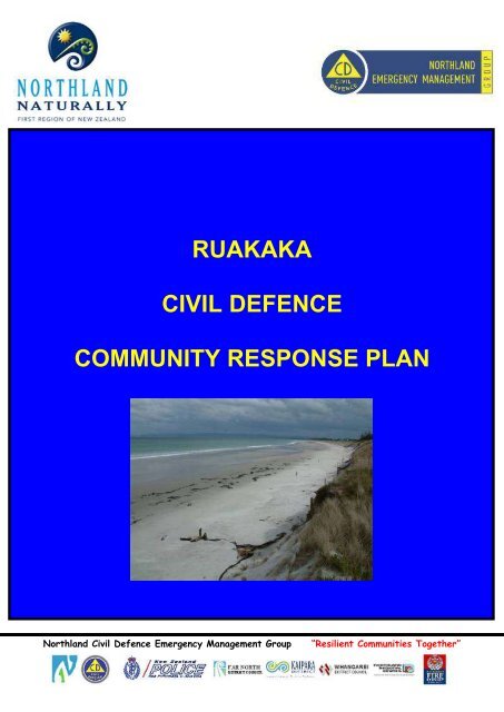
RUAKAKACIVIL DEFENCECOMMUNITY RESPONSE PLANNorthland <strong>Civil</strong> <strong>Defence</strong> Emergency Management Group“Resilient Communities Together”
1 INTRODUCTION 12 PLAN PURPOSE 13 COMMUNITY OVERVIEW 14 GEOGRAPHICAL MAP 45 SIGNIFICANT THREATS TO RUAKAKA COMMUNITY 46 ALERT AND WARNING SYSTEMS 47 EMERGENCY RESPONSE GUIDELINES 88 DECLARATIONS 99 RESPONSE GROUP COMMITTEE 1010 EMERGENCY RESPONSE GROUP 1011 AGENCY AND OTHER GROUP RESPONSIBILITIES 1212 PLAN ACTIVATION 1213 EMERGENCY CENTRES 1314 COMMUNICATION 13Appendix 1 Hazard Map ............................................................................................. 155Appendix 2 Tsunami Inundation Map ......................................................................... 166Appendix 3 Significant Threats to <strong>Ruakaka</strong>………………………………………….........17Appendix 4 Warnings for New Zealand ...................................................................... 199Appendix 5 <strong>Plan</strong> activation process.............................................................................. 20Appendix 6 Evacuation Process ................................................................................. 211Appendix 7 Priority Contacts ...................................................................................... 222Appendix 8 Local Resources ...................................................................................... 233Appendix 9 <strong>Civil</strong> <strong>Defence</strong> <strong>Community</strong> Centre Information ......................................... 244Version 1 July 2012 i <strong>Community</strong> <strong>Response</strong> <strong>Plan</strong><strong>Ruakaka</strong>
1 IntroductionThis plan has been prepared to provide a <strong>Civil</strong> <strong>Defence</strong> <strong>Community</strong> <strong>Response</strong> <strong>Plan</strong> for<strong>Ruakaka</strong> in the event that the community is required to respond to any civil defenceemergency or take action in advance of any civil defence emergency to prevent potentiallydevastating effects.When an emergency occurs, this plan will be activated by the community in response tothe event. Other agencies will respond to the event by activating their own plans andcoordinating their activities with other agencies to manage the impact on the community.This plan has been prepared with the aim of providing an effective, planned civil defenceemergency response that links the community and the civil defence organisations inNorthland.In preparation of surviving a civil defence emergency the community should undertake tobe personally prepared with survival kits of water, food, lighting, heating, radios, sparebatteries and medical supplies (see back page of the phone book for more detail onsurvival information or visit www.getthru.govt.nz).2 <strong>Plan</strong> purposeThe purpose of this plan is to identify hazards that may impact on <strong>Ruakaka</strong>, and toprovide a plan whereby the community within is able to respond and remain self reliant forat least 3-5 days without any outside assistance if an emergency occurs.3 <strong>Community</strong> Overview<strong>Ruakaka</strong> is located at the eastern end of <strong>Whangarei</strong> Harbour 30km southeast of<strong>Whangarei</strong>. Topography of the area is flat coastal plains, fringed by a coastline andbacked by the steep Takahiwai hills in the North West.The <strong>Ruakaka</strong> River flows from the northwest through the <strong>Ruakaka</strong> Township, Marsdenvillage and past Bream Bay College out to the Bay.The <strong>Ruakaka</strong> area is defined as the area north of SH1, from Takahiwai in the west to<strong>Ruakaka</strong> in the east, including Marsden Point industrial facilities.Within the <strong>Ruakaka</strong> area there are four identified areas:-One Tree Point is on the <strong>Whangarei</strong> Harbour, and is mainly a residential area with apopulation of approximately 1000. Over the past 10 years there has been major housingdevelopment in the area with two unique subdivisions - La Pointe Estate, housing that wasdeveloped around a golf course that also includes many waterways, and the newlydeveloped Marsden Cove; the entrance of which is in <strong>Whangarei</strong> Harbour.Central to the development is a 230 berth marina; with a few permanent boat/yachtresidents, and adjacent to the marina is a small retail centre and cafe. Many housesconstructed have direct access to the waterway.In addition to the marina and housing, the area is well known for major events- such asthe Boat Show and national fishing tournaments.Takahiwai Is on <strong>Whangarei</strong> Harbour west of One Tree Point and is accessible by onlyone road that leads off One Tree Point Road. Today there is a small community livingthere and Takahiwai Marae has been appointed as a <strong>Civil</strong> <strong>Defence</strong> <strong>Community</strong> Centre forthis area.Version 1 July 2012 1 <strong>Community</strong> <strong>Response</strong> <strong>Plan</strong><strong>Ruakaka</strong>
<strong>Ruakaka</strong> Central consists of a small shopping centre and the Marsden Village, aresidential area. Adjacent to the township is a light industry area with many smallbusinesses in Kepa Road. Behind the shopping centre is The Bream Bay <strong>Community</strong>Support Trust building which is also a <strong>Civil</strong> <strong>Defence</strong> <strong>Community</strong> Centre, <strong>Ruakaka</strong>Recreation Centre, the council building which accommodates the Library and thePolice Station, opposite the shopping centre is Bream Bay College.<strong>Ruakaka</strong> Beach is a popular tourist area. It is equally divided between permanentresidential housing, and holiday homes. In addition there is also a very large popularmotor camp, and the summer population can treble during the summer. Roading in thisarea is limited to one road in/out over a narrow one lane bridge.Marsden Point is the most eastern point of the <strong>Whangarei</strong> Harbour and is a majorindustrial area.Marsden Point’s largest facility is Refining NZ. The Refinery receives shipments of crudeoil via marine tankers and refines it using distillation and hydrocracker technology.Products and by-products produced on site include petrol, automotive and marine diesel,aviation and light kerosene, fuel oils, bitumen, sulphur and CO 2 .These products are transported around NZ by marine tanker and pipelines to the Wiri OilServices operated terminal adjacent to the refinery and in Auckland, and a small amountof road tanker transportation for bitumen and sulphur. The Facility also includes a visitorcentre.Wiri Oil Services Limited operates road tanker loading and fuel storage facility on MairRoad. The fuel is supplied via pipeline from the refinery, stored in above ground fuel tanksand distributed via road tanker.Northport operates a port facility at Marsden Point with multiple shipping movementseach day, cargo storage and transportation facilities. In addition large areas of storage oflogs, woodchip, fertiliser, coal and laminated veneer lumber (LVL) products are located onsite.Carter Holt Harvey operates a number of forestry activities at Marsden Point includingtransportation and processing of forestry products and logs, as well as the operation of theLVL plant.Air Liquide operates a small CO 2 receiving and storage plant adjacent to the Refinery onMair road. CO 2 is distributed from this plant by road tanker. The facility also includesoxygen storage, which is piped to the Refinery for their use. The oxygen is delivered to thestorage facility by road tanker.PopulationThe permanent population of the <strong>Ruakaka</strong> area is approximately 3100; however duringthe summer holiday period there is a marked increase in population, (9000) predominatelyin the <strong>Ruakaka</strong> Beach area, which consist mainly of holiday homes and the <strong>Ruakaka</strong>Beach Motor Camp, and also in the One Tree Point area holiday homes and the MarsdenBay Youth Camp.Of the permanent population 75% are New Zealand European, 22% Maori and theremaining 3% Pacific Islanders, Asian and other.There is a slightly higher percentage of people 65+ and approximately 52% of thehouseholds do not have children.Version 1 July 2012 2 <strong>Community</strong> <strong>Response</strong> <strong>Plan</strong><strong>Ruakaka</strong>
Emergency Services within the plan area consist of: Police, who work from a small policestation in the township, and cover an area greater than <strong>Ruakaka</strong>. St John Ambulance,with two ambulances and 2 employed officers who are supported by a small crew ofvolunteers and a Fire Service have two appliances a support van and on average 25volunteers.In addition, there is a large medical centre, Bream Bay Medical Centre with four doctors, aPharmacy, and a Dentist.<strong>Community</strong> facilities include the Takahiwai Marae, <strong>Ruakaka</strong> Recreation Centre, BreamBay <strong>Community</strong> Support Trust, <strong>Ruakaka</strong> <strong>Community</strong> Hall, Takahiwai Rugby LeagueCentre, Scout Hall, <strong>Ruakaka</strong> Motor Camp and Marsden Bay Youth Camp.Schools within the plan area are, One Tree Point Primary, <strong>Ruakaka</strong> Primary, Bream BayCollege, five pre-schools.There are six churches within the plan area.The <strong>Ruakaka</strong> area lifeline utilities include power from the national grid and maintransmission lines pass through the area as well as local substations.A reticulated water supply including water treatment at the <strong>Ruakaka</strong> Water Treatment<strong>Plan</strong>t (Refining NZ uses approximately half the daily supply of water in the area) howevera few places in the area are not on town supply and have to rely on collected rainwater.Main sewers extend to all but a few areas that still remain on septic tanks.Telecommunication services are present with one mobile phone site.The Refining NZ facility connects to the regional gas pipeline that passes from theRefinery to the West of <strong>Ruakaka</strong>, and The Refinery Auckland Pipeline (RAP) extendssouth from the refinery and supplies products to the Auckland region.There are two roads in and out of the <strong>Ruakaka</strong> area, Marsden Port Highway and MarsdenPoint Road, both of which access SH1. And all local roads lead on to either one or theother. There is no local public transport (buses nor taxi’s) in the area, residents rely onprivate transport.Within the plan area there is both heavy and light industry, the heavy industry isconcentrated in the Marsden Point Area, while the future development in the <strong>Ruakaka</strong>area includes large business and industrial sites, further subdivisions, all of which willresult in a major increase in the population and infrastructure.Version 1 July 2012 3 <strong>Community</strong> <strong>Response</strong> <strong>Plan</strong><strong>Ruakaka</strong>
4 Geographical MapFor the purpose of this plan, the geographic area of coverage for the <strong>Ruakaka</strong> area isdefined as the area north on SH1 from Uretiti Camp / Mountfield Road, as far as MataHall, Takahiwai to <strong>Ruakaka</strong>, including Marsden Point.5 Significant Threats to <strong>Ruakaka</strong> <strong>Community</strong>Hazards which pose a significant threat to <strong>Ruakaka</strong> Area may include:TsunamiTide surgeCyclones / StormsLandslip Coastal instabilityFloodingPandemicMarsden Point IndustryInfrastructure failureEarthquakeMotor vehicle road tanker and or chemical tanker accidentAny other major threat to the communityA more detailed list of hazards and their effects on the community is contained inAppendix 3.Of the risks identified above which have been assessed as being likely to have thegreatest impact on the <strong>Ruakaka</strong> Area, should they occur, are flooding, cyclones, storms,tidal surges, and tsunami.6 Alert and Warning SystemsThe <strong>Whangarei</strong> District Council is a member of the Northland Regional Council <strong>Civil</strong><strong>Defence</strong> Emergency Management Group and receives warning of adverse natural eventsfrom Central Government, the Meteorological Service, the Institute of Geological andNuclear Sciences and other agencies. See Appendix 4 for a description of warningsreceived and disseminated in New Zealand.Warning systems in place for <strong>Ruakaka</strong> are as follows:International WarningsThe Pacific Tsunami Warning Centre (PTWC) sends notification of tsunami in thePacific Ocean area to all registered subscribers. When a warning from the PacificTsunami Warning Centre (PTWC) is received in New Zealand it is evaluated by theMinistry of <strong>Civil</strong> <strong>Defence</strong> Emergency Management for its relevance to the New Zealandcoastline. If considered necessary the ministry will issue National Tsunami Warnings andAdvisories and notify regional and local <strong>Civil</strong> <strong>Defence</strong> and Emergency Services and preplannedwarnings and evacuations will be put into effect.National WarningsVersion 1 July 2012 4 <strong>Community</strong> <strong>Response</strong> <strong>Plan</strong><strong>Ruakaka</strong>
These will be received by councils and Police/Fire/Ambulance Communication Centresand disseminated to regional and local emergency responders. National Warnings comefrom the ministry and from different agencies that are contracted by the ministry (seeappendix 3-warnings for New Zealand). For example: The Metservice issues severe weather warnings and watches for storms,cyclones, snow, thunderstorms and wind. The Institute of Geological and Nuclear Sciences provide earthquake and volcanicbulletins. The Ministry of Health and District Health boards provide public health warnings MAF disseminate alerts and warnings for animal disease outbreaksThe Ministry of <strong>Civil</strong> <strong>Defence</strong> and Emergency Management provide tsunamiwarnings and advisoriesNatural WarningsFor some natural events there are no pre-warnings, for example an earthquake. But anearthquake can be a natural sign that a tsunami may follow if the sea has been displaced.This natural warning should be heeded by the public who should make for higher ground.Local WarningsAll television and radio networks will provide public information. Public should listen to theradio, refer to the back of the phone book and follow instructions.<strong>Community</strong> WarningsThe <strong>Ruakaka</strong> community encompassed in this plan should have in place a phone treemethod of contacting members of the community to warn them of an impending event thatmay have a significant risk to life and property. The first calls will be to all low lying at riskareas to initiate evacuation of required.Social Media<strong>Ruakaka</strong> <strong>Civil</strong> <strong>Defence</strong> is available on Facebook and Twitter.Communities and individuals can evacuate when and if they want to at any timewithout direction if they wish to.Version 1 July 2012 5 <strong>Community</strong> <strong>Response</strong> <strong>Plan</strong><strong>Ruakaka</strong>
SignageOther optionsThe <strong>Ruakaka</strong> community have signage which can be appointed to all beach access pointsduring a tsunami threat to advise members of the public about the impending danger.Committee members will hold the signage for the <strong>Ruakaka</strong> area in their homes. Theplacement of the signs are to cover the areas of access to the beach via walkways off:Boat RampBeach EndBoat RampMair Road<strong>Ruakaka</strong> Village<strong>Ruakaka</strong> BeachOne Tree Point RoadPyle Road WestMarsden Cove MarinaMarsden PointRace Course , Karawai St, Station Rd East,Wahanui WalkMotor Camp<strong>Ruakaka</strong> Beach Surf Club, <strong>Ruakaka</strong> Beach Road, Bream Bay Drive X 2<strong>Community</strong> sirensThe <strong>Civil</strong> <strong>Defence</strong> Tsunami sirens have now been placed within the community. There arecurrently ten sirens within the <strong>Ruakaka</strong> community positioned on power poles by NorthPower in the following locations:Siren Number Pole Number Street Address or Location Description53 19789 Takahiwai54 53974 One Tree Point55 53932 One Tree Point56 13474 One Tree Point57 13445 One Tree Point58 13454 One Tree Point59 51599 <strong>Ruakaka</strong> Village60 16578 <strong>Ruakaka</strong>61 17476 <strong>Ruakaka</strong>62 51510 <strong>Ruakaka</strong>Version 1 July 2012 6 <strong>Community</strong> <strong>Response</strong> <strong>Plan</strong><strong>Ruakaka</strong>
Upon hearing the sirens people are advised to seek further information as to the situation.This can be found on websites:Northland Regional Councilhttp://www.nrc.govt.nz/civildefence/<strong>Whangarei</strong> District Councilhttp://www.wdc.govt.nz/<strong>Community</strong>SafetyandSupport/<strong>Civil</strong><strong>Defence</strong>/Pages/default.aspxor listen to the radioRadio StationFrequencyMore FM91.6FMRadio New Zealand / National Radio AM 837, FM 101.1 and 104.3News talk ZB AM 1026 and 1215Radio Live FM 90.6Coast AM 900Classic Hits FM 96.0The sirens will only be activated and deactivated by North Power when a request is sentfrom <strong>Civil</strong> <strong>Defence</strong> at the Northland Regional Council. Sirens are activated when a threatis posed to the New Zealand coastline as assessed by the Ministry.Sirens are an alert to the public that there is a threat to the coastline and the public shouldthen seek further information from the civil defence website, radio, news and the <strong>Ruakaka</strong>civil defence community response group as to what that threat is and what action shouldbe taken.Tsunami Indoor SirensNorth Power has indoor tsunami warning sirens available to purchase, that plug directlyinto the wall socket and are activated at the same time as the larger sirens through theRipple Control method of activation and deactivation. Contact North Power for moredetails on price.Tsunami Inundation MapsThe tsunami inundation maps identify evacuation areas and evacuation high points incase of a tsunami warning. The community should familiarise themselves with the maps.Maps will be displayed around the community as decided by the group.See Appendix 2 for tsunami inundation mapsOPTN networkThe Northland Regional Council’s OPTN text message service will be promoted throughthe local community newsletter as a means of receiving warning messages. This will onlybe useful for those who have cell phones and in areas which receive cell phone coverage.http://nz.optnmobile.net/signup/civildefence/Car hornsCar horns will be used to alert residents that there is a tsunami and an immediateevacuation to higher ground is necessary.If there is a greater lead in time before a tsunami arrives then the <strong>Ruakaka</strong> <strong>Civil</strong> <strong>Defence</strong>Group will distribute the warning message by utilising telephone trees and door knocking.Version 1 July 2012 7 <strong>Community</strong> <strong>Response</strong> <strong>Plan</strong><strong>Ruakaka</strong>
7 Emergency <strong>Response</strong> GuidelinesIncidents and emergencies are categorised into five levels reflecting the intensity of scopeof the event that has occurred.The broad headings of the levels of response are:1) Local incident declaration not required and emergency is dealt with by theEmergency Services2) Local incident declaration not required, but some external support is necessary.3) Imminent state of local emergency is being considered and is of local significance4) Imminent state of local emergency is regionally significant5) Imminent or state of National emergency.Version 1 July 2012 8 <strong>Community</strong> <strong>Response</strong> <strong>Plan</strong><strong>Ruakaka</strong>
8 DeclarationsOnly the following persons may declare a state of <strong>Civil</strong> <strong>Defence</strong> Emergency within the<strong>Whangarei</strong> District Council:1) The Mayor of the <strong>Whangarei</strong> District2) An elected member of the <strong>Whangarei</strong> District Council authorised to act on behalfof the mayor, of if the mayor is absent3) A member of the Northland <strong>Civil</strong> <strong>Defence</strong> Emergency Management GroupWhen a civil defence emergency is declared, the <strong>Civil</strong> <strong>Defence</strong> Emergency ManagementAct 2002 is invoked which gives Emergency Services and Police additional powers overand above their respective acts.The lead agency in the event of any emergency response is the agency that has thelegislative or agreed authority for control of the incident or emergency.NZ Fire - control and suppression of fires and other specialist functionsNZ Police - maintain law and order, exercise additional powers as required duringthe state of emergencyMinistry of Health - control the outbreak of infectious diseasesTHE CIVIL DEFENCE CONTROLLER HAS ABSOLUTE AUTHORITY OVER ALLASSISTING AGENCIESAll instructions given by the Emergency Services and the Policemust be followed without exception.Version 1 July 2012 9 <strong>Community</strong> <strong>Response</strong> <strong>Plan</strong><strong>Ruakaka</strong>
9 <strong>Response</strong> Group CommitteeThe persons listed below form the <strong>Ruakaka</strong> <strong>Civil</strong> <strong>Defence</strong> <strong>Response</strong> Group. This groupshould meet at least annually with the community to discuss and review the plan and liasewith the <strong>Whangarei</strong> District Council’s <strong>Civil</strong> <strong>Defence</strong> Officer/Coordinator to effect anychanges. The role of this group is to assist in the initiation of an early response,disseminate warnings within the community covered by this plan, identify and set up a civildefence community centre or emergency control centre if required, situation reporting,plan review and updating.Vaughan Tait CoordinatorAllan Mitchell Alt CoordinatorMargaret Mitchell Alt CoordinatorGrant Fischer Team LeaderPeter Hope Team LeaderProtection under the CDEM ActThe CDEM Act (Section 110) provides protection from liability for Controllers, localauthority staff, contractors and volunteers, in a state of emergency. Any personperforming their functions, duties or powers under the CDEM Act is protected from liabilityfor loss or damage caused by their actions or omissions due to a state of emergency.However section 110 does not exempt a person from liability for an act or omission thatconstitutes bad faith or gross negligence.Re-imbursement for costsThe <strong>Whangarei</strong> District Council will reimburse fair and reasonable costs incurred by thecommunity during the emergency. Those costs associated with the caring of peopleevacuated from their homes or adversely affected by the event, or any actions taken toprotect life should be collated by the <strong>Ruakaka</strong> <strong>Civil</strong> <strong>Defence</strong> Group and forwarded to the<strong>Civil</strong> <strong>Defence</strong> Officer/Coordinator at the <strong>Whangarei</strong> District Council.10 Emergency <strong>Response</strong> GroupThe overall responsibility of the <strong>Ruakaka</strong> <strong>Civil</strong> <strong>Defence</strong> <strong>Community</strong> <strong>Response</strong> Group is toliase with police and emergency services to initiate and assist in response to a civildefence emergency.The <strong>Ruakaka</strong> <strong>Response</strong> Group responsibilities prior, during and after an emergency arelisted below.Prior to an emergency:Develop a <strong>Ruakaka</strong> <strong>Community</strong> <strong>Response</strong> <strong>Plan</strong>Act as a point of contact for <strong>Civil</strong> <strong>Defence</strong> in the <strong>Ruakaka</strong>Where possible communicate the plan to the greater community at everyopportunity (i.e. community days, school events, community meetings…)Meet at least annually to review the planTest the plan when requested and participate in joint exercises if possibleVersion 1 July 2012 10 <strong>Community</strong> <strong>Response</strong> <strong>Plan</strong><strong>Ruakaka</strong>
During an emergency:Where possible establish contact with <strong>Civil</strong> <strong>Defence</strong> at the <strong>Whangarei</strong> DistrictCouncil If requested activate the <strong>Ruakaka</strong> <strong>Response</strong> <strong>Plan</strong>If contact cannot be made with either the <strong>Whangarei</strong> District Council or theemergency services and if required then activate (see section 12 for activationprocess)Ensure that critical warning information is communicated to the community asquickly and efficiently as possibleLiase with the emergency services if at all possible to get an overview of what ishappening and what is requiredRelay information back to the <strong>Whangarei</strong> District Council civil defence if possibleabout:o The plan of action takeno Situation Reporting (i.e. overview of the situation, casualties, damage,other threats…)o Services and assistance required from civil defenceIf required set up a emergency control centre or a civil defence community centre ifrequested or if people have been evacuated or misplaced from their homesProvide assistance if required by the emergency services to help evacuate theaffected communityAfter an emergency has occurred the main avenue for the collection of information will befrom local sources and those persons identified in this plan. The early collection ofinformation is very important, as it will assist in determining the scale of the response thatis required.After an emergency:Work in support of any recovery efforts in the <strong>Ruakaka</strong> areaHold a de-brief of the groups response to see if there needs to be anyimprovements or there are things that worked really well that should be continuedArrange to get the plan updated with any improvements or new ideas that havecome about as a result of the emergencyThere is also the commitment of the <strong>Whangarei</strong> District Council to provide the following insupport of the <strong>Ruakaka</strong> <strong>Response</strong> Group:To maintain and ensure that early response warnings are being received by the<strong>Whangarei</strong> District CouncilEnsure that vital information of any threat is forwarded to the <strong>Ruakaka</strong> <strong>Community</strong><strong>Response</strong> Group without delay, where communication is possibleProvide advice and guidance to local communities developing and testing theirplansProvide opportunities for training and exercising as requested by the <strong>Ruakaka</strong><strong>Response</strong> GroupVersion 1 July 2012 11 <strong>Community</strong> <strong>Response</strong> <strong>Plan</strong><strong>Ruakaka</strong>
11 Agency and other group responsibilitiesThe roles and responsibilities of the emergency services are clearly defined by legislation.In the event of this plan being activated due to an emergency occurring, the roles andresponsibilities of the community groups are set out as below. However, it isacknowledged that these roles are intended to be flexible if required.PoliceMaintain law and orderProtect life and propertyAssist the coronerCo-ordinate movement controlSearch and rescueFire ServiceFire fighting responsibilitiesContainment of releases and spillages of hazardous substancesUrban search and rescueLimitation of damageRedistribution of water for specific needsSt John AmbulanceProvision of emergency medical careCoastguardCoordination of marine rescueProvision of alternative communication if required via VHF and SSB12 <strong>Plan</strong> ActivationThe following may activate this plan:Local Incident ControllerLocal emergency services personnelThe <strong>Ruakaka</strong> <strong>Civil</strong> <strong>Defence</strong> Coordinator or Alterative Coordinator in consultationwith either of the above if contact can be madeThe <strong>Ruakaka</strong> <strong>Civil</strong> <strong>Defence</strong> Coordinator or Alterative Coordinator in isolation only ifcontact cannot be made with either the Local Incident Controller or localemergency personnel.There may be situations when an event has not occurred but the local community isconcerned about the impact of a potential threat and this plan can be activated. Forexample an impending tsunami or cyclone may cause the activation of this plan.This plan is also designed to be activated when there is limited or no contact with the<strong>Whangarei</strong> District Council and it outlines the process the community will go through towork together to support themselves in an emergency.The community may also be asked to activate the plan as part of a local, regional ornational exercise to test its capability.Version 1 July 2012 12 <strong>Community</strong> <strong>Response</strong> <strong>Plan</strong><strong>Ruakaka</strong>
13 Emergency CentresAn emergency control centre or civil defence community centre may be established forany event if it is required. An emergency control centre can be set up at the discretion ofthe <strong>Community</strong> <strong>Response</strong> Group. The location of the centre will be determined by theimpact of the disaster and it is likely that the emergency control centre will be at the samelocation as a civil defence community centre if one is to be set up.The <strong>Ruakaka</strong> <strong>Civil</strong> <strong>Defence</strong> Group should, when possible, inform the <strong>Whangarei</strong> DistrictCouncil when it is contemplating setting up a civil defence community centre. In absenceof any means to contact the <strong>Whangarei</strong> District Council the <strong>Response</strong> Group can set up acivil defence community centre to receive evacuated persons from within the <strong>Ruakaka</strong>area.14 CommunicationCommunication is the critical component of this community response plan. People withinthe community must be alerted to an impending emergency or be contacted after anemergency or an event has occurred. Communication must also be made outside thecommunity to relay the situation and request any assistance if required.This plan must also be communicated to the community.Communication within and between communitiesCommunication typically relies on the following communication pathways:TelephoneCell phoneFaxE-mailRadio NetworksPagersRadio telephoneFace to face (neighbours calling on neighbours)Camp ground information to campers (announcement/signage)During emergencies there are often disruptions to these telecommunications pathways(i.e. with loss of power, cell phone towers and poor satellite coverage) and the followingalternatives have been identified if traditional communication pathways have becomeinterrupted to communicate with those outside the community:This could include VHF radio or satellite phoneThe <strong>Ruakaka</strong> Group has three types of radios available for communication needs – twobase sets - Tait 2000’s one located at <strong>Ruakaka</strong> Fire Station the other at the Bream Bay<strong>Community</strong> Support Trust both have battery back up and should continue to operate for acouple of days without mains power, these have four PRS (Public Radio Service.)channels available as per table below. There are five handheld iCom radios each have arechargeable battery pack and an adaptor to enable AA batteries to be fitted – thechargers run on a mains to 12v plugpack so could be adapted to charge off a vehicle ifneeded. They have 16 PRS channels available as per table below. There is also a Hyterrahandheld, which operates on the ESB 151 Band for a direct link to the council.Version 1 July 2012 13 <strong>Community</strong> <strong>Response</strong> <strong>Plan</strong><strong>Ruakaka</strong>
<strong>Ruakaka</strong> Communication Frequencies:Tait 2000 Ch Number iCom Ch Number Frequency (MHz)1 1 476.6750002 2 476.7000003 3 476.7250004 4 476.750000- 5 476.775000- 6 477.150000- 7 477.175000- 8 477.200000- 9 477.225000- 10 477.250000- 11 477.275000- 12 477.300000- 13 477.325000- 14 477.350000- 15 477.375000- 16 476.650000Channel 1 is to be mainly used, if there is a lot of other radio traffic all users should benotified to change to another available channel. Correct radio protocols should be usedwithin all radio communications in the group.Communication of this plan to the communityThis plan needs to be communicated to the wider community if it is to be effective andrepresentative of the entire community. The following have been identified as means ofcommunicating this plan to the wider community:For example:Presentation at community meetingsStands at community eventsNotices on community notice boardsNotice or articles in community newslettersTraining exercisesVersion 1 July 2012 14 <strong>Community</strong> <strong>Response</strong> <strong>Plan</strong><strong>Ruakaka</strong>
Appendix 1 Hazard MapVersion 1 July 2012 15 <strong>Community</strong> <strong>Response</strong> <strong>Plan</strong><strong>Ruakaka</strong>
Appendix 2 Tsunami Inundation MapVersion 1 July 2012 16 <strong>Community</strong> <strong>Response</strong> <strong>Plan</strong><strong>Ruakaka</strong>
Appendix 3 Significant threats to <strong>Ruakaka</strong>Significant threats to <strong>Ruakaka</strong> include but are not limited to:Threat Probability Impact to <strong>Ruakaka</strong>Flooding High Road Access deniedMost areas in <strong>Ruakaka</strong> are affected<strong>Community</strong> cut-off from outside<strong>Community</strong> may have to be self-sustainableLand Slips / Erosion High Road access deniedDamage to property or homes<strong>Community</strong> may have to be self-sustainableCyclones/Storms High Can be life-threateningCause of panic & fear - in particular to elderlyLoss of power affecting water pumps &appliancesTelephones not working properlyDamage to property or homes<strong>Community</strong> may have to be self-sustainableMarsden Point Industry Low Process explosion (fumes major issue)Process fire (fumes major issue)Tank/Tanker fire (explosion & fumes majorissue)Sulphur fire (fumes major issue)Marine Oil spillGas leak (toxic fumes & potential explosion)Large chemical spill toxic, eco-toxic, corrosive,flammable (Hazmat response required)Tidal Surges Medium Becoming more frequentCause of flooding in some areasRoad access could be denied <strong>Community</strong> cutofffrom outsideCoastal erosion - foreshore damageDamage to property or homesTsunami Low Definitely life-threateningTotal evacuation of residents & visitorsnecessaryVarious options identified:Head for higher groundEvacuees have to be self-sustainableInfrastructure Failure Medium Power failure will have major impact on:-Industry<strong>Community</strong>Local businessesSewerage systems inoperablePandemic Medium Life- threateningReduced services in the areaPanic & Anxiety in the community<strong>Community</strong> may have to be self-sustainableEarthquake Low Life- threateningReduced services in the areaPanic & Anxiety in the communityVersion 1 July 2012 17 <strong>Community</strong> <strong>Response</strong> <strong>Plan</strong><strong>Ruakaka</strong>
<strong>Community</strong> may have to be self-sustainableMotor vehicle accident High Road tanker accident in residential areapossible fuel / chemical spill in drainagesystem.Multiple dwellings inaccessible.Eco toxic spill into water systems.Wilson Dam Burst Low SH1 floodingCouncil has emergency action plan in placeHazard identification determines which hazards threaten areas of the community andthe probability identifies how likely it is that the disaster will occur.Version 1 July 2012 18 <strong>Community</strong> <strong>Response</strong> <strong>Plan</strong><strong>Ruakaka</strong>
Appendix 4 Warnings for New ZealandThe following table outlines risks and the monitoring agency responsible for issuingwarnings:Particular Risk or Hazard Monitoring Agency CommentSevere Weather Outlook Watch orWarnings Storms Cyclones Flooding WindTsunamiEarthquakeVolcanic EruptionMeteorological Service ofNew Zealand (Met Service).www.metconnect.co.nzMinistry of <strong>Civil</strong> <strong>Defence</strong>Emergency Managementfrom the Pacific TsunamiWarning Centre.Institute of Geological andNuclear SciencesInstitute of Geological andNuclear SciencesPublic Health Warnings Ministry of Health andDistrict Health BoardsNational Weather Services (NWS),A division of the Met Service collectsand analyses meteorological data fromaround New Zealand and the world, fromwhich the many different types ofweather forecasts are made. The NWSis responsible for the safeguarding ofNew Zealand lives and property throughthe issuing of Severe Weather Watchesand Warnings.Monitored by the Pacific TsunamiWarning Centre and reported toMCDEM. Within New Zealand MCDEMare responsible for the issue of anyTsunami Warning.Monitored by the Institute of Geologicaland Nuclear Sciences who areresponsible for alert bulletins issued toMCDEM and CDEM Groups.Monitored by the Institute of Geologicaland Nuclear Sciences who areresponsible for alert bulletins issued toMCDEM and CDEM Groups.Develop and disseminate alerts andwarnings to CDEM Groups and thegeneral public.Flood Warnings for major rivers Northland Regional Council Develop and disseminate river floodwarnings to the public, emergencyresponders and pre-arrangedlandowners.Wildfire Northland Rural FireAuthorityAnimal Disease OutbreaksMinistry of Agriculture andForestryThe rural fire authority monitors adverseweather conditions likely to increase thepossibility of wildfire, which will instituteappropriate fire bans and if necessarydisseminate warnings.Dissemination alerts and warnings toCDEM Groups and public.Version 1 July 2012 19 <strong>Community</strong> <strong>Response</strong> <strong>Plan</strong><strong>Ruakaka</strong>
Appendix 5 <strong>Plan</strong> activation processThe <strong>Ruakaka</strong> <strong>Response</strong> Group is responsible for the activation of this plan in the leadup to an event that is known to be likely to occur due to advance warning, or as a resultof a sudden event. The community may also be asked to activate the plan as part of alocal, regional or national exercise to test its capability.Initial actionsWhere advance warning of an event is received by <strong>Civil</strong> <strong>Defence</strong> or the responsibleagency then:DO THISNotify the Police, Fire Service, Ambulance and a response group member.Police- 111Fire- 111St John- 111<strong>Response</strong> Group Member- Vaughan TaitAllan MitchellMargaret MitchellOnce the above group receives advice of the event, they should:DO THISLiaise to determine what actions should be takenNotify all other members of the response groupBrief them on the warning that has been received and current situationConsider who will be affected and whereConsider a suitable location for an control centre if requiredConsider initial actions for the establishment of a civil defence communitycentre if requiredNotify the <strong>Civil</strong> <strong>Defence</strong> Controller with actions takenWhere an unexpected sudden event occurs:REMEMBERThe person in charge of the lead agency or the community should activatethis plan if required or at all possible.Version 1 July 2012 20 <strong>Community</strong> <strong>Response</strong> <strong>Plan</strong><strong>Ruakaka</strong>
Appendix 6 Evacuation ProcessEvacuation Priorities- <strong>Ruakaka</strong><strong>Civil</strong> <strong>Defence</strong> warnings to this area will be by the following methodsWarnings via radioPA systems on emergency services vehiclesText for subscribers to OPTN networkSirensPhone TreesPhysical PresenceDo this:If this happensListen to your local radio station and follow instructions (More FM willtransmit <strong>Civil</strong> <strong>Defence</strong> information in northland)Refer to the back of your telephone book as a guide on what to doActivate your pre-determined telephone tree to warn othersPrepare to activate your household emergency planIf you are required to EVACUATEDo this:Tsunami WarningActivate community phone tree and alert residents on all low lying areafirstMove to ground higher than 35 meters above sea level a pre-determinedsafe areas away from the coast and up as high as possibleFor all other emergenciesAssemble with your emergency survival kit as directed in other of priority to:Bream Bay <strong>Community</strong> Support Trust CentreTakahiwai MaraeTHE CIVIL DEFENCE CONTROLLER HAS ABSOLUTE AUTHORITY OVER ALLASSISTING AGENCIESAll instructions given by the Emergency Services and thePolice must be followed without exception.Version 1 July 2012 21 <strong>Community</strong> <strong>Response</strong> <strong>Plan</strong><strong>Ruakaka</strong>
Appendix 7 Priority ContactsFire All emergencies Dial 111<strong>Ruakaka</strong> (Unattended) Fire Station 09 432 7701Police All emergencies Dial 111<strong>Ruakaka</strong> (Unattended) Police Station 09 432 7719Ambulance All emergencies Dial 111Coastguard Radio VHF Channel 83Marine Emergency 09 303 1303From Mobile Phone *500Local <strong>Civil</strong> <strong>Defence</strong>ContactsDepartment ofConservationVaughan TaitAllan MitchellMargaret MitchellEmergencies only0800 DOCHOT0800 362 468<strong>Whangarei</strong> DistrictCouncilElected Council MemberCall Centre 09 430 4200Phil HalseBream Bay <strong>Community</strong>Support CentreTakahiwai MaraeNorthland RegionalCouncil<strong>Whangarei</strong> DistrictCouncilRegional Information andupdatesLocal area informationwww.nrc.govt.nz0800 504 639www.wdc.govt.nz0800 932 463Version 1 July 2012 22 <strong>Community</strong> <strong>Response</strong> <strong>Plan</strong><strong>Ruakaka</strong>
Appendix 8 Local ResourcesMedical Assistance St John Emergencies only Dial 111Bream Bay Medical Centre 09 432 8060Refining NZ MedicalCentre09 432 8311 Ex 8888Coast Guard Radio VHF Channel 83Local radio stationOut There FM 107.7MHzWave FM 107.3MHz021 973 846 / 432 8667022 065 0599Version 1 July 2012 23 <strong>Community</strong> <strong>Response</strong> <strong>Plan</strong><strong>Ruakaka</strong>
Appendix 9 <strong>Civil</strong> <strong>Defence</strong> <strong>Community</strong> CentreInformationBream Bay <strong>Community</strong> Support TrustLocationTakutai Pl <strong>Ruakaka</strong>AccessFlatCoordinator<strong>Civil</strong> <strong>Defence</strong>Centre Phone Number 09 432 7197Cater facilities 2Toilet facilities 5ParkingUnlimitedBuilding capacity 50Alternative power supplyNoWater supplyMainsResources availableCounselling rooms, Showers, VariousWelfare kit on site?NoNotesBream Bay CollegeLocationAdj BBCSTAccessFlatCoordinator<strong>Civil</strong> <strong>Defence</strong>Centre Phone Number 09 432 8226To open as a welfare centre contact CaretakerCater facilities 4Toilet facilities Adequate – 1000ParkingUnlimitedBuilding capacity 3000Alternative power supplyNoWater supplyMainsResources availableRooms, Halls, Gym, AuditoriumWelfare kit on site?NoNotesTakahiwai MaraeLocationTakahiwai RdAccessCoordinatorCentre Phone Number 09 432 8007To open as a community centre contact <strong>Civil</strong> <strong>Defence</strong>Cater facilitiesYesToilet facilitiesYesParkingYesBuilding capacityYesAlternative power supply ?Water supply ?Resources available ?Welfare kit on site?YesNotesVersion 1 July 2012 24 <strong>Community</strong> <strong>Response</strong> <strong>Plan</strong><strong>Ruakaka</strong>