Strategic Projects - Geospatial World Forum
Strategic Projects - Geospatial World Forum
Strategic Projects - Geospatial World Forum
Create successful ePaper yourself
Turn your PDF publications into a flip-book with our unique Google optimized e-Paper software.
<strong>Strategic</strong> <strong>Projects</strong><br />
Copyright, @ Dubai GIS Department, Dubai Municipality<br />
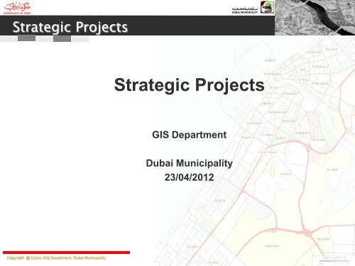
<strong>Strategic</strong> <strong>Projects</strong><br />
GIS Department<br />
Dubai Municipality<br />
23/04/2012
<strong>Strategic</strong> <strong>Projects</strong><br />
Director General Message<br />
– By 2009, about 500 services were automated and the process of development in the portal is still<br />
continuing as services do not stop and do not end. The world of Internet is a vast sea without<br />
any limit or stop.<br />
– We have realized that the future stages will demand an interactive portal and this is why we<br />
launch a new portal for Dubai Municipality, which underwent a trial and developmental period<br />
that lasted for more than a year. We had a qualified Advisory Panel consisting, monitoring all<br />
stages of its construction and we have been satisfied with the fact that we have completed the<br />
first phase and are ready for launch. It is also capable for improvement and development, and<br />
we have set our eyes to do it when required.<br />
– With the launch of the new portal we have endeavored to offer a new concept of official<br />
websites by designing it with a different concept based on packages that reflect the concept<br />
and elements of the <strong>Strategic</strong> Plan of Dubai Municipality, in a smooth, explanatory and<br />
supportive form with elements of attraction such as photos, carefully selected and suitable for<br />
the topics. We have used clear icons competently designed to help identify each services of the<br />
portal to make it an interactive and attractive web portal that displays the information that<br />
answers the questions of the public..<br />
Copyright, @ Dubai GIS Department, Dubai Municipality
<strong>Strategic</strong> <strong>Projects</strong><br />
Dubai Municipality:<br />
Our Vision<br />
– Creating an excellent city that provides the essence of success and comfort of<br />
sustainable living.<br />
Our Mission<br />
– Working to plan, design, build and manage the municipal infrastructure, facilities<br />
and services through the appropriate investment in our human and other<br />
resources maintaining the sustainable development.<br />
Our Values<br />
– In the quest towards achieving our strategic vision and our grand mission at all<br />
levels; we act based upon the following core values:<br />
– Employees: The real asset<br />
– Stakeholders: Commitment to partnership and appreciation of their needs and<br />
expectations<br />
– Transformation: Appreciation of change and strive for positive development<br />
– Performance: Doing the right things right.<br />
– Interdependence: Focus on teamwork through cooperation and sharing of ideas.<br />
– Innovation: The adoption of initiatives and the recognition of innovators<br />
Copyright, @ Dubai GIS Department, Dubai Municipality
<strong>Strategic</strong> <strong>Projects</strong><br />
Copyright, @ Dubai GIS Department, Dubai Municipality
<strong>Strategic</strong> <strong>Projects</strong><br />
The GIS Dept. is under <strong>Strategic</strong> Plan #1 Urban & Regional Planning & Supporting the infrastructure<br />
Sector in the Emirate of Dubai. Objective #27 <strong>Geospatial</strong>ly Enabling the Services<br />
Copyright, @ Dubai GIS Department, Dubai Municipality
<strong>Strategic</strong> <strong>Projects</strong><br />
GIS Department:<br />
- Vision<br />
Making spatial data a public utility<br />
– Mission<br />
Copyright, @ Dubai GIS Department, Dubai Municipality<br />
To provide access to accurate and up-to-date<br />
spatial data for government, business and<br />
public, to facilitate real time mapping and<br />
decision making
<strong>Strategic</strong> <strong>Projects</strong><br />
<strong>Strategic</strong> <strong>Projects</strong><br />
– Dubai Cadastral Program<br />
– Dubai Base Map Project<br />
– Dubai Utility Map Project (UMAS Program)<br />
– Dubai Soil Map Project (UMAS Program)<br />
Copyright, @ Dubai GIS Department, Dubai Municipality<br />
UMAS – Utility Management and Analysis Program
<strong>Strategic</strong> <strong>Projects</strong> - Objectives<br />
Dubai Cadastral Program<br />
1. Web Enabled Publishing so that the cadastral data available all authenticated users for query<br />
2. Authorized and easy access to all Geo-Spatial data with business information including<br />
documents, reports, pictures etc, needed for municipal uses through a single window using<br />
state-of-the art latest GIS technology<br />
3. Integrating other departmental and organizational data into single geo spatial portal to be<br />
aligned with Dubai e-Government policies<br />
4. Better and faster decision making to improve Dubai Municipality’s customer satisfaction.<br />
Technology Used<br />
Key GIS Technology : ESRI ArcGIS Server<br />
Database : Oracle 11G and ArcSDE 10<br />
Business Layer : ROLTA’s OnPoint<br />
Implemented By : In House Project Team<br />
Copyright, @ Dubai GIS Department, Dubai Municipality
<strong>Strategic</strong> <strong>Projects</strong> - Outcomes<br />
Copyright, @ Dubai GIS Department, Dubai Municipality
<strong>Strategic</strong> <strong>Projects</strong> - Outcomes<br />
Copyright, @ Dubai GIS Department, Dubai Municipality
<strong>Strategic</strong> <strong>Projects</strong> - Outcomes<br />
Copyright, @ Dubai GIS Department, Dubai Municipality
<strong>Strategic</strong> <strong>Projects</strong> - Objectives<br />
Dubai Base Map Project<br />
1. Updating the Ground Control Points of Emirate of Dubai.<br />
2. Digital Terrain Model and Contours<br />
3. Digital TRUE Ortho-Photos with 15cm resolution in areas of high raised buildings<br />
4. Digital regular Ortho-Photos with 15cm/45cm resolution<br />
5. Ortho Photos in GeoTIFF format in tiles (15 cm: 1000 m * 1000 m and, 45 cm: 4500 m * 4500 m)<br />
6. Digital collection of features that belong to various department of Dubai Municipality,<br />
Government Departments, Semi-Government Departments, Ministries and various authorities.<br />
7. Features are time stamped – analyze the temporal changes, as this project is executed on regular<br />
bases.<br />
8. Publishing the features as part of Cadastral program and access of the features to all the<br />
authenticated stakeholders.<br />
9. Standardizing the features as per ISO standards.<br />
Copyright, @ Dubai GIS Department, Dubai Municipality
<strong>Strategic</strong> <strong>Projects</strong> - Objectives<br />
Copyright, @ Dubai GIS Department, Dubai Municipality<br />
Area<br />
A<br />
B<br />
C<br />
D<br />
Forward<br />
80%<br />
60%<br />
60%<br />
60%<br />
Lateral<br />
60%<br />
30%<br />
30%<br />
30%<br />
Res<br />
15cm<br />
15cm<br />
15cm<br />
45cm<br />
Contours<br />
1 m<br />
1, 2 m<br />
1 m<br />
2 m
<strong>Strategic</strong> <strong>Projects</strong> - Technology<br />
Technology:<br />
Digital Photogrammetric Camera<br />
Vexcel UltraCam X<br />
Flying Height between 8000 ft and 21000 ft<br />
NZ Aerial Mapping<br />
Executed by Genesys International Corporation Limited<br />
Feature Collection<br />
SSK system<br />
Publishing<br />
Cadastral Program (OnPoint)<br />
Copyright, @ Dubai GIS Department, Dubai Municipality
<strong>Strategic</strong> <strong>Projects</strong> - Outcome<br />
Copyright, @ Dubai GIS Department, Dubai Municipality
<strong>Strategic</strong> <strong>Projects</strong> - Outcome<br />
Copyright, @ Dubai GIS Department, Dubai Municipality<br />
+ DEM + Contours
Dubai Utility Map – Objectives and Highlights<br />
Dubai Utility Project - This has two major sub-projects<br />
Utility Network Project<br />
1. Correcting and standardizing Drainage, Sewerage and Irrigation data which presently exists in<br />
more than 100,000 files with various formats.<br />
2. Storing the utility data in Oracle Spatial, so that the data is accessible to all stakeholders<br />
3. Automating to large extent the utility construction projects to integrate the new utility projects<br />
data to the main and complete network.<br />
4. The utility network data with rich attribute information. This is useful for network analysis and<br />
planning.<br />
5. Rule and Role based Construction Management System which manages utility construction<br />
projects,<br />
Copyright, @ Dubai GIS Department, Dubai Municipality<br />
1. Defines responsibilities for all the project members within Dubai Municipality and contractor/consultants.<br />
2. Automatic network checks for standards/topology/attributes etc.<br />
3. Contractor/consultants need not visit Dubai Municipality. Deliver the drawing from home.<br />
4. Intelligent system to take decisions on accept/reject of networks.<br />
5. Project status tracking at department level and different authentication levels.<br />
6. Maintain complete network of Emirate of Dubai.<br />
7. Better and cost-effective project management. Reduces the efforts of Engineers.<br />
8. Web based application and accessible from anywhere in the world.<br />
9. Easy support of other utility projects like water, electricity, telecommunication etc.
Dubai Utility Map – Objectives and Highlights<br />
Utility Network Project – Outcome - Drainage<br />
Copyright, @ Dubai GIS Department, Dubai Municipality
Dubai Utility Map – Objectives and Highlights<br />
Utility Network Project – Outcome - Sewerage<br />
Copyright, @ Dubai GIS Department, Dubai Municipality
Dubai Utility Map – Objectives and Highlights<br />
Utility Network Project – Outcome - Irrigation<br />
Copyright, @ Dubai GIS Department, Dubai Municipality
Dubai Utility Map – Objectives and Highlights<br />
Dubai Utility Project - This has two major sub-projects<br />
Utility Corridor project<br />
– Digital conversion of all utility corridors as per the standards.<br />
– Storing the corridors for all utilities (including metro utilities) in Oracle Spatial, so<br />
that the data is accessible to all stakeholders<br />
– Corridors Management System to support the production of corridors.<br />
– Easy “No Objection Certificate System” which uses Corridors and networks.<br />
Copyright, @ Dubai GIS Department, Dubai Municipality
Dubai Utility Map – Objectives and Highlights<br />
Utility Corridor Project – Outcome<br />
Copyright, @ Dubai GIS Department, Dubai Municipality
Dubai Utility Map – Phases and budget<br />
1. The Utility Program is organized in phase wise approach.<br />
2. Phase 1 and 2:<br />
– Correcting and Standardizing the network and Corridor data. Migrating it to Oracle Spatial<br />
– Construction Management System to automate the utility projects and make it available to<br />
contracts/consultants/engineers/draftsmen submit drawings and plans online.<br />
– Publishing the utility networks and corridors in Cadastral program along with parcel and<br />
planning data.<br />
– Utility Infrastructure map for analysis and planning the underground utilities.<br />
– Management Level query system on utilities.<br />
Budget: 8 Million AED<br />
3. Phase 3:<br />
– Utility Corridor Management System to manage the corridors<br />
– No Objection Certificate system for utility projects.<br />
– Utility Network in 3D and integration with various systems.<br />
– Network Analysis and Planning system<br />
Budget: Under Planning<br />
Copyright, @ Dubai GIS Department, Dubai Municipality
Dubai Utility Map – Technology<br />
1. Research and design done in house at GIS Department.<br />
2. Standards and procedures are derived in house expert team.<br />
3. Data Models are designed in house expert team.<br />
4. Workflows and Systems are designed and documented in house expert team.<br />
5. Support and co-operation from various organizations of Dubai Municipality on<br />
Domain knowledge.<br />
6. Rolta Middle East is executing the projects.<br />
Copyright, @ Dubai GIS Department, Dubai Municipality
Dubai Soil Map – Objectives and Highlights<br />
Dubai Soil Map Project<br />
1. Creating soil map of Emirate of Dubai.<br />
2. Creating various thematic maps like water distribution, Sulphate distribution, chloride<br />
distribution, various strata distribution, cross-section maps etc.<br />
3. 3D soil distribution models, 3D fence diagrams etc.<br />
4. Borehole Entry system, where contractors and consultant can enter borehole content without<br />
submitting the report in hardcopy.<br />
5. Various Analysis report generation for each borehole.<br />
6. Land Use decision making system using the soil information.<br />
7. System to generate area wise soil and thematic maps.<br />
Copyright, @ Dubai GIS Department, Dubai Municipality
Dubai Soil Map – Present outcome<br />
Blue points are the distribution of boreholes<br />
Copyright, @ Dubai GIS Department, Dubai Municipality
Dubai Soil Map – Present outcome<br />
For each borehole<br />
Copyright, @ Dubai GIS Department, Dubai Municipality
Dubai Soil Map – Phases and budget<br />
1. The Soil Map Program is organized in phase wise approach.<br />
2. Phase 1 and 2:<br />
– Migrating 22,000 evenly distributed boreholes of Emirate of Dubai to digital form.<br />
– Developing a system to enter borehole data. Providing access to this system to borehole<br />
contractors/consultants and departments.<br />
– Various Analysis report generation for each borehole.<br />
– Publish all the borehole locations in Cadastral program. All stakeholders can view the<br />
boreholes and can see various reports on each and multiple boreholes.<br />
Budget: 1.4 Million AED<br />
3. Phase 3:<br />
– Creating soil map of Emirate of Dubai.<br />
– Creating various thematic maps like water distribution, Sulphate distribution, chloride<br />
distribution, various strata distribution, cross-section maps etc.<br />
– 3D soil distribution models, 3D fence diagrams etc.<br />
– Land Use decision making system using the soil information.<br />
– System to generate area wise soil and thematic maps.<br />
Budget: Under Planning<br />
Copyright, @ Dubai GIS Department, Dubai Municipality
Dubai Soil Map – Technology<br />
1. Research and design done in house at GIS Department.<br />
2. Standards and procedures are derived in house expert team.<br />
3. Data Models are designed in house expert team.<br />
4. Workflows and Systems are designed and documented in house expert team.<br />
5. Support and co-operation from various organizations of Dubai Municipality on<br />
Domain knowledge.<br />
6. Rolta Middle East is executing the projects.<br />
Copyright, @ Dubai GIS Department, Dubai Municipality
In Conclusion<br />
Main Goals<br />
– Single Window Systems<br />
– Zero Visit Environment<br />
– Single Repository data<br />
– Automation in Day to Day workflows<br />
– Synchronize departments and processes<br />
– Follow ISO standards<br />
Copyright, @ Dubai GIS Department, Dubai Municipality
Burj Khalifa<br />
Copyright, @ Dubai GIS Department, Dubai Municipality<br />
Thank you<br />
Dank u<br />
اركش


