Satellite Instrument Calibration for Measuring Global Climate Change
Satellite Instrument Calibration for Measuring Global Climate Change
Satellite Instrument Calibration for Measuring Global Climate Change
Create successful ePaper yourself
Turn your PDF publications into a flip-book with our unique Google optimized e-Paper software.
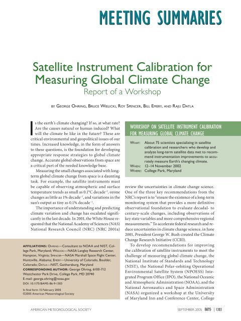
<strong>Satellite</strong> <strong>Instrument</strong> <strong>Calibration</strong> <strong>for</strong><strong>Measuring</strong> <strong>Global</strong> <strong>Climate</strong> <strong>Change</strong>Report of a WorkshopBY GEORGE OHRING, BRUCE WIELICKI, ROY SPENCER, BILL EMERY, AND RAJU DATLAIs the earth’s climate changing? If so, at what rate?Are the causes natural or human induced? Whatwill the climate be like in the future? These arecritical environmental and geopolitical issues of ourtimes. Increased knowledge, in the <strong>for</strong>m of answersto these questions, is the foundation <strong>for</strong> developingappropriate response strategies to global climatechange. Accurate global observations from space area critical part of the needed knowledge base.<strong>Measuring</strong> the small changes associated with longtermglobal climate change from space is a dauntingtask. For example, the satellite instruments mustbe capable of observing atmospheric and surfacetemperature trends as small as 0.1°C decade –1 , ozonechanges as little as 1% decade –1 , and variations in thesun’s output as tiny as 0.1% decade –1 .The importance of understanding and predictingclimate variation and change has escalated significantlyin the last decade. In 2001, the White House requestedthat the National Academy of Sciences (NAS)National Research Council (NRC) (NRC 2001a)AFFILIATIONS: OHRING—Consultant to NOAA and NIST, CollegePark, Maryland; WIELICKI—NASA Langley Research Center,Hampton, Virginia; SPENCER—NASA Marshall Space Flight Center,Huntsville, Alabama; EMERY—University of Colorado, Boulder,Colorado; DATLA—NIST, Gaithersburg, MarylandCORRESPONDING AUTHOR: George Ohring, 6100-712Westchester Park Drive, College Park, MD 20740E-mail: george.ohring@noaa.govDOI: 10.1175/BAMS-86-9-1303In final <strong>for</strong>m 15 February 2005©2005 American Meteorological SocietyWORKSHOP ON SATELLITE INSTRUMENT CALIBRATIONFOR MEASURING GLOBAL CLIMATE CHANGEWHAT: About 75 scientists specializing in satellitecalibration and researchers who develop andanalyze long-term satellite data met to recommendinstrumentation improvements to accuratelymeasure Earth’s changing climate.WHEN: 12–14 November 2002WHERE: College Park, Marylandreview the uncertainties in climate change science.One of the three key recommendations from theNRC’s report is to “ensure the existence of a long-termmonitoring system that provides a more definitiveobservational foundation to evaluate decadal- tocentury-scale changes, including observations ofkey state variables and more comprehensive regionalmeasurements.” To accelerate federal research and reduceuncertainties in climate change science, in June2001, President George W. Bush created the <strong>Climate</strong><strong>Change</strong> Research Initiative (CCRI).To develop recommendations <strong>for</strong> improvingthe calibration of satellite instruments to meet thechallenge of measuring global climate change, theNational Institute of Standards and Technology(NIST), the National Polar-orbiting OperationalEnvironmental <strong>Satellite</strong> System (NPOESS) IntegratedProgram Office (IPO), the National Oceanicand Atmospheric Administration (NOAA), and theNational Aeronautics and Space Administration(NASA) organized a workshop at the Universityof Maryland Inn and Conference Center, CollegeAMERICAN METEOROLOGICAL SOCIETY SEPTEMBER 2005 | 1303
Park, Maryland, 12–14 November 2002. Some75 scientists, including researchers who develop andanalyze long-term datasets from satellites, expertsin the field of satellite instrument calibration, andphysicists working on state-of-the-art calibrationsources and standards, participated in the workshop.Workshop activities consisted of keynote papers,invited presentations, breakout groups, and thepreparation of draft input <strong>for</strong> a workshop report.The keynote papers and invited presentations provideextensive background in<strong>for</strong>mation on issuesdiscussed at the workshop and are posted on theNIST Web site at http://physics.nist.gov/Divisions/Div844/global/mgcc.html. (Please note that to accessthis site, you have to input user name, mgccoutline,and password, div844mgcc.) The workshoporganizing committee consisted of R. Datla, Chair,NIST; G. Ohring, Consultant; M. Weinreb, NOAA;S. Mango, NPOESS IPO; J. Butler, NASA; and D.Pollock, University of Alabama (UAH).The workshop had a single clearly defined goal:develop requirements and recommend directions<strong>for</strong> future improvements in satellite instrumentcharacterization, calibration, intercalibration, andassociated activities to enable measurements of globalclimate change that are valid beyond a reasonabledoubt. Although many of the recommendations aredirected at the NPOESS program, the nation’s convergedfuture civilian and military polar-orbitingoperational environmental satellite system, most alsoapply to sustained space-based climate change observationsin general. To achieve this goal, the workshopfirst defined the absolute accuracies and long-termstabilities of global climate datasets that are neededto detect expected trends. These accuracies and stabilitieswere then translated to the required satelliteinstrument accuracies and stabilities. The workshopthen evaluated the ability of the current observingsystems to meet these requirements.The focus was on passive satellite sensors thatmake observations in spectral bands ranging fromthe ultraviolet to the microwave. The climate changevariables of interest include the following:• solar irradiance, earth radiation budget, andclouds (total solar irradiance, spectral solar irradiance,outgoing longwave radiation, net incomingsolar radiation, cloudiness),• atmospheric variables (temperature, water vapor,ozone, aerosols, precipitation, and carbondioxide), and• surface variables (vegetation, snow cover, sea ice,sea surface temperature, and ocean color).This list is not exhaustive. The variables were selectedon the basis of the following criteria: 1) importanceto decadal-scale climate change, 2) availabilityor potential availability of satellite-based climate datarecords, and 3) measurability from passive satellitesensors. The workshop breakout groups were alignedwith the above three groups of climate variables.While previous workshops have also discussedaccuracy and stability measurement requirements <strong>for</strong>long-term climate datasets (e.g., Hansen et al. 1993;Jacobowitz 1997; NPOESS 2001) and calibration issues(Guenther et al. 1997; NRC 2000, 2001b), the presentdocument is an end-to-end report. It not only coversthe latest thinking on measurement requirements butalso provides general directions to improve satelliteinstrument characterization, calibration, vicariouscalibration, interinstrument calibration, and associatedactivities to meet the requirements. This general roadmap provides guidance to the national agencies concernedwith the development of the space system andrelated calibration program to measure global climatechange—NPOESS IPO, NOAA, NIST, and NASA.<strong>Measuring</strong> small changes over extended time periodsnecessarily involves the accuracy and stabilityof time series. Accuracy is measured by the bias orsystematic error of the data, that is, the differencebetween the short-term-average measured value ofa variable and the truth. The short-term average isthe average of a sufficient number of successive measurementsof the variable under identical conditions,such that the random error is negligible relative to thesystematic error. Stability may be thought of as theextent to which the accuracy remains constant withtime. Stability is measured by the maximum excursionof the short-term-average measured value of avariable under identical conditions over a decade.The smaller the maximum excursion, the greater thestability of the dataset.The methods to establish the true value of a variable(the measurand) should be consistent with theinternationally adopted methods and standards, thus,establishing the International System of Units (SI)traceability (BIPM 1998; Taylor 1995).The spatial scale of interest to the workshop isgenerally that of global averages. This is not to saythat regional climate change is not important. Onthe contrary, just as all politics are local, all climatechanges are regional [e.g., desertification, monsoonalchanges, ocean color (coral death), and snow/icecover (retreating snow lines and decreasing sea icecover/receding glaciers)]. Because trends in globallyaveraged data will generally be smaller than those ofregional averages, meeting global average require-1304 | SEPTEMBER 2005
ments will ensure meeting regional climate-monitoringrequirements.OVERARCHING PRINCIPLES. The workshopdeveloped a set of basic axioms, or overarching principles,that must guide high-quality climate observationsin general. The principles include many of the10 climate observing principles outlined in the NRCreport on climate-observing systems (NRC 1999), andthe additional principles <strong>for</strong> satellite-based climateobservations that were adopted by the <strong>Global</strong> <strong>Climate</strong>Observing System (GCOS; GCOS 2003). But; in somecases, they go beyond both of those recommendations,especially relative to the NOAA, NASA, andNPOESS satellite systems.Adherence to these principles and implementationof the road map <strong>for</strong> calibration improvements willensure that satellite observations are of sufficient accuracyand stability not only to indicate that climatechange has occurred, but also to prove it beyondreasonable doubt and permit evaluation of climate<strong>for</strong>cing and feedbacks.These key climate observation principles are givenbelow. (Some of these, while specifically directed atNPOESS, a major future contributor to the nation’sclimate-monitoring program, are also applicable toall satellite climate-monitoring systems):1) <strong>Satellite</strong> systems• Establish clear agency responsibilities <strong>for</strong> theU.S. space-based climate-observing system.• Acquire multiple independent space-basedmeasurements of key climate variables.• Ensure that launch schedules reduce the riskof a gap in the time series to less than 10%probability <strong>for</strong> each climate variable.• Add highly accurate measurements of spectrallyresolved reflected solar and thermalinfrared radiation to the NPOESS EnvironmentalData Record (EDR) list.• Increase U.S. multiagency and internationalcooperation to achieve a rigorous climate-observingsystem.2) <strong>Calibration</strong>• Elevate climate calibration requirements tocritical importance in NPOESS.• Develop characterization requirements <strong>for</strong> allinstruments and ensure that these are met.• Conduct prelaunch calibration roundrobins <strong>for</strong> most NPOESS and GeostationaryOperational Environmental <strong>Satellite</strong>(GOES)-R instruments using NIST transferradiometers.• Simplify the design of climate-monitoringinstruments.• Implement redundant calibration systems.• Establish means to monitor the stability of thesensors.3) <strong>Climate</strong> data records (CDRs)• Define measurement requirements <strong>for</strong> CDRs.• Establish clear responsibility and accountability<strong>for</strong> the generation of climate data records.• Arrange <strong>for</strong> production and analysis of eachCDR independently by at least two sources.• Organize CDR science teams.• Develop archive requirements <strong>for</strong> NPOESSCDRs.REQUIRED ACCURACIES AND STABILI-TIES FOR CLIMATE VARIABLES. The requiredaccuracies and stabilities of the climate variabledatasets were established with the consideration ofchanges in important climate signals based on currentunderstanding and models of long-term climatechange. Such signals include the following:• climate changes or expected trends predictedby models,• significant changes in climate <strong>for</strong>cing or feedbackvariables (e.g., radiative effects comparableto that of increasing greenhouse gases),and• trends similar to those observed in pastdecades.The first step in the process is specifying theanticipated signal in terms of expected change perdecade. The second step is determining the accuraciesand stabilities needed in the dataset to permitdetection of the signal. Excellent absolute accuracyin the measurement of the climate variable is vital<strong>for</strong> understanding climate processes and changes.Continuous ef<strong>for</strong>ts should be undertaken to constantlyimprove the accuracy of satellite instruments.However, such accuracy is not as necessary<strong>for</strong> determining long-term changes or trends aslong as the dataset has the required stability, and,when it comes to building satellite instruments,stability appears to be less difficult to achieve thanaccuracy. The difficulty arises because of the manyknown and unknown systematic uncertainties thatare to be accounted <strong>for</strong> in the calibration of theinstrument on the ground to establish its absoluteaccuracy and transfer and monitor the calibration inorbit. Stability, on the other hand, is the measure ofrepeatability and reproducibility of the metrologicalAMERICAN METEOROLOGICAL SOCIETY SEPTEMBER 2005 | 1305
characteristics of the instrument with time. Thus,a key attribute <strong>for</strong> the climate datasets is long-termstability. The required stability is some fractionof the expected signal, assumed to be 0.2 by theworkshop participants. If we cannot achieve theabove stability, <strong>for</strong> example, if we can only achievea stability of 0.5 of the signal, there would be anincreased uncertainty in the determination of thedecadal rate of change.The stability factor 0.2, or 20%, is somewhatarbitrary. It should be periodically reevaluated. Ifthe climate signal is one unit per decade, a ±20%stability would imply an uncertainty range of0.8–1.2, or a factor 1.5, in our estimate of the signal.One basis <strong>for</strong> choosing such a factor is related to theuncertainty in climate model predictions of climatechange. Thirty-five climate model simulations yield atotal range of 1.4–5.8 K, or a factor of about 4, in thechange in global temperature by 2100 (IPCC 2001).Thus, an observational stability of ±20% should leadto a considerable narrowing of the possible modelsimulations of climate change. Achieving the stabilityrequirement does not guarantee determining theselong-term trends. Superimposed on these trends isclimatic noise—short-term climate variations—thatmay mask the signal we are trying to detect or reduceour confidence in the derived trend.Table 1 summarizes the required accuracies andstabilities of the datasets <strong>for</strong> the solar irradiance,earth radiation budget, and cloud variables; the atmosphericvariables; and the surface variables. Thetable also indicates which one of the above climatesignals—climate changes, climate <strong>for</strong>cings, climatefeedbacks, or trends similar to those in recenttrends—<strong>for</strong>ms the basis <strong>for</strong> the requirement.TRANSLATION OF CLIMATE DATASETACCURACIES AND STABILITIES TO SAT-ELLITE INSTRUMENT ACCURACIES ANDSTABILITIES. The requirements <strong>for</strong> the datasetsmust be translated into required accuracies andstabilities of the satellite measurements. In somecases, <strong>for</strong> example, solar irradiance and top-of-theatmosphere(TOA) earth radiation budget, thereis a one-to-one correspondence. For other climatevariables, this translation is more complex, and <strong>for</strong> afew of the variables, additional studies are needed todetermine the mapping of dataset accuracies/stabilitiesinto satellite accuracies/stabilities.Long-term stability may be achieved by either havingan extremely stable instrument or by monitoringthe instrument’s stability while it is in orbit. An idealexternal calibration source is nearly constant in timeand can be viewed from different orbit configurations.If there is scientific evidence regarding thedegree of stability of such a source, and it is believedto be at an acceptable level <strong>for</strong> long-term climatestudies, then the stability of the satellite sensor canbe assessed independent of other reference standards.With such monitoring, instrument readings can becorrected <strong>for</strong> lack of stability. However, this bringsup a measurement challenge <strong>for</strong> establishing thedegree of stability of the external reference source.Obviously, the methods and instruments testing thestability of those sources must have stability requirementsthat are far more stringent than those given inthis summary. One method that has been successfullyimplemented <strong>for</strong> the reflected solar spectral intervalis lunar observations, from orbit, with the sensor.One example is the ocean color satellite Sea-viewingWide Field-of-View Sensor (SeaWiFS), whichused lunar observations to correct <strong>for</strong> degradationin the near-infrared channels (Barnes et al. 2004).The required reference lunar reflectance data arebeing supplied by a dedicated ground-based facility(Anderson et al. 1999).Because satellites and their instruments are shortterm—NPOESS satellites and instruments have designlives of about 7 yr—the long-term data recordconsists of contributions from a series of satelliteinstruments, some using different techniques. Toassess the reproducibility of the measurementresults, to assist in understanding the differencesthat arise even with instruments of similar design,and to create a seamless data record, it is essentialthat the satellites be launched on a schedule thatincludes an overlap interval of the previous andthe new instrument. This cannot be achieved if thepolicy is to “launch on failure” of the existing satellite.Acquiring multiple independent space-basedmeasurements of key climate variables—one of theclimate-observing principles listed above—wouldalso help ensure maintenance of stability in the eventof a single instrument failure.One instrument that may have very high accuracyand may not require overlap periods is the proposedspectrally resolved radiance spectrometer (Andersonet al. 2004). Sequential flights of copies of this instrumentmight maintain the climate record withoutoverlapping measurements.Table 2 summarizes the required accuracies andstabilities of the satellite instruments <strong>for</strong> solar irradiance,earth radiation budget, and cloud variables; theatmospheric variables; and the surface variables. Thetable also indicates the types of satellite instrumentsused <strong>for</strong> the measurements.1306 | SEPTEMBER 2005
TABLE 1. Required accuracies and stabilities <strong>for</strong> climate variable datasets. Column labeled “signal” indicates thetype of climate signal used to determine the measurement requirements.Signal Accuracy Stability (per decade)Solar irradiance, earth radiationbudget, and cloud variablesSolar irradiance Forcing 1.5 W m –2 0.3 W m –2Surface albedo Forcing 0.01 0.002Downward longwave flux: surface Feedback 1 W m –2 0.2 W m –2Downward shortwave radiation: surface Feedback 1 W m –2 0.3 W m –2Net solar radiation: top of atmosphere Feedback 1 W m –2 0.3 W m –2Outgoing longwave radiation: top ofFeedback 1 W m –2 0.2 W m –2atmosphereCloud-base height Feedback 0.5 km 0.1 kmCloud cover (fraction of sky covered) Feedback 0.01 0.003Cloud particle size distribution Feedback TBD TBDCloud effective particle sizeForcing: waterFeedback: iceWater: 10%Ice: 20%Water: 2%Ice: 4%Cloud ice water path Feedback 25% 5%Cloud liquid water path Feedback 0.025 mm 0.005 mmCloud optical thickness Feedback 10% 2%Cloud-top height Feedback 150 m 30 mCloud-top pressure Feedback 15 hPa 3 hPaCloud-top temperature Feedback 1 K/cloud emissivity 0.2 K/cloud emissivitySpectrally resolved thermal radiance Forcing/climate change 0.1 K 0.04 KAtmospheric variablesTemperatureTroposphere <strong>Climate</strong> change 0.5 K 0.04 KStratosphere <strong>Climate</strong> change 0.5 K 0.08 KWater vapor <strong>Climate</strong> change 5% 0.26%OzoneTotal column Expected trend 3% 0.2%Stratosphere Expected trend 5% 0.6%Troposphere Expected trend 10% 1.0%AerosolsOptical depth (troposphere/Forcing 0.01/0.01 0.005/0.005stratosphere)Single scatter albedo (troposphere) Forcing 0.03 0.015Effective radius (troposphere/Forcing greater of 0.1 or 10%/0.1 greater of 0.05 or 5%/0.05stratosphere)Precipitation 0.125 mm h –1 0.003 mm h –1Carbon dioxide Forcing/Sources–sinks 10 ppmv/10 ppmv 2.8 ppmv/1 ppmvSurface variablesOcean color 5% 1%Sea surface temperature <strong>Climate</strong> change 0.1 K 0.04 KSea ice area Forcing 5% 4%Snow cover Forcing 5% 4%Vegetation Past trend 3% 1%AMERICAN METEOROLOGICAL SOCIETY SEPTEMBER 2005 | 1307
TABLE 2. Required accuracies and stabilities of satellite instruments to meet requirements of Table 1. The instrumentcolumn indicates the type of instrument used to make the measurement.<strong>Instrument</strong> Accuracy Stability (per decade)Solar irradiance, earth radiationbudget, and cloud variablesSolar irradiance Radiometer 1.5 W m –2 0.3 W m –2Surface albedo VIS radiometer 5% 1%Downward longwave flux: surfaceDownward shortwave radiation: surfaceIR spectrometer andVIS/IRradiometerBroadband solar andVIS/IR radiometerSee tropospheric temperature,water vapor, cloud-baseheight, and cloud coverSee net solar radiation: TOA,cloud particle effective size,cloud optical depth, cloudtopheight, and water vaporSee tropospheric temperaturewater vapor, cloud-base height,and cloud coverSee net solar radiation: TOA,cloud particle effective size, cloudoptical depth, cloud-top height,and water vaporNet solar radiation: top of atmosphere Broadband solar 1 W m –2 0.3 W m –2Outgoing longwave radiation: top of Broadband IR 1 W m –2 0.2 W m –2atmosphereCloud-base height VIS/IR radiometer 1 K 0.2 KCloud cover (fraction of sky covered) VIS/IR radiometer See cloud optical thicknessand cloud-top-temperatureSee cloud optical thickness andcloud-top-temperatureCloud particle size distribution VIS/IR radiometer TBD TBDCloud effective particle size VIS/IR radiometer 3.7 µm: water, 5%; ice, 10%1.6 µm: water, 2.5%; ice, 5%3.7 µm: Water, 1%; Ice, 2%1.6 µm: Water, 0.5%; Ice, 1%Cloud ice water path VIS/IR radiometer TBD TBDCloud liquid water pathMicrowave and VIS/IRradiometerMicrowave: 0.3 K VIS/IR: seecloud optical thickness andcloud-top heightMicrowave: 0.1 K VIS/IR: seecloud optical thickness andcloud-top heightCloud optical thickness VIS radiometer 5% 1%Cloud-top height IR radiometer 1 K 0.2 KCloud-top pressure IR radiometer 1 K 0.2 KCloud-top temperature IR radiometer 1 K 0.2 KSpectrally resolved thermal radiance IR spectroradiometer 0.1 K 0.04 KAtmospheric variablesTemperatureTroposphere MW or IR radiometer 0.5 K 0.04 KStratosphere MW or IR radiometer 1 K 0.08 KWater vaporMW radiometerIR radiometer1.0 K1.0 K0.08 K0.03 KOzoneTotal column UV/VIS spectrometer 2% (l independent), 1% (l0.2%dependent)Stratosphere UV/VIS spectrometer 3% 0.6%Troposphere UV/VIS spectrometer 3% 0.1%Aerosols VIS polarimeter Radiometric: 3%Polarimetric: 0.5%Radiometric: 1.5%Polarimetric: 0.25%Precipitation MW radiometer 1.25 K 0.03 KCarbon dioxide IR radiometer 3% Forcing: 1%; Sources/sinks: 0.25%Surface variablesOcean color VIS radiometer 5% 1%Sea surface temperature IR radiometer 0.1 K 0.01 KMW radiometer 0.03 K 0.01 KSea ice area VIS radiometer 12% 10%Snow cover VIS radiometer 12% 10%Vegetation VIS radiometer 2% 0.80%1308 | SEPTEMBER 2005
ABILITY OF CURRENT OBSERVING SYS-TEMS TO MEET REQUIREMENTS. Table 3 indicatesthe ability of current satellite instruments tomeet the requirements <strong>for</strong> accuracy and stability thatare spelled out in Table 2. Most current observingsystems have not been designed to measure the smallchanges over long time periods that are of concernhere. The Clouds and Earth’s Radiant Energy System(CERES) instrument appears to be meeting the accuracyrequirements <strong>for</strong> earth radiation budget, butit has not been in orbit long enough to determinewhether it is meeting the stability requirements.Stability requirements are being met, or appearto be close to being met (stabilities labeled “yes”in Table 3) <strong>for</strong> solar irradiance, cloud cover, cloudtemperature, cloud height, atmospheric temperature,total column water vapor, ozone, ocean color,snow cover, and sea ice measurements. Seamlesslong-term datasets have been assembled <strong>for</strong> manyof these variables by stitching together observationsfrom successive satellites and exploiting satelliteoverlap periods to account <strong>for</strong> systematic differencesbetween successive instruments. However, thesedatasets have required major collaborative ef<strong>for</strong>ts tocarefully exam the satellite radiances, reevaluate thealgorithms, and consider the validation data. In allcases, more than one reprocessing was required. Formost climate variables, current observing systemscannot meet both accuracies and stabilities. In somecases, we do not know whether current systems areadequate, and studies are needed to answer thisquestion.ROAD MAP FOR FUTURE IMPROVEMENTSIN SATELLITE INSTRUMENT CALIBRA-TION AND INTERCALIBRATION TO MEETREQUIREMENTS. It is quite clear from the previoussection that we are currently unable to meet themeasurement requirements <strong>for</strong> most of the climatevariables. Each of the three workshop panels maderecommendations <strong>for</strong> improving satellite instrumentcharacterization, calibration, intercalibration,and associated activities, and these are listedin the appendix and summarized below. Action onthese recommendations and on the overarchingprinciples listed above would permit us to detectclimate change signals at a much earlier stage thanis possible now.The specific recommendations generally fallinto groups that are consistent with the overarchingprinciples. To ensure continuity and stability ofclimatic time series, satellite overlap periods from1 month <strong>for</strong> outgoing longwave radiation to 1 yr<strong>for</strong> solar irradiance and atmospheric temperatureare recommended. Specific independent observationsof the same variable are recommended, <strong>for</strong>example, verifying Moderate Resolution ImagingSpectroradiometer (MODIS) cloud measurementsagainst Geoscience Laser Altimeter System(GLAS), Calipso, and Cloudsat observations, andconducting full broadband spectrometer observationsof reflected and outgoing longwave radiationto compare with NPOESS earth radiation budgetobservations. Suggested programs to validate satellitedatasets include radiometric observationsof ocean skin temperatures from ships to validatesatellite SSTs, Marine Optical Buoy (MOBY)-typemeasurements <strong>for</strong> checking on satellite ocean colorobservations, ground-based measurements of thenormalized difference vegetation index (NDVI)similar to those made from satellites, and expansionof the Baseline Surface Radiation Network <strong>for</strong>validating satellite-based surface radiation quantities.Recommended improvements in prelaunchinstrument characterization include enhancementof NIST spectral sources and transfer radiometersto cover the full reflected solar and emitted infrared(IR) thermal spectra of the earth, enhanced use ofNIST’s portable calibrated thermal transfer radiometer,and a number of detailed recommendations <strong>for</strong>ultraviolet (UV), visible (VIS), IR, and microwaveinstruments. Recommendations <strong>for</strong> onboard calibrationinclude implementing multiple calibrationreferences—lunar measurements, calibration lamps,and solar diffusers—<strong>for</strong> monitoring the in-orbitstability of VIS radiometers.It is recommended that a follow-up workshop beconducted to discuss implementation of the aboveroad map developed at this workshop.SUMMARY. Perhaps <strong>for</strong> the first time a large groupof climate dataset producers/users and instrumentexperts assembled to discuss the problem of measuringglobal climate change from space. In addition tospecific recommendations, the workshop developeda set of overarching principles <strong>for</strong> satellite systems,satellite instrument calibration, and climate datarecords that should guide high-quality climateobservations in general. The complete workshopreport has been published by NIST (Ohring et al.2004) and should serve as valuable guidance <strong>for</strong>the federal agencies responsible <strong>for</strong> implementingthe nation’s satellite program <strong>for</strong> monitoring globalclimate change. A follow-up workshop to discussimplementation of recommendations is in the earlyplanning stages.AMERICAN METEOROLOGICAL SOCIETY SEPTEMBER 2005 | 1309
TABLE 3. Ability of current observing systems to meet accuracy and stability requirements.AccuracyStabilitySolar irradiance, earth radiation budget, and cloud variablesSolar irradiance No YesSurface albedo Yes TBDDownward longwave flux: surface No NoDownward shortwave radiation: surface No NoNet solar radiation: top of atmosphere Yes Yes?Outgoing longwave radiation: top of atmosphere Yes Yes?Cloud-base height No NoCloud cover (fraction of sky covered) No Yes?Cloud particle size distribution TBD TBDCloud effective particle size TBD TBDCloud ice water path No NoCloud liquid water path No No (except thicker clouds over oceans)Cloud optical thickness No TBDCloud-top height No Yes?Cloud-top pressure No Yes?Cloud-top temperature No Yes?Spectrally resolved thermal radiance No NoAtmospheric variablesTemperatureTroposphere Yes Yes? (deep layer means)Stratosphere Yes Yes? (deep layer means)Water vaporTotal column Yes YesProfile ? ?OzoneTotal column No Yes?Stratosphere No Yes?Troposphere No NoAerosolsOptical depth No NoSingle scatter albedo No NoEffective radius No NoPrecipitation No ?Carbon dioxide ? ?Surface variablesOcean color Yes Yes?Sea surface temperature No NoSea ice area Yes YesSnow cover Yes YesVegetation ? No1310 | SEPTEMBER 2005
APPENDIX: LIST OF DETAILED WORK-SHOP RECOMMENDATIONS.1) Solar irradiance, earth radiation budget, andcloud variablesi) Solar irradiance• Schedule a 1-yr overlap in observations ofboth solar irradiance and spectral solarirradiance• Conduct two independent series of observationsto verify accuracy and stabilityii) Surface albedo• Implement satellite observations of themoon <strong>for</strong> monitoring visible/near-infraredinstrument stability• Maintain the same satellite orbits in sequentialmissionsiii) Downward longwave and shortwave radiationat the surface• Per<strong>for</strong>m studies to assess the sensitivity ofdownward longwave radiation to boundarylayer temperature and water vaporchanges, and downward shortwave radiationto cloud optical depth, cloud particlesize, and aerosol optical depth• Evaluate the capability of 4D data assimilationmodels to constrain boundarylayer temperature and humidity, and activeinstruments, such as GLAS, Cloudsat,and Calipso, to constrain cloud base <strong>for</strong>determination of downward longwaveradiation• Assimilate aerosol profile data fromactive instruments, such as GLAS andCalipso, into 4D NWP models to constrainaerosol effects on downward shortwaveradiation• Expand the Baseline Surface RadiationNetwork (BSRN) from the current 20 landsites, especially to ocean locationsiv) Net solar radiation and outgoing longwaveradiation at top of the atmosphere (Earthradiation budget)• Plan minimum satellite overlap periodsof 3 months <strong>for</strong> net solar radiation and 1month <strong>for</strong> outgoing longwave radiation• Fully characterize NPOESS Earth radiationbudget detectors (total and shortwavechannels) <strong>for</strong> stability with solar exposureas well as time in vacuum• Conduct a second set of Earth radiationbudget observations independent of theNPOESS Earth radiation budget measurements.(One possibility is full broadbandspectrometers <strong>for</strong> observations of earthreflectedsolar radiation and outgoinglongwave radiation.)• Enhance NIST spectral sources and transferradiometers to cover the full reflectedsolar and emitted thermal IR spectra of theearthv) Cloud-base height• Pursue the development and applicationof active instruments, such as satellitelidar and cloud radar, because they appearto be the only methods currentlycapable of meeting the cloud-base heightrequirementsvi) Cloud cover, cloud particle size distribution,cloud effective particle size, cloud ice waterpath, and cloud liquid water path• Per<strong>for</strong>m additional studies to translatecloud dataset requirements into instrumentaccuracy/stability requirements• Verify MODIS cloud measurementsagainst GLAS, Calipso, and Cloudsat observations• Evaluate the NIST standard at 1.6, 2.1,and 3.7 μm to determine if improvementsare needed to meet accuracy/stabilityrequirements <strong>for</strong> cloud effective particlesize• Assess the various instrumental approaches—VIS/IR,microwave, and activesystems—to meet cloud requirements• Implement multiple calibration references—lunarmeasurements, calibrationlamps, and solar diffusers—<strong>for</strong> monitoringthe in-orbit stability of VIS radiometersvii) Cloud-top height, cloud-top pressure, andcloud-top temperature• Ensure sufficient overlap to meet 0.2°Cdecade –1 stability requirement• Verify zero radiance levels <strong>for</strong> IR radiometersusing deep space scanning• Develop onboard blackbody radiationsources whose temperature can be variedover a controlled rangeviii) Spectrally resolved outgoing longwaveradiation• Establish a spectrally resolved absoluteIR radiance scale by laboratory comparisonsof “source based” radiance scalesand “detector based” radiance scales• Conduct similar measurements independentlywith instruments that usedifferent technologiesAMERICAN METEOROLOGICAL SOCIETY SEPTEMBER 2005 | 1311
2) Atmospheric variablesi) Atmospheric temperature• Plan <strong>for</strong> satellite overlap periods of (optimally)1 yra) Microwave instruments• Characterize more accurately thenonlinear response of microwave radiometersby prelaunch measurements• Maintain in-orbit temperature differencesacross the blackbody target toless than or equal to 0.1 K• Reduce effects of extraneous microwaveradiation reaching the detectorby per<strong>for</strong>ming more accurate prelaunchmeasurements of feedhornspillover off of the antennas andcalibration targets• Maintain spatial and temporal temperaturechanges of radiometer subcomponentsto less than 0.3 K• Determine the Earth incidence angleof observation to accuracy of 0.3°b) Infrared instruments• Per<strong>for</strong>m careful laboratory measurementsof spectral response functionsand develop filters that remain stablein space• Calibrate laboratory blackbody targetradiances with the NIST portablecalibrated radiometer, the ThermalTransfer Radiometer (TXR)• Minimize scattered radiation fromsolar-heated components of theIR sounder and thermal gradientswithin the internal calibration target(ICT) to increase the accuracy of inorbitradiances of the ICT• Accurately characterize in the laboratorynonlinearities of the instrumentresponse as functions of instrumentand scene temperatures• Avoid scan angle effects on the instrumentthroughput by intelligentinstrument design and/or in-orbitprocessingii) Water vapor• Microwave radiometer issues <strong>for</strong> watervapor are not as stringent as <strong>for</strong> temperature,but the recommendationsabove carry through <strong>for</strong> water vapor• IR instrument recommendations <strong>for</strong>temperature carry through <strong>for</strong> watervaporiii) Ozone• Improve the consistency of the preflightcalibrations of all UV/VIS ozone instrumentsand employ standard and welldocumentedprocedures• Increase the accuracy of preflight calibrationof albedo (radiance/irradiance) measurementsof UV/VIS ozone instruments• Improve preflight characterization ofwavelength scales, bandpasses, fields ofview uni<strong>for</strong>mity, nonlinearity of responses,out-of-band and out-of-field stray lightcontributions, imaging and ghosting, anddiffuser goniometry• Add zenith sky viewing to prelaunch instrumenttesting• Calibrate and characterize new instruments[those with advanced technologiessuch as Ozone Mapping and Profiler Suite(OMPS)] more fully in a laboratory vacuum,including the temperature sensitivityof wavelength and radiometric stability,and the instrument response to differentozone amounts• Develop methods to validate satellitemeasuredradiances using ground-basedmeasurementsiv) Aerosols• Aerosol optical depth measurements arederived from solar spectral reflectanceobservations, thus, the recommendationsconcerning VIS/NIR instruments listedabove are applicable• Develop methods <strong>for</strong> accurate preflightlaboratory calibration and characterizationof polarimetric instruments• Develop methods <strong>for</strong> the in-orbit calibrationof polarimetersv) Precipitation• Precipitation measurements are derivedfrom microwave radiometer observations,thus, recommendations concerningmicrowave radiometers listed above areapplicablevi) Carbon dioxide• Assess the capability of hyperspectral IRinstruments, such as the AtmosphericInfrared Sounder (AIRS), to detect CO 2variations• Implement an extensive validation program,including airborne, tall tower, andground-based Fourier trans<strong>for</strong>med infrared(FTIR) spectrometric measurements1312 | SEPTEMBER 2005
to fully characterize spatial and temporalbiases in satellite CO 2measurements• Report and fully document error characteristicsof satellite CO 2measurementsto facilitate effective data assimilationtechniques• Develop new active techniques (e.g., lidar)to measure CO 2in the atmosphere3) Surface variablesThe surface measurements are derived fromVIS/IR and microwave radiometers, thus, recommendationsconcerning VIS/NIR and microwaveradiometers listed above are applicable. In addition,the following recommendations apply to individualsurface variables:i) SST• Characterize more definitively the accuracyof satellite SST measurements byinitiating an ongoing validation programusing radiometric measurements of oceanskin temperature from ships and otherplat<strong>for</strong>ms as ground truthii) Ocean color• Increase confidence in ocean color measurementsby expanding the MOBY buoytypesurface validation program to moreocean sitesiii) Normalized difference vegetation index• Explore the validation of satellite-based observationsof surface NDVI by ground-basedobservations of NDVI using VIS/IR instrumentssimilar to the satellite instrumentsACKNOWLEDGEMENTS. We are grateful to theIntegrated Program Office of the National Polar-orbitingOperational Environmental <strong>Satellite</strong> and the NationalInstitute of Standards and Technology <strong>for</strong> their generousfinancial support and to D. Pollack and the administratorsat the University of Alabama at Huntsville <strong>for</strong> organizationalassistance <strong>for</strong> the workshop. We appreciate thecareful and detailed reviews of the complete workshopreport by J. Sullivan and S. Bruce. We thank M. Weinreb<strong>for</strong> his review of an early draft of the complete report. Wealso thank the following <strong>for</strong> their reviews and comments,or clarifications, of sections of the complete workshopreport: R. Barnes, J. Bates, B. Cairns, J. Dykema, L. Flynn,C. Frohlich, E. Hilsenrath, H. Jacobowitz, C. Johnson, H.Kieffer, C. Kummerow, J. Lean, C. McClain, G. Pierce, D.Pollack, J. Rice, W. Rossow, D. Tarpley, and F. Wentz. Theviews, opinions, and findings contained in this paper arethose of the authors and should not be construed as an officialNational Oceanic and Atmospheric Administrationor U.S. Government position, policy, or decision.REFERENCESAnderson, J. G., J. A. Dykema, R. Goody, H. Hu, and D. B.Kirk-Davidoff, 2004: Absolute, spectrally resolved, thermalradiance: A space benchmark <strong>for</strong> climate monitoring. J.Quant. Spectrosc. Radiative Transfer, 85, 367–383.Anderson, J. M., K. J. Becker, H. H. Kieffer, and D. N. Dodd,1999: Real-time control of the Robotic Lunar ObservatoryTelescope. Astron. Soc. Pacific, 111, 737–749.Barnes, R. A., R. E. Eplee, Jr., F. S. Patt, H. H. Kieffer, T. C.Stone, G. Meister, J. J. Butler, and C. R. McClain, 2004:Comparison of SeaWiFS measurements of the Moon withthe USGS lunar model, Appl. Opt., 43, 5838–5854.BIPM, 1998: The International System of Units (SI). 7th ed.Bureau International des Poids et Measures, 72 pp.GCOS, 2003: The second report on the adequacy of the globalobserving systems <strong>for</strong> climate in support of the UNFCCC.GCOS-82, WMO Tech. Doc. 1143, 85 pp.Guenther, B., J. Butler, and P. Ardanuy, 1997: Workshop onstrategies <strong>for</strong> calibration and validation of global changemeasurements. NASA Reference Publication 1397,125 pp.Hansen, J., W. Rossow, and I. Fung, Eds., 1993: Long-termmonitoring of global climate <strong>for</strong>cings and feedbacks. Tech.Rep. NASA CP-3234, 89 pp.IPCC, 2001: <strong>Climate</strong> <strong>Change</strong> 2001: The Scientific Basis. WMO/UNEP Intergovernmental Panel on <strong>Climate</strong> <strong>Change</strong>,881 pp.Jacobowitz, H., Ed., 1997: <strong>Climate</strong> measurement requirements<strong>for</strong> the National Polar-orbiting Operational Environmental<strong>Satellite</strong> System (NPOESS): Workshop Report. UCAR,71 pp.NPOESS, cited 2001: Integrated operational requirementsdocument II (IORD II). [Available online at http://npoesslib.ipo.noaa.gov/.]NRC, 1999: Adequacy of <strong>Climate</strong> Observing Systems. NationalAcademy Press, 51 pp.——, 2000: Improving atmospheric temperature monitoringcapabilities. <strong>Climate</strong> Research Committee, Letter Reportfrom the Panel on Reconciling Temperature Observations,17 pp.——, 2001a: <strong>Climate</strong> <strong>Change</strong> Science: An Analysis of Some KeyQuestions. National Academy Press, 29 pp.——, 2001b: Issues in the Integration of Research and Operational<strong>Satellite</strong> Systems <strong>for</strong> <strong>Climate</strong> Research: Part II.Implementation. National Academy Press, 98 pp.Ohring, G., B. Wielicki, R. Spencer, B. Emery, and R. Datla,Eds., 2004: <strong>Satellite</strong> <strong>Instrument</strong> <strong>Calibration</strong> <strong>for</strong> <strong>Measuring</strong><strong>Global</strong> <strong>Climate</strong> <strong>Change</strong>. NIST Rep. NISTIR 7047, 101 pp.Taylor, B. N., 1995: Guide <strong>for</strong> the use of the InternationalSystem of Units (SI). National Institute of Standards andTechnology Special Publication 811, U.S. GovernmentPrinting Office, 74 pp.AMERICAN METEOROLOGICAL SOCIETY SEPTEMBER 2005 | 1313


