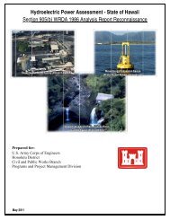
Rivers & Harbors Act - § 10 Drawings - Honolulu District - U.S. Army
Rivers & Harbors Act - § 10 Drawings - Honolulu District - U.S. Army
Rivers & Harbors Act - § 10 Drawings - Honolulu District - U.S. Army

You also want an ePaper? Increase the reach of your titles
YUMPU automatically turns print PDFs into web optimized ePapers that Google loves.
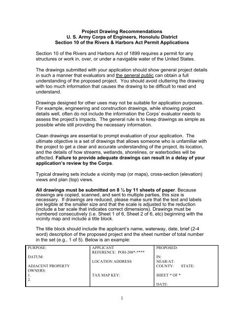
The vicinity, or location map must show the general and specific areas where theproject is located. A topographic (quad) map is useful as is a street map. Includestreet address (if any) and longitude/latitude. Major roads, identifiable landmarks,existing structures and adjacent property uses need to be identified. The permitevaluator should be able to go directly to the site based on the vicinity maps. Insummary, ensure the vicinity map is zoomed out far enough so one who isunfamiliar with the area can easily place him/herself in the landscape.For plan views, provide the following information:A north arrow. Use the top of the page as “north”.The name of the water body and the larger water body it flows into (ifapplicable).The direction of flood (incoming tide) and ebb (outgoing tide). The location of the existing shoreline and water elevation (level) –- Show the Ordinary High Water (OHW) line for fresh waters (rivers)or Mean High Water (MHW) line for tidal waters when applying forpermits under Section <strong>10</strong> of the <strong>Rivers</strong> and <strong>Harbors</strong> <strong>Act</strong>.Note: Be sure to indicate the source of your water datum. For example, acommon reference elevation for tidal areas is the Mean Lower Low Water(MLLW) line – informally called the 0-foot tide line.The dimensions of the activity or structure, the distance from propertylines, and the distance it extends into the waterbody beyond the OrdinaryHigh or Mean High Water Line, as appropriate.Show existing structures on subject and adjoining properties and indicateadjoining property ownership. This should include existing overwaterstructures as well as landward structures.If fill material is to be placed, identify the type of material, amount ofmaterial (cubic yards), and area to be filled (acres).If the project involves dredging (or excavating), identify the type of materialto be removed, the amount of material (in cubic yards), the area to bedredged, the method of dredging, and the location of disposal site.Dredging in areas shallower than -<strong>10</strong> feet needs to be clearly identified ondrawings.Identify any part of the activity that has been completed.2
Indicate types and location of aquatic and shoreline vegetation andcorals/coral reefs.Show control measures for preventing impacts from disturbed silts,stabilization of disturbed areas, etc.For Cross-Sectional View, provide the following information:The location of the existing shoreline and water elevation as describedabove.The water depth or tidal elevation at the waterward face of project.The dimensions of the activity or structure, and the distance it extends intothe waterbody as described above.Indicate dredge and/or fill grades as appropriate.Indicate existing and proposed contours and elevations. Show slopeangles as a ratio, e.g., 3 feet horizontal to 1 foot vertical would be shownas 3:1.Indicate types and location of aquatic and shoreline vegetation present onsite.Indicate type and location of material used in construction and method ofconstruction.Indicate height of structure.Please review the sample drawing(s) included with this package. They areprovided to ensure that you submit all the information needed on each drawing.For assistance in developing project drawings, contact the Corps of Engineers<strong>Honolulu</strong> <strong>District</strong> Regulatory Office at:Phone: (808) 438-9258Mailing address:<strong>Honolulu</strong> <strong>District</strong> Corps of EngineersRegulatory BranchBuilding 230Fort Shafter, HI 96858-54403