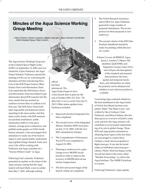
Minutes of the Aqua Science Working Group Meeting - Aqua - NASA
Minutes of the Aqua Science Working Group Meeting - Aqua - NASA
Minutes of the Aqua Science Working Group Meeting - Aqua - NASA

You also want an ePaper? Increase the reach of your titles
YUMPU automatically turns print PDFs into web optimized ePapers that Google loves.
The <strong>Aqua</strong> <strong>Science</strong> <strong>Working</strong> <strong>Group</strong> met<br />
at <strong>the</strong> Goddard Space Flight Center<br />
(GSFC) on September 12, 2000, and was<br />
chaired by Claire Parkinson, <strong>the</strong> <strong>Aqua</strong><br />
Project Scientist. Parkinson opened <strong>the</strong><br />
meeting at 8:30 a.m. by welcoming <strong>the</strong><br />
attendees and <strong>the</strong>n introducing Steve<br />
Cole <strong>of</strong> <strong>the</strong> EOS Project <strong>Science</strong> Office<br />
<strong>Science</strong> News and Information Team.<br />
Cole stated that <strong>the</strong> EOS <strong>Science</strong> News<br />
and Information Team has helped to get<br />
information about EOS research into <strong>the</strong><br />
news media that has reached an<br />
audience <strong>of</strong> more than six million in its<br />
first year. The EOS News Team facilitates<br />
responsible and balanced science<br />
reporting in <strong>the</strong> mass media, and that<br />
team works closely with EOS researchers<br />
and <strong>the</strong>ir institutions’ public<br />
information staffs to write press<br />
releases, arrange press conferences, and<br />
publish media guides on <strong>NASA</strong> Earth<br />
<strong>Science</strong> missions. Cole encouraged all in<br />
attendance to make use <strong>of</strong> his team to<br />
improve and expand public understanding<br />
<strong>of</strong> global change research. Early next<br />
year, Cole will be working with<br />
Parkinson and <strong>Aqua</strong> scientists on a<br />
“<strong>Science</strong> Writers Guide” to <strong>Aqua</strong>.<br />
Following Cole’s remarks, Parkinson<br />
presented an update on <strong>the</strong> status <strong>of</strong> <strong>the</strong><br />
<strong>Aqua</strong> mission, noting that <strong>the</strong> <strong>Aqua</strong><br />
launch will most likely occur no earlier<br />
than May 7, 2001, although nothing<br />
THE EARTH OBSERVER<br />
<strong>Minutes</strong> <strong>of</strong> <strong>the</strong> <strong>Aqua</strong> <strong>Science</strong> <strong>Working</strong><br />
<strong>Group</strong> <strong>Meeting</strong><br />
—Steve Graham (steven.m.graham.2@gsfc.nasa.gov), <strong>Aqua</strong> Outreach Coordinator,<br />
<strong>NASA</strong> Goddard Space Flight Center<br />
<strong>of</strong>ficial<br />
has been<br />
announced. The<br />
<strong>Aqua</strong> Project hopes to have<br />
a firm launch date in place by <strong>the</strong><br />
end <strong>of</strong> October 2000. [Ed. Note: The<br />
<strong>of</strong>fical date is now no earlier than July 12,<br />
2001.] O<strong>the</strong>r status updates from<br />
Parkinson included:<br />
• Spacecraft electrical integration has<br />
been completed.<br />
• The second review <strong>of</strong> <strong>the</strong> Integrated<br />
Mission Timeline (IMT) took place<br />
on July 13-14, 2000, with <strong>the</strong> next<br />
IMT scheduled for October.<br />
• The Comprehensive Performance<br />
Test (CPT) was completed on<br />
August 23, 2000.<br />
• Planning is underway for a gain<br />
change in two MODIS circuit<br />
boards in order to improve <strong>the</strong><br />
accuracy <strong>of</strong> MODIS-derived sea<br />
surface temperatures.<br />
• The first and second stages <strong>of</strong> <strong>the</strong><br />
launch vehicle are completed.<br />
4<br />
• The <strong>NASA</strong> Research Announcement<br />
(NRA) for <strong>Aqua</strong> Validation<br />
generated a large number <strong>of</strong><br />
proposal submissions. The review<br />
process for <strong>the</strong>se proposals is now<br />
underway.<br />
• The second volume <strong>of</strong> <strong>the</strong> EOS Data<br />
Products Handbook should be<br />
ready for printing within <strong>the</strong> next<br />
two weeks.<br />
Volume 2 covers ACRIMSAT, <strong>Aqua</strong>,<br />
Jason-1, Landsat 7, Meteor 3M,<br />
QuikScat, QuikTOMS, and<br />
Vegetation Canopy Lidar (VCL)<br />
and will provide descriptions<br />
<strong>of</strong> <strong>the</strong> standard and research<br />
data products, file sizes,<br />
spatial and temporal resolutions,<br />
and information on where<br />
<strong>the</strong> products can be obtained and<br />
whe<strong>the</strong>r or not a browse product is<br />
available.<br />
Concerning <strong>Aqua</strong> outreach initiatives,<br />
<strong>the</strong> first installment in <strong>the</strong> <strong>Aqua</strong> Series<br />
<strong>of</strong> <strong>NASA</strong> Fact Sheets has been completed.<br />
Titled “The Water Cycle” and<br />
written by Steve Graham, Claire<br />
Parkinson, and Mous Chahine, this fact<br />
sheet gives an overview <strong>of</strong> Earth’s water<br />
cycle and how <strong>the</strong> <strong>Aqua</strong> mission will<br />
contribute to an increased understanding<br />
<strong>of</strong> its role in global change. Those<br />
EOS and <strong>Aqua</strong> parties interested in<br />
obtaining hard copies <strong>of</strong> <strong>the</strong> fact sheet<br />
are encouraged to contact Steve<br />
Graham, e-mail: steven.m.graham.2<br />
@gsfc.nasa.gov. It can also be found<br />
online at earthobservatory.nasa.gov/<br />
Library/Water. Work has begun on <strong>the</strong><br />
second fact sheet in <strong>the</strong> series, titled<br />
“Wea<strong>the</strong>r Forecasting,” as well as <strong>the</strong><br />
<strong>Aqua</strong> brochure. The AMSR-E brochure<br />
is in press.<br />
Following Parkinson’s <strong>Aqua</strong> update,
Bruce Barkstrom, <strong>the</strong> CERES Team<br />
Leader, provided an update on <strong>the</strong><br />
CERES investigation. He noted that all<br />
major activation activities are completed<br />
on Terra CERES, with <strong>the</strong> exception <strong>of</strong><br />
<strong>the</strong> deep space maneuver. To date, <strong>the</strong><br />
Terra instruments have performed<br />
exceptionally well, with reasonably<br />
good fixes on geolocation and coastline<br />
navigation.<br />
Barkstrom <strong>the</strong>n moved on to <strong>the</strong> science<br />
impact on CERES <strong>of</strong> Earth <strong>Science</strong> Data<br />
and Information System (ESDIS)<br />
capacity limitations. He reiterated that<br />
<strong>the</strong> CERES <strong>Science</strong> mission provides a<br />
peer-reviewed science investigation in<br />
five areas:<br />
• The continuation <strong>of</strong> <strong>the</strong> Earth<br />
Radiation Budget Experiment<br />
(ERBE) measurements <strong>of</strong> <strong>the</strong> Earth’s<br />
radiation budget and cloud<br />
forcings.<br />
• Improvement <strong>of</strong> scene identification<br />
<strong>of</strong> radiation budget with simultaneous<br />
and collocated imager data<br />
(VIRS and MODIS).<br />
• Provision <strong>of</strong> new angular distribution<br />
models to cut instantaneous<br />
Earth radiation budget (ERB) flux<br />
errors in half.<br />
• Provision <strong>of</strong> empirical surface<br />
radiation budget fluxes.<br />
• Provision <strong>of</strong> atmospheric flux<br />
pr<strong>of</strong>iles (shortwave and longwave).<br />
Barkstrom noted that <strong>the</strong> last four<br />
bullets are new areas <strong>of</strong> major scientific<br />
improvement.<br />
There has been a major investment in<br />
<strong>the</strong> CERES instrument, validation, and<br />
s<strong>of</strong>tware. Five instruments have been<br />
September/October 2000 • Vol. 12 No. 5<br />
developed and are flying or will fly on<br />
three platforms. The CERES team has<br />
invested three years <strong>of</strong> work in <strong>the</strong><br />
scientific validation <strong>of</strong> TRMM data. The<br />
investment in CERES production code is<br />
large, with about 600,000 lines <strong>of</strong><br />
scientific code and about 45,000 lines <strong>of</strong><br />
production scripts.<br />
Regarding <strong>the</strong> CERES effort to reduce<br />
hardware capacity requirements,<br />
Barkstrom provided a number <strong>of</strong><br />
instances:<br />
First, ingest is down six times from <strong>the</strong><br />
original estimates. The original ESDIS/<br />
EOSDIS Core System (ECS) ingest rates<br />
included one MODIS stream for each<br />
CERES instrument. CERES recommended<br />
not only reducing to one<br />
MODIS stream per satellite but also<br />
subsetting to only one third <strong>of</strong> channels.<br />
Second, <strong>the</strong> CERES Surface and Atmospheric<br />
Radiation Budget (SARB)<br />
algorithms have reduced central<br />
processing unit (CPU) needs by a factor<br />
<strong>of</strong> 10.<br />
Third, personal efforts by Barkstrom on<br />
<strong>the</strong> Ad Hoc <strong>Working</strong> <strong>Group</strong> on Production<br />
(AHWGP) resulted in reducing 19<br />
ESDIS/ECS working groups to one<br />
working group that produced a preliminary<br />
summary <strong>of</strong> needs in two weeks<br />
using e-mail and that provided final<br />
capacity estimates within six months.<br />
This work reduced <strong>the</strong> uncertainty and<br />
cost <strong>of</strong> <strong>the</strong> total EOSDIS system.<br />
Fourth, <strong>the</strong> CERES team is considering<br />
<strong>the</strong> impact <strong>of</strong> using reduced imager<br />
resolution data in its cloud algorithms,<br />
although this reduction may increase<br />
spatial noise.<br />
Fifth, <strong>the</strong> team is considering <strong>the</strong><br />
possible removal <strong>of</strong> clear-sky reflectance<br />
5<br />
history in <strong>the</strong> same algorithms, which<br />
may reduce cloud detectability.<br />
It is clear that reducing hardware<br />
capacity carries a substantial scientific<br />
risk for <strong>the</strong>se algorithms.<br />
Commenting on <strong>the</strong> current state <strong>of</strong><br />
CERES data production, Barkstrom<br />
noted that <strong>the</strong> TRMM ERBE-like data<br />
products have been available from <strong>the</strong><br />
Langley Research Center (LaRC)<br />
Distributed Active Archive Center<br />
(DAAC) for some time and that Terra<br />
ERBE-like data products have been<br />
available in beta form since very shortly<br />
after <strong>the</strong> covers opened late in February.<br />
The CERES Team expects to release an<br />
“Edition 1” version <strong>of</strong> <strong>the</strong> Terra ERBElike<br />
data products shortly along with<br />
TRMM instantaneous cloud properties.<br />
Owing to <strong>the</strong> TRMM instrument failure,<br />
only about one year <strong>of</strong> TRMM data will<br />
be available. On Terra, EOS Data and<br />
Operations System (EDOS)/ECS<br />
problems have been hampered as<br />
intermittent dropouts have prevented<br />
producing daily and monthly data<br />
products.<br />
The current CERES approach to capacity<br />
estimation involves improving <strong>the</strong> data<br />
production schedule to cover TRMM,<br />
Terra, and <strong>Aqua</strong>. CERES has developed<br />
s<strong>of</strong>tware to tie <strong>the</strong> production schedule<br />
to hardware capacity needs and<br />
production workforce. The standard<br />
<strong>NASA</strong> approach based on Level 0, Level<br />
1, Level 2, and Level 3 data does not<br />
describe <strong>the</strong> phased validation and<br />
production approach CERES uses. In <strong>the</strong><br />
CERES schedule, <strong>the</strong>re is a need to<br />
reprocess some data products before<br />
validating o<strong>the</strong>rs. In addition, CERES<br />
will begin to use a “non-delay” schedule<br />
as a baseline and examine schedule slips<br />
and associated cost increases as a<br />
function <strong>of</strong> capacity reduction. CERES
primarily needs a three-fold CPU<br />
increase over <strong>the</strong> ESDIS pr<strong>of</strong>ile.<br />
The science impact <strong>of</strong> a reduced<br />
hardware capacity critically lowers <strong>the</strong><br />
ability <strong>of</strong> <strong>the</strong> EOS program to reduce<br />
uncertainty in cloud-radiation interaction.<br />
This effectively lessens <strong>the</strong> ability<br />
<strong>of</strong> EOS to (1) provide improved longterm<br />
cloud properties, (2) reduce <strong>the</strong><br />
uncertainty in angular distribution<br />
models and top <strong>of</strong> atmosphere (TOA)<br />
fluxes, (3) improve <strong>the</strong> surface radiation<br />
budget, and (4) provide new information<br />
on <strong>the</strong> atmospheric budget. In<br />
addition, <strong>the</strong>re would be a probable<br />
reduction in <strong>the</strong> EOSDIS user community.<br />
Also, a reduced capacity would<br />
slow improvements in commercial data<br />
products used by solar energy and<br />
home-building industries, and reduce<br />
<strong>the</strong> ability to provide timely data to<br />
students who participate in <strong>the</strong> CERES<br />
outreach program called Students’<br />
Cloud Observations On Line (S’COOL).<br />
Next, Bob Murphy <strong>of</strong> <strong>the</strong> MODIS<br />
<strong>Science</strong> Team presented sample Terra<br />
MODIS results and provided an <strong>Aqua</strong><br />
MODIS update on behalf <strong>of</strong> Vince<br />
Salomonson, who was unable to attend<br />
<strong>the</strong> meeting.<br />
Murphy began by stating that MODIS is<br />
working well, and in general, signal to<br />
noise ratios (SNR) and noise equivalent<br />
delta temperatures (NEDT) are better<br />
than pre-launch. Band-to-band registration<br />
is good and most early striping<br />
problems have been resolved. The team<br />
is still adjusting focal plan biases to<br />
optimize performance, as optical crosstalk<br />
in medium wavelength infrared<br />
(MWIR) and short wavelength infrared<br />
(SWIR) persists. Also, <strong>the</strong> noise injection<br />
into analog to digital conversion (ADC)<br />
problem results in 10-11 bit long<br />
wavelength infrared (LWIR) bands, so<br />
THE EARTH OBSERVER<br />
<strong>the</strong>y need to switch to <strong>the</strong> MODIS B side<br />
electronics. Because <strong>of</strong> this problem, a<br />
resistor swap has been requested for <strong>the</strong><br />
<strong>Aqua</strong> MODIS. (Note: The resistor swap<br />
was approved on October 2.) A deep<br />
space maneuver for <strong>the</strong> Terra spacecraft<br />
is planned for January 2001.<br />
Next, Murphy showcased a series <strong>of</strong><br />
MODIS images including Enhanced<br />
Vegetation Index (EVI), cloud mask,<br />
water vapor, thin cirrus, cloud top<br />
pressure, cloud optical thickness, cloud<br />
particle effective radius, aerosols<br />
(African dust), and sea surface temperature.<br />
A current issue being worked is <strong>the</strong><br />
timeliness <strong>of</strong> ephemeris data. Murphy<br />
noted that <strong>the</strong> Tracking and Data Relay<br />
Satellite System (TDRSS) On-board<br />
Navigation System (TONS) on Terra<br />
provides real time orbit data needed for<br />
geolocation. For <strong>Aqua</strong>, <strong>the</strong>se data must<br />
come from <strong>the</strong> post-processed ephemeris<br />
that is not available for 40 hours<br />
after <strong>the</strong> first data collection for each<br />
day. ESDIS estimates that more frequent<br />
ephemeris data would involve a onetime<br />
ECS s<strong>of</strong>tware costs <strong>of</strong> approximately<br />
$150K and that yearly cost<br />
would vary depending on desired<br />
frequency (2 ephemera per day - $52K, 4<br />
ephemera per day - $112K, 6 ephemera<br />
per day - $172K). At <strong>the</strong> present time,<br />
<strong>the</strong> processing chain from EDOS<br />
through <strong>the</strong> Goddard Earth <strong>Science</strong>s<br />
Distributed Active Archive Center (GES<br />
DAAC) and to <strong>the</strong> MODIS Adaptive<br />
Processing System (MODAPS, a MODIS<br />
Principal Investigator-led processing<br />
system) takes more than a week so it is<br />
not necessary to provide <strong>the</strong> more<br />
frequent ephemeris updates. Ultimately<br />
<strong>the</strong> entire system must be optimized so<br />
that data can move from EDOS through<br />
<strong>the</strong> GES DAAC and into MODAPS in 48<br />
hours. To achieve that requirement, it<br />
6<br />
will be necessary to provide <strong>the</strong><br />
ephemeris updates more frequently. The<br />
target for reaching this timeliness<br />
should be launch plus 6 months.<br />
Following Murphy, Kathy Amidon,<br />
from <strong>the</strong> <strong>Aqua</strong> Instrument Planning<br />
<strong>Group</strong> Support, provided a summary <strong>of</strong><br />
<strong>the</strong> Integrated Mission Timeline (IMT).<br />
Amidon noted that <strong>the</strong> second IMT<br />
Review was held on July 13-14 and was<br />
attended by members <strong>of</strong> <strong>the</strong> <strong>Aqua</strong><br />
Project, TRW, Instrument Operations<br />
Teams, and <strong>the</strong> Flight Operations Team.<br />
The current version <strong>of</strong> <strong>the</strong> IMT is based<br />
on previous IMT reviews from March<br />
and July 2000. She noted that MODIS<br />
yaw maneuvers previously planned for<br />
days 26-27 and 30-31 have been rescheduled<br />
to days 29-30 and 36-37. This is<br />
because MODIS elects to wait until day<br />
15 to begin its outgassing procedure.<br />
Since MODIS activities stay in <strong>the</strong> same<br />
order, <strong>the</strong> first set <strong>of</strong> yaw maneuvers<br />
slips out to days 29-30.<br />
A table was included that summarizes<br />
all planned instrument modes during<br />
spacecraft maneuvers. It is still <strong>the</strong><br />
preference <strong>of</strong> <strong>the</strong> AIRS team not to<br />
perform deep space constant pitch<br />
maneuvers, so <strong>the</strong> question remains<br />
which calibration activities would need<br />
to be repeated. If all calibration activities<br />
need to be repeated, <strong>the</strong>n AIRS would<br />
not complete activation checkout until<br />
approximately day 85.<br />
Next, Amidon noted that CERES yaw<br />
maneuvers appear to be incompatible<br />
with MODIS yaw maneuvers. CERES<br />
solar calibrations probably cannot<br />
piggyback on MODIS yaw maneuvers<br />
because <strong>of</strong> <strong>the</strong> orbital timing <strong>of</strong> <strong>the</strong> yaw<br />
maneuvers, <strong>the</strong> duration <strong>of</strong> attitude<br />
hold at <strong>the</strong> yaw <strong>of</strong>fset attitude, and <strong>the</strong><br />
yaw angle sequences. MODIS wants to<br />
maneuver to a yaw-<strong>of</strong>fset attitude, hold
for approximately five minutes, and<br />
return to nominal attitude once per<br />
orbit. These yaw maneuvers would be<br />
centered roughly over <strong>the</strong> orbital South<br />
Pole, which is approximately 10-15<br />
minutes after <strong>the</strong> spacecraft experiences<br />
sunrise. Each orbit will have a different<br />
(incremental) yaw <strong>of</strong>fset currently<br />
varying from 16.5° to 0°. CERES, on <strong>the</strong><br />
o<strong>the</strong>r hand, wants to maneuver to a yaw<br />
<strong>of</strong>fset attitude <strong>of</strong> approximately 15° and<br />
hold attitude for roughly 35 minutes<br />
before returning to nominal attitude <strong>of</strong><br />
0° yaw. The beginning <strong>of</strong> <strong>the</strong> maneuver<br />
would be at approximately sunrise<br />
minus two minutes, so <strong>the</strong> maneuver<br />
back would be at approximately sunrise<br />
plus 33 minutes. CERES first wants an<br />
orbit sunrise at 0° yaw, followed by an<br />
orbit sunrise at 15° yaw, followed by an<br />
orbit at 0° yaw, and wants to perform<br />
this sequence twice. The MODIS<br />
sequence does not allow for 0° yaw<br />
orbits between <strong>the</strong>ir incremented yaw<br />
<strong>of</strong>fsets and does not want to sit in <strong>the</strong><br />
yaw <strong>of</strong>fset attitude for 35 minutes.<br />
Consequently, an additional maneuver<br />
sequence has been proposed to satisfy<br />
CERES solar calibration requirements<br />
and is currently under evaluation.<br />
Lastly, Amidon noted that <strong>the</strong> next <strong>Aqua</strong><br />
IMT Review is currently scheduled for<br />
October 17-18, 2000.<br />
After a short break and guided tour <strong>of</strong><br />
<strong>the</strong> <strong>Aqua</strong> Flight Operations Facility<br />
(narrated by Fran Wasiak), <strong>the</strong> meeting<br />
reconvened with presentations by Ed<br />
Masuoka <strong>of</strong> <strong>the</strong> MODIS <strong>Science</strong> Data<br />
Support Team and Bruce Barkstrom <strong>of</strong><br />
<strong>the</strong> CERES Team on Terra and <strong>Aqua</strong><br />
Data Processing Issues. Masuoka<br />
presented first on MODIS lessons from<br />
Terra regarding data systems and<br />
product release. He noted that a<br />
spacecraft design flaw has resulted in<br />
bit-flips in high data rate instrument<br />
September/October 2000 • Vol. 12 No. 5<br />
Level 0 data, and that <strong>the</strong> ground<br />
system lost capacity and robustness due<br />
to budget constraints. In July 2000,<br />
EDOS had hardware failures and<br />
capacity bottlenecks followed by<br />
difficulty processing Level 0 with bitflips<br />
in August 2000.<br />
From a science perspective, six months<br />
to a year are required to get releasable<br />
products after initial data acquisition.<br />
The performance <strong>of</strong> MODIS on orbit<br />
required calibration s<strong>of</strong>tware changes<br />
and <strong>the</strong>re were on average 10 science<br />
algorithm changes per higher level<br />
product (Level 2 and Level 3 products.)<br />
The performance <strong>of</strong> <strong>the</strong> data system and<br />
bit-flip problems resulted in days with<br />
large data gaps, and since products are<br />
now being released to <strong>the</strong> public, solid<br />
data days are very important. Additional<br />
problems with data ordering have<br />
been encountered, as ordering data<br />
using <strong>the</strong> EOS Data Gateway (EDG) is<br />
cumbersome, slow, and intermittent,<br />
and frequently leaves <strong>the</strong> user with <strong>the</strong><br />
impression that no products are in <strong>the</strong><br />
archive. Ano<strong>the</strong>r flaw in product<br />
ordering is that large data orders (15<br />
GB) do not get filled, but do not fail<br />
ei<strong>the</strong>r, so it is only later that <strong>the</strong> enduser<br />
is notified via email from DAAC<br />
user support. The Quality Assurance<br />
metadata update tool (QAMUT) needs<br />
substantial work to improve its efficiency<br />
in handling <strong>the</strong> updating <strong>of</strong> a<br />
large number <strong>of</strong> data sets.<br />
Next, Masuoka commented on <strong>the</strong><br />
current status and issues related to<br />
MODIS data production at <strong>the</strong> GSFC<br />
DAAC. He noted that some two-hour<br />
Level 0 data sets are truncated due to<br />
file transfer protocol (FTP) problems,<br />
and <strong>the</strong>y are unable to achieve robust<br />
processing <strong>of</strong> Level 1 products in <strong>the</strong><br />
GSFC DAAC as production problems in<br />
<strong>the</strong> EOSDIS Core System (ECS) release<br />
7<br />
5B are being manifested as gaps in <strong>the</strong><br />
Level 1 data products.<br />
MODAPS is processing <strong>the</strong> data that<br />
arrive from GSFC, and is currently<br />
running 10-30 days behind acquisition.<br />
MODAPS data production is exceeding<br />
A+ baseline (<strong>the</strong> average daily product<br />
volume and average daily number <strong>of</strong><br />
files that MODIS is allowed to store in<br />
each <strong>of</strong> <strong>the</strong> MODIS DAACs) for delivery<br />
and <strong>the</strong> MODIS <strong>Science</strong> Team is<br />
working closely with <strong>the</strong>m to prioritize<br />
production. Currently, <strong>the</strong> science team<br />
is making trades between keeping<br />
production near current day and<br />
processing complete days for time<br />
series. Delays in acquiring complete<br />
days (95% <strong>of</strong> Level 1) from EDOS/<br />
GDAAC is an issue and it is taking up to<br />
a month to fill holes in a day when<br />
EDOS reprocessing is required.<br />
Impacts <strong>of</strong> <strong>the</strong> current problems include<br />
having not processed all <strong>of</strong> <strong>the</strong> MODIS<br />
Level 0 data that has been acquired.<br />
There exist a large number <strong>of</strong> days that<br />
haven’t been produced due to system<br />
inefficiencies. The system is unable to<br />
produce consistently, even at 96 A+<br />
levels, mainly due to <strong>the</strong> incomplete<br />
delivery <strong>of</strong> Level 1 products to<br />
MODAPS, greatly hampering higherlevel<br />
product generation and validation<br />
efforts. Masuoka noted that <strong>the</strong>y have<br />
lost as many clear views <strong>of</strong> validation<br />
sites to “bit flips” and EDOS problems<br />
as to cloud cover. In addition, increased<br />
archive capacity is needed above <strong>the</strong> 96<br />
baseline to store higher level MODIS<br />
science products. Estimates were<br />
developed before any code was completed<br />
and is now inadequate to store<br />
<strong>the</strong>se MODIS products.<br />
A delay in production <strong>of</strong> complete Level<br />
0 products for data days has held up<br />
downstream production at GDAAC and
MODAPS. The production backlogs<br />
have resulted in having to move data<br />
from online storage to tape archive with<br />
associated overhead <strong>of</strong> retrieval and<br />
fur<strong>the</strong>r delays in producing Level 3<br />
composite products (8-, 16-, and 32-day<br />
products). Reprocessing is a high<br />
priority due to large gaps in <strong>the</strong> data<br />
record and <strong>the</strong> beta quality <strong>of</strong> <strong>the</strong><br />
science algorithms that produced <strong>the</strong><br />
products. Currently <strong>the</strong>re is no capacity<br />
to reprocess and keep up with <strong>the</strong><br />
current production at <strong>the</strong> same time.<br />
The MODIS team needs significantly<br />
more reprocessing and ingest capacity at<br />
<strong>the</strong> DAACs to reprocess <strong>the</strong> science data<br />
and insert reprocessed products into <strong>the</strong><br />
archives.<br />
Barkstrom <strong>the</strong>n continued this <strong>the</strong>me by<br />
giving an overview <strong>of</strong> <strong>the</strong> EOS data<br />
issues workshop held on June 1-2, 2000<br />
at GSFC. The ga<strong>the</strong>ring constituted <strong>the</strong><br />
inaugural meeting <strong>of</strong> a <strong>Science</strong> <strong>Working</strong><br />
<strong>Group</strong> on Data (SWGD). Participants<br />
included (1) Terra instrument team<br />
representatives from CERES, MISR,<br />
MODIS, MOPITT, (2) EOS Project and<br />
ESDIS Project representatives, (3) EOS<br />
Project <strong>Science</strong> Office representatives,<br />
including <strong>the</strong> Terra and <strong>Aqua</strong> Project<br />
Scientists, and (4) DAAC and <strong>Science</strong><br />
Investigator-led Processing System<br />
(SIPS) representatives.<br />
He noted that <strong>the</strong> immediate EOSDIS<br />
situation appears to have improved as<br />
early EDOS problems are being solved,<br />
although EDOS remains backlogged.<br />
The <strong>Working</strong> <strong>Group</strong> formed because <strong>the</strong><br />
system remains unstable and appears to<br />
be systematically under-sized. There is<br />
concern that <strong>the</strong> lack <strong>of</strong> hardware will<br />
delay <strong>the</strong> scientific validation effort by<br />
2-3 years minimum. The SWGD<br />
hardware appraisal needed to deal with<br />
validation and reprocessing shows a<br />
need <strong>of</strong> about $15 million in computer<br />
THE EARTH OBSERVER<br />
hardware in FY01 and FY02 to solve <strong>the</strong><br />
problems, with small additions in later<br />
years (~$2M).<br />
During <strong>the</strong> workshop, <strong>the</strong> participants<br />
discussed <strong>the</strong> current operating status<br />
<strong>of</strong> EOSDIS, and in particular <strong>the</strong> lower<br />
than expected throughput and how it<br />
should be addressed. They noted that<br />
<strong>the</strong> February 1996 baseline sizing used<br />
to implement EOSDIS is not adequate<br />
to support <strong>the</strong> science data needs.<br />
Because that baseline was established<br />
before <strong>the</strong> algorithms were developed<br />
and could be run in <strong>the</strong> production<br />
environment, it did not have a clear<br />
empirical basis. In addition, <strong>the</strong> 1996<br />
baseline does not appear to have been<br />
based on previous <strong>NASA</strong> experience in<br />
validating and producing Earth science<br />
data. Terra instrument team representatives<br />
presented revised system sizing<br />
estimates based on current experience<br />
and improved understanding <strong>of</strong> <strong>the</strong><br />
EOS production environment. The<br />
group noted that <strong>the</strong> current performance<br />
<strong>of</strong> <strong>the</strong> system has yet to meet an<br />
operational level <strong>of</strong> production equivalent<br />
to <strong>the</strong> Option A+ first year capacity<br />
<strong>of</strong> 1x (product generation executable<br />
rate equals <strong>the</strong> input data rate from <strong>the</strong><br />
satellite) <strong>of</strong> Level 1 products and .5x<br />
(product generation executable rate is .5<br />
<strong>of</strong> <strong>the</strong> input data rate from <strong>the</strong> satellite)<br />
<strong>of</strong> Level 2 and higher products as<br />
volumes specified in <strong>the</strong> 1996 baseline.<br />
The primary finding from <strong>the</strong> working<br />
group meeting was <strong>the</strong> need for a<br />
marked increase in <strong>the</strong> system capacity<br />
to generate data products. The current<br />
budget situation is difficult on all sides.<br />
It is clear that <strong>the</strong>re will need to be<br />
frank and open discussions between all<br />
<strong>of</strong> <strong>the</strong> parties involved in EOSDIS<br />
regarding possible options. One area <strong>of</strong><br />
concern is <strong>the</strong> impact <strong>of</strong> <strong>the</strong> rapid<br />
evolution <strong>of</strong> information technology on<br />
8<br />
<strong>the</strong> obsolescence <strong>of</strong> <strong>the</strong> current system.<br />
This impact suggests that we may need<br />
to move rapidly from <strong>the</strong> current system<br />
to <strong>the</strong> more distributed system being<br />
envisioned for <strong>the</strong> new Data Information<br />
Systems and Services (NewDISS).<br />
[Ed. Note: See article on page 32 for<br />
progress in <strong>the</strong> performance <strong>of</strong> <strong>the</strong> EOSDIS<br />
system since this meeting.]<br />
The next topic <strong>of</strong> discussion was<br />
possible formation flying amongst <strong>the</strong><br />
EOS afternoon constellation <strong>of</strong> satellites.<br />
As introduced by Parkinson, Al Chang,<br />
<strong>the</strong> <strong>Aqua</strong> Deputy Project Scientist, will<br />
be representing <strong>Aqua</strong> scientists at<br />
upcoming meetings this fall on <strong>the</strong> issue<br />
<strong>of</strong> formation flying amongst <strong>Aqua</strong>,<br />
PICASSO-CENA, Cloudsat, Aura, and<br />
PARASOL (French micro-satellite<br />
containing POLDER), <strong>the</strong> set <strong>of</strong> upcoming<br />
EOS satellites taking measurements<br />
in <strong>the</strong> afternoon. Chang outlined <strong>the</strong><br />
issues involved, including fuel expenditure,<br />
mission risks, and measurement<br />
enhancements, and solicited from <strong>the</strong><br />
audience any concerns or support for<br />
formation flying. Ed Macie <strong>of</strong> <strong>the</strong> Earth<br />
<strong>Science</strong> Missions Operations (ESMO)<br />
Project presented more detail on <strong>the</strong><br />
Constellation Coordination <strong>of</strong> <strong>the</strong><br />
Afternoon Train. Macie said <strong>the</strong> ESMO<br />
at GSFC has been designated as <strong>the</strong><br />
focal point for coordination <strong>of</strong> <strong>the</strong> Earth<br />
<strong>Science</strong> morning and afternoon constellations.<br />
Their charter is to design and<br />
implement a constellation plan to<br />
maximize <strong>the</strong> science return, minimize<br />
operations, demonstrate various<br />
formation-flying technologies, and<br />
provide a focal point for communication<br />
and coordination between missions.<br />
The Morning Train includes Landsat 7,<br />
Terra, EO-1, and SAC-C and <strong>the</strong><br />
Afternoon Train includes <strong>Aqua</strong>,<br />
PICASSO-CENA, CloudSat, Aura, and
PARASOL. Barkstrom noted that <strong>the</strong><br />
ESMO needs to have a clearer picture <strong>of</strong><br />
<strong>the</strong> PICASSO-CENA/CloudSat precession<br />
across <strong>the</strong> swath, and that <strong>the</strong><br />
PICASSO-CENA team should follow up<br />
on this with GSFC. In addition, <strong>the</strong> point<br />
was brought up that in <strong>the</strong> forward<br />
scattering direction near <strong>the</strong> equator,<br />
MODIS sees a lot <strong>of</strong> sun glint in clear<br />
skies. The major concern on formation<br />
flying right now is <strong>the</strong> gap in time<br />
needed between Aura and <strong>Aqua</strong> since<br />
<strong>the</strong>y use <strong>the</strong> same polar ground stations.<br />
This is not a problem for Terra/<strong>Aqua</strong><br />
since <strong>the</strong>y will be rarely overhead at <strong>the</strong><br />
same time, and PICASSO-Cena/<br />
CloudSat since different ground stations<br />
will be used. The current philosophy <strong>of</strong><br />
<strong>the</strong> train constellation is that <strong>Aqua</strong> leads<br />
and o<strong>the</strong>r satellites respond to any <strong>Aqua</strong><br />
orbital changes in elevation or inclination.<br />
There will be a Morning Constellation<br />
<strong>Working</strong> <strong>Group</strong> meeting at <strong>NASA</strong><br />
Headquarters on September 15, 2000<br />
and an Afternoon Constellation <strong>Working</strong><br />
<strong>Group</strong> <strong>Meeting</strong> sometime in late<br />
October. [Ed. Note: <strong>the</strong> afternoon constellation<br />
meeting was changed to November 28,<br />
2000.] Current plans and activities call<br />
for:<br />
• establishing Missions Operations<br />
<strong>Working</strong> <strong>Group</strong>s and Charters;<br />
• developing a Mission Implementation<br />
Plan (morning constellation<br />
draft being reviewed);<br />
• prototyping a web-enabled Earth<br />
<strong>Science</strong> Collaborator tool for <strong>the</strong><br />
Morning Constellation for dissemination<br />
<strong>of</strong> information, analysis, and<br />
coordination <strong>of</strong> constellation<br />
activities;<br />
• a system demonstration in January<br />
2001;<br />
September/October 2000 • Vol. 12 No. 5<br />
• reviewing and updating <strong>the</strong> Flight<br />
Dynamics and Network studies as<br />
needed, and maintaining insight for<br />
identification and resolution issues;<br />
and<br />
• defining and developing agreements<br />
between missions and<br />
services as required.<br />
After returning from lunch, <strong>the</strong> group<br />
heard from Akira Shibata, <strong>the</strong> Japanese<br />
AMSR-E Team Leader, who presented a<br />
National Space Development Agency <strong>of</strong><br />
Japan (NASDA) AMSR-E <strong>Science</strong> Team<br />
Update. Shibata noted that <strong>the</strong> AMSR-E<br />
data will be available after 24 hours<br />
following <strong>the</strong> collection <strong>of</strong> data. Shibata<br />
also showed sea surface temperature<br />
maps from <strong>the</strong> TRMM Microwave<br />
Imager (TMI), and he discussed <strong>the</strong><br />
merits <strong>of</strong> <strong>the</strong> inclusion <strong>of</strong> 6 GHz<br />
channels on AMSR. These merits<br />
include more accurate sea surface<br />
temperature, soil moisture, sea surface<br />
wind speed and precipitation data.<br />
Shibata noted that main efforts for<br />
validation are concentrating on making<br />
match up data sets. Operational data on<br />
water vapor, sea surface winds, sea<br />
surface temperatures, precipitation, and<br />
snow depth have been collected through<br />
<strong>the</strong> global telecommunications system<br />
(GTS), <strong>the</strong> internet, and JMA. Experimental<br />
data will be collected by field<br />
campaigns and automatic stations<br />
maintained by <strong>the</strong> PIs and NASDA.<br />
These data will include water vapor,<br />
cloud water, precipitation, sea ice, snow<br />
depth, and soil moisture.<br />
Data distribution from <strong>the</strong> Earth<br />
Observation Research Center (EORC)<br />
(for PIs and authorized persons):<br />
Level 1B 6 hours online, tape<br />
Level 2 24 hours online, tape<br />
9<br />
Level 3 1.5 days online, tape<br />
Subsetting 6 hours online<br />
Matchup data 2 days online<br />
Reports <strong>of</strong> Japanese scientific activities<br />
on <strong>the</strong> usefulness <strong>of</strong> 10 GHz data <strong>of</strong><br />
TRMM Microwave Imager (TMI) have<br />
been prepared on sea surface temperature<br />
(SST) by Shibata and Murakami,<br />
precipitation by Aonashi, sea surface<br />
wind speed under rainy conditions by<br />
Shibata, and soil moisture by Koike.<br />
Shibata also commented on <strong>the</strong> merits <strong>of</strong><br />
6 GHz <strong>of</strong> AMSR/AMSR-E by saying<br />
that more accurate SST, soil moisture,<br />
sea surface wind speed, and precipitation<br />
measurements will be available. In<br />
addition, some new applications are<br />
anticipated for snow and sea ice.<br />
Concerns for 6 GHz include interference<br />
from artificial sources like <strong>the</strong> 10 GHz <strong>of</strong><br />
TMI.<br />
Following Shibata, Roy Spencer, <strong>the</strong><br />
<strong>NASA</strong> AMSR-E Team Leader, <strong>of</strong>fered an<br />
update on <strong>NASA</strong> AMSR-E progress and<br />
issues. Spencer noted that all algorithm<br />
s<strong>of</strong>tware has been handed <strong>of</strong>f to SIPS<br />
(except sea ice) and that SIPS interface<br />
testing with Remote Sensing Systems<br />
(RSS) and National Snow and Ice Data<br />
Center (NSIDC) is progressing normally.<br />
Regarding passive microwave calibration,<br />
<strong>the</strong> TMI calibration bias has been<br />
traced to a probable loss <strong>of</strong> all vacuum<br />
deposited aluminum (VDA) coating on<br />
<strong>the</strong> main reflector, due to atomic oxygen<br />
in its 350 km orbit. Also, a passive<br />
microwave rainfall mystery exists in<br />
that various estimates <strong>of</strong> tropical ocean<br />
rainfall change during El Niño Sou<strong>the</strong>rn<br />
Oscillation (ENSO) (+10% during warm<br />
phase) is at least double that inferred<br />
from surface energy and atmospheric<br />
radiation balance considerations<br />
(possible explanations for <strong>the</strong>se observations<br />
include rainfall efficiency and drop
size distribution change). The TRMM<br />
radar actually shows a decrease during<br />
<strong>the</strong> warm phase (may be due to drop<br />
size distribution change).<br />
Spencer also noted that <strong>the</strong>re will be an<br />
AMSR-E workshop in Kyoto, from<br />
October 30 to November 1, 2000.<br />
After Spencer, George Aumann, <strong>the</strong><br />
AIRS Project Scientist, <strong>of</strong>fered a status<br />
update on <strong>the</strong> AIRS/AMSU/HSB<br />
program. Aumann began by stating that<br />
<strong>the</strong> scientific objectives <strong>of</strong> <strong>the</strong> AIRS/<br />
AMSU/HSB instrument suite are to<br />
improve operational wea<strong>the</strong>r forecasting<br />
and study <strong>the</strong> wea<strong>the</strong>r and climate<br />
related processes related to temperature<br />
and moisture pr<strong>of</strong>iles, surface temperature<br />
and emissivities, and cloud<br />
properties.<br />
Aumann noted that <strong>the</strong> instrument suite<br />
passed <strong>the</strong> warm Comprehensive<br />
Performance Test (CPT) at TRW, and <strong>the</strong><br />
cold Thermal Vacuum (TVAC) is <strong>the</strong><br />
next scheduled test.<br />
Version 2 product generation s<strong>of</strong>tware<br />
(PGS) has been installed at <strong>the</strong> GSFC<br />
DAAC and Level 1b s<strong>of</strong>tware performance<br />
is being verified using flight<br />
model data from <strong>the</strong> TVAC tests. Based<br />
on <strong>the</strong>se tests, <strong>the</strong> instrument is demonstrating<br />
excellent radiometric and<br />
spectral performance.<br />
The instrument team continues to work<br />
on <strong>the</strong> implementation <strong>of</strong> <strong>the</strong> Validation<br />
Plan. The validation processing system<br />
is being prepared at JPL with <strong>the</strong> goal <strong>of</strong><br />
having fully characterized Level 1b data<br />
at launch +7 months and T(p) (temperature<br />
pr<strong>of</strong>ile as a function <strong>of</strong> atmospheric<br />
pressure), q(p) (water vapor pr<strong>of</strong>ile as a<br />
function <strong>of</strong> atmospheric pressure), and<br />
T_surface (surface skin temperature)<br />
products at launch +12 months.<br />
THE EARTH OBSERVER<br />
For routine global meteorological<br />
observation support, plans include <strong>the</strong><br />
use <strong>of</strong> 100 co-located atmospheric truth<br />
sets from worldwide routine radiosondes<br />
(expect about 10 to be cloud free)<br />
and 300 “surface reports” from ocean<br />
buoys and ships per day for sea surface<br />
temperature validation (expect about 30<br />
to be cloud free, 15 <strong>of</strong> <strong>the</strong>se at night). In<br />
addition, a routine meteorological data<br />
set will be used for operational quality<br />
assurance.<br />
For dedicated temporary support, plans<br />
include <strong>the</strong> use <strong>of</strong> 16 atmospheric state<br />
truth periods per day from <strong>the</strong> U.S. and<br />
five o<strong>the</strong>r countries for three months<br />
coordinated with EOS <strong>Aqua</strong> overflights.<br />
Concerning <strong>the</strong> <strong>NASA</strong> Research<br />
Announcement for EOS <strong>Aqua</strong> validation<br />
support, 36 proposals were received<br />
related to AIRS/AMSU/HSB and <strong>the</strong>y<br />
expect to have funding for approximately<br />
8 <strong>of</strong> <strong>the</strong> proposals. The funded<br />
proposals are expected to support <strong>the</strong><br />
validation effort with an additional 50<br />
research-type radiosonde launches per<br />
year, many <strong>of</strong> <strong>the</strong>m with chilled mirror<br />
hygrometers, and 40 special floating<br />
buoy measurements per day, for <strong>the</strong><br />
three-year proposal period.<br />
Next, Aumann spoke about <strong>the</strong> new<br />
task <strong>of</strong> AIRS data forecast impact<br />
assessment. There is a letter <strong>of</strong> agreement<br />
between NOAA and <strong>NASA</strong> (James<br />
Baker and Dan Goldin) to assess impact<br />
<strong>of</strong> AIRS data on operational forecast by<br />
launch +12 months. NOAA understands<br />
what information is needed to improve<br />
wea<strong>the</strong>r forecasts and sees <strong>the</strong> AIRS<br />
instrument as <strong>the</strong> way to provide this<br />
important information. The National<br />
Centers for Environmental Prediction<br />
(NCEP) and <strong>the</strong> European Center for<br />
Medium-range Wea<strong>the</strong>r Forecasting<br />
(ECMWF) have determined that<br />
10<br />
achieving a major positive forecast<br />
impact requires satellite data that<br />
provides:<br />
• lower tropospheric sounding with<br />
minimal surface mixing;<br />
• accurate surface temperature and<br />
emissivity;<br />
• mid-tropospheric and higher water<br />
vapor sounding channels; and<br />
• accurate (and scene independent)<br />
error characterization.<br />
Currently, none <strong>of</strong> <strong>the</strong>se data is provided<br />
by infrared or microwave<br />
sounders, but will be provided by AIRS.<br />
Aumann noted that NCEP and ECMWF<br />
have great expectations for AIRS to have<br />
a high impact on wea<strong>the</strong>r forecasting.<br />
They are currently working with<br />
NOAA/NESDIS to expedite AIRS data<br />
transfer within three hours <strong>of</strong> receipt on<br />
<strong>the</strong> ground. Operational forecast<br />
systems (NCEP, ECMWF) have switched<br />
from Level 2 data assimilation to Level<br />
1b data assimilation. The initial impact<br />
assessment will be based on <strong>the</strong><br />
evaluation <strong>of</strong> specific forecast “bust”<br />
cases over North America and Western<br />
Europe.<br />
Lastly, Aumann commented on an <strong>Aqua</strong><br />
instrument inter-instrument cross<br />
comparison. There is significant Level<br />
1b spectral and spatial overlap between<br />
MODIS/AIRS/CERES and AMSU/<br />
HSB/AMSR-E. Also <strong>the</strong>re is significant<br />
Level 2 product overlap between<br />
MODIS/AIRS/AMSR-E for sea surface<br />
temperature, MODIS/AIRS for cloud<br />
height, cloud fraction, and cloud top<br />
temperature, and AIRS/AMSU/AMSR-<br />
E for cloud liquid water and total water<br />
column. Aumann <strong>the</strong>n displayed an<br />
example comparing an SST product for
a single AIRS footprint and corresponding<br />
MODIS field <strong>of</strong> 15 x 15 footprints.<br />
AIRS SST claimed an accuracy <strong>of</strong> 0.5K<br />
root mean squared (RMS) for a single<br />
footprint, while MODIS SST claimed an<br />
accuracy <strong>of</strong> 0.2K RMS. He clarified that<br />
successful inter-instrument crosscomparison<br />
does not constitute validation,<br />
but if simple uniform areas are<br />
picked, this could be an important step<br />
in <strong>the</strong> development <strong>of</strong> multi-instrument<br />
data products, or at <strong>the</strong> least, <strong>the</strong><br />
products could contain information that<br />
could be used for new products.<br />
Following Aumann, Peter Hildebrand,<br />
<strong>the</strong> Deputy <strong>Aqua</strong> Project Scientist for<br />
Validation, provided an update on <strong>Aqua</strong><br />
validation activities. Hildebrand<br />
discussed areas <strong>of</strong> concern for <strong>Aqua</strong><br />
validation, which include <strong>the</strong> scheduling<br />
<strong>of</strong> validation field efforts.<br />
Hildebrand noted that flexibility needs<br />
to be built into <strong>the</strong> planning <strong>of</strong> field<br />
efforts and critical validation campaigns<br />
should be delayed until <strong>the</strong> time is right<br />
(i.e., everything is working). Also, <strong>the</strong>re<br />
exists <strong>the</strong> need for development <strong>of</strong><br />
alternative modes <strong>of</strong> data collection for<br />
use during start-up so initial calibration<br />
and validation needs can be met.<br />
O<strong>the</strong>r areas <strong>of</strong> concern are <strong>the</strong> expectation<br />
<strong>of</strong> supporting measurements from<br />
o<strong>the</strong>r instruments and <strong>the</strong> cooperation<br />
<strong>of</strong> common validation efforts.<br />
There are also concerns about <strong>the</strong> data<br />
system, ground stations, and data<br />
delivery planning. Terra has a complete<br />
direct downlink data path that is<br />
unavailable for <strong>Aqua</strong>. Concerning <strong>the</strong><br />
archival <strong>of</strong> validation data sets, <strong>the</strong><br />
model appears to have individual<br />
teams/sites do <strong>the</strong> archival. This will be<br />
facilitated using standard data formats<br />
and planning for eventual migration to<br />
a DAAC.<br />
September/October 2000 • Vol. 12 No. 5<br />
O<strong>the</strong>r validation impacts noted by<br />
Hildebrand are <strong>the</strong> needs for deep space<br />
looks for calibration, <strong>the</strong> scheduling <strong>of</strong><br />
validation efforts due to time lost<br />
following launch due to getting to <strong>the</strong><br />
proper orbit, and <strong>the</strong> effects <strong>of</strong> recompetition<br />
on <strong>the</strong> science teams.<br />
Action items suggested by Hildebrand<br />
included increasing communications by<br />
holding validation meetings on <strong>the</strong> day<br />
prior to <strong>the</strong> <strong>Science</strong> <strong>Working</strong> <strong>Group</strong><br />
<strong>Meeting</strong> and having regular validation<br />
meetings and telecons. Finally, he<br />
S<strong>of</strong>tware tool being distributed by <strong>NASA</strong>’s Jet<br />
Propulsion Laboratory<br />
— Linda A. Hunt (l.a.hunt@LARC.<strong>NASA</strong>.GOV), <strong>NASA</strong> Langley Research Center<br />
A s<strong>of</strong>tware tool for visualization <strong>of</strong> MISR and AirMISR data files, misr_view, is now being<br />
distributed by <strong>NASA</strong>’s Jet Propulsion Laboratory.<br />
misr_view is an IDL-based and graphical user interface-driven display and analysis tool for<br />
use with many types <strong>of</strong> MISR and AirMISR data. It is specificially designed for use with<br />
those MISR and AirMISR files that use <strong>the</strong> HDF-EOS “grid” interface. These include MISR<br />
L1B2 georectified (map-projected) radiance, MISR L1B3 radiometric cloud masks, all MISR<br />
Level 2 geophysical products, <strong>the</strong> MISR Ancillary Geographic Product, and AirMISR L1B2<br />
georectified radiances. For MISR data, <strong>the</strong> user interface provides data selection for<br />
specified orbits, paths, or observation dates, and enables translation between <strong>the</strong>se modes<br />
<strong>of</strong> identification. The interface to AirMISR data is simplified. The display and analysis tools<br />
include simultaneous display <strong>of</strong> several data planes through color assignment, contrast<br />
enhancement, data value query, image rotation, creation <strong>of</strong> stereo anaglyphs, zooming, and<br />
linked analysis and view windows.<br />
misr_view has been developed by <strong>the</strong> Visualization and Earth <strong>Science</strong> Applications <strong>Group</strong><br />
<strong>of</strong> <strong>the</strong> Image Processing Applications and Development Section at <strong>the</strong> Jet Propulsion<br />
Laboratory. Version 3.3 <strong>of</strong> misr_view, which includes a User’s Guide, is available for<br />
download free <strong>of</strong> charge from JPL, upon completion <strong>of</strong> a misr_view license agreement:<br />
URL: osa.jpl.nasa.gov/MISR_SW_LICENSES/license.visualization<br />
MISR and AirMISR data are available from <strong>the</strong> Atmospheric <strong>Science</strong>s Data Center at <strong>NASA</strong><br />
Langley Research Center:<br />
<strong>Science</strong> User and Data Services Office<br />
Atmospheric <strong>Science</strong>s Data Center<br />
<strong>NASA</strong> Langley Research Center<br />
MS 157D<br />
Hampton, VA 23681-0001<br />
Phone: (757) 864-8656<br />
Fax: (757) 864-8807<br />
Internet: larc@eos.nasa.gov<br />
URL: http://eosweb.larc.nasa.gov<br />
11<br />
suggested <strong>the</strong> creation <strong>of</strong> an <strong>Aqua</strong><br />
validation document that identifies <strong>the</strong><br />
planned validation activities and<br />
sources <strong>of</strong> validation data.<br />
The meeting concluded at 4:00 p.m. with<br />
a guided tour <strong>of</strong> <strong>the</strong> Goddard DAAC<br />
facilities narrated by Steve Kempler, <strong>the</strong><br />
Goddard DAAC Manager.<br />
The next <strong>Aqua</strong> <strong>Science</strong> <strong>Working</strong> <strong>Group</strong><br />
meeting is scheduled for Thursday,<br />
February 8, 2001 at Goddard.