GeoKongres 2012 makedonskil n...
GeoKongres 2012 makedonskil n...
GeoKongres 2012 makedonskil n...
- No tags were found...
You also want an ePaper? Increase the reach of your titles
YUMPU automatically turns print PDFs into web optimized ePapers that Google loves.
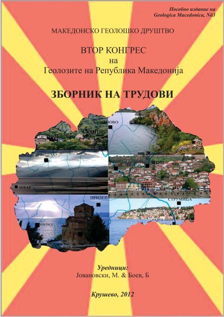
МАКЕДОНСКО ГЕОЛОШКО ДРУШТВОВТОР КОНГРЕСнаГеолозите на Република МакедонијаЗБОРНИК НА ТРУДОВИПосебно издание наGeologica Macedonica, N ō3Уредници:Јовановски, М. & Боев, БКрушево, <strong>2012</strong>
Izdava~: Makedonsko geolo{ko dru{tvoGlavni i odgovorni urednici: Prof. d-r Milorad Jovanovski iProf. d-r Bla`o BoevUredni~ki odbor: Prof. d-r Bla`o Boev (R.Makedonija), Prof. d-rTodor Serafimovski (R.Makedonija), Prof. d-rMilorad Jovanovski (R.Makedonija), Prof. d-rNikola Dumurxanov (R.Makedonija), Doc. d-r GoranTasev (R.Makedonija), m-r Igor Pe{evski(R.Makedonija), prof. Ivan Zagorchev PhD (Bulgaria), prof.Tadej Dolenec PhD (Slovenia), prof. Vladmir Bermanec PhD(Croatia), prof. Alexander Volkov PhD (Russia), prof.VeselinDragišić PhD (Serbia).Tehni~ki urednik: m-r Igor Pe{evskiLektura: Blagoja BogatinoskiPe~ati: Pe~atnica "2-ri Avgust S"-[tipTira`: 300 primeroci
СОДРЖИНАCONTENTS1. Regionalna geologija, tektonika ipaleontologija ........................ 1КРАИШТИДИ ВО РЕПУБЛИКА МАКЕДОНИЈААлександар Стојанов ......................... 3GEOLOGICAL AND PETROLOGICALCHARACTERISTICS OF THE VOLCANIC CENTERSFROM THE UPPER VOLCANOGENIC-SEDIMENTARYUNIT FROM THE WESTERN SREDNOGORIE,BULGARIAStefan Velev, Rossen Nedialkov, Irena Peytcheva, Albrecht vonQuadt ........................... 7PALAEOZOIC EVOLUTION OF THE OGRAZHDENUNIT (SERBO-MACEDONIAN MASSIF, BULGARIAAND MACEDONIA)Ivan Zagorchev, Constantin Balica, Ioan Balintoni,Evgeniya Kozhoukharova, Gavril Săbău, Elena Negulescu ........................... 13ПРИЧИНИ И НЕОТЕКТОНСКО СТРУКТУРИРАЊЕНА ГЕОПРОСТОРОТ НА Р.МАКЕДОНИЈАГаврил Мираковски ........................... 19ГЕОТЕКТОНСКИ РАЗВОЈ НА ЛАКАВИЧКИОТГРАБЕН ВО АЛПИСКИОТ ОРОГЕН ЦИКЛУСГоше Петров, Виолета Стојанова, Војо Мирчовски ........................... 29МЕТОДОЛОГИЈА И ПРИНЦИПИ ЗА ИЗРАБОТКАНА ОГК-2 НА РЕОНОТ ПЛАЧКОВИЦАЗоран Донев, Благојчо Божинов ........................... 35ПРОЕКТ ЗА ИЗРАБОТКА НА ОСНОВНА ГЕОЛОШКАКАРТА ОГК 2 РЕОН ОГРАЖДЕН-БЕЛАСИЦАМ 1:50.000Сашо Георгиевски, Санде Донев, Игор Митев ........................... 43БИОСТРАТИГРАФИЈА НА ОВЧЕПОЛСКИОТПАЛЕОГЕНСКИ БАСЕН, Р. МАКЕДОНИЈАВиолета Стојанова, Гоше Петров, Виолета Стефанова ........................... 53i
2. Metalogenija i nao|ali{ta namineralni surovini ..................... 63HYDROGEN ISOTOPIC STUDY OF THE BOROVIĆMINERALIZED SYSTEM, KRATOVO-ZLETOVOVOLCANIC AREATodor Serafimovski, Goran Tasev, Tadej Dolenec, Nastja Rogan-Šmuc, Dalibor Serafimovski, Petra Vrhovnik, Matej Dolenec,Timotej Verbovšek ........................... 65PORPHYRY Cu-Mo-Au-Ag-DEPOSITS OF THENORTHEAST OF RUSSIA, COMPARISON WITHSIMILAR DEPOSITS OF THE R. MACEDONIASEGMENT OF THE TETHYS BELTAlexander Volkov, Todor Serafimovski, Goran Tasev ......................... 73FLUID INCLUSIONS STUDY IN THE QUARTZFROM THE ZLETOVO MINEGoran Tasev, Todor Serafimovski ......................... 83THE POTENTIAL OF THE NONMETALLIC MINERALRESOURCES IN THE REPUBLIC OF MACEDONIAOrce Spasovski, Daniel Spasovski ........................... 91ПЕРСПЕКТИВНИ ГЕОЛОШКИ ФОРМАЦИИ КАКОНОСИТЕЛИ НА СИЛИЦИСКИ СУРОВИНИВО РЕПУБЛИКА МАКЕДОНИЈАКрсто Блажев, Андреј Блажев ........................... 95THE POSSIBILITIES TO USE THE TRAVERTINE ANDONYX – GULABOVA CAVE, BESISTE VILLAGE(WESTERN MACEDONIA) AS AN ARCHITECTURALSTONEОrce Spasovski, Zoran Kostovski, Daniel Spasovski ........................... 103STRUCTURAL RESEARCH ON DOLOMITE MARBLESIN BELOVODICA MINE FROM THE ASPECT OFMARBLE EXPLOIATATIONVasja Dameski, Blazo Boev ........................... 109QUALITATIVE COAL FEATURES FROM DEPOSITNEGOTINO, R. MACEDONIAMilica Nikolova, Orce Spasovski ........................... 117ПРИМЕНЕТА МЕТОДОЛОГИЈА НАИСТРАЖУВАЊАТА НА НАОЃАЛИШТЕТО НАЈАГЛЕН МАРИОВО, ЛОКАЛИТЕТ С. БЕШИШТЕЗоран Донев ........................... 123ЈАГЛЕНОВО НАОЃАЛИШТЕ “МАРИОВО”ПРЕСМЕТКА НА КВАЛИТЕТ И РЕЗЕРВИЕлизабета Ралева, Златко Илијовски, Данче Тодорова ........................... 131ii
ГЕОЛОШКИ И СТРУКТУРНО -ТЕКТОНСКИКАРАКТЕРИСТИКИ НА ЈАГЛЕНОВОТОНАОЃАЛИШТЕ „ЖИВОЈНО“Ласте Ивановски, Петре Пасков, Елизабета Ралева,Владимир Костовски ........................... 139КОМПАРАТИВНИ СОГЛЕДУВАЊА НА ГЕОЛОШКИИ ЕКОНОМСКИ ПАРАМЕТРИ НА ЈАГЛЕНОВИТЕНАОЃАЛИШТА „МАРИОВО“ И „ЖИВОЈНО“Петре Пасков, Ласте Ивановски, Трифун Милевски,Данче Тодорова, Игор Пешевски ........................... 1473. In`enerska geologija i geotehnika ...................... 155ГЕОЛОШКА ГРАДБА НА ТЕРЕНОТ ОКОЛУ БРАНАКНЕЖЕВО ВО ИЗВЕДЕНА СОСТОЈБАМоме Милановски ........................... 157ИНЖЕНЕРСКОГЕОЛОШКА КЛАСИФИКАЦИЈА НАНЕВРЗАНИТЕ КАРПИ ОД ОКОЛИНАТА НАОХРИДСКОТО ЕЗЕРОЃорги Димов, Благица Донева, Марјан Делипетров, ТодорДелипетров ........................... 163ИНЖЕНЕРСКО ГЕОЛОШКИ И ГЕОТЕХНИЧКИИСПИТУВАЊА КАЈ ФЛИШНИ СЕДИМЕНТИОрце Петковски ........................... 169ПРИСТАП ЗА АНАЛИЗА НА СТАБИЛНОСТ ВОАНИЗОТРПОНИ КАРПЕСТИ МАСИ СО ПРИМЕНАНА МЕТОДОТ НА ИНТЕРАКЦИОНИ МАТРИЦИИгор Пешевски, Милорад Јовановски, Наум Гапковски ........................... 175STANDARD PENETRATION TEST, HISTORICALDEVELOPMENT AND CURRENT USE OF THE TESTGareth Evans, Saša Živadinović ........................... 181ПОЈАВА, ФОРМИРАЊЕ И САНАЦИЈА НАСВЛЕЧИШТА ВО УРБАНИ СРЕДИНИ НАТЕРИТОРИЈАТА НА ОПШТИНА ШТИПЉупче Кулаков , Зоран Ѓорѓиевски , Златко Илијовски ........................... 189СВЛЕЧИШТЕ ВО ПОВРШИНСКИ КОП СУВОДОЛ,МИКРОЛОКАЦИЈА – 7, НЕГОВА ПОЈАВА ИИСКУСТВАЉупчо Петрески, Анита Мартиновиќ, Марија Манева ........................... 195МЕТОДОЛОГИЈА ЗА ИЗРАБОТКА НАДИГИТАЛНАТА ГЕОЛОШКА КАРТА НАРЕПУБЛИКА МАКЕДОНИЈА (РАЗМЕР 1:100000)Благоја Маркоски, Милорад Јовановски, Свемир Горин, ИгорПешевски........................... 203iii
4. Petrologija i mineralogija ...................... 211ГЕОХЕМИСКИ КАРАКТЕРИСТИКИ НА ЕПИДОТ –(Pb), ПИЕМОНТИТ – (Pb) ОД „МЕШАНАТА СЕРИЈА“БЛИЗУ с. НЕЖИЛОВО, МАКЕДОНИЈАНикита Чуканов, Симеон Јанчев ........................... 213GEOLOGY AND MINERALOGY OF ALLCHARSb-As-Tl-Au DEPOSITBlazo Boev, Gligor Jovanovski, Petre Makreski ........................... 215МИНЕРАЛОШКИ И ХЕМИСКИ КАРАКТЕРИСТИКИНА KEРАМИЧКИТЕ ГЛИНИ ОД НАОЃАЛИШТЕТОГРАДЕЦ, ВИНИЦА, Р. МАКЕДОНИЈАМиле Илиев, Орце Спасовски ........................... 233IR SPECTROSCOPICAL CHARACTERISTICS OFMETAMICT ALLANITE-(CE)Andrea Čobić, Nenad Tomašić, Vladimir Bermanec ........................... 239COLLOIDAL ORIGIN OF COLLOFORM-BANDEDTEXTURES IN THE LOW-SULFIDATION,SEDIMENTARY ROCK-HOSTED AU-AG KHAN KRUM(ADA TEPE) DEPOSIT, SE BULGARIAIrina Marinova, Rositsa Titorenkova, Valentin Ganev ........................... 245ELECTRON BACKSCATTER DIFFRACTION–BASEDIDENTIFICATION OF MICROPHASES IN ALTEREDMONAZITEMihail Tarassov, Eugenia Tarassova ........................... 253SPHALERITE CYCLIC TWINS FROM STARI TRGMINE, TREPČA, KOSOVOVladimir Zebec, Snježana Mikulčić Pavlaković, Željka ŽigovečkiGobac, Vladimir Bermanec ........................... 257STAR-LIKE GALENA CRYSTALS FROM STARI TRGMINE, TREPČA, KOSOVOŽeljka Žigovečki Gobac, Vladimir Zebec, Snježana MikulčićPavlaković, Vladimir Bermanec ........................... 261MINERALOGICAL CHARACTERISTICS OF THE NI-LATERITE WEATHERING CRUST ON THEOPHIOLITES NEAR GORNJE OREŠJE, MEDVEDNICAMTS., CROATIAMarta Kiš, Sabina Strmić Palinkaš, Ladislav Palinkaš, VladimirBermanec ........................... 265MINERALOGY AND THE FLUID INCLUSION DATAOF THE BONČE TOURMALINE-BEARINGPEGMATITE, THE SELEČKA MTS., REPUBLIC OFMACEDONIADanijela Šmajgl, Sabina Strmić Palinkaš, Ladislav Palinkaš,Štefica Kampić, Blažo Boev, Tamás Váczi ........................... 271iv
5. Geohemija i geohemija na sredinata ...................... 277ГЕОХЕМИСКИ КАРАКТЕРИСТИКИ НА ВИНАПРОИЗВЕДЕНИ ВО ДОМАШНИ УСЛОВИ ВООБЛАСТА ТИКВЕШИван Боев, Соња Лепиткова, Тена Шијакова,Орце Спасовски, Блажо Боев........................... 279GEOCHEMICAL CHARACTERISTICS OF THEWATERS FROM THE GEOTHERMAL SYSTEMZDRAVEVCIOrce Spasovski, Daniel Spasovski ........................... 311ОПРЕДЕЛУВАЊЕ НА ТЕШКИ И ТОКСИЧНИМЕТАЛИ ВО ВОДИТЕ ОД ГРАДСКИОТ ВОДОВОДВО ШТИП СО ПРИМЕНА НА МЕТОДАТА НА ICP-AESМарјан Максимов, Блажо Боев, Весна Зајкова Панова ........................... 317ГЕОХЕМИЈА НА СТРИМ СЕДИМЕНТИТЕ И НИВНАПРИМЕНА ВО ПРОСПЕКЦИЈАТА НАНАОЃАЛИШТА ВО Р. МАКЕДOНИЈАВиолета Стефанова, Војо Мирчовски, Росен Неделков,Виолета СтојановаINDOOR RADON AND SOIL RADIOACTIVITY INKRUSEVO, REPUBLIC OF MACEDONIAZdenka Stojanovska, Blazo Boev, Jovan Januseski, MimozaRistova........................... 325........................... 3316. Hidrogeologija i geotermija ...................... 337KARST AQUIFERS CARACTERISATIONON THE RESULTS OF TIME SERIES ANALYSIS –CASE EXAMPLE OF SERBIAN KARST AQUIFERIgor Jemcov ........................... 339ХИДРОГЕОЛОШКА РЕОНИЗАЦИЈА НАПОДРАЧЈЕТО НА ГРАД СКОПЈЕ И МОЖНОСТИ ЗАИСКОРИСТУВАЊЕ НА ПОДЗЕМНАТА ВОДА ЗАНАВОДНУВАЊЕ НА ЗЕЛЕНИ ПОВРШИНИЗлатко Илијовски, Моме Милановски, Никола Димов ........................... 347PHYSICOCHEMICAL CHARACTERISTICS OF MINEWATERS AT ABANDONED MINING SITES IN SERBIAVeselin Dragišić, Nebojša Atanacković, Vladimir Živanović,Gordana Milentijević ........................... 355COMPARATIVE ANALYSIS OF APPLICATION OFDRASTIC AND PI METHOD IN THE PROTECTION OFNATIONAL PARK TARA GROUNDWATERSVladimir Živanović, Veselin Dragišić, Igor Jemcov, NebojšaAtanacković ........................... 361v
ХИДРОГЕОЛОШКИ КАРАКТЕРИСТИКИ НАСУБАРТЕСКИОТ ВОДОНОСНИК ВО СЕЛОТОКРУШЕАНИ – ПРИЛЕПВојо Мирчовски, Виолета Стефанова, Тена Шијакова-Иванова, Владо Мирчовски ........................... 369МАЛИ ВОДИ НА КАРСТНИОТ ИЗВОРСТУДЕНЧИЦААтанас Угрински, Војо Мирчовски, Гоше Петров ........................... 375THERMAL MATURITY OF THE MESOZOICSEDIMENTS IN THE CENTRAL SOUTHERN PART OFTHE MOESIAN PLATFORMNikola Botoucharov ........................... 381МЕТОДОЛОГИЈА НА ИСТРАЖУВАЊЕ НАПЕТРОТЕРМАЛНА ЕНЕРГИЈАСтојанче Николов, Александар Буов, Јован Првуловиќ,Милорад Јовановски ........................... 387ХИДРОГЕОЛОШКИ КАРАКТЕРИСТИКИ НАЈАГЛЕНОВОТО НАОЃАЛИШТЕ „ЖИВОЈНО“Костадин Јовановски, Данче Тодорова ........................... 395МЕТОДОЛОГИЈА НА ИЗВЕДБА НА БУНАРСКИСИСТЕМ ЗА ОДВОДНУВАЊЕ НА ПЈС РЕК БИТОЛАОД ПОВРШИНСКИ И ПОДЗЕМНИ ВОДИСтојан Михаиловски, Никола Димов, Мирјана Трпчевска,Љупчо Петрески ........................... 4037. Geofizika ...................... 411ГЕОЕЛЕКТРИЧЕН МОДЕЛ НА КОЧАНСКАТАДЕПРЕСИЈАБлагица Донева, Љупче Ефнушев, Ѓорги Димов, СањаПостолова ........................... 413ИНВЕРЗНА ЕКСТРАПОЛАЦИЈА НА БРАНОВО ПОЛЕ–МИГРАЦИЈАСања Постолова, Благица Донева, Марјан Делипетров, ТодорДелипетров ........................... 4198. Geolo{ko i kulturno nasledstvo ...................... 425ПРИМЕНА НА ЕЛЕКТРОНСКАТА МИКРОАНАЛИЗАВО АНАЛИЗА НА ПРИМЕРОЦИ ОДКУЛТУРНОТО НАСЛЕДСТВОБлажо Боев ........................... 427vi
COMPARATIVE ANALYSIS OF APPLICATION OFDRASTIC AND PI METHOD IN THE PROTECTION OFNATIONAL PARK TARA GROUNDWATERSVladimir Živanović 1 , Veselin Dragišić 2 , Igor Jemcov 3 , Nebojša Atanacković 41 & 2 & 3 & 4Faculty of Mining and Geology, Djušina 7, 11000 Belgrade, Serbia, v.zivanovic@rgf.bg.ac.rsAbstractMethods for groundwater vulnerability assessment are becoming more and more important especially when itcomes to groundwater protection. Maps that are obtained by applying these methods are of particularimportance because they represent an important basis used to establish groundwater protection preventivemeasures. These maps can also find wide application in the protection of certain areas as is the case with theNational Parks.The paper describes the use of DRASTIC and PI methods to assess the vulnerability of the National Park Taragroundwaters. Selection of the proper methods for assessing the vulnerability is not an easy task, because eachmethod requires a different level of input data and gives different results, especially if the terrain ischaracterized by a complex hydrogeological composition. This problem is expressed in karst terrains, wheresome methods do not take into account the specific characteristics of the karst aquifers. Such is the case with theDRASTIC and PI method application, and therefore this paper comparatively showsthe results that are obtainedby applying these methods.Key words:groundwater vulnerability, karst aquifer, DRASTIC method, PI method, National Park TaraINTRODUCTIONThe concept of groundwater vulnerabilityassessment was presented in the 60s of the 20 thcentury by a French scientist Margat (Vrbaand Zaporozec [1]). The idea was to describethe degree of groundwater vulnerability topollution as a function of geological,hydrological and hydrogeological conditionsof the environment. Ever since then variousmethods have been developed some of whichhave become a standard tool for groundwatervulnerability assessment (Gogu andDassargues [2]). That is the case withDRASTIC method, Alleret al. [3], which hasbeen applied in many countries and indifferent hydrogeological environment so far(Hamza et al. [4], Denny et al. [5], etc).However, although it has often been applied,this method has various disadvantages,especially when karst groundwatervulnerability is assessed. Exactly for thisreason during the last decade certain methodsappeared and they were designed in such away to take into account specific rechargeconditions of the karst aquifer (EPIK method -Doerfliger and Zwahlen [6], COP method –Vias et al. [7], etc.). One of these methods isthe PI method (Goldscheider [8]) which notonly that takes into account specific infiltrationconditions in karst terrains, but also gives agood estimation of the protective role of theunsaturated zone in the areas with other typeof aquifers as well.This paper shows methodology of applicationof DRASTIC and PI methods aiming to showthe differences in vulnerability maps producedby application of these methods. We havevarious examples of application of differentmethods on the same area in practice (Vias etal. [9], Ravbar and Goldscheider [10]). Theresults produced were very often different, andsometimes even contradictory.National park Tara (NP Tara) was chosen to bethe test area for application of these methods.The geological structure of this region isdominated by carbonate formations which arehighly karstified and represent significantreservoirs of karst groundwater. That is whyone of the objectives of this paper was to showhow important it was to apply methods whichwerespecifically designed to assess thevulnerability of karst groundwater in order toevaluate properly the protective role ofunsaturated zone, and thus prepare a goodbasis for protection of this natural resource.361
EXPERIMENTAL SECTIONOne of the first and most used methods forgroundwater vulnerability assessment isDRASTIC method (Aller et al. [3]). Analysingthe characteristics of the aquifer and vadosezone, groundwater level, topography andinfiltration conditions, this method considersthe behaviour of pollutants from the surfacewhich are infiltrated with rain. The methoduses seven parameters: depth to groundwaterlevel (factor D), recharge (P factor), theaquifer media (factor A), soil type (factor S),topography of the terrain (factor T), theinfluence of the aeration zone (factor I) andtransmissibilityof the aquifer (factor C). In theprocess of entire vulnerability calculation, toeach factor the weight coefficient is added.This coefficient defines the importance of thefactor in defining the natural protection. Thusthe size of the vulnerability, or so calledDRASTIC index,is calculated by the formula:DRASTICIndex =5·Dr+4·Rr+3·Ar+2·Sr+Tr·Tw+5·Ir+3·Cr.The numbers in front of each of the factors arevalues pointing the importance of individualfactors on the vulnerability index.Vulnerability map is obtained when the terrainis classified into 6 different classes, from veryhigh to very low groundwater vulnerability.PI method was developed under the projectCOST 620 (Zwahlen[11]) at the Department ofApplied Geology (University of Karslruhe). PImethod is GIS-based approach for mappinggroundwater vulnerability of all types ofaquifers, with special focus to the karstaquifer. Acronym PI points out that 2parameters are considered: a protective factorP and the infiltration conditions I.P factor describes the protective function ofthe layers that lie between the terrain surfaceand groundwater levels –soil, non karstifiedrocks and unsaturated karstified rocks. P factoris calculated by the updated version of theGerman GLA method (Hölting et al. [12]). Bythis factor, the land is classified into 5 classeswhere P=1 corresponds to the class with thelowest level of protection and P=5 correspondsto the highest level of protection.The I factor describes the infiltrationconditions, i.e. degree to which the protectivecover is being bypassed as a result of thelateral surface and subsurface flow incatchment of the ponors or sinking streams. Indefining this factor, the catchment of theponors or sinking streams is first beingdetermined. Then, based on the character ofthe slope, vegetation and soil, the movementof pollutant from the surface to the zones ofconcentrated infiltration is being estimated.Values range from 0-1 where the lowest valuesindicate rapid infiltration conditions withbypassing the protective role of theunsaturated zone.The final factor π is calculated as the productof P and I values:π = P · IAccording to π factor, the land is divided intofive classes. Values π≤1 indicates a smalldegree of protection and extreme vulnerabilityto contamination. In contrast, the value of π =5 indicates a high degree of protection andvery low vulnerability. Spatial distribution offactors of π is shown on the vulnerability map.For the application of these two methods andfor the creation of the vulnerability maps as atest area the territory of Tara National Park ischosen. The National Park covers an area of192 km 2 and covers most of Tara Mountain. Itis located in the far west of Serbia on theborder with Bosnia and Herzegovina.Carbonate rocks of Mesozoic age dominate inthe structure of mountain Tara (Fig. 1).Palaeozoic schists, Jurassic diabase andgabbro, and Quaternary sediments are withlimited distribution. From the hydrogeologicalpoint of view, karst aquifers have the largestdistribution within the research area. This typeof aquifer is the most important in the areabecause of the largest groundwateraccumulation and because almost the entirequantity of water of mountain Tara drainsthrough it.362
Figure 1. Geological map of the National Park Tara (Olujuć and Karović[13])Q –Quaternarysediments (intergranular aquifer); K 21,2– bedded limestones (karst aquifer); K 2 1 –Mudstones and marlstones (fissured aquifer); J – Diabase-chert formation (fissured aquifer); Se,ββ,σe – Serpentinite, diabase, spilite, harcburgite (fissured aquifer), T 3 , T 2,3 , T 2 – limestones anddolomites (karst aquifer); 2 T 1 – sandstones and marlstones - (fissured aquifer); T 1 – shale (lowpermeable rocks); Pz – Palaeozoic schists(low permeable rocks)Karst aquifer recharge is highly dependent onthe meteorological conditions and thecomposition of soil and vegetation cover. Sumof annual precipitation in this area is around1000 mm. Infiltration of precipitation is doneon the entire karst plane, but the intensity isgreatest in places of concentric infiltration -sinkholes, karst valleys (Ljuto and Dobropolje), pits and ponors (Jaruga ponor, ponornear the spring Zaboj, Vasić ponor, ponor inMitrovac, Lokvica ponor, ponor in KrnjaJelaet al., Jemcov [14]).Aquifers drainage is mostly done through akarst springs with different yield. Thelocations of the springs are related to the mainfault zones or crossing of some faults, and thusthe largest karst springs within the researcharea (Perućac, Lađevac and Rača) are relatedto the tectonic zones. The largest spring in theinvestigation area is the Perućac spring with aminimum yield of 450 l/s (Jemcov [14]).RESULTS AND DISCUSSIONThe application of DRASTIC methodMaking a map of groundwater vulnerability ofNP Tara by applying DRASTIC methodrequire the creation of 7 different layers, i.e. 7maps for each analysed parameter. On thesemaps different areas are isolated according tothe influence of the analysed factor on thegroundwater vulnerability.Map of factor D (depth to groundwater level)was obtained by the spatial analysis of thefactors which have impact on the size of thevadose zone, Živanović [15]:hydrogeologi-calcharacteristics of the rocks on one side and thenearness of water occurrences such as springs,rivers and lakes on the other. Based on thelocation of water occurrences, first a map thatshows how much each point on the ground isaway from any spring or river is done (bufferzones of 20, 50, 100 and 500 m). This map iscombined with the hydrogeological map of theNational park and as a final resulta map thatshows the influence of the depth togroundwater on the vulnerability is done.For mapping of recharge (R factor), followinglayers were used through a special calculationscheme (Piscopo [16]): 1.layershowing theterrain slope that was made on the basis ofDEM using slope analysis; 2.layer showingspatial distribution of rainfall (average yearly363
precipitation values from existing rainfallstations were used); 3 layer showing soilcomposition was done based on existingpedological maps (terrain classification wasmade according to the soil permeability).Joining these layers a new map is createdwhere the recharge is estimated according tothe sum of points assigned to each particularlayer.The parameters A, C and I are relatively easilydetermined based on the known geological andhydrogeological situation in the research area.Factors A and I are determined descriptively,based on the ranging values given from theauthors of the DRASTIC method. Dependingon the nature of the rocks in the saturated andunsaturated zone values in the range of 2 to 10are assigned. The factor C depends on thefiltration coefficient of the rocks which formedthe aquifer. Filtration coefficient wasestimated based on the lithologicalcomposition and the degree of cracking andkarstification of these rocks.Figure 2. Creation of the groundwater vulnerability map of the National Park Tara using theDRASTIC method364
Pedological maps at a scale 1:50000 were usedfor creation of factor S map. Each soil type onthe map is characterized by specific grain sizecomposition on the basis of which the rankingof this factor is made. For the creation offactor T map, classification of the slope mapmaid with spatial analysis of the DEM wasdone. The DEM is made in the scale of 1: 25000 in total surface of 265 km 2 .Using the DRASTIC equation, finalvulnerability index is calculated and based onit, different zones (classes) with differentdegree of groundwater vulnerability tocontamination from the surface were separated(Fig. 2).Five of the six classes of groundwatervulnerability have been allocated pointing outlow to very high vulnerability.The application of PI methodThe first step in applying the PI method is todetermine the protection factor P whichdescribes the protective function of the layersthat lie between the terrain surface andgroundwater levels - topsoil, subsoil, nonkarstifiedrocks and karstified rocks in theunsaturated zone.For this purpose, first the map of effectivefield capacity (EFC factor) was made. Thisparameter was calculated based onthepedological maps of the research area, wherefor each pedological unit estimationof thethickness and grain-size was done (Jemcov[14]). After making the EFC map, assessmentof the protective function provided by the soiland the rocks in the unsaturated zone wasdone.To determine the protective role of rockmasses in the unsaturated zone, scoring wasperformed according to the type of rock(parameter L) where each L value wasmultiplied by the parameter F, whichdetermines the degree of cracking or thedegree of rock karstification. This product wasthen multiplied by the thickness of rock in theunsaturated zone.To determine the P factor, it was alsonecessary to determine the size of thegroundwater recharge because based on it thecorrection factor R,which reduces or increasesthe protective function of the soil andthevadosezone,was calculated. For rechargeestimation, the same methodology as in theDRASTIC method was used. Combining allthese parameters final P factor map wasobtained.In determining the I factor it was firstnecessary to determine the dominant flow ofsurface water movement. This was done basedon the estimatedfiltration coefficient of theupper part of the soil. To define the directinfiltration conditions it was also necessary todetermine the slope and the vegetation of theterrain. The vegetation map was developedbased on the satellite image where the terrainwas classified into two categories: 1.meadows, pastures and fields and 2. forests.According to the degree of slope, zoning wasdone into 3 groups. Combining these threeparameters I' map was obtained.For creation of the final I map, it was alsonecessary to create the map of catchmentareas. Ponor zones and zones with differentdistance from the ponors and sinking streams(buffer zones) are isolated on this map. Areaswhich gravitate towards the karst terrain aswell as the areas which represent drainingzonesoutside of karst are also isolated on thismap. By combining the I 'map and thecatchment area map wecreated the I factormap which shows the degree to which theprotective role of the unsaturated zoneisbypassed.Groundwater vulnerability map was created bydetermining the π factor which was done bymultiplying P and I factors in each point of theresearch area. The resulting map showsgeneral vulnerability and natural protection ofgroundwater from the highest aquifer. Thevalue of π factor is in the range between 0.0and 5.0 with high values indicating a highdegree of natural protection and lowvulnerability (Fig. 3).365
Figure 3.The final PI vulnerability map which was made by intersecting the P and the I mapBy applying the DRASTIC method avulnerability map was produced containingdifferent vulnerability classes with equalpercentage of participation. Very highvulnerability class covers around 15% of theresearch area and is mainly distributed in thenorthwest part of the National park. Moderateand high vulnerability are mainly isolated onthe karst plateau around Mitrovac. Lowgroundwater vulnerability characterizes thebiggest part of the research area (44.5%) and itis the most widespread in the areas withdeveloped fissured type of aquifer as well asthe terrains made of low permeable rocks.By applying the PI method a map with thelargest part of the terrain (63,4%) belonging tothe moderate groundwater vulnerability classwas produced. The northwest part of the parkis characterized by high vulnerability. Veryhigh vulnerability class which covers only2.2% is isolated in the zone of ponors anddolines on the karst plateau around Mitrovac.Low vulnerability is also isolated on the karstplateau around Mitrovac, in parts outside thecatchment area of ponors, where thegroundwater level is deep and where there isclayey soil in surface parts.366
Figure 4. Difference between vulnerability maps obtained using DRASTIC and PI method for thekarst plateau above Perućac karst springCONCLUSIONOn the basis of analysis done by applyingDRASTIC and PI methods, it can be concludedthat the degree of groundwater vulnerability isdirectly influenced by karst distribution. Zoneswith very high and high groundwatervulnerability are isolated in these terrains byapplying DRASTIC method. However, PImethod recognizes low groundwatervulnerability in some parts of karst (the part ofthe karst plateau above Perućac karst spring)since it pays much more attention to the depthto groundwater level and pedologicalcharacteristics of the ground (Fig. 4).REFERENCES(Vrba and Zaporozec, 1994):Vrba J. and ZoporozecA. (eds.), 1994: Guidebook on MappingGroundwater Vulnerability, InternationalContributions to Hydrogeology (IAH), 16: 131 p.;Hannover.(Gogu and Dassargues, 2000): Gogu R.C. andDassargues A., 2000: Current trends and futurechallenges in ground water vulnerability assessmentusing overly and index methods, EnvironmentalGeology, 39(6): 549-559.(Aller et al., 1985):Aller L., Bennet T., Lehr J., PettyR., Hackett G., 1985: DRASTIC: A standardizedsystem for evaluating ground water pollutionpotential using hydrogeologic settings, U.S. EPA,Chicago, Illinois(Hamza et al., 2007): Hamza M.H., Added A.,Rodrıguez R., Abdeljaoued S., Ben Mammou, A.,The differences in vulnerability maps producedin this way are the result of the fact that PImethod is created to take into account specificcharacteristics of karst terrains. By applying PImethod conditions of surface water infiltrationare analysed, bearing in mind the existence ofponors and ponor zones as well as the zonesgravitating towards them. That explains lowvulnerability of some karst terrains outside thecatchment areas of ponors. These terrains arecharacterised with deep groundwater level andthick clayey soil which significantly reducedthe infiltration of pollutants from the surface.2007: A GIS-based DRASTIC vulnerability and netrecharge reassessment in an aquifer of a semi-aridregion (Metline-Ras Jebel-RafRaf aquifer, NorthernTunisia), Journal of Environmental Management 84(2007) 12–19(Denny et al., 2007):Denny S.C., Allen D.M.,Journeay J.M., 2007: DRASTIC-Fm: a modifiedvulnerability mapping method for structurallycontrolled aquifers in the southern Gulf Islands,British Columbia, Canada, Hydrogeology Journal2007-15, 483–493(Doerfliger and Zwahlen, 1997): Doerfliger N. andZwahlen F., 1997: EPIK: A new method foroutlining of protection areas in karstic environment,Karst Waters and Environmental Impacts, Gunayand Johnson (eds), Balkema, Rotterdam367
(Vias et al., 2006):Vias J.M., Andreo B., Perles M.J.,Carrasco F., Vadillo I., Jimenez P., 2006: Proposedmethod for groundwater vulnerability mapping incarbonate (karstic) aquifers: the COP method,Hydrogeology Journal 2006-14, 912-925(Goldscheider, 2002): Goldscheider N., 2002:Hydrogeology and vulnerability of karst systems –examples from the Northern Alps and SwabianAlb,PhD Thesis (Dissertation), Fakultätfür Bio- undGeowissenschaften, University of Karlsruhe, 236 s,Karlsruhe(Vias et al., 2005): Vias J.M., Andreo B., PerlesM.J., Carrasco F., 2005: A comparative study of fourschemes for groundwater vulnerability mapping in adiffuse flow carbonate aquifer under Mediterraneanclimatic conditions, Environmental Geology, 47:586-595.(Ravbar and Goldscheider, 2009): Ravbar N.,Goldscheider N., 2009: Comparative application offour methods of groundwater vulnerabilitymappingin a Slovene karst catchment, Hydrogeology Journal2009-17, 725-733(Zwahlen, 2004): Zwahlen F [ed], 2004:Vulnerability and risk mapping for the protection ofcarbonate (karst) aquifers, COST Action 620, Officefor Official Publications of the EuropeanCommunities, Luxembourg, 297 s.(Hölting et al., 1995): Hoelting B, Haertlé T,Hohberger KH, Nachtigall KH, Villinger E,Weinzierl W, Wrobel JP (1995)KonzeptzurErmittlung der Schutzfunktion derGrundwasserueberdeckung, Geol.Jb., C, 63, p. 5–24,Hannover (Concept for the Determination of theProtective Effectiveness of the Cover above theGroundwater against Pollution, Ad-hoc WorkingGroup on Hydrogeology, 28 p., Hannover)(Olujuć and Karović, 1985): Olujuć J., Karović J.,1985: Base Geological Map at Scale 1:100,000,Sheet Visegrad (in Serbian). Saveznigeološkizavod,Belgrade.(Jemcov, 2009): Jemcov I., 2009:Bilans karstnihizdanskihvodaioptimizacijarešenjanjihovogzahvatanaprimerimaizSrbije, PhD,Faculty of Mining andGeology, Belgrade(Živanović, 2011): Živanović, V., 2011: Ocenaranjivosti podzemnihvodaodzagađenjanaprimerimakarsta Srbije, Magistarski rad, Faculty of Mining andGeology, Belgrade(Piscopo, 2001): Piscopo G., 2001: Groundwatervulnerability map explanatory notes, NSWDepartment of Land and Water Conservation,Australia368


