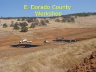
Building Roads That Fit the Landscape - El Dorado County ...
Building Roads That Fit the Landscape - El Dorado County ...
Building Roads That Fit the Landscape - El Dorado County ...

You also want an ePaper? Increase the reach of your titles
YUMPU automatically turns print PDFs into web optimized ePapers that Google loves.
Topography• Steep slopes (> 40 %) and flat (
Topography• Gentle slopes (10% - 40%):– Minimize road grade (steepness)• Reduces potential for– Erosion of roadbed– Stream diversion at watercourse crossings• While allowing road surface to drain downslope8
Topography• Gentle slopes minimize:– Excavation and fill• Shorter and less steep– Cutslopes– Fillslopes• Less likelihood of– Cutslope failure– Fillslope failure13
Cutbank HeightsRoadwidthSideslope40%12’ with outslopeCu<strong>the</strong>ight4 ¾ ft15’ with insideditchCu<strong>the</strong>ight7 ¼ ft65%7 ¾ ft11 ¾ ft80%9 ½ ft14 ½ ft15
Spoils VolumesRoadwidthSideslope40%65%80%12’ with outslopeSpoilsvolume1 yd 3 /ft1 2/3yd 3 /ft2 yd 3 /ft15’ with insideditchSpoilsvolume2 1/3yd 3 /ft4 yd 3 /ft5 yd 3 /ft16
Water• Streams• Wet areas• Groundwater17
Water• StreamsStay away from except to cross(Pete Cafferata will discuss crossings)• Road effects on streams• Stream effects on roads18
Road Effects on Streams• Can Increase Sediment Discharge toStreams• Can Increase Stream Peak Flow –Flood Crest• Road effects reduced by increasingdistance between road and stream(buffer effects)19
Note: Assumes insloped road!20
Road Effects on StreamsSediment discharge to streams• Affects <strong>the</strong> form and texture of <strong>the</strong> channel as well as<strong>the</strong> organisms that live in <strong>the</strong> streamSediment derived from erosion of• Road running surface• Cutslopes and fillslopes• Inside Ditch21
How water comes offforested slopes**Atkinson, 197822
Road Effects on StreamsStream peak flows increased by• Runoff from compacted road surface, cutslope,fillslope.• Interception of shallow groundwater by cutslope.23
Road Effects on Streams• Interception of shallow groundwaterminimized by:– Smaller road width– Outsloping• <strong>El</strong>iminates inner ditch,• Narrows <strong>the</strong> road width• Raises inside edge of road24
Road Drainage• Outsloped road is best• Will need rolling dips in case ruts form• Insloped with inside ditch• Need to cross-drain <strong>the</strong> ditch with ditchrelief culverts. Closer spacing <strong>the</strong> better.26
Stream Effects on <strong>Roads</strong>• Inner gorges‣Unstable‣Poor location for roads (unstable, too close to stream)• Lateral erosion may erode roadway if locatedclose to stream.• Road located near valley bottom must crosstributary streams.31
Destined fordisaster.Hwy 50 is anexcellentexample.33
Unless stream iseroding outside ofbends andundercutting road.34
Road failure caused by stream undercutting35
Stream Effects on <strong>Roads</strong>• Best to locate roads up on ridge tops ifpossible – away from potential adverseeffects of <strong>the</strong> stream.36
Compromise ifsteep climb.Hwy 4 is anexample.37
Stream Effects on <strong>Roads</strong>• Crossings‣Expensive to install, maintain(Pete Cafferata will discuss)‣Failure potential – need to consider– Cost of re-installing crossing– Stream diversion, subsequent road erosion, and roadreconstruction costs• Best to avoid stream crossings ifpossible!38
Wet Areas (seeps, wet ground)• How to ID?• Problems• Mitigations39
Wet AreasHow to Identify –• Water present on ground surface• Water-loving plants (horsetail, maple, dogwood,etc.) = hydrophytes• Green areas when all else is dried up40
Wet AreasProblems –• Soft soils and road substrate• Possible surface drainage across road andsediment to streams41
Wet AreasMitigations –• Avoid wet areas ifpossible• French drain• Engineered roadsubstrate, Geofabric42
Geology• The Geology of <strong>El</strong> <strong>Dorado</strong> <strong>County</strong> is typical of <strong>the</strong>Central Sierras.• Consists of belts of metamorphic rock: greenstone,slate, and schist, which are separated by faultszones.• Large rock masses of predominantly granite and alesser extent gabbro.49
Slope Stability• Unstable area characteristics:– Hummocky topography• Rolling bumpy ground• Frequent topographic benches• Frequent closed depressions– Tension cracks and headwall scarps– Evidence of impaired groundwater movement• Sag ponds, springs, patches of wet ground, hydrophyticvegetation– Short irregular surface drainages begin and end on<strong>the</strong> slope– Leaning, jackstrawed, or split trees are common– Trees with excessive sweep50
XXXXXXXXXX54
Landslides• Unstable areas– Types of slides• Deep-seated (rotational) (cohesive, clay-rich soils)• Shallow-seated (debris slides, flows, torrents)(non-cohesive, clay-poor soils)55
Deep-Seated landslide57
Shallow-Seated landslides59
ACBD61
<strong>El</strong> DORADO COUNTYGEOLOGYVOLCANIC MUDFLOWCAPROCK ABOVE GRANITICBEDROCK
Predictable trouble• Unstable areas associated with:– Certain Rock types and associations:• Clays and rocks that wea<strong>the</strong>r to clay• Colluvium in hollows; poorly consolidated rocks• Slippery rocks (phyllites, mica schists, serpentinite)• High-permeability rocks over low-permeability rocks• Fault zones (weak, sheared, often clay-like rocks,permeability difference)– Bad areas• Areas of groundwater convergence (bottom of swales)• Areas of groundwater discharge, esp. at toes ofslopes (e.g., inner gorges of streams, landslides)69
• Erodible soils– Sandy soils with little or no cohesive binder– “Decomposed Granite” type of soil, foundin western part of <strong>the</strong> <strong>County</strong>.– Not generally as big a problem in easternportions of <strong>the</strong> county where granite hasbeen scoured by glaciers. Deepwea<strong>the</strong>red rind has been scraped off.70
• Examples of rocks in <strong>El</strong> <strong>Dorado</strong> <strong>County</strong> that maybe associated with unstable areas• Young, relatively unconsolidated rocks– Colluvium (esp. in hollows)• Sheared rocks in <strong>the</strong> Melones and Bear MountainFault Zones• Ultramafic rocks (typically serpentinized) andserpentinite• Strongly bedded or foliated rocks such as slate,where <strong>the</strong> layering has an adverse orientation(layering daylights in <strong>the</strong> road cutslope , and <strong>the</strong>dip of layering is between 10 and 80 degrees)71
HIGH PRECIPITATION along <strong>the</strong>LOWER SNOW ZONE at 5,000to 7,000 FEET- also known as<strong>the</strong> “RAIN ON SNOW” ZONESTEEP RUGGED TERRAIN withHIGH PRECIPITATION andRAPID RUNOFF meansLANDSLIDE POTENTIAL
• Unstable areasGeology– Avoid if at all possible– Do not:• Excavate toe (reduces slide-resisting forces)• Load head (increases slide-driving forces)• Concentrate water onto or into <strong>the</strong> slide74
• Erodible soils– How to identify• Field testGeology• Soil Survey – available from– NRCS – soil surveys on <strong>the</strong> Internet at:(http://websoilsurvey.nrcs.usda.gov/app/)– USFS Forest Service75
Geology• Mitigating erodible soils– Keep road gradient gentle– Get water off <strong>the</strong> road!• Outslope <strong>the</strong> road• Frequent water breaks (Rolling dips, Waterbars)– Rock <strong>the</strong> road!– Avoid draining water over unvegetated cutslopes– For DG soils, see CDF guidance document:Recommended Mitigation Measures for TimberOperations in Decomposed Granite soilsAvailable on <strong>the</strong> Internet at:http://www.fire.ca.gov/resource_mgt/downloads/DGSoilsMits.pdf76
DUST• Asbestos-bearing rock units(Contain naturally occurring asbestos [NOA])– Occur in ultramafic rocks and soils– Concerns and effects– How to identify• Geology maps• Rock descriptions• See CGS site(http://www.conservation.ca.gov/cgs/minerals/hazardous_minerals/asbestos/Pages/Index.aspx)– Mitigation• Keep soil damp to avoid dust during construction77
The EndQuestions??78