

cities growing smaller 71 (Terry Schwarz) - Cleveland Urban Design ...
cities growing smaller 71 (Terry Schwarz) - Cleveland Urban Design ...
cities growing smaller 71 (Terry Schwarz) - Cleveland Urban Design ...

You also want an ePaper? Increase the reach of your titles
YUMPU automatically turns print PDFs into web optimized ePapers that Google loves.
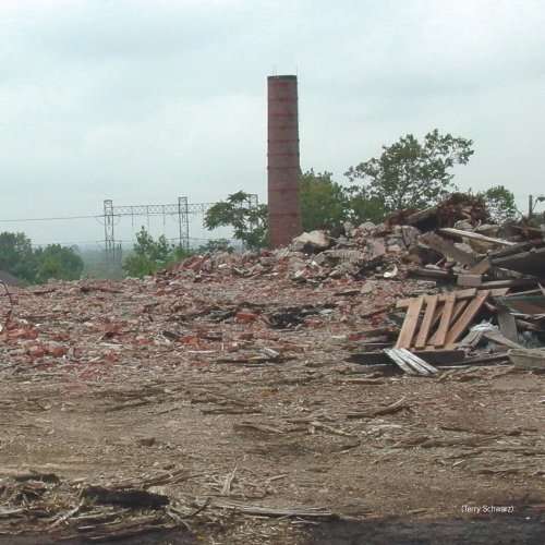
(<strong>Terry</strong> <strong>Schwarz</strong>)<br />
<strong>cities</strong> <strong>growing</strong> <strong>smaller</strong> <strong>71</strong>
72 <strong>cities</strong> <strong>growing</strong> <strong>smaller</strong><br />
The <strong>Cleveland</strong><br />
Land Lab<br />
Experiments for a City in Transition<br />
<strong>Terry</strong> <strong>Schwarz</strong><br />
<strong>Terry</strong> <strong>Schwarz</strong> is a Senior Planner with Kent<br />
State’s <strong>Cleveland</strong> <strong>Urban</strong> <strong>Design</strong> Collaborative<br />
and director of the CUDC’s Shrinking Cities<br />
Institute and related initiatives.<br />
from Cities Growing Smaller<br />
published by Kent State University’s<br />
<strong>Cleveland</strong> <strong>Urban</strong> <strong>Design</strong> Collaborative<br />
© 2008, Kent State University
The <strong>Cleveland</strong> <strong>Urban</strong> <strong>Design</strong> Collaborative has been engaged in issues of population<br />
decline and large-scale urban vacancy since we launched the Shrinking Cities<br />
Institute in 2004. Through the Institute, the CUDC has conducted charrettes, symposia,<br />
exhibitions, and research initiatives to provoke discussion and debate about<br />
<strong>Cleveland</strong>’s ongoing transformation.<br />
The oft-quoted statistics paint a portrait of a city in decline: <strong>Cleveland</strong>’s population<br />
peaked in 1950 at 914,808. By 2000, the city’s population had dropped to<br />
478,403—below the 500,000 threshold that is the key to maintaining crucial levels<br />
of federal community development block grant funding. The ambition at the time<br />
was to grow the city back to 500,000 by 2010 through the construction of 1,500<br />
new housing units each year. The city has had a remarkable housing boom in recent<br />
years but even so, the city’s population has continued to decline. Most recent projections<br />
have the city’s population dropping to 387,000 by 2016. (NODIS, 2008)<br />
Although <strong>Cleveland</strong>’s ongoing population loss is undeniably difficult—politically,<br />
economically and emotionally—it is still possible to approach this situation with a<br />
measured blend of pragmatism and optimism. The city’s inventory of vacant land<br />
is vast and <strong>growing</strong>. Vacant land and buildings pose a daunting challenge, but also<br />
an unprecedented opportunity. The opportunity lies in the time we inhabit, this<br />
moment of no longer and not yet, in which we can transform <strong>Cleveland</strong> into a more<br />
dynamic, ecologically sound, and livable place.<br />
Like other shrinking <strong>cities</strong>, <strong>Cleveland</strong>’s physical footprint is significantly larger<br />
than what we need to support the current population. As a result, the city feels fragmented<br />
and underutilized. The problem isn’t too few people, but too much space.<br />
Surplus land undermines urban character and depresses property values. To address<br />
this issue, two models have emerged in the literature about shrinking <strong>cities</strong>: a consolidation<br />
model and a dispersion model. One of the earliest incarnations of the consolidation<br />
model was the Green <strong>Urban</strong> Archipelago for West Berlin in 1977, envisioned<br />
by architect Oswald Mathias Ungers. Ungers’ concept described micro-<strong>cities</strong> within<br />
a city—areas of dense development concentrated in the most viable areas within the<br />
existing urban footprint. All new development would be constrained to these urban<br />
islands as a way of maintaining density and vitality within a context of depopulation.<br />
Buildings outside of the activity nodes would be targeted for demolition, remaining<br />
residents would be relocated, and surplus land would eventually revert to a natural<br />
condition. 1 This model aims to create a new kind of city—a city of small, vibrant,<br />
interconnected centers embedded in a high-functioning natural ecosystem. But it<br />
would be very difficult to implement this vision because growth and decline in a<br />
city are inevitably intertwined. In practical terms, determining which parts of a city<br />
1. Jasper Cepl, “Oswald Mathias Ungers’s<br />
<strong>Urban</strong> Archipelago for Shrinking<br />
Berlin,” in Shrinking Cities Volume<br />
2: Interventions, Ostfildern, Germany:<br />
Hatje Cantz Verlag: 2006.<br />
<strong>cities</strong> <strong>growing</strong> <strong>smaller</strong> 73
One of the student proposals from<br />
the Oak Hill Charrette places a<br />
meadow “clearing” at the heart of<br />
the Youngstown neighborhood. (Rob<br />
Dower)<br />
74 <strong>cities</strong> <strong>growing</strong> <strong>smaller</strong><br />
to re-urbanize and which parts to naturalize would be nearly impossible to achieve,<br />
given the underlying political, economic, and social factors that would have to be<br />
addressed.<br />
In contrast, the dispersion model suggests that, instead of concentrating development<br />
in some areas and vacating others, vacancy can be used to reduce the overall<br />
density of a city. In effect, suburban and (in some cases) rural densities could be<br />
accommodated within the urban footprint. The CUDC explored this concept in<br />
a 2005 design charrette in Youngstown’s Oak Hill neighborhood. As we traveled<br />
to Youngstown for the charrette, it was the consolidation model we were envisioning<br />
as a response to the neighborhood’s challenges. However, Oak Hill residents<br />
quickly divested us of this notion. These residents were not especially interested in<br />
restoring density to their neighborhood. Many liked the spaciousness that resulted<br />
from depopulation and they told us that their hope was to take title to an adjacent<br />
vacant lot, expanding their properties and permanently reducing the density of the<br />
neighborhood. A similar dispersion model is described by Daniel D’Oca in his work<br />
in Detroit (see Chapter 4 above). In both cases residents would be permitted and<br />
encouraged to use surplus land in resourceful and innovative ways, through relaxed<br />
zoning codes and progressive land use policies.<br />
The inherent challenge of the dispersion model is to retain a sense of cohesion in<br />
changing neighborhoods. As <strong>Cleveland</strong>’s population continues to decline, traditional<br />
forms of urban development are beginning to disintegrate. The city is fortunate to<br />
have retained many vibrant, walkable, mixed-use neighborhoods that look and feel<br />
like the city of our collective memories. Expanding and reinforcing these neighbor-
hoods must remain a high priority since these places are inextricably linked to the<br />
<strong>Cleveland</strong>’s identity and its potential for economic expansion. At the same time, it<br />
is increasingly apparent that we lack the population and the resources to bring every<br />
neighborhood back to the density and character it had during <strong>Cleveland</strong>’s period of<br />
peak population. As a result, we need to rethink traditional notions of urbanity and<br />
become more open-minded about what city living could be. We also need to develop<br />
realistic and economically productive strategies for reusing vacant land.<br />
The <strong>Cleveland</strong> Land Lab is a collaborative effort between the CUDC, Neighborhood<br />
Progress, Inc., and the City of <strong>Cleveland</strong> that seeks to unleash the potential of<br />
vacant land. At the most fundamental level, we are developing holding strategies for<br />
vacant sites that will help stabilize neighborhoods and reduce the stigma of unmanaged<br />
land. Simple landscape strategies, such as planting low-maintenance turf grasses<br />
and trees, can be used to establish a sense of stewardship and control for vacant sites<br />
in high-visibility locations. When implemented in conjunction with an effective<br />
on-going maintenance program, these techniques will create a perception of stability<br />
and will increase the market value of vacant sites and surrounding properties.<br />
This strategy has been successfully implemented in Philadelphia. The Pennsylvania<br />
Horticultural Society’s Philadelphia Green program is a landscape initiative intended<br />
Low-mow in <strong>Cleveland</strong>’s Fairfax<br />
neighborhood: a demonstration plot<br />
opposite a major new county administrative<br />
facility and a landscaped neighborhood<br />
gateway using grasses and<br />
hardy, native groundcovers (CUDC)<br />
<strong>cities</strong> <strong>growing</strong> <strong>smaller</strong> 75
2. Susan Wachter, “The Determinants<br />
of Neighborhood Transformation<br />
in Philadelphia: Identification and<br />
Analysis—the New Kensington Plot<br />
Study,” Wharton School, University<br />
of Pennsylvania, the William Penn<br />
Foundation, Pennsylvania Horticultural<br />
Society, 2005.<br />
76 <strong>cities</strong> <strong>growing</strong> <strong>smaller</strong><br />
to address the challenge of 1,100 parcels of vacant land in the New Kensington<br />
neighborhood. Through Philadelphia Green, lawns and perimeter fencing have<br />
been installed on vacant land throughout the neighborhood. Susan Wachter at the<br />
Wharton School of the University of Pennsylvania analyzed the impact of this greening<br />
strategy. 2 Her analysis was based on more than 50 variables adjusted for factors<br />
(other than greening) which affect residential real estate values. After examining the<br />
sales records of thousands of homes, she determined that:<br />
• The clean-up and landscaping of vacant lots can increase adjacent property values<br />
by as much as 30%<br />
• Planting a tree within 50 feet of a house can increase its value by about 9%<br />
• Location of a house within ¼ mile from a park increases its value by 10%<br />
• Neighborhood blocks with many unmanaged vacant lots result in lower residential<br />
property values, a reduction of about 18%.<br />
This research provided a basis for public funds to be spent on landscape beautification<br />
strategies for vacant, privately-owned sites. The value of this public investment<br />
extends beyond the intangible benefits of urban green space because it results in a<br />
quantifiable economic return in the form of increased property tax revenues from<br />
surrounding properties.<br />
Deriving a quantifiable benefit from vacant properties is at the heart of the <strong>Cleveland</strong><br />
Land Lab. Vacant land and buildings drain value from city neighborhoods.<br />
This is one of the most challenging aspects of the foreclosure crisis—that the surfeit<br />
of foreclosed houses being sold at fire sale prices devalues all of the housing in the<br />
city. And while substandard houses throughout <strong>Cleveland</strong> are being demolished at<br />
a record pace, it is also important to realize that vacant lots can be as damaging to<br />
neighborhoods as deteriorated houses, especially when the resulting land is not needed<br />
or cared for. Currently, there are an estimated 15,000 vacant sites in the City of<br />
<strong>Cleveland</strong>. The <strong>Cleveland</strong> Land Lab is seeking productive new uses for this expanding<br />
inventory of vacant sites within the city in order to derive a tangible economic<br />
return, a public health benefit, or an improvement to residents’ quality of life.<br />
Agriculture is one such use. Community gardens have emerged in <strong>cities</strong> across the<br />
country and are especially useful in <strong>cities</strong> with declining and impoverished populations.<br />
Gardens provide a source of fresh produce to city residents who often lack<br />
access to affordable, healthful, locally grown food. The abundance of vacant land in<br />
<strong>Cleveland</strong> enables agricultural uses to permeate deeply into urban neighborhoods,<br />
returning surplus and derelict land to productive use. Through the efforts of the<br />
Ohio State Extension, <strong>Cleveland</strong> currently has over 150 community gardens. The
city also has a commercial-scale farm, the Blue Pike Farm in the St. Clair-Superior<br />
neighborhood. Research in urban agriculture and what has been deemed “The New<br />
Ruralism” identifies the mechanisms for connecting farmers to urban neighborhoods<br />
with ample amounts of reasonably-priced land because agriculture within the urban<br />
core can foster a local, sustainable food system. 3 To advance the potential for agriculture<br />
in <strong>Cleveland</strong>, the Land Lab is looking at soil types, environmental pollutants,<br />
micro-climates, and market conditions across the city to identify the most feasible<br />
and productive locations for <strong>growing</strong> food in <strong>Cleveland</strong>.<br />
A farmers market in the Tremont<br />
Neighborhood (Gauri Torgalkar)<br />
3. David Moffat, “New Ruralism:<br />
Agriculture at the Metropolitan Edge,”<br />
Places 18.2, 2007.<br />
<strong>cities</strong> <strong>growing</strong> <strong>smaller</strong> 77
Concept for a farm to grow street<br />
trees in a high vacancy area of <strong>Cleveland</strong>’s<br />
“Forgotten Triangle” (CUDC)<br />
78 <strong>cities</strong> <strong>growing</strong> <strong>smaller</strong><br />
Planning for agricultural uses in the city begins with a problem statement. The<br />
problems in this case are a lack of access to affordable, healthy foods for city residents<br />
and an over-reliance on foods that must be shipped a great distance to reach dinner<br />
tables in <strong>Cleveland</strong>. We could, for example, set a goal of <strong>growing</strong> 20% of apples consumed<br />
by <strong>Cleveland</strong>ers on vacant land within city limits. To accomplish this goal, we<br />
would need to know how many pounds of apples a typical person eats in a year and<br />
how many pounds of apples that would add up to for the population of <strong>Cleveland</strong>.<br />
Average per capita apple consumption is estimated to be 18 pounds per year (per the<br />
US Department of Agriculture), so <strong>Cleveland</strong>ers consume approximately 8 million<br />
pounds; 20% of this figure is 1.6 million pounds. In order to grow this many apples<br />
within city limits, we would need about 70 acres of apple orchards. The analysis<br />
can be taken further, to determine how many jobs would be created by a <strong>Cleveland</strong>based<br />
orchard industry and what percentage of apples consumed by <strong>Cleveland</strong><br />
residents are currently being grown in the region, versus elsewhere in the country.<br />
This would enable us to determine whether apple orchards are a productive strategy<br />
for the reuse of vacant land in the city.<br />
Another problem we might be able to address with vacant land pertains to the deicing<br />
of city streets in the winter. What if we could reduce road salt usage in <strong>Cleveland</strong><br />
by 25% through the use of beet juice, produced from beets grown on vacant<br />
lots. We know that a de-sugared beet juice solution, when blended with sodium<br />
chloride (rock salt), is an effective road de-icer. The combination of beet juice and<br />
rock salt has a lower freezing point than salt alone and stays on the road longer,<br />
reducing the number of applications. Blending beet juice with rock salt also reduces
corrosion to plows and equipment, is less damaging to green spaces, and less polluting<br />
to ground and surface water. To evaluate this idea, we would need to know how<br />
many miles of roads there are in the city and how much beet juice it would take to<br />
de-ice 25% of these roads in a typical winter. A rough calculation is that we would<br />
need about 12,000 gallons of beet juice, produced from the equivalent of 768,000<br />
beets. It would take approximately 9 acres of land to grow this many beets. To<br />
continue the analysis, we would need to know which vacant sites in the city are most<br />
conducive to <strong>growing</strong> beets, and whether it would make sense to create numerous<br />
beet gardens on residential-size lots or a handful of larger beet farms. We would have<br />
to determine how many processing facilities would be needed to turn the beets to<br />
juice and to store the juice and whether it would be more cost-effective to purchase<br />
a commercial beet juice produce rather than to produce it ourselves from <strong>Cleveland</strong>grown<br />
beets. Aside from beets and apples, there are many other possible agricultural<br />
opportunities that we could explore for privately held or public-sector inventories<br />
of vacant land. Burten Bell Carr is currently conducting a similar analysis to determine<br />
the feasibility of a city tree nursery in the Forgotten Triangle neighborhood in<br />
Central.<br />
Vacant properties may also offer opportunities for the generation of alternative<br />
energy. Solar, wind, and biofuel technologies can all be incorporated into urban settings<br />
where there is ample vacant land and reduced population density. For example,<br />
could we reduce <strong>Cleveland</strong>’s gasoline consumption by 5% through the use of vacant<br />
sites to generate biofuels? Once again, we would need to do some simple calculations<br />
to consider this question. We know that per capita gasoline use in Ohio is about<br />
451.1 gallons per year. (Energy Information Administration, statistics for 2004)<br />
Based on the current population of <strong>Cleveland</strong>, this equates to about 200 million<br />
gallons of gasoline per year used by city residents. To meet 5% of this demand, we<br />
would need approximately 10 million gallons of biofuel. If we look at the specifics of<br />
biofuel production using plant materials grown on city sites, we can make some estimates<br />
of the acreage needed. Switchgrass, for example, reaches its full yield potential<br />
after the third year planted, producing approximately 6 to 8 tons of material per<br />
acre; that is 500 gallons of ethanol per acre. So it would take roughly 20,000 acres of<br />
switchgrass to meet 5% of <strong>Cleveland</strong>er’s annual fuel consumption. Many other issues<br />
would need to be addressed in order to develop an alternative fuel strategy for vacant<br />
sites such as whether biofuel produced from plant material grown in urban conditions<br />
would result in a usable fuel that meets industry standards and whether the energy<br />
it would take to grow these crops would offset any net gains in fuel production.<br />
Another compelling possibility for reusing vacant land would be as a way to<br />
restore urban ecosystems and address the <strong>growing</strong> challenges of stormwater management<br />
in the city and the region. Stormwater runoff is a leading cause of pollution<br />
<strong>cities</strong> <strong>growing</strong> <strong>smaller</strong> 79
On-site stormwater management<br />
and needed parking are combined in<br />
this plan for a site on the East Side.<br />
(CUDC)<br />
80 <strong>cities</strong> <strong>growing</strong> <strong>smaller</strong><br />
in the rivers and streams that feed into Lake Erie. Addressing water quality issues<br />
is critically important to the future of our region. Sewers, detention basins, and<br />
other engineered solutions are being developed to address flooding, erosion, and<br />
other stormwater-related problems. But vacant land in strategic locations within the<br />
watershed can be used to reintroduce a more sustainable hydrological pattern while<br />
expanding the region’s green space network, increasing wildlife habitat, and promoting<br />
biodiversity. Restructuring fragments of vacant land into a comprehensive green<br />
infrastructure network will simultaneously improve the integrity of <strong>Cleveland</strong>’s ecosystem<br />
and create amenities that enhance the quality of life for city residents. As with<br />
other vacant land strategies, potential stormwater benefits can be assessed using a<br />
problem statement. If reduced runoff and cleaner water is the goal, we need to begin<br />
with an understanding of the volume of runoff produced by an acre of paved surface<br />
over the course of a year or during a typical rain event. Then we need to determine if<br />
there is sufficient vacant land available to deploy alternative stormwater management<br />
strategies in the most strategically significant locations.
Soil-based lead and other environmental toxins are prevalent in <strong>Cleveland</strong>. Abatement<br />
and remediation efforts are typically tied to redevelopment projects. This kind<br />
of strategic, targeted remediation is essential because the city lacks the resources to<br />
remove environmental pollutants on a comprehensive, city-wide basis. However,<br />
there are many parts of the city with no major development plans on the horizon.<br />
In these neighborhoods, long-term, lower cost remediation strategies are needed<br />
for vacant land and buildings to reduce the exposure of <strong>Cleveland</strong> residents to toxic<br />
substances. For example, phytoremediation techniques use plants to extract heavy<br />
metals and other pollutants from the soil. Over time, these techniques could gradually<br />
reduce environmental hazards in city neighborhoods, especially on properties<br />
that lack short-term development demand and the resulting resources for environmental<br />
clean-up.<br />
Vacant sites with exposed soil contribute to airborne lead levels in <strong>Cleveland</strong><br />
neighborhoods, especially in the summer months when more children are outdoors,<br />
windows are open for ventilation, and dry soils get picked up and blown around in<br />
the wind. In many <strong>Cleveland</strong> neighborhoods, over 30% of children test positively<br />
for lead poisoning each year. This is a public health crisis and a major social and<br />
economic challenge. Planting low-maintenance native turf grasses on vacant sites is<br />
one technique that would reduce the amount of lead particles that become airborne<br />
and lessen the extent to which <strong>Cleveland</strong> residents are exposed to lead. Lead is not<br />
the only environmental pollutant that is prevalent in <strong>Cleveland</strong>. We face challenges<br />
from ozone and fine particulate matter in the air and other contaminants in our soil<br />
and water. Because of the variety and volume of environmental issues that need to be<br />
addressed, <strong>Cleveland</strong> has the potential to become a major center for remediation research<br />
and development. Experimental soil and water remediation techniques could<br />
be created and tested here on vacant sites throughout the city. The most effective<br />
techniques could then be commercialized for use in other <strong>cities</strong>.<br />
Residential demolitions have led to significantly reduced population density in<br />
some <strong>Cleveland</strong> neighborhoods. This is not necessarily a bad thing. Planners and<br />
urban designers tend to oppose de-densification out of a fear that this will lead to<br />
the “suburbanization” of the city. While suburban-style development patterns can in<br />
some cases undermine the character of the city, the statistical reality of <strong>Cleveland</strong>’s<br />
on-going population decline obligates us to be more flexible and open-minded about<br />
what good urban form means for our city in this period of transition. This year<br />
alone, the city plans to demolish 1,000 houses, creating approximately 110 acres of<br />
additional vacant land. As vacant land continues to grow more prevalent within the<br />
city, we have opportunities to accommodate and integrate urban, suburban, and<br />
even rural development patterns and a wide range of lifestyle choices within the city’s<br />
existing footprint—the dispersion model is taking shape right before our eyes.<br />
<strong>cities</strong> <strong>growing</strong> <strong>smaller</strong> 81
Rightsize transect (David Jurca and<br />
Gauri Torgalkar)<br />
82 <strong>cities</strong> <strong>growing</strong> <strong>smaller</strong><br />
In the transect theory espoused by Andres Duany and the Congress for the New<br />
<strong>Urban</strong>ism, well-designed <strong>cities</strong> demonstrate a gradual and measured transition from<br />
a very dense and compact urban core to lower density urban, suburban, and eventually<br />
rural development patterns. But in <strong>Cleveland</strong>, the transect is wonderfully (and<br />
perhaps irreparably) unpredictable as vibrant neighborhoods and depopulated areas<br />
co-exist side-by-side while lush, natural vegetation is emerging in the gaps between<br />
renewal and abandonment. <strong>Cleveland</strong>’s transect embodies the idea of land use in motion,<br />
derived from changing patterns in human settlements and the eternal cycle of<br />
natural succession. This gives us an unprecedented opportunity to create a new kind<br />
of city. The <strong>Cleveland</strong> of the future may have nodes of traditional urban development,<br />
expansive prairies, and productive farms…thriving industries, suburban-style<br />
developments, and high-functioning wetlands. As <strong>Cleveland</strong> continues to change,<br />
surprising land use juxtapositions will occur. Throughout this process, we must<br />
never abdicate our responsibility for good urban form, even as we begin to challenge<br />
the meaning of the term. The key to maintaining a sense of cohesion in a complex<br />
and ambiguous city will be to focus on the edges where disparate uses and varying<br />
densities meet. Well-designed edges can weave together remnants of the old city and<br />
emerging aspects of the new.<br />
Many familiar things have disappeared from <strong>Cleveland</strong> and will not be coming<br />
back. Now is the time to determine what will take their place. Vacant properties are<br />
a luxury and a resource that we must learn to use more effectively. Today, vacancy<br />
undermines the character and viability of <strong>Cleveland</strong>. Tomorrow, it can be the glue<br />
that holds us together.
Bibliography<br />
Jasper Cepl, “Oswald Mathias Ungers’s <strong>Urban</strong> Archipelago for Shrinking Berlin,” in Shrinking Cities<br />
Volume 2: Interventions. Ostfildern, Germany: Hatje Cantz Verlag: 2006.<br />
Cuyahoga County Board of Health, Office of Epidemiology, “Surveillance, and Informatics; the Ohio<br />
Department of Health Childhood Lead Poisoning Program,” State Plane Ohio North, August 24, 2007.<br />
Susan Miller, REAL NEO, email correspondence, 2008.<br />
David Moffat, “New Ruralism: Agriculture at the Metropolitan Edge,” Places 18.2, 2007.<br />
Elaine Price, Cuyahoga County Planning Commission, <strong>Cleveland</strong> Land Lab Charrette, 2008.<br />
Victoria Schlesinger, “Beet it: road ice needs to be defeated - A common root vegetable is an eco de-icer,”<br />
Plenty Magazine, www.plentymag.com/features/2008/02/beets_as_icemelt.php.<br />
USDA, “The US Apple Industry: Situation, Trends and Outlook,” April 9, 2002, http://www.fas.usda.gov/<br />
htp/horticulture/Fresh%20Fruit/4-9-02%20US%20Apples.pdf.<br />
Susan Wachter, “The Determinants of Neighborhood Transformation in Philadelphia: Identification and<br />
Analysis—The New Kensington Pilot Study,” Wharton School, University of Pennsylvania, the William<br />
Penn Foundation, and the Pennsylvania Horticultural Society, 2005.<br />
<strong>cities</strong> <strong>growing</strong> <strong>smaller</strong> 83
84 <strong>cities</strong> <strong>growing</strong> <strong>smaller</strong>