the preservation of the cultural heritage of eritrea
the preservation of the cultural heritage of eritrea
the preservation of the cultural heritage of eritrea

Create successful ePaper yourself
Turn your PDF publications into a flip-book with our unique Google optimized e-Paper software.
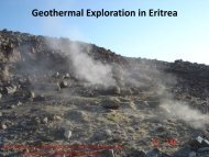
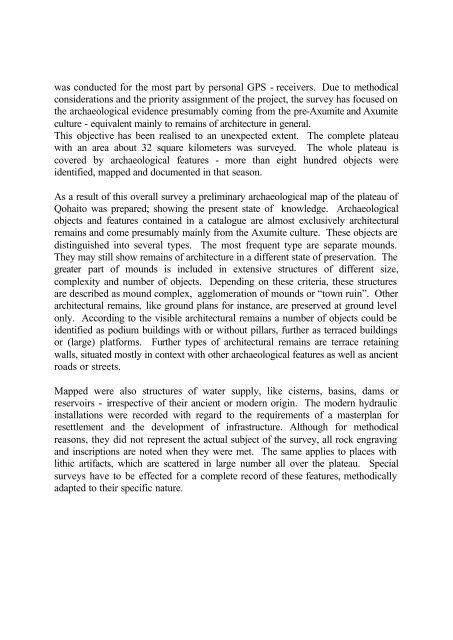
was conducted for <strong>the</strong> most part by personal GPS - receivers. Due to methodicalconsiderations and <strong>the</strong> priority assignment <strong>of</strong> <strong>the</strong> project, <strong>the</strong> survey has focused on<strong>the</strong> archaeological evidence presumably coming from <strong>the</strong> pre-Axumite and Axumiteculture - equivalent mainly to remains <strong>of</strong> architecture in general.This objective has been realised to an unexpected extent. The complete plateauwith an area about 32 square kilometers was surveyed. The whole plateau iscovered by archaeological features - more than eight hundred objects wereidentified, mapped and documented in that season.As a result <strong>of</strong> this overall survey a preliminary archaeological map <strong>of</strong> <strong>the</strong> plateau <strong>of</strong>Qohaito was prepared; showing <strong>the</strong> present state <strong>of</strong> knowledge. Archaeologicalobjects and features contained in a catalogue are almost exclusively architecturalremains and come presumably mainly from <strong>the</strong> Axumite culture. These objects aredistinguished into several types. The most frequent type are separate mounds.They may still show remains <strong>of</strong> architecture in a different state <strong>of</strong> <strong>preservation</strong>. Thegreater part <strong>of</strong> mounds is included in extensive structures <strong>of</strong> different size,complexity and number <strong>of</strong> objects. Depending on <strong>the</strong>se criteria, <strong>the</strong>se structuresare described as mound complex, agglomeration <strong>of</strong> mounds or “town ruin”. O<strong>the</strong>rarchitectural remains, like ground plans for instance, are preserved at ground levelonly. According to <strong>the</strong> visible architectural remains a number <strong>of</strong> objects could beidentified as podium buildings with or without pillars, fur<strong>the</strong>r as terraced buildingsor (large) platforms. Fur<strong>the</strong>r types <strong>of</strong> architectural remains are terrace retainingwalls, situated mostly in context with o<strong>the</strong>r archaeological features as well as ancientroads or streets.Mapped were also structures <strong>of</strong> water supply, like cisterns, basins, dams orreservoirs - irrespective <strong>of</strong> <strong>the</strong>ir ancient or modern origin. The modern hydraulicinstallations were recorded with regard to <strong>the</strong> requirements <strong>of</strong> a masterplan forresettlement and <strong>the</strong> development <strong>of</strong> infrastructure. Although for methodicalreasons, <strong>the</strong>y did not represent <strong>the</strong> actual subject <strong>of</strong> <strong>the</strong> survey, all rock engravingand inscriptions are noted when <strong>the</strong>y were met. The same applies to places withlithic artifacts, which are scattered in large number all over <strong>the</strong> plateau. Specialsurveys have to be effected for a complete record <strong>of</strong> <strong>the</strong>se features, methodicallyadapted to <strong>the</strong>ir specific nature.