Mineral potential of Eritrea
Mineral potential of Eritrea
Mineral potential of Eritrea
- No tags were found...

You also want an ePaper? Increase the reach of your titles
YUMPU automatically turns print PDFs into web optimized ePapers that Google loves.
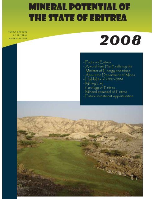
MINERAL POTENTIAL OFTHE STATE OF ERITREAYEARLY BROCUREOF ERITREANMINERAL SECTOR2008- Facts on <strong>Eritrea</strong>- A word from His Exellency theMinister <strong>of</strong> Energy and mines- About the Department <strong>of</strong> Mines- Highlights <strong>of</strong> 2007-2008- Mining Law- Geology <strong>of</strong> <strong>Eritrea</strong>- <strong>Mineral</strong> <strong>potential</strong> <strong>of</strong> <strong>Eritrea</strong>- Future investment opportunities
Tesfai GhebreselassieMinister <strong>of</strong> Energy and MinesDear investorsI have the great honour and pleasure to bring for yourconsideration the investment opportunities that mycountry <strong>Eritrea</strong> <strong>of</strong>fers in the minerals sector.Artisanal gold mining in <strong>Eritrea</strong> can be traced back toancient times: even today it is commonly practiced inwestern <strong>Eritrea</strong>. Modern mining however only startedduring the Italian rule in the late twenties <strong>of</strong> the lastcentury, when the Italian colonisers developed morethan twenty small gold mines. The development <strong>of</strong>the mining industry was interrupted at an early stage,at the end <strong>of</strong> 1940’s. Since then, the political andsecurity conditions necessary for the development<strong>of</strong> the industry did not prevail in <strong>Eritrea</strong>, until thecountry’s independence in 1991.Until now, several exploration companies have beensuccessfully operating in <strong>Eritrea</strong>. The recent announcementsmade by these companies have demonstratedthe extraordinary <strong>potential</strong> that <strong>Eritrea</strong> holds formajor mineral discoveries.This brochure aims to acquaint you with the generalgeology, known types and areas <strong>of</strong> mineralisation,and the investment opportunities and environment<strong>of</strong> <strong>Eritrea</strong>. Brief mention is also made <strong>of</strong> the aggressiveexploration activities <strong>of</strong> several foreign companies,and some <strong>of</strong> their exciting achievements. Thereare plenty <strong>of</strong> occurrences that suggest the <strong>potential</strong>for the discovery <strong>of</strong> economic deposits <strong>of</strong> preciousand base metals. A variety <strong>of</strong> industrial minerals andgood quality construction materials are also availablein abundance.The Government <strong>of</strong> the State <strong>of</strong> <strong>Eritrea</strong> is aware <strong>of</strong>the crucial role the private sector can play in the discoveryand development <strong>of</strong> mineral resources. Themining law and policies <strong>of</strong> <strong>Eritrea</strong> provide an attractivelegal and economic environment for investors:by setting out a number <strong>of</strong> incentives, including lowroyalties <strong>of</strong> two to five percent (with the option fortheir reduction, suspension or waiver) and a nominalhalf percent duty on imported capital goods. Theholder <strong>of</strong> a mineral license is guaranteed the right todispose <strong>of</strong> minerals without export tax, and to therepatriation <strong>of</strong> after-tax pr<strong>of</strong>its without restriction.The law also permits financial losses to be chargedagainst gross income and to be carried forward. Inaddition, the <strong>Eritrea</strong>n mining law provides simpleprocedures for the submission and processing <strong>of</strong>license applications.I take this opportunity to extend a personal invitationto all investors to share in the pleasure and privilege<strong>of</strong> developing a cordial business partnership withus in mineral prospecting and development. Theparticipation <strong>of</strong> international private investment inthe minerals sector is more than welcome. The prospectivegeology, attractive investment conditions,political stability and the friendly and industriouspeople <strong>of</strong> <strong>Eritrea</strong> combine to create a rare investmentopportunity.Tesfai GhebreselassieMinister <strong>of</strong> Energy and Mines
A highly prospective country<strong>Eritrea</strong> joined the world community <strong>of</strong> independentstates in May 1993 following a thirty year war forliberaon which ended in May 1991. A UN supervisedreferendum held in April 1993 enabled the<strong>Eritrea</strong>n people to state unequivocally to the worldtheir strong choice for freedom and independence.Aware <strong>of</strong> the significant and vital role the privatesector has to play in the achievement <strong>of</strong> naonaldevelopment objecves, the Government <strong>of</strong> <strong>Eritrea</strong>has been commied to create a conducive atmospherefor the acve parcipaon <strong>of</strong> local and foreignprivate investors. However, since May 1998 thedevelopment <strong>of</strong> this young state has been severelycurtailed by the border dispute with neighbouringEthiopia. Despite this, the <strong>Eritrea</strong>n people andGovernment are as resolute as ever in their commitmentand endeavours to work together to rebuildtheir country’s economy, and to secure social andeconomic progress.<strong>Mineral</strong> <strong>potential</strong> <strong>of</strong> <strong>Eritrea</strong>Location, climate, geographyand infrastructureThis young state is located in the north-eastern part <strong>of</strong>Africa with the Red Sea on its east coast, Sudan to the westand north, and Ethiopia and Djibou to the south. <strong>Eritrea</strong>,with a land surface area <strong>of</strong> about 125,000 squarekilometres, including hundreds <strong>of</strong> coral islands in the RedSea, has a populaon <strong>of</strong> about three and a half millionpeople. The country is home to nine ethnic groups, all witha strong sense <strong>of</strong> <strong>Eritrea</strong>n naonal unity. Tigrinya and Tigrearethe most widely spoken indigenous languages. Englishis commonly used in the business community, while Arabicand Italian are also frequently encountered.The topography <strong>of</strong> <strong>Eritrea</strong> is exceponally varied, from the1,200 kilometre long coastal plain only a few metres abovesea level, through the central highlands ranging up to 2,500metres above sea level, to the low lying western and southwestern areas <strong>of</strong> the country. Rugged mountain chainsrun from the central plateau to the extreme north <strong>of</strong> thecountry. The climate in these different terrains correspondinglyvaries from arid, to semi-arid, to temperate. The meanannual rainfall in the coastal areas is less than 300 mm peryear, whilst in the highlands and the western lowlandsrainfall ranges between 500 and 1,000 mm.3
<strong>Mineral</strong> <strong>potential</strong> <strong>of</strong> <strong>Eritrea</strong><strong>Eritrea</strong>’s infrastructure is centered on a well developedcommunicaons network linking the capital city Asmara tothe regions <strong>of</strong> the country, including the two main sea ports<strong>of</strong> Massawa and Assab, and to the neighbouring countries.Asmara and Massawa have internaonal airports, whichalso serve internal flights. Inevitably, the ravages <strong>of</strong> warhave le their mark on the infrastructure, and the reconstrucon<strong>of</strong> the prime facilies has been a high priority.Telecommunicaon facilies have also been renovated anddeveloped, and mobile phones are now a common site inthe major towns.The Department <strong>of</strong> MinesThe Ministry <strong>of</strong> Energy and Mines is the authorisedLicensing Agency and is responsible for the administraon,regulaonand coordinaon <strong>of</strong> all types<strong>of</strong> mining operaons in <strong>Eritrea</strong>. The Department <strong>of</strong>Mines within the Ministry encompasses, amongstother funcons, the Geological Survey and theMines Administraon Division, and is also itself ac-vely engaged in exploraon and mapping acvies.Even though there are several maps producedon different scales from various sources, therehave been only two geological maps, at a scale <strong>of</strong>1:250,000, compiled unl recently, when the <strong>Eritrea</strong>nGeological Survey prepared a 1:1,000,000 scalemap.The <strong>Eritrea</strong>n mining sector has shown rapid developmentover the past few years since the Ministry<strong>of</strong> Energy and Mines started issuing licenses in 1997.Since then, several exploraon companies havebeen involved in assessing and exploring the mineralpotenal <strong>of</strong> the country. In the successive years addionallicenses have been issued on the first-comefirst-servedprinciple. The Department <strong>of</strong> Mineshas also been developing a naonal minerals database.The Ministry has a responsibility to provide preliminaryinformaon to exploraon companies interestedin conducng detailed invesgaons in <strong>Eritrea</strong>,and to make a contribuon towards enriching thegeological database <strong>of</strong> the country. As part <strong>of</strong> itsroune works, the Department <strong>of</strong> Mines throughthe Mines Administraon Division issues licenses toarsanal miners, and controls and supervises exploraonand mining acvies so that they are in linewith the direcves <strong>of</strong> the Ministry and are environmentallycompliant. In addion, the Department <strong>of</strong>Mines, through its research wing – the GeologicalSurvey – has been working, together with variousforeign governmental aid agencies and internaonalorganizaons, to carry out geological mapping andmineral exploraon.Highlights <strong>of</strong> 2007-2008The years 2007 and 2008 were high mes in themineral sector. In the past two years the major highlightswere:- In 2007 <strong>Eritrea</strong>n Naonal Mining Corporaon(ENAMCO) was established. This corporaon wasestablished with a major objecve <strong>of</strong> exercising theGovernment’s free and purchased equity in mining.It is an independent body from the Ministry <strong>of</strong>Energy and Mines and its establishment enables theMinistry to concentrate on regulang acvies.- Establishement <strong>of</strong> Bisha Mining Share Company.This share company was formed in 2007 betweenNevsun (60%) and ENAMCO owns 40% <strong>of</strong> the totalshare.- The first Mining Agreement between the Governmentand Bisha Mining Sh. Co. was signed in 2007.This is the first <strong>of</strong> its type and involved many processesincluding negoaon. Following the signing,a mining permit was issued to the share company.- Another important event in 2007 was the transfer<strong>of</strong> exploraon license from Sub-Sahara Resourcesto Sunridge Gold Corp. In the last few yearsSub-Sahara and Sunridgegold were working as jointpartners in the Asmara property that include threelicense areas (Debarwa, Medrizien and Adi Nefas).Upon the agreement between the two companiesthe transfer <strong>of</strong> the exploraon rights <strong>of</strong> the Asmaraproperty from Sub-Sahara to Sunridge was approvedby the Government <strong>of</strong> <strong>Eritrea</strong> at the end <strong>of</strong> 2007.4
<strong>Mineral</strong> <strong>potential</strong> <strong>of</strong> <strong>Eritrea</strong>- Two new exploraon licenses were also issuedto two companies. <strong>Eritrea</strong>-China mining and Exploraoncompany was granted a license in the southwestern part <strong>of</strong> <strong>Eritrea</strong> around Augaro. While anotherChinese company, Beijing Donia was grantedexploraon license at the central part <strong>of</strong> <strong>Eritrea</strong>located north <strong>of</strong> Sunridgegold’s Asmara property.- At the beginning <strong>of</strong> 2008 a mining permit (license)was issued to Bisha Mining Share Companythat allowed the company to develop the Bishadeposit.- In the last two years different exploraon companiesfrom various countries showed interest onthe mineral potenal <strong>of</strong> <strong>Eritrea</strong>. Consequently therewere a number <strong>of</strong> visits to different parts <strong>of</strong> thecountry by experts from different countries, includingSouth Africa, India, Pakistan, Japan, Australiaand UK. All <strong>of</strong> the visits were escorted and guidedby the Department <strong>of</strong> Mines staff. Evaluaon <strong>of</strong> theapplicaons on different prospects is underway andlicenses will be granted soon.- A proposal is being made and approved for theconnuaon <strong>of</strong> the geothermal study in Alid. Accordingto the approved proposal the GeologicalSurvey <strong>of</strong> Iceland and the <strong>Eritrea</strong>n Geological Surveywill, in collaboraon, conduct exploraon works atAlid which will lead to the recommendaon <strong>of</strong> drillingin the prospect.- The first dra Regional Geological Map <strong>of</strong> <strong>Eritrea</strong>,on 1:1,000,000 scale is finalized and is on theprocess <strong>of</strong> distribuon. In addion other geologicalmaps on 1:250,000 scale were also produced onspecific areas.Mining lawThe legal framework governing the conduct <strong>of</strong> allmining and related operaons within the territory<strong>of</strong> <strong>Eritrea</strong> is embodied in a Mining Law comprising:<strong>Mineral</strong>s Proclamaon No 68/1995, Mining IncomeTax Proclamaon No. 69/1995 and Regulaons onMining Operaons Legal Noce No. 19/1995, all <strong>of</strong>which were promulgated in March 1995.Key Policy issues upon which the Mining Law isbased include:• All mineral resources in <strong>Eritrea</strong> are public property.TheState has a duty to ensure the conservaonand sustainable development <strong>of</strong> these resources forthe benefit <strong>of</strong> the people;• The intenon is to create a favourable atmospherefor foreign investment in the mining sector.Due recognion is made <strong>of</strong> the significant role thatforeign investment and skills can play in the development<strong>of</strong> this sector and the capital intensive, longterm, and risky nature <strong>of</strong> mining investments;• The necessity for formulang regulaons whichensure protecon <strong>of</strong> the natural environment, togetherwith sustainable development <strong>of</strong> the country’smineral resources, in accordance with soundprinciples <strong>of</strong> resource management and land use;The <strong>Eritrea</strong>n Mining Law is up-to-date, aracveand compeve, as it provides considerable benefitsand incenves to investors. For example, thelaw provides for:• The right to exploit any commercial discoveriesmade pursuant to a valid exploraon license;• The right to sell locally or export, free <strong>of</strong> all duesand taxes and without being required to obtain anyother authorisaon or permission from any otherGovernment agency, all minerals produced pursuantto a mining license;• A simple and fair taxaon system which recognisesthe risky nature <strong>of</strong> mining investments, andhence allows:* Accelerated depreciaon (straight linemethod over 4 years) <strong>of</strong> all capitaland preproducon costs;* Write-<strong>of</strong>fs <strong>of</strong> exploraon expenditure incurred anywhere in the country;* The carrying forward <strong>of</strong> losses;* A generous reinvestment deducon (5% <strong>of</strong>gross income);* No dividend tax* A nominal rate <strong>of</strong> import duty (0,5%) on allinputs necessary for mining operaons;5
<strong>Mineral</strong> <strong>potential</strong> <strong>of</strong> <strong>Eritrea</strong>* Normal royalty rates as well as an oponfor the reducon, suspension or waiver <strong>of</strong>the royalty in appropriate circumstances;• Equitable foreign exchange regulaons permit• Prospecng License, valid for one year and nonrenewable;• Exploraon License, valid for an inial period <strong>of</strong>three years, but which may be renewed twice foraddional terms <strong>of</strong> one year each, with an oponfor further renewals in appropriate circumstances;ng;* Free and unrestricted repatriaon <strong>of</strong> earnings;* Retenon <strong>of</strong> a poron <strong>of</strong> foreign currencyearnings abroad in external accounts;* Maintenance <strong>of</strong> foreign currency accountsin banks in <strong>Eritrea</strong>.• A simple “one-stop” licensing system enablingall the formalies for all types <strong>of</strong> licenses for miningoperaons to be completed by a single Governmentagency - the Department <strong>of</strong> Mines with the Ministry<strong>of</strong> Energy and Mines.The mineral licensing systemThe Mining Law permits the following types <strong>of</strong>licenses:and• Mining License, valid for a period <strong>of</strong> 20 years withoponal 10-year renewals.All <strong>of</strong> these licenses are exclusive and grant theirholders an automac right to obtain an Explora-on License from within a Prospecng Licenseand a Mining License from an Exploraon License,subject to the fulfillment <strong>of</strong> the obligaons underthe preceding license. Although the maximum areathat a single license can cover is fixed at 100km2for a Prospecng License, 50 km2 for an ExploraonLicense and 10km2 for a Mining License, simultaneouspossession <strong>of</strong> mulple conguous licenses ispermied.Applicaons for any <strong>of</strong> these licenses may be madeby individuals or legal enes <strong>of</strong> any naonality. Allapplicaons are to be made on specified forms thatcan be obtained from the Department <strong>of</strong> Mines<strong>of</strong> the Ministry <strong>of</strong> Energy and Mines and must beaccompanied by a nonrefundable processing (reg-6
<strong>Mineral</strong> <strong>potential</strong> <strong>of</strong> <strong>Eritrea</strong>istraon) fee <strong>of</strong> US$1 per page <strong>of</strong> each applicaonand the supporng documentaon presented. Successfulapplicants are also subject to a payment <strong>of</strong>license fees and the first year’s rental upon the issue<strong>of</strong> a license. The rate <strong>of</strong> these fees is governed byRegulaon and is at present as follows:LicenseLicense Fee(per license)US$(approx.)Prospecting 80 8Annual rentals(per km 2 )US$(approx.)Exploration 240 32Mining 960 967
<strong>Mineral</strong> <strong>potential</strong> <strong>of</strong> <strong>Eritrea</strong>The Geology <strong>of</strong> <strong>Eritrea</strong>The geological set up <strong>of</strong> <strong>Eritrea</strong> is made up <strong>of</strong> Precambrianbasement rocks that are overlain unconformablyby predominantly Mesozoic sedimentaryrocks and Terary to Quaternary volcanic and sedimentaryrocks.Precambrian Basement RocksBasement rocks in <strong>Eritrea</strong> cover more than 60% <strong>of</strong>the surface <strong>of</strong> the country. The basement rocks <strong>of</strong><strong>Eritrea</strong> are part <strong>of</strong> the Arabian Nubian Shield (ANS)which are exposed in north east Africa (Egypt,Sudan, <strong>Eritrea</strong>, and Ethiopia) and in Saudi Arabia,northern and northwestern parts <strong>of</strong> Yemen and part<strong>of</strong> the western Middle East.The shield is believed to represent a mega suturebetween East and West Gondwana. Archean andPaleoproterozoic connental crust rocks make theolder components <strong>of</strong> the shield and occupy a verysmall part <strong>of</strong> the basement rocks and the majorpart <strong>of</strong> the shield consists <strong>of</strong> Neoproterozoic (c. 870-670 Ma)connental-marginal and juvenile intraoceanic magmac-arcrocks.In <strong>Eritrea</strong>, the basement rocks are not well studieddespite their high mineral potenal. There are onlytwo geological maps (1:250,000) prepared in thelast decade. That which covers the western part<strong>of</strong> the country (Geology <strong>of</strong> Gash River Area) andthat which covers the southern part <strong>of</strong> the country(Geology <strong>of</strong> Mai Dima/Kohain Area). Compilaon <strong>of</strong>geologic maps at 1:250,000 scale has recently beencompleted for four map sheets. Other study, basedlargely on satellite image interpretaon aided bylimited ground controls, suggest that the rocks canbe subdivided into four tectonic blocks or segments,separated by tectonic boundaries. Three <strong>of</strong> theseblocks, the western, central and eastern segments,underlienorthern and central <strong>Eritrea</strong>, whilst thefourth, the Danakil segment, occurs in the southeasternpart <strong>of</strong> the country.The western segment, the Barka Terrain - is exposedin thenorthwestern part <strong>of</strong> the country and underliesthe Barka lowlands. It is made up <strong>of</strong> amphibolite,amphibolite-facies polic schists containingkyanite and staurolite, quartzites and marble.The central segment, referred to as the HagarTerrain,extends from the Barka River up to theAdobha Abi valley inthe east, and comprises severallarge ellipcal bodies <strong>of</strong> various tectonic units thatare dominantly composed <strong>of</strong> oceanic and accreonarywedge materials. Occasionally, layered sequences<strong>of</strong> chloric schists are seen, inter-layered withepidoc and chloric metabasalts, occasional thinand disconnuous marbles, and manganiferous andferruginous cherts. The Hagar Terrain displays aneast verging thrust contact with the adjacentsegment to the east. The Hagar Terrain is known tobe prospecve for chromite, planum group elements,nickel, gold and copper mineralizaon.The eastern segment- the Nakfa Terrain - is boundedby the Adobha Abi valley in the west and by the RedSea escarpment to the east. It is made up <strong>of</strong> calc-alkalinevolcanic and volcanoclasc rocks conformablyoverlain by a metasedimentary sequence <strong>of</strong> chloriteschists, grits and polymict conglomerates with occasionalpelic sericite schists and carbonates. Themetavolcanic rocks are intruded by variably deformedplutonic to hypabyssal calc-alkalinebodies. The sequence is cut in places by post-kinemacgranites and gabbros and is also transectedby several narrow shear zones sub- parallel to theregional strike. The Nakfa Terrain is considered torepresent a relict island arc assemblage. SeveralVMS (Volcanogenic Massive Sulphide) base metaloccurrences and gold showings are associated withthis tectonic unit.The southern segment - The Danakil Terrain - iscomposed <strong>of</strong> metamorphic rocks which may begrouped into three formaons:-(1) migmac hornblende biote gneisses;(2)a phyllic formaon consisng <strong>of</strong> schists, conglomeracphyllites,crystalline limestones, andgraphic schists; and(3) post-tectonic granitoids.8
<strong>Mineral</strong> <strong>potential</strong> <strong>of</strong> <strong>Eritrea</strong>9
<strong>Mineral</strong> <strong>potential</strong> <strong>of</strong> <strong>Eritrea</strong>Recently compiled geologic map <strong>of</strong> the whole countryat 1:1,000,000 scale has divided the Precambrianbasement rocks into 7 domains, 5 groups and 3formaons. It is rather a more detailed presentaon<strong>of</strong> the rocks units <strong>of</strong> the country.Mesozoic SedimentsThe lower Mesozoic sediments are represented bythe Merbet (Adigrat) Sandstone which outcrops inthe southern part <strong>of</strong> the country and in the Danakilarea, and is commonly intercalated with siltstonesand haemac layers. It lies unconformably overthin layers <strong>of</strong> conglomerac sandstones which, inplaces, appear to have the characteriscs <strong>of</strong> a glacialdeposit. Overlying the sandstone is the JurassicAdailo (Antalo) Limestone. This unit is exposed overa large area in the Danakil and is made up <strong>of</strong> limestonesthat are compact, partly shelly, fossiliferousand layered. Alternaons <strong>of</strong> quartzic layers arepresent in the lower part, whilst towards the upperpart the sequence becomes mainly gypsiferous todolomic. The Upper Sandstone forms pockets <strong>of</strong>sandstones that have been preserved from erosion.Commonly this sandstone is medium to coarsegrained, light coloured, and dominantly quartzicbut partly conglomerac.Tertiary Volcanics and SedimentsThe Terary volcanics can be divided into threeunits:(1) the plateau-forming Terary basalts that arepredominantly olivine basalts with intercalaons <strong>of</strong>intermediate lavas and tuffs;(2) the lower Afar strafied basalts composed <strong>of</strong>basalc lava flows and tuffs that are usually foundintercalated with sediments <strong>of</strong> the Danakil Forma-on; and(3) the Afar Basalts composed <strong>of</strong> recent lava flowsand volcanic cones, with minor acid to intermediatevolcanics, mainly trachytes, rhyolites and ignimbrites.The Terary basalts are currently acvelyexploited for aggregates.The Tertiary SedimentsThe Terary sediments lie along the Ri escarpmentand in central Afar. Three sedimentary formaonshave been idenfied: the Danakil, Dogali and DessetFormaons. The Danakil and Dogali Formaonsare <strong>of</strong> late Terary age and are composed mainly <strong>of</strong>limestones intercalated with conglomerac sandstonesand siltstones. They are overlain by calcareoussands with coral reefs, partly consisng <strong>of</strong>pebbles <strong>of</strong> volcanic origin, and gravels with sand, siltand clay horizons. The Desset Formaon comprisessandstones, clays and fine beds <strong>of</strong> anhydrite and haliteunconformably overlying the Dogali formaon inthe northern part <strong>of</strong> the coast, while the Red Seriescontaining coarse clasc fresh water sediments occupiesthe southern part <strong>of</strong> the coast.Quaternary SedimentsA thick evaporic formaon <strong>of</strong> bedded halite, gypsum,anhydrite, potassium and magnesium salts,with shell material fills the basin in the Danakil Depression.Deposits <strong>of</strong> sheelood terraces, silt, sandand gravel are present in some locaons occasionallycovered by windblown sands. Basalc flows andrelated spaer cones represent Quaternary volcanicacvity in the Danakil region.<strong>Mineral</strong> <strong>potential</strong> <strong>of</strong> <strong>Eritrea</strong><strong>Eritrea</strong> has a long mining history that stretchesback to Biblical mes. Gold producon in <strong>Eritrea</strong>was recorded in the mes <strong>of</strong> the Pharaohs <strong>of</strong> theFourth Dynasty, and later gold mining during thePortuguese occupaon in the seventeenth centuryis also well recorded. Further evidence <strong>of</strong> the work<strong>of</strong> ancient miners is found in several places in thecountry, indicang that mining operaons were ac-ve in <strong>Eritrea</strong> long before colonial mes.Modern mining, however, began at the beginning <strong>of</strong>the 20th century following the Italian colonizaon<strong>of</strong> the country. Following the Second World War,mining and related operaons connued through-10
<strong>Mineral</strong> <strong>potential</strong> <strong>of</strong> <strong>Eritrea</strong>out the country, although intermiently. In the earlysevenes this resulted in the development <strong>of</strong> theshort-lived modern mine at Debarwa, before theindependence struggle forced its closure.Recent re-evaluaon <strong>of</strong> the available records onthese early operaons strongly indicates that theseoperaons were generally unsystemac and poorlydocumented. The technology and exploraon methodsemployed at the me, as well as the understanding<strong>of</strong> styles <strong>of</strong> mineralizaon have now beensuperseded. It can be expected that more mupto-datetechnology and exploraon methods willlead to the idenficaon <strong>of</strong> previously unsuspectedstyles <strong>of</strong> mineralizaon , and it is also possible thatknown deposits previously regarded as uneconomicmay prove to be economically viably with today’stechnology.<strong>Eritrea</strong> has now emerged as a demonstrated poten-al to host significant VMS deposits aer the discovery<strong>of</strong> Bisha, Harena, and Hambok Massive sulphidedeposits in the western lowlands and koken in thenorthwestern lowland. Zara shear-hosted gold andthe recent finings in Harab Suit and Seroa prospects.Moreover, more findings such as the Embaderhodeposit, in the VMS belt <strong>of</strong> Asmara/Debarwa area,which includes Debarwa , Adi Nefas and Kena andmany other small prospects has made the countryto be known in such type <strong>of</strong> mineralizaon.Presence <strong>of</strong> a great potenal for shear hosted golddeposits is also demonstrated from the recent,shear hosted gold discovery in Zara. Here, an exploraonwork was conducted over a small area,situated along a major shear zone that runs acrossthe country. <strong>Eritrea</strong> is not well explored althoughthere are many prospecve grounds waing to bediscovered.It has a geological seng that is favourable for bothprecious metals and base metal mineralizaon, aswell as for industrial minerals. The range <strong>of</strong> idenfiedpotenal deposits covers gold and other preciousmetals, polymetallic and several base metalshosted in both massive sulphide types and quartzvein and quartz stockwork type <strong>of</strong> deposits. Thereis an indicaon <strong>of</strong> the occurrences Ni and chromiteshowings associated to the ultrabasic rocks in thefar north <strong>of</strong> the country. Occurrences <strong>of</strong> potash andsulphur evaporates in the Danakil depression, and avariety <strong>of</strong> construcon materials, including marble,granite and others in several parts <strong>of</strong> the country iswell known.GoldRecent exploraon acvies have shown that goldoccurrences Is very widespread in many part <strong>of</strong> thecountry and that the country has great potenal ingold. In addion to the previously known areas <strong>of</strong>primary gold occurrence in the central highland(which includes the Hamasien gold field), those <strong>of</strong>Shillalo (in southwestern lowlands) area, and those<strong>of</strong> southern <strong>Eritrea</strong>, exploraon acvity in the lastdecade has shown the presence <strong>of</strong> economic golddeposits in the western lowlands and also in thenorthern part <strong>of</strong> the country. Among these are goldalong with basemetals in Bisha, and gold showingsin Haykota area, southeast <strong>of</strong> Tesseney areas and innorthern <strong>Eritrea</strong>(Zara).The average head grades in most <strong>of</strong> the historic veingold mines that were acve during the Italian colonialme up to the late 1950s, were reported to beas high as 25 - 45 g/t, withreasonably good recoveries.<strong>Eritrea</strong>’s gold mineralizaon is usually hosted inquartz veins and stockworks, and in parcular inshear zones associated with felsic volcanic rocks,dioric intrusions and in various schists that arefrequently sub-parallel to the strike <strong>of</strong> the pronouncedcleavage <strong>of</strong> the host rocks. Occurrences<strong>of</strong> gold within exhalave VMS deposits, and in theweathered and supergene zones overlying them,are becoming more evident with recent addionaldiscoveries <strong>of</strong> gold in Debarwa and Adi Nefas (in thecentral highlands), and at Bisha and Harena (in thewestern lowlands).Base Metal DepositsNNW to NNE-trending belt <strong>of</strong> gossans, exhalavecherts and Altered felsic rocks that are indicators11
<strong>Mineral</strong> <strong>potential</strong> <strong>of</strong> <strong>Eritrea</strong><strong>of</strong> massive sulphide mineralizaon are recoded inmany parts <strong>of</strong> <strong>Eritrea</strong>. The ores <strong>of</strong> these massive sulphidedeposits are predominantly chalcocite, pyritewith minor amounts <strong>of</strong> sphalerite, chalcopyrite andbornite. A major belt <strong>of</strong> massive sulphide depositwith gold and base metal mineralizaon passesthrough Asmara and includes Debarwa, Adi Nefas,Embaderho and many other localies roughly withina 50 km wide belt over a strike length <strong>of</strong> 250 km,extending for more than 50 km north <strong>of</strong> Asmara andupto the <strong>Eritrea</strong>n border to the south.A belt that includes the Bisha VMS and Harena VMSin the Western Low lands has already shown thepresence <strong>of</strong> world class deposit and is also underexploraon for more deposits. There are belt <strong>of</strong>VMS indicaons farther nnorth <strong>of</strong> Kerkebet, Harabuitand possibly surrounding areas. There is a belt<strong>of</strong> copper mineralizaon in Raba-Semait area, sulphide-richgossanous rock in Mt Tullului(Bedeho) inSahel, northern <strong>Eritrea</strong> and in Mt Seccar and Sheibareas in the Easter Low Lands.At Bisha, a world class deposit <strong>of</strong> precious andbase metal VMS deposit has been found. Recentexploraon work in Adi Nefas VMS shows 9.0metres grading 11.91 g/t Au, 285 g/t Ag, 3.18% Cuand 11.05% Zn and in another test drill NG-043-D– 5.25 metres grading 10.81 g/t Au, 239.8 g/t Ag,6.77 % Cu and 6.77% Zn has been obtained. Reserveesmaon made recently has shown that minablezinc, copper and associated gold is present in AdiNefas.Embaderho is now emerging as a large 51 Mtonebase metals, Cu-Zn deposit with some associatedgold. Resource esmaon is sll going on, howeverat this stage it is confirmed that is big base metaldeposit.This all shows that the country is not well exploredand that it has excellent potenal for the discovery<strong>of</strong> major base metal deposits.Industrial <strong>Mineral</strong>sPotash, sylvite and gypsum-bearing evaporates occurat Colluli, south <strong>of</strong> Bada. Substanal deposit <strong>of</strong>the laer are found at Desset area, north-west <strong>of</strong>Massawa. Large deposits <strong>of</strong> common salt also occurat several places along the Red Sea coast.Considerable quanes <strong>of</strong> high quality silica arefound at Merbet, which has been exploited for glassmanufacture. In addion, deposits <strong>of</strong> silica sandwith feldspar occur at various wadis <strong>of</strong> <strong>Eritrea</strong>. Highpurity feldspars occur in pegmates at Lahazen,35 kms south <strong>of</strong> Massawa. Sub economic deposits<strong>of</strong> mica, which was once exported by the Italians,are found south east <strong>of</strong> Lahazien. Large deposits<strong>of</strong> kaolin occur in the lateric horizon in parts <strong>of</strong>Teraimni, at Adi Koteio close to Adi Kwala, Adi Keih,Zeghib, Adi Hawusha, Adi Ahderom and west andsouth-west areas <strong>of</strong> Himbir.Extensive deposits <strong>of</strong> the raw materials for cementmanufacture are found at Adailo, close to Tio withall the constuents including limestone, marl, clayand gypsum occurring close together.Barite occurrences have been idenfied around theHeneb, Meter and Gharsa wadis to the north west<strong>of</strong> Mersa Gulbub. Barite veins also occur associatedwith faults in the sediments <strong>of</strong> the Dogali and DessetFormaons. Other barite deposits <strong>of</strong> economicsignificance, with reported grades <strong>of</strong> 95-97% areknown to exist at Debarwa and Kena. Gypsum depositsare also found in the Desset plains.Construction MaterialsLarge deposits <strong>of</strong> marble occur as belts runningnorth-northeast including in the Gogne area extendingfrom Gogne to Goranda, and in the Adobha area.Other significant marble deposits occur at Aimbol,Amberbeb, and Mt Kuruku (in the upper valley <strong>of</strong>Barka). The Kertse-Komte and Debri black and graymarble deposits occur south <strong>of</strong> Decamhare andhave been exploited for a long me. Recrystallisedlimestone deposits with variegated colours occur atDichinema area, in the southwest <strong>of</strong> <strong>Eritrea</strong>.Granites <strong>of</strong> various colours and textures are exposedover large areas. Granites <strong>of</strong> dimension stone quali-es, and which are currently being exploited, occur12
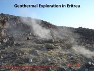
<strong>Mineral</strong> <strong>potential</strong> <strong>of</strong> <strong>Eritrea</strong>at Geleb (pink granite), and in the Arato, Korbaria,and Tukul areas (grey granite). The Mai mine graniteand Elabered granite are also suitable candidates fordimension stone.A narrow outcrop <strong>of</strong> coral limestone extends alongthe coast from the headland <strong>of</strong> Ras Kassar to thecoastline <strong>of</strong> Tio. Immense deposits <strong>of</strong> limestoneoccur in the Adailo-Atosh area south west <strong>of</strong> Tio. Anarrow outcrop <strong>of</strong> coral limestone extends northwardsparallel to the coast from Massawa up to theheadland <strong>of</strong> Ras Kassar.Geothermal acvity, evidenced by fumaroles andhot springs with extensive alteraon <strong>of</strong> the ground,are abundant in the Alid geothermal field. Studiescarried out so far in this area indicate that thepresence <strong>of</strong> a possible sub-surface high temperaturereservoir. The geothermal manifestaons at Nebroand Dubbi are also promising, but further study willbe required to esmate the reservoir temperature.Geothermal PotentialThe possibility <strong>of</strong> the economic exploitaon <strong>of</strong> thegeothermal potenal for power generaon occursin the ri area, associated with volcanic acvity.Alid, Nebro, and Dubi are the main target locaonswhere geothermal acvity is known to be intensive.Lower temperature acvity also occurs at Mai Wuui,30 kms west <strong>of</strong> Massawa.13
<strong>Mineral</strong> <strong>potential</strong> <strong>of</strong> <strong>Eritrea</strong>14
<strong>Mineral</strong> <strong>potential</strong> <strong>of</strong> <strong>Eritrea</strong>15
<strong>Mineral</strong> <strong>potential</strong> <strong>of</strong> <strong>Eritrea</strong>CURRENT LICENSES STATUSCurrently there are six companies who are acvein <strong>Eritrea</strong>. These companies are Bisha Mining Sh.Co., Sub-Sahara Resources (<strong>Eritrea</strong>), SunridgeGold(<strong>Eritrea</strong>), Sanu Resources, <strong>Eritrea</strong>-China Sh. Co. andBeijing Donia. The spaal distribuon <strong>of</strong> their properesinclude Central, Western, South western andNorthern <strong>Eritrea</strong>.Bisha Mining Share CompanyFollowing the issue <strong>of</strong> Mining agreement, BishaMining Share Company has started civil works construconin Bisha. With all perming requirementslong in place and much <strong>of</strong> the detailed design workcompleted the project is well advanced. Construc-on <strong>of</strong> housing and infrastructure for around 450people has already started. Heavy earthmoving forthe main process plant will begin shortly. Much <strong>of</strong>the machinery and equipment for the Project hasalready been procured, including the main grindingmills. Mining will commence mid-2009 and the Processplant will be delivering gold in the first quarter<strong>of</strong> 2010 aer a capital expenditure <strong>of</strong> around US$250 million.Producon will be:• Gold (Years1&2)• Copper (Years 3 to 5)• Copper (Years 6 to 11)400+ thousand ouncesper year78,000 tonnes120,000 tonnes• Copper (Years 6 to 11)20,000 tonnesSunridgegold Corp (<strong>Eritrea</strong>)Sunridgegold Corp (<strong>Eritrea</strong>) is currently working onits Asmara properes that consists <strong>of</strong> three licensesthat surround the capital city <strong>of</strong> Asmara namely Debarwa,Adi Nefas and Medrizien. Extensive explora-on program including ground geophysics, geologicalmapping, geochemical surveys and drilling areunderway on all the properes.Environemntal baseline studies have already beenstarted a Scoping study on the large newly discoveredcopper-zinc-gold Emba Derho VMS deposit inunderway which is expected to be compeleted inOctober 2008. As part <strong>of</strong> this study in July 2008 ascoping study workshop was given to government<strong>of</strong>ficials and experts from different ministries. Priorto this, public consultaons were conducted to variousvillages and this is sll ongoing.Sub-Sahara Resources (<strong>Eritrea</strong>)Sub-Sahara has been acvely exploring in<strong>Eritrea</strong> for the past eight years. The inialproperes that Sub Sahara secured containedthe volcanogenic massive sulphide(VMS) prospects surrounding the capitalcity <strong>of</strong> Asmara. The Debarwa Cu/Zn/Au/Agdeposit was successfully advanced to a‘Scoping Study’ for mining before the en-re land package was sold to joint venturepartner Sunridge Gold Corp in 2007. During2007, Sub Sahara accelerated explora-on acvies on its Zara Gold Project (inthe north-west <strong>of</strong> the country) and wasrewarded with definion <strong>of</strong> a +1moz golddeposit (Koka) grading 6.31g/t, in early 2008. TheKoka Gold Deposit is now in development for miningthrough a Pre-Feasibility Study.Work to date at the Zara Project includes over17,000m <strong>of</strong> diamond drilling, independent resourceesmates by C<strong>of</strong>fey consultaon firm, metallurgicaldrilling and test-work, structural studies with fol-16
<strong>Mineral</strong> <strong>potential</strong> <strong>of</strong> <strong>Eritrea</strong>low-up drilling, petrographic studies, aquifer development,an environmental baseline study, groundbased chargeability and resisvity geophysical surveys,regional geochemical sampling programmesand high resoluon digital terrain modelling.Sanu ResourcesSanu conducted 518 m diamond drilling and geophysicalsurvey on its newly discovered massive sulfidegossan trend in the Koken area <strong>of</strong> its KerkebetRiver exploraon license. This area is 85km northSanu’s Hambok discovery and appears to be an en-rely new district. The mulple gossan occurrencescrop out over a strike length <strong>of</strong> 4.5km with the individualgossan zones up to 11m wide in outcrop andup to 400m long. Zones <strong>of</strong> massive barite mineralizaonup to 5m wide as well as disseminated baritein gossan occur toward the northern end <strong>of</strong> thetrend. Preliminary rock chip analyses <strong>of</strong> more than80 gossan outcrop samples from the trend returnedvery strongly anomalous values in the majority <strong>of</strong>samples in gold, copper, zinc, lead and barium withpeak assay values <strong>of</strong> 20.1, 8.9, 4.7 g/t for gold, copper0.36%, zinc 0.3% and lead 0.47%. It has drilled 9holes and the results are pending.On its Mogoraib exploraon license Sanu has intersectedmassive sulfide style mineralizaon on its Aderatprospect 5km north <strong>of</strong> its Hambok deposit. The1070m <strong>of</strong> diamond core drilled at Aderat to date arepart <strong>of</strong> a larger drill program to test the “Hamboktrend”, a significant geophysical feature defined byanomalous gravity and EM, and geology.<strong>Eritrea</strong>-China Sh. Co.This company is one <strong>of</strong> the two companies recentlygranted exploraon license. It has started its exploraonworks at Augaro.Beijing DoniaBeijing Donia Co. has also started exploraon worksat Defere, located north <strong>of</strong> Asmara.Future investment opportunitiesThe future <strong>of</strong> <strong>Eritrea</strong>’s mining industry appearsbright. The prospecve geology <strong>of</strong> the area togetherwith an aracve and compeve investment regimemakes <strong>Eritrea</strong> one <strong>of</strong> the most aracve andrewarding mining investment opportunies.Results <strong>of</strong> the exploraon acvies conducted inthe last ten years have proved the high mineralpotenal <strong>of</strong> the country, and that invesng in <strong>Eritrea</strong>is rewarding. Although all areas <strong>of</strong> exploraon areprospecve, the following are believed to be moreprospecve for investment.Gold Prospects in South-Western andWestern <strong>Eritrea</strong>The south-western part <strong>of</strong> <strong>Eritrea</strong> is one <strong>of</strong> the mostprospecve gold regions in the country. It containshundreds <strong>of</strong> small historic mines and operaonsthat were acve during the Italian occupaonincluding the Augaro mines which was reportedlythe most producve mine in <strong>Eritrea</strong>. There are alsoareas where arsanal gold mining is currently beingundertaken by the local people. Most <strong>of</strong> these mineralshowings and historical mines and old workingsare associated with rocks <strong>of</strong>: the Augaro-Antore beltand Bisha VMS and Hykota-Fanco belts.Deposits in the Augaro-Antore BeltThe Augaro-Antore belt is situated in the southeasternpart <strong>of</strong> Western Lowlands <strong>of</strong> <strong>Eritrea</strong>. It stretchesfrom the border in the south to the Barka River tothe north where its extension is masked by intrusions.Localies known for gold in the lowerAugaro-Antore belt include Augaro, Damishoba,Dase, Tokombia, Ranyo and Doboro. The Augaromine appears to have been developed on a series<strong>of</strong> quartz veins and stringers, some showingsulphide mineralisaon and formed in a low-pressureregion associated with a regional shear zone.The mineralised system is known to extend for adistance <strong>of</strong> 2,900 metres, <strong>of</strong> which only about 35017
<strong>Mineral</strong> <strong>potential</strong> <strong>of</strong> <strong>Eritrea</strong>metres was mined. The main quartz vein, about240 metres long, and having an average width <strong>of</strong>10 metres, ends in a stockwork <strong>of</strong> stringers. Themain en-echelon system extends over a strike length<strong>of</strong> 300 metres with widths <strong>of</strong> 20 – 30 metres. Therecovered gold grade is reported to have been 30– 40 grams per tonne and producon during theperiods 1933 – 1941 and 1955 – 1956 is recorded at874 kg, although it is widely believed that the actualproducon was greatly in excess <strong>of</strong> this esmate.The mine was closed in 1941 due to war and all itsmining equipment was removed. It was re-openedbriefly in 1955 to re-treat the tailings. Other interesnglocalies in this belt that reached produc-on include Damishoba, Dase, and Ranyo. Doboro,Tokombia and others were sll at the developmentstage, involving ping and underground explora-on, when the Italian occupaon ended in 1941. Inthe southern part <strong>of</strong> the belt operaons at Antoreand Damanoshila, and in the eastern zone <strong>of</strong> theBerbere River, all were at various stages <strong>of</strong> developmentbefore the Second World War. In the northernpart <strong>of</strong> the belt, at Suzena, prospecng started in1932, and mining was carried out from 1937 – 40.Dri on three levels were developed, but work wasabandoned on the fourth level due to water problems.Gold has also been discovered by the local arsanalminers at a number <strong>of</strong> places in recent mes. Theseare indicaons <strong>of</strong> the high gold potenal <strong>of</strong> the area.Deposits in the Bisha VMS BeltBased on regional works and satellite image interpretaon,the Bisha VMS and associated volcanosedimentarybelt is esmated to have a maximumwidth <strong>of</strong> about 30 kms and extends for more than100 kms to the south, while its northern extensionis not clear. This belt is believed to be highly prospecveand may connue for a substanal distanceto the north as well as to the south. In addion,records <strong>of</strong> past exploraon in this area indicatethat quartz veins with varying gold contents havebeen reported from some locaons including Okere(Okreb). Some <strong>of</strong> these were prospected and exploitedbefore mining stopped due to WWII.Gold & Base Metal Prospects in Southern<strong>Eritrea</strong>There are indicaons <strong>of</strong> the connuity <strong>of</strong> the Asmara/DebarwaVMS belt for long distance to the south.Outcrops are known <strong>of</strong> gossanous rocks, exhala-ves and rock assemblages (felsic and mafic) suchas those <strong>of</strong> the Debarwa area, in the Kena area.There are also many places where local people areconducng arsanal mining. The area west <strong>of</strong> Kenacould represent another belt <strong>of</strong> mineralizaon, asthere are areas <strong>of</strong> recently discovered arsanalworkings south <strong>of</strong> Monsura area, that are its northernextension.Gold & Base Metal mineralisation in Northern<strong>Eritrea</strong>.There are indicaons <strong>of</strong> gold and basemetalmineralizaon in several parts <strong>of</strong> northern <strong>Eritrea</strong>.Old workings and prospects, <strong>of</strong> Italina me arefound in Seroa and Arruba in Harab Suit. There is aCu-mineralizaon along a belt that passes throughRaba and Semait areas where old workings arefound. Gossanous rocks running for hundreds <strong>of</strong>metres occur in Halibet area in farther north.Recent exploraon acvies and the work <strong>of</strong> arsanalminers in Zara and other areas to the north isindicang the presence <strong>of</strong> auriferous quartz veinsand stock works in many areas in this part <strong>of</strong> thecountry.In conclusion, it can be said that mineralizaon inmost part <strong>of</strong> the country is not well studied. It maybe far more complex and extensive than is apparent.The level <strong>of</strong> technology and understanding<strong>of</strong> mineralizaon styles that prevailed during theItalian occupaon was low, and most <strong>of</strong> the historicmines and old mining operaons in <strong>Eritrea</strong> wereinterrupted because <strong>of</strong> the Second World War. Theinvestment climate that existed at the me <strong>of</strong> thestruggle for independence that followed was alsonot conducive to the development <strong>of</strong> these opera-ons. It is therefore, no doubt that this part <strong>of</strong> theregion deserves comprehensive exploraon.18
<strong>Mineral</strong> <strong>potential</strong> <strong>of</strong> <strong>Eritrea</strong>For further information contact:Ministry <strong>of</strong> Energy and MinesDepartment <strong>of</strong> MinesP.O.Box 272Asmara,<strong>Eritrea</strong>Tel: +291-1-202889+291-1-202843/44Fax: +291-1-124509To find other Useful information on <strong>Eritrea</strong>,please check these sites:-www.shabait.comwww.shaebia.comwww.dehai.org19
© 2008 Ministry <strong>of</strong> Energy and Mines