Vegetation alliances of the San Dieguito River Park - California ...
Vegetation alliances of the San Dieguito River Park - California ...
Vegetation alliances of the San Dieguito River Park - California ...
- No tags were found...

You also want an ePaper? Increase the reach of your titles
YUMPU automatically turns print PDFs into web optimized ePapers that Google loves.
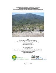
INTRODUCTIONThe <strong>Vegetation</strong> Program <strong>of</strong> <strong>the</strong> <strong>California</strong> Native Plant Society (CNPS) has workedcollaboratively with local and regional agencies, including <strong>the</strong> <strong>California</strong> Department <strong>of</strong> Fish andGame (CDFG), in producing a vegetation classification and map <strong>of</strong> <strong>the</strong> <strong>San</strong> <strong>Dieguito</strong> <strong>River</strong> <strong>Park</strong>.The <strong>San</strong> <strong>Dieguito</strong> <strong>River</strong> <strong>Park</strong> occurs in <strong>San</strong> Diego County, <strong>California</strong>, and extends 55 miles from<strong>San</strong> <strong>Dieguito</strong> Lagoon at Del Mar to its headwaters in <strong>the</strong> Peninsular Range at Volcan Mountain.At least 86 different plant communities, described floristically at <strong>the</strong> alliance level <strong>of</strong> <strong>the</strong> National<strong>Vegetation</strong> Classification (Grossman et al. 1998), are discussed in this report.Two main project goals are 1) to provide detailed, floristic classification <strong>of</strong> <strong>the</strong> vegetationand a report defining <strong>the</strong> different vegetation types, 2) to provide a detailed vegetation map <strong>of</strong> <strong>the</strong>region. Field data are being collected using standard CNPS and CDFG protocols (e.g.,vegetation rapid assessment protocol), and <strong>the</strong>se data and color imagery are being analyzed tocreate <strong>the</strong> classification and maps.The field-based classification depicts vegetation types that were sampled and identified in579 vegetation rapid assessments. The classification follows <strong>the</strong> National <strong>Vegetation</strong>Classification System’s hierarchy <strong>of</strong> <strong>alliances</strong> and associations. These are floristically andenvironmentally defined plant communities, such as those described in <strong>the</strong> CNPS publication <strong>of</strong> AManual <strong>of</strong> <strong>California</strong> <strong>Vegetation</strong> (Sawyer and Keeler Wolf 1995). In this project, <strong>the</strong> vegetationtypes are depicted in standard descriptions and a field key to concisely differentiate 86 <strong>alliances</strong>,2 unique stands, and 103 associations.In a parallel effort, <strong>the</strong> alliance and association-level classification is being used to createa vegetation map at a fine-scale resolution (minimum mapping unit <strong>of</strong> 1/2-1 acre). The map isbeing created by interpreting detailed, digital color aerial photography and delineating boundariesaround <strong>the</strong> individual stands <strong>of</strong> vegetation in <strong>the</strong> study area. This detailed map is being producedin a Geographic Information System (GIS) digital format, through a “head’s-up” digitizing process.With <strong>the</strong> field data collected and classified, <strong>the</strong> mapping is guided by <strong>the</strong> 579 rapid assessmentsand 595 reconnaissance points. The final map will include digitization <strong>of</strong> polygons and attribution<strong>of</strong> <strong>the</strong> vegetation type, tree cover, shrub cover, herb cover, tree size, site quality and impacts.Over <strong>the</strong> past 15 years, <strong>the</strong>re has been a proliferation <strong>of</strong> Habitat Conservation Plans(HCP) and Natural Communities Conservation Planning programs in sou<strong>the</strong>rn <strong>California</strong>;however, <strong>the</strong>se projects suffer from a lack <strong>of</strong> sufficient field vegetation information. Presently,only coarse-scale vegetation maps exist from <strong>the</strong> <strong>San</strong> Diego County Multiple SpeciesConservation Planning area, in which <strong>the</strong> vegetation is not precisely defined or mapped. Thus,collection <strong>of</strong> detailed field data for floristic vegetation classification and mapping will assist inmore appropriate conservation and management decisions to sustain <strong>California</strong>’s natural andunique resources. The <strong>San</strong> <strong>Dieguito</strong> vegetation descriptions and map will be shared with localand regional organizations and agencies for land management and conservation purposes.This is <strong>the</strong> first time a collaborative vegetation project has provided detailed vegetationand site quality information over <strong>the</strong> range <strong>of</strong> biodiversity in this portion <strong>of</strong> <strong>California</strong>, from <strong>the</strong>interior mountain drainage to <strong>the</strong> coastal lagoon <strong>of</strong> <strong>the</strong> <strong>San</strong> <strong>Dieguito</strong>. With a fine-scale vegetationclassification and map, we can be more certain that <strong>the</strong> full range <strong>of</strong> ecological variability iscaptured in <strong>the</strong> <strong>San</strong> <strong>Dieguito</strong> <strong>River</strong> <strong>Park</strong>. As each vegetation type is mapped, it has referenceground data so that <strong>the</strong> vegetation types can be compared quantitatively. In <strong>the</strong> maps, baselinefloristic, structural, and site impact information is captured in a defensible manner. Once we havea map <strong>of</strong> scientifically and quantitatively based units, we can determine location, acreage,numbers and quality <strong>of</strong> vegetation types. Ensuring representation <strong>of</strong> each vegetation type willassist in ecological sustenance <strong>of</strong> <strong>the</strong> region. In <strong>the</strong> future, agencies can compare areas basedon vegetation diversity and habitat quality to identify conservation values for such things as landacquisition, proper placement <strong>of</strong> trail systems, restoration, and o<strong>the</strong>r management in <strong>the</strong> <strong>River</strong><strong>Park</strong>.CNPS is currently collaborating with a variety <strong>of</strong> local and state agencies in this project,many <strong>of</strong> whom own/manage land in <strong>the</strong> <strong>River</strong> <strong>Park</strong>. The CDFG-Wildlife and Data HabitatAnalysis Branch and <strong>the</strong> <strong>San</strong> Diego Chapter <strong>of</strong> CNPS have been instrumental in providing work1