Castrum Bene 12 - Oddelek za arheologijo - Univerza v Ljubljani
Castrum Bene 12 - Oddelek za arheologijo - Univerza v Ljubljani
Castrum Bene 12 - Oddelek za arheologijo - Univerza v Ljubljani

You also want an ePaper? Increase the reach of your titles
YUMPU automatically turns print PDFs into web optimized ePapers that Google loves.
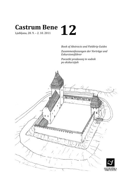
<strong>Castrum</strong> <strong>Bene</strong><br />
Ljubljana, 28. 9. – 2. 10. 2011<br />
<strong>12</strong><br />
Book of Abstracts and Fieldtrip Guides<br />
Zusammenfassungen der Vorträge und<br />
Exkursionsführer<br />
Povzetki predavanj in vodnik<br />
po ekskurzijah
<strong>Castrum</strong> <strong>Bene</strong> <strong>12</strong><br />
Ljubljana, 28. 9. – 2. 10. 2011<br />
<strong>12</strong> th International Castellological Conference<br />
<strong>12</strong>. Internationale Konferenz für Burgenforschung<br />
<strong>12</strong>. mednarodna kastelološka konferenca<br />
The Castle as Social Space<br />
Die Burg als sozialer Raum<br />
Grad kot družbeni prostor<br />
Book of Abstracts and Fieldtrip Guides<br />
Zusammenfassungen der Vorträge und Exkursionsführer<br />
Povzetki predavanj in vodnik po ekskurzijah<br />
Ljubljana 2011
Edited by / Urednica<br />
Proofreading<br />
Jezikovni pregled<br />
Technical Editor<br />
Tehnična urednica<br />
Published by / Založila<br />
Issued by / Izdal<br />
For the publisher / Za <strong>za</strong>ložbo<br />
Design and layout<br />
Oblikovanje in prelom<br />
Printed by / Tisk<br />
Number of copies printed<br />
Naklada<br />
<strong>12</strong>th International Castellological Conference <strong>Castrum</strong> <strong>Bene</strong>, Ljubljana, 28. 9. – 2. 10.<br />
2011: The Castle as Social Space. Book of Abstracts and Fieldtrip Guides<br />
<strong>12</strong>. Internationale Konferenz für Burgenforschung <strong>Castrum</strong> <strong>Bene</strong>, Ljubljana, 28.<br />
9. – 2. 10. 2011: Die Burg als sozialer Raum. Zusammenfassungen der Vorträge und<br />
Exkursionsführer<br />
<strong>12</strong>. mednarodna kastelološka konferenca <strong>Castrum</strong> <strong>Bene</strong>, Ljubljana, 28. 9. – 2. 10. 2011:<br />
Grad kot družbeni prostor. Povzetki predavanj in vodnik po ekskurzijah<br />
Katarina Predovnik<br />
Katarina Predovnik<br />
Nives Spudić<br />
©University of Ljubljana, Faculty of Arts, 2011 / Univer<strong>za</strong> v <strong>Ljubljani</strong>, Filozofska fakulteta,<br />
2011<br />
All rights reserved. / Vse pravice pridržane.<br />
Znanstvena <strong>za</strong>ložba Filozofske fakultete Univerze v <strong>Ljubljani</strong><br />
(Ljubljana University Press, Faculty of Arts)<br />
Department of Archaeology / <strong>Oddelek</strong> <strong>za</strong> <strong>arheologijo</strong><br />
Valentin Bucik, the dean of the Faculty of Arts / Valentin Bucik, dekan Filozofske fakultete<br />
Nives Spudić<br />
Birografika Bori d.o.o.<br />
Ljubljana 2011<br />
First edition / Prvi natis<br />
100<br />
Distributed free of charge. / Publikacija je brezplačna.<br />
This publication was supported by the Slovenian Research Agency. / Publikacija je izšla s<br />
podporo Javne agencije <strong>za</strong> raziskovalno dejavnost Republike Slovenije.<br />
CIP - Kataložni <strong>za</strong>pis o publikaciji<br />
Narodna in univerzitetna knjižnica, Ljubljana<br />
930.85(4)(082)<br />
728.81(4)(091)(082)<br />
INTERNATIONAL Castellological Conference (<strong>12</strong> ; 2011 ; Ljubljana)<br />
The castle as social space : book of abstracts and fieldtrip guide = Die Burg als<br />
sozialer Raum : Zusammenfassungen der Vorträge und Exkursionführer = Grad kot<br />
družbeni prostor : povzetki predavanj in vodnik po ekskurzijah / <strong>Castrum</strong> <strong>Bene</strong> <strong>12</strong><br />
[tudi] <strong>12</strong>th International Castellological Conference, Ljubljana 28. 9.-2. 10. 2011 =<br />
<strong>12</strong>. Internationale Konferenz für Burgenforschung = <strong>12</strong>. mednarodna kastelološka<br />
konferenca ; [edited by Katarina Predovnik]. - 1st ed. = 1. natis. - Ljubljana :<br />
Znanstvena <strong>za</strong>ložba Filozofske fakultete, 2011<br />
ISBN 978-961-237-455-6<br />
1. Gl. stv. nasl. 2. Vzp. stv. nasl. 3. Predovnik, Katarina Katja<br />
257691648
5<br />
11<br />
41<br />
45<br />
45<br />
53<br />
61<br />
Contents / Inhalt / Ka<strong>za</strong>lo<br />
Conference Programme<br />
Programm der Konferenz<br />
Program konference<br />
Paper Abstracts<br />
Zusammenfassungen der Vorträge<br />
Povzetki predavanj<br />
Poster Abstracts<br />
Zusammenfassungen der Poster<br />
Povzetki plakatov<br />
Fieldtrip Guides<br />
Exkursionsführer<br />
Vodnik po ekskurzijah<br />
Štajerska<br />
Gorenjska<br />
Ljubljana
Conference organized by<br />
Organisation der Konferenz<br />
Konferenco organizira<br />
Committee Head<br />
Vorsitzende<br />
Predsedujoča<br />
University of Ljubljana, Faculty of Arts, Department of Archaeology<br />
Universität Ljubljana, Philosphische Fakultät, Abteilung für Archäologie<br />
Univer<strong>za</strong> v <strong>Ljubljani</strong>, Filozofska fakulteta, <strong>Oddelek</strong> <strong>za</strong> <strong>arheologijo</strong><br />
Scientific organi<strong>za</strong>tion committee<br />
Wissenschaftliches Organisationskomitee<br />
Programski in organi<strong>za</strong>cijski odbor<br />
Doc. dr. Katarina PREDOVNIK<br />
Univer<strong>za</strong> v <strong>Ljubljani</strong>, Filozofska fakulteta, <strong>Oddelek</strong> <strong>za</strong> <strong>arheologijo</strong>, Ljubljana, SI<br />
PhDr. Peter BEDNÁR, CSc.<br />
Archeologický ústav SAV, Nitra, SK<br />
Dr. György DOMOKOS<br />
HM Hadtörténeti Intézet és Múzeum, Budapest, H<br />
Doc. PhDr. Tomás DURDÍK, DrSc.<br />
Archeologický ústav AV ČR, Praha, CZ<br />
Dr. Istvan FELD<br />
Eötvös Loránd Tudományegyetem, Budapest, H<br />
Mag. Dr. Martin KRENN<br />
Bundesdenkmalamt, Abteilung für Bodendenkmäle, Wien, A<br />
Dr. Adrian Andrei RUSU<br />
Institutul de arheologie şi istoria artei al Academiei Române, Cluj-Napoca, RO
28. 9. 2011<br />
16:00–19:00<br />
20:30<br />
29. 9. 2011<br />
9:00<br />
9:15<br />
9:45<br />
10:15<br />
10:45<br />
11:15<br />
11:45<br />
<strong>12</strong>:15<br />
Conference Programme<br />
Programm der Konferenz<br />
Program konference<br />
Wednesday / Mittwoch / Sreda<br />
Arrival and registration / Anreise und Anmeldung / Prihod in prijava<br />
Meeting of the Permanent Committee / Sitzung des<br />
Comité-Permanent / Zasedanje stalnega odbora<br />
Thursday / Donnerstag / Četrtek<br />
Morning session / Vormittagssektion / Dopoldanska sekcija<br />
Social Interpretation of Material Culture / Gesellschaftliche Deutung der<br />
materiellen Kultur / Družbena interpretacija materialne kulture<br />
Wellcome / Begrüssung / Dobrodošlica<br />
Patrick SCHICHT (Krems, Österreich): Die Burg als Spiegel der Gesellschaft<br />
–Überlegungen an Hand des Salzburger Erzbistums<br />
Christina SCHMID (Krems, Österreich): Räumliche Analysen<br />
archäologischer Funde auf Burgen<br />
Tomáš DURDÍK (Praha, Česko): Aussage der archäologischen Quellen zum<br />
Alltag der oberen Burgbewohnerschicht<br />
Coffee break / Kaffeepause / Odmor <strong>za</strong> kavo<br />
Artur BOGUSZEWICZ (Wrocław, Polska): Auf der Suche nach der<br />
Adelskultur. Das Beispiel Burgen in Schlesien<br />
Arvi HAAK (Tartu, Eesti), Eve RANNAMÄE (Tartu, Eesti): Tracing the<br />
castellans: Viljandi (Estonia) in the late 13 th century<br />
Josef HLOŽEK (Plzeň, Česko): Gesellschaftlicher Kontext und Nutzung der<br />
Vorburgareale der mittelalterlichen Burgen in Böhmen<br />
Lunch break / Mittagspause / Odmor <strong>za</strong> kosilo<br />
Ljubljana, Slovenia, September 28 th – October 2 nd 2011<br />
5
15:00<br />
15:30<br />
16:00<br />
16:30<br />
17:00<br />
17:30<br />
18:00<br />
18:30<br />
20:00<br />
30. 9. 2011<br />
9:00<br />
9:30<br />
10:00<br />
10:30<br />
11:00<br />
Afternoon session / Nachmittagssektion / Popoldanska sekcija<br />
Social Stratification and Castle Architecture / Soziale Schichtung und<br />
Burgenarchitektur / Družbena stratifikacija in grajska arhitektura<br />
Paul MITCHELL (Wien, Österreich): The Gozzoburg in Krems and the<br />
Hofburg in Vienna. Their relevance to the study of social space in<br />
medieval architecture<br />
Günther DONATH (Wilsdruff, Deutschland): Eine Residenz für zwei<br />
Haushaltungen. Das hochkomplexe Raum- und Bauprogramm beim<br />
Neubau der Albrechtsburg in Meißen 1470<br />
Michael RYKL (Praha, Česko): Die Baugestalt als Spiegel des Wandels<br />
des Sozialstatus. Fallbeispiel der Feste Kestřany in Südböhmen in der<br />
neueren Forschung<br />
Radu LUPESCU (Cluj-Napoca, România): Social stratification and castle<br />
architecture in 15 th -century Transylvania<br />
Coffee break / Kaffeepause / Odmor <strong>za</strong> kavo<br />
Castle Studies and their Social Context / Burgenforschung und ihr<br />
Sozialkontext / Kastelologija in njen družbeni kontekst<br />
Vytautas VOLUNGEVIČIUS (Vilnius, Lietuva): The Grand Duchy of Lithuania<br />
and the case of the castle: context, problems, perspectives<br />
Igor SAPAČ (Ljubljana, Slovenija): Blicke auf Burgen und Schlösser in<br />
Slowenien<br />
Adrian Andrei RUSU (Cluj-Napoca, România): A critique of the “peasant<br />
fortresses” from Romania<br />
Reception / Empfang / Sprejem<br />
Friday / Freitag / Petek<br />
Morning session / Vormittagssektion / Dopoldanska sekcija<br />
Living in Castles / Leben auf Burgen / Življenje na gradovih<br />
Maxim MORDOVIN (Budapest, Hungary): Civitas or refugium? Life in 10 th –<br />
11 th -century castles in Hungary<br />
Daniela DVOŘÁKOVÁ (Bratislava, Slovensko): Die Frau und ihr Leben auf<br />
der mittelalterlichen Burg<br />
Regina JANÍKOVÁ (Plzeň, Česko): Touch of her hand: the reflection of<br />
women in archaeological sources from castle areas<br />
Coffee break / Kaffeepause / Odmor <strong>za</strong> kavo<br />
Catriona COOPER (Southampton, UK), Gemma MINIHAN (Southampton,<br />
UK): Bodiam, Scotney and Ightham: lived experience in the later Middle<br />
Ages<br />
6 <strong>Castrum</strong> <strong>Bene</strong> <strong>12</strong>
11:30<br />
13:00–22:30<br />
1. 10. 2011<br />
9:00<br />
9:30<br />
10:00<br />
10:30<br />
11:00<br />
11:30<br />
<strong>12</strong>:00<br />
<strong>12</strong>:30<br />
14:30<br />
Thomas KÜHTREIBER (Krems, Österreich): Gefahrenstelle Burg. Unfälle<br />
auf Burgen als Quellen zur Identifikation von unterschiedlichen sozialen<br />
Gruppen auf Adelssitzen des Mittelalters und der frühen Neuzeit<br />
Excursion to the region of Štajerska / Exkursion nach Untersteiermark /<br />
Ekskurzija na Štajersko<br />
Saturday / Samstag / Sobota<br />
Morning session / Vormittagssektion / Dopoldanska sekcija<br />
Communication and Perception: The Life and Afterlife of Castles and<br />
Fortresses / Kommunikation und Wahrnehmung: das Leben und Nach-<br />
Leben der Burgen und Festungen / Komunikacija in percepcija: življenje<br />
in »življenje po življenju« gradov in trdnjav<br />
Ján BELJAK (Nitra, Slovensko), Pavol MALINIAK (Banská Bystrica,<br />
Slovensko), Noémi PAŽINOVÁ (Nitra, Slovensko), Michal ŠIMKOVIC (Zvolen,<br />
Slovensko): Die Burg Pustý hrad bei Zvolen – eine Zeugin mittelalterlichen<br />
Lebens. Differenzierung des Raumes der königlichen Burg auf der<br />
Grundlage der archäologischen, architektonischen und historischen<br />
Forschung<br />
Wendy LANDEWÉ (Enschede, Nederland): Castles and gender in late<br />
medieval Holland<br />
Alessandro BRODINI (Roma, Italia): The fortress as a social space: the<br />
16 th –17 th -century Venetian Terraferma as a case in point<br />
György DOMOKOS (Budapest, Hungary): Das Zeughaus von Kaschau und<br />
seine Verbindungen<br />
Coffee break / Kaffeepause / Odmor <strong>za</strong> kavo<br />
Zsuzsanna KOPECZNY (Timişoara, România): The castle of Timişoara in<br />
the early modern period, as seen by its contemporaries<br />
Ileana BURNICHIOIU (Alba Iulia, România), Oana TODA (Cluj-Napoca,<br />
România): Castle after castle in Transylvania: the social and cultural<br />
changes (16 th –20 th centuries)<br />
Martin KRENN (Wien, Österreich): Die Kreuzenstein – späthistoristischer<br />
Burgenbau<br />
Lunch break / Mittagspause / Odmor <strong>za</strong> kosilo<br />
Afternoon session / Nachmittagssektion / Popoldanska sekcija<br />
Castles as Heritage / Burgen als Erbe / Gradovi kot dediščina<br />
Wojciech BRILLOWSKI (Toruń, Polska), Arkadiusz KOPERKIEWICZ (Gdańsk,<br />
Polska): The Bäslack castle – a stronghold, a church, a legend<br />
Ljubljana, Slovenia, September 28 th – October 2 nd 2011<br />
7
15:00<br />
15:30<br />
16:00<br />
16:30<br />
17:00<br />
17:30<br />
18:00<br />
20:00<br />
2. 10. 2011<br />
9:00<br />
9:30<br />
10:00<br />
10:30<br />
Barbara POSPIESZNA (Malbork, Polska), Kazimierz POSPIESZNY (Toruń,<br />
Polska): Kloster-Residenzen der „Maria-Diener“ oder Wehrbauten der<br />
Kreuzritter in Preußen – zwei Bilder der Deutschordensburgen ehemals<br />
und heute<br />
Jože HUDALES (Ljubljana, Slovenija): Castles in Slovene folk tradition:<br />
some examples from the Šaleška Dolina Valley<br />
Rajko MURŠIČ (Ljubljana, Slovenija): Kapralov’s Castle and Upper Cmurek<br />
(Mureck) Castle as venues of alternative punk rock scene in Trate,<br />
Slovenske gorice<br />
Coffee break / Kaffeepause / Odmor <strong>za</strong> kavo<br />
Vesna MERC (Ptuj, Slovenija): Back to the future? Heritage-making and<br />
castles<br />
Harald ROSMANITZ (Partenstein, Deutschland): The castle project in the<br />
Spessart – scientists and volunteers explore a cultural landscape<br />
Silvija PISK (Zagreb, Hrvatska): Croatian medieval fortifications between<br />
academic and pop-scientific approach: selected examples<br />
Poster session / Poster-Sektion / Posterska sekcija<br />
František GABRIEL (Česká Lípa, Česko), Lucie KURSOVÁ (Litoměřice,<br />
Česko): Die Pflichten der Untertanen und ihre Möglichkeiten in der Burg<br />
Helfenburk im 14. Jahrhundert<br />
Arkadiusz KOPERKIEWICZ (Gdańsk, Polska): Kleine Schlösser in<br />
kleinen Gesellschaften. Die archäologischen Ausgrabungen in dem<br />
Ritterordensschloss Hochenstein<br />
Arkadiusz PRZYBYŁOK (Piekary Śląskie, Polska): Raum der<br />
oberschlesischen Burgen. Dienst, Tiere, Versorgung<br />
Kari UOTILA (Kaarina, Suomi): Using a mobile-guide system in medieval<br />
castles and fortifications<br />
Sunday / Sonntag / Nedelja<br />
Morning session / Vormittagssektion / Dopoldanska sekcija<br />
Castle Biographies / Burgenbiographien / Biografije gradov<br />
Zsolt CSOK (Zalău, România): <strong>Castrum</strong> Carazna and its domain: a hidden<br />
castle and clear social ambient (11 th –13 th centuries)<br />
Mira STRMČNIK GULIČ (Maribor, Slovenija), Mateja RAVNIK (Ljubljana,<br />
Slovenija): Marchpurch. The Upper Castle of Maribor<br />
Tatjana TKALČEC (Zagreb, Hrvatska): The medieval castle of ''Vrbouch'' in<br />
Klenovec Humski (Northwestern Croatia)<br />
Coffee break / Kaffeepause / Odmor <strong>za</strong> kavo<br />
8 <strong>Castrum</strong> <strong>Bene</strong> <strong>12</strong>
11:00<br />
11:30<br />
<strong>12</strong>:00<br />
13:30 –19:30<br />
14:30 –17:00<br />
Andrej JANEŠ (Zagreb, Hrvatska): A view on life in a feudal castle:<br />
finds analysis from the castle of Cesargrad (2008 and 2010 excavation<br />
campaigns)<br />
Tajana PLEŠE (Zagreb, Hrvatska): Krčingrad and Garić-grad: two castles<br />
and their role in the late medieval cultural and historical landscape<br />
Final discussion / Schlussdiskussion / Sklepna diskusija<br />
Excursion to the region of Gorenjska / Exkursion nach Oberkrain /<br />
Ekskurzija na Gorenjsko<br />
or / oder / ali<br />
A tour around Ljubljana / Stadtrundgang in Ljubljana / Ogled Ljubljane<br />
Ljubljana, Slovenia, September 28 th – October 2 nd 2011<br />
9
Patrick Schicht<br />
Christina Schmid<br />
Paper Abstracts<br />
Zusammenfassungen der Vorträge<br />
Povzetki predavanj<br />
Die Burg als Spiegel der Gesellschaft –<br />
Überlegungen an Hand des Salzburger<br />
Erzbistums<br />
Im Rahmen einer umfangreichen Untersuchung zum hochmittelalterlichen<br />
Burgenbau der Erzbischöfe von Salzburg (<strong>12</strong> Anlagen) gelangen<br />
<strong>za</strong>hlreiche Beobachtungen zur sozialen Staffelung vom Erzbischof über<br />
seine Burggrafen zu den Dienstmannen und gewöhnlichen Besuchern. So<br />
fanden sich mehrfach Privatkapellen im Kernbereich und größere Kapellen<br />
in der Unterburg, direkte Zugänge vom Kernbereich auf die Emporen<br />
sowie eine Staffelung der Burgbereiche von außen nach innen. Analog<br />
finden sich mehrere und unterschiedliche Küchen, Gesindestuben versus<br />
Prunkstuben und unterschiedliche Verteidigungslinien und private Rückzugsorte<br />
für die höchsten Kreise. Die soziale Staffelung zeigt im betrachteten<br />
Zeitraum des 11. bis 14. Jahrhunderts einige Entwicklungen, die sich<br />
auf das jeweilige Hofzeremoniell aber auch auf moderne Strömungen und<br />
Anforderungen zurückführen lassen.<br />
Der Vortrag würde diese Hinweise auf gesellschaftliche Staffelungen beleuchten<br />
und zur allgemeinen Diskussion stellen.<br />
Räumliche Analysen archäologischer Funde auf Burgen<br />
Wenn aufgrund des schlechten Erhaltungszustandes architektonisch abgegrenzter<br />
Räume keine Untersuchungen zu Raumfunktionen wie etwa<br />
„access analysis“ mehr möglich sind, bleibt die räumliche Verteilung der<br />
archäologisch relevanten Hinterlassenschaften die einzige Quelle für eine<br />
Lokalisierung von Aktivitäten. Analysen und Interpretationen von „intrasite<br />
spatial data“ wurden bisher in erster Linie in Hinblick auf urgeschichtliche<br />
Fundstellen durchgeführt – solches „patterning“, also die Verteilung<br />
von und die Beziehungen zwischen Artefakten und Befunden im Boden,<br />
liefert jedoch auch wichtige Informationen für mittelalterarchäologische<br />
Befunde.<br />
Aktivitätszonen als räumlich eingrenzbare Orte, an denen eine bestimmte<br />
Tätigkeit von einer oder mehreren Personen durchgeführt wird, können<br />
anhand einer Analyse der räumlichen Beziehung von Objekten definiert<br />
werden. Dabei bleiben Einzelereignisse immer schwer interpretierbar,<br />
zielführender ist es, wiederkehrende Aktivitätsmuster zu identifizieren.<br />
Räumliche Verteilungsmuster stellen dabei keine passive und zufällige<br />
Reflexion sozialer Praxis dar, räumliche Strukturen sind sowohl Mittel als<br />
Ljubljana, Slovenia, September 28 th – October 2 nd 2011<br />
11
auch Resultat menschlicher Aktivität. Raum darf also auch nicht nur als<br />
eine Beziehung zwischen Objekten gesehen, und sozialer Raum nicht auf<br />
seine physische Beschreibung reduziert werden.<br />
Wichtig für Untersuchungen räumlicher Verteilungsmuster ist die Frage<br />
nach der räumlichen Trennung von Aktivitäten. Auf Burgen, wo viele<br />
Gebäude aus Stein errichtet wurden, ist der Aufwand für Umbauten sehr<br />
groß, Veränderungen sind daher schwierig und arbeitsaufwändig – bei<br />
flüchtiger Architektur aus Lehm oder Holz ist eine Einflussnahme auf die<br />
architektonische Gestaltung leichter möglich. Ein Gebäude auf einer Burg<br />
muss daher in seiner letzten baulichen Ausprägung nicht mehr zwingend<br />
die Bedürfnisse der BewohnerInnen widerspiegeln, der Lebensvollzug<br />
muss nicht mit der baulich intendierten Funktion übereinstimmen. Die<br />
stratigraphisch jüngsten Nutzungsschichten geben allerdings Hinweise<br />
auf die auf einer Burg tatsächlich verübten Tätigkeiten.<br />
Räumlich ungebundene Tätigkeiten können an Zonen gebunden sein, der<br />
konkrete Ort jedoch kann variieren. Räumlich gebundene Tätigkeiten sind<br />
an eine bestimmte Installation gebunden. Solche Aktivitäten mit festgelegtem<br />
Aktivitätsort haben eine größere archäologische Sichtbarkeit – zum<br />
einen aufgrund der festen Installation, deren Überlieferungswahrscheinlichkeit<br />
hoch ist, und zum anderen, da wiederholt immer wieder dieselbe<br />
Art von Abfall abgelagert wird. Bei Aktivitäten ohne festgelegten Ort ist<br />
eine funktionelle Interpretation zumeist schwierig bis unmöglich. Darüber<br />
hinaus muss in Betracht gezogen werden, dass es Tätigkeiten gibt, deren<br />
Abläufe Räume miteinander verknüpfen und sich daher nicht in Form einzelräumlicher<br />
Binnenfunktionen fassen lassen.<br />
Eine Lokalisierung von Aktivitätszonen anhand archäologisch fassbarer<br />
Belege birgt jedoch auch positivistisches Fehlerpotential: Aktivitäten sind<br />
archäologisch nur lokalisierbar, sofern sie mit Materialaufwand und -Verlust<br />
verbunden sind. Die Menge an archäologisch fassbaren Überresten,<br />
die sich auf einer Oberfläche (Fußboden, Begehungshorizont etc.) beobachten<br />
lässt, ist abhängig davon, wie viel Material im Rahmen einer Aktivität<br />
benutzt oder erzeugt, und in welcher Form diese Gegenstände auf der<br />
Oberfläche belassen oder entsorgt wurden. Wenig materialintensive bzw.<br />
wenig abfallerzeugende Tätigkeiten produzieren einen geringeren bis keinen<br />
Niederschlag im archäologischen Material und können daher im Zuge<br />
solcher Analysen nicht erfasst werden.<br />
Entscheidend für eine Analyse räumlicher Verteilungsmuster sind die Erhaltungsbedingungen:<br />
Im archäologischen Befund zeigen sich oft überlagernde<br />
Verteilungsmuster. Bei bestimmten Entstehungsformen archäologischer<br />
Kontexte darf jedoch davon ausgegangen werden, dass die an<br />
diesem Ort durchgeführten Handlungen – etwa durch ein Erdbeben oder<br />
ein Schadensfeuer – plötzlich beendet wurden. Das Ende der menschlichen<br />
Aktivität an dem betreffenden Platz wurde also durch ein unvermittelt<br />
auftretendes Ereignis herbeigeführt. Dadurch stand den handelnden<br />
Menschen wenig Zeit zur Verfügung, um die Befundbildung entscheidend<br />
zu beeinflussen. Wenn der in diesem Zusammenhang entstandene Niederschlag<br />
nach seiner Ablagerung keinen entscheidenden räumlichen Veränderungen<br />
– davon vorrangig (mit Ausnahme der Ausgrabung) keiner Manipulation<br />
mehr durch den Menschen – unterlag, stellt er eine gute Basis<br />
für eine erfolgreiche Analyse räumlicher Verteilungsmuster dar. Es besteht<br />
aufgrund der besonderen Depositionsumstände Grund zur Annahme, dass<br />
eine „tatsächliche Artefaktpopulation“ in einen archäologischen Kontext<br />
<strong>12</strong> <strong>Castrum</strong> <strong>Bene</strong> <strong>12</strong>
Tomáš Durdík<br />
Artur Boguszewicz<br />
gelangt ist und über die Fundlage der Objekte sowie ihre Vergesellschaftung<br />
mit anderen Objekten auf ihre Funktion bzw. Verwendung geschlossen<br />
werden kann. Befunde dieser Kategorie dienen als Quellen der vorgestellten<br />
Untersuchung.<br />
Im Rahmen dieses Vortrags soll der Frage nachgegangen werden, in wie<br />
weit sich Aktivitäten der Burgbewohnerinnen und Burgbewohner im archäologischen<br />
Befund niederschlagen und wie in weiterer Folge dieser<br />
Niederschlag durch die Archäologie dokumentiert und interpretiert werden<br />
kann. In dem Bewusstsein, dass wohl immer ein großer Spalt zwischen<br />
komplexen historischen Handlungen und den archäologisch fassbaren Resten<br />
dieses Verhaltens klafft, wird versucht, verschiedene Gruppen von BurgbewohnerInnen<br />
oder anderer Anwesender anhand der durch sie durchgeführten<br />
Aktivitäten im archäologischen Befund sichtbar zu machen.<br />
Aussage der archäologischen Quellen zum<br />
Alltag der oberen Burgbewohnerschicht<br />
Der Beitrag beschäftigt sich in Form der Bemerkungen mit dem Alltag der<br />
oberen Burgbewohnerschicht. Dieses Thema braucht sicher eine breite interdisziplinäre<br />
Fassung. Im Rahmen dieses Beitrags werden aus dem breiten, vielseitigen<br />
und vielschichtigen Spektrum der aussagefähigen Quellen zum Thema<br />
die Möglichkeiten der archäologischen Quellen betrachtet. Diskutiert werden<br />
die Belege des Alltags, z. B. Belege aus dem Bereich der Ritterkultur und ihren<br />
Satzungen, der Tafelsitten, des Verständnisses von Zeit, der Kultur, des Geldumlaufs,<br />
der Jagd, des Freizeitverbleibs usw. Es gibt keine Zweifel darüber,<br />
dass das Bild des Alltags der höchsten sozialen Schichten der Burgbewohner<br />
im archäologischen Material sehr modifiziert ist und es (wie auch beim gesamten<br />
Burgalltag) unbestreitbar einer weit größeren interdisziplinären Bandbreite<br />
bedarf, um es zu begreifen. Trotzdem ist das Studium und Auswertung der archäologischen<br />
Quellen notwendig und bildet einen wichtigen Bestandteil des<br />
Gesamtbildes.<br />
Auf der Suche nach der Adelskultur.<br />
Das Beispiel Burgen in Schlesien<br />
Augenscheinlich ist die Burg ein Ort, der das Gepräge der Kultur von mittelalterlichen<br />
Adeligen möglichst triftig widerspiegelt. Allerdings werden<br />
in der letzten Zeit immer mehr Faktoren sichtbar, die diese Meinung in<br />
Frage stellen. Die formale Differenzierung dieser Objekte, Umwandlungen,<br />
denen sie in der Geschichte unterlagen, Übereignungen, einschließlich der<br />
Übernahme durch kirchliche Institutionen oder Bürgerschaft, machen die<br />
Interpretation des Kulturphänomens, welches die Burg war, viel komplizierter.<br />
Damit stehen Dilemmas in Verbindung, welche mit der Deutung<br />
der auf den Burgen geborgenen Funde zusammenhängen. Nur ausnahmsweise<br />
gibt es Artefakte, die mit der ritterlich-höfischen Kultur zu verbinden<br />
wären. Die meisten sind hingegen Geräte und Gegenstände, derer<br />
Ljubljana, Slovenia, September 28 th – October 2 nd 2011<br />
13
Arvi Haak<br />
Eve Rannamäe<br />
Benutzung unterschiedlichen „nichtadeligen“ Sozialgruppen zugewiesen<br />
werden kann, die auf der Burg mannigfaltige Dienste und Wirtschaftstätigkeiten<br />
leisteten. Die Zweifel stellen sich auch bei einem Versuch auf, unter<br />
den Funden die so genannte adelige Komponente auszusondern, wenn<br />
ähnliche archäologische Fundkomplexe auch in den mittelalterlichen Städten<br />
entdeckt werden.<br />
Die Ordnung von diesen Fragen sowie Bestimmung von Anzeichen der<br />
Adelskultur kann eine Analyse vom breiteren Zusammenhang der Aktivitäten<br />
auf der Burg mit Berücksichtigung der Verhältnisse zwischen den<br />
verschiedenen Gruppen von Burgbewohnern bringen. In dieser Hinsicht<br />
kann die Anwendung der Elemente von der Theorie des Kultursoziologen<br />
Pierre Bourdieu behilflich sein. Laut der letzteren sollte man eine Analyse<br />
von Artefakten auf die Bestimmung vom „Habitus“ des Burgherrn konzentrieren,<br />
also auf die von ihm angeeigneten Muster von Denken, Verhalten<br />
und Geschmäckern. Somit dürfen sich die Untersuchungen dieser Frage auf<br />
eine einfache Bestimmung von Funktionen einzelner Gebäude, Einrichtungen<br />
und Geräte sowie deren Zuweisung den Vertretern einer gegebenen<br />
Sozialgruppe nicht beschränken. Notwendig ist es, jene Elemente im Kontext<br />
der Struktur, die von Bourdieu soziales Feld genannt wird, also der<br />
Burgbewohner anzubringen, für die die wichtigste Person, der „Akteur“,<br />
der Burgbesitzer war. Die Anwendung dieser Forschungsinstrumente lässt<br />
das soziale, mit der Adelskultur gleichzusetzende Kapital des Besitzers bestimmen.<br />
Jene Frage wird in Anlehnung an die Fundmaterialien aus den schlesischen<br />
Burgen der Zeit zwischen dem 13. und 15. Jh. betrachtet werden, sie wird<br />
aber auch auf die in Mittel- und Osteuropa sichtbaren Kulturerscheinungen<br />
bezogen werden. Unter den angesprochenen Angelegenheiten finden<br />
sich auch die Sachen der Lokalisierung einer Burg, ihrer Form, Ausstattung<br />
und Ausschmückung. In Bezug auf die Problematik des Alltagslebens<br />
auf der Burg werden die mit dem Lebensstandard der Burgbewohner, dem<br />
Umfang ihrer Wirtschaftsaktivitäten und Unterhaltung zusammenhängenden<br />
Fragen angeschnitten. Besondere Beachtung sollte auch den gefundenen<br />
Waffen und Spuren von Kriegshandlungen auf den Burgen geschenkt<br />
werden. In vielen Fällen können die Vergleichsuntersuchungen der in den<br />
mittelalterlichen Dörfern und Städten geborgenen archäologischen Fundmaterialien<br />
eine Basis für die gezogenen Schlüsse bilden.<br />
Tracing the Castellans: Viljandi (Estonia)<br />
in the Late 13 th Century<br />
In Estonia, the construction of stone castles started after the conquest of<br />
the territory during the early 13 th century. In Viljandi, written sources allow<br />
the assumption that a fortification was constructed in stone from <strong>12</strong>24<br />
on, yet the shape of the first castle is unknown. The earliest archaeological<br />
contexts determined so far originate from the last third of the century.<br />
The current presentation concentrates on two contexts of the latter date:<br />
one from the town area, and another from the castle. Both of these should<br />
have formed before the construction of the castle of a convent house type<br />
was begun. The finds and data unearthed are treated as the main source<br />
14 <strong>Castrum</strong> <strong>Bene</strong> <strong>12</strong>
Josef Hložek<br />
material, with special attention on the information obtained from animal<br />
bones. The analysis of archaeological bone material informs us of the utili<strong>za</strong>tion,<br />
consumption, and treatment of different animals. The latter reflects<br />
cultural features and distinctions in the medieval society. In the case<br />
of Viljandi, we concentrate on the variances between the castle and town<br />
contexts, and the possible social connotations of the findings. Can we also<br />
speak of remarkable dissimilarities within the finds from the castle area?<br />
Does the situation alter once the Convent House is built (presumably early<br />
14 th century)?<br />
Regarding the significance of archaeological finds for the study of social relations,<br />
it should be stressed that life in the castle included several actors,<br />
from members of the Livonian branch of the Teutonic Order down to servants<br />
and possibly travelling craftsmen. Thus, there is no straightforward<br />
way from the finds to the social relations of the inhabitants. The amount of<br />
written data that could be used in the case of Viljandi is rather scarce. Still,<br />
archaeological and zooarchaeological finds need to be included in the discussion<br />
and a comparative analysis will hopefully reflect topics of interest<br />
and problems for further study.<br />
Gesellschaftlicher Kontext und Nutzung<br />
der Vorburgareale der mittelalterlichen<br />
Burgen in Böhmen<br />
Hochmittelalterliche Burgen zählen zu den bedeutendsten Quellen der<br />
Archäologie und Geschichtswissenschaft und sind wichtige Brennpunkte<br />
nicht nur der gegenwärtigen, sondern auch der vergangenen Kulturlandschaft.<br />
Die Burgareale stellen eine ungemein wertvolle und bisher bei<br />
weitem nicht ausgeschöpfte Quelle dar, die viel über die Wirklichkeit und<br />
den Alltag verschiedener Schichten der vielschichtigen mittelalterlichen<br />
Gesellschaft aussagt. Die einzelnen Burgteile verfügen jedoch über ein unterschiedliches<br />
Maß an Aussagekraft in Hinblick auf verschiedene Lebens-<br />
und Funktionsaspekte der mittelalterlichen Burg, und nicht zuletzt auch<br />
in Hinblick auf deren gesellschaftlichen Kontext. In den einzelnen europäischen<br />
Regionen wurden die Burganlagen durch verschiedene, in vielerlei<br />
Hinsicht diametral entgegen gesetzte Entwicklungstendenzen geformt.<br />
Diese wurden nicht nur durch das Umfeld und die Person des Bauherren<br />
oder dessen gesellschaftliche Position beeinflusst, sondern auch durch<br />
weitere regionale politische, wirtschaftliche, betriebliche und gesellschaftliche<br />
Zusammenhänge. Trotz dieser bedeutenden regionalen Unterschiede<br />
ist es möglich, eine gewisse Ähnlichkeit bei einigen Teilen der Burganlagen<br />
festzustellen, und dies sowohl auf der Ebene ihrer formalen Struktur als<br />
auch auf der funktionalen und gesellschaftlichen Ebene. Die Vorburgen der<br />
Adelsburgen stellen im europäischen Kontext den wandlungsfähigsten Teil<br />
der Burganlage dar. In diesem Bereich lässt sich eine Konzentration eines<br />
weiten Spektrums besonders von wirtschaftlichen und betrieblichen, aber<br />
auch von militärischen und in mancherlei Hinsicht auch demonstrativen<br />
Funktionen des Burgorganismus nachvollziehen. Vor allem im Falle von<br />
Adelsburgen stellte die Vorburg unter bestimmten Bedingungen einen nur<br />
schwer ersetzbaren Wirtschafts- und Betriebsbereich dar, der sehr oft auch<br />
als Bindeglied zur Kommunikation zwischen der mittelalterlichen Burg<br />
Ljubljana, Slovenia, September 28 th – October 2 nd 2011<br />
15
Paul Mitchell<br />
und ihrem Umland funktionierte. Die Vorburg war jedoch in vielen Fällen<br />
ein nicht zu unterschätzendes Kommunikationsbindeglied nicht nur auf<br />
wirtschaftlich-betrieblicher, sondern auch auf symbolischer Ebene. Dies<br />
erfolgte sowohl durch Sakralbauten mit Pfarreifunktion im Bereich der<br />
Vorburg als auch durch verschiedene Elemente demonstrativer Architektur,<br />
bzw. durch deren demonstratives Potential. Es ist möglich, auf Grundlage<br />
der bisherigen Forschungsergebnisse zu Vorburgarealen die Annahme<br />
zu treffen, dass die Vorburg in vielerlei Hinsicht eine Anpassungsform des<br />
Burgorganismus an spezifische regionale, gesellschaftliche und wirtschaftliche<br />
Bedingungen darstellte. In einigen Fällen wurde die Vorburg, unter<br />
Berücksichtigung ihrer Ausstattung, zu einem Kommunikationsmittel mit<br />
bestimmten Gruppen im Umland. Die Vorburg der mittelalterlichen Burgen<br />
verfügt daher über ungewöhnlich hochwertige Informationen über den<br />
Alltag auf der mittelalterlichen Burg und deren gesellschaftlichen Kontext,<br />
in Abhängigkeit von dem Qualitätsniveau des entsprechenden Burgobjekts,<br />
von dessen funktioneller Ausrichtung und nicht zuletzt von der gesellschaftlichen<br />
Position des Eigentümers. Mit archäologischen Methoden<br />
lassen sich deshalb sehr verschiedene soziale Kontexte einzelner Burganlagen<br />
nachvollziehen, und dies sowohl auf der Grundlage des Spektrums<br />
gefundener Artefakte und der Art und Weise der Entstehung der überlagernden<br />
Schichten an der Lokalität, als auch durch Analyse der Architektur<br />
und weiterer erhaltener Ausstattung in diesem Bereich.<br />
The Gozzoburg in Krems and the Hofburg in Vienna.<br />
Their Relevance to the Study of Social Space in Medieval<br />
Architecture<br />
Castles and great houses are shaped by and reflect social structure and<br />
ideas, but they also influence behaviour in their turn. Research at two<br />
important castle-type sites in eastern Austria, the Gozzoburg in Krems<br />
(2005–2007) and the Hofburg in Vienna (2006–ongoing), has shed light<br />
on the relationship between social behaviour and architecture.<br />
The Gozzoburg is the extensive palace of the important burgher Gozzo,<br />
which was constructed <strong>12</strong>50–<strong>12</strong>80 and taken over by the Hapsburgs after<br />
1320. It consists of a series of buildings and courtyards, including several<br />
hall-type rooms and two chapels, and includes several sequences of<br />
frescoes. Architecture and decoration were used systematically in the Gozzoburg<br />
to communicate ideas and expected social behaviour. The extraordinarily<br />
well-preserved character of the complex allows the reconstruction<br />
both of “ceremonial access routes” (Eadie) and of utilitarian, “invisible”<br />
routes through the complex. A great deal can also be said about the settings<br />
in which different groups of men and women experienced the palace.<br />
The Hofburg was a key centre of the Austrian dukes, founded as a quadrangular<br />
castle in the second quarter of the 13 th century. By the 15 th century it<br />
had seen several vertical and horizontal additions and was surrounded by<br />
gardens, churches and outbuildings. Research has uncovered substantial<br />
medieval remains and allowed a reconstruction of the castle in its main<br />
phases. Important sources, for example the “partition contract” of 1458<br />
and the poem of the siege of 1462, can now be understood in their archi-<br />
16 <strong>Castrum</strong> <strong>Bene</strong> <strong>12</strong>
Günter Donath<br />
Michael Rykl<br />
tectural context, making it possible to discuss the castle’s spaces as understood<br />
by the various people who worked and lived there or visited it.<br />
The talk will be based on a combination of new data and of data presented<br />
for the first time in English. The author was/is an active member of both<br />
research teams.<br />
Eine Residenz für zwei Haushaltungen. Das<br />
hochkomplexe Raum- und Bauprogramm beim Neubau<br />
der Albrechtsburg in Meißen 1470<br />
1470 beauftragten die beiden Brüder Kurfürst Ernst und Herzog Albrecht<br />
den Baumeister Arnold von Westfalen mit dem Neubau eines Residenzschlosses<br />
in Meißen. Dazu musste die alte, 929 unter König Heinrich gegründete<br />
Markgrafenburg, umgebaut werden. Mit der Wahl des Ortes wollten<br />
die beiden Wettiner an die jahrhundertelange Tradition des Wirkens<br />
ihrer Familie anknüpfen. Bei Planung und Bau des neuen Schlosses vollzog<br />
sich ein Paradigmenwechsel: während in den talseitigen Untergeschossen<br />
noch die Wehrfunktionen dominierten, entstanden über einem Erdgeschoß<br />
mit Verwaltungsräumen in den darüber liegenden Etagen vor allem Repräsentations-<br />
und Wohnräume für die Haushaltungen der beiden Brüder,<br />
die ihre gemeinsame Landesregierung auch durch gemeinsames Wohnen<br />
dokumentieren wollten. Diese Funktionen alle unter einem Dach unterzubringen<br />
bedurfte es hochkomplexer Überlegungen für die Anordnung der<br />
verschiedenen Wohn- und Funktionsräume sowie der dazu gehörenden<br />
Laufgänge sowohl für die Herrschaft als auch deren Diener. Hochmoderne<br />
Abortsysteme runden das Bild der neuen Anlage als Wohnschlosses ab. Obwohl<br />
das Schloss in Meißen im Spätmittelalter niemals fertiggestellt wurde<br />
gilt es doch als „Geburtsort“ für den modernen Schlossbau. 1710 war er<br />
Sitz und Produktionsstätte der ersten europäischen Porzellanmanufaktur.<br />
Ganz symbolhaft wurde nach der deutschen Wiedervereinigung 1990 in<br />
der Meißner Albrechtsburg der Freistaat Sachsen wieder gegründet.<br />
Der Verfasser hat nicht nur nahezu ein Jahrzehnt lang die 2010 abgeschlossenen<br />
baulichen Instandsetzungsarbeiten an der Albrechtsburg als Architekt<br />
geleitet, sondern auch mit seinem Büro die Bauforschung betrieben.<br />
Die Baugestalt als Spiegel des Wandels des Sozialstatus.<br />
Fallbeispiel der Feste Kestřany in Südböhmen in der<br />
neueren Forschung<br />
Die Feste Kestřany ist ein gutes Beispiel einer komplizierten Bauentwicklung.<br />
Die einzelnen Bauphasen spiegeln den wechselnden Status des Sitzes.<br />
Es sind mindestens vier Bauphasen deutlich erkennbar: erste Hälfte des 14.<br />
Jhdts., Ende des 14. bis erste Hälfte des 15. Jhdts., Anfang 16. Jhdts. (1517<br />
dendrodatiert) und zweite Hälfte des 16. Jhdts. Anhand der Bauforschungsergebnisse<br />
und darauffolgenden Rekonstruktion der Raumanordnung lässt<br />
sich die Ausdehnung der Wohn-, Repräsentations- und Verwaltungsgebiete<br />
Ljubljana, Slovenia, September 28 th – October 2 nd 2011<br />
17
Radu Lupescu<br />
Vytautas Volungevičius<br />
(der Burggraf) mit gewisser Wahrscheinlichkeit bestimmen und die fehlenden<br />
Bestandteile voraussetzen. Interessant ist auch der Bezug der Feste<br />
Kestřany zu zwei anderen naheliegenden Festen, welche einmal selbständig<br />
waren, später aber zur selben Herrschaft gehörten.<br />
Social Stratification and Castle Architecture<br />
in 15 th -Century Transylvania<br />
The main purpose of the presentation is to identify the relationship between<br />
the different classes of the Transylvanian nobility and the castle<br />
types owned by them. The structure and status of the nobility in Transylvania<br />
were basically the same as in the Hungarian Kingdom in general,<br />
although there were some minor specific features. The aristocracy, placed<br />
on the top of the hierarchy, was quite small in number. More important was<br />
the middle class of the nobility, the so-called county nobles. Both of these<br />
classes owned different types of residences. The question is whether the<br />
castles built by these families have some particular features according to<br />
the owners’ status or not?<br />
The Grand Duchy of Lithuania and the Case of the Castle:<br />
Context, Problems, Perspectives<br />
One of the main problems of the historiography of Lithuania is the issue<br />
of social and spatial structures. Soviet historiography was focused only<br />
on ideological relations between the nobility and the peasants. This point<br />
of view was based on a rather primitive Marxist-Leninist methodological<br />
background. Nowadays, that is, in the last twenty years, Lithuanian historiography<br />
is renewing and looking for new theoretical approaches and<br />
themes which had been forgotten (and had to be forgotten) for about fifty<br />
years. In 1982, the main ideologist of Lithuanian Soviet historiography<br />
thus expressed the whole situation of Lithuanian historiography, especially<br />
the problem of the medieval castle: “...it is not allowed to be interested in<br />
castles because it is a ‘United Stream’.” 1<br />
Almost all articles which have been written about the medieval castles of<br />
the Grand Duchy of Lithuania (GDL) are factographic and do not analyze the<br />
issue of social space which was constituted by the castle and its structure:<br />
micro and macro spaces inside (internal) and outside (external) the castle<br />
area. On the other hand, it is not clear what has belonged (in the sense of<br />
jurisdiction, territory, administration, and household) to a particular castle:<br />
which territories, villages, manors. All these problems are related with the<br />
local social contingent (i.e. the different categories of nobility and peasants<br />
and their duties).<br />
The other set of problems is posed by the heterogeneity of GDL. It involves<br />
both social and territorial questions. As far as we know, the situation and<br />
position of a castle was determined by the local society. GDL can be devi-<br />
18 <strong>Castrum</strong> <strong>Bene</strong> <strong>12</strong>
Igor Sapač<br />
ded in several territories: Lituania propria – the core of the state, Samogitia<br />
– the west and most archaic part of the state, Ruthenian lands – Kiev,<br />
Podolia, Volhynia, Smolensk, Polotsk, Vitebsk, Podlachia. All these regions<br />
had a local and specific structure, the so-called Verfassung. Because of that<br />
all these regions and especially their castles have to be analyzed separately<br />
but at the same time in the context of the “classic” feudalism, its transformations<br />
and local variations.<br />
Furthermore, the phenomenon castle concerns also the question of territorialisation.<br />
What exactly was the policy of the Grand Duke of Lithuania<br />
and what role did castles play within it? How can we compare GDL and<br />
its castle policies for example with the policies of the Polish king Casimir<br />
III the Great or of the Hungarian king Stephen I? On the other hand, the<br />
question about the genesis of “the castle” in GDL is still open. We know<br />
that in Western Europe the feudal revolution was one of the main factors<br />
which caused the rise of local power centres as fortresses. Therefore, this<br />
phenomenon is not strictly associated with GDL. This could be a promising<br />
way to discuss the comparative history of castles in the whole of Europe or<br />
in a few selected regions of the continent.<br />
We can approach the study of castles in GDL from various perspectives and<br />
at different levels:<br />
- a particular castle and its inner territory,<br />
- the castle with its constituted external territory and structure,<br />
- regional castle structures (defensive systems, complexes of private<br />
castles etc.),<br />
- specific features of castles in the various provinces of the state,<br />
- the distribution of castles in the entire territory of the state.<br />
1 In Soviet times, the term “United Stream” denoted those historians, or scholars in general,<br />
who were blamed of expressing a bourgeois point of view or discussing problems which<br />
weren’t relevant etc.<br />
Blicke auf Burgen und Schlösser in Slowenien<br />
Burgen und Schlösser in Slowenien gelten heute, wie auch in den meisten<br />
europäischen Ländern, als wichtige Symbole der nationalen und regionalen<br />
Identität. Viele wurden vom Staat als Denkmale deklariert und mit<br />
Unsummen von Steuergeldern umfassend saniert. Man findet sie auf touristischen<br />
Werbeprospekten und auf Briefmarken. Wenn ein Autohändler<br />
sein neuestes Modell erfolgreich verkaufen will, fotografiert er es vor einer<br />
Burg. Wenn eine Ehe dauerhaft und glücklich sein soll, muss sie in einem<br />
Schloss geschlossen werden. Nicht zuletzt wurden Burgen und Schlösser<br />
zum beliebten Thema vieler Forscher. Das war nicht immer so. Noch einige<br />
Jahrzehnte zurück waren Burgen und Schlösser in Slowenien, anders als<br />
in den meisten europäischen Ländern, keine Nationalsymbole. Nach dem<br />
ersten und besonders nach dem zweiten Weltkrieg wurden sie fast ausschließlich<br />
und nicht nur von der Seite der offiziellen Politik als Symbole<br />
der langen Fremdherrschaft und der Ausbeuter des slowenischen Volkes<br />
gedeutet. Ihre einstiegen Besitzer wurden vertrieben, viele Gebäude wurden<br />
vernichtet, die Einrichtungen und Archive weggeschleppt und in alle<br />
Ljubljana, Slovenia, September 28 th – October 2 nd 2011<br />
19
Adrian Andrei Rusu<br />
Winde zerstreut. Kaum jemand hat sich zur damaligen Zeit gewagt, Burgen<br />
und Schlösser in Slowenien zu erforschen.<br />
Mit diesem Beitrag möchte ich zeigen, wie sich die Bedeutung und Deutung<br />
der Burgen und Schlösser im heutigen slowenischen Raum durch die<br />
Zeit gewandelt haben. Wie sahen die Burgen und Schlösser in Slowenien<br />
ihre einstigen Erbauer und Benutzer? Wie sahen sie die ersten Topografen<br />
und Geschichtsschreiber wie Paolo Santonino, Johann Weichard Valvasor,<br />
Ireneo della Croce oder Simon Rutar? Was bedeuteten sie nach 1848 als<br />
sie die Rolle der Feudalherrschaftssitze verloren haben? Wie sahen sie die<br />
ersten slowenischen Schriftsteller im 19. Jahrhundert? Wie sahen sie die<br />
ersten Forscher und Denkmalpfleger in der ersten Hälfte des 20. Jahrhunderts?<br />
Wie sahen sie die Revolutionäre während des zweiten Weltkrieges<br />
und kurz danach? Wie sahen sie die Denkmalpfleger, Architekten, Kunsthistoriker<br />
und Archäologen in der zweiten Hälfte des 20. Jahrhunderts?<br />
Manche Blicke auf Burgen und Schlösser in Slowenien sind im europäischen<br />
Raum einzigartig. Die verschiedenen Blicke haben bedeutend zu ihrer<br />
Erforschung und Erneuerung bzw. Vernichtung beigetragen. Mit einer<br />
Analyse der Blicke auf Burgen und Schlösser in Slowenien in der Vergangenheit<br />
wird es vieleicht möglich, zu einem breiteren und objektiveren<br />
Blick auf ihre heutige Bedeutung zu gelangen. Ich möchte auch darauf aufmerksam<br />
machen, dass bisher im slowenischen Raum kaum breit interdisziplinär<br />
ausgelegte Forschungen durchgeführt wurden und deshalb viele<br />
verschiedene enge Blicke auf das gestern, heute und morgen von Burgen<br />
und Schlösser existieren, die aber nur sehr selten zu einem klareren generellen<br />
Blick weiter helfen.<br />
A Critique of the “Peasant Fortresses” from Romania<br />
The existence of this subject was conditioned by the persistence of some<br />
Marxist historiography clichés. No medieval castle in any historic period,<br />
not even the so-called “peasant fortresses”, was ever meant for the most<br />
humble social classes. We may therefore contend that fortifications belonging<br />
exclusively to the “common people” have never actually existed.<br />
With relation to fortified churches, German Transylvanian historiography<br />
traditionally uses a term Bauernburg (Ger.) which is closely related to the<br />
German word meaning “castle” (Burg). In that case, the chosen term is not<br />
without foundation for two reasons. Firstly, a church as a building is intended<br />
for collective usage and represents community wealth (a parish consisting<br />
of the total number of believers in a well-defined territory). Secondly,<br />
the term Bauernburg has always been related to communities of free peasants<br />
far from being poor. In this respect, we can only point to one particular<br />
approach in which this subject matter has been treated in an overly reductionist<br />
manner: the one displayed by the Romanian historian Ştefan Pascu.<br />
20 <strong>Castrum</strong> <strong>Bene</strong> <strong>12</strong>
Maxim Mordovin<br />
Daniela Dvořáková<br />
Civitas or Refugium? Life in 10 th –11 th -Century Castles<br />
in Hungary<br />
Systematic research of early Hungarian castles started only in the late<br />
1960s. Many important localities have been investigated so far but the<br />
excavations have concentrated mainly on the fortifications of these sites.<br />
However, some traces of the inner structure of castles have also been uncovered<br />
and – despite the lacking evaluation of archaeological data – could<br />
have been analysed separately.<br />
Most early Hungarian castles have been seriously damaged in the last few<br />
centuries, their inner areas especially. In some cases, this has resulted in<br />
an almost complete absence of medieval archaeological layers within the<br />
fortifications (for example at S<strong>za</strong>bolcs, Hont, Zemplén etc.). Based on these<br />
observations, some scholars interpreted these castles not as permanent<br />
regional and royal centres but rather as some kind of asylia or refugia.<br />
The paper shall review all data available from the published excavations<br />
to verify this hypothesis, building mainly on such sites as Borsod, Doboka/<br />
Dăbâca, Sopron/Ödenburg, Pozsony/Pressburg/Bratislava etc. All of them<br />
present many traces not only of simple houses but also of various workshops.<br />
This can be compared with some well-known contemporary castles<br />
from the neighbouring regions of Poland and Bohemia. The archaeological<br />
excavations of such sites as Prague, Žatec, Chrudim, Kouřim, Levý Hradec,<br />
Chełmno, Opole, Szczecin, Wrocław, Kołobrzeg etc. produced indisputable<br />
and sometimes spectacular finds proving a permanent use of these places<br />
as settlements.<br />
In view of these findings, early Hungarian castles cannot be interpreted<br />
as refugia or asylia. Even if insufficiently researched, traces of their longlasting<br />
use as settlements are clearly visible.<br />
Die Frau und ihr Leben auf der mittelalterlichen Burg<br />
Die mittelalterliche Burg ist in unserer Vorstellung mit der Männerwelt verbunden.<br />
Die Burg war der Sitz oder die Residenz des Mannes – des Burgherrn<br />
und seiner „Familie“ (das bedeutet nicht nur Blutsverwandten, sondern<br />
auch die familiares, die Gästen, Beamten, Diener usw.). Obwohl der<br />
Burgbesitz das Vorrecht der Könige und Adeliger war, war die Burggemeinschaft<br />
eine heterogene Gruppe von Menschen, und zwar erstreckte sie sich<br />
von den Aristokraten bis zu den Leibeigenen. Zu jeder von diesen sozialen<br />
Gruppen gehörten auch Frauen. Obwohl die schriftlichen Quellen nur geringe<br />
Angaben enthalten, können wir doch das Bild der Frauen auf mittelalterlichen<br />
Burgen teilweise rekonstruieren. Zwar reden die mittelalterlichen<br />
Urkunden sehr selten über Frauen, jedoch waren diese ein wichtiger Teil<br />
der Burggemeinschaft. Die wichtigste unter ihnen war selbstverständlich<br />
die Burgfrau – die Gemahlin des Burgbesitzers. Es gibt in der mittelalterlichen<br />
ungarischen Geschichte auch einige seltene Fälle, wo eine Frau allein<br />
als Burgbesitzerin auftrat. Aber das waren eher kurze Episoden. Der vorliegende<br />
Beitrag wird unter anderem solchen konkreten Fällen und Gründen,<br />
warum dies immer nur ein zeitweiliger Zustand war, gewidmet.<br />
Ljubljana, Slovenia, September 28 th – October 2 nd 2011<br />
21
Regina Janíková<br />
Neben der Burgfrau lebten in der Burg auch ihre Gefährtinnen, die aus den<br />
Adels- und Bürgerkreisen rekrutierten Hofdamen. Die Damen bewohnten<br />
oft einen separaten Teil der Burg. Die Hauptaufgabe dieser Frauen war es,<br />
ihrer Herrin – der Königin oder Burgfrau – beim Zeitvertreib oder Pflichterfüllung<br />
Gesellschaft zu leisten und sich mit ihr zusammen den Hand-<br />
und anderen „Frauenarbeiten“ widmen (vor allem der Instandhaltung<br />
oder Herstellung von Textilien, Kleidungen, Teppichen, Vorhängen usw.).<br />
Neben der Gemeinschaft von jungen Frauen (consortio virginum), deren<br />
Hauptaufgabe den Glanz des Hofes zu erhöhen war, gab es auch andere<br />
Frauen von unterschiedlichem Alter und sozialen Kategorien, welche konkrete<br />
Pflichten zu erfüllen hatten – z. B. die Ammen, die Erzieherinnen,<br />
Verwalterinnen usw. Dies waren nicht nur die Angehörigen einer privilegierten<br />
Gesellschaftsschicht, sondern auch verschiedene Dienerinnen,<br />
Mägde, Hausgehilfinnen. Das Thema des vorliegenden Beitrags ist es, den<br />
Alltag und Lebensbedingungen aller dieser auf den mittelalterlichen ungarischen<br />
Burgen lebenden Frauen zu rekonstruieren.<br />
Touch of Her Hand: the Reflection of Women in<br />
Archaeological Sources from Castle Areas<br />
The aim of this contribution is to summarize the archaeological finds that<br />
can prove the presence of women in the core areas and outer wards of<br />
castles. The focus will be on various specific finds discovered during archaeological<br />
excavations in castles in the Czech Republic, for example the<br />
weaving tablets or loom weights which are specific for textile production. I<br />
am going to concentrate on castles and their outer wards in Bohemia only;<br />
the region of Moravia is not going to be taken into account.<br />
In Bohemia, several extensive archaeological investigations of castles have<br />
been carried out. These excavations have supplied us with a large amount<br />
of artefacts and ecofacts of various kinds stretching from militaria to kitchen<br />
ware. But can we presume that some of these artefacts were made for<br />
women and used by women only or at least prevailingly? I want to focus<br />
on an analysis of traditional approaches to the evaluation of women’s role<br />
in the castle areas. A comparison of written accounts, iconographic and<br />
archaeological sources will be carried out in order to try to reveal the approaches<br />
of past scholars to researching women’s roles and how their<br />
opinions influenced the results of their work. I am going to compare their<br />
presumptions and results to my own ideas of how women worked and<br />
how much, if at all, their work had been appreciated.<br />
The second part of the contribution will focus on the reflection of women’s<br />
work in the outer wards of the castles investigated. Again, the archaeological<br />
finds regarding and reflecting women in the outer wards are going to<br />
be analyzed. I am going to use some of the ethnographic examples showing<br />
that for instance all procedures of textile production did not necessarily<br />
have to be women’s work only. I would like to compare the information<br />
obtained from the castle cores and from the outer wards. In view of this,<br />
the excavated pieces of jewellery from various contexts in castle cores and<br />
outer wards are going to be analyzed.<br />
22 <strong>Castrum</strong> <strong>Bene</strong> <strong>12</strong>
Catriona Cooper<br />
Gemma Minihan<br />
The final part of the presentation shall concentrate on archaeological<br />
transformations, their classification and influence on the amount of archaeological<br />
sources available.<br />
Bodiam, Scotney and Ightham: Lived Experience<br />
in the Later Middle Ages<br />
This paper will focus on the potentials and complexities of exploring the<br />
lived experience of medieval castles. The paper presents the initial phases<br />
of an interdisciplinary project funded by the UK Arts and Humanities Research<br />
Council (AHRC) through the Collaborative Doctoral Awards scheme<br />
at the University of Southampton with support from the National Trust.<br />
The project will examine the everyday experiences of living, visiting and<br />
working in Bodiam, Scotney and Ightham through two different approaches:<br />
documentary research and digital media recreation and re-enactment.<br />
These three buildings are situated in south-east England and provide a focussed<br />
research area in which to begin to explore new ways of looking at<br />
buildings and landscape in the later middle ages.<br />
The personal motivations for the men who embarked upon substantial<br />
medieval building projects can never be fully known. However, the significance<br />
of such projects to the medieval mentality can be illuminated<br />
through exploration and analysis of the regional setting and the cultural,<br />
social and economic contexts of the three sites at the end of the fourteenth<br />
century. In particular, through consideration of the relationships between<br />
the manorial buildings in question and outlying property boundaries, religious<br />
houses and neighbouring manors, as well as the personal relationships<br />
played out against this scenery, a shared grammar of expectation and<br />
expression centred upon landscape and building becomes evident.<br />
The buildings at Bodiam, Scotney and Ightham provide a lynchpin for the<br />
study of wider issues regarding the ways in which medieval buildings and<br />
their landscapes were experienced and utilised by differing members of<br />
medieval society. They also allow us to explore what meaning such interactions<br />
held, and in what ways the environment both shaped, and was<br />
shaped by, a community of practice which lay at the heart of every social<br />
relationship and interaction during the late medieval period.<br />
In addition to documentary research relating to the three sites this project<br />
also explores the buildings through a series of digital media projects, examining<br />
the sites just after their initial construction. Digital media and digital<br />
sensory experience enable us to challenge ideas about the experience<br />
of the buildings and to explore:<br />
- the atmosphere of the building; how it was decorated and would have<br />
‘felt’;<br />
- the nature of furnishing, food and material culture;<br />
- how other senses would have had an effect on the experience of<br />
encountering the building;<br />
- how the structure and external appearance of the buildings would affect<br />
the way space was used and how this affected social interaction.<br />
Ljubljana, Slovenia, September 28 th – October 2 nd 2011<br />
23
Thomas Kühtreiber<br />
Ján Beljak<br />
Pavol Maliniak<br />
Noémi Pažinová<br />
Michal Šimkovic<br />
Through a range of visuali<strong>za</strong>tion techniques the lives of different members<br />
of society who encountered the building are being examined in terms<br />
of their experiences as well as their social interactions. It also provides a<br />
technique for examining these buildings through the lost or decontextualized<br />
material culture from a novel, personalised point of view. This paper<br />
presents the first year of work that has been undertaken on this project<br />
and how it approaches these buildings as social space.<br />
Gefahrenstelle Burg. Unfälle auf Burgen als Quellen zur<br />
Identifikation von unterschiedlichen sozialen Gruppen<br />
auf Adelssitzen des Mittelalters und der frühen Neuzeit<br />
Unfälle stellen Sondersituationen im Alltag dar, welche durch ihre bisweilen<br />
drastischen Folgen für menschliche Existenzen eine erhöhte Chance<br />
auf Überlieferung haben. Zweifellos ist die Überlieferungschance im Kontext<br />
der Burgherrenfamilie höher als für Bedienstete, insbesondere wenn<br />
der Unfall von den verunfallten Personen, Angehörigen oder einem Chronisten<br />
in einen größeren Bedeutungszusammenhang gestellt wurde. Dies<br />
gilt zum Beispiel für die Rettung und/oder Genesung einer Person, die als<br />
Wundertat Gottes auf Fürbitten eines/r Heiligen gedeutet und als Motiv<br />
für die Stiftung von Votivbildern in Wallfahrtsstätten wurde. Auch wenn<br />
quellenkritisch die Intention der jeweiligen bildlichen oder schriftlichen<br />
Überlieferung eines Unfalls zu hinterfragen ist, so liefern diese Quellen<br />
dennoch schlaglichtartig Hinweise auf Aufenthaltsbereiche unterschiedlicher<br />
Personengruppen innerhalb einer Burg, wie z. B. Kinder, aber auch<br />
Beweggründe für den zum Zeitpunkt des Unfalls von der Person gewählten<br />
Aufenthaltsort.<br />
Die Burg Pustý hrad bei Zvolen – eine Zeugin<br />
mittelalterlichen Lebens. Differenzierung des Raumes der<br />
königlichen Burg auf der Grundlage der archäologischen,<br />
architektonischen und historischen Forschung<br />
Nur wenige Mauerreste erinnern an die wechselvolle Geschichte des mehr<br />
als 4,2 ha großen Burgkomplexes Pustý hrad (Verwüstete Burg) bei Zvolen<br />
in der Slowakei, der auf einer 571 m NN hohen Bergkuppe des Javorie Höhenzuges<br />
gebaut wurde. Die Burg wurde im <strong>12</strong>. Jahrhundert errichtet und<br />
urkundlich erstmals zur Zeit der Regierung Andreas II. in der ersten Hälfte<br />
des 13. Jahrhunderts erwähnt. Der Burgkomplex besteht aus der Oberen<br />
und Unteren Burg. Die Obere Burg scheint laut bisherigen Forschungen<br />
älter zu sein, und die Errichtung des Turms der Komitats Burg setzen wir<br />
schon in der zweiten Hälfte des <strong>12</strong>. Jahrhunderts voraus.<br />
Die Obere Burg erstreckt sich auf einer Fläche von 3,5 ha. Mit zwei Querwällen<br />
ist das Areal in drei Teile gegliedert. Im ersten Teil befinden sich<br />
zwei Wohntürme und die Eingangspforte. Im zweiten Teil, der ungefähr<br />
1 ha Groß ist, sind Spuren von handwerklichen Aktivitäten entdeckt wor-<br />
24 <strong>Castrum</strong> <strong>Bene</strong> <strong>12</strong>
Wendy Landewé<br />
den. Zu diesem Teil gehört auch eine Bastion, die mit einem Graben selbständig<br />
geschützt worden ist. Die dichteste Bebauung befindet sich im gotischen<br />
Teil der Oberen Burg und zwar in ihrer nördlichen Ecke. Hier befinden<br />
sich auf einer Fläche von 0,5 ha der Burgpalast, die Wasserzisterne<br />
und weitere Wohn- und wirtschaftliche Objekte. Ungefähr 100 m niedriger<br />
erstreckt sich die Untere Burg mit ihrer vorgeschobenen Befestigung.<br />
Die Untere Burg hat eine Fläche von 0,65 ha und die größte Struktur hier<br />
ist der Donjon (Wohnturm) mit einem Fundament von 19,8 x 19,8 m. Er<br />
gehörte zu den größten Türmen im ehemaligen ungarischen Königreich.<br />
Man sieht wie die Pustý hrad Burgruine in landschaftlicher Einsamkeit<br />
von der modernen Stadt abgeschirmt immer noch einen gewissen Reiz auf<br />
die menschliche Phantasie ausübt. In dem Beitrag konzentrieren wir uns<br />
auf die Arpadenzeit, vor allem auf die zweite Hälfte des 13. Jahrhunderts.<br />
Wir versuchen eine Modellierung der Bedingungen auf der Burg, sowie<br />
eine Rekonstruktion der nachgewiesenen Aktivitäten und deren räumlichen<br />
Äußerung. Nur wenn man die Burg in ihrer historisch-geografischen<br />
Umgebung unter Einbeziehung aller soziologischen, politischen, administrativen,<br />
militärischen und wirtschaftlich mitwirkenden Kräfte betrachtet,<br />
kann sie uns über ihre Funktion Auskunft geben. Leitmotiv der Studie ist<br />
der Umbau der Komitats Burg in eine große Befestigungsanlage – Refugium,<br />
zusammen mit einer königlichen Residenz – bis die Änderung der<br />
Bedeutung der Burg während der Zeit der Oligarchen bzw. des Adelsgeschlechtes<br />
der Familie Balassa.<br />
Castles and Gender in Late Medieval Holland<br />
This paper on castles and gender will explore the ways in which the castle<br />
was appropriated by different social groups to convey messages to different<br />
audiences about sex, love and marital life in the Middle Ages.<br />
In recent years the question of how to look at medieval castles has become<br />
the subject of a lively debate. There are castellologists who have convincingly<br />
argued that castles were not foremost built as defensive and/or offensive<br />
structures, but as noble residences communicating social status<br />
and (political) power.<br />
Yet, medieval castles did not only communicate these cultural messages<br />
materially; castles also played a remarkable part in medieval literature and<br />
works of art, guiding and educating contemporary audiences. Not only was<br />
the castle often used as a symbol because of the widely acknowledged defensive<br />
qualities it possessed as an architectural object. It was furthermore<br />
a valuable motif in arts and literature for its capacity to testify of the noble<br />
background and prosperity of its owners and inhabitants.<br />
Besides these themes, related to the way nobility tried to define itself in relation<br />
to other social groups, the castle was involved in conveying social messages<br />
of another kind; the way men and women were looked upon by medieval<br />
thinkers and writers. Some of them used castles in their creative outings<br />
to teach the men and women in medieval society how to live. Others used<br />
castles to play with and to comment on these social and moral guidelines.<br />
Ljubljana, Slovenia, September 28 th – October 2 nd 2011<br />
25
Alessandro Brodini<br />
Many interesting questions can be asked, for instance: in what way exactly<br />
were castles used to communicate views considering the role of the noble<br />
man and woman in medieval and late medieval marriage and society?<br />
Who or which persons directed these messages and which target groups<br />
did they have in mind? Which roles are bestowed upon men and women<br />
in these literary works or works of art? How far do these roles match the<br />
prescribed male or female behaviour? What happens for instance when<br />
women in medieval sources undertake military action to defend castles?<br />
Or when males are not able to take them?<br />
As it turns out, it seems little has changed over the last 500 to 600 years.<br />
We recognize the views on men and women as they were communicated in<br />
medieval times. As far as the castle is involved, there are still distant echoes<br />
from the past. In modern day movies for instance, there is still the image of<br />
the lady in the tower and the noble knight who has to free her, although the<br />
medieval tower is nowadays often replaced by a modern apartment building,<br />
as we can see in the famous movie Pretty Woman (1990), starring Julia<br />
Roberts and Richard Gere.<br />
The Fortress as a Social Space: the 16 th –17 th -Century<br />
Venetian Terraferma as a Case in Point<br />
The extensive fortification programme enacted by the Republic of Venice<br />
between the defeat of Agnadello (1509) and the War of Gradisca (1615)<br />
gave rise to important modifications in the organi<strong>za</strong>tion of the Terraferma,<br />
as the Venetian and Lombard territories under the dominion of the Serenissima<br />
were called. The strategic planning behind this defence policy and<br />
the construction process of the individual fortresses have both been amply<br />
treated in the foregoing literature. Less attention has instead been paid<br />
to the effects of the process of fortification on the inhabitants of the sites<br />
that were being transformed into “war machines” or to the spaces that still<br />
remained available to them.<br />
These defence machines were also administered and controlled by means<br />
of rectors, that is, Venetian patricians who were sent to the Terraferma and<br />
who subsequently were required to prepare a report on the condition of<br />
the fortress they had governed. My paper utilizes these reports together<br />
with contemporary documentary evidence to assess the impact on the<br />
population of the construction of a fortress.<br />
Numerous examples, in particular small-to-medium sized fortresses located<br />
along the south-western border of the Republic’s territories (Crema,<br />
Orzinuovi, Asola, Peschiera, Legnago) demonstrate that the decision to<br />
privilege military functions had heavy repercussions on life in the town<br />
that was undergoing fortification. The reinforcement of the city walls led to<br />
a closure of the urban structure that was compounded by what was called<br />
the “spianata”, that is, the demolition of houses, monasteries and mills, together<br />
with the elimination of vineyards and other cultivated areas around<br />
the outside perimeter of the walls. Even economic activity was sacrificed<br />
to the security of the defence system, so that at Orzinuovi the pasturing of<br />
small animals was prevented because it would have ruined the uniformity<br />
of the glacis, while in Peschiera fishing was greatly complicated by the<br />
26 <strong>Castrum</strong> <strong>Bene</strong> <strong>12</strong>
György Domokos<br />
Zsuzsanna Kopeczny<br />
presence of the bastions in the lake. If water was an indispensible resource<br />
to the life of a fortress, it could instead become seriously dangerous to the<br />
health of its inhabitants when it stagnated in moats, as happened in Crema,<br />
where the air became impossible to breathe. In Legnago the freedom of<br />
movement fundamental to commerce was severely hampered by the necessary<br />
control of the passage of persons and goods within the fortress.<br />
Even the very presence of markets could be considered a security risk, so<br />
they were moved to sites outside the walls, usually less convenient settings<br />
far removed from the urban centre. Crushed by the weight of taxes<br />
imposed on them to sustain the huge expense of the construction of the<br />
fortifications, the population was forced to negotiate relations with the<br />
soldiery (and not infrequently did social tensions emerge), and all “useful”<br />
inhabitants were obliged to remain available for emergencies.<br />
Thus, while in the mid-16 th century Venice considered its fortresses as “the<br />
foundation of the State,” often the only way to escape the many disadvantages<br />
incurred by life in such sites was to abandon them and emigrate to a<br />
neighbouring city.<br />
Das Zeughaus von Kaschau und seine Verbindungen<br />
Die Stadt und Festung von Kaschau war das Zentrum von oberungarischer<br />
Militärgrenze und in den 1560er Jahren ist dort das größte königliche<br />
Zeughaus in Ungarn erbaut worden. Dieses Zeughaus versorgte die in seiner<br />
Umgebung liegende Burgen und Städten mit Waffen, Munition und anderen<br />
Materialien. Es hat über seine eigene Besatzung verfügt, in welcher<br />
Soldaten, Beamten, Handwerksleute und Gesellen gedient haben. Dabei<br />
hat das Zeughaus auch viele Handwerker und Kaufleute beschäftigt zur<br />
Anschaffung der vielen nötigen Waren, für deren Herstellung das Zeughaus<br />
über keine eigenen Kapazitäten verfügt hatte.<br />
The Castle of Timişoara in the Early Modern Period,<br />
as Seen by its Contemporaries<br />
The Castle of Timişoara has a rich historical background. Originally built<br />
as a royal residence of temporary use for Charles I of Anjou, it later served<br />
as the residence of the Count of Timiş, one of the most important functions<br />
during the 15 th and 16 th centuries. Following the Ottoman conquest<br />
in 1552, the city became the centre of the vilayet of Timişoara and the castle<br />
continued its existence as residence of the pasha of Timişoara.<br />
However, written documents illustrating the everyday life in the medieval<br />
castle of Timişoara are almost nonexistent. Late medieval or early modern<br />
descriptions provide precious information regarding the aspect of the<br />
castle. These chronicles were written a short time before or during the<br />
Ottoman occupation, so they illustrate later realities. One of the earliest<br />
descriptions was made in 1551 by General Castaldo, during the refortification<br />
of the castle after the first and unsuccessful Ottoman siege. We can<br />
Ljubljana, Slovenia, September 28 th – October 2 nd 2011<br />
27
Ileana Burnichioiu<br />
Oana Toda<br />
note the General’s optimist attitude regarding the resistance of the castle,<br />
when he affirms that it is inexpugnable.<br />
Another detailed description comes from a famous Ottoman traveller,<br />
Evliya Celebi. In a very plastic way he compares the shape of the castle<br />
of Timişoara to a turtle lying in water. Evliya Celebi also underlines the<br />
strength and beauty of the fortification.<br />
On the other hand, Heinrich Ottendorf, an Austrian military engineer, observes<br />
on the derelict state of the castle and the negligence of the Ottomans<br />
regarding the maintenance of the moats. He is filled with consternation in<br />
the matter of water source: some of the inhabitants take their water from<br />
the moats, while others throw their waste in at the same place.<br />
The most accurate graphic representation made by contemporaries stems<br />
from Franciscus Wattay. He could observe the castle of Timişoara during<br />
his captivity there.<br />
In all these descriptions we can recognize the importance of the castle<br />
in its contemporaries’ mentality. The Ottomans had a well-known saying<br />
about Timişoara: “Who conquers Buda, conquers a town, but who conquers<br />
Timişoara, conquers a country”.<br />
Castle after Castle in Transylvania: the Social and Cultural<br />
Changes (16 th –20 th Centuries)<br />
Little scientific interest has been directed towards the study of late medieval<br />
castles’ afterlife on the territory of Transylvania. Tagging that period<br />
as a decaying one from the point of view of their functionality – especially<br />
regarding the ownership or strategic means, other castle-related subjects<br />
seem to hold a diminished appeal for both the academic environment and<br />
general public.<br />
Having this particular research gap in mind, we have decided to question<br />
the various data related to these monuments’ state from the 16 th century<br />
onwards, in order to point out the general phenomena, certain patterns or<br />
particular developments of their social and cultural image for both the socalled<br />
literate milieu and the popular culture.<br />
Therefore, using a comparative method we will gather information related<br />
to their owners, recipients, abandonment or functional changes, academic<br />
interest and heritage protection, as well as popular culture perceptions.<br />
We will submit all these aspects to specific questioning, such as: When? By<br />
and for whom? Why?<br />
By collecting all these information we will be able to synthesize certain<br />
conclusions related to the social and cultural role of medieval Transylvanian<br />
castles in the 16 th –20 th centuries, establishing the scale and motives<br />
for changes such as the loss of primary functions or abandonment of a specific<br />
structure. Moreover, this research aims at offering an overall picture<br />
regarding the first tendencies of studying and protecting these old monuments,<br />
analyzing the reasons that lead to a general growth of interest in<br />
them. Nevertheless, a strong-point would be putting an emphasis on data<br />
28 <strong>Castrum</strong> <strong>Bene</strong> <strong>12</strong>
Martin Krenn<br />
Wojciech Brillowski<br />
Arkadiusz Koperkiewicz<br />
that show how the local communities and the general public apprehend<br />
these old castles, providing the academic environment with certain clues<br />
reflecting the nowadays missing elements of the monuments’ former existence.<br />
Die Kreuzenstein – späthistoristischer Burgenbau<br />
Im ausgehenden 19. Jahrhundert wird Österreich, wie auch seine Nachbarländer,<br />
von einem sozialen bzw. kulturellen Phänomen erfasst – der<br />
Burgenrenaissance. Der Versuch des hohen aber auch höchsten Adels, sich<br />
von den in immer höhere soziale Bereiche vordringenden bürgerlichen<br />
Strukturen abzugrenzen sowie im Sinne einer standesinternen Konkurrenzsituation<br />
auch den eigenen Status neu zu definieren, findet besonders<br />
in der Beschäftigung mit dem Mittelalter im allgemeinen, besonders aber<br />
mit Burgen seinen Niederschlag.<br />
Ähnlich wie schon zur Entstehungszeit der Anlagen, werden der repräsentative<br />
Charakter von Burgen und die daraus abgeleitete Selbstdefinition<br />
der Eigentümer herausgestrichen. Die Hohkönigsburg, die Marienburg,<br />
Schloss Vaduz oder Schloss Tirol aber auch Neuschwanstein können als<br />
hervorragende internationale Beispiele für dieses Phänomen gelten.<br />
Dieser Vortrag widmet sich ausgehend von der Burganlage Kreuzenstein<br />
im Besonderen der Situation der Burgenrenaissance in Österreich und<br />
versucht die handelnden Personen und ihre Beweggründe näher zu beleuchten.<br />
Graf Hans von Wilczek, Johann Karl von Khevenhüller, Erzherzog Franz Ferdinand<br />
oder Franz von Liechtenstein als Besitzer standen gemeinsam mit<br />
ihren Architekten und Baumeistern (Carl Gangolf Kaysers oder Humbert<br />
Walchers von Molthein) bedingt durch ihre Ansätze einer (Komplett-)Wiederherstellung<br />
in einem hochspannenden, intellektuellen Diskurs mit den<br />
ersten Vertretern einer „modernen“ Denkmalpflege (z. B. Aloys Riegel) im<br />
deutschsprachigen Raum.<br />
An Hand der Baugeschichten der Kreuzenstein, aber auch anderer österreichischer<br />
Anlagen, wie der Lichtenstein oder auch der Hardegg, die in<br />
Österreich als hervorragende Beispiele der Burgenrenaissance dienen<br />
können, sollen die handelnden Personen und ihre Motive sowie das innere<br />
Beziehungsgeflecht vorgestellt und eine Bewertung dieses Phänomens<br />
auch für den heutigen Umgang mit Burgen getroffen werden.<br />
The Bäslack Castle – a Stronghold, a Church, a Legend<br />
The Castle at Bäslack (Bezławki) remains in constant use for about 540<br />
years now. Built in the late 14 th century as a Teutonic Order borderland<br />
stronghold, it was converted into a protestant church in the 16 th century,<br />
and again in the 1980s, into a Roman Catholic church.<br />
Ljubljana, Slovenia, September 28 th – October 2 nd 2011<br />
29
What is surprising, bearing in mind the castle's complicated history and<br />
changing function, is the fact that its form has been only slightly altered.<br />
Another factor is that for all this years, it has been, and still is, a beating<br />
heart of the local population. At first, it served as a refugium for the peasants<br />
and merchants living in the area, but what is even more important,<br />
as an administrative centre of the Order built in a region which had been<br />
already colonized for about 30 years. At times it played a much greater<br />
role as a resting post for a crusade against Lithuania and for a period of<br />
two years, as the residence of Prince Swidrigal, one of the major players<br />
in Eastern European politics of the time. After the conversion, apart from<br />
being a spiritual centre of the village, it remained an economic and administrative<br />
one, being the core of the vast estates of the local priest, a<br />
major landlord in the region. With a school located nearby, it was also the<br />
intellectual and educational centre. Later yet, from 17 th century onward,<br />
the church has become a kind of honorific burial ground for the elevated<br />
members of Prussian and German community born in this region, including<br />
a certain army general, as well as a prime minister.<br />
Having all this in mind, it is not surprising to find out that the castle was<br />
also a kind of legendary place for the local people. Even in the 20 th century<br />
there was a legend circling among them, telling the mythical story of<br />
how the castle was built by a certain heroic knight fighting the vicious pagans.<br />
Today, with the original population nearly extinct and replaced after<br />
1945 with Polish settlers, new myths are told about mysterious tunnels<br />
and crypts underneath the castle. In the internet, on the other hand, one<br />
can find yet another story about the Holy Grail left here by Swidrigal (indeed<br />
there is mention in the sources of him donating a chalice for the local<br />
church). He is thought to be the descendant of the pre-Norman English<br />
dynasty who found refuge in the Lithuanian forests in late 11 th century,<br />
carrying away with him the Grail as the most secret of relics...<br />
In fact, we have started our research on the castle attracted by those myths<br />
and since then have remained “anthropologically sensitive”. Through extensive<br />
interdisciplinary research, ongoing since 2008, we were able to reconstruct<br />
the original plan of the castle, as well as the architectural form of<br />
the manor house. During the last year campaign, we launched digs in the<br />
village, where, according to the written sources, the first medieval church<br />
was located. Even if we haven't discovered its remains yet, we came across<br />
the 14 th –15 th -century cemetery. In fact it is the very first properly excavated<br />
burial ground from the times of the Teutonic Order. Apart from their<br />
general importance for the late medieval archaeology of the region, the<br />
excavations provided us with artefacts confirming the history of the village<br />
as known from written sources. Based on such valuable information from<br />
the various disciplinary fields of the humanities, our aim is to present a<br />
kind of sociological history of the castle as seen through the eyes of local<br />
people across centuries.<br />
30 <strong>Castrum</strong> <strong>Bene</strong> <strong>12</strong>
Barbara Pospieszna<br />
Kazimierz Pospieszny<br />
Jože Hudales<br />
Kloster-Residenzen der „Maria-Diener“ oder<br />
Wehrbauten der Kreuzritter in Preußen – zwei Bilder der<br />
Deutschordensburgen ehemals und heute<br />
Die Kreuzritter übten ihre Territorialherrschaft in Preußen im Namen<br />
der Muttergottes Maria, Patronin und Königin aus, gestützt auf die Komtursburgen.<br />
Die bauurbanistische Struktur der weitläufigen mehrteiligen<br />
Anlagen, die seit Mitte des 13. bis Anfang des 15. Jahrhunderts errichtet<br />
worden sind, spiegelte ein komplexes Bild der den Ordensregeln unterliegenden,<br />
jedoch einer höheren theokratischen Idee untergeordneten Ständegesellschaft<br />
wider. Die Burgen dienten auch als Angriffsstützpunkte und<br />
Sammelorte für die Kreuzzüge, zuerst gegen die Pruzzen, ab dem 14. Jahrhundert<br />
gegen die Litauer und ab 1410 im Krieg gegen Polen.<br />
Die Deutschordensburgen stellten, im Licht der kastellologischen Forschungen,<br />
fortifizierte Konventhäuser dar, die auf der in mehreren Etagen<br />
ausgebauten vitae communis der Ritter- und Priesterbrüder, Halbbrüder<br />
und Diener organisiert worden waren. Dazu zählten die mit ihnen integrierten<br />
oder von ihnen abgesonderten Würdenträgerresidenzen mit zentralen<br />
Verwaltungs- und Repräsentationsfunktionen. Ergänzt wurden sie<br />
durch gewerbedienstliche Fachhöfe auf den Vorburgen (die Ackerbau-,<br />
Gestüt- und Viehhöfe stellten sie auch frei im Gelände auf). Das Phänomen<br />
der Deutschordensburgen besteht in der mehrschichtigen, hierarchisch<br />
geordneten Gesellschaftsstruktur, die einen in sich geschlossenen Organismus<br />
bildete. Diese umfangreichen Anlagen wurden mit einem System von<br />
meistens zwei Befestigungslinien und dem Verteidigungsgeschoß an der<br />
Mauerkrone des Wohnhauses gesichert, jedoch waren sie nicht von den<br />
Abwehr- und Wehrfunktionen dominiert. Dies bestätigen die Beispiele der<br />
erhaltenen Burgenhäuser oder Burgenfragmente, vor allem Mewe, Thorn,<br />
Elbing, Königsberg (bis neulich), Schwetz, Straßburg, Schlochau, Bütow,<br />
Marienwerder (Kapitelsburg), mit der Marienburg an der Spitze.<br />
Solch ein aus den kastellologischen Gründen folgendes Bild ist heute keineswegs<br />
repräsentativ für die Exposition der Deutschordensburgen. Es<br />
dominiert das durch die Forschung und Denkmalpflege des 19. Jahrhunderts<br />
eingeführte Interesse für die Wehrfunktionen. Dieses drängt die<br />
ehemals an symbolischen Bedeutungen gesättigten, architektonisch reich<br />
gestalteten Bauten in die Rolle von ritterlichen „Festungen“ oder Schanzen<br />
und sogar massiven Mauerkulissen als Arena für pseudohistorische<br />
Schauspieler.<br />
Castles in Slovene Folk Tradition: Some Examples from<br />
the Šaleška Dolina Valley<br />
The author will analyze some aspects of the extremely rich and vast folk<br />
tradition about castles in Slovenia which show that almost every castle<br />
or manor-house left some traces in the Slovene folk tradition. One of the<br />
most comprehensive books of records on folk traditions about castles was<br />
published by Janko Orožen in 1936 under the title “Gradovi in graščine v<br />
narodnem izročilu: Gradovi in graščine ob Savinji, Sotli in Savi” (Castles<br />
Ljubljana, Slovenia, September 28 th – October 2 nd 2011<br />
31
Rajko Muršič<br />
and Manor-Houses in Folk Tradition: Castles and Manor-Houses along the<br />
Savinja, Sotla and Sava Rivers). I will compare these common characteristics<br />
of folk tradition about castles in Slovenia with the records about castles<br />
in the Šaleška Dolina Valley in central Slovenia. The valley represents<br />
a small but well-rounded geographical unit with more than 20 known castles<br />
and manor-houses which are well represented in the records of narrative<br />
and song tradition, in different journalistic and topographic reports<br />
and in other ethnographical material from the 19 th and 20 th centuries. In<br />
Orožen's book the castles from Šaleška Dolina with 15 sites and more than<br />
60 different records are also well represented. Among the narrative motifs<br />
the most frequent are the records about Turkish raids on castles, about the<br />
“evil lords of the castle” who tortured their serfs, and the records about<br />
castle and manor ruins as very special and “dangerous places” where a<br />
treasure could be dug out but where you could also meet the bewitched<br />
castle dwellers, witches or other mythological creatures. The author will<br />
compare these different historical records with the contemporary narratives<br />
about castles and try to analyze the various modes of producing and<br />
changing narratives about castles as collective memories in the second<br />
half of the 20 th century and today.<br />
Kapralov’s Castle and Upper Cmurek (Mureck) Castle<br />
as Venues of Alternative Punk Rock Scene in Trate,<br />
Slovenske Gorice<br />
From the perspectives of historical anthropology, anthropology of popular<br />
music and anthropology of space and place, the author will present the<br />
role and impact of two castles in the village of Trate in the region of Slovenske<br />
Gorice (Slovenia) to the life of its inhabitants.<br />
Between the late 1970s and the early 1990s, an extraordinary creative alternative<br />
scene emerged and developed in the Trate Youth Club in Slovenske<br />
Gorice. Its emergence was possible only due to the fact that the local youth<br />
occupied two rooms in Kapralov's Castle (also named the Upper Castle or<br />
New Kinek) in the heart of the village of Trate. Kapralov’s Castle was built at<br />
the end of the 18 th century from the ruins of the defence towers of the older<br />
castle of Upper Cmurek (Upper Mureck) and the nunnery in the lower part<br />
of the village. The situation in Trate was very specific, since there are not<br />
many villages around with two castles and a deserted early industrial mill<br />
with vacant space. Even if the youth and rock club moved from the Upper<br />
Castle to the mill eventually, both castles played an important role in the<br />
emergence and development of the local alternative scene in Trate.<br />
In many different ways both castles influenced life in the village. The oldest<br />
interlocutors from the village remembered that the village (well, the<br />
castles and the mill) got electricity before WWI, which was more than<br />
half a century before the neighbouring villages. After WWII, during the<br />
cultural awareness and education campaign led by the Communist party,<br />
many public events were organised in the Lower and Upper Castles. These<br />
events comprised both entertainment (public festivities, dance parties,<br />
etc.) and more formal meetings (local celebrations at national holidays,<br />
theatre plays, education lectures, etc.). In the 1950s, the Lower Castle be-<br />
32 <strong>Castrum</strong> <strong>Bene</strong> <strong>12</strong>
Vesna Merc<br />
Harald Rosmanitz<br />
came an old people's home, while a decade later it became a closed psychiatric<br />
institution Hrastovec-Trate. In the 2000s, this institution opted for an<br />
open treatment of its patients and the castle was again deserted.<br />
Based on the ethnographic material collected during his fieldwork in the<br />
1990s, the author will present a short history of Kapralov's (Upper) Castle<br />
and an interesting story of its pre-war owner, a Russian immigrant, physician<br />
Serghei Kapralov. The emergence and decline of three consecutive<br />
youth clubs in the village after WWII will be presented, all of which were<br />
located in the Upper Castle. The author will also present another interesting<br />
character from the village, an English entrepreneur Harry Hanson, and<br />
his construction of the electric mill, as well as some other events related to<br />
the castles in the 20 th century.<br />
Finally, the author will touch upon the still unclear destiny of the Lower<br />
Castle (Upper Cmurek) after 2004, when the psychiatric institution moved<br />
out. The castle originating from the <strong>12</strong> th century is much too big for the local<br />
community to use and preserve, athough they would have some ideas<br />
for its new use. Rumours have it that some foreign investors have shown<br />
interest in developing the Lower Castle into a hotel or an entertainment<br />
centre (perhaps a night club). Perhaps the most challenging idea for its future<br />
purpose is the project for the establishment of a national museum of<br />
popular music, especially rock music, proposed by some actors of the local<br />
alternative rock scene.<br />
Back to the Future? Heritage-Making and Castles<br />
Heritage is a multilayered experience, closely linked to the regulation of<br />
social meanings and praxis, intertwined with identity making and as such<br />
promptly reflects changes in societies. Heritage concepts disguise cultural<br />
processes of identity formation, which are essential for heritage. Previous<br />
research has shown that archaeological heritage went through several<br />
profound changes in the last decades, as evident in its presentations, representations<br />
and interpretations.<br />
Through an analysis of various examples of images and identity readings of<br />
castles in the last couple of decades we will attempt to identify the change<br />
of heritage regarding castles in south-eastern Europe with special emphasis<br />
on Slovenia. The paper will focus on the performative power of castle<br />
identities for the national, regional, company, local or personal identities.<br />
The Castle Project in the Spessart – Scientists and<br />
Volunteers Explore a Cultural Landscape<br />
In 2004, the Archäologisches Spessartprojekt (ASP – Project for Archaeology<br />
of the Spessart-Region), an Institute at the University of Würzburg, introduced<br />
a new model for cooperation between archaeologists and interested<br />
volunteers whose origins are to be found in the UK: the so-called „Commu-<br />
Ljubljana, Slovenia, September 28 th – October 2 nd 2011<br />
33
Silvija Pisk<br />
nal Dig“. With this model, non-professionals get the chance to participate actively<br />
in an archaeological excavation alongside experienced archaeologists.<br />
The main goal of the concept is to arouse people’s interest in local archaeology<br />
and the cultural heritage of their homeland and turn them into<br />
ambassadors for the cultural treasures of their vicinity. Since the general<br />
awareness of our cultural heritage has gradually declined due to a variety<br />
of factors, it is as important as ever to make people aware of the cultural<br />
wealth that surrounds them and the significance of archaeology in<br />
unearthing and preserving that wealth for future generations, both on a<br />
smaller and wider scales.<br />
In parallel, involving and instructing dedicated residents guarantees effective<br />
protection and maintenance of the monuments in question. The measures<br />
comply with essential requirements of several treaties by the Council<br />
of Europe, above all the Convention of Valetta (protection of archaeological<br />
heritage) and the Convention of Florence.<br />
More than a ruin – a close bond with the castle:<br />
On closer inspection, one will quickly discover the local population to have<br />
a certain, special bond with the castles and ruins that surround them. To<br />
many people, those places are almost magical and often tightly linked with<br />
their childhood. The stories and myths surrounding these strongholds further<br />
serve in making them ever more attractive. Without the fascination<br />
connected with these castles, neither the resident population’s general<br />
interest in the Middle Ages nor the willingness to take action helping the<br />
research into such monuments could be duly explained.<br />
Croatian Medieval Fortifications Between Academic and<br />
Pop-Scientific Approach: Selected Examples<br />
Fortifications are a constant subject of interest to the academic population<br />
and they also intrigue the general public, but the approaches of both<br />
groups, as well as their understanding of the fortifications phenomenon,<br />
differ in many ways. This paper will be based on five years’ (2007–2011)<br />
experience of research and development of a university course entitled<br />
“Medieval Fortress in Croatia and Slavonia” at the Department of History,<br />
Faculty of Humanities and Social Sciences, University of Zagreb, as well<br />
as the experience gained during the development of tourist programmes<br />
focused on medieval fortresses in Croatia.<br />
The course is based on the study of medieval fortresses from multiple perspectives<br />
and though an interdisciplinary approach: history, archeology,<br />
art history and literature. The subjects include, for example, the ways of<br />
building a fortress, the role of certain parts of a fortress, ways of the siege<br />
and defence of fortifications, everyday life and the role of fortifications in<br />
the middle ages. Some topics are given more or less attention, depending<br />
on the student interest. Also, each student examines the history of a selected<br />
fortification (its origin, owners and downfall), as well as its present<br />
condition (current situation and possible archaeological research). In addition<br />
to working on different types of medieval sources and mandatory<br />
visits to fortifications to determine their present conditions, students also<br />
34 <strong>Castrum</strong> <strong>Bene</strong> <strong>12</strong>
Zsolt Csok<br />
Mira Strmčnik Gulič<br />
Mateja Ravnik<br />
look back at the literary references to the fortifications’ history (like old<br />
travelogues, folklore tales and legends). Fieldwork has a special role in the<br />
study of medieval fortifications.<br />
Itineraries of travel agencies are adapted to users, who are mostly interested<br />
in the everyday life and various legends associated with a particular<br />
medieval fortification. Legends are the best way to create good tourist<br />
itineraries and to attract visitors. A good example of this is the program<br />
Secrets of the Black Queen which leads tourists to the castles that were, at<br />
some point in time, in possession of the infamous Barbara of Cilli (Celje),<br />
the second wife of the Hungarian-Croatian king Sigismund. Through the<br />
programme, the visitors get acquainted with the legends and historical<br />
facts behind the “Black Queen”, as well as with the historical specifics of<br />
individual castles, their present degree of preservation and research.<br />
However, both approaches lead to a common goal: the research and populari<strong>za</strong>tion<br />
of Croatian fortifications. In fact, most of them – especially the<br />
ones in continental Croatia – are still insufficiently explored, both historically<br />
and archaeologically, neglected and unknown to the public.<br />
<strong>Castrum</strong> Carazna and its Domain: a Hidden Castle and<br />
Clear Social Ambient (11 th –13 th Centuries)<br />
First mentioned in the late 11 th century, <strong>Castrum</strong> Carazna, then the centre<br />
of Crasna County, still remains a mystery. The exact identification of this<br />
maximum interest point was and still is the main purpose of the region’s<br />
medieval archaeologists. Although its position during the <strong>12</strong> th century and<br />
later is uncertain, the domain of Carazna developed into an important centre<br />
of north-western Transylvania. The first written documents mention<br />
all of the social elements a castle needed, though.<br />
The main purpose of the present paper is to present the castles around<br />
<strong>Castrum</strong> Carazna, the hot spots of the county, that later, during the 13 th<br />
century (<strong>12</strong>49) became strong trade and military strategic points defining<br />
the county’s social structure. Also, we raise questions concerning the<br />
disappearance of the old castrum. Why did the nobles move the centre to<br />
Valko? What kind of social factors could have influenced this decision? Is in<br />
fact the castle of Somlyo the original <strong>Castrum</strong> Carazna?<br />
Marchpurch. The Upper Castle of Maribor<br />
In the presentation we will discuss the results of the 2010/2011 excavations<br />
which followed the preliminary probing, conducted in 1985, on the<br />
hill named Piramida above the city of Maribor (Marburg). The research<br />
took place on the western part of the plateau, comprising the western part<br />
of the castle complex and inner ward, along with the outer part of the castle<br />
wall. The hill was first settled in prehistory and then again in the late<br />
Roman period. Before building work on the castle started, the ground was<br />
Ljubljana, Slovenia, September 28 th – October 2 nd 2011<br />
35
levelled and thus prepared for extensive construction. The castle has been<br />
occupied until the 18 th century when it was demolished and the building<br />
material used for construction of other buildings around Maribor. Among<br />
the archaeological finds excavated, a broken bronze seal is particularly<br />
worth mentioning. It belonged to Ulrich III of Marburg, a Maribor feudal<br />
lord who lived in the castle around <strong>12</strong>50. Also of interest is a well or a cistern<br />
uncovered in the castle courtyard.<br />
The excellent strategic position of the hill overlooking the passage over the<br />
river Drava, which had been used already during the Roman period, coupled<br />
with a fine view over the Drava Valley were the main reasons for choosing<br />
Piramida to build a castle by 1106 at the latest. The Duke of Carinthia, Bernhard<br />
of Spanheim, having defeated the Askvinians, acquired vast estates in<br />
almost all of the so-called Drau March (the March of Drava), a border county<br />
established in 970 after the Hungarians had been pushed back to the Pesnica<br />
Valley. With that the conditions were ripe for the founding of Maribor<br />
(Marburg) Castle on Piramida, as centre of the march ruled by margraves<br />
who performed administrative, military and judicial functions.<br />
Duke Bernhard died in 1147 on a crusade in Asia Minor without any offspring,<br />
so his lands were inherited by Ottokar III, a nephew on his wife’s<br />
side. With Ottokar III Maribor Castle lost its function as residence and became<br />
headquarters of the Traungau dominion which was run by its administrators<br />
until 1182. In the following year, the so-called Lords of Marburg<br />
emerged as provincial-princely serf-knights (ministeriales) and administered<br />
the seat until 1376. They were brought to this area by Ottokar IV of<br />
Traungau and remained the hereditary castle administrators even under<br />
the Bambergs who took over the castle in 1192. The Bambergs also reorganized<br />
the dominion around <strong>12</strong>00, dividing it into the upper and lower<br />
parts.<br />
After the Lords of Marburg had died out, the ownership passed through<br />
the hands of many families until 1784 when the castle was finally abandoned.<br />
Thus the main causes for the decline of Maribor Castle seem to be<br />
the dying out of the founding family (namely Bernhard and Kunigunde of<br />
Spanheim), the division of the dominion by the Bambergs and, last but not<br />
least, the founding of the town of Maribor after the mid-13 th century. The<br />
town was even named after the castle on Piramida.<br />
Following a very important beginning as the main castle of the border<br />
county, signified clearly by its very name – “march purg – the castle in the<br />
march, the border castle”–, a period of stagnation set in. Still, in spite of its<br />
diminishing importance and all of the additions and improvements to the<br />
buildings in the following centuries, the castle complex retained its original<br />
design till the very end of its existence.<br />
(Translated by J. Ravnik)<br />
36 <strong>Castrum</strong> <strong>Bene</strong> <strong>12</strong>
Tatjana Tkalčec<br />
Andrej Janeš<br />
The Medieval Castle of “Vrbouch” in Klenovec Humski<br />
(Northwestern Croatia)<br />
The paper presents the archaeological excavations of the castle of Vrbouch<br />
in northwestern part of Croatia, which gave its name to the entire<br />
archdeaconry. The castle is mentioned directly or indirectly in historical<br />
sources from the period between <strong>12</strong>67 and 1497. The archaeological investigations<br />
ascertained the polygonal layout of the Romanesque castle,<br />
erected perhaps as early as the end of the <strong>12</strong> th century and definitely during<br />
the first half of the 13 th century. It consists of a perimeter wall, a palace<br />
in the north with ancillary structures at ground level, a southern keep,<br />
a courtyard with a cistern and probably subsidiary timber structures in<br />
the southeastern and eastern part of the courtyard; a smaller trapezoidal<br />
eastern room was added to the castle core during one of the later phases<br />
of the castle’s existence, that is, in the latter half of the 15 th century. In one<br />
of the earliest construction phases, an elongated structure made of stone,<br />
perhaps a defended entrance to the castle, was built outside the core area,<br />
next to the northeastern section of the perimeter wall. The uncovered remains<br />
of a timber tower erected in the 16 th century atop the very ruins of<br />
the medieval castle confirm the continuation of life on the site in the early<br />
modern period.<br />
Based on the archaeological finds from stratigraphically excavated layers,<br />
we can envisage the organi<strong>za</strong>tion of the interior space of the castle, that<br />
is, the function of the rooms themselves and the activities taking place in<br />
them, both on the ground level and on the (unpreserved) residential and<br />
representative first floor of the castle hall. Precious information on the life<br />
course of the medieval castle was gained from the excavated finds, as well<br />
as from the results of archaeobotanical and zooarchaeological analyses.<br />
A View on Life in a Feudal Castle: Finds Analysis from<br />
the Castle of Cesargrad (2008 and 2010 Excavation<br />
Campaigns)<br />
The castle of Cesargrad is just one of many old castles and forts in northwestern<br />
Croatia. It is located on the west side of the Cesargrad hill, just<br />
northwest of the town of Klanjec, from where it overlooks the Sutla River<br />
and its gorge of Zelenjak. Today it is situated on the state border between<br />
Croatia and Slovenia, near the castle of Kunšperk on the Slovenian side.<br />
Cesargrad was first mentioned in 1399 when it was in possession of the<br />
Counts of Cilli (Celje). After the Counts of Cilli died out in 1456, it passed<br />
from hand to hand between Styrian and Slavonian nobles, until it became<br />
the property of the Erdödy family at the end of the 15 th century. January<br />
29 th 1573 was an important date in Cesargrad’s history, as the castle was<br />
destroyed then by the peasant armies during the Great Peasant Revolt. The<br />
Erdödys restored Cesargrad, but in the early 17 th century the castle was<br />
already referred to as a ruin.<br />
In 2008 and 2010 the Croatian Conservation Institute carried out two<br />
archaeological research campaigns at Cesargrad. The 2008 campaign<br />
Ljubljana, Slovenia, September 28 th – October 2 nd 2011<br />
37
Tajana Pleše<br />
involved the exploration of the interior and surroundings of the square<br />
tower “H”, which is located in the northeastern corner of the castle core.<br />
In 2010, excavations were carried out in the large room “K” of the south<br />
wing of the hall, i.e. the living quarters. Along with archaeological research,<br />
conservation and restoration of this valuable late medieval monument has<br />
been planned due to the fact that a large part of the preserved standing<br />
architecture is in poor condition.<br />
In both campaigns a large quantity of kitchen, table and technical ceramics<br />
has been found, among which late Gothic stove-tiles stand out due to<br />
their shape. Most of kitchen ceramics consists of coarse pottery with only<br />
a small amount of fine tableware. Although the major part of Cesargrad remains<br />
unexcavated, some observations about the quality of life and social<br />
status of the inhabitants can already be made based on the data obtained.<br />
A distinctively small amount of fine glazed pottery and majolica is surprising,<br />
since this has been a feudal lord’s residence. The interpretation of the<br />
distribution of finds leads to the conclusion that the excavated areas were<br />
used as living and working quarters by the castle’s inhabitants whose activities<br />
were associated with preparation of food and drink, as well as their<br />
storage. Namely, the ground floor of the tower “H” has accommodated<br />
one of Cesargrad’s kitchens, while the excavated part of the hall’s south<br />
wing “K” is also located on the ground floor. Although only a small part of<br />
the room “K” has been explored, the type of plaster flooring as well as the<br />
number and quality of ceramic finds indicate that the room was used for<br />
economic purposes and not as a representative area.<br />
Beside the analysis of ceramics and architectural remains, an analysis of<br />
the remains of animal bones will be carried out to improve our knowledge<br />
of the Cesargrad inhabitants’ eating culture and its quality at the end of the<br />
middle ages.<br />
In the coming years we plan to continue the research and conservation<br />
which will provide new insights into the past of the Cesargrad castle.<br />
Krčingrad and Garić-Grad: Two Castles and Their Role in<br />
the Late Medieval Cultural and Historical Landscape<br />
This paper will encompass the comparative analysis of Krčingrad and<br />
Garić-grad, two late-13 th -century castles. Krčingrad (Krčin or Pliš) was<br />
built on an elongated peninsula between the lakes of Kozjak and Gradina,<br />
in the very heart of the present-day national park of Plitvička Jezera. It<br />
would seem that the main determinant in choosing this position was not<br />
its geostrategic significance but its esthetic quality. According to the historical<br />
data (which is very scarce for the northern part of late medieval<br />
region of Lika), it is possible to deduce that this castle was not situated<br />
near any of the main communication routes, nor was it possible to control<br />
the surrounding area from its tower(s). However, each point of the castle<br />
offers a spectacular view of the neighbouring lakes, waterfalls and woods.<br />
Fulfilling the idea of the aesthetics of nature, a triangular defence tower<br />
was built in the southern part of Krčingrad. With its rare ground plan, this<br />
tower of impressive dimensions was, beside having an obvious defensive<br />
38 <strong>Castrum</strong> <strong>Bene</strong> <strong>12</strong>
ole, a symbol of power and social status, accentuating with its form the<br />
owners’ – most probably, these were the powerful counts of Babonić – significance<br />
in the political sphere of the time. Although the complete ground<br />
plan of the castle is unknown as yet – the archaeological excavations are<br />
still in progress –, it is possible to establish two areas. According to the<br />
stratigraphy of the whole plateau and comparative ground plans of other<br />
late medieval castles (i.e. Šalek, Košice-Hradova, Boldogkö), it is possible<br />
to conclude that the northern part had a residential-economic role. It is<br />
also clear that the southern and northern area have been merged into one<br />
space with massive defensive walls emphasizing the exclusion of the surrounding<br />
areas and integration in times of great peril.<br />
The principle of connecting several parts with different functions by a double<br />
line of defensive walls and of isolation from the surroundings was also<br />
used in the design of the castle of Garić (Garić-grad). Situated on the slopes<br />
of the Moslavina highlands, this castle had pronounced geostrategic qualities.<br />
It was built with maximum respect and optimal use of the natural<br />
properties of the location resulting in a castle complex comprising several<br />
clearly separated parts, each built on a separate plateau. On the central,<br />
highest plateau the main tower was built. This position offered the possibility<br />
of monitoring the other two plateaus. The main tower was separated<br />
by a small, common space (a yard?) from the residential-economic area,<br />
situated on the slightly lower-lying, southern plateau. To the north, an accentuated<br />
slope divided it from the substantially lower-lying northern plateau<br />
that most likely had a military-defensive role.<br />
Both castles share, beside the mentioned settings, a complete lack of information<br />
regarding the possible settlement of the outer baileys, as well as<br />
concerning their interaction with the surrounding villages.<br />
Ljubljana, Slovenia, September 28 th – October 2 nd 2011<br />
39
František Gabriel<br />
Lucie Kursová<br />
Arkadiusz Koperkiewicz<br />
Poster Abstracts<br />
Zusammenfassungen der Poster<br />
Povzetki plakatov<br />
Die Pflichten der Untertanen und ihre Möglichkeiten in<br />
der Burg Helfenburk im 14. Jahrhundert<br />
Die Burg, wie in der Literatur definiert, verstand das Mittelalter nicht nur als<br />
einen Bau, sondern gleichzeitig auch als Güter mit Territorium und deren<br />
Bewohner. Die Bindung zwischen dem Burgbesitzer und den Bewohnern<br />
auf seinen Gütern bildete eine Reihe von Beziehungen, die unter anderem<br />
auch die Beziehung zwischen dem Herrn und seinen Untertanen andeutete.<br />
Im Allgemeinen bieten die Urbare vereinzelte Informationen über dieses<br />
Segment der damals lebenden Kultur an. Die Urbare erfassen nicht nur<br />
den Umfang der Burggüter, sondern vor allem die Pflichte der Untertanen<br />
gegenüber dem Besitzer des Dominia. Unser Beitrag befasst sich mit der<br />
Analyse von 11 Siedlungen und mit den Pflichten deren Bewohner auf den<br />
Gütern der Burg Helfenburk (Tschechische Republik, Bezirk Litoměřice,<br />
Katastralgebiet Rašovice) laut dem Urbar aus den neunziger Jahren des<br />
14. Jahrhunderts, als die Burg dem Prager Erzbischof angehörte.<br />
Kleine Schlösser in kleinen Gesellschaften.<br />
Die archäologischen Ausgrabungen in dem<br />
Ritterordensschloss Hochenstein<br />
Das Poster präsentiert die Ergebnisse und Konsequenzen der archäologischen<br />
Forschungen, die in den Jahren 2006–2010 vom Institut für Archäologie<br />
der Danziger Universität in Kreuzritterordensschlösser in Olsztynek<br />
(Hochenstein) und Bezławki (Bäslack) im ehemaligen Ostpreußen durchgeführt<br />
wurden.<br />
Diese Objekte gehören zu einer Kategorie der kleinsten Gebäude des<br />
Kreuzritterordens in Preußen, die bisher kaum erforscht wurden. Trotz<br />
ihren sich durch die Jahrhunderte verändernden Funktionen bildeten sie<br />
immer den Kern lokalen Gemeinschaftslebens.<br />
Aufgrund des Mangels an geschichtlichen Quellen, erlauben ausschließlich<br />
archäologische Forschungen neue Daten zum Bau und Funktion dieser<br />
Schlösser zu gewinnen. Durch archäologische Arbeiten wird eine Revitalisierung<br />
dieser Plätze ermöglicht, als auch eine höhere An<strong>za</strong>hl von Touristen<br />
gewonnen.<br />
Ljubljana, Slovenia, September 28 th – October 2 nd 2011<br />
41
Arkadiusz Przybyłok<br />
Raum der oberschlesischen Burgen. Dienst, Tiere,<br />
Versorgung<br />
Die Geschichte von Schlössern und Residenzen in Oberschlesien wird leider<br />
nicht gut genug untersucht, viel schlechter als die der ähnlichen Objekte<br />
in den benachbarten Regionen. Der Hauptgrund dafür ist der schlechte<br />
Zustand der zu untersuchenden Substanz sowie der Archivalien.<br />
Viele, wenn nicht die Mehrheit der architektonisch relevanten Objekte in<br />
Oberschlesien sind bis heute leider nicht mehr erhalten geblieben. Trotzdem<br />
lassen sich drei Hauptbereiche des Schlossraumes unterscheiden:<br />
Residenz-, Militär- und Wirtschaftsbereich. Der Militär- und der Residenzbereich<br />
wurden am besten untersucht, weil sie bis heute erhalten geblieben<br />
sind. Am häufigsten fehlen jedoch die materiellen Überreste des Wirtschaftsbereiches.<br />
Während der archäologischen Untersuchungen des vermeintlichen Platzes<br />
des Schlosses in Beuthen/Bytom, O.S. wurden neben den Mauern von<br />
unbekannten Bauobjekten wahrscheinlich Schlosskeller aus dem 15. Jh.<br />
gefunden, die an frühere Fundamente angebaut wurden. Die Räume waren<br />
vermutlich gewölbt und wurden aus lokal auftretendem Dolomit errichtet.<br />
Archäologische Untersuchungen sowie knappe geschichtliche Quellen lassen<br />
uns jedoch keine konkreten Wirtschaftsbereiche unterscheiden. Wir<br />
wissen nur, dass neben einem zweigeschossigen Wohnhaus aus Stein, einem<br />
Turm und einem Torgebäude noch Holzbauten und ein Brunnen zu<br />
dem Schloss gehörten. Es lässt sich behaupten, dass mit dem in den Quellen<br />
erwähnten Begriff blochwerck eben Wirtschaftsgebäude gemeint werden.<br />
Ende der Blütezeit des Schlosses, im 16. und 18. Jh. wurde das Schloss<br />
von dem ein paar hundert Meter entfernten Gutshof mit Dienstleistungen<br />
und Produkten versorgt.<br />
Interessant an dem Beuthener Schloss ist eine an ihm liegende Metzgerei,<br />
die 1406 errichtet wurde. Sie ist zwar kein Bestandteil des Schlossbereiches,<br />
aber das Stadtgericht entschied, dass sie zum festen Element der<br />
Schlosslandschaft werden sollte.<br />
Das neuzeitliche Wirtschaftsgebäude ist auf dem Schloss in Tost (Toszek)<br />
erhalten geblieben. An die nördliche Randmauer der Gründung wurden im<br />
17. Jh. gewölbte Pferdeställe aus Backstein angebaut. Das lange Gebäude<br />
wurde drinnen in Tröge geteilt. Das Objekt ist nur dank der Umwandlung<br />
in eine Orangerie, die im 18. Jh. stattfand, erhalten geblieben.<br />
Dank der Umwandlung sind auch zwei Wirtschaftsflügel des Ratiborer<br />
(Racibórz) Schlosses bis heute erhalten geblieben. In den im 16. Jh. an die<br />
Randmauer angebauten Gebäuden gab es einen Wagenschuppen und eine<br />
Mälzerei. Die Mälzerei ist in Form einer Schlossbrauerei bis in das 20. Jh.<br />
erhalten geblieben<br />
Der allgemeine Erhaltungszustand der Schlösser in Oberschlesien, besonders<br />
im Vergleich mit benachbarten Niederschlesien, Tschechien und<br />
Kleinpolen (Małopolska) erlaubt keine weitgehende Analyse des Wirtschaftsbereiches.<br />
Nur vereinzelte Schriftquellen enthalten Angaben über<br />
konkrete Personen, An<strong>za</strong>hl der gezüchteten Tiere oder Bedarf an Rohstoffe.<br />
Dieses Informationsbündel gibt uns zwar ein unvollständiges aber immer<br />
noch interessantes Bild von einfachen Menschen, die Knochenarbeit<br />
für die Schlosselite leisteten.<br />
42 <strong>Castrum</strong> <strong>Bene</strong> <strong>12</strong>
Kari Uotila<br />
Man kann behaupten, dass sich der Wirtschaftsbereich im Mittelalter innerhalb<br />
von den Schlossmauern, oft in Form von Holzbauten, befand. In<br />
der Neuzeit wurden größere Versorgungsbedürfnisse gedeckt von den benachbarten<br />
Gutshöfen oder neuen größeren Gebäuden, die sich um den<br />
Schlosshof befanden.<br />
Using a Mobile-Guide System in Medieval Castles and<br />
Fortifications<br />
The LAMB Project has been designed with the aim to develop a mobile<br />
digital guiding and learning platform. Work started in 2001. The first prototypes<br />
were tested in 2002–2003 and the development has been carried<br />
on until 2010–2011. The aim of the project has been to provide the potential<br />
users with an opportunity to visit cultural (e.g. medieval castles and<br />
fortifications) and natural heritage sites using a portable electronic device<br />
as a travel guide. The development of the LAMB (fi. PULU) system has continued<br />
in cooperation with experts from Muuritutkimus Company, Turku<br />
University of Applied Sciences, Åbo Akademi University/Uppsala University,<br />
University of Turku and Municipality of Eura. The project has been<br />
supported financially by the Finnish National Board of Education.<br />
The current versions of the client system have been built using Java Standard<br />
Edition. This platform was chosen because it is well established and<br />
available on most platforms including smart phones. Due to portability<br />
requirements, the platform uses a minimal device specific interface for accessing<br />
GPS data. At the moment, the system is running on mini tablet PC<br />
and mini-laptop devices. These provide usable screen size, workable interaction<br />
and performance for an affordable price.<br />
The LAMB/PULU platform has proven to be a versatile framework for<br />
designing and realizing sightseeing and learning sessions with a specific<br />
focus on tourists’, students’ and researchers’ experience and engagement<br />
with their environment and its various human dimensions. The variety of<br />
functionalities in the client provides the means to develop rich interaction<br />
with cultural heritage sites both for individual tourists and groups.<br />
The poster will focus on some examples of Finnish castles and mobiletouring<br />
in them.<br />
Ljubljana, Slovenia, September 28 th – October 2 nd 2011<br />
43
44 <strong>Castrum</strong> <strong>Bene</strong> <strong>12</strong>
Katarina Predovnik<br />
Fieldtrip guides<br />
Exkursionsführer<br />
Vodnik po ekskurzijah<br />
Štajerska<br />
Podvrh near Braslovče<br />
Grad Žovnek / Saneck or Sannegg Castle<br />
In about 1<strong>12</strong>5, a person named Gebhard de Soune appears in written documents.<br />
His name was derived from the river Savinja after which the entire<br />
county had been named for a while. Similarly, the name of Sounheck (Saneck)<br />
derives from the Savinja. This latter name has been used from the<br />
1170s onwards by members of a family of free lords from the Savinja Region,<br />
signifying their family residence. Whether the lords of Saneck were<br />
of local descent and were related to Gebhard de Soune or they perhaps<br />
stemmed from the Bavarian family of the counts of Neuburg-Falkenstein,<br />
remains unclear. In any case, by 1139 at the latest, the family resided in the<br />
Lower Savinja Valley. The construction of Saneck Castle can be surmised at<br />
about the same time. The castle itself was first mentioned directly in <strong>12</strong>78.<br />
Its position was related to the nearby road connecting Styria with Carniola<br />
via Črnivec mountain pass.<br />
The lords of Saneck were held in great esteem among the nobility in the<br />
wider region. They resided mostly in their castle at Lemberg/Lengenberg<br />
near Poljčane, while Saneck was managed by several knights who co-resided<br />
there. In the early 14 th century, the lords of Saneck sided with Friedrich<br />
Duke of Austria against Heinrich Duke of Carinthia. In 1308, Ulrich<br />
Žovnek / Saneck Castle, general ground-plan (after Stopar 1992, 160).<br />
Ljubljana, Slovenia, September 28 th – October 2 nd 2011<br />
45
of Saneck handed over several castles to the Habsburgs, among them Saneck,<br />
only to receive them back again as fiefdoms. In return, the Habsburgs<br />
entrusted the lords of Saneck with the administration of all of their towns<br />
and castles in the Savinja Valley which they had acquired in the above<br />
mentioned conflict. In 1322, the Sanecks inherited vast estates around<br />
Celje from the Counts of Heunburg (Vovbrški). Presumably in 1333, they<br />
moved their residence to Celje and even changed their name as they were<br />
raised to the rank of counts in 1339/1341: the Counts of Cilli (Celjski).<br />
Since then, Saneck Castle has been managed by various castellans. In 1423<br />
it once more became a freehold. Following the death of the last Count of<br />
Cilli, Saneck came into possession of the Habsburgs. It was then managed<br />
by several tenants until it was sold to Adam Schrott in the late 16 th century.<br />
From then on, it has changed owners continually. Since the early 19 th century<br />
when its owner Jožef Čokl of Ruhethal built a new mansion nearby,<br />
Saneck Castle has been decaying rapidly. Only recently, amateur incentive<br />
has led to partial conservation and restoration of the ruins.<br />
The castle complex consists of the inner castle core and two baileys separated<br />
by a series of deep ditches. In the <strong>12</strong> th century, the castle had the layout<br />
of an irregular polygonal enclosure but the remains of original buildings<br />
inside it are no longer discernible. In the southwestern corner, a massive<br />
round tower has been erected. Its walls have a thickness of ca. 2.70<br />
m. Traces of vaulting on the second floor attest to the existence of a castle<br />
chapel inside this tower. A water cistern was arranged in the courtyard.<br />
Some water pipes are reported to have been uncovered bringing water to<br />
the castle from an unidentified water source northwest of the complex.<br />
The outer line of defensive walls with towers was also added in the late<br />
medieval period. In the Renaissance phase, the inner courtyard was surrounded<br />
by several arcaded buildings along the inner perimeter wall.<br />
Further reading:<br />
KOS, Dušan 2005, Vitez in grad: vloga gradov v življenju plemstva na Kranjskem, slovenskem<br />
Štajerskem in slovenskem Koroškem do <strong>za</strong>četka 15. stoletja. – Ljubljana, pp. 408–410. (German<br />
edition: In Burg und Stadt: spätmittelalterlicher Adel in Krain und Untersteiermark,<br />
Wien, 2006.)<br />
KRALJ, Franc 2000, Žovnek in Žovneški. – Braslovče.<br />
STOPAR, Ivan 1992, Grajske stavbe v vzhodni Sloveniji 3: Spodnja Savinjska dolina. – Ljubljana,<br />
pp. 160–165.<br />
Celje<br />
The area at the confluence of the rivers of Savinja and Voglajna has been<br />
settled since prehistoric times. The modern name of Celje derives from the<br />
Celtic settlement of Keleia and the Roman Municipium Claudium Celeia<br />
(since AD 41–54). The Roman town had a regular urban structure and was<br />
surrounded by walls with towers. By the 4 th century, a Christian bishopric<br />
had been established here and several early Christian churches have been<br />
excavated inside the town walls, as well as on the hill of Miklavški Hrib just<br />
to the south of the town. In the 5 th and 6 th centuries, Celeia was in decline.<br />
The site once more gained strategic importance after 970 as the centre of<br />
the Askvinian dynastic estates and later the administrative centre of the<br />
County of Savinja (Souna) which they ruled.<br />
46 <strong>Castrum</strong> <strong>Bene</strong> <strong>12</strong>
Still, the urban development of medieval Celje was rather slow and gradual.<br />
It was only with the political rise of the Counts of Cilli in the early 15 th<br />
century that the centre of their estates prospered economically. In 1451,<br />
Count Frederick II of Cilli finally granted it the legal status of a town.<br />
The Church of St. Daniel<br />
The main church of Celje, once the seat of a parish and since 2006 the cathedral<br />
of the bishopric of Celje, existed by at least <strong>12</strong>29 when its parish<br />
priest was mentioned. The present building, a three-aisled basilica with<br />
flat wooden ceilings was consecrated in 1306. After 1379, during the long<br />
and politically successful rule of Count Hermann I of Cilli, the church was<br />
refurbished. The nave received a ribbed vaulting; the belfry and a new,<br />
long choir were also built at that time. The vaulted choir was painted with<br />
frescoes in the early 15 th century. The composition of the Journey and Adoration<br />
of the Magi depicted on the northern choir wall is particularly notable.<br />
In the early 15 th century, the chapel of St. Mary was constructed to the<br />
north of the choir. It was originally dedicated to the Three Kings – a typical<br />
knightly dedication – and was probably consecrated in 1413. The walls inside<br />
the chapel carry sculpted consoles and baldachins with crockets and<br />
finials. Thirteen of twenty consoles are still preserved and they are decorated<br />
with several motifs from Physiologus (the Siren, Onocentaurus, Lion,<br />
Pelican, Ostrich, and Scylla, or probably Serra), a mask, a human face, St.<br />
John the Evangelist, a monk and an extremely rare depiction of the »Woman<br />
of Seven Deadly Sins« (Siebenlasterweib). The motifs were explained by<br />
inscriptions on stone slabs placed beneath them. Stylistic differences suggest<br />
a possible earlier date for the execution of the consoles (ca. 1380).<br />
St. Mary's Chapel also houses a fine painted stone sculpture of Pietà dated<br />
to 1410–1415. The vaulted ceiling is decorated with the motif of the Thronus<br />
Pietatis, surrounded by angels carrying the Arma Christi, the Evangelists,<br />
and the four Church Fathers. These frescoes were probably painted<br />
around 1415. Above the entrance to the chapel in the north aisle of the<br />
church there is another, badly-preserved fresco from around 1520–1530<br />
depicting the Hortus Conclusus motif.<br />
Commissioned by the Counts of Cilli, St. Mary's Chapel is the only example<br />
on Slovenian territory of a private chapel built by a noble ruling family as a<br />
sign of their devotion but also as a symbol of their earthly power and prestige.<br />
This chapel certainly was one the crucial milestones in the shaping<br />
of the Counts' identity and self-representation even as they were aspiring<br />
to a princely status, building their own independent dominion within the<br />
Holy Roman Empire through dynastic alliance with the ruling families of<br />
the time.<br />
In the 16 th century, the side aisles of the church were raised to the level of<br />
the nave and vaulted. Two chapels were later added on the northern side.<br />
The main altar of St. Daniel was made by a Venetian master in 1743 and<br />
the side altar of St. Francis by Ferdinand Gallo in 1769. In the mid-19 th century,<br />
the church was re-Gothicized and restoration with further changes to<br />
the interior followed in the mid-20 th century.<br />
Ljubljana, Slovenia, September 28 th – October 2 nd 2011<br />
47
Further reading:<br />
FUGGER GERMADNIK, Rolanda 2007, Opatija sv. Danijela, preroka v Celju. – V: PIRKMAJER,<br />
Darija (ed.), Od škofije --- do škofije: opredmetena cerkvena dediščina celjske škofije, Celje,<br />
pp. 153–155.<br />
HÖFLER, Janez 2004, Srednjeveške freske v Sloveniji 4: Vzhodna Slovenija. – Ljubljana, pp.<br />
86–92.<br />
KREVELJ, Ana 2011, Nove ugotovitve o ikonografiji figuralnih konzol v kapeli Žalostne<br />
Matere božje v Celju. – Bilten SUZD <strong>12</strong>–13. – http://www.suzd.si/bilten/bilten-suzd-<strong>12</strong>-<br />
13-2011/raziskave/307-ana-krevelj-nove-ugotovitve-o-ikonografiji-figuralnih-konzol-vkapeli-alostne-matere-boje-v-celju<br />
(visited last on September 15th 2011)<br />
STOPAR, Ivan 1971, Opatijska cerkev v Celju: načela restavracije in umetnostnozgodovinski<br />
rezultati obnovitvenih del v letih 1963 do 1969. – Celje.<br />
ŠTEFANAC, Samo 1995, Celje, opatijska c. sv. Danijela. – V: HÖFLER, Janez (ed.), Gotika v<br />
Sloveniji, Ljubljana, pp. 53–54.<br />
ŠTEFANAC, Samo 1995, Celje, opatijska c. sv. Danijela: kapela Žalostne Matere božje. – V:<br />
HÖFLER, Janez (ed.), Gotika v Sloveniji, Ljubljana, p. 63–64.<br />
Knežji Dvorec / the Prince’s Mansion<br />
The princely mansion (Fürstenhof) where the counts of Cilli held their<br />
court stood in the southwestern corner of the medieval (market) town of<br />
Celje. It had developed from a simple tower-like structure (mentioned in<br />
1323) only to become the largest and most prestigious medieval urban<br />
palace on the territory of Slovenia. It was raided in 1457 by the army of<br />
Jan Vitovec, one of the key figures in the wars over the Cilli inheritance. As<br />
property of provincial rules, the Habsburgs, it was then used for administrative<br />
purposes. By the mid-16 th century, it was in dire need of repair. The<br />
work was completed by 1579. The most radical alterations to the complex<br />
were carried out in the years 1748–1750 when it was transformed into<br />
military barracks based on an order by the Austrian Empress Maria Theresa.<br />
The complex was severely damaged in the fire of 1798. Consequently,<br />
in 1803 the curtain wall was pulled down and the defensive ditch filled<br />
in. The towers were lowered and some buildings were raised so that the<br />
whole complex could be united under one roof. The military has been stationed<br />
here until the early 1980s. Research and conservation work started<br />
in the early 1990s.<br />
Archaeological excavations carried out by the Celje Institute for Protection<br />
of Cultural Heritage in 1992–1996 revealed the well-preserved remains<br />
of Roman Celeia underneath the complex. The main decumanus with two<br />
residential complexes (villa urbana) on both sides was uncovered. The Roman<br />
architecture and infrastructure date from the 1 st to the 3 rd centuries<br />
AD. Furthermore, substantial remains of the 4 th -century town wall with a<br />
gate comprising two square towers were also found.<br />
The medieval mansion has developed from a tower-like structure (a hall?)<br />
standing in the western part of an enclosed courtyard. A defensive moat<br />
running along the outer perimeter on the northern, eastern and southern<br />
side was probably cut out at the very beginning. A smaller tower was<br />
then added to the south of the hall and later also the entrance tower in the<br />
southeastern corner of the yard. Another defensive tower was added in<br />
the northwestern corner of the complex and an entrance hall was added<br />
to the main building on its eastern side. Subsequently, the buildings along<br />
the western and southern line of the curtain wall were connected into a<br />
compact range. On the northern side, a large tower was added standing<br />
48 <strong>Castrum</strong> <strong>Bene</strong> <strong>12</strong>
on a 7 m wide arch spanning the moat. This tower probably contained living<br />
quarters. Its upper floors were accessible from the south by an outer<br />
spiral staircase. The main hall contained two or possibly one two-storeyed<br />
representative halls, as attested by two rows of Gothic windows which are<br />
still partly preserved in the western wall of the building. The hall building<br />
was subsequently connected with the northwestern tower and a new gate<br />
tower was built to the east of the residential tower, thus opening the complex<br />
to the north while the old southeastern entrance gate had been transformed<br />
and possibly closed up. Later on, the old moat was filled in and<br />
a new line of defensive walls erected along the outer bank of the former<br />
moat. A new entrance gate was arranged in the north. Another building<br />
was built opposite the hall in the southern part of the courtyard. Radical<br />
transformation followed when the complex was rearranged for military<br />
purposes in the mid-18 th century.<br />
Further reading:<br />
KOS, Dušan 2005, Vitez in grad: vloga gradov v življenju plemstva na Kranjskem, slovenskem<br />
Štajerskem in slovenskem Koroškem do <strong>za</strong>četka 15. stoletja. – Ljubljana, pp. 259–263. (German<br />
edition: In Burg und Stadt: spätmittelalterlicher Adel in Krain und Untersteiermark,<br />
Wien, 2006.)<br />
KREMPUŠ, Robert 2001, Arheološke raziskave Knežjega dvora v Celju = Archäologische<br />
Forschungen im Fürstenhof in Celje. – In: GUŠTIN, Mitja (ed.), Srednjeveško Celje = Medieval<br />
Celje, Ljubljana, pp. 25–38.<br />
STOPAR, Ivan 1992, Grajske stavbe v vzhodni Sloveniji 3: Spodnja Savinjska dolina. – Ljubljana,<br />
pp. 24–28.<br />
STOPAR, Ivan 1998, Knežji dvorec v Celju: anali<strong>za</strong> historičnih virov. – Varstvo spomenikov<br />
38, pp. 98-<strong>12</strong>2.<br />
Knežji Dvorec / the Prince's Mansion in Celje, situation in the early 15 th century<br />
(after Stopar 1992, 25).<br />
Ljubljana, Slovenia, September 28 th – October 2 nd 2011<br />
49
Stari Grad / Upper Cilli Castle<br />
The upper castle of Celje / Cilli (hist. Ober Cilli) is perched on a narrow<br />
promontory overlooking the confluence of the Savinja and Voglajna Rivers.<br />
Whether the Askvinians, the 11 th -century rulers of the county of Savinja<br />
(Souna) have built a fortification on the site of Upper Cilli or not, remains<br />
unclear. Around 1130, Count Günther from the line of the counts of Heunburg<br />
(Vovbrški) acted as Margrave of Savinja and he even named himself<br />
occasionally the “Margrave of Celje”. The Savinja margraviate was soon<br />
abolished and the freehold of Celje fell into the hands of the Heunburg family.<br />
These have managed their estates around Celje with the help of their<br />
serf-knights and castellans residing at Upper Cilli Castle. The first known<br />
direct reference to the castle dates from the year 1323.<br />
In 1322, the last of the Heunburgs died and the lords of Saneck inherited<br />
their estates around Celje. After a decade of fighting for the Heunburg inheritance,<br />
the Sanecks finally took hold of Celje in 1333. In 1339/1341, they<br />
acquired the status of counts and duly changed their name to the Counts of<br />
Cilli (Celjski). The counts built a princely mansion (Knežji dvorec, Fürstenhof)<br />
inside their market town of Celje, whilst the Upper Cilli Castle served<br />
as a military stronghold and was managed by castellans.<br />
With the extinction of the Cilli dynasty in 1456, Upper Cilli became the<br />
property of provincial rulers. Several castellans and custodians have been<br />
appointed by the Habsburgs to maintain the fortress. In 1515, it was occupied<br />
for a short while by rebellious peasants. The dilapidated complex was<br />
thoroughly restored in 1566–1579. In 1748–1750, Upper Cilli Castle was<br />
dismantled to provide the necessary building material for the construction<br />
of the military barracks inside the former princely mansion in the town of<br />
Celje and later also for other buildings. Conservation and restoration of the<br />
ruins started in the late 19 th century and are still underway. At its largest,<br />
Upper Cilli Castle has covered an area of over 7.000 m 2 which makes it by<br />
far the largest castle complex on the territory of Slovenia.<br />
In 1972–1983 and 1986, archaeological excavations were carried out by<br />
the Ljubljana Faculty of Arts’ Department of Archaeology. The entire castle<br />
core and parts of the outer baileys were excavated. The excavators maintained<br />
that traces of an early medieval fortified settlement were uncovered<br />
underneath the later Gothic hall building, yet this interpretation remains<br />
questionable, since the supposed earthen rampart and wooden constructions<br />
might easily be ascribed to the earliest phase of the castle and the<br />
construction of the protective “shield” wall on this location. The revision<br />
of small finds from this area has also failed to confirm the presence of 10 th –<br />
11 th -century pottery. The earliest artefacts from this assemblage are now<br />
reliably dated to the <strong>12</strong> th and early 13 th century.<br />
The most plausible interpretation of the development of the castle complex<br />
– based both on the results of archaeological excavations and the<br />
structural analysis of standing remains – might be summarised as follows:<br />
In the late <strong>12</strong> th or early 13 th century, an irregular pentagonal area at the<br />
end of the promontory was enclosed by a curtain wall. In the far northeastern<br />
corner of the enclosure, a rectangular hall was probably built of which<br />
no traces remain. The southwestern front of the enclosure on the access<br />
side exposed to attack was provided with a shielding, thicker and higher<br />
defensive wall carrying a wooden gallery. The entrance to the inner yard<br />
50 <strong>Castrum</strong> <strong>Bene</strong> <strong>12</strong>
was leading through a simple gate on the ground floor level. West of the<br />
gate, an outbuilding with two rooms was erected. A filtering cistern was<br />
constructed in the southern part of the castle courtyard. Around 1300, the<br />
old core was surrounded by an outer line of defensive walls. At its northern<br />
end, a tower was erected. The position and arrangement of the outer<br />
gate leading through the outer curtain wall remains uncertain. In the first<br />
half of the 14 th century, probably when the lords of Saneck came into possession<br />
of Upper Cilli, the castle was transformed into a more comfortable<br />
residential complex. Against the old shield-wall in the eastern end of the<br />
inner yard, a new, larger hall building was erected in Gothic style. On the<br />
ground floor, a smoking chamber was arranged for the processing of meat.<br />
On the plateau east of the castle, an isolated tower (propugnaculum; later<br />
called the Frederick’s Tower) was built controlling the access route leading<br />
to the castle core. Somewhat later, probably in the mid-14 th century, the<br />
old hall was replaced by a new one in Gothic style. It had an outer staircase<br />
tower attached to its eastern front. In order to construct the new western<br />
hall, the outbuilding next to the main gate had to be demolished. Around<br />
1400, a new line of crenellated walls complete with two defensive wall<br />
towers and a gate (keep) was erected to the east of the castle core enclosing<br />
the Frederick’s Tower into a large elongated bailey. The outer keep<br />
Stari Grad Celje / Upper Cilli Castle, situation ca. 1500 (after Stopar 1992,<br />
20).<br />
Ljubljana, Slovenia, September 28 th – October 2 nd 2011<br />
51
stood north of the Frederick’s Tower. In the early 15 th century, a second<br />
bailey was added on the eastern side. The entrances through the individual<br />
lines of walls were secured with the erection of four gate towers. Now the<br />
entrance to the inner bailey was moved from the northeast to the southeasthern<br />
corner. A massive ditch separating the castle core from the inner<br />
bailey was dug out making use of a natural cut in the bedrock. In the<br />
late 15 th century, the outer perimeter of the castle core was lowered and<br />
two semicircular bastions were added to it. Another tower (the so-called<br />
Andrew’s Tower) was added on the southern side of the castle core. It is<br />
supposed to have housed a chapel dedicated to St. Andrew. On the northern<br />
side next to the ditch, the so-called Pelikan’s Tower was also erected<br />
in the early 16 th century. The baileys received an additional line of walls<br />
on the southern side, adapted to the use of firearms. Inside the inner bailey,<br />
the foundations of stables were excavated in the northwestern corner<br />
and a forge next to the southern tower, both dated to this period. From<br />
1566 until 1579, extensive repairs took place at the castle. Its battlements<br />
were repaired and provided with artillery bastions. Inside the castle core,<br />
the buildings were linked into a unified architectural ensemble with three<br />
ranges of arcaded balconies giving the castle a then fashionable look of a<br />
Renaissance fortress-residence.<br />
Further reading:<br />
BREGANT, Tatjana 1974, Raziskovanja na Starem gradu Celje 1972. leta. – In: Celjski zbornik<br />
1973–1974, pp. 269–307.<br />
BREGANT, Tatjana 1977, Stari grad nad Celjem. Raziskovanja v letih 1973 in 1974. Poizkus<br />
rekonstrukcije rasti grajskega jedra. – Ljubljana.<br />
BREGANT, Tatjana 1983, Prispevek arheoloških raziskovanj k proučevanju stavbnega razvoja<br />
starega gradu Celje. – Varstvo spomenikov 25, pp. 39–52.<br />
BREGANT, Tatjana 1984, Pečnice s Starega gradu Celje. – Ljubljana and Celje. (Reprinted<br />
in: GUŠTIN, Mitja and Katarina PREDOVNIK (eds.) 1997, Drobci nekega vsakdana = Bruchstücke<br />
eines Alltags, Ljubljana, pp. 29–38.)<br />
BRIŠNIK, Danijela 1999, Stari grad nad Celjem. Keramično gradivo iz sektorjev A in B. – In:<br />
FUGGER GERMADNIK, Rolanda (ed.), Zbornik mednarodnega simpozija Celjski grofje, stara<br />
tema – nova spoznanja, Celje, 27. – 29. maj 1998, Celje, pp. 261 – 273.<br />
CURK, Jože 1987, Celjski Stari grad, posebno v 16. stoletju. – Časopis <strong>za</strong> zgodovino in narodopisje<br />
23/1, pp. 107–117<br />
KOS, Dušan 2005, Vitez in grad: vloga gradov v življenju plemstva na Kranjskem, slovenskem<br />
Štajerskem in slovenskem Koroškem do <strong>za</strong>četka 15. stoletja. – Ljubljana, pp. 259–263. (German<br />
edition: In Burg und Stadt: spätmittelalterlicher Adel in Krain und Untersteiermark,<br />
Wien, 2006.)<br />
KRAMBERGER, Dušan 1987, Ščitni plašč na starem gradu Celje. – Varstvo spomenikov 29,<br />
pp. 49–54.<br />
KRAMBERGER, Dušan 1999, Srednjeveški grad nad Celjem – notranji obrambni jarek. – In:<br />
FUGGER GERMADNIK, Rolanda (ed.), Zbornik mednarodnega simpozija Celjski grofje, stara<br />
tema – nova spoznanja, Celje, 27. – 29. maj 1998, Celje, pp. 239–247.<br />
KRAMBERGER, Dušan and Ivan STOPAR 1987, Program sanacije in prezentacije gradu Celje.<br />
– In: Celjski zbornik 1987, pp. 85–94. (Reprinted in: GUŠTIN, Mitja and Katarina PREDOVNIK<br />
(eds.) 1997, Drobci nekega vsakdana = Bruchstücke eines Alltags, Ljubljana, pp. 9–28.)<br />
STOPAR, Ivan 1982, K problemu cisterne na gradu Celje. – Varstvo spomenikov 24, pp. 5–15.<br />
STOPAR, Ivan 1992, Grajske stavbe v vzhodni Sloveniji 3: Spodnja Savinjska dolina. – Ljubljana,<br />
pp. 14–23.<br />
STOPAR, Ivan 2000, Stari grad Celje med včeraj, danes in jutri. – Celje.<br />
52 <strong>Castrum</strong> <strong>Bene</strong> <strong>12</strong>
Gorenjska<br />
Kamnik<br />
Mali Grad / (Lower) Stein Castle<br />
Following the victory of German king Otto I the Great over the Hungarians<br />
at Lechfeld in 955, Carniola, one of the previously semi-autonomous Slav<br />
regions at the southern borders of the Frankish – and later, German – Empire<br />
was turned into a margraviate sometime around the year 1000. The<br />
territory was divided up into great estates which the crown then handed<br />
over to their loyal clientele among the Bavarian aristocracy and to several<br />
church institutions, such as the bishopric of Freising or the archbishopric<br />
of Salzburg. Next to the early medieval centre at Kranj, Kamnik/Stein<br />
seems to have become one of the central sites in the country as early as the<br />
10 th century, but certainly by the early <strong>12</strong> th century when it was chosen to<br />
be the seat of the mighty Counts of Andechs. These came into possession<br />
of margrave’s estates in Carniola around 1100 through the inheritance of<br />
the former Carniolan Margrave’s daughter Sophia of Weimar-Orlamünde<br />
who had married Count Berthold II of Andechs. Immediately, this line of<br />
the House of Andechs began to invest in their political position in Carniola,<br />
forging alliances and acquiring new estates. In the <strong>12</strong> th century, Mali Grad<br />
was managed by several serf-knights of the Andechses. In <strong>12</strong>02, both cas-<br />
Mali Grad / (Lower) Stein Castle in Kamnik, composite plan (after Štular<br />
2009, 59).<br />
Ljubljana, Slovenia, September 28 th – October 2 nd 2011<br />
53
tles of Stein were first directly mentioned in the written sources. The Andechs<br />
dynasty reached its peak in the early 13 th century with Heinrich IV<br />
who held the titles of the Margrave of Istria and the Duke of Merania. Heinrich<br />
was the most powerful lord in Carniola and practically ruled it, even<br />
though the title of Carniolan Margraves was officially held by the Patriarchs<br />
of Aquileia. In <strong>12</strong>28 Heinrich IV of Andechs died with no male offspring.<br />
This opened the way for the rise to power of another feudal dynasty, the<br />
Carinthian Dukes of Spanheim who also had vast territorial possessions in<br />
Carniola. With this turn, Kamnik lost its political importance. Instead, the<br />
Spanheim centre of Ljubljana started to prosper and gradually became the<br />
capital city of Carniola.<br />
The importance of Kamnik in the <strong>12</strong> th and 13 th centuries is aptly illustrated<br />
by the existence of two medieval castles belonging to the dominion. They<br />
both carried the name of Kamnik/Stein and it is often impossible to attribute<br />
the information from medieval documents to either one or the other<br />
with any certainty. But there are some documents referring specifically<br />
to the upper (nowadays named Stari Grad) or lower (nowadays named<br />
Mali Grad) castle of Stein. Archaeological excavations carried out at the<br />
site of the lower castle (1974–1995, with intermissions) attest to its early<br />
construction and previous importance of the location, whereas the poor<br />
state of preservation and lack of research prevent reliable dating of the<br />
upper castle.<br />
The lower castle of Stein stands on a cliff above a small gorge cut through<br />
the rock by the Kamniška Bistrica River. The upper castle was built on the<br />
peak of the mountain just opposite, across the river. Here, the Tuhinjska<br />
Valley leading from the heart of the Savinja Alps towards west opens onto<br />
the Kamnik Plain. The Tuhinjska Dolina Valley offers access to the Lower<br />
Savinja Valley over the mountain pass at Špitalič and this has indeed been<br />
the main trade route connecting the regions of Spodnja Štajerska/Untersteiermark<br />
and Kranjska/Carniola up until the 17 th century when the ancient<br />
Roman route via Trojane Pass was reopened.<br />
At the site of Mali Grad some Copper age pottery was found but no prehistoric<br />
structures. 27 early medieval burials containing rare grave goods<br />
dated to the 10 th and early 11 th centuries were excavated directly underneath<br />
the medieval castle core. Some finds attest to the presence of high<br />
status individuals indicating that Kamnik was a central place already prior<br />
to the arrival of the Counts of Andechs.<br />
In the second quarter of the <strong>12</strong> th century, the first stone castle was built.<br />
An irregular polygonal wall enclosed the easternmost part of the plateau.<br />
The access side of the wall was thicker and probably higher than the others<br />
forming a protective shield-wall. At the far end of the enclosed yard a<br />
narrow hall was erected and in the southwestern corner underneath the<br />
still standing chapel yet another building, possibly an earlier chapel from<br />
which only the tympanum bearing the relief of Agnus Dei is preserved,<br />
now placed above the main entrance of the later chapel.<br />
Around <strong>12</strong>00, the castle was rebuilt completely. Inside the castle core, a<br />
new hall with at least two storeys was erected lying at a right angle to the<br />
old one. On the ground floor there was a kitchen and storage rooms. On the<br />
first floor, grain supplies were stored. Several heaps of charred wheat, barley,<br />
oats, millet and horse bean were found lying on a thin layer of charcoal<br />
representing the burnt wooden storey construction. The hall burnt down<br />
in the late 13 th century. Further changes in the early 13 th century included<br />
54 <strong>Castrum</strong> <strong>Bene</strong> <strong>12</strong>
the erection of a new two-storeyed chapel with a crypt and an outer bailey.<br />
At the easternmost corner of the bailey, next to the outer castle gate, a massive<br />
square tower (a keep) was erected, possibly a propugnaculum at first<br />
and only enclosed by the curtain wall at a later date. The separate entrance<br />
to the upper storey of the chapel and some other traces in the masonry<br />
suggest that a third residential hall existed to the west of the chapel.<br />
The archaeological evidence suggests that the old castle core was abandoned<br />
after the fire in the late 13 th century. But life at Mali Grad must have<br />
continued for more than a century, as attested by the written sources. The<br />
castle belonged to the provincial rulers and was managed by castellans,<br />
even two or more at a time. By 1444, Mali Grad had been deserted. In the<br />
late 15 th and 16 th centuries, a small burghers’ fort was erected on the ruins<br />
of the former western keep but even that did not survive for long. Since the<br />
late 17 th century, the castle chapel remains the only completely preserved<br />
building of the former castle complex.<br />
Further reading:<br />
KOS, Dušan 2005, Vitez in grad: vloga gradov v življenju plemstva na Kranjskem, slovenskem<br />
Štajerskem in slovenskem Koroškem do <strong>za</strong>četka 15. stoletja. – Ljubljana, pp. 148–154. (German<br />
edition: In Burg und Stadt: spätmittelalterlicher Adel in Krain und Untersteiermark,<br />
Wien, 2006.)<br />
SAGADIN, Milan 1996, Prazgodovinske najdbe z Malega gradu v Kamniku. – Kamniški<br />
zbornik 13, pp. 110–115.<br />
SAGADIN, Milan 1997a, Mali grad v Kamniku. – Varstvo spomenikov 37, pp. 105–<strong>12</strong>1.<br />
SAGADIN, Milan 1997b, Mali grad v Kamniku. – Kulturni in naravni spomeniki Slovenije,<br />
Zbirka vodnikov 191. – Ljubljana.<br />
SAGADIN, Milan 2001, Staroslovansko grobišče na Malem gradu v Kamniku. – Arheološki<br />
vestnik 52, pp. 359–375.<br />
STOPAR, Ivan 1997, Grajske stavbe v osrednji Sloveniji I: Gorenjska. Vol. 2: Območje Kamnika<br />
in Kamniške Bistrice. – Ljubljana, pp. 65–73.<br />
ŠTULAR, Benjamin 2009, Mali grad: visokosrednjeveški grad v Kamniku = Mali Grad: High<br />
Medieval Castle in Kamnik. – Ljubljana.<br />
Begunje<br />
Grad Kamen / Stein Castle<br />
In the early <strong>12</strong> th century, the dominion of Kamen/Stein in Upper Carniola<br />
(germ. Oberkrain), once owned by the Margraves of Carniola, the Counts of<br />
Weimar-Orlamünde, was inherited by the Count Adalbert I of Ortenburg.<br />
The earliest known written reference to the castle of Stein itself dates back<br />
to the year <strong>12</strong>63 (castrum Lapis). The castle was then managed by four<br />
castellans who all lived there and were serf-knights (lat. ministeriales) of<br />
the Counts of Ortenburg. In the late 14 th century the status of Stein Castle<br />
seems to have changed; its castellans then possessed their own castles and<br />
only acted as employees of the Ortenburg family. In 1418, following the<br />
death of the last of the Ortenburgs, the Counts of Cilli came in possession of<br />
Stein Castle. Count Hermann III of Cilli who had lived in nearby Radovljica/<br />
Radmanssdorf for a while managing the family's estates in Upper Carniola,<br />
died here in 1428 in a fatal riding accident. Upon the death of Count Ulrich<br />
II of Cilli in 1456, the Habsburgs inherited the Cilli possessions. Stein<br />
Castle was managed by several families, and in 1476 Emperor Friedrich III<br />
granted the Stein dominion as fiefdom to the Lamberg family. These have<br />
Ljubljana, Slovenia, September 28 th – October 2 nd 2011<br />
55
owned it for centuries. In 1553, Stein Castle underwent a substantial renovation<br />
but gradually the Lambergs left it over to decay as they moved to<br />
their newly built manor of Kacenštajn/Katzenstein in the nearby village<br />
of Begunje. Stein Castle had been completely abandoned by the mid-18 th<br />
century when its masonry was used for the construction of the new parish<br />
church in Begunje and for repairs at Katzenstein.<br />
Stein Castle stands on a steep rocky promontory closing off the valley of<br />
the Draga rivulet. An ancient road, once a mere pack animal trail, passes<br />
just underneath the castle, leading from Bohinj and the Upper Sava Valley<br />
towards Tržič and thence over the mountains via Ljubelj/Loibl Pass to<br />
Carinthia. In the medieval and early-modern periods it was particularly<br />
important for trade in raw and forged iron.<br />
The oldest building inside the castle core is the old hall standing in the<br />
southeastern corner of the promontory where it is naturally protected<br />
by cliffs on three sides. The only possible access to the hall was from the<br />
northwest where it was controlled by a ditch cut into the bedrock. In the<br />
cellar and on the upper floors traces of wooden ceilings and wall panelling<br />
are preserved. The hall was probably first built in the <strong>12</strong> th century but was<br />
raised and changed substantially afterwards.<br />
Around <strong>12</strong>00, an exposed tower (propugnaculum) was added on the<br />
northwestern side of the castle complex, securing it against possible attack<br />
from the uprising slopes. This tower is now integrated into the castle<br />
core with a later, Renaissance hall standing at its foot. Originally, the tower<br />
Kamen/Stein Castle near Begunje, composite plan (after Stopar 1996, 79).<br />
56 <strong>Castrum</strong> <strong>Bene</strong> <strong>12</strong>
probably had one or two additional storeys, a crenellated parapet and a<br />
wooden defensive gallery. In the 16 th century the tower was lowered and<br />
Renaissance-style machicolations were added.<br />
The Renaissance hall was built around 1550. It contained several rooms,<br />
some of them heated, and a chapel dedicated to St. Valentine. Its outer front<br />
was embellished with arcades.<br />
Several late-medieval and particularly 16 th -century buildings inside and<br />
outside the inner ward, a newly arranged access route with a drawbridge<br />
and a lower bailey complete the castle complex. At the foot of the cliff on<br />
the southwestern side, a terraced park with a pond was arranged next to<br />
the Renaissance outer gate, probably in the 17 th century when some of the<br />
outbuildings in the bailey were also constructed.<br />
The conservation and partial restoration work on the ruin started in 1959<br />
and was mainly completed by the mid-1970s.<br />
Further reading:<br />
ADAM, Stane 2000, Grad Kamen in njegovi prebivalci do konca Ortenburžanov. – Radovljica.<br />
FISTER, Peter 1975, Grad Kamen pri Begunjah na Gorenjskem. – Varstvo spomenikov 17–<br />
19/2, 1972–1974, pp. 5–32.<br />
FISTER, Peter 1977, Grad Kamen pri Begunjah. – Ljubljana.<br />
KOS, Dušan 2005, Vitez in grad: vloga gradov v življenju plemstva na Kranjskem, slovenskem<br />
Štajerskem in slovenskem Koroškem do <strong>za</strong>četka 15. stoletja. – Ljubljana, pp. 146–147. (German<br />
edition: In Burg und Stadt: spätmittelalterlicher Adel in Krain und Untersteiermark,<br />
Wien, 2006.)<br />
SMOLE, Majda 1982, Graščine na nekdanjem Kranjskem. – Ljubljana, pp. 209.<br />
STOPAR, Ivan 1996, Grajske stavbe v osrednji Sloveniji I: Gorenjska. Vol. 1: Ob zgornjem toku<br />
Save. – Ljubljana, pp. 79–89.<br />
Jama / De Antro or Lueg Fortified Refuge<br />
This fortification consisted of a natural cave in a rock wall, closed-off by a<br />
stone front wall. A small window ensured safe observation of the underlying<br />
grounds. It was accessible only with the help of a ladder and was clearly<br />
not inhabited permanently but served as a secure and hidden outlook and<br />
possible temporary refuge in times of danger.<br />
The refuge was first mentioned in 1185 (de Antro). In <strong>12</strong>63, when the Ortenburg<br />
brothers Friedrich and Heinrich agreed upon a division of their<br />
family estates amongst themselves, this refuge was mentioned specifically<br />
among the Carniolan estates that were assigned to Heinrich, together with<br />
the nearby Stein Castle to which it probably belonged (Carniole antrum<br />
et castrum Lapis cum quattuor castellanis). In the mid-14 th century it was<br />
refered to as the fortress of Lueg. It was probably abbandoned by the end<br />
of the 15 th century.<br />
Further reading:<br />
KOS, Dušan 2005, Vitez in grad: vloga gradov v življenju plemstva na Kranjskem, slovenskem<br />
Štajerskem in slovenskem Koroškem do <strong>za</strong>četka 15. stoletja. – Ljubljana, pp. 143. (German<br />
edition: In Burg und Stadt: spätmittelalterlicher Adel in Krain und Untersteiermark, Wien,<br />
2006.)<br />
STOPAR, Ivan 1996, Grajske stavbe v osrednji Sloveniji I: Gorenjska. Vol. 1: Ob zgornjem toku<br />
Save. – Ljubljana, p. 63.<br />
Ljubljana, Slovenia, September 28 th – October 2 nd 2011<br />
57
Zgornja Lipnica near Radovljica<br />
Pusti Grad / Waldenberg Castle<br />
The ruins of Waldenberg Castle (also named Waldenburg or Wallenberg,<br />
nowadays Pusti Grad) are stretched along a narrow ridge separating the<br />
river valleys of Sava and Lipnica. The castle was probably built in the late<br />
<strong>12</strong> th century by the Carinthian line of the Counts of Ortenburg who had<br />
managed to acquire large parts of the former Margrave’s lands in Carniola<br />
by 1185. The Ortenburg family ruled its estates in the Upper Sava Valley<br />
from two administrative seats built on both banks of the river Sava – the<br />
castles of Kamen/Stein to the north and Pusti Grad/Waldenberg to the<br />
south of the river. Waldenberg Castle was erected on a steep ridge offering<br />
a dominant view of the surroundings from a naturally protected location.<br />
The site was chosen carefully, next to a bridge on the Sava and just above<br />
the road that runs from the town of Radovljica/Radmannsdorf along the<br />
Lipnica Valley towards the medieval town of Škofja Loka/Bischoflack and<br />
over the Jelovica mountain plateau, rich in iron ore, towards Železniki. The<br />
iron ore mining, smelting and forging were particularly important economic<br />
activities developed by the Counts of Ortenburg at least since the<br />
14 th century and the tradition continues to this day with the ironworks<br />
at Jesenice. Nearby, Radovljica was established by the Ortenburgs as the<br />
urban centre of their estates.<br />
In <strong>12</strong>63, Waldenberg first appears in written sources in an agreement<br />
signed by the Ortenburg brothers Friedrich and Heinrich to divide the family<br />
estates between themselves. The dominion of Waldenberg Castle was<br />
to be owned by Friedrich, whereas that of Stein Castle on the other bank<br />
of the Sava was assigned to Heinrich. The Ortenburg estate was reunited<br />
in the early 14 th century. Indirectly, the castle was first mentioned in <strong>12</strong>28<br />
already. Then and until the late 14 th century, it was managed by the Lords<br />
of Waldenberg who were serf-knights of the Counts of Ortenburg and lived<br />
in the castle itself as their castellans. At times, two or even three castellans,<br />
all members of the Waldenberg family, lived in the castle together and<br />
this situation clearly explains the symmetrical design of the castle complex<br />
comprising two halls.<br />
In the late 14 th and early 15 th centuries, the position of castellans at Waldenberg<br />
was held by several members of the lower-ranking nobility as a<br />
temporary office. In 1418 (1420), Waldenberg came in the possession of<br />
the Counts of Cilli who had inherited the Ortenburg estates. The Counts<br />
of Cilli then managed Waldenberg in a similar way, employing several<br />
castellans for shorter periods of time. Managing the dominions of Radovljica/Radmannsdorf<br />
and Spittal an der Drau, Counts Hermann III and his<br />
brother Friedrich II of Cilli resided in Radovljica for a while. Apparently<br />
they built a town palace and chose not to reside in Waldenberg.<br />
In 1456 the last Count of Cilli died and the dominions of Waldenberg and<br />
Radovljica/Radmannsdorf fell into the hands of the House of Habsburg.<br />
Waldenberg was then leased out to tenants acting as keepers for the<br />
Habsburgs. In 1616, Count Johann Ambrosius von Thurn bought and united<br />
the dominions of Waldenberg and Radovljica/Radmannsdorf. Waldenberg<br />
Castle was then probably abandoned to decay. Certainly it had been abandoned<br />
prior to the 1680s when the Carniolan erudite Johann Weichard von<br />
Valvasor depicted it as a ruin.<br />
58 <strong>Castrum</strong> <strong>Bene</strong> <strong>12</strong>
The castle complex measures some 90 × 45 m and comprises the inner ward<br />
with two halls and a concentric or rather, spiralling series of outer baileys.<br />
On both sides, the ridge is cut through by a transverse ditch preventing<br />
easy and direct access. Possibly there were some additional fortifications<br />
arranged on the outer sides of these ditches but no traces are visible on the<br />
surface. The castle core displays a symmetrical layout of an elongated, 35<br />
m long and 10 m wide hexagon. Its pointed opposite ends are formed by<br />
two pentagonal tower-like hall buildings separated by a central courtyard.<br />
This compact architectural ensemble was probably created already in the<br />
late <strong>12</strong> th century but its poor state of preservation and lack of research do<br />
not allow for a closer assessment of any later structural changes.<br />
In the south, the base of the perimeter wall was reinforced with a socle<br />
ending abruptly at the probable location of the gate leading to the inner<br />
courtyard. Surrounding the core area at a distance of about 2.5 m is an outer<br />
curtain wall, probably built in the 14 th century. This narrow concentric<br />
belt was separated into several segments by transverse walls and at least<br />
two buildings, one on the northern side and the other in the southeast,<br />
next to the presumed inner gate. In this area, archaeological excavations<br />
were carried out by Gorenjski Muzej Kranj (the Museum of Gorenjska) in<br />
1993, following an earlier unauthorised dig by an amateur. The excavated<br />
buildings consist of at least three rooms. Their purpose and possible<br />
reconstruction remain tentative and open to interpretation. The narrow<br />
western room (A) was 8.45 m long and 1.88 m wide but it remains unclear<br />
whether it was covered with a roof or not. Two walking levels were observed,<br />
the later consisting of mortar flooring.<br />
To the south of Room A lies the so-called Room B measuring 4.70 × 2.05 on<br />
the inside. It has massive, up to 1.80 m thick walls which still rise over 4 m<br />
high. The cellar and lower part of the first floor of this structure are preserved<br />
together with the remains of a massive wooden floor construction.<br />
Pusti Grad / Waldenberg Castle near Zgornja Lipnica, situation in the 14 th -<br />
century (after Sapač 2004).<br />
Ljubljana, Slovenia, September 28 th – October 2 nd 2011<br />
59
The entrance to the cellar was from the northwest and opened through the<br />
wall directly underneath the ceiling so that a wooden ladder was needed<br />
to reach the cellar floor. The walls of the cellar were plastered. Two further<br />
features complicate the picture: in the southwestern corner of Room A, a<br />
shaft opens in the wall separating Rooms A and B. The shaft leads diagonally<br />
downwards through the thickness of the wall towards Room B (the<br />
cellar) but it ended inside the wall and did not have an opening visible<br />
from inside the cellar until it was broken open by the excavators. In the<br />
same wall, but further north, another diagonal shaft opens inside Room<br />
B leading in the opposite direction, sloping downwards towards Room A.<br />
Again, there is no connection, since this second shaft ends at a level lower<br />
than the floor inside Room A. The excavations produced vast quantities of<br />
artefacts; more than 2450 have been recorded so far, dating mostly from<br />
the 14 th to the 16 th centuries. Pottery comprises numerous cooking vessels,<br />
oil lamps, simple tableware and also decorative luxury wares, among<br />
them imported Italian and Spanish majolica, as well as painted and glazed<br />
wares with engraved decoration, presumably of local production. Several<br />
fragments of stove tiles and an almost completely preserved figurine of St.<br />
Catherine of Alexandria made of pipe clay were also discovered. Glass vessels<br />
and coins are rare but other metal objects are numerous, comprising<br />
remains of agricultural and other tools, knives and kitchen utensils, window<br />
and door trappings, nails, arrow heads, bullets and remains of early<br />
firearms, dress accessories and ornaments made of brass etc. Some metal<br />
objects show traces of cutting and some could be interpreted as scrap metal<br />
though there is no clear evidence of recycling and production of metal<br />
objects on site.<br />
Around the castle core spirals a bailey possibly divided in two separate<br />
segments by a transverse wall on the northern side. It is enclosed by a polygonal<br />
wall with two rectangular towers. In the south it is still preserved<br />
almost to its original height. The entrance to the castle was on the western<br />
side leading through the bailey gate towards southeast, then turning<br />
sharply norhtwestwards and up an access ramp supported by an escarp<br />
towards Room B. The bailey was probably enclosed in the 14 th century.<br />
In the 16 th century, another small bailey was added in front of the 14 th -<br />
century outer gate, securing the access to the castle even more efficiently.<br />
No remains of possible outbuildings are visible inside the baileys.<br />
Further reading:<br />
GELICHI, Sauro und Mitja GUŠTIN 2003, Keramika španske proizvodnje v Sloveniji = Ceramiche<br />
di produzione spagnola dalla Slovenia. – In: GUŠTIN, Mitja (ed.), Srednjeveško Celje<br />
= Medieval Celje, Ljubljana: Filozofska fakulteta, <strong>Oddelek</strong> <strong>za</strong> <strong>arheologijo</strong>, pp. <strong>12</strong>5–138 (esp.<br />
<strong>12</strong>7–<strong>12</strong>9).<br />
KOS, Dušan 2005, Vitez in grad: vloga gradov v življenju plemstva na Kranjskem, slovenskem<br />
Štajerskem in slovenskem Koroškem do <strong>za</strong>četka 15. stoletja. – Ljubljana, pp. 245–247. (German<br />
edition: In Burg und Stadt: spätmittelalterlicher Adel in Krain und Untersteiermark,<br />
Wien, 2006.)<br />
OTOREPEC, Božo 1995, Gradivo <strong>za</strong> zgodovino Radovljice v srednjem veku (Materials for<br />
the history of Radovljica in the Middle Ages). – In: Radovljiški zbornik 1995, Radovljica, pp.<br />
10–37.<br />
RAVNIK TOMAN, Barbara 1993, Pusti grad nad Zgornjo Lipnico. Dnevnik arheoloških izkopavanj<br />
1993 (Excavation Field Diary). – Kept by Gorenjski Muzej Kranj.<br />
RAVNIK TOMAN, Barbara 1995, Kratek <strong>za</strong>pis o arheoloških izkopavanjih na Pustem gradu<br />
(Waldenberg) nad Zgornjo Lipnico. – In: Kroparski zbornik. Ob 100-letnici Plamena (1894–<br />
1994), Kropa und Radovljica, pp. 246–250.<br />
RAVNIK TOMAN, Barbara 1999, Gli scavi archeologici a Pusti grad – Waldenberg sopra<br />
Zgornja Lipnica. – In: Ceramica dal Bassomedioevo al Rinascimento in Italia nordorientale e<br />
nelle aree transalpine. Atti della giornata di studio (Udine, 16 Marzo 1996). – Archeologia di<br />
60 <strong>Castrum</strong> <strong>Bene</strong> <strong>12</strong>
frontiera 2, Udine, pp. 151–152, T. XIX: 5–7.<br />
SAPAČ, Igor 2004, Grad Waldenberk – Pusti grad nad Radovljico na Gorenjskem. Stavbni razvoj<br />
(unpublished expert report). – Ljubljana.<br />
SMOLE, Majda 1982, Graščine na nekdanjem Kranjskem. – Ljubljana, pp. 406–408.<br />
STOPAR, Ivan 1996, Grajske stavbe v osrednji Sloveniji I: Gorenjska. Vol. 1: Ob zgornjem toku<br />
Save. – Ljubljana, pp. 153–157.<br />
ŠMITEK, Janez 1992, Lipniški grad. – In: Radovljiški zbornik 1992, Radovljica, pp. 23–29.<br />
Ljubljana<br />
Ljubljana, the capital of Slovenia, lies in a central position at the crossroads<br />
of both land and river routes connecting the easternmost outcrops of the<br />
Alps to the north and the Pannonian plain to the east with the littoral regions<br />
around the Adriatic Sea and the Apennine peninsula to the west. The historic<br />
centre of the city stretches along both banks of the river <strong>Ljubljani</strong>ca.<br />
To the south of the city extends a vast wetland area, the Ljubljana Marshes,<br />
covering some 160 km 2 . It is there that the earliest traces of settlement in<br />
the Ljubljana area have been found, presumably dating from the Mesolithic<br />
period (ca. 5000 BC). From the late Neolithic period until the Bronze Age,<br />
the edge of Ljubljana Marshes was occupied with pile dwellings. The most<br />
important find made in this context is the world's oldest wooden wheel,<br />
dating from 3350 to 3100 BC. The pile dwelling nearest to Ljubljana stood<br />
at the site of Špica just up the river from the city’s historic centre.<br />
During the late Bronze and early Iron Ages, several settlements existed inside<br />
the modern city centre. A hillfort was constructed on the castle hill. At<br />
its foot, just to the south of the medieval town at the site named Tribuna,<br />
a well-organised settlement with a rectangular grid of streets and large<br />
wooden houses was laid out. A third settlement core developed at the eastern<br />
edge of medieval Ljubljana at Vodnikov Trg. A vast necropolis, contemporaneous<br />
with these settlements has been excavated on the opposite, left<br />
river bank, in Salendrova and Gosposka Streets and at Kongresni Trg.<br />
In the 1 st century BC, a Celtic settlement existed at the foot of the castle<br />
hill extending from Stari and Gornji Trg to the site of Tribuna. The locals<br />
have had contacts with the Roman traders for some time before the Roman<br />
occupation which started in the late Augustan period. Remains of a<br />
short-lived wooden Roman army camp from the late 1 st century BC and the<br />
1 st century AD have been documented south of the Celtic settlement at the<br />
site of Tribuna. Soon, construction of a Roman colony started on the left<br />
bank of the <strong>Ljubljani</strong>ca. The building of Colonia Iulia Emona was rapid and<br />
the town was founded in AD 14/15. The fortified town with a rectangular<br />
street grid measured some 520 × 430 m. It was settled with retired soldiers,<br />
mostly those who had served in the legions stationed in Illirycum and<br />
Pannonia. Emona was erected at an important crossroads where roads to<br />
Aquileia (towards Rome), Siscia (towards southern Illyricum and Moesia)<br />
and Poetovio (towards Vindobona and the Danube limes) met. Around<br />
the walled-in town, suburban settlements developed right next to the cities<br />
of the dead along the main roads leading from the town.<br />
Remains of the Roman town and its necropolises are well preserved and<br />
have been subject to excavation for over a century. In the 4 th century, Emona<br />
got its early-Christian centre around the bishop's palace. Internal politi-<br />
Ljubljana, Slovenia, September 28 th – October 2 nd 2011<br />
61
cal and military conflicts within the empire and the incursions of the Huns<br />
and other barbarian tribes affected the town considerably. In the late Roman<br />
period, the town walls and fortifications were renovated and some of<br />
the town gates blocked.<br />
Little is known about the settlement of today Ljubljana from the 6 th to the<br />
9 th /10 th centuries. This period witnessed the arrival and settlement of the<br />
Slavs. Graves containing typical head ornaments and other grave goods<br />
were found at various locations around Ljubljana, most notably at St. Peter's<br />
church to the east of the medieval town. Presumably, a church existed<br />
at this site in the 10 th century already, but no traces of the building have<br />
been found so far. St. Peter's was the seat of an extensive parish which<br />
included even the town of Ljubljana; the church retained this status until<br />
the 15 th century when St. Nicholas' church standing inside the town also<br />
gained parish status.<br />
Inside the medieval town itself, the earliest traces of settlement are now<br />
coming to light on the right bank of the <strong>Ljubljani</strong>ca between Tromostovje<br />
(the Three Bridges) and the Čevljarski (Shoemakers’) Bridge. Excavations<br />
are still underway but it would appear that the earliest medieval settlement<br />
in this area started in the 11 th century, if not even earlier. Some remains of<br />
a fortified settlement (a hillfort?) dating from the 11 th –<strong>12</strong> th century have<br />
been uncovered on the castle hill.<br />
Written sources document the existence of the castle of Ljubljana for the<br />
time between 11<strong>12</strong> and 1<strong>12</strong>5 and then again for the 1140s. The name appears<br />
first in its German form Leibach or Laibach, and then in 1146 also in<br />
the Slovene form Luwigana. All of these early mentions relate to the castle,<br />
then in the hands of the Carinthian Dukes of Spanheim. It was their main<br />
outpost in the Holy Roman Empire's border county or March of Carniola<br />
where in the course of the <strong>12</strong> th and early 13 th centuries the Spanheims were<br />
building a strong dominion. Upon the death of the last member of the Spanheim<br />
dynasty in the late 13 th century, Ljubljana, their main urban centre in<br />
Carniola, fell into the hands of the Czech king Ottacher II Premysl, then<br />
the Counts of Gorizia-Tyrol and finally in 1335, the Habsburgs. Ljubljana<br />
became the official seat of Carniolan provincial rulers and thus gained the<br />
status which it bears even to this very day as the capital of Slovenia.<br />
The medieval town was composed of three separate parts, the so-called<br />
Town (Mesto), Old Market (Stari Trg) and New Market (Novi Trg). They<br />
had formed and developed as separate settlement cores, even though in<br />
a legal sense, they constituted a single urban entity. The walls and other<br />
defensive structures followed that tripartite scheme and had developed<br />
individually for each part of the town.<br />
It is generally supposed that the Old Market was the first to gain market<br />
rights and is thus to be understood as the oldest urban core of the later<br />
medieval Ljubljana. However, no archaeological finds have been made so<br />
far to support this hypothesis. Clearly, it was the Town that was the first to<br />
be encircled by a wall with towers and gates connected with the castle, as<br />
confirmed by the archaeological findings on the castle hill. The position of<br />
a town gate, the so-called Old Market Gate shows that the Town was the<br />
first to have been enclosed with defensive walls protecting it even against<br />
attack from the Old Market lying to the south-west of it. Access to the Town<br />
was also possible from the east through the so-called Monastery Gate and<br />
from the north through the Hospital Gate on the river bank opening directly<br />
onto the wooden Old or Hospital Bridge (nowadays the Three Bridges).<br />
62 <strong>Castrum</strong> <strong>Bene</strong> <strong>12</strong>
The role of another, so-called Upper Bridge (nowadays the Shoemakers’<br />
Bridge) lying next to the Old-Market Gate was vital as it provided for the<br />
internal communication between the Town and the New Market at a point<br />
where the three parts of medieval Ljubljana meet.<br />
The city walls were first mentioned in <strong>12</strong>43 when Ljubljana was explicitly<br />
named a civitas. Apparently, sometime before that a new, planned settlement<br />
(the Town) has been laid out east of the Old Market with the express<br />
intent of its feudal lords, the Counts of Spanheim, to spur urban development<br />
and enhance their own economic gains and interests. Recent archaeological<br />
findings confirmed this thesis in a rather spectacular way: Inside<br />
the Town, remains of a planned settlement were found, preliminarily dated<br />
around <strong>12</strong>00. The whole area was divided in house lots; streets were<br />
planned and laid out at the same time as the buildings were constructed.<br />
The houses had low stone foundations on which walls made of wooden<br />
logs were resting. The basic street grid and in some cases even the lines of<br />
the street fronts have been preserved to this day. This planned settlement<br />
replaced an earlier phase of wooden buildings with walls made of horizontal<br />
or vertical planks inserted into massive horizontal log-frames. The<br />
corners were formed by massive wooden posts.<br />
Archaeological findings show that skin tanning and leather working were<br />
highly developed. Until the 13 th century, these industries were present in-<br />
Ljubljana and its fortifications in the 16 th century (© Mestni Muzej Ljubljana,<br />
edited by K. Predovnik).<br />
Ljubljana, Slovenia, September 28 th – October 2 nd 2011<br />
63
side the later Town, whereas a late-medieval tannery has been uncovered<br />
on the left river bank in the New Market, next to the monastery of the Teutonic<br />
Knights. This workshop was demolished by the 15 th century when<br />
the Carniolan nobles started to build their urban residences in the New<br />
Market.<br />
Already in the mid-13 th century, several religious orders have settled in<br />
Ljubljana, among them the Franciscans on the eastern edge of the Town,<br />
Teutonic Knights in the southwestern corner of the New Market and later<br />
the Augustinians in the suburbs opposite the Town, on the right riverbank<br />
(the site of the present Franciscan friary). In the post-medieval period and<br />
until its abolishment in 1783, the Franciscan friary was one of the preferred<br />
burial sites for the Ljubljana nobility and prominent burghers.<br />
The New Market was separated from both the Town and the Old Market<br />
by the course of the <strong>Ljubljani</strong>ca and thus had to be fortified as a separate<br />
unit. It was also protected by the river to the east and possibly by the ruins<br />
of the eastern wall of the Roman town of Emona to the west, though the<br />
extent to which the Roman architecture was still preserved at the time is<br />
impossible to establish. The defences around the New Market were therefore<br />
not a dire necessity and were probably only completed around 1307.<br />
Two fortified gates allowed access into the New Market, the German or<br />
Knights-of-the-Cross' Gate from the west and the Viceroy's Gate from the<br />
north. A semi-circular tower and some stretches of the medieval wall are<br />
still standing in the Vegova Street today, since they have been incorporated<br />
into the later buildings. The foundations of another semi-circular tower<br />
have been excavated a little further west. The towers were a later addition<br />
to the wall; they were probably built in the early 15 th century.<br />
The Old Market was placed at a point well protected by the castle hill to the<br />
north, the river to the west and the marshes to the south and east. Thus,<br />
the wall around it was the last of the three segments of Ljubljana's fortifications<br />
to be built; it was probably completed after 1533 when even the<br />
last of the Old Market territory fell under direct jurisdiction of the town.<br />
Due to the incursions of the Turks in the 15 th and 16 th centuries, it was<br />
vital to keep Ljubljana's defences in good order. As the capital of Carniola,<br />
Ljubljana was also the military centre of the country and thus its strategic<br />
importance demanded a whole-scale moderni<strong>za</strong>tion and reinforcement of<br />
the existing fortifications. In the mid-16 th century, a massive semicircular<br />
barbican was built outside the Monastery Gate on the eastern side of the<br />
Town. Outside the eastern defensive wall and encircling the barbican, a<br />
new, wider moat was laid out. At about the same time, the New Market<br />
received a new, outer wall running parallel to the medieval one at a few<br />
metres distance with a circular artillery fort at the southwestern corner<br />
and a large trapezoidal bastion at the northwestern corner. A wide moat<br />
filled with water and connected to the river was laid out along this second<br />
line of defences.<br />
The development of firearms and military tactics has rendered Ljubljana's<br />
fortifications fairly obsolete. In the 17 th century plans for a modern<br />
system of angular artillery bastions and forts were made but they have<br />
never been carried out. The demolition of the town walls started in 1783<br />
and by the early 19 th century most of Ljubljana's fortifications have been<br />
removed completely. The modern development of the town started with<br />
the arrival of the railway in 1849. In 1895, Ljubljana was devastated by an<br />
earthquake. In the ensuing reconstruction, a new town with several fine<br />
64 <strong>Castrum</strong> <strong>Bene</strong> <strong>12</strong>
Art Nouveau (Jugendstil) buildings had developed in the area between the<br />
medieval town and the railway station to the north.<br />
Ljubljanski grad / Ljubljana Castle<br />
The castle of Ljubljana was built on the edge of a hill (376 m) rising some<br />
70 m above the settlement below. This low outcrop offers a dominant position<br />
overlooking Ljubljana Marshes to the southwest and the Ljubljana<br />
Field plain along the river Sava towards north and east.<br />
Archaeological excavations carried out inside and outside the castle complex<br />
in the 1960s and then from 1988 until the late 1990s by the Ljubljana<br />
Institute for Protection of Cultural Heritage and the Ljubljana City Museum<br />
have shown that the site of medieval castle was first settled during the<br />
late Bronze Age. Parts of an earthen rampart and a fireplace have been<br />
recorded together with some Iron Age artefacts, so this hillfort must have<br />
been occupied for several centuries. This corresponds well with the large<br />
prehistoric necropolis found on the opposite riverbank of the <strong>Ljubljani</strong>ca<br />
in Gosposka and Salendrova Streets but also with the two settlements at<br />
the foot of the hill (the sites of Tribuna and Vodnikov Trg). As the crown<br />
of the hill has been continually levelled for construction, traces of earlier<br />
settlement are but scant and do not allow for any realistic assessment of<br />
its extent or form.<br />
A stretch of an earthen rampart with some wooden structures dating from<br />
the 11 th to the <strong>12</strong> th centuries has been excavated on the westernmost edge<br />
of the present castle complex. Presumably, some sort of feudal fortification<br />
or residence existed here already in the first half of the <strong>12</strong> th century when<br />
the name of Ljubljana first appears in the written sources. In <strong>12</strong>20, the<br />
Carinthian Duke Bernard of Spanheim issued a document in palacio nostro<br />
Leibach. Whether this denotes the castle on the hill or a residence in the<br />
underlying urban settlement remains unclear. The first clear written reference<br />
to the castle itself appears in <strong>12</strong>56 when it is mentioned as the most<br />
important castle belonging to the provincial rulers of Carniola (castrum<br />
capitalis ... Laybach).<br />
The extensive archaeological excavations at Ljubljana Castle have unearthed<br />
some, though rather inconclusive, remains of the <strong>12</strong> th –13 th -century<br />
castle. A part of the defensive ditch cut into the bedrock and a stretch<br />
of a wall inside the area enclosed by the ditch have been found. The water<br />
well in front of the late-medieval castle hall was probably also first dug out<br />
in the earlier medieval phase when it was fed with rainwater with the help<br />
of a gutter. In the early 16 th century, it was enlarged and changed into a socalled<br />
filtering cistern.<br />
A little further west, on the outer side of the medieval ditch, a stretch of the<br />
medieval southern town wall has been recorded. A gate must have existed<br />
nearby, since some 20 m further to the north a medieval pathway leading<br />
in a gentle curve towards the castle has also been uncovered. This point<br />
of access to the castle remained in use until the end of the Middle Ages.<br />
The castle was a central stronghold in the medieval defensive system of<br />
Ljubljana. The town was connected to the castle with defensive walls running<br />
uphill on both sides of the Town. Foundations of a circular wall-tower<br />
Ljubljana, Slovenia, September 28 th – October 2 nd 2011<br />
65
have been excavated next to the curtain wall in the eastern corner of the<br />
late-medieval castle complex. To this tower two walls were connected, one<br />
running downhill towards the river protecting the town to the east and the<br />
other probably connecting the round tower with the castle itself.<br />
Since the late 13 th century, Ljubljana Castle was property of the provincial<br />
rulers and their representatives (later called Lords Governor or Vicedomini)<br />
resided there. Due to its strategic importance for defence of Ljubljana,<br />
the castle was rebuilt completely in the late 15 th century and later on.<br />
The crown of the hill was levelled radically, removing nearly all traces of<br />
the medieval castle. Then, a larger area was enclosed by a polygonal curtain<br />
wall. An entrance tower was erected at the point of access through the<br />
town wall. On the outer (southern) side of the gate there was a ditch, 3 m<br />
wide, and the access was controlled by a drawbridge. From this keep, the<br />
old medieval path was leading to the castle complex from the north. The<br />
path ended at another gate in the so-called Frederic's Tower. This gate was<br />
also defended by a shallow ditch and a drawbridge. Until the late 16 th century,<br />
the area between the two entrance towers was protected by a mere<br />
wooden palisade on the side facing the town.<br />
Inside the curtain wall, the chapel of St. George, a residential hall and a<br />
water cistern were built in the first phase, whereas other buildings where<br />
added on later. The cistern was built on a square ground-plan in the central<br />
part of the courtyard. Its vast cubic water-chamber was fed with rainwater<br />
through a system of channels and was covered on the inside with a special<br />
water-tight plaster containing crushed brick. Nowadays it is empty and<br />
visits are possible.<br />
The chapel was built in the late 15 th century, by 1489 at the latest. At first,<br />
the building was somewhat lower than it is now and had a flat wooden<br />
ceiling. Traces of original painted decoration are still preserved inside,<br />
displaying ornamental bands with geometric motifs. The main entrance<br />
from the inner courtyard was on the southern side, the northern one connected<br />
the chapel with the castle hall. A third entrance led directly onto<br />
the western wooden gallery from which the Lord Governor, his family and<br />
other dignitaries would hear mass secluded from the rest of the congregation.<br />
Due to poor maintenance, the chapel was in dire need of repair by the<br />
end of the 16 th century. The new altar was consecrated in 1597 but construction<br />
continued until the mid-17 th century. At that time the chapel was<br />
raised and vaulted, and new, high and slender windows in late Gothic style<br />
were opened in the choir walls. A small belfry was erected to the north of<br />
the choir. The western gallery was closed-off with a stone wall and became<br />
a private oratory. The southern entrance to the chapel was abandoned,<br />
since new buildings had been erected along the curtain wall to the south<br />
of the chapel and the walking level of the courtyard around the chapel had<br />
been raised considerably. In 1747, the interior was painted by Abraham<br />
Kaltschmied with coats-of-arms of the various Governors of Carniola who<br />
had held the office from <strong>12</strong>21 until 1742. During the French occupation<br />
(1809–1813) and from 1815 onwards, when the castle was serving as a<br />
prison, the chapel was badly neglected. A wooden floor was inserted separating<br />
the interior in two storeys. The choir part of the lower storey (cellar)<br />
was used as a morgue while the upper storey still served as prison<br />
chapel. Further changes were made around 1849, as the wooden storey<br />
was replaced with a vaulted construction and the oratory wall was demolished<br />
and replaced with a wooden gallery. The ceiling was painted over<br />
with provincial coats-of-arms of the Duchy of Carniola, the so-called Wind-<br />
66 <strong>Castrum</strong> <strong>Bene</strong> <strong>12</strong>
ischmark (Slovenian March) and the March of Istria. In the early 1990s, the<br />
chapel was restored presenting the interior as it might have been in the<br />
mid-17 th century but including both earlier and later wall paintings and<br />
architectural elements (e.g. original windows).<br />
In 1496, a tower named Padav was built on the castle hill east of the castle<br />
complex as an outpost overlooking the main route of the approaching<br />
Turkish armies. In 1543, a large burghers' citadel was built at the same<br />
location. It was incorporated into the fortification belt by a wall connecting<br />
it with the castle curtain wall on one side and with the wall protecting the<br />
Old Market on the other side. The communication routes on the castle hill<br />
were rearranged radically and a new entrance to the castle complex was<br />
needed. On the eastern stretch of the castle curtain wall a massive pentagonal<br />
entrance tower was erected in the early 16 th century. A huge moat<br />
was dug in front of it, cutting across the width of the hill more than 8 m<br />
deep and 11.90 m wide at the top. The material from the moat was used to<br />
form an artificial mound, the so-called Lipnik, in the area between the citadel<br />
and the entrance tower. From Lipnik, a bridge spanning the distance of<br />
some 25 m and supported by two massive stone pillars stretched across the<br />
moat to the pentagonal tower with the gate controlled by a drawbridge. In<br />
1544, the former outer entrance tower was rebuilt and enlarged in order<br />
to serve as the municipal fire guard station (the so-called Piper's Tower).<br />
Other buildings have been erected inside the castle courtyard from the<br />
16 th to the 18 th century. The Lords Governor, acting on behalf of the Dukes<br />
of Carniola, lived in Ljubljana Castle until the mid-17 th century when they<br />
moved to a more comfortable town palace. The central provincial armoury<br />
and a military garrison remained at the castle. During the Napoleonic wars,<br />
the French occupied Ljubljana Castle shortly in 1797 and again from 1809<br />
until 1813. They used the castle as military barracks, prison and hospital.<br />
Once more in Austrian hands, the castle served as penitentiary from<br />
1815 till 1849, then as military barracks, and finally as penitentiary again<br />
from 1868 until the earthquake of 1895. It was then bought by Ljubljana<br />
municipality. Conservation and restoration of the complex started in the<br />
1930s and continued – with longer intermissions – until the end of the 20 th<br />
century.<br />
Further reading:<br />
GASPARI, Andrej 2010, »Apud horridas gentis ---«. Začetki rimskega mesta Colonia Iulia Emona<br />
= Beginnings of the Roman town of Colonia Iulia Emona. – Ljubljana.<br />
GESTRIN, Ferdo (ed.) 1984b, Zgodovina Ljubljane. Prispevki <strong>za</strong> monografijo. Gradivo s posvetovanja<br />
o zgodovini Ljubljane, 16. in 17. novembra 1983 v <strong>Ljubljani</strong>. – Ljubljana.<br />
GESTRIN, Ferdo 1989, Ljubljana – nastanek mestne naselbine. – Zgodovinski časopis 43(4),<br />
pp. 473–476.<br />
GUŠTIN, Mitja and HORVAT, Martin (eds.) 1994, Ljubljanski grad. Pečnice = Ljubljana Castle:<br />
Stove Tiles. – Archaeologia historica Slovenica 1. – Ljubljana.<br />
KOROŠEC, Branko 1991, Ljubljana skozi stoletja: mesto na načrtih, projektih in v stvarnosti.<br />
– Ljubljana.<br />
KOROŠEC, Paola 1951, Slovanske ostaline na dvorišču SAZU v <strong>Ljubljani</strong>. – Arheološki vestnik<br />
II(1), pp. 156–183.<br />
KOS, Milko 1955, Srednjeveška Ljubljana. Topografski opis mesta in okolice. – Ljubljana.<br />
KOS, Dušan 1994, Luwigana 1146. Commentarium. Ob 850-letnici prve omembe Ljubljane v<br />
pisnih virih. – Monumenta slovenica 5. – Ljubljana.<br />
KOS, Dušan 2005, Vitez in grad: vloga gradov v življenju plemstva na Kranjskem, slovenskem<br />
Štajerskem in slovenskem Koroškem do <strong>za</strong>četka 15. stoletja. – Ljubljana, pp. 173–180. (German<br />
edition: In Burg und Stadt: spätmittelalterlicher Adel in Krain und Untersteiermark,<br />
Wien, 2006.)<br />
LUBEJ, Uroš 1995, 157, Ljubljana, Mestni stolp – stolp piskačev. – Varstvo spomenikov 35<br />
(1993), pp. 113–114.<br />
Ljubljana, Slovenia, September 28 th – October 2 nd 2011<br />
67
PETRU, Peter 1961, Zametki Ljubljanskega gradu. – Kronika 9(3), pp. 182–187.<br />
PLESNIČAR-GEC, Ljudmila 1999, Urbanizem Emone = The Urbanism of Emona. – Ljubljana.<br />
REISP, Branko 1985, Ljubljanski grad: zgodovinski oris. – Kulturni in naravni spomeniki Slovenije<br />
144. – Maribor.<br />
SLABE, Marijan 1976, Sondiranja z arheološko metodo na Ljubljanskem gradu. – Varstvo<br />
spomenikov 20, pp. 267–274.<br />
STOPAR, Ivan 1999, Grajske stavbe v osrednji Sloveniji I: Gorenjska. Vol. 4: Ljubljana, grad in<br />
dvorci. – Ljubljana, pp. 69–<strong>12</strong>0.<br />
ŠAŠEL, Jaro 1962, Ljubljanski grad v starem veku. – Kronika 10(2), pp. 1<strong>12</strong>–116.<br />
ŠTIH, Peter 2002, Dve novi notici <strong>za</strong> najstarejšo zgodovino Ljubljane. – Zgodovinski časopis<br />
56(1–2), pp. 5–40.<br />
ŠENICA PAVLETIČ, Vera 2005, Zgodba o Ljubljanskem gradu. – Ljubljana.<br />
TURK, Peter et. al. (eds.) 2009, The <strong>Ljubljani</strong>ca - a river and its past (Exhibition catalogue).<br />
– Ljubljana.<br />
VOJE, Ignacij 1987, Utrjevanje mest <strong>za</strong> obrambo pred turškimi napadi. – Zgodovinski časopis<br />
41(3), pp. 473–492.<br />
68 <strong>Castrum</strong> <strong>Bene</strong> <strong>12</strong>