pub. 131 sailing directions
pub. 131 sailing directions
pub. 131 sailing directions
Create successful ePaper yourself
Turn your PDF publications into a flip-book with our unique Google optimized e-Paper software.
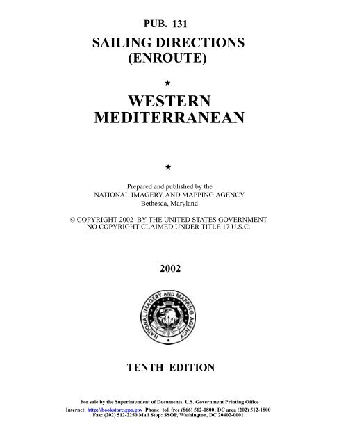
PUB. <strong>131</strong>SAILING DIRECTIONS(ENROUTE)★WESTERNMEDITERRANEAN★Prepared and <strong>pub</strong>lished by theNATIONAL IMAGERY AND MAPPING AGENCYBethesda, Maryland© COPYRIGHT 2002 BY THE UNITED STATES GOVERNMENTNO COPYRIGHT CLAIMED UNDER TITLE 17 U.S.C.2002TENTH EDITIONFor sale by the Superintendent of Documents, U.S. Government Printing OfficeInternet: http://bookstore.gpo.gov Phone: toll free (866) 512-1800; DC area (202) 512-1800Fax: (202) 512-2250 Mail Stop: SSOP, Washington, DC 20402-0001
How to Keep this Book CorrectedAs initially <strong>pub</strong>lished, this book contains material basedupon information available in the National Imagery andMapping Agency through the date given in the preface. The<strong>pub</strong>lication of New Editions will be announced in Notice toMariners. Instructions for ordering the latest Edition will befound in CATP2V01U, Ordering Procedures.In the interval between Editions, information that mayamend material in this book is <strong>pub</strong>lished in the weekly Noticeto Mariners. The Notice to Mariners number and year can alsobe marked on the applicable page of the Sailing Directions.Between Editions, the Record of Corrections Published inWeekly Notice to Mariners, located below, affords analternative system for recording applicable Notice to Marinersnumbers. The Summary of Corrections, Volume 5, contains acumulative list of corrections for Sailing Directions from thedate of <strong>pub</strong>lication. Reference to the Summary of Correctionsshould be made as required.Book owners will be placed on the Notice to Marinersmailing list on request to the DEFENSE LOGISTICSAGENCY, DSC-R, ATTN: Product Center 9, 8000 JeffersonDavis Highway, Richmond VA 23297-5337.Record of CorrectionsPublished in Weekly Notice to MarinersNotice to MarinersYear 20 Year 201............. 14........... 27........... 40........... 1............. 14........... 27........... 40...........2............. 15........... 28........... 41........... 2............. 15........... 28........... 41...........3............. 16........... 29........... 42........... 3............. 16........... 29........... 42...........4............. 17........... 30........... 43........... 4............. 17........... 30........... 43...........5............. 18........... 31........... 44........... 5............. 18........... 31........... 44...........6............. 19........... 32........... 45........... 6............. 19........... 32........... 45...........7............. 20........... 33........... 46........... 7............. 20........... 33........... 46...........8............. 21........... 34........... 47........... 8............. 21........... 34........... 47...........9............. 22........... 35........... 48........... 9............. 22........... 35........... 48...........10........... 23........... 36........... 49........... 10........... 23........... 36........... 49...........11........... 24........... 37........... 50........... 11........... 24........... 37........... 50...........12........... 25........... 38........... 51........... 12........... 25........... 38........... 51...........13........... 26........... 39........... 52........... 13........... 26........... 39........... 52...........Year 20 Year 201............. 14........... 27........... 40........... 1............. 14........... 27........... 40...........2............. 15........... 28........... 41........... 2............. 15........... 28........... 41...........3............. 16........... 29........... 42........... 3............. 16........... 29........... 42...........4............. 17........... 30........... 43........... 4............. 17........... 30........... 43...........5............. 18........... 31........... 44........... 5............. 18........... 31........... 44...........6.............7.............19...........20...........32...........33...........45...........46...........6.............7.............19...........20...........32...........33...........45...........46...........8............. 21........... 34........... 47........... 8............. 21........... 34........... 47...........9............. 22........... 35........... 48........... 9............. 22........... 35........... 48...........10........... 23........... 36........... 49........... 10........... 23........... 36........... 49...........11........... 24........... 37........... 50........... 11........... 24........... 37........... 50...........12........... 25........... 38........... 51........... 12........... 25........... 38........... 51...........13........... 26........... 39........... 52........... 13........... 26........... 39........... 52...........II Pub. <strong>131</strong>
PrefacePub. <strong>131</strong>, Sailing Directions (Enroute) for WesternMediterranean, Tenth Edition, 2002, is issued for use inconjunction with Pub. 140, Sailing Directions (PlanningGuide) North Atlantic Ocean, Baltic Sea, North Sea, and theMediterranean Sea. The companion volume is Pub. 132.This <strong>pub</strong>lication has been corrected to 7 December 2002,including Notice to Mariners No. 49 of 2002.Explanatory RemarksSailing Directions are <strong>pub</strong>lished by the National Imageryand Mapping Agency (NIMA), under the authority ofDepartment of Defense Directive 5105.40, dated 12 December1988, and pursuant to the authority contained in U. S. CodeTitle 10, Sections 2791 and 2792 and Title 44, Section 1336.Sailing Directions, covering the harbors, coasts, and waters ofthe world, provide information that cannot be showngraphically on nautical charts and is not readily availableelsewhere. New Editions of Sailing Directions are correctedthrough the date of the <strong>pub</strong>lications shown in the preface. Inthe period between Editions, important information, whichmay amend material in the <strong>pub</strong>lication, is <strong>pub</strong>lished in theweekly Notice to Mariners.Sailing Directions (Enroute) include detailed coastal andport approach information which supplements the latestrevised print of the largest scale chart for sale by the NationalImagery and Mapping Agency. This <strong>pub</strong>lication is divided intogeographic areas called "Sectors.'' Sector limits are shown on achartlet following the Table of Contents. The standard formatof the Sector is described below.Chart Information.—A graphic key to the largest scalecharts is included for each Sector. The key has a border scalegraduated to help identify by approximate coordinates, the bestscale chart for a place. Refer also to the Index—Gazetteer atthe back of the book.Coastal Winds, Currents, and Ice.—Special graphics thatdepicted coastal winds, weather, tides, currents and ice for theSectors have been removed. General weather information cannow be found within the text.Dangers.—As a rule outer dangers are fully described, butinner dangers which are well-charted are, for the most part,omitted. Numerous offshore dangers, grouped together, arementioned only in general terms. Dangers adjacent to a coastalpassage or fairway are described.Coastal Features.—It is assumed that the majority of shipshave radar. Available coastal descriptions and views, useful forradar and visual piloting are included in geographic sequencein each Sector.Ports.—Directions for entering ports are depicted whereappropriate by means of chartlets, sketches, and photos, whichfacilitate positive identification of landmarks and navigationalaids. These chartlets and sketches are not always to scale,however, and should be used only as a general informationalguide in conjunction with the best scale chart. Specific portfacilities are omitted from the standard format. They aretabulated in Pub. 150, World Port Index.Index—Gazetteer.—Navigational features and place-namesare listed alphabetically in the back of the book. Theapproximate position, along with the Sector and paragraphnumbers (e.g. 1.1), facilitate location in the text. Refer to theChart Information graphic for the Sector, where the largestscale chart showing the feature is depicted.Geographic Names are generally those used by the nationhaving sovereignty. Names in parentheses following anothername are alternate names that may appear on some charts. Ingeneral, alternate names are quoted only in the principaldescription of the place. Diacritical marks, such as accents,cedillas, and circumflexes, which are related to specific lettersin certain foreign languages, are not used in the interest oftypographical simplicity.Geographic names or their spellings do not necessarilyreflect recognition of the political status of an area by theUnited States Government.Soundings are referred to the datum of the charts and areexpressed in meters.Heights are referred to the plane of reference used for thatpurpose on the charts and are expressed in meters.Bearings are true, and are expressed in degrees from 000˚(north) to 360˚, measured clockwise. General bearings areexpressed by initial letters of points of the compass (e.g. N,NNE, NE, etc.). Adjective and adverb endings have beendiscarded. Wherever precise bearings are intended degrees areused.Courses are true, and are expressed in the same manner asbearings. The directives "steer'' and "make good'' a coursemean, without exception, to proceed from a point of originalong a track having the identical meridianal angle as thedesignated course. Vessels following the directives must allowfor every influence tending to cause deviation from such track,and navigate so that the designated course is continuouslybeing made good.Distances are expressed in nautical miles of 1 minute oflatitude. Distances of less than 1 mile are expressed in meters,or tenths of miles.Wind Directions are the true <strong>directions</strong> from which windsblow.Current Directions are the true <strong>directions</strong> toward whichcurrents set.Light and Fog Signals are not described, and light sectorsare not usually defined. The Light Lists should be consulted forcomplete information.Radio Navigational Aids are not described in detail.Publication No. 117 Radio Navigational Aids should beconsulted.Special Warnings.—A Special Warning may be in force forthe geographic area covered by this <strong>pub</strong>lication. SpecialWarnings are printed in the weekly Notice to Mariners uponpromulgation and are reprinted annually in Notice to MarinersNo. 1. A listing of Special Warnings currently in force isprinted in each weekly Notice to Mariners, Section III,Broadcast Warnings, along with the notice number ofpromulgation. In force Special Warnings are also available onthe Maritime Safety Information Division Home Page (http://164.214.12.145/index) under the heading “Broadcast WarningMessages.”Corrective Information.—It is requested that theMARITIME SAFETY INFORMATION DIVISION, ST D 44,NATIONAL IMAGERY AND MAPPING AGENCY, 4600SANGAMORE ROAD, BETHESDA MD 20816-5003, or anyof its branch offices be advised of any inaccuracy found in thisPub. <strong>131</strong> III
<strong>pub</strong>lication or of additional navigational informationconsidered appropriate for insertion. The Sailing DirectionsInformation and Suggestion Sheet on page IX may be used forthis purpose.Imagery and Copyright.—Most of the photographs in this<strong>pub</strong>lication are copyright protected by their rightful owner andmay not be reproduced without their permission. Thephotographs used in this <strong>pub</strong>lication are for illustrativepurposes only and are not to be used or relied upon fornavigational purposes.Reference ListThe principal sources examined in the preparation of this<strong>pub</strong>lication were:British Hydrographic Department Sailing Directions.French Sailing Directions.Italian Sailing Directions.Spanish Sailing Directions.Various port handbooks.Reports from United States naval and merchant vessels andvarious shipping companies.Other U.S. Government <strong>pub</strong>lications, reports, and documents.Charts, light lists, tide and current tables, and other documents in possession of the Agency.IV Pub. <strong>131</strong>


