USACE Presentation from NYSFSMA 2011 - Great Lakes Coastal ...
USACE Presentation from NYSFSMA 2011 - Great Lakes Coastal ...
USACE Presentation from NYSFSMA 2011 - Great Lakes Coastal ...

You also want an ePaper? Increase the reach of your titles
YUMPU automatically turns print PDFs into web optimized ePapers that Google loves.
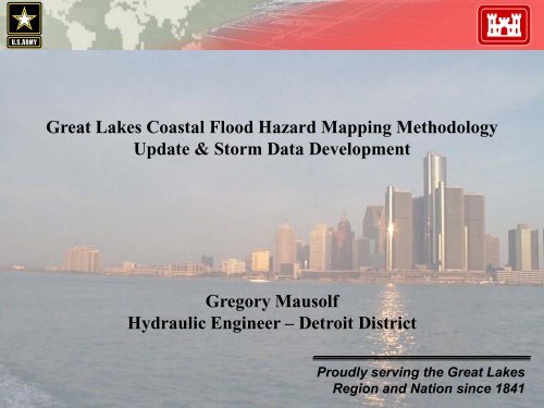
<strong>Great</strong> <strong>Lakes</strong> <strong>Coastal</strong> Flood Hazard Mapping MethodologyUpdate & Storm Data DevelopmentGregory MausolfHydraulic Engineer – Detroit DistrictProudly serving the <strong>Great</strong> <strong>Lakes</strong>Region and Nation since 1841“ Building Strong “ 1
US Army Corps of Engineers<strong>Presentation</strong> Overview• Project Overview• Major Project Events• Key Changes to the Methodology• Pilot Studies• Project Schedule“ Building Strong “ 2
US Army Corps of Engineers<strong>Great</strong> <strong>Lakes</strong> Flood Hazard Mapping(GLFHM)CollaborativeProject Between:FEMA Region 5 (Lead)FEMA Region 2FEMA Region 3Detroit District <strong>USACE</strong>“ Building Strong “ 3
US Army Corps of EngineersMajor Project EventsAugust 1996 – FEMA HQ publishes draft guidance “Wave ElevationDetermination and V-Zone Mapping for the <strong>Great</strong> <strong>Lakes</strong>”January 2005 – Corps hosts a 2-day workshop for the FEMA-Corps update ofAppendix D.3 which was attended by State NFIP and CZM leadsNovember 2008 – FEMA HQ and Baker completes a third version of AppendixD.3 update and asks Corps and FEMA Region 5 to provide forreview and commentAugust 2009 – Corps holds a Stakeholder Workshop with FEMA Regions 2 / 3 /5, State govt. officials, ASFPM, FEMA contractors and otherinterested partiesFebruary 2010 – <strong>USACE</strong> ERDC holds an Executive Committee meeting withFEMA Region 5, Corps, ASFPM, and FEMA contractors“ Building Strong “ 4
US Army Corps of EngineersKey Changes to the Methodology1. Run-up Computations‣ Old method used the 100-year S.W.L. with a 3-year wave height‣ New method uses a response-based analysis approach to run-upcomputations‣ Water levels will be updated <strong>from</strong> the 1988 Open Coast Report.Photo: Timaru Herald“ Building Strong “ 5
US Army Corps of EngineersKey Changes to the Methodology2. New Run-up Methods Available for Structures andRevetments‣ Updated methodologyprovides for the TAWrun-up method at thestructures andrevetments‣ Mean overtopping rates<strong>from</strong> Owen & Godamay be usedPhoto: Timaru Herald“ Building Strong “ 6
US Army Corps of EngineersKey Changes to the Methodology3. New Methods for Overland Wave Propagation‣ Available for Embayments and Sheltered Shoreline Areas‣ Discarding the use of ACES Transitioning to CHAMP‣ WHAFIS and STWAVE together can be better utilized“ Building Strong “ 7
US Army Corps of EngineersKey Changes to the Methodology4. Ice Cover‣ Currently examining multiple methods to include ice cover in waveheight determination, run-up, and overland wave propagationcalculationsPhoto: Lori NiedenfuerPhoto: Michigan Travel Bureau“ Building Strong “ 8
US Army Corps of EngineersGLFHM “Technical” Sub-CommitteeGoal‣ Address V-Zone feasibility within the new <strong>Great</strong> <strong>Lakes</strong> <strong>Coastal</strong> FloodHazard Mapping methodologyObjectives‣ Incorporate the methodology both timely & seamlessly‣ Prioritize the mapping to account for population density and potentialrisks‣ Collect and organize spatial and tabular data to populate analysis forthe GIS Enterprise System Subcommittee“ Building Strong “ 9
US Army Corps of EngineersGLFHM “GIS” Sub-CommitteeGoal‣ Obtain and manage all <strong>Great</strong> <strong>Lakes</strong> <strong>Coastal</strong> Flood Hazard MappingGIS dataObjectives‣ Establish a database architecture to ensure long-term utility for an arrayof datasets‣ Create and implement a quality control protocol for the datasets‣ Enable an innovative data sharing solution with federal/state partnersand regional organizations“ Building Strong “ 10
US Army Corps of EngineersGoalGLFHM “Education and PublicOutreach” Sub-Committee‣ Identify the target audiences and tools in order to communicate thenew <strong>Great</strong> <strong>Lakes</strong> <strong>Coastal</strong> Flood Hazard Mapping methodologyObjectives‣ Establish both a process and framework that will be able tocommunicate the GLFHM process to both technical and non-technicalaudiences‣ Enable proactive tools to educate both the public and stakeholders‣ Utilize existing conferences and/or workshops to facilitate speakers“ Building Strong “ 11
US Army Corps of EngineersGLFHM Pilot StudiesOld Methodology vs. the New Methodology1. Review Old Methodology2. Revise the Old Methodology Study3. Conduct New Methodology Analysis Using Old Datasets4. Perform a Comparison of Old and New Methodology Using the OldDatasets and Assumptions5. Re-create Historical Flood Event“ Building Strong “ 12
US Army Corps of EngineersGLFHM Pilot StudiesData Sensitivity Analysis1. Identify & Compare Datasets that should be used for SensitivityAnalysis Comparing Data Resolution2. Develop Matrix of Comparison3. Conduct Flooding, Run-up & Overland Propagation Elevation Analysis“ Building Strong “ 13
US Army Corps of EngineersGLFHM Pilot StudiesStructure Sensitivity1. <strong>Coastal</strong> Protection Structures will be examined by modeling thestructures parcel by parcel and increased spacing in order to determinewhether or not the high resolution mapping of structures has a largeimpact on the final results2. Comparison of structure stability• Total Loss• Partial Loss• No Loss - Total Stability“ Building Strong “ 14
US Army Corps of EngineersGLFHM Pilot Studies<strong>Coastal</strong> Erosion1. The topic of <strong>Coastal</strong> Erosion as it is explained in the new methodologywill be examined by the contractor2. This topic is discussed in flood mapping arenas, so the results <strong>from</strong> thepilot studies for bluff erosion, dune erosion etc will be helpful infinalizing the methodology3. Perform a sensitivity analysis using SBEACH to determine the effectscoastal erosion may have on the results.“ Building Strong “ 15
US Army Corps of EngineersOblique Image Collection“ Building Strong “ 16
US Army Corps of EngineersLiDAR Collection• LiDAR - Light Detection And Ranging• JALBTCX - Joint Airborne Lidar Bathymetry Technical Center of Expertise“ Building Strong “ 17
US Army Corps of EngineersProject ScheduleJuly 31, 2010 – Oblique Photography Pilot Flight of 20 miles of theLake Michigan ShorelineAugust 23-26, 2010 – FY09 Executive Committee meeting in Chicagowith LRE, FEMA, ERDC, state stakeholders, ASFPM,etc.September 2010 – Oblique Photography full scale collection effortFY 10 – Model the waves and water levels on the <strong>Great</strong> <strong>Lakes</strong>, mapselect counties on Lake MichiganFY 11 – Start full scale map production modeFY 11 & FY 12 – <strong>Great</strong> <strong>Lakes</strong> Basin Wide LiDAR Collection“ Building Strong “ 18
US Army Corpsof EngineersDetroit DistrictThank you for your time!“ Building Strong “ 19
<strong>USACE</strong> C-STORM Surge andWave Database for ExtremeEvents Web ServiceFlood Risk MappingProcess<strong>USACE</strong> ProbabilisticAnalysis ToolsLocal Landscape andStructure DataFEMA MappingContractors<strong>Coastal</strong> Topo/BathyLIDAR Data <strong>from</strong> NOAADigital Coast Web Service<strong>USACE</strong> Web Service forOblique Aerial PhotosWave Run-Up/Overtopping/Erosion AnalysesWHAFIS Overland Wave and Water Level AnalysesDetailed Local-Scale Inundation Modelingof Critical AreasFlood Risk Map ProductionMap Delivery viaFEMA MappingInformation Platform(MIP)“ Building Strong “
Step 1.Define MajorHistorical Storms,1960-presentExtreme Event StormSurge and WaveModelingNOAA GLERLBathymetryHigh ResolutionDetailed GridMeshesStep 2.Set Up and Validate Surgeand Wave Models at theRegional Scale; Apply ModelCoupling as NeededModel InputStep 3.Apply Models for Each MajorHistorical Storm; Applied atSynoptic Lake LevelStep 4. ArchiveModeled Storm DataIce andWind/PressureFields UsingNOAATechniquesStorm Surge (ADCIRC) and Wave(WAM) Modeling on Regional Domain“ Building Strong “C-STORM <strong>Coastal</strong>StormDatabase