2013 Virginia Freshwater Fishing & Watercraft Owner's Guide
2013 Virginia Freshwater Fishing & Watercraft Owner's Guide
2013 Virginia Freshwater Fishing & Watercraft Owner's Guide

You also want an ePaper? Increase the reach of your titles
YUMPU automatically turns print PDFs into web optimized ePapers that Google loves.
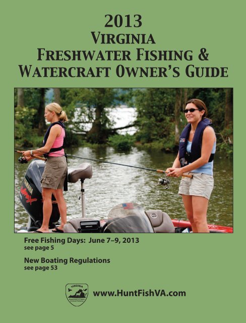
<strong>2013</strong> <strong>Fishing</strong> Regs & WOG 11-15-12_Layout 1 11/16/12 1:01 PM Page 1<strong>2013</strong><strong>Virginia</strong><strong>Freshwater</strong> <strong>Fishing</strong> &<strong>Watercraft</strong> Owner’s <strong>Guide</strong>Free <strong>Fishing</strong> Days: June 7–9, <strong>2013</strong>see page 5New Boating Regulationssee page 53www.HuntFishVA.com
<strong>2013</strong> <strong>Fishing</strong> Regs & WOG 11-15-12_Layout 1 11/16/12 1:01 PM Page 4Message from theExecutive Directorerving the public sinceS1916, the <strong>Virginia</strong>Department of Game andInland Fisheries workshard to conserve andmaintain optimum populationsof inland fisheriesacross the state. We annuallystock over 1.2 milliontrout into 600 miles oftrout streams and raise asmany as 15 million warmwater fish to stock in otherlakes and rivers. The Department owns and operates38 public fishing lakes and manages the fisheries in virtuallyall major fresh waters of the state. That’s over177,000 acres in lakes and ponds, over 25,000 miles offishable warmwater streams and rivers, and over 2,300miles of trout waters. In order to provide access tothese waters, the Department operates and maintains219 launching ramps.The year 2012 was one for the history books as<strong>Virginia</strong> anglers took to these waters! Three staterecords were broken, as follows: a 4 lb. 7 oz. spottedbass, taken by Rod Kegley in Claytor Lake; a 3 lb. 20 oz.white perch, taken by Beau McLaughlin in a privatepond; and a 26 lb. 8 oz. freshwater drum, taken byNancy Cash in Buggs Island Lake.<strong>Fishing</strong> and boating often go hand in hand, andserving <strong>Virginia</strong>’s 250,000 recreational boaters remainsa top priority. The Department works hard to ensureboating is a safe and enjoyable activity through educationand enforcement efforts.All of this work is paid for by anglers, boaters, andwildlife supporters. In fact, the Department receivesthe vast majority of its funds from fishing and huntinglicenses, and from boat titling and registration fees. Inaddition, the Federal Sport Fish and Wildlife Restorationfund, which generates needed dollars from a federalexcise tax on hunting and fishing equipment aswell as motor boat fuel, helps support the Department’swildlife management efforts.Here’s wishing you a terrific fishing and boatingseason in <strong>2013</strong>!Bob DuncanExecutive Directorwww.dgif.virginia.gov/plates/Richmond Headquarters4010 W. Broad St., P.O. Box 11104, Richmond, VA 23230-1104(804) 367-1000; (804) 367-1278 V/TDDCustomer Service: 866-721-6911, during normal business hoursReport Violations: 1-800-237-5712Regional OfficesCharles City3801 John Tyler Memorial Hwy.Charles City, VA 23030(804) 829-6580Forest1132 Thomas Jefferson RoadForest, VA 24551-9223(434) 525-7522Marion1796 Highway SixteenMarion, VA 24354(276) 783-4860LEEWISESCOTTDICKENSONBUCHANANRUSSELL3WASHINGTONTAZEWELLSMYTHBLANDWYTHEGRAYSONGILESPULASKICARROLLMONTGOMERYFLOYDCRAIGROANOKEPATRICKALLEGHANYVeronaP.O. Box 96, 517 Lee HighwayVerona, VA 24482(540) 248-9360Fredericksburg1320 Belman RoadFredericksburg, VA 22401(540) 899-4169BATHBOTETOURTFRANKLINHENRYHIGHLANDROCKBRIDGEBEDFORDAUGUSTAAMHERST2PITTSYLVANIAROCKINGHAMNELSONCAMPBELLAPPOMATTOXHALIFAXSHENANDOAHPAGEGREENEFREDERICKWARRENCLARKERAPPAHANNOCKMADISONALBEMARLEBUCKINGHAMPRINCEEDWARDCHARLOTTEFLUVANNACUMBERLANDORANGELUNENBURGMECKLENBURG4CULPEPERLOUDOUNFAUQUIERLOUISAGOOCHLANDAMELIANOTTOWAYFAIRFAXPRINCE WILLIAMSTAFFORDSPOTSYLVANIAPOWHATANKINGGEORGECAROLINEHANOVERCHESTERFIELDDINWIDDIEBRUNSWICKHENRICOGREENSVILLEKING WILLIAMPRINCEGEORGESUSSEXCHARLESCITYARLINGTONWESTMORELANDKING AND QUEENNEWKENTJAMESCITYSURRYSOUTHAMPTONAdditional ContactsCustomer Service: 866-721-6911Trout Stocking: 434-525-3474Snakehead Fish Reporting: 804-367-2925Potomac River Fisheries Commission: 800-266-3904Dept. of Environmental Quality: 800-592-5482<strong>Virginia</strong> Marine Resources Commission; Saltwater <strong>Fishing</strong>/Regulations:757-247-2200; 757-247-2292 VTDD; www.mrc.state.va.usState Parks: 800-933-7275Shenandoah National Park: 540-999-3500George Washington/Jefferson National Forests: 540-265-5100ESSEXRICHMONDMIDDLESEXGLOUCESTERYORKISLE OFWIGHTLANCASTERSUFFOLKNORTHUMBERLANDMATHEWS1NEWPORTNEWSVIRGINIABEACHCHESAPEAKE<strong>Virginia</strong>’s Sport Fish Programand YouNORTHAMPTONHAMPTONPORTSMOUTHNORFOLKAnglers like you make it possible for <strong>Virginia</strong> to enjoy exceptionalfishing and boating opportunities. Through theFederal Aid in Sport Fish Restoration Program, you helpthe <strong>Virginia</strong> Department of Game and Inland Fisheries and <strong>Virginia</strong> MarineResources Commission make fishing and boating even better each time youbuy a fishing reel, fishing lure, trolling motor, or gas for your boat because aportion of the federal tax goes to the Sport Fish Restoration Program.<strong>Virginia</strong> annually receives about $5.4 million of that money, which pays75% of many of the fish management and boat access projects to improveyour angling pleasure.www.wsfr75.comACCOMACK4
<strong>2013</strong> <strong>Fishing</strong> Regs & WOG 11-15-12_Layout 1 11/16/12 1:01 PM Page 6• Any Indian who “habitually” resides on an Indian reservationor a member of the <strong>Virginia</strong> recognized tribes whoresides in the Commonwealth is not required to have afreshwater license; however, such Indian must have on hisperson an identification card or paper signed by the chiefof his tribe, a valid tribal identification card, written confirmationthrough a central tribal registry, or certificationfrom a tribal office. However, a saltwater fishing license isrequired.• Stockholders owning 50 percent or more of the stock ofany domestic corporation owning land in <strong>Virginia</strong>, his orher spouse and children and minor grandchildren, residentor nonresident, to hunt, trap and fish within theboundaries of lands and inlands waters owned by thedomestic corporation.• Persons 65 years of age or older do not need a saltwaterlicense.• Any person not fishing but aiding a disabled license holder.Legacy <strong>Fishing</strong> or Hunting Licenses• Issued only to an individual who is younger than two yearsof age and is valid for the lifetime of the license holder regardlessof any change in that person’s status as a residentor nonresident.• Legacy hunting license is valid until the individual’s twelfthbirthday. Upon proof of completion of a hunter educationcourse or equivalent, this license is transferable to a lifetimehunting license at no additional charge.• The Legacy fishing or hunting license is available by applicationthrough the Richmond office or by mail. The cost is$125 for resident children and $250 for nonresident children.Lifetime LicensesResident and nonresident lifetime licenses are purchased byan application and require supporting documentation of age,residency and/or disability. They are issued only through theRichmond office. Retail license agents cannot issue theselicenses. Applications can be submitted in person at the Richmondoffice or mailed in. License applications can be obtainedby calling customer service at 1-866-721-6911 or found on theDepartment’s website at www.HuntFishVA.com.Replacement LicenseIf you purchased a license from a retail license agent, such asa sporting goods store, you can request a replacement at anyretail license agent.If you purchased a license online, by phone, by mail, orfrom the Richmond office you will need to request a replacementfrom customer service at 1-866-721-6911.Tidal Boat LicenseThe tidal boat license is a new type of boat license that becameavailable 7/1/11. This entitles a registered boat ownerlisted as the licensee to an individual fishing license valid forALL <strong>Virginia</strong> freshwater and saltwater, which would includefishing from shore. In addition, when the boat owner/licenseeis aboard any of their own registered boats while fishing in<strong>Virginia</strong> tidal waters only, they and their passengers may fishwithout additional license (unlicensed passengers do howeverhave to comply with FIP registration requirements).Where to Obtain a License✦ Online: www.HuntFishVA.com. Select the license(s),pay with your VISA or MasterCard, and print yourlicense(s) after you pay.✦ In Person: Sold by some clerks of the Circuit Court andhundreds of sporting goods stores around the state.✦ By Phone: Customer Service 1-866-721-6911,during regular business hours.License Fees The issuance fee is included in the prices below.<strong>Fishing</strong> licenses are valid for one year from the date of purchase.RESIDENT FEESSportsman’s License (16 years or older).............................$133.00Includes hunting license, bear deer turkey license (valid July 1–June 30), archery license,crossbow license, muzzleloader license,freshwater fishing license and trout licenseCounty/City Resident <strong>Freshwater</strong> <strong>Fishing</strong>* .........................$16.00(For county or city of residence only)Resident State <strong>Freshwater</strong> <strong>Fishing</strong> * ...................................$23.00Resident State Fresh/Saltwater <strong>Fishing</strong>* ............................$40.00South Holston Reservoir <strong>Fishing</strong> License ............................$21.00(Allows fishing in both Tennessee and <strong>Virginia</strong> waters ofSouth Holston Reservoir)Resident 5-Day <strong>Freshwater</strong> <strong>Fishing</strong> ....................................$14.00(5 consecutive days) Not valid in designated stocked trout watersResident 5-Day Fresh/Saltwater <strong>Fishing</strong> .............................$24.00(5 consecutive days) Not valid in designated stocked trout watersResident Tidal Boat Sport <strong>Fishing</strong> (see page 6) ..................$126.00Resident 65 and over annual <strong>Freshwater</strong> <strong>Fishing</strong>* ................$9.00Resident Trout <strong>Fishing</strong> (October 1–June 15) ........................$23.00Required in addition to other resident licenses if fishing instocked waters.Resident Legacy Lifetime <strong>Freshwater</strong> <strong>Fishing</strong> License ........$125.00Must be purchased before age 2. See page 6 for more details.Mail in application available through the Richmond Office.Resident Lifetime <strong>Freshwater</strong> Fish * (A valid trout fishing license isalso required to fish in stocked trout waters.)or Resident Lifetime Trout <strong>Fishing</strong> (A valid resident fishing licenseis also required.)Mail in application available through the Richmond Office.Age up to age 44 ............................................................$260.00Age 45-50......................................................................$210.00Age 51-55......................................................................$160.00Age 56-60......................................................................$110.00Age 61-64........................................................................$60.00Age 65 and over...............................................................$20.00* A valid trout license (annual or lifetime) is required in addition toother resident licenses only if you are fishing in designated stockedtrout waters (October 1–June 15).6
Service-connected Totally and Permanently Disabled VeteranResident Lifetime License*...................................................$0.00To hunt and freshwater fish.Mail in application available through the Richmond Office.Totally and Permanently Disabled Resident Special LifetimeLicense to freshwater fish *...................................................$0.00Mail in application available through the Richmond Office.NONRESIDENT FEENonresident State <strong>Freshwater</strong> <strong>Fishing</strong> ** ..........................$47.00Nonresident State Fresh/Saltwater <strong>Fishing</strong>** ....................$71.00Nonresident 5 Day <strong>Freshwater</strong> <strong>Fishing</strong> ..............................$21.00(5 consecutive days)Nonresident 5-Day Fresh/Saltwater <strong>Fishing</strong>**....................$31.00(5 consecutive days)Nonresident Tidal Boat Sport <strong>Fishing</strong> (see page 6) ............$201.00Nonresident Trout <strong>Fishing</strong> (October 1–June 15) ..................$47.00Required in addition to other nonresident licenses if fishingin stocked watersNonresident Legacy Lifetime <strong>Freshwater</strong> <strong>Fishing</strong> License ..$250.00Must be purchased before age 2. See page 6 for more details.Mail in application available through the Richmond Office.Nonresident Lifetime <strong>Freshwater</strong> <strong>Fishing</strong>** ....................$555.00Mail in application available through the Richmond Office.Nonresident Lifetime Trout <strong>Fishing</strong> ..................................$555.00To fish in designated stocked trout waters A valid nonresidentfishing license is also required; (Mail in application availablethrough the Richmond Office).** A valid nonresident trout license ($47.00 annual or $555.00 lifetime)is required in addition to other nonresident licenses only if youare fishing in designated stocked trout waters (October 1–June 15).Nonresident tidal boat licensees are not required to havetheir boats registered in <strong>Virginia</strong> to qualify to purchase thislicense.National Forest PermitAll persons required to have a license (except holders of aresident 65 and older license) are required to have a NationalForest Permit when fishing on National Forest lands exceptthe North and South Fork of the Shenandoah River, theJames River, Skidmore Lake in Rockingham County, NorthFork Pound Reservoir, Lake Moomaw, the Jackson Riverbelow Gathright Dam, and in Wilson Creek below DouthatLake in Alleghany and Bath counties.State Forest Use PermitRequired for those persons aged 16 or older to practice thefollowing activities on a state forest: hunting, trapping, fishing,mountain biking, and horse riding. No motorizedvehicles on gated roads/trails (open or closed). The ForestUse Permit is not required for forest visitors who practice thefollowing activities on a state forest: walking, hiking, or boating.Sold in cooperation with the <strong>Virginia</strong> Department ofForestry.Facility Access PermitAs of January 1, 2012, a Facility Access Permit is requiredwhen using any Department-owned Wildlife ManagementArea or <strong>Fishing</strong> Lake. Such permit shall not be required forany person holding a valid hunting, fishing or trapping licenseor a current certificate of boat registration issued by theDepartment or persons 16 years of age or younger. The FacilityAccess Permit requirement does not apply to Departmentownedboat ramps or segments of the Appalachian Trail onDepartment-owned land. The permit fee is $4 for a dailypermit or $23 for an annual permit and may be purchasedonline or at any license agent.MISCELLANEOUS FEESDaily Permit Required at Clinch Mountain, Crooked Creek,and Douthat State Park Fee <strong>Fishing</strong> Areas ............................$9.00Required in addition to regular resident, resident 5 day license,nonresident, or nonresident 5 day license. See page 25.National Forest Permit .........................................................$4.00For fishing in the National Forest. This permit is required inaddition to other fishing licenses [exceptions: residents 65or older and complementary licenses].Valid for one year from date of purchase.<strong>Virginia</strong> State Forest Use Permit .........................................$16.00Allows hunting, trapping, fishing, mountain biking, and horse riding.No motorized vehicles on gated roads/trails (open or closed). Sold incooperation with the <strong>Virginia</strong> Department of Forestry.Facility Access Permit.....................$4.00 per day or 23.00 per yearSee page 7 for more informationCounty Dip Net Permit .........................................................$4.50To take shad, herring, and mullet.River herring and American shad may not be harvested fromtidal waters.7
<strong>2013</strong> <strong>Fishing</strong> Regs & WOG 11-15-12_Layout 1 11/16/12 1:01 PM Page 9Potomac (call 1-804-224-7148 or 1-800-266-3904 for current PRFC regulations).Waters between the Woodrow WilsonBridge and Little Falls are controlled by D.C.,and a D.C. fishing license is required.General <strong>Freshwater</strong><strong>Fishing</strong> Regulations• <strong>Fishing</strong> in inland waters must be by anglingwith a hook and line or rod and reel.(See exceptions for nongame fish.)• A hand landing net may be used to landfish legally hooked in all waters.• Any person who fishes on another’sproperty must have the landowner’s permissionto do so except on designatedstocked trout waters along which signshave been placed indicating that thewaters are open to public fishing.• No species of fish, freshwater mussel ormollusk may be taken in inland waters tobe sold, except under special permitsprovided by law.• It is unlawful to use lime, dynamite, orany other substances to destroy fish, orto cast or allow noxious matter to passinto watercourses that might destroy fishor fish spawn, or to deposit trash instreams or lakes or along their banks.• It is illegal to use SCUBA (Self-containedUnderwater Breathing Apparatus) gearto take or attempt to take fish.• It is unlawful to have more than the dailycreel limit of any fish in possession whileafield or on the waters. The daily creellimit includes live possession of fish.• It shall be unlawful for any person, whilefishing, to remove the head or tail orotherwise change the appearance of anygame fish (except bluegill sunfish andbream of the sunfish family) having adaily creel or size limit so as to obscure itsspecies or render it impracticable tomeasure its total original length or countthe number of such fish in possession. Inaddition, it shall be unlawful for any personto possess or transport such alteredgame fish while on the water. However,the prohibition against possession andtransportation in the previous sentenceshall not apply to the preparation of lawfullyobtained fish for immediate use asfood or any lawful commercial use ofsuch fish.• It is unlawful to take, kill, capture, orpossess any threatened or endangeredspecies.South Holston ReservoirAny person possessing a valid Tennessee or <strong>Virginia</strong> resident freshwater fishing license,or who is legally exempt from those license requirements, and possessing the SouthHolston Reservoir License may fish in the Tennessee and <strong>Virginia</strong> impounded waters ofSouth Holston Reservoir. <strong>Virginia</strong> residents fishing in South Holston Lake in TN musthave a <strong>Virginia</strong> resident license and South Holston Reservoir Permit (or Tennesseenonresident fishing license); under the age of 13—no license or permit required. Theannual cost of the South Holston License is currently $21. The South Holston License isvalid in all impounded portions of the reservoir below full pool elevation of 1,730 feet,including the confluence of the Middle Fork and South Fork Holston rivers and the SouthFork Holston River upstream to the Route 710 Bridge at Alvarado, VA. The South HolstonLicense is not valid for possession of trout.A valid resident Tennessee trout fishing license or a valid resident <strong>Virginia</strong> troutfishing license is required to fish for trout and to possess trout on South HolstonReservoir. All anglers shall abide by the laws of the state in which they are fishing as tomanner and means of taking fish. Size restrictions and creel limits shall be as follows:Species Restrictions Creel (Harvest) LimitBlack bass No smallmouth less than 15 inches 5 per daySpotted bass15 per dayWalleye No walleye less than 18 inches 5 per dayCrappie No crappie less than 10 inches 15 per dayTrout No minimum size–only 2 lake trout per day 7 per dayWhite bass No harvest–all White bass must be releasedCatfish Only 1 catfish over 34 inches 20 per dayBluegill No miminum size 50 per dayRock bass No minimum size 20 per dayTrotlines* 100 hooks per anglerJugs*50 per anglerLimb-lines*15 per angler*All trotlines, limb-lines, and jugs must be tagged with angler’s name/address orlicense number.<strong>Virginia</strong> Game Fish“Game fish” as defined by the Code of<strong>Virginia</strong> means and includes trout, all of thesunfish family (including largemouth bass,smallmouth bass, spotted bass, rock bass,bream, bluegill and crappie), walleye, whitebass, chain pickerel, muskellunge, northernpike, and striped bass.Stocking FishIt is unlawful to stock any species of fish intoinland waters of the Commonwealth withoutfirst obtaining written approval from theDepartment (private ponds excepted).It is unlawful to fish on watersof any public or private club,association, or preservewithout a proper license.Trout as BaitArtificially raised rainbow trout may be soldas bait for use in the James and New rivers,and in impoundments (ponds, lakes, reservoirs),except impoundments listed as designatedstocked trout waters, Lake Moomaw,and Philpott Reservoir. Persons possessingpurchased rainbow trout for bait must havea valid invoice or bill of sale, specifying dateof purchase, the number of trout purchased,and name of an individual or businesspermitted to sell trout.www.fishvirginiafirst.com/www.HuntFishVA.com 9
<strong>2013</strong> <strong>Fishing</strong> Regs & WOG 11-15-12_Layout 1 11/16/12 1:01 PM Page 10Dam RegulationsBuggs Island: Mechanical lure launchersmay not be used within 600 yards belowBuggs Island Dam.Walkers Dam: Only rod and reel and handlines permitted within 500 yards below dam.It is illegal to snag fish at Walkers Dam.Leesville Dam: It shall be unlawful to fish, attemptto fish, assist others in fishing, collector attempt to collect bait while wading, oroperating, or anchoring any vessel in thewaters of the Roanoke River from LeesvilleDam downstream 840 feet to a permanentoverhead cable. However, fishing is permittedfrom behind safety railings of the Department’sLeesville Dam fishing structure.Fishways: It shall be unlawful to fish or tocollect bait from March 1 through June 15within 300 feet of Boshers Dam Fishway onthe north bank of the James River or within150 feet of Harvell Dam Fishway on thesouth bank of the Appomattox River.Department-Owned orControlled Lakes, Ponds,Streams or Boat Access SitesA. Motors and boats. Unless otherwiseposted, the use of boats propelled by gasolinemotors, sail, or mechanically operatedpaddle wheel is prohibited at Departmentownedor controlled lakes, ponds, orstreams.B. Method of fishing. Taking any fish at anyDepartment-owned or controlled lake,pond, or stream by any means other than byuse of one or more attended poles with2012 Kids n’ <strong>Fishing</strong> ContestCatch theExcitement!Kids ’n <strong>Fishing</strong> PhotoContestwww.HuntFishVA.comhook and line attached is prohibited unlessotherwise posted, in which case cast netsmay be used for collecting nongame fish foruse as bait.C. Hours for fishing. <strong>Fishing</strong> is permitted24 hours a day unless otherwise posted atDepartment-owned or controlled lakes,ponds, streams, or boat access sites.D. Seasons, hours and methods of fishing,size and creel limits, hunting. The openseasons for fishing, as well as fishing hours,methods of taking fish, and the size, possessionand creel limits, and hunting andtrapping on Department-owned or Department-controlledlakes, ponds, streams orboat access sites shall conform to the regulationsof the board unless otherwise exceptedby posted rules by the director or hisdesignee. Such posted rules shall be displayedat each lake, pond, stream or boataccess site, in which case the posted rulesshall be in effect. Failure to comply withposted rules concerning seasons, hours,methods of taking, bag limits, and size,possession and creel limits shall constitute aviolation of this regulationE. Other uses. Camping overnight or buildingfires (except in developed and designatedareas), swimming, or wading inDepartment-owned or Department-controlledlakes, ponds, or streams (except byanglers, hunters, and trappers actively engagedin fishing, hunting, or trapping), is prohibited.All other uses shall conform to theregulations of the board unless excepted byposted rules.F. <strong>Fishing</strong> tournaments, etc. It shall beunlawful to organize, conduct, supervise, orsolicit entries for fishing tournaments,rodeos, or other fishing events on lakes,ponds, or streams owned by the Departmentfor which prizes are offered, awardedor accepted based on size or numbers of fishcaught, either in money or other valuableconsiderations. This will not prohibit eventsapproved by the Department which are intendedto promote youth fishing or provideinstruction, provided no prizes, as definedabove, are awarded and no participationfees are charged.Special RegulationsLick, Bear, and Laurel CreeksIt shall be unlawful to use fish as bait or touse seines, nets, or traps to take fish in LickCreek in Smyth and Bland counties, BearCreek in Smyth County, and Laurel Creek inTazewell and Bland counties.Angling EducationProgram<strong>Fishing</strong> is such an exciting sport, onethat can be enjoyed by all. Yet there areso many who have never experiencedthe thrill of catching a fish! One of thegreat things about angling is that thereare no restrictions to participants,regardless of age, gender, or ability.Anyone can enjoy fishing and the outdoors.The VDGIF Angling EducationProgram offers angling workshopsthroughout the year covering a widevariety of species and techniques andare designed for beginners or experiencedanglers. Visit the “UpcomingEvents” page of the VDGIF website formore information and to register for aworkshop.The Angling Education Program alsooffers the Materials Request Programto provide educational fishing materialsfor events. The Tackle Loaner Programsupplies rods, reels and tackle on loanfor individuals and events. To obtain aMaterials Request form and locate aTackle Loaner site near you, go to theVDGIF website and click on “<strong>Fishing</strong>”and then “<strong>Fishing</strong> Education.”RecycleYour<strong>Fishing</strong>Line!Look for thesecontainers atboat rampsand marinas.Lee Walker10 <strong>2013</strong> <strong>Virginia</strong> <strong>Freshwater</strong> <strong>Fishing</strong> & Boating <strong>Guide</strong>
<strong>2013</strong> <strong>Fishing</strong> Regs & WOG 11-15-12_Layout 1 11/16/12 1:01 PM Page 11Game/Sport FishRegulationsSeasonsThere is a continuous, year-round season forall freshwater game and nongame fish, withthe following exceptions:1. Special times and limited closures fortrout (Designated Stocked Trout Waterspage 18, Trout Heritage Waters page 19,Urban Program Waters page 19, BlueRidge Parkway page 19, and Fee <strong>Fishing</strong>trout waters page 25); and2. Certain seasons for special methods totake nongame fish pages 27–28.Regulations for anadromous (coastal)striped bass, alewife and blueback herringabove and below the fall line, in tidal riversof the Chesapeake Bay; and anadromous(coastal) American shad and hickory shad,and all other saltwater fish below the fallline, in tidal rivers of the Chesapeake Bay,are set by the <strong>Virginia</strong> Marine ResourcesCommission. For more information call757-247-2200.Catch-And-Release <strong>Fishing</strong>It is often necessary to release a fish becauseit is too small, illegal to keep, or you justdon’t want to take it home to eat. In somecases, releasing fish unharmed is a conservationmeasure that will assist in helping tomaintain and build population abundanceand size. The Department of Game andInland Fisheries encourages anglers whopractice catch and release fishing to use afew simple precautions when doing so.Using the tips below will help to assure thatthe fish you release will survive to bite againanother day.✔ When catching a fish, play it quickly andkeep the fish in the water as much aspossible while handling. Avoid the use ofa net in landing the fish and release itquickly to avoid exhaustion.✔ Handle the fish gently and as little as possible.Do not put your fingers in its eyesor gills. Avoid wiping the slime or scalesoff the fish; this reduces their survival bymaking them more susceptible todisease or infection.✔ Remove hook promptly usingneedlenose pliers or a “hook out”device. If the hook is too deep or hookedin the stomach or throat, cut the lineand leave the hook in. The hook willdissolve without harming the fish.✔ Carefully revive the fish if it appearsexhausted by holding it upright andmoving it gently forward so water runsover the gills. Release the fish when itbegins to struggle and is able to swim.✔ Do not hold fish in a live well and laterdecide to release it. If you are going torelease a fish, do so right away.✔ With a little care and by following theguidelines set above, you can give releasedfish a better chance of survival.✔ See the “Qualifying a Trophy Fish byLength and Photo” option for TrophyFish Awards on page 49.We’re working hardto find you a placeto hunt and fish!The Wildlife Foundation of <strong>Virginia</strong> is anon-profit organization, dedicated to theconservation, protection, and enhancementof the wildlife and habitat resourcesthroughout the Commonwealth of <strong>Virginia</strong>.For more information on how you canhelp us ensure <strong>Virginia</strong>ns will always havea place to hunt and fish, contact us:Jenny West, Executive Directorjwest@vawildlife.org, 757-566-4000www.vawildlife.orgSubscribe to <strong>Virginia</strong> Wildlife Magazineannual subscription – $12.95Name____________________________________please printAddress __________________________________City_________________ State ____ Zip ________Make checks payable to the: Treasurer of <strong>Virginia</strong>Send orders to: <strong>Virginia</strong> Wildlife Magazine, Department of Gameand Inland Fisheries, P.O. Box 11104, Richmond, VA 23230orcall 1-800-710-9369 and mention code J13HFOur boating page, “On The Water,” appears seasonallyin the magazine and offers great tips on maintenanceand boating safety.www.HuntFishVA.com 11
<strong>2013</strong> <strong>Fishing</strong> Regs & WOG 11-15-12_Layout 1 11/16/12 1:01 PM Page 12The tables that follow give statewide creel (harvest) and length limits for major sport fish, and exceptions for major rivers andlakes. Regulations for many smaller lakes and boat access areas are posted on site, and posted regulations are in effect (see “D”under Department Owned or Controlled Lakes, Ponds, Streams or Boat Access Sites, page 10).Sub-type or Creel and Creel or Length LimitsType of Fish Locations Length Limit Geographic Exceptions for ExceptionsBass:LAKESlargemouth 5 per day in the Briery Creek Lake No bass 16 to 24 inches, onlysmallmouth aggregate (combined) 1 per day longer than 24 inchesspottedNo statewide Buggs Island (Kerr) Only 2 of 5 bass less thancontinued on length limits 14 inchespage 13Claytor LakeNo bass less than 12 inchesFlannagan ReservoirLake GastonLeesville ReservoirLake MoomawPhilpott ReservoirQuantico Marine Base watersSmith Mt. Lake and its tributaries belowNiagara DamSouth Holston ReservoirRIVERSClinch River–within the boundaries ofScott, Wise, Russell or Tazewell countiesNo bass less than 12 inchesOnly 2 of 5 bass less than14 inchesOnly 2 of 5 bass less than14 inchesNo bass less than 12 inchesNo bass less than 12 inchesNo bass 12 to 15 inchesOnly 2 of 5 bass less than14 inchesNo smallmouth less than 15 inches15 spotted bass per dayNo bass 11 to 14 inchesHow to Measure a FishTotal Length• Lay the fish on top of or beside a flat measuring rule.• Do not lay the rule over the curvature of the fish’s body.• Close the fish’s mouth and squeeze the tail lobes together.• Measure from the tip of the snout to the end of the tail.Dan River and tributaries downstreamfrom the Union Street Dam, DanvilleOnly 2 of 5 bass less than14 inchesJames River–Confluence of the Jacksonand Cowpasture rivers (Botetourt No bass 14 to 22 inches, only 1County) downstream to theper day longer than 22 inchesthe 14th Street Bridge in RichmondNew River–Fields Dam (Grayson County) No bass 14 to 20 inches, only 1downstream to the VA-WV State line per day longer than 20 inchesand its tributary Little River downstreamfrom Little River Dam in MontgomeryCounty (This does not include ClaytorLake which is delineated as: the upperend of the island at Allisonia downstreamto the Dam.)North Fork Holston River– Rt. 91 Bridgeupstream of Saltville, Va downstream tothe VA–TN state lineNo bass less than 20 inches,only 1 per day longer than20 inches12
<strong>2013</strong> <strong>Fishing</strong> Regs & WOG 11-15-12_Layout 1 11/16/12 1:01 PM Page 13Sub-type or Creel and Creel or Length LimitsType of Fish Locations Length Limit Geographic Exceptions for ExceptionsBassRivers continuedlargemouth North Fork Shenandoah River- No bass 11 to 14 inchessmallmouthRt. 42 bridge, Rockingham Co.spotteddownstream to the confluencewith S. Fork Shenandoah atFront RoyalPotomac River - <strong>Virginia</strong> tidalNo bass less than 15 inchestributaries above Rt. 301 bridge from March 1 through June 15Roanoke (Staunton) River–andits tributaries below DifficultCreek, Charlotte CountyShenandoah River–Confluence of South Fork andNorth Fork rivers, Front Royal,downstream to the WarrenDam, near Front RoyalOnly 2 of 5 bass less than14 inchesNo bass 11 to 14 inchesBase of Warren Dam, near No bass 14 to 20 inches, only 1Front Royal downstream toper day longer than 20 inchesRt. 17/50 bridgeRt. 17/50 bridge downstreamVA–WV state lineSouth Fork Shenandoah River–Confluence of North and Southrivers, below Port Republic,downstream to ShenandoahDam, near Town of ShenandoahNo bass 11 to 14 inchesNo bass 11 to 14 inchesBase of Shenandoah Dam, near No bass 14 to 20 inches, only 1Town of Shenandoah, down-per day longer than 20 inchesstream to Luray Dam, near LurayBase of Luray Dam, near Luray,downstream to the confluencewith North Fork of Shenandoah,Front RoyalNo bass 11 to 14 inchesStaunton River–Leesville Dam No smallmouth bass less than 20(Campbell County) downstream to the inches, only 1 per day longer thanmouth of Difficult Creek, Charlotte Cty. 20 inchesStriped bass landlocked striped 4 per day in the Buggs Island (Kerr) Reservoir October 1–May 31: 2 per daybass and landlocked aggregate including the Staunton River in the aggregate (combined)continued on striped bass X white to Leesville Dam and the Dan No striped bass or hybridpage 14 bass hybrids no fish less than River to the Union Street Dam striped bass less than 24 inches20 inches (Danville)June 1–September 30: 4 perday in the aggregate (combined)No length limit.www.HuntFishVA.com 13
<strong>2013</strong> <strong>Fishing</strong> Regs & WOG 11-15-12_Layout 1 11/16/12 1:01 PM Page 14Sub-type or Creel and Creel or Length LimitsType of Fish Locations Length Limit Geographic Exceptions for ExceptionsStriped bass Lake Gaston 4 per day in the aggregatecontinued(combined)October 1–May 31: Nostriped bass or hybrid stripedbass less than 20 inchesJune 1–September 30:No length limitSmith Mountain Lake and itstributaries, including theRoanoke River upstream toNiagara Dam2 per day in the aggregate(combined)November 1–May 31: Nostriped bass 26 to 36 inchesJune 1–October 31:No length limitAnadromous (coastal)striped bass above thefall line in all coastalrivers of the ChesapeakeBayStriped bass in theMeherrin, Nottoway,Blackwater (ChowanDrainage), NorthLanding and Northwestrivers and theirtributaries plusBack BayCreel and lengthlimits shall be as setby the <strong>Virginia</strong>Marined ResourcesCommission forrecreational fishingin tidal waters2 per dayNo striped bassless than 18 inchesWhite bass 5 per day South Holston Reservoir No harvest or possession(catch and release only)No statewidelength limitsWalleye 5 per day New River upstream of Buck Dam No walleye less than 20 inchesin Carroll CountyNo walleye less than Claytor Lake and the New River February 1–May 31:18 inches upstream of Claytor Lake Dam 2 walleye per day; no walleyeto Buck Dam in Carroll County 19 to 28 inchesJune 1–January 31:5 walleye per day; no walleyeless than 20 inchesSauger2 per dayNo statewidelength limits14
<strong>2013</strong> <strong>Fishing</strong> Regs & WOG 11-15-12_Layout 1 11/16/12 1:01 PM Page 15Sub-type or Creel and Creel or Length LimitsType of Fish Locations Length Limit Geographic Exceptions for ExceptionsChain pickerel 5 per day Gaston and Buggs Island No daily limit(Kerr) reservoirsNo statewidelength limitsNorthern pike2 per dayNo pike less than20 inchesMuskellunge 2 per day New River–Fields Dam 1 per day(Grayson County) downstreamNo muskellunge to the VA–WV state line, No muskellunge lessless than 30 inches including Claytor Lake than 42 inchesBluegill (bream) 50 per day in the Gaston and Buggs Island (Kerr) No daily limitand other sunfish aggregate (combined) reservoirs and that portion ofexcluding crappiethe New River from the VA–NCrock bass (redeye) No statewide state line downstream to theand Roanoke length limits confluence of the New and Littlebassrivers in Grayson CountyCrappie 25 per day in the Gaston and Buggs Island (Kerr) No daily limit(black or white) aggregate (combined) reservoirs and that portion ofthe New River from the VA–NCNo statewidelength limitsstate line downstream to theconfluence of the New and Littlerivers in Grayson CountyFlannagan and South HolstonreservoirsNo crappie less than 10 inches;South Holston Res.–15 per dayin the aggregate (combined)Rock bass 25 per day Gaston and Buggs Island (Kerr) No daily limit(redeye)reservoirs and that portion of theNo statewide New River from the VA–NC statelength limits line downstream to the confluenceof the New and Little rivers inGrayson CountyNottoway and Meherrin riversand their tributaries5 per day in the aggregate(combined) with Roanoke bassNo rock bass less than 8 inchesSouth Holston Reservoir20 per dayRoanoke bass No statewide daily Nottoway and Meherrin 5 per day in the aggregatelimit rivers and their tributaries (combined) with rock bassNo statewidelength limitsNo Roanoke bass less than8 inches15
<strong>2013</strong> <strong>Fishing</strong> Regs & WOG 11-15-12_Layout 1 11/16/12 1:01 PM Page 16Sub-type or Creel and Creel or Length LimitsType of Fish Locations Length Limit Geographic Exceptions for ExceptionsYellow Perch No statewide daily limit Lake Moomaw 10 per day6 per dayTrout 7 inch minimum size See Trout Waters, pgs. 18–25No minimum size limit South Holston 7 fish per day—only 2 laketrout. No minimum size.Catfish channel, white 20 per day All rivers below the fall line No daily limitand flatheadNo length limitsblue 20 per day, only 1 All rivers below the fall line No daily limt, except onlyblue catfish per day1 blue catfish per daylonger than 32 incheslonger than 32 inchesyellow, brown,black, flat andsnail bullheadsNo daily limitNo length limitsall catfish South Holston River 20 per day, only 1 catfishper day longer than 34inchesAmerican James River above the fall line No possession:shad and (14th Street Bridge), the (catch and releasehickory shad Meherrin River above only)Emporia Dam, theChickahominy Riverabove Walkers Dam, theAppomattox River aboveHarvell Dam, the PamunkeyRiver and the Mattaponi Riverabove the Rt. 360 bridge, andthe Rappahannock Riverabove the Rt. 1 bridge, andVA waters of Lake Gaston andBuggs Island (Kerr) Reservoirand tributaries to include theDan and Staunton riversbelow the fall line in tidal riversof the Chesapeake BayMeherrin River below EmporiaDam, Nottway River,Blackwater River, (ChowanDrainage), North Landing andNorthwest rivers, and theirtributaries plus Back BayCreel and lengthlimits are as set by the<strong>Virginia</strong> MarineResources Comm.10 per day in theaggregate (combined)No length limits16 <strong>2013</strong> <strong>Virginia</strong> <strong>Freshwater</strong> <strong>Fishing</strong> & Boating <strong>Guide</strong>
<strong>2013</strong> <strong>Fishing</strong> Regs & WOG 11-15-12_Layout 1 11/16/12 1:01 PM Page 17Sub-type or Creel and Creel or Length LimitsType of Fish Locations Length Limit Geographic Exceptions for ExceptionsAnadromous Above and below the fall line The <strong>Virginia</strong> Marine Resources Commission has enacted(coastal) in all coastal rivers of the a ban on the possession of river herring, effectivealewife and Chesapeake Bay January 1, 2012, due to the collapse of the stock,bluebackand to comply with an Atlantic States Marine FisheriesherringCommission fishery management plan directiveMeherrin River, NottowayRiver, Blackwater River(Chowan Drainage),North Landing andNorthwest rivers and theirtributaries plus Back BayNo possessionOther native 20 per day Statewide See pages 27–28 foror naturalized No length limits exceptionsnongame fishThreatened andNo possessionendangered speciesGrass carpNo possession (catchand release only)Snakehead Anglers may possess a snakehead taken from <strong>Virginia</strong> waters if they immediately kill the fish and notify VDGIFfish (see office listings on page 4 or call 804-367-2925. See snakehead identification on page 36.Non-native See pages 27–28(exotic) fishRed Drum Back Bay, Lake Tecumseh, 1 per day betweenNorth Landing River and 18 and 27 inchestheir tributariesSpotted Sea Back Bay, Lake Tecumseh, 4 per day, no fish lessTrout North Landing River and than 14 inchestheir tributariesGrey Trout Back Bay, Lake Tecumseh, 1 per day, no fish lessNorth Landing River and than 12 inchestheir tributariesSouthern Back Bay, Lake Tecumseh, 6 per day, no fish lessFlounder North Landing River and than 15 inchestheir tributarieswww.HuntFishVA.com 17
<strong>2013</strong> <strong>Fishing</strong> Regs & WOG 11-15-12_Layout 1 11/16/12 1:01 PM Page 19Trout StockingInformation1-434-525-FISH (3474)Information is updated each day at4:00 PM during the stockingseason. Stocking information isalso updated daily on theDepartment’s website:www.HuntFishVA.com.limit of trout has been obtained or duringthe closed hours for taking trout. Once atrout is taken into possession by placing inthe creel (basket, bucket, stringer, cooler,etc.) it becomes part of the daily creel limitand may not be released (culled). It isunlawful to feed, bait or snag trout in designatedstocked trout waters. It shall beunlawful for any person fishing in designatedstocked trout waters to use more than onerod, one line, and one baited hook (a treblehook is considered one hook); however, anycombination of artificial lures is allowed. Itshall be unlawful to use seines and nets indesignated stocked waters, except that ahand-landing net to land fish legally hookedmay be used in all waters.Urban Program WatersWaters selected by the Director for inclusioninto the Urban <strong>Fishing</strong> Program will be considereddesignated stocked trout watersfrom November 1 through April 30 only(trout license required). A trout license isnot required from May 1 through October31. In addition trout may be creeled fromthese waters year round and the trout creellimit is 4 per day. Once a trout is taken intopossession by placing in the creel (basket,bucket, stringer, cooler, etc.) it becomes partof the daily creel limit and may not be released(culled).Artificial Lure DefinitionArtificial lure shall include manufactured orhandmade flies, spinners, plugs, spoons, andfacsimiles of live animals, but shall not beconstrued to include artificially produced organicbaits and fish eggs that are intended tobe ingested. Artificial lure with single hookshall mean any single point lure (with nomultiple point hooks). Where single-hookartificial lures are required, a multiple numberof single-hook lures (such as dropperflies) fished in a series is permitted.Special Trout AreasBlue Ridge Parkway: <strong>Fishing</strong> is prohibitedfrom one-half hour after sunset until onehalfhour before sunrise. No live or dead fishor fish eggs may be used as bait. Digging forworms is prohibited. Special creel limits andother regulations for Parkway waters may beposted.Shenandoah National Park: Only singlepointhook artificial lures may be used—nobait. On those streams open to harvest, thecreel limit is 6 trout per day with a 9-inchminimum size for brook trout and a 7-inchminimum size for brown and rainbow trout.On all other streams open to fishing, catchand release regulations apply. The release ofany brown trout back into any Park stream isprohibited and brown trout less than 7 inchesmust be disposed of within the Park butaway from Park streams, roads or trails. Thisis an effort to limit the impacts of browntrout on the native brook trout populations.Contact the Shenandoah National Park at540-999-3500 for the annual list of streamsopen to harvest.A Reel Keeperwww.dgif.virginia.gov/plates/Trout Heritage Waters for <strong>2013</strong>This program was added several years ago for those anglers who enjoyed andmissed the old opening day. Selected waters are stocked for the first Saturday inApril to create an announced stocking event.The following waters will be stocked for Heritage Day on April 6.Beartree LakeBark Camp LakeClinch Mountain Fee <strong>Fishing</strong> Area*Cripple Creek (Ravens Cliff)Crooked Creek Fee <strong>Fishing</strong> Area*Douthat Lake Fee <strong>Fishing</strong> Area*Hawksbill CreekJennings CreekLake WittenLiberty LakeLincolnshire LakeMiddle Fork Holston RiverPassage CreekPedlar River (upper)Pigg RiverQuantico MCBRobinson RiverRose RiverSouth Fork Powell RiverTinker CreekWashington CountyScott CountyWashington CountyWythe CountyCarroll CountyBath CountyPage CountyBotetourt CountyTazewell CountyBedford CountyTazewell CountySmyth CountyShenandoah CountyAmherst CountyFranklin CountyPrince William CountyMadison CountyMadison CountyWise CountyRoanoke CountyRainbow trout, ©Spike Knuth* The fee fishing areas are closed to angling from April 1–April 5.Heritage Waters are closed on April 5. On April 6 fishing can begin at 9:00 A.M.www.HuntFishVA.com 19
<strong>2013</strong> <strong>Fishing</strong> Regs & WOG 11-15-12_Layout 1 11/16/12 1:01 PM Page 20ALBEMARLE COUNTYMint Springs Lake (Upper)Mint Springs Lake (Middle)Moormans River (N. Fork)Moormans River (S. Fork)Sugar Hollow ReservoirALEXANDRIA CITYCook Lakeillustration©Michael SimonALLEGHANY COUNTYClifton Forge Reservoir*Jerrys Run*Pounding Mill Creek*Smith Creek*AAB (NSF)BAUACBC (NSF)AMHERST COUNTYDavis Mill Creek*CLittle Irish Creek*C (NSF)Pedlar River (Below dam)* DHPedlar River (Lower)* APedlar River (Upper)* B (H)Piney River (S. Fk. and Proper)* B (NSF)Rocky Row Run*CAPPOMATTOX COUNTYHolliday CreekDHAUGUSTA COUNTYBack Creek*BBraley Pond*AElkhorn Lake*AFalls Hollow*C (NSF)Hearthstone Lake*ALower Sherando Lake* AMills Creek*CNorth River (Natural Chimneys) BNorth River (Gorge)*BNorth River (Upper)* B (NSF)North River (Tail)*DHSouth River (Ridgeview Park) ASouth RiverDHUpper Sherando Lake* BBATH COUNTYBack CreekDHBack Creek*ABullpasture RiverACowpasture River*ADouthat Lake and Wilson Creek +Jackson River Special Reg.*Jackson River (Hidden Valley)* AJackson River (Rt. 623)* APads Creek*BBEDFORD COUNTYLiberty Lake A (H)<strong>2013</strong> Catchable Trout Stocking PlanThese waters require a trout license between October 1 and June 15.Urban Waters require a trout license November 1-April 30.BLAND COUNTYLaurel Fork CreekCLick CreekBWolf CreekABOTETOURT COUNTYJennings Creek* A (H)McFalls Creek*CMiddle Creek*BNorth Creek*BRoaring Run*BBUCHANAN COUNTYDismal RiverARussell Fork RiverCCARROLL COUNTYChestnut CreekDHCrooked Creek A **Little Reed Island Creek ALovills CreekCStewarts CreekB (NSF)CHESAPEAKE CITYNorthwest River Park UCRAIG COUNTYBarbours Creek*Potts Creek*DICKENSON COUNTYCranesnest RiverFrying Pan CreekPound River (Flannagan Dam)Russell Fork River (Haysi)Russell Fork River (Bartlick)FAIRFAX COUNTYAccotink CreekHolmes RunFAUQUIER COUNTYThompson WMA PondB (NSF)ABCABADHDHA***FLOYD COUNTYBurkes ForkAGoose CreekBLaurel ForkBLittle Indian CreekB (NSF)Little RiverAMira ForkC (NSF)Rush ForkC (NSF)West Fork Little River B (NSF)FLUVANNA COUNTYHardware RiverDHFRANKLIN COUNTYRunnett Bag CreekBPigg River A (H)FREDERICK COUNTYClearbrook LakeHogue CreekPaddy Run*Wilkins LakeFREDERICKSBURGOld Cossey PondGILES COUNTYBig Stoney Creek*Dismal Creek*Wolf CreekGRAYSON COUNTYBig Wilson CreekElk CreekFox Creek*Hales Lake*Helton CreekMiddle Fox CreekGREENE COUNTYSouth RiverSwift RunHENRICO COUNTYDorey Park LakeHENRY COUNTYSmith River (Dam)Smith River (Lower)ABBAUAB (NSF)BAABABBBBUBAHIGHLAND COUNTYBullpasture RiverAS. Br. Potomac River BLEE COUNTYMartins CreekNorth Fork Powell RiverAAMADISON COUNTYHughes RiverARobinson River A (H)Rose River A (H)MONTGOMERY COUNTYCraig Creek*BPandapas Pond*APoverty Creek*CToms CreekBNELSON COUNTYSouth Rockfish RiverTye RiverNEWPORT NEWSLake BigginsPAGE COUNTYCub Run*C (NSF)AUB20
<strong>2013</strong> <strong>Fishing</strong> Regs & WOG 11-15-12_Layout 1 11/16/12 1:01 PM Page 21Hawksbill Creek A (H)Upper Passage Creek* CPATRICK COUNTYArarat RiverBClarks CreekBDan River (Above Talbott) B (NSF)Dan River (Below Powerhouse) APoorhouse CreekC (NSF)Rockcastle CreekBRound Meadow Creek C (NSF)South Mayo River (North Fork) CSouth Mayo River (South Fork) CPRINCE WILLIAM COUNTYQuantico MCB B (H)(NSF)Locust Shade ParkUPULASKI COUNTYPeak CreekPeak CreekRICHMOND CITYShield LakeBDHROANOKE COUNTYGlade CreekARoanoke River (City)ARoanoke River (Green Hill Park) DHRoanoke River (Salem) ARoanoke River (Salem) DHTinker Creek A (H)ROCKBRIDGE COUNTYIrish Creek*BMaury RiverAMill Creek*ASouth RiverBROCKINGHAM COUNTYBriery Branch Lake*Dry RiverGerman RiverHone Quarry Lake*Hone Quarry Run*North Fork Shenandoah RiverSilver LakeSlate Lick Lake*Slate Lick Run*South River (Grottoes)RUSSELL COUNTYBig Cedar CreekUAB (NSF)CACBBBBASCOTT COUNTYBark Camp Lake* A (H)Big Stony CreekBLittle Stony Creek*BStock CreekBSHENANDOAH COUNTYMill CreekBPassage Creek* A (H)Peters Mill Creek*CAStony CreekTomahawk Pond*ABSMYTH COUNTYComers Creek*CCressy Creek*CDickey Creek*CHurricane Creek*CMiddle Fork Holston River(Marion & Chilhowie) A (H)Middle Fork Holston River(Upper)BSouth Fork Holston River(Buller Dam)*ASouth Fork Holston River(Lower)AStaley CreekASTAUNTON CITYLake TamsTAZEWELL COUNTYLake Witten A (H)Laurel Creek*CLincolnshire Lake A (H)Little Tumbling Creek BBWARREN COUNTYHappy CreekBPassage CreekDHWASHINGTON COUNTYBeartree Lake* A (H)Big Brumley CreekCBig Tumbling Creek A **Straight Branch*CTennessee LaurelAValley CreekCWhitetop Laurel (Lower)* AWhitetop Laurel (Upper)* AWISE COUNTYClear Creek*CPound River/N.Fk. Pound River DHSouth Fork Powell River A (H)WYTHE COUNTYCripple Creek (Rt. 94) ACripple Creek (Ravens) A (H)Gullion Fork Ponds*BRural Retreat Lake Pond AStoney Creek*CWest Fork Reed Creek* CCategory A stocked 8 times between October 1 and May 30.Category B stocked 5 times between October 1 and May 15.Category C stocked 3 times between October 1 and April 30.* National Forest Waters.+ Douthat stocked as Category A, Wilson as Category B put-and-take waterafter fee fishing season.DH Delayed Harvest Water-Special Regulations apply, please refer to DelayedHarvest waters on page 24.(NSF) These waters do not receive fall & early winter stockings.** A section of these waters is reserved for a fee fishing area.(H) These waters will receive a stocking for the “Heritage Day” program.Heritage Day is April 6. For details see page 19.U Urban fishing waters, trout license required November 1 through April 30,stocked 5 times between November 1 and March 31.Stocking information for put-and-take stocking can be obtained on our website or bycalling 434-525-FISH (3474). Both are updated after 4:00 PM each day fish are stocked.***The water discharge on Thompson WMA Pond has experienced periodic leaking overthe past several years and the Agency is taking steps to mitigate the problem. Thompsonwill be stocked as a category A water provided the pond water level is compatible withstocking needs.trout illustration ©Spike Knuth21
<strong>2013</strong> <strong>Fishing</strong> Regs & WOG 11-15-12_Layout 1 11/16/12 1:01 PM Page 22Special Regulation TroutWatersJackson River Tailwater (Allegheny County):From Gathright Dam downstream to theWestvaco Dam at Covington: No rainbowtrout 12 to 16 inches; no brown trout lessthan 20 inches; 4 trout (combined rainbowand brown) creel (harvest) limit per day, only1 of 4 can be a brown trout over 20 inches.All rainbow trout between 12 and 16 inchesand all brown trout less than 20 inches mustbe released immediately. The 7-inchstatewide minimum size limit does not applyto rainbow trout in this section of river.Lake Moomaw (Alleghany/Bath counties):The entire reservoir has the special 16-inchminimum size limit and 2 fish per day creellimit on trout.Smith River (Henry County): From PhilpottDam downstream to the State Route 636Bridge crossing (Mitchell Bridge) locatedapproximately 31 miles downstream ofPhilpott Dam and approximately 10.5 milesbelow Martinsville Dam: No brown trout 10to 24 inches, only 1 brown trout per daylonger than 24 inches. The length limit forrainbow and brook trout is 7 inch minimum.The creel limit for all trout combined is 6fish/day, and only one brown trout can belarger than 24 inches. The use of bait andany combination of artificial lure is allowedthroughout this section of river.South Holston Reservoir (WashingtonCounty): 7 per day creel (harvest) limit, only2 of 7 can be a Lake trout; no length limits(see licenses and regulations in the reciprocalsection on pages 8–9).Regulations for the special 9-inch,12-inch, 16-inch/2, 20-inch/1, andcatch & release trout streamsections that follow:a. Only single point hook artificial luresmay be used unless otherwise noted.(See artificial lure definition above.)b. No bait may be in possession while fishingthese waters unless otherwise noted.c. All trout less than the minimum sizemust be immediately returned to thewater unharmed. No trout less than theminimum size may be in possessionwhile fishing in these waters.9-inch MinimumBig and Little Wilson Creeks and their tributaries,Quebec Branch, Wilburn Branch andMill Creek (Grayson County): That portionwithin the Grayson Highlands State Park andthe Jefferson National Forest Mount RogersNational Recreation Area. With the specialregulation on Cabin Creek (see below), all ofthe streams within Grayson Highlands StatePark are under one regulation. Access can begained through Grayson Highlands StatePark on Route 806 and 817 off U.S. Route 58.Be prepared to do some hiking to fish thisarea.Cabin Creek (Grayson County): That portionof stream and its tributaries within theGrayson Highlands State Park and the JeffersonNational Forest Mount Rogers NationalRecreation Area. See above for more informationon the area.Conway River/Devils Ditch (Greene andMadison counties): That portion of ConwayRiver and its major tributary, Devils Ditch,within the Rapidan Wildlife ManagementArea and the Shenandoah National Park.The stream lies north of Stanardsville andcan be reached by Route 615 from GravesMill.Garth Run (Madison County): That portionof stream within the Rapidan WildlifeManagement Area. The stream can bereached by Route 615 from Graves Mill.Most of the stream is accessible only byfoot as the streams enters a gorge.Little Stony Creek (Giles County): That portionof stream within the Jefferson NationalForest. The stream is located near Pembrokeand can be reached by Route 623.Little Stony Creek (Shenandoah County):That portion of stream within the GeorgeWashington National Forest, includingWoodstock Reservoir. The stream is locatedwest of Woodstock and the Forest ServiceRoad 92 crosses the lower portion of thespecial regulation section. Much of theupper reaches can only be reached by foottrail.Mill Creek (Giles County): That portion ofMill Creek and its tributaries upstream of thePoplar Street Bridge in the Town of Narrows(Mill Creek flows through the NationalForest in Giles County and the Town ofNarrows.) The stream can be accessed froma parking area on Northview Street, off ofState Route 100, south of Narrows.North Fork Buffalo River (Amherst County):That portion of the stream and its tributarieswithin the George Washington NationalForest. Access is available by a forest trail offForest Road 51 or from the end of StateRoute 635.St. Mary’s River (Augusta County): All portionsof stream and its tributaries above thegate near the George Washington NationalForest property line. The stream lies east ofRaphine off Route 608, a short distance fromI-81. Most of the area is accessible by foottrail only and backpacking is popular.Ramsey’s Draft (Augusta County): That portionof the stream and its tributaries withinthe George Washington National Forest. Toreach this stream, drive 15 miles west ofChurchville on Route 250 and look for theMountain Home Picnic Area on the right; afoot trail parallels the stream from the picnicarea.12-inch MinimumSnake Creek (Carroll County): All of BigSnake Creek below Hall Ford and all of LittleSnake Creek below the junction of Routes922 and 674. These streams are located justnorth of Fancy Gap.Smith Creek (Alleghany County): Thatportion from the Clifton Forge Dam downstreamto a sign at the Forest Service boundaryabove the C & O Dam. Best streamaccess is by Route 606 from Clifton Forge tothe Clifton Forge Water Plant access road;anglers must park at the entrance and walka half mile to the stream.Whitetop Laurel/Green Cove Creeks(Washington County):Whitetop Laurel (2 sections)—that portionupstream from the first railroad trestleabove Taylor Valley to the mouth of GreenCove Creek at Creek Junction and that portionupstream from the mouth of StraightBranch to a sign at the Forest Service boundaryjust downstream of Taylor Valley;Green Cove Creek—that portion from Rt.859 downstream to its mouth. Thereremains a section of catchable stocked troutwater without special regulations throughthe village of Taylors Valley. The specialregulation area is located east of Damascus(near the Tennessee line) and lies within theMount Rogers Recreation Area.16-inch Minimum,2 Fish Per Day*Buffalo Creek (Rockbridge County): Thatportion from the confluence of Collier’sCreek upstream 2.9 miles to the confluenceof North and South Buffalo creeks. Thestream flows through private land and *afree written landowner permit is requiredto fish these waters. A no cost permit, map,and additional information for this stream22 <strong>2013</strong> <strong>Virginia</strong> <strong>Freshwater</strong> <strong>Fishing</strong> & Boating <strong>Guide</strong>
<strong>2013</strong> <strong>Fishing</strong> Regs & WOG 11-15-12_Layout 1 11/16/12 1:01 PM Page 23can be obtained by visiting DGIF’s websitehttps://www3.dgif.virginia.gov/troutpermits/*Dan River (Patrick County): That portionfrom Talbott Dam approximately 6 milesdownstream to a sign posted just upstreamfrom the confluence of the Dan River andTownes Reservoir. The upper reaches can bereached by taking Route 614 south fromMeadows of Dan, turn right on Route 601,and proceed to Talbott Dam. The lowerreach can only be accessed by boat at theupper end of Townes Reservoir. *A permitfrom the City of Danville is required and canbe obtained at no charge from the City UtilitiesDepartment or on site at the PinnaclesPowerhouse. Contact: City of Danville, Directorof Electric Division, Department of Utilities,P.O. Box 3300, Danville, VA 24543.Phone: (434) 799-5270.Jackson River (Bath County): That portionfrom the Forest Service swinging bridge,located just upstream from the mouth ofMuddy Run, upstream 3 miles to the lastford on Forest Service Road 481D. Thissection is stocked several times a year withcatchable-sized trout and good populationsare always present (a trout license is requiredto fish in this stream from October 1through June 15). This section can only bereached by foot travel, either from the HiddenValley area or off Route 623 and FS Road481. Note: Multiple hook artificial lures arepermitted.Pound River (Dickenson County): That portionfrom a sign 0.4 miles below FlannaganDam downstream 1.2 miles to a sign just upstreamof the confluence of the Pound Riverand the Russell Fork River. The section canbe accessed from Flannagan Dam, which isowned and operated by the U.S. Army Corpsof Engineers.Roaring Run (Botetourt County): The 1-milespecial trophy trout section is located in theJefferson National Forest between the thirdfoot bridge upstream of the Roaring RunFurnace Day Use Area and the Botetourt/Alleghany County line. The stream can beaccessed by taking Route 615 off US Route220 west of Eagle Rock to Route 621 atStrom. The lower section of Roaring Run(within the National Forest) remains catchablestocked trout water.South Fork Holston River (Smyth County):The area was expanded in 1999 and nowincludes approximately 4 miles of streamextending from 500 feet above the concreteDam at Buller Fish Hatchery, upstream to theupper Jefferson National Forest boundary(Left to Right) Ed Nicholson, Founder and President of Project Healing Waters Fly <strong>Fishing</strong> Inc.;Lt. Gov. Bill Bolling; Dan Genest, Media Relations Dominion / Event Coordinator and PHWVolunteer <strong>Guide</strong>; J. Davis Rives, Senior Vice President Dominion, Fossil and Hydro Divisionand Shawn Fridley, Station Director Dominion Back Creek Pumped Storage Station dedicatethe Back Creek Special Regulation Area as the “home waters” for all wounded warriors andvolunteers who visit the creek under the auspices of PHW FFF Inc.(above the crossing of the Appalachian Trail).This section is located south of Marion andwest of the community of Sugar Grove offRoute 16.South River (Augusta County): That portionof South River from North Oak Lane Bridgein Waynesboro upstream to a sign postedapproximately 1.5 miles above the Rt. 626(Shalom Road) Bridge. This section of streamflows through private property and *a freewritten landowner permit is required tofish these waters. A no cost permit, map,and additional information for this streamcan be obtained by visiting DGIF’s websitehttps://www3.dgif.virginia.gov/troutpermits/ or in person at Stone Soup Bookstore& Café, 908 W. Main St., Waynesboro(540-943-0084); South River Fly Shop, 317West Main St., Waynesboro (540-942-5566);or Dominion Outdoors, 15 Angela Ct., Fishersville,VA 22939 (540-337-9218).20-inch Minimum,1 Fish Per Day, Flyfishing Only*Mossy Creek (Augusta County): A 4-mileportion of stream upstream from the Augusta/Rockinghamcounty line to a sign postedat the confluence of Joseph’s Spring. Thestream is located just off Route 42 south ofBridgewater. <strong>Fishing</strong> is restricted to fly-fishingonly and *a free written landownerpermit is required to fish these waters. Ano cost permit, map, and additional informationfor this stream can be obtained byvisiting DGIF’s website https://www3.dgif.virginia.gov/troutpermits/Catch-and-Release OnlyBrumley Creek (Washington County): Thatportion of stream and its tributaries fromthe Hidden Valley Wildlife ManagementArea (WMA) boundary upstream to theHidden Valley Lake Dam. This portion ofstream is hike-in access only from theHidden Valley WMA.*Dan River (Patrick County): That portion ofstream and its tributaries between theTownes Dam and the Pinnacles HydroelectricPowerhouse. This section can bereached by taking Route 8 south from Stuartto Route 103 west, turn right on Route 648at Claudeville, and proceed to the powerhouseat the end of the road. The upper endof this section can be reached by takingRoute 614 south from Meadows of Dan,turning left on Route 602, and proceeding toTownes Dam. *A permit from the City ofDanville is required and it can be obtainedat no charge from the Pinnacles Powerhouseor from the City Utilities Department. Contact:City of Danville, Director of Electric Division,Department of Utilities, P.O. Box 3300,Danville, VA 24543. Phone: (434) 799-5270.East Fork Chestnut Creek (Farmers Creek)(Grayson and Carroll counties): That portionof stream and its tributaries upstream fromthe Blue Ridge Parkway. The stream liessouth of Galax, crossing the Blue Ridge Parkwaya short distance east of Route 89.North Creek (Botetourt County): That portionof stream and its tributaries upstreamfrom a sign at the North Creek Campground.The stream is located east of Buchanan, ashort distance from I-81. The JeffersonNational Forest maintains a campgroundadjacent to the stream and vehicular accessis available along most of its length.North Fork Moormans River (AlbemarleCounty): That portion of the stream within23
<strong>2013</strong> <strong>Fishing</strong> Regs & WOG 11-15-12_Layout 1 11/16/12 1:01 PM Page 24the Shenandoah National Park. Access isavailable using Rt. 614 past Sugar HollowReservoir.Rapidan River (Madison County): That portionof stream and its tributaries (includingStaunton River) upstream from a sign at thelower Shenandoah National Park boundary(includes the entire stream and its tributarieswithin the Shenandoah National Parkand the Rapidan Wildlife ManagementArea). Access to the Rapidan is availableusing Route 662 from Graves Mill and Route649 from Criglersville.Roaring Fork (Tazewell County): That portionupstream from the southwest boundaryof Beartown Wilderness Area of the JeffersonNational Forest. Access can be gainedfrom Forest Service Road 222 off Route 16,south of Tazewell, some hiking will berequired.South Fork Holston River (Smyth County):That portion of stream from the concretedam at Buller Fish Hatchery downstream tothe lower boundary of the Buller Fish Hatchery.Access can be gained through the BullerFish Hatchery property off Route 650, southof Marion.Spring Run (Bath County): That portion ofthe stream from its confluence with theCowpasture River upstream to a cable andposted sign at the discharge from CourseySprings Hatchery. Parking is available at theangler access just below the hatchery.Stewart’s Creek (Carroll County): Approximately4.5 miles of Stewart’s Creek and itstwo major tributaries, North Fork and SouthFork Stewart’s Creek, within the StewartsCreek Wildlife Management Area. Stewart’sCreek WMA is southeast of Galax on the eastside of the Blue Ridge Parkway. Take Exit 1off I-77. Follow the trailblazer signs to thearea.Venrick Run (Wythe County): That portionof Venrick Run and its tributaries within BigSurvey Wildlife Management Area (WMA)and Town of Wytheville property. TheBrown trout, ©Spike Knuthstream can be accessed from a parking loton Town property at the end of State Route684, off of State Route 21, south ofWytheville.Delayed Harvest WatersFrom October 1 through May 31 fishing onthe following waters is permitted under thefollowing regulations only:a. Only artificial lures may be used.b. No trout may be in possession (catchand release only) while fishing thesewaters.c. No bait may be in possession while fishingthese waters.d. Trout license required October 1–June 15.Note: During the period of June 1 throughSeptember 30 restrictions a. through c.above will not apply and these waters arelike any other designated stocked troutwater (see page 18).Accotink Creek (Fairfax County): Thatportion of stream from King Arthur Roaddownstream 3.1 miles to Route 620 (BraddockRoad). Primary access is via the FCPAWakefield Park facility off Braddock Road.Back Creek (Bath County): That portion ofstream from the Rt. 600 Bridge just belowthe <strong>Virginia</strong> Power Back Creek Dam downstream1.5 miles to the Rt. 600 Bridge at thelower boundary of the <strong>Virginia</strong> Power RecreationalArea. Take Route 39 west from WarmSprings to Mountain Grove, then right onRoute 600 for 6 miles.Chestnut Creek (Carroll County): Thatportion of stream from the U.S. Rt. 58 Bridgedownstream 11.4 miles to the confluencewith the New River. The stream parallels theNew River Trail State Park, and parking isavailable at state road crossings and at thetrail head in Galax. In addition to the statepark, many private landowners have madethis program possible and anglers should besure to respect adjoining private property.Hardware River (Fluvanna County): Thatportion of stream from the confluence withthe James River upstream 3 miles toMuleshoe Bend as posted. This section islocated within the Hardware River WildlifeManagement Area (WMA), and is accessedby taking Route 6 east from Scottsville thenturning right onto Route 611 to the Kidd’sMill Road parking area. To access the easternportion of the WMA, continue east on Route6 and turn right onto Route 646. Detailedmaps and information on the HardwareRiver WMA can be obtained from any VDGIFoffice or at www.HuntFishVA.com.Holliday Creek (Appomattox/Buckinghamcounties): That portion of stream from theRt. 640 crossing downstream 2.8 miles to asign at the headwaters of Holliday Lake. Thissection is located completely within theAppomattox/Buckingham State Forest thatcan be accessed by taking Route 24 northout of Appomattox to Route 626. Anglersshould turn onto Routes 640 or 614 toaccess a series of foot trails to the streamthat have been developed by the <strong>Virginia</strong>Department of Forestry (VDOF). A StateForest Use Permit is now required by theVDOF for anyone 16 years and older whofishes in one of <strong>Virginia</strong>’s 19 State Forests;the Use Permit is available at authorizedretailers who sell fishing licenses or online.Holmes Run (Fairfax County): That portionof stream from the Lake Barcroft Dam downstream1.2 miles to a sign posted at theAlexandria City line. A fairly good trail follows(and sometimes crosses) the streamfrom the parking lot off Columbia Pike(Route 244).North Fork of Pound and Pound rivers(Wise County): That portion of the streamsfrom the base of North Fork of Pound Damdownstream to the confluence with IndianCreek. Access is available at the North Forkof Pound Dam and at parking lots within thetown of Pound.North River (Augusta County): That portionof stream from the base of Elkhorn Damdownstream 1.5 miles to a sign posted at thehead of Staunton City Reservoir. This is aremote section of stream that can only bereached by foot trail. Access is available byparking at Elkhorn Lake and following thetrail along the lake to the spillway.Passage Creek (Warren County): Thatportion of stream from the Shenandoah/Warren County line downstream approximately1 mile through the Department’sFront Royal Fish Hatchery. This section isimmediately downstream of the area thathas historically been stocked under theput-and-take program. Parking is availableon Forest Service lands adjacent to Route678 or on Department lands adjacent toRoute 619.Peak Creek (Pulaski County): That portionof stream from the confluence of Tract Forkdownstream 2.7 miles to the Rt. 99 Bridge.Approximately 1 mile of this section is indowntown Pulaski.24 <strong>2013</strong> <strong>Virginia</strong> <strong>Freshwater</strong> <strong>Fishing</strong> & Boating <strong>Guide</strong>
<strong>2013</strong> <strong>Fishing</strong> Regs & WOG 11-15-12_Layout 1 11/16/12 1:01 PM Page 26Fish ConsumptionAdvisories<strong>Fishing</strong> provides many benefits includingfood and recreational enjoyment. Manyanglers keep, cook and eat their catches.Fish are routinely monitored for contaminantsby the Department of EnvironmentalQuality. Sometimes the fish in certain watersare found to contain potentially harmfullevels of chemicals. When this happens, theDepartment of Health issues warnings forthe affected bodies of water. Because theHealth Department lowered their PCBadvisory level and the list of advisories oftenchanges several times in a given year, VDGIFis no longer going to try and publish acurrent list in this booklet. For specific, upto-datefish consumption advisories, pleasego to the Health Department website,www.vdh.virginia.gov/epidemiology/DEE/PublicHealthToxicology/Advisories/Index.htm or call the Health Department at804-864-8182.Anglers should realize that they may stillfish these waters and enjoy excellent recreationalfishing. Below is a section on cleaningand cooking your fish, which will help reducecontamination levels in fish you eat.Cleaning and CookingYour FishPolychlorinated biphenyls (PCBs) and mostother organic contaminants usually build upin a fish’s fat deposits and just underneaththe skin. By removing the skin and fat beforecooking, you can reduce the levels of thesechemicals. Mercury collects in the fish’smuscle and cannot be reduced by cleaningand cooking methods. To reduce PCBs andother organics in your fish, consider cleaningand cooking your fish as described below:• Remove all skin.• Trim off all the fat, especially the bellyflap, along the lateral line on each side ofthe fish, along the back, and under theskin.• Bake or broil trimmed fish on a rack orgrill. Cooking does not destroy thecontaminants in fish, but heat fromcooking melts some of the fat in the fishand allows some of the contaminated fatto drip away.• Discard any drippings. Do not eat themor use them for cooking other foods orfor preparing sauces or gravies.IMPORTANT: The meal advice included inthis information is based on fish that havebeen skinned, trimmed, and cookedproperly.Also remember that larger and older fishtend to collect more contaminants, and fattyfish (such as channel catfish and carp) tendto collect PCBs and other organic chemicals.Eating smaller, younger fish and avoidingfatty species can help limit your exposure.Your exposure depends not only on thecontaminant levels in the fish, but also theamount of fish you eat.Zebra Mussel AlertZebra mussels are small (
<strong>2013</strong> <strong>Fishing</strong> Regs & WOG 11-15-12_Layout 1 11/16/12 1:01 PM Page 27Nongame Fish,Reptile, Amphibian,and AquaticInvertebrateRegulationsGeneralIt shall be unlawful to take, possess, import,cause to be imported, export, cause to beexported, buy, sell, offer for sale or liberatewithin the Commonwealth any wild animalunless otherwise specifically permitted bylaw or regulation. Albino reptiles and amphibiansand domestic animals may beimported, possessed, and sold. A list ofdomestic animals and the Department’sofficial listing of “Native and NaturalizedFauna of <strong>Virginia</strong>” is available from theRichmond and regional offices, and atwww.HuntFishVA.com.Native and NaturalizedSpeciesPossession Limits(Personal Use & Not for Sale):5–Amphibians and Reptiles20–Nongame Fish and AquaticInvertebratesExceptions:1. Threatened and endangered species,freshwater mussels, candy darter, easternhellbender, diamondback terrapin,and spotted turtle—no take2. Carp, bowfin, longnose gar, mullet,yellow bullhead, brown bullhead, blackbullhead, snail bullhead, white sucker,northern hogsucker, gizzard shad,threadfin shad, white perch, yellowperch (10 fish limit in Lake Moomaw),alewife and blueback herring[see limits under Anadromous (coastal)in table on pages 16– 17)], stoneroller(hornyhead), fathead minnow, goldenshiner, goldfish, and Asian clams—unlimited3. See page 16 for catfish and pages 16–17for anadromous (coastal) shad and herringlimits.4. Fish bait: minnows and chubs(Cyprinidae), salamanders (less than 6inches), crayfish, and hellgrammites—50in aggregate unless said person has purchasedfish bait and has a receipt specifyingthe number of individuals purchasedby species. Note: Madtoms, crayfish andsalamanders cannot be bought or sold.5. Bullfrogs–15 per day.Snapping turtles–5 per day.Cannot be taken from the banks or watersof designated stocked trout waters.6. Native amphibians and reptiles that arecaptured within the Commonwealth andpossessed live for private use and not forsale may be liberated under the followingconditions:a. Period of captivity does not exceed 30days;b. Animals must be liberated at the siteof capture;c. Animals must have been housed separatelyfrom other wild-caught anddomestic animals; andd. Animals that demonstrate symptomsof disease or illness or that have sustainedinjury during their captivitymay not be released.Methods to Capture or TakeGeneral Methods:• Except as provided for under “OtherMethods” and except in any waterswhere the use of nets is prohibited, thespecies listed in the previous section(Native and Naturalized Species–PossessionLimits) may only be taken by hand,hook and line, with a seine not exceeding4 feet in depth by 10 feet in length, anumbrella type net not exceeding 5 by 5feet square, small minnow traps withthroat openings no larger than 1 inch indiameter, cast nets, and handheld bownets with diameter not to exceed 20inches and handle length not to exceed8 feet.• Gizzard shad and white perch may alsobe taken from below the fall line in alltidal rivers of the Chesapeake Bay usinga gill net in accordance with <strong>Virginia</strong>Marine Resources Commission recreationalfishing regulations.• Bullfrogs may also be taken by gigging orbow and arrow and from private watersby firearms no larger than .22 caliberrimfire. Taking bullfrogs with a gig orbow and arrow requires a huntinglicense.• Snapping turtles may be taken for personaluse with hoop nets not exceeding 6feet in length with a throat opening notexceeding 36 inches. Taking turtles byhook and line requires a fishing license.Other Methods:It is illegal to use SCUBA (Self-containedUnderwater Breathing Apparatus) gear totake or attempt to take fish.Trot Lines, juglines or set poles may be usedto take nongame fish and turtles providedthey are not baited with live bait (worms arepermissible), except on designated stockedtrout waters, Department-owned or controlledlakes, and within 600 feet of any dam.Live bait other than game fish may be usedon trot lines to take catfish in Carroll, Dickenson,Giles, Grayson, Montgomery, Pulaskiand Wythe counties, and in the Clinch Riverin Russell, Scott, and Wise counties. (Seepage 9 for South Holston Reservoir.)Any person setting or possessing theabove equipment shall have it clearlymarked by permanent means with his or hername, address, and telephone number, andis required to check all lines and remove allfish and animals caught each day.Additional requirements for juglines(also called “noodles”): Defined as a singlehook, including one treble hook, and lineattached to a float. Jugline/noodle sets onpublic waters shall be restricted to 20 perangler and must be attended (within sight)by anglers at all times. Also, in addition tobeing labeled with the angler’s name, addressand telephone number, jugs/noodlesshall also be labeled with a reflective markerthat encircles the jugs/noodles to allow forvisibility at night.<strong>Virginia</strong> Game Fish“Game fish” as defined by the Code of<strong>Virginia</strong> means and includes trout, allof the sunfish family (including largemouthbass, smallmouth bass, spottedbass, rock bass, bream, bluegilland crappie), walleye, white bass,chain pickerel, muskellunge, northernpike and striped bass.www.HuntFishVA.com 27
<strong>2013</strong> <strong>Fishing</strong> Regs & WOG 11-15-12_Layout 1 11/16/12 1:01 PM Page 28Bow and Arrow (including crossbows) maybe used to take common carp, northernsnakehead, and gar (fishing license required)during day and night hours (24 hrs.), exceptfrom waters stocked with trout. Bowfin andcatfish may be taken in tidal waters (belowfall line, see page 8). Spearguns and poisonedarrows are prohibited. Snakeheadmust be immediately killed and reported toVDGIF.Snagging, grabbing, snaring, gigging, andthe use of a striking iron are legal methodsto take nongame fish in certain waters incertain counties as follows (see table page 17for certain nongame fish limits):1. In the waters of the following counties[except public impoundments, theRoanoke (Staunton) and Dan Rivers, andthose waters stocked by the Department]:Amelia, Appomattox, Brunswick,Campbell, Charlotte, Cumberland, Dinwiddie,Goochland (except James River),Greensville, Halifax, Louisa, Lunenburg,Mecklenburg, Nottoway, Pittsylvania,and Prince Edward.2. From April 1 through May 15 and October1 through November 30 during thedaytime in the following waters:Buchanan County, all waters except DismalRiver; Grayson County, New River;Lee County, Powell River; Russell County,Clinch River; Scott County, Clinch Riverand its tributaries; Tazewell County, DryRun Creek; Wise County, Clinch River;and Washington County, Middle Forkand South Fork of the Holston rivers.Creel limit: 20 suckers per day.3. Snagging for carp and suckers duringApril in Wolf and Big Walkers Creek inGiles County.4. Snagging for carp and suckers in WalkersCreek, Wolf Creek and the North Fork ofthe Holston in Bland County.5. Bow and arrow and gigging for carp yearround in the Shenandoah River.6. Shooting with a rifle for suckers and carpfrom April 15 to May 31 during daylighthours in the shoals of the Clinch Riverwithin the limits of Scott County, exceptthat it shall be unlawful to shoot fish onSunday or within the limits of any town,or from any bridge. <strong>Fishing</strong> license isrequired. Creel limit: 20 per day.Dip nets may be used to take shad, herring,mullet and suckers except in designatedstocked trout waters, Department-owned orcontrolled lakes, in certain waters whereanadromous shad and herring cannot bepossessed (see page 16 for shad and herringlimits), and as restricted below. The user andall helpers (regardless of age) musthave dip net permits ($4.50) or valid fishinglicense. Permits are valid in the county’sinland waters for which issued. All otherfish species taken are to be immediatelyreturned to the water alive.Herring:The <strong>Virginia</strong> Marine Resources Commissionenacted a ban on the possession of river herringin tidal waters, effective January 1,2012, due to the collapse of the stock and inorder to comply with an Atlantic StatesMarine Fisheries Commission directive.Suckers:Limit of 20 per day.Season: February 15– May 15.Dip nets shall not be more than 6 feetsquare. Dip net permits are not required fortaking suckers in Brunswick, Greensville andSussex counties.Nets and Seines are prohibited while fishingin designated stocked trout waters and fortaking fish from Department-owned or controlledlakes (except as otherwise posted)(see table page 17 for certain nongame fishlimits). Only those nets and seines listedunder general methods to capture or takenongame fish (above) can be used in thepublic waters of the Roanoke (Staunton) andDan Rivers in Campbell, Charlotte,Halifax and Pittsylvania counties, and in theCity of Danville. Seines, nets, and traps arealso prohibited in Lick Creek in Smyth andBland counties, Bear Creek in Smyth County,Laurel Creek in Tazewell and Bland counties,and Hungry Mother Creek above HungryMother Lake in Smyth County. However,these restrictions do not prohibit the use ofa hand-landing net to land fish legallyhooked. Seasons and local restrictionsgoverning the use of nets and seines arecomplex. Persons deciding to try this type offishing should contact the closest regionaloffice for more information.Areas RestrictedDesignated Stocked Trout Waters:Nongame fish may be harvested only byhook and line in designated stocked troutwaters.Mollusks: Unlawful to take the spiny riversnail(Io fluvialis) in the Tennessee drainagein <strong>Virginia</strong> (Clinch, Powell and the North,South and Middle Forks of the Holston riversand tributaries). It shall be unlawful to takemussels from any inland waters in <strong>Virginia</strong>.Salamanders: Unlawful to take salamandersin Grayson Highlands State Park and onNational Forest lands in the Jefferson NationalForest in those portions of Grayson,Smyth and Washington counties boundedon the east by Rt. 16, on the north by Rt. 603and on the south and west by Rt. 58.Non-Native (Exotic Animals)A special permit is required and may beissued by the Department, if consistent withthe Department’s fish and wildlife managementprogram, to import, possess, or sell thefollowing non-native (exotic) amphibians,fish, mollusks, aquatic invertebrates, andreptiles: giant or marine toad, tongueless orAfrican clawed frog, barred tiger salamander,gray tiger salamander, blotched tigersalamander, smallmouth buffalo, bigmouthbuffalo, black buffalo, piranhas, bigheadcarp, grass carp or white amur, red shiner,silver carp, black carp, rudd, tench, ruffe,snakeheads, air-breathing catfish, tilapia,swamp eel, tubenose goby, round goby,zebra mussel, New Zealand mudsnail, quaggamussel, rusty crayfish, Australian crayfish,marbled crayfish, Chinese mitten crab,alligators, caimans, brown tree snake,crocodiles, and gavials.Anglers may legally possess snakeheadfish taken from <strong>Virginia</strong> waters providedthey immediately kill the fish and notifyVDGIF at 804-367-2925.All other non-native (exotic) amphibians,fish, aquatic invertebrates and reptiles notlisted above may be possessed, purchased,and sold, provided that such animals shall besubject to all applicable local, state, andfederal laws and regulations, includingthose that apply to threatened/endangeredspecies, and further provided that suchanimals shall not be liberated within theCommonwealth.28 <strong>2013</strong> <strong>Virginia</strong> <strong>Freshwater</strong> <strong>Fishing</strong> & Boating <strong>Guide</strong>
<strong>2013</strong> <strong>Fishing</strong> Regs & WOG 11-15-12_Layout 1 11/16/12 1:01 PM Page 29Let’s Go <strong>Fishing</strong>Fish Identification and <strong>Fishing</strong> InformationLargemouth BassCommon Names: Black bass, bigmouth.Identification: Sunfish family. Basically darkgreenish above fading to a whitish belly, butvariable depending on the water it lives in.Shows a series of dark blotches that form adark horizontal band along its midline to itstail. Named because of its big mouth. Upperjaw extends well beyond the eye. Dorsal findeeply notched. Average weight is 2 to 4 lbs.,with up to 10 lbs. occurring in some waters.Best <strong>Fishing</strong>: Lakes: Anna, Gaston, BuggsIsland, Chickahominy, Chesdin, Smith Mountain,Prince, Briery Creek, Sandy River,Western Branch, Witten, and Flannagan.Rivers: Chickahominy (below Walkers Dam),and James (below the fall line).<strong>Fishing</strong> Techniques: Fly, medium spincasting,spinning or baitcasting rods and reelscan all be used. Plastic worms and otherplastic imitations, crankbaits, spinner baits,surface lures, jigs and other lures imitatingminnows, crayfish, frogs, salamanders andnightcrawlers. For flyrodders, streamer flies,bucktails and large poppers. Live bait includessmall bluegills, minnows of manykinds, crayfish, nightcrawlers, frogs, etc.Smallmouth BassCommon Names: Black bass, bronzeback.Identification: Sunfish family. Copperybrownabove, with greenish-brown sideswith darker vertical bars. Three dark barsradiate from the eye on the cheek and gillcover. Dorsal fin is not as deeply notched asthe largemouth. Upper jaw extends backonly in line with the middle of the eye. A fishin the 4 or 5 lb. range is considered a trophy.Best <strong>Fishing</strong>: Lakes: Claytor, Smith Mountain,Philpott, Moomaw, and South Holston.Rivers: James (above the fall line), New,South Fork, North Fork and mainstemShenandoah, Rappahannock (above the fallline), Maury, North Fork Holston, and Clinch.<strong>Fishing</strong> Techniques: Fly, spinning, spincastingand baitcasting rods and reels with 4 to 8pound test line are all suitable for taking thisscrappiest of freshwater gamefish. Live crayfish,hellgrammites, “spring lizards” (salamanders),madtoms, and minnows are bestlive baits. Artificials include jigs, smallcrankbaits, small spinner-bucktail combos,minnow and crayfish imitations. For fly rodding,hair bugs, poppers, and streamers aregood.Spotted BassCommon Name: Kentucky bass.Identification: Sunfish family. Much like thelargemouth and the smallmouth, it is calledthe “in-between” species. It is distinguishedfrom the smallmouth by the dark, blotchylateral band from head to tail. The back ofspotted bass’ upper jaw lines up with themiddle rear of the eye, while largemouthjaws extends past the eye. It derives itsname from the black spots on its belly scales.Most are about 1 lb. or less.Best <strong>Fishing</strong>: Lakes: Claytor, Hungry Mother,and North Fork Pound. Rivers: Appomattox,New, Pamunkey, and South and North Anna.<strong>Fishing</strong> Techniques: Light to medium spincastingand spinning outfits and mediumbait casting rods and reels. Similar baits asfor largemouth, but smaller. Spinnerbaits,top water plugs, crankbaits and fly rodpopping bugs.CrappieBlack CrappieWhite CrappieCommon Names: papermouth, Calico bass,specks, speckled perch.Identification: Sunfish family. There are twospecies of crappie—the black and the white.The black crappie is covered with dark, irregularblotches and has seven—rarely eight—dorsal spines. It shows more yellow andgreen on its sides and its caudal (tail) andanal fins are heavily flecked. The white crappiehas six dorsal spines—rarely five—and ithas noticeable vertical bars on its silverysides as well as a light pearlescent color oriridescent blue and lavendar. Both haveprotruding lower jaws.Best <strong>Fishing</strong>: Lakes: Buggs Island, Chesdin,Chickahominy, Cohoon, Anna, Smith Mountain,Prince, Gaston, Claytor, Brittle,Moomaw, Orange, Burke, South Holston,and Western Branch. Rivers: tidal Chickahominyand its tributaries, tidal James, andSouth Fork Shenandoah.<strong>Fishing</strong> Techniques: Light spinning or spincastingrods and reels with tiny jigs, doll flies,streamers, small crankbaits that imitateminnows, small spoons and spinner-bucktailcombinations, and spinner-grubs. Best livebaits are small to medium minnows.Fish illustrations by Duane Raver/USFWSwww.HuntFishVA.com 29
<strong>2013</strong> <strong>Fishing</strong> Regs & WOG 11-15-12_Layout 1 11/16/12 1:01 PM Page 30BluegillCommon Names: Bream, bluegill sunfish,sun perch.Identification: Sunfish family. Colors arevariable. Dark green, olive-green, olivebrown, or bluish-black on its back, fading toyellowish-green or silvery. Normally has fiveto seven vertical bars extending down oneach side. Lower parts of its cheek and gillcover are bluish. Its “throat” is yellow on femalesto bright orange on the male, brighterduring spawning. Has a black, ear-like flap onits opercle (gill cover) and a black blotch atthe back base of its spiny dorsal fin. Typicallyunder 1lb. in <strong>Virginia</strong>.Best <strong>Fishing</strong>: Lakes: Western Branch, Prince,Cohoon, Chickahominy, Robertson, Gatewood,Briery Creek, Burke, and many others.<strong>Fishing</strong> Techniques: A number 8 or 10 hookbaited with soft crickets, small nymphs, gardenworms, red wigglers, pieces of nightcrawlers, other grubs and caterpillars on anultralight spinning or spincasting outfit, flyrod or cane pole provides a lot of fun. Towardevening, in summer, when the shallowscool, bluegills come into shore to feed.When using bait, fish shallow with a small,light bobber in spring, deep near structure inhot summer with no bobber and lightlyweighted. Effective artificials include poppers,nymphs, wet and dry flies of manytypes, rubber spiders, grasshoppers andcrickets, and tiny jigs. Flyrodding for bluegillsis especially rewarding.Redear SunfishCommon Name: Shellcracker.Identification: Sunfish family. Yellow-greenor olive, with faint vertical bars and randomdark spots. During spawning, the margin ofthe male’s gill cover flap turns bright red.Body is rounded like other sunfish and has arelatively small mouth. Pectoral fins are longand pointed. They grow faster and largerthan other sunfish; 1 lb. fish not uncommon.Best <strong>Fishing</strong>: Lakes: Cohoon, Meade, Prince,Little Creek, Chickahominy, Robertson,Western Branch, Lone Star, and BrieryCreek. Rivers: Nottoway.<strong>Fishing</strong> Techniques: Best time to catch redearsis in the spring when they come up tothe spawning beds. Being bottom feeders,most redears are caught by letting livenymphs, red wigglers or garden worms lieon the bottom near shore. Artificial jigs andgrubs fished slowly and near the bottom willwork as well.Redbreast SunfishCommon Names: Yellowbreast sunfish, redbelly,red throat.Identification: Sunfish family. Basically oliveto brownish gray along the back, merging toblue with a golden cast along its sides and abright orange to yellow underside. Has severalirregular bluish stripes on its cheek andgill cover. Identifiable by a long, black opercular(gill)flap. Reaches about 8 inches.Best <strong>Fishing</strong>: South Fork Shenandoah, Nottoway,Rapidan, Rappahannock, Maury andCowpasture rivers.<strong>Fishing</strong> Techniques: Small spinner baits,spinner bucktails, grubs and tiny crankbaits.Spring and fall are the best times, but theyare active throughout the summer.PumpkinseedCommon Names: Pond perch, sun perch,sunny.Identification: Sunfish family. Dark, olivegreenon its back, with mottled sides. Basecolor of sides, yellowish, spotted with orange,red and blue. Its belly is yellow tobright orange. Cheeks and gill covers markedwith alternate worm-shaped bands of bluegreenand yellow. Bluish-black gill cover flapsare edged with white, yellow, orange orblue, with a small half moon spot of red. Average4 to 6 inches.Best <strong>Fishing</strong>: Most lakes, ponds and rivers.Best time to catch them is in spring and earlysummer when they move into the shallowsto spawn, but are cooperative even in thehot summertime and is commonly caughtnear shore throughout the warmer months.<strong>Fishing</strong> Techniques: Relatively easy to catch.Small garden worms, red wigglers, variousgrubs and crickets are good live baits. An ultralightspinning or spincast rod and reel isideal rigged with 4 to 6 lb. line, lightlyweighted and fitted with a small bobber isthe best outfit for sunfish. Simply cast toopenings in aquatic vegetation, the edges ofaquatic vegetation or gravel clearings nearshore. They will hit artificials, such as wetflies and nymphs, but fish them a little slowerthan other sunfish species.Green SunfishCommon Names: Blue sunfish.Identification: Sunfish family. Basicallybluish green in color, with faint, alternatingblue, brown and brassy gold stripes. Olivecolored on its head with pale blue spots andwavy lines on its upper lip. Has a dark opercle(gill flap) spot and some orange and yellow-oliveon its lower fins. Is a stocky, thickfish with a large head and large mouth.Best <strong>Fishing</strong>: Small lakes, pond or quietcoves on large reservoirs where they havebeen introduced.<strong>Fishing</strong> Techniques: A ready striker of anysmall crankbait, spinnerbait, wet or dry fliesas well as live nymphs, minnows and worms.Fish close up against the shore, often underthe smallest of overhanging banks, or smalldugout areas along a shallow shore.Rock BassCommon Names: Redeye, goggle eye androck sunfish.Identification: Sunfish family. Short, robust30 <strong>2013</strong> <strong>Virginia</strong> <strong>Freshwater</strong> <strong>Fishing</strong> & Boating <strong>Guide</strong>
<strong>2013</strong> <strong>Fishing</strong> Regs & WOG 11-15-12_Layout 1 11/16/12 1:01 PM Page 31body and fairly large mouth. Lower jaw protrudesslightly. Back is olive-green with sidestarnished gold or brassy colored. Each scalehas a dark central spot. Large spots on itslower body forms a striped-like appearance.Has a discernable dark outline on its anal fin.Has wide vertical blotches on its sides and adark spot on its cheek. Average 6 to 8 inches,but will reach 12 to 14 inches and 1.5 to 2lbs. Cheeks with obvious scales.Best <strong>Fishing</strong>: Lakes: Smith Mountain,Moomaw, and Laurel Bed. Rivers: Roanoke,New, Jackson, Maury, James, Bullpasture,Calfpasture, Buffalo, North Fork Shenandoahand Clinch.<strong>Fishing</strong> Techniques: Voracious feeders thatreadily strike spinners, jigs, small crankbaitsand flies. Favored live baits include minnows,crayfish, nightcrawlers, mayflynymphs and hellgrammites.Identification: Sunfish family. A deep-bodied,almost round fish, with many spines onboth dorsal and anal fins. Color is a yellowgreenor brassy-olive to brownish-gold, witha dark brown to black spot on each scale,appearing as rows of spots. A dark verticalstreak extends downward from the eye tothe lower edge of its cheek. It has large,rounded fins, much like a crappie, with ahead and mouth similar in shape to abluegill’s. Slow growing, they reach up to 10inches in length.Best <strong>Fishing</strong>: Lakes: Drummond, Airfield,Kilby, Cohoon, Meade, Lee Hall, and MottsRun. Rivers: Dismal Swamp Canal, Nottoway,and Blackwater.<strong>Fishing</strong> Techniques: Most are probablycaught incidentally by fishermen fishing forcrappies in early spring. They will hit dry andwet flies, as well as small minnows andworms using typical small panfish rigs. Fisharound stumps, sunken brush, cypresstrunks and knees, and near or underbridges.Identification: Temperate “true” bass family.Light greenish back, light yellowish-green tosilver sides to a silvery-white below, 6 to 8horizontal faint stripes; stripes below lateralline are broken; the first stripe below the lateralline is not complete to tail. Deep-bodiedwith distinctively arched back, considerablysmaller than its striped bass cousin. Singlespine on gill cover; variable patch of teeth ontongue. Commonly reaches 0.5 to 2 lbs.Best <strong>Fishing</strong>: Lakes: Buggs Island, SmithMountain, Claytor, and Leesville. Rivers:New, and the Dan and Staunton (duringspawning).<strong>Fishing</strong> Techniques: Spinning or spincastingoutfits with live minnows, or artificials imitatingminnows, including jigs, spinner baits,streamers, spinner-bucktails, crankbaits andspoons. Caught during the spawning runs,also below dams in the tailraces, and byjump fishing schools in open water.Roanoke BassCommon Names: Redeye, rock bass.Identification: Sunfish family. Robust bodymuch like the rock bass but with dark, olivegreento olive-brown back, fading to grayishsides and white belly. Has smaller scale spotsthan the rock bass and lighter, small whitishor yellowish spots on its upper body. Has aslightly concave outline over the eyes.Cheeks scaleless or nearly so.Best <strong>Fishing</strong>: Lakes: Leesville and SmithMountain. Most of the trophy “rock bass”registered by anglers are really Roanokebass. Rivers: Nottoway, Roanoke/Staunton, and Blackwater and Pigg of theRoanoke drainage.<strong>Fishing</strong> Techniques: Spinning and spincastingwith small to medium spinner baits,small spoons and crankbaits. Live baitsinclude minnows, crayfish, and worms.FlierCommon Names: Round sunfish, millpondflier.WarmouthCommon Names: Openmouth, warmouthbass, Indian fish.Identification: Sunfish family. A largemouthed,robust fish with mottled sides andwavy lines on its cheek. Basically darkbrownish above, with mottled and barredsides, and mottled or spotted fins. Can beolive-brown colored with greenish cast.Seldom gets larger than 8 or 9 inches.Best <strong>Fishing</strong>: Numerous small lakes, pondssuch as lakes Orange, Lee Hall, and Airfield;and slow-moving, swampy rivers andstreams, such as Dragon Run and Nottoway.<strong>Fishing</strong> Techniques: Caught incidental toother fishing activities. Will take a variety ofsmall artificials, as well as worms, small crayfishand minnows.White BassCommon Names: Silver bass, linesides.Striped BassCommon Names: Striper, rockfish.Identification: True bass family. Streamlined,elongated body; coloration shadesfrom dark olive above through silvery sidesto a white belly; 7 to 8 prominent unbrokenblack stripes originate behind the head andextend to the tail; more prominent than onthe white bass. Two spines on the gill cover;two patches of teeth on tongue. Ten to 15 lb.fish are common with 30 to 40 +lb. fish landedeach season.Best <strong>Fishing</strong>: Lakes: Smith Mountain, BuggsIsland, Anna, Claytor, Gaston, Leesville andWestern Branch. Rivers: Staunton/Roanoke,Dan, and all tidal rivers.<strong>Fishing</strong> Techniques: Heavy baitcasting, spincastingor spinning outfits with a good backboneand 15 to 25 pound test line. Live baitincludes large minnows or gizzard orthreadfin shad. Large feathered or plastic jigcombinations, spoons, crankbaits that imitateshad or other fish and bucktails. Trolling,drift fishing, jump fishing or deep jigging areusual fishing methods.Fish illustrations by Duane Raver/USFWSwww.HuntFishVA.com 31
<strong>2013</strong> <strong>Fishing</strong> Regs & WOG 11-15-12_Layout 1 11/16/12 1:01 PM Page 32Hybrid Striped BassCommon Names: Hybrid, hybrid striper.Identification: This is a striped bass x whitebass cross, with a body shape between thatof striper and white bass. Silvery-white withup to 8 dark broken stripes; first stripe belowlateral line complete to tail. Tongue toothpatches are intermediate between whiteand striped bass. Typically less than 10 lbs.Best <strong>Fishing</strong>: Claytor and Flannagan lakes.<strong>Fishing</strong> Techniques: Tackle and techniquesvery similar to striped bass, but often with alittle lighter tackle. Shiners and a variety ofspoons, crankbaits, and jigs are favoritebaits.White PerchCommon Names: Stiffback, silver perch.Identification: Not really a perch, but amember of the temperate bass family alongwith white and striped bass. Averages 8 to10 inches but reaches up to 2 lbs. Silver grayabove, fading to silvery-white below withno longitudinal lines. Has a deep notchbetween spiny dorsal and soft-rayed dorsal.No teeth on tongue.Best <strong>Fishing</strong>: Lakes: Western Branch, Gaston,Buggs Island, Motts Run, Occoquan,Anna, Smith Mountain, Waller Mill Reservoir,Harwoods Mill Reservoir, and Back Bay.Rivers: Tidal rivers (Pamunkey, James, Rappahannock,Chickahominy, Mattaponi,North Landing, Northwest and Potomac)and most of their tributary creeks.<strong>Fishing</strong> Techniques: Live bait such as minnows,grass shrimp and blood worms, plusartificials such as small spinner baits and jigs.Fish near structure such as old wharves, pilings,and sunken logs on a falling tide, whichmoves baitfish and shrimp out of cover.Fish illustrations by Duane Raver/USFWSWalleyeCommon Names: Walleyed pike, jack.Identification: Largest member of the perchfamily (Percidae). Grows up to 21 inches, 3and 4 lbs. by age three. Brassy-olive sidesflecked with green and gold, and mottled by6 to 8 obscure markings on top, white belly.Dorsal fins completely separate and unmarked,except for a distinct dark blotch atthe rear base of the front dorsal fin. Whiteblotch on tip of lower tail fin. The eye has amilky cornea, hence the name walleye.Best <strong>Fishing</strong>: Lakes: Flannagan, South Holston,Gaston (especially below Kerr Dam),Philpott, Whitehurst, Hungry Mother, andBrittle. Rivers: New, Staunton/Roanoke,South Holston, Clinch and Dan.<strong>Fishing</strong> Techniques: Jigs dressed with plasticgrubs or tipped with live bait work well,especially in cold water. Three- to five-inchminnow plugs are very effective whenwalleyes move into shallow water. Crankbaitsand jigging spoons work well when walleyesare deep. Trolling with nightcrawler harnesses(spinner rigs) is the preferred method inreservoirs during the summer months. Livebaits such as minnows, shad or nightcrawlersare always a good option for walleye.Yellow PerchCommon Names: Ringed perch, raccoonperch, striped perch.Identification: Member of the perch family,which includes the walleye, sauger and numeroussmall darters. Generally olive-greenabove, fading down the sides to green or yellow-green,to yellow or golden yellow. Haseight vertical dusky bars on its side anda silvery underside. Dorsal fins have adistinctive dusky blotch. Ventral and analfins are yellow to orange, turning a brightorange on breeding males. Average 6 to 8inches, but commonly reach 14 to 15 inchesand 1.5 to 2 lbs.Best <strong>Fishing</strong>: Brackish-water tributaries ofthe Chesapeake Bay. Top waters here in-clude Machodoc, Maddox, Aquia and Occoquancreeks. Lakes: Western Branch, Prince,Waller Mill, Little Creek, Holliday, Moomawand Claytor. Rivers: Potomac, Rappahannock,Chickahominy, Nottoway and New.<strong>Fishing</strong> Techniques: Ready feeders, but cautiousbiters and slow movers. Locate schoolsof fish by drift fishing or use deep jiggingmethods. Small minnows are the best overallbait. Other popular live baits includemummichogs, mayfly nymphs, worms andgrubs. They’ll also hit fish eyes, cut bait andpork rind, as well as artificials tipped withsome of the above, including small spoons,spoon hooks, spinners, bucktails, spinnerbaits and streamers.SaugerCommon Names: Sand pike, jack salmon.Identification: A member of the perch family,very similar to walleye. Its best identifyingmarks are its spotted spiny dorsal. Its bodycolors are more of a dusky-brown to yellowish-olive,with large, irregular patches on itsside, peppered in between with smaller darkmarkings and a white underside. Very slimbuild in comparison to walleye. Has a silvery,reflective eye similar to the walleye’s, and amouth full of canine teeth. When handled, itflares out its gills, flattens its head and shiversas if bracing itself for the hook removal.Typically 10 to 19 inches.Best <strong>Fishing</strong>: Clinch and Powell rivers.<strong>Fishing</strong> Techniques: Minnows are the bestbait. Sauger tend to feed on or near the bottom.Some of the best fishing is below damsin the tailwaters. Early morning and eveningare best times. They will hit fairly large minnowsand are “lazy” hitters. Are quite adeptat “stealing” bait. Will hit spoons, jigs orspinners, especially if tipped with a minnow.Northern PikeCommon Names: Pike, pickerel, jackfish.Identification: Member of the pike family(Esocidae). A long, lean body, generally oliveor dark green above fading to a light olive or32 <strong>2013</strong> <strong>Virginia</strong> <strong>Freshwater</strong> <strong>Fishing</strong> & Boating <strong>Guide</strong>
<strong>2013</strong> <strong>Fishing</strong> Regs & WOG 11-15-12_Layout 1 11/16/12 1:01 PM Page 33gray-green to yellowish-green then to whiteon its belly. Its sides have light yellowishbean-shaped spots the length of its body.Strongly toothed jaws have teeth arrangedin rows, plus rows of teeth located on itstongue and palate; they angle inward so itsprey cannot get loose. Cheek is fully scaled,gill cover is only half scaled.Best <strong>Fishing</strong>: Lakes: Occoquan, Motts Run,and Arrowhead (Page County).<strong>Fishing</strong> Techniques: Still-fishing with largeminnows or other baitfish, or casting ortrolling with large spoons, spinner-bucktailsor crankbaits.Chain PickerelCommon Names: Chainsides, jackpike, pike.Identification: A member of the pike family,it is named for its chain-like markings on itssides. Also has a black vertical mark under itseye. Normally its fin is unmarked. Averages1.5 to 3 lbs. Fully scaled on both cheek andgill cover.Best <strong>Fishing</strong>: Lakes: Chickahominy, Gaston,Western Branch, Diascund, Burnt Mills,Prince, Anna, Cohoon, Little Creek,Moomaw, Douthat and many other rivers,ponds and lakes. Rivers: Nottoway, Blackwater,Chickahominy, and Dragon Run.<strong>Fishing</strong> Techniques: Best time is from Octoberthrough March. Most active when watertemperatures are 55° to 70°F. Spinners,spoons, bucktails, jigs, pork rind baits, and avariety of crankbaits will take pickerel.Minnows are the best live bait. Fish theedges of weed beds, lily pad beds, sunkenbrush, or tree stumps.MuskellungeCommon Names: Musky, muskie.Identification: Largest member of the pikefamily. Normally olive to dark gray on itsback, with grayish to bluish to yellowishsides. Sides may have faint vertical bars,spots or blotches.Feeding Habits: Muskies eat mainly otherfishes, especially soft-rayed species such assuckers, carp and shad, but also frogs, ducklings,muskrats and other mammals.Best <strong>Fishing</strong>: Lakes: Rural Retreat, HungryMother, and Burke. Rivers: James, Clinch,Shenandoah and New.<strong>Fishing</strong> Techniques: River fishermen usesmall boats with electric motors or smalloutboards to float larger pools and fishshoreline snags and submerged brush.Heavy bait casting rods and reels with 30+lb. test line is used. Using large hooks, 4/0 orlarger, some anglers simply allow 8- or 12-inch suckers, shad or carp to swim free.Muskies are commonly caught in lakes bytrolling deep water with large crankbaits,spoons and spinner-bucktail combinations.Early in the year, try trolling acrossshallow points.Rainbow TroutCommon Name: Rainbow.Identification: The variety of rainbows hasresulted in a variety of colors, hues andmarkings. Normally the back is olive-greenwith a silvery cast on its sides fading to a silvery-whitebelly. A pinkish or light rosy redband extends from its cheek to near its tail.Normally, they are well spotted with blackspots, but vary from large spots to tinyspecks to no markings at all.Best <strong>Fishing</strong>: Well established in streams ofthe southwestern region of the state and arefound in a myriad of mountain streams inwestern <strong>Virginia</strong>. Lakes: Moomaw. Riversand Streams: Smith River, Elk Creek, DanRiver, Potts Creek, Cripple Creek, RoanokeRiver, Little Reed Island Creek, Jackson River,Crooked Creek and Big Tumbling Creek, andmany others on both sides of the Blue Ridge.Some good wild streams are WhitetopLaurel, Fox Creek, and the South Fork HolstonRiver.<strong>Fishing</strong> Techniques: Hits dry flies, wet flies,streamers, nymphs, small spinners and spinner-bucktails,spoons, as well as worms, livenymphs, minnows and salmon eggs. Hatcherytrout readily take kernel corn and coloredmarshmallows. Berkeley Power Baitsthat give off a scent and can be shaped onthe hook are used extensively by anglers.Brown TroutCommon Names: English brown trout,German brown trout, European trout.Identification: Colors vary widely. Naturalwild browns are olive-brown on the back,lighter on the sides, brilliant yellow-gold ontheir underside, with yellowish-green,unspotted fins. They have numerous blackor dark brown spots on their sides, alongwith a sprinkling of red spots encircled withlight blue rings. Hatchery-reared brownstend to be more silvery with dark brownishabove with light yellow undersides and spotsof a lighter shade.Best <strong>Fishing</strong>: Lakes: Moomaw. Rivers andStreams: Little River, Mossy Creek, PottsCreek, Back Creek, Jackson River, Smith Riverand a wide array of others on either side ofthe Blue Ridge and in southwestern <strong>Virginia</strong>.<strong>Fishing</strong> Techniques: Will rise to dry flies aswell as hitting wet flies, streamers andnymphs. Worms, live nymphs, minnows andsalmon eggs are good too. Brown trout tendto be bigger “meat eaters” in that they’lltake larger live baits more readily and will hitspinners, spinner bucktail combinations, aswell as small crankbaits and spoons. Livebaits and wet flies are normally fished downstreamwhile dry flies are fished upstream.Brook TroutCommon Names: Native, brookie, mountaintrout, speckled trout.Identification: Most colorful of our trout.Back is a dark olive-green with light wavy orwormy markings. Sides are lighter, sometimeswith a bluish cast, yellowish spots andred spots with a light blue halo around them.Belly is white with bright orange fins. Finshave outer edges of white with a black lineseparating it from the orange. Ten to 16 inchesand 1 to 2 lbs. is a good-sized brookie.Native brookies seldom grow beyond 12inches in <strong>Virginia</strong> streams.Best <strong>Fishing</strong>: Over 400 streams or portionsof streams contain brook trout. Many of thestreams and ponds in the Shenandoahwww.HuntFishVA.com 33
<strong>2013</strong> <strong>Fishing</strong> Regs & WOG 11-15-12_Layout 1 11/16/12 1:01 PM Page 34National Park and the George Washingtonand Jefferson National Forest have nativebrook trout. Lakes: Laurel Bed, Coles Creekand Mill Creek reservoirs, Lexington CityReservoir and Switzer Lake. Rivers andStreams: Crooked Creek, Little Stoney Creek,Rapidan River, Rose River, Hughes River, Jeremy'sRun, Laurel Fork and Dry River.<strong>Fishing</strong> Techniques: For the purist, dry flies,wet flies, streamers and nymphs are used.Nymphs early in the season, dry flies whenthe natural insects hatch. Live bait anglersuse garden worms and caddis, mayfly andstonefly nymphs also early in the year whenthese aquatic larvae are available naturally.In deep pools, small minnows may beeffective year round.Flathead CatfishCommon Names: Mud cat, shovelhead cat,yellow cat.Identification: Broadly flattened head with alower jaw that projects beyond the upperjaw. Tail only slightly notched and adipose finis relatively large. Body is yellowish orcream-colored with black, dark brown orolive-brown mottling on back and sides,fading to dirty white or yellow. Youngerfish have darker, bolder markingsand the upper tip of the tailshave white, triangular patches.Best <strong>Fishing</strong>: Lakes: Occoquan,Claytor, Flannagan, Smith Mountain,and Buggs Island. Rivers: James, New,Staunton/Roanoke rivers and Occoquan Creek.<strong>Fishing</strong> Techniques: Use live bait since theyaren’t easily attracted to catfish baits normallyused for other catfish, although chickenentrails, nightcrawlers, and minnowswork well. Usually caught on the bottom ofdeep pools or in tailraces below dams.Blue CatfishCommon Names: Forked-tailed cat, humpbackblue, chuckleheadIdentification: Heavy-bodied with a widehead and high spot forward of center nearthe head called the dorsal hump. Upper jawprojects well beyond the lower. Bluish-graybody above, fading to white on sides andbelly. No spots and a deeply forked tail. Bluecats are often confused with channel catfish.Small channel cats typically will have spotslacking in small blue cats. However, largechannel cats and medium-sized blue cats canbe more difficult to tell apart, often havingsimilar coloration and general body shape.The margin, or edge, of the anal fin can beused to identify these fish: blue catshave an anal fin with a very straightmargin; in channel cats the anal finhas a rounded margin. Biologistsand anglers can definitively distinguishbetween the two species bycounting anal fin rays; 30-35 rays inthe blue cat’s anal fin versus the channelcat’s 25 to 29 rays.Best <strong>Fishing</strong>: Lakes: Buggs Island. Rivers:James, Mattaponi, Pamunkey, Rappahannock,Staunton, Appomattox, and Potomactributaries in <strong>Virginia</strong>.<strong>Fishing</strong> Techniques: March through May arethe best months, but they are caught yearround. Use heavy tackle with cut bait, liveherring, shad, or peeler crabs. Best at nightor low-light conditions.Channel CatfishCommon Names: Spotted-catfish,speckledcatfish, silver catfish, fork-tailed catfish.Identification: Deeply forked tail. Upper jawis longer than, and overlaps the lower. Whensmall, its smooth-skinned body is usuallyspotted; however, these spots disappear inolder fish (can be confused with blue catfish,see identification of blue catfish). Has asmall dorsal fin with stiff spine standinghigh on its back. Varies in color, althoughgenerally dark brownish to slate-gray ontop, fading to light brownish-gray on thesides. Has 25 to 29 rays in its anal fin.Best <strong>Fishing</strong>: Lakes: Buggs Island, Gaston,South Holston, Claytor, Anna, Chesdin,Flannagan, and most small public lakes.Rivers: Appomattox, Chickahominy, Dan,Mattaponi, Pamunkey, New, Rappahannock,Shenandoah, Staunton, and North Landing.<strong>Fishing</strong> Techniques: Rod and reel anglerscatch them on clam snouts, peeler crabs,large minnows, nightcrawlers, cut herring,chicken livers or entrails, shrimp, and avariety of stink or dough baits. They take avariety of artificials including crankbaits, jigsand spinners. Best at night or low-lightconditions.White CatfishCommon Names: Forked-tailed cat.Identification: Has a moderately forked tail,a stocky body with its upper jaw extendingslightly beyond lower. Color is basically bluegrayabove, fading to gray on its sides with awhite underside. Occasionally mottled lightgray on its sides. Average 8 to 18 inches,rarely 20.Best <strong>Fishing</strong>: Tidal rivers such as thePotomac, Rappahannock, James, and Yorkand numerous lakes in southeast andcentral <strong>Virginia</strong>.<strong>Fishing</strong> Techniques: Many of the samemethods used for other catfish. Worms,minnows and scented baits fished on ornear the bottom.American ShadCommon Names: White shad, roe shad.Identification: Largest of the river herringfamily, American shad average around 3 lbs.,with fish up to 5 lbs. common. Silver-sidedwith greenish-blue back; deep bodied fromthe side, narrow and symmetrical top to bottomhead-on; row of dark spots on the sides,running back from the gill cover; the upperand lower jaws are equal length when themouth is closed.Best <strong>Fishing</strong>: Rivers: James (Richmond fall34 <strong>2013</strong> <strong>Virginia</strong> <strong>Freshwater</strong> <strong>Fishing</strong> & Boating <strong>Guide</strong>
<strong>2013</strong> <strong>Fishing</strong> Regs & WOG 11-15-12_Layout 1 11/16/12 1:01 PM Page 35line area), Mattaponi, Pamunkey, Meherrin,and Nottoway.<strong>Fishing</strong> Techniques: Best time from mid-March to early May in fall line areas of tidalrivers as adults return to spawn. Light spincastingrods and reels, with 1/32 to 1/8 oz.,brightly colored shad darts, spoons, jigs, orsmall minnow imitation lures. Fly fishingwith darts, gold or white soft-bodiedstreamers, and other wet flies. Increasedsuccess in deeper water; do not usuallyjump but give a good fight; need to be carefullyplayed to avoid tearing delicate mouth.Check current regulations for restrictions.Hickory ShadCommon Names: Hickory, silver shad.Identification: River herring family, averagingaround 1 lb., with fish up to 2 lbs. common.Silver-sided with grayish-green backand a prominent dark spot, followed by arow of lighter spots (especially when fresh)on the upper part of the side just behind thegill cover; body long but compressed, asymmetricaltop to bottom and in cross section itis wedge-shaped; the lower jaw protrudessignificantly beyond the upper jaw when themouth is closed. Each scale on the sides hasa small dark spot.Best <strong>Fishing</strong>: Rivers: Rappahannock (fall linearea in Fredericksburg), James (Richmondfall line area), Appomattox, Chickahominy(below Walker’s Dam), Mattaponi,Pamunkey, and Nottoway.<strong>Fishing</strong> Techniques: Mid-March into Maywith spring spawning run, arriving earlierthan American shad. Light spin casting usingvery small, brightly colored shad darts,spoons, jigs, or minnow imitation lures. Flyfishing with darts, gold or white streamers,and other wet flies. Often taken near the surface,will “tail-walk” and sometimes jump.Check current regulations for restrictions.Longnose GarCommon Names: Billy gar, billfish, garfish,garpike.Identification: Living relic of prehistoricpast; family dates back 245 million years.Nothing in <strong>Virginia</strong> is even remotely similarto the gar. The long narrow beak-like jaw,laden with sharp teeth, is the unmistakablefeature. Very long, cylindrical fish withdorsal and anal fins set well back on thebody, and a large rounded tail fin; note thearmament of very large, hard, sharp, bonyscales. Brownish-olive on its back, fading toyellowish- or olive-green to white on itsbelly; 2 to 3 ft in length is not uncommon.Best <strong>Fishing</strong>: Lakes: Western Branch, Prince,Chickahominy and Buggs Island. Rivers:Chickahominy, Pamunkey, James andRappahannock.<strong>Fishing</strong> Techniques: Large minnows are beston medium to heavy casting and spinningtackle. They are adept at stripping bait fromhooks and difficult to hook in their bony jaw.Feed at night, especially moonlit nights.AlewifeBlueback HerringBlueback Herring & AlewifeCommon Names: River herring.Identification: Blueback herring and alewifeare almost identical looking; the best way totell them apart is an internal difference,blueback have a black membrane that linesthe abdominal cavity and alewife have a lightcolored one with few, scattered spots. Bluebackare bluish along the back with a silveryhead; alewife is grayish-blue above, with abronze head. Maximum length is 12 to 15inches and less than 1 lb.<strong>Fishing</strong>: Because stocks are depressed thereis no harvest permitted in the waters flowinginto North Carolina (Meherrin, Nottoway,Fish illustrations by Duane Raver/USFWSBlackwater, North Landing and Northwestrivers and their tributaries plus Back Bay).The <strong>Virginia</strong> Marine Resources Commissionhas enacted a ban on the possessionof river herring, effective January 1, 2012,due to the collapse of the stock over the past40 years and in order to comply with anAtlantic States Marine Fisheries Commissionfishery management plan directive.BowfinCommon Names: Grindle, grinnel.Identification: Bowfin are living relics, withprimitive roots back 70 million years ago.Has a long, soft-rayed dorsal which arches ina bow over most of the length of its body.Tail is rounded, with distinct black spotrimmed with orange on males; black spot onfemales faint or absent and no orange rim.Its back and sides are brownish-green orolive-green, with mottled sides fading toyellowish or white. During spawning, itsunderside turns a bright yellow-green. Has acylindrical body and a wide flattened head,almost snake-like, with deep-set dark eyes.Snout is rounded with short nasal barbels.Mouth is large and has conical-shaped teeth.Note: While the bowfin shares similarcoloration and body shape with the northernsnakehead (recently introduced to thePotomac River), the anal fin of a bowfin ismuch shorter than that of the snakehead,and snakeheads will not have the spot foundon bowfin.Best <strong>Fishing</strong>: Lakes: Chickahominy, LittleCreek and Diascund. Rivers: Chickahominy,Mattaponi, Pamunkey, Nottoway andBlackwater.<strong>Fishing</strong> Techniques: They are strong, muscularfighters and strike at all manner of livebait and many artificials. Often fools anangler into thinking it’s whipped, and thensuddenly explodes back to life. Minnows anda variety of jigs are best baits. Spinner baitsand bass jigs work well for summertimebowfin; in winter, vertical jigging spoons andblade baits can be effective. Use a good stiffrod with at least 15-lb test line. Steel leadersmay be necessary and don’t try to lip holdthese fish! Food value is generallyconsidered poor.www.HuntFishVA.com 35
<strong>2013</strong> <strong>Fishing</strong> Regs & WOG 11-15-12_Layout 1 11/16/12 1:01 PM Page 36Common CarpCommon Names: German carp, Europeancarp, mud bass, buglemouth bass.Identification: Largest member of theminnow family. Thick bodied, with a brassysheen, humped back, very large scales, largelips, barbles extending from lips, and spineson the front of dorsal and anal fins. Commonlyattain 15 to 20 lbs.Best <strong>Fishing</strong>: Lakes: Western Branch,Claytor and Prince. Rivers: Rappahannock,Pamunkey, Chickahominy, Potomac,Shenandoah and James and Kerr Reservoir.<strong>Fishing</strong> Techniques: Common carp haveacute senses of hearing, smell and taste, andare very skittish in clear water. They will bitein hot summer when other fish are not veryactive, but are a challenge to catch on hookand line. Carp often go on feeding spreesafter a rain. Sometimes it pays to chum anarea with kernel corn, oatmeal, cookedvegetables or similar materials. Baits includebread dough balls, canned corn or peas,marshmallows, cheese mixed with cotton tokeep it on the hook, and worms. Baits mustlie on unobstructed bottom. Tackle is usuallya spinning, spincasting or casting rod at least6 feet long with plenty of backbone; reelsshould be fitted with at least 100 yds. of 12to 30 lb. test line. Hooks from #2 down to#10 are favored, and a sliding sinker shouldbe used because of the carp’s wariness.<strong>Freshwater</strong> DrumCommon Names: Drum, sheepshead.Identification: <strong>Freshwater</strong> drum have ahumped back, stout body and large scales.The fins and body are silvery brown. Thetrailing edge of the caudal fin is rounded oralmost triangular.Best <strong>Fishing</strong>: Rivers: Clinch and Powell.Lakes: Buggs Island.<strong>Fishing</strong> Techniques: Most anglers use livebait (crayfish and small minnows), but drumwill hit artificial lures that imitate their preferredprey. Light or medium tackle is best.Fish on the bottom in deeper pools in riversor on drop-offs and points in Buggs IslandLake.Fish illustrations by Duane Raver/USFWSNorthern SnakeheadDO YOU KNOW THE DIFFERENCE?Pelvic fins close topectoral fins and gillsExtended anal finSimilar-Appearing Native SpeciesBlack spot at base of tailBowfinPelvic fins set back fromgills and pectoral finsShort anal fin36Anglers are encouraged to contact VDGIF with all snakehead catches but are required to call ifthey plan to keep a legally caught fish, which must be killed before being taken into posssession.804-367-2925
<strong>2013</strong> <strong>Fishing</strong> Regs & WOG 11-15-12_Layout 1 11/16/12 1:01 PM Page 37Public Lakes <strong>Guide</strong>For more information: www.HuntFishVA.com/fishing/waterbodies/?type=1Eastern <strong>Virginia</strong>Permit Boat Picnic Gas Boat Handi. Conces. LMBLakes, Size & Location Req. Ramp Facil. Motor Rental Facil. Facil. BG CF CRP SB CP YPBeaverdam Swamp Reservoir (635 ac) Rt. 17 to Rt. 616. Fee • • • • • • • •Chandler’s Millpond (75 ac) on Rt. 3 just south of• • • •Westmoreland State Park.Chickahominy Reservoir (1,230 ac) I-64 east toProvidence Forge (Rt. 60 E) off Rt. 649.Fee • • • • • • • • • •Diascund Reservoir (1,110 ac) I-64 east to Providence• • • • • •Forge (Rt. 60 E) off Rt. 603.Gardy’s Mill Pond (75 ac) Rt. 202 west of Callao. • • • • •Harwood’s Mill Reservoir (265 ac) Rt. 17 – Rt. 173. Fee • • WD WD • • • •Harrison Lake (82 ac) Rt. 5 to Rt. 658.(Harrison Lake National Fish Hatchery)• • 5 HP • • • •Lake Maury (165 ac) Intersection of Rt. 60 and Rt. 17. • • • • • • • • •Lee Hall Reservoir (230 ac) Rt. 143 Newport News.(757) 886-7912.Fee • • WD WD • • • • •Little Creek Reservoir (947 ac) Rt. 60 E to Rt. 603 toRt. 610 E off Lakeview Drive.Fee • • • • • • • • • • •Sandy Bottom Park Pond (12 ac) Intersection of I-64 and• • • • • •Big Bethel Road.Waller Mill Reservoir (360 ac) Rt. 143 to Rt. 645. Fee • • • • • • • • •Woodstock Pond (7.5 ac) York River State Park east ofCroaker Rt. 606.• • • • •KEYWD – Weekends onlyLMB/BG – Largemouth Bass/BluegillCF – CatfishCRP – CrappieSB – Striped BassCP – Chain PickerelYP – Yellow PerchFor more Information contact:VDGIF3801 John Tyler Memorial Hwy.Charles City, VA 23030(804) 829-6580www.HuntFishVA.com 37
<strong>2013</strong> <strong>Fishing</strong> Regs & WOG 11-15-12_Layout 1 11/16/12 1:01 PM Page 38Southeastern <strong>Virginia</strong>Permit Boat Picnic Gas Boat Handi. Conces. LMBLakes, Size & Location Req. Ramp Facil. Motor Rental Facil. Facil. BG CF CRP SB MY CP WE YP WPAirfield (105 ac) Located 5 miles south of Wakefieldon Rt. 628.DR • • • •Back Bay (25,473 ac) Rt. 615. State ramps at• • •Priv •Priv • • • • • • •Mill Landing Rd. and Back Bay Landing Rd.Burnt Mills (610 ac) Located in Suffolk off Rt. 10 onRt. 603. No fishing from shore.Cohoon (510 ac) off Rt. 58 on Pitchkettle Road(Rt. 604) in Suffolk.Fee DR 12 HP • • • •Fee • 10 HP • • • • • •Drummond (3,000 ac) Access by feeder ditch offRt. 17.25 HP • • •Emporia (210 ac) West of I-95 on Rt. 611. • 10 HP • • •Lone Star (490 ac) <strong>Fishing</strong> station located off Rt. 10on Rt. 125 in Suffolk.Fee • • • • • • •Meade (512 ac) <strong>Fishing</strong> station (bait sales). Locatedoff Rt. 58 on Pitchkettle Rd. (Rt. 604 ) in Suffolk.Fee • 10 HP • • • • • • • • •Oak Grove Lake (70 ac) Byron Street off Volvo• • •Parkway in Chesapeake. Shore <strong>Fishing</strong>Prince (777 ac) Off Rt. 460 on Lake Prince(Rt. 604) in Suffolk.Smith (222 ac) Boat ramp located on Rt. 13(Northampton Blvd) in Va. Beach.Speights Run (197 ac) Located on Rt. 646 offRt. 58 in Suffolk. No shore fishing.Fee • 12 HP • • • • • •Fee • • 12 HP • • • • •Fee • 10 HP • • •Trashmore (52 ac) Located off Va. Beach Exp. in• • • • • •Va. Beach. No private boats.Western Branch (1,579 ac) 2 boat ramps locatedoff Rt. 603 and Rt. 605 in Suffolk.Fee • 12 HP • • • • • • • •KEYDR – Dirt rampCL – Ramp closed–Another to be built in another locationLMB/BG – Largemouth Bass/BluegillCF – CatfishCRP – CrappieSB – Striped BassMY – MuskellungeCP – Chain PickerelWE – WalleyeYP – Yellow PerchWP – White PerchFor more Information contact:VDGIF3909 Airline BoulevardChesapeake, VA 23321(757) 465-6812KEYSL – 25 mph Speed LimitSP – State Park FeeSF – State Forest PermitLMB/BG – Largemouth Bass/BluegillCF – CatfishCRP – CrappieSB – Striped BassCP – Chain PickerelWE – WalleyeWB – White BassFor more Information contact:VDGIF910 Thomas Jefferson RoadForest, VA 24551(434) 525-752238 <strong>2013</strong> <strong>Virginia</strong> <strong>Freshwater</strong> <strong>Fishing</strong> & Boating <strong>Guide</strong>
<strong>2013</strong> <strong>Fishing</strong> Regs & WOG 11-15-12_Layout 1 11/16/12 1:01 PM Page 39Southside <strong>Virginia</strong>Permit Boat Picnic Gas Boat Handi. Conces. LMBLakes, Size & Location Req. Ramp Facil. Motor Rental Facil. Facil. BG CF CRP SB CP WE WBAmelia (100 ac) from Rt. 360 take Rt. 604 N to Rt. 616• • • • •to Rt. 652.Bannister (400 ac) Rt. 501 just north of Halifax. • • • • • •Bear Creek (42 ac) Rt. 60 W to Rt. 622 to Rt. 629. SP • • • • • • • •Briery Creek (845 ac) Rt. 15, 7 miles south of Farmville. • 10 HP max • • • •Brunswick (150 ac) on Rt. 638 off Rt. 58 east of Edgerton. • • • • •Conner (110 ac) from Rt. 360 take Rt. 746 to Rt. 603 to• • • • •Rt . 619 to Rt. 623 E to Rt. 624 S, 2 miles from Providence.Cumberland State Forest LakesArrowhead (6 ac) Rt. 60 W, Rt. 622 to Rt. 629. • • •Bonbrook (6 ac) Rt. 60 W to Rt. 622-623-626 to C.S.F. Fee • • •Oak Hill (6 ac) Rt. 60 W to Rt. 622 to Rt. 629. • • •Winston (12 ac) Rt. 60 W to Rt. 622 to Rt. 629. • • • • •Fort Pickett Lakes off Rt. 40 east of Blackstone.Birchin (45 ac) limited access. SL • •Butterwood Pond (8 ac) SL Dearing Pond (7 ac) • • SL • •Engineers Pond (19 ac)SLLewis Pond ( 12 ac) SL Pickett Reservoir (384 ac) SL • • •Reservation Pond (3 ac) • SL Tommeheton (51 ac) limited access. • SL • • •Gaston (20,300 ac) Mecklenburg and Brunswick counties,• • • • • • • • • • • • •various routes.Gordon (157 ac) off Rt. 58 on Rt. 664 south of South Hill. • • • • •Great Creek (212 ac) 1 mile north of Lawrenceville off• • • • • •Rt. 46.Holliday (113 ac) Appomattox-Buckingham State Forest.From Rt. 460 take Rt. 24 N to Rt. 626 to Rt. 640 to Rt. 692.Fee • • • • • • • • •Horsepen (19 ac) Rt. 60 to Rt. 638 to WMA. • • • • • •James River Ponds Rt. 607, 7 miles north of Rt. 60 at BentCreek.Branch (7 ac) • • • • •Taylor (1 ac) Fee • • • •Green Hill (1 ac) • • • •Kerr Reservoir (48,900 ac) Halifax and Mecklenburg counties,• • • • • • • • • • • •various routes.Modest Creek (29 ac) from Victoria - Rt. 49 N to Rt. 723 toRt. 739.• • • •Nottoway (188 ac) 6 miles north of Blackstone on Rt. 606. • 10 HP max • • • •Nottoway Falls (60 ac) from Victoria - Rt. 49 N to lake. • • • • •Sandy River Reservoir (740 ac) Rts. 460-640, 1 mile toaccess road.• 10 HP max • • • • •Slate River Watershed (38 ac) in Appomattox -BuckinghamState Forest, Rt. 640 1 mile north of Rt. 636.Twin Lakes State Park (Goodwin, 13 ac.; Prince Edward27 ac.) From Rt. 360 take Rt. 621 to park.SF • • • • •Fee • • • • • •Wilck’s (27 ac) Rt. 460 Bus. west in Farmville. Fee • • • • •www.HuntFishVA.com 39
<strong>2013</strong> <strong>Fishing</strong> Regs & WOG 11-15-12_Layout 1 11/16/12 1:01 PM Page 40Staunton River DistrictPermit Boat Picnic Gas Boat Handi. Conces. LMBLakes, Size & Location Req. Ramp Facil. Motor Rental Facil. Facil. BG CF CRP MY WE SMB WB SBAbbott (24 ac) off Rt. 43 at Peaks of Otter on BlueRidge Parkway.BANK FISHING ONLY BG •Burton (76 ac) 6 miles north of Callands via Rt. 969• • • •and Rt. 800.Fairy Stone (168 ac) Rt. 623 off of Rt. 57 west of• • • • • • •Bassett.Leesville Reservoir (3,400 ac) Campbell, Bedford,• • • • • • • • • •and Pittsylvania counties, various routes.Martinsville Reservoir (175 ac) Rt. 220 Bus. South,Rt. 174 North, left on Rt. 108.Fee • • • • • •Mill Creek (189 ac) Rt. 60 to Rt. 778, right on610–619.• • • • •Nelson (40 ac) Rt. 655 E of Arrington, left on 812. • • • •Otter Lake (8 ac) off Blue Ridge Parkway north ofBANK FISHING ONLY•Big Island.Philpott Reservoir (2,800 ac) Franklin, Henry,• • • • • • • •and Patrick counties, various routes.Smith Mountain (20,000 ac) Bedford, Franklin, andPittsylvania counties, various routes.• • • • • • • • • • • • •Stonehouse (34 ac) Rt. 610 – 625 – 830. • • • •Thrasher (34 ac) Rt. 60 – 610 – 617. • • • •White Oak Mtn. Ponds (4) (1/2 to 7 ac) off Rt. 707•out of Spring Garden.KEYLMB/BG – Largemouth Bass/BluegillCF – CatfishCRP – CrappieMY – MuskellungeWE – WalleyeSMB – Smallmouth BassWB – White BassSB – Striped BassFor more Information contact:VDGIF910 Thomas Jefferson RoadForest, VA 24551(434) 525-752240
<strong>2013</strong> <strong>Fishing</strong> Regs & WOG 11-15-12_Layout 1 11/16/12 1:01 PM Page 41Southwest <strong>Virginia</strong>Permit Boat Picnic Gas Boat Handi. Conces. LMBLakes, Size & Location Req. Ramp Facil. Motor Rental Facil. Facil. BG SMB CF CRP WB TR MY WE HSBBark Camp (48 ac) Alt. 58 to Tacoma, Rt. 706to Rt. 699 to Rt. 822 to U.S.F.S. Rt. 993 to lake.Beartree (14 ac) I-81 to Marion (Exit 45) and Rt. 16 Sto Troutdale, west on Rt. 603 to Rt. 58 W to lake.NF • • • • • •NF • • •John Flannagan (1,143 ac) Alt. 58 to Rt. 63 N to• • • • • •, KB • • • • •Clincho Rt. 63 to Rt. 616 to Rt. 614 to lake.Hales (4 ac) I-81 to Marion (Exit 45) Rt. 16 S to SugarGrove and Rt. 614 to Rt. 612 to Rt. 798 to lake.NF•Hidden Valley (61 ac) Abingdon northwest on• •, RBr • •Alt. 58 to Rt. 690 to lake.Hungry Mother (108 ac) Hungry Mother State Park.I-81 to Marion (Exit 47) to Rt. 16 N to state park and• • • •KB,•RBr• • • •lake.Keokee (92 ac) Rt. 23 to Rt. 68 W at Appalachia toRt. 606 to Rt. 623 to U.S.F.S. road to lake.NF • • • •Laurel (Breaks Interstate Park) Rt. 460 at Vansant• • •to Rt. 83 W to Rt. 80 N to park.Laurel Bed (300 ac) I-81 to Chilhowie, Rt. 107 NWto Saltville. Signs lead to Clinch Mtn. WMA and lake.• • •Lincolnshire (20 ac) Rt. 460 at Tazewell. • • • • •North Fork Pound (154 ac) Rt. 23 to Pound and lake. • • • • •, KB • • • •South Holston (7,580 ac) I-81 to Abingdon (Exit 17)Rt. 75 S to Rt. 670 and lake.• • • • •, RBr • • • • • • •Witten (52 ac) Rt. 460 to Tazewell and Rt. 16 N to• • •, RBr • •Rt. 643 to lake.New River ValleyPermit Boat Picnic Gas Boat Handi. Conces.LMBLakes, Size & Location Req. Ramp Facil. Motor Rental Facil. Facil. BG CF CRP MY SMB WB SB HSBClaytor (4,472 ac) Various routes. • • • • • • • • • • • • • •Gatewood (162 ac) Rt. 710 (Mt. Olivet Rd.), westof Pulaski off Rt. 99 N.• • • • • • • •Rural Retreat (90 ac) I-81 to Rural Retreat (Exit 60)to Rt. 90 S. Signs to lake.• • • • • • • •Lovill’s Creek (45 ac) Rt. 52 to Cana, Rt. 686 to lake. • • • • • •KEYNF – National ForestLMB/BG – Largemouth Bass/BluegillKB – Kentucky Spotted BassRBr – Redbreast SunfishSMB – Smallmouth BassCF – CatfishCRP – CrappieWB – White BassTR – TroutMY – MuskellungeWE – WalleyeSB – Striped BassHSB – Hybrid Striped BassFor more Information contact:VDGIF1796 Highway SixteenMarion, VA 24354(276) 783-4860www.HuntFishVA.com 41
<strong>2013</strong> <strong>Fishing</strong> Regs & WOG 11-15-12_Layout 1 11/16/12 1:01 PM Page 42West Central <strong>Virginia</strong>Permit Boat Picnic Gas Boat Handi. Conces. LMBLakes, Size & Location Req. Ramp Facil. Motor Rental Facil. Facil. BG CF CRP TR CP NP WEClifton Forge Reservoir (9 ac) I-64 W of Clifton Forge,Exit 24, go toward town, Rt. 606 N to top of mountain.NF • • •Coles Run Reservoir (7 ac) Exit 96 off I-64 atWaynesboro, Rt. 624 S, Rt. 664 S to Forest Rd 42,take right, go 4.5 miles.NF•Douthat (52 ac) I-64 W of Lexington (Exit 27). Fee • • • • • • • • • •Forest Service LakesBraley Pond (5 ac) 10 miles west of Churchvilleon Rt. 250, 0.5 north on Rt. 715.Elkhorn (50 ac) 10 miles west of Churchvilleon Rt. 250, 6.5 miles north on Rt. 715, east onForest Road 95.Hearthstone (14 ac) 5 miles north of Churchvilleon Rt. 42, 0.4 mi. north on Rt. 760, 3 miles weston Rt. 730, 2 miles north Forest Service Road 101.Sherando (20 & 8 ac) Exit 96 off I-64 atWaynesboroRt. 624 S (3 mi.) and Rt. 664 S (7 mi).NF • • • •NF • • • • • •NF • • • • • •NF • •,SW Canoe • • • • •Lexington (22 ac) Rt. 11 south to 251 – 612 – 667. • •Mills Creek Reservoir (17 ac) Exit 96 off I-64 atWaynesboro, Rt. 624 S, Rt. 664 S to Forest Rd. 42,take right, go 1.5 miles.NFMoomaw (2,530 ac) Callaghan Exit off I-64,2 miles east on Rt. 661, 10 miles north on Rt. 620. SMB•PK • • • • • • • • • • •Tams City Park (3 ac) City of Staunton. • • •<strong>Virginia</strong> Power Rec. Ponds (40 & 32 ac) Rt. 39 west of• • • • • •Warm Springs to Hiners Store, Rt. 600 N (6 mi).Willis Robertson (26 ac) Rt. 11 bypass to S. Lexington,• • • • • • • •Rt. 251 follow signs to lake.KEYNF – National ForestSW – SwimmingPK – ParkingLMB/BG – Largemouth Bass/BluegillSMB – Smallmouth BassCF – CatfishCRP – CrappieTR – TroutCP – Chain PickerelNP – Northern PikeWE – WalleyeFor more Information contact:VDGIFP.O. Box 996Verona, VA 24482(540) 248-936042 <strong>2013</strong> <strong>Virginia</strong> <strong>Freshwater</strong> <strong>Fishing</strong> & Boating <strong>Guide</strong>
<strong>2013</strong> <strong>Fishing</strong> Regs & WOG 11-15-12_Layout 1 11/16/12 1:01 PM Page 43Northwest <strong>Virginia</strong>Permit Boat Picnic Boat Handi. Conces. LMBLakes, Size & Location Req. Ramp Facil. Rental Facil. Facil. BG CF CRP TR MY NP WEArrowhead (34 ac) southeast of Luray on Rt. 669. • • • • • • • •Clearbrook (3 ac) Clearbrook Park (Town of ClearbrookRt. 81 – 11 – 672).Forest Service LakesBealler’s Ferry Pond (7 ac) Hwy. 211 to Luray. Northon Rt. 675, east on Rt. 684.NF• • •• • •Briery (9 ac) Rt. 257 W of Dayton - Rt. 924. NF • • •Dry Run (10 ac) Rt. 33 W of Rawley Springs. NF •Hone Quarry (6 ac) Rt. 257 W of Dayton - Rt. 924. NF • • • •Skidmore (118 ac ) Rt. 33 W of Harrisonburg - PS 227. NF • • • •Slate Lick (10 ac) Rt. 33 - Rt. 612N - Rt. 230 - PS 1279. NF • • •Tomahawk (2 ac) Rt. 263 and 610 W of Mt. Jackson. NF • • • •Laura (44 ac) Bryce Mtn. Resort at Bayse.Rt. 263, 12 miles west of Mt. Jackson.• • • • • •Silver (10 ac) From Harrisonburg take Rt. 42 southto Dayton, then right on Rt. 701.•<strong>Virginia</strong> Dept. of Game & Inland Fisheries LakesFrederick (117 ac) Rt. 522 and 340, 5 miles northof Front Royal.• • • • • • • • •Shenandoah (36 ac) Rt. 276 S of Rt. 33. • • • • • • • •Wilkins (3 ac) Jim Barnett Park (Winchester). • • • • • •KEYNF – National ForestLMB/BG – Largemouth Bass/BluegillCF – CatfishCRP – CrappieTR – TroutMY – MuskellungeNP – Northern PikeWE – WalleyeFor more Information contact:VDGIFP.O. Box 996Verona, VA 24482(540) 248-9360www.HuntFishVA.com 43
<strong>2013</strong> <strong>Fishing</strong> Regs & WOG 11-15-12_Layout 1 11/16/12 1:01 PM Page 44Northern <strong>Virginia</strong>Permit Boat Picnic Gas Boat Handi. Conces. LMB NPLakes, Size & Location Req. Ramp Facil. Motor Rental Facil. Facil. BG SMB CF CRP SB TR MY WEAbel (185 ac) Rt. 17 N - Rt. 616 N - Rt. 651 E. • • • •Accotink (90 ac) FCPA, I-95 N - 644 W - right on Backlick,• • • • • •left on Highland, right on Accotink.Anna (9,600 ac) Rt. 1 south, west on Rt. 208 to lake. • • • • • • • • • •Beaverdam Cr. (350 ac) 15 N - 50 W - 659 N. PR • • • •Brittle (77 ac) 29 N - 600 E - 793 S. • • • FP • • • • •Burke (218 ac) in Burke Park. 95 N - 123N. • • • FP • • • • MY •Cook (4 ac) Cameron Run Reg. Pk. (Alexandria). FP • • •Curtis (91 ac) 17 N - 616 N - 662 W, surrounded by park. • • • FP • • •Fairfax Lake (28 ac) 7 W - 606 W - FCPA surrounded• • • • •by park.Germantown Lake (109 ac) Rt. 17 to 28 N,• • • •FP• • • •643 (Meetze Road) to C.M. Crocklett Park.Hunting Run Reservoir (430 ac) 3 W to 610 W. • • • FP • • •Huntsman (27 ac) 123 N- 636 N - 641 N. • • •Lake Anna State Park Pond (1 ac) Rt. 1 toFredericksburg west on 208, north on 601 to Lake• • • • •Anna State Park. (Kids only)Locust Shade (8 ac) Locust Shade Park.• • • • • • •Paddle boats available.Lunga Reservoir (670 ac) I-95 (Exit 148) to 9.9 HPUSMC Truck Road and follow signs to lake.• •MAX• • • •Motts (160 ac) 95 N - 3 W - 639 N - 618 W. • • • • FP • • • • NPMtn. Run (75 ac) 29 S - 718 W - 719 N. • • • • • •Ni Reservoir (411 ac) 95 N - 3 W - 620 S - 627 S • • • • • • •Occoquan (2,100 ac) two parks off 123 N.Fountainhead ParkPrince William Park • • MAX • • • • • •9.9 HPOrange (124 ac) Game Department, off Rt. 629• • • FP • • • • •two miles east of Orange on Rt. 20 S - 629 S.Pelham (255 ac) 29 S – 718 N. • • • • •Phelps Pond (3 ac) Rt. 17 N – Rt. 651. Phelps WMA. • •Royal (35 ac) 123 N – R. Zion Rd. – Rt. 20 S – 629 S –• • • •R Commonwealth Blvd. – R Gainsborough Dr.KEYPR – Primitive RampFP – <strong>Fishing</strong> PierLMB/BG – Largemouth Bass/BluegillSMB – Smallmouth BassCF – CatfishCRP – CrappieSB – Striped BassTR – TroutNP – Northern PikeMY – MuskellungeWE – WalleyeFor more Information contact:VDGIF1320 Belman RoadFredericksburg, VA 22401(540) 899-416944 <strong>2013</strong> <strong>Virginia</strong> <strong>Freshwater</strong> <strong>Fishing</strong> & Boating <strong>Guide</strong>
<strong>2013</strong> <strong>Fishing</strong> Regs & WOG 11-15-12_Layout 1 11/16/12 1:01 PM Page 45Central <strong>Virginia</strong>Permit Boat Picnic Gas Boat Handi. Conces. LMBLakes, Size & Location Req. Ramp Facil. Motor Rental Facil. Facil. BG CF TR CRP SB CP WEAlbemarle Parks Dept. LakesBeaver Creek (104 ac) Follow 680 from Rt. 250 junction • • • • •west of Charlottesville to lake.Chris Greene (62 ac) Off Rt. 606 one mile from airport. Fee • •,SW Canoe • • • •Mint Springs (8 ac) Rt. 684-788 west of Crozet. Fee •,SW • • • •Totier Creek (66 ac) Rt. 726 to Rt. 845W of Scottsville. • • • • •Walnut Creek (60 ac) on Rt. 631 south of Fee • •,SW Canoe • • • ••Charlottesville.Bryan Park Lakes (12 ac) Richmond, Hermitage Rd/• • • •Lakeside Ave. to Bryan Park.Chesdin (3,100 ac) I-95 to I-85 S to Rt. 460 W to• • • • • • • • • • • •Rt. 623 N to Rt. 601 W to Rt. 776 N.Gordonsville (81 ac) I-64 W to Rt. 15 Boswell Tavern to• • • • • •Rt. 603.Henrico County Park LakesCrump Park (2 ac) Staples Mill Rd. (33 W) to Courtney • • • •RoadDeep Run Park (2) (2 ac) I-64 to S. Gaskins Rd. to • • • •Ridgefield Parkway.Dorey Park (5 ac) Off Darbytown Rd.Three Lakes Park (3) (4 ac) off Rt. 301 N to Wilkinson Rd.••••••••••Lakeview (42 ac) Rt. 1 to Pickett St. • • • • •Northeast Creek (187 ac) 4 miles east of Louisa on Rt. 33. • • • • • •Ragged Mountain (50 ac) Rt. 702 off Rt. 29. • • •Rivanna (450 ac) Rt. 659 off 631 (Rio Rd). • • • •Sugar Hollow Reservoir (47 ac) On Moorman’s River•6 mi. west of White Hall on Rt. 614. No boats allowed.Shields (7 ac) in Byrd Park in Richmond. • • • • •Swan (13 ac) in Byrd Park in Richmond. • • • •Swift Creek (156 ac) Pocahontas State Park, Rt. 10 toRt. 655 (Beach Rd) to Rt. 780.• • • • • • • • •<strong>Virginia</strong> Dept. of Game & Inland Fisheries LakesAlbemarle (35 ac) In White Hall, take Rt. 614 E to • • • •Rt. 675, follow to lake.Fluvanna Ruritan (50 ac) On Rt. 619 off Rt. 58 at • • • •Cunningham.Powhatan Ponds (3) (20 ac) Powhatan County PR • • •Rt. 60 W to Rt. 627 to Rt. 662.Powhatan Lakes (2) (71 ac) Powhatan County • • • •Rt. 60 W to Rt. 684 (Bell Rd) to Rt. 625 (PowhatanLakes Rd.)KEYSW – SwimmingLMB/BG – Largemouth Bass/BluegillCF – CatfishTR – TroutCRP – CrappieSB – Striped BassCP – Chain PickerelWE – WalleyePR – Primitive RampFor more Information contact:VDGIF4010 West Broad StreetRichmond, VA 23230(804) 367-6765www.HuntFishVA.com 45
<strong>2013</strong> <strong>Fishing</strong> Regs & WOG 11-15-12_Layout 1 11/16/12 1:01 PM Page 46Major <strong>Fishing</strong> RiversFor more detailed fishing and access informationfor all of the major fishing riversplease check out the fishing web pages:www.HuntFishVA.com/fishing/Appomattox RiverThe Appomattox is a major tributary of theJames River that flows out of AppomattoxCo. toward Petersburg and Hopewell. LakeChesdin, just west of Petersburg, is a majorman-made impoundment on the river.Fishery: A wide range of species, includinglargemouth, smallmouth and spottedbass, and redbreast sunfish, bluegill, flier,crappie, pickerel, and fallfish. Striped bassand walleye, which run out of Lake Chesdin,provide a seasonal fishery.Access: Mostly limited to bridge crossings.Due to the remote nature of the river,only experienced boaters should try itswaters.Blackwater River(Chowan Drainage)The Blackwater originates in Prince GeorgeCo., flows east through Surry Co., then southinto the Nottoway to form the Chowan.Fishery: Hosts runs of river herring inspring, along with limited numbers of shadand striped bass. Redbreast sunfish anglingis also quite good in the spring; also haslargemouth bass, bluegill, crappie, flier, andchain pickerel; bowfin and gar are commonin the lower river.Access: Ramps are available in the City ofFranklin and at Routes 611 and 603 off Route©David Hart258; canoe access is available at severalbridge crossings; bank fishing is limited tosome bridge crossings, state boat ramps,and canoe access areas.Chickahominy RiverThe Chickahominy flows east out of Henricoand Hanover Cos. and enters the JamesRiver east of Jamestown. Chickahominy Lakeis a man-made reservoir along the NewKent/Charles City Co. lines.Fishery: With it’s beautiful cypressstudded shoreline, the river below the lakesupports a nationally known largemouthbass fishery; with good fishing for crappie,chain pickerel, bowfin, yellow perch, channelcatfish, longnose gar, and blue catfish;river herring runs at Walker’s Dam continueto draw anglers.Access: Chickahominy Riverfront Park(formerly Powhatan Resort); the WMA landingon Morris Creek; and Brickyard Landingwest of Toano, off Route 610. Private ramps:Rock-a-Hock Campground; Riverside Camp;Colonial Harbor; and River’s Rest.Clinch RiverThe Clinch is the crown of the mountain empire,flowing 135 miles southwestward fromits origin near the town of Tazewell on itsway to the Tennessee state line.Fishery: The river is home to many rarespecies of mussels and dozens of species ofminnows and darters, but the variety ofsport fish is what makes the Clinch a greatdestination for anglers; native game fish arethe smallmouth bass, spotted bass, walleye,and sauger. Largemouth bass, rock bass, redbreastsunfish, longear sunfish, and bluegillare available, as well as musky, black crappie,and freshwater drum. Both channel and flatheadcatfish are found in good numbers andsizes. Striped bass and white bass are sometimescaught in the lower stretches, wherethey migrate out of Norris Reservoir inTennessee.Dan RiverThe Dan originates high along the easternslopes of the Blue Ridge Mountains inPatrick Co. and flows easterly until it emptiesinto 50,000-acre Kerr Reservoir (BuggsIsland Lake) near Clarksville, VA.Fishery: In mountainous Patrick Co.; wildand stocked trout fishing opportunities, withtwo special regulation areas. Just west ofDanville, this slower flowing Dan offers fishingfor catfish, largemouth bass, and severalkinds of sunfish; landlocked striped bass fishingbegins east of Danville. Migratory fishrunning out of Kerr and flathead and bluecatfish are the heart of the lower river fishing;walleye begin moving as early as January,white perch and white bass begin tomigrate in early April, and the striped bassrun begins in late April and continuesthrough May.James River (Upper)From the confluence of the Jackson andCowpasture rivers in Alleghany Co., theJames flows east toward Richmond.Fishery: Both the mountain sections (upstreamfrom Lynchburg) and the piedmontsections (between Lynchburg and Richmond)offer excellent smallmouth bass fishing;other species include channel catfish,flathead catfish, and various sunfish species(redbreast, bluegill, and rock bass). Muskiesare also annually stocked; these fish arescarce, with most muskies found upstreamof Lynchburg.Access: Canoeing is the best way toaccess the river; jet motor and jon boatscan also be used at some access points;numerous sites are available; see the website.Bank and wade fishing access is availablethroughout.Since spring of 2007, the upper Jameshas seen fish disease outbreaks, similar tothose seen on the Shenandoah system. Forupdated information about the fish diseaseinvestigations visit:www.HuntFishVA.com/fishing/.James River (Lower)River based recreation is exceptional on thetidal James River below Richmond.Fishery: A nationally recognized largemouthbass fishery; upstream fromHopewell, largemouth fishing is best in oldriver channels and abandoned gravel pits;downstream from Hopewell to Hog Island,bass fishing is most productive in larger tributarycreeks and large expanses of vegetatedtidal flats. The tidal James also providesthe best fishing for blue catfish in the state,with hundreds of 30- to 60- pound fishcaught each year; good crappie fishing inoxbows upstream of Hopewell; and whiteperch throughout the river. Returning adultAmerican shad from a stocking restorationprogram, along with a healthy run of hickoryshad, have created a very popular springfishery within the fall line from late Marchthrough early May. Anadromous stripedbass (“rockfish”) fishing has been excellentsince in the vicinity of the I-95 Bridge inRichmond.46 <strong>2013</strong> <strong>Virginia</strong> <strong>Freshwater</strong> <strong>Fishing</strong> & Boating <strong>Guide</strong>
<strong>2013</strong> <strong>Fishing</strong> Regs & WOG 11-15-12_Layout 1 11/16/12 1:01 PM Page 47Maury RiverCalfpasture and Little Calfpasture riverscome together to form the Maury River justbefore entering famous Goshen Pass; oncethrough the turbulent Pass the river dropsinto the valley toward Lexington and entersthe James River at Glasgow.Fishery: The Goshen Pass section has anexcellent stocked trout fishery; smallmouthbass are caught anywhere from the headwatersto the mouth of the river where it entersthe James; the Maury is loaded with scrappyredbreast sunfish and has some rock bass;other fish include carp, catfish, and suckers.New RiverThe New is the oldest river in North Americanand second oldest in the world. It beginsin NC and flows northward for 160 milesthrough VA before it turns into BluestoneLake in WV.Fishery: The New rivals the James andRappahannock rivers as one of the bestsport fisheries in VA: smallmouth bass, spottedbass, largemouth bass, rock bass, stripedbass, white bass, hybrid striped bass,muskellunge, walleye, black crappie, channelcatfish, flathead catfish, yellow perch,redbreast sunfish, and bluegill. State recordsinclude muskie (45 lbs., 8 oz.), smallmouth(8 lbs., 1 oz.), and walleye (15 lbs., 15oz.).The state record spotted bass came out ofClaytor Lake in 1993 at 3 lbs., 10 oz.Access: Plenty of excitement for whitewaterenthusiasts, with several major ClassII–III rapids. There is also an abundance offlatwater to please motor boaters andcanoeists; numerous sites are available;see the website.North Fork Holston RiverFrom its origin in Bland Co., the North ForkHolston flows over 100 miles through SouthwestVA before crossing the Tenn. state linenear Yuma.Fishery: Outstanding smallmouth basspopulation, with good numbers of smallmouth14 to 18 inches, about one thirdmore than 14 inches, and more than 10%longer than 17 inches; rock bass and severalspecies of sunfish provide good fishing andchannel and flathead catfish are available.There is a mercury fish consumption prohibitionin effect from Saltville downstream tothe Tennessee line.North Fork ShenandoahRiverThe North Fork Shenandoah flows north 116miles from Rockingham Co. to Front Royalwhere it joins the South Fork Shenandoah toform the Shenandoah River.Fishery: Anglers can expect to catchsmallmouth bass throughout and the NorthFork is also home to some largemouth bassand redbreast sunfish, rock bass, bluegill,pumpkinseed sunfish, fallfish, muskie,American eel, white sucker, common carp,crappie, yellow bullhead andchannel catfish.Access: The North Fork is a relativelysmall, shallow river; is an ideal river to floatby canoe; and can easily be waded.For updated information about theShenandoah River fish diseaseinvestigations visit:www.HuntFishVA.com/fishing/.North Landing andNorthwest RiversThe North Landing and Northwest rivers inthe Tidewater area may be close in proximityand eventually join in North Carolina, butthere are plenty of differences between thetwo.North Landing, (the larger of the two),contains part of the Intracoastal Waterway,so you can follow the waterway north to theElizabeth River, and ultimately, the ChesapeakeBay; heading south takes you intoCurrituck Sound in NC.Fishery: A wide variety of both freshwaterand brackish fish include largemouthbass, bluegill, pumpkinseed, yellow perch,white perch, and white catfish, with aresurgence of smaller striped bass (up to10 pounds).Northwest River, draining eastward fromthe Great Dismal Swamp, is very dark incolor and acidic (commonly referred to asblackwater). There are plenty of small tributariesto explore that keep you away frombigger boats on the main river.Fishery: Abundant bluegill and pumpkinseed,good numbers of largemouth bass,redear, black crappie, chain pickerel, and afew white perch and white catfish.Nottoway RiverThe Nottoway begins in Prince Edward andLunenburg counties and flows 130 milessoutheasterly to its confluence with theBlackwater River at the NC line, forming theChowan River.Fishery: The fishery is divided at Rt. 630Bridge on the Greensville-Sussex Co. line:above has numerous redbreast sunfish,smallmouth bass, and Roanoke bass.; below,bluegill, largemouth bass, black crappie, andchannel catfish are more common; springsees blueback herring, American shad,hickory shad, striped bass, and white perchmigrating upstream from NC.Access: Above Route 630 bridge,canoeists find nice float trips in this shallow,clear and fast flowing section; below Rt 630,the river slows, deepens, and darkens asnumerous swamps in the Coastal Plain joinit and this part of the river, particularly inSouthampton County, is large enough forbass boats during normal flows.©Bruce IngramRappahannock andRapidan RiversThe Rappahannock flows from its origin atChester Gap in Fauquier Co. ~184 miles tothe Chesapeake Bay. The first 62 miles, fromthe headwaters to Mayfield Bridge (Fredericksburg),are designated State Scenic River.Fishery: Above Fredericksburg and tidalinfluence: excellent smallmouth bass andredbreast sunfish angling. Below Fredericksburg:herring and shad run each spring andthe tidal area also hosts white perch, largemouthbass, striped bass, crappie, yellowperch, channel catfish, and blue catfish.Access: Upper Rappahannock andRapidan access: public access points on theRapp (traveling downstream) are at Kelly’sFord (Route 672 off Route 651) in CulpeperCo. and Motts Landing (Route 618) inSpotsylvania Co.; about 25 miles separatethese canoe/john boat slides and anovernight camp stop is nearly mandatory tofloat fish this reach; another access point islocated on the Rapidan at Elys Ford (Route610) in Spotsylvania Co. about 14 milesupstream of Motts Landing. Access may alsobe gained via several “non-established”points consisting of VDOT right-of-waysalong bridges. Tidal area public boat launchsites below Fredericksburg: 4 (two nearFredericksburg), Hicks Landing (Port Royal)and Tappahannock).www.HuntFishVA.com 47
<strong>2013</strong> <strong>Fishing</strong> Regs & WOG 11-15-12_Layout 1 11/16/12 1:02 PM Page 48©Bruce IngramShenandoah River(Main Stem)Main stem Shenandoah River is formedwhen the North Fork and South Forkconverge at Front Royal, flows 57 miles, andempties into the Potomac River at HarpersFerry, WV.Fishery: Serious smallmouth anglersknow the Shenandoah as one of the topsmallmouth bass rivers in the eastern US.Excellent smallmouth spawning successover the past few years has greatly minimizedthe observed impacts of the diseaseand mortality events (For updated informationabout the Shenandoah River fishdisease investigations visit: www.HuntFishVA.com/fishing/ ); while positive fishingreports varied in 2010, biologists predictaverage smallmouth bass and strong sunfishfishing for 2011 (redbreast sunfish beingfound most places and bluegill inhabitingthe slower currents); other sport fish includechannel catfish and muskie.South Fork ShenandoahRiverThe South Fork Shenandoah begins at theconfluence of the North River and SouthRiver near Port Republic and flows north 97miles to meet the North Fork Shenandoahat Front Royal.Fishery: A long-standing reputation as anexcellent smallmouth bass river; however,the severity and distribution of “chronic” fishdisease and mortality events has varied fromyear to year causing different sections tohave varying densities of smallmouth andredbreast (For updated information aboutthe Shenandoah River fish disease investigationsvisit:www.HuntFishVA.com/fishing/.)Above average smallmouth spawning successthe past 5 years is keeping catch ratesconsistent in and biologists predict qualitysmallmouth fishing in 2011 and redbreastsunfish catch rates have also been on therise; other sport fish include largemouthbass, channel catfish, muskie, and fallfish.Access: A very popular destination forcanoeists, over 20 public access pointscreates the opportunity to plan many differentfloat trips of varying length (check outthe fishing web pages).Staunton (Roanoke) RiverThe Staunton, actually an 81-mile segmentof the Roanoke River, begins at LeesvilleDam and continues to the confluence withKerr Reservoir.Fishery: Seasonal runs of walleye,striped bass, white bass, white perch, andsuckers. Catfish, including larger flatheadcatfish, can be caught throughout the river.Smallmouth bass and Roanoke bass (a largercousin of the rock bass) are common in theupper sections, particularly around rifflesand other rocky habitat. Largemouth andcrappie are attractive angling prospects inthe lower river, toward the state park.Access: A public bank fishing area isfound just below Leesville Dam and largesections of the Staunton River also are accessibleto motorboats, with access pointsat Altavista, Long Island, Brookneal, ClarktonBridge, Watkins Bridge, US 360 E, andStaunton River State Park.48 <strong>2013</strong> <strong>Virginia</strong> <strong>Freshwater</strong> <strong>Fishing</strong> & Boating <strong>Guide</strong>
<strong>2013</strong> <strong>Fishing</strong> Regs & WOG 11-15-12_Layout 1 11/16/12 1:02 PM Page 49The <strong>Virginia</strong> Angler Recognition Program“Trophy-sized fish” that are caught in <strong>Virginia</strong> waters can beregistered through the <strong>Virginia</strong> Department of Game and InlandFisheries’ Angler Recognition Program. This program grants:Trophy Fish Awards: Certificates for registration of trophy size fish(see size chart below).Expert Angler Awards: Certificates and patches for registration of 10trophy fish of the same species.Master Angler Awards I-V: Certificates and patches for registrationof 5 trophy fish of different species. Five successive levels.Angler of the Month: Pins for registration of the largest trophy fishof each species, by certified weight, each month.Angler of the Year: Pins for registration of the largest trophy fish ofeach species, by certified weight, each year.Creel of the Year: Recognizes the angler who catches and registersthe most trophy-sized fish from January 1 through December 31,annually. Accolade presented is determined annually.Program Policies• The fish must be caught in <strong>Virginia</strong> waters (within the state lineon boundary waters), the freshwater part of the PotomacRiver that borders <strong>Virginia</strong>, or above the designated <strong>Freshwater</strong>/Saltwaterline on tidal waters.• The fish must be caught legally (in accordance with <strong>Virginia</strong><strong>Freshwater</strong> <strong>Fishing</strong> Regulations) by noncommercial methods.• The fish must meet or exceed the minimum weight or length.• The fish must be registered according to the proper procedures.Fish may be certified by weight, or length, or both.Weights from store certified scales or personal scales will beaccepted. Personal scales must be calibrated and certifiedwithin a year of date of catch. (See the Trophy Fish page on ourwebsite for more information about calibrating and certifyingscales.)• Applications must be received within 60 days to be eligible forAngler of the Month/Year competition. There is no deadline forsubmission of a Trophy Fish Award Application.• All applicants are encouraged to submit a photo of their catchwith each submission.Certifying a Trophy Fish by Weight• Take your fish to a store with certified scales. Have a clerkweigh the fish and complete the witness information on thetrophy fish application.• Or, weigh your fish on a personal scale that has been certified.Have an observer witness and verify the weight and fill outthe witness information or if a witness is not available, take apicture of the fish next to a ruler. Fill out the date the scale wascertified, the company or organization certifying the scale, themake and model and the maximum weight of the scale. (Scalesmust be certified within a year prior to the date of catch. Seethe Trophy Fish page on our website for more informationabout calibrating and certifying scales.)Qualifying a Trophy Fish by Lengthand Photo• Lay the fish on top of or beside a flat measuring rule.• Do not lay the rule over the curvature of the fish’s body.• Close the fish’s mouth and squeeze the tail lobes together.• Measure from the tip of the snout to the end of the tail to thenearest 1⁄4-inch. See diagram below.• Have an observer verify the length and complete the witnessinformation on the trophy fish application. Or, take a picture ofthe fish next to the ruler and submit the photo with application.• Return the fish safely to the water if desired.How to Measure a FishTotal LengthTrophy Fish Lengths and WeightsTo qualify as a trophy, fish must meet or exceedthe following lengths or weights.Length WeightLargemouth Bass 22” 8 lbs.Smallmouth Bass 20” 5 lbs.Striped Bass 37” 20 lbs.Hybrid Striped Bass* 24” 8 lbs.Rock Bass 12” 1 lb.White Bass 18” 2 lbs. 8 ozs.Bowfin (Grindle) 30” 10 lbs.Flathead Catfish 40” 25 lbs.Channel Catfish 30” 12 lbs.Blue Catfish 38” 30 lbs.Carp 34” 20 lbs.Chain Pickerel 24” 4 lbs.Crappie 15” 2 lbs.<strong>Freshwater</strong> Drum 24” 6 lbs.Gar 40” 10 lbs.Muskellunge 40” 15 lbs.Northern Pike 30” 6 lbs.Yellow Perch 12” 1 lb. 4 oz.White Perch 13” 1 lb. 4 oz.Sunfish 11” 1 lb.Brook Trout 16” 2 lbs.Brown Trout 25” 5 lbs.Rainbow Trout 22” 4 lbs.Walleye 25” 5 lbs.Sauger** 18” 2 lbs.* Claytor and Flannagan reservoirs only**Clinch and Powell rivers only49
<strong>2013</strong> <strong>Fishing</strong> Regs & WOG 11-15-12_Layout 1 11/16/12 1:02 PM Page 50<strong>Virginia</strong> Department of Game and Inland Fisheries<strong>Freshwater</strong> Trophy Fish Award Application FormMail-in Application: Certify the size of the fish. Fill out completely, one application form for each fish, $5.00 per fish. (No charge forfor youth 15 and under.) You may include more than one application form per envelope. Applications may be found in the <strong>Freshwater</strong><strong>Fishing</strong> Regulations or online at www.dgif.virginia.gov/forms/EDUC/EDUC-006.pdf. Mail the application form(s) with payment and makecheck or money order payable to the Treasurer of <strong>Virginia</strong>. Send to: Cashier, VDGIF, P.O. Box 11104, Richmond, VA 23230.PLEASE PRINT CLEARLY❒ Check box if applicant is 15 or under and receiving a trophy fish award for the 1st time for this species.Birth Date: m/ d/ y/NameStreet Address Apt. #City State ZipPhone ( ) ❒ Female ❒ Male• Species of Fish: • Date Caught: m/ d/ y/• Weight of Fish:• Name of water where caught:First Middle Last• Length of Fish (to nearest ¼-inch):• Name of County/City where caught:• Type of water where caught: ❒ River ❒ Public Lake/Reservoir ❒ Stream ❒ Private Pond/Lake❒ Jr ❒ Sr ❒ II ❒ III ❒Check the box below that applies and fill in information requested—see Program Policies for details❒ Weight Certification: (Select One) ❒ Store Scale/Witness ❒ Certified/Calibrated ❒ Certified/CalibratedPersonal Scale/Witness Personal Scale/PhotoStore/Name Phone ( )Street AddressCity State ZipWitness NameWitness SignaturePersonal Scale: Date Certified/CalibratedCertified/Calibrated byScale Make/ModelScale Max Weight❒ Length Certification:Witness Name Phone ( )Witness SignatureStreet AddressCity State Zip❒ Length by Photo Certification: Take photo of fish next to ruler. Print your name, birth date, and fish species on back of the photo.Enclose with application. Photos become property of VDGIF and may be used in publications.(Angler sign here) I,hereby affirm that the above information is true and that intaking this fish I complied with all state fishing regulations and rules of the <strong>Virginia</strong> Angler Recognition Program and that the witness/esactually witnessed the weighing and/or measuring of this fish. I understand that photos become the property of VDGIF and may be used inagency publications.Nov. 1, 201250
<strong>2013</strong> <strong>Fishing</strong> Regs & WOG 11-15-12_Layout 1 11/16/12 1:02 PM Page 51<strong>Virginia</strong> State Record <strong>Freshwater</strong> FishThe rules for certifying a state record are as follows:1. The fish must be caught in <strong>Virginia</strong> waters with rod, reel, line,and hook held in hand. The angler must identify the specific watersfrom which the fish was caught.2. Although more than one angler may participate in catching apotential state record fish, only one applicant will be considered asthe official record holder. Anglers should be aware, however, thatworld records are only granted for fish that are hooked and foughtby one individual without assistance.3. A Department employee must witness the official weighing.Only the weight observed by the Department employee will be certified.The fish must be unfrozen, in whole condition and made availableto the Department employee for a thorough examination. Thefish may also be made available to the Department for further examinationif deemed necessary by the Department representative.4. The species of the fish must be confirmed by a Department fishbiologist who must inspect the fish in whole condition. (This can beaccomplished subsequent to the weighing if the Departmentwitness is not a fish biologist).5. Application must be made within 60 days of the catch. A clear,side view photograph of the fish should accompany the application.6. Weighing scales must be appropriate to the size of the fish andbe certified for legal commercial trade or those owned by the VDGIFthat have been tested for accuracy by the <strong>Virginia</strong> Department ofAgriculture and Consumer Services, Bureau of Weights and Measures.Fish under 25 pounds must be weighed on a scale capable ofweighing to the ounce. Fish over 25 pounds should be weighed onscales having no greater graduations than one-half pound. When -ever scales of 8-ounce graduations are used, the fish weight willalways be rounded down to the nearest one-half pound.7. Any potential state record fish found to contain artificial foodin the stomach will not be recognized as a new record. Any fish fedartificial food to reach state record size is not eligible for state recordstatus.8. No fish caught within the boundaries of a public or privateaquaculture facility or private fee fishing area will be recognized as astate record.9. If there is reasonable doubt regarding any aspect of theapplication, it may be rejected.10. One appeal of the Committee’s decision may be made within60 days of notification. The appeal must be in writing to theChairman, State Record Fish Committee.<strong>Virginia</strong> State Record Fish as of October 1, 2012Species Weight Location Date NameBlue Catfish 143 lbs. Buggs Island Lake 6/18/2011 Richard AndersonBowfin 16 lbs. 8 oz. Lake Cahoon 10/17/2004 John W. Plyler, Jr.Brook Trout 5 lbs. 10 oz. Big Stony Creek 10/22/1987 Greg OrndorffBrown Trout 14 lbs. 12 oz. S. Fork. Holston 5/24/1990 Mike S. PerkinsCarp 49 lbs. 4 oz. Lake Prince 6/25/1986 Jeffrey GrahamChain Pickerel 7 lbs. 10 oz. Lake Shawnee 12/31/1996 R. L. WhiteChannel Catfish 31 lbs. 8 oz. Rappahannock River 10/2/1992 Sue StanleyCrappie 4 lbs. 10 oz. Private Pond 4/24/1994 Justin ElliottFlathead Catfish 66 lbs. 4 oz. Occoquan Reservoir 5/6/1994 Mike Willems<strong>Freshwater</strong> Drum 26 lbs. 8 oz. Buggs Island Lake 7/10/2012 Nancy CashGar 25 lbs. 2 oz. Lake Prince 5/28/1987 Roger BeaverHybrid Striped Bass 13 lbs. New River 5/13/2009 Robert RakesLargemouth Bass 16 lbs. 4 oz. Conner Lake 5/20/1985 Richard TateMusky (& Tiger) 45 lbs. 8 oz. New River 6/1/2007 Shannon HillNorthern Pike 31 lbs. 4 oz. Motts Run Reservoir 7/24/1994 George WoodRainbow Trout 14 lbs. 7 oz. Greers Pond 6/28/1993 Michael LoweRoanoke Bass 2 lbs. 9 oz. Western Branch Reservor 5/28/2005 Harry G. SwaugerRock Bass 2 lbs. 2 oz. Laurel Bed Lake 5/17/1986 Larry BallSauger 3 lbs. Clinch River 4/24/2010 Ronald C. DavisSmallmouth Bass 8 lbs. 1 oz. New River 3/12/2003 Donald S. Eaton, Jr.Spotted Bass 4 lbs. 7 oz. Claytor Lake 3/10/2012 Rod KegleyStriped Bass 53 lbs. 7 oz. Leesville Lake 3/16/2000 James B. DavisSunfish (all) 4 lbs. 12 oz. Private Pond 4/28/1986 Michael MillsWalleye 15 lbs. 15 oz. New River 12/15/2000 Anthony P. DuncanWhite Bass 6 lbs. 13 oz. Lake Orange 7/31/1989 Ron SprouseWhite Catfish 7 lbs. 6 oz. Western Branch Reservoir 3/24/1992 Thomas F. ElkinsWhite Perch 3 lbs. 2 oz. Private Pond 6/13/2012 Beau McLaughlinYellow Perch 3 lbs. Flannagan Reservoir 3/8/2010 George Mullins51
<strong>2013</strong> <strong>Fishing</strong> Regs & WOG 11-15-12_Layout 1 11/16/12 1:02 PM Page 53<strong>Virginia</strong> <strong>Watercraft</strong> Owner’s <strong>Guide</strong>Since 1960 the Department has been designated as the state boating agencyproviding boat titling and registration, boating access through our manystatewide public boat ramps and facilities, boating education, boating lawenforcement, and boat accident investigation and reporting.There are endless opportunities for boaters in <strong>Virginia</strong>, from saltwater towhitewater and everything in between. <strong>Virginia</strong> offers an abundance of beautifulpublic and private waterways for the recreational boating community. Whetheryou are a seasoned mariner or just beginning, remember that boating doesinvolve some risks and the choices you make as a boat operator can eithercontribute to those risks or mitigate them.Be Responsible: Don’t drink and boat! Be Safe: Wear an approved life jacketand take a boating safety course! Have Fun!–Tom GuessBoating Law Administrator, VDGIFWhat’s New for <strong>2013</strong>• Type IV life jackets now only required onmotorboats 16 feet or greater (seepage 55).• Recreational boats may carry visualdistress signals in excess of requirement(see page 57).• Wake surfing is allowable behind boatspropelled by inboard motors (seepage 60.<strong>Watercraft</strong>Registration, Titling,and Sales TaxRequirementsThe <strong>Virginia</strong> Department of Game and InlandFisheries (VDGIF) administers all boat titlingand registration of recreational boats in <strong>Virginia</strong>.All motorboats used on the publicwaters of <strong>Virginia</strong> must be registered andtitled. If the motorboat is principally used onthe public waters of <strong>Virginia</strong> it must be registeredand titled in <strong>Virginia</strong> as opposed toanother state.• A Certificate of Title (title) and aCertificate of Number (registration) arerequired for all watercraft propelled bymachinery, including , but not limited to,gasoline, diesel, and electric motors.• A title alone is required for sail-poweredvessels in excess of 18 feet in length, ifthey do not have a motor.• Boats used only on private waters do notrequire registration or titling.• New watercraft must be registered orhave a temporary registration beforethey may be operated on the publicwaters of <strong>Virginia</strong>.• Used watercraft with a current, validregistration may be operated for 30 dayson the previous owner’s registration ifa copy of the dated bill of sale and theregistration card are carried aboard thewatercraft.• If there is no valid registration or theregistration has expired, used watercraftmust be registered or have a temporaryregistration before being operated onthe public waters.• An owner bringing a watercraft into<strong>Virginia</strong> from another state may operatethe vessel up to 90 consecutive days onthe other state’s current, valid registrationbefore registering it in <strong>Virginia</strong>.<strong>Watercraft</strong> registration is accomplishedthrough the mail or at the VDGIF head -quarters building at 4010 West Broad Streetin Richmond (8:15 A.M.–5:00 P.M., M–F exceptholidays). The full mailing address is on theapplication form. Applications submittedthrough the mail are usually processed andthe registration materials mailed within twoweeks of receipt in Richmond.Titling and Registering Your<strong>Watercraft</strong>The Application for <strong>Watercraft</strong> Certificate ofTitle and Certificate of Number (registration)form is available from VDGIF offices,Department of Motor Vehicle servicecenters, and from the VDGIF website,www.dgif.virginia.gov. This is a combinedapplication for both the registration and title.An application for title and registrationrequires a detailed description of the watercraftthat includes the make, length, modelyear, type of vessel, hull material, type ofpropulsion, and the 12-character hull identificationnumber; the make, horsepower andserial number of the motor if in excess of 25horsepower; and the name and address ofthe lien holder, if any.Most of this information will be availablefrom the title provided by the previousowner or the Manufacturer’s Statement ofOrigin provided by the retail outlet where thewatercraft was purchased.Certain supporting documents must besubmitted with an application for title andregistration as follows:New <strong>Watercraft</strong>:• The owner must provide the originalManufacturer’s or Importer’s Certificate(statement) of Origin with “First Assignment”completed and issued by dealer attime of purchase and a copy of the salesinvoice showing gross purchase price,watercraft sales tax paid, and adescription of the watercraft.• If watercraft was homemade by you,an affidavit must be provided statingthis fact in lieu of a Manufacturer’s orImporter’s Certificate of Origin. Theaffidavit may be retrieved from theVDGIF website or mailed to you uponrequest. Copies of receipts for buildingmaterials must also be submitted withthe application. Your watercraft may besubject to inspection by a law enforcement officer.Additional information on watercraftregistration and titling may beobtained by calling the Boat Sectionof the VDGIF at 804-367-6135 ortoll-free 1-877-898-BOAT (2628).53
<strong>2013</strong> <strong>Fishing</strong> Regs & WOG 11-15-12_Layout 1 11/16/12 1:02 PM Page 54Used <strong>Watercraft</strong>:• If titled in <strong>Virginia</strong>—the original title withassignment of title completed by titledowner/owners. If purchased from a dealerthe dealer reassignment portion of thetitle must be completed, and include acopy of the sales invoice showing grosspurchase price, watercraft sales tax paid,and a description of the watercraft.• If titled by someone else in anotherstate—the original title with assignmentof title completed by titled owner/owners.If purchased from a dealer the dealerreassignment portion of the title must becompleted, and include a copy of thesales invoice showing gross purchaseprice, watercraft sales tax paid, and adescription of the watercraft.• If titled by you in another state (movingthe watercraft to <strong>Virginia</strong>)—the originaltitle must be submitted.• If registered by you in another state butnot titled (moving the watercraft to<strong>Virginia</strong>)—a copy of the out-of-stateregistration.• If registered in <strong>Virginia</strong> but nevertitled—a copy of a dated bill of sale or a“Notification of Change in Status of aNumbered Vessel” form signed by theregistered owner/owners. (Available onthe VDGIF website or mailed to you uponrequest.)• If registered by someone else in anotherstate but not titled—a copy of the out-ofstateregistration and a copy of the bill ofsale signed by the registered owner/owners.• If never registered or titled in <strong>Virginia</strong> orany other state—an “Affidavit for Registeringand Titling a Motorboat NotPreviously Registered and/or Titled”form. (Available on the VDGIF website ormailed on request.)Documented <strong>Watercraft</strong>If Documented with the U.S. Coast Guard(USCG) and being changed to state registration—theCertificate of Documentation, acopy of the signed bill of sale, and either aLetter of Deletion from the USCG or theAbstract of Title (with proof of lien release inthe documented owner’s name).Note: <strong>Watercraft</strong> cannot be documentedby the USCG and titled at the same time. Theowner must choose between documentationor titling. While a documented vesselmay not be titled, it may be registered at theowner’s discretion should a registrationdecal be desired to show proof that sales taxwas paid. The registration decals may be usefulif the watercraft is operated in otherRegistration and Titling Fees and<strong>Watercraft</strong> Sales and Use TaxMost people must pay a registration fee, a titling fee, and watercraftsales and use tax when they acquire a watercraft. These fees are foundon the application.<strong>Watercraft</strong> Registration ( 3 Years)Feeless than 16 feet in length $27.0016 to less than 20 feet in length $31.0020 to less than 40 feet in length $37.0040 feet in length and longer $45.00Temporary certificate $11.00Duplicate Cards & Decals $9.00(Replacements or extra sets)Livery of up to 10 watercraft $27.00Livery of more than 10 watercraft $21.00TitlingOriginal $7.00Duplicate $2.00Change of Motor on Title $2.00(Original Title must be submitted)Record Supplemental Lien on Previously Titled $7.00<strong>Watercraft</strong> (Original Title must be submitted)Tax<strong>Watercraft</strong> Sales and Use Taxstates that require a registration decal orother proof that sales tax was paid.Boat MotorsAny size, type, or horsepower of motor on awatercraft will require it to be registered, butonly motors in excess of 25 horsepower arelisted on titles.Duplicate Titles,Registrations or DecalsIf a title, registration or decal becomesdefaced, lost, or destroyed, you may obtainan “Application for a Duplicate Certificate ofNumber, Decal and/or Title” form at all thelocations where the application is available(see “Titling and Registering Your <strong>Watercraft</strong>”above). You may also use this form toorder extra registration cards should youwant more than one.2% of grosspurchase ofwatercraftand motorPlease note that only one valid title isrecognized for each watercraft. If a duplicatetitle is issued, it prevails over any previouslyissued title.Temporary 30-DayRegistration CertificateIf you wish to operate a watercraft that doesnot have a valid registration (it expired, thewatercraft is new, it was never registered,etc.), a “<strong>Virginia</strong> Motorboat TemporaryRegistration Certificate” is required. It allowsa watercraft to be legally operated for 30days pending the receipt of the 3-yearregistration from VDGIF. The TemporaryRegistration Certificate is available forpurchase through all Hunting and <strong>Fishing</strong>License Agents at a cost of $11.00. A list ofHunting and <strong>Fishing</strong> License Agents can befound on VDGIF’s website.54
<strong>2013</strong> <strong>Fishing</strong> Regs & WOG 11-15-12_Layout 1 11/16/12 1:02 PM Page 55If you purchase this Certificate, you arenot required to display the <strong>Virginia</strong> registrationnumbers on your watercraft during the30-day period in which the Temporary RegistrationCertificate is valid. To purchase thetemporary you will need to show the licenseagent some proof of ownership (bill of sale,registration card, manufacturer’s statementof origin, or title).You must apply for the 3-year registrationimmediately after receipt of the temporaryregistration certificate. An application toregister and title the watercraft may beobtained from the same agents that sell thetemporary registration certificate.Expiration and Renewal ofRegistrationRegistrations are valid for three years.Renewal notices are mailed to the lastknown address of all watercraft ownersapproximately 45 days before expiration.The most common reason owners do notreceive a renewal notice is because theiraddress has changed within the three yearsand VDGIF was not notified. If a renewalnotice was not received, the registrationmay be renewed by checking the “renewregistration” box at the top of the applicationto register and title a watercraft, thencompleting the application. A shorter “registrationrenewal application” is also availableat the VDGIF website.Change in Status or Changeof Mailing AddressIf a registered watercraft is sold, destroyed,abandoned, or stolen, or if there is a changein your mailing address, you are required bylaw to report this information within 15 daysin writing to the VDGIF Boat Section. A“Notification of Change of Status of aNumbered Vessel” form is available at allthe locations where the application is available(see “Titling and Registering Your<strong>Watercraft</strong>” on page 53). The notificationcan be mailed to the address on the form oremailed to boat-reg@dgif.virginia.gov.Registration Must beOnboard While OperatingYou must have the registration card or a“temporary” registration on the vesselbefore your watercraft may legally beoperated on public waters. The 3-yearregistration card is the official document ofregistration for your watercraft and onceit has been issued, must be carried aboardthe watercraft when in use.Display of Registration NumbersThe number issued to your watercraft appears on the registration and is to be displayedon each side of the forward half of the vessel in block letters, at least 3” inheight, and contrasting in color with hull or background. They may be painted orattached to the watercraft, must read from left to right and must always be legible.A space or hyphen must separate both the “VA” symbol and the letter suffix fromthe numerals.On vessels so configured that a number on the hull or superstructure would notbe easily visible or the number would not remain securely attached (as on an inflatablevessel), the number may be painted on or the number and decal attached to a backingplate that is attached to the forward half of the vessel so that the number is visiblefrom each side of the vessel.If the watercraft already has <strong>Virginia</strong> registration numbers (used watercraft), inmost instances those same numbers will be reassigned to the new owner. The <strong>Virginia</strong>registration number assigned to a watercraft should never be removed from thewatercraft unless VDGIF assigns new numbers to the vessel.If you purchased a used watercraftwith a valid, current registration, you mayoperate the vessel for 30 days from the dateof purchase provided you carry a dated billof sale and the former owner’s validregistration card.Validation DecalsDecals will be furnished with each 3-yearregistration issued by the VDGIF. Decalsindicate the month, year of expiration andthe registration number assigned to yourwatercraft, and must be displayed within 6inches of the registration number on eachside of the watercraft for which they wereissued. Only the current decal may bevisible. Expired decals must be removed.Trailers: Title, Registration,and License PlatesTitle, registration, and license plates forwatercraft trailers are purchased throughthe Department of Motor Vehicles.Check with DMV for rules andregulations regarding trailers.Required EquipmentLife JacketsNearly all boating-related fatalities are theresult of drowning and most of thesefatalities could have been prevented if alife jacket was worn.• There must be one wearable (Type I, II,III, or V) USCG approved life jacket foreach person on the boat. The life jacketmust be the appropriate size for eachintended wearerD Each wearable life jacket needs to be“readily accessible”. Readily accessible”means the life jackets are stowedwhere they can be easily reached, orare out in the open ready for wear.Readily accessible life jackets cannotbe in protective coverings or underlock and key.D In addition, you should check each lifejacket for proper fit. This is especiallyimportant for children. Check the“Does Your Life Jacket Really Fit” onpage 56.D A Type V life jacket needs to be wornaccording to the manufacturer labelto meet safety requirements.• In addition to the wearable life jacket,there must be at least one (1) USCG approvedType IV throwable (ring buoy or55
<strong>2013</strong> <strong>Fishing</strong> Regs & WOG 11-15-12_Layout 1 11/16/12 1:02 PM Page 56Type I–AdultType I–HybridType II–ChildType III–AdultInflatable life jackets may be aType III or Type V, check the label.Type IV Throwable Ring Buoy & Seat CushionLife jacket photos by Dwight Dykeseat cushion), on vessels of 16 feet orgreater. The regulation to carry a Type IVdoes not apply to (1) personal watercraft;(2) non-motorized canoes and kayaks of16 feet or greater; (3) racing shells,rowing sculls, racing canoes, and racingkayaks; (4) sailboards; and (5) vessels ofthe United States used by foreigncompetitors while practicing for orracing in competition.D Each Type IV throwable must beimmediately available. “Immediatelyavailable” means the life jacket shallbe quickly reachable in an emergencysituation. An immediately availablelife jacket cannot be in a protectivecovering, in a closed compartment orunder other equipment. There is norequirement to have a line attached.• All life jackets must be in good andserviceable condition. A life jacket thatdisplays any of the following is not ingood condition:D Metal or plastic hardware used tosecure the life jacket on thewearer that is broken, deformed, orweakened by corrosion;D Webbings or straps used to secure thelife jacket on the wearer that areripped, torn, or which have becomeseparated from an attachment pointon the life jacket; orD Any other rotted or deterioratedstructural component that fails whentugged.D Rips, tears, or open seams in fabric orcoatings, that are large enough toallow the loss of buoyant material;D Buoyant material that has becomehardened, non-resilient, permanentlycompressed, waterlogged, oil-soaked,or which shows evidence of fungus ormildew; orD Loss of buoyant material or buoyantmaterial that is not securely held inposition.• Inflatable Life Jackets must meet all therequirements for life jackets listed aboveplus the following:D A properly armed inflation mechanism,complete with a full inflationcartridge and all status indicatorsshowing that the inflation mechanismis properly armedD Inflatable chambers that are allcapable of holding air;D Oral inflation tubes that are notblocked, detached, or brokenD Inflation status indicators that are notbroken or otherwise non-functionalD The inflation system of an inflatablelife jacket need not be armed whenthe life jacket is worn inflated andotherwise meets the requirementsabove.• Federal Life Jacket Rule for ChildrenUnder 13 Years Old—No person mayoperate a recreational vessel on federalwaters with any child under age 13 onthe vessel unless each child is either:D Wearing an appropriate life jacketapproved by the Coast Guard; orD Below deck or in an enclosed cabin.In <strong>Virginia</strong>, this rule is enforced by the U.S.Coast Guard or other federal agents andapplies on waters over which they haveenforcement jurisdiction. Most waters in<strong>Virginia</strong> are considered federal waters.A Special Note about InflatableLife JacketsInflatable life jackets are lightweight, comfortableto wear and take up about one-tenththe storage room of conventional foam-filledlife jackets. Most are USCG approved only forpersons 16 years of age and older who arenot engaged in white water or skiing activitiesor riding on PWC. They are a great choice foradults on the water!Does Your Life Jacket Really Fit?How do you know if a life jacket really fitsyou? First, check the label to make sure thelife jacket is a U.S. Coast Guard approvedwearable. Life jackets (or PFDs) come in acouple of basic sizes: infant, child, and adult.Within those basic sizes, there will be a range(Small, Medium, Large, etc.) of sizes. Thelabel will indicate the basic size and the sizerange, which will include a weight range andusually also a chest size range. After youcheck the label, make sure you move on tothe second step, try it on! Before every boatingseason, try on your life jacket. Make surethat it fits correctly. What does a correct fitmean? It should be snug, but not tight. Liftyour arms over your head, can you turn yourhead left, right, and over your shoulder orhas the life jacket ridden up and is in the wayof moving your head? For a child, have themstand with their arms to their sides. Lift thelife jacket up by the shoulders. The life jacketshould not move more than 3 inches, nohigher than the child’s ears. If the life jacketdoes move up more than 3 inches, it is toobig and the child can slip right out—get asmaller life jacket! A younger child’s life jacketshould also include a crotch strap—thiswill help insure the life jacket stays on. Finally,practice using the life jacket in shallowwater. Make sure it is snug enough to stayput and not ride up over the chin and earswhen in shallow water. Have children practicein shallow water with their life jacket sothey don’t panic in case of emergency.Fire ExtinguishersAll boats over 26 feet must have USCGapproved, adequately charges fire extinguishersaboard (see the chart on page 57for specific safety requirement). In addition,all motorboats under 26 feet that have oneor more of the following conditions mustalso carry fire extinguishers:a. Permanently installed fuel tanks.b. Closed compartment under thwarts andseats wherein portable fuel tanks maybe stored.c. Double bottoms not sealed to the hull orwhich are not completely filled withflotation material.d. Closed living spacese. Closed stowage compartment in whichcombustible or flammable materialsmay be stowed.All fire extinguishers must be U.S. CoastGuard approved, must have an efficientchange, and must be in good and service -able condition.Backfire Flame ArrestorInboard gasoline engines must have USCG,SEA, or UL approved flame arrestors on their56<strong>2013</strong> <strong>Virginia</strong> <strong>Freshwater</strong> <strong>Fishing</strong> & Boating <strong>Guide</strong>
<strong>2013</strong> <strong>Fishing</strong> Regs & WOG 11-15-12_Layout 1 11/16/12 1:02 PM Page 57carburetors. The backfire flame arrestormust be securely attached to the carburetor.VentilationNo person may operate a boat built afterJuly 31, 1980, that has an inboard gasolineengine unless it is equipped with an operableventilation system that meets USCGstandards.For boats built after April 25, 1940, andbefore August 1, 1980, (with engines usinggasoline as fuel and other fuels having aflashpoint of 110°F. or less) the following isrequired:At least two ventilation ducts fittedwith cowls or their equivalent for thepurpose of properly and efficientlyventilating the bilges of every engineand fuel tank compartment. Thereshall be at least one exhaust ductinstalled so as to extend to the lowerportion of the bilge and at least oneintake duct installed so as to extend toa point at least midway to the bilge orat least below the level of the carburetorair intake.For boats which are built after July 31,1978, but prior to August 1, 1980, there areno requirements for ventilation of the fueltank compartment if there is no electricalsource in the compartment and if the fueltank vents to the outside of the boat.The operator of the vessel is required tokeep the system in operating condition.Sound Producing DevicesThe navigation rules require sound signalsto be made under certain circumstances.Meeting, crossing, and overtaking situationsdescribed in Navigation Rules are examplesof when sound signals are required. Recreationalvessels are also required to sound fogsignals during periods of reduces visibility.Having some means of making an efficientsound signal capable of a 4 second blastaudible for 1 mile is required. A whistle or airhorn is acceptable if your vessel is notequipped with a horn.Muffling DeviceThe exhaust of an internal combustionengine on any motorboat shall be effectivelymuffled. The muffling device shall exhaustat or below the water line or it shall beequipped with mechanical baffles. The useof cutouts is prohibited.Marine Sanitation Devices(MSD)Vessels with installed toilets and marine sanitationdevices shall be in compliance withfederal regulations which set standards forsewage discharges from marine sanitationdevices. Vessels without installed toilets orwithout installed marine sanitation devicesshall not directly or indirectly dischargesewage into state waters. Sewage and otherwastes from self-contained, portable toiletsor other containment devices shall bepumped out at pump-out facilities or carriedashore for treatment in facilities approved bythe <strong>Virginia</strong> Department of Health. SmithMountain Lake is a “No Discharge Zone.”Pump-Out StationsA complete list of pump-out stations is availableby contacting the <strong>Virginia</strong> Departmentof Health at 804-864-7473 or online athttp://www.vdh.state.va.us/environmentalhealth/wastewater/marina/pumpoutdata/index.htm .Visual Distress SignalsAll recreational boats 16 feet or greater inlength shall be equipped with visual distresssignaling devices at all times when operatingon coastal waters. This regulation applies toall coastal waters and those rivers 2 miles ormore wide at the mouth and up to the firstpoint the river narrows to less than 2 miles.Boats less than 16 feet, manually propelledboats (rowboats, canoes, kayaks, etc.),and open sailboats under 26 feet with nomotor, are required to carry only night visualdistress signals when operated on coastalwaters at night.Minimum Number of B-I Hand-Portable Fire Extinguishers Required 1Length, feet No Fixed Fire Extinguishing Fixed Fire ExtinguishingSystems in Engine Space System in Engine SpaceUnder 16 1 016 to less than 26 1 026 to less than 40 2 140 to 65 3 21One B-II hand-portable fire extinguisher may be substituted for two B-I handportablefire extinguishers.Recreational boaters may carry additionalvisual distress signals over the minimumnumber of VDS required.Note: It is illegal to display a visual distresssignal unless immediate assistance isneeded.If using pyrotechnic signals, must have 3night signals plus 3 day signals or 3 day/nightcombination signals. If using non-pyrotechnicsignals, you must have 1 day signal and 1night signal.Pyrotechnic visual distress signalsmust be:• USCG approved• in serviceable condition• readily accessible.• not expired• Launchers produced before January 1,1981, intended for use with approvedsignals are not required to be USCGapproved.USCG approved Pyrotechnic Visual DistressSignals include:• Pyrotechnic red flares, hand-held oraerial;• Pyrotechnic orange smoke, handheld orfloating;• Launchers for aerial red meteors orparachute flares.Non-pyrotechnic visual distresssignaling devices must:• Meet USCG requirements.• Be in serviceable condition• Be readily accessible.USCG approved Non-pyrotechnic visualdistress signals include:• Orange distress flag with black squareand black ball, for daytime use;• Electric distress light for night use.The following points will be used as the“cutoff points” for enforcement of the visualdistress signal regulations on the coastalwaters in <strong>Virginia</strong>. These points can be foundon the appropriate nautical chart.1. Entrance to Hampton Roads up to wherethe waterway is reduced to 2 nauticalmiles which is a line drawn between OldPoint Comfort and Fort Wool.2. York River up to where the waterway isreduced to 2 nautical miles which is aline drawn between Sandy Point and TuePoint, which is in the vicinity of TueMarshes Light.3. Mobjack Bay up to, but not including,the Severn, Ware, North and East rivers.4. Entrance to the Piankatank River where57
<strong>2013</strong> <strong>Fishing</strong> Regs & WOG 11-15-12_Layout 1 11/16/12 1:02 PM Page 58the waterway is reduced to 2 nauticalmiles which is a line drawn from CherryPoint at Gwynns Island across the riverto the opposite shore, which is in thevicinity of Piankatank River LightedBuoy 6.5. Rappahannock River up to where thewaterway is reduced to 2 nautical miles,which is a line drawn from Parrott Islandto Cherry Point, which is just before youget to the first highway bridge.6. Those parts of the Pocomoke andTangier Sounds which fall within <strong>Virginia</strong>.7. Where the uncharted inlets of theAtlantic Ocean are reduced to 2 nauticalmiles in width.Navigation LightsRecreational boats, while underway, arerequired to display navigation lights (seepage 59) between sunset and sunrise andduring periods of restricted visibility.No other lights shall be exhibited thatcould impair the visibility of required runninglights or impair the visibility ofapproaching vessels.Lights Used When AnchoredAn anchor light is a 360 degree (all-round)white light exhibited where it can best beseen and visible for 2 miles.Special Lights for EnforcementVesselsEnforcement vessels of the VDGIF, the USCG,and other law enforcement agencies maydisplay a rotating or flashing blue light.When such a light is observed you shouldstop immediately and maneuver in such away as to permit the boarding officer tocome alongside or aboard.By federal law, blue lights may only bedisplayed by enforcement vessels of the federal,state or local governments, and havethe same effect on the water as the rotatingor flashing blue lights on law enforcementcars traveling our highways.Life Jackets -WearableLife Jackets -Type IVSummary of <strong>Virginia</strong> Boating Equipment RequirementsManually PWC’s Boats Boats Boats BoatsPropelled Under 16 Feet– 26 Feet – 40 Feet–Kayaks and 16 Feet Less Than Less Than 65 FeetCanoes 26 Feet 40 Feet✔ ✔ 1 ✔ ✔ ✔ ✔✔ ✔ ✔Certificate of Number ✔ ✔ 2 ✔ 2 ✔ ✔Validation Decal ✔ ✔ 2 ✔ 2 ✔ ✔Type B-1Fire ExtinguisherType B-IIFire ExtinguisherIgnition Safety SwitchBackfire FlameArrestor✔ ✔ 3 ✔ 3✔✔ 4 ✔ 5✔ ✔ ✔ ✔ ✔Ventilation System ✔ ✔ ✔ ✔ ✔Muffler✔ ✔ ✔ ✔ ✔(inboard engines)Horn, Whistle, or Bell ✔ 8 ✔ ✔ ✔ ✔ ✔Daytime VDS –Operating inCoastal Waters✔ ✔ ✔ ✔(pgs 57–58)Nightime VDS –Operating inCoastal Waters✔ ✔ ✔ ✔ ✔(pgs 57–58)Navigation Lights ✔ 6 ✔ 6 ✔ 6 ✔ 6 ✔ 6Boating SafetyEducationCertificate✔ 7 ✔ 7 ✔ 7 ✔ 7 ✔ 71. The operator, each rider, and anyone being towed behind a PWC must be wearing aUSCG approved Type I, II, III or V life jacket. Inflatable life jackets are prohibited.2. Except non-motorized vessels3. Applies to boats where one of the following conditions exists: permanently installedfuel tanks; closed compartments under thwarts and seats where portable fuel tanksare stored; double bottoms not sealed at the hull or which are not completely filledwith flotation material; closed living spaces; or closed stowage compartment inwhich combustible or flammable materials or stowed.4. Must carry one B-II or two B-1. A fixed system equals one B-1.5. Must carry one B-II and one B-1 or three B-1. A fixed system equals one B-1.6. See pages 58–60.7. Education requirement is being phased in through July 1 2016. See page 61 forphase-in. Applies to all PWCs and all motorboats with engine of 10 hp or greater.8. A sufficient means of making a sound signal (4–6 seconds) in duration.58
<strong>2013</strong> <strong>Fishing</strong> Regs & WOG 11-15-12_Layout 1 11/16/12 1:02 PM Page 59Navigation Lights – Power Driven VesselsFIG. 1 FIG. 2Vessels Less Than 12 Meters (39.4 ft.)in Length• Vessels or sailboats using power: thelighting arrangement in Figure 1, 2, 3, or4 may be used.• Sailboats using sail alone: the lightingarrangement in figure 5, 6, or 7 may beused.The white masthead light or all aroundwhite light must be at least 1 meter (3.3 ft.)higher than the colored sidelights.FIG. 3Navigation Lights – Sailing VesselsFIG. 5FIG. 4FIG. 6Vessels 12 Meters but Less Than 20Meters (65.5 ft.) in Length• Vessels or sailboats using power: thelighting arrangement in figure 1 or 2 maybe used. The lighting arrangement infigure 3 may be used if the vessel wasconstructed before December 24, 1980.• Sailboats using sail alone: the lightingarrangement in figure 5, 6, or 7 may beused.The white masthead light or all aroundwhite light must be at least 1 meter (3.3 ft.)higher than the colored sidelights.Unpowered VesselsA vessel under oars and sailboats less than 7meters (23 feet) in length may display thoselights prescribed for a sailing vessel, but itthey do not, they shall have ready at handan electric torch or lighted lantern shininga white light which shall be exhibited insufficient time to prevent collision.International Rules(Past the Line of Demarcation)If your power-driven vessel is less than 23feet (7 meters) in length and its maximumspeed does not exceed 7 knots, then itmay display an all-round white light, and ifpossible, sidelights instead of the lightspreviously prescribed.FIG. 7FIG. 8Be ResponsibleBe SafeHave Fun59
<strong>2013</strong> <strong>Fishing</strong> Regs & WOG 11-15-12_Layout 1 11/16/12 1:02 PM Page 60Safe OperationEnforcementBoating laws are enforced primarily by ConservationPolice Officers employed by VDGIF.These officers have full police powers andhave the right to lawfully stop and boardyour boat at any time to check for properregistration and required safety equipment.Unlawful Acts• Reckless operation of boat, water skis oraquaplane.• Operating, while intoxicated, a boat,aquaplane or water skis.• Operating or giving permission tooperate an unregistered motorboat.• Operating or giving permission to operatea boat with an expired Certificate ofNumber.• Operating a motorboat with numberimproperly displayed.• Operating a boat with unauthorizednumber displayed.• Failing to carry the Certificate of Numberon board or refusing to show it to inspectingofficers.• Operating a registered motorboatmore than 90 days in <strong>Virginia</strong> withoutregistering it here.• Failing to report a change of address of aregistered motorboat owner within 15days.• Failure to report loss or abandonment ofa registered boat within 15 days.• Failure to exhibit lights as required by lawbetween sunset and sunrise.• A vessel operator failing to stop, renderassistance, give name and address at thescene of an accident or failing to file anaccident report within 10 days.• Towing a water skier not wearing a USCGapproved life jacket without an observerin the boat.• Operating a motorboat without amuffled exhaust or with a cutout on theexhaust.• Failure to obey regulatory watermarkers.• Operating a motorboat or skis in an areadesignated for swimming.• Engaging in snorkeling or scuba diving inwaters open to boating without displayinga flag (no boat shall approach closerthan 25 yards when flag displayed).Speed LawsNo Wake1. “No Wake” is defined as the slowestpossible speed required to maintainsteerage and headway.2. It shall be unlawful to operate anymotorboat greater than no wake speedin areas marked with regulatory “NoWake” buoys.3. It shall be unlawful to operate anymotorboat greater that no wake speedwhen within 50 feet or less of docks,piers, boathouses, boat ramps, andpeople in the water. This definition doesnot prohibit the pulling of a skier with arope of less than 50 feet, nor a personaccompanying the motorboat (wakesurfing) provided the motorboat ispropelled by an inboard motor.Slacken SpeedOperators shall reduce speed to avoidendangering persons or property by theeffect of the motorboat’s wake whenapproaching or passing vessels under way,lying to, at anchor, or made fast to the shore;or, when approaching or passing piers,docks, or boathouses; or when approachingor passing persons in the water or usingwater skis or surfboards.Safe SpeedA safe speed is a speed less than the maximumat which the operator can take properand effective action to avoid collision andstop within a distance appropriate to theprevailing circumstances and conditions.In establishing a safe operating speed,the operator shall take into account:visibility, traffic density, ability to maneuverthe vessel (stopping distance and turningability), background light at night, proximityof navigational hazards, draft of the vessel,limitations of radar equipment, and thestate of wind, sea, and current.Unsafe PracticesIt is unlawful to allow any person to ride orsit on the bow, gunwales, transom, or on thedecking over the bow of the vessel whileunder power unless such motorboat isprovided with adequate guards or railing toprevent passengers from falls overboard.Passengers or other persons aboard a watercraftmay occupy these areas of the vessel tomoor or anchor the watercraft, to cast off, orfor any other necessary purpose.Boating EducationInformationThe VDGIF provides a free classroom boatingsafety course, Boat <strong>Virginia</strong>. This courseis available throughout <strong>Virginia</strong> during theyear. The VDGIF also supports NASBLAapproved boating courses offered by theUSCG Auxiliary (USCGAux) and the U.S.Power Squadrons (USPS). There are severalinternet courses that meet <strong>Virginia</strong>’s BoatingSafety Education Requirement (see informationabout this requirement on page 61).For a complete up-to-date list of boatingsafety education course offerings and boat-Did you get your <strong>Virginia</strong> Lifetime Boater’s Card?Our new Lifetime <strong>Virginia</strong> Boater’s Card is available to those who meet the boating safetyeducation requirement. This durable, drivers license styled card is available for a fee of$10.00. If you meet any of the below listed requirements – you may apply today!• Completed a NASBLA approved boating safetycourse (U.S. Power Squadrons, U.S. CoastGuard Auxiliary, other states’ boating safetycourses, or internet courses)• Completed a <strong>Virginia</strong> Challenge Exam• Have lost your original Boat <strong>Virginia</strong> card• Possess/once possessed a valid license tooperate a vessel issued to maritime personnelby the United States Coast Guard or a marine certificate issued by the Canadian government• Possess a Canadian Pleasure Craft Operator’s Card• Possess/once possessed a commercial fisherman registrationApplications can be found on the Department’s website atwww.dgif.virginia.gov/boating/education/.60<strong>2013</strong> <strong>Virginia</strong> <strong>Freshwater</strong> <strong>Fishing</strong> & Boating <strong>Guide</strong>
<strong>2013</strong> <strong>Fishing</strong> Regs & WOG 11-15-12_Layout 1 11/16/12 1:02 PM Page 61ing safety information, visit our web-site atwww.dgif.virginia.gov/boating/education/.To arrange a free vessel safety check, pleasecall 1-800-245-2628 or contact localUSCGAuxiliary or USPS member.National Safe Boating WeekMay 18–24, <strong>2013</strong><strong>Virginia</strong> Boating SafetyEducation RequirementIn 2007, the <strong>Virginia</strong> General Assemblyenacted a law establishing requirements forboating safety education. This applies to ALLmotorboat operators with a motor of10 horsepower and greater. This requirementwill be phased in over several yearsas follows:Personal <strong>Watercraft</strong> (PWC) “jet-ski”PWC, ALL ages by July 1, 2012Motorboat (MB) 10 hp and greaterMB, age 30 or younger, July 1, 2012MB, age 40 or younger, July 1, <strong>2013</strong>MB, age 45 or younger, July 1, 2014MB, age 50 or younger, July 1, 2015MB, ALL ages, July 1, 2016Do I need to take a boating course?YES – If you have never taken a NASBLAapproved boating safety course and you fallwithin the phase-in schedule (no grand -fathering).NO – If you have previously taken a NASBLAapproved boating safety course and stillhave a card/certificate.NO – If you hold or have held a licenseto operate a vessel (Master, Captain,or Mate).NO – If you are or have been a RegisteredCommercial Fisherman.If your boat is registered in another stateor if are planning to rent a boat visit ourwebsite for more information.Personal <strong>Watercraft</strong> (PWC)OperationA personal watercraft is a motorboat lessthan 16 feet in length which uses an inboardmotor powering a jet pump as its primarymotive power and which is designed to beoperated by a person sitting, standing orkneeling on, rather than in the conventionalmanner of sitting or standing inside thevessel.PWCs must follow all rules and regulationsfor motorboats. There are additionalrules and regulations for PWC operators asfollows:1. It shall be unlawful for any person to operatea PWC, or the owner or any personhaving control to authorize or knowinglypermit a person to operate a PWC, unlessthe operator is at least 16 years of age.Any person age 14 or 15 may operate aPWC if they have successfully completedan approved boating education safetycourse, carry proof of successful completionof such course, and show this proofupon request by a law enforcementofficer.2. It is unlawful to operate a PWC unless theoperator, each rider and anyone beingtowed by a PWC is wearing a Type I, II, III,or V USCG approved life jacket. Inflatablelife jackets are prohibited.3. If the PWC is equipped with a lanyardtypeengine cut-off switch, the operatormust attach the lanyard to his person,clothing, or life jacket.4. It is unlawful to operate a PWC aftersunset or before sunrise.5. It is unlawful to operate a PWC whilecarrying passengers in excess of thenumber for which the craft was designedby the manufacturer; including towedpassengers.6. A person shall be guilty of reckless operationwho operates any PWC recklessly soas to endanger the life, limb, or propertyof any person, which shall include, butnot be limited to: (1) weaving throughother vessels which are underway,stopped, moored or anchored whileexceeding a reasonable speed; (2) followinganother vessel or skier, crossing thepath of another vessel or skier, crossingthe path of another vessel more closelythan is reasonable and prudent; (3) crossingbetween the towing vessel and askier; or (4) steering toward an object orperson and turning sharply in close proximityto such object or person in order tospray or attempt to spray an object or personwith the wash or jet spray of thePWC.7. PWC operators must maintain “no wake”operation when within 50 feet or less ofdocks, piers, boathouses, boat ramps,people in the water and vessels otherthan PWCs. PWCs may tow a skier with arope less than 50 feet. No wake is definedas “The slowest possible speed requiredto maintain steerage and headway”.The above provisions do not apply toparticipants in regattas, races, marineparades, tournaments or exhibitionsapproved by the Board of the VDGIF or theUSCG.Navigation RulesMost boating accidents are the result ofcollision, either between two vessels, orbetween a vessel and a fixed or submergedobject. For this reason, boat operatorsare cautioned to follow the establishedNavigation Rules, especially maintaining aproper lookout and safe speed.Remember the three basic rules ofnavigation:1. Practice Good Seamanship – it is theresponsibility of every vessel or PWCoperator to take all necessary action toavoid collisions. Such action should betaken in ample time to avoid a collisionand at a safe distance from other vessels.2. Keep a Proper Lookout – every operatormust keep a proper lookout using bothsight and hearing at all times. Watch andlisten for other vessels, radio communications,navigation hazards, and othersinvolved in water activities.3. Maintain a Safe Speed – safe speed willvary depending upon conditions suchas wind, water conditions, navigationhazards, visibility, surrounding vesseltraffic, and the maneuverability of yourvessel.The boat operator is responsible for knowingand following all of the applicable navigationalrules. Copies of the rules may beobtained from the Superintendent of Documents,U.S. Government Printing Office,Washington, D.C. 20402, 202-512-1800.The stock number is 050-012-00192-8.On the Web at: http://www.uscg.mil/vtm/navrules/ navrules.pdf.Right Side = StarboardLeft Side = Port(cont. pg. 63)www.HuntFishVA.com 61
<strong>2013</strong> <strong>Fishing</strong> Regs & WOG 11-15-12_Layout 1 11/16/12 1:02 PM Page 62Aids to NavigationBuoys are the most familiar aids to navigation-they're the signposts of the water. Here's how they work: entering a channel or river from openwater, buoys on the right (starboard) are painted red and are even numbered starting from the mouth. Buoys on the left (port) side of thechannel are green buoys with odd numbers. Stay between the red and green buoys and keep to the right of the channel.Buoys marking mid-channel have red and white vertical stripes; those marking obstructions or junctions are striped horizontally red orgreen with the top band marking the best channel. Red top: keep buoy on your right. Green top: keep buoy on your left. Remember: RRR for“Red Right Returning.“ Returning means going upstream, or coming from the ocean.Floating Channel Markers3Can Buoy (Green)Keep buoy to leftgoing upstream.Additional MarkersNun Buoy (Red)Keep buoy to rightgoing upstream.Special Buoy(Yellow)–A cautionarea meaning to steerclear. Indicates anisolated danger.Lighted, whistle, bell, horn or gong buoy–may bered, green or yellow.RW “E”Mo(A)Boaters may only tie up to designated mooring buoys. Donot tie up to any other type of navigational buoy or otheraids to navigation.Stationary Channel MarkersLighted (White Light)Mid-channel Buoy–Pass close to either sideof unlighted red andwhite , verticallystriped, spherical buoy.Channel JunctionBuoy (Red Top)–Keep buoy to rightgoing upstream tostay in preferredchannel. (Keep GreenTop buoy to left.)DaymarkDaymarkDaymarkUniform State Waterway Marking SystemIt is unlawful to place unauthorized regulatory markers on or near the public waters.Scuba divers or snorkelers must display “Diver Down” flag thatmarks their area and boats must maintain distance of 25 yardsor more from any displayed diver down flag.Pass BetweenTheseKeep Clear25 YardsInformationDangerOpposite green and red buoysmark channelAnchoringMooring AreaKeep Clear25 Yards62Controlled AreaExclusion Area–Boats Keep OutBlue Banded white buoy
<strong>2013</strong> <strong>Fishing</strong> Regs & WOG 11-15-12_Layout 1 11/16/12 1:02 PM Page 63MEETING (HEAD-ON) SITUATIONSPassingPort to PortPassingStarboard toStarboardMeeting Headto Head1 short blast**2 short blasts**50’ Rule*1 short blast**2 short blasts**50’ Rule*1 short blast**1 short blast**Stand-On vesselholds courseand speedCROSSING SITUATIONDANGER ZONE50’ Rule*50’ RuleOVERTAKING SITUATIONInland RulesI want to go around you on yourport side - 2 short blasts**Proceed2 short blasts**GIVE-WAYvesselovertakingInland RulesI want to go aroundyour on your starboardside - 1 short blast*Proceed1 short blast**50’ Rule*50’ Rule*STAND-ONvessel holdscourseand speed50’ Rule1 short blast*** A PWC must slow to no wake speedif within 50’ of a motorboatSOUND SIGNALSShort blast=a blast of about one second’s duration3 short blasts indicates a motorboat operating astern propulsion5 short blasts is the danger signal** Not sounded on international watersPortStarboardGIVE-WAY vessel alters course1 short blast**Head-on (bow to bow)When two power-driven vessels are meetinghead-on or nearly head-on, each shallalter her course to starboard (right) so thateach shall pass on the port side of the other.A head-on situation exists when a vesselsees the other ahead or nearly ahead and bynight she could see the masthead lights ofthe other in a line or nearly in a line or bothsidelights.Giveway and Stand-on VesselsGive-way and Stand-on is the terminologyused to describe the appropriate actionof each vessel in crossing and passingsituations.The “give-way” vessel is the vessel thatmust take early and substantial action tokeep well clear of another vessel.The “stand-on” vessel shall maintaincourse and speed unless it becomes apparentthat the vessel required to keep out ofthe way (the “give-way” vessel) is not takingthe appropriate action. If the stand-on vesselmust take action to avoid a collision, itmust avoid turning to port for a vessel onher port side.An action taken to avoid a collision needsto be positive, made in ample time and largeenough to be apparent to the other vessel. Ifnecessary to avoid a collision or allow moretime to assess the situation, a vessel mustslacken her speed or take all way off by stoppingor reversing engines.Power boats must give-way to sailingvessels under sail regardless of the angle thepower-driven vessel approaches the sailingvessel.CrossingWhen two power-driven vessels are crossing,the vessel which has the other on herstarboard side shall give way and keep out ofthe way and avoid crossing ahead (in front)of the other vessel.When taking action to stay out of theway, make it early, substantial and well clearof the other boat. Avoid making a successionof small alterations of course or speed. If youare directed by the Rules to stay out of theway, then make your turn large and obviousso as to be readily apparent to another vesselboth visually or by radar. This is especiallytrue at night, when the only visual indicationof your course change is the alteration ofyour boat's lights.OvertakingAny vessel overtaking any other shall givewayand keep out of the way of the vesselbeing overtaken.When a vessel is in any doubt as towhether it is overtaking another, it shallassume that this is the case and act accordingly.If you are being overtaken (passed), youare the stand-on vessel and should maintainyour course and speed. The vessel over -taking you should notify an intent to pass bymaking an appropriate sound signal. Oneshort blast of the horn or whistle means “Iintend to overtake you on your starboardside” and 2-short blasts means “I intend toovertake you on your port side”.When two sailing vessels are approachingone another in a crossing situation, one ofthem shall keep out of the way of the otheras follows:• When each has the wind on a differentside, the vessel which has the wind onthe port side shall keep out of the way ofthe other;• When both have the wind on the sameside, the vessel which is to windwardshall keep out of the way of the vesselwhich is to leeward; and• If a vessel with the wind on the port sidesees a vessel to windward and cannotdetermine with certainty whether theother vessel has the wind on the port oron the starboard side, she shall keep outof the way of the other.Windward side is deemed to be the sideopposite to that on which the main-sail iscarried.Responsibility BetweenVesselsExcept where otherwise required:A power-driven vessel shall keep outof the way of:• A vessel not under command• A vessel restricted in her ability tomaneuver, such as a tug boat or deepdraftfreighter• A vessel engaged in commercial fishing• A sailing vesselA sailing vessel shall keep out of theway of:• A vessel not under command• A vessel restricted in her ability tomaneuver, such as a tug boat or deepdraftfreighter• A vessel engaged in commercial fishing63
<strong>2013</strong> <strong>Fishing</strong> Regs & WOG 11-15-12_Layout 1 11/16/12 1:02 PM Page 64Departure FromRegulations to AvoidImmediate DangerAt times it may be necessary to depart fromthese rules in order to avoid immediatedanger. When, from any cause the vesselrequired to keep its course and speed findsitself so close that collision cannot be avoidedby the action of the give-way vessel alone,the operator shall take such action as willbest aid to avoid collision. This action doesnot relieve the give-way vessel of its obligationto keep out of the way. The give-wayvessel is that vessel required to take earlyand substantial action to keep well awayfrom other vessels by stopping, slowing orchanging course.Narrow ChannelsIn narrow channels, the operator of everyvessel shall, when it is safe and practicable,keep to that side of the fairway or midchannelwhich lies on the right side of suchvessel. The operator of a vessel under 65.6feet in length underway, fishing or at anchorin narrow channels shall not interfere withthe passage of large, deep-draft vessels thatcan safely navigate only inside such channels.Restricted VisibilityThe following rule applies to vessels not insight of one another when navigating in ornear an area of restricted visibility:Proceed at a Safe Speed adapted to theprevailing circumstances and conditions ofrestricted visibility. A power-driven vesselshall have engines ready for immediatemaneuver.Except where it has been determinedthat a risk of collisions does not exist, everyvessel which hears apparently forward of herbeam the fog signal of another vessel, orwhich cannot avoid a close-quarter situationwith another vessel forward of her beam,shall reduce her speed to the minimum atwhich she can be kept on course. She shall ifnecessary take all way off (slow down orstop) and in any event, navigate withextreme caution until danger of collision isover.Sound Signals for Restricted VisibilityWhistle means any sound producing devicecapable of producing a blast.Short Blast = a blast of about 1 second.Prolonged Blast = a blast of from 4–6seconds’ duration.In or near an area of restricted visibility,whether by day or night, the following soundsignals shall be made:• A power-driven vessel making waythrough the water—one prolonged blastat least once every 2 minutes.• A power-driven vessel underway butstopped and making no way through thewater shall sound at intervals of notmore than 2 minutes two prolongedblasts in succession with an interval ofabout 2 seconds between them.• A sailing vessel, whether underway or atanchor, shall sound one-prolonged blastfollowed by two-short blast at least onceevery 2 minutes.Other SafetyConcernsBoating Accident ReportingAs the operator of a vessel, you are requiredby law to file a formal, written report ofyour boating accident with the VDGIF undercertain circumstances.When a Report is RequiredA formal, written report must be filed withVDGIF when there is:• Damage over $2000 by or to the vesselor its equipment;• Injury (requiring medical help beyondFirst Aid) or loss of life; and/or• Disappearance of any person from avessel.To inform Law Enforcement about anaccident that has just occurred, please callyour county or city law enforcement group,sheriff’s office, Conservation Police Officer,or Department dispatcher (800-237-5712)or 911.When a person dies or disappears as aresult of an occurrence that involves a vesselor its equipment, the operator is requiredby law to notify the VDGIF in Richmond,<strong>Virginia</strong>, or the most immediately availableDepartment Conservation Police Officerwithout delay and by the quickest meanspossible.Time Frame for ReportingWritten reports must be filed within thefollowing time frames from the boatingaccident:• 48 hours, if a person dies within 24 hoursof the accident;• 48 hours if a person involved is injuredand cannot perform usual activities;• 48 hours if a person disappears from avessel;• 10 days if an earlier report is not requiredbut becomes necessary; and/or• 10 days if the boat or property damage isin excess of $2000 or total boat loss.How to File a Written Accident ReportBoating Accident Report forms are obtainedfrom local law enforcement authorities,Department Conservation Police Officers,VDGIF website, and all Department offices.You may submit the completed forms in personor send them to the Law EnforcementDivision–Boating Accident, <strong>Virginia</strong> Departmentof Game and Inland Fisheries, 4010W. Broad St., P.O. Box 11104, Richmond,<strong>Virginia</strong>, 23230-1104. The boat operator orowner usually completes the form unlessshe/he is physically unable to do so.Duty to Stop and Render AssistanceIt is the duty of every operator involved in acollision to stop and offer assistance.Operators involved in a collision, who knowinglyfail to comply with this law when thecollision or accident results in serious bodilyinjury to, or the death of, any person, shall beguilty of a Class 6 Felony. When a collision oraccident results in only property damage,the operator who does not comply with thislaw shall be guilty of a Class 1 Misdemeanor.Naval Protection ZonesAll vessels must operate at minimum speednecessary to maintain a steerage and headway(no wake speed) within 500 yards of theU.S. naval vessel and proceed as directed bythe Commanding Officer or the officialpatrol. Violations of the Naval VesselProtection Zone are a felony offense, punishableby up to 6 years in prison and/or up to$250,000 in fines.No vessel or person is allowed within100 yards of a U.S. naval vessel greater than100 feet in length. Due to Little CreekChannel’s width of 150 yards, all vesselsmust exit Little Creek Channel when a U.S.naval vessel is approaching.If you have questions about the NavelVessel Protection Zone, contact Coast GuardSector Hampton Roads Waterways ManagementDivision at 757-668-5580.500Yards100YardsKEEP OUT!Operate at Minimum Speed64<strong>2013</strong> <strong>Virginia</strong> <strong>Freshwater</strong> <strong>Fishing</strong> & Boating <strong>Guide</strong>
<strong>2013</strong> <strong>Fishing</strong> Regs & WOG 11-15-12_Layout 1 11/16/12 1:02 PM Page 65 &/$&+& -/1*+1 , * + +)+ &0%/&0>> ,7 KKKJN; &%*,+; LMLMJCKKJN/=,+1/,) ,=% ,-/1,/B,6+/ , 500) 40 ,/ //2,+) -4/-,00 &0 /.4&/ 1, ) /-,/1 &+ 6/&2+$ 6%+5/ + &+1 /04)10 &+= ),00 , )& ,/ &0--/+/,* 500)< + &+'4/8 6%&% /.4&/0 *&) 1/1*+1 8,+ /01 &< ,/ -/,-/18 *$ &+ 700 , ILJJJ ,/ ,*-)1 ),00 , 1% 500)> -,/10 &+ 1%+ &+'4/8 00 *401 04*&3 6&1%&+ NR %,4/0> -,/10 &+ ,1%/ 00 *401 04*&3 6&1%&+ KJ 80> -,/10 *401 04*&3 &+ -/0,+ ,/ 8 *&) 1,1% ,5 /00> %&0 ,/* &0 -/,5& 1, 00&01 1% ,-/1,/ &+ )&+$ 1% /.4&/ 6/&3+ /-,/1> F&+&1 1%,0 +,1 --)&) 8 @AG ? %&0 8- , ,1 1%/ ,1 -/2+$ 7-> EEE +/ LJ ,4/0 EEE +/ LJ ,4/0EEE LJCKJJ ,4/0 EEE LJCKJJ ,4/0EEE KJJCOJJ ,4/0 EEE KJJCOJJ ,4/0EEE 5/ OJJ ,4/0 EEE 5/ OJJ ,4/0 :EEE 0EEE , EEE ,+ EEE 11 EEE >> ,6/ .4/,+EEE 47&)&/8 EEE */&+ /,00EEE 1%/ F-&8G > & * F1%&0 500)G > > EEE -+ ,1,/,1EEE &+ ,1,/,1EEE 47&)&/8 &)EEE &) F,+)8GEEE ,6,1EEE +,EEE 1%/ F-&8G EEE ,,EEE )4*&+4*EEE 1)EEE &/$)00EEE 4/B&+8)EEE 1%/ F-&8G EEE 41,/EEE +,/ 0,)&+EEE +,/ &0)EEE +,/C41/&5EEE 1EEE 1%/ F-&8G ,> , +$&+0=,/0-,6/ F1,1)G=8- , 4)= +$1%=/ 4&)1 F,1G=0 ,1 % 18 7*&+2,+: EEE 0 EEE,,/ 4//+1 8/: EEE 0 EEE, /= EEEEEEEE+&1 6%1%/= EEE 47> ,4/108 /&+ 7*>EEE 11B,) 7*&+2,+ EEE 1%/ >*>->*> F&5 ),2,+ -/&0)8G1=,+$=EEE )/EEE ),48EEE ,$EEE &+EEE +,6EEE 98 EEE )* F650 )00 1%+ PAGEEE %,--8 F650 PADL?GEEE ,4$% F650 L?DP?GEEE /8 ,4$% F$/1/ 1%+ P?GEEE 1/,+$ 4//+1 F%( )) 1%1 --)8GEEE ,**/&) 25&18 EEE /&#&+$EEE /4&0&+$EEE 1 +%,/EEE +45/&+$ EEE & 1, ,(EEE --/,%&+$ ,( EEE 4)&+$EEE 5&+$ ,( EEE &0%&+$EEE 1/ (&&+$EEE 4+2+$EEE ,6&+$EEE &+$EEE (&+ &5&+$B6&**&+$ EEE &+$ ,6EEE1%/ F-&8GF02*1G&/= H1/ H EEE /,4+&+$EEE -0&9&+$EEE ),,&+$EEE &+(&+$EEE ))0 &+ ,1EEE ))+ (&/EEE &/ ,/ 7-),0&,+ F4)GEEE &/ ,/ 7-),0&,+ F,1%/ 1%+ 4)GEEE ,))&0&,+ 6&1% 00)EEE ,))&0&,+ 6&1% &7 '1EEE ,))&0&,+ 6&1% ),2+$ '1EEE ))0 5/,/EEE &1 8 ,1 ,/ /,-))/EEE 1%/ F-&8G EEE ,+EEE &$%1 FJCP *-%GEEE ,/1 FQCKN *-%GEEE 1/,+$ FKOCLO *-%GEEE 1,/* F5/ LO *-%G 8 &$%1EEE ,, EEEEEE &/ EEEEEE ,,/ EEE : F%( )) 1%1 --)8GEEE 1%/EEE ),%,) 0EEE 700&5 - EEE /4$ 0EEE , /,-/ ,,(,41 EEE 4)1 , 4))EEE 01/&1 &0&,+ EEE 4)1 , %&+/8EEE 5/),&+$ EEE 4)1 , .4&-*+1EEE *-/,-/ ,&+$ EEE -/1,/ +7-/&+EEE 9/,40 1/0 EEE -/1,/ +3+2,+EEE1%/ F-&8G ('")0 1% ,1 .41)8 .4&-- 6&1%,01 4/ --/,5 ),12,+ 5&0: EEE 0 EEE ,/ 1%8 00&): EEE 0 EEE ,/ 1%8 0/5&): EEE 0 EEE ,/ 1%8 40 8 04/5&5,/0: EEE 0 EEE ,%1 8-: EEE EEE EEE EEE EEE F-&8G/ 0 -/,-/)8 0: EEE 0 EEE ,'401: EEE 0 EEE ,&9: EEE 0 EEE ,+)4 +8 ,**+10 ,+ 0 4+/ &+1 0/&-2,+,+ ,1%/ 0& , ,/*>0 1% 500) //8&+$,+C--/,5 ",12,+ 5&0:EEE 0 EEE ,/ 1%8 00&):EEE 0 EEE ,/ 1%8 40:EEE 0 EEE , 0; &+&1 (&+ 02*1 *,4+1%&0 ,1 I1%/ ,1 I1%/ /,-/18 I / 1%8 40: F 80; )&0118-F0G + +4*/ 40>GEEE 0 EEE ,8-0=BD 65
<strong>2013</strong> <strong>Fishing</strong> Regs & WOG 11-15-12_Layout 1 11/16/12 1:02 PM Page 66 *,/ 1%+ M 1)&20 +B,/ &+'4/&0; 3% &2,+) ,/*F0G :EEE 6&**/EEE ,+C06&**/ :EEE 6&**/EEE ,+C06&**/ :EEE 6&**/EEE ,+C06&**/ EEE /,6+&+$EEE 1%/EEE EEE /,6+&+$EEE 1%/EEE EEE /,6+&+$EEE 1%/EEE :DDD EEE %1 8-: :DDD EEE %1 8-: :DDD EEE %1 8-: DDD EEE DDD EEE DDD EEE F.4+ , 5+10> +)4 &)4/ , .4&-*+1> &$/* &0 + 3% 0-/1)8> ,+2+4 ,+ &2,+) 0%10 & +00/8>+)4 +8 &+,/*2,+ /$/&+$ 1% &+5,)5*+1 , ),%,) +B,/ /4$0 &+ 40&+$ ,/ ,+1/&42+$ 1, 1% &+1> +)4 +8 0/&-25 &+,/*2,+ ,41 1%40 , ?0>G & + F& *,/ 1%+ L 500)0; 3% &2,+) ,/*F0G> 4)& 2,+ F%( ,+GEEE -/1,/ EEE6+/ EEE +502$1,/ EEE 1%/ ( # ") ($" % # "#!)400 0 ,+ F%( ,+G* , 5&6&+$ !/EEE %&0 /-,/1 EEE +502$2,+ + 1%&0 /-,/1EEE +502$2,+ EEE ,4) +,1 1/*&+/&*/8 40 , &+1,+/8 40 , &+11 &55&6 866
<strong>2013</strong> <strong>Fishing</strong> Regs & WOG 11-15-12_Layout 1 11/16/12 1:02 PM Page 67America’s Waterway WatchAmerica’s coasts, rivers, bridges, tunnels,ports, ships, military bases, and watersideindustries may be the terrorists’ next targets.If you see outwardly suspicious activity,or even behavior that makes you uneasy,please report it. Here are things to look for:• Unattended vessels or vehicles inunusual locations.• Unusual night operations.• Recovering or tossing items into/ontothe waterway or shoreline.• Operating in or passing through an areathat does not typically have such activity.• Missing fencing or lighting near sensitivelocations.• Transfer of people or items betweenvessels, or between vessels and theshore outside of a port.• Anyone operating in an aggressivemanner.• Small planes flying over critical locations.• Persons attempting to buy or rent fishingor recreational vessels with cash forshort-term, undefined use.• Other suspicious activity.Call the National Response Center at877-24WATCH or 911 to report suspiciousactivity.Boat Theft PreventionWhen Buying a Boat• Be careful because it could be stolen.• Be certain that the boat’s descriptionon the title matches the boat you arebuying. Check year, make, length, andhull identification number.• Be sure the model and serial numberon an outboard motor have not beenremoved, tampered with or altered.• Be suspicious of a fresh paint job on alate model vessel.• When buying a used vessel, try to dealwith a reputable marine dealer or abroker licensed by the state.• If the price seems too good to be true,there is a good chance that the boat isstolen.Equipment Identification• Mark all equipment when purchased.• If your boat was built before 1972, it maynot have a hull identification number.• It is a good idea to inscribe that registrationnumber onto some unexposedlocation on the interior of your boat.• Document Boat contents.• Store gear/electronics when not in use.Trailerable BoatsStealing a boat is much easier if a thief canhitch up to your boat on a trailer and driveaway. These tips may help.• If possible, store the boat and trailer in alocked garage.• Store boats in the back or side yard outof sight.• Store the boat with the trailer tongue noteasily accessible.• Park another vehicle or other largeobject in front of the trailer.• Remove one trailer wheel.• Purchase a good quality trailer hitch lockand use it—even if stored inside.Vessel SecurityThere are several things that can be done toreduce the risk of vessel theft.• Lock Marine Hatch.• Lock the Forward Hatch.• Lock Windows.Report ItIf your boat, trailer or gear is missing,report it immediately to the followinggroups. Use your written and photographicmarine record to give specific and completeinformation.• Local law enforcement agencies.• Your insurance company.• Department of Game and InlandFisheries.• The dock or harbormaster.• Neighboring boaters.• Local newspapers.Carbon MonoxideCarbon monoxide is an odorless, colorless,tasteless gas that can be toxic in small quantities.It is produced by engines, generators,grills, and other equipment commonly usedby boaters. Every year people who recreateon and around boats are overcome by theeffects of carbon monoxide.Recreational boaters need to be awareof carbon monoxide poisoning preventionpractices such as regular professional boatinspections; the installation and maintenanceof carbon dioxide detectors in livingspaces; the hazards of “platform dragging;exhaust leaks from CO sources, specific boatdesign features of concern (especiallyhouseboats); and the danger of swimmingnear the stern of the watercraft while generators,engines or other carbon monoxideproducing equipment is in operation.Capsizings and FallsOverboardCapsizings and falls overboard are theleading cause of fatal boating incidents. Tohelp lessen the chance of capsizing or fallingoverboard, follow these basic safety tips:• Always wear your life jacket.• Stay low in the boat and maintain 3points of contact. Keep 2 feet and 1hand, or 2 hands and 1 foot in contactwith the boat at all times. If seated, youhave one point of contact on the seat,and still need to maintain 2 others—suchas 1 foot, 1 hand, 2 feet, etc.• When loading supplies into a boat, haveone person get into the boat and thenhand that person the supplies.• If retrieving an item from the water,maneuver the boat close to the objectand use a boathook or paddle. If you doneed to reach outside the hull of theboat, keep 3-points of contact.• Keep an even, balanced load.• Do not attach the anchor line to the sternof the boat.• When pulling up the anchor, stay low inthe boat and well balanced.• If in rough waters, head the bow of theboat anywhere from directly into theseas up to a 45 degree angle dependingon sea state and vessel construction.• Follow the information stated on the“Capacity Plate.” Never exceed theallowable weight, horsepower rating,or maximum number of people.Enjoying the WaterTowed Sports SafetyThe boating law contains several provisionsrelating to the towing of persons on waterskis, aquaplanes, and similar devices; andthe manipulation of such devices by theperson being towed.1. All boats towing a water skier(s) or otherpersons on towed devices MUST haveONE of the following:a. Persons being towed must be wearinga USCG approved life jacket or67
<strong>2013</strong> <strong>Fishing</strong> Regs & WOG 11-15-12_Layout 1 11/16/12 1:02 PM Page 68b. There must be an observer on theboat (in addition to the operator) whois in a position to observe the progressof the skier.2. A person(s) being towed on water skisor other device may not operate in areckless or dangerous manner.3. A person(s) being towed on water skis orother device may not operate whileunder the influence of alcohol or drugs,including prescription narcotics andillegal drugs.4. The operator of the boat towing a waterskier(s) or person(s) on another towingdevice may not manipulate or controlthe boat so as to cause the person(s)being towed to collide with any objector person.5. Water skiing (or towing of people onother devices) is allowed only betweenone-half hour before sunrise to one-halfhour after sunset. Check the officialsunrise and sunset times for your area.Environmental LawsPollutionIt is illegal for anyone to pollute our waterwaysin <strong>Virginia</strong>. If you can’t recycle it, takeit ashore to a trash receptacle. Please helpkeep the waterways clean by picking up yourtrash. If you see any source or indication ofwater pollution, such as dead fish, call yourlocal Department of Environmental Qualityregional office, or call 804-698-4000.Sea Turtle and Marine MammalEncountersWhile boating in <strong>Virginia</strong>, you mayencounter sea turtles, which are common inthe summer months in the coastal ocean,Chesapeake Bay, and associated rivermouths, and marine mammals (whales,dolphins, porpoises, manatees and seals),which are most common in the coastalocean and Chesapeake Bay mouth, but canoccur inside the Bay and associated rivermouths as well. Sea turtles are protected bythe Endangered Species Act (ESA), andmarine mammals are protected by theMarine Mammal Protection Act (MMPA).<strong>Guide</strong>lines for approaching dolphins andsea turtles suggest that vessels stay at least50 feet away and cut the engine or remain inneutral if the animals approach you. Largewhales such as humpback and fin whalescan also be seen in the Chesapeake Bay andocean waters off <strong>Virginia</strong>. Vessels are askedto remain at least 300 feet from theseendangered whales. Occasionally manateesare sighted in <strong>Virginia</strong> waters. Vessel operatorsshould avoid approaching manatees asthey are critically endangered and susceptibleto vessel strikes. Be a responsible vesseloperator and allow <strong>Virginia</strong>’s sea turtles andmarine mammals to exist undisturbed in ourwaters, their natural habitat.The Marine EnvironmentNuisance aquatic species, such as zebramussels and hydrilla, can spread quickly,replace native species and damage waterresources. Properly cleaning boats andequipment after each use can prevent thespread of invasive marine species.Submersed aquatic vegetation (or SAV)are underwater plants often found in shallow(usually less than 6 feet) areas. They areimportant habitat for fish and shellfish,particularly the blue crab, and are a foodsource for several waterfowl species.Scientific studies have shown that SAV bedscan be scarred by boat propellers or bylarger craft if they run aground. Whenoperating your boat in shallow areas,particularly at low tide, be careful to avoiddamaging SAV.Safe BoatingThe Law about Alcohol,Drugs, and Boating<strong>Virginia</strong>’s law states that boat operators withblood alcohol concentrations of .08 percentor more by weight, by volume, shall bepresumed to be under the influence ofalcoholic intoxicants.Implied ConsentThe <strong>Virginia</strong> Implied Consent Law states thatby operating a watercraft, you are agreeingto submit to a breath and/or blood test todetermine the amount of alcohol and/ordrugs in your blood. Unreasonable refusal tosubmit to these tests constitutes grounds forthe revocation of the operator’s privilege tooperate a watercraft on the waters of theCommonwealth.Zero Tolerance Law<strong>Virginia</strong> Law prohibits persons younger than21 from consuming alcohol and operating awatercraft with any measurable alcohollevel. Operation under the influence ofalcohol or other drugs is a criminal offense.Additionally, persons age 18–20 arrestedbuying, possessing, or drinking alcohol canbe fined up to $2,500, lose their motorvehicle operator’s license for up to 1 year,and be sent to jail.Protect YourselfDon’t allow a drinking boater to make youand your passengers boating fatality statistics.Be alert to what other boaters are doingand steer clear of boaters who may beabusing alcohol and/or drugs.Sportsmen: Boat Smart–Wear Your Life JacketWearing a life jacket may save your life. Most boating-related drownings could have beenprevented had the victim been wearing a life jacket. The newest type of life jacket, the manualor automatic inflatable life jacket, is lightweight and comfortable. They are versatile enough tobe worn at any time of the year, and will easily fit over a hunting coat or sweater.Safety Tips• Check the weather before leaving.• Wear a life jacket, vest, or float coat.• Remain seated and keep weight evenly distributed.• Anchor from the bow, never from the stern.• Properly load your boat.• Stay with your boat if it should capsize.• Guard against hypothermia.• Leave the alcohol at home.photo courtesy of the U.S. Coast Guard68
<strong>2013</strong> <strong>Fishing</strong> Regs & WOG 11-15-12_Layout 1 11/16/12 1:02 PM Page 69Motorboat andPWC OperatorsBoating Safety Courses Are RequiredPersonal <strong>Watercraft</strong> (PWC) “Jet Ski”Required for all agesBoats With Motors–10hp or GreaterAge 40 or younger, July 1, <strong>2013</strong>Age 45 or younger, July 1, 2014Age 50 or younger, July 1, 2015All ages by July 1, 2016Be Responsible Be Safe Have FunLakeAnnaBack BayBannisterBriery CreekBuggs IslandBurnt MillsChesdinChickahominyClaytorCohoonDrummondEmporiaFt. Pickett LakesFlannaganGastonHarrisonLake Horsepower LimitsNote: While some lakes have unlimited horsepower, they may have speedlimits. Most lakes not listed are ‘Electric Motors Only,’ but a few small city orcounty lakes have ‘No Boat’ regulations. Check local regulations.Limitunlimitedunlimitedunlimited10 HPunlimited12 HPunlimitedunlimitedunlimited10 HP25 HP10 HP35 HPunlimitedunlimited5 HPLakeLimitKilby10 HPLeesvilleunlimitedLunga10 HPMeade10 HPMoomawunlimitedNorth Fork Pound unlimitedNottoway10 HPOccoquan10 HPPhilpottunlimitedPrince12 HPSandy River10 HPSmith [<strong>Virginia</strong> Beach] 12 HPSmith Mountain unlimitedSpeight’s Run 10 HPSouth Holston unlimitedWestern Branch 12 HPVDGIF Boat Ramps and Access PointsVDGIF managed-public boat access facilities are to be used for parking vehicles/trailers while boating and fishing, and are provided for this purposeonly. Camping, Swimming, Sunbathing, Loitering, or any other use of the property, other than launching or retrieving boats and/or fishing isprohibited and considered trespassing. Public display of alcoholic beverages is prohibited. PWC staging on, or adjacent to, the boat ramp is prohibited.Littering, Dumping and Destruction of State Property Laws will be strictly enforced on these properties.Maps and driving directions may not work for all locations. Map information provided through Google is intended for planning purposes only.You may find that construction projects, traffic conditions, or other events may differ from the map results.Remember to check a boat landing’s status before visiting! www.dgif.virginia.gov/boating/accessKey: ( ) = miles R = Right L = LeftTypes of Access: R = Concrete RS = Shallow Water BS = Boat Slide SA = Shoreline Access GA=Gravel AccessBarrier TypeCounty/City Body Of Water Access Area Free? of # LocationAccessAccomack Messongo Creek Hammock N R 1 From Temperanceville. Rt 13 Turn W. Rt 695 (9.5), Turn S. Rt 788 (1 Mi.)Accomack Pungoteague Creek Harborton Y R 2 From Pungoteague, West On Rt.180 (3) To Harborton. Access AtEnd Of Rt. 180Accomack Queen Sound Channel Queens Sound No R 1 On Rt 175 to Chincoteague from Wallop Station, * Very limited parkingAlbemarle Beaver Creek Lake Beaver Creek Lake No R 1 From Charlottesville, Rt 250 West (.7); R on Rt 680 to LakeAlbemarle Albemarle Lake Lake Albemarle Yes R 1 From Charlottesville, Rt 601 West (4.7); L on 676 (1.1); R on Rt 614(3.8); L on Rt 675(2.7)Albemarle James River Scottsville Yes R 1 Town of Scottsville, Ferry StreetAlleghany Jackson River Indian Draft No SA 0 From Covington, N. Rt 220, left Rt. 687 @ Clear.Pk, (3 mi. on E.side)Alleghany Jackson River Island Ford II No SA 0 From Covington, E. on Rt. 1104 (2 mi. on right)www.HuntFishVA.com 69
<strong>2013</strong> <strong>Fishing</strong> Regs & WOG 11-15-12_Layout 1 11/16/12 1:02 PM Page 70Barrier TypeCounty/City Body Of Water Access Area Free? of # LocationAccessAlleghany Jackson River Johnson Spring No SA 0 From Covington, N Rt 220, left Rt. 687, Clear. Pk, S.Rt 638 Nat.Well (1/2m)Alleghany Lake Moomaw Lake Moomaw Yes R 1 From Covington, Rt 60 West (4); R on Rt 600 (9.5)(Coles Point)Alleghany Jackson River Low Moor No SA 0 From Low Moor exit (I64), N. 100 yds, E., on Rt. 1101, Follow Signs toAccessAlleghany Jackson River Petticoat Junction No SA 0 From Covington, N. Rt 220, left Rt. 687 at Clear.Pk -1 mi on leftAmelia Amelia County Lake Amelia Lake (WMA) Yes R 1 From Rt 360, Rt 604 North (4.9);L on Rt 616 (1.4); R on Rt 652 (.9)to WMAAmherst Mill Creek Reservoir Mill Creek Yes R 1 From Amherst, Northwest on Rt 645 (9.5)Amherst James River Snowden No R 1 From Snowden, Rt 501/130 East cross over Rocky Roe Run (1)Amherst Stonehouse Lake Stone House Creek No R 1 From Amherst west, Rt 60 West (6); R on 778 (2.4); L on Rt 610 (.3);R on Rt 625 (.3); LAmherst Thrasher’s Lake Thrasher’s Creek No R 1 From Amherst, Rt 60 North (8); R on Rt 610 (1.5); L on Rt 617 (.5);L on Rt 829 (.4)Appomattox James River Bent Creek No R 1 At Bent Creek at the intersection of Rt 60 and Rt 26Arlington Potomac River Gravelly Point Yes R 2 George Washington Memorial Parkway, N of National AirportBedford Smith Mountain Lake Hales Ford Yes R 1 From Moneta, Rt 122 S (1.5), L Rt 695 (1.25), R Rt828(1.5) R MeadowPt. Dr (.25); R Oak Hollow Rd (.25)Bedford Smith Mountain Lake Hardy Ford Yes R 2 From Stewertsville, Rt 24 West (2.4); L on Rt 635 (1.5); L on Rt 634 (3.7)Bedford James River Reed Creek Landing No R 1 From Big Island take 501 South, access adjacent to GeorgiaPacific Plant on the RiverBotetourt James River Arcadia No SA 0 From Buchanan, N. Rt. 11, E. Rt. 614, 1 1/2 mi.Botetourt James River Buchanan No R 1 Town of BuchananBotetourt James River Craig Creek No SA 0 Under Rt. 220 Bridge at Rt. 683Botetourt James River Horseshoe Bend No R 1 From Buchanan. West on Rt. 43 (7mi)Botetourt James River Irongate No SA 0 From Irongate, Rt. 220Botetourt James River Springwood No SA 0 From Buchanan, Rt 43 North (3.5); L on Rt 630 to (1); to Rt 601Brunswick Brunswick County Lake Brunswick Lake Yes R 1 From Lawrenceville, Rt 58 East (4); L on Rt 638 (2)Brunswick Great Creek Great Creek Watershed Yes R 1 From Lawrencev. N. Rt. 46, 2 1/2 mi, W. on road before school (1/2 mi.)Brunswick Lake Gaston Pea Hill Yes R 1 From Gasburg East on Rt 626 (.9); L on Rt 705Buckingham Horsepen Lake Horsepen Lake WMA No R 1 From Buckingham, South on Route 638 (3); L into WMA 1 mile toLandingBuckingham James River New Canton Yes R 1 From Arvonia Rt. 15, N. app.2 mi, E. Rt 670, N. beyond P.O. (1/2/mi.)Buckingham Slate River Watershed Slate River Watershed Yes SA 0 From Sliders, North on Rt 24 (.25);R on Rt 636 (3.25);L on Rt 640 (.8) toL on Forest RdCampbell Staunton River Alta Vista Yes R 2 From the Town of Altavista take Route 688 south to Riverside ParkCampbell Staunton River Brookneal No R 1 Town of Brookneal off Rt 40 & 501 SouthCampbell James River Joshua Falls Yes BS 0 From Kelly on Rt 460 to N. Rt 726 (4)Campbell Staunton River Long Island Yes R 1 Town of Long Island off Rt 761Carroll New River Byllesby Pool Yes R 1 From the Town of Riverhill, N on Rt 739 to the RiverCarroll New River Ivanhoe No SA 0 From Rt. 94 (S. of Ivanhoe), turn east on Rt. 658, follow under NewRiver Trail, turn left into siteCarroll Lovills Creek Lake Lovill’s Creek Yes R 1 From Rt. 52 at NC state line, North on Rt. 52 (1), East on Rt 686 toLake entranceCharles City Chickahominy River Morris Creek Yes R 1 Between Rt 5 & Rt 60; Rt 621 off Rt 623 in Chickahominy WMACharlotte Staunton River Clarkton Bridge No R 1 From Rt 40 at Womacks , S on Rt 649 to W. on Rt 619 at Harrisburg toS. Rt 620 to RiverChesapeake S. Branch Elizabeth River Elizabeth River Park Yes R 4 City of Chesapeake, Rt 337Chesterfield James River Dutch Gap Yes R 2 I-95 East to Rt 10 (.2); L on Rt 732 (2); R on Rt 615 (1)Chesterfield James River Robious Landing Yes BS 0 From Rt 147 & Rt 711(Robious Rd.), West on Rt 711(3), followChesterfield Park sign to riverClarke S. Fork Shenandoah River Berry’s No R 1 Rt 50 East of Rt 340 (5.5)Clarke Shenandoah River Castleman’s Ferry No R 1 From Berryville East on Rt 7; R on Rt 60670 <strong>2013</strong> <strong>Virginia</strong> <strong>Freshwater</strong> <strong>Fishing</strong> & Boating <strong>Guide</strong>
<strong>2013</strong> <strong>Fishing</strong> Regs & WOG 11-15-12_Layout 1 11/16/12 1:02 PM Page 71Barrier TypeCounty/City Body Of Water Access Area Free? of # LocationAccessClarke Shenandoah River Lockes No R 1 From Berryville, East on Rt 7 (3); R on Rt 621 (8.4)Colonial Heights Swift Creek White Bank Park Yes R 1 City of Colonial HeightsCulpeper Rappahannock River Kelly’s Ford Yes BS 0 From Remington, Bus Rt 15 S. (.5); L on Rt 673 (2.4); L on Rt 674 (3.3);L on Rt 620 (.1)Culpeper Lake Pelham Lake Pelham Yes R 1 From Culpeper, South on Rt 29 (1.8) from Rt 15, West on Rt 718,Right on Pelham Rd.Culpeper Mt. Run Lake Mountain Run Lake Yes R 1 From Culpeper, South on Rt 29 (1.8) from Rt 15, West on Rt 718 (2)into Park on leftCumberland James River Cartersville No R 1 Town of Cartersville on Rt 45Cumberland James River Columbia No R 1 South of Columbia on Rt 690Dinwiddie Lake Chesdin Lake Chesdin Yes R 2 From Petersburg, Rt 460 W(.4); R on Rt 226 (.2); R on Rt 600 (.9);L on Rt 601(3.5); R on Rt 776 (.6)Emporia Meherrin Reservoir Emporia No R 1 From Rt 58 in Emporia; Rt 619 South 1 mileEmporia Meherrin River Meherrin Park Yes R 1 In Emporia, Off of Route 301 , East on Hicksford Ave. into MeherrinPark Road, follow to endEssex Hoskin’s Creek Hoskin’s Creek No R 1 Town of Tappahannock, Rt T-1002 (Dock Street)Fairfax Burke Lake Lake Burke Yes R 1 From City of Fairfax, Rt 123 SouthFauquier Lake Brittle Lake Brittle Yes R 1 From New Baltimore Rt15 East (.3); R on Rt 600 (1.5); R on Rt 793 (1.2);R on Rt 825 (.3)Fluvanna Rivanna River Crofton No R 1 From Zion Crossroads, Rt 15 South (4); R on Rt 616 (2.1); L onRt 600 (1.5)Fluvanna James River Hardware River No RS 0 From Scottsville, Rt 6 East (6); R on Rt 646 (3.8)Fluvanna Rivanna River Palmyra No SA 0 From Town of Palmyra, Rt 53Fluvanna Fluvanna Ruritan Lake Ruritan Lake Yes R 1 From Town of Palmyra, Rt 53 (3); L on Rt 660 (.1); R on Rt 619 (3)Franklin Blackwater River Blackwater Landing Yes R 2 Located just beyond the south end of Main St.Franklin Smith Mountain Lake Penhook #9 Yes R 2 From Penhook, Rt 660 North (.8); R on Rt 966 (1.4)Franklin Smith Mountain Lake Scruggs #8 Yes R 1 From Moneta southwest on Rt 122 (7); L on Rt 616 (5.7); R on Rt 601 (2)Frederick Wheatlands Lake Lake Frederick Yes R 1 On Rt 340 South (1) of Double Toll GateFredericksburg Rappahannock River City Docks Yes R 2 City of Fredericksburg on Sophia StreetGiles New River Glen Lyn No R 1 Town of Glen Lyn on Rt 460Giles New River Narrows Yes RS 0 North of Narrows on Rt 649Giles New River Rich Creek No R 1 East of Rich Creek (.5) on Rt 460Giles New River Snidow Park Landing Yes R 1 In the Town of Pembroke take Snidow Road (Rt 623) south to bridge,L into Snidow ParkGloucester Piankatank River Deep Point Yes R 1 From Glenns, Rt 198 East (7.5); L on Rt 606 (1.5)Gloucester York River Gloucester Point Yes R 2 Town of Gloucester Point, Rt 1208Gloucester Porpoptank River Tanyard No R 1 From Gloucester, Rt 14 North (4.3); L on Rt 613 (3.3); R on Rt 610 (.6);L on Rt 617 (.5)Gloucester Ware River Warehouse Yes R 1 East of Gloucester on Rt 621 (2)Goochland James River West View Yes R 1 From Goochland, Rt 6 West (3.5); L on Rt 600 (4.8); R on Rt 643 (1.2)Grayson New River Baywood No RS 0 From Independence, Rt 58 East (6)Grayson New River Bridle Creek No R 1 From Independence, Rt 58 West (1.8); L on Rt 711 (3.9)Grayson New River Independence No GA 0 From Independence, Rt 21 South to Rt 221 (3.2); L on Rt 700 (.5)Grayson New River Mouth of Wilson No GA 0 East of Mouth of Wilson; Intersection Rt 58 & 93Grayson New River Oldtown No GA 0 Rt 58 West; R on Rt 640 (Old Town Rd) (1); R on Rt 634 (1.3); L onRt 641 (1.7)Grayson New River Riverside No GA 0 Intersection of Rt 94 & Rt 274, South of FriesGreensville Nottoway River Jarratt Yes R 1 From Jarratt, Rt 630 East (2.2) to Nottoway River; site on leftGreensville Nottoway River Purdy No R 1 From Jarratt, Rt 610 West (.7); R on Rt 608 (4.4); R on Rt 651 (1.2)Halifax Staunton River Clover No R 1 From Clover, Rt 360 East (3.5)Halifax Hyco River Hyco No R 1 From South Boston, Rt 58 East (8)Halifax Connor Lake Lake Connor Yes R 1 From Clover, Rt 746 N (4); L on Rt 603 (2.6); R on Rt 619 (2.19);R on Rt 623 (1.3); R on Rt 624 (1.5)www.HuntFishVA.com 71
<strong>2013</strong> <strong>Fishing</strong> Regs & WOG 11-15-12_Layout 1 11/16/12 1:02 PM Page 72Barrier TypeCounty/City Body Of Water Access Area Free? of # LocationAccessHalifax Staunton River Watkins Bridge No R 1 From Clover, Rt 746 North (8.5)Hampton Back River Fox Hill Yes R 3 North (1) of Fox Hill at end of Dandy Point RoadHanover South Anna River Ground Squirrel Bridge Yes BS 0 From Rt. 33 at Farrington, Northwest on Rt. 33 (2.25) to access at riveron right.Hanover Pamunkey River Little Page Bridge Yes BS 0 From Hanover, North on Rt 301 (2)Hanover South Anna River Patrick Henry Yes BS 0 From Ashland , West on Rt 54 (4.5)Henrico James River Deep Bottom Yes R 2 South (8) of Seven Pines on Deep Bottom RoadHenrico James River Huguenot Bridge No BS 0 West of Huguenot Bridge (.2) off Southampton StreetHenrico James River Osborne Pike Landing Yes R 6 Intersection of Kingsland Road and Osborne TurnpikeIsle of Wight Jones Creek Jones Creek Yes R 2 From Rt 17, West on 669 (.5), West on Rt 665 (1.5) , turn left into JonesCreek LandingIsle of Wight Blackwater River Joyner’s Bridge Landing Yes R 1 At intersection of River and Rt 611 (S/E quad.)James City Diascund Creek Reservoir Diascund Landing Yes R 1 From Rt 60 at Norge, West on Rt. 60 (8), North on Rt. 603 (0.5) toaccess on right.King & Queen Mattaponi River Melrose Yes R 1 From King & Queen C.H., Rt. 14 South (2.8); R on Rt 602 (1.2) to RampKing & Queen Mattaponi River Waterfence Yes R 1 From West Point, Rt 33 East, turn L onto SR 14 (5), turn L onto SC 611to endKing George Rappahannock River Hopyard Landing Yes R 1 From Rt 301 North of Rapp. River, West on Rt. 607 (4.5 mi.), South onOld Wharf Road, follow to landing.King William Mattaponi River Aylett Yes R 1 Aylett, Rt 360 East, R onto Rt. 600King William Pamunkey River Lestor Manor Yes R 1 From King William C.H., Rt. 30 South (.7); R on Rt 633 (7.4); L onRt 672 (.4)King William Mattaponi River West Point Yes R 2 Town of West Point on Rt. 33Lancaster Greenvale Creek Greenvale Creek Yes R 1 From Lively Rt. 3, S. Rt 201, E. Rt. 354, S. foll. Rt 624 Mullosk (1/2 mi.)Lee Lake Keokee Lake Keokee Yes R 1 Rt. 624 South of KeokeeLoudoun Potomac River McKimmey Yes R 1 Point of Rocks, Rt 672(Point of Rocks)Lunenburg Nottoway River The Falls No R 1 Northeast on Rt 49, (4) of VictoriaMathews East River Town Point Yes R 1 From Mathews, Rt 14 South (3.8); R on Rt 615 (.6)Mecklenburg Lake Gordon Lake Gordon No R 1 Rt 58 South (3.5); R on Rt 664 (.6); R on Rt 799Mecklenburg Lake Gaston Poplar Creek Yes R 2 From Broadnax, Rt 58 West (.2); L on Rt 626 (1.8)Mecklenburg Lake Gaston Steel Bridge Yes R 1 Southwest on Rt 1 (7) of South HillMiddlesex Rappahannock River Mill Creek Yes R 1 From Hartfield, Rt 3 North (.5); R on Rt 626 (3.1)Middlesex Parrotts Creek Mill Stone Yes R 1 Church View, Rt 17 North (1.1); R on Rt 640 (4.4); L on Rt 608 (.8)Middlesex Rappahannock River Saluda Yes R 1 Rt 618 North (1.4) of SaludaMontgomery New River Claytor Dam No R 1 Rt. 232-605 South (2) of RadfordMontgomery New River Whitethorne No R 1 From Rt 460, Rt 655 West (6.8); L on Rt 652 (.2); R on Rt 623 (1)Nelson Lake Nelson Lake Nelson Yes R 1 From Arrington, Rt 655 East (1.4); L on Rt 812 (.8) to RampNelson James River Midway No R 1 In James River WMA off Rt 743 (3); Northeast of WinginaNelson James River Wingina No R 1 Rt 56 South of WinginaNewport News Hampton Roads Peterson Yatch Basin Yes R 2 I-64 to Terminal Ave. exit,L on Jefferson Ave to 16th St;R 16th St(1) toAnderson ParkNorthampton Cape Charles River Cape Charles Yes R 4 Town of Cape Charles, Rt 1103Northampton Oyster Harbor Oyster Yes R 2 In Oyster on Rt 1802Northampton Red Bank Creek Red Bank No R 1 From Nassawadox, Rt 13 South (1); L on Rt 617 (1.9)Northumberland Great Wicomico River Coopers Yes R 1 From Heathsville, Rt. 360 East (4) to Horse Head; R on Rt 707 (1.5)Northumberland Yeocomico River Lodge Landing Yes R 1 From Callo, North on Route 712 to end of road. ( Lodge Creek )Northumberland Cockerell Creek Shell No R 2 Southeast on Rt 657 (2) of ReedvilleNottoway Nottoway Lake Nottoway County Lake No R 1 Rt. 606 North (5.5) of BlackstoneOrange Lake Orange Lake Orange Yes R 1 From Orange, Rt 20 East (2.2); R on Rt 629 (2); L on Rt 739 (.6)Page S. Fork Shenandoah River Alma No SA 0 Rt 650 South of Alma (.5)Page S. Fork Shenandoah River Fosters No R 1 From Luray, Rt 675 North (2.7); R on Rt R-684 (6)Page S. Fork Shenandoah River Grove Hill No SA 0 From Shenandoah, Rt 340 North (2); R on Rt 650 (1.1)72 <strong>2013</strong> <strong>Virginia</strong> <strong>Freshwater</strong> <strong>Fishing</strong> & Boating <strong>Guide</strong>
<strong>2013</strong> <strong>Fishing</strong> Regs & WOG 11-15-12_Layout 1 11/16/12 1:02 PM Page 73Barrier TypeCounty/City Body Of Water Access Area Free? of # LocationAccessPage S. Fork Shenandoah River Inskeep No RS 0 From Luray, Rt 684 North (2.5) at the Rt 675 BridgePage S. Fork Shenandoah River Massanutten No RS 0 From Luray, Rt 211 West (3.8); R on Rt 615 (2.8)Page S. Fork Shenandoah River Newport No SA 0 Northeast on Rt 340 (7) of ShenandoahPage S. Fork Shenandoah River Shenandoah Riverside Yes R 1 Town of Shenandoah, Morrison StreetPage S. Fork Shenandoah River White House No R 1 From Luray, Rt 211 East (2.8); R on Rt 646 (.1)Pittsylvania Smith Mountain Lake Anthony Ford #4 Yes R 1 From Penhook, Rt 40 East (2); L on Rt 626 (6)Pittsylvania Lake Burton Lake Burton No R 1 From Callands, Rt 57 E(.3); L on Rt 969 (3); R on Rt 626 (1.3); R onRt 649 (.6); R on Rt 800 (2.3)Pittsylvania Leesville Reservoir Leesville Dam #7 No R 1 From Hurt, Bus Rt 29 South (1.5) to Rt 988 (1.3); R on Rt 642 (1.2);R on Rt 754 (2.9)Pittsylvania Leesville Reservoir Myer's Creek No R 1 From Gretna, Rt 40 W(2.5); R on Rt 790 (.2); L on Rt 765 (2.7);L on Rt 672 (1.2); R on Rt 768 (2.2)Portsmouth W. Branch Elizabeth River City Park Yes R 4 City of Portsmouth on City Park DrivePowhatan James River Beaumont No R 1 Rt 522 South (1) of MaidensPowhatan Lower Powhatan Lake Powhatan Lakes No R 1 From Powhatan, Rt 60 West (3.2); R on Rt 684 (1.8); L on Rt 625 (1.6)Powhatan James River Watkins Landing Yes R 2 From Bon Air, Rt 147 West (3); R on Rt 711 (6.5); R on Rt 625 (1.2)Prince Edward Briery Creek Lake Briery Creek Yes R 1 Rt 460 S Farmville, S. Rt. 15, (5 1/2m) enter WMA on W Rt 14,cont. 3/4 mPrince Edward Briery Creek Lake Briery Creek - Yes R 1 Rt 460 S Farmville, S. Rt. 15, (8 miles) to Rt 701, turn left onto 701701 Landing to endPrince Edward Sandy River Reservoir Sandy River Resevoir Yes R 2 Rt 460 E, Farmville, S. Rt on 640 (1m) enter on leftPulaski Claytor Lake Allisonia Yes R 1 At Allisonia, Rt 693Pulaski Claytor Lake Dublin Yes R 3 Southeast on Rt 660 (7) of DublinPulaski Claytor Lake Harry DeHaven Park Yes R 2 From I-81, S on Little River Dam Rd (5.5), W on Poor House Rd. (2.5) toPark, follow signs to rampRichmond James River Ancarrow’s Landing Yes R 2 City of Richmond on Maury StreetRichmond Rappahannock River Carter’s Wharf No R 1 From Warsaw, Rt 3 West (2); Rt 624 North (10.8); L on Rt 622 (2)Richmond Rappahannock River Simonson Landing No R 1 From Farnham, Rt 3 East to Rt 608 South to Rt 606 to rampRichmond Totuskey Creek Totuskey No R 1 From Warsaw, Southeast on Route 3 (3)Rockbridge Robertson Lake Lake Robertson No R 1 Rt 770 West (1) of CollierstownRockbridge Maury River Locker Landing No SA 0 Town of Glasgow on Rt 130Rockbridge Maury River VMI Route 60 Bridge No SA 0 West of Bueno Vista off Route 60 (.5)Rockingham S. Fork Shenandoah River Elkton No BS 0 From Elkton, North on Rt 33 Business (.2)Rockingham South River Grottos Landing No BS 0 From Town of Grottoes, N on Rt 825, W on 20th St, follow to Parkentrance, road to riverRockingham S. Fork Shenandoah River Island Ford No SA 0 From Island Ford Rt. 340, W. Rt 649, Left Rt 642, ramp on rightRockingham Lake Shenandoah Lake Shenandoah Yes R 1 From Harrisonburg, Southwest on Rt 659 (1.9); L on Rt 689 (.7);R on Rt 687 (.6)Rockingham S. Fork Shenandoah River Port Republic No SA 0 From Grottoes, Rt 340 N.; W. Rt 659, R. bef. river, Ramp on left.Russell Clinch River Blackford Bridge No GA 0 From Honaker on Rt 80 South (1.4); L on Rt 641 (.03)Russell Clinch River Carterton No SA 0 From Castlewood in the community of Carterton, Rt 615 N (1.9);R on Rt 628 (3.3); R on Rt 614 (1)Russell Laurel Bed Lake Laurel Bed Lake Yes R 1 From Saltville, Rt 634 North (.3); L on Rt 613 to Rt 747 in ClinchMt. WMARussell Clinch River Nash’s Ford No SA 0 From Honaker, Rt 645 West (8.3); L on Rt 798 (.2)Russell Clinch River Puckett’s Hole No SA 0 From Honaker, Rt 645 West (2.2); L on Rt 651 (1); R on Rt 652 (2.3)Scott Bark Camp Lake Bark Camp Lake Yes R 1 From Dungannon, Rt 72 North (.5); L on Rt 653 (1.6); R on Rt 706 (3.9);R on Rt 822 (2.8Scott Clinch River Clinch Port No RS 1 From Clinchport take Rt 65 north (2.3); landing on the rightScott Clinch River Dungannon No RS 1 From Dungannon, Rt 65 at Ruritan ParkScott Clinch River State Line No SA 0 From Clinchport, SR 58 East (1.6); R on SR 625 (9)Shenandoah N. Fork Shenandoah River Chapman’s No R 1 From Edinburgh, Rt 11 North (3.2); R on Rt 672 (2.2)www.HuntFishVA.com 73
<strong>2013</strong> <strong>Fishing</strong> Regs & WOG 11-15-12_Layout 1 11/16/12 1:02 PM Page 74Barrier TypeCounty/City Body Of Water Access Area Free? of # LocationAccessShenandoah N. Fork Shenandoah River Deer Rapids No SA 0 Rt 11 South from Strasburg to Fishers Hill; turn left on SR 601 Funk Rd;travel 2.5 miles; turn left on SR 744; travel to bridge crossingShenandoah N. Fork Shenandoah River Meems Bottom No SA 0 From New Market (4.5) North; Rt 730 East (3.2)Shenandoah N. Fork Shenandoah River Strasburg Landing Yes R 1 From Strasburg, W on Rt 55, R on Industrial Road (SSR 1201) tothe ParkSmyth Hungry Mother Lake Hungry Mother St. Pk. Yes R 1 From Marion, Rt 16 North, R on SR 617 (1.4); L on SR 750Smyth North Fork Holston River Saltville No R 1 From E. Main St. in Saltville, L. on Government Plant road (100yds),R. on River Road (1/4 mi), landing on leftSouthampton Blackwater River Blackwater Bridge No R 1 From Windsor, Rt 603 West (6)Southampton Nottoway River Carey’s No R 1 From Capron, Rt 653 Northeast (4.5)Southampton Nottoway River Gen. Vaughan Bridge No R 2 From Franklin, Rt 258 South (9.5)Southampton Nottoway River Hercules No R 1 From Franklin, Rt 671 West (4)Spotsylvania Rapidan River Elys Ford Yes RS 0 From Chancellorsville, Rt 610 Northwest (4.5)Spotsylvania Rapidan River Hunting Run No BS 0 From 3 West right on Ely’s Ford Rd. (Rte 610), Right on SpotswoodFurnace (Rt 610), Left on gravel road just before base of HuntingRun DamSpotsylvania Rappahannock River Motts Run No BS 0 From Fredericksburg, Rt 3 West; North on Rt 639 (.9); L on Rt 618 (2.1)Stafford Lake Curtis Lake Curtis Yes R 1 From Hartwood, Rt 612 North (2.7); R on Rt 622 (.5)Suffolk Butler Tract Lake Butler Tract Lake No R 1 From Chuckatuck, N on Rt 10/32 (1.25),E into Suffolk Park, follow signsinside park to rampSuffolk Crane Lake Crane Lake No R 1 From Chuckatuck, North on Rt 10/32 (1.25), East into Suffolk Park,follow signs insideSuffolk W. Branch Reservoir Western Branch No R 2 From Providence Church, Rt 605 North (3); Girl Scout Drive to rampSurry James River Lawnes Creek Yes R 1 From Bacons Castle, Rt 650 North (5.2)Sussex Airfield Pond Airfield Pond No R 1 From Wakefield, South on Rt.628 (5) to ramp.Sussex Nottoway River Peters Bridge No R 1 From Littleton, Rt 35 South (1); R on Rt 631 (2.7)<strong>Virginia</strong> Beach Back Bay Back Bay No R 1 Princess Anne Road, South to Back Bay; L on Rt 622<strong>Virginia</strong> Beach Rudee Inlet Owls Creek Municipal Yes R 4 From <strong>Virginia</strong> Beach, South on General Booth Blvd.<strong>Virginia</strong> Beach Back Bay Princess Anne WMA No R 1 From Va.Beach South on Princess Anne Road; L on Rt 699Warren S. Fork Shenandoah River Bentonville No SA 0 From Bentonville, West on Rt 613 (1)Warren N. Fork Shenandoah River Catletts Ford Landing No SA 0 From Front Royal, N on Rt 522 (.9); L on Rt 637 Guard Hill Rd (4.3);L on Rt 626, Catlett’s Ford RdWarren Shenandoah River Front Royal No SA 0 Front Royal on Luray AvenueWarren S. Fork Shenandoah River Karo No SA 0 From Front Royal, West on Rt 340 (5) at KaroWarren Shenandoah River Morgan's Ford No SA 0 From Front Royal, East on 6th. Street to Rt 624 (3)Warren N. Fork Shenandoah River Riverton No R 1 From Front Royal, North on Rt 340/522 (1/4 mile), Right on Rt. 637(250 yds), Landing on RightWarren Shenandoah River (South) Simpson’s Landing No SA 0 From Front Royal, West on Rt 340 (.3); R on Rt 619 (4.3); L on Rt 673(.7); L on Rt 623Washington S. Holston Lake Avens No R 1 From Abingdon, South on Rt 75 (3.2); L on Rt 672 (2.4)Washington North Holston River Clinch Mnt. Landing No R 1 From I-81, take Exit 35 towards Chilhowie, R. on Whitetop Road (8 mi.),L. on Easy St., R. on 1st Ave (1 mi), L. on Perryville Rd. (3 mi), Landingon leftWashington Hidden Valley Lake Hidden Valley Lake Yes R 1 From Holston, North on Rt 19 (2.5); R on Rt 690 (2) to WMAWashington S. Holston Lake Whitaker Hollow Park No R 1 From Abingdon, South on Rt 75 (8); L on Rt 670 (3); L on Rt 674 (4);L on 664 (2)Westmoreland Chandler's Mill Pond American Legion Yes R 1 From Montross North Rt 3 (1)Westmoreland Gardy’s Mill Pond Gardy’s Mill Pond Yes R 1 From Callao , West on Rt 202 (2); L on Rt 617 (1.2)Wise Clinch River St Paul Yes BS 0 Located in St Paul at Town ParkWythe New River Austinville Yes R 1 From Austinville S. on Rt 69 to the RiverWythe Rural Retreat Lake Rural Retreat Lake Yes R 1 From Rural Retreat, South on Rt 749 (1.1); R on Rt 677 (1.6);L on Rt 778 (.7)74 <strong>2013</strong> <strong>Virginia</strong> <strong>Freshwater</strong> <strong>Fishing</strong> & Boating <strong>Guide</strong>