

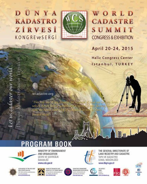
file179
file179
file179

Create successful ePaper yourself
Turn your PDF publications into a flip-book with our unique Google optimized e-Paper software.
wcadastre.org1
Greeting from The Generel DirectorDear Friends,Welcoming MessagesLand registry and Cadastre service, today, is a dynamic chain of service coveringservices such as preparing source data for all kinds of planning and organizationon the ground and underground, providing geo-data and displaying topographicstructure, producing data that can meet the information need required foreconomy, law, statistics, management, planning and various different scientificresearches as well as all kinds of contractual transactions related to land registryand register of immovable properties, to follow-up, and control changes on theregisters, to ensure the protection of archive records and documents.In Turkey, The General Directorate of Land Registry and Cadastre (TKGM inTurkish) has been carrying out its duty determined by the law in its 22 RegionalDirectorates, 81 Cadastre directorates and 970 land registry directorates, serving20 million citizens every year as well as producing required basic data for manyoffices and institutions.Davut GÜNEYThe Generel DirectorAlthough there are land registry transaction records since 1460s in our archives,the first organization of land registry in our was established under the name of“Defter-I Amire Kalemi” on May 21, 1847 and our institution celebrated its 167thanniversary under the name of General Directorate of Land Registry and Cadastrein this year.TKGM carrying out the mission of maintaining and protecting ownership and rightsrelated to land. It has been fulfilling one of the most important functions of the stateand playing a significant role in the service sector. These services have the qualityof fulfilling the requirements of our county as well as increasing and changingdemands in the international basis, finding solutions, amenable to the expectedsensibility and credibility within the framework of laws, capable of using the recenttechnology of today. Many projects have accomplished within this framework since2004 till today. It would be seen that every single project would contribute to thedevelopment of our country in the short, medium and long term.Now we think that it is the time for all worldwide cadaster-related people shouldcome together to share their very valuable experiences and create a network fora better mapping for our common future. As the organizer of the “World CadastreSummit, Congress and Exhibition”, we also would like to welcome all of you andto give us an opportunity to show you our warm hospitably. Therefore, we lookforward to seeing you in Istanbul.Yours sincerely,Davut GÜNEY, The General Directorof Land Registry and Cadastre ofTurkeyThe General Directorate OfLand Registry And Cadastrewcadastre.org3
ScientificCommitteeAbbas RAJABIFARD, AUSTRALIAAbdurrahman GEYMEN, ERCIYES U.Ahmed EL-RABBANY, RYERSON U.Arif Çağdaş AYDINOĞLU, GTUAziz ŞİŞMAN, OMUBayram UZUN, KTUBülent BOSTANCI, ERCIYES U.C. Coşkun AYDIN, HACETTEPE U.Cemal BIYIK, KTUÇetin MEKİK, B. ECEVIT U.Cevat İNAL, SELCUK U.Daniel STEUDLER, ETH ZURICHDavid J COLEMAN, UNBFaik Ahmet SESLİ, OMUFatih İŞCAN, SELCUK U.Ferruh YILDIZ, SELCUK U.Gerda SCHENNACH, AUSTRIAGülgün ÖZKAN, SELCUK U.H. Ebru ÇOLAK, KTUH. İbrahim İNAN, ERCIYES U.Halis SAKA, GTUIan P. WILLIAMSON, AUSTRALIAJohn D. McLAUGHLIN, UNBKamil KARATAŞ, AKSARAY U.M. Zeki COŞKUN, ITUMehmet ÇETE, IKCMuhammed ŞAHİN, ITUMustafa ATASOY, AKSARAY U.Mustafa YANALAK, ITUNihat Enver ÜLGER, OKAN U.Osman DEMİR, KTURecep NİŞANCI, KTUReha M. ALKAN, ITUS Savas DURDURAN, KNEUSaffet ERDOĞAN, A. KOCATEPE U.Selçuk REİS, AKSARAY U.Stig ENEMARK, DENMARKSue E NICHOLS, UNBŞükran YALPIR, SELCUK U.Tahsin YOMRALIOĞLU, ITUTaşkın KAVZOĞLU, GTUTayfun ÇAY, SELCUK U.Volkan YILDIRIM, KTUYakup E ÇORUHLU, KTUYunus KALKAN, ITUZakaria Mat AROF, UITM6 wcadastre.org
General Information - Congress"The World Cadastre Summit,Congress & Exhibition(WCS-CE)" is a high-profileinternational event attractingthousands of cadastral andrelated professionals andorganizations from across theworld. It is organized by theMinistry of Environmental andUrbanization of the Republic ofTurkey (TR).The strategic intentions for"The World Cadastre Summit,Congress & Exhibition" are toengage with the dynamics ofthe cadastral sectors and theirinterfaces, including all aspectsof cadastral applications with allover the world."The World Cadastre Summit,Congress & Exhibition"is a valuable and uniqueopportunity for the communityof world-leading cadastralprofessionals to meet,exchange ideas, explore thestate of the art and debatethe key issues underlying thescience and practice of thecadastre and all kinds of landrelatedtopics.The WCS-CE is expectingaround 2,000 delegates andmany visitors to attend thisevent. As a delegate you willimprove your cadastral andland-related industry networksand increase your store ofknowledge on the latest globalcadastral-based developments,legal, science, technologyand strategic issues. You andyour organization will benefitfrom your attendance and theknowledge and networks thatyou gain.WCS 2015 Press Conference, IstanbulMeeting with FIG President Prof Chryssy Potsiou in Athens.The WCS Congress&Exhibitions (WCS-CE) openingceremony will provide a spectacular introduction to thecongress, its theme, and its unique location - a festivestart of the Summit. Each day invited recognized expertswill deal with topics within the overall theme of thecongress. They will address key challenges of our timewithin the cadastral profession.The technical program of WCS-CE will include a broadprofessional and scientific programme: during congressdays, offering up to 10 parallel sessions, 4 plenarysessions with keynote speakers and special trainingworkshops. This will allow about 150 presentations in theentire broadness of the cadastral profession. The carefullyprepared Technical Programme will offer both speciallyinvited high profile presentations and papers that areselected through the open call for papers procedure.The WCS-CE will be organized through a series ofplenary sessions addressing common policy issues, andparallel sessions from the call for papers, workshops,poster sessions and an exhibition. A summit subject tocadastral policies will be held with the participations ofworld-nations representatives.A number of attractive and informative Technical Tourshave been organized to complement the WCS-CEexperience. These tours will visit sites and organizationsof particular interest to Congress delegates.Congress languages are English and Turkish.wcadastre.org7
THE WORLD CADASTRE SUMMITISTANBUL DECLARATION ON CADASTRE IN THEWORLD CADASTRE SUMMIT 2015“Let us Cadastre the World...”Within the World Cadastre Summit, “ISTANBUL WCS’2015COUNTRIES ROUND TABLE MEETING” will be held withthe mere participation of the almost 80 official delegations ofthe countries on April 23, 2015 between 14:00-17:00 p.m.,30 ministries and 50 General Directories respectively.In this meeting that will be chaired by Mr. İdris GULLUCEwho is the Minister of Environment and Urbanization ofRepublic of Turkey, all country representatives will have theopportunity to describe the current situation in the field ofcadastre and express their expectations.As a global call, “ISTANBUL DECLARATION ONCADASTRE” will be prepared based on congresspresentations and opinions of the country representativesand will be made public as a memorandum ofunderstanding…8 wcadastre.org
ISTANBUL’2015Land Administration Systems – LAS dynamic are as follows; thesesystems are directly affected by rapid technological developments, theyare the main source of land information, including land policy making,that all public institutions and private sector need, and government wantsto provide more effective service by using these systems. “Cadastre” isone of the main components of LAS. In addition, as the main source ofdata concerning the land use, “topographical map producing” and “landvaluation” activities fall within the field of cadastre.A well-functioning cadastre guarantees property, reduces land conflict,supports real estate taxation, ensures loan security, protects landsources, monitors environment and ameliorates urban planning andinfrastructural development. Today, the most important duty of cadastreis to support sustainable development…WCS recognize the statement of “FIG- International Federation ofSurveyors Statement on the Cadastre”. As stated by the FIG;This statement of the International Federation of Surveyors highlights, from aninternational perspective, the importance of the Cadastre as a land informationsystem for social and economic development. It gives examples of legal,organisational, and technical issues that need to be addressed in order toestablish and maintain a Cadastre. The statement also describes some ofthe different roles that surveyors play in the management and operation of aCadastre. This statement does not recommend a uniform cadastre for everycountry or jurisdiction.A Cadastre is normally a parcel based, and up-to-date land informationsystem containing a record of interests in land (e.g. rights, restrictions andresponsibilities). It usually includes a geometric description of land parcels linkedto other records describing the nature of the interests, the ownership or controlof those interests, and often the value of the parcel and its improvements. It maybe established for fiscal purposes (e.g. valuation and equitable taxation), legalpurposes (conveyancing), to assist in the management of land and land use(e.g. for planning and other administrative purposes), and enable sustainabledevelopment and environmental protection.wcadastre.org9
Keynote SpeakersProfessionals give information about cadastral life, world’s cadastre, and cadastralvision in the plenary sessions. Some renowned speakers about Land Managementare visualized below.John McLaughlinCanadaProfessor (emer.)University of New BrunswickChryssy PotsiouGreeceAssociate ProfessorFIG PRESIDENTProfessor of Engineering and President Emeritus at theUniversity of New Brunswick, Canada. He served as Chair ofthe Department of Surveying Engineering, Vice-President andwas the University’s 17th President and Vice-Chancellor. Johnintroduced and developed the first land administration programat a North American university and the first program in landinformation management to be taught anywhere in the world.He has been a leader in building the North American Geomaticsindustry and has worked extensively overseas, in more than40 countries, on the development of property systems with theWorld Bank, UNDP, and other international agencies.She is the President of International Federation of Surveyors(FIG), Associate Professor, School of Rural and SurveyingEngineering, Technical University of Athens, Greece. She has30 years experience in education, training and internationalcapacity building. She is elected member of the bureau of theHellenic Association of Rural and Surveying Engineers. Since1982 she is active in the FIG especially in the work of Com 7(Cadastre and Land Management) and Com 3 (Spatial InformationManagement). She was the Chair of FIG Commission 3, theACCO representative at the FIG Council, FIG Vice President.She has organized several international conferences. She hasbeen contributor, co-author or main author of many publicationsand has written more than 110 scientific papers.Stig EnemarkDenmarkProfessorAalborg UniversityElshad KhanalibayliAzerbaijanPhD, The United NationsEconomic Commission for EuropeStig Enemark is Professor of Land Management at Aalborg University,Denmark. He is Honorary President of the InternationalFederation of Surveyors, FIG (President 2007-2010) and PastPresident and Honorary Member of the Danish Association ofChartered Surveyors (DdL). He worked for 12 year as a licensedsurveyor in private practice before entering the academic world.He is a well-known international expert in the areas of cadastre,land administration systems, land management and spatialplanning, and related educational and capacity building issues.He has consulted and published widely in these areas. A full listof about 400 publications is available at: www.personprofil.aau.dk/100037.PhD, Dr. Chair of the UNECE Working Party on Land Administration,Head of Investment, International Cooperation and StrategicPlanning Department of the State Committee on PropertyIssues, the Republic of Azerbaijan. Educated in Baku, Moscowand London, had been working as the Regional Sales Manager(Caucasus) of the Gillette International several years, beforehe began his career at the State Committee on Property Issuesin 1999. He is involved as a Chair and/or a Project Manager ina number of projects like the management and privatisation oflarge-sized state-owned enterprises, creating of digital cadastredatabase, improving Real Estate Registration system, developmentof Address Register Information System in Azerbaijan, etc.He closely cooperates with both international organisations andnational authorities of foreign states.10 wcadastre.org
Keynote SpeakersEde Jorge Ljjasz VasquezUSAMSc, PhD,The WORLD BANKJorge A. MuñozUSAMA, PhD,The WORLD BANKHe is the Senior Director for the new Social, Urban, Rural andResilience Global Practice at the World Bank Group. As seniordirector, Mr. Ijjász will lead a team of over 600 technical expertsdeployed across the world, leveraging global knowledge andcollaborating with partners to help tackle the world’s most complexdevelopment challenges. Prior to joining the World Bank, Mr.Ijjasz was a Senior Associate with ICF Kaiser International wherehe provided technical and policy advisory services to the U.S.Environmental Protection Agency on pollution issues, and ledthe preparation of environmental impact assessments of largeinfrastructure projects in Latin America and the United States. Mr.Ijjasz has a Ph.D. and a M.Sc. from the Massachusetts Institute ofTechnology (MIT) in civil and environmental engineering. He is aColombian and Hungarian national.He is Practice Manager of the Global Land and Geospatial Unitoverseeing the World Bank’s land administration portfolio ($1.2 billionin commitments). Mr. Muñoz joined the Bank in 1998, wherehe has worked on land policy reforms and land administrationprojects in over 20 countries across the globe, mostly in Africa andLatin America. For two years he was Head of the Bank’s regionaloffice in Recife, Brazil. He also serves as the Bank’s focal pointin several global partnerships related to these issues. Mr. Muñozholds a B.S. in Engineering from Swarthmore College and an M.A.and Ph.D. in Economics from Stanford University.Ian P. WilliamsonAustraliaProfessor (emer.)University of MelbourneKees de ZeeuwThe NetherlandsKADASTERINTERNATIONALHe is a surveyor and engineer, and an Emeritus Professor in theCentre for Spatial Data Infrastructures and Land Administrationat the University of Melbourne, Australia. His interests includecadastral, land and GIS; land administration and spatial datainfrastructures, in both developed and developing countries. Hehas published widely on these topics. He has undertaken researchor consultancies worldwide, including for various countrydevelopment assistance agencies, FIG, the United Nations, theAsian Development Bank and the World Bank, most governmentsin Australia. For almost four decades he has taught,consulted, researched, published and provided leadership oncadastral and related matters globally.He is Director of Kadaster International at the Cadastre, LandRegistry and Mapping Agency (Kadaster), The Netherlands. Heholds an MSc. degree in land and water management (1989).After long term contracts in Rwanda and Bolivia he has beenworking more than 10 years in environmental and geo-informationsciences at Wageningen University and ResearchCentre.After being responsible at Kadaster for product and processinnovation (2007 – 2010), he now is responsible for the coordinationof Kadaster’s international activities and internationalcooperation projects. Kadaster International provides world wideadvisory services in the domain of land administration, e-governance,geo-information services and SDI.wcadastre.org11
Keynote SpeakersBrent A. JonesUSAESRI,Washington D.CAbbas RajabifardAustraliaProfessor, FIEAust, FSSSIHead, Department of InfrastructureEngineering University of MelbournePE, PLS. He is the Cadastre/Land Record Global Manager ofESRI. Based in Washington D.C., Brent Jones oversees ESRI’sworldwide strategic planning, business development, and marketingactivities for cadastral, surveying, and land administration.Jones specializes in modernizing existing land administrationsystems and designing new GIS-based cadastral managementplatforms for small and large governments across the globe.Established in 1969, ESRI creates systems that drive all componentsof land and cadastral administration, including addressing,registration, taxation/valuation, planning, and development.Head of Department of Infrastructure Engineering at TheUniversity of Melbourne. He is also Director of the Centre forSpatial Data Infrastructures & Land Administration. He wasPresident of the GSDI Association; Vice Chair of Working Group3 of the United Nations supported Permanent Committee onGIS Infrastructure for Asia and the Pacific, is a member ofICA-Spatial Data Standard Commission, and is a member ofVictorian Spatial Council. He has active research in the areas ofSDI, Land Administration and land management, spatial enabledgovernment and societies, smart cities, 3D platforms and virtualjurisdictions. He had published broadly on SDI, land administration,GIS and spatial data managementShe is a Senior Advisor in Headquarters of the Austrian FederalOffice of Surveying and Metrology (BEV). Graduated as aDI (MSc) of Geodesy from Vienna University of Technology.In BEV, where she held the position as head of a regionalcadastral office for 15 years. Since 1998 she has representedBEV in several European and international organisations andassociations as well in projects on Geoinformation and onpublic administration issues. Member of Executive Committee ofEUROGI, Vice-President of Austrian Umbrella Organization forGI (AGEO), Member of Executive Board of the Austrian Societyfor Surveying and GI (OVG), former Vice-Chair and Memberof the WG on Gender issues in the Austrian federal Ministry ofScience, Research and Economy.12 wcadastre.orgGerda SchennachAustriaChair of FIG Commission 7 onCadastre & Land ManagementVanessa LawrenceUKPhD, Co-Chair of United Nations Committeeof Experts of Global GeospatialInformation Management InitiativeDr. Vanessa is Co-Chair of the United Nations Committeeof Experts of Global Geospatial Information Management(UN-GGIM), formerly Director General and Chief Executiveof Ordnance Survey and Patron of MapAction, UK. She was,from 2000 to 2014, the Director General and Chief Executive ofOrdnance Survey and the adviser to the British Government onmapping, surveying and geographic information. She was thelongest-serving Director General since 1875 and she was thefirst woman to hold the post. She is also a Visiting Professor atthe University of Southampton and Kingston University. In 2008,Vanessa was appointed as a Companion of The Most HonourableOrder of the Bath (CB) in the Queen’s New Year HonoursList. In 2009, Vanessa was appointed Honorary Colonel of 135Independent Geographic Squadron, Royal Engineers. In 2011,She was awarded the GeoSpatial Personality of the Decade2000 – 2010. In 2011, Vanessa was appointed as Co-Chair ofthe United Nations Committee of Experts on Global GeospatialInformation Management.
Keynote SpeakersDaniel SteudlerSwitzerlandPhD, Swiss Federal Directorate ofCadastral SurveyingTahsin YomraliogluTurkeyProfessor,Istanbul Technical UniversityDr. Steudler has a degree from the Swiss Federal Institute ofTechnology (ETH) in Zurich, the University of New Brunswick,Canada and from the University of Melbourne. Since 1991,he is working for the ‘Swiss Federal Directorate of CadastralSurveying’. He was member in several working groups andcommittees for geospatial information. He was participant at theUN-FIG-Workshop on ‘Land Tenure and Cadastral Infrastructuresfor Sustainable Development’ in Bathurst. Since 1994, heis involved in activities of FIG-Commission 7, such as “Cadastre2014”, “Reforming the Cadastre”, “Spatially Enabled Society”,and “Cadastral Template A Worldwide Comparison of CadastralSystems”. Since March 2015, he is chair of the EuroGeographics“Cadastre + Land Registry” Knowledge Exchange Network.PhD, he graduated from the Surveying Engineering KaradenizTechnical University (KTU), Trabzon in 1985. He worked onLand Information Systems at the University of New Brunswickin Fredericton, Canada. In 1993, he obtained his Ph.D. fromthe University of Newcastle upon Tyne, England. In 1994, hewas appointed as a full-time Professor in 2001 at KTU, then atIstanbul Technical University (ITU) in 2009. He has been theDeputy Chairman of the Department, and the Head of the bothCartography and the Land Management divisions at KTU. Healso appointed as the General Secretary of KTU, and an adviserto the Rector of KTU and the Rector of ITU. He has served amember on various commissions, and also worked as a projectmanager and consultant in several public and private institutions.He established ITU-GeoIT graduate program and the firstnational GIS R&D innovation center of Turkey. He has publishedmany scientific-research publications in the field of GIS&LandManagement.Peter van OosteromThe NetherlandsProfessor,Head of GIS Technology, TU DelftOrhan ErcanTurkeyPhD, The Turkish Chamber of Survey andCadastre EngineersHe is a full professor and head of the section GIS Technologyat TU Delft since 2000. From 1995 to 1999 he was senior informationmanager within the Dutch Cadastre. Since October 2005he is member of the INSPIRE drafting team Data Specificationand Harmonization. He was member of the INSPIRE thematicworking group on cadastral parcels. He is co-editor of ISO19152 LADM, member of the editorial boards of several journalsand member of the program committees of the major GISconferences. He is the chair of the FIG joint working group ‘3DCadastre’ of commissions 3 (Spatial Information Management)and 7 (Cadastre and Land Management). He is the (co) authorof more than 100 publications.Ph.D., He was from 1984-2007, a senior engineer at theGeneral Directorate of Land Registry and Cadastre in Turkey.He executed some of the World Bank`s Project, and worked asexecutive staff at Turkish NSDI, CORS, TAKBİS Projects. Since2007, he was involved in private sector as company managerand freelancer both in Turkey and Libya. From 2001 to 2010 hewas the part-time lecturer at university. He was the member ofscientific commission C of OEEPE in 1993-94 and member ofFIG working group 5.4.3 in 1995. He is an active member of FIGCommission 7 and Congress Director of FIG2018. Since 2012he is the chair of International Affairs Commission of TurkishChamber of Survey and Cadastre Engineers.wcadastre.org13
Program at GlanceDAY 1 - MONDAY APRIL 20DAY 2 - TUESDAY APRIL 2109:00 TS 2.1 CountryProfiles 1:ImplementationsREGISTRATIONissues andLegistationsTS 2.2 Public LandManagementProcedures andForest CadastralSystemsTS 2.3 - SpecialExhibition Session:Historical Route ofCadastre in Turkey10:4011:00OPENING CEREMONY & WELCOME SPEECHES& WELCOME SPEECHES OPENING EXHIBITIONSTS 3.1 CountryProfiles2: Day of SwissCadastreTS 3.2 GNSS/GPS& SurveyingSystems inCadastreTS 3.3 Economy inCadastre PrivateSectors & LIHKAP'sApplication12:3014:00PS.01 - PLENARY SESSION 1THE ROLE OF CADASTRE IN CHANGING ANDDEVELOPING WORLDPS.02 - PLENARY SESSIONS 2CADASTRAL ACTIONS AND ISSUES IN THE WORLD16:3017:00TS 1.1 - CadastralMapping &SurveyingTechnology forLand RegistrationTS 1.2 - People,Cadastre and LandGovernance ForSocietyTS 1.3 - Actors andPartnerships inCadastre & Public -Private SectorsTS 4.1 - Cloud &WebbasedCadastralSystems, SpatialData InfrastructuresTS 4.2 -Developments &Requirements forMarine CadastreTS 4.3 - CountryProfiles 3: Day ofTurkishCadastre19:00WCS VELCOME RECEPTION14 wcadastre.org
DAY 3 - WEDNESDAY APRIL 22DAY 4 - THURSDAY APRIL 23TS 5.1 - 30 DataCapture andRegistration forCadastreTS 6.1 The Role ofCivil Organizationsfor sustainableLandDevelopmentsTS 7.1 - CountryProfiles 5:National LandAdministrationSystemTS 5.2 - CadastralProfession &Education Acrossthe WorldTEA / COFFEE BREAKTS 6.2 Photogrammetry & OrthophotoUsage for CadastreLUNCH BREAKPS.03 - PLENARY SESSIONS 2CADASTRE FOR THE NEXT GENERATIONSTEA / COFFEE BREAKTS 7.2 - RemoteSessing In LinearRouteWorks for LandRegistrationTS 5.3 - Country TS 8.1 - CountryProfiles 4:Profiles 6: 3DRenewingCadastre & Landin Cadaster and 2nd Registry ModelsCadastreTS 6.3 - LandConffictsand CadastralAspects,SolutionsTS 7.3 - CadastralVisions & DataModels for e-GovarnanceTS 9.1 4DCadastre, LandDomain Models &ConceptsTS 8.2 - GIS &PlanningImplementationsTS 9.2 Cadastre InDisasterManagement &PlanningTS 8.3 - RealEstateAdministration andLand ValutationProceduresTS 9.3 Zoning andCadastre Relationsand ValuationImplementationsSUMMIT MEETING : PART IWCS'2015 COUNTRIES ROUNDTABLEZİRVE TOPLANTISI 1.BÖLÜMWCS' 2015 ÜLKELER YUVARLAK MASA TOPLANTISISUMMIT MEETING : PART 2WCS'2015 ROUNDTABLE RESOLUTIONSZİRVE TOPLANTISI 2.BÖLÜMWCS' 2015 ÜLKELER YUVARLAK MASA TOPLANTISISONUÇLARIDAY 5 - FRIDAY APRIL 24 - HISTORICAL ISTANBUL - BOSPHORUS BOAT TOURCLOSING CEREMONYGALA DINNERwcadastre.org15
Program09:0010:0010:0012:0012:0012:3012:3014:0014:0016:3016:3017:00REGISTRATION KAYITDAY 1 - MONDAY APRIL 20OPENING CEREMONY & WELCOME SPEECHES• Prof Dr Tahsin YOMRALIOGLU, Chairman of the World Cadastre Summit, C&E• Davut GÜNEY, The General Directory of Land Registry & Cadastre• Prof Dr Chryssy POTSIOU, The President of International Federation of Surveyors• Kadir TOPBAŞ, Mayor of Istanbul• İdris GÜLLÜCE, The Minister of Environment and Urbanization• Prof Dr Ahmet DAVUTOĞLU, The Prime Minister of The Republic of Turkey• Recep Tayyip ERDOĞAN, The President of The Republic of TurkeyOPENING EXHIBITIONS SERGİ AÇILIŞLARI• SECTORS MEET: SURVEYING & MAPPING TECHNOLOGIES EXHIBITION• ÖLÇME ve HARİTA TEKNOLOJİLERİ SERGİSİ• OTTOMAN FROM PRESENT AND SURVEY EXHIBITION IN TURKEY• OSMANLIDAN GÜNÜMÜZE TÜRKİYE’DE KADASTRO SERGİSİ• THE 100th ANNIVERSARY OF GALLIPOLI: SURVEYOR MARTYRS IN CANAKKALE• GELİBOLU’NUN 100.YIL ANISINA: ÇANAKKALE HARİTA-KADASTRO ŞEHİTLERİ SERGİSİLUNCH BREAKPS.01 - PLENARY SESSION 1 & KEYNOTESPS.01 - ANA OTURUM 1 ve ÇAĞRILI KONUŞMALARTHE ROLE OF CADASTRE IN CHANGING AND DEVELOPING WORLDDEĞİŞEN VE GELİŞEN DÜNYA’DA KADASTRO’NUN ROLÜModerator Tahsin YOMRALIOGLU (Turkey) - “Why WCS ?”• John McLAUGHLIN (Canada) “Towards a Fourth Wave of Property Reform”• Stig ENEMARK (Denmark) “Sustainable Land Governance in Support of the Global Agenda”• Chryssy POTSIOU (Greece) “Ensuring the Rapid Response to Change, Ensuring the Surveyor of Tomorrow”• Elshad KHANALIBAYLI (Azerbaijan) “UNECE Working Party on Land Administration”• Ede Jorge LJJASZ VASQUEZ (USA) “The World Bank for Cadastre”TS 1.1 - Cadastral Mapping &Surveying Technology for LandRegistrationChair: Çetin MEKİKRapporteur: Ali TUNÇTEA/COFFEE BREAKTS 1.2 - People, Cadastre andLand Governance for SocietyChair: Sedat BAKICIRapporteur: Adalet DERVİŞOĞLUTS 1.3 - Actors and Partnershipsin Cadastre & Public-PrivateSectorsChair: Mustafa YANALAKRapporteur: Rabia BOVKIR16 wcadastre.org
Program17:0017:2017:2017:4017:4018:0018:0018:2019:0021:00“A PERFORMANCE ASSESSMENTMODEL FOR CADASTRAL SURVEYSYSTEM EVALUATION“ -(51)Haodong Zhang, Conrad Tang(Hong Kong SAR, China)“LOCAL GEOID MODEL AS AHEIGHT REFERENCE FIELD OF 3DCADASTRE SURVEY: CASE STUDYIN DI YOGYAKARTA PROVINCE OFINDONESIA” - (110)Leni Sophia Heliani, BagasTriarahmadhana, NurrohmatWıdjajantı(Indonesia)“GNSS AND THE INTERSECTIONOF GEODESY AND CADASTREIN KINGDOM OF SAUDI ARABIA”- (29)Ali Al Omar, Sami Al Balawi, SaeedAl Zahrani, Ramazan Yanar(Saudi Arabia)“FOUNDATION IMMOVABLEPROPERTIES IN TURKEY” - (140)Yakup Emre Coruhlu, Osman Demir(Turkey)DAY 1 - MONDAY APRIL 20“USE OF ‘UPGRADED EVIDENCE’IN CADASTER APPROACHES FORSYRIAN REFUGEE RETURN” - (70)Jon Unruh(Canada)“VERTICAL RESETTLEMENT - APANACEA TO THE PROLIFERATIONOF SLUMS IN NIGERIAN CITIES”- (103)Gbade Akinola, Gaius Ojo, IsmailaOgundiji(Nigeria)“SPATIAL ANALYSIS METHODTO OPTIMIZE THE LAND USEBASED ON LAND RIGHT STATUSIN SUKABUMI, WEST JAVA,INDONESIA” - (98)Septina Maryanti, Dian PermanaSari(Indonesia)“POLISH INTEGRATED SYSTEMOF REAL-ESTATE INFORMATION -PROCESS OF ESTABLISHING ANDIMPACT OF CADASTRAL DATAQUALITY” - (192)Jarosław Wysocki(Poland)WCS WELCOME RECEPTIONHalic Congress Center Terrace“Sunset in the Golden Horn with Turkish Music & Picture with Erguvans - Flowers of Judas”“A SIGNIFICANT ACTOR INSECTOR: TKGM, TURKEY” - (9)Mehmet Fatih Diri, Ismail Dursun(Turkey)“PRIVATE SECTOR ROLE ANDEFFECT IN TURKISH CADASTRALSYSTEM” - (83)Okan Yıldız, Yakup Emre Çoruhlu,Osman Demir, Merve Özlem Murat(Turkey)“A TRANSPARENT CADASTRALSYSTEM – FIT FOR SUSTAINABLEDEVELOPMENT AND LEGALSECURITY. THE DANISH PUBLIC-PRIVATE COOPERATION MODEL.”- (102)Torben Juulsager, HennıngElmstrøm(Denmark)“IMPLIMENTATION OF TECHNICALCADASTRE SERVICES THROUGHDELEGATION OF AUTHORITY:LIHKAB*” - (25)Ismail Dursun, Senay Karatas,Melike Uzumveren, Zuhre DuyguYegen, Taskin Aykit, Fatma HopyarYetgin(Turkey)wcadastre.org17
Program09:0009:2009:2009:4009:4010:0010:0010:2010:2010:40DAY 2 - TUESDAY APRIL 21Hall 1 - HARİTA Hall 2 - TAPU Hall 3 - KADASTROTS 2.1 - Country Profiles 1:Implementations, Issues andLegislationsChair: Mehmet ÇETERapporteur:Yakup Emre ÇORUHLU“CURRENT ISSUES INCADASTRAL REGULATIONS INROMANIA” - (96)Gheorghe Badea, Ana - CorneliaBadea(Romania)“AIMS AND ACTUAL OUTCOMESOF TUSCANY CASTORE PROJECT:A FINAL BALANCE“ - (57)Massimiliano Grava, MaurizioTrevisani, Umberto Sassoli, FabioLucchesi(Italy)“TOWARD A DATA STANDART FORTHE CADASTRE, LAND REGISTRYAND LAND ADMINISTRATION INMOROCCO” - (148)Adad Moulay Abdeslam(Morocco)“NEPAL CADASTRE” - (167)Krishna Raj Bc(Nepal)“MODELING PGIS FORMULTIPURPOSE CADASTRE (MPC)IN GHANA” - (46)Edward Duncan, Ebenezer Ankoma(Ghana)TS 2.2 - Public LandManagement Procedures andForest Cadastral SystemsChair: Saffet ERDOĞANRapporteur: Hasan TONBUL“DETECTING CLEAR-CUT AREASUSING REMOTELY SENSED DATAIN ISTANBUL - SILE REGION”-(49)Saziye Özge Dönmez, HasanTonbul, Semih Sami Akay(Turkey)“AN IMPLEMENTATION OFFOREST INFORMATION SYSTEMIN KYRGYZSTAN“ - (50)Emin Bank(Turkey)“FOREST CADASTRAL SURVEYSIN TURKEY” - (120)Mustafa Atasoy, Hakan Eraslan,Cemal Bıyık(Turkey)“INVESTIGATION OF THEVERTICAL DIMENSIONRESTRICTED REAL ESTATESIN LAND CONSOLIDATIONPROJECTS” - (116)Musa Nehir Sozen, Kamil Karatas(Turkey)“UPDATING AND MAINTAININGLAND PARCEL TYPES THROUGHCROWD-SOURCED LAND USE/COVER CLASSIFICATION” - (127)Halil İbrahim Inan, AbdurrahmanGeymen, Omer Faruk Inan(Turkey)TS 2.3 - Special ExhibitionSession: Historical Route ofCadastre in TurkeyChair: Zeynel Abidin TÜRKOĞLURapporteur: Hasan AVCI“ART APPROACH OF LANDREGISTRY CADASTRE” - (30)Kemalettin Toker(Turkey)“HISTORICAL DEVELOPMENTOF CADASTRE IN TURKEY:FIRST CADASTRAL STUDIESIN OTTOMAN EMPIRE, LEGALARRENGEMENT AND REFLECTIONTO THE TURKISH REPUBLIC” -(73)Mehmet Yıldırır(Turkey)“SOCIO-CULTURAL ASPECTSOF CADASTRAL STUDIES INOTTOMAN EMPIRE: CASE OFADALAR PROVINCE CADASTRE”- (17)Murat Alandagli(Turkey)“IN MEMORIAM OF 100th YEARANNIVERSERY OF CANAKKALEVICTORY : EFFECTS OF FIRSTWORLD WAR TO CADASTREWORKS IN TURKEY AND THEMARTYRS OF LAND REGISTRYCADASTRE” - (74)Funda Aydın Seymen, SongülKadıoğlu(Turkey)“SERVICE QUALITY OF CADASTREIN TURKEY” - (162)Nevzat Kul, Orhan Deligöz(Turkey)18 wcadastre.org
Program10:4011:0011:0011:2011:2011:4011:4012:0012:0012:20DAY 2 - TUESDAY APRIL 21Hall 1 - HARİTA Hall 2 - TAPU Hall 3 - KADASTROTS 3.1 - Country Profiles 2: Dayof Swiss CadastreChair: Daniel STEUDLERRapporteur: Halil İbrahim İNAN“THE SWISS CADASTRALSYSTEM IN THE DIGITAL AGE“- (166)Daniel Steudler(Switzerland)“FROM A TRADITIONAL TO ACOMPREHENSIVE CADASTRE”- (163)Juerg Kaufmann(Switzerland)“CADASTRAL SYSTEMS INFEDERAL STRUCTURES” - (164)Christian Kaul(Switzerland)“STANDARDIZED DATAMODELING AND ITS BENEFITS”- (165)Michael Germann(Switzerland)TEA/COFFEE BREAKTS 3.2 - GNSS/GPS & SurveyingSystems in CadastreChair: Reha M ALKANRapporteur: Halis SAKA“USABILITY OF GNSS TECHNIQUEFOR CADASTRAL SURVEYING”- (87)Reha Metin Alkan, İ. Murat Ozulu,Veli İlçi, F. Engin Tonbuş, MuratŞahin(Turkey)“TESTING CORS SYSTEM FORCADASTRAL SURVEYING” - (144)Atınç Pırtı, Nursu Tunalıoğlu(Turkey)“DETERMINATION OF THE ZEROBASELINE FOR CADASTRALSURVEYING PRACTICES INMALAYSIA” - (68)Akhbaaruddın Abd.hamıd, JuazerRizal Abdul Hamid, Ainon NisaOthman(Malaysia)“ANALYSIS AND APPLICABILITYOF TECHNICAL AND LEGALDOCUMENTS FROM PRE-CADASTRAL WORKS REGARDINGUP-TO-DATE CADASTRALWORKS IN TURKISH CADASTRALSYSTEM” - (82)Cemal Bıyık, Okan Yıldız, GamzeYılmaz(Turkey)TS 3.3 - Economy in Cadastre,Private Sectors & LIHKAPs’ApplicationsChair: Gökhan KANALRapporteur: M Fatih DİRİ“ECONOMIC FUNCTION OFCADASTRE” - (137)Huseyin Erkan(Turkey)“COMPARATIVE PROBLEMSAND SOLUTIONS OF LICENSEDSURVEY AND CADASTREENGINEERING OFFICES INSWITZERLAND AND TURKEY”-(150)Şebnem Yürükler Akça, Ali KazımTelli, Ertuğrul Eyüboğlu, HülyaKarslı, Osman Gülcan(Turkey)“STUDIES AND RESULTSOF TENDERED CADASTRALSTUDIES” - (20)Nihat Erdogan, Ramis Soytemiz,Ozgen Sadu Caglar(Turkey)“A NEW INSTRUMENT TO TIKAPROJECT: ISSUANCE OF TURKISHCADASTRAL SYSTEM” - (151)Ahmet Altun(Turkey)wcadastre.org19
Program12:3014:0014:0016:30DAY 2 - TUESDAY APRIL 21Hall 1 - HARİTA Hall 2 - TAPU Hall 3 - KADASTROLUNCH BREAKPS.02 - PLENARY SESSION 2 & KEYNOTESPS.02 - ANA OTURUM 2 ve ÇAĞRILI KONUŞMALARCADASTRAL ACTIONS AND ISSUES IN THE WORLDDÜNYA’DA KADASTRAL EYLEMLER VE SORUNLARModerator Ian WILLIAMSON (Australia) - “The Role of Cadastre in Sustainable Development”• Jorge A. MUNOZ (USA) “Geo-IT & the challenges of urbanization: Perspectives from the World Bank”• Kees de ZEEUW (The Netherlands) “The Need for Fast, Cheap and Good Land Administration”• Brent A. JONES (USA) “Sustainable Spatial Technology for Cadastral Systems”• Gerda SCHENNACH (Austria) “The Cadastral Challenge of The 21st Century”16:3017:00TEA/COFFEE BREAKTS 4.1 - Cloud & Web-basedCadastral Systems, Spatial DataInfrastructuresChair: Hüseyin BAYRAKTARRapporteur: Merve KESKİNTS 4.2 - Developments &Requirements for MarineCadastreChair: Zakaria Mat AROFRapporteur:Abdurrahman GEYMEN“FUZZY DELPHI FOR MARINESPACE STAKEHOLDERFRAMEWORK DEVELOPMENT:AN ANALYTICAL LITERATUREREVIEW” - (131)Nazirah Abdullah, Abdullah HisamOmar(Malaysia)“MARINE CADASTRE LEGALFRAMEWORK FOR MALAYSIA”- (128)Ashraf Abdullah(Malaysia)TS 4.3 - Country Profiles 3: Dayof Turkish CadastreChair: Yunus KALKANRapporteur: Mehmet İŞİLER17:0017:20“MILESTONES TO BUILDSPATIAL DATA INFRASTRUCTURESUPPORTING SUSTAINABLE LANDMANAGEMENT” - (132)Tahsin Yomralioglu, Arif Aydinoglu(Turkey)“ANALYSIS OF CADASTREPROCESS ACCORDING TO THETYPES IN TURKEY” - (31)Kemalettin Toker(Turkey)17:2017:40“UTILIZATION OF CLOUDCOMPUTING FOR PRESENTATIONOF CADASTRE DATA” - (142)Sevket Bediroglu, Volkan Yildirim,Recep Nisanci, Ebru Colak, TugbaMemişoğlu(Turkey)“PRESENT PROBLEMS ANDLOSSES CONSISTING OF PASTCADASTRE MEASUREMENTMETHODS IN TURKEY” - (88)Bilal Atak, S. Savaş Durduran(Turkey)20 wcadastre.org
Program17:4018:0018:0018:20DAY 2 - TUESDAY APRIL 21Hall 1 - HARİTA Hall 2 - TAPU Hall 3 - KADASTRO“CADASTRAL DATA MODEL ANDSPATIAL REAL ESTATE SYSTEM(MEGSIS)” - (62)Funda Aydın Seymen, İsmailKurukama, Kadir Şahin, GüngörGüzel(Turkey)“ROLE AND IMPORTANCE OFTUSAGA-AKTIF IN CADASTRALSTUDIES THAT PLAN ISESSENTIAL” - (10)Tahsin Kara, Omer Salgin, Ali Ilbey,Bilal Erkek, Sedat Bakici(Turkey)“CADASTRAL DATA MODELDESIGN FOR THE MARINE AREAGEOGRAPHIC INFORMATIONSYSTEM: THE TRABZONEXPERIENCE” - (141)Recep Nisanci, Yasar Selcuk Erbas,Bayram Uzun, Volkan Yildirim,Husniye Ebru Colak, SevketBediroglu(Turkey)“SUSTAINABLE MARINE SPACEMANAGEMENTS: MALAYSIAPERSPECTIVE” - (130)Abbdullah Hisam Omar(Malaysia)“ROLE OF PRIVATE SURVEYORSIN CADASTRE: THE TURKISHCASE” - (99)Yunus Konbul, Mehmet Cete(Turkey)“INSTITUTIONAL AND TECHNICALOVERVIEW OF PROPERTY ANDUSAGE RIGHT ACTIVITIES ONCOASTAL AND MARINE AREAS INTURKEY” - (26)Volkan Baser, Cemal Bıyık(Turkey)wcadastre.org21
Program09:0009:2009:2009:4009:4010:0010:0010:2010:2010:4010:4011:00DAY 3 - WEDNESDAY APRIL 22Hall 1 - HARİTA Hall 2 - TAPU Hall 3 - KADASTROTS 5.1 - 3D Data Capture andRegistration for CadastreChair: Arif C AYDINOĞLURapporteur: Tuğba MEMİŞOĞLU“REGISTRATION NEEDS IN THETHIRD-DIMENSION CADASTRE”- (126)Aziz Sisman, Ridvan Yildirim(Turkey)“LAND RECORDING OF OBJECTSSUBJECT TO 3D CADASTRE INTURKEY” - (114)Kamil Karataş(Turkey)“AUTOMATED EXTRACTION OFBUILDINGS FROM AERIAL LIDARPOINT CLOUD AND DIGITALIMAGING DATASETS FOR 3DCADASTRE – PRELIMINARYRESULT” - (90)Pankaj Kumar, Alias AbdulRahman, Gurcan Buyuksalıh(Malaysia)“THE UNDERGROUND SPACE USERIGHT REGISTRATION WITH THEAPPROACH OF 3 DIMENSIONALCADASTRAL CONCEPT (CASESTUDY COMMERCIAL MALLBELOW THE PUBLIC TRANSPORTTERMINAL BLOK M)” - (80)Bambang Edhı Leksono, AndiRistiawan, HendrıatınıngsıhSadıkın, Lucy Meyke(Indonesia)“REGISTRATION OF STRUCTUREDIMMOVABLE PROPERTIES: 3DCADASTRE IMPLEMENTATION INTURKEY” - (44)Yakup Emre Çoruhlu, OsmanDemir, Merve Ozlem Murat(Turkey)TS 5.2 - Cadastral Proffesion &Education Across the WorldChair: Doğan UÇARRapporteur: Ezgi CANDAŞ“REAL ESTATE VALUATIONTRAINING IN TURKEY” - (66)Mehmet Ertaş(Turkey)“GEO-INFORMATICSSURVEYING: AN ACADEMIC ANDPROFESSIONAL DISCIPLINE” -(77)Godwill Pepple, Gaius Assor(Nigeria)“PUBLICLY APPOINTMEND, THEROLE OF GERMAN SURVEYORS”- (112)Clemens Kiepke(Germany)“E-LEARNING APPROACHIN HIGHER EDUCATION INCADASTRE AND CADASTRALLEGISLATION” - (97)Gheorghe Badea, Ana - CorneliaBadea(Romania)“OUTCOME-BASED APPROACH INENGINEERING EEDUCATION (OBE):ITU GEOMATICS ENGINEERINGCASE” - (156)Doğan Uçar(Turkey)TEA/COFFEE BREAKTS 5.3 - Country Profiles 4:Renewing in Cadaster and 2ndCadastreChair: Cemal BIYIKRapporteur: Volkan YILDIRIM“QUALITY CONTROL ANALYSISON DIGITIZING CADASTRALMAPS” - (122)Ulku Kirici, Yasemin Sisman(Turkey)“NECESSITY OF SECONDCADASTRE IN TURKEY ANDGERMANY CASE” - (64)Ömer Yurdakul(Turkey)“UNDER THE SECOND CADASTRESTUDIES INVESTIGATION OF THERENOVATION OF THE CADASTRALMAPS: KONYA/EREGLI CASE”-(115)Harun Resit Ugur, Kamil Karatas,Kemal Yurt(Turkey)“SCOPE AND OUTCOMESOF CADASTRAL RENEWALPROJECTS” - (23)Sadik Yildirim, Said Nurbaki Unsur,Nese Bucan, Nazli Caglar, AynurAcar Celik, Enver Uzer(Turkey)“EFFECTS OF THREEDIMENSIONAL CADASTRE ONINVESTMENT VALUES IN TURKEY”- (53)Celalettin Bilgin(Turkey)22 wcadastre.org
Program11:0011:2011:2011:4011:4012:0012:0012:2012:3014:00DAY 3 - WEDNESDAY APRIL 22Hall 1 - HARİTA Hall 2 - TAPU Hall 3 - KADASTROTS 6.1- The role of CivilOrganizations for SustainableLand DevelopmentsChair: Nihat Enver ÜLGERRapporteur: Muzaffer Can İBAN“MAKING EUROPE’S CADASTRALINFORMATION AVAILABLE” - (184)Angela Matcov(Moldava)“LAND MANAGEMENT APPROACHAND APPLICATION OF LANDPOLICY IN TURKEY” - (153)Nihat Enver Ülger, Zeynep Sevindik(Turkey)“PLANNING OF LICENSEDSURVEY AND CADASTREENGINEERING OFFICES: THECASE OF TURKEY” - (145)Saffet Erdoğan, İbrahim Tiryakioğlu,Ali Kazım Telli, Hülya Karslı,Mustafa Yalçın(Turkey)“THE TASKS AND ROLES OFSURVEYING ENGINEERINGCIVIL ASSOCIATIONS ON LANDMANAGEMENT PROCESS INTURKEY” - (158)Selami Balci, Suheyla Aydın(Turkey)TS 6.2 - Photogrammetry &Orthophoto Usage for CadastreChair: Ferruh YILDIZRapporteur: Fatih İŞCAN“MULTIPURPOSE USE OFORTHOPHOTO MAPS FORMINGBASIS TO DIGITAL CADASTREDATA AND THE VISION OF THEGENERAL DIRECTORATE OF LANDREGISTRY AND CADASTRE” - (11)Erdem Ozer, Hulya Tuna, Fusun C.Acar, Bilal Erkek, Sedat Bakici(Turkey)“TRUE ORTHOPHOTOPRODUCTION PROJECT INTURKEY” - (35)Akın Kısa , Hüseyin Bayraktar, BekirTüzel(Turkey)“INVESTIGATION OF USINGORTHOPHOTO AND HIGH-RESOLUTION SATALLITE IMAGERYFOR CADASTRAL RENOVATIONWORK IN TURKEY” - (92)Fazıl Nacar, Hakan Karabörk,Tayfun Çay(Turkey)“THE USE OF OBLIQUEPHOTOGRAMMETRY ON LANDADMINISTRATION” - (12)Erdem Ozer, Füsun Çetintaş, BilalErkek, Sedat Bakici(Turkey)LUNCH BREAKTS 6.3 - Land Conflicts andCadastral Aspects, SolutionsChair: Bayram UZUNRapporteur: Ebru ÇOLAK“GEOSPATIAL DEVELOPMENTFOR STATE OWNED LANDIDENTIFICATION AND INVENTORY”- (58)Asep Yusup Saptari ,Hendriatiningsih Sadikin, AndrıHernandı, Rızkı Abdulharis(Indonesia)“AN INNOVATIVE WAY FORRESOLVING OF THE COASTALLAND CONFLICTS IN TURKEY”- (143)Bayram Uzun, Nida Celik Simsek,Recep Nisanci, Ziya Usta(Turkey)“CADASTRAL RENEWAL ANDAUTOMATION PROJECT INCYPRUS” - (108)Nihat Şahin, Baransel İzmirli, SinanÇolakoğlu, Rabia Bovkır(Turkey)“GLOBALIZING OWNERSHIP”- (109)Bekir Tarık Yiğit, Fidan Elçi, GüvenNazmi Demiralp(Turkey)wcadastre.org23
Program14:0016:30DAY 3 - WEDNESDAY APRIL 22Hall 1 - HARİTA Hall 2 - TAPU Hall 3 - KADASTROPS.03 - PLENARY SESSION 2 & KEYNOTESPS.03 - ANA OTURUM 2 ve ÇAĞRILI KONUŞMALARCADASTRE FOR THE NEXT GENERATIONSGELECEK NESİLLER İÇİN KADASTROModerator Orhan ERCAN (Turkey) - “FIG’2018 in Istanbul”• Abbas RAJABIFARD (Australia) “Smart Future Cities-the role of 3D Land & Property & CadastreInformation”• Vanessa LAWRENCE (United Kingdom) “Cadastre in a Changing World: A UN-GGIM Perspective”• Daniel STEUDLER (Switzerland) “Cadastral Dimensions – Crossing Boundaries”• Peter van OOSTEROM (The Netherlands) “Why and what to standardize in Land Administration?”16:3017:00TEA/COFFEE BREAKTS 7.1 - Country Profiles 5:National Land AdministrationSystemsChair: Michael GERMANNRapporteur: Nida Çelik ŞİMŞEK“THE NEW ROLE OF CADASTERFOR THE REPUBLIC OF KOREAGOVERNMENT 3.0” - (193)Dekkie Tcha(South Korea)TS 7.2 - Remote Sensing inLinear Route Works for LandRegistrationChair: Taşkın KAVZOĞLURapporteur: Bülent BOSTANCI“CADASTRAL CHALLENGESBY MULTI-COUNTRY PIPELINEPROJECTS” - (19)Andre Kwitowski(Netherlands)TS 7.3 - Cadastral Visions &Data Models for e-GovernanceChair: Güngör GÜZELRapporteur: Nihat ERDOĞAN17:0017:20“EFFECTS OF A WELL ORGANIZEDCADASTRAL INFORMATIONSYSTEM TO E-GOVERNMENTPERFORMANCE” - (48)Mustafa Görgün, Ali Rıza Ceylan,Mehmet Erdoğdu, Murat Dalkıran(Turkey)“DESIGNING AND IMPLEMENTINGAN INTEROPERABLE LANDREGISTRY AND CADASTRE DATAMODEL FOR EFFECTIVE DATAMANAGEMENT” - (133)Arif Aydinoglu, Halil Ibrahim Inan,Betul Natir, Sahin Il(Turkey)“PERFORMANCE OF CADASTRE2014 OF TURKEY ANDEXPECTATIONS FROM CADASTRE2034” - (54)Zeynel Abidin Polat(Turkey)17:2017:40“AN OVERVIEW OF THECADASTRAL SYSTEM INTANZANIA” - (152)Joseph Mango(Tanzania)“TRANS-ANATOLIAN (TANAP)/ IRAN TURKEY EUROPE (ITA)NATURAL GAS PIPELINESCADASTRE AND PROPERTY”-(104)Burçu Yurt(Turkey)17:4018:00“CADASTRE OR LANDADMINISTRATION: A CASE STUDYOF TURKEY” - (101)Tahsin Yomralioglu, Mehmet Cete(Turkey)“INFORMATION EXTRACTION FORCADASTRE MAPPING USING VHRSATALLITE IMAGERY” - (106)Steven Allen(United Kingdom)24 wcadastre.org
Program18:0018:2018:2018:40DAY 3 - WEDNESDAY APRIL 22Hall 1 - HARİTA Hall 2 - TAPU Hall 3 - KADASTRO“CURRENT STATUS OF IRANCADASTRE” - (147)Alı Heidarzadehyenkikand(Iran)“AZERBAIJAN REAL ESTATEREGISTRATION AND CADASTREMANAGEMENT SYSTEM(RERCMS)” - (45)Emın Bank(Turkey)“LAND USE CHANGE DETECTIONUSING SATLLITE IMAGES FORNAJRAN CITY, KINGDOM OFSAUDI ARABIA (KSA)” - (139)Ismail Elkhrachy(Saudi Arabia)“INVESTIGATION OF AVAILABILITYREMOTE SENSED DATA INCADASTRAL WORKS” - (160)Selçuk Reis, A. T. Torun, B. B.Bilgilioğlu(Turkey)“AN ASSESSMENT TOWARDSTO INNOVATIVE CADASTREINTEGRATED WITH CADASTRE2034 VISION” - (111)Recep Nisanci, Ali Erdem Ozcelik(Turkey)“TOWARDS INTEGRATION OFCADASTRAL LAND INFORMATIONSYSTEM IN KOSOVO” - (61)Murat Meha, Joep Crompvoets,Muzafer Çaka, Reshat Murati(Kosovo)wcadastre.org25
Program09:0009:2009:2009:4009:4010:0010:0010:20DAY 4 - THURSDAY APRIL 23Hall 1 - HARİTA Hall 2 - TAPU Hall 3 - KADASTROTS 8.1 - Country Profiles 6:3D Cadastre & Land RegistryModelsChair: Alias Abdul RAHMANRapporteur: Atınç PIRTI“STATE OF THE ART OF 2DCADASTRE AND REFLECTION ONA FUTURE 3D CADASTRE - CASEOF MOROCCO” - (89)El Hassane Semlali, Rafika Hajjı,Hicham Benıjjane,Brahim En-nasıry(Morocco)“TOWARDS 3D LAND REGISTRYIN HUNGARY” - (86)Gyula Iván(Hungary)“ENHANCING CADASTRALDATABASE: 3-D NATIONALDIGITAL CADASTRAL DATABASE”- (55)Siti Zainun, Kamaludin Mohd Omar(Malaysia)“MANAGEMENT OF NATURALRISK AND DISASTERS IN ARIVER BASIN WITHIN THE NEWCADASTRE CONCEPT” - (63)Rodolfo Salazar, Davıd Mıranda,Urbano Fra(Ecuador)TS 8.2 - GIS & PlanningImplementationsChair: Selçuk REİSRapporteur: C. Coşkun AYDIN“GEOGRAPHIC INFORMATIONSYSTEM FOR PLANNING HEALTHCARE CENTERS: KUTAHYAPROVINCE” - (69)H. Canan Gungor, Gülgün Ozkan(Turkey)“CAPPADOCIA AND 3DCADASTREKAPADOKYA VE 3BOYUTLU KADASTRO” - (107)Sefa Özkan(Turkey)“DETERMINING THE LOCATIONOF 112 EMERGENCY CENTRALSTATIONS WITH GEOGRAPHICINFORMATION SYSTEMS ANDANALYSIS OF ROAD ROUTES”- (135)Ceren Yagci, Savas Durduran,Fadime Kiyak, Habibe Ozer(Turkey)“SPECIFIC ISSUES IN GREENRESOURCE MANAGEMENT INROMANIA” - (93)Ana - Cornelıa Badea, GheorgheBadea(Romania)TS 8.3 - Real EstateAdministration and LandValuation ProceduresChair: Recep NİŞANCIRapporteur:Funda Aydın SEYMEN“MASS VALUATION ACTIVITIESCONDUCTED BY GENERALDIRECTORATE OF LANDREGISTRY AND CADASTRE INTURKEY” - (21)Umit Yildiz, Tugba Gunes, OzkanEser, Sadik Yildirim, Nese Bucan,Güngör Güzel, Hatice Şule PostacıTemiz, Enver Uzer(Turkey)“PRINCIPAL COMPONENTANALYSIS APPROACH IN THEDETERMINATION OF RESIDENTIALSALES VALUE” - (124)Aziz Sisman, Yasemin Sisman(Turkey)“NOMINAL VALUATION WITHFUZZY ANALYTICAL HIERARCHYPROCESS WEIGHTS” - (91)Bülent Bostancı, Hülya Demir,Abdullah Karaağaç(Turkey)“LOCATION PROFILING INCADASTRE FOR PROPERTY VALUEINTELLIGENCE” - (18)Mohammed Abdur Razzak(Bangladesh)26 wcadastre.org
Program10:2010:4010:4011:0011:0011:2011:2011:4011:4012:0012:0012:2012:3014:00DAY 4 - THURSDAY APRIL 23Hall 1 - HARİTA Hall 2 - TAPU Hall 3 - KADASTRO“THREE-DIMENSIONAL (3D)CADASTRE FOR THE PURPOSESOF REGISTRATION OF LANDAGAINST THE PROPRIETARYRIGHTS .....IN INDONESIA” - (79)Bambang Edhı Leksono, NurCholıs,(Indonesia)TS 9.1 - 4D Cadastre, LandDomain Models & ConceptsChair: Juerg KAUFMANRapporteur: Şevket BEDİROĞLU“THE LADM BASED ON INTERLIS”- (85)Michael Germann, Jürg Kaufmann,Daniel Steudler, ChristiaanLemmen, Peter Van Oosterom,Kees De Zeeuw (Switzerland)“GERMANY ON THE WAY TO4D-CADASTRE” - (22)Markus Seifert(Germany)“CONCEPTUAL MODELLING OF3D CADASTRE AND LADM” - (52)Alias Abdul Rahman, ImzanHassan, Amalına Zulkıflı, LıatChoon Tan (Malaysia)“CONCEPTS FOR 3D CADASTREAND LAND ADMINISTRATIONDOMAIN MODEL FOR GHANA”- (47)Edward Duncan (Ghana)“DETERMINING BEST LOCATIONOF EMERGENCY STATIONS IN THEURBAN AREA” - (118)Aziz Sisman, Ridvan Yildirim(Turkey)TEA/COFFEE BREAKTS 9.2 - Cadastre in DisasterManagement & PlanningChair: H Murat YILMAZRapporteur: S. Sefa BİLGLİOĞLU“DISASTER RISK MANAGEMENTAND CADASTRE” - (161)Selçuk Reis, S. S. Bilgilioğlu(Turkey)“EFFECT OF CADASTRAL FORMON EARTHQUAKE DAMAGE:ADAPAZARI CASE” - (71)Fikret Bayhan, Çağlar Kotaoğlu,Serhat Kaya (Turkey)“TAKING DECISIONS IN URBANMANAGEMENT” - (94)Ana - Cornelıa Badea, GheorgheBadea (Romania)“PROPERTY ISSUES IN LANDREGENERATION PROJECTS:ISTANBUL-GAZIOSMANPASAMUNICIPALITY CASE” - (190)Hasan Tahsin Usta (Turkey)LUNCH BREAK“PROCEDURE OF REAL ESTATEACQUISITION BY FOREIGNERS INTURKEY” - (81)Nida Celik Simsek, Bayram Uzun,Volkan Yildirim(Turkey)TS 9.3 - Zoning and CadastreRelations and ValuationImplementationsChair: Gürsel GÜZELRapporteur: Mehmet YİĞİT“DETERMINATION OF REALESTATE VALUES IN URBANTRANSFORMATION PROJECTS:KONYA/MERAM EXAMPLE” - (41)Fatma Toru, Süleyman SavaşDurduran, Ceren Avcı (Turkey)“UPDATING OF CADASTRALDATA FOR THE DEVELOPMENTOF VALUATION STUDYINGAND EVALUATION OF THEINTEGRATION ISSUES” - (72)Seçkin Yılmazer (Turkey)“PUBLIC CADASTRE FORLAND REGULATION AND LANDMANAGEMENT” - (76)Adil Hakan Ayber (Turkey)“MULTI-PURPOSE CADASTREAPPROACH FOR TURKEY” - (121)Mustafa Atasoy, Hakan Eraslan,Sadik Yildirim(Turkey)wcadastre.org27
Program14:0016:00DAY 4 - THURSDAY APRIL 23Hall 1 - HARİTA Hall 2 - TAPU Hall 3 - KADASTROSUMMIT MEETING: PART IWCS’2015 COUNTRIES ROUNDTABLE“Designing Future Actions For The Modern Cadastre...”ZİRVE TOPLANTISI 1.BÖLÜMWCS’2015 ÜLKELER YUVARLAK MASA TOPLANTISI16:0016:3016:3017:30“Modern Kadastro İçin Gelecekteki Eylemlerin Tasarımı...”TEA/COFFEE BREAKSUMMIT MEETING: PART 2WCS’2015 ROUNDTABLE RESOLUTIONS“Declaration of Istanbul Cadastre’2015...”ZİRVE TOPLANTISI 2.BÖLÜMWCS’2015 YUVARLAK MASA TOPLANTISI SONUÇLARIWCS’2015 COUNTRIES ROUNDTABLE17:3018:3019:0023:00“Kadastro’2015 İstanbul Deklarasyonu...”CLOSING CEREMONYKAPANIŞ OTURUMUGALA DINNER“SPECIAL TURKISH NIGHT...”28 wcadastre.org
FIG - Sofia 2015www.fig.net/fig20152015FIG WORKING WEEK17–21 MAY SOFIA BULGARIAThe International Federation of Surveyors invites you to the main conference withinthe surveying field in 2015 with the overall theme “From the Wisdom of the Ages to theChallenges of the Modern World”.FIG Working Week 2015 is an exciting opportunity for members of the surveyingprofession to:• network with international peers from 90–100 countries• reflect and combine surveying fields such as: measure, position, map, locate, appraise andvalue, estimate and cost, plan, construct and develop, and manage land, the seas and anystructures thereof• get the latest developments in surveying, both academically and in practice• get new inspiration for your daily work.We hope to see you at FIG Working Week 2015 in Sofia, Bulgaria.Organised by:InternationalFederation ofSurveyorswcadastre.org29
TIME TUNNEL OFSURVEYING TECHNOLOGY...!30 wcadastre.org
ExhibitionAs an exhibitor you will promoteyour company, organizationor countries products andservices over five days toglobal cadastral people andland-decision-makers fromup to 130 different countries.Our exhibitors will includeSurveying, Geomatics,GIS, GPS, Remote Sensingetc technology, utilities,consultants, knowledge andresearch institutes, governmentand non-governmentorganizations and the media.There will also be a number ofcountry pavilions.As a sponsor you will presentyour country, company ororganization as a majorinternational cadastral player.Sponsors will receive maximumexposure before, during andafter the summit and be givenfull VIP treatment at technical,social and business networkingevents.Institutions/Organizations thatwould like to open an exhibitionsite on the lounge area of theCongress Center can sende-mail to info@wcadastre.orgAn exhibition area will beformed in the congresscenter, containing 70x100 cmcanvas printed paintings forthe Cadastre in Turkey fromOttoman to Today exhibition. A65-pages Introductory Bookletwill be distributed for thepromotion of the exhibition.An exhibition area will beformed for Land Registry andCadastre Martyrs. A 70-pagesLand Registry and CadastreMartyrs Introductory Bookletwill be distributed for thepromotion of the exhibition.wcadastre.org31
Congress VenueThe congress, summit meetings, primary plenary, technical and business meetingsessions will be held in the Halic (Golden Horn) Sutluce Congress Center in Istanbul,Turkey.All concurrent sessions, exhibits, breaks and lunches will be held in the same place. TheHalic Congress Center has wireless Internet access to which conference participants willbe able to link.Estuary Culture and Congress Centre, Turkey’s largest and most modern convention andcultural center is the distinction. Established in an area of approximately 65 thousandsquare meters of the center, 88 thousand square meters of construction area. In thecenter, three-thousand-seat concert hall, 1120 seat theater, 900 person capacity and14 study rooms for three cinema halls are located. Also, 650 seat restaurant, seventhousand seven hundred square meters of outdoor space was built. 8 thousand 250square meters of construction area with a dock in the center, with 700 car parkingspaces is 17 thousand square meters of green space.Imagine a meeting venue by the sea where urban sounds mingle with the cries of gullsand waves lapping against the shores of the HaliçCongress Center; an unforgettablescenic location where you can take a break from the chaotic city without actually havingto leave it.The Center’s unique setting along the banks of the Haliç, also known as ‘the GoldenHorn’ presents an unforgettably panoramic and spectacular view of historic İstanbul.As one of the few venues in the world where indoor, outdoor and waterfront eventscan be held simultaneously, the Haliç Congress Center stands out with its low-slungarchitecture.HALİÇ CONGRESS CENTERSutluce Mah. Karaagac Cad. No.19 34445Beyoglu / Istanbul / TURKEYwww.haliccc.com32 wcadastre.org
Haliç Congress Centerwcadastre.org33
TurkeyTurkey: the cradle of cultures and civilizations connectingEurope and Asia and capital of civilizations that have reinedthe lands of Anatolia for centuriesSince the beginning of history, Anatolia, well known asone the earliest settlements, has continued to flourish withthe migration of various tribes, and accumulated a largecultural heritage through a line of succeeding empires andcivilizations. Many empires ranging from the Sumerians to theHittites, the Lydians to the Byzantines and the Seljuks to theOttomans have once thrived and expired within the bordersof Turkey.One may encounter different climate zones in different areasof Turkey which is comprised of seven geographical regionsand experience various climates in one day!Turkey is much the same as an open air museum thanks toits magnificent heritage comprised of historical and culturalmonuments and sites built everywhere in Anatolia since theancient times. With the establishment Çatalhöyük, the firstproto-city settlement of the Neolithic Age, history began toleave its marks discernible today even in the tiniest structures.Located at the mid-point of the European, Asian and Africancontinents, Turkey has a varied geography rich in mountains,plains, caves, seas and many other natural formations andbeauties. All types of sports activities and more specificallyoutdoor sports can be done amidst a breathtaking natureproviding both for adrenaline and entertainment.The hub of all religions that have been lost in time or stillexist, Anatolia is particularly rich in monuments and heritagesbearing traces of diverse religious cultures. According toChristianity, for instance, pilgrims travelling the route of theseven holy churches including Ephesus, Izmir, Bergama,Salihli, Alasehir, Denizli and Akhisar are considered to havefulfilled their duty of pilgrimage.One of the most precious and diverse treasures of Turkeyis, of course, the Turkish cuisine. The variety offered bythis magnificent heritage of flavors which evolved over thecenturies with the blending of the culinary cultures of manycommunities and civilizations is limitless. Thousands ofunique delicacies and specialties ranging from meat dishesto cold dishes with olive oil, from sorbets to spices are waitingto be served to guests from all over the world.Entertaining and lively folk dances and songs, whichoriginated from the combination of the local culture withmusic and dance, provide for unique local entertainment inevery province you visit.Worldwide famous cruise ships visit the major ports of Turkeyon their route. Passengers of these cruise ships have theopportunity to visit and explore the port and city centre ofIstanbul, Izmir and Kusadasi. Ferries between Cyprus andMersin and between Bodrum, Marmaris and the Greekislands provide for other alternatives to get to Turkey fromother lands.Turkey, well known particularly for its hospitality andfriendliness, welcomes its visitors any time of the year offeringa spectacular countryside and unique monuments all overthe land! You may already enjoy your vacation in Turkey!34 wcadastre.org
IstanbulIstanbul in BriefTurkey is a rapidly developing seculardemocracy with a population of nearly70 million and is a candidate formembership of the European Union. Itis the only country to straddle Europeand Asia, a fact that is reflected inits complex cultural make up. AsiaticTurkey, or Anatolia, constitutes thebulk of the country. It consists of avast peninsula framed by four seas,the Black Sea, the Sea of Marmara,the Aegean and the Mediterranean,each of which has its own distinctivecharacter.Istanbul in Numbers:Surface Area: 5.512 kmPopulation : 15.000.000(approximately)Istanbul today is the focal point ofindustry, commerce and cultural lifein Turkey. It has many internationallyacclaimed hotels, congress centersand offers state-of-the-art meetingfacilities. The city is connected to theworld by two international airports,international harbours, railways andTrans-European-Motorway.When combined with the city’sfabulous history and stunning naturalbeauty, cultural richness, excitingshopping, sophisticated cultural lifeand world-class dining, it’s not hard tofigure out why top associations chooseIstanbul and enjoy exceptionally highattendance.Delegates can enjoy luxurous,comfortable and affordableaccommodations and Istanbul’s 3500years of history as well as attending ahigh quality and productive meetingplanned precisely from the plenarysession to the closing ceremoniesin facilities equipped with the latesttechnology.Currency:The monetary unit is theTurkish lira (TL), which comes in banknotes of 5, 10, 20, 50, 100 and 200.In Istanbul, traveler checks are rarelyaccepted. ATMs can be found ineven the smallest Turkish towns. Mostinternational credit cards or bank cardsare accepted.Fine & Dine:The Turkish cuisine,which is one of the richest in the world,appeals to the eye as well as to thetaste. Turkish food that is found todayin Istanbul is truly a living synthesisof Eastern and Western. In additionto the many restaurants that servetraditional and international menus tosatisfy the varied tastes of their guests,many nightclubs, cafes and bars offerfine menus along with a wide range ofentertainment choices.Working Hours & Holidays:Banksare open weekdays from 9 AM untilnoon and from 1 PM to 5 PM in theafternoon. Museums are generallyopen Tuesday through Sunday from 9AM to 5 PM and closed on Monday.Electricity:The electrical currentin Turkey is 220 volts, 50 cyclesalternating current (AC); wall outletstake Continental-type plugs, with tworound prongs.Weight & Measures:Turkey usesthe metric system for weight andmeasures.Driving License: Most internationaldriver’s licenses are recognized inTurkey. Car rental companies require fora valid national or international license.VATThe value-added tax, here calledKDV is almost always included inquoted prices. Certain shops areauthorized to refund the tax (ask).Web Page: http://www.goturkey.com/wcadastre.org35
Social EventsIstanbul TourTime: April 24, 2015The historic city of Istanbul forms a unified whole with the Bosphorus andthe Golden Horn. Nowhere else can one find the wonders of nature, humanartifacts, the testimony of the past and the bustle of everyday life in such closerelationship. For those who will remain briefly in the city, that will be a daily tourincluding the important historical sites, museums, the famous Covered Bazaarand its vicinity. ( Tour details will be announced on our website.)Cappadocia TourTime: April 24, 2015In an extraordinary meeting of nature’s artistic splendor and humankind’sresourcefulness, Cappadocia is one of those rare places that must beexperienced at least once in a lifetime. With soaring rock formations,uniquelyrippled landscapes, splendid walking trails, mysterious undergroundcities and rock-cut churches, Cappadocia is the must-see destination in Turkey.(Tour details will be announced on our website.)Gallipoli TourTime: April 24, 2015The Gallipoli Peninsula is now a national park, with moving memorials to thosewho died here a century ago during the World War I. Antipodean visitors comehere in their thousands to commemorate the 100th Anniversary of ANZAC Dayand the Dawn Service on the night of the 24th of April, 2015. (Tour details willbe announced on our website.)Pamukkale, Hierapolis and Necropolis TourTime: April 24, 2015Succumb to the spectacular sight of Pamukkale - a unique natural wonder withdazzling white petrified lime cascades. At the ancient city of Hierapolis exploreits Theater, a 2nd century AD building in Roman style. You’ll also see theexceptional Necropolis, the largest ancient cemetery in Anatolia. (Tour detailswill be announced on our website.)36 wcadastre.org
unlimited beauty...wcadastre.org37
38 wcadastre.org