Arroyo Grande Creek Steelhead Distribution & Abundance Survey ...
Arroyo Grande Creek Steelhead Distribution & Abundance Survey ...
Arroyo Grande Creek Steelhead Distribution & Abundance Survey ...
You also want an ePaper? Increase the reach of your titles
YUMPU automatically turns print PDFs into web optimized ePapers that Google loves.
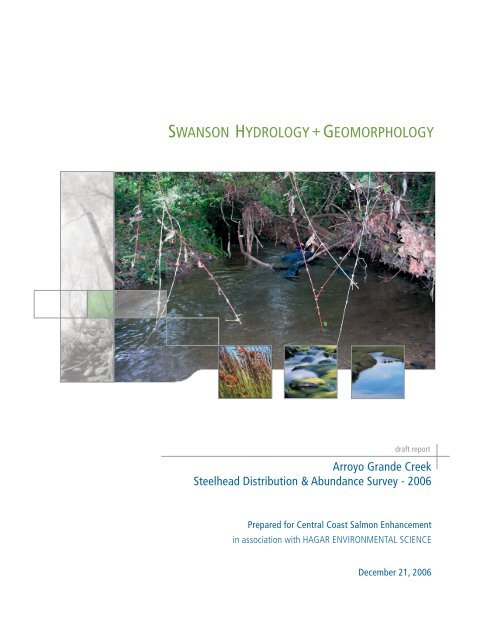
draft report<strong>Arroyo</strong> <strong>Grande</strong> <strong>Creek</strong><strong>Steelhead</strong> <strong>Distribution</strong> & <strong>Abundance</strong> <strong>Survey</strong> - 2006Prepared for Central Coast Salmon Enhancementin association with HAGAR ENVIRONMENTAL SCIENCEDecember 21, 2006
INTRODUCTION AND BACKGROUNDHistorically, <strong>Arroyo</strong> <strong>Grande</strong> <strong>Creek</strong> supported a large native population of steelhead. Land useimpacts in the watershed and construction of Lopez Dam and Reservoir has greatly reduced theirnumbers to a point where only a small run of adult steelhead occur today. Access to historicspawning habitat upstream of Lopez Reservoir was completely cut off due to construction of thedam in the late 1960’s. The remaining habitat consists of the mainstem of <strong>Arroyo</strong> <strong>Grande</strong> <strong>Creek</strong>downstream of the dam and pockets of year-round flow on tributaries such as Los Berros and TarSprings. These areas do not provide the prime spawning and rearing habitat that occurs upstream ofLopez Reservoir.In 1997, steelhead (Oncorhynchus mykiss mykiss) were listed as threatened under the EndangeredSpecies Act. Due to their declining numbers and federal protection, awareness has been raisedabout the fate of the steelhead run in <strong>Arroyo</strong> <strong>Grande</strong> <strong>Creek</strong> and measures are being pursued torestore this population through habitat enhancement measures downstream of Lopez Reservoir. Toevaluate improvements in habitat conditions on <strong>Arroyo</strong> <strong>Grande</strong> <strong>Creek</strong>, Central Coast SalmonEnhancement, through a California Department of Fish and Game, received a grant to establish abaseline for their distribution and relative abundance in Lower <strong>Arroyo</strong> <strong>Grande</strong> <strong>Creek</strong> (Figure 1).METHODSOverviewThere are two main methodologies in use for evaluating the distribution and abundance of juvenilesteelhead populations: visual surveys and electrofishing. Electrofishing provides relatively accurateand precise population estimates and allows precise information on length and weight to becollected as well. Visual surveys take less time than electrofishing and much greater sample sizes canbe obtained, but they have low precision and accuracy (Thurow 1994, Dolloff et al. 1993, Hankin1986, Hankin and Reeves 1988).The mainstem of <strong>Arroyo</strong> <strong>Grande</strong> <strong>Creek</strong> consists of approximately 14 miles of channel along themainstem, 14 miles of channel along Los Berros and an equal amount along Tar Springs. Thenumber of miles of potential habitat along all of these channels may be on the order of 20+ miles.Given limited resources to sample such a large area, the primary sampling technique consisted ofvisual surveys and limited electrofishing on the mainstem of <strong>Arroyo</strong> <strong>Grande</strong> <strong>Creek</strong> below LopezReservoir. There may be an opportunity to evaluate habitat conditions and sample fish populationsin future studies if funding becomes available.To maximize the amount of area covered, visual surveys were conducted in teams of two with JeffHagar of Hagar Environmental Science (HES), leading one team and John Dvorsky, of SwansonHydrology and Geomorphology (SH+G), leading the other. A minimum of one Central CoastSalmon Enhancement (CCSE) technician was assigned to each team with the team members
emaining consistent throughout the entire survey. Electrofishing surveys consisted of a single teammade up of Jeff Hagar, John Dvorsky and a minimum of one technician from CCSE.Site SelectionThe mainstem of <strong>Arroyo</strong> <strong>Grande</strong> <strong>Creek</strong> was habitat and channel typed in the summer of 2004 by acrew from the California Conservation Corps using methods outlined in the California SalmonidStream Habitat Restoration Manual (Flosi et al, 1998). A total of 13.9 miles of stream channel washabitat typed and a total of 772 habitat units were identified. Potential fish bearing tributaries suchas Los Berros and Tar Spring <strong>Creek</strong>s were not habitat typed. Due to the lack of habitat typing dataon Los Berros and Tar Spring <strong>Creek</strong>s, these tributaries were not sampled for fish. The focus of theassessment was on the mainstem of <strong>Arroyo</strong> <strong>Grande</strong> <strong>Creek</strong>.SH+G and HES compiled and reviewed the existing habitat typing data provided by CCSE. Fromthese data, SH+G and HES developed a sampling strategy based on a stratified random samplingapproach that maximizes the resources available to the project. The selected sites were stratifiedbased on reach delineations provided in the CCC habitat typing work and consideration of areas upand downstream of known barriers. Four to five sampling locations were randomly selected fromthe CCC habitat database within each reach or reach subset (some reaches were split based on thepresence of known barriers and tributary inputs). From the four to five sites randomly selected,subsets of those were surveyed based on their order of selection within the random selectionprotocol, or the accessibility of the site (i.e. – landowner permission, vegetation, etc). Each selectedsampling location encompassed several habitat units bounding the randomly selected unit to ensureselection of representative pool, riffle, and run habitat.Sampling ProtocolVisual <strong>Survey</strong>sGiven limited resources, visual surveys were the primary sampling approach for the study tounderstand steelhead distribution and abundance. A total of 30 habitat units on the mainstem<strong>Arroyo</strong> <strong>Grande</strong> were visually surveyed between October 8 th and October 13 th , 2006 (Figure 2; Table1). Visual surveys consisted of up to two divers swimming each selected habitat unit to count thenumber of fish and estimate size classes. Most habitats only required the use of one observer due tonarrow wetted widths and shallow water. During all surveys, a high-powered dive light was availableto each observer to improve observations in areas of vegetation and undercut banks. To minimizepotential observation error, or at least maintain a consistent level of error between sample units, thefollowing approach was used:o Consistency was maintained between each sample unit in terms of who is making theobservation.o The amount of time, or effort, spent in each habitat unit was consistent between habitatunits based on the habitat unit’s length.
Fish counts were segregated by size class as less than 3 inches fork length, 3-6 inches, and 6-10inches, and greater than 10 inches. Divers attempted to compensate for the magnification resultingfrom viewing objects underwater. Divers note presence/absence of other fish species but did notestimate their numbers. Notes were also collected on the observed condition of the steelhead,evidence of anadromy, and other habitat characteristics.Electrofishing <strong>Survey</strong>sA representative site, visually sampled within each reach, was electrofished using a 2-pass method, toevaluate the visual survey abundance estimates and obtain detailed weight and length distributionsfor steelhead. The site selected within each reach was based on its random selection order, withaccess constraints taken into consideration. A total of seven sites on the mainstem <strong>Arroyo</strong> <strong>Grande</strong>were sampled. Habitat conditions, such as temperature and discharge, were recorded for each unitsampled. Length and weight for the first 10 trout collected from each size class at each site wascollected (total of 30 fish maximum). Given the number of trout sampled, this resulted in collectionof weight and length for all individuals collected during the survey. The condition of each measuredfish was noted along with the presence of diseases and overall health. Fish species other than troutwere noted for presence/absence.Data AnalysisVisual survey and electrofishing data was entered in an electronic database (MS Excel) forease of data summary and ease of incorporating any future surveys. A population estimateand confidence limit was calculated for each electrofishing site using the two-pass removalmethod (Seber and LeCren 1967).RESULTSA total of 30 sampling locations were surveyed in October of 2006 on lower <strong>Arroyo</strong> <strong>Grande</strong> <strong>Creek</strong>within 7 identified reaches. <strong>Steelhead</strong> were identified in all but 4 sampling locations (Table 2). Inaddition, a total of 8 other species were identified including Sacramento sucker (Catostomusoccidentalis), California roach (Hesperoleucus symmetricus), threespine stickleback (Gasterosteus aculeatus),speckled dace (Rhinichthys osculus), sculpin (Cottus ssp.), bullhead catfish (Ameiurus spp.), anundetermined centrarchid, and mosquitofish (Gambusia affinis).The most common species observed during the survey were Sacramento sucker, California roach,and threespine stickleback 1 (Table 3). The non-native fish species, including bullhead, centrarchids,and mosquitofish, were only identified in reaches closer to Lopez Reservoir suggesting that thereservoir is a source of these species in the system. Native species, including steelhead and nonsteelheadnatives became less abundant closer to Lopez Reservoir suggesting unfavorable habitatconditions or possibly, interactions with non-native species.1Since the focus of the electroshocking survey was to estimate steelhead abundance, many of the smaller,non-steelhead individuals were not captured.
<strong>Steelhead</strong> were present in all 7 reaches but were found in relatively low numbers (Table 4).<strong>Steelhead</strong> were most abundant in the upper portions of Reach 2, in Reach 3, and the lower portionof Reach 4. <strong>Steelhead</strong> length distribution in electrofishing (Figure 3) surveys indicated the followingsize and age-class distributions: young-of-year or 0+ fish = 60-90 mm fork length; 1+ fish = 110-140 mm fork length; 2+ or older fish = >150 mm fork length. The length frequency distributionindicates that young-of-year fish may have gained slightly larger size than anticipated (up to 90mmor 3.5 inches instead of 3 inches) and that age class designations used in the visual surveys may haveresulted in counting some young-of-year fish as 1+. Correlations between electrofishing and visualsurvey results for steelhead were poor (Table 5).A rough estimate of trout density was developed from the electrofishing and snorkel data (Table 6),by using the maximum of the electrofishing catch or snorkel survey counts of 1+ and 2+ trout(usually the snorkel count). Young-of-year fish were excluded from the analysis since their numbersare highly variable and the abundance of older trout is a better indication of a streams capacity toproduce steelhead smolts. In comparison to density of smolt sized fish in Central California streamsin the 1980s (Table 7), trout densities in <strong>Arroyo</strong> <strong>Grande</strong> <strong>Creek</strong> would be regarded as at the low endof the spectrum.DISCUSSIONLow numbers of steelhead visually observed and sampled during the survey support previous studiessuggesting low steelhead adult returns, poor quality habitat, and loss of historic, high quality habitatpresent above Lopez Reservoir. The data presented in this report suggests that the best habitatpresent in the system occurs in the upper portions of Reach 2, Reach 3, and the lower portion ofReach 4. Habitat conditions in the upper portions of Reaches 4, 5, 6, and 7 appear to besignificantly influenced by a lack of high flows due to regulation by Lopez Reservoir. The lack ofchannel flushing high flows has resulted in a narrow channel that lacks complexity and the presenceof silt in the substrate. The presence of high fine sediment loads in streams has been shown to limitmacroinvertebrate production and reduce the amount of cover habitat available to juvenilesalmonids. Portions of Reaches 2, 3, and 4 probably exhibit higher steelhead abundance becauseunregulated flows from Los Berros, Tar Springs, and Corbett/Carpenter <strong>Creek</strong> allow forintroduction of coarse material for spawning and flushing of fine sediment from pools and riffles.<strong>Abundance</strong> estimates from electrofishing surveys were less precise than generally expected andestimates for electrofishing and snorkel surveys were not generally in close agreement. Samplingproblems experienced during the survey that may have resulted in the lack of correlation betweenelectrofishing and visual surveys include:• Low capture rates for stunned fish in electrofishing survey (particularly for survey units inReaches 1 and 2),• Fish avoidance of electrofishing due to dense overhead and underbank cover in somelocations,• Relatively low abundance of steelhead in comparison with several other species making itdifficult to focus efforts on steelhead,
• Difficult in accurately identifying steelhead during visual surveys due to the presence andnumber of individuals represented by other species,• Small size of survey units may have resulted in disturbance of steelhead and other fish andstimulation of escape response (rapid darting) with possible multiple counting or missedobservations during visual surveys, and• Poor visibility due to siltation in some areas may have affected visual observations.Despite sampling problems, the study provides a strong representation of the general distributionand relative abundance of steelhead and presence/absence of other species for lower <strong>Arroyo</strong><strong>Grande</strong> <strong>Creek</strong>. The approach is repeatable and will provide a good baseline for future studies.Future abundance surveys in lower <strong>Arroyo</strong> <strong>Grande</strong> <strong>Creek</strong> should assume similar levels of precisionunless better agreement can be obtained between electrofishing and snorkel surveys.
S T U O HER NPAC I F227ICMapExtentLopezLake<strong>Creek</strong>Gra ndePismo BeachGrover BeachCity of<strong>Arroyo</strong> <strong>Grande</strong><strong>Arroyo</strong>TarSpring<strong>Creek</strong>OceanoLosBerros<strong>Creek</strong>1011LEGENDNL I R R A OA DI L R OA D0 1.0 2.0 4.0SWANSON HYDROLOGY + GEOMORPHOLOGY500 Seabright Ave, Suite 202 Santa Cruz, CA 95062PH 831.427.0288 FX 831.427.0472Miles 1:126,720FIGURE 1: Location map for the study area on <strong>Arroyo</strong> <strong>Grande</strong> <strong>Creek</strong>.INCORPORATEDCITY LIMITSHIGHWAYSSTREETS / ROADSRAILROADSRIVERS AND STREAMS
!> !>!>!>!> !>!>!>!>!>!> !>!> !> !> !> !>!>!>!> !> !>!>REACH 1!> !>0 0.5 1.0 2.0MilesSWANSON HYDROLOGY + GEOMORPHOLOGY FIGURE 2: Map indicating sample locations and geomorphic reaches along the <strong>Arroyo</strong> <strong>Grande</strong> <strong>Creek</strong>.500 Seabright Ave, Suite 202 Santa Cruz, CA 95062PH 831.427.0288 FX 831.427.0472!>!> NREACH 7REACH 5REACH 6227REACH 4<strong>Arroyo</strong> <strong>Grande</strong> <strong>Creek</strong>REACH 31101LEGENDREACH BREAKHIGHWAYS / INTERSTATESROADS / STREETSRIVERS / STREAMSSAMPLE LOCATIONREACH 2Grover Beach
180-189190-19976543210Figure 3: Length Frequency <strong>Distribution</strong> for <strong>Steelhead</strong> in <strong>Arroyo</strong> <strong>Grande</strong> <strong>Creek</strong>October 200630-3940-4950-5960-6970-7980-8990-99100-109110-119120-129130-139140-149150-159160-169170-179Length Class (mm fork length)20-2910-19Number of Fish
Table 1: Selected sample locations for <strong>Arroyo</strong> <strong>Grande</strong> <strong>Creek</strong> <strong>Steelhead</strong> <strong>Distribution</strong> and <strong>Abundance</strong> <strong>Survey</strong> - 2006Downstreamdistance fromReach start (ft)Sample IDHabitat UnitNumber Latitude Longitude ReachCummulativedistance (ft)*Habitat Type1 0002.00.00.00.00 35.09972222 -120.625 1 372 372 3.2- Glide 3722 0035.00.00.00.00 35.09583333 -120.6136111 1 3856.5 3856.5 4.2 - Mid-Channel Pool 633 0062.00.00.00.00 35.09526667 -120.601 1 6671.3 6671.3 5.3 - L. Scour Pool (Root Wad Enhance 244 0082.00.00.00.00 35.0975 -120.5933333 1 10170.7 10170.7 6.5 - Dammed Pool 1435 0094.00.00.00.00 35.09972222 -120.5913889 2 533 11150.7 3.3 - Run 1026 0167.00.00.00.00 35.11472222 -120.5863889 2 6657 17274.7 4.2 - Mid-Channel Pool 517 0253.00.00.00.00 35.12444444 -120.5727778 2 13134 23751.7 3.3 - Run 988 0255.00.00.00.00 35.1244 -120.575 2 13318 23935.7 3.4 - Step Run 1189 0263.00.00.00.00 35.12472222 -120.5711111 2 13695 24312.7 4.2 - Mid-Channel Pool 8810 0295.00.00.00.00 35.12601667 -120.5659167 3 932 26254.7 4.1 - Trench Pool 6711 0307.00.00.00.00 35.12553333 -120.5650167 3 1459 26781.7 3.3 - Run 3412 0315.00.00.00.00 35.12516667 -120.5636833 3 1911 27233.7 3.3 - Run 7613 0341.00.00.00.00 35.12465 -120.5623333 3 3204 28526.7 3.3 - Run 11214 0400.00.00.00.00 35.15928333 -120.5301167 4 876.1 46579.8 3.3 - Run 13315 0416.00.00.00.00 35.1575 -120.5288889 4 1708.1 47411.8 5.2 - L. Scour Pool (Log Enhanced) 1616 0476.00.00.00.00 35.16388889 -120.5325 4 5225.1 50928.8 3.3 - Run 9518 0605.00.00.00.00 35.175 -120.5241667 4 11739.1 57442.8 4.2 - Mid-Channel Pool 3419 0621.00.00.00.00 35.17543333 -120.5212833 5 422 58431.8 4.2 - Mid-Channel Pool 2820 0640.00.00.00.00 35.17973333 -120.5189 5 2177.5 60187.3 3.2- Glide 3021 0654.00.00.00.00 35.17995 -120.5185 5 2693.5 60703.3 3.2- Glide 5422 0662.00.00.00.00 35.17971667 -120.51815 5 3055.5 61065.3 4.2 - Mid-Channel Pool 2223 0690.00.00.00.00 35.17985 -120.5151167 6 149 62103.3 4.2 - Mid-Channel Pool 2724 0700.00.00.00.00 35.17972222 -120.5147222 6 579 62533.3 3.3 - Run 15025 0701.00.00.00.00 35.17944444 -120.5141667 6 657 62611.3 3.2- Glide 7826 0716.00.00.00.00 35.17972222 -120.5125 6 1284 63238.3 4.2 - Mid-Channel Pool 3328 0738.00.00.00.00 35.18516667 -120.4906333 7 8378 71752.3 3.3 - Run 4229 0744.00.00.00.00 35.18611667 -120.4905 7 8720 72094.3 3.3 - Run 5030 0745.00.00.00.00 35.18625 -120.4905 7 8839 72213.3 4.2 - Mid-Channel Pool 119NOTES:Habitat Units selected from California Conservation Corps survey, 2005.* Cumulative distance from the beginning of Reach 1.UnitLength(ft)
Table 2: Fish Species <strong>Distribution</strong> in <strong>Arroyo</strong> <strong>Grande</strong> <strong>Creek</strong> Snorkel <strong>Survey</strong>s and Electrofishing <strong>Survey</strong>s, October 2006Reach1234567SampleUnit # <strong>Steelhead</strong>SacramentoSuckerCaliforniaRoachThreespineSticklebackSpeckledDace SculpinBullheadCatfish1 X X X X X2 X X X X3 X X X X X X4 X X X X X5 X X X X6 X X X7 X X X X8 X X X X X X9 X X X X10 X X X X11 X X X X12 X X X X X13 X X X X X14 X X X X X15 X X X16 X X18 X19 X X20 X X X X X21 X X X22 X X X X23 X X X24 X X XCentrarchid(speciesundetermined)Mosquitofish25 X26 X28 X X X X29 X30 X X X
Table 3: Fish Species <strong>Abundance</strong> in <strong>Arroyo</strong> <strong>Grande</strong> <strong>Creek</strong> Electrofishing <strong>Survey</strong>s, October 2006ReachSampleUnit # <strong>Steelhead</strong>SacramentoSuckerCaliforniaRoachThreespineSticklebackSpeckledDace SculpinBullheadCatfish1 3 19 15 12 12 8 6 58 22 1 7 13 13 8 31 25 2 104 14 3 10 15 22 6 5 16 23 4 12 17 28 13Table 5: <strong>Steelhead</strong> Population Estimates and Comparison of Electrofishing and Snorkel <strong>Survey</strong> Results in <strong>Arroyo</strong> <strong>Grande</strong> <strong>Creek</strong>,October 2006.ElectrofishingCatch in FirstPassElectrofishingCatch in SecondPassTotal Catch inElectrofishing<strong>Survey</strong>ElectrofishingPopulationEstimateUpper 95%confidence limitof PopulationEstimateTotal Count inSnorkel <strong>Survey</strong>Reach Unit #1 3 0 -- 0 12 8 1 5 6 ** ** 143 13 5 3 8 13 33 224 14 2 1 3 4 11 205 22 4 2 6 8 18 36 23 3 1 4 5 7 37 28 0 -- 0 4** no estimate possible due to lack of depletion
Table 4: <strong>Steelhead</strong> <strong>Abundance</strong> in <strong>Arroyo</strong> <strong>Grande</strong> <strong>Creek</strong> Electrofishing and Snorkel <strong>Survey</strong>s, October 2006Reach Unit #Electrofishing TotalCatch Snorkel Total Count1 112 13 0 14 25 06 027 218 6 149 1510 28311 712 1213 8 2214 3 20415 616 1618 319 1520 1021 222 6 323 4 3624 125 526 028 0 4729 030 9Grand Total 27 207
Table 7: Density Estimates for Smolt Sized <strong>Steelhead</strong> in Central California Coastal Streams inthe 1980s.Average Number of Smolt-StreamSized Fish per 100 feetSan Vicente 40.9San Lorenzo River 29.8Aptos (Nisene Marks, upstream from 2nd Bridge) 24.0Zayante 22.0Carmel 21.8Valencia (downstream of Valencia Road) 17.0Browns 16.5Corralitos 16.1Valencia average 15.0Baldwin 13.8Valencia (up flume road 0.75 miles 13.0Newell 13.0Shingle Mill Gulch 12.7Bear 12.0Fall 12.0Soquel West Fork 11.3Aptos (County Park above railroad crossing) 11.0Boulder 10.5Mill (San Lorenzo) 10.5Aptos Average 9.6Bean 9.5Majors 9.4Jamison 8.0Hester 7.0Laguna 7.0Aptos (just above Valencia) 6.0Aptos (Nisene Marks, upstream from Steel Bridge) 6.0Bates 6.0Liddell 6.0Pescadero 6.0Ramsey 6.0Soquel East Fork 6.0Kings 5.0Liddell West Fork 5.0Moore's Gulch 5.0Gamecock 4.0Hinkley 3.0Liddell East Fork 3.0Lockhart Gulch 3.0Soquel 3.0Carbonera 1.7Aptos (below Valencia) 1.0Source: Harvey and Stanley Associates (1984)


