Kerang Local Flood Guide.pdf - Victoria State Emergency Service
Kerang Local Flood Guide.pdf - Victoria State Emergency Service
Kerang Local Flood Guide.pdf - Victoria State Emergency Service

You also want an ePaper? Increase the reach of your titles
YUMPU automatically turns print PDFs into web optimized ePapers that Google loves.
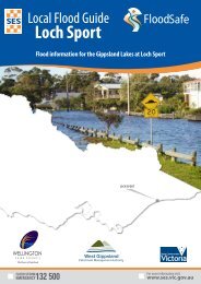
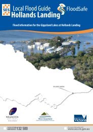
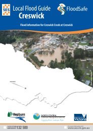
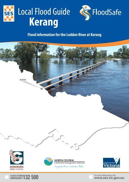
<strong>Local</strong> <strong>Flood</strong> <strong>Guide</strong><strong>Kerang</strong>Safe<strong>Flood</strong> information for the Loddon River at <strong>Kerang</strong><strong>Kerang</strong>
<strong>Local</strong> <strong>Flood</strong> InformationThe <strong>Kerang</strong> <strong>Local</strong> Area<strong>Kerang</strong> is located within the Shire of Gannawarra on the Loddon River, a few kilometresnorth of the intersection of the Murray Valley and Loddon Valley Highways. <strong>Kerang</strong>’smain river is the Loddon River but it often receives overflows from other rivers and creekssuch as Pyramid Creek . Properties in the town, surrounding rural areas and essentialinfrastructure including the nearby electricity sub-station are at risk of flooding.The area around <strong>Kerang</strong> is prone to being cut-off by floodwater when any or all of theMurray Valley and Loddon Valley Highways, Koondrook Road and <strong>Kerang</strong>-QuambatookRoad are closed.Your local emergency broadcasters are:■■ABC <strong>Local</strong> 102.1 FM■■Mixx 98.7 FM■■ SKY NEWS TelevisionGannawarra Shire Council Contact:Phone: (03) 5450 9333Email: council@gannawarra.vic.gov.auWeb: www.gannawarra.vic.gov.auThe town is surrounded by levees, most of which were built between 1980 and 1996 aspart of a flood mitigation scheme. However, no levee is flood proof and parts of the townmay still be prone to flooding. The map below shows the extent of the January 2011 floodwhich measured 78.03m on the Murray Valley Highway River Gauge:DisclaimerThis publication is presented by the <strong>Victoria</strong> <strong>State</strong> <strong>Emergency</strong> <strong>Service</strong> for the purpose of disseminating emergency management information. The <strong>State</strong> <strong>Emergency</strong> <strong>Service</strong> disclaims any liability (including fornegligence) to any person in respect of anything and the consequences of anything, done, or not done of any kind including damages, costs, interest, loss of profits or special loss or damage, arising from any error,inaccuracy, incompleteness or other defect in this information. By any such person in whole or partial reliance upon the whole or part of the information in this map publication. <strong>Flood</strong> information is provided by NorthCentral Catchment Authority.2<strong>Local</strong> <strong>Flood</strong> <strong>Guide</strong>
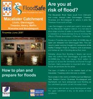
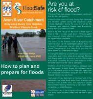
Your <strong>Local</strong> <strong>Flood</strong> InformationAre you at risk of flood?<strong>Kerang</strong> is on the Loddon River floodplain, making it susceptibleto flooding. The town and its surrounding areas are vulnerable tooverland flows of water due to the flat nature of the landscape.<strong>Kerang</strong> is located close to the Loddon River and within the Loddoncatchment there are a number of creeks and river run offs.Significant floods have occurred in <strong>Kerang</strong> since records beganincluding in 1909, 1916, 1933, 1975, 1981, 1993 and 2011. The 2011flood followed an extensive period of wet weather with majorflooding through the lower Loddon and Avoca Rivers in Septemberand December 2010.Properties start to become isolated to the north and south of <strong>Kerang</strong>when the Murray Valley Highway Bridge Gauge reads 77.20 metres,just about minor flood level.Widespread flooding in <strong>Kerang</strong> led to a number of mitigation worksin the area during 1980-1996 to help reduce the impact of floods.<strong>Kerang</strong>’s levees run for 17 kilometres and includes part of the MurrayValley Highway to the south of the town.Did you know?Know your riskUntil January 2011, the largest flood occurred in 1909 whereextensive parts of <strong>Kerang</strong> and its surrounding rural areas wereflooded. In 2011, the flood reached the highest levels everrecorded causing significant damage to the township and itsassociated rural areas flooding:■■13 houses and 1 shop in East <strong>Kerang</strong>, and 28 houses and 4businesses in West <strong>Kerang</strong>.■■Rural properties surrounding the town isolating them fordays.■■Main transport routes and other roads, disrupting traffic.■■Community facilities and other private properties.During the 2011 flood, widespread power outages for <strong>Victoria</strong>ncommunities were avoided by emergency sandbaggingactivities of the electricity substation, located south of the<strong>Kerang</strong> township.If you live or work close to a creek, river or low-lying area youmay be at risk from floods.<strong>Local</strong> <strong>Flood</strong> InformationDuring the 2011 flood, floodwater overtopped the Pyramid Creeklevee. However, the township of <strong>Kerang</strong> was saved from the fullextent of the flooding by a combination of the levee on the LoddonRiver and a temporary levee built on the southern side of <strong>Kerang</strong>.<strong>Kerang</strong>’s levees have reduced the level of risk associated withflooding in some areas of the town, however no levee is flood proofand some houses and businesses inside and outside of the townwere flooded.Even if you are not directly affected, you may still have to detouraround flooded areas.Loddon River <strong>Flood</strong> Levels at the Murray Valley Highway Bridge GaugeWhen the Bureau of Meteorology (BoM) issues flood warnings they include a prediction of the flood height at a particular gauge.While no two floods are the same, the following table can give you an indication of what you can expect at certain heights, includingwhen your access may be cut off and when your property may be affected.78.03 m19 January 2011 floodDuring the January 2011 flood, <strong>Kerang</strong> was just protected by town levees but many properties,roads and levees damaged in the surrounding area including 20 houses in the immediate vicinity, 13houses and one shop in East <strong>Kerang</strong>, 28 houses and four businesses in <strong>Kerang</strong> West, the Murray Valleyand Loddon Valley Highways. Height shown on page 2.The Murray Valley Highway Bridge Gauge ismeasured based on the Australian HeightDatum (AHD) which assumes sea level is 0metres.77.90 m Design level for <strong>Kerang</strong> flood levee*77.84 m77.80 m77.60 m77.50 m77.20 m77.40 m77.00 m1981 flood – before the town levees was completedMAJOR FLOOD LEVELSeptember 1993 floodMODERATE FLOOD LEVEL10 December 2010 floodProperties start to become isolated to the north and south of <strong>Kerang</strong>MINOR FLOOD LEVEL*Note: The design level is the height that a levee was designed to provide protection. This is lowerthan the top of the levee which is why the <strong>Kerang</strong> levee did not overtop in the 2011 flood. This is calledthe freeboard of a levee. Freeboard should NEVER be relied on to provide protection in a flood.An example of a flood gauge.<strong>Local</strong> <strong>Flood</strong> <strong>Guide</strong>3
What warnings mean<strong>Flood</strong> Watches and <strong>Flood</strong> Warnings are issued by the Bureau ofMeteorology (BoM) to tell people about possible flooding.A <strong>Flood</strong> Watch means there is a developing weather pattern thatmight cause floods in one or two days.About <strong>Flood</strong> WarningsAbout <strong>Flood</strong><strong>Flood</strong> Warnings mean flooding is about to happen or is alreadyhappening. There are Minor, Moderate and Major flood warnings.Minor <strong>Flood</strong> Warning means floodwater can:■■Reach the top of the river banks■■■■■■ Come up through drains in nearby streets■ Cover low-lying areas including riverside camping areas■ Affect some low-lying caravan parks■ Cover minor roads, tracks and low level bridges■ Spread across land or go into buildings on some propertiesand farms.A Moderate <strong>Flood</strong> Warning means floodwater can:■■Spill over river banks and spread across low-lying areas■■Start to threaten buildings, roads, rail, power and otherdevelopments■■Require evacuation in some areas■■Cover main roads.A Major <strong>Flood</strong> Warning means floodwater can:■■Cause widespread flooding■■■■■Require many evacuations.Warnings■ Threaten more houses and businesses■ Cause properties and whole areas to be isolated by water■ Disrupt major roads and transport routesThe <strong>Victoria</strong> <strong>State</strong> <strong>Emergency</strong> <strong>Service</strong> (SES) will give informationabout how the floodwater might affect people and properties.This includes safety messages to remind you what to do.Severe Thunderstorm WarningsThunderstorms are classified as severe, due to their potential tocause significant localised damage through: wind gusts, large hail,tornadoes or flash flooding. Severe thunderstorm warnings areissued to the community by the Bureau of Meteorology.Severe Weather WarningsThese warnings are issued to the community by the Bureau ofMeteorology when severe weather is expected that is not directlyrelated to severe thunderstorms or bushfires. Examples of severeweather include damaging winds and flash flooding.Remember, you may not receive any official warning.<strong>Emergency</strong> assistance may not be immediately available. Beaware of what is happening around you to stay safe.Never wait for a warning to act.<strong>Emergency</strong> AlertSES may provide alerts to the <strong>Kerang</strong> community through the<strong>Emergency</strong> Alert telephone warning system. All <strong>Emergency</strong><strong>Service</strong>s can use <strong>Emergency</strong> Alert to warn communities aboutdangerous situations by voice message to landline telephones ortext message to mobile phones.If you receive a warning, make sure that all family members,people at work and your neighbours are aware of the situation.If you receive an <strong>Emergency</strong> Alert you should pay attentionand act. It could mean life or death.<strong>Flood</strong> Warnings for <strong>Kerang</strong>For the Loddon River <strong>Flood</strong> Warnings are issued by the Bureauof Meteorology. <strong>Flood</strong> Warnings provide predictions of floodsize (minor, moderate or major), time and possible peaks of theLoddon River.It is important to know how the predicted flood levels are likelyto impact you as you may be affected before the peak. See page 3:Loddon River <strong>Flood</strong> Levels at the Murray Valley Highway Bridge.While no two floods are the same, you can use this table to helpyou figure out when you need to start following your floodemergency plan.<strong>Flood</strong> leveesA levee is an embankment usually along-side a river or creekdesigned to protect property from floodwater.Levees can reduce the frequency of flooding but no levee isguaranteed to be flood proof. A levee is designed to control acertain amount of floodwater. If larger floods occur, water will flowover the levee into low-lying areas. <strong>Flood</strong>water may also damagethe levee, allowing floodwater to flow through an opening orbreak.<strong>Flood</strong> levees are to protect property, not people. If the levee isin danger of failing, you will be advised to evacuate floodprone areas. It is important that you follow this advice.Flash <strong>Flood</strong>ing happens quickly. There may be little or nowarning. The arrival time or depth of a flash flood can usually notbe predicted.4<strong>Local</strong> <strong>Flood</strong> <strong>Guide</strong>
Preparing for <strong>Flood</strong>sNOW - before a flood■■Check if your home or business is subject to flooding. Formore information, contact Gannawarra Shire Council.■■Check if you could be cut off by floodwater.■■ Know the safest way to go if you decide to leave your propertyand plan an alternative route.■■Check your insurance policies as often properties, equipmentand businesses are not covered for flood.■■Keep a list of emergency numbers near the telephone.■■Develop an <strong>Emergency</strong> Plan.■■Put together an <strong>Emergency</strong> Kit.When a flood is likely■■Take action. Follow your <strong>Emergency</strong> Plan.■■■■ Listen to your radio for information and advice.■ Check your neighbours are safe and know about the flood.■ Stack possessions on benches and tables with electrical goodsin the highest places.■■Move pumps, machinery, hay and livestock to high ground.■■Move rubbish bins, chemicals and poisons to the highestplace.■■Anchor objects that are likely to float and cause damage.■■Put important papers, valuables, photos and other specialpersonal items into your <strong>Emergency</strong> Kit.■■Business owners should raise stock, business records andequipment onto benches and tables.■■If you are likely to be isolated, have enough food, drinkingwater, medicine, fuel and other needs to last at least threedays.■■Do not forget pet food and stock feed.The time for me to evacuate is before:Your <strong>Emergency</strong> PlanEmergencies can happen at any time, with little warning.People who have planned and prepared for emergencies havereduced the impact and recovered faster.Taking the time to think about emergencies and make your ownplan helps you think clearly and have more control to make betterdecisions when an emergency occurs.Your <strong>Emergency</strong> Plan should identify:■■The types of emergencies that might affect you.■■How those emergencies might affect you.■■■Where to get more information.■■ What you will do before, during and after an emergency.■ Where you will go if you evacuate and the best way to go indifferent circumstances.■■A list of phone numbers you will need, including emergencyservices, your insurance company, friends and family.Visit www.ses.vic.gov.au to obtain a copy of yourHome <strong>Emergency</strong> Plan workbookEvacuationPrepare a planPreparing For <strong>Flood</strong>s<strong>Victoria</strong> Police is responsible for coordinating an evacuation inan emergency. During a flood, Police, SES and other emergencyservices may advise you to evacuate to keep you safe. It isimportant that you follow this advice.There are two types of evacuation notices that may be issued viayour emergency broadcaster during a flood:■■Prepare to evacuate - means you should act quickly andtake immediate action to protect your life and property. Youshould be ready to leave.■■ Evacuate immediately - you must leave immediately as thereis a risk to lives.Remember you can leave at any time if you feel unsafe. You do notneed to wait to be told to evacuate.<strong>Local</strong> <strong>Flood</strong> <strong>Guide</strong> 5
Home <strong>Emergency</strong> Kit<strong>Emergency</strong> KitEvery home and business should have a basic emergency kit:Copy of your <strong>Emergency</strong> PlanRadio Torch Spare batteries Copy of documents & recordsLong life foodFirst aid kitSafe drinking waterGlovesCheck your kit often. Make sure things work. Replace out of date items.When a warning is issued, have ready for use or pack into your kit:Mobile phone and charger Prescriptions & medicines Pet needs Strong shoes Clothes for your family3 days supply3 days supply3 days supply3 days supplyI need to add:Write your list here. Tick items as you pack them into your kit.Special needsPhotosFamily KeepsakesValuablesDocumentsOther6<strong>Local</strong> <strong>Flood</strong> <strong>Guide</strong>
During and After a <strong>Flood</strong>During a floodWhen flooding has begun:■■Never drive, ride or walk through floodwater.■■■ <strong>Flood</strong>waters can be deep and damage roads and bridges.■ Do not let your children play or swim in floodwater. It isdirty, dangerous and deadly.■■Tune in to your emergency broadcasters: ABC <strong>Local</strong> Radio,Commercial Radio, designated Community Radio Stationsand SKY NEWS Television.■■In life-threatening emergencies, call 000 (triple zero).■■For emergency help from the SES in floods and storms call132 500.■■Stay away from all waterways including drains and culverts.■■Stay away from fallen power lines – electricity travels easilythrough water.■■Be aware that animals, snakes, rats, spiders and other pestsmay be on the move during a flood - they can come intohouses and other buildings or hide around sandbags.■■Keep in contact with neighbours.■■Be prepared to leave early.When you leave early or evacuate:■■Leaving early is always the safest option, leave well beforeroads are closed by floodwater.■■Take your emergency kit and three days supply of clothingwith you.■■Turn off the electricity, gas and water as you leave.■■Take your pets with you. Do not leave them behind. Dogsshould be muzzled.■■Go to a relief centre or to stay with friends or family in higherareas.Relief Centre staff can help you with:■■Temporary accommodation■■Financial help■■Personal support■■Drinks and meals■■Basic clothing and personal needs■■Help to contact family and friends.After a flood<strong>Flood</strong> dangers do not end when the water begins to fall.To make sure you stay safe:■■Keep listening to local emergency broadcasters.■■Do not return home until advised that it is safe.Once you return to your home:■■Drink bottled water or boil all drinking water until advised thatthe water supply is safe.■■Throw away any food or medicines that may have been incontact with floodwater or affected by power outages.■■When entering the building, use a torch to light yourway - never use matches, cigarette lighters or any other flame asthere may be gas inside.■■Keep the electricity and gas off until checked and tested by aprofessional.■■Clean your home straight away to stay healthy.■■Take photographs of all damage for insurance.■■Contact Council to let them know about damage to yourproperty.How SES helps the communityThe <strong>Victoria</strong> <strong>State</strong> <strong>Emergency</strong> <strong>Service</strong> (SES) is a volunteer basedemergency service. Although our SES volunteers attempt toreach everyone prior to or during an emergency, at times this isnot possible. Therefore it is advisable for you to be prepared foremergencies so that you can share responsibility for your ownwellbeing during those times. In a flood, SES assistance mayinclude:■ ■ Giving flood advice■■Protecting essential services■ ■ Helping to protect infrastructure■ ■ Rescuing people from floodwater■ ■ Advising of an evacuation.To assist your preparation, it is recommended that you obtain acopy of a SES Home <strong>Emergency</strong> Plan by visitingwww.ses.vic.gov.au.During and After a <strong>Flood</strong>If you choose to shelter with a friend or relative, tell authoritieswhere you are staying.<strong>Local</strong> <strong>Flood</strong> <strong>Guide</strong> 7
Checklist and Contacts<strong>Emergency</strong> ChecklistNOW: <strong>Flood</strong> preparationCheck if your insurance policies cover flooding.Keep this list of emergency numbers near the telephone.Put together an <strong>Emergency</strong> Kit and prepare a home or business<strong>Emergency</strong> Plan, see www.ses.vic.gov.au.When you hear a <strong>Flood</strong> Watch or weather warningMove pumps, machinery, hay and livestock to higher ground.Listen to severe weather warnings for flash flood.Listen to radio and check the SES website for more informationand advice.Go over your <strong>Emergency</strong> Plan. Pack clothing and other extraitems into your <strong>Emergency</strong> Kit and take this with you if youevacuate.When flooding may happen soon (a <strong>Flood</strong> Warning)Make sure your family members and neighbours are aware ofwhat is happening.Be ready to evacuate. Act early, conditions change rapidly, roadsand escape routes can be covered or blocked. Don’t forget totake pets and medicine with you.Put household valuables and electrical items as high as possible.Turn off water, gas and electricity at the mains.Secure objects likely to float and cause damage. Raisechemicals and oils well above the predicted flood height.During the floodFor emergency assistance, call 132 500 for SES.DO NOT drive, ride, walk or swim through floodwater. This is themain cause of death during floods.NEVER allow children to play in floodwater. This is the maincause of death during floods for children and young people.Stay away from drains, culverts and waterways, water can flowquickly and have strong currents.Stay well clear of fallen trees, power lines and damagedbuildings.After the flood: recoveryIf your property has been flooded, check with Gannawarra ShireCouncil for information and advice.Have all electrical and gas equipment professionally testedbefore use.For more information visit:www.ses.vic.gov.auwww.facebook.com/vicseswww.twitter.com/vicseswarnings<strong>Emergency</strong> ContactsLife threatening <strong>Emergency</strong>Police fire ambulance<strong>Victoria</strong> <strong>State</strong> <strong>Emergency</strong> <strong>Service</strong> (SES)For flood / storm emergency callsSES Information LineOperates during major floods or stormsBureau of Meteorology (BoM)Weather Information, forecasts, warningsNational Relay <strong>Service</strong> (NRS)Internet Relay users log intoVicRoadsRoad closures and hazard reporting serviceGannawarra Shire CouncilYour electricity supplier:Your gas supplier:Doctor:132 500The deaf, hearing or speech impaired can call SES or 000 using NRS:■■■■Triple ZeroTTY1061300 842 7371300 VIC SESwww.ses.vic.gov.au1300 659 217www.bom.gov.au13 11 70www.vicroads.vic.gov.auPhone: (03) 5450 9333Email:council@gannawarra.vic.gov.auWeb:www.gannawarra.vic.gov.auWeather District:Catchment:Vet:Speak and Listen (SSR) users phoneTTY / Voice users phone<strong>Emergency</strong> Broadcasters<strong>Emergency</strong> broadcasters include ABC<strong>Local</strong> Radio, designated commercialradio stations across <strong>Victoria</strong> and SKYNEWS Television.InsurancePolicy Number:Phone Number:Mallee000www.iprelay.com.au/call/then enter: 132 500 or 000North Centralwww.relayservice.com.auDial1300 555 72713 36 77■■ABC <strong>Local</strong> 102.1 FM■■Mixx 98.7 FM■■ SKY NEWS TelevisionComplete the following and keep this informationhandy close to the phone:Then Ask For132 500132 500This publication is supported by the National Disaster Resilience Grants SchemeTo check for the current version of this publication visit www.ses.vic.gov.au EMPC-LFG-14.0 February 2013