ANALYSIS OF AEROMAGNETIC DATA OVER MUTUM ... - RJEAS
ANALYSIS OF AEROMAGNETIC DATA OVER MUTUM ... - RJEAS
ANALYSIS OF AEROMAGNETIC DATA OVER MUTUM ... - RJEAS
- No tags were found...
Create successful ePaper yourself
Turn your PDF publications into a flip-book with our unique Google optimized e-Paper software.
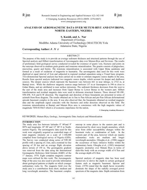
Rjeas Research Journal in Engineering and Applied Sciences 1(2) 142-148 Rjeas© Emerging Academy Resources (2012) (ISSN: 2276-8467)www.emergingresource.org<strong>ANALYSIS</strong> <strong>OF</strong> <strong>AEROMAGNETIC</strong> <strong>DATA</strong> <strong>OVER</strong> <strong>MUTUM</strong>-BIYU AND ENVIRONS,NORTH–EASTERN, NIGERIAS. Kasidi, and A. NurDepartment of Geology,Modibbo Adama University of Technology (MAUTECH) YolaAdamawa State, NigeriaCorresponding Author: A. Nur___________________________________________________________________________ABSTRACTThe purpose of the study is to provide an average sediment thickness and structural patterns through the use ofSpectral analysis and Hilbert transformation of Aeromagnetic data over Mutum-Biyu and Environs. The resultsof preliminary field geological survey conducted revealed the existence of quartz vein, fractures and joints onthe outcrops observed in medium grain granite and ironstone mineralization. The granite consists of plagioclase,microcline, quartz and biotite. The ironstone mineralization is associated with Upper Bima sandstone andformed as a result of oxidation of magnetite to haematite. The aeromagnetic data used for this work weredigitized at equal interval of 2cm and subjected to regional residual separation using a Visual basic program.Two-dimensional Spectral analysis has been carried out in order to estimate magnetic source depths in the area.Results from spectral analysis indicated two magnetic source depths, which account for deeper and shallowersources. The deeper sources which represent the basement vary between 661 m near Jalingo, to 2722 m, atBantaji town. While the shallower magnetic sources range between 137 m at Gurumpawa to 590 m close toGidan Shanu, and are attributed to near surface intrusions. The sediment thickness decreases from the west tothe east of the study area and increases from Upper Benue to Lower Benue in the western part. Hilberttransformation and residual magnetic data were used to delineate structural features. These showed NE-SW,NW-SW, N-S and E-W direction. The magnitude and direction of these lineaments are presented in terms ofazimuth from Rose diagram. The results obtained are in line to Pan-African and pre-Pan-African deformationalepisode basement complex in the area. It was also observed that, the lineaments obtained on residual magneticdata and the amplitude signal coincides with the fractures and strike direction observed on the field. Theironstone mineralization at Bantaji and Mutum Biyu area is consistence with the high magnetic values ofmagnitude 7850-8150nT which is of economic importance for the nation.© Emerging Academy ResourcesKEYWORDS: Mutum Biyu, Geology, Aeromagnetic Data Analysis and Mineralization________________________________________________________________________________________INTRODUCTIONThe study area lies between latitudes 8 o 00ʹand 9 o00ʹN and longitudes 10 o 00ʹ and 12 o 00ʹ E in NortheasternNigeria. The aeromagnetic data used for thiswork were originally acquired as controlled maps oftotal magnetic intensity on a scale of 1:100,000compiled from Geological survey of Nigeria (GSN).The Survey was conducted along series of NW-SEprofile with a spacing of 2 km, and a nominal tie linespacing of 20 km and an average flight elevationabove terrain of 150 m. The geomagnetic gradientwas removed from the data using the InternationalGeomagnetic Reference field formula (IGRF) of the1 st January, 1974. Eight complete magnetic contourmaps were utilised for this work. The AeromagneticMap of the area was also used to provide informationabout geological patterns at depths on which youngersedimentary rocks lie. The magnetic field over thestudy area is a contribution from short, medium andlong wavelength anomalies. The basement complexoutcrop in some places in the eastern part and ischaracterised by short wave length anomalies, whicharise from either susceptibility changes within thebasement rocks or combination of both. In thewestern part of the area, however which are mainlysedimentary rocks are medium and longerwavelength anomalies. Ofoegbu et al., (1988) suggestthe occurrence of basic intrusive bodies within thesedimentary basin. Ofoegbu et al., (1985) interpretedmagnetic anomalies over Mutum Biyu in terms ofdyke-like body with an average width of 0.7km andthe average depth of 0.3km.Spectral analysis of magnetic data has been usedextensively to derive the depth to certain geologicalfeature such as magnetic basement. Spector andGrant, (1970) stated that the depth factor invariablydominate the shape of the radially averaged powerspectrum of the magnetic data. Depth estimation from142
Research Journal in Engineering and Applied Sciences (ISSN: 2276-8467) 1(2):142-148Analysis of Aeromagnetic Data Over Mutum-Biyu and Environs, North–Eastern, Nigeriapotential field using power spectra requires a realisticassumption of the statistical properties of the sourcedistributions (Stefan et al. 1996). The Benue Valley,which lies in the Eastern part of the study area, is alinear rift system whose development is closelyassociated with the separation of Africa from SouthAmerica and the opening of the South Atlantic Oceanduring the Cretaceous (Benkhelil, 1988). The studyarea also consists of Precambrian basement andsedimentary rocks. The basement complexes aremainly gneiss-migmatites complex, granitoids andtertiary to recent volcanic rocks basically basalts,trachytes and rhyolite belonging to Cameroonvolcanic line. On the other hand, the sedimentaryrocks consist of Pindiga formation, which is a marineshale, limestone and siltstone, Yolde formation whichis a variable sequence of sandy clay, calcareous sandstone and shelly limestone underlying by felspathicBima sandstone. Through geological and geophysicalstudies the depth to magnetic source bodies,delineation of lineaments which could host secondarymineralization, the general structural patterns and aswell as their hydrogeological implications will beprovided. This information will in turn help for abetter understanding of geology of the area.Geology of the Study AreaThe geology is made up of the Precambrian basementcomplex rocks, which are considered to beundifferentiated basement mainly gneiss-migmatitescomplex, remnants of metasediments and OlderGranite series the granitoids, Figure.1. The basementcomplex rocks mineralogically consist of quartz,feldspars biotite, hornblende, diorite and granodiorite.These rocks Outcrop at Jalingo, Kam, Gurumpawa,Kiri, Monkin and Tola. The Cretaceous sedimentaryrocks which include rocks of Pindiga, Yoldeformation and Bima sandstone outcrops to the westaround Gidan Shanu, Amar, Bangule, Gassol, Bantajiand Wuriu, with Tertiary –Recent Volcanic rockswhich consist of basalts, trachyte and rhyolitebelonging to Cameroon volcanic line outcropping atAngwam.The Bima Sandstone which overlies the basementcomplex at the base of sedimentary succession wasderived from granitic rocks (Offodile, 1977). Thelower beds of the formation are invariably felspathic.The Yolde Formation is a variable sequence ofcalcareous sandstone and shale which marks thetransition from continental to marine sedimentation.Pindiga Formation is a sequence of Marine shale witha number of limestone beds toward the base of theFormation. The Tertiary- Recent volcanic rocks in thestudy area consist of the basalts, trachyte, rhyolite,and newer basalts of eastern arm of Cameroonvolcanic line (Fig.1).Fig.1. Geological map of study area (After GSN2006)Preliminary Field WorkThe preliminary field work undertaken in this studyarea reveals some geological features and formations.These features include fractures, mineralization andjoint, and the areas include Monkin, Jalingo, MutumBiyu and Bantaji. The rock types at Monkin andJalingo are predominantly medium-grained granitewith some quartz vein mineralization which consistsmainly of quartz, feldspars, biotite and hornblendes.The quartz vein is of 20cm thickness and the fracturewith approximate lengths of 70m and 120mrespectively, are observed in the medium graingranite of Monkin area on Latitude 8 o 51ʹ 40.5"N andLongitude 11 o 41ʹ 51.5" E, at an elevation of515.3m.The mineralized vein trend NW-SE andfracture trend NE-SW, plate 1a &b. The trendscoincide with the results from lineaments/fracture onresidual magnetic data expressed by azimuthdiagram.N0 10 cmPlate.1a Quarz vein in medium grain granites atMonkin area143
Research Journal in Engineering and Applied Sciences (ISSN: 2276-8467) 1(2):142-148Analysis of Aeromagnetic Data Over Mutum-Biyu and Environs, North–Eastern, NigeriaN33.2"N and longitude 10 o 06ʹ 57" E at an altitude of109 m, dipping 70 o N and strike NE-SW,plate.4.This can be related with Previous geophysicaldata interpretation of some selected profile overMutum Biyu by Ofoegbu (1985) as being due todyke-like body observed a high magnetic anomalywith an average width of 0.7km and at an averagedepth of 0.36 km (Fig.2).0 10 cmNPlate.1b. Fracture in medium grain granite at MonkinIn Jalingo area, the joints and fractures were observedon outcrop from a quarry site in medium grainedgranite Plate 2. It is composed of diorite,granodiorite, quartz, feldspars and micas. Joints arevisible on the plate with smooth plane surface as wellas the fractures with jiggle surface. The joints trendN-S meaning that it was initiated by brittledeformation in the area, while the fracture trendsNW-SE (plate 2), these correspond to lineaments onresidual magnetic map illustrated by azimuthdiagram. The location is on Latitude 8 o 58ʹ 39"N andlongitude 11 o 23ʹ 06" E at an elevation of 328m.Plate 3. Ironstone mineralization at Mutum Biyu010cmN010cmNPlate 4. Ironstone Mineralization at Bantaji0 10cmPlate.2. Joints and fracture on medium grain granitesof JalingoIn Mutum Biyu and Bantaji, iron stone mineralizationwas observed in borrowed pit as shown on Plates 3and 4. These iron stone are associated with UpperBima sandstone formed as result of oxidation ofmagnetite to haematite. It is a basic rock with highmagnetic susceptibility which accounts for the highmagnetic values on aeromagnetic data around thearea. The mineralization at Mutum Biyu are foundon latitude 8 o 37ʹ 52.7"Nand longitude 10 o 49ʹ 0.1"Eat an altitude of 186m and dip 84 o W and strikes E-W,plate,3, and also the ironstone mineralization atBantaji outcrop in borrowed pit on latitude 8 o 07ʹFig.2. Interpretation of Mutum-Biyu magneticprofiles in terms of a dyke (After Ofoegbu et al 1985)144
Research Journal in Engineering and Applied Sciences (ISSN: 2276-8467) 1(2):142-148Analysis of Aeromagnetic Data Over Mutum-Biyu and Environs, North–Eastern, NigeriaAnalysis of Magnetic DataThe aeromagnetic data used for this paper wasobtained as controlled maps of total magneticintensity on a scale of 1:100,000 compiled byGeological Survey of Nigeria (GSN 1975). It consistsof sheets 213, 214, 234, 235, 254, 255, 256 and 257.The survey was conducted along NW-SE profileswith a spacing of 2 km and a nominal tie line spacingof 20 km and an average flight elevation aboveterrain of 150 m. The geomagnetic gradient wasremoved using the International GeomagneticReference Field Formula (IGRF) of the 1 st January,1974. The magnetic map was digitized at an equalinterval of 2cm x 2 cm in the N-S and E-W grid linesgiving a data matrix of (56 x 112). To eliminateregional field, a plane surface has been fitted to thedata by multi-regression least-square analysis, andexpression for the regional obtained was:-T(x, y) = 7770.55 + 1.742x-0.178y (1)Where x and y are unit of spacing of the digitizedmagnetic data.The regional field values were subtracted from theobserved data, and the obtained residual field overthe area is shown on Figure.4.The points sampled on the square grid represent theTotal Magnetic Intensity (TMI) values which werecontoured (Fig. 3).NGidan ShanuBantajiWuriuTapareGassolBagunleAmarGargaleKatsinaBakundiMutum BiyuManjiGundumaJalingoIwereYarima GamtsinKamZogon kombiGarin ShegeGurumpawaMonkinTolaMbagarAngwamKiriLegendContourTown0 20 40 60 KmFig3.Total magnetic intensity map (Cont Inter.40nTMonkinBanguleJalingoGidan ShanuMutum BiyuAmarManjiGundumaIwereZogon KombiTolaMbagarGassolGarin ShegaGargaleGurumpawaWuriuYarima GamtsinLegendKatsina KamAngwamContourBantajiTownTapareBakundiKiriFig.4. Residual magnetic map of the area (Cont. Int.80nT)From the residual magnetic map, lineaments/fractureswere traced parallel to the closures of the magneticanomalies; the length depends on the direction andthe length of magnetic anomalies. The azimuthdiagram (Rose diagram) was obtained from thestructural map. The residual lineaments map deducedindicated that 60% have NE-SW; 19% NW-SE; 13%E-W and 11% N-S direction as illustrated by azimuthdiagram showing the magnitude and direction (Figure5). These fracture directions are in line with the Pan-African and Pre-Pan-African deformational episodein the area. It could also be related to those developedin the pre-existing zones of weakness, which are alsoin alignment to the major lineaments of Africa(Grant, 1978 and Ekweme, 1994)Relating the lineaments; high density of lineamentsoccur in the eastern part of the area, in the oldergranite and gneiss-migmatites complex, and has beenintruded by igneous rocks and basalts of CameroonVolcanic Line(CVL), while the less dense lineamentsoccurred in the western part which is dominated bysedimentary rocks. Most high magnitude lineamentscould be attributed to deep seated fractures, while thelow magnitude fractures could be attributed toshallower weathered zones in the study area. Thefractures observed on the field range from open tomineralize; few of them are shown on the plate.To obtain the residual, regional field were calculatedusing a visual basic program, the regional field werecomputed from the observed data and the residualmagnetic values obtained were contoured (Fig. 4).145
Research Journal in Engineering and Applied Sciences (ISSN: 2276-8467) 1(2):142-148Analysis of Aeromagnetic Data Over Mutum-Biyu and Environs, North–Eastern, Nigeriaof dark brown coloured ferromagnetic mineral plates3&4 that contains mineral iron in form of magnetite,which oxidizes to haematite, while the magnetic lowsare associated with granitic and allied rocks.The magnetic susceptibility contrast across a fracturezones are due to oxidation of magnetite to hematite,and /or infilling of fracture planes by dyke like bodieswhose magnetic susceptibilities are different fromthose of their host rocks (Bassey, et al, 2000), Suchgeological features appear as thin elliptical closuresor nosing on the residual magnetic map (Fig.3).Bearing this in mind, prominent elliptical closuresand nosing were identified on the residual magneticmap. The features / lineaments indicated are linesdrawn parallel to the closure and /or elongation of theanomalies. The residual lineaments map deducedindicated that 60% have NE-SW; 19% NW-SE; 13%E-W and 11% N-S direction as illustrated by azimuthdiagram figure 5.These correspond to Pan-Africanand Pre-Pan–African deformational episodes in thestudy area. These also compare favourably well withthose observed in the field (plates1, 2, 3& 4).Previous work in Mutum Biyu by Ofoegbu (1985),interpreted magnetic anomaly of two profiles in termsof dyke showed sharp observed anomaly for theselected points on the curve. The sharpness of theanomaly could be related to the iron mineralization inMutum Biyu. The presence of iron mineralization inMutum Biyu and Bantaji must have affected thegroundwater quality which is evident from spillagesof over head tanks of boreholes. The Hilberttransform analysis which tends to sharpen the edgesof anomalies and enhances the anomalous featuresconfirm the existence of N-S, E-W, NE-SW, andNW-SE trends of lineaments in the study area.Looking at figure 6 the analytical signalsconcentrated more in the south eastern portion ofstudy area. This may be explained that the basementcomplex outcropping here is not mineralogicallyhomogeneous. The contoured map (Fig.3) shows thepresence of remarkable magnetic features whichagree quite well when compared with geologic mapof (Fig.1). In addition, the presence of faults whichControl Rivers and stream channels in the area can beinterpreted as major fracture zones which originallydeveloped in the zones of weakness of the area.Magnetic source depth determination throughspectral analysis over Mutum Biyu and environssuggests two main source depths under the area. Thedeepest source lies between 661m close to Jalingoand 2722m around Bantaji town, and the shallowersource depths obtained ranges from 137m atGurumpawa to 590m close to Gidan Shanu. Thesecould be a result of intrusive bodies from CameroonVolcanic line in the study area; Table1 shows thecomputed magnetic source depths in the area.The results compared favourably with previous workobtained from gravity and magnetic analysis.Ofoegbu (1988) estimated the sediment thickness inUpper Benue that ranges from 500m to 460m.Osazuwa et al., (1981) estimated sediment thicknessthat ranges from 900m to 2200m from gravity datainterpretation, and 900m to 4900m from magneticdata. Nur.,(2000) estimated the sediment thicknessranges between 1500m to 2219 m for deeper source,and range between 330m to 414m for shallow source.CONCULUSIONSThe preliminary analysis of the aeromagnetic dataover Mutum Biyu and its environs indicated theexistence of two magnetic source depths; the deepestsource lies between 661m to 2722m and shallowersource depth obtained ranges from137m to 590m andcould be attribute of intrusive bodies. The structurallineaments/fractures observed from the residual andanalytical signal of the area are dominantly in NE-SW, with others trending NW-SE, E-W and N-Sdirection. Most high magnitude lineaments could beattributed to deep seated fractures, while the lowmagnitude could be attributed to shallow weatheredzones in the area as observed in the field. Theazimuth magnitudes and the trend of the fractures arein line with the Pan-African and Pre-Pan-Africandeformational episode in the area. Lineaments aresites of concentration of pegmatite’s dykes, quartzveins and ironstone that host mineralization inmedium grain granite at Monkin, Jalingo, MutumBiyu and Bantaji respectively. In addition, the resultshows area of groundwater resources in shallowweathered regolith basement suitable for locatingboreholes and hand dug wells, though for MutumBiyu and Bantaji the groundwater resource is affectedby oxidation of mineralized iron in Upper Bimasandstone. The iron mineralization in the area may beof economic importance, therefore, a further studyusing detailed integrated geophysical methods isrecommended.REFERECESBassey, N. E. Nur, A. and Obiefuna, G. I., (2000).Analysis of Aerial Photographic data over Guyukarea, North-eastern Nigeria. Journal of Mining andGeology Vol.36 (2), 45-152.Benkhelil, J., (1988). Structure et evolutionGeodynamique du basin intracontinetal Bull. Centresreach.Explor. Prod. Elf Aquitain. Vol.1207. 29-128.Ekwueme, B.N., (1994). Structural features ofsouthern Obudu plateau, Bamenda massif, SENigeria, Preliminary interpretation. Jour. Mining.Geol. Vol.30. (1), 45-59.Geological survey of Nigeria, (1975). Air BoneMagnetometer Survey Contour Map of TotalMagnetic Field Intensity of study area.Geological survey of Nigeria, (2006) Geological mapof study area.147
Research Journal in Engineering and Applied Sciences (ISSN: 2276-8467) 1(2):142-148Analysis of Aeromagnetic Data Over Mutum-Biyu and Environs, North–Eastern, NigeriaGrant, N.K., (1978). Structural distinction between ametasedimentary cover and underlying basement in600 m.y old Pan-African domain of northwestNigeria. West African Geol. Sic. Am. Bull.Vol. 89,50-58Markku, P., (2009). Fourier transform basedprocessing of 2D potential field data Version 1.0a(Software). Division of Geophysics, Department ofGeosciences FIN-90014 University of OuluFinland.Valley on the basis of new geophysical data. EarthEvol. Sci., Vol. 2, 26-135Spector, A. and Grant, F.S., (1970). Statistical modelsfor interpreting aeromagnetic data, Geophysics.Vol.35, 293- 302.Stefan, M., and Vijay, D., (1996). Depth estimationfrom the scaling power spectrum of potential fields?Geophysics. J. Int.Vol.124, 113-120Nur, A.M, Onuoha M.K. and Ofoegbu C.O., (1994).Spectral analysis of Aeromagnetic data over theMiddle Benue Trough, Nigeria. Journal of miningand geology, Vol. 30 (2), 211-217.Nur, A. (2000). Analysis of aeromagnetic data overYola arm of the Benue Trough, Nigeria. Mining andGeol.Vol.36 (1), 77-84Nur. A, Ofeogbu C.O. and Onuoha K.M. (1999).Estimation of the depth to the curie point Isotherm inthe upper Benue trough, Nigeria. Jour. Min. Geol.Vol.35 (1), 53-60.Nur. A, Ofeogbu C.O. and Onuoha K.M. (1999).Estimation of the depth to the curie point Isotherm inthe upper Benue trough, Nigeria. Jour. Min. Geol.Vol.35 (1), 53-60.Offodile, M.E., (1977). A review of the geology ofthe cretaceous of the Benue Trough in Geology ofNigeria (Ed. Kogbe, C.A), Pp319-330. Elizebethpress Lagos.Ofoegbu, C.O., (1985).Long wave magnetic anomalyand crustal structure underneath the Benue Troughand surrounding regions. Nig. J. Min. Geol.Vol. 22,45-50.Ofoegbu, C.O. (1988). An aeromagnetic study of partof the Upper Benue Trough, Nigeria. Jour. Afr.EarthSci., Vol.7, 77-90.Ofoegbu, C.O., and Mohan N.I., (1990).Interpretation of aeromagnetic anomalies over partsof south eastern Nigeria using three dimensionalHilbert transformation. Pageoph. Vol.134, 13-29Ofoegbu, C.O. and Onuoha, K. M. (1991). Analysisof magnetic data over the Abakaliki Anticlinorium ofthe lower Benue Trough, Nigeria. Marine and Petr.Geol. Vol.8, 174-183.Ofeogbu, C.O, Odigi, M.I. Okereke, C.S. andAhmed, N.M, (1992). Magnetic anomalies and thestructure of the Nigeria’s Oban massif: Journal. ofAfrican Earth Sciences Vol.15 (2), 217-280.Osazuwa, I.B., Ajakaiye, D. E and Verheijin, P.J.T.,(1981). Analysis of the structure of part of the Benue148


