Whiteley Village - Elmbridge Borough Council
Whiteley Village - Elmbridge Borough Council
Whiteley Village - Elmbridge Borough Council

You also want an ePaper? Increase the reach of your titles
YUMPU automatically turns print PDFs into web optimized ePapers that Google loves.
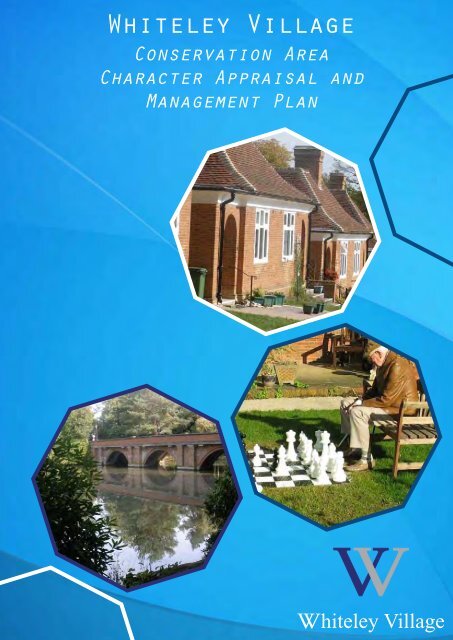
<strong>Whiteley</strong> <strong>Village</strong>Conservation AreaCharacter Appraisal andManagement Planhiteley <strong>Village</strong>
<strong>Whiteley</strong> <strong>Village</strong> Conservation Area Character Appraisal and Management Planhiteley <strong>Village</strong>In patnership withFORUMHeritageServicesThis document has been designed and prepared by Phillips Planning Services Ltd inconjunction with Context 4 D and Forum Heritage Services Ltd on behalf of The <strong>Whiteley</strong> <strong>Village</strong>Trust.July 2012All maps used in this document are reproduced with permission of Ordnance Survey on behalfof the controller of Her Majesty’s staionery office, © Crown CopyrightPhillips Planning Services Ltd Licence Number: A-100020449
<strong>Whiteley</strong> <strong>Village</strong> Conservation Area Character Appraisal and Management PlanPart I :Conservation Area Character Appraisal1 Introduction Page 12 Location and Setting 6(a) Location 6(b) Boundaries 6(c) Topography and landscape setting 6(d) Geology 63 The Historical Development of the <strong>Village</strong> 7(a) Historic Background 7(b) Archaeology 124 Surviving Historical Features within the 13Conservation Area(a) Summary of historical development 13(b) Street pattern and building plots 145 The Character and Appearance of the 20Conservation Area(a) Summary of townscape features 20(b) Current activities and uses 23(c) Focal points, views and vistas 25(d) Open spaces, landscape and trees 29(e) Public realm: Floorscape, street lighting and street furniture 316 Character Areas 34Identification of character areas (see character areas map)Area 1: <strong>Village</strong> core 34Area 2: Huntley House, <strong>Whiteley</strong> House and St Mark’s Church 45Area 3: Minor Buildings 49Area 4: Fox Oak and Western entrance 52Area 5: Fox Wood 54Area 6: Sports grounds and northern approach 56Area 7: Strawberry Hill and environs 60
<strong>Whiteley</strong> <strong>Village</strong> Conservation Area Character Appraisal and Management Plan7 The Buildings of the Conservation Area 62(a) Architectural styles and detailing 62(b) Boundaries 76(c) Listed buildings 77(d) Locally listed buildings 80(e) Significant unlisted buildings 808 Negative Features and Issues 82(a) Combe Lane 82(b) Car park to the south of the administration building 82(c) Over embellishment of remodelling of front garden areas 82(d) Some tree and hedge planting 83(e) Former Laundry, Combe Lane 83(f) Cricket Pavillion 83(g) Windows to Combe Lane Cottages 83(h) Ingram House 83
<strong>Whiteley</strong> <strong>Village</strong> Conservation Area Character Appraisal and Management PlanPart II : Conservation Area Management Plan1 Introduction Page 852 Legislative background 883 Policy background 894 Public consultation 955 Boundary amendments 986 Statutory controls 987 Listed buildings 998 Locally Listed buildings and 100Significant Unlisted Buildings9 Buildings at risk 10010 Article 4 Directions 10011 Guidance for managing change 10012 Landscape 108(a) Trees 109(b) Front Gardens 110
<strong>Whiteley</strong> <strong>Village</strong> Conservation Area Character Appraisal and Management Plan13 Areas for enhancement and development 112opportunity sites(a) Combe Lane 112(b) CP south of Administration Building 113(c) Tree and hedge planting 113(d) Ingram House 11314 Heritage Partnership Agreement 115Background 115Introduction 115Statement of Agreement 115Specifically agreed work 116Repairs and maintenance 116Trees 116Minor alterations 116Proposed extensions (as part of a wider masterplan) 117Highways maintenance 117New service buildings 117Approved signage (type, form, colour, location) 11715 Monitoring and Review 118Public consultation 118Document review 118
<strong>Whiteley</strong> <strong>Village</strong> Conservation Area Character Appraisal and Management PlanAppendices 121Appendix 1: Guidelines for new development 121Appendix 2: Further reading andinformation 126Appendix 3: List of Clubs and Societies open to the public 128Appendix 4: Plans and details of street lamps 130Appendix 5: Planning permissions still to be exercised 135MapsCompetition winning plan (Frank Atkinson’s plan) 8Townscape Analysis Map 81<strong>Elmbridge</strong> <strong>Borough</strong> <strong>Council</strong> Core Strategy Diagram 2011 92<strong>Village</strong> Infill Boundary 102Conservation Area Boundary 103Areas likely to be subject to change 105
<strong>Whiteley</strong> <strong>Village</strong> Conservation Area Character Appraisal and Management Plan
<strong>Whiteley</strong> <strong>Village</strong> Conservation Area Character Appraisal and Management Plan<strong>Whiteley</strong> <strong>Village</strong> Conservation AreaCharacter Appraisal & Management PlanForewordThis document has been commissioned by the <strong>Whiteley</strong> Homes Trust but formspart of a series of conservation area appraisals and management proposalsprepared by <strong>Elmbridge</strong> <strong>Borough</strong> <strong>Council</strong> Planning Services.Phillips Planning Services, Forum Heritage Services and context4D wereappointed as heritage consultants to facilitate the project, organize exhibitionsand co-ordinate and produce the Character Appraisal and Management Plan.The document has been produced by the heritage consultants appointed by<strong>Whiteley</strong> <strong>Village</strong> and <strong>Elmbridge</strong> <strong>Borough</strong> <strong>Council</strong>.The designation, review, protection and management of conservation areas ispart of the statutory duties of the Local Planning Authority, <strong>Elmbridge</strong> <strong>Borough</strong><strong>Council</strong>. However, community involvement is essential in understanding thespecial nature and different issues for each individual conservation area. Theexhibition and public consultation identified many aspects and issues and thesewere incorporated into the document at its initial draft stages. This document hasbeen the subject of wider public consultation for a six-week period commencing on24th October 2011 and comments received have informed the final document.This guidance document will be a material consideration with regards to theimplementation of the <strong>Elmbridge</strong> Local Plan as a basis for understanding thearea, informing decision making, monitoring and management. It will be thesubject of an ongoing five-year review providing the opportunity to take accountof new planning policy as it arises. The document was considered and endorsedby the <strong>Elmbridge</strong> <strong>Borough</strong> <strong>Council</strong> Planning Committee on 12th July 2012 andby full <strong>Council</strong> on 18th July 2012.The document is available in PDF format onthe <strong>Council</strong>’s website www.elmbridge.gov.uk and to purchase in printed formfrom the <strong>Whiteley</strong> Homes Trust.
<strong>Whiteley</strong> <strong>Village</strong> Conservation Area Character Appraisal and Management Plan
<strong>Whiteley</strong> <strong>Village</strong> Conservation Area Character Appraisal and Management PlanMap copyright:Most maps are reproduced from Ordnance Survey material with the permissionof Ordnance Survey on behalf of the Controller of Her Majesty’s StationeryOffice © Crown Copyright. Unauthorized reproduction infringes Crown Copyrightand may lead to prosecution or civil proceedings. LA1000248822004. Othersare reproduced by permission of Surrey History Service and Surrey County<strong>Council</strong>.
<strong>Whiteley</strong> <strong>Village</strong> Conservation Area Character Appraisal and Management Plan
<strong>Whiteley</strong> <strong>Village</strong> Conservation Area Character Appraisal and Management PlanPart I: Conservation Area Character Appraisal1. IntroductionWilliam <strong>Whiteley</strong>, founder of the Londonretail store of the same name, diedin 1907, leaving a million pounds forthe purchase of land and the erectionof buildings to be used and occupiedby “approved poor persons of eithersex”. The result is <strong>Whiteley</strong> <strong>Village</strong>, aunique planned self-contained 20thCentury <strong>Village</strong> Community situated justsouth of Walton at the centre of a 225acre estate. The buildings, effectivelyalmshouses, were designed by eminentarchitects of the period and retain manyoriginal features. It is of both very higharchitectural and historic regional andnational significance.The layout of the village, the result of adesign competition, was based on thewinning design by an eminent architect,Frank Atkinson, whilst the individualbuildings were designed by six architects(including Mr Atkinson). The aim of thiswas to present a combination of differentstyles in one harmonious group, avoidinginstitutional characteristics. All of thedesigned cottage style houses share thecommon Surrey vernacular materialsof brick and tile and are statutory listedGrade II.The plan of the settlement is octagonaland based on the principals of theGarden Suburb although it may havetaken some influence from the Victorianideal of improved conditions for the poor,with asylum and workhouse forms of theperiod taking on hexagon, square andoctagonal plans. There are 8 main groupsof houses within the octagon, each groupenclosing a small green and separatedby a wide avenue. The eight radiatingavenues meet at a central monument toWilliam <strong>Whiteley</strong> surrounded by a circulargreen.Fig 01: William <strong>Whiteley</strong> 1831 – 19071
<strong>Whiteley</strong> <strong>Village</strong> Conservation Area Character Appraisal and Management PlanH Inigo Triggs (1876-1923) was appointedin 1919 to plan and oversee landscapework within the village, particularly thelevelling and laying out of courts, groundsand open spaces.As stated in the original designationstatement, the Garden <strong>Village</strong> is unusualin that it forms an entirely self-containedsettlement but devoted entirely tothe elderly. The <strong>Village</strong> itself is a selfsufficientcommunity. Whilst there aresimilar undertakings elsewhere in thecountry, most notably the BournevilleEstate, Birmingham and Port Sunlight,Bebington (Liverpool), <strong>Whiteley</strong> <strong>Village</strong>is the most intact and well-defined andemployed some of the most distinguishedand accomplished architects of theperiod. To this end, <strong>Whiteley</strong> <strong>Village</strong> isa unique heritage asset of considerablenational significance.<strong>Whiteley</strong> <strong>Village</strong> is owned and operated byThe <strong>Whiteley</strong> Homes Trust, a charitabletrust, entirely for the benefit of its 500 orso elderly residents of limited financialmeans.The <strong>Whiteley</strong> <strong>Village</strong> Trust owns allthe infrastructure with the associatedmaintenance burden, including themetalled roads within the <strong>Village</strong>measuring in excess of 5 Km, and anextensive network of pedestrian pathwaysand woodland paths. With the exceptionof refuse disposal, the <strong>Village</strong>rs receiveall their services directly from the Trust– these include water, gas, electric,foul and surface water drainage, roads,shops, churches, street lighting, library,community hall, surgery, hairdresser andlaundrette. The <strong>Village</strong> has its own libraryand community facilities are available toall <strong>Village</strong> residents within comfortablewalking distance although many usemobility scooters to travel around. The<strong>Village</strong> provides a very pleasant andsecure living environment for its residentswho reside in a well designed settlementwhich is of a very high landscape andarchitectural quality tailored for theirneeds.The <strong>Village</strong> is an integral part of the careinfrastructure for the elderly in <strong>Elmbridge</strong>and Surrey. The vast majority of the 500or so residents who occupy the cottages(average age 82) qualify and receivehousing benefit. The small number ofresidents who do not qualify or claimhousing benefit are of limited means,insufficient to maintain their independencewithout support. <strong>Whiteley</strong> <strong>Village</strong> is one ofthe largest providers of accommodationfor older people in the <strong>Borough</strong>. Itprovides the equivalent of 24% of thesheltered housing stock for rent within<strong>Elmbridge</strong> <strong>Borough</strong>. Substantially all theadmissions to the 114 bed care homeare referred from the community outsidethe <strong>Village</strong> of which 60% are funded bySurrey Social Services. The Care Centreis a vital resource to <strong>Elmbridge</strong>. 30% ofthe extra care apartments in HuntleyHouse are maintained for admissionsreferred by Surrey Social Services.2
<strong>Whiteley</strong> <strong>Village</strong> Conservation Area Character Appraisal and Management PlanThe <strong>Village</strong> has a wide range of Clubs andSocieties established by, and managed,by the residents themselves. Whilstmembership substantially comprises theresidents of the <strong>Village</strong>, by implicationcompetition and invitation involves thewider community beyond the <strong>Village</strong>boundary.the preservation and enhancement ofthese conservation areas. Section 72also specifies that, in making a decisionon an application for development in aconservation area, special attention shallbe paid to the desirability of preserving orenhancing the character or appearanceof that area.There is also a large number of othersports and recreational clubs andsocieties which make use of the <strong>Village</strong>’sfacilities. These include rugby, footballand cricket clubs, childrens’nurseries and swimming clubs,angling, bee conservation, finearts classes, cubs and scouts,guides and brownies, a hawkingclub and a carriage drivingassociation. <strong>Whiteley</strong> is a “<strong>Village</strong>Settlement” not a gated communityor patrolled environment. Thechurches, supermarket and Post Officeare there to serve and are patronisedby the wider community. The <strong>Village</strong> ison a scheduled bus route with bus stopsaround the <strong>Village</strong> road system.<strong>Elmbridge</strong> <strong>Borough</strong> <strong>Council</strong> designatedthe <strong>Whiteley</strong> <strong>Village</strong> Conservation Areaon 6th March 1979. Conservation Areasare designated under the provisionsof Section 69 of the Planning (ListedBuildings and Conservation Areas) Act1990. A conservation area is defined as“an area of special architectural or historicinterest the character or appearanceof which it is desirable to preserve orenhance”. Section 71 of the same Actrequires local planning authorities toformulate and publish proposals forUnderstanding Place:Conservation AreaDesignation, Appraisaland ManagementFig 02: English Heritage Guidance onConservation3
<strong>Whiteley</strong> <strong>Village</strong> Conservation Area Character Appraisal and Management PlanThe objectives of the document are asfollows :• To understand the significanceof <strong>Whiteley</strong> <strong>Village</strong>’s importanthistorical, architectural andlandscape assets and protectand enhance these assetsthrough positive management• To provide a long-term,evidence based, comprehensiveapproach to the planning of<strong>Whiteley</strong> <strong>Village</strong> as a firm basisagainst which future planningapplications can be assessedThis document therefore seeks to:• Define the special interestof the conservation area andidentify the issues whichthreaten the special qualities ofthe conservation area (in theform of the “Appraisal”);• Provide guidelines to preventharm and achieve enhancement(in the form of a “ManagementPlan”).• To support the long termsustainability of <strong>Whiteley</strong> <strong>Village</strong>Comparison of relevant timelinescontinuous vision of <strong>Whiteley</strong> <strong>Village</strong> development (1907 - completion)death ofWilliam <strong>Whiteley</strong>(1907)birth of planning system and state pensions (1947 - present)WWI(1914 - 18)<strong>Whiteley</strong> villagecompleted(1929)WWII (1939 - 45)core strategyadopted(2011)end of corestrategy period(2026)<strong>Whiteley</strong> <strong>Village</strong>masterplan(2062)1900 1910 1920 1930 19401950 1960 1970 1980 1990 2000 2010 2020 2030 2040 2050 2060 2070 2080Fig 03: Comparison of relevant timelines4
<strong>Whiteley</strong> <strong>Village</strong> Conservation Area Character Appraisal and Management PlanThe original vision for <strong>Whiteley</strong> <strong>Village</strong>was created when William <strong>Whiteley</strong>’s willwas made public in 1907. The <strong>Village</strong>was largely complete by 1927, wellbefore the birth of the planning system in1947 and the welfare state in the post waryears. Looking into the future, the timeline for this document extends over thenext 50 years which is much longer thanthat of the Core Strategy. The currentadopted Core Strategy extends to 2026although this obviously will be updatedthrough various subsequent replacementpolicy documents. While the <strong>Village</strong> hasa long and successful history of welfareprovision, it will hopefully continue to doso for many centuries into the future. Theprinciple aim of this document is to providea comprehensive, long term approachto the future planning and conservationof the <strong>Village</strong> which will respect its pastwhile providing for its future.(i) the Replacement <strong>Elmbridge</strong><strong>Borough</strong> Local Plan 2000,Chapter 8 addressing thehistoric built environment. Themanagement of conservationareas is covered by savedpolicies HEN 9, 11, 13 and 14;(ii) the adopted <strong>Elmbridge</strong><strong>Borough</strong> <strong>Council</strong> Core Strategy2011.(iii) Design and CharacterSupplementary PlanningDocument April 2012.This document will also provide afirm basis on which applications fordevelopment within the <strong>Whiteley</strong> <strong>Village</strong>Conservation Area can be assessed.It should be read in conjunction withnational legislation and policy (TheNational Planning Policy Framework ).In addition it should be read in conjunctionwith the wider adopted development planpolicy framework. These documentscurrently include:Fig 04: National Planning Policy FrameworkPlanning policy changes over time -please contact <strong>Elmbridge</strong> <strong>Council</strong>Planning Services for the most up to datepolicies.5
<strong>Whiteley</strong> <strong>Village</strong> Conservation Area Character Appraisal and Management Plan2. Location and Setting(c) Topography and landscapesetting(a) Location<strong>Whiteley</strong> <strong>Village</strong> lies approximately 2.5kmsouth of Walton-on-Thames and 1.5 kmwest of the village of Hersham. BurhillGolf course lies to the immediate eastand the area known as St George’ s Hilllies to the west.(b) BoundariesThree sides of the conservation areaare defined by roads or lanes; to thenorth is Burwood Road and to the westis Seven Hills Road (B365). The easternboundary is less well-defined to thenorth-east corner cutting across woodedareas but picking up a footpath and thenfollowing the more informal lane knownas The Kings Drive. Approximately 10metres north of Convent Lane (whichforms the access to the former BurwoodHouse, now the Notre Dame PreparatorySchool) a cast iron fence runs roughlyeast-west through this wooded area fromthe western boundary of the Burhill GolfCourse back to Seven Hills Road.There is some level change within thedeveloped sections of the village with thesouthern sections, particularly DrapersCrescent beginning to slope steadilyaway to the south at the edge of thedeveloped part of the village. There isalso some variation seen to the recreationgrounds to the north-east. To the southof the developed sections of the villagethe land form is much more undulatingbut this level change is to some extentmasked by the dense tree and vegetationcover which forms an attractive backdropto the village.To the north the landscape setting ismore open with a series of green spaceslined by trees and used for recreationalpurposes; cricket, rugby and footballpitches and other facilities.The village is very much contained withinits landscape setting and the topographyand tree cover is such that there areno long views into the village otherthan glimpsed from the West and NorthAvenues.(d) GeologyThe underlying mix of clay and sands ofthe Bagshot Barton and BrackleshamBeds gives rise to the heathland characterof this part of Surrey. To the immediatenorth and south of the area are theLondon clays laid over sand and gravelof the London Basin.6
<strong>Whiteley</strong> <strong>Village</strong> Conservation Area Character Appraisal and Management Plan3. The HistoricalDevelopment of the<strong>Village</strong>(a) Historic Background<strong>Whiteley</strong> <strong>Village</strong> lies on an area of formerheathland with poor soils that wereprobably exhausted by the late Iron Ageor Roman period. There is evidencefrom the landscape around the village ofprehistoric activity and settlement withartefacts dating from the Palaeolithicperiod to the late Iron Age. Many of thefinds recorded from the area come fromSt George’ s Hill to the west of the B365.On this low hill a multivallate Iron Age hillfort was constructed and ditches recordedto the south-west have been interpretedas possible Iron Age field systems. Itis possible that the area of <strong>Whiteley</strong><strong>Village</strong> was once a similar agriculturallandscape.Evidence for settlement into the Romanperiod is provided by finds of pottery andcoins from St George’s Hill and someSaxon or Norman pottery was also foundin this area. It is probable that, due tothe nature of the heathland, there wasrelatively little settlement in the area ofthe village during the medieval or postmedievalperiods.Through the 18th and 19th centuries theland formed part of the extensive BurhillEstate with the house set to the east of thevillage (presently forming part of BurhillGolf Course). This section of the estatewas predominantly woodland set out inworks undertaken in the 1860s by thethen owner F T Bircham. This comprisedprincipally Scots and Weymouth pinesin addition to chestnut, oak , larch andWellingtonia. At the time of purchase bythe Trust in 1911 it had become heavilywooded and neglected with limitedaccess due to the rhododendrons andother vegetation. However, an avenue oflime trees can be clearly seen on earlymaps and there was a large pond to thenorthern part of the site.In 1911, part of the Burhill Estate (225acres) between Weybridge, Walton-on-Thames and Cobham was purchasedfor £40,000 with the sole purpose ofproviding land for the development of<strong>Whiteley</strong> <strong>Village</strong>. The background to thepurchase relates to the untimely death ofthe wealthy owner of a large Bayswaterdepartment store, William <strong>Whiteley</strong>, whowas shot dead by a young man claimingto be his illegitimate son on 24th January1907. William <strong>Whiteley</strong> was known asthe ‘The Universal Provider’. In his will<strong>Whiteley</strong> had specified that the thenconsiderable sum of £1,000,000 be usedto purchase freehold land.‘... as a site for the erectionthereon of buildings to be usedand occupied as homes for agedpoor persons’.7
<strong>Whiteley</strong> <strong>Village</strong> Conservation Area Character Appraisal and Management PlanFig 05: A copy of the original winning design for the plan of <strong>Whiteley</strong> <strong>Village</strong> submitted byR. Frank Atkinson8
<strong>Whiteley</strong> <strong>Village</strong> Conservation Area Character Appraisal and Management PlanTo oversee the spending of funds andin accordance with instructions fromWilliam <strong>Whiteley</strong> eight Trustees, two ofwhom were his sons, Frank and Williamwere appointed. Dissension over asuitable site on which to build hamperedinitial progress, and a number of possiblelocations, including Shirley Park, nearCroydon, were considered before theheavily wooded Burhill Estate waschosen.William <strong>Whiteley</strong> devoted considerablethought to the needs of the elderly whendevising the proposed village. His willstates that the site was to‘... be in as bright, cheerful andhealthy spot as possible’.Moreover, the buildings erected were tobe ofActing upon the advice of the newlyappointedconsulting architect, WalterCave, the Trustees invited six renownedarchitects to submit plans for the villagelayout. Those presented by R. FrankAtkinson were duly selected (Fig.05 –Atkinsons winning plan), but subsequentlyaltered to such an extent that only theoriginal octagonal layout of the villagecentre is recognisable today.The Trustees instructed Walter Cave todesign and build two single-storey ‘ModelCottages’. These were built alongside theWest Avenue approach to the village in1913. These, however, were consideredto be too expensive to build to thisspecification and too spacious for elderlyoccupants to be able to manage (in termsof cleaning etc.) and consequently thecottages built later were considerablysmaller. The proposed accommodationcomprised a living room with alcove bedrecess, a scullery containing a gas stove,small bath and sink, a larder and a WC.‘good and substantialcharacter and of a plain and usefuldesign and shall be well lighted,ventilated and drained and soplaced as to be protected as far aspossible from the north and eastwinds’.Walter Cave and six other leadingarchitects; Sir Ernest George, ErnestNewton, Mervyn McCartney, Sir AstonWebb, Robert Frank Atkinson, ReginaldBlomfield, three of whom had previouslysubmitted plans for the village layout,were chosen to design the eight blocks ofcottages which would form the octagonalvillage centre and provide homes fornearly 300 pensioners. In order toavoid an institutional appearance byencouraging variations in style, one blockwas entrusted to each architect, exceptSir Ernest George, ARA, who, designedtwo of the eight.9
<strong>Whiteley</strong> <strong>Village</strong> Conservation Area Character Appraisal and Management PlanEach of the eight ‘sections’, as theyare still known today, were to comprisesixteen single-occupancy cottages, fourtwo-storey cottages (one pensioner perfloor), six double cottages (for marriedcouples) and a nurse’s cottage.While the site was being cleared,essential services installed and road laid,the Trustees made plans for additionalamenities and facilities. In addition to achurch, village hall, library and a recreationground, an infirmary, clubhouse, allotmentgardens and a telephone exchange wereproposed.Building officially began on 21 July1914, when the then Bishop of London,the Rt Hon and Rt Revd Arthur FoleyWinnington-Ingram, PC, KCVO, DD,Chairman of the Trustees from 1907 to1946, laid the foundation stone of thecentrally placed monument to William<strong>Whiteley</strong>.‘persons of good charac ter and ofsound mind and not affected by aninfectious or contagiou s diseaseand not having been convictedof any criminal of fence and beingmale of not less than 65 years andbeing female of not less than 60years of age’.Preference was also to be given to:‘persons or the wives of personswho have been engaged incommercial or agriculturalpursuits’.On 10 October 1917, Miss Eliza Palmer,a retired nurse became the first residentvillager. By the years end 42 pensionerswere in residence.Work progressed rapidly during the earlyyears of the First World War and, in1917, application forms were sent to 376pensioners following their response to anadvertisement circulated by the Trustees.However, most of the 244 applicantswho returned their forms failed to meetWilliam <strong>Whiteley</strong>’s definition of suitablevillagers as being:A further pair of cottages were addedto those along Combe Lane circa late1920s. The Sanctuary was built in 1925to the designs of M Aston Webb. Thestable and coach house to Fox Oak wasconverted to residential accommodationand became Fox Oak Cottage in 1961.10
<strong>Whiteley</strong> <strong>Village</strong> Conservation Area Character Appraisal and Management PlanFig 06: Sir Aston Webb proposals for extension to the village “as built” in 1927Proposals to carry out the full plan aslaid out by R. Frank Atkinson did notcome to fruition. Alternative plans weredrawn up by Sir Aston Webb in 1927 for aseries of crescents and squares locatedaround extensions to all of the Walksand Avenues and further cottages liningall of Octagon Road (Fig.06 Sir AstonWebb proposal). In all an additional179 cottages (141 single and 38 double)were planned. This was begun with thebuilding out of Chestnut Crescent (1928)to the north-west but the Trust ran out offunds to further develop the remainingcottages.11
<strong>Whiteley</strong> <strong>Village</strong> Conservation Area Character Appraisal and Management PlanAfter his appointment in 1910 Inigo Triggslaid out a hierarchy of avenues and walkswith Scots pine planted along the Northand South Avenues and Limes on theEast and West Avenue.Fox Oak was sold to a private owner andis now separate from the village (c1963).Ingram House was constructed circa1960s.The last major phase of building within thevillage was in 2003/4 with the constructionof Drapers Crescent and Huntley Houseboth by Robert Adams Architects.Fifteen houses in a private gateddevelopment now known as Fox Woodwere constructed in 2005-6. This areawas previously quarry workings. Thedevelopment was to enable the partfundedrepair of the statutory listedcottages within the village from fundsreceived from the sale of the land toprivate developers.(b) ArchaeologyAlthough there have been somearchaeological assessments undertakenin relation to development at <strong>Whiteley</strong><strong>Village</strong>, these have only revealed a ditchof possible Bronze Age date and several ofthe trenches excavated did not encounterany archaeological features. As thereare no known sites of archaeologicalinterest within the conservation area noArea of Archaeological Potential hasbeen defined but the nature of prehistoricactivity within this area means that thereis potential to encounter archaeologicalevidence of the early land use andsettlement of the area. Any proposeddevelopment in the area will need toinclude appropriate measures to assessand, if necessary, protect or record thearchaeological interest of the site. Advicefrom the Surrey County <strong>Council</strong> HeritageService, the council’s archaeologicaladvisors, should be sought at an earlystage.12
<strong>Whiteley</strong> <strong>Village</strong> Conservation Area Character Appraisal and Management Plan4. Surviving HistoricalFeatures within theConservation Area(a) Summary of historicaldevelopment• Through the medieval andimmediate post medieval periodsthis area was open heathlandwith pockets of woodland to theedge of historic settlements ofBurwood and Walton• Part of 16th century huntinggrounds• The wider area experiencessub-division into a series oflarge estates at the beginning ofthe 18th century• 1726 - Mansion house built forPeter De La Porte, a LondonThread Merchant creating BurhillPark• Late 18th Burwood Houseconstructed to south-east ofpresent village• 1917 - first residents arrive• Further buildings added in the1930s including the laundry andcottages to Combe Lane• 2003/4 first major developmentin the village since its inceptionwith the construction of HuntleyHouse to the north-east andThe Henry Lucas Cottages toDrapers Crescent to the southeast• Development of Fox Wood tothe north-east corner of theconservation area in 2005• Upgrade and extension of 80%of cottages to the present day(initiated 2004/5)• Construction of the combinedservices building in 2009• Conversion of Minor Buildingsto private residentialaccommodation 2010• Part of the Burhill Estateis purchased in 1911 forconstruction of <strong>Whiteley</strong> <strong>Village</strong>• Competition to design <strong>Whiteley</strong><strong>Village</strong> won by Frank Atkinsonin 191213
<strong>Whiteley</strong> <strong>Village</strong> Conservation Area Character Appraisal and Management Plan(b) Street pattern and buildingplotsA number of factors have contributed tothe distinct street pattern of the villagewhich has a centrally placed octagonalplan form. The octagon plan forms anintegral part of the winning competitionplan for the village by R. Frank Atkinson(Fig. 05 – original R Frank Atkinsonplan). The original plan was for a muchlarger village with a number of moreconventional streets formed on the armsof the octagonal plan.The formal, geometric octagonal plan of<strong>Whiteley</strong> <strong>Village</strong> with its radial avenuesconverging on the centre, derives fromrenaissance archetypes, which werere-interpreted by the designers of theGarden City Movement. Thus the planreflects similar layouts of the type, forexample the centres of Port Sunlight(1888), Letchworth Garden City (1903)and Hampstead Garden Suburb (1907).Indeed Ebenezer Howard, the founder ofthe Garden City Movement, proposed adiagrammatic version of this type of layout(Fig.07) - which he labelled the ward andcentre plan, in his book “Tomorrow - thePeaceful Path to Real Reform”, in 1898.The location of the plan is also importantas it takes advantage of the land formto this part of the conservation area.Further south, the terrain becomes farmore undulating and a radial plan such asthis would not be as successful or easilyachieved. The area to the north alongNorth Avenue was originally intendedfor development (see Fig. 08) whichalso explains the location of the presentvillage. There is also the important lakeand bridge ‘entrance’ to the village.The distribution of buildings to the centralcore of the village is around the eight‘spokes’ of the octagon with ‘walks’springing diagonally from the north-southaxis and ‘avenues’ set along the northsouthand east west axes. Buildingsare set to face onto the avenues andwalks and also to Octagon Road whichforms the outer perimeter and CircleRoad forming the inner circular roadway.This network of roads form eight openperimeter blocks known historically andpresently as Sections. The sections arelabelled ‘A’ to ‘J’.14
<strong>Whiteley</strong> <strong>Village</strong> Conservation Area Character Appraisal and Management PlanFig 07: Ebenezer Howard’ s radial spoke plan may have influenced the design philosophy for<strong>Whiteley</strong> <strong>Village</strong>15
<strong>Whiteley</strong> <strong>Village</strong> Conservation Area Character Appraisal and Management PlanFig 08: View looking towards Combe Lane from North Avenue. This area was originally allocated fordevelopment in the Atkinson plan (see Fig. 05)Part of the intentional character of thevillage is the tension between a rigid anduniform street pattern producing a verydefined public and private realm andsetting up a series of local and extendedviews to buildings, monuments and outto the landscape setting and the variationto the sections produced by the use ofdifferent architects for each section (withthe exception of Sir Ernest George whodesigned buildings for more than onesection). Fig. 09 (named architects onplan) provides an overview of the sectionsof the central core and other buildings andthe architects responsible for the designsof buildings within them.16
<strong>Whiteley</strong> <strong>Village</strong> Conservation Area Character Appraisal and Management Plan17Fig. 09: Architects Named Plan
<strong>Whiteley</strong> <strong>Village</strong> Conservation Area Character Appraisal and Management PlanFig. 10: The street pattern and formal and informal planting combine to give a very strong structure andframework to the townscapeThe street patterns and relationship offormal and informal spaces is, in-part,defined by the setting out (and oftenretention) of mature street trees, shrubs,hedges and forest trees forming partof the wider setting. This helps definekey routes and streets (Fig.10 - streetpatterns) and further emphasises theclose relationship the village has with itssurrounding landscape.Combe Lane to the north of the villagecore provides access to Combe LaneCottages. The cottages built circa 1920are laid out in four pairs set back fromthe lane in generous garden plots whichstretch around the sides of the pairs givinga sense of spatial quality and setting. Thisgrouping of houses is prominent in viewsfrom North Avenue (Fig.11 – CombeLane) on approaching the village fromthe Burwood Road (north) entrance.18
<strong>Whiteley</strong> <strong>Village</strong> Conservation Area Character Appraisal and Management PlanFig 11: View looking towards Combe Lane from North Avenue. This area was originally allocated fordevelopment in the Atkinson plan (see Fig. 07)19