information. - Univelt
information. - Univelt
information. - Univelt
- No tags were found...

You also want an ePaper? Increase the reach of your titles
YUMPU automatically turns print PDFs into web optimized ePapers that Google loves.
GUIDANCE AND CONTROL 2012Edited byMichael L. OsborneVolume 144ADVANCES IN THE ASTRONAUTICAL SCIENCES
GUIDANCE AND CONTROL2012i
CONFERENCE COMMITTEEBrent AbbottLee BarkerJay BrownfieldJim ChapelDavid A. ChartBrian ClappMichael DrewsBill EmeryKristen FrancisScott FrancisBill FrazierLis GarrattLarry GermannIan GravsethLisa HardawaySteven JollyAlex MayJames McQuerryShawn McQuerryKyle MillerCarolyn O’BrienMichael OsborneBrian PattersonRon RauschCheryl WalkerDeb WrightZach WilsonSurrey SpaceLockheed Martin Space Systems Co.ConsultantLockheed Martin Space Systems Co.Lockheed Martin Space Systems Co.Lockheed Martin Space Systems Co.Lockheed Martin Space Systems Co.University of ColoradoLockheed Martin Space Systems Co.Lockheed Martin Space Systems Co.Ball Aerospace & Technologies Corp.Ball Aerospace & Technologies Corp.Left Hand DesignBall Aerospace & Technologies Corp.Ball Aerospace & Technologies Corp.Lockheed Martin Space Systems Co.Lockheed Martin Space Systems Co.Ball Aerospace & Technologies Corp.Lockheed Martin Space Systems Co.Ball Aerospace & Technologies Corp.Lockheed Martin Space Systems Co.Lockheed Martin Space Systems Co.Lockheed Martin Space Systems Co.United Launch Alliance (Retired)TASC, Inc.Lockheed Martin Space Systems Co. (Retired)Lockheed Martin Space Systems Co.THE 36th ANNUALROCKY MOUNTAIN SECTION GUIDANCE AND CONTROL CONFERENCEWill be held at Breckenridge, Colorado, February 1–6, 2013,Chairperson: Lisa Hardaway, Ball Aerospace & Technologies Corp.ii
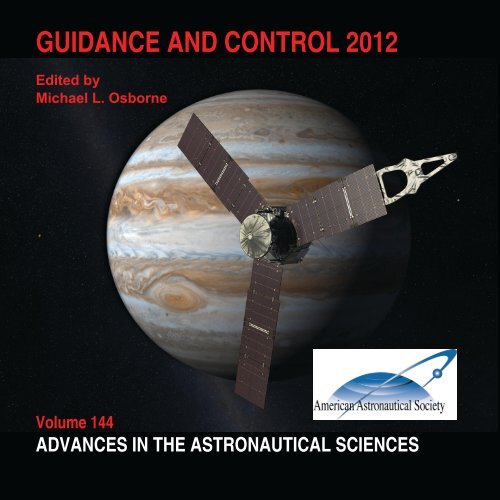
AAS PRESIDENTFrank A. SlazerVICE PRESIDENT - PUBLICATIONSProf. David B. SpencerEDITORMichael L. OsborneSERIES EDITORRobert H. JacobsNorthrop GrummanPennsylvania State UniversityLockheed Martin Space Systems Co.<strong>Univelt</strong>, IncorporatedFront Cover Illustration:The Juno spacecraft, built for NASA/JPL by Lockheed Martin, was launched in 2011 and will arriveat Jupiter in 2016. Juno’s mission is to peer deep within the gas giant’s atmosphere andhelp answer questions about the planet’s formation, thus providing insights to the early evolutionof our solar system. (Image Credit: Courtesy of NASA/JPL)Frontispiece:NASA’s twin GRAIL spacecraft, Ebb and Flow, are currently in orbit around the Moon. GRAIL(short for Gravity Recovery And Interior Laboratory) measures radio signals between the twoformation-flying spacecraft to map the moon’s gravitational field to an unprecedented level ofdetail. The spacecraft were built by Lockheed Martin and launched in 2011.(Image Credit: Courtesy of NASA/JPL-Caltech/MIT)iii
GUIDANCE ANDCONTROL 2012Volume 144ADVANCES IN THE ASTRONAUTICAL SCIENCESEdited byMichael L. OsborneProceedings of the 35th Annual AAS RockyMountain Section Guidance and ControlConference held February 3-8, 2012,Breckenridge, Colorado.Published for the American Astronautical Society by<strong>Univelt</strong>, Incorporated, P.O. Box 28130, San Diego, California 92198Web Site: http://www.univelt.comv
Copyright 2012byAMERICAN ASTRONAUTICAL SOCIETYAAS Publications OfficeP.O. Box 28130San Diego, California 92198Affiliated with the American Association for the Advancement of ScienceMember of the International Astronautical FederationFirst Printing 2012Library of Congress Card No. 57-43769ISSN 0065-3438ISBN 978-0-87703-585-5 (Hard Cover Plus CD ROM)ISBN 978-0-87703-586-2 (CD ROM)Published for the American Astronautical Societyby <strong>Univelt</strong>, Incorporated, P.O. Box 28130, San Diego, California 92198Web Site: http://www.univelt.comPrinted and Bound in the U.S.A.vi
FOREWORDHISTORICAL SUMMARYThe Annual Rocky Mountain Guidance and Control Conference began as an informalexchange of ideas and reports of achievements among local guidance and control specialists.Since most area guidance and control experts participated in the American Astronautical Society(AAS), it was natural to gather under the auspices of the Rocky Mountain Section ofthe AAS.In 1977 Martin Marietta and Ball Aerospace engineers approached the AAS SectionChair at the University of Colorado with their proposal and organized the first conference,thus beginning the annual series of meetings the following winter. In March 1978, the FirstAnnual Rocky Mountain Guidance and Control Conference met at Keystone, Colorado. Itmet there for eighteen years, moving to Breckenridge in 1996.The Conference is now held annually the first week of February and is a technicalconference on aerospace attended by Government Labs, NASA facilities, DOD, Aerospace,Industry Component Manufactures, Academia, and International Participants. The 2012Conference was the 35th Annual AAS Rocky Mountain Guidance and Control Conference.The conference has maintained the original theme of no parallel sessions, with twothree-hour sessions per day and a six-hour break at midday. This provides a forum for exchangeof technical ideas, accomplishments and recent events in the aerospace industry in asocial environment promoting an opportunity to meet customers, associates and industrypartners one-on-one.A tradition from the beginning has been the Conference banquet, an elegant dinneropen to attendees and their guests. For these wider audiences, general-interest speakers havebeen quite popular. The banquet speakers from the past ten years have been:Banquet Speakers2002 Bradford W. Parkinson, Stanford University, “GPS: National Dependence and theRobustness Imperative”.2003 Bill Gregory, Honeywell Corporation, “Mission STS-67, Guidance and Controlfrom an Astronaut’s Point of View”.2004 Richard Battin, MIT, “Some Funny Things Happened on the Way to the Moon”.2005 Dr. Matt Golombeck, Senior Scientist, MER Program, JPL, “Mars Science Resultsfrom the MER Rovers”.2006 Mary E. Kicza, Deputy Assistant Administrator for Satellite and InformationServices, NASA, “NOAA: Observing the Earth from Top to Bottom”.2007 Patrick Moore, Consulting Senior Life Scientist, SAIC and the Navy MarineMammal Program, “Echolocating Dolphins in the U.S. Navy Marine MammalProgram”.vii
2008 Dr. Ed Hoffman, Director, NASA Academy of Program and Project Leadership,“The Next 50 Years at NASA – Achieving Excellence”.2009 William Pomerantz, Senior Director for Space, The X Prize Foundation,“The Lunar X Prize”.2010 Berrien Moore, Executive Director, Climate Central, “Climate Change and EarthObservations: Challenges and Responsibilities”.2011 Joe Tanner, Senior Instructor, University of Colorado, “Building Large Structuresin Space”.2012 Greg Chamitoff, NASA Astronaut, “Completing Construction of the InternationalSpace Station – The Last Mission of Space Shuttle Endeavour”.Tutorials and special sessions or featured invited lectures have served as focal pointsfor the Conferences. In 2005, the tutorial session’s theme was “University Work on PrecisionPointing and Geolocation”. In 2006, a day for U.S. citizens only was inserted at the beginningof the Conference to allow for topics that were limited due to ITAR constraints. In2007, two invited sessions were held: “Lunar Ambitions—The Next Generation” and “ProjectOrion—The Crew Exploration Vehicle”. In 2008, a panel addressed “G&C Challengesin the Next 50 Years”. The 2009 Conference featured a special session on “ConstellationGuidance, Navigation, and Control”. This year continued the tradition with a tutorial on“Space Weather”.From the beginning, the Conference has provided extensive support for students interestedin aerospace guidance and control. The Section annually gives $2,000 in the form ofscholarships at the University of Colorado. One scholarship is awarded to the top AerospaceEngineering Sciences senior, and another to an outstanding Electrical and Computer Engineeringsenior who has an interest in aerospace guidance and control. The Section has assuredthe continuation of these scholarships in perpetuity through a $70,000 endowment.The Section supports other space education through grants to K-12 classes throughout theregion. All this is made possible by proceeds from the Conference.The student scholarship winners attend the Conference as guests of the AmericanAstronautical Society. They are recognized at the banquet where they are presented withscholarship plaques. These scholarship winners have gone on to great successes in the industry.The winners from the past few years are:Scholarship WinnersAcademic Year Aerospace Engr Sciences Electrical and Computer Engr2002–2003 Tara Klima Kiran Murthy2003–2004 Stephen Russell Andrew White2004–2005 Trannon Mosher Ehsan Negar2005–2006 Matthew Edwards Henry Romero2006–2007 Arseny Dolgov Henry Romero2007–2008 Christopher Aiken Kirk Nichols2008–2009 Nicholas Hoffmann Gregory Stahl2009–2010 Justin Clark Filip Maksimovic2010–2011 John Jakes Filip Maksimovic2011–2012 Wenceslao Shaw-Cortez Andrew Thomas2012–2013 Nicholas Mati Jacob Haynesviii
The Rocky Mountain Section of the American Astronautical Society established abroad-based Conference Committee, the Rocky Mountain Guidance and Control Committee,chaired ex-officio by the next Conference Chair, to run the annual Conference. The Conferenceattracts the nation’s top specialists in space guidance and control. Chairpersons fromrecent years are:Conference Chair Attendance2002 Steve Jolly 1512003 Ian Gravseth 1782004 Jim Chapel 1372005 Bill Frazier 1402006 Steve Jolly 1822007 Heidi Hallowell 2062008 Michael Drews 1892009 Ed Friedman 1602010 Shawn McQuerry 1892011 Kyle Miller 1612012 Michael Osborne 140The AAS Guidance and Control Technical Committee, with its national representation,provides oversight to the local conference committee. From 2000 through 2004, LarryGermann chaired this committee, and James McQuerry has chaired the technical committeesince 2005. The committee meets every year at the Conference.The AAS Guidance and Control Conference, hosted by the Rocky Mountain Section inColorado, continues as the premier conference of its type. As a National Conference sponsoredby the AAS, it promises to be the preferred idea exchange for guidance and controlexperts for years to come.On behalf of the Conference Committee and the Section,Michael L. OsborneLockheed Martin Space Systems CompanyLittleton, ColoradoJames McQuerryBall Aerospace & Technologies Corp.Boulder, Coloradoix
PREFACEThis year marked the 35th anniversary of the AAS Rocky Mountain Section’s Guidanceand Control Conference. It was held in Breckenridge, Colorado at the Beaver Run Resortfrom February 3-8, 2012. The planning committee and the national chairs did an outstandingjob in creating a highly-technical conference experience, and I extend many thanksto all those involved.The conference formally began on the morning of Saturday, February 4th with a plenarysession new to the format this year. The speaker was Mr. Keith Uebele of Intel Corporationon “The Future of Computing for Space and Ground Systems: Exploring the Limits”.After this well-received kick-off, the first session began with Space Debris – Tracking,Characterization & Mitigation. This session investigated the nature of debris and ways toensure our safe future in space.To cap off the day, the Technical Exhibits session was held Saturday afternoon. Nineteencompanies and organizations participated with many hardware demonstrations as wellas excellent technical interchanges between conferees, vendors, and family. The session wasaccompanied by a buffet dinner. Many family members and children were present, greatlyenhancing the collegiality of the session. The highly-experienced technical exhibits team didan outstanding job organizing the vendors and exhibits.Sunday, February 5th marked a return of the tutorial sessions with a morning SpaceWeather Tutorial. This session, expanding upon the hazards of space, included a discussionof the current state of space and upper-atmospheric physics along with an overview of measuringsystems and available data sources.Continuing in the educational spirit, MathWorks held a special workshop that afternoonon “Using MATLAB & Simulink for Model-Based Design of Control Systems”. Thiswell-attended lunch-time event covered the iterative process of analysis, design, and optimizationinvolved in the development and implementation of a real-world practical application.The ever-popular Advances in G&C was held later that same afternoon. And with somuch interest this year in the topic, a special follow-up Advances session was held Mondaymorning to further examine the current state-of-the-art. In the afternoon of February 6th,GN&C – The Future addressed how new concepts of operation, algorithms, and componentswill be required to meet increasingly-sophisticated mission needs in the years to come.The banquet was held later that evening, and featured Dr. Greg Chamitoff, NASA Astronautand Mission Specialist who performed the last spacewalk of the Space Shuttle Program.Greg described his mission experiences and life in space in his captivating speech entitled“Completing Construction of the International Space Station – The Last Mission ofSpace Shuttle Endeavour”. The images and videos he showed were truly awe-inspiring.xi
The sessions continued Tuesday, the morning of February 7th, with Current & FutureAdvanced European Programs highlighting innovations in that continent’s space agencies,industries, technologies, and missions. Tuesday afternoon featured INR from UAVs, a sessionthat showcased hardware and software systems for Image Navigation & Registration fromUnmanned Aerial Vehicle platforms.Finally, the morning of Wednesday, February 8th featured the popular closing sessionRecent Experiences. This traditional session contained candid first-hand accounts of the successesand failures, trials and tribulations encountered in the space industry with valuablelessons for all to help ensure continued successes in the future.The participation and support of our many colleagues in the industry helped make the35th Annual Rocky Mountain AAS G&C conference a great success. The technical committee,session chairs, and national chairs were unfailingly supportive and fully committed tothe technical success of the conference. Special thanks also go to Carolyn O’Brien ofLockheed Martin, Lis Garratt of Ball Aerospace, and the staff at Beaver Run for their professionalismand attention to the operational details that made this conference happen!Michael L. Osborne, Conference Chairperson2012 AAS Guidance and Control Conferencexii
CONTENTSPageFOREWORDPREFACEviixiSPACE DEBRIS: TRACKING, CHARACTERIZATION AND MITIGATION 1Satellite Conjunction Assessment and Collision Avoidance Support from anOperational Perspective (AAS 12-011)Robert A. Massey . . . . . . . . . . . . . . . . . . 3SPADOC 4 Track Association and Short Arc Initial Orbit Determination(AAS 12-013)James A. Peugh . . . . . . . . . . . . . . . . . . 23Space Object Mass-Specific Inertia Matrix Estimation from Photometric Data(AAS 12-014)Richard Linares, Fred A. Leve, Moriba K. Jah and John L. Crassidis. . . . 41Space Object Area-to-Mass Ratio Estimation Using Multiple Model Approaches(AAS 12-015)Richard Linares, Moriba K. Jah and John L. Crassidis . . . . . . . . 55Space Debris Reorbiting Using Electrostatic Actuation (AAS 12-016)Erik A. Hogan and Hanspeter Schaub . . . . . . . . . . . . 73Design of Spacecraft Missions to Remove Multiple Orbital Debris Objects(AAS 12-017)Brent W. Barbee, Salvatore Alfano, Elfego Piñon, Kenn Goldand David Gaylor . . . . . . . . . . . . . . . . . . 93Operations Concept for the Robotic Capture of Large Orbital Debris(AAS 12-018)Richard Rembala, Frank Teti and Patrice Couzin . . . . . . . . . 111SPACE WEATHER TUTORIAL 121Space Weather Hazards in the Inner Magnetosphere (AAS 12-033)Josef Koller . . . . . . . . . . . . . . . . . . . 123Addressing the Influence of Space Weather on Airline Navigation (AAS 12-034)Lawrence Sparks . . . . . . . . . . . . . . . . . . 131Tutorial: the Neutral Atmosphere and the Satellite Drag Environment(AAS 12-035)Geoff Crowley, Marcin Pilinski and Irfan Azeem . . . . . . . . . 145xiii
PageADVANCES IN GUIDANCE, NAVIGATION AND CONTROL 163Attitude Determination for a Small Satellite Mission (AAS 12-041)Michael D’Angelo, Richard Linares and John L. Crassidis . . . . . . 165Alignment Between IMU and Star Tracker Using the Night Sky and anOn-Board Navigation System (AAS 12-042)Stephen R. Steffes, Malak A. Samaan and Stephan Theil. . . . . . . 173Small Satellite Attitude Control for Tracking Resident Space Objects(AAS 12-043)Dylan Conway, Richard Linares and John L. Crassidis . . . . . . . 187GPS at GEO: A First Look at GPS from SBIRS GEO1 (AAS 12-044)Lee Barker and Chuck Frey . . . . . . . . . . . . . . . 199Safehold Attitude Determination Approach for GPM (AAS 12-045)Henry Fitzpatrick and Keith DeWeese . . . . . . . . . . . . 213Vision Navigation Sensor (VNS) Results from the STORRM Mission(AAS 12-051)Ian J. Gravseth, Reuben Rohrschneider and Jim Masciarelli . . . . . . 223Full Scale Flight Demonstration of Lidar-Based Hazard Detection andAvoidance (AAS 12-052)David Neveu, Jean-François Hamel, Mike Alger, Jean de Lafontaine,Jeff Tripp, Marwan Hussein, Brian Hill, Allen Taylor, Peter Dietrich,Chris Langley and Andrew Kerr . . . . . . . . . . . . . 243Simulation Results of Rendezvous and Docking with the International SpaceStation Using Only 3D Range Images (AAS 12-053)Reuben R. Rohrschneider, William Tandy, Jeff Bladt and Ian J. Gravseth . . 263Monocular 3D Slam Using a Visual Landmark Database for AutonomousNavigation Near Small Celestial Bodies (AAS 12-054)Cedric Cocaud and Takashi Kubota . . . . . . . . . . . . 275EPOXI Fine Guidance Architecture and Operation (AAS 12-055)Dustin Putnam . . . . . . . . . . . . . . . . . . 289GOES-R Magnetic Field Estimation (AAS 12-056)Chris Chastain, Donald Chu and Doug Westbury . . . . . . . . . 305Gimbal Control Algorithms for the Global Precipitation Measurement CoreObservatory (AAS 12-057)Gary Welter, Kuo Chia (Alice) Liu and Carl Blaurock . . . . . . . 317GUIDANCE, NAVIGATION AND CONTROL: THE FUTURE 333Technical Challenges and Future Technology Needs for NASA’s Guidance,Navigation and Control Engineering Discipline (AAS 12-061)Cornelius J. Dennehy . . . . . . . . . . . . . . . . 335xiv
PageOptimal Space Effects: Driving Future Military GN&C Technology Needs(AAS 12-062)William W. Saylor and David J. Richie . . . . . . . . . . . 357Future US Launch Vehicle GN&C Technology Needs (AAS 12-063)John G. Reed . . . . . . . . . . . . . . . . . . . 373Guidance, Navigation and Control Requirements for Future Remote SensingSpace Systems (AAS 12-064)Michael Santina, Bruce C. Chesley and Gregory R. Johnston . . . . . 381Autonomous RPOD Technology Challenges for the Coming Decade(AAS 12-065)Bo J. Naasz and Michael C. Moreau . . . . . . . . . . . . 403CURRENT AND FUTURE ADVANCED EUROPEAN PROGRAMS 427Spacebus 4000: From Earth Sensors to 3-Axis Star Trackers Control ofTelecommunication Spacecraft (AAS 12-071)E. Brouillard, B. Célérier and C. Boddaert . . . . . . . . . . . 429The PRISMA Formation Flying Demonstrator: Overview and Conclusions fromthe Nominal Mission (AAS 12-072)Per Bodin, Ron Noteborn, Robin Larsson, Thomas Karlsson, Simone D’Amico,Jean Sebastien Ardaens, Michel Delpech and Jean-Claude Berges . . . . 441From the Bright Sun to the Faintest Stars: The European Route to State of theArt Miniaturized Attitude Sensors (AAS 12-073)Paolo Fidanzati, Riccardo Gabrieli, Egidio Pucci, Franco Boldrini,Dorico Procopio and Stephen P. Airey . . . . . . . . . . . . 461European ASTRIX TM FOG In-Orbit Heritage (AAS 12-074)G. Cros, Ph. Loubières, I. Lainé, Ph. Guay and S. Ferrand . . . . . . 481Flash Optical Sensors for Guidance, Navigation and Control Systems(AAS 12-075)A. Pollini . . . . . . . . . . . . . . . . . . . . 503NPAL Evolutions Applied to ESA’s Lunar Lander Mission (AAS 12-076)D. Fischer, E. Zaunick, B. Polle and E. Kervendal . . . . . . . . 519European Space Agency – ESA: New Reaction Wheel Characterisation TestFacility (RCF) (AAS 12-077)Mark Wagner, Stephen Airey, Gaetan Piret and Phuoc Le . . . . . . 537IMAGE NAVIGATION AND REGISTRATION (INR) FROMUNMANNED AERIAL VEHICLES (UAVs) 557Population of a Range Bearing Map for Local Obstacle Avoidance UsingMonocular Vision (AAS 12-081)Sean Quinn Marlow and Jack W. Langelaan . . . . . . . . . . 559Cloud Computing on Wings: Applications to Air Quality (AAS 12-082)H. Chen, R. Hansen, J. Huang, E. Pereira, R. Swick, D. Vizzini, R. Sengupta,C. M. Kirsch, F. Landolt, M. Lippautz, A. Rottmann and R. Trummer . . . 575xv
PageThree Dimensional Geolocation From UAS Imagery: Investigating an InverseStructure-from-Motion Model (AAS 12-083)Keith W. Cunningham and Rayjan Wilson. . . . . . . . . . . 591From Weather Satellites to Aerial Imaging: Bringing Image Navigation andRegistration Down to Earth (AAS 12-084)James L. Carr, Nate Allen, Joseph Fox-Rabinovitz, Christopher Miller,Norman Lo, Stephen J. Fujikawa and Lanny Herron . . . . . . . . 599Costal Survey Using Unmanned Aerial Systems (AAS 12-085)Gregory Walker . . . . . . . . . . . . . . . . . . 617Optical Terrain Navigation for Pinpoint Landing: Image Scale and Position-GuidedLandmark Matching (AAS 12-087)Jeff Delaune, Guy Le Besnerais, Martial Sanfourche, Thomas Voirin,Clément Bourdarias and Jean-Loup Farges. . . . . . . . . . . 627RECENT EXPERIENCES IN GUIDANCE AND CONTROL 645Implementing the Mars Science Laboratory Terminal Descent Sensor FieldTest Campaign (AAS 12-091)James F. Montgomery, James H. Bodie, Joseph D. Brown, Allen Chen,Curtis W. Chen, John C. Essmiller, Charles D. Fisher, Hannah R. Goldberg,Steven W. Lee and Scott J. Shaffer . . . . . . . . . . . . . 647Orion Multi-Purpose Crew Module Pad Abort Flight Test Overview andSummary (AAS 12-092)Richard R. Burt, William D. Pratt and Michael E. Begley . . . . . . 665NigeriaSat-2 AOCS: Results from the First 90 Days in Orbit (AAS 12-093)Andrew Carrel, Tony Holt, A. Gavin Y. Johnston, Gokhan Yuksel,Allon Jameson, Yoshi Hashida, Andrew Cawthorne and Guy Richardson . . 685DEMETER – In-Orbit Results of Deorbitation (AAS 12-094)Christine Fallet and Jérôme Maureau . . . . . . . . . . . . 701Initial GN&C Performance on the Juno Spacecraft (AAS 12-095)Jay A. St. Pierre, Kristen M. Francis, Jason A. Wynn and Christopher T. Voth 715Guidance and Control Challenges to the MESSENGER Spacecraft in Achievingand Operating from Orbit at Mercury (AAS 12-096)Sarah H. Flanigan, Daniel J. O’Shaughnessy and Eric J. Finnegan . . . . 735Understanding Spacecraft Agility for Orbit Transfers on the Dawn Low-ThrustMission (AAS 12-097)Brett A. Smith, C. Anthony Vanelli and Allan Y. Lee . . . . . . . 753Stardust-NExT: Lessons Learned from a Comet Flyby Mission (AAS 12-098)Aron A. Wolf, Timothy Larson, Paul Thompson, Timothy McElrath,Shyam Bhaskaran, Steven Chesley, Kenneth P. Klaasen and Allan Cheuvront . 771xvi
PagePOSTER SESSION PAPERS 787In-Situ Sub-Millimeter Space Debris Detection Using CubeSats (AAS 12-001)Katharine M. Brumbaugh, Henri C. Kjellberg, E. Glenn Lightsey,Alexander Wolf and Rene Laufer . . . . . . . . . . . . . 789Meeting Orbit Determination Requirements for a Small Satellite Mission(AAS 12-002)Adonis Pimienta-Peñalver, Richard Linares and John L. Crassidis . . . . 805Heliogyro Solar Sail Blade Twist Control (AAS 12-003)Daniel Guerrant, Dale Lawrence and W. Keats Wilkie . . . . . . . 817Multiobjective Genetic Algorithm for Stability Analysis of Flexible ArticulatedPlants (AAS 12-004)Ashley Moore, Marcus R. George and Davin K. Swanson . . . . . . 829Analysis of the Touch-and-Go Surface Sampling Concept for Comet SampleReturn Missions (AAS 12-005)Milan Mandiæ, Behçet Açýkmeºe, David S. Bayard and Lars Blackmore . . 841Smart GN&C Components for Smart Satellites (AAS 12-006)Anja Nicolai, Antje Deckert, Christian Raschke and Stephan Stoltz . . . . 857GNC Design and Validation for Precision Landing at the Moon and Mars(AAS 12-007)Jean-François Hamel, David Beaudette, Vincent Simard-Bilodeau,Jean de Lafontaine, Emanuele Di Sotto, Nuno Paulino, Joao Branco,Guy Johns and Diego de Rosa . . . . . . . . . . . . . . 869Spacecraft Attitude and Body Rate Estimation with Multi-Head Star Sensor:Concept, Design and On-Orbit Results (AAS 12-008)Shoji Yoshikawa, Katsumasa Miyatake, Hiroyuki Kawano, Haruhiko Shimoji,Takeshi Suzuki, Yoshinori Kunii, Kazumori Hama, and Noriaki Oka . . . 885TECHNICAL EXHIBITS PAPERS 899European ASTRIX TM FOG In-Orbit Heritage (AAS 12-021)G. Cros, Ph. Loubières, I. Lainé, Ph. Guay and S. Ferrand . . . . . . 9012012 with the Shazbots (AAS 12-022)Aida Castillo, Taylor Andrews, Will Searight, Dylan Cassidy, David Sahud,Rebecca Minari, Noah Rosenthal and Daniel Early . . . . . . . . 903APPENDICES 909Publications of the American Astronautical Society . . . . . . . . . 910Advances in the Astronautical Sciences . . . . . . . . . . . 911Science and Technology Series . . . . . . . . . . . . . . 921AAS History Series . . . . . . . . . . . . . . . . . 929INDICES 931Numerical Index . . . . . . . . . . . . . . . . . . . 933Author Index. . . . . . . . . . . . . . . . . . . . 937xvii
SPACE DEBRIS:TRACKING, CHARACTERIZATION,AND MITIGATION1
SESSION IA safe space environment without substantial debris threats is crucial for scientific, defense,and commercial needs. Debris mitigation is a topic of global concern and has internationalattention. An improved understanding of what debris is up there, where it is,and how it is moving is important to characterize what actions we must take. Methodsto help prevent satellite collisions and breakups are continuously being refined and employedin operations, and innovative ways to actively remove debris are gaining moretraction. This session covers these topics to ensure that space debris will not obstructour future in space.National Chairpersons:Moriba JahAir Force Research LaboratoryScott DawTASC Inc.Local Chairpersons:Alex MayLockheed Martin Space SystemsCheryl WalkerTASC Inc.The following papers were not available for publication:AAS 12-012(Paper Withdrawn)The following paper numbers were not assigned:AAS 12-019 to -0202
AAS 12-011SATELLITE CONJUNCTION ASSESSMENTAND COLLISION AVOIDANCE SUPPORTFROM AN OPERATIONAL PERSPECTIVERobert A. Massey *Under Space Situational Awareness (SSA) sharing provisions of the new U.S. NationalSpace Policy, commercial and international Guidance, Navigation, and Controlprofessionals and satellite owner/operators concerned about orbital safety now have expandedaccess to systems, processes, and <strong>information</strong> used by the United States StrategicCommand (USSTRATCOM) Joint Space Operations Center (JSpOC) for high-accuracysatellite Conjunction Assessment (CA) and collision avoidance support. Recentcontributions to the orbital debris population and historical Satellite Catalog growth arereviewed with commentary on catalog-growth projections. A brief background of operationaldebris avoidance strategy for ISS/Shuttle and its progression to include all currentactive payloads is presented. Key systems, software applications and underlying algorithmsused by the JSpOC for high-accuracy satellite catalog maintenance, CA, and collisionavoidance support are reviewed. The simplified 2-D formulation and supportingkey assumptions for computed probability of collision are illustrated and explained. Thegeneral CA process used by JSpOC Orbit Safety Analysts (OSAs) for consistent orbitdetermination and improved covariances leading to actionable relative miss predictionsand computed collision probabilities is described. A close-conjunction asset versus debriscase study example is presented. [View Full Paper]* Sr. Space Analyst and former JSpOC 1st Space Control Squadron Orbital Safety Analyst; Colorado Springs,Colorado, U.S.A.; 719-360-3549 mobile, E-mail: robert_massey@zoho.com.3
AAS 12-013SPADOC 4 * TRACK ASSOCIATION ANDSHORT ARC INITIAL ORBIT DETERMINATIONJames A. Peugh †The catalog of man-made objects in space was established, and is maintained usingobservations provided by a network of sensors that collectively: anticipate and point towardspecific objects at scheduled intervals; survey portions of the sky; or act as a“fence” to observe objects passing through. Continued collections are necessary sinceenvironmental and space object parameters used in orbit prediction are not known precisely,some objects internally generate orbit changes, and many undiscovered objectsare still to be cataloged. As the current surveillance network has limited capacity to ideallysatisfy collection requirements, new sensor concepts are being evaluated for inclusion.To maintain tracking, and to support discovery and change detection on deepspace objects, angles-only (angles and angular rates) optical sensor concepts have beenproposed that provide increased frequency of collections through wide area survey andthe use of Too Short Arcs (TSAs). Such tracking does not provide range or range rate<strong>information</strong>, and the incomplete state <strong>information</strong> creates difficulties in object correlationand initial orbit determination (IOD). While methods are being developed to resolvethese problems, the viability of using widely spaced TSAs to perform the spacesurveillance mission is still in debate. What follows is a discussion of the current use ofangles-only observations in space operations, including observation association, an introductionto IOD using TSAs, operational impacts of using TSAs, identification ofshortcomings and recommendations to mitigate them, and an illustration of the correlationand IOD problem encountered when TSAs are applied to a cluster of satellites residingin the geosynchronous belt. [View Full Paper]* The Space Defense Operations Center, SPADOC, refers to the Space Control Center (SCC), while “SPADOC 4”refers to the computer hardware and software that support SCC operations. In this paper we are referring to theprocessing and procedures used to maintain the space catalog, but for simplicity we will use the term“SPADOC.”† Space Surveillance Modeling, Simulation and Analysis Consultant for SRA International, Incorporated. E-mailjames_peugh@sra.com, jandjap@yahoo.com, Phone 719-660-8586.4
AAS 12-014SPACE OBJECT MASS-SPECIFIC INERTIA MATRIXESTIMATION FROM PHOTOMETRIC DATARichard Linares, * Fred A. Leve, † Moriba K. Jah ‡ and John L. Crassidis §This works investigates the problem of estimating the scaled inertia parameters ofa space object using photometric and astrometric data. The inertia matrix isparameterized in terms of the relative scaled inertias and the orientation of the principalcomponents because the system is not completely observable. A Unscented Kalman Filter(UKF) is presented that processes the lightcurve (single band photometric) and angles(astrometric) data to estimate the orientation, rotational rates, position, and velocityof the space object (SO) along with the scaled inertia parameters. [View Full Paper]* Graduate Student, Department of Mechanical & Aerospace Engineering, University at Buffalo, State Universityof New York, Amherst, New York 14260-4400, U.S.A. E-mail: arp27@buffalo.edu, Student Member AAS andAIAA.† Research Engineer, Air Force Research Laboratory, Kirtland AFB, New Mexico 87117, U.S.A. Senior MemberAIAA.‡ Senior Research Aerospace Engineer, Air Force Research Laboratory, Kirtland AFB, New Mexico, 87117,U.S.A. Member AAS, Associate Fellow AIAA.§ Professor, Department of Mechanical & Aerospace Engineering, University at Buffalo, State University of NewYork, Amherst, New York 14260-4400, U.S.A. E-mail: johnc@buffalo.edu, Member AAS, Associate FellowAIAA.5
AAS 12-015SPACE OBJECT AREA-TO-MASS RATIO ESTIMATIONUSING MULTIPLE MODEL APPROACHESRichard Linares, * Moriba K. Jah † and John L. Crassidis ‡In this paper two multiple model approaches are applied to estimate the effectivearea-to-mass ratio of a space object. Both multiple-model adaptive estimation and a newapproach called adaptive likelihood mixtures are used in this work. Multiple model approacheshave been used extensively used in target tracking applications since they candetect abrupt changes in the models governing the target’s motion. Since thearea-to-mass ratio is a function of the projected Sun facing area, which is a function ofthe orientation of the space object, then the effective area-to-mass ratio is time varying.It is difficult to estimate the time varying nature of the area-to-mass ratio using traditionalestimators. Therefore multiple model approaches are proposed here. Simulationresults are shown for different scenarios and good performance is given to determinethe effective area-to-mass ratios as, well as their changes over time. [View Full Paper]* Graduate Student, Department of Mechanical & Aerospace Engineering, University at Buffalo, State Universityof New York, Amherst, New York 14260-4400, U.S.A. E-mail: arp27@buffalo.edu, Student Member AAS andAIAA.† Director, Advanced Sciences and Technology Research Institute for Astrodynamics (ASTRIA), Air ForceResearch Laboratory, Kirtland AFB, New Mexico, 87117, U.S.A. Member AAS, Associate Fellow AIAA.‡ Professor, Department of Mechanical & Aerospace Engineering, University at Buffalo, State University of NewYork, Amherst, New York 14260-4400, U.S.A. E-mail: johnc@buffalo.edu, Member AAS, Associate FellowAIAA.6
AAS 12-017DESIGN OF SPACECRAFT MISSIONSTO REMOVE MULTIPLE ORBITAL DEBRIS OBJECTSBrent W. Barbee, * Salvatore Alfano, † Elfego Piñon, ‡Kenn Gold § and David Gaylor **The amount of hazardous debris in Earth orbit has been increasing, posing anever-greater danger to space assets and human missions. In January of 2007, a ChineseASAT test produced approximately 2600 pieces of orbital debris. In February of 2009,Iridium 33 collided with an inactive Russian satellite, yielding approximately 1300pieces of debris. These recent disastrous events and the sheer size of the Earth orbitingpopulation make clear the necessity of removing orbital debris. In fact, experts fromboth NASA and ESA have stated that 10 to 20 pieces of orbital debris need to be removedper year to stabilize the orbital debris environment. However, no spacecraft trajectorieshave yet been designed for removing multiple debris objects and the size ofthe debris population makes the design of such trajectories a daunting task. Designingan efficient spacecraft trajectory to rendezvous with each of a large number of orbitaldebris pieces is akin to the famous Traveling Salesman problem, an NP-complete combinatorialoptimization problem in which a number of cities are to be visited in turn.The goal is to choose the order in which the cities are visited so as to minimize the totalpath distance traveled. In the case of orbital debris, the pieces of debris to be visitedmust be selected and ordered such that spacecraft propellant consumption is minimizedor at least kept low enough to be feasible. Emergent Space Technologies, Inc. has developedspecialized algorithms for designing efficient tour missions for near-Earth asteroidsthat may be applied to the design of efficient spacecraft missions capable of visitinglarge numbers of orbital debris pieces. The first step is to identify a list of high prioritydebris targets using the Analytical Graphics, Inc. SOCRATES website and thenobtain their state <strong>information</strong> from Celestrak. The tour trajectory design algorithms willthen be used to determine the itinerary of objects and Äv requirements. These resultswill shed light on how many debris pieces can be visited for various amounts of propellant,which launch vehicles can accommodate such missions, and how much margin isavailable for debris removal system payloads. [View Full Paper]* Aerospace Engineer, NASA GSFC, Code 595, 8800 Greenbelt Road, Greenbelt, Maryland 20771, U.S.A.† Senior Research Astrodynamicist, Center for Space Standards and Innovation (CSSI), 7150 Campus Drive, Suite260, Colorado Springs, Colorado 80920, U.S.A.‡ Senior GN&C Engineer, Emergent Space Technologies, Inc., 6411 Ivy Lane, Suite 303, Greenbelt, Maryland20770, U.S.A.§ Director of R&D, Emergent Space Technologies, Inc., 6411 Ivy Lane, Suite 303, Greenbelt, Maryland 20770,U.S.A.** Vice President, Emergent Space Technologies, Inc., 6411 Ivy Lane, Suite 303, Greenbelt, Maryland 20770,U.S.A.8
AAS 12-018OPERATIONS CONCEPT FOR THE ROBOTIC CAPTURE OFLARGE ORBITAL DEBRISRichard Rembala, * Frank Teti † and Patrice Couzin ‡The growing population of expired satellites and space debris has become a globalconcern. Nearly 29,000 objects larger than 10 cm have been identified, any of whichcould cause a catastrophic collision and on-orbit break-up of an operating satellite. Aspostulated by Donald J. Kessler in 1978, the debris field is expected to increase throughcollisions with existing orbiting objects until a critical level is reached where a cascadingcollision effect will pollute Earth orbit with small fragments in a phenomenonknown as the “Kessler Syndrome.” The presence of debris has and will continue to putat risk the safe operation of satellites in high value orbits. One remedy proposed byKessler in 2009: “The control of future debris requires, at a minimum, that we not leavefuture payloads and rocket bodies in orbit after their useful life and might require thatwe plan launches to return some objects already in orbit.” This paper examines an activedebris removal mission whereby a robotic Orbital Debris Removal Vehicle(ODRV) removes large derelict objects from high value regions in low earth orbit. Theoperations concept and key functional requirements for the tracking and capture systemsnecessary to address the unprepared nature and possibly tumbling behavior of the debriswill be presented. [View Full Paper]* Systems Engineering, MDA Space Mission, 9445 Airport Road, Brampton, Ontario, Canada.† Manager, Autonomous Robotics, MDA Space Mission, 9445 Airport Road, Brampton, Ontario, Canada.‡ Systems Engineering, Thales Alenia Space, 100 boulevard du midi - BP 99 - 06156 Cannes, France.9
SPACE WEATHER TUTORIAL10
SESSION IIIUnderstanding near-Earth space and atmospheric effects are critical to satellite designand effective on-orbit operation of spacecraft and payload systems (including RF andscientific payloads). Atmospheric density impacts Orbital Determination (OD) in theLow Earth Orbit (LEO) regime. Ionospheric and proto-ionospheric physics result in RFsignal delays and scintillation. The spacecraft in-situ environment will drive on-orbitimpacts that include electrostatic discharge events, single-event upsets and other effectsresulting from trapped radiation and other solar particle events. This session will includea tutorial of the current state of space and upper-atmospheric physics and providean overview of its impact to orbital missions.National Chairpersons:Tim WalshNational Oceanic andAtmospheric Administration –Goddard Space Flight Center(NOAA/GSFC)Bob RutledgeNational Oceanic andAtmospheric Administration –Space Weather PredictionCenter (NOAA/SWPC)Doug BieseckerNational Oceanic andAtmospheric Administration –Space Weather PredictionCenter (NOAA/SWPC)Local Chairpersons:Shawn McQuerryLockheed MartinSpace Systems CompanyLee BarkerLockheed MartinSpace Systems CompanyThe following papers were not available:AAS 12-031“Introduction to Space Weather,” Bob Rutledge, NOAA/NWS (Presentation Only)AAS 12-032“Space Weather Considerations for Spacecraft/Instrument Design,” Paul Richards,NASA/GSFC (Presentation Only)The following paper numbers were not assigned:AAS 12-036 to -04011
AAS 12-033SPACE WEATHER HAZARDS IN THE INNER MAGNETOSPHEREJosef Koller *Space weather refers to the conditions on the sun and in the solar wind, magnetosphere,ionosphere, and thermosphere that can influence the performance and reliabilityof space-borne and ground-based technological systems and endanger human life orhealth. The purpose of this presentation is to review the processes and effects on spacehardware with relevance to real world applications. We will focus on the inner magnetosphereand in particular on the radiation belt environment. We will describe the impactof space weather on hardware as a function of orbit and discuss the current modelingefforts that take into account real-time radiation belt observations and a physics-basedmodel. [View Full Paper]* Space Science and Applications, ISR-1, PO Box 1663, D466, Los Alamos, New Mexico 87545, U.S.A.12
AAS 12-034ADDRESSING THE INFLUENCE OF SPACE WEATHERON AIRLINE NAVIGATIONLawrence Sparks *The advent of satellite-based augmentation systems has made it possible to navigateaircraft safely using radio signals emitted by global navigation satellite systems(GNSS) such as the Global Positioning System. As a signal propagates through theearth’s ionosphere, it suffers delay that is proportional to the total electron content encounteredalong the raypath. Since the magnitude of this total electron content isstrongly influenced by space weather, the safety and reliability of GNSS for airline navigationrequires continual monitoring of the state of the ionosphere and calibration ofionospheric delay. This paper examines the impact of space weather on GNSS-basednavigation and provides an overview of how the Wide Area Augmentation System protectsits users from positioning error due to ionospheric disturbances. [View Full Paper]* Jet Propulsion Laboratory / California Institute of Technology, 4800 Oak Grove Drive, Pasadena, California91109-8099, U.S.A.13
AAS 12-035TUTORIAL: THE NEUTRAL ATMOSPHERE ANDTHE SATELLITE DRAG ENVIRONMENTGeoff Crowley, * Marcin Pilinski † and Irfan Azeem ‡Satellite drag is the primary non-gravitational force acting on satellites below 500km altitudes and continues to be an important orbital perturbation up to 800-1000 kmaltitudes. Recent developments in the understanding of upper atmospheric physics aswell as the availability of high-resolution satellite drag data are motivating a transitionfrom empirical models to physics based assimilative models as the primary tools forsatellite drag specification. The motivation, current progress and future challenges associatedwith this effort are described in this paper. First principles models, such asTIMEGCM are described and their ability to specify satellite drag is demonstrated.Since the prediction of satellite ballistic coefficients limits the ability to forecast satellitedrag almost as much as atmospheric density, physics-based atmospheric models willlikely be coupled with physics-based ballistic and drag coefficient specification. Thiscomplete approach to the satellite drag problem has the potential to be the first systemto achieve the 5% drag specification goal prescribed by the Air Force Space Command.[View Full Paper]* Chief Scientist and CEO, Atmospheric and Space Technology Research Associates (ASTRA), Boulder,Colorado 80301, U.S.A. Tel: 210-834-3475.† Postdoctoral Researcher, Atmospheric and Space Technology Research Associates (ASTRA), Boulder, Colorado80301, U.S.A. Tel: 210-834-3475.‡ Chief Engineer, Atmospheric and Space Technology Research Associates (ASTRA), Boulder, Colorado 80301,U.S.A. Tel: 210-834-3475.14
ADVANCES IN GUIDANCE,NAVIGATION AND CONTROL15
SESSIONS IV and VMany programs depend on heritage, but the future is advanced by those willing to designand implement new and novel architectures, technologies, and algorithms to solvethe GN&C problems. This session is open to papers with topics ranging from theoreticalformulations to innovative systems and intelligent sensors that will advance the stateof the art, reduce the cost of applications, and speed the convergence to hardware, numerical,or design trade solutions.National Chairpersons:Brent RobertsonNASA GoddardSpace Flight CenterTim CrainNASA Johnson Space CenterLocal Chairpersons:David ChartLockheed Martin Space SystemsIan GravsethBall Aerospace &Technologies Corp.The following paper numbers were not assigned:AAS 12-046 to -050 and AAS-058 to -06016
AAS 12-041ATTITUDE DETERMINATIONFOR A SMALL SATELLITE MISSIONMichael D’Angelo, * Richard Linares † and John L. Crassidis ‡This paper describes a path toward the development of theory for using a lownoise high frame rate camera as a star tracker for spacecraft attitude estimation. Thebenefit of using a low noise high frame rate camera is that star data can be sampled at afaster rate while allowing one to measure very dim stars, increasing the number of starsavailable for attitude estimation. The development of a noise model is discussed and analgorithm to process raw data is shown. An attitude estimation method is discussed andsimulated data is shown. A simulated star tracker for attitude estimation is shown andattitude estimation results are shown. [View Full Paper]* Undergraduate Student, Department of Computer Science and Engineering, University at Buffalo, StateUniversity of New York, Amherst, New York 14260-4400, U.S.A. Student Member AAS and AIAA.† Graduate Student, Department of Mechanical & Aerospace Engineering, University at Buffalo, State Universityof New York, Amherst, New York 14260-4400, U.S.A. E-mail: linares2@buffalo.edu, Student Member AASand AIAA.‡ Professor, Department of Mechanical & Aerospace Engineering, University at Buffalo, State University of NewYork, Amherst, New York 14260-4400, U.S.A. E-mail: johnc@buffalo.edu, Member AAS, Associate FellowAIAA.17
AAS 12-042ALIGNMENT BETWEEN IMU AND STAR TRACKER USINGTHE NIGHT SKY AND AN ON-BOARD NAVIGATION SYSTEMStephen R. Steffes, * Malak A. Samaan † and Stephan Theil ‡When developing a navigation system with an IMU and star tracker, the attitudealignment between the two sensors (relative pose) must be estimated so that measurementsfrom both sensors can be converted to a common reference frame. Often suchnavigation systems use an on-board computer to combine the IMU’s gyro and accelerometermeasurements with the star tracker’s attitude measurements using a Kalman filter.The proposed alignment method adds three states to this navigation filter to estimatethe error in a given coarse alignment quaternion. On ground, the alignment quaternioncan be accurately measured by navigating with the on-board system while the startracker points towards the night sky and takes measurements. The vehicle is rotated inseveral positions to image the night sky from different angles. Each change of orientationprovides the navigation system with additional measurements of gravity, Earth rate,angle slews and star tracker quaternions, all of which help improve the filter’s estimateof the alignment quaternion. Alignment can also be done during the mission, howevergravity and Earth rate measurements may not be available. Alignment accuracy dependson the IMU’s error characteristics and the star tracker’s accuracy. This technique isused for the Hybrid Navigation System and is compared to a traditional indoor alignmentmethod which uses a checkerboard optical target. [View Full Paper]* Research Engineer, Navigation and Control Systems Department, DLR German Aerospace Center, Institute ofSpace Systems, Robert-Hooke-Str. 7, 28359 Bremen, Germany. E-mail: stephen.steffes@dlr.de.† Research Engineer, Navigation and Control Systems Department, DLR German Aerospace Center, Institute ofSpace Systems, Robert-Hooke-Str. 7, 28359 Bremen, Germany. E-mail: malak.samaan@dlr.de.‡ Head of Navigation and Control Systems Department, DLR German Aerospace Center, Institute of SpaceSystems, Robert-Hooke-Str. 7, 28359 Bremen, Germany. E-mail: stephan.theil@dlr.de.18
AAS 12-043SMALL SATELLITE ATTITUDE CONTROLFOR TRACKING RESIDENT SPACE OBJECTSDylan Conway, * Richard Linares † and John L. Crassidis ‡This paper addresses the attitude determination and control problem for the Universityat Buffalo’s GLADOS mission. The main objective of the mission is to collectmulti-band photometric data of resident space objects to improve space situationalawareness. The team plans to use two optical payloads, a wide-field camera and a spectrometer,to achieve this goal. The attitude control system uses feedback from thewide-field camera in order to track targets and allow the collection of spectral data. Thedevelopment of this novel approach which is suitable for low-cost small satellites ispresented. A numerical simulation of a modeled mission including environmental disturbances,reaction wheel limitations, and sensor errors and delays is outlined. Resultsof this simulation are then presented. The ability of this approach to effectively tracktargets within the narrow field-of-view of the spectrometer is demonstrated.[View Full Paper]* Undergraduate Student, Department of Mechanical & Aerospace Engineering, University at Buffalo, StateUniversity of New York, Amherst, New York 14260-4400, U.S.A. Student Member AIAA. E-mail:dtconway@buffalo.edu.† Graduate Student, Department of Mechanical & Aerospace Engineering, University at Buffalo, State Universityof New York, Amherst, New York 14260-4400, U.S.A. E-mail: linares2@buffalo.edu, Student Member AASand AIAA.‡ Professor, Department of Mechanical & Aerospace Engineering, University at Buffalo, State University of NewYork, Amherst, New York 14260-4400, U.S.A. E-mail: johnc@buffalo.edu, Member AAS, Associate FellowAIAA.
AAS 12-044GPS AT GEO: A FIRST LOOK AT GPS FROM SBIRS GEO1 *Lee Barker † and Chuck Frey ‡On May 7, 2011, Lockheed Martin successfully launched the first of a new seriesof Space-Based Infrared System (SBIRS) satellites, SBIRS GEO1. SBIRS is intendedprimarily to provide enhanced strategic and theater ballistic missile warning capabilities.Part of the SBIRS GEO1 design is the inclusion of a dual frequency GPS receiver tosupport spacecraft navigation requirements. Launch of GEO1 is significant in that itmakes use of GPS in the geosynchronous orbit regime, providing a unique look at theGPS environment, expectation of performance, and new challenges in GPS applicationsas seen from above the GPS constellation.New user navigation accuracy and robustness requirements for GEO satellites havespurred interest in developing GPS navigation systems designed to operate in the sparsemeasurement environment. Understanding that environment is key to designing a successfulsystem.Several published papers have described the well understood geometric constraintsof the GPS system when operating receivers above the GPS constellation. A few operatorshave reported on actual data collected by receivers operating at or above the GPSconstellation. Finally, several papers have been authored regarding proposed systemsshowing simulation results for high altitude GPS based navigation systems. These simulationresults are based on modeling assumptions that are critical to the analysis. SBIRSGEO1 data offers the first look at actual observations from GEO, and an opportunity tovalidate or improve upon models.The purpose of this paper is to present and discuss observations, postulate phenomena,and identify areas where future research or work would be useful in the exploitationof GPS in the geosynchronous orbit environment. This paper will (1) briefly summarizesome earlier work in the use of GPS above the terrestrial and LEO regime, (2)present and discuss analysis of observed GPS signal from the GEO regime. These observationsinclude a look at ionosphere delay as seen from GEO, GPS L1 antenna groupdelay as seen from large angles off the GPS satellite beam center, and GPS signalstrength at GEO relative to link predictions. [View Full Paper]* © 2010 Lockheed Martin Corporation. All Rights Reserved. This paper/material is released for publication onlyto the American Astronautical Society in all forms.† Lockheed Martin Space Systems Company, Sunnyvale, California 94089, U.S.A.‡ Lockheed Martin Integrated Systems and Global Solutions.20
AAS 12-045SAFEHOLD ATTITUDE DETERMINATION APPROACH FOR GPMHenry Fitzpatrick * and Keith DeWeese *Spacecraft safing designs generally have minimal goals with loose pointing requirements.Safe pointing orientations for three-axis stabilized spacecraft are usuallychosen to put the spacecraft into a thermally safe and power-positive orientation. In addition,safe mode designs are required to be simple and reliable. This simplicity lendsitself to the usage of analog sun sensors, because digital sun sensors will add unwantedcomplexity to the safe hold mode.The Global Precipitation Measurement (GPM) Mission Core Observatory willlaunch into lower earth orbit (LEO) at an inclination of 65 degrees. The GPM instrumentsuite consists of an active radar system and a passive microwave imager to providethe next-generation global observations of rain and snow. The complexity and precisionof these instruments along with the operational constraints of the mission resultin tight pointing requirements during all phases of the mission. To ensure the instrumentsare not damaged during spacecraft safing, thermal constraints dictate that the solarpointing orientation must be maintained to better than 6.5 degrees. This requirementis outside the capabilities of a typical analog sun sensor suite, primarily due to the effectsof Earth’s albedo. To ensure mission success, a new analog sensor, along with theappropriate algorithms, is needed.This paper discusses the design issues involving albedo effects on spacecraft pointingand the development of a simple, low-cost analog sensor and algorithm that will addressthe needs of the GPM mission. In addition, the algorithms are designed to be easilyintegrated into the existing attitude determination software by using common interfaces.The sensor design is based on a heritage, commercial off-the-shelf analog sunsensors with a limited field-of-view to reduce the effects of Earth’s albedo. High fidelitysimulation results are presented that demonstrate the efficacy of the design.[View Full Paper]* Aerospace Engineer, NASA/Goddard Space Flight Center, Code 591, Greenbelt, Maryland 20771, U.S.A.21
AAS 12-051VISION NAVIGATION SENSOR (VNS) RESULTSFROM THE STORRM MISSIONIan J. Gravseth, Reuben Rohrschneider and Jim Masciarelli *The VNS was developed as the final docking sensor for Orion and is intended toprovide range and bearing data which can be used to calculate relative pose between thesensor and the docking target from a range of in excess of 5 km down to docking. Thesensor measures time of flight of reflected laser pulses and returned intensity off ofretroreflectors on the target vehicle. As part of the Orion program’s development, thissensor was designed, built and tested at Ball Aerospace and was flown on STS-134 tomitigate the risk of differences between ground test and spaceflight for relative navigationsensors. This paper will discuss centroiding results from the Sensor Test for OrionRelNav Risk Mitigation (STORRM) flight of the VNS sensor as a science payload onSTS-134. Centroiding results will be compared against the Best Estimated Trajectoryfor the shuttle flight. [View Full Paper]* Ian, Reuben and Jim all work for the Systems Engineering organization for Ball Aerospace & TechnologiesCorp., 1600 Commerce Street, Boulder, Colorado 80301, U.S.A.22
AAS 12-052FULL SCALE FLIGHT DEMONSTRATIONOF LIDAR-BASED HAZARD DETECTION AND AVOIDANCEDavid Neveu, * Jean-François Hamel, † Mike Alger, † Jean de Lafontaine, †Jeff Tripp, ‡ Marwan Hussein, ‡ Brian Hill, ‡ Allen Taylor, § Peter Dietrich, §Chris Langley § and Andrew Kerr §International space agencies want to maximise the scientific return of planetary explorationmissions with the minimum level of risk. This goal can be achieved by implementingthe capability of landing spacecrafts with high precision and safety nearbyknown surface targets of interest such as craters, boulders and hills. Innovative guidance,navigation and control technologies are needed to achieve that goal. It requires thecapability to identify boulders and slopes on the surface of the celestial body and reactrapidly in order to guide the spacecraft toward a safe region. This capability is knownin the literature as Hazard Detection and Avoidance (HDA). In previous papers presentedat various conferences, the design of a Lidar-based autonomous planetary landingsystem and its validation using software simulators and scaled hardware-in-the-loopsimulators were presented. This paper is a continuation of this work and presents thedemonstration at full scale of this technology using helicopter flight test experiments,with Lidar measurements processing and HDA software functions operated in real timeusing a flight representative Lidar instrument. The first flight test experiments of thisprogram were performed with success during the month of October 2010 and additionalflight test campaigns were conducted during September 2011 using an upgraded andconsolidated version of the design. This paper begins with a description of the latest designversion of the Lidar-based autonomous planetary landing system. Then, the paperpresents the methodology adopted to validate the interfaces and the performance of thelanding system in a scaled and repeatable environment using a robotic test bench, theso-called Landing Dynamic Test Facility (LDTF). This laboratory environment enablesthe efficient, low-cost and low-risk validation of the complex landing system beforeproceeding to the more expensive and more risky flight experiments. The paper thenpresents the flight test validation methodology using a helicopter on a steep descent(Mars-like) and shallow descent (Moon-like) trajectory toward terrains with representativeslopes, rocks and boulders. The paper concludes with the presentation of the flightexperiment results and a detailed analysis of the achieved performance.[View Full Paper]* NGC Aerospace, 1650 King Ouest, Office 202, Sherbrooke, Québec J1J 2C3, Canada.E-mail: david.neveu@ngcaerospace.com.† NGC Aerospace, 1650 King Ouest, Office 202, Sherbrooke, Québec J1J 2C3, Canada.‡ Optech Incorporated, 300 Interchange Way, Vaughan, Ontario L4K 5Z, Canada.§ MDA Corporation, 9445 Airport Road, Brampton, Ontario L6S 4J3, Canada.23
AAS 12-053SIMULATION RESULTS OF RENDEZVOUS AND DOCKINGWITH THE INTERNATIONAL SPACE STATIONUSING ONLY 3D RANGE IMAGESReuben R. Rohrschneider, * William Tandy, †Jeff Bladt * and Ian J. Gravseth *NASA’s future plans for space vehicles call for the ability to automatically rendezvousand dock (AR&D) with the International Space Station (ISS) and other targets.This requires sensors and algorithms capable of determining the relative position andorientation (pose) between the target and chase vehicles under the drastically varyinglighting conditions of low Earth orbit and beyond.To this end, Ball Aerospace has developed algorithms to produce six degree-of-freedomnavigation data from 3D point clouds. The algorithms require a-prioriknowledge of the target vehicle geometry and a range image of the target vehicle forin-flight pose determination (no visible or reflective targets are needed). The algorithmshave been incorporated into a simulation that includes a flash LIDAR model, orbital dynamics,vehicle thrust control, and a three-dimensional model of the ISS. The flashLIDAR is used as the only relative navigation sensor during AR&D. In this paper wepresent the results of the docking simulation, including the accuracy of the pose determinationalgorithms during a successful approach and docking with ISS.[View Full Paper]* Spacecraft Systems Engineer, Ball Aerospace & Technologies Corp., 1600 Commerce Street, Boulder, Colorado80305, U.S.A.† Structural Engineer, Ball Aerospace & Technologies Corp., 1600 Commerce Street, Boulder, Colorado 80305,U.S.A.24
AAS 12-054MONOCULAR 3D SLAMUSING A VISUAL LANDMARK DATABASE FOR AUTONOMOUSNAVIGATION NEAR SMALL CELESTIAL BODIESCedric Cocaud * and Takashi Kubota †Close proximity operations near small celestial bodies adds a new range of problemsrequiring more autonomy, more precision and more flexibility from the navigationsoftware. Addressing these problems, this paper focuses on a 3D monocular SLAMbased on the Rao-Blackwellized Particle Filter approach using a hybrid mapping modulecombining binary search trees acting as a visual landmark signature catalog, and anoctree occupancy grid meant to offer a spatial representation of the landmark uncertaintydistribution. SLAM motion estimation is performed at the beginning of each timestep according to a probabilistic scheme based on fast linear visual pose estimation algorithms,sampling probable motion estimates from subgroups of visual featuresmatched across pairs of subsequent navigation camera images. The autonomousSLAM-based navigation scheme estimates the spacecraft position and attitude – or pose– at each time step by picking the most probable pose from a sample population of particlesrepresenting different hypotheses on the spacecraft path and the landmark distributionconditioned on it. A low-pass filter processes the raw output of the SLAM toprovide a smoother response that can be used by a conventional trajectory tracking controller.[View Full Paper]* Department of Electrical Engineering, University of Tokyo, ISAS campus 3-1-1 Yoshinodai, Sagamihara,Kanagawa 229-8510, Japan. Tel. 81-42-759-8311, E-mail: cedric.cocaud@ac.jaxa.jp.† Institute of Space and Astronautical Science (ISAS-JAXA), ISAS campus 3-1-1 Yoshinodai, Sagamihara,Kanagawa 229-8510, Japan. Tel. 81-42-759-8311, E-mail: kubota@isas.jaxa.jp.25
AAS 12-055EPOXI FINE GUIDANCE ARCHITECTURE AND OPERATIONDustin Putnam *The Deep Impact spacecraft was launched January 2005 and has subsequently executedclose flybys of two comets: 9P/Tempel and 103P/Hartley. The Deep Impactspacecraft is equipped with three science instruments: a high resolution visible imager(HRI), a medium resolution visible imager (MRI), and a high resolution infra-red spectrometer.This paper describes the software architecture being put in place to use theMRI to provide high accuracy stellar inertial reference measurements. Combining these“Fine Guidance” measurements with the Scalable Space Inertial Reference Unit(SSIRU) yields a pointing stability of 0.5 ìrad 1ó and a pointing accuracy of approximately5 ìrad 3ó. [View Full Paper]* Ball Aerospace & Technologies Corporation, 1600 Commerce Street, Boulder, Colorado 80301, U.S.A.26
AAS 12-056GOES-R MAGNETIC FIELD ESTIMATIONChris Chastain, * Donald Chu † and Doug Westbury ‡GOES-R is the next satellite in the series of NOAA geostationary operational environmentalsatellites (GOES) and will be launched in 2015. This paper discusses the designand estimation approach being implemented for the GOESR Series Magnetometermission which will provide highly accurate estimates of the magnetic field in GeostationaryEarth Orbit (GEO). These estimates are used to determine the level of geomagneticactivity, detect magnetopause crossings, storm sudden commencements, and mapthe space environment that controls charged particle dynamics in the outer region of themagnetosphere. [View Full Paper]* Subsystem Principal Engineer, GOES-R, Lockheed Martin Space Systems Company, P.O. Box 179, Denver,Colorado 80201, U.S.A.† Analyst, GOES-R Project, Chesapeake Aerospace, LLC, NASA/GSFC Code 417.0, Greenbelt, Maryland 20771,U.S.A.‡ System Engineer, GOES-R, Lockheed-Martin Space Systems Company, P.O. Box 179, Denver, Colorado 80201,U.S.A.27
AAS 12-057GIMBAL CONTROL ALGORITHMS FOR THE GLOBALPRECIPITATION MEASUREMENT CORE OBSERVATORYGary Welter, * Kuo Chia (Alice) Liu † and Carl Blaurock ‡There are two gimbaled systems on the Global Precipitation Measurement CoreObservatory: two single-degree-of-freedom solar arrays (SAs) and one two-degree-of-freedomhigh gain antenna (HGA). The guidance, navigation, and control analysisteam was presented with the following challenges regarding SA orientation controlduring periods of normal mission science: (1) maximize solar flux on the SAs duringorbit day, subject to battery charging limits, (2) minimize atmospheric drag during orbitnight to reduce frequency of orbit maintenance thruster usage, (3) minimize atmosphericdrag during orbits for which solar flux is nearly independent of SA orientation, and (4)keep array-induced spacecraft attitude disturbances within allocated tolerances. Theteam was presented with the following challenges regarding HGA control during missionscience periods: (1) while tracking a ground-selected Tracking Data and Relay Satellite(TDRS), keep HGA control error below about 4’, (2) keep array-induced spacecraftattitude disturbances small, and (3) minimize transition time between TDRSs subjectto constraints imposed by item 2. This paper describes the control algorithms developedto achieve these goals and certain analysis done as part of that work.[View Full Paper]* Software Engineering Division, NASA Goddard Space Flight Center (GSFC), Greenbelt Maryland 20771,U.S.A.† Mission Engineering and Systems Analysis Division, NASA GSFC, Greenbelt, Maryland 20771, U.S.A.‡ Nightsky Systems, Inc., 301 Fayetteville Street, #3014, Raleigh, North Carolina 27601, U.S.A.28
GUIDANCE, NAVIGATIONAND CONTROL: THE FUTURE29
SESSION VIAdvances in technology and engineering capabilities have continued to facilitate increasingly-sophisticatedspace-based platforms for a variety of purposes. However it isclear that new GN&C concepts, architectures, systems, algorithms, and components,will be required to meet the emerging needs of the more demanding, complex andhighly dynamic missions currently envisioned for Earth observation, space science, humanexploration beyond low Earth orbit, and national defense. Some of the GN&Cfunctions driven by advanced mission concepts and payload requirements include autonomy,adaptability, high stability, rapid slew and settle times, high-accuracy pointing andprecise vehicle position/attitude knowledge. This session considers foreseeable systemrequirements and their flow to future GN&C requirements.National Chairpersons:Neil DennehyNASA GoddardSpace Flight CenterDavid RichieU.S. Air Force AcademyLocal Chairpersons:Michael DrewsLockheed Martin Space SystemsBill FrazierBall Aerospace &Technologies Corp.The following paper numbers were not assigned:AAS 12-066 to -07030
AAS 12-061TECHNICAL CHALLENGES AND FUTURE TECHNOLOGYNEEDS FOR NASA’S GUIDANCE, NAVIGATION AND CONTROLENGINEERING DISCIPLINECornelius J. Dennehy *Currently the United States (U.S.) National Aeronautics and Space Administration(NASA) is experiencing some significant changes, particularly in the human explorationarena. Notable among the changes that have recently occurred within NASA is the retirementof the space shuttle, the emergence of commercial crew transport to the InternationalSpace Station (ISS), the development of architectures for human explorationbeyond low-Earth orbit (LEO), affordability constraints on robotic spaceflight missions,and a renewed emphasis on and commitment to space technology development/demonstration.These new changes within the Agency will have impacts on the Guidance,Navigation and Control (GN&C) discipline. This paper will summarize an independentNASA Engineering and Safety Center (NESC) assessment of the GN&C technical challengesand barriers currently faced by the three NASA Mission Directorates. Technicalchallenges and future technological need for NASA’s GN&C engineering discipline willbe summarized. In particular, three key GN&C challenge areas will be discussed in thispaper. The first challenge concerns the fact that advanced GN&C capabilities (e.g., theapplication of robust/optimal or adaptive control) are not being exploited as much asthey could be due to perceived risk of implementation. The second challenge addressesthe need for meaningful investments in the next generation of GN&C component-leveltechnologies. The third challenge arises from the lack of consistent NASA-widetop-level guidelines for GN&C system Design, Development, Test and Evaluation(DDT&E). Specific steps, many involving the efforts of the NESC GN&C TechnicalDiscipline Team (TDT), to mitigate these three challenges will be identified and described.This paper will also discuss the need for sustained investments to sufficientlymature the several classes of GN&C technologies required to implement NASA crewedexploration missions beyond LEO, to address future aeronautical system needs, and toconduct robotic spaceflight missions for attaining Earth and Space scientific goals.[View Full Paper]* NASA Technical Fellow for Guidance, Navigation and Control, NASA Engineering and Safety Center, NASAGoddard Space Flight Center, 8800 Greenbelt Road, Mail Code 590, Greenbelt, Maryland 20771, U.S.A.E-mail: cornelius.j.dennehy@nasa.gov, Phone: 301-286-5696.31
AAS 12-062OPTIMAL SPACE EFFECTS:DRIVING FUTURE MILITARY GN&C TECHNOLOGY NEEDSWilliam W. Saylor * and David J. Richie †This work builds on current exquisite performance in a variety of spacecraft components,subsystems, and algorithms in very demanding guidance, navigation, and controlapplications through flowing future national interest goals into satellite platformtechnology requirements within plausible constellation constructs identified along theway. Rather than hypothesizing new developments at the component and algorithmlevel, the paper focuses on the underlying rationale and methods for pushing thestate-of-the-art GNC subsystems for space, from identifying future military challenges,to meeting planned threats with robust space effects (i.e. precise navigation and timing;intelligence, surveillance, and reconnaissance collection), the carefully designed, analyzed,integrated, and tested satellite systems usually work as well as expected on orbitand generally demonstrate robust performance in the presence of space environmentaluncertainties. However, the latest complication is that each satellite must continuallycalculate power, energy, bandwidth, memory storage and thermal constraints – and then“play forward” in, for example, a receding horizon optimal control construct that calculatesthe next move in an infinite game of space chess. The remainder of this work,then, initiates this investigation through identifying constellation constructs, addressingthe utility optimal algorithms have on advancing the state-of–the-art while still leveragingtoday’s hardware with minimal changes, demonstrates how this all works with asingle ISR small satellite slewing maneuver, and presents future tasks needed to adequatelyevolve these steps from concept to reality, noting that each optimization step,however simplified, places new GNC requirements upon space mission designers anddevelopers. [View Full Paper]* Contractor, Air Force Research Laboratory (AFRL) Liaison, Space Systems Research Center, Department ofAstronautics, USAF Academy, Colorado 80841, U.S.A.† Lt. Col., U.S. Air Force, Ph.D. Director, Space Systems Research Center (SSRC), Department of Astronautics,2355 Fairchild Drive, USAF Academy, Colorado 80841, U.S.A.32
AAS 12-063FUTURE US LAUNCH VEHICLE GN&C TECHNOLOGY NEEDS *John G. Reed †With the exciting changes looming in the United States launch vehicle market, thisis an appropriate time to examine the emerging needs of commercial crew and the evolutionof range safety. This paper addresses the changing face of GN&C in the USLaunch Vehicle Segment, addressing the impact of crewed vehicle operations on the architecture,systems and components of the Atlas and Delta launch vehicles, with specialattention paid to those aspects driving evolution of the GN&C systems. It is also timelyto address the integration of the GPS Metric Tracking effort into the fleet and assess thefuture impacts of this evolving system and the intersection with crewed launch vehicleoperations. Consideration is also given to the evolving role of the FAA in launch vehicleoperations and their intersection with fault tolerant GN&C. Given the increasing focuson affordability and the importance of maximizing the launch benefits, additionaltopics include the impacts of secondary mission’s requirements on GN&C evolution.Finally, no assessment would be complete without touching on the challenges and opportunitiesafforded with the development of the SLS and reusable concepts like thefly-back booster efforts by the USAF and some of the new Launch Vehicle entrants.[View Full Paper]* Copyright © 2012 United Launch Alliance, LLC. All Rights Reserved.† Technical Fellow, Guidance and Navigation, United Launch Alliance, MS A5000, 7958 S. Chester Street,Centennial, Colorado 80112, U.S.A.33
AAS 12-064GUIDANCE, NAVIGATION AND CONTROL REQUIREMENTSFOR FUTURE REMOTE SENSING SPACE SYSTEMSMichael Santina, * Bruce C. Chesley † and Gregory R. Johnston ‡As the role of space-based intelligence, surveillance and reconnaissance continuesto grow, military users will demand higher image quality, faster delivery of image products,and improved target location accuracy in order to pinpoint locations of events ofinterest and for precise situational awareness. Such demands have a significant impacton the space vehicle Guidance, Navigation and Control (GNC) subsystem. GNC requirementsare ultimately driven by key performance parameters (KPPs) for the overallsystem which include image quality, quantity, timeliness, and geolocation accuracy.Consequently, an important task in the initial phase of the system development is toconvert these KPP requirements into GNC requirements and then flow down these requirementsinto drivers of GNC performance. We focus on a process to derive GNC requirementsfrom KPPs for electro-optical and synthetic aperture radar remote sensingsystems. Error budgets for the pointing knowledge and pointing control will be presentedand the error contributors that affect the pointing control system performancewill also be discussed. [View Full Paper]* Senior Technical Fellow, Boeing Space & Intelligence Systems, Seal Beach, California 90740, U.S.A.† Director, Strategic Architectures, Boeing Space & Intelligence Systems, Colorado Springs, Colorado 80910,U.S.A.‡ Senior Manager, System Modeling & Simulation, Boeing Space & Intelligence Systems, El Segundo, California90245, U.S.A.34
AAS 12-065AUTONOMOUS RPOD TECHNOLOGY CHALLENGESFOR THE COMING DECADEBo J. Naasz and Michael C. Moreau *Rendezvous Proximity Operations and Docking (RPOD) technologies are importantto a wide range of future space endeavors. This paper will review some of the recentand ongoing activities related to autonomous RPOD capabilities and summarize thecurrent state of the art. Gaps are identified where future investments are necessary tosuccessfully execute some of the missions likely to be conducted within the next tenyears. A proposed RPOD technology roadmap that meets the broad needs of NASA’sfuture missions will be outlined, and ongoing activities at GSFC in support of a futuresatellite servicing mission are presented. The case presented shows that an evolutionary,stair-step technology development program, including a robust campaign of coordinatedground tests and space-based system-level technology demonstration missions, will ultimatelyyield a multi-use mainstream autonomous RPOD capability suite with cross-cuttingbenefits across a wide range of future applications. [View Full Paper]* Aerospace Engineer, NASA GSFC, Code 595, 8800 Greenbelt Road, Greenbelt, Maryland 20771, U.S.A.35
CURRENT AND FUTURE ADVANCEDEUROPEAN PROGRAMS36
SESSION VIIThis session aims to provide an overview of GN&C developments and direction withinEurope. All aspects of GN&C, from system design and new equipment feasibility studiesthrough on-orbit experiences, are covered via the presentation of selected topicsrepresentative of the current state of the art in Europe.National Chairpersons:Stephen P. AireyEuropean Space AgencyJacques BusseuilThales Alenia SpaceLocal Chairpersons:Jim ChapelLockheed Martin Space SystemsJames McQuerryBall Aerospace &Technologies Corp.The following paper numbers were not assigned:AAS 12-078 to -08037
AAS 12-071SPACEBUS 4000: FROM EARTH SENSORSTO 3-AXIS STAR TRACKERS CONTROL OFTELECOMMUNICATION SPACECRAFTE. Brouillard, * B. Célérier † and C. Boddaert ‡Spacebus 4000 telecommunication spacecraft are now operated without Earth sensor.It took a long way to achieve this configuration. It was only possible thanks to thehigh records of Star Trackers and their careful and step by step introduction in theAOCS control loop. The paper will retrace the main milestones of the STR introductionon Spacebus 4000 that finally ended with the earth sensor removal. Flight recordsshowing the great superiority of stellar pointing versus direct earth pointing will be provided.[View Full Paper]* Attitude & Orbit Control System, Telecom Business Unit, Thales Alenia Space.† System Engineering, Telecom Business Unit, Thales Alenia Space.‡ In Orbit Support, Telecom Business Unit, Thales Alenia Space.38
AAS 12-072THE PRISMA FORMATION FLYING DEMONSTRATOR:OVERVIEW AND CONCLUSIONS FROM THE NOMINAL MISSIONPer Bodin, * Ron Noteborn, * Robin Larsson, * Thomas Karlsson, *Simone D’Amico, † Jean Sebastien Ardaens, †Michel Delpech ‡ and Jean-Claude Berges ‡The PRISMA in-orbit testbed was launched on June 15, 2010 to demonstrate strategiesand technologies for formation flying and rendezvous. OHB Sweden (OHB-SE) isthe prime contractor for the project which is funded by the Swedish National SpaceBoard with additional support from the German Aerospace Center (DLR), the FrenchNational Space Center (CNES), and the Technical University of Denmark (DTU). InAugust 2011, PRISMA completed its nominal mission and during the fall of 2011, severaladditional activities have been performed under a mission extension program. Themission qualifies a series of sensor and actuator systems including navigation usingGPS, Vision Based and RF technology as well as a propulsion system based on environmentallyfriendly propellant technology. The mission also includes a series of GNCexperiments using this equipment in closed loop. Separate experiments are implementedby OHB-SE, DLR, and CNES and the paper provides an overview and conclusionsfrom the nominal mission flight results from these experiments. [View Full Paper]* OHB Sweden AB, AOCS & SW Department, P.O. Box 1064, SE-171 22 Solna, Sweden.† DLR/GSOC, Oberpfaffenhofen, D-82234 Weßling, Germany.‡ CNES, 18 avenue Edouard Belin, 31401 Toulouse Cedex 1, France.39
AAS 12-073FROM THE BRIGHT SUN TO THE FAINTEST STARS:THE EUROPEAN ROUTE TO STATE OF THE ARTMINIATURIZED ATTITUDE SENSORSPaolo Fidanzati, * Riccardo Gabrieli, * Egidio Pucci, * Franco Boldrini, *Dorico Procopio * and Stephen P. Airey †Following the recent trend for miniaturization and the latest innovation steps in theCMOS technology, the integration on the same chip of a detector pixel array as well asthe driving & processing logic has become mature for applications in the space field. Inthe star tracker application a real optics is needed to image the stars on the detector, butthe relevant telescope cannot be integrated directly on the chip. However, the processinglogic can be embedded on the silicon and, with a suitable optics, a miniaturized starsensor optical head can be realized. The design of a suitable miniaturized optics istherefore necessary to perform a step forward in the sensor miniaturization. A contractwas then awarded to SELEX Galileo by ESA to carry out a preliminary study on a miniaturizedoptics suitable to be used for a future STAR TRACKER ON CHIP (STRoC).This paper describes in detail the design of such optics for a star tracker application, developedkeeping in mind the need for small dimensions and low recurring cost, mandatoryfor such kind of application to gain attractiveness on a wide range of applicationsand market opportunities, not only limited to micro and nano satellites. The analysesshow encouraging results both in terms of optics performance and stability of the assemblyin temperature given the proposed radiative thermal design. A prototype will bemanufactured early in 2012 and tested on an optical test bench using an image detectorused for star tracker products. The next step in the miniaturized sensor road map is thedesign of a dedicated chip and supporting off chip electronics. The latter will take advantageof the work realized for the development of a miniaturized Sun Sensor on Chipby SELEX Galileo, like ‘4T’ pixel design, on chip signal processing, thresholding andclustering, algorithms for cluster identification and unwanted objects rejection, feasibilityof a true on chip DC/DC converter. [View Full Paper]* SELEX Galileo – Via A. Einstein, 35 – 50013 Campi Bisenzio (Florence) – Italy.† ESA-ESTEC – Keplerlaan, 1 – NL-2200 AG Noordwijk – The Netherlands.40
AAS 12-074EUROPEAN ASTRIX TM FOG IN-ORBIT HERITAGEG. Cros, Ph. Loubières, I. Lainé, * Ph. Guay † and S. Ferrand ‡In the early 2000s, ASTRIUM SAS, in collaboration with iXBlue (formerlyIXSEA), a French SME, developed with CNES and ESA support, an inertial referenceunit (IRU) family for a wide range of space applications. These fully European products,called “ASTRIXTM”, are based on solid-state (FOG) technology. The first flightmodels were delivered in 2006 and 2007, and production is now running smoothly.These IRUs have been selected by a range of applications as varied as PLANCK,PLEIADES, AEOLUS, GAIA, EUROSTAR, GALILEO IOV, SENTINEL 1&2,JPSS_1 etc. covering the different orbit types (LEO, MEO, GEO and Lagrange). Theyfully benefit from the unequalled potential of FOG technology and from its particularlygood suitability to high performance space applications requirements. The ASTRIXfamily currently comprises three fully qualified products, namely ASTRIX200,ASTRIX120 and ASTRIX120HR, which are shortly presented in this paper.A total of 22 FOG channels, cumulating to date 170 000 operating hours, are currentlyin orbit (latest being with PLEIADES ASTRIX200 launched on Soyouz, Kourou,on Dec. 11). Up to Feb. 2012, the PLANCK (L2) ASTRIX120 has continuously been inoperation for two and half years and the COMS (GEO) ASTRIX120HR for one andhalf year. After having briefly introduced the origin of the product development, the paperpresents the observed in-orbit performances of these gyros in detail. The differencesbetween these two missions, their different orbits and use of gyros give a particularlyinteresting feedback on the excellent behavior of this technology. One of the 4PLANCK FOGs is oriented perpendicularly to the spin axis, making it possible to accuratelycharacterize its measurement noise, and confirming that this remains unchangedwith regard to ground acceptance test results. The COMS gyros are part of the spacecraftAOCS control loop, and thus are a major contributor to the excellent mission performances.During their use in the transfer phase, their high accuracy gave unprecedentedvisibility of micro-vibration and flexure in the various equipments and instruments,as well as the effects of spacecraft outgassing. Very positive lessons learnt fromthis in-orbit heritage are discussed. The paper concludes by briefly presenting theASTRIX family latest development, the ASTRIX3M2, a promising three-axis,cost-competitive, high-performance IMU. [View Full Paper]* ASTRIUM SAS, Toulouse, France.† CNES, Toulouse, France.‡ iXBlue (formerly IXSEA), Paris, France.41
AAS 12-075FLASH OPTICAL SENSORSFOR GUIDANCE, NAVIGATION AND CONTROL SYSTEMSA. Pollini *This paper described the project “Flash Optical Sensor for TErrain Relative NAVigation(FOSTERNAV)”, an activity funded by the European Commission through itsseventh research programme framework (FP7) space call.The orientations of the project are three folds: to review space exploration missions’requirements with landing or rendezvous phases for which the use of Light DetectionAnd Ranging (LiDAR) is foreseen, to design and build a three-dimensional (3D)imaging flash LiDAR prototype and to test the prototype on test-benches for soft-landingand rendezvous applications.The flash imaging LiDAR architecture studied in the frame of the project is a systemsolution addressing the intrinsic disadvantage of flash compared with flying-spotLiDAR. In the case of flash LiDAR the scene of interest – or the target – is illuminatedcompletely in one shot. Consequently, the limited available optical power has to be diffusedin a larger solid angle for flash imaging LiDAR than for flying-spot LiDAR, andhence a lower optical density is available on the photo-detector’s sensitive surface.When the signal-to-noise ratio (SNR) of the detected light is sufficient, the two-dimensionalphoto-detector array of a flash imaging LiDAR captures in one snapshot a 3Dimage or a Digital Elevation Map (DEM) of the target.If the lower relative optical power density disadvantage can be compensated for,then the flash architecture offers advantages for system miniaturization and simplificationover the flying-spot architecture.In the frame of FOSTERNAV to compensate for the intrinsic disadvantage, the illuminationsource of the LiDAR is a controllable laser head that can generate eitherseveral beams with low relative divergence or one single beam with a large relative divergence.For the receiver, an Active Pixel Sensor (APS) made of demodulation pixelsis used. This detector or imager generates DEM by measuring the Time-Of-Flight(TOF) of the modulated light hitting each pixel.FOSTERNAV started in January 2011and will last three years. So far, the project’steam has gone through the first phase of the project focusing at identifying andanalyzing several missions’ term of requirements for soft-landing and rendezvous, andto derive from the results, system and subsystems specifications of the flash 3D imagingLiDAR. The second phase will concentrate on the sensor prototype design and the thirdon the assessment of the prototype. [View Full Paper]* Senior Project Manager, Time and Frequency Sector, Division Systems, CSEM SA, 1 Rue Jaquet-Droz 2002Neuchâtel, Switzerland. E-mail: alexandre.pollini@csem.ch.42
AAS 12-076NPAL EVOLUTIONSAPPLIED TO ESA’S LUNAR LANDER MISSIOND. Fischer, * E. Zaunick, * B. Polle † and E. Kervendal ‡In 2010, The European Space Agency has kicked off the phase B1 of LunarLander: a mission aiming to autonomously, safely, softly and precisely landing a spacecraftat the lunar South Pole by 2018. Astrium, in charge of mission analysis and spacecraftdesign, is actively involved in the design of the GNC system for which innovativesolutions had to be implemented in order to meet stringent landing requirements. Builtupon work performed during the Lunar Lander phase A, Astrium proposes a navigationsystem based on the NPAL solution developed with ESA, and improved through internalstudies at Astrium. Compatible with the very sequence of lunar descent and landingas well as needs for Hazard Detection and Avoidance, this navigation solution is designedto meet both real time and CPU load challenges inherent to such a lunar endeavor.Recent test campaigns with computer-generated and data acquired with a helicopterhave also confirmed that navigation solution is compatible with soft and precisionlanding requirements. [View Full Paper]Astrium Satellites, AOCS & GNC, Flight Dynamics Department, Transnational Unit in Central Engineering:* GNC Engineer, Friedrichshafen, Germany.† Navigation Senior Expert, Toulouse, France.‡ GNC group leader, Toulouse, France.43
AAS 12-077EUROPEAN SPACE AGENCY (ESA): NEW REACTION WHEELCHARACTERISATION TEST FACILITY (RCF)Mark Wagner, * Stephen Airey, † Gaetan Piret ‡ and Phuoc Le §Future scientific and Earth observation space missions call for stringent requirementswith regard to the micro-vibration environment on-board of a spacecraft. The experimentalverification of the compliance to such requirements on a fully assembledspacecraft on ground e.g. during an environmental test campaign is hardly feasible becauseof the complexity to establish representative boundary conditions and the difficultyto realize a satisfying decoupling from the disturbing surrounding. The unit levelmeasurement of the micro-vibration environment induced by a unit under operation e.g.mechanisms or reaction wheel is much more straight forward to be set up. The datameasured on the unit can be used as input to dynamic simulation models of the overallspacecraft system in order to assess the severity of induced perturbations on critical performanceparameters such as pointing accuracy.The European Space Agency (ESA) initiated the development of a new test facilitywith the objective to quantify very low level forces and moments in six degrees of freedominduced by spacecraft units under operation. The design of this new test facilitywas driven by the need to characterize the interface dynamics of reaction wheels at differentspeeds. Thus facility was named Reaction Wheel Characterization Facility (RCF).Pre-studies and market survey revealed that commercially available dynamometers andforce tables were not able to satisfy the demanding requirements. The most challengingtask was to establish a design able to acquire very low amplitude levels (
IMAGE NAVIGATION ANDREGISTRATION FROM UNMANNEDAERIAL VEHICLES45
SESSION VIIIThis session will focus on hardware and software systems for the Image Navigation andRegistration (INR) from Unmanned Aerial Vehicles (UAVs).Talks will cover UAV systemsthat can be used for INR of sensors installed on the UAV platform and will alsoreport on instruments with an autonomous INR capability. Applications will includeboth defense and civilian applications and will apply both to the remote collection ofimage data and to image guidance systems for the UAV.National Chairpersons:Gary BullockNaval Surface Warfare CenterMatt FladelandNASA Ames Research CenterLocal Chairpersons:Bill EmeryUniversity of ColoradoScott FrancisLockheed Martin Space SystemsThe following papers were not available for publication:AAS 12-086(Paper Withdrawn)The following paper numbers were not assigned:AAS 12-088 to -09046
AAS 12-081POPULATION OF A RANGE BEARING MAP FOR LOCALOBSTACLE AVOIDANCE USING MONOCULAR VISIONSean Quinn Marlow * and Jack W. Langelaan †This paper presents a method for navigation of a small unmanned aerial vehicle(UAV) through an unsurveyed static environment using a single forward pointing cameraand a GPS corrected inertial measurement unit. The size and maneuverability of smallUAVs allows for low altitude flights in complex environments. Without accurate estimatesof obstacle locations, successful navigation is not possible. Using camera measurementsof bearing and optical flow and estimates of vehicle motion, a range bearingmap is created. The range bearing map stores estimates of the closest obstacle in a particularregion, the <strong>information</strong> necessary to perform local obstacle avoidance. Bydiscretizating the area around the vehicle by angle and forcing each region to contain anestimated range, complex environments can be modeled. Results of two-dimensionalsimulations are presented using a potential field method for obstacle avoidance and navigation.[View Full Paper]* Graduate Student, Department of Aerospace Engineering, The Pennsylvania State University, University Park,Pennsylvania 16802, U.S.A.† Assistant Professor, Department of Aerospace Engineering, The Pennsylvania State University, University Park,Pennsylvania 16802, U.S.A.47
AAS 12-082CLOUD COMPUTING ON WINGS:APPLICATIONS TO AIR QUALITYH. Chen, *R. Hansen, * J. Huang, * E. Pereira, * R. Swick, * D. Vizzini, * R. Sengupta, †C. M. Kirsch, ‡ F. Landolt, ‡ M. Lippautz, ‡ A. Rottmann ‡ and R. Trummer ‡We extend the concept of cloud computing developed in the cyber–world to sensorsmounted on aircraft, creating a new paradigm called the Cloud on Wings. Underthe proposed framework, a server hosted on an airplane is allowed to move in space andperform sensing and actuation. The analog of cloud computing’s virtual machine, in theCloud on Wings, is the “virtual vehicle.” Virtual vehicles are hosted by real vehicles,such as commercial flights or unmanned air vehicles. We explore air quality monitoringas a service enabled by the Cloud on Wings. We describe a low cost, low liability measurementaircraft built and tested by us for measurement in close proximity to people,our server design and implementation for the Cloud on Wings, and algorithms to operatethe cloud efficiently. [View Full Paper]* Department of Mechanical Engineering, University of California, Berkeley, California 94706, U.S.A. E-mails:haoc@berkeley.edu. {rhansen, eloi, jiangchuan, ryan.swick, dvizzini}@berkeley.edu.† Department of Civil and Environmental Engineering, University of California, Berkeley, California 94720.E-mail: sengupta@ce.berkeley.edu.‡ Department of Computer Sciences, University of Salzburg, Austria. E-mails: {christoph.kirsch, florian.landolt,michael.lippautz, andreas.rottmann, rainer.trummer}@cs.uni-salzburg.at.48
AAS 12-083THREE DIMENSIONAL GEOLOCATION FROM UAS IMAGERY:INVESTIGATING AN INVERSESTRUCTURE-FROM-MOTION MODELKeith W. Cunningham and Rayjan Wilson *We discuss an inverse approach to Structure-from-Motion that enables thegeolocation of an unmanned aerial system using a single, two-dimensional image correlatedto a digital surface model. This approach allows the calculation of airborne xyzposition coordinates as well as the orientation parameters of omega (ù), phi (ö), andkappa (ê). This theoretical investigation with idealized models seems promising.[View Full Paper]* University of Alaska, Fairbanks, Alaska 99709, U.S.A.49
AAS 12-084FROM WEATHER SATELLITES TO AERIAL IMAGING:BRINGING IMAGE NAVIGATION AND REGISTRATIONDOWN TO EARTHJames L. Carr, *† Nate Allen, * Joseph Fox-Rabinovitz, * Christopher Miller, *Norman Lo, * Stephen J. Fujikawa ‡ and Lanny Herron §Image Navigation and Registration (INR) is an engineering term used with geostationaryweather satellites. INR technology enables accurate determination of geo-locations(“navigation”) for sensed objects. In weather satellite applications, image geometricdistortions with respect to a standard fixed-grid projection are either compensated byonboard Image Motion Compensation (IMC) or by on-ground remapping (“registration”).Repeated acquisitions of the same image frame will then be registered to eachother, which enables movie making. The use of geometric observations made throughthe aperture of the sensor itself is a general characteristic of such INR solutions. Thecurrent generation of Geostationary Operational Environmental Satellites (GOES) usesstar senses and landmarks from which IMC model coefficients are determined. The nextgeneration of GOES weather satellites will augment this capability with GPS from geostationaryorbit. Current capabilities navigate and register imagery to the sub-pixellevel. The INR problem is more challenging from an aerial platform as its flight dynamicsare less predictable and consideration of the three-dimensional geometry of thescene is required. We describe our work in this area and the application of INR technologyfrom GOES to the FalconScan commercial imaging venture. Low-cost FalconScanpayloads fly on single engine airplanes, but they are well suited to UAVs once regulationspermit such flights in national airspace. FalconScan processed almost 200 collectionsin 2011 for customers in the U.S. and Canada. Product mosaics are at 10cm to50cm resolution and cover large areas that may include up to one billion pixels. Meter-levelINR accuracies are achieved over these large survey spaces. We describe theseproducts and some of the challenges in verification of their INR.Key words: INR, Aerial Remote Sensing, GOES, Landmarks, Mosaic, UAV.[View Full Paper]* Carr Astronautics Corp., 6404 Ivy Lane, Suite #333, Greenbelt, Maryland 20770, U.S.A.† Corresponding Author: E-mail: jcarr@carrastro.com.‡ Maryland Aerospace, 2138 Priest Bridge Court, Suite #3, Crofton, Maryland 21114, U.S.A.E-mail: sfujikawa@imicro.biz.§ Maryland Aerospace, 2138 Priest Bridge Court, Suite #3, Crofton, Maryland 21114, U.S.A.E-mail: lherron@falconscan.com.50
AAS 12-085COSTAL SURVEY USING UNMANNED AERIAL SYSTEMSGregory Walker *Generating high-resolution 3-dimensional costal imagery from imagery collectedon small-unmanned aircraft is opening many opportunities to study marine wildlife andits use of costal habitats as well as climate change effects on northern coasts wherestorm surges are radically altering the coastline. Additionally, the technology is beingevaluated for oil spill response planning and preparation. The University of Alaska Fairbanksworks extensively with small-unmanned aircraft and recently began evaluatingthe aircraft utility for generating survey grade mapping of topographic features. Whengenerating 3-D maps of coastal regions however there are added challenges that theUniversity have identified and are trying to address. Recent projects with Alaska fisheriesand BP Exploration Alaska have demonstrated that small-unmanned aircraft cansupport the generation of map-based products that are nearly impossible to generatewith other technologies. [View Full Paper]* University of Alaska, Fairbanks, Alaska 99775, U.S.A. E-mail: Gregory.Walker@gi.alaska.edu.51
AAS 12-087OPTICAL TERRAIN NAVIGATION FOR PINPOINT LANDING:IMAGE SCALE AND POSITION-GUIDED LANDMARK MATCHINGJeff Delaune, * Guy Le Besnerais, † Martial Sanfourche, † Thomas Voirin, ‡Clément Bourdarias § and Jean-Loup Farges **Map-based accurate navigation is a requirement for future planetary missions requiringa pinpoint landing capability. Based on an Extended Kalman Filter tight fusionarchitecture between a camera and inertial sensors, this paper proposes a new method tomatch descent image landmarks with orbital ones down to very low altitude while beingrobust to 3D terrain topography and illumination changes. It is based on the idea thatimage scale can be used as an additional description for a landmark. Filter estimates areused to predict the research area and scale of the landmarks in the descent image. AMonte Carlo analysis using software simulation shows its compliance with pinpointlanding requirements. [View Full Paper]* Ph.D. Student, Systems Control and Flight Dynamics, ONERA, 2 av. Édouard Belin - 31000 Toulouse - France.† Research Engineer, Modeling and Information Processing, ONERA, Chemin de la Hunière - 91123 Palaiseau -France.‡ GNC System Engineer, TEC-ECN, ESA-ESTEC, Keplerlaan 1 - 2200 AG Noordwijk - The Netherlands.§ Navigation Engineer, Mission Analysis and Navigation Systems, Astrium ST, 66 route de Verneuil - 78133 LesMureaux - France.** Research Engineer, Systems Control and Flight Dynamics, ONERA, 2 av. Édouard Belin - 31000 Toulouse -France.52
RECENT EXPERIENCESIN GUIDANCE AND CONTROL53
SESSION IXLessons learned through experience prove most valuable when shared with others in theGN&C community. This session, which is a traditional part of the conference, providesa forum for candid sharing of insights gained through successes and failures.National Chairpersons:Kyle HendersonAir Force Research LaboratoryMimi AungNASA Jet Propulsion LaboratoryLocal Chairpersons:Brian ClappLockheed Martin Space SystemsLarry GermannLeft Hand DesignThe following paper number was not assigned:AAS 12-09954
AAS 12-091IMPLEMENTING THE MARS SCIENCE LABORATORYTERMINAL DESCENT SENSOR FIELD TEST CAMPAIGNJames F. Montgomery, * James H. Bodie, * Joseph D. Brown, † Allen Chen, *Curtis W. Chen, * John C. Essmiller, * Charles D. Fisher, †Hannah R. Goldberg, ‡ Steven W. Lee * and Scott J. Shaffer §The Mars Science Laboratory (MSL) will deliver a 900 kg rover to the surface ofMars in August 2012. MSL will utilize a new pulse-Doppler landing radar, the TerminalDescent Sensor (TDS). The TDS employs six narrow-beam antennas to provide unprecedentedslant range and velocity performance at Mars to enable soft touchdown ofthe MSL rover using a unique sky crane Entry, Descent, and Landing (EDL) technique.Prior to use on MSL, the TDS was put through a rigorous verification and validation(V&V) process. A key element of this V&V was operating the TDS over a series offield tests, using flight-like profiles expected during the descent and landing of MSLover Mars-like terrain on Earth. Limits of TDS performance were characterized withadditional testing meant to stress operational modes outside of the expected EDL flightprofiles. The flight envelope over which the TDS must operate on Mars encompassessuch a large range of altitudes and velocities that a variety of venues were necessary tocover the test space. These venues included an F/A-18 high performance aircraft, aEurocopter AS350 AStar helicopter and 100-meter tall Echo Towers at the China LakeNaval Air Warfare Center. Testing was carried out over a five year period from July2006 to June 2011. TDS performance was shown, in general, to be excellent over allvenues. This paper describes the planning, design, and implementation of the field testcampaign plus results and lessons learned. [View Full Paper]* Senior Engineer, Jet Propulsion Laboratory, California Institute of Technology, 4800 Oak Grove Drive,Pasadena, California 91109, U.S.A. E-mails: james.f.montgomery@jpl.nasa.gov; James.h.bodie@jpl.nasa.gov;Allen.chen@jpl.nasa.gov; Curtis.w.chen@jpl.nasa.gov; John.c.essmiller@jpl.nasa.gov;steven.w.lee@jpl.nasa.gov.† Engineer, Jet Propulsion Laboratory, California Institute of Technology, joseph.d.brown@jpl.nasa.gov.‡ Senior Systems Engineer, Arkyd Astronautics, hannah@arkyd.com.§ Senior Engineer, Jet Propulsion Laboratory, California Institute of Technology, scott.j.shaffer@jpl.nasa.gov.55
AAS 12-092ORION MULTI-PURPOSE CREW MODULE PADABORT FLIGHT TEST OVERVIEW AND SUMMARYRichard R. Burt, William D. Pratt and Michael E. Begley *The NASA Orion Multi-Purpose Crew Vehicle (MPCV) program conducted thefirst flight test of the active ascent abort system on May 6th, 2010. The flight test wasexecuted at the White Sands Missile Range (WSMR) in New Mexico with the objectiveto demonstrate the capability of the Launch Abort Vehicle (LAV) to successfully performan abort from the launch pad. This paper will provide an overview of the PadAbort 1 (PA-1) mission, an overview of the flight vehicle and GNC system, a review ofthe flight performance in contrast to the pre-flight predictions, and some GNC findingsfrom the test. [View Full Paper]* Lockheed Martin Space Systems Company, U.S.A.56
AAS 12-093NIGERIASAT-2 AOCS:RESULTS FROM THE FIRST 90 DAYS IN ORBITAndrew Carrel, * Tony Holt, † A. Gavin Y. Johnston, ‡Gokhan Yuksel, § Allon Jameson, § Yoshi Hashida, **Andrew Cawthorne †† and Guy Richardson ‡‡The NigeriaSat-2 mission is a high resolution imaging system launched on 17thAugust, 2011. The 300 kg satellite will provide high-resolution (2.5m) imagery to supportNigeria natural resource management. The Attitude and Orbit Control Subsystem(AOCS) provides the stability required by the imager, a geolocation accuracy of 45mand an agile off-nadir targeting capability which can support a range of imaging modes.This paper discusses the evolution of the AOCS design from SSTL’s existing heritage,which enables operational high-resolution imagery to be captured by a small satelliteand reports on the performance of the system during the initial commissioning phaseduring the 90 days after launch. Finally, the paper discusses how the lessons learnedduring the commissioning process are already being fed into the design of future missions,in particular, the DMC3 Earth observation constellation. [View Full Paper]* NigeriaSat-2 Project Manager, Surrey Satellite Technology Ltd., 20 Stephenson Road, Guildford, SurreyGU2 7YE, United Kingdom.† Chief Missions Engineer, Surrey Satellite Technology Ltd., Guildford, UK.‡ AOCS Team Leader, Surrey Satellite Technology Ltd., Guildford, UK.§ Senior AOCS Engineer, Surrey Satellite Technology Ltd., Guildford, UK.** Principal AOCS Engineer, Surrey Satellite Technology Ltd., Guildford, UK.†† Earth Observation Business Line Engineer, Surrey Satellite Technology Ltd., Guildford, UK.‡‡ Principal Mechanical Engineer, Surrey Satellite Technology Ltd., Guildford, UK.57
AAS 12-094DEMETER – IN-ORBIT RESULTS OF DEORBITATION *Christine Fallet and Jérôme Maureau †MYRIADE is a microsatellite concept initiated by CNES, designed to produceseveral spacecrafts for different purposes. Its main goal is to set a common structure formicrosatellite product line. This program intends to develop low-cost spacecraft forLEO missions, mainly to perform scientific experiments, using the existing concepts toreduce costs and leadtime.DEMETER is the first application of the MYRIADE micro-satellite program.Launched in 2004 with a two years expected lifetime, DEMETER was designed neitherfor a fluidic passivation nor an electric one. Since 2008, the European code concerningthe space debris mitigation requires to limit to 25 years the orbital lifetime after the endof operational mission for LEO spacecrafts and the passivation of all components withrisks of explosion or creation of debris. In 20l0, after seven years of successful operationallifetime, it has been decided to stop the DEMETER mission and to realize thefluidic and electric passivation of the spacecraft to comply with the European code. Thepaper will introduce the DEMETER spacecraft. It will present the deorbitation strategyadapted to the spacecraft architecture. Then, it will focus on the G&C studies performedto demonstrate the adequacy of the control spacecraft subsystem with the strategy. Itwill also describe the tools developed to follow the deorbitation. After the description ofthe on-ground strategy validation, it will present the in-orbit results of the fluidic andelectric passivation of the spacecraft. [View Full Paper]* Copyright © 2010 by CNES. Permission to publish granted to The American Astronautical Society.† AOCS engineers at CNES, 18 avenue Edouard Belin, 31401 Toulouse Cedex 4, France.E-mail: christine.fallet@cnes.fr. Phone: +33 561282911, Fax: +33 5 61282409.58
AAS 12-095INITIAL GN&C PERFORMANCE ON THE JUNO SPACECRAFTJay A. St. Pierre, * Kristen M. Francis, †Jason A. Wynn ‡ and Christopher T. Voth §Juno, part of the NASA New Frontiers Program, is a spin stabilized, solar-poweredspacecraft launched on August 5th, 2011 and destined to arrive at Jupiter in July, 2016.The attitude determination sensors consist of two Stellar Reference Units, two InertialMeasurement Units, and two Spinning Sun Sensors. Attitude control is achievedthrough twelve one pound thrusters and one main engine, supplemented by a passivenutation damper. The principal axis of the vehicle has been aligned to the High GainAntenna boresight by actuating the solar panels. This paper will discuss the initial performanceof the GN&C subsystem. The Juno spacecraft is managed by the Jet PropulsionLaboratory in Pasadena, California, and was built and is operated by LockheedMartin Space Systems in Denver, Colorado. [View Full Paper]* Juno GN&C Subsystem Lead, Lockheed Martin Space Systems, S8003, P.O. Box 179, Littleton, Colorado80127, U.S.A.† Juno GN&C Mission Ops Engineer, Lockheed Martin Space Systems, S8003, P.O. Box 179, Littleton, Colorado80127, U.S.A.‡ Juno GN&C Analyst, Advanced Solutions Inc., 7815 Shaffer Parkway, Littleton, Colorado 80127, U.S.A.§ Juno GN&C Analyst, Lockheed Martin Space Systems, S8003, P.O. Box 179, Littleton, Colorado 80127, U.S.A.59
AAS 12-096GUIDANCE AND CONTROL CHALLENGES TOTHE MESSENGER SPACECRAFT IN ACHIEVING ANDOPERATING FROM ORBIT AT MERCURYSarah H. Flanigan, * Daniel J. O’Shaughnessy † and Eric J. Finnegan ‡Next to the launch of the MErcury Surface, Space ENvironment, GEochemistry,and Ranging (MESSENGER) spacecraft, the Mercury orbit insertion (MOI) maneuverwas the most critical activity of the mission. The MOI maneuver was the largest of themission by nearly a factor of three and required extensive planning and simulation toensure insertion into the desired science orbit. The criticality of the MOI maneuver alsoprompted a unique fault management schema. Once in orbit about Mercury, a series oforbit-correction maneuvers was required in the year-long primary mission to ensure thatthe orbit continued to meet the science requirements. These maneuvers capitalized onthe flexibility in the guidance and control (G&C) system, as they required operationalstrategies unforeseen at the time the G&C software was designed. [View Full Paper]* Guidance and Control Lead Engineer, Space Department, The Johns Hopkins University Applied PhysicsLaboratory, 11100 Johns Hopkins Road, Laurel, Maryland 20723, U.S.A.† Principal Professional Staff, Space Department, The Johns Hopkins University Applied Physics Laboratory,11100 Johns Hopkins Road, Laurel, Maryland 20723, U.S.A.‡ Mission Systems Engineer, Space Department, The Johns Hopkins University Applied Physics Laboratory,11100 Johns Hopkins Road, Laurel, Maryland 20723, U.S.A.60
AAS 12-097UNDERSTANDING SPACECRAFT AGILITY FORORBIT TRANSFERS ON THE DAWN LOW-THRUST MISSION *Brett A. Smith, † C. Anthony Vanelli ‡ and Allan Y. Lee §Dawn is a low-thrust interplanetary spacecraft currently orbiting the asteroid Vesta. Thespacecraft launched in September 2007 on a mission to better understand the early creation ofthe solar system, and recently arrived at Vesta in May of 2011. Three solar electric ion-propulsionengines provide the primary thrust for the Dawn spacecraft. Ion engines very efficientlyproduce a small thrust magnitude, and therefore must thrust almost continuously for long periodsto realize the necessary change in velocity to reach Vesta, and eventually Ceres.The amount of time that must be spent thrusting presents unique challenges to executingorbit transfers on low-thrust missions. The necessary delta-V cannot be easily decomposed intoa subset of fixed inertial attitudes, leading to the need to use time-varying thrust attitudes.Changing spacecraft orientation while thrusting imposes dynamic constraints on orbit transferthrust designs, in addition to geometric pointing constraints. The dynamic constraints increasethe coupling between the navigation design and the attitude control system, further challengingthe design of flyable orbit transfers. Additionally, software commanding limitations and theneed to maintain positive solar array power made developing simplified constraints for the navigationteam a very non-linear problem. Post-launch development of new tools and processeswas necessary to aid in the design of flyable orbit transfer trajectories.This paper briefly discusses the general attitude control issues with orbit transfers on alow thrust mission, and details their specific resolution on the Dawn mission. The discussionpresents the tools and strategies developed to ensure successful design of orbit transfer thrusttrajectories that remain safely within the capabilities of the Dawn attitude control system. WithDawn having recently completed a significant percentage of the orbit transfers at Vesta, this papercompares predicted performance and capabilities with actual spacecraft performance duringorbit transfers. Being NASA’s first ion-propulsion mission to orbit an asteroid provided numerouslessons that will be beneficial to all future low thrust missions. [View Full Paper]* Copyright © 2010, California Institute of Technology. Government sponsorship acknowledged.† Technical Staff, Guidance and Control Section. M/S 264-853, Jet Propulsion Laboratory, California Institute ofTechnology, 4800 Oak Grove Drive, Pasadena, California 91109-8099, U.S.A.E-mail: Brett.A.Smith@jpl.nasa.gov.‡ Technical Staff, Guidance and Control Section. M/S 264-854, Jet Propulsion Laboratory, California Institute ofTechnology, 4800 Oak Grove Drive, Pasadena, California 91109-8099, U.S.A.E-mail: Tony.Vanelli@jpl.nasa.gov.§ Section Staff, Guidance and Control Section. M/S 230-104, Jet Propulsion Laboratory, California Institute ofTechnology, 4800 Oak Grove Drive, Pasadena, California 91109-8099, U.S.A.E-mail: Allan.Y.Lee@jpl.nasa.gov.61
AAS 12-098STARDUST-NEXT:LESSONS LEARNED FROM A COMET FLYBY MISSION *Aron A. Wolf, † Timothy Larson, ‡ Paul Thompson, §Timothy McElrath, § Shyam Bhaskaran, ** Steven Chesley, §Kenneth P. Klaasen †† and Allan Cheuvront ‡‡The Stardust-NExT (New Exploration of Tempel) mission, a follow-on to theStardust prime mission, successfully completed a flyby of comet Tempel-1 on 2/14/11.However there were many challenges along the way, most significantly low propellantmargin and detection of the comet in imagery later than anticipated. These challengesand their ramifications forced the project to respond with flexibility and ingenuity. As aresult, the flyby at an altitude of 178 km was nearly flawless, accomplishing all its scienceobjectives. Lessons learned on Stardust-NExT may have relevance to other spacecraftmissions. [View Full Paper]* Copyright © 2012. All rights reserved.† Stardust-NExT navigation lead, GNC Section, Jet Propulsion Laboratory, California Institute of Technology,4800 Oak Grove Drive, Pasadena, California 91109-8099, U.S.A.‡ Stardust-NExT project manager, JPL, Caltech, Pasadena, California.§ Mission Design and Navigation Section, JPL, Caltech, Pasadena, California.** Supervisor, Outer Planets Navigation Group, Mission Design and Navigation Section, JPL, Caltech, Pasadena,California.†† Stardust-NExT Deputy Principal Investigator, JPL, Caltech, Pasadena, California.‡‡ Stardust Spacecraft Team Manager, Lockheed Martin, Denver, Colorado 80201, U.S.A.62
POSTER SESSION63
POSTER SESSIONLocal Chairperson:Kyle MillerBall Aerospace &Technologies Corp.The following paper numbers were not assigned:AAS 12-009 to -01064
AAS 12-001IN-SITU SUB-MILLIMETER SPACE DEBRIS DETECTIONUSING CUBESATSKatharine M. Brumbaugh, * Henri C. Kjellberg, * E. Glenn Lightsey, †Alexander Wolf ‡ and Rene Laufer §Space debris is a major concern for both government and industry space assets.With more debris posing a danger to vital communications, scientific and military satellites,cataloguing the space debris environment is a growing problem. The existingground-based technology, however, is limited to sensing space debris particles whichare larger than 1 cm. While the up-and-coming “Space Fence” will have the ability todetect smaller particles, it will primarily use this <strong>information</strong> to warn satellite operatorsif their satellite is in danger. However, there is an unmet need to provide in-situ data forscientists in order to characterize the space debris environment to a higher fidelity.In particular, there is a significant gap in knowledge about particles smaller than 1cm. These particles may cause damage to operational satellites: hits from space dust anddebris particles of only 0.01 cm in diameter have required that Space Shuttle windowsbe replaced; 0.02 cm particles have penetrated astronaut EVA suits. Unfortunately, notmuch is known about this particle size range other than experiments which are analyzedonce they have returned to Earth (such as LDEF and MISSE). There has not, to thistime, been an in-situ small particle measurement method which provides data collectionof sub-millimeter particles while on orbit.The University of Texas at Austin (UT-Austin) is developing a 3U CubeSat to satisfythis in-situ data collection need. CubeSats are relatively inexpensive compared tolarger nano- or micro-satellites and have a higher ability to launch quickly. This paperexplores the importance of studying small space debris particles in general as well asthe ability of CubeSats to provide this service. A case study of a current satellite projectat UT-Austin is presented which employs a 3U CubeSat to study the sub-millimeterspace debris size range and provide in-situ data collection using a piezoelectric dust detector.The case study concludes with a grassroots cost analysis of 3U CubeSat productioncosts as compared to traditional cost models used in the aerospace industry. Thiscomprehensive case study shows the 3U CubeSat as a viable platform for missionsstudying space debris. [View Full Paper]* Graduate Student, Aerospace Engineering, The University of Texas, 210 E. 24th Street, Austin, Texas 78712,U.S.A.† Professor, Aerospace Engineering, The University of Texas, 210 E. 24th Street, Austin, Texas 78712, U.S.A.‡ Graduate Student, CASPER Baylor University, One Bear Place 97310, Waco, Texas 76798, U.S.A. / Institute ofSpace Systems, Universität Stuttgart, Pfaffenwaldring 31, 70569 Stuttgart, Germany.§ Associate Research Professor, CASPER Baylor University, One Bear Place 97310, Waco, Texas 76798, U.S.A.65
AAS 12-002MEETING ORBIT DETERMINATION REQUIREMENTSFOR A SMALL SATELLITE MISSIONAdonis Pimienta-Peñalver, * Richard Linares † and John L. Crassidis ‡A study is conducted with the goal of utilizing estimation techniques on measurementsobtained from various onboard resources such as a Sun sensor, a magnetometerand a commercial GPS unit in order to approximate the true trajectory of the vehicle inrealtime and minimize the error associated with the process. This carries significant relevanceto the field of orbit determination, where a small mission could operate a relativelycheap system for tracking purposes. This paper models a GPS sensor to becomeavailable only 5 minutes each day, which approximates a worst-case scenario wheresparse pseudorange data is only possible due to suboptimal operating conditions forcommercial GPS receivers taken to the space environment. Using a dynamic propagationmodel, which includes effects of Earth’s gravity, J 2 zonal harmonics, and atmosphericdrag, a sequential filtering method is used in order to estimate the states (positionand velocity) of the vehicle with respect to time. This study demonstrates the capabilityof this system to achieve an error of approximately 15 meters, which is greatly influencedby the inclusion of a low-cost GPS module as an alternative to high end unitsthat may be unaffordable for low-budget small satellite missions. [View Full Paper]* Graduate Student, Department of Mechanical & Aerospace Engineering, University at Buffalo, State Universityof New York, Amherst, New York 14260-4400, U.S.A. E-mail: arp27@buffalo.edu, Student Member AAS.† Graduate Student, Department of Mechanical & Aerospace Engineering, University at Buffalo, State Universityof New York, Amherst, New York 14260-4400, U.S.A. E-mail: linares2@buffalo.edu, Student Member AASand AIAA.‡ Professor, Department of Mechanical & Aerospace Engineering, University at Buffalo, State University of NewYork, Amherst, New York 14260-4400, U.S.A. E-mail: johnc@buffalo.edu, Member AAS, Associate FellowAIAA.66
AAS 12-003HELIOGYRO SOLAR SAIL BLADE TWIST CONTROLDaniel Guerrant, * Dale Lawrence † and W. Keats Wilkie ‡The heliogyro is an ultra-lightweight, high performance, spinning solar sail architecture.The sail is divided into long blades supported by the centripetal acceleration ofthe spacecraft’s spin alone. The heliogyro’s attitude and thrust vector are controlled bychanging the cyclic and collective blade pitch similar to a helicopter. The heliogyro’sreflective sail membranes are packaged and unspooled from rolls, greatly simplifyingdeployment operations compared with square-rigger solar sail designs. The heliogyroalso easily scales to the huge dimensions required for many applications enabled by solarsail propulsion. One principal concern for the feasibility of heliogyros is the abilityto adequately control the dynamic response of their long, unsupported blades, and inparticular, to damp disturbances caused by maneuvering transients. First, the finite elementequations of motion for a thin membrane are developed and validated for a singleblade in twist. A Proportional/Derivative/Feed-Forward controller is implemented atthe root. The control gains are optimized both through the stiffness analysis andparametrically. It is found that the blade vibrations from all maneuvers of interest canbe damped in less than eight minutes using root actuation alone. This is a significantimprovement over previous work in the area and is sufficiently rapid for even the mostdemanding heliogyro missions. [View Full Paper]* Ph.D. Student, University of Colorado, Aerospace Engineering Sciences, ECOT-634, 429 UCB, Boulder,Colorado 80309, U.S.A.† Professor, University of Colorado, Aerospace Engineering Sciences, ECOT-634, 429 UCB, Boulder, Colorado,80309 U.S.A.‡ Head, Structural Dynamics Branch, NASA Langley Research Center, Mail Stop 230, Hampton, Virginia 23666,U.S.A.67
AAS 12-004MULTIOBJECTIVE GENETIC ALGORITHM FOR STABILITYANALYSIS OF FLEXIBLE ARTICULATED PLANTSAshley Moore, * Marcus R. George † and Davin K. Swanson ‡Flexible spacecraft with multiple articulated degrees of freedom result in modelcomplexity and configuration space size that can render typical stability verificationmethods computationally infeasible. Therefore, this work explores the use of amultiobjective genetic algorithm for an automated stability search tool that aims to identifyplant configurations that lead to poor stability. The genetic algorithm is applied toan example plant with one articulated degree of freedom and quickly locates the globalminima for all specified stability margins. The real power of the genetic algorithmemerges when applied to a system with multiple articulated degrees of freedom. Alumped parameter plant with two solar arrays and two articulated payloads is fabricatedto exhibit poor stability behavior in certain configurations. The genetic algorithm successfullyidentifies these problematic configurations. [View Full Paper]* Member Technical Staff, Control Analysis Department, The Aerospace Corporation, El Segundo, California90245, U.S.A. E-mail: Ashley.Moore@aero.org.† Senior Member Technical Staff, Control Analysis Department, The Aerospace Corporation, El Segundo,California 90245, U.S.A. E-mail: Marcus.R.George@aero.org.‡ Associate Director, Control Analysis Department, The Aerospace Corporation, El Segundo, California 90245,U.S.A. E-mail: Davin.K.Swanson@aero.org.68
AAS 12-005ANALYSIS OF THE TOUCH-AND-GO SURFACE SAMPLINGCONCEPT FOR COMET SAMPLE RETURN MISSIONS *Milan Mandiæ, Behçet Açýkmeºe, David S. Bayard and Lars Blackmore †This paper studies the Touch-and-Go (TAG) concept for enabling a spacecraft totake a sample from the surface of a small primitive body, such as an asteroid or comet.The idea behind the TAG concept is to let the spacecraft descend to the surface, makecontact with the surface for several seconds, and then ascend to a safe location. Samplingwould be accomplished by an end-effector that is active during the few seconds ofsurface contact. The TAG event is one of the most critical events in a primitive bodysample-return mission. The purpose of this study is to evaluate the dynamic behavior ofa representative spacecraft during the TAG event, i.e., immediately prior, during, andafter surface contact of the sampler. The study evaluates the sample-collection performanceof the proposed sampling end-effector, in this case a brushwheel sampler, whileacquiring material from the surface during the contact. A main result of the study is aguidance and control (G&C) validation of the overall TAG concept, in addition to specificcontributions to demonstrating the effectiveness of using nonlinear clutch mechanismsin the sampling arm joints, and increasing the length of the sampling arms to improverobustness. [View Full Paper]* Copyright © 2012 California Institute of Technology. Government sponsorship acknowledged.† Jet Propulsion Laboratory, California Institute of Technology, 4800 Oak Grove Drive, Pasadena, California91109-8099, U.S.A.E-mail: mandic@jpl.nasa.gov, acikmese@jpl.nasa.gov, bayard@jpl.nasa.gov, larsb@mit.edu.69
AAS 12-006SMART GN&C COMPONENTS FOR SMART SATELLITESAnja Nicolai, * Antje Deckert, * Christian Raschke * and Stephan Stoltz *For future satellite design, smart components play an important role. They are easyto integrate, time saving and require less complex GN&C software on board the satellite.With smart components, a modular satellite is possible, where integration and onboard software development time is greatly reduced. A smart component does not onlyhave a digital interface, it can also provide telemetry <strong>information</strong> and includes softwaremodels that model and control disturbing influences like temperature gradients or friction.With the for the component required software being developed by the manufacturer,it is especially adapted to the physical properties of the smart component and thustends to enhance the precision of the component much more than a software developedby the satellite design team. The knowledge once created in designing that software isnot lost, but is available for other future satellite projects and lessons learned from previousprojects can be used to enhance the smart component even further. If an interfacestandard is defined, smart components could have plug & play capabilities, making theirintegration even easier. This paper describes the efforts and successes of creating smartGN&C components by Astro- und Feinwerktechnik as well as lessons learned from theBIRD satellite project. [View Full Paper]* Space Component Development, Astro- und Feinwerktechnik Adlershof GmbH, Albert-Einstein-Str. 12, Berlin12489, Germany.70
AAS 12-007GNC DESIGN AND VALIDATIONFOR PRECISION LANDING AT THE MOON AND MARSJean-François Hamel, * David Beaudette, † Vincent Simard-Bilodeau, †Jean de Lafontaine, † Emanuele Di Sotto, ‡ Nuno Paulino, ‡ Joao Branco, ‡Guy Johns § and Diego de Rosa **Precision landing is a critical and challenging requirement for future planetary explorationlanding missions. In order to meet these requirements, a GNC architecture isproposed for autonomous planetary landing applications. The GNC design proves tomeet a 200 m landing accuracy at the Moon and a 10 km landing accuracy at Mars, relyingon vision-based navigation technologies (for Moon), guided entry (for Mars) andinnovative navigation concepts. Performance of the GNC is validated throughMonte-Carlo simulations campaigns, in closed-loop in a high-fidelity simulation environment.[View Full Paper]* NGC Aerospace Ltd. Sherbrooke, Canada. E-mail: jean-francois.hamel@ngcaerospace.com.† NGC Aerospace Ltd., Sherbrooke, Canada.‡ GMV, Lisbon, Portugal.§ SciSys UK Ltd., Chippenham, United Kingdom.** ESA ESTEC, Noordwijk, The Netherlands.71
AAS 12-008SPACECRAFT ATTITUDE AND BODY RATE ESTIMATIONWITH MULTI-HEAD STAR SENSOR: CONCEPT, DESIGNAND ON-ORBIT RESULTSShoji Yoshikawa, * Katsumasa Miyatake, † Hiroyuki Kawano, †Haruhiko Shimoji, ‡ Takeshi Suzuki, § Yoshinori Kunii, §Kazumori Hama ** and Noriaki Oka ††We have developed a star sensor system with four heads as a prototype of a futuresmall and low-priced satellite attitude controller. To reduce size and cost of the controller,we integrate attitude sensors into star sensors with medium resolution and mediumsensitivity and adopt Commercial Off-The-Shelf (COTS) electrical parts for key partssuch as CPU and CCD. After its basic design was verified by on-orbit tests, the proposedstar sensor system was installed on the 2nd verification satellite of the Space EnvironmentReliability Verification Integrated System (SERVIS-2) as a primary attitude<strong>information</strong> source. The SERVIS-2 was launched on June 2nd, 2010 and had been operatedsmoothly until it ended its mission on June 3rd, 2011. We summarize the conceptand design of the proposed star sensor system and report some highlights from theon-orbit results. [View Full Paper]* Space Systems Group Manager, Advanced Technology R&D Center, Mitsubishi Electric Corporation, 8-1-1,Tsukaguchi-Honmachi, Amagasaki, Hyogo 661-8661, Japan.† Senior Researcher, Advanced Technology R&D Center, Mitsubishi Electric Corporation, 8-1-1,Tsukaguchi-Honmachi, Amagasaki, Hyogo 661-8661, Japan.‡ Manager, Satellite Control Engineering Section, Kamakura Works, Mitsubishi Electric Corporation, 325Kamimachiya, Kamakura, Kanagawa 247-8520, Japan.§ Senior Researcher, Kamakura Works, Mitsubishi Electric Corporation, 325 Kamimachiya, Kamakura, Kanagawa247-8520, Japan.** Senior Researcher, Institute for Unmanned Space Experiment Free Flyer, 3-5-8, Shibakouen, Minato-ku, Tokyo105-0011, Japan.†† SERVIS Project Manager, Institute for Unmanned Space Experiment Free Flyer, 3-5-8, Shibakouen, Minato-ku,Tokyo 105-0011, Japan.72
TECHNICAL EXHIBITS73
SESSION IIThe Technical Exhibits Session was a unique opportunity to observe displays and demonstrationsof state-of-the-art hardware, design and analysis tools, and services applicableto advancement of guidance, navigation, and control technology. The latest commercialtools for GN&C simulations, analysis, and graphical displays were demonstrated ina hands-on, interactive environment, including lessons learned and undocumented features.Associated papers not presented in other sessions were also provided and couldbe discussed with the authors.Local Chairpersons:Kristen FrancisLockheed Martin Space SystemsZach WilsonLockheed Martin Space SystemsFor most of the Technical Exhibits there was no formal written text available, andtherefore most of the papers for this session were not available for publication. The followingpapers and paper numbers were not available for publication, or were not assigned:AAS 12-023 to -030Company:Participants in Technical Exhibitsa.i. Solutions, Inc.ACUTRONIC USA Inc.Ball Aerospace & Technologies Corp.EADS-Astrium SASEmergent Space Technologies Inc.Astro- und Feinwerktechnik Adlershof GmbHBEI Precision Systems & Space CompanyEADS SodernJena-Optronik GmbHLockheed Martin Space Systems CompanyMathWorks, Inc.Monarch High SchoolSELEX GalileoSimuLogixMIT Space Systems LaboratoryRockwell CollinsSierra Nevada CorporationSSBV Space and Ground SystemsSurrey Satellite Technology US LLC74
AAS 12-021EUROPEAN ASTRIX TM FOG IN-ORBIT HERITAGE *G. Cros, Ph. Loubières, I. Lainé, † Ph. Guay ‡ and S. Ferrand §In the early 2000s, ASTRIUM SAS, in collaboration with iXBlue (formerlyIXSEA), a French SME, developed with CNES and ESA support, an inertial referenceunit (IRU) family for a wide range of space applications. These fully European products,called “ASTRIX TM ”, are based on solid-state (FOG) technology. The first flightmodels were delivered in 2006 and 2007, and production is now running smoothly.These IRUs have been selected by a range of applications as varied as PLANCK,PLEIADES, AEOLUS, GAIA, EUROSTAR, GALILEO IOV, SENTINEL1&2, JPSS_1etc. covering the different orbit types (LEO, MEO, GEO and Lagrange). They fullybenefit from the unequalled potential of FOG technology and from its particularly goodsuitability to high performance space applications requirements. The ASTRIX familycurrently comprises three fully qualified products, namely ASTRIX200, ASTRIX120and ASTRIX120HR, which are shortly presented in this paper.A total of 22 FOG channels, cumulating to date 170 000 operating hours, are currentlyin orbit (latest being with PLEIADES ASTRIX200 launched on Soyouz, Kourou,on Dec 11). Up to Feb. 2012, the PLANCK (L2) ASTRIX120 has continuously been inoperation for two and half years and the COMS (GEO) ASTRIX120HR for one andhalf year. After having briefly introduced the origin of the product development, the paperpresents the observed in-orbit performances of these gyros in detail. The differencesbetween these two missions, their different orbits and use of gyros give a particularlyinteresting feedback on the excellent behavior of this technology. One of the 4PLANCK FOGs is oriented perpendicularly to the spin axis, making it possible to accuratelycharacterize its measurement noise, and confirming that this remains unchangedwith regard to ground acceptance test results. The COMS gyros are part of the spacecraftAOCS control loop, and thus are a major contributor to the excellent mission performances.During their use in the transfer phase, their high accuracy gave unprecedentedvisibility of micro-vibration and flexure in the various equipments and instruments,as well as the effects of spacecraft outgassing. Very positive lessons learnt fromthis in-orbit heritage are discussed. The paper concludes by briefly presenting theASTRIX family latest development, the ASTRIX3M2, a promising three-axis, costcompetitive,high-performance IMU.* This paper appears in full in this volume as paper AAS 12-074, pp. 481–502.† ASTRIUM SAS, Toulouse, France.‡ CNES, Toulouse, France.§ iXBlue (formerly IXSEA), Paris, France.75
AAS 12-0222012 WITH THE SHAZBOTSAida Castillo, Taylor Andrews, Will Searight, Dylan Cassidy,David Sahud, Rebecca Minari, Noah Rosenthal and Daniel Early *FIRST (For Inspiration and Recognition of Science and Technology) is an organizationcreated with the purpose of encouraging and challenging students of all ages andnationalities to employ engineering, programming, web design, business, and managementskills while working together in real-world circumstances. FIRST holds the FRCtournament for high school students, in which Monarch Shazbots has participated insince 2003, and our team will compete in the 2012 Colorado FIRST Regional, with thehelp of our sponsors, including the AAS Rocky Mountain Section. Throughout the seasonwe do so many things, and we would like to take this opportunity to show you a bitmore about not only the building process, basic design, and robot functions, but alsoour experiences from build season and the lessons we learned as a FRC team.[View Full Paper]* Monarch High School Robotics, Louisville, Colorado 80027, U.S.A.76