Summit Evolution - Norconsult
Summit Evolution - Norconsult
Summit Evolution - Norconsult
- No tags were found...
You also want an ePaper? Increase the reach of your titles
YUMPU automatically turns print PDFs into web optimized ePapers that Google loves.
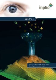
Production of geospatial data withprecision, power and user-friendliness.<strong>Summit</strong> <strong>Evolution</strong> from DAT/EM Systems International, is a userfriendlydigital photogrammetric stereo workstation and allows a3D feature collection directly into ArcGIS, AutoCAD or MicroStation.<strong>Summit</strong> <strong>Evolution</strong> is part of inpho’s digital photogrammetric system.A wide range of efficient feature collectionfunctions is offered via DAT/EM Capture andStereo Capture for ArcGIS, which are integralparts of <strong>Summit</strong> <strong>Evolution</strong>.Vector data collected by <strong>Summit</strong> <strong>Evolution</strong>,or imported from GIS or CAD systems, aresuperimposed directly onto the stereo models,making it an excellent solution for mapping,change detection and updating GIS data.Automatic batch map-editing of collected datacan be applied for best mapping performance.Routines for data generalization, checking andautomatic line editing among various otherfunctions are included.<strong>Summit</strong> <strong>Evolution</strong> works in a projectbasedenvironment, using triangulated photoblocks generated by MATCH-AT or other softwarepackages. The user can roam seamlesslythroughout an entire project of any size.The product <strong>Summit</strong> <strong>Evolution</strong> & MATCH-Tbundles the digital stereo plotter with MATCH-T,inpho’s product for automatic DTM generationfrom aerial or satellite imagery, and withCapture Contour, an on-line contouringpackage based on inpho’s SCOP technology.MATCH-T and Capture Contour are extending<strong>Summit</strong> <strong>Evolution</strong> to a powerful photogrammetricDTM station. Functionality of MATCH-Tis described in the MATCH-T data sheet.Image Capture<strong>Summit</strong> <strong>Evolution</strong> is not restricted to aerialimagery, but also offers feature collection fromclose-range, satellite, IFSAR and orthophotoimagery.Aerial TriangulationData CaptureTerrain ModelingOrthophoto ProcessingDAT/EM is inpho’s partner fordigital stereo plotters.
Stand-alone stereo view, variousconnections to CAD/GIS packages,together with an ergonomicaldesign in a dual monitor setup,passive or active stereo hardware,handwheels or 3D cursor, make<strong>Summit</strong> <strong>Evolution</strong> the most flexibleproject-based (not model-based)stereo plotter.Features• <strong>Summit</strong> <strong>Evolution</strong> comes with a variety ofsoftware components:· <strong>Summit</strong> <strong>Evolution</strong> – digital photogrammericsoftware including orientation tools andproject management· DAT/EM Capture – data collectionprogram for collecting 3D features directlyinto AutoCAD or MicroStation· Stereo Capture for ArcGIS – turns our<strong>Summit</strong> <strong>Evolution</strong> photogrammetricstereoplotter into a 3D ground coordinatedigitizer for ArcGIS. 3D features arecollected directly into ESRI’s ArcView 8.x,ArcEditor, and ArcInfo· Map/Editor – software for automaticbatch and vector editing in AutoCADor MicroStation· Super/Imposition – software allowingstereoscopic viewing of 3D vector data,superimposed onto the stereo imagery• With its flexible orientation tools, <strong>Summit</strong><strong>Evolution</strong> fits into any production workflow:· Automatic interior orientation· Automatic or manual relative orientation· Absolute orientation· Orientation data import from inBLOCK,PATB, Applanix, Albany, Bingo, AeroSys· Project data import from MATCH-AT,BAE Socet Set, Z/I Image Station, Phorex· Project transformation from/into newcoordinate systems• Advanced imaging features make <strong>Summit</strong><strong>Evolution</strong> a precise and easy-to-use stereoplotter:· Handling of 8-bit and 16-bit imagery· Measurement with subpixel accuracy· Quick frame sequential imaging· Smooth real-time panning and zooming· On-the-fly epipolar resampling· OpenGL for image rendering· User-definable cursors· Customizable GUI elements• <strong>Summit</strong> <strong>Evolution</strong> supports all types ofsource image:· Digitized aerial photographs(TIFF, TIFF JPEG, ECW, BMP and others)· ADS 40 digital aerial camera· DMC digital aerial camera· UltraCam digital aerial camera· Digital Globe QuickBird· Space Imaging IKONOS RPC· SPOT5 HRS· IFSAR Stereo· Close-range imagery· Orthophoto images (GeoTIFF)Options• CAD/GIS interfaces:· DAT/EM Capture for AutoCAD· DAT/EM Capture for Microstation· Stereo Capture for ArcGIS• Hardware:· Optionally, inpho provides all necessaryhardware for <strong>Summit</strong> <strong>Evolution</strong>, includingcomputers, monitors, stereo viewing systemsand 3D cursors. For up-to-date informationsee <strong>Summit</strong> <strong>Evolution</strong> description on inpho’swebsite (Products section).· Additional optional hardware componentsare:· DAT/EM Keypad· DAT/EM handwheels and footdisk<strong>Summit</strong> <strong>Evolution</strong> is available with threedifferent functional extensions:• SUMMIT <strong>Evolution</strong> “Professional”· Unlimited functionality of <strong>Summit</strong> <strong>Evolution</strong>• SUMMIT <strong>Evolution</strong> “Feature Collection”· Full 3D feature collection, but no orientationcapabilities• SUMMIT <strong>Evolution</strong> “Viewer”· Stereo viewer for <strong>Summit</strong> <strong>Evolution</strong>s projectsBenefits• Produces digital topographic and engineeringquality maps and geospatial data directly intoArcGIS, AutoCAD or Microstation.• Easy API integration of other CAD or GISpackages.• Sophisticated yet straight forward mappingfunctionality.• Developed for comfortable ease-of-use byphotogrammetric professionals.• Applies cutting-edge technology.Recommendations• High-end PC workstation• Dual Intel Xeon processors• 2 Gbyte RAM• High-capacity disk system• Windows XP/2000Hardware for 3D data capture:• Stereo-capable graphics card(s) supportingOpenGL quad-buffer stereo• Stereo viewing system• 3D cursor• DAT/EM Keypad• Supported CAD and GIS:· AutoCAD 2002 or higher· MicroStation V8 version 08.05.00.64or newer· ArcGIS 9 Desktop Products ArcView,ArcEditor or ArcInfo<strong>Summit</strong> <strong>Evolution</strong> is a trademark of DAT/EMSystems International. All other brands and productnames are trademarks of their respective owners.
Image CaptureAerial TriangulationData CaptureTerrain ModelingOrthophoto ProcessingFor further information,please contact:inpho GmbHSmaragdweg 170174 StuttgartGermanyTel.: +49-711-228810Fax: +49- 7 11 - 22 88 111E-mail: sales@inpho.dewww.inpho.deInformation is subject to change without notice.


