Bath Western Riverside Supplementary Planning Document (SPD)
Bath Western Riverside Supplementary Planning Document (SPD)
Bath Western Riverside Supplementary Planning Document (SPD)

Create successful ePaper yourself
Turn your PDF publications into a flip-book with our unique Google optimized e-Paper software.
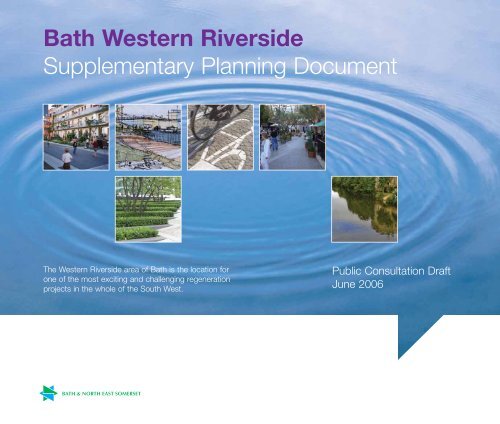
<strong>Bath</strong> <strong>Western</strong> <strong>Riverside</strong><strong>Supplementary</strong> <strong>Planning</strong> <strong>Document</strong>The <strong>Western</strong> <strong>Riverside</strong> area of <strong>Bath</strong> is the location forone of the most exciting and challenging regenerationprojects in the whole of the South West.Public Consultation DraftJune 2006
Part 1Strategic Framework1.1 Role and Objectives of the <strong>SPD</strong>1.1.1 The <strong>Western</strong> <strong>Riverside</strong> area of <strong>Bath</strong> is the location forone of the most exciting and challenging regenerationprojects in the South West. To successfully regeneratea 35 hectare site within the World Heritage Site of <strong>Bath</strong>in a way that meets the Government’s vision forSustainable Communities requires a comprehensive,masterplanned approach.1.1.2 The principal role of this <strong>Supplementary</strong> <strong>Planning</strong><strong>Document</strong> (<strong>SPD</strong>) is to provide a Spatial Masterplan toguide the redevelopment and regeneration of <strong>Bath</strong><strong>Western</strong> <strong>Riverside</strong> (BWR). This <strong>SPD</strong> brings forward thekey principles that are set out in the Adopted<strong>Supplementary</strong> <strong>Planning</strong> Guidance for BWR and PolicyGDS1:B1 of the emerging <strong>Bath</strong> & North East SomersetLocal Plan and applies them spatially to the sitefollowing detailed environmental investigation and amasterplanning process that has involved developersand stakeholders. Finally, the <strong>SPD</strong> sets out anImplementation Framework for development, in termsof phasing, requirements for applications, developercontributions, and also a set of three dimensional sitespecific design rules for development in the form ofDesign Codes.1.1.3 The Council anticipates that it will take around 15years for the BWR regeneration scheme to be fullycompleted. It is likely, therefore, that this <strong>SPD</strong> will besubject to periodic review so that it keeps step withchanging circumstances, legislation, Governmentguidance and development plan policies.Structure of the <strong>SPD</strong>Section 1StrategicFrameworkOverview ofdevelopmentrequirementsSection 2SpatialMasterplanMain spatialsite-specificorganisationalprinciplesexpressed inplans and textSection 3ImplementationPlanDesign codes –and developercontributionsstrategy1.1.4 The Council’s adopted Vision Statement for <strong>Bath</strong><strong>Western</strong> <strong>Riverside</strong> is:‘To create a vital and viable place whichreconnects the urban fabric of <strong>Bath</strong> in a seamlessway to offer a high quality mixed use environmentthat functions as a working and living quarter ofthe City, and reinforces its World Heritage status’.1.1.5 The Council has also identified the following KeyPrinciples for BWR:Secure high quality development in a world classsettingMaximise opportunities for economic, social andenvironmental regenerationAchieve a significant modal shift from the private carto public transport, cycling and walkingEnsure that the wider <strong>Bath</strong> community benefits fromthe regeneration of BWRTo revitalise the riverside environment and to makethe river the focus of activity at BWREnsure regeneration is compatible with andcomplementary to the existing city centreTo create a beacon of sustainable developmentand living through the concept of ‘embedded’sustainabilitySecure regeneration predominantly within the existinglocal plan context, regional planning guidance andGovernment guidance on the redevelopment ofbrownfield sites2 <strong>Bath</strong> <strong>Western</strong> <strong>Riverside</strong> <strong>Supplementary</strong> <strong>Planning</strong> <strong>Document</strong>
Sustainable Development1.1.6 <strong>Planning</strong> Policy Statement 1: Delivering SustainableDevelopment (PPS1) was published in 2005 and setsout sustainable development as the core principle thatunderpins planning. The Council considers it to beessential that the redevelopment of BWR embodiesthe following principles that PPS1 sets out asfacilitating and promoting sustainable and inclusivedevelopment:Making suitable land available for development inline with economic, social and environmentalobjectives to improve people’s quality of lifeContributing to sustainable economic developmentProtecting and enhancing the natural and historicenvironment and existing communitiesEnsuring high quality development through goodand inclusive design, and the efficient use ofresourcesEnsuring that development supports existingcommunities and contributes to the creation ofsafe, sustainable, liveable and mixed communitieswith good access to jobs and key services for allmembers of the community.1.1.7 The Council expects BWR to form a sustainablecommunity, the components of which have beendefined by ODPM and are listed below:Active, Inclusive and Safe – Fair, tolerant and cohesivewith a strong local culture and other sharedcommunity activitiesWell Run – with effective and inclusive participation,representation and leadership.Environmentally Sensitive – providing places for peopleto live that are considerate of the environment.Well Designed and Built – featuring quality built andnatural environment.Well Connected – with good transport services andcommunication linking people to jobs, schools, healthand other services.Thriving – with a flourishing and diverse local economyWell Served – with public, private, community andvoluntary services that are appropriate to people’sneeds and accessible to all.Fair for Everyone – including those in othercommunities, now and in the future.1.1.8 Historically, major developments in <strong>Bath</strong> have included a‘Wow’ factor. Examples of this are the key Georgian setpieces and their landscape settings, that are special inthemselves, yet blend into the wider City. The Councilconsiders that the ‘Wow’ factor for BWR should besustainability in all its forms. This includes the keyprinciples within PPS1:Social Cohesion and InclusionProtection and Enhancement of the EnvironmentPrudent Use of Natural ResourcesSustainable Economic Development1.1.9 Sustainability also includes helping towards theachievement of the Council’s ‘Zero Waste’ policy andthe creation of a low carbon emissions development.The development must be seen as an ‘exemplar’scheme of sustainable living. The best way of achievingthis will be through the concept of ‘embeddedsustainability’. This is dealt with in more detail in section1.5 of this <strong>SPD</strong>.1.1.10 This <strong>SPD</strong> is also accompanied by a SustainabilityAppraisal (SA) statement. Earlier versions of theSustainability Appraisal Report have been used toamend this <strong>SPD</strong> and enhance it in terms ofsustainability, as part of an iterative process.Status of the <strong>SPD</strong>1.1.11 The <strong>Bath</strong> <strong>Western</strong> <strong>Riverside</strong> <strong>Supplementary</strong> <strong>Planning</strong><strong>Document</strong> is a Draft <strong>SPD</strong> for public consultation.1.1.12 This <strong>SPD</strong> is in accordance with, and supplementary tothe Regional <strong>Planning</strong> Guidance for the South West(RPG10), and the Joint Replacement Structure Plan.The <strong>SPD</strong> is also in accordance with and supplementaryto the <strong>Bath</strong> & North East Somerset Local Plan RevisedDeposit Draft (Incorporating Pre-Inquiry Changes andFurther Pre-Inquiry Changes). It also conforms with<strong>Planning</strong> Policy Statement 12: Local DevelopmentFrameworks and the associated Town and Country<strong>Planning</strong> (Local Development) (England) Regulations2004.1.1.13 This <strong>SPD</strong> was produced prior to the publication of thereport by the Inspector concerning the <strong>Bath</strong> and NorthEast Somerset Local Plan, following the Local PlanInquiry. The recommendations made by the Inspector,and the Council’s response to those recommendations,will be taken into account during the public consultationprocess for this <strong>SPD</strong> before the <strong>SPD</strong> is adopted.1.1.14 The Draft BWR <strong>SPD</strong> is a material consideration andwhen adopted will have significant weight during theconsideration of planning applications. Once this <strong>SPD</strong>has been adopted it will replace the existing <strong>Western</strong><strong>Riverside</strong> SPG.<strong>Bath</strong> <strong>Western</strong> <strong>Riverside</strong> <strong>Supplementary</strong> <strong>Planning</strong> <strong>Document</strong> 3
Part 1 Strategic Framework1.2 Background1.2.1 <strong>Bath</strong> <strong>Western</strong> <strong>Riverside</strong> has been subject to a complexhistory in recent years that reflects the scale of thechallenge and the opportunity that the site provides.1.2.2 In 2000, the Council’s Strategy Committee considered aComprehensive Development Framework (CDF) whichhad been prepared for BWR. The CDF set out a VisionStatement and also key principles and urban designobjectives for the area (these form the basis of paras.1.1.4 and 1.1.5 of this <strong>SPD</strong>). The Committee endorsedthe CDF and resolved that the vision, principles andobjectives be adopted as a basis for the preparation ofplanning policy and design guidance for BWR.1.2.3 During 2001, consultants began to carry out a numberof studies that were recommended in the CDF. Theoutputs of these studies led to the publication of the<strong>Western</strong> <strong>Riverside</strong> Regeneration Framework inDecember 2001.1.2.4 In January 2002, the Deposit Draft <strong>Bath</strong> & North EastSomerset Local Plan was put out for publicconsultation. The allocation of BWR for acomprehensive mixed-use scheme appeared for the firsttime at this stage, based on the work associated withthe CDF and the Regeneration Framework.1.2.5 In July 2003, following preparation and publicconsultation, the <strong>Supplementary</strong> <strong>Planning</strong> Guidance forBWR was adopted. The SPG was informed by Parts Aand B of the Regeneration Framework and replaced theCDF as the Council’s policy guidance for BWR. TheSPG required the production of a Masterplan to guidethe comprehensive redevelopment of the entire BWRsite. At the same time, the Revised Deposit Draft <strong>Bath</strong> &North East Somerset Local Plan was considered by theCouncil and later in 2003 was subject to publicconsultation.1.2.6 From the beginning of 2004 to autumn 2005, and usingthe SPG as a brief, a masterplanning exercise has takenplace that has involved the carrying out of numerousbaseline assessments, detailed development viabilitywork, and extensive design exercises. This process hasinvolved developers, stakeholders, Members, andCouncil officers. This <strong>SPD</strong> is one of the key outputs ofthat process.1.3 Future for <strong>Bath</strong> Vision1.3.1 <strong>Bath</strong> is an outstanding and successful City and itssuccess provides a foundation for the future. It is aUNESCO World Heritage Site with an architectural andhistoric heritage of international reknown. However, likeall towns and cities it functions in a competitiveenvironment and this impacts in many ways, fromsecuring external funding to visitor numbers andprivate investment. In this respect, the absence of along-term vision and framework to instigate and guideenhancement and development is a current weakness.Key indicators suggest the seeds of economic decline.1.3.2 The Council has embarked on a process to establish avision for the future of <strong>Bath</strong> which focuses onharnessing the economic potential of the City. Buildingon the historic strengths of <strong>Bath</strong>, the draft visionidentifies a series of themes which uniquely positionthe City, both nationally and internationally. The draftvision establishes a clear role for <strong>Bath</strong> within the SouthWest region and the West of England sub-region. Italso provides a basis for securing the long termsuccess of <strong>Bath</strong> as a key driver for the local economyacross <strong>Bath</strong> & North East Somerset and as a place forlocal residents to visit, shop, learn, work and enjoy.1.3.1 The themes are:Living HeritageHealth and WellbeingEnjoyment and FunCreativity‘Smart City’1.3.4 These themes will be driven by a successful city centre,and this is the area which the study will concentrate on,acknowledging its dependence and linkages withoutlying and sub-regional areas and facilities.1.3.5 The vision has now been progressed through thepreparation of the <strong>Bath</strong> Business Plan and a SpatialFramework. A report on these studies was consideredby the Council Executive in January 2006 and acceptedas the basis for the preparation of planning policyguidance and further public consultation.1.3.6 The spatial and strategic elements of the emergingVision for <strong>Bath</strong> have yet to be encapsulated as anidentifiable entity in the development plan andconsequently have little weight in planning terms.Bearing that in mind, it is nevertheless important to notethat BWR can be seen as an initial phase in takingforward this emerging initiative for the wider city centrearea.1.4 <strong>Planning</strong> Policy Context1.4.1 The policy context for this <strong>SPD</strong> is established bynational, regional and local policy documents. The keypolicy documents relating to this <strong>SPD</strong> are reviewed inAppendix A, with particular regard to their relevanceto BWR.1.5 Development RequirementsComprehensive Development1.5.1 The key site specific requirement for BWR is that it hasto be a comprehensive mixed use scheme. PolicyGDS1 states the following with regard to BWR (this isthe amended wording put forward by the Council at theLocal Plan Inquiry):Any planning application will need to demonstratethat it is consistent with and contributes to thedelivery of comprehensive development of thewhole site by reference to an approved Masterplanwhich accords with this policy.1.5.2 The principal reasons why a comprehensive approach isrequired to the regeneration and redevelopment of BWRare as follows:To deliver the optimum quantum, mix and location ofuses for the benefit of the community.To achieve high quality urban design which issympathetic to and respectful of the City’s WorldHeritage Site status.To secure the necessary accessibility, linkages,permeability and transport infrastructure for BWR thatenables it to integrate with the City as a whole.To deliver the requisite supporting infrastructureand facilities.To make an appropriate contribution towards thedelivery of a high quality employment generatingdevelopment of sufficient critical mass, in theinterests of supporting and enhancing <strong>Bath</strong>’seconomic role.To ensure that appropriate phasing and sequencingof development is secured to enable the regenerationof the area as a whole and not on a piecemeal basis.To achieve development and financial viability overthe whole regeneration period.4 <strong>Bath</strong> <strong>Western</strong> <strong>Riverside</strong> <strong>Supplementary</strong> <strong>Planning</strong> <strong>Document</strong>
1.5.3 <strong>Bath</strong> <strong>Western</strong> <strong>Riverside</strong> is of critical importance to thefuture success and development of <strong>Bath</strong> and NorthEast Somerset. It represents an opportunity, the scaleof which will not recur, and the optimum use of thearea’s potential must be realised. Only in this way canthe complex and interrelated economic, social andenvironmental objectives, which need to be met, besuccessfully addressed.1.5.4 Viability needs to be achieved in all respects across thewhole of the regeneration period. The comprehensiveregeneration will create substantial private and socialcosts, which need to be met from the developmentwhilst ensuring that the financial viability of the overallscheme is maintained. There are significant abnormaldevelopment costs which will need to be met by thegross development value created across the <strong>Western</strong><strong>Riverside</strong> area as a whole. An unplanned incrementalapproach would severely compromise the ability toachieve this objective. The opportunities for gap fundingfrom bodies such as the South West RegionalDevelopment Agency, English Partnerships, and theHousing Corporation are more likely to be maximised ifa comprehensive approach is taken.1.5.5 The optimum land use balance must be delivered. Avibrant and vital City quarter will be created through theinterrelationship of housing, commercial, retail, cultural,leisure and community activities that has been broughttogether through the masterplanning process. Theoptimum disposition of land uses across the site needsto be achieved in order to deliver integration withinBWR and also between BWR and the wider City andtherefore involves relocation of some existing uses. Arange of forms of accommodation within any particularland use will also need to be delivered.1.5.6 The requisite supporting infrastructure and facilitiesmust be delivered. The regeneration of an area of thescale of <strong>Western</strong> <strong>Riverside</strong> is dependent upon theprovision of substantial social and physicalinfrastructure and facilities, which must be planned forand provided in a comprehensive manner. The requiredinfrastructure works include comprehensivedecontamination and flood risk management.1.5.7 High quality urban design for the area as a whole mustbe achieved. High quality design is needed not only tointegrate BWR with the City, but also to ensure that thequality of the environment within BWR will endure in thelong term, responding to the context within which it islocated and created.1.5.8 Accessibility, linkages, permeability and transportinfrastructure together with integration with the City as awhole must be secured. All modes of transport andmovement must be assessed cumulatively if theprinciples of sustainable development are to be applied.BWR also has an important role in assisting towardsthe delivery of a bus-based rapid transit system that willform a key element of the public transport networkserving the City.1.5.9 Appropriate sequencing of development will enable theregeneration of the area as a whole to be achieved.Failure to address sequencing at an early stage mayresult in prejudice to the future regeneration of parts ofBWR. Piecemeal development without appropriatesequencing will not enable the full consequences ofdevelopment to be properly addressed and theoptimum development of the whole area to beachieved. For example, the relocation and displacementof certain existing uses must be planned for anddelivered. The displacement of these uses must beaddressed through appropriate alternative provision.1.5.10 It is clear that a comprehensive spatial planningapproach is therefore a prerequisite to the successfulregeneration of BWR and a piecemeal approach wouldbe unacceptable.1.5.11 Mixed-use development is advocated as a positivedevelopment form within national, regional and strategicplanning policy documents. Mixed uses at <strong>Western</strong><strong>Riverside</strong> will bring activity during different times of theday, create inherent vitality, bring a sense of place tothe area and reduce the need to travel.1.5.12 The main role of this <strong>SPD</strong> is to set out a SpatialMasterplan that forms a spatial framework for the futureredevelopment of BWR. The Masterplan, however, mustbe read in conjunction with the Implementation Plan setout in Part 3 of this <strong>SPD</strong>, as it is the ImplementationPlan that sets out the Council’s requirements for thecontent of planning applications, phasing, developercontributions, and design codes.1.5.13 The Masterplan forming part of this <strong>SPD</strong> constitutes anapproved Masterplan that accords with therequirements of Policy GDS1. Any planning applicationmade for land or buildings within the BWR area will beassessed against this <strong>SPD</strong>, with particular regard to theneed to demonstrate that individual schemes areconsistent with and contribute to the comprehensivedevelopment of the whole of the BWR site. TheImplementation Plan sets out defined DevelopmentZones within the BWR area, with a requirement for thepreparation of Context Plans for each zone, to ensure acomprehensive approach to BWR.Residential Development1.5.14 In its entirety, depending on the development optionpursued on the eastern sector, BWR is expected toprovide in the region of 3,000 dwellings over the totalredevelopment period. The <strong>Bath</strong> & North East SomersetLocal Plan expects 800 of these to be provided by2011.1.5.15 In order to create a sustainable and inclusivecommunity, BWR is expected to provide a variety ofdwelling types, sizes and tenures. Having regard tolocal need, demographic trends and the location ofBWR adjacent to the City Centre, it is anticipated thatBWR will provide a significant proportion of smallerunits. It is important to recognise that, whilst BWR itselfmust be a mixed, sustainable community, the existenceof a variety of accommodation in neighbouring areas of<strong>Bath</strong> will influence the assessment of the extent towhich development of BWR reflects the range of localhousing need. The Council expects, however, at least5% of the units to be provided at BWR to be houses,as opposed to apartments.<strong>Bath</strong> <strong>Western</strong> <strong>Riverside</strong> <strong>Supplementary</strong> <strong>Planning</strong> <strong>Document</strong> 5
Part 1 Strategic FrameworkAffordable Housing1.5.16 It is essential that BWR includes an appropriate elementof affordable housing. The Council will seek to achieveits policy of 30% affordable units on BWR, as set out inthe Adopted SPG on Affordable Housing. The dominantform of affordable housing provided should be rentedaccommodation managed by a Registered SocialLandlord, with the Council expecting 80% of theaffordable housing at BWR to be social rented. Anelement of low cost home ownership accommodationwill also be acceptable, however, a range of low costhome ownership products (ranging from 25% to 75%ownership) should be provided. The low cost homeownership products must be affordable for thosehouseholds with a single or joint income of between£15,000 to £30,000 per annum. There will be a role for‘key worker’ accommodation within BWR and the needfor some intermediate rented housing. The mix of theaffordable housing must be agreed with the Councilwhich will use its latest housing waiting list to agree abalance of units in order to create a sustainablecommunity. A small element of the affordable housingwill be accommodation with care for older people andsupported housing for other needs groups.1.5.17 A comprehensive overview will be taken towards theprovision and location of affordable housing withinBWR. Individual schemes will have to demonstrate thattheir affordable element forms part of the overallstrategy towards affordable housing at BWR. Thecreation of concentrations of affordable housing unitswill not be acceptable unless there are overridingprovision and management benefits in doing so.1.5.18 It is anticipated that gap funding will be required inorder to deliver significant affordable housing at BWR.The role of the Housing Corporation will be paramount,therefore, both the Council and developers mustcontinue the dialogue that has already established withthe Housing Corporation. In order to maximise theopportunities for delivering affordable housing at BWR,discussions with the Housing Corporation must be ‘twintracked’ with planning discussions, especially regardingSection 106 Agreements, in order to be able to take acoordinated and longer-term view of the provision ofaffordable units.1.5.19 Negotiations that developers have with both the Counciland the Housing Corporation must be carried out onthe basis of an ‘open book’ approach to developmentviability. This is to ensure that it is possible to properlyassess the additionality of any gap funding.1.5.20 Affordable units benefiting from gap funding must bebuilt to the Housing Corporation’s SchemeDevelopment Standard and be rated at Eco HomesExcellent standard (see also section on embeddedsustainability). Affordable units must also achieve theSecured By Design standard.1.5.21 The Council will also expect developers to address atan early stage the long-term managementarrangements of a mixed community at BWR. Anexample of an appropriate way of dealing with this isthe Housing Corporation’s ‘In Business’ scheme.Business Development1.5.22 The provision of high quality modern commercialaccommodation of sufficient critical mass in central<strong>Bath</strong> is critical to the diversity and future health of thecity, district and sub-regional economy. The emergingFuture for <strong>Bath</strong> vision will provide the strategic contextfor tackling this issue, including the optimum locationfor business accommodation. BWR will play an earlyrole in providing such accommodation, and the spatialMasterplan allows for this within the eastern zone.Retail Development1.5.23 The <strong>Bath</strong> and North East Somerset Local Plan makesprovision for retail development at BWR, subject tocompliance with development criteria. It is important tonote that the Spatial Masterplan within this <strong>SPD</strong> doesnot specifically address these development criteria anddoes not make specific provision for significant retailingon site. Nevertheless, the Spatial Masterplan allows forappropriate retail development principally in the easternzone subject to the requirements of policy as set out inthe Local Plan.1.5.24 It should also be noted that, whilst this <strong>SPD</strong> issupportive of policies for the plan period up to 2011,the Spatial Masterplan is intended to be flexible enoughto guide development at BWR for the full developmentperiod – up to about 2021. The Masterplan does not,therefore, rule out additional retail development at BWRbeyond 2011, if the Council’s Local DevelopmentFramework considered this to be acceptable.Transport Infrastructure1.5.25 Proposals at BWR will recognise and address the keyimportance of transportation and access within the siteand linkages to the City Centre and other parts of <strong>Bath</strong>.The transport implications of the comprehensiveredevelopment of BWR will be considered in thecontext of the whole City and appropriate proposalsbrought forward to address the travel demandsgenerated by the site. Having regard to the overarchingprinciple of sustainability, development proposals haveto demonstrate how they will reduce reliance on theprivate car, enhance public transport usage andimprove cycling and walking facilities. In addition, theRiver Avon is a key artery within the City of <strong>Bath</strong> andtherefore the movement strategy in this <strong>SPD</strong> considersthe role of the river. The scale and nature of theproposed redevelopment is also likely to require theprovision of targeted off-site infrastructure as part of aCity-wide network.6 <strong>Bath</strong> <strong>Western</strong> <strong>Riverside</strong> <strong>Supplementary</strong> <strong>Planning</strong> <strong>Document</strong>
‘Embedded’ SustainabilityBackground1.5.26 If BWR is to deliver a truly sustainable community, inall its forms, it must aspire to achieve ‘zero carbon’and ‘zero waste’ objectives. It will be best placed toachieve this if the redevelopment of the area is basedon the concept of ‘embedded’ sustainability, that is,the development is designed and constructed in away that means that being sustainable is an ingrainedor inherent way of living, visiting or working in the area,rather than just one choice. This can be achievedthrough a variety of means, such as:the way that buildings are constructed, in order tominimise energy consumptionthe level of encouragement that is given to alternativemodes of travel to the private car, such as theprovision of secure cycle storagethe way that the design and layout of buildingsenables the easier segregation and collection ofrecyclable material.1.5.27 Embedded sustainability does not mean thatdevelopments become sustainable through ‘bolt-on’solutions but through designing for sustainability fromthe earliest stages to ensure, for example, thatbuildings are oriented and constructed to maximiseenergy efficiency and minimise energy need. Provisionshould be made for firstly, renewable energy andsecondly, highly efficient fossil fuel energy as a lastresort.1.5.28 In setting out the need for the prudent use of naturalresources, PPS1 sets out the objective of minimisingthe need to consume new resources over the lifetime ofa development by making more effective use or re-useof existing resources, rather than making new demandson the environment, and to promote and encourage theuse of renewable resources (for example by thedevelopment of renewable energy). PPS1 adds thatlocal authorities should promote resource and energyefficient buildings, community heating schemes, the useof combined heat and power, small scale renewableand low carbon energy schemes in developments, thesustainable use of water resources, and the use ofsustainable drainage systems in the management ofrun-off.1.5.29 PPS22: Renewable Energy sets out that RegionalSpatial Strategies should set targets for renewableenergy. The draft RSS for the South West is currently inpreparation, however, a pre-consultation draft of theRSS (October 2005) provides useful guidance that canbe applied to BWR:“Emerging Guidance on Sustainability from theSouth West RSSMajor development proposals must be accompanied byan “Energy Use Assessment” which describes howmuch energy is expected to be used within theproposal and goes on to consider ways by which the“Energy Heirarchy” can be put into effect.All developments will meet a proportion of their energyfrom renewable sources. Larger developments will beexpected to provide, as a minimum, sufficient on-siterenewable energy to reduce carbon dioxide emissionsfrom energy use of the site by 10%.By 2026 the measurable outcome expected is that allnew dwellings will conform to sustainable constructionstandards and will make a significant contributiontowards reducing net per capita domestic energyrequirements and greenhouse gas emissions. Buildingto sustainable construction standards seeks theachievement of best practice in sustainableconstruction by:(i)(ii)requiring all new and refurbished buildings toachieve the requirements of the emrging nationalCode for Sustainable Buildingspromoting the principles contained within FutureFoundations, the South West’s sustainableconstruction charter(iii) seeking to minimise lifetine resources use, energyconsumption, water use and waste production, forexample through the setting of BREEAM and EcoHomes “Very Good” and “Excellent” standards(iv) minimising the environmental impact of new andrefurbished buildings, including reducing air, land,water, noise and light pollution throughout thebuilding’s lifetime, and(v)promoting the use of sustainable drainagesolutions to minimise flood risk associated withnew developmentDevelopment should be within environmental limits by:(i)(ii)ensuring that new developments, regenerationareas and major refurbishments are “future proofed”so that they can cope with or are able to easilyadapt to climate change impactsrequiring that all new developments, regenerationareas and major refurbishments assess how theywill contribute to stabilising the region’s ecologicalfootprint by reducing the consumption of resourcesduring the lifecycle of the development down to thatwhich can be provided by one planet(iii) requiring the submission of sustainability statementsto accompany planning applications, the content ofwhich should meet or exceed the requirements ofthe South West Regional checklist for SustainableDevelopmentsThe Energy HeirarchyWith reference to PPS22’s emphasis on the importanceof developing positively expressed policies on buildingintegrated renewables, this involves reducing buildingenergy demand through energy efficiency and lowenergy design, before meeting the resulting demandfrom first renewable energy and then fossil fuels or gridelectricity. This approach has been characterised as theEnergy Heirarchy within the South West and will ensurethat energy efficiency opportunities are maximisedbefore renewable energy is considered within proposalsfor new developments.<strong>Bath</strong> <strong>Western</strong> <strong>Riverside</strong> <strong>Supplementary</strong> <strong>Planning</strong> <strong>Document</strong> 7
Part 1 Strategic Framework1.5.30 The UK’s target is to reduce CO2 emissions from 1990levels by 60% by 2050. Use of energy in buildingsaccounts for almost 50% of the UK’s CO2 emissions –30% from housing. The UK housing stock is old andthe rate of new buildings replacing old ones is low. 40%of homes in England were built before 1945. In 02/0323,200 homes were demolished out of a total stock of21.3 million. As a result of this slow replacement rate, itcould be argued that it is essential that ALL newbuildings must be carbon neutral if the UK’s target is tobe met.1.5.31 All of this demonstrates that achieving truly sustainabledevelopment at BWR is a huge challenge, but is onethat must be met.Low and Zero Carbon Technologies(including renewables)1.5.32 The Council has already recognised that low and zerocarbon technologies are crucial in ensuring that newdevelopments contribute to the reduction of CO2emissions from the area and to meeting regional andnational CO2 targets. In December 2005 <strong>Bath</strong> & NorthEast Somerset Council became a signatory to theNottingham Declaration on Climate Change. Policy ES1of the <strong>Bath</strong> and North East Somerset Local Plan alsoencourages the utilisation of renewable energy sources.1.5.33 The UK Government has set a targetaspires to achieve10% of UK electricity generated from renewable energysources by 2010, increasing to 20% by 2020. In orderto achieve this increase in renewable energy generation,it will be important for every new development tocontribute as much as possible toward this target.BWR is an opportunity to demonstrate the potential forusing low and zero carbon technologies in an urbansetting.1.5.34 Whilst renewable energy, and low carbon technologiessuch as Combined Heat and Power, are beneficialmethods of generating energy with minimal carbonimpact, there are other important issues that must betaken into account.Carbon emissions1.5.35 In housing built to 2006 Building Regulation standards,much of the space heating demand will be met byinternal gains from people, cooking and lights andappliances. At BWR, care should be taken to ensurethat solar gain is balanced to reduce use of heatingsystems whilst minimising the likelihood of overheatingin summer.1.5.36 Whilst particularly relevant to dwellings, it also applies tonon-residential buildings. This could be achieved by anumber of design alternatives including provision ofthermal mass, orientation and siting of buildings anduse of external shading systems. By these and othermethods, carbon emissions can be reducedconsiderably. Reducing energy demand through designand efficiency will reduce the amount of renewableenergy generation needed to meet the targets set out inpara 1.5.33. Policy ES2 of the <strong>Bath</strong> and North EastSomerset Local Plan also requires new developmentsto incorporate measures to acheive energyconservation and the protection of environmentalresources.Environmental Assessment Standards1.5.37 The targets and recommendations set out within this<strong>SPD</strong> will assist the achievement of both EcoHomes andBREEAM standards. These standards are revised eachyear and therefore ensure that a standard above andbeyond legislation is achieved at all times. Thesesystems also have the benefit of being independentlyaccredited and suitable to allow benchmarking againstnational achievementss.1.5.38 All buildings on the BWR site should be assessed atthe design stage against the BREEAM or EcoHomesstandards and should achieve an Excellent rating. Asummary of the expected achievement should beprovided, demonstrating in particular the creditsachieved in the Energy, Transport and Materialscategories, to reflect the Council’s headline priorities.1.5.39 All buildings must also be reassessed prior to handoverby achievement of a Post Construction Reviewcertificate which must also achieve an Excellent rating.Contractors will need to be informed of this requirementat the earliest stages to ensure achievement.Development Requirements at BWR1.5.40 The following are energy targets that will applied todevelopments at BWR, and will be assessed throughthe submission of Sustainability Statements:Energy Targets for BWREco Homes ExcellentBREEAM Excellent for other buildingsApplication of the Energy HeirarchyAt least one zero carbon building10% renewable energy – as established by an EnergyUse AssessmentRemainder of energy requirement to meet with eitherrenewable or low carbon provisionBuildings to be future proofed to allow for conversion tofull renewable or zero carbon energy as technologydevelopsAll targets to be subject to review as standards andtargets develop.1.5.41 An Energy Use Assessment should form part of theSustainability Statement required to be submitted withapplications – see the Implementation Plan at section3.4.1.5.42 The design and layout of all developments should alsohave regard to the impacts of climate change, such asallowing for flood defence requirements and theprovision of Sustainable Urban Drainage Systems(SUDS) where appropriate.1.5.43 The following building integrated technologies may besuitable for use at BWR:Small scale wind turbines (where visual intrusion,noise and vibration can be taken into account)Roof integrated photovoltaics and solar hot watergenerationBiomass heat sources including CHPGround or water sourced heat pumpsHydrogen fuel cells (future technology)8 <strong>Bath</strong> <strong>Western</strong> <strong>Riverside</strong> <strong>Supplementary</strong> <strong>Planning</strong> <strong>Document</strong>
Transport1.5.44 At <strong>Bath</strong> <strong>Western</strong> <strong>Riverside</strong> walking and cycling will begiven priority as a healthy and sustainable form oftravel. However if people are to be persuaded to leavetheir cars at home, walking and cycling routes demandparticular attention. Pedestrians and cyclists needroutes that are safe, direct, accessible and free frombarriers. The proposals for Rapid Transit will alsoprovide a more sustainable mode of transport than theprivate car.1.5.45 To encourage use of cycles over other forms oftransport, developments must allow adequate storageof cycles, in the form of sheltered, secure storagespaces that allow the front and rear wheels to besecured. In other buildings, occupants should haveaccess to cyclist facilities including cycle spaces,lockers and showers (in accordance with BREEAM andEcoHomes requirements).Waste1.5.46 The Council is committed to reducing waste arisingsand to dealing with waste locally. This is part of the<strong>Bath</strong> and North East Somerset Zero Waste Strategy(include reference and link if possible). In keeping withthis strategy, BWR should encourage as far as possiblethe minimisation, sorting and recycling of waste in allbuildings. Primarily this can be achieved throughprovision of suitable storage and space for sorting andrecycling activities.Water1.5.47 Water consumption and disposal of both waste andsurface water will become more important issues in thefuture and must be dealt with in a robust and futureproofed manner at BWR. In particular, the incorporationof Sustainable Urban Drainage Systems (SUDS) intodevelopments at BWR should be investigated.Materials1.5.48 In line with the <strong>Bath</strong> Zero Waste Strategy, the materialsused to carry out the development at <strong>Bath</strong> <strong>Western</strong><strong>Riverside</strong> should be selected to minimise emissions andother environmental impacts.Public Open Spaces1.5.49 The Council is currently preparing a Green SpaceStrategy for all types of open space and recreationareas in <strong>Bath</strong> & North East Somerset. In the meantime,standards for open spaces are set out in the <strong>Bath</strong> &North East Somerset Local Plan. The Council acceptsthat a brownfield redevelopment site such as BWR isnot likely to be able to meet the required standards onsite,however, these standards should have input intothe design of individual developments and will also formthe basis of contributions to be sought for off-siteprovision and improvement of existing facilities as partof the proposed developer contributions set out in theImplementation Plan (Part 3 of this <strong>SPD</strong>).Public Art and Culture1.5.50 As a new development with key areas of public realm,where a contemporary approach is encouraged, theCouncil expects public art proposals to form a keyelement of the design and layout of individualdevelopments. The Council would also like to see amulti-purpose Cultural Building to form part of thedevelopment of the Eastern zone of BWR.Education Provision1.5.51 The Council considers that a two-form entry PrimarySchool will be required as part of the BWRdevelopment, having regard to the likely impact of theproposed development on the demand for schoolsplaces, compared to the supply of places. The PrimarySchool should form part of a multi-use CommunityHub, featuring a variety of community uses.Healthcare Facilities1.5.52 <strong>Bath</strong> & North East Somerset Primary Care Trust areproposing to locate a Walk-In Health Centre on JamesStreet West, at the eastern end of the BWR site,through the conversion of an existing building. Whenthis part of BWR becomes redeveloped, the Councilwould like to see this facility relocated but retainedwithin the BWR area.1.5.53 Community healthcare facilities should also be providedat the heart of the new residential quarter of BWR inorder to serve the new community.1.6 Physical Parameters and BaselineConditions1.6.1 These are reported on in detail in the accompanyingEnvironmental Appraisal report (Appendix B).1.7 Involvement of Stakeholders1.7.1 The publication of this draft <strong>SPD</strong> for consultation is akey event in terms of engagement with stakeholders.Public consultation on this draft <strong>SPD</strong> will be undertakenin accordance with guidance contained in PPS12 andwith relevent legislation.1.7.2 Consultation will take place over a 6 week period duringJune and July 2006. Following expiry of thisconsultation period, representations received will beanalysed and changes to the draft <strong>SPD</strong> considered.The revised draft <strong>SPD</strong>, including a full schedule ofrepresentations received and responses to them, willthen be taken through the Council’s decision makingprocess and will ultimately be submitted to theCouncil’s Executive and / or Full Council for adoption inAutumn 2006.1.7.3 Prior to this, a detailed programme of stakeholderengagement has already been undertaken. Stakeholderengagement has been central to the BWRmasterplanning process. The aim of the engagementstrategy has been to ensure that the Masterplan benfitsfrom, and is informed by, local, regional and nationalviews and knowledge.1.7.4 The engagement strategy has included theestablishment of a Masterplan Panel and an UrbanRegeneration Panel, as well as workshops withlandowners, face-to-face meetings with keystakeholders, consultation with Statutory Consultees,Statutory Undertakers, Councillors and officers of theCouncil.<strong>Bath</strong> <strong>Western</strong> <strong>Riverside</strong> <strong>Supplementary</strong> <strong>Planning</strong> <strong>Document</strong> 9
Part 2Spatial Masterplan2.1 Purpose of the Spatial Masterplan2.1.1 This document makes up part of the <strong>Supplementary</strong><strong>Planning</strong> <strong>Document</strong> for <strong>Bath</strong> <strong>Western</strong> <strong>Riverside</strong>. It mustbe read and applied in conjunction with the suite ofdocuments that make up the <strong>SPD</strong> for the site. It has aclose relationship with the design codes referred to inPart 3 of this <strong>SPD</strong> (The Implementation Plan) andenclosed as Appendix D. The following ‘family tree’diagram shows the relationship between the documentsand the key principle contained therein.2.1.2 This spatial masterplan along with the other documentsin the <strong>SPD</strong> is the regeneration tool for <strong>Bath</strong> <strong>Western</strong><strong>Riverside</strong>. It aims to provide a degree of certainty for thefuture redevelopment of the area by providing clearguidance on the acceptable spatial arrangement andform of redevelopment.2.1.3 The spatial masterplan is intended to promote proactiveengagement with stakeholders and the localcommunity, to ensure positive engagement with theproposals that flow from the masterplan. The spatialmasterplan is a three-dimensional proposal affectingphysical, economic and social development. It isexpressed as a series of plans, illustrations and thisdescription of the proposed design approach to theredevelopment.Hierarchy of design adviceVision statementOverarching design principlesSpatial masterplan –Key principles (11)Detailed design principlesand componentsDesign codes –includes overarching designprinciples and detailedperformance criteriaSection 2SpatialMasterplanSection 3ImplementationPlanHow has the masterplan beendeveloped?2.1.4 The spatial masterplan that forms this part of the suiteof <strong>SPD</strong> document has been developed as acollaborative exercise by a team including: LlewelynDavies Yeang who are the principal masterplanners;WSP have provided advice on access, transport,engineering and environmental appraisal; the <strong>Bath</strong> &North East Somerset Coucil Major Projects Team; CrestNicholson Projects Ltd; Project Managers EC Harris;and in support of the Local <strong>Planning</strong> Authority, as wellas internal staff members, English Heritage haveadvised on all heritage issues and Turley Associates onUrban Design. There has been additional input by theEnvironment Agency, Wessex Archaeology, and SpaceSyntax. There have been a series of workshops withthese bodies to develop the spatial masterplan andrespond to issues as an iterative process.2.1.5 The work of this team has been scrutinised by theUrban Regeneration Panel, this is a panel made up ofleading figures working within urban regeneration,appointed to provide independent expert advice,guidance and inspiration for the <strong>Bath</strong> <strong>Western</strong> <strong>Riverside</strong>project. The Panel’s role has subsequently beenexpanded to include the Future for <strong>Bath</strong> project, thuslooking at a wider part of the City.10 <strong>Bath</strong> <strong>Western</strong> <strong>Riverside</strong> <strong>Supplementary</strong> <strong>Planning</strong> <strong>Document</strong>
Scope of Spatial Masterplan2.1.6 The spatial masterplan covers all the land within theallocated site defined by Policy GDS1: Site B1 of the<strong>Bath</strong> & North East Somerset Local Plan. The land inquestion is in a variety of ownership and control. Someof the buildings within this area will be retained in theirpresent form, and others will be redeveloped. Theboundary coincides with those areas in need ofregeneration, and hence it is drawn more widely thanthe immediately available sites for redevelopment. Thissite is the first redevelopment opportunity as part of theFuture for <strong>Bath</strong> Vision, and as such it must be anexemplar of the quality of the new urban fabric of thecity. See Plan 2.1 for details of the extent of the SpatialMasterplan.2.1.7 This spatial masterplan document presents the mainorganisational and urban form principles of thedevelopment, it does not contain detailed performancecriteria as these are contained within the design codesthat accompany this document.Application of Spatial Masterplan2.1.8 This document combines plan-based diagrams,illustrative examples and text to describe and explainhow any planning application for the site should fitwithin the three dimensional spatial masterplan. It givesclear guidance on the spatial form and arrangement ofdevelopment on the site.2.1.9 This <strong>SPD</strong> goes further than the previous SPG in that itprovides certain fixed elements that structure theredevelopment of the site. In particular it sets out themovement network including the rapid transit system. Italso fixes the key urban design principles that will shapethe form and layout of the site. It will allow parts of theredevelopment site to come forward individually whilstsecuring an overall coordinated plan for the site.2.1.10 The <strong>SPD</strong> has been developed as a robust but flexibletool for the long term planning of the area. This is anambitious programme to create a high quality extensionto the city that is worthy of its position within the WorldHeritage Site.2.1.11 Any planning application for development within the sitewill be tested against this spatial masterplan and theaccompanying design codes. It is acknowledged thatdevelopers may wish to depart from the SpatialMasterplan for sound design reasons; if this is intended,a case must be demonstrated that the resulting designsolution is equal or superior to the solution envisaged bythe spatial masterplan.2.1.12 Failure to comply with this <strong>SPD</strong> or to demonstrate thatthe design solution is equal or superior to the spatialmasterplan is likely to result in a refusal of planningconsent. To this end any planning application for thissite must be accompanied by a thorough designstatement that explains how it complies or departs fromthe <strong>SPD</strong>, the spatial masterplan and the design codes.<strong>Bath</strong> <strong>Western</strong> <strong>Riverside</strong> <strong>Supplementary</strong> <strong>Planning</strong> <strong>Document</strong> 11
Part 2 Spatial MasterplanPlan 2.1 Retained built form, zonal development and boundary12 <strong>Bath</strong> <strong>Western</strong> <strong>Riverside</strong> <strong>Supplementary</strong> <strong>Planning</strong> <strong>Document</strong>
2.2 Vision Statement for BWR2.2.1 The vision for the <strong>Bath</strong> <strong>Western</strong> <strong>Riverside</strong>redevelopment is to create a sustainable mixed usedcity quarter that is a contemporary addition to the city,with its own distinct identity, but is respectful of thestrong established traditions of the town planning andbuilding of <strong>Bath</strong> which have led to its designation as aWorld Heritage Site.2.2.2 The tradition of well planned and linked spaces framedby high quality built form is a key theme for creating aquality development that befits its unique context.There are numerous significant opportunities to createthe highest quality public spaces. In addition to themain public realm areas there will be a series ofintimate and incidental public spaces following thetraditions of the city.2.2.3 The transverse north-south pedestrian routes buildingon established desire lines are a key feature of thepositive links to the existing communities, and establisha strong relationship with Victoria Park to the north forboth the new and existing residents. This is shown onPlan 2.2.2.2.4 Links from the west and into the city centre will bestrong with a new Rapid Transit System that joins theredevelopment site and the city centre with frequentand speedy public service vehicles.2.2.5 The eastern end of the site closest to the city willprovide a new extension to the city centre based on amix of uses with a higher proportion of commercialuses. The western end of the site will respond stronglyto the residential quarters adjacent with predominantlyresidential uses.2.2.6 The sites location on the valley floor dictates thatroofscape and choice of materials are critical aspectsof the built form. In addition the need to protect theviews and connections to the natural landscape willlimit the scale of the built form in relation to the widercity and landscape setting.2.2.7 The design of the built form should be enduring; muchof the city fabric has this enduring quality this is in partdue to one of the key characteristics of the built form in<strong>Bath</strong>, which is that of the completeness of the historicfabric. Large areas of historic fabric have beensensitively reused rather than be subject to wholesaleclearance and redevelopment. This is testament to thestrong conservation movement in the city since the1960’s, coupled with the lack of major roadimprovements or extensive war damage. Both thetraditional layouts and the buildings have adapted tocontemporary uses. The Georgian terrace isacknowledged as an adaptable sustainable buildingtype2.2.8 The future for the city and its hinterland identified by theFuture for <strong>Bath</strong> Vision relies on recognising the existingstrengths of the city and building on these to create atruly successful world-class city centre. <strong>Bath</strong> has thispotential.2.2.9 The redevelopment will focus on the River Avon, thesites strongest natural asset, which will be fullyacknowledged and addressed by significant publicopen space along its length2.2.10 The design of the built form should be enduring.2.2.11 The site falls naturally into two parts either side ofVictoria Bridge Road, the emphasis on uses anddesign responses changes most dramatically at thispoint in the site. With the east being very much part ofan extension to the existing city centre, and to the westa more supporting role to the city, providing asustainable location for a new community2.2.12 <strong>Bath</strong> <strong>Western</strong> <strong>Riverside</strong> is the first part of the vision forthe Future for <strong>Bath</strong>, and as such it must be anexemplar of the quality of new urban fabric of the city,and in particular an exemplar of sustainabledevelopment that respects its unique context within theWorld Heritage Site.2.2.13 <strong>Western</strong> <strong>Riverside</strong> regeneration has to embrace this inproviding the highest quality built form and public realmto attract and retain investment, and embrace arenewed ambition for the city.<strong>Bath</strong> <strong>Western</strong> <strong>Riverside</strong> <strong>Supplementary</strong> <strong>Planning</strong> <strong>Document</strong> 13
Part 2 Spatial MasterplanPlan 2.2 North-South Links14 <strong>Bath</strong> <strong>Western</strong> <strong>Riverside</strong> <strong>Supplementary</strong> <strong>Planning</strong> <strong>Document</strong>
North-South Link (Victoria Bridge Road)Indicative section through North-South Link<strong>Bath</strong> <strong>Western</strong> <strong>Riverside</strong> <strong>Supplementary</strong> <strong>Planning</strong> <strong>Document</strong> 15
Part 2 Spatial Masterplan2.3 Overarching Design PrinciplesDesign Principles for <strong>Bath</strong> <strong>Western</strong> <strong>Riverside</strong>2.3.1 Building upon the detailed contextual appraisal for thesite and the city, the following eleven overarchingdesign principles have been developed collaborativelywith the project team to set the framework for all designsolutions for the site. These are repeated in the DesignCodes as they are essential to the design solution forthe site, and form the basis for all design decisions.Applicants will be expected to demonstrate that theyhave complied with all overarching design principles.1. <strong>Bath</strong> ContextThe design solutions must be sensitive to, responsive andinspired by their <strong>Bath</strong> context. In particular designs must berespectful of the wider city and the special qualities andcharacteristics that have led to its designation as a WorldHeritage Site. Designs should be inspired by and complimentthe historic fabric of the city but not compete with it in terms oftheir overall visual presence. BWR should, by way ofcontemporary interpretations, continue the <strong>Bath</strong> tradition thatis based upon classical proportions and detailed to give visualdelight.2. River at the heart of <strong>Bath</strong>The River Avon is one of <strong>Bath</strong>’s principal natural assets, and inturn a significant feature within the BWR site, but it is widelyrecognised that the river currently is an underutilised resourceacross the city. The river provides a significant opportunity tocreate an exciting and unique landscape experience of linkedspaces and enhance its contribution to the city of <strong>Bath</strong> for thefuture.3. Scale and ProportionThe tradition of a human scale in <strong>Bath</strong> must be recognised inBWR and this is based on hierarchy, order, proportion, rhythm,and harmony. Where greater scale is proposed sufficientsetting will be required to retain human proportions. Retentionof the human scale will reinforce the quality of the environmentas a walking city.4. Physical ConnectivityBWR plays an important part in a city wide strategicmovement network to enhance the connectivity of the city anddiversity of transport options for residents and visitors;improving public transport links and the experience and extentof the walking and cycling network.5. Visual ConnectivityAn important design consideration for BWR is the nature of thevisual relationship it establishes with the Georgian city centreand the rest of the city, as it extends over the adjacent hillside.The redevelopment of the site must not reduce the visualconnection to the natural landscape. In this regard it must usethe opportunity to bring the country into the city by a feelingthat you can reach out to the wider green surroundings whilstbeing able to enjoy immediate green space.6. Highest Design QualityDesign proposals for BWR should respect the quiet, polite andharmonious well-detailed architectural tradition yet embraceinnovation and contemporary architecture Design solutions willneed to be of the highest design quality that will be valuedenough to keep for future generations and must be adaptableto a variety of uses over time; a tradition to which the buildingsof <strong>Bath</strong> have historically responded well.7. Space and Hierarchy<strong>Bath</strong> has a fine tradition of deliberate well planned linkedspaces and these are in some respects as important as thebuildings that frame them. This hierarchy of formal spaces issupplemented by a lower order of incidental spaces thatanimate the city. The redevelopment will continue the provisionof formal public open spaces as well as the more intimategeneral public realm areas.8. Materials<strong>Bath</strong>’s unique character as a city is in large part made up ofthe homogeneity in the appearance of the city which isprimarily as a result of the extensive use of <strong>Bath</strong> Stone. Theneed to respect this homogeneity will affect the choice ofmaterials palette, which will be limited in range. The colour ofmaterials, their texture and scale and the proportional solidityof the building elevations, as well as the application ofmaterials, will all be important considerations when proposingmaterials for the site.9. RoofscapeSet in a valley, roofscape is the fifth elevation of the built formin <strong>Bath</strong>. The appearance of the roofscape is how the majorityof <strong>Bath</strong> residents will experience BWR. It is therefore essentialthat it reflects the context of <strong>Bath</strong>, which is a fine grainedsolution. This will preclude large unbroken roof elements.10.SustainabilityThis is at the heart of the BWR development and mustdemonstrably be embodied in all design proposals whilstrespecting the unique contextual conditions. Local context isarguably a key factor in sustainability, as it is central to effectiveplace-making by responding to the host community it serves.11. Community<strong>Bath</strong> <strong>Western</strong> <strong>Riverside</strong> will be a new community, but will alsoneed to respect the dynamics of the existing communities andprovide opportunities for improved access to services andfacilities, as well as creating a high quality living environmentfor the new and existing residents. The design solution mustbe developed in conjunction with key stakeholders in the localcommunity.16 <strong>Bath</strong> <strong>Western</strong> <strong>Riverside</strong> <strong>Supplementary</strong> <strong>Planning</strong> <strong>Document</strong>
2.4 Spatial Masterplan – Key Organising PrinciplesThe following is a summary of the key organising components of the masterplan –as shown within the summary spatial masterplan diagram (Plan 2.3).Plan 2.3 Summary Masterplan<strong>Bath</strong> <strong>Western</strong> <strong>Riverside</strong> <strong>Supplementary</strong> <strong>Planning</strong> <strong>Document</strong> 17
Part 2 Spatial Masterplan1. River FocusThe river is the principal asset of this site and must be fullyaddressed by development on both banks.The site offers the opportunity to create significant public realmon the southern bank of the River Avon through the site; inparticular the opportunity to create a new river park along themajority of the Avon frontage.2. Public RealmAt the heart of the redevelopment is the requirement to createthe highest quality public realm experiences that form asequence of experiences. These will not only be the majorspaces – identified as activity zones on the summary diagramincluding the River Park, Victoria Bridge Cascade, Midland/Windsor Bridge Road junction with river, Green Park Station(front and rear), and the community space but also high qualityintimate incidental spaces mirroring this tradition throughoutthe city.3. Rapid Transit SystemThe RTS will form an east-west link from the city centre toNewbridge Park and Ride. This is a central feature of theaccess strategy for this site and it supports sustainable travelfor the city. It will reduce reliance on the private car and help toensure modal shift. In design terms it needs an efficientalignment from east to west that integrates well within thedevelopment which it will serve.4. UsesThe whole site is viewed as a mixed use quarter; however,there will be dominant uses amongst the mix. To the westernend residential and community uses will dominate. To the eastof Victoria Bridge Road this forms the eastern city extensionwith the full range of uses including retail, leisure, civic, cultural,commercial and residential. These uses relate to the conceptof character areas which is supported by the spatialmasterplan and the design codes.5. LinksThe main new link created by the redevelopment is the RTS,(see 3 above). The other key links across the site are the twostrong north-south green pedestrian links connecting this siteto the surrounding communities. Other desire lines areincluded within the spatial masterplan, recognising wellestablished routes that have developed over time.6. Heritage EnhancementThe key heritage enhancement is the opportunity to add to thequality of the World Heritage site, not only in physical termsbut also in the management of the existing asset. Theredevelopment will secure the future for Victoria Bridge, andcreate a proper setting for it which is currently lacking. It willcreate opportunities to enhance the conservation area andlisted buildings, in particular Green Park Station. Other notablebuildings unlisted but worthy of retention are included in thespatial masterplan, notably <strong>Bath</strong> Press.7. Landmark OpportunitiesIn recognising the role that the gasholders play in creating alandmark throughout the city it is acknowledged that the sizeof the site and the scale of the redevelopment offers theopportunity for the inclusion of landmarks. The spatialmasterplan includes possible locations for these, however, anylandmark must be fully justified by a detailed examination ofcontext and design rationale. See paras. 2.9.12 to 2.9.14 formore guidance on this issue.8. Townscape OpportunitiesAs well as the opportunity for landmarks there exist theopportunity for significant townscape enhancements buildingon the respected built form elements of the area. These form avaluable tool as townscape navigational aids to bolster thenew urban form and help to tie it back to the contextuallanguage and community associations. These opportunitiesare explored within the spatial masterplan and expressed onPlan 2.8, and are expanded upon in the design codes for eachcharacter area.9. Protecting Key ViewsThe <strong>Western</strong> <strong>Riverside</strong> site sits on the valley floor and as aconsequence is exposed to views from all around the city. Theconsideration of the key viewpoints rather than protection of allviewpoints is the best approach. The development mustdemonstrate how key views will be affected by the proposal.Key views are shown on Plan 2.9.10. Scale Height and Massing<strong>Bath</strong> is a city that is founded on the principles of human scaleand proportion, it lacks tall buildings. The appropriate scale forthe development of <strong>Western</strong> <strong>Riverside</strong> needs to respond tolocal contextual conditions and respect the established cityscale. The respect for contextual scale will help to protectviews to the wider landscape. Refer to Plan 2.10.2.5 Public RealmIntroduction2.5.1 The public realm in <strong>Bath</strong> is one of the city’s key assets;it includes both the powerful gestures of the grandarchitectural statements, well known set-pieces andthe intimate and incidental spaces and a range ofspaces between these extremes that create a variedand stimulating sequence of experiences, particularlyfor the pedestrian.2.5.2 The success of BWR will be judged primarily by itsquality of public realm. The public realm is the glue thatholds all the development together. Experience hasshown that successful urban regeneration is often ledby excellent public realm.18 <strong>Bath</strong> <strong>Western</strong> <strong>Riverside</strong> <strong>Supplementary</strong> <strong>Planning</strong> <strong>Document</strong>
Plan 2.4 Public Realm Typologies<strong>Bath</strong> <strong>Western</strong> <strong>Riverside</strong> <strong>Supplementary</strong> <strong>Planning</strong> <strong>Document</strong> 19
Part 2 Spatial Masterplan2.5.3 This public realm network provides the primaryorganising element of the masterplan creating a stronghierarchy of attractive and integrated spaces thatphysically link the area to the wider city as well asproviding a series of new and exciting citywide spacesthat help to define a strong character and sense ofplace by extending the distinctive qualities and varietyof the City into the <strong>Western</strong> <strong>Riverside</strong> area. These are aseries of spaces that extend across the site from eastto west.2.5.4 Within the framework of the masterplan are a series ofdistinct character areas or public realm componentsthat begin to define the variety, activities and nature ofspaces and experiences in the <strong>Western</strong> <strong>Riverside</strong> area:2.5.5 The first level in the hierarchy is the key routes:The River Corridor – divided into three distinct zonesGreen LinksCity links2.5.6 The second level in the hierarchy are the main publicrealm spaces which occur at the intersection of routes,or where the routes meet key features or uses, definedas activity points on the summary masterplan (Plan2.3). The public realm opportunities are around theseactivity points and are as follows: (Moving from east towest)Plaza to west of Green Park StationCivic River CrossingVictoria Bridge CascadeCommunity Space at Junction of Midland Road andRapid Transit SystemThe area where Midland Road meets both banks ofthe River2.5.7 The third level in the hierarchy is the incidental spacesthat occur between and within the remainingdevelopment areas. These are not just remnant stripsof open space, all incidental spaces at this third levelneed to be positively designed. These are likely tooccur where roads widen slightly or corners allow amore generous public realm areas, and small squaresthat allow relief to an otherwise dense developmentscheme.2.5.8 A series of high level design principles have beendeveloped to inform the development of the publicrealm strategy and are applicable to each area:Public Realm will be of the highest quality and will beconsistent throughout the site, secured through thedesign coding. This is considered the glue that bindsthe scheme as a whole, and will lead the qualityregeneration of this area.Adopt a simple, high quality palette of hardlandscape materials that balances lifetime costs,aesthetics, durability and sustainability (details areprovided in the accompanying design codes).Maximise opportunities to translate the <strong>Bath</strong> traditionof respecting the landscape setting, where significantviews from the surrounding city and countryside arecaptured and drawn into a set piece composition oflandscape and urban form.Extend the <strong>Bath</strong> tradition of linked distinctive andincidental spaces defined by and sharing a closerelationship with architecture, creating well-definedhard civic spaces and streets whilst integrating greenspaces such as courtyards, parks and gardens.Create a stimulating and fun environment thatcontinues <strong>Bath</strong>’s character as a ‘playground’stimulating future art, literature, science, educationand politics.Create a public realm that is varied and dramaticConsider the enclosure ratios of public realm andensure they are consistent with contextual languageof the city – refer to the design codes for details<strong>Bath</strong>’s public realm contains a diverse variety ofdetails but should embody simplicity but attention todetail in a contemporary interpretation of traditionallanguageGreen Park Station Plaza2.5.9 Green Park Station has significant townscape qualitiesassociated with the former railway station. This Grade IIlisted building, currently is a missed opportunity as acar park to the Sainsbury’s foodstore. The relocation ofSainsbury’s within the scheme allows the opportunity tocreate a space that will support civic/ cultural events tosupport the proposed uses in this area. This has thepotential to be a lively event space at the heart of thecity extension. This is a key space in the new publicrealm hierarchy.2.5.10 Key aspects of this area are as follows:The design of the area needs to maximise theopportunity for the enjoyable, safe and legiblemovement of pedestrians. The careful and safeintegration of the rapid transit route within a highquality pedestrian environment is critical to thesuccess of the space.Green Park plaza, to the rear of the station building,will be a high quality urban city space, essentiallyhard landscaped, and framed by the listed buildingThis location will be a bus stop on the rapid transitroute and will act as the main entry point for manypassengers arriving at <strong>Western</strong> <strong>Riverside</strong>.The key public realm asset in the area will be a new,high quality urban city square designed as a platformto host performances and other social functionsand gathering.Civic River Crossing (Ivo Peters Road)2.5.11 This space across the river is the second in the seriesof the linked series of spaces, following the tradition inthe city. Entering from the city this is the first experienceof the river, and must entice the pedestrian to furtherexplore the river environment. On the east of the river,the bank could be re-modeled to allow access down tothe water’s edge.20 <strong>Bath</strong> <strong>Western</strong> <strong>Riverside</strong> <strong>Supplementary</strong> <strong>Planning</strong> <strong>Document</strong>
Indicatice cross section of Victoria Bridge CascadeVictoria Bridge Cascade2.5.12 At an important mid point within the masterplan, andinterchange between a number of significant routes andspaces, a new city-scale public space will be createdthat draws together influences and activities fromacross the site. This space will offer views towards theRoyal Crescent. This area could become a key spacewithin the city network, equal to some of the traditionalkey spaces in the city. This is one of the grandestspaces within BWR, and as such its proportions shouldreflect their status. Details of the performance criteriafor this space are included in the design coding.2.5.13 Key aspects of this space are as follows:A strong physical and visual relationship with thewater should be establishedThis is a key point at which physical access to thewater forms a central design brief for the creation ofa space that cascades down to the waters edge.The modeling of the landform should be exploited toform interesting and exciting series of terracesProvision should be made for the accommodation ofwaterside recreation facilities eg. the inclusion of aphysical structure to house a ticket office/boathouse, the creation of pontoons off which accesscan be gained to pleasure craft on the river.The design of the space should respond to andimprove the setting of the listed Victoria Bridgestructure.The built form facing Victoria Bridge Cascade OpenSpace should reflect the importance of this spacewithin the hierarchy. The opportunity for a landmark(as defined elsewhere) could enhance the position ofthis space within the hierarchy.Victoria Bridge Cascade<strong>Bath</strong> <strong>Western</strong> <strong>Riverside</strong> <strong>Supplementary</strong> <strong>Planning</strong> <strong>Document</strong> 21
Part 2 Spatial MasterplanCommunity Space – at Junction of Midland Roadand Rapid Transit System2.5.14 This space will provide a hub for community activityrelated to the community building, and with a RTS stopit provides a central focus for the western residentialneighbourhood. Within the spatial masterplan it isshown as a significant public realm space. As it occurswithin the north/south green link along Midland Road, itis expected to contain significant trees. This space willalso interact with the retained Wessex Water pumpingfacility and must address this positively in the design. Itis expected that the design for this space will relatestrongly to the community facility and should be theproduct of active engagement with the existing andnew community.The Area where Midland Road meets both banksof the River2.5.15 Either side of the existing Destructor bridge is theopportunity for public realm activity points on bothbanks of the river. This is a significant design challengeas this is one of the main entry points into the site.2.5.16 The northern bank could offer the opportunity forcommercial activity to make use of the sunny aspect,but this will be determined by the extent of the builtform on the river edge, the deck level of the bridge andthe profile of the bank, which may need to terraced toaccommodate level areas.2.5.17 The southern bank at this point is at the junction of theGreen Link and the River Park, the expectation is thatthe space will reflect this softer transition to the naturaledge.River Park(Refer to the River Corridor Section below)2.6 The River CorridorIntroduction2.6.1 As a counterpoint to the dense urban character at theheart of the city, and in sharp contrast to its strong,hard urban lines the River Avon and its banks extendthe strength and softness of <strong>Bath</strong>’s natural landscapethrough the area. The river is one of the most importantlandscape assets within the City of <strong>Bath</strong>. It is howeverwidely acknowledged that the river is currently heavilyunder utilised and over looked as a resource, withmuch of the city turning its back to the river and publicaccess and enjoyment of the water limited2.6.2 Within the <strong>Western</strong> <strong>Riverside</strong> masterplan the river iscentral to the development area, and the mostsignificant natural landscape element, with the capacityto provide an important and exciting organising,orientating and leisure environment for new andexisting residents as well as visitors to the city as awhole.2.6.3 There are currently six river crossings within the BWRredevelopment area, ranging form the delightful VictoriaBridge to the lowly accommodation bridge. All thebridges are important as interactions with the river andact as the connecting points with the existing builtdevelopment and communities.2.6.4 The River is the key feature in the spatial masterplan forthe site, it is central to all design decisions and thedevelopment must respect this as the primary driver tothe layout of the entire siteRiver Design PrinciplesThe River is at the heart of a public space whichpulls both banks of the river together withexperiences across the river bank that respect andbalance each otherThe southern bank offers the opportunity for theriver park with frontage development addressing theriver and creating an active edgeDevelopment on the southern bank should bepositive in its relationship to the river and create anactive and varied river frontage sceneThe northern bank development will have a moreintimate relationship with the public realm, and somedevelopment will be at 90 degrees to the river edgeto continue the contextual traditionCreate a strong landscape infrastructure that marksthe river in long distance views, continuing thetradition to allow trees to mature significantly to markthe river route from a distanceAlso exploit the opportunities to capture views andvistas along the river corridor.22 <strong>Bath</strong> <strong>Western</strong> <strong>Riverside</strong> <strong>Supplementary</strong> <strong>Planning</strong> <strong>Document</strong>
Along the waterfront the variety of character experiencedwill be emphasised in the diversity of the soft landscapeelements, these have been expressed in the three zonesenvisaged for the river.Maximise opportunities for public access to, and interactionwith, the river, at some points this will require remove of thesheet piling and reprofiling of the river bank.Create a diverse variety of interlinked spaces andexperiences, with the river and the theme of water play astheir key inspirationCreate a linear route with a variety of events and interestingspaces along its length that links into the wider city networkof popular walking routes.Provide opportunities for informal and formal recreationalenjoyment.Incorporate opportunities, within the waterside environment,to host exhibits of art; more temporary pieces of installation,performance art, permanent fine art works and sculpture.Create opportunities for education and enhancedinterpretation of the life along the river.The opportunities to play with levels within the public realmat the waters edge should be exploited wherever possible.Every opportunity should be taken to improve the currentriver corridor edges in particular proposals should be putforward to improve the environmental condition and variety.It is acknowledged that it may be impractical to remove allthe sheet piling, but visual softening with floating devicesamongst others should be considered.Further performance criteria are included in the design codes.<strong>Bath</strong> <strong>Western</strong> <strong>Riverside</strong> <strong>Supplementary</strong> <strong>Planning</strong> <strong>Document</strong> 23
Part 2 Spatial MasterplanPlan 2.5 The River CorridorThe River Corridor: Key Components2.6.5 The spatial masterplan envisages the river corridor willhave three distinct character types along the southernbank, these are shown on Plan 2.5. The northern bankis a distinct character area. (Refer to section 2.7)The three areas are1) Urban River Quarter–on the southern bank fromSainsbury’s Bridge to Victoria Bridge2) The River Park – on the southern bank betweenVictoria Bridge and Midland Bridge3) The Natural Edge – on the southern bank betweenMidland Bridge and Windsor Bridge Road2.6.6 Between areas 1 and 2 lies Victoria Bridge Cascade.River Coridor sections (see above)Section 3.1.1Section 3.1.2Section 3.1.3 Section 3.1.424 <strong>Bath</strong> <strong>Western</strong> <strong>Riverside</strong> <strong>Supplementary</strong> <strong>Planning</strong> <strong>Document</strong>
Urban River Quarter2.6.7 Along the south bank of the river, within the eastern cityextension, built form will define a new strong rivercorridor with all public and commercial activity frontingdirectly onto the public realm creating a new highquality river promenade.Indicative section of Urban River quarterUrban River quarter<strong>Bath</strong> <strong>Western</strong> <strong>Riverside</strong> <strong>Supplementary</strong> <strong>Planning</strong> <strong>Document</strong> 25
Part 2 Spatial Masterplan2.6.8 The design criteria for the Urban River Quarter are asfollows:Provide a strong, attractive and accessiblepedestrian riverside promenade between the GreenPark Station and Victoria BridgesThe public realm should have a strong hard urbancharacter extending the civic influence of the cityonto the waterfrontThe promenade should be clutter free, with theinclusion of street furniture and lighting very carefullyconsidered within the context of a composition.The visual relationship between the river andadjacent walks should be maximizedThe area should be designed to be safe andattractive for activity both during the day andeveningBuilding curtilage – relationship with promenade –Provide opportunities for riverside diningThe built form fronting this area must take accountof Norfolk Crescent Green which is read inconjunction with development here andacknowledge the visual connectivity to this spaceThe detailed dimensions, materials and guidance onappropriate building scale is included within thedesign codesMore details are provided in the design codesRiver Park2.6.9 At the central point within the western riverside area alinear, city-scale, river park has been accommodatedwithin the spatial masterplan, placing the river at theheart of a new community and weaving the presenceof the river back into the context of a wider citynetwork of public spaces and popular walking routes.Indicative section of River Park26 <strong>Bath</strong> <strong>Western</strong> <strong>Riverside</strong> <strong>Supplementary</strong> <strong>Planning</strong> <strong>Document</strong>
2.6.10 The Design Criteria for the River Park are as follows:Create a linear riverside park for public enjoyment asa significant recreational opportunity.The space should be no less than a minimum depthof 30m from the river bank edge to building edge(refer to cross-section in Design Codes)A sequence of spaces, of varying scales andcharacteristics, should be createdThese spaces should be linked along the river edgeby a continuous waterside promenade and to thesouth by a residential street facing the riverThis residential street, should be designed as anattractive shared space and running along the parkssouthern edge.The park will be predominantly an area of softlandscape characterThe landscape setting of the river should beimproved with attention given to the environmentalcharacteristics of the plant species being animportant consideration to encourage the protectionof, and support, the river ecologyThe river park will include significant tree cover tocontinue the tradition of marking the river in longviews by the presence of significant treesThe scale of development along the river park mustvary to add interest and prevent it becoming toomuch like a corridor, in addition a set back of the topstorey should be employed to soften the built edge.Refer to design codes for more detail.Natural Edge2.6.11 Along the western most edge of the river corridor thecharacter of the riverside promenade changes. Thepromenade narrows as the built form moves closer tothe river and a twin level walk is created that providesboth an intimate riverside experience at the lower levelas well as a more public terrace at the higher level thatrelates more directly with the adjacent residential areas.2.6.12 The Design Criteria for the Natural Edge are as follows:The lower area close to the river should not bepublicly accessible to increase the biodiversity ofthe area.Native species will be used to supplement theexisting retained plantingThis space will be tighter than the river park (detailsin the design code)Indicative section of Natural Edge<strong>Bath</strong> <strong>Western</strong> <strong>Riverside</strong> <strong>Supplementary</strong> <strong>Planning</strong> <strong>Document</strong> 27
Part 2 Spatial Masterplan2.7 Character AreasIntroduction2.7.1 The spatial masterplan fixes certain key elementsdescribed in the preceding section, the result is the sitenaturally divides between the fixed elements intocharacter areas. The four character areas relate, notonly to uses, but the location of these uses within thecontext. These interlinked character areas to help todefine a new identity for the area and strong sense ofplace2.7.2 The following sections explain in more detail the designapproach for each of these areas; this is expanded indetail in the design codes. In addition within thesecharacter areas are further key public realm elementsthat have shared characteristics, these are describedabove.2.7.3 The character areas are as follows:The River Corridor (see section 2.6)City Extension<strong>Western</strong> NeighbourhoodsNorth Bank2.7.4 Within these areas there are further subdivisions thatare as follows:River Corridor:Natural EdgeRiver ParkUrban River QuarterCity Extension:Green Park StationCivic AreaCommercial Area<strong>Western</strong> Neighbourhood:Central area – encompassing Wessex WaterLower Bristol RoadNorth Bank:No subdivisions are proposed as all of this area fallswithin the Conservation Area.City Extension:2.7.5 The City Extension is the first in an important series ofurban areas which extend strong physical and visuallinks form the heart of the established city into the newwestern riverside development.2.7.6 The Design Principles for the Natural Edge are asfollows:Should be considered in terms of grain, scale andmass as an important extension of the city centreDense urban form that positively defines meaningfulareas of public spacesA predominantly hard, urban public realm withstrong civic qualitiesPredominantly occupied by city wide land uses andfacilities ie. retail, markets, culture and family leisureusesProvide a strong visual and physical link to the riverpromenadeIt will be an area of transition and movementdominated by pedestrian activityActive frontages will line the central movementcorridor through the station buildingA new bridge, may be required, which willaccommodate the movement of the rapid transitvehicle, if it is found that the existing rail bridge isnot suitableStrong ‘gateway’ into the heart of a river28 <strong>Bath</strong> <strong>Western</strong> <strong>Riverside</strong> <strong>Supplementary</strong> <strong>Planning</strong> <strong>Document</strong>
Plan 2.6 The City ExtensionIndicative section (3.2.1) of City Extension(Civic Area)Indicative section (3.2.2) of City Extension(Commercial Area)<strong>Bath</strong> <strong>Western</strong> <strong>Riverside</strong> <strong>Supplementary</strong> <strong>Planning</strong> <strong>Document</strong> 29
Part 2 Spatial Masterplan2.7.7 Design criteria for the City Extension are as follows:This area requires the accommodation of largefootprint buildings and will inevitably have a coarsergrain than the residential areas to the west, it isimportant that this is recognised and the opportunityto express this area as a more fine grained solutionby adding additional uses on upper floors must betaken if it is to achieve successful integration withinthe contextual language. Frontage developmentmust be used to cloak the large formats and avoidlong blank facades.The scale of this zone must relate to the citycontext, in this regard, this part of the site canaccommodate the taller structures. (refer to plan 4Scale Height and Mass) for acceptable height range).The city extension must function as a lively mixedquarter, and must not become dead after the maintrading has ceased. This can be ensured by thesupporting mixed uses on upper floors.Green Park Station2.7.8 At the key point of transition between the city and thewider <strong>Western</strong> <strong>Riverside</strong> site Green Park Stationpresents an opportunity to regenerate a building ofgreat local significance and regional heritagesignificance (Grade II listed) and create a distinctive andvisually powerful ‘gateway’, leading to the rejuvenatedRiver Avon and new western neighbourhoods.2.7.9 The Station area is identified on the diagrams as anactivity point and is envisaged as a lively and colourfulplace supporting a weekly farmers market, permanentand temporary stalls selling organic foods andproduces as well as stalls with high quality craft anddesign products.2.7.10 The area to the front of Green Park Station needs to bedesigned to be inviting with a strong presence markingthe threshold into a new city quarter. As the principalgateway into the new city quarter the design of theGreen Park Station public space areas will need toensure that a high quality, clutter free and legible publicrealm is created.Civic Area2.7.11 Closely related to Green Park Station the Civic Area willcreate a new focus for the performance arts andculture in the city, with both the public realm and builtform providing venues to host live performance,accommodate cafes and other family leisure and socialactivities. It will also provide the first in a strong seriesof links that will reunite the city to its river, with the newriver crossing? (this is needs further work to establishthe reuse possibility of the existing bridge) becoming apowerful event in a series of public spaces and a newstrong visual and physical relationship between the riveradjacent built form.2.7.12 The key perception of this area will be through the civicspaces surrounding the buildings, they should bedesigned as one entity.2.7.13 The spatial masterplan has identified this zone aspotentially accommodating a landmark, this could bethe cultural building, this would continue the tradition inthe city of public buildings being of a higherarchitectural order and quality than the surroundingbuildings.Green Park Station30 <strong>Bath</strong> <strong>Western</strong> <strong>Riverside</strong> <strong>Supplementary</strong> <strong>Planning</strong> <strong>Document</strong>
Commercial area2.7.14 The line and powerful visual character of the city linkprovides an ordering element within the masterplan,extending a powerful link between the west and east.This street adopts and translates into the westernriverside area the hard urban character of <strong>Bath</strong>’s mostdistinctive Georgian streets providing a grand addressfor the <strong>Western</strong> <strong>Riverside</strong> and delivering a high quality,sharply defined street that reconnects the City.2.7.15 Strong emphasis has been placed on animating thewaterfront with built form giving strong definition to theriver corridor, and the proposed use and requireddetailing of the ground floors providing focuses foractivity and an animated edge to the new riversidepromenade.2.7.16 Upper floors in this area are likely to contain someresidential uses. The interface between commercial andresidential uses needs careful design solutions to avoidpotentially conflicting situations.2.7.17 Servicing and access considerations must not interruptthe flow of the city links and should not be visible withinthe public realm areas2.7.18 The scale and massing of this part of the site mustrespect the grain of the city, although acknowledgedthat this area may need to accommodate largerfloorplates, their three dimensional form and faÁadetreatment must be carefully designed to disguise this.2.7.19 It is important that the specific demands of commercialoperators do not compete with the need to respect the<strong>Bath</strong> context, this area needs to feel like <strong>Bath</strong> and notlike any other commercial street in the UK. Thecommercial success of <strong>Bath</strong> trades on its uniquetownscape, this tradition must continue in the newcommercial area.Commercial area<strong>Bath</strong> <strong>Western</strong> <strong>Riverside</strong> <strong>Supplementary</strong> <strong>Planning</strong> <strong>Document</strong> 31
Part 2 Spatial Masterplan<strong>Western</strong> Neighbourhood2.7.20 To the west of Victoria Bridge Road the prevailingcharacter of the development area is that of anemerging residential quarter. This area needs to showrespect for the immediate contextual framework, andshould be animated by the key public realm areas andthe incidental public spaces that will provide theopportunity for community interaction, with someproviding opportunities for children’s play.2.7.21 BWR is expected to provide in the region of 3000dwellings. Taken baldly this implies a density of 86dwellings per hectare across the entire site. However,in reality, densities will need to be substantially higherthan this in parts of the site to accommodate openspace, and the other range of uses envisaged.Densities in excess of this figure will create challengingliving conditions and present the possibility of muchhigher densities than that of the surrounding context.Care must be taken to ensure that living quality ismaintained throughout.2.7.22 The mix of dwelling types is likely to be predominantlysmall flats and apartments to achieve the densitiesrequired. Families generally require private gardens,and retired people also enjoy leisure gardening. Havinga range of outdoor private space experience will helpattract a wider variety of residents and support abalanced community.32 <strong>Bath</strong> <strong>Western</strong> <strong>Riverside</strong> <strong>Supplementary</strong> <strong>Planning</strong> <strong>Document</strong>
Plan 2.7 The <strong>Western</strong> NeighbourhoodIndicative section (3.4.1) of Shared SpaceIndicative section (3.4.2) of Victoria Bridge Road<strong>Bath</strong> <strong>Western</strong> <strong>Riverside</strong> <strong>Supplementary</strong> <strong>Planning</strong> <strong>Document</strong> 33
Part 2 Spatial Masterplan2.7.23 The Guiding Design Principles of the <strong>Western</strong>Neighbourhood are as follows:The western neighbourhood must includesupporting mixed uses, including the communitybased use located south of the Rapid Transit Routeclose to the bus stop.Streets within this neighbourhood must be biasedtowards the pedestrian and provide shared spacefor vehicles. These streets need to be relatively quietto ensure quality living conditions given the highdensities proposed, this means they should be notallow through traffic. Refer to 3.4.1The high densities expected on the site can putexcessive demands on the outdoor space, andsome immediate access direct from each dwelling toa balcony, patio or roof terrace in addition to semiprivate communal space is desirable, .however, it isacknowledged this will not be achieved for all units.(Refer to design codes for further details)2.7.24 The western neighbourhood is to provide an exemplarof sustainable urban living. The requirement of this <strong>SPD</strong>is to create elegant living conditions echoing thetraditional context, but expressed in a contemporaryway. Refer to plan 2.7 to show the extent of this area.2.7.26 The Design Criteria for the <strong>Western</strong> Neighbourhood areas follows:The transition between the more commerciallyfocused City Extension, characterised by the largergrain of development will create a design challengeto ensure consistency across Victoria Bridge Road.The blocks facing the river, must, in combination,present a street scene with a positive (ie active)river frontage.There are opportunities for this new westernneighbourhood to strengthen the grain in this area.2.7.27 Within the western neighbourhoods supportingcommunity facilities will be provided. Further work isbeing undertaken to establish the range and extent offacilities required both on site and off site. Any newprovision is expected to be provided close to the newcivic space, within the western neighbourhood, near tothe rapid transit and close to the bus stop.Wessex Water2.7.28 The retained Wessex Water pumping station creates asignificant design challenge within the westernneighbourhoods, which cannot necessarily be resolvedby this <strong>SPD</strong> or the design codes. The solution mustdevelop in tandem with the surrounding urban form.The main issues for the successful integration ofWessex Water Pumping Station are as follows:Mitigate any odour issuesAddress the change in scaleRetention of the traditional buildings on siteProvide suitable, attractive secure boundariesPrevent parking abusesRetain operational access to the site through theresidential zoneProvide high quality public realm around the areathat is secured by the fencingCreate a positive public relations solution to theretention of the siteLower Bristol Road2.7.29 This character area within the western neighbourhoodsis distinct from the areas to the north as it requires ahigher degree of integration with the existing built fabricand must address the challenge of creating anattractive street scene along the Lower Bristol Road. Itis envisaged that this area will contain a greater varietyof mixed uses. The retention of the <strong>Bath</strong> Press buildingis central to this area, although not listed it is animportant contributor to townscape quality.2.7.30 The Design Criteria for Lower Bristol Road are asfollows:Integration with the existing townscape will be theprimary considerationCreating a positive street scene along LowerBristol RoadThe scale of development needs to reflect thesurrounding context in particular around VictoriaBuildingsThe area is likely to support a mixture of employmentand residential uses, the interface between theseuses needs careful handlingThe North Bank2.7.31 The whole of the north bank falls within the <strong>Bath</strong>Conservation Area. This is a much finer grained area,than elsewhere on the site and care is needed to knitnew development with the existing fabric where thisshould be retained. The development blocks arenarrow, formed by the Upper Bristol Road to the northand the River to the south. Historically this area hashad a poor relationship to the river, yet being southfacing offers great opportunities for development toaddress the river. Part of the charm of this area is thediverse relationships to the river and this diversityneeds to be continued in the redevelopment.2.7.32 The Design Criteria for the North Bank are as follows:Respect for the character of the conservation area isthe primary consideration in this zoneThe scale of development will be lower than thatsouth of the riverDiversity of experience along the river edgeReinforce the pedestrian and cycle route on the riverbank, and provide links to it through thedevelopment areaMore details are provided in the design codes34 <strong>Bath</strong> <strong>Western</strong> <strong>Riverside</strong> <strong>Supplementary</strong> <strong>Planning</strong> <strong>Document</strong>
2.8 The Block StructurePlan 2.8 Townscape OpportunitiesBlock Resolution2.8.1 Block resolution, namely shape and size of blocks hasnot been defined through the spatial masterplan, thereis some flexibility for the designer, but the blocks mustmeet the critical dimensions expressed within thedesign codes.2.8.2 The spatial masterplan has deliberately not resolved theindividual urban blocks that will make up theredevelopment scheme. This will allow a degree offlexibility over time, and is hoped will give individualdesigners the freedom to explore imaginative solutionsthat fit within the spatial masterplan and the designcodes. The accompanying diagrams in this <strong>SPD</strong> areillustrating development zones and these do notnecessarily relate to building frontages.2.8.3 In common with good urban design principles (egUrban Design Compendium) and the local contextuallanguage, generally the built form will be formed byperimeter blocks that surround private space andservicing. Exceptions from this general rule may beacceptable if it can be demonstrated that issues of theuse private use of space and servicing do notcompromise the public realm.Street Scenes2.8.4 The examination of context has shown that the area isdominated by terraces which group to form perimeterblocks. Terraces often have continuous frontages alongstreets. This leads to dominant street scenes thatcharacterize the area. In designing a solution for thesite the following street scenes must be considered ascomplete compositions. These include:Lower Bristol RoadGreen Park Station/ James Street WestUpper Bristol RoadWindsor Bridge RoadRiver – South BankMidland Bridge Road2.8.5 The Townscape Opportunities diagram (Plan 2.8)demonstrates how these inportant principles should beapplied to the BWR area. This is also covered alter insection 2.10 Townscape Opportunities.<strong>Bath</strong> <strong>Western</strong> <strong>Riverside</strong> <strong>Supplementary</strong> <strong>Planning</strong> <strong>Document</strong> 35
Part 2 Spatial Masterplan2.9 Scale, Height and MassingPlan 2.9 Significant Views2.9.1 The location of <strong>Bath</strong> <strong>Western</strong> <strong>Riverside</strong> on the valleyfloor and central to the surrounding urban settlement,which rises above the site, presents both anopportunity and constraint. The site has beendescribed as being a goldfish in a bowl, which can beviewed from virtually everywhere. Certainly the zone ofvisual influence of the site is significant. (See Plan 2.9 –Views). The longer views of the development aretherefore a significant factor in devising the designsolution for the site. It must be recognized that everyview across the site at present cannot be protected.The benefit of being at the lowest point within the citymeans that it is possible to protect the general views tothe landscape setting around the city.2.9.2 It is not recommended that heights are consistentacross the site. In fact the reverse is recommended theskyline needs to have a variety, with a mixture ofheights and scales.36 <strong>Bath</strong> <strong>Western</strong> <strong>Riverside</strong> <strong>Supplementary</strong> <strong>Planning</strong> <strong>Document</strong>
Plan 2.10 Scale, Height and Massing<strong>Bath</strong> <strong>Western</strong> <strong>Riverside</strong> <strong>Supplementary</strong> <strong>Planning</strong> <strong>Document</strong> 37
Part 2 Spatial MasterplanTall Buildings2.9.3 The <strong>Bath</strong> city-wide character study has found that <strong>Bath</strong>is characterised by a lack of tall buildings, apart fromthe punctuation by the Abbey and other Church Spires.Generally other tall buildings that have been developedhave harmed the integrity and balance of city views.2.9.4 Against this background it must be recognised that the<strong>Western</strong> <strong>Riverside</strong> site does contain the threesignificant gas holder structures. These vary from othertall buildings as they are temporarily tall, and often onlythe lightweight lattice structure is visible, with thebackground seen through the structure.2.9.5 There is no tall buildings policy for the city of <strong>Bath</strong>. Thisspatial masterplan is not intended to develop a tallbuildings policy for the city, rather it a guide for theheight, scale and massing of the developmentexpressed as a range. The section on landmarks alsorefers, but note that the specific guidance onlandmarks does not imply that they are tall buildings,they can be expressed as a wider range of landmarksas these are emphasis points within the spatialmasterplan. The design codes elaborate on the detailsof this guidance.2.9.6 A number of significant viewpoints have been agreedthese are shown on Plan 2.9. Any developmentproposal must test these viewpoints and demonstratethe impact of development upon these views.2.9.7 Although some specific local views would be lost bythis approach as stated above Key views around thesite must be tested as part of the appraisal ofproposals for the site.Height Plan2.9.8 The spatial masterplan includes a zonal plan whichillustrates the acceptable ranges of heights across thesite (see Plan 2.10). These are not intended as targets,the building heights must vary within these zones toreflect the local context. This zonal height plan doesnot apply to the potential landmarks (see para 2.9.12to 2.9.14).Proportion2.9.9 The <strong>Bath</strong> city-wide character study (adopted <strong>SPD</strong>)found that there was a key balance of building heightand space.2.9.10 There are some particularly sensitive neighbours to thissite, for example Victoria Buildings, where not onlyheight, but scale of adjacent development, is critical tosuccessful integration. In addition the scale of VictoriaBridge is extremely sensitive and must be respected.2.9.11 Any redevelopment must respect the relativeproportions and enclosure ratios found within the cityto fully reflect the context. Taller structures will needrelatively more space to create the suitable balance.The design codes elaborate on the details of height,scale and massing for each character area.Landmarks2.9.12 The spatial masterplan has included the possibility forfour ‘landmarks’. (refer to Townscape Plan 2.8). Theseare spatially defined, but they should be seen asflexible guides to their location, which will depend onthe detailed layout surrounding the site of the landmarkto fix their location. The landmarks are points ofemphasis within the built form that assist in reinforcingthe activity points within the scheme and providing newtownscape signposts within the new built fabric.2.9.13 The term ‘Landmark’ does not infer that this is a tallbuilding or structure. A landmark can be defined in anumber of ways. It could include the following:Significant public spacePublic ArtA building / structure in contrasting architecturalstyle to the prevailing contextA building/ structure in contrasting scale to theprevailing contextThe use of the landmark building should reflect itstatus and include a community/ cultural or civicpurpose on the ground floor as part of amixed-use building.2.9.14 Design Criteria for Landmarks are as follows:Landmarks are points of emphasis within the generalform of development that provide references withinthe scheme and the wider setting.The point of interest might be created by roofscape,architectural expression or scale.A landmark is not intended as a ìtrophyî piece ofarchitecture.It may not be necessary to provide landmarkstructures on all four points identified in the spatialmasterplanThe landmarks must be in sympathy with theremainder of the development of the siteTower blocks are not an acceptable form within thecity.38 <strong>Bath</strong> <strong>Western</strong> <strong>Riverside</strong> <strong>Supplementary</strong> <strong>Planning</strong> <strong>Document</strong>
2.10 Townscape2.10.1 The contextual and townscape appraisals informing thisMsterplan has recognised that there are significanttownscape qualities to some of the existing elementswithin the BWR site.2.10.2 <strong>Bath</strong> has a strong tradition of excellent cornerbuildings, this must be continued within the BWR area,key corners are marked on the townscape plan(Plan 2.8).2.10.3 The townscape plan also marks the opportunity tocreate or mend the street scenes; these are theoutward aspects of the development and are the faceof BWR to the existing host community. The recognitionof the street scene opportunities extends to both riverbanks, although there is recognition that these will havea different feel across the river.2.10.4 The desire lines across the site are noted on thetownscape plan, these need to be acknowledged in thedevelopment proposals to provide pedestrians theopportunity to access the site and its hinterland.2.10.5 Plan 2.8 (the townscape plan) shows theseopportunities. The plan recognises individual elementsthat need careful consideration in creating the newurban form including:The Belvoir Public House, Lower Bristol RoadThe <strong>Bath</strong> PressThe Wessex Water Pumping StationThe Green Park entrance/ link to city centre2.11 Movement and Access2.11.1 <strong>Bath</strong> <strong>Western</strong> <strong>Riverside</strong> occupies an important positionin a wider strategic plan to improve the ease ofmovement, diversity of transport choices andaccessibility of the City of <strong>Bath</strong> and its wider district.The movement network of the <strong>Western</strong> <strong>Riverside</strong> areamust therefore be considered within this wider contextin terms of volumes of traffic and the hierarchy ofroutes and their connectivity.2.11.2 Streets should be designed to encourage walking,provide platforms for social interaction and facilitate thesafe interaction between pedestrians, cyclists, cars andservice vehicles should be subservient to pedestriansand cyclists.<strong>Bath</strong> <strong>Western</strong> <strong>Riverside</strong> <strong>Supplementary</strong> <strong>Planning</strong> <strong>Document</strong> 39
Part 2 Spatial MasterplanPlan 2.11 Movement and Access Strategy40 <strong>Bath</strong> <strong>Western</strong> <strong>Riverside</strong> <strong>Supplementary</strong> <strong>Planning</strong> <strong>Document</strong>
2.11.3 It is the principal intent, within the <strong>Western</strong> <strong>Riverside</strong>area, to create a pedestrian focused environment inwhich the usual dominance of the private vehicle issignificantly reduced and the free and easy, safe andenjoyable movement of primarily pedestrians and thencyclists is paramount.2.11.4 General principles for Movement at BWR are as follows:All non-essential traffic should be excluded from theroad network within the development area.All streets should be defined and animated by thebuildings and activities of the occupants along them.Buildings of all types should show their public faceto the street networkThe primary means of pedestrian access to allbuildings should be from the street.Whilst the movement of vehicles is a contributoryfactor to a safe and lively neighbourhood they shouldnot be allowed to undermine the quality of thepublic realm.A coherent palette of street furniture materials shouldbe installed to provide continuity, identity and unity.Issues of design, fitness for purpose, sustainabilityand long term maintenance and management shouldequally inform the choice of street furniture. Refer todesign codes for detailsBus priority measures need to be incorporated at allsignalized junctions in the vicinity of the site,including bus detection in order to reduce delaysto services.The redevelopment must ensure good links to Oldfield ParkStation, this will require some off-site pedestrian and cycleimprovements.Bus stops should be carefully designed, with considerationgiven to their integration into the public realm, with ease ofaccessibility, safety, relationship with context and lightingdefining the essential elements of a design criteria. Designcodes give details of bus stops<strong>Bath</strong> <strong>Western</strong> <strong>Riverside</strong> <strong>Supplementary</strong> <strong>Planning</strong> <strong>Document</strong> 41
Part 2 Spatial MasterplanManagement of vehicle speeds2.11.5 Venicle speeds will be managed at BWR as follows:Speed limits will be below the current nationalaverages across the area with variations dependantupon the relative hierarchy of the street underconsideration.Vehicle speeds should be severely restricted by thedesign of the highway: with the application of tightcorner radii and limited sight lines.Street junctions should be designed as spacesrather than formless traffic interchangesRoundabouts will not be permitted at any pointacross the developmentThe carriageway design at the points of interfacewith the external road network should be detailed insuch a manner to clearly signal the transition oftraffic from a city-wide road network into apedestrian priority residential quarter.Public transport2.11.6 Bus stops should be strategically located in relation totheir proximity to local facilities, nodes of communitywide activities and each other as illustrated in themasterplan (fig. Ref).2.11.7 Proposals must be designed in order to accommodatethe proposed bus-based Rapid Transit System for<strong>Bath</strong>.Pedestrians & Cyclists2.11.8 The comprehensive adoption of a shared spacestrategy within the design of the public realm willprovide a positive and inclusive environment for allpedestrians and cyclists.2.11.9 Careful consideration should be given to the choiceand siting of street furniture elements to ensure that aclutter and hazard free environment is provided.2.11.10 Designated cycle lanes will not be defined within thepublic realm, cyclists will be able to percolate throughthe development in the same space as pedestrians andtraffic.Parking2.11.11 Large areas of surface parking are not acceptableanywhere within the <strong>Western</strong> <strong>Riverside</strong> area2.11.12 The dimensions for parking bays should be to thestandards required by the local authority.2.11.13 Undercroft and basement parking provision should becarefully integrated, with particular attention given tothe creation of safe access points which are positivelyintegrated with the adjacent public realm.Further details are provided in the design codes.Bridges2.11.14 There are five river crossings within the <strong>Western</strong><strong>Riverside</strong> boundary, and two crossings that areimmediately adjacent to the policy boundary. Thehistorical study of the river corridor by Mike Chapman(see bibliography) includes extensive information on therole of the bridges as they relate to the former uses ofthe site. The following is a brief description of theexpected solution for each crossing. Moving from eastto west they are as follows:Former Railway Bridge immediately west ofWindsor Bridge2.11.15 This bridge has been deliberately included within thepolicy boundary to secure the crossing of the river forthe RTS. The current bridge will be retained forexclusive use of the RTS in two-way flows.Windsor Bridge2.11.16 This is just outside the policy boundary for the site;however, it remains important to the scheme as itcarries through traffic in the area traveling to the southof the city, built in 1980 from concrete. It is a busyheavily trafficked route and provides a poorenvironment for pedestrians. Nearby, the formerWindsor Bridge is stopped up but provides a servicebridge.The Accommodation Bridge2.11.17 This bridge was formerly used for railway wagonswhich carried coal to the <strong>Bath</strong> Gas Light and CokeCompany, it was a private bridge built in 1869. Areplacement bridge will be required in this location toserve pedestrians and cyclists, providing an importantnon-vehicular route at the western end of the site. Theremoval of the accommodation bridge requiresconservation area consent.42 <strong>Bath</strong> <strong>Western</strong> <strong>Riverside</strong> <strong>Supplementary</strong> <strong>Planning</strong> <strong>Document</strong>
Destructor Bridge (Midland Road)2.11.18 This bridge was constructed in 1870 formerly on thesite of the present Midland Bridge as a private road–bridge to Green Park, it was moved downstream to itspresent site. It provided a connection between therefuse incinerator ‘The Destructor’ and the oldscavengers yard opposite. It is a typical MidlandRailway wrought iron lattice girder design. It retains itsdecorative iron scrolls at the girder ends. This bridgewill need to be replaced, it will provide for two-waytraffic serving both pedestrians and vehicles; it providesthe crossing point for the green link to Victoria Park.2.11.19 The new bridge needs to respect the historic role of theDestructor Bridge, and needs to consider incorporatingthe decoration from the existing bridge possiblythrough a modern reinterpretation. Removal of theexisting bridge requires conservation area consent.Potential New Crossing to Norfolk Crescent2.11.20 It is possible that an additional pedestrian bridgewould be required to support the commercial uses inthe city extension. The case for an additional crossingwould need to be demonstrated. Any new crossingfalls within the conservation area boundary. Any newcrossing, if required, must not compete with theprimacy of Victoria Bridge.Victoria Bridge2.11.21 This elegant suspension bridge is grade II* listed, builtin 1836, must be retained and restored as part of theredevelopment of the site.2.11.22 It provides an excellent townscape marker with itsarched supports in <strong>Bath</strong> stone. It is the central pointwithin the scheme, and is a well loved and respectedestablished landmark, nothing surrounding this bridgemust compete with its in terms of scale or style. Thespatial masterplan has identified it for pedestrians andcyclists only.2.11.23 The environment around the bridge and its settingcould benefit from considerable improvements. Thespatial masterplan has allowed for a considerable openspace around the bridge to accommodate theseimprovements.2.11.24 There are some technical limitations on the bridge inrespect of loading and vibration that will needaddressing in a sensitive way, to respect the listedstructure.2.11.25 Victoria Bridge is a key pedestrian bridge on the desireline between Lower Bristol Road and Victoria Park, itwill retain and strengthen this role with the developmentof attractive pedestrian routes to the north and south,and in particular its concurrence with the VictoriaBridge Cascades.Sainsbury’s Bridge – (Ivo Peters Road)2.11.26 This bridge is the existing rail bridge that served GreenPark Station, alongside is the poor quality pedestriancovered bridge. This crossing point needs toaccommodate both the RTS and pedestrians at a keypoint across to the city centre. Removal of this bridgerequires Conservation Area Consent. A detailed designsolution for the future of this crossing needs furtherinvestigation.Midland Bridge Road Bridge2.11.27 This bridge falls outside the site boundary but, as withWindsor Bridge, remains an important part of thehighway infrastructure that supports the site.<strong>Bath</strong> <strong>Western</strong> <strong>Riverside</strong> <strong>Supplementary</strong> <strong>Planning</strong> <strong>Document</strong> 43
Part 2 Spatial Masterplan2.12 Zonal Masterplan: Land use2.12.1 The strong guiding principal for the distribution of landuse across the site is one of a mixed use. TheSummary Masterplan Diagram – Plan 2.3 shows thespatial distribution of land use across the site.2.12.2 The Zonal Masterplan generally allows for a number ofdifferent options for the overall land use mix at BWR.The <strong>Western</strong> zone remains consistent as a residentiallydominated mix of uses that will also include communityuses, local needs shopping and small-scale commercialuse. The Eastern zone, however, will accommodateCity Centre type uses, but the precise make-up of thisis more flexible. This will become more certain once thework on the Future for <strong>Bath</strong> Vision has been completedand brought forward through the Local DevelopmentFramework, as this will properly establish the role thatthe Eastern zone of BWR has to play in the future ofCentral <strong>Bath</strong>.2.12.3 The Zonal Masterplan anticipates the Green ParkStation area hosting City Centre retail and associateduses, and a Cultural Facility located near to the River.This would require Sainsbury’s moving across the river.The remaining uses will be a mix of retail (the form andquantum of which will depend on the Future for <strong>Bath</strong>Vision and the LDF) business uses (again the form andquantum of which will depend on the Future for <strong>Bath</strong>Vision); Leisure uses; and residential use (on upperfloors of every option).2.13 Landscape Strategy2.13.1 The <strong>Bath</strong> city-wide character study describes thelandscape character of <strong>Bath</strong>, and identifies the keycharacteristics of the landscape of the city. The WorldHeritage Site includes some of the wider landscapesetting of the city, which is part of the unique beauty of<strong>Bath</strong>. The river is identified as a Site of NatureConservation Importance (SNCI).2.13.2 Key principles that flow from the analysis include thefollowing:River Avon is marked by mature trees along itslength. The relationship of buildings next to the rivermust allow for trees to reach their maturity within theRiver Park and the Natural edge. (Details of suitabletree species are included in the design codes.)Structure Planting is required along the river corridor(details in design codes)Incidental green spaces within the scheme are anadditional requirement in addition to the River Park togive a sense of relief to the dense built form andrepeat this tradition within the city.Space is required in the development for trees bothwithin blocks and between blocks. (Performancecriteria are set out within the design codes)2.14 Stakeholders2.14.1 It is essential that BWR forms part of a SustainableCommunity with the surrounding areas of <strong>Bath</strong>. Thismeans that the redevelopment must be based on theprinciples of inclusive design, with the uses and publicrealm areas provided as part of the new developmentbeing readily accessible from surrounding areas. Thenew community at BWR must be fully integrated withexisting communities in <strong>Bath</strong>.2.14.2 This must be achieved by the provision of safe anddirect links between BWR and surrounding areas andalso through the provision of a quality environmentwithin BWR. The specific location of uses that will beaccessed by existing communities as well as residentsof BWR, such as community facilities, employmentfloorspace, shops and leisure facilities is also animportant factor in meeting these objectives.2.14.3 The links between BWR and surrounding areas will beprovided through individual development proposals inaccordance with this Spatial Masterplan. The specificlocation of individual uses, however, is more flexibledue to the zonal nature of the Spatial Masterplan,therefore, the location of specific uses must haveregard to the need to create an integrated community.44 <strong>Bath</strong> <strong>Western</strong> <strong>Riverside</strong> <strong>Supplementary</strong> <strong>Planning</strong> <strong>Document</strong>
2.15 Heritage enhancement2.15.1 The key heritage enhancement is the opportunity toadd to the quality of the World Heritage site, not only inphysical terms but also in the management of theexisting asset. The development allows the opportunityto bring a significant derelict part of the city back in topositive use and can demonstrate how contemporarydevelopments can enhance the World Heritage Site.2.15.2 The Conservation Area stands to gain from theredevelopment, if the approach is sensitive, andrespects the contextual cues for the development.2.15.3 The redevelopment will secure the future for VictoriaBridge, and create a proper setting for it which iscurrently lacking. It will create opportunities to enhancelisted buildings, in particular Green Park Station. Othernotable buildings unlisted but worthy of retention areincluded in the spatial masterplan, notably <strong>Bath</strong> Press.<strong>Bath</strong> <strong>Western</strong> <strong>Riverside</strong> <strong>Supplementary</strong> <strong>Planning</strong> <strong>Document</strong> 45
Part 3The Implementation Plan3.1 Delivery Strategy for BWRThe Need for a Delivery Strategy3.1.1 This part of the <strong>SPD</strong> sets out the delivery strategy forBWR. An Implementation Plan is required in order toensure that the Spatial Masterplan contained in this<strong>SPD</strong> is achieved on the ground. There is a pressingneed, determined by the commitments in the Local Planand also in the interests of the <strong>Bath</strong> economy, for theredevelopment of BWR to be finally realised as the firstphase of the Future for <strong>Bath</strong> vision.3.1.2 This Implementation Plan sets out how the regenerationand redevelopment of BWR will take place and what therequirements of individual proposals will be, in order tomeet the various stated objectives. Implementation onthe ground is anticipated to commence in 2007 andcontinue until at least 2021.Delivery Roles3.1.3 In order to achieve the regeneration and redevelopmentof BWR, in accordance with the various objectives,there has to be joined-up approach from the variousparties involved in the project. Their particular roles areas follows:<strong>Bath</strong> & North East Somerset Council3.1.4 The Council has a variety of roles to play before, duringand after the redevelopment of BWR. The Council’sMajor Projects Team has a co-ordinating role with allparties, particularly with South West RDA anddevelopers. The Council’s role as Local <strong>Planning</strong>Authority, which begins with the preparation andadoption of this <strong>SPD</strong>, will continue through theconsideration of planning applications for large areas ofthe site and more detailed applications too.3.1.5 The Council’s various services also have an on-goingrole in servicing the completed development, includingwaste management, education, and maintenance ofpublic areas and highways.3.1.6 The Council also has a land owning interest in BWR,being the freeholder of Green Park Station and theexisting Sainsbury’s site, and the owner of the existingMidland Road Depot.3.1.7 Finally, the Council has powers to serve CompulsoryPurchase Notices, if required. The Council originallyresolved to utilise these powers, if necessary, in relationto BWR in 2000 and again in April 2006.Developers3.1.8 These will range from developers with plans for thecomprehensive redevelopment of large areas of BWRwho are carrying out land assembly, to developers whoare focussing on more limited areas of BWR for specificdevelopments.Existing Uses and Landowners3.1.9 These fall into the following general categories:those likely to remain at BWRthose who will have to re-locate, possibly outsideof BWRPotential Providers of Gap Funding3.1.10 The South West RDA has consistently supported workconcerning BWR, including the recent masterplanningexercise that has led to the preparation of this <strong>SPD</strong>.Their future role is currently being discussed, in the lightof the emerging Future for <strong>Bath</strong> Vision.3.1.11 The Housing Corporation has a key role to play if BWRis to successfully deliver a significant amount ofaffordable housing on site to meet identified local need.Grant applications for gap funding have already beenmade, and discussions regarding this must continue intandem with discussions over specific planningproposals.3.1.12 There is a potential role for English Partnerships to playin the implementation of BWR, which will be clarified inthe light of the emerging Future for <strong>Bath</strong> Vision.3.1.13 A single major scheme bid was submitted to theDepartment for Transport in March 2006 for significantfunding towards <strong>Bath</strong> transport solutions including arapid transit scheme from a new Newbridge Park &Ride site to the new <strong>Bath</strong> transport interchange atSouthgate. These elements of transport infrastructureare of great significance to BWR.Statutory Consultees3.1.14 English Heritage has a particular interest in BWR, as itinvolves the redevelopment of a 35Ha area of the <strong>Bath</strong>World Heritage Site. English Heritage has taken apositive and proactive role in the recent masterplanningexercise and the preparation of this <strong>SPD</strong>. The closeinvolvement of English Heritage will continue with regardto the emerging detailed proposals3.1.15 CABE also has a key role to play regarding BWR. This<strong>SPD</strong> has been influenced by the CABE guidance:Creating Successful Masterplans – Guide for Clients. Itis also expected that significant development proposalsat BWR will be the subject of CABE Design Reviews.3.1.16 The Environment Agency clearly has a role with regardto the redevelopment of this significant riverside site.The EAs guidance has been sought with regard to thisMasterplan, and should also be engaged with at thepre-application stage.46 <strong>Bath</strong> <strong>Western</strong> <strong>Riverside</strong> <strong>Supplementary</strong> <strong>Planning</strong> <strong>Document</strong>
3.1.17 British Waterways also has a key role with regard to thefocus of the development on the river and the requiredenhancement of the role that the river plays in this partof <strong>Bath</strong>. British Waterways should also be engaged withat the pre-application stage.3.1.18 English Nature has an interest in the site, particularlywith regard to the river’s designation as a Site of NatureConservation Interest (SNCI). English Nature should alsobe consulted by applicants at the pre-application stage.Stakeholders3.1.19 <strong>Bath</strong> & North East Somerset Local Strategic Partnershipwill seek to add value where possible by engagingpartner organisations to progress the CommunityStrategy’s ambitions.3.1.20 Interest groups and amenity bodies such as the <strong>Bath</strong>Preservation Trust, <strong>Bath</strong> Society, and Friends of theEarth have a valuable role to play in commenting on theproposals contained in this <strong>SPD</strong> and also individualdevelopment proposals.3.1.21 Private individuals – those living within BWR, those livingnear BWR, and other residents of <strong>Bath</strong>, given the scaleof BWR also have a valuable role to play in commentingon proposals for BWR.Delivery Mechanisms3.1.22 The main method of achieving the delivery of theregeneration and redevelopment of BWR will be throughthe granting of planning permissions for acceptabledevelopments with associated s106 Agreements. Theimplementation of planning permissions fordevelopments that meet the requirements of the SpatialMasterplan in this <strong>SPD</strong>, and the developmentrequirements set out in section 1.5 of this <strong>SPD</strong> will resultin developments that meet the objectives of this <strong>SPD</strong>.Conditions and planning obligations associated withsuch permissions will also control the development, withsection 106 agreements securing appropriatecontributions in line with section 3.3 of this <strong>SPD</strong> andalso providing the required level of affordable housing.3.1.22 Potentially, there may be development agreementsbetween parties including the Council, landowners,developers, potential occupiers and gap funders. Suchagreements would reinforce the delivery of keyrequirements by introducing contractual arrangementsto these elements.3.1.23 As mentioned in 3.1.7, the Council has the ability touse its compulsory purchase powers if required toassist in the delivery of key elements of BWR.3.2 Phasing Strategy3.2.1 The Council supports the principle of a phasedapproach to the delivery of comprehensivedevelopment at BWR. During the Local Plan Inquiry in2005 the Council amended the wording of the relevantpart of Policy GDS1:Site 1 to state the following:Any planning application will need todemonstrate that it is consistent with andcontributes to the delivery of comprehensivedevelopment of the whole site by reference to anapproved Masterplan which accords with thispolicy.3.2.2 This <strong>SPD</strong> sets out the Council’s terms for acceptingindividual development phases at BWR. The SpatialMasterplan included in this <strong>SPD</strong> sets out a frameworkfor the comprehensive redevelopment of BWR.However, the Masterplan is at a ‘zonal’ level, and afurther level of masterplanning work will be required inorder to properly inform individual proposals andensure that individual schemes are not being designedin isolation. This lies at the heart of the requirement forContext Plans set out in section 3.4.3.2.3 Whilst the Council accepts that the redevelopment ofthe BWR area can come forward in individual phases,within the zonal framework of the Spatial Masterplan,such phases have to be significant enough tocontribute meaningfully towards the comprehensiveredevelopment of the whole site. If the redevelopmentof BWR were to be dealt with in numerous small sites,the approach would be too fragmented and thebenefits of a comprehensive approach would soon belost.3.2.4 Therefore, set out below and on Plan 3.1 are the threeDevelopment Zones that the Council consider areappropriate. The zones are as follows:1. Eastern Zone, including north of the river and GreenPark Station.2. <strong>Western</strong> Zone, including north of the river and RTS linkto the west.3. <strong>Bath</strong> Press and adjacent land.<strong>Bath</strong> <strong>Western</strong> <strong>Riverside</strong> <strong>Supplementary</strong> <strong>Planning</strong> <strong>Document</strong> 47
Part 3 The Implementation PlanPlan 3.1 <strong>Bath</strong> <strong>Western</strong> <strong>Riverside</strong> Development Zones23.2.5 The acceptability of individual phases of developmentat BWR will be determined through the submission ofContext Plans, a definition of which is set out in the boxbelow.<strong>Planning</strong> applications submitted for proposalswithin BWR must comply with one of thefollowing:A. Applications must be accompanied by anacceptable Context Plan for the entireDevelopment Zone within which the applicationsite is located; orB. Applications must be in accordance with aContext Plan that has previously been approvedunder A above; orC. Applications must propose a form of developmentthat is of either equal or superior quality, in termsof conformity with this <strong>SPD</strong>, when compared to aContext Plan that has previously been approvedunder A above.313.2.6 In addition to the relevant zone, the Context Plansubmitted with an application, which will cover theentire Development Zone, must also illustrate how theadjacent land could be developed. This will particularlyapply to land on the opposite side of a road, and onthe opposite bank of the River.48 <strong>Bath</strong> <strong>Western</strong> <strong>Riverside</strong> <strong>Supplementary</strong> <strong>Planning</strong> <strong>Document</strong>Context PlansThe purpose of the context plans is to provide aframework for the integration of the new urbanneighbourhoods with the surrounding urban contextand natural environment.The plans should reflect the development principles setout in the <strong>SPD</strong>, including the proposals for thedistribution of activities and uses that are proposed foreach zones.The plans should:Show how the streets, squares and open spaceswithin each zone are to be connected tosurrounding neighbourhoods;Identify the network of movement patterns for peoplemoving by foot, cycle, car and public transport tosurrounding neighbourhoods;Define the heights, massing and bulk of buildings;Include the immediate interface to that zone,whether within the <strong>SPD</strong> boundary or otherwise;Include two dimensional layout plans and threedimensional massing diagrams.
3.2.7 The Council considers that this approach allows forphased delivery of the BWR redevelopment, whilstprotecting the comprehensive framework for BWR andachieving the key objectives of BWR.3.3 Developer ContributionsIntroduction3.3.1 This section on developer contributions follows theadvice contained in ODPM Circular 05/2005 on<strong>Planning</strong> Obligations and provides detailed guidance onhow the Council will apply the following policies of the<strong>Bath</strong> & North East Somerset Local Plan in relation toBWR:IMP1 (<strong>Planning</strong> Obligations)CF3 (Contributions from new development tocommunity facilities)SR3 (Childrens playing space and new development)HG8 (Affordable housing on allocated and largewindfall sites)T24 (General development control and access policy)3.3.2 As set out in para. 1.1.14, when adopted, the <strong>SPD</strong> willbe a material consideration in the determination ofapplications for planning permission and will form thebasis for planning obligations to deliver betterinfrastructure, environmental enhancements andcommunity facilities where needed at BWR.3.3.3 The Council will regularly review this guidance to takeaccount of:changes in government guidance;adoption of new development plan documents in theLDF;experience gained through negotiation ofcontributions; andchanges in the costs of providing infrastructure andcommunity facilities.3.3.4 Appendix C sets out the <strong>Planning</strong> Obligationrequirements. These are in 3 parts as follows:Affordable housingSpecific infrastructure requirements which are expectedto be provided as part of the development Formulae forPooled contributions to mitigate the effects ofdevelopment3.3.5 The use of formulae for pooled contributions enablesthe Council to set contributions on an equal basis fordifferent phases of the development, from differentdevelopers, over a period of time, in a way thatmaximises transparency, and helps to fund needsarising from the development as a whole.3.3.6 The rest of this section sets out the Government policycontext, and the Council’s approach to negotiationsand monitoring.Government Policy3.3.7 Section 106 of the Town and Country <strong>Planning</strong> Act1990 (as amended) provides for any person interestedin land to enter into certain types of obligation whetherby agreement or unilaterally. Those types of obligationare limited to:restricting the development or use of land;requiring specified operations or activities to becarried out in, on, under or over the land;requiring the land to be used in a specified way; andrequiring a sum or sums to be paid to the localplanning authority on a specified date or dates, orperiodically.3.3.8 Case law has established that there must be somegeographic or functional connection between theplanning obligation and the planning permission sought.As long as such a connection exists it is a matter forthe local planning authority to decide the weight to begiven to the obligation in determining the application.3.3.9 However, the Government has provided policyguidance, most recently in ODPM Circular 5/05 –<strong>Planning</strong> Obligations (July, 2005). The Circular reiteratesprevious guidance that planning obligations should onlybe sought where they are:relevant to planning;necessary to make the proposed developmentacceptable in planning terms;directly related to the proposed development;fairly and reasonably related in scale and kind to theproposed development; andreasonable in all other respects.3.3.10 The Circular also provides guidance on provision forsubsequent maintenance of facilities and on poolingdeveloper contributions in cases where individualdevelopments will have some impact but not sufficientto justify the need for a discrete piece of infrastructure.It also encourages local authorities to employ formulaeand standard charges as part of their framework fornegotiating and securing planning obligations. They canhelp speed up negotiations, and ensure predictability,by indicating the likely size and type of somecontributions in advance.3.3.11 In addition to Circular 5/05, guidance on the use ofplanning obligations in relation to specific aspects ofdevelopment has been provided in Government<strong>Planning</strong> Policy Statements (PPSs) and <strong>Planning</strong> PolicyGuidance Notes (PPGs).<strong>Bath</strong> <strong>Western</strong> <strong>Riverside</strong> <strong>Supplementary</strong> <strong>Planning</strong> <strong>Document</strong> 49
Part 3 The Implementation PlanNegotiating <strong>Planning</strong> Obligations3.3.12 In determining planning applications, the Council willhave regard to relevant Government policy guidanceand local planning policies and particularly considerwhether a planning obligation is necessary, relevant toplanning, directly related to the proposed development,fairly and reasonably related in scale and kind to theproposed development, and reasonable in all otheraspects.3.3.13 The Council’s strategy for seeking developercontributions at BWR is complemented by a processwhich will ensure that the negotiation of contributionsruns smoothly for both the applicant and the authority.3.3.14 Drafting of planning agreements will be undertaken bythe Council’s solicitors. In order to ensure thatagreements are dealt with quickly and efficiently, thedeveloper should provide with the planning applicationevidence of title to the land and a solicitor’s undertakingto pay the Council’s reasonable legal costs whether ornot the matter proceeds to completion. Developersshould also inform us immediately if there is any changein the ownership of the application site, as failure to doso can lead to delays.3.3 15 It is our intention that by the time the proposal isconsidered by the Development Control Committee, thematters which have the potential to be included in theobligations should be known and agreed with theapplicant, in principle if not in detail. The obligations(including when those obligations are triggered) will beset out as part of the Committee report, and the headsof terms will be placed on Part 1 of the statutoryplanning register. This process should help to ensure aspeedy completion of the agreement or undertakingfollowing the Committee resolution.3.3.16 If a developer feels that the Council is placingunreasonable burdens on a proposal, we will expect an’open book’ approach to be adopted whereby thedevelopment finances are shared with Council officers.If we agree that a scheme cannot reasonably afford tomeet all of our normal requirements, these may beprioritised in negotiation with the developer subject tothe scheme being acceptable in all other respects.Monitoring <strong>Planning</strong> Obligations3.3.17 Infrastructure works and highway improvements directlyassociated with the development are normally requiredto have been carried out before occupation, although insome instances, these may be required before anydevelopment can take place. Financial contributions forother off-site works and longer term projects will benormally be expected on commencement ofdevelopment but in some cases on occupation may beacceptable. Building and construction costs will beindexed in legal agreements to allow for changes incosts and prices over time.3.3.18 The Council will track compliance with each provisioncontained in a legal agreement as a developmentproceeds to ensure that services are spending financialcontributions and completing non-financial obligationsin accordance with the terms in the agreements. Inorder to provide this service, we will levy anadministration charge on each legal agreementequivalent to 1% of the value of the contribution.3.4 Information Requirements for<strong>Planning</strong> ApplicationsForm of Applications3.4.1 It is anticipated that development proposals for BWRwill come forward as a number of individual planningapplications, although this is subject to therequirements set out in section 3.2 of this <strong>SPD</strong>.Recognising that applications will cover significantareas of the site (due to the requirements of section3.2) and that development will take place over a 10 –15 year construction period, the Council accepts thatoutline applications will be made. Due to the need forall proposals within BWR to be subject toEnvironmental Impact Assessment (see para. XXX),and having regard to case law on this subject, outlineapplications will at least have to seek approval forsiting and means of access.Environmental Impact Assessment3.4.2 All planning applications within the BWR area willnormally be required to be accompanied by anEnvironmental Statement in accordance with the Townand Country (Environmental Impact Assessment)(England and Wales) Regulations 1999 or suchlegislation as may amend or replace these regulations.3.4.3 Applications will fall within section 10 (urbandevelopment projects) of Schedule 2 of the 1999Regulations. <strong>Bath</strong>’s status as a World Heritage Sitemeans that the applications will be made within adefined ‘sensitive area’ and therefore, the usualthresholds will not apply.3.4.4 Applications will be for an integral part of an inevitablymore substantial development, therefore, by virtue ofparagraph 46 of Circular 02/99 – Environmental ImpactAssessment, EIA will be required.Supporting Information3.4.5 Applications should be accompanied by the following:Environmental Statement.Transport Assessment.Context Plan illustrating block form of development.Design Statement – demonstrating how the proposalsrelate to the guidance in this <strong>SPD</strong>, especially the SpatialMasterplan and the Design Codes.Sustainability Statement, including an Energy UseAssessment.Statement of Community Involvement3.5 BWR Design Codes3.5.1 These are set out in a separate appendix – Appendix D.50 <strong>Bath</strong> <strong>Western</strong> <strong>Riverside</strong> <strong>Supplementary</strong> <strong>Planning</strong> <strong>Document</strong>