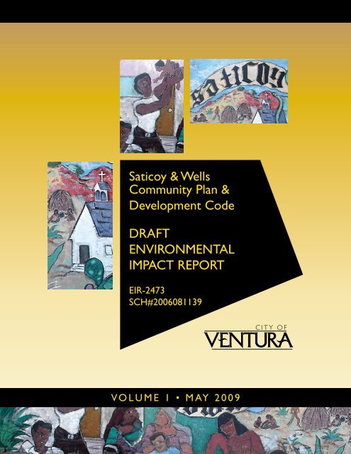
Saticoy & Wells Community Plan & Development ... - City Of Ventura
Saticoy & Wells Community Plan & Development ... - City Of Ventura
Saticoy & Wells Community Plan & Development ... - City Of Ventura

Create successful ePaper yourself
Turn your PDF publications into a flip-book with our unique Google optimized e-Paper software.
<strong>Saticoy</strong> & <strong>Wells</strong> <strong>Community</strong> <strong>Plan</strong> and Code EIRTable of Contents5.0 Other CEQA-Required Discussions5.1 Growth Inducing Effects .................................................................................................5-15.2 Irreversible Environmental Effects ................................................................................5-25.3 Global Climate Change ...................................................................................................5-36.0 Alternatives6.1 Alternative 1: No Project .................................................................................................6-16.2 Alternative 2: Eliminate Large Retail From Broome Site (Only Residential) ..........6-26.3 Alternative 3: Reduced Agricultural Land Conversion..............................................6-66.4 Alternative Sites .............................................................................................................6-106.5 Environmentally Superior Alternative........................................................................6-117.0 References and Report Preparers...................................................................................................7-17.1 References..........................................................................................................................7-17.2 Report Preparers...............................................................................................................7-4List of FiguresFigure 1-1 Environmental Review Process....................................................................1-6Figure 2-1 Regional Location...........................................................................................2-2Figure 2-2 <strong>Plan</strong>ning Area and <strong>City</strong>/County Boundaries ............................................2-3Figure 2-3 Existing Land Use ..........................................................................................2-6Figure 2-4 <strong>Saticoy</strong> and <strong>Wells</strong> Neighborhoods...............................................................2-9Figure 2-5 Concept for Old Town <strong>Saticoy</strong> ...................................................................2-12Figure 2-6 <strong>Saticoy</strong> and <strong>Wells</strong> Regulating Land Use <strong>Plan</strong> ..........................................2-15Figure 4.1-1 Visual Character ..........................................................................................4.1-2Figure 4.1-2 Ridgelines .....................................................................................................4.1-3Figure 4.1-3 Santa Clara River and Franklin Barranca.................................................4.1-4Figure 4.1-4 Developed Open Space...............................................................................4.1-6Figure 4.1-5 Scenic View Corridors ................................................................................4.1-7Figure 4.2-1 Agriculture Location and Type .................................................................4.2-3Figure 4.2-2 SOAR, LCA Contracts, and Greenbelt Areas ..........................................4.2-6Figure 4.3-1 Countywide Average CO Emissions......................................................4.3-14Figure 4.4-1 Habitat Types...............................................................................................4.4-2Figure 4.4-2 Riparian Areas and Drainages ..................................................................4.4-3Figure 4.5-1 Historic Resources Location ......................................................................4.5-9Figure 4.5-2 <strong>Saticoy</strong> Walnut Grower’s Association Warehouse...............................4.5-10Figure 4.5-3 Farmers and Merchants Bank..................................................................4.5-12Figure 4.6-1 Seismic Faults...............................................................................................4.6-3Figure 4.6-2 Liquefaction Hazard Areas........................................................................4.6-6Figure 4.6-3 Expansive Soil Areas...................................................................................4.6-7Figure 4.7-1 Known or Suspected Contaminated Sites................................................4.7-8Figure 4.8-1 FEMA Flood Zone Map..............................................................................4.8-3Figure 4.8-2 Dam Inundation Zone ................................................................................4.8-4Figure 4.10-1 Mineral Resource Zones...........................................................................4.10-2Figure 4.10-2 Petroleum Resources.................................................................................4.10-3Figure 4.11-1 Noise Compatibility Matrix .....................................................................4.11-3ii<strong>City</strong> of <strong>Ventura</strong>
<strong>Saticoy</strong> & <strong>Wells</strong> <strong>Community</strong> <strong>Plan</strong> and Code EIRTable of ContentsFigure 4.13-1 Fire and Police Stations ............................................................................4.13-4Figure 4.13-2 Park Locations ...........................................................................................4.13-7Figure 4.14-1 Water Distribution Facilities....................................................................4.14-3Figure 4.14-2 Sewage Collection Facilities.....................................................................4.14-7Figure 4.15-1 Study Area Street Network and Studied Intersections........................4.15-2Figure 4.15-2 Bus Routes and Stop Locations ...............................................................4.15-6Figure 4.15-3 Bicycle Routes ............................................................................................4.15-8List of TablesTable ES-1 Summary of Environmental Impacts and Mitigation Measures .......... ES-3Table 2-1 Existing Project Area Characteristics...........................................................2-4Table 2-2 <strong>Community</strong> <strong>Plan</strong> Chapters ...........................................................................2-7Table 2-3 <strong>Plan</strong> Area Potential <strong>Development</strong> (2025)..................................................2-11Table 2-4 Our Accessible <strong>Community</strong> Key Actions Potentially Resulting inPhysical Changes..........................................................................................2-13Table 2-5 Parcel Land Redesignations Requiring General <strong>Plan</strong> Amendments ....2-18Table 3-1 2000 and 2008 <strong>City</strong>wide Population Estimates ..........................................3-1Table 3-2 2000 and 2008 <strong>City</strong>wide Housing Estimates ..............................................3-2Table 3-3 <strong>City</strong>wide Housing Projections, 2008-2025 ..................................................3-4Table 3-4 <strong>City</strong>wide Projected Job Growth by Sector, 2005-2025...............................3-4Table 3-5 Forecast Cumulative <strong>Development</strong> in <strong>Ventura</strong> through 2025 .................3-5Table 4.2-1 Agricultural Lands within the Project Area ............................................4.2-2Table 4.2-2 Prime Farmlands Designated for Non-Agricultural Use in theProject Area ..................................................................................................4.2-4Table 4.3-1 Federal and State Ambient Air Quality Standards ................................4.3-2Table 4.3-2 Ambient Air Quality Data..........................................................................4.3-6Table 4.3-3 Comparison of 2025 Population Projections ...........................................4.3-9Table 4.3-4 Project Size That Will Exceed VCAPCD Significance Thresholds forOzone Precursors (ROC and NOx).........................................................4.3-10Table 4.4-1 Special Status Wildlife Species with Potential to Occurin the Project Area .......................................................................................4.4-5Table 4.5-1 Landmarks and Points of Interest In the<strong>Saticoy</strong> & <strong>Wells</strong> Project Area .....................................................................4.5-8Table 4.6-1 Significant Faults and Estimated Maximum Earthquake Size..............4.6-4Table 4.8-1 Existing Dams with the Potential to Affect the Project Area ................4.8-2Table 4.11-1 Existing Noise Levels in the Vicinity of the Project Area ....................4.11-2Table 4.11-2 <strong>City</strong> of <strong>Ventura</strong> Exterior Noise Standards .............................................4.11-4Table 4.11-3 Significance of Changes in Operational Roadway Noise Exposure ..4.11-6Table 4.11-4 Comparison of Existing and Future Noise Levels onKey Project Area Roadways.....................................................................4.11-7Table 4.11-5 Typical Noise Levels at Construction Sites............................................4.11-9Table 4.12-1 Current Housing and Population ...........................................................4.12-1Table 4.12-2 SCAG Employment, Households and PopulationProjections for <strong>Ventura</strong>.............................................................................4.12-1Table 4.12-3 Project Projected Growth Compared to SCAG Forecasts....................4.12-3Table 4.12-4 Forecast Project Area and <strong>City</strong>wide Jobs/Housing Ratios .................4.12-4Table 4.13-1 Enrollment and Acreage Prerequisites...................................................4.13-5iii<strong>City</strong> of <strong>Ventura</strong>
<strong>Saticoy</strong> & <strong>Wells</strong> <strong>Community</strong> <strong>Plan</strong> and Code EIRTable of ContentsAppendicesTable 4.13-2 School Enrollment and Capacity.............................................................4.13-5Table 4.13-3 Future School Enrollment and Capacity..............................................4.13-15Table 4.14-1 Historic and Projected Water Source Supply Availability ..................4.14-2Table 4.14-2 Historic and Projected Water Production..............................................4.14-2Table 4.15-1 Study Area Intersections ..........................................................................4.15-3Table 4.15-2 Intersection Level of Service Descriptions.............................................4.15-4Table 4.15-3 Existing A.M. and P.M. Peak Hour Intersection Level of Service ......4.15-5Table 4.15-4 <strong>City</strong> of <strong>Ventura</strong> Committed Roadway Network Improvementswithin the Project Area...........................................................................4.15-10Table 4.15-5 Project <strong>Development</strong> Potential Trip Generation.................................4.15-12Table 4.15-6 Year 2025 A.M. and P.M. Peak Hour Intersection Level of Service .4.15-13Table 4.15-7 Forecast LOS with Darling Rd/<strong>Wells</strong> Rd Improvements .................4.15-14Table 5-1 Estimated Electricity Consumption...........................................................5-13Table 5-2 Estimated Annual Operational Greenhouse Gas Emissions..................5-14Table 5-3 Estimated Annual Mobile Greenhouse Gas Emissions ..........................5-15Table 5-4 Combined Annual Emissions of Greenhouse Gases...............................5-15Table 5-5 CAPCOA Suggested Thresholds for Greenhouse Gases........................5-17Table 5-6 Project Consistency with Applicable Climate Action TeamGreenhouse Gas Emission Reduction Strategies .....................................5-17Table 6-1 Project vs. Alternative 2 Potential <strong>Development</strong> .......................................6-2Table 6-2 Water Demand Comparison (Alternative 2 vs. Project) ...........................6-4Table 6-3 Wastewater Generation Comparison (Alternative 2 vs. Project).............6-4Table 6-4 Solid Waste Generation Comparison (Alternative 2 vs. Project).............6-5Table 6-5 <strong>Community</strong> <strong>Plan</strong> Trip Generation Comparison(Alternative 2 vs. Project) ..............................................................................6-6Table 6-6 Project vs. Alternative 3 Potential <strong>Development</strong> .......................................6-6Table 6-7 Water Demand Comparison (Alternative 3 vs. Project) ...........................6-8Table 6-8 Wastewater Generation Comparison (Alternative 3 vs. Project).............6-9Table 6-9 Solid Waste Generation Comparison (Alternative 3 vs. Project).............6-9Table 6-10 Project Trip Generation Comparison (Alternative 3 vs. Project)...........6-10Table 6-11 Comparison of the Environmental Impacts of Project Alternatives .....6-11Appendix A:Appendix B:Appendix C:Appendix D:Initial StudyClimate Change DatasheetsHazardous Materials ReportTraffic Noise Modelingiv<strong>City</strong> of <strong>Ventura</strong>
<strong>Saticoy</strong> & <strong>Wells</strong> <strong>Community</strong> <strong>Plan</strong> and Code EIRExecutive Summary0.0 EXECUTIVE SUMMARYThis section summarizes the characteristics of the proposed <strong>Saticoy</strong> and <strong>Wells</strong> <strong>Community</strong> <strong>Plan</strong>and Code, alternatives, environmental impacts associated with the specific plan, recommendedmitigation measures, and the level of significance of impacts after mitigation.PROJECT SYNOPSISProject Proponent<strong>City</strong> of San Buenaventura501 Poli Street, Room 133<strong>Ventura</strong>, California 93001Project DescriptionProject CharacteristicsThe proposed project involves the adoption of a community plan and development code(<strong>Saticoy</strong> and <strong>Wells</strong> <strong>Community</strong> <strong>Plan</strong> and <strong>Development</strong> Code, herein referred to as the “Project”)for the regulation of development for approximately 1,000 acres in the <strong>City</strong> and County of<strong>Ventura</strong>.The <strong>Community</strong> <strong>Plan</strong> includes goals, policies, and actions aimed at facilitating its envisionedplanned development. The <strong>Community</strong> <strong>Plan</strong> goals are developed in conjunction with themodel provided by the General <strong>Plan</strong>. The policies and actions defined in the <strong>Community</strong> <strong>Plan</strong>are divided amongst eleven chapters, similar to the General <strong>Plan</strong>.Most of the policies and actions within the <strong>Plan</strong> chapters either do not involve physicalenvironmental changes or are intended to reduce the potential environmental changesassociated with future development within the <strong>Plan</strong> Area. <strong>Of</strong> the above mentioned <strong>Community</strong><strong>Plan</strong> chapters, the two primary chapters that involve physical environmental changes to theenvironment are “Our Well <strong>Plan</strong>ned and Designed <strong>Community</strong>” and “Our Accessible<strong>Community</strong>.” These chapters include the identification of neighborhoods and core districtswithin the Project Area, development forecasts, identification of circulation improvements andpolicies and strategies to achieve the goals of the <strong>Community</strong> <strong>Plan</strong>. See Section 2.0, ProjectDescription, for a more detailed depiction of these chapters.The proposed <strong>Saticoy</strong> & <strong>Wells</strong> <strong>Development</strong> Code is designed to achieve consistency with theGeneral <strong>Plan</strong> for the <strong>City</strong>, as analyzed in the Final Environmental Impact Report for the <strong>Ventura</strong>General <strong>Plan</strong> adopted in 2005. The Code represents a continuation of development of a<strong>City</strong>wide “Form-Based Code” as called for in the General <strong>Plan</strong>. Therefore, in conjunction withthe <strong>Community</strong> <strong>Plan</strong>, certain amendments to the <strong>City</strong>’s <strong>Development</strong> Code are proposed. Theprinciple role of the <strong>Saticoy</strong> & <strong>Wells</strong> <strong>Development</strong> Code is to implement the land use pattern,land use densities and intensities designated by the General <strong>Plan</strong> land use diagram, and thepolicies and program of the General <strong>Plan</strong> and proposed <strong>Saticoy</strong> & <strong>Wells</strong> <strong>Community</strong> <strong>Plan</strong>. Allland uses allowed by the <strong>Saticoy</strong> & <strong>Wells</strong> <strong>Development</strong> Code are consistent with thoseES-1<strong>City</strong> of <strong>Ventura</strong>
<strong>Saticoy</strong> & <strong>Wells</strong> <strong>Community</strong> <strong>Plan</strong> and Code EIRExecutive Summaryanticipated by the General <strong>Plan</strong>. The provisions of the <strong>Saticoy</strong> & <strong>Wells</strong> <strong>Development</strong> Codewould supersede and replace existing regulations in the <strong>Ventura</strong> Zoning Code as applicable.Project ObjectivesThe <strong>Saticoy</strong> and <strong>Wells</strong> <strong>Community</strong> <strong>Plan</strong> is intended to function as a policy document to guideland use decisions within the <strong>Saticoy</strong> and <strong>Wells</strong> communities. The overall objective of the<strong>Saticoy</strong> and <strong>Wells</strong> <strong>Community</strong> <strong>Plan</strong> is to:“Create six distinct, yet interconnected, walkable neighborhoods that improve over timeby requiring well-designed development, thoroughfares usable by all modes oftransportation, and providing neighborhood amenities that meet the unique needs of the<strong>Saticoy</strong> and <strong>Wells</strong> Communities.”The <strong>Community</strong> <strong>Plan</strong> identifies eleven overall planning principles to achieve the aboveobjective. See Section 2.0, Project Description for a list of these principles.Required ApprovalsImplementation of the proposed <strong>Saticoy</strong> and <strong>Wells</strong> <strong>Community</strong> <strong>Plan</strong> would require thefollowing discretionary approvals from the <strong>City</strong> of <strong>Ventura</strong>:• Certification of the EIR• General <strong>Plan</strong> Amendment to adopt <strong>Saticoy</strong> and <strong>Wells</strong> <strong>Community</strong> <strong>Plan</strong>• General <strong>Plan</strong> Amendment to change the amount of retail square footage under‘vacant’ in Table 3-2 of the General <strong>Plan</strong> from 165,000 square feet to 228,475 squarefeet of retail. All other allocations in Table 3-2 of the General <strong>Plan</strong> would remain thesame.• General <strong>Plan</strong> Land Use Re-Designations as indicated in Table 2-5 of this document.• Zone Change and Zoning Ordinance Text amendment for <strong>City</strong> designated parcels asindicated on Figure 2-8 and specified in Appendix B, <strong>Community</strong> <strong>Plan</strong>.Discretionary approval of the <strong>Community</strong> <strong>Plan</strong> is not required from any agency except for the<strong>City</strong> of <strong>Ventura</strong>. However, the County of <strong>Ventura</strong> will retain land use authority over propertiesthat remain in the unincorporated County. In addition, the <strong>Ventura</strong> County LAFCO will havediscretionary authority with respect to any future proposals to annex individual <strong>Plan</strong> Areaproperties.ALTERNATIVESThis EIR examines three alternatives, as described below.• Alternative 1: No Project (no development - no change to existing land uses)• Alternative 2: Eliminate Large Retail from Broome Site (only residential)• Alternative 3: No Agricultural Land ConversionEach of the alternatives has specific issue areas that are environmentally superior to the proposedproject. Overall, Alternative 3, Reduced Agricultural Land Conversion, is consideredES-2<strong>City</strong> of <strong>Ventura</strong>
<strong>Saticoy</strong> & <strong>Wells</strong> <strong>Community</strong> <strong>Plan</strong> and Code EIRExecutive Summaryenvironmentally superior among the three options it is superior in 10 issues and only inferior inone. The No Project alternative is infeasible because it would not accommodate already entitledprojects. None of the alternatives would result in unavoidably significant environmental impacts.AREAS OF PUBLIC CONTROVERSYAreas of public controversy include the amount of development facilitated by the proposedproject, changes in land use, and loss of agricultural lands. This EIR studies all 16 issue areasidentified in the CEQA Appendix G checklist. See the appropriate issue section for discussionsfor project impacts related to those issues.SUMMARY OF IMPACTS AND MITIGATION MEASURESTable ES-1 lists the environmental impacts of the proposed project, proposed mitigationmeasures, and residual impacts. Impacts are categorized by classes. Class I impacts are definedas significant, unavoidable adverse impacts, which require a statement of overridingconsiderations pursuant to Section 15093 of the CEQA Guidelines if the project is approved.Class II impacts are significant adverse impacts that can be feasibly mitigated to less thansignificant levels and which require findings to be made under Section 15091 of the CEQAGuidelines. Class III impacts are adverse, but less than adopted significance thresholds. ClassIV effects are those where there is no impact or the effect would be beneficial.As noted in Table E S-1, all of the project generated impacts can be mitigated to a less thansignificant level through implementation of proposed policies and actions. Aesthetic andbiological resources each had one issue that is a Class II, significant but mitigable impact. SeeTable ES-1 for mitigation associated with these impacts.Table ES-1Summary of Environmental Impacts and Mitigation MeasuresImpactAESTHETICSImpact AES-1 <strong>Development</strong> facilitatedby the Project would convert agriculturallands and vacant land in the Project Areato suburban uses, thus transforming theProject Area’s visual character. Althoughsome individuals may view this changeas adverse, the change for this area wasenvisioned in the 2005 General <strong>Plan</strong> andthe proposed development would notcreate an aesthetically offensivecondition. Thus, the impact to the ProjectArea’s visual character would be ClassIII, less than significant.Impact AES-2 <strong>Development</strong> that wouldbe facilitated by the Project wouldpotentially alter and/or block views fromvarious public view corridors. Themagnitude of impact would vary witheach proposed development. Impacts toNone NecessaryMitigation MeasuresAES-2(a) Sound Walls. Views of sound wallsabutting SR 126 shall be softened throughinstallation of landscaping such as trees,shrubs and climbing vines, resulting in a varietyof textures and colors.ES-3Significance AfterMitigationLess than significantwithout mitigationLess than significant<strong>City</strong> of <strong>Ventura</strong>
<strong>Saticoy</strong> & <strong>Wells</strong> <strong>Community</strong> <strong>Plan</strong> and Code EIRExecutive SummaryTable ES-1Summary of Environmental Impacts and Mitigation MeasuresImpactviewsheds are considered Class II,significant but mitigable.Impact AES-3 <strong>Development</strong> that wouldbe facilitated by the Project wouldpotentially introduce new sources of lightand glare. However, implementation ofcurrent and proposed lighting standardsand policies on new development wouldreduce impacts to a Class III, less thansignificant, level.AGRICULTURAL RESOURCESImpact AG-1 <strong>Development</strong> facilitated bythe Project could result in conflicts withongoing agricultural operations insurrounding areas. However, withadherence to existing regulations as wellas implementation of proposed<strong>Community</strong> <strong>Plan</strong> policies and actions,impacts to the agriculture/urban interfaceare considered Class III, less thansignificant.Impact AG-2 <strong>Development</strong> facilitated bythe Project would involve the conversionof State-designated Prime, StatewideImportance, and Unique farmland.However, the <strong>City</strong> already acknowledgedthis conversion in the 2005 General <strong>Plan</strong>EIR and Project implementation wouldnot increase impacts beyond thosealready identified in the 2005 General<strong>Plan</strong> FEIR. Therefore, impacts related tothe conversion of farmland areconsidered Class III, less than significant.AIR QUALITYImpact AQ-1 Anticipated populationgrowth facilitated by the Project wouldbe consistent with the 2005 <strong>Ventura</strong>General <strong>Plan</strong> and the <strong>Ventura</strong> CountyAQMP population forecasts. Therefore,impacts related to the consistency withthe AQMP are Class III, less thansignificant.Impact AQ-2 Individual projectsfacilitated by the proposed Projectwould generate air pollutant emissions.The significance of air quality impactsassociated with individual projectswould depend upon the characteristicsof the projects and the availability offeasible mitigation measures. However,implementation of existing programs, incombination with proposed <strong>Community</strong><strong>Plan</strong> policies and actions, would reduceimpacts associated with individualMitigation MeasuresNone NecessaryNone NecessaryNone NecessaryNone NecessaryNone NecessarySignificance AfterMitigationLess than significantwithout mitigationLess than significantwithout mitigationLess than significantwithout mitigationLess than significantwithout mitigationLess than significantwithout mitigationES-4<strong>City</strong> of <strong>Ventura</strong>
<strong>Saticoy</strong> & <strong>Wells</strong> <strong>Community</strong> <strong>Plan</strong> and Code EIRExecutive SummaryTable ES-1Summary of Environmental Impacts and Mitigation MeasuresImpactdevelopment projects to Class III, lessthan significant.Impact AQ-3 Construction of individualprojects accommodated under theProject would result in temporaryemissions of air pollutants. The <strong>Ventura</strong>County APCD has not adoptedsignificance thresholds for constructionimpacts because of their temporarynature; therefore, impacts are Class III,less than significant. Nevertheless,implementation of standard emissionand dust control technologies will berequired on all future development.Impact AQ-4 Increased trafficcongestion Project Area growth wouldpotentially increase carbon monoxide(CO) concentrations at congestedintersections. However, because of thelow ambient CO concentrations andanticipated reduction in emissionsassociated with less polluting vehicles,exceedance of state and federal COstandards is not expected. Impactsrelating to CO “hotspots” are thereforeconsidered Class III, less thansignificant.BIOLOGICAL RESOURCESImpact BIO-1 The Project wouldlargely avoid impacts to riparian andwetland habitats by emphasizingpreservation of the existing naturalhabitats and restoration of those areasthat have been previously altered byhuman impacts. Potential impacts couldoccur in certain locations, but would beaddressed through implementation ofproposed <strong>Community</strong> <strong>Plan</strong> policies andactions. Impacts would be Class III,less than significant.Impact BIO-2 The Project wouldgenerally avoid sensitive habitat,including areas with mature trees.Based on reconnaissance studies of theProject Area and with implementation of<strong>Community</strong> <strong>Plan</strong> policies and actions,impacts to sensitive habitats would beClass III, less than significant.Impact BIO-3 The Project woulddesignate areas for future developmentand would implement publicinfrastructure such as bridges,pathways, and parklands. Futuredevelopment and infrastructurecomponents may affect areas known orNone NecessaryNone NecessaryNone NecessaryNone NecessaryMitigation MeasuresBIO-3(a) Pre-construction Surveys. Apreconstruction presence/absence survey willbe required within 30 days prior to anydevelopment proposed within natural habitatto determine the presence of special-statuswildlife species. Prior to commencement ofgrading operations or other activities involvingSignificance AfterMitigationLess than significantwithout mitigationLess than significantwithout mitigationLess than significantwithout mitigationLess than significantwithout mitigationLess than significantES-5<strong>City</strong> of <strong>Ventura</strong>
<strong>Saticoy</strong> & <strong>Wells</strong> <strong>Community</strong> <strong>Plan</strong> and Code EIRExecutive SummaryTable ES-1Summary of Environmental Impacts and Mitigation MeasuresImpactsuspected to contain rare, threatened,or endangered species. Impacts areconsidered Class II, significant butmitigable.Mitigation Measuresdisturbance of natural habitat, a survey shallbe conducted to locate potential specialstatuswildlife species within 100 feet of theouter extent of projected soil disturbanceactivities. If a special-status wildlife speciesis observed, the locations shall be clearlymarked and identified on theconstruction/grading plans. A biologicalmonitor shall also be present at the initiationof vegetation clearing to provide an educationprogram to the construction operatorsregarding the efforts needed to protect thespecial-status species. Fencing or flaggingshall be installed around the limits of gradingprior to the initiation of vegetation clearing.BIO–3(b) Lighting and Sound Restrictions.Lighting near natural habitat, such as in thevicinity of Brown Barranca and the SantaClara River, shall be shielded and directedaway from that habitat. Lighting of parking lotareas shall be limited to an intensity onlysufficient to provide safe passage. Soundamplification equipment shall be shieldedfrom natural habitat to reduce effects onpotential special-status wildlife species. Aqualified biologist shall review lighting andsound plans prior to construction to ensurethat the proposed lighting minimizes potentialimpacts on special-status wildlife species.BIO-3(c) Conduct Pre-ConstructionFloristic Surveys. Within natural habitatareas that have been previously undevelopedand undisturbed, floristic surveys shall beconducted prior to the commencement ofconstruction activities to account for anyspecial-status plant species that were notidentifiable or detected during initial surveys.The supplemental focused rare plant surveyswould follow survey guidelines as developedby CDFG and CNPS. The purpose of thesurveys shall be to identify all extantindividuals and the population size of listedplants within the Project Area.BIO-3(d) Avoid or Minimize Impacts toListed <strong>Plan</strong>t Species. If a special-statusplant species is observed on a proposedconstruction site, the location of any potentiallisted species and/or population boundariesshall be delineated prior to grading orconstruction. All individuals or areas of thepopulation that can be avoided shall beflagged off, preserved, and monitored toinsure indirect impacts do not contribute toSignificance AfterMitigationES-6<strong>City</strong> of <strong>Ventura</strong>
<strong>Saticoy</strong> & <strong>Wells</strong> <strong>Community</strong> <strong>Plan</strong> and Code EIRExecutive SummaryTable ES-1Summary of Environmental Impacts and Mitigation MeasuresImpactMitigation Measuresfurther loss of any listed species. Avoidanceis defined as a minimum 200-foot bufferunless an active maintenance plan isimplemented for the known occurrence. Withimplementation of an active maintenance andmanagement program, the buffer width maybe reduced further based on review andapproval by the jurisdictional agencies(USFWS and/or CDFG).Construction monitors shall be present duringgrading or other construction activity within200 feet of known listed plant species.Construction operators shall be educated asto the species identification and sensitivity,and shall be directed to avoid impacts to suchplants.Any individuals that may be affected or lostdue to construction activities and associateddevelopment shall be salvaged and relocatedto a designated suitable mitigation siteisolated from human disturbance. Amitigation restoration plan shall be preparedby a qualified plant ecologist that identifiesthe number of plants to be replanted and themethods that will be used to preserve thisspecies in the onsite mitigation area. Theplan shall also include a monitoring programso that the success of the effort can bemeasured. Restoration efforts shall becoordinated with applicable federal, state, andlocal agencies. The mitigation restorationplan shall be submitted to the appropriateregulatory agencies for review, with the planthen submitted to the <strong>City</strong> of <strong>Ventura</strong> forapproval prior to issuance of a grading permitfor the area of concern.BIO-3(e) Sensitive <strong>Plan</strong>tProtection <strong>Plan</strong>. A mitigation andmanagement plan shall be developed forlisted plant species that may be affected orlost due to potential development facilitatedby the proposed <strong>Community</strong> <strong>Plan</strong>. The planshall be developed by a qualified plantecologist and would include an analysis oftake, mitigation measures, and an AdaptiveManagement <strong>Plan</strong> (AMP) to identifystrategies for responding to changedcircumstances, and a monitoring plan.Specifically, it shall identify the number ofplants to be replanted, the methods that willbe used to preserve this species in thislocation, and methods to ensure successfulmitigation for impacts to special-status plantSignificance AfterMitigationES-7<strong>City</strong> of <strong>Ventura</strong>
<strong>Saticoy</strong> & <strong>Wells</strong> <strong>Community</strong> <strong>Plan</strong> and Code EIRExecutive SummaryTable ES-1Summary of Environmental Impacts and Mitigation MeasuresImpactImpact BIO-4 Locally importantspecies have been tracked in the vicinityof the Project Area. However, withimplementation of proposed <strong>Community</strong><strong>Plan</strong> policies and actions, impacts tothese species would be Class III, lessthan significant.Impact BIO-5 Implementation of theProject would largely avoid impacts towildlife movement corridors byemphasizing intensification/reuse ofexisting urbanized areas.Implementation of <strong>Community</strong> <strong>Plan</strong>Actions 11.1.3, 11.1.4, 11.1.6, and11.1.7 would maintain ecologicalconnectivity corridors through urbanspaces and potentially enhanceconnectivity in some locations.Therefore, impacts to wildlife movementwould be Class III, less than significant.Mitigation Measuresspecies. The required level of success shallbe defined at a minimum as a demonstrationof three consecutive years of growth of apopulation equal to or greater than that wouldbe lost due to development facilitated underthe proposed <strong>Community</strong> <strong>Plan</strong>. Themitigation plan shall include but not be limitedto:• Preserving and transportingappropriate topsoil from thedevelopment envelope as a seedbank to promote special-statusspecies revegetation at a relocationsite;• Salvage operations to relocatespecies to a suitable mitigation site;• Collecting seeds of special-statusplant species in the immediate vicinityof the project site, to ensure that thegenetic integrity of the local landscaperemains intact;• Sowing the collected seed intodesignated suitable mitigation site.• Determination of necessary irrigationrequirements and irrigating themitigation plantings if necessary untilthey become established; and• Maintaining and monitoringrestoration/planting sites for aminimum of three (3) years (or asdetermined successful, whichever issooner) to determine mitigationsuccess/failure, and implementingremedial measures to satisfymitigation objectives.None NecessaryNone NecessarySignificance AfterMitigationLess than significantwithout mitigationLess than significantwithout mitigationES-8<strong>City</strong> of <strong>Ventura</strong>
<strong>Saticoy</strong> & <strong>Wells</strong> <strong>Community</strong> <strong>Plan</strong> and Code EIRExecutive SummaryTable ES-1Summary of Environmental Impacts and Mitigation MeasuresImpactCULTURAL AND HISTORIC RESOURCESImpact CR-1 Implementation of the None NecessaryProject may result in the direct orindirect disturbance of as-yetundetected areas of prehistoricarchaeological significance. This isconsidered a Class II, significant butmitigable impact.Impact CR-2 Implementation of the None NecessaryProject may result in the removal oralteration of buildings that have thepotential to be historic resources. Thisis considered a Class II, significant butmitigable, impact.GEOLOGICAL HAZARDSImpact GEO-1 Future seismic events None Necessarycould produce ground shakingthroughout the Project Area as well assurface rupture in some areas wherefuture development could beaccommodated. Ground shaking andsurface rupture could damagestructures and/or create adverse safetyeffects. However, compliance with <strong>City</strong>policies, in combination with therequirements of the CBC and theAlquist-Priolo legislation, would reducethe risk associated with ground shakingand surface rupture to a Class III, lessthan significant, level.Impact GEO-2 Future seismic events None Necessarycould result in liquefaction of soils inportions of the Project Area.<strong>Development</strong> in certain areas within theProject Area could be subject toliquefaction hazards. However,compliance with 2005 General <strong>Plan</strong>policies would reduce potential impactsto a Class III, less than significant, level.Impact GEO-3 Expansive soilNone Necessaryconditions could result in foundationand building distress problems andcracking of concrete slabs. However,buildings would conform to CBCrequirements along with 2005 General<strong>Plan</strong> policies that address expansivesoils would reduce potential impacts toClass III, less than significant.HAZARDS AND HAZARDOUS MATERIALSImpact HAZ-1 Some industrial and None Necessaryagricultural operations within the ProjectArea use hazardous materials to whichcurrent and future residents could beMitigation MeasuresSignificance AfterMitigationLess than significantwithout mitigationLess than significantwithout mitigationLess than significantwithout mitigationLess than significantwithout mitigationLess than significantwithout mitigationLess than significantwithout mitigationES-9<strong>City</strong> of <strong>Ventura</strong>
<strong>Saticoy</strong> & <strong>Wells</strong> <strong>Community</strong> <strong>Plan</strong> and Code EIRExecutive SummaryTable ES-1Summary of Environmental Impacts and Mitigation MeasuresImpactexposed. Potential development nearhazardous material users, includingagricultural sources, could exposeindividuals to health risks due tosoil/groundwater contamination oremission of hazardous materials intothe air. However, compliance with 2005General <strong>Plan</strong> policies and actions, incombination with existing regulations,would reduce potential impactsassociated with hazardous material useto a Class III, less than significant, level.Impact HAZ-2 The transportation of None Necessaryhazardous materials could potentiallycreate a public safety hazard for newdevelopment that could beaccommodated along majortransportation corridors under theProject. Provided the <strong>City</strong> continuesparticipation in the SEMS MultihazardFunctional Response <strong>Plan</strong>, impacts tonew development within the ProjectArea would be Class III, less thansignificant.HYDROLOGY AND WATER QUALITYImpact HYD-1 <strong>Development</strong> facilitated None Necessaryby the Project could place newdevelopment within 100-year floodzones and dam inundation zones.However, compliance with the <strong>City</strong>Flood Plain Ordinance, 2005 General<strong>Plan</strong> actions, and proposed <strong>Community</strong><strong>Plan</strong> actions would reduce impacts to aClass III, less than significant, level.Impact HYD-2 <strong>Development</strong> facilitated None Necessaryby the proposed Project would increasethe amount of impervious surfaceswithin the Project Area, potentiallyincreasing surface runoff in areas whereexisting storm drain systems aredeficient. However, compliance withexisting regulations, 2005 General <strong>Plan</strong>actions, and <strong>Community</strong> <strong>Plan</strong> policiesand actions would reduce impacts to aClass III, less than significant, level.Impact HYD-3 <strong>Development</strong> facilitated None Necessaryby the Project would incrementallyincrease the generation of urbanpollutants in surface runoff. Point andnon-point sources of contaminationcould affect water quality in the SantaClara River, Franklin and Brownbarrancas, and groundwater. However,implementation of existing regulatoryrequirements, and 2005 General <strong>Plan</strong>Mitigation MeasuresSignificance AfterMitigationLess than significantwithout mitigationLess than significantwithout mitigationLess than significantwithout mitigationLess than significantwithout mitigationES-10<strong>City</strong> of <strong>Ventura</strong>
<strong>Saticoy</strong> & <strong>Wells</strong> <strong>Community</strong> <strong>Plan</strong> and Code EIRExecutive SummaryTable ES-1Summary of Environmental Impacts and Mitigation MeasuresImpactand <strong>Community</strong> <strong>Plan</strong> policies andactions, would reduce impacts to aClass III, less than significant, level.LAND USE and PLANNINGImpact LU-1 The proposed Projectimplements policies and actions of the2005 General <strong>Plan</strong> and carries out thevision of the General <strong>Plan</strong> for the <strong>Wells</strong>-<strong>Saticoy</strong> communities. The Projectwould not conflict with other localregulatory planning documents. This isa Class III, less than significant impact.Impact LU-2 The proposed Projectdoes not directly involve anyannexation, but certain properties withinthe Project Area would likely beannexed under the guise of the Project.Conflicts with LAFCO policies are notanticipated; therefore, impacts would beClass III, less than significant.Impact LU-3 The proposed Projectcould be found to be consistent withapplicable SCAG policies, therefore,impacts are Class III, less thansignificant impact due to policyconsistency.MINERAL RESOURCESImpact M-1 The Project would notreduce access to mineral resources.This would be a Class III, less thansignificant, impact.NOISEImpact N-1 Growth facilitated by theProject would increase traffic-relatednoise. Cumulative traffic noiseincreases on SR 126 and <strong>Wells</strong> Roadwould exceed significance thresholds.However, implementation of applicable2005 General <strong>Plan</strong> policies and actions,in combination with mitigationrecommended for the UC Hansen andParklands specific plans, would reducepotential impacts to a Class III, lessthan significant, level.Impact N-2 Construction of individualprojects throughout the Project Areacould intermittently generate high noiselevels under the Project developmentscenario. This may affect sensitivereceptors near construction sites.However, compliance with NoiseOrdinance restrictions on constructiontiming would reduce this impact to aMitigation MeasuresNone NecessaryNone NecessaryNone NecessaryNone NecessaryNone NecessaryNone NecessarySignificance AfterMitigationLess than significantwithout mitigationLess than significantwithout mitigationLess than significantwithout mitigationLess than significantwithout mitigationLess than significantwithout mitigationLess than significantwithout mitigationES-11<strong>City</strong> of <strong>Ventura</strong>
<strong>Saticoy</strong> & <strong>Wells</strong> <strong>Community</strong> <strong>Plan</strong> and Code EIRExecutive SummaryTable ES-1Summary of Environmental Impacts and Mitigation MeasuresImpactClass III, less than significant level.Impact N-3 The placement ofresidential and other noise-sensitiveuses in proximity to industrial andcommercial uses could potentiallyexpose residents to high noise levels.However, development facilitated by theProject would be required to complywith the <strong>City</strong> Noise Ordinance and thenoise compatibility standards.Adherence to these regulations wouldreduce impacts to a Class III, less thansignificant, level.POPULATION AND HOUSINGImpact PH-1 <strong>Development</strong> facilitatedby the Project would not causedevelopment to exceed SCAG orGeneral <strong>Plan</strong> population or housingprojections. Therefore, impacts wouldbe Class III, less than significant.Impact PH-2 <strong>Development</strong> facilitatedby the Project would accommodate anestimated 2.87 housing units per job.This would help to balance thejobs/housing ratio in the <strong>City</strong>, which iscurrently jobs rich. Therefore, impactswould be Class III, less than significant.PUBLIC SERVICESImpact PS-1 <strong>Development</strong> facilitatedby the Project would add an estimated1,833 residences within the ProjectArea. This increase would placeadditional demand on fire protectionservices, but would not create the needfor new or expanded fire protectionfacilities. Impacts would therefore beClass III, less than significant.Impact PS-2 Implementation of theProject would facilitate an increase inpopulation within the Project Area. Thiswould place additional demands uponpolice services. However, because theincrease in demand would not createthe need for new VPD facilities, impactswould be Class III, less than significant.Impact PS-3 The Project wouldimplement recommended circulationimprovements that would improveemergency access in the Project Area.This impact is considered beneficial(Class IV).Impact PS-4 Residential developmentfacilitated by the Project would generateadditional school aged children, whichMitigation MeasuresNone NecessaryNone NecessaryNone NecessaryNone NecessaryNone NecessaryNone NecessaryNone NecessarySignificance AfterMitigationLess than significantwithout mitigationLess than significantwithout mitigationLess than significantwithout mitigationLess than significantwithout mitigationLess than significantwithout mitigationLess than significantwithout mitigationLess than significantwithout mitigationES-12<strong>City</strong> of <strong>Ventura</strong>
<strong>Saticoy</strong> & <strong>Wells</strong> <strong>Community</strong> <strong>Plan</strong> and Code EIRExecutive SummaryTable ES-1Summary of Environmental Impacts and Mitigation MeasuresImpactwould increase the demand for schoolfacilities. However, new developmentwill be required to pay the schoolfacilities fee as allowed by State law.Payment of the fee is considered fullmitigation of school impacts associatedwith new development. Therefore,impacts to school facilities areconsidered less than significant (ClassIII).Impact PS-5 <strong>Development</strong> facilitated None Necessaryby the Project would increase thedemand for park facilities due to anincrease of population within the ProjectArea. However, implementation ofcurrent <strong>City</strong> programs to develop newparks as needed would reduce impactsto a Class III, less than significant, level.UTILITIES AND SERVICE SYSTEMSImpact U-1 <strong>Development</strong> facilitated by None Necessarythe Project would increase waterdemand by a net increase ofapproximately 1,014 acre feet per year(AFY). The total estimated wateravailable from Lake Casitas, the<strong>Ventura</strong> River diversion, andgroundwater basins is 28,000 AFY,which is sufficient to meet theseprojected demand increases.Therefore, water supply impacts wouldbe Class III, less than significant.Impact U-2 New developmentNone Necessaryfacilitated by the Project would increasewastewater generation. However,projected future wastewater flows wouldremain within the capacity of the <strong>City</strong>treatment plant. Impacts are Class III,less than significant.Impact U-3 <strong>Development</strong> facilitated by None Necessarythe Project would increase solid wastegeneration, but projected future solidwaste generation is anticipated toremain within the capacity of locallandfills. Impacts would therefore beClass III, less than significant.TRAFFIC and CIRCULATIONImpact T-1 <strong>Development</strong> facilitated by None Necessarythe Project could result in a deficiencyat one study area intersection (<strong>Wells</strong>Road and Darling Road) based on theprojected 2025 growth scenario.However, feasible improvements areavailable to address this deficiency.Therefore, impacts associated with theMitigation MeasuresSignificance AfterMitigationLess than significantwithout mitigationLess than significantwithout mitigationLess than significantwithout mitigationLess than significantwithout mitigationLess than significantwithout mitigationES-13<strong>City</strong> of <strong>Ventura</strong>
<strong>Saticoy</strong> & <strong>Wells</strong> <strong>Community</strong> <strong>Plan</strong> and Code EIRExecutive SummaryTable ES-1Summary of Environmental Impacts and Mitigation MeasuresImpactProject would be Class II, significant butmitigable.Impact T-2 Implementation of theProject would be expected to generallyenhance the use of alternativetransportation modes, including transit,bicycling, and walking. Impacts relatingto alternative transportation are ClassIV, beneficial.Impact T-3 Implementation of theProject would place new residentialdevelopment along heavily traveledthoroughfares which may incrementallyincrease hazards. However, theimplementation of proposed policiesrelating to traffic calming and improvingwalkability would reduce such impactsto Class III, less than significant.None NecessaryNone NecessaryMitigation MeasuresSignificance AfterMitigationLess than significantwithout mitigationLess than significantwithout mitigationES-14<strong>City</strong> of <strong>Ventura</strong>
<strong>Saticoy</strong> & <strong>Wells</strong> <strong>Community</strong> <strong>Plan</strong> and Code EIRSection 1.0 Introduction1.0 INTRODUCTIONThis document is a Draft Environmental Impact Report (EIR) for the proposed <strong>Saticoy</strong> & <strong>Wells</strong><strong>Community</strong> <strong>Plan</strong> and <strong>Development</strong> Code (herein referred to as the “<strong>Community</strong> <strong>Plan</strong> andCode” or “Project”), located in the <strong>City</strong> of <strong>Ventura</strong>, County of <strong>Ventura</strong>. This EIR is tiered off the<strong>City</strong> of <strong>Ventura</strong> General <strong>Plan</strong> Final EIR (herein referred to as “General <strong>Plan</strong>”) dated August 2005(SCH #2004101014), which is incorporated by reference. Per CEQA disclosure, the General <strong>Plan</strong>FEIR can be read at the <strong>City</strong> of <strong>Ventura</strong> <strong>Plan</strong>ning Counter located at 501 Poli Street, Room #117,<strong>Ventura</strong>, CA. <strong>Community</strong> <strong>Plan</strong>s are adopted by resolution as an amendment to the General<strong>Plan</strong> under Government Code Sec. 65350, et seq. In order to reduce redundancy, the reader isdirected to the General <strong>Plan</strong> EIR for more detailed discussions of various issue areas. This EIRfocuses the discussion of General <strong>Plan</strong> issues as they pertain to the <strong>Saticoy</strong> & <strong>Wells</strong> <strong>Community</strong><strong>Plan</strong> and Code area.This section describes: (1) the general background of the project’s EIR process; (2); the purposeand legal authority of the EIR (3) the scope and content of the EIR; (4) lead, responsible, andtrustee agencies; and (5) the environmental review process required under the CaliforniaEnvironmental Quality Act (CEQA).1.1 ENVIRONMENTAL IMPACT REPORT BACKGROUNDPrior to preparing the <strong>Saticoy</strong> & <strong>Wells</strong> <strong>Community</strong> <strong>Plan</strong> and Code, the <strong>City</strong> of <strong>Ventura</strong>sponsored a series of public workshops to gather and incorporate public input. Workshopswere conducted on December 3, 2005, January 19, 2006, and February 11, 2006. Additionally,the <strong>City</strong> engaged the public in a large scale design charrette effort in August of 2006. Theresults of public workshops and additional public feedback before the <strong>Plan</strong>ning Commissionand <strong>City</strong> Council were presented on November 13, 2006, February 6, 2007, April 30, 2007, March3, 2008 and March 17, 2008.The <strong>City</strong> of <strong>Ventura</strong> prepared a Notice of Preparation (NOP) for an environmental impactreport and distributed the NOP for agency and public review for the required 30-day reviewperiod from August 19, 2006 to September 25, 20006. During that time, the <strong>City</strong> receivedcomment letters from agencies and members of the public. The NOP is presented in AppendixA, along with the Initial Study that was prepared for the project and the comment lettersreceived.A public scoping meeting was held on August 29, 2006, at the Sacred Heart Church communityfacility in <strong>Saticoy</strong>. The intent of the scoping meeting was to provide interested individuals,groups, public agencies and others a forum to provide input in an effort to assist in furtherrefining the intended scope and focus of the EIR. The focus of the scoping meeting was ontraffic and increased development in the area. The following topics were added to the scope ofthe EIR due to comments received:• Agricultural resources are analyzed according to both the CEQA thresholds and theLAFCO analysis used in advance of annexation. The EIR focuses greater attentionon prior cropping activities and economic consequences of farmland conversion.• Area roadways are analyzed in both a local and regional context.1-1<strong>City</strong> of <strong>Ventura</strong>
<strong>Saticoy</strong> & <strong>Wells</strong> <strong>Community</strong> <strong>Plan</strong> and Code EIRSection 1.0 Introduction1.2 PURPOSE AND LEGAL AUTHORITYThis EIR has been prepared in accordance with the California Environmental Quality Act(CEQA) and the CEQA Guidelines. In accordance with Section 15121 of the CEQA Guidelines, thepurpose of this EIR is to serve as an informational document that:...will inform public agency decision-makers and the public generally of the significantenvironmental effects of a project, identify possible ways to minimize the significanteffects, and describe reasonable alternatives to the project.This EIR is tiered from the 2005 General <strong>Plan</strong> Final EIR (FEIR) and has been prepared as aProgram EIR pursuant to Section 15168 of the CEQA Guidelines, which states that a ProgramEIR may be prepared on a series of actions that may be characterized as one large project. The useof a Program EIR can allow a Lead Agency to consider broad policy alternatives and programwidemitigation measures at an early time when the agency has greater flexibility to deal withbasic problems or cumulative impacts.1.3 SCOPE AND CONTENT/ENVIRONMENTAL FACTORSPOTENTIALLY AFFECTEDThis EIR addresses the issues for which the <strong>City</strong> of <strong>Ventura</strong> determined that significantenvironmental impacts could occur based on the Initial Study and responses to the NOP. Theissues addressed in this EIR include:• Aesthetics• Agriculture• Air Quality• Biological Resources• Cultural Resources• Hydrology• Land Use/Population & Housing• Noise• Public Services• Transportation• UtilitiesThe Initial Study found that there were no impacts or less than significant impacts in thefollowing areas:• Geology and Soils• Mineral Resources• Hazards and Hazardous MaterialsDespite of the lack of significant impacts, these last three issue areas are represented in the EIRto pull forward the discussion from the NOP, and to maintain the sequencing of discussionsfrom the General <strong>Plan</strong> EIR.This EIR addresses the issues referenced above and identifies potentially significantenvironmental impacts, including site-specific and cumulative effects of the project, inaccordance with the provisions set forth in the CEQA Guidelines. In addition, the EIRrecommends feasible mitigation measures, where possible, that would reduce or eliminateadverse environmental effects.1-2<strong>City</strong> of <strong>Ventura</strong>
<strong>Saticoy</strong> & <strong>Wells</strong> <strong>Community</strong> <strong>Plan</strong> and Code EIRSection 1.0 IntroductionIn preparing the EIR, use was made of pertinent <strong>City</strong> policies and guidelines, certified EIRs andadopted CEQA documents, and background documents prepared by the <strong>City</strong>. A full referencelist is contained in Section 7.0, References and Report Preparers.The Alternatives Section of the EIR (Section 6.0) was prepared in accordance with Section15126.6 of the CEQA Guidelines. The alternatives discussion evaluates the CEQA-required “noproject” alternative and two alternative development scenarios for the Project Area.The level of detail contained throughout this EIR is consistent with the requirements of CEQAand applicable court decisions. The CEQA Guidelines provide the standard of adequacy onwhich this document is based. Section 15151 of the CEQA Guidelines states:An EIR should be prepared with a sufficient degree of analysis to provide decision-makerswith information which enables them to make a decision which intelligently takes accountof environmental consequences. An evaluation of the environmental effects of theproposed project need not be exhaustive, but the sufficiency of an EIR is to be reviewed inlight of what is reasonably feasible. Disagreement among experts does not make an EIRinadequate, but the EIR should summarize the main points of disagreement among theexperts. The courts have looked not for perfection, but for adequacy, completeness, and agood faith effort at full disclosure.1.4 LEAD, RESPONSIBLE, AND TRUSTEE AGENCIESThe CEQA Guidelines define lead, responsible and trustee agencies. The <strong>City</strong> of <strong>Ventura</strong> is thelead agency for the project because it holds principal responsibility for approving the project.A responsible agency refers to a public agency other than the lead agency that has discretionaryapproval over the project. There are no responsible agencies for the proposed <strong>Saticoy</strong> & <strong>Wells</strong><strong>Community</strong> <strong>Plan</strong> and Code as the <strong>City</strong> of <strong>Ventura</strong> has sole discretionary authority to approvethe Project. Nevertheless, certain agencies would be responsible for the review and approval ofcertain aspects of individual actions that may be approved under the guise of the <strong>Saticoy</strong> &<strong>Wells</strong> <strong>Community</strong> <strong>Plan</strong> and Code. These agencies include the following:• <strong>Ventura</strong> County Local Agency Formation Commission (LAFCO)• <strong>Ventura</strong> County Transportation Commission (VCTC)• California Department of Fish and Game (CDFG)• <strong>Ventura</strong> County Watershed Protection District (VCWPD)• Los Angeles Regional Water Quality Control Board (LARWQCB)• US Army Corp of Engineers (USACOE)• <strong>Ventura</strong> County Board of SupervisorsA ”Trustee Agency“ refers to a state agency having jurisdiction by law over natural resourcesaffected by a project but without the legal authority to approve or carry out the project[Guidelines §15386]. The only trustee agency for the proposed project is the Department of Fishand Game [CEQA Guidelines §15386].1-3<strong>City</strong> of <strong>Ventura</strong>
<strong>Saticoy</strong> & <strong>Wells</strong> <strong>Community</strong> <strong>Plan</strong> and Code EIRSection 1.0 Introduction1.5 ENVIRONMENTAL REVIEW PROCESSThe major steps in the environmental review process, as required under CEQA, are outlinedbelow. The steps are presented in sequential order. Figure 1-1 illustrates the review process.1. Notice of Preparation (NOP). After deciding that an EIR is required, the lead agency mustfile an NOP soliciting input on the EIR scope to the State Clearinghouse, other concernedagencies, and parties previously requesting notice in writing (CEQA Guidelines Section15082; Public Resources Code Section 21092.2). The NOP must be posted in the CountyClerk’s office for 30 days. The NOP may be accompanied by an Initial Study that identifiesthe issue areas for which the proposed project could create significant environmentalimpacts.2. Draft Environmental Impact Report (DEIR) Prepared. The DEIR must contain: a) table ofcontents or index; b) summary; c) project description; d) environmental setting; e)discussion of significant impacts (direct, indirect, cumulative, growth-inducing andunavoidable impacts); f) a discussion of alternatives; g) mitigation measures; and, h)discussion of irreversible changes.3. Notice of Completion. A lead agency must file a Notice of Completion with the StateClearinghouse when it completes a Draft EIR and prepare a Public Notice of Availability ofa Draft EIR. The lead agency must place the Notice in the County Clerk’s office for 30 days(Public Resources Code Section 21092) and send a copy of the Notice to anyone requesting it(CEQA Guidelines Section 15087). Additionally, public notice of DEIR availability must begiven through at least one of the following procedures: a) publication in a newspaper ofgeneral circulation; b) posting on and off the project site; and c) direct mailing to owners andoccupants of contiguous properties. The lead agency must solicit input from other agenciesand the public, and respond in writing to all comments received (Public Resources CodeSections 21104 and 21253). The minimum public review period for a DEIR is 30 days. Whena Draft EIR is sent to the State Clearinghouse for review, the public review period must be45 days unless the Clearinghouse (Public Resources Code Section 21091) approves a shorterperiod.4. Final EIR. A Final EIR (FEIR) must include: a) the Draft EIR; b) copies of commentsreceived during public review; c) list of persons and entities commenting; and, d) responsesto comments.5. Certification of FEIR. Prior to making a decision on a proposed project, the lead agencymust certify that: a) the FEIR has been completed in compliance with CEQA; b) the FEIRwas presented to the decision-making body of the lead agency; and, c) the decision-makingbody reviewed and considered the information in the FEIR prior to approving a project(CEQA Guidelines Section 15090).6. Lead Agency Project Decision. A lead agency may: a) disapprove a project because of itssignificant environmental effects; b) require changes to a project to reduce or avoidsignificant environmental effects; or, c) approve a project despite its significant1-4<strong>City</strong> of <strong>Ventura</strong>
<strong>Saticoy</strong> & <strong>Wells</strong> <strong>Community</strong> <strong>Plan</strong> and Code EIRSection 1.0 Introductionenvironmental effects, if the proper findings and statement of overriding considerations areadopted (CEQA Guidelines sections 15042 and 15043).7. Findings/Statement of Overriding Considerations. For each significant impact of theproject identified in the EIR, the lead or responsible agency must find, based on substantialevidence, that either: a) the project has been changed to avoid or substantially reduce themagnitude of the impact; b) changes to the project are within another agency's jurisdictionand such changes have or should be adopted; or, c) specific economic, social, or otherconsiderations make the mitigation measures or project alternatives infeasible (CEQAGuidelines Section 15091). If an agency approves a project with unavoidable significantenvironmental effects, it must prepare a written Statement of Overriding Considerationsthat sets forth the specific social, economic, or other reasons supporting the agency'sdecision.8. Mitigation Monitoring Reporting Program. When an agency makes findings on significanteffects identified in the EIR, it must adopt a reporting or monitoring program for mitigationmeasures that were adopted or made conditions of project approval to mitigate significanteffects.9. Notice of Determination. An agency must file a Notice of Determination after deciding toapprove a project for which an EIR is prepared (CEQA Guidelines Section 15094). A localagency must file the Notice with the County Clerk. The Notice must be posted for 30 daysand sent to anyone previously requesting notice. Posting of the Notice starts a 30-daystatute of limitations on CEQA legal challenges [Public Resources Code Section 21167(c)].1-5<strong>City</strong> of <strong>Ventura</strong>
<strong>Saticoy</strong> & <strong>Wells</strong> <strong>Community</strong> <strong>Plan</strong> and Code EIRSection 1.0 IntroductionLead agency (<strong>City</strong> of <strong>Ventura</strong>) preparesInitial Study<strong>City</strong> sends Notice of Preparation(NOP) to responsible agencies<strong>City</strong> solicits input from agencies & publicon the content of the Draft EIR<strong>City</strong> prepares Draft EIR<strong>City</strong> files Notice of Completion and givespublic notice of availability of Draft EIRPublic Review Period(45 day minimum)<strong>City</strong> solicits comment from agencies &public on the adequacy of the Draft EIR<strong>City</strong> prepares Final EIR, includingresponses to comments on the Draft EIRResponsible agency decision-making bodiesconsider the Final EIR<strong>City</strong> prepares findings on thefeasibility of reducing significantenvironmental effects<strong>City</strong> makes a decisionon the project<strong>City</strong> files Notice of Determinationwith County ClerkCEQA Environmental Review ProcessFigure 1-1<strong>City</strong> of <strong>Ventura</strong>
<strong>Saticoy</strong> & <strong>Wells</strong> <strong>Community</strong> <strong>Plan</strong> and Code EIRSection 2.0 Project Description2.0 PROJECT DESCRIPTIONThe proposed project involves the adoption of a community plan and development code(<strong>Saticoy</strong> and <strong>Wells</strong> <strong>Community</strong> <strong>Plan</strong> and <strong>Development</strong> Code, herein referred to as the “Project”)for the regulation of development for approximately 1,000 acres in the <strong>City</strong> and County of<strong>Ventura</strong>. This section describes the project location, characteristics of the site and the proposeddevelopment, project objectives, and the approvals needed to implement the project.2.1 PROJECT PROPONENT<strong>City</strong> of San Buenaventura501 Poli Street, Room 133<strong>Ventura</strong>, California 930012.2 GEOGRAPHIC EXTENT OF THE PROJECT AREAThe <strong>Saticoy</strong> and <strong>Wells</strong> <strong>Community</strong> <strong>Plan</strong> and Code Area (Project Area) is located in the <strong>City</strong> of<strong>Ventura</strong>, California. The Project Area consists of approximately 1,000 acres that include roughly565 acres within the <strong>City</strong> of <strong>Ventura</strong> and 435 acres in unincorporated <strong>Ventura</strong> County. Figure 2-1 illustrates the Project Area location in its regional context. The Project Area is bounded byTelegraph Road to the north, <strong>Saticoy</strong> Avenue to the west, the Santa Clara River to the south,and the Franklin-Wason Barranca to the east. The Project Area is regionally accessible by theState Route (SR) 126. Figure 2-2 illustrates the <strong>Plan</strong> Area and <strong>City</strong>/County boundaries.2.3 CURRENT LAND USE AND REGULATORY SETTING2.3.1 Current Land UsesThe Project Area for the most part is a built environment. However, approximately 300 acreswithin the Project Area acreage are either currently used for agricultural purposes or consist ofvacant land. Land uses within the Project Area include residential, commercial, recreational,and industrial, and agricultural activities. Residential development includes autonomoushousing tracts with little interconnectivity. The Project Area displays a mixed atmospherewhere different land uses lie adjacent to one another. Recreational uses include HuntzingerYouth Sports Complex, <strong>Saticoy</strong> Regional Park and the <strong>Saticoy</strong> Golf Course.There are four properties within the Project Area for which Specific <strong>Plan</strong>s are either adopted orplanned. These are as follows• UC Hansen Trust (Adopted)• Parklands (<strong>Plan</strong>ned – awaiting adoption)• <strong>Saticoy</strong> Gateway (Broome Site) (pending application)• <strong>Saticoy</strong> Village (Adopted)2-1<strong>City</strong> of <strong>Ventura</strong>
<strong>Saticoy</strong> & <strong>Wells</strong> <strong>Community</strong> <strong>Plan</strong> and Code EIRSection 2.0 Project Description/0 0.25 0.5 MileSource: <strong>City</strong> of San Buenaventura and Rincon Consultants, Inc., 2005.Figure 2.0-1 - Regional Location of <strong>Plan</strong>ning AreaRegional LocationFigure 2-1<strong>City</strong> of <strong>Ventura</strong>
<strong>Saticoy</strong> & <strong>Wells</strong> <strong>Community</strong> <strong>Plan</strong> and Code EIRSection 2.0 Project DescriptionWELLS RD NTELEGRAPH RD126WB126EBWASON BARRANCAWELLS RD SBROWN BARRANCALOS ANGELES AVETELEPHONE RDLegendRail LineMajor RoadRoadBarrancasPETIT AV SSUDDEN BARRANCASanta Clara River<strong>Ventura</strong> <strong>City</strong> Limits<strong>Community</strong> <strong>Plan</strong> Boundary<strong>Ventura</strong> County±00.25 0.5 MileSource: CIRGIS, 2008.<strong>Plan</strong>ning Area and <strong>City</strong>/County BoundariesFigure 2-2<strong>City</strong> of <strong>Ventura</strong>
<strong>Saticoy</strong> & <strong>Wells</strong> <strong>Community</strong> <strong>Plan</strong> and Code EIRSection 2.0 Project DescriptionThe Specific <strong>Plan</strong> sites account for the majority of the Project Area agricultural lands and areslated to be developed into residential and commercial land uses. The Specific <strong>Plan</strong> locationsare identified on figures 2-6 in this section. Table 2-1 summarizes the existing characteristics ofthe Project Area.Table 2-1Existing Project Area CharacteristicsProject Area Size2005 General <strong>Plan</strong>Land UseDesignationsSpecific <strong>Plan</strong>s withinProject AreaCurrent Use and<strong>Development</strong>Regional AccessLocal AccessPublic ServicesAbout 1,000 acresNeighborhood Low (0-8 du/acre); Neighborhood Medium (9-20 du/acre);Neighborhood High (21-53 du/acre); Commerce (<strong>Wells</strong> Corridor);Commerce (Neighborhood Center); Public and Institution; Parks/OpenSpace; Industry (<strong>Saticoy</strong> District)UC Hansen (adopted), Parklands (planned), <strong>Saticoy</strong> Gateway (pendingapplication), <strong>Saticoy</strong> Village (adopted)Residential neighborhoods, parks, industrial, institutional, agricultural rowcrop productionState Route 126Telegraph Road, <strong>Wells</strong> Road, Blackburn Road, and <strong>Saticoy</strong> Avenue.Water:Sewer:Fire:Police:<strong>City</strong> of <strong>Ventura</strong><strong>City</strong> of <strong>Ventura</strong>; <strong>Saticoy</strong> Sanitary District (unincorporated areas)<strong>Ventura</strong> Fire Department<strong>Ventura</strong> Police Department2.3.2 Land Use Regulatory OverviewAs indicated previously, about 565 of the 1,000 acres within the Project Area are within the <strong>City</strong>and are therefore under the <strong>City</strong>’s regulatory authority. Approximately 435 acres in the ProjectArea are currently under County of <strong>Ventura</strong> jurisdiction, but lie within the <strong>City</strong> of <strong>Ventura</strong>’sSphere of Influence. Unincorporated lands within the Sphere of Influence are under theregulatory authority of County of <strong>Ventura</strong>; however, all projects within the Sphere of Influenceare reviewed by the <strong>City</strong> of <strong>Ventura</strong>.2.3.3 2005 General <strong>Plan</strong> ConnectionThe most recent <strong>City</strong> of <strong>Ventura</strong> General <strong>Plan</strong> was adopted in 2005. The 2005 General <strong>Plan</strong> setsforth the land use designations, policies, programs, standards, and goals for development of the<strong>City</strong> of <strong>Ventura</strong> and its sphere of influence through 2025. The 2005 General <strong>Plan</strong> is a formalexpression of community goals and desires and fulfills California Government Code §65302,which requires the preparation and adoption of a General <strong>Plan</strong>.The <strong>Community</strong> <strong>Plan</strong> is a product of the 2005 General <strong>Plan</strong> and is intended to serve as animplementation tool to carry out the policies of the 2005 General <strong>Plan</strong>. The 2005 General <strong>Plan</strong>describes a number of subareas within the <strong>City</strong>. Both the <strong>Saticoy</strong> and <strong>Wells</strong> areas aredesignated in the General <strong>Plan</strong> as “<strong>Plan</strong>ning Communities,” places where distinct communitiesexist or are appropriate. Figure 2-3 shows the 2005 General <strong>Plan</strong> land use designations within2-4<strong>City</strong> of <strong>Ventura</strong>
<strong>Saticoy</strong> & <strong>Wells</strong> <strong>Community</strong> <strong>Plan</strong> and Code EIRSection 2.0 Project Descriptionthe Project Area. Descriptions of the <strong>Saticoy</strong> and <strong>Wells</strong> areas as identified by the 2005 General<strong>Plan</strong> are as follows.<strong>Wells</strong>. Within the Project Area, the <strong>Wells</strong> community includes an area north of the SR126 to the south, Telegraph Rd to the north and <strong>Saticoy</strong> Ave to the west. This includes the<strong>Wells</strong> Road corridor. Brown Barranca runs through the northerly portion of this area, whichincludes several large parcels of agricultural land. The <strong>Wells</strong> Road corridor is a mix of olderindustrial uses and newer sub-urban commercial and residential development.<strong>Saticoy</strong>. Within the Project Area, the <strong>Saticoy</strong> planning community includes the areasouth of SR 126, <strong>Saticoy</strong> Ave to the west, the Franklin-Wason Barranca to the east and the SantaClara River to the south. This includes the Telephone/Cachuma and <strong>Saticoy</strong> neighborhoodcenters and the Old Town <strong>Saticoy</strong> district. Originally developed as a rural town in the late1800s, <strong>Saticoy</strong> has a range of transect characteristics: from the Santa Clara River and the ruraleastern edge, to its neighborhood centers, and a mix of housing types at various intensities. Itsmajor civic uses are the Fritz Huntzinger Youth Sports Complex, <strong>Saticoy</strong> Regional Golf Courseand <strong>Saticoy</strong> neighborhood park. <strong>Saticoy</strong> is further described as a Neighborhood Center, wherehousing alongside commercial is specifically encouraged in certain areas. The 2005 General<strong>Plan</strong> also describes the <strong>Saticoy</strong> area as a “planning district,” as follows:A mix of homes, older industrial and agricultural operations, and the planned site for theCounty maintenance yard. The <strong>Saticoy</strong> Village Specific <strong>Plan</strong> governs a small portion ofthis area. A larger effort should ensure <strong>Saticoy</strong>’s seamless connection with adjacentareas, including a greenspace and circulation plan.2.4 PROJECT OBJECTIVESThe <strong>Saticoy</strong> and <strong>Wells</strong> <strong>Community</strong> <strong>Plan</strong> is intended to function as a policy document to guideland use decisions within the <strong>Saticoy</strong> and <strong>Wells</strong> communities. The overall objective of the<strong>Saticoy</strong> and <strong>Wells</strong> <strong>Community</strong> <strong>Plan</strong> is to:“Create six distinct, yet interconnected, walkable neighborhoods that improve over timeby requiring well-designed development, thoroughfares usable by all modes oftransportation, and providing neighborhood amenities that meet the unique needs of the<strong>Saticoy</strong> and <strong>Wells</strong> Communities.”The <strong>Community</strong> <strong>Plan</strong> identifies the following overall planning principles to achieve the aboveobjective:• Traditional Neighborhood <strong>Development</strong>• Make great public places• Generate a continuous network of great thoroughfares• Make great neighborhoods• Create a variety of housing choices2-5<strong>City</strong> of <strong>Ventura</strong>
<strong>Saticoy</strong> & <strong>Wells</strong> <strong>Community</strong> <strong>Plan</strong> and Code EIRSection 2.0 Project DescriptionWELLS RD NTELEGRAPH RD126WB126EBWASON BARRANCAWELLS RD SBROWN BARRANCALOS ANGELES AVETELEPHONE RDLegendRail LineMajor RoadRoadBarrancasSanta Clara River<strong>City</strong> LimitsPETIT AV SSUDDEN BARRANCA<strong>Community</strong> <strong>Plan</strong> BoundaryEU Existing UrbanSF Single FamilyPR <strong>Plan</strong>ned ResidentialHPR Hillside <strong>Plan</strong>ned ResidentialPO Professional <strong>Of</strong>ficePMXD <strong>Plan</strong>ned Mixed <strong>Development</strong>PC <strong>Plan</strong>ned CommercialM General IndustrialA AgriculturalP Parks±00.25 0.5 MileSource: CIRGIS, 2008.Existing Land UseFigure 2-3<strong>City</strong> of <strong>Ventura</strong>
<strong>Saticoy</strong> & <strong>Wells</strong> <strong>Community</strong> <strong>Plan</strong> and Code EIRSection 2.0 Project Description• Live near transit• Get the retail right• Encourage various modes of transit• Get the parking right• Maintain industry functions• Manage natural resources through ‘infill first’ and green redevelopment2.5 COMMUNITY PLAN CHARACTERISTICS2.5.1 <strong>Community</strong> <strong>Plan</strong> ChaptersThe <strong>Community</strong> <strong>Plan</strong> includes goals, policies, and actions aimed at facilitating its envisionedplanned development. The <strong>Community</strong> <strong>Plan</strong> goals are developed in conjunction with themodel provided by the General <strong>Plan</strong>. The <strong>Community</strong> <strong>Plan</strong> incorporates the same chapterformat of the General <strong>Plan</strong> to provide for a clearer statement of its goals and policies. Thepolicies and actions defined in the <strong>Community</strong> <strong>Plan</strong> are divided among the following chaptersas listed in Table 2-2.Table 2-2<strong>Community</strong> <strong>Plan</strong> ChaptersChapterOur Natural <strong>Community</strong>Our Prosperous <strong>Community</strong>Our Well-planned and Designed <strong>Community</strong>Our Accessible <strong>Community</strong>Our Sustainable InfrastructureOur Active <strong>Community</strong>Our Healthy and Safe <strong>Community</strong>Our Educated <strong>Community</strong>Our Creative <strong>Community</strong>Our Involved <strong>Community</strong>Example of Topics CoveredNatural drainages, habitats, plant and animal speciesEconomic development, commercial and retail standards<strong>Development</strong> patterns, neighborhoods, visual character,urban design, housing needs, agricultural uses, greendesignTraffic, street network, parking, transit services, bikeroutesPublic facilities, utilitiesGreenspace, parks, community facilitiesFlood control, seismic activity, noise, emergencyservicesSchools and librariesArts, events, community programs, historic resourcesParticipation in governanceMost of the policies and actions within the <strong>Plan</strong> chapters either do not involve physicalenvironmental changes or are intended to reduce the potential environmental changesassociated with future development within the <strong>Plan</strong> Area. <strong>Of</strong> the above mentioned <strong>Community</strong><strong>Plan</strong> chapters, the two primary chapters that involve physical environmental changes to theenvironment are “Our Well <strong>Plan</strong>ned and Designed <strong>Community</strong>” and “Our Accessible<strong>Community</strong>.” These chapters and the components contained therein are discussed below.2-7<strong>City</strong> of <strong>Ventura</strong>
<strong>Saticoy</strong> & <strong>Wells</strong> <strong>Community</strong> <strong>Plan</strong> and Code EIRSection 2.0 Project Description2.5.2 Our Well <strong>Plan</strong>ned and Designed <strong>Community</strong>This chapter includes components that would result in the facilitation of physicalenvironmental changes in concert with the overall planning objectives of the <strong>Community</strong> <strong>Plan</strong>.This section identifies the primary items in this chapter.a. Identification of Neighborhoods, Corridors and Districts. The proposed<strong>Community</strong> <strong>Plan</strong> divides the <strong>Plan</strong> Area into six distinct neighborhoods, the <strong>Wells</strong> RoadCorridor, and the Transit Oriented <strong>Development</strong> Opportunity district. To an extent, thePolicies, Actions, and potential development for the <strong>Plan</strong> are divided among theseNeighborhoods based on their geographical extents. Figure 2-4 shows the locations of the sixneighborhoods, corridor, and district. A description of each component follows.Northwest Neighborhood. The Northwest Neighborhood is framed by Telegraph Roadto the north, <strong>Saticoy</strong> Avenue to the west, <strong>Wells</strong> Road to the east and SR 126 to the south. Itcurrently consists of an existing housing tract, mobile home park and agricultural lands. TheUC Hansen Trust and Parklands Specific <strong>Plan</strong>s consist of approximately 100 acres combined inthis neighborhood.Northeast Neighborhood. The Northeast Neighborhood is framed by Telegraph Road tothe north, <strong>Wells</strong> Road to the west, Highway 126 to the south, and the SOAR fields to the east. Itis comprised largely of independently built housing tracts.West Neighborhood. The West Neighborhood is framed by SR 126 to the north, <strong>Saticoy</strong>Avenue to the west, <strong>Wells</strong> Road to the east and Telephone Road to the south. This areaprimarily includes school and recreational facilities (Huntzinger Youth Sports Complex and<strong>Saticoy</strong> Golf Course) in addition to a small pocket of residential in the northwest corner of thisneighborhood.East Neighborhood. The East Neighborhood is framed by SR 126 to the north, <strong>Wells</strong>Road to the west, agricultural fields to the east, and Aster Road to the south. Thisneighborhood consists of independent housing tracts. The <strong>Saticoy</strong> Village Specific <strong>Plan</strong> and theconceptual <strong>Saticoy</strong> Gateway Specific <strong>Plan</strong> are included in the East Neighborhood. <strong>Saticoy</strong> Parklies to the south of the East Neighborhood.Southwest Neighborhood. The Southwest Neighborhood is framed by Telephone Roadto the north, <strong>Saticoy</strong> Avenue to the west, <strong>Wells</strong> Road to the east, and the Santa Ana River to thesouth. This neighborhood is comprised with a mix of land uses including housing tracts,agriculture, and industrial. Additionally, the historic Chumash Indian burial grounds and thenew Veteran’s Home is located within this neighborhood. The industrial areas of thisneighborhood exhibit unkempt grounds.Southeast Neighborhood. The Southeast Neighborhood is framed by Violeta Road tothe north, <strong>Wells</strong> Road to the west, agricultural fields to the east, and the Santa Ana River to thesouth. This neighborhood centers around the historic Old Town <strong>Saticoy</strong>, which is locatedimmediately north and south of the existing rail tracks. Several historic sites can be found here,including the Farmers & Merchants Bank, Walnut Growers Association Warehouse, and the2-8<strong>City</strong> of <strong>Ventura</strong>
<strong>Saticoy</strong> & <strong>Wells</strong> <strong>Community</strong> <strong>Plan</strong> and Code EIRSection 2.0 Project Description1 2NorthwestNeighborhoodNortheastNeighborhood3 4WestNeighborhoodEastNeighborhood5SouthwestNeighborhoodSatic aticoyPark6SoutheastNeighborhood/Source:50 200100A comfortable 5 minute walk800 1300 ft.400 1200<strong>Saticoy</strong> and <strong>Wells</strong> Neighborhoods<strong>City</strong> of San Buenaventura, April 2009.Figure 2-4<strong>City</strong> of <strong>Ventura</strong>
<strong>Saticoy</strong> & <strong>Wells</strong> <strong>Community</strong> <strong>Plan</strong> and Code EIRSection 2.0 Project Description<strong>Saticoy</strong> Bean Warehouse. The Southeast Neighborhood also supports a mix of land usesincluding residential, commercial, and industrial facilities.<strong>Wells</strong> Road Corridor. <strong>Wells</strong> Road divides the <strong>Plan</strong> Area into east and west portions,creating boundaries for the above mentioned neighborhoods. <strong>Wells</strong> Road becomes SR 118/LosAngeles Avenue to the south of the <strong>Plan</strong> Area and extends through the north of the <strong>Plan</strong> Area.The <strong>Wells</strong> Road Corridor includes a mix of land uses from primarily industrial in the southernportion of the <strong>Plan</strong> Area and then passes through a mix of agricultural lands and mixedresidential and commercial.Transit Oriented <strong>Development</strong> District. The heart of this district centers on the historictrain depot and rail tracks for the potential of a commuter train. The half-mile radius pedestrianshed overlaps with portions of the West, East, Southwest, and Southeast Neighborhoods.b. Key Policies. The “Well <strong>Plan</strong>ned and Designed <strong>Community</strong>” chapter includespolicies aimed at developing the <strong>Plan</strong> Area within the framework of the <strong>Community</strong> <strong>Plan</strong>’soverall goal and planning principles. The following policies would facilitate physical changesto the <strong>Plan</strong> Area that may include reconfiguring <strong>Wells</strong> Road, establishing new buildings alongthe <strong>Wells</strong> Road Corridor, alterations of key intersections, development of community servingretail, a community gathering places, roadway extensions and agricultural buffers. Otherchanges include redeveloping the Old Town <strong>Saticoy</strong> area, installation of public art, andannexation of unincorporated areas into the <strong>City</strong>. Policies contained in this chapter areidentified below.• Policy 11E: Sustain and complement the historic and natural characteristics of the<strong>Saticoy</strong> and <strong>Wells</strong> <strong>Community</strong> <strong>Plan</strong> Area.• Policy 11F: Integrate the design principles of Traditional Neighborhood<strong>Development</strong> into community-scale and building-scale plans.• Policy 11G: Promote the development of neighborhood centers at strategic locationsto direct investment into the local economy, encourage community vitality, andprovide community amenities.• Policy 11H: Diversify housing to provide for a range of incomes and special needsthroughout the <strong>Saticoy</strong> and <strong>Wells</strong> <strong>Community</strong> <strong>Plan</strong> Area.• Policy 11I: Continue to preserve agricultural uses in the <strong>City</strong>’s Sphere of Influenceand as identified in the greenbelt agreement between the <strong>City</strong> of <strong>Ventura</strong> and SantaPaula, and require new development to provide all necessary buffers.• Policy 11J: Incorporate green design and infrastructure solutions into the urbanlandscape using low impact development techniques to protect and preserve waterresources, and mitigate air quality and urban heat island effects.c. <strong>Development</strong> Forecasts. Implementation of the <strong>Community</strong> <strong>Plan</strong> would notsubstantially alter development patterns for the <strong>Plan</strong> Area as compared to the 2005General <strong>Plan</strong>. The development figures included in the <strong>Community</strong> <strong>Plan</strong> as facilitateddevelopment are conceptual numbers and do not reflect codified regulations.The determination of potential development scenario is also based on trends in a particularcommunity. Assumptions can be made as to the likely percentage of the maximum allowable2-10<strong>City</strong> of <strong>Ventura</strong>
<strong>Saticoy</strong> & <strong>Wells</strong> <strong>Community</strong> <strong>Plan</strong> and Code EIRSection 2.0 Project Descriptiondensities at which parcels will be built, based on community trends. A good example is withthe Old <strong>Saticoy</strong> Village. This area is largely developed at a level of lesser intensity than whatthe <strong>City</strong> would allow were it annexed. It is unlikely that within the horizon of the <strong>Community</strong><strong>Plan</strong> the area will see any significant change in that intensity.Table 2-3 shows estimates of the additional <strong>Plan</strong> Area development that would be facilitated bythe <strong>Saticoy</strong> and <strong>Wells</strong> <strong>Community</strong> <strong>Plan</strong> through 2025.Table 2-3<strong>Plan</strong> Area Potential <strong>Development</strong> (2025)NeighborhoodDevelopable Area(acres)AdditionalResidential(dwelling units)AdditionalCommercial(retail squarefeet)Northwest 124 688 15,000Northeast 107 231 17,150Midwest 109 1 0Mideast 107 653 228,475Southwest 189 248 10,000Southeast 138 12 0Totals 794 1,833 270,625The <strong>Community</strong> <strong>Plan</strong> identifies areas in which development is likely to occur. The <strong>Plan</strong> aims tobring these individual infill developments and relate them into a larger community vision.Figure 2-5 illustrates the identified development opportunities within the <strong>Plan</strong> Area.2.5.3 Our Accessible <strong>Community</strong>The “Our Accessible <strong>Community</strong>” chapter addresses the topic of transportation and circulationwithin the <strong>Plan</strong> Area. The <strong>Community</strong> <strong>Plan</strong> seeks to achieve its goals of interconnecting the<strong>Plan</strong> Area through two methods. These include introducing new streets that establishconnections from north to south and east to west and area-wide street interventions.Additionally, the chapter provides a conceptual transportation plan for Old Town <strong>Saticoy</strong> onFigure 2-5.a. Principle Strategies. The <strong>Community</strong> <strong>Plan</strong> identifies the following principlestrategies to establish an interconnected street network in the <strong>Plan</strong> Area.1. A new north-south connection (Los Angeles Avenue), east <strong>Wells</strong> Road will providealternatives for local traffic that normally bottlenecks on <strong>Wells</strong> Road. Los AngelesAvenue is intended to connect to Darling Road and beyond.2-11<strong>City</strong> of <strong>Ventura</strong>
<strong>Saticoy</strong> & <strong>Wells</strong> <strong>Community</strong> <strong>Plan</strong> and Code EIRSection 2.0 Project Description//Source: <strong>City</strong> of San Buenaventura, February 6, 2007.Concept for Old Town <strong>Saticoy</strong><strong>Ventura</strong>-Santa Paula GreenbeltConcept for Old Town <strong>Saticoy</strong>Figure 2-5<strong>City</strong> of <strong>Ventura</strong>
<strong>Saticoy</strong> & <strong>Wells</strong> <strong>Community</strong> <strong>Plan</strong> and Code EIRSection 2.0 Project Description2. A pedestrian crossing from the East Neighborhood to the Northeast Neighborhoodwill be evaluated in order to link these two neighborhoods together, allowingincreased access to neighborhoods to the south.3. The enhancement of Telegraph Road will establish a clear east-west connection northof the freeway.4. The enhancement of Darling Road will establish a clear east-west connection south ofthe freeway.5. Two east-west connector roads at Citrus Drive (north of the 126) and Nardo Street(south of the train tracks), will join the area latitudinally and provide alternatives tothe SR 126, Darling Road, and Telegraph Road for local traffic6. In new development, local streets will ensure interconnectivity between differentprojects within the same neighborhood, through compliance with subdivisionsstandards of this <strong>Plan</strong>’s accompanying development code (See Section 2.6, below),and further connect to other neighborhoods.7. Explore the potential for new at-grade rail pedestrian crossing located west of <strong>Wells</strong>Road to complement the two existing crossings that exist to the east of <strong>Wells</strong> Road8. Enhancements for <strong>Wells</strong> Road, from Telegraph Road in the north to Nardo Street tothe south, are intended to strengthen this thoroughfare’s character to allowpedestrians, cars, bicyclists, and other modes of transit to coexist with a mix of usesto activate the street level and weaken its current presence as a distinct barrierbetween neighborhoods.9. Old Town <strong>Saticoy</strong> will maintain its grid pattern and further improve upon itthrough the extension and connection of stubbed streets to provide for a greaterdegree of connectivity.b. Key Actions. The “Our Accessible <strong>Community</strong>” chapter includes one policy and 36actions divided amongst neighborhoods and area-wide zones. Based on the above mentionedprinciple strategies, the <strong>Community</strong> <strong>Plan</strong> includes a number of actions aimed at facilitating thegoals of the <strong>Plan</strong>. Some of these actions would result in specific environmental changes to thetransportation and circulation setting of the <strong>Plan</strong> Area. Those actions that would inducespecific change to identified roadways are acknowledged below in Table 2-4 under theirrespective divisions in the chapter. Actions that include specific streetscaping improvementsonly are not included.Table 2-4Our Accessible <strong>Community</strong> Key Actions Potentially Resulting in Physical ChangesActionArea-Wide ActionsAction 11.4.4Action 11.4.8Northwest NeighborhoodAction 11.4.16Action 11.4.17Action 11.4.18Action 11.4.19Action 11.4.21East NeighborhoodAction 11.4.26Potential Physical ChangeReconfigure <strong>Wells</strong> RdInstall sidewalksReconfigure Telegraph RdReconfigure Telegraph Rd between Nevada and <strong>Saticoy</strong> AveCreate new street from <strong>Wells</strong> Rd to <strong>Saticoy</strong> Ave between mobile home park andadjacent residential tractOpen the cul-de-sac on South Linden AveReconfigure <strong>Wells</strong> Rd between Telegraph Rd and Citrus DrCreate new north-south street north of Darling Rd and east of <strong>Wells</strong> rd2-13<strong>City</strong> of <strong>Ventura</strong>
<strong>Saticoy</strong> & <strong>Wells</strong> <strong>Community</strong> <strong>Plan</strong> and Code EIRSection 2.0 Project DescriptionTable 2-4Our Accessible <strong>Community</strong> Key Actions Potentially Resulting in Physical ChangesAction 11.4.27Southwest NeighborhoodAction 11.4.30Action 11.4.31Southeast NeighborhoodAction 11.4.33Action 11.4.35Action11.4.36Establish east-west street between Broome and Aldea Hermosa propertiesExtend and reconfigure North Bank Dr to connect to Nardo StConnect Daffodil Ave and infill south of North Bank DrReconfigure Los Angeles Ave around rail stationReconfigure Los Angeles Ave around rail hubExtend Azahar St west to connect to <strong>Wells</strong> Rd2.6 SATICOY & WELLS DEVELOPMENT CODEThe <strong>City</strong> of <strong>Ventura</strong> is in the process of developing a form-based development code. The<strong>Saticoy</strong> & <strong>Wells</strong> <strong>Development</strong> Code is the third is a series of phases as it pertains to the <strong>City</strong>incorporatedareas of the <strong>Saticoy</strong> & <strong>Wells</strong> <strong>Community</strong> <strong>Plan</strong> Area. The proposed <strong>Saticoy</strong> &<strong>Wells</strong> <strong>Development</strong> Code is designed to achieve consistency with the General <strong>Plan</strong> for the <strong>City</strong>,as analyzed in the Final Environmental Impact Report for the <strong>Ventura</strong> General <strong>Plan</strong> adopted in2005. The Code represents a continuation of development of a <strong>City</strong>wide “Form-Based Code” ascalled for in the General <strong>Plan</strong>. Therefore, in conjunction with the <strong>Community</strong> <strong>Plan</strong>, certainamendments to the <strong>City</strong>’s <strong>Development</strong> Code are proposed. “Form-based” codes emphasizedesign and building form in pedestrian areas and have less emphasis on use constraints ascompared to traditional zoning. The principle role of the <strong>Saticoy</strong> & <strong>Wells</strong> <strong>Development</strong> Code isto implement the land use pattern, land use densities and intensities designated by the General<strong>Plan</strong> land use diagram, and the policies and program of the General <strong>Plan</strong> and proposed <strong>Saticoy</strong>& <strong>Wells</strong> <strong>Community</strong> <strong>Plan</strong>. All land uses allowed by the <strong>Saticoy</strong> & <strong>Wells</strong> <strong>Development</strong> Code areconsistent with those anticipated by the General <strong>Plan</strong>. The <strong>Saticoy</strong> & <strong>Wells</strong> <strong>Development</strong> Codeis only applicable to those areas within the jurisdiction of the incorporated areas of the <strong>City</strong> of<strong>Ventura</strong>, as indicated on Figure 2-6..The <strong>Saticoy</strong> & <strong>Wells</strong> <strong>Development</strong> Code is proposed to protect and promote the public health,safety, comfort, convenience, prosperity and general welfare of the community. The proposedproject uses Transect Zones in order the achieve this purpose. The proposed <strong>Saticoy</strong> & <strong>Wells</strong><strong>Development</strong> Code Transect Zones are as follows:T.3.3: The T3.3, Neighborhood General Zone, is applied to areas appropriate for a mix ofhouse and lot sizes, characterized by single-family houses on larger lots. Building typesallowed in this Transect Zone include Large Lot, Carriage, Front Yard, and Side YardHousing types. Allowable buildings heights would be 20 feet to the eaves above thefinished grade. The T3.3 Transect Zone is generally applied in areas with existingtraditional subdivision housing development types.T.4.10: The T4.10, Urban General Zone, would allow for a mix of uses and buildingtypes to achieve a balanced mix of residential and neighborhood serving commercial useswithin a walkable setting. Allowable building heights are from 1 to 3 stories.T.5.4: The T5.4, Urban Center Zone, is characterized by mixed-use buildings set close tothe sidewalk, many with ground floor commercial uses and higher density housing. Thiszone occurs on the northwest corner of the East Neighborhood. <strong>Development</strong> allowed<strong>City</strong> of <strong>Ventura</strong>2-14
Driv<strong>Saticoy</strong> & <strong>Wells</strong> <strong>Community</strong> <strong>Plan</strong> and Code EIRSection 2.0 Project DescriptionT3.3Civic DistrictDate Avenue(RPD-8)Cinnamon Oak AvenueApple AvenueT-4.10Optional(RPD-8)126T3.3 OptionalCivic BuildingT4.10Shopfront OverlayT4.10 Optional Specific <strong>Plan</strong> AreaCasa StreetPistachio AvenueReata AvenueT-3.3OptionalGorrion Avenue(R-1-7)Pajaro AvenuePascal AvenueCarlos StreetPeach AvenueCitrus eT-5.4T-4.10Optional(RPD-8)Jonquil AvenueSpecific <strong>Plan</strong> #5<strong>Saticoy</strong> VillageSnapdragon Street<strong>Saticoy</strong>ParkLos AngelesAvenueOldTown<strong>Saticoy</strong>FutureRailStatiionLos Angeles AvenueT5.4Special District IndustrialSpecial District Mobile Home ParkParks & Open SpaceResidential Overlay(SR 118)Future Street Connections<strong>City</strong> BoundarySphere of Influence BoundaryT-4.10South <strong>Wells</strong> RoadTelegraph RoadSpecific <strong>Plan</strong> #7ParklandsDarling RoadTelephone RoadT-4.10Cosmos AveSunflower StreetSouth Linden Drive(R-1-1AC)Carlos StreetSpecific <strong>Plan</strong> #6UC HansenBlackburn RoadHenderson RoadNopalito StreetJazmin Avenue<strong>Saticoy</strong> AvenueHollyhock AveCandytuft StreetT-4.10Optional(RPD-15)Honeysuckle AvenueT-3.3OptionalBluebonnet Avenue(RPD-15)Cineraria StDaisy DriveLavender Street(RPD-20)Daffodil AvenueT-3.3OptionalCarnation AvenueStreetVerbena(RPD-6)Lobelia AvenueMarigold AvenueStreetSunflowerDaphne AvenueBank DriveNorth50200800 1300 ft.100400 1200Source: <strong>City</strong> of San Buenaventura, May 2009.<strong>Saticoy</strong> and <strong>Wells</strong> RegulatingLand Use <strong>Plan</strong>Figure 2-6<strong>City</strong> of <strong>Ventura</strong>
<strong>Saticoy</strong> & <strong>Wells</strong> <strong>Community</strong> <strong>Plan</strong> and Code EIRSection 2.0 Project Descriptionunder this zone includes buildings from 1 to 4 floors, which may include residential,commercial, or a mix of the two.Optional Zones:. The Optional Zones areas are designed to offer an alternate, formbased,set of regulations for properties that were recently developed or entitled as part of alarge-scale conventional (non form-based) residential subdivision. The parallel system ofcoding retain the zoning designation and development standards under which thesubdivision were entitled. In doing so, it protects the right of the affected properties to bemaintained in accordance with the development standards under which they were builtwithout being deemed ‘nonconforming’. The Optional Zones are applied in areas of theT3.3 and T4.10 Transect Zones. These areas are not anticipated to experiencedevelopment pressure or change in the foreseeable future or within the planning horizonof the 2005 <strong>Ventura</strong> General <strong>Plan</strong> and thus the intensities of these areas will not change.Shopfront Overlay Zone: To provide an even finer level of precision and subtlety, theShopfront Overlay Zones has been added to select areas of the T4.10 and T5.4 TransectZones to articulate allowable frontage types.Residential Overlay Zone: The Residential Overlay Zone is applied to a portion of theParks and Open Space District to reflect the existing residential uses on those sites.Mobile Home Special District: Existing mobile home parks represent an importantcomponent to a diversified community affordable housing strategy. Existing mobilehome parks are to be protected as an important piece of the affordable housing stock of the<strong>City</strong> through special district zoning which refers back to existing regulation of the<strong>Ventura</strong> Municipal Code.Industrial Special District:Existing industrial development represents an importantcomponent of job preservation within the <strong>City</strong> of <strong>Ventura</strong>. Existing industrialdevelopment is to be preserved through special district zoning which refers back toexisting regulation of the <strong>Ventura</strong> Municipal Code.Parks and Open Space Special District: The Parks and Open Space Special Districtidentifies the open space types allowed within the <strong>Saticoy</strong> & <strong>Wells</strong> Area and providesdesign standards for each type, to ensure that proposed development is consistent withthe <strong>City</strong>’s goals for character and quality of the public realm of the street.Civic District: The Civic District applies to existing public uses within the <strong>Saticoy</strong> &<strong>Wells</strong> Project Area.Existing/Proposed Specific <strong>Plan</strong> Areas: These areas denote properties that are subject toa Specific <strong>Plan</strong>. Most notably, they are the UC Hansen, Parklands, and <strong>Saticoy</strong> VillageSpecific <strong>Plan</strong>. These areas will refer to those documents for development standards.County Unincorporated. This area would not be coded and no developmental change isscheduled to occur.2-17<strong>City</strong> of <strong>Ventura</strong>
<strong>Saticoy</strong> & <strong>Wells</strong> <strong>Community</strong> <strong>Plan</strong> and Code EIRSection 2.0 Project DescriptionThe provisions of the <strong>Saticoy</strong> & <strong>Wells</strong> <strong>Development</strong> Code would supersede and replaceexisting regulations in the <strong>Ventura</strong> Zoning Code as applicable. The full text of the <strong>Saticoy</strong> &<strong>Wells</strong> <strong>Development</strong> Code can be found at:http://www.ci.ventura.ca.us/depts/community_development/planning/planning_communities/wells-saticoy2.7 REQUIRED APPROVALSImplementation of the proposed <strong>Saticoy</strong> and <strong>Wells</strong> <strong>Community</strong> <strong>Plan</strong> would require thefollowing discretionary approvals from the <strong>City</strong> of <strong>Ventura</strong>:• Certification of the EIR• General <strong>Plan</strong> Amendment to adopt <strong>Saticoy</strong> and <strong>Wells</strong> <strong>Community</strong> <strong>Plan</strong>• General <strong>Plan</strong> Amendment to change the amount of retail square footage under‘vacant’ in Table 3-2 of the General <strong>Plan</strong> from 165,000 square feet to 228,475 squarefeet of retail. All other allocations in Table 3-2 of the General <strong>Plan</strong> would remain thesame.• General <strong>Plan</strong> Land Use Re-Designations as indicated in Table 2-5 of this document.• Zone Change and Zoning Ordinance Text amendment for <strong>City</strong> designated parcels asindicated on Figure 2-8 and specified in Appendix B, <strong>Community</strong> <strong>Plan</strong>.Table 2-5Parcel Land Redesignations Requiring General <strong>Plan</strong> AmendmentsParcel #Redesignation Summary900250025 and 900250035 Neighborhood Low to Commerce900240035 Commerce to Neighborhood Medium900101010 and 900094130 Neighborhood Low to Parks and Open SpaceDiscretionary approval of the <strong>Community</strong> <strong>Plan</strong> is not required from any agency except for the<strong>City</strong> of <strong>Ventura</strong>. However, the County of <strong>Ventura</strong> will retain land use authority over propertiesthat remain in the unincorporated County. In addition, the <strong>Ventura</strong> County LAFCO will havediscretionary authority with respect to any future proposals to annex individual <strong>Plan</strong> Areaproperties.2-18<strong>City</strong> of <strong>Ventura</strong>
<strong>Saticoy</strong> & <strong>Wells</strong> <strong>Community</strong> <strong>Plan</strong> and Code EIRSection 1.0 Introduction3.0 ENVIRONMENTAL SETTINGThis section provides a general overview of the environmental setting for the proposed project.More detailed descriptions of the environmental setting germane to each environmental issuecan be found in their environmental sections found in Section 4.0, Environmental Impact Analysis.3.1 REGIONAL SETTINGThe Project Area is located in the <strong>City</strong> of <strong>Ventura</strong>, in western <strong>Ventura</strong> County about 60 milesnorthwest of Los Angeles and 25 miles southeast of Santa Barbara. The County istopographically diverse, with mountains, rich agricultural valleys, and distinct urban areas, allwithin close proximity of the Pacific Ocean. The Mediterranean climate of the region andcoastal influence produce moderate temperatures year round, with rainfall concentrated in thewinter months. The region is subject to various natural hazards, including earthquakes,landslides, flooding, and wildfires. The <strong>City</strong> of <strong>Ventura</strong> is located in the Santa Clara RiverValley, framed on the north, east and south by steep mountains and by the Pacific Ocean on thewest. The <strong>Saticoy</strong> and <strong>Wells</strong> communities are located at the extreme eastern edge of the <strong>City</strong>,and include unincorporated lands near the Santa Clara River. Major features in the Project Areainclude the Santa Clara River to the south, and Highway 126 and <strong>Wells</strong> Road/Highway 118,which intersect in the central portion of the Project Area.Tables 3-1 and 3-2 show population and housing trends from 2000-2008. As indicated,<strong>Ventura</strong>’s 2008 population is estimated at 108,261. Between 2000 and 2008, the population grewby an estimated 7,345 persons. This represents an average annual growth rate of approximately0.91% over the 8-year period. About 97% of the <strong>City</strong>’s residents reside in households, with theremainder in group quarters.Table 3-12000 and 2008 <strong>City</strong>wide Population EstimatesYearPopulationHousehold Group Quarter Total2000 98,546 2,370 100,9162008 105,508 2,753 108,261Source: California Department of Finance, 2008.(http://www.dof.ca.gov/HTML/DEMOGRAP/E-5a.xls).3-1<strong>City</strong> of <strong>Ventura</strong>
<strong>Saticoy</strong> & <strong>Wells</strong> <strong>Community</strong> <strong>Plan</strong> and Code EIRSection 1.0 IntroductionTable 3-22000 and 2008 <strong>City</strong>wide Housing EstimatesYearHousingSingle Family Multi-Family Mobile Homes Total2000 25,666 11,514 2,623 39,8032008 26,978 12,806 2,623 42,407Source: California Department of Finance, 2008.(http://www.dof.ca.gov/HTML/DEMOGRAP/E-5a.xls).<strong>Ventura</strong>’s 2008 housing stock is estimated at 42,407 units. An estimated 2,604 units were addedbetween 2000 and 2008, which represents an average annual growth rate of about 0.81% overthe 8-year period. Single family residences make up about 64% of the <strong>City</strong>’s existing housingstock, while 30% are attached multiple family residences and 6% are mobile homes. Thehousing vacancy rate has remained steady since 2000 and, as of 2008, was estimated at 3.21%(California Department of Finance, 2008).3.2 PROJECT AREA SETTINGThe Project Area consists of approximately 1,000 acres of moderately sloping land in the easternportion of the <strong>City</strong>. Major drainages include Brown and Franklin-Wason barrancas, both ofwhich drain to the Santa Clara River. The Project Area consists of both agricultural and urbanlands. Regional access is provided by SR 126, which bisects the Project Area in an east/westdirection.As discussed in Section 2.0, Project Description, the proposed Project Area consists of sixdistinct neighborhoods. These neighborhoods, shown on Figure 2-4 in Section 2.0, are describedbelow.• Northwest Neighborhood. This neighborhood is framed by Telegraph Road to thenorth, <strong>Saticoy</strong> Avenue to the west, <strong>Wells</strong> Road to the east and SR 126 to the south.It currently consists of an existing housing tract, mobile home park and agriculturallands. The UC Hansen Trust and Parklands specific plan areas, which are currentlyagricultural, but proposed for residential use, encompass a combined 100 acres of thisneighborhood.• Northeast Neighborhood. This neighborhood is framed by Telegraph Road to thenorth, <strong>Wells</strong> Road to the west, Highway 126 to the south, and the SOAR fields to theeast. It is comprised largely of independently built housing tracts.• West Neighborhood. This neighborhood is framed by SR 126 to the north, <strong>Saticoy</strong>Avenue to the west, <strong>Wells</strong> Road to the east and Telephone Road to the south. Thisarea primarily includes school and recreational facilities (Huntzinger Youth SportsComplex and <strong>Saticoy</strong> Golf Course). A small residential pocket is located in thenorthwest corner of the neighborhood.3-2<strong>City</strong> of <strong>Ventura</strong>
<strong>Saticoy</strong> & <strong>Wells</strong> <strong>Community</strong> <strong>Plan</strong> and Code EIRSection 1.0 Introduction• East Neighborhood. This neighborhood is framed by SR 126 to the north, <strong>Wells</strong>Road to the west, agricultural fields to the east, and Aster Road to the south. Itconsists of independent housing tracts. The <strong>Saticoy</strong> Village Specific <strong>Plan</strong> and theconceptual <strong>Saticoy</strong> Gateway Specific <strong>Plan</strong> are included in the East Neighborhood.• Southwest Neighborhood. This neighborhood is framed by Telephone Road to thenorth, <strong>Saticoy</strong> Avenue to the west, <strong>Wells</strong> Road to the east, and the Santa Ana Riverto the south. It is comprised of a mix of land uses, including housing, andagricultural and industrial uses. A historic Chumash Indian burial grounds and thenew Veteran’s Home are also located within this neighborhood.• Southeast Neighborhood. This neighborhood is framed by Violeta Road to thenorth, <strong>Wells</strong> Road to the west, agricultural fields to the east, and the Santa AnaRiver to the south. This neighborhood centers around the historic Old Town <strong>Saticoy</strong>,which is located immediately north and south of the existing rail tracks. Severalhistoric sites can be found here, including the Farmers & Merchants Bank, WalnutGrowers Association Warehouse, and the <strong>Saticoy</strong> Bean Warehouse. Thisneighborhood supports a mix of uses, including residences and commercial andindustrial facilities.Within the Project Area, there are approximately 300 acres of lands used for agriculture, 13acres of vacant land, and 70 acres of parks/open space. All of the agricultural lands within theProject Area are designated for non-agricultural uses and approximately 132 of these acres areunder approved or planned Specific <strong>Plan</strong>s. The UC Hansen and <strong>Saticoy</strong> Village Specific <strong>Plan</strong>shave been adopted, while the Parklands is pending review by the <strong>City</strong> and a specific plan forthe Broome Site is still in conceptual form and pending application to the <strong>City</strong>. The locations ofthese properties are shown on figures 2-5 and 2-8 in Section 2.0, Project Description.3.3 CUMULATIVE PROJECTS SETTINGSection 15130 of the CEQA Guidelines requires a discussion of cumulative impacts, which aredefined as two or more individual events that, when evaluated together, are significant orwould compound other environmental impacts. For example, traffic impacts of two nearbyprojects may be inconsequential when analyzed separately, but could have a substantial impactwhen analyzed together.The CEQA Guidelines indicate that discussion of related or cumulative projects may be drawnfrom either a “list of past, present, and probable future projects producing related or cumulativeimpacts” or a “summary of projections contained in an adopted general plan or relatedplanning document or in a prior environmental document which has been adopted or certified,which described or evaluated regional or area wide conditions contributing to the cumulativeimpact.”To assess potential cumulative impacts to which implementation of the Project may contribute,this EIR considers 2025 projections for population, housing, and job growth contained in the2005 General <strong>Plan</strong> EIR. That document is incorporated by reference and is available for reviewat the Department of <strong>Community</strong> <strong>Development</strong>, <strong>Ventura</strong> <strong>City</strong> Hall, 501 Poli Street, <strong>Ventura</strong>,California 93001 and all public libraries within the <strong>City</strong> of <strong>Ventura</strong>.3-3<strong>City</strong> of <strong>Ventura</strong>
<strong>Saticoy</strong> & <strong>Wells</strong> <strong>Community</strong> <strong>Plan</strong> and Code EIRSection 1.0 IntroductionTable 3-3 summarizes the projected citywide increase in population and housing growththrough 2025, while Table 3-4 summarizes the projected citywide increase in jobs through 2025.An estimated 7,995 housing units are projected to be added to the <strong>City</strong> over that time period,while the <strong>City</strong>’s population is projected to grow by just over 20,000. Employment growth isestimated at 14,010 jobs though 2025. The cumulative analysis for this EIR is based on thepotential development of the entire <strong>City</strong> of <strong>Ventura</strong> through the year 2025 as indicated in the2005 General <strong>Plan</strong> and shown in Table 3-5.Table 3-3<strong>City</strong>wide Housing Projections, 2008-20252008 Levels a 2025 Estimates(0.88% AverageAnnual Growth)Change from 2008-2025Population 108,261 126,153 17,892 (16.5%)Housing Units b 42,407 49,138 6,731 (15.9%)aSource: California Department of Finance, <strong>City</strong>/County Population and Housing Estimates, 2008.bHousing unit estimates assume that the current ratio of 2.57 persons per household remains constant through 2025.In reality, the number of persons power unit could go up or down, depending upon housing costs, the types of housingbuilt in the <strong>City</strong>, population growth, and other factors.Table 3-4<strong>City</strong>wide Projected Job Growth by Sector, 2005-2025Sector 2005 Jobs 2025 JobsJob Growth2005-2025Retail 12,168 13,432 1,264<strong>Of</strong>fice 14,168 17,943 3,775Industrial 9,398 12,662 3,264Total (Retail, <strong>Of</strong>fice,Industrial)35,734 44,037 8,303Total Jobs (all sectors) 55,201 69,211 14,010Job estimates from Stanley R. Hoffman Associates, Inc., August 2003, and UCSB Economic ForecastProject. Job estimates are based upon the “low growth” estimates from the report.3-4<strong>City</strong> of <strong>Ventura</strong>
<strong>Saticoy</strong> & <strong>Wells</strong> <strong>Community</strong> <strong>Plan</strong> and Code EIRSection 1.0 IntroductionTable 3-5Forecast Cumulative <strong>Development</strong>in <strong>Ventura</strong> through 2025Land UseResidentialRetail<strong>Of</strong>ficeIndustrialHotelTotalsPredicted <strong>Development</strong> (du or sf)8,318 du1,241,377 sf1,213,214 sf2,235,133 sf530,000 sf8,318 du / 5,219,724 sfSource: <strong>City</strong> of <strong>Ventura</strong>, 2005 General <strong>Plan</strong>.du = dwelling unit; sf = square feetNote: These figures are from the General <strong>Plan</strong> which analyzed from 2004 to 2025.Therefore, figures differ from Table 3-3, which provide data from 2008 to 2025.For cumulative traffic impacts, the analysis considers the effects of regional traffic growth inaddition to the effects of development projected for the <strong>City</strong> of <strong>Ventura</strong>. The forecasts ofregional growth are the same as those used in the 2005 General <strong>Plan</strong> EIR. For cumulativeimpacts to regional air quality and solid waste disposal facilities, the analysis considers theeffects of countywide growth as forecast by the <strong>Ventura</strong> County Air Pollution Control District(APCD) and the Southern California Association of Governments (SCAG). APCD forecasts arediscussed in Section 4.3, Air Quality. SCAG forecasts are discussed in the 2005 General <strong>Plan</strong>EIR.3-5<strong>City</strong> of <strong>Ventura</strong>
<strong>Saticoy</strong> & <strong>Wells</strong> <strong>Community</strong> <strong>Plan</strong> and Code EIRSection 4.0 Environmental Impact Analysis4.0 ENVIRONMENTAL IMPACT ANALYSISThis section discusses the possible environmental effects of the proposed <strong>Saticoy</strong> & <strong>Wells</strong><strong>Community</strong> <strong>Plan</strong> for the issue areas identified as having the potential to experience significantimpacts. “Significant effect” is defined by Section 15382 of the State CEQA Guidelines as “asubstantial, or potentially substantial, adverse change in any of the physical conditions within thearea affected by the project including land, air, water, minerals, flora, fauna, ambient noise, andobjects of historic or aesthetic significance. An economic or social change by itself shall not beconsidered a significant effect on the environment, but may be considered in determining whetherthe physical change is significant.”The assessment of each issue area begins with a description of the current setting for the issue areabeing analyzed, followed by an analysis of the project’s effect within that issue area. The firstsubsection of the impact analysis identifies the methodologies used and the “significancethresholds,” which are those criteria adopted by the <strong>City</strong>, other agencies, universally recognized, ordeveloped specifically for this analysis to determine whether potential effects are significant. Thenext subsection describes each impact of the proposed project, mitigation measures for significantimpacts, and the level of significance after mitigation. Each effect under consideration for an issuearea is separately listed in bold text, with the discussion of the effect and its significance following.Each bolded impact listing also contains a statement of the significance determination for theenvironmental impact as follows:Class I, Significant and Unavoidable: An impact that cannot be reduced to below thethreshold level given reasonably available and feasible mitigation measures. Such animpact requires a Statement of Overriding Considerations to be issued if the project isapproved per §15093 of the State CEQA Guidelines.Class II, Significant but Mitigable: An impact that can be reduced to below thethreshold level given reasonably available and feasible mitigation measures. Such animpact requires findings to be made under §15091 of the State CEQA Guidelines.Class III, Not Significant: An impact that may be adverse, but does not exceed thethreshold levels and does not require mitigation measures. However, mitigationmeasures that could further lessen the environmental effect may be suggested if readilyavailable and easily achievable.Class IV, No Impact or Beneficial: An effect that would reduce existingenvironmental problems or hazards or no change in environmental conditions wouldoccur.As indicated above, significant positive effects are also noted (Class IV) in addition to the adverseeffects (Class I through III). Following each environmental effect discussion is a listing ofrecommended mitigation measures (if required) and the residual effects or level of significanceremaining after implementation of the measures. In cases where the mitigation measure for animpact could have a significant environmental impact in another issue area, this impact is discussedas a residual effect. The impact analysis concludes with a discussion of cumulative effects, whichevaluates the impacts associated with the proposed project in conjunction with other futuredevelopment in the area.4-1<strong>City</strong> of <strong>Ventura</strong>
<strong>Saticoy</strong> & <strong>Wells</strong> <strong>Community</strong> <strong>Plan</strong> and Code EIRSection 4.0 Environmental Impact AnalysisThis page intentionally left blank4-2<strong>City</strong> of <strong>Ventura</strong>
<strong>Saticoy</strong> & <strong>Wells</strong> <strong>Community</strong> <strong>Plan</strong> and Code EIRSection 4.1 Aesthetics4.1 AESTHETICSThis section evaluates potential impacts to views, visual conditions, and light and glareresulting from implementation of the <strong>Saticoy</strong> & <strong>Wells</strong> <strong>Community</strong> <strong>Plan</strong> and Code.4.1.1 Settinga. Visual Character of the <strong>Saticoy</strong> & <strong>Wells</strong> Project Area. The Project Area encompassesapproximately 1,000 acres and is bound by Telegraph Road on the north, <strong>Saticoy</strong> Avenue on thewest, the Santa Clara River on the south, and the Franklin-Wason Barranca on the east. TheProject Area includes properties within the <strong>City</strong> limits as well as properties in unincorporated<strong>Ventura</strong> County. The Project Area is regionally accessible by SR 126 and consists of a mix ofolder industrial and agricultural operations, as well as newer suburban commercial and residentialdevelopment. The <strong>Community</strong> <strong>Plan</strong> and Code recognizes Old Town <strong>Saticoy</strong> as the historic towncenter of the Project Area comprised of sporadic and discontinuous residential, commercial, andindustrial uses, and gradually dissolves into a disconnected block-street network with severaldeadends. This neighborhood is today comprised of older buildings that are generally in a state ofdisrepair. Small bungalow style single-family housing in the neighborhood line Violeta, Azahar,Nardo Streets and are in need of repair. Many agricultural properties within the Project Arearemain in operation, though some are no longer cultivated. Section 4.2, Agricultural Resources,discusses agricultural production within the Project Area further. Figure 4.1-1 shows the generalvisual character of neighborhoods within the Project Area.Key visual features of the Project Area and surrounding areas are described below.Hillsides. Hillsides can be seen from both the east and south and are visible from SR 126and throughout the Project Area. The hillsides offer views of open space and areas of topographicinterest. Figure 4.1-2 shows hillsides visible from the Project Area.Rivers and Barrancas. Although the Santa Clara River forms the southern boundary ofthe Project Area, river features are not readily visible from most of the Project Area due tointervening topography and vegetation. Views of the river are afforded from the elevatedHighway 118 bridge crossing and from some residences along North Bank Drive. Existinghousing in the La Paloma and Rio Vista neighborhoods do not have views of the river orbarrancas.Both the Franklin-Wason and Brown Barrancas are visible from roadways in the Project Area.Brown Barranca, particularly its northern reaches, exhibits relatively intact riparian vegetation,and provides views from Telegraph and <strong>Wells</strong> Roads. Southerly portions of the BrownBarranca are more actively managed and are not of scenic value. Franklin-Wason Barranca isalmost completely devoid of vegetation, except at its outlet to the Santa Clara River, andprovides little scenic value. Views of Brown Barranca from Parklands are being considered inthe Parklands Specific <strong>Plan</strong>. Figure 4.1-3 shows a view of the Santa Clara River and Franklin-Wason Barranca.4.1-1<strong>City</strong> of <strong>Ventura</strong>
<strong>Saticoy</strong> & <strong>Wells</strong> <strong>Community</strong> <strong>Plan</strong> and Code EIRSection 4.1 AestheticsPhoto 1 - Old Town <strong>Saticoy</strong> industrial structure.Photo 2 - Old Town <strong>Saticoy</strong> commercial structurePhoto 3 - Old Town <strong>Saticoy</strong> residence.Photo 4 - Old Town <strong>Saticoy</strong> commercial spaces.Visual CharacterFigure 4.1-1<strong>City</strong> of <strong>Ventura</strong>
<strong>Saticoy</strong> & <strong>Wells</strong> <strong>Community</strong> <strong>Plan</strong> and Code EIRSection 4.1 AestheticsPhoto A - Ridgelines east of Highway126 in the planning area.Photo B - Ridgelines south of the planning area.RidgelinesFigure 4.1-2<strong>City</strong> of <strong>Ventura</strong>
<strong>Saticoy</strong> & <strong>Wells</strong> <strong>Community</strong> <strong>Plan</strong> and Code EIRSection 4.1 AestheticsPhoto A - View of the Santa Clara River.Photo B - View of Franklin-Wason Barranca.Santa Clara River andFranklin BarrancaFigure 4.1-3<strong>City</strong> of <strong>Ventura</strong>
<strong>Saticoy</strong> & <strong>Wells</strong> <strong>Community</strong> <strong>Plan</strong> and Code EIRSection 4.1 AestheticsAgricultural Lands. Approximately 300 acres, or 30% of the Project Area remain in rowcrop operations or are otherwise undeveloped and have soils suitable for agricultural use. Inaddition to row crops, portions of the Project Area are used for orchard production. Theseagricultural areas are interspersed with residential and commercial areas providing a visualbreak from development. The UC Hansen Trust Specific <strong>Plan</strong> and the Parklands Specific <strong>Plan</strong>areas, located in the northwestern corner of the Project Area, account for 103 acres ofagricultural lands, but are slated to be developed with a mix of residential and commercial landuses.Developed Open Space. The Project Area includes the Fritz Huntzinger Youth SportsComplex (18 acres) and <strong>Saticoy</strong> Regional Golf Course (50 acres), which are located on <strong>Wells</strong>Road between Darling Road and Telephone Road. Fritz Huntzinger Youth Sport Complex hasthree baseball fields, open space, and picnic tables. These developed open spaces provide greenspace views. Figure 4.1-4 shows views of these developed green spaces.b. View Corridors. Principal travel corridors are important to an analysis of aestheticfeatures because they define the vantage points for the largest number of views. Figure 4.1-5depicts the locations of scenic view corridors. The following routes within and adjacent to theProject Area are identified in the 2005 General <strong>Plan</strong> as having scenic value:• SR 126• Telegraph Road• <strong>Wells</strong> Road• Union Pacific Rail CorridorState Route 126. SR 126, also known as the Santa Paula Freeway, is the primary routelinking <strong>Ventura</strong> to Santa Paula and points farther east. The highway runs through the easternportion of the <strong>City</strong> and bisects the Project Area. For eastbound travelers, SR 126 offers backgroundviews of the hillsides behind the <strong>City</strong>. Ridgelines to the north are located at elevationsapproximately 800 feet higher than the freeway elevation at a distance of approximately one milefrom the freeway.Telegraph Road east of Victoria Avenue. East of <strong>Saticoy</strong> Avenue, Telegraph Road crossesthrough a mix of agricultural and residential suburban areas. Portions of this road offer views ofthe foothills and mountains to the north and east. <strong>Development</strong> obstructs portions of these views.<strong>Wells</strong> Road. <strong>Wells</strong> Road is a major thoroughfare that runs between the hills to the northand south to SR 118. This road provides views of the hills and agricultural areas on the east side ofthe road at the base of the hills as one travels farther up the roadway away from SR 126.Commercial and residential developments are also visible along portions of the <strong>Wells</strong> Roadfrontage.Union Pacific Rail Corridor. The Union Pacific Railroad (UPRR) crosses through the ProjectArea south of Azahar Street. Currently, the rail line is used for both freight and interstatepassenger service. Views from the railroad include hillsides and agricultural lands.4.1-5<strong>City</strong> of <strong>Ventura</strong>
<strong>Saticoy</strong> & <strong>Wells</strong> <strong>Community</strong> <strong>Plan</strong> and Code EIRSection 4.1 AestheticsPhoto A - View of <strong>Saticoy</strong> Regional Golf Course.Photo B - View of Huntsinger Sports Complex.Developed Open SpaceFigure 4.1-4<strong>City</strong> of <strong>Ventura</strong>
!! !! ! ! ! ! ! ! ! ! ! ! ! ! ! ! ! ! ! ! ! ! ! ! ! ! ! ! ! ! ! ! ! ! ! ! ! !! ! !!!! ! ! ! ! ! ! !<strong>Saticoy</strong> & <strong>Wells</strong> <strong>Community</strong> <strong>Plan</strong> and Code EIRSection 4.1 AestheticsFOOTHILL RD! ! ! ! ! ! ! ! ! ! ! !! ! ! ! ! ! ! ! ! ! ! ! ! ! ! ! ! ! ! !!! ! ! ! ! ! ! ! ! ! !! ! ! ! !! ! ! ! ! ! ! ! ! ! ! ! ! ! ! ! ! ! ! ! ! ! ! ! ! ! ! ! ! ! ! ! ! ! ! !!!! !! ! ! !! ! ! ! ! ! ! !! ! ! ! ! ! ! ! ! ! ! !WELLS RD N!!!! ! !! ! ! ! ! ! ! ! ! ! ! !! ! ! ! ! ! ! ! ! ! ! ! ! ! ! !WELLS RD N! ! ! ! ! ! ! ! !! ! ! ! ! ! ! ! ! ! ! !! ! ! ! ! ! ! ! ! !TELEPHONE RD! ! ! ! ! ! ! ! !! ! ! !! ! !! ! ! ! !TELEGRAPH RD! ! ! !! !! ! ! ! ! ! ! !! ! ! ! ! ! ! ! ! ! !! ! ! ! ! ! ! ! ! ! ! !!!! ! !! !!!! ! ! ! !!! ! ! ! ! ! ! ! !! !! ! ! ! ! ! ! ! ! ! ! ! ! ! ! ! ! ! ! ! ! ! ! ! ! ! ! ! ! ! ! ! ! ! ! ! ! ! ! ! ! ! ! ! ! ! ! ! ! ! ! ! ! ! !! ! ! ! ! ! ! ! ! ! ! ! ! ! ! ! ! ! ! ! ! ! ! ! ! ! ! ! ! ! ! ! ! ! ! ! ! !BROWN BARRANCA! ! ! ! ! ! ! ! ! ! ! ! ! ! ! ! ! ! ! ! ! ! ! ! ! ! ! ! ! ! ! ! ! ! ! ! ! ! ! ! ! ! ! ! ! ! ! ! ! ! ! ! ! ! ! !!! ! ! ! ! ! ! ! ! !!! !TELEGRAPH RDWELLS RD SWELLS RD SFritz HuntsingerPark and Youth Complex126WB! !126EB!! !! !! !! !! !!! !! ! ! ! ! ! ! ! ! ! ! ! ! ! ! ! ! ! ! ! ! ! ! !!WASON BARRANCA! ! ! ! ! ! ! ! ! ! ! ! ! ! ! ! ! ! ! ! ! ! ! ! ! ! ! ! ! ! ! ! ! ! ! ! ! ! ! ! ! ! ! ! ! ! !!LOS ANGELES AVE!! ! ! ! ! ! ! ! ! ! ! ! ! ! ! ! ! ! ! ! ! ! ! ! ! ! ! ! ! ! ! ! ! ! !! ! ! ! ! ! ! ! ! ! ! ! ! ! ! ! ! ! ! ! ! ! ! ! ! ! ! ! !! ! ! ! ! ! ! ! ! ! !!!LegendNORTH BANK DR! ! ! ! ! !! !Park! !!! !! !! !! !! !! !SUDDEN BARRANCA! ! ! ! Scenic CorridorsMajor RoadRoadBarrancasPETIT AV S! !Santa Clara River<strong>City</strong> Limits! !! !<strong>Community</strong> <strong>Plan</strong> Boundary!!! !! ! ! ! ! ! !!! !!! ! ! ! ! !!!!!NORTH BANK DR±0Scenic View Corridors!! !0.25 0.5 MileSource: CIRGIS, 2008.Figure 4.1-5<strong>City</strong> of <strong>Ventura</strong>
<strong>Saticoy</strong> & <strong>Wells</strong> <strong>Community</strong> <strong>Plan</strong> and Code EIRSection 4.1 Aestheticsc. Light and Glare. During the day, sunlight reflecting from roadways and structures isa primary source of glare, while nighttime light and glare can be divided into both stationaryand mobile sources.Stationary sources of nighttime light include structure illumination, interior lighting, decorativelandscape lighting, and streetlights. The principal mobile source of nighttime light and glare isvehicle headlights. This ambient light environment can be accentuated during periods of lowclouds or fog. In general, nighttime lighting levels within and adjacent to the Project Area arelow to moderate.d. Regulatory Setting. <strong>Development</strong> in the Project Area is subject to the followingregulatory programs aimed in part at the preservation of the Project Area’s visual character.Zoning Ordinance. The Zoning Ordinance establishes setback, parking and signstandards, building height limits, hillside development restrictions, and building densities inconformance with the 2005 General <strong>Plan</strong>.SOAR Ordinance. In November 1995, a majority of voters (52%) in <strong>Ventura</strong> passed theSave Our Agricultural Resources (SOAR) Ordinance also called the Agricultural LandsPreservation Initiative. The <strong>Ventura</strong> County Save Open Space and Agricultural ResourcesInitiative, Measure B, passed in November 1998 by a 63% majority. Both measures generallyprevent changes in specified land use categories (of the <strong>City</strong>’s Comprehensive <strong>Plan</strong> and theCounty General <strong>Plan</strong>) unless the land use change is approved by a majority of voters. The <strong>City</strong>SOAR Ordinance reaffirms and re-adopts the Agriculture designations defined in the 2005General <strong>Plan</strong> until the year 2030. Lands along the Santa Clara River, are subject to the <strong>City</strong>SOAR ordinance (see Figure 4.2-2).<strong>City</strong> of <strong>Ventura</strong> 2005 General <strong>Plan</strong>. The 2005 General <strong>Plan</strong> designates SR 126, <strong>Wells</strong> Road,and Telegraph Road (east of Victoria Avenue) as view corridors having scenic value. Policy 4D ofthe 2005 General <strong>Plan</strong> requires the protection of views along scenic routes, and Action 4.36 requiresdevelopment along these roadways – including noise mitigation, landscaping, and advertising – torespect and preserve views of the community and its natural context. In addition, Action 4.37requests that SR 126 be designated as a State Scenic Highway.<strong>Ventura</strong> County General <strong>Plan</strong>. The <strong>Ventura</strong> County General <strong>Plan</strong> contains goals andpolicies to protect aesthetic quality of <strong>Ventura</strong> County. The <strong>Plan</strong> identifies designated State andCounty Scenic Highways of considerable value in providing a pleasurable environment forlocal citizens and in stimulating tourism. The <strong>Plan</strong> states conservation of scenic resources ismost critical where the resources will be frequently and readily viewed, as from a highway, orwhere the resource is particularly unique. The <strong>Plan</strong> contains goals, policies, and programs toprotect scenic resources including Goal 1.7.1 (1) preserve and protect the significant open viewsand visual resources of the County and (3) enhance and maintain the visual appearance ofbuildings and developments. Furthermore, Policy 1.7.2 (1) states discretionary developmentwhich would significantly degrade visual resources or significantly alter or obscure public4.1-8<strong>City</strong> of <strong>Ventura</strong>
<strong>Saticoy</strong> & <strong>Wells</strong> <strong>Community</strong> <strong>Plan</strong> and Code EIRSection 4.1 Aestheticsviews of visual resources shall be prohibited unless no feasible mitigation measures areavailable and the decision-making body determines there are overriding considerations.UC Hansen Trust Specific <strong>Plan</strong>. The Hansen Specific <strong>Plan</strong> would facilitate thedevelopment of an approximately 36-acre parcel in the Project Area for predominantlyresidential uses, including 185 dwelling units with supporting infrastructure, green-space, andcommunity recreational space. The Hansen Specific <strong>Plan</strong> Area is located at the southeast cornerof the intersection of Telegraph Road and <strong>Saticoy</strong> Avenue in the Project Area.<strong>Saticoy</strong> Village Specific <strong>Plan</strong>. The <strong>Saticoy</strong> Village Specific <strong>Plan</strong> area encompassesapproximately 23-acres located within the Project Area. The site is located to the south ofDarling Road and bounded by <strong>Wells</strong> Road on the west. At the time this Project was analyzed,the <strong>Saticoy</strong> Village Specific <strong>Plan</strong> area contains 111 existing units and proposes to develop 336additional units by 2025.4.1.2 Impact Analysisa. Methodology and Significance Thresholds. The assessment of aesthetic impactsinvolves qualitative analysis that is inherently subjective in nature. Different viewers react toviewsheds and aesthetic conditions differently. This evaluation measures the existing visualenvironment against the proposed action, analyzing the nature of the anticipated change.An impact is considered significant if development facilitated by the <strong>Community</strong> <strong>Plan</strong> and Codewould result in one or more of the following conditions, which are based upon the environmentalchecklist in Appendix G of the CEQA Guidelines:• A substantial adverse effect on a scenic vista• Substantial damage to scenic resources, including, but not limited to, trees, rockoutcroppings, and historic buildings• Substantial degradation of the existing visual character of quality of the community• New sources of light or glare that would adversely affect day or nighttime viewsb. Project Impacts and Mitigation Measures. Project impacts to aesthetics andcorresponding mitigation measures follow.Impact AES-1<strong>Development</strong> facilitated by the Project would convertagricultural lands and vacant land in the Project Area tosuburban uses, thus transforming the Project Area’s visualcharacter. Although some individuals may view this change asadverse, the change for this area was envisioned in the 2005General <strong>Plan</strong> and the proposed development would not createan aesthetically offensive condition. Thus, the impact to theProject Area’s visual character would be Class III, less thansignificant.4.1-9<strong>City</strong> of <strong>Ventura</strong>
<strong>Saticoy</strong> & <strong>Wells</strong> <strong>Community</strong> <strong>Plan</strong> and Code EIRSection 4.1 AestheticsThe <strong>Community</strong> <strong>Plan</strong> and Code would facilitate the development and redevelopment of landswithin the Project Area. These areas include agricultural lands, vacant lands, infilldevelopment, and reuse of existing urbanized lands. The intensification and change in land useanticipated to occur in certain areas of the Project Area may be considered an adverse effect tosome people due to the conversion of agricultural and vacant lands to a more suburbanenvironment. The 2005 General <strong>Plan</strong> FEIR acknowledges a significant visual impact relating tothe conversion of agricultural lands throughout the <strong>City</strong>’s Sphere of Influence to nonagriculturaluse, including the lands that would be converted under the guise of the Project.The <strong>City</strong> Council adopted a Statement of Overriding Considerations for that impact at the timethe 2005 General <strong>Plan</strong> was adopted and the Project would not create any impact in this regardbeyond what was anticipated in the 2005 General <strong>Plan</strong> FEIR.The potential redevelopment of already developed areas would minimize the pressure forconversion of agricultural lands and open space outside the <strong>City</strong>’s Sphere of Influence.Moreover, development facilitated by the Project , such as the Parklands Specific <strong>Plan</strong> andHansen Specific <strong>Plan</strong>, is anticipated to create mixed-use neighborhoods that would be morepedestrian–scaled. Although it is not anticipated that substantial redevelopment of Old Town<strong>Saticoy</strong> would occur during the lifetime of the Project, infill development within Old Town<strong>Saticoy</strong> would generally enhance the area recognized in the <strong>Community</strong> <strong>Plan</strong> and Code as thehistoric town center of the Project Area. Redevelopment activities would also generallyimprove the visual character of this neighborhood as it is currently comprised of olderresidential, commercial, and industrial buildings, some of which have deferred maintenanceissues. As such, development within the Project Area is anticipated to generally improve visualconditions in the Project Area. The Project strives to create new development of the highestdesign and quality to include much needed public amenities such as parks and communityfacilities, and meet larger citywide goals. These citywide goals include creating walkable,compact neighborhoods with a wide diversity of housing types and neighborhood serving uses.The <strong>Community</strong> <strong>Plan</strong> includes the following policies and actions intended to enhance the visualquality within the Project Area.Policy 11EAction 11.3.1Action 11.3.2Action 11.3.3Sustain and complement the historic and natural characteristics of the<strong>Saticoy</strong> and <strong>Wells</strong> <strong>Community</strong> Project Area.Develop Old Town <strong>Saticoy</strong>, the historic core of <strong>Saticoy</strong> and <strong>Wells</strong>,through lot-by-lot infill that respects the character of the existing urbanfabric.Ensure the frontage of <strong>Wells</strong> Road, south of Darling Road, enhances thehistoric character of Old Town <strong>Saticoy</strong>.Provide the southern gateway to <strong>Saticoy</strong> with public art on thetriangular parcel of land at the intersection of Nardo Street, Los AngelesAvenue, and <strong>Wells</strong> Road. This feature could be added to development onsite.4.1-10<strong>City</strong> of <strong>Ventura</strong>
<strong>Saticoy</strong> & <strong>Wells</strong> <strong>Community</strong> <strong>Plan</strong> and Code EIRSection 4.1 AestheticsAction 11.3.4Action 11.3.7Policy 11FAction 11.3.8Action 11.3.9Work with the Historic Preservation Committee to preserve importanthistoric buildings in the area through reuse and preservation.Monitor the production and pace of new development through theissuance of building permits and report annually to the <strong>City</strong> Council.When the Project Area has reached 70% of predicted development asdefined in the General <strong>Plan</strong>, the <strong>City</strong> Council shall review the intensityof development and locations throughout the Project Area to determine ifstrategies are needed to modify the pace, redirect location of new growth,or consider changing the <strong>Plan</strong>ning Designations and related zoning forthe area.Integrate the design principles of Traditional Neighborhood <strong>Development</strong>into community-scale and building-scale plans.Design the <strong>Saticoy</strong> and <strong>Wells</strong> <strong>Community</strong> Project Area as a series of sixneighborhoods with community gathering places within a network ofinterconnected blocks.Ensure infill is integrated with surrounding development to achievecontinuity of design and scale and connectivity of open space andcirculation patterns.Action 11.3.10 Work with Caltrans to reconfigure <strong>Wells</strong> Road with new buildings anduses to establish it as a pedestrian friendly, mixed-use thoroughfare.Action 11.3.11 Create development standards that allow existing neighborhoods tochange over time to reflect the community design features of this<strong>Community</strong> <strong>Plan</strong>.Action 11.3.12 Allow and encourage small retail and restaurant areas within walkingdistance of the industrial employment centers.Action 11.3.13 Create urban standards for parcels along <strong>Wells</strong> Road to both create anurban face to the proposed <strong>Wells</strong> Road Corridor, as well as transitiondown into neighborhood massing and densities. Projects along <strong>Wells</strong>Road should have urban frontages such as shop fronts, and live workhousing types.Action 11.3.14 Establish a live/work flex frontage for the units just west of the BrownBarranca in the Southwest Neighborhood in anticipation of theirrelationship and context facing the <strong>Saticoy</strong> Industrial area.<strong>Development</strong> facilitated by the <strong>Community</strong> <strong>Plan</strong> and Code would result in visual alterations tothe Project Area. These alterations would be subject to the policies and actions included in the<strong>Community</strong> <strong>Plan</strong> that address the aesthetic character of the Project Area. The following General<strong>Plan</strong> policies and actions related to urban development address visual conditions:4.1-11<strong>City</strong> of <strong>Ventura</strong>
<strong>Saticoy</strong> & <strong>Wells</strong> <strong>Community</strong> <strong>Plan</strong> and Code EIRSection 4.1 AestheticsPolicy 3AAction 3.2Policy 3CPolicy 3EAction 3.23Sustain and complement cherished community characteristics.Enhance the appearance of districts, corridors, and gateways…throughcontrols on building placement, design elements, and signage.Maximize use of land in the <strong>City</strong> before considering expansion.Ensure the appropriateness of urban form through modified developmentreview.Develop and adopt a form-based <strong>Development</strong> Code that emphasizespedestrian orientation, integration of land uses, treatment of streetscapesas community living space, and environmentally sensitive buildingdesign and operation.<strong>Development</strong> and redevelopment facilitated over the life of the <strong>Community</strong> <strong>Plan</strong> would also besubject to the <strong>Development</strong> Code and applicable Specific <strong>Plan</strong>s. As noted above, adherence tothese Specific <strong>Plan</strong> regulations and General <strong>Plan</strong> actions and policies would protect andgenerally enhance the aesthetic character of the Project Area. Impacts would be less thansignificant with implementation of applicable action, policies, and regulations.Mitigation Measures. No mitigation is required as the development facilitated by of theProject would not create an offensive aesthetic condition and is consistent with the 2005 General<strong>Plan</strong>.Significance after Mitigation. Although <strong>Community</strong> <strong>Plan</strong> and Code implementationwould transform the visual character of portions of the Project Area, it would generallyenhance the visual character of the community and would not create an aesthetically offensivecondition. Impacts would be less than significant without mitigation.Impact AES-2<strong>Development</strong> that would be facilitated by the Project wouldpotentially alter and/or block views from various public viewcorridors. The magnitude of impact would vary with eachproposed development. Impacts to viewsheds are consideredClass II, significant but mitigable.Travel corridors provide views of the Project Area for the greatest quantity of viewers. SR 126,<strong>Wells</strong> Road, and Telegraph Road (east of Victoria Ave) are identified in the 2005 General <strong>Plan</strong> asoffering high quality views of the community and its natural context, particularly with respectto such features as the Santa Clara River, barrancas, and mountains. Project area privatedevelopment projects, including the Parklands Specific <strong>Plan</strong>, effectively address key visualfeatures located within or adjacent to their boundaries (Brown Barranca, in the case ofParklands). In addition, it is anticipated that future Project Area developments with visualaccess to key visual features (such as future development within the North Bank Drive area,which may have views of the Santa Clara River) would take appropriate steps to maintain andenhance views. Nevertheless, implementation of the Project has the potential to affect views4.1-12<strong>City</strong> of <strong>Ventura</strong>
<strong>Saticoy</strong> & <strong>Wells</strong> <strong>Community</strong> <strong>Plan</strong> and Code EIRSection 4.1 Aestheticsfrom key roadways. The specific impacts to affected view corridors associated with this changein land use are described below.SR 126. <strong>Development</strong> that could be facilitated by the Project along SR 126 consists of acombination of retail, single-family residential, multi-family residential, and mixed-usedevelopments. <strong>Development</strong> adjacent to SR 126 would potentially include the Hansen Specific<strong>Plan</strong> Area, Parklands Specific <strong>Plan</strong> Area, and future development at the Broome Site. SR 126provides the main access to the Project Area and thus the most viewers traveling through theProject Area. The majority of the development accommodated under the Project along SR 126would be on agricultural lands and vacant lands and would increase density along the viewcorridor. <strong>Development</strong> would be required to comply with the 2005 General <strong>Plan</strong> policies anddesign guidelines. <strong>Development</strong> facilitated by the Project could potentially add sound walls inorder to address noise along SR 126. Such walls would have the potential to block viewsdepending on siting and height.The Parklands Specific <strong>Plan</strong> includes a sound wall along the south side of Blackburn Road.Second story development would also be visible above the wall. SR 126 Westbound viewerswould be approximately 60 feet from the sound wall. The mountains to the north are located atelevations approximately 800 feet higher than the freeway elevation at a distance ofapproximately one mile from the freeway. Based on the wall height, distance from the viewersto the wall, and distance to the hillsides behind the wall, views of the hillsides from the portionof SR 126 adjacent the Project Area would be obstructed by a continuous and potentiallymonolithic wall. The creation of a monolithic structure along the freeway edge wouldpotentially create an aesthetically offensive condition and is therefore a potentially significantimpact.The Hansen Specific <strong>Plan</strong> proposes a sound wall to be constructed immediately south ofBlackburn Road adjacent to the northern boundary of SR 126. The wall has the potential tomarginally obscure views of the mountains to the north. Existing vegetation locatedimmediately south of the proposed sound wall currently blocks most, but not all, views of themountains. Based on the wall height, distance from the viewers to the wall, and the hillsidesbehind the wall, it is likely that a viewer from motor vehicles would not be able to see above thesound wall. The sound wall would, therefore, obstruct backdrop views of the hillsides. Thecreation of this sound wall along the freeway edge would potentially create an aestheticallyoffensive condition and is therefore a potentially significant impact.Future development on the 29-acre Broome Site southeast of SR 126 may necessitate a soundwall. Unlike views to the north side of the freeway, a sound wall constructed in this locationwould not block any views of significant ridgelines from SR 126 as the site is south of thefreeway and ridgelines. Also, views of the hillsides to the north are negligible because theeastbound lanes of the freeway are depressed and views to the north are minimal. Constructionof a sound wall could however, be considered as adding a monolithic structure along thefreeway edge that would potentially create an aesthetically offensive condition and wouldtherefore be a potentially significant impact.4.1-13<strong>City</strong> of <strong>Ventura</strong>
<strong>Saticoy</strong> & <strong>Wells</strong> <strong>Community</strong> <strong>Plan</strong> and Code EIRSection 4.1 AestheticsThe Parklands Specific <strong>Plan</strong> and Hansen Specific <strong>Plan</strong> contain mitigation measures to soften thevisual effects of the proposed sound walls. The mitigation measure below would soften theeffects of other potential sound walls proposed in the Project Area.<strong>Wells</strong> Road. Following development of the Parklands Specific <strong>Plan</strong> and Broome Siteviewers along <strong>Wells</strong> Road would see primarily multi-family residential structures if looking tothe west or east. The visually sensitive designation for <strong>Wells</strong> Road is intended to preserveviews of the hillsides, which are visible when traveling northbound toward the hillsides at theterminus of <strong>Wells</strong> Road. The proposed development would not interfere with views of thehillsides, as the <strong>Wells</strong> Corridor leads straight to the hillsides, while the proposed developmentswould occur adjacent the western and eastern boundaries of <strong>Wells</strong> Road. Thus, the Project’seffects with respect to the <strong>Wells</strong> Road visual corridor and obstruction of hillside views would beless than significant.Telegraph Road. With respect to Telegraph Road, the proposed developments wouldoccur south of Telegraph Road, whereas the hillsides lie to the north. Thus, although theproposed development would alter the character of views to the south by convertingagricultural land and vacant land to residential and commercial uses, it would not obstructviews of the hillsides to the north. Thus, the visual effect of development along the TelegraphRoad corridor would be less than significant.Mitigation Measures. Inclusion of the following mitigation measure would reduce theimpacts of potentially monolithic sound walls that could potentially be constructed in theProject Area.AES-2(a) Sound Walls. Views of sound walls abutting SR 126 shall be softenedthrough installation of landscaping such as trees, shrubs and climbingvines, resulting in a variety of textures and colors.Significance After Mitigation. Impacts would be less than significant with the adoptionof Mitigation Measure AES-2(a).Impact AES-3<strong>Development</strong> that would be facilitated by the Project wouldpotentially introduce new sources of light and glare.However, implementation of current and proposed lightingstandards and policies on new development would reduceimpacts to a Class III, less than significant, level.<strong>Development</strong> that could be facilitated by the Project would increase the ambient nighttimelighting throughout the Project Area. Increased lighting could come from streetlights, parkinglot lights, and signage on business establishments. Increased glare could potentially occur as aresult of building materials, roofing materials, and windows reflecting sunlight. <strong>Development</strong>facilitated by the Project would occur mostly on agricultural land and vacant land, areas thathave traditionally not had nighttime lighting. Areas that would experience the greatestpotential for increased lighting are those areas likely to experience the greatest amount ofdevelopment. Locations in which potential future development would occur include the<strong>Saticoy</strong> Village Specific <strong>Plan</strong> Area, Hansen Specific <strong>Plan</strong> Area, Parklands Specific <strong>Plan</strong> Area, and4.1-14<strong>City</strong> of <strong>Ventura</strong>
<strong>Saticoy</strong> & <strong>Wells</strong> <strong>Community</strong> <strong>Plan</strong> and Code EIRSection 4.1 AestheticsBroome Site. Mixed-use, residential, and retail development that would potentially occurwould increase lighting. Old Town <strong>Saticoy</strong> could also accommodate infill development thatcould incrementally increase sources of lighting and glare in an area already containing lightingsources.General <strong>Plan</strong> Action 3.23 addresses appropriate design standards as part of the <strong>Development</strong>Code that emphasizes pedestrian orientation, integration of land uses, treatment of streetscapesas community living space, and environmentally sensitive building design and operation.Furthermore, the <strong>Development</strong> Code provides for enhancement of exposure to light and air andincludes setbacks, lot coverage, and parking lot lighting standards to ensure that new structureswould not affect adjacent uses. Adherence to Action 3.23 and existing <strong>City</strong> lightingrequirements and restrictions would reduce impacts to a less than significant level.Mitigation Measures. No mitigation is required beyond adherence to the <strong>City</strong>’s lightingstandards.Significance After Mitigation. Impacts would be less than significant withoutmitigation.c. Cumulative Impacts. As discussed in Section 3.0, Environmental Setting, growthforecast under the 2005 General <strong>Plan</strong> would add an estimated 8,300 dwelling units, as well asabout 1.2 million square feet of retail development, 1.2 million square feet of officedevelopment, 2.2 million square feet of industrial development, and more than 500,000 squarefeet of hotel development citywide. Such development would create a somewhat more urbancharacter in portions of the <strong>City</strong>, including the Project Area. The 2005 General <strong>Plan</strong> FEIRidentifies impacts relating to the change in visual character of alteration of views from publicview locations as unavoidably significant and the <strong>City</strong> Council adopted a Statement ofOverriding Considerations for this cumulative change at the time the 2005 General <strong>Plan</strong> wasadopted. This cumulative impact has not changed since the adoption of the 2005 General <strong>Plan</strong>,nor has the Project’s contribution to cumulative visual effects. Because cumulative aestheticimpacts would not be greater than what has already been acknowledged in conjunction with2005 General <strong>Plan</strong> adoption, they are not significant.4.1-15<strong>City</strong> of <strong>Ventura</strong>
<strong>Saticoy</strong> & <strong>Wells</strong> <strong>Community</strong> <strong>Plan</strong> and Code EIRSection 4.1 AestheticsThis page intentionally left blank.4.1-16<strong>City</strong> of <strong>Ventura</strong>
<strong>Saticoy</strong> & <strong>Wells</strong> <strong>Community</strong> <strong>Plan</strong> and Code EIRSection 4.2 Agricultural Resources4.2 AGRICULTURAL RESOURCESThis section analyzes the impacts of development accommodated under the <strong>Saticoy</strong> & <strong>Wells</strong><strong>Community</strong> <strong>Plan</strong> and Code upon agricultural resources. Both direct impacts relating to thepotential conversion of agricultural lands and indirect effects associated with placing urbandevelopment adjacent to agriculture are addressed.4.2.1 Settinga. General Setting. Agriculture plays an important role in the economy of <strong>Ventura</strong>County and the <strong>City</strong> of <strong>Ventura</strong>. <strong>Ventura</strong> County is one of the principal agricultural counties inthe state. In 2007, the total value of agriculture production for the County was $1.550 billion, anincrease of $41.8 million from 2006 (<strong>Ventura</strong> County Crop Report, 2007). This level ofproduction is made possible by the presence of high quality soils, adequate water supply,favorable climate, long growing season, and level topography. In 2007, the top five cash cropsin the County were strawberries, nursery stock, lemons, raspberries, and avocados. Nurserystock and cut flowers are of increasing importance to local agricultural production.b. Project Area Agriculture. The majority of the soils in the ProjectArea were at onetime considered suitable for intensive farming. Most of the Project Area has been developed(approximately 60%) and no longer supports farming operations. Approximately 300 acres, or30% of the Project Area, remain in row crop operations or are otherwise undeveloped and havesoils suitable for agricultural use. In addition to row crops, portions of the Project Area areused for orchard production. Table 4.2-1 lists the existing sites used for agriculture as well asthe estimated acreage of “Prime” and “Statewide” Important Farmland.Important Farmlands. The U.S. Soil Conservation Service Important FarmlandsInventory (IFI) system is used to inventory lands with agricultural value. This system dividesfarmland into classes based on productive capability of the land (rather than the mere presenceof ideal soil conditions). The major classifications for farmlands are described below.• “Prime” farmlands in California are irrigated soils (Class I and II) over 40 inchesdeep with an available water-holding capacity of four inches or more. They aregenerally well drained and free from frequent flooding. Soil reaction is neitherextremely acid nor strongly alkaline. The erosion hazard is slight and farming is notlimited by cobbly surface layers, slow subsoil permeability, or freezing soiltemperatures.• Farmlands of “statewide” importance are lands other than “prime” that have a goodcombination of physical and chemical characteristics to produce food, feed, forage,fiber, and oil seed crops. The criteria are like that for “prime” except that nominimum soil depth limitation or permeability restriction exists. “Statewide”farmlands have broader waterholding capacity, soil reaction, may be slightly saline oralkali affected, and may have a slight erosion hazard.• “Unique” farmlands are additional lands that produce high value food and fibercrops, as listed in the annual report of the Department of Food and Agriculture.4.2-1<strong>City</strong> of <strong>Ventura</strong>
<strong>Saticoy</strong> & <strong>Wells</strong> <strong>Community</strong> <strong>Plan</strong> and Code EIRSection 4.2 Agricultural ResourcesTable 4.2-1Agricultural Lands within the Project AreaNameAcres in ProjectAreaType ofAgricultureAcres of PrimeFarmlandFarmland ofStatewideImportanceUC Hansen Trust 36 Row Crops 36 NoneParklands 67 Row Crops 67 NoneCitrus Place 23 Row Crops 23 NoneBroome Site 29 Row Crops 29 NoneAldea Hermosa 7 Row Crops 7 None<strong>Saticoy</strong> Village 24 Row Crops 24 NoneNorth Bank Infill 31Row Crops,Orchards15 16<strong>Saticoy</strong> IndustryDistrict East76 Row Crops 66 10South of Rosal St.“Las Brisas”8 Row Crops None NoneTotal 300 267 26Note: All acreage numbers are approximate.Figure 4.2-1 shows important farmlands within the Project Area. A number of propertieswithin the Project Area designated for urban uses in the <strong>Community</strong> <strong>Plan</strong> and Code arecurrently in agricultural production. Major agricultural lands currently slated for eventualurbanization include approximately 160 acres of land that have been or are currently used forthe cultivation of nursery crops, seeds, truck crops, and lemons (these sites are listed in Table4.2-2). These areas are within unincorporated <strong>Ventura</strong> County and are currently zoned asAgriculture – Urban Reserve on the <strong>Ventura</strong> County General <strong>Plan</strong> Land Use Map (2005).However, the entire Project Area is within the <strong>City</strong> of <strong>Ventura</strong>’s Sphere of Influence and all fiveareas are designated for urban use in the 2005 <strong>Ventura</strong> General <strong>Plan</strong>. During adoption of the2005 <strong>Ventura</strong> General <strong>Plan</strong>, the <strong>City</strong> Council considered the conversion of agricultural landswithin the <strong>City</strong>'s sphere of influence and determined that the public benefits of the 2005 General<strong>Plan</strong> outweigh certain unavoidable adverse environmental effects, including the conversion ofagricultural land. A Statement of Overriding Consideration was adopted.4.2-2<strong>City</strong> of <strong>Ventura</strong>
<strong>Saticoy</strong> & <strong>Wells</strong> <strong>Community</strong> <strong>Plan</strong> and Code EIRSection 4.2 Agricultural Resources/0 .5 1.0 Mile<strong>Saticoy</strong> <strong>Community</strong> <strong>Plan</strong> BoundaryAgriculture Location and TypeFigure 4.2-1<strong>City</strong> of <strong>Ventura</strong>
<strong>Saticoy</strong> & <strong>Wells</strong> <strong>Community</strong> <strong>Plan</strong> and Code EIRSection 4.2 Agricultural ResourcesTable 4.2-2Prime Farmlands Designated forNon-Agricultural Use in the Project AreaSite NameAcres of Prime FarmlandsUC Hansen Trust 36Parklands 67Citrus Place 23Broome Site 29Aldea Hermosa 7Total 160Note: All acreage numbers are approximate.c. Agricultural/Urban Interface Issues. Large agricultural parcels abut urban landuses, including residences and schools, in portions of the Project Area. The gradualdevelopment in the <strong>Saticoy</strong> and <strong>Wells</strong> communities in the past has created a variety of potentialconflicts for both growers and urban interests. Areas of potential conflict are primarily in theNortheast and Northwest neighborhoods, where housing tracts and other urban uses arelocated immediately adjacent to agricultural parcels. This land use pattern also occurs to alesser degree in portions of the East neighborhood and the Southeast neighborhoodneighborhoods. Issues concerning the agricultural/urban interface include:Potential Issues for Urban Interests• Use of pesticides/dust problems in vicinity of residential neighborhoods, particularlynear schools• Odors associated with pesticides and livestock• Noise related to farming equipment• Growing presence and operation of large greenhouses• General effects of agriculture on air quality4.2-4<strong>City</strong> of <strong>Ventura</strong>
<strong>Saticoy</strong> & <strong>Wells</strong> <strong>Community</strong> <strong>Plan</strong> and Code EIRSection 4.2 Agricultural ResourcesPotential Issues for Agricultural Interests• Restrictions on activity• Restrictions on conversion• Loss of revenue and competitiveness• Competition for water and land• Pilferage, trespassing, and littering• Dust from adjacent construction activityd. Regulatory Setting. A number of state and local regulatory mechanisms are in placeto preserve farmland and agricultural activity. These are described below. Figure 4.2-2 showslands that are affected by one or more of these policies.Williamson Act/Land Conservation Act. A primary tool to preserve farmlands is theCalifornia Land Conservation Act (LCA) or Williamson Act contract program, established in1965. Under provisions of the Act, private landowners may voluntarily enter into a long-termcontract (minimum of 10 years) with cities and counties to form agricultural preserves andmaintain their property in agricultural or open space uses in return for a reduced property taxassessment based on the agricultural value of the property. The term of an LCA contract isgenerally ten years and the contract automatically renews itself each year for another ten-yearperiod, unless a Notice of Non-Renewal is filed or the contract is cancelled. State GovernmentCode Section 51282 provides specific findings that must be made for the approval of LCAcontract cancellations. <strong>Ventura</strong> County entered the program in 1969, and in 2007 the Countyhad 907 LCA (10-year) contracts and 57 FSZA/LCA (20-year) contracts in the unincorporatedarea, for a total of approximately 128,900 acres under contract (<strong>Ventura</strong> County <strong>Plan</strong>ningDivision, 2008). There are existing LCA contract properties adjacent to the east and northwestof the Project Area. However, no LCA contract properties are located within the Project Area.As such, the development facilitated under the Project would not conflict with an existing LCAcontract. Figure 4.2-2 shows the properties in the vicinity of the Project Area that are underLCA contracts.Save Our Agricultural Resources (SOAR) Initiative. In November 1995, a majority ofvoters (52%) in <strong>Ventura</strong> passed the Save Our Agricultural Resources (SOAR) Ordinance alsocalled the Agricultural Lands Preservation Initiative. The <strong>Ventura</strong> County Save Open Spaceand Agricultural Resources Initiative, Measure B, passed in November 1998 by a 63% majority.Both measures generally prevent changes in specified land use categories (of the <strong>City</strong>’sComprehensive <strong>Plan</strong> and the County General <strong>Plan</strong>) unless the land use change is approved by amajority of voters. The <strong>City</strong> SOAR Ordinance reaffirms and readopts the Agriculturedesignations defined in the <strong>Ventura</strong> General <strong>Plan</strong> until the year 2030. Portions of the ProjectArea along the Santa Clara River in the Southeast neighborhood are subject to the SOAROrdinance (see Figure 4.2-2). However, the development that would be facilitated under theProject does not propose any land use change on the agriculture lands under the SOAROrdinance. As such, there would be no conflict with existing agriculture lands that are underthe SOAR Ordinance as a result of the development facilitated by the Project.4.2-5<strong>City</strong> of <strong>Ventura</strong>
<strong>Saticoy</strong> & <strong>Wells</strong> <strong>Community</strong> <strong>Plan</strong> and Code EIRSection 4.2 Agricultural Resources/0 0.5 1.0 MileSource: <strong>City</strong> of San Buenaventura and Rincon Consultants, Inc., 2005.<strong>Ventura</strong>-Santa Paula GreenbeltSOAR, LCA Contracts,and Greenbelt AreasFigure 4.2-2<strong>City</strong> of <strong>Ventura</strong>
<strong>Saticoy</strong> & <strong>Wells</strong> <strong>Community</strong> <strong>Plan</strong> and Code EIRSection 4.2 Agricultural ResourcesGreenbelt Agreements. Several cities, <strong>Ventura</strong> County, and the Local Agency FormationCommission (LAFCO) have adopted greenbelt agreements between jurisdictions to further theobjectives of the Guidelines for Orderly <strong>Development</strong> and to assist in preserving agricultureand other open space lands located between cities. Greenbelt agreements are joint or coadoptedresolutions by cities, the County (when applicable) and LAFCO, whereby it is agreedto cooperatively administer a policy of non-annexation and non-development in a specific area.The basic purpose of the greenbelt is to establish a mutual agreement between cities regardingthe limits of urban growth for each city. A greenbelt agreement must be amended by all partiesinvolved before the LAFCO will consider any proposal that may be in conflict with theagreement.The <strong>City</strong> of <strong>Ventura</strong> is a participant in two greenbelt agreements. <strong>Ventura</strong> first entered into agreenbelt agreement with the <strong>City</strong> of Oxnard in 1994 and updated the agreement in 2002. Thatagreement applies to farmlands between the two cities. <strong>Ventura</strong> and Santa Paula adopted anagreement in 1967 to maintain the area between the Franklin Barranca east of the <strong>Ventura</strong> citylimits and the Adams Barranca west of the Santa Paula city limits in agriculture production.The majority of agricultural lands in this greenbelt are under LCA contract. No portion of theProject Area lies within the greenbelt. Although the <strong>Ventura</strong>-Santa Paula greenbelt lies directlyadjacent to portions of the eastern boundary of the Project Area. The boundary for the <strong>Ventura</strong>-Santa Paula greenbelt is shown on Figure 4.2-2.Right-To-Farm Ordinances. In 1997, the <strong>City</strong> approved a Right-To-Farm Ordinance toprovide protection to farmers against nuisance claims and frivolous lawsuits involving legaland accepted farming practices. The measure requires realtors to disclose potential conflictswith agriculture (e.g., pesticide smells, noise from machinery, pesticides use) when propertiesadjacent to agricultural parcels are for sale. The ordinance also provides a statement thatagriculture is not subject to nuisance claims if it is being properly conducted. <strong>Ventura</strong> Countyalso has a Right-To-Farm Ordinance that mediates similar disputes between neighboring cities.Agricultural/Urban Buffer Policy. The <strong>Ventura</strong> County Agricultural Commissionerindicates that ideal setbacks include a 300-foot setback to new structures and sensitive uses onthe non-agricultural property, or a setback of 150 feet with a vegetative screen (UC HansenTrust Specific <strong>Plan</strong> MND, p. 13). Low human-intensive uses such as non-residential accessorystructures, walking paths and front yards of homes are considered acceptable with setbacks ofless than 150 feet as long as vegetative screening is present.4.2.2 Impact Analysisa. Methodology and Significance Thresholds. Agricultural impacts were evaluatedbased upon review of Department of Conservation farmland classifications, regulatoryrequirements that apply to the various agricultural lands within the Project Area, and thepotential of future development to create agricultural/urban interface.Impacts to agriculture would be significant if development accommodated by the Projectwould:4.2-7<strong>City</strong> of <strong>Ventura</strong>
<strong>Saticoy</strong> & <strong>Wells</strong> <strong>Community</strong> <strong>Plan</strong> and Code EIRSection 4.2 Agricultural Resources• Convert Prime Farmland, Unique Farmland, or Farmland of Statewide Importance(Farmland) to nonagricultural use• Conflict with existing zoning for agricultural use, or a Williamson Act contract• Involve other changes in the existing environment which, due to their location ornature, could individually or cumulatively result in the loss of FarmlandAs discussed in the Setting, no properties within the Project Area are under a WilliamsonAct/LCA contract. In addition, development facilitated under the proposed <strong>Community</strong> <strong>Plan</strong>and Code would not convert any agriculture lands that are protected under the SOAROrdinance to non-agriculture use. Finally, although agriculture properties within the ProjectArea are a part of unincorporated <strong>Ventura</strong> County and zoned Agriculture – Urban Reserve bythe <strong>Ventura</strong> County General <strong>Plan</strong> Land Use Map (2005), the entire Project Area is within the<strong>City</strong> of <strong>Ventura</strong>’s Sphere of Influence; therefore, conversion of agriculture lands within theProject Area to non-agricultural use does not require voter approval. These areas aredesignated for urban use under the 2005 <strong>Ventura</strong> General <strong>Plan</strong>. As such, the developmentfacilitated under the proposed Project would have no conflict with existing zoning foragricultural use, or a Williamson Act contract.b. Project Impacts and Mitigation MeasuresImpact AG-1 <strong>Development</strong> facilitated by the Project could result in conflictswith ongoing agricultural operations in surrounding areas.However, with adherence to existing regulations as well asimplementation of proposed <strong>Community</strong> <strong>Plan</strong> policies andactions, impacts to the agriculture/urban interface areconsidered Class III, less than significant.<strong>Development</strong> facilitated by the Project that would be located near ongoing agriculturaloperations could result in conflicts for both urban and agriculture interests. New residents inthe Project Area may be subject to various conflicts associated with standard agricultureoperations. Impacts to residents may include the use of pesticides/dust problems, odorsassociated with pesticides and livestock, and noise related to farming equipment.Under the <strong>Community</strong> <strong>Plan</strong> and Code, certain areas currently in the agricultural productioncould be converted to urban uses. This would reduce conflicts between existing residences andagricultural operations in some areas, while creating potential new conflicts in other areas.Areas where potential conflicts would be reduced or eliminated include the UC Hansen site, theParklands site, the Broome site, Aldea Hermosa, and Citrus Place. Many of these “islands” ofagriculture are currently surrounded by residential and commercial activities; therefore,conversion of these areas to urban uses would eliminate potential conflicts.The placement of new suburban development adjacent to agricultural lands that abut theProject Area boundary would have the potential to create agricultural/urban conflicts. The UCHansen site abuts agricultural lands to the west of the Project Area, resulting in a potentialconflict area. However, the UC Hansen Specific <strong>Plan</strong> includes 150-foot agricultural buffers thatwould reduce conflicts between urban use and ongoing agricultural operations. Additionally,the Citrus Place site in the Northeast neighborhood (see Figure 2-5 in Section 2.0, Project4.2-8<strong>City</strong> of <strong>Ventura</strong>
<strong>Saticoy</strong> & <strong>Wells</strong> <strong>Community</strong> <strong>Plan</strong> and Code EIRSection 4.2 Agricultural ResourcesDescription), which borders agriculture lands to the east, is another potential conflict area.<strong>Community</strong> <strong>Plan</strong> Action 11.3.25 requires the <strong>City</strong> to collaborate with the AgricultureCommissioner’s <strong>Of</strong>fice to determine the necessity for agricultural buffers in new development.If required, agricultural buffers between agricultural activity and new structures and othersensitive uses on non-agricultural properties are to be no less than 300 feet, but may be reducedto 150 feet on the recommendation or guideline of the agricultural commissioner.Implementation of this action would address potential impacts associated with development onthe Citrus Place site.Adherence to existing regulations and 2005 General <strong>Plan</strong> policies in association with theimplementation of the Project’s policies and actions would also reduce impacts associated withagricultural/urban conflicts.The 2005 General <strong>Plan</strong> contains several goals and policies that address agriculture resources.Applicable goals and policies include:Policy 3D:Action 3.21:Continue to preserve agricultural and other open space lands within the<strong>City</strong>’s <strong>Plan</strong>ning Area.Adopt performance standards for non-farm activities in agriculturalareas that protect and support farm operations, including requiring nonfarmuses to provide all appropriate buffers as determined by theAgriculture Commissioner’s <strong>Of</strong>fice.The <strong>Community</strong> <strong>Plan</strong> and Code also encourages development projects within the Project Areato provide adequate buffers between proposed development, and adjacent agricultural uses. Inthis way, the proposed Project is consistent with the policies and actions within the General<strong>Plan</strong>. The following <strong>Community</strong> <strong>Plan</strong> policy and actions, which include Action 11.3.25discussed above, support the creation of buffers in areas where there is an agriculture-urbaninterface:Policy 11I:Continue to preserve agricultural uses in the <strong>City</strong>’s Sphere of Influenceand as identified in the greenbelt agreement between the <strong>City</strong> of <strong>Ventura</strong>and Santa Paula, and require new development to provide all necessarybuffers.Action 11.3.25: Collaborate with the Agriculture Commissioner’s <strong>Of</strong>fice to determine thenecessity for agricultural buffers in new development. If required,agricultural buffers shall be no less than 300 feet to new structures andsensitive uses on non-agricultural property, but may be reduced to noless than 150 feet on recommendation or guideline of the agriculturalcommissioner for vegetative screens or other buffering mechanisms toprotect neighborhoods from agricultural activities and to allowagricultural uses to continue operating.4.2-9<strong>City</strong> of <strong>Ventura</strong>
<strong>Saticoy</strong> & <strong>Wells</strong> <strong>Community</strong> <strong>Plan</strong> and Code EIRSection 4.2 Agricultural ResourcesAction 11.3.26: Utilize CEQA to identify mitigation measures such as agriculturalbuffers to be employed by new development to reduce impacts asdetermined by applicable thresholds of significance for noise, toxic,substances, odors, and other effects of agricultural use as it adjoins theboundaries of new development within the <strong>Saticoy</strong> & <strong>Wells</strong> Project Area.Implementation of proposed <strong>Community</strong> <strong>Plan</strong> Action 11.3.25 would require the AgricultureCommissioner’s <strong>Of</strong>fice to determine necessary buffers for new development in all areas thatborder agriculture lands. Buffers are especially effective if substantial plantings are used in thebuffer areas to diminish the effects of farming. Buffers would help to alleviate a number of theagricultural/urban interface issues. This would reduce impacts from potential conflict areassuch as Citrus Place which would place development facilitated under the proposed Project inareas that are adjacent to agriculture lands that exist outside the Project Area. As such,impacts from the agricultural/urban interface would be less than significant.With adherence to the existing regulations as well as implementation of the <strong>Community</strong> <strong>Plan</strong>’spolicies and actions, impacts relating to agriculture/urban conflicts would be avoided andimpacts to farmland due to urbanization within the Project Area would be less than significant.Mitigation Measures. Mitigation is not required as implementation of 2005 General <strong>Plan</strong>and <strong>Community</strong> <strong>Plan</strong> policies and actions would reduce impacts to a less than significant level.Significance After Mitigation. Impacts would be less than significant withoutmitigation.Impact AG-2<strong>Development</strong> facilitated by the Project would involve theconversion of State-designated Prime, Statewide Importance,and Unique farmland. However, the <strong>City</strong> alreadyacknowledged this conversion in the 2005 General <strong>Plan</strong> EIRand Project implementation would not increase impactsbeyond those already identified in the 2005 General <strong>Plan</strong>FEIR. Therefore, impacts related to the conversion offarmland are considered Class III, less than significant.As shown in Table 4.2-2 in the Setting, there are approximately 160 acres of Prime farmlandwithin the Project Area that would be converted to non-agricultural use under the Project. Theconversion of Prime farmland into non-agricultural use is considered a significant impact underCEQA. However, the conversion of farmland under the <strong>Community</strong> <strong>Plan</strong> is in accord with thelong-range plan for the <strong>City</strong> of <strong>Ventura</strong> as expressed in the 2005 General <strong>Plan</strong>. The <strong>City</strong>adopted a statement of overriding considerations for specific significant impacts, including theunavoidably significant impact related to the conversion of agricultural lands throughout the<strong>City</strong>’s sphere of influence to non-agricultural use in conjunction with Addendum Number 1 tothe 2005 General <strong>Plan</strong>, which was prepared to provide additional information related to theproposed Housing Approval Program. The conversion of farmland associated with the Projectis consistent with that already acknowledged in the 2005 General <strong>Plan</strong> FEIR and for which the<strong>City</strong> already adopted a statement of overriding considerations. Therefore, no new significantimpact beyond that previously identified in the 2005 General <strong>Plan</strong> FEIR would occur.4.2-10<strong>City</strong> of <strong>Ventura</strong>
<strong>Saticoy</strong> & <strong>Wells</strong> <strong>Community</strong> <strong>Plan</strong> and Code EIRSection 4.2 Agricultural ResourcesMitigation Measures. Mitigation is not required as the Project would not create anyimpacts beyond those associated with the 2005 General <strong>Plan</strong>. As noted under Impact AG-1,both the 2005 General <strong>Plan</strong> and the Project include policies and actions aimed at thepreservation of agriculture. Implementation of these policies would further minimize impactsrelating to agricultural land conversion.Significance After Mitigation. The project would contribute to the unavoidablysignificant agricultural impact identified in the 2005 General <strong>Plan</strong> FEIR, though the Primefarmland conversion associated with the Project would not be beyond that acknowledged in the2005 General <strong>Plan</strong> FEIR. As discussed above, the <strong>City</strong> previously adopted a statement ofoverriding considerations for this impact as part of Addendum Number 1 to the 2005 General<strong>Plan</strong> FEIR.c. Cumulative Impacts. <strong>Development</strong> facilitated by the Project would convertapproximately 160-acres of Prime farmland to non-agriculture use. As discussed in Section 3.0,Environmental Setting, planned cumulative development associated with growth forecasts fromthe 2005 General <strong>Plan</strong> would add about 8,300 dwelling units, as well as about 1.2 million squarefeet of retail development, 1.2 million square feet of office development, 2.2 million square feetof industrial development, and 530,000 square feet of hotel development. This cumulativedevelopment would convert an estimated 674 acres of important farmlands, including 520 acresof Prime farmland, 138 acres of “Statewide Importance” farmland, and 16 acres of “Unique”farmland. This would incrementally contribute to the loss of farmland throughout the Countyand the state.As discussed in the Setting, a number of regulatory mechanisms are in place to minimize theconversion of agricultural land to nonagricultural use, including the <strong>City</strong>’s SOAR Initiative, theCounty SOAR Ordinance, the <strong>City</strong>’s Right-To-Farm Ordinance, the Agriculture/Urban BufferPolicy, and the greenbelt agreement between <strong>Ventura</strong> and Santa Paula. Nevertheless, otherpending projects within the <strong>City</strong> would allow for continued conversion of agricultural landscitywide. The 160-acre loss of farmland associated with development facilitated by the Projectrepresents about 31% of the total cumulative loss of Prime farmlands within the <strong>City</strong> planningarea. However, as described previously in this section, the conversion of farmland under theProject is in accord with the long-range plan for the <strong>City</strong> of <strong>Ventura</strong> as expressed in the 2005General <strong>Plan</strong>. The General <strong>Plan</strong> and General <strong>Plan</strong> FEIR specifically noted the conversion ofagriculturally suitable land to urban uses including the approximately 160-acres within theProject Area. During adoption of Addendum Number 1 to the 2005 General <strong>Plan</strong> FEIR, the <strong>City</strong>Council considered the conversion of agricultural lands within the <strong>City</strong>'s sphere of influenceand determined that the public benefits of the General <strong>Plan</strong> outweigh certain unavoidableadverse environmental effects, including the conversion of agricultural land. A Statement ofOverriding Consideration was adopted. Because cumulative impacts would not be greater thanthose already identified in the 2005 General <strong>Plan</strong> FEIR, such impacts are considered less thansignificant.4.2-11<strong>City</strong> of <strong>Ventura</strong>
<strong>Saticoy</strong> & <strong>Wells</strong> <strong>Community</strong> <strong>Plan</strong> and Code EIRSection 4.2 Agricultural ResourcesThis page intentionally left blank.4.2-12<strong>City</strong> of <strong>Ventura</strong>
<strong>Saticoy</strong> & <strong>Wells</strong> <strong>Community</strong> <strong>Plan</strong> and Code EIRSection 4.3 Air Quality4.3 AIR QUALITYThis section analyzes the impacts of the <strong>Saticoy</strong> & <strong>Wells</strong> <strong>Community</strong> <strong>Plan</strong> and Code upon localand regional air quality. Both temporary impacts relating to construction activity and longtermimpacts associated with population growth and associated growth in vehicle traffic andenergy consumption are discussed. Impacts relating to global climate change are discussed inSection 5.0, Other CEQA Sections.4.3.1 Settinga. Local Climate and Meteorology. The semi-permanent high pressure system west ofthe Pacific coast strongly influences California’s weather. It creates sunny skies throughout thesummer and influences the pathway and occurrence of low pressure weather systems that bringrainfall to the area during October through April. As a result, wintertime temperatures in<strong>Ventura</strong> are generally mild, while summers are warm and dry. During the day, thepredominant wind direction is from the west and southwest, and at night, wind direction isfrom the north and generally follows the Santa Clara River Valley.Predominant wind patterns are occasionally broken during the winter by storms coming fromthe north and northwest and by episodic Santa Ana winds. Santa Ana winds are strongnortherly to northeasterly winds that originate from high pressure areas centered over thedesert of the Great Basin. These winds are usually warm, very dry, and often full of dust. Theyare particularly strong in the mountain passes and at the mouths of canyons.Daytime summer temperatures in the area average in the high 70s to the low 90s. Nighttimelow temperatures during the summer are typically in the high 50s to low 60s, while the winterhigh temperatures tend to be in the 60s. Winter low temperatures are in the 40s. Annualaverage rainfall in <strong>Ventura</strong> ranges from about 14 to 16 inches, the majority of which falls inwinter months.Two types of temperature inversions (warmer air on top of colder air) are created in the<strong>Ventura</strong> County area: subsidence and radiational (surface). The subsidence inversion is aregional effect created by the Pacific high in which air is heated as it is compressed when itflows from the high pressure area to the low pressure areas inland. This type of inversiongenerally forms at about 1,000 to 2,000 feet and can occur throughout the year, but is mostevident during the summer months. Surface inversions are formed by the more rapid coolingof air near the ground at night, especially during winter. This type of inversion is typicallylower and is generally accompanied by stable air. Both types of inversions limit the dispersal ofair pollutants within the regional airshed. The primary air pollutant of concern during thesubsidence inversions is ozone, while carbon monoxide and nitrogen oxides are of greatestconcern during winter inversions.b. Local Regulatory Framework. Both the federal and state governments haveestablished ambient air quality standards for the protection of public health. The U.S.Environmental Protection Agency (USEPA) is the federal agency designated to administer airquality regulation, while the California Air Resources Board (CARB) is the state equivalent in4.3-1<strong>City</strong> of <strong>Ventura</strong>
<strong>Saticoy</strong> & <strong>Wells</strong> <strong>Community</strong> <strong>Plan</strong> and Code EIRSection 4.3 Air Qualitythe California Environmental Protection Agency. Local control in air quality management isprovided by the CARB through county-level Air Pollution Control Districts (APCDs). TheCARB has established air quality standards and is responsible for the control of mobile emissionsources, while the local APCDs are responsible for enforcing standards and regulatingstationary sources. The CARB has established 14 air basins statewide. In addition, the <strong>City</strong>further regulates air quality through the <strong>City</strong>’s Air Quality Ordinance (Ordinance 93-37). Thisordinance requires developers of projects that generate emissions exceeding <strong>Ventura</strong> CountyAPCD (VCAPCD) significance thresholds to pay air quality impact fees that are placed in atransportation demand management (TDM) fund that is used by the <strong>City</strong> to offset projectemissions through implementation of regional air quality programs.The USEPA has set primary national ambient air quality standards (NAAQS) for ozone (O 3 ),carbon monoxide (CO), nitrogen dioxide (NO 2 ), sulfur dioxide (SO 2 ), suspended particulates,known as PM 10 (particulate matter with a diameter of 10 microns or less) and PM 2.5 (particulatesof less than 2.5 microns in diameter), and lead (Pb). Primary standards are those levels of airquality deemed necessary, with an adequate margin of safety, to protect public health. Inaddition, the State of California has established health-based ambient air quality standards forthese and other pollutants, some of which are more stringent than the federal standards. Table4.3-1 lists the current Federal and State standards for regulated pollutants.Table 4.3-1Federal and State Ambient Air Quality StandardsPollutant Averaging Time Federal Primary Standards California StandardOzoneCarbon MonoxideNitrogen DioxideSulfur Dioxide1-Hour --- 0.09 ppm8-Hour 0.075 ppm 0.07 ppm8-Hour 9.0 ppm 9.0 ppm1-Hour 35.0 ppm 20.0 ppmAnnual 0.053 ppm 0.03 ppm1-Hour --- 0.18 ppmAnnual 0.03 ppm ---24-Hour 0.14 ppm 0.04 ppm1-Hour --- 0.25 ppmPM 10PM 2.5LeadAnnual --- 20 µg/m 324-Hour 150 µg/m 3 50 µg/m 3Annual 15 µg/m 3 12 µg/m 324-Hour 35 µg/m 3 --30-Day Average --- 1.5 µg/m 33-Month Average 1.5 µg/m 3 ---ppm = parts per millionµg/m 3 = micrograms per cubic meterSource: California Air Resources Board, www.arb.ca.gov/research/aaqs/aaqs2.pdf, April 1, 2008.4.3-2<strong>City</strong> of <strong>Ventura</strong>
<strong>Saticoy</strong> & <strong>Wells</strong> <strong>Community</strong> <strong>Plan</strong> and Code EIRSection 4.3 Air Quality<strong>Ventura</strong> County has been listed as “moderate nonattainment” for the eight-hour ozonestandard with an estimated attainment date of June 2010.The USEPA has issued a staff paper regarding the policy implications of the latest scientific andtechnical information regarding particulate matter. In this report, USEPA staff recommendscontinuing the PM 2.5 annual standard while reducing the 24-hour standard to between 25-35µg/m 3 or reducing the annual standard to 12 µg/m 3 (same as California standard) and the 24-hour standard to 35-40 µg/m 3 . The PM 10 standard is recommended to be revised to not includethe 2.5 micron increment.<strong>Ventura</strong> is located in the <strong>Ventura</strong> County portion of the South Central Coast Air Basin. TheVCAPCD is the designated air quality control agency in the <strong>Ventura</strong> County portion of theBasin. The <strong>Ventura</strong> County portion of the South Central Coast Air Basin is a state and federalnon-attainment area for ozone (1-hour and 8-hour, respectively) and a state non-attainment areafor suspended particulates (PM 10 & PM 2.5 ). In addition, though the <strong>Ventura</strong> County portion ofthe South Central Coast Air Basin is in attainment for the state and federal carbon monoxidestandards, carbon monoxide can potentially be a problem at heavily congested intersections.Each of these pollutants is described below. The <strong>City</strong> of <strong>Ventura</strong> is within the “<strong>Ventura</strong> growtharea.”Ozone. Ozone is produced by a photochemical reaction (triggered by sunlight) betweennitrogen oxides (NOx) and reactive organic gases (ROG). Nitrogen oxides are formed duringthe combustion of fuels, while reactive organic gases are formed during combustion andevaporation of organic solvents. Because ozone requires sunlight to form, it mostly occurs inserious concentrations between the months of May and October. Ozone is a pungent, colorlesstoxic gas with direct health effects on humans including respiratory and eye irritation andpossible changes in lung functions. Groups most sensitive to ozone include children, theelderly, people with respiratory disorders, and people who exercise strenuously outdoors.Suspended Particulates. PM 10 is small particulate matter measuring no more than 10microns in diameter. It is mostly composed of dust particles, nitrates, and sulfates. PM 10 is aby-product of fuel combustion and wind erosion of soil and unpaved roads, and is directlyemitted into the atmosphere through these processes. PM 10 is also created in the atmospherethrough chemical reactions. Particles less than 10 micrometers in diameter (PM 10 ) pose a healthconcern because they can be inhaled into and accumulate in the respiratory system. Particlesless than 2.5 micrometers (=microns) in diameter (PM 2.5 ) are referred to as “fine” particles andare believed to pose the greatest health risks. Because of their small size (approximately 1/30ththe average width of a human hair), fine particles can lodge deeply into the lungs. Fineparticulate matter is composed primarily as a by-product of combustion, while matter between2.5 and 10 microns is mostly dust from roads and grinding or crushing operations. Fineparticulate matter poses a serious health threat to all groups, but particularly to the elderly,children, and those with respiratory problems. More than half of the fine particulate matter thatis inhaled into the lungs remains there, which can cause permanent lung damage. Thesematerials can damage health by interfering with the body’s mechanisms for clearing therespiratory tract or by acting as carriers of an absorbed toxic substance.4.3-3<strong>City</strong> of <strong>Ventura</strong>
<strong>Saticoy</strong> & <strong>Wells</strong> <strong>Community</strong> <strong>Plan</strong> and Code EIRSection 4.3 Air QualityAn important fraction of the particulate matter emission inventory is that formed by dieselengine fuel combustion. Particulates in diesel emissions are very small and readily respirable.The particles have hundreds of chemicals adsorbed onto their surfaces, including many knownor suspected mutagens and carcinogens. The California <strong>Of</strong>fice of Environmental Health HazardAssessment (OEHHA) reviewed and evaluated the potential for diesel exhaust to affect humanhealth, and the associated scientific uncertainties (California EPA, ARB, April 1998). Based onthe available scientific evidence, a level of diesel PM exposure below which no carcinogeniceffects are anticipated has not been identified. The Scientific Review Panel that approved theOEHHA report determined that based on studies to date that 3 x 10⁻⁴ (µg/m 3 )-1 is a reasonableestimate of the unit risk for diesel PM. This means that a person exposed to a diesel PMconcentration of 1 µg/m 3 continuously over the course of a lifetime has a 3 per 10,000 chance (or300 in one million chance) of contracting cancer due to this exposure. Based on an estimatedyear 2000 statewide average concentration of 1.26 µg/m 3 for indoor and outdoor ambient air,about 380 excess cancer cases per one million population could be expected if diesel PMconcentrations remained the same (ARB, October 2000).Diesel PM emissions are estimated to be responsible for about 70% of the total ambient air toxicsrisk. In addition to these general risks, diesel PM can also be responsible for elevated localizedor near-source exposures (“hot spots”). Depending on the activity and nearness to receptors,these potential risks can range from small to 1,500 per million or more (ARB, October 2000).Risk characterization scenarios have been conducted by the ARB staff to determine the potentialexcess cancer risks involved due to the location of individuals near to various sources of dieselengine emissions, ranging from school buses to high volume freeways.Diesel PM emissions are expected to decline 30% from 2000 to 2020 due to currently adoptedon-road standards and fleet turnover as new vehicles with controls replace older vehicles withlittle or far less effective controls, but such reductions will not be sufficient to fully reduce theexisting risk. In addition, ARB staff have prepared a Diesel Risk Reduction <strong>Plan</strong> (ARB, October2000) that includes a comprehensive plan to further reduce diesel PM emissions. The ARB is inthe process of developing specific regulations to implement the plan. The basic concept is torequire all new diesel-fueled vehicles and engines to use state-of-the-art catalyzed dieselparticulate filters (DPFs) and very low-sulfur diesel fuel. Also, where technically andeconomically feasible, the ARB staff recommends that existing vehicles and engines should beretro-fitted to further reduce particulate emissions. For example, the ARB in 2001 adopted newPM and NOx emission standards to clean up large diesel engines that power big-rig trucks,trash trucks, delivery vans and other large vehicles. The new standard for PM takes effect in2007 and reduces emissions to 0.01 gram of PM per brake horsepower-hour (g/bhp-hr.), a 90%reduction from the existing standard.The USEPA is also working to reduce the emissions from diesel engines. The USEPA finalized anew rule in December 2000 for on-road vehicles requiring petroleum refiners to remove all but15 ppm of sulfur from diesel fuel by mid-2006, and requiring engine makers to reduceparticulate matter emissions by almost 90% and NOx levels by up to 95% for new engines bythe model year 2007.4.3-4<strong>City</strong> of <strong>Ventura</strong>
<strong>Saticoy</strong> & <strong>Wells</strong> <strong>Community</strong> <strong>Plan</strong> and Code EIRSection 4.3 Air QualityCarbon Monoxide. Carbon monoxide, a colorless, odorless, poisonous gas, is a localpollutant that is found in high concentrations only very near the source. The major source ofcarbon monoxide is automobile engines. Elevated concentrations, therefore, are usually onlyfound near areas of high traffic volumes. Carbon monoxide’s health effects are related to itsaffinity for hemoglobin in the blood. At high concentrations, carbon monoxide reduces theamount of oxygen in the blood, causing heart difficulties in people with chronic diseases,reduced lung capacity and impaired mental abilities.c. Current Ambient Air Quality. The Air Quality Monitoring Station at El Rio is thenearest to the <strong>City</strong> of <strong>Ventura</strong> and most representative of air quality in the Project Area. The ElRio monitoring station measures ozone, NO2, PM10, and PM2.5. The closest monitoring stationreporting CO is the Goleta-Fairview station in Santa Barbara. There are no CO monitoringstations in <strong>Ventura</strong> County. Table 4.3-2 lists the ambient air quality data for the El Rio andGoleta-Fairview monitoring stations.Ozone concentrations at the El Rio monitoring station exceeded the state standard only onceduring the 2005-2007 period and federal standards were not exceeded. Measured concentrationsamples of PM10 at El Rio exceeded state standards between 2 to 4 times per year from 2005-2007. Federal exceedances occurred once in the year 2007; 2005 and 2006 did not report anyexceedances of the federal standard. Estimates were used due to a lack of samples. <strong>Ventura</strong>County is in attainment for the federal PM 2.5 standard. Neither carbon monoxide nor nitrogendioxide at the El Rio station exceeded federal or state standards. Carbon monoxideconcentrations at the Goleta-Fairview monitoring station did not exceed state or federalstandards during the 2005-2007 period.The major sources of ozone precursors in <strong>Ventura</strong> County are motor vehicles and other mobileequipment, solvent use, pesticide application, the petroleum industry, and electric utilities. Themajor sources of PM 10 are road dust, construction, mobile sources, and farming operations.Locally, Santa Ana winds are responsible for entraining dust and occasionally causing elevatedPM 10 levels.d. Air Quality Management <strong>Plan</strong>. The Federal Clean Air Act Amendments (CAAA)mandate that states submit and implement a State Implementation <strong>Plan</strong> (SIP) for areas notmeeting air quality standards. The SIP includes pollution control measures to demonstrate howthe standards will be met through those measures. The SIP is established by incorporatingmeasures established during the preparation of AQMPs and adopted rules and regulations byeach local APCD and AQMD, which are submitted for approval to the ARB and the USEPA.The goal of an AQMP is to reduce pollutant concentrations below the National Ambient AirQuality Standards (NAAQS) through the implementation of air pollutant emissions controls.The USEPA designated <strong>Ventura</strong> County a moderate nonattainment area for the 8-hour ozonestandard based on <strong>Ventura</strong> County’s ozone levels over the previous three years in 2004.Moderate ozone nonattainment areas are required to obtain the federal 8-hour ozone standardby June 15, 2010. On February 14, 2008, ARB formally requested that the USEPA reclassify<strong>Ventura</strong> County to a serious 8-hour ozone nonattainment area. This means that <strong>Ventura</strong> Countymust meet the federal 8-hour ozone standard by June 15, 2013. VCAPCD has released a Final4.3-5<strong>City</strong> of <strong>Ventura</strong>
<strong>Saticoy</strong> & <strong>Wells</strong> <strong>Community</strong> <strong>Plan</strong> and Code EIRSection 4.3 Air QualityTable 4.3-2Ambient Air Quality DataPollutantOzone, ppm - maximum hourlyconcentration (ppm)Number of days of state exceedances(>0.09 ppm)Number of days of federalexceedances (>0.12 ppm)Ozone, ppm - maximum 8-hourconcentration (ppm)Number of days of State exceedances(>0.07 ppm)Number of days of federalexceedances (>0.08 ppm)Air Pollution Data2005 2006 20070.076 0.089 0.0890 0 00 0 00.068 0.070 0.0720 0 10 0 0Carbon Monoxide, ppm - Worst 8 Hours a 0.83 0.80 1.10Number of days of state 1-hourexceedances (>20.0 ppm) a 0 0 0Number of days of state 8-hourexceedances (>9.0 ppm) a 0 0 0Nitrogen Dioxide, ppm - Worst Hour 0.070 0.050 0.053Number of days of state exceedances(>0.25 ppm)Particulate Matter 50 μg/m 3 )Number of samples of federalexceedances (>150 μg/m 3 )0 0 054.4/54.0 119.1/119.4 248/245.52 4 20 0 1Particulate Matter 65 μg/m 3 )0 0 0Source: ARB, Air Quality Data Statistics; available at http://www.arb.ca.gov/adam/cgibin/db2www/adamtop4b.d2w/starta No CO monitoring is available in <strong>Ventura</strong> County, the closest point is the Goleta-Fairview site results.4.3-6<strong>City</strong> of <strong>Ventura</strong>
<strong>Saticoy</strong> & <strong>Wells</strong> <strong>Community</strong> <strong>Plan</strong> and Code EIRSection 4.3 Air Quality2007 AQMP (May 2008), which presents new control measures intended to bring the Countyinto compliance by that date. The 2007 AQMP emission factors based its population forecastson the 2008 South Coast Association of Governments (SCAG) Regional Transportation <strong>Plan</strong>(RTP).The 2007 AQMP also presents the 2003 – 2005 Triennial Assessment and <strong>Plan</strong> Update requiredby the California Clean Air Act (CCAA). The goal of the CCAA is to achieve more stringenthealth-based state air quality standards at the earliest practicable date. <strong>Ventura</strong> County isdesignated a severe nonattainment area under the CCAA and must meet many of the moststringent requirements under this act.While the Final 2007 AQMP contains some additional local control measures, most of theemissions reductions that <strong>Ventura</strong> County needs to attain the federal 8-hour ozone standardand continued progress to the state ozone standard will come from the ARB’s 2007 SIP. ThisSIP contains comprehensive emission reduction programs that focus on reducing emissionsfrom mobile sources, consumer products, and pesticides to significantly improve air quality.Based on photochemical modeling and the use of the local and state control measures, <strong>Ventura</strong>County is projected to attain the federal ozone standard by the required 2013 date.e. Sensitive Receptors. Ambient air quality standards have been established torepresent the levels of air quality considered sufficient, with an adequate margin of safety, toprotect public health and welfare. They are designed to protect that segment of the public mostsusceptible to respiratory distress, such as children under 14; the elderly over 65; personsengaged in strenuous work or exercise; and people with cardiovascular and chronic respiratorydiseases. The majority of sensitive receptor locations are therefore schools and hospitals.Sensitive receptors in the Project Area include Sacred Heart School, <strong>Saticoy</strong> Elementary School,Douglas Penfield School, seniors living at assisted living communities, patients of medicaloffices, and residences located throughout the Project Area.4.3.2 Impact Analysisa. Methodology and Significance Thresholds. The analysis of the Project air qualityimpacts follows the guidance and methodologies recommended in the <strong>Ventura</strong> County AirQuality Assessment Guidelines (October 2003). This analysis is based on information providedby the General <strong>Plan</strong> EIR for existing and buildout figures.Projects and programs requiring an analysis of consistency with the AQMP include generalplan updates and amendments, specific plans, area plans, large residential developments andlarge commercial/industrial developments. The consistency analysis evaluates the followingquestions:• Are the population projections used in the plan or project equal to or less than thoseused in the most recent AQMP for the same area?• Is the rate of increase in vehicle trips and miles traveled less than or equal to the rateof population growth for the same area?4.3-7<strong>City</strong> of <strong>Ventura</strong>
<strong>Saticoy</strong> & <strong>Wells</strong> <strong>Community</strong> <strong>Plan</strong> and Code EIRSection 4.3 Air Quality• Have all applicable land use and transportation control measures from the AQMPbeen included in the plan or project to the maximum extent feasible?If the answer to all of the above questions is yes, then the proposed project or plan is consideredconsistent with the AQMP. If the answer to any one of the questions is no, then Projectimplementation could potentially delay or preclude attainment of the state ozone standard.This would be considered inconsistent with the AQMP.The VCAPCD’s 25 lbs/day threshold is not used in this analysis due to the broad nature of theProject. The threshold is specific to development projects. As such, development projects arenot proposed as part of the <strong>Community</strong> <strong>Plan</strong> and Code. Further, projects accommodated by theProject will required individual environmental review to assess air quality impacts.The VCAPCD has not established numeric thresholds for particulate matter. However, aproject that may generate fugitive dust emissions in such quantities as to cause injury,detriment, nuisance, or annoyance to any considerable number of persons, or which mayendanger the comfort, repose, health, or safety of any such person, or which may cause or havea natural tendency to cause injury or damage to business or property is considered to have asignificant air quality impact by the VCAPCD. This threshold is particularly applicable to thegeneration of fugitive dust during construction grading operations. As outlined in theVCAPCD’s Guidelines for the Preparation of Air Quality Impact Analyses, the project’s impactis considered significant if it would:• Cause an exceedance or making a substantial contribution to an exceedance of anambient air quality standard;• Directly or indirectly cause the existing population to exceed the population forecastsin the most recently adopted AQMP; or• Create a human health hazard by exposing sensitive receptors to toxic air emissions.b. Project Impacts and Mitigation Measures.Impact AQ-1Anticipated population growth facilitated by the Projectwould be consistent with the 2005 <strong>Ventura</strong> General <strong>Plan</strong> andthe <strong>Ventura</strong> County AQMP population forecasts. Therefore,impacts related to the consistency with the AQMP are ClassIII, less than significant.Vehicle use, energy consumption, and associated air pollutant emissions are directly related topopulation growth. The population forecasts upon which the <strong>Ventura</strong> County AQMP is basedare used to estimate future emissions and devise appropriate strategies to attain state andfederal air quality standards. When population growth exceeds the forecasts upon which theAQMP is based, emission inventories could be surpassed, which could affect attainment ofstandards.The <strong>Ventura</strong> County AQMP relies on the most recent population estimates developed by theMetropolitan <strong>Plan</strong>ning Organization (MPO). The Southern California Association ofGovernments (SCAG) acts as the MPO for <strong>Ventura</strong> County. Accordingly, the <strong>Ventura</strong> County4.3-8<strong>City</strong> of <strong>Ventura</strong>
<strong>Saticoy</strong> & <strong>Wells</strong> <strong>Community</strong> <strong>Plan</strong> and Code EIRSection 4.3 Air QualityAQMP uses SCAG’s 2008 RTP for its population forecasts. SCAG’s projected 2025 populationfor <strong>Ventura</strong> is 127,032.The projected 2025 population under the 2005 General <strong>Plan</strong> is 126,153 for the year 2025. This iswithin the 2007 AQMP population projections for the <strong>City</strong>. See Table 4.3-3 for a comparisonAQMP and 2005 General <strong>Plan</strong> population forecasts.Table 4.3-3Comparison of 2025 Population ProjectionsPopulation<strong>Ventura</strong> AQMP 2025 Population Projections 127,0322005 General <strong>Plan</strong> 2025 Population Projection 126,153Estimated Persons Under AQMP Projection 879Source: 2005 <strong>City</strong> of <strong>Ventura</strong> General <strong>Plan</strong> EIR.The residential development facilitated by the Project (1,833 dwelling units) is within theallotted 1,990 dwelling units identified for the Project Area under the 2005 General <strong>Plan</strong>.Therefore, the population forecast for the Project Area is within that envisioned in the 2005General <strong>Plan</strong>. Therefore, the Project is consistent with the residential growth with the General<strong>Plan</strong> and essentially the AQMP population forecasts and impacts to regional air quality wouldbe less than significant.Mitigation Measures. Mitigation is not required.Significance after Mitigation. Impacts would be less than significant without mitigation.Impact AQ-2Individual projects facilitated by the proposed Project wouldgenerate air pollutant emissions. The significance of airquality impacts associated with individual projects woulddepend upon the characteristics of the projects and theavailability of feasible mitigation measures. However,implementation of existing programs, in combination withproposed <strong>Community</strong> <strong>Plan</strong> policies and actions, would reduceimpacts associated with individual development projects toClass III, less than significant.Long-term emissions associated with growth facilitated by the proposed Project are thoseassociated with vehicle trips and stationary sources (electricity and natural gas). As noted inImpact AQ-1, development facilitated by the Project would be within regional growth forecasts.However, individual intensification/reuse projects could exceed the VCAPCD’s project-specificthresholds. Table 4.3-4 shows the size of projects that would be expected to exceed VCAPCDthresholds in 2005, 2010, 2015, 2020, and 2025. As indicated, it is anticipated that the size of4.3-9<strong>City</strong> of <strong>Ventura</strong>
<strong>Saticoy</strong> & <strong>Wells</strong> <strong>Community</strong> <strong>Plan</strong> and Code EIRSection 4.3 Air Qualityprojects that will exceed VCACPD thresholds will increase over time. This is because it isanticipated that emissions from individual vehicles and buildings will continue to decline asnew technologies are introduced. It should be noted, that the UC Hansen and ParklandsSpecific <strong>Plan</strong>s exceed these thresholds but have already been addressed in separateenvironmental review documents.Table 4.3-4Project Size That Will Exceed VCAPCD Significance Thresholds for Ozone Precursors(ROC and NO x )YearSingleFamilyHousingResidential Projects (units)ApartmentsCondos/TownhousesStrip Mall(retail)Non-Residential Projects (square feet)HomeImprovement(retail)<strong>Of</strong>ficeParkIndustrialPark2005 117 160 203 60,600 70,900 120,500 199,5002010 173 236 255 88,000 99,900 191,700 366,5002015 247 294 310 141,600 156,800 328,500 704,0002020 284 331 345 202,000 220,500 475,000 1,099,0002025 322 367 378 288,200 311,400 677,000 1,705,000Source: <strong>Ventura</strong> County Air Pollution Control District, <strong>Ventura</strong> County Air Quality Assessment Guidelines, Appendix F, October2003.Individual future development projects under the Project would be required to includemitigation measures to address potential impacts. Specifically, the <strong>City</strong>’s Air Quality Ordinance(Ordinance 93-37) requires developers of projects that generate emissions exceeding VCAPCDsignificance thresholds to pay air quality impact fees that are placed in a transportation demandmanagement (TDM) fund that is used by the <strong>City</strong> to offset project emissions throughimplementation of regional air quality programs. The fee is based on a formula developed bythe VCAPCD and included in the District’s Air Quality Assessment Guidelines (October 2003).Funds are used to implement such programs as enhanced public transit service, vanpoolprograms/subsidies, rideshare assistance programs, clean fuel programs, improved pedestrianand bicycle facilities, and park-and-ride facilities. Continued collection of fees on all projectsthat generate emissions over VCAPCD thresholds would reduce the impacts of individualdevelopments to a less than significant level.The potential for individual projects to generate emissions exceeding VCAPCD thresholds isbased on areas of change as identified by the Project. Figure 2-5 illustrates those areas theProject is expecting to result in development. The Parklands and the UC Hansen Specific <strong>Plan</strong>shave undergone environmental review in respect to Air Quality. The <strong>Saticoy</strong> Gateway (Broomesite) is adding additional commercial use and would therefore likely result in additional traffictrips. Additional traffic trips are discussed in Section 4.15, Transportation and Circulation. Thisproject along with other development that would occur within the Project Area would requireindividual environmental review and may require mitigation. Long-term emissions impactsfrom implementation of the Project would be less than significant.4.3-10<strong>City</strong> of <strong>Ventura</strong>
<strong>Saticoy</strong> & <strong>Wells</strong> <strong>Community</strong> <strong>Plan</strong> and Code EIRSection 4.3 Air QualityMitigation Measures. Mitigation is not required. Individual Project Area projects mayrequire mitigation, including compliance with the <strong>City</strong>’s Air Quality OrdinanceSignificance after Mitigation. Impacts would be less than significant without mitigation.Impact AQ-3Construction of individual projects accommodated under theProject would result in temporary emissions of air pollutants.The <strong>Ventura</strong> County APCD has not adopted significancethresholds for construction impacts because of their temporarynature; therefore, impacts are Class III, less than significant.Nevertheless, implementation of standard emission and dustcontrol technologies will be required on all futuredevelopment.Construction activity that would by facilitated through 2025 under the Project would causetemporary emissions of various air pollutants. Ozone precursors NO x and CO would beemitted by the operation of construction equipment, while fugitive dust (PM 10 ) would beemitted by activities that disturb the soil, such as grading and excavation, road construction andbuilding construction. Information regarding specific development projects, soil types, and thelocations of receptors would be needed in order to quantify the level of impact associated withconstruction activity.Impacts associated with individual construction projects are not generally consideredsignificant because of their temporary nature. Nevertheless, given the amount of developmentthat the Project would accommodate over the next 16 years, it is reasonable to conclude thatsome major construction activity could be occurring at any given time over the life of theProject. Impacts could also be complicated by the fact that multiple construction projects couldoccur simultaneously within the Project Area’s vicinity.Impacts from construction are directly associated with the amount of land disturbance anddevelopment that will take place. As shown in Table 2-2 in Section 2.0, Project Description, theProject Area would accommodate approximately 1,800 new dwelling units and approximately271,000 sf of new retail uses through 2025.Areas identified by the Project as areas for potential development primarily include developinggreenfield sites. Grading of these areas would be expected to generate temporary emissions offugitive dust. For redevelopment areas, the demolition of existing older structures that wereconstructed with asbestos containing materials (ACMs) may occur. Demolition activity thatdisturbs friable asbestos could potentially create health hazards for receptors in the vicinity ofindividual demolition sites. However, all demolition activity involving ACMs is required to beconducted in accordance with VCAPCD Rule 62.7, which requires VCAPCD notification anduse of licensed asbestos contractors to remove all ACMs prior to demolition. Compliance withRule 62.7 on all future construction activity would reduce impacts to a less than significantlevel.The impact of construction-related emissions upon sensitive receptors such as residences,schools, and hospitals depends upon the location of individual construction projects relative to4.3-11<strong>City</strong> of <strong>Ventura</strong>
<strong>Saticoy</strong> & <strong>Wells</strong> <strong>Community</strong> <strong>Plan</strong> and Code EIRSection 4.3 Air Qualitysensitive receptors. It is not possible to predict where all future development might occur, butvirtually any new development within the Project Area is likely to be adjacent to or near one ormore sensitive receptors.As mentioned above, the VCAPCD has not adopted significance thresholds for constructionrelatedemissions since such emissions are temporary. Nevertheless, the <strong>Ventura</strong> County AirQuality Assessment Guidelines (October 2003) recommend various techniques to reduceconstruction-related emissions associated with individual developments. These includetechniques to limit emissions of both ozone precursors (NO X and ROC) and fugitive dust (PM 10 )and are identified below:• Minimize equipment idling time.• Maintain equipment engines in good condition and in proper tune as permanufacturers’ specifications.• Lengthen the construction period during smog season (May through October), tominimize the number of vehicles and equipment operating at the same time.• Use alternatively fueled construction equipment, such as compressed natural gas(CNG), liquefied natural gas (LNG), or electric, if feasible.• The area disturbed by clearing, grading, earth moving, or excavation operations shallbe minimized to prevent excessive amounts of dust.• Pre-grading/excavation activities shall include watering the area to be graded orexcavated before commencement of grading or excavation operations. Application ofwater (preferably reclaimed, if available) should penetrate sufficiently to minimizefugitive dust during grading activities.• Fugitive dust produced during grading, excavation, and construction activities shallbe controlled by the following activities:a) All trucks shall be required to cover their loads as required by California VehicleCode §23114.b) All graded and excavated material, exposed soil areas, and active portions of theconstruction site, including unpaved on-site roadways, shall be treated toprevent fugitive dust. Treatment shall include, but not necessarily be limited to,periodic watering, application of environmentally-safe soil stabilizationmaterials, and/or roll-compaction as appropriate. Watering shall be done as oftenas necessary and reclaimed water shall be used whenever possible.• Graded and/or excavated inactive areas of the construction site shall be monitored bythe <strong>City</strong> Building Inspector at least weekly for dust stabilization. Soil stabilizationmethods, such as water and roll-compaction, and environmentally-safe dust controlmaterials, shall be periodically applied to portions of the construction site that areinactive for over four days. If no further grading or excavation operations areplanned for the area, the area should be seeded and watered until grass growth isevident, or periodically treated with environmentally-safe dust suppressants, toprevent excessive fugitive dust.• Signs shall be posted on-site limiting traffic to 15 miles per hour or less.• During periods of high winds (i.e., wind speed sufficient to cause fugitive dust toimpact adjacent properties), all clearing, grading, earth moving, and excavationoperations shall be curtailed to the degree necessary to prevent fugitive dust createdby on-site activities and operations from being a nuisance or hazard, either off-site or4.3-12<strong>City</strong> of <strong>Ventura</strong>
<strong>Saticoy</strong> & <strong>Wells</strong> <strong>Community</strong> <strong>Plan</strong> and Code EIRSection 4.3 Air Qualityon-site. The site superintendent/supervisor shall use his/her discretion in conjunctionwith the APCD in determining when winds are excessive.• Adjacent streets and roads shall be swept at least once per day, preferably at the endof the day, if visible soil material is carried over to adjacent streets and roads.• Personnel involved in grading operations, including contractors and subcontractors,should be advised to wear respiratory protection in accordance with CaliforniaDivision of Occupational Safety and Health regulations.The General <strong>Plan</strong> FEIR identified mitigation that requires individual construction contractors toimplement the construction mitigation measures included in the most recent version of the<strong>Ventura</strong> County APCD’s <strong>Ventura</strong> County Air Quality Assessment Guidelines.Compliance with the above mentioned techniques and the individual environmental reviews ofdevelopment projects within the Project Area would help to reduce impacts. Constructionrelated impacts from implementation of the Project are less than significant.Mitigation Measures. Mitigation is not required.Significance after Mitigation. Impacts would be less than significant without mitigation.Impact AQ-4Increased traffic congestion Project Area growth wouldpotentially increase carbon monoxide (CO) concentrations atcongested intersections. However, because of the low ambientCO concentrations and anticipated reduction in emissionsassociated with less polluting vehicles, exceedance of state andfederal CO standards is not expected. Impacts relating to CO“hotspots” are therefore considered Class III, less thansignificant.All of <strong>Ventura</strong> County is in attainment of state and federal CO standards and has been forseveral years. At the El Rio monitoring station, the maximum 8-hour CO level recorded from2002-2004 is 3.5 parts per million (ppm), less than half of the 9 ppm state and federal 8-hourstandard. Updated CO data (2005-2007) does not exist within <strong>Ventura</strong> County. As such, theclosest monitoring station (Goleta-Fairview) recorded maximum CO levels from 0.80 to 1.10ppm from 2005-2007. In addition, as shown on Figure 4.3-1, countywide CO emissions areprojected to fall by about 38% by 2020, largely due to the use of cleaner operating vehicles.Although CO is not expected to be a major air quality concern in <strong>Ventura</strong> County over theplanning horizon, elevated CO levels can occur at or near intersections that experience severetraffic congestion. A project’s localized air quality impact is considered significant if theadditional CO emissions resulting from the project create a “hot spot” where the 1-hour or 8-hour standard is exceeded. This typically occurs at severely congested intersections. The<strong>Ventura</strong> County APCD's Air Quality Assessment Guidelines indicate that screening for possibleelevated CO levels should be conducted for severely congested intersections experiencing levelof service (LOS) E or F with project traffic where a significant project traffic impact may occur.4.3-13<strong>City</strong> of <strong>Ventura</strong>
<strong>Saticoy</strong> & <strong>Wells</strong> <strong>Community</strong> <strong>Plan</strong> and Code EIRSection 4.3 Air QualityFigure 4.3-1 Countywide Average CO Emissions300CO Emissions (tons/day)2502001501005002005 2010 2015 2020YearSource: California Air Resources Board, 2008 Almanac.As discussed in Section 4.15, Transportation and Circulation, traffic growth accommodated underthe Project would potentially result in LOS F at one <strong>Plan</strong>ning Area intersection. However,mitigation has been incorporated to reduce impacts to LOS D. Additionally, implementation ofthe Project would improve circulation within the Project Area through its Policies and Actions.Finally, as noted above, the <strong>Ventura</strong> County region does not experience any CO “hot spots” andCO concentrations are expected to drop substantially over the planning period as cleanertechnologies become available. As such, it is not anticipated that violations of state or federalstandards would occur.Mitigation Measures. Mitigation is not required.Significance after Mitigation. Impacts would be less than significant without mitigation.c. Cumulative Impacts. The <strong>Ventura</strong> County Air Basin is currently a non-attainmentarea for both the federal and state standards for ozone and the state standards for PM 10 . Whenpopulation growth exceeds the forecasts upon which the AQMP is based, emission inventoriescould be surpassed, which could affect attainment of standards as a result of past and ongoingurban and rural development that has caused emissions to exceed the air basin’s capacity fordispersal and removal of the air pollutants. However, as indicated in AQ-1, the 2005 General<strong>Plan</strong> development forecasts (2025) do not exceed the AQMP forecasts for the <strong>City</strong>, and wouldtherefore not result in delayed attainment of air quality standards. Cumulative impacts wouldtherefore be less than significant and the Project’s contribution to cumulative air quality impactswould not be cumulatively considerable.4.3-14<strong>City</strong> of <strong>Ventura</strong>
<strong>Saticoy</strong> & <strong>Wells</strong> <strong>Community</strong> <strong>Plan</strong> and Code EIRSection 4.4 Biological Resources4.4 BIOLOGICAL RESOURCESThis section evaluates potential impacts to biological resources within the Project Area. Bothdirect and indirect impacts to biological resources are discussed.4.4.1 Settinga. Project Area Habitat Types. The Project Area is primarily built out withurban/suburban development as well as agricultural operations. As such, the Project Areaincludes few remaining natural habitat types. The natural habitat types present in the ProjectArea are described in the following paragraphs. Figure 4.4-1 illustrates the locations of habitattypes within the Project Area and its surroundings.Southern Willow Riparian Forest/Scrub. Riparian plant communities are characterizedas sparse to dense corridors of vegetation occurring adjacent to streams and rivers or in areaswith a high ground water table. The most biologically diverse habitat within the Project Area,riparian forest, occurs in several areas. It can be found along Brown Barranca betweenTelegraph Road and Blackburn Road. In addition, it occurs along the Santa Clara River near themouth of Brown Barranca and the <strong>Saticoy</strong> Sanitary District treatment plant. The structure ofriparian communities within the Project Area is variable and alternates between dense treethickets (riparian woodland) and open, shrub dominated areas (riparian scrub). In addition,species composition varies in conjunction with the level of habitat and channel alteration.Riparian forest habitat in the Project Area is made up of dense semi-aquatic trees, shrubs, andherbs along intermittent and perennial streams. Portions of Brown Barranca support riparianvegetation, which is mainly composed of a dense overstory dominated by arroyo willow (Salixlasiolepis), southern California black walnut (Juglans californica var. californica), and blue gumeucalyptus (Eucalyptus globulus) with an understory populated with poison oak (Toxicodendrondiversilobum), broad-leaved cattail (Typha latifolia), mulefat (Baccharis salicifolia), castor bean(Ricinus communis), willow weed (Polygonum lapathifolium), and big saltbrush (Atriplexlentiformis). Figure 4.4-2 illustrates photos of riparian and drainages within the Project Area.Wetlands. Portions of Brown Barranca and the Santa Clara River reach that borders theProject Area exhibit wetland and riparian characteristics. These characteristics include soilsaturation, plants that are associated with prolonged wet conditions, and certain types of soilswhich develop under these conditions. Riparian areas are similar to wetlands except that theyare typified by flowing water and associated scrub or woodlands.Ruderal Vegetation. Ruderal vegetation is significantly disturbed vacant land that hasbeen influenced by agriculture, construction, or other land clearing activities for many years.Disturbed habitat occurs throughout the Project Area in vacant lots, abandoned fields,roadsides, agricultural fields, parks, golf courses, and development areas. The vast majority ofthe Project Area is considered Ruderal. Characteristic uncultivated species recorded indisturbed habitats include non-native species such as wild mustard, wild radish (Raphanussativus), Russian thistle (Salsola iberica), castor bean (Ricinus communis), wild oat, soft chess, redbrome, ripgut grass (Bromus diandrus), sweet fennel (Foeniculum vulgare), Bermuda grass(Cynodon dactylon), and red stem filaree.4.4-1<strong>City</strong> of <strong>Ventura</strong>
<strong>Saticoy</strong> & <strong>Wells</strong> <strong>Community</strong> <strong>Plan</strong> and Code EIRSection 4.4 Biological ResourcesWELLS RD SWASON BARRANCABROWN BARRANCADARLING RDLOS ANGELES AVSATICOY AV SLegendHabitat TypeAgricultureSUDDEN BARRANCABarren, rock, sandRiparian and oak woodlandHerbaceous (grassland)/open parklandCoastal Sage ScrubUrbanRiversBarrancasFreewayMajor Road<strong>City</strong> Limits<strong>Plan</strong>ning Area±0 0.25 0.5 MileVegetation cover types were derivedfrom Landsat Thematic Mapper (TM) satelliteimagery from the California Department of Forestryand Fire Protection and the USDA Forest Service.Source: <strong>City</strong> of San Buenaventura, and Rincon Consultants, Inc., 2005, and California Department of Forestry andFire Protection, 2000 (cover types renamed based on local vegetation characteristics).Habitat TypesFigure 4.4-1<strong>City</strong> of <strong>Ventura</strong>
<strong>Saticoy</strong> & <strong>Wells</strong> <strong>Community</strong> <strong>Plan</strong> and Code EIRSection 4.4 Biological ResourcesPhoto 1: Brown Barranca north of Highway 126 along <strong>Wells</strong>Road.Photo 2: Brown Barranca south of Telephone Road.Photo 3: Franklin Barranca south of Darling Road.Photo 4: Santa Clara River near <strong>Wells</strong> Road.Riparian Areas and DrainagesFigure 4.4-2<strong>City</strong> of <strong>Ventura</strong>
<strong>Saticoy</strong> & <strong>Wells</strong> <strong>Community</strong> <strong>Plan</strong> and Code EIRSection 4.4 Biological Resourcesb. Special-Status Biological Resources. The term special-status biological resourcesincludes those plants, animals, vegetation communities, jurisdictional drainages and othersensitive biological resources that are governed under federal, state, and local laws andregulations.Listed Species. Federal, State, and local authorities under a variety of legislative actsshare regulatory authority over biological resources. The California Department of Fish andGame (CDFG) has direct jurisdiction under law for biological resources through the state Fishand Game Code and under the California Endangered Species Act. The federal EndangeredSpecies Act also provides direct regulatory authority over specially designated organisms andtheir habitats to the U.S. Fish and Wildlife Service (USFWS). These acts specifically regulatelisted and candidate endangered and threatened species, which are defined as:• Endangered Species: any species that is in danger of extinction throughout all or asignificant portion of its range.• Threatened Species: any species that is likely to become an endangered specieswithin the foreseeable future throughout all or a significant part of its range.Sensitive <strong>Plan</strong>ts. Special-status plant species are either listed as endangered orthreatened under the federal or California Endangered Special Acts, or rare under the CaliforniaNative <strong>Plan</strong>t Protection Act, or considered to be rare (but not formally listed) by resourceagencies, professional organizations (e.g., California Native <strong>Plan</strong>t Society [CNPS]), and thescientific community. Although only one special-status plant species is tracked by CNDDB(CDFG 2008) within five miles of the Project Area, a literature search and field surveysconducted (Rincon Consultants 2008b; Padre Associates 2007) indicates that four special-statusplant species have the potential to occur within the Project Area. These include:• <strong>Ventura</strong> marsh milk-vetch (Astragalus pycnostachyus var. lanosissimus)• Round leaved boykinia (Boykinia rotundifolia)• Southern California black walnut (Juglans californica var. californica)• Fish’s milkwort (polygala cornuta var. fishiae).<strong>Ventura</strong> marsh milk-vetch is a Federally and State listed Endangered plant species, and was notobserved in or near the Project Area. The other three species are designated as CNPS List 4,meaning they have a limited distribution, but are not rare or declining. Southern Californiablack walnut was observed in the Brown Barranca near the northwestern portion of the ProjectArea and is the only special-status plant species observed within the Project Area. SouthernCalifornia black walnut is a deciduous tree native to California that occurs in Los Angeles,Orange, and <strong>Ventura</strong> counties. Walnut forest is a much fragmented, rare, and decliningvegetation community. It is threatened by urbanization and grazing, and possibly by lack ofnatural reproduction.Sensitive Wildlife. State or federally listed species are accorded the highest protectionstatus. A total of 29 special-status wildlife species are documented as having the potential tooccur within the Project Area (Padre Associates 2007; Rincon Consultants 2008b; CDFG 2008).Six special-status wildlife species are tracked by CNDDB (CDFG 2008) within five miles of the4.4-4<strong>City</strong> of <strong>Ventura</strong>
<strong>Saticoy</strong> & <strong>Wells</strong> <strong>Community</strong> <strong>Plan</strong> and Code EIRSection 4.4 Biological ResourcesProject Area, including the western yellow-billed cuckoo, monarch butterfly, tidewater goby,coast horned lizard, coastal California gnatcatcher, and least Bell's vireo. Three special-statusbird species were documented within the Project Area during a nesting bird survey conductedby Rincon Consultants (May 2008). Allen’s hummingbird is considered a Special Animal byCalifornia Department of Fish and Game (CDFG) while nesting, the California horned lark is onthe CDFG Watch List, and the yellow warbler is a CDFG Species of Special Concern whilenesting. While none of these species were observed nesting within the Project Area during thebreeding season surveys, these species have a high potential of nesting within the Project Areasince they were observed during the breeding season in appropriate breeding habitat. Thesebirds are not listed as threatened or endangered under the federal or state Endangered SpeciesActs, but are under consideration for conservation (Rincon 2008b). Table 4.4-1 identifies thesespecies and their likelihood of occurrence within the Project Area.Table 4.4-1Special Status Wildlife Species with Potential to Occur in the Project AreaCommon Name(Scientific Name)Invertebratesmonarch butterfly(Danaus plexippus)Fishsouthern steelhead(Oncorhynchus mykiss irideus)Tidewater gobi(Eucyclogobius newberryi)Santa Ana sucker(Catostomus santaanae)Arroyo chub(Gila orcuttii)Reptilessouthwestern pond turtle(Actinemys marmorata pallida)Two-striped garter snake(Thamnophis ammondii)Coast (San Diego) horned lizard(Phrynosoma coronatum[blainvillii population])San Diego mountain kingsnake(Lampropeltis zonata pulchra)StatusG5, S3(overwintering)FE, CSCFE, CSCFT, CSCCSCCSC, PCSC, PCSCCSCOccurrence within the Project AreaNone-Moderate, reported by CNDDB within fivemiles of the Project Area. May potentially useriparian trees or windrow eucalyptus trees foroverwintering sites.None, reported from the Santa Clara River(CNDDB 2008) but barriers exist downstream ofthe Project Area that would preclude access toBrown Barranca.None-Low, reported by CNDDB within five miles ofthe Project Area.None, reported from the Santa Clara River(CNDDB 2008) but barriers exist downstream ofthe Project Area that would preclude access toBrown Barranca.None-Low, reported from the Santa Clara River(CNDDB 2008) but surface water is rare within theProject Area.None-Low, surface water is rare, no suitable poolhabitat.None-Low, prey base (small fish and amphibianlarvae) is rare or absent.None-Low, reported by CNDDB within five miles ofthe Project Area; however, no suitable habitat(Coastal Sage Scrub with friable soils) within studyarea.None-Low, prey base (lizards, snakes, bird eggs) israre or absent due to surrounding development.4.4-5<strong>City</strong> of <strong>Ventura</strong>
<strong>Saticoy</strong> & <strong>Wells</strong> <strong>Community</strong> <strong>Plan</strong> and Code EIRSection 4.4 Biological ResourcesTable 4.4-1Special Status Wildlife Species with Potential to Occur in the Project AreaCommon Name(Scientific Name)Birdswestern yellow-billed cuckoo(Coccyzus americanusoccidentalis)Least Bell’s vireo(Vireo belli pusillus)Southwestern willow flycatcher(Empidonax trailii extimus)Coastal California gnatcatcher(Polyoptila californica californica)Cooper’s hawk(Accipiter cooperi)ferruginous hawk(Buteo regalis)sharp-shinned hawk(Accipiter striatus)northern harrier(Circus cyaneus)golden eagle(Aquila chrysaetos)white-tailed kite(Elanus caeruleus)prairie falcon(Falco mexicanus)long-eared owl(Asio otus)yellow warbler(Dendroica petechia brewsteri)StatusFC, SEFE, SESE, FEFT, CSCCSCCSCCSCCSCCSCSA, PCSCCSCCSC (nesting)Occurrence within the Project AreaNone, rarely reported from the Santa Clara River(CNDDB 2008), habitat within Project Area is notsuitable.None-Low, reported nesting in the Santa ClaraRiver (CNDDB 2008) in riparian habitats. Habitatwithin Project Area is too small, fragmented, andlacks upland foraging areas.None, rarely reported from the Santa Clara River(CNDDB 2008), habitat within Project Area is notsuitable.None-Low, reported by CNDDB (2008) within fivemiles of the Project Area; however, no suitablehabitat (Coastal Sage Scrub) within study area.Low-Moderate, common in the region (<strong>Ventura</strong>Audubon Society 2003). May forage within theBrown Barranca, no suitable nesting habitat.Low, an uncommon migrant (<strong>Ventura</strong> AudubonSociety 2003). Unlikely to forage within BrownBarranca.Low, an uncommon migrant (<strong>Ventura</strong> AudubonSociety 2003). Unlikely to forage within BrownBarranca.Low, an uncommon migrant (<strong>Ventura</strong> AudubonSociety 2003). Unlikely to forage within BrownBarranca.Low, an uncommon migrant (<strong>Ventura</strong> AudubonSociety 2003). Unlikely to forage within BrownBarranca.Low, uncommon in the region (<strong>Ventura</strong> AudubonSociety 2003). No suitable nesting habitat withinthe Project Area.None-Low, rare in the region (<strong>Ventura</strong> AudubonSociety 2003). No suitable nesting habitat withinthe Project Area.None-Low, very rare in region (<strong>Ventura</strong> AudubonSociety 2003). No suitable nesting habitat withinthe Project Area.Observed in the Project Area (Rincon 2008b) inappropriate breeding habitat during the breedingseason. It was not observed nesting, but haspotential to nest in the Project Area. Reported fromthe Santa Clara River, riparian vegetation withinProject Area is considered marginal habitat as it issmall, isolated, and lacks upland foraging areas4.4-6<strong>City</strong> of <strong>Ventura</strong>
<strong>Saticoy</strong> & <strong>Wells</strong> <strong>Community</strong> <strong>Plan</strong> and Code EIRSection 4.4 Biological ResourcesTable 4.4-1Special Status Wildlife Species with Potential to Occur in the Project AreaCommon Name(Scientific Name)yellow-breasted chat(Icteria virens)Allen’s Hummingbird(Selasphorus sasin)California horned lark(Eremophila alpestris actia)Mammalspallid bat(Antrozous pallidus)California mastiff bat(Eumops perotis californicus)pale big-eared bat(Plecotus townsendii pallescens)Ringtail(Bassariscus astutus octavus)StatusCSCSA (nesting)Watch ListCSCCSCCSCPOccurrence within the Project AreaModerate-Low, uncommon in the region (<strong>Ventura</strong>Audubon Society 2003). Riparian vegetation withinProject Area is considered marginal habitat as it issmall, isolated, and lacks upland foraging areas.Observed in the Project Area (Rincon 2008b) inappropriate breeding habitat during the breedingseason. It was not observed nesting, but has thepotential to nest in the Project Area.Observed in the Project Area (Rincon 2008b) inappropriate breeding habitat during the breedingseason. It was not observed nesting, but has thepotential to nest in the Project Area.None-Low, no roosting habitat (caves, crevices,buildings) present within Project Area. Prey base(large insects) limited by cultivation, unlikely toforage within Project Area.None-Low, no roosting habitat (crevices) presentwithin Project Area. Prey base (night-flying beesand wasps) limited by cultivation, unlikely to foragewithin Project Area.None-Low, no roosting habitat (caves, mines,buildings) present within Project Area. Prey base(small moths and beetles) limited by cultivation,unlikely to forage within Project Area.Low, no documented sightings in the Project Area,but may forage in Brown Barranca.Source: Table 4, Padre Associates Inc., April 2007; Rincon Consultants, Inc May 2008a/b; CNDDB (CDFG) October 2008.Status Codes: FE Federal Endangered (USFWS) SE State Endangered (CDFG)FT Federal Threatened (USFWS) CSC California Species of Special Concern (CDFG)FC Federal Candidate (USFWS) P Protected under California Fish and Game CodeSA Special animal (CDFG)c. Wildlife Corridors. Wildlife corridors are generally defined as connections betweenhabitat patches that allow for physical and genetic exchange between otherwise isolated animalpopulations. Such linkages may serve a local purpose, such as between foraging and denningareas, or they may be regional in nature allowing movement across the landscape. Some habitatlinkages may serve as migration corridors, wherein animals periodically move away from anarea and then subsequently return.The major potential corridor feature in the Project Area is Brown Barranca. Brown Barranca hasthe potential to provide a suitable wildlife migration corridor between the Santa Clara RiverValley and the largely undeveloped areas to the north within Long Canyon and adjacent subwatersheds.Concrete arched and box culverts beneath road crossings at the upstream anddownstream ends of Northwest Neighborhood area would provide access for wildlife4.4-7<strong>City</strong> of <strong>Ventura</strong>
<strong>Saticoy</strong> & <strong>Wells</strong> <strong>Community</strong> <strong>Plan</strong> and Code EIRSection 4.4 Biological Resourcestraversing the area. However, the concrete-lined trapezoidal channel downstream of thisNeighborhood extends for about 1,000 feet through the SR 126/<strong>Wells</strong> Road interchange. Thelack of cover and difficult access associated with steep concrete banks may discourage use ofBrown Barranca by wildlife moving between the Santa Clara River and Long Canyon. Inaddition, dense growth of willows in the Barranca within the Northwest Neighborhood limitspassage by larger mammals. Therefore, Brown Barranca is not considered an important wildlifemovement corridor. Linear park development adjacent to the Barranca may reduce the value ofthis potential movement corridor through increased noise, lighting, pet predation and humanactivity.The Franklin-Wason Barranca has potential to act as a wildlife corridor. However, this featureis not considered a likely movement corridor due to the rarity of woody vegetation andfrequent disturbance, as well as the considerable fencing on all sides.d. Special-Status Habitats. Special-status habitats are vegetation types, associations, orsub-associations that support concentrations of special-status plant or wildlife species, are ofrelatively limited distribution, or are of particular value to wildlife. One sensitive habitat istracked by CNDDB and was observed within the Project Area - southern riparian scrub. Thishabitat is described above in the Project Area Habitat Types subsection (4.4.1 A). The only criticalhabitat tracked in the vicinity of the Project Area is southern steelhead critical habitat within theSanta Clara River.e. Regulatory Setting. The following describes the regulatory context under whichbiological resources are managed at the federal, state, and local level. Agencies withresponsibility for protection of biological resources within the Project Area include:• Regional Water Quality Control Board (RWQCB)• U.S. Army Corps of Engineers (wetlands and other waters of the United States)• U.S. Fish and Wildlife Service (endangered species and migratory birds)• California Department Fish and Game (waters of the State, endangered species, andother protected plants and wildlife)• <strong>City</strong> of <strong>Ventura</strong> (General <strong>Plan</strong> Goals, Policies, and Actions)A number of federal and State statutes provide a regulatory structure that guides the protectionof biological resources. The following discussion provides a summary of those laws that aremost relevant to biological resources in the vicinity of the Project Area.Regional Water Quality Control Board. The protection of water quality in thewatercourses of <strong>Ventura</strong> County is under the jurisdiction of the Los Angeles Regional WaterQuality Control Board (LARWQCB). The Board establishes requirements prescribing dischargelimits and establishes water quality objectives through the <strong>Ventura</strong> County Municipal StormWater National Pollutant Discharge Elimination System (NPDES) Permit. The Storm WaterQuality Urban Impact Mitigation <strong>Plan</strong> (SQUIMP), which is part of the NPDES Permit, addressesspecific storm water pollution requirements for new developments. As co-permittee, the <strong>City</strong> of<strong>Ventura</strong> is responsible for assuring that new developments are in compliance with the SQUIMP.4.4-8<strong>City</strong> of <strong>Ventura</strong>
<strong>Saticoy</strong> & <strong>Wells</strong> <strong>Community</strong> <strong>Plan</strong> and Code EIRSection 4.4 Biological ResourcesThe SQUIMP requires that all development projects implement various control techniques(termed best management practices, or BMPs) to minimize the amount of pollutants enteringsurface waters. The following requirements apply to all new development:• Control post-development peak stormwater runoff discharge rates to maintain orreduce pre-development downstream erosion and to protect stream habitat• Conserve natural areas• Minimize stormwater pollutants of concern• Protect slopes and channels• Provide storm drain system stenciling and signage• Properly design outdoor material storage areas• Properly design trash storage areas• Provide proof of on-going best management practice (BMP) maintenance• Implement structural or treatment BMPs that meet design standardsU.S. Army Corps of Engineers (Corps). Under Section 404 of the Clean Water Act, theCorps regulates activities that could discharge fill or dredge material or otherwise adverselymodify wetlands or other waters of the United States.U.S. Fish and Wildlife Service. The U.S. Fish and Wildlife Service (USFWS) implementsthe Migratory Bird Treaty Act (16 United States Code (USC) Section 703-711), the Bald andGolden Eagle Protection Act (16 USC Section 668), and the Federal Endangered Species Act(FESA) (16 USC § 153 et seq).Native birds, including raptors such as the red-tailed hawk, are regulated under the FederalMigratory Bird Treaty Act (MTBA) of 1918 (50 C.F.R.) and protected under California Fish andGame Code (Section 3503, raptors under Section 3503.5). According to this legislation, breedingbirds and nests should be avoided until the young have fledged and left the nest.Projects that would result in a “take” of any federally listed threatened or endangered speciesare required to obtain permits from the USFWS through either Section 7 (interagencyconsultation) or Section 10(a) (incidental take permit) of FESA, depending on the involvementby the federal government in permitting or funding the project. The permitting process is usedto determine if a project would jeopardize the continued existence of a listed species and whatmitigation measures would be required to avoid jeopardizing the species.“Take” under federal definition means to harass, harm (which includes habitat modification),pursue, hunt, shoot, wound, kill, trap, capture, or collect an individual, or to attempt to engagein any such conduct. Candidate species do not have the full protection of FESA; however, theUSFWS advises project applicants that they could be elevated to listed status at any time.California Department of Fish and Game. The California Department of Fish and Game(CDFG) derive its authority from the Fish and Game Code of California. The CaliforniaEndangered Species Act (CESA) (Fish and Game Code Section 2050 et, seq,) prohibits take oflisted threatened or endangered species. Take under CESA is restricted to direct killing of alisted species and does not prohibit indirect harm by way of habitat modification.4.4-9<strong>City</strong> of <strong>Ventura</strong>
<strong>Saticoy</strong> & <strong>Wells</strong> <strong>Community</strong> <strong>Plan</strong> and Code EIRSection 4.4 Biological ResourcesCalifornia Fish and Game Code Sections 3503, 3503.5, and 3511 describe unlawful take,possession, or needless destruction of birds, nests, and eggs. Fully protected birds (Section3511) may not be taken or possessed except under specific permit. Section 3503.5 of the Codeprotects all birds-of-prey and their eggs and nests against take, possession, or destruction ofnests or eggs.Species of Special Concern (CSC) is a category conferred by CDFG for those species which areconsidered to be indicators of regional habitat changes or are considered to be potential futureprotected species. Species of Special Concern do not have any special legal status except thatafforded by the Fish and Game Code. The CSC category is intended by the CDFG for use as amanagement tool to take these species into special consideration when decisions are madeconcerning the development of natural lands.The CDFG also has authority to administer the Native <strong>Plan</strong>t Protection Act (Fish and GameCode Section 1900 et seq). The Act requires CDFG to establish criteria for determining if aspecies, subspecies, or variety of native plant is endangered or rare. Under Section 1913(c) ofthe Act, the owner of land where a rare or endangered native plant is growing is required tonotify the Department at least 10 days in advance of changing the land use to allow for salvageof the plant.Perennial and intermittent streams also fall under the jurisdiction of the CDFG. Section 1602 ofthe Fish and Game Code (Streambed Alteration Agreements) gives the CDFG regulatoryauthority over work within the stream zone (which could extend to the 100-year flood plain)consisting of, but not limited to, the diversion or obstruction of the natural flow or changes inthe channel, bed, or bank of any river, stream or lake.The Department identified the following stressors affecting wildlife habitat: 1) growth anddevelopment; 2) water management conflicts and degradation of aquatic ecosystems; 3)invasive species; and 4) altered fire regimes.<strong>City</strong> of <strong>Ventura</strong>. The <strong>City</strong>’s 2005 General <strong>Plan</strong> provides the framework for evaluatingpotential biological impacts. The following Policies and Actions from the ”Our Natural<strong>Community</strong>” chapter of the 2005 General <strong>Plan</strong> protect biological resources:Policy 1BAction 1.8Action 1.9Action 1.10Increase the area of open space protected from development impacts.Buffer barrancas and creeks that retain natural soil slopes from developmentaccording to State and Federal guidelines.Prohibit placement of material in watercourses other than native plants andrequired flood control structures, and remove debris periodically.Remove concrete channel structures as funding allows, and where doing sowill fit the context of the surrounding area and not create unacceptable floodor erosion potential.4.4-10<strong>City</strong> of <strong>Ventura</strong>
<strong>Saticoy</strong> & <strong>Wells</strong> <strong>Community</strong> <strong>Plan</strong> and Code EIRSection 4.4 Biological ResourcesAction 1.11Action 1.12Action 1.13Action 1.14Action 1.15Policy 1CAction 1.16Action 1.17Action 1.18Action 1.19Action 1.20Action 1.21Action 1.22Action 1.23Require that sensitive wetland and coastal areas be preserved as undevelopedopen space wherever feasible and that future developments result in no netloss of wetlands or “natural” coastal areas.Updated the provisions of the Hillside Management Program as necessary toensure protection of open space lands.Recommend that the <strong>City</strong>’s Sphere of Influence boundary be coterminouswith the existing <strong>City</strong> limits in the hillsides in order to preserve the hillsidesas open space.Work with established land conservation organizations toward establishing a<strong>Ventura</strong> hillsides preserve.Actively seek local, State, and federal funding sources to achieve preservationof the hillsides.Improve protection for native plants and animals.Comply with directives from regulatory authorities to update and enforcestormwater quality and watershed protection measures that limit impacts toaquatic ecosystems and that preserve and restore the beneficial uses of naturalwatercourses and wetlands in the <strong>City</strong>.Require development to mitigate its impacts on wildlife through thedevelopment review process.Require new development adjacent to rivers, creeks, and barrancas to usenative or non-invasive plant species, preferably drought tolerant, forlandscaping.Require projects near watercourses, shoreline areas, and other sensitivehabitat areas to include surveys for State and/or federally listed sensitivespecies and to provide appropriate buffers and other mitigation necessary toprotect habitat for listed species.Conduct coastal dredging in accordance with the U.S. Army Corps ofEngineers and California Department of Fish and Game requirements inorder to avoid impacts to sensitive fish and bird species.Work with State Parks on restoring the Alessandro Lagoon and pursuefunding cooperatively.Adopt development code provisions to protect mature trees, as defined byminimum height, canopy, and/or trunk diameter.Require, where appropriate, the preservation of healthy tree windrowsassociated with current and former agricultural uses, and incorporate treesinto the design of new developments.4.4-11<strong>City</strong> of <strong>Ventura</strong>
<strong>Saticoy</strong> & <strong>Wells</strong> <strong>Community</strong> <strong>Plan</strong> and Code EIRSection 4.4 Biological ResourcesAction 1.24Require new development to maintain all indigenous tree species or provideadequately sized replacement native trees on a 3:1 basis.The <strong>City</strong> of <strong>Ventura</strong> Tree Ordinance, Sec. 20.150.210 of the Municipal Code, requires a tree permitas follows: “It is unlawful for any person to plant, prune, deface, destroy, or remove or in anymanner injure any tree or shrub on any street in the city without first obtaining a permit fromthe parks manager to do so. Whenever a tree is removed or destroyed pursuant to any treepermit, it will be unlawful for the permittee to fail, refuse, or neglect to plant another tree, of thekind and size specified in the permit to replace the one destroyed or removed, within 40 daysafter the permit was issued.”4.4.2 Impact Analysisa. Methodology and Significance Thresholds. Impacts were assessed using availableliterature regarding the existing biological resources within the Project Area, aerialphotography, and field surveys of the Project Area conducted at various times over the pastthree years (Padre Associates 2007, Rincon Consultants 2008a-c).CEQA Statute 21001(c) states that it is the policy of the state of California to “prevent theelimination of fish and wildlife species due to man’s activities, ensure that fish and wildlifepopulations do not drop below self-perpetuating levels, and preserve for future generationsrepresentations of all plant and animal communities.” Environmental impacts relative tobiological resources may be assessed using impact significance based on the CEQA Guidelinesand federal, state and local plans, regulations, and ordinances. Impacts to flora and fauna maybe determined to be significant even if they do not directly affect rare, threatened, orendangered species.Significant impacts to biological resources could occur if Project Area development would:• Substantially affect rare, threatened or endangered species• Interfere substantially with the movement of any resident or migratory fish orwildlife species• Substantially diminish habitat for fish, wildlife or plants• Substantially affect federally protected wetlands• Have impacts that are individually limited, but cumulatively considerable; or involvethe alteration or conversion of biological resources (locally important species orlocally important communities) identified as significant within the county or regionb. Project Impacts and Mitigation Measures.Impact BIO-1The Project would largely avoid impacts to riparian andwetland habitats by emphasizing preservation of theexisting natural habitats and restoration of those areas thathave been previously altered by human impacts. Potentialimpacts could occur in certain locations, but would beaddressed through implementation of proposed <strong>Community</strong><strong>Plan</strong> policies and actions. Impacts would be Class III, lessthan significant.4.4-12<strong>City</strong> of <strong>Ventura</strong>
<strong>Saticoy</strong> & <strong>Wells</strong> <strong>Community</strong> <strong>Plan</strong> and Code EIRSection 4.4 Biological ResourcesDue to large-scale agriculture and urban development within the Project Area, the onlyremaining Project Area wetland and riparian habitats present are along the Brown Barranca andthe Santa Clara River floodplain. The potential for impacts to riparian, wetland, and openwater habitats is limited due to the extent of such habitats in the Project Area. Most projectsfacilitated by the <strong>Community</strong> <strong>Plan</strong> would occur on land that has already been altered byagricultural activities or development, to a varying degree and, therefore, would not affectwetland and riparian areas. Potential development facilitated under the Project Area wouldinclude the adopted UC Hansen Specific <strong>Plan</strong>, the proposed Parklands Specific <strong>Plan</strong>, andpotential development on the Citrus Place site, the Broome site, and the Aldea Hermosa site, allof which would convert existing agriculture lands to non-agricultural use (For the locations seeFigure 2-5 in Project Description). The Parklands site is the only potential development area thatincludes portions of the Brown Barranca. As part of the Draft Environmental Impact Report(DEIR) for the proposed Parklands Specific <strong>Plan</strong>, impacts to riparian habitat were analyzed andmitigation measures including invasive plant removal, wetland creation, and a barranca andbasin management plan were recommended to reduce any potentially significant impacts to aless than significant level. Furthermore, Policy 11J of the <strong>Community</strong> <strong>Plan</strong> directs theincorporation of green design and infrastructure using low impact development techniques toprotect and preserve water resources. Specifically, Action 11.3.29 requires landscaping toreduce water demand, retain runoff, decrease flooding, and recharge groundwater throughselection of plants, soil preparation, and the installation of appropriate irrigation systems.Bridges, multi-modal paths, and other infrastructure may affect riparian and wetland areas.Permits would be required prior to beginning any activity in Army Corps and Department ofFish and Game jurisdictional areas, in order to ensure no net loss of wetland or riparian habitat.Assuming that Regional Water Quality Control Board (RWQCB) asserts jurisdictional authority,a general Waste Discharge Requirements (WDRs) permit would be required to regulate any filldischarge to State waters.The proposed Project follows the “infill first” strategy for development promoted in the 2005General <strong>Plan</strong> and also promotes “green development” in order to manage natural resourceswithin the Project Area. Implementation of Action 1.8 from the 2005 General <strong>Plan</strong>, requiringbuffers from the Santa Clara River, would minimize potential impacts to riparian and ruderalvegetation near the river’s floodplain to a less than significant level. Action 1.9 of the 2005General <strong>Plan</strong> requires the use of native landscaping adjacent to rivers, creeks, and barrancas,which addresses potential indirect adverse effects to downstream fish, wildlife, and vegetationas a result of water quality degradation associated with increased human activity. In addition,Action 1.10 of the 2005 General <strong>Plan</strong> requires restoration of channelized barrancas and creeks toa quasi-natural condition to the extent feasible.<strong>Community</strong> <strong>Plan</strong> policies and actions are consistent with 2005 General <strong>Plan</strong> actions and wouldreduce impacts to riparian and wetland habitats. The <strong>Community</strong> <strong>Plan</strong> includes the followingpolicy and actions (from the Our Natural <strong>Community</strong> section) aimed at the protection of wetlandand riparian areas from the impacts of future development:Policy 11ARestore and maintain critical environmental habitats, such as the Brownand Franklin Barrancas and the Santa Clara River, as vital components4.4-13<strong>City</strong> of <strong>Ventura</strong>
<strong>Saticoy</strong> & <strong>Wells</strong> <strong>Community</strong> <strong>Plan</strong> and Code EIRSection 4.4 Biological Resourcesof the natural resource system for wildlife habitat, water quality throughsub-basin stormwater collection and for recreation opportunities.Action 11.1.1Action 11.1.2Action 11.1.6Where land or structural improvements are necessary to the barrancas orriver, development should comply with the <strong>Ventura</strong> County WatershedProtection District standards and permit requirements, and require theincorporation of aesthetic and ecologically sensitive design treatments.To the extent possible, preserve the Brown and Franklin Barrancas and theSanta Clara River in their natural state.Require landscape that conserves and re-establishes native habitat in theriparian corridors, protects drainage processes, reduces water demand,retains runoff, and recharges groundwater supplies.With adherence to the regulatory framework, applicable 2005 General <strong>Plan</strong> actions andimplementation of the <strong>Community</strong> <strong>Plan</strong>’s policies and actions, impacts to riparian andwetland habitats would be reduced to a less than significant level.Mitigation Measures. Compliance with regulatory framework and the General <strong>Plan</strong>actions in association with implementation of the <strong>Community</strong> <strong>Plan</strong>’s policies and actions wouldreduce impacts to riparian, wetland, and aquatic resources to a less than significant level.Mitigation is not required.Significance After Mitigation. Impacts would be less than significant withoutmitigation.Impact BIO-2The Project would generally avoid sensitive habitat,including areas with mature trees. Based on reconnaissancestudies of the Project Area and with implementation of<strong>Community</strong> <strong>Plan</strong> policies and actions, impacts to sensitivehabitats would be Class III, less than significant.Sensitive habitat within the Project Area is limited to relatively undeveloped portions of BrownBarranca, the outlet of Franklin-Wason Barranca, and the Santa Clara River. As discussedunder Impact BIO-1, existing regulations, including policies and actions outlined in the 2005General <strong>Plan</strong>, ensure impacts to these features are avoided and/or mitigated. The 2005 General<strong>Plan</strong> addresses impacts to mature trees as follows:Action 1.23Require, where appropriate, the preservation of healthy tree windrowsassociated with current and former agricultural uses, and incorporate treesinto the design of new developments.Action 1.24 Require new development to maintain all indigenous tree species orprovide adequately sized replacement native trees on a 3:1 basis.Along with Policy 11A (discussed under Impact BIO-1), the proposed <strong>Community</strong> <strong>Plan</strong> includesthe following actions that address potential impacts to sensitive habitat, including mature trees:4.4-14<strong>City</strong> of <strong>Ventura</strong>
<strong>Saticoy</strong> & <strong>Wells</strong> <strong>Community</strong> <strong>Plan</strong> and Code EIRSection 4.4 Biological ResourcesAction 11.1.3Action 11.1.7Enhance the Brown Barranca along the western edge of <strong>Wells</strong> Road tocreate a distinct green edge. Any development that happens along the golfcourse in the long term will have to further improve this green edge.Work with local watershed groups and others to identify opportunities toprotect natural features and systems including trees and vegetation, soils,hydrology, and to restore features such as urban creeks and wetlands thathave been degraded from previous land uses and management practice.The <strong>City</strong> of <strong>Ventura</strong> Tree Ordinance (Sec. 20.150.210 of the Municipal Code) requires a treepermit and the replacement of any tree removed or destroyed after a permit was issued.Adherence to the tree ordinance would reduce impacts to sensitive habitats including maturetrees.Mature trees (mostly willows and eucalyptus) occur within the Northwest Neighborhood inassociation with Brown Barranca. The Project would avoid or mitigate loss of these trees bydesignating Brown Barranca as a linear park/preserve as part of Action 11.1.5:Action 11.1.5Create a linear park along the Brown Barranca and ensure its visual andexperiential continuity from north to south over the freeway.As described under Impact BIO-1, the Parklands Specific <strong>Plan</strong> DEIR includes mitigationmeasures that in addition to <strong>Community</strong> <strong>Plan</strong> Action 11.1.5 would avoid or mitigate the loss ofmature trees along Brown Barranca. The mitigation measures include:BIO-2(a)Invasive <strong>Plan</strong>t Removal. The applicant shall remove invasive or nonnativeplants from the Brown Barranca Preserve area, including (butnot limited to) castor bean, German ivy, garden blackberry, freetobacco, garden nasturtium, and palm trees.BIO-2(b) Wetland Creation. The applicant shall mitigate the removal ofriparian vegetation (CDFG defined wetlands) at a minimum ratio of1:1. The mitigation may be done on-site by increasing the area of theBrown Barranca preserve where feasible to eliminate landscapespecimens and incorporate native riparian species between thebikepath/ footpath and the preserve such that the total area of thepreserve is increased by 0.27 acres or the applicant may mitigate offsitethrough in-kind mitigation banks within the same watershedsubject to review and approval by the <strong>Plan</strong>ning Division or theirdesignee.BIO-2(c)Barranca and Basin Maintenance <strong>Plan</strong>. The applicant shall developand implement a maintenance plan to assure that future maintenanceof the detention basin, Brown Barranca and associated slopes forpermanent erosion control measures, which will minimize adverseeffects to vegetation and promote maturation of wetland vegetationsuch that a Corps defined wetland, is formed.4.4-15<strong>City</strong> of <strong>Ventura</strong>
<strong>Saticoy</strong> & <strong>Wells</strong> <strong>Community</strong> <strong>Plan</strong> and Code EIRSection 4.4 Biological ResourcesMature trees also occur within the Southwest Neighborhood at the confluence of BrownBarranca and the Santa Clara River. The Project would avoid loss of these trees by designatingBrown Barranca as a linear park/preserve. In addition, a linear park is proposed near the SantaClara River. This park would support new mature trees. Mature trees also occur within areasin Old Town <strong>Saticoy</strong>. Implementation of existing permit procedures for removal of existingmature trees would address potential impacts in this neighborhood as a result of potential infilldevelopment that would be facilitated under the Project.With adherence to the 2005 General <strong>Plan</strong> policies and actions and the <strong>City</strong> of <strong>Ventura</strong> TreeOrdinance in association with the implementation of the policies and actions of the <strong>Community</strong><strong>Plan</strong>, impacts to sensitive habitat including mature trees would be less than significant.Mitigation Measures. Compliance with the 2005 General <strong>Plan</strong> and <strong>Ventura</strong> TreeOrdinance and implementation of proposed <strong>Community</strong> <strong>Plan</strong> policies and actions wouldreduce impacts to riparian, wetland, and aquatic resources to a less than significant level.Mitigation is not required.Significance After Mitigation. Impacts would be less than significant withoutmitigation.Impact BIO-3The Project would designate areas for future developmentand would implement public infrastructure such as bridges,pathways, and parklands. Future development andinfrastructure components may affect areas known orsuspected to contain rare, threatened, or endangeredspecies. Impacts are considered Class II, significant butmitigable.The majority of the Project Area is already built out or will be developed under the guidance ofapplicable Specific <strong>Plan</strong>s. Consequently, there is limited potential for new development thatwould affect sensitive species. However, through 2025, the Project would facilitatedevelopment estimated at up to 794 acres, 1,833 additional dwelling units, and 270,625 squarefeet of additional commercial retail (see Table 2-2 in Section 2.0 Project Description). No listedwildlife species were observed in the Project Area; however, development facilitated by the<strong>Community</strong> <strong>Plan</strong> & Code may result in the loss of listed wildlife species not detected orobserved, and may result in loss of habitat in areas near the Brown Barranca and natural areasadjacent to the Santa Clara River where sensitive species may be present.Although no listed plant species were observed in the Project Area, one listed plant species istracked within five miles of the Project Area. This species, <strong>Ventura</strong> marsh milk-vetch, is aFederally and State listed Endangered plant species. Future development facilitated by the<strong>Community</strong> <strong>Plan</strong> could potentially result in the loss of <strong>Ventura</strong> marsh milk-vetch not detectedor observed. This is considered a potentially significant impact.Mitigation Measures. The following mitigation measures are proposed to reducepotential impacts to listed wildlife species.4.4-16<strong>City</strong> of <strong>Ventura</strong>
<strong>Saticoy</strong> & <strong>Wells</strong> <strong>Community</strong> <strong>Plan</strong> and Code EIRSection 4.4 Biological ResourcesBIO-3(a)Pre-construction Surveys. A preconstruction presence/absencesurvey will be required within 30 days prior to any developmentproposed within natural habitat to determine the presence of specialstatuswildlife species. Prior to commencement of grading operationsor other activities involving disturbance of natural habitat, a surveyshall be conducted to locate potential special-status wildlife specieswithin 100 feet of the outer extent of projected soil disturbanceactivities. If a special-status wildlife species is observed, the locationsshall be clearly marked and identified on the construction/gradingplans. A biological monitor shall also be present at the initiation ofvegetation clearing to provide an education program to theconstruction operators regarding the efforts needed to protect thespecial-status species. Fencing or flagging shall be installed aroundthe limits of grading prior to the initiation of vegetation clearing.If a listed wildlife species is located within the Project Area, the following mitigation measurewould be required.BIO–3(b) Lighting and Sound Restrictions. Lighting near natural habitat, suchas in the vicinity of Brown Barranca and the Santa Clara River, shallbe shielded and directed away from that habitat. Lighting of parkinglot areas shall be limited to an intensity only sufficient to provide safepassage. Sound amplification equipment shall be shielded fromnatural habitat to reduce effects on potential special-status wildlifespecies. A qualified biologist shall review lighting and sound plansprior to construction to ensure that the proposed lighting minimizespotential impacts on special-status wildlife species.The following mitigation measures are proposed to reduce potential impacts to listed plantspecies. These mitigation measures provide for the development of restoration measures thatwould result in mitigation for potential loss of potential listed plant species. It is at the CDFG’sdiscretion as to whether or not the actions that an applicant may propose meet the criteria listedabove such that a finding of “no jeopardy” regarding listed plant species can be made.BIO-3(c)Conduct Pre-Construction Floristic Surveys. Within natural habitatareas that have been previously undeveloped and undisturbed,floristic surveys shall be conducted prior to the commencement ofconstruction activities to account for any special-status plant speciesthat were not identifiable or detected during initial surveys. Thesupplemental focused rare plant surveys would follow surveyguidelines as developed by CDFG and CNPS. The purpose of thesurveys shall be to identify all extant individuals and the populationsize of listed plants within the Project Area.BIO-3(d) Avoid or Minimize Impacts to Listed <strong>Plan</strong>t Species. If a specialstatusplant species is observed on a proposed construction site, thelocation of any potential listed species and/or population boundaries4.4-17<strong>City</strong> of <strong>Ventura</strong>
<strong>Saticoy</strong> & <strong>Wells</strong> <strong>Community</strong> <strong>Plan</strong> and Code EIRSection 4.4 Biological Resourcesshall be delineated prior to grading or construction. All individualsor areas of the population that can be avoided shall be flagged off,preserved, and monitored to insure indirect impacts do not contributeto further loss of any listed species. Avoidance is defined as aminimum 200-foot buffer unless an active maintenance plan isimplemented for the known occurrence. With implementation of anactive maintenance and management program, the buffer width maybe reduced further based on review and approval by the jurisdictionalagencies (USFWS and/or CDFG).Construction monitors shall be present during grading or otherconstruction activity within 200 feet of known listed plant species.Construction operators shall be educated as to the speciesidentification and sensitivity, and shall be directed to avoid impacts tosuch plants.Any individuals that may be affected or lost due to constructionactivities and associated development shall be salvaged and relocatedto a designated suitable mitigation site isolated from humandisturbance. A mitigation restoration plan shall be prepared by aqualified plant ecologist that identifies the number of plants to bereplanted and the methods that will be used to preserve this speciesin the onsite mitigation area. The plan shall also include a monitoringprogram so that the success of the effort can be measured.Restoration efforts shall be coordinated with applicable federal, state,and local agencies. The mitigation restoration plan shall be submittedto the appropriate regulatory agencies for review, with the plan thensubmitted to the <strong>City</strong> of <strong>Ventura</strong> for approval prior to issuance of agrading permit for the area of concern.BIO-3(e)Sensitive <strong>Plan</strong>t Protection <strong>Plan</strong>. A mitigation and management planshall be developed for listed plant species that may be affected or lostdue to potential development facilitated by the proposed <strong>Community</strong><strong>Plan</strong>. The plan shall be developed by a qualified plant ecologist andwould include an analysis of take, mitigation measures, and anAdaptive Management <strong>Plan</strong> (AMP) to identify strategies forresponding to changed circumstances, and a monitoring plan.Specifically, it shall identify the number of plants to be replanted, themethods that will be used to preserve this species in this location, andmethods to ensure successful mitigation for impacts to special-statusplant species. The required level of success shall be defined at aminimum as a demonstration of three consecutive years of growth ofa population equal to or greater than that would be lost due todevelopment facilitated under the proposed <strong>Community</strong> <strong>Plan</strong>. Themitigation plan shall include but not be limited to:4.4-18<strong>City</strong> of <strong>Ventura</strong>
<strong>Saticoy</strong> & <strong>Wells</strong> <strong>Community</strong> <strong>Plan</strong> and Code EIRSection 4.4 Biological Resources• Preserving and transporting appropriate topsoil from the developmentenvelope as a seed bank to promote special-status species revegetation ata relocation site;• Salvage operations to relocate species to a suitable mitigation site;• Collecting seeds of special-status plant species in the immediate vicinityof the project site, to ensure that the genetic integrity of the locallandscape remains intact;• Sowing the collected seed into designated suitable mitigation site.• Determination of necessary irrigation requirements and irrigating themitigation plantings if necessary until they become established; and• Maintaining and monitoring restoration/planting sites for a minimum ofthree (3) years (or as determined successful, whichever is sooner) todetermine mitigation success/failure, and implementing remedialmeasures to satisfy mitigation objectives.Significance After Mitigation. After successful implementation of the proposedmitigation measures, the level of significance for potential impacts to endangered, threatened,or rare wildlife and plant species would be reduced to a less than significant level.Impact BIO-4Locally important species have been tracked in the vicinity ofthe Project Area. However, with implementation of proposed<strong>Community</strong> <strong>Plan</strong> policies and actions, impacts to these specieswould be Class III, less than significant.Round leaved boykinia (Boykinia rotundifolia), southern California black walnut (Juglanscalifornica var. californica), and Fish’s milkwort (polygala cornuta var. fishiae) were tracked in thevicinity of the Project Area. These species are designated as CNPS List 4, meaning they have alimited distribution, but are not rare or declining. Southern California black walnut wasobserved in the Brown Barranca near the northwestern portion of the Project Area and is theonly special-status plant species observed within the Project Area. Adherence to the <strong>Ventura</strong>Tree Ordinance procedures would address potential impacts to the Southern California blackwalnut. In addition, <strong>Community</strong> <strong>Plan</strong> Action 11.1.7 (see Impact BIO-2) would identifyopportunities to protect natural features and systems, including locally important plant species.Most of the wildlife species that could be encountered within the natural habitats in the ProjectArea are found throughout California and the Pacific Coast, and many are found throughoutthe western United States. Project Area development would likely not restrict the range of thesespecies and would not substantially reduce the population levels of common wildlife specieswith broad ranges and substantial numbers. However, significant impacts to wildlife habitatmay occur if a project action would have a substantial adverse effect either directly or throughhabitat modifications on any species identified as a candidate, sensitive, or special-statusspecies. The loss of habitat is relative to the actual numbers and distribution of individualspecies both at an individual site and in the region.Three locally important wildlife species were observed in the vicinity of Brown Barranca,including a yellow warbler (Dendroica petechia brewsteri), Allen’s Hummingbird (Selasphorussasin), and California horned lark (Eremophila alpestris actia). With the implementation of4.4-19<strong>City</strong> of <strong>Ventura</strong>
<strong>Saticoy</strong> & <strong>Wells</strong> <strong>Community</strong> <strong>Plan</strong> and Code EIRSection 4.4 Biological Resources<strong>Community</strong> <strong>Plan</strong> actions 11.1.3 and 11.1.7, which would enhance the Brown Barranca andprotect natural features and systems (both are listed above under Impact BIO-2), impacts toimportant wildlife species would be less than significant.Franklin Barranca is channelized and currently is not considered suitable habitat for locallyimportant or special status species. However, implementation of <strong>Community</strong> <strong>Plan</strong> Action11.1.4 may have a beneficial impact upon locally important plant and wildlife species.Implementation of the proposed action would likely increase the amount of suitable habitatwithin the Project Area.Action 11.1.4Work with the County of <strong>Ventura</strong> and the Watershed Protection Districtand other appropriate agencies to convert the concrete channel of theFranklin Barranca to a natural watercourse.With adherence to 2005 General <strong>Plan</strong> and <strong>Community</strong> <strong>Plan</strong> policies and actions, impacts tolocally important species would be less than significant.Mitigation Measures. Compliance with the 2005 General <strong>Plan</strong> and implementation ofProject policies and actions would reduce the potential for impacts to locally important speciesto a less than significant level. Mitigation measures listed above for listed plants (BIO-3(c, d,and e)) would further reduce the potential for impacts to locally important plants potentiallywithin the Project Area.Significance After Mitigation. Impacts would be less than significant withoutmitigation. Implementation of the measures listed under Impact BIO-3 would further reducethe potential for adverse effects.Impact BIO-5Implementation of the Project would largely avoid impactsto wildlife movement corridors by emphasizingintensification/reuse of existing urbanized areas.Implementation of <strong>Community</strong> <strong>Plan</strong> Actions 11.1.3, 11.1.4,11.1.6, and 11.1.7 would maintain ecological connectivitycorridors through urban spaces and potentially enhanceconnectivity in some locations. Therefore, impacts towildlife movement would be Class III, less than significant.The Santa Clara River is a key wildlife corridor in the Project Area, providing linkage to the eastto the Sespe area and the San Gabriel Mountains. Brown Barranca is considered a potentialmovement corridor as it may link the Santa Clara River to the <strong>Ventura</strong> foothills. <strong>Development</strong>in the vicinity of these resources may incrementally reduce the widths of the linkages and mayindirectly affect wildlife passage through lighting, noise, chemicals, and increased humanpresence. However, with implementation of Actions 11.1.3, 11.1.6, and 11.1.7, the Project wouldreduce impacts to wildlife movement to a less than significant level. Action 11.1.3 (listed inBIO-2) would enhance the Brown Barranca to create a distinct green edge. Action 11.1.5 (listedin BIO-2) would create a linear park along the Brown Barranca. Both actions would enhance thepotential for the wildlife movement within the barranca with the creation of a green edge and alinear park that ensures continuity from the north to south over the freeway. Action 11.1.64.4-20<strong>City</strong> of <strong>Ventura</strong>
<strong>Saticoy</strong> & <strong>Wells</strong> <strong>Community</strong> <strong>Plan</strong> and Code EIRSection 4.4 Biological Resources(listed in BIO-1) would also enhance the potential for wildlife movement by requiring landscapethat conserves and re-establishes native habitat to riparian corridors. And Action 11.1.4 (listedin BIO-4) and Action 11.1.7 (listed in BIO-2) would convert the Franklin Barranca to a naturalwatercourse and would promote restoration of areas that have been previously degraded. Thismay include enhancement to wildlife corridors, thus also enhancing the potential for wildlifemovement. Therefore, impacts to wildlife movement would be less than significant.Mitigation Measures. Compliance with the 2005 General <strong>Plan</strong> and implementation of<strong>Community</strong> <strong>Plan</strong> policies and actions would reduce impacts to wildlife corridors to a less thansignificant level. Mitigation is not required.Significance After Mitigation. Impacts would be less than significant withoutmitigation.c. Cumulative Impacts. The significance of cumulative impacts to biological resources isbased upon:• The cumulative contribution of the projects and other approved and proposed projectsto fragmentation of open space in the project vicinity• The loss of sensitive habitats and species• Contribution of the projects to urban expansion into natural areas• Isolation of open space within the proposed Project Area by future projects in thevicinity<strong>Development</strong> facilitated by the Project, in conjunction with other development in the <strong>City</strong>, wouldcontinue to disturb areas with potential biological resources. As discussed in Section 3.0,Environmental Setting, planned cumulative development associated with the growth forecasts ofthe 2005 General <strong>Plan</strong> in the <strong>City</strong> of <strong>Ventura</strong> would add about 8,300 dwelling units, as well asabout 1.2 million square feet of retail development, 1.2 million square feet of officedevelopment, 2.2 million square feet of industrial development, and 530,000 square feet of hoteldevelopment. Biological resource impacts related to cumulative development are dependentupon the specific site and nature of an individual development.As described in the 2005 General <strong>Plan</strong> FEIR, the 2005 General <strong>Plan</strong>’s growth forecasts focusespredominantly on intensification and reuse of already developed areas and limited expansioninto agricultural and/or relatively undisturbed areas. Policy 3C of the 2005 General <strong>Plan</strong>requires the <strong>City</strong> to maximize use of land in the city before considering expansion. Otheractions focus on reducing impacts to biological resources to less than significant. Action 1.8 ofthe 2005 General <strong>Plan</strong> requires buffers from the Santa Clara River in order to minimize potentialimpacts to riparian and ruderal vegetation near the river’s floodplain to a less than significantlevel. Action 1.9 requires the use of native landscaping adjacent to rivers, creeks, and barrancas,which addresses potential indirect adverse effects to downstream fish, wildlife, and vegetationas a result of water quality degradation associated with increased human activity. Action 1.23requires developments to incorporate trees and Action 1.24 requires maintenance of indigenoustrees or replacement of native trees. In addition, Action 1.10 requires restoration of channelizedbarrancas and creeks to a quasi-natural condition to the extent feasible. As such,implementation of 2005 General <strong>Plan</strong> policies and actions would generally avoid direct impacts4.4-21<strong>City</strong> of <strong>Ventura</strong>
<strong>Saticoy</strong> & <strong>Wells</strong> <strong>Community</strong> <strong>Plan</strong> and Code EIRSection 4.4 Biological Resourcesto riparian, wetland, open water habitats, sensitive habitats, special-status species, and wildlifemovement corridors throughout the <strong>City</strong>. With adherence to 2005 General <strong>Plan</strong> policies andactions, cumulative impacts to biological resources as a result of overall growth in the <strong>City</strong>,including the Project, would be reduced to a less than significant level.4.4-22<strong>City</strong> of <strong>Ventura</strong>
<strong>Saticoy</strong> & <strong>Wells</strong> <strong>Community</strong> <strong>Plan</strong> and Code EIRSection 4.5 Cultural and Historic Resources4.5 CULTURAL and HISTORIC RESOURCESThis section analyzes the impacts of the <strong>Saticoy</strong> & <strong>Wells</strong> <strong>Community</strong> <strong>Plan</strong> and Code on culturaland historic resources. Impacts to both pre-historic archaeological resources and historicresources are addressed.4.5.1 Settinga. Historic Resources Surveys. This discussion summarizes the findings of a RecordSearch conducted by Conejo Archaeological Consultants (Conejo) (July 2006). This sectionanalyzes potential impacts to cultural resources. The cultural resource analysis included arecords search with the South Central Coastal Information Center (SCCIC) and a sacred landsfile check with the Native American Heritage Commission. Conejo requested a NativeAmerican Heritage Commission’s (NAHC) sacred lands file check for the <strong>Saticoy</strong> & <strong>Wells</strong>Project Area on July 4, 2006. To date, Conejo has not received a response from the NAHC. Thereport is confidential in order to protect resources, but may be requested for review byauthorized persons by contacting the <strong>City</strong> of <strong>Ventura</strong> <strong>Plan</strong>ning Department. The purpose ofthis technical report was to identify and evaluate any historic resources that may be affected byimplementation of the proposed Project and to recommend mitigation measures whereappropriate. The report includes record searches for previous documentation of identifiedhistoric resources, including listings in the National Register of Historic Places, determinationsof eligibility for National Register listings, the California Historical Resources Inventorydatabase and the <strong>Ventura</strong> County Historical Landmarks Inventories. A site inspection wasmade to document existing conditions, identify character-defining features of those propertiesevaluated as significant, and define the historic resources study area. A reconnaissance survey,including photography and background research, was then made of the Project Area.Additional background and site-specific research was conducted in order to evaluate theproperties within their historic context. National Register of Historic Places and CaliforniaRegister of Historical Resources criteria were employed to assess the significance of theproperties.b. Prehistoric Context of the Project Area. The Project Area lies within the historicterritory of the Native American Indian group known as the Chumash. The Chumash occupiedthe region from San Luis Obispo County to Malibu Canyon on the coast, and inland as far as thewestern edge of the San Joaquin Valley, and the four northern Channel Islands. The Chumashare subdivided into factions based on distinct dialects. <strong>Ventura</strong> County is within the historicterritory of the Ventureño Chumash. The Ventureño were the southernmost Chumash group,occupying most of the area of present day <strong>Ventura</strong> County and the southwest corner of LosAngeles County. The name Ventureño is derived from the mission with local jurisdiction, SanBuenaventura. Based on the results of the archaeological records search, outlined below, thereis evidence of four Chumash archaeological sites including the Chumash Village Sa’aqtik’oyexisting within the <strong>Saticoy</strong> & <strong>Wells</strong> Project Area.c. Historic Context of the Project Area. In 1769, the Portola Expedition departed thenewly established San Diego settlement, and marched northward toward Monterey with theobjective to secure that port and establish five missions along the route. The closest mission to4.5-1<strong>City</strong> of <strong>Ventura</strong>
<strong>Saticoy</strong> & <strong>Wells</strong> <strong>Community</strong> <strong>Plan</strong> and Code EIRSection 4.5 Cultural and Historic Resourcesthe project site is Mission San Buenaventura, founded by Father Serra in 1782. In 1822, Mexicogained its independence from Spain and in the 1830s, the Missions were secularized and theirlands granted as rewards for loyal service or in response to an individual’s petition.By the end of the Mexican-American War in the 1840’s, most Spanish Europeans had fled thearea, leaving the Indians at the Mission. American settlers slowly began to move into the area.The state was then divided into 27 counties; <strong>Ventura</strong> was originally the southern end of SantaBarbara County. Large-scale subdivision of ranchos occurred in the 1860s, as a result of adrought. <strong>Ventura</strong> incorporated in 1866, and in 1873, <strong>Ventura</strong> County was split from SantaBarbara County. The Southern Pacific Railroad was laid in 1887 connecting <strong>Saticoy</strong> to the mainSan Francisco-Los Angeles line. The community of <strong>Saticoy</strong> was officially established in 1892.Two towns were originally known as <strong>Saticoy</strong>. One was referred to as West <strong>Saticoy</strong> and theother, Lower <strong>Saticoy</strong>. West <strong>Saticoy</strong> is today Old Town <strong>Saticoy</strong> and Lower <strong>Saticoy</strong> is the arealocated just north of Darling Road and east of <strong>Saticoy</strong> Avenue. In the late 1890s through the1920s, the area significantly contributed to the growth of the <strong>City</strong> of <strong>Ventura</strong> as a central pointof cultivation of citrus, beans, and other crops. During this time, farmers used the SouthernPacific train depot to load and ship crops to other cities and states. Since that time, <strong>Saticoy</strong> haschanged from a small agricultural center along the banks of the Santa Clara River into a largerand more complex residential, commercial, and industrial area.d. Criteria for Evaluation of Historic Resources. CEQA requires the evaluation ofproject impacts on historic resources, including properties “listed in, or determined eligible forlisting in, the California Register of Historical Resources [or] included in a local register ofhistorical resources.” In analyzing the historic significance of properties located within thestudy area, various criteria for designation under federal, state, and local landmark programswere considered and applied, as described below. It should be noted, however, that pursuantto CEQA Section 15064.5(a)(4), “[t]he fact that a resource is not listed in, or determined to beeligible for listing in the California Register of Historical Resources, not included in a localregister of historical resources…or identified in an historical resources survey…does notpreclude a lead agency from determining that the resource may be an historical resource asdefined in Public Resources Code sections 5020.1(j) or 5024.1.”Federal Regulatory Setting. The criteria for determining eligibility for listing on theNational Register of Historic Places (NRHP) have been developed by the National Park Service.Properties may qualify for NRHP listing if they:1. Are associated with events that have made a significant contribution to the broadpatterns of our history; or2. Are associated with the lives of persons significant in our past; or3. Embody the distinctive characteristics of a type, period, or method of construction orthat represent the work of a master, or that possess high artistic values, or thatrepresent a significant and distinguishable entity whose components may lackindividual distinction; or4.5-2<strong>City</strong> of <strong>Ventura</strong>
<strong>Saticoy</strong> & <strong>Wells</strong> <strong>Community</strong> <strong>Plan</strong> and Code EIRSection 4.5 Cultural and Historic Resources4. Have yielded, or may be likely to yield, information important in prehistory orhistory.According to the NRHP guidelines, the “essential physical features” of a property must bepresent for it to convey its significance. Further, in order to qualify for the NRHP, a resourcemust retain its integrity, or “the ability of a property to convey its significance.”The seven aspects of integrity are:1. Location (the place where the historic property was constructed or the place where thehistoric event occurred)2. Design (the combination of elements that create the form, plan, space, structure, andstyle of a property)3. Setting (the physical environment of a historic property)4. Materials (the physical elements that were combined or deposited during a particularperiod of time and in a particular pattern or configuration to form a historic property5. Workmanship (the physical evidence of the crafts of a particular culture or peopleduring any given period of history or prehistory)6. Feeling (a property’s expression of the aesthetic or historic sense of a particular periodof time)7. Association (the direct link between an important historic event or person and ahistoric property).The relevant aspects of integrity depend upon the National Register criteria applied to aproperty. For example, a property nominated under Criterion A (events), would be likely toconvey its significance primarily through integrity of location, setting and association. Aproperty nominated solely under Criterion C (design) would usually rely primarily uponintegrity of design, materials and workmanship.The minimum age criterion for the NRHP is 50 years. Properties less than 50 years old may beeligible for listing on the NRHP if they can be regarded as “exceptional,” as defined by theNRHP procedures.State of California Regulatory Setting. A resource is eligible for listing on the CaliforniaRegister of Historical Resources (CRHR) if it:1. Is associated with events that have made a significant contribution to the broadpatterns of California’s history and cultural heritage;2. Is associated with the lives of persons important in our past;3. Embodies the distinctive characteristics of a type, period, region, or method ofconstruction, or represents the work of an important creative individual, or possesseshigh artistic values; or4. Has yielded, or may be likely to yield, information important in prehistory or history.4.5-3<strong>City</strong> of <strong>Ventura</strong>
<strong>Saticoy</strong> & <strong>Wells</strong> <strong>Community</strong> <strong>Plan</strong> and Code EIRSection 4.5 Cultural and Historic ResourcesThe California Register procedures include similar language to the NRHP with regard tointegrity. The minimum age criterion for the CRHR is 50 years. Properties less than 50 yearsold may be eligible for listing on the CRHR “if it can be demonstrated that sufficient time haspassed to understand its historical importance” (Chapter 11, Title 14, §4842(d)(2)).By definition, the California Register of Historical Resources also includes all “propertiesformally determined eligible for, or listed in, the National Register of Historic Places,” andcertain specified State Historical Landmarks. The majority of “formal determinations” of NRHPeligibility occur when properties are evaluated by the State <strong>Of</strong>fice of Historic Preservation inconnection with federal environmental review procedures (Section 106 of the National HistoricPreservation Act of 1966). Formal determinations of eligibility also occur when properties arenominated to the NRHP, but are not listed due to owner objection.Historic resources as defined by CEQA also include properties listed in “local registers” ofhistoric properties. A “local register of historic resources” is broadly defined in §5020.1 (k) ofthe Public Resources Code, as “a list of properties officially designated or recognized ashistorically significant by a local government pursuant to a local ordinance or resolution.” Localregisters of historic properties come essentially in two forms: (1) surveys of historic resourcesconducted by a local agency in accordance with <strong>Of</strong>fice of Historic Preservation procedures andstandards, adopted by the local agency and maintained as current, and (2) landmarksdesignated under local ordinances or resolutions. These properties are “presumed to behistorically or culturally significant... unless the preponderance of the evidence demonstratesthat the resource is not historically or culturally significant.” (Public Resources Code §§ 5024.1,21804.1, 15064.5).<strong>City</strong> of <strong>Ventura</strong> Criteria. The <strong>City</strong> of <strong>Ventura</strong> Municipal Code, Chapter 24.455, HistoricPreservation Regulations, establishes the procedures for identifying, designating, and preservinghistoric landmarks or points of interest. Pursuant to §24.455.120.2, a building, structure,archaeological excavation, or object that is unique or significant because of its location, design,setting, materials, workmanship, or aesthetic feeling may qualify as a landmark if it is marked byany of the following:1. Events that have made a meaningful contribution to the nation, state, or community2. Lives of persons who made a meaningful contribution to national, state, or local history3. Embodying the distinctive characteristics of a type, period, or method of construction4. Reflecting or exemplifying a particular period of the national, state, or local history5. The work of one or more master builders, designers, artists, or architects whose talentsinfluenced their historical period, or work that otherwise possesses high artistic value6. Representing a significant and distinguishable entity whose components may lackindividual distinction7. Yielding or likely to yield, information important to national, state, or local history orprehistoryPursuant to §24.455.120.3, any real property or object may qualify as a point of interest if:4.5-4<strong>City</strong> of <strong>Ventura</strong>
<strong>Saticoy</strong> & <strong>Wells</strong> <strong>Community</strong> <strong>Plan</strong> and Code EIRSection 4.5 Cultural and Historic Resources1. It is the site of a building, structure, or object that no longer exists but was associatedwith historic events, important persons, or embodied a distinctive character ofarchitectural style.2. It has historic significance, but was altered to the extent that the integrity of the originalworkmanship, materials, or style is substantially compromised.3. It is the site of a historic event which has no distinguishable characteristics other thanthat a historic event occurred there and the historic significance is sufficient to justifythe establishment of a historic landmark.Potential landmarks or points of interests are first considered by the Historic PreservationCommittee at a noticed public hearing and with the property owner’s permission. The HistoricPreservation Committee then makes a recommendation to the <strong>Plan</strong>ning Commission. Afterconsideration of the Historic Preservation Committee’s recommendation, the <strong>Plan</strong>ningCommission is responsible for making a recommendation to the <strong>City</strong> Council, which, afterconsideration at a noticed public hearing, has sole authority to designate landmarks or points ofinterest. Pursuant to General <strong>Plan</strong> Action 9.19, any project in a historic district or that would affectany potential historic resource, or structure more than 40 years old is required to perform anassessment of eligibility for the State and Federal registers, landmark status, and appropriatemitigation to protect the resource.Pursuant to §24.455.510, it is unlawful for a property owner or any other person to carry out, cause,or permit the demolition or relocation of a designated historic landmark. Any such act shallconstitute a misdemeanor and:1. The owner shall pay to the <strong>City</strong> the greater of $10,000.00 or the appraised value of thelandmark before demolition occurred minus the appraised value after such action.2. No building permits shall be issued for new development on the property for a period offive years from the date of demolition.Exceptions to the rule exist as outlined in §24.455.520, the demolition or relocation of a historiclandmark shall not constitute a misdemeanor as prescribed in section 2.430.510 if prior approval ofthe action was received from the historic preservation committee or, on appeal, from the planningcommission or, on appeal from city council.In addition to the designation of individual historical landmarks and points of interest, the HistoricPreservation Committee, <strong>Plan</strong>ning Commission, and, ultimately, the <strong>City</strong> Council may designatecertain areas of the <strong>City</strong> as Historic District (HD) Overlay Zones, pursuant to the <strong>City</strong> of <strong>Ventura</strong>Municipal Code, Chapter 23.340 and §24.455.310. The purpose of the HD Overlay Zone is toregulate a landmark, point of interest, or any combination thereof in order to:1. Protect against destruction or encroachment upon such areas and structures2. Encourage uses which promote the preservation, maintenance, or improvement oflandmarks and points of interest3. Assure that new structures and uses within such areas will be in keeping with thecharacter to be preserved or enhanced4. Promote the educational and economic interests of the entire <strong>City</strong>5. Prevent creation of environmental influences adverse to such purposes4.5-5<strong>City</strong> of <strong>Ventura</strong>
<strong>Saticoy</strong> & <strong>Wells</strong> <strong>Community</strong> <strong>Plan</strong> and Code EIRSection 4.5 Cultural and Historic ResourcesThe procedure for establishing an HD Overlay Zone is similar to that required for designating ahistorical landmark or point of interest and includes recommendations by the HistoricPreservation Committee and <strong>Plan</strong>ning Commission to the <strong>City</strong> Council for consideration at noticedpublic hearings. After designation as a historical landmark, point of interest, or Historic District,future development that might have an impact on designated buildings, structures, or areas issubject to design review for compliance with any architectural and development guidelines thatthe <strong>City</strong> Council has adopted as a part of the designation process.The <strong>City</strong> has adopted the Mills Act, a state law that grants local governments the authority todirectly implement a historic preservation program to encourage the preservation and restorationof designated Historic Landmarks. In exchange for property tax relief, property owners agree tomaintain and preserve the exterior of their properties according to the Secretary of the Interior'sStandards for the Treatment of Historical Properties guidelines.d. Project Area Cultural Resources. Below is a discussion of historic properties andarchaeological resources within the Project Area.Archaeological Sites. Four archaeological sites are located within the <strong>Saticoy</strong> & <strong>Wells</strong>Project Area and are all located on the former Rancho Attilio, which is located in southernportion of the Project Area. The western half of Rancho Attilio has been sold and developedwith residential units. The orchards have been cleared from the eastern half of the property forfuture development of a Veteran’s Residential Care Center.CA-VEN-31. This site marks the remnants of the Chumash village Sa’aqtik’oy. Theoriginal springs that helped support the village are visible during the wet years. The site islocated within a swale on the Vanoni property known as Rancho Attilio. The swale was filledwith up to 4.5 meters to 6 meters of fill during terracing of the property in the mid-1950s. Theartifact assemblage observed by Dr. Charles Rozaire at that time included a complement ofprojectile points, scrapers, blades, drills, manos, mortars, pestles, bone awls, shell beads, andglass trade beads. Also, a limited subsurface testing program performed by Conejo in 1999identified a burial within CA-VEN-31. This area has been set aside as a Chumash Preservationarea. The <strong>Saticoy</strong> Springs and Chumash Indian Village Sa’aqtik’py site is the only <strong>Ventura</strong>County Point of Historical Interest located within the <strong>Saticoy</strong> & <strong>Wells</strong> Project Area.CA-VEN-32. This is a cemetery site located on a small knoll on Rancho Attiliooverlooking CA-VEN-31. At least four burials have been associated with the cemetery whichwas likely destroyed by bulldozing to prepare land for citrus trees. Conejo excavated ten testtrenches within CA-VEN-32 in 1999. All ten trenches were sterile of cultural material with theexception of one flake, further indicating that this site had been destroyed during the 1950sgrading.CA-VEN-33. This site was discovered on Rancho Attilio in 1931 during irrigationtrenching and consisted of 48 whole metates, 16 metate fragments, six manos, six mortars andbowls, 14 pestles, and three stone balls. This collection has since been lost after the artifactswere taken from the site and loaned to the <strong>Ventura</strong> County Courthouse for display in the 1930s.4.5-6<strong>City</strong> of <strong>Ventura</strong>
<strong>Saticoy</strong> & <strong>Wells</strong> <strong>Community</strong> <strong>Plan</strong> and Code EIRSection 4.5 Cultural and Historic ResourcesCA-VEN-34. This site was located during the large-scale grading operations for orchardplanting on the Vanoni property in 1955. Analogous to CA-VEN-33, this site was also classifiedas a metate feature, although other items in the inventory included hammerstones, pestles andsandstone balls. The entire site assemblage was salvaged and collected while the site was beinggraded.Historic Resources. The following locations are designated historic sites or eligible siteswithin the Project Area. Table 4.5-1 lists the landmarks and historic points of interest within theProject Area. Existing historical resources are identified on Figure 4.5-1.<strong>Saticoy</strong> Walnut Growers Association Warehouse. The <strong>Saticoy</strong> Walnut Growers AssociationWarehouse was constructed in 1917 and is located at 1235 E. <strong>Wells</strong> Road. This structure wasused for drying and shipping Diamond Brand walnuts and is one of two large agriculturalwarehouses in <strong>Saticoy</strong> located on opposite sides of the Southern Pacific Railroad tracks. Thissite is registered as <strong>Ventura</strong> County Historical Landmark number 117 and recorded on theSCCIC site record map as site 56-152244. The California State Historic Resources Inventory(HRI) indicates that this site is listed on the California Register and is determined eligible forlisting on the National Register. Figure 4.5-2 provides views of the building.<strong>Saticoy</strong> Bean Warehouse. The <strong>Saticoy</strong> Bean Warehouse was built in 1917 and is located at10995 Azahar Street. This structure served the area’s important local lima bean industry. Alongwith the <strong>Saticoy</strong> Walnut Growers Association Warehouse, this structure stands today as areminder of the <strong>Saticoy</strong> and <strong>Wells</strong> agricultural history and the growth of the farmingcooperative movement in California. This site is registered as <strong>Ventura</strong> County HistoricalLandmark number 118 and recorded on the SCCIC site record map as site 56152245. The HRIindicates this site is listed on the California Register and is determined eligible for listing on theNational Register.Golden Top Dairy Hay Barns. The Golden Top Dairy hay barns were built in the 1940s.These structures were recorded during Conejo’s 1998 survey of Rancho Attilio and have sincebeen replaced by residential development. This site is recorded on the SCCIC site record mapas number 56-152746.Rancho Attilio Ancillary Structures. This site consists of five Rancho Attilio ancillarystructures, including an approximately 90 year old barn, equipment shed, a former walnutdehydrator barn, a wooden shed, and a corrugated metal shed used as a corn crib. Maki andCarbone (1998) noted that the structures would be demolished for future development. All ofthese structures, with the exception of one barn, have since been either demolished or relocated.This site is recorded on the SCCIC site record map as number 56-152747.Storage Facilities. This site consists of two large two-story structures with concrete floorsand corrugated metal roofs supported by steal “I” beams, used for storage. These structures4.5-7<strong>City</strong> of <strong>Ventura</strong>
<strong>Saticoy</strong> & <strong>Wells</strong> <strong>Community</strong> <strong>Plan</strong> and Code EIRSection 4.5 Cultural and Historic ResourcesTable 4.5-1Landmarks and Points of Interest In the <strong>Saticoy</strong> & <strong>Wells</strong> Project AreaResource Year Address Designation<strong>Saticoy</strong> WalnutGrower’sAssociationWarehouse<strong>Saticoy</strong>WarehouseCompany,BeanWarehouseRancho Attilio(VanoniRanch)Farmers andMerchantsBank of SantaPaula, <strong>Saticoy</strong>BranchSite of <strong>Saticoy</strong>Springs andChumashIndian Village,Sa’aqtik’oySite.1917 1235 E. <strong>Wells</strong> Rd.1917 10995 Azahar Street19161911 1203 Los Angeles Av.<strong>Ventura</strong> County Historical Landmark No.117. June 1988.<strong>Ventura</strong> County Historical Landmark No.118. May 1988. Under private ownership.Shown by appointment only.Recommended Historic Point of Interest.Family-owned and operated ranch site.Property was once part of the ChumashVillage Sa’aqtik’oy.HRI determined the site is listed on theCalifornia Register and is eligible for listingon the National Register.<strong>Ventura</strong> County Declared Point of InterestNo. 6. May 1988.Sacred HeartMissionChurch1910Darling Rd off <strong>Wells</strong>Rd.HRI determined this property appears eligiblefor listing on the National Register as acontributor to a National Register eligibledistrict. The building was burned down.have since been replaced by residential development. This site is recorded on the SCCIC siterecord map as number 56-152748.Sacred Heart Mission Church. This site consists of a white clapboard country churchconstructed in 1910. The church was constructed at the northwest corner of Telephone Roadand <strong>Saticoy</strong> Avenue as Arnold’s General Store and Post <strong>Of</strong>fice in 1910. Five years later John P.Thille and other community leaders had the building moved to the northwest side of VioletaStreet between <strong>Wells</strong> Road and Los Angeles Avenue and converted the building into a chapelnamed Sacred Heart. The building fell out of use when the congregation relocated to a newbuilding in 1968. The church was moved to a location on Darling Road off of <strong>Wells</strong> Road (noaddress) in 1987. The HRI indicated this property appeared eligible for listing on the NationalRegister as a contributor to a National Register eligible district, however, in 2004, the buildingburned down.4.5-8<strong>City</strong> of <strong>Ventura</strong>
<strong>Saticoy</strong> & <strong>Wells</strong> <strong>Community</strong> <strong>Plan</strong> and Code EIRSection 4.5 Cultural and Historic ResourcesWELLS RD NTELEGRAPH RD126WB126EBWASON BARRANCAWELLS RD SBROWN BARRANCATELEPHONE RD<strong>Saticoy</strong>WalnutWarehouseli liFarmersBank<strong>Saticoy</strong>BeanWarehouseliLOS ANGELES AVELegendliSUDDEN BARRANCA<strong>Community</strong> <strong>Plan</strong> BoundaryHistoric ResourceBarrancasSanta Clara RiverPETIT AV S±00.25 0.5 MileBasemap Source: CIRGIS, 2008.Historic Resources LocationsFigure 4.5-1<strong>City</strong> of <strong>Ventura</strong>
<strong>Saticoy</strong> & <strong>Wells</strong> <strong>Community</strong> <strong>Plan</strong> and Code EIRSection 4.5 Cultural Resources and Historic ResourcesPhoto 1 - Front view of <strong>Saticoy</strong> Walnut Grower’s Association Warehouse, built in 1917, andlocated at 1235 E. <strong>Wells</strong> Road. <strong>Ventura</strong> County Historical Landmark No. 117.Photo 2 - Back side of <strong>Saticoy</strong> Walnut Grower’s Association Warehouse.<strong>Saticoy</strong> Walnut Grower’sAssocation WarehouseFigure 4.5-2<strong>City</strong> of <strong>Ventura</strong>
<strong>Saticoy</strong> & <strong>Wells</strong> <strong>Community</strong> <strong>Plan</strong> and Code EIRSection 4.5 Cultural and Historic ResourcesFarmers and Merchants Bank of Santa Paula-<strong>Saticoy</strong> Branch. This bank was built in 1911serving as the first branch bank in <strong>Ventura</strong> County and is located at 1203 Los Angeles Avenue.The bank was built in a neo-classical style and is a reminder of <strong>Saticoy</strong>’s vitality as an importantagricultural shipping community around the turn of the century. The HRI indicates that thissite is listed on the California Register and is determined eligible for listing on the NationalRegister. Figure 4.5-3 provides views of the building.4.5.2 Impact Analysisa. Methodology and Significance Thresholds. Conejo Archeological Consultantsperformed an historic resources technical report for the proposed project in July 2006. Theconclusions as to the significance of the effects of the proposed project on historic resources arebased on the findings of the Historic Resources report.According to PRC §21084.1, “a project that may cause a substantial change in the significance ofan historical resource is a project that may have a significant effect on the environment.”Broadly defines a threshold for determining if the impacts of a project on an historic propertywould be significant and adverse. By definition, a substantial adverse change means,“demolition, destruction, relocation, or alterations,” such that the significance of an historicalresource would be impaired (PRC §5020.1(6)). For purposes of NRHP eligibility, reductions in aresource’s integrity (the ability of the property to convey its significance) should be regarded aspotentially adverse impacts.Further, according to the CEQA Guidelines, “an historical resource is materially impaired when aproject... [d]emolishes or materially alters in an adverse manner those physical characteristics ofan historical resource that convey its historical significance and that justify its inclusion in, oreligibility for, inclusion in the California Register of Historical Resources [or] that account for itsinclusion in a local register of historical resources pursuant to section 5020.1(k) of the PublicResources Code or its identification in an historical resources survey meeting the requirementsof section 5024.1(g) of the Public Resources Code, unless the public agency reviewing the effectsof the project establishes by a preponderance of evidence that the resource is not historically orculturally significant.”The lead agency is responsible for the identification of “potentially feasible measures to mitigatesignificant adverse changes in the significance of an historical resource.” The specifiedmethodology for determining if impacts are mitigated to less than significant levels are theSecretary of the Interior’s Standards for the Treatment of Historic Properties with Guidelines forPreserving, Rehabilitating, Restoring, and Reconstructing Historic Buildings and the Secretaryof the Interior’s Standards for Rehabilitation and Guidelines for Rehabilitating HistoricBuildings (1995), publications of the National Park Service. (PRC §15064.5(b)(3-4))4.5-11<strong>City</strong> of <strong>Ventura</strong>
<strong>Saticoy</strong> & <strong>Wells</strong> <strong>Community</strong> <strong>Plan</strong> and Code EIRSection 4.5 Cultural Resources and Historic ResourcesPhoto 1 - Farmers and Merchants Bank of Santa Paula, <strong>Saticoy</strong> Branch, built in 1911,located at 1203 Los Angeles Avenue. Listed on the California Register of Historic Resourcesand is eligible for the National Register of Historic Places.Photo 2 - Facade of Farmers and Merchants Bank.Farmers and Merchants BankFigure 4.5-3<strong>City</strong> of <strong>Ventura</strong>
<strong>Saticoy</strong> & <strong>Wells</strong> <strong>Community</strong> <strong>Plan</strong> and Code EIRSection 4.5 Cultural and Historic Resourcesb. Project Impacts and Mitigation Measures.Impact CR-1Implementation of the Project may result in the direct orindirect disturbance of as-yet undetected areas of prehistoricarchaeological significance. This is considered a Class II,significant but mitigable impact.The SCCIC records search identified both prehistoric and historic resources within the ProjectArea. The four recorded prehistoric sites and three of the five of the historic resources arelocated within the former Rancho Attilio property. In addition, four <strong>Ventura</strong> CountyLandmarks and one Point of Historic Interest are located within the Project Area. The majorityof the Project Area has not been subject to archaeological reconnaissance studies. Therefore, it ispossible that undocumented prehistoric and historic resources occur within the Project Area.Future development in the Project Area would likely occur in present agricultural areas. Asurvey was performed for the Parklands Specific <strong>Plan</strong> that did not discover archaeologicalresources. Surficial archaeological resources or human remains could potentially be unearthedin these areas since they have not experienced extensive disturbance. However, urbanizedareas have been subject to extensive disturbance over the years due to previous development;thus, any surficial archaeological resources or human remains that may have been present atone time in these areas have likely been disturbed. The potential exists for previously unknownresources or remains to be damaged during grading for site preparation. Potential impacts topreviously unknown resources are considered significant, though standard measures andprocedures are to be followed if resources or remains are discovered during grading and sitepreparation would mitigate impacts.Potentially significant impacts would be mitigated through implementation of 2005 General<strong>Plan</strong> Actions 9.14 and 9.15.Action 9.14Action 9.15Require archaeological assessment for projects proposed in the CoastalZone and other areas where cultural resources are likely to be located.Suspend development activity when archaeological resources arediscovered, and require the developer to retain a qualified archaeologist tooversee handling of the resources in coordination with the <strong>Ventura</strong>County Archaeological Society and local Native American organizationsas appropriate.Implementation of these policies on a project-by-project basis would require the preparation ofsite-specific archaeological studies in areas of potential sensitivity as well as mitigation ofimpacts to any identified resources. Implementation of these policies would reduce potentialarchaeological resource impacts to a less than significant level.Mitigation Measures. Impacts would be less than significant with adherence to General<strong>Plan</strong> Actions 9.14 and 9.15 and additional mitigation measures are not necessary.4.5-13<strong>City</strong> of <strong>Ventura</strong>
<strong>Saticoy</strong> & <strong>Wells</strong> <strong>Community</strong> <strong>Plan</strong> and Code EIRSection 4.5 Cultural and Historic ResourcesSignificance after Mitigation. Adherence to the General <strong>Plan</strong> Actions above wouldreduce impacts of project excavations and ground disturbing activities to as-yet undetectedareas of significance.Impact CR-2Implementation of the Project may result in the removal oralteration of buildings that have the potential to be historicresources. This is considered a Class II, significant butmitigable, impact.Most of the development proposed under the Project would occur on agricultural properties,such as the Northwestern Neighborhood and on vacant land such as those in the EastNeighborhood and would not require the alteration or demolition of buildings. However,redevelopment and infill projects in the Project Area, particularly in Old Town <strong>Saticoy</strong>(<strong>Community</strong> <strong>Plan</strong> designated Southeast Neighborhood), could potentially result in the removalor alteration of the historic buildings included in Table 4.5-1. As discussed in the Setting, theFarmers and Merchants Bank, Walnut Growers Association Warehouse, and the <strong>Saticoy</strong> BeanWarehouse are located in the Old Town <strong>Saticoy</strong> area. Any proposed alterations made to thesebuildings would be required to conform to the requirements of the 2005 <strong>City</strong> of <strong>Ventura</strong>General <strong>Plan</strong> and the Project pertaining to cultural heritage resources. The <strong>Saticoy</strong> BeanWarehouse, <strong>Saticoy</strong> Walnut Growers Association Warehouse, and the Farmers & MerchantsBank are located in unincorporated <strong>Ventura</strong> County and would be subject to goals and policiesof the County of <strong>Ventura</strong> General <strong>Plan</strong> (as last amended September 8, 2008).The <strong>City</strong>’s 2005 General <strong>Plan</strong> contains the following actions that address historic resourcesprotection:Action 9.16 Pursue funding to preserve historic resources.Action 9.17 Provide incentives to owners of eligible structures to seek historiclandmark status and invest in restoration efforts.Action 9.18 Require that modifications to historically-designated buildings maintaintheir character.Action 9.19 For any project in a historic district or that would affect any potentialhistoric resource or structure more than 40 years old, require anassessment of eligibility for State and federal register and landmark statusand appropriate mitigation to protect the resource.Action 9.20 Seek input from the <strong>City</strong>’s Historic Preservation Commission on anyproposed development that may affect any designated or potentiallandmark.Action 9.23 Complete and maintain historic resource surveys containing all the presentand future components of the historic fabric within the built, natural, andcultural environments.The <strong>Community</strong> <strong>Plan</strong> includes the following actions that address historic resources protection:4.5-14<strong>City</strong> of <strong>Ventura</strong>
<strong>Saticoy</strong> & <strong>Wells</strong> <strong>Community</strong> <strong>Plan</strong> and Code EIRSection 4.5 Cultural and Historic ResourcesPolicy 11EAction 11.3.1Action 11.3.2Action 11.3.4Policy 11UAction 11.9.6Action 11.9.7Action 11.9.8Action 11.9.9Sustain and complement the historic and natural characteristics of the<strong>Saticoy</strong> & <strong>Wells</strong> Project Area.Develop Old Town <strong>Saticoy</strong>, the historic core of <strong>Saticoy</strong> and <strong>Wells</strong>,through lot-by-lot infill that respects the character of the existing urbanfabric.Ensure the frontage of <strong>Wells</strong> Road, south of Darling Road, enhances the historiccharacter of Old Town <strong>Saticoy</strong>.Work with the Historic Preservation Committee to preserve important historicbuildings in the area through reuse and preservation.Enhance, preserve, and celebrate the historic and prehistoric resources.Preserve the historic Chumash burial grounds as a significantcommunity amenity as well as a memory of the history of <strong>Wells</strong> and<strong>Saticoy</strong>.Upon annexation to conduct a historical survey (in Old Town <strong>Saticoy</strong>and other areas as appropriate) in accordance with the U.S. Departmentof the Interior Guidelines for Local Surveys.Upon completion of a historical survey, all new development on a lotcontaining a historic resource to be reviewed by the Historic PreservationCommittee for compliance with the Secretary of the Interior’s Standardand Guidelines for the treatment of Historic Properties.Upon the completion of a historical survey, development contiguous to alot containing a historic resource to be reviewed by the Design ReviewCommittee for compliance with the <strong>City</strong>’s Municipal Code and theHistoric Preservation Committee for compliance with the Secretary of theInterior’s Standards and Guidelines for the Treatment of HistoricProperties.Action 11.9.10 Establish a permit application fee to be established for design review bythe Historic Preservation community.Action 11.9.11 Update the Historic and Prehistoric Sensitivity map every 10 years.The County General <strong>Plan</strong> includes the following goals, policies, and programs that addresshistoric resources protection:Goal 1.8.1.1Identify, inventory, preserve, and protect the paleontological andcultural resources of <strong>Ventura</strong> County (including archaeological,historical, and Native American Resources) for their scientific,educational, and cultural value.4.5-15<strong>City</strong> of <strong>Ventura</strong>
<strong>Saticoy</strong> & <strong>Wells</strong> <strong>Community</strong> <strong>Plan</strong> and Code EIRSection 4.5 Cultural and Historic ResourcesGoal 1.8.1.2Policy 1.8.2.1Policy 1.8.2.2Policy 1.8.2.3Policy 1.8.2.4Policy 1.8.2.5Policy 1.8.2.6Enhance cooperation with cities, special districts, other appropriateorganizations, and private landowners in acknowledging and preservingthe County’s paleontological and cultural resources.Discretionary developments shall be assessed for potentialpaleontological and cultural resource impacts, except when exempt fromsuch requirements by CEQA. Such assessments shall be incorporatedinto a Countywide paleontological and cultural resource data base.Discretionary development shall be designed or re-designed to avoidpotential impacts to significant paleontological or cultural resourceswhenever possible. Unavoidable impacts, whenever possible, shall bereduced to a less than significant level and/or shall be mitigated byextracting maximum recoverable data. Determinations of impacts,significance and mitigation shall be made by qualified archaeological (inconsultation with recognized local Native American groups), historicalor paleontological consultants, depending on the type of resource inquestion.Mitigation of significant impacts on cultural or paleontological resourcesshall follow the Guidelines of the State <strong>Of</strong>fice of Historic Preservation,the State Native American Heritage Commission, and shall beperformed in consultation with professionals in their respective areas ofexpertise.Confidentiality regarding locations of archaeological sites throughout theCounty shall be maintained in order to preserve and protect theseresources from vandalism and the unauthorized removal of artifacts.During environmental review of discretionary development thereviewing agency shall be responsible for identifying sites havingpotential archaeological, architectural, or historical significance and thisinformation shall be provided to the County Cultural Heritage Board forevaluation.The Building and Safety Division shall utilize the State HistoricBuilding Code for preserving historic sites in the County.Program 1.8.3.1 The County Cultural Heritage Board will continue to assist the Countyof <strong>Ventura</strong> in identifying and preserving significant Countyarchitectural and historical landmarks.Program 1.8.3.2 The <strong>Plan</strong>ning Division will continue to compile and retain a list ofqualified archaeological, historical, and paleontological consultants toprovide additional information to complete Initial Studies andEnvironmental Analyses.4.5-16<strong>City</strong> of <strong>Ventura</strong>
<strong>Saticoy</strong> & <strong>Wells</strong> <strong>Community</strong> <strong>Plan</strong> and Code EIRSection 4.5 Cultural and Historic ResourcesProgram 1.8.3.2 The General Services Agency will continue to develop a culturalresources program at Oakbrook Park emphasizing Chumash history andheritage.Implementation of these actions on a case-by-case basis as individual projects are proposedwould reduce the potential for historic resource impacts to a less than significant level.Mitigation Measures. Mitigation is not required as <strong>Community</strong> <strong>Plan</strong> policies and actionswould address potential impacts to historic resources within the Project Area.Significance After Mitigation. Historic resource impacts would be less than significantwithout mitigation.c. Cumulative Impacts. Implementation of the Project, in combination with past,present, and potential future cumulative development in the <strong>City</strong>, could alter the historiccharacter of the Project Area and of <strong>Ventura</strong> as a whole. However, continued implementationof 2005 <strong>City</strong> General <strong>Plan</strong> and County General <strong>Plan</strong> policies described above, in combinationwith <strong>Community</strong> policies and actions, would reduce impacts resulting from cumulativedevelopment to a less than significant level.4.5-17<strong>City</strong> of <strong>Ventura</strong>
<strong>Saticoy</strong> & <strong>Wells</strong> <strong>Community</strong> <strong>Plan</strong> and Code EIRSection 4.5 Cultural and Historic ResourcesThis page intentionally left blank.4.5-18<strong>City</strong> of <strong>Ventura</strong>
<strong>Saticoy</strong> & <strong>Wells</strong> <strong>Community</strong> <strong>Plan</strong> and Code EIRSection 4.6 Geological Hazards4.6 GEOLOGICAL HAZARDSThis section discusses potential seismic and geologic hazards in the <strong>Saticoy</strong> & <strong>Wells</strong> ProjectArea.4.6.1 Settinga. Regional (Structural) Geology. California is divided geologically into severalphysiographic or geomorphic provinces, including the Sierra Nevada range, the Central (Great)Valley, the Transverse Ranges, the Coast Ranges, and others. The Project Area lies within theTransverse Range geomorphic province of California. The Transverse Range includes <strong>Ventura</strong>County and portions of Los Angeles, San Bernardino, and Riverside counties.The Transverse Range was formed at the intersection of two tectonic plates: the Pacific to thewest and the North American plate. The compressive and shearing motions between thetectonic plates resulted in a complex system of active strike-slip faults, reverse faults, thrustfaults and related folds (bends in rock layers). Locally, the Transverse Ranges are characterizedby east-west trending mountains and faults. Major basins and ranges in the Transverse Rangesinclude the <strong>Ventura</strong> basin and the San Gabriel and San Bernardino Mountains.The <strong>Saticoy</strong> & <strong>Wells</strong> Project Area is located in the <strong>Ventura</strong> basin, which is drained primarily bythe Santa Clara River. The <strong>Ventura</strong> Basin is one of the most active tectonic regions in the world.b. Seismic Hazards. The Project Area lies in a highly active earthquake region ofsouthern California and thus is subject to various seismic and geologic hazards, includingground shaking, surface rupture, and landslides. Each potential geological hazard is describedbelow.Seismically Induced Ground Shaking. Faults produce comprehensive damage in twoways: ground shaking and surface rupture. Seismically induced ground shaking covers a widearea and is greatly influenced by the distance of the site to the seismic source, soil conditions,and depth to groundwater. Surface rupture is limited to very near the fault. Other hazardsassociated with seismically induced ground shaking include earthquake-triggered landslidesand liquefaction.Alquist-Priolo (A-P) Earthquake Fault Zones encompass surface traces of active faults that havepotential for future surface fault rupture. A-P Fault Zones are designated within 500 feet from aknown fault trace. Per the Alquist-Priolo legislation, no structure for human occupancy ispermitted on the trace of an active fault. The term “structure for human occupancy” is definedas any structure used or intended for supporting or sheltering any use or occupancy, which isexpected to have a human occupancy rate of more than 2,000 person-hours per year. Ifdevelopment is proposed within an A-P Fault Zone, a geologic study must be conducted fordevelopments of four units or more to determine the location of the fault trace. Based on thefindings in the geologic study, all structures for human occupancy must be set back a minimumof 50 feet from the fault trace because, unless proven otherwise, an area within 50 feet of anactive fault is presumed to be underlain by active traces of the fault.4.6-1<strong>City</strong> of <strong>Ventura</strong>
<strong>Saticoy</strong> & <strong>Wells</strong> <strong>Community</strong> <strong>Plan</strong> and Code EIRSection 4.6 Geological HazardsThe U.S. Geological Survey defines active faults as those that have had surface displacementwithin Holocene time (about the last 11,000 years). Holocene surface displacement can berecognized by the existence of cliffs in alluvium, terraces, offset stream courses, fault troughsand aligned saddles, sag ponds, and the existence of steep mountain fronts. Potentially activefaults are those that have had surface displacement during Quaternary time, within the last 1.6million years. Inactive faults have not had surface displacement within the last 1.6 millionyears. A fault is a plane or surface in the earth along which failure has occurred and materialson opposite sides have moved relative to one another in response to the accumulation andrelease of stress. Faults that are known to have moved in recent history (the last 200 years) areconsidered historically active. Faults that have exhibited signs of activity during the last 11,000years are considered active, and faults that have exhibited signs of activity within 11,000 yearsto 2 to 3 million years ago are considered potentially active. Ground surface displacementalong a fault, although more limited in area than the ground shaking associated with it, canhave disastrous consequences when structures are located across or near the fault zone.Amounts of movement during an earthquake can range up to tens of feet. Fault displacementmay also occur gradually, not as a result of earthquakes, but as the nearly imperceptiblecontinual movement known as creep. Creep can produce the rupture or bending of buildings,fences, railroads, streets, pipelines, curbs, and other linear structures.Faults in the Project Area. Potentially active faults within in the Project Area include theCountry Club Fault and McGrath Fault. The Country Club Fault is a northwest-southeasttrending zone in the eastern portion of the <strong>City</strong> between Kimball Road and <strong>Wells</strong> Road to thewest and east, and Telegraph and Telephone Roads to the north and south. This fault isconsidered potentially active; however, it was evaluated in 1976 and was not designated as anAlquist-Priolo Special Studies Zone. The McGrath Fault runs along the Santa Clara River on thesouthern boundary of the Project Area. Other faults within the vicinity of the Project Areainclude the <strong>Ventura</strong>-Foothill Alquist-Priolo Zone, and Oak Ridge. Areas on or around activeand potentially active fault traces are potentially subject to surface rupture. These faults mayproduce damaging ground shaking and are shown on Figure 4.6-1.Effects of Seismicity. Table 4.6-1 shows the estimated maximum earthquake that mayoccur due to activity along the most significant faults that could affect the <strong>Saticoy</strong> & <strong>Wells</strong>Project Area. It includes active regional faults such as the San Andreas and the Anacapa thatare known to produce tremors sufficient in magnitude to affect large areas.In the event of a strong earthquake (magnitude 6.0 to 7.5) originating in southern <strong>Ventura</strong>County or a major earthquake (8.0 magnitude) along the San Andreas Fault, damage to manyexisting structures could be severe and some loss of life could occur.b. Landslides. A landslide is the perceptible downslope movement of earth mass. It ispart of the continuous, natural, gravity-induced movement of soil, rock and debris. Landslidingcan range from downslope creep of soil and rock material to sudden failure of entire hillsides.Landslides include rockfalls, slumps, block glides, mudslides, debris flows, and mud flows.4.6-2<strong>City</strong> of <strong>Ventura</strong>
<strong>Saticoy</strong> & <strong>Wells</strong> <strong>Community</strong> <strong>Plan</strong> and Code EIRSection 4.6 GeologyWELLS RD NTELEGRAPH RDThis map is a product of the <strong>City</strong> of San Buenaventura, California andRincon Consultants, Inc. It was created for illustration purposes only;its accuracy cannot be guaranteed.±00.25 0.5 Mile126WB126EBWASON BARRANCAWELLS RD SBROWN BARRANCACountry ClubCountry ClubCountry ClubLOS ANGELES AVTELEPHONE RDLegendMajor Fault SystemsCountry ClubMcGrathMajor RoadRoadPETIT AV SBarrancasSUDDEN BARRANCASanta Clara River<strong>City</strong> Limits<strong>Community</strong> <strong>Plan</strong> BoundaryMcGrathReferences:Dibblee, Thomas W., 1992 (location).Yerkes, R.F. A.M. Sarna-Wocicki, and K.R. Lajoie, 1987.Geology and Quaternary Deformation of the <strong>Ventura</strong> areain Recent Reverse Faulting in the Transverse Ranges,California; U.S. Geological Survey Professional Paper 1339,pp 169-178, p.1.11.1 map scale 1:24,000 (name).Source: <strong>City</strong> of San Buenaventura, and Rincon Consultants, Inc., 2002.Noise contours are based on existing traffic volumes estimated by Austin Faust Associates (2005).Seismic FaultsFigure 4.6-1<strong>City</strong> of <strong>Ventura</strong>
<strong>Saticoy</strong> & <strong>Wells</strong> <strong>Community</strong> <strong>Plan</strong> and Code EIRSection 4.6 Geological HazardsLandsliding or slope instability may be caused by natural factors such as fractured or weakbedrock, heavy rainfall, erosion, earthquake activity, and fire, as well as by human alteration oftopography and water content in the soil.Table 4.6-1Significant Faults and Estimated MaximumEarthquake SizeFault NameEstimated MaximumCredible Earthquake<strong>Ventura</strong>-Pitas Point 6.9Red Mountain 7.0Oak Ridge 7.0Simi-Santa Rosa 7.0San Cayetano 7.0Arroyo Parida-More Ranch 7.2Mid Channel 6.6Santa Ynez (East) 7.1Malibu Coast 6.7Anacapa 7.5San Andreas (Mojave) 7.4Source: Cao, T, Bryant, W.A., Rowshandel, B., Branum, D., and Wills, C.(2003).The <strong>Saticoy</strong> & <strong>Wells</strong> Project Area contains no steep slopes or other earthquake-inducedlandslide areas where the previous occurrence of landslide movement, or local topographic,geological, geotechnical, and subsurface water conditions indicate a potential for permanentground displacements. Thus, landsliding is not a significant hazard within the Project Area.c. Secondary Seismic and Soil Related Hazards. Secondary seismic and soil relatedhazards include liquefaction, expansive soils, settlement, subsidence, and hydrocompaction.These types of hazards within the Project Area are discussed as follows.Liquefaction. Liquefaction is a temporary, but substantial, loss of shear strength ingranular solids, such as sand, silt, and gravel, usually occurring during or after a majorearthquake. This occurs when the seismic waves, from an earthquake of sufficient magnitudeand duration, shear a soil deposit that has a tendency to decrease in volume. If drainage cannotoccur, this reduction in soil volume will increase the pressure exerted on the water contained inthe soil. This process can transform stable granular material into a fluid-like state. Thepotential for liquefaction to occur is greatest in areas with loose, granular, low-density soil,where the water table is within the upper 40 to 50 feet of the ground surface. Liquefaction canresult in slope and/or foundation failure, and also post-liquefaction settlement. Liquefactionhazards are present in portions of the Project Area along the Brown Barranca and south of the4.6-4<strong>City</strong> of <strong>Ventura</strong>
<strong>Saticoy</strong> & <strong>Wells</strong> <strong>Community</strong> <strong>Plan</strong> and Code EIRSection 4.6 Geological HazardsSouthern Pacific Railroad tracks to the Santa Clara River. Areas within the Project Area that areclassified by the State of California as being subject to liquefaction are shown on Figure 4.6-2.Expansive Soils. Expansive soils are generally clayey and swell when wetted and shrinkwhen dried. Wetting can occur naturally in a number of ways, (e.g., absorption from the air,rainfall, groundwater fluctuations, lawn watering and broken water or sewer lines). In hillsideareas, as expansive soils expand and contract, gradual downslope creep may occur, eventuallycausing landsliding. Clay soils also retain water and may act as lubricated slippage planesbetween other soil/rock strata, also producing landslides, often during earthquakes or byunusually moist conditions.Expansive soils are also often prone to erosion. Foundations of structures placed on expansivesoils may rise during the wet season and fall during the succeeding dry season. Expansive soilsare prone to erosion and can act as a lubricant when between differing soil/rock strata whichcan facilitate movement triggered during heavy rains or earthquakes. Soils in the Project Areaare classified as having low to moderate expansiveness and do not require study andmitigation. The Project Area does not contain areas of high expansiveness. Soils in the ProjectArea are shown on Figure 4.6-3.Settlement, Lateral Spreading, and Subsidence. Extreme settling or ground subsidencemay result from post-liquefaction reconsolidation. Ground settlement often occursdifferentially because liquefiable deposits and ground water elevations are seldom distributedevenly over broad areas. If the ground surface slopes even gently, liquefaction may lead tolateral spreading or low angle landsliding of soft saturated soils. This can result in the rapid orgradual loss of strength in the foundation materials, so that structures built upon them settle orbreak up as the foundation soils flow out from beneath them.Subsidence may be caused by post-liquefaction reconsolidation. It may also be caused bygroundwater withdrawal, oil or gas withdrawal, and hydroconsolidation. Groundwaterwithdrawal subsidence generally occurs in valley areas underlain by alluvium. This type ofsubsidence results from extraction of a large quantity of water from an unconsolidated aquifer.As water is removed from the aquifer, the total weight of the overburden, which the water hadhelped support, is placed on the alluvial structure and it is compressed. If fine-grained silts andclays make up portions of the aquifer, the additional load can squeeze the water out of theselayers and into the coarser-grained portions of the aquifer. All of this compaction produces anet loss in volume and hence a subsidence of the land surface. A very similar sequence ofevents leads to subsidence with the oil and gas withdrawals. Hydroconsolidation subsidencecan occur in dry, unconsolidated, porous, semi-arid and arid deposits that, when wetted, losetheir strength and develop spontaneous settling, slumping, or cracking.Damage caused by subsidence generally is not immediate or violent in nature. Theconsolidation of alluvium and settling of the land surface is a process that tends to take manyyears, except when prompted by seismic shaking or wetting of highly collapsible soils.However, subsidence that results from groundwater or oil and gas withdrawal can beresponsible for numerous structural effects. Most seriously affected are long surface4.6-5<strong>City</strong> of <strong>Ventura</strong>
<strong>Saticoy</strong> & <strong>Wells</strong> <strong>Community</strong> <strong>Plan</strong> and Code EIRSection 4.6 GeologyThis map is a product of the <strong>City</strong> of San Buenaventura, California andRincon Consultants, Inc. It was created for illustration purposes only;its accuracy cannot be guaranteed.WELLS RD NTELEGRAPH RD126WB126EBWASON BARRANCAWELLS RD SBROWN BARRANCALOS ANGELES AVETELEPHONE RDLegendPETIT AV SSUDDEN BARRANCALiquefaction Hazard ZoneMajor RoadRoadBarrancasSanta Clara River<strong>City</strong> Limits<strong>Community</strong> <strong>Plan</strong> Boundary±00.25 0.5 MileSource: California Department of Conservation, California Geological Survey,Seismic Hazard Mapping Program, 2003, <strong>City</strong> of San Buenaventura, 2005and Rincon Consultants, Inc., 2005.Liquefaction Hazard AreasFigure 4.6-2<strong>City</strong> of <strong>Ventura</strong>
<strong>Saticoy</strong> & <strong>Wells</strong> <strong>Community</strong> <strong>Plan</strong> and Code EIRSection 4.6 GeologyThis map is a product of the <strong>City</strong> of San Buenaventura, California andRincon Consultants, Inc. It was created for illustration purposes only;its accuracy cannot be guaranteed.WELLS RD NTELEGRAPH RD126WB126EBWASON BARRANCAWELLS RD SBROWN BARRANCALOS ANGELES AVTELEPHONE RDLegendExpansive Soil ZonesHighModerateLowMajor RoadRoadBarrancasPETIT AV SSUDDEN BARRANCASanta Clara River<strong>City</strong> Limits<strong>Community</strong> <strong>Plan</strong> Boundary±00.25 0.5 MileSource: <strong>City</strong> of San Buenaventura and Rincon Consultants, Inc., 2005,<strong>Ventura</strong> Soil Survey (Cañada Larga area), and SSURGO Data, 2002.Expansive Soil AreasFigure 4.6-3<strong>City</strong> of <strong>Ventura</strong>
<strong>Saticoy</strong> & <strong>Wells</strong> <strong>Community</strong> <strong>Plan</strong> and Code EIRSection 4.6 Geological Hazardsinfrastructure facilities that are sensitive to slight changes in gradient, such as wells, sewers, andother underground utility lines.The <strong>Community</strong> Project Area is not located in an area threatened with subsidence orhydroconsolidation.4.6.2 Impact Analysisa. Methodology and Significance Thresholds. The Project would result in potentiallysignificant impacts if development would result in substantial adverse physical impactsassociated with any of the following conditions:• Expose people or structures to potential substantial adverse effects, including the riskof loss, injury, or death involving rupture of a known earthquake fault, strongseismic ground shaking, seismic-related ground failure, including liquefaction, orlandslides, or seismic-related inundation from tsunami or seiche• Be located on a geologic unit or soil that is unstable, or that would become unstableas a result of the project, and potentially result in on- or off-site landslide, lateralspreading, subsidence, liquefaction, or collapse• Be located on expansive soil, creating substantial risks to life or property<strong>Development</strong> facilitated by the Project would not result in substantial soil erosion or the loss oftopsoil nor would it result in the loss of a unique geologic feature. The Initial Study does notidentify significant soil erosion impacts. No unique geologic features have been identified inthe Project Area as the Project Area is generally flat and consists of mostly suburban andagricultural uses. Therefore, these conditions were not addressed as potential effects resultingfrom implementation of the Project.b. Project Impacts and Mitigation Measures. A discussion of the project impacts andmitigation measures follows.The following 2005 General <strong>Plan</strong> policy and actions relate to geologic and seismic hazards.Policy 7BAction 7.6Action 7.7Minimize risks from geologic and flood hazards.Adopt updated editions of the California Construction Codes andInternational Codes as published by the State of California and theInternational Code Council respectively.Require project proponents to perform geotechnical evaluations andimplement mitigation prior to development of any site:• With slopes greater than 10% or that otherwise have potential forlandsliding• Along bluffs, dunes, beaches, or other coastal features• In an Alquist-Priolo earthquake fault zone or within 100 feet of anidentified active or potentially active fault4.6-8<strong>City</strong> of <strong>Ventura</strong>
<strong>Saticoy</strong> & <strong>Wells</strong> <strong>Community</strong> <strong>Plan</strong> and Code EIRSection 4.6 Geological Hazards• In areas mapped as having moderate or high risk of liquefaction,subsidence, or expansive soils• In areas within 100-year flood zones, in conformance with all FederalEmergency Management Agency regulations.Action 7.8Action 7.9To the extent feasible, require new critical facilities (hospital, police, fire,and emergency service facilities, and utility “lifeline” facilities) to belocated outside of fault and tsunami hazard zones, and require criticalfacilities within hazard zones to incorporate construction principles thatresist damage and facilitate evacuation on short notice.Maintain and implement the Standardized Emergency ManagementSystem (SEMS) Multihazard Functional Response <strong>Plan</strong>.The following <strong>Community</strong> <strong>Plan</strong> standard relates to geologic and seismic hazards.Action 11.7.1Review the integrity of barranca structures to evaluate hazards adjoiningdevelopment from failing or disintegrating barranca walls.Impact GEO-1 Future seismic events could produce ground shakingthroughout the Project Area as well as surface rupture in someareas where future development could be accommodated.Ground shaking and surface rupture could damage structuresand/or create adverse safety effects. However, compliancewith <strong>City</strong> policies, in combination with the requirements ofthe CBC and the Alquist-Priolo legislation, would reduce therisk associated with ground shaking and surface rupture to aClass III, less than significant, level.Similar to most of southern California, the <strong>Saticoy</strong> & <strong>Wells</strong> Project Area is subject to severeground shaking from any of a number of faults in the region. As shown in Table 4.6-1, thelargest ground-shaking events in the Project Area would occur from a maximum earthquake onthe Arroyo Parida-More Ranch, Mid Channel, Santa Ynez (East), and Malibu Coast Faults. Theonly potentially active fault in the Project Area is the Country Club fault, which crosses portionsof the neighborhood center on Telephone Road. Surface rupture could potentially occur alongthis fault line.All new development within the Project Area would conform to the California Building Code(CBC) (as amended at the time of permit approval), as required by law. This addressespotential impacts relating to ground shaking. In addition, the 2005 General <strong>Plan</strong> containspolicies that address risks from fault rupture. Action 7.7 requires geotechnical evaluation andmitigation prior to development of any site within an Alquist-Priolo earthquake fault zone orwithin 100 feet of a potentially active fault. Action 7.8 requires new critical facilities (hospital,police, fire, and emergency service facilities, and utility “lifeline” facilities) to be located outsideof fault zones. Implementation of these 2005 General <strong>Plan</strong> policies, in combination with CBCrequirements, on all new development in the Project Area would reduce impacts to a less thansignificant level.4.6-9<strong>City</strong> of <strong>Ventura</strong>
<strong>Saticoy</strong> & <strong>Wells</strong> <strong>Community</strong> <strong>Plan</strong> and Code EIRSection 4.6 Geological HazardsMitigation Measures. No mitigation is required.Significance After Mitigation. Implementation of State requirements and adherence to2005 General <strong>Plan</strong> policies in all new development would reduce impacts associated withground shaking and fault rupture to a less than significant level for future projects in the<strong>Saticoy</strong> & <strong>Wells</strong> Project Area.Impact GEO-2 Future seismic events could result in liquefaction of soils inportions of the Project Area. <strong>Development</strong> in certain areaswithin the Project Area could be subject to liquefactionhazards. However, compliance with 2005 General <strong>Plan</strong>policies would reduce potential impacts to a Class III, lessthan significant, level.Liquefaction, a process in which soils liquefy during ground shaking, is of greatest concern inareas with high water tables. Areas along and adjacent to the Santa Clara River and BrownBarranca within the Project Area are subject to liquefaction hazards. The Brown Barrancaliquefaction area crosses through the Northwest Neighborhood and the East Neighborhoodwhere the proposed Parklands Specific <strong>Plan</strong> Area and <strong>Saticoy</strong>-Gateway Specific <strong>Plan</strong> Area arelocated. No potential future developments are proposed for the Santa Clara River liquefactionarea.The 2005 General <strong>Plan</strong> contains an action that would address the risks from liquefaction. Action7.7 requires a geotechnical analysis and mitigation prior to development of any site within anarea mapped as having high or moderate risk for liquefaction. Additionally, <strong>Community</strong> <strong>Plan</strong>Action 11.7.1 requires review of the integrity of barranca structures to evaluate hazards toadjoining development from failing or disintegrating barranca walls. Implementation of these2005 General <strong>Plan</strong> and <strong>Community</strong> <strong>Plan</strong> policies as appropriate on Project Area developmentwould reduce liquefaction impacts to a less than significant level.Mitigation Measures. No Mitigation is required.Significance After Mitigation. Impacts would be less than significant withoutmitigation.Impact GEO-3 Expansive soil conditions could result in foundation andbuilding distress problems and cracking of concrete slabs.However, buildings would conform to CBC requirementsalong with 2005 General <strong>Plan</strong> policies that address expansivesoils would reduce potential impacts to Class III, less thansignificant.Expansive soil could lead to subsidence or settlement may result in loss of strength infoundation materials, such that structures built upon them gradually settle or break up.Expansive soils may contribute to downslope creep, landslides, and erosion. The seasonalexpansion and contraction of soils may cause foundations, walls, and ceilings to crack andvarious structural portions of building to warp and distort. Expansive soils are generally clayey4.6-10<strong>City</strong> of <strong>Ventura</strong>
<strong>Saticoy</strong> & <strong>Wells</strong> <strong>Community</strong> <strong>Plan</strong> and Code EIRSection 4.6 Geological Hazardsand swell when wetted and shrink when dried. The Project Area does not contain high soilexpansion zones. Detailed geotechnical studies at a site-specific level would be necessary priorto development to evaluate the potential for geologic and soil hazards, including expansivesoils, for these conditions to be minimize or corrected during construction. Large-scalesettlement problems would not be significant provided that adequate soil and foundationstudies are performed prior to construction and that CBC guidelines and appropriate sitespecificmitigation are followed.Mitigation Measures. Compliance with the California Building Code andimplementation of General <strong>Plan</strong> Action 7.7 would reduce impacts due to expansive soils to aless than significant level. Additional mitigation is not required.Significance After Mitigation. Impacts would be less than significant with theimplementation of CBC requirements and General <strong>Plan</strong> Action 7.7.c. Cumulative Impacts. Implementation of the Project, in combination with past,present, and potential future cumulative development in the area, increase the populationdensity of the <strong>Saticoy</strong> & <strong>Wells</strong> Project Area. <strong>City</strong>wide development anticipated through 2025includes an estimated of 8,300 dwelling units and about 5.2 million square feet of retail, office,industrial, and hotel spaces. Cumulative development within the <strong>City</strong> would increase thenumber of people and structures susceptible to risks from geologic hazards, including surfacerupture, groundshaking, liquefaction, and landslides. However, adherence to the CBC, 2005General <strong>Plan</strong> policies, and <strong>Community</strong> <strong>Plan</strong> policies would reduce the risk resulting frompotential geologic hazards to a less than significant level.4.6-11<strong>City</strong> of <strong>Ventura</strong>
<strong>Saticoy</strong> & <strong>Wells</strong> <strong>Community</strong> <strong>Plan</strong> and Code EIRSection 4.6 Geological HazardsThis page intentionally left blank.4.6-12<strong>City</strong> of <strong>Ventura</strong>
<strong>Saticoy</strong> & <strong>Wells</strong> <strong>Community</strong> <strong>Plan</strong> and Code EIRSection 4.7 Hazards and Hazardous Materials4.7 HAZARDS AND HAZARDOUS MATERIALSThis section evaluates potential hazard impacts relating to hazardous materials in the soil andgroundwater, and hazardous material transport and airport operation. Geologic hazards arediscussed in Section 4.5, Geology and Soils.A records search was completed to provide property owners and the public more informationabout past and present hazardous materials contamination in the Project Area. The followingparagraphs summarize the findings of this search, which is included in its entirety as AppendixC.4.7.1 Settinga. Regulatory Setting. Federal, state, and/or local government laws define hazardousmaterials as substances that are toxic, flammable/ignitable, reactive, or corrosive. Extremelyhazardous materials are substances that show high or chronic toxicity, carcinogenic,bioaccumulative properties, persistence in the environment, or that are water reactive.Hazardous materials impacts are normally a result of project related activities disturbing orotherwise encountering such materials in subsurface soils or groundwater during site gradingor dewatering. Other means for human contact with hazardous materials are transportationaccidents associated with the transportation on hazardous materials along highways andrailroads.Use, Storage, and Handling of Hazardous Materials. Numerous federal, state, and localregulations regarding use, storage, transportation, handling, processing and disposal ofhazardous materials and waste have been adopted since the passage of the federal ResourceConservation and Recovery Act (RCRA) of 1976. The goal of RCRA is to assure adequatetracking of hazardous materials from generation to proper disposal. California Fire Codes(CFC) Articles 79, 80 et al., which augment RCRA, are the primary regulatory guidelines usedby the <strong>City</strong> to govern the storage and use of hazardous materials. The CFC also serves as theprincipal enforcement document from which corresponding violations are written.Pursuant to SB 1082 (1993), the State of California has adopted regulations to consolidate sixhazardous materials management programs under a single, local agency, known as theCertified Unified Program Agency (CUPA). The CUPA provides regulatory oversight for thefollowing program elements:• Hazardous Materials Reporting and Response <strong>Plan</strong>ning Program• Uniform Fire Code Business <strong>Plan</strong>• Hazardous Waste Generator Program• Accidental Release Prevention• Underground Storage Tanks• Aboveground Storage TanksIn addition to conducting annual facility inspections, the Hazardous Materials Program isinvolved with hazardous materials emergency response, investigation of the illegal disposal of4.7-1<strong>City</strong> of <strong>Ventura</strong>
<strong>Saticoy</strong> & <strong>Wells</strong> <strong>Community</strong> <strong>Plan</strong> and Code EIRSection 4.7 Hazards and Hazardous Materialshazardous waste, public complaints, and stormwater illicit discharge inspections. The <strong>Ventura</strong><strong>City</strong> Fire Department has been designated as the administering agency for CUPA. Accordingly,the <strong>City</strong> Fire Department compiles and maintains a list of businesses that meet the thresholdcriteria for use, storage, or disposal of hazardous materials, compressed gases and/orhazardous waste. Threshold quantities are defined as hazardous materials equal to orexceeding 55 gallons or 500 pounds, 200 cubic feet of compressed gas, and/or hazardous wastein any amount.Soil Contamination. Regulatory agencies such as the United States EnvironmentalProtection Agency (USEPA) set forth guidelines that list at what point concentrations of certaincontaminants pose a risk to human health. The USEPA combines current toxicity values ofcontaminants with exposure factors to estimate what the maximum concentration of acontaminant can be in environmental media before it is a risk to human health. Theseconcentrations set forth by the EPA are termed Preliminary Remediation Goals (PRGs) forvarious pollutants in soil, air, and tap water (USEPA Region IX, Preliminary Remediation GoalsTables, 2002). PRG concentrations can be used to screen pollutants in environmental media,trigger further investigation, and provide an initial cleanup goal.The Los Angeles Regional Water Quality Control Board (RWQCB) has developed an interimguidance document that contains numerical site screening levels to determine the need forremediation of gasoline and volatile organic compound (VOC) contaminated soils (Los AngelesRWQCB, 1996). The guidance document has been used to determine when a site may requireremedial action or to establish an acceptable clean up standard for a particular constituent.Groundwater Contamination. Both the EPA and the California Department of HealthServices (DHS) regulate the concentration of various chemicals in drinking water. The DHSthresholds are generally stricter than the EPA thresholds. Primary maximum contaminantlevels (MCLs) are established for a number of chemical and radioactive contaminants (Title 22,Division 4, Chapter 15, California Code of Regulations). MCLs are often used by regulatoryagencies to determine cleanup standards when groundwater is affected with contaminants.Large-Scale Hazardous Material Upset. The <strong>Ventura</strong> <strong>City</strong> Fire Department has devisedand maintains a comprehensive Standardized Emergency Management System (SEMS)Multihazard Functional Response <strong>Plan</strong> (1999) that addresses the <strong>City</strong>’s planned response toextraordinary emergency situations associated with natural disasters, technological incidents, ornational security emergencies, including incidents involving major hazardous material upset.The plan provides operational concepts, identifies sources of outside support that would beprovided through mutual aid agreements, State and Federal agencies, and the private sector.Hazardous material incidents differ from other emergency response situations because of thewide diversity of causative factors and the pervasiveness of the potential threat. Circumstancessuch as the prevailing wind and geographic features in the vicinity of emergency incidents arerelevant factors that may greatly increase the hazardous chemical dangers. Incidents may occurat fixed facilities within the Project Area such as the <strong>Saticoy</strong> Industrial District, where, mostlikely, the occupants have filed site-specific emergency response contingency and evacuationplans. However, incidents may also occur at any place along any land, water, or air4.7-2<strong>City</strong> of <strong>Ventura</strong>
<strong>Saticoy</strong> & <strong>Wells</strong> <strong>Community</strong> <strong>Plan</strong> and Code EIRSection 4.7 Hazards and Hazardous Materialstransportation routes, and may occur in unpredictable areas, relatively inaccessible by groundtransportation.The <strong>Ventura</strong> <strong>City</strong> Fire Department responds to all hazardous materials calls within the <strong>City</strong> of<strong>Ventura</strong>. The city maintains a hazardous materials (HAZMAT) team at Fire Station 6, located at10979 Darling Road. The HAZMAT team is specially trained and equipped to respond toemergencies involving potentially hazardous materials. As partners to a region wideHazardous Materials Response <strong>Plan</strong>, additional fire protection equipment and staffingspecifically designed for hazardous materials incidents is available from the <strong>City</strong> of Oxnard, the<strong>Ventura</strong> County Fire Protection District and the U.S. Naval Construction Battalion Center inPort Hueneme.b. Hazardous Materials within the Project Area. Improper use, storage, transport, anddisposal of hazardous materials and waste may result in harm to humans, surface andgroundwater degradation, air pollution, fire, and explosion. The risk of hazardous materialexposure can come from a range of sources. These may include household uses, agricultural/commercial/industrial uses, transportation of hazardous materials, and abandoned industrialsites, commonly known as brownfields.Household Products. By far the most common hazardous materials are those found orused in the home. Waste oil is a common hazardous material that is often improperly disposedof and can contaminate surface water through runoff. Other household hazardous wastes (usedpaint, pesticides, cleaning products and other chemicals) are common and often improperlystored in garages and homes throughout the community. Because of their prevalence andproximity to residents, household products constitute the most pervasive health hazard facingresidents of the community.Commercial and Industrial Uses. The <strong>City</strong> and County of <strong>Ventura</strong> (per CUPA) regulateseveral hundred facilities in the <strong>City</strong> that meet specified threshold quantities for hazardousmaterials. Under Chapter 6.95, Section 25503 of the California Health and Safety Code, Business<strong>Plan</strong>s are required from California businesses that handle a hazardous material. As part of theBusiness <strong>Plan</strong>, emergency response plans must be developed and training sessions provided toemployees. Businesses are routinely inspected by the <strong>Ventura</strong> County Environmental HealthDivision to ensure that handling, storage, and waste disposal practices conform to appropriatelaws and regulations.The <strong>Saticoy</strong> & <strong>Wells</strong> Project Area contains a mixture of residential, retail commercial, servicecommercial, light industrial, and public facility land uses. Potentially hazardous materials fromidentified sites include leaking underground storage tanks, the closed <strong>Saticoy</strong> County landfill,and one industrial facility with regulatory action. <strong>Saticoy</strong> County landfill is located adjacent tothe southeastern corner of the Project Area north of Brown Barranca and near the Santa ClaraRiver. The <strong>Saticoy</strong> Industrial District is the primary area where hazardous material use occurswithin the Project Area. <strong>Community</strong> <strong>Plan</strong> Action 11.7.2 requires monitoring of the use andstorage of hazardous substances in the <strong>Saticoy</strong> Industrial District to alleviate the risk ofwatercourse contamination along the Santa Clara River through development review andNPDES monitoring requirements.4.7-3<strong>City</strong> of <strong>Ventura</strong>
<strong>Saticoy</strong> & <strong>Wells</strong> <strong>Community</strong> <strong>Plan</strong> and Code EIRSection 4.7 Hazards and Hazardous MaterialsAgricultural Pesticide Use. Agricultural operations are located throughoutportions of the <strong>Saticoy</strong> & <strong>Wells</strong> Project Area, including the Northwest, Northeast, andEast neighborhoods. Orchards are often sprayed with various pesticides, which cancontaminate the soils. In general, pesticide use can result in health impacts to those whocome in contact with such chemicals and are unprotected. The County of <strong>Ventura</strong> <strong>Of</strong>ficeof the Agricultural Commissioner Agricultural/Urban Buffer Policy states that newurban developments (and non-farming activities) should be required to lessen publicand animal exposure to agricultural chemicals, dust, noise, and odors and protectagricultural operations and land from vandalism, pilferage trespassing and complaintsagainst standard legal agricultural practices. This policy provides guidelines to preventconflicts that may arise at the urban/agricultural interface from issues includingpesticide sprayings. General <strong>Plan</strong> Action 7.29 requires non-agricultural development toprovide buffers of 50 feet or more from agricultural operations to minimize the potentialfor pesticide drift. The <strong>Ventura</strong> County Agricultural Commissioner’s office retains aregistry of pesticides used on individual agricultural parcels in the County. Please referto Section 4.2, Agriculture, for further discussion of potential conflicts betweenagricultural and urban development.Transportation Corridors. The most likely cause of a major hazardous materials(HAZMAT) incident is a transportation accident involving a vehicle carrying hazardousmaterials. Historically, HAZMAT incidents frequently occur on the heaviest traveled streets,freeway interchanges, and railroad crossings. The railroad in the Project Area is minimallyoperational, providing only freight service (no passengers) every several months; therefore, aHAZMAT incident is unlikely along this corridor.State Route 126 and <strong>Wells</strong> Road/SR 118 are the main arteries in the Project Area utilized bytransporters of hazardous materials and waste. The <strong>City</strong> does not currently restrict travel waysfor hazardous materials transportation. Trucks commonly carry a variety of potentiallyhazardous materials, including gasoline and various crude oil derivatives, and other chemicalsknown to cause human health problems. When properly contained, these materials present nohazard to the community. However, in the event of an accident, such materials may bereleased, either in liquid or gas form. In the case of some chemicals (such as chlorine), highlytoxic fumes may be carried far from the accident site.Pipelines. Underground pipelines are located throughout the <strong>City</strong>. Natural gas, crudeoil, and refined petroleum products are transported in these lines. The failure of these pipelinescan expose the adjacent population and improvements to the dangers of potential fire andexplosion from the ignition of materials release. Pipelines are inspected on a regular basis perstate and federal requirements, and normally present no hazard to the community.4.7.2 Impact Analysisa. Methodology and Thresholds of Significance. For the purpose of this analysis, asignificant impact would occur if the project would:• Create a significant hazard to the public or the environment through the routine4.7-4<strong>City</strong> of <strong>Ventura</strong>
<strong>Saticoy</strong> & <strong>Wells</strong> <strong>Community</strong> <strong>Plan</strong> and Code EIRSection 4.7 Hazards and Hazardous Materialstransport, use, or disposal of hazardous materials• Be located on a site included on a list of hazardous material sites compiled pursuant toGovernment Code Section 65962.5 and, as a result, would create a significant hazard tothe public or the environment• Impair implementation of or physically interfere with an adopted emergency responseplan or emergency evacuation plan<strong>Development</strong> facilitated by the Project would not create a significant hazard to the public or theenvironment through reasonably foreseeable upset and accident conditions involving therelease of hazardous materials into the environment. Additionally, development facilitated bythe Project would not involve construction of facilities that would emit hazardous emissions orhandle actively hazardous materials, substances, or waste within one-quarter mile of an existingor proposed school. The Project would facilitate residential, mixed-use, and commercial landuses, which would not produce or handle hazardous substances. Therefore, these conditionswere not addressed as potential effects resulting from implementation of the Project.b. Project Impacts and Mitigation Measures. The 2005 General <strong>Plan</strong> includes thefollowing policy and actions intended to minimize human exposure to hazardous substances.Policy 7DAction 7.20Action 7.24Action 7.25Action 7.27Action 7.28Minimize exposure to air pollution and hazardous substances.Require air pollution point sources to be located safe distances fromsensitive sites such as homes and schools.Only approve projects involving sensitive land uses (such as residences,schools, daycare centers, playgrounds, medical facilities) within oradjacent to industrially designated areas if an analysis provided by theproponent demonstrates that the health risk will not be significant.Adopt new development code provisions that ensure uses in mixed-useprojects do not pose significant health effects.Require proponents of projects on or immediately adjacent to lands inindustrial, commercial, or agricultural use to perform soil andgroundwater contamination assessments in accordance with AmericanSociety for Testing and Materials standards, and if contaminationexceeds regulatory action levels, require the proponent to undertakeremediation procedures prior to grading and development undersupervision of the County Environmental Health Division, CountyDepartment of Toxic Substances Control, or Regional Water QualityControl Board (depending upon the nature of any identifiedcontamination).Educate residents and businesses about how to reduce or eliminate theuse of hazardous materials, including by using safer non-toxicequivalents.4.7-5<strong>City</strong> of <strong>Ventura</strong>
<strong>Saticoy</strong> & <strong>Wells</strong> <strong>Community</strong> <strong>Plan</strong> and Code EIRSection 4.7 Hazards and Hazardous MaterialsAction 7.29Action 7.30Action 7.31Require non-agricultural development to provide buffers of 50 feet ormore from agricultural operations to minimize the potential for pesticidedrift.Require all users, producers, and transporters of hazardous materialsand wastes to clearly identify the materials that they store, use, ortransport, and to notify the appropriate <strong>City</strong>, County, State and Federalagencies in the event of a violation.Work toward voluntary reduction or elimination of aerial and syntheticchemical application in cooperation with local agricultural interests andthe <strong>Ventura</strong> County agricultural commissioner.The <strong>Community</strong> <strong>Plan</strong> includes the following policy and actions intended to minimize humanexposure to hazardous substances.Action 11.7.2Monitor the use and storage of hazardous substances in the<strong>Saticoy</strong> Industrial District to alleviate the risk of watercoursecontamination along the Santa Clara River through developmentreview and NPDES monitoring requirements.Impact HAZ-1 Some industrial and agricultural operations within the ProjectArea use hazardous materials to which current and futureresidents could be exposed. Potential development nearhazardous material users, including agricultural sources, couldexpose individuals to health risks due to soil/groundwatercontamination or emission of hazardous materials into the air.However, compliance with 2005 General <strong>Plan</strong> policies andactions, in combination with existing regulations, wouldreduce potential impacts associated with hazardous materialuse to a Class III, less than significant, level.The development of residential uses in proximity to commercial and industrial uses that use orstore hazardous materials increases the risk of exposure to deleterious health effects. Thefollowing eight sites were identified by Environmental Data Resources as known or suspectedcontaminated sites within the Project Area and are shown on Figure 4.7-1:• The Pacific Intermediates site located at 11019 Jacinto Way is an RCRA-NFRAParchived site that has been removed and archived from the CERCLIS inventory.Archived status indicates a site assessment has been completed and the EPA hasdetermined no further steps will be taken to list this site on the National PrioritiesList (NPL), unless information indicates the decision was not appropriate or requirelisting at another time. This decision does not mean there is no hazard associatedwith the site, rather, based upon available information the location is not judged to bea potential NPL site. At present the site has been delivered a consent order by theEPA.• The 1962 <strong>Saticoy</strong> County Landfill is a closed landfill located within the Project Area.4.7-6<strong>City</strong> of <strong>Ventura</strong>
<strong>Saticoy</strong> & <strong>Wells</strong> <strong>Community</strong> <strong>Plan</strong> and Code EIRSection 4.7 Hazards and Hazardous MaterialsIt is classified a SWF/LF (Solid Waste Facilities and Landfills).• <strong>Ventura</strong> Unified School District Site 760 at 760 Jazmin is a designated LUST(Leaking Underground Storage Tank) site. The site contains contaminated soil butno contaminated groundwater. Remedial action is underway.• The Chevron site is located at 11008 Citrus and is a designated LUST site. The site’ssoil and ground water are contaminated. The site is under post remedial actionmonitoring.• The Borchard Estate site located at 11075 Violetta Street is a designated LUST site.The site’s soil and ground water are contaminated. The site remediation plan is inpreparation.• The U-Rent site located at 1387 Los Angeles Avenue is a designated LUST site.Only the site’s soil has been affected and the groundwater has not been contaminated.Pollution characterization is underway.• The E.J. Harrison and Sons site located at 1589 Lirio Avenue is a designated LUSTsite. The site’s soil and groundwater are contaminated. Pollution characterization isunderway.• The Arco site located at 11005 Citrus is a designated LUST site. The site’s soil andgroundwater are contaminated. Post remedial action monitoring is underway.<strong>Development</strong> or redevelopment in the vicinity of these facilities would have the potential forexposure of hazardous materials to the public. Potential developments facilitated by the Projectthat would be within the vicinity of these facilities include the Hansen Specific <strong>Plan</strong> andParklands Specific <strong>Plan</strong> in the Northwest Neighborhood and infill development in Old Town<strong>Saticoy</strong> in the West Neighborhood. The magnitude of hazards for individual projects woulddepend upon the location, type, and size of development and the specific hazards associatedwith individual sites. Action 7.27 of the 2005 General <strong>Plan</strong> Action 7.27 requires proponents ofprojects on or immediately adjacent to lands in industrial, commercial or agricultural use toundertake soil and groundwater contamination assessment in accordance with ATSMstandards, and requires remediation if necessary. The assessment and clean up of propertieslisted may be required as part of grading activities during redevelopment if grading activitieswould disturb remaining areas of contaminated soils. Clean up would be pursuant to existingregulations and oversight would be provided by the <strong>Ventura</strong> County CUPA and the RWQCB.Clean up goals and methods would be established and the sites would be remediated prior todevelopment of listed sites within the Project Area.<strong>Development</strong> or redevelopment in the proximity of agricultural uses that utilize pesticidesincreases the chance of health risks. Agricultural operations are located throughout portions ofthe <strong>Saticoy</strong> & <strong>Wells</strong> Project Area, including the Northwest Neighborhood, NortheastNeighborhood, and East Neighborhood. Action 7.29 of the 2005 General <strong>Plan</strong> would requirenon-agricultural development to provide buffers of 50 feet or more from agricultural operationsto minimize the potential for pesticide drift. Please refer to Section 4.2, Agriculture, for furtherdiscussion of potential conflicts between agricultural and urban development. Compliance withfederal, state, and local regulations, in combination with 2005 General <strong>Plan</strong> and <strong>Community</strong><strong>Plan</strong> policies and actions, would reduce adverse impacts from exposure to hazardous materials.4.7-7<strong>City</strong> of <strong>Ventura</strong>
<strong>Saticoy</strong> & <strong>Wells</strong> <strong>Community</strong> <strong>Plan</strong> and Code EIRSection 4.7 Hazardous MaterialsWELLS RD NTELEGRAPH RDliliArco SiteChevron Site126WB126EBWASON BARRANCAWELLS RD SBROWN BARRANCAli<strong>Ventura</strong> UnifiedSchool DistrictSite 760liBorchard Estate SiteliU-Rent SiteTELEPHONE RDPacificIntermediatesliliLOS ANGELES AVEEJ Harrisonand SonsSiteLegendliPETIT AV SSUDDEN BARRANCALocation of Known and SuspectedContaminated Site within the <strong>Plan</strong> AreaMajor RoadRoadBarrancasSanta Clara River<strong>City</strong> Limits<strong>Community</strong> <strong>Plan</strong> Boundaryli1962 <strong>Saticoy</strong>County Landfill±00.25 0.5 MileSource: <strong>City</strong> of San Buenaventura, 2005 and Rincon Consultants, Inc., 2008.Known or Suspected Contaminated SitesFigure 4.7-1<strong>City</strong> of <strong>Ventura</strong>
<strong>Saticoy</strong> & <strong>Wells</strong> <strong>Community</strong> <strong>Plan</strong> and Code EIRSection 4.7 Hazards and Hazardous MaterialsMitigation Measures. No mitigation is required.Significance After Mitigation. Compliance with existing regulations and 2005 General<strong>Plan</strong> and <strong>Community</strong> <strong>Plan</strong> policies and actions would reduce potential impacts associated withrisk through the use, storage, or disposal of hazardous materials to a less than significant levelfor proposed development within the Project Area. Impacts would be less than significantwithout mitigation.Impact HAZ-2 The transportation of hazardous materials could potentiallycreate a public safety hazard for new development that couldbe accommodated along major transportation corridors underthe Project. Provided the <strong>City</strong> continues participation in theSEMS Multihazard Functional Response <strong>Plan</strong>, impacts to newdevelopment within the Project Area would be Class III, lessthan significant.While incidents related to hazardous materials spills are infrequent, accidents along majortransportation corridors are a possibility. Hazardous materials are transported along SR 126and <strong>Wells</strong> Road/SR 118. The placement of residences along the freeway or <strong>Wells</strong> Road/SR 118would put people at risk of exposure to hazardous materials that may be released, either inliquid or gas form in the event of an accident. All of the neighborhoods within the Project Areaare located along either one of these roadways and developments facilitated by the Projectincluding the Hansen Specific <strong>Plan</strong>, Parklands Specific <strong>Plan</strong>, <strong>Saticoy</strong> Village Specific <strong>Plan</strong>, andpotential development at the Broome Site are at risk from exposure to hazardous materialsreleases. Action 7.30 of the 2005 General <strong>Plan</strong> requires all users, producers, and transporters ofhazardous materials and wastes to clearly identify the materials that they store, use, ortransport, and to notify the appropriate <strong>City</strong>, County, State and Federal agencies in the event ofa violation. When properly contained, these materials present no hazard to the community.The <strong>Ventura</strong> Fire Department has devised and maintains a comprehensive StandardizedEmergency Management System (SEMS) Multihazard Functional Response <strong>Plan</strong> that addressesthe city’s planned response to extraordinary emergency situations, including incidentsinvolving major hazardous material upset. The plan provides operational concepts, identifiessources of outside support that would be provided through mutual aid agreements, State andFederal agencies, and the private sector. Continued implementation of the <strong>City</strong>’s SEMS <strong>Plan</strong>would reduce impacts associated with transportation-related hazardous material incidents to aless than significant level.Mitigation Measures. Compliance with existing hazardous materials transportationregulations as well as continuing participation and maintenance of the SEMS MultihazardFunctional Response <strong>Plan</strong> would reduce impacts related to hazardous material upset risk to aless than significant level. No mitigation is required.Significance After Mitigation. With implementation of the SEMS and 2005 General <strong>Plan</strong>and policies and actions, impacts would be less than significant for the transportation ofhazardous materials in the Project Area.4.7-9<strong>City</strong> of <strong>Ventura</strong>
<strong>Saticoy</strong> & <strong>Wells</strong> <strong>Community</strong> <strong>Plan</strong> and Code EIRSection 4.7 Hazards and Hazardous Materialsc. Cumulative Impacts. Implementation of the Project, in combination with past,present, and potential future cumulative development in the area, increase the populationdensity of the <strong>Saticoy</strong> & <strong>Wells</strong> Project Area. <strong>City</strong>wide development anticipated by 2025consists of about 8,300 dwelling units and 5.2 million square feet of retail, office, industrial, andhotel spaces. Cumulative development within the <strong>City</strong> would increase the number of peopleand structures susceptible to risks from hazards and hazardous materials. Implementation of2005 General <strong>Plan</strong> and <strong>Community</strong> <strong>Plan</strong> policies and actions would reduce impacts associatedwith exposure of hazardous materials to development facilitated by the Project. Actionsincluded in the 2005 General <strong>Plan</strong>, such as Action 7.27 requiring soil and groundwaterassessment and remediation if necessary of lands immediately adjacent to or on industrial,commercial, or agricultural use. Action 7.29 of the 2005 General <strong>Plan</strong> would require nonagriculturaldevelopment to provide buffers of 50 feet or more from agricultural operations tominimize the potential for pesticide drift. Action 7.30 of the 2005 General <strong>Plan</strong> requires allusers, producers, and transporters of hazardous materials and wastes to clearly identify thematerials that they store, use, or transport, and to notify the appropriate <strong>City</strong>, County, State andFederal agencies in the event of a violation. Impacts from hazards and hazardous materialswould be less than significant with the implementation of existing General <strong>Plan</strong> regulations.Significant cumulative impacts would not occur.4.7-10<strong>City</strong> of <strong>Ventura</strong>
<strong>Saticoy</strong> & <strong>Wells</strong> <strong>Community</strong> <strong>Plan</strong> and Code EIRSection 4.8 Hydrology and Water Quality4.8 HYDROLOGY AND WATER QUALITYThis section addresses impacts to local and regional hydrology, as well as temporary and longtermimpacts to surface water and groundwater quality. Water supply impacts are discussed inSection 4.14, Utilities and Service Systems.4.8.1 Settinga. Hydrology. The <strong>City</strong> of <strong>Ventura</strong> is located within the western portion of the SantaClara River Basin. The <strong>City</strong>’s general drainage pattern begins in the hills above of the <strong>City</strong> andterminates at the <strong>Ventura</strong> River, the Santa Clara River or the Pacific Ocean. Within the ProjectArea, water is transported through overland flows or by <strong>Ventura</strong> County Watershed ProtectionDistrict (VCWPD) natural and concrete-lined barrancas. Long Canyon, located in the hills northof the Project Area, drains to Brown Barranca, a drainage that is under the jurisdiction of theVCWPD. Brown Barranca is the primary drainage in the Project Area and transitions between aconcrete lined channel to a heavily vegetated earthen ditch that crosses the Parklands site in asoutheasterly direction from Telegraph Road on the north to the Santa Clara River to the south.Franklin-Wason Barranca transports water from Peppertree Canyon located northeast of theProject Area and partially forms the eastern border of the Project Area near Darling Road. Thisdrainage, like Brown Barranca, also continues south to the Santa Clara River.The Project Area is a predominantly built environment with approximately 300 acres ofundeveloped land previously or currently used for agriculture. Impermeable surfaces in thedeveloped portions of the Project Area prevent water from infiltrating, increasing the amount ofrunoff reaching the storm drainage infrastructure.b. Drainage. The Project Area consists of approximately 1,000 acres that extends fromTelegraph Road to the north down to the Santa Clara River to the south. The Project Areagently slopes to the south toward the Santa Clara River. Project Area elevations range fromabout 240 feet above mean sea level at the northern boundary to approximately 130 feet abovemean sea level in the southern portion of the Project Area. The Project Area is predominantlydeveloped, but also contains approximately 300 acres of agricultural and undeveloped landsand drains overland toward the Santa Clara River via the Brown and Franklin-Wasonbarrancas.c. Flood Hazards. The Federal Emergency Management Agency (FEMA) has definedthe 100- and 500-year flood hazard areas within the Project Area through the publication ofFlood Insurance Rate Maps (FIRMs), which establish base flood heights and flood zones for 100-year and 500-year storm events. The 100-year storm event is defined as a storm that has a 1%probability of occurring in any given year, while a 500-year storm event has a 0.2% chance ofoccurring in any given year. A “floodplain”, also called a flood zone, is the lowland adjacent toa river, lake or ocean and is designated by the frequency of the flood that is large enough tocover it. For example, a 100-year floodplain will be covered by a 100-year flood, while a 500-year floodplain will be covered by a 500-year flood. The “floodway” is the channel of a river orstream plus any adjacent floodplain areas that must be kept free of encroachment so that the100-year flood can be conveyed without substantial (greater than one foot) increases in floodheights. <strong>Plan</strong>ning policies typically prohibit urban development, activities, and structures4.8-1<strong>City</strong> of <strong>Ventura</strong>
<strong>Saticoy</strong> & <strong>Wells</strong> <strong>Community</strong> <strong>Plan</strong> and Code EIRSection 4.8 Hydrology and Water Qualitywithin the floodway that will alter the floodway’s ability to convey the 100-year flood.However, development is not usually restricted within the 500-year flood zone because of thelow probability of flood occurrence.As indicated on the FEMA Flood Maps (Figure 4.8-1), portions of the Project Area are locatedwithin the 100- and 500-year floodplains. Currently, Brown Barranca and areas located alongthe barranca are located within a 100-year flood zone (see Figure 4.8-1). Brown Barranca, for themost part, is a stabilized earthen ditch. It is currently deficient for the 100-year storm.However, modifications to the hydrological setting included in the Parklands Specific <strong>Plan</strong>would eliminate the deficiency of Brown Barranca and revise the flood zone for that area. Areason the north bank of the Santa Clara River, especially in the Southwest Neighborhood are alsolocated within a 100-year flood zone.Dam inundation is also a potential hazard to the Project Area. Table 4.8-1 illustrates those damsthat would have impacts on the Project Area should they fail. All of these dams meet applicablesafety requirements and are inspected by the Division of Dam Safety, California Department ofWater Resources, twice per year to ensure they meet all safety requirements and that necessarymaintenance is performed. The Castaic and Pyramid Dam inundation area lies north of OlivasPark Drive and south of U.S. 101 and SR 126. Dam inundation zones are shown on Figure 4.8-2.Table 4.8-1Existing Dams with the Potential to Affect the Project AreaDamLocationConstructionMaterialCapacity(Acre Feet)Bouquet DamSanta Felicia DamCastaic DamWest fork of Matilija Creekabove Matilija Hot SpringsPiru Creek 5 miles N oftown of PiruCastaic Creek 1 mile NEof town of CastaicEarth Fill 36,505Earth Fill 100,000Earth Fill 325,000Pyramid DamPiru Creek 15 miles N ofCastaicEarth and RockFill179,000Source: McClelland Consultants (West), Inc. Environmental Services, 1989.d. Surface and Groundwater Water Quality. The primary sources of pollution tosurface and groundwater resources include stormwater runoff from paved areas, which cancontain hydrocarbons, sediments, pesticides, herbicides, toxic metals, and coliform bacteria.Seepage from sewage treatment lagoons can further contribute to degraded water quality in theform of elevated nitrate levels. Improperly placed septic tank leach fields can cause similartypes of contamination. Illegal waste dumping can introduce contaminants such as gasoline,pesticides, herbicides, and other harmful chemicals. Agricultural and industrial operationstypically use substances that can affect surface and groundwater quality.4.8-2<strong>City</strong> of <strong>Ventura</strong>
<strong>Saticoy</strong> & <strong>Wells</strong> <strong>Community</strong> <strong>Plan</strong> and Code EIRSection 4.8 Hydrology and Water Quality/Source: <strong>City</strong> of San Buenaventura and Rincon Consultants, Inc., 2005.0 .5 1.0 MileFEMA Flood Zone MapFigure 4.8-1<strong>City</strong> of <strong>Ventura</strong>
<strong>Saticoy</strong> & <strong>Wells</strong> <strong>Community</strong> <strong>Plan</strong> and Code EIRSection 4.8 Hydrology and Water Quality/Source: <strong>City</strong> of San Buenaventura and Rincon Consultants, Inc., 2005.0 .5 1.0 MileDam Inundation ZoneFigure 4.8-2<strong>City</strong> of <strong>Ventura</strong>
<strong>Saticoy</strong> & <strong>Wells</strong> <strong>Community</strong> <strong>Plan</strong> and Code EIRSection 4.8 Hydrology and Water Qualityd. Regulatory Framework. <strong>Development</strong> in the Project Area is subject to various local,state, and federal regulations and permits regarding the use of water resources. The <strong>Ventura</strong>County Watershed Protection District, the California Department of Water Resources, and theLos Angeles Regional Water Quality Control Board are the primary agencies responsible for theprotection of watersheds, floodplains, and water quality. The <strong>Ventura</strong> County Department ofHealth is the primary agency responsible for establishing design standards and permitting ofseptic tanks and wells. The federal government administers the National Pollutant DischargeElimination System (NPDES) permit program, which regulates discharges into surface waters.Section 404 of the Clean Water Act prohibits the discharge of dredged or fill materials intoWaters of the United States or adjacent wetlands without a permit from the U.S. Army Corps ofEngineers. As discussed above under the subheading, “Flood Hazards,” FEMA establishes baseflood heights for the 100-year and 500-year flood zones.The primary regulatory control relevant to the protection of water quality is the FederalNational Pollution Discharge Elimination System (NPDES) permit administered by the StateWater Resources Control Board. This board establishes requirements prescribing the quality ofpoint sources of discharge and establishes water quality objectives. These objectives areestablished based on the designated beneficial uses (e.g., water supply, recreation, and habitat)for a particular surface water or groundwater. The NPDES permits are issued to point sourcedischargers of pollutants to surface waters and are issued pursuant to Water Code Chapter 5.5that implements the Federal Clean Water Act. Examples include, but are not limited to, publicwastewater treatment facilities, industries, power plants, and groundwater cleanup programsdischarging to surface waters (State Water Resources Control Board, Title 23, Chapter 9, Section2200). Discharge limits, under the NPDES permits, for minerals and pollutants are establishedand regulated by the California Regional Water Quality Control Board.Locally, the <strong>Ventura</strong> County Stormwater Quality Urban Impact Mitigation <strong>Plan</strong> (SQUIMP) isincluded as an attachment to the NPDES permit. The SQUIMP is an implementation documentthat resulted from the <strong>Ventura</strong> County Stormwater Quality Management Program, which wasformed to enhance, protect and preserve water quality in <strong>Ventura</strong> County water bodies. TheProgram works as a countywide means to locally implement Clean Water Act Requirements.The SQUIMP requires proposed developments to “control the post-development peak stormwater runoff discharge rates to maintain or reduce predevelopment downstream erosion and toprotect stream habitat.” The SQUIMP addresses stormwater pollution from new andredevelopment by the private sector and contains guidance for implementing and designingBest Management Practices (BMPs) used to reduce impacts.BMPs can be used for minimizing the introduction of pollutants of concern that may result insignificant impacts to the storm water conveyance system from site runoff. Treatment ControlBMPs are required for eight categories of development. Additional BMPs may be required byordinance or code adopted by the <strong>City</strong> and applied generally or on a case-by-case basis. The<strong>City</strong> is required to implement the requirements of the SQUIMP, and developers are required tocomply with those provisions.4.8-5<strong>City</strong> of <strong>Ventura</strong>
<strong>Saticoy</strong> & <strong>Wells</strong> <strong>Community</strong> <strong>Plan</strong> and Code EIRSection 4.8 Hydrology and Water Quality4.8.2 Impact Analysisa. Methodology and Significance Thresholds. This evaluation is based on a review ofexisting information that has been developed for the Project and other available regionalsources. Impacts would be considered significant if development facilitated by the Projectthrough the year 2025 would:• Violate any water quality standards or waste discharge requirements• Substantially alter existing drainage patterns such that substantial erosion wouldoccur on- or off-site• Substantially alter existing drainage patterns such that flooding would occur on- oroff-site• Create or contribute runoff water that would exceed the capacity of existing orplanned stormwater drainage systems or provide substantial additional sources ofpolluted runoff• Place housing within a 100-year flood hazard area• Place within a 100-year flood hazard area structures that would impede or redirectflood flows• Expose people or structures to risk of flooding, including as a result of dam failureSince the Project Area lies more than seven miles from the Pacific Ocean, impacts related toflooding due to seiches and tsunamis, are less than significant. Therefore, these impacts are notanalyzed.b. Project Impacts and Mitigation Measures.Impact HYD-1 <strong>Development</strong> facilitated by the Project could place newdevelopment within 100-year flood zones and dam inundationzones. However, compliance with the <strong>City</strong> Flood PlainOrdinance, 2005 General <strong>Plan</strong> actions, and proposed<strong>Community</strong> <strong>Plan</strong> actions would reduce impacts to a Class III,less than significant, level.The primary effect of flooding, where urban encroachment on flood plains has occurred, is thethreat to life and property. Floods may also create health and safety hazards and disruption ofvital public services. Economic costs may include a variety of flood relief expenses, as well asinvestment in flood control facilities to protect endangered development. The extent of damagecaused by any flood depends on the topography of the area flooded; depth, duration, andvelocity of floodwaters; the extent of development in the floodplain; and the effectiveness offorecasting, warnings, and emergency operations. Encroachment onto floodplains, such asartificial fills and structures, reduces the capacity of the flood plain and increases the height offloodwater upstream of the obstructions. The 2005 General <strong>Plan</strong> includes the following actionsrelating to flood hazards:Action 7.7Require project proponents to perform geotechnical evaluations andimplement mitigation prior to development of any site:4.8-6<strong>City</strong> of <strong>Ventura</strong>
<strong>Saticoy</strong> & <strong>Wells</strong> <strong>Community</strong> <strong>Plan</strong> and Code EIRSection 4.8 Hydrology and Water QualityAction 7.10• With slopes greater than 10 percent or that otherwise have potentialfor landsliding,• Along bluffs, dunes, beaches, or other coastal features• In an Alquist-Priolo earthquake fault zone or within 100 feet of anidentified active or potentially active fault,• In areas mapped as having moderate or high risk of liquefaction,subsidence, or expansive soils,• In areas within 100-year flood zones, in conformance with all FederalEmergency Management Agency regulations.Require proponents of any new developments within the 100-yearfloodplain to implement measures, as identified in the Flood PlainOrdinance, to protect structures from 100-year flood hazards (e.g., byraising the finished floor elevation outside the floodplain).The proposed <strong>Community</strong> <strong>Plan</strong> includes the following action:Action 11.5.6Require new development to either pay their proportionate share for orconstruct specific improvements identified in the updated <strong>Saticoy</strong> and<strong>Wells</strong> Capital Improvement Deficiency Study.Most of the areas that have potential to be developed under the Project are outside the 100-flood zone (see Figure 4.8-1). However, portions of <strong>Wells</strong> Road near Brown Barranca are withinthe 100-year flood zone. Action 7.10 of the 2005 General <strong>Plan</strong> requires proponents of any newdevelopments within the 100-year floodplain to implement measures, as identified in the FloodPlain Ordinance, to protect structures from 100-year flood hazards. As required by the FloodPlain Ordinance, any future development within the 100-year flood zone would require ahydrologic/hydraulic analysis to show that they are protected from flood flows and a Letter ofMap Revision (LOMR) filed and approved by FEMA prior to development approval. The DraftEIR for the Parklands Specific <strong>Plan</strong> area, a portion of which is within the 100-year flood zonenear Brown Barranca, includes mitigation requiring that the applicant obtain a Letter of MapRevision (LOMR) from FEMA prior to issuance of building permits and requiring the finaldevelopment shall be sited to assure that no structures are placed within the re-defined 100-yearflood zone. The agriculture lands within the Southeast neighborhood that exist north of theSanta Clara River near the southeast border of the Project Area are also within the 100-yearflood zone. However, this area is not proposed for any land use changes and would remainagricultural lands under the Project. <strong>Community</strong> <strong>Plan</strong> Action 11.5.6 would require any futuredevelopment within the 100-year floodplain to pay for or construct specific improvementsidentified in the updated <strong>Saticoy</strong> & <strong>Wells</strong> Capital Improvement Deficiency Study. These mayinclude storm drain infrastructure improvements, especially within Brown Barranca.Compliance with these requirements would reduce flooding impacts within the 100-year floodhazard areas to a less than significant level.Portions of the Project Area are also potentially subject to inundation from a number of dams(see Figure 4.8-2). However, response to dam inundation risk is already addressed throughnotification and evacuation procedures at the <strong>City</strong> and regional levels. Implementation of theProject would not alter evacuation procedures at the <strong>City</strong> or regional level and newdevelopment would be required to adhere to existing procedures or seek approval from4.8-7<strong>City</strong> of <strong>Ventura</strong>
<strong>Saticoy</strong> & <strong>Wells</strong> <strong>Community</strong> <strong>Plan</strong> and Code EIRSection 4.8 Hydrology and Water Qualityrequired agencies. Compliance with these requirements would reduce flooding impacts due todam inundation to a less than significant level.Mitigation Measures. Compliance with the Flood Plain Ordinance and the 2005 General<strong>Plan</strong>, in combination with implementation of <strong>Community</strong> <strong>Plan</strong> policies and actions, wouldreduce flood hazard impacts to a less than significant level. Mitigation is not required.Significance After Mitigation. Impacts would be less than significant withoutmitigation.Impact HYD-2 <strong>Development</strong> facilitated by the proposed Project wouldincrease the amount of impervious surfaces within the ProjectArea, potentially increasing surface runoff in areas whereexisting storm drain systems are deficient. However,compliance with existing regulations, 2005 General <strong>Plan</strong>actions, and <strong>Community</strong> <strong>Plan</strong> policies and actions wouldreduce impacts to a Class III, less than significant, level.The 2005 General <strong>Plan</strong> includes the following actions aimed at minimizing impacts to the localstorm drain system and surface and groundwater quality.Action 1.16Action 5.2Comply with directives from regulatory authorities to update and enforcestormwater quality and watershed protection measures that limitimpacts to aquatic ecosystems and that preserve and restore the beneficialuses of natural watercourses and wetlands in the city.Use natural features such as bioswales, wildlife ponds, and wetlands forflood control and water quality treatment when feasible.The <strong>Community</strong> <strong>Plan</strong> includes the following policy and actions aimed at minimizing impacts tothe local storm drain system and surface and groundwater quality:Principle 11Manage natural resources through “infill first”’ and green redevelopment– The “infill first” strategy of the 2005 <strong>Ventura</strong> General <strong>Plan</strong> is in and ofitself a powerful environmental strategy to reduce the pressure to developin greenfields and expand the urban growth boundary. Compact, walkabletransit-oriented community design minimizes automobile-generated urbanrunoff pollutants and the open lands that absorb water are preserved to themaximum extent possible. Overall the collective urban design principlescontained in this plan work to reduce the footprint and impacts ofdevelopment by efficiently using lands, having public spaces such asparking and transportation, and reducing, per unit, the amount ofimpervious coverer and land disturbance needed to sustain ourcommunity and development needs. This plan will introduce an array ofgreen features to minimize runoff, prevent pollution, reduce water use,and auto travel-related pollution. Actions at the area wide scale will focuson identifying and using existing natural drainage systems to promotewater treatment through infiltration to the extent feasible. Area wide4.8-8<strong>City</strong> of <strong>Ventura</strong>
<strong>Saticoy</strong> & <strong>Wells</strong> <strong>Community</strong> <strong>Plan</strong> and Code EIRSection 4.8 Hydrology and Water Qualitysolutions, coupled with site level practices, can be designed to minimizeand prevent impacts on water quality and reduce stormwater quality.Policy 11AAction 11.1.6Action 11.1.7Policy 11JRestore and maintain critical environmental habitats, such as the Brownand Franklin Barrancas and the Santa Clara River, as vital components ofthe natural resource system for wildlife habitat, water quality through subbasinstormwater collection and for recreation opportunities.Require landscape that conserves and re-establishes native habitat in theriparian corridors, protects drainage processes, reduces water demand,retains runoff, and recharges groundwater supplies.Work with local watershed groups and others to identify opportunities toprotect natural features and systems including trees and vegetation, soils,hydrology, and to restore features such as urban creeks and wetlands thathave been degraded from previous land uses and management practice.Incorporate green design and infrastructure solutions into the urbanlandscape using low impact development techniques to protect andpreserve water resources, and mitigate air quality, and urban heat islandeffects.Action 11.3.28 Require new development to minimize impervious surfaces throughcompact design, parking reduction strategies, street design, and the use ofalternative paving surfaces where applicable.Action 11.3.29 Require landscaping to reduce water demand retain runoff, decreaseflooding, and recharge groundwater through selection of plants, soilpreparation, and the installation of appropriate irrigation systems.Policy 11LAction 11.5.1Action 11.5.2Action 11.5.4Action 11.5.5Promote the use of existing natural systems for resource management.Require new development to maximize and preserve permeable landsurfaces, to the extent feasible, for water quality protection, groundwaterrecharge, flood prevention and watershed health.Make use of existing barrancas for drainage, and utilize other naturalisticfeatures such as bioswales, ponds, and wetlands to capture and treatrunoff, decrease flooding, and recharge groundwater. Comply, at aminimum, with the current municipal National Pollutant DischargeElimination System requirements for peak flow, stormwater quality, andrunoff volume and hydromodification.New development shall provide adequate public services and facilities asdetermined through the development review process.Update the 1996 Capital Improvement Deficiency Study (CIDS) for the<strong>Saticoy</strong> and <strong>Wells</strong> Communities.4.8-9<strong>City</strong> of <strong>Ventura</strong>
<strong>Saticoy</strong> & <strong>Wells</strong> <strong>Community</strong> <strong>Plan</strong> and Code EIRSection 4.8 Hydrology and Water QualityAction 11.5.6Policy 11NRequire new development to either pay their proportionate share for orconstruct specific improvements identified in the updated <strong>Saticoy</strong> and<strong>Wells</strong> Capital Improvement Deficiency Study.Develop a rich and interconnected palette of public open spaces in aninspirational manner that facilitates social interaction and a sense ofcommunity, and provides ecoservices such as planned sub-basin drainageand storage.Action 11.6.11 Create multi-functional parks and open space that benefit people and theenvironment by protecting and enhancing water supplies, and providingflood and storm water management services.Action 11.6.12 Identify opportunities to use and connect public lands such as playingfields, parks, and rights-of-way for “green solutions” to water quality andsupply problems, while creating a more human urban environment.<strong>Development</strong> facilitated by the Project would require increases in the number or size ofstormwater collection lines, and may require new or expanded recharge infrastructure (i.e.,basins or injection wells). The larger vacant and agricultural parcels that could be converted tosuburban use under the Project (the UC Hansen site, the Parklands site, the Broome Site, andCitrus Place) include sufficient acreage to allow for provision of onsite detention or retentionfacilities. Where infill of vacant parcels occurs, localized runoff could increase incrementally.However, such increases can be addressed on a case-by-case basis and individual developerswould be required to implement solutions to address their project’s impacts. Even with limitedacreage, on-site solutions, such as detention facilities constructed under parking lots and/orutilization of impervious paving methods, could be employed to minimize runoff.In the event that on-site solutions are unavailable, individual developers may contribute to thefunding of regional solutions, such as off-site detention basins and/or drainage facility capacityenhancement projects. This would be required under <strong>Community</strong> <strong>Plan</strong> Policy 11L actions11.5.4, 11.5.5 and 11.5.6. It is anticipated that potential regional impacts to the local drainagesystem can be reduced to a less than significant level through implementation of applicable <strong>City</strong>and Watershed Protection District regulations on a case-by-case basis. Implementation of theapplicable regulatory requirements and proposed <strong>Community</strong> <strong>Plan</strong> actions would reducepotential impacts to groundwater recharge to a less than significant level and, in someinstances, may improve recharge as compared to current conditions. It is also anticipated thatimplementation of storm drain system improvements in accordance with current requirementsand the Project’s actions would not have significant secondary environmental effects and wouldgenerally reduce pollutants in storm runoff. <strong>Development</strong> facilitated by the Project would berequired to comply with the most recent NPDES requirements at the time of developmentapproval.Implementation of the applicable regulatory requirements, in combination with the 2005General <strong>Plan</strong> actions and the proposed <strong>Community</strong> <strong>Plan</strong> actions would reduce impacts tosurface runoff to a less than significant level.4.8-10<strong>City</strong> of <strong>Ventura</strong>
<strong>Saticoy</strong> & <strong>Wells</strong> <strong>Community</strong> <strong>Plan</strong> and Code EIRSection 4.8 Hydrology and Water QualityMitigation Measures. Implementation of applicable regulatory requirements, incombination with 2005 General <strong>Plan</strong> and <strong>Community</strong> <strong>Plan</strong> policies and actions, would reduceimpacts to a less than significant level. Mitigation is not required.Significance After Mitigation. Impacts would be less than significant withoutmitigation.Impact HYD-3 <strong>Development</strong> facilitated by the Project would incrementallyincrease the generation of urban pollutants in surface runoff.Point and non-point sources of contamination could affectwater quality in the Santa Clara River, Franklin and Brownbarrancas, and groundwater. However, implementation ofexisting regulatory requirements, and 2005 General <strong>Plan</strong> and<strong>Community</strong> <strong>Plan</strong> policies and actions, would reduce impactsto a Class III, less than significant, level.The <strong>Community</strong> <strong>Plan</strong> includes the following policy and actions aimed at minimizing impacts tothe local storm drain system as well as surface and groundwater quality:<strong>Plan</strong>ning Principle 11Refer to HYD-2.Policy 11AAction 11-1.6Action 11-1.7Policy 11IRefer to HYD-2.Refer to HYD-2.Refer to HYD-2.Continue to preserve agricultural uses in the <strong>City</strong>’s Sphere of Influenceand as identified in the greenbelt agreement between the <strong>City</strong> of <strong>Ventura</strong>and Santa Paula, and require new development of provide all necessarybuffers.Action 11.3.27 Require new development to utilize low impact and green designtechniques to treat stormwater and mitigate air quality and urban heatisland effects.Action 11.3.28 Refer to HYD-2.Action 11.3.29 Refer to HYD-2.Action 11.4.2Chapter 11.5Develop street standards that emphasize the safe and sufficient movementof vehicles, pedestrian safety, streetscapes, and compatibility withadjoining urban features and incorporate naturalistic ‘green street’ designelements into the streetscape to minimize impacts to the naturalenvironment.California planning guidelines define sustainable development as anintegrated, systems approach to development, which attempts to maximize4.8-11<strong>City</strong> of <strong>Ventura</strong>
<strong>Saticoy</strong> & <strong>Wells</strong> <strong>Community</strong> <strong>Plan</strong> and Code EIRSection 4.8 Hydrology and Water Qualitythe efficient and effective long-range management of land, community, andresources (State of California, General <strong>Plan</strong> Guidelines 2003). A sufficientwater supply, an effective waste water treatment system, and an efficientdrainage system are vital components of a community’s well being. It iswthe responsibility of the <strong>City</strong> to ensure that growth does not outpace theability to provide adequate public facilities and services. In addition totraditional infrastructure systems, the <strong>City</strong> recognizes the values of“natural infrastructure” systems including healthy soils, vegetation, andwatersheds. With this plan, the <strong>City</strong> will strive to continue to advancesustainable planning and design practices to minimize the impacts ofdevelopment on natural systems and processes. The <strong>City</strong> of <strong>Ventura</strong> willincorporate practices for integrating watershed protection, water resourcemanagement, and land use planning to enable a “sustainable urbanism”.Policy 11LAction 11.5.1Action 11.5.2Refer to HYD-2.Refer to HYD-2.Refer to HYD-2.Open Space Strategy 12 Create multi-functional parks and open space that serveindividuals, the community, and the environment.Policy 11NRefer to HYD-2.Action 11.6.11 Refer to HYD-2.Action 11.6.12 Refer to HYD-2.The <strong>Community</strong> <strong>Plan</strong> further augments the local drain system as well as surface and groundwaterquality with a discussion on page 11-17 directing infill projects to reduce water demand, rechargegroundwater, treat and retain runoff, and decrease flood risks.Water quality impacts associated with new development are directly related to specific sitedrainage patterns and stormwater runoff. <strong>Development</strong> within the Project Area would increasethe amount of impermeable surface over current conditions. Most areas within the Project Areathat are proposed for new development are largely comprised of undeveloped, permeablesurfaces. <strong>Development</strong> of these areas would place impervious surfaces, such as commercial andresidential structures, parking lots, walkways, roadways, and other paved areas within theseareas. These surfaces would increase the amount of runoff following storm events.As rainwater passes overland, contaminants become suspended within the flow. In particular,stormwater runoff from landscaped areas, roadways and parking lots contains variouspollutants associated with motor vehicles, including petroleum compounds, heavy metals,asbestos, and rubber, as well as, fertilizers and pesticides from landscaped areas. During stormevents, these pollutants are transported into drainage systems by surface runoff. The pavementof individual sites reduces the amount of exposed, erodable dirt, resulting in a reduction insediment loading. With no prior treatment of stormwater runoff, any pollutants retained from4.8-12<strong>City</strong> of <strong>Ventura</strong>
<strong>Saticoy</strong> & <strong>Wells</strong> <strong>Community</strong> <strong>Plan</strong> and Code EIRSection 4.8 Hydrology and Water Qualitythe impervious roadway surfaces could enter the surface water bodies including the Brown andFranklin Barrancas and the Santa Clara River.Construction activities could also result in the pollution of natural watercourses orunderground aquifers. The types of pollutant discharges that could occur as a result ofconstruction include accidental spillage of fuel and lubricants, discharge of excess concrete, andan increase in sediment runoff.It should be noted that agricultural uses within the Project Area may involve the application ofpesticides and other chemicals. Storm runoff from these agricultural fields rechargesgroundwater and also discharges into local water bodies. The replacement of agricultural landwith urban uses could result in the reduction in discharge of agriculturally-related pollutants,including pesticide runoff, into nearby surface water bodies and the placement of impervioussurfaces at the sites would reduce the amount of sediment conveyed to surface water throughstormwater runoff.Discharge of pollutants from any point source is prohibited unless it is in compliance with theNational Pollutant Discharge Elimination System (NPDES) Permit issued by the Regional WaterQuality Control Board. Point sources of pollutants of greatest concern include nutrients(ammonia and nitrate), heavy metals, toxic chemicals, chlorine, and salts. Non-point sources ofpollutants, which are also regulated under NPDES permits, include both construction-relatedrunoff and operational runoff associated with urban uses. Surface runoff from individual sitesis carried to <strong>City</strong> storm drains and/or natural drainages.Regulations under the federal Clean Water Act require that projects that would disturb greaterthan one acre during construction comply with the statewide NPDES general constructionstorm water permit. Compliance with the NPDES permit is dependent on the preparation of aStorm Water Pollution Prevention <strong>Plan</strong> (SWPPP) that contains specific actions, termed BestManagement Practices (BMPs), to control the discharge of pollutants, including sediment, intothe local surface water drainages. In the State of California, Regional Water Quality ControlBoards administer the NPDES permit process. <strong>Development</strong> facilitated by the Project would berequired to comply with the most recent NPDES requirements at the time of developmentapproval.As discussed in the Setting, the <strong>Ventura</strong> County SQUIMP applies to the operational runoff andrequires new developments and redevelopment projects to implement various BMPs tominimize the amount of pollutants entering surface waters. All projects that fall into one ofeight categories are identified in the <strong>Ventura</strong> Countywide Municipal Permit as requiringSQUIMPs. These categories include: (1) single family hillside residences; (2) 100,000 squarefoot commercial developments; (3) automotive repair shops; (4) retail gasoline outlets; (5)restaurants; (6) home subdivisions with 10 or more housing units; (7) location within or directlyadjacent to or discharging directly to an environmentally sensitive area; and (8) parking lotswith 5,000 square foot or more impervious parking or access surfaces with 25 or more parkingspaces and potentially exposed to stormwater runoff.4.8-13<strong>City</strong> of <strong>Ventura</strong>
<strong>Saticoy</strong> & <strong>Wells</strong> <strong>Community</strong> <strong>Plan</strong> and Code EIRSection 4.8 Hydrology and Water QualityFuture developments with the Project Area that fall into any of these categories would besubject to SQUIMP requirements for implementing stormwater BMPs. Per the SQUIMP,structural or treatment control BMPs must meet the following design standards:• Volume based post-construction structural or treatment control BMPs shall bedesigned to mitigate (infiltrate or treat) storm water runoff from the volume ofannual runoff to achieve 80% volume capture (<strong>Ventura</strong> County Land <strong>Development</strong>Guidelines); or• Flow-based post-construction structural or treatment control BMPs shall be sized tohandle the flow generated from 10% of the 50-year design flow rate.Implementation of these standards on future development and redevelopment projects withinthe Project Area would address impacts on a project-by-project basis, thus reducing surfacewater quality impacts to a less than significant level.In addition to these standards, the 2005 General <strong>Plan</strong> includes the actions described underImpact HWQ-2, as well as the following actions aimed at preservation of riparian habitat andimprovement of water quality.Action 1.8Action 1.9Action 1.10Buffer barrancas and creeks that retain natural soil slopes fromdevelopment according to State and Federal guidelines.Prohibit placement of material in watercourses other than native plantsand required flood control structures, and remove debris periodically.Remove concrete channel structures as funding allows, and where doing sowill fit the context of the surrounding area and not create unacceptableflood or erosion potential.The <strong>Community</strong> <strong>Plan</strong> also includes actions aimed at preservation of riparian habitat andimprovement of water quality.Policy 11AAction 11.1.1Action 11.1.2Action 11.1.6Restore and maintain critical environmental habitats, such as the Brownand Franklin Barrancas and the Santa Clara River, as vital componentsof the natural resource system for wildlife habitat, water quality throughsub-basin stormwater collection and for recreation opportunities.Where land or structural improvements are necessary to the barrancas orriver, development should comply with the <strong>Ventura</strong> County WatershedProtection District standards and permit requirements, and require theincorporation of aesthetic and ecologically sensitive design treatments.To the extent possible, preserve the Brown and Franklin Barrancas and theSanta Clara River in their natural state.Require landscape that conserves and re-establishes native habitat in theriparian corridors, protects drainage processes, reduces water demand,retains runoff, and recharges groundwater supplies.4.8-14<strong>City</strong> of <strong>Ventura</strong>
<strong>Saticoy</strong> & <strong>Wells</strong> <strong>Community</strong> <strong>Plan</strong> and Code EIRSection 4.8 Hydrology and Water QualityAction 11.5.2Make use of existing barrancas for drainage, and utilize other naturalistic featuressuch as bioswales, ponds, and wetlands to capture and treat runoff, decreasingflooding, and recharge groundwater. Comply, at a minimum, with the currentmunicipal National Pollutant Discharge Elimination System requirements forpeak flow, stormwater quality, and runoff volume and hydromodification.Policy 11A and Actions 11.1.1, 11.1.2 and 11.1.6 are further discussed in Section 4.4, BiologicalResources.In addition to infill development in already urbanized areas in the Project Area, several largeagricultural parcels, including the UC Hansen site, the Parklands site, the Broome site, theAldea Hermosa site, and Citrus Place, could be developed under the Project. <strong>Development</strong> ofthese properties would be expected to reduce erosion and sedimentation, but mayincrementally reduce percolation and increase urban pollutants. Installation of water qualityBMPs in conjunction with new development, as required by the <strong>Ventura</strong> County SQUIMP (asdiscussed above), would mitigate potential urban runoff pollutants. In many instances,replacement of older development with new development built in accordance with currentrunoff and water quality control standards may reduce contaminants entering surface waterand groundwater. Impacts to water quality as a result of infill and new development facilitatedunder the Project would be less than significant.Mitigation Measures. Implementation of existing and proposed policies and actions, incombination with existing regulations, would reduce water quality impacts to a less thansignificant level. Mitigation is not required.Significance After Mitigation. Impacts would be less than significant withoutmitigation.c. Cumulative Impacts. Continued development in the Project Area will increase theamount of impervious surfaces that in turn will concentrate flow, and increase volume andvelocity of runoff. As discussed in Section 3.0, Environmental Setting, planned cumulativedevelopment associated with growth forecasts from the 2005 General <strong>Plan</strong> in the <strong>City</strong> of<strong>Ventura</strong> would add about 8,300 dwelling units, as well as about 1.2 million square feet of retaildevelopment, 1.2 million square feet of office development, 2.2 million square feet of industrialdevelopment, and 530,000 square feet of hotel development. Additional developmentfacilitated by the 2005 General <strong>Plan</strong> may also adversely affect the quality of ground and surfacewater by increasing the number and density of vehicles, people, and commercialestablishments. However, 2005 General <strong>Plan</strong> Policy 3C requires the <strong>City</strong> to maximize use ofland in the city before considering expansion. As described in the 2005 General <strong>Plan</strong> FEIR, this“infill first” approach would reduce impacts to hydrology and water quality to a less thansignificant level. <strong>Development</strong> facilitated under the Project would be consistent with the 2005General <strong>Plan</strong>. In addition, new development would be subject to regulatory requirements towhich existing development was not subject. As all development in the <strong>City</strong>, including theProject Area, would be subject to the SQUIMP, the NDPES permit and 2005 General <strong>Plan</strong>policies and actions, cumulative water quality, recharge and stormwater infrastructure impactswould not be significant.4.8-15<strong>City</strong> of <strong>Ventura</strong>
<strong>Saticoy</strong> & <strong>Wells</strong> <strong>Community</strong> <strong>Plan</strong> and Code EIRSection 4.8 Hydrology and Water QualityThis page intentionally left blank.4.8-16<strong>City</strong> of <strong>Ventura</strong>
<strong>Saticoy</strong> & <strong>Wells</strong> <strong>Community</strong> <strong>Plan</strong> and Code EIRSection 4.9 Land Use and <strong>Plan</strong>ning4.9 LAND USE AND PLANNINGThis section addresses potential environmental impacts resulting from, applicable local,regional, and state land use policies. Consistency with the <strong>Ventura</strong> County Air QualityManagement <strong>Plan</strong> (AQMP) is discussed in Section 4.3, Air Quality. Land use compatibilityconflicts associated with growth facilitated by the <strong>Community</strong> <strong>Plan</strong> and Code are also discussedin sections 4.1, Aesthetics, 4.2, Agricultural Resources, 4.3, Air Quality, 4.7, Hazards and HazardousMaterials, 4.13, Public Services, and 4.15, Traffic and Circulation.4.9.1 SettingThe <strong>City</strong> of <strong>Ventura</strong> is the lead agency for the <strong>Saticoy</strong> & <strong>Wells</strong> <strong>Community</strong> <strong>Plan</strong> and Code, withsole discretionary approval over the <strong>Community</strong> <strong>Plan</strong> and Code, amendments to the General<strong>Plan</strong>, land use re-designations, and zone changes. Approximately 435 acres in the Project Areaare under <strong>Ventura</strong> County jurisdiction, but lie within the <strong>City</strong> of <strong>Ventura</strong>’s Sphere of Influenceand are anticipated for eventual annexation to the <strong>City</strong>.Both the <strong>Saticoy</strong> and <strong>Wells</strong> areas are designated in the 2005 General <strong>Plan</strong> as “<strong>Plan</strong>ningCommunities,” places where distinct communities exist or are appropriate. The <strong>Saticoy</strong> & <strong>Wells</strong><strong>Community</strong> <strong>Plan</strong> and Code is intended to function as a policy document to guide land usedecisions within the <strong>Saticoy</strong> and <strong>Wells</strong> communities. As indicated in Section 2.0, ProjectDescription, the proposed Project would require the following discretionary approvals from the<strong>City</strong>:Required Discretionary <strong>City</strong> Approvals• Certification of the EIR• General <strong>Plan</strong> Amendment to adopt <strong>Saticoy</strong> & <strong>Wells</strong> <strong>Community</strong> <strong>Plan</strong>• General <strong>Plan</strong> Amendment to change the amount of retail square footage under‘vacant’ in Table 3-2 of the General <strong>Plan</strong> from 165,000 square feet to 228,475 squarefeet of retail. All other allocations in Table 3-2 would remain the same.• General <strong>Plan</strong> Land Use Re-Designations as indicated in Table 2-5 of this document.• Zone Change for <strong>City</strong> designated parcels as indicated on Figure 2-8 and specified inthe proposed <strong>Community</strong> <strong>Plan</strong>.a. Regulatory Agencies. In addition to the <strong>City</strong> of <strong>Ventura</strong>, the <strong>Ventura</strong> County LocalAgency Formation Commission (LAFCO) and Southern California Association of Governments(SCAG) have authority over certain aspects of planning in <strong>Ventura</strong> County. The roles of theseagencies are described below.<strong>Ventura</strong> LAFCO. Portions of the Project Area are currently unincorporated.Consequently, they would eventually need to be annexed into the <strong>City</strong> of <strong>Ventura</strong> in order tofully implement the proposed <strong>Community</strong> <strong>Plan</strong> and Code. The <strong>Ventura</strong> County LAFCO wouldhave discretionary authority over any future annexation proposals.The State of California has the exclusive power to regulate boundary changes, which means thatno local government has the right to change its own boundary without State approval. TheLegislature has prescribed a “uniform process” for boundary changes for both cities and special4.9-1<strong>City</strong> of <strong>Ventura</strong>
<strong>Saticoy</strong> & <strong>Wells</strong> <strong>Community</strong> <strong>Plan</strong> and Code EIRSection 4.9 Land Use and <strong>Plan</strong>ningdistricts that is now embodied in the Cortese-Knox-Hertzberg Local GovernmentReorganization Act of 2000 (California Government Code Section 56000 et seq.). This Actdelegates the Legislature’s boundary powers to local agency formation commissions (LAFCOs).The <strong>Ventura</strong> LAFCO is responsible for reviewing and approving proposed jurisdictionalboundary changes in <strong>Ventura</strong> County, including the annexation and detachment of territory toand/or from cities and most special districts, incorporations of new cities, formations of newspecial districts, and consolidations, mergers, and dissolutions of existing districts. In addition,LAFCOs must review and approve contractual service agreements, conduct service reviews,and determine spheres of influence for each city and district.In addition to the Cortese-Knox-Hertzberg Act, the <strong>Ventura</strong> LAFCO has adopted local policiesthat it considers in its review of projects. The LAFCO also enforces the County’s Guidelines forOrderly <strong>Development</strong>. A complete listing of policies that LAFCO considers in its review ofproposed boundary changes can be found on the LAFCO website (www.ventura.lafco.ca.gov),which is incorporated by reference.SCAG. The <strong>City</strong> of <strong>Ventura</strong> is located within the planning area of the SouthernCalifornia Association of Governments (SCAG). SCAG functions as the Metropolitan <strong>Plan</strong>ningOrganization for Los Angeles, Orange, San Bernardino, Riverside, <strong>Ventura</strong> and Imperialcounties. The region encompasses a population exceeding 15 million persons in an area of morethan 38,000 square miles. As the designated Metropolitan <strong>Plan</strong>ning Organization, SCAG ismandated by the federal government to research and draw up plans for transportation, growthmanagement, hazardous waste management, and air quality. Also functioning as theMetropolitan Transportation Authority, SCAG administers the state-mandated RegionalTransportation <strong>Plan</strong> (RTP), designed to address the regional impact of urban congestion.b. Applicable <strong>Plan</strong>s and Policies.<strong>City</strong> of <strong>Ventura</strong> 2005 General <strong>Plan</strong>. As mentioned throughout this document, the<strong>Ventura</strong> General <strong>Plan</strong>, recently adopted in 2005, provides a comprehensive picture ofdevelopment in the <strong>City</strong> of <strong>Ventura</strong> in the future. The General <strong>Plan</strong> sets forth land use goals,policies, actions and maps for use in assessing and processing development proposals in the<strong>City</strong>.Guidelines for Orderly <strong>Development</strong>. The Guidelines for Orderly <strong>Development</strong> make<strong>Ventura</strong> County unique in the State in terms of County/<strong>City</strong> development issues. Originallyadopted in 1969 by the <strong>Ventura</strong> LAFCO, <strong>Ventura</strong> County, and each of the cities in the County,the Guidelines for Orderly <strong>Development</strong> are statements of local policies which provide thaturban development should occur, whenever and wherever practical, within incorporated cities.Regional Comprehensive <strong>Plan</strong> and Guide. SCAG’s Regional Comprehensive <strong>Plan</strong> andGuide (RCPG) contains a general overview of federal, state, and regional plans applicable to thesouthern California region and serves as a comprehensive planning guide for future regionalgrowth. The primary goals of the RCPG are to improve the standard of living, enhance thequality of life, and promote social equity. The RCPG was originally adopted in 1994 by themember agencies of SCAG to set broad goals for the Southern California region and identifystrategies for agencies at all levels of government to use in their decision making. The 2008 RCP4.9-2<strong>City</strong> of <strong>Ventura</strong>
<strong>Saticoy</strong> & <strong>Wells</strong> <strong>Community</strong> <strong>Plan</strong> and Code EIRSection 4.9 Land Use and <strong>Plan</strong>ningwas recently adopted and includes input from each of the 13 subregions that make up theSouthern California region and includes Los Angeles, Orange, San Bernardino, Riverside,Imperial, and <strong>Ventura</strong> Counties. The 2008 RCP serves the same function as the previousversion.Regional Transportation <strong>Plan</strong> (RTP). SCAG’s RTP is a long range transportation planthat looks ahead 20+ years and provides a vision for the future of the regional multi-modaltransportation system. The RTP identifies major challenges as well as potential opportunitiesassociated with growth, transportation finances, the future of airports in the region, andimpending transportation system deficiencies that could result from growth that is anticipatedin the region.Growth Vision Report. In an effort to provide local decision-makers with the tools theyneed to plan more effectively for the six million new residents projected to live in SouthernCalifornia by 2030, SCAG undertook a growth visioning initiative called Southern CaliforniaCompass. The objective of this effort was to develop a comprehensive new vision for SouthernCalifornia over the next 30 years by taking a more all-encompassing, inclusive approach toplanning at both the local and regional levels. The SCAG Growth Vision Report begins with ageneral discussion of the challenges facing Southern California as it prepares to accommodatean estimated 6.3 million additional people by 2030. It studies historical trends in demographics,housing, jobs, and other key aspects essential to understanding how the region will evolve andgrow. Looking forward, the report explores how emerging trends and conditions will affectfuture growth in the region. It also discusses the challenges of continuously developing andrefining the Growth Vision.4.9.2 Impact Analysisa. Methodology and Significance Thresholds. The discussion of land use impactsanalyzes the proposed <strong>Saticoy</strong> & <strong>Wells</strong> <strong>Community</strong> <strong>Plan</strong> and Code’s consistency withapplicable policies of the various state and regional plan’s for the purposes of assessing theProject’s environmental impacts related to land use.The proposed <strong>Community</strong> <strong>Plan</strong> is intended to function as a policy document to guideland use decisions within the <strong>Saticoy</strong> and <strong>Wells</strong> communities. The proposed<strong>Development</strong> Code includes regulations that identify the uses, design criteria andintensity of development, consistent with the goals, policies, and actions of the proposed<strong>Community</strong> <strong>Plan</strong>. As such, it would not physically divide an established community ordisplace people or housing. No Habitat Conservation <strong>Plan</strong>s or Natural CommunitiesConservation <strong>Plan</strong>s apply to the area. Therefore, the proposed Project would result in apotentially significant land use impact if it would conflict with an applicable land useplan, policy, or regulation of an agency with jurisdiction over the Project Area adoptedfor the purpose of avoiding or mitigating an environmental effect.Although the analysis that follows evaluates consistency with various regulatory policies, itshould be noted that each individual agency (<strong>City</strong> of <strong>Ventura</strong>, LAFCO, SCAG) ultimately hasthe discretion to determine consistency of the Project with the policies, plans, and/or programsthat fall within that agency’s purview.4.9-3<strong>City</strong> of <strong>Ventura</strong>
<strong>Saticoy</strong> & <strong>Wells</strong> <strong>Community</strong> <strong>Plan</strong> and Code EIRSection 4.9 Land Use and <strong>Plan</strong>ningb. Project Impacts and Mitigation Measures. A discussion of the Project’s land useeffects follows.Impact LU-1 The proposed Project implements policies and actions of the2005 General <strong>Plan</strong> and carries out the vision of the General <strong>Plan</strong>for the <strong>Wells</strong>-<strong>Saticoy</strong> communities. The Project would notconflict with other local regulatory planning documents. This isa Class III, less than significant impact.Both the <strong>Saticoy</strong> and <strong>Wells</strong> areas are designated in the General <strong>Plan</strong> as “<strong>Plan</strong>ningCommunities,” places where distinct communities exist or are appropriate. Descriptions of the<strong>Saticoy</strong> and <strong>Wells</strong> areas as identified by the 2005 General <strong>Plan</strong> “Our Well <strong>Plan</strong>ned and Designed<strong>Community</strong>” section are as follows:<strong>Wells</strong>. This area includes the <strong>Wells</strong> Road corridor. Brown Barranca runs through thenortherly portion of this area and includes several large parcels of agricultural land. The <strong>Wells</strong>Road corridor is a mix of older industrial uses and newer sub-urban commercial and residentialdevelopment. <strong>Wells</strong> Road should be returned to the neighborhoods it serves, so that newdevelopment can emulate the country charm that existed prior to it’s widening. Traffic calmingin appropriate locations would encourage neighborhood connectivity, and end the currenttrend toward walls and buildings that turn their back to the street. This would also encourageredevelopment of the old neighborhood centers.<strong>Saticoy</strong>. This area includes the Telephone/Cachuma and <strong>Saticoy</strong> neighborhood centersand the <strong>Saticoy</strong> district. Developed originally as a rural town in the late 1800s, <strong>Saticoy</strong> has arange of transect characteristics: from the Santa Clara river and the rural eastern edge, to itsneighborhood centers, and a mix of housing types at various intensities. Its major civic uses arethe Fritz Huntsinger Youth Sports Complex, <strong>Saticoy</strong> Regional Golf Course and the <strong>Saticoy</strong>neighborhood park. <strong>Saticoy</strong> is further described as a Neighborhood Center, where housingalongside commercial is specifically encouraged.The <strong>Saticoy</strong> area is described as a “planning district,” as follows:A mix of homes, older industrial and agricultural operations, and the planned site for theCounty maintenance yard. The <strong>Saticoy</strong> Village Specific <strong>Plan</strong> governs a small portion ofthis area. A larger effort should ensure <strong>Saticoy</strong>’s seamless connection with adjacentareas, including a greenspace and circulation plan.<strong>Development</strong> facilitated by the Project would add additional residential and commercial landuses to the Project Area. As indicated in Table 2-2 of Section 2.0, Project Description,development facilitated by the Project could add 1,833 dwelling units and 270,625 square feet(sf) of additional commercial land uses. Allowable residential units within the Project Areawould be within the growth forecasts of the General <strong>Plan</strong> (2025) of 1,990 dwelling units.Therefore, the Project would not induce substantial population growth that was unforeseen inthe 2005 General <strong>Plan</strong>.The Project is consistent with the intent of the 2005 General <strong>Plan</strong> to maximize development inareas of the <strong>City</strong> where infill is possible, prioritizing infill development. As such, the 20054.9-4<strong>City</strong> of <strong>Ventura</strong>
<strong>Saticoy</strong> & <strong>Wells</strong> <strong>Community</strong> <strong>Plan</strong> and Code EIRSection 4.9 Land Use and <strong>Plan</strong>ningGeneral <strong>Plan</strong> promotes smart growth, which is a measure to reduce VMT in regional plans. TheProject is consistent with the vision for the <strong>Saticoy</strong> and <strong>Wells</strong> communities as described in the2005 General <strong>Plan</strong> as it would create six distinct, yet interconnected, walkable neighborhoodsthat improve over time by requiring well-designed development, thoroughfares usable by allmodes of transportation, and providing neighborhood amenities that meet the unique needs ofthe <strong>Saticoy</strong> and <strong>Wells</strong> Communities. The <strong>Community</strong> <strong>Plan</strong> includes policies, and actions aimedat facilitating the vision described for the <strong>Wells</strong> and <strong>Saticoy</strong> communities within the General<strong>Plan</strong>. These include:Policy 11FAction 11.3.9Integrate the design principles of Traditional Neighborhood <strong>Development</strong>into community-scale and building-scale plans.Ensure infill is integrated with surrounding development to achievecontinuity of design and scale and connectivity of open space andcirculation patterns.Action 11.3.10 Work with Caltrans to reconfigure <strong>Wells</strong> Road with new buildings anduses to establish it as a pedestrian friendly, mixed-use thoroughfare.Policy 11GPolicy 11KPolicy 11NPromote the development of neighborhood centers at strategic locationsto direct investment into the local economy, encourage communityvitality, and provide community amenities.Improve thoroughfare design and ensure that the circulation system isinterconnected and usable by all modes of transportation.Develop a rich and interconnected palette of public open spaces in aninspirational manner that facilitates social interaction and a sense ofcommunity, and provides ecoservices such as planned sub-basin drainageand storage.Policy 11F is consistent with the 2005 General <strong>Plan</strong>’s vision by implementing design principlesthat would orient walls and buildings towards the street. Actions 11.3.9 and 11.3.10 areconsistent with the General <strong>Plan</strong>’s vision by encouraging neighborhood connectivity thatincludes pedestrian friendly, mixed-use thoroughfare. Policy 11G is consistent by encouragingneighborhood centers in strategic locations within the Project Area. Action 11.3.10 and Policy11K encourage improvements to the circulation system that would improve theinterconnectivity of both the <strong>Saticoy</strong> and <strong>Wells</strong> communities. And Policy 11N encouragesimplementation of public open spaces that would provide a seamless connection withgreenspace. With implementation of the policies and actions, the proposed Project is consistentwith the vision for the <strong>Saticoy</strong> and <strong>Wells</strong> communities that was established in the 2005 General<strong>Plan</strong>. Impacts are less than significant.Mitigation Measures. The proposed Project follows the vision that the 2005 General <strong>Plan</strong>established for the <strong>Saticoy</strong> and <strong>Wells</strong> communities and would generally implement policies andactions of the 2005 General <strong>Plan</strong>. No mitigation is required.4.9-5<strong>City</strong> of <strong>Ventura</strong>
<strong>Saticoy</strong> & <strong>Wells</strong> <strong>Community</strong> <strong>Plan</strong> and Code EIRSection 4.9 Land Use and <strong>Plan</strong>ningSignificance After Mitigation. The impact with respect to consistency with <strong>City</strong> of<strong>Ventura</strong> land use policies would be less than significant without mitigation.Impact LU-2The proposed Project does not directly involve anyannexation, but certain properties within the Project Areawould likely be annexed under the guise of the Project.Conflicts with LAFCO policies are not anticipated; therefore,impacts would be Class III, less than significant.The <strong>Ventura</strong> LAFCO is responsible for reviewing and approving proposed jurisdictionalboundary changes in <strong>Ventura</strong> County, including the annexation and detachment of territory toand/or from cities and most special districts, incorporations of new cities, formations of newspecial districts, and consolidations, mergers, and dissolutions of existing districts. In addition,LAFCOs must review and approve contractual service agreements, conduct service reviews,and determine spheres of influence for each city and district.In addition to the Cortese-Knox-Hertzberg Act, the <strong>Ventura</strong> LAFCO has adopted local policiesthat it considers in its review of projects. The LAFCO also enforces the County’s Guidelines forOrderly <strong>Development</strong>.The Project Area consists of approximately 1,000 acres of which 565 acres lie within the <strong>Ventura</strong>city limits and the remaining 435 acres are apart of unincorporated <strong>Ventura</strong> County. Themajority of the unincorporated areas are located in the southern portion of the Project Area.However, to the north of Darling Road, approximately 160-acres of unincorporated areas existas islands, completely surrounded by urban use (see Figure 2-3 in Section 2.0, ProjectDescription). No adjustments to the <strong>City</strong>’s corporate boundaries or Sphere of Influence (SOI) areproposed at this time. However, under the Project, the <strong>City</strong> would anticipate the eventualannexation of existing islands of county land within the general <strong>City</strong> boundary. The 2005General Project also envisioned the extension of the <strong>City</strong> limits to include the unincorporatedlands within the Project Area. Boundary adjustment policies as they relate to the <strong>Community</strong>Project are discussed belowConformance with Local <strong>Plan</strong>s and Policies. Unless exceptional circumstances areshown, LAFCO will not approve a proposal unless it is consistent with the applicable generalplan and any applicable specific plan. Although no boundary adjustments are being sought atthis time, implementation of the Project would involve the annexation of existing islands ofcounty land within the general city boundary, consistent with the 2005 General <strong>Plan</strong>. Some ofthe areas to be eventually annexed area also include specific plans including the UC HansenSpecific <strong>Plan</strong> and the proposed Parklands Specific <strong>Plan</strong>. The <strong>Saticoy</strong> Village Specific <strong>Plan</strong> hasbeen incorporated into the <strong>City</strong> and the UC Hansen and Parklands Specific <strong>Plan</strong>s will as well.Therefore the potential annexations under the Project are consistent with the <strong>Ventura</strong> General<strong>Plan</strong> and applicable specific plans.LAFCO will not approve a proposal unless it is consistent with ordinances requiring voterapproval. No land use designations or boundary adjustments are being sought at this time forany lands that require voter approval. If such adjustments are sought at some point in thefuture, they will be sought only after voter approval of a land use designation change for theproperty in question.4.9-6<strong>City</strong> of <strong>Ventura</strong>
<strong>Saticoy</strong> & <strong>Wells</strong> <strong>Community</strong> <strong>Plan</strong> and Code EIRSection 4.9 Land Use and <strong>Plan</strong>ningGuidelines for Orderly <strong>Development</strong>. LAFCO encourages proposals that involve urbandevelopment or that result in urban development to include annexation to a city whereverpossible. As discussed in Section 4.2 Agricultural Resources, the Project follows the vision of the2005 General <strong>Plan</strong> by designating 160 acres within the Project Area that are currently inagricultural use for non-agriculture use. <strong>Development</strong> of such areas could be found consistentwith the Guidelines for Orderly <strong>Development</strong>, as those areas are surrounded by urban uses. Inaddition, no development would occur until such time as the property in question is annexedinto the <strong>City</strong>. Given that future boundary adjustments would only be made at such time as theyare deemed consistent with the Guidelines for Orderly <strong>Development</strong>, the Project could be foundto be consistent with the Guidelines.Greenbelts. LAFCO will not approve a proposal for a city that is in conflict with anyGreenbelt Agreement unless exceptional circumstances are shown to exist. The Project Areadoes not include any lands that are subject to existing Greenbelt Agreements. Therefore, theProject could be found to be consistent with LAFCO’s criteria.Agricultural and Open Space Preservation. LAFCO will approve a proposal for achange of organization that is likely to result in the conversion of Prime agricultural land oropen space land only if it finds that the proposal will lead to planned, orderly, and efficientdevelopment. For a development to be deemed planned, orderly, and efficient, all of thefollowing criteria must be met: (1) the territory involved is contiguous with lands developedwith an urban use or that have received approvals for urban development; (2) the territory islikely to be developed within 5 years and has been pre-zoned for non-agricultural use; (3)insufficient non-Prime agricultural land or vacant land exists within the existing boundaries ofthe agency that is planned and developable for the same general type of use; (4) the territory isnot subject to voter approval for the extension of services or changing of land use designations;and (5) the proposal will have no significant adverse effects on the integrity of other Primeagricultural or open space lands.As discussed in Section 4.2, Agricultural Resources, the Project would facilitate the conversion ofapproximately 160-acres of Prime agricultural lands. These areas include:• UC Hansen Trust, 36 acres• Parklands Site, 67 acres• Citrus Place, 23 acres• Broome Site, 29 acres• Aldea Hermosa, 7 acresAll of the areas that could potentially be converted are contiguous with existing urban uses and,in many instances, are surrounded by urban uses (see Figure 2-5 in Section 2.0, ProjectDescription). Any of the agricultural lands that could be converted under the Project could befound to be consistent with LAFCO’s agricultural and open space preservation policies, thoughLAFCO’s determination would need to be at the time of individual proposals based uponcurrent (at that time) circumstances and the nature of the proposals.School Capacity. LAFCO will not favor a change of organization where any affectedschool district certifies that there is not sufficient existing school capacity to serve the territory4.9-7<strong>City</strong> of <strong>Ventura</strong>
<strong>Saticoy</strong> & <strong>Wells</strong> <strong>Community</strong> <strong>Plan</strong> and Code EIRSection 4.9 Land Use and <strong>Plan</strong>ninginvolved. As discussed in Section 4.13, Public Services, many VUSD schools are at or nearcapacity and could be over capacity in 2025 with the growth projected by the 2005 General <strong>Plan</strong>.Future development in the Project Area would generate new VUSD students, therebycontributing to potential future capacity exceedances. However, as discussed in Section 4.13, Inaccordance with Section 65995(h) of the California Government Code (Senate Bill 50, chapteredAugust 27, 1998), the payment of statutory fees “...is deemed to be full and complete mitigationof the impacts of any legislative or adjudicative act, or both, involving, but not limited to, theplanning, use, or development of real property, or any change in governmental organization orreorganization.” Pursuant to CGC §65994(h), impacts relating to school capacity would not besignificant under CEQA if future developers within the VUSD continue to pay State-mandatedschool impact fees. The Project could be found consistent with LAFCO’s criteria.Annexation of Unincorporated Island Areas. Any approval of a proposal for a change oforganization for an area of 40 acres or more will be conditioned to provide that the proceedingswill not be completed until and unless a subsequent proposal is filed with LAFCO initiatingproceedings for the change of organization of all unincorporated island areas that meet theprovisions of Government Code Section 56375.3. This policy means that LAFCO will notapprove annexations of 40 acres or more unless the <strong>City</strong> has filed an application to annex all ofthe island areas in the <strong>City</strong>, which include eight separate islands in the Montalvo area totalingabout 55 acres. The 67-acre Parklands site, for which a specific plan is being considered at thetime of this writing, is the only unincorporated site within the Project Area that is greater than40 acres. Presumably, the <strong>City</strong> would need to file an application to annex the eight islands inMontalvo before the LAFCO will consider annexation of this area.Mitigation Measures. No mitigation is required, though the <strong>City</strong> would presumablyneed to apply for annexation of eight island areas in Montalvo before annexation of theParklands site would be considered by the LAFCO. The Project is consistent with the LAFCOGuidelines for Orderly <strong>Development</strong> and with the <strong>City</strong>’s vision under the 2005 General <strong>Plan</strong>.Significance After Mitigation. The impact would be less than significant withoutmitigation.Impact LU-3The proposed Project could be found to be consistent withapplicable SCAG policies, therefore, impacts are Class III, lessthan significant impact due to policy consistency.In their comment letter on the NOP, the Southern California Association of Governments(SCAG) wrote that the Project is considered “regionally significant,” and that an assessment ofthe <strong>Community</strong> <strong>Plan</strong> and Code’s consistency with its planning documents, including the 1996Regional Comprehensive <strong>Plan</strong> and Guide (RCPG), the Regional Transportation <strong>Plan</strong> (RTP), andthe Compass Growth Vision, is required. The following discussion lists the applicable policiesfrom the RCPG, RTP, and the Compass Growth Vision and determines whether the Project isconsistent with those policies.SCAG’s Regional Comprehensive <strong>Plan</strong> and Guide (RCPG) serves as a framework for decisionmakingwith respect to regional growth and changes that can be anticipated during the next 20years and beyond. The RCPG provides a general view of regional plans that will affect localgovernments, responses to significant issues facing Southern California, and a summary of how4.9-8<strong>City</strong> of <strong>Ventura</strong>
<strong>Saticoy</strong> & <strong>Wells</strong> <strong>Community</strong> <strong>Plan</strong> and Code EIRSection 4.9 Land Use and <strong>Plan</strong>ningthe region will meet certain federal and state requirements with respect to Transportation,Growth Management, Air Quality, Housing, Hazardous Waste Management, and WaterQuality Management. Relevant goals and policies contained within the Growth Management,Air Quality, and Open Space chapters are discussed below, with cross-references to sections ofthis EIR that are applicable to specific issue areas. RCPG Policies relating to population andhousing are discussed in Section 4.12, Population and Housing.The RCPG includes Growth Management goals that seek to develop urban forms that minimizepublic and private development costs, enable firms to be more competitive, and stimulate theregional economy. The following policies are intended to guide efforts toward achievement ofthese goals.3.03 The timing, financing, and location of public facilities, utility systems, andtransportation systems shall be used by SCAG to implement the region’s growthpolicies.Environmental impacts associated with public services, public facilities, transportation, andutilities for the Project are discussed in sections 4.13, Public Services, 4.14, Utilities and ServiceSystems, and, 4.15, Traffic and Circulation. SCAG could use the analysis provided in each of thosesections for the Project to implement the region’s growth policies. Therefore, the Project couldbe found to be consistent with RCPG Policy 3.03.Growth Management Policies Related to the RCPG Goal to Improve the Regional Standard ofLiving. The following policies are intended to develop urban forms that enable individuals tospend less income on housing cost, that minimize public and private development costs, thatenable firms to be more competitive, and that strengthen the regional strategic goal to stimulatethe regional economy.3.04 Encourage local jurisdictions’ efforts to achieve a balance between the types ofjobs they seek to attract and housing pricesThe Project includes flexibility to allow for a variety of building types. As indicated in Section4.12, Population and Housing, development facilitated by the Project would employapproximately 639 people and accommodate approximately 1,833 housing units within theProject Area. The <strong>Community</strong> <strong>Plan</strong> and Code is intended to guide efforts toward achievementof a jobs/housing balance citywide. Therefore, the Project could be found to be consistent withRCPG Policy 3.04.3.05 Encourage patterns of urban development and land use, which reduce costs oninfrastructure construction and make better use of existing facilities.3.09 Support local jurisdictions’ efforts to minimize the cost of infrastructure andpublic service delivery, and efforts to seek new sources of funding fordevelopment and the provision of services.3.10 Support local jurisdictions’ actions to minimize red tape and expedite thepermitting process to maintain economic vitality and competitiveness.4.9-9<strong>City</strong> of <strong>Ventura</strong>
<strong>Saticoy</strong> & <strong>Wells</strong> <strong>Community</strong> <strong>Plan</strong> and Code EIRSection 4.9 Land Use and <strong>Plan</strong>ningThe development and redevelopment of the Project Area is intended to improve use of anunderutilized portion of the <strong>City</strong> (and the County) where infrastructure and utilities currentlyexist. The adoption of the Project is also intended to streamline future development byproviding more guidance and environmental information for future projects. Although theProejct are not budgeting documents, several policies and actions provide general guidance forthe funding of public services and facilities. Similarly, although the <strong>Community</strong> <strong>Plan</strong> does notaddress specific procedural requirements for permitting development, it includes a range ofpolicies and actions intended to foster economic vitality. The Projiect could be found to beconsistent with the requirements of RCPG policies 3.5, 3.9, and 3.10.Growth Management Policies Related to the RCPG Goal to Improve the Regional Quality of Life.The growth management goals to attain mobility and clean air goals and to develop urbanforms that enhance quality of life, that accommodate a diversity of life styles, that preserve openspace and natural resources, and that are aesthetically pleasing and preserve the character ofcommunities enhance the regional strategic goal of maintaining the regional quality of life.3.12 Encourage existing or proposed local jurisdictions’ programs aimed at designingland uses which encourage the use of transit and thus reduce the need forroadway expansion, reduce the number of auto trips and vehicle miles traveled,and create opportunities for residents to walk and bike.3.13 Encourage local jurisdictions’ plans that maximize the use of existing urbanizedareas accessible to transit through infill and development.3.14 Support local plans to increase density of future development located at strategicpoints along the regional commuter rail, transit systems, and activity centers.3.15 Support local jurisdictions’ strategies to establish mixed-use clusters and othertransit-oriented developments around transit stations and along transitcorridors.The Project includes, among its central objectives, the creation of mixed use, walkable districtsproximate to existing and proposed transit options. It also provides actions to enhance naturalresources such as Brown Barranca. The Project could therefore be found to be consistent withRCPG policies 3.12, 3.13, 3.14 and 3.15.3.22 Discourage development, or encourage the use of special design requirements, inareas with steep slopes, high fire, flood, and seismic hazards.3.23 Encourage mitigation measures that reduce noise in certain locations, measuresaimed at preservation of biological and ecological resources, measures that wouldreduce exposure to seismic hazards, minimize earthquake damage, and to developemergency response and recovery plans.As discussed in Section 4.6, Geology, the Project Area contains no steep slopes and impacts fromseismic hazards are reduced to less than significant levels with adherence to the CaliforniaBuilding Code, 2005 General <strong>Plan</strong> policies, and <strong>Community</strong> <strong>Plan</strong> policies. As described inSection 4.13, Public Services, fire hazards are addressed mainly through the application of the4.9-10<strong>City</strong> of <strong>Ventura</strong>
<strong>Saticoy</strong> & <strong>Wells</strong> <strong>Community</strong> <strong>Plan</strong> and Code EIRSection 4.9 Land Use and <strong>Plan</strong>ningState Fire Code and the Uniform Building Code (UBC). Within Section 4.8, Hydrology and WaterQuality, flood hazard impacts would be reduced to a less than significant level with complianceto the Flood Plain Ordinance and the 2005 General <strong>Plan</strong>, in combination with implementation of<strong>Community</strong> <strong>Plan</strong> policies and actions. Impacts as a result of flooding in areas of potentialdevelopment facilitated under the Project. The Project generally would not aversely affect areasof particular biological or ecological value, as discussed in Section 4.4, Biology. Noise and thereduction of noise are addressed in Section 4.11, Noise.Growth Management Policies Related to the RCPG Goal to Provide Social, Political, andCultural Equity. Goals to develop urban forms that avoid economic and social polarizationspromotes the regional strategic goal of minimizing social and geographic disparities and ofreaching equity among all segments of society.3.24 Encourage efforts of local jurisdictions in the implementation of programs thatincrease the supply and quality of housing and provide affordable housing asevaluated in the Regional Housing Needs Assessment.The Project is intended to guide development for the <strong>Saticoy</strong> and <strong>Wells</strong> communities. Withfuture buildout under the Project, development would add additional housing the <strong>City</strong> of<strong>Ventura</strong> housing stock. The Project would increase both the supply and quality of housing inthe Project Area. The Project could therefore be found to be consistent with RCPG Policy 3.24.Air Quality Chapter. Air Quality goals related to the proposed <strong>Community</strong> <strong>Plan</strong> includethe following.5.07 Determine specific programs and associated actions needed (e.g., indirect sourcerules, enhanced use of telecommunications, provision of community based shuttleservices, provision of demand management based programs, or vehicle-milestraveled/emissionfees) so that options to command and control regulations canbe assessed5.11 Through the environmental document review process, ensure that plans at alllevels of government (regional, air basin, county, subregional, and local) considerair quality, land use, transportation, and economic relationships to ensureconsistency and minimize conflicts.The air quality chapter policies relate to identification of programs and actions to reduce airpollutant emissions and ensuring that environmental documents consider air quality andrelated issues. As discussed in Section 4.3, Air Quality, the <strong>City</strong>’s Air Quality Ordinance(Ordinance 93-37) requires developers of projects that generate emissions exceeding VCAPCDsignificance thresholds to pay air quality impact fees that are placed in an air quality mitigationfund that is used to offset project emissions through implementation of regional air qualityprograms. The EIR analyzes the Project’s air quality impacts (see Section 4.3, Air Quality) aswell as related impacts in the areas of traffic (see Section 4.15, Traffic and Circulation).Open Space and Conservation Chapter. Goals related to the proposed specific plan includethe following.4.9-11<strong>City</strong> of <strong>Ventura</strong>
<strong>Saticoy</strong> & <strong>Wells</strong> <strong>Community</strong> <strong>Plan</strong> and Code EIRSection 4.9 Land Use and <strong>Plan</strong>ning9.01 Provide adequate land resources to meet the outdoor recreation needs of thepresent and future residents in the region.9.02 Increase the accessibility to open space lands for outdoor recreation.9.03 Promote self sustaining regional recreation resources and facilities.9.04 Maintain open space for adequate protection to lives and properties againstnatural and manmade hazards.9.05 Minimize potentially hazardous developments in hillsides, canyons, areassusceptible to flooding, earthquakes, wildfire, and other known hazards, and areaswith limited access for emergency equipments.9.08 Develop well managed viable ecosystems or known habitats of rare, threatenedand endangered species, including wetlands.Open space and conservation policies relate to the provision of adequate land for outdoorrecreation, maintenance of open space to guard against natural disasters, and the developmentof well-managed ecosystems. While development under the Project would designate currentlyundeveloped sites for more urban use, the Project would provide green space, including parksand a preserve around the Brown Barranca. In addition, the applicants would be required topay recreation fees consistent with <strong>City</strong> ordinance for each potential development project’scontribution to the development of citywide parks (see Section 4.13, Public Services). Moreover,the Project Area is not subject to any natural hazards that cannot be avoided throughimplementation of proposed mitigation measures, while the Project calls for the preservation ofmost of the disturbed riparian corridor that crosses through the site as well as restoration of thecorridor and revegetation with native plantings (see Section 4.4, Biology). As such, the proposedProject could be found to be consistent with applicable open space and conservation policies.Water Quality Chapter Recommendations and Polity Options. Goals related to the proposedspecific plan include the following.11.02 Encourage “watershed management” programs and strategies, recognizing theprimary role of local governments in such efforts.11.07 Encourage water reclamation throughout the region where t is cost-effective,feasible, and appropriate to reduce reliance on imported water and wastewaterdischarges. Current administrative impediments to increased use of wastewatershould be addressed.Water quality policies are aimed at the development of watershed management programs andencouraging water reclamation where feasible. The proposed <strong>Community</strong> <strong>Plan</strong> incorporates anumber of policies and actions (see Section 4.4, Biology) that involve improvements/enhancements to the local watersheds, including the Brown and Franklin barrancas and theSanta Clara River. Future development would be required to implement improvements such asinfiltration swales, biofilters, pervious pavements, and stormwater detention. In addition,projects would be required to be designed to control runoff in a manner that would reduce4.9-12<strong>City</strong> of <strong>Ventura</strong>
<strong>Saticoy</strong> & <strong>Wells</strong> <strong>Community</strong> <strong>Plan</strong> and Code EIRSection 4.9 Land Use and <strong>Plan</strong>ningpost-project runoff to at or below existing undeveloped conditions. As such, the proposedProject could be found to be consistent with applicable water quality policies.Regional Transportation <strong>Plan</strong>. Applicable goals include the following.RTP G1RTP G2RTP G3RTP G4RTP G5RTP G6Maximize mobility and accessibility for all people and goods in the region.Ensure travel safety and reliability for all people and goods in the region.Preserve and ensure a sustainable regional transportation system.Maximize the productivity of our transportation system.Protect the environment, improve air quality and promote energy efficiency.Encourage land use and growth patterns that complement our transportationinvestments.Transportation policies are aimed primarily at the efficient use of the transportation system andmaximizing of mobility, accessibility, and reliability. Overall traffic volumes will increaseunder the Project due to other growth in the region. The 2005 General <strong>Plan</strong> EIR found the 2005General <strong>Plan</strong> consistent with the RTP because it generally promotes infill and use of land withinthe existing Sphere of Influence, rather than expansion. The Project furthers the 2005 General<strong>Plan</strong> goals by identifying opportunities for improved accessibility, including pedestrianwalkways, and roadway extensions. The Project also includes neighborhood centers, toincrease local shopping opportunities and bike paths that facilitate alternative transportationmodes. Therefore, the Project could be found to be consistent with applicable transportationpolicies.Growth Visioning. The fundamental goal of the Compass Growth Visioning effort is tomake the SCAG region a better place to live, work and play for all residents regardless of race,ethnicity, or income class. The following “Regional Growth Principles” are proposed to providea framework for local and regional decision making that improves the quality of life for allSCAG residents. Each principle is followed by a specific set of strategies intended to achievethis goal.Principle 1: Improve mobility for all residents.GV P1.1 Encourage transportation investments and land use decisions that aremutually supportive.GV P1.2 Locate new housing near existing jobs and new jobs near existinghousing.GV P1.3 Encourage transit-oriented development.GV P1.4 Promote a variety of travel choices.Principle 2: Foster livability in all communities.GV P2.1 Promote infill development and redevelopment to revitalize existingcommunities.GV P2.2 Promote developments which provide a mix of uses.4.9-13<strong>City</strong> of <strong>Ventura</strong>
<strong>Saticoy</strong> & <strong>Wells</strong> <strong>Community</strong> <strong>Plan</strong> and Code EIRSection 4.9 Land Use and <strong>Plan</strong>ningGV P2.3GV P2.4Promote “people scaled” walkable communities.Promote the preservation of stable, single-family neighborhoods.Principle 3: Enable prosperity for all people.GV P3.1 Provide, in each community, a variety of housing types.GV P3.2 Support educational opportunities that promote balanced growth.GV P3.3 Ensure environmental justice regardless of race, ethnicity or incomeclass.GV P3.4 Support local and state fiscal policies that encourage balanced growth.GV P3.5 Encourage Civic engagement.Principle 4: Promote sustainability for future generations.GV P4.1 Preserve rural, agricultural, recreational, and environmentally sensitiveareas.GV P4.2 Focus development in urban centers and existing cities.GV P4.3 Develop strategies to accommodate growth that uses resourcesefficiently, eliminate pollution and significantly reduce waste.GV P4.4 Utilize “green” development practices.Compass Growth Visioning policies are aimed at a variety of topics, including fosteringmobility, livability, prosperity, and sustainability. As described earlier, the Project has beendesigned to implement the goals and visions of the 2005 General <strong>Plan</strong> to create six distinct, yetinterconnected, walkable neighborhoods that improve over time by requiring well-designeddevelopment, thoroughfares usable by all modes of transportation, and providingneighborhood amenities that meet the unique needs of the <strong>Saticoy</strong> and <strong>Wells</strong> Communities.The <strong>Community</strong> <strong>Plan</strong> and Code is intended to function as a policy document to guide land usedecisions within the <strong>Saticoy</strong> and <strong>Wells</strong> Communities. The additional residential units provide avariety of housing types in different economic ranges and diversity of designs oriented to thestreets and scaled for pedestrian comfort. The designated areas to be used for commercial unitswould introduce the potential for jobs and commercial centers to serve the existing and futureresidents of the Project Area. .Mitigation Measures. The Project could be found to be consistent with applicablegrowth visioning principles and strategies; therefore, mitigation is not required.Significance After Mitigation. Impacts with respect to consistency with growthvisioning principles and strategies would be less than significant without mitigation.4.9-14<strong>City</strong> of <strong>Ventura</strong>
<strong>Saticoy</strong> & <strong>Wells</strong> <strong>Community</strong> <strong>Plan</strong> and Code EIRSection 4.10 Mineral Resources4.10 MINERAL RESOURCESThis section addresses potential impacts to mineral resources. Both direct impacts to mineralresource production and indirect land use compatibility impacts are discussed.4.10.1 SettingMineral resources are usually mineral derivatives but can include geothermal and natural gasdeposits. Because mineral resources can take millions of years to replenish naturally afterextraction, they are considered “nonrenewable” resources. The two principal mineral resourceswithin the <strong>Ventura</strong> area are aggregate and petroleum resources, each of which is discussedbelow.a. Aggregate. Aggregate resources comprise the basic ingredients for a large variety ofrock products including fill, construction-grade concrete, and riprap. Aggregate resourcesinclude sand, gravel, and rock material.The Project Area is located in the Western <strong>Ventura</strong> production-consumption region (PCR), asdesignated by the California Geological Survey (CGS). Aggregate mining sites located withinthe vicinity of the Project Area were previously located along the Santa Clara River, andconsisted primarily of the extraction of Portland cement concrete (PCC)-grade aggregate.However, there are currently no active aggregate mining activities within this area; “red line”restrictions imposed by a joint resolution of the <strong>Ventura</strong> County Board of Supervisors haveremoved the portion of the Santa Clara River downstream of Highway 118 from considerationas an area for possible future mining activities (AMEC Earth and Environmental, January 2004).A gravel extraction operation is located across the Santa Clara River (south of the Project Area),on the south bank immediately west of the Route 118 bridge (see Figure 4.10-1). This site islocated outside of the <strong>City</strong> of <strong>Ventura</strong> in unincorporated <strong>Ventura</strong> County.b. Petroleum. Oil production has played an integral role in the development of the<strong>Ventura</strong> area, where oil was discovered in 1885 during the drilling of a water well. By the1980s, a drop in local oil production rates and a general decline in the oil production industryresulted in a substantial reduction in oil field related activity.There are no petroleum fields within the Project Area. The only remaining petroleum fields inthe Project vicinity are located approximately 2 ½ miles northeast of the Project Area (see Figure4.10-2). This area is in unincorporated <strong>Ventura</strong> County.c. Regulatory Framework. Surface mines are regulated by the state of California inaccordance with the Surface Mining and Reclamation Act (SMARA), PRC § 2710 et seq., andthrough the County’s land use permitting processes. Adopted in 1975, SMARA has two basicobjectives: (1) to safeguard access to mineral resources of regional and statewide significance inthe face of competing land uses and urban expansion; and, (2) to ensure the proper reclamationof surface mining operation. Pursuant to SMARA, the California State Mining and GeologyBoard oversees the Mineral Resource Zone (MRZ) classification system. The MRZ systemcharacterizes both the location and known/presumed economic value of underlying mineral4.10-1<strong>City</strong> of <strong>Ventura</strong>
<strong>Saticoy</strong> & <strong>Wells</strong> <strong>Community</strong> <strong>Plan</strong> and Code EIRSection 4.10 Mineral Resources/0 100 200Scale in Feet0 1 2Scale in Miles<strong>Community</strong> <strong>Plan</strong> BoundaryMineral Resource ZonesFigure 4.10-1<strong>City</strong> of <strong>Ventura</strong>
<strong>Saticoy</strong> & <strong>Wells</strong> <strong>Community</strong> <strong>Plan</strong> and Code EIRSection 4.10 Mineral ResourcesN0 1 2 4Miles<strong>City</strong> LimitsPetroleum ResourcesFigure 4.10-2<strong>City</strong> of <strong>Ventura</strong>
<strong>Saticoy</strong> & <strong>Wells</strong> <strong>Community</strong> <strong>Plan</strong> and Code EIRSection 4.10 Mineral Resourcesresources. Typically, the lead agency under SMARA is the city or county within which themining operation is located; however, the State Mining and Geology Board (SMGB) assumed“lead agency” status from the County on June 14, 2001, pursuant to SMARA §2774.4. Theassumption of SMARA powers does not include the County’s authority to review and revise,issue, enforce, and revoke mining permits. The SMGB retains the authority to review andapprove reclamation plans, review and approve financial assurances, conduct annual mineinspections, and enforce compliance with SMARA regulations.4.10.2 Impact Analysisa. Methodology and Significance Thresholds. Potential impacts were assessed bycomparing the proposed Project to the locations of existing mineral resource extraction areas.Impacts would be considered significant if development facilitated under the Project wouldresult in either of the following:• The loss of availability of a known mineral resource that would be of value to theregion and the residents of the state• Land use conflicts between mining operations and other land usesb. Project Impacts and Mitigation Measures.Impact M-1The Project would not reduce access to mineral resources. Thiswould be a Class III, less than significant, impact.Although the Santa Clara River is designated as having regional or statewide significance formineral resources, there are no active aggregate mining operations within the Project Area. Asnoted in the Setting, the <strong>Ventura</strong> County Board of Supervisors removed areas along the SantaClara River that have been subject to aggregate mining operations from consideration for futuremining activities.The only current aggregate mining operation in the vicinity of the Project Area is a gravelextraction operation located across the Santa Clara River, on the south bank immediately westof the Route 118 Bridge (see Figure 4.10-1). The only issue relative to this aggregate miningoperation is the ability to access the resource. The current operation has ample access to theriver and development facilitated by the Project would not impede the operation because thenearest development within the Project Area is located approximately 0.35 miles from theoperation. Consequently, future development accommodated under the Project wouldgenerally create minimal conflicts with such operations.The nearest petroleum fields are located approximately 2 ½ miles northeast of the Project Area(see Figure 4.10-2). As such, development facilitated by the Project would not result in a loss ofavailability of petroleum resources or create land use conflicts with the existing petroleumfields.Mitigation Measures. The Project would not reduce access to mineral resources;therefore, mitigation is not required.4.10-4<strong>City</strong> of <strong>Ventura</strong>
<strong>Saticoy</strong> & <strong>Wells</strong> <strong>Community</strong> <strong>Plan</strong> and Code EIRSection 4.10 Mineral ResourcesSignificance after Mitigation. Impacts related to mineral resources would be less thansignificant without mitigation.c. Cumulative Impacts. <strong>Development</strong> facilitated by the Project, in conjunction with otherdevelopment in the <strong>City</strong>, would continue to disturb areas with potential mineral resources. Asdiscussed in Section 3.0, Environmental Setting, planned cumulative development associatedwith the growth forecast of the 2005 General <strong>Plan</strong> in the <strong>City</strong> of <strong>Ventura</strong> would add about 8,300dwelling units, as well as about 1.2 million square feet of retail development, 1.2 million squarefeet of office development, 2.2 million square feet of industrial development, and 530,000 squarefeet of hotel development. As described in the 2005 General <strong>Plan</strong> EIR, the General <strong>Plan</strong>’sgrowth forecast focuses predominantly on intensification and reuse of already developed areasand limited expansion into relatively undisturbed areas. Policy 3C from the General <strong>Plan</strong>requires the <strong>City</strong> to maximize use of land in the city before considering expansion. Otheractions focus on reducing impacts to mineral resources to a less than significant level. Action7.24 would require the <strong>City</strong> to only approve projects involving sensitive land uses (such asresidences, schools, daycare centers, playgrounds, medical facilities) within or adjacent toindustrially designated areas if an analysis provided by the proponent demonstrates that thehealth risk will not be significant. <strong>Development</strong> facilitated under the Project would beconsistent with the growth projections of the 2005 General <strong>Plan</strong>. Actions included in the 2005General <strong>Plan</strong> would reduce compatibility conflicts between residential uses and mineral extractionactivity to a less than significant level.4.10-5<strong>City</strong> of <strong>Ventura</strong>
<strong>Saticoy</strong> & <strong>Wells</strong> <strong>Community</strong> <strong>Plan</strong> and Code EIRSection 4.10 Mineral ResourcesThis page intentionally left blank.4.10-6<strong>City</strong> of <strong>Ventura</strong>
<strong>Saticoy</strong> & <strong>Wells</strong> <strong>Community</strong> <strong>Plan</strong> and Code EIRSection 4.11 Noise4.11 NOISEThis section addresses the impacts of noise generated by additional traffic and the placement ofdevelopment near noise producing sources.4.11.1 Settinga. Overview of Sound Measurement. Noise level (or volume) is generally measured indecibels (dB) using the A-weighted sound pressure level (dBA). The A-weighting scale is anadjustment to the actual sound power levels to be consistent with that of human hearingresponse, which is most sensitive to frequencies around 4,000 Hertz (about the highest note on apiano) and less sensitive to low frequencies (below 100 Hertz).The sound pressure level is measured on a logarithmic scale with the 0 dB level based on thelowest detectable sound pressure level that people can perceive (an audible sound that is notzero sound pressure level). Based on the logarithmic scale, a doubling of sound energy isequivalent to an increase of 3 dB, and a sound that is 10 dB less than the ambient sound levelhas no effect on ambient noise. Because of the nature of the human ear, a sound must be about10 dB greater than the reference sound to be judged as twice as loud. In general, a 3 dB changein community noise levels is noticeable, while 1-2 dB changes generally are not perceived.Quiet suburban areas typically have noise levels in the range of 40-50 dBA, while those alongarterial streets are in the 50-60+ dBA range. Normal conversational levels are in the 60-65 dBArange, and ambient noise levels greater than 65 dBA can interrupt conversations.Noise levels typically attenuate (or drop off) at a rate of 6 dB per doubling of distance frompoint sources such as industrial machinery. Noise from lightly traveled roads typicallyattenuates at a rate of about 4.5 dB per doubling of distance. Noise from heavily traveled roadstypically attenuates at about 3 dB per doubling of distance.In addition to the actual instantaneous measurement of sound levels, the duration of sound isimportant since sounds that occur over a long period of time are more likely to be an annoyanceor cause direct physical damage or environmental stress. One of the most frequently used noisemetrics that considers both duration and sound power level is the equivalent noise level (Leq).The Leq is defined as the single steady A-weighted level that is equivalent to the same amountof energy as that contained in the actual fluctuating levels over a period of time (essentially, theaverage noise level). Typically, Leq is summed over a one-hour period.The actual time period in which noise occurs is also important since noise that occurs at nighttends to be more disturbing than that which occurs during the daytime. Two commonly usednoise metrics – the Day-Night average level (Ldn) and the <strong>Community</strong> Noise Equivalent Level(CNEL) - recognize this fact by weighting hourly Leqs over a 24-hour period. The Ldn is a 24-hour average noise level that adds 10 dB to actual nighttime (10 PM to 7 AM) noise levels toaccount for the greater sensitivity to noise during that time period. The CNEL is identical to theLdn, except it also adds a 5 dB penalty for noise occurring during the evening (7 PM to 10 PM).b. Sensitive Receptors. Noise exposure goals for various types of land uses reflect thevarying noise sensitivities associated with those uses. Residences, hospitals, schools, guest4.11-1<strong>City</strong> of <strong>Ventura</strong>
<strong>Saticoy</strong> & <strong>Wells</strong> <strong>Community</strong> <strong>Plan</strong> and Code EIRSection 4.11 Noiselodging, and libraries are most sensitive to noise intrusion and therefore have more stringentnoise exposure targets than manufacturing or agricultural uses that are not subject to impactssuch as sleep disturbance. The Project Area and surrounding neighborhoods include numerousresidential areas. Other sensitive receptors in the area include Sacred Heart School, <strong>Saticoy</strong>Elementary School, Douglas Penfield School, seniors living at assisted living communities, andpatients of medical offices. The schools are primarily located in the West Neighborhood on theblock of land between the SR 126 and the <strong>Saticoy</strong> Golf Course. One additional school is locatedin the Northeast Neighborhood adjacent to <strong>Wells</strong> Road. Seniors living in assisted livingcommunities would occur in the Southwest Neighborhood as part of the Veteran’s HomeProject; while patients of medical offices would be located along <strong>Wells</strong> Road between thenorthern Project Area boundary and SR 126.c. Noise Sources. Noise sources often include roadways, construction sites, industrialuses, etc. The primary noise sources in most of the Project Area are roadways such as SR 126,Telegraph Road, Telephone Road and <strong>Wells</strong> Road. Existing noise levels within the Project Areaare identified in Table 4.11-1 as taken from the Parklands and General <strong>Plan</strong> EIRs.Table 4.11-1Existing Noise Levels in the Vicinity of the Project AreaLocationNoiseLevel(dBA Leq)Near Bonaventure Senior Housing at Telegraph Road a 67.0Near Las Clinicas Medical Building at <strong>Wells</strong> Road a 76.1Near Country Estates Mobile Home Park at Blackburn Road a 74.2Telegraph Road/Nevada – 35 ft from Telegraph centerline b 69.7aData taken from Parklands DEIR, 2008.bData taken from <strong>City</strong> of <strong>Ventura</strong> General <strong>Plan</strong> EIR, 2005.Additional noise sources occur within the Southwestern and Southeastern Neighborhoods ofthe Project Area, where industrial land uses occur. Industrial areas are located primarily along<strong>Wells</strong> Road and include uses such as auto repair, recycling centers, industrial equipment repairand the County of <strong>Ventura</strong> Public Works yard. These noise sources have the potential to affectadjacent residential dwellings located in Old Town <strong>Saticoy</strong> and near the Veteran’s Home.d. Regulatory Setting. Guidelines for noise compatible land use, based upon the <strong>City</strong>of <strong>Ventura</strong> General <strong>Plan</strong> “Our Healthy and Safe <strong>Community</strong>” Element noise guidelines areshown on Figure 4.11-1. The objective of noise compatibility guidelines is to provide thecommunity with a means of judging the noise environment that it deems to be generallyacceptable.4.11-2<strong>City</strong> of <strong>Ventura</strong>
<strong>Saticoy</strong> & <strong>Wells</strong> <strong>Community</strong> <strong>Plan</strong> and Code EIRSection 4.11 NoiseCOMMUNITY NOISE EXPOSURELAND USE CATEGORY Ldn or CNEL, dBARESIDENTIAL - LOW DENSITYSINGLE FAMILY, DUPLEX,MOBILE HOMES55 60 65 70 75 80 85RESIDENTIAL - MULTI-FAMILYTRANSIENT LODGING - MOTELS,HOTELSSCHOOLS, LIBRARIES,CHURCHES, HOSPITALS,NURSING HOMESAUDITORIUMS, CONCERTHALLS, AMPHITHEATRESSPORTS ARENA, OUTDOORSPECTATOR SPORTSPLAYGROUNDS,NEIGHBORHOOD PARKSGOLF COURSES, RIDINGSTABLES, WATER RECREATION,CEMETERIESOFFICE BUILDINGS, BUSINESSCOMMERCIAL ANDPROFESSIONALINDUSTRIAL, MANUFACTURING,UTILITIES, AGRICULTURENORMALLY ACCEPTABLESpecified land use is satisfactory, basedupon the assumption that any buildingsinvolved are of normal conventionalconstruction, without any special noiseinsulation requirements.NORMALLY UNACCEPTABLENew construction or development shouldgenerally be discouraged. If new constructionor development does proceed, a detailed analysisof the noise reduction requirements must bemade and needed noise insulation featuresincluded in the designCONDITIONALLY ACCEPTABLENew construction or development shouldbe undertaken only after a detailed analysisof the noise reduction requirements is madeand needed noise insulation features includedin the design. Conventional construction, butwith closed windows and fresh air supplysystems or air conditioning will normallysuffice.CLEARLY UNACCEPTABLENew construction or development shouldgenerally not be undertaken.Source: Guidelines for the Preparation and Content of Noise Elements of the General <strong>Plan</strong>,California <strong>Of</strong>fice of <strong>Plan</strong>ning and Research, 1998.Noise Compatibility MatrixFigure 4.11-1<strong>City</strong> of <strong>Ventura</strong>
<strong>Saticoy</strong> & <strong>Wells</strong> <strong>Community</strong> <strong>Plan</strong> and Code EIRSection 4.11 NoiseThe noise matrix is grouped into land uses that rate the “acceptability” of noise for those uses.Denotation of a land use as “clearly acceptable” implies that the highest noise level in that bandis the maximum desirable for existing or conventional construction that does not incorporateany special acoustical treatment. In general, evaluation of land use that fall into the “normallyacceptable,” “conditionally acceptable,” or “normally unacceptable” noise environments shouldanalyze other potential factors that would affect the noise environment. These includeconsideration of the type of noise source, the sensitivity of the noise receptor, the noisereduction likely to be provided by structures, and the degree to which the noise source mayinterfere with speech, sleep, or to other activities characteristic of the land use.The noise standards shown in Table 4.11-2 apply to any noise-generating activity that exceedsthe applicable level for a cumulative period of more than 30 minutes in any hour. For noiselevels that last less than 30 minutes, the following standards apply: maximum noise levelsequal to the value of the noise standard plus 5 dBA for a cumulative period of no more than 15minutes in any hour, 10 dBA for a cumulative period of no more than 5 minutes in any hour, 15dBA for a cumulative period of no more than 1 minute in any hour, or 20 dBA for any period oftime. If the ambient sound level exceeds the allowable exterior standard, the ambient levelsbecome the standard.Table 4.11-2<strong>City</strong> of <strong>Ventura</strong> Exterior Noise StandardsTime Period ZONE I ZONE II ZONE III ZONE IV7 A.M. to 10 P.M. 50 dBA 50 dBA 60 dBA 70 dBA10 P.M. to 7 A.M. 45 dBA 45 dBA 55 dBA 70 dBASource: <strong>City</strong> of <strong>Ventura</strong> Municipal Code § 10.650.130B.For all multi-family residential units within zones I or II, daytime (7 a.m.–10 p.m.) noise levelsshall not exceed 45 dBA and nighttime (10pm-7am) shall not exceed 40 dBA (Section 10.650.130C.1).Section 10.650.150 of the Ordinance exempts construction activities from the above standards,provided that they are conducted between 7 A.M. and 8 P.M. Construction activity is permittedbetween the hours of 8 pm and 7 am, provided that the noise levels do not exceed the standardsspecified in Table 4.11-2.<strong>City</strong> of <strong>Ventura</strong> General <strong>Plan</strong>. The 2005 General <strong>Plan</strong> sets the interior noise standard forhabitable rooms of new residences at 45 dBA CNEL (Policy 7E, Action 7.32). The exterior levelfor usable outdoor recreation space (patios, gardens, etc.) of both new single and multi-familyresidential structures is 65 dBA CNEL (Policy 7E, Action 7.32).4.11-4<strong>City</strong> of <strong>Ventura</strong>
<strong>Saticoy</strong> & <strong>Wells</strong> <strong>Community</strong> <strong>Plan</strong> and Code EIRSection 4.11 NoiseAction 7.32 also requires an acoustical analysis and mitigation prior to development of anyresidential development within the 60 dBA CNEL contour and incorporation of appropriatemitigation to reduce noise in residential exterior usable space to 65 dBA CNEL or lower andreduce interior noise levels at residences to 45 dBA CNEL or lower. Additionally, Action 7.33calls for the construction of sound walls along SR 126 in areas where existing residences areexposed to exterior noise exceeding 65 dBA CNEL.4.8.2 Impact Analysisa. Methodology and Thresholds of Significance. The analysis of noise impacts focusesupon the Project’s impact to surrounding noise-sensitive land uses and the impact of existingnoise sources upon residents of the Project Area.Roadway noise impacts were based on projected traffic volumes from the General <strong>Plan</strong> EIR forthe year 2025. Existing and future (2025) conditions were used in this analysis. To determineroadway-generated impacts, the Federal Highway Administration’s (FHWA) Traffic NoiseModel (TNM) Version 2.2 was used. Existing and future average daily traffic (adt) was usedfrom the General <strong>Plan</strong> Traffic Study. TNM datasheets can be found in Appendix D.The average daily traffic (ADT) was used for the Project Area segments and a vehicle use mixwas completed based on current conditions and compared to the FHWA 2007 Annual AverageDaily Truck Traffic on the California State Highway System report (2008) for accuracy. A vehiclemix of 90% automobiles, 8% medium trucks and 2% heavy trucks was used.Next, the ADT was converted to peak hour vehicles based on the general rule of thumb bydividing the ADT by 10. This provides a general weighting factor instead of dividing the ADTby 24 hours in a day which would skew results.For the purpose of this analysis, a significant impact would occur if growth accommodatedunder the Project would result in any of the following conditions:• Exposure of persons to or generation of noise levels in excess of standards establishedin the General plan or noise ordinance• Exposure of persons to or generation of excessive ground-borne noise levels• A substantial permanent increase in ambient noise levels above levels existingwithout the project• A substantial temporary or periodic increase in ambient noise levels above levelsexisting without the projectFor purposes of defining a “substantial” increase in traffic noise, project impacts would besignificant if the increase in noise exceeded the Federal Interagency Committee on Noise(FICON) recommendations and affects a sensitive receptor. The FICON recommendations areshown in Table 4.11-3.4.11-5<strong>City</strong> of <strong>Ventura</strong>
<strong>Saticoy</strong> & <strong>Wells</strong> <strong>Community</strong> <strong>Plan</strong> and Code EIRSection 4.11 NoiseTable 4.11-3Significance of Changes inOperational Roadway Noise ExposureNoise Level with Project(CNEL)Significant Impact< 60 dB + 5.0 dB or more60 – 65 dB + 3.0 dB or more> 65 dB + 1.5 dB or moreTemporary or periodic noise increases associated with specific plan implementation wouldprimarily result from future construction activity. A temporary increase in noise is considered“substantial” if it would be in conflict with the <strong>City</strong> Noise Ordinance, which allows noisegeneratingconstruction activity between the hours of 7 AM and 8 PM.b. Project Impacts and Mitigation Measures.Impact N-1Growth facilitated by the Project would increase traffic-relatednoise. Cumulative traffic noise increases on SR 126 and <strong>Wells</strong>Road would exceed significance thresholds. However,implementation of applicable 2005 General <strong>Plan</strong> policies andactions, in combination with mitigation recommended for theUC Hansen and Parklands specific plans, would reducepotential impacts to a Class III, less than significant, level.<strong>Development</strong> facilitated by the Project would increase traffic-generated noise on Project Arearoadways. Table 4.11-4 compares existing (2005) noise levels on main Project Area roadwaysegments to projected noise levels in 2025 with growth forecast under the 2005 General <strong>Plan</strong>(including the Project).As illustrated in Table 4.11-4, four roadway segments would experience noise increases abovethe 1.5 dBA threshold that applies in locations where the noise level with the project exceeds 65dBA CNEL. These include three segments on <strong>Wells</strong> Road and SR 126 west of <strong>Wells</strong> Road.Sensitive receptors that may be affected by the increase in roadway noise include residencesalong <strong>Wells</strong> Road and on SR 126. Major developments facilitated by the Project includedevelopment of the UC Hansen, Parklands, and Broome sites. Environmental documentsprepared for the UC Hansen and Parklands specific plans include mitigation in the form ofsound walls along SR 126 to effectively reduce potential noise impacts associated with thatroadway to a less than significant level. Other future development located adjacent to SR 126and <strong>Wells</strong> Road, including possible development at the Broome site, would require similarmitigation based on 2005 General <strong>Plan</strong> Action 7.32, which requires acoustical analyses for new4.11-6<strong>City</strong> of <strong>Ventura</strong>
<strong>Saticoy</strong> & <strong>Wells</strong> <strong>Community</strong> <strong>Plan</strong> and Code EIRSection 4.11 NoiseTable 4.11-4Comparison of Existing and Future Noise Levelson Key Project Area RoadwaysRoadway SegmentEstimated Noise Level(dBA CNEL)Existing2025 withProjectChange(dB)SignificantImpact?Telegraph Rd b/w <strong>Saticoy</strong> and <strong>Wells</strong> 68.9 69.3 0.4 NoTelegraph Rd b/w <strong>Saticoy</strong> and <strong>City</strong> limit 67.1 67.8 0.7 No<strong>Saticoy</strong> Ave b/w Telegraph and SR 126 65.4 65.4 0.0 No<strong>Saticoy</strong> Ave b/w Darling and Telephone 65.4 66.3 0.9 NoTelephone Rd b/w <strong>Saticoy</strong> and <strong>Wells</strong> 68.6 69.2 0.6 NoDarling Rd b/w <strong>Saticoy</strong> and <strong>Wells</strong> 61.4 61.4 0.0 No<strong>Wells</strong> Rd south of Telephone 71.1 72.4 1.3 No<strong>Wells</strong> Rd b/w Telephone and Darling 75.2 76.7 1.5 Yes<strong>Wells</strong> Rd b/w Darling and SR 126 71.4 73.0 1.6 Yes<strong>Wells</strong> Rd b/w SR 126 and Telegraph 70.5 a -- -- No<strong>Wells</strong> Rd b/w SR 126 and A St 70.5 72.3 b 1.8 Yes<strong>Wells</strong> Rd b/w A St and Telegraph 70.5 69.7 b -0.8 NoSR 126 west of <strong>Wells</strong> Road 75.1 76.6 1.5 YesA St b/w <strong>Saticoy</strong> and <strong>Wells</strong> c -- 59.7 -- NoSource: Federal Highway Administration, Traffic Noise Model version 2.5, Appendix DThose figures reflecting bold typing exceed FICON thresholds as indicated in Table 4.11-3.aThis segment exists only in the Existing scenario, it is broken up into two segments for the future conditions.Therefore, for comparison purposes, this noise level is used for the existing scenario for the two segments thissegment was broken into.bThese segments were separated for the future scenario from the segment identified above.cThis is a new roadway segment for the future scenario. Therefore, no comparison exists.residential developments within the mapped 60 decibel (dBA) CNEL contour and mitigationnecessary to ensure that:• Noise in exterior spaces of new residences and other noise sensitive uses that areused for recreation (such as patios and gardens) does not exceed 65 dBA CNEL; and• Interior noise in habitable rooms of new residences does not exceed 45 dBA CNELwith all windows closed.In addition, Action 7.37 of the 2005 General <strong>Plan</strong> requires the use rubberized asphalt or othersound reducing material for paving and re-paving of <strong>City</strong> streets, including roadways withinCaltrans ROW. Studies have indicated that rubberized asphalt reduces overall roadway noiseby 3-5 dB as compared to conventional asphalt. Such a reduction would offset the potential 1.54.11-7<strong>City</strong> of <strong>Ventura</strong>
<strong>Saticoy</strong> & <strong>Wells</strong> <strong>Community</strong> <strong>Plan</strong> and Code EIRSection 4.11 Noiseto 1.8 dBA increase in noise along <strong>Wells</strong> Road within the Project Area. Thus, compliance withthis action would reduce noise impacts associated with project-generated traffic to a less thansignificant level.Mitigation Measures. Mitigation is not required as compliance with mitigationmeasures already adopted as part of other environmental documents, in combination withconformance with 2005 General <strong>Plan</strong> actions, would reduce impacts to a less than significantlevel.Significance After Mitigation. Impacts would be less than significant withoutmitigation.Impact N-2Construction of individual projects throughout the ProjectArea could intermittently generate high noise levels under theProject development scenario. This may affect sensitivereceptors near construction sites. However, compliance withNoise Ordinance restrictions on construction timing wouldreduce this impact to a Class III, less than significant level.Construction noise from individual projects through 2025 could have noise impacts on adjacentnoise-sensitive land uses. As required by the <strong>City</strong>’s Noise Ordinance (Sect. 10.650.150)construction noise is limited to between the hours of 7AM and 8PM. All future Project Areadevelopment would be subject to the <strong>City</strong>’s Noise Ordinance requirements.As shown in Table 4.11-5, the noise level associated with heavy equipment typically rangesfrom about 78 to 88 dBA at 50 feet from the source. Such noise levels can be disturbing,particularly to noise-sensitive uses such as residences, schools, and hospitals. Thegrading/excavation phase of project construction tends to create the highest construction noiselevels because of the operation of heavy equipment.Noise levels similar to those shown in Table 4.11-5 would be expected to occur with individualProject Area construction projects. Such levels would be temporary in nature, but wouldexceed ambient noise levels present throughout the Project Area. Continued development ofthe <strong>Saticoy</strong> Village and new development of the Broome Site would have the highest likelihoodof creating noise disturbances because of their proximity to existing noise-sensitive uses(residences). These developments are located adjacent to residential areas located about 50 feetaway from the development boundaries.The <strong>Ventura</strong> Noise Ordinance exempts construction activities from the standards shown inTable 4.11-2 in the Setting, provided that they are conducted between 7 A.M. and 8 P.M.Assuming compliance with these timing restrictions, noise associated with construction ofindividual projects would not be significant.Mitigation Measures. Mitigation is not required, though it is anticipated that individualconstruction activities would incorporate standard noise reduction techniques.Significance after Mitigation. Impacts would be less than significant without mitigation.4.11-8<strong>City</strong> of <strong>Ventura</strong>
<strong>Saticoy</strong> & <strong>Wells</strong> <strong>Community</strong> <strong>Plan</strong> and Code EIRSection 4.11 NoiseTable 4.11-5Typical Noise Levels at Construction SitesAverage Noise Level at 50 FeetConstruction PhaseMinimum RequiredEquipment On-SiteAll PertinentEquipment On-SiteClearing 84 dBA 84 dBAExcavation 78 dBA 88 dBAFoundation/Conditioning 88 dBA 88 dBALaying Subbase, Paving 78 dBA 79 dBAFinishing and Cleanup 84 dBA 84 dBASource: Bolt, Beranek and Newman, “Noise from Construction Equipment andOperations, Building Equipment, and Home Appliances,” prepared for the U.S.Environmental Protection Agency, 1971.Impact N-3The placement of residential and other noise-sensitive uses inproximity to industrial and commercial uses could potentiallyexpose residents to high noise levels. However, developmentfacilitated by the Project would be required to comply withthe <strong>City</strong> Noise Ordinance and the noise compatibilitystandards. Adherence to these regulations would reduceimpacts to a Class III, less than significant, level.<strong>Development</strong> facilitated by the Project has the potential to place new residents in areas of withhigh ambient noise such as areas containing commercial and industrial uses. Commercial andindustrial activity can produce noise due to heavy traffic, deliveries, and operation ofmachinery. Commercial and industrial activity occurs with in the Project Area predominantlybelow Telephone Road along the <strong>Wells</strong> Road corridor. Some existing residential neighborhoodsare located adjacent to these industrial areas and development facilitated by the Project couldplace additional residential development adjacent to or near industrial, commercial uses. Forexample, locations where this may occur include on the Broome site, Parklands, and the <strong>Saticoy</strong>Village properties. Placement of residences in proximity to industrial activity such as in theSouthwest and Southeast neighborhoods could potentially expose Project Area residents tonoise that exceeds levels specified in the <strong>City</strong> Noise Ordinance (Sec. 10.650.130), as shown inTable 4.11-2. However, the Noise Ordinance specifies that if the ambient noise level exceeds thedesignated noise limit level, the ambient noise level becomes the allowable noise level.Therefore, any new residential development placed adjacent to existing industrial developmentwould be subject to current noise levels and violations of the Noise Ordinance would not beexpected. Due to the nature of the noise ordinance, future increases of noise activity fromindustrial sites would exceed the current thresholds. This would limit the ability for additionalindustrial use.4.11-9<strong>City</strong> of <strong>Ventura</strong>
<strong>Saticoy</strong> & <strong>Wells</strong> <strong>Community</strong> <strong>Plan</strong> and Code EIRSection 4.11 NoiseIn addition, development facilitated by the Project has the potential to expose residential unitsto high noise levels from roadway corridors. Corridors within the Project Area that experienceincreased noise levels include <strong>Wells</strong> Road, SR 126, Telephone Road and Telegraph Road.Residential units along these corridors would therefore be exposed to higher noise levels thatthose that are located further away from them.The <strong>City</strong>’s interior noise guidelines as outlined in General <strong>Plan</strong> Action 7.32, sets a limit for 45dBA interior residential areas and requires noise studies prior to development of residentialareas within the 60 dBA noise contour. If exterior noise exceeds 60-65 dBA, it is likely that the45 dBA standard would be exceeded. This is due to an approximate 20 dBA decrease fromstandard construction practices from the exterior to the interior levels. Action 7.32 alsoindicates the need to mitigate development so that interior noise is 45 dBA. <strong>Development</strong>sfacilitated by the Project would be required to meet this standard, and can be met with standardconstruction practices. The UC Hansen and Parklands Specific <strong>Plan</strong>s have accessed noiseimpacts and include mitigation to reduce impacts to less than significant. Impacts would beless than significant with adherence to the above mentioned standards.Mitigation Measures. Mitigation is not required. Design features that would achieveacceptable interior noise levels would need to be incorporated into individual Project Areaprojects.Significance after Mitigation. Impacts would be less than significant without mitigation.c. Cumulative Impacts. Impact N-1 addresses the cumulative change from existingconditions through 2025 due to projected growth under the 2025 General <strong>Plan</strong> (including theProject). As such, Impact N-1 addresses cumulative impacts. As noted under Impact N-1,cumulative traffic noise increases along portions of SR 126 and <strong>Wells</strong> Road would potentiallyexceed adopted thresholds; however, continued implementation of 2005 General <strong>Plan</strong> actions7.32 and 7.37, in combination with mitigation measures adopted for the UC Hansen andParklands specific plans, would reduce cumulative impacts to a less than significant level.4.11-10<strong>City</strong> of <strong>Ventura</strong>
<strong>Saticoy</strong> & <strong>Wells</strong> <strong>Community</strong> <strong>Plan</strong> and Code EIRSection 4.12 Population and Housing4.12 POPULATION AND HOUSINGThis section evaluates the Project’s potential impact on population, housing and employment inthe <strong>City</strong> of <strong>Ventura</strong>.4.12.1 Settinga. <strong>City</strong> of <strong>Ventura</strong>. <strong>Ventura</strong> is the fourth largest city in <strong>Ventura</strong> County, with a 2008population estimated at 108,261 (California Department of Finance, 2008). Table 4.12-1provides the 2008 estimates of population and housing for the <strong>City</strong> of <strong>Ventura</strong> and <strong>Ventura</strong>County as a whole.The <strong>City</strong> of <strong>Ventura</strong> accounts for about 13% of the countywide population of 831,587. The<strong>City</strong>’s 42,407 households make up about 15% of the County’s total households. The averagenumber of persons per household in <strong>Ventura</strong> is 2.571 (California Department of Finance, 2008),which is about 19% lower than the countywide average of 3.065 persons per household.Table 4.12-1Current Housing and Population<strong>City</strong> of <strong>Ventura</strong><strong>Ventura</strong> CountyHouseholds 42,407 276,320Population 108,261 831,587Persons/Household 2.571 3.065Sources: California Department of Finance, <strong>Of</strong>ficial State Estimates of<strong>City</strong>/County Population and Housing, January 1, 2008.Table 4.12-2 shows employment, households and population projections for <strong>Ventura</strong> from theSouthern California Association of Governments (SCAG). As indicated, the current (2008)number of jobs in the <strong>City</strong> is estimated at approximately 66,049.Table 4.12-2SCAG Employment, Households and Population Projections for <strong>Ventura</strong>2005 2008 2010 2015 2020 2025 2030 2035Population 106,261 108,261 a 112,044 117,013 122,440 127,032 131,050 133,638Household 40,055 42,407 a 42,346 44,838 46,925 48,665 50,210 51,677Employment 62,748 66,049 b 68,249 72,626 76,606 80,017 82,860 85,379Source: SCAG, 2008 RTP Baseline Growth Forecast, February, 2008.aThese figures are from the California Department of Finance in Table 4.10-1.bThis figure was interpolated from 2005 and 2010 projections. Note that SCAG’s employment estimates for <strong>Ventura</strong> have increasedon the order of 5-10% as compared to the estimates available at the time of the preparation of the 2005 General <strong>Plan</strong> FEIR.4.12-1<strong>City</strong> of <strong>Ventura</strong>
<strong>Saticoy</strong> & <strong>Wells</strong> <strong>Community</strong> <strong>Plan</strong> and Code EIRSection 4.12 Population and HousingUsing the 2008 estimate of employment (jobs) shown in Table 4.12-2, and comparing it to thenumber of households in the <strong>City</strong>, the current jobs/housing ratio in <strong>Ventura</strong> is about 1.58:1.According to the <strong>Ventura</strong> Council of Governments, an area is normally considered to be “inbalance” if it has between 1.1 and 1.34 jobs per housing unit (Economic/Transit/Mixed UseStrategies for Housing Rich Communities, 2004). The current ratio reflects a condition of higherjobs in relationship to housing, suggesting that <strong>Ventura</strong> is somewhat “jobs rich.”b. Project Area. The Project Area includes a variety of housing types and locations.There are currently an estimated 2,235 residential units within the Project Area. Based on the<strong>City</strong> of <strong>Ventura</strong>’s current persons per household ratio (2.57 persons/household), the ProjectArea houses approximately 5,750 residents.The Project Area also includes a mix of special needs housing for seniors, homeless, andfarmworker housing. Specifically, the Project Area includes several mobile home parks thatserve as low-cost housing for seniors. Additionally, the <strong>Ventura</strong> County Farmworker HousingStudy (2002) identified 24 parcels within the Project Area potentially suitable for farmworkerhousing. The UC Hansen Specific <strong>Plan</strong> includes a minimum of 20 farmworker dwelling units.c. Regulatory Setting. The 2000-2006 Housing Element is one the nine elements of<strong>Ventura</strong>’s General <strong>Plan</strong>, which identifies and analyzes existing and projected housing needs andincludes a statement of goals, policies, and schedule programs for the preservation,improvement and development of housing. The Housing Element identifies strategies andprograms that focus on: (1) maintaining and improving existing housing and neighborhoods,(2) providing a range of housing types and adequate housing sites, (3) assisting in the provisionof affordable housing, (4) removing governmental and other constraints to housing productionand affordability and (5) promoting fair and equal housing opportunities.4.12.2 Impact Analysisa. Methodology and Significance Thresholds. Impacts to population are generallysocial or economic in nature. Under CEQA, a social or economic change is not considered asignificant effect on the environment unless the changes can be directly linked to a physicalchange. Population impacts would therefore be considered potentially significant if growthfacilitated by the Project would exceed SCAG growth projections and if such an exceedancewould have the potential to create a significant physical change to the environment.Project implementation would not displace existing residences or residents. Therefore, issuesrelating to displacement are not relevant to the project.b. Project Impacts and Mitigation Measures.Impact PH-1 <strong>Development</strong> facilitated by the Project would not causedevelopment to exceed SCAG or General <strong>Plan</strong> population orhousing projections. Therefore, impacts would be Class III, lessthan significant.As indicated in Table 2-3 of Section 2.0, Project Description, development facilitated by the4.12-2<strong>City</strong> of <strong>Ventura</strong>
<strong>Saticoy</strong> & <strong>Wells</strong> <strong>Community</strong> <strong>Plan</strong> and Code EIRSection 4.12 Population and Housingproposed Project would add an estimated 1,833 dwelling units to the Project Area by 2025.Based on a rate of 2.571 persons per unit, this would add an estimated 4,713 residents to theProject Area (see Table 4.12-3). When added to current estimates of population and housing,such growth would bring citywide totals to just over 44,000 housing units and a population ofjust under 113,000. As noted in Table 4.12-3, this is within SCAG’s 2025 forecasts for <strong>Ventura</strong>(these totals are also within SCAG’s 2015 forecasts). In addition, the housing and populationgrowth forecasts for the Project Area are within that anticipated in the 2005 General <strong>Plan</strong>.Therefore, project impacts relating to population and housing growth would be less thansignificant.Table 4.12-3Project Projected Growth Compared to SCAG ForecastsUnitsProjected Housing and Population GrowthRateProject AreaGrowthProject AreaGrowth PlusCurrent <strong>City</strong>SCAG 2025ForecastsHousing 1,833 du N/A 1,833 44,240 48,665Population1,833 dudu = dwelling unitaData from Table 4.12-12.571 4,713persons/du a persons112,974 127,032Mitigation Measures. Mitigation is not required.Significance after Mitigation. Impacts would be less than significant withoutmitigation.Impact PH-2<strong>Development</strong> facilitated by the Project would accommodate anestimated 2.87 housing units per job. This would help tobalance the jobs/housing ratio in the <strong>City</strong>, which is currentlyjobs rich. Therefore, impacts would be Class III, less thansignificant.As indicated in Section 4.12.1, the current jobs/housing ratio in <strong>Ventura</strong> is 1.58:1, whichindicates a “jobs rich” condition (“balanced” is generally between 1.1 and 1.34 jobs per housingunit). <strong>Development</strong> facilitated by the Project would add an estimated 639 jobs and 1,833housing units (see Table 4.12-4). This represents a Project Area jobs/housing ratio of 0.35:1.When added to the current citywide estimates of jobs and housing, these totals would reducethe citywide jobs/housing ratio from 1.58:1 to about 1.51:1. This would move the <strong>City</strong> toward a“balanced” range of 1.0 to 1.34 jobs per housing units, thus improving the citywidejobs/housing balance. Consequently, impacts relating to jobs/housing balance would be lessthan significant.4.12-3<strong>City</strong> of <strong>Ventura</strong>
<strong>Saticoy</strong> & <strong>Wells</strong> <strong>Community</strong> <strong>Plan</strong> and Code EIRSection 4.12 Population and HousingTable 4.12-4Forecast Project Area and <strong>City</strong>wide Jobs/Housing RatiosProject Area<strong>City</strong>wide(existing + ProjectArea development)Projected Jobs 639 a 66,688Projected Housing Units 1,833 44,240Projected Jobs/Housing Ratio 0.35:1 1.51:1aThe Project Area job estimate was derived using a factor of 2.36 employees/1,000 square feetof retail area and an estimate of 270,625 square feet of Project Area retail development (seeSection 2.0, Project Description). The employees/1,000 square feet estimate is from theNatelson Company, Inc., Employment Density Study Summary Report, prepared for SouthernCalifornia Association of Governments, October 31, 2001.Mitigation Measures. Mitigation is not required.Significance After Mitigation. Impacts would be less than significant withoutmitigation.c. Cumulative Impacts. As indicated in Impact PH-1, housing and population growthfacilitated by the Project would be consistent with the forecasts contained in the 2005 General<strong>Plan</strong>. Similarly, other planned and pending development in the <strong>City</strong> is consistent with what isenvisioned in the 2005 General <strong>Plan</strong>. As such, cumulative citywide population and housinggrowth would be consistent with the SCAG growth forecasts through 2025. Therefore,cumulative impacts relating to population and housing would not be significant.4.12-4<strong>City</strong> of <strong>Ventura</strong>
<strong>Saticoy</strong> & <strong>Wells</strong> <strong>Community</strong> <strong>Plan</strong> and Code EIRSection 4.13 Public Services4.13 PUBLIC SERVICESThis section assesses potential impacts to public services, including fire and police protection,public schools, and parks. Impacts to water and wastewater infrastructure and solid wastecollection and disposal are discussed in Section 4.14, Utilities and Service Systems.4.13.1 Settinga. Fire. The <strong>City</strong> of <strong>Ventura</strong> Fire Department (VFD) provides fire protection in theProject Area. The VFD’s Fire Suppression Division provides direct responses to fire, emergencymedical, hazardous material, hazardous conditions and public service incidents from a total ofsix fire stations. All fire-fighting personnel are also certified medical technicians. The VFDmaintains a countywide mutual aid agreement with all fire protection agencies within <strong>Ventura</strong>County. This agreement has been arranged between the VFD and other fire agencies tofacilitate response to large isolated incidents such as earthquake and wild fires, and does notinclude daily operations under normal conditions.The VFD has 73 sworn firefighters, or approximately 0.67 firefighters per 1,000 residents, whichis below the average of 0.98 firefighters per 1,000 residents in other similarly sized cities (VFD,<strong>City</strong> of <strong>Ventura</strong> Homepage, 2008). Nevertheless, the VFD currently (2008) has an ISO rating ofClass 2 (Class 1 being the highest), indicating a generally rapid response to emergencies and anappropriate level of staffing.The Project Area is located within a zone designated as a three-minute response time for FireStation 6. Station #6 is located within the Project Area at 10797 Darling Rd (see Figure 4.13-1).Station 6 is home to the <strong>City</strong>’s HAZMAT 6 team, which consists of firefighters who havereceived extensive training in hazardous materials response.The VFD has an average response time of four minutes (2005 General <strong>Plan</strong> FEIR). This responsetime varies according to fire personnel staffing levels, placement of fire stations in relation totheir service areas, and the density and pattern of development within a service area. Asindicated, the Project Area is located within a three-minute response time for Station 6.The majority of department calls (approximately 75%) are for emergency medical service (<strong>City</strong>of <strong>Ventura</strong> Public Safety Department). The Automatic Aid Agreement, which specifies thatwhichever station or engine (<strong>City</strong> or County) is closest to the emergency is the first to respond,is intended to ensure that <strong>Ventura</strong> residents receive the most immediate response possible inemergency situations. The VFD has an automatic aid agreement with the County to serve theunincorporated Old Town <strong>Saticoy</strong> area (since they offer the nearest facility).Fire Flow. The term “fire flow” refers to the pressure and volume or rate of water flowneeded at a given location to combat a fire. All new projects in the VFD’s jurisdiction mustcomply with the fire code, including certification of adequate fire flow, denoted hydrantlocations and provision of adequate storage. VFD requirements for access, fire flows andhydrants are addressed during the building permit stage for any given project. <strong>City</strong> staffindicate that a four million gallon storage tank and 24” diameter transmission line are currently4.13-1<strong>City</strong> of <strong>Ventura</strong>
<strong>Saticoy</strong> & <strong>Wells</strong> <strong>Community</strong> <strong>Plan</strong> and Code EIRSection 4.13 Public Servicesunder construction (Memo, <strong>City</strong> of <strong>Ventura</strong> Public Works, 3/14/2007). When complete, thoseimprovements will resolve the fire flow deficiencies in both the <strong>Wells</strong> and <strong>Saticoy</strong> communities.<strong>Saticoy</strong> Well # 3 is planned to serve additional growth in the vicinity of the Project Area and isanticipated for operation in late 2009 (Biennial Water Supply Report, 2008). Thus, although<strong>Saticoy</strong> Well #3 is not yet constructed, the <strong>City</strong> is planning the construction of that wellregardless of whether the Project is implemented. In addition, the Project indicates that alldevelopment and land use proposals would be reviewed by emergency service staff to ensurethat the appropriate requirements area applied. Any additional specific requirements for theProject and any improvements in the water supply system necessary to meet thoserequirements, would be verified by the VFD and accomplished prior to occupancy of newdevelopment.Funding of Fire Services. As with most municipal fire departments, the VFD isprimarily funded by the <strong>City</strong>’s general fund. Section 4.220 of the <strong>City</strong>’s Municipal Code setsforth the reasoning for, and methodology for, assessing development mitigation impact fees forfire service. Fees are assessed and levied upon the owner of the property that proposesdevelopment. For residential property, the amount of fees are based on the type ofdevelopment and the number of dwelling units proposed to be added to the property. Fornonresidential property, the amount of fees are based on the kind of development and thesquare footage of any new building or structure on the property, the square footage beingadded to any existing building or structure on the property and/or the square footage of anyexisting residential building or structure on the property or portion of an existing building orstructure being changed to residential use or to a different nonresidential use. Fees are used tofund the additional fire facilities and equipment required to provide fire prevention andsuppression services, hazardous waste containment, identification and cleanup services, andparamedic services to new development occurring within the <strong>City</strong>. Fees are only used for thepurpose of acquiring and constructing fire facilities and/or purchasing or fabricating fireequipment necessary to provide a level of fire suppression and prevention services, hazardouswaste containment, identification and cleanup services, and paramedic services for the residentsand other inhabitants of new residential and nonresidential development that is at leastequivalent to the level of service provided to the <strong>City</strong>’s existing residents and other inhabitants.Existing Conditions in the Project Area. The Project Area currently includes firefightinginfrastructure, including a fire station (Station 6) within a three-minute response distance, andan established hydrant network. The station is equipped with a fire pumper, a hazmat unit andother specialized equipment for managing hazardous materials spills. The apparent staffingshortage is an ongoing concern for the Fire Department. The Project Area is not located withinmapped high fire hazard zones, although wildfires on the hillsides surrounding <strong>Ventura</strong> pose apotential threat to the developed portions of the <strong>City</strong>.b. Police Services. Public safety in the Project Area is managed by the <strong>Ventura</strong> PoliceDepartment (VPD). The VPD is headquartered at 1425 Dowell Drive, approximately five mileswest of the Project Area. The VPD currently has 128 sworn personnel or 1.18 officers per 1,000residents. The response time within the <strong>City</strong> for emergency calls averages less than 6 minutes,and for all other calls average less than 20 minutes. The <strong>City</strong>’s response times are consideredrapid by state standards.4.13-2<strong>City</strong> of <strong>Ventura</strong>
<strong>Saticoy</strong> & <strong>Wells</strong> <strong>Community</strong> <strong>Plan</strong> and Code EIRSection 4.13 Public ServicesThe <strong>City</strong> is divided into four geographic areas (Beats), which are created based on the numberof crimes reported and calls for service within the <strong>City</strong>. The majority of the Project Area fallswithin VPD’s Beat 4, which includes area south of Highway 126 and east of Mills Road. TheProject Area that lies north of Highway 126 is within Beat 3 which includes the area east of MillsRoad that is north of 126 (VPD, <strong>City</strong> of <strong>Ventura</strong> Homepage). Figure 4.13-1 shows police and firestations located near the Project Area.Police Protection Standards. Currently, there are no standards for police protection bywhich the <strong>City</strong> measures its performance. The 2005 General <strong>Plan</strong> includes policies to improvecommunity safety through enhanced police service. Action 7.15 specifically provides forincreased staffing as necessary to serve the community, in addition to increasing communityparticipation and researching funding options for police services.Current Needs. Based on the General <strong>Plan</strong> FEIR, existing facilities are at maximumcapacity, meaning that additional staffing may require the construction of additional facilityspace, or additional management efforts to preserve space, such as alternate shift patterns.Based on personal communications, the Police Department is not actively seeking additionalpersonnel (Sgt Reynoso, 2009). The Project, as all new development, would increase thestatistical probability of the occurrence of criminal incidents, and an increase in traffic-relatedcalls for service.Funding of Police Services. The Police Department is primarily funded by the <strong>City</strong>’sgeneral fund. Additional funding is obtained through the collection of various fees forviolations and permits.c. Schools. The <strong>Ventura</strong> Unified School District (VUSD) serves the educational needs ofthe Project Area population. The Project Area is located within the East End area of the schooldistrict. All elementary schools except one serve a specific attendance area of one or moreneighborhoods; the exception is Mound School, which is a District-wide math magnet school.Students in the Project Area generally attend Citrus Glen Elementary, <strong>Saticoy</strong> ElementarySchool, Balboa Middle School, and Buena High School. Two public schools and two privateschools are located within the Project Area: <strong>Saticoy</strong> Elementary School at 760 Jazmin Avenue,Douglas Penfield Special Education School, St. Augustine Academy, and Sacred Heart School.According to the 2005 General <strong>Plan</strong> FEIR, all public school facilities are near capacity andadditional schools will be needed to serve the future population of the <strong>City</strong>. The <strong>Ventura</strong>Unified School District determined in the 2008 East End Site Selection Evaluation Report(Evaluation Report), using standard guidelines for school size shown in Table 4.13-1 below, anew middle school and a new elementary school would be needed to accommodate additionalstudent population growth. The Evaluation Report also determined that a high school site isnot required at this time due to the allowable area for growth on the Buena High Schoolcampus. Once constructed, these facilities would serve students within the Project Area. Table4.13-2 shows school enrollment and capacity statistics for Citrus Glen Elementary, <strong>Saticoy</strong>Elementary, Balboa Middle School, and Buena High School.4.13-3<strong>City</strong> of <strong>Ventura</strong>
<strong>Saticoy</strong> & <strong>Wells</strong> <strong>Community</strong> <strong>Plan</strong> and Code EIRSection 4.13 Public ServicesSource: <strong>City</strong> of San Buenaventura and Rincon Consultants, Inc., 2005./0 1.0 2.0 Miles<strong>Community</strong> <strong>Plan</strong> BoundaryFire and Police StationsFigure 4.13-1<strong>City</strong> of <strong>Ventura</strong>
<strong>Saticoy</strong> & <strong>Wells</strong> <strong>Community</strong> <strong>Plan</strong> and Code EIRSection 4.13 Public ServicesTable 4.13-1Enrollment and Acreage PrerequisitesStudent Enrollment aSite Acreage bElementary School 600 10.3-10.6Middle School 1000 21.9High School 2200 50Source: <strong>Ventura</strong> Unified School District, East End Site Selection Evaluation Report, preparedby Jorge Gutierrez, Director Facilities Services Department and Terri Allison, Facilities<strong>Plan</strong>ner, January 15, 2008.aPer VUSD Long Range Facility <strong>Plan</strong> 1996-2010bPer California Department of Education GuidelinesTable 4.13-2School Enrollment and CapacitySchoolCurrent CapacityEnrollment(2008-2009)Percent CapacityUtilizedCitrus GlenElementary<strong>Saticoy</strong>Elementary573 538 94%429 419 98%Balboa Middle 1,357 1,320 97%Buena High 2,279 2,187 96%Source: Sandy Mikkelson, Attendance Accounting Specialist, <strong>Ventura</strong> Unified SchoolDistrict, January 27, 2009School Funding. Operating revenue for school districts is provided by local propertytaxes accrued at the state and allocated to each school district based on the average dailystudent attendance. Capital for facility improvements to accommodate new students comesprimarily from fees charged to development projects.California Government Code §53080, 65995, and 66001, authorizes school districts to collect feesfrom new residential and commercial/industrial development which are used for facilityconstruction, acquisition and improvements. Statutory fees charge a certain dollar amount persquare foot of new residential construction and a certain dollar amount per square foot ofcommercial and industrial development. Land use approvals cannot be denied based on theirimpact on school capacity. In other words, once a fee has been exacted, the impacts of aparticular project are considered mitigated by law.d. Parks. The <strong>City</strong> of <strong>Ventura</strong> parks system includes more than 700 acres of parklandand facilities serving various interests from sailing, surfing, tennis, league sports, skateboard4.13-5<strong>City</strong> of <strong>Ventura</strong>
<strong>Saticoy</strong> & <strong>Wells</strong> <strong>Community</strong> <strong>Plan</strong> and Code EIRSection 4.13 Public Servicesparks, tot lots and picnic areas. Within the Project Area, <strong>Saticoy</strong> <strong>Community</strong> Park is located justnorth of Old Town <strong>Saticoy</strong> near Aster Street and the Project is redesignating the park as part ofthe 2005 General <strong>Plan</strong> authority. This park is also referred to as “the old ball field” due to thepresence of a baseball field on its premises. The Fritz Huntzinger Youth Sports Complex islocated within the Project Area adjacent to the <strong>Saticoy</strong> Regional Golf Course. The Youth SportsComplex consists of about 18 acres and provides ball fields and neighborhood park facilitieswhich include three baseball fields, open space, barbecue pits and picnic tables. Figure 4.13-2shows park and recreation facilities near the <strong>Community</strong> Project Area.Open space areas located along the barrancas and the Santa Clara River also provide informalrecreational opportunities used as bike and walking trails by residents in the area.The 2005 General <strong>Plan</strong> sets a goal of providing 10 acres of recreational uses per 1,000 residents.The 2005 General <strong>Plan</strong> states that the <strong>City</strong> currently falls approximately 1,050 acres short ofmeeting that standard with a ratio of about 8 acres per 1,000 residents. Action 6.2 of the 2005General <strong>Plan</strong> requires higher density development to provide pocket parks, tot lots, seatingplazas and other aesthetic green spaces. In addition, Action 6.3 of the 2005 General <strong>Plan</strong>requires development to include trails when appropriate.Funding. The operation and maintenance of parks and other recreational facilities arefunded primarily by the <strong>City</strong>’s general fund. The ability to provide proper maintenance,equipment, and recreational programs has declined in the <strong>City</strong> due to declining general fundrevenues. Additional funding has been obtained through grants, shared use arrangements(such as with the school district), and other funding mechanisms.The development of parks is funded through various fee programs on new development in the<strong>City</strong>. Quimby fees are charged on all single family and condominium developments. ServiceArea Park Fees are charged on all new development in the <strong>City</strong> (including rental housing andnon-residential development) for the development of new community facilities (such as the newcommunity park). Capital Improvement Deficiency Study (CIDS) fees are charged on newdevelopment in the <strong>Saticoy</strong> & <strong>Wells</strong> area for the development of new facilities to offset thecurrent deficiency of parks in that part of the Project Area. CIDS fees are applied in addition tothe general <strong>City</strong> capital improvement fees. Developers may petition the city council to pay aportion of the fees if for example she only develops a portion of the parcel. The developer mayalso petition the city council to waive the additional general city capital fees.e. Regulatory Setting.Fire. Fire hazards are addressed mainly through the application of the State Fire Codeand the Uniform Building Code (UBC). The Fire Code addresses access, including roads, andvegetation removal in high fire hazard areas. The UBC requires development in high firehazard areas to show proof of nearby water sources and adequate fire flows.The VFD sets standards for fire flow, based on a number of factors, including type ofdevelopment and setting. The <strong>City</strong> has a residential sprinkler ordinance in place, which hassignificantly reduced the risk of fire damage throughout the community.4.13-6<strong>City</strong> of <strong>Ventura</strong>
<strong>Saticoy</strong> & <strong>Wells</strong> <strong>Community</strong> <strong>Plan</strong> and Code EIRSection 4.13 Public ServicesSource: <strong>City</strong> of San Buenaventura and Rincon Consultants, Inc., 2005./0 0.5 1.0 Mile<strong>Community</strong> <strong>Plan</strong> BoundaryPark LocationsFigure 4.13-2<strong>City</strong> of <strong>Ventura</strong>
<strong>Saticoy</strong> & <strong>Wells</strong> <strong>Community</strong> <strong>Plan</strong> and Code EIRSection 4.13 Public ServicesThe 2005 General <strong>Plan</strong> includes polices and programs to minimize potential damage andhazards resulting from fire, including, but not limited to, the following:Policy 7COptimize firefighting and emergency response capabilities.Action 7.12 Refer development plans to the Fire Department to assure adequacy ofstructural fire protection, access for firefighting, water supply, andvegetation clearance.Action 7.13 Resolve extended response time problems by:• Adding a fire station at the Pierpont/Harbor area,• Relocating Fire Station #4 to the <strong>Community</strong> Park site,• Increasing firefighting and support staff resources,• Reviewing and conditioning annexations and developmentapplications, and• Requiring the funding of new services from fees, assessments, or taxesas new subdivisions are developed.Police. The Safety Element of the 2005 General <strong>Plan</strong> (Our Health and Safe <strong>Community</strong>)contains implementation policies and programs that relate to police protection.Policy 7DImprove community safety through enhanced police serviceAction 7.15 Increase public access to police services by:• Increasing police staffing to coincide with increasing population,development, and calls for service,• Increasing community participation by creating a Volunteers inPolicing Program, and• Requiring the funding of new services from fees, assessments, or taxesas new subdivisions are developedAction: 7.17 Establish a nexus between police department resources and increaseddemands associated with new development.Action 7.19 Expand Police Department headquarters as necessary to accommodate staffgrowth.Schools. California Government Code §53080, 65995, and 66001, authorizes schooldistricts to collect fees from new residential and commercial/industrial development which areused for facility construction, acquisition and improvements. Any future development withinthe Project Area would be required to pay statutory fees the <strong>Ventura</strong> Unified School Districtbased on the size of the proposed residential or commercial development.Policies contained in the 2005 General <strong>Plan</strong> also call for specific actions to follow during thedevelopment process.4.13-8<strong>City</strong> of <strong>Ventura</strong>
<strong>Saticoy</strong> & <strong>Wells</strong> <strong>Community</strong> <strong>Plan</strong> and Code EIRSection 4.13 Public ServicesPolicy 8AAction 8.1Action 8.3Policy 8BAction 8.5Action 8.6Action 8.8Reach out to institutions and educators to advance lifelong learning.Work closely with schools, colleges, and libraries to provide input into siteand facility planning.Adopt joint-use agreements with libraries, schools, and other institutionsto maximize use of educational facilities.Increase the availability and diversity of learning resources.Install infrastructure for wireless technology and computer networking in<strong>City</strong> facilities.Establish educational centers at <strong>City</strong> parks.Work with the <strong>Ventura</strong> Unified School District to ensure that schoolfacilities can be provided to serve new development.Parks. The <strong>City</strong> has adopted an ordinance to fund parks and recreation in accordancewith Section 66477 of the Subdivision Map Act (the Quimby Act). The <strong>City</strong>’s QuimbyOrdinance allows the <strong>City</strong> to require the payment of a fee or the dedication of an equivalentarea of parkland when new residential subdivisions are proposed. The law states that “thededication of land or the payment of fees, or both, shall not exceed the proportionate amountnecessary to provide three acres of park area per 1,000 persons residing within a subdivisionsubject to this section, unless the amount of existing neighborhood and community park area,as calculated pursuant to this subdivision, exceeds that limit, in which case the legislative bodymay adopt the calculated amount as a higher standard not to exceed five acres per 1,000 personsresiding in a subdivision subject to this section.” In addition to Quimby fees, facilities can beprovided by grants, donations, user fees, community fund raising events, joint ventures, andjoint use agreements.State Public Park Preservation Act. The State Public Park Preservation Act was adopted topreserve and protect public parks. Under the public resource code, cities may not acquire anyreal property that is in use as a public park for any non-park use unless compensation and/orland are provided to replace the parkland acquired.The 2005 General <strong>Plan</strong> includes policies directing land acquisition for park areas where futurepopulation growth and higher density is anticipated, and encourages a balanced park systemthat is accessible to all.Policy 6AAction 6.1:Expand the park and trail network to link shoreline, hillside, andwatershed areas.Develop new neighborhood parks, pocket parks, and community gardensas feasible and appropriate to meet citizen needs, and require them innew development.4.13-9<strong>City</strong> of <strong>Ventura</strong>
<strong>Saticoy</strong> & <strong>Wells</strong> <strong>Community</strong> <strong>Plan</strong> and Code EIRSection 4.13 Public ServicesAction 6.2:Policy 6B:Action 6.14:Action 6.15:Action 6.16:Policy 6C:Action 6.17:Action 6.18:Action 6.19:Action 6.20:Policy 6D:Action 6.21:Action 6.22:Require higher density development to provide pocket parks, tot lots,seating plazas, and other aesthetic green spaces.Ensure equal access to facilities and programs.Improve facilities at <strong>City</strong> parks to respond to the requirements of specialneeds groups.Adjust and subsidize fees to ensure that all residents have theopportunity to participate in recreation programs.Update the project fee schedule as necessary to ensure that developmentprovides its fair share of park and recreation facilities.Provide additional gathering spaces and recreation opportunities.Update and create new agreements for joint use of school and <strong>City</strong>recreational and park facilities.<strong>Of</strong>fer programs that highlight natural assets, such as surfing, sailing,kayaking, climbing, gardening, and bird watching.Provide additional boating and swimming access as feasible.Earmark funds for adequate maintenance and rehabilitation of existingskatepark facilities, and identify locations and funding for newdevelopment of advanced level skatepark facilities.Increase funding and support for park and recreation programs.Promote the use of <strong>City</strong> facilities for special events, such as festivals,tournaments, and races.Enter into concession or service agreements where appropriate tosupplement <strong>City</strong> services.4.13.2 Impact Analysisa. Methodology and Significance Thresholds. The following thresholds have beenused to determine the impacts to fire protection services, police protection services, publicschools, libraries, recreation, and solid waste disposal.<strong>Development</strong> facilitated by the Project would result in potentially significant impacts relating topublic services if it would:• Involve substantial adverse physical impacts associated with provision of new orphysically altered governmental facilities4.13-10<strong>City</strong> of <strong>Ventura</strong>
<strong>Saticoy</strong> & <strong>Wells</strong> <strong>Community</strong> <strong>Plan</strong> and Code EIRSection 4.13 Public Services• Create the need for new or physically altered governmental facilities, the constructionof which could cause significant environmental impacts, in order to maintainacceptable service ratios, response times or other performance objectives• Directly remove or otherwise adversely affect the operation of an existing or plannedpark or recreational facility• Increase the use of existing parks and recreational facilities such that substantialphysical deterioration would occur or be accelerated. The potential for physicaldeterioration of existing parks may be considered substantial if the amount of newparkland in the <strong>City</strong> is insufficient to meet the projected demand associated withprojected population growth (based on the current <strong>City</strong> standard, park demand is 10acres per 1,000 new residents)• Require the construction or expansion of parks or other recreational facilities thatmight have adverse effects on the environmentWith respect to school enrollment, impacts associated with new development would beconsidered significant if it is anticipated that individual developers would not pay Statemandated school impact fees (pursuant to Section 65995(h) of the California Government Code[Senate Bill 50, chaptered August 27, 1998], the payment of statutory fees “...is deemed to be fulland complete mitigation of the impacts of any legislative or adjudicative act, or both, involving,but not limited to, the planning, use, or development of real property, or any change ingovernmental organization or reorganization”)b. Project Impacts and Mitigation Measures.Impact PS-1<strong>Development</strong> facilitated by the Project would add an estimated1,833 residences within the Project Area. This increase wouldplace additional demand on fire protection services, but wouldnot create the need for new or expanded fire protectionfacilities. Impacts would therefore be Class III, less thansignificant.<strong>Development</strong> facilitated by the Project would increase the demand for fire and emergencyservices in the Project Area. Facility and staffing levels are based on achieving the desired fourminuteresponse time, which varies (at least in part) according to fire personnel staffing levels,the placement of fire stations in relation to service areas, and the density/layout of land usesand development within a service area. As discussed in the Setting, Fire Station #6 is locatedwithin the Project Area (10797 Darling Rd) and would be able to provide fire protection servicesto the Project Area within the VFD’s desired four-minute response time. Therefore,development facilitated under the proposed Project would not require the construction of a newfire station. <strong>Development</strong> impact fees collected from applicants of development projectsfacilitated under the Project could be used as necessary for the purchase and maintenance ofequipment.As the Project continues to be developed with new or intensified urban uses it would increasethe need for adequate fire flow for fire protection purposes. The provision of the necessarywater supply infrastructure necessary to serve new development is assessed in Section 4.13,Utilities. In summary, the <strong>City</strong> will adopt capital improvement programs which identifyimprovements to the water supply system necessary to maintain fire flow and domestic service.4.13-11<strong>City</strong> of <strong>Ventura</strong>
<strong>Saticoy</strong> & <strong>Wells</strong> <strong>Community</strong> <strong>Plan</strong> and Code EIRSection 4.13 Public ServicesAs new development is proposed, a project specific assessment of water demand and thenecessary improvements to serve that demand will be undertaken. Backbone water supplyinfrastructure would be funded by development impact fees charged to new development.Implementation of 2005 General <strong>Plan</strong> Action 7.13 would provide the requisite funding for newfacilities and equipment needed to serve the Project Area through 2025, including facilities andstaffing needed to serve development facilitated under the Project. No new stations arerecommended for the Project Area. However, additional equipment for Fire Station 6 toaccommodate Project Area development would be achieved through the collection of impactfees charged to new development. Additional staffing would be funded through the <strong>City</strong>’sgeneral fund from taxes generated by new development.Mitigation Measures. No measures required so long as funding as required by 2005General <strong>Plan</strong> Action 7.13 is provided concurrently or in advance to the demand for new fireprotection facilities and staffing.Significance After Mitigation. Impacts would be less than significant withoutmitigation.Impact PS-2Implementation of the Project would facilitate an increase inpopulation within the Project Area. This would placeadditional demands upon police services. However, because theincrease in demand would not create the need for new VPDfacilities, impacts would be Class III, less than significant.<strong>Development</strong> facilitated by the Project would increase the demand for police protection servicesin the Project Area. This demand increase would increase the number and frequency of calls forservice.Police protection services are not “facility-driven;” that is, police protection services are not asreliant on facilities in order to effectively patrol a beat. An expansion of, or intensification ofdevelopment within, a beat does not necessarily result in the need for additional facilities ifpolice officers and patrol vehicles are equipped with adequate telecommunications equipmentin order to communicate with police headquarters. However, if the geographical area of a beatis expanded, population increases, or intensification/redevelopment of an existing beat resultsin the need for new police officers, new or expanded facilities could be needed.To maintain the current ratio of 1.21 police officers per 1,000 residents, the population growthfacilitated by the Project would require an additional six police officers. a As described in theGeneral <strong>Plan</strong> EIR, new development that could occur outside of the existing <strong>City</strong> limits (e.g., theUpper North Avenue, North Avenue corridors, or <strong>Saticoy</strong> corridors) would not require theconstruction of new facilities. However, additional telecommunications equipment (e.g., radios,cell phones, and computers) would be required to effectively patrol these areas. Additionalequipment and facilities needed to accommodate additional police officers would be fundedthrough the collection of impact fees charged to new development. Additional staffing woulda Based on a population increase of 4,711 residents in the <strong>Saticoy</strong> & <strong>Wells</strong> Project Area.4.13-12<strong>City</strong> of <strong>Ventura</strong>
<strong>Saticoy</strong> & <strong>Wells</strong> <strong>Community</strong> <strong>Plan</strong> and Code EIRSection 4.13 Public Servicesbe funded by the <strong>City</strong>’s general fund through tax revenues when available. As such, theconstruction of new facilities would not be required to effectively patrol the Project Area.The <strong>Community</strong> <strong>Plan</strong> includes policies and actions to deter crime in the Project Area.Policy 11QAction 11.7.4Action 11.7.5Develop a safety-by-design strategy that employs, where feasible, urbandesign techniques to reduce crime.Integrate features such as public visibility, night-time public use, lowlevellighting, or other prevention measures, into the design ofcommercial and public buildings in order to create a safe environment,particularly in mixed-use areas.As resources become available, add code enforcement personnel in orderto provide code enforcement in public places, recognizing the relationshipof crime to poorly maintained area.With funding from development fees and the <strong>City</strong>’s general fund and with implementation ofthe <strong>Community</strong> <strong>Plan</strong>’s policies and actions, police services would be able to effectively patrolthe Project Area without construction of new facilities. Impacts to police services would be lessthan significant.Mitigation Measures. No measures required so long as 2005 General <strong>Plan</strong> Action 7.15 isimplemented and development impact fees are collected concurrently with new development.Significance After Mitigation. Impacts would be less than significant withoutmitigation.Impact PS-3The Project would implement recommended circulationimprovements that would improve emergency access in the ProjectArea. This impact is considered beneficial (Class IV).The circulation system serving the Project Area does not currently provide adequate emergencyassess to all portions of the Project Area primarily because of narrow streets and an incompleteroadway network. The roadway system recommended by the Project will provide connectionsthrough areas that are currently underserved.Policy 11KAction 11.4.1Action 11.4.2Improve thoroughfare design and ensure that the circulation system isinterconnected and usable by all modes of transportation.Require street continuity and interconnectivity between infill projects(including neighborhood focal points) and existing development andthrough new subdivision standards.Develop street standards that emphasize the safe and sufficientmovement vehicles, pedestrian safety, streetscapes, and compatibilitywith adjoining urban features and incorporate naturalistic ‘green street’4.13-13<strong>City</strong> of <strong>Ventura</strong>
<strong>Saticoy</strong> & <strong>Wells</strong> <strong>Community</strong> <strong>Plan</strong> and Code EIRSection 4.13 Public Servicesdesign’ elements into the streetscape to minimize impacts to the naturalenvironment.New development would be required to provide streets of sufficient size to accommodateemergency vehicles and will pay traffic impact fees aimed at funding improvements to theoverall street network serving the <strong>City</strong> and the Project Area. The proposed circulation system isfurther analyzed in Section 4.15, Traffic and Circulation.Mitigation Measures. No measures required so long as the circulation improvementsrecommended by the Project are provided concurrently or in advance of new development.Significance After Mitigation. This effect would be beneficial.Impact PS-4Residential development facilitated by the Project wouldgenerate additional school aged children, which would increasethe demand for school facilities. However, new developmentwill be required to pay the school facilities fee as allowed byState law. Payment of the fee is considered full mitigation ofschool impacts associated with new development. Therefore,impacts to school facilities are considered less than significant(Class III).<strong>Development</strong> facilitated by the Project would add about 1,833 additional dwelling units. Thegeneration of school-aged children is based on the following factors from the VUSD DeveloperFee Report:• 0.22 elementary school students per unit• 0.09 middle school students per unit• 0.11 high school students per unitBased on these factors, 1,833 additional dwelling units will generate approximately 403elementary school students, 165 middle school students and 202 high school students, as shownin Table 4.13-3. With these additional students, every school serving the Project Area would beover capacity.In accordance with Section 65995(h) of the California Government Code (Senate Bill 50,chaptered August27, 1998), the payment of statutory fees “...is deemed to be full and completemitigation of the impacts of any legislative or adjudicative act, or both, involving, but notlimited to, the planning, use, or development of real property, or any change in governmentalorganization or reorganization.” Therefore, pursuant to CGC §65994(h), impacts relating toschool capacity would not be significant.The <strong>Community</strong> <strong>Plan</strong> includes policies and actions to further encourage adequate educationfacilities within the Project Area.Policy 11RWork with the <strong>Ventura</strong> Unified School District to provide for adequatepublic schools and learning centers to meet expected growth in the<strong>Saticoy</strong> & <strong>Wells</strong> Project Area. .4.13-14<strong>City</strong> of <strong>Ventura</strong>
<strong>Saticoy</strong> & <strong>Wells</strong> <strong>Community</strong> <strong>Plan</strong> and Code EIRSection 4.13 Public ServicesTable 4.13-3Future School Enrollment and CapacityCurrentAdditionalSchool Current Capacity a Enrollment Enrollment From(2008-2009) a the ProjectCumulativeCapacity UtilizedCitrus GlenElementary<strong>Saticoy</strong>Elementary573 538 202 135%429 419 202 145%Balboa Middle 1,357 1,320 165 109%Buena High 2,279 2,187 202 105%Source: <strong>Ventura</strong> Unified School District, 2008aFigures from Table 4.13-2Action 11.8.1Action 11.8.3Work with the <strong>Ventura</strong> Unified School District to ensure that schoolfacilities are provided to serve new development in <strong>Saticoy</strong> and <strong>Wells</strong>.New development proposals and <strong>City</strong> thoroughfare enhancements shouldlink new and existing school sites into a cohesive network of pedestrianfriendlystreets, trails, paths, and bikeways for safe public access.The VUSD conducted a site selection process to identify one new Middle School and one newElementary School in the East End Site Selection Evaluation Report. The VUSD identified fouroptions for consideration. Option 1 recommends selecting one new Elementary and one newMiddle School site. Option 1 would build these schools on separate parcels. Option 2 proposesselection of one site that would accommodate both a new middle school and a new elementaryschool. Option 3 recommends conversion of the existing <strong>Saticoy</strong> Elementary School to a MiddleSchool and determine two new locations for Elementary Schools. Option 3, ideally, wouldlocate one site north of SR 126 and one site south of SR 126. Option 4 considers a VUSD staffrecommendation of another location.Mitigation Measures. No mitigation is required or allowed by State law.Significance After Mitigation. Continued collection of State-mandated school impactfees would reduce school impacts to a less than significant level. The VUSD East End SiteSelection Report identifies five feasible candidate site locations to build additional schools thatwould serve the Project Area if it is determined expanded facilities are needed.4.13-15<strong>City</strong> of <strong>Ventura</strong>
<strong>Saticoy</strong> & <strong>Wells</strong> <strong>Community</strong> <strong>Plan</strong> and Code EIRSection 4.13 Public ServicesImpact PS-5<strong>Development</strong> facilitated by the Project would increase thedemand for park facilities due to an increase of populationwithin the Project Area. However, implementation of current<strong>City</strong> programs to develop new parks as needed would reduceimpacts to a Class III, less than significant, level.The Project Area currently includes about 18 acres of public parkland for active recreation in theFritz Huntzinger Youth Sports Complex. Assuming a population of 5,744 residents, b thecurrent ratio of neighborhood parks per 1,000 population within the Project Area is currentlywell above the two acres per 1,000 resident <strong>City</strong> standard (18 acres per 5,750 residents). Withdevelopment facilitated by the Project, the Project Area population would grow to about 10,455residents. To achieve the desired ratio of neighborhood parks to population of two acres per1,000 population, an additional three acres of parklands will be needed to serve the ProjectArea.As the Project Area develops over time, dedication of parklands for new development andcontinued payment of required park fees to purchase lands that could be converted intoparklands would help offset the demand in new parklands. The adopted UC Hansen TrustSpecific <strong>Plan</strong> will provide approximately six acres of public parks. With development of the UCHansen Specific <strong>Plan</strong>, the Project would achieve the desired ratio of neighborhood parks topopulation. The proposed Parklands Specific <strong>Plan</strong>, if adopted, would also add approximatelyfive acres of active recreational parks, approximately two acres of passive recreational parks,and three acres of sensitive habitat reserves. In addition, the <strong>Ventura</strong> <strong>City</strong> Council concurredwith the Project’s facilitated park acreages and found them to meet the <strong>City</strong>’s NeighborhoodPark Standard for the projected population of the Project (<strong>City</strong> of <strong>Ventura</strong>, March 2008).The <strong>Community</strong> <strong>Plan</strong> includes policies and actions that would further promote the addition ofparklands into the citywide inventory.Policy 11NAction 11.6.1Develop a rich and interconnected palette of public open spaces in aninspirational manner that facilitates social interaction and a sense ofcommunity, and provides ecoservices such as planned sub-basin drainageand storage.Require new smaller open spaces, including public plazas, fountains, andpocket parks on portions of blocks to supplement larger public openspaces and to diversify the built environment.Action 11.6.10 Create a neighborhood park as a transition element between the NorthBank project and the existing housing tract to the north.Action 11.6.11 Create multi-functional parks and open space that benefit people and theenvironment by protecting and enhancing water supplies, and providingflood and storm water management services.b Population based on 2,235 existing units X 2.57 persons per household (Department of Finance, 2008)4.13-16<strong>City</strong> of <strong>Ventura</strong>
<strong>Saticoy</strong> & <strong>Wells</strong> <strong>Community</strong> <strong>Plan</strong> and Code EIRSection 4.13 Public ServicesAction 11.6.12 Identify opportunities to use and connect public lands such as playingfields, parks, and rights-of-way for “green solutions” to water qualityand supply problems, while creating a more human urban environment..The Project allows for a variety of parks of varying sizes and types. Together, the payment ofpark in-lieu fees and the dedication of parkland as allowed by the Quimby Act would meet thedemand for parks over time. Impacts would therefore be less than significant.Mitigation Measures. Continued payment of required park fees and dedication of landfor parks on a case-by-case basis would reduce impacts to a less than significant level.Therefore, mitigation is not required.Significance After Mitigation. Impacts would be less than significant with continuedpayment of applicable park fees and dedication of parkland in associated with individualdevelopment projects. Possible environmental impacts associated with the development of newparks would depend upon the local and type of facility and would need to be addressed oncase-by-case basis.c. Cumulative Impacts. As discussed in Section 3.0, Environmental Setting, plannedcumulative development associated with the growth forecasts of the 2005 General <strong>Plan</strong> in the<strong>City</strong> of <strong>Ventura</strong> would add about 8,300 dwelling units, as well as about 1.2 million square feetof retail development, 1.2 million square feet of office development, 2.2 million square feet ofindustrial development, and 530,000 square feet of hotel development.Fire Protection. Growth forecasts estimated in the 2005 General <strong>Plan</strong> would increasedemand for fire protection services in the <strong>City</strong>. As stated in the General <strong>Plan</strong> EIR, the additionof an estimated 21,201 new residents citywide would require additional fire protection facilitiesand fire stations. The VFD has tentative plans to construct a new fire station in the Harbor areaand General <strong>Plan</strong> Action 7.13 calls for a new station in this area. Approximately 30 newfirefighters are currently required to alleviate current staffing deficiencies and achieve thedesired 0.98 firefighters/1,000 residents ratio. With estimated growth forecasts from theGeneral <strong>Plan</strong>, a total of 121 firefighters would be needed in 2025 to maintain desired staffingratio. As discussed in the General <strong>Plan</strong> EIR, implementation of 2005 General <strong>Plan</strong> Action 7.13would provide the requisite funding for new facilities and equipment needed to serve newdevelopment through 2025. Site- and project-specific environmental review would be requiredfor new fire stations once sites for the new facilities are identified. Action 7.12 would minimizeimpacts associated with new development adjacent to, or within, high fire hazard areas. Thus,significant cumulative impacts relative to fire protection are not anticipated.Police Protection. Growth forecasts estimated in the 2005 General <strong>Plan</strong> would increasedemand for police protection services in the <strong>City</strong>. Approximately 26 additional police personnelwould be needed to maintain the current 1.21 police officers per 1,000 residents ratio with theprojected increase of 21,201 new residents under the growth forecasts from the General <strong>Plan</strong>.As described in the General <strong>Plan</strong> EIR, implementation of General <strong>Plan</strong> Action 7.15 wouldprovide for increased staffing as necessary to serve the community. New development thatcould occur outside of the existing <strong>City</strong> limits (e.g., the Upper North Avenue, North Avenuecorridors, or <strong>Saticoy</strong> corridors) would not require the construction of new facilities. However,4.13-17<strong>City</strong> of <strong>Ventura</strong>
<strong>Saticoy</strong> & <strong>Wells</strong> <strong>Community</strong> <strong>Plan</strong> and Code EIRSection 4.13 Public Servicesadditional telecommunications equipment (e.g., radios, cell phones, and computers) would berequired to effectively patrol these areas. As the construction of new facilities would not berequired to effectively patrol these areas, cumulative impacts would not be significant.Schools. The anticipated addition of 8,300 residential units through 2025 under thegrowth forecasts in the General <strong>Plan</strong> would generate an estimated 3,486 new students at the<strong>Ventura</strong> Unified School District. This total includes 1,826 elementary, 747 middle, and 913 highschool students. With this increase in enrollment, overall enrollment would exceed the capacityof existing VUSD schools by an estimated 1,962 students. Based on California Department ofEducation recommended standards, projected student growth associated with General <strong>Plan</strong>forecasts would generate the need for an estimated 2-3 new elementary schools, a new middleschool, and potentially a new high school. Overall acreage needed to accommodate newfacilities would range from about 29 to 93 acres, depending primarily upon whether or not newmiddle or high school facilities are needed. However, the VUSD report for the East Endidentified the need for one elementary and one middle school and that Project populationswould be met. Additionally, the report identified that no high schools are necessary due to theallowable area for growth at Buena High School. Schools located within the Project Area wouldserve VUSD needs for residents both within and outside the Project Area.Pursuant to Section 65995(h) of the California Government Code (Senate Bill 50, chapteredAugust 27, 1998), the payment of statutory fees “...is deemed to be full and complete mitigationof the impacts of any legislative or adjudicative act, or both, involving, but not limited to, theplanning, use, or development of real property, or any change in governmental organization orreorganization.” Therefore, pursuant to CGC §65994(h), cumulative impacts relating to schoolcapacity would not be significant if future developers within the VUSD continue to pay Statemandatedschool impact fees.Parks. Growth forecasts estimated in the 2005 General <strong>Plan</strong> would increase demand forparks and recreational facilities by adding an estimated 21,201 new residents. Based on the 10acres/1,000 residents standard, citywide demand for parkland in 2025 would be 1,262 acres.Because the current parkland inventory includes 866-870 acres, approximately 392-396 acres ofnew parkland would be needed to meet the 10 acres/1,000 residents standard. Dedication ofparkland for new development and continued collection of required park fees on newdevelopment would allow the <strong>City</strong> to address increased demand for parks associated withpopulation growth. General <strong>Plan</strong> Action 6.1 addresses this issue, calling for new neighborhoodparks, pocket parks, and community gardens, and requiring new development to incorporatepark facilities. In addition, Action 6.2 requires higher density development to provide pocketparks, tot lots, seating plazas, and other aesthetic green spaces. Continued payment of requiredpark fees and dedication of land for parks on a case-by-case basis would reduce cumulativeimpacts to a less than significant level.4.13-18<strong>City</strong> of <strong>Ventura</strong>
<strong>Saticoy</strong> & <strong>Wells</strong> <strong>Community</strong> <strong>Plan</strong> and Code EIRSection 4.14 Utilities and Service Systems4.14 UTILITIES and SERVICE SYSTEMSThis section discusses potential impacts to utilities, including water supply and distribution,wastewater collection and treatment, and energy resources.4.14.1 Settinga. Water Supply. <strong>City</strong> of <strong>Ventura</strong> water facilities include water treatment, reservoirs,wells, pump stations, and pipelines. The <strong>City</strong> provides drinking water to over 109,000 residentsthrough approximately 31,000 water service connections. The <strong>City</strong> receives its water from threesources: the <strong>Ventura</strong> River, Lake Casitas, and local groundwater wells. The <strong>City</strong> owns andoperates 11 wells, three water treatment plants, 23 pump stations, 31 reservoirs, and more than380 miles of distribution pipelines. A portion of <strong>Ventura</strong>’s water is taken from the <strong>Ventura</strong>River and is stored and pumped from four shallow wells. The <strong>City</strong> also receives water fromLake Casitas which is operated and treated by the Casitas Municipal Water District (CMWD).Groundwater wells are pumped in the <strong>City</strong>’s eastside to service the eastern portion of the <strong>City</strong>including the Project Area. Only <strong>City</strong>-generated water diverted from the <strong>Ventura</strong> River atFoster Park can be used to service the eastern area of the <strong>City</strong>.There are presently five water sources that provide water to the <strong>City</strong> water system.• Casitas Municipal Water District• <strong>Ventura</strong> River Surface Water Intake, Subsurface Water and <strong>Wells</strong> (Foster Park)• Mound Groundwater Basin• Oxnard Plain Groundwater Basin (Fox Canyon Aquifer)• Santa Paula Groundwater BasinThe <strong>City</strong> generally uses its water supplies in the following order: (1) <strong>Ventura</strong> River; (2) LakeCasitas; and (3) groundwater basins. Each of these water sources accounts for approximatelyone-third of the <strong>City</strong>’s entire water supply. Water is used in this order to maximize the amountof surface water that would otherwise be lost to runoff before using stored groundwater.Figure 4.14-1 shows the locations of the <strong>City</strong>’s water distribution facilities.Table 4.14-1 summarizes historic and projected water supply from these sources, as detailed inthe 2008 <strong>City</strong> of <strong>Ventura</strong> Urban Water Management <strong>Plan</strong>. The historic delivery values shownrepresent the capacity of available sources. The projected numbers in the table estimateavailable water supply levels under normal, non-drought conditions. Actual water supplylevels in any given year may be higher or lower than these averages.Table 4.14-2 presents historic and projected water production for the <strong>City</strong>. The <strong>City</strong> does notcurrently experience water supply shortages and, with the upcoming addition of the <strong>Saticoy</strong>Yard Well, does not anticipate the need for additional supplies within a 20-year horizon. The<strong>Saticoy</strong> Yard Well property has been acquired and construction is slated for 2010. The <strong>Saticoy</strong>Yard Well is anticipated to begin production in 2010, with an estimated 75% of designproduction capacity of 2,400 AFY.4.14-1<strong>City</strong> of <strong>Ventura</strong>
<strong>Saticoy</strong> & <strong>Wells</strong> <strong>Community</strong> <strong>Plan</strong> and Code EIRSection 4.14 Utilities and Service SystemsYearTable 4.14-1Historic and Projected Water Source Supply Availability(Acre Feet)LakeCasitasSurface Water<strong>Ventura</strong>RiverMoundBasinGroundwaterOxnardPlainBasinSantaPaulaBasin<strong>Saticoy</strong>YardWellTotalWaterSupplyHistoric1980 7,544 7,276 0 5,198 2,129 0 22,1471985 9,099 5,493 2,360 6,172 46 0 23,1701990 6,175 3,196 4,365 5,749 0 0 19,1481995 1,622 9,042 2,169 2,603 2,594 0 18,0301996 4,456 7,926 2,789 2,768 1,599 0 19,5381997 7,089 7,052 213 3,452 2,025 0 19,8311998 4,328 8,069 802 4,312 1,033 0 18,5441999 7,061 6,419 3,955 1,621 1,669 0 20,7252000 5,836 6,779 4,579 2,674 1,698 0 21,5662001 6,292 5,727 4,030 905 2,006 0 18,9602002 7,127 5,951 3,720 1,978 1,157 0 19,9332003 4,874 6,722 5,546 2,898 316 0 20,3562004 6,833 6,118 4,773 2,391 2,183 0 22,2982005 1,293 7,115 3,716 4,728 2,046 0 18,8982006 5,398 2,244 4,102 5,348 1,068 0 18,1602007 6,649 1,966 3,521 5,314 1,263 0 18,713Projected2008 8,000 6,700 5,700 4,600 3,000 0 28,0002013 8,000 6,700 5,700 4,100 3,000 2,400 29,9002018 8,000 6,700 5,700 4,100 3,000 2,400 29,900Source: <strong>City</strong> of <strong>Ventura</strong> 2008 Biennial Water Supply Report as amended, September 2008 (see Appendix F).Table 4.14-2Historic and Projected Water Production (Acre Feet)YearEstimatedWater ServiceAreaPopulationPer CapitaUsageTreated WaterDemandRaw WaterDemandTotal WaterDemand2008 112,006 0.18 20,161 1,000 21,1612013 116,920 0.18 21,046 1,000 22,0462018 122,052 0.18 21,969 1,000 22,969Source: <strong>City</strong> of <strong>Ventura</strong> 2008 Biennial Water Supply Report as amended, September 2008 (see Appendix F).4.14-2<strong>City</strong> of <strong>Ventura</strong>
<strong>Saticoy</strong>& <strong>Wells</strong><strong>Community</strong> <strong>Plan</strong> and Code EIRS e c t i o n 4 . 14U t i l i t i e s a n d S e r v i c e S y s t e m s/20 0 . 5 1M i l e sS o u r c e : C i t y o f S a n B u e n a v e n t u r a , D e p a r t m e n t o f P u b l i c W o r k s a n d P s o m a s , 2002.W a t e r D i s t r i b u t i o n F a c i l i t i e s4 . 13- 3F i g u r e 4 . 14- 1C i t y o f V e n t u r a
<strong>Saticoy</strong> & <strong>Wells</strong> <strong>Community</strong> <strong>Plan</strong> and Code EIRSection 4.14 Utilities and Service Systemsb. Drinking Water Quality. The following terms are used to describe water quality:• Maximum Contaminant Level (MCL): The highest level of a contaminant allowed indrinking water. Primary MCLs are set as close to the Federal Public Health Goals orState Maximum Contaminant Level Goals as is economically and technologicallyfeasible. Secondary MCLs are set to protect the odor, taste and appearance ofdrinking water.• Primary Drinking Water Standard: MCLs for contaminants that affect health alongwith their monitoring and reporting requirements, and water treatmentrequirements.• Maximum Contaminant Level Goal: The level of contaminant in drinking waterbelow which there is no known or expected risk to the health; set by EPA.• Public Health Goal: The level of a contaminant in drinking water below which thereis no known or expected risk to health; set by the California EPA.• Regulatory Action Level (RAL): The concentration of a contaminant, which, ifexceeded, triggers treatment or other requirements that a water system must follow.In late 2002, the <strong>City</strong> completed changes to its water supply disinfection program for the use ofchloramines for disinfection rather than chlorine primarily because the Casitas District alsoswitched to chloramine disinfection and the two methods can’t be utilized where the waterwould be commingled. This process was selected because chloramines have less odor and taste.The <strong>City</strong> owns and maintains a full scale, state certified laboratory where water quality ismonitored. All treatment plants are run by State certified operators who consistently monitorwater quality constituents.In order to ensure tap water is safe to drink, the U.S. Environmental Protection Agency (EPA)and the California Department of Health Services prescribe regulations that limit the amount ofcertain contaminants allowed in water provided by public water systems. The <strong>City</strong> of <strong>Ventura</strong>treats its water according to the Department's regulations. Table 4.14-9 shows 2008 waterquality test results for <strong>Ventura</strong>. The system meets all primary drinking water standardsincluding state and federal water quality requirements. However, as shown in Table 4.14-3, theaverage total specific conductance and sulfate from groundwater sources was slightly higherthan the Maximum Contaminant Level (MCL) for secondary standards.The Department of Heath Services also conducts an annual inspection of the public watersystems. Table 4.14-4 shows water quality testing results for the distribution system and wells.The 2008 inspection report does not indicate above average levels for any primary standards.c. Wastewater Collection and Treatment. The <strong>Ventura</strong> Water Reclamation Facility(WRF) is a permitted tertiary treatment plant with a 14 MGD capacity, located at 1400Spinnaker Drive, near the mouth of the Santa Clara River in the <strong>Ventura</strong> Harbor area and treatsthe majority of wastewater generated in the Project Area. Wastewater flows in the Project Areawould be directed to this facility (pers. comm., Don Burt, <strong>City</strong> of <strong>Ventura</strong> Public Works,December 2008). Locations of the <strong>City</strong>’s sewage collecting facilities are shown on Figure 4.14-2.However, portions of the Project Area lie within the unincorporated County and are servedeither by the <strong>Saticoy</strong> Sanitary District or by4.14-5<strong>City</strong> of <strong>Ventura</strong>
<strong>Saticoy</strong> & <strong>Wells</strong> <strong>Community</strong> <strong>Plan</strong> and Code EIRSection 4.14 Utilities and Service SystemsTable 4.14-3Water Quality Testing, 2008ConstituentUnitsMaximumLevelMCL<strong>Ventura</strong> River Groundwater CMWDAverage Range Average Range Average RangePrimary Standards (PDWD)Water ClarityTurbidity NTU TT 0.15 0.03-0.29 0.28 0.1-1.0 0.08 0.01-0.08Radioactive ContaminantsGross Alpha pCi/l 15 4.26 0.96-10.0 9.1 2.9-27.6 1.1 0.3-2.1Radium 226 pCi/l 5 0.0.08 ND-0.27 0.28 0.11-0.89 NA NAUranium pCi/l 20 3.0 1.8-4.9 11.4 3.4-25.9 NA NAInorganic ContaminantsFluoride Ppm 2 0.43 0.33-0.57 0.52 0.43-0.64 0.3 0.3Selenium Ppb 50 ND ND 6 ND-18 ND NDNitrate Ppm 10 ND ND-0.5 2.0 ND-2.4 ND NDSecondary StandardsAesthetic StandardsColor Color 15 5 ND-15 5 ND-10 10 10Odor Threshold 3 ND ND ND ND ND NDChloride ppm 500 28 15-48 61 54-76 10 10Corrosivity ppb Non corrosive 0.11 -0.15-0.82 0.47 -0.3-0.52 0.2 0.2Iron ppb 300 ND 0.13 ND ND-190 NS NSTotal dissolved solids ppm 1000 630 310-728 1195 982-1616 360 360Specific conductance Umhos 1600 728 568-1035 1646 1336-2130 539 539Sulfate ppm 500 170 122-249 613 401-660 126 126Additional ConstituentspH Units 6.5-8.5 7.65 7.49-8.12 7.44 7.23-7.93 7.7 7.7Hardness ppm NS 292 227-392 574 471-758 227 227Calcium ppm NS 76 55-103 150 122-207 58 58Magnesium ppm NS 25 21-34 49 36-65 20 20Manganese (TT) ppb 50 ND ND ND ND-70 ND NDSodium ppm NS 31 21-47 126 92-185 23 23Phosphate ppm NS 0.08 ND-0.22 0.17 0.06-0.89 NS NSPotassium ppm NS 2.2 2.1-2.5 4.7 3.8-6.6 2 2Total Alkalinity ppm NS 169 143-214 263 248-286 140 140pCi/l = pico Curies per liter; ppb = parts per billion ; ppm = parts per million4.14-6<strong>City</strong> of <strong>Ventura</strong>
S a t i c o y & <strong>Wells</strong><strong>Community</strong> <strong>Plan</strong> and Code EIRS e c t i o n 4 . 14U t i l i t i e s a n d S e r v i c e S y s t e m s/2L e g e n d0 0 . 5 1M i l e sS o u r c e : C i t y o f S a n B u e n a v e n t u r a , D e p a r t m e n t o f P u b l i c W o r k s a n d P s o m a s , 2002.S e w a g e C o l l e c t i o n F a c i l i t i e s4 . 13- 15F i g u r e 4 . 14 - 2C i t y o f V e n t u r a
<strong>Saticoy</strong> & <strong>Wells</strong> <strong>Community</strong> <strong>Plan</strong> and Code EIRSection 4.14 Utilities and Service SystemsTable 4.14-4Primary Standards for Distribution System, 2008ConstituentUnitsMaximumLevel(MCL)DistributionSystem AverageDistributionSystem RangePrimary StandardsDisinfectionChlorine Residual ppm 4 2.3 0.9-3.5Disinfection By ProductsTotal Trihalomethanes ppb 80 29 5-84Total Haloacetic Acids ppb 60 25 2-73Microbiological ContaminantsTotal Coliform Bacteria NA 5% 0 0Fecal Coliform Bacteria NA 0 0 0ConstituentUnitsMaximumLevelRALSamplesCollectedAboveRAL90thPercentileLead ppb 15 55 1 9Copper ppm 1.3 55 1 1.09ppb = parts per billionppm = parts per millionND: Not DetectedNA: Data Not Availableseptic systems. The <strong>Saticoy</strong> Sanitary District Treatment <strong>Plan</strong>t has a capacity of 2.2 milliongallons per day and is undergoing expansion and upgrading to tertiary treatment. <strong>Of</strong> thewastewater sent to the <strong>Ventura</strong> WRF, a minimum of 5.6 MGD of the effluent is discharged tothe Santa Clara Estuary as required by the existing Regional Water Quality Board (RWQCB)Permit. The remaining effluent is either transferred to recycling ponds, where a portion isdelivered as reclaimed water, or lost through percolation or evaporation. Methods fortreatment of residual solids include thickening, anaerobic digestion, and dewatering by filterpresses prior to land application.d. Wastewater Conveyance Infrastructure. Wastewater conveyance infrastructureserving the Project Area is owned and operated by the <strong>City</strong>, the County, and <strong>Saticoy</strong> SanitaryDistrict. The wastewater conveyance infrastructure consists of gravity collection mains and onewastewater lift station. The <strong>City</strong> collection system includes seven major tributary, or planning,areas (see Figure 4.14-1) with a total service area of 31,309 acres. The Project Area is serviced bythe <strong>Wells</strong> Road Valley Trunk Sewer.e. Solid Waste. Solid waste generated in the Project Area would likely be taken toeither the Toland Road Landfill or the Simi Valley Landfill. The Toland Road Landfill has amaximum permitted capacity of 1,500 tons/day and receives on average 1,300 tons/day (Sally4.14-9<strong>City</strong> of <strong>Ventura</strong>
<strong>Saticoy</strong> & <strong>Wells</strong> <strong>Community</strong> <strong>Plan</strong> and Code EIRSection 4.14 Utilities and Service SystemsColeman, 2008) while the Simi Valley Landfill has a maximum permitted capacity of 3,000 tonsper day. There are 200 tons available capacity at the Toland Road Landfill.4.14.2 Impact Analysisa. Methodology and Significance Thresholds. <strong>Development</strong> facilitated by the Projectwould result in potentially significant impacts if growth accommodated by the Project wouldresult in substantial adverse physical impacts associated with provision of new or physicallyaltered governmental facilities, or the need for new or physically altered governmental facilities,the construction of which could cause significant environmental impacts, in order to maintainacceptable service ratios or other performance objectives.Water. Water demand was estimated using factors from the <strong>City</strong> of <strong>Ventura</strong>’s UrbanWater Management <strong>Plan</strong>. Impacts related to the implementation of the Project would beconsidered substantial if development facilitated by the Project would:• Substantially deplete groundwater supplies or interfere substantially withgroundwater recharge such that there would be a net deficit in aquifer volume or alowering of the local groundwater table level (e.g., the production rate of pre-existingnearby wells would drop to a level which would not support existing land uses orplanned uses for which permits have been granted);• Require or result in the construction of new water facilities or expansion of existingfacilities, the construction of which could cause significant environmental effects; or• Fail to have sufficient water supplies available to serve the project from existingentitlements and resources, or are new or expanded entitlements needed.Wastewater. Wastewater generation was estimated using factors from the <strong>Ventura</strong>Standards and Design Manual. Table 4.14-5 lists wastewater generation factors applied to newdevelopment in <strong>Ventura</strong>.Impacts related to the Project would be considered substantial if growth accommodated underthe Project would:• Require or result in the construction of new wastewater treatment facilities orexpansion of existing facilities, the construction of which could cause significantenvironmental effects; or• Result in a determination that the wastewater treatment provider that it does nothave adequate capacity to serve projected demand in addition to existingcommitments.Solid Waste. Solid waste generation was estimated using factors from the 2005 General<strong>Plan</strong> FEIR. Impacts are considered significant if solid waste generated by growth that could beaccommodated under the Project would exceed the existing or planned capacity of landfills ordo not comply with federal, state, and local statutes and regulations related to solid waste.4.14-10<strong>City</strong> of <strong>Ventura</strong>
<strong>Saticoy</strong> & <strong>Wells</strong> <strong>Community</strong> <strong>Plan</strong> and Code EIRSection 4.14 Utilities and Service SystemsTable 4-13-5Wastewater Generation FactorsLand UseResidentialIndustrialCommercialPublic StructuresRecreationHospitalSchoolCollegeAverage Flow0.00013 cfs/capita0.0081 cfs/acre0.0061 cfs/acre0.0061 cfs/acre0.00031 cfs/acre0.039 cfs/100 beds0.031 cfs/1,000 students0.031 cfs/1,000 studentsSource: <strong>Ventura</strong> Standards and Design Manual, 2000b. Project Impacts and Mitigation MeasuresImpact U-1<strong>Development</strong> facilitated by the Project would increase waterdemand by a net increase of approximately 1,014 acre feet peryear (AFY). The total estimated water available from LakeCasitas, the <strong>Ventura</strong> River diversion, and groundwater basins is28,000 AFY, which is sufficient to meet these projected demandincreases. Therefore, water supply impacts would be Class III,less than significant.<strong>Development</strong> facilitated by the Project would generate a water demand increase estimated at1,014 AFY, as indicated in Table 4.14-6. Overall projected water demand for 2018 is 22,969 AFYand projected water supply is 29,900 AFY (<strong>City</strong> of San Buenaventura 2008 Biennial WaterSupply Report). The 2018 demand is projected to be 23,983 AFY, which is within the projectedsupply.Agricultural areas within the Project Area are not served by the <strong>City</strong> water system, but doutilize water from private wells drawing from the same groundwater basin as the <strong>City</strong>. Whenthese lands are taken out of agricultural production, the available water supply that can beextracted from existing <strong>City</strong> wells or new <strong>City</strong> wells increases. Although water use variesdepending on such conditions as crop type and soil characteristics, the average agriculturalirrigation use is assumed to be 2.5 feet per year (30 inches) (2005 General <strong>Plan</strong>). Within theProject Area, 160 acres of lands in agricultural production are slated for conversion to urbanuses. Using the equation 2.5 AFY x 160-acres, the conversion of 160 acres would yield a 400-AFY water credit. This would create an additional source of water available for urban demandin the <strong>City</strong>.4.14-11<strong>City</strong> of <strong>Ventura</strong>
<strong>Saticoy</strong> & <strong>Wells</strong> <strong>Community</strong> <strong>Plan</strong> and Code EIRSection 4.14 Utilities and Service SystemsTable 4.14-6Increase in Water Demand Associated withProject <strong>Development</strong>Land UseQuantityWater DemandFactorWaterDemandResidential1,833 units0.5 Acre-feet perdwelling unit916.5 AFYNon-Residential270,625 square feet9 acre-feet per 25,000square feet97.4 AFYTotal1,013.9 AFYSource for Demand Factors: Urban Water Management <strong>Plan</strong>, 2005.Connection fees would be paid by all new developments, and these would cover each project’s“buy-in” to existing <strong>City</strong> supply, storage and transmission/distribution systems. In addition,developers would be responsible for constructing all local on and off-site distributionimprovements necessary to bring the particular development up to current standards. Wheresubstantial intensification is anticipated, upgrades to older water distribution infrastructure toimprove pressure and fire flow may be required.Mitigation Measures. Impacts would be less than significant; therefore, mitigation is notrequired. Continued implementation of the following 2005 General <strong>Plan</strong> policies and actionswould further reduce water demand.Policy 5AAction 5.1Action 5.3Policy 5BFollow an approach that contributes to resource conservation.Require low flow fixtures, leak repair, and drought tolerant landscaping(native species if possible), plus emerging water conservation techniques,such as reclamation, as they become available.Demonstrate low water use techniques at community gardens and cityownedfacilities.Improve services in ways that respect and even benefit the environment.Significance After Mitigation. Impacts related to water supply and reliability would beless than significant without mitigation.Impact U-2New development facilitated by the Project would increasewastewater generation. However, projected future wastewaterflows would remain within the capacity of the <strong>City</strong> treatmentplant. Impacts are Class III, less than significant.4.14-12<strong>City</strong> of <strong>Ventura</strong>
<strong>Saticoy</strong> & <strong>Wells</strong> <strong>Community</strong> <strong>Plan</strong> and Code EIRSection 4.14 Utilities and Service SystemsIncreased development facilitated by the Project would incrementally increase flows to thewastewater treatment plants serving the Project Area. The <strong>Ventura</strong> WRF averagesapproximately 10 MGD and has a designed capacity of 14 MGD, presently leaving 4 MGD ofavailable capacity (Don Burt, 2008). <strong>Development</strong> facilitated by the Project would increase thepopulation of the Project Area by an estimated 4,674 new residents (2.55 residents x 1,833 units).Using the 2005 General <strong>Plan</strong> EIR wastewater generation factors, residential developmentfacilitated by the Project would add 387,792 gallons per day and commercial developmentwould add 244,438 gallons per day, totaling 632,230 gallons per day. This represents a 0.5%increase above existing <strong>Ventura</strong> WRF wastewater flows and represents approximately 16% ofthe available capacity. Table 4.14-7 shows a breakdown of projected wastewater generation.Some wastewater flows may also be diverted to the <strong>Saticoy</strong> Wastewater Treatment <strong>Plan</strong>t.Additionally, an expansion of the <strong>Ventura</strong> WRF is expected to occur within the next 2-3 years,which would increase capacity and allow for the continued compliance with RWQCBrequirements. <strong>Development</strong> facilitated by the Project would not be permitted unless existingfacilities could handle project generated flows.Table 4.14-7Wastewater GenerationLand UseForecastPopulation/AcreageIncreasePer Capita/AcreWastewater GenerationTotal Increase inWastewater GenerationResidential 4,674 people 83 gpd/per capita 387,792 gpdCommercial 6.2 acres 39,425 gpd/acre 244,438 gpdSources: Generation Factors: 2005 General <strong>Plan</strong>, Table 4.11-12 Wastewater Generation Factors.632,230 gpdResidential Calculations:Forecast Population Increase: 2.55 residents x 1,833 units = 4,674 peoplePer Capita Wastewater Generation: 387,792 gpd/4,674 people = 82.96 gpdTotal Increase in Wastewater Generation: 4,674 people x 0.00013 cfs/day x 646,320 gallons/day/cfs = 387,792gpdCommercial Calculations:Forecast Acreage Increase: 270,625 sf/43,560 sf(1 acre) = 6.2 acresPer Acre Wastewater Generation: 244,438 gpd/6.2 acres = 39,425 gpd/acreTotal Increase in Wastewater Generation: 6.2 acres x 0.061 cfs/day x646,320 gallons/day/cfs = 244,438 gpdMitigation Measures. Mitigation is not required as projected wastewater generation iswithin the capacity of the <strong>Ventura</strong> WRF. Continued implementation of the following 2005General <strong>Plan</strong> actions would further reduce wastewater generation.Action 5.6Require project proponents to conduct sewer collection system analyses todetermine if downstream facilities are adequate to handle the proposeddevelopment.Action 5.12 Apply new technologies to increase the efficiency of the wastewatertreatment system.4.14-13<strong>City</strong> of <strong>Ventura</strong>
<strong>Saticoy</strong> & <strong>Wells</strong> <strong>Community</strong> <strong>Plan</strong> and Code EIRSection 4.14 Utilities and Service SystemsSignificance After Mitigation. Wastewater impacts associated with Project developmentwould be less than significant without mitigation.Impact U-3<strong>Development</strong> facilitated by the Project would increase solidwaste generation, but projected future solid waste generation isanticipated to remain within the capacity of local landfills.Impacts would therefore be Class III, less than significant.Solid waste generated in the Project Area would likely be taken to either the Toland RoadLandfill or the Simi Valley Landfill. Table 4.14-8 provides a breakdown of projected solid wastegeneration for the Project Area. <strong>Development</strong> facilitated by the Project would increase thepopulation of the Project Area by an estimated 4,674 new residents (2.55 residents X 1,833units). Therefore, based on a 2005 General <strong>Plan</strong> generation per capita rate of 0.0096 tons/dayper person, development facilitated by the Project would generate an estimated 45 tons of solidwaste per day. However, the <strong>City</strong> diverts approximately 61% of this solid waste through sourcereduction programs such as recycling; therefore, the amount sent to the landfills would beapproximately 18 tons per day. The Toland Road Landfill has a maximum permitted capacityof 1,500 tons/day and currently receives on average 1,300 tons/day (Sally Coleman, 2008).Therefore, the 18 tons per day is within the available capacity (200 tons per day) at the TolandRoad Landfill and the project impact to solid waste disposal would be less than significant.Table 4.14-8Solid Waste GenerationForecast PopulationIncreasePer Capita Solid WasteGenerationTotal Increase in SolidWaste Generation4,674 people 0.006 tons per day 18 tons per daySource: Generation Factors: 2005 General <strong>Plan</strong>, Table 4.11-17 Current and Solid WasteGeneration.Calculations:Forecast Population Increase: 2.55 residents x 1,833 units = 4,674 peoplePer Capita Solid Waste Generation: 27 tons/day/4,674 people = 0.006 tons per day.Total Increase in Solid Waste Generation: 4,674 people x 0.0096 tons per capita generation rate =45 tons;45 tons x 61% diversion rate = 27 tons per day; 45 tons - 27 tons = 18 tonsMitigation Measures. Impacts would be less than significant; therefore, mitigation is notrequired. Continued implementation of the following 2005 General <strong>Plan</strong> policies would furtherreduce solid waste generation.Action 5.10 Utilize existing waste source reduction requirements, and continue toexpand and improve composting and recycling options.Action 5.18 Work with the <strong>Ventura</strong> Regional Sanitation District and the County toexpand the capacity of existing landfills, site new landfills, and/or developalternative means of disposal that will provide sufficient capacity for solidwaste generated in the <strong>City</strong>.4.14-14<strong>City</strong> of <strong>Ventura</strong>
<strong>Saticoy</strong> & <strong>Wells</strong> <strong>Community</strong> <strong>Plan</strong> and Code EIRSection 4.14 Utilities and Service SystemsSignificance After Mitigation. Impacts would be less than significant withoutmitigation.c. Cumulative Impacts. The 2005 General <strong>Plan</strong> FEIR estimated the increase in citywidewater demand through 2025 at 4,528 AFY. This increase would bring total citywide demand to26,028 AFY, which is within the projected 2025 supplies (28,262 AFY. This forecast ofcumulative water demand has not changed since certification of the 2005 General <strong>Plan</strong> FEIR.Because projected water supplies are adequate to meet citywide demand increases, cumulativewater supply impacts would be less than significant.The 2005 General <strong>Plan</strong> FEIR estimated the increase in wastewater flow to the VWRF through2025 at 2.88 mgd. This total, which includes development of the Project Area, is within theremaining plant capacity of 4 mgd. This cumulative forecast has not changed since certificationof the 2005 General <strong>Plan</strong> FEIR. Because projected wastewater generation is within the availablecapacity at the VWRF, cumulative wastewater impacts would be less than significant.The 2005 General <strong>Plan</strong> FEIR estimated the citywide increase in solid waste generation through2025 at 84 tons per day. As noted in the 2005 General <strong>Plan</strong> FEIR, this increase, in combinationwith increased solid waste generation in other <strong>Ventura</strong> County communities, would exceed theavailable capacity at Toland Road Landfill. Because other landfills had not been identified atthat time, this impact was identified as unavoidably significant and the <strong>City</strong> adopted aStatement of Overriding Considerations with respect to solid waste generation. This situationhas not changed since certification of the 2005 General <strong>Plan</strong> FEIR and the Project is within thegeneral parameter of what was considered in the 2005 General <strong>Plan</strong> FEIR. Therefore, althoughthe cumulative solid waste impact remains potentially significant, this impact has not changedand no new significant impact would occur as a result of current cumulative development,including the Project. As noted above, 2005 General <strong>Plan</strong> Action 5.18 calls for the <strong>City</strong> to workwith the County Sanitation District to identify new or expanded landfill sites or alternativemeans of providing sufficient solid waste disposal capacity. However, because siting of newlandfills and waste disposal facilities is subject to the approval of another agency (the RegionalSanitation District), the <strong>City</strong> cannot guarantee the siting of a new landfill within the timeframeof the 2005 General <strong>Plan</strong>. In addition, though any new or expanded facility would likely besubject to separate environmental review under CEQA, the siting of a new facility would likelyhave unavoidably significant secondary environmental impacts. As such, impacts relating tosolid waste disposal facilities are considered unavoidably significant. As such, the <strong>City</strong> of<strong>Ventura</strong> adopted a statement of overriding considerations for regional solid waste impacts aspart of city council resolution No. 2007-049 for the 2005 General <strong>Plan</strong>.4.14-15<strong>City</strong> of <strong>Ventura</strong>
<strong>Saticoy</strong> & <strong>Wells</strong> <strong>Community</strong> <strong>Plan</strong> and Code EIRSection 4.14 Utilities and Service SystemsThis page intentionally left blank.4.14-16<strong>City</strong> of <strong>Ventura</strong>
<strong>Saticoy</strong> & <strong>Wells</strong> <strong>Community</strong> <strong>Plan</strong> and Code EIRSection 4.15 Traffic and Circulation4.15 TRAFFIC AND CIRCULATIONThis section evaluates the impacts of the <strong>Saticoy</strong> & <strong>Wells</strong> <strong>Community</strong> <strong>Plan</strong> and Code on thelocal circulation system. The analysis utilizes information from the <strong>City</strong> of <strong>Ventura</strong> 2005General <strong>Plan</strong> FEIR and the Parklands Specific <strong>Plan</strong> DEIR. Both of those documents areincorporated by reference and available for review at the <strong>City</strong> of <strong>Ventura</strong> Department of<strong>Community</strong> <strong>Development</strong>.4.15.1 Settinga. Existing Street Network. The Project Area is served by a network of highways, arterialstreets and collector streets, as shown on Figure 4.15-1. The following text provides a briefdiscussion of the major components of the area circulation network.State Route 126. State Route (SR) 126 bisects the Project Area and is a four-lane east-westfreeway that extends from U.S. Highway 101 to Santa Paula. East of Santa Paula the freewaybecomes a conventional highway, extending to Interstate 5 in Santa Clarita (Los Angeles County).SR 126 provides regional access to the Project Area via the SR 126/<strong>Wells</strong> Road interchange. The SR126/<strong>Wells</strong> Road Eastbound Ramp intersection is controlled by a traffic signal, and the SR126/<strong>Wells</strong> Road Westbound Ramps intersection is controlled by a stop-sign on the off rampapproach.<strong>Wells</strong> Road. <strong>Wells</strong> Road is a primary arterial that extends south from Foothill Road until itbecomes Los Angeles Avenue at a point south of Telephone Road in the County of <strong>Ventura</strong>. Southof SR 126 the roadway is also a state facility (SR 118). <strong>Wells</strong> Road bisects the Project Area into westand east sections and continues both north and south beyond the Project Area boundaries. Theroadway contains five travel lanes and a raised median from SR 126 to Carlos Street. North ofCarlos Street the roadway gradually narrows to two travel lanes and a median two-way left-turnlane. The intersections of <strong>Wells</strong> Road with Telegraph Road, Citrus Drive, Blackburn Road, DarlingRoad and Telephone Road are signalized. The <strong>Wells</strong> Road/Carlos Street intersection is controlledby a stop sign on Carlos Street.Telegraph Road. Telegraph Road, which forms the Project Area’s northern boundary, is aneast-west primary arterial that connects the residential and commercial uses in the eastern part of<strong>Ventura</strong> to downtown. Telegraph Road extends from Main Street through east <strong>Ventura</strong> to the <strong>City</strong>of Santa Paula. It contains four travel lanes east of Kimball Road, and two travel lanes and amedian two-way left-turn lane between Petit Avenue and <strong>Wells</strong> Road. The posted speed limitadjacent the Project Area is 45 to 55 mph. The intersections of Telegraph Road with Kimball Road,Petit Avenue and <strong>Saticoy</strong> Avenue are controlled by traffic signals. The Telegraph Road/NevadaAvenue intersection is controlled by stop signs on Nevada Avenue.Telephone Road. Telephone Road is located south of SR 126, is a four- to six-lane primaryarterial that extends north from Olivas Park Drive to U.S. Highway 101. From there it extendseasterly until it terminates at <strong>Wells</strong> Road. The intersections of Telephone Road with Kimball Road,Montgomery Avenue, Petit Avenue, and <strong>Saticoy</strong> Avenue are controlled by traffic signals.4.15-1<strong>City</strong> of <strong>Ventura</strong>
<strong>Saticoy</strong> & <strong>Wells</strong> <strong>Community</strong> <strong>Plan</strong> and Code EIRSection 4.15 Transportation and CirculationTelegraph Rd32!( 1678!( 9!( 10!( 4!( 5!( !( !( !(!(!(!( 17!( 1213!( 11!( 14!( 15!( 16Legend!( 1 Studied Intersection<strong>Community</strong> <strong>Plan</strong> Boundary±±0 0.25 0.5 1 MileMap images copyright © 2008 ESRI and its licensors. All rights reserved. Used by permission.Study Area Street Network andStudied IntersectionsFigure 4.15-1<strong>City</strong> of <strong>Ventura</strong>
<strong>Saticoy</strong> & <strong>Wells</strong> <strong>Community</strong> <strong>Plan</strong> and Code EIRSection 4.15 Traffic and Circulationb. Existing Traffic Volumes and Levels of Service. Table 4.15-1 and Figure 4.15-1illustrate the intersections that were analyzed during the A.M. and P.M. peak hours as part ofthis EIR.Table 4.15-1Study Area Intersections1. Telegraph Road/<strong>Saticoy</strong> Avenue2. Telegraph Road/Nevada Avenue3. Telegraph Road/<strong>Wells</strong> Road4. Telegraph Road/Kimball Road5. Telegraph Road/Petit Avenue6. <strong>Wells</strong> Road/ Carlos Street7. <strong>Wells</strong> Road/ Citrus Drive-Blackburn Road8. <strong>Wells</strong> Road/ SR-126 Westbound Ramps9. <strong>Wells</strong> Road/ SR-126 Eastbound Ramps10. <strong>Wells</strong> Road/ Darling Road11. <strong>Wells</strong> Road/Nardo Street12. Telephone Road/<strong>Saticoy</strong> Avenue13. Telephone Road/<strong>Wells</strong> Road14. Telephone Road/Kimball Road15. Telephone Road/Montgomery Avenue16. Telephone Road/Petit Avenue17. <strong>Saticoy</strong> Ave/Darling RoadBecause traffic flow on urban arterials is most constrained at intersections, detailed traffic flowanalyses focus on the operating conditions of critical intersections during peak travel periods.In rating intersection operations, “Levels of Service” (LOS) A through F are used, with LOS Aindicating free flow operations and LOS F indicating exceedance of road capacity. IntersectionLevel of Service criteria are shown in Table 4.15-2.The <strong>City</strong> considers LOS E acceptable at freeway interchange intersections and considers LOS Dacceptable at the “Principal Intersections” within the <strong>City</strong>. Principal intersections areintersections that are regularly monitored by the <strong>City</strong> as a gauge of the operation of the <strong>City</strong>’scirculation system. The <strong>City</strong> does not have a level of service standard for non-principalintersections, except for those that are located on the CMP network, at which the CMP level ofservice standard of LOS E is applicable.Levels of service for signalized intersections were calculated based on the “IntersectionCapacity Utilization” (ICU) methodology parameters outlined in the <strong>City</strong>'s 2005 <strong>Ventura</strong>General <strong>Plan</strong> EIR. Levels of service for the unsignalized intersections were calculated using theHighway Capacity Software (HCS), which implements the Highway Capacity Manual (HCM)methodology to determine the total delay in seconds experienced by vehicles at a stopcontrolledintersection, which is then related to a level of service. Table 4.15-3 lists the studyarea intersections and their corresponding A.M. and P.M. peak hour levels of service and theICU for existing traffic conditions.As indicated in Table 4.15-3, all of the intersections considered in this traffic study operate atLOS C or better under existing conditions, which is considered acceptable based on the <strong>City</strong>’slevel of service standards.c. Transit. Transit service is provided by Gold Coast Transit (formerly SCAT), with sixroutes operating on both weekdays and weekend days within the Project Area. Additionaltransit is provided by the <strong>Ventura</strong> Intercity Service Transit Authority (VISTA), which providesintercity service for the County of <strong>Ventura</strong>. Transit service routes within the Project Area are<strong>City</strong> of <strong>Ventura</strong>4.15-3
<strong>Saticoy</strong> & <strong>Wells</strong> <strong>Community</strong> <strong>Plan</strong> and Code EIRSection 4.15 Traffic and CirculationTable 4.15-2Intersection Level of Service DescriptionsLOSDescriptionDelay perVehicle(sec.)ICU RangeABCDEFLOS A describes operations with low control delay, up to 10seconds per vehicle. This LOS occurs when progression isextremely favorable and most vehicles arrive during the greenphase. Many vehicles do not stop at all. Short cycle lengths maytend to contribute to low delay values.LOS B describes with control delay greater than 10 and up to 20seconds per vehicle. This level generally occurs with goodprogression, short cycle lengths, or both. More vehicles stop thanthe LOS A, causing higher levels of delay.LOS C describes operations with control delay greater than 20 andup to 35 seconds per vehicle. These higher delays may result fromonly fair progression, longer cycle lengths, or both. Individual cyclefailures may begin to appear at this level. Cycle failure occurswhen a given green phase does not serve queued vehicles, andoverflows occur. The number of vehicles stopping is significant atthis level, though many still pass through the intersection withoutstopping.LOS D describes operations with control delay greater than 35 andup to 55 seconds per vehicle. At LOS D, the influence ofcongestion becomes more noticeable. Longer delays may resultfrom some combination of unfavorable progression, long cyclelengths, and high V/C ratios. Many vehicles stop, and theproportion of vehicles not stopping declines. Individual cyclefailures are noticeable.LOS E describes operations with control delay greater than 55 andup to 80 seconds per vehicle. These high delay values generallyindicate poor progression, long cycle lengths, and high V/C ratios.Individual cycle failures are common.LOS F describes operations with control delay in excess of 80seconds per vehicle. This level, considered unacceptable to mostdrivers, often occurs with oversaturation, that is, when arrival flowrates exceed the capacity of lane groups. It may also occur at highV/C ratios with many individual cycle failures. Poor progressionand long cycle lengths may also contribute significantly to highdelay levels.< 10 0.00 – 0.6010 - 20 0.61 – 0.7020 - 35 0.71 – 0.8035 - 55 0.81 – 0.9055 - 80 0.91 – 1.00> 80 > 1.00Source: Highway Capacity Manual 2000, Transportation Research Board, National Research Council.4.15-4<strong>City</strong> of <strong>Ventura</strong>
<strong>Saticoy</strong> & <strong>Wells</strong> <strong>Community</strong> <strong>Plan</strong> and Code EIRSection 4.15 Traffic and CirculationTable 4.15-3Existing A.M. and P.M. Peak Hour Intersection Level of ServiceIntersectionControlA.M. Peak HourP.M. Peak HourICU/Delay LOS ICU/Delay LOS1. Telegraph Rd/<strong>Saticoy</strong> Ave Signal 0.38 A 0.37 A2. Telegraph Rd/Nevada Ave a,b Stop Sign 10.7 sec/veh B 10.5 sec/veh B3. Telegraph Rd/<strong>Wells</strong> Rd Signal 0.54 A 0.52 A4. Telegraph Rd/Kimball Rd b Signal 0.21 A 0.30 A5. Telegraph Rd/Petit Ave b Signal 0.34 A 0.37 A6. <strong>Wells</strong> Rd/Carlos St a,b Stop Sign 12.5 sec/veh B 12.2 veh/sec B7. <strong>Wells</strong> Rd/Citrus Dr-Blackburn Rd Signal 0.33 A 0.34 A8. <strong>Wells</strong> Rd/SR-126 WB Ramps a Stop-Sign 10.5 sec/veh B 12.5 B9. <strong>Wells</strong> Rd/SR-126 EB Ramps Signal 0.73 C 0.63 B10. <strong>Wells</strong> Rd/Darling Rd Signal 0.72 C 0.78 C11. <strong>Wells</strong> Rd/Nardo St b Signal 0.64 B 0.71 C12. Telephone Rd/<strong>Saticoy</strong> Ave Signal 0.39 A 0.41 A13. Telephone Rd/<strong>Wells</strong> Rd Signal 0.78 C 0.72 C14. Telephone Rd/Kimball Rd b Signal 0.69 B 0.53 A15. Telephone Rd/Montgomery Ave b Signal 0.57 A 0.38 A16. Telephone Rd/Petit Ave b Signal 0.41 A 0.49 A17. <strong>Saticoy</strong> Ave/Darling Rd c Signal 0.31 A 0.23 ASource: <strong>City</strong> of <strong>Ventura</strong>, General <strong>Plan</strong> EIR, 2005.a Unsignalized intersection; level of service determined by average delay per vehicleb Data is from Parklands Specific <strong>Plan</strong> Traffic Study (ATE, 2008)shown on Figure 4.15-2. The routes serve major activity centers throughout the <strong>City</strong>, and asdiscussed in the bicycle section later in this chapter, buses are able to transport bicycles bymeans of special racks mounted on the buses. There are four scheduled bus stop locations.Three of these are for Gold Coast Transit service within the Project Area.d. Bicycle/Pedestrian Travel. Non-motorized components of the circulation systemwithin the Project Area include bicycle and pedestrian facilities. A description of each arediscussed below.Bicycle Facilities. The <strong>City</strong> of <strong>Ventura</strong> General Bikeway <strong>Plan</strong>, updated in January 2005,provides detailed information regarding the current bikeway network and an implementationprogram for augmenting the existing system. The Bikeway <strong>Plan</strong> envisions a “citywide bikeway4.15-5<strong>City</strong> of <strong>Ventura</strong>
<strong>Saticoy</strong> & <strong>Wells</strong> <strong>Community</strong> <strong>Plan</strong> and Code EIRSection 4.15 Transportation and CirculationTelegraph RdÆaÆaÆaÆaLegendÆaÆaSCAT Bus StopVISTA Bus StopSCAT Route #10SCAT Route #11VISTA<strong>Community</strong> <strong>Plan</strong> Boundary±±0 0.25 0.5 MileMap images copyright © 2008 ESRI and its licensors. All rights reserved. Used by permission.Bus Routes and Stop LocationsFigure 4.15-2<strong>City</strong> of <strong>Ventura</strong>
<strong>Saticoy</strong> & <strong>Wells</strong> <strong>Community</strong> <strong>Plan</strong> and Code EIRSection 4.15 Traffic and Circulationsystem that serves the needs of both commuter and recreational cyclists.” Portions of theBikeway <strong>Plan</strong> that occur within the Project Area are shown on Figure 4.15-3.<strong>City</strong> bikeways conform to standards and designations established by the California Departmentof Transportation (Caltrans), which are described below.• Bike Path (Class I) – Class I bike paths are separated from roads by distance orbarriers, and cross-traffic by motor vehicles is minimized. Bike paths offeropportunities not provided by the road system and can provide recreationalopportunities or serve as desirable commuter routes. Design standards require twowaybicycle paths to be a minimum of eight feet wide plus shoulders. Bike paths areusually shared with pedestrians, and if pedestrian use is expected to be significant,the desirable width is 12 feet.• Bike Lane (Class II) – Class II bikeways are lanes on a road that are reserved forbicycles. The lane is painted with pavement lines and markings and is signed. Thelane markings decrease the potential for conflicts between motorists and bicyclists.Bike lanes are one-way, with a lane on each side of the roadway between the travellane and the edge of paving or, if parking is permitted, between the travel lane andthe parking lane. The lanes are at least four feet wide, five feet if parking ispermitted.• Bike Route (Class III) – Class III bike routes share existing roads and providecontinuity to other bikeways or designated preferred routes through high trafficareas. There is no separate lane and bike routes are established by placing signs thatdirect cyclists and warn drivers of the presence of bicyclists. Since bicyclists arepermitted on all roads, the decision to sign a road as a bike route is based on factorsincluding the advisability of encouraging bicycle travel on the route, the need to meetbicycle demand, and the desire to connect discontinuous segments of bike lanes.Pedestrian Facilities and Programs. Pedestrian facilities address the ability forpedestrians to access different land uses by way of non-vehicular or bicycle transportation. Thefollowing discussions identify pedestrian facilities within the Project Area.Sidewalks. Sidewalks are the most important component of pedestrian systems. The <strong>City</strong>maintains 283 centerline miles of streets (one centerline mile is 5,280 feet by 10 feet) and 2million square feet of sidewalks. Most city streets have sidewalks, but some neighborhoodstreets do not. .Access Ramps. Access ramps are sloped sidewalks at intersections that providetransitions into street crosswalks for wheelchairs, strollers, and other wheeled vehicles likebicycles. The need for access ramps was codified with the 1990 Americans with Disabilities Act(ADA), which intends to make American society more accessible to people with disabilities. Itcontains requirements for new construction, alterations or renovations to buildings andfacilities, and access to existing facilities of private companies that provide public goods orservices. ADA requires access ramps at each street intersection from the sidewalk to the streetlevel to permit safe movement for people with disabilities. Access ramps are currently beingretrofitted into <strong>City</strong> sidewalks.<strong>City</strong> of <strong>Ventura</strong>4.15-7
<strong>Saticoy</strong> & <strong>Wells</strong> <strong>Community</strong> <strong>Plan</strong> and Code EIRSection 4.15 Transportation and CirculationSource: <strong>City</strong> of San Buenaventura and Rincon Consultants, Inc., 2005.<strong>Community</strong> <strong>Plan</strong> Boundary/0 1300 2,600 3,900 5,200 Feet<strong>Ventura</strong>-Santa Paula GreenbeltBicycle RoutesFigure 4.15-3Figure 4.12-7: Existing Bicycle System Serving the <strong>Community</strong> <strong>Plan</strong> Area<strong>City</strong> of <strong>Ventura</strong>
<strong>Saticoy</strong> & <strong>Wells</strong> <strong>Community</strong> <strong>Plan</strong> and Code EIRSection 4.15 Traffic and CirculationCrosswalks. The California Vehicle Code defines a crosswalk as the portion of a roadwayat an intersection that is an extension of the curb and property lines of the intersecting street, oris any other portion of a roadway that is marked as a pedestrian crossing location by paintedlines. A marked crosswalk is delineated by white or yellow painted markings on the pavement.Crosswalks adjacent to or within 600 feet of a school building or grounds or along a suggestedroute to school are painted yellow; all other painted crosswalks are white. Although driverslegally must yield to pedestrians in any crosswalk (marked or unmarked), marking encouragespedestrians to use particular crossings. The <strong>City</strong> maintains marked crosswalks at intersectionswhere:• There is substantial conflict between vehicle and pedestrian movement• Significant pedestrian concentrations occur• Pedestrians could not otherwise recognize the proper place to cross• Traffic movements are controlledSuch locations include school crossings and signalized and four way stop intersections. In aneffort to improve the “pedestrian friendliness” of the local circulation system, the <strong>City</strong> hasundertaken a number of programs, which include the following:• Lowered Speed Limits• Restriping• School Traffic Safety Programs• Improved Pedestrian SignalsPedestrian System Deficiencies. The main deficiency of the Project Area’s pedestriansystem is its discontinuity. A goal of the Project is to increase the connectivity of the six distinctneighborhoods. Many sections of streets lack sidewalks, and pedestrian connections betweenkey use areas are rare and often in need of repair. There are limited crosswalks in some key useareas, and, in some instances, the pedestrian signal phases may be too short for some walkers.Traffic calming measures would also improve the walkability of many Project Areaneighborhoods. Pedestrian system deficiencies identified in the Project Area include:• Several main streets very wide with high traffic volumes• Cars driving above speed limits (posted speed limit between 40 and 55 mph)• Sidewalks lacking in some areas• Few sidewalk amenities where sidewalks are presente. <strong>Plan</strong>ned Roadway Improvements. Several long-term roadway and intersectionimprovement projects have been identified in the <strong>City</strong>’s 2005 General <strong>Plan</strong> EIR that would berequired to maintain the <strong>City</strong>’s performance standards under Year 2025 conditions. Other <strong>City</strong>improvements have been identified through the Parklands Specific <strong>Plan</strong> Traffic Study that arefunded and planned for implementation. Table 4.15-4 lists those improvements that have beenidentified. These improvements are incorporated into the year 2025 buildout traffic scenario.The new roadway “A” Street, programmed to extend from <strong>Saticoy</strong> Avenue to <strong>Wells</strong> Road,would connect to the existing segment of Carlos Street located north of the Country Estates4.15-9<strong>City</strong> of <strong>Ventura</strong>
<strong>Saticoy</strong> & <strong>Wells</strong> <strong>Community</strong> <strong>Plan</strong> and Code EIRSection 4.15 Traffic and CirculationTable 4.15-4<strong>City</strong> of <strong>Ventura</strong> Committed Roadway Network Improvements within the Project AreaRoadways/IntersectionsTelegraph Road (<strong>Saticoy</strong> Avenue to <strong>Wells</strong> Road)<strong>Wells</strong> Road (SR-126 to <strong>City</strong> limits)<strong>Wells</strong> Road (Telegraph Road to Carlos Drive)<strong>Wells</strong> Road (Carlos Street to Citrus Drive)“A” Street (<strong>Saticoy</strong> Avenue to <strong>Wells</strong> Road)<strong>Wells</strong> Road/SR-126 Eastbound Ramps intersection<strong>Wells</strong> Road/Darling Road intersection<strong>Wells</strong> Road/Telephone Road intersection<strong>Wells</strong> Road/Nardo StreetNorth Bank Drive (<strong>City</strong> limits to <strong>Wells</strong> Road)North Bank Drive (Current terminus to <strong>Saticoy</strong> Avenue)ImprovementMaintained and enhanced as two-lane road aWiden to six LanesWiden to four lanesWiden to four lanesNew two-lane roadwayAdd third northbound and southbound through lanesAdd third northbound and southbound through lanesAdd third northbound and southbound through lanesAdd third northbound and southbound through lanesNew two-lane roadwayNew two-lane roadwaySource: <strong>City</strong> of <strong>Ventura</strong>, General <strong>Plan</strong> EIR, 2005; ATE, Parklands Project, <strong>City</strong> of <strong>Ventura</strong>, Traffic and Circulation Study.September 2008.aAs part of the UC Hansen Project, the <strong>City</strong> is reserving the right to reclassify this roadway if traffic increases necessitateincreased capacity. See text below for further information.Mobile Home Park and west of the Project Area. When fully constructed, this roadway willprovide a direct connection between the Parklands Specific <strong>Plan</strong> area and <strong>Saticoy</strong> Avenue.Interim improvements are proposed for the segment of Telegraph Road from <strong>Saticoy</strong> Avenue to<strong>Wells</strong> Road and the segment of <strong>Wells</strong> Road between Telegraph and Carlos Street. The UCHansen Trust Project resulted in the <strong>City</strong> deciding to maintain and enhance Telephone <strong>Wells</strong>Roads as two-lane roads (Secondary Arterials) until traffic volumes necessitate the conversionto a four-lane road. The Secondary Arterial classification in the General <strong>Plan</strong> preserves thepotential for the streets to be expanded if needed. In the event that future traffic volumesnecessitate the conversion of these streets to four lanes, the street cross sections shall bedetermined by the <strong>City</strong> of <strong>Ventura</strong> <strong>Community</strong> <strong>Development</strong> Department.Committed roadway and intersection improvements listed in Table 4.15-4, were assumed in theYear 2025 analysis provided in this traffic study. Frontage improvements planned to occur inconjunction with the Project are described below.4.15-10<strong>City</strong> of <strong>Ventura</strong>
<strong>Saticoy</strong> & <strong>Wells</strong> <strong>Community</strong> <strong>Plan</strong> and Code EIRSection 4.15 Traffic and Circulation• Telegraph Road. Frontage improvements include widening of Telegraph Road alongthe project’s frontage to provide two-travel lanes, parallel parking on both sides of thestreet, a bike lane on the south side of the street, a central median, and a 28-footparkway on the north side of the street. The proposed parkway would provide ameandering bike lane and pedestrian path.• <strong>Wells</strong> Road (north of Citrus Drive). Improvements include widening the street toprovide one travel lane in each direction with parallel parking and bicycle lanes onboth sides of the street. A center median would also be installed along this segment.• <strong>Wells</strong> Road (South of Citrus Drive). Improvements including widening the roadwayto provide two travel lanes in each direction, as well as bicycle lanes on both sides ofthe street. A center median would also be installed along this segment.• Blackburn Road. Blackburn Road would be realigned to connect to the [ProjectArea’s] main roadway approximately 100 feet west of <strong>Wells</strong> Road. Additionalimprovements would include construction of curb, gutter and sidewalk on BlackburnRoad along the [Project Area] frontage.4.15.2 Impact Analysisa. Methodology and Significance Thresholds. In August, 2005, the <strong>City</strong> certified afinal environmental impact report (FEIR) and adopted a comprehensive revision of the General<strong>Plan</strong>, including the Circulation Element. As part of that effort, 2025 traffic levels were modeledbased on projected growth and a program of recommended improvements was devised toachieve and maintain the desired level of service on area roadways and intersections. Thetraffic analysis prepared for the 2005 General <strong>Plan</strong> (incorporated herein by reference andavailable for review at the <strong>City</strong> <strong>Plan</strong>ning Department) was based on growth assumptions for allof the various planning sub-areas of the <strong>City</strong>, including the Project Area. A comparison of thegrowth forecast for the Project with the assumptions used for the 2005 General <strong>Plan</strong> FEIR trafficmodel reveals that the Project would accommodate a comparable level of development atbuildout as that assumed for the 2005 General <strong>Plan</strong>, resulting in comparable roadway andintersection impacts.Accordingly, the analysis provided in this EIR characterizes traffic levels associated withgrowth facilitated by the Project within the context of the growth forecasts contained in the 2005General <strong>Plan</strong> and focuses on impacts to the local circulation system that may result from theroadway and intersection improvements recommended by the Project.Performance standards include level of service E (peak hour ICU less than or equal to 1.00) forfreeway ramp intersections and non-Principal Intersections that are located in the CMPnetwork. Level of service D (peak hour ICU less than or equal to 0.90) is the performancestandard for all other principal intersections. For an intersection that is forecast to operateworse than its performance standard, the impact of a project is considered to be significant if theproject increases the ICU by more than 0.01. Additionally, impacts relating to transportationand circulation would be considered potentially significant if development facilitated by theProject would:4.15-11<strong>City</strong> of <strong>Ventura</strong>
<strong>Saticoy</strong> & <strong>Wells</strong> <strong>Community</strong> <strong>Plan</strong> and Code EIRSection 4.15 Traffic and Circulation• Result in a change in air traffic patterns• Substantially increase traffic-related hazards due to a design feature or incompatibleuses• Result in inadequate emergency accessb. Project Impacts and Mitigation Measures.Impact T-1<strong>Development</strong> facilitated by the Project could result in adeficiency at one study area intersection (<strong>Wells</strong> Road andDarling Road) based on the projected 2025 growth scenario.However, feasible improvements are available to address thisdeficiency. Therefore, impacts associated with the Projectwould be Class II, significant but mitigable.<strong>Development</strong> accommodated by the Project would add additional trips to the Project Area andto the <strong>City</strong>. Table 4.15-5 indicates that the potential development would add approximately27,500 ADT through the year 2025, representing about 16% of the expected overall trafficgrowth under the 2005 General <strong>Plan</strong>.Table 4.15-5Project <strong>Development</strong> Potential Trip GenerationLand Use Units (du or sf) a Generation Rate ADTSingle-Family Residential 1,224 du 9.57 trips / du 11,714Multi-Family Residential 609 du 6.72 trips / du 4,092Retail 270,625 sf 42.94 trips / 1,000 sf 11,621Total 27,427du = dwelling units, sf = square feetSource: Institute of Transportation Engineers. Trip Generation. 7 th Edition.aThis estimate of Project Area development is within the 1,990 dwelling units forecasted for the<strong>Saticoy</strong> and <strong>Wells</strong> area in the 2005 General <strong>Plan</strong> upon which the 2005 General <strong>Plan</strong> traffic analysiswas based.Year 2025 ICUs and LOS are listed in Table 4.15-6, which shows the traffic values with baselineimprovements.The Darling Road/<strong>Wells</strong> Road intersection is the only intersection that would operate atunacceptable levels (LOS F) under “baseline improvements” for the General <strong>Plan</strong> buildoutconditions for the year 2025. To address this issue, the 2005 General <strong>Plan</strong> EIR identified aroadway improvement that would achieve the desired level of service at this location.Individual developments within the Project Area would be required to mitigate impacts byeither implementing needed physical improvements, contributing “fair share” fees (both <strong>City</strong>and County) toward implementation of needed improvements, or some combination thereof.Implementation of the identified improvement at Darling Road/<strong>Wells</strong> Road would reduce 2025traffic impacts to a less than significant level.4.15-12<strong>City</strong> of <strong>Ventura</strong>
<strong>Saticoy</strong> & <strong>Wells</strong> <strong>Community</strong> <strong>Plan</strong> and Code EIRSection 4.15 Traffic and Circulation<strong>Development</strong> of the Broome site facilitated by the Project would add a mixed-use developmentthat was not considered in the 2005 General <strong>Plan</strong> FEIR traffic analysis. The General <strong>Plan</strong> trafficanalysis did not include residential dwelling units and included a split of 165,000 square feet ofretail with the <strong>Saticoy</strong> Village Specific <strong>Plan</strong>. However, the analysis relied upon in this EIR is notcompromised by this issue because the development projections for each parcel are within theallowable densities provided by the General <strong>Plan</strong>, and the addition of the dwelling units to theBroome Site does not exceed the 1,990 dwelling units analyzed in the General <strong>Plan</strong> trafficanalysis.Table 4.15-6Year 2025 A.M. and P.M. Peak Hour Intersection Level of ServiceIntersectionControlA.M. Peak HourP.M. Peak HourICU/Delay LOS ICU/Delay LOS1. Telegraph Rd/<strong>Saticoy</strong> Ave Signal 0.47 A 0.51 A2. Telegraph Rd/Nevada Ave a Stop Sign 10.2 sec B 10.5 B3. Telegraph Rd/<strong>Wells</strong> Rd Signal 0.63 B 0.63 B4. Telegraph Rd/Kimball Rd a Signal 0.24 A 0.34 A5. Telegraph Rd/Petit Ave a Signal 0.42 A 0.28 A6. <strong>Wells</strong> Rd/Carlos St a Stop Sign 12.1 B 14.8 B7. <strong>Wells</strong> Rd/Citrus Dr-Blackburn Rd a Signal 0.38 A 0.45 A8. <strong>Wells</strong> Rd/SR-126 WB Ramps b Stop-Sign 0.33 A 0.50 A9. <strong>Wells</strong> Rd/SR-126 EB Ramps b Signal 0.65 B 0.74 C10. <strong>Wells</strong> Rd/Darling Rd Signal 0.69 B 1.06 F11. <strong>Wells</strong> Rd/Nardo St a Signal 0.71 C 0.72 C12. Telephone Rd/<strong>Saticoy</strong> Ave Signal 0.47 A 0.46 A13. Telephone Rd/<strong>Wells</strong> Rd Signal 0.72 C 0.73 C14. Telephone Rd/Kimball Rd a Signal 0.76 C 0.66 B15. Telephone Rd/Montgomery Ave a Signal 0.58 A 0.35 A16. Telephone Rd/Petit Ave a Signal 0.45 A 0.58 A17. <strong>Saticoy</strong> Ave/Darling Rd Signal 0.35 A 0.29 ASource: <strong>City</strong> of <strong>Ventura</strong>, 2005 General <strong>Plan</strong> EIR, 2005.a Data taken from Parklands Cumulative 2025 scenario based on 2005 <strong>City</strong> of <strong>Ventura</strong> General <strong>Plan</strong> development.b LOS E (ICU less than or equal to 1.00) is acceptable at this location (freeway ramps). LOS D (ICU less than or equal to0.90) is the recommended performance standard for all other intersection locations.4.15-13<strong>City</strong> of <strong>Ventura</strong>
<strong>Saticoy</strong> & <strong>Wells</strong> <strong>Community</strong> <strong>Plan</strong> and Code EIRSection 4.15 Traffic and CirculationAs indicated above and in Table 4.15-6, the <strong>Wells</strong>/Darling Road intersection, located at thesouthwest corner of the Broome site would have a significant impact associated withcumulative growth through the year 2025. <strong>Development</strong> of the Broome site would contribute tothe traffic generation at this intersection. However, it should be noted that development of theretail land uses is consistent with the proposed <strong>Community</strong> <strong>Plan</strong> planning principle “Get theretail right.” This principle identifies additional retail growth in the east neighborhood, whichcontain both the Broome and <strong>Saticoy</strong> Village properties. Other than basic neighborhoodservices, the nearest retail services are located 3-5 miles away along the Victoria Avenue andMain Street Corridors. Therefore, placement of new retail services on the Broome site wouldprovide additional retail services in an area that currently lacks such services. This wouldgenerally be expected to allow Project Area residents to reduce the length of certain shoppingtrips, thereby reducing the overall vehicular miles traveled and impacts to the regionaltransportation system.Mitigation Measures. The intersection of Darling Road/<strong>Wells</strong> Road would experienceunacceptable LOS ratings under baseline improvement conditions in the 2025 scenario. Asnoted above, the 2005 General <strong>Plan</strong> EIR identified an improvement that would reduce the trafficimpacts at this Project Area intersection to a less than significant level. This improvementconsists of adding an eastbound left-turn lane, second southbound left-turn lane, and secondwestbound left-turn lane at the Darling Road/<strong>Wells</strong> Road intersection. Table 4.15-7 shows theICU and LOS ratings for that intersection with these improvements.Table 4.15-7Forecast LOS with Darling Rd/<strong>Wells</strong> Rd ImprovementsLocationAM PeakPM PeakICU LOS ICU LOSDarling Road/<strong>Wells</strong> Road 0.63 B 0.88 DSource: <strong>City</strong> of <strong>Ventura</strong> General <strong>Plan</strong> EIR, 2005.Project Area developments would be required to pay a fair share contribution towardimplementation of planned improvements at the Darling Road/<strong>Wells</strong> Road intersection.Significance after Mitigation. The above mentioned mitigation, from the 2005 General<strong>Plan</strong> FEIR, would reduce impacts to a less than significant level.Impact T-2Implementation of the Project would be expected to generallyenhance the use of alternative transportation modes, includingtransit, bicycling, and walking. Impacts relating to alternativetransportation are Class IV, beneficial.The proposed <strong>Community</strong> <strong>Plan</strong> includes policies and actions that promote the increased use ofalternative transportation modes within the Project Area. The <strong>Community</strong> <strong>Plan</strong> and Code isincluded in Appendix B. In addition to the modes of transportation, the Project incorporates thegoals of compact neighborhoods, pedestrian and bicycle circulation improvements and4.15-14<strong>City</strong> of <strong>Ventura</strong>
<strong>Saticoy</strong> & <strong>Wells</strong> <strong>Community</strong> <strong>Plan</strong> and Code EIRSection 4.15 Traffic and Circulationroadway connections to adjacent neighborhoods. Implementation of the Project is expected toimprove the availability of sidewalks, bike paths, and transit over time. By making thesetransportation alternatives more attractive, Project implementation is expected to foster agradual transition toward greater use of alternatives to the single-occupant automobile. Thecommercial centers where development is to be emphasized are generally located along or inclose proximity to existing Gold Coast Transit bus routes (see Figure 4.12-2). Implementation ofthe Project would likely result in beneficial impacts to the Project Area.Mitigation Measures. Mitigation is not required.Significance after Mitigation. Impacts would be beneficial.Impact T-3Implementation of the Project would place new residentialdevelopment along heavily traveled thoroughfares which mayincrementally increase hazards. However, the implementationof proposed policies relating to traffic calming and improvingwalkability would reduce such impacts to Class III, less thansignificant.The Project would accommodate new mixed use and residential development along relativelyhighly traveled corridors. Among the corridors anticipated to accommodate substantial newdevelopment within the Project Area are <strong>Wells</strong> Road and Telegraph Road.The placement of residences along main travel corridors is expected to generally increasepedestrian activity in these areas, with the potential for increased hazards for pedestrians.However, the <strong>Community</strong> <strong>Plan</strong> includes a range of policies and actions specifically intended toenhance the walkability of neighborhoods and corridors throughout the Project Area. Thefollowing policies and actions aim to achieve the overall goal of increasing connectivity withinthe Project Area:Policy 11KAction 11.4.2Action 11.4.3Action 11.4.4Improve thoroughfare design and ensure that the circulation systemis interconnected and usable by all modes of transportation.Develop street standards that emphasize the safe and sufficientmovement of vehicles, pedestrian safety, streetscapes, andcompatibility with adjoining urban features and incorporatenaturalistic ‘green street’ design elements into the streetscape tominimize impacts to the natural environment.Create standards for properties fronting <strong>Wells</strong> Road to facilitate theefficient movement of vehicles, bicyclists, and pedestrians betweencommunity gathering places, transportation nodes, and public areas,and to protect the public/private realm.Work with Caltrans to reconfigure <strong>Wells</strong> Road (south of CitrusDrive) to accommodate new buildings and uses and to create it as apedestrian-friendly, mixed-use thoroughfare.4.15-15<strong>City</strong> of <strong>Ventura</strong>
<strong>Saticoy</strong> & <strong>Wells</strong> <strong>Community</strong> <strong>Plan</strong> and Code EIRSection 4.15 Traffic and CirculationAction 11.4.5Action 11.4.6Action 11.4.7Action 11.4.8Action 11.4.18Action 11.4.21Action 11.4.23Action 11.4.24Action 11.4.25Action 11.4.29Action 11.4.34Improve connectivity between schools and neighborhoods throughpedestrian access across and along major thoroughfares.Develop a cohesive network of bicycle paths that link neighborhoods,community gathering places, and recreational areas as an extensionof the <strong>City</strong>’s “Select System of Bikeways.”Require development projects adjacent to urban focal points andnatural features to create seamless connections and easy pedestrianaccess to those features.Require, through new development or redevelopment, theinstallation of sidewalks.Create a landscaped, pedestrian friendly east-west street from <strong>Wells</strong>Road to <strong>Saticoy</strong> Avenue that crossest he boundary between theexisting mobile home park and adjacent residential tract.Reconfigure <strong>Wells</strong> Road between Telegraph Road and Citrus Driveas a pedestrian parkway, with central median, single-lanes, bicyclepath, and parallel parking.Enhance <strong>Saticoy</strong> Avenue and its overpass with streetscaping as animproved pedestrian-friendly connection between the neighborhoodsnorth and south of SR 126.Require infill projects north and south of Darling Road to create apedestrian friendly interconnected block-street network.Study the feasibility of providing a pedestrian overpass between theEast and Northeast Neighborhoods in order to link them and provideincreased accessibility from the north to the south.Study the feasibility of a new pedestrian rail crossing.Study the feasibility of providing a pedestrian crossing fromAmapola Avenue south over the rail tracks.Implementation of proposed policies and actions, in combination with continued application ofstandard safety requirements and ongoing <strong>City</strong> programs (including lowering of speed limits,re-striping of streets, neighborhood traffic management and calming) is expected to generallyimprove overall safety conditions for pedestrians throughout the Project Area.Implementation of <strong>Community</strong> <strong>Plan</strong> policies, actions, and ongoing <strong>City</strong> programs on any futuredevelopment in any of the potential expansion areas would also minimize traffic-relatedhazards associated with the development of those areas. Therefore, significant traffic safetyimpacts are not anticipated.4.15-16<strong>City</strong> of <strong>Ventura</strong>
<strong>Saticoy</strong> & <strong>Wells</strong> <strong>Community</strong> <strong>Plan</strong> and Code EIRSection 4.15 Traffic and CirculationMitigation Measures. Mitigation is not required.Significance after Mitigation. Impacts would be less than significant without mitigation.c. Cumulative Impacts. The analysis under Impact T-1 considers cumulative growththrough 2025. As noted under that discussion, a significant cumulative impact would occur atthe Darling Road/<strong>Wells</strong> Road intersection, but improvements identified in the 2005 General<strong>Plan</strong> FEIR would reduce the impact at that location to a less than significant level.4.15-17<strong>City</strong> of <strong>Ventura</strong>
<strong>Saticoy</strong> & <strong>Wells</strong> <strong>Community</strong> <strong>Plan</strong> and Code EIRSection 4.15 Traffic and CirculationThis page intentionally left blank.4.15-18<strong>City</strong> of <strong>Ventura</strong>
<strong>Saticoy</strong> & <strong>Wells</strong> <strong>Community</strong> <strong>Plan</strong> and Code EIRSection 5.0 Growth Effects and Other CEQA Sections5.0 GROWTH EFFECTS AND OTHER CEQA SECTIONSThis section discusses other issues for which CEQA requires analysis in addition to the specificissue areas discussed in Section 4.0, Environmental Impact Analysis. These additional issuesinclude the Project's potential to induce growth and potential significant and irreversible effectson the environment.5.1 GROWTH INDUCING EFFECTSSection 15126.2(d) of the CEQA Guidelines requires that EIRs discuss the potential for projects toinduce population or economic growth, either directly or indirectly. CEQA also requires adiscussion of ways in which a project may remove obstacles to growth, as well as ways in whicha project may set a precedent for future growth.Growth may be induced in the following ways:• The removal of an impediment to growth (e.g., the establishment of an essentialpublic service, or the provision of new access to an area.)• Urbanization of land in a remote area (leapfrog development)• Establishment of a precedent-setting action (e.g., change in zoning or general plan)• Economic expansion or growth in response to the project5.1.1 Population and Economic GrowthAs discussed in Section 2.0, Project Description, a maximum of about 1,833 residential units couldbe facilitated by the Project. This number of units would accommodate an estimated 4,713 newresidents in the <strong>Saticoy</strong> and <strong>Wells</strong> community. When added to the SCAG projections, theaccommodated housing and population figures are consistent with the year 2025 projections, asindicated in Table 4.12-2 of Section 4.12, Population and Housing. Additionally, the Project Areagrowth projections would be within the General <strong>Plan</strong> 2025 scenario of 1,990 additional dwellingunits for the Project Area. Consequently, no exceedance of the population forecasts upon whichSCAG’s Regional Transportation <strong>Plan</strong> (RTP) is based is anticipated. Furthermore, consistencywith the 2005 General <strong>Plan</strong> would preserve the jobs/housing balance within the <strong>City</strong>.Based upon SCAG’s employment generation factors of 3.13 and 2.36 employees per 1,000 squarefeet for retail (SCAG, 2001), the 270,625 sf of retail development facilitated by the Project wouldadd about 639 jobs [270,625 sf times (2.36 divided by 1,000 sf)]. This increase in jobs wouldrepresents growth of about 1.0% over the current level of employment in the <strong>City</strong>. It is thespecific purpose of the Project to accommodate the orderly development of the <strong>Wells</strong> and<strong>Saticoy</strong> community. Therefore, by its nature, the Project is intended to reduce the potential foruncontrolled growth and associated environmental impacts. As discussed above, the proposedproject would generate employment opportunities in a <strong>City</strong> that is currently housing rich and isconsistent with the long-term vision for the Project Area as indicated in the <strong>Community</strong> <strong>Plan</strong>and Code. Consequently, economic growth inducing impacts are considered less thansignificant.5-1<strong>City</strong> of <strong>Ventura</strong>
<strong>Saticoy</strong> & <strong>Wells</strong> <strong>Community</strong> <strong>Plan</strong> and Code EIRSection 5.0 Growth Effects and Other CEQA Sections5.1.2 Removal of Obstacles to GrowthThe Project would not facilitate development in any undeveloped areas where developmentcould not already occur under the 2005 <strong>Ventura</strong> General <strong>Plan</strong>. Consequently, although limiteddevelopment on certain undeveloped properties and existing agriculture lands within theProject Area could occur, the Project would not open up new areas to development or otherwiseremove obstacles to growth.It is the specific purpose of the Project to create six distinct, yet interconnected, walkableneighborhoods that improve over time by requiring well-designed development, thoroughfaresusable by all modes of transportation, and providing neighborhood amenities that meet theunique needs of the <strong>Saticoy</strong> and <strong>Wells</strong> communities. The Project’s purpose is to accommodatethe orderly development of the <strong>Saticoy</strong> and <strong>Wells</strong> communities. Therefore, by its nature, theProject is intended to reduce the potential for uncontrolled growth and associatedenvironmental impacts.The majority of undeveloped areas within the Project Area, all of which are in the <strong>City</strong>’s Sphereof Influence, are bordered by urban uses. As discussed in Section 4.9, Land Use and <strong>Plan</strong>ning,annexation of any of these areas to the <strong>City</strong> would require the approval of the <strong>Ventura</strong> CountyLocal Agency Formation Commission (LAFCO). <strong>City</strong> services, roads and other infrastructureare available to serve these areas but would require improvements. However, withimplementation of the policies and actions proposed in the <strong>Community</strong> <strong>Plan</strong>, in combinationwith additional actions recommended in this EIR, service and infrastructure needs could be metfor all of the Project Area. These improvements would not be likely to facilitate additionalperipheral development in the future. This is due to the natural physical boundaries of theSanta Clara River located adjacent the southern boundary of the Project Area and the <strong>Ventura</strong>-Santa Paula Greenbelt Agreement area located adjacent to the eastern boundary of the ProjectArea. Therefore, the adverse impacts due to removal of obstacles to growth would be less thansignificant.5.2 IRREVERSIBLE ENVIRONMENTAL EFFECTSThe CEQA Guidelines require that EIRs evaluating projects involving amendments to publicplans, ordinances, or policies contain a discussion of significant irreversible environmentalchanges. CEQA also requires decisionmakers to balance the benefits of a proposed projectagainst its unavoidable environmental risks in determining whether to approve a project. Thissection addresses non renewable resources, the commitment of future generations to theproposed uses, and irreversible impacts associated with the proposed development.Construction facilitated by the Project would involve the use of building materials and energy,some of which are non-renewable resources. Consumption of these resources would occur withany development in the region and are not unique to <strong>Ventura</strong> or the Project Area. The additionof new residential and non-residential development in the <strong>City</strong> through 2025 would irreversiblyincrease local demand for non-renewable energy resources such as petroleum and natural gas.Increasingly efficient building fixtures and automobile engines, as well as implementation ofpolicies and actions in the <strong>Community</strong> <strong>Plan</strong>, are expected to offset the demand to some degree.5-2<strong>City</strong> of <strong>Ventura</strong>
<strong>Saticoy</strong> & <strong>Wells</strong> <strong>Community</strong> <strong>Plan</strong> and Code EIRSection 5.0 Growth Effects and Other CEQA SectionsIt is not anticipated that growth accommodated under the Project would significantly affectlocal or regional energy supplies.The Project would facilitate development that could convert 160 acres of Prime agriculturallands to non-agricultural uses. However, the agricultural lands within the Project Area wereincluded in a list of a number of properties already designated for non-agricultural use underthe 2005 General <strong>Plan</strong>. During adoption of the 2005 <strong>Ventura</strong> General <strong>Plan</strong>, the <strong>City</strong> Councilconsidered the conversion of agricultural lands within the <strong>City</strong>'s sphere of influence anddetermined that public benefits of the General <strong>Plan</strong> outweigh certain unavoidable adverseenvironmental effects, including the conversion of agricultural land. A Statement of OverridingConsideration was adopted. Therefore, the Project would not have any significant impact toagricultural lands beyond that identified in a prior impact assessment and documented in thecertified 2005 General <strong>Plan</strong> FEIR.Growth facilitated by the Project would require an irreversible commitment of law enforcement,fire protection, water supply, wastewater treatment, and solid waste disposal services. Asdiscussed in sections 4.13, Public Sevices, and 4.14, Utilities and Service Systems, impacts to publicservices and utilities generally can be reduced to a less than significant level withimplementation of policies and actions included in the 2005 General <strong>Plan</strong> and the Project.Additional vehicle trips associated with growth through 2025 would incrementally increaselocal traffic and noise levels and regional air pollutant emissions. <strong>Development</strong> under theProject has the potential to expose sensitive receptors to noise levels exceeding the normallyacceptable range for single family and multiple family residential uses. Implementation of<strong>Community</strong> <strong>Plan</strong> policies and actions, in combination with additional recommended mitigation,could reduce the noise impacts associated with future growth to a less than significant level. Asdiscussed in Section 4.15, Traffic and Circulation, the proposed intersection level of serviceperformance standards would be met at all locations. A significant cumulative impact wouldoccur at the Darling Road/<strong>Wells</strong> Road intersection during the P.M. peak hour. However, theprescribed mitigation would achieve the <strong>City</strong>’s level of service standard at that location. Asdiscussed in Section 4.3, Air Quality, any future development projects accommodated under theProject would be required to contribute towards an air Quality Mitigation fund to be used todevelop regional programs to offset air pollutant emissions associated with implementation ofthe Project.5.3 GLOBAL CLIMATE CHANGEGlobal climate change (GCC) is a change in the average weather of the earth that is measured bytemperature, wind patterns, precipitation, and storms over a long period of time. The baseline,against which these changes are measured, originates in historical records identifying temperaturechanges that have occurred in the past, such as during previous ice ages. The global climate iscontinuously changing, as evidenced by repeated episodes of substantial warming and coolingdocumented in the geologic record. The rate of change has typically been incremental, withwarming or cooling trends occurring over the course of thousands of years. The past 10,000 yearshave been marked by a period of incremental warming, as glaciers have steadily retreated across5-3<strong>City</strong> of <strong>Ventura</strong>
<strong>Saticoy</strong> & <strong>Wells</strong> <strong>Community</strong> <strong>Plan</strong> and Code EIRSection 5.0 Growth Effects and Other CEQA Sectionsthe globe. However, scientists have observed an unprecedented acceleration in the rate ofwarming during the past 150 years.GCC is a documented effect. Although the degree to which the change is caused by anthropogenic(man-made) sources is still under study, the increase in warming has coincided with the globalIndustrial Revolution, which has seen the widespread reduction of forests to accommodate urbancenters and agriculture and the use of fossil fuels, primarily burning of coal, oil, and natural gas forenergy. Per the United Nations Intergovernmental Panel on Climate Change (IPCC, 2007), theunderstanding of anthropogenic warming and cooling influences on climate has led to a veryhigh confidence (90% or greater chance) that the global average net effect of human activitiessince 1750 has been one of warming. Most of the observed increase in global averagetemperatures, since the mid-20th century, is very likely due to the observed increase inanthropogenic greenhouse gas (GHG) concentrations per the IPCC (November 2007). Whilethere is some disagreement by individual scientists with some of the findings of the IPCC, theoverwhelming majority of scientists working on climate change agree with the mainconclusions, as do the vast majority of major scientific societies and national academies ofscience. Disagreement within the scientific community is always present for all issues;however, the current state of knowledge suggests that GCC is occurring, with eleven of the lasttwelve years (1995-2006) ranking among the twelve warmest years in the instrumental record ofglobal surface temperature since 1850 (IPCC, 2007). In addition, the majority of scientists agreethat anthropogenic sources are a main, if not primary, contributor to the GCC warming.5.3.1 Greenhouse Gases (GHGs)Gases that trap heat in the atmosphere are often called greenhouse gases (GHG), analogous to theway in which a greenhouse retains heat. Common GHGs include water vapor, carbon dioxide(CO 2 ), methane (CH 4 ), nitrous oxides (N 2 O x ), fluorinated gases, and ozone. GHGs are emitted byboth natural processes and human activities. <strong>Of</strong> these gases, CO 2 and CH 4 are emitted in thegreatest quantities from human activities. Emissions of CO 2 are largely by-products of fossil fuelcombustion, whereas CH 4 results from off-gassing associated with agricultural practices andlandfills. Man-made GHGs, many of which have greater heat-absorption potential than CO 2 ,include fluorinated gases, such as hydrofluorocarbons (HFCs), perfluorocarbons (PFC), and sulfurhexafluoride (SF 6 ) (Cal EPA, 2006b).The accumulation of GHGs in the atmosphere regulates Earth’s temperature. Without the naturalheat trapping effect of GHGs, Earth’s surface would be about 34° C cooler (CAT, 2006). However,it is believed that emissions from human activities, particularly the consumption of fossil fuels forelectricity production and transportation, have elevated the concentration of these gases in theatmosphere beyond the level of naturally occurring concentrations. The following discusses theprimary GHGs of concern.Carbon Dioxide. The global carbon cycle is made up of large carbon flows and reservoirs.Billions of tons of carbon in the form of CO 2 are absorbed by oceans and living biomass (i.e., sinks)and are emitted to the atmosphere annually through natural processes (i.e., sources). When inequilibrium, carbon fluxes among these various reservoirs are roughly balanced (USEPA, April2008). CO 2 was the first GHG demonstrated to be increasing in atmospheric concentration, with5-4<strong>City</strong> of <strong>Ventura</strong>
<strong>Saticoy</strong> & <strong>Wells</strong> <strong>Community</strong> <strong>Plan</strong> and Code EIRSection 5.0 Growth Effects and Other CEQA Sectionsthe first conclusive measurements being made in the last half of the 20th century. Concentrationsof CO 2 in the atmosphere have risen approximately 35%, since the Industrial Revolution. Per theIPCC (2007), the global atmospheric concentration of carbon dioxide has increased from a preindustrialvalue of about 280 parts per million (ppm) to 379 ppm in 2005. The atmosphericconcentration of CO 2 in 2005 exceeds the natural range over the last 650,000 years (180 to 300 ppm)as determined from ice cores. The average annual carbon dioxide concentration growth rate waslarger during the last 10 years (1995–2005 average: 1.9 ppm per year) than it has been since thebeginning of continuous direct atmospheric measurements (1960–2005 average: 1.4 ppm per year),although there is year-to-year variability in growth rates.Methane. Methane (CH 4 ) is an effective absorber of radiation, though its atmosphericconcentration is less than that of carbon dioxide and its lifetime in the atmosphere is limited to 10-12 years, compared to some other GHGs. It is approximately 20 times more effective at trappingheat in the atmosphere than CO 2 (global warming potential [GWP] 20x that of CO 2 ). Over the last250 years, the concentration of CH 4 in the atmosphere increased by 148% (IPCC 2007).Anthropogenic sources of CH 4 include landfills, natural gas and petroleum systems, agriculturalactivities, coal mining, wastewater treatment, stationary and mobile combustion, and certainindustrial processes (USEPA, April 2008).Nitrous Oxide. Concentrations of nitrous oxide (N 2 O) also began to rise at the beginning ofthe industrial revolution. N 2 O is produced by microbial processes in soil and water, includingthose reactions which occur in fertilizers that contain nitrogen. Use of these fertilizers hasincreased over the last century. Nitrous oxide’s GWP is 300 times that of CO 2 .Fluorinated Gases (HFCS, PFCS and SF 6 ). Fluorinated gases, such as hydrofluorocarbons(HFCs), perfluorocarbons (PFCs) and sulfurhexafluoride (SF 6 ), are greenhouse gases that areemitted from a variety of industrial processes. Fluorinated gases are used as substitutes for ozonedepletingsubstances, such as chlorofluorocarbons (CFCs), hydrochlorofluorocarbons (HCFCs),and halons, which have been regulated since the mid-1980s because of their ozone-destroyingpotential and are phased out under the Montreal Protocol and Clean Air Act Amendments of 1990.Fluorinated gases are typically emitted in smaller quantities than CO 2 , CH 4 , and N 2 O, but eachmolecule can have a much greater global warming effect. SF 6 is the most potent greenhouse gasthat the IPCC has evaluated.5.3.2 Greenhouse Gas InventoryWorldwide anthropogenic emissions of GHGs were approximately 40,000 million metric tons ofcarbon dioxide equivalent (CDE 1 ), including ongoing emissions from industrial and agriculturalsources, but excluding emissions from land use changes (i.e., deforestation, biomass decay) (IPCC,2007). CO 2 emissions from fossil fuel use accounts for 56.6% of the total emissions of 49,000 millionmetric tons CDE (includes land use changes) and all CO 2 emissions are 76.7% of the total. Methaneemissions account for 14.3% and N 2 O emissions for 7.9% of GHGs (IPCC, 2007).1Carbon dioxide equivalent (CDE or CO 2 E) is a quantity that describes, for a given mixture and amount of GHGs, the amount ofCO 2 (usually in metric tons; million metric tons [megatonne] = MMTCO 2 E = terragram [Tg] CO 2 Eq; 1,000 MMT = gigatonne) thatwould have the same global warming potential (GWP) when measured over a specified timescale (generally, 100 years).<strong>City</strong> of <strong>Ventura</strong>5-5
<strong>Saticoy</strong> & <strong>Wells</strong> <strong>Community</strong> <strong>Plan</strong> and Code EIRSection 5.0 Growth Effects and Other CEQA SectionsTotal U.S. GHG emissions were estimated at 7,054 million metric tons CDE in 2006 (USEPA, April2008), or about 14% of worldwide GHG emissions. U.S. emissions rose by 14.7% from 1990 to 2006,while emissions fell by 1.1% from 2005 to 2006 (75.7 MMT CDE). The following factors wereprimary contributors to this decrease: (1) compared to 2005, 2006 had warmer winter conditions,which reduced consumption of heating fuels, as well as cooler summer conditions, which reduceddemand for electricity; (2) restraint on fuel consumption caused by rising fuel prices, primarily inthe transportation sector; and (3) increased use of natural gas and renewables in the electric powersector.The primary GHG emitted by human activities in the United States is CO 2 , representing anestimated 84.8% of total GHG emissions (USEPA, April 2008). The largest source of CO 2 , and ofoverall greenhouse gas emissions, was fossil fuel combustion. CH 4 emissions, which have declinedfrom 1990 levels, resulted primarily from enteric fermentation associated with domestic livestock,decomposition of wastes in landfills, and natural gas systems. Agricultural soil management andmobile source fossil fuel combustion were the major sources of N 2 O emissions. The emissions ofsubstitutes for ozone depleting substances and emissions of HFC-23 during the production ofHCFC-22 are the primary contributors to aggregate HFC emissions. Electrical transmission anddistribution systems account for most SF 6 emissions, while PFC emissions result fromsemiconductor manufacturing and as a by-product of primary aluminum production.The residential and commercial end-use sectors accounted for 20% and 18%, respectively, of CO 2emissions from fossil fuel combustion in 2006 (USEPA, April 2008). Both sectors relied heavily onelectricity for meeting energy demands, with 72% and 79%, respectively, of their emissionsattributable to electricity consumption for lighting, heating, cooling, and operating appliances. Theremaining emissions were due to the consumption of natural gas and petroleum for heating andcooking.California is the second largest contributor in the United States among states and if California wereconsidered a country, it would be the sixteenth largest contributor in the world (AEP, 2007). Basedupon the 2004 GHG inventory data (the latest year available) compiled by the California EnergyCommission (CEC, December 2006), California produced 492 MMT CDE (7% of US total). Themajor source of GHGs in California is transportation, contributing 41% of the state’s total GHGemissions. Electricity generation is the second largest source, contributing 22% of the state’s GHGemissions (CEC, December 2006). Most, 81%, of California’s 2004 GHG emissions (in terms ofCDE) were carbon dioxide produced from fossil fuel combustion, with 2.8% from other sources ofCO 2 , 5.7% from methane, and 6.8% from nitrous oxide (CEC, December 2006). Californiaemissions are due in part to its large size and large population. By contrast, California had thefourth lowest CO 2 emissions per capita from fossil fuel combustion in the country in 2001, due tothe success of its energy-efficiency and renewable energy programs and commitments that havelowered the state’s GHG emissions rate of growth by more than half of what it would have beenotherwise (CEC, December 2006). Another factor that reduces California’s per capita fuel use andGHG emissions, as compared to other states, is its mild climate compared to that of many otherstates.5-6<strong>City</strong> of <strong>Ventura</strong>
<strong>Saticoy</strong> & <strong>Wells</strong> <strong>Community</strong> <strong>Plan</strong> and Code EIRSection 5.0 Growth Effects and Other CEQA Sections5.3.3 Effects of Global Climate ChangeGCC has the potential to affect numerous environmental resources through potential impactsrelated to future air temperatures and precipitation patterns. Scientific modeling predicts thatcontinued GHG emissions, at or above current rates, would induce more extreme climatechanges during the 21st century than were observed during the 20th century. A warming ofabout 0.2°C (0.36°F) per decade is projected, and there are identifiable signs that globalwarming could be taking place, including substantial ice loss in the Arctic (IPCC, 2007).According to the California Air Resources Board (ARB), potential impacts in California of globalwarming may include loss in snow pack, sea level rise, more extreme heat days per year, morehigh ozone days, more large forest fires, and more drought years (ARB 2006c, 2007c). Below is asummary of some of the potential effects reported by an array of studies that could beexperienced in California as a result of global warming and climate change.Air Quality. Higher temperatures, conducive to air pollution formation, could worsenair quality in California. Climate change may increase the concentration of ground-level ozone,but the magnitude of the effect, and therefore its indirect effects, are uncertain. If highertemperatures are accompanied by drier conditions, the potential for large wildfires couldincrease, which, in turn, would further worsen air quality. However, if higher temperatures areaccompanied by wetter, rather than drier conditions, the rains would tend to temporarily clearthe air of particulate pollution and reduce the incidence of large wildfires, thus ameliorating thepollution associated with wildfires. Additionally, severe heat accompanied by drier conditionsand poor air quality could increase the number of heat-related deaths, illnesses, and asthmaattacks throughout the state (CEC, February 2006).Water Supply. Uncertainty remains with respect to the overall impact of global climatechange on future water supplies in California. Studies have found that, “considerableuncertainty about precise impacts of climate change on California hydrology and waterresources will remain, until we have more precise and consistent information about howprecipitation patterns, timing, and intensity will change” (Climate Change and California WaterResources). For example, some studies identify little change in total annual precipitation inprojections for California (California Climate Change Center, 2006). Other studies showsignificantly more precipitation (Climate Change and California Water Resources [(DWR2006)]). Even assuming that climate change leads to long-term increases in precipitation,analysis of the impact of climate change is further complicated by the fact that no studies haveidentified or quantified the runoff impacts that such an increase in precipitation would have inparticular watersheds (California Climate Change Center, 2006). Also, little is known abouthow groundwater recharge and water quality will be affected (Id.). Higher rainfall could leadto greater groundwater recharge, although reductions in spring runoff and higherevapotranspiration could reduce the amount of water available for recharge (Ibid.).The California Department of Water Resources (DWR 2006) report on climate change andeffects on the State Water Project (SWP), the Central Valley Project, and the Sacramento-SanJoaquin Delta concludes that “[c]climate change will likely have a significant effect onCalifornia’s future water resources… [and] future water demand.” DWR also reports that5-7<strong>City</strong> of <strong>Ventura</strong>
<strong>Saticoy</strong> & <strong>Wells</strong> <strong>Community</strong> <strong>Plan</strong> and Code EIRSection 5.0 Growth Effects and Other CEQA Sections“much uncertainty about future water demand [remains], especially [for] those aspects of futuredemand that will be directly affected by climate change and warming. While climate change isexpected to continue through at least the end of this century, the magnitude and, in some cases,the nature of future changes is uncertain” (DWR, 2006).This uncertainty serves to complicate the analysis of future water demand, especially where therelationship between climate change and its potential effect on water demand is not wellunderstood (DWR, 2006). DWR adds that “[i]t is unlikely that this level of uncertainty willdiminish significantly in the foreseeable future.” Still, changes in water supply are expected tooccur, and many regional studies have shown that large changes in the reliability of wateryields from reservoirs could result from only small changes in inflows (Kiparsky 2003; DWR2005; Cayan 2006, Cayan, D., et al, 2006).Hydrology. As discussed above, climate changes could potentially affect: the amount ofsnowfall, rainfall and snow pack; the intensity and frequency of storms; flood hydrographs(flash floods, rain or snow events, coincidental high tide and high runoff events); sea level riseand coastal flooding; coastal erosion; and the potential for salt water intrusion. Sea level risemay be a product of global warming through two main processes: expansion of sea water asthe oceans warm and melting of ice over land. A rise in sea levels could result in coastalflooding and erosion and could jeopardize California’s water supply. Increased storm intensityand frequency could affect the ability of flood-control facilities, including levees, to handlestorm events.Agriculture. California has a $30 billion agricultural industry that produces half thecountry’s fruits and vegetables. Higher CO 2 levels can stimulate plant production and increaseplant water-use efficiency. However, if temperatures rise and drier conditions prevail, waterdemand could increase; crop-yield could be threatened by a less reliable water supply; andgreater ozone pollution could render plants more susceptible to pest and disease outbreaks. Inaddition, temperature increases could change the time of year certain crops, such as winegrapes, bloom or ripen, and thus affect their quality (CCCC, 2006).Ecosystems and Wildlife. Increases in global temperatures and the potential resultingchanges in weather patterns could have ecological effects on a global and local scale. Increasingconcentrations of GHGs are likely to accelerate the rate of climate change. Scientists expect thatthe average global surface temperature could rise as discussed previously: 1.0-4.5°F (0.6-2.5°C)in the next fifty years, and 2.2-10°F (1.4-5.8°C) in the next century, with substantial regionalvariation (EPA 2000). Soil moisture is likely to decline in many regions, and intense rainstormsare likely to become more frequent. Sea level could rise as much as two feet along most of theU.S. coast. Rising temperatures could have four major impacts on plants and animals: (1)timing of ecological events; (2) geographic range; (3) species’ composition within communities;and (4) ecosystem processes, such as carbon cycling and storage (Parmesan, 2004; Parmesan, C.and H. Galbraith 2004.)5-8<strong>City</strong> of <strong>Ventura</strong>
<strong>Saticoy</strong> & <strong>Wells</strong> <strong>Community</strong> <strong>Plan</strong> and Code EIRSection 5.0 Growth Effects and Other CEQA Sections5.3.4 Regulatory SettingInternational and Federal. The United States is, and has been, a participant in the UnitedNations Framework Convention on Climate Change (UNFCCC), since is was signed on March21, 1994. The Kyoto Protocol is a treaty, made under the UNFCCC, and was the firstinternational agreement to regulate GHG emissions. It has been estimated that if thecommitments outlined in the Kyoto Protocol are met, global GHG emissions could be reducedby an estimated 5% from 1990 levels, during the first commitment period of 2008–2012.Although the United States is a signatory to the Kyoto Protocol, Congress has not ratified theProtocol and the United States has not bound itself to the Protocol’s commitments (UNFCCC,2007).The United States is currently using a voluntary and incentive-based approach towardemissions reductions in lieu of the Kyoto Protocol’s mandatory framework. The ClimateChange Technology Program (CCTP) is a multi-agency research and development coordinationeffort (which is led by the Secretaries of Energy and Commerce) that is charged with carryingout the President’s National Climate Change Technology Initiative (CCTP, December 2007;http://www.epa.gov/climatechange/policy/cctp.html).To date, the United States Environmental Protection Agency (USEPA) has not regulated GHGsunder the Clean Air Act; however, the U.S. Supreme Court in Massachusetts v. EPA (April 2,2007) held that the USEPA can, and should, consider regulating motor-vehicle GHG emissions.The USEPA has not yet promulgated federal regulations limiting GHG emissions. In December2007, the USEPA also denied California’s request for a waiver to directly limit GHG tailpipeemissions, which prompted a suit by California in January 2008 to overturn that decision.California Regulations. Assembly Bill (AB) 1493, requiring the development andadoption of regulations to achieve “the maximum feasible reduction of greenhouse gases”,emitted by noncommercial passenger vehicles, light-duty trucks, and other vehicles usedprimarily for personal transportation in the State was signed into law in September 2002.Executive Order S-3-05, issued in 2005, established statewide GHG emissions reduction targets. S-3-05 provides that by 2010, emissions shall be reduced to 2000 levels; by 2020, emissions shall bereduced to 1990 levels; and by 2050, emissions shall be reduced to 80% of 1990 levels (CalEPA2006a).AB 32, the “California Global Warming Solutions Act of 2006,” was signed into law in the fall of2006. AB 32 required the ARB to adopt regulations to require reporting and verification ofstatewide GHG emissions. In June 2008, ARB produced a plan that indicates how emissionreductions will be achieved from significant GHG sources via regulations, market mechanisms,and other actions. Additionally, the ARB plan outlines a comprehensive plan to reduce GHGemissions to 1990 emission levels by 2020 (essentially a 25% reduction below 2005 emission levels;same requirement as under S-3-05). AB 32 requires ARB to adopt regulations by January 1, 2010 toimplement the early action GHG emission reduction measures that can be implemented before theadoption of those recommended by the 2009 plan. Additionally, the bill requires the adoption ofrules and regulations to achieve the maximum technologically feasible and cost-effective GHGemissions reductions. To provide guidance to local lead agencies, SCAQMD staff will be5-9<strong>City</strong> of <strong>Ventura</strong>
<strong>Saticoy</strong> & <strong>Wells</strong> <strong>Community</strong> <strong>Plan</strong> and Code EIRSection 5.0 Growth Effects and Other CEQA Sectionsconvening a GHG CEQA Significance Threshold working group. Members of the group includegovernment agencies implementing CEQA and representatives from various stakeholder groupsthat will provide input to SCAQMD staff on developing GHG CEQA significance thresholds.Senate Bill (SB) 97, signed in August 2007, acknowledges that climate change is an importantenvironmental issue that requires analysis under CEQA. This bill directs the California <strong>Of</strong>fice of<strong>Plan</strong>ning and Research to prepare, develop, and transmit to the Resources Agency guidelines forthe feasible mitigation of GHG emissions or the effects of GHG emissions by July 1, 2009. TheResources Agency is required to certify or adopt those guidelines by January 1, 2010.The OPR published a preliminary draft of the CEQA Guideline Amendments addressing GHGemissions on January 8, 2009 with the intent to receive input on the proposed amendments.Through a review of comments and workshops the OPR recently, April 13, 2009, submitted tothe Secretary for Natural Resources its proposed amendments to the state CEQA Guidelines forgreenhouse gas emissions, as required by Senate Bill 97. These proposed CEQA Guidelinesamendments would provide guidance to public agencies regarding the analysis and mitigationof the effects of greenhouse gas emissions in draft CEQA documents. The Natural ResourcesAgency will conduct formal rulemaking in 2009, prior to certifying and adopting theamendments, as required by Senate Bill 97. Adoption of the CEQA Guideline Amendments islikely to occur in the summer of 2009.Executive Order S-01-07 was enacted on January 18, 2007. The order mandates that a statewidegoal be established to reduce the carbon intensity of California’s transportation fuels by at least 10percent by 2020. In addition, a Low Carbon Fuel Standard (“LCFS”) for transportation fuels is tobe established for California.In response to EO S-3-05, the CalEPA created the Climate Action Team (CAT), which publishedthe Climate Action Team Report (the “2006 CAT Report”) in March 2006. The CAT Reportidentifies a recommended list of strategies that the State could pursue to reduce climate changegreenhouse gas emissions. These are strategies that could be implemented by various Stateagencies to ensure that the Governor’s targets are met and can be met with existing authority ofthe State agencies. The strategies include the reduction of passenger and light duty truckemissions, the reduction of idling times for diesel trucks, an overhaul of shippingtechnology/infrastructure, increased use of alternative fuels, increased recycling, and landfillmethane capture, etc.In response to the requirements of AB 32, ARB produced a list of 37 early actions for reducingGHG emissions in June 2007. ARB expanded this list in October 2007 to 44 measures that havethe potential to reduce GHG emissions by at least 42 million metric tons of CO 2 emissions by 2020,representing about 25% of the estimated reductions needed by 2020 (ARB, October 2007). ARBstaff is working on 1990 and 2020 GHG emission inventories in order to refine the projectedreductions needed by 2020. After completing a comprehensive review and update process, theARB has approved a 1990 statewide GHG level and 2020 limit of 427 MMT CDE.For more information on the assembly bills and executive orders identified above, and to viewreports and research referenced above, please refer to the following websites, which areincorporated by reference:<strong>City</strong> of <strong>Ventura</strong>5-10
<strong>Saticoy</strong> & <strong>Wells</strong> <strong>Community</strong> <strong>Plan</strong> and Code EIRSection 5.0 Growth Effects and Other CEQA Sectionswww.climatechange.ca.gov and http://www.arb.ca.gov/cc/cc.htm.Local Regulations and CEQA Requirements. GHG emissions and their contribution toglobal climate change have only recently been addressed in CEQA documents, such that CEQAand case law do not provide guidance relative to their assessment. Quantitative significancethresholds for this topic have not been adopted by the State of California, or any particular airpollution control district, including the SCAQMD. The <strong>Of</strong>fice of <strong>Plan</strong>ning and Research (OPR)is directed under SB 97, to prepare, develop, and transmit to the Resources Agency guidelinesfor the feasible mitigation of GHG emissions or the effects of GHG emissions through CEQA byJuly 1, 2009. Those guidelines may recommend thresholds, but no adopted thresholds areavailable at this time. OPR will develop guidelines, and the California Resources Agency(Resources Agency) will certify and adopt amendments to the guidelines for the feasiblemitigation of GHG emissions or the effects of GHG emissions implementing the CaliforniaEnvironmental Quality Act (CEQA Guidelines), on or before January 1, 2010, pursuant to SenateBill 97 (Dutton, 2007). These new CEQA Guidelines will provide regulatory guidance on theanalysis and mitigation of GHG emissions in CEQA documents. In the interim, in an effort toguide professional planners, land use officials and CEQA practitioners, the OPR prepared CEQAand Climate Change: Addressing Climate Change through California Environmental Quality Act (CEQA).CEQA and Climate Change offers informal guidance regarding the steps lead agencies should taketo address climate change in their CEQA documents. This guidance was developed incooperation with the Resources Agency, the California Environmental Protection Agency(Cal/EPA), and the California Air Resources Board (ARB).Climate Change Impact Analysis. The information provided in this section is based onrecently established California goals for reducing GHG emissions as well as a project-specificemissions inventory developed for the Project. Determining how a proposed project mightcontribute to climate change, and what the overall effect of an individual project would bebased on that contribution is still undergoing debate at this time. As previously discussed, noapproved thresholds or methodologies are currently available for determining the significanceof a project’s potential cumulative contribution to global climate change in CEQA documents.An individual project (unless it is a massive construction project, such as a dam or a newfreeway project, or a large fossil-fueled fired power plant) does not generate sufficient GHGemissions to directly influence global climate change; therefore, the issue of global climatechange typically involves an analysis of whether a project’s contribution towards a cumulativeimpact is cumulatively considerable. “Cumulatively considerable” means that the incrementaleffects of an individual project are significant when viewed in connection with the effects ofpast projects, the effects of other current projects, and the effects of probable future projects.The following is a good faith effort at disclosing the nature of the Project’s potential effect withregard to GHG emissions, and suggest measures as appropriate to reduce potential GHGemissions.Methodology. This analysis is based on the methodologies recommended by theCalifornia Air Pollution Control <strong>Of</strong>ficers Association [CAPCOA] (January 2008) CEQA andClimate Change white paper and is consistent with the methodologies identified in the draftCEQA Guidelines Amendments released by OPR on April 13, 2009 (See discussion above inCalifornia Regulations subsection). CAPCOA conducted an analysis of various approaches and5-11<strong>City</strong> of <strong>Ventura</strong>
<strong>Saticoy</strong> & <strong>Wells</strong> <strong>Community</strong> <strong>Plan</strong> and Code EIRSection 5.0 Growth Effects and Other CEQA Sectionssignificance thresholds, ranging from a zero threshold (all projects are cumulatively considerable)to a high of 40,000 – 50,000 metric tons CDE per year. For example, assuming a zero threshold andthe AB 32 2020 targets, this approach would require all discretionary projects to achieve a 33%reduction from projected “business-as-usual” emissions to be considered less than significant. Azero threshold approach could be considered based on the concept that climate change is a globalphenomenon, and that not controlling small source emissions would potentially neglect a majorportion of the GHG inventory. Another method based on a market capture approach that requiresmitigation for greater than 90% of likely future discretionary development would use aquantitative threshold of greater than 900 metric tons CDE/year for most projects, which wouldgenerally correspond to office projects of approximately 35,000 square feet, retail projects ofapproximately 11,000 square feet, or supermarket space of approximately 6,300 square feet.Another potential threshold of 10,000 metric tons was considered by the Market AdvisoryCommittee for inclusion in a GHG Cap and Trade System in California. A 10,000 metric tonsignificance threshold would correspond to the GHG emissions of approximately 550 residentialunits, 400,000 square feet of office space, 120,000 square feet of retail, and 70,000 square feet ofsupermarket space (CAPCOA, January 2008). This threshold would capture roughly half of newresidential or commercial development (CAPCOA, January 2008). The basic concepts for thevarious approaches suggested by CAPCOA are used herein to determine whether or not theProject’s GHG emissions are “cumulatively considerable.”Calculations of carbon dioxide (CO 2 ), methane (CH 4 ), and nitrous oxide (N 2 O)are provided for fulldisclosure of the magnitude of potential project effects. The analysis focuses on CO 2 , N 2 O, andCH 4 as these are those GHG emissions that the Project would emit in the largest quantities, ascompared to other GHGs (such as chlorofluorocarbons [CFCs]). Calculations were based on themethodologies discussed in the CAPCOA white paper (January 2008) and included the use of theCalifornia Climate Action Registry General Reporting Protocol (March 2007).Indirect Emissions. Operational emissions of CO 2, associated with space heating andlandscape maintenance were quantified using the California Air Resource Board’s URBEMIS 2007(version 9.2.4) computer model. Nitrous oxide (N 2 O) and methane (CH 4 ) emissions werequantified using the California Climate Action Registry General Reporting Protocol (March 2007)indirect emissions factors for electricity use (see Appendix B for calculations). The calculations andemission factors contained in the General Reporting Protocol were selected based on technicaladvice provided to the Registry by the California Energy Commission. This methodology isconsidered reasonable and reliable for use, as it has been subjected to peer review by numerouspublic and private stakeholders, and in particular by the California Energy Commission, and isrecommended by CAPCOA (January 2008).Direct Emissions from Mobile Combustion. Emissions of CO 2 from transportation sourceswere quantified using the California Air Resource Board’s URBEMIS 2007 (version 9.2.4) computermodel. N 2 O and CH 4 emissions were quantified, using the California Climate Action RegistryGeneral Reporting Protocol (March 2007) direct emissions factors for mobile combustion (seeAppendix B for calculations). Total daily mileage was calculated in URBEMIS 2007 andextrapolated to derive total annual mileage. Emission rates were based on the vehicle mix output,generated by URBEMIS, and the emission factors found in the California Climate Action RegistryGeneral Reporting Protocol.5-12<strong>City</strong> of <strong>Ventura</strong>
<strong>Saticoy</strong> & <strong>Wells</strong> <strong>Community</strong> <strong>Plan</strong> and Code EIRSection 5.0 Growth Effects and Other CEQA SectionsIt should be noted that one of the limitations to a quantitative analysis is that emission models,such as URBEMIS, evaluate aggregate emissions and do not demonstrate, with respect to a globalimpact, what proportion of these emissions are “new” emissions, specifically attributable to theproposed project in question. For most projects, the main contribution of GHG emissions is frommotor vehicles and the total vehicle miles traveled (VMT), but the quantity of these emissionsappropriately characterized as “new” is uncertain. Traffic associated with a project may berelocated trips from other locales, and consequently, may result in either higher or lower net VMT.In this instance, it is likely that some of the proposed Project-related GHG emissions, associatedwith traffic and energy demand, would be truly “new” emissions; but, it is also likely that some ofthe emissions represent diversion of emissions from other locations. Thus, although GHGemissions are associated with the Project, it is not possible to discern how much diversion isoccurring or what fraction of those emissions represents global increases. In the absence ofinformation regarding the different types of trips, the VMT generated by URBEMIS is used as aconservative estimate.Estimate of GHG Emissions. Growth estimates for the Project include 1,833 residentialunits and 270,625 square feet of commercial retail space. This analysis uses a conservativeestimate of GHG emissions that assumes that all such development would occursimultaneously. It is important to note that development projects would likely occurthroughout the 2025 planning horizon in separate development projects.Operational Indirect and Stationary Direct Emissions. <strong>Development</strong> forecast for the ProjectArea would consume an estimated 17.4 million kilowatt-hours [kWh] of electricity per year (seeTable 5-1). The generation of electricity through combustion of fossil fuels typically yieldscarbon dioxide, and to a smaller extent nitrous oxide and methane. As discussed above, annualelectricity emission can be calculated using the California Climate Action Registry GeneralReporting Protocol, which has developed emission factors, based on the mix of fossil-fueledgeneration plants, hydroelectric power generation, nuclear power generation, and alternativeenergy sources associated with the regional grid.Table 5-1Estimated Electricity ConsumptionType of Usesf/UnitsElectricity Demand Factor1Annual ElectricityDemand (kWH/year)Commercial 270,625 sf 16,750 kWH/1000 sf/year 4,532,969Residential 1,833 units 7,000 kWH/unit/year 12,831,000Project Total 17,363,969sf = square feet kWH = kilowatt hour1Source:: CAPCOA, CEQA and Climate Change January 2008.5-13<strong>City</strong> of <strong>Ventura</strong>
<strong>Saticoy</strong> & <strong>Wells</strong> <strong>Community</strong> <strong>Plan</strong> and Code EIRSection 5.0 Growth Effects and Other CEQA SectionsTable 5-2 shows the estimated operational emissions of GHGs from the Project. The carbondioxide emission estimates in Table 5-2 combine the electricity emissions and emissions fromother operational sources, such as natural gas used for space heating which were calculatedbased on the URBEMIS model (see Appendix B for calculations).Transportation Emissions. Mobile source GHG emissions were estimated using theaverage daily trips estimate generated by the total vehicle miles traveled estimated in URBEMIS2007 (v. 9.2.4). The URBEMIS 2007 model estimates that 242,953 daily vehicle miles traveled(VMT) are associated with Project Area development. Table 5-3 shows the estimated mobilesource GHG emissions that would result from development facilitated by the Project.Table 5-2Estimated Annual Operational Greenhouse Gas EmissionsSourceEmissionsAnnual EmissionsCDECarbon Dioxide (CO 2 )* 12,668 tons (short, US) 11,493 metric tonsMethane (CH 4 ) 2 0.0528 metric tons 1 metric tonNitrous Oxide (N 2 O) 0.0291metric tons 9 metric tonsProject Total11,503 metric tons* Carbon dioxide emission estimates are partially based on the URBEMIS model (see Appendix B),which also take into account emissions from other operational sources, such as natural gas used forspace heating.CDE = carbon dioxide equivalentsSource:Calculation Methodology per California Climate Action Registry General Reporting Protocol,Reporting Entity-Wide Greenhouse Gas Emissions, Version 2.2, March 2007, page 30-35.See Appendix B for GHG emission factor assumptions.5-14<strong>City</strong> of <strong>Ventura</strong>
<strong>Saticoy</strong> & <strong>Wells</strong> <strong>Community</strong> <strong>Plan</strong> and Code EIRSection 5.0 Growth Effects and Other CEQA SectionsTable 5-3Estimated Annual Mobile Greenhouse Gas EmissionsSourceEmissionsAnnual EmissionsCDECarbon Dioxide (CO 2 ) 44,549 tons (short, US) 40,414 metric tonsMethane (CH 4 ) 2 37.27 metric tons 857 metric tonsNitrous Oxide (N 2 O) 40.86 metric tons 12,095 metric tonsProject Total53,367 metric tonsCDE = carbon dioxide equivalentsSource:1.Calculation Methodology per California Climate Action Registry General Reporting Protocol, ReportingEntity-Wide Greenhouse Gas Emissions, Version 2.2, March 2007, page 30-35.See Appendix B for GHG emission factor assumptions.Combined Stationary and Mobile Source Emissions. Table 5-4 combines the operational andmobile GHG emissions associated with development facilitated by the Project, which totalapproximately 64,870 metric tons per year in CO 2 equivalency units. This total representsroughly 0.013% of California’s total 2004 emissions of 492 million metric tons. These emissionprojections indicate that about 18% of the Project GHG emissions are associated with electricityuse (and other operational sources, such as natural gas), while the other 82% of GHG emissionsare associated with vehicular travel. Please note that as discussed above, the mobile emissionsare in part a redirection of existing travel to other locations, and so already a part of the totalCalifornia GHG emissions.Table 5-4Combined Annual Emissions of Greenhouse GasesEmission SourceAnnual EmissionsOperational11,503 metric tons CDEMobile53,367 metric tons CDEProject Total64,870 metric tons CDECDE = carbon dioxide equivalentsSources: Operational Emissions from URBEMIS 2007 (version 9.2.4).California Climate Action Registry General Reporting Protocol, Reporting Entity-Wide Greenhouse Gas Emissions, Version 2.2, March 2007.The emission levels shown in Table 5-4 assume that all GHG emissions associated with theProject are new emissions that would not occur if the Project were not implemented. In reality,5-15<strong>City</strong> of <strong>Ventura</strong>
<strong>Saticoy</strong> & <strong>Wells</strong> <strong>Community</strong> <strong>Plan</strong> and Code EIRSection 5.0 Growth Effects and Other CEQA Sectionsa portion of the emissions already occur, insofar as the occupants of the Project would beexpected to consume energy and drive, regardless of where they live.GHG Cumulative Significance. As discussed above under Methodology, CAPCOA (January2008) provided several approaches to consider potential cumulative significance of projects withrespect to GHGs. Table 5-5 shows CAPCOA’s suggested thresholds for GHG emissions. A zerothreshold approach can be considered based on the concept that climate change is a globalphenomenon in that all GHG emissions generated throughout the Earth contribute to it, and notcontrolling small source emissions would potentially neglect a major portion of the GHGinventory. However, the CEQA Guidelines also recognize that there may be a point where aproject’s contribution, although above zero, would not be a considerable contribution to thecumulative impact (CEQA Guidelines, Section 15130 (a)). Therefore, a threshold of greater than zerois considered more appropriate for the analysis of GHG emissions under CEQA.Based on CAPCOA suggested thresholds in Table 5-5, the Project’s contribution of about 64,870metric tons CDE/year would exceed four out of the five thresholds. However, as stated earlier,this conservative estimate assumes that all forecast development (1,833 residential units and270,625 sf of commercial retail space) would be developed within the 2025 planning horizon andthat all emissions are new. Finally, the proposed project involves development of the entire ProjectArea (which involves multiple individual development projects), whereas the CAPCOAthresholds are intended to apply to individual developments.It should also be noted that because the Project seeks to intensify development in already urbanenvironment by improving the interconnectivity among neighborhoods in the <strong>Saticoy</strong> and <strong>Wells</strong>communities, it would be expected to generally reduce reliance on the drive-alone automobile. Areduction in vehicle use and vehicle miles traveled can result in a reduction in fuel consumptionand in air pollutant emissions, including GHG emissions. The Climate Action Team, establishedby Executive Order S-3-05 has recommended strategies (Table 5-6) to reduce GHG emissions ata statewide level to meet the goals of the Executive Order (http://www.climatechange.ca.gov/climate_action_team/index.html). Several of these actions are already required by Californiaregulations. The Project’s consistency with the Climate Action Team Strategies is discussed inTable 5-6.The Project would be consistent with the measures indicated in the 2006 CAT Report.Consistency with this report illustrates that the Project would coincide with the State’sgreenhouse legislations and would not contribute to its inability to meet said goals.In addition, the <strong>City</strong> recognizes the value of “sustainable urbanism.” With the Project, the <strong>City</strong>strives to advance sustainable planning design practices to minimize the impacts of developmenton natural systems and processes. For example, the <strong>Community</strong> <strong>Plan</strong> includes the elements listedon page 5-21 that reduce its impact to global climate change through construction and operationalpractices that have reduced carbon footprints and contribute to a more sustainable community.5-16<strong>City</strong> of <strong>Ventura</strong>
<strong>Saticoy</strong> & <strong>Wells</strong> <strong>Community</strong> <strong>Plan</strong> and Code EIRSection 5.0 Growth Effects and Other CEQA SectionsTable 5-5CAPCOA Suggested Thresholds for Greenhouse GasesQuantitative (900 tons)~900 tons CDE/yearQuantitativeCARB ReportingThreshold/CapTradeandReport: 25,000 tons CDE/yearCap and Trade: 10,000 tons CDE/yearQuantitativeRegulated InventoryCapture~40,000 - 50,000 tons CDE/yearQualitativeUnit-Based ThresholdStatewide, Regional orArea-wide(CEQA Guidelines15206(b)).Commercial space > 50,000 sf*<strong>Of</strong>fice Space > 250,000 sf*sf = square feetSources: California Air Pollution Control <strong>Of</strong>ficers Association (CAPCOA), CEQA &Climate Change, January 2008.Table 5-6Project Consistency with Applicable Climate Action TeamGreenhouse Gas Emission Reduction StrategiesStrategyProject ConsistencyCalifornia Air Resources BoardVehicle Climate Change StandardsAB 1493 (Pavley) required the state to develop and adoptregulations that achieve the maximum feasible and costeffectivereduction of climate change emissions emitted bypassenger vehicles and light duty trucks. Regulations wereadopted by the ARB in September 2004.Diesel Anti-IdlingThe ARB adopted a measure to limit diesel-fueledcommercial motor vehicle idling in July 2004.ConsistentVehicles that travel to and from the Project Area on publicroadways would be in compliance with ARB vehicle standardsthat are in effect at the time of vehicle purchase.ConsistentCurrent State law restricts diesel truck idling to five minutes orless. Diesel trucks operating from and making deliveries to, theProject Area are subject to this statewide law. Constructionvehicles are also subject to this regulation.Hydrofluorocarbon Reduction1) Ban retail sale of HFC in small cans.2) Require that only low GWP refrigerants be used in newvehicular systems.3) Adopt specifications for new commercial refrigeration.4) Add refrigerant leak-tightness to the pass criteria forvehicular inspection and maintenance programs.5) Enforce federal ban on releasing HFCs.ConsistentThis strategy applies to consumer products. All applicableproducts would comply with the regulations that are in effect atthe time of manufacture.5-17<strong>City</strong> of <strong>Ventura</strong>
<strong>Saticoy</strong> & <strong>Wells</strong> <strong>Community</strong> <strong>Plan</strong> and Code EIRSection 5.0 Growth Effects and Other CEQA SectionsTable 5-6Project Consistency with Applicable Climate Action TeamGreenhouse Gas Emission Reduction StrategiesStrategyAlternative Fuels: Biodiesel BlendsARB would develop regulations to require the use of 1 to 4percent biodiesel displacement of California diesel fuel.Alternative Fuels: EthanolIncreased use of E-85 fuel.Heavy-Duty Vehicle Emission Reduction MeasuresIncreased efficiency in the design of heavy duty vehicles andan education program for the heavy duty vehicle sector.Achieve 50% Statewide Recycling GoalAchieving the State’s 50% waste diversion mandate asestablished by the Integrated Waste Management Act of1989, (AB 939, Sher, Chapter 1095, Statutes of 1989), willreduce climate change emissions associated with energyintensive material extraction and production as well asmethane emission from landfills. A diversion rate of 48% hasbeen achieved on a statewide basis. Therefore, a 2%additional reduction is needed.Zero Waste – High RecyclingEfforts to exceed the 50% goal would allow for additionalreductions in climate change emissions.Project ConsistencyConsistentDiesel vehicles that travel to and from the Project Area on publicroadways could utilize this fuel once it is commercially available.ConsistentEmployees and residents of the Project Area could choose topurchase flex-fuel vehicles and utilize this fuel once it iscommercially available in the region and local vicinity.ConsistentHeavy-duty vehicles that travel to and from the Project Area onpublic roadways would be subject to all applicable ARB efficiencystandards that are in effect at the time of vehicle manufacture.ConsistentThe <strong>City</strong> of <strong>Ventura</strong> has already achieve the 50% StatewideRecycling Goal. It is anticipated that the <strong>Saticoy</strong> and <strong>Wells</strong>communities would similarly divert at least 50% of its solid wasteafter the recyclable content is diverted. <strong>Development</strong> projectsunder the Project will be conditioned to provide recycling bins topromote recycling of paper, metal, glass, and other recyclablematerial.ConsistentIt is anticipated that the Project Area would similarly divert at least50% of its solid waste after the recyclable content is diverted.Projects under the Project will be conditioned to provide recyclingbins to promote recycling for both residential andcommercial/retail components. Individual projects under theProject would also be subject to all applicable State and <strong>City</strong>requirements for solid waste reduction as they change in thefuture.Department of ForestryUrban ForestryA new statewide goal of planting 5 million trees in urbanareas by 2020 would be achieved through the expansion oflocal urban forestry programs.ConsistentThe <strong>Community</strong> <strong>Plan</strong> includes policies and actions that includerestoration of the Brown Barranca in addition to creation of alinear park. The Project also proposes landscaping as part ofcirculation improvements along area streets. This would includeplanting street trees for streets included in the Project.Department of Water ResourcesWater Use EfficiencyApproximately 19% of all electricity, 30% of all natural gas,and 88 million gallons of diesel are used to convey, treat,distribute and use water and wastewater. Increasing theefficiency of water transport and reducing water use wouldreduce greenhouse gas emissions.ConsistentThe Project proposes to provide drought-tolerant, low waterconsumption plant varieties throughout the Project Area. Thiswould include requiring landscaping that not only re-establishesnative habitat in riparian corridors, but also protects drainageprocesses, reduces water demand, retains runoff, and rechargesgroundwater supplies.Energy Commission (CEC)Building Energy Efficiency Standards in Place and inProgressPublic Resources Code 25402 authorizes the CEC to adoptand periodically update its building energy efficiencyConsistentAll future development under the Project will need to comply withthe standards of Title 24 that are in effect at the time ofdevelopment.5-18<strong>City</strong> of <strong>Ventura</strong>
<strong>Saticoy</strong> & <strong>Wells</strong> <strong>Community</strong> <strong>Plan</strong> and Code EIRSection 5.0 Growth Effects and Other CEQA SectionsTable 5-6Project Consistency with Applicable Climate Action TeamGreenhouse Gas Emission Reduction StrategiesStrategyProject Consistencystandards (that apply to newly constructed buildings andadditions to and alterations to existing buildings).Appliance Energy Efficiency Standards in Place and inProgressPublic Resources Code 25402 authorizes the EnergyCommission to adopt and periodically update its applianceenergy efficiency standards (that apply to devices andequipment using energy that are sold or offered for sale inCalifornia).Fuel-Efficient Replacement Tires & Inflation ProgramsState legislation established a statewide program toencourage the production and use of more efficient tires.Municipal Utility Energy Efficiency Programs/DemandResponseIncludes energy efficiency programs, renewable portfoliostandard, combined heat and power, and transitioning awayfrom carbon-intensive generation.Municipal Utility Renewable Portfolio StandardCalifornia’s Renewable Portfolio Standard (RPS), establishedin 2002, requires that all load serving entities achieve a goalof 20 percent of retail electricity sales from renewable energysources by 2017, within certain cost constraints.Municipal Utility Combined Heat and PowerCost effective reduction from fossil fuel consumption in thecommercial and industrial sector through the application ofon-site power production to meet both heat and electricityloads.Alternative Fuels: Non-Petroleum FuelsIncreasing the use of non-petroleum fuels in California’stransportation sector, as recommended as recommended inthe CEC’s 2003 and 2005 Integrated Energy Policy Reports.ConsistentUnder State law, appliances that are purchased for anydevelopment under the Project - both pre- and post-development– would be consistent with energy efficiency standards that are ineffect at the time of manufacture.ConsistentResidents of the Project Area site could purchase tires for theirvehicles that comply with state programs for increased fuelefficiency.Not applicable, but the Project would not preclude theimplementation of this strategy by municipal utility providers.Not applicable, but the Project would not preclude theimplementation of this strategy by Southern California Edison.Not applicable since this strategy addresses incentives that couldbe provided by utility providers such as Southern CaliforniaEdison and The Gas Company.ConsistentResidents of the Project Area could purchase alternative fuelvehicles and utilize these fuels once they are commerciallyavailable in the region and local vicinity.Business, Transportation and HousingMeasures to Improve Transportation Energy EfficiencyBuilds on current efforts to provide a framework for expandedand new initiatives including incentives, tools and informationthat advance cleaner transportation and reduce climatechange emissions.Smart Land Use and Intelligent Transportation Systems(ITS)Smart land use strategies encourage jobs/housing proximity,promote transit-oriented development, and encourage highdensityresidential/commercial development along transitcorridors.ITS is the application of advanced technology systems andmanagement strategies to improve operational efficiency ofConsistentThe proposed Project seeks to guide development in an areaunderutilized in the region; existing and potential developmentswould have readily available access to SR 126, which couldreduce the lengths of regional vehicle trips. Additionally, theProject promotes walkability and bicycling as a mode oftransportation and participates in the CIDS improvements for the<strong>Saticoy</strong> and <strong>Wells</strong> communities.Consistent<strong>Development</strong> under the proposed Project would locate newresidences in relatively close proximity to commercial areas withinthe <strong>Saticoy</strong> and <strong>Wells</strong> communities. The Project also allows for amix of residential and retail uses including some live-workopportunities that would cut down on vehicular trips. The ProjectArea would have readily available access to SR 126, therebyimproving the efficiency of goods movement. The Project isdesigned to interconnect six distinct neighborhoods in the <strong>Wells</strong>-5-19<strong>City</strong> of <strong>Ventura</strong>
<strong>Saticoy</strong> & <strong>Wells</strong> <strong>Community</strong> <strong>Plan</strong> and Code EIRSection 5.0 Growth Effects and Other CEQA SectionsTable 5-6Project Consistency with Applicable Climate Action TeamGreenhouse Gas Emission Reduction StrategiesStrategytransportation systems and movement of people, goods andservices.The Governor is finalizing a comprehensive 10-year strategicgrowth plan with the intent of developing ways to promote,through state investments, incentives and technicalassistance, land use, and technology strategies that providefor a prosperous economy, social equity and a qualityenvironment.Project Consistency<strong>Saticoy</strong> community, providing additional housing and commercialdevelopment opportunities in an area where infrastructure alreadyexists. The Project would help guide future development in thearea while ensuring efficient land use and a circulation systemthat effectively moves people, goods and services.Smart land use, demand management, ITS, and valuepricing are critical elements in this plan for improving mobilityand transportation efficiency. Specific strategies include:promoting jobs/housing proximity and transit-orienteddevelopment; encouraging high densityresidential/commercial development along transit/railcorridor; valuing and congestion pricing; implementingintelligent transportation systems, traveler information/trafficcontrol, incident management; accelerating the developmentof broadband infrastructure; and comprehensive, integrated,multimodal/intermodal transportation planning.State and Consumer Services AgencyGreen Buildings InitiativeGreen Building Executive Order, S-20-04 (CA 2004), sets agoal of reducing energy use in public and private buildings by20 percent by the year 2015, as compared with 2003 levels.The Executive Order and related action plan spell outspecific actions state agencies are to take with state-ownedand -leased buildings. The order and plan also discussvarious strategies and incentives to encourage privatebuilding owners and operators to achieve the 20 percenttarget.ConsistentAs discussed previously, any development under the Projectwould be required to be constructed in compliance with thestandards of Title 24 that are in effect at the time of development.The 2005 Title 24 standards are approximately 8.5% moreefficient than the 2001 standards.Public Utilities Commission (PUC)Accelerated Renewable Portfolio StandardThe Governor has set a goal of achieving 33 percentrenewable in the State’s resource mix by 2020. The jointPUC/Energy Commission September 2005 Energy Action<strong>Plan</strong> II (EAP II) adopts the 33 percent goal.California Solar InitiativeThe solar initiative includes installation of 1 million solar roofsor an equivalent 3,000 MW by 2017 on homes andbusinesses, increased use of solar thermal systems to offsetthe increasing demand for natural gas, use of advancedmetering in solar applications, and creation of a fundingsource that can provide rebates over 10 years through adeclining incentive schedule.Not applicable, but the Project would not preclude theimplementation of this strategy by energy providers.ConsistentAlthough development is not proposed as part of the Project, it isrecommended that the developers of future projects under theProject consider the installation and use of solar equipment.5-20<strong>City</strong> of <strong>Ventura</strong>
<strong>Saticoy</strong> & <strong>Wells</strong> <strong>Community</strong> <strong>Plan</strong> and Code EIRSection 5.0 Growth Effects and Other CEQA Sections• Easy pedestrian access to urban and natural amenities;• A five-minute pedestrian walking shed from center of Project Area to edge of ProjectArea;• An interconnected north-south and east-west network of diverse pedestrian-friendlythoroughfares;• A rich and interconnected palette of open spaces, from streets, to parks, to playing fields,trails, and watercourses;• Require new development to utilize low impact and green design techniques to treatstormwater and mitigate air quality and urban heat island effects;• Require new development to minimize impervious surfaces through compact design,parking reduction strategies, street design, and the use of alternative paving surfaceswhere applicable;• Require landscaping to reduce water demand, retain runoff, decrease flooding, andrecharge groundwater through selection of plants, soil preparation, and the installationof appropriate irrigation systems; and• Require new multi-family/mixed-use development to provide common transportationamenities such as transit passes, bicycles, personal mobility devices, scooters,neighborhood-use electric vehicles, and shared cars as part of the development and innumbers proportionate to the size of the development.As indicated in Table 5-4, development facilitated by the Project would increase the global GHGinventory by an estimated 64,870 metric tons CDE/year. However, the Project would beconsistent with CAT strategies and would incorporate design criteria, working towards a moresustainable community. Therefore, the Project’s contribution to cumulative GHG emissions andclimate change would not be cumulatively considerable.5-21<strong>City</strong> of <strong>Ventura</strong>
<strong>Saticoy</strong> & <strong>Wells</strong> <strong>Community</strong> <strong>Plan</strong> and Code EIRSection 5.0 Growth Effects and Other CEQA SectionsThis page intentionally left blank.5-22<strong>City</strong> of <strong>Ventura</strong>
<strong>Saticoy</strong> & <strong>Wells</strong> <strong>Community</strong> <strong>Plan</strong> and Code EIRSection 6.0 Alternatives6.0 ALTERNATIVESAs required by Section 15126.6 of the CEQA Guidelines, this section of the EIR examines a rangeof reasonable alternatives to the Project. However, it should be emphasized that the Projectwould not result in any unavoidably significant impacts. As such, alternatives were chosen thatcould potentially reduce certain impacts further.The following alternatives are evaluated in this EIR:• Alternative 1: No Project (no development - no change to existing land uses)• Alternative 2: Eliminate Large Retail from Broome Site (only residential)• Alternative 3: No Agricultural Land ConversionA more detailed description of the alternatives is included in the impact analysis for eachalternative. As required by CEQA, this section also includes a discussion of the“environmentally superior alternative” among those studied.This EIR analyzes 15 issues. For some alternatives, impacts relating to many of these issueswould not differ significantly from than those associated with the proposed project. Therefore,only those issues that would result in a substantial change in the level of impact under thealternative as compared to the proposed project are discussed. Issues not discussed for eachalternative would be similar to those of the proposed project.6.1 ALTERNATIVE 1: NO PROJECT6.1.1 DescriptionThis alternative assumes that the proposed <strong>Saticoy</strong> & <strong>Wells</strong> <strong>Community</strong> <strong>Plan</strong> is not adoptedand that development within the Project Area would not occur. As such environmentalconditions would not change under this alternative. No new development would occur withinthe Project Area and the already approved UC Hansen and <strong>Saticoy</strong> Village Specific <strong>Plan</strong>s wouldnot be implemented. No new roadway infrastructure, parks, or other facilities would becompleted within the Project Area. It is assumed that the current population of the Project Areawould not change, though it should be recognized that the <strong>City</strong> cannot in reality controlwhether or not population growth occurs. Absent additional housing, any population growthwithin the Project Area would be accommodated through increasing the number of persons perhousehold.6.1.2 Impact AnalysisImplementation of this alternative would not result in any physical changes as it would notaccommodate any new development. As such, this alternative would avoid the potentiallysignificant, but mitigable, impacts of the Project relating to aesthetics, biological resources,cultural resources, or transportation. On the other hand, this alternative would not have any ofthe positive changes anticipated to occur as a result of development under the <strong>Community</strong><strong>Plan</strong>, such as improvements to Brown Barranca and enhanced vehicular and pedestrian6-1<strong>City</strong> of <strong>Ventura</strong>
<strong>Saticoy</strong> & <strong>Wells</strong> <strong>Community</strong> <strong>Plan</strong> and Code EIRSection 6.0 Alternativescirculation systems, and new parks. In addition, this alternative would not address any of theinfrastructure deficiencies within the Project Area or address possible impacts relating to trafficgrowth. Failure to provide additional housing and non-residential development within theProject Area could potentially result in overcrowded conditions within the existing housingstock, lack of jobs for local residents, and increased traffic. Finally, it should be noted that thisalternative may not feasible because it would involve prohibiting all development, includingthat associated with already entitle projects.6.2 ALTERNATIVE 2: ELIMINATE LARGE RETAIL FROMBROOME SITE (ONLY RESIDENTIAL)6.2.1 DescriptionThis alternative would assume residential development for the Broome site under the<strong>Community</strong> <strong>Plan</strong>. The conceptual <strong>Community</strong> <strong>Plan</strong> development assumptions include 125,000sf of commercial development and up to 236 dwelling units with 3.6 acres of parks for theBroome Site. This alternative would assume 25,000 sf of commercial and up to 268 dwellingunits with 5.5 acres of parks on the Broome site.. This represents an 80% reduction incommercial space and a 14% increase in dwelling units from development projection assumedfor the site through 2025. Table 6-1 compares potential development under Alternative 2 todevelopment forecasts for the Project.Table 6-1Project vs. Alternative 2 Potential <strong>Development</strong>Developable Area (acres)Residential UnitsCommercial Floor Area(square feet)<strong>Community</strong> <strong>Plan</strong> total 794 1,833 270,625Alternative 2 total 794 1,865 170,625Net Change 0 + 32 - 100,000Implementation of Alternative 2 would result in additional changes to the Project. Thesechanges would include alteration to proposed Action 11.2.6 to remove the specification of50,000 sf of commercial for the Broome Site and a change to the amount of commercial landidentified for the General <strong>Plan</strong> Amendment addressing Table 3-2 of the 2005 General <strong>Plan</strong>. Theproposed T.5.3 zoning would continue to apply to the Broome Site.6.2.2 Impact AnalysisAir QualityAir pollutant impacts associated with this alternative would be generally similar to, but slightlylower than what would occur under the Project’s potential development scenario. As indicatedin Table 6-5, overall vehicle trips would be reduced by about 4,000 ADT, or 17%, due to thereduction in commercial development. As with the Project, impacts would be less than6-2<strong>City</strong> of <strong>Ventura</strong>
<strong>Saticoy</strong> & <strong>Wells</strong> <strong>Community</strong> <strong>Plan</strong> and Code EIRSection 6.0 Alternativessignificant for this alternative since population forecasts would remain within regionalforecasts.It should be noted that removal of the commercial center may increase the trip length for ProjectArea residents for certain shopping trips. This would potentially increase emissions associatedwith such trips.NoiseOverall increases in noise and exposure to noise would be similar to those of the Project. Thepotential for exposure of residents to noise would be incrementally higher due to the placementof dwelling units on the Broome site adjacent to <strong>Wells</strong> Road and SR 126. On the other hand,replacing the commercial use with residences would result in a 17% reduction in Projectgenerated traffic, with commensurate reductions in traffic-generated noise. <strong>Development</strong> of theBroome site, along with all development in the Project Area, is required to comply withapplicable noise standards and requirements such as the <strong>City</strong>’s 45 dBA interior noiserequirements for residences. Mitigation measure N-1 would continue to apply. As with theproposed project, incorporation of noise attenuation features into new development on a caseby-casebasis would reduce noise impacts to a less than significant level.Public ServicesThe overall demand for public services within the Project Area would be similar to, but slightlygreater than that of the Project. The addition of 32 dwelling units would place additionaldemand on police, fire, school and park services. Fire and police impacts would be mitigatedthrough the 2005 General <strong>Plan</strong> Actions 7.13 and 7.15 which aids in securing funds for neededimprovements.Based on the student generation factors used in Section 4.13, Public Services, the additionalresidential units from this alternative would add approximately 7 elementary school, 3 middleschool, and 4 high school students. The addition of these students to the existing schools withinthe Project Area would incrementally increase impacts above those for the Project. However,the payment of additional school impact fees would mitigate impacts.Park facilities would experience slightly greater impacts than under the Project. However, aswith the proposed project, payment of park fees would mitigate this impact.UtilitiesThe overall water demand and wastewater generation would be similar to, but slightly lowerthan that of the Project. Solid waste generation would be about equal to the waste estimated forthe Project. Tables 6-2 through 6-4 compare utility demands for Alternative 2 and the Project.6-3<strong>City</strong> of <strong>Ventura</strong>
<strong>Saticoy</strong> & <strong>Wells</strong> <strong>Community</strong> <strong>Plan</strong> and Code EIRSection 6.0 AlternativesTable 6-2Water Demand Comparison(Alternative 2 vs. Project)Land Use Units (du or sf) RateWaterDemandAlternative 2Residential1,865 du0.5 Acre-feet perdwelling unit932.5Non-Residential170,625 sf9 acre-feet per25,000 square feet61.4Alternative 2 Total 993.9 AFYProject Total a 1,013.9AFYDifference -20 AFYdu = dwelling units, sf = square feetSource for Demand Factors: Urban Water Management <strong>Plan</strong>, 2005a From Table 4.14-6Land UseTable 6-3Wastewater Generation Comparison(Alternative 2 vs. Project)ForecastPopulation/Acreage IncreasePer Capita/AcreWastewaterGenerationTotal WastewaterGenerationAlternative 2Residential 1,865 du 84 gpd/per capita 399,607Non-Residential 170,625 sf 39,426 gpd/acre 153,760Alternative 2 Total 553,367 gpdProject Total a 632,230 gpdDifference -78,863 gpddu = dwelling units, sf = square feetSources: Generation Factors: 2005 General <strong>Plan</strong>, Table 4.11-12 Wastewater Generation Factors.a From Table 4.14-7Residential Calculations:Forecast Population Increase: 2.55 residents x 1,865 units = 4,756 peoplePer Capita Wastewater Generation: 399,607 gpd/4,756 people = 84.02 gpdTotal Increase in Wastewater Generation: 4,756 people x 0.00013 cfs/day x 646,320gallons/day/cfs = 399,607 gpdCommercial Calculations:Forecast Acreage Increase: 170,625 sf/43,560 sf(1 acre) = 3.9 acresPer Acre Wastewater Generation: 153,760 gpd/3.9 acres = 39,426 gpd/acreTotal Increase in Wastewater Generation: 3.9 acres x 0.061 cfs/day x646,320 gallons/day/cfs =153,760 gpd6-4<strong>City</strong> of <strong>Ventura</strong>
<strong>Saticoy</strong> & <strong>Wells</strong> <strong>Community</strong> <strong>Plan</strong> and Code EIRSection 6.0 AlternativesForecast PopulationIncreaseAlternative 2Table 6-4Solid Waste Generation Comparison(Alternative 2 vs. Project)Per Capita Solid WasteGenerationTotal Increase in SolidWaste Generation4,756 people 0.006 tons per day 18 tons per dayProject Total a 18 tons per dayDifference 0Source: Generation Factors: 2005 General <strong>Plan</strong>, Table 4.11-17 Current and Solid WasteGeneration.Calculations:Forecast Population Increase: 2.55 residents x 1,865 units = 4,756 peoplePer Capita Solid Waste Generation: 28 tons/day/4,756 people = 0.006 tons per day.Total Increase in Solid Waste Generation: 4,756 people x 0.0096 tons per capita generation rate =46 tons;46 tons x 61% diversion rate = 28 tons per day; 46 tons - 28 tons = 18 tonsAs indicated in the above tables, water demand under Alternative 2 would be reduced by about20 AFY, wastewater generation would be reduced by 78,863 gpd, and solid waste generationwould be about the same. This represents a 2% and 12% reduction in water demand andwastewater generation, respectively, as compared to the Project. As with the Project, significantproject impacts would not occur, though this alternative would contribute to the significantsolid waste impact identified in the 2005 General <strong>Plan</strong> FEIR.Traffic and CirculationOverall traffic impacts would be similar to, but slightly lower than those of the Project.Reducing retail development and replacing it with residential units would reduce daily trafficgenerated by Project Area development by about 4,000 ADT. This is a 17% reduction ascompared to the Project. Table 6-5 compares ADT for Alternative 2 and the Project.As indicated in Table 6-5, Alternative 2 would result in about 4,000 fewer ADT, or a 17%decrease in ADT compared to the Project. This would result in somewhat lower impacts to allof the intersections identified within the Project Area. However, the significant impactidentified at the intersection of Darling Road/<strong>Wells</strong> Road would remain potentially significant,despite a reduction in trips through this intersection. Mitigation for the Darling Road/<strong>Wells</strong>Road intersection identified in the 2005 General <strong>Plan</strong> FEIR would apply.It should be noted that removal of the commercial center may increase trip lengths for ProjectArea residents for certain shopping trips. This may result in increased traffic impacts in thevicinity of existing retail centers in the <strong>City</strong> as well as increased impacts upon the citywide andregional transportation systems.6-5<strong>City</strong> of <strong>Ventura</strong>
<strong>Saticoy</strong> & <strong>Wells</strong> <strong>Community</strong> <strong>Plan</strong> and Code EIRSection 6.0 AlternativesTable 6-5<strong>Community</strong> <strong>Plan</strong> Trip Generation Comparison(Alternative 2 vs. Project)Alternative 2Land Use Units (du or sf) Generation Rate ADTSingle-Family Residential 1,256 du a 9.57 trips / du 12,020Multi-Family Residential 609 du 6.72 trips / du 4,092Retail 170,625 sf 42.94 trips / 1,000 sf 7,327Alternative 2 Total 23,439Project Total b 27,427Difference - 3,988du = dwelling units, sf = square feetSource: Institute of Transportation Engineers. Trip Generation. 7 th Edition.a32 additional dwelling units are represented as single family to represent a conservative amountbFrom Table 4.15-56.3 ALTERNATIVE 3: REDUCED AGRICULTURAL LANDCONVERSION6.3.1 DescriptionThis alternative includes no agricultural land conversion within the Project Area beyond thatwhich would be converted by already approved projects. Existing agricultural lands wouldremain in their present state with the exception of the UC Hansen and <strong>Saticoy</strong> Village Specific<strong>Plan</strong> properties, which would be developed according to their Specific <strong>Plan</strong> regulating land useplans. Currently there are about 300 acres of agricultural lands within the Project Area. Thisalternative would preserve about 173 of these acres, based on 127 of the 300 acres being part ofSpecific <strong>Plan</strong>s. Table 6-6 illustrates the development accommodated by this Alternative ascompared to the Project.Table 6-6Project vs. Alternative 3 Potential <strong>Development</strong>Developable Area(acres)Residential UnitsCommercial Floor Area(square feet)Project total 794 1,833 270,625Alternative 3 total 621 1,089 135,625Net Change -173 -744 -135,0006-6<strong>City</strong> of <strong>Ventura</strong>
<strong>Saticoy</strong> & <strong>Wells</strong> <strong>Community</strong> <strong>Plan</strong> and Code EIRSection 6.0 Alternatives6.3.1 Impact AnalysisAgricultural ResourcesThe overall decrease in agricultural lands converted to non-agricultural use would havereduced agricultural impacts as compared to the Project. The preservation of 173 acres foragricultural use would reduce the total converted agricultural land by about 58% as comparedto the Project. As with the proposed project, no significant impacts beyond those identified inthe 2005 General <strong>Plan</strong> FEIR would occur.Air QualityAir pollutant impacts associated with this alternative would be generally similar to, but lowerthan what would occur under the Project. As indicated in Table 6-10 on page 6-10, overallvehicle trips would be reduced by about 12,175 ADT, or 44%, due to the reduction in totaldevelopment. As with the proposed project, impacts would be less than significant for thisalternative. It should be noted that removal of potential commercial centers (Broome and NorthBank Infill) may increase the length of certain shopping trips for Project Area residents.Hazards and Hazardous MaterialsImpacts relating to hazards would be similar, but slightly higher than compared to those of theProject. This alternative would accommodate additional residential units near the nonconvertedagricultural uses. This has the potential to increase the potential for residential/agricultural conflicts. Impacts would remain less than significant with compliance with existing2005 General <strong>Plan</strong> policies and actions and proposed actions from the <strong>Community</strong> <strong>Plan</strong> aimedat reducing hazards impacts from the agriculture/residential interface.NoiseNoise and exposure impacts would be similar to, but slightly lower than those of the Project.The reduction of development would reduce the amount of new residents subject to high noiseareas within the Project Area such as <strong>Wells</strong> Road and SR 126. Additionally, the 44% decrease intraffic would reduce potential traffic-generated noise. As with the proposed project,development accommodated within the Project Area would be required to comply withapplicable noise standards and requirements such as the <strong>City</strong>’s 45 dBA interior noiserequirements for residential units. Mitigation measure N-1 would continue to apply. As withthe proposed project, incorporation of noise attenuation features into new development wouldreduce impacts to a less than significant level.Public ServicesThe overall demand for public services within the Project Area would be lower than estimatedfor the Project. The reduction of 744 dwelling units and 135,000 sf would reduce demands onpolice, fire, school and park services.6-7<strong>City</strong> of <strong>Ventura</strong>
<strong>Saticoy</strong> & <strong>Wells</strong> <strong>Community</strong> <strong>Plan</strong> and Code EIRSection 6.0 AlternativesAs with the proposed project, demand that would occur under Alternative 3 for fire and policeservices would be mitigated through the 2005 General <strong>Plan</strong> Actions 7.13 and 7.15, which aids insecuring funds for needed improvements.Based on the student generation factors used in Section 4.13, Public Services, the developmentreduction associated with not converting agricultural lands would reduce the total studentsattending Project Area Schools. The reduction would include 164 elementary, 67 middle school,and 82 high school students for a total of 313 students. This is a 41% reduction as compared tothe student generation of the Project. Payment of school fees would mitigate the studentsassociated with accommodated development under Alternative 3.Park facility impacts would be lower under Alternative 3 as well. As with the proposed project,park fees are required for the Project Area development.UtilitiesThe overall demand for utility services would be lower than that of the Project. Tables 6-7through 6-9 compare utility demands or generation for Alternative 3 and the Project.Table 6-7Water Demand Comparison(Alternative 3 vs. Project)Land Use Units (du or sf) RateWaterDemandAlternative 3Residential1,089 du0.5 Acre-feet perdwelling unit544.5Non-Residential135,625 sf9 acre-feet per25,000 square feet48.8Alternative 3 Total 593.3Project Total a 1,013.9AFYDifference -420.6du = dwelling units, sf = square feetSource for Demand Factors: Urban Water Management <strong>Plan</strong>, 2005a From Table 4.14-6Alternative 3 water demand would be reduced by an estimated 420.6 AFY, wastewatergeneration would be reduced by 276,683 gpd, and solid waste generated would be reduced byabout 7 tons per day. This represents reductions of 41%, 44% and 39% for water demand,wastewater generation and solid waste, respectively, as compared to the Project. As with theProject, significant project impacts would not occur, though this alternative would contribute tothe significant solid waste impact identified in the 2005 General <strong>Plan</strong> FEIR.6-8<strong>City</strong> of <strong>Ventura</strong>
<strong>Saticoy</strong> & <strong>Wells</strong> <strong>Community</strong> <strong>Plan</strong> and Code EIRSection 6.0 AlternativesLand UseTable 6-8Wastewater Generation Comparison(Alternative 3 vs. Project)ForecastPopulation/Acreage IncreasePer Capita/AcreWastewaterGenerationTotal WastewaterGenerationAlternative 3Residential 1,089 du 84 gpd/per capita 233,328Non-Residential 135,625 sf 39,425 gpd/acre 122,219Alternative 3 Total 355,547 gpdProject Total a 632,230 gpdDifference -276,683 gpddu = dwelling units, sf = square feetSources: Generation Factors: 2005 General <strong>Plan</strong>, Table 4.11-12 Wastewater Generation Factors.a From Table 4.14-7Residential Calculations:Forecast Population Increase: 2.55 residents x 1,089 units = 2,777 peoplePer Capita Wastewater Generation: 233,328 gpd/1,089 people = 84.02 gpdTotal Increase in Wastewater Generation: 2,777 people x 0.00013 cfs/day x 646,320 gallons/day/cfs= 233,328 gpdCommercial Calculations:Forecast Acreage Increase: 135,625 sf/43,560 sf(1 acre) = 3.1 acresPer Acre Wastewater Generation: 122,219 gpd/3.1 acres = 39,425 gpd/acreTotal Increase in Wastewater Generation: 3.1 acres x 0.061 cfs/day x646,320 gallons/day/cfs =122,219 gpdTable 6-9Solid Waste Generation Comparison(Alternative 3 vs. Project)Forecast Population IncreasePer Capita Solid WasteGenerationTotal Increase in Solid WasteGenerationAlternative 32,777 people 0.004 tons per day 11 tons per dayProject Total a18 tons per dayDifference-7 tons per daySource: Generation Factors: 2005 General <strong>Plan</strong>, Table 4.11-17 Current and Solid Waste Generation.Calculations:Forecast Population Increase: 2.55 residents x 1,089 units = 2,777 peoplePer Capita Solid Waste Generation: 11 tons/day/2,777 people = 0.004 tons per day.Total Increase in Solid Waste Generation: 2,777 people x 0.0096 tons per capita generation rate = 27 tons;27 tons x 61% diversion rate = 16 tons per day; 27 tons - 16 tons = 11 tonsTraffic and CirculationOverall traffic would be reduced by about 44% as compared to the Project and traffic impactswould be incrementally lower. Reducing total development by not converting all theagricultural land in the Project Area would result in an approximately 12,175 ADT reduction ascompared to the Project. Table 6-10 illustrates the comparison of the ADT for the Project andAlternative 2.6-9<strong>City</strong> of <strong>Ventura</strong>
<strong>Saticoy</strong> & <strong>Wells</strong> <strong>Community</strong> <strong>Plan</strong> and Code EIRSection 6.0 AlternativesTable 6-10Project Trip Generation Comparison(Alternative 3 vs. Project)Alternative 3Land Use Units (du or sf) Generation Rate ADTSingle-Family Residential 741 du a 9.57 trips / du 7,091Multi-Family Residential 348 du a 6.72 trips / du 2,339Retail 135,625 sf 42.94 trips / 1,000 sf 5,824Alternative 3 Total 15,254Project Total b 27,427Difference - 12,173du = dwelling units, sf = square feetSource: Institute of Transportation Engineers. Trip Generation. 7 th Edition.aReduction of dwelling units is based on potential residential development on agg land notconverted by this alternative.bFrom Table 4.15-5The reduction in overall traffic generation would lower impacts at all of the intersectionsidentified within the Project Area. However, the significant impact identified at the intersectionof Darling Road/<strong>Wells</strong> Road would likely remain potentially significant. Mitigation for theDarling Road/<strong>Wells</strong> Road intersection identified in the 2005 General <strong>Plan</strong> FEIR would apply.It should be noted that removal of the commercial center may increase trip lengths for ProjectArea residents for certain shopping trips. This may result in increased traffic impacts in thevicinity of existing retail centers in the <strong>City</strong> as well as increased impacts upon the citywide andregional transportation systems.6.4 ALTERNATIVE SITESThe Project involves various policies and actions specific to the <strong>Saticoy</strong> and <strong>Wells</strong> community.Implementing these changes at another location is not feasible since they relate to thedevelopment at the current location. Therefore, analysis of alternative sites is not warranted.6-10<strong>City</strong> of <strong>Ventura</strong>
<strong>Saticoy</strong> & <strong>Wells</strong> <strong>Community</strong> <strong>Plan</strong> and Code EIRSection 6.0 Alternatives6.5 ENVIRONMENTALLY SUPERIOR ALTERNATIVETable 6-11 provides a summary comparison of the proposed project and the two projectalternatives. The table indicates both the magnitude of each impact for each alternative (Class I,II, III, or IV) and how the impact for each alternative compares to the proposed project (superior[+], similar [=], or inferior [-]).Table 6-11Comparison of the Environmental Impacts of Project AlternativesIssue Proposed Project a Alt 1 (No Project)Alt 2 (EliminateLarge Retail fromBroome Site)Alt 3(ReducedAgricultural LandConversion)Aesthetics II + + +Agricultural Resources III + = +Air Quality III + + +Biological Resources II - = +Cultural and HistoricResourcesII = = +Geology III = = =Hazards andHazardous MaterialsHydrology and WaterQualityIII + = -III + = +Land Use III = = =Mineral Resources III = = =Noise III + - +Population andHousingIII = = =Public Services III + - +Utilities III + + +Transportation II - + +aIssues may include multiple impact statements. The most significant level will be reported here.I = Unavoidably significant impactII = Significant but mitigable impactIII = Adverse, but less than significant impactIV = No Impact+ Superior to the proposed project- Inferior to the proposed project= Similar impact to the proposed projectEach of the alternatives has specific issue areas that are environmentally superior to theproposed project. Overall, Alternative 3, Reduced Agricultural Land Conversion, is consideredenvironmentally superior among the three options it is superior in 10 issues and only inferior inone. The No Project alternative is infeasible because it would not accommodate already entitled6-11<strong>City</strong> of <strong>Ventura</strong>
<strong>Saticoy</strong> & <strong>Wells</strong> <strong>Community</strong> <strong>Plan</strong> and Code EIRSection 6.0 Alternativesprojects. None of the alternatives would result in unavoidably significant environmentalimpacts.6-12<strong>City</strong> of <strong>Ventura</strong>
<strong>Saticoy</strong> & <strong>Wells</strong> <strong>Community</strong> <strong>Plan</strong> and Code EIRSection 7.0 References7.0 REFERENCES AND REPORT PREPARERS7.1 REFERENCES7.1.1 BibliographyAMEC Earth and Environmental, Santa Clara River Enhancement and Management <strong>Plan</strong>. Preparedfor County of <strong>Ventura</strong> Watershed Protection District. January 2004Associated Transportation Engineers. Traffic and Circulation Study, Parklands Project. <strong>City</strong> of<strong>Ventura</strong>, California, September 3, 2008.Association of Environmental Professionals (AEP). June 29, 2007. Alternative Approaches toAnalyzing Greenhouse Gas Emissions and Global Climate Change in CEQA Documents.Bolt, Beranek and Newman, “Noise from Construction Equipment and Operations, BuildingEquipment, and Home Appliances,” prepared for the U.S. Environmental ProtectionAgency, 1971.Brick, Timothy F. Chairman of MWD. Testimony to U.S. Senate Energy and Natural ResourcesCommittee, Subcommittee on Water and Power, Re Impacts of Climate Change on WaterSupply in the U.S., June 6, 2007.California Air Pollution Control <strong>Of</strong>ficers Association (CAPCOA), January 2008. CEQA andClimate Change, http://www.capcoa.org/.California Air Resources Board, Climate Change Emission Control Fact Sheet, 2007.http://www.arb.ca.gov/cc/factsheets/cc_newfs.pdfCalifornia Climate Action Registry, April 2008. California Climate Action Registry GeneralReporting Protocol: Reporting Entity-Wide Greenhouse Gas Emissions. Version 3.0,http://www.climateregistry.org/resources/docs/protocols/grp/GRP_V3_April2008_FINAL.pdf.California Climate Action Team, Climate Action Team Report to Governor Schwarzenegger andthe California Legislature. 2006.http://www.climatechange.ca.gov/climate_action_team/reports/2006-04-03_FINAL_CAT_REPORT_EXECSUMMARY.PDFCalifornia Climate Change Center, Climate Scenarios for California, 2006.California Department of Finance, <strong>Of</strong>ficial State Estimates of <strong>City</strong>/County Population and Housing,January 1, 2008.Califonria Air Resources Board, Air Quality Data Statistics, 2008.http://www.arb.ca.gov/adam/cgi-bin/db2www/adamtop4b.d2w/startCalifornia Air Resources Board, Ambient Air Quality Standards, April 2008.www.arb.ca.gov/research/aaqs/aaqs2.pdf.California Air Resources Board, Diesel Risk Reduction <strong>Plan</strong>, October 2000.California Air Resources Board, Report on Diesel Exhaust, April 1998.7-1<strong>City</strong> of <strong>Ventura</strong>
<strong>Saticoy</strong> & <strong>Wells</strong> <strong>Community</strong> <strong>Plan</strong> and Code EIRSection 7.0 ReferencesCalifornia Department of Fish and Game (CDFG). 2008. California Natural Diversity Databasesearch of RareFind3. updated October, 2008. The Resource Agency, State of California,Sacramento, California.California Department of Water Resources. July 2006. Progress on Incorporating ClimateChange into Management of California’s Water Resources.California Energy Commission, February 2006. Scenarios of Climate Change in California: AnOverview. CEC-500-2005-186-SF.California Energy Commission, December 2006. Inventory of California Greenhouse GasEmissions and Sinks: 1990-2004. Staff Final Report. CEC-600-2006-013-SF.California Environmental Protection Agency, March 2006. Climate Action Team Report toGovernor Schwarzenegger and the Legislature.California Division of Mines and Geology (CDMG), Mineral Resource Zones (MRZ), 1999.<strong>City</strong> of San Buenaventura, 2005 General <strong>Plan</strong>, including all technical appendices, maps, and the2005 General <strong>Plan</strong> Final Environmental Impact Report.<strong>City</strong> of San Buenaventura, 2005 General <strong>Plan</strong> Final Environmental Impact Report, 2005.Prepared by Rincon Consultants, Inc.<strong>City</strong> of San Buenaventura, Biennial Water Supply Report, 2008.<strong>City</strong> of San Buenaventura Public Works Memorandum, March 14, 2007. Parklands Project(Telegraph Road /<strong>Wells</strong> Road). Response to request for comments regarding the projectwater plans (DTR Domestic Water Study).<strong>City</strong> of San Buenaventura, Department of Public Works, Urban Water Management <strong>Plan</strong>,December 2005.<strong>City</strong> of San Buenaventura, Parklands Draft Environmental Impact Report, 2008.<strong>City</strong> of San Buenaventura, <strong>Saticoy</strong> <strong>Wells</strong> <strong>Community</strong> <strong>Plan</strong> Background Report, 2006.<strong>City</strong> of San Buenaventura Homepage, http://www.cityofventura.net/. Accessed November,2008.<strong>City</strong> of San Buenaventura, UC Hansen Trust Specific <strong>Plan</strong> Mitigated Negative Declaration,August 2008.Conejo Archaeological Consultants. Records Search for <strong>Saticoy</strong>-<strong>Wells</strong> <strong>Community</strong> <strong>Plan</strong>,<strong>Ventura</strong> County, July 20, 2006.County of <strong>Ventura</strong>: <strong>Of</strong>fice of Agricultural Commissioner, 2007 Crop Report, July 13, 2008.County of <strong>Ventura</strong> General <strong>Plan</strong> Land Use Map, 2005.Environmental Data Resources, Radius Map Report, <strong>Saticoy</strong>-<strong>Wells</strong>, September 15, 2006.Federal Emergency Management Agency (FEMA) Flood Insurance Rate Maps (FIRMs),available online at www.fema.gov/hazard/map/firm.shtm.Federal Highway Administration, Annual Average Daily Truck Traffic on the California StateHighway System, 2008.Federal Highway Administration, Traffic Noise Model Version 2.5.7-2<strong>City</strong> of <strong>Ventura</strong>
<strong>Saticoy</strong> & <strong>Wells</strong> <strong>Community</strong> <strong>Plan</strong> and Code EIRSection 7.0 ReferencesIntergovernmental Panel on Climate Change [IPCC], 2007: Summary for Policymakers. In:Climate Change 2007: The Physical Science Basis. Contribution of Working Group I to theFourth Assessment Report of the Intergovernmental Panel on Climate Change Solomon, S.,D. Qin, M. Manning, Z. Chen, M. Marquis, K.B. Averyt, M.Tignor and H.L. Miller (eds.)].Cambridge University Press, Cambridge, United Kingdom and New York, NY, USA.Kiparsky, Michael and Peter H. Gleick. 2003. Climate Change and California Water Resources:A Survey and Summary of the Literature. California Energy Commission Report 500-04-073<strong>Ventura</strong> County Local Agency Formation Commission (LAFCO), available online atwww.ventura.lafco.ca.gov.McClelland Consultants (West), Inc. Environmental Services, 1989.Padre Associates, Biology Impact Study for the Parklands Master <strong>Plan</strong> <strong>City</strong> of <strong>Ventura</strong>,California, April 2007.Padre Associates, <strong>Saticoy</strong>/<strong>Wells</strong> <strong>Community</strong> Area <strong>Plan</strong> – Hazardous Materials Research,September 21, 2006.Parmesan C, Galbraith H. 2004. Observed Ecological Impacts of Climate Change in NorthAmerica. Arlington, VA: Pew Cent. Glob. Clim. ChangeRincon Consultants, Inc. Breeding Bird Survey, May 2008.Rincon Consultants, Inc. California Red Legged From Survey, 2008.Rincon Consultants, Inc. <strong>Saticoy</strong> and <strong>Wells</strong> <strong>Community</strong> <strong>Plan</strong> Field Survey, November 2008.Rincon Consultants, Inc. Site Visits, October 16, 2008 and December 16, 2008.Southern California Association of Governments, Regional Transportation Program. AdoptedMay 8, 2008.Southern California Association of Governments, 2008 RTP Baseline Growth Forecast, February,2008.Southern California Association of Governments, Regional Comprehensive <strong>Plan</strong> and Guide (RCPG).Updated 2002.State of California, Seismic Hazard Zones, <strong>Saticoy</strong> Quadrangle, February 14, 2003.State Water Resources Control Board, Title 23, Chapter 9, Section 2200.Transportation Research Board, National Research Council, Highway Capacity Manual 2000.Udall, Brad. “Recent Research on the Effects of Climate Change on the Colorado River,” inIntermountain West Climate Summary (May 2007) [Appendix O, Exhibit 7] (citing N.Christensen and D.P. Lettenamair, “A Multimodel Ensemble Approach to Assessment ofClimate Change Impacts on the Hydrology and Water Resources of the Colorado RiverBasin,” Hydrology and Earth System Sciences Discussion 3:1-44 (2006).United Nations Framework Convention on Climate Change (www.unfccc.int), 2007.U.S. Environmental Protection Agency (USEPA). Inventory of U.S. Greenhouse Gas Emissionsand Sinks: 1990-2006. April 15, 2008 Final.United States Environmental Protection Agency, Air Quality <strong>Plan</strong>ning and Standards HomePage (http://www.epa.gov/air/oaqps/), 2008.7-3<strong>City</strong> of <strong>Ventura</strong>
<strong>Saticoy</strong> & <strong>Wells</strong> <strong>Community</strong> <strong>Plan</strong> and Code EIRSection 7.0 References<strong>Ventura</strong> Audubon Society, <strong>Ventura</strong> County Birdlist, 2003.<strong>Ventura</strong> County Air Pollution Control District, 2007 Air Quality Management <strong>Plan</strong>, 2007.<strong>Ventura</strong> County Air Pollution Constrol District, Air Assessment Guidelines, October 2003.<strong>Ventura</strong> Unified School District East End Site Selection Evaluation Report, 2008.7.1.2 Persons ContactedDon Burt, Public WorksSandy Mikkelson, <strong>Ventura</strong> Unified School DistrictSally Coleman, <strong>Ventura</strong> Regional Sanitation DistrictSergeant Reynoso, <strong>Ventura</strong> Police Department7.2 REPORT PREPARERSThis EIR was prepared by the <strong>City</strong> of <strong>Ventura</strong> with the assistance of Rincon Consultants, Inc.Joe Power, Principal, managed the preparation of the EIR for the <strong>City</strong>. Consultant staffinvolved in the preparation of the EIR are listed below.Rincon Consultants, Inc.Joe Power, AICP, PrincipalMark Neumeister, LEED-AP, Associate Environmental <strong>Plan</strong>nerJohn Stark, Associate Environmental <strong>Plan</strong>nerMatt Maddox, Associate Environmental <strong>Plan</strong>nerCher Batchelor, Senior BiologistKathy Babcock, Graphics TechnicianKatherine Warner, Graphics Technician/GIS Specialist7-4<strong>City</strong> of <strong>Ventura</strong>
In compliance with the Americans with Disabilities Act, this document is available in alternate formats by callingthe <strong>City</strong> of <strong>Ventura</strong> at 805/654-7893 or by contacting the California Relay Service.