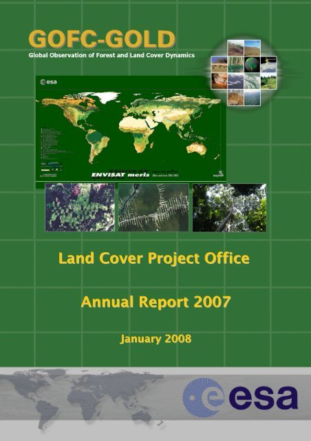
Land Cover Project Office Annual Report 2007 - GOFC-GOLD LC-IT ...
Land Cover Project Office Annual Report 2007 - GOFC-GOLD LC-IT ...
Land Cover Project Office Annual Report 2007 - GOFC-GOLD LC-IT ...

Create successful ePaper yourself
Turn your PDF publications into a flip-book with our unique Google optimized e-Paper software.
<strong>Land</strong> <strong>Cover</strong> <strong>Project</strong> <strong>Office</strong><strong>Annual</strong> <strong>Report</strong> <strong>2007</strong>January 2008
ESA <strong>GOFC</strong>-<strong>GOLD</strong> LAND COVER PROJECT OFFICE A<strong>GOFC</strong>NNUAL REPORT 2004ObservationsOverviewMappingMonitoringModelingIn its fourth year of operation, the <strong>GOFC</strong>-<strong>GOLD</strong> land cover projectoffice (<strong>LC</strong>-PO) was able to successfully fulfill the requirements andchallenges posed by the international community and ESA ascontracting agency. The project office has further evolved to anestablished international focal point for global and regional landcover observations, and is a key actor of <strong>GOFC</strong>-<strong>GOLD</strong>implementation towards operational land monitoring globally andon the European level. Such reliable environmental observationsare of crucial importance to understanding climate change and itsimpacts, to sustainable development, natural resourcesmanagement, conservation, biodiversity and understanding ofecosystems and biogeochemical cycling.<strong>GOFC</strong>-<strong>GOLD</strong> (Global Observation of Forest <strong>Cover</strong> - GlobalObservation of <strong>Land</strong> Dynamics) as technical panel of the GlobalTerrestrial Observing System (GTOS) provides the platform forinternational communication and cooperation for actors involvedin global Earth Observation including data producers (e.g. spaceagencies, land cover facilities), the scientific community, and datausers (FAO, UNEP, global modeling community etc.). Theseactivities improve the value of current and future land coverdatasets for a multitude of applications and contribute to theoverall goal of operational observations of the land surface.We would like to thank you andyour colleagues for your effortsover the last year in making anoperational <strong>GOFC</strong>-<strong>GOLD</strong> <strong>Land</strong><strong>Cover</strong> <strong>Office</strong> in Jena. Youractivities have made an importantcontribution in the internationalarena of land cover and relatedissues. In particular your supportto the activities of the Global <strong>Land</strong><strong>Cover</strong> Network (G<strong>LC</strong>N) and theGlobal terrestrial ObservingSystem (GTOS) are appreciated.Dr. John Latham, Executive Director ofthe Global Terrestrial ObservingSystem of the United NationsThe <strong>GOFC</strong>-<strong>GOLD</strong> land cover project office is providing aplatform to discuss and implement strategies for global andregional land cover harmonization and dataset interoperability(i.e. CORINE land cover, UN <strong>LC</strong>CS), land cover productdefinitions, applications and validation.Dr. Chris Steenmans, 2 European Environmental Agency (EEA)
<strong>Land</strong> <strong>Cover</strong> <strong>Project</strong> <strong>Office</strong> – <strong>Annual</strong> <strong>Report</strong> <strong>2007</strong>Contribution to international activities<strong>GOFC</strong>-<strong>GOLD</strong> land cover projectoffice involvementGroup on Earth Observation:Coordination of land cover tasks in theGEO work plan and participation in theCommunity of Practice for forestobservation.Integrated Global Observation of <strong>Land</strong>(IGOL): Evolution of a new and first landtheme of the Integrated GlobalObservation Strategy (IGOS).Global Climate Observing System:Implementing the UNFCCC plan forsystematic research and observationsof essential climate variables (ECV)including land cover and fire.United Nations Framework Conventionon Climate Change: Coordination of aspecial working group on forestmonitoring for reducing emissionsfrom deforestation (REDD).ESA-GLOBCOVER <strong>Project</strong>: Participationin ongoing global land cover mappingfor increasing detail, accuracy andusability of existing maps.Harmonization & Validation Initiative:Activities towards synergy andimproved usability of land coverproductsRegional networking and capacitybuilding: Hosting and organization of anumber of workshops and capacitybuilding events involving the <strong>GOFC</strong>-<strong>GOLD</strong> regional networks.Major achievements in <strong>2007</strong>• GEO <strong>2007</strong>-2009 workplan task (DA-07-02)on global land cover recognized as GEO earlysuccess story global land cover• Participation and contribution GEO ministerialsummit (poster display at venue, leadauthorship for land cover and fire chapters insummit publication)• <strong>GOFC</strong>-<strong>GOLD</strong> major contributor todevelopment of IGOL report• Presentation and approval of IGOL documentby IGOS plenary and GEO• Contribution to land cover tasks anddevelopment of reporting standards (GTOS,UNFCCC/SBSTA mandate)• Participation in UNFCCC-COP13 and SBSTA26/27, including <strong>LC</strong>-PO presentation onGTOS/FAO side event on ECV observationprogress• Coordination of working group to evolveinternationally agreed technical Earthobservation protocols for REDDimplementation• Organization of REDD workshops (Bolivia,April <strong>2007</strong>) & UNFCCC side events (May+Dec)• Delivery of draft technical sourcebook forREDD implementation at UNFCCC/COP 13 inBali• Contribution to GLOBCOVER legenddevelopment and validation framework• Coordinate user feedback on GLOBCOVERimage mosaics• Promotion of GLOBCOVER as contribution toGCOS implementation plan and GEO tasks• Translation, and comparison of several landcover legends• Refine implementation plan for an operationalvalidation strategy to develop a synergetic“best available” global land cover map• <strong>GOFC</strong>-<strong>GOLD</strong> science meetings (Boston,October <strong>2007</strong>) and capacity buildingworkshop with <strong>GOFC</strong>-<strong>GOLD</strong> regionalnetworks• Regional network engagement in globalvalidation exercises
Taking on theGEO challenges‣ <strong>GOFC</strong>-<strong>GOLD</strong> provides an operationalframework for land observations within GTOS.‣ The land domain is least advanced comparedto other fields of observation (ocean,atmosphere).‣ <strong>GOFC</strong>-<strong>GOLD</strong> provides a communication andcooperation platform between data producers,data users, and the science community tocooperatively improve observation, dataproducts definition, assimilation, anddissemination.‣ Implementation builds upon and enhancesestablished partnerships and observingsystems, and stable funding and staffing isessential for a comprehensive GEOSSimplementation.‣ Potential of international capacity building(linkage to <strong>GOFC</strong>-<strong>GOLD</strong> regional networks).GEO aims to achieve EarthObservation advances in ninespecific areas of socio-economicbenefit (see above for land cover).There are several commonlyrequired and used products amongthe nine societal benefit areas(Disasters, Health, Energy, Climate,Water, Weather, Ecosystems,Agriculture and Biodiversity). Allareas require land cover products.(GEO Implementation Plan, 2005)The <strong>GOFC</strong>-<strong>GOLD</strong> land cover office is leading the GEO taskon global land cover. The successful activities have beenrecognized as GEO early success stories and presented atthe ministerial summit through contributions in thesummit book (above) and poster presentations (left)4
<strong>Land</strong> <strong>Cover</strong> <strong>Project</strong> <strong>Office</strong> – <strong>Annual</strong> <strong>Report</strong> <strong>2007</strong>Tasks in the GEO <strong>2007</strong>-09 work planwhere the ESA <strong>LC</strong>-PO has taken thelead implementation role:DATA/ARCH<strong>IT</strong>ECTURE-07-02: Provide a suite ofglobal land cover datasets, initially based onimproved and validated moderate resolutionland cover maps and eventually including landcoverchange at high resolution.Global forest information from satellite:Differences in forest estimates in existingglobal land cover maps (top) limits theirusability. Percent tree canopy cover (bottom).AGRICULTURE-06-04: Initiate an internationalassessment effort on forests and forest changesutilizing ongoing land cover mapping projects(e.g. GLOBCOVER). Ensure application ofstandardized classifications and harmonizationof existing datasets.Concept of the GEOcommunity of practice forforest observationspresented at GEO IIIplenary in November 2006in Bonn, Germany5The table links the GEO areas of societal benefits with global land cover observation requirements
<strong>Land</strong> <strong>Cover</strong> <strong>Project</strong> <strong>Office</strong> – <strong>Annual</strong> <strong>Report</strong> <strong>2007</strong>European Space Agency SponsorshipLocation of the ESA<strong>GOFC</strong>-<strong>GOLD</strong> land coveroffice at the FSU Jena.The office is led by Prof.Christiane C. Schmullius,the Co-chair of the <strong>GOFC</strong>-<strong>GOLD</strong> <strong>Land</strong> <strong>Cover</strong>Implementation Team,and coordinated by Dr.Martin Herold.With the establishment of a <strong>GOFC</strong>-<strong>GOLD</strong> land coverproject office at the Friedrich Schiller University Jena,Germany, the European Space Agency has taken responsibilityto participate and contribute to the internationalcooperation and communication to coordinateand improve global observations of land. The <strong>Land</strong> <strong>Cover</strong> <strong>Project</strong> <strong>Office</strong> (PO)helps to strengthen the <strong>GOFC</strong>-<strong>GOLD</strong> framework, to coordinate, promote and fulfil the<strong>GOFC</strong>-<strong>GOLD</strong> <strong>Land</strong> <strong>Cover</strong> implementation plan, and to support the European SpaceAgency and related projects and services. ESA has invested K€ 240 over a 3 yearperiod (2004-2006) and is investing K€ 200 to support the <strong>LC</strong>-PO. In conjunction withthe extensive ENVISAT data acquisitions and several regional and global mappingactivities (e.g. GLOBCOVER), ESA has strengthened its position in coordination of landobservations and extended their activities for an improved match between dataproducts and user needs.The ESA <strong>LC</strong>-PO office is led by Prof. Christiane Schmullius, the Co-chair of the <strong>GOFC</strong>-<strong>GOLD</strong> <strong>Land</strong> <strong>Cover</strong> Implementation Team (<strong>LC</strong>-<strong>IT</strong>) jointly with Curtis Woodcock fromBoston University. The <strong>Project</strong> <strong>Office</strong> is located at the Department of Geoinformaticsof the Friedrich Schiller University in Jena, Germany. The management, coordinationand execution of the <strong>GOFC</strong>-<strong>GOLD</strong> activities close cooperation with the <strong>GOFC</strong>-<strong>GOLD</strong>chairsTony Janetos and Philippe Mayaux, as well as, the <strong>GOFC</strong>-<strong>GOLD</strong> executive officein Edmonton, Canada led by Michael Brady.Despite fostering the implementation of <strong>GOFC</strong>-<strong>GOLD</strong> objectives, a major objective ofthe PO is to support ESA in the coordination of land cover harmonization andvalidation activities focused on the development of a user information service for thereporting and exchange of validation results and information relating to theoperational activities of satellite platforms and data delivery (GLOBCARBON andGLOBCOVER projects).6
<strong>Land</strong> <strong>Cover</strong> <strong>Project</strong> <strong>Office</strong> – <strong>Annual</strong> <strong>Report</strong> <strong>2007</strong>Key activities and achievements‣ State of the art in global land cover assessment• Summarize published materials and datasets accessible through the <strong>LC</strong>-PO website• Documentation on land cover algorithms, change routines, data products, in situ facilities‣ Strategies for land cover harmonization and dataset interoperability• Review of previous land cover harmonization approaches including advocating the UN <strong>Land</strong><strong>Cover</strong> Classification System as common ground for land characterization• Translation, and comparison of several land cover legends• Development of strategic documents for land cover harmonization activities‣ Global land cover validation strategies• Strong cooperation with CEOS Cal-Val group on development of validation standards• Participation in validation activities (GLOBCOVER) and comparative accuracy assessment ofexisting global datasets using existing reference information (scientific publication)• Outline implementation plan for an operational validation strategy to assess the accuracyof existing and future global land cover products and foster their interoperability/synergy‣ <strong>Land</strong> cover map product applications• Develop advanced and refined global land cover maps for global process modeling• Dataset synergy for coarse scale land change analysis and long term trends‣ Completion and approval of IGOS-P “land theme”• <strong>GOFC</strong>-<strong>GOLD</strong> major contributor to develop “Integrated Global Observations for <strong>Land</strong>” (IGOL)• Approval of IGOL by IGOS plenary and GEO‣ Support development of GLOBCOVER• Comparative assessment of G<strong>LC</strong>2000 and CORINE for flexible development of GLOBCOVER• Contribution to GLOBCOVER legend development and validation framework• Promotion of GLOBCOVER as contribution to GCOS implementation plan and GEO tasks‣ Participation in GEO process• <strong>LC</strong>-PO acts as point of contact for global land cover (DA-07-02) and forest monitoring (AG-06-04) tasks in the GEO <strong>2007</strong>-2009 workplan activities• Participation in GEO meetings and contribution to <strong>2007</strong> GEO ministerial summit (posterdisplay at venue, lead authorship for land cover and fire chapters in summit publication)‣ Earth observation to support UN conventions and GCOS implementation plan• Active contribution for land cover task described in the GCOS implementation plan• Participation in delegations to UNFCCC-COP13 and SBSTA 26/27 (Side events)‣ UNFCCC support on Reducing emissions from deforestation:• Coordination of <strong>GOFC</strong>-<strong>GOLD</strong> working group to evolve internationally agreed technicalprotocols for using Earth observation in monitoring avoided tropical deforestation• Organization of REDD workshops (Bolivia, April <strong>2007</strong>) and UNFCCC side events (2)• Delivery of draft technical sourcebook for REDD implementation at UNFCCC/COP 13 in Bali‣ Participation in key events to foster international cooperation• <strong>GOFC</strong>-<strong>GOLD</strong> science meetings and capacity building• Contacts and communications with <strong>GOFC</strong>-<strong>GOLD</strong> regional networks• Participation in meetings and workshops on: GLOBCOVER meetings, UNFCCC, GTOS, IGOS-IGOL, GEOLAND, DLR, scientific conferences‣ Documentation, publication, and outreach:• 12 deliverables submitted to ESA• Maintenance of webpage and development and distribution of four <strong>GOFC</strong>-<strong>GOLD</strong> newsletters• Contribution to <strong>GOFC</strong>-<strong>GOLD</strong> report series (2 published)• Scientific publications (3 peer-reviewed papers 7 published, 1 accepted, 2 submitted)
<strong>Land</strong> <strong>Cover</strong> <strong>Project</strong> <strong>Office</strong> – <strong>Annual</strong> <strong>Report</strong> <strong>2007</strong>How to make landobservations operationaland useful to multifacetedapplications?The Challenge:‣ Growing need for detailed and accurateinformation about land cover and landcover change on all geographic scales‣ Need to move from research to operationalmonitoring capabilities for land cover‣ Need for operational data and productsuites, better defined, flexible, and openlyavailable<strong>GOFC</strong>-<strong>GOLD</strong> –A platform for an internationalpartnership of data producers, thescience community, and usersThe <strong>GOFC</strong>-<strong>GOLD</strong> Approach:‣ Improved match between observations,data products and user needs‣ Support of coordination mechanisms forland surface observations‣ Establish international standards andprotocols especially with respect toharmonization and validation‣ Improve adequacy and advocacy of landcover products based on userrequirements‣ Maintain <strong>GOFC</strong>-<strong>GOLD</strong> regional networks‣ Work towards continuity and consistencyof land cover observations‣ Implement coordinated research,demonstration and operational projects‣ Support to share data, information andknowledge8As shown above, a multitude of global forestinformation from satellite observations areavailable. The <strong>GOFC</strong>-<strong>GOLD</strong> challenge is toensure they are flexible, comparable, andavailable to satisfy the needs of a large usercommunity.
<strong>Land</strong> <strong>Cover</strong> <strong>Project</strong> <strong>Office</strong> – <strong>Annual</strong> <strong>Report</strong> <strong>2007</strong>Involving a global network of partnersParticipants at the 2 nd <strong>GOFC</strong>-<strong>GOLD</strong> Workshop on Tropical deforestation, organized by the <strong>LC</strong>-PO inApril <strong>2007</strong>, in St. Cruz, BoliviaLack of harmonization and validation hinders theflexibility and usability of land cover datasets; inparticular considering the large number of users andapplications including the analysis of land changes.The <strong>GOFC</strong>-<strong>GOLD</strong> PO has fostered the harmonizationand standardized development of land cover datasetsincluding the use of the UN <strong>Land</strong> <strong>Cover</strong> ClassificationSystem (<strong>LC</strong>CS), legend translations, and datasetharmonization. <strong>GOFC</strong>-<strong>GOLD</strong> has contributed to thedevelopment and dissemination of standard validationprotocols and frameworks for their operationalimplementation.For example, in <strong>2007</strong> the <strong>LC</strong>-PO has contributed to<strong>LC</strong>CS capacity building, completed a thoroughtranslation of the European CORINE land cover legend.The results have been presented and discussed duringa targeted tutorial workshop. Together with the CEOSCal-Val working group the <strong>LC</strong>-PO has released aconsensus technical document for global land covervalidation.Standards for landcover harmonizationand validation
<strong>Land</strong> <strong>Cover</strong> <strong>Project</strong> <strong>Office</strong> – <strong>Annual</strong> <strong>Report</strong> <strong>2007</strong>Activities to support UN Conventions<strong>GOFC</strong>-<strong>GOLD</strong> activities are guided and outlined inseveral international agreements and UN conventions.In the GCOS implementation plan to the UNFCCCcalls for <strong>GOFC</strong>-<strong>GOLD</strong> support with respect to landcover observations and reporting standards.Major activities of <strong>LC</strong>-PO in <strong>2007</strong> have been dedicatedto the issue of reducing GHG emissions fromdeforestation in developing countries. Internationalnegotiations are currently underway within theUNFCCC to build incentives for developing countriesto avoid deforestation. A key issue is the technicalfeasibility of determining historical deforestation ratesand monitoring future land change that would enabletropical countries to obtain carbon credits forreducing deforestation.Together with GTOS,the <strong>LC</strong>-PO haspresented first draftreporting standardsfor the ECV’s duringa side event atUNFCCC/COP 13 inBali.<strong>GOFC</strong>-<strong>GOLD</strong> has established a working group toassess satellite observation capabilities and developconsensus technical guidelines for operationalimplementation of such policy in the post 2012period. A related technical sourcebook draft has beendeveloped (see to the right). The report was presentedto the UNFCCC COP 13 in Bali and the adjacent CIFORforest day and has been well recognized in the policydiscussion process.Consensus technical document formonitoring carbon emissions fromdeforestation from space prepared by<strong>GOFC</strong>-<strong>GOLD</strong> working group as input toUNFCCC negotiations and to supportREDD implementation activities10This timeline shows theongoing contribution andcommitment of the <strong>GOFC</strong>-<strong>GOLD</strong> PO to support theUNFCCC REDD process.Since 2005, the PO hasorganized workshops, andpublished dedicatedtechnical reports that havebeen communicated to theUNFCCC negotiations andimplementation actorsthrough GTOSsubmissions and sideevents. In <strong>2007</strong>, joint sideevents with ESA were heldat UNFCCC/SBSTA 26 and27 and at the CIFOR forestday adjacent to the COP13in Bali.
<strong>Land</strong> <strong>Cover</strong> <strong>Project</strong> <strong>Office</strong> – <strong>Annual</strong> <strong>Report</strong> <strong>2007</strong><strong>Land</strong> cover data to study global changeHot spots of forest change 1980-2000 derived as part of a jointIGBP LUCC and <strong>GOFC</strong>-<strong>GOLD</strong>activity. The dataset emphasizesthe aggregated information offorest cover change indicatorsfrom a synergy for differentregional and global datasets.Source: Lepers, E., E.F. Lambin, A.C.Janetos, R. DeFries, F. Achard, N.Ramankutty and R.J. Scholes (2005). Asynthesis of information on rapid landcoverchange for the period 1981-2000.BioScience, 55 (2), 115-124Relationship between positive temperature anomalies andthe trends in vegetation growth for spring periods 1998-2005 in Northern Eurasia based on SPOT VGT data.Synergy dataset of existingglobal land cover maps forcarbon cycle modeling toprovide best estimate for landcover characteristics. Leafattributes of trees are notshown for reasons of visibilitybut are defined for each class.(Source: Jung, M., Henkel, K., Herold,M., and G. Churkina (2006).Exploiting synergies of global landcover products for carbon cyclemodeling, Remote Sensing ofEnvironment, 101, 4, 534-553.).11
<strong>Land</strong> <strong>Cover</strong> <strong>Project</strong> <strong>Office</strong> – <strong>Annual</strong> <strong>Report</strong> <strong>2007</strong>Supporting ESA land cover initiativesThe <strong>LC</strong>-PO is providing user feedback on releasedGLOBCOVER products. In this case, the assessmentof global bi-monthly MERIS image mosaics throughregional land cover mapping and monitoringprograms (ESA Acquifer working in Africa)The GLOBCOVER project, launched in2004, is an ESA initiative led by aninternational network of partners, inparticular ESA, FAO, UNEP, JRC, IGBPand <strong>GOFC</strong>-<strong>GOLD</strong>. The objective is toproduce a global land-cover map forthe year 2005, using fine resolution(300 m) ENVISAT-MERIS data acquiredover the full year 2005 and parts of2006. This new product is intendedto update and to complement otherexisting comparable global products,such as the global land cover map forthe year 2000 with 1 km resolution.The GLOBCOVER project provides an opportunity to implement the <strong>GOFC</strong>-<strong>GOLD</strong> objectives forharmonized and validated land cover mapping and the <strong>LC</strong>-PO plays an active role in thecoordination and development of the products. It participates at project meetings and assiststhe ESA in GLOBCOVER legend development, validation and user assessment. The <strong>LC</strong>-POcompleted a comparative assessment of G<strong>LC</strong>2000 and CORINE2000, and providedcoordinated user feedback for released GLOBCOVER image and map products.The first GLOBCOVER land cover classification based on ENVISAT MERIS data was presented with<strong>GOFC</strong>-<strong>GOLD</strong> PO support at UNFCCC/COP 13 in Bali 12 during the ESA side event and at a display booth
<strong>Land</strong> <strong>Cover</strong> <strong>Project</strong> <strong>Office</strong> – <strong>Annual</strong> <strong>Report</strong> <strong>2007</strong>Presentation, publications and outreachThe <strong>LC</strong>-PO is continuously producingdocumentations and outreach materials.Several reports, newsletters, and scientificpapers have been produced, edited,released and circulated.The quarterly newsletter is distributed to acomprehensive list of actors involved inglobal land cover assessment trough<strong>GOFC</strong>-<strong>GOLD</strong> and GTOS.The <strong>GOFC</strong>-<strong>GOLD</strong> <strong>LC</strong>-PO webpage containsa variety of services to users includingdocumentation on access to global andregional land cover map products and insituobservations.Quarterly NewsletterWeb Pagehttp://gofc-gold.uni-jena.deWith documentation on global, regional and nationalland cover data setsWorkshop reports and deliverables have beensubmitted to ESA. They include status reports,documentation of implementation strategies forharmonization and validation, and results fromprototype studies. The <strong>LC</strong>-PO has contributed tothe <strong>GOFC</strong>-<strong>GOLD</strong> report series, in particularreports summarizing the results of the REDDWorkshop in Bolivia. Further input anddocumentation was provided to UNFCCC COP 12and GEO. The <strong>LC</strong>-PO has completed severalscientific publications in the peer-reviewedliterature.<strong>GOFC</strong>-<strong>GOLD</strong><strong>Report</strong> SeriesThe PO office contributed to publicationsreporting on progress in internationalinitiatives, e.g. the GEO publication on“GEO Early achievements” and a GTOSsupplement issue on Essential ClimateVariables.<strong>GOFC</strong>-<strong>GOLD</strong>-31:<strong>Report</strong> of the <strong>GOFC</strong>-<strong>GOLD</strong> Workshopon the Proposed East Asia RegionalNetwork, 9 June 2006,Ulaanbaatar/Mongolia<strong>GOFC</strong>-<strong>GOLD</strong>-30:<strong>Report</strong> of the 2nd <strong>GOFC</strong>-<strong>GOLD</strong>Workshop on Reducing Emissionsfrom Deforestation, 17-19 April <strong>2007</strong>,Santa Cruz/Bolivia
<strong>Land</strong> <strong>Cover</strong> <strong>Project</strong> <strong>Office</strong> – <strong>Annual</strong> <strong>Report</strong> <strong>2007</strong>Workshops and travelThe <strong>LC</strong>-PO director and officer have organized,contributed and participated in several workshops andmeetings to foster international cooperation andcommunication. Most prominently, the <strong>LC</strong>-PO hasorganized a 4-day <strong>GOFC</strong>-<strong>GOLD</strong> Workshop in Bolivia onmonitoring tropical deforestation and organized sideevents at UNFCCC SBSTA and COP-13 in Bali (incooperation with its partners). The PO participated atGLOBCOVER progress meetings and attendedinternational conferences.Side Event atUNFCCC COP 13Side Event at UNFCCC SBSTAWorkshops organized by <strong>GOFC</strong>-<strong>GOLD</strong>Date Destination WorkshopApr 07St. Cruz, Bolivia2 nd <strong>GOFC</strong>-<strong>GOLD</strong> Workshop of the REDDWorking group: From case studies toimplementation guidelinesFinancial overviewMay 07 Bonn, GermanyJoint ESA & <strong>GOFC</strong>-<strong>GOLD</strong> side event atUNFCCC SBSTA 26Nov 07 Boston, USA <strong>Land</strong> <strong>Cover</strong> Implementation Team MeetingDec 07 Bali, IndonesiaJoint Winrock International & <strong>GOFC</strong>-<strong>GOLD</strong>side event at UNFCCC COP 13: REDDpreparedness: a sourcebook for highquality and cost effective estimationDec 07 Bali, Indonesia <strong>GOFC</strong>-<strong>GOLD</strong> side event at CIFOR Forest DayParticipation and contribution to ConferencesJan 07 Brussels, Belgium EU Workshop Framework Programme 7Feb 07Geneva,GEO User Interface Committee and FCPSwitzerland meetingsFeb 07 Toulouse, France GLOBCOVER Progress MeetingFeb 07Noordwijk, 2nd Space & Society Conference “SpaceNetherlands Options for the 21st century”Apr 07 Washington, USANASA land cover and land use changescience team meetingApr 07 Washington, USA GEO Global <strong>Land</strong> <strong>Cover</strong> Task MeetingApr 07Montreux,SwitzerlandESA ENVISAT SymposiumMay 07 Munich, Germany GSE Forest Monitoring validation workshopJun 07Offenbach,Germany5th German National GCOS MeetingJun 07Basel/Muttenz, Joint <strong>Annual</strong> Conference of Swiss, GermanSwitzerland and Austrian Remote Sensing OrganizationsJun 07 Ispra, Italy 1st Glob<strong>Cover</strong> User Consultation MeetingSep 07 Frascati, ItalyGlobModel Workshop: “Strenghtening theUse of EO in Earth System Modelling”Dec 07Cape Town,South AfricaGEO Ministerial Meeting and PlenaryThe <strong>GOFC</strong>-<strong>GOLD</strong> <strong>LC</strong>-PO is operated throughESA’s Technical <strong>Office</strong>r Olivier Arino under ESAESRIN contract. All expenses have beendocumented in Quarterly Status <strong>Report</strong>s andsubmitted to the ESA technical officer. Aftersuccessful completion of the first three years,ESA agreed for a contract extension untilJanuary 2010.Financial summary <strong>2007</strong>Revenues: K €ESA sponsorship80.0Additional funding6.3Carry over 20068.4TOTAL 94.7Expenses: K €Personnel costs‣ PO executive officer/staff53.8‣ Student support staff6.8Travel and subsistence‣ PO director and officer21.2‣ Workshop subsistence1.0Consumables‣ Printing/communication cost2.0‣ Publications/Brochures/other0.6TOTAL 85.4Carry over for <strong>2007</strong>* 9.3* Carry over contains travel support for additional intercontinentalmissions of PO director and officer in 2008. Inaddition the <strong>LC</strong>-PO is receiving less funding support for2008 and 2009 and the carry over will be used to balancethe reduced resources.
<strong>Land</strong> <strong>Cover</strong> <strong>Project</strong> <strong>Office</strong> – <strong>Annual</strong> <strong>Report</strong> <strong>2007</strong>Activities and objectives for 2008Building upon the four successful years of <strong>LC</strong>-PO operation, the <strong>LC</strong>-PO will continue to act as focal pointfor global and regional land cover observations, and as such provide an international interface assistingdata producers and land cover mapping programs, and user organizations. Despite progress made, thearena of land cover observations still remains heterogeneous. One of the key general roles of the <strong>LC</strong>-POis to coordinate and moderate among the different land cover observation actors. Key activities toachieve progress for international coordination and cooperation in particular to evolve commonground for land cover monitoring are:• <strong>Land</strong> cover harmonization and assistance for standardized mapping• Ensure implementation of agreed validation protocols• Capacity building in particular for developing countries• Encourage free and open data assimilation and dissemination mechanisms for satellite and in-situdata, and land cover mapping productsSeveral international activities on the political and strategic level have asked for <strong>GOFC</strong>-<strong>GOLD</strong> input todefine implementation objectives and priorities. In this context, the <strong>LC</strong>-PO work plan for the next yearsincludes to foster implementation of the tasks outlined in Integrated Global Observations for <strong>Land</strong>(IGOL), to support the UNFCCC REDD activities and GCOS implementation plan by evolving standardsfor essential climate variables in the terrestrial domain and continue to contribute to the GEO processconcerning forest and land cover observations.Following these objectives in <strong>2007</strong>, the <strong>LC</strong>-PO will further contribute to several ongoing land covermapping projects (e.g. using ENVISAT MERIS data). Most prominently, the <strong>LC</strong>-PO will further assist ESA inthe development of the GLOBCOVER products with focus on harmonization, validation and the userassessment. The <strong>LC</strong>-PO will build up a user interface to establish communication to the users of theproducts and to receive and assess their feedback. Another main activity will be the issue of tropicaldeforestation and the UNFCCC REDD process. The <strong>LC</strong>-PO will continue in coordinating the related <strong>GOFC</strong>-<strong>GOLD</strong> Working Group, and provide an updated draft of input to the UNFCCC to inform policy discussionand foster implementation activities and pilot studies. In the framework of the GEO <strong>2007</strong>-2009 WorkingPlan the <strong>LC</strong>-PO will further its leading role for the global land cover task and be actively involved in forestmonitoring activities, as such it will assist in the FAO-FRA 2010 assist remote sensing component. Allthese activities will be in accordance and in joint activities with ongoing international developments onthe strategic level including cooperation with GTOS, other <strong>GOFC</strong>-<strong>GOLD</strong> implementation activities, theGCOS implementation plan, and the UN Global <strong>Land</strong> <strong>Cover</strong> Network and user requirements.Established cooperation and communication with user agencies like FAO, UNEP, the EuropeanEnvironmental Agency (EEA), Canadian Forest Service and considering requirements posed byinternational conventions and treaties will be strengthened to improve adequacy and advocacy of landcover data sets. Building capacities and confidence will be pursued within <strong>GOFC</strong>-<strong>GOLD</strong> (regionalnetworks), the scientific community and with different user organizations. The following workshops andmissions will be organized and attended from <strong>LC</strong>-PO members:Time Destination Purpose and objectiveMar 2008 Rome, Italy FAO-FRA 2010 global remote sensing survey kick-off meetingMar 2008 Rome, Italy Participation in 2 nd GLOBCOVER user consultationMar 2008 Bochum, Germany EaRSEL developing countries special interest group meetingApr 2008 Vienna, Austria Participation in EGU general assemblyMay 2008 Vienna, Austria Participation in Global <strong>Land</strong> Use data workshopMay 2008 Helsinki, Finnland <strong>GOFC</strong>-<strong>GOLD</strong> Scientific and Technical Board meetingJun 2008 Bonn, Germany Side Event on the REDD sourcebook at the UNFCCC SBSTA 28Oct 2008Jena, Germany2nd <strong>GOFC</strong>-<strong>GOLD</strong> land cover symposium and science teammeetingDec 2008 Poznan, Poland Participation in UNFCCC COP 14All progress and developments will be documented and communicated through presentations andreports to ESA, <strong>GOFC</strong>-<strong>GOLD</strong> and the public through the 15 <strong>LC</strong>-PO Newsletter and reports.
<strong>Land</strong> <strong>Cover</strong> <strong>Project</strong> <strong>Office</strong> – <strong>Annual</strong> <strong>Report</strong> <strong>2007</strong>More information and contactMore information and documentation about <strong>GOFC</strong>-<strong>GOLD</strong>, GTOS, and the <strong>LC</strong>-PO activities can be foundon the following web pages:ESA:http://www.esa.int/ESA Data User Element:http://dup.esrin.esa.it/GTOS:http://www.fao.org/gtos/<strong>GOFC</strong>-<strong>GOLD</strong>:http://www.fao.org/gtos/gofc-gold/<strong>GOFC</strong>-<strong>GOLD</strong> land cover project office:http://www.gofc-gold.uni-jena.de/<strong>GOFC</strong>-<strong>GOLD</strong> report series:http://www.fao.org/gtos/gofc-gold/series.html<strong>Land</strong> cover implementation team newsletter (sign up and information):http://www.gofc-gold.uni-jena.de/sites/letter.htmlIGOS-P:http://ioc.unesco.org/igospartnersCEOS group on calibration and validation for land:http://landval.gsfc.nasa.gov/LPVS/Prepared and published by the international <strong>GOFC</strong>-<strong>GOLD</strong> <strong>Land</strong> <strong>Cover</strong> <strong>Project</strong> <strong>Office</strong>Dr. Martin Herold, Prof. Dr. Christiana SchmulliusDepartment of Geography / GeoinformaticsFriedrich-Schiller-UniversityLoebdergraben 3207743 Jena, GERMANYPhone: +49 (3641) 948887Fax: +49 (3641) 948882E-mail: m.h@uni-jena.de, c.schmullius@uni-jena.dehttp://www.gofc-gold.uni-jena.de/16