
You also want an ePaper? Increase the reach of your titles
YUMPU automatically turns print PDFs into web optimized ePapers that Google loves.
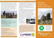
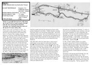
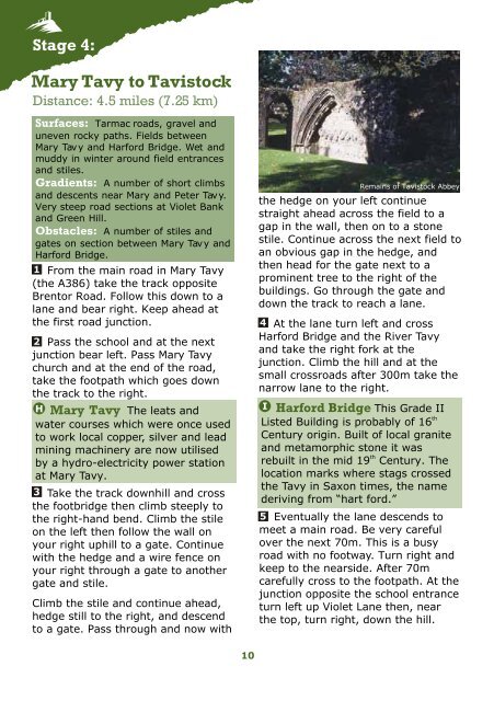
Stage 4:Mary Tavy to TavistockDistance: 4.5 miles (7.25 km)Surfaces: Tarmac roads, gravel anduneven rocky paths. Fields betweenMary Tavy and Harford Bridge. Wet andmuddy in winter around field entrancesand stiles.Gradients: A number of short climbsand descents near Mary and Peter Tavy.Very steep road sections at Violet Bankand Green Hill.Obstacles: A number of stiles andgates on section between Mary Tavy andHarford Bridge.1 From the main road in Mary Tavy(the A386) take the track oppositeBrentor Road. Follow this down to alane and bear right. Keep ahead atthe first road junction.2 Pass the school and at the nextjunction bear left. Pass Mary Tavychurch and at the end of the road,take the footpath which goes downthe track to the right.H Mary Tavy The leats andwater courses which were once usedto work local copper, silver and leadmining machinery are now utilisedby a hydro-electricity power stationat Mary Tavy.3 Take the track downhill and crossthe footbridge then climb steeply tothe right-hand bend. Climb the stileon the left then follow the wall onyour right uphill to a gate. Continuewith the hedge and a wire fence onyour right through a gate to anothergate and stile.Climb the stile and continue ahead,hedge still to the right, and descendto a gate. Pass through and now withRemains of Tavistock Abbeythe hedge on your left continuestraight ahead across the field to agap in the wall, then on to a stonestile. Continue across the next field toan obvious gap in the hedge, andthen head for the gate next to aprominent tree to the right of thebuildings. Go through the gate anddown the track to reach a lane.4 At the lane turn left and crossHarford Bridge and the River Tavyand take the right fork at thejunction. Climb the hill and at thesmall crossroads after 300m take thenarrow lane to the right.I Harford Bridge This Grade IIthListed Building is probably of 16Century origin. Built of local graniteand metamorphic stone it wasthrebuilt in the mid 19 Century. Thelocation marks where stags crossedthe Tavy in Saxon times, the namederiving from “hart ford.”5 Eventually the lane descends tomeet a main road. Be very carefulover the next 70m. This is a busyroad with no footway. Turn right andkeep to the nearside. After 70mcarefully cross to the footpath. At thejunction opposite the school entranceturn left up Violet Lane then, nearthe top, turn right, down the hill.10