EPA Region 10 Mercury Strategy Framework - Environmental ...
EPA Region 10 Mercury Strategy Framework - Environmental ...
EPA Region 10 Mercury Strategy Framework - Environmental ...
- No tags were found...

You also want an ePaper? Increase the reach of your titles
YUMPU automatically turns print PDFs into web optimized ePapers that Google loves.
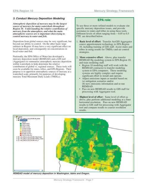
<strong>EPA</strong> <strong>Region</strong> <strong>10</strong>3. Conduct <strong>Mercury</strong> Deposition ModelingAtmospheric deposition of mercury may be the largestsource of mercury for many watersheds throughout<strong>Region</strong> <strong>10</strong>. Understanding the relative contribution ofmercury from the atmosphere, and what the mainatmospheric sources are is important when trying tocontrol mercury in water and fish.Deposition from global sources may be very significant, butbeyond our ability to control. On the other hand, largeemitters in <strong>Region</strong> <strong>10</strong> may have a very significant effect onlocal deposition, and consequently on concentrations inlocal water and fish.Nationally, the <strong>EPA</strong> Office of Water has developed amercury deposition model (REMSAD) and a GIS tool(Aggregator) to summarize atmospheric mercury depositionwithin watersheds to help determine the relativecontribution of global vs. regional sources. These tools willsoon be available for states, tribes, and <strong>EPA</strong> <strong>Region</strong>s. Theirpurpose is to apportion atmospheric sources of mercury at awatershed scale, primarily for purposes of developingmercury Total Maximum Daily Loads (TMDLs).<strong>Mercury</strong> <strong>Strategy</strong> <strong>Framework</strong><strong>EPA</strong> role:To use these or more refined models to evaluate sitespecific mercury deposition issues, and provideassistance to states and tribes in using these tools.Different levels of effort ranging from ~ 0.05 to 0.5FTE are described below.1. Basic level of effort: Transfer ArcGIS Aggregatorsource apportionment technology to <strong>EPA</strong> <strong>Region</strong><strong>10</strong>, including training of GIS staff. Assist states andtribes in using results for TMDLs and air controlstrategies.2. More extensive effort: Above, plus transferREMSAD Hg modeling system to <strong>EPA</strong> <strong>Region</strong> <strong>10</strong>,and train modeling staff.• <strong>Region</strong> <strong>10</strong> modeling staff will work with theREMSAD contractor to transfer modelingsystem to <strong>EPA</strong> computers. These modelingsystems are highly complex and requiresignificant effort to install and operate.• Adjust emissions inputs as needed based on:(a) mitigation scenarios and/or(b) new emissions information and re-runREMSAD.• Pass on new REMSAD results to GIS staff forprocessing with Aggregator tool.3. Highest level of effort: Same level of effort asabove, plus perform additional modeling at a finerhorizontal resolution. Pass on new REMSADresults to GIS staff for processing with Aggregatortool and compare results to coarser resolutionresults.REMSAD model of mercury deposition in Washington, Idaho and Oregon.<strong>Mercury</strong> <strong>Strategy</strong> <strong>Framework</strong> - Page 7