Comprehensive Plan - Carbondale, IL
Comprehensive Plan - Carbondale, IL
Comprehensive Plan - Carbondale, IL
- No tags were found...

You also want an ePaper? Increase the reach of your titles
YUMPU automatically turns print PDFs into web optimized ePapers that Google loves.
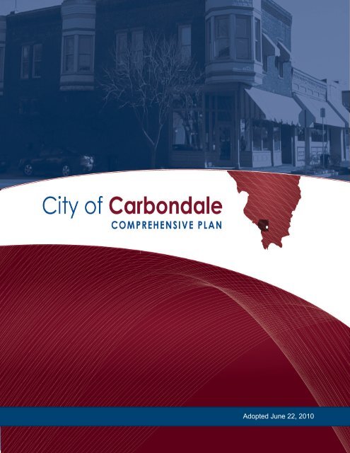
Adopted June 22, 2010
Adopted June 22, 2010Table of ContentsChapter 1, Community OverviewIntroduction................................................................................................................. 1.1<strong>Carbondale</strong> in Context – Yesterday, Today, and Tomorrow................... 1.2Where is <strong>Carbondale</strong>’s population heading?.......................................................... 1.3Emerging Themes Related to Future Population Growth..................... 1.5<strong>Plan</strong>ning Context........................................................................................................ 1.8What is the Purpose of the <strong>Comprehensive</strong> <strong>Plan</strong>?.................................. 1.8How to Use This <strong>Plan</strong>.................................................................................. 1.8Citizen Involvement - “Early and Often”.............................................. 1.10Building Upon Past <strong>Plan</strong>ning Efforts...................................................... 1.13A Vision for <strong>Carbondale</strong>............................................................................ 1.15An Overview of the <strong>Comprehensive</strong> <strong>Plan</strong> Topics................................. 1.16<strong>Comprehensive</strong> <strong>Plan</strong>Chapter 2, Land Use Character and Community GrowthIntroduction................................................................................................................. 2.1Purpose........................................................................................................................ 2.2Existing Conditions.................................................................................................... 2.3The Natural Environment........................................................................... 2.3Land Use and Community Character....................................................... 2.5Existing Land Use Inventory...................................................................... 2.7Water and Wastewater Utilities.................................................................. 2.8Parks and Recreation................................................................................. 2.10<strong>Plan</strong> Focus Areas and Strategic Recommendations............................................. 2.14Focus Area 2.1 – Managing Future Growth........................................... 2.14Focus Area 2.2 – Quality, Sustainable Development............................. 2.19Focus Area 2.3 – Downtown Renaissance.............................................. 2.25Focus Area 2.4 – Preserving Community Heritage............................... 2.32Focus Area 2.5 – Enhanced Community Character............................... 2.36Future Land Use and Urban Design: <strong>Plan</strong> and Policies...................................... 2.40<strong>Carbondale</strong> Future Land Use <strong>Plan</strong>.......................................................... 2.40Implementation: Prudent Use of Developmental Regulations.......................... 2.40Chapter 3, Community MobilityIntroduction................................................................................................................. 3.1Purpose........................................................................................................................ 3.2Existing Conditions.................................................................................................... 3.3Pedestrian and Bicyclist Connections........................................................ 3.3Existing Street Network and Connectivity............................................... 3.5Existing Street Hierarchy............................................................................ 3.6Existing Public Transit Service................................................................... 3.7T.1Table of Contents
Adopted June 22, 2010City of <strong>Carbondale</strong><strong>Plan</strong> Focus Areas and Strategic Recommendations............................................... 3.8Focus Area 3.1 – Improving Mobility........................................................ 3.8Focus Area 3.2 – Enhancing the Street Environs................................... 3.12Focus Area 3.3 – Becoming a Walkable & Bikeable Community........ 3.18Focus Area 3.4 – Enhancing Public Transit Services............................. 3.21Future Thoroughfares: <strong>Plan</strong> and Policies.............................................................. 3.24<strong>Carbondale</strong> Thoroughfare <strong>Plan</strong>................................................................ 3.24Chapter 4, Housing & NeighborhoodsIntroduction................................................................................................................. 4.1Purpose........................................................................................................................ 4.2Summary of Housing Needs, Conditions, and Programs.................................... 4.3<strong>Plan</strong> Focus Areas and Strategic Recommendations............................................... 4.6Focus Area 4.1 – Rehabilitating Existing Housing Stock........................ 4.6Focus Area 4.2 – Defending Neighborhood Integrity in ExistingNeighborhoods........................................................................................... 4.10Focus Area 4.3 – Ensuring Affordable and Sufficient HousingOptions in the Future................................................................................. 4.13Focus Area 4.4 – Designing Neighborhoods and Communitiesas Special Places.......................................................................................... 4.18Existing City of <strong>Carbondale</strong> Housing Programs................................................. 4.19T.2Chapter 5, Economic DevelopmentIntroduction................................................................................................................. 5.1Purpose........................................................................................................................ 5.2Recent and Current Economic Efforts..................................................................... 5.5<strong>Plan</strong> Focus Areas and Strategic Recommendations............................................... 5.7Focus Area 5.1 – Maximize and Leverage the Resources of SIUto Expand and Enhance Economic Growth of <strong>Carbondale</strong>and the Region.............................................................................................. 5.7Focus Area 5.2 – Maximize the Potential of Southern IllinoisHealthcare and Memorial Hospital of <strong>Carbondale</strong> as an EconomicDevelopment Tool...................................................................................... 5.10Focus Area 5.3 – Develop and Expand the Retail Sales Tax Base andContinue to Build on <strong>Carbondale</strong> as a Regional Center for Retailand Business................................................................................................ 5.12Focus Area 5.4 – Revitalize Downtown and Connect the City’sMajor Downtown Institutions.................................................................. 5.13Focus Area 5.5 – Expand and Customize the Use of EconomicDevelopment Tools and Improve the Business Friendlinessof the City.................................................................................................... 5.16Focus Area 5.6 – Bolster Entrepreneurial Activity in the City............. 5.19Table of Contents
Adopted June 22, 2010Focus Area 5.7 – Demonstrate and Exert Leadership in RegionalEconomic Development Efforts and Refocus Initiatives toAccentuate the Attributes that Region has to Offer.............................. 5.21Focus Area 5.8 – Use the Draw of the Shawnee Hills WineTrail, Shawnee National Forest and Other Attractionsas a Tool for Economic Development Through Ecotourismand Outdoor Recreation............................................................................ 5.23Chapter 6, ImplementationIntroduction................................................................................................................. 6.1Purpose........................................................................................................................ 6.2<strong>Plan</strong> Implementation Methods................................................................................. 6.2Policy-Based Decisions................................................................................ 6.2Land Development Regulations and Engineering Standards............... 6.3Capital Improvements Programming....................................................... 6.3Specific <strong>Plan</strong>s and Studies........................................................................... 6.3Special Projects, Programs and Initiatives................................................ 6.3<strong>Plan</strong> Administration................................................................................................... 6.3Education....................................................................................................... 6.4Role Definition.............................................................................................. 6.4Action <strong>Plan</strong>.................................................................................................................. 6.6<strong>Plan</strong> Amendment Process.......................................................................................... 6.8Annual Progress Report.............................................................................. 6.8Bi-Annual Amendment Process................................................................. 6.9Five-Year Update / Evaluation and Appraisal Report............................. 6.9Ongoing Community Outreach and Engagement................................ 6.10<strong>Comprehensive</strong> <strong>Plan</strong>MapsMap 1.1, Study Area........................................................................................ Chapter 1Map 2.1, Existing Land Use Character......................................................... Chapter 2Map 2.2, Park Service Areas........................................................................... Chapter 2Map 2.3, Growth Trends................................................................................. Chapter 2Map 2.4, Current Zoning................................................................................ Chapter 2Map 2.5, Future Growth and Reinvestment Areas..................................... Chapter 2Map 2.6, Future Land Use <strong>Plan</strong>..................................................................... Chapter 2Map 3.1, Existing Sidewalk System............................................................... Chapter 3Map 3.2, Conceptual trail Opportunities..................................................... Chapter 3Map 3.3, Saluki Express Routes..................................................................... Chapter 3Map 3.4, Thoroughfare <strong>Plan</strong>.......................................................................... Chapter 3Map 4.1, Vacancy by Block Group................................................................ Chapter 4Map 4.2, Housing Tenure by Block Group.................................................. Chapter 4Map 4.3, Median Year Structure Built by Block Group.............................. Chapter 4T.3Table of Contents
Adopted June 22, 2010City of <strong>Carbondale</strong>T.4Map 4.4, Conceptual Neighborhood Organization Boundaries............... Chapter 4Map 4.5, Median Household Income by Block Group............................... Chapter 4FiguresFigure 1.1, Past and Projected Population............................................................... 1.4Figure 1.2, Population of Comparison Cities.......................................................... 1.4Figure 1.3, Public Involvement in the <strong>Plan</strong>ning Process..................................... 1.12Figure 2.1, Natural Setting......................................................................................... 2.4Figure 2.2, Neighborhood Tree Canopy.................................................................. 2.5Figure 2.3, Zoning Ordinance Standards................................................................ 2.6Figure 2.4, Water Treatment Facility........................................................................ 2.9Figure 2.5, Doug Lee Park (Superblock)................................................................ 2.10Figure 2.6, Trail Connections.................................................................................. 2.11Figure 2.7, Brownfield Redevelopment................................................................. 2.16Figure 2.8, Cedar Lake Watershed......................................................................... 2.18Figure 2.9, Development Options.......................................................................... 2.21Figure 2.10, Low-Impact Development................................................................. 2.25Figure 2.11, Downtown Character......................................................................... 2.26Figure 2.12 , Downtown Urban Enhancement Concept..................................... 2.30Figure 2.13, Historic Properties.............................................................................. 2.34Figure 2.14, Use and Character............................................................................... 2.37Figure 2.15, Attached Housing Design Concept.................................................. 2.38Figure 3.1, Proposed Campus Master <strong>Plan</strong>............................................................. 3.3Figure 3.2, Bikeway Routes....................................................................................... 3.4Figure 3.3, Street Continuity..................................................................................... 3.5Figure 3.4, Arterial Street Sections........................................................................... 3.7Figure 3.5, Saluki Express.......................................................................................... 3.8Figure 3.6, Traffic Calming...................................................................................... 3.11Figure 3.7, Connectivity Index................................................................................ 3.12Figure 3.8, Tree Preservation Along Major Corridors......................................... 3.15Figure 3.9, Giant City Road Streetscape Design................................................... 3.16Figure 3.10, Streetscaping Concepts Along <strong>IL</strong> 13................................................. 3.16Figure 3.11, Internal Pedestrian Connections....................................................... 3.20Figure 3.12, Bike Parking Standards...................................................................... 3.21Figure 3.13, Local Transit Connections.................................................................. 3.22Figure 3.14, Regional Amtrak Connections.......................................................... 3.23Figure 3.15, Amtrak Station Improvements.......................................................... 3.24Figure 4.1, Alternative Housing Types.................................................................... 4.3Figure 4.2, Vacant Rental Units................................................................................. 4.4Figure 4.3, Owner-Occupied Home Sales and Average Price.............................. 4.7Figure 4.4, Existing Housing Stock.......................................................................... 4.8Figure 4.5, Code Enforcement................................................................................... 4.9Figure 4.6, Families First.......................................................................................... 4.10Table of Contents
Adopted June 22, 2010Figure 4.7, Housing Financing Options and Leadership Needed..................... 4.11Figure 4.8, Adapting Older Homes........................................................................ 4.12Figure 4.9, Campus Neighborhood <strong>Plan</strong>............................................................... 4.13Figure 4.10, Housing Options................................................................................. 4.15Figure 4.11, Redevelopment Success..................................................................... 4.17Figure 4.12, Average Lot Size.................................................................................. 4.17Figure 4.13, Bufferyards........................................................................................... 4.18Figure 4.14, Open Space Preservation Options.................................................... 4.19Figure 5.1, Jackson County SWOT Analysis........................................................... 5.6Figure 5.2, Economic Development Opportunities............................................... 5.7Figure 5.3, Town-Gown Connections...................................................................... 5.8Figure 5.4, Memorial Hospital................................................................................ 5.11Figure 5.5, Public Art Installation........................................................................... 5.15Figure 5.6, Tax Credits............................................................................................. 5.18Figure 5.7, Community Investment....................................................................... 5.20Figure 5.8, Broadband Connectivity...................................................................... 5.21Figure 5.9, Food Works............................................................................................ 5.24<strong>Comprehensive</strong> <strong>Plan</strong>TablesTable 1.1, Historical Population................................................................................ 1.3Table 1.2, Population Projections (Five Years)........................................................ 1.5Table 2.1, Existing Use and Character Acreages and Proportions....................... 2.7Table 2.2, Illustrative District Structure................................................................. 2.23Table 3.1, Street Classifications............................................................................... 3.13Table 4.1, Owner-Occupied Home Sales................................................................. 4.5Table 4.2, New Lots Created................................................................................... 4.12Table 4.3, Housing Affordability............................................................................ 4.14Table 4.4, History of Housing Programs and Funding Availability.................. 4.16Table 4.5, Income Limits.......................................................................................... 4.21Table 4.6, Retrofit Program...................................................................................... 4.23Table 5.1, Occupations of Employed Persons......................................................... 5.3Table 5.2, SIU Research and Commercialization Efforts..................................... 5.10Table 6.1, Priority Action Agenda............................................................................ 6.6AppendicesAppendix A, Ordinance No. 2010-24Appendix B, Report of the <strong>Comprehensive</strong> <strong>Plan</strong> Review CommitteeT.5Table of Contents
Adopted June 22, 20101CommunityOverviewThis <strong>Comprehensive</strong> <strong>Plan</strong> is designed as a framework for guiding futuredevelopment, redevelopment, and community enhancement in the Cityand its planning area over the next 20 years and beyond. The purpose ofthis plan is to establish a vision, along with realistic goals and achievablestrategies, that residents, business and land owners, major institutions, civicgroups, members of advisory committees, and public officials prefer – andwill support with action – in the years ahead.1.1 Introduction<strong>Carbondale</strong> is a freestanding community that has evolved from its earliest years asa railroad center to being a regional hub of economic activity. The evidence of thishistory is still represented in every corner of the City – through the Town Square,near downtown neighborhoods, parks and civic spaces. The current economicengines of education and health care (represented by Southern Illinois University(SIU) and Memorial Hospital), in addition to retail, offer the ongoing catalysts forgrowth. While change in the community is inevitable, there are implied decisionsthat will be necessary in the future:• How do we want our community to appear?• What type of growth do we want and where should it occur?• How do we achieve our economic objectives?• What improvements and enhancements will be needed?• What are our priorities for achieving our goals ?City of <strong>Carbondale</strong><strong>Comprehensive</strong> <strong>Plan</strong>This planning process offers an opportunity for the community to remember itspast, but, more importantly, to envision its future. While future actions are likelyto build upon past endeavors, the success of the City in achieving its vision willlargely depend on the manner in which residents address current challenges andopportunities.From its initial founding around the Town Square, Daniel H. Brush started a56-acre community that has grown steadily into the <strong>Carbondale</strong> of today. Therailroad added to the original influx of people, but the presence of Southern IllinoisUniversity allowed <strong>Carbondale</strong>’s population to expand during the second half ofthe 20th century. Since the University’s expansion, <strong>Carbondale</strong> has continued togrow by adapting to new forms of economic advancement, acting as a hub for theSouthern Illinois region. The role as the central city in the region is evident assurrounding communities utilize <strong>Carbondale</strong>’s assets related to health care, retail,1.1Community Overview
Adopted June 22, 2010City of <strong>Carbondale</strong>higher education, and social services. Today, <strong>Carbondale</strong> seeks additional andinnovative economic opportunities to be able to keep growing both physically andeconomically. Respecting the natural environment and creating job growth, amongother goals, carry implications that residents acknowledge must be addressed inorder to remain successful in the future.<strong>Carbondale</strong> in Context –Yesterday, Today, and TomorrowThe following community snapshot offers a summary of <strong>Carbondale</strong> socioeconomicdata, compared to other Illinois college towns. The data was put together bythe City to highlight existing socioeconomic conditions and demographiccharacteristics pertaining to population, educational attainment, and the economicand housing opportunities that affect residents and local businesses. Although thesummary is only a snapshot in time, it provides insight as to the current issues andCARBONDALE PLANNING TIMELINEThis is not the first time <strong>Carbondale</strong> has undertaken a comprehensive plan. Most recently,the 1997 <strong>Comprehensive</strong> <strong>Plan</strong> served as a guide for the City over the past 13 years. The goalsand objectives set forth in the last plan set several other planning efforts in motion. Thesesubsequent efforts will be incorporated into this planning process, as will the goals of pastdocuments, such as:1979 <strong>Carbondale</strong> <strong>Comprehensive</strong> <strong>Plan</strong>1988 <strong>Carbondale</strong> Transportation Study1990 <strong>Carbondale</strong> Downtown Development <strong>Plan</strong>1991 Architectural/Historical Survey of the Central Area of <strong>Carbondale</strong>1993 <strong>Carbondale</strong> 2000 – Visions for City Development in the 21 st Century1995 <strong>Carbondale</strong> Downtown Action <strong>Plan</strong>1996 Architectural Preservation Guidelines1997 <strong>Carbondale</strong> <strong>Comprehensive</strong> <strong>Plan</strong>1997 The Historic Town Square (Architectural Survey Report)2002 <strong>Carbondale</strong> Historic Preservation <strong>Plan</strong>2002 150 Years of History – A Pictorial Celebration of <strong>Carbondale</strong>’sSesquicentennial2007 Assessment of Response Times & Station Distribution (Illinois FireChiefs Association Consulting Service Report)2008 Revisions to the <strong>Carbondale</strong> Revised Code2009 City of <strong>Carbondale</strong> –Municipal Budget for FY2010 (Annual)2009 City of <strong>Carbondale</strong> Five-Year Community Investment Program1.2Through this process, the <strong>Comprehensive</strong> <strong>Plan</strong> will serve as an up-to-date guide for thedevelopment of <strong>Carbondale</strong> with respect to land use, thoroughfares and streets, and othermatters affecting development within the City and its study area.Chapter One
Adopted June 22, 2010validates many of those discussed by residents. See attached summaries entitledDemographic Comparison of College Communities in Illinois and Readiness forEconomic Development.1.2 Where is <strong>Carbondale</strong>’s populationheading?Over the past 100+ years, The City of <strong>Carbondale</strong>’s population has multiplied byeight, while Jackson County’s population has nearly doubled, as shown in Table1.1, Historical Population. In 1900, the City of <strong>Carbondale</strong> accounted for 10percent of the County. Between 1910 and 1950, <strong>Carbondale</strong> experienced strongpopulation growth due to the emergence of the City as a rail hub for the IllinoisCentral Railroad. However, the explosive population growth that occurred postWorld War II launched <strong>Carbondale</strong> towards its present size and status. Between1950 and 1970, SIU student enrollment flourished, as did sources of employment inthe area. The decades of aggressive growth on the part of the University representedan unusually high rate of population increase. The implications of this rapid risein population growth are still seen today in the City’s land use and transportationpatterns of the community.<strong>Comprehensive</strong> <strong>Plan</strong>Table 1.1Historical PopulationYear<strong>Carbondale</strong>PercentChangeCity Shareof CountyPopulationJacksonCountyPercentChange1900 3,318 __ 9.8% 33,871 __1910 5,411 63.1% 15.8% 34,173 0.9%1920 6,267 15.8% 16.9% 37,091 8.5%1930 7,528 20.1% 21.1% 35,650 -3.9%1940 8,550 13.6% 22.5% 37,920 6.4%1950 10,021 17.2% 26.3% 38,124 0.5%1960 14,670 46.4% 34.8% 42,151 10.6%1970 22,816 55.5% 41.5% 55,008 30.5%1980 26,414 15.8% 42.8% 61,649 12.1%1990 27,033 2.3% 44.3% 61,067 -0.9%2000 25,597 -5.3% 42.9% 59,612 -2.4%2007 26,367 3.0% 45.2% 58,233 -2.3%SOURCE: U.S. CENSUS BUREAU, SOUTHERN <strong>IL</strong>LINOIS UNIVERSITY, AND <strong>IL</strong>LINOIS DEPARTMENT OFCOMMERCE AND ECONOMIC OPPORTUNITY (DCEO)1.3Community Overview
Adopted June 22, 2010City of <strong>Carbondale</strong>Figure 1.1 | PAST AND PROJECTED POPULATIONSPopulationPopulation70,00070,00060,000 60,00050,000 50,00040,00040,00030,00030,00020,00020,00010,00010,00000Jackson CountySouthern Illinois University<strong>Carbondale</strong>TargetPopulation1900 1910 1920 1930 1940 1950 1960 1970 1980 1990 2000 2010 2020 20301900 1910 1920 1930 1940 1950 1960Year1970 1980 1990 2000 2010 2020 2030YearFigure 1.2 | POPULATION OF COMPARISON CITIESPopulation30,00025,00020,00015,00010,0005,0000<strong>Carbondale</strong>CartervilleDu QuoinHerrinMarionMurphysboro<strong>Carbondale</strong>Du Quoin1930 1940 1950 1960 1970 1980 1990 2000YearHerrinMarionMurphysboroCarterville<strong>Carbondale</strong>’s populationhas fluctuated in the past,with more moderategrowth in recent decades.Figure 1.1, Past andProjected Populations,shows the previous andprojected future growthof <strong>Carbondale</strong> comparedto the SIU enrollmentand Jackson Countypopulation. <strong>Carbondale</strong>’sprimary years of populationgrowth occurred between1950 and 1970 (12,795people). Not surprisingly,this population growthpattern closely reflects theSIU enrollment trends.As student enrollmenthas leveled off in recentyears, there is reducedgrowth associated with theUniversity presence. Whilethere is not necessarily adirect relationship betweentotal enrollment and totalpopulation, it is worthnoting the trend as part ofa long-term perspective ofthe community. Lookingahead, it could be expectedthat another dramaticrise (or fall) in studentenrollment would have asimilar impact on the City’spopulation. At present,the overall SIU studentenrollment is expected toremain steady in the nearterm.1.4Since 1970, the City has experienced small increases in population, with theexception occurring between 1990 and 2000, when the City experienced a 5.3percent decrease in population. However, recent estimates show these numbersrebounding. Similarly, Jackson County was estimated to have 58,233 residents in2007, representing a 2.3 percent decrease since 2000. The City’s population hasleveled off since 1990 and remains around 26,367 persons 1 . At present, just underhalf of the Jackson County population lives in <strong>Carbondale</strong>. This share of Countypopulation appears to be stable, remaining at about 43 percent over the past 40 years.Population projections, using a step-down methodology, indicate that <strong>Carbondale</strong>1 U.S. Census Bureau, 2007 estimateChapter One
DemographicComparisonEducation% Population with a BachelorDegree or Higher<strong>Carbondale</strong> is a highlyeducated community with thesecond highest rate ofresidents (48%) with abachelor’s degree or greaterand 90.7% of the populationwith a high school diploma.This community-wide trend isan asset that should translateinto greater economic developmentopportunities.Source: City of <strong>Carbondale</strong>,U.S. Census BureauHousehold andFamily Income<strong>Carbondale</strong> has the lowestmedian household income($15,882) and median familyincome ($34,450). Moreurbanized communities, suchas Bloomington, Normal,Champaign, Urbana,Edwardsville, and GlenCarbon, experience higherincome levels, a reflection ofmore diverse economies thatoffer stronger job markets andhigher wages. Source: City of<strong>Carbondale</strong>, U.S. CensusBureauPoverty Level<strong>Carbondale</strong> has a higher levelof individuals and familiesbelow the povery level (41.4%and 23.5%, respectively). Thispercentage is reinforced by theCity’s low per capita income($13,346), an amount below theaverage and comparable toCharleston and Macomb, twosimilarly sized, ruralcommunities. Source: City of<strong>Carbondale</strong>, U.S. CensusBureau60.0%50 .0%40.0%30.0%20.0%10 .0 %0.0%$80,000$70,000$60,000$50,000$40,000$30,000$20,000$10,000$045.00%40.00%35.00%30.00%25.00%20.00%15.00%10.00%5.00%0.00%C arbondaleBloomingtonNormalChampaignUrbanaCharl estonMattoonDekalbEdwardsvilleG len Carbo nMacombMedian Family IncomeC arbondaleBloomingtonNormalChampaignUrbanaCharl estonMattoonDekalbMedian Household IncomeEdwardsvilleG len Carbo nMacombFamilies below poverty levelIndividuals below poverty levelC arbondaleBloomingtonNormalChampaignUrbanaCharl estonMattoonDekalbEdwardsvilleG len Carbo nMacombof College Communitiesin Illinois<strong>Carbondale</strong> is a freestanding “college community” that struggles to compete with itsurban counterparts. Embedded within these education-based economies are bothchallenges and opportunities, unique to the college-age demographic. Thiscomparative analysis of Illinois college communities is based on local, state andfederal data sources, including population characteristics, family and householdincome, housing characteristics, educational attainment, employment and work forcedata, and other economic indicators. The following communities are included in thestudy:Southern Illinois University<strong>Carbondale</strong> (Main Campus)Illinois State UniversityBloomingtonNormalUniversity of IllinoisChampaignUrbanaEastern Illinois UniversityCharlestonMattoonNorthern Illinois UniversityDekalbSouthern Illinois UniversityEdwardsville (Satellite Campus)Glen CarbonWestern Illinois UniversityMacomb<strong>Carbondale</strong>BloomingtonNormalChampaignPopulation ChangeBetween 1990 and 2000UrbanaCharlestonMattoonDekalbEdwardsvilleGlen CarbonMacomb80 %60 %40 %20 %0 %<strong>Carbondale</strong> is home to 25,597 residents accordingto 2000 census data, a 5.31% decline fromthe 1990 population of 27,033 residents. JacksonCounty reflects this loss, with a 5.10% populationdecline from 61,067 in 1990 to 57,954 in2005. While Macomb and Mattoon experienceda similar trend, the overwhelming majority ofcollege communities grew between 1990 and2000, with population gains as great as 66.47%in Edwardsville and 59.73% in its neighboringcommunity, Glen Carbon. Bloomington andNormal also realized increases with 53.87% and26.63% growth rates, respectively, whileDeKalb’s population increased by 21.86%.Source: City of <strong>Carbondale</strong>, U.S. Census BureauAge of Housing Stock% Constructed Before 1969<strong>Carbondale</strong> has the largestpercentage (77%) of housingstock constructed prior to 1969,with most housing over 40years old. While the age ofhousing does not directlycorrelate to a decline inlivability or overallneighborhood condition, itunderscores the importance ofhousing rehabilitation and newconstruction to meet futuregrowth demands. Source: Cityof <strong>Carbondale</strong>, U.S. CensusBureauOwner-OccupiedHousingWhile college communitiestraditionally contain morerental-occupied housing unitsthan a typical urban or ruralcity, <strong>Carbondale</strong> has the lowestrate (28.7%) ofowner-occupied housingrelative to its counterparts.This number increases to43.1% when looking at a10-mile radius from<strong>Carbondale</strong>. Source: City of<strong>Carbondale</strong>, U.S. CensusBureauHousing ValuesThe median housing value($73,400) and the averagehousing value ($84,557) for<strong>Carbondale</strong> are comparable torural communities (Charleston,Mattoon, and Macomb), butlower than more urbanized ones(Bloomington, Normal,Champaign, Urbana, andDeKalb). Source: City of<strong>Carbondale</strong>, U.S. Census Bureau90.0%80.0%70.0%60.0%50.0%40.0%30.0%20.0%10.0%0.0%100.0%90.0%80.0%70.0%60.0%50.0%40.0%30.0%20.0%10.0%0.0%$160,000$140,000$120,000$100,000$80,000$60,000$40,000$20,000$0Carb ondaleBloomingtonCar bonda leC arbondaleBloomingtonNormalC ha mpaignUrbanaCharlesto nMattoonDek a lbBloomingtonNormalChampaignUrbanaCharl estonMattoonDekal bNormalChampaignUrbanaC harles tonMattoonDek albCorporate LimitsWithin 10 milesEdwardsvilleGlen CarbonMacombIn corporate limitsWithin 10 mile radiusEdwardsvilleGlen Carbo nMacom bMedian Value OwnerOccupied Hom esAverage Hom e ValueEdwardsvilleGlen CarbonMacomb
Readiness forEconomicCost of LivingIndex<strong>Carbondale</strong>’s cost of livingranks favorably among othercollege communities. TheCity received an index valueof 78.53 based on the U.S.average of 100. A valuebelow 100 means the communityis cheaper than the USaverage; a value above 100means a community is moreexpensive. Source: City of<strong>Carbondale</strong>, Sperlings BestPlaces100.0090.0080.0070.0060.0050.0040.0030.0020.0010.000.00Carbonda leBloomingtonNormalC hamp aignUrbanaCharlest onMattoonDekalbE dwardsvilleGlen CarbonMa comb80 to 84 years70 to 74 years60 to 64 yearsDevelopmentU.S. FemaleU.S. Male<strong>Carbondale</strong> Male<strong>Carbondale</strong> FemaleLabor Force% Total in Labor ForceThe City’s unemploymentrate (4%) is below the stateaverage (5.5%) despite<strong>Carbondale</strong>’s smaller overallworkforce (60%) relative toother college communities.Source: City of <strong>Carbondale</strong>,U.S. Census Bureau, IllinoisDepartment of EmploymentSecurity80.0%70.0%60.0%50.0%40.0%30.0%20.0%10.0%0.0%% of population in w ork force % employedCa rbondaleB loomingtonNormalChampaignUrbanaC harles tonMattoonDekalbEdwa rdsvilleG len C arbonMaco mb50 to 54 years40 to 44 yearsRetail SalesPer Capita<strong>Carbondale</strong> has the secondhighest retail sales per capita -an indicator of positivebusiness performance. In2007, retail sales amounted to$23,035 per capita. In manyinstances, the local portion ofthe retail sales tax accounts forover 50% of the generaloperating revenue of acommunity. Source: City of<strong>Carbondale</strong>, IllinoisDepartment of Revenue$ retail sales per capita300002500020000150001000050000<strong>Carbondale</strong>BloomingtonNormalChampaignUrbanaCharlestonMattoonDekalbEdwardsvilleGlen CarbonMacomb30 to 34 years20 to 24 years10 to 14 yearsUnder 5 years34323028262422201816141210864202468101214161820222426283020%35 to 59 Years.11%5%60+ Years. Under 5 Years15%5 to 19 YearsOccupations46% of <strong>Carbondale</strong>’spopulation in the labor force iscategorized as management,professional, and related fields.30% are in sales and officeoccupations, while 23% are inthe service sector. Source: Cityof <strong>Carbondale</strong>, U.S. CensusBureau, Illinois Department ofEmployment Security30.3%Sales & OfficeOccupations23.4%ServiceOccupations0.7%Farming, Fishing, &Forestry45.6%Management,Prfoessional, &RelatedPopulation ChangeCity vs. County Comparison<strong>Carbondale</strong>’s populationdecreased 5.31% from the 1990census, dropping from 27,033residents in 1990 to 25,597 in2000. In comparison, the populationof Jackson County decreasedby 5.10% from 61,067 in 1990 to57,954 in 2005. Source: City of<strong>Carbondale</strong>, U.S. Census Bureau65,00060,00055,00050,00045,00040,00035,00030,00025,00020,00015,00010,0005,0000<strong>Carbondale</strong>Jackson County1970 1980 1990 2000 2006Population Age Breakout49%20 to 34 YearsLike most college communities, <strong>Carbondale</strong> is heavy skewed toward a younger demographic,with a predominance of 20- to 24-year-olds. While there is not necessarily acausal relationship between total enrollment and total population, the population hasemulated university enrollment over the long haul. Looking ahead, it could be expectedthat a dramatic rise (or fall) in student enrollment will have an impact on the populationnumbers for the City, given the disproportionately high percentage of college-agestudents. Source: City of <strong>Carbondale</strong>, U.S. Census BureauClass of Worker57% of <strong>Carbondale</strong>’s populationin the labor force are consideredprivate wage and salary workers,while 40% are governmentworkers. Source: City of <strong>Carbondale</strong>,U.S. Census Bureau, IllinoisDepartment of EmploymentSecurity2.5%Self-Employed40.3%GovernmentEmployment0.2%Unpaid Family57.0%Private Wage &Salary
Adopted June 22, 2010will remain steady and witness a moderate increase during the 20-year horizon ofthis <strong>Plan</strong>. The projections listed in Table 1.2, Population Projections (Five Years)are based upon the Illinois Department of Commerce and Economic Opportunity’s(DCEO) five-year population projections for Jackson County.Table 1.2Population Projections (5 Years)2000 2005 2010 2015 2020 2025 2030Jackson County 59,710 60,704 61,574 62,561 63,719 64,295 63,825City of <strong>Carbondale</strong> 25,597 26,103 26,477 26,901 27,399 27,647 27,445SOURCE: <strong>IL</strong>LINOIS DEPARTMENT OF COMMERCE AND ECONOMIC OPPORTUNITY; HTTP://WWW.COMMERCE.STATE.<strong>IL</strong>.US/DCEO/BUREAUS/FACTS_FIGURES/POPULATION_PROJECTION<strong>Comprehensive</strong> <strong>Plan</strong>Such projection methodology assumes that the City’s share of County populationwill continue to remain relatively stable.Future projections, according to DCEO, show that Jackson County (and by this stepdownmethodology, <strong>Carbondale</strong>) is expected to increase in population even thoughthe County’s population has declined over the last 10 years. Between 2000 and2030, <strong>Carbondale</strong> is expected to increase by 7.2 percent (1,848 residents) to 27,445persons. However, the target population is set for 30,000 residents (as explainedin the insert on page 1.6). This goal is achievable through a multi-pronged effortincluding annexation, proactive economic development strategies, and housinginvestment. While there are indications of a continued modest population growth,based upon the use of statistical projections of past trends, there are many localinitiatives that aim to increase the overall population.Emerging Themes Related to Future Population GrowthJob Growth Drives Population IncreasesA key element to facilitate community growth is providing a variety of employmentopportunities. The level of education is also a key determinant related to thecapabilities of the area labor force. This influences the types of businesses that maybe retained and attracted to the community, as well as the success businesses have infinding the types of labor skills they require. <strong>Carbondale</strong> compares favorably withother college towns, as well as Jackson County and the State of Illinois. The presenceof SIU substantially boosts the educational achievement level in <strong>Carbondale</strong>, asreflected by 48 percent of its residents having a bachelor’s degree or higher.As stated by multiple stakeholders during the public involvement process, it isimportant for <strong>Carbondale</strong> to provide proper opportunities for young adults so theywill want to stay in the City. As host to SIU, <strong>Carbondale</strong> has a constant stream ofyounger workers who may become future residents and employees. However, amajority of these students migrate to other cities immediately upon graduation.Most important will be an effort to diversify the economy so there is a variety1.5Community Overview
Adopted June 22, 2010City of <strong>Carbondale</strong>1.6TARGET POPULATIONIn the life of a city – and the City of <strong>Carbondale</strong>in particular – we also look forward, and we doso everyday with the task of making <strong>Carbondale</strong>a better community. One of my goals forthe community has been to set our sights onincreasing our official population to more than30,000 within the next dozen years. This may notseem like too high of a goal to the average person(adding about 4,000 new residents), but it equatesto a net gain of about 300 new people annually.In order to reach this goal, we have to continue towork hard together to attract and retain business,to build new homes, and to create opportunitiesfor people who will want to live in the city.In the past we have done these things, too, but wenever had a recognizable goal to which we wouldbe accountable. Now, with the 30,000 populationmark, we have a goal to meet and the work takeson new meaning. Setting achievable goals isimportant when focusing on the future, becauseit sets a target and gives us something to measureagainst in all that we do. Building a communityis like building anything else, there have to bepoints where success can be seen and where onestep leads to another. – Mayor Brad ColeSOURCE: CARBONDALE COMMUNIQUE (JAN/FEB 2007)of jobs available in the community for newgraduates. This effort will be part of a largergoal of bringing more jobs to <strong>Carbondale</strong> andthe region. In order to attract younger residentsto remain in <strong>Carbondale</strong>, other niche amenitieswill need to be offered and advertised. Theseopportunities include housing choices thatappeal to younger persons and are affordablebased upon the local employment options.This constituency composes the futureworkforce and population of <strong>Carbondale</strong>, soefforts should continue to be made to attractthis segment of society.Also, it is essential to focus on the existing coreconstituency, the aging 65+ age cohort, so theyhave the proper economic, social, recreational,and housing opportunities. The “graying”of the population is a consideration for thecommunity since the needs of residents willbe changing: more transportation options forseniors who do not drive, housing alternativesthat allow residents to age gracefully in theirexisting neighborhoods, local health carefacilities, and life-long learning opportunities.Adequate Housing Needed for GrowthTraditionally, <strong>Carbondale</strong> has experienceda housing shortage of quality rental andownership options. This fact is evidentwhen comparing housing statistics, as wellas visible when inventorying neighborhoodconditions. In all cases, there is historicalprecedent from the past boom of SIU, whichrapidly increased the demand for rentalhousing in the community. In order to houseas many students as possible, mobile homeswere placed in backyards, garages and atticswere converted to living space, and multifamilyhousing options sprung up around thecampus. While the backyard mobile homes aremostly gone today, the legacy of the housingneed still continues. New residents (includingstudents) face challenges in finding housingoptions that include modern conveniences andare priced affordably. As businesses attemptto recruit talented workers to <strong>Carbondale</strong>,many prospective employees choose to livein Jackson or Williamson County. Anecdotalevidence cites the “lack of quality housing ata reasonable price” as one of the determiningChapter One
Adopted June 22, 2010factors for residents who choose to live elsewhere. The limited ability of residentsto find an appropriate home in the City has growth implications as the Countypopulation may increase while relying on <strong>Carbondale</strong> jobs. It also curtails existingresidents from moving up from their existing home into a larger home or anotherhousing type. Across all housing types, the message from residents is that there isnot sufficient choice in housing currently available on the market. Creating moreavailability and a wider variety of housing is essential for <strong>Carbondale</strong> to maintainits population growth and economic competitiveness.A lower rate of home ownership is often an indicator of building maintenanceand neighborhood integrity issues. As of 2000, 28.7 percent of dwelling unitsin <strong>Carbondale</strong> were owner occupied, with the remaining 71.3 percent renteroccupied. Although this is the city-wide average, there are neighborhoods thathave much higher and lower rental rates. An abundance of renters in one area canlead to neighborhood-wide issues that may not be present in other areas. A lackof neighborhood integrity and obvious investment can permit a cycle that drivesaway potential investors or new residents. While less of a driver in regards topopulation growth, neighborhood character is an important factor when weighingoptions about housing. Just as neighborhoods suffering from disinvestment maydeter potential residents, vibrant locations may attract additional residents to<strong>Carbondale</strong>.<strong>Comprehensive</strong> <strong>Plan</strong>Role of the Natural Environment in Guiding GrowthThe City of <strong>Carbondale</strong> is a nationally recognized small city that is loved by outdoorenthusiasts. <strong>Carbondale</strong> has been highlighted as such in a recent publication, 101Best Outdoor Towns in America: Unspoiled Places to Visit, Live & Play (2007). As agateway to the Shawnee National Forest, the City is located near the largest forestedland area in Illinois, and subsequently benefits from the recreational and naturalresource opportunities it has to offer. These resources include the Crab OrchardNational Wildlife Refuge and Giant City State Park which are located adjacent tothe City. The City has a history of implementing and encouraging environmentalstewardship through various programs and policies. This also coincides with thework of various departments at SIU that contribute scientific research, volunteerprograms, and educational opportunities about the local natural environment.In geographic terms, this <strong>Comprehensive</strong> <strong>Plan</strong> addresses the current city limits of<strong>Carbondale</strong>, as well as its surrounding “extra-territorial jurisdiction.” In accordancewith Illinois State Statute, <strong>Carbondale</strong>’s planning area is allowed to extend oneand one-half miles beyond the City limits, as shown in Map 1.1, Study Area. Thisarea is subject to the City’s zoning and subdivision regulations, which guide landuse, layout, and intensity of future development. The City’s zoning and subdivisionjurisdiction is an important consideration in this <strong>Plan</strong> since many of the City’snatural resources are located in the land surrounding the City. Thus, protection ofthese lands from incompatible development practices can be implemented throughthe City’s regulatory authority.1.7Community Overview
Adopted June 22, 2010City of <strong>Carbondale</strong>1.3 <strong>Plan</strong>ning ContextWhat is the Purpose of this <strong>Comprehensive</strong> <strong>Plan</strong>?This <strong>Comprehensive</strong> <strong>Plan</strong> is an important policy reference for the City since it:• Lays out the City’s “big picture” vision and associated goals regarding thefuture growth and enhancement of the community;• considers, at once, the entire geographic area of <strong>Carbondale</strong>, including potentialgrowth areas where new development and/or annexation may occur beyondthe already developed portions of the City; and• assesses near- and longer-term needs and desires across a variety of interrelatedtopics that represent the key building blocks of <strong>Carbondale</strong> (e.g., land use,transportation, urban design, economic development, redevelopment, neighborhoods,parks and recreation, utility infrastructure, public facilities and services, etc.).“PLANNING” IS....Through this <strong>Comprehensive</strong> <strong>Plan</strong>, the City may determine how best toaccommodate and manage its projected growth, as well as the redevelopment ofolder neighborhoods and commercial and industrial areas. This <strong>Plan</strong> is aimed atensuring that ongoing development and redevelopment will proceed in an orderly,well-planned manner so that public facilities and services…the process of identifying issuesand needs, establishing goals andobjectives, and determining the mosteffective means by which these endsmay be achieved.can keep pace and residents’ quality of life will beenhanced. Significantly, by clarifying and stating the City’sintentions regarding the area’s physical development andinfrastructure investment, this <strong>Plan</strong> may also create alevel of certainty for residents, landowners, developers,and potential investors.How to Use This <strong>Plan</strong>This <strong>Plan</strong>, as embraced by the community and itsleadership, is envisioned to help take the City to a newlevel in terms of its livability and tangible accomplishments. However, this <strong>Plan</strong>is only words and images on paper if its recommendations are not pursued andeffectively implemented.1.8The <strong>Plan</strong> is ultimately a guidance document for City officials and staff who mustmake decisions on a daily basis that will determine the future direction, financialhealth, and look and feel of the community. These decisions are carried out through:• targeted programs and expenditures prioritized through the City’s annualbudget process, including routine, but essential, functions such as codeenforcement;• major public improvements and land acquisitions financed through the City’sCommunity Investment Program and related bond initiatives;• new and amended City ordinances and regulations closely linked to<strong>Comprehensive</strong> <strong>Plan</strong> objectives (and associated review and approval proceduresin the case of land development, subdivisions, and zoning matters);• departmental work plans and staffing in key areas;• support for ongoing planning and studies that will further clarify needs andChapter One
Adopted June 22, 2010strategies, including the City Council’s own strategicplanning;• pursuit of external grant funding to supplement localfunds and/or expedite certain projects; and• initiatives pursued in conjunction with other publicand private partners to leverage resources and achievesuccesses that neither could accomplish alone.LOCAL PLANNINGThe success of the <strong>Plan</strong> dependsupon how it is integrated withthe operation of local government(planning, policy development,regulation, and programmingthrough City departments).Despite these many avenues for action, this <strong>Plan</strong> should notbe considered a cure all for every issue in the community.Instead, this <strong>Plan</strong> focuses on the responsibilities of theCity in the physical planning arena, where it may havea more direct and extensive role than in areas such as education, social services,and arts and culture. Of necessity, this <strong>Plan</strong>, as a vision and policy reference, mustremain relatively general. The <strong>Plan</strong> may not touch on every challenge before thecommunity, but it is meant to set a tone and motivate concerted efforts to move thecommunity forward in the coming years.<strong>Comprehensive</strong> <strong>Plan</strong>PLANNING AUTHORITYThe State of Illinois allows a <strong>Plan</strong>ning Commission or <strong>Plan</strong>ning Department to create a<strong>Comprehensive</strong> <strong>Plan</strong> as an advisory document to the City Council. It is to be used when creatingmunicipal regulations by stating policies or establishing a rational basis for decision-making. Inthe event that a zoning decision is appealed, the content of the <strong>Comprehensive</strong> <strong>Plan</strong> would beevaluated to verify that the ordinance or planning decision is supported in the <strong>Plan</strong> text and maps.The Illinois Municipal Code allows the commission or department:“To prepare and recommend to the corporate authorities a comprehensive plan for the present and futuredevelopment or redevelopment of the municipality. Such plan may be adopted in whole or in separategeographical or functional parts, each of which, when adopted, shall be the official comprehensive plan,or part thereof, of that municipality. This plan may include reasonable requirements with reference tostreets, alleys, public grounds, and other improvements hereinafter specified. The plan, as recommendedby the plan commission and as thereafter adopted in any municipality in this state, may be madeapplicable, by the terms thereof, to land situated within the corporate limits and contiguous territory notmore than one and one-half miles beyond the corporate limits and not included in any municipality. Suchplan may be implemented by ordinancesabcestablishing reasonable standards of design for subdivisions and for resubdivisions of unimprovedland and of areas subject to redevelopment in respect to public improvements as herein defined;establishing reasonable requirements governing the location, width, course, and surfacing of publicstreets and highways, alleys, ways for public service facilities, curbs, gutters, sidewalks, street lights,parks, playgrounds, school grounds, size of lots to be used for residential purposes, stormwaterdrainage, water supply and distribution, sanitary sewers, and sewage collection and treatment; andmay designate land suitable for annexation to the municipality and the recommended zoningclassification for such land upon annexation.”SOURCE: 65 <strong>IL</strong>CS 5/11-12-51.9Community Overview
Adopted June 22, 2010City of <strong>Carbondale</strong>It is also important to distinguish between the function of the <strong>Comprehensive</strong> <strong>Plan</strong>relative to the City’s development regulations, such as the zoning ordinance andsubdivision regulations. The <strong>Plan</strong> recommends overall policy for future land use,roads, utilities, and other aspects of community growth and enhancement. TheCity’s zoning ordinance and official zoning district map then implement policy interms of specific land use, building, and site development standards. The City’ssubdivision regulations establish standards in conformance with the <strong>Plan</strong> for thephysical subdivision of land, the layout of new streets and building sites, and thedesign and construction of roads, water and sewer lines, and storm drainage.Citizen Involvement – Early and OftenLocal planning is often the most direct and efficient way to involve members ofthe general public in determining the vision of their community. The process ofplan preparation provides a rare opportunity for two-way communication betweencitizens and local government officials as to their vision of the community and thedetails of how that vision is to be achieved. The <strong>Plan</strong> results in a series of guidingprinciples that will assist the City in administering development regulations;determining the location, financing, and sequencing of public improvements; andsteering reinvestment and redevelopment efforts. The <strong>Plan</strong> also provides a meansof coordinating the actions of the different departments and divisions within theCity, with those of outside agency’s.PUBLIC INVOLVEMENTThrough the course of stakeholder interviews, there were many comments that summarized thebroader planning issues. Some of these issue area comments included:How should the future land use, recreation, and environmental needs be met?• “Future expansion of the City needs to be concentrated and close to existing development asan environmental benefit. Keep leapfrog development to a minimum.”• “<strong>Carbondale</strong> needs to create a character of its own versus having strip malls like every othertown.”• “We need a Downtown with more businesses and activities. There need to be more optionsfor dining, shopping, and entertainment.”• “<strong>Carbondale</strong> has the opportunity to be natural and urban together. However, there are fewinstances of recent development that do a good job of blending the two strategies together. “• “The idea of infill is to preserve old structures rather than to tear them down and replacethem with new buildings. We need to capitalize on our history and the significance ofbuildings.”• “There are more incentives necessary for Downtown rather than standards and regulationsonly.”• “The community needs more green space, trails, and better sidewalks.”1.10What improvements are necessary for better mobility?• “The Amtrak service is highly valued by students as a way to get in/out of town. Connectionsto Amtrak via the Saluki Express.”[ CONTINUED ON NEXT PAGE ]Chapter One
Adopted June 22, 2010To facilitate the process of updating this <strong>Comprehensive</strong> <strong>Plan</strong>, the City engagedKendig Keast Collaborative, urban planning consultants, and appointed a15-member, broadly-representative <strong>Comprehensive</strong> <strong>Plan</strong> Review Committee (PRC)to work with City officials, staff, residents, and the consultants. Over the courseof a 14-month period, a variety of public outreach and involvement activities wereconducted, background studies were completed, and individual elements of the<strong>Plan</strong> were drafted, reviewed, and refined to produce a document for public andofficial consideration.[ CONTINUED FROM PREVIOUS PAGE ]• “There need to be ‘free-moving’ pedestrian corridors between the University andDowntown, and between Downtown and the hospital. Shopping and restaurants could bemore accessible to students through a stronger connection.”• “Stronger connections are needed between Downtown and nearby neighborhoods. Manyresidents bike and walk, or would like to do more so, but obstacles exist that prohibitsafe mobility. Linkages are important to the viability of both the neighborhoods andDowntown.”<strong>Comprehensive</strong> <strong>Plan</strong>How to address existing and future housing and neighborhoods?• “The recent housing market has improved with the recent addition of new units. There arenow more options, which have helped the housing situation. However, there is a concern asto the future of the older housing stock owned by individual owners. What happens to themnow that there is a greater supply in the market?”• “A general aim is to develop housing closer to amenities. Many workers commute to<strong>Carbondale</strong> from other places.” When asked why, ‘housing issues’ are a primary concern.How to maintain and improve the <strong>Carbondale</strong> atmosphere for business and job growth?• “<strong>Carbondale</strong> is not a boomtown that rapidly rises and falls, but is representative of moresteady growth. At the same time, there are strong connections to the University’s studentpopulation, which acts as a base for the community. The University’s influence (losing andgaining students) affects the community in many ways.”• “The ‘brain drain’ issue is real and there is a need to introduce students to the opportunitiesavailable in the region before they leave for other areas.”• “We must continue to think regionally and act locally. There is much strength in the largerregion, within 50 miles. We must continue to work together through the Southern IllinoisLeadership Group and others.”• “Our natural environment is a major attraction to this area. This must be preserved andprotected if it is to remain an asset.”• “Economic development opportunities were viewed to be in the medical field as wellas retirees (aging as an asset). However, senior services and mobility concerns loom aspotential issues.”• “Economic development potential exists both on the airport property as well as adjacentsites.”1.11Community Overview
Adopted June 22, 2010City of <strong>Carbondale</strong>GETTING TO ACTIONThe <strong>Plan</strong> must go beyond generaland lofty sounding goals. Whileeverybody may agree with suchgoals, true progress will only occurif the plan establishes a policyframework and provides guidance asto how particular opportunities andchallenges are to be tackled.The ability to implement the <strong>Plan</strong> is directly correlatedto the amount of citizen participation and the sense ofownership derived from the process. The <strong>Plan</strong> containsmany components and serves numerous functions,such as providing information, identifying existingconditions and characteristics, and establishing policiesand strategies. As graphically illustrated in Figure 1.3,Public Involvement in the <strong>Plan</strong>ning Process, the publicinvolvement activities included:<strong>Comprehensive</strong> <strong>Plan</strong> Review Committee (PRC) Meetings. A<strong>Comprehensive</strong> <strong>Plan</strong> Review Committee (PRC) composedof elected and appointed officials and a representativegroup of citizens, business and property owners, and Citystaff provided strategic direction for the project throughConsultant and PRC scheduled meetings. <strong>Comprehensive</strong> <strong>Plan</strong> Review Committeemeetings were open to the public and posted on the web site and at locations whereproject materials were available.Stakeholder Interviews. Input from residents, landowners, business owners, and Cityofficials occurred throughkey stakeholder interviewsFigure 1.3 | PUBLIC INVOLVEMENT IN THE PLANNINGPROCESSon subject-specific topicsthroughout the planningprocess.Community Symposium. Acommunity symposium washeld on March 26, 2009 todiscuss the <strong>Comprehensive</strong><strong>Plan</strong> with residents andto kick-off the planningprocess. This input helpedto ensure that commentsand resident’s experiencesare included in the <strong>Plan</strong>. Itadded many voices to the<strong>Plan</strong> so that the input wasbroadly representative of theentire community.1.12City Council Involvement.A mid-point City Councilbriefing was held on July 21,2009 to update the Council onthe activities to date. As notonly the approval body, butalso the chief implementingagent, the City Council wasinvolved at periodic pointsin the process.Chapter One
Adopted June 22, 2010A priority-setting workshop where members of the<strong>Comprehensive</strong> <strong>Plan</strong> Review Committee, City Council,and <strong>Plan</strong>ning Commission were invited, was held inNovember 2009 to engage in a group discussion aboutthe on-going process and to gather feedback. Analysisof the draft document allowed for establishing neartermand long-term priorities for plan implementationThe results of this workshop are incorporated into theImplementation Chapter.Throughout the process, citizens were able to review thelatest updates on the City’s website and provide feedbackto City staff. Residents were also able to participate inthe Community Symposium, complete a communitysurvey, and voice support and/or opposition at the public“The Citizens Advisory Committeerecommends that, in the comingyears, <strong>Carbondale</strong> develop asa regional center for business,education, health care, and culture.The talented pool of citizens,businesses, and institutions in<strong>Carbondale</strong> should make such areality possible.”– <strong>Carbondale</strong> 2000hearing. The <strong>Plan</strong> is a definitive source of information regarding the existing andfuture conditions and characteristics of the community. By its nature, it is intendedto serve all interests of the community.<strong>Comprehensive</strong> <strong>Plan</strong>Building upon Past <strong>Plan</strong>ning Efforts<strong>Carbondale</strong> 2000: Visions for City Development in the 21st Century (1993) is a strategicplanning document that summarizes the goals that <strong>Carbondale</strong> has identifiedthrough the involvement and participation of residents in a Citizens AdvisoryCommittee(CAC). Although that effort preceded this planning effort, and theprevious <strong>Comprehensive</strong> <strong>Plan</strong> (1997), the positive impacts of the citizen involvementcan still be felt in the community. As stated in the Introduction,“The <strong>Carbondale</strong> 2000 project addressed six major aspects of life within thecommunity: city government services, economic development, education,health care, transportation, and housing. Each topic was investigated throughdiscussions with informed professionals and CAC group discussions. Theviews and ideas expressed in those forums were drawn together into formalrecommendations presented below. The six topics are broad subjects and havesome overlap among them. In various ways, each topic has an impact on others.The Citizens Advisory Committee presents the following recommendationsfor <strong>Carbondale</strong> 2000 in sincere hope that they can help <strong>Carbondale</strong> develop itsimmense potential as “the best small city in Illinois.”In comparison to the <strong>Carbondale</strong> 2000 process, the 1997 <strong>Comprehensive</strong> <strong>Plan</strong>included a more substantial amount of public involvement, utilizing citizen inputto help define the City’s planning objectives, strategies, and priorities and the meansby which they are achieved.As a result of public involvement, the following goals and objectives were identifiedin the 1997 <strong>Comprehensive</strong> <strong>Plan</strong>:Growth Management• To control the type and location of development beyond the City’s limits.• To support and build on the residential character of the community whilepromoting <strong>Carbondale</strong> as a regional center.1.13Community Overview
Adopted June 22, 2010City of <strong>Carbondale</strong>• To coordinate planning with local, county, regional and state officials to controldevelopment beyond the City’s jurisdiction.Housing• To protect and maintain single family neighborhoods as low density residentialareas.• To encourage the development of all types and prices of housing in <strong>Carbondale</strong>.• To promote opportunities for residential rehabilitation and redevelopment inresidential areas to provide housing for low and moderate income families.Transportation• To promote efficient circulation and accessibility within and beyond the Cityof <strong>Carbondale</strong>.• To pursue alternative transportation modes, including bicycles, publictransportation, and paratransit to reduce traffic volumes.• To enhance the appearance of major streets and gateways into the community.Downtown• To emphasize public and private improvements that help establish Downtownas a focal point for all <strong>Carbondale</strong>’s citizens.• To maintain the character of the Downtown while continuing to serve a varietyof local markets.Economic Development• To continue the growth of regional and local oriented uses that provides abroad base of employment opportunities.• To continue to build on the partnership with Southern Illinois University byexpanding cooperative City-University efforts.Natural Features/Open Space• To protect natural features and open space as the City continues to develop andexpand.• To create more open space throughout the community.• To protect air and water quality and land, ground, and water resources fromfuture development which could diminish, degrade, and have adverse impactson these natural resources.Community Services1.14• To promote on-going communication and coordination with other governmentalbodies, public agencies, and other service providers so as to support the needsof <strong>Carbondale</strong>’s residents.• To maintain the level of quality services in the City as it grows.• To provide infrastructure in an efficient and cost-effective manner.Chapter One
Adopted June 22, 2010Infill Development• To promote a compact, contiguous urban development pattern.• To support compatible development on vacant, redeveloped, or under utilizedparcels throughout the community.A Vision for <strong>Carbondale</strong>To establish a vision for the community and to help direct the drafting of the<strong>Comprehensive</strong> <strong>Plan</strong>, the PRC established the following vision statement:By the year 2030 <strong>Carbondale</strong> will broaden and diversify its economic base and continue to be theregional hub for business, commerce, and cultural activities. <strong>Carbondale</strong> will be the leader in specializedmedical facilities and rehabilitative services. <strong>Carbondale</strong> will be recognized as the home of a major research<strong>Comprehensive</strong> <strong>Plan</strong>university. Its identity as a “university town” will guide its growth and development over the nextdecades.The community will capitalize on its location as the gateway to Shawnee National Forest to become adestination spot for eco-tourism and outdoor recreation enthusiasts. The rural, less congested locationprovides a relaxed atmosphere that will serve as a backdrop to attract retirees desiring to relocate. Residentswill take advantage of the natural surroundings and beauty of the region and the wide range ofcultural and intellectual offerings through the University and community.<strong>Carbondale</strong> will be home to one of the most vibrant downtowns in the region with many culturalactivities, art studios and entertainment venues. In addition, the downtown will provide a variety of retailservices, professional uses, and restaurants that attract residents at all times throughout the day. Theavailability and large variety of desirable student housing options, coupled with the University’s manyeducational, research, and sports opportunities, will attract an increasing number of students.<strong>Carbondale</strong> will be a “model community” recognized nationally for its programs, policies andinitiatives in sustainable growth and development. Families will be attracted by the City’s overallquality of life, affordable and diversified housing, and commitment to diversified citizenry. Strongneighborhoods with active neighborhood associations will provide an ideal setting for all residents. Theexcellent public education system will become a model for creating high achievement and high morale.1.15Community Overview
Adopted June 22, 2010City of <strong>Carbondale</strong>An Overview of the <strong>Comprehensive</strong> <strong>Plan</strong> TopicsChapter 1, Introduction & VisionThis chapter explains the purpose of community planning and the value that willbe accrued from undertaking a comprehensive planning process in <strong>Carbondale</strong> andits 1.5-mile planning area. The chapter focuses on compiling and summarizingmeaningful information on key community indicators (such as the EconomicProfile Report of ‘College Communities’ in Illinois, which is featured earlier inthis chapter as full page layouts). Along with utilizing <strong>Carbondale</strong> 2000 – Visionsfor City Development in the 21st Century, the chapter also documents the publicparticipation activities that served as the foundation of the planning process,leading to a consensus Vision Statement from which the <strong>Plan</strong>’s guiding principlesand policies flow.Chapter 2, Land Use Character & Community GrowthThis chapter provides policy for directing future development and managing growth,preserving valued areas and lands, and protecting the integrity of neighborhoods.Proper policy guidance is established to aid the City in making decisions about thecompatibility and suitability of individual developments within the context of thelarger community.Existing facilities, services, and utilities are evaluated to determine areas requiringimprovement to support the intended future growth. The focal point is how growthand new development is coordinated with public amenities and services.Chapter 3, Community MobilityThe purpose of this chapter is to ensure orderly development of the transportationsystem, considering all forms of mobility. In coordination with the Land UseCharacter and Community Growth chapter, this chapter evaluates the impactsof different transportation investment decisions on future development,redevelopment, and community character. The multi-modal transportation plan isan essential element to ensure preservation of rights-of-way and other coordinationneeds and opportunities concurrent with new development.Chapter 4, Housing and NeighborhoodsThis chapter evaluates the design of neighborhoods within the framework ofthe City’s current development regulations and the resulting impact on housingdevelopment, community character, urban form, and community connectivity. Akey issue is the adequate supply of housing with a desired level of quality andaffordability. This chapter ties with the City’s subdivision regulations and otherdevelopment standards to ensure that development will occur in a manner thatmeets the expectations of the City, is compatible with adjacent development, and isfeasible and profitable.Chapter 5, Economic Development1.16This chapter tackles one of the key elements in <strong>Carbondale</strong> (as well as the largerregion), which is strengthening and diversifying the economy. This strategyincludes reviewing current conditions and initiating action steps for growingChapter One
Adopted June 22, 2010the community in a way that is both feasible and compatible with <strong>Carbondale</strong>’scharacter. These policies outline ways to support and retain existing businesses,attract and grow new job-creating businesses, and train the community’s workforcefor current and future labor needs—all with a view toward achieving an improvedliving environment.Of particular importance to economic development are the physical planningcomponents that contribute to <strong>Carbondale</strong>’s readiness to accommodate newdevelopment and reinvestment. Key considerations include the provision ofsufficient space in appropriate locations for commercial business parks andindustrial development; connections to the airport and SIU campus; adequatepublic facilities and services; available, quality housing; and a high-quality livingenvironment for all residents of the community.Chapter 6, ImplementationThis final chapter utilizes the recommendations of the individual plan elementsto consolidate an overall strategy for implementing the <strong>Comprehensive</strong> <strong>Plan</strong>,particularly for the highest priority initiatives that are first on the community’saction agenda. Specific tasks are cited which must be accomplished to achieve thecommunity’s vision and goals.<strong>Comprehensive</strong> <strong>Plan</strong>1.17Community Overview
COUNTRY CLUB RDS. OAKLAND AVEBig Mu d dy R.MurphysboroBig Muddy R.AIRPORT RDGLENN RDN. NEW ERA RDW. CHARLES RDAIRPORT RD¬« 13 £¤ 51 £¤ 51E. D<strong>IL</strong>LINGER RDCrab Orchard Cr.W. CLAYTON RDCambria1.1Study Area100-year Floodplain500-year FloodplainMud Cr.COUNTRY CLUB RDW. LAKE RDOLD HIGHWAY 13N. WOOD RDSTRIEGEL RDKENNEDY RDN. TOWER RDW. KENT DRW. ALVERIA DRN. PARRISH LNLittle Crab Orchard Cr.W. MAIN STS. EMERALD LNW. CHAUTAUQUA STS. GLENVIEW DRW. FREEMAN STS. MCLAFFERTY RDN. OAKLAND AVERIGDON STW. SYCAMORE STN. ALLYN STCAMPUS LAKE<strong>Carbondale</strong> ReservoirN. MICHAELS STN. WASHINGTON STW. PECAN STW. MAIN STW. WALNUT STLINCOLN DRW. M<strong>IL</strong>L STN. MARION STN. WALL STE. BIRCH STE. JACKSON STS. WALL STE. PARK STPiles ForkRENDLEMAN RDS. LEWIS LNE. GRAND AVEE. WALNUT STE. PARK STE. PLEASANT H<strong>IL</strong>L RDNEAL LNE. DOGWOOD RDS. GIANT CITY RD¬« 13Crab Orchard Cr.CartervilleCRAB ORCHARD LAKECrab OrchardRailroadCity LimitsLakesSouthern Illinois UniversityStreamsCounty BoundaryStudy Area (1.5 mile)PlacesCity of <strong>Carbondale</strong>ICedar Cr.CEDAR LAKECedarGREEN RIDGE RDSTARVATION ACRESUNION H<strong>IL</strong>L RDCEDAR CREEK RDDrury Cr.S. SPRINGER RIDGE RDBOSKYDELL RDIndian Cr.Sycamore Cr.JacksonCountyLost BranchWilliamsonCountyMiles0 0.25 0.5 1 1.5 2Study AreaMay 2010
2Land Use CharacterAdopted June 22, 2010and CommunityGrowthThis overview of existing physical characteristics provides insight into thecommunity’s urban form, current uses of land, and supporting infrastructureand public facilities. This chapter and Chapter 3, Community Mobility,illustrate current and future land use patterns and identify issues for analysis.<strong>Plan</strong>ning for future land use and community character will depend, in part,on how <strong>Carbondale</strong> has grown and evolved in the past and where it standstoday as a small city that still retains an historic and academic flavor. It willbe important for community leaders and residents to appreciate how thephysical development pattern of <strong>Carbondale</strong> is moving away from—orbuilding upon and reinforcing—traditional practices and amenities. This maybe accomplished through a series of recommended programs, ordinances,and capital projects, as well as through implementation of the Future Land Use<strong>Plan</strong>. In short, this chapter provides the missing link between ideals and actionso that the vision of land use expressed by residents can become a reality.City of <strong>Carbondale</strong><strong>Comprehensive</strong> <strong>Plan</strong>2.1 IntroductionIn many ways, residents seek to retain the small city atmosphere that hascharacterized <strong>Carbondale</strong> throughout its history. There has always been a senseof “place” associated with <strong>Carbondale</strong> as a city and a regional center in SouthernIllinois. <strong>Carbondale</strong> residents identify with the City’s historic Downtown and itsdifferent neighborhoods. There are many urban design and land use elements thatcombine to create this perception of <strong>Carbondale</strong>. Streets with extensive tree coverand local parks help to complete the picture. Likewise, Memorial Hospital and SIUassist with “place-making” by creating destinations that draw residents and visitorsalike. Lastly, the large businesses that employ local residents are also landmarks andcontribute to the overall impression of the City. The issues that relate to land use,development and redevelopment, community design and appearance, Downtown,and historic preservation are addressed in this chapter.Most of the land within the corporate limits of <strong>Carbondale</strong> is developed, so theprotection of existing neighborhoods is a critical issue for residents. This is sucha critical issue that it occupied a majority of time for voicing resident opinions atthe Community Symposium. Many of the housing and neighborhood issues fall intothis category of addressing the already built-out areas of the city. A second majoropportunity is addressing new development, the so-called “greenfield” developmenton the City’s edges (and just outside its edges). Zoning for new development needsto encourage quality new development and protect neighbors from incompatibleland uses. Lastly, redevelopment in the Downtown area that focuses on urban formand walkable spaces is an issue. The opportunity for Downtown redevelopmentwill be ripe once the proper financial and zoning incentives are in place. This is not2.1Land Use Character and Community Growth
Adopted June 22, 2010City of <strong>Carbondale</strong>2.2INSERT ONE: GOALSto say that the current districts and standards are wholly inadequate, but that thisplanning process must keep an eye to the eventual implementation mechanism. Inshort, the <strong>Comprehensive</strong> <strong>Plan</strong> is only as effective as it can be translated into projectactions and established regulations.2.2 PurposeThe purpose of this chapter is to provide the necessary guidance to enable the Cityto plan effectively for its future growth and redevelopment, while being mindfulof existing land uses. Sound planning is essential to ensure the community isprepared to meet its future infrastructure needs, but also to establish and enhanceits character. (See Insert One: Goals)Land use and its context with the natural environment are integral componentsof this <strong>Comprehensive</strong> <strong>Plan</strong>. They are also important and influenced by the otherelements of community growth, mobility, neighborhood preservation and integrity,utility infrastructure, and economic development. For instance, the transportationnetwork provides access to land, which influences the type and density ofdevelopment. The availability or lack of utilities may determine the amount,location, and timing of development. DesignThe intent of this chapter is to providerecommendations that will guide the City as itstrives to:• Effectively manage future growth toachieve a compact and fiscally responsiblepattern of development.• Preserve the community’s rich andvalued open spaces and environmentalresources while forging more sustainabledevelopment practices.• Strengthen the integrity and livabilityof existing neighborhoods throughappropriate infill development andreinvestment.• Develop and redevelop Downtown tobecome a local and regional destinationof culture, entertainment, and communitygathering.• Preserve community heritage throughhistoric restoration and neighborhoodintegrity improvements.• Enhance the character and aestheticattractiveness of the community and itsneighborhoods, districts, and corridors.and development character impact communityaesthetics and the perceptions held by residentsand those considering economic investment inthe community. Proximity to public facilities canimpact health and safety and, as a result, impactthe development potential of an area.Given the above community desires and importantplanning considerations, this chapter is dividedinto three sections, as follows:• Analysis of existing conditions related to thenatural environment, existing land use, andutility infrastructure.• Statements of land use, character, andcommunity growth together with theirimplementation strategies and advisableactions and initiatives; and• The plan for future growth and developmentincluding the land use designations and theirrelationship to the existing and proposedzoning districts.A summary of the key focus areas and strategies isas follows:Focus Area 2.1: Managing Future Growth• Strategy 1: Provide additional attention andresources to promote infill development andredevelopment and to invest in the establishedneighborhoods.• Strategy 2: Accommodation of Developmentand RedevelopmentChapter Two
Adopted June 22, 2010• Strategy 3: Direct Future growth to occur in areas that are most suitable fordevelopment.• Strategy 4: Continue to renovate and replace aging infrastructure components.• Strategy 5: Upgrade service levels in areas currently served by rural watersupply districts.• Strategy 6: Water Supply Protection• Strategy 7: Preserve the rural character of the City’s periphery.Focus Area 2.2: Quality, Sustainable Development• Strategy 1: Continue to work with the <strong>Carbondale</strong> Park District and GreenEarth on quality improvements to existing parks and expansion of the parksystem and natural areas through cooperative land acquisition agreements.• Strategy 2: Protect and preserve environmental resources.• Strategy 3: Adopt a community agenda for energy conservation.• Strategy 4: Pursue more sustainable development outcomes through bonusesand incentives.Focus Area 2.3: Downtown Renaissance• Strategy 1: Strengthen Downtown as a viable place to conduct business.• Strategy 2: Position Downtown as a unique local and regional destination.• Strategy 3: Re-establish the traditional urban character of Downtown.• Strategy 4: Improve connections to, through, and within Downtown and itssurrounding neighborhoods.Focus Area 2.4: Preserve Community Heritage• Strategy 1: Preserve the historic character and integrity of the community.• Strategy 2: Redevelop Town SquareFocus Area 2.5: Enhanced Community Character• Strategy 1: Refocus the zoning ordinance to emphasize the character and formof development in applicable zoning districts.• Strategy 2: Enhance the appearance of development and the compatibilitybetween districts.<strong>Comprehensive</strong> <strong>Plan</strong>2.3 Existing ConditionsThe Natural EnvironmentThis <strong>Plan</strong> puts forward a vision related to overall livability and a high quality of life.Other elements of this <strong>Plan</strong> address future policy recommendations of continuedeconomic growth or creating additional housing options. <strong>Carbondale</strong> has flourishedfor many years in large part due to its rich and plentiful environmental resources.The spirit of sustainability intends to preserve or improve these environmentalresources for future generations. Decisive action at this time fulfills the sharedresponsibility of all residents allowing future generations the ability to enjoycontinued environmental opportunities.Sensitive areas, stream corridors, and forest cover remain core issues, but thissummary also introduces contemporary concepts such as energy conservation,2.3Land Use Character and Community Growth
Adopted June 22, 2010City of <strong>Carbondale</strong>2.4Figure 2.1 | NATURAL SETTING<strong>Carbondale</strong> residents enjoy the citylife that is situated in a forestedsetting. Minutes from huntingand fishing as well as Downtownand University amenities. The<strong>Comprehensive</strong> <strong>Plan</strong> should protectthose resources that contribute to thissense of a “city in the country.”building design, and alternative transportationrecommendations. A sustainable city requires that eachof these issues receives attention, but more importantly,that these recommendations lead to action. In thecontext of a unique community like <strong>Carbondale</strong>, this<strong>Plan</strong> must focus on topics such as jobs, housing, streets,education, municipal finances, and culture. At the sametime that growth and impacts occur in these areas, aneffort must be made to limit the negative environmentaleffects. This is not to say that other <strong>Plan</strong> elements areinherently incompatible with the environment, but,rather, that there is a need to understand the humanimpacts associated with these activities. These impactsare part of everyday life as <strong>Carbondale</strong> residents buildhomes, design neighborhoods, and commute to jobs.Summary of existing natural environment conditions:• In January 2007, the Mayor of <strong>Carbondale</strong> joinedother mayors in signing the historic U.S. Conferenceof Mayors Climate Protection Agreement. Thislandmark document pledges to inventoryclimate-changing emissions, adopt strategiesfor reductions, and educate the public about thesituation. Development/redevelopment activities,transportation decisions, purchasing patterns, andother behaviors directly contribute to the community’s “carbon footprint.”Climate change is a threat to the quality of life in <strong>Carbondale</strong> as increasinglyvolatile weather patterns will have an impact on the community.• <strong>Carbondale</strong> enjoys a gentle topography that adds to its environmental characterwithout the constraints of steep slopes to pose development problems or severeland erosion. As depicted in Figure 2.1, Natural Setting, the overall topographyinfluences how residents perceive the city’s character.• The natural amenities offered by the gently rolling terrain, mature forests, andnearby water resources are highly desirable as a living environment. There isan attraction to this open, rural landscape, which without careful planning maybe eroded by scattered development patterns and limits land use controls.• As a riparian community with many stream corridors, <strong>Carbondale</strong> can beparticularly susceptible to soil erosion and flooding. The City has taken stepsthrough development standards and permitting procedures that are aimed atprevention and mitigation.• The City has established stream buffers to protect water bodies and wetlandsfrom damaging pollutants. A 50-foot riparian buffer along the edges of waterbodies or wetlands helps maintain natural vegetation and serves to filter erosionand harmful contaminants.• There are no endangered species within the City’s planning area that warrantpreservation of habitats. However, there are many opportunities to establishor enhance wildlife corridors, open spaces, and riparian corridors as nativehabitats.• The City enjoys a substantial tree canopy, which significantly contributes to itsChapter Two
Adopted June 22, 2010community character as typified in Figure 2.2, Neighborhood Tree Canopy.Many of the streets are tree-lined with stands of native vegetation within theCity and throughout the planning area.• The intensively developed commercial areas are largelyimpervious and, therefore, warrant improvements toavoid flooding and further damage to local waterways.The City should seek ways to incorporate sustainablepractices into all new development projects.• The City established the Sustainability Commissionand an Energy Efficiency Task Force has already begunto implement changes including rehabilitation of theEurma Hayes Center, efficiency improvements to theCivic Center, and a shift to LED lighting for trafficsignals.• The combination of increased runoff, reduced recharge,and increased water usage had created a condition of“water mining” in the aquifer resulting in the graduallowering of the water table near Crab Orchard. Inresponse, the City diversified its water sources sothat it no longer contributes to this problem. TheCedar Creek watershed now provides most of thewater supply for the City. Protection measures for thewatershed are due to the City’s ownership of muchof the reservoir’s shoreline, which could be expandedthrough subdivision authority.• Residents take an active role in environmental protection and management,including participation in events and programs ranging from removal ofinvasive plant species to participation in land conservancies, such as GreenEarth, Inc., a local not-for-profit organization.• The City’s policy for utility extensions requires that development be annexedinto the City in order to connect to sewer and water. The 1997 <strong>Comprehensive</strong><strong>Plan</strong> identified defined growth areas but, there have not been any evaluationstandards to determine the costs/benefits of proposed developments. Utilityconnections have been on a case-by-case basis so there has not been a mechanismto coordinate the pattern and timing of development or ensure cost efficiency ofproviding adequate public facilities and services.Figure 2.2 | NEIGHBORHOODTREE CANOPYMany of the neighborhoods retain aperception of open space through thepresence of trees. Tree canopy is animportant community character factoras well as an environmental asset.<strong>Comprehensive</strong> <strong>Plan</strong>Land Use and Community CharacterThe term “land use” literally relates to the use of land. However, the design ofindividual uses, districts, and neighborhoods influence the “look and feel” ofdevelopment. Therefore, the character of an area is more distinctly defined bythe intensity of development, the arrangement of buildings and parking areas,the preservation and use of open space, and other design features. For instance,Downtown has a grid street pattern, buildings mostly brought to the street, andsidewalks and street furniture, which differentiates it from the more auto-orientednature of the University Mall. The mall is largely characterized by large setbacksand expansive parking areas, large-scale buildings and out-parcels, and signage.While also commercial in use, the mall produces a much different character ofdevelopment than Downtown or other commercial strip centers.2.5Land Use Character and Community Growth
Adopted June 22, 2010City of <strong>Carbondale</strong>2.6It is this combination of land use and design that determine the compatibility andquality of development. Aesthetic enhancements, such as the design of buildings,landscaping and screening, sign control, and site amenities, also contribute to theappeal of <strong>Carbondale</strong>. It is each of the above considerations that collectively areresponsible for the community’s character and appearance and the impressions lefton visitors and passers-by.Examples of how design influences character within different land use typesinclude:• a single-family home situated on a large lot with mature trees and separatedfrom neighboring homes versus a detached single-family home on a small lotwith rear-alley access and minimal yard space and vegetation;• a master-planned business park in a campus-like setting versus an officebuilding on an individual site surrounded by a parking lot;• storefront shops and small cafes in a walkable, neighborhood setting versus“big box” stores and pad-site restaurants and retailers in a large-scale shoppingcenter with expansive surface parking and minimal landscaping; and• a manufacturing facility that is nestled on a largeFigure 2.3 | ZONING ORDINANCESTANDARDSThe recent destruction of a local businessrequired that it be reconstructedaccording to the new Downtown zoningregulations. Improvements in the zoningstandards lead to changes on the groundthat can be visible to residents.site and among broad open space and mature treesand landscaping versus a more intensive industrialoperation with outdoor activity and unscreenedequipment storage.Above are examples of the same use types that mayassume different characters depending on their layout,design, and environmental context.The zoning ordinance plays a significant role inestablishing the physical character of the community.After all, this ordinance determines the types of use anddelineation of districts, together with the height andarea requirements and standards for landscaping, openspace, and signage. As a result, the zoning ordinancelargely directs the development outcomes as highlightedin Figure 2.3, Zoning Ordinance Standards. This isimportant since it provides a regulatory context inwhich local land use decisions may be made to foster asustainable environment, a prosperous economy, and ahigh quality of life. The City’s development ordinances(zoning, subdivision, sign, landscaping, and buildingcodes) represent the primary tools for implementing therecommendations in this document.Examined in this chapter is the basic use of land,together with the standards and elements of designthat lead to the appearance of neighborhoods, commercial areas, and corridors,and the compatibility among and between them. This includes such factors asdensity, intensity, building setbacks, height and lot coverage, amount of open space,and vegetation. Since the zoning and subdivision regulations direct the design ofindividual sites, they warrant special attention. However, there are many other“levers” that can be utilized to create appropriate development and encourageattractive redevelopment of existing sites. These tools must be fully utilized so thatfuture development reflects the aspirations of <strong>Carbondale</strong> residents.Chapter Two
Adopted June 22, 2010DesignationTable 2.1Existing Use and Character Acreages and ProportionsCity(ac)% ofTotalETJ (ac)% ofTotalTotal (ac)% ofTotalVacant 416.4 4.2% 130.4 0.6% 546.8 1.7%Natural 914.9 9.1% 5,402.2 24.6% 6,317.0 19.7%Agriculture 731.9 7.3% 10,712.1 48.7% 11,444.0 35.8%Estate Residential 0.0 0.0% 1,815.8 8.3% 1,815.8 5.7%Suburban Residential 982.3 9.8% 2,263.2 10.3% 3,245.5 10.1%Auto-Urban Single-Family ResidentialAuto-Urban Multi-Family ResidentialAuto-UrbanManufactured HomesAuto-UrbanCommercial746.5 7.5% 47.8 0.2% 794.3 2.5%406.8 4.1% 23.6 0.1% 430.5 1.3%248.7 2.5% 254.6 1.2% 503.3 1.6%866.4 8.7% 173.5 0.8% 1,040.0 3.3%Urban Commercial 135.2 1.3% 0.0 0.0% 135.2 0.4%<strong>Comprehensive</strong> <strong>Plan</strong>Industrial 401.3 4.0% 231.7 1.1% 633.1 2.0%Institutional 3,661.4 36.6% 685.1 3.1% 4,346.5 13.6%Parks 502.5 5.0% 243.9 1.1% 746.4 2.3%TOTAL 10,014.4 100% 21,984.0 100% 31,998.4 100%SOURCE: KENDIG KEAST COLLABORATIVE (MAY 2009)Existing Land Use InventoryReflected in Map 2.1, Existing Land Use Character, is the current use of land in<strong>Carbondale</strong> and its one and one-half mile extraterritorial jurisdiction. The inventoryreflects both the use of land (delineated as vacant, natural, agriculture, residential,commercial, industrial, institutional, and parks), as well as its character. <strong>Carbondale</strong>can be divided generally into four character types as follows:• Urban is unique to Downtown by reason of the intensity and form ofdevelopment;• Auto-Urban reflects the more densely developed single- and multiplefamilyneighborhoods, as well as the commercial use along each of the maincorridors;• Suburban includes the larger lot neighborhoods primarily on the fringes andoutside the City; and• Rural makes up the natural and agricultural areas around the periphery of theCity.Currently, U.S. 51 and <strong>IL</strong> 13 make up the two major thoroughfares that run throughthe city, attracting a large majority of “Auto-Urban Commercial” to the east andwest sides of Downtown along the Highway 13 corridor. On the north side of thecity, a substantial portion of <strong>Carbondale</strong>’s “Industrial” land use is located along U.S.51, while the Southern Illinois University campus is situated opposite, just south2.7Land Use Character and Community Growth
Adopted June 22, 2010City of <strong>Carbondale</strong>of Downtown. Surrounding Downtown is a variety of higher-density residentialuses, including largely “Auto-Urban Single-Family,” with some “Auto-UrbanMulti-Family,” “Auto-Urban Manufactured Homes,” and “Suburban Residential.”The area surrounding the City limits is largely comprised of “Agriculture” and“Natural” land uses, with scattered lower-density residential developmentdispersed throughout. The quantities of the individual land use designations areexhibited in Table 2.1, Existing Use and Character Acreages and Proportions.Findings• Land use within the City totals approximately 10,014 acres (15.6 square miles),as shown in Map 2.1, Existing Land Use Character. This acreage excludes waterbodies and rights-of-way.• The area outside of the City limits is predominantly comprised of “Natural”(5,402 acres) and “Agriculture” (10,712 acres) land uses with pockets of Estate(1,816 acres) and Suburban Residential (2,263 acres). According to Table 2.1,Existing Use and Character Acreages and Proportions, approximately 55 percent ofthe land within the City and ETJ is “Natural” (19.7%) or “Agriculture” (35.8%).• With Southern Illinois University being within the City limits, “Institutional”contributes a little over one-third of the City land area.• “Suburban Residential,” “Natural,” and “Auto-Urban Commercial” comprisethe next three largest categories, altogether totaling nearly 30 percent of thecalculated land area within the City. “Vacant” (416.4 acres) and “Parks” (502.5acres) together, account for roughly nine percent of the total acreage within theCity limits.• Commercial categories contribute to the local <strong>Carbondale</strong> character, but havevastly different acreages. “Auto-Urban Commercial” contributes approximatelynine percent of the City’s land use, with most of this development centeredon <strong>IL</strong> 13. “Urban Commercial” in the Downtown area adds only about onepercent.• “Auto-Urban Single-Family Residential,” “Auto-Urban Multi-FamilyResidential,” and “Auto-Urban Manufactured Homes” make up the moredensely developed residential uses and occupy nearly 15 percent of the City’sland area.Water and Wastewater UtilitiesWater supply and distribution, along with wastewater collection and treatment,are essential services that will enable <strong>Carbondale</strong> to grow and develop over time.Along with the physical components of these utility systems, the City must alsoattend to the public policy arguments for fiscal responsibility in extending waterand wastewater connections. In both respects, <strong>Carbondale</strong> is pursuing positive endgoals: Investing in system maintenance and improvements while adhering to apolicy of expansion only through annexation.2.8All areas within the City are provided water by either the City or a rural watersupply district. Most areas within the City are served by the City’s wastewatercollection utilities. The surrounding areas, which are less intensively developed,are served by rural water supply districts and private on-site septic systems. Witha few exceptions, primarily in the area formerly served by the Crab Orchard WaterDistrict, the City’s systems can accommodate the current and anticipated servicerequirements. Additional detail on the current status of <strong>Carbondale</strong>’s water andwastewater systems are described on the next page:Chapter Two
Adopted June 22, 2010Summary of existing conditions:• Cedar Lake was constructed by the City of <strong>Carbondale</strong> in 1974 as its main,long-term water supply. As an overall source of water, Cedar Lake provides100 percent of the City’s annual water supply, while the <strong>Carbondale</strong> Reservoirserves as an emergency backup if needed. Furthermore, Cedar Lake is reliableas a permanent water source during periods of drought as it is fed by springs,in addition to seasonal rainfall. A significant portion of the 1,750-acre springfedreservoir is located in the Shawnee National Forest, thereby affordingprotection to much of the shoreline and many of the lake’s tributaries.• The City serves as a wholesale supplier through contracts with rural waterdistrict providers (such as Lakeside, Buncombe, and South Highway) andto the SIU campus distribution system. Some of the areas served by therural water systems are within the <strong>Carbondale</strong> municipal limits, and thereare instances where the City water service areas appear to commingle andeven overlap. It should be noted that the existing long-term water supplycontracts govern issues related to rates and service areas covered by therural water districts. Opportunities for implementing growth managementpolicies through rural water providers would arise during the renegotiationperiod of a contract. At that point, pricing and service area coverage issuescan be structured to benefit those residents living within the city limits.• Water infrastructure has adequate capacity for the existing demands and serviceareas. At present, the water treatment plant pictured in Figure 2.4, Water TreatmentFacility, is under capacity and could accommodate increased future demands.• One short-term infrastructure improvement, a new three-milliongallon water tower, is planned to address existing water distributionissues in the southeast quadrant. This improvement will alleviatelow water pressure conditions that are currently being experienced.• <strong>Carbondale</strong> has assumed responsibility for operating the Crab Orchard RuralWater District in order for this provider to continue meeting Illinois EPAstandards. The City has formulated a nine-year improvements program torepair the system and bring it into conformity with EPA standards, enhanceservice to customers, and improve reliability byproviding additional interconnections with the Citywater system.• Wastewater is treated by two separate treatment plants,a newer facility in the southeast and an older facilityin the northwest. The City updated the southeastwastewater treatment plant in 2006, and it is currentlyoperating at an average 3 MGD. This daily flow leavesa significant surplus capacity for the future since theoverall treatment capability of the plant approaches 6MGD. Likewise, the northwest wastewater treatmentplant averages about 2.6 MGD and has a peak capacityof 6.6 MGD.• Due to <strong>Carbondale</strong>’s location in four principaldrainage basins, the City’s wastewater collectionsystem requires the use of 17 lift stations to conveysewage to the two wastewater treatment plants. Whilethese pump stations are appropriately sized, the City’sFigure 2.4 | WATER TREATMENTFAC<strong>IL</strong>ITYAdequate long-term water resourcesand distribution is a critical planningissue. Current water supply and plantcapacity is adequate to accommodatefuture growth.<strong>Comprehensive</strong> <strong>Plan</strong>2.9Land Use Character and Community Growth
Adopted June 22, 2010City of <strong>Carbondale</strong>Figure 2.5 | DOUG LEE PARK(SUPERBLOCK)Public Works Department could enhance the efficiency of operations throughimproved telemetry and control systems.• As in every wastewater collection system with significant portions that wereinstalled decades ago, flows within the piping system are increased by theinfiltration of water through manhole covers, broken pipes, and faulty pipejoints (particularly at house connections), and especially during wet weatherconditions. The phenomenon magnifies the flows entering treatment facilitiesand can lead to overflows at lift stations, among other system impacts.<strong>Carbondale</strong> is not immune to these inflow and infiltration (I & I) issues, butmuch work has been done to combat the effects. Future efforts are now beingdirected to reduce I & I issues at the remaining critical areas including theUniversity’s system.In general, the City’s sewer and water infrastructure is wellpositioned to meet the City’s long-term requirements andaccommodate any anticipated growth. Because overallservice areas are not expected to expand significantly,major investments should continue to be directed towardenhanced maintenance, upgrading of service levels, andimproved efficiency:Parks and RecreationParks and recreation facilities are an essential part of ahealthy, quality, and vibrant community environment.They provide the necessary components for events outsideof the home and after work and after school activities.Whether for passive or active use, parks and recreationfacilities are an important part of everyday, active living —serving health benefits for children and seniors alike. Thepark system enhances the community’s “quality of life” factor, boosting economicdevelopment efforts to recruit and retain a skilled workforce; build a strong taxbase to finance system expansion, facility enhancements, and maintenance; andattract retirees.The <strong>Carbondale</strong> Park District, which is a seperate governmental agency, isresponsible for the operation of all parks and recreational facilities. The missionof the <strong>Carbondale</strong> Park District is to enhance the quality of life in the City of<strong>Carbondale</strong> by providing quality parks, facilities, programs, and services in thearea. The <strong>Carbondale</strong> Park District is responsible for addressing the availability,quality, type, size, and location of recreation opportunities to meet the needs of<strong>Carbondale</strong>’s residents and visitors to the community. Over the last three decades,the Park District has grown to about 500 acres of parkland, both developedand undeveloped, in 13 locations throughout the community. These parks aresupplemented by the institutional resources of Southern Illinois University, and thenature preserves maintained by Green Earth, Inc. (see Map 2.2, Park Service Areas)2.10Neighborhood and Community ParksThe <strong>Carbondale</strong> Park District’s function has to be able to respond to new andemerging community desires. While the identification of park projects, sites, andpriorities are under the guidance of the Park District, there are opportunities for theCity to remain engaged. For example, residents identified a new aquatic center asChapter Two
Adopted June 22, 2010a priority (along with many other park improvements).This facility might be sited at the Superblock site, Figure2.5, Doug Lee Park (Superblock), and will requiresome level of City support. Any City support, thoughundetermined as of yet, will need to come in many forms,possibly including a financial agreement to addressconstruction costs.Another example of a park improvement that mightinvolve the City, would be the addition of a park in theDowntown area. While this park may only involve Cityplanning and guidance, it will still need to be a groupeffort from start to finish. While it was noted that the Cityhas established a number of Plazas in the Downtown, itis lacking a traditional park for young families to gatherand socialize. While the Town Square Pavilion serves asa focal point for the community and provides a venuefor public events, a Downtown park could provide agreater variety of options. In addition, a skateboardpark could provide another gathering spot for localyouth, though a location Downtown may not be the bestoption. There has also been public support for a dogpark in <strong>Carbondale</strong>. While many residents are able toutilize the existing parks for dog walking purposes, theydo not have a dedicated dog area. A dog park should beconsidered in any future park improvement plans.Linear ParksA system of parks and recreation areas is not completewithout linear linkages between park facilities,neighborhoods, schools, and other public use facilities.Such linkages may boost accessibility to parks andother public spaces, thereby expanding the effectiveservice area coverage of these existing parks. This thenreduces the amount of public investment necessary to locate and construct parksthroughout the community. In this planning process, residents expressed a desirefor parks and other amenities to be within walking distance of home. In existingneighborhoods, it may be difficult to introduce parks to the built environment.However, linear parks or trails can allow those residents better access to existingparks. While trails enhance the entire system by connecting neighborhood parksand greenways to community parks, they also fill in the “gaps” on a micro level,connecting individual homes to neighborhood parks.The fact that cities develop in an incremental fashion adds to the complexity ofachieving a continuous system of linkages. This appears to be the historical andongoing scenario for <strong>Carbondale</strong>, especially as it extends the Piles Fork Creek Trailas illustrated in Figure 2.6, Trail Connections. Without advance planning, theselinkages will not happen naturally. To realize a comprehensive trail network overtime, there must be a connectivity review at the stage of subdivision development,backed by the necessary requirements and standards for road continuity, sidewalksand trails within rights-of-way and easements, and other essential planning anddesign considerations, including safe intersection crossings, curb cuts, signage, andvarious other factors.Figure 2.6 | TRA<strong>IL</strong> CONNECTIONSThe Piles Fork Creek Trail currentlyprovides a north-south connectionbetween Grand Avenue and WalnutStreet. Connections should be madethat can continue the trail in bothdirections. Also, east-west connectionsalong Grand Avenue are necessary tolink the trail to nearby uses as well asthe University campus.<strong>Comprehensive</strong> <strong>Plan</strong>2.11Land Use Character and Community Growth
Adopted June 22, 2010City of <strong>Carbondale</strong>As each trail component feeds into the larger system, consideration should be givento the level of safety and maintenance requirements. Some segments that are remoteor poorly lit may need increased police patrols. Others may need to be located offstreet to prevent automobile and pedestrian collisions. It is acknowledged thattrails are expensive and sometimes difficult to introduce and construct in alreadydeveloped environments. However, some railroad rights-of-way may offer areadily available linkage that can be built out immediately. These are valuableopportunities that should not be overlooked. Therefore, a plan is warranted toidentify the best and most efficient means for achieving the intent of a communitytrail network, which is to enhance pedestrian and other non-motorized mobilitywithin the City.2.12Chapter Two
Adopted June 22, 2010Park Service AreasEvaluating service areas is an effective means of determining if the parks are welllocatedrelative to their users. While some communities have sufficient, or evenan abundance of parkland, the location of these opportunities plays a crucial rolein determining the effectiveness of the entire park system. This analysis allowsidentification of those areas of the community that have sufficient park areasavailable and, more importantly, those that are in need of parks and recreationareas and facilities in closer proximity to neighborhoods.Depicted in Map 2.2, Park Service Areas, are service area buffers around all existingparks. The service areas are shown separately to emphasize the difference in servicearea coverage based on the type of park. In some cases, such as the Superblock /Doug Lee Fields, parks are multi-use destinations, serving as both a communitypark and a neighborhood park for nearby residents.From a purely locational standpoint, the analysis indicates that, within the Citylimits, the developed areas of the eastern side of the community are fairly wellserved by the existing neighborhood parks system. On the west side, there is anavailability of community level parks that serve the local neighborhoods. However,some of the older neighborhoods near the City core and the fringes of the community,especially in the northwest, are deficient in park resources.<strong>Comprehensive</strong> <strong>Plan</strong>Findings of the service area analysis for each park type include:• Community parks have a primary service area of one mile, meaning that amajority of persons utilizing these area-wide parks generally reside within thisradius. As illustrated by Map 2.2, Park Service Areas, <strong>Carbondale</strong> currently hasfour community parks. While their associated service areas cover most of theCity limits, the central areas of the community have limited coverage. Sincethere is limited opportunity for creating a new community park in the nearDowntown neighborhoods, the community park needs might be met throughbetter access to the existing community parks. As future development takesplace in these areas, it will be important that commensurate trail and bikewayimprovements occur.• Illustrated in Map 2.2, Park Service Areas, are the one-half mile service areas ofthe four neighborhood parks, as well as the one-eighth mile service areas of thenatural areas maintained by Green Earth. The intent is to have well-distributedand evenly spaced neighborhood parks in close proximity to residential areas.As displayed, the current array of neighborhood parks provides good coveragein most places, with the exception of the original core of the City. However,under-served areas exist as pockets on the fringe areas of the City. For example,there is limited coverage along the spine of U.S. 51. Other areas currentlyunder served are located in the northwestern and far western portions of theCity. However, these areas are still sparsely developed and may not necessarilyneed additional neighborhood parks until more development occurs. As newresidential development occurs throughout the periphery of the City, there willbe a need for additional neighborhood parks to serve these new developments.• As shown in Map 2.2, Park Service Areas, natural areas have a limited servicearea of one-eighth mile, and, by nature, they serve the needs of people livingin their immediate vicinity. While these parks tend to benefit a relativelylimited population, they provide an additional form of recreation for nearbyresidents. These passive park areas complement the Park District’s more active2.13Land Use Character and Community Growth
Adopted June 22, 2010City of <strong>Carbondale</strong>INSERT TWO: THE PRINCIPLES OFSMART GROWTH INCLUDE:• Create a range of housing opportunitiesand choices• Create walkable neighborhoods• Encourage community and stakeholdercollaboration• Foster distinctive, attractive communitieswith a strong sense of place• Make development decisions predictable,fair and cost effective• Mix land uses• Preserve open space, farmland, naturalbeauty and critical environmental areas• Provide a variety of transportation choices• Strengthen and direct developmenttowards existing communities• Take advantage of compact buildingdesignSOURCE: SMART GROWTH ONLINErecreation holdings. Furthermore, these natural areasare an asset since Green Earth Inc. not only acquiresthe site for public use, but also assumes maintenanceresponsibilities for the site.• It should be noted that the University offers anumber of recreational opportunities that are opento the public but are not categorized as parks. Thewalking trail around Campus Lake is a majorrecreational attraction. While the Frisbee Golf course,Thompson Woods, and the Skate Park attract visitorsof all ages.Parks and recreation facilities serve a numberof purposes that relate to physical, social, andcommunity well-being. One of the hurdles tofulfilling park and recreational needs is balancingresources with demands. With a diverse populationthere is a wide variety of recreational resources thatthe community may utilize. These resources mayinclude everything from soccer and baseball fields,indoor and outdoor aquatic facilities, to communitygardens. The challenge for the <strong>Carbondale</strong> ParkDistrict is to concede to popular demand while alsoaccommodating specialized groups that otherwisecould not participate in that activity. The City shouldcontinue to facilitate a relationship with the ParkDistrict in order to achieve a strong park system andmeet the needs of its residents.2.4 <strong>Plan</strong> Focus Areas and StrategicRecommendationsThroughout the planning process, a number of issues and concerns wereexpressed related to land use compatibility, community growth, corridor designand appearance, Downtown and neighborhood redevelopment, and historicpreservation. These discussions formed the basis of the following focus areas, alongwith the analysis of existing conditions: review of current plans, ordinances, andpractices; and an examination of the planning and development process. Followingthe identification of the Focus Areas are a series of strategies and their rationales,along with the advisable implementation actions and initiatives. The areas of focusare as follows:Focus Area 2.1 - Managing Future Growth2.14The development form of the City and its 1.5 mile extraterritorial jurisdiction ismostly concentrated in each direction around the intersection of U.S. 51 and <strong>IL</strong>13. Over time, neighborhoods and supporting commercial districts have radiatedoutward from the original Town Square. Over the last two decades, the patternof land use has become increasingly fragmented, with both small and large-lotsubdivisions unfolding throughout the periphery of the extraterritorial planningChapter Two
Adopted June 22, 2010area (see Map 2.3, Growth Trends). Therefore, the greater <strong>Carbondale</strong> area has apopulation that is actually much larger than the 26,367 persons estimated in 2007by the U.S. Census Bureau. Based on City estimates, the population within the Cityand its planning area is approximately 33,197 persons.The principles of Smart Growth (see Insert Two) advocate a more compact patternof development. This is based on the notions of maximizing the efficiencies of theinfrastructure systems (e.g. water, wastewater, storm sewers, and transportation)and the provision of services (notably police and fire protection). Other principlesof Smart Growth include: retaining and growing employment within the City toproduce tax revenue; shortening commuting distances and promoting alternativemodes of transportation; protecting natural resources and preserving ruralagricultural land; reinforcing the value and integrity, while promoting reinvestmentin well-established neighborhoods; and, generally, forging a more sustainable andfiscally responsible growth pattern.State law gives the City the authority to manage the type, pattern, and characterof development within the City limits and its extraterritorial jurisdiction. Withinthis area, the City may exercise its zoning regulations and subdivision Ordinance.The City’s zoning ordinance includes Forestry (F) and General Agriculture (AG)districts for the purpose of conserving natural resources and agricultural lands anduses. While much of the extraterritorial area is zoned AG (see Map 2.4, CurrentZoning), there has been an increase in the amount of request for low-densityresidential zoning, particularly in the less constrained areas to the southwest.These outlying subdivisions are not contiguous to the City limits and other existingdevelopment, nor are they within the City’s water and wastewater service areas.In coordination with the Jackson County Health Department, the City allowssubdivision development in the extraterritorial jurisdiction to include up to four,one-acre lots with any additional lots being a minimum of two and one-half acreseach. However, developments may have lots below one acre in size when theyprovide their own community wastewater system. The City should re-evaluate thispolicy to curb sporadic development in areas outside of the preferred growth areas.<strong>Comprehensive</strong> <strong>Plan</strong>Strategy 1: Provide additional attention and resources to promote infilldevelopment and redevelopment and to reinvest in the establishedneighborhoods.RationaleA tenet of growing smart is maximizing the efficiency of the development pattern.This means contiguous development and land use patterns that capitalize on theavailability of existing infrastructure. There are several sizeable undeveloped andunderdeveloped parcels that provide opportunity for infill development wherestreets and utilities may be readily extended. There are also many individual lotsthat may be developed, particularly in northeast <strong>Carbondale</strong>. In addition, there areseveral areas that warrant consideration of redevelopment during the horizon ofthis <strong>Plan</strong>.A second tenet is improving the integrity and desirability of existing neighborhoods.Specific strategies and implementation measures are outlined in Chapter 4, Housingand Neighborhoods. As related to land use, there are also initiatives pertainingto the compatibility of adjacent and nearby uses, preservation of neighborhoodcharacter, and convenient access to goods and services.2.15Land Use Character and Community Growth
Adopted June 22, 2010City of <strong>Carbondale</strong>2.16Figure 2.7 | BROWNFIELDREDEVELOPMENTThe former Koppers Wood-Treating site, located in thenortheast corner of <strong>Carbondale</strong>,dates back to 1902 when railroadcross ties, utility poles, and otherwood products were treated.Until the plant closed in 1991,wood products were treatedwith chemical preservatives,including creosote. During theyears the plant was operational,handling and storage ofchemicals caused spills,resulting in the pollution ofsoil, ground water, and nearbysurface water.Beazer East Inc. - the currentowner of the property - hasconducted numerous studiesof the site to learn more aboutthe location, amount andtype of contamination. As thesite and surrounding area isdecontaminated, there arepotential redevelopment optionsthan can be explored.SOURCE: US EPAActions and Initiativesa. Determine the appropriate zoning of the infill developmenttracts and initiate rezoning as appropriate. Care must betaken to ensure that the neighborhood character is preservedand compatibility with existing uses is observed.b. Study the infrastructure needs of the infill opportunity sitesand prepare a schedule of capital improvements, includingthe timing and methods of funding the improvements.c. Incorporate bonuses into the zoning provisions wherebyincreased height and/or floor area may be achieved formeeting certain prescribed development standards. This mayhelp to make infill development more feasible.d. Consider re-establishing funding to the New HomeConstruction Grant program whereby fees may be waived andinfrastructure improvement costs may be shared as a meansto encourage infill and redevelopment. Also, establish criteriaand procedures to simplify and streamline developmentapproval.e. In accordance with Chapter 4, Housing and Neighborhoods,define areas that warrant redevelopment and designatethem as a redevelopment district. Subsequently, prepare aredevelopment plan to determine the type and general formof development, which may serve as a basis for design andimplementationf. Identify on the future land use plan the future character ofthe redevelopment areas. Subsequently, establish the zoningprovisions necessary to achieve the intended developmentoutcomes.g. Review and amend the City’s development ordinanceto identify and resolve regulatory impediments to infilldevelopment and redevelopment. Incorporate standards thatare unique and applicable to these sites versus greenfielddevelopment sites.h. Solicit interest among the landowners to partner inestablishing individual redevelopment authorities for thepurpose of developing a transition plan and the means offinancing and implementation.i. Adopt interim zoning regulations for the redevelopmentareas to ensure that development conforms to the futureintent of the area. 1j. Create a locally-maintained brownfield inventory to establisha searchable listing of all sites that are known to contain soilcontamination based on environmental testing (or alreadyincluded on EPA brownfields list) or could potentially containcontamination.k. Redevelop brownfield sites, as appropriate, while beingmindful of the possibility of brownfield grants to aid in the1 Chapter 2, Zoning, Section 15-2C-7, Interim ZoningChapter Two
Adopted June 22, 2010environmental remediation and site reuse. The Koppers Tie <strong>Plan</strong>t is one suchbrownfield that could be a redevelopment site in the future, as explained inFigure 2.7, Brownfield Redevelopment.Strategy 2: Accommodation of Development and RedevelopmentRationaleAs stated in the strategies and recommendations presented in other parts of thischapter, the amount of undeveloped land needed to accommodate future growthin <strong>Carbondale</strong> is not expected to be significant. Concentration, instead, shouldbe on development in infill areas and redevelopment of established areas of theCity. Development in this fashion will take advantage of the foresight of earliergenerations by utilizing the facilities that they installed.Actions and Initiativesa. Discourage leap-frog (or even peripheral) development. Instead, utilize theadequate infill areas that exist within the City’s current water and sanitarysewer service areas for accommodating new development.b. In those cases where development of underutilized land is determined to beappropriate, the City should continue its current policy requiring developersto provide adequate water distribution lines and sewer extensions as a part ofany new subdivisions or land development project.<strong>Comprehensive</strong> <strong>Plan</strong>Strategy 3: Direct future growth to occur in areas that are most suitable fordevelopment.RationalThe City is projected to grow by an additional 1,848 persons by 2030. Assumingsimilar development patterns and densities, there will be a demand for anadditional 409 acres to accommodate the projected population. This amounts toroughly two-thirds of a square mile. To reach the targeted population of 30,000persons, a total of 1,380 acres would be needed. For land use planning purposes,the acreage requirements are commonly factored up by 30 percent to allow marketflexibility. This means the City should plan for approximately 530 additional acresby 2030 (or 1,794 acres to meet the targeted population).The areas that are most suitable for future growth include several infill sites andredevelopment tracts, as well as those properties that are outside of the floodplainand adjacent to the City limits where City water and wastewater is readilyavailable(see Map 2.5, Future Growth and Reinvestment Areas).Actions and Initiativesa. Pre-zone the preferred future growth areas to be consistent with the futureland use plan. Such zoning should allow flexibility as to the development type,provided the development character is compatible with the surrounding area.b. Initiate annexation of the properties within the preferred future growth areas.c. Develop a municipal service plan to establish the timing and means ofinfrastructure provision to the annexed properties.d. Coordinate the Community Investment Program (CIP) to provide publicfacilities and municipal services to the preferred growth areas.2.17Land Use Character and Community Growth
Adopted June 22, 2010City of <strong>Carbondale</strong>Strategy 4: Continue to renovate and replace aging infrastructure components.RationaleThe City has invested wisely for many years to provide high quality and reliablewater distribution and sanitary sewer services. As with all capital investments,these facilities wear out and eventually require refurbishment or replacement.Special attention should be given to areas that cannot adequately be served by theexisting utilities.Figure 2.8 | CEDAR LAKE WATERSHEDActions and Initiativesa. Renovate and replace aging water lines tomaintain service levels and reduce leakage.b. Renovate and replace aging sewers toadequately meet flow requirements whilereducing infiltration and inflow.c. Continue to enhance sewage lift stationsystem controls and telemetry, utilizing thelatest information technology to improveoperational efficiency and provide timelyfinancial reporting and control.d. Continue replacing the existing waterlineswithin the recently acquired Crab OrchardWater District.Strategy 5: Upgrade service levels in areascurrently served by rural water supplydistricts.Location of Cedar Lake WatershedRationaleRural water systems were never intended toaccommodate the requirements of urban andsuburban residents. Generally, the componentsof a rural water system are designed to provideminimum-cost water supplies over a widegeographical area. These include small-diameter,non-looped distribution lines that cannot handlefire protection demands.<strong>Carbondale</strong> is largely separated from thewatershed that acts as its drinking water source.The Cedar Lake watershed is located in theunincorporated areas of Jackson and UnionCounties.a. Upgrade water distribution service levels inareas of the City that are currently servedby rural water supply districts by eventualreplacement of water lines and the provisionof fire hydrants. Achieving this would entailadjustments of the rural water supply districts’ service areas or their acquisitionby the City at the districts request.Strategy 6: Water Supply ProtectionActions and Initiatives2.18RationaleCedar Lake continues to provide an abundant water supply to the City while actingChapter Two
Adopted June 22, 2010as a valuable recreational and scenic resource to the region. While a substantialpart of the reservoir is located within the Shawnee National Forest, large areas ofshoreline and interior areas may be subject to future development pressures orintense recreational usage. It is important that the City maintains the integrity of itswater supply as effectively as possible.Actions and Initiativesa. Continue to protect Cedar Lake by restricting development and land disturbancein non-federal shoreline areas. Explore measures that will ensure the long-termprotection of those parts of the Cedar Lake watershed, including annexation oroutright acquisition of strategic shoreline and interior land areas as illustratedin Figure 2.8, Cedar Lake Watershed.Strategy 7: Preserve the rural character of the City’s periphery.RationaleThe pattern of land use around the City has in recent years become increasinglyscattered with rural development. Continuing this pattern will have implicationson the rural environment including an inadequate road network, urban-rural useconflicts, degradation of resources, costly service provision, and a likely shiftingpattern of spending and investment. Since the City has zoning jurisdiction withinmile and one-half, it may be necessary to re-evaluate its growth policies andregulatory framework.<strong>Comprehensive</strong> <strong>Plan</strong>Actions and Initiativesa. Amend the provisions of the AG, General Agriculture, district to narrow the listof permitted and special uses. Also, consider increasing the minimum lot areafrom five to 10 acres or more.b. Coordinate with the Jackson County Health Department to re-evaluate thesubdivision regulations in the extraterritorial jurisdiction.c. Undertake a zoning study to establish an appropriate designation for the areascurrently un-zoned (see Map 2.4, Current Zoning).d. Collaborate with Murphysboro to finalize an intergovernmental agreement todefine the future planning area of both communities.e. Consider provisions that encourage development clustering by way of densitybonuses for reduced lot sizes together with an increased percentage of commonopen space.f. Establish ordinance provisions requiring conservation easements for requiredopen space within certain zoning districts.g. Encourage agriculture or development of airport-related uses in the areasurrounding the airport.h. Discourage residential development that would interfere with the airportexpansion and flight paths. While the noise contours for the existing airportoperations are entirely located on airport property, there remain importantconsiderations regarding building heights and uses in the surrounding area.Focus Area 2.2 - Quality, Sustainable DevelopmentThe Southern Illinois region is well-known for its rich environmental assets andthe quality of its natural environs. <strong>Carbondale</strong> enjoys beautiful natural scenery by2.19Land Use Character and Community Growth
Adopted June 22, 2010City of <strong>Carbondale</strong>way of its woodland stands, rock formations, and its many creeks, wetlands, andlakes. In fact, this was cited by many residents as the reason for making this theirhome. It is this natural quality – among many other attractions – that significantlycontributes to the aesthetic and character of the community. Residents greatly valuethe environment and expressed their desire to see it preserved and protected.The areas of future growth are pretty well defined by way of natural features(Piles Fork, Little Crab Orchard, and Crab Orchard Creek and their floodplains),major land holdings and uses (Southern Illinois University), as well as the limitsof municipal utility services. There is a significant presence of natural resources inthe areas around the City. Therefore, as growth occurs and development is soughtin or near these areas, the harmony of development and the environment will beessential to preserve community character and realize sustainable outcomes.The City’s current development standards have few provisions for the preservationof open space, protection of resources, and alternative development forms. Otherthan through application of the Land Use Intensity(LUI) system for the R-3, HighDensity Residential, district and planned unit developments, there are no minimumopen space requirements in any of the residential districts. Also, since density iseffectively determined by way of minimum lot sizes, the current ordinance leadsto densely patterned development with little provision for open space. This resultsin maximizing the development site with minimal allowance for open space setaside to protect resource areas. To preserve environmental resources and to achievesustainable outcomes, other regulatory options may be considered. A land use andzoning system that rewards good design and responsible development practiceswith density bonuses, streamlined approval, and increased certainty may helpaccomplish the vision expressed by residents.While the pattern and form of development may greatly influence environmentalconditions, so, too, may the design of buildings and sites. Green building practicesmay reduce energy consumption, reuse and save precious resources (e.g. waterrecycling), and mitigate off-site impacts such as stormwater runoff and flooding.Strategy 1: Continue to work with the <strong>Carbondale</strong> Park District and GreenEarth on quality improvements to existing parks and expansion of the parksystem and natural areas through cooperative land acquisition agreements.RationaleThe needs and desires of the citizens of <strong>Carbondale</strong> justify continued developmentof parks and recreation facilities and preservation of open space to meet the specificneeds and requirements of the community. A variety of types and sizes of parksand recreation facilities and associated activities are recommended to satisfy thediverse interests of the population, to ensure adequate and equal opportunity forall persons, and, ultimately, to encourage use by all population groups.2.20Actions and Initiativesa. Amend the City’s subdivision regulations to establish a formal parkland andnature preserve dedication programb. Coordinate with Jackson County, local school districts, and SIU to addresspotential joint acquisition of land, improvement and maintenance of park landand facilities, nature preserves and trails, and use and management of areasand buildings, especially to avoid duplication of efforts and services.Chapter Two
Adopted June 22, 2010c. Improve accessibility to parks for disabled users by adding sidewalk curb cutswith ramps, wheelchair-accessible sidewalks, trails, and accessible facilitiesincluding play equipment, drinking fountains, and restrooms.d. Adopt a policy for the potential conversion and use of abandoned railroadcorridors, under-utilized or vacant alleys, and other rights-of-way andeasements as trails and walking connections.e. Regularly submit grant applications to state and federal programs and otheravailable resources to leverage funds for trails and bikeway planning anddevelopment.f. Use the City’s Development Regulations as another means to promote thegradual emergence of a city-wide trail and bikeway network.g. Establish requirements for the dedication of easements or rights-of-way fromnew developments that adjoin or overlap the City’s planned trail network.Strategy 2: Protect and preserve environmental resources.RationaleThe natural environment is a significant contributor to the character and beauty of<strong>Carbondale</strong>. This City has made strides in the area of resource protection yet thereis more that can be done. There must be a balance though, so as not to go too farin regulating environmental protection. This balance may be achieved through theuse of incentives and increased development flexibility with a goal of encouragingbetter protection and more efficient development.<strong>Comprehensive</strong> <strong>Plan</strong>Actions and Initiativesa. Modify the structure of thecurrent zoning districts toallow increased flexibilitythrough more developmentoptions that are eachpermitted by right. Thisapproach would allowdevelopment in harmonywith the environmentalfeatures of a site (seeFigure 2.9, DevelopmentOptions).b. Consolidate and restructurethe residential districtsby recalibrating the lotsizes, percentages ofminimum open space,and relative densities.Within each district,density bonuses shouldbe offered commensuratewith increased provisionfor common open space.For instance, R-1-15, R-1-12,R-1-8, R-1-8A, and R-1-5may be consolidated intoFigure 2.9 | DEVELOPMENT OPTIONSThe above graphic illustrates the different development formsthat may be accommodated while maintaining the samegross density and this character of development. While theform of development changes, the off-site impacts remain thesame while the on-site impacts are improved relative to thepreservation of open space and protection of resources.2.21Land Use Character and Community Growth
Adopted June 22, 2010City of <strong>Carbondale</strong>INSERT THREE: U.S. CONFERENCEOF MAYORS CLIMATE PROTECTIONAGREEMENTOn February 16, 2005, the Kyoto Protocol, theinternational agreement to address climatedisruption, became law for the 141 countries thathave ratified it to date. On that day, Seattle MayorGreg Nickels launched this initiative to advance thegoals of the Kyoto Protocol through leadership andaction by at least 141 American cities.Under the Agreement, participating cities commit totake following three actions:• Strive to meet or beat the Kyoto Protocol targetsin their own communities, through actionsranging from anti-sprawl land-use policiesto urban forest restoration projects to publicinformation campaigns;• Urge their state governments, and the federalgovernment, to enact policies and programsto meet or beat the greenhouse gas emissionreduction target suggested for the United Statesin the Kyoto Protocol -- 7% reduction from 1990levels by 2012; and• Urge the U.S. Congress to pass the bipartisangreenhouse gas reduction legislation, whichwould establish a national emission tradingsystem.an individual low-density residentialdistrict whereby there are increasedopen space requirements for the smallerlots to maintain comparable densities.(see page 2.23, Table 2.2, IllustrativeDistrict Structure)c. Repurpose planned unit developmentas an option within the residentialdistricts, which would allow mixedunit types and may also allow formixed commercial use provided certaincriteria are met.d. Amend the landscape requirementsfor the purpose of preserving siteresources, meeting landscape andbuffering requirements, and providingfor site drainage.e. Incorporate site capacity provisionsinto the development regulations tocontrol the amount of developmentthat may be accommodated onenvironmentally constrained sites. Withthe approach shown in Figure 2.9, ofallowing development options withineach district, there would be flexibilityto allow development of heavilyconstrained sites.f. Undertake a resource inventory ofthe extraterritorial jurisdiction for thepurpose of defining the boundariesof sensitive resources. Subsequently,initiate rezoning of these sites from AG,General Agriculture, to F, Forestry.g. Amend the zoning ordinance to include provisions to preserve and enhance theexisting tree canopy, including tree protection and replacement standards, aswell as preservation of large trees.h. Consider increasing the distance of structures from designated streams from 50feet to 100 feet, or more.Strategy 3: Adopt a community agenda for energy conservation.2.22RationaleBeginning with the signing of the U.S. Conference of Mayors Climate ProtectionAgreement and continuing through the appointment and efforts of the SustainabilityCommission, the City is committed to conserving energy and seeking ways tolessen their impact on climate change. Several initiatives are already underway;yet, there is a broad range of other proactive approaches that may have a collective,positive impact.Chapter Two
Adopted June 22, 2010District / DevelopmentTypeTable 2.2Illustrative District StructureAverageLot SizeMinimumOpen SpaceGrossDensityRequiredUtilitiesMinimumSite AreaLow Density ResidentialEstate (R-1-15) 15,000 0.10 2.0 public 5 acresStandard (R-1-12) 12,000 0.13 2.3 public 5 acresCluster (R-1-8, R-1-8A) 8,000 0.20 3.1 public 5 acres<strong>Plan</strong>ned (R-1-5) 5,000 0.30 4.2 public 10 acresSOURCE: KENDIG KEAST COLLABORATIVE (MAY 2009)Commentary: The above example reflects how the current low-density residential districts may beconsolidated into a single district. In this example, the minimum required open space is directlyproportional to the lot size, thereby maintaining comparable densities while providing a densitybonus for increased open space. The open space may fulfill parkland needs, provide for bufferingof adjacent uses, and/or protect site resources such as woodlands or areas of the floodplain. Eachdevelopment type would be permitted by-right subject to other performance standards to ensurecompatibility.<strong>Comprehensive</strong> <strong>Plan</strong>Actions and Initiativesa. Continue efforts to meet the provisions of the U.S. Conference of MayorsClimate Protection Agreement (see Insert Three), including:• Conduct an inventory of greenhouse gas emissions as a means toestablish a baseline standard, as the premise of the agreement is based onimprovement.• Establish an action plan forgreenhouse gas reductions. Thisplan should identify the mostpromising strategies for greenhousegas reductions, such as reducingthe emissions from buildings andvehicles.• Implement the action plan to achievethe climate protection agreementgoals.b. Seek alternative transportation solutionsat the local and regional levels topreserve air quality. Nonpoint sourcetransportation impacts represent up to 40percent of the pollution levels. Measuresthat may help reduce vehicle emissionsinclude, but are not limited to:• Increased opportunities for bicyclingand walking by way of completestreets and other pedestrianimprovements.• Coordinating with SIU for theINSERT FOUR: MUNICIPAL GREEN BU<strong>IL</strong>D-ING (LEED) POLICYMany companies and municipalities arecommitting to building green facilities as a matterof policy. Although the definition of a greenbuilding can vary, the most widely acceptedbenchmarks are established by the US GreenBuilding Council (www.usgbc.org). These greendesign standards are collectively known as theLeadership in Energy and Environmental Design(LEED) system, which evaluates green buildingsaccording to specific criteria. There are five generalareas:1. Sustainable site planning2. Safeguarding water and water efficiency3. Energy efficiency and renewable energy4. Conservation of materials and resources5. Indoor environmental quality2.23Land Use Character and Community Growth
Adopted June 22, 2010City of <strong>Carbondale</strong>expansion of the Saluki Express to serve the transit interests of the broaderpublic, as well as the gradual replacement of the vehicle fleet and purchaseof new alternative-powered vehicles that are more energy efficient andproduce lower emissions.• Improve regional high-capacity connections via Amtrak and Greyhoundthrough better multi-modal access.• Reduce congestion at local intersections by making Transportation SystemsManagement (TSM) improvements, including dedicated left and rightturn lanes, traffic signal synchronization, and transit vehicle pull-out bays,among others.INSERT FIVE: INCENTIVIZING GREENBU<strong>IL</strong>DING IN THE ZONING ORDINANCEMost incentives are based on a “bonus” systemwhere there are relaxed standards as a rewardfor providing a public amenity. A logical areafor inclusion would be the PUD standards thatalready include several incentive provisions. Insuch a project, the green design features would beconsidered a public amenity even though they arenot public in the same sense as a plaza, fountain,or pedestrian walkway. The “bonus” can focus onthe height of the buildings, floor area ratio (FAR)requirements, parking ratios, or setbacks. Addingan additional floor or allowing increased floor areacan make a small incentive for the developer inexchange for the completion of green design.c. Adopt a long-term municipal energystrategy to include an energy plan thatenumerates reduction goals based oncurrent energy usage.d. Conduct an audit to evaluate theeffectiveness of the current buildingcode with regard to building energyefficiency. The City may considerencouraging higher levels of energyand water efficiency by encouragingvoluntary best management practicesand incentivizing such practices in siteand building design.e. Conduct a pilot energy efficiency projector seek LEED certification for newmunicipal buildings, such as the PublicSafety Facility. Given the long lifespanof municipal facilities, the operationalcost savings over the long-term wouldoutweigh any additional upfront greenbuilding costs (see Insert Four ).2.24f. Consider a City-wide policy that all new or retrofitted public buildings willmeet a certain energy efficiency standard or achieve LEED certification.g. Continue the efforts of the Sustainability Commission to identify energy savingmeasures, such as building lighting, street lights, building heating/cooling,building/window shading, and water usage/recapture.Strategy 4: Pursue more sustainable development outcomes through bonusesand incentives.RationaleIn recent years, there has been a renewed awareness and emphasis on sustainabledevelopment practices. There are many approaches to seek improved sustainability,one of which is in the design of building sites and developments. Infusing bestmanagement practices and providing incentives for good design will move theCity toward more responsible development outcomes. This also has the benefit ofenhancing community character.Chapter Two
Adopted June 22, 2010Actions and Initiativesa. Amend the development ordinances to integratesustainability standards into the design andplanning of both commercial and residential sites.This may include incentives for infill development,better defined regulations that allow for the on-siteproduction of energy (e.g. wind and solar power),and an emphasis on mixed use developments. (seeInsert Five).b. Incorporate sustainability concepts into the sitedevelopment standards such as:• The use of bioswales and on-site water featurecollection systems for stormwater managementand water quality purposes.• Use of green roofs as a method of stormwatermitigation, as well as reduction of the urban“heat island” effect.• Reduced stormwater runoff through on-siteretention, micro-storage such as water gardensand rain barrels, and pervious pavement.c. Incorporate low-impact development provisions intothe development ordinances. This approach usessite design techniques to store, infiltrate, evaporate,and detain runoff, which address runoff volume,frequency, and water quality. Examples of site designelements in Figure 2.10, Low-Impact Development,include on-lot micro-storage, functional landscaping,open drainage swales, reduced imperviousness,minimal grades, and depression storage.d. Develop a campaign to educate citizens andcommunity groups on the ways to reduce waterconsumption and waste, including do-it-yourself,low-cost measures such as residential water catchment(gutter collection) and water-efficient fixtures. Note:This is also a National Pollutant Discharge EliminationSystem (NPDES) Phase II requirement.e. Add trash disposal and recycling options in each parkand other public facilities throughout the City.Focus Area 2.3 - Downtown RenaissanceDowntown <strong>Carbondale</strong> was once the center of commerceand community activity. As in City centers across thecountry, the focus of Downtown has shifted away fromits central retail activity to more offices, services, andgovernment. The transition of Downtown has occurredover many years and is the result, among others, of thefollowing key factors:• An increased reliance on the automobile establishingFigure 2.10 | LOW-IMPACTDEVELOPMENTNatural stormwater drainage optionsare possible low-impact strategiesfor addressing stormwater issueson individual sites. The stormwaterexamples above are from the ‘green’Wal-Mart, which uses alternativeapproaches to detention ortreatment.<strong>Comprehensive</strong> <strong>Plan</strong>2.25Land Use Character and Community Growth
Adopted June 22, 2010City of <strong>Carbondale</strong>2.26Figure 2.11 | DOWNTOWNCHARACTERThese two adjacent blocks illustrate thedifference between an urban (outlined inorange) and auto-urban (red) character,with the primary difference being thearrangement of on-site and street parking.a market for auto-oriented strip shopping centersand malls. This draws retail out of the core of thecity and to the fringe of the community.• The emergence of big box stores attracting fastfood restaurants and small retailers to nearby sitesaway from Downtown.• Specifically in <strong>Carbondale</strong>, perhaps the mostsignificant influences were the Federal (U.S. 51)and State (<strong>IL</strong> 13) highway improvements creatingone-way pairs through Downtown. This had theeffect of increasing traffic and speeds and, in turn,deteriorating the pedestrian environment. (seeFigure 2.11, Downtown Character).Before the roadway widening and trafficimprovements, Downtown had more of an urbancharacter. Remnants of this pattern remain today,made visible by pedestrian-scaled block frontagesalong Illinois Avenue, on-street parking rather thanlarge off-street surface parking lots, and mostlyhidden rear parking and loading areas. While foottraffic remains, it is much less than it once was andless than what is most desired.The major street projects have served to break thedirect connections to the University and each of thenearby neighborhoods. This is due to major at-gradestreet crossings, deteriorating or missing sidewalks,and interruptions of pedestrian ways by drivewaysand parking lots. This has broken the ties and thenatural synergies that underpin a sense of place andare common among successful downtowns.There are great opportunities to repurpose Downtown. This is to say that it willnot be what it once was, but it may be re-established as a destination for culture,entertainment, and community gathering, with a healthy compliment of localshops and eateries. Doing so will require a commitment to restore the marketattraction and redesign the environment and reintroduce an urban fabric. Thismeans a combination of economic initiatives and physical improvements to createa business-friendly environment that is both accessible and walkable.A recent amendment to the zoning code now takes a step to preserve the streetscapeand urban character. The Primary Business (BPR) district is intended to “protectthe community created values by: encouraging uses serving primarily pedestrianorientedtraffic; discouraging uses requiring large areas of land in proportion topedestrian traffic generated; and encouraging intensive use of land.” This elementof the zoning code advances several concepts that promote quality design; yet, thereare additional changes to better equip the district to forge the desired character.An appropriate mix of uses is essential, including vertically integrated residentialover retail uses, as well as higher-intensity attached-living integrated within or onthe immediate fringes of Downtown. Moreover, the boundaries of the Downtownmay warrant realignment and expansion.Chapter Two
Adopted June 22, 2010The “community created values” generally articulated by residents and stakeholdersthrough the initial public involvement process included, among others, thefollowing statements regarding Downtown:• “Downtown needs to be turned inside out and made more walkable andattractive to students.”• “There need to be “free-moving” pedestrian corridors between the Universityand Downtown and within Downtown. Shopping and restaurants could bemore accessible to students through a stronger connection.”• “We need a Downtown with more businesses and activities. There need to bemore options for dining, shopping, and entertainment.”• “<strong>Carbondale</strong>’s Downtown needs a defined “district” and a single identity.Downtown needs to serve students, as well as the whole community.”• “Downtown needs outdoor spaces together with a multitude of other activitiesand things to do. These spaces must be accessible and attractive..”Therefore, it is apparent that the community seeks a renaissance of Downtown. Thevision of Downtown and the general recommendations are expressed by this <strong>Plan</strong>.<strong>Comprehensive</strong> <strong>Plan</strong>Strategy 1: Strengthen Downtown as a viable place to conduct business.RationalePresently, Downtown does not have an identity as a cohesive district. Rather, it hasevolved as a collection of individual businesses without a strong synergy. As therenaissance of Downtown is initiated, the impediments for locating and operatinglong-standing and stable, economically viable businesses must be overcome. Afterall, there are many other possible choices that may offer better appeal for locating abusiness. There must be a reason for deliberately choosing Downtown, whether itis the dynamic of the University, hospital, or nearby neighborhoods; a draw to theheart and history of <strong>Carbondale</strong>; or attractive incentives. Other barriers may includeland or lease rates, available floor space, obsolete buildings and code complianceissues, or access and parking, among others.Actions and Initiativesa. Leverage the Enterprise Zone to create incentive packages to attract theidentified target businesses to locate, or relocate within Downtown.b. Continue to provide grants through the Downtown Façade ImprovementFund, as well as the grants offered through <strong>Carbondale</strong> Main Street includingthe Facade with Signage Grant, Architectural Design Assistance Grant, andRear Entrance/Alleyway Grant. Seek sources of funding through foundations,fundraisers, or state-sponsored programs to increase these and potential othergrant amounts.c. Seek tools and financing mechanisms to increase the amount of incentive that isavailable in Downtown, with a particular focus on those businesses interestedin the adaptive reuse of existing buildings.d. Consider forming a new tax increment financing (TIF) district or expand theexisting district(see Insert Six). The funds generated by the district may helpreduce the extra cost and risk that private development may face in Downtown,which may make it more competitive relative to locations outside of the district.These funds may also be used for improvement projects that provide directbenefit to the district.2.27Land Use Character and Community Growth
Adopted June 22, 2010City of <strong>Carbondale</strong>2.28INSERT SIX: TAX INCREMENTFINANCINGe. Consider forming a Business Improvement District (BID) to organize Downtownbusinesses and for the purpose of funding improvements to the district’s publicrealm. The BID would also oversee the management of the district and addressissues of common concern to district owners.f. Review and make warranted changes to the permitted use types within theBPR, Primary Business, district. Reconsider some of the currently permitteduses such as drive through services, repair services, and automotive salesand service. Integrate height and floor area incentives into the regulations forplacing non-retail businesses on the second floor or above.g. Collaborate with Memorial Hospital to establish a plan for their long-termexpansion, as well as other associated medical offices and service-related uses.This plan should be an integral part of the Downtown master plan and carefullydesigned so as to complement one another.h. Encourage shoppers to patronize Downtown businesses through a buy-localcampaign.TIF funds may be used for costsassociated with the development orredevelopment of property within theTIF, allowing blighted, declining andunderperforming areas to again becomeviable, and allowing these areas tocompete with vacant land at the edge ofurban areas. Typical projects include:• The redevelopment of substandard,obsolete, or vacant buildings.• Financing general publicinfrastructure improvements,including streets, sewer, water, andthe like, in declining areas.• The development of residentialhousing in areas of need.• Cleaning up polluted areas.• Improving the viability of downtownbusiness districts.• Providing infrastructure needed todevelop a site for new industrial orcommercial use.• Rehabilitating historic properties.SOURCE: <strong>IL</strong>LINOIS TAX INCREMENTASSOCIATIONi. Incorporate nighttime shopping events andprogramming that can bring life to Downtown after5:00 p.m., thereby encouraging a vibrant “24/7”nightlife. This type of activity will be particularlyattractive to students and young adults and familieswho seek such amenities and cultural attractions intheir community.Strategy 2: Position Downtown as a unique localand regional destination.RationaleThe circumstances of Downtown have changeddramatically over the years. The nature of businesshas shifted away from its traditional primary retailrole to one of government, institutions, and offices,combined with a lesser amount of retail services. Sincethe retail focus has moved to the primary corridors,particularly in East <strong>Carbondale</strong>, Downtown mustcreate a new identity that is solely unique to thecommunity and region. It must position itself so asnot to compete for the typical retail outlets, insteadtargeting a niche market with an orientation towardculture, entertainment, and community gathering.This will naturally attract complimentary retail usessuch as restaurants, coffee shops, and unique localretailers.Given its central location among the City’s wellestablishedneighborhoods and its proximity to theUniversity, Downtown is well-situated to cater bothto residents and students, as well as regional visitorsand tourists. The nature of businesses and the typesof activities and attractions must appeal to all sectors.Chapter Two
Adopted June 22, 2010Actions and Initiativesa. Perform a study to define the market potential of Downtown as to its regionaleconomic capture, saleable/leasable square footage, and likely rate of absorption.Identify the range and preferred mixture of use types, along with a retentionand attraction strategy and target marketing approach.b. Solicit professional assistance in developing a brand identity for Downtown.This could include an advertising campaign and production of related mediamaterials.c. Through the course of the recommended master plan, identify a design themefor the Downtown district. This may include parameters of architecture, signage,lighting, streetscaping, and public art and amenities. The theme should allowindividual expression while ensuring a semblance of design cohesiveness.d. Prepare a multi-year implementation program to initiate the recommendedstrategies and improvements of the master plan and market, branding, anddesign studies. The program should outline implementation authorities andresponsibilities, specific timelines, and the methods and means of funding foreach individual project.e. Based upon the design theme and branding studies, create new street signagethat is unique for the Downtown district.f. Design and install distinct monuments and gateway treatments at the primaryentries to the Downtown district, along with unifying design elements likevegetated walls, decorative lighting, street and sidewalk patterns, and otherunique design treatments.g. Develop a public art program for Downtown that compliments the city-wideprogram. The program should implement the master plan recommendationsas to the locations of art installations and the parameters of thematic design.<strong>Comprehensive</strong> <strong>Plan</strong>Strategy 3: Re-establish the traditional urban character of Downtown.RationaleOver time, the pattern of buildings and parking lots has dramatically shifted thecharacter of Downtown from an urban to an auto-urban character. This is causedby the placement of buildings relative to the street and the percent of highlyvalued Downtown property that is devoted to surface parking and accessways.As a result, the pedestrian orientation of Downtown has declined in favor of theautomobile. If the City is to re-establish Downtown as a destination and seize itseconomic opportunities, it should reconsider the form and design of developmentand specifically how parking is handled and treated.Actions and Initiativesa. Prepare a Downtown master plan that is of sufficient detail to result ina regulating plan that illustrates the intended arrangement and form ofdevelopment. This would include general lot and block arrangements, typicalbuilding footprints to reflect general character and scale, public spaces, andcontextual relationships with existing uses and adjacent properties (see Figure2.12, Downtown Urban Enhancement Concept, page 2.30).b. Utilize the Downtown plan to amend the BPR, Primary Business, districtto specify allowable parking configurations, such as mid-block only lots,as well as building form standards including building massing, height,2.29Land Use Character and Community Growth
Adopted June 22, 2010City of <strong>Carbondale</strong>Figure 2.12 | DOWNTOWN URBAN ENHANCEMENT CONCEPT2.30The above illustration depicts redevelopment opportunities for Downtown that essentially bringthe buildings to the front setback to address the street and place the parking within the mid-blockareas to the rear. While this does not itself create an urban environment, it improves the pedestrianorientation of Downtown. Buildings form a traditional Main Street environment along W. CollegeStreet, which would be intensely pedestrian focused. This is to draw pedestrians from the highlytrafficked S. University Avenue and S. Illinois Avenue. It could serve as a “college town” atmospherefor students and as an entertainment district to support the Varsity Theatre and nearby restaurantsand shops. The drawing also reflects streetscape enhancements including landscaping, crosswalkimprovements, and pedestrian pathways to reach SIU and the surrounding neighborhoods.Chapter Two
Adopted June 22, 2010building placement, allowable frontage types and conditions, and allowableencroachments. The use of such standards may allow more general use typeswith a greater emphasis placed on design.c. Integrate into the BPR, Primary Business, district floor area bonuses for verticalmixed use buildings, shared and/or structured parking, and LEED certifiedbuildings. Also consider allowances and incentives for first floor retail andentertainment uses with upper floor office, institutional, and residential uses.d. Include attached residential dwellings as a special use within the BPR, PrimaryBusiness, district. Additionally, consider rezoning the fringes of Downtown formore intensive urban residential uses. This may include housing for matureresidents as a means for increasing the Downtown population while offeringconvenient access to community services and University activities.e. In the interim, before the master plan and regulating plan are prepared, amendthe BPR, Primary Business, district to require a site design study to evaluatealternative siting and configurations of parking, subject to the review andrecommendation of a Downtown Advisory Board.f. Appoint a Downtown Advisory Board for the purpose of overseeing the masterplan process and to review and consider the appropriateness of developmentand redevelopment projects. The Board should include representatives of the<strong>Plan</strong>ning Commission, Preservation Commission, and <strong>Carbondale</strong> Main Street,as well as Downtown business and property owners and a design professional.g. Develop design standards to guide the construction of new and improvement ofexisting buildings to ensure compatibility of the architecture and cohesivenesswith the historic integrity of Downtown.h. Conduct a Downtown parking study to evaluate the existing and planned usetypes 2 and their respective space requirements. Utilize the findings to determinethe options to provide adequate parking. Study the alternatives and feasibilityof public versus private and surface versus structured parking.<strong>Comprehensive</strong> <strong>Plan</strong>Strategy 4: Improve connections to, through, and within Downtown and itssurrounding neighborhoods.RationaleWhile there are existing street connections from the surrounding neighborhoods toDowntown, many of them lack adequate sidewalks and street crossings. Also, due tothe current design, speeds, and volumes of traffic on U.S. 51/University Ave/IllinoisAve and <strong>IL</strong> 13/Main Street/Walnut Street, there are significant barriers of accessfor pedestrians and bicyclists. Therefore, to aid in the success of Downtown, theremust be improved linkages that are both direct and safe. Additionally, the existingrights-of-way need to become complete streets, meaning they are redesigned tobetter serve pedestrians, bicyclists, and transit vehicles. These improvements areparticularly warranted in Downtown as its function and character are intended tobe pedestrian-oriented.Actions and Initiativesa. Collaborate with the Illinois Department of Transportation (IDOT) to identifyalternatives and seek new solutions to improve the street cross-sections,pedestrian crossings, and streetscapes along U.S. 51 and <strong>IL</strong> 13. Also, coordinatewith them in reviewing the Thoroughfare <strong>Plan</strong> (see Chapter 3, Community2 The planned use types would be based upon the recommended business use study.2.31Land Use Character and Community Growth
Adopted June 22, 2010City of <strong>Carbondale</strong>Mobility) as to possible alternatives to reroute tractor-trailer traffic out ofDowntown.b. Perform a design study to evaluate the options to reduce the crossing widths ofDowntown streets. In many instances, the current widths are 70 feet or more,making it difficult and unsafe for suitable pedestrian crossings.c. Use street trees, building canopies and awnings, covered walkways, and otherdesign treatments as pedestrian shelter from inclement weather.d. Improve the pedestrian experience in Downtown with active storefrontdisplays, informational and interactive kiosks, public seating, pedestrianscaledlighting, landscaped planters, public art displays, sidewalk cafes anddisplays, and points of historical references.e. Create a plan for pedestrian precincts and civic spaces within the Downtowndistrict with connections to a city-wide network of sidewalks, bike lanes,pathways, and green ribbons.f. Reconnect each of the adjacent neighborhoods to Downtown by way of sidewalkmaintenance, improvements, and/or construction; handicap accessibilityimprovements at intersections including curb cuts and ramps; pedestrianand bicycle actuated signal detectors; increased signal timing for pedestriancrossings; possible alleyway pathways; and on-street, striped bike lanes.g. Identify improvement projects to create better pedestrian and bicycle linkagesbetween Downtown and the University. Such improvements may includecrosswalk improvements along Mill Street with an improved and widened (aspossible) esplanade on Mill Street to act as a refuge for pedestrian crossing.h. Provide adequate infrastructure and capital budget support for multimodalprojects. An example of a strategic multimodal investment would be makingthe Washington Street corridor a “complete street,” which may include an onstreetbike lane, improved sidewalks, and streetscaping enhancements.i. Identify commercial and residential properties that are experiencing, or atrisk for experiencing, disinvestment and decline. Special emphasis should beplaced on the corridors and entrances to Downtown.j. Establish a targeted infrastructure improvement program with identifiedfunding incentives and administrative assistance to aid in their redevelopmentand aesthetic improvement.k. Adopt and enforce provisions that reduce blighting influences on corridors andin neighborhoods.Focus Area 2.4 - Preserving Community HeritageA significant part of a community’s identity and attractiveness as a place to visitis its history. In fact, heritage tourism is the fastest growing product type in theUnited States, with 92.5 million adult Americans visiting a museum or historic siteor district while traveling: that’s 46 percent of the 199.8 million trips taken over 50miles from home. The Travel Industry of America reports that this $61.5 billionmarket grows at an average of 10 percent, while the tourism industry as a whole isgrowing at a rate between four and six percent.2.32The City was founded in 1852 as a station on the Illinois Central Railroad, whichbecame a crossroad for what is now U.S. 51 and <strong>IL</strong> 13. This is where <strong>Carbondale</strong>’spost office and first hotels and commercial businesses were established, which grewChapter Two
Adopted June 22, 2010during the late 19th Century and early 20th Century into a sizeable and prominentDowntown. Certainly, the founding of Southern Illinois Normal University and the1869 charter of Southern Illinois University greatly strengthened and distinguishedthe growth of the original City area. From here, at a time when automobiles wereless prominent and of less influence on town planning, neighborhoods wereestablished on the edges of Downtown. The original neighborhoods were tightknitand oriented around the train depot and the original Downtown businesses.This is significant to the character of this community. The traditional developmentpatterns were settled on a dense street grid and have since given way to curvilinearstreets and a wholly different design and character of development. While theoverall land use patterns and focus have shifted to the corridors and outlying areas,Downtown and the near-Downtown neighborhoods have mostly retained theircharacter, albeit in want for conservation and reinvestment. The character of theseareas is realized by the pattern, form, and design of development; recognition ofthe urban forest by reason of its mature vegetation and intense tree canopy; andthe presence of historic and long-standing homes, businesses, and well-recognizedpublic places. As these historic icons are removed or replaced, the area assumes anew meaning and a different character.<strong>Comprehensive</strong> <strong>Plan</strong>The <strong>Carbondale</strong> Preservation Commission was established in 1989 for the purposesof increasing awareness, providing historic education, and facilitating the processof historic preservation and restoration of locally significant structures. Along withthe formation of the Preservation Commission, a Preservation District was addedto the Zoning Ordinance. This district establishes the framework for preservationefforts and is intended to:• Preserve and protect the character and vitality of traditional neighborhoods;• Preserve the existing housing stock;• Protect and enhance the attractiveness of the community;• Prevent future urban blight and reverse current urban deterioration; and• Encourage private ownership and use.The City has designated 15 local landmarks on the <strong>Carbondale</strong> Register ofhistoric Places and an estimated 300 additional properties are included on a list ofpotentially “architecturally significant” structures. The Preservation Commissionhas studied the feasibility of establishing historic districts including considerationof the Town Square Historic District, the West Walnut Street Historic District, andthe SIU Campus Historic District. To date, these are yet to be locally designated.In 2002, the Preservation Commission drafted a Preservation <strong>Plan</strong> that was formallyadopted by the City Council. The Preservation <strong>Plan</strong> outlined the Commission’srecommendations for necessary amendments to the 1997 <strong>Comprehensive</strong> <strong>Plan</strong> andthe Zoning Ordinance. The recommendations for the Zoning Ordinance were toamend the Preservation District to improve its terminology and user-friendliness,adjust the district designation procedures, and realize the establishment ofboth historic and neighborhood preservation districts. The district sets out thecomposition, powers, and duties of the Commission; establishes procedures fornominating and designating landmarks, historic districts, and neighborhoodpreservation districts; and establishes some limited guidelines for the alteration,construction, and demolition of structures within designated districts. Whileindividual properties have been landmarked, no historic districts have been2.33Land Use Character and Community Growth
Adopted June 22, 2010City of <strong>Carbondale</strong>2.34designated on the <strong>Carbondale</strong> Register of Historic Places, and therefore, therehas been little influence over recent alterations and removal of historic and locallysignificant structures. This <strong>Comprehensive</strong> <strong>Plan</strong> and its subsequent and intentionalimplementation provide the opportunity for the community to decide on its pathforward.Strategy 1: Preserve the historic character and integrity of the community.RationaleThe community is well-organized to facilitate the preservation and restoration ofhistoric landmarks, districts, and neighborhoods. The Preservation Commissionis well-established (since 1989) and active. There is a Preservation district in thezoning ordinance that establishes the authority and jurisdiction of the commission;outlines the procedures for the designation of landmarks, historic districts, andneighborhood preservation districts; references design standards and architecturalpreservation guidelines; and includes regulatory provisions as to the alteration,construction, or demolition of structures in a designated district.Actions and Initiativesa. Conduct informational meetings with each of the potential historic andneighborhood preservation districts to discuss their interests and concernsas to their formal designations. Seek assistance from a historic preservationprofessional, as well as a plan implementation specialist, to provide educationas to the different methods and means. Solicit their input toward the drafting ofapplicable guidelines and/or standards.b. Establish, through official designation and amendment of the zoningordinance and map, the foundational elements that apply across all districts.Subsequently, draft the alteration, construction, and demolition standards thatmay be applicable to each individual district.Figure 2.13 | HISTORIC PROPERTIESc. Amend the zoning ordinance to accomplishthe following:• Establish general city-wide standardspertaining to the procedures foralteration or demolition of potentiallyarchitecturally significant structureswhether or not they are officiallydesignated as a landmark or includedin a historic district or neighborhoodpreservation district.• Clarify the procedures that areindividually appropriate for thedesignation of landmarks, historicdistricts, and neighborhood preservationdistricts, as each warrants uniqueconsideration.• Establish a neighborhood conservationdistrict for stable, intact neighborhoodsfor which redevelopment is notcontemplated during the horizon of thisChapter Two
Adopted June 22, 2010<strong>Plan</strong>. This district is for the purpose of protecting the form and designcharacter of neighborhoods while establishing allowances for investmentand reinvestment. This district would protect the form of development,which may be supplemented by designation as a neighborhood preservationdistrict to retain the historic structural and aesthetic integrity of individualstructures.d. Conduct a thorough review and critique of the 1996 Architectural PreservationGuidelines and, subsequently, update and codify them into the zoningordinance. Where appropriate and applicable, seek to develop definitivestandards rather than guidelines.e. Upon designation, strengthen the organization of historic and neighborhoodpreservation districts through a centralized and official historic preservationorganization for which technical preservation assistance may be offered andresources may be available. In this way, a professional staff person may serveas an advocate for preservation efforts who may provide assistance to ownersin complying with the procedures and preservation standards.f. Conduct an examination of the zoning ordinanceand building code to correct any unintendedimpediments to rehabilitation, redevelopment,and/or preservation.g. Publish educational resources to makeinformation readily available as to appropriatepreservation and modification techniquesand the use of appropriate materials to allowneighborhoods to be historically reclaimed.HERITAGE TREEA Heritage tree is a tree that - becauseof its age, size, type, historical associationor horticultural value – is of specialimportance to the City.h. Supplement the materials already provided on the City’s website to includeother historic preservation library materials, including those outlined in The<strong>Carbondale</strong> Historic Preservation <strong>Plan</strong>.i. Take steps to protect, preserve, and restore the urban forest, particularly inthe older, well-established neighborhoods. This may include a preservationordinance for heritage trees and/or tree protection requirements.j. Continue to offer financial assistance for property owners through the façaderehabilitation program (<strong>Carbondale</strong> Main Street) to facilitate improvement ofhistoric buildings. Also, seek to identify or create a source of funding to providegrant or loan assistance in preservation and restoration efforts.<strong>Comprehensive</strong> <strong>Plan</strong>Strategy 2: Redevelop Town SquareRationaleTown Square is the site of the original town settled along the Illinois Central Railroad.Locally and historically significant buildings including The Dunaway Block and theF.A. Prickett Building, along with the Town Square Pavilion, remain (see Figure2.13, Historic Properties). The recent demolition of the Tuscan Lodge changed – atleast in the near term – the traditional fabric of this historically significant area. Nearthe same time, several other buildings on the east side of Washington Street, bothnorth and south of E. Main Street, were removed, opening great new opportunitiesfor returning Town Square to its glory days. Its location serves as a gateway toDowntown and its proximity to the railroad affords great opportunity.2.35Land Use Character and Community Growth
Adopted June 22, 2010City of <strong>Carbondale</strong>Actions and Initiativesa. Conduct a small area plan for Town Square, with boundaries extending fromOak Street on the north to Walnut Street on the south and from Illinois Avenueto Marion Street on the west and east, respectively. The purpose of the plan isto conceptualize its redevelopment as means for drafting standards to ensurean urban character.b. Consider expansion of the Tax Increment Financing (TIF) district to supplementthe incentives available through the Enterprise Zone.c. Evaluate the feasibility of installing permanent facilities necessary to supportthe operations of the farmer’s market within the parking lot adjacent to therailroad and north of E. Main Street. An alternate site would be south of E.Main Street.d. Transition the redevelopment with the adjacent businesses and neighborhoodsthrough extended public improvements, on-street parking restrictions, andstandards for rear elevations, buffering of loading and service areas, and lightand noise.Focus Area 2.5 - Enhanced Community Character<strong>Carbondale</strong> is settled on an open landscape and nestled amongst a beautiful naturalenvironment. Its location and environmental juxtaposition contributes to its macrocharacter– that is, its identity and recognition in a regional context. Within thecommunity, defined here to include the 1.5 mile extraterritorial jurisdiction, differentneighborhoods and areas exhibit their own micro-character. The differentiation ofmicro-character is due to: 1) the integration and design of the natural environment;2) the patterns and form of development; and 3) the aesthetic and sense of place byway of amenities and the characteristics of urban design. The proximity of theseareas and districts to one another and to the primary corridors is what forms thecommunity’s character.The term community character relates to how the community is viewed by visitorsand passers-by (at the macro-scale), as well as (at the micro-scale) its contextualand functional relationships between districts and areas. In short, it relates to thecompatibility between adjacent uses.As a University community that is also a regional retail, medical, and culturalhub, <strong>Carbondale</strong> has a broad range of uses and development types. For instance,there are more, larger-scale and greater-intensity, multiple-family developmentsthan is common among comparably sized communities. For this reason, there aregreater differences in intensities between adjacent and nearby uses, which, in turn,sometimes raises concerns of land use compatibility. This greatly affects values andcommunity livability.2.36The City’s zoning ordinance is based on the use of land, meaning that the delineationof zoning districts is driven by lists of permitted, conditional, and special uses, aswell as building height and lot area standards. In the case of the residential districts,the densities are determined by a minimum lot size. Other than building heightsand setbacks in the standard districts (excluding planned developments), there areno other standards that affect decisions as to minimum or larger lots, amount ofopen space, placement of garages and lot access, on-site parking, etc. As a result,the character of neighborhoods in the same zoning district, which are each allowedby-right, may be much different. The outcome is commonly either uniformity (orChapter Two
Adopted June 22, 2010monotony by reason of equal lot sizes and identical setbacks) or, in many cases,undesirable variability.The character of the commercial districts is due to their design. For instance, retailuses including stores and restaurants are allowed downtown (Primary BusinessDistrict, BPR) and along Main Street near the mall (Secondary Business, SB),although both reflect a very different character (see Figure 2.14, Use and Character).Likewise, whether a building is located adjacent to or set back from the street, or hasmoderate or no open space and landscaping, a different character may be exhibited.Therefore, if the community desires to enhance its appearance and change itscharacter, a refocusing and restructuring of the zoning districts is necessary.The role of the natural environment and the use of open space in the design ofdevelopment are telling of the character. While the pattern – and even use or form– of development may change, its character may remain the same. This is to say,by way of example, that smaller lots that are surrounded by open space may becompatible and of the same character as larger lots (with less open space) by reasonof comparable densities and increased buffering and separation from abutting oradjacent developments. This is essentially the intent of the land use intensity systemfor planned developments (which may be greatly simplified and more effective).<strong>Comprehensive</strong> <strong>Plan</strong>Figure 2.14 | USE AND CHARACTERWhile the use is the same, their context and character are much different. Land usehas little influence on character, as exhibited by these photos.Through the course of the initial phase of public involvement, residents madeknown their views of the City and its character, as well as the designs of sites,buildings, and neighborhoods. They spoke of a lack of green space in development,preserving natural character, protecting environmental resources, Downtown andcommunity aesthetics, auto-centric design, and property maintenance, amongother references to their perspectives of the community. While these concerns mustbe balanced with those of economic development and property interests, this <strong>Plan</strong>and its implementation offer the opportunity to re-evaluate policies and practicesand make reasonable adjustments to the current approaches and standards.2.37Land Use Character and Community Growth
Adopted June 22, 2010City of <strong>Carbondale</strong>Strategy 1: Refocus the zoning ordinance to emphasize the character and formof development in appropriate zoning districts.RationaleThe City’s zoning ordinance includes many of the elements necessary to achievegood development outcomes. However, there are many opportunities to repurposeand recalibrate appropriate zoning districts to achieve the intended character ofdevelopment without placing as much emphasis on land use. While use shouldremain a secondary consideration, the form and design of development may bemore important if the City is to achieve enhanced character.Actions and Initiativesa. Revise the district purpose statements to define the intended character of thedistrict, rather than general use types.b. Recalibrate and consolidate, where possible, each of the existing districts. Revisethe dimensional standards to produce the intended character. For instance,many of the districts have the same setbacks although the use types anddensities are quite different. The dimensions should be changed accordingly.c. Review and revise the lists of permitted and special uses in each district. Includedevelopment and performance standards that relate to the district character.d. Adopt a housing palette that includes the dimensional standards for a varietyof housing types. As a by-right planned development option, allow mixedhousing types subject to district density restrictions and appropriate buffering.e. Replace the land use intensity system with applicable performance standardsin each district. The intent may be retained only with much simpler standardsthat achieve better quality outcomes.f. For the purpose of procedural streamlining and to better focus the appropriatelocations of uses, restrict the types and numbers of allowable special uses. Forthose uses with performance standards, make them a limited use whereby theyare conditionally permitted subject to the standards.Figure 2.15 | ATTACHED HOUSING DESIGN CONCEPT2.38Multiple-family design standards provide certainty to the neighborhoodsince there are specific standards included in the zoning ordinance.Chapter Two
Adopted June 22, 2010g. Amend the current bufferyard requirements to tie them to the character ofdevelopment, with variations as to their width, opacity, and means of bufferingbased on the density (residential) or intensity (nonresidential) of development.In this way, the buffers are commensurate with the impacts between abuttingdevelopments.Strategy 2: Enhance the appearance of development and the compatibilitybetween districts.RationaleThe appearance of the City is, perhaps, the single most evident glimpse of the City’sdevelopment standards and its pro-activeness. As the saying goes, you don’t get asecond chance to make a good first impression. The perceptions of the communityare largely driven by the physical environment. As a result, decisions are made tolive, work, or shop here; to invest in the community; or whether to return for anothervisit. For this reason, the quality of development is essential to the community’songoing and future success. While many good standards are already in place, thereare warranted changes and improved provisions to enhance the appearance of theCity’s districts and corridors and the compatibility between them.<strong>Comprehensive</strong> <strong>Plan</strong>Actions and Initiativesa. Consider embellished gateway treatments with more significant monuments,landscaping, and lighting at the locations of greatest visibility, such as thecommunity gateways along U.S. 51 and <strong>IL</strong> 13.b. Integrate gateway and other street enhancements including lighting, signage,landscaping, street furniture, and paths into community investment projects.Enhancements may include pavement colors and patterns at intersections,crosswalk textures (particularly in and around Downtown), ornamentalstreet fixtures (signal poles and mast arms), unique signage, green space, landcontouring, street trees, and pedestrian paths and amenities. Coordinationwith IDOT will be required along state routes.c. Require plantings along all parking and vehicular areas with frontage adjacentto public street rights-of-way, as well as major entrance drives. This screeningmay include shrubbery, earthen berms, walls, or a combination thereof.d. Amend the zoning ordinance to require that walls and “sight-proof” fences becomplemented by landscaping to soften the buffer between adjacent uses. Insome instances, fences may be replaced by berms and a landscape buffer, whichmay enhance their effectiveness and appearance.e. Require site design standards for temporary uses. Specify the percentage of sitearea that may be used for these uses and the display of outdoor merchandise,as well as their location on the site, means of defining the space, and the heightof stacked materials, among other applicable requirements.f. Establish design standards for the NB, Neighborhood Business, district. Thisdistrict and the other business districts have different intents, yet they aremostly similar in their uses and bulk standards.g. Prepare and adopt design standards for multiple-family developments asconceptually illustrated in Figure 2.15, Attached Housing Design Concept.These design standards should include building and parking lot siting andproximity to adjacent properties, variable building heights and façade setbacks,sustainable building and roofing materials, site lighting, landscaping andscreening, and other applicable standards.2.39Land Use Character and Community Growth
Adopted June 22, 2010City of <strong>Carbondale</strong>h. Establish industrial development standards that differentiate between thosethat are on the periphery and in public view and those within the interior ofan industrial park. Standards relating to building façade enhancements, blankwalls, building materials, and screening of outdoor storage areas should applyto those within public view, with lesser standards for those generally out of thepublic view.i. Rewrite the sign regulations to restrict the number of signs, require a master signplan for multi-tenant developments, establish clearer electronic message boardstandards related to animations, revise regulations pursuant to temporary andportable signs, and enumerate more definitive standards for the removal ofnonconforming signs.j. Strengthen and clarify enforcement language in the zoning ordinance relatingto issues such as pedestrian and bicycle compatibility with parking lot design.The bike parking standards can be improved to include best practices in bikeparking design, location, and access. The parking lot design standards shouldinclude pedestrian accessways and crosswalks that lead to the main entrance.k. Continue to ensure that developments are accessible to people of all disabilities.This includes compliance with the Illinois Accessibility Code.2.5 Future Land Use and Urban Design:<strong>Plan</strong> and PoliciesThe essence of land use planning is a recognition that <strong>Carbondale</strong> does not haveto wait and react to growth and development. Rather, it can determine wheregrowth will occur and what character this new development will reflect. Throughactive community support, this <strong>Plan</strong> will ensure that development meets certainstandards and, thus, contributes to achieving the desired pattern of developmentand community character.<strong>Carbondale</strong> Future Land Use <strong>Plan</strong>As a guide for land development and public improvements, the <strong>Plan</strong> depicted inMap 2.6, Future Land Use <strong>Plan</strong>, captures and incorporates into the City’s vision,the community’s values regarding how, when, and where the City will growover the course of the next two decades. This is significant since the findings andrecommendations contained in this <strong>Plan</strong> provide the basis for the City’s developmentordinances as the primary tools to implement this <strong>Plan</strong>.2.402.6 Implementation: Prudent Use ofDevelopment RegulationsDirectly associated with the implementation of this <strong>Plan</strong> is the enactment ofappropriate incentives, standards, and regulations to ensure compliance with theCity’s policies and overall community vision. While regulations impose certainrestrictions on the use of land, in the interest of all persons and the communityas a whole, they are an essential component for realizing many of the values andpriorities expressed by individuals and groups during this planning process.Regulations that are enacted must be reasonable, fair, and equally applied – andChapter Two
Adopted June 22, 2010effective in achieving a specific public purpose. There must also be diligence intheir enforcement so as to “maintain a level playing field” and protect the interestsof all persons and not just those who are nearby or adjacent to the use.There are a variety of methods available to enact control and, thus, managedevelopment in a responsible manner. The approach taken is fully in the handsof the community and its leadership. While there are traditional means that arecommon among other communities, there are also creative variations that can becustomized to address the specific issues and desired outcomes of <strong>Carbondale</strong>.The content of this chapter establishes a firm foundation and policy frameworkto support whichever implementation strategy the community chooses to pursue.<strong>Comprehensive</strong> <strong>Plan</strong>2.41Land Use Character and Community Growth
COUNTRY CLUB RDN. MARION STBig Muddy R.SouthernIllinois AirportCambria2.1Existing LandUse CharacterBig Muddy R.MurphysboroAIRPORT RDN. NEW ERA RDAIRPORT RDCrab Orchard Cr.LAND CHARACTER DESIGNATIONS¬« 13 £¤ 51 £¤ 51 CRAB ORCHARD LAKEGLENN RDW. CHARLES RDE. D<strong>IL</strong>LINGER RDW. CLAYTON RDN. COUNTY LINE RDVacantNaturalAgricultureMud Cr.COUNTRY CLUB RDW. LAKE RDOLD HIGHWAY 13N. WOOD RDSTRIEGEL RDKENNEDY RDN. TOWER RDW. KENT DRW. ALVERIA DRN. PARRISH LNLittle Crab Orchard Cr.W. MAIN STS. EMERALD LNW. CHAUTAUQUA STW. FREEMAN STSouthern IllinoisUniversityS. GLENVIEW DRS. MCLAFFERTY RDRIGDON STW. SYCAMORE STN. OAKLAND AVES. OAKLAND AVE<strong>Carbondale</strong> ReservoirREADY MIX RDN. ALLYN STN. MICHAELS STW. PECAN STCAMPUS LAKELINCOLN DRW. MAIN STW. M<strong>IL</strong>L STDOUGLAS DRN. WASHINGTON STW. WALNUT STE. BIRCH STN. WALL STE. JACKSON STS. WALL STE. PARK STPiles ForkRENDLEMAN RDS. LEWIS LNE. GRAND AVEE. PARK STE. PLEASANT H<strong>IL</strong>L RDE. WALNUT STS. GIANT CITY RDNEAL LNE. DOGWOOD RDS. GIANT CITY RD¬« 13WALNUT ST (OLD RTE 13)Crab Orchard Cr.CartervilleCrab OrchardNational WildlifeRefugeCrab OrchardEstateSuburban ResidentialAuto-Urban Single-FamilyAuto-Urban Multi-FamilyAuto-Urban Manufactured HomesAuto-Urban CommercialUrban CommercialIndustrialInstitutionalParks & RecreationWaterBOUNDARIES & INFRASTRUCTURECity LimitsStudy Area (1.5 mile)County BoundaryPlacesCity of <strong>Carbondale</strong>GREEN RIDGE RDSTARVATION ACRESUNION H<strong>IL</strong>L RDDrury Cr.S. SPRINGER RIDGE RDBOSKYDELL RDIndian Cr.Sycamore Cr.Lost BranchLakesStreamsRailroadFeet0 1,250 2,500 5,000 7,500 10,000ICedar Cr.CedarCEDAR LAKECEDAR CREEK RDJacksonCountyWilliamsonCountyExisting Land Use CharacterMay 2010
AIRPORT RDService2.2ParkAreasPARKS & NATURAL AREASN. COUNTY LINE RDCommunity ParkNeighborhood ParkPocket Park / Natural AreaSpecial Use ParkPARK SERVICE AREASN. MARION STCommunity Park Service Area (1 mile)W. OWENS STN. B<strong>IL</strong>LY BRYAN STNeighborhood Park Service Area (1/4 mi)Natural Area Service Area (1/8 mi)E. BIRCH STBOUNDARIES & INFRASTRUCTUREW. SYCAMORE STCity LimitsCounty BoundaryCity of <strong>Carbondale</strong>LakesStreamsS. OAKLAND AVECrab OrchardE. GRAND AVEE. PARK STCrab Orchard Cr.COUNTRY CLUB RDFeet0 875 1,750 3,500 5,250 7,000GREEN RIDGE RDLost BranchJacksonCountyMay 2010W. CLAYTON RDSycamore Cr.WALNUT ST (OLD RTE 13)Crab Orchard Cr.NEAL LNS. GIANT CITY RDE. DOGWOOD RDS. GIANT CITY RDDrury Cr.Piles ForkRENDLEMAN RDE. WALNUT STS. LEWIS LNE. PARK STE. PLEASANT H<strong>IL</strong>L RDIndian Cr.BOSKYDELL RDN. NEW ERA RD<strong>Carbondale</strong> ReservoirGLENN RDLittle Crab Orchard Cr.UNION H<strong>IL</strong>L RDBig Muddy R.AIRPORT RD 13 tu 51 tu 51E. D<strong>IL</strong>LINGER RDW. CHARLES RDN. OAKLAND AVEREADY MIX RDN. MICHAELS STN. WALL STRIGDON ST 13N. WASHINGTON STN. ALLYN STW. PECAN STW. MAIN STW. OAK STE. JACKSON STS. WALL STS. WASHINGTON STW. WALNUT STW. MAIN STW. WALNUT STN. PARRISH LNS. GLENVIEW DRS. EMERALD LNS. POPLAR STS. OAKLAND AVEN. WALL STN. ALLYN STW. M<strong>IL</strong>L STW. FREEMAN STLINCOLN DRW. CHAUTAUQUA STDOUGLAS DREVERGREEN DRS. MCLAFFERTY RDS. SPRINGER RIDGE RDPark Service AreasBLACK DIAMONDSTRIEGEL RDN. TOWER RDW. KENT DRW. ALVERIA DRW. PLEASANT H<strong>IL</strong>L RDKENNEDY RDSTARVATION ACRESN. WOOD RDJackson CountyCountry ClubHickory RidgePublic Golf CenterGreen EarthFlaglandsDemonstrationPrairieTurleyParkGreen EarthOakland Nature PreserveOakdaleParkHickoryLodgeW. LAKE RDOLD HIGHWAY 13COUNTRY CLUB RDIGreen EarthArnold Nature PreserveParrishParkGreen EarthChautauqua BottomsNature PreserveCrispusAttucksParkEvergreenParkGreen EarthPyles ForkNature PreserveDoug Lee Park/SuperblockTatum HeightsParkGreen EarthBrush HillNature PreserveMarberry AboretumRailroadMud Cr.
COUNTRY CLUB RDS. OAKLAND AVEMurphysboro£¤ 51SouthernIllinois Airport¬« 13 £¤ 51Big Muddy R.AIRPORT RDGLENN RDN. NEW ERA RDW. CHARLES RDAIRPORT RDE. D<strong>IL</strong>LINGER RDBicentennialIndustrial ParkW. CLAYTON RDCambria2.3Growth TrendsLand UseUndevelopedResidentialCOUNTRY CLUB RDW. LAKE RDN. WOOD RDSTRIEGEL RDKENNEDY RDN. TOWER RDW. KENT DRW. ALVERIA DRN. PARRISH LNW. PLEASANT H<strong>IL</strong>L RDNorthwest WastewaterTreatment <strong>Plan</strong>tW. MAIN STS. EMERALD LNW. CHAUTAUQUA STW. FREEMAN STSouthern IllinoisUniversityS. MCLAFFERTY RDN. OAKLAND AVERIGDON STW. SYCAMORE ST<strong>Carbondale</strong> WaterTreatment <strong>Plan</strong>tCAMPUS LAKE<strong>Carbondale</strong> Reservoir<strong>Carbondale</strong>Industrial ParkN. ALLYN STN. MICHAELS STW. PECAN STW. WALNUT STLINCOLN DRW. MAIN STW. M<strong>IL</strong>L STN. WASHINGTON STN. MARION STN. WALL STE. BIRCH STE. JACKSON STSouthern IllinoisResearch ParkS. WALL STE. PARK STS. LEWIS LNE. GRAND AVEE. WALNUT STE. PARK STE. PLEASANT H<strong>IL</strong>L RDNEAL LNE. DOGWOOD RDS. GIANT CITY RD¬« 13<strong>Carbondale</strong>Business Park EastSoutheast WastewaterTreatment <strong>Plan</strong>tCartervilleCrab OrchardNational WildlifeRefugeCRAB ORCHARD LAKECrab OrchardNon-ResidentialCrab Orchard Wildlife RefugeSouthern Illinois UniversityBOUNDARIES & INFRASTRUCTURECity LimitsStudy Area (1.5 mile)County BoundaryPlacesLakesStreamsRailroadCity of <strong>Carbondale</strong>Mud Cr.GREEN RIDGE RDSTARVATION ACRESS. SPRINGER RIDGE RDBOSKYDELL RDSycamore Cr.Lost BranchUNION H<strong>IL</strong>L RDDrury Cr.Feet0 1,250 2,500 5,000 7,500 10,000Indian Cr.ICedar Cr.CEDAR LAKECedarCEDAR CREEK RDJacksonCountyWilliamsonCountyGrowth TrendsMay 2010
COUNTRY CLUB RDS. OAKLAND AVEMurphysboroCOUNTRY CLUB RD£¤ 51£¤ 51¬« 13 F, ForestryAG, General AgricultureSouthernIllinois AirportCambriaZoning2.4CurrentZONINGW. LAKE RDN. WOOD RDAIRPORT RDSTRIEGEL RDKENNEDY RDGREEN RIDGE RDGLENN RDN. TOWER RDW. KENT DRW. ALVERIA DRN. PARRISH LNW. PLEASANT H<strong>IL</strong>L RDSTARVATION ACRESN. NEW ERA RDW. CHARLES RDW. MAIN STS. EMERALD LNW. CHAUTAUQUA STW. FREEMAN STS. MCLAFFERTY RDSouthern IllinoisUniversityAIRPORT RDN. OAKLAND AVERIGDON STW. SYCAMORE STN. ALLYN STN. MICHAELS STW. PECAN STW. WALNUT STLINCOLN DRW. MAIN STW. M<strong>IL</strong>L STDOUGLAS DRN. WASHINGTON STN. MARION STE. D<strong>IL</strong>LINGER RDN. WALL STE. BIRCH STE. JACKSON STS. WALL STE. PARK STS. SPRINGER RIDGE RDS. LEWIS LNE. GRAND AVEBOSKYDELL RDE. WALNUT STE. PARK STE. PLEASANT H<strong>IL</strong>L RDNEAL LNE. DOGWOOD RDS. GIANT CITY RD¬« 13W. CLAYTON RDCartervilleCrab OrchardNational WildlifeRefugeRR, Rural ResidentialR-1-15, Low Density ResidentialR-1-12, Low Density ResidentialR-1-8, Low Density ResidentialR-1-8A, Low Density ResidentialR-1-5, Low Density ResidentialR-1-15D, Low Density Residential, Two-Unit DwellingR-1-12D, Low Density Residential, Two-Unit DwellingR-1-8D, Low Density Residential, Two-Unit DwellingR-1-5D, Low Density Residential, Two-Unit DwellingR-2, Medium Density ResidentialR-2-4, Medium Density Residential, Four-Unit DwellingR-3, High Density ResidentialPUD, <strong>Plan</strong>ned Unit DevelopmentRMH, <strong>Plan</strong>ned Mobile HomePA, Professional Administrative OfficePAR, Professional Administrative Office, ResidentialSB, Secondary BusinessBPL, <strong>Plan</strong>ned BusinessBPR, Primary BusinessBRD, Business RedevelopmentBWA, Wholesale and AutomotiveLI, Light IndustrialGI, General IndustrialSIU, UniversityPAD, <strong>Plan</strong>ned AirportBOUNDARIES & INFRASTRUCTURECity LimitsStudy Area (1.5 mile)PlacesCounty BoundaryRailroadCity of <strong>Carbondale</strong>UNION H<strong>IL</strong>L RDFeet0 1,250 2,500 5,000 7,500 10,000ICEDAR CREEK RDJacksonCountyWilliamsonCountyCurrent ZoningMay 2010
COUNTRY CLUB RDS. OAKLAND AVEMurphysboroBig Muddy R.AIRPORT RDSouthernIllinois AirportGLENN RDN. NEW ERA RDAIRPORT RD¬« 13 £¤ 51 £¤ 51E. D<strong>IL</strong>LINGER RDCrab Orchard Cr.W. CLAYTON RDCambriaGrowth& Reinvestment2.5FutureAreasFUTURE GROWTH AREASPreferred Growth AreaW. CHARLES RDInfill Opportunity AreaRedevelopment Warrant AreaCOUNTRY CLUB RDW. LAKE RDN. WOOD RDSTRIEGEL RDKENNEDY RDN. TOWER RDW. KENT DRW. ALVERIA DRN. PARRISH LNW. PLEASANT H<strong>IL</strong>L RDW. MAIN STS. EMERALD LNW. CHAUTAUQUA STW. FREEMAN STS. MCLAFFERTY RDSouthern IllinoisUniversityN. OAKLAND AVERIGDON STW. SYCAMORE STN. ALLYN ST!¨ !¨CAMPUS LAKE<strong>Carbondale</strong> ReservoirN. MICHAELS STW. PECAN STW. WALNUT STLINCOLN DRW. MAIN STW. M<strong>IL</strong>L STN. WASHINGTON STN. MARION STN. WALL STE. BIRCH STE. JACKSON STS. WALL STE. PARK STS. LEWIS LNE. GRAND AVE!¨E. WALNUT STE. PARK STE. PLEASANT H<strong>IL</strong>L RDNEAL LNE. DOGWOOD RDS. GIANT CITY RD¬« 13CartervilleCrab OrchardNational WildlifeRefugeCRAB ORCHARD LAKECrab OrchardZoned ForestryFLOODPLAIN & WETLANDS100-year floodplain500-year floodplainWetlandsBOUNDARIES & INFRASTRUCTURECity LimitsStudy Area (1.5 mile)County BoundaryPlaces!¨ Fire StationsLakesStreamsStream Buffer (150 ft.)City of <strong>Carbondale</strong>Mud Cr.GREEN RIDGE RDSTARVATION ACRESUNION H<strong>IL</strong>L RD!¨Drury Cr.S. SPRINGER RIDGE RDBOSKYDELL RDSycamore Cr.Lost BranchFeet0 1,250 2,500 5,000 7,500 10,000Indian Cr.Cedar Cr.ICEDAR LAKECedarCEDAR CREEK RDJacksonCountyWilliamsonCountyFuture Growth & Reinvestment AreasMay 2010
Adopted June 22, 20103CommunityMobilityCommunity mobility includes a multitude of components that collectivelycreate a system that facilitates the movement of goods and people to, andthroughout, the community. These components include not only roadwaysfor motorized vehicles, but also sidewalks, bike lanes, multi-purpose pathways,and transit facilities. A comprehensive and efficient transportation systemprovides not only for the ease of circulation within a community, but alsoenhances the community’s environmental, economic, and social environs.People of all ages, abilities, and modes of movement must have the abilityto circulate throughout the community from one’s home to workplace,shopping, dining, and entertainment activities. To achieve this end, asystematic and multi-faceted strategy must be implemented that addressesthe interconnections between land use and mobility demand.3.1 IntroductionMuch of the emphasis of this chapter is on the roadwaysystem as it connects the region and is the predominantform of mobility in <strong>Carbondale</strong>. While traveling by caris the most common mode of travel, this plan recognizesthat building and improving roadways alone will notfully address the transportation needs of the community.Continued economic growth, escalating infrastructureand fuel costs, and impacts on air quality and theenvironment all warrant a view of transportation as aninterconnected system of roadways, paths, trails, andsidewalks, as well as options for public transportationand freight movement.The transportation system has a strong influence onthe type and quality of growth. Therefore, it shouldbe closely coordinated with the community’s overallland use goals and policies. Likewise, an integratedand interconnected system of roadways is important tomaintain an efficient and safe traffic flow. It is necessaryto effectively convey traffic within and between areasof the community. Roadways must be continuousand offer some redundancy. This allows multiplealternatives for traveling within the community, whilekeeping traffic flowing and alleviating congestion onroadways. Options should be encouraged, not only interms of different travel routes, but also in modal choicesalong the system’s corridors. Providing such optionsand enhancing mobility will also require promotion ofdevelopment patterns that encourage alternative landGETTING FROM HERE TOTHERE IN CARBONDALEThe quality of the transportationexperience (which includes theefficiency of traffic movement, as wellas the attractiveness of the roadwayenvirons) contributes to quality oflife. In the original town area wherethe local streets are laid out on a grid,there is good interconnectivity. In themore recently developed areas, andparticularly where there are creeksand drainageways, there are fewerconnections. Discontinuous streetsinterrupt the efficient flow of trafficand create congestion elsewhere.For this reason, as the communitycontinues to develop, it is importantfor the street system that connectionsare made in new developments orretrofitted in existing neighborhoods.<strong>Comprehensive</strong> <strong>Plan</strong>3.1Community Mobility
Adopted June 22, 2010City of <strong>Carbondale</strong>uses and shorter trips (i.e., mixed use developments and compatible commercialuses within close proximity to neighborhoods). It will also require multi-modalimprovements, such as sidewalks and bike lanes, to existing and proposed corridors.3.2 PurposeThe purpose of this chapter is to identify and address key transportation issues inthe community and make recommendations to help improve mobility in the areaand accommodate anticipated growth. Additionally, included in this chapter isa Thoroughfare <strong>Plan</strong> map that can be used by City staff and the City Council toaddress necessary thoroughfare connections and extensions as new developmentoccurs.This transportation chapter is divided into three sections:1. Discussion of existing conditions and trends affecting mobility in <strong>Carbondale</strong>.2. Recommended focus areas, strategies, and actions for maintaining andimproving <strong>Carbondale</strong>’s transportation network.3. Existing and future Thoroughfare <strong>Plan</strong> discussion.A summary of the key focus areas and strategies is as follows:Focus Area 3.1: Improving Mobility• Strategy 1: Improve continuity of the street system to provide connectionswithin and between neighborhoods and districts.• Strategy 2: Preserve adequate rights-of-way for future street extensions and thetraffic carrying capacity of roadways, particularly in the outlying rural areas ofthe extraterritorial jurisdiction.Focus Area 3.2: Enhancing the Street Environs• Strategy 1: Visually enhance the aesthetic appearance of the community’sprimary entranceways and major roadway corridors.• Strategy 2: Establish a direct relationship between the character of developmentand the design of the adjacent roadways.Focus Area 3.3: Becoming a Walkable Bikeable Community• Strategy 1: Interconnect citywide destinations (e.g. neighborhoods, schools,parks, retail centers) with pedestrian linkages such as sidewalks, trails, andpathways.• Strategy 2: Emphasize pedestrian and bike accessibility in the funding anddesign of corridor planning and construction efforts.Focus Area 3.4: Enhancing Public Transit Services• Strategy 1: Improve the propensity of public transit use through strategicinvestments, public improvements, targeted advertising, and direct marketing.3.2Chapter Three
Adopted June 22, 20103.3 Existing ConditionsPedestrian and Bicyclist ConnectionsAs a university community, thereis an increased propensity forwalking and bicycling. This isespecially true on and aroundcampus, which itself has a denseweb of sidewalks and pathways,but also extends to many offcampusdestinations of studentliving, shopping, and recreation(see Figure 3.1, Proposed CampusMaster <strong>Plan</strong>). Moreover, based onthe community input received,there is a call by residents forimproved pedestrian connectionscitywide. A comprehensive trailand sidewalk system wouldbe for leisure and recreation,health and fitness, better accessto the community’s parks andnatural areas, and a consciouseffort to reduce vehicle trips andlessen the use of -- and relianceon – fossil fuels. In this way, theCity could take steps to fulfill itssustainability goals.Figure 3.1 | PROPOSED CAMPUS MASTER PLANPresently, there are neighborhoods Source: Southern Illinois Universitythat have a good network ofsidewalks (both within and around the periphery) and other neighborhoods thatdo not (see Map 3.1, Existing Sidewalk System). Improving walkability requiresthe design of walkable neighborhoods and seamless connections between them.Missing sidewalk links, unusable sections, and/or poor access and street crossingtreatments at intersections can make it easier to decide to drive rather than walk inthe interest of safety. Barriers like the railroad, major arterial highways like U.S.51 and <strong>IL</strong> 13, wide and busy intersections like that at Illinois/University/Mill, andnoncontiguous development must be overcome. In short, “pedestrianism” must beconsidered in all aspects of development and design if <strong>Carbondale</strong> is to improve itsattractiveness as a place to bicycle and walk.There are places within the community that are walkable from the perspective ofhaving stores, schools, and parks in close proximity to housing. While there maybe nearby conveniences to these locations, there are also obstacles and barriers towalking/bicycling that will require good planning and design solutions.Currently, the City has several on-street and off-street trails through the moredensely developed areas of the community as pictured in Figure 3.2, BikewayRoutes (see next page). However, they are not yet tied together in a comprehensivesystem of trails, sidewalks, and pathway connectors. Fortunately, there are several<strong>Comprehensive</strong> <strong>Plan</strong>3.3Community Mobility
Adopted June 22, 2010City of <strong>Carbondale</strong>Figure 3.2 | BIKEWAY ROUTESThe current bikeway system consists of a series of wide shouldered streets, bike lanes, andbikeway signs. While it is a good start, future efforts need to focus on bicyclist safety andestablishing a more uniform treatment of bike routes. Following a Complete Streets policywould be one mechanism for citywide implementation.Source: City of <strong>Carbondale</strong> <strong>Plan</strong>ning Services Divisiongood opportunities for locating off-street trails along the City’s main streams andnatural corridors (see Map 3.2, Conceptual Trail Opportunities). Together with theexisting trails, the City has the beginnings of a pedestrian framework.Developing a well-utilized trail system requires good connectivity. As such,constructing a trail alone is insufficient to maximize its use. Rather, it must beconceived as one among a comprehensive network of pedestrian ways. This meansweaving together each neighborhood and district by way of sidewalks leadingto trail heads or other points of access and a combination of bike lanes (stripedbicycle-only lanes along appropriate streets), bikeways (shared rights-of-way), andpathway connectors. This necessitates improving, restriping, and signing existingroadways; altering the cross sections of new streets; redesigning intersections andmid-block crossings; and possibly even repurposing the use of alleyways (whereapplicable). It also requires new subdivision provisions for trail rights-of-way,public access easements, and improved pedestrian systems.3.4Chapter Three
Adopted June 22, 2010Existing Street Network and ConnectivityA surface transportation system is formed by a network of highways and streets,each with different designations as to their function and their designed trafficcarrying capacities within the overall system. Each street segment contributesto the interconnectivity of the network. Without a continuous system, there areunnecessary interruptions, thereby altering natural traffic movement patternsand inadvertently directing traffic onto street segments that are not designed –or intended – to carry the associated traffic volume. This creates congestion andincreased traffic volumes and speeds on neighborhoods streets, raising concerns ofpedestrian safety and quality of life.For a street network to operate efficiently, it is important for there to be a completesystem of roadways designed in a hierarchy from highways (U.S. 51 and <strong>IL</strong> 13),to arterial roads (Pleasant Hill Road, Giant City Road, New Era Road, etc.), andcollector streets (W. Sycamore Street, Washington Street, Glenview Drive, etc.) tothe local residential street network. Each link is intended to function according toits design capacity, in effect, distributing traffic from the lowest design classification– local streets – to the highest functional classification – regional, state, and federalhighways. Connectivity is key to providing an efficient, safe, and convenientroadway network for vehicular traffic.An optimum street network has a principal or secondary arterial roadway spacedroughly each mile. Within this arterial street grid, collector roadways should bespaced at one-half mile intervals in each direction – north-south and east-west. Agood example of this is the area bound by Main Street/<strong>IL</strong> 13 on the north, ChautauquaStreet on the south, Emerald Lane to the west, and Oakland Avenue on the east(see Figure 3.3, Street Continuity). Within this grid are W. Freeman Street and S.Glenview Drive that currentlyfunction as collector streets.These two streets collect trafficfrom the local neighborhood Figure 3.3 | STREET CONTINUITYstreets and convey it to the13primary and secondary arterialstreet network. In this location,W. Freeman Street is a viablecollector street because it iscontinuous between EmeraldLane and Oakland Avenue.However, its continuity isbroken east of Oakland Avenue,and it has not yet been extendedwestward. Due to railroadrights-of-way, the presence ofSIU, extensive floodplain, andexisting land development andownership patterns, there are fewother examples of continuouscollector roadways. This has ledto congested conditions on the Ncross town arterial roadways –primarily Main Street/WalnutEmerald Ln.Glenview Dr.Freeman St.Chautauqua St.Oakland Ave.<strong>Comprehensive</strong> <strong>Plan</strong>3.5Community Mobility
Adopted June 22, 2010City of <strong>Carbondale</strong>Street and Illinois Avenue/University Avenue – as there are few other continuouseast-west routes that cross the railroad. There are also no continuous north-southroadways other than U.S. 51. While the street pattern is established in the developedareas of the City, except for areas of potential redevelopment, such situations mustbe avoided within the newly developing areas of the City. Specific subdivisionregulations that stipulate design criteria are necessary to accomplish an efficientcollector and arterial street network. Left to the decisions of individual landownersand developers and without a thoroughfare plan, the street network will naturallybe constructed in a piecemeal fashion.Existing Street HierarchyStreets are grouped into functional classes according to their role for trafficmovement and land access. Characteristics of each functional class differ to meetthe intended purpose. The functional classification of area streets includes principaland minor arterials, collectors, and local streets.Local StreetsLocal streets are intended to provide direct property access. Through the use oftechniques such as geometric designs, traffic control devices, and traffic calming,thru-traffic and higher speeds should be discouraged.The current standard for local streets is a right-of-way width of 50 feet and apavement width between 27 and 32 feet. These widths do not specify the street crosssection as to how the right-of-way is allocated. As a result, local street widths tend tovary. Furthermore, increased pavement width adds to development costs, occupiesadditional space (thereby reducing development efficiency), may encouragehigher speeds, and results in increased impervious surface and stormwater runoff.Therefore, this plan advocates the use of alternative street cross sections that arebased on characteristics including the type of access, number of dwelling unitsserved, and the units’ average frontage dimensions. The characteristics relate todensity and the number of vehicles generated by the development. The benefits ofthis approach are definitive standards that tend to reduce travel speeds and providemore green space and a greater distance between the street and sidewalk.Collector StreetsSubdivision street layout plans and commercial and industrial districts must includecollector streets in order to provide efficient traffic ingress/egress and circulation.Since collectors generally carry higher traffic volumes than local streets, theyrequire a wider roadway cross section and added lanes at intersections with arterialstreets to provide adequate capacity for both thru-traffic and turning movements.However, since speeds are slower and more turn movements are expected oncollectors versus arterials, a higher speed differential and much closer intersection/access spacing can be used than on arterials.3.6Arterial StreetsArterial streets form an interconnecting network for broad movement of traffic.Although they usually represent only five to 10 percent of the total roadwaynetwork, arterials typically accommodate between 30 and 40 percent of an area’stravel volume. Since traffic movement, not land access, is the primary function ofarterials, access management is essential to avoid traffic congestion and delaysChapter Three
Adopted June 22, 2010caused by turning movements for vehiclesentering and exiting driveways. Likewise,intersections of arterials with other publicstreets and private access drives shouldbe designed to limit speed differentialsbetween turning vehicles and other trafficto no more than 10 to 15 miles per hour.Signalized intersection spacing should belong enough to allow a variety of signalcycle lengths and timing plans that canbe adjusted to meet changes in trafficvolumes and maintain traffic progression(preferably one-quarter to one-halfmile spacing). According to the currentthoroughfare design standards listed in thesubdivision regulations, right-of-way forarterials is required to be 100 feet, with apavement width of 49 feet.Figure 3.4 | ARTERIAL STREET SECTIONS4’ 8’ 8’ 24’ 15’ 24’ 8’ 5’ 4’100’ R.O.W.Arterial (Divided)<strong>Comprehensive</strong> <strong>Plan</strong>This plan proposes developing alternativecross sections for arterial streets, as shownin Figure 3.4, Arterial Street Sections.In this example, one is a divided fourlanestreet section with a 15-foot centermedian and 48 feet of pavement within100 feet of right-of-way. The alternativesection reduces the right-of-way to 85 feetand includes four undivided lanes. Bothsections include an eight-foot trail on oneside and a five-foot sidewalk on the other.The latter may also be within the same 100 feet of right-of-way, offering flexibilityfor widening or constructing a median and/or intersection turn lanes at a later date.Existing Public Transit Service5’ 8’ 10’ 21’ 21’ 10’ 5’ 5’85’ R.O.W.Arterial (Undivided)Arterial streets may be divided or undivided and mayvary in widths.As a university community, there is naturally a higher propensity for walking,bicycling, and transit use. This is because many students live near campus orbecause they do not have a vehicle available. The 2000 U.S. Census indicated that10.6 percent of <strong>Carbondale</strong> residents walked to work, while 3.1 percent used publictransit and 2.6 percent used their bicycle. Together, this amounts to 16.1 percentwho use non-vehicular means for their trip to work. These percentages are assumedto be reflective of the trip to school, as well, with possibly even higher non-vehicularpercentages. Citywide, 15.5 percent of residents do not have a vehicle available. Ofthose who rent their housing, the percentage of those without a vehicle climbs tonearly 20 percent. Therefore, there is a real opportunity to capture these trips onpublic transportation and to encourage other non-vehicular modes, e.g. walkingand bicycling. This highlights the warrant for exploring the opportunities forexpanding transit service for broader trip purposes.Through the input received from residents, the community recognizes that theyare fortunate to have a local public transit system. The fixed-route transit serviceis offered through SIU by Saluki Express, and a dial-a-ride service is operated by3.7Community Mobility
Adopted June 22, 2010City of <strong>Carbondale</strong>Figure 3.5 | SALUKI EXPRESSthe Jackson County Mass Transit District.The Saluki Express operates 11 routes thatconsist of one daily route (No. 1), fourroutes (Nos. 3, 9, 10, and 52) that operateon weekdays, three shuttle routes (GrandAvenue, East, and West) around campusand to the east along Grand Avenue, aFriday-Saturday late night route (No. 8),and a Saturday-Sunday mall/cross-townroute (No. 11). These routes operate whileUniversity classes are in session and carry asubstantial number of riders, as depicted inFigure 3.5, Saluki Express. During breaks,there is an individual daily route (BreakRoute) that provides service between SIU,Downtown, Murdale Shopping Center,University Mall, and many points inbetween.Saluki Express provided over 415,000 rides in 2008, The Saluki Express service areawhich equates to 18.68 riders per hour.encompasses the SIU campus, Downtown,Murdale Shopping Center, UniversityMall, areas of student living both onandoff-campus, a route extending to the Jackson County Health Department,Southern Illinois Airport, and the Hickory Ridge Golf Course (see Map 3.3, SalukiExpress Routes). Service is also provided to John A. Logan Community College.The neighborhoods close to campus are served, as are those in northwest andnortheast <strong>Carbondale</strong>. The areas that are not well served are the southwest, farwest, and northernmost neighborhoods, as well as those around the periphery ofthe community.National rail service also exists for <strong>Carbondale</strong> on the City of Chicago to City ofNew Orleans Amtrak line. Amtrak currently offers three daily routes to Chicagoand points in between. The Amtrak service allows students and residents toeasily travel north to Chicago and south to New Orleans. Amtrak ridership onthe <strong>Carbondale</strong> line is up in recent years and there are current opportunities toexamine site improvements at the station. Locating a multi-modal facility at or nearthe existing site is one potential option as it would allow the Amtrak train serviceto link to Amtrak Thruway Motorcoach Service, which connects <strong>Carbondale</strong> to St.Louis. The current Greyhound bus station is in need of a permanent home andmight also be relocated to such a facility.3.4 <strong>Plan</strong> Focus Areas and StrategicRecommendationsFocus Area 3.1 - Improving Mobility3.8With the amount of development occurring in the extraterritorial jurisdiction,an adopted Thoroughfare <strong>Plan</strong> and sound thoroughfare planning policies areessential. A Thoroughfare <strong>Plan</strong> will ensure that adequate rights-of-way arededicated to the City concurrent with development and on general alignmentsthat are consistent with the plan. A complete grid of highways, primary andChapter Three
Adopted June 22, 2010secondary arterials, and collectors areneeded to ensure an efficient and safe localtransportation system. Currently, there isno thoroughfare plan in the extraterritorialjurisdiction. Development that is occurringis taking access to existing rural roadwayswith no mechanism for accepting right-ofwaydedication that is in accord with anadopted plan. Since this area is within theinfluence of future growth, extension ofa Thoroughfare <strong>Plan</strong> to include this areais essential to achieve an adequate andcomplete roadway network.The grid street pattern throughout<strong>Carbondale</strong> is generally effective forconveying traffic to the collector and arterialroads. However, there are significantbarriers to developing continuity in thestreet system. These barriers include:COMPLETE STREETS POLICY IN <strong>IL</strong>LINOISIllinois is now one of the leaders in DOT policyrelated to ‘Complete Streets.’ The recent ‘CompleteStreets’ policy mandates multi-modal planning fromthe outset rather than installing pedestrian andbicycle amenities as a retroactive measure after adeath or series of high profile crashes.In 2007, the Illinois legislature voted unanimously inthe Senate and 109-3 in the House to nullify formerDemocratic Governor Rod Blagojevich's amendatoryveto on the comprehensive Complete Street Law(AB 314). Under this bill, the Illinois Departmentof Transportation must include safe bicycling andwalking routes in all planning for urbanized areasimmediately and in construction by August 2008.• The Illinois Central Gulf Railroad, which has at-grade crossings at DillingerRoad, Oak Street, Jackson Street, Main Street, Walnut Street, College Street,Grand Avenue, and Boskydell Road; an underpass at Mill Street; an overpassat Pleasant Hill Road; and two pedestrian bridges that cross South Illinois Ave.• Floodplain along Piles Fork Creek, Crab Orchard Creek, Drury Creek, andLittle Crab Orchard Street.• The significant land holding of Southern Illinois University (SIU).• Wetlands and water bodies that dot the landscape around the community.• Heavily vegetated areas that are not conducive to intensive development.<strong>Comprehensive</strong> <strong>Plan</strong>The design and layout of existing subdivisions has also created a barrier to streetcontinuity by presenting limited opportunities for improving the existing streetsystem without significant costs. Also, the introduction of curvilinear streets in themore recent rural subdivisions further complicates the ability to make much neededconnections. As a result, traffic is diverted to the arterial streets, thereby adding tothe congestion during peak periods. To improve the situation, it will be importantfor the City to adopt better subdivision layout standards and street design criteria.Furthermore, the efficiency of a street in conveying traffic is predicated uponpreserving its traffic carrying capacity. Situations that affect its efficiency include:• the number of access points (driveways and alleys);• lane width;• synchronization of signals;• number of intersections;• impedance of traffic flow by vehicles entering and existing properties;• allowance for deceleration/acceleration at each ingress/egress point; and• the presence or nonexistence of a center turn lane or median, among otherfactors.3.9Community Mobility
Adopted June 22, 2010City of <strong>Carbondale</strong>Of relevance to this plan is the management of property access along each ofthe arterial roadways. Driveway access to arterial roads slows traffic and createspotential points of conflict. The numbers of access points affect the operatingefficiency of the street system. Solutions to this problem include shared access toreduce the number of breaks in traffic; cross access easements to move vehiclesbetween properties without accessing the arterial street; and, in feasible locations,boulevard street sections.Strategy 1: Improve continuity of the street system to provide connectionswithin and between neighborhoods and districts.RationaleThe majority of the City’s older residential areas are on a grid system providing goodconnectivity within and through neighborhoods. However, newer neighborhoodsin the periphery have been designed with a curvilinear street pattern, cul-de-sacs,and, often, one point of entry/exit. While this pattern is desirable by residentsfor reasons of safety and aesthetics, concerns are typically raised regardingconnectivity. Also, as new subdivisions are developed, plans should be madefor adequate connectivity within and between neighborhoods. New subdivisionsand commercial centers should be developed in a manner that allows multipletransportation options. It is not sufficient to simply designate where new corridorswill expand, but there is much gained or lost in the manner of their development.A well-designed, multi-modal corridor can be a boon to a neighborhood, while apoorly designed street may only signal a lost opportunity.3.10Actions and Initiativesa. Amend the subdivision regulations to include more provisions that standardizeconnectivity and discourage one-way in/one-way out subdivisions. Connectivityimprovements may include requiring street connectivity between subdivisionsand more than one point of access for subdivisions over twenty lots.b. Adopt a policy requiring the extension of collectors to and through a newsubdivision (similar to utilities).c. Create a new railroad crossing at Sycamore Street and consider closing anexisting crossing.d. Improve citywide mobility, including better north-south and east-west accessvia local roadways. Current transportation patterns use <strong>IL</strong> 13 and U.S. 51as the primary means of cross-town circulation due to the lack of parallelroadway alternatives. The City can overcome these barriers to street continuitythrough right-of-way acquisition and community investments as listed on theThoroughfare <strong>Plan</strong>.e. Consider as potential community investment projects the extension of collectorstreets in developing areas. Sycamore Street, or Oak Street, between Wall Streetand Lewis Lane, for example, is a project that will alleviate traffic on otherlocal streets and greatly improve the mobility in the adjacent neighborhoods.Another collector roadway connection might include Rigdon Street, betweenNew Era Road and Oakland Avenue. Projects of this nature, however, must besensitive in their design.f. Conduct transportation demand management (TDM) and transportationsystems management (TSM) studies and improvement projects for U.S. 51, <strong>IL</strong> 13,and other applicable roadways. These strategies may include synchronizationChapter Three
Adopted June 22, 2010of traffic signals, access management and consolidation of access points,medians and left-turn lanes.g. Develop a neighborhood traffic calming manual with policies, guidelines asto their warrant and applicability, and specific design standards. Though notnecessary in all neighborhoods, the installation of speed humps on Elm Streetas illustrated in Figure 3.6, Traffic Calming, are indicative of one such type oftraffic calming method.h. Establish a policy whereby an assessment district may be used to fund costlyrehabilitation of reconstruction projects. This may be particularly applicablewhere an improvement project is requested by a majority of the owners in aneighborhood.j. Perform a street continuity assessment to identify possible extensions andimprovements to enhance area and citywide mobility. Subsequently, identifypotential land acquisitions or landdedication requirements necessaryFigure 3.6 | TRAFFIC CALMINGto improve mobility and communitysafety.Strategy 2: Preserve adequate rights-ofwayfor future street extensions and thetraffic carrying capacity of roadways,particularly in the outlying rural areas ofthe extraterritorial jurisdiction.RationaleIn order to seize economic opportunitiesand preserve the community’s specialquality of life, there must be a long-rangeplan for growth of the transportation systemconcurrent with new development. Aprimary role of this transportation elementis to preserve sufficient right-of-way onsufficient alignments to facilitate expansionof the street system. Furthermore, thissection seeks to coordinate regional andcitywide transportation projects andcorridors that will benefit the community.Traffic Calming. A past traffic calming project onElm Street has focused on reducing the speed ofthrough traffic.<strong>Comprehensive</strong> <strong>Plan</strong>Actions and Initiativesa. Seek to acquire railroad right-of-way for roadway or trails.b. Amend the subdivision regulations to address roadway access.c. Commission a study with IDOT to investigate options for identifying analternate truck route.d. Adopt local thoroughfare classifications and standards including the widthsof rights-of-way, number and widths of travel (and parking) lanes, and designcharacter, consistent with IDOT’s Bureau of Local Roads and Streets Manual.e. Development of a hierarchical, interconnected, and continuous street networkthroughout the extraterritorial jurisdiction.3.11Community Mobility
Adopted June 22, 2010City of <strong>Carbondale</strong>Figure 3.7 | CONNECTIVITY INDEXpreserved.f. Preserve the traffic carrying capacityof arterial and collector roadwaysby requiring shared driveways andcross access easements betweenadjacent properties with commercialfrontage to minimize the number ofaccess points to arterial streets.g. Develop explicit thoroughfareplanning policies to guidedecisions relating to the patternof land development and thedesign of subdivisions relativeto the thoroughfare plan. Forinstance, adopt a policy restrictingsubdivisions from terminating anexisting or planned collector street.Alternatively, a subdivision maypropose a realignment of a collectorroad as long as its function ish. Consider adoption of a connectivity index, as conceptually illustrated in Figure3.7, Connectivity Index. This ordinance provision conditions curvilinear,discontinuous streets, dead-ends, and cul-de-sacs on the basis of their continuityand external points of access. In general, a point is required as a condition ofsubdivision approval.i. Adopt an access management ordinance that specifies authority for limitingaccess on certain roadway types, and delineates standards pertaining to thenumber and width of access points.j. Incorporate provisions requiring a traffic impact study for conditions thatexceed a certain traffic generation threshold or specified developmentconditions. Require submission of a study prior to the official acceptance of anapplication for subdivision or property development.Focus Area 3.2 - Enhancing the Street EnvironsThroughout the public involvement process, there were often repeated concernsregarding the appearance of the community’s entranceways and corridors. Residentsrecognize the influence these corridors have on the impressions of their community,and they wish to improve them. Improvements may include enhanced treatmentswithin the public right-of-way and better design of sites and districts adjacent toand outside of the right-of-way. The focus of this section is on the improvementsthat may occur within the right-of-way, which, to be effective, must be coordinatedwith the character of adjacent development. Enhancements adjacent to the rightof-wayare addressed in Chapter 2, Land Use Character and Community Growth.3.12A Thoroughfare <strong>Plan</strong> serves the purpose of designating the functional role of theCity’s major streets. These include those that serve a citywide capacity (arterials),several adjoining neighborhoods (collectors), and individual neighborhoods (localstreets), as well as the rural areas. Therefore, each of the major streets is assigned a roleaccording to their traffic carrying capacity. The design capacity of each classificationtranslates into its design requirements pertaining to the width of rights-of-way, theChapter Three
Adopted June 22, 2010number and width of travel (and parking) lanes, locations of medians and turnlanes, and the types of traffic control. The City uses the Bureau of Local Roadsand Streets Manual published by the Illinois Department of Transportation (IDOT).The street classifications and dimensional standards outlined in this manual areas follows: The State standards are not overly specific, but rather rely on on-siteconditions, reference to other design guidelines, and additional analysis to makespecific determinations. For instance, minimum rights-of-way for each classificationare not established in the manual. This makes it overly difficult for the localdevelopment community as there are no specific standards, per se. Through theplan implementation process it is advisable to amend the subdivision regulationsto establish clear standards and design criteria for making these determinations.The State standards are used to guide the design and construction of streets.These apply within the City limits and also within the extraterritorial jurisdictionwhere the City has subdivision authority. Standards would be helpful to ensureconsistent application andregulatory simplicity. However,there must also be great careto prevent a “one size fits all”approach to roadway designthat bears little relationship tothe character of development. Inother words, different charactersof development warrant differentroad cross sections. Simplyput, the design of the road isa significant contributor to thecharacter of an area. Therefore,Table 3.1Street ClassificationsClassification Travel Lanes Lane WidthsRural Highways 2 9' - 12'Urban- Local 1 -2 10' -11'- Collector 2 10' - 12'- Arterial 4 - 8 10' - 12'whether the abutting development is more or less dense or near downtown (urban)or on the rural fringe, the street design standard must adjust accordingly. If not, asis the case presently, the street design is among the causes for less than desirablecorridor appearance. This creates a lost opportunity to produce neighborhoods anddistricts that are unique and have a symbiotic, quality appearance.This new plan offers an opportunity for the City to reshape and repurpose itscorridors. This may be accomplished through the use of context sensitive design.This refers to roadways that are designed in a manner that is cohesive with andcompliments the surrounding environs. Implementing this approach to streetdesign means that there are different sets of street cross sections to fit differentenvironments. Interestingly, the State standards refer to “rural” and “suburban”facilities, which acknowledge the need to design roadways in the context ofdevelopment form and density/intensity. Each cross section would be designed tomeet the design capacities, although this approach would also tie into the characterof development. By way of example, <strong>IL</strong> 13 passes from the rural fringes throughdowntown (an urban area) where the cross section is designed to the characterof development. This relates to the volumes and speeds of traffic, numbers andspacing of driveways and intersections, requirements for signalization, pedestrianimprovements, and other traffic operating conditions.In the rural and suburban areas around and on the fringes of the community,the natural landscape and increased amount of open space contribute to theattractiveness of the roadway environs. In the auto-urban (strip commercial)and urban (downtown) areas, though, the importance of corridor aesthetics is<strong>Comprehensive</strong> <strong>Plan</strong>3.13Community Mobility
Adopted June 22, 2010City of <strong>Carbondale</strong>heightened. In these more densely developed areas, there must be an increasedlevel of attention to design features and treatments.In 2008, the City submitted an application for the Illinois Green Streets Initiative.This funding request was for tree planting along Grand Avenue, Giant CityRoad, Walnut Street, Main Street, and portions of U.S. 51, and while this grantwas not funded it may be used as a basis for future planning. This proposal wasconsistent with the objectives of the Forestry Management Division, the chargesof the Keep <strong>Carbondale</strong> Beautiful and the <strong>Carbondale</strong> Park District, as well as theinput of residents received during this planning process. This is among the manyopportunities for corridor enhancement. Others include:• Pavement texturing in strategic locations such as Downtown, around SIU,entrances to historic and other special districts, etc.• Public art displays (e.g. sculptures, monuments, etc.) in the public right-of-way.• Pedestrian amenities like benches, trash receptacles, planters, low-level lighting,and interpretive displays.• Preservation and/or enhancement of natural features such as woodlands,wetlands, prairielands, etc.• Upgraded standards for light poles and fixtures, as well as signal poles andmast arms.• Parallel facilities such as trails, green utility corridors, etc.Strategy 1: Visually enhance the aesthetic appearance of the community’sprimary entranceways and major roadway corridors.RationaleThe character of a corridor is influenced by the City’s ordinances and standards thatregulate the form of development, including the location and design of buildings,arrangement of parking areas, extent of open space and vegetation, perimeterfencing and bufferyard treatments, and size and placement of signage. Street treesand gateway signage also increase the aesthetic appeal of major corridors.3.14Actions and Initiativesa. Re-vegetate or reforest the rights-of-way of <strong>IL</strong> 13. An example of tree preservationis evident in Figure 3.8, Tree Preservation Along Major Corridors, whichfeatures the Wal-Mart site that includes a significant stand of trees between theparking lot and <strong>IL</strong> 13.b. Regularly pursue grants through IDOT and other funding sources to seekfunding for enhancements along Grand Avenue, Giant City Road, WalnutStreet, Main Street, and U.S. 51.c. Explore the possibility of creating boulevard street sections along majorcorridors, particularly near the entries to the community. Illustrated in Figure3.9, Giant City Road Streetscape Design, the existing turn lane is updated witha median strip and street trees. An alternative median design is illustrated inFigure 3.10, Streetscaping Concepts Along <strong>IL</strong> 13.d. Coordinate with IDOT to identify groups and organizations to adopt segmentsof U.S. 51 and <strong>IL</strong> 13 near the community entrances. Consider partnering withthese organizations and providing seed money for special enhancementprojects along these rights-of-way.Chapter Three
Adopted June 22, 2010e. Coordinate with IDOT regarding standards for lighting and signal poles andmast arms along state roads.f. Develop a corridor art display program within the right-of-way.g. Develop street-wide pedestrian improvements that include pedestrian-scalelighting, benches, walking surfaces, etc.h. Prepare conceptual streetscape master plans for each of the major roadwaysfollowed by detailed design for individual roadway enhancement projects.Strategy 2: Establish a direct relationship between the character of developmentand the design of the adjacent roadways.RationaleCoupled with the aim of improved mobility is the influence of the local transportationsystem on the character and appearance of the community. For example, Walnuttransitions from a suburban residential character between Old West Main Streetand Poplar Street to an auto-urban commercial character when it runs throughDowntown (and when it reunites with Main Street). Therefore, this plan seeks toaccentuate the adjacent land character throughthe design of context sensitive streets.Actions and Initiativesa. Amend the subdivision regulations toinclude street design standards that aretied to the character of development. Thesestandards may remain generally consistentwith IDOT’s Bureau of Local Roads andStreets Manual although variation iswarranted for the purpose of enhancingtheir design and appearance.b. Ensure that any improvements to <strong>IL</strong> 13& Hwy 51 are done in a context sensitivemanner with an emphasis on preservingthe integrity of the surrounding area. Anyimprovements should include significant public input.Figure 3.8 | TREE PRESERVATION ALONGMAJOR CORRIDORSc. Adopt a policy for context sensitive design and, subsequently, developapplicable standards and criteria. For instance, street cross sections should bedeveloped for each of the City’s designated character types, e.g. rural, suburban,auto-urban, and urban.d. Specify within the street cross sections the provision for and dimensions ofdesign elements including sidewalks, trails, bike lanes, and parkways.e. Include among the street cross sections a boulevard section that includes acenter median (see Figure 3.9, Giant City Road Streetscape Design). This wouldprovide for improved access management as an alternative to the continuousturn or ‘suicide lane.’f. Consider amending the subdivision regulations to include performancestandards for local streets, where the type of access, number of dwelling unitsserved, and the units’ average frontages determine the right-of-way, pavementwidth, parking lanes, curb width, parkways, and sidewalks. Therefore, theright-of-way and street design are directly tied to development density andtraffic volumes.<strong>Comprehensive</strong> <strong>Plan</strong>3.15Community Mobility
Adopted June 22, 2010City of <strong>Carbondale</strong>Figure 3.9 | GIANT CITY ROAD STREETSCAPE DESIGN (FACING SOUTH)Figure 3.10 | STREETSCAPING CONCEPTS ALONG <strong>IL</strong> 133.16Chapter Three
Adopted June 22, 2010STREETSCAPE MASTER PLANSThese studies should include an assessment of existing conditions, including land use andzoning, building footprints, driveways and parking lots, signs, trees and vegetation, powerpoles and overhead lines, street cross sections, sidewalks and pedestrian improvements,pervious and impervious surfaces, and general visual characteristics. The design plansshould include regulatory recommendations and identified improvements and their costs.An implementation plan should identify priorities, funding options and sources, and atimeline. Design principles for corridor design andenhancement may include:• Raised or depressed medians to break up theexpanse of pavement and create space for runoffand drainage, grass, trees, signage, gatewaytreatments, and other amenities.• Street trees allowing a canopy to be formedover the roadway. The species of trees mustbe tolerant of the environment and have rootsthat can coexist with streets and sidewalks.Incorporate xeriscaping to be more natural inappearance, environmentally sustainable, andrequire little maintenance.• A streetscape buffer on either side of the streetpavement to create separation between thepublic and private realms and provide spacefor more “green” adjacent to the roadway. Thisarea may be planted in grass or some form ofgroundcover or may include rock or mulchin some locations, which helps to alter themonotony of the street and create visual interest.• Limiting the number, width, and location of newdriveways, consolidating existing driveways,and defining the edges with curb cuts andpatterned crossings to create a more appealingpedestrian environment.• At gateways and near Downtown, usingdecorative street lamps to form a uniquecommunity identity. The use of banners affixedto the lampposts would allow the communityto personalize itself by advertising upcomingcommunity festivities or public events.• Placing overhead wiring underground orrelocating them away from the primarycorridors, replacing the typical wood poles withconcrete poles, and consolidating the lines ontoa single set of poles.• Enhanced standards for traffic control devicesand consolidating signs onto single poles orrelocating signs to enhance the appearance ofcorridors.<strong>Comprehensive</strong> <strong>Plan</strong>3.17Community Mobility
Adopted June 22, 2010City of <strong>Carbondale</strong>Focus Area 3.3 - Becoming a Walkable and BikeableCommunityToday, the design of streets is primarily for the purpose of traffic movement.Pedestrian use of the right-of-way, in most instances, is clearly secondary. While theCity maintains a well developed sidewalk system, there are some areas that coulduse improvement. Additionally, the right-of-way must be more multi-functional.This is to say that the right-of-way should be designed to serve a complete array ofmobility needs including vehicular traffic, public transit, bicyclists, and pedestrians,as well as utility transmission. This notion is referred to as complete streets.Complete streets are designed and operated to enable safe access for all users.Pedestrians, bicyclists, motorists, and transit riders of all ages and abilities mustbe able to safely move along and across a complete street. This concept is growingacross the country and is also gaining traction with possible new federal legislation.Benefits of complete streets include:• Accessible and efficient connections between residences, schools, parks, publictransportation, offices, and retail destinations.• Reduced accidents through safety improvements.• Encouraging more walking and bicycling.• Easing transportation woes by providing more travel choices.• Helping children get physical activity and gain independence.• Cutting carbon dioxide (CO2) emissions.• Fiscal responsibility by avoiding later retrofits for sidewalks, bike lanes, transitamenities, and safe crossings. 1Strategy 1: Interconnect citywide destinations (e.g. neighborhoods, schools,parks, retail centers) with pedestrian linkages such as sidewalks, trails, andpathways.RationaleBicycle and pedestrian facilities add to the quality of life in <strong>Carbondale</strong>. Not onlydo these facilities offer important mobility options within the community, they alsohelp to meet the recreational needs of citizens. Through the public involvementprocess, residents articulated their desires to become a more walkable community.The City has taken a good first step with the recent sidewalk inventory and theconstruction of the initial Piles Fork Creek Trail segment, as well as the designationof bike routes and lanes. Incremental implementation of this plan will eventuallyform a thorough network of non-motorized connections. These improvementsmust remain a funding priority for the City to achieve this objective.3.18Actions and Initiativesa. Extend the existing trail along Piles Fork Creek to the north and south. Buildingupon the existing backbone will allow for a longer trail system that can tie moreneighborhoods together and allow for recreational biking and jogging.b. Re-stripe and install signs as part of a bicycle infrastructure maintenanceprogram that receives attention on a regular basis. Investigate new coatingoptions for striping projects that are longer lasting, more visible to drivers, andMUTCD-approved.1 www.completestreets.orgChapter Three
Adopted June 22, 2010c. Re-evaluate the current zoning and subdivision regulations with respect toneighborhood design. The standards of the subdivision regulations must relateto street and block patterns, mid-block rights-of-way or easements, provisionsfor the location and use of open space, and other applicable design guidelines.d. Acquire railroad right-of-way for rails-to-trails projects that will establish anopportunity for long-distance off-road biking and walking. Funds may beavailable through rails-to-trails grants, transportation enhancement funds, andstimulus funding.e. Include provisions in the zoning ordinance to allow (and encourage) mixed usedevelopment.f. Perform a barrier analysis to identify the major constraints and obstacles forpedestrians and bicyclists near parks and schools, and subsequently preparean improvement program together with funding options (e.g. Safe Routes toSchool).g. Work with individual neighborhoods to improve their internal circulationsystems through sidewalk repairs and bicycle improvements. One suchimprovement is the connecting of nearby cul-de-sacs and adjoining subdivisionswith pedestrian linkages.h. Seek access to and use of natural corridors for trail system development, whichmay be by way of dedication, conservation or access easement, or right-of-wayacquisition. Amend the subdivision regulations to require dedication of rightof-wayor public access easements for trail connections.<strong>Comprehensive</strong> <strong>Plan</strong>Strategy 2: Emphasize pedestrian and bike accessibility in the funding anddesign of corridor planning and construction efforts.RationaleThe other vital component of a multi-modal system is the planning and engineeringof new connections. A complete sidewalk and bikeway network is essential toprovide adequate and safe connections within neighborhoods and to nearby trails,bike lanes, parks, and schools. Subdivision, zoning, and engineering standards canall support the creation of corridors that allow walking and biking.Actions and Initiativesa. Develop a comprehensive trail and pedestrian system master plan thatcoincides with the planned thoroughfare network and is carefully tied to theland use and growth plan.b. Restore funding to the sidewalk improvement program for the purpose ofrepairing, reconstructing, and/or installing new sidewalks in priority locations,e.g. near schools, parks, and public facilities. Previous budget years included a$100,000 budget items for sidewalks, which is no longer available. Ensure thatall new and repaired sidewalks meet or exceed the accessibility standards asestablished by the Americans with Disabilities Act (ADA).c. City-owned facilities should retrofit buildings and sites to include indoor bikeparking, outside bike parking, and perhaps showers.d. Collaborate with employers and bicycle advocacy groups to promote bikeawareness and bike-to-work programs. The City might also encourage bike-toworkprograms for its employees.e. Initiate a citywide bike rack installation program to create more bicycle parking3.19Community Mobility
Adopted June 22, 2010City of <strong>Carbondale</strong>Figure 3.11 | INTERNAL PEDESTRIANCONNECTIONSoptions, especially in the Downtown.Such a program may rely on grantsand/or private funds in addition topublic investment.f. Develop site design standards tobetter accommodate pedestriansand bicyclists in commercialdevelopments, especially big-boxesthat feature large parking lots. Anexisting pedestrian connectionthrough the Kohl’s’ parking lot,Figure 3.11, Internal PedestrianConnections, is an example ofthe types of internal circulationconnections that should beincorporated into design standards.g. Amend the zoning ordinance to3.20include specific standards (location, type, etc.) for bike parking at multi-familycomplexes and commercial developments, as described in Figure 3.12, BikeParking Standards.h. Set goals for bikeway improvements (“20 miles by 2020”) and detail a multiyearimprovement plan in order to achieve the infrastructure specified in thetrails plan. For instance, a phasing schedule of bikeways would set prioritiesand be a potential asset for grant applications.i. Coordinate with SIU to design and promote pedestrian and bike access betweenthe off-campus student housing. Recent developments along Grand Avenueare prime candidates for sidewalk and off-street pathway improvements thatwould facilitate better access between housing and campus.j. Continue to update and publish a map showing current bike routes, includingrecreational routes and linkages to schools or parks.k. Seek a compact community form that is more conducive to non-vehicular trips,as emphasized in Chapter 2, Land Use Character and Community Growth.l. Prepare a public awareness and marketing program to encourage bicyclingand walking in <strong>Carbondale</strong>, which may include educational resources, mapsof trails and bikeways, etc.m. Prepare a map showing Sidewalk Improvement Priority Areas for thoseneighborhoods and areas for which there are limited or no sidewalks. This planmay prioritize connections according to their proximity to parks, schools, etc.n. Regularly submit applications for Safe Routes to School grants administeredby IDOT.o. Develop a source of funds or a reasonable financing mechanism for theimprovement of neighborhood off-street trails and pathways. This fundingmechanism should be for capital improvements and route extensions inaddition to ongoing maintenance.p. Adopt a complete streets policy and corresponding design standards. Thispolicy should include specific criteria as to the improvement of street corridorsto include bike and pedestrian accommodations. An example of a ‘completeChapter Three
Adopted June 22, 2010streets’ improvement would be the expansion of narrow sidewalks to a wide,off-street pathway.q. Prepare standard street cross sections for each functional class and charactertype that include right-of-way and pavementwidth, number and width of lands and medians (asapplicable), and provision for on- and/or off-streetbikeways, sidewalks, and transit improvements.Focus Area 3.4 - Enhancing Public TransitServicesThe Saluki Express is funded by a mass transit feeassessed to students and by a subsidy from the City.The subsidy from the City allows the Saluki Expressto continue operating while SIU is on Summer andWinter break. Students ride for free, while faculty, staff,and the general public are welcome to ride for a smallfee. Since the service is primarily funded by students,the route alignments are expressly for the purposeof transporting students to/from campus and otherpopular student destinations. As a result, the routeschedules do not coincide with typical work hoursnor are the route origins and destinations suitable fordaily work trips. While many of the routes operate inproximity to many of the major employers, they are notcounted among the primary stop locations. As a result,Saluki Express is viewed as student transportation.Figure 3.12 | BIKE PARKINGSTANDARDSThe transit system is serving a valuable role as it had415,235 boardings in 2008. Since 1996 when there were277,040 boardings, the service has steadily grown, onaverage, by 3.6 percent annually. 2 This is to say thatroughly 207,618 vehicle trips were saved in 2008. 3This helps relieve congestion, reduce potential traffic incidents, and cut vehicleemissions. Should the City, University, and other benefactors collaborate to adaptthe service for the general public, the benefits would likely increase exponentially.Doing so, however, will require a new funding model whereby expanded routesand extended days and hours of service are underwritten by transit patrons,together with the City, benefitting businesses and institutions, and other public andprivate funding.Most of the routes originate on campus at the student center. While there are stopsat the Amtrak Station, there has been public dialogue as to the warrant for a multimodaltransit center at (or near) the Downtown Amtrak Station. This would allowbetter coordination of routes, times, and providers, thereby potentially increasingridership and generally improving local and regional mobility. It could also serve asan impetus for a significant mixed use Downtown redevelopment project focusedaround a transit station. It could be a central hub for a citywide transit system withconnections to the Amtrak Service to Chicago, Greyhound service to St. Louis andChicago (and beyond), direct transfers to Jackson County Mass Transit (see Figure2 This is based on ridership numbers provided by Saluki Express.3 This assumes a boarding each for the original and return trips and that the vehicle tripwould be by a single occupant.Encouraging bike travel also meansproviding adequate parking spaces atkey destinations. The zoning ordinancedenotes the number of bike parkingspaces, but does not address the mannerof the bike parking. Bike parking must besafe and provide secure options to lockup the frame of the bicycle.<strong>Comprehensive</strong> <strong>Plan</strong>3.21Community Mobility
Adopted June 22, 2010City of <strong>Carbondale</strong>Figure 3.13 | LOCAL TRANSITCONNECTIONS3.13, Local Transit Connections), and local taxi services (see Figure 3.14, RegionalAmtrak Connections). It could also include retail outlets and upper floor or nearbyattached living options.There are a variety of improvement needs necessary to support a well-utilizedbus system. These include bus stop improvements and amenities such as weathershelters, benches, trash receptacles, security lighting, handicap accessible curb cutsand ramps, non-slip boarding/alighting surfaces, landscaping, and informationalkiosks. Additionally, there is an array of other essential considerations including:• Means of access to stop locations via sidewalks and/or trails;• Convenient and safe street crossings;• Access design of nearby neighborhoods including provisions for direct publicaccess ways;• The design of nonresidential building sites relative to the pedestrian avenuefrom the building through parking areas and across drives to the transit stop;• The number of vehicular/pedestrian crossing points and the treatments tomitigate conflicts;• Citing the stop location either on- or off-site and the pedestrian, car, and buscirculation patterns; and• Street side improvements such as pull-out bays that are warranted so as not toimpede through traffic patterns.Strategy 1: Improve the propensity ofpublic transit use through strategicinvestments, public improvements,targeted advertising, and directmarketing.3.22Adding a hub for transit connections would benefittransit ridership by facilitating linkages betweenservice providers. Bus improvements could includebays that allow buses to pull out of street traffic. Thiswould be an improvement to the existing situation,above, where buses need to compete with cars, bikes,and pedestrians for street space when picking uppassengers.RationaleA true transportation “system” mustinclude a variety of travel options andmode choices, among them public transit.It is expected that the demand for servicewill increase in the community overtime. This is due, in part, to an agingpopulation and the presence and generaldesire for more retirement living options,as well as increased gas prices and abetter understanding and concern forthe environment. Therefore, ensuringalternative transportation options will beimportant to enhance mobility. Likewise,given limited resources, maximizingpartnerships will be important as a longtermimplementation strategy.Actions and Initiativesa. Study the warrant for and feasibilityof a multi-modal transportationcenter at or near the Amtrak Station inChapter Three
Adopted June 22, 2010Downtown <strong>Carbondale</strong>. An expanded complex or entirely new facility shouldbe contemplated near the existing station. Improvements will not only includeexpanded access, but can include aesthetic improvements as well. One currentinitiative displayed in Figure 3.15, Amtrak Station Improvements is the soundwall and art installation that serves as a sound buffer for adjacent residentialunits while offering a home for public art displays.b. Seek to become actively involved in the state discussions concerning theimprovement of Amtrak’s Illinois routes (now operating between Chicago and<strong>Carbondale</strong>, St. Louis, and Quincy). While most current studies are focusedon upgrading the Chicago to St. Louis route to 110-mile per hour service, there is interest in improvingall the Midwest rail lines. Presumably, studieswould be performed on the <strong>Carbondale</strong> route in thefuture to analyze the possibility of rail infrastructureimprovements.c. Coordinate with the officials of the Canadian Nationalrailroad to further improve safety conditions atall railroad crossings. The City may consider thedesignation of “quiet zones” whereby passing trainsare prohibited from sounding their horns in orderto decrease the noise level for nearby residentialcommunities. The train horns can be silenced onlywhen other safety measures compensate for theabsence of the horns.d. Explore ways the City can support the expansion oflocal transit services provided by the Saluki Expressand Jackson County Mass Transit District, especiallyto benefit the area’s senior population and householdswithout automobiles. Continue to provide an annualoperating budget to Saluki Express for specificprogramming during the school breaks so that servicecontinues during these periods.e. Coordinate with the hospital, medical clinics, andsocial service agencies for opportunities to coordinatetransit services.f. Expand Saluki Express service to the southwest, far west, and northernmostareas that are currently not well served.g. Seek revenue through sponsorships of transit stop improvements/shelters.Allowing advertising will generate revenue that can be used for stopimprovements or other transit improvements.h. Commission a citywide transit study to include feasibility of expansion, routeand stop locations, headways, transfer points, employer transit program,vehicle and fuel technologies, and funding alternatives and financing options.i. Commission a study jointly with SIU to evaluate current operations, identifystrategies for increasing ridership, outline advisable route and schedule changes,determine an approach for public education and marketing, and investigateand recommend funding sources and financing options for developing a robustcitywide public transportation system.Figure 3.14 | REGIONAL AMTRAKCONNECTIONS<strong>Comprehensive</strong> <strong>Plan</strong>3.23Community Mobility
Adopted June 22, 2010City of <strong>Carbondale</strong>Figure 3.15 | AMTRAK STATIONIMPROVEMENTSj. Develop a capital program aimed atmaking street-side transit stop improvements,e.g. bus pull-out bays along major arterials,sidewalk improvements, pedestrian amenities,etc.k. Amend the development regulations toincorporate provisions regarding site designstandards for improved transit access andpedestrian circulation.l. Amend the parking regulations to allowflexibility in the number of spaces requiredfor employers who enhance public transitservice through programming or on-siteimprovements.3.5 Future Thoroughfares: <strong>Plan</strong> andPolicies<strong>Carbondale</strong> Thoroughfare <strong>Plan</strong>Implementation of thoroughfare system improvements will occur in stages overtime as <strong>Carbondale</strong> grows and, over many years, builds toward the ultimatethoroughfare network shown by the Thoroughfare <strong>Plan</strong>. The fact that a futurethoroughfare is shown on the plan does not represent a commitment to a specifictimeframe for construction or that the City – or other jurisdiction – will build theroadway improvement. Individual thoroughfare improvements may be constructedby a variety of implementing agencies, including the City, Jackson County, and/orthe Illinois Department of Transportation, as well as private developers and landowners for sections of roadways located within or adjacent to their property. Roadconstruction can be implemented by individual entities or in partnership. (see Map3.4, Thoroughfare <strong>Plan</strong>)3.24The City, County, and IDOT, as well as residents, land owners, and subdividers,can utilize the Thoroughfare <strong>Plan</strong> in making decisions relating to planning,coordination, and programming of future land development and transportationimprovements. Review of preliminary and final plats for proposed subdivisions inaccordance with the City’s subdivision regulations should include considerationof compliance with the Thoroughfare <strong>Plan</strong>. This will ensure the consistency andavailability of sufficient rights-of-way for the general roadway alignments shownon the plan. It is particularly important to provide for continuous roadways andthrough connections between developments to ensure mobility and emergencyaccess. By identifying thoroughfare locations where rights-of-way are needed, landowners and subdividers can consider the roadways in their subdivision planning,dedication of public rights-of-way, and provision of setbacks for new buildings,utility lines, and other improvements located along the right-of-way for existing orplanned thoroughfares.Chapter Three
COUNTRY CLUB RDN. B<strong>IL</strong>LY BRYAN STS. OAKLAND AVEGLENN RDW. CHARLES RDE. D<strong>IL</strong>LINGER RDW. CLAYTON RD3.1ExistingSidewalk SystemW. LAKE RDOLD HIGHWAY 13N. WOOD RD¬« 13 £¤ 51STRIEGEL RDW. ALVERIA DRN. TOWER RDW. KENT DRN. PARRISH LNW. PLEASANT H<strong>IL</strong>L RDW. MAIN STW. CHAUTAUQUA STS. EMERALD LNSouthern IllinoisUniversityS. GLENVIEW DRW. FREEMAN STS. MCLAFFERTY RDRIGDON STW. SYCAMORE STN. OAKLAND AVES. OAKLAND AVECAMPUS LAKE<strong>Carbondale</strong> ReservoirREADY MIX RDW. OWENS STN. ALLYN STN. ALLYN STN. MICHAELS STW. PECAN STW. WALNUT STLINCOLN DRS. POPLAR STW. OAK STW. MAIN STW. WALNUT STW. M<strong>IL</strong>L STDOUGLAS DRN. WASHINGTON STN. MARION STE. BIRCH STE. JACKSON STN. WALL ST N. WALL STS. WALL STE. PARK STRENDLEMAN RDS. LEWIS LNE. GRAND AVEE. PLEASANT H<strong>IL</strong>L RDE. PARK STE. WALNUT STS. GIANT CITY RDNEAL LNE. DOGWOOD RDDrury Cr.Crab Orchard Cr.¬« 13WALNUT ST (OLD RTE 13)Sycamore Cr.SIDEWALK ACCESSIB<strong>IL</strong>ITYParcels with SidewalkParcels with Partial SidewalkParcels without SidewalkBOUNDARIES & INFRASTRUCTURECity LimitsLakesStreamsRailroadCity of <strong>Carbondale</strong>Feet0 750 1,500 3,000 4,500 6,000IGREEN RIDGE RDKENNEDY RDUNION H<strong>IL</strong>L RDIndian Cr.JacksonCountyExisting Sidewalk SystemMay 2010
COUNTRY CLUB RDS. OAKLAND AVEBig Mu d dy R.MurphysboroBig Muddy R.AIRPORT RDGLENN RDN. NEW ERA RDAIRPORT RDE. D<strong>IL</strong>LINGER RDCrab Orchard Cr.W. CLAYTON RDCambria3.2Conceptual TrailOpportunitiesBICYCLE / PEDESTRIAN FAC<strong>IL</strong>ITIES¬« 13 £¤ 51 £¤ 51 CRAB ORCHARD LAKEMulti-Use PathMud Cr.COUNTRY CLUB RDJackson CountyCountry ClubW. LAKE RDN. WOOD RDSTRIEGEL RDKENNEDY RDHickory RidgePublic Golf CenterN. TOWER RDW. KENT DRW. ALVERIA DRN. PARRISH LNLittle Crab Orchard Cr.W. CHARLES RDW. MAIN STParrishParkS. EMERALD LNGreen EarthChautauqua BottomsNature PreserveW. CHAUTAUQUA STTurleyParkW. FREEMAN STS. MCLAFFERTY RDSouthern IllinoisUniversityN. OAKLAND AVEGreen EarthOakland Nature PreserveRIGDON STOakdaleParkW. SYCAMORE STHickoryLodgeEvergreenParkN. ALLYN ST<strong>Carbondale</strong> ReservoirN. MICHAELS STW. PECAN STW. WALNUT STCAMPUS LAKELINCOLN DRW. MAIN STW. M<strong>IL</strong>L STDOUGLAS DRN. WASHINGTON STN. MARION STN. WALL STE. BIRCH STCrispusAttucksParkE. JACKSON STS. WALL STE. PARK STPiles ForkTatum HeightsParkS. LEWIS LNGreen EarthBrush HillNature PreserveGreen EarthPyles ForkNature PreserveE. GRAND AVEE. WALNUT STE. PARK STE. PLEASANT H<strong>IL</strong>L RDMarberry AboretumDoug Lee Park/SuperblockNEAL LNE. DOGWOOD RDS. GIANT CITY RD¬« 13CartervilleCrab OrchardCrab Orchard National Wildlife RefugeCrab Orchard Cr.Proposed Multi-Use PathOn-Street Bike Lane /Parallel TrailProposed On-Street BikeLane / Parallel TrailFLOODPLAINCampus Pathway100-year Floodplain500-year FloodplainBOUNDARIES & INFRASTRUCTURECity LimitsCounty BoundaryStudy Area (1.5 mile)PlacesParks and RecreationLakesStreamsRailroadCity of <strong>Carbondale</strong>ICedar Cr.CEDAR LAKECedarGreen EarthArnold Nature PreserveGREEN RIDGE RDSTARVATION ACRESUNION H<strong>IL</strong>L RDCEDAR CREEK RDDrury Cr.S. SPRINGER RIDGE RDBOSKYDELL RDIndian Cr.Sycamore Cr.JacksonCountyLost BranchWilliamsonCountyMiles0 0.25 0.5 1 1.5 2Conceptual Trail OpportunitiesMay 2010
3.3SalukiExpress RoutesTRANSIT ROUTESRt. 1, Downtown/University MallRt. 3, Airport/Poplar StreetRt. 8, Late NightRt. 9, C.A.S.A./LoganRt. 10, University Mall/Cross TownN. MARION STRt. 11, Weekend Mall/Cross TownW. OWENS STRt. 52, Southern Hills/Grand AveN. B<strong>IL</strong>LY BRYAN STBreak RoutePiles ForkE. BIRCH STGrand Avenue ShuttleCity of <strong>Carbondale</strong>W. SYCAMORE STShuttle Route EastShuttle Route WestBOUNDARIES & INFRASTRUCTURECity LimitsS. GIANT CITY RDCounty BoundaryS. OAKLAND AVEStudy Area (1.5 mile)E. GRAND AVELakesE. PARK STE. DOGWOOD RDCrab O rchard CrNEAL LNS. GIANT CITY RDDrury Cr.E. WALNUT STE. PARK STE. PLEASANT H<strong>IL</strong>L RDS. LEWIS LNN. WALL STN. WALL STS. WALL STE. D<strong>IL</strong>LINGER RDE. JACKSON STN. ROBERT A STALLS AVEN. WASHINGTON STS. WASHINGTON STW. M<strong>IL</strong>L STW. OAK STAIRPORT RD 13 <strong>Carbondale</strong>Industrial ParkGLENN RDW. CHARLES RDN. OAKLAND AVENorthwest WastewaterTreatment <strong>Plan</strong>tW. LAKE RDREADY MIX RDBLACK DIAMONDRIGDON STSTRIEGEL RDN. MICHAELS STN. ALLYN STN. WOOD RDOLD HIGHWAY 13W. PECAN STN. ALLYN STW. MAIN STN. PARRISH LNN. TOWER RDW. SUNSET DRW. WALNUT STW. WALNUT STS. POPLAR STW. KENT DRW. CHAUTAUQUA STW. ALVERIA DRCAMPUS LAKEBicentennialIndustrial Park 13StreamsRailroadFeet0 625 1,250 2,500 3,750 5,000May 2010Southern IllinoisResearch ParkW. MAIN STS. OAKLAND AVES. GLENVIEW DRS. EMERALD LNW. FREEMAN STLINCOLN DRDOUGLAS DRSouthern IllinoisUniversityEVERGREEN DRS. MCLAFFERTY RDLittle Crab Orchard Cr.W. PLEASANT H<strong>IL</strong>L RD<strong>Carbondale</strong> ReservoirISaluki Express RoutesCOUNTRY CLUB RD
COUNTRY CLUB RDS. OAKLAND AVEBig Mud dy R.MurphysboroSouthern Illinois £¤ 51Airport¬« 13 £¤ 51Big Muddy R.AIRPORT RDGLENN RDN. NEW ERA RDW. CHARLES RDAIRPORT RD! EE. D<strong>IL</strong>LINGER RDCrab Orchard Cr.W. CLAYTON RDCambria3.4Thoroughfare<strong>Plan</strong>EXISTING / PROPOSEDCLASSIFICATIONS/Principal Arterial/Minor ArterialICedar Cr.Mud Cr.COUNTRY CLUB RDCEDAR LAKECedarW. LAKE RDN. WOOD RDSTRIEGEL RDKENNEDY RDGREEN RIDGE RDUNION H<strong>IL</strong>L RDN. TOWER RDW. KENT DRW. ALVERIA DRN. PARRISH LNW. CHAUTAUQUA STLittle Crab Orchard Cr.STARVATION ACRESW. MAIN STS. EMERALD LNW. FREEMAN STS. MCLAFFERTY RDSouthern IllinoisUniversityCEDAR CREEK RDN. OAKLAND AVERIGDON STW. SYCAMORE STN. ALLYN STCAMPUS LAKE<strong>Carbondale</strong> ReservoirN. MICHAELS STW. PECAN STW. WALNUT STLINCOLN DRW. MAIN ST! PW. M<strong>IL</strong>L STN. WASHINGTON STN. MARION STP! E!CE! E! EE! E! E! P! EDrury Cr.N. WALL STE. BIRCH STSee InsetE. JACKSON STS. WALL STE. PARK STS. SPRINGER RIDGE RDPiles ForkThoroughfare <strong>Plan</strong>S. LEWIS LNE. GRAND AVEBOSKYDELL RDE. WALNUT STE. PARK STE. PLEASANT H<strong>IL</strong>L RDE. DOGWOOD RDIndian Cr.NEAL LNS. GIANT CITY RD¬« 13W. PECAN STW. OAK STSycamore Cr.S. POPLAR STW. MAIN STW. WALNUT STJacksonCountyW. M<strong>IL</strong>L STCrab Orchard Cr.! P! P! E!C! ECartervilleS. WASHINGTON ST! E! ECRAB ORCHARD LAKELost Branc hCrab OrchardWilliamsonCounty Feet0 1,000 2,000! E! EE. JACKSON STS. WALL ST/CollectorCROSSINGS AND INTERSECTIONS!E Existing Crossing!C Closed Crossing!P <strong>Plan</strong>ned CrossingBOUNDARIES & INFRASTRUCTURECity LimitsStreamsRailroadPlacesMiles0 0.25 0.5 1 1.5 2City of <strong>Carbondale</strong>May 2010
Adopted June 22, 20104Housing &Neighborhoods<strong>Carbondale</strong>’s long-term future as a community is inextricably tied to itshousing conditions. Housing is central to almost any discussion aboutCity affairs, no matter whether the focus is on economic developmentopportunities, student enrollment trends at SIU, or the ability to simply walkfrom one neighborhood to another. The reason for a focus on housing wasevident in public meetings and <strong>Comprehensive</strong> <strong>Plan</strong> Review Committeediscussions: deteriorating neighborhoods need to be rehabilitated to avoidfurther decline. The timing of this critical housing issue is not by chance. Itis a culmination of several long-term trends: historic disinvestment in rentalunits aimed at a captive student population, recent increases in rentalmarket supply created by new housing options near campus, and an aginghousing stock that, without rehabilitation is approaching obsolescence.<strong>Carbondale</strong>’s current housing challenge may be succinctly summarized:How may the City, together with SIU, spark increased reinvestment in agingneighborhoods?The answer is not as simple. Identifying the proper actors and funding sourcesfor housing improvements offers a long list of potential options. Any long-termsolution will require many levels of partnership, whether between City andUniversity or neighborhoods, owners, and developers. This chapter bringstogether potential solutions and strategies that can serve as immediate,mid-term, and long-range initiatives to improve existing housing conditions.<strong>Comprehensive</strong> <strong>Plan</strong>While one challenge is to sustain the integrity of existing neighborhoods,another task is to address future housing needs. Having a diverse stock ofhousing – new and old, big and small – is instrumental in offering choice andproviding for the individual needs of all households, regardless of economicstature. Besides price and location, another consideration is the designof neighborhoods. The suburban development that occurred in the late-20th century departed from the established town settlement pattern nearthe core of the city. New housing development needs to reflect growingdemand for neighborhood-style patterns that are once again integratedto the existing fabric of the community. This new development should belocated near other uses for ease of access, accessible to local services,offering transportation options, and preserving resources through innovativesubdivision design.4.1 Introduction<strong>Carbondale</strong> residents wish to enjoy quality housing and the positive impact thatwell-designed neighborhoods can have on the image and attitude of the community.From the outset of this planning process, housing has taken the lead as one of thekey issues facing the community. The current state of neighborhood conditions isa central issue. Issues voiced by citizens, organizations, and officials indicate thataddressing existing housing conditions and demands are primary components to asuccessful future. Stakeholder input resulted in the assembly of several key issuesrelated to existing housing and neighborhood conditions.4.1Housing & Neighborhoods
Adopted June 22, 2010City of <strong>Carbondale</strong>Concurrent with job and population growth, <strong>Carbondale</strong>’s stock of housing andneighborhoods will continue to grow. Based on citizen concerns and commentsabout existing developments, it is essential to recognize that creating future housingoptions and designs will require additional development standards. Providingquality housing and neighborhoods is fundamental in creating a desirable place tolive. In fact, residents supported this premise through their comments indicatingtheir desire for attractive, landscaped, and well-connected neighborhoods.4.2 PurposeThe purpose of this chapter is to identify solutions to ensure the community meetsits existing and future housing needs. This is accomplished by providing accessto safe, quality, and affordable housing within livable, attractive neighborhoodenvironments. Furthermore, the types of housing, their arrangement and design,and integration of open space and amenities contribute significantly to the qualityappearance and character of the community. The City’s economic health relies, inpart, on its ability to preserve its well-established neighborhoods while planningfor the development of new living environments that meet the physical, social, andeconomic needs of its residents.This chapter is divided into three sections:• Discussion of trends affecting existing neighborhoods and future housingavailability, which also includes an inventory of existing City programs.• Recommendations of strategies and actions for maintaining and improving<strong>Carbondale</strong>’s neighborhoods, those existing and those planned for the future.• List of existing City housing grants and program summaries.A summary of the key focus areas and strategies is as follows:Focus Area 4.1: Rehabilitating existing housing stock.• Strategy 1: Promote opportunities for neighborhood improvements andhousing stock rehabilitation.• Strategy 2: Strengthen the ability of local organizations to work on housingissues in existing neighborhoods.Focus Area 4.2: Defending neighborhood integrity in existing neighborhoods.• Strategy 1: Protect the integrity of single family neighborhoods in regards tohousing and site conditions.Focus Area 4.3: Ensuring affordable and sufficient housing options in the future.• Strategy 1: Provide housing options and assistance to lower income and elderlyresidents, both now and in the future.• Strategy 2: Utilize the land development regulations to encourage thedevelopment of moderate and upper income level housing in the community.4.2Focus Area 4.4: Designing neighborhoods and developments as special places• Strategy 1: Improve subdivision design standards to include additional criteriaaddressing site design and create livable neighborhoods for young families.Chapter Four
Adopted June 22, 2010Summary of Housing Needs, Conditions, andProgramsMixture of Housing Types<strong>Carbondale</strong> has a narrow range of owner occupiedneighborhoods and housing types, with the current mix beingmostly single-family detached homes. Since 88 percent ofthe existing owner-occupied housing units are single-familydetached, there is little choice between unit types. Within thebroad single-family category, most development is suburbanin character with some estate development in the form ofone-acre or larger lots. These housing types are primarilylocated on the fringe of the community and throughout the1.5 mile extraterritorial jurisdiction. While single familydetached homes makes up the majority of owner occupiedunits, there are other options including duplex and multiplexdevelopments. The rental market provides a wide rangeof options from single family detached to large apartmentcomplexes, and everything in between.In the future, aging residents may desire to have more housingoptions available, including additional assisted living andcontinuing care facilities. Units marketable to households thatare “downsizing” should both be permitted and encouragedin appropriate locations. Examples of these units are depictedin Figure 4.1, Alternative Housing Types, and options mayinclude duplexes, patio homes, townhomes, and multiplexes.Additionally, there is a market for suburban-style livingin detached single-family homes on larger lots. This beingso, they should be developed on more connected, grid-likestreet networks. These networks should feature multipleconnections to the major street system and, eventually, to thebroader regional transportation system.Jobs – Housing BalanceMaintaining a balance between jobs and housing is needed toensure that residents can both live and work in the community. Not only does thisbalance contribute to quality of life, it is also a major factor in the siting of newbusinesses in <strong>Carbondale</strong>. Attracting new business relies upon the host city havingan adequate housing supply for potential workers. Even retaining businesses andproviding for their expansion relies upon a healthy housing market that offersadequate choice in housing and living environments. While adequate jobs are anasset, it is indicative of a need to be wary of the implications of a jobs-to-housingimbalance. Longer commutes and lower quality of life are possible results of a localhousing market that has a scarcity of housing units at different prices.Figure 4.1 |ALTERNATIVEHOUSING TYPESDuplexPatio HomeTownhouseMultiplex (side view with two ofthree entrances shown)<strong>Comprehensive</strong> <strong>Plan</strong>Housing Vacancy and TurnoverAt any given point in time, a portion of the housing stock is vacant. These vacanciesare essential to a healthy functioning housing market. When vacancy rates are toolow, demand for housing will push up rents and prices as consumers vie for scarceunits. When vacancy rates are high, new households can be accommodated by4.3Housing & Neighborhoods
Adopted June 22, 2010City of <strong>Carbondale</strong>4.4Figure 4.2 |VACANT RENTAL UNITSthe existing stock of housing, and the demandand prices drop. The recent addition of roughly2,000 housing units to the local housing marketsince 2006, has created a surplus of rentaloptions. While most of these units are intendedas student rentals, it will have an effect on thehousing market as a whole. In particular, it willhave an impact on the least desirable rental unitsthat exist in neighborhoods near the campus.This impact will be felt through declining renterinterest and lower rent price points, possiblyto the level that the housing unit is not a viableinvestment property.According to the American Community Survey(2006-2008), the City had a relatively high 16.6percent vacancy rate among all housing unitsHigh rates of rental properties are clustered and 13.2 percent vacancy for rental units. Thisin neighborhoods near the SIU campus.rate is slightly higher than the State, which hadrates of 9.3 percent and 7.7 percent, respectively.While the individual units can be unsightly,The American Community Survey estimatedthe overall effect is a blighted community.a total of 12,053 housing units in <strong>Carbondale</strong>.Marginal properties, such as the rental unit In terms of housing tenure, this same estimatepictured above, are at risk of prolongedbroke down the homeownership rate as 29.3vacancy as the rental housing supplypercent owner-occupied and 70.7 percent renteroccupied.This tenure ratio represents an inverseincreases.relationship to the average national rate ofhomeownership (one-third rental versus twothirdshomeowner). Current rental market conditions, as depicted in Figure 4.2,Vacant Rental Units, have sufficient demand at the moment, but the full impact ofthe recent boom in housing development has yet to be seen.Vacancy rates are identified at the block group level in Map 4.1, Vacancy by BlockGroup. Within the city limits, there are noticeably higher percentages of vacantresidential units in the eastern portion of the city. Most block groups on the westside are zero to ten percent vacant, while the groups to the east are vacant between10 to 20 percent.Rental and Owner-Occupied Housing ConditionsAccording to residents and others who participated in the planning process, thereare many off-campus rentals units that are in poor condition. As the community’shousing stock ages, and with the continued reliance on rental housing to servethe student and low-incomepopulation, there are visiblesigns of neighborhood distress.Protecting neighborhoodintegrity is one of the key issuesin this <strong>Plan</strong>.Compounding this troublingsituation in the City are thehousing conditions that resultedfrom SIU’s dramatic growth inHOW IMPORTANT ARE THEEXISTING HOUSING STOCKCONDITIONS?92% of the housing units that will be in<strong>Carbondale</strong> in the Year 2030 are alreadyhere today.Chapter Four
Adopted June 22, 2010the 1970’s. The conversion of homes into rooming houses, garages into dwellingunits, and incompatible high density uses have hindered the revitalization effortsin some neighborhoods. The City and University need to work together to addressthis difficult situation.As identified in Map 4.2, Housing Tenure by Block Group, several clustered blockgroups just south of Highway 13 make up a substantial area that has zero to 20percent home ownership. This area is in the heart of the neighborhoods that surroundthe SIU campus. Smaller clusters southeast ofthis area and directly north of this area have only20 to 40 percent ownership. The high rates ofrental occupancy can make revitalization effortsin these areas difficult. Other areas within theCity that do have a higher owner occupancy ratemay be a candidate for neighborhood integrityprotection measures.Housing AgeIn some areas within the City the housingstock is older and in need of maintenanceor rehabilitation. Typically, housing needssignificant repairs after 20 years. At present, over10,000 units in the City are older than 20 years.The 1960’s and 1970’s saw a significant expansionof the residential housing stock with 6,242 unitsconstructed. Multi-family units comprised manyof the new units at that time and have provideda substantial portion of the rental pool over therecent decades. In addition to the age of theunits, many of them served as student housing,which typically increases the need for repairs andmaintenance.Until the recent addition of multi-family options,owners of rental property have had a steady poolof student renters and did not have to upgradetheir units to successfully rent them. Theconstruction of new multi-family housing willchange this dynamic and will likely require anupgrade of the older units in order for them toremain competitive.Southern Illinois University faces similar issueswith an aging housing stock. Many of theUniversity’s units were built 40 years ago andsuffer from deferred maintenance, as well. Therecent apartments built at Grand Avenue and WallStreet have been very popular as a newer housingoption offered by the University. Likewise, therehave been discussions to demolish the existingSouthern Hills housing and create new retirementhousing in order to respond to that expandingsegment of the market.Table 4.1Owner-Occupied Home SalesYear 2007-2009 Owner-Occupied Home SalesHomesSoldAverage SalePriceTotal Sale PriceJanuary 12 $ 126,538 $ 1,518,456February 8 $ 81,125 $ 649,000March 10 $ 84,000 $ 840,000April 13 $ 121,600 $ 1,580,800May 22 $ 119,409 $ 2,626,998June 28 $ 169,910 $ 4,757,480July 36 $ 117,447 $ 4,228,092August 26 $ 109,837 $ 2,855,762September 13 $ 114,857 $ 1,493,141October 13 $ 131,469 $ 1,709,097November 13 $ 106,904 $ 1,389,752December 12 $ 107,742 $ 1,292,904Year 2007 $ 115,903 $ 24,941,482Year 2008 Owner-Occupied Home SalesJanuary 9 $ 147,788 $ 1,330,092February 12 $ 101,262 $ 1,215,144March 9 $ 136,056 $ 1,224,504April 15 $ 105,997 $ 1,589,955May 22 $ 143,864 $ 3,165,008June 19 $ 117,773 $ 2,237,687July 44 $ 114,387 $ 5,033,028August 31 $ 108,538 $ 3,364,678September 15 $ 127,567 $ 1,913,505October 8 $ 101,251 $ 810,008November 4 $ 89,183 $ 356,732December 5 $ 109,400 $ 547,000Year 2008 $ 116,922 $ 22,787,341Year 2009 Owner-Occupied Home SalesJanuary 6 $ 178,250 $ 1,069,500February 7 $ 100,371 $ 702,600March 6 $ 121,500 $ 729,000April 8 $ 129,613 $ 1,036,900May 7 $ 118,293 $ 828,050June 35 $ 129,021 $ 4,515,750Year 2009 $ 129,508 $ 8,881,800<strong>Comprehensive</strong> <strong>Plan</strong>4.5Housing & Neighborhoods
Adopted June 22, 2010City of <strong>Carbondale</strong>As depicted in Map 4.3, Median Year Structure Built By Block Group, themedian age of housing stock is well over 20 years old. Not surprisingly, the coreneighborhoods, included in block groups 108.05 and 108.06, maintain buildingsthat were built from 1940 to 1950 on average. Other groups located in the peripheryof the city have an older median age of buildings, averaging construction datesbetween 1951 and 1960. Block groups 114.01 and 114.02 both show a higher median,averaging from 1981 to 1990, implicating more recent residential development isbeing pursued in that southeast area.Housing Needs<strong>Carbondale</strong>’s population is anticipated to grow from 25,597 people in 2000 to about30,000 by the year 2030 (target population), an increase of 4,403 people. The year2000 average household size was 1.99 persons. Assuming this number remainssteady, <strong>Carbondale</strong> will need to add 74 households per year until 2030. Thisnumber is conservative since it does not account for the number of homes that willbe needed to replace housing units that are functionally obsolete or demolished.Looking at the bigger picture over the next two decades allows for a more balancedview as to what type of growth is possible. The City will need approximately2,212 housing units of various types to accommodate its projected population andmaintain a healthy, balanced housing market. Rather than seek a comparable ratioof ownership to rental units over time, there should be a focus on increasing theowner-occupied units. Achieving a ratio of 50/50 between owner and renter wouldbe an acceptable goal.Recent Construction and SalesAs displayed in Table 4.1, <strong>Carbondale</strong> Owner-Occupied Home Sales, the owneroccupiedhousing market has seen a slight, but not overly dramatic, slowdown inthe recent recession. Most of the 2007-2009 owner occupied home sales averaged asale price of about $120,000 according to Figure 4.3, Owner-Occupied Home Salesand Average Price. This home sale price illustrates that <strong>Carbondale</strong> housing pricesare relative to incomes and the market is still active with buyers and sellers.4.3 <strong>Plan</strong> Focus Areas and StrategicRecommendationsFocus Area 4.1 – Rehabilitating existing housing stock4.6The community must remain cognizant of its older housing stock as rehabilitationand reinvestment will become increasingly important to the integrity and vitalityof neighborhoods within the original City core. There are distinct neighborhooddifferences as housing in the central neighborhoods is older and may warrantreinvestment. Code enforcement and basic building maintenance are critical issuesin these neighborhoods. Comments by residents at public meetings indicatedconcerns about rental unit over-occupancy and external appearance, particularlythose areas along major roadways. Some suggested the need for stricter regulationsor increased enforcement of existing requirements. Others emphasized the need toimprove basic cleanliness and property maintenance.Chapter Four
Adopted June 22, 2010Figure 4.3 | OWNER-OCCUPIED HOME SALES AND AVERAGE PRICEOwner Occupied Home Sales and Average PriceHomes Sold per MonthStrategy 1: Promote opportunities for neighborhood improvements and housingstock rehabilitation.Rationale:50454035302520151050JanuaryFebruaryMarchAprilMayJuneJulyAugustSeptemberOctoberNovemberDecemberJanuaryFebruaryMarchAprilMayJuneMonths (2007 to mid-2009)JulyAugustSeptemberOctoberNovemberDecemberJanuaryFebruaryMarchAprilEstablished neighborhoods often lack the size, design, and amenities of newerhousing developments. However, older neighborhoods offer intangibles suchas history, culture, proximity, and, often, a stronger sense of community. In<strong>Carbondale</strong>, some older neighborhoods have been well maintained, while manyothers require infill development, infrastructure (streets, sidewalks, street lights,drainage) improvements, and further revitalization efforts. While the impacts ofhistory, neglect due to poverty, and inappropriate surrounding land uses may makerecovery difficult for some neighborhoods, most offer an opportunity for renewaland long-term viability.MayJuneHomes Sold$200,000$180,000$160,000$140,000$120,000$100,000$80,000$60,000$40,000$20,000$-Average Sale PriceAverage Sale Price ($)Linear (Average Sale Price)<strong>Comprehensive</strong> <strong>Plan</strong>Actions and Initiativesa. Encourage redevelopment in target areas through programs that rewards infillredevelopment in <strong>Carbondale</strong> neighborhoods. Such a program could targetlots that have recently demolished structures so that those lots are put backonto the market and tax rolls.b. Form a target-area community investment program focused on infrastructureimprovements within at-risk neighborhoods. The purpose of this program is toprovide a dedicated source of annual funding for use in making improvementsand leveraging private reinvestment.4.7Housing & Neighborhoods
Adopted June 22, 2010City of <strong>Carbondale</strong>4.8Figure 4.4 |EXISTING HOUSING STOCKThe condition of the existing housing stockis a primary concern to many residents andplanning process participants. <strong>Carbondale</strong>developed much of its housing stock in themiddle of the previous century. As a result,many of the housing concerns are associatedwith older homes: improving energy-efficiency,retrofitting for accessibility, rehabilitating formodern interiors, and addressing infill designissues. Shown above are three examples wherereinvestment in older housing has positivelyimpacted the neighborhood.c. Review the feasibility for infill developmentand redevelopment based upon the costsof land purchase and development. Infilldevelopment can help meet the need foradditional housing units in the community.d. Focus on park and recreation improvementsas a means for elevating neighborhoodviability. In concert with Chapter 2, LandUse Character and Community Growth,highlight the importance of clean, safe,well-maintained, and vibrant neighborhoodparks as an anchor for strong, establishedneighborhoods. Another neighborhoodscaleopen space amenity would be thecreation of neighborhood gardens, whichcan be located in existing parks or as atemporary use on vacant lots.e. Pursue alternative code enforcementmethods in an endeavor to be more proactiveand ensure positive outcomes. Consideruse of an advocacy program to aid in codecompliance rather than citing noncompliantproperty owners. A key element may bethe cross-training of enforcement advocacyofficers in conflict management/resolution.f. Continue the Mandatory Rental InspectionProgram, which enforces propertymaintenance standards. Code enforcementwas widely discussed as a top issue duringthe Community Symposium. This programis important not only for the safety ofoccupants, but it also serves to maintainproperty values and helps to stabilize olderneighborhoods. As such, the Building &Neighborhood Services Division schedulesrequired inspections and follows up toensure that all noted code violations anddeficiencies found are properly corrected ina timely manner.g. Strictly enforce the repeat offenders of theMandatory Rental Inspection Programso that chronic problem properties areaddressed. Annual inspections, ratherthan every three years, may be requiredfor properties that continue to blight theneighborhood.h. Expand the Rental Housing ConversionProgram that provides a $5,000 grantto encourage the conversion of singlefamilyrental units to owner-occupiedChapter Four
Adopted June 22, 2010units. This supports the level of home ownershipthat will strengthen and revitalize establishedneighborhoods.Strategy 2: Strengthen the ability of localorganizations to work on housing issues in existingneighborhoods.Rationale:The amount of maintenance performed on housing andproperty can impact neighborhood appearance andcreate a lasting impression. Freshly painted and wellmaintainedhomes and properties are indicative of apromising future. Adversely, housing and propertiesin need of upkeep can be an indication of a communityin a state of disrepair and decline. Appearance canalso be correlated to community pride in ownership,perception, property values, maintenance costs, andquality of life. While private owners can and shouldwork to maintain their properties, there are otherhousing groups that can offer technical or financialassistance. Complex rehabilitation projects canoftentimes only be completed with the help of a thirdpartyorganization that addresses housing issues on aprofessional basis.Figure 4.5 |CODE ENFORCEMENT“If code enforcement had been strongerfor many years, there would still beproblems. However, there would be farfewer housing issues than <strong>Carbondale</strong>faces today.”<strong>Comprehensive</strong> <strong>Plan</strong> Review Committee<strong>Comprehensive</strong> <strong>Plan</strong>Actions and Initiativesa. Initiate a City-sponsored Housing Action <strong>Plan</strong> that will monitor and evaluatehousing development in the future. This <strong>Plan</strong> may be largely derived fromaction items in this <strong>Comprehensive</strong> <strong>Plan</strong>. However, it will be supplementedannually with housing data and measurable accomplishments (i.e. number ofnew housing units built at each price point, grant dollars invested in housingprograms, homes rehabilitated, or homebuyer classes offered locally).b. Develop a not-for-profit housing organization to act as a ‘lead agency’ inhousing related projects and grant applications. This not-for-profit housingorganization may be formed in collaboration with SIU or involve SIU facultyand students workers. The presence of a local not-for-profit organization willallow more grant money to flow into local redevelopment projects. Without thisagency, as currently exists, the City cannot apply for certain grants since there isno lead agency to control the project. Also, a not-for-profit organization wouldaid the City in administering its homebuyer programs and conducting creditcounseling classes. While the City can play a supportive role, it cannot stepup to that position, as noted in Figure 4.7, Housing Financing Options andLeadership Needed. (see page 4.11). There is an unfilled niche in this respect,and it will be a critical step to build this organizational capacity.c. Continue working with Crosswalk, the local Community Action Program(CAP) on housing programs and grant proposals. Since the nearest CAPprogram is located in Murphysboro, and not locally in <strong>Carbondale</strong>, it will benecessary to strengthen the ties between <strong>Carbondale</strong> and Crosswalk. Crosswalknot only has a housing program, but also has an energy-efficiency retrofit andweatherization program that assists homeowners with improvements outsidethe City limits.4.9Housing & Neighborhoods
Adopted June 22, 2010City of <strong>Carbondale</strong>Figure 4.6 |FAM<strong>IL</strong>IES FIRST<strong>Carbondale</strong> would like to strengthenits focus on being a “family-first”community. This stands to reason sincemany households are larger, youngerfamilies that were attracted by the specialquality of life. Below are three criticalissues for family life in <strong>Carbondale</strong>:1. Parks and open space opportunitiesshould target all age levels sothat whole families can enjoy theoutdoors.2. Work closely with the local schooldistricts to ensure that schools canaccomodate expected growth withinthe community.3. Pedestrian mobility systems shouldsupport walking and biking to schooland for recreational purposes.d. Strengthen the ability for local organizations,such as the Western Egyptian EconomicOpportunity Council (WEEOC) and the City tosupport weatherization and energy-efficiencyimprovements in existing neighborhoods. Theefforts of WEEOC need additional support sothat there are more weatherization improvementoptions available to residents as illustrated inFigure 4.8, Adapting Older Homes (see page4.12). The City may actively support theseorganizations by partnering with them in grantapplications. Additional steps may be taken bythe City, such as hosting weatherization openhouses or organizing energy-efficiency audits.e. Continue to offer a quarterly local homebuyereducation course in <strong>Carbondale</strong> that will educateresidents about the purchasing and mortgageprocess. These classes are not only an educationaltool for the prospective homebuyer looking tolearn about the process, but also this class is aprerequisite for homebuyers interested in grantfunds.f. Seek the participation of churches, civicorganizations, schools, and businesses inneighborhood improvement and revitalizationefforts.g. Coordinate with SIU to expand studenteducational programs on housing and buildingcodes and being a good neighbor. Such educationcan focus on rights and responsibilities of rentersin the established neighborhoods. This programmight also include an outlet or mechanism forstudent code complaints, such as a website orhotline number. Links should be made betweenthe SIU and City’s websites.h. Preserve the appearance of a single-occupantresidence typology by using design and development standards relatedto parking; exterior entrances on separate sides; and placement of meters,addresses, and mailboxes.i. Provide technical guidance to the “Map Your Neighborhood” efforts related toemergency preparedness. In light of the initial success of this program, thereshould be an effort to further build upon its work and expand the program toother neighborhoods.4.10Focus Area 4.2 – Defending neighborhood integrity in existingneighborhoodsIn <strong>Carbondale</strong>’s context, some older neighborhoods have been well maintained,while others require infill development, infrastructure improvements, andfurther revitalization efforts. While the impacts of history, neglect due toChapter Four
Adopted June 22, 2010poverty, conversions to student rental use, andinappropriate surrounding land uses may makerecovery difficult for some neighborhoods, mostoffer an opportunity for renewal and long-termviability.Strategy 1: Protect the integrity of singlefamily neighborhoods in regards to housingand site conditions.Rationale:Continue to work with SIU on mutually beneficialissues of housing. Since a majority of studentslive off campus, this may strain the housingand transportation networks in the immediatevicinity of the campus. There are issues of facultyand staff housing that should be addressed, aswell as the housing options for those studentswho live off campus. These issues are similar tothe issues already targeted in this chapter andmany of the recommendations will benefit theSIU community. That being said, the Universityand City must continue working together tofind workable solutions to housing issues in theexisting single family neighborhoods and thoseneighborhoods around the University.Actions and Initiativesa. Create a neighborhood-oriented planningprogram to help the community formneighborhood associations and developneighborhood plans. A neighborhoodplan may include elements that wouldnormally be required for a housing grantsubmittal and could, thus, be very effectiveas a grant administration tool. Such a planwould highlight potential development/redevelopment sites, infrastructureimprovements, and link current issuesto solutions. ( See Figure 4.9, CampusNeighborhood <strong>Plan</strong> page 4.13),Figure 4.7 |HOUSING FINANCINGOPTIONSHousing grant funds are very competitive and<strong>Carbondale</strong> must re-apply each year. Sinceyearly funding levels ebb and flow, there issome variability in the overall funding levels.However, external funds play an importantrole in <strong>Carbondale</strong> since these funds are almostthe only source of funds used in existingneighborhoods on rehabilitation, demolition,and education efforts. The older housing stockin the City will require future improvementsand any source of grant funds will fulfillthis niche in the community. Creating a newhousing organization will diversify fundingoptions so that the City is not entirelyreliant on state housing dollars. A non-profitorganization can assume the role of the ‘leadagency. ’ This designation is critical for grantapplications and housing development. Theinterrelated role of the ‘lead agency’ is one thataffects many organizations by partnering onmany housing projects.b. Formalize neighborhood groups throughidentifiable maps that distinguish neighborhood boundaries. The residentsin the neighborhoods can then create neighborhood groups or homeownerorganizations. As drafted in Map 4.4, Conceptual Neighborhood OrganizationBoundaries, the different areas of <strong>Carbondale</strong> are identified in order to starta neighborhood organization movement. More defined boundaries anddesignation of neighborhoods will likely occur as the process evolves.c. Work with neighborhood organizations on prioritizing local infrastructureimprovements and identifying likely candidates for capital improvements.Such improvements may include street and alley improvements, parking<strong>Comprehensive</strong> <strong>Plan</strong>4.11Housing & Neighborhoods
Adopted June 22, 2010City of <strong>Carbondale</strong>4.12Figure 4.8 |ADAPTING OLDER HOMESAs housing units age, there are upgradesneeded to keep them relevant to occupants.Energy-efficiency and handicappedaccessibilityimprovements are commoninvestments. Straightforward improvements,such as a wheelchair ramp, can increase the lifeof the home and provide a valuable amenity.Communicating the availability of fundingoptions to residents should be one of the topicsat the annual Neighborhood Alliance meeting.Table 4.2New Lots CreatedYear Residential Commercial2009 10 132008 6 02007 45 52006 42 212005 70 252004 13 252003 32 72002 23 62001 31 202000 33 21Total 305 143strides towards a safer community.restrictions, shielded street lighting,improved pedestrian lighting, addedgreen space, improved public streetscape/landscape, and new signage. Thisneighborhood improvement list will alsobe a source of site specific information(improvements, history, etc.) for any futuregrant application that involves that area.d. Provide technical planning support forestablished subdivisions and newly createdneighborhood organizations. Such supportcould address issues related to open spacepreservation, transportation improvements,crime prevention through environmentaldesign (CPTED), or navigating the availablehousing programs.e. Organize neighborhood crime watch effortsthroughout the community. These localcrime prevention efforts may be initiatedon a neighborhood scale that correspondswith the newly designated neighborhoodboundaries. Such efforts will serve toenhance communication between publicsafety staff and local residents while makingf. Coordinate with Jackson County on the property assessment standards usedfor detached housing units so that single-family and multi-tenant units areaccurately distinguished. Current appraisal methods do not identify detachedsingle-family housing units any differently than detached units that are dividedinto apartments. The income generating capabilities of multi-tenant homes isnot analyzed in the appraisal. As such, there is an inequitable assessment ofproperties. Updating the assessment methods could benefitsingle-family homes and, thus, provide an added incentive forhomeowners to remain in their units and avoid splitting thehome into smaller apartments.g. Incentivize home building on empty lots as infill development.One such example is the currently unfunded New HomeConstruction Grant ($3,500 per lot). Equally important to thedemolition program is a redevelopment program that matcheshomebuilders with newly demolished lots. In this respect,the City can be ambitious in funding financial incentives fordevelopers willing to build on infill lots. Recent subdivisionand commercial lot activity is listed in Table 4.2, New LotsCreated.h. Create a model lease agreement that can serve as a template forstudent lease agreements with landlords. This action wouldcomplement present code enforcement efforts.i. Evaluate neighborhoods for downzoning options that willprotect existing predominantly owner-occupied neighborhoodsChapter Four
Adopted June 22, 2010from increased levels of multi-tenanthousing. Neighborhoods with conflictingzoning from one side of the street to thenext would be likely candidates for sucha review. Key evaluation measures wouldinclude the current levels of ownership,housing conditions, and local geography.j. Expand the Rental Inspection Programto include a trigger that housing unitschanging ownership shall be inspectedand brought to code. A requirement tobring the code up to basic standards wouldbe a long-term method for improvingneighborhood conditions, especiallyamong the most troubled properties.k. Link homeowners with historicpreservation funds so that homeownerscan update their homes in a contextsensitivemanner. Historic preservationefforts are currently without any fundingmechanism, which is an obstacle tofurther improvements in some housingunits. Historic tax credits are one financialincentive that could be facilitated by alocal non-profit organization dedicated tohousing redevelopment.l. Delineate multi-family developmentstandards that will accommodate newdevelopment in existing neighborhoods.Such an initiative will involve changes tothe zoning ordinance.Focus Area 4.3 - Ensuringaffordable and sufficient housingoptions in the futureFigure 4.9 |CAMPUS NEIGHBORHOODPLANThe City of Columbus, OH partnered withOhio State University to form a non-profitorganization, Campus Partners for CommunityUrban Redevelopment. This organization,created as a result of a collaborative effort,intends to revitalize the neighborhoods nearthe OSU campus. One of the first steps inthe revitalization efforts was to engage thenearby neighborhoods in small-scale planningefforts. Such plans focused on complementaryland uses, desirable development forms,improved transportation corridors, and housingrehabilitation. The Weinland Park Neighborhood<strong>Plan</strong> includes a Housing Revitalization Map(above), which illustrates the anticipatedneighborhood-scale planning efforts.Affordability is a constant issue of debate.For many, the question is, “Affordable towhom?” The household earning $34,000 willdefine “affordable” quite differently fromthe household that earns $102,000 a year.Nevertheless, each is looking for housing thatis affordable. Families earning the medianincome have been able to afford housing in thepast, but with the recent increases in housingcosts, these families may begin to encounteraffordability issues. The price barrier created by the new housing market createsdifficulties for most households to consider purchasing a new home in <strong>Carbondale</strong>.Thus, the remaining option is to buy an existing home, though, as mentionedpreviously, the older housing stock presents its own rehabilitation issues.<strong>Comprehensive</strong> <strong>Plan</strong>4.13Housing & Neighborhoods
Adopted June 22, 2010City of <strong>Carbondale</strong>Percent of MedianFamily Incomemortgage.Table 4.3Housing AffordabilityMedian FamilyIncomeAffordableMortgage Payment180% $90,880.20 $2,272150% $75,733.50 $1,893130% $65,635.70 $1,641100% $50,400.00 $1,26280% $40,391.20 $1,01050% $25,244.50 $63130% $15,146.70 $379Housing affordability is generally defined in several ways. A widely used standarddeveloped by the Department of Housing and Urban Development (HUD) statesthat a family or household can afford to spend 30 percent of its income on housing.This percentage leaves a sufficient amount of income for other essential householdneeds. Households who pay more than 30 percent of their income for housingare described as “cost burdened.” According to the 2008 US Census AmericanCommunity Survey, approximately 71 percent of <strong>Carbondale</strong>’s renting householdspaid more than 30 percent of their income for rent, and 20 percent of the owneroccupiedhouseholdspaid more than 30percent of their monthlyincome for a mortgage. Inthe <strong>Carbondale</strong> area, themedian family incomein 2008 was $50,489. Forhousing to be consideredaffordable to a familyearning the medianincome, housing costscould not exceed $1,262in a month regardless ofthe type or terms of theAt a glance, <strong>Carbondale</strong> is relatively affordable when comparing the median familyincome and the median priced home. This basic theory is clear in the affordabilitylevels examined in Table 4.3, Housing Affordability, which breaks down monthlyhousing costs. However, newly constructed homes, at any level of quality, maycost more than the median priced existing home and may be beyond reach for themedian income family in <strong>Carbondale</strong>. Therefore, the level of housing affordabilityis much less when new construction is involved and even further constricted asnew lending limits are enacted. Although the mortgage issues are nationwide andthe lack of new workforce housing is constrained in <strong>Carbondale</strong>, the end result is amultiplier of impacts that cut into the ability to buy a home. As explained in Figure4.10, Housing Options, this situation can result in potential homebuyers seekinghousing options elsewhere.Evaluating median household incomes in Map 4.5, Median Household Incomeby Block Group, indicates that income only loosely corresponds with the otherhousing indicators (vacancy, tenure, and age). A very similar area denoted as thezero to 20 percent ownership rate on the ‘Housing Tenure’ map also has the lowestmedian household income range of $0 to $10,000 per year. This, in accordance withhousing tenure, as well, is largely due to the college campus being located withinthe center of the city. While the core neighborhoods that are closest to the city centerand SIU campus are the ones that maintain the lowest incomes, there appears tobe an east/west divide in income. Areas east of the railroad have generally lowermedian incomes in comparison to the west, as the eastern areas average between$10,000 and $40,000 per year, while the western neighborhoods average $20,000 to$60,000 per year.4.14Strategy 1: Provide housing options and assistance aimed at a variety of incomelevels and household age groups, both now and in the future.Chapter Four
Adopted June 22, 2010Rationale:In short, affordable housing options lead to a higherquality of life for the community. In general, as moreaffordable housing options are supplied, a greaternumber of residents are able to live in <strong>Carbondale</strong> andwork nearby. In addition to the distress it causes familieswho cannot easily find a place to live, lack of affordablehousing is considered to have negative effects on acommunity’s overall health. The City recognizes the needto ensure that all of <strong>Carbondale</strong>’s residents enjoy accessto quality and affordable housing within livable andattractive environments.Actions and Initiativesa. Continue seeking state grant programs that provideassistance to low-income residents. These fundsare the lifeblood and single source of support formany of the housing programs that exist in the City.Unfortunately, the volatile nature of grant fundingcreates unpredictable program support as illustratedin Table 4.4, History of Housing Programs andFunding Availability.b. Seek to supplement dwindling grant funding forthese low-income housing programs in lean years.Additional revenue will assist to balance irregularitiesin grant funding, but, more importantly, will allowthe City to address more of the housing issues inlow-income target areas. Most funding is statesuppliedand the City financial involvement shouldbe strengthened so that more success can be had inaddressing the backlog of housing and neighborhoodimprovements.c. Continue support for the single-family, owneroccupiedrehabilitation program. Simultaneously,explore ways to boost revenue for this program toexpand its coverage since the program is capped outevery year at about 10 homes. The current fundingFigure 4.10 | HOUSING OPTIONSIncreasing livability extends beyondthe purchasing of an acceptablehouse. Likewise, high housing pricescreate obstacles for low-incomehouseholds and threaten to pushresidents to unsatisfactory housingoptions. Alternatively, there aremany families that will send a spouseto <strong>Carbondale</strong>, but choose to residein a nearby city or in Jackson County.While there may be other forcesat play in that decision, the lack ofhousing options may be cited as acontributing factor. The inability tofind housing locally poses a hardshipfor households seeking an affordablehome and employers seekingemployees.structure relies on competitive grant funds awarded through IDHA andDCEO, which are then administered through the City. Target areas and incomerequirements limit the households that are eligible, but demand outstripssupply each year. The most recent HUD income qualification guidelines (80percent of the median household income), for instance, set the level at $43,450for a family of four.d. Support mixed use developments through the establishment of a Tax IncrementFinancing (TIF) district that can make infrastructure improvements aspreparation for residential and non-residential development. TIF districts serveto bridge the gap between a project that would otherwise be infeasible due tocost, but also fulfills City goals of providing additional housing and revitalizinga particular area. Since the TIF district seeks to build development that conformsto the City’s higher goals, it allows for negotiation as to the price and form of<strong>Comprehensive</strong> <strong>Plan</strong>4.15Housing & Neighborhoods
Adopted June 22, 2010City of <strong>Carbondale</strong>the final development. Many cities have used this strategy to achieve projectsof higher quality, targeted at niche markets (retirement communities or youngfamilies), or increased energy efficiency than would otherwise be constructed.e. Acquire infill sites for individual redevelopment or assembly as larger areas.This strategy will get the City actively involved in the infill market so thattroublesome sites or vacant parcels can be sold to developers or a non-profitorganization, possibly at a reduced cost.f. Continue redevelopment efforts in target areas as this transformation canhelp meet some of the low-income housing needs. Not only can newly createdworkforce housing be constructed as infill projects, it will also serve to increasethe vitality of the neighborhood. Recently improved homes in the Northeast<strong>Carbondale</strong> neighborhood are an example of recent rehabilitation efforts thatinvolved housing grant funds (Figure 4.11, Redevelopment Success).g. Identify means for aging neighborhoods to add housing options. A feasibilitystudy may be needed to determine how small infill lots are to be redeveloped.Of particular importance for Northeast <strong>Carbondale</strong> is the growing differentialbetween family housing preferences (3+ bedroom homes) and existing housingstock. This is true in all older parts of the city. The current conditions of rentalhousing tend to keep the value of the homes at a level that is not economical forredevelopment.4.16FundingSourceProgramIllinois Departmentof Commerceand EconomicOpportunityCommunityDevelopmentAssistance Program1993 $200,0001994 $300,0001995 $350,0001996 $230,0001997 $237,5001998 $300,0001999 N/ATable 4.4History of Housing Programs and Funding AvailabilityIllinois HousingDevelopment AuthoritySingle FamilyOwner OccupiedRehabilitation2000 $350,000 $131,233HomebuyerCommonwealth Edisonand AmerenLow Income EnergyEfficient Residential RetrofitProgramRentalConversionCity of <strong>Carbondale</strong>SubdivisionInfrastructureGrants2001 $400,000 $118,744 $109,557 $340,0002002 $443,500 $181,456 $210,000 $60,0002003 N/A $186,028 $180,337 $50,000InfillProgram2004 $385,350 N/A $102,118 $90,000 $49,0002005 $376,000 $187,102$108,500$305,5002006 $350,000 $210,000 $180,5002007 N/A $210,000$42,000$233, 9332008 N/A $210,000 $3,000 $25,000 14,0002009 N/A $210,000 $168,000 $3,000 $25,000Source: City of <strong>Carbondale</strong> Development Services DepartmentChapter Four
Adopted June 22, 2010Strategy 2: Utilize the land developmentregulations to encourage the development ofmoderate and upper income level housing in thecommunity.Rationale:Figure 4.11 | REDEVELOPMENTSUCCESSA diversity of housing opportunities in a communitypromotes a mixture of people with different skills,needs, and aspirations. Additionally, a variety ofhousing choices is attractive to a broader range ofpotential workers. As in any community, peopletend to live near their jobs in order to keep commutesBefore Rehabshort, while not exceeding their monthly budget.Looking at the bigger picture, a variety of housingoptions supports economic development efforts. Providing a number of housingoptions near employment centers will have a positive effect on the economic wellbeingof individual residents, families, and the entire community. <strong>Plan</strong>ning for anavailable supply of housing ensures that neighborhoods retain economic growthpossibilities and maintain a high quality of living within the <strong>Carbondale</strong> city limits.After Rehab<strong>Comprehensive</strong> <strong>Plan</strong>Actions and Initiativesa. Establish an average, rather than minimum, lot size whereby lot sizes arerequired to vary in width, with a certain percentage being narrower and theremaining being wider than the average. For example, the average lot size mayallow a variability of 25 percent. As illustrated in Figure 4.12, Average Lot Size,this allows design flexibility for up to a quarter of the lots to be 25 percentsmaller than the average while being balanced by 25 percent of the lots that arelarger. This approach allows a variety of housing styles and also works wellwith constrained sites.b. Allow flexible site design options that permit alternative treatment of utilitiesand infrastructure. There can be cost savings to development from flexible sitedesign and cluster development techniques, which translate into reduced lotand house prices (e.g., reduced linear feet of street, pipe, sidewalk; fewer streetlights, fire hydrants; reduced stormwater management needs; etc.).c. Provide a density bonus to offset any subsidized housing production in orderto avoid significantly affecting the feasibility of the residential development.Density bonuses are a type of housing production program where projectsare granted additional residential density over and above the maximum limitallowed by existing zoning, with the condition that the additional housing isrestricted to occupancy by a certain target group and that the units remainaffordable over timeand multiple resales Figure 4.12 | AVERAGE LOT SIZEof the property.d. Consider accessorydwelling units in theCity’s zoning code.This would requirespecific provisionsgoverning their useand compatibility4.17Housing & Neighborhoods
Adopted June 22, 2010City of <strong>Carbondale</strong>CRIME PREVENTION THROUGHENVIRONMENTAL DESIGN (CPTED)Crime Prevention Through EnvironmentalDesign (CPTED) is a multi-disiplinaryapproach to deterring criminal behaviorthrough environmental design. Examples ofCPTED include:• Install windows that overlook sidewalks• Install lighting that avoids creating shadows• Keep landscaping trimmed toavoid hiding spots• Use shoulder-level, open type fencingand a strict policy of enforcement. They arecommon in some communities when used toaccommodate elderly parents, relatives, andyoung adult family members wanting to liveindependently.e. Coordinate with SIU as they pursue therecommendations of their Campus Master<strong>Plan</strong>. Based upon current market conditions,additional housing development will likely bedelayed until the mid-term future. However,additional housing options may be necessaryin order to provide appropriate housingchoices for students. The City will need tocoordinate with the University as these housingdevelopments occur.f. Strengthen the “abandonment” provisions sothat there are specific improvements necessaryupon six months of abandonment. Thesestandards should be detailed enough to allow for proper enforcement of issuesrelated to lighting, signs, curb cuts, vacant buildings, and site conditions.Focus Area 4.4 – Designing neighborhoods and developmentsas special placesProviding quality housing and neighborhoods is fundamental to creating a desirableplace to live, especially as it relates to attracting new families to <strong>Carbondale</strong>.Many residents expressed their desire to have an increased variety of attractive,landscaped, and well-connected neighborhoods.Strategy 1: Improve subdivision design standards to include additional criteriaaddressing site design and create livable neighborhoods for young families.Rationale:Most new residential areas are developed as independent subdivisions ratherthan as dynamic neighborhoods that are connected to other destinations. Basedon citizen concerns and comments about existing development, it is essential torecognize that creating future housing options anddesigns will require flexible development standards.Figure 4.13 | BUFFERYARDSDevelopment ordinances should encourage traditionalneighborhood development (TND) unless there aresite constraints that prove such design impractical.Creating attractive environments for young families iscritical for <strong>Carbondale</strong>’s future. Such efforts, partneredwith investments in school district education, caninclude open space, housing choices, and affordablehousing prices.4.18Actions and Initiativesa. Adopt design standards for high-densityresidential development, which may include provisionsfor building form and scale, articulated building walls,Chapter Four
Adopted June 22, 2010building orientation, architectural detailing,roof types and materials, façade enhancements,and acceptable building materials.b. Incorporate the principles of Crime PreventionThrough Environmental Design (CPTED) intoany proposed design/landscaping standards.c. Amend the City’s development regulationsto provide more flexibility in the bufferyardrequirements. Flexible standards, as illustratedin Figure 4.13, Bufferyards, ensure that thescale of the bufferyard is commensurate withthe intensity and/or proximity of adjacent uses.Figure 4.14| OPEN SPACE PRESERVATIONSTANDARDSSingle Family (no OSR)d. Continue to monitor investor interest inDowntown residential projects, includingConservation Cluster (50% OSR)attached single-family, multi-family, andresidential-over-retail opportunities. Workwith private interests to pinpoint and remove or reduce barriers to newdevelopment and redevelopment in and around Downtown.e. Support open space and parkland areas in subdivisions for enhanced value andamenities to residents, as conceived in Figure 4.14, Open Space PreservationStandards. This may include well-designed residential development near creekcorridors and other environmental assets.f. Encourage life-cycle housing options in new subdivisions that will offeralternatives to residents. A subdivision should not only be allowed, but shouldalso promote inclusion of more than one housing type. A combination ofhousing options and lot size will result in a diversity of housing choices thatwill be useful in attracting younger families and keeping older residents.g. Require adequate connectivity and multi-modal design in new subdivisionsand neighborhoods, as consistent with the recommendations of Chapter 3,Community Mobility:h. Discourage design that promotes cut-through traffic and speeding.• Require sidewalks in all neighborhoods.• At the time of platting, require public access easements to provide for directlinkages between developments and to trails, parks, schools, and neighborhoodconvenience areas.• Provide regular maintenance on pedestrian amenities including crosswalksand signals, replacing obsolete traffic signs and synchronizing traffic signals.Cluster (30% OSR)Preservation Cluster (80% OSR)<strong>Comprehensive</strong> <strong>Plan</strong>4.4 Existing City of <strong>Carbondale</strong>Housing ProgramsCommunity Development Assistance ProgramThe Illinois Department of Commerce and Economic Opportunity (DCEO)administers the Community Development Assistance Program (CDAP) grant,which provides Federal Community Development Block Grant (CDBG) Programfunds to local governments in Illinois. Each year since 1994, the City has applied4.19Housing & Neighborhoods
Adopted June 22, 2010City of <strong>Carbondale</strong>QUALITY NEIGHBORHOOD DESIGNContemporary subdivision design often overlooks the elements of what makes a neighborhoodappealing and viable for the long term. Typical features of a quality neighborhood design include:• Some focal point, whether a park or central green, school, community center, or small-scalecommercial activity, that enlivens the neighborhood and provides a gathering place.• Equal importance of pedestrian and vehicular circulation. Street design accommodates, but alsocalms, necessary automobile traffic. Sidewalks on streets, and/or a network of off-street trails,provide for pedestrian circulation and promote interconnectivity of adjacent neighborhoods.• A variety of dwelling types to address a range of needs among potential residents (based onage, income level, household size, etc.).• Access to schools, recreation, and daily conveniences within relatively close proximity to theneighborhood, if not within or at its edges (such as along bordering major streets).• An effective street layout that provides multiple paths to external destinations (and criticalaccess for emergency vehicles) while also discouraging non-local or cut-through traffic.• Appealing streetscapes, whether achieved through street trees or other design elements, which“soften” an otherwise urban atmosphere and draw residents to enjoy common areas of theirneighborhood. Landscape designs consistent with local climate and vegetation.• Compatibility of fringe or adjacent uses, or measures to buffer the neighborhood fromincompatible development.• Neighborhoods should be a defined “unit” through recognizable identity and edges, withoutgoing so far as to establish “fortress” neighborhoods.• Set-aside of conservation areas, greenbelts, or other open space as an amenity, to encourageleisure and healthful living, and to contribute to neighborhood buffering and definition.• Use of local streets for parking to reduce the lot area that must be devoted to driveways andgarages and for the traffic calming benefits of on-street parking.• Respect for historic sites and structures and incorporation of such assets into neighborhooddesign.for CDAP grants for a housing rehabilitation program that targeted parts ofNortheast and Northwest <strong>Carbondale</strong>. Many homes in <strong>Carbondale</strong> are in need ofrehabilitation; however, many homeowners in <strong>Carbondale</strong> have low to very lowincomes and do not have the financial resources necessary to make the neededimprovements to their homes.4.20The proposed CDAP grant applications are normally for housing rehabilitationfor $350,000. This CDAP application also serves as an application to the IllinoisHousing Development Authority (IHDA) for a $90,000 grant to provide part of therequired matching funds for the CDAP grant. In addition, $24,500 of “in-kind”contributions of City staff time, postage, copying, other nominal and incidentalcosts, and $10,000 of City funds would be used as matching funds. The proposedmatching funds meet the minimum requirement set by DCEO. The grant applicationproposes to rehabilitate approximately nine houses of low- and very low-incomeowner-occupants in small targeted areas. A 3:1 ratio of eligible low-income owneroccupiedhomes per house intended to be rehabilitated is required.Chapter Four
Adopted June 22, 2010Table 4.5Income LimitsProgram income limitsare 80% of the AreaMedian Income:1 Person $30,4002 People $34,7503 People $39,1004 People $43,4505 People $46,9506 People $50,400HomebuyerSince 1999, the City of <strong>Carbondale</strong> has applied forand received Homebuyer grants from the federalHOME program administered by the Illinois HousingDevelopment Authority (IHDA). An application forone year of funding is being proposed to rehabilitatefive homes in one grant year. The maximum amountof Homebuyer funds allowed per home is $40,000. Upto $10,000 per year is also allowed for administrativecosts. As a result, the application could be for as muchas $210,000.7 People $53,900The Homebuyer program regulations limit participation8 People $57,350in the program to persons who are low- or very lowincome.There are also purchase price limits on thehomes. For a single unit dwelling, the limit is currently$160,176. A target area must be designated. As was the case in prior years, it isrecommended that the target area encompass the entire city. Since the number ofincome-qualified homebuyers is small, using the entire corporate limits is a sensibleoption to ensure that the funds are available to any qualified applicant.The purchaser can receive up to $10,000 towards closing costs and the downpayment for the home. The purchaser must also contribute at least $1,000 towardsthe purchase price. If the home does not meet Federal, IHDA, and the City’s housingstandards, it must be rehabilitated to those standards. The Homebuyer programcan provide funds to make those improvements. However, the total assistance toa home purchaser cannot exceed $40,000. The assistance is made in the form of aforgivable loan. For each month the homeowner lives in the home, a portion of theloan is forgiven. After five or 10 years (depending on the amount of the loan), thetotal amount is forgiven, essentially turning it into a grant.<strong>Comprehensive</strong> <strong>Plan</strong>Infrastructure Grant: Infill Areas and New SubdivisionsThe City has implemented a number of other programs to stimulate new homeconstruction and reinvestment in older residential neighborhoods. Althoughcurrently unfunded in the annual budget, both programs have been in operationsince September 2003.New Home Construction Grant:Existing neighborhoods already have many of the infrastructure requirementsassociated with residential development: streets, sidewalks, water lines, wastewaterservice, parks, schools, and stormwater drainage. As an incentive to construct newhousing units on vacant lots or recently demolished lots, the City provides a rebatefor infrastructure improvements. This $3,500 rebate amount is typically used forthe essential costs associated with building a new home and then connecting it toutility services or repairing existing connections that may be deteriorating.Infrastructure Improvement Grant:As a means to encourage new residential development within the corporate limitsof <strong>Carbondale</strong>, the City set up a program in which developers are granted $5,000 persingle family lot that helps defray the costs associated with public infrastructure.Over 100 lots received funds through this program between 2003 and 2008.4.21Housing & Neighborhoods
Adopted June 22, 2010City of <strong>Carbondale</strong>Single-Family Owner-Occupied RehabilitationEach year from 1999 to 2009, the City has applied for and received HOME programSingle-Family Owner-Occupied Rehabilitation (SFOOR) grants from the IllinoisHousing Development Authority (IHDA). This program provides the City fundsfrom which forgivable, zero-percent loans are made to lower income homeownersfor the rehabilitation of their homes. To date, sixty homes have been rehabilitatedwith SFOOR funds, with plans for five more homes to be completed by the end of2010. There is still a need to rehabilitate more owner-occupied homes in <strong>Carbondale</strong>.The grant funding represents five homes per year. The maximum amount of SFOORfunds allowed per home is $40,000. Up to $10,000 per year is also allowed foradministrative costs. As a result, the application could be for as much as $210,000.The SFOOR applications approved last year targeted Tatum Heights, the Northeastneighborhoods and part of Northwest <strong>Carbondale</strong>. According to the city-wideHousing Rehabilitation surveys gathered in August 2008, a majority of thehomeowners in the proposed target area indicated a need for housing rehabilitation.These areas still contain many homes in need of minimal to moderate rehabilitationand are proposed to, again, be included as the target area for the SFOOR grant.Single-Family Housing Conversion Grant Available for HomeBuyersThe City’s Single-Family Housing Conversion Program is designed to stimulate andencourage the conversion of single-family renter houses that have been registeredrentals to owner-occupied homes.City’s Commitment• A $5,000 grant is given to approved home buyers of a single-family housethat has been registered with the City’s Mandatory Rental Housing InspectionProgram in excess of two years at the time of purchase. The home must belocated in a residential zone within the corporate limits of the City.• The City will waive all applicable permit fees required in the improvement ofthe house for two years after the purchase.• The City will provide the homeowner with a housing inspection performed bya Building and Neighborhood Services Housing Inspector. Please note thatthis service is intended for personal knowledge only and should not be used inplace of a professional housing inspection.Owner’s Commitment• The owner agrees to place a covenant on the property that would require thatthe house remain occupied by the owner of record for a minimum of 10 years.• Property purchased must be occupied as the principal residence and be asingle-family home, a condominium, or a cooperative unit and be purchasedthrough a fee simple title.Demolition of Unsafe Structures4.22The City of <strong>Carbondale</strong> has a long history of securing funding from State andFederal agencies that have been effectively used in redevelopment and revitalizationefforts. Many of these programs were neighborhood oriented and multi facetedChapter Four
Adopted June 22, 2010including public facility improvements, social services and programs and targetedcode enforcement efforts to identify and address unsafe and blighting conditionson private property. Although it is unfortunate to lose existing housing stock in thecommunity due to demolition, these structures are neglected beyond repair. Thisincluded action to remove vacant and abandoned buildings that were consideredbeyond feasible rehabilitation and repair. Since 2000, the City has initiated actionto have over 100 unsafe structures (mostly vacant and abandoned residentialTable 4.6Retrofit Programenergy star rated refrigerator $700energy star rated fluorescent light fixtures$65/fixtureenergy star rated bathroom exhaust fan $300energy star rated dishwasher $425seer 14 central air conditioner with programmable thermostat $500energy star rated room air conditioner $40090% efficiency furnace with electronically commutated motoror equivalent air handler$600improvement of thermal envelope $2,500installation of compact florescent bulbs$5/lamp<strong>Comprehensive</strong> <strong>Plan</strong>structures) demolished and sites cleared. The City program to demolish unsafestructures is partially funded by grant funds and the City’s general operating fund.Low-Income Energy Efficient Residential Retrofit ProgramThe Low-Income Energy Efficient Residential Retrofit Program is the result of theEnergy Efficiency Portfolio (P.A.95-0481), the utility rate reduction state legislationpassed in 2008. Under this legislation, electric utility providers CommonwealthEdison and Ameren provide funds to support various electric usage reductionprograms. These funds are administered by the DCEO and were made availableto IHDA and other state and local entities for application under the Program. Theobjective of this Program is to leverage existing rehabilitation and weatherizationprograms to maximize electricity savings in low-income residences through thedirect installation of energy efficiency measures. See Table 4.6, Retrofit Program.Jackson County Housing AuthorityThe Jackson County Housing Authority is not a City program, but does operate within<strong>Carbondale</strong> and the remainder of Jackson County. The Housing Authority provides826 total units of public housing within the County. There are 393 units availablewithin the <strong>Carbondale</strong> city limits, which accounts for 47.5 percent of the HousingAuthority’s properties. Maintaining these properties is a consistent challenge that isrooted in the State and Federal funding options available to the Housing Authority.At present, several renovations for the units located in <strong>Carbondale</strong> are planned andunderway. In fact, the recent stimulus (ARRA) dollars have already been allocatedand contractors are already at work to make improvements. Looking ahead, thereare no long-term plans for traditional public housing unit expansion.4.23Housing & Neighborhoods
Adopted June 22, 2010City of <strong>Carbondale</strong>The Jackson County Housing Authority also runs a housing choice program thatissues tenant-based Section 8 vouchers. There are 557 vouchers which are notdedicated to any particular location within the County, but are flexible in geography.They are associated with a particular tenant or family who then chooses theirpreferred location based upon the program requirements. Income requirementsand home quality standards also play a role in the housing choice locations.4.24Chapter Four
COUNTRY CLUB RDN. MARION STBig Muddy R.Murphysboro106.06107.05107.05110.01Mud Cr.103.04COUNTRY CLUB RDBig Muddy R.104.03W. LAKE RDOLD HIGHWAY 13N. WOOD RDAIRPORT RDSTRIEGEL RDKENNEDY RDGLENN RDN. TOWER RDW. KENT DRW. ALVERIA DRN. PARRISH LNLittle Crab Orchard Cr.N. NEW ERA RDW. CHAUTAUQUA STW. CHARLES RDW. MAIN STS. EMERALD LNS. GLENVIEW DRW. FREEMAN STS. MCLAFFERTY RDW. SYCAMORE STAIRPORT RDRIGDON STN. OAKLAND AVE<strong>Carbondale</strong> ReservoirREADY MIX RDN. MICHAELS STW. PECAN STLINCOLN DRW. M<strong>IL</strong>L STDOUGLAS DRN. WASHINGTON STE. D<strong>IL</strong>LINGER RDE. BIRCH STN. WALL STE. JACKSON STS. WALL STPiles ForkCrab Orchard Cr.¬« 13 £¤ 51 £¤ 51 109.01110.02108.01110.03108.03108.02110.04110.05S. OAKLAND AVEN. ALLYN ST108.04108.05108.06W. MAIN STW. WALNUT ST109.03113.01113.02CAMPUS LAKEE. PARK ST112.03Carterville109.02¬« 13RENDLEMAN RD112.01111.01 111.02111.03 111.04112.05112.02 112.04S. LEWIS LNE. GRAND AVEE. PARK STE. PLEASANT H<strong>IL</strong>L RD115.05115.03E. WALNUT ST114.01114.03S. GIANT CITY RDNEAL LNE. DOGWOOD RDS. GIANT CITY RDWALNUT ST (OLD RTE 13)W. CLAYTON RDN. COUNTY LINE RDCrab Orchard Cr.Cambria202.01112.06 214.01CRAB ORCHARD LAKE114.02116.02202.02Crab Orchard4.1Vacancy byBlock Group2000 VACANCY0-5 percent5-10 percent10-15 percent15-20 percent20+ percentBOUNDARIES & INFRASTRUCTURECity LimitsStudy Area (1.5 mile)Block Group BoundariesCounty BoundaryPlacesLakesStreamsRailroadCity of <strong>Carbondale</strong>115.02GREEN RIDGE RD116.01STARVATION ACRESS. SPRINGER RIDGE RD116.03116.03UNION H<strong>IL</strong>L RDDrury Cr.116.02BOSKYDELL RDIndian Cr.Sycamore Cr.Lost BranchFeet0 1,250 2,500 5,000 7,500 10,000ICedar Cr.CedarCEDAR LAKECEDAR CREEK RDJacksonCountyWilliamsonCountyVacancy by Block GroupMay 2010
COUNTRY CLUB RDN. MARION STBig Muddy R.Murphysboro106.06107.05107.05110.01Mud Cr.103.04COUNTRY CLUB RD£¤ 51 Cambria104.03109.01¬« 13 202.01108.01202.02Carterville108.02109.02¬« 13RIGDON ST 108.04108.03108.05 109.03112.06 214.01108.06112.03CRAB ORCHARD LAKE£¤ 51Big Muddy R.W. LAKE RDOLD HIGHWAY 13110.02N. WOOD RDAIRPORT RDSTRIEGEL RDKENNEDY RDGLENN RDN. TOWER RDW. KENT DRW. ALVERIA DRN. PARRISH LNLittle Crab Orchard Cr.N. NEW ERA RDW. CHAUTAUQUA STW. CHARLES RDW. MAIN STS. EMERALD LNS. GLENVIEW DRW. FREEMAN ST110.03S. MCLAFFERTY RDW. SYCAMORE ST110.04110.05AIRPORT RDN. OAKLAND AVES. OAKLAND AVE<strong>Carbondale</strong> ReservoirREADY MIX RDN. ALLYN STN. MICHAELS STW. PECAN STLINCOLN DRW. MAIN STW. M<strong>IL</strong>L STDOUGLAS DRN. WASHINGTON STW. WALNUT STE. D<strong>IL</strong>LINGER RDE. BIRCH STN. WALL STE. JACKSON STS. WALL STE. PARK ST114.01113.01113.02CAMPUS LAKE114.02Piles ForkRENDLEMAN RD112.01111.01 111.02111.03 111.04112.05112.02 112.04S. LEWIS LNE. GRAND AVEE. PARK STE. PLEASANT H<strong>IL</strong>L RD115.05115.03Crab Orchard Cr.E. WALNUT STS. GIANT CITY RD114.03NEAL LNE. DOGWOOD RDS. GIANT CITY RDWALNUT ST (OLD RTE 13)W. CLAYTON RD116.02N. COUNTY LINE RDCrab Orchard Cr.Crab Orchard4.2Housing Tenureby Block Group2000 TENURE - PERCENT OWNERSHIP0-20 percent20-40 percent40-60 percent60-80 percent80-100 percentBOUNDARIES & INFRASTRUCTURECity LimitsStudy Area (1.5 mile)Block Group BoundariesCounty BoundaryPlacesLakesStreamsRailroadCity of <strong>Carbondale</strong>115.02GREEN RIDGE RD116.01STARVATION ACRESS. SPRINGER RIDGE RD116.03116.03UNION H<strong>IL</strong>L RDDrury Cr.116.02BOSKYDELL RDIndian Cr.Sycamore Cr.Lost BranchFeet0 1,250 2,500 5,000 7,500 10,000ICedar Cr.CedarCEDAR LAKECEDAR CREEK RDJacksonCountyWilliamsonCountyHousing Tenure by Block GroupMay 2010
Big Muddy R.104.03Big Muddy R.Crab Orchard Cr.Cambria4.3Median YearStructure Builtby Block GroupMurphysboro107.05109.012000 MEDIAN YEAR STRUCTURE BU<strong>IL</strong>T107.05108.01202.011940 - 19501951 - 1960106.06Mud Cr.103.04110.01110.02Little Crab Orchard Cr.110.03108.02108.04108.03108.05108.06111.02110.05 111.01 111.03110.04111.04CAMPUS LAKE113.01<strong>Carbondale</strong> Reservoir115.05109.03112.01112.02113.02Piles Fork112.03109.02112.05112.04114.01114.03114.02115.03Crab Orchard Cr.202.02Carterville112.06 214.01 CRAB ORCHARD LAKE116.02Crab Orchard1961 - 19701971 - 19801981 - 1990BOUNDARIES & INFRASTRUCTURECity LimitsStudy Area (1.5 mile)Block Group BoundariesCounty BoundaryPlacesLakesStreamsRailroadCity of <strong>Carbondale</strong>115.02116.01116.03116.03Drury Cr.116.02Indian Cr.Sycamore Cr.Lost BranchFeet0 1,250 2,500 5,000 7,500 10,000ICedar Cr.CedarCEDAR LAKEJacksonCountyWilliamsonCountyMedian Year Structure Built by Block GroupMay 2010
N. B<strong>IL</strong>LY BRYAN STN. MARION STE. DOGWOOD RDBig Muddy R.AIRPORT RDN. NEW ERA RDAIRPORT RD4.4ConceptualNeighborhoods¬« 13 £¤ 51 Conceptual NeighborhoodsCrab Orchard C r.GLENN RDE. D<strong>IL</strong>LINGER RDSouthern Illinois UniversityW. CHARLES RDW. CHARLES RDCity LimitsCounty BoundaryLakesW. LAKE RDN. OAKLAND AVEStreamsRailroadOLD HIGHWAY 13N. WOOD RDW. MURPHYSBORO RDSTRIEGEL RDW. ALVERIA DRBLACK DIAMONDW. SUNSET DRW. KENT DRN. TOWER RDN. PARRISH LNW. MAIN STW. CHAUTAUQUA STS. EMERALD LNS. GLENVIEW DRW. FREEMAN STRIGDON STW. SYCAMORE STS. OAKLAND AVES. OAKLAND AVEW. OWENS STN. ALLYN STN. ALLYN STREADY MIX RDW. WALNUT STLINCOLN DRW. PECAN STS. POPLAR STN. MICHAELS STW. OAK STW. MAIN STW. WALNUT STW. M<strong>IL</strong>L STN. WASHINGTON STS. WASHINGTON STN. ROBERT A STALLS AVEE. BIRCH STE. JACKSON STN. WALL STN. WALL STJAMES AND THELMA WALKER AVES. WALL STE. PARK STPiles ForkS. LEWIS LNRENDLEMAN RDE. GRAND AVEE. WALNUT STS. GIANT CITY RD¬« 13NEAL LNCity of <strong>Carbondale</strong><strong>IL</strong>ittle Crab Orchard Cr.S. MCLAFFERTY RDEVERGREEN DRDOUGLAS DRCAMPUS LAKEDOUGLAS DRE. PARK STDrury Cr.JacksonCountyFeet0 625 1,250 2,500 3,750 5,000Conceptual NeighborhoodsMay 2010
COUNTRY CLUB RDN. MARION STMurphysboro106.06107.05107.05110.01Mud Cr.103.04COUNTRY CLUB RDBig Muddy R.104.03W. LAKE RDOLD HIGHWAY 13N. WOOD RDAIRPORT RDSTRIEGEL RDKENNEDY RDBig Muddy R.GLENN RDN. TOWER RDW. KENT DRW. ALVERIA DRN. PARRISH LNLittle Crab Orchard Cr.N. NEW ERA RDW. CHARLES RDW. MAIN STW. CHAUTAUQUA STS. EMERALD LNS. GLENVIEW DRW. FREEMAN STS. MCLAFFERTY RDW. SYCAMORE STAIRPORT RDRIGDON STN. OAKLAND AVE114.01113.01113.02CAMPUS LAKE114.02<strong>Carbondale</strong> ReservoirREADY MIX RDN. MICHAELS STW. PECAN STLINCOLN DRW. M<strong>IL</strong>L STN. WASHINGTON STE. D<strong>IL</strong>LINGER RDE. BIRCH STN. WALL STE. JACKSON STS. WALL STPiles ForkCrab Orchard Cr.¬« 13 £¤ 51 £¤ 51 109.01110.02108.01110.03108.03108.02110.04110.05S. OAKLAND AVEN. ALLYN ST108.04108.05108.06W. MAIN STW. WALNUT ST109.03E. PARK ST112.03Carterville109.02¬« 13RENDLEMAN RD112.01111.01 111.02111.03 111.04112.05112.02 112.04S. LEWIS LNE. GRAND AVEE. PARK STE. PLEASANT H<strong>IL</strong>L RD115.05115.03E. WALNUT STS. GIANT CITY RD114.03Crab Orchard Cr.Cambria202.01112.06 214.01 CRAB ORCHARD LAKENEAL LNE. DOGWOOD RDS. GIANT CITY RDWALNUT ST (OLD RTE 13)W. CLAYTON RD116.02N. COUNTY LINE RD202.02Crab Orchard4.5MedianHousehold Incomeby Block Group2000 MEDIAN HOUSEHOLD INCOME$0-$10,000$10,000-$20,000$20,000-$40,000$40,000-$60,000$60,000+BOUNDARIES & INFRASTRUCTURECity LimitsStudy Area (1.5 mile)Block Group BoundariesCounty BoundaryPlacesLakesStreamsRailroadCity of <strong>Carbondale</strong>115.02GREEN RIDGE RD116.01STARVATION ACRESS. SPRINGER RIDGE RD116.03116.03UNION H<strong>IL</strong>L RDDrury Cr.116.02BOSKYDELL RDIndian Cr.Sycamore Cr.Lost BranchFeet0 1,250 2,500 5,000 7,500 10,000ICedar Cr.CedarCEDAR LAKECEDAR CREEK RDJacksonCountyWilliamsonCountyMedian Household Income by Block GroupMay 2010
Adopted June 22, 20105EconomicDevelopmentSimply put, <strong>Carbondale</strong>’s future, including its ability to implement the variousrecommendations of this plan, rests with its future economic performance.The plan’s many recommendations in areas such as housing, land use, andpublic services all affect, and will be affected by, the City’s ability to competeeconomically in a new global era. The City’s economic “churn” will largelydetermine the pace of change and the nature of that change. It will alsodictate the City’s ability to provide the public services that will help retain,attract, and support future businesses and the people that fuel them.In today’s talent-driven economy, the City’s ability to capture newopportunities will depend somewhat less on having the lowest business costsstructures than on having a higher “quality of life” than its competitors. “Qualityof life” is a highly generalized, and difficult to determine gauge of how theCity measures up in things like neighborhoods, recreational opportunities,economic opportunities, schools etc.; but one that is increasingly importantin helping to attract and retain the people that companies need. Therefore,the City’s ability to advance economic objectives will depend largely onthe region’s ability to create conditions that help foster innovation andattract talent. As home to the region’s biggest economic driver and talentsource, Southern Illinois University, there are greater responsibilities andpotentially greater gains that fall to <strong>Carbondale</strong> in helping to maximize theseopportunities.<strong>Comprehensive</strong> <strong>Plan</strong>5.1 Introduction<strong>Carbondale</strong>’s economy doesn’t exist in a vacuum. It is inextricably linked to theeconomic fortunes of all of Southern Illinois. The economic drivers that havehistorically sustained this regional economy, including manufacturing andagriculture, continue to experience major structural changes and are increasinglysubject to global economic changes and influences. The City is home to a majoruniversity that has and will continue to buoy against some of the economic upsand downs experienced by other small Midwestern communities. Southern IllinoisUniversity is also taking aggressive strides to position itself among the nation’s toptier research universities. These efforts will continue to cast favorable light on theCity and create opportunities for new economic growth. It has been said that theCity needs to work to diversify its economy since it can’t be expected that everyonewill be (or should be) employed in jobs that are directly or indirectly related to theuniversity. The City must therefore continue to develop other opportunities relatedto its ‘place-based’ and human assets including its proximity to major recreationalattractions; traditional land-based resources such as agriculture and bio-materials;and its location amidst a cluster of important large and medium-sized cities includingSt. Louis, Memphis, Indianapolis, and Chicago. The City’s role in developing theseopportunities absent a concerted regional effort; however, is somewhat limited.As a larger regional economic development campaign continues to coalesce throughthe efforts of the Jackson Growth Alliance (JGA) and other regional organizations,5.1Economic Development
Adopted June 22, 2010City of <strong>Carbondale</strong>the City, in order to improve local economic opportunities, will need to work onthe fundamental, neighborhood-level quality of life factors that come under thebroader heading of “community development” - basic things such as infrastructure,housing, education, recreation, and public safety. These more commonplace thingsoften get glossed over in heady discussions on economic development but arecritical foundations for it. More importantly, these are the types of things thatcities can work on by themselves as regional efforts take shape. Other, biggerpictureeconomic development efforts, such as major workforce development andinfrastructure projects and technology-transfer initiatives, on the other hand, aremore effectively implemented at a regional level among multiple, cooperatingentities that brings greater attention and resources to address.This isn’t to suggest that the City should “back-seat” regional initiatives, but ratherrecognize the specific role that it plays within the region and focus its initial effortson fulfilling that role. <strong>Carbondale</strong>’s major assets (SIU and medical services), andlimitations (lack of interstate access) suggest that its primary role is that of talent,knowledge, recreation, tourism and a service center. Much of the work involved inpositioning the City to better fulfill this role can be done in tandem with regionalefforts and will contribute to those efforts. Because the City is home to the region’smain economic driver (SIU) and has historically served as a principal downstatecommercial and intellectual center, a comparatively greater burden is placed on theCity to take a central leadership role in “region building and collaboration”.The City also needs to offer a full and focused compliment of business incentivesthat are specifically oriented to desired types of business that it can realistically viefor. These are the types of supports that businesses today have come to expect andare necessary to support business development and entrepreneurship. Even thesehowever, should be developed with sensitivity to what neighboring communitiesare doing since predatory incentives and business poaching are one of the quickestways to kill regional cooperation. Likewise, to the extent that the City decides inthe future to direct greater resources on recruitment of new businesses, it wouldbe wise to select sector targets that best align with existing assets and companieswithin those clusters that are located outside the region, the latter in the interestof maintaining good regional relations. Existing occupation strengths are listed inTable 5.1, Occupations of Employed Persons (on the next page).5.25.2 PurposeThe purpose of this chapter is to set forth actionable recommendations andimplementation strategies to advance economic development efforts in the City.The main focus of the chapter is on economic development activities that the Citycan implement on its own while it continues to help advance regional efforts.For the purposes of this plan, economic development is broadly defined to includethose things that both directly and indirectly affect the City’s economy. It is gaugednot just by standard metrics such as: tax revenues, job and income growth, businessstart-ups and earnings; but also population and housing growth, educationalperformance, and the commercialization of intellectual property as measured byventure capital flows and licensing activity. It is intended that the goals and prioritiesrecommended in this Chapter will be implemented through a combination of newpolicy and program changes.Chapter Five
Adopted June 22, 2010Table 5.1Occupations of Employed Persons (16+ years), 2000Jackson Co. Williamson Co. IllinoisOccupational categories Workers % % %MANAGEMENT, PROFESSIONAL, & RELATED: 10,087 35.8% 28.4% 34.2%Mgmt., business, & financial operations: 2,478 8.8% 10.6% 14.2%Management (exc. farmers & farm mgrs) 1,554 5.5% 7.0% 8.9%Farmers & farm managers 176 0.6% 0.5% 0.6%Business & financial operations 748 2.7% 3.1% 4.7%Professional & related 7,609 27.0% 17.8% 20.0%Computer & mathematical 434 1.5% 0.6% 2.7%Architecture & engineering 256 0.9% 1.3% 1.9%Life, physical, & social science 385 1.4% 0.4% 0.9%Community & social services 741 2.6% 2.0% 1.4%Legal 225 0.8% 1.0% 1.2%Education, training, & library 3,624 12.9% 6.7% 5.6%Arts, design, entertainment, sports, & media 526 1.9% 1.0% 1.8%Healthcare practitioners & technical 1,400 5.0% 4.7% 4.5%SERVICE: 5,357 19.0% 17.8% 13.9%Healthcare support 502 1.6% 2.4% 1.7%Protective service 923 3.3% 3.1% 2.0%Food preparation & serving related 2,011 7.1% 5.9% 4.5%Building & grounds cleaning & maintenance 1,095 3.9% 3.6% 3.0%Personal care & service 826 2.9% 2.7% 2.7%SALES & OFFICE 7,575 26.8% 27.8% 27.6%Sales & related 3,215 11.4% 12.1% 11.2%Office and administrative support 4,360 15.5% 15.8% 16.4%“BLUE-COLLAR:” 5,194 18.4% 25.9% 24.3%Farming, fishing, & forestry 188 0.7% 0.3% 0.3%Construction, extraction, & maintenance 2,057 7.3% 9.6% 8.2%Construction & extraction 1,122 4.0% 6.0% 4.7%Installation, maintenance, & repair 935 3.3% 3.6% 3.6%Production, transportation, & material moving: 2,949 10.5% 16.0% 15.7%Production 1,558 5.5% 9.0% 9.1%Transportation & material moving 1,391 4.9% 7.1% 6.6%SOURCE: CENSUS 2000A summary of the key focus areas and strategies is as follows:Focus Area 5.1: Maximize and leverage the resources of SIU to expand andenhance the economic growth of <strong>Carbondale</strong> and the region.• Strategy 1: Partner closely with SIU to improve the physical setting surroundingthe campus including new on/off campus housing and upgraded infrastructure,• Strategy 2: Maximize SIU’s potential to spawn new businesses through workingwith the Entrepreneurship Center and Small Business Development Center.• Strategy 3: Form Task Force to explore opportunities to encourage and supportpublic / private ventures looking at examples of successful ventures initiated inother university communities.<strong>Comprehensive</strong> <strong>Plan</strong>5.3Economic Development
Adopted June 22, 2010City of <strong>Carbondale</strong>5.4Focus Area 5.2: Maximize the potential of Southern Illinois Healthcare andMemorial Hospital of <strong>Carbondale</strong> as an economic development tool.• Strategy 1: Encourage the future growth and expansion of Memorial Hospitalof <strong>Carbondale</strong>.• Strategy 2: Develop a plan to link the Hospital with the downtown to integratethe hospital as a part of downtown.• Strategy 3: Provide assistance with the location of an extended stay facility orthe development of urban housing options for employees of the hospital.Focus Area 5.3: Develop and expand the retail sales tax base and continue tobuild <strong>Carbondale</strong> as a regional center for retail and business.• Strategy 1: Review current policies and practices to provide incentivesincluding retail sales tax rebates to companies who wish to locate here.• Strategy 2: Continue to support the Enterprise Zone and encourage the useof additional programs including TIF districts that would encourage neweconomic growth.• Strategy 3: Encourage citizens to buy locally through a “buy local” campaignand other means of promotion.Focus Area 5.4: Revitalize Downtown and connect the City’s major downtowninstitutions.• Strategy 1: Redevelop the area connecting the downtown with the University,and Memorial Hospital. This includes, among other areas, “the Strip” and theTown Square.• Strategy 2: Work to retain and expand existing storefront businesses andmaximize adaptive reuse of upper floors for office and work / live lofts.• Strategy 3: Expand the size and visibility of the City’s arts, culture, and tourismmarkets.• Strategy 4: Improve the physical appearance of the streetscape andinfrastructure through adoption of development standards that will lead to aconsistent identity.• Strategy 5: Continue supporting <strong>Carbondale</strong> Main Street in programs andservices provided to market downtown for new business investments.Focus Area 5.5: Expand the use of economic development tools and improve thebusiness friendliness of the City.• Strategy 1: Reevaluate, retool, and customize the City’s economic developmentprograms.• Strategy 2: Conduct a thorough review of City intake procedures fordevelopment projects, business permits and fee structures with a view towardadopting more expedited development standards and procedures, andpermitting processes.Focus Area 5.6 Bolster entrepreneurial activity in the city and encourage theprivate sector to become more engaged in leading economic developmentefforts.• Strategy 1: Engage City institutions including the Chamber of Commerce andSIU on ways to foster and celebrate entrepreneurship in the City.Chapter Five
Adopted June 22, 2010• Strategy 2: Actively cultivate, engage, and enlist leadership from among theCity’s business, educational, and non-profit institutions.Focus Area 5.7: Demonstrate and exert leadership in regional economicdevelopment efforts and refocus initiatives to accentuate the attributes that theRegion has to offer.• Strategy 1: Lead, participate in, and help develop the specific cross-governmentalcampaigns of the Jackson Growth Alliance (JGA).• Strategy 2: Demonstrate regional leadership in promoting Connect SI andefforts to expand and improve broadband service. See Figure 5.3, BroadbandConnectivity.Focus Area 5.8: Use the draw of the Shawnee Hills Wine Trail , ShawneeNational Forest and the natural surroundings as a tool for economicdevelopment through ecotourism and outdoor recreation.• Strategy 1: Work with the <strong>Carbondale</strong> Tourism Bureau to help promote theregion and its many natural amenities including the branding of <strong>Carbondale</strong> asthe Gateway to the “Shawnee Hills Wine Trail”.<strong>Comprehensive</strong> <strong>Plan</strong>• Strategy 2: Support tourism efforts to help draw attention to local attractionsincluding the R Buckminster Fuller (RBF) Dome Home, The African AmericanMuseum, and The Varsity Center for the Arts.• Strategy 3: Collaborate with organizations such as “Food Works” andUniversity of Illinois Extension Service to promote local, sustainable foodsystems development for Southern Illinois.5.3 Recent and Current Economic EffortsJackson County Opportunities Analysis, 2007In 2007, the Jackson County Business Development Corporation (JCBDC) publisheda regional opportunities analysis cataloging the region’s assets, challenges, andopportunities. The report set forth a set of actions to advance a regional economicagenda; however, it was never formally adopted by the municipalities within theregion and seemingly, had little overall resonance. The recently reorganized JacksonGrowth Alliance – a cadre of regional business and political leaders promotingregional economic development – is perhaps the most tangible outcome of thereport.The major assets identified in Figure 5.1, Jackson County SWOT Analysis include,among others, SIU, John A. Logan Community College, and the City’s proximity tomajor outdoor recreation facilities. Weaknesses were determined to be the region’sisolation and lack of interstate access; its over-dependence on SIU and lack of anentrepreneurial culture; an underdeveloped private sector; and its fragmentedand generally under-funded economic development programs. Threats includeddemographic shifts showing that the county may be losing its standing as theeconomic epicenter of the region; brain-drain and challenges associated withattracting new talent; and globalization which will continue to put pressure onMidwest manufacturing and routine administrative work due to lower overseaslabor costs.5.5Economic Development
Adopted June 22, 2010City of <strong>Carbondale</strong>Figure 5.1 | JACKSON COUNTY SWOT ANALYSISStrengths• HIGHER ED: Southern Illinois University-<strong>Carbondale</strong>; John A. Logan College• Regional labor market• Young, educated workforce• Regional transportation infrastructure(interstates, rail, airports)• Quality of Place (cultural/recreationalamenities, downtowns)• Name recognition (SIUC)WeaknessesOpportunities• Leveraging SIUC for economicdevelopment (technology transfer/entrepreneurship)• Attracting and retaining talent• Southern Illinois Airport (business park)• Research Park (new spec space)• Unique industry targets• Image enhancement• Policy (transportation and more)• Retiree and tourism attractionThreats• Distance from interstate• Stagnate population• Distance from major metro areas• Small “white collar” private sector• No Jackson County image• Limited economic development effort• Lack of larger industrial/business sites• Dependence on university• Multiple taxing jurisdictions• Continued offshoring/outsourcingpressures in both manufacturing andservices• Continued lack of significanteconomic development efforts• State fiscal health• Competition from the South• Continued loss of talent to metroareasPotential opportunities identified in the report centered on the Southern IllinoisAirport and SIU’s Transportation Programs; talent attraction and retention witha particular emphasis on both retaining and luring back SIU graduates; and thecommercialization of SIU-based research; particularly in the areas of advancedmaterials and renewable energy. The Southern Illinois Research Park and SIUEntrepreneurship Center were cited as potential catalysts to spawn new businessesby providing a supportive home for would-be entrepreneurs. These assets arehighlighted in Figure 5.2, Economic Development Opportunities.More traditional clusters that the region could potentially develop given its existingasset base were said to be: automotive and aviation-related industries and specialtyfoods. Other targets included professional & technical services, retail & leisure, andretiree attraction. All of these except professional services and retail are the typesof coveted “export” industries that have the potential to bring new income into theregion.Regional goals from the Jackson County Opportunities Analysis are as follows:5.61. “Support business development, innovation, and attract new industry.”2. “Grow, retain, and attract talent.”3. “Enhance and promote quality of place.”In addition, The Illinois Department of Commerce and Economic Opportunity(DCEO) initiated the “Opportunity Returns” program in 2003. Through the“Opportunity Returns” initiative the state was divided into ten regions. DCEOworking with local governmental entities, business and community leaders andothers created strategic plans for each region outlining tangible, specific actionsand initiatives to make each region more accessible, more marketable, moreentrepreneurial and more attractive to business.Chapter Five
N. MARION STAdopted June 22, 2010Figure 5.2 | ECONOMIC DEVELOPMENT OPPORTUNITIESSTRIEGEL RDGLENN RDN. TOWER RDW. KENT DRN. PARRISH LNW. CHARLES RDW. MAIN STS. EMERALD LNS. GLENVIEW DRRIGDON STW. SYCAMORE STN. OAKLAND AVEREADY MIX RDW. OWENS STS. OAKLAND AVEN. ALLYN STN. MICHAELS STW. PECAN STW. MAIN STN. WASHINGTON STW. WALNUT STE. BIRCH STE. JACKSON STN. WALL STBicentennialIndustrial ParkPiles Fork<strong>Carbondale</strong>TIF DistrictRENDLEMAN RDE. WALNUT STS. GIANT CITY RDNEAL LNCrab Orchard Cr.WALNUT ST (OLD RTE 13)W. CLAYTON RDN. COUNTY LINE RDBusinessPark East<strong>Comprehensive</strong> <strong>Plan</strong>W. ALVERIA DRW. FREEMAN STW. M<strong>IL</strong>L STE. GRAND AVECrab OrchardW. CHAUTAUQUA STE. PARK STE. DOGWOOD RDCrab Orchard Cr.LINCOLN DR<strong>IL</strong>ittle Crab Orchard Cr.W. PLEASANT H<strong>IL</strong>L RDS. MCLAFFERTY RDDOUGLAS DRSouthern IllinoisResearch ParkE. PLEASANT H<strong>IL</strong>L RDE. PARK STDrury Cr.¬« 13 Enterprise ZoneSycamore Cr.Other opportunities and challenges mentioned separately in interviews for thisplan included the lack of broadband capacity in the region, which is hamperingresearch efforts at SIU, and the opportunity (need) to refocus the City’s economicdevelopment efforts more toward local business development over industrialrecruitment.5.4 <strong>Plan</strong> Focus Areas and StrategicRecommendationsFocus Area 5.1 – Maximize and leverage the resources of SIUto expand and enhance the economic growth of carbondaleand the region.Strategy 1: Partner closely with SIU to improve the physical settingsurrounding the campus including new on/off campus housing and upgradedinfrastructure.Rationale:<strong>Carbondale</strong> lacks a strong “college town” atmosphere where the campus is tightlyknit into the fabric of the community. This partly has to do with the scale of campusbuildings and the different periods and styles of development immediately adjacentto it. It also has to do with the fact that the campus grew up around the City ratherthan the other way around. The result is a campus in the City but not of the City.5.7Economic Development
Adopted June 22, 2010City of <strong>Carbondale</strong>Although aesthetics and the physical environment can sometimes beoveremphasized in terms of what they mean for economic development, they doaffect the community’s overall place-quality and have strong implications for talentattraction. A stronger town-gown relationship manifested in buildings, streets, andland uses that relate to each other and visually connect the City to the campus,would help <strong>Carbondale</strong> seem more collegial and would likely improve the flow ofpeople and commerce between them. It may also help the City better capture theexpenditures resulting from visitations to the campus.There is strong evidence suggesting that prospective students, as well as campusboundretirees, select not just the school, but the whole community. Therefore,it seems plausible that a more integrated andunified urban environment with attractive andFigure 5.3 | TOWN-GOWN CONNECTIONS interconnected on-campus and off-campusdistricts would help attract more people to thecommunity. As cited in Chapter 2, the WashingtonStreet corridor is one opportunity area forconnecting the University and Downtown(Figure 5.3, Town-Gown Connections).Additionally Illinois Avenue (known locallyas “The Strip”) lacks a unified identity andconnectivity to the campus.To create a stronger college town brandidentity, the City and SIU must continue toOff -site university facilities also help towork closely together on major developmentintegrate campus into the community andprojects; particularly at the edges of campus.The goal would be to mesh boundaries, balanceinfuse vitality.infrastructure needs, and ease movementsbetween the campus and the larger community. The ultimate goal is to help thecampus realize its full potential as an economic driver, downtown redevelopmentcatalyst, and brand identifier for the City and region.5.8Actions and Initiativesa. Work collaboratively to redevelop the campus town area as a mixed-use,transit-served urban neighborhood facing Mill Street.b. Seek ways for the City and University to “go green” together by coordinating:recycling programs, the bulk purchase of fleet vehicles, the sourcing of localproducts and services, co-investing in redundant, clean energy and cogenerationpilot projects, etc.c. Adopt a policy allowing (solicit) broadband vendors to place fiber-opticconduit in streets during major roadwork and utility extension projects.d. Seek State and Federal funding to establish a fully functioning downtown WI-FI district.e. Integrate the university’s transit service into all corners of downtown.Coordinate this service with other transit modes (existing and planned).Strategy 2: Maximize SIU’s potential to spawn new businesses in the Citythrough working with the Entrepreneurship Center and the Small BusinessDevelopment Center.Chapter Five
Adopted June 22, 2010Rationale:SIU is making important strides in ramping up their research profile and becominga bigger player in the commercialization of university-based research; particularlyin areas such as renewable energy, new materials, and other bio-technology spheres.SIU has seen increases in its research funding, as highlighted in Table 5.2, Researchand Commercialization Efforts (see the following page). While there are varioussupporting roles it can potentially play, like helping to align political support andvying for funding, the City’s main role in helping to advance these opportunities ismostly an indirect one – making sure that the City is a place where academics andentrepreneurs want to live and work in terms of cultural and recreational amenities,neighborhood vitality, housing choices, environmental quality, lifestyle diversity,and business cost structures.The City’s other main role rests primarily in its ability to provide infrastructureand other physical design improvements to assure that the University ResearchPark, and its future phases, are all state-of-the-art. There may also be a limitedCity role in helping provide venture funding through a revolving loan fund, andhelping to locate permanent homes in the City for future “graduates” of the SIU’sEntrepreneurship and Small Business Development Center and business incubator.<strong>Comprehensive</strong> <strong>Plan</strong>Finally, it isn’t enough to have just a business idea without also having the businessacumen and financing to make it happen. While the Small Business DevelopmentCenter does a good job of providing basic technical assistance, more needs to bedone throughout the education system to instill a culture of entrepreneurship in theCity. SIU should be encouraged to provide leadership in thinking through how Cityinstitutions can become more business-minded starting from within the universitysystem itself.Actions and Initiatives:a. Schedule regular recruitment visits to the business incubator to meet promisingbusiness owners; impress upon them that the City wishes to keep them in theCity as they grow to scale; and advise them of the potential locations, incentives,and assistance available through the City.b. Encourage entrepreneurship education/training at the high school and technicalcollege levels.c. Talk with SIU, arts groups, and private developers on the potential for an artsincubator in the city – preferably located Downtown.d. Conduct regular dialogues with the Office of Regional and EconomicDevelopment on the need for business accelerator facilities to compliment theincubator. Work to locate sites and developers when the opportunities arise.e. Aggressively assist SIU in expanding or creating newer phases of the UniversityResearch Park as demand warrants; including assistance with land assemblyand infrastructure. Demonstrate leadership in regional initiatives, such asConnect SI, that seek to expand local broadband services.f. Seek opportunities to joint-venture on shared City/campus cultural andrecreational facilities.g. Solicit the development of a downtown hotel and supporting commercial andresidential uses to better serve visitors to SIU and Memorial Hospital, andmaximize the capture of visitor spending.5.9Economic Development
Adopted June 22, 2010City of <strong>Carbondale</strong>Fiscal YearInventionsDisclosedTable 5.2Southern Illinois UniversityResearch and Commercialization EffortsRoyaltiesLicenses/OptionsUS PatentApplicationsFiledUS PatentsIssued2009 23 TBA 7 14 32008 35 $776,102 10 14 32007 21 $524,584 5 18 42006 20 $354,045 4 13 22005 19 $466,300 5 9 42004 15 $224,535 3 11 62003 17 $157,726 6 6 52002 20 $132,804 4 7 62001 18 $108,630 4 6 42000 18 $60,300 6 7 41999 19 $48,245 6 6 01998 14 $250,624 4 7 01997 14 $235,047 5 5 01996 8 $9,592 2 2 0Strategy 3: Form a Task Force to explore opportunities to encourage andsupport public / private ventures looking at examples of successful venturesinitiated in other university communities.Rationale:There are a number of Universities across the Country that have formed alliancesand partnerships with the private sector and local governmental units to undertakeprojects to develop and redevelop areas on and adjoining the campus. Such projectsinclude housing and mixed use developments serving the immediate areas of theuniversity. Because universities have limited resources, emphasis is increasinglybeing placed on forming coalitions with public and private sector partners toleverage resources needed to fund new developments. The City has developed astrong partnership with SIU and is looking at ways to expand on the partnership.Opportunities to redevelop areas adjoining the main campus should be exploredand acted on.Actions & Initiatives:a. Collect case studies of successful projects in other University Communities andevaluate their applicability locally.b. Become joint members of the International Town & Gown Association.c. Review land use regulations and zoning designations of areas adjoining SIUcampus and revamp as needed to allow desired development to be initiated.5.10Focus Area 5.2: Maximize the potential of Southern IllinoisHealthcare and Memorial Hospital of <strong>Carbondale</strong> as aneconomic development toolStrategy 1: Encourage the future growth and expansion of <strong>Carbondale</strong>Memorial Hospital.Chapter Five
Adopted June 22, 2010Rationale:Since opening their doors in 1959 Memorial Hospital of <strong>Carbondale</strong> has become adominate employer for the community and region and has continued to expandtheir facilities and healthcare services. Memorial Hospital, as depicted in Figure5.4, Memorial Hospital, is part of the Southern Illinois Healthcare System and isthe largest facility in their system serving southern Illinois as a regional medicalcenter. The Hospital is located on West Main Street just west of the downtown andis surrounded predominately by residential neighborhoods. As a major employerand healthcare provider for the region, and as a major generator of visits intothe City, the Hospital is integral to the regional economy. Therefore, an ongoingdialogue with the Hospital administration and SIH management to discuss waysto enhance the hospital’s plans to expand needs to be initiated as part of the City’sown economic expansion plans.Actions and Initiatives:a. Schedule periodic meetings (quarterly or semi-annually) with the HospitalAdministration to develop strategies andinitiatives that would mutually benefit theHospital and the community.Figure 5.4 | MEMORIAL HOSPITALb. Review the existing zoning and land uses ofthe area bordering the Hospital and identifyareas that may be suitable for futureexpansion of facilities.c. Consider infrastructure improvementsin the area that would accommodate andsupport future Hospital expansion.Strategy 2: Develop a plan to link theHospital with the downtown to integrate thehospital as a part of downtown.Rationale:Memorial Hospital is strategically located in thecore area of <strong>Carbondale</strong> immediately west ofthe downtown area. The Hospital fronts alongWest Main and University Avenue providingeasy vehicular access to the Hospital complex.However there is a perceived disconnect to thedowntown due to the location along two majorhighways with heavy traffic volumes. The largedaytime population at the Hospital, includingemployees and visitors, should warrant someefforts to improve the connectivity of theHospital to the downtown.Actions and Initiatives:a. As part of plans to improve the streetscapeof downtown, ensure that improvementsextend along West Main Street to theHospital.Memorial Hospital of <strong>Carbondale</strong> is home tothe leading open heart surgery and cardiac careprogram in southern Illinois, with outcomesthat exceed national standards. The hospitalis also home to a regional cancer treatmentcenter, the only Level II-plus neonatal intensivecare unit south of Springfield, and the onlypediatric unit in southern Illinois. The hospitalalso features the area’s most advanced imagingcenter with a new, filmless, digital picturearchiving network that makes all images madeat the hospital instantly available on securecomputers throughout the SIH system. Thehospital is affiliated with Southern IllinoisUniversity’s Medical School through its FamilyPractice Residency Program.<strong>Comprehensive</strong> <strong>Plan</strong>5.11Economic Development
Adopted June 22, 2010City of <strong>Carbondale</strong>b. Improve street lighting to encourage walking and provide security.c. Coordinate a “shop and eat downtown” campaign with <strong>Carbondale</strong> MainStreet geared toward Hospital staff, employees and visitors.d. Look at ways to enhance direct physical connections and linkages to theHospital.Strategy 3: Provide assistance with the location of an extended stay facility orthe development of urban housing options for employees of the hospital.Rationale:The Hospital continues to add more professional medical staff and serves as a facilitywhere doctors are completing their training in residency. As the hospital continuesto grow, the demand for housing will grow as well. This demand will createopportunities to provide short term and long term housing options. Preferablysuch housing can be located in close proximity to the Hospital and the Downtownwhere essential services are easily accessible and many young professionals desireto live.Actions and Initiatives:a. Form “task force” comprised of Hospital and City representatives to assess theneeds for housing and explore options that could fill this need.b. Research financial programs that could be blended together to develop a multiuseproject.c. Inventory and prioritize potential sites and locations.Focus Area 5.3: Develop and expand the retail sales tax baseand continue to build <strong>Carbondale</strong> as a regional center forretail and businessStrategy 1: Review current policies and practices to provide incentivesincluding retail sales tax rebates to companies who wish to locate here.Rationale:The City has a number of financial programs and initiatives in place that havebeen used to promote and support new businesses development in <strong>Carbondale</strong>.Several of these programs are focused primarily on bringing new investments tothe downtown. Given current economic conditions, businesses that have lookedat new locations are reconsidering their options and plans. To better compete toattract new businesses, the City will need to become more aggressive and innovativein their approach and consider incentives and inducements that are consideredessential in attracting new business investments.5.12Actions and Initiatives:a. Review current financial programs that are available by the City for businessdevelopment and modify as needed to reflect the type of businesses that theCity desires to attract.b. Continue to encourage new development on both the east and west side of<strong>Carbondale</strong> through the use of incentives. Development on the east side of<strong>Carbondale</strong> has been consistent for many years. Continue to focus on this areawhile at the same time emphasizing the importance of the west side.Chapter Five
Adopted June 22, 2010Strategy 2: Continue to support the Enterprise Zone and encourage the useof additional programs including TIF districts that would encourage neweconomic growth.Rationale:The City of <strong>Carbondale</strong> has a state designated Enterprise Zone that encompassespart of the downtown as well as other major business and industrial areas withinthe City. Through the Enterprise Zone, businesses that locate or expand theirfacilities are entitled to certain local and state tax related benefits. In addition to theEnterprise Zone, the City established a Tax Increment Financing (TIF) District in2004 that encompasses 31 acres of the downtown. The TIF provides direct financialbenefits focusing on bringing new investments to the downtown. Both of theseprograms have been successful in stimulating new business investments and areimportant components of the City’s overall economic development program.Actions and Initiatives:a. Develop guidelines for the redevelopment of properties owned by the City inthe downtown and actively solicit developer proposals.b. Explore the expansion of the TIF District to include areas that are suitable fordevelopment.c. Consider forming public/private redevelopment organization with theauthority to acquire property and advance projects.Strategy 3: Encourage citizens to buy locally through a “buy local” campaignand other means of promotion.Rationale:The City of <strong>Carbondale</strong> serves as a major retail hub for southern Illinois and theregion. Sales generated from local retail establishments provides the City withsales tax that is the principal source of revenue for municipal operations. It isimportant that programs and initiatives are put in place to ensure the dominance of<strong>Carbondale</strong> as a retail center to maintain and expand the tax base for the community.<strong>Comprehensive</strong> <strong>Plan</strong>Actions and Initiatives:a. Work with both the <strong>Carbondale</strong> Chamber of Commerce and <strong>Carbondale</strong> MainStreet in support of programs encouraging residents to shop locally.b. Develop material that identifies the selection of goods and services availablelocally.Focus Area 5.4 – Revitalize Downtown and connect the City’smajor downtown institutionsStrategy 1: Redevelop the area connecting the downtown with the Universityand Memorial Hospital. This includes, among other areas, “the Strip” and theTown Square.Rationale:As suggested elsewhere, Downtown <strong>Carbondale</strong> lacks a clear focal point and thekind of urban density that would make it truly active and explorable. The streetsconnecting its major features are thinly developed and carry high volumes oftraffic, and most of the housing is of older stock and low value. All of this creates a5.13Economic Development
Adopted June 22, 2010City of <strong>Carbondale</strong>downtown that is attractive and interesting in certain spots, but not in totality. Thereis also a lack of synergy and economic spillover between some of the importantattractions located in and near downtown, including the University and MemorialHospital, resulting in a likely loss of economic capture from the tens of thousandsof visitations to these institutions each year. Many of the recommendations belowoverlap with, or reiterate those cited in Focus Area 1, and Chapter 2.Actions and Initiatives:a. Create a redevelopment agency to lead the redevelopment of catalytic projectsdowntown, such as new urban (market-rate) housing and mixed-use projects.Redevelopment should be targeted to sites that are clearly blighted and thosethat help fuse together important centers of activity within close proximity tomajor employment nodes.b. Work with <strong>Carbondale</strong> Main Street to put together an interactive databaseof downtown properties, their ownership, use, size, tax assessment, specialfeatures, and availability for rent or sale.c. Conduct a developers’/brokers’ roundtable to assess developer interest indowntown and the type of desired City or redevelopment authority support.d. Identify potential sites and solicit interest in a new downtown hotel fromdevelopers and hotel operators.e. Work on aggressive code enforcement downtown to eliminate eyesores andencourage repairs and rehabilitation of older historic buildings.f. Expand or create a new TIF district, and look for opportunities to assemblelarger redevelopment sites. Solicit developer interest in redeveloping largerparcels.g. Experiment with a peak-time shuttle-loop service connecting SIU, MemorialHospital, the Town Square, and the Civic Center.Strategy 2: Work to retain and expand existing storefront businesses andmaximize adaptive reuse of upper floors for office and work / live lofts.Rationale:An effective way to revitalize downtown is to help existing retail businessesprosper and recruit new businesses to provide a service not previously existing.Many downtown businesses are one-of-a-kind and exhibit a uniquely local flavor.Basic efforts to help these businesses stay alive, through “buy local” campaignsand outreach programs intended to extend technical and financial assistance, aresometimes forgotten in communities’ efforts to recruit new businesses. At thesame time, upper floors are often under utilized and vacant . Adaptive reuse toapartments or office space can provide economic benefits to both the downtownand to those who own the building.5.14Actions and Initiatives:a. Work with <strong>Carbondale</strong> Main Street and the <strong>Carbondale</strong> Chamber of Commerceas a joint venture to encourage co-marketing and the promotion of specialevents, and to build support for a potential future Business ImprovementDistrict (BID).b. Expand/promote the City’s façade loan program to include outright façadegrants, and work to connect existing businesses to other available businessdevelopment resources.Chapter Five
Adopted June 22, 2010c. Work to encourage the launch of a “buy local” campaign with the <strong>Carbondale</strong>Main Street.d. Highlight and recognize local businesses that choose to locate downtown.e. Identify buildings with under utilized upper floor space that could be convertedto apartments or other suitable uses and help owners understand the benefits.Strategy 3: Expand the size and visibility of the City’s arts, culture, and tourismmarkets.Rationale:The presence of SIU infuses the City with a cultural atmosphere that is unusualfor a City of its size. As the main talent center for the region, <strong>Carbondale</strong> has theopportunity to exploit the cultural vibe already present in the City to new businessand tourism opportunities. Building the City’s art and culture scene coincides witha focus on local entrepreneurship and is also an important piece of an overall talentattraction and retention strategy. A stronger arts presence would also stronglyposition <strong>Carbondale</strong> as the figurative “visitor center” for the region, supporting(and capitalizing on) its growing tourism and retiree markets.<strong>Comprehensive</strong> <strong>Plan</strong>Actions and Initiatives:a. Work with <strong>Carbondale</strong> Community Arts and other local arts groups toestablish an arts guild. Determine interest in the formation of an arts co-op orarts incubator to be located in a visible downtown location.b. Work with <strong>Carbondale</strong> Main Street to sponsor an art walk and gallery nightevent, and special public art installations. A recent public art installation canbe found at Friendship Plaza, as depicted in Figure 5.5, Public Art Installation.c. Support and promote the efforts of the Southern Illinois Music Festivalin extending cultural music experiences to area residents of all ages andbackgrounds. Encourage the use of venues throughout <strong>Carbondale</strong> and expandthe tourism potential of this popular program.d. Encourage the small business development center to develop a specialentrepreneurship module specifically oriented to artist-run businesses.e. Encourage local businesses to sponsor or commission special arts projects. Seekfinancing through local foundations, corporate sponsors,and TIF/BID revenues.f. Solicit developer interest in creating affordable artist(live-work) housing downtown with ground-floor galleryspace.g. Consider public art displays to be exhibited on a rotatingbasis on the town square and other public places.Strategy 4: Improve the physical appearance of thestreetscape and infrastructure through adoption ofdevelopment standards that will lead to a consistentidentity.Rationale:The overall physical appearance of the downtown includingstreets, sidewalks, lighting and other public infrastructure isFigure 5.5 | PUBLIC ARTINSTALLATION5.15Economic Development
Adopted June 22, 2010City of <strong>Carbondale</strong>an important factor for businesses deciding on where to make investments. Thepresent appearance of the downtown infrastructure lacks uniformity.Actions and Initiatives:a. Develop design guidelines for new projects including uniform streetscapedesign standards.b. Prioritize streetscape improvements and seek funding programs to help coverthe costs.c. Continue to provide funding to businesses for façade improvements.Strategy 5: Continue to provide support to <strong>Carbondale</strong> Main Street in programsand services to market downtown for new business investments.Rationale:<strong>Carbondale</strong> Main Street (CMS) is an organization recognized by the City to promotedowntown redevelopment and revitalization. The organization receives fundingfrom the City along with tax revenue from a Special Service Area and membershipfees and donations. Besides recruiting businesses and promoting the downtownfor new investments CMS also hosts events to attract residents downtown.Actions and Initiatives:a. The City should continue annual financial support to maintain the operationsof <strong>Carbondale</strong> Main Street.b. Encourage City staff to participate by sitting on the Board of Directors andserve on active committees.c. Support the extension and expansion of the Special Service Area as a means tofinance the operations of CMS.d. Continue the bi-annual downtown walk with City staff to help identify areasthat require improvement.Focus Area 5.5 - Expand and customize the use of economicdevelopment tools and improve the business friendliness of thecity.Strategy 1: Reevaluate and retool the City’s economic development programs.Rationale:The City already offers a full compliment of economic development programsand incentives. The use of incentives seems to be limited, which could possiblybe the result of their limited funding, limited knowledge of their existence,onerous eligibility requirements and/or because of perceived “red tape” as hasbeen previously suggested. There may also be a mismatch between the particularorientation of the incentives (conventional industrial attraction) and where the City’sneeds and its competitive advantages actually lay (talent attraction, entrepreneurialdevelopment, downtown redevelopment, etc).5.16Actions and Initiatives:a. Create a Redevelopment Authority or Corporation to manage the revitalizationof Downtown. This could involve changing the mission and funding structureof the City’s existing Development Corporation, with initial capitalizationcoming from the sale of the remaining acreage in the Bicentennial IndustrialPark.Chapter Five
Adopted June 22, 2010EXISTING INCENTIVES AND PROGRAMS(http://www.explorecarbondale.com)There are a number of organizations and players that areinvolved in the overall economic development effort. Eachhas a number of economic development programs, manyof which serve smaller niche functions within the overalleconomic development context. A few existing incentivesand programs include:• Enterprise Zone – the city of <strong>Carbondale</strong> is part of alarger zone that also includes a section of Murphysboro.Various tax incentives including property and salestax abatements/credits, and fee waivers apply for newbusinesses in the zone.• Façade Loan Program – FLP provides low interestloans for up to 100% of façade improvement costs fordowntown properties.• Revolving Loan Program (RLF) – RLF is a loan interestloan fund capitalized originally with state CommunityDevelopment Assistance Program (CDAP) funds. It isused to provide gap financing for new or expandingbusinesses with eligibility tied to the amount of capitalinvestment and job creation.• Main Street Program – The City operates a downtownMain Street program under the aegis of the NationalTrust for Historic Preservation. The program offersdesign and grant assistance and special event planningamong other activities.• Tax Increment Financing (TIF) – <strong>Carbondale</strong>’s TIFdistrict is a 31-acre redevelopment area bordered byMain Street, Logan Avenue, Elm Street, and the railroad tracks. The TIF district was created in2004 and has 17 years of remaining spending life. The TIF generated approximately $131,000 ofincrement in FY 2008 with an estimated equalized assessed value (EAV) of $2,770,000.• <strong>Carbondale</strong> Business Development Corporation – This is a 501C-3 community developmentcorporation originally formed to market the City’s Bicentennial Industrial Park. Theorganization was originally funded with privatedonations. Its assets currently consist of 125 remainingundeveloped acres at the industrial park.• SIU Small Business Development Center andIncubator Program – SIU offers a full range of businessstart-up assistance programs at the Dunn-RichmondEconomic Development Center in the Southern IllinoisResearch Park.<strong>Comprehensive</strong> <strong>Plan</strong>5.17Economic Development
Adopted June 22, 2010City of <strong>Carbondale</strong>Figure 5.6 | TAX CREDITSThe New Markets Tax Credit (NMTC) Programpermits taxpayers to receive a credit againstFederal income taxes for making qualifiedequity investments in designated CommunityDevelopment Entities (CDEs). Substantially allof the qualified equity investment must in turnbe used by the CDE to provide investments inlow-income communities.b. Expand the use of TIF districts and seekmore creative ways to apply TIF financing.c. Seek ways for private developers to tapinto the Federal New Markets Tax Credits(NMTC) program as explained in Figure 5.6,Tax Credits. Create call-lists of designatedCommunity Development Entities (CDEs) andtax credit developers in the region to identifypotential developer recruitment targets.d. Maintain a current digest of State andFederal economic development programs andgrant/loan funds. Create links to appropriatewebsites from the City webpage.e. Conduct regular business outreach tounderstand the plans and needs of areabusinesses and to troubleshoot potentialproblems.f. Consider creating a land banking programto hold, resell, and redevelop blightedredevelopment sites.g. Apply to the Community DevelopmentAssistance Program (CDAP) for additionalcapital for the Revolving Loan Fund (RLF).Strategy 2: Conduct a thorough review ofCity intake procedures for developmentprojects, business permits, and feestructures with a view toward adopting more expedited and “business friendly”permitting processes.SOURCE: US DEPARTMENT OF THE TREASURYRationale:The City has established a Development Review Committee (DAC) comprisedof members from each individual department within the City to review all plansubmittals. After the DAC members have had a chance to review the proposedplan, a meeting is scheduled with the developer to go over any concerns andprovide feedback that will help the developer modify the plan to meet City Code.The DAC Committee is chaired by the Development Services Director and allcorrespondence is funneled through the Development Services Department. Whilethis process is used to provide constructive feedback to developers, some find theprocess cumbersome.5.18Actions and Initiatives:a. Consider conducting customer service training for front desk personnel andother key staff members and implementing a survey tool to monitor customersatisfaction.b. Rewrite the land development regulations to allow more flexibility andincreased certainty of approval.c. Refine the development checklist that will serve as an easy-to-follow guide fordevelopers and others that are looking at making investments in the community.Chapter Five
Adopted June 22, 2010REDEVELOPMENT AUTHORITYUnlike most TIF joint review boards, which are mainly involved in the technical aspects of districtmanagement and periodically responding to funding requests, a Redevelopment Authority is typicallycharged with actually leading the implementation of a downtown master plan. Working as an arm ofCity government, and with the assistance of City staff, they are actively involved in such things as: landdevelopment strategy, property acquisitions, deal structuring, loan underwriting, developer recruitment,and the negotiating of developer agreements. They are not building developers or property managers inthe typical sense, but instead work on the land assembly and financing side of development. However,in cases where public buildings are planned, they may act as project developer of record.Most redevelopment authorities operate as an agent of the City and serve at the pleasure of the Mayorand City Council. In some cases, they have bonding and condemnation authority, although this isusually the exception and not the rule.<strong>Comprehensive</strong> <strong>Plan</strong>Board members consist of council members and other motivated advocates for Downtown who cancontribute valuable knowledgeable in areas such as business planning and development, financialmanagement, real estate development, construction management, legal, marketing and promotions.Redevelopment Authority boards generally serve under the aegis of the City Council and are supportedby dedicated community development staff. Their funding typically comes from TIF revenues, blockgrants, and development fees.The advantage of redevelopment authorities is their power to act on behalf of (and sometimes withthe full faith and credit of) the City and their dedicated funding streams. Disadvantages include theirbeholdeness to public process, which can prevent them from acting quickly or with confidentiality asopportunities arise, and can expose their dealings to City “politics”.d. Update website to make it easier to access information required by the publicto secure approval for projects.e. Hold periodic informational meetings with local and area developers to discussrelevant issues impacting development and maintain a dialogue to follow upon recommendations.Focus Area 5.6 - Bolster entrepreneurial activity in the CityStrategy 1: Engage City institutions including the Chamber of Commerce andSIU on ways to foster and celebrate entrepreneurship in the City.Rationale:Several sources including the Jackson County Opportunity Analysis, 2007, suggestthat the best way to grow the regional economy is to concentrate on growing anddeveloping local businesses as opposed to trying to recruit them from the outside.This is an attitude that is beginning to resonate more and more nationwide asbusiness recruitment campaigns have become increasingly competitive and costly.Some of these same sources however, while lauding the business generatingopportunities available in the region, also cite lack of an entrepreneurial climate asevidenced by the lack of new business start-ups; the lack of demand for businesscounseling services; and the inability of would-be entrepreneurs to translate ideasinto actual business plans.5.19Economic Development
Adopted June 22, 2010City of <strong>Carbondale</strong>5.20Figure 5.7 | COMMUNITY INVESTMENTThe Community Reinvestment Act is intendedto encourage depository institutions to helpmeet the credit needs of the communitiesin which they operate, including low- andmoderate-income neighborhoods, consistentwith safe and sound operations. It was enactedby the Congress in 1977 and is implementedby Regulation BB (12 CFR 228). The regulationwas substantially revised in May 1995, and wasmost recently amended in August 2005.SOURCE: FEDERAL RESERVE BOARDf. Work with area lenders to create a loanpool to assist start-ups as a way to boosttheir Community Reinvestment Act (CRA) ratings (Figure 5.7, CommunityInvestment).g. Expand, promote, and reevaluate the underwriting guidelines of the City’srevolving loan fund. Seek additional capitalization from local banks, CDAP,foundations, and TIF revenues among other possible sources.h. Aggressively promote and support the services offered through SIU’s Office ofRegional and Economic Development.i. Encourage the development of new multi-tenant starter space for microbusinesses.Strategy 2: Actively cultivate, engage, and enlist leadership from among theCity’s business, educational, and non-profit institutions.Rationale:Actions and Initiatives:a. Coordinate with SIU, the Chamber ofCommerce, and other partners to workwith the school district to introduceentrepreneurship education modules atthe elementary and high school levels.b. Encourage the sponsorship of an annualbusiness plan competition among localeducational institutions and entrepreneurnetworks. Seek prize money (in cash orin-kind services) from local and nationalfoundations and organizations suchas the Kaufman Foundation and SmallBusiness Administration (SBA).c. Assist in leveraging existing state andfederal programs that offer businessstart-up assistance. Examples includethe Small Business Innovation ResearchProgram and Small Business TechnologyTransfer Program .d. Encourage the formation of entrepreneursand angel networks.e. Develop a local media campaigncelebrating local entrepreneurial successstories.City government can’t be expected to shoulder the entire burden of managingthe City’s economic future. Most successful cities have well developed groups ofbusiness leaders and young professionals who carry out special programs, mentoryoung leaders, form professional networking groups, and generally help championthe community. These organizations can bring a lot of talent, energy, and financialresources to the table.Chapter Five
Adopted June 22, 2010Actions and Initiatives:a. Work with the Chamber of Commerce to support the further development ofthe 13Pro young professionals groups.b. Convene regular roundtables of the City’s business leadership to raise awarenessof “happenings“ in the City and to spur the sponsorship of special initiatives.c. Work with SIU and the Chamber to form a future leader’s academy wherematriculation is earned through the completion of an important teamcommunity development project.d. Support and/or participate in the Jackson Growth Alliance.Focus Area 5.7 – Demonstrate and Exert leadership in regionaleconomic development efforts and refocus initiatives toaccentuate the attributes that the region has to offerStrategy 1: Lead, participate in, and help develop the specific crossgovernmentalcampaigns of the Jackson Growth Alliance.Rationale:As stated earlier, the fate of <strong>Carbondale</strong> is very much bound in the fate of theregion. Similarly, it will take a strong regional voice for “game changing” thingsto happen. The City’s relatively small size and its physical isolation make strongregional dialogue and cooperation especially important since some of things thatcan put the City on a new economic footing will need to occur mostly outside of theCity. Such is the case with the Southern IllinoisAirport, which is managed under the auspices ofFigure 5.8 |BROADBAND CONNECTIVITYthe Southern Illinois Airport Authority.Extending linkages in both transportation andin the transmission of information, will helpdiminish the City’s isolation (in both the physicaland virtual realms), and help the universityreach its goal of becoming a top tier researchinstitution. <strong>Carbondale</strong>, perhaps more than anyother City in the region, stands to economicallybenefit the most from these improvements.<strong>Comprehensive</strong> <strong>Plan</strong>Actions and Initiatives 1 :a. Maintain a strong leadership role in JacksonGrowth Alliance and Connect SI to facilitateinfrastructure projects including highwayimprovements and broadband that arecritical to the region.b. Encourage local leaders to participate in aregional entrepreneurship task force.c. Encourage the formation of a University/Business Alliance to explore ways for theregion to both leverage and support SIU.Connect SI is a collaborative, regional economicstrategy for southern Illinois focused onbroadband connectivity. The initative strivesto accomplish three things: 1) encourageinvestment in broadband infrastructure, 2)convince Southern Illinoisans that they needhigh speed broadband access, and 3) encourageresidents to use this infrastructure to grow oureconomy.1 Most of the following recommendations are adapted from the Jackson County OpportunityAnalysis, 2007.5.21Economic Development
Adopted June 22, 2010City of <strong>Carbondale</strong>d. Encourage annual workforce development conferences involving John A.Logan Community College, Man-Tra-Con, and area businesses to discussneeded skills and training modules.e. Participate in a regional ambassador’s team to respond to business relocationinquiries.f. Work to launch, enlarge, and formalize a young professionals group with aregional reach.Strategy 2: Demonstrate regional leadership in promoting Connect SI.Rationale:The lack of broadband access is one of the critical problems facing the City andSIU. The University’s ability to conduct major research and to participate inDOWNTOWN DEVELOPMENT AUTHORITYDevelopment Corporations are sometimes structured the same way as redevelopment authorities andcan be involved in the same types of activities. The term “development corporation” however, usuallyconnotes a higher degree of autonomy from City government and is often structured as a private orpublic-private non-profit organization. They sometimes operate with a board that is independent of Citygovernment and rely more heavily on creating and managing their own sources of operating capital.It is also somewhat more common for corporations to be involved in activities other than just realestate development to include the administration of low-interest loan pools that support business andeconomic development.Operating capital often derives from the ownership and management of real estate assets, privatedonations, development and financing fees, and fees from tax exempt bonds and special taxes. The<strong>Carbondale</strong> Business Development Corporation (CBDC) is an example of a development corporationalready established in <strong>Carbondale</strong>.Advantages of development corporations generally include their ability to act with greaterconfidentiality and speed; especially when it comes to real estate deals where agility and privacy canbe very important. When they are structured autonomously from City government, developmentcorporations can also help take some of the politics out of public-private joint ventures and can operatemore effectively in the tax credits markets where they can act as syndicators. They can also solicit taxdeductible donations from foundations and other philanthropic entities whereas most purely publicentities are prohibited from doing so. They are also frequently used as pass-through vehicles for taxexemptgovernment bonds.5.22Disadvantages of the typical development corporation structure include their self-supporting natureand frequent lack of dedicated public financing. This often means a precarious financial existence andsometimes a greater amount of time and energy spent raising money and managing overhead thanactually doing deals. Finding solid leadership can also be a problem, especially in communities witha weak culture of community involvement and leadership outside of regular government channels.Some development corporations are off-shoots of existing organizations, such as special councils andchambers of commerce.Chapter Five
Adopted June 22, 2010inter-institutional collaborations is hindered by the region’s lack of bandwidthcapacity. The ability of SIU to recruit top researchers and spawn technology-basedcompanies may be significantly hampered if this deficiency persists. (see Figure 5.8,Broadband connectivity, page 5.21)Actions and Initiatives:a. Work with SIU, state representatives, and other regional partners to seek Stateand Federal funds to extend “middle mile” and “last mile” service.b. Continue to develop relationships and solicit proposals from vendors andservice providers to enhance broadband internet access.c. Seek State and Federal funding to improve the downtown WI-FI district.Focus Area 5.8 Use the draw of the Shawnee Hills Wine Trail,Shawnee National Forest and other attractions as a tool foreconomic development through tourism and outdoor recreationStrategy 1: Work with the <strong>Carbondale</strong> Tourism Bureau to help promote theregion and its many natural amenities including branding of <strong>Carbondale</strong> as the“Gateway to the Shawnee Hills Wine Trail”.<strong>Comprehensive</strong> <strong>Plan</strong>Rationale:<strong>Carbondale</strong>’s strategic location in southern Illinois at the edge of the ShawneeNational Forest provides great opportunities for promoting the wide variety ofrecreation and tourism attributes including the “Shawnee Hills Wine Trail.” Overthe past ten years there have been a number of wineries established in the area whichhas become a major tourist designation. <strong>Carbondale</strong> can and should capitalize onthis asset through marketing and promotions with local businesses.Actions and Initiatives:a. Continue to fund the <strong>Carbondale</strong> Tourism Bureau to market and promote thecommunity for tourism and overnight stays.b. Reach out to local businesses through the Chamber of Commerce to developpackages to attract visitors to the area.c. Explore opportunities for new businesses that cater to “outdoor enthusiast”that visit the area.d. Work with SIU to assess economic impact of ecotourism on the local andregional economies.Strategy 2: Support tourism efforts to help draw attention to local attractionsincluding the R Buckminster Fuller (RBF) Dome Home, The African AmericanMuseum, and The Varsity Center for the Arts.Rationale:The City of <strong>Carbondale</strong> served as the home of R Buckminster Fuller from 1959-1969, during this period Mr. Fuller constructed a geodesic dome for he and hiswife to reside in. This home is still intact and is currently undergoing renovationefforts. The RBF Dome Home along with the African American Museum and theVarsity Center for the Arts, among others, provide unique tourism opportunitiesfor the City.5.23Economic Development
Adopted June 22, 2010City of <strong>Carbondale</strong>Figure 5.9 | FOOD WORKSSouthern Illinois.”Food Works wasformed to drawattention to localfood, local farmersand issues ofsocial, physicaland environmentalhealth. Theirmission is “Local,sustainablefood systemsdevelopment forFood Works is involved in several programsand activities related to local food systemdevelopment and community engagement.They work with local and state-wide businessesand organizations to educate about andpromote local food issues.In 2010, Food Works will focus on developing anew and transitioning farmer training programfor Southern Illinois, as well as a regionalbranding program to draw attention to thebountiful produce, meats and dairy productsgrown and produced in the region.Source: eatsouthernillinois.orgActions and Initiatives:a. Provide support through the City of<strong>Carbondale</strong> Preservation Commission tohelp draw attention to the unique historyof the City and the tourism opportunities itpresents.b. Support tourism efforts of localorganizations by expressing support forgrant nominations and other requests.Strategy 3: Collaborate with organizationssuch as “Food Works” and University ofIllinois Extension Service to promote local,sustainable food systems development forSouthern Illinois.Rationale:There is a movement nationally on “SustainableFood Sources” that promotes the consumptionof more locally generated food. The AmericanPublic Health Association (APHA) defines a“sustainable food system” as “one that provideshealthy food to meet current food needs whilemaintaining healthy ecosystems that can alsoprovide food for generations to come withminimal negative impact to the environment. Asustainable food system also encourages localproduction and distribution infrastructures andmakes nutritious food available, accessible, andaffordable to all.” Given the rural location of<strong>Carbondale</strong> and strong presence of agriculturein the region there are a number of small localfarmers that are providing food sources on asmall scale directed toward local consumers.A number of local organizations such as “FoodWorks” were formed to promote local food, local farmers and issues of social,physical and environmental health.5.24Actions and Initiatives:a. Support initiatives of organizations such as “Food Works” in promoting localsustainable food systems for southern Illinois. (see Figure 5.9, Food Works)b. Link local farmers and value-added food producers with the resources of SIU’sSmall Business Development Center and Entrepreneurship Center.c. Support efforts to expand the seasonal farmers market and encourage thedevelopment of an indoor off-season market.d. Encourage local restaurants and institutional food buyers including SIU, localschool districts, and Memorial Hospital to purchase their food from localsources whenever possible.e. Investigate ways to capitalize on the growing agri-business and eco-tourismindustry. This growing industry could potentially play a major role in the localand regional economy.Chapter Five
Adopted June 22, 20106ImplementationWith the completion of a new <strong>Comprehensive</strong> <strong>Plan</strong>, the City of <strong>Carbondale</strong>has goals and recommendations for the ongoing development,redevelopment, and enhancement of the community over the next 20years. However, now comes the most challenging and important step inthe planning process—implementing the plan by turning the community’saspirations into reality. This will take the efforts and commitment of the City’selected and appointed officials, staff, residents, business owners, institutions,other levels of government, and other organizations and individuals who willserve as champions of the plan and its particular direction and strategies. Itwill also require the City to make sound decisions, set priorities, and securenecessary resources to implement the action strategies set forth in this plan.6.1 Introduction<strong>Plan</strong>s are never intended to simply exist as a binder that is forever sitting on theshelf. These are collaborative works that involve many different contributors andinclude directions for many aspects of City development. A great many peopleput time and effort into chronicling ‘the next step’ for the City of <strong>Carbondale</strong> andthe addition of this Implementation Chapter is meant to recognize those efforts byproviding a clear vision for implementation. Using this <strong>Plan</strong> on a frequent basis forplanning, regulatory, and capital decisions will lead to its commonplace acceptanceand reference. This is the goal of this chapter and moreover, this document as awhole.The <strong>Comprehensive</strong> <strong>Plan</strong> should be a “living document,” that is, a document that isfrequently referred to for guidance in community decision-making. Its assumptions,goals, policies and action strategies must also be revisited periodically to ensurethat it is providing clear and reliable direction on a range of matters, including landdevelopment issues and public investments in infrastructure and services.Implementation is not just about a list of action items. It is a challenging processthat will require the commitment of the City’s elected and appointed officials, staff,residents, business owners, major institutions, other levels of government, and otherorganizations and individuals who will serveas champions of the plan and its particulardirection and strategies. Equally important areformal procedures for the ongoing monitoringand reporting of successes achieved, difficultiesencountered, new opportunities, and challengesthat have emerged. This is in addition to anyother change in circumstances, which mayrequire rethinking of <strong>Plan</strong> priorities.This chapter is divided into foursections:• <strong>Plan</strong> implementationmethods• <strong>Plan</strong> administration• Action plan• <strong>Plan</strong> amendment process<strong>Comprehensive</strong> <strong>Plan</strong>6.1Implementation
Adopted June 22, 2010City of <strong>Carbondale</strong>6.2 PurposeThe <strong>Comprehensive</strong> <strong>Plan</strong> provides recommendations to assist in decision-makingfor future development and enhancement projects in <strong>Carbondale</strong>. This finalchapter breathes life into the rest of the plan by setting out a practical, prioritizedand sequenced implementation program. The key objective of this chapter is tointegrate the different elements of the plan in such a way as to provide a clear pathfor sound decisions. This chapter is also intended to establish accountability forplan implementation and provide guidance on essential processes to maintain itsrelevance to the City and its citizens.6.3 <strong>Plan</strong> Implementation MethodsSimply setting out an implementation framework in this chapter is not enough toensure that the action items of this plan will be carried out and the community’svision and goals ultimately achieved. The recommendations and action prioritiesin this plan should be consulted frequently and should be widely used by decisionmakersas a basis for judgments regarding:• The timing and availability of infrastructure improvements.• Proposed development and redevelopment applications.• City-initiated and landowner-requested annexations.• Zone change requests and other zoning-related actions.• Expansion of public facilities, services and programs.• Annual capital budgeting.• Potential redrafting and amendments to the City’s Zoning Ordinance andrelated code elements.• Intergovernmental (including inter-City, and City/County) coordination andagreements.• Operations, capital improvements, and programming related to individualCity departments.There are six general methods for plan implementation:1. policy-based decisions;2. land development regulations and engineering standards;3. community investment programming;4. coordination and partnerships;5. special projects, programs, and initiatives; and6. specific plans and studies.Policy-Based Decisions6.2Land use and development decisions should be made based on the recommendationsthat are set out in this <strong>Comprehensive</strong> <strong>Plan</strong>. In some measure, the adoptionof new or amended land development regulations (e.g., zoning, subdivision,landscaping, sign controls, etc.) will establish a specific framework for evaluatingprivate development proposals against the City’s articulated policies. However,Chapter Six
Adopted June 22, 2010decisions regarding annexation, infrastructure investment, Future Land Use mapamendments, and right-of-way acquisitions are generally left to the broad discretionof the City Council. This plan provides the common threads that should connectthose decisions.Land Development Regulations and Engineering StandardsLand development regulations and engineering standards are fundamentalsfor plan implementation. It is plain—but often underappreciated—that privateinvestment decisions account for the vast majority of any City’s physical form.Consequently, zoning and subdivision regulations and associated developmentcriteria and technical engineering standards are the basic keys to ensuring that theform, character and quality of development reflect the City’s planning objectives.These ordinances should reflect the community’s desire for quality developmentoutcomes while recognizing economic factors. They should not delay or interfereunnecessarily with appropriate new development or redevelopment that isconsistent with plan goals and policies.<strong>Comprehensive</strong> <strong>Plan</strong>Community Investment ProgrammingA community investment program, or “CIP,” is a multi-year plan (typically fiveyears) that identifies budgeted capital projects, including street infrastructure;water, wastewater and drainage facilities; open space, trails and recreation facilityconstruction and upgrades; construction of public buildings; and purchase ofmajor equipment. Identifying and budgeting for major capital improvements willbe essential to implementing this plan. Decisions regarding the prioritization ofproposed capital improvements should take into account the recommendations ofthis plan.Specific <strong>Plan</strong>s and StudiesThere are a number of areas where additional planning work is recommended, at a“finer grain” level of detail than is appropriate in a <strong>Comprehensive</strong> <strong>Plan</strong>. As such,some parts of this plan will be implemented only after some additional planningor special study.Special Projects, Programs and InitiativesSpecial projects or initiatives are the last broad category of implementation measures.These may include initiating or adjusting City programs; entering into interlocalagreements; expanding citizen participation programs; providing training; andother types of special projects.6.4 <strong>Plan</strong> AdministrationDuring the development of the plan, representatives of government, business,neighborhoods, civic groups, and others came together to participate in the planningprocess. These community leaders, and new ones to emerge over the horizon of thisplan, must maintain their commitment to the ongoing implementation of the plan’srecommendations—and to the periodic updating of the plan to adapt to changingconditions or unforeseen events.6.3Implementation
Adopted June 22, 2010City of <strong>Carbondale</strong>Education<strong>Comprehensive</strong> <strong>Plan</strong>s are relatively general in nature, but they are still complexdocuments that account for interrelationships among various choices. As such,educating decision-makers and administrators about plan implementation isan important first step after plan adoption. As the principal groups that willimplement the plan, the City Council, <strong>Plan</strong>ning Commission, and City departmentheads should all be “on the same page” with regard to priorities, responsibilitiesand interpretations.Consequently, an education initiative should be undertaken immediately after planadoption, which should include:• A discussion of the individual roles and responsibilities of the City Council,<strong>Plan</strong>ning Commission (and other advisory bodies), and individual staffmembers.• A thorough overview of the entire <strong>Comprehensive</strong> <strong>Plan</strong>, with emphasis on theparts of the plan that relate to each individual group.• Implementation tasking and priority setting, which should lead to each groupestablishing a one‐year and three-year implementation agenda.• An in-depth question and answer session, with support from planningpersonnel, the City Manager, and other key staff.Integrating the <strong>Plan</strong> into Daily OperationsEach department, staff person, board, commission, and committee of the Cityhas an obligation to use this plan in guiding their decisions and priorities. Assuch, the plan has been designed to be user-friendly with the intent that it canbe used on a daily basis to guide the overall growth and economic developmentof the community. The plan is intended to guide staff in their efforts to managetheir individual departments, annual work programs, and capital improvementprojects. To ensure cross-fertilization throughout all municipal departments,the overall community vision and the recommendations articulated in eachelement of the plan should be referenced in other related studies and projectsthat are developed by the City. Components of the plan, including the FutureLand Use <strong>Plan</strong> and Thoroughfare <strong>Plan</strong> must be used during the developmentreview process, as well as during any decision-making related to investments incommunity infrastructure and the provision of municipal services.While it is critical that the plan be highly visible within the City to ensure that it isconsidered in all municipal functions and operations, it must also be accessible to,and used by, the private sector as it makes investment decisions in the community.Role Definition6.4As the community’s elected officials, the City Council will assume the lead rolein implementation of this plan. The key responsibilities of the City Council are todecide and establish priorities, set timeframes by which each action will be initiatedand completed, and determine the budget to be made available for implementationefforts. In conjunction with the City Manager, the City Council must also ensureeffective coordination among the various groups that are responsible for carryingChapter Six
Adopted June 22, 2010out the plan’s recommendations.The City Council may take the lead in the following general areas:• Acting as a “champion” of the plan.• Adopting and amending the plan by Ordinance, after recommendation by the<strong>Plan</strong>ning Commission.• Adopting new or amended land development regulations to implement theplan.• Approving interlocal agreements that implement the plan.• Establishing the overall action priorities and timeframes by which each actionitem of the plan will be initiated and completed.• Considering and approving the funding commitments that will be required.• Offering final approval of projects and activities and the associated costs duringthe budget process, keeping in mind the need for consistency with the plan andits policies.• Providing policy direction to the <strong>Plan</strong>ning Commission, other appointed Cityboards and commissions, and City staff.The <strong>Plan</strong>ning Commission may take the lead in the following general areas:• The Commission should consider the appointment of Committees within theCommission with the express purpose of ensuring that programs and activitiesare carried out to implement the plan.• Hosting the education initiative described above with the assistance of the<strong>Plan</strong>ning staff.• Periodically obtaining public input to keep the plan up-to-date, using a varietyof community outreach and stakeholder involvement methods.• Ensuring that recommendations forwarded to the City Council are reflectiveof the <strong>Plan</strong>’s goals and recommendations. This relates particularly to decisionsinvolving development review and approval, zoning requests, ordinanceamendments, and potential annexations.• Making recommendations to the City Council regarding plan updates and planamendments.City Staff may take the lead in the following general areas:• Managing day-to-day implementation of the <strong>Plan</strong>, including ongoingcoordination through an interdepartmental plan implementation committee.• Supporting and carrying out community investmentplanning efforts.• Managing the drafting of new or amended landdevelopment regulations.• Enforcing code standards in existing neighborhoods.• Conducting studies and developing additional plans(including management of consultant efforts, asnecessary).• Reviewing applications for consistency with the<strong>Comprehensive</strong> <strong>Plan</strong> as required by the City’s landThe vision and goals in acomprehensive plan are attainedthrough a multitude of specificactions. Many of the action initiativeshighlighted in this section cut across—and are supported by—multiplechapters within the plan.<strong>Comprehensive</strong> <strong>Plan</strong>6.5Implementation
Adopted June 22, 2010City of <strong>Carbondale</strong>Action TypeZoning andsubdivisionordinance revisionsMaintainand ensureneighborhoodIntegrityTable 6.1Priority Action AgendaImplementation and Coordination RolesCity of <strong>Carbondale</strong>’s Coordination with Public andPrivate PartnersCommunity Representatives(i.e., developers, designprofessionals, neighborhood associations, etc.),Professional consulting firmHousing and Neighborhood Action Group,Neighborhood Associations, Southern Illinois University(SIU), Illinois Department of Transportation (IDOT),Southern Illinois Healthcare (SIH)Funding SourcesCity BudgetCIP BudgetOther GovtsGrantsPrivate/Other Promote economicdevelopment<strong>Carbondale</strong> Business Development Corporation(CBDC), Southern Illinois Research Park, <strong>Carbondale</strong>Main Street, <strong>Carbondale</strong> Chamber of Commerce,Illinois Department of Commerce and EconomicOpportunity (DCEO), Jackson Growth Alliance, LocalInvestors Reinvest andrehabilitate theexisting housingstockFunding Assistance through Illinois HousingDevelopment Authority and DCEO, <strong>Carbondale</strong>Business Development Corporation, the establishmentof a not-for-profit Neighborhood RedevelopmentGroup Downtownrevitalization andredevelopment<strong>Carbondale</strong> Main Street,IDOT, CBDC, <strong>Carbondale</strong>Chamber of Commerce, Memorial Hospital Promotesustainability andgreen buildingUtility companies and local providers, Southern IllinoisUniversity (SIU), Homebuilders Association, VariousGrants and Incentive programs through the State andFederal Government. Increasepedestrian andbicycle useIDOT, Local Bike Enthusiasts, Local Retailers, SchoolDistricts, SIU, Federal and State Grants development regulations.• Administering collaborative programs and ensuring open channels ofcommunication with various private, public, and non-profit implementationpartners.• Maintaining an inventory of potential plan amendments, as suggested by Citystaff and others, for consideration during annual and periodic plan review andupdate processes.6.66.5 Action <strong>Plan</strong>For progress to be achieved in any of these areas, it is essential that both long- andshort-range implementation strategies be identified along with an action timeframeand an assignment of responsibilities to specific entities. Table 6.1, Priority ActionChapter Six
Adopted June 22, 2010Agenda, includes the following elements andimplementation considerations:• Action Type. This relates back to the six typesof implementation methods highlighted earlierin this chapter (policy focused, regulatoryfocused, capital focused, program/initiativefocused, partnership focused, planning/studyfocused).• Implementation and Coordination Roles.In addition to identifying which Citydepartment(s) or function(s) would likely leada task, this portion of Table 6.1 also highlightsa variety of local and regional agencies thatmight have a role to play in certain initiatives,perhaps through potential cost-sharing,technical assistance, direct cooperation, orsimply by providing input and feedback ona matter in which they have some mutualinterest. In particular, whenever potentialregulatory actions or revised developmentstandards are to be considered, participationof the development community is essential toensure adequate consensus building.• Funding Sources. This final set of columnsin Table 6.1 indicates typical ways to financeplan implementation efforts. An obvioussource is through the City’s own annualoperating budget, as well as multi-year capitalbudgeting which is not strictly for physicalconstruction projects but also for fundingsignificant studies and plans intended to laythe groundwork for long-term capital projects.An Other Governments column is includedalong with a Grants column because grantsare often applied for and awarded through acompetitive process. Also, the County or othergovernment agencies might choose to commitfunds directly to an initiative along with theCity. On the other hand, grants can also comefrom foundations and other non-governmentsources. Finally, the Private/Other columnunderscores the potential for public/privateinitiatives, corporate outreach, universityparticipation, faith-based efforts, and othercommunity volunteer contributions. Theearly implementation of certain action items,while perhaps not the highest priority, may beexpedited by the availability of related grantopportunities, by a State or Federal mandate,or the willingness of one or more partners toSETTING A DIRECTION FOR ACTIONA mock task prioritization exercise wascompleted with members of the City Council,<strong>Plan</strong>ning Commission, and <strong>Plan</strong> ReviewCommittee prior to final considerationof the proposed <strong>Comprehensive</strong> <strong>Plan</strong>.Through this informal exercise, participantsended up rating a set of initiatives thatoriginate from various sections of the <strong>Plan</strong>involving neighborhoods and Downtown,infrastructure, economic development,and housing conditions – all of which willrequire particular types of tasks to achieve, asdiscussed in this chapter.This type of ranking exercise, andthe ensuing workshop discussion ofimplementation opportunities andchallenges, demonstrates the value ofconsidering <strong>Plan</strong> implementation prioritiesamong the City’s leadership. It is essentialthat implementation priorities be revisitedannually to recognize accomplishments,highlight areas where further attention andeffort is needed, and determine whethersome items have moved up or down on thepriority list given changing circumstancesand emerging needs. One should keepin mind that the early implementation ofcertain items, while perhaps not the highestpriority, may be expedited by the availabilityof related grant opportunities by a State orfederal mandate or the willingness of one ormore partners to pursue an initiative with theCity. On the other hand, some high-priorityitems may prove difficult to tackle in the nearterm due to budget constraints, the lack ofan obvious lead entity or individual to carrythe initiative forward, or by the community’sreadiness to take on a potentiallycontroversial new program.<strong>Comprehensive</strong> <strong>Plan</strong>6.7Implementation
Adopted June 22, 2010City of <strong>Carbondale</strong>pursue an initiative with the City. The vision and goals in a <strong>Comprehensive</strong><strong>Plan</strong> are attained, over time, through a multitude of specific actions.6.6 <strong>Plan</strong> AmendmentProcessThe <strong>Carbondale</strong> <strong>Comprehensive</strong> <strong>Plan</strong> is meant to be a flexible document allowing foradjustment to changing conditions over time. Shifts in political, economic, physical,technological, and social conditions, as well as other unforeseen circumstances,may influence and change the priorities and fiscal outlook of the community. Asthe City grows and evolves, new issues will emerge while others will no longer beas relevant. Some action statements will be found impractical or outdated whileother plausible solutions will arise. To ensure that it continues to reflect the overallgoals of the community and remains relevant and resourceful over time, the planmust be revisited on a regular basis to confirm that the plan elements are still onpoint and the associated goals, policies and action statements are still appropriate.Revisions to the <strong>Comprehensive</strong> <strong>Plan</strong> are two-fold, with minor plan amendmentsoccurring at least bi-annually and more significant modifications and updatesoccurring every five years. Minor amendments could include revisions to certainelements of the plan as a result of the adoption of another specialized plan or interimchanges to the Future Land Use <strong>Plan</strong> and/or the Thoroughfare <strong>Plan</strong>. Major updateswill involve reviewing the base conditions and anticipated growth trends; reevaluatingthe goals, policies and recommendations in the plan—and formulatingnew ones as necessary; and adding, revising or removing action statements in theplan based on implementation progress.Annual Progress ReportThe <strong>Plan</strong>ning Commission, with the assistance of staff, should prepare an annualprogress report for presentation to the Mayor and City Council. This ensures that the<strong>Plan</strong> is consistently reviewed and that any needed modifications or clarifications areidentified for the bi-annual minor plan amendment process. Ongoing monitoringof consistency between the plan and the City’s implementation of ordinances andregulations should be an essential part of this effort.6.8The Annual Progress Report might include and highlight:• Significant actions and accomplishments during the past year, including thestatus of implementation for each programmed task in the <strong>Comprehensive</strong><strong>Plan</strong>.• Obstacles or problems in the implementation of the <strong>Plan</strong>, including thoseencountered in administering the land use and transportation aspects, as wellas any other recommendations of the <strong>Plan</strong>.• Proposed amendments that have come forward during the course of the year,which may include revisions to individual maps or text changes.• Recommendations for needed actions, programs, and procedures to bedeveloped and implemented in the coming year, including recommendationof projects to be included in the City’s CIP, other projects to be funded, andcoordination with public and private implementation partners.Chapter Six
Adopted June 22, 2010Bi-Annual Amendment Process<strong>Plan</strong> amendments should occur on at least a bi-annual basis, allowing for proposedchanges to be considered concurrently so that the cumulative effect may beunderstood. When considering a plan amendment, the City should ensure theproposed amendment is consistent with the goals and recommendations set forthin the plan. Careful consideration should also be given to guard against site specificplan changes that could negatively impact adjacent areas and uses or detract fromthe overall character of the area. Factors that should be considered in deciding on aproposed plan amendment include:• Consistency with the goals and recommendations in the plan.• Adherence with the Future Land Use and/or Thoroughfare <strong>Plan</strong>s.• Compatibility with the surrounding area.• Impacts on infrastructure provision including water, wastewater, drainage, andthe transportation network.• Impact on the City’s ability to provide, fund, and maintain services.• Impact on environmentally sensitive and natural areas.• Whether the proposed amendment contributes to the overall direction andcharacter of the community as captured in the <strong>Plan</strong> vision and goals.<strong>Comprehensive</strong> <strong>Plan</strong>Five-Year Update / Evaluation and Appraisal ReportAn evaluation and appraisal report should be prepared every five years. This reportshould be prepared by City staff with input from various City departments, the<strong>Plan</strong>ning Commission, and other boards and commissions. The report processinvolves evaluating the existing plan and assessing how successful it has beenin achieving the community’s goals. The purpose of the report is to identify thesuccesses and shortcomings of the plan, look at what has changed over the last fiveyears, and make recommendations on how the plan should be modified in light ofthose changes.The report should review baseline conditions and assumptions about trendsand growth indicators. It should also evaluate implementation potential and/or obstacles related to any unmet goals and recommendations. The evaluationreport and process should result in an amended <strong>Comprehensive</strong> <strong>Plan</strong>, includingidentification of new or revised information that may lead to updated goals, and/oraction recommendations.More specifically, the report should identify and evaluate the following:1. Summary of major actions and interim plan amendments undertaken over thelast five years.2. Major issues in the community and how these issues have changed over time.3. Changes in the assumptions, trends and base studies data, including thefollowing:• The rate at which growth and development is occurring relative to theprojections put forward in the plan.• Shifts in demographics and other growth trends.• The area of land that is designated and zoned for urban development and6.9Implementation
Adopted June 22, 2010City of <strong>Carbondale</strong>its capacity to meet projected demands and needs.• City-wide attitudes and whether apparent shifts, if significant, necessitateamendments to the stated goals or strategies of the plan.• Other changes in political, social, economic, technological, or environmentalconditions that indicate a need for plan amendments.4. Ability of the plan to continue to support progress toward achieving thecommunity’s goals. The following should be evaluated and revised as needed:• Individual statements or sections of the <strong>Plan</strong> must be reviewed and rewritten,as necessary, to ensure that the <strong>Plan</strong> provides sufficient information anddirection to achieve the intended outcome.• Conflicts between goals that have been discovered in the implementationand administration of the <strong>Plan</strong> must be pointed out and resolved.• The action agenda must be reviewed and major accomplishmentshighlighted. Those not completed by the specified timeframe should bere evaluated to ensure their continued relevance and/or to revise themappropriately.• As conditions change, the timeframes for implementing the individualactions of the <strong>Plan</strong> should be re-evaluated where necessary. Some actionsmay emerge as a higher priority given new or changed circumstances whileothers may become less important to achieving the goals and developmentobjectives of the community.• Based upon organizational, programmatic and procedural factors, aswell as the status of previously assigned tasks, the implementation taskassignments must be reviewed and altered, as needed, to ensure timelyaccomplishment of the plan’s recommended actions.• Changes in laws, procedures and missions may impact the ability of thecommunity to achieve its goals. The <strong>Plan</strong> review must assess these changesand their impacts on the success of implementation, leading to anysuggested revisions in strategies or priorities.• As the City continues to grow, it may be necessary to expand the FutureLand Use <strong>Plan</strong> to identify land uses in areas not initially covered by thestudy area included in the original plan. The City may or may not chooseto expand the zoning jurisdiction as the City expands. An amendment tothe Future Land Use <strong>Plan</strong> would at least provide the framework for suchan action if the City so chooses.Ongoing Community Outreach and Engagement6.10All review and updates processes related to the <strong>Comprehensive</strong> <strong>Plan</strong> shouldemphasize and incorporate ongoing public input. The annual and continual planevaluation and reporting process should also incorporate specific performancemeasures and quantitative indicators that can be compiled and communicated bothinternally and to elected officials and citizens in a “report card” fashion. Examplesmight include:• Acres of new development (plus number of residential units and square footageof commercial and industrial space) approved and constructed in conformancewith this plan and related City codes. This measurement should also includethe number of affordable residential units.Chapter Six
Adopted June 22, 2010• Various measures of service capacity (gallons, kilowatts, acre-feet, etc.) addedto the City’s major utility systems as indicated in this plan and associated utilitymaster plans—and the millions of dollars allocated to fund the necessary capitalprojects.• Acres of open space and miles of trail developed or improved in accordancewith this plan and related bikeways plan.• Indicators of City efforts to ensure neighborhood integrity as emphasizedin this plan (e.g., code enforcement activity, number of homes receivingimprovements and weatherization, number of historic designations made forhomes/neighborhoods, etc.).• Miles of new bike routes and sidewalks added to the City’s transportationsystem to provide alternative mobility options as recommended in this plan.• New businesses and associated employment added to the local job marketthrough the economic development initiatives and priorities identified in thisplan.• Indicators of the benefits of redeveloped sites and structures (appraised value,increased property and/or sales tax revenue, new residential units, and retailand office spaces in urban mixed-use settings, etc.) as envisioned through thisplan.• The estimated dollar value of operating cost savings from reduced energyand water use, heating/cooling, etc., from green building practices and relatedconservation efforts in new and existing City facilities, as suggested in thisplan.• The numbers of residents and other stakeholders engaged through Citysponsorededucation and outreach events related to <strong>Comprehensive</strong> <strong>Plan</strong>implementation and periodic review and updating, as outlined in this chapter.<strong>Comprehensive</strong> <strong>Plan</strong>6.11Implementation