DISCOVER ANALYSIS & VISUALIZATION WITH STK - AGI
DISCOVER ANALYSIS & VISUALIZATION WITH STK - AGI
DISCOVER ANALYSIS & VISUALIZATION WITH STK - AGI
- No tags were found...

Create successful ePaper yourself
Turn your PDF publications into a flip-book with our unique Google optimized e-Paper software.
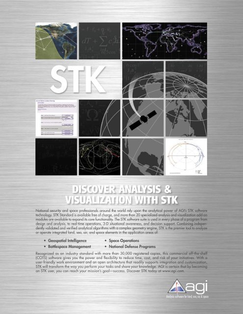
<strong>DISCOVER</strong> <strong>ANALYSIS</strong> &<strong>VISUALIZATION</strong> <strong>WITH</strong> <strong>STK</strong>National security and space professionals around the world rely upon the analytical power of <strong>AGI</strong>’s <strong>STK</strong> softwaretechnology. <strong>STK</strong> Standard is available free of charge, and more than 20 specialized analysis and visualization add-onmodules are available to expand its core functionality. The <strong>STK</strong> software suite is used in every phase of a program fromdesign and analysis, to real-time operations, 3-D situational awareness, and decision support. Combining independentlyvalidated and verified analytical algorithms with a complex geometry engine, <strong>STK</strong> is the premier tool to analyzeor operate integrated land, sea, air, and space elements in the application areas of:• Geospatial Intelligence• Battlespace Management• Space Operations• National Defense ProgramsRecognized as an industry standard with more than 30,000 registered copies, this commercial off-the-shelf(COTS) software gives you the power and fl exibility to reduce time, cost, and risk of your initiatives. With auser-friendly work environment and an open architecture that readily supports integration and customization,<strong>STK</strong> will transform the way you perform your tasks and share your knowledge. <strong>AGI</strong> is certain that by becomingan <strong>STK</strong> user, you can reach your mission’s goal—success. Discover <strong>STK</strong> today at www.agi.com.
<strong>STK</strong> SOFTWARE SUITE<strong>STK</strong>/ADVANCED<strong>VISUALIZATION</strong> OPTION<strong>STK</strong>/ADVANCED VO. <strong>STK</strong>/Advanced VO is a 3-D visualizationenvironment that displays all scenario information from <strong>STK</strong>and its add-on modules. Land, sea, air, and space assets canbe displayed with detailed and scalable 3-D models withtime-varying position, attitude, and model articulations. Interobjectrelationships and dynamic conditions can be displayedwith visual cues. Vehicle viewing opportunities with respectto time-based position of theater and strategic assets providessituational awareness for operational decision support;mission planning; modeling and simulation; or training. This isalso the key module for use with <strong>STK</strong>/Author and <strong>AGI</strong> Viewertools, which gives users the ability to create and share 4-Dfiles for any level audience.<strong>ANALYSIS</strong> MODULES<strong>STK</strong>/ANALYZER. Enables users to automate <strong>STK</strong> analysis withoutprogramming or scripting; view and understand trendsand relationships within <strong>STK</strong>; and optimize complex <strong>STK</strong>scenarios. <strong>STK</strong>/Analyzer includes five different analyticaltools: parametric study, carpet plot, design of experiments,probabilistic analysis, and an optimizer.<strong>STK</strong>/ASTROGATOR. Supports interactive, orbit maneuver planningfor Earth-orbiting and interplanetary missions. <strong>STK</strong>/Astrogator includes finite and impulsive burn modeling, targetedmaneuver sequences, fuel usage calculations, and multipleconstrained stopping conditions. All calculations are supportedby sophisticated drag models and numerical integrators.<strong>STK</strong>/ATTITUDE. Provides the ability to assess numerous attitudeprofiles within a single trajectory including user-definedvectors and axes that define new attitude profiles. “AttitudeView” allows you to output 3-D results of a propagated object’sattitude, as projected in any desired reference frame. Environmentalforces and open- or closed-loop control can be accountedfor using the attitude simulation capability.<strong>STK</strong>/CHAINS. Extends <strong>STK</strong>’s pair-wise access capabilities withmulti-hop link analysis and constellation analysis for complexnetworks. <strong>STK</strong>/Chains also provides information about thenature of the link, such as the angle between consecutiveobjects and the number of potential visibilities for each object.<strong>STK</strong>/COMM. Enables dynamic link performance and RF interferenceanalysis for communication networks. It includes gaincontours; RF environment modeling; multiple antenna types andaggregate computations; laser communication link modeling;and the full spectrum of link analysis parameters.<strong>STK</strong>/CONJUNCTION <strong>ANALYSIS</strong> TOOLS (<strong>STK</strong>/CAT). Conducts proximityanalysis to determine potential collisions, laser firingopportunities, and launch windows.<strong>STK</strong>/COVERAGE. Performs detailed, time-varying coveragecomputations on geographic regions and objects of interest.<strong>STK</strong>/Coverage lets users evaluate a variety of figures of meritto optimize system design and mission planning. Coveragecontours can be displayed in the 2-D and 3-D windows.<strong>STK</strong>/MISSILE MODELING TOOLS. Offers a high-fidelity missile propagatorthat simulates all events of unclassified/classified missileflights, including boost, staging, post-boost maneuver, deployment,and re-entry. It also has interceptor capabilities.<strong>STK</strong>/RADAR. Analyzes both monostatic and bistatic radarsystems and supports operations in Synthetic Aperture Radar(SAR) and/or Search/Track modes.<strong>STK</strong>/PRECISION ORBIT DETERMINATION SYSTEM (<strong>STK</strong>/PODS). Providesorbit determination that uses space- and ground-basedobservation data to predict orbits and related parameters.<strong>STK</strong>/SCHEDULER. Provides a powerful scheduling and planningapplication. Users define tasks and resource requirements,request schedule solutions, and analyze results via a GraphicalUser Interface (GUI) or Application Program Interface (API).<strong>STK</strong>/SPACE ENVIRONMENT. Predicts ionizing dose rate and totalradiation dosage; South Atlantic Anomaly (SAA) entry/exittimes; vehicle equilibrium temperature; and exposure impactsfrom debris along an orbit or trajectory.DATA PRODUCTS & SERVICES<strong>STK</strong>/HIGH RESOLUTION MAPS. Comprehensive high-resolutionmap data for the entire Earth with 30-meter resolution. Inaddition to coastlines, lakes, rivers, and geopolitical borders,the map data includes ice shelves, reefs, demilitarized zones,disputed borders, old political borders, canals, and glaciers.<strong>STK</strong>/EARTH IMAGERY. Global 1-km high-resolution imagery datasets generated from composite cloud-free satellite data forenhanced visualization within <strong>STK</strong>/Advanced VO. There areglobal bathymetric oceans, night lights data, and inlay imagesof 1- to 25-m resolution for specific areas of interest. Celestialimagery is also available for a stellar view of the heavens.<strong>STK</strong>/RADAR ADVANCED ENVIRONMENT. Extends the capabilities of<strong>STK</strong>/Radar by introducing ground reflectivity as a contributingfactor in dynamic radar analysis. This module provides 4-kmresolution global clutter data and the ability to display RCSmaps for user-defined areas of the Earth.<strong>STK</strong>/TERRAIN. Provides 3-D terrain data for the entire globewww.agi.com
KEY BENEFITS<strong>AGI</strong>’s free core product, <strong>STK</strong> Standard, incorporates complex algorithms that perform detailed mathematical calculations in amatter of seconds. With <strong>STK</strong>, users can quickly and accurately calculate any vehicle’s position and attitude over time; evaluatecomplex visibility relationships among land, sea, air, and space assets; and compute satellite or ground-based sensor coverageareas. To extend the basic analytical capabilities of <strong>STK</strong> Standard, <strong>AGI</strong> offers <strong>STK</strong>/Professional (<strong>STK</strong>/PRO), which includes additionalorbit propagators; user-definable attitude profiles; coordinate types and systems; sensor types; extensive visibility constraints;and city, facility, and star databases.<strong>STK</strong> results can be displayed in flexible formats such asreports, graphs, and spreadsheets.<strong>STK</strong> quickly shows ground station and spacecraft fields ofview in a variety of 2-D maps.A wide variety of <strong>STK</strong> analyses results are easily outputinto detailed customizable graphs.CUSTOMIZABLE INTERFACE<strong>STK</strong> users on Windows ® NT, 2000, andXP platforms can take advantage of<strong>STK</strong>’s implementation of the Microsoft ®Component Object Model ® (COM) toeasily integrate with other COM-enabledapplications, such as Microsoft Word,Excel, and PowerPoint. In addition,embedded HTML pages provide enhancednetwork file sharing and can betailored so everyday tasks are easily repeatedwith a single mouse click.ORBIT/TRAJECTORY GENERATIONMultiple analytical and numerical propagatorscompute vehicle position data ina wide variety of coordinate types andsystems. <strong>STK</strong>’s Orbit Wizard guidesusers through quick creation of commonorbits. Additionally, <strong>AGI</strong> maintainsan on-line database of satellite two-lineelements (TLEs), which is available onlineand is regularly updated using USAFdata. Users easily and quickly query thisdatabase and automatically propagatesatellites with the SGP4 propagator.VISIBILITY <strong>ANALYSIS</strong>Intervisibility access times between <strong>STK</strong>objects can be calculated and displayedin 2-D maps during animation. Thesetimes can be reported and graphed asvisibility timelines. <strong>STK</strong> also calculatesaccess from all types of scenario vehicles,facilities, targets, and sensors to allobjects (including planets and stars).Users can apply various constraints to addrealism to simple line-of-sight visibility.ATTITUDE <strong>ANALYSIS</strong>Pre-computed and user-defined attitudeprofiles generated within <strong>STK</strong> and/orexternal attitude quaternion files letusers analyze attitude motion and itseffect on various <strong>STK</strong> calculations.SENSOR <strong>ANALYSIS</strong>Sensor fields-of-view can be added toground- and space-based <strong>STK</strong> objectsto increase fidelity of visibility calculations.The time-varying sensor coverageareas display dynamically, and sensordefinitions (complex conic, half-power,rectangular, SAR, or user-defined) refinevisibility analysis. Sensor constraints,such as solar or object exclusions, canbe analyzed and visualized as well.<strong>VISUALIZATION</strong> OF RESULTSTime-varying parameters can be analyzedwith reports, viewed on graphs,or watched in a variety of 2-D mapdisplays. Multiple 2-D map windows,each with unique projections and styles,display simultaneously. Scenarios animateforward or reverse and/or in real-time todisplay object positions; sensor coverageareas; visibility status; and lighting conditions.Users can also output graphics in avariety of formats and stream or record2-D windows as AVI files.COMPREHENSIVE DATA REPORTING<strong>STK</strong> features a number of standardreport and graph styles that summarizecritical information. With access to hundredsof data elements, the user canalso create custom reports or graphs forindividual objects or groups of objects.PC users can take advantage of theCOM-enabled interface to easily transfer<strong>STK</strong> reports into Excel spreadsheets.<strong>STK</strong>/PRO offers a set of sophisticated analysis tools suchas custom sensors and area targets.www.agi.com
✓ ✓✓✓ ✓✓ ✓✓ ✓✓ ✓✓ ✓✓ ✓✓ ✓✓✓✓✓ ✓✓✓✓ ✓✓✓ ✓✓ ✓✓✓✓✓✓✓✓✓✓✓✓✓ ✓✓ ✓✓✓✓✓✓✓✓✓✓✓ ✓<strong>STK</strong><strong>STK</strong>/PROFEATURE OVERVIEW OF <strong>STK</strong> ANDORBIT PROPAGATIONJ2, J4, SGP4, Two-BodySupport for plug-in propagatorsBallistic propagatorGreat arc flight- and ground-path waypoint generationPlanetary ephemerisOrbit Wizard for quick creation of satellites with common orbits.Ability to import external ephemeris dataMultiple gravitational models—WGS84, EGM96, GEMT1, JGM2, JGM3, customSPICE propagatorLifetime tool for modeling atmospheric drag effects over satellite lifeHigh-Precision Orbit Propagator (HPOP)Long-term Orbit Predictor (LOP)COORDINATE SYSTEMSFixed, J2000, B1950, Mean Equinox True Equator, True of Reference DateMean of Date, Mean of Epoch, True of Date, True of Epoch, Mean Equinox True EquatorVector Geometry Tool (VGT)—custom coordinate systems, axes, vectors, angles, and pointsCOORDINATE TYPESClassical and CartesianEquinoctial, Delaunay variables, mixed spherical, sphericalATTITUDE PROFILESNadir alignment with ECI or ECF velocity constraintExternal attitude fileNadir alignment with sun constraintNadir alignment with orbit normal constraintSun alignment with nadir, ecliptic normal, ECI Z-axis, occultation normal, or Z in-orbit plane constraintECI velocity alignment with nadir or sun-constraintECF velocity alignment with radial constraintXPOP inertial attitudeYaw to nadirSpinning, precessing spin, spin about nadir, or spin about sun vectorInertially fixedTarget pointing attitudeIntegrated attitudeVISIBILITY <strong>ANALYSIS</strong>Visualization of visibility periods—highlighted ground track, access lines, timeline graphsField of view, elevation angle, azimuth angle, range and range rate, angular rate, and lighting constraintsTemporal constraints—duration, intervals, local, GMT, and local apparent timeBeta angle constraintGrazing angle, grazing altitude, height above horizon constraintsAzimuth rate, elevation rate, altitude constraintsPropagation delay constraintCross-track and in-track range; squint angle constraintsSolar and lunar constraints—elevation angles, exclusion angles, and obstructionExclusion zone constraintsMATLAB ® , VBScript, or Perl plug-in constraintsUser-defined vector constraints
<strong>STK</strong>/PROFESSIONAL (<strong>STK</strong>/PRO)✓ ✓✓✓✓✓✓✓ ✓✓ ✓✓✓ ✓✓✓✓ ✓✓✓✓ ✓✓ ✓✓<strong>STK</strong><strong>STK</strong>/PRO✓✓✓ ✓✓ ✓✓ ✓✓ ✓✓ ✓✓ ✓✓ ✓✓ ✓✓ ✓✓ ✓✓ ✓✓ ✓✓ ✓✓ ✓✓ ✓✓ ✓✓✓✓ ✓SENSOR DEFINITIONSSimple conicComplex conicRectangular—vertical and horizontal angleSynthetic Aperture Radar (SAR)Half-power beamwidthCustom/user-defined sensor patternSENSOR POINTING TYPESFixedTargeted to other <strong>STK</strong> objectsSpinningExternal pointing profileGrazing altitudeFixed in axesREPORTS & GRAPHSStandard reports, graphs, dynamic displays, and strip charts (dynamic graphs)Hundreds of additional data providers for extensive reporting and graphingUser-defined custom report styles and associated graphs, displays, and chartsSEARCHABLE DATABASESSatellite database of USAF Two-Line Element (TLE) sets of more than 10,000 space objectsOn-line satellite database updating to maintain current element setsCity database of more than 70,000 cities from ESRI position dataGround network database of approximately 500 locations—AFSCN, CNES, CLR, DLR, ESA, INPE, ISRO,launch sites, NASA DSN, NASA GNR, NASDA, NOAA, NESDIS, Optical, SSCStar database of all 88 constellations—Harvard Revised, Smithsonian Astrophysical Observatory,Henry Draper, 5th Fundamental catalogsMISCELLANEOUSCustomizable HTML interfaceMicrosoft ® automation compatibility for easy integrationOne-button access to continually updated Web resourcesSimple and detailed example scenarios with auto-loading HTML descriptionsEmbedded <strong>STK</strong> tasks and utilitiesStep-by-step tutorialsComprehensive context-sensitive help filesCreation of external data files for position and attitude dataAutomatic unit conversion within GUI and reports—English, metric, and nauticalAuto-save for scenario dataSwath tool for sensor ground coverage projectionConstellation toolOutput of streamed map images or AVI filesMultiple map displays2-D map projections: including equidistant cylindrical, Mercator, perspective, sinusoidalText annotations on mapVisibility calculations to user-defined polygonal regions (area targets)Sensor resolution specification and sensor constraintsIndependently validated and verified
DATA PRODUCTS & SERVICES (cont’d)that conforms to Level 1 Spec of the U.S. Defense MappingAgency for terrain elevation data. <strong>STK</strong>’s terrain capability alsosupports industry-standard formats such as NGA Muse Rasterfile format (dte) and USGS Digital Elevation Model (dem).VO and <strong>AGI</strong> Viewer gives users direct access to globe imagerythat resides on a server at <strong>AGI</strong>. This data service allows alarger selection of imagery for <strong>STK</strong> without adding more localdata storage.<strong>AGI</strong> GLOBESERVER. Streaming technology in <strong>STK</strong>/AdvancedEXTENDING, INTEGRATING, AND INTERFACING <strong>WITH</strong> <strong>STK</strong><strong>STK</strong>/AUTHOR. Provides users with a simple method for saving<strong>STK</strong> scenarios in a format that can be shared with <strong>STK</strong> andnon-<strong>STK</strong> users alike via the free <strong>AGI</strong> Viewer. The “author” hasthe ability to include stored viewpoints, camera paths, and datadisplays that they wish to share with any level audience.<strong>STK</strong>/CONNECT. Enables users to integrate <strong>STK</strong> with legacy applications,enterprise infrastructure, or other mission-critical analysistools. With <strong>STK</strong>/Connect, users can perform automated <strong>STK</strong>tasks or post-processing of <strong>STK</strong> data by operating <strong>STK</strong> in clientservermode. The flexible “Connect” macro language supportsautomation via Microsoft COM or through a TCP/IP socket connectionfor remote operation. <strong>STK</strong>/Connect also allows for realtimeanalysis and visualization from external data; integrationwith other software applications; and automated testing.<strong>STK</strong>/DISTRIBUTED INTERACTIVE SIMULATION (<strong>STK</strong>/DIS). ProvidesIEEE-standard simulation system interface for displaying PDUs.<strong>STK</strong>/GEOGRAPHIC INFORMATION SYSTEMS (<strong>STK</strong>/GIS). Integratesindustry-standard GIS data formats with <strong>STK</strong>. <strong>STK</strong>/GIS providesimport/export functionality for sensor footprints, sensorswaths, area targets, and antenna gain contours to enhancesystem design.<strong>STK</strong>/MATLAB INTERFACE. Provides a two-way communicationpathway between <strong>STK</strong> software and The Mathworks’MATLAB ® . Dynamic data, such as orbital trajectories orvisibility intervals, may be passed over a TCP/IP socket via<strong>STK</strong>/Connect into the MATLAB workspace where the datamay then be manipulated and reported on using nativeMATLAB functions.<strong>STK</strong>/X. Allows users to embed the analysis and visualizationengine of <strong>STK</strong> into third party applications such as MicrosoftPowerPoint, Word, Excel, or Internet Explorer. <strong>STK</strong>/X extendsthe functionality of <strong>STK</strong> by allowing it to operate as a fullyfeatured ActiveX control. It gives the user the ability tocompletely change the look and feel of <strong>STK</strong>, seamlesslyintegrating with their specific workflow and improving theanalysis and visualization capabilities of their existing tools.OTHER <strong>AGI</strong> SOFTWARE OFFERINGSORBIT DETERMINATION TOOL KITOrbit Determination Tool Kit is a software suite that providesorbit determination and orbit analysis support for the entirelife cycle of satellite tracking systems. The main products inthis suite are a tracking data simulator, state-of-the-art optimalsequential filter, and matched optimal sequential smoother.NAVIGATION TOOL KITNavigation Tool Kit helps the GPS satellite navigation (SAT-NAV) community predict how accurately their navigationequipment will perform in complex environments. The graphicaluser interface (GUI) is tailored to the workflow and requirementsof this user group. An intuitive “look and feel” guidesusers and operators step-by-step through input and customizationoptions while ensuring high-fidelity output.<strong>AGI</strong> VIEWER<strong>AGI</strong> Viewer users are exposedto dynamic, 4-D scenes, generatedvia <strong>STK</strong>/Author, withoutthe cost or expertise required tobe an <strong>STK</strong> user. This easy-to-usesoftware tool enables non-<strong>STK</strong>users to view, interact with, orembed <strong>STK</strong> analyses free ofcharge. Get your FREE copy todayat www.agi.com/viewer.<strong>AGI</strong> Viewer allows non-<strong>STK</strong> users toview and interact with scenes created in<strong>STK</strong>/Advanced VO using <strong>STK</strong>/Author.©2005 ANALYTICAL GRAPHICS, INC.All copyrights, trademarks, and registered trademarks are the property of their respective owners. Analytical Graphics ® , Analytical Graphics, Inc., Satellite Tool Kit ® (<strong>STK</strong>), 4DX EmbeddedTechnology, <strong>AGI</strong> Viewer, <strong>AGI</strong> Globeserver, Navigation Tool Kit (NTK) ® , Orbit Determination Tool Kit (ODTK), <strong>STK</strong>/Advanced VO, <strong>STK</strong>/Analyzer, <strong>STK</strong>/Attitude, <strong>STK</strong>/Astrogator ® ,<strong>STK</strong>/Author , <strong>STK</strong>/CAT ® , <strong>STK</strong>/Chains, <strong>STK</strong>/Comm, <strong>STK</strong>/Connect ® , <strong>STK</strong>/Coverage, <strong>STK</strong>/DIS ® , <strong>STK</strong> Earth Imagery, <strong>STK</strong>/GIS ® , <strong>STK</strong>/High Resolution Maps, <strong>STK</strong>/Interceptor Flight Tool,<strong>STK</strong>/MATLAB Interface, <strong>STK</strong>/Missile Flight Tool, <strong>STK</strong>/PODS ® , <strong>STK</strong>/PRO ® , <strong>STK</strong>/Radar, <strong>STK</strong>/Radar Advanced Environment, <strong>STK</strong>/Scheduler, and <strong>STK</strong>/Server ® , <strong>STK</strong>/Space Environment,<strong>STK</strong>/Terrain, <strong>STK</strong>/X are trademarks of Analytical Graphics, Inc.GENERAL INFO & SALESPhone: 1.800.220.4785*1.610.981.8000E-mail: info@agi.comTECHNICAL SUPPORTPhone: 1.888.785.9973*1.610.981.8888E-mail: support@agi.com*Toll-free in U.S. & Canada