Limestone Clints & Grykes walk - Lancashire Wildlife
Limestone Clints & Grykes walk - Lancashire Wildlife
Limestone Clints & Grykes walk - Lancashire Wildlife
- No tags were found...

You also want an ePaper? Increase the reach of your titles
YUMPU automatically turns print PDFs into web optimized ePapers that Google loves.
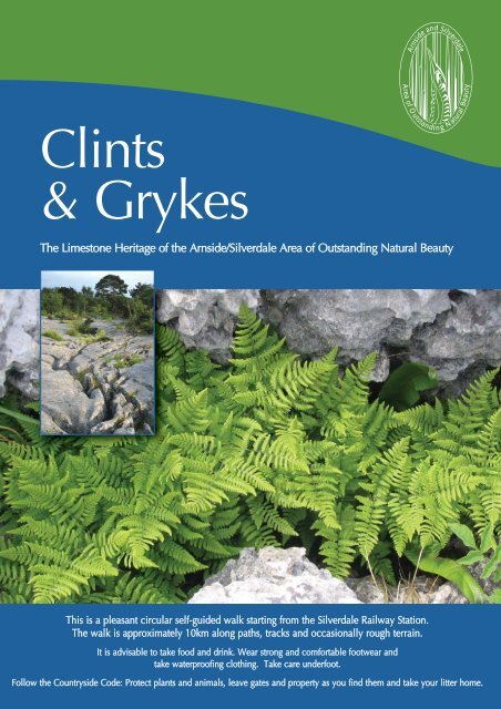
Arnside andSilverdale<strong>Clints</strong>& <strong>Grykes</strong>Areaof Outstandin gBeautyNaturalThe <strong>Limestone</strong> Heritage of the Arnside/Silverdale Area of Outstanding Natural BeautyThis is a pleasant circular self-guided <strong>walk</strong> starting from the Silverdale Railway Station.The <strong>walk</strong> is approximately 10km along paths, tracks and occasionally rough terrain.It is advisable to take food and drink. Wear strong and comfortable footwear andtake waterproofing clothing. Take care underfoot.Follow the Countryside Code: Protect plants and animals, leave gates and property as you find them and take your litter home.
6Gait BarrowsNationalNature Reserve7NO dogs on thisstretch of route5HawesWater48932TrowbarrowLocal NatureReserve10CringlebarrowWood11Station114DeepdalePond1213
1 Silverdale Station (rail & bus stop)As you leave the station turn left along theroad. After 150m turn left into StorrsLane. To your right is RSPB Leighton MossNature Reserve visitor centre.50m past the visitor centre go througha field gate on your right and follow thepath that runs parallel with the road.At the end of the path turn right, past thecauseway entrance and 100m onyour left is a footpath sign. Follow thepermissive path towards TrowbarrowLocal Nature Reserve (LNR).This route known as ‘The Trough’follows a linear gorge 5-10 metres wide,with vertical rock walls on either side.The Carboniferous <strong>Limestone</strong> thatconstitutes the bedrock of the whole ofthe Area was formed over 300 millionyears ago from the calcareous skeletonsof billions of creatures, shells and coralsdeposited at the bottom of a shallow,warm tropical sea – this part of the BritishIsles was then close to the equator, havingsince drifted north with the movement oftectonic plates. Periods of lime sedimentdeposition alternated with periods of muddeposition. Water containing fine grains oferoded rock flowed far out into this sea,and the particles settled to the bottomforming muds, which in the course of timebecame layers of mudstone or shalebetween the limestone strata.Trough FormationRunning about one quarter of the way upin the Urswick <strong>Limestone</strong>, the rock unitwhich predominates in the south-east ofthe Area, is a major bed of mudstone(Woodbine Shale). It may representaround 1,000 years’ worth of deposits.At the end of the Carboniferous period,which lasted for 65 million years (between345 and 280 million years ago), theearth’s surface underwent a seriesof dramatic earth movements. All thismovement of the earth’s crustal (tectonic)plates resulted in folding, buckling andfaulting of the bedding planes often beingupturned vertically, as in the case of thelimestone on either side of the trough.The Trough2 Trowbarrow LNR. Passing through theJohn Mabson Memorial gate (designed inthe shape of a climber’s karabiner) you enterTrowbarrow LNR that was formerly a quarry.Derived from two words, ‘Trow’ meaning‘trough’ and ‘barrow’, the Anglo-Saxon wordfor hill.Shale is a softer rock and more readily weatheredthan limestone when it is exposed at the surfaceleading to the formation of the eroded notchknown as The Trough.John Mabson Memorial gate
The quarrying activity between 1857 and1959 reveals a glimpse into the 300million-year geological history of the site.A more detailed leaflet about Trowbarrow– the history, geology, wildlife and rockclimbs - is available from the AONBOffice.Exit the quarry following the track downto Moss Lane. 3You are now <strong>walk</strong>ing down a slightincline following an old tramway, whichtransported limestone from the quarryto the limeworks. The weight of the fullwagons transporting the quarried limestoneby gravity down the incline would haul theempty ones back to the top.On reaching the road turn right and carryon past the cottages for 600m until youreach a low gate across the road. You arenow entering Gait Barrows NationalNature Reserve (NNR). Follow the trackstraight on, until you reach the board<strong>walk</strong>.The stretch of water on your left isHawes Water, 4 with Challan Hallon the far side.Trowbarrow (LNR)The process is accelerated by carbonicacid (formed from dissolved atmosphericcarbon dioxide) and organic acids(a by-product of decaying vegetation).The limestone is slowly ‘dissolved’ overmillions of years, as the water picks outvertical lines of weakness in the rockbelow the surface resulting in a seriesof underground streams and caverns.Over millions of years the cavern walls/ceilings weaken and eventually collapse.The debris is gouged out by subsequentglaciers. Sometimes several ‘dolines’,often referred to as ‘sink-holes’, downwhich concentrated surface watersproceed underground, can coalesceand form a ‘uvala’ of which Hawes Waterbasin is a good example.Solution DolineHawes WaterAbout 2 million years ago the worldclimate cooled dramatically, heraldingthe start of a series of ice ages.Intermittent milder periods (inter-glacial)resulted in torrential melt water. The actionof both ice and melt water moulded muchof the landscape we see today.The Hawes Water basin was formed bysolutional activity removing the limestone,which is both permeable and soluble.Collapsed Doline
The basin is filled with sediments, clayand chalk marl (a very pure calcareousdeposit) with fen peat, derived from thenon-decomposed remnants of the reedbeds, on top. The edges of the lake arealmost vertical cliffs, cut in the sediments.The maximum depth of the lake isabout 12.5m.5 Follow the board<strong>walk</strong> to the end andat the gate turn left (turning right takesyou to Yealand Hall Allotment missingout Gait Barrows where dogs are notallowed).Follow this path for 250m and asthe track bears to the left, turn right andfollow the path up a slight incline for200m. On reaching the public road turnright. Be careful, this is a narrow and faststretch of road. Follow the road overthe brow of the hill and continue for afurther 250m, before turning right onto ahardcore track through a low walledgateway. 6 Follow the track for 100m toa metal barrier-gate and a sign ‘Welcometo Gait Barrows’.Illustration:Rob Petley-JonesNatural EnglandThese differenthabitats give riseto a rich and diversevariety of plants andferns.Occasionally, you will seelarge isolated boulders(erratics) on the surfaceof the limestone pavement.These erratics, often weighingseveral tonnes, were transported in or onthe frozen ice sheet and deposited as theglaciers slowlymelted. The typeof bedrock ofwhich they arecomprisedindicates wherethey travelledfrom, frozen in the An erratic - a spectacularice. Deep grooveslimestone boulder(striations) gouged out by the erraticsin the underlying rock indicates thedirectional movement of the ice sheet.Gait Barrows NNRGait Barrows NNR is the best example oflowland limestone pavement in Britain.During the last ice age much of northernBritain lay beneath a vast ice sheet whichscoured the land back to the bare rock.The last glacial ice sheets retreated about12,000 years ago to expose the underlyingand gently rounded limestone hills. Themost characteristic surface features oflimestone pavement are the flat blocks(clints) and a variety of solution featuresincluding deep fissures (grykes), shallow‘runnels’ and pan-like ‘solution cups’.Gait Barrows limestone pavement
Bear left and follow the track for 250mto a marker post and then turn rightfollowing the ‘<strong>Limestone</strong> Trail’ (whitearrows). Here you have a beautifulexample of limestone pavement. 7After a few hundred metres the trail leadsdown a slope to a field gate on your right.Follow the path through an avenue ofconifer trees and continue on the track upthe hill and through the wood. 10 Theserock outcrops are <strong>Limestone</strong> ’Escarpments’.They were formed over a period of timebetween 280 and 65 million years ago,when tectonic plate movement createdthis fault defined escarpment as a resultof a line of weakness in the bed rock.Farleton KnottCringlebarrow WoodUrswick<strong>Limestone</strong>(UL)KendalfaultOutwash PlainfaultlinePeat, Marl/Sands,Boulder ClayEscarpmentULPark<strong>Limestone</strong>DipslopeJust into the field you will find a naturalspring fed by water from the underlyinglimestone.Keep to the left in the field and continuethrough the next gate, passing a smallderelict stone hut (behind the wall) to afurther gate with a squeeze stile to the left.Follow a muddy track for 150m and thenbear right following the hardcore trackthrough the gate.8 Yealand Hall AllotmentAn extensive area of limestone pavementwith a thin covering of soil dominated byhazel trees.Follow the main track for 700m, untilyou reach a road junction. Go straightacross the road towards Yealand Storrs.Follow the road for 300m and as youpass the property ‘Temple Court’ takethe public footpath on the right towards‘Cringlebarrow Wood’. 9On the left you will see a small enclosure‘Yealand Pound’ where, in the past, straycattle and sheep were kept until theirowners recovered them. It is also possiblethat there was originally a spring hereand this was a watering hole.Looking down into the M6 corridorenvisage the Lake District glacial meltwaters flowing into this ‘outwash plain’ andout to Morecambe Bay. Beyond lie the limestonehills of Farleton Knott, Hutton Roof &Dalton Crags.The area around Hale Moss was oncea shallow lake with water worn ‘waveundercut’ limestone on its edges as foundalong the road between Thrang Endand Hale.Further north, around Sedgwick and downto Borwick, glacial ‘till’ comprising clay,sand and gravel transported in the icesheets has been deposited to formstreamlined hillocks known as ‘drumlins’(often referred to as a ‘basket of eggs’in appearance).Beetham Hall with drumlins in the background
On reaching the field, turn right bythe gate. Follow the fence round the edgeof the field, then up the small limestonecliffs (escarpment), turning left at a smalljunction and continue through thewoodland. At the second finger postfollow the sign towards ‘Deepdale’.After climbing the stone steps, gothrough the gate in the wall.Below you, resting in an almost naturalamphitheatre is a glistening jewel of apond. In the mid-19th century it wasknown as the ‘Lily Pond’.Throughout the woodland the tree rootscling to the limestone pavement takingadvantage of the natural grykes.Leighton HallFollow the track across the fields towardsLeighton Hall.Deepdale PondThe pond sits in the bottom of a deepdepression in the limestone, formed by thecollapse of a cavern roof in the water-worncave systems that underlie the AONB.Such depressions are called ‘dolines’.These ubiquitous features are morecolloquially known as ‘sink-holes’ andcharacteristically pepper the landscape inall areas of limestone (‘karst’) scenery.Massive underground erosion takes placeas the limestone dissolves in the flow ofsubterranean water, which exploits thefracture and fissures of the rock, thuscreating the cave systems so beloved ofpot-holers.In the summer months the pond isfrequently dry and in danger of vanishingfor good as the processes of silting and soilformation take over the aquatic habitat.Descend steadily down to the pondand bearing left continue to the maintrack. Turn left and follow the track tothe fields.The historic home of the world-renownedGillow furniture making family. The earliestrecords of Leighton Hall go back 760years to 1246, when it is known thatAdam D’Avranches had a fortified manorhere, probably due to the existence of anatural spring - St Catherine’s Well. Sincethen there have been 26 owners of theproperty and only twice has the ownershippassed by sale. Even now, the currentowner is a descendant of that firstrecorded resident.Little remains of the earlier buildings for in1715 the house was sacked and burnedby Government troops. In 1763 the housewas rebuilt as a classical Georgian houseand in 1822 the Gothic façade wassuperimposed on this earlier building.As a small child, the current ownerremembers Deepdale pond beingreferred to as an extinct volcano!After the White Lund munitions explosionof 1917 in Morecambe, the Hall’s watersupply from the spring became unreliable(perhaps because of a ‘new fissure’ in thelimestone).
13 Upon reaching the tarmac drive turnright and continue downhill for 400mto Grisedale Farm. Continue past thefarm through the gates to the reedbeds of Leighton Moss.After the last ice age, the Leighton Mossvalley floor, known as a ‘polje’, would havebeen lower and would haveexperienced periodic flooding of the seadepositing a layer of impervious clay overthe limestone valley floor. At the sametime, water flowing into the valley fromthe surrounding land was unable to drainaway and a large area of marsh developedsimilar to salt marsh and mudflats.The gradual rise of the land since the lastice age and the intervention of man haveproduced the landscape you see today.Perhaps the most dramatic change toLeighton Moss occurredin 1830.A substantial embankment(1km in length)was constructed acrossthe valley from the footof Heald Brow to thebase of Warton Crag.The Gillow family ofMarsh HarrierPhoto:David MowerLeighton Hall installedan engine with a paddlewheel pump near CragFoot. This pump drained water frombehind the embankment to provide landfor growing crops.Whilst the pump was in operation, the soilproved to be exceptionally fertile and largequantities of crops were produced.The valley earned the title, ‘Golden Vale’.The tall chimney of Crag Foot is the onlysurviving landmark. The pump becameredundant in 1917 because of difficultiesin finding fuel supplies. In the past 2 yearsthe moss has undergone dredging work ofa different nature to deepen the lagoonsand channels to benefit wildlife,in particular the bittern.Crag FootChimneyReed BuntingPhoto:Mike Richardsrspb-images.comBittern © RSPB14 After 800m ‘the causeway’ joinsthe road once again. Bear left and headback towards RSPB visitor centre and therailway station.This leaflet has been produced by the:Arnside/Silverdale Area of Outstanding Natural BeautyThe Old Station Building, Arnside, Carnforth LA5 0HGTel: 01524 761034email: info@arnsidesilverdaleaonb.org.ukwww.arnsidesilverdaleaonb.org.ukAreaArnside andof Outstandin gSilverdaleBeautyNatural